

Uilkraals Situation Assessment - Anchor Environmental
Uilkraals Situation Assessment - Anchor Environmental
Uilkraals Situation Assessment - Anchor Environmental

You also want an ePaper? Increase the reach of your titles
YUMPU automatically turns print PDFs into web optimized ePapers that Google loves.
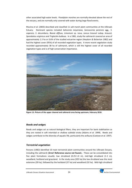
other associated high water levels. Floodplain marshes are normally elevated above the rest ofthe estuary, and are normally only covered with water during large flood events.Mucina et al. (2003) described and classified 11 salt marsh plant communities at the <strong>Uilkraals</strong>Estuary. Dominant species included Salicornia meyeriana, Sarcocornia perennis agg., S.capensis, S. decumbens, Bassia diffusa, Limonium sp. nova, Juncus kraussii subsp. kraussii,Sporobolus virginicus and Triglochin bulbosa. In a 1981, study the saltmarsh covered an area ofapproximately 1.3 ha or 0.6% of the studied estuarine region (Heydorn & Bickerton 1982) andhad the highest cover (95%) of all recorded vegetation types. A more recent vegetation studyrecorded approximately 38 ha of saltmarsh, which is still the highest cover of all recordedvegetation types and is of high conservation importance.Figure 13. Picture of the upper channel and saltmarsh area facing upstream, February 2010.Reeds and sedgesReeds and sedges act as natural biological filters, they are important for bank stabilisation asthey are rooted in soft intertidal or shallow subtidal strata (Adams et al. 1999). Reeds andsedges contribute to the diversity of aquatic life, particularly the avifauna (Coetzee et al. 1997).Terrestrial vegetationParsons (1982) identified 10 main terrestrial plant communities around the <strong>Uilkraals</strong> Estuary,including the saltmarsh (Error! Reference source not found.). These can be consolidated intofive plant formations visually: low shrubland (0.25‐1.0 m), mid‐high shrubland (1‐2 m),woodland, herbland and grassland. In the study area (205 ha) the low shrubland was the mostextensive (39 ha), followed by the herbland (37 ha) and woodland (32 ha). Mid‐high shrubland<strong>Uilkraals</strong> Estuary <strong>Situation</strong> <strong>Assessment</strong>24<strong>Anchor</strong> <strong>Environmental</strong>


