

A GIS Based Water Balance Study of Africa - Physical Land Resources
A GIS Based Water Balance Study of Africa - Physical Land Resources
A GIS Based Water Balance Study of Africa - Physical Land Resources

You also want an ePaper? Increase the reach of your titles
YUMPU automatically turns print PDFs into web optimized ePapers that Google loves.
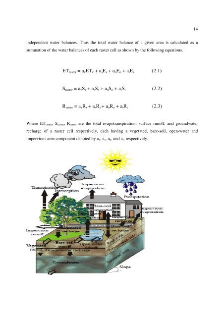
14independent water balances. Thus the total water balance <strong>of</strong> a given area is calculated as asummation <strong>of</strong> the water balances <strong>of</strong> each raster cell as shown by the following equations.ET raster = a v ET v + a s E s + a o E o + a i E i (2.1)S raster = a v S v + a s S s + a o S o + a i S i (2.2)R raster = a v R v + a s R s + a o R o + a i R i (2.3)Where ET raster , S raster , R raster are the total evapotranspiration, surface run<strong>of</strong>f, and groundwaterrecharge <strong>of</strong> a raster cell respectively, each having a vegetated, bare-soil, open-water andimpervious area component denoted by a v , a s , a o , and a i , respectively.


