

A GIS Based Water Balance Study of Africa - Physical Land Resources
A GIS Based Water Balance Study of Africa - Physical Land Resources
A GIS Based Water Balance Study of Africa - Physical Land Resources

Create successful ePaper yourself
Turn your PDF publications into a flip-book with our unique Google optimized e-Paper software.
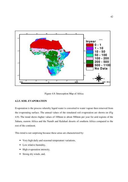
30° 30° 10° 10° 30° 50° 30°42Inyear0 - 11 - 1010 - 5050 - 100100 - 200200 - 500500 - 1100No Data70°(mm)10° 10°NWE3000 0 3000 6000 MilesS10° 10°Figure 4.8: Interception Map <strong>of</strong> <strong>Africa</strong>30° 30° 10° 10° 30° 50° 70° 30°4.2.5. SOIL EVAPORATIONEvaporation is the process whereby liquid water is converted to water vapour then removed fromthe evaporating surface. The annual values <strong>of</strong> the simulated soil evaporation are shown on (Fig4.9). The trend shows higher values <strong>of</strong> 100mm to about 500mm per year for arid regions <strong>of</strong> theSahara, eastern <strong>Africa</strong> and the Namib and Kalahari deserts <strong>of</strong> southern <strong>Africa</strong> compared to therest <strong>of</strong> the continent.This trend is not surprising because these areas are characterized by:• Very high daily and seasonal temperature variations,• Low relative humidity,• High evaporation intensity,• Strong dry winds, and,


