

A GIS Based Water Balance Study of Africa - Physical Land Resources
A GIS Based Water Balance Study of Africa - Physical Land Resources
A GIS Based Water Balance Study of Africa - Physical Land Resources

You also want an ePaper? Increase the reach of your titles
YUMPU automatically turns print PDFs into web optimized ePapers that Google loves.
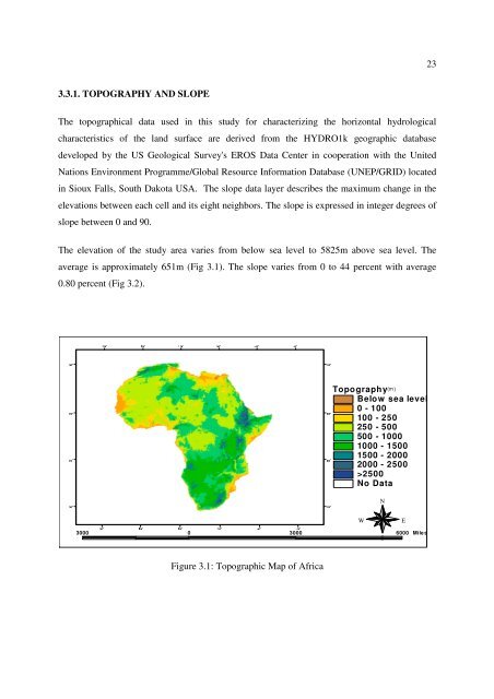
233.3.1. TOPOGRAPHY AND SLOPEThe topographical data used in this study for characterizing the horizontal hydrologicalcharacteristics <strong>of</strong> the land surface are derived from the HYDRO1k geographic databasedeveloped by the US Geological Survey's EROS Data Center in cooperation with the UnitedNations Environment Programme/Global Resource Information Database (UNEP/GRID) locatedin Sioux Falls, South Dakota USA. The slope data layer describes the maximum change in theelevations between each cell and its eight neighbors. The slope is expressed in integer degrees <strong>of</strong>slope between 0 and 90.The elevation <strong>of</strong> the study area varies from below sea level to 5825m above sea level. Theaverage is approximately 651m (Fig 3.1). The slope varies from 0 to 44 percent with average0.80 percent (Fig 3.2).30° 30° 30° 10° 10° 30° 50° 70°10° 10°10° 10°Topography(m)Below sea level0 - 100100 - 250250 - 500500 - 10001000 - 15001500 - 20002000 - 2500>2500No DataNWE3000 0 3000 6000 MilesSFigure 3.1: Topographic Map <strong>of</strong> <strong>Africa</strong>30° 30° 10° 10° 30° 50° 70° 30°


