

A GIS Based Water Balance Study of Africa - Physical Land Resources
A GIS Based Water Balance Study of Africa - Physical Land Resources
A GIS Based Water Balance Study of Africa - Physical Land Resources

Create successful ePaper yourself
Turn your PDF publications into a flip-book with our unique Google optimized e-Paper software.
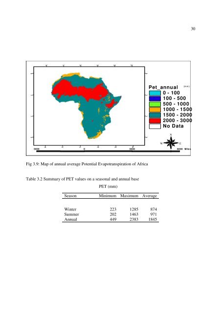
30° 30° 30° 10° 10° 30° 50° 70°10° 10°30(mm)Pet_annual0 - 100100 - 500500 - 10001000 - 15001500 - 20002000 - 3000No DataNWE3000 0 3000 6000 MilesS10° 10°Fig 3.9: Map <strong>of</strong> annual average Potential Evapotranspiration <strong>of</strong> <strong>Africa</strong>30° 30°10° 10° 30° 50° 70°Table 3.2 Summary <strong>of</strong> PET values on a seasonal and annual base30°PET (mm)SeasonMinimum Maximum AverageWinter 223 1285 874Summer 202 1463 971Annual 449 2383 1845


