

A GIS Based Water Balance Study of Africa - Physical Land Resources
A GIS Based Water Balance Study of Africa - Physical Land Resources
A GIS Based Water Balance Study of Africa - Physical Land Resources
SHOW LESS

Create successful ePaper yourself
Turn your PDF publications into a flip-book with our unique Google optimized e-Paper software.
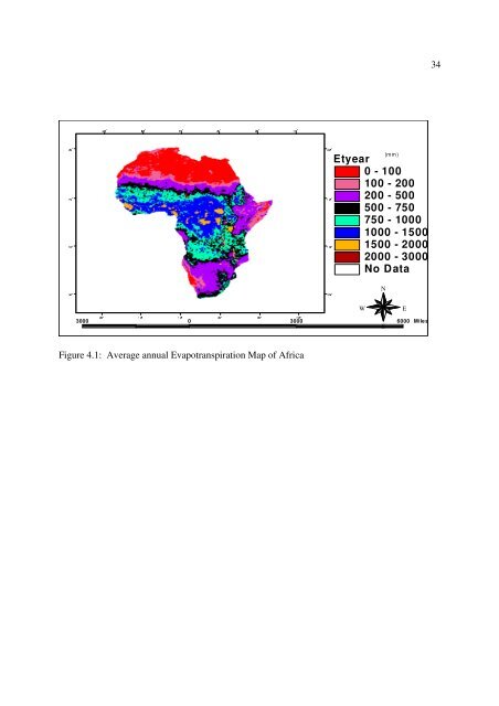
30° 30° 10° 10° 30° 50° 30°34Etyear0 - 100100 - 200200 - 500500 - 750750 - 10001000 - 15001500 - 20002000 - 3000No Data70°(mm)10° 10°NWE3000 0 3000 6000 MilesS10° 10°Figure 4.1: Average annual Evapotranspiration Map <strong>of</strong> <strong>Africa</strong>30° 30° 10° 10° 30° 50° 70° 30°


