

Banc y Celyn, Brecknockshire - Royal Commission on the Ancient ...
Banc y Celyn, Brecknockshire - Royal Commission on the Ancient ...
Banc y Celyn, Brecknockshire - Royal Commission on the Ancient ...
- No tags were found...

Create successful ePaper yourself
Turn your PDF publications into a flip-book with our unique Google optimized e-Paper software.
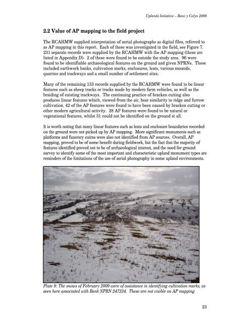
Uplands Initiative – <str<strong>on</strong>g>Banc</str<strong>on</strong>g> y <str<strong>on</strong>g>Celyn</str<strong>on</strong>g> 20082.2 Value of AP mapping to <strong>the</strong> field projectThe RCAHMW supplied interpretati<strong>on</strong> of aerial photographs as digital files, referred toas AP mapping in this report. Each of <strong>the</strong>se was investigated in <strong>the</strong> field, see Figure 7.231 separate records were supplied by <strong>the</strong> RCAHMW with <strong>the</strong> AP mapping (<strong>the</strong>se arelisted in Appendix D). 2 of <strong>the</strong>se were found to be outside <strong>the</strong> study area. 96 werefound to be identifiable archaeological features <strong>on</strong> <strong>the</strong> ground and given NPRNs. Theseincluded earthwork banks, cultivati<strong>on</strong> marks, enclosures, leats, various mounds,quarries and trackways and a small number of settlement sites.Many of <strong>the</strong> remaining 133 records supplied by <strong>the</strong> RCAHMW were found to be linearfeatures such as sheep tracks or tracks made by modern farm vehicles, as well as <strong>the</strong>braiding of existing trackways. The c<strong>on</strong>tinuing practice of bracken cutting alsoproduces linear features which, viewed from <strong>the</strong> air, bear similarity to ridge and furrowcultivati<strong>on</strong>. 42 of <strong>the</strong> AP features were found to have been caused by bracken cutting oro<strong>the</strong>r modern agricultural activity. 28 AP features were found to be natural orvegetati<strong>on</strong>al features, whilst 31 could not be identified <strong>on</strong> <strong>the</strong> ground at all.It is worth noting that many linear features such as leats and enclosure boundaries recorded<strong>on</strong> <strong>the</strong> ground were not picked up by AP mapping. More significant m<strong>on</strong>uments such asplatforms and funerary cairns were also not identified from AP sources. Overall, APmapping, proved to be of some benefit during fieldwork, but <strong>the</strong> fact that <strong>the</strong> majority offeatures identified proved not to be of archaeological interest, and <strong>the</strong> need for groundsurvey to identify some of <strong>the</strong> most important and characteristic upland m<strong>on</strong>ument types arereminders of <strong>the</strong> limitati<strong>on</strong>s of <strong>the</strong> use of aerial photography in some upland envir<strong>on</strong>ments.Plate 9: The snows of February 2009 were of assistance in identifying cultivati<strong>on</strong> marks, asseen here associated with Bank NPRN 247234. These are not visible <strong>on</strong> AP mapping23


![The Source of the Usk Walk [2012 PDF]](https://img.yumpu.com/49285699/1/190x245/the-source-of-the-usk-walk-2012-pdf.jpg?quality=85)


