

Banc y Celyn, Brecknockshire - Royal Commission on the Ancient ...
Banc y Celyn, Brecknockshire - Royal Commission on the Ancient ...
Banc y Celyn, Brecknockshire - Royal Commission on the Ancient ...
- No tags were found...

Create successful ePaper yourself
Turn your PDF publications into a flip-book with our unique Google optimized e-Paper software.
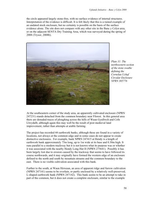
Uplands Initiative – <str<strong>on</strong>g>Banc</str<strong>on</strong>g> y <str<strong>on</strong>g>Celyn</str<strong>on</strong>g> 2008<strong>the</strong> circle appeared largely st<strong>on</strong>e-free, with no surface evidence of internal structures.Interpretati<strong>on</strong> of <strong>the</strong> evidence is difficult. It is felt likely that this is a ruined example ofan undated stock enclosure, but no certainty is possible <strong>on</strong> <strong>the</strong> basis of <strong>the</strong> surfaceevidence al<strong>on</strong>e. The site does not compare with any o<strong>the</strong>r site in <strong>the</strong> <str<strong>on</strong>g>Banc</str<strong>on</strong>g> y <str<strong>on</strong>g>Celyn</str<strong>on</strong>g> area,or <strong>on</strong> <strong>the</strong> adjacent SENTA Dry Training Area, which was surveyed during <strong>the</strong> spring of2008 (Trysor, 2008b).Plate 31: Thenorthwestern secti<strong>on</strong>of <strong>the</strong> st<strong>on</strong>e swa<strong>the</strong>defining <strong>the</strong>Cornelau UchafCircular EnclosureNPRN 305776At <strong>the</strong> sou<strong>the</strong>astern corner of <strong>the</strong> study area, an apparently cultivated enclosure (NPRN247231) stands detached from <strong>the</strong> comm<strong>on</strong> boundary near Fforest. In this general area<strong>the</strong>re are denuded traces of ploughing across <strong>the</strong> hills of Waun Gynllwch and CefnLlwydallt, although again this may well be <strong>the</strong> result of post medieval landimprovement, ra<strong>the</strong>r than attempts at arable farming.The project has recorded 44 earthwork banks, although <strong>the</strong>se are found in a variety oflocati<strong>on</strong>s, not always at <strong>the</strong> comm<strong>on</strong> edge and in some cases do not appear to createdistinctive enclosures. For example, bank NPRN 247415 at Hendy is a length ofearthwork bank approximately 75m l<strong>on</strong>g, up to 1m wide at its base and 0.30m high. Itruns parallel to a modern trackway but it is not known what its purpose was or whe<strong>the</strong>rit was associated with <strong>the</strong> nearby Hendy L<strong>on</strong>g Hut II (NPRN 275641). Possibly it hasbeen largely lost due to erosi<strong>on</strong> caused by <strong>the</strong> trackway that seems to have followed itscourse northwards, and it may originally have formed <strong>the</strong> western edge of an enclosuredefined to <strong>the</strong> north and south by mountain streams and <strong>the</strong> comm<strong>on</strong> boundary to <strong>the</strong>east. There is no visible cultivati<strong>on</strong> associated with this bank.Fur<strong>the</strong>r to <strong>the</strong> south, at Waun Hirwaun, an area of apparent ridge and furrow cultivati<strong>on</strong>(NPRN 247141) seems to be overlain, or partly enclosed by a relatively well-preserved,L-shaped earthwork bank (NPRN 247142). This bank seems to be an attempt to take inpart of <strong>the</strong> comm<strong>on</strong>, but it does not create a complete enclosure, similar to <strong>the</strong> example58


![The Source of the Usk Walk [2012 PDF]](https://img.yumpu.com/49285699/1/190x245/the-source-of-the-usk-walk-2012-pdf.jpg?quality=85)


