
You also want an ePaper? Increase the reach of your titles
YUMPU automatically turns print PDFs into web optimized ePapers that Google loves.
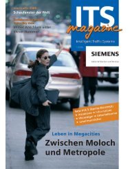
Focus<br />
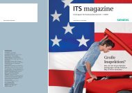
Look at today’s Brasilia:<br />
The roots of the drawingboard<br />
capital reach back<br />
into the 19 th century<br />
one of the BMBF projects during his studies<br />
at the Technical University of Berlin. Also<br />
when selecting the suitable means of<br />
transport, guidelines from Europe for<br />
example provide help. “Buses are the preferred<br />
option on less frequented routes,<br />
while from about 5,000 passenger journeys<br />
per day a tram would be more efficient<br />
in handling the traffic flow.” And<br />
for routes daily serving 30,000 or more<br />
passengers, a subway or light-rail line<br />
becomes profitable.<br />
Step by step, a suitably<br />
sized transport<br />
network is created<br />
As Karger knows from experience, the<br />
mobility planning process for New Towns<br />
starts with the collection of maximally comprehensive<br />
data on the physical structure<br />
and the population, mainly from local government<br />
bodies. For transport planning in<br />
developing and emerging countries, information<br />
on transport-related mobility behavior,<br />
the level of motorization as well as<br />
accident statistics are also of considerable<br />
relevance. Land-use data is usually available<br />
in the form of a master plan. Based on these<br />
findings, future patterns of mobility can be<br />
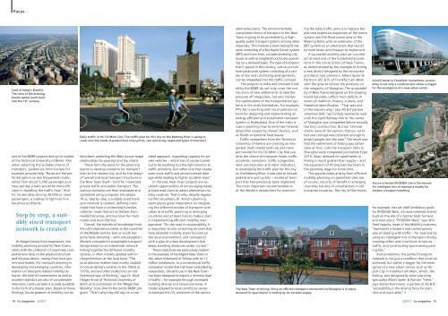
Daily traffic in Ho Chi Minh City: The traffic plan for this city on the Mekong River is going to<br />
cover also the needs of pedestrians and cyclists, two previously neglected types of transport<br />
described, predicting the likely source-target<br />
relationships for journeys and trip chains.<br />
These form the basis for the planning<br />
teams to develop scenarios for transport<br />
links to the nearest city, and for the design<br />
of overall and local transport structures in<br />
the New Town itself – both for motorized<br />
private traffic and public transport. The<br />
various scenarios are then evaluated and<br />
optimized using computer simulation.<br />
Thus, step by step, a suitably sized transport<br />
network is created, defining main<br />
roads that have a connecting function,<br />
collector roads that act as feeders from<br />
residential areas, and bus lines for main<br />
routes and local districts.<br />
Overall, the transfer of knowledge from<br />
the old industrial countries to the countries<br />
of the Middle and Far East or South has<br />
gone fairly smoothly – with one exception:<br />
Modern concepts for sustainable transport<br />
design based on an intermodal network<br />
linking together the different mobility<br />
options, is often initially greeted with incomprehension<br />
at the local level. “The<br />
local decision makers have mostly studied<br />
in industrialized countries in the 1960s or<br />
1970s, and are often locked into an oldfashioned<br />
way of thinking,” says Dr. Wulf-<br />
Holger Arndt of Technical University of<br />
Berlin and coordinator of the “Megacities<br />
<strong>Mobility</strong>” cross-link for the entire BMBF program.<br />
“That’s why they still rely on a one-<br />
sided approach, expanding capacity for private<br />
vehicles – which has of course turned<br />
out to be anything but the right solution to<br />
traffic problems, but rather one that creates<br />
even more traffic and environmental damage<br />
while leading to higher accident rates.“<br />
In the end, New Town projects are excellent<br />
opportunities of encouraging newly<br />
arrived road users to adopt alternative mobility<br />
routines. That is why, despite regular<br />
conflict situations, Dr. Arndt’s planning<br />
team places great importance on integrating<br />
the different modes of transport with<br />
urban and traffic planning in emerging<br />
countries and at least tries to make a start<br />
in implementing efficient mobility management:<br />
“On the road to sustainability, it<br />
is important to use consulting services that<br />
help establish mobility styles focused on<br />
the local environment, and correspond<br />
with a type of urban development that<br />
keeps traveling distances under control.“<br />
These objectives are particularly evident<br />
in the example of Hashtgerd New Town in<br />
the urban hinterland of Tehran with its 12<br />
million inhabitants. In a conventional traffic<br />
simulation model that had been extended by<br />
researchers, the land use in the New Town<br />
has been designed to require a minimal level<br />
of traffic – for example through increased<br />
building density and mixed-use areas. A<br />
model adapted to local conditions serves<br />
to estimate the CO2 emissions of the various<br />
alternative plans. The environmentally<br />
sustainable choice of transport in this New<br />
Town is going to be promoted by a highquality<br />
public transport system, among other<br />
measures. This involves a main transport network<br />
consisting of a Bus Rapid Transit system<br />
(BRT) and tram lines, complemented by city<br />
buses as well as neighborhood buses operating<br />
on a demand basis. The type of transport<br />
that is typical in this country, such as a multilevel<br />
paratransit system consisting of a variety<br />
of taxi and car-sharing arrangements,<br />
can be integrated into this traffic concept.<br />
The projects in India and Vietnam funded<br />
by the BMBF do not only cover the construction<br />
of new settlements to take the<br />
pressure off megacities, but also involve<br />
the optimization of the transportation systems<br />
in the cities themselves. For example,<br />
PTV AG is working with local partners on<br />
tools for designing and implementing an<br />
energy-efficient and sustainable transport<br />
system in Hyderabad. One of the main issues<br />
is planning how to minimize network<br />
downtime caused by climatic factors, such<br />
as floods or extreme heat waves.<br />
Traffic researchers from the Technical<br />
University of Vienna are creating an integrated,<br />
multi-modal land-use and transport<br />
model for Ho Chi Minh City that predicts<br />
the choice of transport mode, traffic<br />
accidents, emissions, traffic congestion,<br />
land-use evolution and other indicators.<br />
In developing the traffic plan for this city<br />
on the Mekong River, it was vital to include<br />
pedestrians and cyclists – modes of transport<br />
that had previously been neglected.<br />
The most important recommendation<br />
of the Western researchers for overcom-<br />
ing the daily traffic jams is to replace the<br />
planned expensive expansion of the metro<br />
system into the flood-prone area of the<br />
Mekong Delta with an extension of the<br />
BRT system as an alternative that would<br />
be both faster and cheaper to implement.<br />
A successful mobility plan can counteract<br />
at least one of the fundamental problems<br />
in the construction of New Towns,<br />
as demonstrated by the example of Anting,<br />
a new district designed by the renowned<br />
architects and planners, Albert Speer &<br />
Partners (AS & P) of Frankfurt am Main<br />
with the goal to relieve the pressure on<br />
the megacity of Shanghai. The acceptability<br />
of New Towns designed on the drawing<br />
board naturally suffers from deficits in<br />
terms of tradition, history, culture, and<br />
therefore identification. “That was one<br />
of the reasons why,” says AS & P partner<br />
Johannes Dell, “we initially wanted to wait<br />
until the Light Railway link to the center<br />
of Shanghai was completed before actually<br />
starting construction. But our Chinese<br />
clients were of the opinion that our architectural<br />
concept was coherent enough to<br />
attract people into the area.” The result was<br />
that the settlement of Anting was rather<br />
slow at first, until the transport links to<br />
Shanghai were completed just before Expo<br />
2010. Now, demand for apartments in<br />
Anting is much greater than supply – and<br />
the expansion of Anting East has been in<br />
the planning stage for some time.<br />
The opportunities arising from efficient<br />
mobility planning on greenfield sites are,<br />
of course, not only of benefit in emerging<br />
countries but also in conurbations in old<br />
industrial countries. The city of Dortmund,<br />
The New Town of Anting: Since an efficient transport connection to Shanghai is in place,<br />
demand for apartments in Anting by far exceeds supply<br />
Airrail Center in Frankfurt: Sometimes, accessibility<br />
is not only a condition but rather a trigger<br />
for the emergence of a new urban center<br />
Future-oriented PHOENIX site in Dortmund:<br />
An intelligent mix of transport modes for<br />
modern transport handling<br />
for example, has set itself ambitious goals<br />
for PHOENIX West, a future-oriented district<br />
built on the site of a former blast furnace<br />
and steel plant. “PHOENIX West,” says Winfried<br />
Sagolla, head of the <strong>Mobility</strong> business,<br />
“represents a modern and contemporary<br />
way of dealing with traffic – for example by<br />
using an intelligent mix of transport modes,<br />
creating offers and incentives to reduce<br />
traffic, and constructing space-saving parking<br />
lots.“<br />
And sometimes, the perfect transport<br />
network is not just a condition that must be<br />
achieved, but rather a trigger for the emergence<br />
of a new urban center, such as Airport<br />
City in Frankfurt am Main, which, like<br />
Anting, was designed by town planning<br />
specialists Albert Speer & Partner. “Here,”<br />
says Stefan Kornmann, a partner at AS & P,<br />
“accessibility is the driving force for planners<br />
and users alike.“ «<br />
14 its magazine 3/20<strong>11</strong> 3/20<strong>11</strong> its magazine 15