Windthrow Hazard Mapping using GIS, Canadian Forest Products ...
Windthrow Hazard Mapping using GIS, Canadian Forest Products ...
Windthrow Hazard Mapping using GIS, Canadian Forest Products ...
SHOW LESS

You also want an ePaper? Increase the reach of your titles
YUMPU automatically turns print PDFs into web optimized ePapers that Google loves.
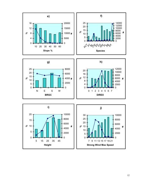
e)f)%161284010 20 30 40 50 6020000150001000050000#%2520151050ACTATBLCWEPFDHWPLSBSX14000120001000080006000400020000#Slope %Speciesg)h)%2520151050N E S W80006000400020000#%2016128400 1 2 3 4 5 6 7120001000080006000400020000#BRGCDIREXi)j)20100003010000%151058000600040002000#%2520151058000600040002000#05 15 25 35 45007 9 11 13 15 17 19 210HeightStrong Wind Max Speed12