Data Acquisition and Processing Report (DAPR) - Center for Coastal ...
Data Acquisition and Processing Report (DAPR) - Center for Coastal ...
Data Acquisition and Processing Report (DAPR) - Center for Coastal ...

Create successful ePaper yourself
Turn your PDF publications into a flip-book with our unique Google optimized e-Paper software.
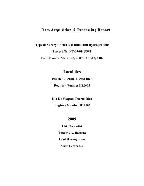
<strong>Data</strong> <strong>Acquisition</strong> & <strong>Processing</strong> <strong>Report</strong><br />
Type of Survey: Benthic Habitat <strong>and</strong> Hydrographic<br />
Project No. NF-09-01-USVI<br />
Time Frame: March 26, 2009 - April 2, 2009<br />
Localities<br />
Isla De Culebra, Puerto Rico<br />
Registry Number H12005<br />
Isla De Vieques, Puerto Rico<br />
Registry Number H12006<br />
2009<br />
Chief Scientist<br />
Timothy A. Battista<br />
Lead Hydrograher<br />
Mike L. Stecher<br />
1
<strong>Data</strong> <strong>Acquisition</strong> & <strong>Processing</strong> <strong>Report</strong><br />
NF-09-01-USVI<br />
March 26, 2009 - April 2, 2009<br />
NOAA Ship NANCY FOSTER<br />
Chief Scientist<br />
Timothy A. Battista<br />
Lead Hydrograher<br />
Mike L. Stecher<br />
2
Table of Contents<br />
I. Background................................................................................................ 4<br />
II. Area ........................................................................................................... 4<br />
III. Equipment............................................................................................... 5<br />
IV. Quality Control ....................................................................................... 8<br />
V. Corrections to Echo Soundings ..............................................................11<br />
VI. Statement of Accuracy <strong>and</strong> Suitability <strong>for</strong> Charting ........................ 12<br />
VII. Summary Of Submitted <strong>Data</strong>............................................................ 18<br />
Approval Sheet ........................................................................................... 19<br />
Appendices<br />
Appendix A. EM1002 Installation <strong>and</strong> Runtime Parameters............................................20<br />
Appendix B. Hydrographic Hardware/Software Inventory ..............................................24<br />
Appendix C. POS/MV 320 V4 Configuration <strong>Report</strong>......................................................26<br />
Appendix D. SBE Calibration <strong>Report</strong>s .............................................................................36<br />
Appendix E. Caris Vessel Configurations & TPE <strong>Report</strong>................................................47<br />
Appendix F. CARIS <strong>Processing</strong> Flow Chart ....................................................................63<br />
Appendix G. NOAA Ship NANCY FOSTER Static Offset <strong>Report</strong>s ...............................65<br />
Appendix H. NOAA Ship NANCY FOSTER Offset Diagrams ......................................74<br />
Appendix I. Multibeam Calibration Procedures & Patch Test <strong>Report</strong>s...........................77<br />
Appendix J. CO-OPS Tide Requirements, Tide Note <strong>and</strong> Correspondence ...................93<br />
Appendix K. CARIS Quality Control <strong>Report</strong>s ...............................................................107<br />
Appendix L. Reson Letter of Explanation.....................................................................113<br />
Appendix M. NF-09-01-USVI Cruise Instructions .......................................................113<br />
3
I. Background<br />
In June 1998, the U.S. Coral Reef Task Force (USCRTF) was established by<br />
Presidential Executive Order 13089. The USCRTF mission is to lead, coordinate, <strong>and</strong><br />
strengthen U.S. government actions to better preserve <strong>and</strong> protect coral reef ecosystems.<br />
The National Oceanic <strong>and</strong> Atmospheric Administration’s (NOAA) <strong>Center</strong> <strong>for</strong> <strong>Coastal</strong><br />
Monitoring <strong>and</strong> Assessment (CCMA) Biogeography Team is supporting the USCRTF<br />
m<strong>and</strong>ate. The Biogeography Team completed its sixth year of an ongoing scientific<br />
research mission on board the NOAA Ship NANCY FOSTER from March 26 to April 2,<br />
2009. The objective of this project was to collect a multibeam bathymetry dataset with<br />
100% seafloor ensonification, along with multibeam backscatter suitable <strong>for</strong> seafloor<br />
characterization in high priority conservation areas within Puerto Rico. Scientists<br />
collected high-resolution multibeam in mid-water depths from approximately 10 to 1020<br />
meters. The multibeam data was collected to con<strong>for</strong>m to IHO Order 1 (100m) accuracy st<strong>and</strong>ards. The strategies developed <strong>for</strong> each survey area took<br />
into account the minimum depths, general bathymetry, <strong>and</strong> time allotment. The<br />
delineation <strong>and</strong> identification of seafloor habitats within areas mapped during the mission<br />
was assisted by the use of an ROV with video <strong>and</strong> camera capabilities.<br />
II. Area<br />
The mission explored <strong>and</strong> mapped moderate depth bathymetry with the NANCY<br />
FOSTER’s Simrad EM1002 & Reson 7125 multibeam systems <strong>for</strong> natural resource<br />
management <strong>and</strong> seafloor characterization. Priority areas <strong>for</strong> 2009 included southern<br />
portions of Isla de Culebra (Registry Number H12005, Sheet A) <strong>and</strong> Isla de Vieques<br />
(Registry Number H12006, Sheet B) offshore of western Puerto Rico. Actual areas<br />
mapped were greatly reduced due to ship transit delays en-route to the Caribbean.<br />
4
III. Equipment<br />
Vessel<br />
The NOAA Ship NANCY FOSTER (R352) is 57 meters in length, has a beam of<br />
12 meters <strong>and</strong> draws approximately 3 meters of water. During the Charleston, South<br />
Carolina drydock period in November of 2005, numerous survey hardware <strong>and</strong> software<br />
installations were implemented by NOAA’s Aviation <strong>and</strong> Marine Operations division<br />
(NMAO) to make multibeam data acquisition a more integral component of the ship’s<br />
research support. NMAO funded the permanent installation of a Simrad EM1002<br />
multibeam sonar, an Applanix POS/MV positioning system, ancillary sensors <strong>and</strong> support<br />
equipment. The NANCY FOSTER was also temporarily mobilized with a Reson 7125<br />
multibeam system in Puerto Rico on March 26, 2009 <strong>for</strong> the shallow water bathymetry<br />
portions of this cruise. For more details on the per<strong>for</strong>mance review of the Simrad<br />
multibeam system please refer to the Hydrographic Systems Readiness Review (HSRR)<br />
<strong>for</strong> the NOAA Ship Nancy Foster, 2006.<br />
Sonar Systems<br />
The Simrad EM1002 multibeam echosounder is permanently hull-mounted<br />
between two fiberglass hydrodynamic fittings starboard of the keel line, aft of the bow.<br />
The EM1002 is a 95-kHz system with a 150° swath consisting of 111 individually<br />
<strong>for</strong>med, electronically roll-stabilized 2° beams, with a maximum ping rate of 10Hz,<br />
depending on water depth. The EM1002 has three different automatically adjusted pulse<br />
lengths to maximize coverage in deeper waters at 0.2, 0.7 <strong>and</strong> 2 milliseconds<br />
respectively. A combination of phase <strong>and</strong> amplitude detection was used, resulting in<br />
measurement accuracy practically independent of beam angle. The system is<br />
compensated in real-time <strong>for</strong> sound velocity changes at the transducer array, to assist the<br />
electronic beam steering capabilities. CCMA per<strong>for</strong>med the EM1002 multibeam patch<br />
test during the research cruise on March 28 - 29, 2009 (Appendix I).<br />
Fig 1: EM1002 transducer fairing<br />
Fig 2: EM1002 transducer<br />
5
The EM1002 sonar system is controlled with a UNIX based operator system<br />
(SUN Solaris 8) that utilizes the Common Desktop Environment <strong>and</strong> Kongsberg’s<br />
MERLIN V 5.2.2 acquisition <strong>and</strong> control program. Be<strong>for</strong>e surveying commenced <strong>and</strong><br />
periodically thereafter, the EM1002 system self-test (BIST test) was per<strong>for</strong>med to<br />
confirm the sonar’s operating status. Sonar errors were not observed during the survey.<br />
As per advice from the Kongsberg representative during the SAT, the automatic <strong>and</strong><br />
default parameters were used to control the sonar during data acquisition. The EM1002<br />
backscatter default options were verified with Adel Sterling <strong>and</strong> the Hawaii Mapping<br />
Resource Group who have extensive experience acquiring backscatter imagery with the<br />
EM1002 system onboard the R/V KILO MOANA. The equidistant beam spacing mode<br />
was chosen to give a uni<strong>for</strong>m distribution of soundings on the seafloor. The ping rate<br />
was set by the system <strong>and</strong> was automatically adjusted according to the depth below the<br />
transducer. Only limited runtime parameters changed during the survey including the<br />
maximum port <strong>and</strong> starboard angles, which did not exceed 60°.<br />
A Reson 7125 multibeam echosounder was mobilized <strong>for</strong> this cruise to map the<br />
shallow water habitats in water depths of less than 75 meters. The system was mounted<br />
from the moon pool flange of the NANCY FOSTER. The 7125 is a dual frequency<br />
system (200/400 kHz) that measures water depths across a 128° swath, consisting of 512<br />
individual beams. The sonar was set to a maximum ping rate of 50 Hz. The ping rate<br />
was reflected by the range scale set by the operator of the sonar, the shallower the range<br />
scale, the faster the ping rate. A variety of ranges were used during acquisition, however<br />
the 100m range or less dominated the majority of survey. A spreading loss of 30 log<br />
decibels <strong>and</strong> absorption value of 50 decibels per kilometer were used as general values<br />
recommended by Reson <strong>for</strong> working in seawater. The power was maintained at 220dB<br />
<strong>and</strong> the gain varied between 33dB <strong>and</strong> 50dB. The sonar data (snippets <strong>and</strong> bathy) was<br />
collected via ethernet with Reson PDS 2000 acquisition software. Un<strong>for</strong>tunately the<br />
7125 did not operate as developed. Reson provided a sonar technician <strong>for</strong> the cruise <strong>and</strong><br />
she was unsuccessful in determining the reason behind numerous data quality issues<br />
during the survey. These<br />
issues included dropped pings,<br />
beam steering inconsistencies<br />
<strong>and</strong> wrong swath widths<br />
reported from the sonar to the<br />
topside unit. Fortunately the<br />
data still meets the IHO<br />
requirements <strong>for</strong> the survey.<br />
These issues will be described<br />
thoroughly with an explanation<br />
from Reson in Appendix L.<br />
Versions of all hardware <strong>and</strong><br />
software used <strong>for</strong> this survey<br />
can be found in Appendix B.<br />
Fig 3: 7125 Mulibeam w/moon pool flange mount<br />
6
Vessel Positioning & Orientation<br />
The Applanix POS/MV 320 V4 (POS) is a vessel positioning <strong>and</strong> orientation<br />
system. The GPS aided Inertial Motion Unit (IMU) provides measurements of roll, pitch<br />
<strong>and</strong> heading that are all accurate to + 0.02°. Heave measurements supplied by POS<br />
maintain an accuracy of 5% of the measured vertical displacement or + 5cm <strong>for</strong> swell<br />
periods of 20 seconds or less. The accuracy <strong>and</strong> stability of measurements delivered by<br />
the system remain unaffected by vessel turns, changes of speed, wave-induced motion<br />
(sea state dependent), or other dynamic maneuvers. The IMU is located on the keel line<br />
in the <strong>for</strong>epeak void, port of the EM1002 transducer; refer to Appendix H <strong>for</strong> the vessel<br />
offset diagram. An additional IMU was located below decks on the moonpool shaft to<br />
compensate <strong>for</strong> motion during operations with the 7125. A POS 7125 vessel<br />
configuration was also created <strong>for</strong> the additional IMU.<br />
The POS obtains its positions from two dual frequency Trimble Zephyr GPS<br />
antennae. The two POS antenna are located above the bridge deck on the port side. An<br />
auxiliary Trimble DSM 132 DGPS system provided an RTCM differential data stream to<br />
the POS. The DSM 132 received differential beacon transmittals from the U.S Coast<br />
Guard Continually Operating Reference Station (CORS) station Port Isabel, Puerto Rico<br />
at an operating frequency of 295.0 kHz.<br />
The vessels motion data were supplied from the POS system via serial<br />
communications to the EM1002 <strong>Processing</strong> Unit (PU) at an update frequency of 100 Hz.<br />
The POS heave b<strong>and</strong>width was set to 18.0 seconds with a dampening ration of .707.<br />
Roll, pitch, <strong>and</strong> heave positive sense were port up, bow up, <strong>and</strong> heave up respectively.<br />
The multipath was set to low, due to the proper placement of the two GPS antennae.<br />
Position updates were supplied to the MERLIN acquisition system via serial<br />
communications at a frequency of 1 Hz. The POS also provided the pulse per second<br />
(PPS) strobe <strong>and</strong> the NMEA ZDA message that the EM1002 uses to continually<br />
synchronize the system clock.<br />
There were also ethernet <strong>and</strong> serial connections from the POS to the PDS2000<br />
acquisition system <strong>and</strong> the Reson 7125 topside. The ethernet connection to the PDS<br />
2000 provided all the positioning <strong>and</strong> attitude data via Group 102, 111 <strong>and</strong> 113. The POS<br />
PPS <strong>and</strong> NMEA ZDA serial data was split to synchronize the PDS2000 <strong>and</strong> Reson 7125<br />
systems to a common time reference.<br />
Sound Velocity<br />
The NANCY FOSTER is equipped with a hull-mounted SBE 45<br />
thermosalinograph (TSG), near the EM1002 transducer. The TSG measures near-surface<br />
conductivity <strong>and</strong> temperature to calculate sound velocity in real-time. The data from the<br />
TSG streamed to the EM1002’s MERLIN acquisition <strong>and</strong> control software to aid in<br />
electronic beam steering. The Reson was also equipped with a real time sound velocity<br />
probe (Reson SVP 70) at the sonar head <strong>and</strong> interfaced with the topside unit. The primary<br />
CTD’s <strong>for</strong> determining sound velocity throughout the water column were a Seabird<br />
7
Electronics SBE-911 <strong>and</strong> a SBE-19 Plus. Sound velocity casts were deployed<br />
approximately every four hours during survey operations. Sound velocity casts were<br />
processed with NOAA’s Velocwin V8.85 software <strong>and</strong> converted to Simrad & CARIS<br />
<strong>for</strong>mat. The NANCY FOSTER’s hydraulic winch was rigged through the block of the<br />
port J-Frame davit, which provided a consistent rate of descent <strong>for</strong> acquisition of the<br />
sound velocity data. Calibration reports from Seabird Electronics are documented in<br />
Appendix D.<br />
<strong>Acquisition</strong> Systems<br />
The EM1002 MERLIN V5.2.2 acquisition <strong>and</strong> control system is based on the Sun<br />
Microsystems Solaris 8 UNIX operating system. The MERLIN system integrated the<br />
auxiliary sensors with the sounding data from the <strong>Processing</strong> Unit (PU) to create<br />
“datagrams”. The datagrams combine the positioning, attitude, sound velocity <strong>and</strong><br />
sounding data. The data was logged in the .ALL <strong>for</strong>mat.<br />
The 7125 sonar was controlled with the Windows based 7-P Sonar Processor Unit<br />
VMR6, <strong>and</strong> collected with Reson’s PDS2000 V3.4.0.2 acquisition software.<br />
<strong>Coastal</strong> Oceanographics Hypack Max 2009 provided the navigation in<strong>for</strong>mation<br />
to the helms display <strong>and</strong> was used along with MapInfo to create line plans <strong>for</strong> the project<br />
areas. Coverage BASE surfaces were created with CARIS’s HIPS <strong>and</strong> SIPS during data<br />
acquisition to verify coverage. The BASE surfaces were then exported in GeoTiff <strong>for</strong>mat<br />
to Hypack <strong>for</strong> creating holiday line plans <strong>and</strong> delineate ROV transect locations.<br />
IV. Quality Control<br />
The HIPS Conversion Wizard uses the .ALL <strong>and</strong> .PDS <strong>for</strong>mats to convert the<br />
multibeam data into CARIS HDCS data files. During the conversion process a depth<br />
limit of 1000m was applied to reject any soundings that exceeded the depth rating of the<br />
EM1002. The vessel configurations used <strong>for</strong> the data conversion was the R352_MB.hvf<br />
(Simrad) <strong>and</strong> NF_7125.hvf (Reson) files. These files include the patch test results,<br />
dynamic draft, waterline <strong>and</strong> the Total Propagated Error (TPE) values (*.hvf & TPE<br />
<strong>Report</strong>, Appendix E). The data was projected to the North American Datum of 1983,<br />
Universal Transverse Mercator Zone 20, Northern Hemisphere (NAD83 UTM20N). All<br />
the acquired data was converted <strong>and</strong> preliminary processed in the field.<br />
Preliminary data processing consisted of: Application of true heave, sound<br />
velocity, zoned predicted tides, navigation editing, attitude editing, swath editing <strong>and</strong><br />
subset editing. Navigation edits included reviewing <strong>for</strong> time jumps greater than 0.2<br />
seconds <strong>and</strong> removing data in vessel turns. Attitude data was reviewed <strong>for</strong> gaps, <strong>and</strong><br />
none were identified. Depth filtering occurred prior to editing <strong>and</strong> was used to eliminate<br />
large outliers in the water column, minimum <strong>and</strong> maximum values varied by survey area.<br />
If the there was adequate coverage from neighboring swaths, then across track filters<br />
were used to limit the swath’s outer beams. <strong>Processing</strong> with the swath edit mode<br />
8
emoved remaining fliers, as well as down-sloping beams where the survey lines crossed<br />
over the reef escarpment providing unreliable soundings.<br />
The Hips Subset Editor <strong>and</strong> BASE surface creation were the second phase of<br />
editing. Subset editing enabled the hydrographer to evaluate each swath against its<br />
neighboring swath while identifying potential tidal <strong>and</strong> motion artifacts. The verification<br />
<strong>and</strong> alignment of features from adjacent lines also confirmed sensor offsets. BASE<br />
surfaces were created to illustrate adequate sonar coverage <strong>and</strong> to also identify systematic<br />
errors or artifacts within the data set. The Bathymetry Associated with Statistical Error<br />
(BASE) surfaces created from the merged <strong>and</strong> TPE calculated soundings are georeferenced<br />
images of a weighted mean surface. The BASE surface uses a combination of<br />
range, uncertainty <strong>and</strong> swath angle weights to assign nodes depth values to create an<br />
image of the seabed surface. The BASE surface images were reviewed with multiple<br />
resolutions, sun angles, sun azimuths <strong>and</strong> vertical exaggerations. The BASE surface<br />
routine produced images representing depth, shoal-biased depth, deep-biased depth, mean<br />
depth, st<strong>and</strong>ard deviation, sounding density, <strong>and</strong> depth uncertainty. During acquisition in<br />
the field editing steps were expedited to create BASE surfaces to confirm adequate<br />
multibeam coverage <strong>for</strong> each survey area <strong>and</strong> to identify ROV transects. The contract<br />
Lead Hydrographer completed final processing of the datasets after field operations. This<br />
included the re-application of sound velocity profiles adjusted by Reson B.V. to try <strong>and</strong><br />
compensate <strong>for</strong> beam steering inaccuracies <strong>and</strong> the application of final tides. Refer to<br />
Appendix F <strong>for</strong> a multibeam processing flow chart. The following two images depict the<br />
areas surveyed by the BASE depth surface.<br />
Fig 4: 2009 bathymetry coverage, 20 km 2 , shown as 8m grid, SE of Isla De Culebra, E Puerto Rico.<br />
9
Fig 5: 2009 bathymetry coverage, 35km 2 , shown as 8m grid, S Isla DeVieques, E Puerto Rico<br />
Table 1: BASE Surface Resolutions <strong>and</strong> Depth Thresholds<br />
Resolution (meters) Depth Thresholds (meters)<br />
1m<br />
0m to 23m<br />
2m<br />
20m to 52m<br />
4m<br />
46m to 115m<br />
8m<br />
103m to 350m<br />
16m<br />
+350m<br />
Multiple resolution BASE surfaces with different depth thresholds were created <strong>for</strong> each<br />
survey area to demonstrate multibeam coverage according to section 5.1.2.2 in the<br />
NOAA Specs <strong>and</strong> Deliverables, April 2009. The surfaces were also stitched together<br />
with the combine surface comm<strong>and</strong>, there<strong>for</strong>e creating a single layer <strong>and</strong> retaining the<br />
in<strong>for</strong>mation from each surface used to create the combined surface. The HIPS export<br />
wizard produced 24-bit sun-illuminated geo-referenced images of the BASE depth<br />
surfaces, <strong>and</strong> ASCII XYZ text exports at resolutions in accordance with the depth<br />
thresholds <strong>for</strong> each survey area <strong>and</strong> as a combined surface. A final analysis was<br />
per<strong>for</strong>med on the BASE depth surfaces with the Hips Quality Control <strong>Report</strong> <strong>and</strong> is<br />
discussed in the Assessment of IHO Compliance section.<br />
10
V. Corrections to Echo Soundings<br />
Instrument corrections<br />
An initial leadline confidence check was measured against the EM1002<br />
multibeam echosounder prior to the start of field operations on March 28, 2009 while tied<br />
up at Isla De Vieques, Puerto Rico. The purpose of this check was to verify the system<br />
during static conditions by confirming that the digital depths being recorded reflected the<br />
actual depths. A sound velocity cast <strong>and</strong> leadline was per<strong>for</strong>med on the starboard side of<br />
the multibeam system. The sonar’s acquisition system was logging data while the<br />
leadline were per<strong>for</strong>med. The CARIS swath editor was then used to verify the depth<br />
soundings. Soundings were queried approximately 4.1 meters to starboard of the nadir<br />
beam <strong>and</strong> verified to the leadline values. No instrument correction was necessary<br />
because of insufficient evidence of systematic error.<br />
A leadline was unable to be per<strong>for</strong>med <strong>for</strong> the 7125 due to sight limitations <strong>and</strong><br />
deployment issues. Vertical elevations were verified with a check line against the<br />
EM1002.<br />
Sensor Offsets<br />
On the February 7 th , 2006 the NOAA Ship NANCY FOSTER had her sensor<br />
offsets surveyed by the Power & Control Systems Group of L3 Communications. The<br />
IMU, GPS antennas, EM1002 transducer <strong>and</strong> the center of rotation were surveyed with<br />
respect to the RP of the vessel. The values obtained from the vessel survey are<br />
documented in Appendix G & H.<br />
On March 10, 2009 the NGS Field Operation Branch conducted an additional survey <strong>for</strong><br />
the second IMU. The field crew based there observations on alignment cubes <strong>and</strong> the<br />
coordinate report from the L3 Communications survey. The values obtained from the<br />
vessel survey are also documented in Appendix G & H.<br />
These offsets were entered into the MERLIN acquisition software, POS/MV<br />
software <strong>and</strong> into the Caris vessel configuration file in the appropriate areas. The offsets<br />
used <strong>for</strong> the sonar’s <strong>and</strong> positioning systems are documented Appendix A, C <strong>and</strong> E.<br />
Static <strong>and</strong> Dynamic Draft Corrections<br />
Static draft values were obtained from visual observations of the projection draft<br />
marks on the starboard side of the NANCY FOSTER <strong>for</strong> the EM1002. The static draft<br />
recorded on March 28, 2009 was 3.66m while tied up at Isla de Vieques, Puerto Rico.<br />
Subtracting the initial draft value of 3.66m from the fixed offset (1.68m) <strong>for</strong> the<br />
Reference Point to the EM1002 gives the final draft reading of -1.98m, which was<br />
entered into the MELIN software <strong>and</strong> confirmed with the leadline procedure previously<br />
discussed. The final EM1002 draft reading at the end of the cruise (April 2 nd ) was<br />
negligible.<br />
11
The 7125 draft was measured at the beginning <strong>and</strong> end of the cruise. The initial<br />
draft reading <strong>for</strong> the 7125 at the moon pool was 3.46m. The final 7125 draft reading at<br />
the end of the cruise (April 2 nd ) was also negligible.<br />
The dynamic draft survey was per<strong>for</strong>med during the Sea Acceptance Test (SAT)<br />
offshore of Charleston, South Carolina in March of 2006. Representatives from the<br />
NOAA Aviation <strong>and</strong> Marine Operations (NMAO) per<strong>for</strong>med the survey <strong>and</strong> evaluated<br />
the results. The dynamic draft was determined using the reference surface method as per<br />
the NOS Field Procedures Manual. Results of the dynamic draft survey were entered into<br />
the vessel configuration files. Refer to Appendix I <strong>for</strong> further in<strong>for</strong>mation on draft<br />
corrections.<br />
System Alignment <strong>and</strong> Calibrations<br />
System Alignment <strong>and</strong> calibration procedures are <strong>for</strong> both sonars are fully<br />
documented in Appendix I, the Multibeam Calibration Procedures & Patch Test <strong>Report</strong>.<br />
The calculated patch test values <strong>for</strong> latency, roll, pitch <strong>and</strong> yaw were entered into the<br />
vessel configuration files.<br />
Tide Corrections<br />
Existing water level stations were used in conjunction with height <strong>and</strong> time<br />
correctors in a CARIS tide zone definition file (ZDF). Predicted tides, adjusted to<br />
MLLW, <strong>and</strong> ZDFs were supplied by NOAA CO-OPS prior to the commencement of<br />
survey operations. Verified six-minute interval water level <strong>and</strong> final tide zone correctors<br />
were applied while post processing the data. During the computation of the TPE, survey<br />
specific parameters including the estimated tidal errors, were applied. The estimated tidal<br />
error contribution to the total survey error budget was 0.12 meters at the 95% confidence<br />
level, <strong>and</strong> included the estimated gauge measurement error, tidal datum computation<br />
error, <strong>and</strong> tidal zoning error. It should be noted that the tidal error component could be<br />
significantly greater than stated if a substantial meteorological event occurred during time<br />
of hydrography, although none were observed. The tide requirements <strong>and</strong> Tide Note <strong>for</strong><br />
Hydrographic Survey is located in Appendix J.<br />
VI. Statement of Accuracy <strong>and</strong> Suitability <strong>for</strong> Charting<br />
Assessment of horizontal control<br />
Positioning equipment <strong>and</strong> methods<br />
The horizontal datum <strong>for</strong> this project is the North American Datum of 1983<br />
Universal Transverse Mercator Zone 20, Northern Hemisphere (NAD83 UTM20N).<br />
Differential GPS (DGPS) corrected positions from the POS/MV were supplied to all the<br />
acquisition systems. Each acquisition system has visual alarms to notify the operator if<br />
the DGPS fix is lost or if HDOP values of 4.0 are exceeded; none were observed.<br />
Differential beacon corrections were received from U.S. Coast Guard Continually<br />
Operating Reference Station (CORS) Isabel, Puerto Rico at a frequency of 295.0 kHz<br />
12
with the Trimble DMS 132 receiver.<br />
Quality control<br />
Position checks between two independent DGPS systems were observed <strong>and</strong><br />
recorded with HYPACK on March 28, 2009 while docked at Isla De Vieques. Both the<br />
EM1002 <strong>and</strong> 7125 POS/MV configuration files were checked with this method. The<br />
Trimble DMS 132 was logged as raw DGPS positions with no offsets applied. Then the<br />
POS/MV DGPS data was logged with the offsets positioning the vessel at the Reference<br />
Point (RP) <strong>and</strong> at the moonpool mounted 7125. Both systems DGPS data were collected<br />
<strong>for</strong> at least one minute, <strong>and</strong> checked well within DGPS positioning st<strong>and</strong>ards.<br />
Statement of accuracy <strong>and</strong> compliance with HSSDM<br />
Based on a combination of the positioning system confidence check, real-time<br />
tolerance monitoring <strong>and</strong> seafloor feature alignment, the hydrographer feels that the<br />
horizontal control should be considered adequate <strong>for</strong> the purposes of this survey.<br />
Assessment of vertical control<br />
Water level measuring equipment <strong>and</strong> methods<br />
The Vertical Datum <strong>for</strong> this survey was Mean Lower-Low Water (MLLW). The<br />
National Water Level Observation Network (NWLON) primary tide stations at Vieques,<br />
PR (975-2695), Culebra, PR (975-2235), <strong>and</strong> Charlotte Amelie, VI (975-1639) served as the<br />
primary sources <strong>for</strong> vertical datum control. Six-minute predicted tides were obtained<br />
from the CO-OPS home page (www.co-ops.nos.noaa.gov) <strong>and</strong> were applied during<br />
preliminary processing onboard the vessel. Verified tides with final zoning were applied<br />
during post-processing.<br />
Tides Zoning<br />
The tidal zoning data, time <strong>and</strong> height corrections were provided by NOAA CO-<br />
OPS (refer to Appendix J). The verified tides were zone corrected with the<br />
I905NF2009CORP.zdf file provided by CO-OPS.<br />
Statement of accuracy <strong>and</strong> compliance with HSSDM<br />
The hydrographer believes that the zoning of tide correctors between the three<br />
primary tide stations is adequate <strong>for</strong> the purpose <strong>and</strong> location of the survey.<br />
Assessment of sensors<br />
Ancillary sensors<br />
Sound velocity profiles were acquired using the NANCY FOSTER’s SeaBird<br />
Electronics (SBE) 19 Plus Conductivity, Temperature, <strong>and</strong> Depth (CTD) profiler (S/N<br />
0355) <strong>and</strong> the SBE 911 CTD (S/N 3269). Raw CTD data was processed using NOAA’s<br />
Velocwin V8.85 software, which generated the sound velocity profiles required <strong>for</strong> realtime<br />
sounding corrections. Casts were recorded to the full depth of the area being<br />
surveyed.<br />
13
The speed of sound through the water was determined by a minimum of one cast<br />
every four hours during multibeam acquisition. The primary CTD was checked against<br />
the secondary unit <strong>and</strong> was in general agreement. Each unit had been calibrated prior to<br />
use <strong>for</strong> this survey; refer to Appendix D <strong>for</strong> the SBE calibration reports.<br />
Assessment of Patch Test <strong>and</strong> Results<br />
The Hydrographer believes that the values of the latency, pitch, roll <strong>and</strong> gyro<br />
coupled with a thorough review of the patch test lines in Caris HIPS HDCS editor,<br />
adequately meet the alignment requirements <strong>for</strong> both systems. The following image<br />
represents an area of feature alignment that was collected with a combination of six lines<br />
of multibeam data from both sonar systems.<br />
Fig 6: Feature mapped with the EM1002 & 7125 multibeam system<br />
Assessment of Dynamic <strong>and</strong> Static Draft<br />
Dynamic draft values <strong>for</strong> the NANCY FOSTER were per<strong>for</strong>med during the Sea<br />
Acceptance Test (SAT) offshore of Charleston, South Carolina in March of 2006.<br />
Representatives from the NOAA Aviation <strong>and</strong> Marine Operations (NMAO) per<strong>for</strong>med<br />
the survey <strong>and</strong> evaluated the results. Four-RPM levels were used to determine the<br />
dynamic draft: 790, 1000, 1300 <strong>and</strong> 1600. The observed changes in draft were<br />
negligible, with a maximum corrector of 0.041m. The values of the dynamic draft were<br />
entered into the vessel configuration files <strong>and</strong> were applied during the merge process.<br />
14
Static draft observations were made <strong>for</strong> the both systems the day of departure<br />
under full load, <strong>and</strong> at the end of the cruise in San Juan, Puerto Rico. Subtracting the RP<br />
from the projection draft markings on the starboard side of the NANCY FOSTER<br />
resulted in the draft <strong>for</strong> the EM1002. For the 7125 a fiberglass tape was lowered into the<br />
moonpool until it reached the flange of the mount. A water elevation was recorded,<br />
which was then added to the acoustic center of the 7125. The total loss of draft observed<br />
during the cruise <strong>for</strong> both systems was negligible. The initial draft values <strong>for</strong> the<br />
EM1002 were verified with lead line observations while tied up at Isla De Vieques.<br />
There were difficulties reading the leadline from the fantail of the ship <strong>for</strong> the 7125, <strong>and</strong><br />
the leadline was not completed. To verify the elevations of the 7125 a reciprocal test line<br />
was ran with both the EM1002 <strong>and</strong> the 7125. There was excellent feature alignment as<br />
well as agreement vertically. The Lead Hydrographer feels that the dynamic <strong>and</strong> static<br />
draft corrections are adequate <strong>for</strong> this survey.<br />
Fig 7: EM1002 & 7125 vertical/horizontal QA/QC check line<br />
15
Assessment of Horizontal <strong>and</strong> Vertical offsets<br />
Sensor Offsets<br />
The Power & Control Systems Group (PacOrd) surveyed the offsets to a<br />
maximum error of +/-5cm, with most of the critical offsets measured to within +/-0.5cm.<br />
Maximum errors of the angles surveyed did not exceed +/-1.0°. During the SAT, Chuck<br />
Hoeing (Kongsberg Rep), Nick Forfinski from NMAO <strong>and</strong> the Lead Hydrographer<br />
verified the sensor offset inputs <strong>for</strong> the EM1002, POS/MV <strong>and</strong> the R352_MB vessel<br />
configuration file.<br />
The second IMU is attached to a plate welded to starboard of the moonpool shaft<br />
below deck, aft of the engine room. The offset survey was conducted on March 10, 2009<br />
at the Old Naval Shipyard in Charleston, South Carolina by the National Geodetic Survey<br />
Field Operations Branch. Control <strong>for</strong> the survey was based on alignment cubes recovered<br />
<strong>and</strong> a coordinate report <strong>for</strong> the survey submitted February 2, 2006 by L3<br />
Communications.<br />
For this cruise the Lead Hydrographer <strong>and</strong> Ed Owens (NOS) confirmed the<br />
offsets <strong>for</strong> the moonpool mounted 7125 <strong>and</strong> EM1002 settings. Refer to Appendix E <strong>and</strong><br />
the 2006 Hydrographic Systems Readiness Review (HSSR) <strong>for</strong> the NANCY FOSTER <strong>for</strong><br />
more in<strong>for</strong>mation.<br />
16
Assessment of Sensor Calibrations<br />
Each sensor associated with this survey underwent calibration prior to<br />
commencement of operations. The digital depths, draft <strong>and</strong> horizontal offsets were<br />
confirmed with a leadline <strong>and</strong> position checks while docked at Isla De Vieques. The<br />
EM1002 <strong>and</strong> 7125 elevations <strong>and</strong> positions were also confirmed with a cross check<br />
confirmation line surveyed by each sonar system. The offsets to these systems were<br />
accurately measured during the PacOrd <strong>and</strong> NGS surveys <strong>and</strong> verified by the Lead<br />
Hydrographer as well as other participating hydrographers. The CTD values were<br />
confirmed by comparing the two units against each other <strong>and</strong> both received calibrations<br />
by the manufacturer within the previous year. The Patch Test occurred during the SAT<br />
trials <strong>and</strong> was confirmed again with the documented NF-03-06, NF-07-06, NF-08-04-<br />
USVI <strong>and</strong> NF-09-01-USVI cruise calibration procedures. Based on these results the<br />
Lead Hydrographer feels that all the systems are adequately calibrated <strong>for</strong> the purpose of<br />
this survey.<br />
Assessment of Object Detection<br />
The EM1002 system’s sonar ping rates are controlled automatically <strong>and</strong> are<br />
dependent on water depths. The 7125 ping rates are range dependent <strong>and</strong> set by the sonar<br />
operator. During acquisition, outer beam overlap was planned at 10%. The goals of the<br />
survey were to meet object detection requirements that satisfy IHO Order 1 in waters<br />
shoaler than 100m <strong>and</strong> IHO Order 2 deeper than 100m.<br />
Bottom Coverage <strong>and</strong> Line Spacing<br />
The survey lines were generally planned parallel to the contours of the seafloor.<br />
Line spacing was determined by depth using 10% overlap with 45° to 60° cutoff angles,<br />
port <strong>and</strong> starboard <strong>for</strong> the EM1002 <strong>and</strong> 7125. The line plan spacing did not exceed three<br />
times average water depth. Holiday lines were planned according to BASE surfaces<br />
created in the field. The resolutions <strong>for</strong> creating holiday plans were 1m <strong>for</strong> the shelf<br />
regions <strong>and</strong> 8m <strong>for</strong> depths generally greater than 100m. Preliminary review of the data in<br />
the field by the Lead Hydrographer determined that the bottom coverage <strong>and</strong> line spacing<br />
were considered adequate <strong>for</strong> the purposes of this survey.<br />
Vessel speed<br />
Survey operations were primarily conducted at a vessel speed of approximately 4<br />
knots <strong>for</strong> deep water <strong>and</strong> approximately 6 knots <strong>for</strong> the shallow shelf regions. The Field<br />
Operations Officer (FOO) of the NOAA ship THOMAS JEFFERSON, which also<br />
operates an EM1002, supplied speed <strong>and</strong> ping rate tables <strong>for</strong> the EM1002. This table was<br />
designed to meet the requirement of the NOAA Specs <strong>and</strong> Deliverables section 5.2.2:<br />
“The hydrographer shall ensure that the vessel speed is adjusted so than no less than 3.2<br />
beam foot prints, center-to-center, fall within 3 m, or a distance equal to 10 percent of the<br />
depth, whichever is greater, in the along track direction". Vessel speeds were adjusted to<br />
follow this table <strong>and</strong> to meet project requirements. Additionally, survey speeds were<br />
decreased during periods of increased sea state. In the opinion of the Lead Hydrographer,<br />
the vessel speeds <strong>and</strong> the sonar parameters used in this survey adequately ensonified the<br />
17
seafloor.<br />
Assessment of IHO Compliance <strong>and</strong> Quality Control <strong>Report</strong><br />
Crosslines totaling approximately 5% of mainscheme were surveyed <strong>for</strong> Registry<br />
# H12005. Only one cross line was completed <strong>for</strong> Registry #H12006 due to time<br />
restraints. CARIS generated Quality Control <strong>Report</strong>s were compiled <strong>for</strong> each survey area.<br />
This routine compares the crosslines <strong>for</strong> each project against the 2m depth BASE surface.<br />
The graphs in Appendix K are a cumulative representation of the IHO compliance of<br />
each region against the BASE depth surface. The results of the QC report are based on<br />
individual HDCS soundings from the crosslines, to a BASE surface created from the<br />
mainscheme data. Comparing HDCS crossline data to a mainscheme BASE surface may<br />
introduce, or reduce, errors, depending on results of comparisons between surfaces <strong>and</strong><br />
individual soundings. In addition to comparing the crosslines to mainscheme data, the<br />
CARIS BASE surface QC report was also per<strong>for</strong>med. This utility compares uncertainty<br />
values contained in the surface to IHO st<strong>and</strong>ards <strong>and</strong> created a compliance report that is<br />
included in Appendix K. Registry Number H12005 met <strong>and</strong> exceeded IHO compliance<br />
<strong>for</strong> IHO order 1 <strong>for</strong> depths shoaler than 100m, <strong>and</strong> IHO order 2 <strong>for</strong> depths deeper than<br />
100m. Registry Number H12006 partially met <strong>and</strong> exceeded IHO compliance <strong>for</strong> IHO<br />
order 1 <strong>for</strong> depths shoaler than 100m, <strong>and</strong> IHO order 2 <strong>for</strong> depths deeper than 100m. It is<br />
a high probability that this is a result of only one cross line of data was available <strong>for</strong><br />
comparisons.<br />
VII. Summary Of Submitted <strong>Data</strong>:<br />
The following documentation <strong>and</strong> data will accompany this survey upon completion:<br />
<strong>Data</strong><br />
• Raw multibeam sonar sounding files in ALL & PDS <strong>for</strong>mat<br />
• Processed multibeam sounding files in CARIS HDCS <strong>for</strong>mat<br />
• Raw <strong>and</strong> processed sound velocity data files<br />
• Predicted <strong>and</strong> Verified tides correctors<br />
• Tidal zoning prepared by NOAA CO-OPS<br />
• XYZ files<br />
• Sun-Illuminated GeoTiffs<br />
• CARIS Hydrographic Vessel Files (HVF)<br />
• CARIS Session Files<br />
• CARIS Fieldsheets<br />
18
Approval Sheet (Separate Signed Document Verifying <strong>DAPR</strong> in<strong>for</strong>mation)<br />
APPROVAL<br />
As Lead Hydrographer, I have ensured that st<strong>and</strong>ard field surveying <strong>and</strong> processing<br />
procedures were followed during this project in accordance with the Hydrographic<br />
Manual, Fourth Edition; Hydrographic Survey Guidelines; Field Procedures Manual, <strong>and</strong><br />
the NOS Hydrographic Surveys Specifications <strong>and</strong> Deliverables Manual, as updated <strong>for</strong><br />
2008.<br />
I acknowledge that all of the in<strong>for</strong>mation contained in this report is complete <strong>and</strong> accurate<br />
to the best of my knowledge.<br />
Approved <strong>and</strong> Forwarded: _________________________________<br />
19
APPENDIX A:<br />
EM1002 Parameters<br />
20
EM1002 installation parameters NOAA SHIP NANCY FOSTER<br />
Cruise# NF-09-01-USVI<br />
Software:<br />
---------<br />
SPTX : 1.0.6 991014<br />
SPRX : 1.0.6 991014<br />
BSP : 1.5.5 050809<br />
PU : 2.2.1 031031<br />
Hull Unit Included: No<br />
Motion Sensor:<br />
----------------<br />
Source = Attitude Sensor, Port 2<br />
Starboard Pos. = 0.00<br />
Forward Pos. = 0.00<br />
DownwardPos. = 0.00<br />
Sensor Delay = 0<br />
Roll Offset = 0.00<br />
PitchOffset = 0.00<br />
Heading Offset = 0.00<br />
Roll Ref. Plane= Pitch-Roll Axis Plane<br />
Waterlevel:<br />
-------------<br />
Downward Pos. = -1.98<br />
Transducer:<br />
--------------<br />
Forward Pos. = 0.81<br />
Starboard Pos. = 1.86<br />
Downward Pos. = 1.68<br />
Heading Re Bow = 0.03<br />
Roll = -0.01<br />
Pitch = 0.05<br />
Heading:<br />
--------<br />
Source = Attitude Sensor<br />
Offset = 0.00<br />
Format = NMEA HDT<br />
1PPS = In Use<br />
Clock Offset (s)= 0<br />
# Serial port no. 1<br />
--------------------<br />
Port will read: GGA ZDA<br />
Baud Rate = 19200 baud<br />
<strong>Data</strong> Bits = 8 bits<br />
Stop Bits = 1 bits<br />
Parity = None<br />
# Serial port no. 2<br />
--------------------<br />
Port will read: Attitude<br />
Baud Rate = 19200 baud<br />
<strong>Data</strong> Bits = 8 bits<br />
Stop Bits = 1 bits<br />
Parity = None<br />
# Serial port no. 3<br />
--------------------<br />
Port will read: None<br />
Baud Rate = 9600 baud<br />
<strong>Data</strong> Bits = 8 bits<br />
Stop Bits = 1 bits<br />
Parity = None<br />
21
# Serial port no. 4<br />
--------------------<br />
Port will read: None<br />
Baud Rate = 9600 baud<br />
<strong>Data</strong> Bits = 8 bits<br />
Stop Bits = 1 bits<br />
Parity = None<br />
# Ethernet<br />
--------------------<br />
Port will read: None<br />
# Clock Synchronization:<br />
-----------------------<br />
Sync. To: External Clock<br />
Active Pos. Sys. on Port 1<br />
# Positioning System on Port 1<br />
-------------------------------<br />
Motion Correction = Enabled<br />
Geoid = WGS_84<br />
Forward Pos. = 0.00<br />
Starboard Pos.= 0.00<br />
Downward Pos .= 0.00<br />
Pos.Delay = 0.0<br />
Time To Use = From <strong>Data</strong>gram<br />
# Positioning System on Port 3<br />
-------------------------------<br />
Motion Correction = Disabled<br />
Geoid = WGS_84<br />
Forward Pos. = 0.00<br />
Starboard Pos.= 0.00<br />
Downward Pos .= 0.00<br />
Pos.Delay = 0.0<br />
Time To Use = From System<br />
# Positioning System on Port 4<br />
-------------------------------<br />
Motion Correction = Disabled<br />
Geoid = WGS_84<br />
Forward Pos. = 0.00<br />
Starboard Pos.= 0.00<br />
Downward Pos .= 0.00<br />
Pos.Delay = 0.0<br />
Time To Use = From System<br />
# Positioning System on Ethernet<br />
-------------------------------<br />
Motion Correction = Disabled<br />
Geoid = WGS_84<br />
Forward Pos. = 0.00<br />
Starboard Pos.= 0.00<br />
Downward Pos .= 0.00<br />
Pos.Delay = 0.0<br />
Time To Use = From System<br />
22
EM1002 runtime parameters NOAA SHIP NANCY FOSTER<br />
Cruise# NF-09-01-USVI<br />
# Sounder Main:<br />
---------------<br />
Sounder Mode = Off<br />
Ping Mode = Auto<br />
# Sounder Depth is supposed to be within:<br />
------------------------------------------<br />
Min. Depth = 1 m<br />
Max. Depth = 1200 m<br />
# Sector / Beams:<br />
-----------------<br />
Max Port Angle = 45 deg<br />
Max Starboard Angle = 45 deg<br />
Max Port Coverage = 600 deg<br />
Max Starboard Coverage = 600 m<br />
Beam Spacing = Equidistant<br />
Angular Coverare = Automatic<br />
Tracking = Auto<br />
Depth To Normal Incidence = 60m<br />
Normal Incidence Backscatter = -25dB<br />
Oblique Backscatter = -25dB<br />
# Sound Speed:<br />
--------------<br />
Sound Speed Profile = 00011_06069183.98.asvp<br />
Tx Sound Speed = 1538.7 m/s<br />
Sound Sensor Offset = 0.0 m<br />
Sound Speed Source = Probe<br />
# Seabed Imaging:<br />
-----------------<br />
TVG Law Crossover Angle= 25 deg.<br />
# Gain:<br />
------<br />
Absorbtion Coeff. = 30.00 dB<br />
Range Gate = Normal<br />
# Filtering:<br />
------------<br />
Slope Filter = Active<br />
Sector Tracking Filter = Active<br />
# Manual Control:<br />
-----------------<br />
Tx Power = -10 dB<br />
Fixed Gain = 30 dB<br />
# Simulator:<br />
------------<br />
Min. Depth = 50 m<br />
Max. Depth = 50 m<br />
Slant X = 0 deg<br />
Slant Y = 0 deg<br />
23
APPENDIX B:<br />
Hydrographic Hardware/Software Inventory<br />
24
Hydrographic Systems Inventory Cruise# NF-09-01USVI HARDWARE<br />
Equipment type Manufacturer Model Serial # Firmware<br />
Transducer Kongsberg/Simrad EM1002 288 N/A<br />
Transceiver Unit Kongsberg/Simrad EM1002 303 N/A<br />
Transducer Reson 7125 1008231 N/A<br />
Transceiver Unit Reson 7-P 51530 MR6<br />
Inertial GPS PCS Applanix POS/MV 320 V4 2249 3.2<br />
IMU Applanix LN 200 447 N/A<br />
IMU Applanix LN 200 047 N/A<br />
DGPS Trimble DSM 132 224096283 3.0<br />
<strong>Acquisition</strong> Sun MicroSystems Solaris 8 TT32220431 N/A<br />
SVP SBE SBE 911 1448 N/A<br />
SVP SBE SBE 19 0355 N/A<br />
SVP Reson SVP 70 N/A N/A<br />
Hydrographic Systems Inventory Cruise# NF-09-01 USVI SOFTWARE<br />
Equipment type Manufacturer Model Software Version<br />
Inertial GPS PCS Applanix POS/MV 320 V4 4.22<br />
Navigation <strong>Coastal</strong> Oceanographics N/A 2009a<br />
<strong>Acquisition</strong> Kongsberg/Simrad MERLIN 5.2 V2<br />
<strong>Acquisition</strong> Reson PDS 2000 3.4.0.2<br />
<strong>Processing</strong> NOAA Velocwin 8.85<br />
<strong>Processing</strong> CARIS HIPS & SIPS 6.1 SP2<br />
25
APPENDIX C:<br />
POS/MV 320 V4 Configuration <strong>Report</strong>s<br />
26
POS/MV Set-up EM1002<br />
COM1<br />
Baud Rate=19200<br />
Parity=None<br />
<strong>Data</strong> Bits=8 Bits<br />
Stop Bits=1 Bit<br />
Flow Control=None<br />
Output Select=NMEA<br />
NMEA Output=GGA,ZDA,VTG Update Rate=1Hz Talker<br />
ID=IN<br />
Roll Positive Sense=Port UpPitch Positive Sense=Bow UpHeave<br />
Positive Sense=Heave Up Input Select=None<br />
COM2<br />
Baud Rate=19200<br />
Parity=None<br />
<strong>Data</strong> Bits=8 Bits<br />
Stop Bits=1 Bit<br />
Flow Control<br />
Output Select=Binary<br />
Binary Output Update Rate=100 Hz Frame=Sensor 1 Formula Select=SIMRAD 1000<br />
(Tate-Bryant) Roll Positive Sense=Port UpPitch Positive Sense=Bow UpHeave Positive<br />
Sense=Heave Up Input Select=None<br />
COM3<br />
Baud Rate=19200<br />
Parity=None<br />
<strong>Data</strong> Bits=8 Bits<br />
Stop Bits=1 Bit<br />
Flow Control=None<br />
Output Select=None<br />
Input Select=Base 1 GPS<br />
Base GPS Input<br />
Input Type=RTCM 1 or 9Line=Serial<br />
Ethernet Logging ControlLogging Group Select=111,113 Logging Control<br />
Output Rate (groups 1, 102, 103)=20 Hz<br />
Ethernet Realtime Output ControlOutput Group Select=1,22,3,7,10,111,113 Output Control<br />
Output Rate (groups 1,102, 103)=2 Hz<br />
Events Event 1=Positive Edge Trigger<br />
Event 2=Positive Edge Trigger<br />
GAMS Parameter Setup<br />
Two Antenna Separation (m)=2.253Heading Calibration Threshold (deg)=0.700Heading<br />
Correction (deg)=0.000 Baseline Vector<br />
X Component (m)=-2.253 Y Component (m)=0.027 Z Component (m)=0.011<br />
29
Heave Filter<br />
Heave B<strong>and</strong>with (sec)=18.000<br />
Damping Ratio=0.707<br />
Lever Arms & Mounting AnglesLever Arms & Mounting Angles<br />
Ref. to IMU Lever Arm X (m)=0.737 Y (m)=0.001 Z (m)=-0.125<br />
IMU Frame w.r.t. Ref. Frame X (deg)= -0.009 Y (deg)=-0.006 Z (deg)=0.057<br />
Ref. to Primary GPS Lever Arm X (m)=6.571 Y (m)=-4.740 Z (m)=-16.308<br />
Ref. to Vessel Lever Arm X (m)=0.000 Y (m)=0.000 Z (m)=0.000<br />
Ref. to Centre of Rotation Lever Arm X (m)=-12.295 Y (m)=0.000 Z (m)=-1.965<br />
Sensor Mounting<br />
Ref. to Aux. 1 GPS Lever Arm X (m)=0.000 Y (m)=0.000 Z (m)=0.000<br />
Ref. to Aux. 2 GPS Lever Arm X (m)=0.000 Y (m)=0.000 Z (m)=0.000<br />
Ref. to Sensor 1 Lever Arm X (m)=0.000 Y (m)=0.000 Z (m)=0.000<br />
Sensor 1 Frame w.r.t. Ref. Frame<br />
X (deg)=0.000<br />
Y (deg)=0.000<br />
Z (deg)=0.000<br />
Ref. to Sensor 2 Lever Arm<br />
X (m)=0.000<br />
Y (m)=0.000<br />
Z (m)=0.000<br />
Sensor 2 Frame w.r.t. Ref. Frame<br />
X (deg)=0.000<br />
Y (deg)=0.000<br />
Z (deg)=0.000<br />
Tags, Multipath & AutoStart<br />
Time Tag 1=UTC Time<br />
Time Tag 2=GPS Time<br />
AutoStart=Enabled<br />
Multipath=Low<br />
Statistics POS Version= MV-320,VER4,S/N2249,HW2.7-7,SW03.22-<br />
Feb08/06,ICD03.17,OS425B14,IMU2,PGPS13,SGPS13,RTK-0,THV-0,DPW-0<br />
GPS Receivers Primary Receiver=BD950;SN:4520A58693,v.00211,channels:24 Secondary<br />
Receiver=BD950:SN:4520A58705,v.00211,channels:24<br />
Statistics<br />
Total Hours=1238.4<br />
Total Runs=31<br />
Average Run (hours)=39.9<br />
Longest Run (hours)=623.0<br />
Current Run (hours)=111.8<br />
Navigator ConfigurationFrame Contol=User Frame Auxiliary GPS Position=NormalPrimary GPS<br />
Measurement=NormalGAMS=unchecked Disable GAMS Solution<br />
POS Internet Address POS Internate Address=010.048.002.012 Subnet Mask=255.000.00.000<br />
30
Gps Receiver ConfiguratioinPrimary GPS Receiver Primary GPS GPS Output Rate=1 Hz<br />
GPS 1 Port<br />
Baud Rate=9600<br />
Parity=None<br />
<strong>Data</strong> Bits=8 Bits<br />
Stop Bits=1 Bit<br />
Auto Configuration<br />
Enabled<br />
Secondary GPS Receiver<br />
Secondary GPS<br />
GPS Output Rate=1 Hz<br />
GPS 2 Port<br />
Baud Rate=9600<br />
Parity=None <strong>Data</strong> Bits=8 Bits Stop Bits=1 Bit<br />
Auto Configuratiion<br />
Enabled<br />
User Parameter Accuracy<br />
RMS Accuracy<br />
Attitude (deg)=0.050<br />
Headinig (deg)=0.050<br />
Position (m)=2.000<br />
Velocity (m/s)=0.500<br />
31
POS/MV Set-up 7125 400kHz<br />
Source Name: NF_7125_400.nvm<br />
Message 37 - Base GPS 1 Setup<br />
Input <strong>Data</strong> Type Port 1 - Accept RTCM 1/9<br />
Message 38 - Base GPS 2 Setup<br />
Input <strong>Data</strong> Type Port 2 - Accept RTCM 1/9<br />
Message 34 - COM Port Setup<br />
Number of COM ports = 5<br />
COM1 - Protocol: 19200,No Parity,8 data,1 stop,None<br />
Input Selection: No Input<br />
Output Selection: NMEA Message<br />
COM2 - Protocol: 19200,No Parity,8 data,1 stop,None<br />
Input Selection: No Input<br />
Output Selection: Real-time Binary<br />
COM3 - Protocol: 9600,No Parity,8 data,1 stop,None<br />
Input Selection: Base GPS 1<br />
Output Selection: No Output<br />
COM4 - Protocol: 19200,No Parity,8 data,1 stop,None<br />
Input Selection: No Input<br />
Output Selection: NMEA Message<br />
COM5 - Protocol: 9600,No Parity,8 data,1 stop,None<br />
Input Selection: No Input<br />
Output Selection: NMEA Message<br />
Message 51 - Display Port Control<br />
Number of groups selected <strong>for</strong> Display Port = 25<br />
1 2 3 4 5 6 7 8 9 10 11 12<br />
13 14 17 20 23 24 99 102 103 104 105 110<br />
20000<br />
Message 53 - Logging Port Control<br />
Number of groups selected <strong>for</strong> Logging Port = 0<br />
Logging Port Output Rate 1 Hz<br />
AutoLog Select Disabled<br />
Message 135 - NMEA Message Select<br />
Number of Port 3<br />
Assigned port number COM1<br />
Update Rate Selection 1 Hz<br />
Output Selection GGA ZDA VTG<br />
32
talker ID $IN<br />
Roll Sense Port Up<br />
Pitch Sense Bow Up<br />
Heave Sense Heave Up<br />
Assigned port number COM4<br />
Update Rate Selection 1 Hz<br />
Output Selection ZDA<br />
talker ID $GP<br />
Roll Sense Port Up<br />
Pitch Sense Bow Up<br />
Heave Sense Heave Up<br />
Assigned port number COM5<br />
Update Rate Selection 1 Hz<br />
Output Selection GGA HDT ZDA VTG SHR UTC<br />
talker ID $IN<br />
Roll Sense Port Up<br />
Pitch Sense Bow Up<br />
Heave Sense Heave Up<br />
Message 136 - Binary Message Select<br />
Number of Port 1<br />
Assigned port number COM2<br />
Update Rate Selection 100 Hz<br />
Output Selection SIMRAD-1000(TB)<br />
Selected frame Sensor1<br />
Roll Sense Port Up<br />
Pitch Sense Bow Up<br />
Heave Sense Heave Up<br />
Message 33 - Event Discrete Setup<br />
Event 1 Trigger Positive edge<br />
Event 2 Trigger Positive edge<br />
Message 30 - Primary GPS Setup<br />
GPS AutoConfig True<br />
Message 31 - Secondary GPS Setup<br />
GPS AutoConfig True<br />
Message 24 - User Accuracy Specifications<br />
User Attitude Accuracy 0.05<br />
User Heading Accuracy 0.05<br />
User Position Accuracy 2<br />
User Velocity Accuracy 0.5<br />
33
Message 52 - Real-time <strong>Data</strong> Port Control<br />
Number of groups selected <strong>for</strong> Real-time <strong>Data</strong> Port = 18<br />
1 2 4 5 9 10 99 102 104 110 111 113 10001 10007 10008 10009 10011 10012<br />
<strong>Data</strong> Port Output Rate 50 Hz<br />
Message 61 - <strong>Data</strong> Port Control<br />
Number of groups selected <strong>for</strong> <strong>Data</strong> Port = 17<br />
1 2 4 5 9 10 99 102 110 111 113 10001<br />
10007 10008 10009 10011 10012<br />
<strong>Data</strong> Port Output Rate 50 Hz<br />
Message 20 - General Installation Parameters<br />
Ref to IMU Lever Arm -0.000 -0.000 0.000 [ Wavemaster User => -0.008 -0.022<br />
0.073 ]<br />
Ref to Pri GPS Lever Arm 29.096 -6.295 -14.577<br />
Ref to Aux1 GPS Lever Arm 27.896 -6.295 -14.577<br />
Ref to Aux2 GPS Lever Arm 0.000 0.000 0.000<br />
IMU to Ref Mounting Angle 0.000 0.000 0.000<br />
AutoStart Enabled<br />
Multipath Low<br />
Message 120 - Sensor Parameter Set-up<br />
Sensor1 Ref Mount Angle 0.000 0.000 0.000<br />
Sensor2 Ref Mount Angle 0.000 0.000 0.000<br />
Ref Sensor1 Lever Arm -0.135 -0.455 2.445<br />
Ref Sensor1 Lever Arm 0.000 0.000 0.000<br />
Ref to CoR Lever Arm 10.230 -1.550 -0.675<br />
Message 121 - Vessel Installation Parameter Set-up<br />
Ref to Vessel Lever Arm -0.135 -0.455 2.445<br />
Message 106 - Heave Filter Set-up<br />
Heave B<strong>and</strong>width 12.000<br />
Heave Damping Ratio 0.707<br />
Message 105 - Analog Port Set-up<br />
Roll Scale 1.00<br />
Pitch Scale 1.00<br />
Heave Scale 1.00<br />
Roll Sense Port Up<br />
Pitch Sense Bow Up<br />
Heave Sense Clockwise<br />
Formula Select - TSS Trig<br />
Analog Port Enabled True<br />
Output Frame Sensor 1<br />
Message 21 - GAMS Installation Parameters<br />
Two Antenna Separation 2.259<br />
34
Baseline Vector -2.259 0.024 -0.002<br />
Heading Calibration Threshold 0.700<br />
Heading Correction 0.000<br />
35
APPENDIX D:<br />
SBE Calibration <strong>Report</strong>s<br />
36
APPENDIX E:<br />
Vessel Configurations & TPE <strong>Report</strong><br />
47
Vessel Name: R352_MB.hvf<br />
Vessel created: September 20, 2007<br />
Depth Sensor:<br />
Sensor Class: Swath<br />
Time Stamp: 2006-064 00:00<br />
Transduer #1:<br />
-------------<br />
Pitch Offset: 0.900<br />
Roll Offset: -0.110<br />
Azimuth Offset: -0.200<br />
DeltaX: 0.000<br />
DeltaY: 0.000<br />
DeltaZ: 0.000<br />
Manufacturer:<br />
Model: em1002<br />
Serial Number:<br />
Depth Sensor:<br />
Sensor Class: Swath<br />
Time Stamp: 2007-044 00:00<br />
Transduer #1:<br />
-------------<br />
Pitch Offset: 1.490<br />
Roll Offset: 0.040<br />
Azimuth Offset: 0.500<br />
DeltaX: 0.000<br />
DeltaY: 0.000<br />
DeltaZ: 0.000<br />
Manufacturer:<br />
Model: em1002<br />
Serial Number:<br />
Depth Sensor:<br />
Sensor Class: Swath<br />
Time Stamp: 2008-051 00:00<br />
Transduer #1:<br />
-------------<br />
Pitch Offset: 0.140<br />
Roll Offset: -0.080<br />
Azimuth Offset: -0.400<br />
DeltaX: 0.000<br />
DeltaY: 0.000<br />
DeltaZ: 0.000<br />
48
Manufacturer:<br />
Model: em1002<br />
Serial Number:<br />
Depth Sensor:<br />
Sensor Class: Swath<br />
Time Stamp: 2009-088 00:00<br />
Transduer #1:<br />
-------------<br />
Pitch Offset: 0.140<br />
Roll Offset: -0.080<br />
Azimuth Offset: -0.700<br />
DeltaX: 0.000<br />
DeltaY: 0.000<br />
DeltaZ: 0.000<br />
Manufacturer:<br />
Model: em1002<br />
Serial Number:<br />
_________________________________________________________<br />
Navigation Sensor:<br />
Time Stamp: 2006-064 00:00<br />
Comments<br />
Latency 0.000<br />
DeltaX: 0.000<br />
DeltaY: 0.000<br />
DeltaZ: 0.000<br />
Manufacturer:<br />
Model:<br />
Serial Number:<br />
Time Stamp: 2009-088 00:00<br />
Comments<br />
Latency 0.200<br />
DeltaX: 0.000<br />
DeltaY: 0.000<br />
DeltaZ: 0.000<br />
Manufacturer:<br />
Model:<br />
Serial Number:<br />
_________________________________________________________<br />
Gyro Sensor:<br />
Time Stamp: 2006-064 00:00<br />
Comments (null)<br />
49
Latency 0.000<br />
Entry 0) Draft: 0.000 Speed: 0.000<br />
_________________________________________________________<br />
Heave Sensor:<br />
Time Stamp: 2006-064 00:00<br />
Comments Caris TechNote - SV Corrections <strong>for</strong> Simrad.pdf 072303<br />
Apply No<br />
Latency 0.000<br />
DeltaX: 0.000<br />
DeltaY: 0.000<br />
DeltaZ: 0.000<br />
Offset: 0.000<br />
Manufacturer: (null)<br />
Model: (null)<br />
Serial Number: (null)<br />
_________________________________________________________<br />
Pitch Sensor:<br />
Time Stamp: 2003-111 00:00<br />
Comments Caris TechNote - SV Corrections <strong>for</strong> Simrad.pdf 072303<br />
Apply No<br />
Latency 0.000<br />
Pitch offset: 0.000<br />
Manufacturer: (null)<br />
Model: (null)<br />
Serial Number: (null)<br />
_________________________________________________________<br />
Roll Sensor:<br />
Time Stamp: 2006-064 00:00<br />
Comments Caris TechNote - SV Corrections <strong>for</strong> Simrad.pdf 072303<br />
Apply No<br />
Latency 0.000<br />
Roll offset: 0.000<br />
Manufacturer: (null)<br />
Model: (null)<br />
Serial Number: (null)<br />
_________________________________________________________<br />
Draft Sensor:<br />
Time Stamp: 2006-064 00:00<br />
Apply Yes<br />
Comments (null)<br />
Entry 1) Draft: 0.007 Speed: 5.054<br />
Entry 2) Draft: 0.041 Speed: 6.143<br />
50
Entry 3) Draft: 0.002 Speed: 7.911<br />
Entry 4) Draft: 0.032 Speed: 9.778<br />
_________________________________________________________<br />
TPE<br />
Time Stamp: 2006-064 00:01<br />
Comments<br />
Offsets<br />
Motion sensing unit to the transducer 1<br />
X Head 1 1.856<br />
Y Head 1 0.074<br />
Z Head 1 1.800<br />
Motion sensing unit to the transducer 2<br />
X Head 2 0.000<br />
Y Head 2 0.000<br />
Z Head 2 0.000<br />
Navigation antenna to the transducer 1<br />
X Head 1 6.596<br />
Y Head 1 5.760<br />
Z Head 1 17.984<br />
Navigation antenna to the transducer 2<br />
X Head 2 0.000<br />
Y Head 2 0.000<br />
Z Head 2 0.000<br />
Roll offset of transducer number 1 -0.014<br />
Roll offset of transducer number 2 0.000<br />
Heave Error: 0.050 or 5.000'' of heave amplitude.<br />
Measurement errors: 0.020<br />
Motion sensing unit alignment errors<br />
Gyro:0.000 Pitch:0.000 Roll:0.000<br />
Gyro measurement error: 0.020<br />
Roll measurement error: 0.020<br />
Pitch measurement error: 0.020<br />
Navigation measurement error: 2.000<br />
Transducer timing error: 0.000<br />
Navigation timing error: 0.000<br />
Gyro timing error: 0.010<br />
Heave timing error: 0.010<br />
PitchTimingStdDev: 0.010<br />
Roll timing error: 0.010<br />
Sound Velocity speed measurement error: 0.600<br />
Surface sound speed measurement error: 0.500<br />
Tide measurement error: 0.010<br />
Tide zoning error: 0.100<br />
Speed over ground measurement error: 0.250<br />
Dynamic loading measurement error: 0.000<br />
Static draft measurement error: 0.030<br />
Delta draft measurement error: 0.000<br />
StDev Comment: 0>„J †J@3†Jp4†J 1†J0 …J .†J0^„J`}€J° †Ja<br />
_________________________________________________________<br />
Svp Sensor:<br />
Time Stamp: 2006-064 00:00<br />
51
Comments (null)<br />
Svp #1:<br />
-------------<br />
Pitch Offset: 0.000<br />
Roll Offset: 0.000<br />
Azimuth Offset: 0.000<br />
DeltaX: 1.856<br />
DeltaY: 0.811<br />
DeltaZ: 1.676<br />
SVP #2:<br />
-------------<br />
Pitch Offset: 0.000<br />
Roll Offset: 0.000<br />
Azimuth Offset: 0.000<br />
DeltaX: 0.000<br />
DeltaY: 0.000<br />
DeltaZ: 0.000<br />
Time Stamp: 2007-044 00:00<br />
Comments (null)<br />
Svp #1:<br />
-------------<br />
Pitch Offset: 0.000<br />
Roll Offset: 0.000<br />
Azimuth Offset: 0.000<br />
DeltaX: 1.856<br />
DeltaY: 0.811<br />
DeltaZ: 1.676<br />
SVP #2:<br />
-------------<br />
Pitch Offset: 0.000<br />
Roll Offset: 0.000<br />
Azimuth Offset: 0.000<br />
DeltaX: 0.000<br />
DeltaY: 0.000<br />
DeltaZ: 0.000<br />
Time Stamp: 2008-051 00:00<br />
Comments (null)<br />
Svp #1:<br />
-------------<br />
Pitch Offset: 0.000<br />
Roll Offset: 0.000<br />
Azimuth Offset: 0.000<br />
DeltaX: 1.856<br />
52
DeltaY: 0.811<br />
DeltaZ: 1.676<br />
SVP #2:<br />
-------------<br />
Pitch Offset: 0.000<br />
Roll Offset: 0.000<br />
Azimuth Offset: 0.000<br />
DeltaX: 0.000<br />
DeltaY: 0.000<br />
DeltaZ: 0.000<br />
Time Stamp: 2009-088 00:00<br />
Comments (null)<br />
Svp #1:<br />
-------------<br />
Pitch Offset: 0.000<br />
Roll Offset: 0.000<br />
Azimuth Offset: 0.000<br />
DeltaX: 1.856<br />
DeltaY: 0.811<br />
DeltaZ: 1.676<br />
SVP #2:<br />
-------------<br />
Pitch Offset: 0.000<br />
Roll Offset: 0.000<br />
Azimuth Offset: 0.000<br />
DeltaX: 0.000<br />
DeltaY: 0.000<br />
DeltaZ: 0.000<br />
_________________________________________________________<br />
WaterLine:<br />
Time Stamp: 2009-080 00:00<br />
Comments<br />
Apply No<br />
WaterLine -1.980<br />
_________________________________________________________<br />
53
Vessel Name: NF_7125.hvf<br />
Vessel created: April 13, 2009<br />
Depth Sensor:<br />
Sensor Class: Swath<br />
Time Stamp: 2009-087 00:00<br />
Transduer #1:<br />
-------------<br />
Pitch Offset: -2.180<br />
Roll Offset: -0.250<br />
Azimuth Offset: 3.380<br />
DeltaX: 0.000<br />
DeltaY: 0.000<br />
DeltaZ: 0.000<br />
Manufacturer:<br />
Model: sb7125d<br />
Serial Number:<br />
_________________________________________________________<br />
Navigation Sensor:<br />
Time Stamp: 2009-087 00:00<br />
Comments (null)<br />
Latency 0.000<br />
DeltaX: 0.000<br />
DeltaY: 0.000<br />
DeltaZ: 0.000<br />
Manufacturer: (null)<br />
Model: (null)<br />
Serial Number: (null)<br />
_________________________________________________________<br />
Gyro Sensor:<br />
Time Stamp: 2009-087 00:00<br />
Comments<br />
Latency 0.000<br />
_________________________________________________________<br />
Heave Sensor:<br />
Time Stamp: 2009-087 00:00<br />
Comments (null)<br />
Apply Yes<br />
Latency 0.000<br />
DeltaX: 0.000<br />
DeltaY: 0.000<br />
DeltaZ: 0.000<br />
54
Offset: 0.000<br />
Manufacturer: (null)<br />
Model: (null)<br />
Serial Number: (null)<br />
_________________________________________________________<br />
Pitch Sensor:<br />
Time Stamp: 2009-087 00:00<br />
Comments (null)<br />
Apply Yes<br />
Latency 0.000<br />
Pitch offset: 0.000<br />
Manufacturer: (null)<br />
Model: (null)<br />
Serial Number: (null)<br />
_________________________________________________________<br />
Roll Sensor:<br />
Time Stamp: 2009-087 00:00<br />
Comments (null)<br />
Apply Yes<br />
Latency 0.000<br />
Roll offset: 0.000<br />
Manufacturer: (null)<br />
Model: (null)<br />
Serial Number: (null)<br />
_________________________________________________________<br />
Draft Sensor:<br />
Time Stamp: 2009-087 00:00<br />
Apply Yes<br />
Comments (null)<br />
Entry 1) Draft: 0.007 Speed: 5.054<br />
Entry 2) Draft: 0.041 Speed: 6.143<br />
Entry 3) Draft: 0.002 Speed: 7.911<br />
Entry 4) Draft: 0.032 Speed: 9.778<br />
_________________________________________________________<br />
TPE<br />
Time Stamp: 2009-060 00:00<br />
Comments<br />
Offsets<br />
Motion sensing unit to the transducer 1<br />
X Head 1 -0.170<br />
Y Head 1 -0.135<br />
Z Head 1 2.445<br />
55
Motion sensing unit to the transducer 2<br />
X Head 2 0.000<br />
Y Head 2 0.000<br />
Z Head 2 0.000<br />
Navigation antenna to the transducer 1<br />
X Head 1 -6.226<br />
Y Head 1 29.090<br />
Z Head 1 -17.022<br />
Navigation antenna to the transducer 2<br />
X Head 2 0.000<br />
Y Head 2 0.000<br />
Z Head 2 0.000<br />
Roll offset of transducer number 1 0.000<br />
Roll offset of transducer number 2 0.000<br />
Heave Error: 0.050 or 5.000'' of heave amplitude.<br />
Measurement errors: 0.020<br />
Motion sensing unit alignment errors<br />
Gyro:0.000 Pitch:0.000 Roll:0.000<br />
Gyro measurement error: 0.020<br />
Roll measurement error: 0.020<br />
Pitch measurement error: 0.020<br />
Navigation measurement error: 2.000<br />
Transducer timing error: 0.000<br />
Navigation timing error: 0.000<br />
Gyro timing error: 0.000<br />
Heave timing error: 0.010<br />
PitchTimingStdDev: 0.010<br />
Roll timing error: 0.010<br />
Sound Velocity speed measurement error: 0.000<br />
Surface sound speed measurement error: 0.000<br />
Tide measurement error: 0.000<br />
Tide zoning error: 0.000<br />
Speed over ground measurement error: 0.250<br />
Dynamic loading measurement error: 0.000<br />
Static draft measurement error: 0.030<br />
Delta draft measurement error: 0.000<br />
StDev Comment: 0>„J †J@3†Jp4†J 1†J0 …J .†J0^„J`}€J° †Ja<br />
_________________________________________________________<br />
Svp Sensor:<br />
Time Stamp: 2009-087 00:00<br />
Comments (null)<br />
Svp #1:<br />
-------------<br />
Pitch Offset: 0.000<br />
Roll Offset: 0.000<br />
Azimuth Offset: 0.000<br />
DeltaX: 0.000<br />
DeltaY: 0.000<br />
DeltaZ: 0.000<br />
SVP #2:<br />
-------------<br />
56
Pitch Offset: 0.000<br />
Roll Offset: 0.000<br />
Azimuth Offset: 0.000<br />
DeltaX: 0.000<br />
DeltaY: 0.000<br />
DeltaZ: 0.000<br />
_________________________________________________________<br />
WaterLine:<br />
Time Stamp: 2009-087 00:00<br />
Comments (null)<br />
Apply Yes<br />
WaterLine -3.459<br />
_________________________________________________________<br />
57
Total Propagated Error (TPE) <strong>Report</strong><br />
NOAA Ship NANCY FOSTER 2006<br />
Caris HIPS 6.0 has an error model that derives from a sounding’s source errors the total<br />
propagated error (TPE) <strong>for</strong> that sounding. The sources of the estimates of the various<br />
errors vary from manufacturers’ specifications, to theoretical values, to field tested<br />
empirical observations. The error estimates (one sigma) are entered into the TPE sensor<br />
section of an HVF.<br />
Below is a table listing various source errors <strong>and</strong> their estimate, followed by a detailed<br />
discussion describing each error estimate.<br />
Error Source Error Estimate<br />
Heave % Amplitude 5.0<br />
Heave 0.05<br />
Gyro 0.02<br />
Roll 0.02<br />
Pitch 0.02<br />
Navigation 4.0<br />
Timing Transducer unknown<br />
Navigation Timing unknown<br />
Gyro Timing 0.01<br />
Heave Timing 0.01<br />
Pitch Timing 0.01<br />
Roll Timing 0.01<br />
Sound Velocity Measured 0.05<br />
Surface 0.05<br />
Tide Measured 0.05<br />
Tide Zoning 0.3<br />
Offset X 0.02<br />
Offset Y 0.02<br />
Offset Z 0.02<br />
Vessel Speed 0.25<br />
Loading unknown<br />
Draft 0.03<br />
Delta Draft unknown<br />
58
Detailed Discussion of Error Estimates<br />
Heave % Amplitude<br />
Error: 5.0<br />
Definition: Heave % Amplitude is an additional heave st<strong>and</strong>ard<br />
deviation component that is the percentage of the<br />
instantaneous heave.<br />
Discussion: See Heave discussion below.<br />
Heave<br />
Error: 0.05<br />
Definition: Heave is the measurement <strong>for</strong> st<strong>and</strong>ard deviation of the heave<br />
data in meters.<br />
Discussion: The POS/MV heave error is given as 0.05 meters + 5% of<br />
heave; however, the Caris error model<br />
implementation uses Heave or Heave % Amplitude,<br />
whichever is greater (see Heave discussion below). Thus a<br />
value of 0.06 <strong>for</strong> Heave is used as a compromise<br />
Gyro<br />
Error: 0.02<br />
Definition: Gyro is the measurement st<strong>and</strong>ard deviation of the<br />
heading data in degrees.<br />
Discussion: Gyro is based on POS/MV manufacturer specifications<br />
Roll<br />
Error: 0.02<br />
Definition: Roll is the measurement st<strong>and</strong>ard deviation of the roll data in<br />
degrees.<br />
Discussion: Roll is based on POS/MV manufacturer specifications.<br />
Pitch<br />
Error: 0.02<br />
Definition: Gyro is the measurement st<strong>and</strong>ard deviation of the<br />
heading data in degrees.<br />
Discussion: Pitch is based on POS/MV manufacturer<br />
specifications.<br />
59
Navigation<br />
Error: 4.0<br />
Definition: Navigation is the st<strong>and</strong>ard deviation associated with<br />
the measurement of positions <strong>for</strong> the vessel in meters.<br />
Discussion: Navigation is based on POS/MV manufacturer<br />
specifications.<br />
Timing Transducer<br />
Error: 0.0<br />
Definition: Timing Transducer is the st<strong>and</strong>ard deviation of<br />
transducer time stamp measurements.<br />
Discussion: Timing Transducer is not known <strong>and</strong> is currently being researched.<br />
Navigation Timing<br />
Error: 0.0<br />
Definition: Navigation Timing is the st<strong>and</strong>ard deviation of<br />
navigation time stamp measurements.<br />
Discussion: Navigation Timing is not known <strong>and</strong> is currently being researched.<br />
Gyro Timing<br />
Error: 0.01<br />
Definition: Gyro Timing is the st<strong>and</strong>ard deviation of gyro time<br />
stamp measurements.<br />
Discussion: Gyro Timing is based on POS/MV manufacturer<br />
specifications.<br />
Heave Timing<br />
Error: 0.01<br />
Definition: Heave Timing is the st<strong>and</strong>ard deviation of heave time<br />
stamp measurements.<br />
Discussion: Heave Timing is based on POS/MV manufacturer<br />
specifications.<br />
Pitch Timing<br />
Error: 0.01<br />
Definition: Pitch Timing is the st<strong>and</strong>ard deviation of pitch time<br />
stamp measurements.<br />
Discussion: Pitch Timing is based on POS/MV manufacturer<br />
specifications.<br />
Roll Timing<br />
Error: 0.01<br />
Definition: Roll Timing is the st<strong>and</strong>ard deviation of roll time<br />
stamp measurements.<br />
Discussion: Roll Timing is based on POS/MV manufacturer<br />
specifications.<br />
60
Sound Velocity Measured<br />
Error: 0.05<br />
Definition: Sound Velocity Measured is the st<strong>and</strong>ard deviation of<br />
the measurement of sound velocity readings in<br />
meters/second.<br />
Discussion: Sound Velocity Measured is based on SEACAT<br />
manufacturer specifications.<br />
Surface<br />
Error: 0.05<br />
Definition: Surface is the st<strong>and</strong>ard deviation of the measurement<br />
of surface sound speed readings in meters/second.<br />
Discussion: This value is currently being researched. In the<br />
meantime, NOAA Ship NANCY FOSTER will use<br />
0.05, which is what NOAA Ship THOMAS<br />
JEFFERSON used <strong>for</strong> its Simrad SSVS.<br />
Tide Measured<br />
Error: 0.05<br />
Definition: Tide Measured is the st<strong>and</strong>ard deviation of the<br />
measured tide values in meters.<br />
Discussion: Tide Measured is based on CO-OPS calculations.<br />
Tide Zoning<br />
Error: 0.3<br />
Definition: Tide Zoning is the st<strong>and</strong>ard deviation of the tide values associated<br />
with zoning in meters.<br />
Discussion: Tide Zoning is based on general CO-OPS calculations.<br />
Offset X<br />
Error: 0.02<br />
Definition: Offset X is the st<strong>and</strong>ard deviation of the measured X<br />
offsets of the vessel.<br />
Discussion: Offset X is the accuracy limit of whatever survey<br />
method was used to survey the vessel.<br />
Offset Y<br />
Error: 0.02<br />
Definition: Offset Y is the st<strong>and</strong>ard deviation of the measured X<br />
offsets of the vessel.<br />
Discussion: Offset Y is the accuracy limit of whatever survey<br />
method was used to survey the vessel.<br />
61
Offset Z<br />
Error: 0.02<br />
Definition: Offset Z is the st<strong>and</strong>ard deviation of the measured X<br />
offsets of the vessel.<br />
Discussion: Offset Z is the accuracy limit of whatever survey<br />
method was used to survey the vessel.<br />
Vessel Speed<br />
Error: 0.25<br />
Definition: Vessel Speed is the st<strong>and</strong>ard deviation <strong>for</strong> the vessel<br />
speed measurements in meters/second.<br />
Discussion: Vessel Speed requires further research. In the<br />
meantime, NANCY FOSTER is using what THOMAS JEFERSON<br />
Loading<br />
Error: 0<br />
Definition: Loading is the measurement st<strong>and</strong>ard deviation of the<br />
vertical changes during the survey because of fuel<br />
consumption, etc. Loading corresponds to the Caris<br />
waterline measurement error.<br />
Discussion: Loading is not currently used. Further investigation is<br />
required.<br />
Draft<br />
Error: 0.03<br />
Definition: Draft is the st<strong>and</strong>ard deviation of the vessel draft<br />
measurements in meters.<br />
Discussion: Draft is the accuracy limit of the draft measuring<br />
method.<br />
Delta Draft<br />
Error: 0<br />
Definition: Delta Draft is the st<strong>and</strong>ard deviation of the dynamic<br />
vessel draft measurements in meters.<br />
Discussion: Delta Draft is not currently used. Further<br />
investigation is required.<br />
62
APPENDIX F:<br />
CARIS <strong>Processing</strong> Flow Chart
APPENDIX G:<br />
NOAA Ship NANCY FOSTER Static Offset <strong>Report</strong>s<br />
65
U.S. Department of Commerce<br />
National Oceanic & Atmospheric Administration<br />
National Ocean Service<br />
National Geodetic Survey<br />
Field Operations Branch<br />
NOAA Ship – Nancy Foster<br />
IMU Component Spatial Relationship Survey<br />
Field <strong>Report</strong><br />
Kevin Jordan<br />
March, 2009<br />
70
NOAA Ship – Nancy Foster<br />
IMU Survey<br />
PURPOSE<br />
The intention of this survey was to accurately position an Inertial Measuring Unit<br />
(IMU) that was to be installed onboard the Nancy Foster <strong>Coastal</strong> Research Vessel.<br />
PROJECT DETAILS<br />
This survey was conducted on March 10, 2009 at the Old Naval Shipyard in<br />
Charleston, South Carolina while the ship was docked. The weather was clear <strong>and</strong><br />
sunny on the day of the survey. Reconnaissance was conducted, but there were no<br />
centerline marks found as described. Control <strong>for</strong> this survey was based on<br />
alignment cubes recovered <strong>and</strong> a coordinate report <strong>for</strong> a survey submitted February<br />
2, 2006 by L3 Communications.<br />
INSTRUMENTATION<br />
The TOPCON GPT 3000 Series Total Station was used to make all measurements.<br />
A SECO 25 mm Mini Prism System with a 30mm offset was used as target<br />
sighting <strong>and</strong> distance measurements.<br />
SOFTWARE AND DATA COLLECTION<br />
ADL Ver. 1.3.4 was used <strong>for</strong> data collection<br />
ForeSight DXM Ver. 3.2.2 was used <strong>for</strong> post processing.<br />
PERSONNEL<br />
Perky Falconer NOAA/NOS/NGS/Field Operations Branch 757-441-5460<br />
Kevin Jordan NOAA/NOS/NGS/Field Operations Branch 757-441-5461<br />
71
DESCRIPTION NORTHING* EASTING* ELEVATION*<br />
IMU CL -22.525 m 1.555 m 1.308 m<br />
IMU BOW<br />
SCRIBELINE<br />
-22.512 m 1.555 m 1.308 m<br />
IMU STERN<br />
SCRIBELINE<br />
-22.690 m 1.555 m 1.308 m<br />
*all positions <strong>and</strong> elevations are referenced from the ship’s granite block with a value of 0.000m northing,<br />
0.000m easting, <strong>and</strong> 0.000m elevation.<br />
72
APPENDIX H:<br />
NOAA Ship NANCY FOSTER Offset Diagrams<br />
74
APPENDIX I:<br />
Multibeam Calibration Procedures & Patch Test <strong>Report</strong>s
Calibration Date: March 29, 2009<br />
Ship<br />
Vessel<br />
Echosounder System<br />
Positioning System<br />
Attitude System<br />
Calibration type:<br />
Annual<br />
Installation<br />
System change<br />
Periodic/QC<br />
Other:<br />
X<br />
NOAA Ship Nancy Foster<br />
Simrad EM1002<br />
POS/MV Model 320 M4<br />
POS/MV Model 320 M4<br />
Full X<br />
Limited/Verification<br />
_______________________________________<br />
The following calibration report documents procedures used to measure <strong>and</strong><br />
adjust sensor biases <strong>and</strong> offsets <strong>for</strong> multibeam echosounder systems. Calibration must<br />
be conducted A) prior to CY survey data acquisition B) after installation of echosounder,<br />
position <strong>and</strong> vessel attitude equipment C) after changes to equipment installation or<br />
acquisition systems D) whenever the Hydrographer suspects incorrect calibration<br />
results. The Hydrographer shall periodically demonstrate that calibration correctors are<br />
valid <strong>for</strong> appropriate vessels <strong>and</strong> that data quality meets survey requirements. In the<br />
event the Hydrographer determines these correctors are no longer valid, or any part of<br />
the echosounder system configuration is changed or damaged, the Hydrographer must<br />
conduct new system calibrations.<br />
Multibeam echosounder calibrations must be designed carefully <strong>and</strong> individually<br />
in consideration of systems, vessel, location, environmental conditions <strong>and</strong> survey<br />
requirements. The calibration procedure should determine or verify system offsets <strong>and</strong><br />
calibration correctors (residual system biases) <strong>for</strong> draft (static <strong>and</strong> dynamic), horizontal<br />
position control (DGPS), navigation timing error, heading, roll, <strong>and</strong> pitch. St<strong>and</strong>ard<br />
calibration patch test procedures are described in Field Procedures <strong>for</strong> the Calibration of<br />
Multibeam Echo-sounding Systems, by André Godin (Documented in Chapter 17 of the<br />
Caris HIPS/SIPS 5.3 User Manual, 2003). Additional in<strong>for</strong>mation is provided in POS/MV<br />
Model 320 Ver 3 System Manual (10/2003), Appendix F, Patch Test, <strong>and</strong> the NOAA<br />
Field Procedures Manual (FPM, 2003). The patch test method only corrects very<br />
basic alignment biases. These procedures are used to measure static navigation<br />
timing error, transducer pitch offset, transducer roll offset, <strong>and</strong> transducer azimuth offset<br />
(yaw). Dynamic <strong>and</strong> reference frame biases can be investigated using a reference<br />
surface.<br />
79
Pre-calibration Survey In<strong>for</strong>mation<br />
Reference Frame Survey<br />
(IMU, sensor, GPS antenna offsets <strong>and</strong> rotation with respect to vessel reference frame)<br />
Vessel reference frame defined with respect to:<br />
IMU X Reference Position<br />
Reference to IMU Lever Arm<br />
X(m) Y(m) Z(m)<br />
0.737 0.001 -0.125<br />
IMU frame w.r.t vessel reference frame<br />
X(deg) Y(deg) Z(deg)<br />
-0.009 -0.006 -0.057<br />
Reference to Sensor Lever Arm<br />
X(m) Y(m) Z(m)<br />
0.0 0.0 0.0<br />
X<br />
X<br />
Measurements verified <strong>for</strong> this calibration.<br />
Reference <strong>Center</strong>line Survey report<br />
Drawing <strong>and</strong> table attached.<br />
Drawing <strong>and</strong> table included with project report/<strong>DAPR</strong>:<br />
X NF-09-04-USVI<br />
<strong>DAPR</strong><br />
Position/Motion Sensor Calibration (<strong>for</strong> POS/MV model 320 M4)<br />
Calibration date: Feb 7, 2006<br />
Reference to primary GPS Lever Arm<br />
X(m) Y(m) Z(m)<br />
6.571 -4.740 -16.308<br />
Heave Settings: B<strong>and</strong>width 18.00 Damping Period .707<br />
Reference to <strong>Center</strong> of Rotation Lever Arm<br />
X(m) Y(m) Z(m)<br />
-12.295 0.000 -1.965<br />
Firmware version 4.22 was used <strong>for</strong> the entire survey.<br />
80
Static Draft Survey<br />
(Vessel waterline with respect to RP)<br />
Survey date: March 28, 2009<br />
Prior to conducting the patch test <strong>and</strong> survey, initial confidence checks were<br />
per<strong>for</strong>med to ensure an accurate measurement of water depths. While the Nancy Foster<br />
was tied up at Isla De Vieques the survey team initially observed the static draft of the<br />
starboard PROJ draft marks at +/-3.66m (12.0 ft.). The EM1002 transducer offset from<br />
the RP (0,0,0) is a fixed distance of 1.676m, which is entered into the installation<br />
parameters in the EM1002 controller software, Merlin V.5.2v2. The waterline to the RP<br />
is the elevation required to compensate <strong>for</strong> draft.<br />
RP to EM1002 offset - WL = Elevation from WL to RP<br />
1.68m - 3.66m = -1.98<br />
Static Draft Correction -1.98<br />
(meters)<br />
81
Dynamic Draft Survey<br />
(Vessel waterline with respect to vessel reference frame <strong>and</strong> vessel speed)<br />
The dynamic draft survey was per<strong>for</strong>med during the Sea Acceptance Test (SAT)<br />
offshore of Charleston, South Carolina in March of 2006. Representatives from the<br />
NOAA Aviation <strong>and</strong> Marine Operations (NMAO) per<strong>for</strong>med the survey <strong>and</strong> evaluated the<br />
results. The dynamic draft was determined using the reference surface method as per<br />
the NOS Field Procedures Manual. Results of the dynamic draft survey are entered into<br />
the CARIS vessel configuration file, R352_MB.hvf<br />
Tabular Summery of Dynamic Draft Results<br />
Dynamic Draft Table, R352_MB.hvf<br />
82
Calibration Survey In<strong>for</strong>mation<br />
An annual patch test was per<strong>for</strong>med during the NF-09-01-USVI cruise. Biases<br />
were estimated by running a series of calibration lines, as described in the NOS<br />
Hydrographic Specifications <strong>and</strong> Deliverables, April 2009 Edition (HSSD). The patch test<br />
calibration quantified residual biases between the POS/MV V4’s Inertial Measurement<br />
Unit <strong>and</strong> the EM1002 multibeam transducer alignment. The patch test also identified<br />
time latency within the positioning <strong>and</strong> acquisition system. All values in Merlin <strong>and</strong> in the<br />
CARIS vessel configuration file were changed to zero be<strong>for</strong>e the patch test was<br />
collected.<br />
An area offshore of South Western Isla De Vieques was chosen <strong>for</strong> the patch test<br />
procedure. The area identified provided the steep <strong>and</strong> smooth slope with little change in<br />
across track depth to accurately assess the latency, pitch <strong>and</strong> yaw biases <strong>for</strong> the Nancy<br />
Foster’s EM1002 multibeam system. Two planned survey lines were oriented<br />
perpendicular to slope, parallel <strong>and</strong> spaced apart to ensure overlap of outer beams <strong>for</strong><br />
the yaw calibration. A check line was also run perpendicular, along the crest of the<br />
seafloor ridge,to verify the determined patch values. A sound velocity cast was<br />
per<strong>for</strong>med prior to conducting the patch test in the immediate vicinity. A total of seven<br />
lines were surveyed. Vessel speeds were consistent <strong>for</strong> the pitch <strong>and</strong> yaw transects at<br />
approximately 5 knots. Vessel speeds were increased to approximately 8 knots <strong>for</strong> the<br />
second latency line of the patch test.<br />
A relatively flat area approximately 1.5km to the North West was chosen <strong>for</strong> the<br />
roll calibration. One planned survey line was collected in reciprocal directions at<br />
approximately 5 knots.<br />
83
The hydrographer per<strong>for</strong>med the biases calculations in the order described in<br />
the HSSD using CARIS HIPS’s calibration tool. The patch test results were proven with<br />
seafloor alignment from opposing swaths throughout the data set. The CARIS vessel<br />
configuration file R352_MB.hvf was updated with the values obtained from the patch test<br />
<strong>and</strong> used <strong>for</strong> the duration of the NF-09-01-USVI cruise <strong>and</strong> <strong>for</strong> post-processing.<br />
Calibration Lines<br />
Line Direction Speed Bias Measured<br />
0012_20090329_024759_raw E-W 5 Check Line<br />
0011_20090329_022634_raw S 5 P2,Y2<br />
0009_20090329_020719_raw N 8 L2<br />
0007_20090329_015016_raw S 5 Y1<br />
0005_20090329_013540_raw N 5 P1,L1<br />
0003_20090329_004855_raw N 5 R1<br />
0004_20090329_010942_raw S 5 R2<br />
Sound Velocity Correction<br />
Measure water sound velocity (SV) prior to survey operations in the immediate vicinity of<br />
the calibration site. Conduct SV observations as often as necessary to monitor changing<br />
conditions <strong>and</strong> acquire a SV observation at the conclusion of calibration proceedings. If<br />
SV measurements are measured at the transducer face, monitor surface SV <strong>for</strong> changes<br />
<strong>and</strong> record surface SV with profile measurements.<br />
Sound Velocity Measurements<br />
Cast Time Depth(m) LAT LONG<br />
DN088_1 00:30 500 18 02.85N 65 36.11W<br />
DN088_2 06:15 700 18 03.26N 65 31.65W<br />
Tide Correction<br />
Predicted tides applied.<br />
Approximate distance of gauge from calibration site:<br />
Water level corrections applied:<br />
X<br />
X<br />
Predicted Verified<br />
Preliminary<br />
Zoned<br />
Variable<br />
84
<strong>Data</strong> <strong>Acquisition</strong> <strong>and</strong> <strong>Processing</strong> Guidelines<br />
Initially, calibration measurement offsets were set to zero in the vessel configuration<br />
files. Static <strong>and</strong> dynamic draft offsets, inertial measurement unit (IMU) lever arm offsets,<br />
<strong>and</strong> vessel reference frame offsets were entered in appropriate software applications<br />
prior to bias analysis. Per<strong>for</strong>med minimal cleaning to eliminate gross flyers from<br />
sounding data.<br />
Navigation Timing Error (NTE)<br />
Measure NTE correction through examination of a profile of the center beams from lines<br />
run in the same direction at maximum <strong>and</strong> minimum vessel speeds. NTE is best<br />
observed in shallow water.<br />
Transducer Pitch Offset (TPO)<br />
Apply NTE correction. Measure TPO correction through examination of a profile of the<br />
center beams from lines run up <strong>and</strong> down a bounded slope or across a conspicuous<br />
feature. Acquire data on lines oriented in opposite directions, at the same vessel speed.<br />
TPO is best observed in deep water.<br />
Transducer Roll Offset (TRO)<br />
Apply NTE <strong>and</strong> TPO corrections. Measure the TRO correction through examination of<br />
roll on the outer beams across parallel overlapping lines. TRO is best observed over flat<br />
terrain in deep water.<br />
Transducer Azimuth Offset (TAO or yaw)<br />
Apply NTE, TPO <strong>and</strong> TRO corrections. Measure TAO correction through examination of<br />
a conspicuous topographic feature observed on the outer beams of lines run in the same<br />
direction.<br />
Patch Test Results <strong>and</strong> Correctors<br />
Evaluator NTE (sec) TPO (deg) TAO (deg) TRO (deg)<br />
Mike Stecher 0.0 0.14 -0.7 -0.08<br />
Corrections calculated in: CARIS HIPS<br />
X<br />
Caris ISIS<br />
Other<br />
85
Caris Vessel Configuration File<br />
Name: R352_MB.hvf<br />
Version:<br />
6.1 SP 2<br />
New Appended values with time tag<br />
Evaluator: Mike Stecher, Lead Hydrographer<br />
X<br />
86
Calibration Date: March 29, 31 <strong>and</strong> April 2 2009<br />
Ship<br />
Vessel<br />
Echosounder System<br />
Positioning System<br />
Attitude System<br />
Calibration type:<br />
Annual<br />
Installation<br />
System change<br />
Periodic/QC<br />
Other:<br />
X<br />
NOAA Ship Nancy Foster<br />
Reson 7125<br />
POS/MV Model 320 M4<br />
POS/MV Model 320 M4<br />
Full X<br />
Limited/Verification<br />
_______________________________________<br />
The following calibration report documents procedures used to measure <strong>and</strong><br />
adjust sensor biases <strong>and</strong> offsets <strong>for</strong> multibeam echosounder systems. Calibration must<br />
be conducted A) prior to CY survey data acquisition B) after installation of echosounder,<br />
position <strong>and</strong> vessel attitude equipment C) after changes to equipment installation or<br />
acquisition systems D) whenever the Hydrographer suspects incorrect calibration<br />
results. The Hydrographer shall periodically demonstrate that calibration correctors are<br />
valid <strong>for</strong> appropriate vessels <strong>and</strong> that data quality meets survey requirements. In the<br />
event the Hydrographer determines these correctors are no longer valid, or any part of<br />
the echosounder system configuration is changed or damaged, the Hydrographer must<br />
conduct new system calibrations.<br />
Multibeam echosounder calibrations must be designed carefully <strong>and</strong> individually<br />
in consideration of systems, vessel, location, environmental conditions <strong>and</strong> survey<br />
requirements. The calibration procedure should determine or verify system offsets <strong>and</strong><br />
calibration correctors (residual system biases) <strong>for</strong> draft (static <strong>and</strong> dynamic), horizontal<br />
position control (DGPS), navigation timing error, heading, roll, <strong>and</strong> pitch. St<strong>and</strong>ard<br />
calibration patch test procedures are described in Field Procedures <strong>for</strong> the Calibration of<br />
Multibeam Echo-sounding Systems, by André Godin (Documented in Chapter 17 of the<br />
Caris HIPS/SIPS 5.3 User Manual, 2003). Additional in<strong>for</strong>mation is provided in POS/MV<br />
Model 320 Ver 3 System Manual (10/2003), Appendix F, Patch Test, <strong>and</strong> the NOAA<br />
Field Procedures Manual (FPM, 2003). The patch test method only corrects very<br />
basic alignment biases. These procedures are used to measure static navigation<br />
timing error, transducer pitch offset, transducer roll offset, <strong>and</strong> transducer azimuth offset<br />
(yaw). Dynamic <strong>and</strong> reference frame biases can be investigated using a reference<br />
surface.<br />
87
Pre-calibration Survey In<strong>for</strong>mation<br />
Reference Frame Survey<br />
(IMU, sensor, GPS antenna offsets <strong>and</strong> rotation with respect to vessel reference frame)<br />
Vessel reference frame defined with respect to:<br />
X IMU X Reference Position<br />
Reference to IMU Lever Arm<br />
X(m) Y(m) Z(m)<br />
0.0 0.0 0.0<br />
IMU frame w.r.t vessel reference frame<br />
X(deg) Y(deg) Z(deg)<br />
0.0 0.0 0.0<br />
Reference to Sensor Lever Arm<br />
X(m) Y(m) Z(m)<br />
-.135 -.455 2.445<br />
X<br />
X<br />
Measurements verified <strong>for</strong> this calibration.<br />
Reference <strong>Center</strong>line Survey report<br />
Drawing <strong>and</strong> table attached.<br />
Drawing <strong>and</strong> table included with project report/<strong>DAPR</strong>:<br />
X NF-09-04-USVI<br />
<strong>DAPR</strong><br />
Position/Motion Sensor Calibration (<strong>for</strong> POS/MV model 320 M4)<br />
Calibration date: March 10, 2009<br />
Reference to primary GPS Lever Arm<br />
X(m) Y(m) Z(m)<br />
29.096 -6.295 -14.577<br />
Heave Settings: B<strong>and</strong>width 18.00 Damping Period .707<br />
Reference to <strong>Center</strong> of Rotation Lever Arm<br />
X(m) Y(m) Z(m)<br />
10.23 -1.55 -.675<br />
Firmware version 4.22 was used <strong>for</strong> the entire survey.<br />
88
Static Draft Survey<br />
(Vessel waterline with respect to RP)<br />
Survey date: March 28, 2009<br />
The 7125 draft was measured at the beginning <strong>and</strong> end of the cruise by lowering<br />
a weighted tape to the top of the sonar mount <strong>and</strong> measuring the waterline. The initial<br />
draft reading <strong>for</strong> the 7125 at the moon pool was 3.46m.<br />
WL - (Moon pool shaft + acoustic center 7125) = Draft<br />
1.731m - 5.19m =-3.46m<br />
Static Draft Correction -3.46<br />
(meters)<br />
89
Dynamic Draft Survey<br />
(Vessel waterline with respect to vessel reference frame <strong>and</strong> vessel speed)<br />
The dynamic draft survey was per<strong>for</strong>med during the Sea Acceptance Test (SAT)<br />
offshore of Charleston, South Carolina in March of 2006. Representatives from the<br />
NOAA Aviation <strong>and</strong> Marine Operations (NMAO) per<strong>for</strong>med the survey <strong>and</strong> evaluated the<br />
results. The dynamic draft was determined using the reference surface method as per<br />
the NOS Field Procedures Manual. Results of the dynamic draft survey are entered into<br />
the CARIS vessel configuration file, NF_7125.hvf<br />
Tabular Summery of Dynamic Draft Results<br />
Dynamic Draft Table, R352_MB.hvf<br />
90
Calibration Survey In<strong>for</strong>mation<br />
A patch test was per<strong>for</strong>med three times <strong>for</strong> the 7125. Each time the patch values<br />
were not consistent throughout the data. A representative from Reson was onbard <strong>for</strong><br />
the mobilization, calibration <strong>and</strong> data acquisition <strong>for</strong> the cruise. The representative was<br />
unable to determine the reasoning <strong>for</strong> the inconsistencies in patch values. The data was<br />
later delivered to Reson B.V. to resolve the issues. Reson determined that the problem<br />
was caused by the real time Reson SVP70 sound velocity sensor reporting wrong sound<br />
velocity values to the 7-P processor, even though the sound velocity values observed<br />
were close to values measured by the SBE-19. Additionally the angle values reported<br />
by the 7125 were not right. Instead of the normal 128.1 degree swath width, the 7125<br />
reported a swath width of 131.2 degrees. To address this, Reson applied a 0.2 degrees<br />
correction to the outer beams. This was achieved by changing the sound velocity profile<br />
at the sonar head by 1 m/s to create an artificial thermo cline during post processing.<br />
Reson per<strong>for</strong>med the biases calculations in PDS2000. The CARIS vessel<br />
configuration file NF_7125.hvf was updated with the values obtained from the Reson<br />
patch test. These values were used <strong>for</strong> NF-09-01-USVI post-processing.<br />
Calibration Lines<br />
Line Direction Speed Bias Measured<br />
221636 W 5 R1, P1<br />
222919 E 5 R2, P2<br />
224924 W 5 Y1<br />
230926 E 5 Y1<br />
Sound Velocity Correction<br />
Measure water sound velocity (SV) prior to survey operations in the immediate vicinity of<br />
the calibration site. Conduct SV observations as often as necessary to monitor changing<br />
conditions <strong>and</strong> acquire a SV observation at the conclusion of calibration proceedings. If<br />
SV measurements are measured at the transducer face, monitor surface SV <strong>for</strong> changes<br />
<strong>and</strong> record surface SV with profile measurements.<br />
Sound Velocity Measurements<br />
Cast Time Depth(m) LAT LONG<br />
DN092_4 21:45 37 18 04.12N 65 12.53W<br />
91
Tide Correction<br />
Predicted tides applied.<br />
Approximate distance of gauge from calibration site:<br />
Water level corrections applied:<br />
X<br />
X<br />
Predicted Verified<br />
Preliminary<br />
Zoned<br />
<strong>Data</strong> <strong>Acquisition</strong> <strong>and</strong> <strong>Processing</strong> Guidelines<br />
Variable<br />
Initially, calibration measurement offsets were set to zero in the vessel configuration<br />
files. Static <strong>and</strong> dynamic draft offsets, inertial measurement unit (IMU) lever arm offsets,<br />
<strong>and</strong> vessel reference frame offsets were entered in appropriate software applications<br />
prior to bias analysis. Per<strong>for</strong>med minimal cleaning to eliminate gross flyers from<br />
sounding data.<br />
Navigation Timing Error (NTE)<br />
Measure NTE correction through examination of a profile of the center beams from lines<br />
run in the same direction at maximum <strong>and</strong> minimum vessel speeds. NTE is best<br />
observed in shallow water.<br />
Transducer Pitch Offset (TPO)<br />
Apply NTE correction. Measure TPO correction through examination of a profile of the<br />
center beams from lines run up <strong>and</strong> down a bounded slope or across a conspicuous<br />
feature. Acquire data on lines oriented in opposite directions, at the same vessel speed.<br />
TPO is best observed in deep water.<br />
Transducer Roll Offset (TRO)<br />
Apply NTE <strong>and</strong> TPO corrections. Measure the TRO correction through examination of<br />
roll on the outer beams across parallel overlapping lines. TRO is best observed over flat<br />
terrain in deep water.<br />
Transducer Azimuth Offset (TAO or yaw)<br />
Apply NTE, TPO <strong>and</strong> TRO corrections. Measure TAO correction through examination of<br />
a conspicuous topographic feature observed on the outer beams of lines run in the same<br />
direction.<br />
92
Patch Test Results <strong>and</strong> Correctors<br />
Evaluator NTE (sec) TPO (deg) TAO (deg) TRO (deg)<br />
Peter De Vries 0.0 -2.18 3.38 -.22<br />
X<br />
Caris ISIS<br />
Other PDS 2000<br />
Caris Vessel Configuration File<br />
Name: NF-7125.hvf<br />
Version:<br />
6.1 SP 2<br />
New X Appended values with time tag<br />
Evaluator: Peter De Vries, Reson B.V.<br />
93
APPENDIX J:<br />
CO-OPS Tide Requirements, Tide Note <strong>and</strong> Correspondence<br />
94
WATER LEVEL INSTRUCTIONS<br />
M-I905-NF-2009 U.S. Virgin Isl<strong>and</strong>s <strong>and</strong> Puerto Rico<br />
(1/8/2009 CFL)<br />
1.0. TIDES AND WATER LEVELS<br />
1.1. Specifications<br />
Tidal data acquisition, data processing, tidal datum computation <strong>and</strong> final tidal zoning shall be<br />
per<strong>for</strong>med utilizing sound engineering <strong>and</strong> oceanographic practices as specified in National<br />
Ocean Service (NOS) Hydrographic Surveys Specifications <strong>and</strong> Deliverables (HSSD), dated<br />
April 2007, <strong>and</strong> OCS Field Procedures Manual (FPM), dated March 2007. Specifically reference<br />
Chapter 4 of the HSSD <strong>and</strong> Sections 1.5.8, 1.5.9, 2.4.5, <strong>and</strong> 3.4.2 of the FPM.<br />
1.2. Vertical Datums<br />
The tidal datums <strong>for</strong> this project are referenced to Chart Datum, Mean Lower Low Water<br />
(MLLW) <strong>and</strong> Mean High Water (MHW). Soundings are referenced to MLLW <strong>and</strong> heights of<br />
overhead obstructions (bridges <strong>and</strong> cables) are referenced to MHW.<br />
The operating National Water Level Observation Network (NWLON) stations at Vieques, PR<br />
(975-2695), Culebra, PR (975-2235), <strong>and</strong> Charlotte Amelie, VI (975-1639) will serve as datum<br />
control <strong>for</strong> the survey area including determination at each subordinate station. There<strong>for</strong>e, it is<br />
critical that these stations remain in operation during all periods of hydrography.<br />
1.2.1. Water Level <strong>Data</strong> <strong>Acquisition</strong> Monitoring<br />
The Comm<strong>and</strong>ing Officer (or Team Leader) <strong>and</strong> the <strong>Center</strong> <strong>for</strong> Operational Oceanographic<br />
Products <strong>and</strong> Services (CO-OPS) are jointly responsible <strong>for</strong> ensuring that valid water level data<br />
are collected during periods of hydrography. The Comm<strong>and</strong>ing Officer (or Team Leader) is<br />
required to monitor the pertinent water level data via the CO-OPS Web site at<br />
http://tides<strong>and</strong>currents.noaa.gov/hydro.shtml, email data transmissions through TIDEBOT, or<br />
through regular communications with CO-OPS/Requirements <strong>and</strong> Development Division (RDD)<br />
personnel be<strong>for</strong>e <strong>and</strong> during operations. During traditional non duty hours, the Comm<strong>and</strong>ing<br />
Officer/Team Leader may contact the Continuous Operational Real-Time Monitoring System<br />
(CORMS) watch st<strong>and</strong>er who is available 24 hours/day - 7 days/week <strong>for</strong> assistance in assessing<br />
the status of applicable water level station operation. The CORMS watch st<strong>and</strong>er may be<br />
contacted either by phone at 301-713-2540 or by Email: CORMS@noaa.gov. Problems or<br />
concerns regarding the acquisition of valid water level data identified by the Comm<strong>and</strong>ing<br />
Officer/Team Leader shall be communicated with CO-OPS/RDD (Tom L<strong>and</strong>on, 301-713-2897<br />
ext. 191, Email: Thomas.L<strong>and</strong>on@noaa.gov on the East Coast) to coordinate the appropriate<br />
course of action to be taken such as gauge repair <strong>and</strong>/or developing contingency plans <strong>for</strong><br />
hydrographic survey operations. In addition, CO-OPS is required to coordinate with the<br />
95
Comm<strong>and</strong>ing Officer (or Team Leader) be<strong>for</strong>e interrupting the acquisition of water level data<br />
<strong>for</strong> any reason during periods of hydrography.<br />
1.2.2. NWLON Water Level Station Operation <strong>and</strong> Maintenance<br />
The operating water level stations at Vieques, PR (975-2695), Culebra, PR (975-2235), <strong>and</strong><br />
Charlotte Amelie, VI (975-1639) will also provide water level reducers <strong>for</strong> this project, reiterating<br />
the importance of their operation during all periods of hydrography. See Sections 1.1. <strong>and</strong> 1.2.<br />
concerning responsibilities.<br />
No leveling is required Vieques, PR (975-2695), Culebra, PR (975-2235), <strong>and</strong> Charlotte Amelie,<br />
VI (975-1639) by NOAA Ship Nancy Foster personnel.<br />
CO-OPS/FOD is responsible <strong>for</strong> the operation <strong>and</strong> maintenance of all NWLON primary control<br />
stations. If a problem is identified at an NWLON primary control station, FOD shall make all<br />
reasonable ef<strong>for</strong>ts to repair the malfunctioning station. However, CO-OPS may request<br />
assistance from the NOAA ship or NRT personnel in the actual repair of the water level station to<br />
facilitate a rapid repair. CO-OPS/FOD <strong>and</strong> the Comm<strong>and</strong>ing Officer (or Team Leader) shall<br />
maintain the required communications until the repairs to the water level station have been<br />
completed.<br />
1.3. Tide Reducer Stations<br />
1.3.1. No subordinate water level stations are required <strong>for</strong> this project, however, supplemental<br />
<strong>and</strong>/or back-up water level stations may be necessary depending on the complexity of the<br />
hydrodynamics <strong>and</strong>/or the severity of the environmental conditions of the project area. The<br />
installation <strong>and</strong> continuous operation of water level measurement systems (tide gauges) at<br />
subordinate station locations is left to the discretion of the Comm<strong>and</strong>ing Officer (or Team<br />
Leader), subject to the approval of CO-OPS. If the Comm<strong>and</strong>ing Officer (or Team Leader)<br />
decides to install additional water level stations, then a 30-day minimum of continuous data<br />
acquisition is required. For all subordinate stations, data must be collected throughout the entire<br />
survey period <strong>for</strong> which they are applicable, <strong>and</strong> not less than 30 continuous days. This is<br />
necessary to facilitate the computation of an accurate datum reference as per NOS st<strong>and</strong>ards.<br />
Tide Component Error Estimation<br />
The estimated tidal error contribution to the total survey error budget in the vicinity of Puerto<br />
Rico <strong>and</strong> the U.S. Virgin Isl<strong>and</strong>s is 0.12 meters at the 95% confidence level, <strong>and</strong> includes the<br />
estimated gauge measurement error, tidal datum computation error, <strong>and</strong> tidal zoning error. Based<br />
on this analysis a subordinate station will not be required. It should be noted that the tidal error<br />
component can be significantly greater than stated if a substantial meteorological event or<br />
condition should occur during time of hydrography.<br />
1.3.2. GOES Satellite Enabled Subordinate Stations<br />
96
This section is not applicable <strong>for</strong> this project.<br />
1.3.3. Benchmark Recovery <strong>and</strong> GPS Requirements<br />
This section is not applicable <strong>for</strong> this project.<br />
1.3.4. This section is not applicable <strong>for</strong> this project.<br />
1.4. Discrete Tidal Zoning<br />
1.4.1. The water level station at Vieques, PR (975-2695), Culebra, PR (975-2235), <strong>and</strong><br />
Charlotte Amelie, VI (975-1639) are the reference stations <strong>for</strong> preliminary tides <strong>for</strong> hydrography<br />
in the U.S. Virgin Isl<strong>and</strong>s. The time <strong>and</strong> height correctors listed below <strong>for</strong> applicable zones<br />
should be applied to the preliminary data at Vieques, PR (975-2695), Culebra, PR (975-2235),<br />
<strong>and</strong> Charlotte Amelie, VI (975-1639) during the acquisition <strong>and</strong> preliminary processing phases of<br />
this project. Preliminary data may be retrieved in one month increments over the Internet from the<br />
CO-OPS Home Page at http://tides<strong>and</strong>currents.noaa.gov/olddata <strong>and</strong> then clicking on<br />
“Preliminary Water Level”. The Comm<strong>and</strong>ing Officer (or Team Leader) must notify CO-<br />
OPS/RDD personnel immediately of any problems concerning the preliminary tides. Preliminary<br />
data are six-minute time series data relative to MLLW in metric units on Greenwich Mean Time.<br />
For the time corrections, a negative (-) time correction indicates that the time of tide in that zone<br />
is earlier than (be<strong>for</strong>e) the preliminary tides at the reference station. A positive (+) time<br />
correction indicates that the time of tide in that zone is later than (after) the predicted tides at the<br />
reference station. For height corrections, the water level heights relative to MLLW at the<br />
reference station are multiplied by the range ratio to estimate the water level heights relative to<br />
MLLW in the applicable zone.<br />
Time Range Predicted<br />
Zone Corrector(mins) Ratio Reference Station<br />
VIR2 -12 x0.96 975-2235<br />
VIR3 -12 x0.88 975-2235<br />
VIR3B -12 x1.2 975-1639<br />
VIR4 -12 x1.08 975-1639<br />
VIR4A -12 x1.08 975-1639<br />
VIR4B -6 x1.08 975-1639<br />
VIR5 -12 x1.01 975-1639<br />
VIR6 +6 x1.08 975-2695<br />
VIR7 +12 x1.01 975-2695<br />
VIR20 -12 x1.01 975-1639<br />
VIR21 -6 x1.01 975-1639<br />
1.4.2. Polygon nodes <strong>and</strong> water level corrections referencing Vieques, PR (975-2695), Culebra,<br />
PR (975-2235), <strong>and</strong> Charlotte Amelie, VI (975-1639) are provided in CARIS ® <strong>for</strong>mat denoted by<br />
a *.zdf extension file name.<br />
NOTE: The tide corrector values referenced to Vieques, PR (975-2695), Culebra, PR (975-<br />
2235), <strong>and</strong> Charlotte Amelie, VI (975-1639) are provided in the zoning file<br />
97
“I905NF2009CORP” <strong>for</strong> this project <strong>and</strong> are in the fourth set of correctors designated as<br />
TS4. Longitude <strong>and</strong> latitude coordinates are in decimal degrees. Negative (-) longitude is a<br />
MapInfo ® representation of West longitude<br />
“Preliminary” data <strong>for</strong> the control water level station, Vieques, PR (975-2695), Culebra, PR (975-<br />
2235), <strong>and</strong> Charlotte Amelie, VI (975-1639), are available in near real-time <strong>and</strong> verified data will<br />
be available on a weekly basis <strong>for</strong> the previous week. These water level data may be obtained<br />
from the CO-OPS web site at http://tides<strong>and</strong>currents.noaa.gov/olddata . From this site, click on<br />
either “Preliminary Water Level” or “Verified Water Level” to obtain preliminary or<br />
verified/historical water level data as appropriate.<br />
Please contact the Hydrographic Planning Team at NOS.COOPS.HPT@noaa.gov <strong>and</strong> the<br />
Operational Engineering Team at NOS.COOPS.OET@noaa.gov be<strong>for</strong>e survey operations begin<br />
<strong>and</strong> once survey operations are completed so that the appropriate CO-OPS NWLON (National<br />
Water Level Observation Network) water level stations are added to or removed from the CO-<br />
OPS Hydro Hotlist (http://tides<strong>and</strong>currents.noaa.gov/hydro).<br />
1.4.3 Zoning Diagram(s)<br />
Zoning diagrams, created in MapInfo ® <strong>and</strong> Adobe PDF, are provided in digital <strong>for</strong>mat to assist<br />
with the zoning in section 1.4.1.<br />
1.4.4 Final Zoning<br />
Upon completion of project M-I905-NF-2009, submit a Pydro generated request <strong>for</strong> smooth tides,<br />
with times of hydrography abstract <strong>and</strong> mid/mif tracklines attached. Forward this request to<br />
smooth.tides@noaa.gov . Provide the project number, as well as a sheet number, in the subject<br />
line of the email.<br />
CO-OPS will review the times of hydrography, final tracklines, <strong>and</strong> six-minute water level data<br />
from all applicable water level gauges. After review, CO-OPS will send a notice indicating that<br />
the tidal zoning scheme sent with the project instructions has been approved <strong>for</strong> final zoning. If<br />
there are any discrepancies, CO-OPS will make the appropriate adjustments <strong>and</strong> <strong>for</strong>ward a<br />
revised tidal zoning scheme to the field group <strong>and</strong> project manager <strong>for</strong> final processing.<br />
1.5 TideBot<br />
Preliminary <strong>and</strong> verified six minute water level time series data may be retrieved from the CO-<br />
OPS database via TideBot application. TideBot delivers timely preliminary/verified tidal <strong>and</strong><br />
Great Lakes six minute water level observations via email to users on a scheduled, recurring<br />
basis. To access TideBot through an email account, send an email to TideBot@noaa.gov with the<br />
word “help” as the subject. An email reply will be sent with instructions on how to subscribe to<br />
TideBot <strong>for</strong> time series data retrieval.<br />
1.6 Water Level Records<br />
Submit water level data, such as leveling records, field reports, <strong>and</strong> any other relevant<br />
data/reports, including the data downloaded onto diskette/CD within 1 week after the end of each<br />
month or the end of hydrography to CO-OPS/RDD. Refer to Section 1.1.<br />
98
1.6.1 Water level records should be <strong>for</strong>warded to the following address:<br />
NOAA/National Ocean Service/CO-OPS<br />
Chief, Requirements <strong>and</strong> Development Division<br />
N/OPS1 - SSMC4, Station 6531<br />
1305 East-West Highway<br />
Silver Spring, MD 20910<br />
99
100
101
102
103
104
105
106
107
APPENDIX K:<br />
CARIS Quality Control <strong>Report</strong>s<br />
108
BASE Surface QC <strong>Report</strong> H12005<br />
-----------------------------<br />
Date <strong>and</strong> Time: 10/8/2009 1:36:22 PM<br />
Surface: C:\CARIS\HIPS\61\Fieldsheets\M-I905-NF-09\H12005\H12005_2m.hns<br />
Holiday Search Radius: 2<br />
Holiday Minimum Number of Nodes: 6<br />
Holiday layer created: No<br />
Error values from: St<strong>and</strong>ard Deviation.<br />
Number of nodes processed: 4,940,928<br />
Number of nodes populated: 4,938,695 (99.9548060607238%)<br />
Number of holidays detected: 0<br />
IHO S-44 Special Order:<br />
Range: 0.0 to 20.0<br />
No depths within the specified range<br />
S-44 Order 1:<br />
Range: 20.0 to 100.0<br />
Number of nodes considered: 3,962,643<br />
Number of nodes within: 3,866,157 (97.565%)<br />
109
BASE Surface QC <strong>Report</strong> H12006<br />
-----------------------------<br />
Date <strong>and</strong> Time: 10/8/2009 4:07:39 PM<br />
Surface: C:\CARIS\HIPS\61\Fieldsheets\M-I905-NF-<br />
09\M_I905_NF_09_EM1002_Vieques_Ledge\H12006\H12006_8m.hns<br />
Holiday Search Radius: 2<br />
Holiday Minimum Number of Nodes: 6<br />
Holiday layer created: No<br />
Error values from: St<strong>and</strong>ard Deviation.<br />
Number of nodes processed: 552,069<br />
Number of nodes populated: 551,857 (99.9615990030232%)<br />
Number of holidays detected: 0<br />
S-44 Order 1:<br />
Range: 20.0 to 100.0<br />
Number of nodes considered: 10,615<br />
Number of nodes within: 685 (6.453%)<br />
Residual mean:<br />
5.67673534491979<br />
S-44 Order 2:<br />
Range: 100.0 to 5000.0<br />
Number of nodes considered: 541,242<br />
Number of nodes within: 494,577 (91.378%)<br />
Residual mean: -6.02852516565061<br />
110
APPENDIX L:<br />
Reson Letter of Explanation<br />
111
112
113
APPENDIX M:<br />
NF-09-01-USVI Cruise Instructions<br />
114
CRUISE INSTRUCTIONS: NOAA SHIP NANCY FOSTER<br />
Cruise Title: Characterization of seafloor habitats of Vieques Puerto Rico<br />
Cruise Number NF-09-01-USVI<br />
Period of Cruise:<br />
DEP: 3/21/09<br />
ARR: 4/3/09<br />
Area of Operation: Vieques, Puerto Rico (See Figure 1)<br />
1.0 Scientific Objectives:<br />
The <strong>Center</strong> <strong>for</strong> <strong>Coastal</strong> Monitoring <strong>and</strong> Assessment (CCMA) will be conducting the sixth year of<br />
an ongoing scientific research mission onboard the NOAA ship Nancy Foster funded by NOAA’s<br />
Coral Reef Conservation Program. The purpose of the cruise will be to collect swath bathymetry<br />
<strong>and</strong> acoustical backscatter, as well as fishery acoustics data in high priority areas surrounding<br />
Vieques Isl<strong>and</strong>. Scientists will collect high resolution multibeam <strong>and</strong> acoustic fisheries data in<br />
mid-water depths approximately 10 to 100 meters so as to continue to characterize seafloor<br />
habitats within all U.S. States, Territories, <strong>and</strong> Commonwealths. The objective of this project is to<br />
collect a multibeam bathymetry dataset with 100% seafloor ensonification, along with multibeam<br />
backscatter suitable <strong>for</strong> seafloor characterization. Multibeam data will be collected to con<strong>for</strong>m to<br />
IHO Order 1 (100m) accuracy st<strong>and</strong>ards. The strategies developed <strong>for</strong><br />
each survey area will take into account the minimum depths, general bathymetry, <strong>and</strong> time<br />
allotment. The delineation <strong>and</strong> identification of seafloor habitats will be assisted by the use of a<br />
moderate-depth ROV <strong>and</strong> drop camera. The vehicle has video <strong>and</strong> frame camera capability to<br />
depths of 300 meters <strong>and</strong> will be used to point sampling within areas mapped during this mission.<br />
2.0 Schedule of Operations:<br />
2.1 Daily Schedule:<br />
Actual survey <strong>and</strong> ground truthing locations will be made available to the Operations Officer<br />
during the daily operations meeting. The following are estimates of locations.<br />
* Passive fisheries acoustics via the Kongsberg ES120-7C will occur during all shifts (MBES<br />
Survey <strong>and</strong> Groundtruthing).<br />
19 March (Thursday): Nancy Foster arrives in San Juan, Puerto Rico<br />
Survey NF: Survey install team arrives.<br />
GT: Ground Truthing (GT) install team arrives.<br />
20 March (Friday):<br />
Survey NF: Survey team installs survey gear, does a gear shake-down of multibeam unit <strong>and</strong><br />
survey planning. Install Reson 7125 <strong>and</strong> ES120-C (time TBD) to the moon pool using ship<br />
divers. Conduct dockside calibration tests.<br />
GT: Ground Truthing (GT) install team configures remaining camera gear <strong>and</strong> conducts USBL,<br />
POS/MV, GPS integration with Hypack; <strong>and</strong> installs hydrophone pole.<br />
All: Team scientists meeting to prepare <strong>for</strong> VIP/Education Day.<br />
115
21 March (Saturday):<br />
VIP Boarding: (0830) to transit with ship to Vieques.<br />
Transit/VIP Event: (0930-1730) Ship transit from San Juan to El Rompeolas (Mosquito Pier) to<br />
conduct Education Day Event (touch <strong>and</strong> go). Conduct VIP MBES, fish acoustic<br />
demonstration en route with ROV deployment mid-route (~ 1 hr) with the exact location<br />
TBD.<br />
Education Event/Open House: (1600-1700) Run education day events.<br />
Transit/Survey NF: (1730-2400) Ship transit from Mosquito Pier to project area to begin MBES<br />
survey.<br />
22 March (Sunday):<br />
Survey NF: (2400-0800) MBES Vieques Project Area.<br />
GT: (0800-1600) Conduct ground truthing of Vieques Project Area.<br />
Survey NF: (1600-2400) MBES Vieques Project Area.<br />
23 March (Monday):<br />
Survey NF: (2400-0800) MBES Vieques Project Area.<br />
GT: (0800-1600) Conduct ground truthing of Vieques Project Area.<br />
Survey NF: (1600-2400) MBES Vieques Project Area.<br />
24 March (Tuesday):<br />
Survey NF: (2400-0800) MBES Vieques Project Area.<br />
GT: (0800-1600) Conduct ground truthing of Vieques Project Area.<br />
Survey NF: (1600-2400) MBES Vieques Project Area.<br />
25 March (Wednesday):<br />
Survey NF: (2400-0800) MBES Vieques Project Area.<br />
GT: (0800-1600) Conduct ground truthing of Vieques Project Area.<br />
Survey NF: (1600-2400) MBES Vieques Project Area.<br />
26 March (Thursday):<br />
Survey NF: (2400-0800) MBES Vieques Project Area.<br />
GT: (0800-1600) Conduct ground truthing of Vieques Project Area.<br />
Survey NF: (1600-2400) MBES Vieques Project Area.<br />
27 March (Friday):<br />
Survey NF: (2400-0800) MBES Vieques Project Area.<br />
GT: (0800-1600) Conduct ground truthing of Vieques Project Area.<br />
Survey NF: (1600-2400) MBES Vieques Project Area.<br />
28 March (Saturday):<br />
Survey NF: (2400-0800) MBES Vieques Project Area.<br />
GT: (0800-1600) Conduct ground truthing of Vieques Project Area.<br />
Survey NF: (1600-2400) MBES Vieques Project Area.<br />
29 March (Sunday):<br />
Survey NF: (2400-0800) MBES Vieques Project Area.<br />
GT: (0800-1600) Conduct ground truthing of Vieques Project Area.<br />
Survey NF: (1600-2400) MBES Vieques Project Area.<br />
116
30 March (Monday):<br />
Survey NF: (2400-0800) MBES Vieques Project Area.<br />
GT: (0800-1600) Conduct ground truthing of Vieques Project Area.<br />
Survey NF: (1600-2400) MBES Vieques Project Area.<br />
31 March (Tuesday):<br />
Survey NF: (2400-0800) MBES Vieques Project Area.<br />
GT: (0800-1600) Conduct ground truthing of Vieques Project Area.<br />
Survey NF: (1600-2400) MBES Vieques Project Area.<br />
1 April (Tuesday):<br />
Survey NF: (2400-0800) MBES Vieques Project Area.<br />
GT: (0800-1600) Conduct ground truthing of Vieques Project Area.<br />
Survey NF: (1600-2400) MBES Vieques Project Area.<br />
2 April (Wednesday):<br />
Survey NF: (2400-0800) MBES Vieques Project Area.<br />
GT: (0800-1600) Conduct ground truthing of Vieques Project Area.<br />
Survey NF: (1600-2400) MBES Vieques Project Area.<br />
3 April (Thursday):<br />
Survey NF: (2400-0800) MBES Vieques Project Area.<br />
Transit: (0800-1300) Transit to San Juan USCGS<br />
2.2 Watches:<br />
Vessel operations will typically be a ~ 24 hour workday. A “give <strong>and</strong> take” operation cycle will<br />
be instituted during these workdays via consultation between the Chief Scientist <strong>and</strong><br />
Comm<strong>and</strong>ing Officer in order to balance crew complement with dem<strong>and</strong>s of day-night<br />
operations. One crew member will be required on deck to work the winch <strong>for</strong> the ROV <strong>and</strong> CTD<br />
casts.<br />
In Science Party, the Field Party Chief is responsible <strong>for</strong> organization of operations <strong>and</strong> data,<br />
respectively.<br />
3.0 Map of Operations:<br />
(See Figures 1 <strong>and</strong> 5)<br />
4.0 Description of Operations:<br />
Multibeam Operations:<br />
Survey Schedule/Personnel:<br />
The EM1002 will be utilized <strong>for</strong> deepwater multibeam surveying <strong>and</strong> the Reson 7125 <strong>for</strong><br />
shallow-water surveying. Installation of the Seabat 7125 will occur in San Juan. The 7125 is<br />
being configured to mount to the moon pool flange.<br />
Patch Test:<br />
The patch test will be per<strong>for</strong>med be<strong>for</strong>e surveying operations commence. The patch test<br />
calibration will quantify any residual biases from the alignment between the motion<br />
sensor, gyro <strong>and</strong> the multi-beam transducer. The patch test also quantifies the time lag<br />
117
(latency) between the time positioning data is received, <strong>and</strong> the time the computed<br />
position reaches the acquisition system. To ensure quality results from the patch test<br />
procedure it is necessary to have a relatively calm sea state, collection of clean data <strong>and</strong> a<br />
helmsman that can stay online during the procedure. Static transducer draft, settlement<br />
<strong>and</strong> squat corrections, sound velocity corrections, <strong>and</strong> preliminary tide corrections will be<br />
applied to the data prior to bias determination. The general patch test procedure requires<br />
multibeam data collection along a series of transects as described in Figure 3.<br />
Alternatively, yaw bias can also be determined by surveying two lines on each side of a<br />
submerged object in relatively shallow water (Fig. 4). Patch test results will be calculated<br />
with CARIS’s v6.1 calibration program in the following order: Latency, pitch, roll <strong>and</strong><br />
yaw.<br />
An area in the vicinity of Vieques will be been identified to provide the steep <strong>and</strong><br />
smooth slope with little change in across track depth to accurately assess the latency,<br />
pitch <strong>and</strong> yaw biases <strong>for</strong> the NF. Two planned survey lines (1&2) oriented perpendicular<br />
to slope are parallel <strong>and</strong> spaced apart to ensure abundant overlap of outer beams.<br />
Figure 3: a = Roll, b = Latency, c = Pitch, d =Yaw<br />
Figure 4: Yaw bias test per<strong>for</strong>med on submerged<br />
object<br />
The lines will be surveyed in the following order at the primary patch test<br />
location. Vessel speed should be consistent <strong>for</strong> the roll, pitch <strong>and</strong> yaw transects. Vessel<br />
speeds should be varied up to 5 knots <strong>for</strong> the latency section of the patch test.<br />
Sufficient time between passes on the same line will be given to ensure ship propeller<br />
disturbances have cleared <strong>and</strong> will not impact data quality. Additional lines can be included <strong>and</strong><br />
the schedule is preliminary.<br />
<strong>Data</strong> <strong>Acquisition</strong> Methodology:<br />
Due to the shoal depths along Puerto Rico, a line spacing of 55 meters is required to<br />
provide sufficient coverage. Reducing the anticipated coverage area will be required.<br />
The line plan is generally orientated parallel with the contours to maximize swath<br />
coverage <strong>and</strong> improve acoustic returns. The line plan has taken into account water depths,<br />
swath width filters <strong>and</strong> overlap requirements (Table 2). Restricting the swath limit<br />
118
ideally be per<strong>for</strong>med during daylight hours at higher tides to maximize swath widths,<br />
<strong>and</strong> <strong>for</strong> vessel safety reasons. Surveying during calm waters <strong>and</strong> steady piloting of the<br />
vessel will improve data quality. This is a preliminary line plan <strong>and</strong> field adjustments<br />
may be required.<br />
The EM1002 data packets will be logged in Simrad Merlin navigation program to create<br />
real time coverage maps to ensure coverage. During line turns data will be transferred to<br />
CARIS processing stations where preliminary zoned tides, swath filters <strong>and</strong> SVP cast<br />
corrections will be applied. The preliminary data will be used to create preliminary sunilluminated<br />
Base surfaces <strong>for</strong> QA/QC analysis <strong>and</strong> then exported into geo tiff <strong>for</strong>mat.<br />
These geo tiffs will be superimposed on top of the charts in Hypack <strong>for</strong> additional line<br />
planning <strong>and</strong> navigation purposes.<br />
<strong>Data</strong> Quality Assurance/Quality Control Methodology:<br />
To ensure that the data collected meets IHO Level 1 & 2 st<strong>and</strong>ards several quality<br />
assurance/quality control measures will be implemented. The velocity of sound through<br />
the water column will be derived from conductivity, temperature, <strong>and</strong> depth<br />
measurements (CTD casts) collected no more than 4 hours apart. A CTD cast will be<br />
will be taken prior to the commencement of daily multibeam operations. Spatial<br />
variability will be taken into account as well as temporal variability when determining<br />
cast locations. These locations will be recorded <strong>and</strong> each cast will be compared to the<br />
previous to identify any significant changes in the water column. Turns will be limited<br />
<strong>and</strong> vessel speed will be adjusted to ensure that no less than 3.2 beam foot prints, centerto-center,<br />
fall within 3 m, or a distance equal to 10 percent of the depth, whichever is<br />
greater, in the along track direction. System confidence checks prior to, <strong>and</strong> during,<br />
multibeam operations will be conducted. These include position checks, lead lines <strong>and</strong><br />
bar checks. Cross lines totaling 5% of main scheme will also be collected across each of<br />
the survey areas. Comparison of single beam, priors’ <strong>and</strong> multibeam data will be used as<br />
an independent verification of the survey.<br />
Ground Truthing Operations:<br />
Benthic habitats in moderate depth water (>10m <strong>and</strong>
the bridge. Once the ship is on station, the USBL hydrophone pole will be rotated into position,<br />
<strong>and</strong> the drop camera powered up <strong>for</strong> deployment. Deployment of the ROV at the deepest depths<br />
(280m) will require the most time on station. Time estimates: 1) 15 minutes to deploy the ROV to<br />
the seafloor, 2) 2 hour transects, <strong>and</strong> 3) 20 minutes <strong>for</strong> retrieval. The scientists anticipate<br />
sampling between 3 to 4 transects per day <strong>for</strong> an 8 hour daylight shift. A ship deck h<strong>and</strong> will be<br />
required during recovery <strong>and</strong> deployment, but can otherwise be operated by the scientists.<br />
Fishery Acoustics Operations:<br />
A Kongsberg ES120-7C 120 kHZ split beam echosounder will be used to estimate fish<br />
abundance in high priority areas being surveyed. Active fishery acoustics will be conducted<br />
concurrently with mutlibeam <strong>and</strong> ground-truthing activities. Survey line plans will be acquired at<br />
strategic times to optimize collection of fish size <strong>and</strong> distribution to estimate diurnal migration<br />
patterns <strong>and</strong> habitat utilization patterns. <strong>Data</strong> collection at Mona Isl<strong>and</strong> will specifically focus on<br />
collecting data to characterize spawning aggregation, which has a high probability of occurrence<br />
during the days of activity. Target depths <strong>for</strong> spawning occur from 20 to 40 meters water depth.<br />
5.0 Requirements <strong>and</strong> Equipment:<br />
5.1 Vessel Provided:<br />
1) H<strong>and</strong> held radios <strong>for</strong> communication between bridge <strong>and</strong> deck.<br />
2) EM 1002 shipboard multibeam, CARIS <strong>Processing</strong> station, Hypack, Velociwin,<br />
Alternate Applanix IMU <strong>for</strong> use with Reson 7125.<br />
3) CTD’s 100m <strong>and</strong>1000 m depth rating.<br />
5.2 Program Provided:<br />
Equipment<br />
1) Underwater video + camera equipment + tow bodies (Phantom 2 ROV)<br />
2) USBL Underwater tracking system <strong>and</strong> hydrophone pole<br />
3) 6 USB 250GB Maxtor 5000XT hard-drives (CCMA).<br />
4) Five high end laptops <strong>and</strong> two flat screen monitors.<br />
5) CARIS, ArcGIS, ISIS<br />
6) Reson 7125 multibeam <strong>and</strong> acquisition system.<br />
7) Kongsberg ES120-6C 120 kHz transducer/receiver, <strong>and</strong> topside control<br />
6.0 Scientific Personnel:<br />
6.1 Chief Scientist Authority<br />
The Chief Scientist has the authority to revise or alter the technical portions of the instructions<br />
provided that, after consultation with the Comm<strong>and</strong>ing Officer, it is ascertained that the proposed<br />
changes will not: 1) jeopardize the safety of the personnel on the ship, 2) exceed the time allotted<br />
<strong>for</strong> the project, 3) result in undue additional expense, or 4) alter the general intent of the Project<br />
Instruction.<br />
6.2 Scientific Personnel List:<br />
Chief Scientist: Tim Battista<br />
120
Lead Hydrographer: Mike Stetcher<br />
Lead Communications/Outreach: Alicia Clarke<br />
Scientist: Organization: FA GT Multibeam Date<br />
Tim Battista NOAA X 3/19-4/3<br />
Mike Stetcher Contractor X 3/19-4/3<br />
Ed Owens NOAA X 3/19-4/3<br />
Bryan Costa NOAA V C 3/20-4/3<br />
Charlie Menza NOAA X 3/20-4/3<br />
Zach Hecht- NOAA X X 3/20-4/3<br />
Leavitt<br />
Lance Horn NURC X 3/19-4/3<br />
Glenn Taylor NURC X 3/19-4/3<br />
Chris Taylor NOAA X 3/19-4/3<br />
Mike Mutchler Reson X 3/19-3/25<br />
Tyler Smith UVI X 3/25-4/3<br />
Alicia Clark NOAA 3/20-3/28<br />
Mark Monaco NOAA 3/20-3/28<br />
Bob Hairston- Charleston X 3/20-4/3<br />
Porter<br />
Steven Long Charleston X 3/20-3/28<br />
Christy Fadel Charleston X 3/20-3/28<br />
Paulo Maurin NOAA 3/28-4/3<br />
TASK TEAMS<br />
Education/Outreach<br />
Clarke, Maurin<br />
Fishery Acoustics<br />
Taylor<br />
Ground Truthing<br />
Battista, Menza, Hecht-Leavitt, Horn, Taylor, Smith<br />
Multibeam<br />
1) NF Team A (1600-2400): Stetcher, Hecht-Leavitt, Long/Fadel, Foster Survey Tech.<br />
2) NF Team B (2400-0800): Owens, Foster Survey Tech, Hairston-Porter, Costa.<br />
Person in bold is field party chief – responsible <strong>for</strong> prepping rest of team. Multibeam team<br />
members will rotate positions throughout the cruise.<br />
Identification: All scientific personnel planning to board the ship should have in their possession<br />
at the time of boarding, a proper photo identification card (agency ID, drivers license, etc.).<br />
7.0 Miscellaneous Activities:<br />
Education/VIP/Media day to occur on March 21 en route to Vieques <strong>and</strong> while in Vieques.<br />
121
Clearance needs to be obtained to conduct a “touch <strong>and</strong> go” in Vieques at El Rompeolas<br />
(Mosquito Pier) from the USCG, Vieques Municpality, <strong>and</strong> Puerto Rico Maritime<br />
Transportation Authority. Pier coordinates are 65° 30’ 53.605” W, 18° 9’ 2.009” N<br />
7.1 Bridge Activities:<br />
It is requested that a copy of the ship’s Deck Log - Weather Observation Sheet NOAA 77-13d <strong>for</strong><br />
<strong>and</strong> digital SCS data <strong>for</strong> the entire cruise be provided to the Chief Scientist upon departure of the<br />
science party or transmitted within 2 weeks thereafter.<br />
8.0 Modification of Cruise Instructions:<br />
Additional operations <strong>and</strong> ancillary projects, not covered under the main project, may be<br />
per<strong>for</strong>med on a “not to interfere” basis. The Chief Scientist is responsible <strong>for</strong> determining the<br />
priority of the additional work, provided that any changes are discussed with the Comm<strong>and</strong>ing<br />
Officer <strong>and</strong> do not constitute a risk to the safety of the ship or personnel <strong>and</strong> do not significantly<br />
change the schedule <strong>for</strong> this cruise. If the requirements <strong>for</strong> the additional work place significantly<br />
different requirements on the ship, amendments to the Cruise Instructions must be prepared <strong>and</strong><br />
approved.<br />
9.0 Ancillary Tasks:<br />
Ship’s personnel conduct ancillary tasks. Instructions <strong>for</strong> ancillary tasks routinely assigned to<br />
Marine Operations <strong>Center</strong> ships are contained in Marine Operations <strong>Center</strong> Directive 1803.00,<br />
Ancillary Tasks <strong>for</strong> NOAA Vessels.<br />
10.0 Hazardous Materials:<br />
An inventory list <strong>and</strong> a Material Safety <strong>Data</strong> Sheet <strong>for</strong> each hazardous material will accompany<br />
hazardous material brought on board NANCY FOSTER by scientific parties. This in<strong>for</strong>mation<br />
should be provided to the Comm<strong>and</strong>ing Officer. On departure from the ship, scientific parties<br />
will provide an inventory of hazardous material to the Comm<strong>and</strong>ing Officer showing that all<br />
hazardous material brought on board have been properly used up or removed in suitable waste<br />
containers. No anticipated hazardous materials is anticipated to be brought onboard.<br />
The Material Safety <strong>Data</strong> Sheet is normally available from the manufacturer of the hazardous<br />
product. Procedures followed <strong>for</strong> use of chemicals will be those outlined in the Chemical<br />
Hygiene Plan <strong>for</strong> Chemical Labs aboard NOAA ships. The Science Party will provide a small<br />
spill containment kit appropriate <strong>for</strong> these chemicals.<br />
11.0 Navigation:<br />
Survey <strong>and</strong> ROV operations will be operated using DGPS. Navigation in<strong>for</strong>mation via Hypack<br />
software will be fed to the Bridge monitor from the Wet <strong>and</strong> Dry labs via cable.<br />
12.0 Communications:<br />
A progress report on operations prepared by the Chief Scientist may be relayed to the program<br />
office. Sometimes it is necessary <strong>for</strong> the Chief Scientist to communicate with another vessel,<br />
aircraft, or shore facility. Through various modes of communication, the ship is able to maintain<br />
contact with the Marine Operations <strong>Center</strong> on an as needed basis. These methods will be made<br />
available to the Chief Scientist upon request, in order to conduct official business. Due to a new<br />
directive from Marine Operations <strong>Center</strong>, the ship must charge the science party <strong>for</strong> all calls made<br />
on the cell or sky-cell telephone. INMARSAT, Sky Cell <strong>and</strong> cellular communication costs shall<br />
be reimbursed to the ship <strong>for</strong> telephone calls made by all scientific personnel. Currently, Sky Cell<br />
<strong>and</strong> cellular telephone services are about $0.89 per minute <strong>and</strong> INMARSAT Mini-M is around<br />
122
$1.68 per minute <strong>for</strong> voice. These charges will be assessed against the program after NANCY<br />
FOSTER receives the bill. There is generally a three-month delay receiving the bill <strong>for</strong> review.<br />
The Chief Scientist will be required to keep a log of all calls made by the science party. The<br />
program will also provide a cell phone to be kept on the bridge.<br />
13.0 Disposition of <strong>Data</strong>:<br />
The Chief Scientist is responsible <strong>for</strong> the disposition of data.<br />
14.0 Foreign Nationals<br />
Paul Maurin of NOAA’s CRCP program is an Argentinean Foreign National. He is submitting<br />
the required paperwork <strong>for</strong> ship clearance.<br />
15.0 Travel orders<br />
All Federal employee scientists will be issued travel orders <strong>for</strong> participation in the science cruise.<br />
Contractors will travel under terms of their respective contracting organizations.<br />
16.0 Meals <strong>and</strong> Berthing:<br />
Meals <strong>and</strong> berthing are required <strong>for</strong> up to 7 scientists. Meals will be served 3 times daily<br />
beginning one hour be<strong>for</strong>e scheduled departure, extending throughout the cruise, <strong>and</strong> ending two<br />
hours after the termination of the cruise. Berthing requirements, including number <strong>and</strong> gender of<br />
the science crew, will be provided to the ship by the Chief Scientist. The Chief Scientist <strong>and</strong><br />
Comm<strong>and</strong>ing Officer will work together on a detailed berthing plan to accommodate the gender<br />
mix of the scientific party taking into consideration the current make-up of the ship’s<br />
complement.<br />
All NOAA Scientists will have proper travel orders when assigned to any NOAA ship. The Chief<br />
Scientist will ensure that all non NOAA or non Federal scientists aboard also have proper orders.<br />
It is the responsibility of the Chief Scientist to ensure that the entire scientific party has a<br />
mechanism in place to provide lodging <strong>and</strong> food <strong>and</strong> to be reimbursed <strong>for</strong> these costs in the event<br />
that the ship becomes uninhabitable <strong>and</strong>/or the galley is closed during any part of the scheduled<br />
project.<br />
Since the watch schedule is split between day <strong>and</strong> night, the night watch may often miss daytime<br />
meals <strong>and</strong> will require adequate food <strong>and</strong> beverages (<strong>for</strong> example a variety of s<strong>and</strong>wich items,<br />
cheeses, fruit, milk, juices) during what are not typically meal hours. Special dietary requirements<br />
<strong>for</strong> scientific participants will be made available to the ship’s comm<strong>and</strong> at least seven days prior<br />
to the survey.<br />
17.0 Medical Forms:<br />
NOAA Fleet Medical Policy requires all personnel embarking on NOAA vessels to furnish a<br />
completed copy of the NOAA Health Services Questionnaire (NHSQ) to the Health Services<br />
Office of the Marine Operations <strong>Center</strong>. This <strong>for</strong>m should be submitted 30 days in advance of<br />
sailing, but no later than 7 days in advance of sailing. The Chief Scientist is responsible <strong>for</strong> the<br />
timely submission of NHSQs <strong>for</strong> scientific personnel to the Health Services Office.<br />
18.0 Post Cruise <strong>Report</strong>ing Requirements<br />
Within seven days of the completion of the cruise, a Ship Operation Evaluation <strong>for</strong>m is to be<br />
completed by the Chief Scientist. The preferred method of transmittal of this <strong>for</strong>m is via email to<br />
123
OMAO.Customer.Satisfation@noaa.gov If email is not an option, a hard copy may be<br />
<strong>for</strong>warded to:<br />
Director, NOAA Marine <strong>and</strong> Aviation Operations<br />
NOAA Office of Marine <strong>and</strong> Aviation Operations<br />
8403 Colesville Road, Suite 500<br />
Silver Spring, MD 20910<br />
Upon completion of the cruise, a post-cruise meeting will normally be held at 08:30 (unless prior<br />
alternate arrangements are made) <strong>and</strong> attended by the ship’s officers, the Chief Scientist <strong>and</strong><br />
members of the scientific party, the Vessel Coordinator <strong>and</strong> the Port Captain to review the cruise.<br />
Concerns regarding safety, efficiency, <strong>and</strong> suggestions <strong>for</strong> improvements <strong>for</strong> future cruises should<br />
be discussed. Minutes of the post-cruise meeting will be distributed to all participants with email<br />
to the CO.MOC.Atlantic@noaa.gov <strong>and</strong> ChiefOps.MOA@noaa.gov<br />
19.0 IT Security: Any computer that will be hooked into the ship's network must comply with<br />
the NMAO Fleet IT Security Policy prior to establishing a direct connection to the NOAA WAN.<br />
Requirements include, but are not limited to:<br />
(1) Installation of the latest virus definition (.DAT) file on all systems <strong>and</strong> per<strong>for</strong>mance of a virus<br />
scan on each system.<br />
(2) Installation of the latest critical operating system security patches.<br />
(3) No external public Internet Service Provider (ISP) connections.<br />
Non-NOAA personnel using the ship's computers or connecting their own computers to the ship's<br />
network must complete NOAA’s IT Security Awareness Course within 3 days of embarking.<br />
17.0 Cruise Instruction Approvals:<br />
The Marine Operations <strong>Center</strong> <strong>and</strong> NANCY FOSTER will acknowledge receipt of these<br />
instructions.<br />
Submitted by:<br />
____________________________ ____________________________<br />
Dr. Russell Callender Mr. Timothy A.<br />
Battista<br />
<strong>Center</strong> Director, Biogeographic<br />
Team,<br />
<strong>Center</strong> <strong>for</strong> <strong>Coastal</strong> Monitoring <strong>Center</strong> <strong>for</strong> <strong>Coastal</strong> Monitoring<br />
<strong>and</strong> Assessment <strong>and</strong> Assessment<br />
Date_________________________<br />
Approved by:<br />
___<br />
Date______________________<br />
124
____________________________<br />
Captain Emily Christman, NOAA<br />
Comm<strong>and</strong>ing Officer, Marine Operations <strong>Center</strong> Atlantic<br />
Date_________________________<br />
125
Figure 1: Puerto Rico Priority (multibeam <strong>and</strong> ground truthing areas).
Table 2: Line Spacing Specifications<br />
Depth (Fath) Depth (M) Depth (ft) Swath Angle (Degrees) Swath Overlap (%) Line Spacing (M) Line Spacing (ft)<br />
5 9.1 30.0 55 10 23.5 77.1<br />
10 18.3 60.0 55 10 47.0 154.2<br />
15 27.4 90.0 55 10 70.5 231.4<br />
20 36.6 120.0 55 10 94.0 308.5<br />
25 45.7 150.0 55 10 117.5 385.6<br />
30 54.9 180.0 55 10 141.0 462.7<br />
40 73.2 240.0 55 10 188.0 617.0<br />
50 91.4 300.0 55 10 235.1 771.2<br />
75 137.2 450.0 55 10 352.6 1156.8<br />
100 182.9 600.0 55 10 470.1 1542.4<br />
125 228.6 750.0 55 10 587.7 1928.0<br />
150 274.3 900.0 55 10 705.2 2313.6<br />
175 320.0 1050.0 55 10 822.7 2699.2<br />
200 365.8 1200.0 55 10 940.2 3084.8<br />
250 457.2 1500.0 55 10 1175.3 3856.0<br />
300 548.6 1800.0 55 10 1410.4 4627.2<br />
350 640.1 2100.0 55 10 1645.4 5398.4<br />
400 731.5 2400.0 55 10 1880.5 6169.6<br />
450 823.0 2700.0 55 10 2115.6 6940.8<br />
500 914.4 3000.0 55 10 2350.6 7712.0<br />
550 1005.8 3300.0 55 10 2585.7 8483.2<br />
600 1097.3 3600.0 55 10 2820.7 9254.4<br />
650 1188.7 3900.0 55 10 3055.8 10025.6<br />
700 1280.2 4200.0 55 10 3290.9 10796.8<br />
L=2 d tan (a/2) * (1-s)<br />
a = Multibeam Swath Angle<br />
d = Water Depth (ft)<br />
s = Swath Sidelap<br />
127
128
129
130
131
132
133
134