Data Acquisition and Processing Report (DAPR) - Center for Coastal ...
Data Acquisition and Processing Report (DAPR) - Center for Coastal ...
Data Acquisition and Processing Report (DAPR) - Center for Coastal ...

Create successful ePaper yourself
Turn your PDF publications into a flip-book with our unique Google optimized e-Paper software.
Assessment of Horizontal <strong>and</strong> Vertical offsets<br />
Sensor Offsets<br />
The Power & Control Systems Group (PacOrd) surveyed the offsets to a<br />
maximum error of +/-5cm, with most of the critical offsets measured to within +/-0.5cm.<br />
Maximum errors of the angles surveyed did not exceed +/-1.0°. During the SAT, Chuck<br />
Hoeing (Kongsberg Rep), Nick Forfinski from NMAO <strong>and</strong> the Lead Hydrographer<br />
verified the sensor offset inputs <strong>for</strong> the EM1002, POS/MV <strong>and</strong> the R352_MB vessel<br />
configuration file.<br />
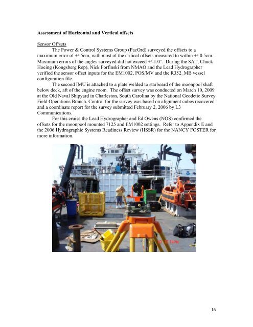
The second IMU is attached to a plate welded to starboard of the moonpool shaft<br />
below deck, aft of the engine room. The offset survey was conducted on March 10, 2009<br />
at the Old Naval Shipyard in Charleston, South Carolina by the National Geodetic Survey<br />
Field Operations Branch. Control <strong>for</strong> the survey was based on alignment cubes recovered<br />
<strong>and</strong> a coordinate report <strong>for</strong> the survey submitted February 2, 2006 by L3<br />
Communications.<br />
For this cruise the Lead Hydrographer <strong>and</strong> Ed Owens (NOS) confirmed the<br />
offsets <strong>for</strong> the moonpool mounted 7125 <strong>and</strong> EM1002 settings. Refer to Appendix E <strong>and</strong><br />
the 2006 Hydrographic Systems Readiness Review (HSSR) <strong>for</strong> the NANCY FOSTER <strong>for</strong><br />
more in<strong>for</strong>mation.<br />
16