Data Acquisition and Processing Report (DAPR) - Center for Coastal ...
Data Acquisition and Processing Report (DAPR) - Center for Coastal ...
Data Acquisition and Processing Report (DAPR) - Center for Coastal ...
You also want an ePaper? Increase the reach of your titles
YUMPU automatically turns print PDFs into web optimized ePapers that Google loves.
CRUISE INSTRUCTIONS: NOAA SHIP NANCY FOSTER<br />
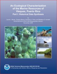
Cruise Title: Characterization of seafloor habitats of Vieques Puerto Rico<br />
Cruise Number NF-09-01-USVI<br />
Period of Cruise:<br />
DEP: 3/21/09<br />
ARR: 4/3/09<br />
Area of Operation: Vieques, Puerto Rico (See Figure 1)<br />
1.0 Scientific Objectives:<br />
The <strong>Center</strong> <strong>for</strong> <strong>Coastal</strong> Monitoring <strong>and</strong> Assessment (CCMA) will be conducting the sixth year of<br />
an ongoing scientific research mission onboard the NOAA ship Nancy Foster funded by NOAA’s<br />
Coral Reef Conservation Program. The purpose of the cruise will be to collect swath bathymetry<br />
<strong>and</strong> acoustical backscatter, as well as fishery acoustics data in high priority areas surrounding<br />
Vieques Isl<strong>and</strong>. Scientists will collect high resolution multibeam <strong>and</strong> acoustic fisheries data in<br />
mid-water depths approximately 10 to 100 meters so as to continue to characterize seafloor<br />
habitats within all U.S. States, Territories, <strong>and</strong> Commonwealths. The objective of this project is to<br />
collect a multibeam bathymetry dataset with 100% seafloor ensonification, along with multibeam<br />
backscatter suitable <strong>for</strong> seafloor characterization. Multibeam data will be collected to con<strong>for</strong>m to<br />
IHO Order 1 (100m) accuracy st<strong>and</strong>ards. The strategies developed <strong>for</strong><br />
each survey area will take into account the minimum depths, general bathymetry, <strong>and</strong> time<br />
allotment. The delineation <strong>and</strong> identification of seafloor habitats will be assisted by the use of a<br />
moderate-depth ROV <strong>and</strong> drop camera. The vehicle has video <strong>and</strong> frame camera capability to<br />
depths of 300 meters <strong>and</strong> will be used to point sampling within areas mapped during this mission.<br />
2.0 Schedule of Operations:<br />
2.1 Daily Schedule:<br />
Actual survey <strong>and</strong> ground truthing locations will be made available to the Operations Officer<br />
during the daily operations meeting. The following are estimates of locations.<br />
* Passive fisheries acoustics via the Kongsberg ES120-7C will occur during all shifts (MBES<br />
Survey <strong>and</strong> Groundtruthing).<br />
19 March (Thursday): Nancy Foster arrives in San Juan, Puerto Rico<br />
Survey NF: Survey install team arrives.<br />
GT: Ground Truthing (GT) install team arrives.<br />
20 March (Friday):<br />
Survey NF: Survey team installs survey gear, does a gear shake-down of multibeam unit <strong>and</strong><br />
survey planning. Install Reson 7125 <strong>and</strong> ES120-C (time TBD) to the moon pool using ship<br />
divers. Conduct dockside calibration tests.<br />
GT: Ground Truthing (GT) install team configures remaining camera gear <strong>and</strong> conducts USBL,<br />
POS/MV, GPS integration with Hypack; <strong>and</strong> installs hydrophone pole.<br />
All: Team scientists meeting to prepare <strong>for</strong> VIP/Education Day.<br />
115


