Summary - City of Gosnells
Summary - City of Gosnells
Summary - City of Gosnells
Create successful ePaper yourself
Turn your PDF publications into a flip-book with our unique Google optimized e-Paper software.
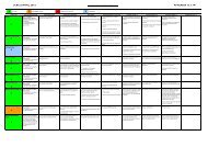
Wetlands Field Survey 92MKSEAPrecinctWetlandUFIDEC 2008bDEC 2008aProposed in thisSurveyComments2 (in BFS 387) 77862 (in BFS 387) 77872 (in BFS 387) 77882 (in BFS 387) 77892 (in BFS 387) 77972 77982 77992MKSEA StudySites 6 & 77800--141222 78052 (in BFS 387) 80282 (in BFS 387) 80302 (in BFS 387) 80312 (in BFS 387) 8032PalusplainCCWPalusplainCCWPalusplainCCWPalusplainCCWPalusplainCCWPalusplainMUWPalusplainMUWPalusplainREW--PalusplainREWPalusplainMUWSumplandCCWPalusplainMUWSumplandCCWSumplandCCWPalusplainCCWPalusplainCCWPalusplainCCWPalusplainCCWPalusplainCCWSumplandMUWPalusplainMUWPalusplain CCW--Floodplain/sumpland CCWSumpland MUWSumplandCCWPalusplainREWSumplandCCWSumplandCCWExcavated dams/ponds. Part <strong>of</strong> groundwater control area and buffer zone for BFS 387. Regulate land uses toavoid further modification and negative impact on surrounding less-modified palusplain (REW) and adjoiningCCWs, revegetate to promote groundwater recharge and provide fauna habitat.Part <strong>of</strong> groundwater control area and buffer zone for BFS 387. Regulate land uses to avoid further modificationand negative impact on surrounding less-modified palusplain (REW) and adjoining CCWs, revegetate topromote groundwater recharge and provide fauna habitat.Current flora survey showed very high conservation values over a large part <strong>of</strong> this block. Recommend thisblock be changed from REW to CCW over much <strong>of</strong> this block. The part <strong>of</strong> the area that is inundated in wintershould be changed to sumpland or floodplain.--Part <strong>of</strong> groundwater and surface water control area for BFS 387. Investigate hydrology <strong>of</strong> this area thatpreviously formed the headwaters <strong>of</strong> a creek that drained to BFS 387. Now this creek has been interrupted andconverted to a drain that crosses Brentwood Rd near Bickley Rd and proceeds to BFS 387 in the Wanaping Rdbushland.Part <strong>of</strong> this block is very degraded by excavations and is flooded in winter. Regulate land uses to avoid furthermodification and negative impact on adjoining CCW 7800. Revegetate to promote groundwater recharge andprovide fauna habitat.The vegetation is somewhat degraded but could regenerate well with some weed control. Regulate land uses toavoid further modification and negative impact on adjoining CCW, revegetate to promote groundwater rechargeand provide fauna habitat.Part <strong>of</strong> this area has been modified by importing fill and excavations. Regulate land uses to avoid furthermodification and negative impact on adjoining CCW, revegetate to promote groundwater recharge and providefauna habitat.Part <strong>of</strong> this area has been modified by grazing <strong>of</strong> horses. This is causing degradation <strong>of</strong> parts <strong>of</strong> the adjacent BFS387 vegetation and requires urgent regulation.Tauss, C. and Weston, A.S. (2010). The flora, vegetation and wetlands <strong>of</strong> the Maddington-Kenwick Strategic Employment Area.A survey <strong>of</strong> the rural lands in the vicinity <strong>of</strong> the Greater Brixton Street Wetlands. Report to the <strong>City</strong> <strong>of</strong> <strong>Gosnells</strong>, W.A. Version 18.04.10


