Summary - City of Gosnells
Summary - City of Gosnells
Summary - City of Gosnells
Create successful ePaper yourself
Turn your PDF publications into a flip-book with our unique Google optimized e-Paper software.
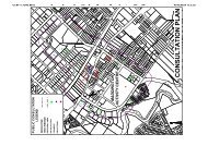
Introduction 11. IntroductionThe <strong>City</strong> <strong>of</strong> <strong>Gosnells</strong> is planning the subdivision and industrial development <strong>of</strong> an area in the north east <strong>of</strong> itsjurisdiction that is currently known (for planning purposes) as the Maddington Kenwick StrategicEmployment Area (MKSEA). The MKSEA comprises 585 ha <strong>of</strong> land currently zoned as rural. It is boundedby Bickley Rd in the south west, Roe Highway in the west and Tonkin Highway in the east and by the <strong>City</strong><strong>of</strong> <strong>Gosnells</strong> – <strong>City</strong> <strong>of</strong> Kalamunda boundary in the north-east (Figure 1).The MKSEA was first identified for future industrial development in Metroplan, the 1990 planning strategyfor the Perth metropolitan region (DPUD, 1990). Subsequent to Metroplan, an altered perspective <strong>of</strong> theMKSEA has developed from the rapid pace <strong>of</strong> environmental degradation worldwide, the enactment <strong>of</strong>Federal and State government environmental legislation and policies and changes in community attitudes toclimate change, the deterioration <strong>of</strong> water resources, and the resultant heightened awareness <strong>of</strong> the need toconserve wetlands and biodiversity. At the Federal level, the Australian Government Environment Protectionand Biodiversity Conservation Act (EPBC Act) was passed in 1999. A large body <strong>of</strong> scientific data <strong>of</strong> thebiodiversity values and the uniqueness <strong>of</strong> the Swan Coastal Plain (SCP) Bioregion and data <strong>of</strong> the easternside <strong>of</strong> the SCP (including Speck and Baird, 1984; Semeniuk, 1987; Keighery and Keighery,1991; Keigheryand Trudgen, 1992; Gibson et. al., 1994; Balla, 1994; Hill et al., 1996; IBRA, 2000 and many others) weredrawn together into various Western Australian Government conservation policies for bushlands and theprotection <strong>of</strong> SCP wetlands (Government <strong>of</strong> Western Australia, 2000; WRC, 2001; EPA, 2004a). Strongerrestrictions on native vegetation clearance (amendments made to the Western Australian EnvironmentalProtection Act in 2004) and more focused recommendations <strong>of</strong> the Swan Canning Water QualityImprovement Plan (Swan River Trust, 2009) have also contributed to changed attitudes and practices innatural resource planning and management.From consultation with relevant State Government Departments and preliminary technical reports for theMKSEA (GHD, 2005; Cardno BSD, 2005), the <strong>City</strong> <strong>of</strong> <strong>Gosnells</strong> identified some <strong>of</strong> the important planningissues pertinent to the MKSEA proposal (<strong>City</strong> <strong>of</strong> <strong>Gosnells</strong>, 2007a, 2007b, 2008). These issues included thepresence <strong>of</strong> highly significant conservation values and indigenous heritage values within, and adjacent to, theproject footprint; the interactions between the local and district water regimes; the interactions between thegroundwater and surface waters; the fragmented land ownership (with an excess <strong>of</strong> 200 landowners currentlyin the MKSEA, see Figure 2) and the potential delays and costs in providing the infrastructure to service theMKSEA. In 2005, the <strong>City</strong> <strong>of</strong> <strong>Gosnells</strong> engaged Cardno BSD to survey the flora, vegetation and wetlands <strong>of</strong>the MKSEA at a level “to provide a sufficient level <strong>of</strong> information to satisfy the development’s likely formalEnvironmental Impact Assessment by the EPA”. However, it became evident from the resultantenvironmental study and the engineering feasibility study conducted by GHD (2005) that the potential forindustrial development in the MKSEA (particularly between Coldwell Rd and Victoria Road) wassignificantly constrained. The constraints on the MKSEA development included the wetland nature <strong>of</strong> most<strong>of</strong> the land, the high conservation values found in and around the project footprint and the environmentprotection and the biodiversity conservation legislation and policies applicable to these values at both theState and Federal levels.In September 2007, the <strong>City</strong> <strong>of</strong> <strong>Gosnells</strong> commissioned the current flora, vegetation and wetlands survey <strong>of</strong>the MKSEA. A Level 2 detailed survey (as defined by the EPA, 2004b) was required for this survey because<strong>of</strong> the extent <strong>of</strong> the development proposal, the location <strong>of</strong> the proposal on the Eastern Swan Coastal Plain (aregion <strong>of</strong> very high stress on scarce and irreplaceable conservation values) and the potential environmentalimpacts <strong>of</strong> the development. Similarly, the wetlands survey was required to be conducted at a high level,according to the protocol <strong>of</strong> DEC (2007). The objectives <strong>of</strong> the current study, as indicated by the <strong>City</strong> <strong>of</strong><strong>Gosnells</strong>, were to further assess the potential for industrial development in the MKSEA and to provideadditional guidance to the <strong>City</strong> <strong>of</strong> <strong>Gosnells</strong> in the land use planning and approval processes (particularly inthe area between Yule Brook and Victoria Rd). The need to adopt a “total water cycle management”approach to the development <strong>of</strong> the MKSEA was a key element <strong>of</strong> the planning process expressed by the<strong>City</strong> <strong>of</strong> <strong>Gosnells</strong> in the brief for this survey.Tauss, C. and Weston, A.S. (2010). The flora, vegetation and wetlands <strong>of</strong> the Maddington-Kenwick Strategic Employment Area.A survey <strong>of</strong> the rural lands in the vicinity <strong>of</strong> the Greater Brixton Street Wetlands. Report to the <strong>City</strong> <strong>of</strong> <strong>Gosnells</strong>, W.A. Version 18.04.10


