WRIA 30 - Klickitat County Home
WRIA 30 - Klickitat County Home
WRIA 30 - Klickitat County Home

Create successful ePaper yourself
Turn your PDF publications into a flip-book with our unique Google optimized e-Paper software.
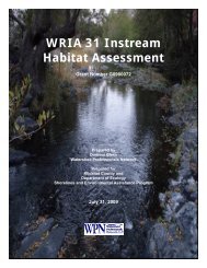
<strong>Klickitat</strong> River BasinWatershed Management Plan2.0 EXISTING CONDITIONSThis section summarizes existing conditions in <strong>WRIA</strong> <strong>30</strong>, including water rights, use, allocation,and demand; surface and ground water resources; surface and ground water quality, and fishhabitat. This section provides basic background information summarized from the <strong>WRIA</strong> <strong>30</strong>Watershed Assessment (Watershed Professionals Network (WPN) and Aspect, 2005). Thereader is referred to the <strong>WRIA</strong> <strong>30</strong> Watershed Assessment for more detailed informationregarding the subjects covered in this section, including references and citations supporting theinformation and methods used to develop the assessment.2.1 PHYSICAL SETTING<strong>WRIA</strong> <strong>30</strong> is located in <strong>Klickitat</strong> and Yakima Counties in south central Washington. The primaryrivers in the <strong>WRIA</strong> are the <strong>Klickitat</strong> River and the Columbia River. The headwaters of the<strong>Klickitat</strong> River drain from Mount Adams and the eastern flanks of the Cascade Mountains. Theprimary tributary to the lower <strong>Klickitat</strong> River is the Little <strong>Klickitat</strong> River, which drains theSimcoe Mountains located to the east of the mainstem <strong>Klickitat</strong> River.For the purposes of the watershed assessment, <strong>WRIA</strong> <strong>30</strong> was subdivided into six subbasins(Figure 2). These include the Upper <strong>Klickitat</strong>, the Middle <strong>Klickitat</strong>, the Lower <strong>Klickitat</strong>, theLittle <strong>Klickitat</strong>, Swale, and Columbia Tributaries Subbasins. Most of the subbasins incorporateone or more major tributaries as well as some of the smaller side tributaries that drain to the<strong>Klickitat</strong> River; however, the subbasin designated as “Columbia Tributaries” encompassesseveral very small tributaries, all of which drain directly to the Columbia River. Most of theUpper Subbasin and the eastern half of the Middle <strong>Klickitat</strong> Subbasin are within the YakamaIndian Reservation, which were nominally addressed in the assessment.Elevation in the <strong>WRIA</strong> ranges from 75 feet at the Columbia River to 12,296 feet at the crest ofMount Adams (Table 1). The Upper <strong>Klickitat</strong> Subbasin contains many areas of high topographicrelief, particularly near Mt. Adams. Many of the headwater areas of the Little <strong>Klickitat</strong> River arealso relatively steep. The remainder of <strong>WRIA</strong> <strong>30</strong> consists primarily of low rolling hills with theexception of areas where water features have dissected the underlying bedrock creating steepcanyon areas. Such canyons can be found in the lower reaches of the Little <strong>Klickitat</strong> River, thelower <strong>Klickitat</strong> River Subbasin, the lower portion of Swale Creek, near the mouths of most of thetributaries to the <strong>Klickitat</strong> and Little <strong>Klickitat</strong> Rivers, and in the smaller tributaries along theColumbia River.Precipitation is highly variable in the <strong>WRIA</strong>. Mean annual precipitation generally increases withelevation and from east to west. Mean annual precipitation is as little as nine inches per year inthe eastern end of the Columbia Tributaries Subbasin and as high as 105 inches per year onMount Adams in the Upper <strong>Klickitat</strong> Subbasin (Figure 3).Existing Conditions 11 May 3, 2005