Montco. Law Reporter; Vol. 144; Issue 50 - Montgomery Bar ...
Montco. Law Reporter; Vol. 144; Issue 50 - Montgomery Bar ...
Montco. Law Reporter; Vol. 144; Issue 50 - Montgomery Bar ...
Create successful ePaper yourself
Turn your PDF publications into a flip-book with our unique Google optimized e-Paper software.
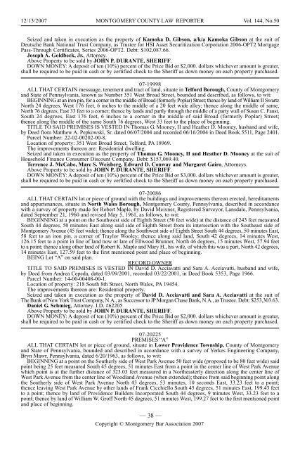
12/13/2007 MONTGOMERY COUNTY LAW REPORTER <strong>Vol</strong>. <strong>144</strong>, No.<strong>50</strong><br />
Seized and taken in execution as the property of Kamoka D. Gibson, a/k/a Kamoka Gibson at the suit of<br />
Deutsche Bank National Trust Company, as Trustee for HSI Asset Securitization Corporation 2006-OPT2 Mortgage<br />
Pass-Through Certificates, Series 2006-OPT2. Debt: $102,087.66.<br />
Joseph A. Goldbeck, Jr., Attorney.<br />
Above Property to be sold by JOHN P. DURANTE, SHERIFF.<br />
DOWN MONEY: A deposit of ten (10%) percent of the Price Bid or $2,000. dollars whichever amount is greater,<br />
shall be required to be paid in cash or by certified check to the Sheriff as down money on each property purchased.<br />
07-19998<br />
ALL THAT CERTAIN messuage, tenement and tract of land, situate in Telford Borough, County of <strong>Montgomery</strong><br />
and State of Pennsylvania, known as Number 351 West Broad Street, bounded and described, as follows, to wit:<br />
BEGINNING at an iron pin, for a corner in the middle of Broad (formerly Poplar) Street; thence by land of William II Swartz<br />
North 24 degrees, West 176 feet, 6 inches to the middle of a 20 feet wide alley; thence along the middle of same,<br />
North 76 degrees, East 33 feet to a corner; thence by lands and partly through the middle of a party wall of Susan C. Faust,<br />
South 24 degrees, East 176 feet, 6 inches to a corner in the middle of said Broad (formerly Poplar) Street;<br />
thence along the middle of the same South 76 degrees, West 33 feet to the place of beginning.<br />
TITLE TO SAID PREMISES IS VESTED IN Thomas G. Mooney, II and Heather D. Mooney, husband and wife,<br />
by Deed from Matthew A. Pepkowski, Sr. dated 06/07/2004 and recorded 06/16/2004 in Deed Book 5511, Page 2401.<br />
Parcel Number: 22-02-00202-00-8.<br />
Location of property: 351 West Broad Street, Telford, PA 18969.<br />
The improvements thereon are: Residential dwelling.<br />
Seized and taken in execution as the property of Thomas G. Mooney, II and Heather D. Mooney at the suit of<br />
Household Finance Consumer Discount Company. Debt: $157,069.40.<br />
Terrence J. McCabe, Marc S. Weisberg, Edward D. Conway and Margaret Gairo, Attorneys.<br />
Above Property to be sold by JOHN P. DURANTE, SHERIFF.<br />
DOWN MONEY: A deposit of ten (10%) percent of the Price Bid or $3,000. dollars whichever amount is greater,<br />
shall be required to be paid in cash or by certified check to the Sheriff as down money on each property purchased.<br />
07-20086<br />
ALL THAT CERTAIN lot or piece of ground with the buildings and improvements thereon erected, hereditaments<br />
and appurtenances, situate in North Wales Borough, <strong>Montgomery</strong> County, Pennsylvania, described in accordance<br />
with a survey of property made for Robert Maple, by David Meixner, Registered Surveyor, Lansdale, Pennsylvania,<br />
dated September 21, 1960 and revised May 5, 1961, as follows, to wit:<br />
BEGINNING at a point on the Southwest side of Eighth Street (<strong>50</strong> feet wide) at the distance of 243 feet measured<br />
South 44 degrees, <strong>50</strong> minutes East along said side of Eighth Street from its intersection with the Southeast side of<br />
<strong>Montgomery</strong> Avenue (45 feet wide); thence along the Southwest side of Eighth Street South 44 degrees, <strong>50</strong> minutes East,<br />
58 feet to an iron pin, a corner of Traylor Wooley; thence along said land, South 42 degrees, 14 minutes West,<br />
126.15 feet to a point in line of land now or late of Ellwood Brunner, North 46 degrees, 15 minutes West, 57.94 feet<br />
to a point; thence along other land of Robert K. Maple and Mary H., his wife, of which this was a part, North 42 degrees,<br />
14 minutes East, 127.59 feet to the first mentioned point and place of beginning.<br />
BEING Lot “A’’ on said plan.<br />
RECORD OWNER<br />
TITLE TO SAID PREMISES IS VESTED IN David D. Acciavatti and Sara A. Acciavatti, husband and wife,<br />
by Deed from Andrea Cepeda, dated 03/09/2001, recorded 03/22/2001, in Deed Book 5353, Page 1966.<br />
Parcel Number: 14-00-00408-00-1.<br />
Location of property: 218 South 8th Street, North Wales, PA 19454.<br />
The improvements thereon are: Residential property.<br />
Seized and taken in execution as the property of David D. Acciavatti and Sara A. Acciavatti at the suit of<br />
The Bank of New York Trust Company, N.A., as Successor to JP Morgan Chase Bank, N.A., as Trustee. Debt: $253,303.63.<br />
Daniel G. Schmieg, Attorney. I.D. #62205<br />
Above Property to be sold by JOHN P. DURANTE, SHERIFF.<br />
DOWN MONEY: A deposit of ten (10%) percent of the Price Bid or $2,000. dollars whichever amount is greater,<br />
shall be required to be paid in cash or by certified check to the Sheriff as down money on each property purchased.<br />
07-20225<br />
PREMISES “A’’<br />
ALL THAT CERTAIN lot or piece of ground, situate in Lower Providence Township, County of <strong>Montgomery</strong><br />
and State of Pennsylvania, bounded and described in accordance with a survey of Yerkes Engineering Company,<br />
Bryn Mawr, Pennsylvania, dated 6/20/1963, as follows, to wit:<br />
BEGINNING at a point on the Southerly side of West Park Avenue <strong>50</strong> feet wide (proposed to be 80 feet wide) said<br />
point being 25 feet measured South 45 degrees, 51 minutes East from a point in the center line of West Park Avenue<br />
which point is at the further distance of 323.03 feet measured in a Northeasterly direction along the center line of<br />
West Park Avenue from the center line of Woodland Avenue (when extended); thence from said beginning point along<br />
the Southerly side of West Park Avenue North 43 degrees, 53 minutes, 10 seconds East, 33.23 feet to a point;<br />
thence leaving West Park Avenue by other lands of Frank Cicchiello South 45 degrees, 51 minutes East, 199.43 feet<br />
to a point; thence by land of Providence Builders Incorporated South 44 degrees, 9 minutes West, 33.23 feet to a<br />
point; thence by land of William W. Groff North 45 degrees, 51 minutes West, 199.27 feet to the first mentioned point<br />
and place of beginning.<br />
— 38 —<br />
Copyright © <strong>Montgomery</strong> <strong>Bar</strong> Association 2007


