
Create successful ePaper yourself
Turn your PDF publications into a flip-book with our unique Google optimized e-Paper software.
Wednesday <strong>June</strong> 1 2<strong>01</strong>6<br />
BAY HARBOUR<br />
PAGE 7<br />
Solvejg Ruarus responds<br />
to National MP Nuk<br />
Korako’s column about<br />
cleaning up the city’s<br />
waterways:<br />
I am shocked by the so positive<br />
sounding words from Nuk<br />
Korako. If only it were true!<br />
The reality is that the Government<br />
is by no means doing<br />
enough!<br />
Readers respond to<br />
Richard Suggate’s Soap<br />
Box column about the<br />
Diamond <strong>Harbour</strong> Ferry:<br />
Mark Watson, of Diamond<br />
<strong>Harbour</strong>:<br />
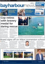
You ask if the ferry service<br />
links well with the buses.<br />
For the last 10 years I’ve<br />
lived in Diamond <strong>Harbour</strong>,<br />
Previously<br />
United Travel<br />
and commuted to my work in<br />
Sydenham, which is about five<br />
minutes walk from a bus stop<br />
on Brougham St.<br />
Most days I use the ferry<br />
and bus. The ferry takes seven<br />
minutes from the Diamond<br />
<strong>Harbour</strong> Wharf to B Jetty in<br />
Lyttelton. From the time I step<br />
on shore in Lyttelton, it takes<br />
me 40-50 minutes to get to work<br />
using the bus. The 11km journey<br />
averages at 15km/h. If I catch a<br />
ride with someone who has left<br />
their car in Lyttelton<br />
overnight, it takes me 15-20<br />
minutes to get to work. That’s an<br />
average speed of about<br />
40km/h. The trip into work is<br />
the easy part of bus commuting.<br />
On the way home, if I want<br />
to guarantee to catch say the<br />
5.20pm ferry, I need to leave<br />
work at 4.20pm. That’s an average<br />
speed of 11km/h, about what<br />
a horse and carriage would do.<br />
If I leave a few minutes later<br />
there’s a good chance I’ll miss<br />
the 5.20 ferry, and I’ll have to<br />
wait for the 5.50 ferry. That’s<br />
an 80min trip, and an average<br />
speed of 8km/h.<br />
If I had a car at work that<br />
homeward trip to the Lyttelton<br />
ferry would take 15-20 minutes.<br />
If I could bike through the tunnel,<br />
I could bike the distance<br />
comfortably in less than 40<br />
minutes. I use the bus because<br />
it’s less damaging to the planet<br />
than taking a car. And I have<br />
patience. Does that answer your<br />
question?<br />
Karen Clarke:<br />
It should be left for connection<br />
to town for all the commuters<br />
who can’t walk so well.<br />
Planning for rising seas<br />
Green MP Eugenie Sage<br />
says we need to plan for sea<br />
level rise<br />
Knowing the extent of a<br />
problem is often the first step in<br />
tackling it. We know that climate<br />
change is happening and that<br />
sea level is rising - at the rate of<br />
3mm annually over last 15 years<br />
around Christchurch.<br />
How rapidly sea level will rise,<br />
how it will affect different<br />
coastal areas and<br />
how we should best<br />
prepare for it are much<br />
less certain.<br />
A 2<strong>01</strong>5 report by<br />
Parliamentary Commissioner<br />
for the Environment<br />
says there<br />
are 10,000 homes in<br />
Christchurch which are low-lying<br />
and close to the coast and vulnerable<br />
to sea level rise, more homes<br />
than in Auckland, Wellington or<br />
Dunedin.<br />
The city council has been<br />
thinking ahead, with research to<br />
identify areas of future coastal<br />
erosion and inundation over the<br />
next 50 years and 100 years, for<br />
both the city and Banks Peninsula.<br />
Based on extensive international<br />
science, the 2<strong>01</strong>5 Tonkin<br />
and Taylor technical report said<br />
it was reasonable to plan for a sea<br />
level rise of 1-2 metres by 2100,<br />
depending on the melting rate<br />
of the Antarctic and Greenland<br />
ice-sheets.<br />
The report has been controversial<br />
because of the potential<br />
effects on property values for<br />
landowners whose homes and<br />
properties were identified as being<br />
in coastal hazard zones.<br />
For example, the report showed<br />
parts of Sumner, including homes<br />
on the Esplanade as being at risk<br />
of coastal flooding, and the rock<br />
work and seawall at<br />
Scarborough Beach as<br />
at risk of over topping<br />
by the sea in storm<br />
surge events.<br />
Identifying areas of<br />
coastal hazard is the<br />
first step. For this and<br />
the next step – planning<br />
how we respond<br />
– Christchurch and other councils<br />
need better guidance and<br />
support from central government.<br />
The most recent Government<br />
guidance on sea level rise is from<br />
2008. Our understanding has<br />
changed a lot since then.<br />
We need guidance on the<br />
parameters for assessing coastal<br />
hazards, a national database of<br />
LiDAR elevation data, and funding<br />
for national coastal monitoring<br />
systems.<br />
We also need a wider community<br />
conversation about how<br />
to share the cost in any areas that<br />
we decide we may need to retreat<br />
from because the costs of coastal<br />
defence are too high.<br />
YOU Travel Ferrymead<br />
melissa@youferrymead.co.nz<br />
Unit 5, 960 Ferry Road<br />
+64 3 384 2700