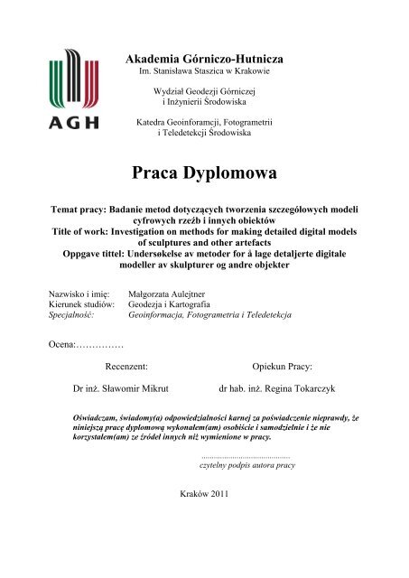
Praca Dyplomowa - Photogrammetry and Remote Sensing - AGH
Praca Dyplomowa - Photogrammetry and Remote Sensing - AGH
Praca Dyplomowa - Photogrammetry and Remote Sensing - AGH

You also want an ePaper? Increase the reach of your titles
YUMPU automatically turns print PDFs into web optimized ePapers that Google loves.
<strong>Praca</strong> <strong>Dyplomowa</strong><br />
Temat pracy: Badanie metod dotyczących tworzenia szczegółowych modeli<br />
cyfrowych rzeźb i innych obiektów<br />
Title of work: Investigation on methods for making detailed digital models<br />
of sculptures <strong>and</strong> other artefacts<br />
Oppgave tittel: Undersøkelse av metoder for å lage detaljerte digitale<br />
modeller av skulpturer og <strong>and</strong>re objekter<br />
Nazwisko i imię: Małgorzata Aulejtner<br />
Kierunek studiów: Geodezja i Kartografia<br />
Specjalność: Geoinformacja, Fotogrametria i Teledetekcja<br />
Ocena:……………<br />
Akademia Górniczo-Hutnicza<br />
Im. Stanisława Staszica w Krakowie<br />
Wydział Geodezji Górniczej<br />
i Inżynierii Środowiska<br />
Katedra Geoinforamcji, Fotogrametrii<br />
i Teledetekcji Środowiska<br />
Recenzent: Opiekun Pracy:<br />
Dr inż. Sławomir Mikrut dr hab. inż. Regina Tokarczyk<br />
Oświadczam, świadomy(a) odpowiedzialności karnej za poświadczenie nieprawdy, że<br />
niniejszą pracę dyplomową wykonałem(am) osobiście i samodzielnie i że nie<br />
korzystałem(am) ze źródeł innych niż wymienione w pracy.<br />
...........................................<br />
czytelny podpis autora pracy<br />
Kraków 2011
Streszczenie pracy :<br />
Różnego rodzaju rzeźby i inne artefakty dorobku kulturalnego są narażone na zniszczenia,<br />
które czasem trudno uniknąć. Tworzy się więc nowe repliki tych obiektów w celu ochrony<br />
tego dziedzictwa. Aby uniknąć dodatkowych zniszczeń w czasie wykonywania tych kopii,<br />
odchodzi się od dawnych metod – wykonywanych metodą odlewów. Stosuje się więc tutaj<br />
metody jak trójwymiarowe skanowanie za pomocą skanera lub metody fotogrametryczne, w<br />
których nie trzeba dotykać w żaden sposób obiektu dzięki czemu ewentualne zniszczenia są<br />
minimalizowane. Trójwymiarowe digitalne modele utrzymane z nowszych metod mogą być<br />
użyte następnie do utworzenia realnej repliki przy zastosowaniu specjalistycznych drukarek<br />
trójwymiarowych, które “wyrzeżbią” dany obiekt.<br />
Celem tej pracy było badanie bezdotykowych, nowszych metod tworzenia szczegółowych<br />
modeli 3D na przykładzie rzeźby z katedry Nidaros w Trondheim (Norwegia). Głównym<br />
priorytetem było uzyskanie jak najbardziej dokładnego modelu, przede wszystkim aby<br />
uzyskać jak najwięcej szczegółów. W pracy mieści się więc porównanie metod<br />
fotogrametrycznych, skaningu a także narzędzi do modelowania 3D.<br />
Do uzyskania modelu z dużą ilością małych szczegółów rzeźby użytej w projekcie potrzebna<br />
jest duża chmura punktów. Trzeba zwrócić uwagę, iż rzeźba nie była płaska, a dość okrągła,<br />
złożona z różnych powierzchni z wieloma małymi obiektami. Uzyskana chmura punktów<br />
powinna być więc tutaj bardzo dokładna z wysoką rozdzielczością. Nie mniej jednak, takie<br />
parametry powodują iż niemalże każdy program potrzebuje dość dużo czasu aby obliczyć tak<br />
dużo danych, czy to z metody fotogrametrycznej czy też skaningu. Głównie nie jest to jednak<br />
spowodowane słabymi parametrami używanego komputera, ale ograniczeniami programów.<br />
Na rynku dostępne są różne skanery, są jednak i takie które potrafią uzyskać bardzo gęstą<br />
chmurę punktów a dużą dokładnością. Zazwyczaj, jeżeli skaner jest stworzony do skanowania<br />
mały obiektów z bliska a rozdzielczość i dokładność rośnie, są one coraz mniejsze w<br />
rozmiarze. Im większa dokładność tym mniejszy zasięg również, tak więc dla mniejszych<br />
obiektów – mniejsza odległość skanowania jest zalecana. Metody fotogrametryczne również<br />
mogą dać dobre wyniki i dobrą rozdzielczość, jednak tylko w momencie gdy materiał<br />
fotografowanego obiektu nie świeci się, nie odbija światła ani nie jest ze szkła.<br />
W projekcie zostały wykorzystane następujące fotogrametryczne programy: PhotoModeler<br />
Scanner i Topcon ImageMaster. Są to dość podobne programy, gdzie obydwa potrafią<br />
stworzyć powierzchnie trójwymiarowe używając do tego zdjęć zrobionych kamerą<br />
niemetryczną. Obydwie firmy zapewniają również kalibrację takiej kamery. Resultat z tych<br />
programów jest dość dobry, jednak powierzchnia rzeźby świeciła się nieco i było widać<br />
refleksy, odbicie światła w niektórych miejscach na zdjęciu, przez co matching i generacja<br />
punktów 3D nie działała w tym wypadku najlepiej. Powyższe problemy resultowały na<br />
modelu w ten sposób, iż widoczny był szum, źle obliczone punkty – odstrzelone od modelu.<br />
Ponadto, czas potrzebny do obliczenia i wygenerowania DSM był dość długi i to przede<br />
wszystkim powinno zostać wzięte pod uwagę przy dalszym ulepszaniu programów.<br />
Oprócz wymienionych programów, aplikacja Autodesk – Project Photofly 2.0 była również<br />
testowana. Program jest w stanie wygenerować teksturowany mesh – powierzchnię TIN 3D.<br />
Jest to program freewere, dostępny na stronie Autodesk do ściągnięcia i jest bardzo łatwy w<br />
obsłudze – użytkownicy bez znajomości fotogrametrii będą w stanie bez problemu wykonać<br />
model. Jednakże, program nie jest w stanie wykonać tak dokładnego modelu jak wspomniane<br />
ii
wcześniej aplikacje. Nie mniej jednak, w wielu sytuacjach może to wystarczyć i dać dużo<br />
możliwości.<br />
Ze skaningu w projekcie został użyty skaner Konica Minolta VI-910, ale także bardzo<br />
ciekawy, mały, przenośny skaner Artec MHT 3D. Obydwa skanery mają dość krótki zasięg,<br />
Artec ma jednak mniejszy. Artec używa światła żarówki zamiast lasera jak Konica Minolta.<br />
Artec również wydaje się być lepszy w zastosowaniu do mniejszych obiektów, charakteryzuje<br />
się też lepszą dokładnością i rozdzielczością. Używając tych skanerów, programy które daje<br />
producent zostały użyte do pozyskania danych 3D. Jednakże, na rynku jest też dostępny<br />
program jak Geomagic, który może zostać użyty do post-processingu, do pracy na surowej<br />
chmurze punktów pozyskanej czy to z fotogrametrii czy też skaninngu. Polygon Editing Tool<br />
od Konici Minolty wydaje się nie działać najlepiej z nowym Windowsem 7 wersji 64-bitowej,<br />
jednak program od Artec jest w stanie wykorzystać komputer znacznie lepiej – można ustawić<br />
ilość rdzeniów procesora do obliczeń.<br />
Najlepszy model został osiągnięty przy użyciu skanera Artec MHT, który potrafi pozyskać<br />
dane z rozdzielczością do 0,5mm i dokładnością aż do 0,1mm. Jeżeli chodzi o końcowy<br />
model uzyskany w programie Artec, jest on dość dobry. Jednak, zdaniem autora, program<br />
Geomagic spisał się lepiej, gdzie jest więcej kontroli nad manipulacją modelu. Wygładzanie<br />
może tu zostać zastosowane z “uwzględnieniem krzywych”, gdzie model przy tych krzywych<br />
nie jest aż tak bardzo wygładzany i potrzebne linie – ostre krawędzie zostaną lepiej widoczne<br />
na modelu.<br />
Ostateczny model jest wyeksportowany w pliku 3D PDF a także w innych dodatkowych<br />
plikach, które można obejrzeć na komputerze.<br />
iii
Summary:<br />
Sculptures <strong>and</strong> other artifacts are exposed to damages <strong>and</strong> it is hard to avoid them. For<br />
cultural heritage preservation new replicas of these objects should be done. For this purpose<br />
the best solution is to use non-touching methods, like photogrammetry <strong>and</strong> three-dimensional<br />
scanning, which will not do any harm to the object. Then 3D digital model may be used <strong>and</strong><br />
by applying of 3D printers the real copy may be done<br />
The purpose of the report was to investigate methods on making detailed digital models on<br />
example of a sculpture from Nidaros Cathedral. The goal was to get as accurate – detailed<br />
model as possible. There is comparison on photogrammetric, 3D scanning methods <strong>and</strong><br />
available 3D modelling tools.<br />
To make a very detailed digital model of round, complex, <strong>and</strong> small objects – very big point<br />
cloud is needed. The point cloud has to be accurate with high resolution. To make such a<br />
point cloud from images any software needs a lot of time for computation. Also, computation<br />
of big amount of points in the data from scanning takes a lot of time. This is not because of<br />
low PC, but because of software limitations. Some scanners are able to make more dense<br />
point cloud with better accuracy than others. With higher resolution <strong>and</strong> better accuracy<br />
scanners become smaller, <strong>and</strong> also distance range is decreasing. Though, for small object<br />
smaller distance is required. <strong>Photogrammetry</strong> may produce also very good results, if only the<br />
material is non-reflective/shiny, or glass.<br />
In the project photogrammetric software has been used, such as PhotoModeler Scanner <strong>and</strong><br />
Topcon ImageMaster, where both are able to create 3D surface from photographs, taken by<br />
non-metric camera. Both softwares provide camera calibration. The results at the end were<br />
quite good, but the sculpture is quite shiny <strong>and</strong> reflects the light, <strong>and</strong> this situation is not<br />
required for image matching <strong>and</strong> creating 3D points. Therefore, the model results with a lot of<br />
noise. Also, the time needed for DSM creating was very long <strong>and</strong> this part still needs some<br />
improvement. Free software from Autodesk – Project Photofly 2.0 was also tested. The<br />
application creates mesh <strong>and</strong> may be used by non-experienced users. Nevertheless, the results<br />
are not so accurate or the resolution is lower, it still may be used in most common situations.<br />
From laser scanning, Konica Minolta VI-910 was used for data acquisition, but also very<br />
interesting h<strong>and</strong>held small scanner from Artec was used. Both are created for small range<br />
distances; nevertheless Artec MHT seems to be better for smaller objects. It has better<br />
accuracy <strong>and</strong> higher resolution. In both cases, softwares recommended by the companies were<br />
used for modelling. Geomagic software was also used for post processing afterwards. Polygon<br />
Editing Tool from Konica Minolta seemed not working properly with new Windows 7 x64<br />
bits, but Artec was even able to use most of the processors cores for computations.<br />
The best model was achieved by applying small structured scanner from Artec with 0,5mm of<br />
resolution <strong>and</strong> accuracy up to 0,1mm. The model created using Artec software works good,<br />
but in the author‟s opinion Geomagic software works better, where smoothing may be done in<br />
the respect to curves.<br />
The final model is exported in 3D PDF file <strong>and</strong> other additional files<br />
iv
NORWEGIAN UNIVERSITY OF SCIENCE AND TECHNOLOGY<br />
DEPARTMENT OF CIVIL AND TRANSPORT ENGINEERING<br />
Report Title:<br />
Investigation on methods for making detailed digital models<br />
of sculptures <strong>and</strong> other artefacts<br />
Undersøkelse av metoder for å lage detaljerte digitale<br />
modeller av skulpturer og <strong>and</strong>re objekter<br />
Badanie metod dotyczących tworzenia szczegółowych<br />
modeli cyfrowych rzeźb i innych obiektów<br />
Name:<br />
Professor in charge/supervisor:<br />
Other external professional contacts/supervisors:<br />
Date: 25.07.2011<br />
Number of pages (incl.<br />
appendices): 90<br />
Master Project Work<br />
Thesis X<br />
Małgorzata Aulejtner<br />
Professor Knut Ragnar Holm<br />
Ph.D. Regina Tokarczyk<br />
Abstract:<br />
Digital modelling of real objects, like sculptures for cultural heritage preservation became a<br />
modern non-touching method. New methods are being developed. There are already existing<br />
methods like photogrammetry <strong>and</strong> relatively newer three-dimensional scanning. In this work<br />
comparison of these methods in connection with the software has been done. The main goal was<br />
to get detailed a model, which would represents the object as real one as best as possible. The<br />
model here is needed to make a real replica afterwards, by applying three-dimensional printer.<br />
The main limitation of the examinations was time period. Dada acquisition was not a problem,<br />
however the amount of data, <strong>and</strong> amount of generated point clouds itself was sometimes<br />
problematic. There were also some limitations of software – every computational step was taking<br />
too much time. Even though the used computer was very fast, the older software was not able to<br />
take full advantage of the hardware. It was also hard to set a proper time index to the quality of<br />
details. The best model was needed, the high resolution was required, what affects that time for<br />
processing increases. It was especially visible when it comes to the photogrammetric part,<br />
because the scanning method was more user-friendly. Geomagic software was also used for<br />
processing the point clouds. All results are compared, <strong>and</strong> the best model was made by using<br />
Artec MHT 3D Scanner in connection with Geomagic Qualify software. The scanner is capable<br />
to acquire data with 0,5mm resolution with 0,1mm accuracy. <strong>Photogrammetry</strong> methods may also<br />
give good results, though in this case, as the material of the sculpture was reflecting the light, it<br />
did not. The model resulted with big amount of noise.<br />
The final model is exported in 3D PDF file <strong>and</strong> other additional files.<br />
Keywords:<br />
1. <strong>Photogrammetry</strong><br />
2. Camera Calibration<br />
3. Three-dimensional scanning<br />
4. Three-dimensional digital modelling<br />
5. Visualisation<br />
6. Comparison<br />
_________________________________________<br />
(Signature)
iii
PREFACE AND ACKNOWLEDGMENTS<br />
This master thesis has been written for The Restoration Workshop of Nidaros Cathedral<br />
(Trondheim) request. I had opportunity to investigate various methods <strong>and</strong> instruments for<br />
three-dimensional modelling, where replica of a sculpture from the Cathedral was object for<br />
tests. I was able to work <strong>and</strong> test available instruments <strong>and</strong> software at the NTNU – The<br />
Norwegian University of Science <strong>and</strong> Technology in Trondheim, Norway. During the year as<br />
exchange student from <strong>AGH</strong> – The University of Science <strong>and</strong> Technology in Kraków, Pol<strong>and</strong>,<br />
I had participated in a few measurement projects, which were based on digital<br />
photogrammetric <strong>and</strong> scanning methods.<br />
Thanks to Kristin Bjørlykke, working at The Restoration Workshop of Nidaros Cathedral, for<br />
borrowing the replica (sculpture of Archbishop) from the Cathedral to work on it. I got<br />
helpful information about the problems, which they had met before <strong>and</strong> historical background<br />
about the Archbishop itself.<br />
I am also very grateful to Odd Erik Mjørlund, manager in Geoplan 3D - company in Oslo, for<br />
giving introduction <strong>and</strong> opportunity to test Artec MHT 3D Scanner.<br />
I would like to express my gratitude to Ph.D. Regina Tokarczyk, working at <strong>AGH</strong> at the<br />
Department of Geoinformation, <strong>Photogrammetry</strong> <strong>and</strong> <strong>Remote</strong> <strong>Sensing</strong> of Environment for<br />
supervising the thesis in Pol<strong>and</strong>, while I was studying abroad.<br />
Since the beginning of this thesis, there has been a continuous communication with Professor<br />
Knut Ragnar Holm, working at NTNU, at the Department of Civil <strong>and</strong> Transport Engineering,<br />
to whom I would like to express my grateful acknowledgments. I am thankful for contacts to<br />
people who were helpful to try more methods.<br />
v
SUMMARY<br />
Sculptures <strong>and</strong> other artifacts are exposed to damages <strong>and</strong> it is hard to avoid them. For<br />
cultural heritage preservation new replicas of these objects should be done. For this purpose<br />
the best solution is to use non-touching methods, like photogrammetry <strong>and</strong> three-dimensional<br />
scanning, which will not do any harm to the object. Then 3D digital model may be used <strong>and</strong><br />
by applying of 3D printers the real copy may be done<br />
The purpose of the report was to investigate methods on making detailed digital models on<br />
example of a sculpture from Nidaros Cathedral. The goal was to get as accurate – detailed<br />
model as possible. There is comparison on photogrammetric, 3D scanning methods <strong>and</strong><br />
available 3D modelling tools.<br />
To make a very detailed digital model of round, complex, <strong>and</strong> small objects – very big point<br />
cloud is needed. The point cloud has to be accurate with high resolution. To make such a<br />
point cloud from images any software needs a lot of time for computation. Also, computation<br />
of big amount of points in the data from scanning takes a lot of time. This is not because of<br />
low PC, but because of software limitations. Some scanners are able to make more dense<br />
point cloud with better accuracy than others. With higher resolution <strong>and</strong> better accuracy<br />
scanners become smaller, <strong>and</strong> also distance range is decreasing. Though, for small object<br />
smaller distance is required. <strong>Photogrammetry</strong> may produce also very good results, if only the<br />
material is non-reflective/shiny, or glass.<br />
In the project photogrammetric software has been used, such as PhotoModeler Scanner <strong>and</strong><br />
Topcon ImageMaster, where both are able to create 3D surface from photographs, taken by<br />
non-metric camera. Both softwares provide camera calibration. The results at the end were<br />
quite good, but the sculpture is quite shiny <strong>and</strong> reflects the light, <strong>and</strong> this situation is not<br />
required for image matching <strong>and</strong> creating 3D points. Therefore, the model results with a lot of<br />
noise. Also, the time needed for DSM creating was very long <strong>and</strong> this part still needs some<br />
improvement. Free software from Autodesk – Project Photofly 2.0 was also tested. The<br />
application creates mesh <strong>and</strong> may be used by non-experienced users. Nevertheless, the results<br />
are not so accurate or the resolution is lower, it still may be used in most common situations.<br />
From laser scanning, Konica Minolta VI-910 was used for data acquisition, but also very<br />
interesting h<strong>and</strong>held small scanner from Artec was used. Both are created for small range<br />
distances; nevertheless Artec seems to be better for smaller objects. It has better accuracy <strong>and</strong><br />
higher resolution. In both cases, softwares recommended by the companies were used for<br />
modelling. Geomagic software was also used for post processing afterwards. Polygon Editing<br />
Tool from Konica Minolta seemed not working properly with new Windows 7 x64 bits, but<br />
Artec was even able to use most of the processors cores for computations.<br />
The best model was achieved by applying small structured scanner from Artec with 0,5mm of<br />
resolution <strong>and</strong> accuracy up to 0,1mm. The model created using Artec software works good,<br />
but in the author‟s opinion Geomagic software works better, where smoothing may be done in<br />
the respect to curves.<br />
vi
TABLE OF CONTENTS<br />
1 INTRODUCTION .............................................................................................................. 1<br />
1.1 Project background ...................................................................................................... 1<br />
1.2 Cathedral <strong>and</strong> sculpture background information ....................................................... 1<br />
1.3 Three-dimensional printers .......................................................................................... 4<br />
1.4 Structure of the report .................................................................................................. 5<br />
2 THEORETICAL BACKGROUND .................................................................................... 6<br />
2.1 Review of similar projects ........................................................................................... 6<br />
2.2 <strong>Photogrammetry</strong> .......................................................................................................... 7<br />
2.2.1 Aerial <strong>Photogrammetry</strong> ........................................................................................ 7<br />
2.2.2 Close – range photogrammetry ............................................................................ 8<br />
2.2.3 Focusing ............................................................................................................... 9<br />
2.2.4 Image scale <strong>and</strong> accuracy .................................................................................. 10<br />
2.2.5 Coordinate systems ............................................................................................ 11<br />
2.2.6 Sensor principle .................................................................................................. 11<br />
2.2.7 Camera calibration - Interior orientation .......................................................... 11<br />
2.2.8 Exterior orientation ............................................................................................ 15<br />
2.2.9 Collinearity equations ........................................................................................ 16<br />
2.2.10 Direct Linear Transformation (DLT) ................................................................. 17<br />
2.2.11 Absolute orientation ........................................................................................... 17<br />
2.2.12 Bundle triangulation .......................................................................................... 17<br />
2.2.13 Matching types of digital images ....................................................................... 20<br />
2.3 Three-dimensional digitizers; Three-dimensional scanning ...................................... 21<br />
2.3.1 Time-of-light (TOF) measurements .................................................................... 22<br />
2.3.2 Phase-shifting measurement techniques ............................................................ 22<br />
2.3.3 Triangulation-based measurements ................................................................... 23<br />
2.4 Three-dimensional digital modelling <strong>and</strong> visualisation ............................................. 25<br />
2.4.1 Solid triangulated surfaces ................................................................................. 26<br />
2.4.2 CAD models ........................................................................................................ 27<br />
2.4.3 Visualisation ....................................................................................................... 27<br />
3 INSTRUMENTS AND SOFTWARE .............................................................................. 28<br />
3.1 Computer - workstation ............................................................................................. 28<br />
3.2 <strong>Photogrammetry</strong> ........................................................................................................ 28<br />
3.2.1 Camera: Canon EOS-1Ds (Body) ...................................................................... 28<br />
3.2.2 Lens: Canon 28mm f/2.8 .................................................................................... 29<br />
3.2.3 Topcon ImageMaster Software .......................................................................... 29<br />
3.2.4 PhotoModeler Scanner Software ....................................................................... 30<br />
3.2.5 Autodesk Project Photofly - Photo Scene Editor 2.0 Software .......................... 30<br />
3.3 Three-dimensional digitizing ..................................................................................... 31<br />
3.3.1 Konica Minolta VI-910 laser scanner ................................................................ 31<br />
3.3.2 Artec MHT three-dimensional scanner .............................................................. 32<br />
3.4 Geomagic Software; post-processing, modelling <strong>and</strong> visualisation .......................... 32<br />
4 EXPERIMENT ................................................................................................................. 34<br />
4.1 <strong>Photogrammetry</strong> ........................................................................................................ 34<br />
4.1.1 Image acquisition ............................................................................................... 34<br />
4.1.2 Topcon ImageMaster Software .......................................................................... 37<br />
4.1.3 PhotoModeler Scanner Software ....................................................................... 39<br />
4.1.4 Autodesk Project Photofly Photo Scene Editor 2.0 Software ............................. 42<br />
vii
4.2 Three-dimensional scanning ...................................................................................... 44<br />
4.2.1 Konica Minolta VI-910 laser scanner ................................................................ 44<br />
4.2.2 Artec MHT three-dimensional scanner .............................................................. 46<br />
4.3 Geomagic Software ................................................................................................... 47<br />
5 RESULTS, COMPARISSON AND ANALYSIS ............................................................ 49<br />
5.1 <strong>Photogrammetry</strong> ........................................................................................................ 49<br />
5.1.1 Camera calibration (PhotoModeler Scanner <strong>and</strong> Topcon ImageMaster) ......... 49<br />
5.1.2 Photogrammetric project concerning modelling of the sculpture (PhotoModeler<br />
Scanner <strong>and</strong> Topcon ImageMaster) .................................................................................. 51<br />
5.1.3 Autodesk Project Photofly Photo Scene Editor 2.0 Software ............................. 55<br />
5.2 Three-dimensional scanning ...................................................................................... 56<br />
5.3 Geomagic Software, modelling, post-processing software ....................................... 58<br />
6 DISCUSSION AND CONCLUSION ............................................................................... 61<br />
REFERENCES ......................................................................................................................... 67<br />
APPENDIXES ......................................................................................................................... 72<br />
viii
LIST OF FIGURES<br />
Figure 1.1 Nidaros Cathedral nowadays – west, front side ........................................................ 2<br />
Figure 1.2 Actual sculpture of Archbishop in Nidaros Cathedral .............................................. 4<br />
Figure 2.1 Photogrammetric principle of 3D measurement; example on convergent image<br />
configuration (Luhmann et al., 2006) ......................................................................................... 8<br />
Figure 2.2 Focusing <strong>and</strong> depth of field (Luhmann et al., 2006) ............................................... 10<br />
Figure 2.3 Perspective centre <strong>and</strong> principle distance (Luhmann et al., 2006) ......................... 12<br />
Figure 2.4 Effect of radial – symmetric distortion; example (Luhmann et al., 2006) .............. 13<br />
Figure 2.5 Effect of radial – asymmetric <strong>and</strong> tangential distortion; example (Luhmann et al.,<br />
2006) ......................................................................................................................................... 14<br />
Figure 2.6 Effect of affinity <strong>and</strong> shear deviations; example (Luhmann et al., 2006)............... 14<br />
Figure 2.7 Interior orientation (Luhmann et al., 2006) ............................................................ 15<br />
Figure 2.8 Exterior orientation for terrestrial photogrammetry (Luhmann et al., 2006) .......... 16<br />
Figure 2.9 Methods <strong>and</strong> data flow for orientation <strong>and</strong> point determination (based on<br />
(Luhmann et al., 2006)) ............................................................................................................ 20<br />
Figure 2.10 Epipolar geometry ................................................................................................. 21<br />
Figure 2.11 Basic triangulation principle applied in scanning<br />
(http://www.impactstudiostv.com/Studios) .............................................................................. 23<br />
Figure 2.12 System setup with one bar pattern <strong>and</strong> one camera; example of structured-light<br />
scanning (http://www.rob.cs.tu-bs.de/en/research/projects/shape/) ......................................... 24<br />
Figure 3.1 Camera Canon EOS-1Ds (Canon, 2011) ................................................................ 28<br />
Figure 3.2 Lens Canon 28mm f/2.8 (Canon, 2011) ................................................................. 29<br />
Figure 3.3 Konica Minolta VI-910 laser scanner (Minolta <strong>and</strong> GmbH, 2011) ........................ 31<br />
Figure 3.4 Artec MHT scanner (Artec, 2011) .......................................................................... 32<br />
Figure 4.1 Photograph from image acquisition ........................................................................ 36<br />
Figure 4.2 Results from Topcon ImageMaster Camera Calibration ........................................ 37<br />
Figure 4.3 Textured mesh from one photo pair in Topcon ImageMaster ................................ 39<br />
Figure 4.4 Residuals on control points in camera calibration in PhotoModeler Scanner ........ 40<br />
Figure 4.5 Coloured point cloud of small part of the sculpture in PhotoModeler Scanner ..... 42<br />
Figure 4.6 Data flow using Autodesk Project Photofly software (Autodesk, 2011) ................ 43<br />
Figure 4.7 Final Maximum mesh in Autodesk Photo Scene Editor 2.0 Project Photo Fly ...... 44<br />
Figure 4.8 Merged point cloud in Polygon Editing Tool from Konica Minolta ...................... 45<br />
Figure 4.9 Merged <strong>and</strong> smoothed point cloud in Artec Scanner software ............................... 47<br />
Figure 4.10 Registration of point clouds in Geomagic; model of deviations .......................... 48<br />
Figure 5.1 Results of camera calibration from Topcon ImageMaster ...................................... 50<br />
Figure 5.2 Textured model from PhotoModeler Scanner; sculpture was sprayed with dust ... 54<br />
Figure 5.3 Shaded model from PhotoModeler Scanner, representing “hair”, 1mm resolution 54<br />
Figure 5.4 Textured model from Autodesk Project PhotoFly 2.0 ............................................ 55<br />
Figure 5.5 Model from Autodesk Project PhotoFly; converted <strong>and</strong> improved in Geomagic .. 56<br />
Figure 5.6 Model from Artec MHT scanner <strong>and</strong> Software ...................................................... 58<br />
Figure 5.7 Model from Artec MHT scanner, but data processed in Geomagic, which is<br />
perceived as the best one. ......................................................................................................... 60<br />
Figure 6.1 Final model from Geomagic, using Artec MHT data ............................................. 64<br />
Figure 6.2 Visual comparison of model – more detailed part of the sculpture – “hair”; top left<br />
Geomagic - “Artec”, top right Geomagic - “Autodesk”, bottom left Geomagic – “Konica<br />
Minolta”, bottom right “PhotoModeler Scanner” .................................................................... 65<br />
ix
Figure 6.3 Visual comparison of model – more sharp part of the sculpture – “collar”; top left<br />
Geomagic - “Konica Minolta”, top right Geomagic - “Autodesk”, bottom Geomagic – “Artec”<br />
.................................................................................................................................................. 66<br />
LIST OF TABLES<br />
Table 2.1 Simplified workflow for modelling: from point cloud to final model ..................... 26<br />
Table 3.1 Specification of Canon lens 28mm f/2.8 (Canon, 2011) .......................................... 29<br />
Table 5.1 Comparison on results of camera calibration using photogrammetric softwares .... 50<br />
Table 5.2 Comparison of photogrammetric software: ImageMaster, PhotModeler Scanner ... 53<br />
Table 5.3 Comparison on scanning systems: Artec, Konica Minolta, processing in Geomagic<br />
.................................................................................................................................................. 59<br />
Table 5.4 Comparison on results of alignment scans in Geomagic software .......................... 60<br />
LIST OF APPENDIXES<br />
A. 1 Specification of Canon Camera EOS-1Ds ....................................................................... 72<br />
A. 2 Report - results of camera calibration using PhotoModeler Scanner software ................ 76<br />
A. 3 Comparison on photogrammetric software used in the project including system<br />
requirements, import/export files, main features camera calibration <strong>and</strong> modelling<br />
manipulation tools .................................................................................................................... 78<br />
A. 4 Comparison of 3D digitizers: main features, specification: used methods, light, range,<br />
resolution, accuracy, etc. .......................................................................................................... 81<br />
A. 5 Comparison of software from scanning systems; main features, system requirements,<br />
model manipulation tools. ........................................................................................................ 83<br />
A. 6 Geomagic Qualify: main features, import/export files, system requirements <strong>and</strong> main<br />
manipulation tools used in the project ...................................................................................... 86<br />
x
1 INTRODUCTION<br />
1.1 Project background<br />
INTRODUCTION<br />
Sculptures are exposed to different damages, like atmospheric <strong>and</strong> so on. For many years,<br />
they have been getting to wear down <strong>and</strong> it is possible to see the signs of erosion. Something<br />
has to be done to preserve cultural heritage. Because of these problems many replicas are<br />
being done <strong>and</strong> they are replacing original forms inside the museums. Some of them are too<br />
fragile to use old methods <strong>and</strong> make plaster casts. There is a risk that touching the sculpture<br />
will destroy it completely.<br />
Nowadays, there are geodetic techniques which allow making three-dimensional digital<br />
models without touching the objects. It may be photogrammetric or laser scanning methods.<br />
The accuracy <strong>and</strong> resolution has been also improved over the time <strong>and</strong> it is possible to get<br />
0,2mm resolution with 0,05mm accuracy (Artec S scanner). This kind of model may be<br />
displayed on a screen <strong>and</strong> virtual museum may be created. Digital models can be also printed,<br />
using special three-dimensional printers which allow recreating the 3D shape of the object.<br />
These methods seem to be the best, because of no risk of destroying the original sculpture.<br />
Moreover, these printers are able to make a copy with good accuracy as well, usually with<br />
0,1mm layer thickness, where 3D dots size is around 0,05mm in diameter.<br />
The project is being done on The Restoration Workshop of Nidaros Cathedral request. They<br />
are trying to reconstruct all the sculptures <strong>and</strong> shapes of the Cathedral. Reconstruction process<br />
takes a long time <strong>and</strong> it is very tedious. Many characters have been reconstructed in plaster<br />
form or sculptures in stone. Around 4000 casts has been made, for preservation copy as a<br />
proof. In 1983 the Archbishop Palace was burnt. A lot of work <strong>and</strong> priceless documentation<br />
was lost in the flames.<br />
In November 2003, Vinn Design company from Oslo (Bache, 2003), have done some<br />
scanning in Nidaros. They made model of Prinsipp <strong>and</strong> Kong Sverre <strong>and</strong> made a real replica<br />
afterwards. The results were quite good, although some parts were not exact reflection of the<br />
real sculpture. Some small details were missing <strong>and</strong> sharp edges were being smoothed. The<br />
Cathedral needs more detailed <strong>and</strong> accurate models. As some of the sculptures are very small,<br />
or some details are very small, a proper method for acquiring the 3D data <strong>and</strong> modelling<br />
should be applied. To get better replica the higher resolution <strong>and</strong> more accurate model is<br />
needed.<br />
In the project investigation on methods of making detailed models has been done. Methods<br />
hereby mean existing photogrammetric software in use of non-metric commercial cameras<br />
<strong>and</strong> close range laser scanning. The software has been tested <strong>and</strong> the results are compared.<br />
The object of investigation is a sculpture – a head of Archbishop from the Cathedral, probably<br />
of Pål Bårdsson. It is a relatively small object, about 25x25x30 cm <strong>and</strong> there are a lot of small<br />
details <strong>and</strong> sharp edges, some small details are even smaller than 1mm.<br />
1.2 Cathedral <strong>and</strong> sculpture background information<br />
Nidaros Cathedal (Nidarosdomen/Nidaros Domkirke) is a church located in city centre in<br />
Trondheim. Figure 1.1 shows the front side of the Cathedral. It was established in 1152 <strong>and</strong> at<br />
that time it was Norwegian archdiocese until its abolition in 1537. After the reformation, it<br />
1
INTRODUCTION<br />
had been the cathedral of the Lutheran bishops of Trondheim (or Nidaros) in the Diocese of<br />
Nidaros. Romanesque <strong>and</strong> Gothic style are represented by architectural style of the cathedral.<br />
The style was also based on English cathedral in Canterbury. This is the largest chapel in all<br />
Sc<strong>and</strong>inavian countries, where a king of Norway Olav II was buried. He interposed Christian<br />
religion in his country <strong>and</strong> for a very long time, his grave was a place of pilgrimages. Because<br />
of this phenomena, 40 years after his funeral the construction of the cathedral began.<br />
Nowadays, it is not possible to see the silver coffin of Olav, as it was moved to Denmark in<br />
1537 <strong>and</strong> remelted into coins.<br />
Building work on the cathedral started in 1070 <strong>and</strong> it was finished about 1300. Nevertheless,<br />
the cathedral had been damaged several times, mostly by fire, firstly in 1327 <strong>and</strong> again in<br />
1531. The nave west of the transept was destroyed <strong>and</strong> it was rebuilt long time after, in early<br />
1900s. Moreover, in 1708 it burned down completely except for the stone walls. After then,<br />
the cathedral had been through major rebuilding <strong>and</strong> restoration, which started in 1869,<br />
initially led by architect Heinrich Ernst Schirmes, <strong>and</strong> nearly completed by Christian Christie.<br />
In 2001 it was officially completed. However, maintenance of the cathedral is an on-going<br />
process. More information can be found on webpages: http://www.nidarosdomen.no/nb-NO/<br />
(Nidaros) <strong>and</strong> http://snl.no/Nidarosdomen (Leksikon et al., 2009).<br />
Figure 1.1 Nidaros Cathedral nowadays – west, front side<br />
2
INTRODUCTION<br />
Generally, the sculptures in the cathedral represents roles in society or the Bible, like Jesus,<br />
Maria, kings, queens, etc. rather than portraits of real person. However, the sculpture used in<br />
the project (see Figure 1.2) is a medieval sculpture of Archbishop Pål Bårdsson. Gerhard<br />
Fisher, who wrote the jubilee book for the restoration of the cathedral (1965) presumes that it<br />
was Bårdsson, archbishop in the period 1333 – 1346. Fisher‟s guess is based on the<br />
assumption of building period a part of the church where the sculpture is located. This place is<br />
on the south side, in the Octagon – the oldest part of the cathedral. Having in mind that the<br />
building history is insecure when it comes to date, the portrait must be considered as a pure<br />
guess. Unfortunately, there is no information about who made the sculpture. The name of the<br />
artist is a relatively modern phenomenon.<br />
Pål Bårdsson died in 01.02.1346 in Nidaros cathedral, but the place of his birth is unknown.<br />
He was elected for archbishop in 1333. When it comes to his education, it is mentioned in the<br />
history that he was a cannon in Bergen from 1309. Later, he became magister in 1313. Pål<br />
represented also bishop in Bergen in law <strong>and</strong> diplomatic fields. Around 1320 he was mostly<br />
spending his time <strong>and</strong> do business abroad. He got also his PhD from the University in Orel<strong>and</strong><br />
in both canonical <strong>and</strong> Rome law. What is more, he had a degree of a professor, which very<br />
few Norwegians had at that time. From 1327 he was also a chancellor of the king. It may be<br />
concluded that he was very wise <strong>and</strong> good man. More information can be found on webpages:<br />
http://www.katolsk.no/organisasjon/mn/erkebiskoper/15 (Organisasjon <strong>and</strong> Martinsen, 1996)<br />
<strong>and</strong> http://snl.no/.nbl_biografi/Pål_Bårdsson/utdypning (Leksikon <strong>and</strong> Dybdahl).<br />
3
INTRODUCTION<br />
Figure 1.2 Actual sculpture of Archbishop in Nidaros Cathedral<br />
1.3 Three-dimensional printers<br />
Since 2003 there has been a large growth in the sale of 3D printers, mostly because the cost of<br />
them has declined. The technology is being applicable in many different fields. Nowadays,<br />
there is large number of competing technologies <strong>and</strong> companies that produce such 3D<br />
printers. The main differences are in the way layers are built to create parts. Printers may use<br />
different tools for cutting the proper 3D surface, but also different materials. Some of them<br />
create bigger objects, whereas some are created for smaller <strong>and</strong> more detailed ones.<br />
Resolution, the most important issue in printing a sculpture with small details, is given in<br />
layer thickness, X-Y resolution in dpi. Usually layer thickness is around 0,1mm, while in X-Y<br />
resolution is comparable to that of laser printers. The particles (3D dots) are around 0,05mm<br />
to 0,1mm in diameter.<br />
4
1.4 Structure of the report<br />
INTRODUCTION<br />
In the beginning the report contains theoretical background about photogrammetry <strong>and</strong><br />
scanning method. Information about camera calibration <strong>and</strong> computed features are given.<br />
Also, there is a description of some basic – principle equations which may be met in<br />
photogrammetry. When it comes to scanning, there is a briefing about laser scanning <strong>and</strong><br />
structured – light scanners <strong>and</strong> the principle that they use – triangulation.<br />
Next section describes instruments used such as camera with lens, scanners <strong>and</strong> computer.<br />
There is also basic information about software: photogrammetric <strong>and</strong> used by canners for<br />
acquisition <strong>and</strong> also for post-processing.<br />
Later on, there are the results, which are divided into <strong>Photogrammetry</strong> <strong>and</strong> Scanning. There is<br />
also at the same time comparison of those methods. Some discussion may be found there as<br />
well.<br />
The last section is discussion <strong>and</strong> conclusions. It contains discussion on what the results<br />
showed <strong>and</strong> which method was the best for the project purpose. There are also figures<br />
comparing models from different methods, which are focused on more detailed areas of the<br />
sculpture.<br />
5
2 THEORETICAL BACKGROUND<br />
2.1 Review of similar projects<br />
THEORETICAL BACKGROUND<br />
Over the time, there were done similar projects concerning documentation of cultural<br />
heritage. Some of them were more precise <strong>and</strong> some were more generalized. For instance in<br />
paper 3D Color Imaging For Cultural Heritage Artefacts Hess <strong>and</strong> Robson (Hess <strong>and</strong><br />
Robson, 2010) are showing how to use 3D laser scanners <strong>and</strong> close range photogrammetry for<br />
this purpose, they also made some comparison. In the paper An Optical Three-dimensional<br />
Measuring Techniques for a Detailed Non-contact Data Acquisition…Floth <strong>and</strong> Breuer (Floth<br />
<strong>and</strong> Breuer, 2010) are showing mostly laser scanning techniques for data acquisition <strong>and</strong><br />
process chain. However, in the What is the Future of Metric Heritage Documentation <strong>and</strong> Its<br />
Skills? (Blake, 2010) Blake is focused on future software that could be used for cultural<br />
heritage preservation. He describes new methods <strong>and</strong> shows that online web – based software<br />
may be future.<br />
In some projects, referring to paper works, the same software has been used. For example<br />
speaking of ImageMaster – photogrammetry software, was used by (Wojtas, 2010) in Offthes-helf<br />
Close-range <strong>Photogrammetry</strong> Software for Cultural Heritage Documentation at<br />
Stonehenge. She also used PhotoModeler Scanner for this purpose <strong>and</strong> she also made camera<br />
calibration. Nevertheless, it must be mentioned, that she used PI-3000 which is previous<br />
version of Topcon ImageMaster. She tested this software on Stonehenge rock. Also, (Kochi et<br />
al.) in PC-based 3D Image Measuring Station With Digital Camera…, used PI – 3000<br />
software. Their case of study was historical ruins of Parthenon but also Hdriaphooroi –<br />
statues. What is more, (Chmielewski <strong>and</strong> Szulwic) in Niemetryczne zdjęcia cyfrowe w<br />
fotogrametrii bliskiego zasięgu w systemie Topcon PI-2000, Chmielewski <strong>and</strong> Szulwic also<br />
used the same software, however their test object was architectural building, but Kazanaa<br />
(Kazanaa, 2010) , used the software on the old fountains abbey stone (English heritage).<br />
These methods were applied for non-metric commercial cameras <strong>and</strong> make process automatic<br />
<strong>and</strong> easy to use. For the modelling of the telamon in the archaeological museum ImageMaster<br />
was also applied in connection to laser scanning data – using TOF ZScan system of Menic<br />
Software - (Brutto <strong>and</strong> Spera, 2011). In the same combination as in the project ImageMaster<br />
<strong>and</strong> the same scanner Konica Minolta is used by Barnett (Barnett et al.) while Recording<br />
Prehistoric Rock Art. PiCalib software for camera calibration from Topcon was also used in<br />
Master Theses supervised by Ph.D. Regina Tokarczyk at University of Science <strong>and</strong><br />
Technology (<strong>AGH</strong>, Kraków) (Pawlak <strong>and</strong> Pulchny, 2009), but also in (Jędrzejek <strong>and</strong> Łącka).<br />
Some experiments with PhotoModeler Scanner have made Alyilmaza with others (Alyilmaza<br />
et al., 2010) during Measurement of Petroglyphs (Rock of Arts…), where the objects of<br />
interest were drawings on the rock like Qobustan petroglyphs. From laser scanning,<br />
mentioned before, Konica Minolta was also used for a purpose by Barba (Barba et al., 2011).<br />
They used this scanner with Tele lens for documentation of artefact from the Roman period,<br />
found in Spanish city Merida. For modelling, visualisation <strong>and</strong> texture they used Geomagic<br />
<strong>and</strong> Photoshop.<br />
Geomagic, software that is able to h<strong>and</strong>le point clouds from laser scanning <strong>and</strong> make models<br />
was applied by (Akca et al.) in Recording <strong>and</strong> modeling of cultural heritage objects with<br />
coded structured light projection systems <strong>and</strong> other similar papers, done by the same persons,<br />
where objects: Weary Herakles, the Khmer Head, Herakles Farnese - sculptures , Lady<br />
6
THEORETICAL BACKGROUND<br />
praying painting were used for documentation. They mentioned that they had used optoTOP-<br />
HE <strong>and</strong> optoTOP-SE, Breuckmann GmbH, systems for 3D digitalization, acquisition, <strong>and</strong><br />
recording. Moreover, they compared two similar applications: Geomagic <strong>and</strong> Polyworks,<br />
which both seems to be good. Though, (Tucci et al., 2011) in Effective 3D Digitization of<br />
Archeological Artifacts… also used Geomagic for documentation of small heritage objects.<br />
They used triangulated based laser scanner NextEngine‟s 3D Scanner HD, which is generally<br />
used for surveying small <strong>and</strong> medium objects. Bigger artifacts were scanned by Z-Scan by<br />
Menci Software photogrammetric system. Texture was captured simultaneously.<br />
For small objects h<strong>and</strong>held laser scanner seems to be very convenient <strong>and</strong> easy to use.<br />
Bonfanti with others (Bonfanti et al., 2010) used such a scanner – H<strong>and</strong>yScan 3D model HZ,<br />
which is triangulated based LiDAR system. For modelling <strong>and</strong> visualisation RiscanPro <strong>and</strong><br />
3D Reshaper were applied in their project.<br />
There is much more photogrammetric software available on the market, or laser scanners,<br />
which use triangulated based system for small objects surveying. Clorama software from<br />
3Dixpplorer is one of the photogrammetric software which is able to reconstruct 3D shapes<br />
from pictures. Pictran or iWitness may be used in example for camera calibration, but they are<br />
not able to create a mesh.<br />
There are also some open source softwares, available even via internet, which are able to<br />
create 3D models from pictures. It is believed these types of software are the future. They are<br />
low cost <strong>and</strong> they do not require very specific photographs. The user does not have to know<br />
photogrammetric principles <strong>and</strong> all the calculations are made in one step. The results of<br />
course are worse than using other software <strong>and</strong> there is very little info about the accuracy.<br />
However, in many cases this might be enough. Deseilligny <strong>and</strong> Clery (Deseilligny <strong>and</strong> Clery,<br />
2011) tested one of these software – Apero <strong>and</strong> Micmac. Also, Balestrinia <strong>and</strong> Guerra<br />
(Balestrinia <strong>and</strong> Guerra, 2011) used Arc3D for 3D reconstruction. On the market there are<br />
also visible Autodesk Project PhotoFly <strong>and</strong> Photosynth which are also open source licensed<br />
<strong>and</strong> produce point cloud or mesh, or both<br />
2.2 <strong>Photogrammetry</strong><br />
<strong>Photogrammetry</strong> is the science of making measurements from photographs. By using<br />
photographs it is possible to determine geometric properties of objects by specific<br />
measurements <strong>and</strong> computations. It is possible to create three dimensional models as well.<br />
By proper calculation, camera station for each photograph may be described. From<br />
intersection of light rays from each photo position of 3D point may be obtained. For this<br />
purpose usually bundle adjustment with least-squares optimization is applied.<br />
<strong>Photogrammetry</strong> can be dated to the mid-nineteenth century <strong>and</strong> words may be explained as:<br />
Photo – light<br />
Gram – drawing<br />
Metry – measurement<br />
2.2.1 Aerial <strong>Photogrammetry</strong><br />
The camera is mounted in an aircraft <strong>and</strong> is usually pointed vertically towards the ground.<br />
Multiple overlapping photos of the ground are taken as aircraft flies along a flight plan. These<br />
7
THEORETICAL BACKGROUND<br />
photos are processed in a stereo mode – nowadays usually with 3D glasses connected to the<br />
workstation – to see two photos at once in stereo view. These photos are usually used for<br />
making Digital Elevation Model (DEM) <strong>and</strong> orthophotomaps.<br />
2.2.2 Close – range photogrammetry<br />
The camera is located close to the object, h<strong>and</strong>held or on a tripod. Usually this type of<br />
photogrammetry work is non – topographic. It is used usually to model buildings, engineering<br />
structures, vehicles, cultural heritage objects, etc.<br />
To be able to describe an object in 3 dimensions there is a need to be at least two pictures of<br />
the object taken in a proper way. At the beginning of photogrammetry pictures were analogue<br />
<strong>and</strong> specific instruments were used to match pictures <strong>and</strong> use them for map making for<br />
instance. Nowadays everything is computerized <strong>and</strong> there are plenty of cheap, commercial<br />
digital cameras which may be used for this purpose. There are also available metric cameras,<br />
very accurate, with certificates of calibration, made for geodetic measurements. Their<br />
specification is that they have fixed settings like: principle distance, aperture, etc.<br />
Knowing camera parameters <strong>and</strong> location of the cameras, which is computed during camera<br />
orientation (interior, exterior, relative <strong>and</strong> absolute orientation – or in one block during bundle<br />
adjustment), which is mainly to coordinate photos in the space, it is possible to compute 3D<br />
point from triangle – rays intersection (using at least two photos). Figure 2.1 shows this<br />
principle. As these parameters are known, rays may be recreated. After the identification of<br />
common points on each image it is possible to gain the position of this point in 3D space,<br />
which is the intersection of the recreated rays.<br />
Figure 2.1 Photogrammetric principle of 3D measurement; example on convergent image<br />
configuration (Luhmann et al., 2006)<br />
Firstly, the object of interest should be examined, if it is big/small <strong>and</strong>, what kind of features<br />
it contains, etc. In respect to shape of the object, the proper camera with lens (wider angle or<br />
not) should be chosen. If applying lens with wider angle the image scale may be bigger <strong>and</strong><br />
more details may be captured. But, it may also lead to bigger error (distortion etc.) <strong>and</strong> more<br />
photographs needed to cover the entire object.<br />
8
THEORETICAL BACKGROUND<br />
For computation of orientation, control points should be measured. In some cases they should<br />
be marked, for better accuracy or to measure them with Total Station to get Global<br />
coordinates. An another situation, marking is not needed at all, because natural features<br />
(natural points, lighter or darker spots for instance) may be used for orientation – then the<br />
computations are in local coordinate system.<br />
No matter what types of control point are used, these have to be measured. Some softwares<br />
are able to mark points in the image <strong>and</strong> reference the same points between the images<br />
automatically (if special coded points used), some are able to measure semi-automatically <strong>and</strong><br />
in others all measurements have to be done by the user. Usually, if automation is available the<br />
software has option for sub-pixel measurements by applying computer vision methods. Every<br />
software has requirements, when it comes to amount of points which are necessary for<br />
computation. It depends on applied algorithms <strong>and</strong> calculation methods. Unfortunately it is<br />
hard to say what exact type the specific software uses, the companies do not want to share this<br />
information. Nevertheless, the main principle is that computations are based on bundle<br />
adjustment <strong>and</strong> least-square normalisation.<br />
Next, the software computes all the necessary parameters to get information about orientation<br />
<strong>and</strong> link the photos between them. The same moment there is accuracy assessment, <strong>and</strong> at this<br />
moment the user should have a look on the results, if they are sufficient. Sometimes the<br />
corresponding points may be wrongly referenced or measured at a wrong place. This<br />
assessment helps to find those errors. It is also possible to remove lens errors from photograph<br />
<strong>and</strong> transform them from central to orthogonal projection.<br />
From that point, point cloud – 3D may be generated. In the past, it was done manually, but<br />
todays methods give an opportunity to generate 3D points automatically, using advanced<br />
computer vision. Image matching with sub-pixel accuracy give good prospects.<br />
Unfortunately, in some cases there might occur miss-match <strong>and</strong> points have to be checked by<br />
the user. For generation of Digital Surface Model (DSM) the area on the image should be<br />
specified. It helps software to limit time for image-matching, while not all the photograph<br />
contains the object of interest. From that point, cleaning the data is being started. Modelling<br />
<strong>and</strong> visualisation tools are described further in the report.<br />
2.2.3 Focusing<br />
For accurate measurements, the object of interest has to be sharp. Then, the object has to be in<br />
a depth of field area, where the object will be sharp. The object is sharp when the diameter of<br />
the circle of confusion u’ does not exceed a diameter of ca. 1pix for digital sensors. Hence,<br />
not only the object point P focused in distance a is sharply defined, but all points between P1<br />
<strong>and</strong> P2 appear sharp. Figure 2.2 illustrates this situation. Depth of field is dependent on f –<br />
number (aperture), distance to the object <strong>and</strong> focal length. What is more, the depth of field<br />
increases by stopping down, enlarging distance to object <strong>and</strong> reducing focal length.<br />
9
Where:<br />
T – depth of field<br />
R – the furthest sharply distance<br />
S – the nearest sharply distance<br />
u’ - circle of confusion<br />
THEORETICAL BACKGROUND<br />
Figure 2.2 Focusing <strong>and</strong> depth of field (Luhmann et al., 2006)<br />
2.2.4 Image scale <strong>and</strong> accuracy<br />
Scale of the image m is connected with distance to the object, principle distance <strong>and</strong> sensor<br />
size (image format).<br />
Where:<br />
h – object distance<br />
c – principle distance<br />
X – distance in object space<br />
x’- distance in image space<br />
In order to achieve sufficient accuracy <strong>and</strong> delectability of fine detail at the scene, the image<br />
scale M has to be defined appropriately with respect to the available imaging system <strong>and</strong> the<br />
exterior environmental conditions.<br />
10<br />
(2.1)<br />
Accuracy is connected to the image scale, because if the bigger scale, the more details are<br />
visible in the photo. What is more, configuration of the image may have influence on the<br />
accuracy, especially when it comes to Z direction. It is connected with height-to-base ratio<br />
(h/b) <strong>and</strong> if the cameras were situated parallel or convergent to each other. Also, generation of<br />
3D point cloud – resolution is dependent on image scale
2.2.5 Coordinate systems<br />
THEORETICAL BACKGROUND<br />
From image to model is a long way. Just after recording, photo is in image coordinate system<br />
(defined by camera); while in the end the model is in global coordinate system, or at least in<br />
object local system. Several coordinate systems may be specified:<br />
� Image coordinate system<br />
It is two dimensional image-based reference system of rectangular Cartesian coordinates x’,<br />
y’. Usually the origin of the image of frame coordinates is located at the image centre. In<br />
digital images, origin is located in left upper corner <strong>and</strong> values of pixels are specified by rows<br />
<strong>and</strong> columns, <strong>and</strong> thus mainly the coordinate system has to be transformed to the centre of<br />
projection on the image<br />
� Camera coordinate system<br />
It is similar to the image coordinate system, it is only moved by z’ axis – principle distance c<br />
– the origin on this system is the spatial position of the perspective centre<br />
� Object coordinate system<br />
It is also known as world coordinate system, or global, Cartesian XYZ coordinate system. The<br />
system is used for all the photographs <strong>and</strong> object. It is defined by reference points on the<br />
object, if the points are measured in global coordinate system, or if not - it may be defined as<br />
local coordinate system of the object, where all the photographs are referenced to the one<br />
(chosen by the used).<br />
� 3D instrument coordinate system<br />
Coordinate system is oriented by one of used 3D measuring machine. This is not directly<br />
related to any superior system or particular object.<br />
2.2.6 Sensor principle<br />
“Sensors consist of a large number of light-sensitive detector element, that are arranged on<br />
semi-conductor modules either line-wise or matrix-wise (line or matrix sensor). Each detector<br />
element (sensor element) generates an electric charge that is proportional to the amount of<br />
incident illumination falling on it. The sensor is arranged such that the charge at each<br />
individual element can be read out, processed <strong>and</strong> digitized.” (Luhmann et al., 2006)<br />
There are sensors based in CCD (Charge Coupled Device) or CMOS technology – they differ<br />
on used material <strong>and</strong> transportation of the electro-magnetic information. CMOS sensors<br />
(complementary metal oxide semi-conductor) seem to be better in many ways. They have less<br />
power consumption, lower manufacturing costs, high image frequencies, high dynamic range<br />
<strong>and</strong> low image noise.<br />
2.2.7 Camera calibration - Interior orientation<br />
Camera calibration is a process to get specification of the camera, parameters of interior<br />
orientation. Some cameras have a certificate, where camera calibration has been done in the<br />
lab. But, commercial cameras do not have it in the beginning. In these cameras there is a<br />
possibility to change lens, aperture, focal length, which changes camera features.<br />
In addition to make accurate 3D measurements – good (accurate) camera calibration is<br />
needed. At this moment there are softwares on the market which provide calibration for<br />
commercial cameras. Some of them may be used for processing at the same time.<br />
11
THEORETICAL BACKGROUND<br />
To make camera calibration, pictures of special calibration chart should be taken with fixed<br />
settings: fixed focal length, focus, principle distance, aperture; <strong>and</strong> it is more secure to at least<br />
fix the lens with a tape to prevent eventual moving. They should be taken also on the same<br />
day with the same conditions, e.g. temperature <strong>and</strong> humidity. The test field may differ. Most<br />
of software companies developed their own calibration pattern; however it is usually possible<br />
to create a new one. Using pattern that the company recommends to use – calibration<br />
computation is automatic, otherwise mainly all the points have to be measured manually or at<br />
least semi-automatically. Every software has his own recommendations how to take pictures<br />
(from which angles etc.) <strong>and</strong> how many. It is also possible to make self – calibration on the<br />
field, but the results may not be as accurate as using test field. Without camera calibration a<br />
slightly different equations are used <strong>and</strong> it is very hard to find the error when it occurs.<br />
No matter what kind of software is used the same features, listed below are computed. The<br />
algorithms may be slightly different but the principle is the same – to get the most accurate<br />
results – with Least Square Method (LSM).<br />
Perspective centre <strong>and</strong> distortion<br />
Mathematically, the perspective centre is defined by the point of central perspective that is the<br />
point through which all straight lines from all image rays pass. Perspective centre depends on<br />
chosen aperture. This point may be defined both external <strong>and</strong> internal of objective. In the ideal<br />
case these points are equal. Similarly in ideal case, principle distance c is equal to the image<br />
distance a’, still there is always some error. What is more, lens distortions, which will always<br />
occur, also change interior geometry. Geometric basics of perspective centre <strong>and</strong> distance<br />
shows Figure 2.2.The shift of the point on the image may be computed:<br />
Where:<br />
τ – angle of incidence<br />
τ’- exit angle<br />
r’ – image radius of an image point<br />
∆r‟- radial shift due to distortion<br />
Figure 2.3 Perspective centre <strong>and</strong> principle distance (Luhmann et al., 2006)<br />
12<br />
(2.2)
THEORETICAL BACKGROUND<br />
Computed features of camera calibration; interior orientation are:<br />
� Principle Point (image coordinates)<br />
Nadir of the perspective centre with image coordinates (x’0, y’0= for st<strong>and</strong>ard cameras<br />
approximately equal to the centre of the image)<br />
� Principle distance<br />
It is normal distance to the perspective centre from the image plane; approximately equal to<br />
the focal length of the lens when focused at infinity: c≈f’<br />
� Parameters of functions describing imaging errors, distortions, etc. (∆r’):<br />
o Radial distortion<br />
It is the major imaging error, the most effective, in most camera systems. It is connected to<br />
the lens <strong>and</strong> its error. It is related with refraction at each individual component lens within the<br />
objective. It may also change while changing focusing distance <strong>and</strong> the object distance. Figure<br />
2.4 illustrates the effect of radial imaging error.<br />
Distortion curve is usually modelled with a polynomial series with parameters K1 to Kn<br />
((Luhmann et al., 2006) - based on Brown, 1971):<br />
Figure 2.4 Effect of radial – symmetric distortion; example (Luhmann et al., 2006)<br />
13<br />
(2.3)<br />
Parameter K2 is often correlated with K1. Parameter K3 can normally be determined to<br />
significant value only in special cases, f.e. for fish eye lens.<br />
o Tangential (asymmetric or decentric) distortion<br />
Radial – asymmetric distortion, called tangential or decentric. It is mainly caused by decentric<br />
<strong>and</strong> misalignment of individual lens elements within the objective<br />
Figure 2.5 illustrates the effect of decentric distortion.<br />
By following function this distortion may be compensated ((Luhmann et al., 2006) - based on<br />
Brown 1971):<br />
( )<br />
( )<br />
(2.4)
THEORETICAL BACKGROUND<br />
Figure 2.5 Effect of radial – asymmetric <strong>and</strong> tangential distortion; example (Luhmann et al.,<br />
2006)<br />
o Affinity <strong>and</strong> shear of the image coordinate system<br />
These components represent error in due to orthogonallity <strong>and</strong> scale image coordinate system<br />
to coordinate axes.<br />
Figure 2.6 represents an example of the effect of this error.<br />
The following function can be used to provide an appropriate correction:<br />
Figure 2.6 Effect of affinity <strong>and</strong> shear deviations; example (Luhmann et al., 2006)<br />
Parameters of tangential asymmetric, distortion B1, B2, <strong>and</strong> affinity <strong>and</strong> shear C1, C2 often<br />
exhibit high correlation with other values of interior orientation.<br />
o In some cases, there are some other additional parameters describing imaging<br />
error, however they have less influence <strong>and</strong> are rather very small.<br />
14<br />
(2.5)
THEORETICAL BACKGROUND<br />
Total correction<br />
The individual terms used to model the imaging errors of most typical photogrammetric<br />
imaging systems can be summarised as follows:<br />
Interior orientation<br />
Knowing these parameters, the (error-free) imaging vector x’ can be defined with respect to<br />
the perspective centre (hence, the principle point).<br />
Figure 2.7 illustrates geometric principle of interior orientation.<br />
[<br />
] [<br />
Where:<br />
x’p, y’p – measured coordinates of image point P’<br />
x’0, y’0 – coordinates of the principle point H’<br />
∆x’, ∆y’ – axis – related correction values for imaging errors<br />
2.2.8 Exterior orientation<br />
Figure 2.7 Interior orientation (Luhmann et al., 2006)<br />
This step is to orient camera in the space, it consists six parameters which describe this<br />
position in camera coordinate system. As the project is in close range photogrammetry, not<br />
aerial, only the example on close range situation is shown.<br />
Six parameters are: three coordinates X0, Y0, Z0 of the principle point in image coordinate<br />
system <strong>and</strong> three rotation angles α, κ, ω– around three axes x, y, z; what is shown in Figure<br />
2.8.<br />
15<br />
]<br />
(2.6)<br />
(2.7)
THEORETICAL BACKGROUND<br />
Figure 2.8 Exterior orientation for terrestrial photogrammetry (Luhmann et al., 2006)<br />
Matrix R of rotation for exterior orientation is a set of combination of sinus <strong>and</strong> cosinus<br />
functions of rotation angles mentioned before. Matrix X0 describes position of the camera.<br />
2.2.9 Collinearity equations<br />
These equations are the core in the photogrammetry. From these equations it is possible to get<br />
object coordinates from image coordinates (exterior orientation). These equations are also<br />
base for other computations, like Bundle Adjustment or Direct Linear Transformation.<br />
Collinearity equations:<br />
( ) ( ) ( )<br />
( ) ( ) ( )<br />
( ) ( ) ( )<br />
( ) ( ) ( )<br />
Where:<br />
x’, y’, z’ – image coordinates of corresponding points (measured on the picture)<br />
z’ – is usually equal principle distance z’=-c<br />
x’0, y’0 – coordinates of the principle point H’ in image coordinate system<br />
∆x’, ∆y’ – correction terms of the image coordinates<br />
X, Y, Z – object coordinates of corresponding points (measured on the picture)<br />
X0, Y0, Z0 – object coordinates of principle point H<br />
These equations describe the transformation of object coordinates (X, Y, Z) into corresponding<br />
image coordinates (x’, y’) as functions of the interior parameters <strong>and</strong> exterior orientation<br />
parameters of one image.<br />
An alternative form may be given, if the object coordinate system is transformed by shift to<br />
the perspective centre <strong>and</strong> orientation parallel to the image coordinate system.<br />
These equations demonstrate clearly that each object point is projected into a unique image<br />
point, if it is not occluded by other object points. The formulas effectively describe image<br />
generation inside a camera by the geometry of a central projection.<br />
16<br />
(2.8)
THEORETICAL BACKGROUND<br />
The collinearity equations are fundamental equations of analytical photogrammetry. They are<br />
suitable for direct use of observations, also in an over-determined least-squares adjustment.<br />
They are used to set up the equation system for spatial intersection, space resection <strong>and</strong><br />
bundle triangulation.<br />
2.2.10 Direct Linear Transformation (DLT)<br />
These equations let determine the orientation of an image without need for approximate initial<br />
values. It is based on collinearity equations, extended by an affine transformation of the image<br />
coordinates. There is also no need for fixed coordinate system in the camera.<br />
DLT equations:<br />
Where:<br />
x, y – measured comparator or image coordinates<br />
X, Y, Z – 3D coordinates of the reference point<br />
L1 – L11 – coefficient, DLT parameters – from these the parameters interior <strong>and</strong> exterior<br />
orientation may be derived<br />
DLT needs minimum 6 points measured on the picture; but for better result, eventual error<br />
detection <strong>and</strong> accuracy assessment there is need to measure more than 6. What is more, using<br />
DLT equations is not easy to detect errors in reference points.<br />
2.2.11 Absolute orientation<br />
This orientation describes how the images are situated in the space in global coordinate<br />
system. It means the local coordinate system may be rotated, scaled <strong>and</strong> moved due to<br />
reference points. It is used mostly in aerial photogrammetry. Sometimes in terrestrial, though<br />
for small objects like sculpture it is not needed, because only the local coordinate system is<br />
used.<br />
2.2.12 Bundle triangulation<br />
17<br />
(2.9)<br />
Bundle block adjustment, multi–image triangulation, multi–image orientation is a method for<br />
the simultaneous numerical fit of unlimited number of spatially distributed images (bundles of<br />
rays). By use of tie points, single images are merged into a global model which the object<br />
surface can be reconstructed in three dimensions. The most important constraint is that all<br />
corresponding (humongous) images rays should intersect in the corresponding object point<br />
with minimum inconsistency (Least Square method). In an over – determined system of<br />
equations, an adjustment technique estimates 3D object coordinates, image orientation<br />
parameters <strong>and</strong> any additional model parameter, together with related statistical information<br />
about accuracy <strong>and</strong> reliability. It is one set of simultaneous calculations, triangulation is the<br />
most powerful <strong>and</strong> accurate method of image orientation <strong>and</strong> point determination in<br />
photogrammetry.
THEORETICAL BACKGROUND<br />
The bundle adjustment has a lot of advantages, because it may be applied with irregularly<br />
arranged <strong>and</strong> often unfavourable image configurations. It is more complex structure of normal<br />
system of equations. There is complex generation of approximate values for the unknowns<br />
<strong>and</strong> arbitrary oriented object coordinate systems. It is possible to combine adjustment of<br />
survey observations <strong>and</strong> conditions, where also several imaging systems can be calibrated<br />
simultaneously.<br />
Adjustment model - Gauss-Markov linear model - based on collinearity equations<br />
This principle is based on that the unknown parameters are estimated with maximum<br />
probability.<br />
Condition for the residuals results (L2 - normalization):<br />
∑ [ ]<br />
Mathematical model of the bundle block adjustment is based on the collinearity equations,<br />
which are mentioned before in equation (2.8) above.<br />
18<br />
(2.10)<br />
The structure of these equations allows the direct formulation of primary observed values<br />
(image coordinates) as functions of all unknowns‟ parameters in the photogrammetric<br />
imaging process. The collinearity equations, linearized at approximate values, can therefore<br />
be used directly as observation equations for least-square adjustment according to the Gauss-<br />
Markov model.<br />
It is principle of the image coordinates of homologous points which are used as observations.<br />
The following unknowns are iteratively determined as functions of these observations.<br />
� 3D object coordinates for each new point i (up, 3 unknowns each)<br />
� exterior orientation of each image (uI, 6 unknowns)<br />
� Interior orientation of each camera k (uc, 0 or ≥ 3 unknowns each)<br />
The bundle adjustment therefore represents an extended form of the space resection:<br />
Where:<br />
i – point index<br />
j – image index<br />
k – camera index<br />
(<br />
(<br />
St<strong>and</strong>ard form, the linearized model (functional model):<br />
With n observations <strong>and</strong> u unknowns, n>u.<br />
⏟̂<br />
⏟<br />
⏟<br />
̂⏟<br />
)<br />
)<br />
(2.11)<br />
(2.12)
Where:<br />
Solving the normal equations:<br />
Variance – covariance matrix:<br />
THEORETICAL BACKGROUND<br />
̂⏟<br />
⏟<br />
⏟<br />
⏟<br />
⏟<br />
⏟<br />
( ⏟<br />
19<br />
⏟<br />
⏟<br />
⏟<br />
⏟ )<br />
⏟<br />
⏟<br />
⏟<br />
⏟<br />
(2.13)<br />
(2.14)<br />
(2.15)<br />
The adjustment is solved iteratively. In this case the corrected approximate values in iteration<br />
k are used as new starting values for the linearized functional model of next iteration k+1,<br />
until the sum of added corrections for the unknowns is less than a given threshold.<br />
Precision <strong>and</strong> accuracy<br />
St<strong>and</strong>ard deviation a posteriori, the empirical st<strong>and</strong>ard deviation of unit weight is given by:<br />
With redundancy:<br />
̂ √<br />
St<strong>and</strong>ard deviation of a single unknown xj is given by:<br />
̂ ̂ √<br />
Where qjj are the elements of the principle diagonal of matrix Q<br />
(2.16)<br />
(2.17)<br />
RMS – root mean square. In many cases adjustment results are reported as RMS instead of<br />
above defined st<strong>and</strong>ard deviation. The RMS value is the square root of the mean squared<br />
difference between n given nominal values Xnom <strong>and</strong> corresponding adjusted observations Xobs<br />
√ ∑( )<br />
(2.18)
THEORETICAL BACKGROUND<br />
RMSE – root mean square error – RMS error of adjusted observations with respect to mean<br />
of adjusted observations<br />
√ ∑( ̅)<br />
20<br />
(2.19)<br />
To orient two images or more, tie points have to be defined. These points may be natural<br />
points which are visible on both pictures. However, they may be marked before. These points<br />
may be defined in a specific shape – coded points, where every software may have different<br />
pattern. In some cases the points (or at least few of them) should have known coordinates<br />
(XYZ), for orientation to global coordinate system, but for close range <strong>and</strong> in the project it is<br />
not necessary. Points should be arranged around the object <strong>and</strong>/or could be on the object.<br />
Picture should cover as best (as biggest area as possible) the object with marked points around<br />
it. Referenced points should not be located in a common plane, this situation may give errors.<br />
Depending on methods (algorithm, transformation etc.), or step in orientation different<br />
amount of control points is needed. In Figure 2.9 is specification of point determination on<br />
each field.<br />
Figure 2.9 Methods <strong>and</strong> data flow for orientation <strong>and</strong> point determination (based on<br />
(Luhmann et al., 2006))<br />
2.2.13 Matching types of digital images<br />
Matching is a process in computer vision that matches pictures to each other. These are<br />
methods which are used to identify <strong>and</strong> uniquely match identical objects features.<br />
Feature-based matching<br />
This is usually the first step <strong>and</strong> it is mainly identifying as many corresponding features as<br />
possible in all images. Specifying area of interest or any other information can be used to limit<br />
the search space <strong>and</strong> minimalize mismatches. This matching is done by extracting distinct
THEORETICAL BACKGROUND<br />
features from images, <strong>and</strong> then identifies those features that correspond to each other by<br />
comparing features attributes <strong>and</strong> location. Types of features may be: edge elements, line<br />
segments, curve segments, circles, ellipses, regions, where cost function may be used.<br />
Correspondence analysis based on epipolar geometry – see Figure 2.10. In the figure the<br />
situation is simplified, it depicts two cameras looking at point X. Virtual image plane is placed<br />
in front of the focal point of each camera to produce unrotated image. OL <strong>and</strong> OR represent the<br />
focal points of the two cameras. Points xL <strong>and</strong> xR are the projections of point X onto the image<br />
plane. When the projection of point xL is known, then the epipolar line eR-xR is known <strong>and</strong> the<br />
point X projects into the right image, on a point xR, which lie on this particular epipolar line.<br />
When the points xL <strong>and</strong> xR are known, their projection lines are also known. If the two image<br />
points correspond to the same 3D point X the projection lines must intersect precisely at X.<br />
Furthermore, the epipolar lines are parallels to the line OL-OR between the focal points.<br />
Figure 2.10 Epipolar geometry<br />
Area-based multi-image matching<br />
It is more precise <strong>and</strong> accurate matching than the one mention above. Correlation <strong>and</strong> least -<br />
squares method are used in this method. In addition, geometric information, epipolar<br />
geometry can be used to improve accuracy <strong>and</strong> reliability. This type of matching compares<br />
the grayscale values of patches of two or more images, trying to find features based on<br />
similarity in those grayscale value patterns.<br />
Object-based matching, Symbolic<br />
This matching use as well geometric but also radiometric object model, where the<br />
corresponding image regions are determined iteratively. The algorithm uses cost function <strong>and</strong><br />
description of symbols. In this matching, the relation between sample <strong>and</strong> correct choice<br />
stimulus is established arbitrarily by the experimenter.<br />
2.3 Three-dimensional digitizers; Three-dimensional scanning<br />
Three-dimensional digitizer is a device that analyses a real world objects or environment to<br />
collect data on its shape <strong>and</strong> if possible e.g. colour. The collected data are usually 3D point<br />
clouds which can be used to construct digital, three dimensional models. This may be used for<br />
several purposes, like industrial design, reverse engineering, etc. <strong>and</strong> of course documentation<br />
of cultural artifacts. Every scanner (or set of scanners inside one company) has its own<br />
software for data acquisition <strong>and</strong> processing. The software for processing, when the point<br />
clouds are captured, has been also developed separately by different companies.<br />
21
THEORETICAL BACKGROUND<br />
In the beginning the purpose of the model, or the object, or both has to be investigated <strong>and</strong> in<br />
respect to this, proper scanner should be used. In some cases it is needed to put additional<br />
targets, for registration of scans, which are taken from different positions. Some companies<br />
required their own coded targets. Some scanners do not need any special targets on the object<br />
for referencing the scans. Aligning is done by approximate specification of corresponding<br />
features which are easy to define <strong>and</strong> algorithms compute needed parameters, by applying<br />
high precision matching computations.<br />
Some scanners are also available to capture a texture – to record photos, <strong>and</strong> put the real<br />
colour on the 3D points. Model has real appearance afterwards. During the data acquisition,<br />
everything depends on used scanner. Usually, for the close-range the object should be visible<br />
<strong>and</strong> separated from background if possible. If the background is far enough, it is not recorded,<br />
because of range limitations of the scanner. For scanning it is also important, that the object is<br />
not made from reflective material/ shiny/ or glass. Some scanners may cope with these<br />
materials. Mostly, when the scanner uses laser or light projection, the light may be reflected<br />
(or go through the object – glass) <strong>and</strong> then the model may result in noise, badly described 3D<br />
position of the points.<br />
After data acquisition it is time for selection of the data. At this stage, the background <strong>and</strong> all<br />
the necessary surfaces should be removed. These cosmetics help software with later alignment<br />
<strong>and</strong> consequence with better results. Next, registration of the point clouds should be done. As<br />
mentioned before, for this purpose corresponding points should be measured/ specified on the<br />
scans. Here, again, software specifies how many points are necessary. Later, the fine<br />
registration is being computed, very accurate computations, where all the scans are being<br />
align simultaneously. Next, the scans may be merged into one regular point cloud. After this<br />
modelling / edition of the 3D surface may be done <strong>and</strong> this is described further.<br />
2.3.1 Time-of-light (TOF) measurements<br />
This type of measurements is preferred at longer ranges. A pulse TOF detects the time a laser<br />
beam is reflected back to the receiver detector. The accuracy depends on how precisely we<br />
can measure the travel distance of the light; which is 3,3 picoseconds is the time taken for<br />
light to travel 1mm. In these scanners we may say that accuracy is relatively constant for the<br />
whole volume of measurement, but increasing the distance the accuracy will be decreasing.<br />
Also, with increasing distance dense resolution of the point cloud is decreasing. These types<br />
of scanners are able to gain about 5000 - 10000 points per second. Distance range is from<br />
200m +. Of course, these numbers are approximate – every laser scanner – every company<br />
may have different specifics. These types of scanners are also used in aerial scanning –<br />
LiDAR (Laser Detection <strong>and</strong> Ranging).<br />
2.3.2 Phase-shifting measurement techniques<br />
Time-of-light method may also be realized by amplitude modulation, using phase difference.<br />
This technique is usually more precise than normal TOF; but there is a higher possibility to<br />
get big – gross error. It is because the distance is computed by the difference in a phase of<br />
sent beam <strong>and</strong> reflected. It is easy to find the difference but it may be not obvious to get the<br />
amount how many times the phase was repeated. These types of scanners are able to gain<br />
even 100000 points per second. Distance range is from up to 80m <strong>and</strong> accuracy about 1-2mm.<br />
Of course, these numbers are approximate – every laser scanner – every company may have<br />
different specifics.<br />
22
2.3.3 Triangulation-based measurements<br />
THEORETICAL BACKGROUND<br />
Laser scanners may be based on different principles <strong>and</strong> use slightly different techniques,<br />
motors, mirrors, laser beams, structured-light patterns <strong>and</strong> so on. The triangulation principle is<br />
very old; it was demonstrated by Greeks for navigation <strong>and</strong> by astronomers more than 2000<br />
years ago.<br />
The sensors recording the data, images, at first, of course, were analogue, but during the time<br />
they were improving <strong>and</strong> now, information is transformed into digital form.<br />
When previous methods may be used for long distances this one may be used only for short<br />
range. Triangles are basis for many measurements techniques, in laser scanning that principle<br />
was developed in the early 80‟s. The triangle is as follows: laser source, which project a beam<br />
of light on an object; camera – sensor, which collect the position of a beam; <strong>and</strong> object of<br />
interest. Figure 2.11 explains triangulation principle. Knowing position <strong>and</strong> angles between<br />
laser source <strong>and</strong> camera it is easy to compute 3D point on the object. This method is much<br />
more precise than the others. This type is mostly used for acquiring high resolution <strong>and</strong><br />
detailed data when it comes to small objects. For cultural heritage <strong>and</strong> preservation these<br />
scanners are common to use. Laser scanning is good non-contact way to produce 3D complex<br />
models of sculptures <strong>and</strong> other object for documentation. This method may be used for other<br />
purpose as well. Distance range, quality <strong>and</strong> time rate may differ very much in these scanners.<br />
There are many different types upon this principle <strong>and</strong> a lot of companies make such<br />
scanners.<br />
Material which may be scanned with current technology include clay, was, rubber, plastic,<br />
bone, wood, ferrous metal, nonferrous metal, glass, stone, <strong>and</strong> ceramics, but not every type is<br />
capable to scan those surfaces.<br />
Figure 2.11 Basic triangulation principle applied in scanning<br />
(http://www.impactstudiostv.com/Studios)<br />
23
THEORETICAL BACKGROUND<br />
Single point scanners<br />
The scanner uses only one single ray beam projection <strong>and</strong> Camera sensor receives only one<br />
point at the time. The point is acquired on the intersection ray beam with an object that the ray<br />
meets. The Imaging lens may differ, for example there may be only one lens; or one lens with<br />
dual aperture mask( inserted next to the diaphragm of the lens creates two spots on CCD<br />
detector <strong>and</strong> a unique peak-position/ separation relationship); or two lenses on both sides of<br />
the project. These additional components give better accuracy.<br />
Slit scanners<br />
The principle is quite similar to single point scanners, though the projector generates laser<br />
plane instead of only one ray. This method gives more information at the time where whole<br />
profile may be received from one scan. The main inconvenience of these scanners is the<br />
compromise between the field of view <strong>and</strong> depth resolution. The other disadvantage is their<br />
relatively poor immunity to ambient light. Some improvements have been done <strong>and</strong> indoor<br />
acquisition is relatively good, but outdoors there might occur some problems.<br />
Pattern projection scanners; structured-light<br />
The projector generates a light pattern (no laser): moiré patterns, circular or line profiles<br />
(horizontal or vertical). “The most popular method use binary coded orphases shift fringe<br />
patterns. Grey-code binary images use multiple frames with increased resolution to encode a<br />
pixel on the CCD with its corresponding range. Subpixel resolution is obtained by detecting<br />
the edge transitions in the highest resolution image. Other methods use sinusoidal phase<br />
encoding the measure range.” (Blais, 2004) In practise, the more frames are used the better<br />
accuracy. These scanners are popular as well, because of low-cost projectors <strong>and</strong> full 3D<br />
volume can be acquired quickly in just few video frames. Disadvantage in comparison to strip<br />
scanners is smaller depth of view. Also, there might occur defocus (when the e.g. image is out<br />
of focus) “of the projected pattern due to fact that a larger projector lens is needed to collect<br />
as much light as possible from the light course.“ (Blais, 2004). Figure 2.12 below illustrates<br />
Pattern projection principle.<br />
Figure 2.12 System setup with one bar pattern <strong>and</strong> one camera; example of structured-light<br />
scanning (http://www.rob.cs.tu-bs.de/en/research/projects/shape/)<br />
24
THEORETICAL BACKGROUND<br />
H<strong>and</strong>-held scanners<br />
There are also scanners available on the market which are small, h<strong>and</strong>–held. They are usually<br />
used for very small objects <strong>and</strong> the most interesting thing is that they do not need marking any<br />
control points. Scanning is done by capturing frames <strong>and</strong> each frame is oriented (referenced)<br />
to the previous automatically (if the scanner is not moving too fast). Here for instance, in<br />
comparison to the scanners, one scan means several frames referenced to each other, every<br />
frame is a point cloud <strong>and</strong> set of this frames creates one big point cloud.<br />
2.4 Three-dimensional digital modelling <strong>and</strong> visualisation<br />
In computer graphics three-dimensional, digital modelling is the process of developing a<br />
mathematical representation of any surface or object via specialized software. The model may<br />
be represented in many different ways: 2D image, animation, short walk-through video <strong>and</strong> so<br />
on.<br />
In the project a 3D model is derived from point cloud (from scanning or photogrammetry) <strong>and</strong><br />
how to get this point cloud is described before. In modelling from these 3D points there is a<br />
need to filter the point cloud. All data are weighted with some kind of error <strong>and</strong> there is<br />
always some kind of noise that is unwelcome in modelling. Therefore, these bad defined<br />
points should be removed, smoothed, or by special filters the position of points may be<br />
changed by applying a specific method. Also, at the beginning the data contain a lot of points<br />
<strong>and</strong> they might be reduced as well, to improve work (it is meaningful especially in time<br />
needed for processing).<br />
Some objects are very complicated <strong>and</strong> it is very hard to cover the entire object with points.<br />
There, the software encloses a tool – “Filling holes”, where all these holes may be filled. The<br />
method may differ in every software.<br />
All these filters may be used on points; they might be used on triangulated mesh as well. It is<br />
easier to work <strong>and</strong> reduce noise <strong>and</strong> data before, using points. To get a surface from points,<br />
triangulation / wrapping / meshing tool should be employed. It is possible to use only points,<br />
but if some curves may be specified, they might be used as break lines. Not every software<br />
gives this opportunity <strong>and</strong> mostly is allows making Triangulated Irregular Network (TIN) or a<br />
skeleton (defined by lines, arcs, etc.). On created mesh it is usually possible to use similar<br />
filters as on points, what was mentioned before.<br />
Very important part for mesh is that the reparation tool should be run. It checks topology,<br />
errors of the surface, like if there are any intersections, etc.<br />
When the model of the surface is ready, model of the light <strong>and</strong> reflection may be created. It is<br />
more visual side. At this point, light <strong>and</strong> type source may be chosen. The user may set a<br />
position of a light, but also a material of the model <strong>and</strong> how much is it reflecting the light.<br />
It is also possible to put texture on the model. It may be default, only one colour, or from<br />
photographs. If photos are referenced to the model it is very easy to put the real texture on the<br />
model. It gives the model more realistic outlook.<br />
The last part is to make files, or hard copies to show the final model. It may be 2D image<br />
from one of the view, but it may be also 3D file. There is a set of different 3D files that may<br />
be exporter <strong>and</strong> viewed, one of them is 3D PDF, GIF or VRML. 3D PDF gives quite a lot of<br />
25
THEORETICAL BACKGROUND<br />
opportunities, because the model may be rotated, but also, the light source <strong>and</strong> material may<br />
be changed as well, <strong>and</strong> the file may be open in Adobe Reader. Other opportunity is creation<br />
of video file, key frames may be chosen by the user, <strong>and</strong> short video may be exported.<br />
Simplified workflow, with listed operations, in modelling <strong>and</strong> visualising from 3D point cloud<br />
to final product is shown in Table 2.1.<br />
Table 2.1 Simplified workflow for modelling: from point cloud to final model<br />
One regular 3D point cloud<br />
Filtering of point cloud Removing noise, occluded point<br />
Smoothing algorithms<br />
Some manual edition if needed<br />
Filling holes (if exists)<br />
Reducing number of points<br />
Triangulation Generation of TIN, 3D surface<br />
Filtering of TIN (if needed) Filling holes (if exists)<br />
Smoothing algorithms<br />
Removing spikes<br />
Reparation of surface (topology, intersections, etc.)<br />
Reducing number of triangles<br />
Model of light <strong>and</strong> reflection (visualisation)<br />
Light source<br />
Type of light<br />
Place of light<br />
Illumination<br />
Reflection<br />
Texture mapping Real texture from photographs<br />
Or unreal texture<br />
Some additional visual, display settings Depending on the software<br />
Export output 2D images<br />
3D files, for example:<br />
3D PDF, VRML, etc.<br />
Video files<br />
2.4.1 Solid triangulated surfaces<br />
Collection of 3D points, which create vertices that are connected with each other <strong>and</strong> creates<br />
triangles (TIN). This type usually defines the volume of the object they represent, like a rock<br />
etc. From this collection 3D models may be created usually in software using proper<br />
algorithms. This method is mainly used in connection to data derived from 3D scanning or<br />
photogrammetry, where point clouds can be gained. This method is used for shapes, forms,<br />
where exact shape of the object is hard to define, like rectangles, shapes which are easy to<br />
define may help to improve the model. Curves easy to define may be used as break lines <strong>and</strong><br />
have impact on created surface.<br />
26
2.4.2 CAD models<br />
THEORETICAL BACKGROUND<br />
These models may be also at first derived from 3D points, but the principle of this model is<br />
that the skeleton of the object creates model. Surface is represented as the boundary of the<br />
object, not its volume. These are easier to work than solid models. Shape of the object may be<br />
defined by straight lines, circles, ellipses etc. This method may be employed when the shape/<br />
boundary is easy to define, e.g. buildings.<br />
2.4.3 Visualisation<br />
After obtaining a 3D model, next step is to visualize the model. Every model may be<br />
displayed differently. The purpose of the model specifies the final look.<br />
� Texturing<br />
To gain a photo-realistic model, the texture from photographs should be used. These photos<br />
may be from scanning (if scanner acquires colour photographs) or from photogrammetry.<br />
There may be used different texture as well, which will depend on the operator who will<br />
choose the proper settings.<br />
� Rendering<br />
It is usually the last step. It is what the final scene will look like. It includes where the camera<br />
will be placed, where to put the light source <strong>and</strong> what kind of light – this will affect shadows,<br />
reflections, transparency <strong>and</strong> other special effects, like adding e.g. background features (grass<br />
etc.)<br />
The very last part is representation of the model – exporting of final method files like 2D<br />
images, animation, etc.<br />
27
3 INSTRUMENTS AND SOFTWARE<br />
3.1 Computer - workstation<br />
INSTRUMENTS AND SOFTWARE<br />
Computer used for the project purpose was very good <strong>and</strong> fast. The main specifications are:<br />
� Microsoft Windows 7, Service Pack 1, based on x64-bits system type,<br />
� Processor: Intel Xeon CPU X5650 2,67 GHZ, 2661 MHz, 6 cores,<br />
� 24 GB RAM physical memory,<br />
� Graphic card, display: NVIDIA Quadro FX 4800, 1,50 GB RAM, resolution:<br />
1920x1080<br />
� 1,82 TB hard disc drive<br />
From the description it is possible to see, that the PC features are good enough for used<br />
methods in the project. It is at least enough for running the software that the companies<br />
require to have.<br />
3.2 <strong>Photogrammetry</strong><br />
3.2.1 Camera: Canon EOS-1Ds (Body)<br />
The camera used in the project is professional digital SLR camera. CMOS 11 megapixels full<br />
35mm frame sensor with 8,4µm x 8,4µm pitch size. The camera covers almost every other<br />
type of photography from l<strong>and</strong>scape to portrait; photo journalism etc. The base of camera<br />
contains the large battery pack <strong>and</strong> allows for the integration of a vertical h<strong>and</strong> grip <strong>and</strong><br />
control system. EOS-1Ds sensor because of full frame, there is no crop in the field of view<br />
(without focal length multiplier). The sensor has slightly larger pixel pitch, than others<br />
cameras, because of its larger effective imaging area. This, in theory will lead to more<br />
sensitivity, dynamic range <strong>and</strong> lower noise. More specification may be found in Appendix A.<br />
1 <strong>and</strong> visual appearance of the camera in Figure 3.1.<br />
Figure 3.1 Camera Canon EOS-1Ds (Canon, 2011)<br />
28
3.2.2 Lens: Canon 28mm f/2.8<br />
INSTRUMENTS AND SOFTWARE<br />
The used lens is light in weight <strong>and</strong> quite small. Minimum Focus Distance is close – 305mm.<br />
Lens has a 5-blade aperture. Angle of horizontal view is 65 degrees <strong>and</strong> vertical view is 46<br />
degrees. Specification may be found in Table 3.1 <strong>and</strong> visual appearance of the lens in Figure<br />
3.2. Also, more information about the Canon camera <strong>and</strong> lens can be found on the webpage<br />
http://www.canon.com/ (Canon, 2011)<br />
Table 3.1 Specification of Canon lens 28mm f/2.8 (Canon, 2011)<br />
3.2.3 Topcon ImageMaster Software<br />
Figure 3.2 Lens Canon 28mm f/2.8 (Canon, 2011)<br />
The software is built on the PI-3000 photogrammetry software. The version used in the<br />
project was 2.0 <strong>and</strong> it trial version, available only for 30-days. The software allows accurate<br />
3D models from stereo photographic image taken with a st<strong>and</strong>ard digital camera.<br />
ImageMaster is able to create automated 3D surface models, Ortho Images <strong>and</strong> xyz point<br />
clouds – the latter at a fraction of the cost of laser scanner. It allows measurements, TIN,<br />
contour lines or cross section creation; calculations of the models, drawing plotting or 3D<br />
model display <strong>and</strong> editing <strong>and</strong> so on. Using coded targets or at least circular it is possible to<br />
measure their centre automatically with sub-pixel accuracy. Similar, the software is also<br />
available to recognize corners. The company also provides camera calibration – ImageMaster<br />
Camera Calibration Software with their own calibration chart. More information about the<br />
Software <strong>and</strong> other instruments that the company offer can be found on webpages:<br />
http://www.topcon-positioning.eu/ (Topcon, 2011), http://imagemaster3d.com/ (Topcon,<br />
2008), http://www.terrageomatics.com/ (TerraDat et al.), <strong>and</strong><br />
http://www.topconpositioning.com/ (Topcon, 2009)<br />
29
3.2.4 PhotoModeler Scanner Software<br />
INSTRUMENTS AND SOFTWARE<br />
The software provides the tools to create accurate, high quality 3D models <strong>and</strong> measurements<br />
from photographs. This process is called photo-based 3D scanning. Results are similar as<br />
from laser scanner. This scanning produces a dense point cloud from photographs of textured<br />
surfaces. The software includes also meshing, filtering <strong>and</strong> clean up tools. Matching may be<br />
done by using coded targets, or not coded or without any targets – then the SmartMatch<br />
function may be used by the software. It is also possible to measure circular target with subpixel<br />
precision, based on advanced computer vision techniques. This software provides also<br />
camera calibration with its own calibration chart. More information about the software can be<br />
found on the webpage: http://www.photomodeler.com/ (PhotoModeler, 2011)<br />
3.2.5 Autodesk Project Photofly - Photo Scene Editor 2.0 Software<br />
Autodesk‟s software, which is available for free to download from the Autodesk‟s website. It<br />
is open source software available for everyone. It allows anyone with a digital camera to<br />
create 3D models from photographs thanks to advanced computer vision technologies<br />
developed by Autodesk. Project Photofly automatically converts photographs into “Photo<br />
Scenes”, which includes photorealistic 3D model. Uploaded Images to a server are being<br />
processed <strong>and</strong> ready Photo Scene file is sent back once the computation is over. While<br />
waiting for computations there is no need to have open window – it is possible to ask for an email<br />
when it will be finished. When the Images are stitched properly, a draft mesh is<br />
computed automatically always as a result. However, we may refine the mesh, change quality<br />
for Mobile, St<strong>and</strong>ard <strong>and</strong> Maximum:<br />
� Mobile – fast, medium resolution mesh, suitable for viewing on mobile devices;<br />
� St<strong>and</strong>ard – high resolution textured mesh, best for visualization on the desktop, or<br />
� Maximum – very high density mesh, suitable for manipulating in external<br />
applications.<br />
The software also provides simple cleaning the 3D mesh, defining referenced points <strong>and</strong><br />
distances or defining coordinate system. It is also possible to make some measurements on a<br />
model, create lines <strong>and</strong> polylines.<br />
The software allows creating an animation <strong>and</strong> a movie <strong>and</strong> exporting to e.g. YouTube.<br />
Photo Scene Editor is very easy to use <strong>and</strong> anyone may use, because of free availability.<br />
There is also no need to have a very specific camera; it is commercial software for everyone.<br />
The Project Photofly 2.0 technology preview will expire on December 31,2012. More<br />
information about the software, <strong>and</strong> the software may be downloaded from the webpage:<br />
http://labs.autodesk.com/utilities/photo_scene_editor/ (Autodesk, 2011)<br />
Appendix A. 3 represents software comparison on many different fields <strong>and</strong> introduces to<br />
main features <strong>and</strong> used tools in the project.<br />
30
3.3 Three-dimensional digitizing<br />
3.3.1 Konica Minolta VI-910 laser scanner<br />
INSTRUMENTS AND SOFTWARE<br />
The laser scanner is based on triangulation, slit beam principle. Figure 3.3 represents this<br />
scanner. The laser beam is scanned using a high – precision galvanometric rotating mirror,<br />
<strong>and</strong> 640x480 individual points can be measured per scan. The VI910 is provided with three<br />
interchangeable lenses that can accommodate measurement objects of various sizes <strong>and</strong><br />
distances from the lens. The scanner incorporates the same automatic focus technology used<br />
in modern cameras. The CDD <strong>and</strong> RGB filter acquire rich, 24-bit full-colour images. Using<br />
these pictures it is able to get true-colour models. Complete fine scan (unsurpassed speed)<br />
takes 2,5 seconds <strong>and</strong> measures 307 200 points. 3D digitizer may be used without a host<br />
computer <strong>and</strong> recorded data are being saved onto Compact Flash memory card. Scanners<br />
integral LCD viewfinder can be used to set camera parameters <strong>and</strong> as view-finder to frame the<br />
shot or review the data. Thanks to these features it may be used wherever the subject is<br />
located. With dynamic range magnification mode very contrast objects are not a problem<br />
anymore. Fine mode gives precision of +- 0,008mm <strong>and</strong> accuracy of +- 0,10mm can be<br />
achieved on the Z – axis; X +-0,22mm <strong>and</strong> Y +- 0,16mm (with Fine mode <strong>and</strong> using Tele<br />
lens). The scanner is able to measure at distance 0,6 – 2,5m. However optimal 3D<br />
measurement range is 0,6-1,2m.<br />
Konica Minolta uses Editing Polygon Tool software (PET) for data acquisition <strong>and</strong><br />
processing. It controls scanner <strong>and</strong> it allows easily polygonize, edit, <strong>and</strong> convert the scanned<br />
data into any of several common formats. Multiple scans can be easily registered <strong>and</strong> merged<br />
into single model. Editing functions are available like: fill holes, filter irregular polygons <strong>and</strong><br />
noise, <strong>and</strong> perform smoothing.<br />
More information about the scanner system <strong>and</strong> software may be found on the webpage:<br />
http://www.konicaminolta.eu/ (Minolta <strong>and</strong> GmbH, 2011)<br />
Figure 3.3 Konica Minolta VI-910 laser scanner (Minolta <strong>and</strong> GmbH, 2011)<br />
31
INSTRUMENTS AND SOFTWARE<br />
3.3.2 Artec MHT three-dimensional scanner<br />
The scanner is based on light pattern projection, triangulation principle. This bulb flashes light<br />
pattern is projected onto the object <strong>and</strong> the camera record this pattern. Figure 3.4 represents<br />
MTH scanner. It is possible to get up to 15 frames per second, so moving around the object<br />
may be quite quickly with still good result. The scanner has also ability to capture the texture.<br />
3D resolution is 0,5mm with 3D point accuracy up to 0,1mm <strong>and</strong> 3D accuracy over distance<br />
up to 0,15% over 100cm. Working distance for this scanner is 0,4-1m <strong>and</strong> data acquisition<br />
speed up to 500000 points per second.<br />
Artec Scanner software is used for data acquisition <strong>and</strong> processing. It is possible to align<br />
scans <strong>and</strong> register into one coordinate system. After than Fusion all scans together is needed<br />
<strong>and</strong> optimizing the grid with fill holes <strong>and</strong> smooth tools may be applied. It is also possible to<br />
texture the model from photos taken by the scanner.<br />
Figure 3.4 Artec MHT scanner (Artec, 2011)<br />
Appendix A. 4 represents comparison of 3D digitizers <strong>and</strong> contains more details on their<br />
specification. There is also mentioned Artec S scanner, because this instrument has the best<br />
accuracy from all Artec scanners. There was a plan to test this one as well, but finally it was<br />
not able to borrow this one. Appendix A. 5 illustrates comparison on software that mentioned<br />
scanner use for data acquisition <strong>and</strong> processing.<br />
More interesting information can be found on webpages: http://www.artec3d.com/ (Artec,<br />
2011) <strong>and</strong> http://www.exact3dscanner.com/ (Metrology)<br />
3.4 Geomagic Software; post-processing, modelling <strong>and</strong> visualisation<br />
Geomagic is a leading provider of 3D software for creating digital models of physical objects.<br />
The company got numerous awards for technologies <strong>and</strong> owns six patents. There are three<br />
editions: Studio, Qualify <strong>and</strong> Wrap.:<br />
� Geomagic Studio is mainly used in reverse engineering, product design, rapid<br />
prototyping <strong>and</strong> analysis. It is created for transforming 3D scan data <strong>and</strong> polygon<br />
meshed into accurate, surfaced 3D digital models.<br />
32
INSTRUMENTS AND SOFTWARE<br />
� Geomagic Qualify is made for accurate, graphical comparisons between digital<br />
referenced models, <strong>and</strong> as-built parts for first-article inspection, production inspection<br />
<strong>and</strong> supplier quality management. Qualify is powerful report designer, <strong>and</strong> also the<br />
first inspection software that allows creating fully interactive 3D documents that can<br />
be viewed by Adobe Reader.<br />
� Geomagic Wrap enables the transformation of point cloud data to 3D polygon meshes<br />
for use in manufacturing, design <strong>and</strong> analysis.<br />
Mostly all of them are able to do/make the same things, there are just some differences that<br />
one is able to do something more than another <strong>and</strong> vice versa.<br />
Geomagic Qualify was used in the project for processing point clouds. It was tested in<br />
aligning <strong>and</strong> registration of point clouds into one coordinate system, removing noise, filters<br />
<strong>and</strong> mesh creation, also with some smoothing filters.<br />
Geomagic supports all 3D digitizers, cameras <strong>and</strong> scanners in XYZ/ASCII formats <strong>and</strong><br />
h<strong>and</strong>les ordered <strong>and</strong> unordered surface <strong>and</strong> volume data.<br />
Appendix A. 6 shows all main features of Geomagic Qualify, system requirements, main<br />
features <strong>and</strong> manipulation tools used in the project.<br />
More about the software capabilities may be also found on the webpage:<br />
http://www.geomagic.com/ (Geomagic, 2011)<br />
33
4 EXPERIMENT<br />
4.1 <strong>Photogrammetry</strong><br />
4.1.1 Image acquisition<br />
EXPERIMENT<br />
Image acquisition was taken few times, for tests. The sculpture is made of quite shiny material<br />
<strong>and</strong> therefore to get better results different settings were used. However, some of the settings<br />
were fixed for every acquisition.<br />
Fixed settings:<br />
� ISO = 100<br />
ISO system is in other words sensitivity to light of the sensor, also Film speed. Lower speed<br />
index requires more exposure to light to produce the same image density as a more sensitive<br />
film. In photography, the reduction of exposure corresponding to use of higher sensitivities<br />
generally leads to reduced image quality (like higher image noise, etc.) The higher film speed,<br />
the more grain on the image will occur.<br />
To achieve the best image quality the lowest film speed was used in the project.<br />
� Aperture = 22<br />
It is a hole or opening through which light travels. More specifically, the aperture is the<br />
opening that determines the cone angle of a bundle of rays that come to a focus in the image<br />
plane. The aperture determines how collimated <strong>and</strong> admitted rays are, which is of great<br />
importance at the image plane. If an aperture is narrow, then highly collimated rays are<br />
admitted, resulting in a sharp focus at the image plane. If an aperture is wide, then sharp focus<br />
is only for rays with a certain focal length. It also means, that sharp image will be around<br />
what the lens is focusing on, the rest will be blurred. Focusing principle was also described<br />
before in section 2.2.3. Moreover, the aperture determines how many of the incoming rays are<br />
actually admitted <strong>and</strong> this how much light reaches the image plane (the narrower the aperture<br />
-> the darker the image for a given exposure time).<br />
In order to get as sharp image as possible, the aperture was the narrower as possible. This<br />
setting changes highly lens distortion parameters <strong>and</strong> thus it have to be unchanged during the<br />
acquisition.<br />
� Focusing = ca. 0,5m<br />
The distance where the object is will be focused; the image will be sharp at this distance from<br />
the camera to the object. This distance was set in a way, to get sharp object – the sculpture<br />
<strong>and</strong> cover most of the image with the object. This setting also changes highly lens distortion<br />
parameters <strong>and</strong> it was fixed for the whole image recording<br />
� Format picture = 4064x2704pixels,<br />
This is the maximum resolution that is possible to choose, for the type of used camera. It<br />
depends on used sensor.<br />
� Image quality: JPG(the highest quality) + RAW (TIFF)<br />
The camera gives an opportunity to acquire in JPG, but also in RAW file. RAW file gives<br />
more opportunities with processing the image. It contains more information <strong>and</strong> uses no<br />
34
EXPERIMENT<br />
compression. RAW file contains minimally processed data from the image sensor <strong>and</strong> they<br />
have to be processed, or convert to print or edit them. Disadvantage is physical size of the<br />
image, which is a few times bigger than JPG.<br />
These were the most important settings, which stayed fixed <strong>and</strong> the same camera calibration<br />
was used for every picture. This was relevant especially for availability of comparison the<br />
results.<br />
Other camera settings which were slightly changing during the acquisition<br />
� Exposure time<br />
Shutter speed,, it is the effective length of time a camera‟s shutter is open. The total exposure<br />
is proportional to this exposure time, or duration of light reaching the image sensor.<br />
This setting was changing, because of different lighting conditions. The image acquisition<br />
was always inside the building <strong>and</strong> rather in dark places <strong>and</strong> this time was from ca. 1.5sec. to<br />
2.5sec. It is also connected with chosen ISO speed <strong>and</strong> aperture. Lower speed ISO <strong>and</strong> the<br />
narrower aperture needs more time for exposure in order to get better quality image, not too<br />
dark.<br />
� Light<br />
Acquisition took place in the building, always with lights. Firstly only lights in the room were<br />
used. Second – round light source – ring flash, that was fixed on the lens. Third – additional,<br />
separate two moving lights were implemented, in that case sheets were used to cover this light<br />
a bit due to too strong/ direct light<br />
� Additional<br />
Dust spray was used in addition to cover the sculpture <strong>and</strong> remove reflection – used only<br />
during one image recording, because the visual appearance was not very slightly for later<br />
texturing, etc.<br />
� White balance<br />
White balance is the global adjustment of the intensities of the colours (primary colours: R-<br />
red, G – green, B – blue). An important goal of this adjustment is to render these colours, as<br />
neutral colours, naturally. In camera it is possible to choose one of the auto programme;<br />
custom mode, or specify a number. The number here describes the colour temperature of the<br />
light in Kelvin.<br />
The setting was changed when light conditions were changed <strong>and</strong> custom mode was chosen<br />
from the menu. Camera is able to define white balance from a taken picture of white object<br />
(the camera is able to define the temperature from this photo), <strong>and</strong> this kind of picture was<br />
taken.<br />
� Background<br />
In general the background was white wall. In the beginning the background was usually the<br />
floor with the rest of the room, <strong>and</strong> the position of camera was changed. To improve results,<br />
the background was changed. The sculpture lay down on the pile of books <strong>and</strong> stood on the<br />
table. Because the additional lights which stood on the tripod were used, changing position of<br />
them was difficult. Only one wall was available. For complete image recording only the<br />
object of interest was moved – rotated. Also the camera always stood on the tripod in the<br />
same place – only height was changed.<br />
35
EXPERIMENT<br />
� Tripod<br />
For image recording tripod for the camera was always used, to reduce blur of applied long<br />
exposure time. Shutter time was also set for 0,5sec, to avoid camera movements <strong>and</strong> then blur<br />
while touching the camera.<br />
The best pictures were taken, with additional lights <strong>and</strong> without flash <strong>and</strong> these were chosen<br />
for processing. In PhotoModeler Scanner a few photos with dust were used as well, to<br />
compare the results. Figure 4.1 illustrates one of the photographs taken during image<br />
acquisition. It is possible to see that the photo is quite good; but it was not possible to avoid<br />
reflectiveness of shiny material <strong>and</strong> some pixels are “lost” (too bright, sometimes too dark).<br />
Additional control point around <strong>and</strong> on the sculpture were used for better bundle adjustment<br />
results. There was also scale bar to be able to scale the project. After all, a lot of images have<br />
been recorded <strong>and</strong> some of them may be found in folder: Canon\Photos including photographs<br />
for camera calibration.<br />
Figure 4.1 Photograph from image acquisition<br />
36
4.1.2 Topcon ImageMaster Software<br />
EXPERIMENT<br />
Camera calibration<br />
For camera calibration in Topcon the test field from the software was used. It was hanging on<br />
the wall, because of software requirements. Then five photographs were taken from every side<br />
(right, left, up, down <strong>and</strong> front). Afterwards camera parameters were computed automatically.<br />
Marking <strong>and</strong> referencing points is automatic. Figure 4.2 is a snapshot from calibration of the<br />
camera, which was used.<br />
The most important things which need to be remembered during the acquisition are: - first line<br />
of points should be as near as possible to the edge of the picture - <strong>and</strong> the chart should cover<br />
as much as possible the whole picture size. Also, very important for photogrammetry is to set<br />
focus length, principle distance <strong>and</strong> aperture <strong>and</strong> fix it for acquisition, because these<br />
parameters change the parameters of the calibration.<br />
New camera calibration was saved in a new project file in folder Topcon ImageMaster\Project<br />
files\Camera Calibration Canon 28mm<br />
Figure 4.2 Results from Topcon ImageMaster Camera Calibration<br />
<strong>Photogrammetry</strong> project<br />
During the work <strong>and</strong> processing the software was easy to use. The circular targets were easy<br />
to mark with subpixel accuracy – available in the software. Every point had to be clicked. The<br />
software was also able to measure corners with subpixel accuracy, but it was not used in the<br />
project. Next, the bundle block adjustment <strong>and</strong> all the computations worked fine. The<br />
software is able to use DLT equations instead of bundle adjustment, e.g. for an unknown<br />
camera. To coordinate system <strong>and</strong> scale, distances between three control points were used.<br />
These were measured with a scale bar. Afterwards, using stereo pairs the area for DSM<br />
creation was chosen. It is enough to draw the polygon on at least one photo pair. Photo pairs<br />
may be displayed in stereo view, when special polarizing glasses <strong>and</strong> 3D monitor are<br />
available. The polygon is being drawn simultaneously on the other photo pairs. To create<br />
DSM it is possible to choose only one photo pair or all of them <strong>and</strong> one mesh will be created.<br />
37
EXPERIMENT<br />
In the project both ways have been tested. After all, the best combination was to create DSM<br />
using separate pairs. The software may use cross-correlation or least-Square Matching as<br />
matching method. Computations take some time, <strong>and</strong> it needs more time for high resolution<br />
mesh. Also, exporting takes some time. Software does not give so many tools for mesh<br />
editing <strong>and</strong> improving. Some results have been exported <strong>and</strong> imported in Geomagic, It did not<br />
get any better results <strong>and</strong> no more investigations were done.<br />
Steps taken while using the software:<br />
� Import appropriate photos to the project. In the experiment 12 photos were used.<br />
� Orientation, bundle block adjustment. For different arrangement of photos, different<br />
amount of point is required. For this purpose at least 7 corresponding points was<br />
defined on every picture. If the coded or not coded circular points were used it is<br />
possible to find them automatically with subpixel accuracy. For computation, photopairs<br />
have to be defined by the user. The software use bundle adjustment but for some<br />
reasons it needs photo-pairs. Next stage is just to run the process <strong>and</strong> computations are<br />
being done automatically.<br />
� After that, photo-pairs may be displayed in stereo-view. Pictures are being calculated<br />
to remove distortion, change central projection to orthogonal to make possible<br />
displaying stereoscopic view, so it also respects orientation of the images.<br />
� Later on, it is recommended to specify area at least on one stereo pair for TIN<br />
creation– triangulated 3D point cloud.<br />
� Next, running TIN creation – there are some settings that may be changed. It is<br />
possible to create mesh only from one pair or use all of the pairs. It is also possible to<br />
create mesh with checked some filters (mean/ median) as well. Median filtering was<br />
mainly used in the project. For texturing only one photograph may be used, but also all<br />
of them, though one of them should be defined as basic one. When separate photopairs<br />
were used for TIN creation, one of them was set as basic.<br />
� The results may be displayed as 3D point cloud, shaded triangles or textured from<br />
pictures. Figure 4.3 illustrates view of the software with one textured mesh – using<br />
only one photo-pair.<br />
� Final model has not been reached. There were met some problems with TIN creation<br />
<strong>and</strong> merging the separate TINs. Exporting process was not the best solution, <strong>and</strong><br />
therefore, Geomagic was not used for any improvement. The main reason of stopping<br />
the research with that software was because a lot of noise was produced affecting with<br />
wrong surface, mainly because of mismatching in shining areas. The project file may<br />
be found in folder Topcon ImageMaster\Project files\ArchBishop<br />
38
EXPERIMENT<br />
Figure 4.3 Textured mesh from one photo pair in Topcon ImageMaster<br />
4.1.3 PhotoModeler Scanner Software<br />
Camera calibration<br />
For this calibration the software require 12 photos, from each side (left, right, up <strong>and</strong> down)<br />
<strong>and</strong> with rotation of a camera with +90º <strong>and</strong> -90º. In that case it is easier to put test field on<br />
the ground or on the table – depending on used focus, lens <strong>and</strong> object of interest. In the<br />
project the table was used. Test field for calibration was also used the one that software<br />
require. 3D frame was also applied, however it was hard to take good pictures <strong>and</strong> the<br />
software compute parameters without sufficient accuracy <strong>and</strong> therefore this method was<br />
skipped. Similarly to Topcon‟s software, the chart should cover as much as possible the whole<br />
picture size <strong>and</strong> the first line on points should be as near as possible to the edge of the picture.<br />
Afterwards the calibration was computed automatically. Marking <strong>and</strong> referencing points is<br />
automatic. New camera was saved in project file in folder PhotoModeler\Project files\Camera<br />
calibration. Figure 4.4 below is snapshot from the camera calibration project. In the picture<br />
residuals on each point is shown.<br />
39
EXPERIMENT<br />
Figure 4.4 Residuals on control points in camera calibration in PhotoModeler Scanner<br />
<strong>Photogrammetry</strong> project:<br />
To process the photographs there is a need to reference control points between photographs,<br />
to be able to compute orientation parameters. Because circulars points were used around the<br />
object, point marking could be automatic. At least six points between the pictures have to be<br />
referenced manually. Then project may be processed – initial process. After then automatic<br />
reference could be executed <strong>and</strong> all of the points can be used. This is a very helpful tool <strong>and</strong><br />
may improve results, because of using more points (this usually results with better<br />
adjustment). Also, when some points have not been marked for some reasons, they can be<br />
also marked with subpixel accuracy – when circular (only by defining rectangular area of<br />
point location on the photo). It is possible to process only few photographs in the project <strong>and</strong><br />
after that all of them. In the project though, every stipe of photographs were computed<br />
separately. After that, all photos were oriented together. For some reasons, the computations<br />
failed when all the photographs were taken into the account for the first “processing”.<br />
For DSM creation software may use option - “use the best photo pairs”, where residuals,<br />
height to base ratio <strong>and</strong> angle between photographs are being taken into consideration.<br />
Maximum project residual quality – the lower the better accuracy; Base to Height Ratio<br />
should be from 0,1 to 0,5; <strong>and</strong> angle should be less than 30º (photos should not be too<br />
convergent) – these are as recommendations from the software. Tool for selection of the best<br />
photo-pairs is very helpful, because photo-pairs do not have to be specified from the<br />
beginning like in Topcon‟s software, but the best photo-pairs may be chosen automatically.<br />
Then, using selected pairs <strong>and</strong> additional settings like resolution, the point cloud is being<br />
generated. Then, if the results are fine, point clouds may be processed – it means: reduce the<br />
noise <strong>and</strong> triangulate the surface. DSM creation with mesh processing also takes some time,<br />
especially when high resolution is needed. The results may be exported, what was done in the<br />
project, <strong>and</strong> afterwards the files have been imported in Geomagic. However, the software was<br />
not able to make big improvement, probably because of small amount of points, <strong>and</strong> the<br />
surface was already created. There was no more investigation considering improvement in<br />
Geomagic, because the test did not give significant conclusion.<br />
40
EXPERIMENT<br />
In the project there were 12 photos used – 6 pairs with few more pair, that the software<br />
founded good for DSM creation. Also, in comparison to the Topcon‟s software, all the<br />
available control points were used, because this software has an ability to mark <strong>and</strong> reference<br />
them automatically. Project files may be found in folder PhotoModeler\Project files<br />
Steps taken while using the software:<br />
� Import appropriate photos to the project.<br />
� Orientation, bundle block adjustment. For this purpose at least six corresponding<br />
points were measured at every picture. If the coded or not coded circular points are<br />
used it is possible to find them automatically with subpixel accuracy. It is also possible<br />
to reference the points automatically, however only when the pictures are already<br />
“initial” oriented. Next stage is just running process <strong>and</strong> computations are being done.<br />
� After that, the project was idealized – it means that used pictures are being<br />
transformed to ideal form. Idealizing tool uses calibrated camera parameters <strong>and</strong> the<br />
lens distortion is being removed from the images. Also, it re-maps (pixel by pixel)<br />
image by non-centred principal point <strong>and</strong> any non-square pixels. After then the project<br />
was to be reprocessed - recomputed, what is recommended in order to get better –<br />
more accurate results.<br />
� Later on, it is recommended to specify area at least on one picture to create DSM – 3D<br />
point cloud.<br />
� Next, running DSM creation – there are some settings that may be changed. It is also<br />
possible to create mesh in the same time using some filters as well, however mesh <strong>and</strong><br />
filters may be used afterwards. Setting, that may be changed for DSM creations are:<br />
o Sampling rate – 3D points are spaced approximately this distance apart on the<br />
surface; higher number results in more points; higher resolution<br />
o Distance from the main created surface – below or above it<br />
o Sub-pixel matching – recommend, for more accurate surface<br />
o Super-sampling factor, factor that also increase accuracy, but also time for<br />
computation, factor that is used for subpixel method<br />
o Matching region radius – radius that the algorithm is looking for pixels, to<br />
make matching between photo-pairs. Larger is slower with smoother results,<br />
but maybe useful if the texture features are large. Smaller is faster but may be<br />
noisier. Lower number reduces time but may produce more noise<br />
o Texture type – number that specifies if the matching algorithm should respect<br />
texture more or less, the lower number means that source images have a weak<br />
r<strong>and</strong>om non-repeating texture, where the biggest number indicates that images<br />
have a regular repeating texture. Also lower number produces a denser result,<br />
but sometimes with more noise.<br />
� The software uses stereo pairs for point cloud generation – it means “the best photo<br />
pairs” was chosen.<br />
� Based on points, TIN is being created, smoothing, fill holes filters may be used there<br />
as well. Every tool for point cloud modification has been used in the project with<br />
default settings, such as merging, noise reduction, smoothing <strong>and</strong> filling holes.<br />
� The results may be displayed as points, shaded triangles or textured from pictures.<br />
Figure 4.5 below represents snapshot from the software with mesh (mesh illustrates<br />
small area of the sculpture – “hair”). It is visible there are a lot of holes, even though<br />
photographs were taken around <strong>and</strong> cover that area, but there should be miss-match,<br />
because of different colour <strong>and</strong> reflection recorded on the images taken from different<br />
angle.<br />
41
EXPERIMENT<br />
Figure 4.5 Coloured point cloud of small part of the sculpture in PhotoModeler Scanner<br />
4.1.4 Autodesk Project Photofly Photo Scene Editor 2.0 Software<br />
The software is open source - available for free to download from Autodesk website. The<br />
software is able to create mesh from a set of the photographs. Interface <strong>and</strong> use of the<br />
software is very user friendly. There is no need to know basics of photogrammetry. These<br />
features make the software able to be used by everyone.<br />
Figure 4.6 is showing data flow in during the process. If in the sent photo scene, there are<br />
some bad stitched photographs, they may be stitched manually, by measuring at least four<br />
corresponding points on three photographs. In the project 154 photographs were used. In<br />
every photo at least 4 corresponding points were measured, for better alignment.<br />
Photogrammetric process is being done by sending the photos with point to the server <strong>and</strong><br />
ready photo scene is being sent to the user when it is finished. Unfortunately is hard to say<br />
what is the accuracy <strong>and</strong> resolution of the mesh. The mesh was also exported <strong>and</strong> imported in<br />
Geomagic. In the Autodesk‟s software it is possible to see some errors in the surface, <strong>and</strong><br />
therefore the model was improved in Geomagic. Nevertheless, the video file was exported as<br />
well from Autodesk‟s software <strong>and</strong> they may be found with project files in folder<br />
Autodesk<br />
42
EXPERIMENT<br />
Figure 4.6 Data flow using Autodesk Project Photofly software (Autodesk, 2011)<br />
Steps taken while using the software:<br />
� Creating a new Photo Scene by selecting appropriate photos<br />
� Next the photos are being uploaded to the system <strong>and</strong> processed (camera calibration,<br />
orientation, bundle adjustment – or something similar –the software does not say what<br />
kind of equations they use <strong>and</strong> how the 3D point cloud is being obtained)<br />
� Ready Photo Scene – oriented photographs <strong>and</strong> created mesh, is being send back to the<br />
software or to a given e-mail address, where the scene may be downloaded afterwards<br />
� The Photo Scene include automatically created Draft Mesh – low resolution mesh<br />
� Next, stitching of photos needs to be checked – some pictures may be not stitched<br />
correctly or be just not stitched. Stitching means here orientation or referencing<br />
photographs. To do the stitching at least (<strong>and</strong> only) four corresponding points (visible<br />
on at least 2 other pictures) has to be defined. It is also possible to unstitch the photos<br />
– if badly stitched, <strong>and</strong> measure the points. In the project to improve accuracy <strong>and</strong><br />
reduce misalignment on every photograph at least four points has been measured.<br />
Since, there is no information on given accuracy of the computations, to be sure, that<br />
the photos are stitched as best as they could, the corresponding points were measured.<br />
� The Photo Scene then is being recomputed – it is sent again to the server <strong>and</strong> ready<br />
model is being sent back, similarly as before<br />
� It is possible to define scale, by referenced distance<br />
� Also, some lines or points may be drawn on the model – it is also done in 3dimensional<br />
model.<br />
� If the model is satisfying <strong>and</strong> all the pictures are stitched correctly, the mesh may be<br />
recomputed to better accuracy <strong>and</strong> resolution. “Maximum” mesh setting is the best<br />
one. Mesh is also always textured from these photos that are used. Figure 4.7 is a<br />
snapshot from the software <strong>and</strong> project file. In the image, location of cameras (location<br />
of taken photographs with maintained sequence of recording) may be found <strong>and</strong><br />
created mesh itself as well.<br />
� After that the model may be exported to different files <strong>and</strong> it is possible to work on a<br />
model using different software.<br />
� The software also provide animation video creation <strong>and</strong> it allows to upload it to the<br />
YouTube<br />
43
EXPERIMENT<br />
Figure 4.7 Final Maximum mesh in Autodesk Photo Scene Editor 2.0 Project Photo Fly<br />
4.2 Three-dimensional scanning<br />
Data acquisition<br />
Artec scanner is h<strong>and</strong>held light <strong>and</strong> acquisition was done by moving scanner around the<br />
sculpture. In the same time view of scanned data was track, to have a view on what was<br />
scanned <strong>and</strong> what need to be scanned. Use of this scanner is very easy <strong>and</strong> starting/ stopping<br />
scan is done by pushing the button at scanner, or mouse click at software. Konica Minolta<br />
instead is quite heavy <strong>and</strong> bigger, <strong>and</strong> therefore it should st<strong>and</strong> on the tripod. In that case, the<br />
sculpture was moving; scanner was only moved to fix the view, mostly on vertical angle.<br />
Scanning is done by mouse click using PET software.<br />
4.2.1 Konica Minolta VI-910 laser scanner<br />
Laser scanner is quite heavy <strong>and</strong> for recording it stood on the tripod. For data acquisition<br />
TELE lens was used <strong>and</strong> 21 scans has been recorded. As it turned out TELE lens was not the<br />
best choice for this type of sculpture to cover the whole object in one scan – the object has to<br />
be farther from the digitizer, sometimes too far away, that the scanner could not work within<br />
his working distance. Therefore, MIDDLE lens was also used for improvement <strong>and</strong> 15 more<br />
scans were acquired. TELE lens seems to be better when it comes to accuracy, but when the<br />
object has to be far away the accuracy is not necessarily increasing. For the acquisition, the<br />
sculpture stood on the table or on the floor, to get the data from all of the sides. Scans were<br />
align <strong>and</strong> processed in PET software, however in many cases the software did not work,<br />
probably because this software is not meant to be use with Windows 7 64 bits operation<br />
system. Due to this problem, the scans were processed in Geomagic from raw data.<br />
Steps taken while using the scanner <strong>and</strong> software:<br />
� Plug every wire to connect laser scanner to the computer<br />
� Open Polygon Editing Tool Software<br />
� Turn on the scanner<br />
� Set some settings in the software if needed <strong>and</strong> find the scanner<br />
44
EXPERIMENT<br />
� Choose one scan; it is possible to set some setting there as well, but the most<br />
important is to set Fine Scan – to get the best results. Also filters are not required – it<br />
is possible to clean the scan afterwards. It is also possible to take a picture for<br />
texturing.<br />
� Move, rotate the object or the scanner or both to get the best view on the object<br />
� Take the scan – the scanner sets focus automatically.<br />
� Now save the scan <strong>and</strong> open it – clean, process <strong>and</strong> so on; or take another scan to<br />
cover the whole object of the interest. In the project 21 scans were acquired with<br />
TELE lens <strong>and</strong> 15 with MIDDLE lens<br />
� Next it is possible to register the scans into one coordinate system. In the beginning<br />
there is a need to register the scans with Initial Manual Registration tool – there one<br />
scan has to be defined as a base <strong>and</strong> second scan is beginning align into the first one<br />
<strong>and</strong> so on. It is possible to work only on one pair of the scans at the same time. To run<br />
the registration there is a need to define at least three corresponding points. Then the<br />
computational algorithm is being run. In the project, usually four or more points were<br />
used for better approximation.<br />
� After good initial registration it is time for Fine Registration – by “elements”. There<br />
also the base scan has to be chosen – all the scans will be registered into the chosen<br />
scan‟s coordinate system. Here all the scans may be chosen to register them all<br />
together.<br />
� After that the scans may be merged into one point cloud, cleaned, filtered, smoothed,<br />
fill holes <strong>and</strong> so on.<br />
� The Software automatically creates mesh from points, but it may be changed from<br />
view settings<br />
In the project steps until fine registration <strong>and</strong> merging were done, because of met the<br />
problems with the software. Scans were exported <strong>and</strong> imported into Geomagic <strong>and</strong> processed<br />
there afterwards. Also, the time was limited, final model in Geomagic was not achieved,<br />
although the results were quite promising. Figure 4.8 below illustrates the view of the PET<br />
software with merged scans from Konica Minolta scanner.<br />
Figure 4.8 Merged point cloud in Polygon Editing Tool from Konica Minolta<br />
45
EXPERIMENT<br />
4.2.2 Artec MHT three-dimensional scanner<br />
The 3D scanner is very easy to use. It is small <strong>and</strong> h<strong>and</strong>held. Scanning is being done by<br />
clicking the button which is on the scanner or using the software on PC. The object is being<br />
scanned with frames. By moving the scanner it is possible to cover the whole object even with<br />
a one single scan. If the digitizer is not being moved too fast, the frames are referenced<br />
automatically. In some cases, like in places hidden deep inside, when the object is<br />
complicated, there might be need to scan more times <strong>and</strong> then align the scans. In the project<br />
25 scans were acquired, but not all of them were used. For processing the scans Artec<br />
software was used, raw data were also exported <strong>and</strong> imported in Geomagic. Simple text file<br />
format was used for export to Geomagic.<br />
Global registration in Artec software when there are a lot of frames takes a lot of time <strong>and</strong><br />
therefore not all the scans were used. The scanner is able to capture very dens point cloud<br />
with high resolution <strong>and</strong> very good accuracy, but processing all the points is very arduous task<br />
for PC. Raw scan may be found in the folder Artec\Scans <strong>and</strong> final model in Artec\Project<br />
files<br />
Steps taken while using the scanner <strong>and</strong> software:<br />
� Plug every wire to connect the scanner to the computer<br />
� Open Artec Scanner software<br />
� Set some settings in the software if needed <strong>and</strong> find the scanner<br />
� Click Scan <strong>and</strong> start of the scan may be initiated from the software by the “Record” or<br />
by the button in the Scanner. It is also possible to take pictures for texturing<br />
� Scan the object – rotate slowly the scanner around the object of interest<br />
� It is possible to take one scan <strong>and</strong> then there is more frames in one scan; or take more<br />
scans with lower amount of frames in each scan. It general, the author‟s opinion is that<br />
more scans with lower amount of the frames should be taken. Of course, it depends on<br />
the object, situation <strong>and</strong> so on. Nevertheless, processing seems to be better when the<br />
scan contains less than 500-700 frames. Also, there should not be too many scans<br />
neither, some computations take too much time then.<br />
� After acquiring the data it is time for Registration – first Rough, than Fine – for every<br />
scan.<br />
� Next, aligning the scans into one coordinate system. One scan has to be chosen as a<br />
reference – all the scan will be aligned into this scan‟s coordinate system. Only one<br />
pair may be aligned in one time, it is possible to align two scans <strong>and</strong> then another<br />
without quitting running this tool. The software needs at least three corresponding<br />
points for aligning. In the project usually four or more points were measured for better<br />
initial approximation.<br />
� After that the scans has to be register more accurately <strong>and</strong> there is a time for Global<br />
Registration Tool to run – it usually lead to better results, more accurate. The<br />
algorithm is taking every frame into the account <strong>and</strong> recomputes again, also by<br />
analysing relations between the frames.<br />
� Having the scans in one coordinate system the software provides Fusion – merging all<br />
scans together – it usually leads to better results. The result is usually smoother model<br />
<strong>and</strong> possibility of reducing of points in mesh may be met. It is hard to say exactly what<br />
kind of tool Fusion is, <strong>and</strong> what it exactly does for sure. Smoother model looks better<br />
– visually, but it may be not necessarily better, because the accuracy may be lower <strong>and</strong><br />
some details may disappear.<br />
� Next, it is possible to filter the model, fill holes, clean <strong>and</strong> smooth it.<br />
46
EXPERIMENT<br />
� Artec software automatically creates mesh from points; it is possible to change it in<br />
the view settings. Screenshot from the software with smoothed model illustrates<br />
� Figure 4.9 below.<br />
Figure 4.9 Merged <strong>and</strong> smoothed point cloud in Artec Scanner software<br />
4.3 Geomagic Software<br />
The software is very powerful. It may open almost every type of format file from 3D<br />
scanning; it may be also point cloud or polygon or mesh from any other software. The<br />
software has many more tools when it comes to operations on the point cloud or mesh. Here,<br />
again processing huge amount of data like points or triangles needs a lot of time; however the<br />
results are being satisfactory. Scans from three-dimensional scanning were processed from the<br />
beginning using this software. The results from photogrammetry were also imported, but the<br />
only thing which was done is a bit of final mesh processing.<br />
Steps taken while using the software:<br />
� Import the scans<br />
� Aligning the scans (if not aligned). First by defining corresponding points – at least<br />
three – Manual initial registration. Only one scan may be aligned to another at the<br />
same time, however without exiting the tool <strong>and</strong> by choosing “next”, next scans may<br />
be aligned to already aligned ones.<br />
� Next, run Global Registration – accurate registration of all scans into one coordinate<br />
system;<br />
� Then “execute overlap” may be chosen <strong>and</strong> this option usually improves the results. It<br />
is a comm<strong>and</strong> after Global Registration <strong>and</strong> applies a slight bend the objects to move<br />
them into a more perfect registration.<br />
� Then the scans may be merged into one point cloud<br />
� Later on, the scans may be filtered, cleaned <strong>and</strong> so on. Cleaning the scans should be<br />
done before alignment <strong>and</strong> merging – it usually improves the results, by for instance<br />
removing the unnecessary points. Also some noise may be removed before merging;<br />
but this may be done afterwards. In the project both ways were tested <strong>and</strong> some noise<br />
47
EXPERIMENT<br />
was removed before merging but most of occluded points were removed afterwards,<br />
by selecting tool: “outliers” <strong>and</strong> “disconnected components”<br />
� Next, the mesh – TIN may be created. Running this tool it is also possible to use some<br />
filters. Those filters mostly smooth the surface <strong>and</strong> remove some noise. Smoothing is<br />
maybe not the best solution for the purpose of the project, but on the other h<strong>and</strong> model<br />
results with a lot of “bad” triangles which have to be repaired, <strong>and</strong> at the end, the<br />
resulting model is not the best neither.<br />
� The resulting model may be here filtered, cleaned, smoothed, the holes may be filled<br />
in <strong>and</strong> so on. In the project, most of the tools were used. First removing the noise with<br />
the least smoothing type <strong>and</strong> choosing “aggressive-curve” style to preserve curves in<br />
the model. Also, removing spikes smooths the model <strong>and</strong> make it nicer. For every type<br />
of model different amount for reducing should be used. If mesh has a lot of triangles<br />
the number for smoothing may be bigger. Some bad triangles however had to be<br />
removed manually. Holes were mostly filled with “Fill All” function, but the bigger<br />
ones were filled separately, <strong>and</strong> one by one.<br />
� Having a model it is also usually recommended to check the model with Mesh Doctor<br />
<strong>and</strong> repair the triangles. This tool was also used in the project, it is very important to<br />
receive right surface, the tool also may improve the results.<br />
� In the Geomagic Studio or Wrap it is possible to texture the model from pictures,<br />
though in the project, only Qualify was used <strong>and</strong> therefore only the colour of texture<br />
was being changed.<br />
Figure 4.10 below represents screenshot from the software after global registration <strong>and</strong> on the<br />
model, deviations on points are displayed.<br />
Figure 4.10 Registration of point clouds in Geomagic; model of deviations<br />
48
RESULTS, COMPARISSON AND ANALYSIS<br />
5 RESULTS, COMPARISSON AND ANALYSIS<br />
5.1 <strong>Photogrammetry</strong><br />
5.1.1 Camera calibration (PhotoModeler Scanner <strong>and</strong> Topcon ImageMaster)<br />
In order to get good results – accurate, from photogrammetric method, a good camera<br />
calibration is required. Because, commercial camera, non-metric was used in the project,<br />
calibration was done, to get all the necessary parameters of camera interior orientation <strong>and</strong><br />
distortions of the lens. In such cameras PhotoModeler scanner or ImageMaster could be used<br />
for this purpose. The companies give calibration field to have all measurements <strong>and</strong><br />
calculations automatic. It is very convenient <strong>and</strong> even people who do not have any<br />
photogrammetric background may do this. It is also possible to use different test field, but<br />
then some measurements have to be done manually <strong>and</strong> also taking appropriate photographs<br />
may be difficult to achieve required coverage.<br />
Some parameters are possible to get from EXIF information from the image file. EXIF –<br />
Exchangeable image format, is a st<strong>and</strong>ard that specifies the formats for images <strong>and</strong> ancillary<br />
tags used by digital camera. Having this on mind, the softwares mentioned before may treat<br />
some parameters as initial, <strong>and</strong> / or maybe fixed. For instance, ImageMaster may use Image<br />
resolution obtained fully automatic, but it may also be specified by the user by giving pixel<br />
size <strong>and</strong> image sensor size. From this point of view, it may be suspected that even if full<br />
automatic calibration is chosen, these parameters are treated as fixed <strong>and</strong> might be taken from<br />
EXIF information. It may be also suspected from calibration results, where no parameters<br />
considering image sensor size are shown.<br />
When it comes to accuracy, the results - numbers that the software gives us look quite good.<br />
In PhotoModeler last error from the last iteration is 0,847; Overall RMS is 0,810pix with<br />
maximum equal 0,463pix <strong>and</strong> maximum RMS 0,317pix, where the maximum vector is<br />
0,0404mm, what can be acclaimed as a good result of adjustment. ImageMaster gives<br />
st<strong>and</strong>ard deviation, which is equal 0,9842mm <strong>and</strong> maximum residual which is 2,6474mm.<br />
The results are also good, but maximum residual might be reconsidered for the very accurate<br />
measurements. It is quite hard to compare the results, since the softwares give slightly<br />
different deviations or different unit.<br />
When it comes to values of parameters, they are also different. Especially when it comes to<br />
Focal length, <strong>and</strong> difference is about 1,4mm, which is quite a lot for that feature. Also, when<br />
it comes to principal point, in X- direction difference is 0,9mm, but a bit smaller in Z –<br />
direction – 0,5mm. Though, the parameters of camera interior orientation are highly<br />
correlated, <strong>and</strong> when the software uses different image sensor size, for example the focal<br />
length may differ. Also, parameters of lens distortion are correlated <strong>and</strong> both softwares have<br />
slightly different results. Therefore, it is hard to say, which software gives more accurate<br />
parameters.<br />
When it comes to the user, it is easier <strong>and</strong> faster to use ImageMaster, because the software<br />
requires only five photographs for calibration, when PhotoModeler needs twelve. When it<br />
comes to the results <strong>and</strong> accuracy, there might by suspicion that PhotoModeler will result in<br />
better adjustment. Having more photographs taken from different angles may improve<br />
computations, may give better approximation <strong>and</strong> adjustment of the parameters, because more<br />
49
RESULTS, COMPARISSON AND ANALYSIS<br />
observations are given to the mathematical model. Table 5.1 below represents results of<br />
camera calibration from both softwares.<br />
From the user side, both calibration projects are easy, most of processing is being done<br />
automatically when test field from software applied. Figure 5.1 <strong>and</strong> Attachment A. 2<br />
represents in accordance results of camera calibration from Topcon‟s <strong>and</strong> PhotoModeler‟s<br />
software.<br />
Table 5.1 Comparison on results of camera calibration using photogrammetric softwares<br />
Application PhotoModeler Scanner Topcon ImageMaster<br />
Number of photographs used 12 5<br />
Interior orientation parameters:<br />
Focal lengths f 29,361075 mm 27,999864 mm<br />
Principle point Xp 18,020201 mm 17,081758 mm<br />
Principle point Yp 11,789349 mm 11,314753 mm<br />
Lens distortion parameters:<br />
Radial distortion K1 1,419 e-004 1,538941 e-004<br />
Radial distortion K2 -1,709 e-007 -2,057164 e-007<br />
Tangential (decentric) distortion P1 -6,230 e-006 -6,622480 e-006<br />
Tangential (decentric) distortion P2 -1,368 e-005 -0,8847591 e-005<br />
Format width Fw 35,761454 mm No info<br />
Format height Fh 23,799800 mm No info<br />
Pixel size Xr/Yr 8,4 µm 8,4 µm<br />
St<strong>and</strong>ard deviation 0,847 – last error 0,9842 mm<br />
Maximum residuals 0,463 pix (0,0039 mm) 2,6474 mm<br />
Figure 5.1 Results of camera calibration from Topcon ImageMaster<br />
50
RESULTS, COMPARISSON AND ANALYSIS<br />
5.1.2 Photogrammetric project concerning modelling of the sculpture (PhotoModeler<br />
Scanner <strong>and</strong> Topcon ImageMaster)<br />
When it comes to the terminal project, bundle block adjustment of photographs of the<br />
sculpture <strong>and</strong> also creating point clouds from photographs the situations is being changed. Of<br />
course, in both softwares: PhotoModeler Scanner of ImageMaster, camera calibration made<br />
before is being used for the project.<br />
PhotoModeler Scanner is able to mark all the circular points automatically, or coded points<br />
designed by the company. Nevertheless there was a slight problem with automatic referencing<br />
between them. At least six points in each photograph had to be referenced manually at first.<br />
The software needs approximate values to be able reference all the points automatically.<br />
Referencing <strong>and</strong> marking points does not have to be done in respect to photo pairs. Number of<br />
measured point is set automatically <strong>and</strong> link between the points (corresponding on the other<br />
photograph) specifies the correspondence. Points, if the automatic marking is used, are<br />
measured with sub-pixel accuracy. Also, when a point is not marked, it can be marked<br />
manually by the user, by specifying rectangular area where the circular point is. Afterwards,<br />
the project had to be “processed” – it is realising computations for orientation, bundle block<br />
adjustment. After that, having „initial‟ orientation, automatic referencing could be used <strong>and</strong> all<br />
marked points are being referenced.<br />
For some reasons, every stripe had to be processed separately. A stripe here means that few<br />
photos were taken from lower or higher position than others. The software could not manage<br />
to compute all of them together in the beginning. The result was error message <strong>and</strong> software<br />
was not able to compute anything at all, or very high residuals were seen on the other stripe.<br />
But, when every stripe was treated separately – results <strong>and</strong> accuracy was very good <strong>and</strong> after<br />
then, all photographs were processed <strong>and</strong> oriented together <strong>and</strong> final results of computations<br />
were satisfactory. For some reasons, software refuses to compute parameters of orientation on<br />
the beginning, but after “initial” orientation of every stripe, it worked completely fine, even<br />
though nothing was changed in the position of points or links between them. It may be<br />
because the software requires better approximation of initial parameters for computations, but<br />
any error message did not give any clue of that problem. In the project, 120 points were used<br />
in total for bundle adjustment. Having more points may give better accuracy, better<br />
adjustment – more accurate. It may be approved, because overall RMS error is 0,102 pixels,<br />
where the maximum residual is 0,544 pixels. Also, maximum RMS error is 0,255 pixels <strong>and</strong><br />
maximum vector length is 0,271mm, which can be perceived as accurate results.<br />
In ImageMaster photo pairs should be created from the beginning. Marking <strong>and</strong> referencing<br />
control points could be done in a single photo or in photo pair, at this stage it does not have<br />
any difference. It has to be mentioned that the same photos <strong>and</strong> the same amount were used<br />
using both software. Marking could be done together with Referencing, which is done by<br />
specifying a point with the same index number. Circular points or corners may be measured<br />
with sub-pixel accuracy as well, but in Topcon‟s software automatic measurement means only<br />
auto measure but by approximate click at the point. Because every point has to be clicked,<br />
only points on the sculpture <strong>and</strong> in the corners were used for bundle block adjustment, not all<br />
of them, from 7 to 19 tie points were used in one photograph. Computational part went very<br />
well, very small errors <strong>and</strong> residuals <strong>and</strong> all pictures were processed together without any<br />
problems. Maximum Residual, parallel is 0,21pixel 0,26mm in Image Coordinate System.<br />
51
RESULTS, COMPARISSON AND ANALYSIS<br />
Next stage was to idealize project <strong>and</strong> process again after then in PhotoModeler. Idealize<br />
project means to transform images <strong>and</strong> remove distortions caused by the lens also it respects<br />
position of principal point <strong>and</strong> non-squared pixels. This process is recommended to run <strong>and</strong><br />
the project should be “re-processed” in order to get better – more accurate results of<br />
orientation.<br />
In ImageMaster opening stereo pair is stereoscopic view initiate computations which<br />
transform images <strong>and</strong> display them stereoscopically (special equipment needed). It is a bit<br />
similar process that “idealizing” in PhotoModeler Scanner, but here images have to be also<br />
transformed in a way that stereoscopic view is possible to achieve.<br />
Next, the area for DSM creation has to be specified, at least in one photograph<br />
(PhotoModeler), or one photo pair in stereo mode in ImageMaster. It is needed especially to<br />
reduce time for computations, because then the algorithm uses the selected area for image<br />
matching <strong>and</strong> point generation.<br />
After then, the setting for DSM creation needs to be chosen. In ImageMaster there is not so<br />
many available options to choose, only filter (mean or median <strong>and</strong> eventually e.g. breaklines);<br />
how many specified photo-pairs should be used (from defined before), <strong>and</strong> which photographs<br />
should be used as a texture. In PhotoModeler instead every combination of photo pairs could<br />
be used, however not every pair will produce good mesh or any mesh at all. The software<br />
gives opportunity to select the “best pairs” , what is done automatically. Criteria here are:<br />
height-to-base ratio, angle between the photos <strong>and</strong> residuals – quality. There are also<br />
additional settings that can be changed during DSM creation. It may be a distance<br />
above/below the surface, sub-pixel sampling, matching area size <strong>and</strong> texture quality. In<br />
PhotoModeler at the same time the point cloud may be processed, merged into one surface,<br />
triangulate <strong>and</strong> smooth, but it may be done afterwards as well, which is rather recommended.<br />
It is better to choose lower resolution for point generation <strong>and</strong> check if the created point cloud<br />
represents good surface <strong>and</strong> then change the resolution to higher. It is also better to check the<br />
surface before modifying the points, filtering <strong>and</strong> triangulating. It may save time, because<br />
sometimes the chosen settings may give wrong surface <strong>and</strong> therefore there is no sense of<br />
waiting for a very long time for bad result. In Topcon software the result is already<br />
triangulated surface.<br />
In both software creation of dense high resolution DSM needs a lot of time. In both cases<br />
there were some parts where the algorithms created very good surface, but in some areas very<br />
bad. The sculpture is shiny <strong>and</strong> there were always some parts which reflect the light. There<br />
was no possibility to avoid this situation. What is more, the sculpture is very detailed <strong>and</strong> has<br />
places hidden deep inside which are covered by other parts of the object <strong>and</strong> therefore more<br />
photographs should be taken, to cover the entire object. If more photographs, the more time<br />
needed for computations <strong>and</strong> image matching <strong>and</strong> DSM creation. If the object would not be<br />
shiny photogrammetry method gives very good results, very little noise, but in this case it was<br />
very hard to get the whole model <strong>and</strong> model resulted with high amount of noise <strong>and</strong><br />
mismatch. Topcon‟s software was used only in Trial version <strong>and</strong> therefore, the final model<br />
was not achieved, because of time-limitations.<br />
Figure 4.3 in previous section illustrates textured model in ImageMaster using only one<br />
photo-pair. In PhotoModeler final model was not achieved neither, because long time was<br />
needed for point cloud generation <strong>and</strong> model resulting with big amount of noise. Figure 5.2<br />
<strong>and</strong> Figure 5.3 illustrates the result from PhotoModeler Scanner. The first one is a mesh using<br />
52
RESULTS, COMPARISSON AND ANALYSIS<br />
three photographs – four photo-pairs <strong>and</strong> second one is mesh using more photo-pairs but<br />
smaller area. The aim was to test the method if it will produce the good surface at all. These<br />
results are also from photographs, where dust-spray was used <strong>and</strong> there was less reflection. It<br />
is possible to see that in some places there was more noise <strong>and</strong> mismatching. Importing the<br />
results to the Geomagic did not improve the results so much <strong>and</strong> therefore the more results<br />
<strong>and</strong> omitted. Table 5.2 below compares the software – the main steps <strong>and</strong> features in respect<br />
to used object <strong>and</strong> author‟s opinion.<br />
Table 5.2 Comparison of photogrammetric software: ImageMaster, PhotModeler Scanner<br />
Step PhotModeler Scanner Topcon ImageMaster<br />
Camera calibration,<br />
image acquisition,<br />
processing<br />
Bundle block<br />
adjustment, control<br />
points marking,<br />
referencing,<br />
processing<br />
DSM creation,<br />
modification, view<br />
+ automatic marking, referencing <strong>and</strong><br />
computation<br />
- more photographs needed – more time for<br />
acquisition, but may produce more accurate<br />
results<br />
- hard to take picture with required coverage<br />
+ automatic marking all circular or coded<br />
points with sub pixel accuracy<br />
+ automatic referencing (if „initial‟ orientation<br />
firstly computed)<br />
- error during processing entire set of<br />
photographs, the software probably needs<br />
better approximation of values <strong>and</strong> refuses to<br />
process the entire project, or big error is<br />
coming out, sometimes few photographs has to<br />
be processed before processing entire set<br />
+ easy specification of area of interest<br />
+ selecting useful photo pairs<br />
- time needed for generation of point cloud <strong>and</strong><br />
triangulated surface<br />
+ easy modification of DSM <strong>and</strong> triangulation<br />
+ texture available from view settings<br />
- inconvenient view changing: rotation, moving<br />
<strong>and</strong> panning<br />
53<br />
+ automatic marking, referencing<br />
<strong>and</strong> computation<br />
+ only 5 photos needed – faster, but<br />
might produce less accurate results<br />
+ easy image acquisition with<br />
software requirements<br />
- no automatic marking control<br />
points<br />
+ automatic only by click by means<br />
of sub pixel accuracy on circular<br />
point of corner<br />
- no automatic referencing<br />
+ processing entire set of<br />
photographs<br />
- difficult specification of area of<br />
interest – (polygon is created on<br />
photo pair in stereo mode <strong>and</strong> is<br />
visible on every photo pair, when<br />
round object, difficult to specify<br />
proper polygon)<br />
- photo pairs specified from the<br />
beginning (good <strong>and</strong> bad, depends<br />
on purpose)<br />
- time needed for generation of<br />
triangulated surface (<strong>and</strong> only<br />
surface, without point cloud)<br />
- not much tools for DSM<br />
modification<br />
+ texture available from view<br />
settings<br />
+ easy view changing<br />
Exporting + easy <strong>and</strong> fast export, also with texture + easy export, also with texture<br />
- time needed for export
RESULTS, COMPARISSON AND ANALYSIS<br />
Figure 5.2 Textured model from PhotoModeler Scanner; sculpture was sprayed with dust<br />
Figure 5.3 Shaded model from PhotoModeler Scanner, representing “hair”, 1mm resolution<br />
54
RESULTS, COMPARISSON AND ANALYSIS<br />
5.1.3 Autodesk Project Photofly Photo Scene Editor 2.0 Software<br />
This software the author treats separately because of different features of the application. It is<br />
open source, very easy to use <strong>and</strong> does not require any background; the only knowledge<br />
which is needed is introduced by the Autodesk on the website. For commercial use it is very<br />
good software, produces quite good dense mesh without long arduous work in the office.<br />
Only few (at least 4 point corresponding) points are measured in the pictures if needed for<br />
stitching them <strong>and</strong> everything is computed by the server <strong>and</strong> ready surface is being sent back.<br />
The only thing that would be appreciated is the accuracy assessment <strong>and</strong> capability to choose<br />
higher resolution, or at least some information about it. Also, in some cases, some editing of<br />
the mesh could be improved. Probably for most of the users it is enough, for this project it<br />
was not. The mesh which was created looked very good, but there were few places where the<br />
surface was computed wrongly, it may be caused also by the reflection <strong>and</strong> the shape of the<br />
object. After all, having on mind that the software if freeware <strong>and</strong> everyone can use it, the<br />
entire impression is very high <strong>and</strong> for many cases this accuracy <strong>and</strong> resolution is enough.<br />
It is good tool, for modelling <strong>and</strong> also make CAD model – wire frame, because of capability<br />
of drawing lines <strong>and</strong> so on <strong>and</strong> export CAD file. This file includes only lines of points, not<br />
raw point cloud. There is also a very interesting tool available in the software – making video<br />
file <strong>and</strong> put it to the YouTube. The video file was also made during the project <strong>and</strong> may be<br />
found in folder Autodesk\Exports\Video. Figure 5.4 illustrates the model from Autodesk‟s<br />
software <strong>and</strong> Figure 5.5 illustrates the same model, but improved using Geomagic <strong>and</strong> without<br />
the texture.<br />
Figure 5.4 Textured model from Autodesk Project PhotoFly 2.0<br />
55
RESULTS, COMPARISSON AND ANALYSIS<br />
Figure 5.5 Model from Autodesk Project PhotoFly; converted <strong>and</strong> improved in Geomagic<br />
5.2 Three-dimensional scanning<br />
Scanners used in the project are very different. For instance Konica Minolta works with a bit<br />
longer distances. When it comes to light, Konica uses laser – (actually three scans, where<br />
output is actually one scan, which is average of these three scans). Laser – actually horizontal<br />
plane of laser is moving from up to down, by using rotating mirror. Artec instead uses flash<br />
bulb - no laser; a light pattern of horizontal lines. Artec, since it is h<strong>and</strong>held scanner, <strong>and</strong><br />
pattern is very small, scanning is done by acquiring single, small frames (up to 15 per<br />
second), which are being referenced online - through tracking system. One scan is a set of<br />
these frames. Key frames are automatically defined by the software <strong>and</strong> those build a<br />
skeleton. In respect to key frames all of frames in scan are registered into one complete scan.<br />
If some scans are badly referenced they might be moved to a new scan.<br />
In both softwares, that the digitizers use, aligning scans is easy <strong>and</strong> require three<br />
corresponding points to align two scans. Specific control points or spheres are not required.<br />
Measuring -marking corresponding points does not have to be very accurate neither. In both<br />
cases situation of initial alignment is very similar. In PET only two scans can be aligned at<br />
one time, in Artec also, but the aligned scan may be marked as align <strong>and</strong> added to the model<br />
of “aligned” scans <strong>and</strong> aligning next scans is becoming easier, because there is visible bigger<br />
area of object to align.<br />
56
RESULTS, COMPARISSON AND ANALYSIS<br />
Next, when initial aligning is done, fine registration may be computed. In PET it may be done<br />
on two scans, a few or all of the scans by applying “Fine registration”. Situation in Artec is<br />
similar, any amount of scans may be chosen for accurate registration. In Artec it is done by<br />
“global registration”.. There the algorithm recomputes every frame separately; it computes<br />
correlations between every frame. When there is a lot of scans <strong>and</strong> frames it may take a very<br />
long time.<br />
In PET registered scans are being merged <strong>and</strong> then model may be improved by applying some<br />
modifications like filtering, smoothing or filling holes. In Artec, the scans, all frames are<br />
being “fused”. There is visible improvement of model after the fusion – the model is<br />
smoother. After then, some cosmetics may be done in the software. No matter what kind of<br />
scanner of software, it is recommended to remove points from background, before alignment,<br />
because it may produce bad results, due to that algorithms use all points <strong>and</strong> background on<br />
every scan may differ.<br />
PET software is not fully compatible with 64 bit systems <strong>and</strong> Windows 7. Probably that was<br />
the reason of some problems that were met during using the application. The software became<br />
grey in some cases <strong>and</strong> mostly it just refused to work, by showing error messages. Because of<br />
this, model was done only until merging all the scans. The rest has been done using Geomagic<br />
software. Although the final model was not achieved (because of time limitations), it was<br />
looking quite promising.<br />
Artec is able to use full, or most of performance that computer gives. It still needs some time<br />
for computation, if a lot of data. However, the final model was made. One problem was met<br />
there, in some places, where the noise occurred. It was irremovable by any filters, <strong>and</strong><br />
therefore smooth brush has to be implemented. Moreover, the brush does not work good<br />
enough, because it soothed the area around <strong>and</strong> it might smooth some surfaces in unexpected<br />
way. At the end the model looks good, omitting few places. The model is very detailed.<br />
Figure 5.6 illustrates the final model from Artec Software.<br />
When it comes to number of scans which was used in the project, from Konica Minolta 20<br />
scans with TELE lens was used <strong>and</strong> 24 with MIDDLE. In PET all of them were merged. In<br />
Geomagic not every scan was used, because very few of them were not aligned properly.<br />
Using Artec scanner about 17 scans were taken. Each scan contains from 207 to 722 surfaces<br />
(frames) <strong>and</strong> about 1090 to 23014 polygons in one frame. In Artec software only few scans<br />
were used for modelling, because Global Registration for all frames would take too much<br />
time. In Geomagic instead all of them were taken into account, but few of them were skipped,<br />
because of miss-alignment with others.<br />
Accuracy in Artec software is very hard to define. The company gives only resolution which<br />
is up to 0,5mm <strong>and</strong> accuracy, which is 0,2mm. After global registration the Quality which<br />
shows the software was 0,2mm. It is assumed it is accuracy of alignment the scans (frames)<br />
(residuals between scans). Accuracy for Konica Minolta scans in PET software can be given<br />
in registration error. For tele lens average error was 0,527 with sigma 0,428. For middle lens<br />
average error was 0,348 <strong>and</strong> sigma 0,310. It is visible that alignment was slightly better with<br />
middle lens. It is probably connected with the distance to the sculpture. When tele lens was<br />
used, this distance has to be very close the limitation of the scanner. The object was quite far<br />
away; otherwise not entire surface was possible to be seen on the screen <strong>and</strong> scanned.<br />
The model in Artec resulted in 5 943 308 polygons, where in PET model contains 967 131<br />
polygons. Artec has about six times more polygons in mesh.<br />
57
RESULTS, COMPARISSON AND ANALYSIS<br />
Figure 5.6 Model from Artec MHT scanner <strong>and</strong> Software<br />
5.3 Geomagic Software, modelling, post-processing software<br />
In the end, from every softwares, the results – point clouds, surface or raw scans were<br />
imported to Geomagic. The software is able to h<strong>and</strong>le a lot of different file formats. It is<br />
possible to process raw scans from the beginning, align them <strong>and</strong> so one, what was done. The<br />
results of alignment look better. The software also needs a lot of time for some computations<br />
if there is a lot of data, heavy point clouds; however some of them seem to be faster. It is sure<br />
that from a technical point of view, it was better to use Geomagic than PET when it comes to<br />
Konica Minolta software.<br />
58
RESULTS, COMPARISSON AND ANALYSIS<br />
In the end, in author‟s assessment Geomagic produced the best model, the most detailed,<br />
which was the aim of the project. In connection to data from Artec <strong>and</strong> this software results<br />
seem to be the best. It may be compared with model made in Artec scanner as well. Konica<br />
Minolta produced also quite a good model, but fewer points make it more smoothed. Also,<br />
hidden places in the sculpture were very difficult to get in comparison to Artec scanner. With<br />
smaller <strong>and</strong> h<strong>and</strong>held scanner it is easier to get data in hidden areas, also working distance is<br />
important there. Table 5.3 below shows comparison of main features of the softwares from<br />
scanning <strong>and</strong> Geomagic: from data acquisition to final model; in author‟s assessment. Figure<br />
5.7 illustrates 2D image from Geomagic, where data from Artec scanner were used. There is<br />
also Table 5.4 where the results from scanning are compared, processing in Geomagic.<br />
Table 5.3 Comparison on scanning systems: Artec, Konica Minolta, processing in Geomagic<br />
Stage Konica Minolta, PET Artec, software Geomagic<br />
Data<br />
acquisition<br />
+ fast scan<br />
+ not so much noise<br />
- hard to get hidden areas<br />
- distance of working<br />
- heavy <strong>and</strong> big instrument<br />
- TELE lens for better accuracy<br />
can be used only with small<br />
things, due to working distance<br />
<strong>and</strong> size of the view<br />
Alignment + good alignment without special<br />
points<br />
Registration + final registration gives quite<br />
good result<br />
Merging - merging scans may give holes,<br />
even if the data were existing<br />
(probably because of<br />
Surface tools,<br />
editing<br />
misalignment)<br />
+ fast scan with a lot of<br />
data<br />
- losing tracking when<br />
rotated too much or too<br />
fast<br />
- sometimes too much<br />
data, which produce a lot<br />
of noise<br />
+ distance of working<br />
+ light <strong>and</strong> very easy to<br />
use<br />
+ easy to get all<br />
necessary data<br />
- in some cases<br />
misalignment of frames<br />
in one scan<br />
+ easy alignment of<br />
scans, without special<br />
points<br />
+ fine <strong>and</strong> global<br />
registration which gives<br />
good results<br />
+ fusion gives better<br />
model<br />
No info + easy use of filters,<br />
which mostly give good<br />
results <strong>and</strong> model is<br />
improved<br />
- some noise is difficult<br />
to remove, especially if<br />
close to the surface<br />
59<br />
Geomagic is not designed for<br />
any data acquisition, only<br />
processing<br />
+ easy, do not require special<br />
points<br />
+ good results<br />
+ good results, option usually<br />
improve results<br />
+ no reduction/ addition/<br />
edition of data while running<br />
merging tool, all scans/ data<br />
are just merged<br />
+ a lot of tools, filters for<br />
model improvement, which<br />
gives better model<br />
- in some cases difficult to<br />
remove noise without proper<br />
surface
RESULTS, COMPARISSON AND ANALYSIS<br />
Figure 5.7 Model from Artec MHT scanner, but data processed in Geomagic, which is<br />
perceived as the best one.<br />
Table 5.4 Comparison on results of alignment scans in Geomagic software<br />
Konica Minolta Polygon Editing Tool Artec 3D Scanner<br />
Alignment & global registration:<br />
Average distance 0,568 mm 0,240 mm<br />
St<strong>and</strong>ard deviation 0,304 mm 0,210 mm<br />
Maximum deviation 0,688 mm 0,614 mm<br />
Total scan used 19 (tele lens)<br />
23 (middle lens)<br />
17<br />
Number of triangles (final model(s)) 967131 polygons 5943308 polygons<br />
60
6 DISCUSSION AND CONCLUSION<br />
DISCUSSION AND CONCLUSION<br />
The best model was received using the most accurate scanner. Some companies advertise<br />
their projects as the best, but in this case Artec scanner turns out to be the best for the project<br />
purpose. Artec Company also has even a more accurate scanner, than it was used in the<br />
project. It is version S, which is capable to acquire 0,2mm resolution with 0,005mm accuracy,<br />
where distance of working is shorter. The only disadvantage is that it does not acquire texture.<br />
It is assumed that this scanner would give the best results, because of better accuracy <strong>and</strong><br />
resolution. Unfortunately, this scanner was not available for tests.<br />
Artec software is able to create a very good model from the scanned data. Some<br />
computations took a lot of time e.g. Global Registration <strong>and</strong> therefore only the necessary<br />
scans should be used for post-processing.<br />
Geomagic seems to be better software for processing, it allows to have bigger impact <strong>and</strong><br />
control what is actually being done with the data. The user may specify more accurate what<br />
kind of smoothing algorithms he/she needs <strong>and</strong> factor of smoothness she/he wants. It is<br />
possible to reduce the amount of points or triangles even while importing the files. Also, it is<br />
very easy to remove some points – in general. The tool, which was very appreciated <strong>and</strong> used<br />
a lot, was Select- outliers, because it very efficiently reduces noise. The “disconnected<br />
components” tool was also used for reducing unwanted points. It is very difficult to remove<br />
points - noise, which are close to the real surface <strong>and</strong> there the tool “select outliers” worked<br />
very well.<br />
“Noise reduction” tool used on points, gives also a possibility to select outliers <strong>and</strong> remove<br />
them. The algorithms move points to the average position <strong>and</strong> make the surface smoother,<br />
which was also a very good tool <strong>and</strong> used as well. A very smooth surface was not the aim of<br />
the project; however, in order to remove noise the tool was appreciated. While smoothing,<br />
some details may disappear, but when the aggressive-curve tool is applied it is not changing<br />
so much the curves. On the other h<strong>and</strong>, Noise reduction tool has to be used, in order to<br />
remove noise, which also has big impact on the surface <strong>and</strong> created mesh was not<br />
representing the real object. There should be some balance, because without smoothing,<br />
model contains a lot of noise <strong>and</strong> does not render the object in a good way. When the model is<br />
smoothed it looks more like a real object, noise is removed, but some small details may<br />
disappear.<br />
But, Geomagic software does not smooth the surface from the beginning, what Artec probably<br />
does during the Fusion. This especially makes Geomagic better software. Moreover, if more<br />
points used for modelling in Geomagic <strong>and</strong> more triangles are created while “Wrapping”<br />
(meshing, triangulation) the more detailed model will come out. Even if the Noise reduction<br />
tool or smoothing (low smoothing level) is being used, the details still remain visible on the<br />
model. Disadvantages here may be that the software needs more time for same computations<br />
<strong>and</strong> also the project file is getting bigger.<br />
Konica Minolta VI-910 turns to be quite a good laser scanner, however for this purpose it was<br />
very difficult to get the whole data, <strong>and</strong> the model contained a lot of holes. Also, in<br />
comparison to the Artec scanner it has slightly worse accuracy <strong>and</strong> lower resolution, which<br />
was the main determining feature. From Table 5.4 <strong>and</strong> section above, it is possible to see that<br />
Artec resulted with 0,210mm st<strong>and</strong>ard deviation <strong>and</strong> 0,614mm with maximum deviation<br />
61
DISCUSSION AND CONCLUSION<br />
between aligned scans, where Konica Minolta resulted adequately 0,304mm <strong>and</strong> 0,688mm.<br />
The values are not so much different, but bigger difference is in Average distance between<br />
scans which is in Artec 0,240mm <strong>and</strong> 0,568mm in Konica Minolta, which tells us that<br />
alignment here was worse. A comparison was made in Geomagic software. But, these<br />
numbers may not describe that the model will be better or worse or the model will have more<br />
or fewer details. It is some kind of assessment, but cannot be treated as the most important<br />
factor. St<strong>and</strong>ard deviation may be bigger, but visually the scans may be aligned better. Also, if<br />
the scans contain a lot of noise, even if the alignment of them looks very good from the<br />
numbers, the model may not be so accurate.<br />
The author has the impression here that Konica Minolta gives scans with less amount of<br />
noise, but the resolution seems to be worse than using Artec. On the other h<strong>and</strong>, if a lot of<br />
scans would be acquired the resolution will somehow increase while merging all the data <strong>and</strong><br />
the model may contain a lot of details. Still, during data acquisition using Konica Minolta, it<br />
was hard to get all the data – there is a lot of holes, but it may not be the worst problem <strong>and</strong><br />
those holes may be filled afterwards. Konica Minolta might also result in detailed model,<br />
rather slightly worse than from Artec. Yet, because of time limitations the final model was not<br />
achieved.<br />
For the purpose of the project, texture is not necessary. It would be nice to have one, in case<br />
you want to show people a digital model on the screen, to give more natural look. However,<br />
the model is needed to make a real replica, to use it for printing. In that case only 3D<br />
information is needed, <strong>and</strong> therefore texture may be skipped.<br />
<strong>Photogrammetry</strong> method works very well for modelling, when not high resolution is required,<br />
because waiting for point cloud takes a lot of time. Also, if the object is not glass, or any<br />
surface that is shiny <strong>and</strong> reflects the light, the method is proper. In the project the sculpture<br />
was a bit shiny <strong>and</strong> in some cases image matching did not worked well enough <strong>and</strong> software<br />
produced a lot of noise. Photogrammetric softwares still need some improvement when it<br />
comes to time of computation, especially when high resolution required. What is more, the<br />
software should be made in a way that would be able to make use of maximum performance<br />
that the computer gives. Or, at least the software should has an option, where it could be<br />
chosen or specified, what kind of PC is being used <strong>and</strong> how much of processor <strong>and</strong> memory<br />
could be used. Artec software is able to use all of the processor‟s cores, <strong>and</strong> also Geomagic is<br />
able to make use of most of the available performance. The rest applications that have been<br />
tested do not use all the power that PC may give.<br />
Autodesk software is also based on photogrammetry, but works differently. It is open source<br />
<strong>and</strong> it is very easy to use. Everyone is able to use this software, without mostly any<br />
background knowledge. The application produces quite good mesh, with texture <strong>and</strong> in many<br />
cases it is enough. Nevertheless, for the project the model was not too accurate <strong>and</strong> resolution<br />
was too low.<br />
Software for DSM creation or edition, manipulation point clouds still needs some<br />
improvements. Some works better than the others, however there should be options which<br />
could be changed according to computer performance. Everyone may use a different PC <strong>and</strong><br />
in the project the workstation was very good. During the computations the system worked<br />
slowly, or it was possible to discover that not every processor core was working. Not entire<br />
available memory was used either. Still computations took too much time, while the potential<br />
of PC was not used properly. Companies need to improve this field <strong>and</strong> give opportunity to<br />
62
DISCUSSION AND CONCLUSION<br />
change performance settings in respect to the used computer, also in respect to used operation<br />
system, especially x64bits, which gives more capability.<br />
In spite of all the problems which were met, the final model was done, the one that was giving<br />
the best results – from Artec MHT scanner. Artec <strong>and</strong> Geomagic software was used for this<br />
purpose, however in author‟s opinion Geomagic resulted in a better model. Figure 6.1<br />
represents this model. Also, 3D PDF file was also made in Geomagic <strong>and</strong> is possible to find<br />
that file in folder Geomagic\Artec\Exports\Files. The produced file is not as heavy as VRML<br />
file <strong>and</strong> the model may be viewed in 3D mode, rotate, etc. It is also possible to change the<br />
light <strong>and</strong> model display. Also, any other exported 2D images or 3D files <strong>and</strong> more 3D PDF<br />
files may be found on the DVD attached to the report.<br />
At the end of the report, in figure Figure 6.2 <strong>and</strong> Figure 6.3 visual comparison of some<br />
detailed area may be found. The first one is more concentrated on “hair” <strong>and</strong> a face of the<br />
Archbishop. It is easy to notice that the model from Artec gives more details, where Autodesk<br />
– significantly less. Also, probably if the model from Konica Minolta was finished it would<br />
probably look also quite good, but here a lot of small holes are visible. A similar situation<br />
may be found on the second figure, but there the view is more concentrated on more “sharp<br />
edge” of the collar.<br />
63
DISCUSSION AND CONCLUSION<br />
Figure 6.1 Final model from Geomagic, using Artec MHT data<br />
64
DISCUSSION AND CONCLUSION<br />
Figure 6.2 Visual comparison of model – more detailed part of the sculpture – “hair”; top left Geomagic - “Artec”, top right Geomagic -<br />
“Autodesk”, bottom left Geomagic – “Konica Minolta”, bottom right “PhotoModeler Scanner”<br />
65
DISCUSSION AND CONCLUSION<br />
Figure 6.3 Visual comparison of model – more sharp part of the sculpture – “collar”; top left Geomagic - “Konica Minolta”, top right Geomagic -<br />
“Autodesk”, bottom Geomagic – “Artec”<br />
66
REFERENCES<br />
REFERENCES<br />
Akca, D., Gruen, A., Alkis, Z., Demir, N., Breuckmann, B., Erduyan, I., Nadir, E., 2006. 3D MODELING OF<br />
THE WEARY HERAKLES STATUE WITH A CODED STRUCTURED LIGHT SYSTEM, in: Maas, H.-G.,<br />
Schneider, D. (Eds.), ISPRS Commission V Symposium 'Image Engineering <strong>and</strong> Vision Metrology'.<br />
International Society of <strong>Photogrammetry</strong> <strong>and</strong> <strong>Remote</strong> <strong>Sensing</strong>, Dresden, Germany, pp. 14-19.<br />
Akca, D., Grun, A., Breuckmann, B., Lahanier, C., 2007. HIGH DEFINITION 3D-SCANNING OF ARTS<br />
OBJECTS AND PAINTINGS, in: Gruen, A., Kahmen, H. (Eds.), Optical 3-D Measurement Techniques VIII,<br />
Zurich, Switzerl<strong>and</strong>, pp. 50-59.<br />
Akca, D., Remondino, F., Novák, D., Hanusch, T., Schrotter, G., Gruen, A., Recording <strong>and</strong> modeling of cultural<br />
heritage objects with coded structured light projection systems, pp. 1-7.<br />
(http://citeseerx.ist.psu.edu/viewdoc/download?doi=10.1.1.67.5893&rep=rep1&type=pdf)<br />
Akca, D., Remondino, F., Novák, D., Hanusch, T., Schrotter, G., Gruen, A., 2007. Performance Evaluation of a<br />
coded structured light system for cultural heritage applications, in: Beraldin, J.-A., Remondino, F., Shortis, M.R.<br />
(Eds.), Videometrics IX, Proc. of SPIE-IS&T Electronic Imaging, San Jose (California), USA, pp. 1-12.<br />
Alyilmaza, C., Alyilmaza, S., Yakarb, M., 2010. MEASUREMENT OF PETROGLYHPS (ROCK OF ARTS)<br />
OF QOBUSTAN WITH CLOSE RANGE PHOTOGRAMMETRY, in: Mills, J.P., Barber, D.M., Miller, P.E.,<br />
Newton, I. (Eds.), Proceedings of the ISPRS Commission V Mid-Term Symposium 'Close Range Image<br />
Measurement Techniques'. International Society of <strong>Photogrammetry</strong> <strong>and</strong> <strong>Remote</strong> <strong>Sensing</strong>, Newcastle upon Tyne,<br />
United Kingdom, pp. 29-32.<br />
Atkinson, A.D.J., Blasco, J.J.d.S., Bejarano, J.d.M., 2010. APPLIED 3D PHOTOGRAMMETRIC STUDIES<br />
FOR THE HISTORICAL HERITAGE OF EXTREMADURA (SPAIN), in: Mills, J.P., Barber, D.M., Miller,<br />
P.E., Newton, I. (Eds.), Proceedings of the ISPRS Commission V Mid-Term Symposium 'Close Range Image<br />
Measurement Techniques'. International Society of <strong>Photogrammetry</strong> <strong>and</strong> <strong>Remote</strong> <strong>Sensing</strong>, Newcastle upon Tyne,<br />
United Kingdom, pp. 51-54.<br />
Atkinson, K.B., 1996. Close Range <strong>Photogrammetry</strong> <strong>and</strong> Machine Vision. Whittles Publishing., Caithness,<br />
Scotl<strong>and</strong>, UK.<br />
Bache, S.N., 2003. Scanning av skulptur på Nidarosdomen. Vinn Design, Oslo, Trondheim, pp. 1-4.<br />
Balestrinia, E.F.d., Guerra, F., 2011. NEW INSTRUMENTS FOR SURVEY: ON LINE SOFTWARES FOR 3D<br />
RECONSTRUCTION FROM IMAGES; ISPRS Commission V - WG 4; Poster Session, in: Remondino, F., El-<br />
Hakim, S. (Eds.), Proceedings of the 4th ISPRS International Workshop 3D-ARCH: "3D Virtual Reconstruction<br />
<strong>and</strong> Visualization of Complex Architectures". International Society of <strong>Photogrammetry</strong> <strong>and</strong> <strong>Remote</strong> <strong>Sensing</strong>,<br />
Trento, Italy, pp. 1-8.<br />
Barazzetti, L., Remondino, F., Scaioni, M., 2010. AUTOMATION IN 3D RECONSTRUCTION: RESULTS<br />
ON DIFFERENT KINDS OF CLOSE-RANGE BLOCKS, in: Mills, J.P., Barber, D.M., Miller, P.E., Newton, I.<br />
(Eds.), Proceedings of the ISPRS Commission V Mid-Term Symposium 'Close Range Image Measurement<br />
Techniques'. International Society of <strong>Photogrammetry</strong> <strong>and</strong> <strong>Remote</strong> <strong>Sensing</strong>, Newcastle upon Tyne, United<br />
Kingdom, pp. 55-61.<br />
Barba, S., Fiorillo, F., Coder, P.O., D‟Auria, S., Feo, E.D., 2011. AN APPLICATION FOR CULTURAL<br />
HERITAGE IN ERASMUS PLACEMENT. SURVEYS AND 3D CATALOGUING ARCHAEOLOGICAL<br />
FINDS IN MÉRIDA (SPAIN), in: Remondino, F., El-Hakim, S. (Eds.), Proceedings of the 4th ISPRS<br />
International Workshop 3D-ARCH: "3D Virtual Reconstruction <strong>and</strong> Visualization of Complex Architectures".<br />
International Society of <strong>Photogrammetry</strong> <strong>and</strong> <strong>Remote</strong> <strong>Sensing</strong>, Trento, Italy, pp. 1-6.<br />
Barnett, T., Bryan, P., Ch<strong>and</strong>ler, J., Case study: Recording Prehistoric Rock Art; Pre-historic photogrammetry<br />
<strong>and</strong> laser scanning, pp. 1-2. (http://www.terrageomatics.com/pdfs/Rock%20Art%20-PI-3000.pdf)<br />
Blais, F., 2004. Review of 20 Years Of Range Sensor Development. Journal of Electronic Imaging 13(1), 231-<br />
240.<br />
67
REFERENCES<br />
Blake, W.H., 2010. WHAT IS THE FUTURE OF METRIC HERITAGE DOCUMENTATION AND ITS<br />
SKILLS?, in: Mills, J.P., Barber, D.M., Miller, P.E., Newton, I. (Eds.), Proceedings of the ISPRS Commission V<br />
Mid-Term Symposium 'Close Range Image Measurement Techniques'. International Society of <strong>Photogrammetry</strong><br />
<strong>and</strong> <strong>Remote</strong> <strong>Sensing</strong>, Newcastle upon Tyne, United Kingdom, pp. 98-102.<br />
Bonfanti, C., Chiabr<strong>and</strong>o, F., Spanò, A., 2010. HIGH ACCURACY IMAGES AND RANGE BASED<br />
ACQUIRING FOR ARTISTIC HANDWORKS 3D-MODELS., in: Mills, J.P., Barber, D.M., Miller, P.E.,<br />
Newton, I. (Eds.), Proceedings of the ISPRS Commission V Mid-Term Symposium 'Close Range Image<br />
Measurement Techniques'. International Society of <strong>Photogrammetry</strong> <strong>and</strong> <strong>Remote</strong> <strong>Sensing</strong>, Newcastle upon Tyne,<br />
United Kingdom, pp. 109-114.<br />
Brutto, M.L., Spera, M.G., 2011. IMAGE-BASED AND RANGE-BASED 3D MODELLING OF<br />
ARCHAEOLOGICAL CULTURAL HERITAGE: THE TELAMON OF THE TEMPLE OF OLYMPIAN ZEUS<br />
IN AGRIGENTO (ITALY), in: Remondino, F., El-Hakim, S. (Eds.), Proceedings of the 4th ISPRS International<br />
Workshop 3D-ARCH: "3D Virtual Reconstruction <strong>and</strong> Visualization of Complex Architectures". International<br />
Society of <strong>Photogrammetry</strong> <strong>and</strong> <strong>Remote</strong> <strong>Sensing</strong>, pp. 1-8.<br />
Chmielewski, K., Szulwic, J., Niemetryczne zdjęcia cyfrowe w fotogrametrii bliskiego zasięgu w systemie<br />
Topcon PI-2000, Sesja Jubileuszowa 60-lecia Katedry geodezji Politechniki Gdańskiej, pp. 1-8.<br />
(http://www.terrageomatics.com/pdfs/PI-3000%20Polish.pdf)<br />
Deseilligny, M.P., Clery, I., 2011. APERO, AN OPEN SOURCE BUNDLE ADJUSMENT SOFTWARE FOR<br />
AUTOMATIC CALIBRATION AND ORIENTATION OF SET OF IMAGES., in: Remondino, F., El-Hakim,<br />
S. (Eds.), Proceedings of the 4th ISPRS International Workshop 3D-ARCH: "3D Virtual Reconstruction <strong>and</strong><br />
Visualization of Complex Architectures". International Society of <strong>Photogrammetry</strong> <strong>and</strong> <strong>Remote</strong> <strong>Sensing</strong>, Trento,<br />
Italy, pp. 1-8.<br />
Earl, G., Beale, G., Martinez, K., Pagi, H., 2010. POLYNOMIAL TEXTURE MAPPING AND RELATED<br />
IMAGING TECHNOLOGIES OR THE RECORDING, ANALYSIS AND PRESENTATION OF<br />
ARCHAEOLOGICAL MATERIALS, in: Mills, J.P., Barber, D.M., Miller, P.E., Newton, I. (Eds.), Proceedings<br />
of the ISPRS Commission V Mid-Term Symposium 'Close Range Image Measurement Techniques'.<br />
International Society of <strong>Photogrammetry</strong> <strong>and</strong> <strong>Remote</strong> <strong>Sensing</strong>, Newcastle upon Tyne, United Kingdom, pp. 218-<br />
223.<br />
Egels, Y., Kasser, M., 2002. Digital <strong>Photogrammetry</strong>. Taylor & Francis Inc., London, UK, New York, USA;<br />
Canada.<br />
Fassi, F., Achille, C., Fregonese, L., Monti, C., 2010. MULTIPLE DATA SOURCE FOR SURVEY AND<br />
MODELLING OF VERY COMPLEX ARCHITECTURE, in: Mills, J.P., Barber, D.M., Miller, P.E., Newton, I.<br />
(Eds.), Proceedings of the ISPRS Commission V Mid-Term Symposium 'Close Range Image Measurement<br />
Techniques'. International Society of <strong>Photogrammetry</strong> <strong>and</strong> <strong>Remote</strong> <strong>Sensing</strong>, Newcastle upon Tyne, United<br />
Kingdom, pp. 234-239.<br />
Floth, M., Breuer, M., 2010. AN OPTICAL THREE-DIMENSIONAL MEASURING TECHNIQUE FOR A<br />
DETAILED NON-CONTACT DATA ACQUISITION OF OBJECT SURFACES IN THE FIELDS OF<br />
CULTURAL HERITAGE, ARCHEOLOGY AND THE CARE AND PRESERVATION OF HISTORIC<br />
MONUMENTS, in: Mills, J.P., Barber, D.M., Miller, P.E., Newton, I. (Eds.), Proceedings of the ISPRS<br />
Commission V Mid-Term Symposium 'Close Range Image Measurement Techniques'. International Society of<br />
<strong>Photogrammetry</strong> <strong>and</strong> <strong>Remote</strong> <strong>Sensing</strong>, Newcastle upon Tyne, United Kingdom, pp. 240-244.<br />
Fraser, C.S., Hanley, H.B., 2004. DEVELOPMENTS IN CLOSE-RANGE PHOTOGRAMMETRY FOR 3D<br />
MODELLING: THE iWitness EXAMPLE, in: Gruen, A., Murai, S., Fuse, T., Remondino, F. (Eds.),<br />
International Workshop on "Processing <strong>and</strong> Visualization using High-Resolution Images". INTERNATIONAL<br />
ARCHIVES OF PHOTOGRAMMETRY, REMOTE SENSING AND SPATIAL INFORMATION SCIENCES,<br />
Pitsanulok, Thail<strong>and</strong>, pp. 1-4.<br />
Fryer, J., Mitchell, H., Ch<strong>and</strong>ler, J., 2007. Applications of 3D Measurement from Images. Whittles Publishing,<br />
Caithness, Scotl<strong>and</strong>, UK.<br />
68
REFERENCES<br />
Gruen, A., Huang, S.T., 2001. Calibration <strong>and</strong> Orientation of Cameras in Computer Vision. Springer, Verlag,<br />
Berlin, Heidelberg, Germany.<br />
Grussenmeyer, P., L<strong>and</strong>es, T., Voegtle, T., Ringle, K., COMPARISON METHODS OF TERRESTRIAL<br />
LASER SCANNING, PHOTOGRAMMETRY AND TACHEOMETRY DATA FOR RECORDING OF<br />
CULTURAL HERITAGE BUILDINGS. International Society of <strong>Photogrammetry</strong> <strong>and</strong> <strong>Remote</strong> <strong>Sensing</strong>, pp.<br />
213-218. (http://www.isprs.org/proceedings/XXXVII/congress/5_pdf/38.pdf)<br />
Hanke, K., Grussenmeyer, P., 2002. ARCHITECTURAL PHOTOGRAMMETRY: Basic theory, Procedures,<br />
Tools. ISPRS Commission 5 tutorial, Corfu.<br />
Hess, M., Robson, S., 2010. 3D Colour Imaging For Cultural Heritage Artefacts, in: Mills, J.P., Barber, D.M.,<br />
Miller, P.E., Newton, I. (Eds.), Proceedings of the ISPRS Commission V Mid-Term Symposium 'Close Range<br />
Image Measurement Techniques'. International Society of <strong>Photogrammetry</strong> <strong>and</strong> <strong>Remote</strong> <strong>Sensing</strong>, Newcastle<br />
upon Tyne, United Kingdom, pp. 288-292.<br />
Jędrzejek, M., Łącka, M., Wykorzystanie wzorców świetlnych i metod fotogrametrycznych do pozycjonowania<br />
ciała ludzkiego (PiCalib), WGGiIŚ. Akademia Górniczo-Hutnicza, Kraków. (http://galaxy.uci.agh.edu.pl/~zfiit/)<br />
Kazanaa, E., 2010. TOPCON‟S PI-3000 IN THE INVENTORY OF DATA RELATING TO SCULPTURAL<br />
AND PORTABLE ARTIFACTS, in: Mills, J.P., Barber, D.M., Miller, P.E., Newton, I. (Eds.), Proceedings of<br />
the ISPRS Commission V Mid-Term Symposium 'Close Range Image Measurement Techniques'. International<br />
Society of <strong>Photogrammetry</strong> <strong>and</strong> <strong>Remote</strong> <strong>Sensing</strong>, Newcastle upon Tyne, United Kingdom, pp. 322-324.<br />
Kimpton, G.R., Horne, M., Heslop, D., 2010. TERRESTRIAL LASER SCANNING AND 3D IMAGING:<br />
HERITAGE CASE STUDY – THE BLACK GATE, NEWCASTLE UPON TYNE, in: Mills, J.P., Barber, D.M.,<br />
Miller, P.E., Newton, I. (Eds.), Proceedings of the ISPRS Commission V Mid-Term Symposium 'Close Range<br />
Image Measurement Techniques'. International Society of <strong>Photogrammetry</strong> <strong>and</strong> <strong>Remote</strong> <strong>Sensing</strong>, Newcastle<br />
upon Tyne, United Kingdom, pp. 325-330.<br />
Kochi, N., Ito, T., Noma, T., Otani, H., Nishimura, S., Ito, J., PC-BASED 3D IMAGE MEASURING STATION<br />
WITH DIGITAL CAMERA AN EXAMPLE OF ITS ACTUAL APPLICATION ON A HISTORICAL RUIN.<br />
The International Archives of the <strong>Photogrammetry</strong>, <strong>Remote</strong> <strong>Sensing</strong> <strong>and</strong> Spatial Information Sciences;<br />
Commission V XXXIV, Part 5/W12, 195-199. (http://www.terrageomatics.com/pdfs/PI-<br />
3000%20ISPRS%20Paper%20-%20Historical%20Ruin.pdf)<br />
Kraus, K., 2007. <strong>Photogrammetry</strong>: Geometry from Images <strong>and</strong> Laser Scans, 2 ed. Walter de Gruyter GmbH &<br />
Co. KG., Berlin, Germany.<br />
Letellier, R., Schmid, W., LeBlanc, F., Eppich, R., Chabbi, A., Recording, Documentation, <strong>and</strong> Information<br />
Management for the Conservation of Heritage Places. The Getty Conversation Institute.<br />
(http://www.getty.edu/conservation/publications/pdf_publications/guiding_principles.pdf)<br />
Luhmann, T., Robson, S., Kyle, S., Harley, I., 2006. Close Range <strong>Photogrammetry</strong>: Principles, Techniques <strong>and</strong><br />
Aplications. Whittles Publishing, Caithness, Scotl<strong>and</strong>, UK.<br />
Marshall, G.F., 2004. H<strong>and</strong>book of Optical <strong>and</strong> Laser Scanning. Marcel Dekker, Inc, New York, USA; Basel,<br />
Switzerl<strong>and</strong>.<br />
McCurdy, P.G., Woodward, L.A., Davidson, J.I., Wilson, R.M., Ask, R.E., Manual of <strong>Photogrammetry</strong>. Pitman<br />
Publishing Corporation, New York, Chicago, USA.<br />
Nex, F., Rinaudo, F., 2010. PHOTOGRAMMETRIC AND LIDAR INTEGRATION FOR THE CULTURAL<br />
HERITAGE METRIC SURVEYS, in: Mills, J.P., Barber, D.M., Miller, P.E., Newton, I. (Eds.), Proceedings of<br />
the ISPRS Commission V Mid-Term Symposium 'Close Range Image Measurement Techniques'. International<br />
Society of <strong>Photogrammetry</strong> <strong>and</strong> <strong>Remote</strong> <strong>Sensing</strong>, Newcastle upon Tyne, United Kingdom, pp. 490-495.<br />
Pawlak, A., Pulchny, K., 2009. Zastosowanie cyfrowych aparatów fotograficznych do fotogrametrycznego<br />
pomiaru wybranych części ciała ludzkiego / The application of digital cameras to photogrammetric measurement<br />
of chosen parts of human body., WGGiIŚ. Akademia Górniczo-Hutnicza, Kraków, p. 133.<br />
69
REFERENCES<br />
Prokos, A., Kalisperakis, I., Karras, G., 2011. AUTOMATIC POINT CLOUD GENERATION AND<br />
REGISTRATION WITH A STEREOVISION SLIT-SCANNER, in: Remondino, F., El-Hakim, S. (Eds.),<br />
Proceedings of the 4th ISPRS International Workshop 3D-ARCH; "3D Virtual Reconstruction <strong>and</strong> Visualization<br />
of Complex Architectures". International Society of <strong>Photogrammetry</strong> <strong>and</strong> <strong>Remote</strong> <strong>Sensing</strong>, Trento, Italy pp. 1-6.<br />
Schewe, H., Holl, J., Gründig, L., LIMEZ - Photogrammetric Measurement of Railroad Clearance Obstacles. 1-<br />
7. (http://www.technet-gmbh.de/fileadmin/Photogrammetrie/Publikationen/Limez-english.pdf)<br />
Schewe, H., Ifert, F., 2000. SOFT TISSUE ANALYSIS AND CAST MEASUREMENT IN ORTHODONTICS<br />
USING DIGITAL PHOTOGRAMMETRY, in: Chikatsu, H., Heuvel, F.v.d. (Eds.), Invited <strong>and</strong> Presented Papers<br />
of the XIXth Congress; Technical Commission V. International Society of <strong>Photogrammetry</strong> <strong>and</strong> <strong>Remote</strong><br />
<strong>Sensing</strong>, Amsterdam, The Netherl<strong>and</strong>s, pp. 699-706.<br />
Stathopouloua, E.K., Valanisa, A., Lermab, J.L., Georgopoulosa, A., 2011. HIGH AND LOW RESOLUTION<br />
TEXTURED MODELS OF COMPLEX ARCHITECTURAL SURFACES, in: Remondino, F., El-Hakim, S.<br />
(Eds.), Proceedings of the 4th ISPRS International Workshop 3D-ARCH: "3D Virtual Reconstruction <strong>and</strong><br />
Visualization of Complex Architectures". International Society of <strong>Photogrammetry</strong> <strong>and</strong> <strong>Remote</strong> <strong>Sensing</strong>, Trento,<br />
Italy, pp. 1-5.<br />
Tucci, G., Cini, D., Nobile, A., 2011. EFFECTIVE 3D DIGITIZATION OF ARCHAEOLOGICAL<br />
ARTIFACTS FOR INTERACTIVE VIRTUAL MUSEUM, in: Remondino, F., El-Hakim, S. (Eds.), Proceedings<br />
of the 4th ISPRS International Workshop 3D-ARCH: "3D Virtual Reconstruction <strong>and</strong> Visualization of Complex<br />
Architectures". International Society of <strong>Photogrammetry</strong> <strong>and</strong> <strong>Remote</strong> <strong>Sensing</strong>, Trento, Italy, pp. 1-8.<br />
Visnovcova, J., Gruen, A., Zhang, L., 2001. IMAGE-BASED OBJECT RECONSTRUCTION AND<br />
VISUALIZATION FOR INVENTORY OF CULTURAL HERITAGE, Proceedings of EVA 2001 Conference -<br />
Electronic Imaging <strong>and</strong> Visual Arts, Florence, Italy, pp. 118-122.<br />
Vosselman, G., Maas, H.-G., 2010. Airborne <strong>and</strong> Terrestrial Laser Scanning. Whittles Publishing, Caithness,<br />
Scotl<strong>and</strong>, UK.<br />
Wojtas, A.M., 2010. OFF-THE-SHELF CLOSE-RANGE PHOTOGRAMMETRIC SOFTWARE FOR<br />
CULTURAL HERITAGE DOCUMENTATION AT STONEHENGE, in: Mills, J.P., Barber, D.M., Miller, P.E.,<br />
Newton, I. (Eds.), Proceedings of the ISPRS Commission V Mid-Term Symposium 'Close Range Image<br />
Measurement Techniques'. International Society of <strong>Photogrammetry</strong> <strong>and</strong> <strong>Remote</strong> <strong>Sensing</strong>, Newcastle upon Tyne,<br />
United Kingdom, pp. 603-607.<br />
Artec, G., 2011. Artec 3D Scanners<br />
http://www.artec3d.com/.<br />
Autodesk, 2011. Autodesk Labs Utilities - Exploring new approaches to design technology - Project Photofly 2.0<br />
Photo Scene editor<br />
http://labs.autodesk.com/utilities/photo_scene_editor/.<br />
Canon, 2011. Canon Global<br />
http://www.canon.com/.<br />
Geomagic, 2011. Geomagic reverse engineering <strong>and</strong> 3D inspection software - "The magic of making it simple"<br />
http://www.geomagic.com/.<br />
Leksikon, S.N., Brochmann, O., Tschudi-Madsen, S., Storsletten, O., 2009. Nidarosdomen<br />
http://snl.no/Nidarosdomen.<br />
Leksikon, S.N., Dybdahl, A., Pål Bårdsson – utdypning (NBL-artikkel)<br />
http://snl.no/.nbl_biografi/Pål_Bårdsson/utdypning.<br />
Metrology, E., Artec 3D Scanner from Exact Metrology - Effortless 3D Scanning<br />
http://www.exact3dscanner.com/.<br />
Minolta, K., GmbH, B.S.E., 2011. Konica Minolta Europe - The essentials of imaging<br />
70
http://www.konicaminolta.eu/.<br />
Nidaros, D., Nidarosdomen & Erkebispegården<br />
http://www.nidarosdomen.no/nb-NO/.<br />
REFERENCES<br />
Organisasjon, D.K.K., Martinsen, O., 1996. Archbishop Pål (1333-1346)<br />
http://www.katolsk.no/organisasjon/mn/erkebiskoper/15.<br />
PhotoModeler, 2011. PhotoModeler - Measuring & Modeling the Real World - accurate <strong>and</strong> affordable 3D<br />
photogrammetry measurement <strong>and</strong> scanning<br />
http://www.photomodeler.com/.<br />
Studios, I., 3D Laser Scanning Services, A Division of Impact Studios LLC<br />
http://www.impactstudiostv.com/.<br />
TerraDat, TerraGeomatics, Topcon, I.P., Topcon ImageMaster Photo - 3D photogrammetry survey software<br />
http://www.terrageomatics.com/.<br />
Topcon, 2009. Topcon Positioning System, Inc<br />
http://www.topconpositioning.com/.<br />
Topcon, 2011. Topcon Europe Positioning B. V.<br />
http://www.topcon-positioning.eu/.<br />
Topcon, I., 2008. Topcon ImageMaster - 3D Measurement & <strong>Photogrammetry</strong> software<br />
http://imagemaster3d.com/.<br />
71
APPENDIXES<br />
APPENDIXES<br />
A. 1 Specification of Canon Camera EOS-1Ds<br />
72
APPENDIXES<br />
73
APPENDIXES<br />
74
APPENDIXES<br />
75
APPENDIXES<br />
A. 2 Report - results of camera calibration using PhotoModeler Scanner software<br />
Status Report Tree<br />
Project Name: Camera calibration Canon 28mm.pmr<br />
Problems <strong>and</strong> Suggestions (0)<br />
Project Problems (0)<br />
Problems related to most recent processing (0)<br />
Information from most recent processing<br />
Last Processing Attempt: Tue Jun 07 12:50:00 2011<br />
PhotoModeler Version: 6.4.0.821 - final, full<br />
Status: successful<br />
Processing Options<br />
Orientation: off<br />
Global Optimization: on<br />
Calibration: on (full calibration)<br />
Constraints: off<br />
Total Error<br />
Number of Processing Iterations: 2<br />
Number of Processing Stages: 2<br />
First Error: 0.847<br />
Last Error: 0.847<br />
Precisions / St<strong>and</strong>ard Deviations<br />
Camera Calibration St<strong>and</strong>ard Deviations<br />
Camera1: Canon EOS-1DS [28.00 ok]<br />
Focal Length<br />
Value: 29.361075 mm<br />
Deviation: Focal: 9.7e-004 mm<br />
Xp - principle point x<br />
Value: 18.020201 mm<br />
Deviation: Xp: 0.001 mm<br />
Yp - principle point y<br />
Value: 11.789349 mm<br />
Deviation: Yp: 0.001 mm<br />
Fw - format width<br />
Value: 35.761454 mm<br />
Deviation: Fw: 6.7e-004 mm<br />
Fh - format height<br />
Value: 23.799800 mm<br />
K1 - radial distortion 1<br />
Value: 1.419e-004<br />
Deviation: K1: 1.4e-007<br />
K2 - radial distortion 2<br />
Value: -1.709e-007<br />
Deviation: K2: 3.3e-010<br />
K3 - radial distortion 3<br />
Value: 0.000e+000<br />
P1 - decentering distortion 1<br />
Value: -6.230e-006<br />
Deviation: P1: 4.1e-007<br />
P2 - decentering distortion 2<br />
Value: -1.368e-005<br />
Deviation: P2: 4.2e-007<br />
76
Quality<br />
APPENDIXES<br />
Photographs<br />
Total Number: 12<br />
Bad Photos: 0<br />
Weak Photos: 0<br />
OK Photos: 12<br />
Number Oriented: 12<br />
Number with inverse camera flags set: 0<br />
Cameras<br />
Camera1: Canon EOS-1DS [28.00 ok]<br />
Calibration: yes<br />
Number of photos using camera: 12<br />
Average Photo Point Coverage: 85%<br />
Photo Coverage<br />
Number of referenced points outside of the Camera's calibrated<br />
coverage: 0<br />
Point Marking Residuals<br />
Overall RMS: 0.108 pixels<br />
Maximum: 0.463 pixels<br />
Point 2 on Photo 11<br />
Minimum: 0.096 pixels<br />
Point 67 on Photo 9<br />
Maximum RMS: 0.317 pixels<br />
Point 140<br />
Minimum RMS: 0.054 pixels<br />
Point 67<br />
Point Tightness<br />
Maximum: 0.00056 m<br />
Point 140<br />
Minimum: 8.6e-005 m<br />
Point 94<br />
Point Precisions<br />
Overall RMS Vector Length: 3.73e-005 m<br />
Maximum Vector Length: 4.04e-005 m<br />
Point 141<br />
Minimum Vector Length: 3.63e-005 m<br />
Point 101<br />
Maximum X: 2e-005 m<br />
Maximum Y: 1.98e-005 m<br />
Maximum Z: 2.9e-005 m<br />
Minimum X: 1.63e-005 m<br />
Minimum Y: 1.64e-005 m<br />
Minimum Z: 2.75e-005 m<br />
77
APPENDIXES<br />
A. 3 Comparison on photogrammetric software used in the project including system requirements, import/export files, main features camera<br />
calibration <strong>and</strong> modelling manipulation tools<br />
Application PhotoModeler Scanner V 6. Topcon ImageMaster V 2.0 (Trial – 30 days) Autodesk Project<br />
Photofly 2.0<br />
System requirements<br />
Operating<br />
System<br />
Windows XP;<br />
Windows Vista;<br />
Windows 7;<br />
Windows 98, Me, NT, 2000 also, but there<br />
might be video <strong>and</strong> interface driver problems;<br />
64 bit version runs in compability mode;<br />
software is 32 bit <strong>and</strong> cannot take full advantage<br />
of the 64 bit operating system;<br />
Can be installed on a Intel – based Mac running<br />
Windows as well<br />
Main features<br />
Import Image:<br />
JPG, TIF, BMP, PCX, TGA, PNG, PCT, PSD,<br />
PPM, MAC, IFF, CAL, PCD, SGI, RGB, JP2,<br />
JPX, HDP, WDP<br />
3D file:<br />
DXF, OBJ, 3D Studio, Raw text file<br />
Export 3DS, 3DM, DXF, FBX, IGS, KMZ, MA, MS,<br />
OBJ, RAW, STL, WRL;<br />
Mesh – specific formats:<br />
BYU, FACET, IV, PLY, STL, TXT<br />
Animation:<br />
GIF, AVI<br />
Ortho – photo:<br />
JPG, TIF, BMP, PCX, TGA, PNG, PSD, IFF,<br />
CAL, SGI, RGB<br />
Table:<br />
TXT, CSV<br />
Main features Modelling tools (modelling every type of<br />
surface, shapes etc., DSM creation)<br />
Coded targets: automate the setup – initial<br />
marking <strong>and</strong> referencing<br />
Photograph h<strong>and</strong>ling: any number of<br />
Windows 2000;<br />
Windows XP;<br />
Windows VISTA;<br />
Windows 7<br />
CSV (scan points, GPS control, total stations, etc.,), DXF, TIN (e.g., site<br />
basemaps), IS scanning data, Laser scan point cloud data, Stereo JPEGS<br />
acquired with st<strong>and</strong>ard digital camera, GPT - 7000i imaging total station<br />
orientation data<br />
DXF, CSV, VRML, TIN, Ortho – Images, Point cloud data (with coloured<br />
RGB values)<br />
IS <strong>Remote</strong> Access Control<br />
Grid Scan, point measurement & image capture<br />
Stereo Imaging / <strong>Photogrammetry</strong><br />
Creation of Pass (tie) Points<br />
78<br />
Windows XP SP 3 or<br />
higher;<br />
Windows 7;<br />
32 – bit <strong>and</strong> 64 – bit<br />
systems<br />
Image formats<br />
DWG, OBJ, LAS,<br />
IPM, RZI<br />
Creating near accurate<br />
3D models from<br />
photographs using the<br />
web,
APPENDIXES<br />
Application PhotoModeler Scanner V 6. Topcon ImageMaster V 2.0 (Trial – 30 days) Autodesk Project<br />
Photofly 2.0<br />
photographs, add new photographs at any time, Bundle Adjustment<br />
Utilizes common point<br />
Camera support: images from digital, film or 3D measurements from stereo images (3D monitor supported)<br />
<strong>and</strong> shoot digital<br />
video cameras, Automatic Camera Calibration<br />
cameras,<br />
determines the position of the camera when the Tools<br />
image was taken, Use different cameras in the Creation <strong>and</strong> modification of points <strong>and</strong> polylines<br />
Harnesses the power<br />
same project<br />
Automatic generation of TIN (digital surface model at pre-defined mesh) of cloud computing to<br />
Camera Calibrator<br />
TIN / DSM editing <strong>and</strong> merging<br />
translate photos into<br />
Texture extraction <strong>and</strong> ortho – photos Creation of contours <strong>and</strong> cross sections<br />
detailed 3D models,<br />
Sub-Pixel Target Marking (based on advanced Texture mapping using digital photo input<br />
computer vision techniques)<br />
Creation of ortho – images<br />
3D models can be<br />
Edge Modelling: Model linear features even Distance measurement between two points<br />
manipulated by design<br />
when distinct end points cannot be matched Area calculations<br />
software (AutoCAD,<br />
across the photographs<br />
Constraints: Enter known relationships into the<br />
Volumetric calculations <strong>and</strong> differencing<br />
Inventro, 123D)<br />
project (e.g., parallel, perpendicular, collinear, Project Settings<br />
Sharing through<br />
etc.) to fine-tune processing<br />
Automated camera calibration for stereo image capture<br />
YouTube, iPad,<br />
Inverse Camera: Enter a few known control Coordinate transformations & translation<br />
iPhone, <strong>and</strong> iPod<br />
points or constraints <strong>and</strong> the focal length <strong>and</strong><br />
position of an unknown camera is automatically<br />
calculated for projects involving single or<br />
multiple photos<br />
Single Photograph Support: Use Inverse<br />
Camera with several known control points or<br />
object constraints to model from a single photo,<br />
This allows the use of photographs from<br />
historical archives, byst<strong>and</strong>ers, <strong>and</strong> third parties<br />
for producing 3D data<br />
Automated Tools for Surface Models:<br />
Automated marking, referencing, <strong>and</strong> surfacing<br />
aid in high-density surface model creation<br />
Bundle Adjustment<br />
Eos' Bundle Adjustment provides camera selfcalibration<br />
<strong>and</strong> full error propagation. The first<br />
stage of our Bundle provides automated relative<br />
<strong>and</strong> absolute camera orientation.<br />
Touch<br />
79
APPENDIXES<br />
Application PhotoModeler Scanner V 6. Topcon ImageMaster V 2.0 (Trial – 30 days) Autodesk Project<br />
Photofly 2.0<br />
Model edition/manipulation tools<br />
Cleaning the<br />
model<br />
Smoothing<br />
algorithms (point<br />
cloud/mesh)<br />
Reducing<br />
algorithms (point<br />
cloud/mesh)<br />
Clean outliers – remove points <strong>and</strong> small point<br />
clusters from the mesh that are separated from<br />
the main mesh <strong>and</strong> are probably noise<br />
Clear redundancy – remove duplicate points<br />
that are close to each other within the mesh<br />
Smooth points – adjust the points in the mesh to<br />
remove small bumps <strong>and</strong> imperfections<br />
Decimate triangles – reduce the number of<br />
triangles while retaining the overall shape<br />
Smooth triangles – adjust the triangles in the<br />
mesh to remove small bumps <strong>and</strong> imperfections<br />
Point decimation – reduce the number of points<br />
while retaining the shape of the point cloud<br />
Select – delete Select – delete<br />
TIN Filtering:<br />
� Median<br />
sorts the elevation around the designated point by ascending order,<br />
determines the median value, then replaces the elevation with the median<br />
value, With this filter, outlying, noise – line points can be removed,<br />
Another feature is that some uneven places can be retained, In order to<br />
increase the precision of each point it‟s necessary to narrow the<br />
measurement interval <strong>and</strong> measure many points,<br />
� Mean<br />
determines the average of the elevations around the designated point <strong>and</strong><br />
then replaces those elevations with that average value, It can be used to<br />
make an entire surface smooth, In order to increase the precision of each<br />
point, it is necessary to narrow the measurement interval <strong>and</strong> measure<br />
many points<br />
n/a<br />
Triangulation Triangulation – triangulate a point cloud to<br />
form a surface<br />
n/a<br />
Filling holes Fill Holes – fill enclosed areas that were not<br />
triangulated due to missing point data<br />
n/a<br />
Texture mapping n/a Texture mapping – function for mapping texture (an image) to a selected<br />
surface (TIN) on the model or registration screen or on the stereo screen<br />
Offset n/a Offset elevations – offsetting the elevations (Z coordinates) of selected<br />
TIN vertices<br />
Reversed n/a Reversed Triangles – reversing the front <strong>and</strong> back (normal vector<br />
triangles<br />
orientation of the triangle selected<br />
Clipping n/a Clipping – clipping area<br />
80<br />
All steps in one set –<br />
computed, made <strong>and</strong><br />
sent by server<br />
Mesh quality –<br />
Mobile, St<strong>and</strong>ard,<br />
Maximum
APPENDIXES<br />
A. 4 Comparison of 3D digitizers: main features, specification: used methods, light, range, resolution, accuracy, etc.<br />
Model Konica Minolta VI-910 Artec MHT 3D Scanner Artec S 3D Scanner<br />
Measurement method Triangulation light block method Triangulation light block Triangulation light<br />
method<br />
block method<br />
Autofocus Image surface AF (contrast method); active AF Yes Yes<br />
Light – receiving lenses (exchangeable) TELE: Focal distance f = 25 mm<br />
MIDDLE: Focal distance f = 14 mm<br />
WIDE: Focal distance f = 8 mm<br />
No info No info<br />
Ability to capture texture Yes Yes No<br />
Scan range (depth of field) / working<br />
distance<br />
0,6 to 2,5 m (2m for WIDE lens) 0,4 – 1 m 0,15 – 0,25 m<br />
Optimal 3D measurement range 0,6 to 1,2m Whole range Whole range<br />
Light source Laser Flash bulb (no laser) Flash bulb (no laser)<br />
Laser class Class 2 (IEC60825-1), Class (FDA) n/a n/a<br />
Laser scan method Galvanometer – driven rotating mirror Light pattern Light pattern<br />
X-direction input range (varies with 111 to 463 mm (TELE),<br />
148 to 371 mm 56 to 93 mm<br />
distance) / linear field of view<br />
198 to 823 mm (MIDDLE),<br />
359 to 1196 mm (WIDE)<br />
Y-direction input range (varies with 83 to 347 mm (TELE),<br />
214 to 536 mm 80 to 134 mm<br />
distance)<br />
148 to 618 mm (MIDDLE),<br />
269 to 897 mm (WIDE)<br />
Z-direction input range (varies with 40 to 500 mm (TELE),<br />
No info No info<br />
distance)<br />
70 to 800 mm (MIDDLE),<br />
110 to 750 mm (WIDE)<br />
Angular field of view, HxW No info 30x21° 30x21°<br />
3D resolution No info Up to 0,5 mm Up to 0,2 mm<br />
Accuracy / 3D point accuracy X: ±0,22 mm, Y: ±0,16 mm, Z: ±0,10 mm to the Z reference plane<br />
(Conditions: TELE/ FINE mode, Konica Minolta‟s st<strong>and</strong>ard)<br />
Up to 0,1 mm Up to 0,05 mm<br />
3D accuracy over distance No info Up to 0,15% over 100 cm Up to 0,15% over 100<br />
cm<br />
Exposure time n/a 0,0002 s 0,0002 s<br />
Video frame rate n/a Up to 15 fps Up to 15 fps<br />
Input time / Data acquisition speed 0,3 s (FAST mode) or<br />
1,5 s (FINE mode)<br />
Up to 500 000 points/s Up to 500 000 points/s<br />
Ambient lighting condition 500 lx or less No info No info<br />
Imaging element 3D data: 1/3 inch frame – transfer CCD (340 000 pixels)<br />
Colour data: 3D data is shared (colour separation by rotary filter)<br />
No info n/a<br />
81
APPENDIXES<br />
Model Konica Minolta VI-910 Artec MHT 3D Scanner Artec S 3D Scanner<br />
Number of output pixels / texture 3D data: 307 000 (FINE mode), 76 800 (FAST mode)<br />
1,3 mp<br />
n/a<br />
resolution; colours<br />
Colour data: 640 x 480 x 24 bits colour depth<br />
24 bpp<br />
n/a<br />
Data file size Total 3D data <strong>and</strong> colour data capacity:<br />
Depending on amount of Depending on amount<br />
1,6 MB (FAST mode) per data,<br />
3,6 MB (FINE mode) per data<br />
frames <strong>and</strong> texture<br />
of frames<br />
Dimensions (W x H x D) 213 x 413 x 271mm (8- 3/8 x 16 – ¼ x 10-11/16 in,) 260 x 180 x 187 mm 80 x 125 x 195 mm<br />
Weight Approximately 11 kg (25 lbs) 1,6 kg 1,6 kg<br />
Processing capacity No info 40 000 000 triangles / 1 GB 40 000 000 triangles / 1<br />
RAM<br />
GB RAM<br />
82
APPENDIXES<br />
A. 5 Comparison of software from scanning systems; main features, system requirements, model manipulation tools.<br />
Application Konica Minolta Polygon Editing Tool V2.20 Artec 3D Scanner<br />
System requirements:<br />
OS / Operating<br />
System<br />
Main features<br />
Readable formats /<br />
Scan data formats<br />
Output formats /<br />
Exporting<br />
Windows 2000 Professional SP4,<br />
XP Professional SP2 (x64 Edition not supported)<br />
83<br />
Windows XP 32,<br />
Vista 32 / 64,<br />
7 32 / 64<br />
CAM, WD, SCN, CDM, CDK<br />
General format: STL<br />
Artec formats<br />
Konica Minolta formats & STL, DXF, OBJ, ASCII points, VRML STL, PLY, WRL, OBJ, PTX, CSV, ASC, AOP<br />
Multi core processing No Yes<br />
Camera remote<br />
operation<br />
Main Functions /<br />
features<br />
Measurement,<br />
measurement reference distance setting,<br />
number of scans setting,<br />
laser power setting,<br />
high – quality setting,<br />
filter setting, etc.,<br />
Scanning,<br />
Data alignment,<br />
data merging,<br />
smoothing,<br />
data reduction,<br />
polygon check,<br />
hole filling with data interpolation,<br />
texture blending<br />
measuring tools<br />
Display modes:<br />
Wireframe,<br />
shading,<br />
texture mapping<br />
Light settings for texture<br />
Working distance settings<br />
Number of frames settings<br />
Scanning,<br />
multicapturing,<br />
scan alignment,<br />
global optimization,<br />
model fusion,<br />
smoothing,<br />
simplify,<br />
hole filling with data interpolation,<br />
repair tool,<br />
texture mapping,<br />
measuring tools<br />
Display modes:<br />
Points,<br />
Wireframe<br />
Shading<br />
Lighting, etc.<br />
Texture
APPENDIXES<br />
Application Konica Minolta Polygon Editing Tool V2.20 Artec 3D Scanner<br />
Model manipulation tools<br />
Aligning point 3 corresponding point need for manual initial registration;<br />
3 corresponding point need for manual initial<br />
cloud/mesh<br />
Any number of scans can be aligned with fine registration<br />
registration;<br />
Any number of scans can be aligned with fine<br />
registration <strong>and</strong> then global registration, which<br />
improves the results<br />
Merging point Scans seems to be slightly moved, again <strong>and</strong> some data seem to be lost – more holes “Fusion” tool, which seems to move a bit scans <strong>and</strong><br />
cloud/mesh<br />
smooth the model, sometimes resulting with more holes<br />
Cleaning the model Select - Delete Eraser brush – select <strong>and</strong> remove unwanted objects<br />
Singletons – removing occasionally encounter outliers –<br />
small areas or fragments untied to the model;<br />
� Filter by threshold<br />
all scene objects smaller than the specified size (number<br />
of polygons) determined by the threshold parameter will<br />
be removed;<br />
� Leave biggest objects<br />
Smoothing algorithm Smooth:<br />
leaves only the biggest objects in each frame<br />
Smooth – algorithm which allows smoothing out noise,<br />
(point cloud/mesh) � Element – makes selected elements smooth as well as to regularize surface outliers on the 3D model <strong>and</strong> makes it generally<br />
points density;<br />
smoother<br />
� Points – makes boundary of the points selected in the currently displayed<br />
element smooth as well as regularize surface points density<br />
Smooth brush – select <strong>and</strong> smooth small parts<br />
Reducing algorithm Subsample<br />
Simplify – optimization algorithm operation<br />
(point cloud/mesh) � Uniformly – Element/Points – reduces the data of the points of the selected<br />
element so that surface points density becomes uniform<br />
� Adaptively – Element/Points – reduces the data of the points of the selected<br />
element so that surface points density in simple-shaped areas is lower than in<br />
complicated-shaped areas<br />
Filling holes<br />
Modify – Element / Points – rebuilds the selected element / points t by deleting small<br />
polygons<br />
Fill Holes:<br />
Fill Holes – or<br />
� Manually (by manually selecting holes)<br />
Filling Holes using separate special tool Holes<br />
� Automatically (create polygon data automatically for the holes However,<br />
some complicated holes may not be filled<br />
Repair Check Polygons – checking for illegal polygons among those compromising the<br />
selected element<br />
Repair (mesh)<br />
84
APPENDIXES<br />
Application Konica Minolta Polygon Editing Tool V2.20 Artec 3D Scanner<br />
Adding points Subdivision – Element / Points– rebuilds the selected element / points by dividing<br />
large polygons<br />
n/a<br />
Triangulate Triangulate – Elements/ Polygon – dividing polygons of the selected element(s) / No info<br />
points into triangles,<br />
Triangulated point cloud is set from view menu<br />
Texture mapping Texture Blending – making the edges of colour image of registrated element smooth Texture mapping – applying texture onto the 3D model<br />
from photos<br />
85
APPENDIXES<br />
A. 6 Geomagic Qualify: main features, import/export files, system requirements <strong>and</strong> main manipulation tools used in the project<br />
Application Geomagic Qualify V 12<br />
System requirements:<br />
OS / Operating System Windows 7 (32 <strong>and</strong> 64 bit);<br />
Windows Vista SP1 (32 <strong>and</strong> 64 bit);<br />
Windows XP SP3 (32 <strong>and</strong> 64 bit)<br />
CPU / Processor Intel compatible 2 GHz / Dual or Quad core 2 GHz CPU‟s recommended<br />
Main features<br />
Readable formats / Scan<br />
data formats (input)<br />
Supports all 3D digitizers, cameras <strong>and</strong> scanners in XYZ / ASCII format:<br />
3PI, AC, ASC, BIN, SWL, BRE, BTX, CDK, CDM, RGV, RVM, VVD, COP, CWK, DBT, FLS, G3D, SURF – GOM, GPD, GTI, HYM,<br />
ICV, MET, MTN, NET, OPD, OPT, PIX, PMJ/ X, PTX, SAB2, SCN, MGP, SCN, STB, XYZ, XYZN, ZFS<br />
Output formats / Exporting Polygon Import / Export:<br />
3DS, DXF, IGS, LWO, NAS, OBJ, PLY, STL, VRML, WRP<br />
CAD Import / Export:<br />
IGES, STEP 203/214, VDA, PRO / ENGINEER (.PRT), PARASOLID (.X_T* <strong>and</strong> .X_B*), SAT<br />
Reports:<br />
3D PDF, HTML, Microsoft Word, PPT, Excel formats, CSV, Unicode data, SPC<br />
Available translators CAIA V4 & V5, NX, Solidworks<br />
Languages Chinese, English, French, German, Italian, Japanese, Russian, Czech, Brazilian Portuguese, Spanish<br />
Main Functions / features Scan data (Collect point <strong>and</strong> polygon data from all major 3D scanners, digitizers <strong>and</strong> hard-probing devices)<br />
Aligning scans (Weighted RPS alignment)<br />
Data merging,<br />
Smoothing,<br />
Data reduction,<br />
hole filling with data interpolation, defining exact shapes,<br />
Mesh check,<br />
Comparing (illustration of deviations, reports, etc.)<br />
Evaluate (Creation of cross-sections, detect <strong>and</strong> inspect geometrical features, calculate size, analyse fit, compare features, measuring<br />
distances, angles)<br />
Reporting,<br />
Automate:<br />
� Automate the inspection process from alignment to the generation of inspection reports<br />
� Record steps in the inspection process to inspect multiple parts automatically<br />
� Define macros for automating repetitive tasks<br />
Geomagic Blade Module (Optional)<br />
Texture mapping available in Geomagic Wrap or Studio<br />
86
APPENDIXES<br />
Application Geomagic Qualify V 12<br />
Display modes:<br />
Different colour (or texture)<br />
Reflectiveness<br />
Light sources<br />
Light type<br />
Transparency of the model<br />
And many more…<br />
Model manipulation tools<br />
Aligning point cloud/ mesh From full automatic to manual, needs at least 3 corresponding points for initial registration; global registration with any amount of scans;<br />
also “Overlap reduction” tool which improve the results <strong>and</strong> align the scans better<br />
Merging point cloud / mesh Merging all scan together; all points without any data lost or adding any points<br />
Cleaning the model Select – Delete points / triangles<br />
Crop Points – Deletes all points from an object except selected points<br />
Select:<br />
� Outliers - Select points that are at least a given distance from most others<br />
Smoothing algorithm (point<br />
cloud / mesh)<br />
Reducing algorithm (point<br />
cloud / mesh)<br />
� Disconnected Components – evaluates the proximity of points <strong>and</strong> select groups of points that are distant from other group<br />
Smooth:<br />
� Reduce Noise Points – Compensates for scanner error (noise) by moving points to statistically correct locations,<br />
� Reduce Noise (mesh) – compensates for noise such as scanner error by moving points to statistically correct locations, Noise can<br />
cause sharp edges to become dull or smooth curves to become rough<br />
� Remove Spikes – detects <strong>and</strong> flattens single – point spikes on a polygon mesh<br />
Sample:<br />
� Uniform – Reduces the number of points on flat surfaces uniformly, but reduces the number of points on curved surfaces to a<br />
specified density<br />
� Curvature – Reduces the number of points in flat regions but preserves points in high – curvature areas to maintain detail<br />
� Grid – Reduces the number of pints in an Unordered Point object by creating an evenly spaced set of points, regardless of curvature<br />
<strong>and</strong> original density<br />
� R<strong>and</strong>om – Removes a percentage of points r<strong>and</strong>omly from an Unordered Points object<br />
� Decimate – Reduces the number of triangles without compromising surface detail or colour<br />
Filling holes Fill Holes – Inserts ordered points into voids on the surface of an unordered point object<br />
Fill All – fills all selected holes on the active Polygon object<br />
Fill Single – fills the hole or holes that are chosen as click one at a time in the Graphics Area, according to the setting in the Fill Holes ribbon<br />
group; Ribbon Group: Specifies that the new mesh must match the curvature of the surrounding mesh:<br />
� Curvature;<br />
� Tangent – more tapering than Curvature;<br />
� Flat – new mesh is generally flat,<br />
� Complete – specifies that an entire opening will be filled;<br />
87
APPENDIXES<br />
Application Geomagic Qualify V 12<br />
� Partial – Specifies that a portion of a hole will be filled,<br />
� Bridge – Specifies that a bridge across a hole will be built, thus dividing it into separately fillable holes, This may be used to divide<br />
a complex hole into smaller ones that can be filled more correctly,<br />
Repair Normals – Comm<strong>and</strong>s that manipulate normal information on unordered point objects:<br />
� Repair – Manipulates, Flips <strong>and</strong>/or removes normal information on an unordered point object<br />
� Remove – Deactivates the shading of Point objects<br />
Scan lines – A set of comm<strong>and</strong>s that repair scan lines (which are created only by some scanning devices):<br />
� Interpolate – optimizes scanlines in preparation for Wrap /<br />
� Order – convents unordered scanline data to ordered data (applicable to Point objects captured with a line scanner)<br />
Mesh:<br />
� Mesh Doctor (Automatically repair imperfections in a polygon mesh), Looking for:<br />
o Non-Manifold Edges<br />
o Self-Intersections<br />
o Highly Creased Edges<br />
o Spikes<br />
o Small Components<br />
o Small Tunnels<br />
o Small Holes<br />
Also possible, to:<br />
o Clean<br />
o Defeature<br />
o Fill Holes<br />
o Make Manifold<br />
� Make Manifold - Set of comm<strong>and</strong>s that delete non-manifold triangles; Manifold triangle is one that is connected the others on all<br />
three sides, or on two sides if it lies on an edge)<br />
� Open - Deletes non-manifold triangles from an otherwise open manifold objects<br />
� Closed- from closed objects (volume enclosing) – On an open manifold objects, all triangles would be considered nonmanifold<br />
<strong>and</strong> the entire object would be deleted<br />
� Trim – Superimposes a plane on the object <strong>and</strong> removes all triangles on one side of that plane, or creates an artificial boundary line<br />
at the intersection:<br />
o Plane -Superimposes a plane on the object <strong>and</strong> removes all triangles on one side of that plane, or creates an artificial<br />
boundary line at the intersection<br />
o Sheet – cuts 3 dimensional chunk from a polygon object by slicing it with a 2 dimensional curve)<br />
� Repair Tool :<br />
o Repair Normals – repairs normal directions of polygons whose “front” <strong>and</strong> “back” sides are confused – a problem caused<br />
by wrapping a Noisy point object<br />
o Flip normals – reverses the normal direction of a Polygon mesh – flips the “front” <strong>and</strong> “back” sides of the entire mesh)<br />
88
APPENDIXES<br />
Application Geomagic Qualify V 12<br />
Adding points Add points – adds individual points to a plane in an unordered point object<br />
Offset Offset Points – Moves unordered points by a user – specified distance in their normal directions<br />
Offset – applies a uniform offset <strong>and</strong> thus makes an object larger or smaller<br />
Triangulate Wrap – Converts a Point object into an polygon object by converting the point cloud to a mesh – triangulation to TIN<br />
Texture mapping Texturing available in Geomagic Wrap or Studio, in Qualify texture is available only from default pallet<br />
Other Compensate Deviations – creates a polygon object that will serve as input to a rapid prototyping machine <strong>and</strong> which compensates for a<br />
consistent flaw in that machine<br />
And more…<br />
Akca, D., Remondino, F., Novák, D., Hanusch, T., Schrotter, G., Gruen, A., Recording <strong>and</strong> modeling of cultural heritage objects with coded structured light<br />
projection systems, pp. 1-7.<br />
Alyilmaza, C., Alyilmaza, S., Yakarb, M., 2010. MEASUREMENT OF PETROGLYHPS (ROCK OF ARTS) OF QOBUSTAN WITH CLOSE RANGE PHOTOGRAMMETRY,<br />
in: Mills, J.P., Barber, D.M., Miller, P.E., Newton, I. (Eds.), Proceedings of the ISPRS Commission V Mid-Term Symposium 'Close Range Image Measurement<br />
Techniques'. International Society of <strong>Photogrammetry</strong> <strong>and</strong> <strong>Remote</strong> <strong>Sensing</strong>, Newcastle upon Tyne, United Kingdom, pp. 29-32.<br />
Artec, G., 2011. Artec 3D Scanners<br />
http://www.artec3d.com/.<br />
Autodesk, 2011. Autodesk Labs Utilities - Exploring new approaches to design technology - Project Photofly 2.0 Photo Scene editor<br />
http://labs.autodesk.com/utilities/photo_scene_editor/.<br />
Bache, S.N., 2003. Scanning av skulptur på Nidarosdomen. Vinn Design, Oslo, Trondheim, pp. 1-4.<br />
Balestrinia, E.F.d., Guerra, F., 2011. NEW INSTRUMENTS FOR SURVEY: ON LINE SOFTWARES FOR 3D RECONSTRUCTION FROM IMAGES; ISPRS Commission V -<br />
WG 4; Poster Session, in: Remondino, F., El-Hakim, S. (Eds.), Proceedings of the 4th ISPRS International Workshop 3D-ARCH: "3D Virtual Reconstruction <strong>and</strong><br />
Visualization of Complex Architectures". International Society of <strong>Photogrammetry</strong> <strong>and</strong> <strong>Remote</strong> <strong>Sensing</strong>, Trento, Italy, pp. 1-8.<br />
Barba, S., Fiorillo, F., Coder, P.O., D’Auria, S., Feo, E.D., 2011. AN APPLICATION FOR CULTURAL HERITAGE IN ERASMUS PLACEMENT. SURVEYS AND 3D<br />
CATALOGUING ARCHAEOLOGICAL FINDS IN MÉRIDA (SPAIN), in: Remondino, F., El-Hakim, S. (Eds.), Proceedings of the 4th ISPRS International Workshop 3D-<br />
ARCH: "3D Virtual Reconstruction <strong>and</strong> Visualization of Complex Architectures". International Society of <strong>Photogrammetry</strong> <strong>and</strong> <strong>Remote</strong> <strong>Sensing</strong>, Trento, Italy,<br />
pp. 1-6.<br />
Barnett, T., Bryan, P., Ch<strong>and</strong>ler, J., Case study: Recording Prehistoric Rock Art; Pre-historic photogrammetry <strong>and</strong> laser scanning, Tertia Barnett<br />
Paul Bryan<br />
Jim Ch<strong>and</strong>ler, pp. 1-2.<br />
89
APPENDIXES<br />
Blais, F., 2004. Review of 20 Years Of Range Sensor Development. Journal of Electronic Imaging 13(1), 231-240.<br />
Blake, W.H., 2010. WHAT IS THE FUTURE OF METRIC HERITAGE DOCUMENTATION AND ITS SKILLS?, in: Mills, J.P., Barber, D.M., Miller, P.E., Newton, I. (Eds.),<br />
Proceedings of the ISPRS Commission V Mid-Term Symposium 'Close Range Image Measurement Techniques'. International Society of <strong>Photogrammetry</strong> <strong>and</strong><br />
<strong>Remote</strong> <strong>Sensing</strong>, Newcastle upon Tyne, United Kingdom, pp. 98-102.<br />
Bonfanti, C., Chiabr<strong>and</strong>o, F., Spanò, A., 2010. HIGH ACCURACY IMAGES AND RANGE BASED ACQUIRING FOR ARTISTIC HANDWORKS 3D-MODELS., in: Mills,<br />
J.P., Barber, D.M., Miller, P.E., Newton, I. (Eds.), Proceedings of the ISPRS Commission V Mid-Term Symposium 'Close Range Image Measurement<br />
Techniques'. International Society of <strong>Photogrammetry</strong> <strong>and</strong> <strong>Remote</strong> <strong>Sensing</strong>, Newcastle upon Tyne, United Kingdom, pp. 109-114.<br />
Brutto, M.L., Spera, M.G., 2011. IMAGE-BASED AND RANGE-BASED 3D MODELLING OF ARCHAEOLOGICAL CULTURAL HERITAGE: THE TELAMON OF THE<br />
TEMPLE OF OLYMPIAN ZEUS IN AGRIGENTO (ITALY), in: Remondino, F., El-Hakim, S. (Eds.), Proceedings of the 4th ISPRS International Workshop 3D-ARCH:<br />
"3D Virtual Reconstruction <strong>and</strong> Visualization of Complex Architectures". International Society of <strong>Photogrammetry</strong> <strong>and</strong> <strong>Remote</strong> <strong>Sensing</strong>, pp. 1-8.<br />
Canon, 2011. Canon Global<br />
http://www.canon.com/.<br />
Chmielewski, K., Szulwic, J., Niemetryczne zdjęcia cyfrowe w fotogrametrii bliskiego zasięgu w systemie Topcon PI-2000, Sesja Jubileuszowa 60-lecia Katedry<br />
geodezji Politechniki Gdaoskiej, pp. 1-8.<br />
Deseilligny, M.P., Clery, I., 2011. APERO, AN OPEN SOURCE BUNDLE ADJUSMENT SOFTWARE FOR AUTOMATIC CALIBRATION AND ORIENTATION OF SET OF<br />
IMAGES., in: Remondino, F., El-Hakim, S. (Eds.), Proceedings of the 4th ISPRS International Workshop 3D-ARCH: "3D Virtual Reconstruction <strong>and</strong> Visualization<br />
of Complex Architectures". International Society of <strong>Photogrammetry</strong> <strong>and</strong> <strong>Remote</strong> <strong>Sensing</strong>, Trento, Italy, pp. 1-8.<br />
Floth, M., Breuer, M., 2010. AN OPTICAL THREE-DIMENSIONAL MEASURING TECHNIQUE FOR A DETAILED NON-CONTACT DATA ACQUISITION OF OBJECT<br />
SURFACES IN THE FIELDS OF CULTURAL HERITAGE, ARCHEOLOGY AND THE CARE AND PRESERVATION OF HISTORIC MONUMENTS, in: Mills, J.P., Barber,<br />
D.M., Miller, P.E., Newton, I. (Eds.), Proceedings of the ISPRS Commission V Mid-Term Symposium 'Close Range Image Measurement Techniques'.<br />
International Society of <strong>Photogrammetry</strong> <strong>and</strong> <strong>Remote</strong> <strong>Sensing</strong>, Newcastle upon Tyne, United Kingdom, pp. 240-244.<br />
Geomagic, 2011. Geomagic reverse engineering <strong>and</strong> 3D inspection software - "The magic of making it simple"<br />
http://www.geomagic.com/.<br />
Hess, M., Robson, S., 2010. 3D Colour Imaging For Cultural Heritage Artefacts, in: Mills, J.P., Barber, D.M., Miller, P.E., Newton, I. (Eds.), Proceedings of the<br />
ISPRS Commission V Mid-Term Symposium 'Close Range Image Measurement Techniques'. International Society of <strong>Photogrammetry</strong> <strong>and</strong> <strong>Remote</strong> <strong>Sensing</strong>,<br />
Newcastle upon Tyne, United Kingdom, pp. 288-292.<br />
Jędrzejek, M., Łącka, M., Wykorzystanie wzorców świetlnych i metod fotogrametrycznych do pozycjonowania ciała ludzkiego (PiCalib), WGGiIŚ. Akademia<br />
Górniczo-Hutnicza, Kraków.<br />
Kazanaa, E., 2010. TOPCON’S PI-3000 IN THE INVENTORY OF DATA RELATING TO SCULPTURAL AND PORTABLE ARTIFACTS, in: Mills, J.P., Barber, D.M., Miller,<br />
P.E., Newton, I. (Eds.), Proceedings of the ISPRS Commission V Mid-Term Symposium 'Close Range Image Measurement Techniques'. International Society of<br />
<strong>Photogrammetry</strong> <strong>and</strong> <strong>Remote</strong> <strong>Sensing</strong>, Newcastle upon Tyne, United Kingdom, pp. 322-324.<br />
90
APPENDIXES<br />
Kochi, N., Ito, T., Noma, T., Otani, H., Nishimura, S., Ito, J., PC-BASED 3D IMAGE MEASURING STATION WITH DIGITAL CAMERA AN EXAMPLE OF ITS ACTUAL<br />
APPLICATION ON A HISTORICAL RUIN. The International Archives of the <strong>Photogrammetry</strong>, <strong>Remote</strong> <strong>Sensing</strong> <strong>and</strong> Spatial Information Sciences; Commission V<br />
XXXIV, Part 5/W12, 195-199.<br />
Leksikon, S.N., Brochmann, O., Tschudi-Madsen, S., Storsletten, O., 2009. Nidarosdomen<br />
http://snl.no/Nidarosdomen.<br />
Leksikon, S.N., Dybdahl, A., Pål Bårdsson – utdypning (NBL-artikkel)<br />
http://snl.no/.nbl_biografi/Pål_Bårdsson/utdypning.<br />
Luhmann, T., Robson, S., Kyle, S., Harley, I., 2006. Close Range <strong>Photogrammetry</strong>: Principles, Techniques <strong>and</strong> Aplications. Whittles Publishing, Caithness,<br />
Scotl<strong>and</strong>, UK.<br />
Metrology, E., Artec 3D Scanner from Exact Metrology - Effortless 3D Scanning<br />
http://www.exact3dscanner.com/.<br />
Minolta, K., GmbH, B.S.E., 2011. Konica Minolta Europe - The essentials of imaging<br />
http://www.konicaminolta.eu/.<br />
Nidaros, D., Nidarosdomen & Erkebispegården<br />
http://www.nidarosdomen.no/nb-NO/.<br />
Organisasjon, D.K.K., Martinsen, O., 1996. Archbishop Pål (1333-1346)<br />
http://www.katolsk.no/organisasjon/mn/erkebiskoper/15.<br />
Pawlak, A., Pulchny, K., 2009. Zastosowanie cyfrowych aparatów fotograficznych do fotogrametrycznego pomiaru wybranych części ciała ludzkiego / The<br />
application of digital cameras to photogrammetric measurement of chosen parts of human body., WGGiIŚ. Akademia Górniczo-Hutnicza, Kraków, p. 133.<br />
PhotoModeler, 2011. PhotoModeler - Measuring & Modeling the Real World - accurate <strong>and</strong> affordable 3D photogrammetry measurement <strong>and</strong> scanning<br />
http://www.photomodeler.com/.<br />
Studios, I., 3D Laser Scanning Services, A Division of Impact Studios LLC<br />
http://www.impactstudiostv.com/.<br />
TerraDat, TerraGeomatics, Topcon, I.P., Topcon ImageMaster Photo - 3D photogrammetry survey software<br />
http://www.terrageomatics.com/.<br />
Topcon, 2009. Topcon Positioning System, Inc<br />
91
http://www.topconpositioning.com/.<br />
Topcon, 2011. Topcon Europe Positioning B. V.<br />
APPENDIXES<br />
http://www.topcon-positioning.eu/.<br />
Topcon, I., 2008. Topcon ImageMaster - 3D Measurement & <strong>Photogrammetry</strong> software<br />
http://imagemaster3d.com/.<br />
Tucci, G., Cini, D., Nobile, A., 2011. EFFECTIVE 3D DIGITIZATION OF ARCHAEOLOGICAL ARTIFACTS FOR INTERACTIVE VIRTUAL MUSEUM, in: Remondino, F.,<br />
El-Hakim, S. (Eds.), Proceedings of the 4th ISPRS International Workshop 3D-ARCH: "3D Virtual Reconstruction <strong>and</strong> Visualization of Complex Architectures".<br />
International Society of <strong>Photogrammetry</strong> <strong>and</strong> <strong>Remote</strong> <strong>Sensing</strong>, Trento, Italy, pp. 1-8.<br />
Wojtas, A.M., 2010. OFF-THE-SHELF CLOSE-RANGE PHOTOGRAMMETRIC SOFTWARE FOR CULTURAL HERITAGE DOCUMENTATION AT STONEHENGE, in:<br />
Mills, J.P., Barber, D.M., Miller, P.E., Newton, I. (Eds.), Proceedings of the ISPRS Commission V Mid-Term Symposium 'Close Range Image Measurement<br />
Techniques'. International Society of <strong>Photogrammetry</strong> <strong>and</strong> <strong>Remote</strong> <strong>Sensing</strong>, Newcastle upon Tyne, United Kingdom, pp. 603-607.<br />
92