- Page 1 and 2:
Local Development Framework for Bra
- Page 3 and 4:
Core Strategy: Baseline Analysis Re
- Page 5 and 6:
6.2 Health 151 6.2.1 Primary Care 6
- Page 7 and 8:
11.1.2 Sand and Gravel 11.1.3 Build
- Page 9 and 10:
1.1 Local Development Framework (LD
- Page 11 and 12:
and the community. The University
- Page 13 and 14:
ural areas include many villages in
- Page 15 and 16:
Such contrasts are an expression of
- Page 17 and 18:
Fig 03: Relationship between differ
- Page 19 and 20:
• Sustainability - An Outline of
- Page 21 and 22:
The Planning Act 2008 The Planning
- Page 23 and 24:
• the proposed provision for new
- Page 25 and 26:
shops and will help councils make t
- Page 27 and 28:
PPG8: Telecommunications (23 rd Aug
- Page 29 and 30:
Draft PPS15: Planning for the Histo
- Page 31 and 32:
Formed as a partnership between the
- Page 33 and 34:
promotion can also improve the vibr
- Page 35 and 36:
Together, and is consistent with ot
- Page 37 and 38:
• Encourage a culture of innovati
- Page 39 and 40:
• Next is extensions to the above
- Page 41 and 42:
economic and social impact of the o
- Page 43 and 44:
• Bradford City Centre Design Gui
- Page 45 and 46:
These partnerships have the respons
- Page 47 and 48:
The Bowl - proposes a large pool of
- Page 49 and 50:
The Draft Neighbourhood Development
- Page 51 and 52:
frontage and is surrounded on both
- Page 53 and 54:
Aims: • Business engagement event
- Page 55 and 56:
• No direct link between bus stop
- Page 57 and 58:
and environment. The plan will reco
- Page 59 and 60:
As the population pyramid below sho
- Page 61 and 62:
4.1.4 International Migration There
- Page 63 and 64:
Figure 4: NASS, Asylum Seekers by W
- Page 65 and 66:
Some 16% of Bradford’s LSOAs are
- Page 67 and 68:
From 2006 the DfES’s preferred me
- Page 69 and 70:
indicators. Overall Bradford is the
- Page 71 and 72:
Ilkley the offer is limited largely
- Page 73 and 74:
Future Strategy The Review seeks to
- Page 75 and 76:
4.5.2 Employment rates Latest data
- Page 77 and 78:
time earnings, however, are increas
- Page 79 and 80:
age population, compared to the Yor
- Page 81 and 82:
that the most significant increases
- Page 83 and 84:
Alternative measures of unemploymen
- Page 85 and 86:
Total benefits claimants can be use
- Page 87 and 88:
Much lower levels of commuting are
- Page 89 and 90:
Data provided by Bradford Health In
- Page 91 and 92:
Black and Minority Ethnic groups ha
- Page 93 and 94:
Locations of crimes The above table
- Page 95 and 96:
The latest crime statistics, as sho
- Page 97 and 98:
The 10 Fire stations located in Bra
- Page 99 and 100:
Figure 21: Areas covered by the tar
- Page 101 and 102:
Figure 22: ambulance stations in we
- Page 103 and 104:
Sources: • Bradford is an enterpr
- Page 105 and 106:
5.0 Housing The following section p
- Page 107 and 108:
POLICY H1: Provision and distributi
- Page 109 and 110:
estimates of the proportion of new
- Page 111 and 112:
The Airedale Corridor is strongly f
- Page 113 and 114:
Table 5: Social Housing completed n
- Page 115 and 116:
Table 7: Tenure profile Tenure of h
- Page 117 and 118:
5.2.6 Stock condition In the privat
- Page 119 and 120:
of vulnerable households in the pri
- Page 121 and 122:
Table 11: Household structure House
- Page 123 and 124:
5.3.4 Household Formation Typology
- Page 125 and 126:
5.4 Housing Markets This section co
- Page 127 and 128:
Having carried out this analysis, t
- Page 129 and 130:
5.4.4 Affordability The relative af
- Page 131 and 132:
Map 7: Affordable Housing Requireme
- Page 133 and 134:
The RSS requires the District of Br
- Page 135 and 136:
Figure 7: LCR Housing Completions S
- Page 137 and 138:
Household characteristics • Compa
- Page 139 and 140:
Sources: • Affordability is a maj
- Page 141 and 142:
6.1 Education Councils as Local Edu
- Page 143 and 144:
Primary There are 159 primary schoo
- Page 145 and 146:
In 2008 nine secondary schools were
- Page 147 and 148:
or have issues which have not previ
- Page 149 and 150:
available more effective. The Confe
- Page 151 and 152:
free school, Rainbow Free School fo
- Page 153 and 154:
6.2.1 Primary Care • Provide exce
- Page 155 and 156:
• provider development - - good p
- Page 157 and 158:
The Foundation Trust also has an ex
- Page 159 and 160:
• St Luke’s Hospital has 119 be
- Page 161 and 162:
The 8 ex Local SureStart programmes
- Page 163 and 164:
162
- Page 165 and 166:
See link below for map of Children
- Page 167 and 168:
• Keighley: Craven, Worth Valley,
- Page 169 and 170:
This community strategy and its pri
- Page 171 and 172:
Westfield/ Broadway Shopping Centre
- Page 173 and 174:
Table: Supermarkets in City, Town a
- Page 175 and 176:
• Equity Partnership - Bradford L
- Page 177 and 178:
Post Office Ltd has considered the
- Page 179 and 180:
Figure: Cemeteries sites mapped aga
- Page 181 and 182:
http://www.yell.com/ucs/UcsSearchAc
- Page 183 and 184:
under the relevant Act of Parliamen
- Page 185 and 186:
6.6.3 Ambulance Yorkshire Ambulance
- Page 187 and 188:
6.7 Social services/over 50s suppor
- Page 189 and 190:
indicates that the department is cu
- Page 191 and 192:
Amenity provision on the sites appe
- Page 193 and 194:
5. Manor House 6. Bolling Hall 7. B
- Page 195 and 196:
It is also home to Bradford's favou
- Page 197 and 198:
The size of library members and the
- Page 199 and 200:
Figure: Bradford Football and Crick
- Page 201 and 202:
There are relatively few issues aff
- Page 203 and 204:
Table: Rugby league pitches in Brad
- Page 205 and 206:
part-time track manager. The qualit
- Page 207 and 208:
• Eccleshill Road Runners - based
- Page 209 and 210:
Table: Tennis clubs in Bradford dis
- Page 211 and 212:
Figure : Golf courses and driving r
- Page 213 and 214:
(ABC) under the Odsal Sports Villag
- Page 215 and 216:
Gardens of Special Historic Interes
- Page 217 and 218:
National parks A short stretch of t
- Page 219 and 220:
Open country In September 2004 a ne
- Page 221 and 222:
7.0 LANDSCAPE CHARACTER AND HISTORI
- Page 223 and 224:
7.1.2 Geology The bedrock is compos
- Page 225 and 226:
Most of the farmland in Bradford Di
- Page 227 and 228:
Moorland The large areas of peat co
- Page 229 and 230:
context. There are also 152 sites o
- Page 231 and 232:
7. Parkland: Broad open grassland d
- Page 233 and 234:
TABLE 2: LANDSCAPE TYPES IN THE BRA
- Page 235 and 236:
Yorkshire Southern Pennine Fringe T
- Page 237 and 238:
7.4 Policy Context- Landscape Plann
- Page 239 and 240:
if the number of buildings at risk
- Page 241 and 242:
7.5.4 World Heritage Site The Distr
- Page 243 and 244:
Table: Local Historic Parks and Gar
- Page 245 and 246:
According to the latest 2011 ‘Her
- Page 247 and 248:
archaeological importance. The loca
- Page 249 and 250: Sources: activities in the countrys
- Page 251 and 252: access to town centres and public t
- Page 253 and 254: Bradford does not feature as one of
- Page 255 and 256: outmoded. Redevelopment in the futu
- Page 257 and 258: slightly cheaper on average than th
- Page 259 and 260: Demand for small-to-medium units is
- Page 261 and 262: In terms of comparison goods, exist
- Page 263 and 264: centre show signs of strong vitalit
- Page 265 and 266: services to Skipton, Keighley, Brad
- Page 267 and 268: • Cinemas; • Health and fitness
- Page 269 and 270: In terms of Bingley, WYG recommend
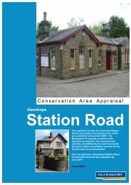
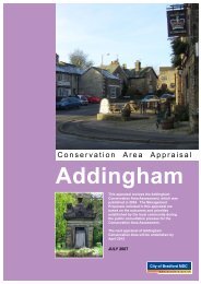
- Page 271 and 272: Local Centre Addingham; Idle; Silsd
- Page 273 and 274: City’s attraction to the wider in
- Page 275 and 276: The top three places of interest to
- Page 277 and 278: The National Media Museum is consid
- Page 279 and 280: the Keighley and Worth Valley Railw
- Page 281 and 282: Occupancy rates have consistently b
- Page 283 and 284: Table: Vacancy rates by sub-area Su
- Page 285 and 286: Within Bradford District there are
- Page 287 and 288: 9.0 TRANSPORT AND ACCESSIBILITY Thi
- Page 289 and 290: The third West Yorkshire Local Tran
- Page 291 and 292: Apperley Bridge Rail Station- The p
- Page 293 and 294: the working process involving eithe
- Page 295 and 296: Table: Commuting Counts in and out
- Page 297 and 298: Table : Car ownership in Bradford D
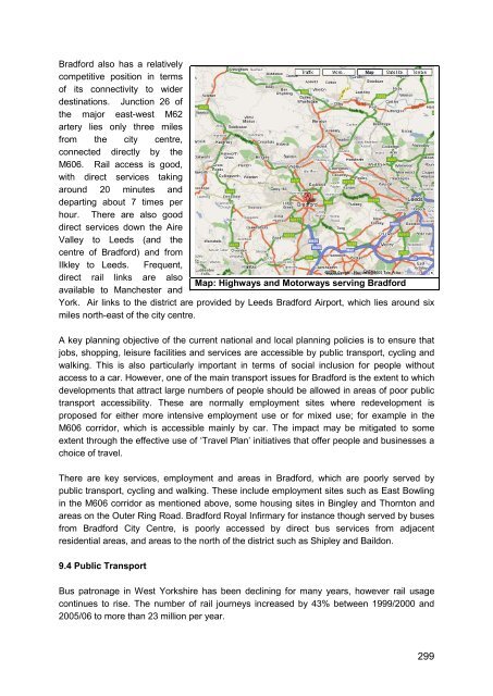
- Page 299: in due course offer alternatives to
- Page 303 and 304: under the name the ‘West Riding S
- Page 305 and 306: The immediate investment priorities
- Page 307 and 308: services including congestion and p
- Page 309 and 310: Dublin-based company will offer 14
- Page 311 and 312: The Bradford Living Street proposal
- Page 313 and 314: Haworth: • Museum Car Park • Br
- Page 315 and 316: housing in the Airedale Corridor wi
- Page 317 and 318: 10. ENVIRONMENT This section of the
- Page 319 and 320: Figure : Locations of the continuou
- Page 321 and 322: esults are corrected using the meth
- Page 323 and 324: of these watercourses. It is also r
- Page 325 and 326: Table: Renewable energy sources in
- Page 327 and 328: Hazardous substances and their spec
- Page 329 and 330: Furthermore, a user satisfaction su
- Page 331 and 332: environment agency is therefore wor
- Page 333 and 334: Table : Known Main River Flooding I
- Page 335 and 336: Biodiversity and Geological Conserv
- Page 337 and 338: Woodland: Only 4.6% of Bradford Dis
- Page 339 and 340: The District has only 3 or 4 of the
- Page 341 and 342: designated a Special Protection Are
- Page 343 and 344: living in Bradford, that equates to
- Page 345 and 346: The Council has direct management c
- Page 347 and 348: Sources: • The delineation of Bra
- Page 349 and 350: • AWAY (2010) West Yorkshire Adap
- Page 351 and 352:
The City of Bradford Metropolitan D
- Page 353 and 354:
The City of Bradford Metropolitan D
- Page 355 and 356:
3. The Council should ensure that i
- Page 357 and 358:
5. The Council and its partners mus
- Page 359 and 360:
7. The Council, when carrying out i
- Page 361 and 362:
11. MINERALS AND WASTE MANAGEMENT T
- Page 363 and 364:
Figure: Mineral extraction sites an
- Page 365 and 366:
masonry. Likewise design objectives
- Page 367 and 368:
Denholme and Oxenhope. However seve
- Page 369 and 370:
Figure: Breakdown of Waste Arisings
- Page 371 and 372:
Recycling The division collects pap
- Page 373 and 374:
ecycling waste is received, the was
- Page 375 and 376:
11.6 Waste Composition In 2002 MEL
- Page 377 and 378:
11.7 Recycling and Composting in Br
- Page 379 and 380:
Table : Commercial and industrial w
- Page 381 and 382:
380
- Page 383 and 384:
382
- Page 385 and 386:
12. SUSTAINABILITY The LDF Core Str
- Page 387 and 388:
The sustainability objectives have
- Page 389:
Produced by the City of Bradford Me