RNAV Training Manual - Keilir
RNAV Training Manual - Keilir
RNAV Training Manual - Keilir

You also want an ePaper? Increase the reach of your titles
YUMPU automatically turns print PDFs into web optimized ePapers that Google loves.
© Vasa Babic, 2008<br />
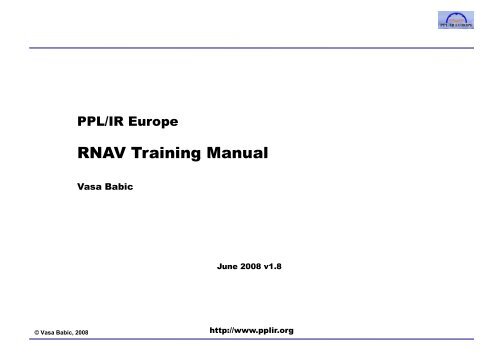
PPL/IR EEurope<br />
<strong>RNAV</strong> <strong>Training</strong> <strong>Manual</strong><br />
Vasa Babic<br />
June 2008 v1.8<br />
http://www.pplir.org
Introduction<br />
This manual covers the <strong>RNAV</strong> theoretical knowledge and ground training for an Instrument Rated pilot<br />
operating single-pilot general aviation aircraft under IFR in Europe Europe, specifically<br />
to meet the requirements of JAA TGL10 and FAA AC90-96A for P-<strong>RNAV</strong> qualification<br />
to meet various national requirements or recommendations for flying <strong>RNAV</strong>(GPS) Approaches,<br />
eg. UK CAA CAP 773<br />
The manual also has a recommended syllabus to meet flight training requirements for P-<strong>RNAV</strong> and<br />
<strong>RNAV</strong>(GPS) Approaches<br />
It is intended to be used in a classroom training g seminar, distance-learning g course or for self-study y<br />
Some of the detailed content and reference material is beyond the scope of what is required for pilot<br />
training. The pages of the document are coded, in the top right corner, as follows:<br />
P A P A<br />
Indicates that page content is<br />
required for P-<strong>RNAV</strong> training<br />
based on this <strong>Manual</strong><br />
Indicates that page content is<br />
required for GPS Approach<br />
training based on this <strong>Manual</strong><br />
Indicates that page content<br />
is required for both P-<strong>RNAV</strong><br />
and GPS Approach training<br />
based on this <strong>Manual</strong><br />
Indicates that page content<br />
is not essential for a training<br />
course<br />
2
Acknowledgements and notes<br />
Garmin software and user manual content is reproduced with the kind permission of Garmin<br />
Jeppesen charts are reproduced with the kind permission of Jeppesen<br />
UK CAA charts and documents are reproduced with the kind permission of the UK CAA<br />
Th The author th would ld like lik to t thank th k MMr. JJulian li SScarfe f ffor reviewing i i this thi document d t in i ddetail t il and d for f hi his very<br />
knowledgeable feedback. Errors and omissions are entirely the author s responsibility<br />
The document, in PDF form, is available for free to the aviation community. If you find this material<br />
valuable, you are asked to:<br />
please consider joining and/or donating to PPL/IR Europe (www (www.pplir.org). pplir org) This small voluntary<br />
organisation serves GA IFR pilots in Europe by publishing and exchanging information to help<br />
promote the safety and utility of IFR flight in single-pilot aircraft, and works with regulators in<br />
Europe to ensure they have input on the specialised needs of private IFR from a credible and<br />
qualified lifi d source<br />
please also join and support your national AOPA. Internationally, AOPA is the only GA<br />
representative organisation for private pilots accredited to ICAO, the FAA, EASA and national<br />
regulators regulators. IFR regulations are planned and decided upon many years in advance advance, at a global and<br />
regional level. AOPA needs your support to make sure that private IFR operators continue to have<br />
practical and cost-effective access to airspace worldwide<br />
3
Course contents<br />
1. <strong>RNAV</strong> and RNP theory 4. <strong>RNAV</strong>(GPS) Approach Procedures<br />
a. Introduction<br />
a. GPS procedure types<br />
b. The Path-Terminator<br />
b. GPS approach requirements and<br />
c. <strong>RNAV</strong> procedure design<br />
approvals<br />
d. RNP principles<br />
c. GPS approach operations<br />
e. <strong>RNAV</strong> and RNP applications<br />
5. Avionics training<br />
2. GPS Navigators and their application to <strong>RNAV</strong><br />
a. The GPS system<br />
b. Databases and Coding<br />
c. Procedures<br />
d. Error detection and warnings<br />
3. P-<strong>RNAV</strong> Terminal Procedures<br />
a. P-<strong>RNAV</strong> requirements and approvals<br />
b. P-<strong>RNAV</strong> training topics<br />
c. P-<strong>RNAV</strong> operations<br />
6. Simulator and/or Flight training<br />
4
What is the basic concept of <strong>RNAV</strong>?<br />
Traditional IFR Navigation <strong>RNAV</strong><br />
Traditional IFR Navigation relies on aircraft<br />
crossing radio beacons and tracking to and from<br />
them directly, or via intersects<br />
This constrains IFR routes and procedures to what is<br />
achievable from a limited and expensive<br />
infrastructure of ground ground-based based stations<br />
Source: charts from the ICAO Performance Based Navigation manual, Draft March 2007<br />
P A<br />
Area Navigation (<strong>RNAV</strong>) is a method of navigation that<br />
permits aircraft to follow IFR routes and procedures<br />
based on any desired routing, subject to the system<br />
limits of the <strong>RNAV</strong> technology<br />
Initially, in the 1970s, based on VOR-DME shifting or systems<br />
like Loran C; limited by station range and coverage. Large jets<br />
also used Inertial Navigation Systems.<br />
Modern <strong>RNAV</strong> in general aviation aircraft is based on panelmounted<br />
GPS. Transport aircraft also use Inertial Reference and<br />
DME-DME in multi-sensor Flight Management Systems (FMS)<br />
5
How is <strong>RNAV</strong> implemented?<br />
Traditional IFR has a single, simple implementation which is valid in airspace worldwide using a<br />
standard set of aircraft equipment (the VOR, VOR DME, DME ADF and ILS receivers and instruments) and the<br />
standard Instrument Rating pilot qualification. Non-standard applications are relatively rare and<br />
specialised (eg. CAT 2 ILS operations)<br />
Fi First-generation t ti <strong>RNAV</strong> was iimplemented l t d iin much h th the same way. Aircraft Ai ft equipped i d with ith one of f the th<br />
many kinds of <strong>RNAV</strong> box could fly additional <strong>RNAV</strong> routes. However, the accuracy and predictability<br />
of an aircraft s flight path was limited by a lack of standardisation<br />
in navigation equipment accuracy and reliability<br />
in how route and procedure data was entered, coded, interpreted and displayed<br />
in how pilots and autopilots would fly turns, intercepts, climbs to a fix and any other non-straight<br />
and level legs<br />
Modern applications have aimed to increase the usefulness of <strong>RNAV</strong> by allowing very precise<br />
procedure designs that use airspace more efficiently and create more direct routes. This also has the<br />
benefit of improving terrain and traffic separation separation, and providing better noise abatement and fuelefficient<br />
descent management<br />
However, to date, no homogenous way of providing the standards and safeguards needed for accurate<br />
and consistent <strong>RNAV</strong> has emerged, and thus there are a variety of <strong>RNAV</strong> applications in different<br />
regional and national airspace and for different phases of flight (enroute, terminal, approach)<br />
eg. B-<strong>RNAV</strong> and P-<strong>RNAV</strong> in Europe, MNPS in the North Atlantic, <strong>RNAV</strong> 1 and <strong>RNAV</strong> 2 in the US<br />
P A<br />
6
What is RNP (Required Navigation Performance) ?<br />
RNP terminology can be confusing, because it means slightly different things in different contexts<br />
RNP, conceptually, is a measure of the navigation performance accuracy necessary for operation<br />
within a defined airspace<br />
RNP RNP, as a performance specification specification, is a measure of the lateral accuracy in nautical miles miles, relative to<br />
a desired flight path, that an aircraft can be expected to maintain 95% of the total time<br />
Referred to as RNP-X where the X may be, for example, 5nm<br />
RNP is i also l used d as th the name ffor <strong>RNAV</strong> applications li ti th that t include i l d a specific ifi RNP RNP-X X requirement i t<br />
For example, RNP 10 is the name for an Oceanic <strong>RNAV</strong> application. Aircraft operating on routes<br />
designated as RNP 10 must conform to a variety of equipment, crew and operator approval<br />
requirements<br />
requirements.<br />
However, <strong>RNAV</strong> application names are not standardised: in the North Atlantic, the <strong>RNAV</strong><br />
application is very similar to RNP 10, but it is called Minimum Navigation Performance<br />
Specifications p (MNPS). ( ) Europe p and the USA both have Terminal <strong>RNAV</strong> applications pp based on<br />
RNP-1, but they are called P-<strong>RNAV</strong> and <strong>RNAV</strong> 1 respectively<br />
ICAO is in the process of standardising <strong>RNAV</strong> and RNP applications and specifications. The general<br />
term for this is Performance Based Navigation (PBN); this will change, and in some cases replace,<br />
the use of RNP concepts<br />
P A<br />
7
Summary of concepts<br />
<strong>RNAV</strong><br />
Navigation capability<br />
for flight along any<br />
desired route<br />
Navigation and<br />
Performance capabilities<br />
combined allow <strong>RNAV</strong><br />
procedures to be more<br />
efficient than legacy IFR<br />
RNP<br />
Performance capability<br />
to remain within X nm<br />
of a desired route for<br />
95% of the flight time<br />
<strong>RNAV</strong> AApplications li ti<br />
Special IFR requirements in national, regional or oceanic airspace which permit<br />
the use of <strong>RNAV</strong> routes and procedures designed around an RNP X specification<br />
BB-<strong>RNAV</strong> <strong>RNAV</strong><br />
P-<strong>RNAV</strong> P <strong>RNAV</strong><br />
MNPS RNP 4 <strong>RNAV</strong> 1 .etc etc<br />
PBN<br />
Performance-based Navigation: ICAO concept to standardise current and future<br />
<strong>RNAV</strong>/RNP applications, requirements and nomenclature<br />
P A<br />
8
Course contents<br />
1. <strong>RNAV</strong> and RNP theory 4. <strong>RNAV</strong>(GPS) Approach Procedures<br />
a. Introduction<br />
a. GPS procedure types<br />
b. The Path-Terminator<br />
b. GPS approach requirements and<br />
c. <strong>RNAV</strong> procedure design<br />
approvals<br />
d. RNP principles<br />
c. GPS approach operations<br />
e. <strong>RNAV</strong> and RNP applications<br />
5. Avionics training<br />
2. GPS Navigators and their application to <strong>RNAV</strong><br />
a. The GPS system<br />
b. Databases and Coding<br />
c. Procedures<br />
d. Error detection and warnings<br />
3. P-<strong>RNAV</strong> Terminal Procedures<br />
a. P-<strong>RNAV</strong> requirements and approvals<br />
b. P-<strong>RNAV</strong> training topics<br />
c. P-<strong>RNAV</strong> operations<br />
6. Simulator and/or Flight training<br />
9
What is a Path-Terminator?<br />
IFR routes and procedures are designed using standardised specifications and criteria<br />
ICAO PANS-OPS Doc 8168 in Europe<br />
TERPS (United States Standard Terminal Instrument Procedures) in the USA<br />
Instrument procedures have always been published in chart and text form. Since the 1970s, the<br />
ARINC 424 standard has also been used to codify IFR procedures, so they can be stored and<br />
managed as records in electronic databases<br />
A key concept in ARINC 424 is that of the Path-Terminator a specific way of defining a leg or<br />
segment of an IFR procedure, based on a set of standard components that define the flight path along<br />
the leg, and the terminator or end-point end point of the leg<br />
Different combinations of Path types (eg. a Heading or a Track) and Terminator types (eg. a radio<br />
beacon, , <strong>RNAV</strong> waypoint yp or DME arc) ) are used to define 23 different Path-Terminator leg g types yp<br />
these 23 Path-Terminator types are, in effect, the periodic table of IFR procedure design<br />
and codification<br />
In a panel-mounted GPS Navigator, an enroute flight plan consists only of one leg type: the basic<br />
Track (from Fix) to Fix (TF) between each of the waypoints entered. When a Departure, Arrival or<br />
Approach procedure is loaded, the flight plan will include each of the path-terminators that make up the<br />
procedure procedure. NNote: t some GPS units it do d not t support t all ll the th leg l types t used d at t the th start t t and d end d of f <strong>RNAV</strong> procedures, d or in i an unpublished bli h d GPS overlay l<br />
P A<br />
10
ARINC 424 Path-Terminator leg types<br />
(1 ( of 3) )<br />
P A<br />
IF leg type TF leg type RF leg type CF leg type<br />
The Initial Fix Leg defines a<br />
database fix as a point in space<br />
It is only required to define the<br />
beginning of a route or<br />
procedure<br />
DF leg type<br />
Direct to a Fix Leg defines an<br />
unspecified track starting from an<br />
undefined position p to a specified p<br />
fix<br />
Track to a Fix defines a great<br />
circle track over ground between<br />
two known databases fixes<br />
Preferred type for straight legs<br />
FA leg type<br />
Fix to an Altitude Leg defines a<br />
specified track over ground from<br />
a database fix to a specified p<br />
altitude at an unspecified<br />
position<br />
Constant Radius Arc Leg defines<br />
a constant radius turn between<br />
two database fixes, lines tangent<br />
to the arc and a center fix<br />
FC leg type<br />
Course to a Fix Leg defines a<br />
specified course to a specific<br />
database fix<br />
TF legs preferred over CF to<br />
avoid magnetic variation issues<br />
FD leg type<br />
Track from a Fix to a Distance Track from a Fix to a DME<br />
Leg defines a specified track Distance Leg defines a specific<br />
over ground g from a database fix track from a database fix to a<br />
for a specific distance specific DME Distance from a<br />
DME Navaid<br />
11
ARINC 424 Path-Terminator leg types<br />
(2 ( of 3) )<br />
P A<br />
FM leg type CA leg type CD leg type CI leg type<br />
From a Fix to a <strong>Manual</strong><br />
termination Leg defines a<br />
specified track over ground from<br />
a database fix until <strong>Manual</strong><br />
termination of the leg<br />
CR leg type<br />
Course to an Altitude Leg<br />
defines a specified course to a<br />
specific altitude at an unspecified<br />
position<br />
AF leg type<br />
Course to a Radial termination Arc to a Fix or defines a track<br />
Leg defines a course to a<br />
over ground at specified constant<br />
specified p Radial from a specific p<br />
distance from a database DME<br />
database VOR Navaid Navaid<br />
Course to a DME Distance Leg<br />
defines a specified course to a<br />
specific DME Distance which is<br />
from a specific database DME<br />
Navaid<br />
VA leg type<br />
Heading to an Altitude<br />
termination Leg defines a<br />
specified p heading g to a specific p<br />
Altitude termination at an<br />
unspecified position<br />
Course to an Intercept Leg<br />
defines a specified course to<br />
intercept a subsequent leg<br />
VD leg type<br />
Heading to a DME Distance<br />
termination Leg defines a<br />
specified p heading g terminating g at<br />
a specified DME Distance from a<br />
specific database DME Navaid<br />
12
ARINC 424 Path-Terminator leg types<br />
(3 ( of 3) )<br />
P A<br />
VI leg type VM leg type VR leg type PI leg type<br />
Heading to an Intercept Leg<br />
defines a specified heading to<br />
intercept the subsequent leg at<br />
an unspecified position<br />
HA leg type<br />
HA leg defines racetrack pattern<br />
or course reversals at a specified<br />
database fix terminating g at an<br />
altitude<br />
Heading to a <strong>Manual</strong> termination<br />
Leg defines a specified heading<br />
until a <strong>Manual</strong> termination<br />
HF leg type<br />
Heading to a Radial termination<br />
Leg defines a specified heading<br />
to a specified radial from a<br />
specific database VOR Navaid<br />
HM leg type<br />
HF leg defines racetrack pattern HM leg defines racetrack pattern<br />
or course reversals at a specified or course reversals at a specified<br />
database fix terminating g at the fix database fix with a manual<br />
after a single pattern termination<br />
Procedure Turn leg defines a<br />
course reversal starting at a<br />
specific fix, includes Outbound<br />
Leg followed by 180 degree turn<br />
to intercept the next leg<br />
13
The ARINC 424 periodic table of 23 Path-Terminator legs<br />
Fix<br />
Altitude<br />
Fix to<br />
Track from<br />
fix to<br />
Paths<br />
Course to Heading to Direct to Racetrack<br />
DME Arc<br />
to<br />
Radius<br />
from fix<br />
IF TF CF DF HF AF RF<br />
FA CA VA HA<br />
<strong>Manual</strong><br />
Termination FM VM HM<br />
Distance<br />
FC<br />
DME<br />
Distance FD CD VD<br />
Intercept<br />
Radial<br />
Procedure<br />
Turn<br />
PI<br />
CI VI<br />
CR VR<br />
Each leg type has a two letter<br />
name based on the path and<br />
terminator combination<br />
P A<br />
14
Fly-By and Fly-Over <strong>RNAV</strong> waypoints<br />
The fix in Path-Terminator legs is either based on radio aids or it is an <strong>RNAV</strong> waypoint. ICAO define<br />
a waypoint yp as a specified p geographical g g p location used to define an <strong>RNAV</strong> route or the flight g ppath<br />
of an<br />
aircraft employing <strong>RNAV</strong><br />
There are 2 kinds of <strong>RNAV</strong> waypoint: Fly-By and Fly Over<br />
Fly-By waypoint Fly-Over waypoint<br />
Jeppesen symbol ICAO symbol Jeppesen symbol<br />
ICAO symbol<br />
Note: Jeppesen sometimes depict the curved<br />
fly-by track, sometimes the two straight tracks<br />
are joined under the fly-by symbol<br />
A waypoint which requires turn anticipation (start of<br />
turn before the waypoint) to allow tangential<br />
interception of the next segment of a route or<br />
procedure<br />
The aircraft navigation system calculates the start of<br />
the turn onto the next route leg before the waypoint<br />
This is the preferred type of waypoint for all Area<br />
Navigation (<strong>RNAV</strong>) Standard Instrument<br />
Departures/Standard Instrument Arrivals (SIDs/STARs)<br />
Source: Eurocontrol http://elearning.eurocontrol.int/IANS/NAV/prnav/prnav_free_access/firstwin.htm<br />
Note: radio aid or other symbols may be<br />
overlaid on waypoint symbol<br />
A waypoint at which a turn is initiated<br />
The aircraft starts to turn onto the next route leg as it<br />
passes over the waypoint<br />
Fly-Over waypoints are most often used as the first fix<br />
in the missed approach procedure and in depicting<br />
traditional procedures designed around overflying radio<br />
aid fixes<br />
<strong>RNAV</strong> Procedure designers are increasingly avoiding<br />
th the use of f Fly-Over Fl O waypoints i t<br />
P A<br />
15
Aircraft trajectory in Fly-By and Fly-Over waypoints<br />
Fly-By Fly-Over<br />
trajectory more consistent<br />
and controlled<br />
Turn is a Rate 1 curved path tangential to both the<br />
inbound and outbound track<br />
trajectory less consistent<br />
and controlled<br />
Turn consists of roll-in, Rate 1 turn, roll-out and<br />
intercept elements<br />
Both types of trajectory are subject to variations in wind, aircraft speed and bank angle, navigation<br />
system logic and Pilot or Autopilot performance. However, flight paths resulting from Fly-By turns are,<br />
in practice, much more consistent and predictable, and thus preferred in <strong>RNAV</strong> procedure design (eg.<br />
they require a smaller protected area)<br />
Although the Fly-By turn is a simple concept, it is important for the pilot to understand exactly<br />
how turns are annunciated and displayed on the GPS navigator and how lateral guidance is<br />
provided to the autopilot in Nav or Roll-Steer Roll Steer (GPSS) modes, modes in order to consistently and<br />
accurately achieve the tangential path the procedure requires<br />
P A<br />
16
Course contents<br />
1. <strong>RNAV</strong> and RNP theory 4. <strong>RNAV</strong>(GPS) Approach Procedures<br />
a. Introduction<br />
a. GPS procedure types<br />
b. The Path-Terminator<br />
b. GPS approach requirements and<br />
c. <strong>RNAV</strong> procedure design<br />
approvals<br />
d. RNP principles<br />
c. GPS approach operations<br />
e. <strong>RNAV</strong> and RNP applications<br />
5. Avionics training<br />
2. GPS Navigators and their application to <strong>RNAV</strong><br />
a. The GPS system<br />
b. Databases and Coding<br />
c. Procedures<br />
d. Error detection and warnings<br />
3. P-<strong>RNAV</strong> Terminal Procedures<br />
a. P-<strong>RNAV</strong> requirements and approvals<br />
b. P-<strong>RNAV</strong> training topics<br />
c. P-<strong>RNAV</strong> operations<br />
6. Simulator and/or Flight training<br />
17
Principles of traditional Instrument Procedure design<br />
1. The Protected Area<br />
Instrument procedures in Europe are designed using the specifications and criteria in ICAO PANS-<br />
OPS Doc 8168. 8168 The US equivalent standard is TERPS (United States Standard Terminal Instrument<br />
Procedures)<br />
Profile of Protected Area Plan View of Protected Area<br />
Full width of Protected Area<br />
¼ width ½ width<br />
¼ width<br />
Secondary<br />
Area<br />
Primary<br />
Area<br />
Full u<br />
MOC<br />
Secondary<br />
Area MOC<br />
declines<br />
to zero<br />
Secondary<br />
Area<br />
Primary<br />
Area<br />
Secondary<br />
Area<br />
The key design criteria is to provide safe obstacle and terrain clearance whilst an aircraft is flown in<br />
accordance with the published procedure<br />
horizontally, o o ta y, within t a Protected otected Area ea<br />
vertically, with a specified Minimum Obstacle Clearance (MOC)<br />
18
Principles of traditional Instrument Procedure design<br />
2. Track and Fix tolerances, , and MOC<br />
The horizontal width of the Protected Area is determined by various tolerances relating to where an<br />
aircraft could be located whilst flying the procedure<br />
The key tolerance is based on the type of radio aid being tracked and distance from it. An angular<br />
splay is used that widens the protected area as the aircraft travels further from the fix<br />
Illustrative plan view of<br />
the Protected Area in a<br />
leg from a VOR<br />
Protected Area widens at an<br />
angle of 7.8 O relative to the leg<br />
track, in the case of a VOR<br />
The angle is 10.3 O for an NDB<br />
and 15 O for flying a heading<br />
Protected Area width<br />
is initially 2nm<br />
Protection in a descent or a turn initiated at a fix is<br />
also provided by including a Fix Tolerance<br />
Examples<br />
Note that fix tolerances are different from<br />
path tracking tolerances<br />
VOR NDB DME LOC<br />
System Tolerance 4.5O 6.2O 1.4<br />
0.25nm<br />
plus<br />
O<br />
Fli Flight ht TTechnical h i l<br />
Tolerance<br />
0.7<br />
plus<br />
1.25% of<br />
the DME<br />
distance<br />
O 0.7O 1.0O Total Fix Tolerance 5.2O 6.9O 2.4O Note: FTT excluded when fix is based on an intersect.<br />
These are illustrative examples, the full definition of fix<br />
tolerances (eg. overhead a beacon, radar fixes) is beyond<br />
the scope of this course<br />
The Minimum Obstacle Clearance (MOC) is 984 or 300m up to the Initial Approach Fix, and declines<br />
during the Approach and Missed Approach (down to a minimum of 98 or 30m on the missed)<br />
Source: Jens Gerlev s book, Instrument Flight Procedures<br />
19
Principles of traditional Instrument Procedure design<br />
3. Fly-Over Turns<br />
y<br />
The protected area around a turn is necessarily greater than the sum of the track protection required<br />
to and from a fix: it must take into account<br />
the fix tolerance<br />
the time it takes a pilot to react to crossing the fix and establish the turn<br />
the effect of worst-case worst case wind pushing the aircraft to the outside of the turn<br />
the turning radius of different aircraft types<br />
Illustration of traditional<br />
Fly-Over turn<br />
Fix tolerance<br />
Fix tolerance<br />
Reaction<br />
time time, 6s<br />
Extra protected area required<br />
in traditional Fly-Over turns<br />
Source: Jens Gerlev, Instrument Flight Procedures<br />
Nominal track : ie. the zero error, zero<br />
wind track an aircraft would follow<br />
20
Principles of traditional Instrument Procedure design<br />
4. Aircraft Approach pp Categories g<br />
Aircraft speed is the key criteria for the design of any manoeuvring elements of an instrument<br />
procedure p ( (turns, , p procedure turns, , holds, , missed approaches, pp , landing g and circling g minima) )<br />
Procedures are designed around 5 aircraft categories, based on a notional approach speed of 1.3x the<br />
stalling speed in the landing configuration at maximum landing mass (V AT)<br />
Aircraft<br />
Category<br />
V AT<br />
Initial<br />
Approach<br />
speeds<br />
Final<br />
Approach<br />
speeds<br />
Max<br />
Circling<br />
speed<br />
A
How are <strong>RNAV</strong> Procedures different?<br />
1. Definition of Protected Area based on <strong>RNAV</strong> system performance or RNP P A<br />
Based on <strong>RNAV</strong> system type Based on RNP<br />
<strong>RNAV</strong> procedures designated for specific<br />
navigation systems, eg<br />
<strong>RNAV</strong> (GNSS)<br />
ie. FMS GPS only, not<br />
<strong>RNAV</strong> (DME-DME)<br />
panel mount GPS<br />
<strong>RNAV</strong> (EXCEPT CLASS A GNSS)<br />
PANS OPS protected area width is 2x<br />
RNP + a buffer<br />
Buffer is 2nm for arrival, 1nm for initial<br />
and intermediate approach and 0.5nm for<br />
final, missed approach and departure<br />
Full width of Protected Area<br />
Each procedure type has a systemspecific<br />
semi area width , which is the<br />
buffer<br />
4x RNP<br />
buffer<br />
llateral t l protection t ti either ith side id of f the th<br />
nominal track, eg. 3nm for GPS STARs<br />
Buffer<br />
Area<br />
Buffer<br />
Area<br />
Modern approach is to define procedures<br />
based on RNP, RNP not on specific navigation<br />
systems<br />
Fix Tolerance is based on system-<br />
MOC<br />
specific linear Along Track (ATT) and Fix Tolerance is simply a 1x RNP radius<br />
Cross-Track (XTT) tolerances, rather<br />
than angular splays<br />
around the waypoint<br />
See the Eurocontrol publication p Guidance Material for the Design g of Terminal Procedures for Area Navigation g , at http://www.ecacnav.com/downloads/iss3 p _0.pdf p<br />
This is an excellent document, with detailed content on many topics that are only briefly touched upon in this manual. It is well worth downloading and saving as a<br />
reference.<br />
22
How are <strong>RNAV</strong> Procedures different?<br />
2. Fly-By turn Protected Area is smaller than that of conventional turns P A<br />
The Fly-By turn design assumes<br />
a fi fix tolerance t l of f RNP RNP-X X( (eg. 11nm iin P<strong>RNAV</strong>) P-<strong>RNAV</strong>)<br />
aircraft turn at Rate 1 (3 O /sec), up to a maximum bank angle of 25 O , whichever is lower<br />
a 5 seconds allowance, from the time the aircraft s navigation system computes that a turn<br />
should start start, for either the pilot or autopilot to react and to establish the appropriate bank angle<br />
The Fly-By turn design thus uses the same bank angles, fix tolerances, wind effects and pilot/autopilot<br />
reaction times as the Fly Fly-Over Over design. design However However, the diagrams below illustrate how much inherently<br />
smaller the Fly-By protected area is with those same safety margins built-in<br />
Identical turns drawn to scale : Fly-Over vs Fly-By Protected Areas<br />
Secondary Area<br />
Primary Area<br />
Secondary<br />
Area<br />
Secondary<br />
Area<br />
Primary Area<br />
Illustration of a delay in<br />
initiating g the turn until<br />
approx 1 minute after<br />
waypoint crossed<br />
Secondary Area<br />
Fly-Over Fly-By<br />
Source: based on diagrams in Guidance Material for the Design of Terminal Procedures for Area Navigation , at http://www.ecacnav.com/downloads/iss3_0.pdf<br />
23
How are <strong>RNAV</strong> Procedures different?<br />
3. Procedures use only a few of the most predictable Path-Terminators P<br />
Fix to<br />
Fix IF<br />
Altitude<br />
<strong>Manual</strong><br />
Termination<br />
Distance<br />
DME<br />
Distance<br />
Intercept<br />
RRadial di l<br />
Procedure<br />
Turn<br />
Initial<br />
Fix<br />
PI<br />
Track from<br />
fix to<br />
TF<br />
Track to<br />
Fix<br />
FA<br />
Paths<br />
Course to Heading to Direct to Racetrack<br />
CF<br />
Course to<br />
Fix<br />
CA<br />
Fix to Course to<br />
Altitude Altitude<br />
FM<br />
Fix to<br />
man. term.<br />
FC<br />
VA<br />
Heading<br />
to<br />
Altit Altitude d<br />
VM<br />
Heading<br />
to man.<br />
term.<br />
DF<br />
Direct to<br />
Fix<br />
HF<br />
Racetrack<br />
to Fix<br />
HA<br />
Racetrack<br />
to Altitude t tude<br />
HM<br />
Racetrack<br />
to man.<br />
term.<br />
term. term.<br />
DME Arc<br />
to<br />
Radius<br />
from fix<br />
RF<br />
AF Radius to<br />
Fix<br />
FD CD VD Orange: <strong>RNAV</strong> leg types used<br />
CI<br />
VI<br />
Course to<br />
Intercept<br />
CR VR<br />
mainly at the start and end of<br />
procedures when required (eg.<br />
VA as the first leg of a SID)<br />
Blue: non-<strong>RNAV</strong> leg types<br />
RRed: d bbest t practice ti<br />
<strong>RNAV</strong> leg types<br />
24
How are <strong>RNAV</strong> Procedures different?<br />
4. There is a distinct <strong>RNAV</strong> procedure style P<br />
Style features typical of <strong>RNAV</strong> procedures:<br />
traditional<br />
Entry Fix<br />
Use of many<br />
Waypoints<br />
Turns are<br />
Fly-by Fly by<br />
Legs are TF,<br />
except at the<br />
start/end of<br />
procedures<br />
Many altitude<br />
and speed<br />
constraints<br />
<strong>RNAV</strong> STARs start with a conventional Fix Fix, which the pilot should<br />
use to cross-check with radio aid raw data to avoid gross errors<br />
<strong>RNAV</strong> SIDs require a nav accuracy check on the runway<br />
<strong>RNAV</strong>(GPS) approaches may require a user-defined check for<br />
gross g error, since they y often start with a pure p <strong>RNAV</strong> waypoint yp<br />
After the initial Fix, all subsequent leg terminators are <strong>RNAV</strong><br />
waypoints, rather than radio-referenced fixes<br />
6-10 waypoints are common in an <strong>RNAV</strong> arrival procedure,<br />
compared dt to 3-6 36 fixes fi iin a ttraditional diti l one<br />
Generally, all turns will be Fly-By, with Fly-Over waypoints avoided<br />
Turns may also use the Fix to Fix via a Constant Radius (RF) leg<br />
WWaypoints i t are spaced d ffar enough h apart t to t allow ll stable t bl track t k<br />
capture between turns<br />
TF (and, in the future, RF) legs are used to provide the most<br />
predictable flight paths and the most FMS/GPS- FMS/GPS friendly coding,<br />
sequencing and guidance<br />
By necessity, procedures may start or end with non-TF legs, eg. a<br />
SID may begin with VA (Heading to Altitude) then CF (Course to<br />
Fix) Fix), followed by a TF sequence<br />
<strong>RNAV</strong> arrivals, in particular, include more specific altitude and<br />
speed constraints than a typical conventional procedure. This is<br />
designed to allow efficient traffic flows and descent profiles and<br />
reduced radio communications<br />
Examples: p<br />
or<br />
above<br />
3000<br />
3000<br />
3000<br />
Conventional initial fix<br />
multiple<br />
waypoints yp<br />
at<br />
or<br />
below<br />
Fly-By<br />
TF<br />
4000<br />
2000 between<br />
Max IAS<br />
220KT<br />
speed<br />
limit<br />
IAS<br />
180KT speed<br />
target<br />
25
How are <strong>RNAV</strong> Procedures different?<br />
4. ..<strong>RNAV</strong> procedure illustration P<br />
Example: NEMAX2B trial P-<strong>RNAV</strong><br />
Arrival to Rwy y 27 ILS at Nottingham g<br />
East Midlands (EGNX)<br />
Extract from UK CAA AIP SUP S1/2008<br />
GAM<br />
235 radial<br />
49.0 DME<br />
traditional Entry<br />
Fix<br />
All legs are TF<br />
(after the IF)<br />
Many<br />
Waypoints<br />
Many altitude and<br />
speed constraints<br />
All turns are<br />
Fly-by<br />
DO NOT USE FOR NAVIGATION<br />
Note:<br />
QNH setting<br />
instruction<br />
after ft passing i<br />
waypoint<br />
26
How are <strong>RNAV</strong> Procedures different?<br />
5. Arrival vertical profile often optimised for jet aircraft continuous descent P<br />
Unlike most conventional procedures, <strong>RNAV</strong> STARs are often closed , terminating at the final<br />
approach pp p point, , rather than an initial or intermediate one ( open p )<br />
The vertical profile is usually designed to allow jet aircraft to commence descent late and then descend<br />
continuously, at 220KIAS and flight idle power, from the start of the procedure until the final approach<br />
waypoint and speed. This corresponds to a gradient of approximately 300 per nm.<br />
FL100<br />
FL80<br />
FL60<br />
4000<br />
2000<br />
0<br />
this is the most efficient and environmentally friendly method, known as CDA (Continuous Descent Approach). Otherwise, for jet aircraft,<br />
the earlier descent and power/configuration changes in a step-down arrival involve unnecessary fuel burn and a greater noise footprint<br />
60<br />
Example: Vertical profile of NEMAX1B trial P-<strong>RNAV</strong> Arrival procedure at Nottingham East Midlands (EGNX)<br />
FL100 min<br />
Gradient approximately<br />
300 per nm<br />
FL120 max<br />
FL70 min<br />
High target speed: advise ATC if<br />
unable when assigned the procedure<br />
and offer best speed to FAP<br />
50<br />
40<br />
30<br />
FL55 min<br />
4000 min<br />
Note the aircraft performance and pilot workload required during the transition to the final approach<br />
descending at ~300 per nm whilst decelerating from 190KIAS (or speed attainable) to approach speed<br />
no distinct level-off available for slowing down<br />
cockpit transition of CDI, GPS course guidance and autopilot mode from <strong>RNAV</strong> to ILS/DME<br />
20<br />
3500<br />
min<br />
10<br />
At<br />
3000<br />
At<br />
2000<br />
nm to<br />
runwayy<br />
0<br />
27
How are <strong>RNAV</strong> Procedures different?<br />
Summary P A<br />
Traditional Procedures <strong>RNAV</strong> Procedures<br />
Execution is demanding<br />
selecting selecting, identing and displaying<br />
navaids<br />
following track, distance and timing<br />
from raw data<br />
repeated for each leg<br />
Management g is easyy<br />
select the right chart and then follow<br />
the execution steps<br />
Execution is easy<br />
following the GPS guidance from<br />
waypoint to waypoint<br />
Management is more complex<br />
valid database, correct procedure<br />
loaded and verified<br />
RAIM availability y checked; ; GPS, , CDI<br />
and Autopilot mode selection<br />
avoidance of gross errors and<br />
WIDN? (what s it doing now?)<br />
confusion f i with ith GPS receivers i<br />
The focus of most of the following sections of this course is on the<br />
proficient and safe management of <strong>RNAV</strong> flight<br />
28
Course contents<br />
1. <strong>RNAV</strong> and RNP theory 4. <strong>RNAV</strong>(GPS) Approach Procedures<br />
a. Introduction<br />
a. GPS procedure types<br />
b. The Path-Terminator<br />
b. GPS approach requirements and<br />
c. <strong>RNAV</strong> procedure design<br />
approvals<br />
d. RNP principles<br />
c. GPS approach operations<br />
e. <strong>RNAV</strong> and RNP applications<br />
5. Avionics training<br />
2. GPS Navigators and their application to <strong>RNAV</strong><br />
a. The GPS system<br />
b. Databases and Coding<br />
c. Procedures<br />
d. Error detection and warnings<br />
3. P-<strong>RNAV</strong> Terminal Procedures<br />
a. P-<strong>RNAV</strong> requirements and approvals<br />
b. P-<strong>RNAV</strong> training topics<br />
c. P-<strong>RNAV</strong> operations<br />
6. Simulator and/or Flight training<br />
29
Objectives of the RNP concept<br />
Traditional procedure p design g <strong>RNAV</strong> procedures p ppre-RNP<br />
RNP procedure p design g<br />
Standard infrastructure of<br />
ground radio aids<br />
Aircraft carry a standardised<br />
suite of navigation receivers<br />
and instruments<br />
Procedure tolerances<br />
designed around these<br />
standards<br />
Proliferation of different <strong>RNAV</strong><br />
navigations systems<br />
Even within one type of aircraft<br />
and one make of avionics, a<br />
variation in the FMS or GPS<br />
software release installed can<br />
make an important difference to<br />
the system s capabilities for<br />
executing a particular<br />
procedure<br />
Procedure design increasingly<br />
complex and restricted<br />
Standard performance<br />
specifications established:<br />
RNP-X<br />
Procedure tolerances<br />
designed around these RNP-X<br />
standards<br />
Navigation and autopilot<br />
systems certified to RNP-X<br />
criteria<br />
RNP is a standard interface between the complex p worlds of IFR airspace p<br />
and procedure design, avionics and autopilot design/certification and the<br />
development of flight training and operating procedures<br />
The new PBN model aims to further improve upon the benefits of the RNP<br />
concept<br />
P<br />
30
Definition of RNP accuracy requirement<br />
There are five main navigation performance criteria:<br />
1. Accuracy is the difference between the true and indicated position and track<br />
2. Integrity is the ability to provide timely warnings when the system is not safe to use<br />
3. Availability is the ability of the total system to perform its function at the initiation of the intended operation<br />
4. Continuity is the ability of the navigation system to provide its service without interruption during an operation<br />
55. Vulnerability is the susceptibility to unintentional or deliberate interference<br />
The key requirement of RNP-X is an accuracy specification expressed as a Total System Error (TSE) of X nm or less<br />
for more than 95% of the total flight time<br />
TSE is defined as follows:<br />
Desired Path<br />
Defined Path<br />
Total System Error (TSE) is the vector sum of<br />
Path Definition Error (PDE)<br />
Path Steering Error (PSE)<br />
Position Estimation Error (PEE)<br />
Path Definition<br />
Error (PDE)<br />
Path Definition Error is the difference between the path intended by the procedure<br />
designer and the path the aircraft is guided along as a result of database coding and<br />
Path Steering Error (PSE)<br />
navigator processing<br />
Path Steering Error is the sum of display error in Nav systems and Flight Technical<br />
Estimated Position<br />
Position<br />
Estimation<br />
Error (PEE)<br />
Error (FTE); ie. the errors in manual flight by pilots or autopilot performance in<br />
following a desired path. FTE includes reaction times and wind/turbulence induced<br />
errors, it does not include human conceptual errors eg. selecting the wrong<br />
procedure, waypoint or autopilot mode, or simply turning in the wrong direction<br />
Position Estimation Error is the combination of navigation system/sensor (GPS) error<br />
True Position<br />
and computation error (GPS software). PEE is expressed as a 95% confidence radius,<br />
called ll d the th EEstimate ti t of f PPosition iti Uncertainty U t i t (EPU) or Actual A t l Navigation N i ti Performance<br />
P f<br />
(ANP). PEE is sometimes also called Navigation System Error (NSE)<br />
In practice, the Path Definition and Position Estimation errors are negligible, the key concerns for the GA pilot<br />
are FTE and the human factor errors in selecting <strong>RNAV</strong> procedures, procedures using GPS units, units interpreting guidance<br />
and in manual flying or operating the autopilot<br />
P A<br />
31
The current RNP-X specifications published in Europe<br />
(see next section for future PBN specs)<br />
Used for<br />
<strong>RNAV</strong>(GPS)<br />
Approaches<br />
Used for<br />
P-<strong>RNAV</strong><br />
Used for<br />
B-<strong>RNAV</strong><br />
Source: Eurocontrol publication Guidance Material for the Design of Terminal Procedures for Area Navigation<br />
US <strong>RNAV</strong> 1<br />
Oceanic &<br />
remote t enroute t<br />
Oceanic<br />
32
Course contents<br />
1. <strong>RNAV</strong> and RNP theory 4. <strong>RNAV</strong>(GPS) Approach Procedures<br />
a. Introduction<br />
a. GPS procedure types<br />
b. The Path-Terminator<br />
b. GPS approach requirements and<br />
c. <strong>RNAV</strong> procedure design<br />
approvals<br />
d. RNP principles<br />
c. GPS approach operations<br />
e. <strong>RNAV</strong> and RNP applications<br />
5. Avionics training<br />
2. GPS Navigators and their application to <strong>RNAV</strong><br />
a. The GPS system<br />
b. Databases and Coding<br />
c. Procedures and guidance<br />
d. Error detection and warnings<br />
3. P-<strong>RNAV</strong> Terminal Procedures<br />
a. P-<strong>RNAV</strong> requirements and approvals<br />
b. P-<strong>RNAV</strong> training topics<br />
c. P-<strong>RNAV</strong> operations<br />
6. Simulator and/or Flight training<br />
33
Current <strong>RNAV</strong> applications in Europe: an overview<br />
Enroute/Terminal Terminal Approach pp<br />
(Basic) B-<strong>RNAV</strong> (Precision) P-<strong>RNAV</strong> <strong>RNAV</strong> (GPS) Approaches<br />
Requires q RNP-5 capable p navigation g Requires q RNP-1 capable p navigation g<br />
Requires q RNP-0.3 capable p<br />
equipment (sufficient condition) equipment (necessary but not<br />
navigation equipment<br />
Compulsory, since 1998, in almost<br />
sufficient)<br />
Europe is in the early stages of<br />
all European airways and TMAs Europe is in the early stages of<br />
implementing GPS approaches<br />
PPrivate i t GA operators t can meet t<br />
requirements through carriage of an<br />
approved IFR GPS installation<br />
implementing P-<strong>RNAV</strong> P <strong>RNAV</strong> procedures<br />
and all such TMAs currently offer<br />
conventional alternatives<br />
PPrivate i t GA operators t requirements i t<br />
for equipment carriage are similar to<br />
B-<strong>RNAV</strong>: (E)TSO C129a or C146a<br />
(for UK registered aircraft, AFM supplement Private GA operators must obtain a GPS with installation conforming to<br />
must specify B<strong>RNAV</strong> approval; for US aircraft, aircraft<br />
requirements are similar see AC90-96A<br />
Appendix 1)<br />
B-<strong>RNAV</strong> SIDs and STARs are<br />
implemented p which meet en-route<br />
design criteria (eg. are above MSA)<br />
and which start & end at a<br />
conventional fix<br />
Letter of Authorisation from their<br />
state of registry. JAA TGL10 and<br />
FAA AC90-96A Appendix 2 specify<br />
requirements for navigation system<br />
function function, database approval approval, pilot<br />
training and operating procedures<br />
FAA AC20-138 AC20 138 or EASA AMC 20-5 20 5<br />
and AFM approval for Approaches<br />
National air law generally requires<br />
GA pilots to have some theoretical<br />
and flight training specific to GPS<br />
Approaches<br />
(note: both B-<strong>RNAV</strong> and P-<strong>RNAV</strong> procedures<br />
are designated <strong>RNAV</strong> . Check approach plate<br />
detail, airport text pages and AIPs/AICs as<br />
appropriate some <strong>RNAV</strong> terminal procedures<br />
formerly requiring only B-<strong>RNAV</strong> are migrating to<br />
needing P-<strong>RNAV</strong> approval)<br />
See Section 3 See Section 4<br />
Source: see website of the Eurocontrol Navigation Domain http://www.ecacnav.com/Home which has a comprehensive set of documents and HTML resources<br />
P A<br />
34
Future <strong>RNAV</strong> applications in Europe:<br />
The new Performance-Based Navigation (PBN) model P<br />
g ( )<br />
Available from<br />
http://www.ecacnav.com/Document_Library<br />
PBN is the new formal model of how <strong>RNAV</strong> is implemented<br />
It is a move from a limited statement of required performance accuracy (ie. basic<br />
RNP-X) to more extensive statements of required performance in terms of<br />
accuracy, integrity, continuity and availability, together with descriptions of how this<br />
performance is to be achieved in terms of aircraft and crew requirements.<br />
The Required Navigation Performance (RNP) concept has been replaced by the<br />
PBN concept. Therefore, a lot of RNP terminology has been replaced by PBN<br />
terminology<br />
The ICAO 'Performance Performance Based Navigation <strong>Manual</strong> (Final Draft) Draft)' replaces the<br />
'<strong>Manual</strong> on Required Navigation Performance (RNP) ICAO Doc 9613-AN/937'.<br />
Global definitions of terms are provided that are aimed at removing any previous<br />
regional differences.<br />
A set of globally compatible Navigation Specifications are also provided. These are<br />
to be used as a basis for local or regional Navigation Applications in the en route,<br />
terminal and approach environments<br />
Source: the ECACNAV free online course on PBN http://www.ecacnav.com/WBT/PBN/frames/firstwin1.htm<br />
p<br />
PBN has no current or imminent relevance to European IFR operations. However,<br />
because a GA pilot may increasingly encounter the terminology and specification of<br />
ffuture t PBN applications li ti in i various i articles ti l and d ddocuments, t this thi section ti provides id a bif brief<br />
overview for the sake of completeness and orientation<br />
This <strong>Manual</strong> will revert to the current <strong>RNAV</strong> terminology in sections 2-6, and no further<br />
reference to PBN will be necessary<br />
35
Performance-Based Navigation (PBN) specifications<br />
PBN<br />
.introduces i t d 2 new classes l of f specification ifi ti<br />
<strong>RNAV</strong> specifications<br />
..do not include a requirement for on-board<br />
performance monitoring and alerting<br />
RNP specifications<br />
..do include a requirement for on-board<br />
performance monitoring and alerting<br />
These are essentially a re re-naming naming of existing<br />
These add some (modest) extra<br />
specifications with a new <strong>RNAV</strong> X<br />
convention, in which the X is 95% lateral<br />
accuracy in nm<br />
PBN name<br />
RNP 10 <strong>RNAV</strong> 10<br />
B-<strong>RNAV</strong> <strong>RNAV</strong> 5<br />
<strong>RNAV</strong> 2 (USA) <strong>RNAV</strong> 2<br />
P-<strong>RNAV</strong> (Europe) (Europe),<br />
<strong>RNAV</strong>1 (USA)<br />
<strong>RNAV</strong> 1<br />
containment /alerting requirements to<br />
existing RNP specs, and introduce some<br />
new applications<br />
PBN name Used in:<br />
RNP 4 Oceanic<br />
Basic RNP 1 & 2 Various flight<br />
Advanced RNP 1 phases<br />
RNP APCH<br />
RNP AR APCH<br />
Similar to<br />
<strong>RNAV</strong>(GPS)<br />
More demanding<br />
Authorisation<br />
Required<br />
approaches<br />
RNP 3D , 4D ..to be defined<br />
on board performance<br />
monitoring is not a<br />
problematic requirement<br />
for modern GPS units<br />
36
Reference: extract from ICAO PBN <strong>Manual</strong><br />
Table 1-1: Application of Navigation Specification by Flight Phase<br />
37
Course contents<br />
1. <strong>RNAV</strong> and RNP theory 4. <strong>RNAV</strong>(GPS) Approach Procedures<br />
a. Introduction<br />
a. GPS procedure types<br />
b. The Path-Terminator<br />
b. GPS approach requirements and<br />
c. <strong>RNAV</strong> procedure design<br />
approvals<br />
d. RNP principles<br />
c. GPS approach operations<br />
e. <strong>RNAV</strong> and RNP applications<br />
5. Avionics training<br />
2. GPS Navigators and their application to <strong>RNAV</strong><br />
a. The GPS system<br />
b. Databases and Coding<br />
c. Procedures<br />
d. Error detection and warnings<br />
3. P-<strong>RNAV</strong> Terminal Procedures<br />
a. P-<strong>RNAV</strong> requirements and approvals<br />
b. P-<strong>RNAV</strong> training topics<br />
c. P-<strong>RNAV</strong> operations<br />
6. Simulator and/or Flight training<br />
38
The Global Satellite Navigation System (GNSS)<br />
The general term for the global navigation satellite and ground station infrastructure<br />
GPS<br />
The USA s Navstar Global<br />
Positioning System<br />
A military system that became fully<br />
operational for worldwide civilian<br />
use in 1995<br />
Designed around a network of 24<br />
medium-earth orbit satellites<br />
Selective Availability (SA)<br />
ddegradation d ti of f civilian i ili signal i l<br />
accuracy ended in 2000<br />
Note that the terms GNSS and GPS are<br />
sometimes used interchangeably<br />
GNSS<br />
GLONASS<br />
Russian Global Navigation Satellite<br />
System<br />
Introduced during the Soviet era for<br />
military applications<br />
At present, present only partially operational operational,<br />
with 13 of 24 required satellites<br />
functioning and approx ~60% global<br />
coverage<br />
RRussia i iintends t d to t fully f ll restore t<br />
GLONASS by ~2011, in partnership<br />
with the Indian government<br />
Galileo<br />
P A<br />
Note: there are other national<br />
GNSS programmes and<br />
proposals , eg. India, China<br />
The European Union s GNSS<br />
project<br />
After some controversy, formally<br />
approved in Nov 2007<br />
Should be operational by ~2013<br />
USA/EU agreement that Galileo and<br />
GPS will be interoperable<br />
Will use a 30 satellite constellation; ;<br />
some service and accuracy<br />
improvements over current GPS<br />
The concept is that receivers should be able to operate with multiple systems,<br />
creating in GNSS a single virtual system capable of providing a high degree of<br />
resilience when used as a sole source of navigation data for aircraft<br />
The rest of this manual will refer only to GPS<br />
39
How does GPS work?<br />
1. Overview of the system s three segments<br />
The Master Control Station feeds<br />
back a navigational update to each<br />
satellite satellite, synchronising its internal<br />
clock and adjusting the ephemeris<br />
model of its orbit<br />
Occasional maneuvers are<br />
commanded which maintain a<br />
satellite in its proper orbit<br />
Control Segment (CS)<br />
A Master Control Station in Colorado and 4<br />
Monitor stations across the globe<br />
They establish the exact orbital position of<br />
each satellite, and maintain the reference<br />
atomic clocks for the system<br />
Space Segment (SS)<br />
The system is designed for a minimum of 24 satellites (abbreviated as SV , Satellite Vehicle):<br />
4 in each of 6 orbital planes, at a height of ~20,000km and completing one orbit every 12hrs<br />
P A<br />
Currently there are 31 satellites, the 7 additional ones improve accuracy and resilience. The<br />
constellation is arranged so that at least 6 satellites are always line-of-sight visible from almost<br />
any point on the Earth<br />
Th The llocation ti of f the th GGround d Stations St ti<br />
is very accurately established and<br />
used to calibrate the satellites<br />
position and clock data based on<br />
the navigation messages they send<br />
Each satellite broadcasts a ranging code , used<br />
to establish distance from the GPS receiver, and<br />
its own Navigation Message containing<br />
Clock data at the time of transmission<br />
Data on the satellite s orbital position<br />
( ephemeris )<br />
Almanac data on the status of the entire<br />
satellite network<br />
(detailed in following pages)<br />
User Segment (US)<br />
Navigation devices which typically include<br />
an antenna, an accurate clock, receiver,<br />
processor and control/display components<br />
Modern multi-channel receivers can<br />
simultaneously monitor 12-20 satellites<br />
The receipt p of ranging g g codes and navigation g messages g from multiple p satellites<br />
allows GPS Receivers to compute accurate 3D position, speed and time<br />
40
How does GPS work?<br />
2. The satellites broadcast a signal for civilian receivers called L1<br />
The Navigation Message<br />
The Navigation Message consists of 5 subframes of 10x 30bit words<br />
(1500bits total) transmitted at 50bits/s, ie. every 30 seconds. See next<br />
page for detail.<br />
C/A C/A (Coarse/Acquisition) code<br />
..is the ranging code, used by the GPS receiver to measure distance to<br />
the satellite; also called the Standard Positioning Service or SPS<br />
The C/A code is a 1,023bit pseudorandom number (PRN) transmitted at<br />
11.023Mbit/s, 023Mbit/s ie ie. repeating every millisecond.<br />
millisecond<br />
The PRN is unique to each satellite, and all the PRNs are stored in GPS<br />
Receiver memory. Because they are long pseudorandom numbers<br />
designed to be orthogonal , any two different PRNs will correlate<br />
poorly (ie. when multiplied together, give a value near zero).<br />
The Receiver isolates any given satellite s transmission by multiplying the<br />
incoming L1 signal by that satellite s PRN at different time shift intervals,<br />
within the 1 millisecond sequence, until it finds a match or lock-on (when<br />
a particular time shift results in a high multiplication value). It can thus<br />
filter out all the other satellites from the L1 frequency frequency, and use the time<br />
shift required for lock-on to calculate the satellite s range and also extract<br />
(demodulate) the Navigation Message from the C/A code. See later<br />
pages for detail.<br />
L1 Carrier<br />
The Navigation message is encoded onto the C/A code, and the C/A is<br />
then modulated on to a carrier frequency of 1575.42 MHz, called L1<br />
The fundamental frequency of the system, Fo, is 10.23Mhz. The carrier and code frequencies<br />
are multiples of this , eg. L1 = Fo x 154. All radio frequencies and codes generated in the<br />
satellite are from the same 10.23MHz crystal, controlled by an atomic clock<br />
Reference: Colorado Centre for Astrodynamics Research, R.S. Nerem & E. W. Leuliette, lecture #25, http://ccar.colorado.edu/asen5060/lectures.html.<br />
The 1023Mbits/s is sometime also referred to as<br />
the chipping rate, and each BPSK modulated<br />
bit of data as a chip (change in phase)<br />
Modulo 2 Adder<br />
The Navigation Message is encoded onto<br />
the C/A at 50bits/s by changing its sign<br />
BPSK Modulation<br />
P A<br />
Broadcast<br />
Signal<br />
A digital (binary) signal is transmitted by changing (modulating) a (sinusoidal)<br />
carrier wave in one of three ways: amplitude, frequency or phase. The latter is<br />
called ll d Phase Ph KKey Shifti Shifting (PSK) (PSK). Bi Binary iis th the simplest i l t PSK method th d (BPSK)<br />
which switches between 2 carriers 180O out of phase<br />
41
How does GPS work?<br />
3. The structure of the Navigation Message<br />
The Navigation Message is transmitted as a stream<br />
of digital data organised into a sequence of Frames<br />
Each satellite begins sending a Frame exactly on the<br />
minute and half-minute, according to its internal clock<br />
Each Frame is made up of 5 Subframes<br />
Subframes 1,2 and 3 are repeated in consecutive<br />
Frames and updated every 1-2 hours, on the hour<br />
The almanac data in Subframes 4 and 5 is sub<br />
commutated ; it takes a cycle of 25 Frames (with<br />
different Subframe 4&5 data) ) for the receiver to<br />
assemble the full almanac<br />
The almanac is thus repeated every 25 Frames<br />
and is updated approximately every 24hrs<br />
EEach h SSubframe bf iis made d up of f 10 WWords d<br />
Words 3-10 carry the data content of the frame as<br />
described above<br />
Word 1 is called the Telemetry word and<br />
contains a sync pattern used by the receiver to<br />
synchronize itself with the Navigation Message and<br />
thus decode the data content<br />
Word 2 is the Handover word, analogous to a<br />
counter that increments by 1 in each Subframe<br />
Each Word is made up of 30 Bits of data<br />
Frame:1500 bits long; 30s @ 50bps<br />
Frame<br />
5 Subframes each 300 bits long: 6s @ 50bps<br />
Subframe 1 Subframe 2 Subframe 3 Subframe 4<br />
Subframe 5<br />
Clock data<br />
for this satellite<br />
Ephemeris data<br />
for this satellite<br />
Data that allows the GPS An ephemeris is a table of values<br />
receiver to calculate the small that gives the position of<br />
offset between the satellite's astronomical objects in the sky. In a<br />
internal clock time and GPS GPS context, it means the detailed<br />
time defined by the ground<br />
station atomic clocks<br />
model of a satellite s orbit<br />
Almanac data<br />
common to all GPS satellites<br />
The almanac consists of basic orbit and<br />
status information for all satellites satellites, an<br />
ionospheric model, and information to<br />
relate GPS time to UTC<br />
A Subframe is made up of 10 Words, each 30 bits long: 0.6s @ 50bps<br />
Word 1 Word 2 Word 3 Word 4 Word 5 Word 6 Word 7 Word 8 Word 9 Word 10<br />
30bits in a word<br />
1 2 .. ..<br />
.. .. 29 30<br />
First 6 bits are<br />
parity data<br />
Final 24 bits carry the data content<br />
The Navigation Message is the real-time reference manual for the GPS receiver,<br />
which helps it calculate an accurate position based on the C/A Code ranging signals<br />
Source: Article by Ed Weston, http://gpsinformation.net/gpssignal.htm.<br />
P A<br />
42
How does GPS work?<br />
4. Other (non-civilian) signals and future enhancements to the system<br />
Non-civilian GPS transmissions Future enhancements<br />
L1 Carrier<br />
1575.42 MHz<br />
C/A Code<br />
1.023 MHz<br />
L2 Carrier<br />
1227.60 MHz<br />
Nav.Msg.<br />
50 Hz<br />
P(Y) Code<br />
10.23 MHz<br />
P(Y) Code<br />
10.23 MHz<br />
Civilian-use signal<br />
Same P(Y) Code<br />
transmitted on L1 and L2<br />
The P (Precise) code is a 10,230bit psuedo-random number, it<br />
is a 10x more accurate version of the C/A code<br />
Normally, the P code is encrypted by a Y code, creating the<br />
10.23 MhZ P(Y) signal which can only be decrypted by military<br />
users known as the Precise Positioning Service (PPS)<br />
The encryption is an anti-spoofing technique ,which provides<br />
some assurance that the signal received is not being sent by a<br />
non-GPS spoofing transmitter. The C/A code is potentially<br />
vulnerable to such spoofing.<br />
The ionosphere delays or disperses radio signals differently<br />
according to their frequency. Military (and some specialised<br />
civilian) receivers can compensate for this by comparing P(Y)<br />
signal reception between the L1 and L2 carriers.<br />
L1 Carrier<br />
1575.42 MHz<br />
L2 Carrier<br />
1227.60 MHz<br />
L5 Carrier<br />
1176 1176.45 45 MH MHz<br />
Existing Future<br />
C/A Code<br />
P(Y) Code<br />
P(Y) Code<br />
L1C<br />
New version of C/A code<br />
M M (Milit (Military) ) code d<br />
L2C signal<br />
CM (civilian moderate) code<br />
CL (civilian long) code<br />
M (Military) code<br />
Safety of Life signal<br />
These new signals are being implemented progressively by new<br />
satellite launches over the next 5 years<br />
L1C will be compatible with existing receivers but include better<br />
interoperability with other GNSS systems and other improvements<br />
L2C is the more accurate v2.0 civilian GPS signal and allows civilian<br />
ionospheric compensation through comparison of L1C and L2C signals<br />
The M code is the improved military signal<br />
The L5 Safety of Life signal is specifically for civil aviation use and is<br />
transmitted in the protected Aeronautical Radio Navigation Services<br />
(ARNS) band<br />
Author s note: Existing GPS receivers will be supported for very many years. It is likely<br />
that after ~2013, some <strong>RNAV</strong> applications will begin to require new GPS receivers,<br />
capable of using the more accurate signals and multiple GNSS systems<br />
Source: Royal Observatory of Belgium GNSS website http://www.gps.oma.be/gb/modern_gb_ok_css.htm and US Air Force GPS fact sheet http://www.losangeles.af.mil/library/factsheets 43
How does GPS work?<br />
5. International time and the GPS time system<br />
International Atomic Time<br />
(TIA)<br />
The standard international scientific<br />
time scale<br />
The length of a second is defined by<br />
a frequency property of the cesium-<br />
133 atom, and atomic clocks are<br />
used to count or accumulate<br />
seconds<br />
TIA is derived from 230 atomic<br />
clocks in 65 sites around the world,<br />
and 11 different laboratory caesium<br />
ffrequency standards t d d<br />
The data is collated by the BIPM<br />
(Bureau International des Poids et<br />
Mesures) in Paris, who calculate<br />
TIA and promulgate the results to<br />
various international centres<br />
Universal Coordinated Time<br />
(UTC)<br />
Earth time ( UT1 ) defines the earth s<br />
angular position with respect to the<br />
celestial sphere; p ; this is the most useful<br />
time scale for navigation and<br />
astronomy<br />
Fluctuations in the earth s spin mean<br />
that UT1 deviates from the precise TIA<br />
reference<br />
GPS Time<br />
P A<br />
The GPS system uses a time<br />
reference ( GPS Time ) maintained<br />
by y the Master Control gground<br />
station s atomic clocks<br />
GPS time uses the TIA second, and was set equal to<br />
UTC in 1980. It does not introduce leap seconds, and<br />
today is 14s ahead of UTC (the difference between TIA<br />
& UTC was 19s in 1980, , hence today y s 33s-19s=14s). )<br />
The Navigation Message transmits a correction for<br />
UTC, so that GPS receivers can display UTC and local<br />
time zones.<br />
UTC, the official world time is a<br />
compromise between Earth time and<br />
TIA TIA; it uses the th TIA second, d bbut t<br />
introduces leap seconds to account for<br />
changes in the earth s spin and<br />
Each satellite carries its own atomic<br />
clock clock, which will have a small error or<br />
offset from GPS Time. This is<br />
known as SV (Satellite Vehicle) time<br />
maintain a useful consistency with UT1 SV clock offset information is<br />
At any given time, UTC equals TIA<br />
minus an integer number of seconds.<br />
broadcast in each satellite s<br />
Navigation Message<br />
In January 2008, UTC was 33s behind. The GPS calendar is a counter of<br />
Typically, a leap second is subtracted weeks and days of the week. Date<br />
once a year zero was 6 January 1980<br />
Time measurement is the basis for GPS navigation, because the range from a<br />
satellite to a receiver can be determined by y the time delay y in receiving g a signal, g ,<br />
and with multiple range fixes, a position can be calculated<br />
Source: The Science of Timekeeping ; DW Allen, N Ashby, C Hodge (Hewlett Packard Application Note 1289) www.allanstime.com/Publications/DWA/Science_Timekeeping<br />
See also the US Naval Observatory Time Service Department website, http://tycho.usno.navy.mil/<br />
44
How does GPS work?<br />
6. The GPS Receiver: Overview<br />
Th The antenna t is i ddesigned i d tto provide id<br />
equal sensitivity to all satellite<br />
signals above (typically) 5 degrees<br />
of elevation, and is shielded from<br />
lower elevation signals to avoid<br />
multi path p error (reflections ( from<br />
terrain or from the airframe)<br />
Antenna<br />
Simplified GPS receiver diagram (not Garmin specific, photos are illustrative)<br />
Preamplifier: amplifies the Radio<br />
Frequency (RF) signal and sets<br />
the noise level to reject other RF<br />
interference<br />
Down Converter: converts the RF<br />
signal to an Intermediate<br />
Frequency (IF)<br />
Preamplifier and<br />
Down Converter<br />
Oscillator provides the receiver s time<br />
and frequency reference<br />
Frequency synthesiser converts this<br />
reference to a signal providing clock<br />
iinformation f ti to t the th Processor P<br />
Demodulation<br />
and Code control<br />
C/A code d<br />
generator<br />
Clock<br />
A modern multi-channel receiver simultaneously detects and<br />
processes signals from all visible satellites<br />
Locks on to the PRN code and extracts the Navigation message<br />
Calculates the relationship between GPS time and Receiver time<br />
Determines position and velocity (method described on next page)<br />
Navigation<br />
Message<br />
C/A Code<br />
Measurement<br />
Time<br />
Measurement<br />
Navigation and<br />
Signal Processor<br />
Data decodingg<br />
Satellite positions<br />
Pseudo-range<br />
calculation<br />
Receiver position,<br />
velocity and time<br />
calculations<br />
Position,<br />
Velocity,<br />
Time<br />
Nav functions and user<br />
interface<br />
Aviation navigation database and<br />
charts. Radios and other sensors.<br />
The Navigation processor s task is complicated, because the GPS receiver has no<br />
accurate time or position reference other than the satellite signals it decodes. These<br />
specify the exact GPS Time of transmission but the receiver doesn t directly know<br />
its own GPS Time of reception. The calculation method is described on the next page.<br />
Sources: Peter H. Dana article 29/7/95 and Jeppesen JAA ATPL <strong>Manual</strong> Edition 2, Radio Navigation volume.<br />
P A<br />
45
How does GPS work?<br />
7. The GPS Receiver: Calculation of time and position<br />
Stage 1: The pseudorange Stage 2: The accurate fix<br />
Wh When th the GPS receiver i is i started-up, t t d it its iinternal t l or llocal l clock l k will ill be b Th The Receiver R i th then uses th the ephemeris h i (orbital) ( bit l) ddata t iin each h<br />
inaccurate by an unknown error, called clock bias or offset, compared to<br />
the reference GPS Time<br />
A modern quartz clock may be accurate to one part in a million (ie. drift by one<br />
microsecond every second). This means that after only 1s, the internal clock error can be<br />
th the equivalent i l t of f hundreds h d d of f metres t (1 (1µs = ~300m 300 at t th the speed d of f li light). ht) A unit it th that t s<br />
been switched off for a week or two could be inaccurate by ~1s or hundreds of thousands<br />
of km.<br />
The first stage of the navigation problem is to calculate pseudoranges<br />
from the visible satellites to the GPS, ignoring the local clock offset.<br />
Th These ranges are pseudo d because b they th are all ll kknown tto bbe wrong by b<br />
the same (unknown) local clock error<br />
For any given satellite, the Receiver generates the satellite s PRN code<br />
internally, based on its code book , and starts the code sequence at the<br />
time t e its ts local oca cclock oc says the t e sate satellite te sshould ou d have a e sta started ted its ts PRN<br />
transmission. The internal PRN code is then time-shifted until it matches<br />
(locks-on) to the PRN code signal from the satellite. This time-shift, or<br />
offset, is the (pseudo) elapsed time between transmission and the<br />
reception Time of Arrival (TOA)<br />
Th The Pseudorange P d iis dderived i d ffrom the th TOA, TOA assuming i a given i speed d ffor<br />
radio wave travel and the decoded time of transmission from the satellite<br />
The 1023 bit PRN code is transmitted at 1000 times per second, and the Receiver can<br />
judge the start of a bit to about 1%, so the maximum accuracy of the C/A code is ~3m<br />
By y decoding g the Navigation g Message, g , the Receiver gets g data that allows it to correct<br />
Pseudorange for the following errors<br />
The SV (Satellite Vehicle) time offset from GPS time<br />
Basic ionospheric corrections from the Almanac<br />
Relativistic effects and receiver noise<br />
The Receiver calculates pseudoranges from different satellites<br />
simultaneously, so they are all subject an identical local clock error<br />
satellite s Navigation Message to establish the satellite s position in<br />
space at the time of the Pseudorange calculation<br />
It requires a minimum of 4 satellite pseudoranges to determine a 3D<br />
navigational a gat o a fix for o tthe e Receiver. ece e<br />
The GPS system specification is that 5 satellites should always be available above<br />
a mask (elevation) angle of 7.5 degrees (usually it is 6 or more)<br />
With 4 satellite positions known and 4 pseudo ranges calculated,<br />
the navigation problem can be expressed as 4 equations with 4<br />
unknowns ( (the unknowns being the x,y,z position of f the receiver<br />
and t, the clock bias error)<br />
The Receiver calculates a solution to these equations and<br />
establishes a position fix<br />
With true t (rather ( th than th pseudo) d ) ranges, it would ld only l require i 3 satellite t llit position iti<br />
spheres to determine a fix intersect. However, with pseudoranges, a 3 sphere<br />
solution would give the wrong range. 4 pseudoranges spheres won t intersect at a<br />
point because the ranges are not true and consistent with a single point in space.<br />
The receiver, in effect, solves the equations to determine which value of local clock<br />
error creates the best intersect of the 4 spheres<br />
The receiver also calculates a Geometric Dilution of Precision (GDOP), based on<br />
the relative position of the satellites (satellites close together provide a weaker fix)<br />
When more than 4 satellites are available, modern receivers use<br />
various other algorithms to provide a better fix<br />
Fi Finally, ll th the x,y,z position iti ffrom th the centre t of f th the earth th iis translated t l t d<br />
into latitude, longitude and altitude using the WGS84 datum, and<br />
GPS Time is converted into UTC. (See later pages on WGS84)<br />
Velocity (ie. ground speed and ground track) is calculated using a<br />
combination of rate of change of position and Doppler shift<br />
measurement of the L1 carrier frequency of different satellites,<br />
compared to the receiver s L1 oscillator frequency<br />
P A<br />
46
How does GPS work?<br />
8. Illustration of the GPS navigation calculation<br />
Sample of the C/A PRN codes<br />
31 rows<br />
Each row is the code from one satellite<br />
The Receiver generates the C/A PRN code for the satellite it is<br />
trying to lock on to .<br />
1023 bits<br />
1 0 1 1 0 0 1 0 1 0 1 1 0 0 1 1 1 0 0 1 1 0 1 0 0 0 0 1 0 0 0<br />
and seeks a time-shift that will provide the best correlation between<br />
the L1 C/A signal and the internally generated code<br />
1 0 1 1 0 0 1 0 1 0 1 1 0 0 1 1 1 0 0 1 1 0 1 0 0 0 0 1 0 0 0<br />
1 0 0 1 1 0 1 1 0 1 1 0 0 1 1 1 1 0 0 1 0 1 1 1 0 0 1 1 1 1 1<br />
1 0 1 1 0 0 1 0 1 0 1 1 0 0 1 1 1 0 0 1 1 0 1 0 0 0 0 1 0 0 0<br />
1 0 1 1 0 0 1 0 1 0 1 1 0 0 1 1 1 0 0 1 1 0 1 0 0 0 0 1 0 0 0<br />
1 0 1 1 0 0 1 0 1 0 1 1 0 0 1 1 1 0 0 1 1 0 1 0 0 0 0 1 0 0 0<br />
1 0 1 1 0 0 1 0 1 0 1 1 0 0 1 1 1 0 0 1 1 0 1 0 0 0 0 1 0 0 0<br />
ti time shift hift<br />
Stage 1: The pseudorange<br />
X<br />
X<br />
X<br />
All 31 satellites use the same L1 carrier frequency to transmit<br />
their C/A codes using the Code Division Multiple Access<br />
(CDMA) method of multiplexing that allows them to share<br />
the same carrier.<br />
A particular C/A code can be extracted from the noise of 31<br />
superimposed signals by multiplying the inbound carrier with<br />
th the ddesired i d PRN code d generated t d internally, i t ll and d time-shifting<br />
ti hifti<br />
the internal PRN until a correlation spike is achieved<br />
A full description is beyond the scope of this course. The<br />
diagrams are illustrative rather than technically rigorous<br />
Sources: Peter H. Dana, University of Colorado website: http://www.colorado.edu/geography/gcraft/notes/gps/gps.html and Id prior pages (R.S. Nerem & E. W. Leuliette, lecture #25)<br />
Low correlation:<br />
wrong PRN code<br />
Better correlation:<br />
correct PRN code, but<br />
time shift wrong<br />
Best correlation:<br />
correct PRN code<br />
and best time shift<br />
47
How does GPS work?<br />
9. Illustration of the GPS navigation calculation<br />
Stage 2: The accurate fix<br />
Two dimensional illustration of the GPS navigation calculation<br />
Determining pseudorange from 3 satellites results in<br />
3 equations with 3 unknowns: the x,y position of the<br />
receiver and t, the local clock bias<br />
Satellite position known from<br />
Navigation Message ephemeris data<br />
Pseudoranges g calculated from<br />
PRN correlation time shift<br />
Clock bias unknown,<br />
thus receiver position<br />
unknown<br />
The navigation processor solves these equations to<br />
determine a clock bias which gives the best intersect<br />
between the three bias-adjusted true range arcs<br />
Pseudorange arc<br />
True range arc<br />
Best fit local clock bias<br />
(all three black arrows represent<br />
the same clock bias)<br />
Best fit position p<br />
solution<br />
The actual method used is analogous to this; 4 satellites provide 4 range spheres spheres, and thus<br />
4 equations to solve for the unknown 3D x,y,z position of the receiver and its clock bias<br />
48
How does GPS work?<br />
10. The WGS84 map datum<br />
What is WGS84? Definition of WGS84<br />
Geodesy (or geodetics) is the science concerned with the study of the geometric shape<br />
and size of the earth. It defines the coordinate systems and references used in surveying,<br />
mapping, and navigation. Typically, such systems have 3 elements:<br />
a Cartesian reference or datum, defining the origin as the centre of the earth s mass<br />
and d th the x,y,z axes iin tterms of f polar, l equatorial t i l and d prime i meridian idi planes l<br />
an Ellipsoidial datum for latitude and longitude; based on the Cartesian datum and<br />
an ellipsoid model of the earth s surface<br />
a Geoid datum for elevation, determined by local variations in the earth s gravity,<br />
which hi h represents t MMean Sea S Level L l and d diff differs from f the th id idealised li d ellispoid lli id ( geoid id<br />
undulation ). See later page on GPS and VNAV.<br />
Many different global, regional and national geodetic systems are used for different<br />
applications. National mapping coordinate systems tend to use a local ellipsoid model of<br />
the earth s surface, , which is a more accurate mathematical approximation pp for a<br />
particularly country than any global ellipsoid.<br />
In 1960, the US Department of Defense combined the different global reference systems<br />
used by the US Navy, Army and Air Force into a standard World Geodetic System<br />
known as WGS60. As terrestrial and space survey data improved, and working with<br />
scientists i ti t and d iinstitutions tit ti ffrom other th countries, t i th the DDoD D published bli h d iimproved d datums d t iin<br />
1966, 1972 and 1984 (WGS66, WGS72, WGS84).<br />
WGS84 was selected as the Datum for the GPS system, and is now a fixed standard;<br />
minor subsequent updates have had no practical impact<br />
CCountries t i continue ti tto use national ti l coordinate di t systems, t although lth h some hhave changed h d<br />
theirs to conform more closely to WGS84. However, there can be differences of<br />
hundreds of metres between WGS84 maps and other, relatively modern, national<br />
and regional maps. For example, the UK s Ordnance Survey grid (OSGB36) meridian is<br />
6m west of the historical meridian monument at Greenwich and the WGS84 meridian is<br />
103 103m east t of f it<br />
From the Eurocontrol WGS84 Implementation <strong>Manual</strong>:<br />
The World Geodetic System - 1984 (WGS 84) coordinate<br />
system is a Conventional Terrestrial System (CTS), realized by<br />
modifying the Navy Navigation Satellite System (NNSS), or<br />
TRANSIT, Doppler Reference Frame (NSWC 9Z-2) in origin and<br />
scale scale, and rotating it to bring its reference meridian into<br />
coincidence with the Bureau International de l Heure (BIH)defined<br />
zero meridian.<br />
Origin and axes of the WGS 84 coordinate system are defined<br />
as following:<br />
Origin: Earth s centre of mass<br />
Z axis: The direction of the Conventional Terrestrial Pole<br />
(CTP) for polar motion, as defined by BIH<br />
X axis: Intersection of the WGS 84 reference meridian plane<br />
and the plane of the CTP s equator, the reference meridian<br />
being the zero meridian defined by the BIH<br />
Y axis: Completes p a right-handed, g , Earth Centred, , Earth Fixed<br />
(ECEF) orthogonal coordinate system, measured in the plane<br />
of the CTP equator, 90° East of the x-axis<br />
WGS 84 is an earth-fixed global reference frame, including an<br />
earth model defined by the shape of an earth ellipsoid, its<br />
angular velocity, and the earth-mass which is included in the<br />
ellipsoid of reference reference.<br />
Source: WGS84 Implementation <strong>Manual</strong>, Eurocontrol & IfEN, University of Munich 1998 http://www.icao.int/pbn/Docs/Eurocontrolwgsman24.pdf . Appendix B of this excellent document has a detailed<br />
overview of Geodesy.<br />
49
How does GPS work?<br />
11. Aviation charts and WGS84<br />
Aviation charting datums GPS Navigators and WGS84<br />
Aviation charts use 3 types of position data<br />
Surveyed positions for topographic and terrain features, navaid positions and<br />
physical references, like runway thresholds<br />
Declared positions, defined by latitude and longitude (rather than any surveyed point)<br />
for airspace boundaries and oceanic entry/exit points<br />
Calculated points, defined by a geometric relationship to a surveyed position (eg. a<br />
fix based on a VOR/DME radial and distance)<br />
<strong>RNAV</strong> waypoints are either calculated relative to navaids or at declared<br />
latitudes and longitudes (although, of course, charts will often show both<br />
the navaid reference and the lat/long of a waypoint)<br />
Historically, each country used its own geodetic datum for aviation<br />
charts. Navigating with ground-based aids, an aircraft could fly between<br />
countries that used datums hundreds of metres apart without any<br />
problem, since IFR terminal and approach charts used in the cockpit<br />
were published with the appropriate local datum<br />
However, work in Europe on radar and navaid trajectories in the 1970s<br />
demonstrated the inconsistency of national datums. For example, an<br />
aircraft could appear on one county s radar exactly at the declared<br />
longitude of an airspace boundary and 1km away from it on an adjacent<br />
country s radar<br />
In 1989, ICAO adopted WGS84 as the standard<br />
aviation geodetic reference system<br />
Thi This has h bbeen ffully ll implemented i l t d in i Europe E and d<br />
North America; so that GPS-derived WGS84<br />
positions, approved electronic charts used in GPS<br />
receivers and approved paper-based aviation charts<br />
are self self-consistent consistent<br />
Source: ibid, WGS84 Implementation <strong>Manual</strong><br />
The source of approved aviation GPS navigation and map data are<br />
the ICAO-compliant charts published in national AIPs.<br />
These are encoded into electronic databases and maps using the<br />
ARINC 424 standard; proprietary standards may also be used for<br />
additional dditi l ffeatures t like lik tterrain i and d obstacle b t l ddata t and d th the electronic l t i<br />
depiction of paper charts<br />
Aviation GPS receivers establish the aircraft's position in<br />
terms of the WGS84 datum. The aircraft position is then used<br />
as the reference for the GPS navigation g and map p display p y<br />
In map display mode , objects such as waypoints, ground features<br />
and airspace boundaries are displayed on the map relative to the<br />
aircraft WGS84 position based on the objects stored WGS84<br />
coordinates. Navigation data (eg. track and distance to waypoint,<br />
cross-track t k error) ) iis also l calculated l l t d from f th the relative l ti WGS84 coordinates<br />
of the aircraft and the waypoint or flight plan track.<br />
In most aviation GPS<br />
Receivers Receivers, the WGS84<br />
datum can not be changed<br />
In non-aviation GPS, the<br />
datum may be changeable<br />
(eg. to be consistent with<br />
maps used for hiking or<br />
marine navigation)<br />
Example from Garmin<br />
GNS530 Pilot s Guide<br />
Note: see http://www.jeppesen.com ..Online Publications..IFR Pilot Information for an online status report of countries whose AIPs conform to WGS84<br />
P A<br />
50
How does GPS work?<br />
12. GPS mapping illustration<br />
Satellite C/A Code and<br />
Navigation Message<br />
Aircraft s position<br />
relative to WGS84<br />
datum<br />
GPS satellite orbits, GPS-derived aircraft position,<br />
electronic charts, in-flight paper charts and AIP<br />
charts h t all ll referenced f d to t the th same WGS84 ddatum t<br />
Navigation and<br />
Si Signal l PProcessor<br />
Using WGS84 datum<br />
Data card with<br />
current database<br />
GPS map objects objects, coded with WGS84<br />
datum, depicted relative to aircraft s position<br />
Chart supplier publishes<br />
paper charts for in-flight use<br />
based on the current AIP<br />
Database supplier encodes<br />
AIP data from the current<br />
AIRAC cycle<br />
P A<br />
National AIS publishes WGS84referenced<br />
charts and procedures in<br />
ICAO format in the AIP, updating them<br />
according to the AIRAC schedule<br />
The use of current, approved WGS84 charts and databases assures the consistency of GPS<br />
navigation with radio aids, paper charts and surveyed airport, terrain and obstacle positions<br />
If non-approved, non-WGS84 or outdated charts or data are used, inconsistencies may arise that<br />
could exceed the protection designed into IFR routes and procedures<br />
51
GPS and Vertical Navigation (VNAV)<br />
Definition of the geoid and Mean Sea Level Aviation vertical navigation<br />
The reference ellipsoid (global or local) for mapping datums is<br />
necessarily a geometric shape so that latitude and longitude lines may<br />
be perfectly regular<br />
Measures of elevation (or, in aviation terminology, altitude) also need a<br />
datum; which, by convention, is Mean Sea Level (MSL). This is both a<br />
vertical reference to measure from and a (gravitationally defined)<br />
direction of up and down to measure along<br />
Climactic, tidal, weather, current and local topographic effects cause the<br />
sea level to fluctuate. At any given point, the actual sea level may be<br />
measured over time to determine its mean mean. However However, measured mean<br />
sea levels do not fit well with any ellipsoid model of the earth - because<br />
of the gravitational effect of irregularities in the earth s shape and<br />
composition (eg. variations in the density of the earth s crust).<br />
In effect, where gravity is locally stronger , MSL will be higher. Why?<br />
water ater flo flows s do downhill nhill under nder the infl influence ence of gra gravity. it A still bod body of water ater will ill establish a<br />
surface which, at all points, is perpendicular to the down direction<br />
in a perfect, ellipsoid planet of uniform density, down would always be towards its<br />
geometric centre. In the case of an irregular body like the earth, the gravitational down<br />
direction varies locally, rather than always pointing to the earth s centre of mass. Hence,<br />
the global MSL datum is an irregular surface of gravitational equipotential . At any point<br />
on this surface, surface a plumb line or spirit level (simple devices for identifying local local,<br />
gravitationally true down ) would indicate a down perpendicular to the surface.<br />
A geoid is the representation of the earth whose surface has the<br />
property of gravitational equipotential and is used as the reference for the<br />
Mean Sea Level datum<br />
The distinction between the geoid and the ellipsoid model of the earth is<br />
a significant one MSL across the world can vary by 100m from the<br />
WGS84 ellipsoid.<br />
In aviation, , altitude is measured from an MSL datum and pressure p<br />
altitude is measured from the ISA pressure datum of 1013.25<br />
hectopascals<br />
In an aircraft, a barometric altimeter is used to indicate<br />
pressure altitude, directly, when set to 1013mb or 29.92 Hg<br />
altitude, indirectly, by using a local pressure setting (QNH) that<br />
approximates to the MSL datum<br />
P A<br />
Under ICAO, the WGS84 datum is widely used as the standard for<br />
lateral navigation (LNAV). There is no corresponding standard datum<br />
ffor MMean SSea Level L l iin vertical ti l navigation i ti (VNAV) (VNAV). AAviation i ti charts h t and d<br />
procedure designs tend to be based on a local MSL datum<br />
Using barometric altimetry, these variations in MSL datum are not<br />
observable to the pilot, because QNH is always referenced to the<br />
local MSL datum used for charts and procedures p<br />
Although modern aviation GPS receivers can display an altitude<br />
derived from GPS position data and referenced to EGM96 Mean<br />
Sea Level, this can vary significantly from the local MSL datum<br />
Thus Thus, all IFR VNAV uses barometric altimetry altimetry,<br />
not GPS altimetry<br />
Example, from the Garmin GNS530W Pilot s Guide<br />
The geoid used in WGS84 is called EGM96 (Earth Geodetic Model 96),<br />
most aviation GPS receivers use this model to transform the Ellipsoid Terrain warning systems also use Radar and GPS altitude inputs to<br />
height coordinate into an altitude above MSL<br />
avoid depending on the manual setting of QNH<br />
52
GPS System Performance<br />
1. A model of GPS performance measures and factors affecting them<br />
Definition the difference between<br />
true and indicated<br />
position<br />
GPS System<br />
and Satellite<br />
Signal<br />
GPS Receiver<br />
GPS Database<br />
Pilot input and<br />
interpretation<br />
Accuracy Integrity Availability Continuity Vulnerability<br />
Ephemeris error<br />
SV clock error<br />
Ionospheric error<br />
Tropospheric error<br />
Multipath error<br />
Dilution of Precision<br />
Signal noise<br />
the ability to provide<br />
timely failure warnings<br />
Ground monitoring<br />
of the Space<br />
segment and<br />
provision of RAIM<br />
data in the Almanac<br />
the ability to perform<br />
at the initiation of use<br />
the ability to perform<br />
without interruption<br />
Satellite coverage<br />
Satellite reliability<br />
Terrain masking<br />
situation where terrain creates a mask angle greater than<br />
the 7.5 7 5 degrees the GPS constellation model is designed<br />
to provide coverage for<br />
System is unaffected by<br />
number of users<br />
P A<br />
susceptibility to<br />
unintentional or<br />
deliberate interference<br />
Spoofing potential<br />
Civilian GPS is<br />
vulnerable to fake<br />
transmissions from<br />
spoofing p g equipment q p<br />
Receiver noise Receiver RAIM Reliability of receiver Receiver FDE Installation<br />
Receiver processing<br />
error<br />
Receiver display error<br />
prediction and<br />
monitoring<br />
(see Section 2d on<br />
RAIM and FDE)<br />
Other receiver<br />
alarms and alerts<br />
Coding error Quality assurance<br />
by database supplier<br />
Flight Technical Error<br />
User conceptual error<br />
hardware, software<br />
and antenna<br />
Quality of installation<br />
and power supply<br />
Completeness of<br />
database<br />
Delivery method for<br />
updates<br />
Reliability of receiver<br />
hardware, software<br />
and antenna<br />
Quality of installation<br />
and power supply<br />
Dynamic masking<br />
Use of RAIM tools Database updating Inadvertent misoperation<br />
vulnerability to RF<br />
interference<br />
masking or attenuation of a satellite signal through<br />
aircraft motion (eg. wing blocks the signal path in a bank)<br />
53
GPS System Performance<br />
2. Sources of accuracy error in GPS<br />
GPS<br />
SSystem t<br />
and<br />
Satellite<br />
Signal<br />
GPS<br />
Receiver<br />
Accuracy Nature of error<br />
Ephemeris error Satellite orbits, although precisely positioned, can deviate from the ephemeris model data transmitted<br />
in the Navigation Message<br />
SV clock error Satellite clock errors are monitored by the Ground Segment and corrections are included in the<br />
Navigation message. These aren t real-time and a small residual error can develop<br />
Ionospheric error Inconsistencies in how the ionosphere disperses radio signals can only be partially compensated for<br />
by the model data in the Almanac<br />
this is the largest single source of error in civilian GPS<br />
P A<br />
Size of<br />
error<br />
Tropospheric error Different concentrations of water vapour in the atmosphere cause an inconsistency in how radio<br />
waves are refracted. This error is small, but can not be easily corrected by modelling or calculation 0.5m<br />
Multipath error In ground-based applications, a satellite signal may arrive at a receiver via a reflection from a building<br />
or terrain. This type of error is inherently less present in most phases of flight, although it is an issue -<br />
for future precision approach systems<br />
Dilution of Precision Like any position line fix, GPS accuracy is reduced if satellites are close together or very far apart. The<br />
total effect is called Geometric Dilution of Precision (GDOP). It is also expressed as Horizontal,<br />
Vertical, Position (horizontal and vertical) and Time dilution: HDOP, VDOP, PDOP and TDOP<br />
Dilution of Precision multiplies errors from the other sources<br />
Signal noise The result of signal noise compromising the accuracy of the PRN code received 1m<br />
Receiver noise The result of noise in the receiver further compromising the accuracy of the decoded PRN 1m<br />
Receiver processing<br />
error and display error<br />
Not operationally significant, unless there is a failure or software bug. Unlike an Inertial system, whose<br />
estimated position drifts away from true position over time, GPS is continuously updated and does not<br />
suffer from systematic map shift error<br />
Th The UUser EEquivalent i l t Range R Error E (UERE) in i civilian i ili GPS is i better b tt than th 35m 35 horizontally h i t ll and d 75 75m<br />
vertically 95% of the time. In practice, the accuracy is significantly better almost all of the time.<br />
2.5m<br />
2m<br />
5m<br />
-<br />
-<br />
54
GPS System Performance<br />
3. GPS performance model: a practical risk assessment from a pilot s perspective<br />
(applies only to IFR-approved aircraft installations)<br />
GPS System<br />
and Satellite<br />
Signal<br />
GPS Receiver<br />
GPS Database<br />
Pilot input and<br />
interpretation<br />
Accuracy Integrity Availability Continuity Vulnerability<br />
Very low risk of system or accuracy failures<br />
that are not identified by y a Receiver RAIM<br />
or Loss of Integrity alert<br />
Very low risk of design problems with<br />
TSO/ETSO certified hardware and software<br />
Generally highly reliable. However, in the current phase of rapid<br />
deployment of <strong>RNAV</strong> (both new procedures and approaches and<br />
new designs of procedure and approach) some extra caution is<br />
warranted in checking GPS nav data against paper charts. Use of<br />
unapproved d or expired i dd databases t b presents t a distinct di ti t risk i k<br />
At the system level, very low risk of a loss of service not<br />
predicted by RAIM tools<br />
At the local level level, terrain and satellite geometry surveying is<br />
part of the <strong>RNAV</strong> procedure design process and thus a very<br />
low risk of local availability or continuity problems<br />
Approved installations have proven highly reliable in<br />
millions of hours of service. Of course, like all radio aids,<br />
they depend on aircraft power<br />
The major risk is pilot error in operating and interpreting GPS navigation equipment<br />
P A<br />
Note: these green risks are<br />
not zero, and regulations<br />
thus require alternative<br />
procedures and facilities to<br />
be available ffor many GPS G S<br />
applications<br />
Just as in conventional IFR, IFR the human factor risks in using GPS equipment can be safely<br />
managed through pilot training, currency and adherence to Standard Operating Procedures<br />
55
Systems used to improve upon GPS accuracy and integrity<br />
Ground-based Augmentation Systems (GBAS) Satellite-based Augmentation Systems (SBAS)<br />
The principle of GBAS is also called Differential GPS<br />
Many of the most significant errors in basic civilian GPS are common to<br />
2 receivers in the same geographical area (eg. Ephemeris, SV clock &<br />
Atmospheric errors, Signal noise and GDOP)<br />
A reference GBAS ground station station, whose position is very accurately<br />
surveyed, can calculate a correction for such errors which can be<br />
broadcast to nearby stand-alone GPS receivers.<br />
The resulting correction can improve the User Equivalent Range Error by<br />
a factor of 20x: from 35m horizontal and 75m vertical to 1m horizontal<br />
and 2m vertical<br />
Differential GPS (DGPS)<br />
Differential GPS (DGPS) systems originated in the time before Selective<br />
Availability was permanently switched off by the US DoD and civilian<br />
GPS accuracy was ~100m. This proved inadequate for safe marine<br />
navigation and, in the late 1990s, the US Coast Guard implemented a<br />
DGPS system in US waters. Similar systems were developed in Europe,<br />
partly also to replace the defunct Decca marine navigation system<br />
LLocal l Area A Augmentation A t ti System S t (LAAS)<br />
An aviation application designed to provide precision approach<br />
capabilities to CAT III Autoland levels of accuracy and integrity<br />
Local in the sense that reference receivers are around a single airport<br />
at precisely surveyed locations. locations The system calculates a differential<br />
correction which is transmitted via a VHF data link. The LAAS Receiver<br />
on board an aircraft can then create a synthetic ILS display<br />
First-generation LAAS proved more expensive and not significantly more<br />
accurate than WAAS. However, future versions will be used as CAT II<br />
and III precision approach aids, to improve on the CAT I limit of WAAS<br />
SBAS uses the same principle p p as GBAS (differential ( corrections<br />
derived from ground-based stations) to achieve ~2m accuracy<br />
The system is implemented by<br />
a network of Reference Stations providing regional/continental coverage<br />
a Master Station which collates their data, calculates a differential correction for each<br />
satellite in the GPS constellation being g tracked and prepares p p a SBAS broadcast<br />
a Ground Earth Station that uplinks the broadcast to a geostationary satellite<br />
the geostationary satellite broadcast of SV corrections as an additional C/A code on<br />
the L1 frequency<br />
A SBAS-enabled GPS receiver which decodes the data and applies the corrections<br />
There are a number of regional SBAS systems, two key ones are the<br />
FAA s Wid Wide AArea Augmentation A t ti System S t (WAAS) and d the th European E<br />
Geostationary Navigation Overlay Service (EGNOS). These systems<br />
are compatible, so that current WAAS-enabled GPS receivers can<br />
work in Europe<br />
WAAS<br />
38 reference stations in the continental US, Canada, Alaska, Mexico<br />
and Hawaii<br />
Commissioned in 2003 for aviation use. WAAS GPS is approved as a<br />
primary (sole) navigation aid for Enroute and Oceanic navigation, and<br />
CAT I Precision Approaches (LPV)<br />
Europe s equivalent to WAAS<br />
EGNOS<br />
The system is fully deployed and undergoing certification trials<br />
See the EGNOS section of the European Space Agency website<br />
http://www.esa.int/esaNA/egnos.html<br />
56
Course contents<br />
1. <strong>RNAV</strong> and RNP theory 4. <strong>RNAV</strong>(GPS) Approach Procedures<br />
a. Introduction<br />
a. GPS procedure types<br />
b. The Path-Terminator<br />
b. GPS approach requirements and<br />
c. <strong>RNAV</strong> procedure design<br />
approvals<br />
d. RNP principles<br />
c. GPS approach operations<br />
e. <strong>RNAV</strong> and RNP applications<br />
5. Avionics training<br />
2. GPS Navigators and their application to <strong>RNAV</strong><br />
a. The GPS system<br />
b. Databases and Coding<br />
c. Procedures<br />
d. Error detection and warnings<br />
3. P-<strong>RNAV</strong> Terminal Procedures<br />
a. P-<strong>RNAV</strong> requirements and approvals<br />
b. P-<strong>RNAV</strong> training topics<br />
c. P-<strong>RNAV</strong> operations<br />
6. Simulator and/or Flight training<br />
57
Sources of navigation data<br />
1. Concept of the aeronautical data chain P A<br />
Originators AIS Commercial providers<br />
Airports<br />
Air Traffic service<br />
providers<br />
Communications<br />
service providers<br />
Procedure and<br />
Airspace<br />
designers<br />
Other<br />
government<br />
agencies<br />
Individual States are responsible for<br />
providing Aeronautical Information<br />
Services (AIS) to ICAO standards<br />
Aeronautical<br />
Information<br />
Publication (AIP)<br />
AIP Supplements<br />
(SUP)<br />
Aeronautical<br />
Information<br />
Circulars (AIC)<br />
Notices to<br />
Airmen (NOTAM)<br />
Example of a commercial provider of<br />
general aviation products: Jeppesen<br />
The Jeppesen Aviation Database<br />
(JAD) is composed of over one<br />
million records. Each 28-day cycle,<br />
the flight information analysts edit<br />
and verify an average 150,000 JAD<br />
transactions. Only original source<br />
documents are used; gathered from<br />
220 separate agencies worldwide<br />
and then cross-checked using<br />
multiple lti l sources<br />
Source: www.jeppesen.com<br />
Airways <strong>Manual</strong><br />
Electronic airways manual<br />
Flight planning software<br />
NavData GPS database<br />
Users<br />
(general aviation examples)<br />
Paper charts<br />
PCs, Electronic flight bags (EFBs)<br />
and some multifunction displays<br />
(MFDs) with the Chartview feature<br />
Also database of features specific to<br />
individual GPS models (eg (eg. terrain, terrain GGarmin, i Honeywell H ll and d other th<br />
obstacles, topographic maps)<br />
aviation GPS units<br />
58
Sources of navigation data<br />
2. An overview of standards relevant to <strong>RNAV</strong> databases P A<br />
ICAO Annex 15 states that Contracting States shall ensure that the integrity of aeronautical data<br />
is maintained throughout the data process from survey/origination to the next intended user<br />
Data standards<br />
how is data originated to a<br />
consistent standard? how is<br />
quality assured in data<br />
processing?<br />
Originators AIS<br />
ICAO doc 8168 PANS OPS<br />
FAA TERPS<br />
ECAC Guidance Material<br />
etc<br />
standards for the design of IFR<br />
facilities and procedures, and the<br />
format of AIS data<br />
RTCA Do 201A<br />
EUROCAE ED 77<br />
quality assurance for the supply<br />
of AIS data used in <strong>RNAV</strong><br />
databases<br />
Commercial<br />
providers<br />
RTCA Do Do 200A<br />
EUROCAE ED 76<br />
data processing quality<br />
assurance for commercial<br />
providers that create <strong>RNAV</strong><br />
databases from AIS data<br />
The ARINC 424 standard<br />
Coding standards<br />
standard for the structure of aviation navigation databases, including the type of data records<br />
how are databases created<br />
(eg. Airports, VORs) and the coding of data fields (eg. runway elevation, VOR frequency)<br />
from AIS data? includes standards for coding g routes ( (airways) y ) and procedures p ( (terminal, , approach) pp )<br />
as well as individual facilities and waypoints<br />
Update p standards<br />
how are databases kept<br />
current?<br />
The AIRAC cycle<br />
ICAO standard for publishing additions and revisions to AIP data based on a schedule of calendar<br />
dates and a process associated with those dates to ensure all users receive timely and<br />
synchronised updates<br />
Users<br />
FAA TSOs<br />
EASA ETSOs<br />
technical certification for IFR<br />
GPS equipment<br />
FAA AC120-138,<br />
EASA modification approval<br />
airworthiness approval pp for IFR<br />
GPS units (or Type Certification<br />
for original equipment in newer<br />
aircraft)<br />
FAA: 14CFR Part 91 or 135<br />
EASA: national laws<br />
(private) or JAR JAR-OPS OPS<br />
(commercial)<br />
Airplane Flight <strong>Manual</strong>s and<br />
AFM Supplements<br />
P-<strong>RNAV</strong>: FAA AC90-96A,<br />
JAA TGL10<br />
operator requirement to use<br />
current data as a condition of<br />
approval for <strong>RNAV</strong> applications<br />
Navigation data management and quality assurance is a specialised topic, most of which is beyond the<br />
scope of this course<br />
The focus in this section will be on the basics of the Do200A/ED76 standards and the AIRAC cycle, and<br />
details of ARINC 424 relevant to users of <strong>RNAV</strong> GPS equipment<br />
Sections 3 and 4 will cover operational approval requirements for P-<strong>RNAV</strong> and GPS Approaches<br />
59
What are the Do200A and ED76 standards?<br />
RTCA and Do200A, EUROCAE and ED76 References<br />
RTCA (Radio Technical Commission for Aeronautics) is a US non non-profit profit organisation that develops standards<br />
for communications, navigation, surveillance, and air traffic management (CNS/ATM) with the participation of<br />
government, academic and industry stakeholders. RTCA recommendations are used by the FAA as a basis for<br />
policy and regulatory decisions<br />
http://www.rtca.org<br />
EUROCAE (the European Organisation for Civil Aviation Equipment) is a non-profit organisation, formed in<br />
Switzerland in 1963 to provide a European forum for developing standards for electronic airborne and ground<br />
systems. Its recommendations are used by EASA for policy-making<br />
http://www.eurocae.eu<br />
RTCA Do200A and Eurocae ED76 are equivalent, they were developed in the late<br />
1990s to regulate the quality assurance of navigation databases supplied by commercial<br />
providers (such as Jeppesen, EAG, Lufthansa Systems) to airline, commercial and<br />
private users.<br />
Do200A/ED76 were designed to meet the accuracy and integrity requirements of<br />
new <strong>RNAV</strong> RNP applications, such as P-<strong>RNAV</strong><br />
Airline and commercial operators are subject to quality management regulation (eg. JAR-<br />
OPS 1.035). The Do200A/ED76 standard may be used (eg. see JAA TGL 9) as a means<br />
of ensuring compliance for databases in Flight Management Systems (FMS)<br />
For private GA operators, the requirements for a database are specific to the<br />
airworthiness approval of an IFR installation and the limitations imposed by the Flight<br />
<strong>Manual</strong> (eg. a GPS unit may only use an approved database and data card, they have<br />
part numbers like any other aviation component)<br />
for B-<strong>RNAV</strong>, a current database is not required, but paper charts must be used to verify<br />
data in an expired database<br />
for GPS approaches, a current database will be a requirement specified in the<br />
approved Flight <strong>Manual</strong> GPS section or supplement<br />
aP-<strong>RNAV</strong> a P-<strong>RNAV</strong> Letter of Authorisation will require use of both a current database and<br />
a supplier conforming to Do200A/ED76 (See next page and Section 3)<br />
For the interested reader reader, a source of further detail on the<br />
methods of navigation data quality assurance is the<br />
Eurocontrol website, eg. the document Integrity of<br />
Aeronautical Information - Data & Quality Management<br />
(2003, AIM/AISD/DI/0007)<br />
http://www.ecacnav.com/downloads<br />
The full set of original sources for data standards are (from<br />
JAA TGL 9)<br />
ICAO Annex 4, International Standards and<br />
Recommended Practices : Aeronautical Charts<br />
ICAO Annex 11, International Standards and<br />
Recommended Practices: Air Traffic Services<br />
ICAO Annex 14, International Standards and<br />
Recommended Practices: Aerodromes and Heliports<br />
ICAO Annex 15, International Standards and<br />
Recommended Practices: Aeronautical Information<br />
Services<br />
ICAO Document 8126, Aeronautical Information Services<br />
<strong>Manual</strong> AN/872<br />
ICAO Document 9613, <strong>Manual</strong> on Required Navigation<br />
Performance AN/937<br />
EUROCAE document ED-76; Standards for Processing<br />
Aeronautical Data. RTCA Inc. document DO-200A is<br />
technically equivalent to ED-76. A reference to one<br />
document, at the same revision level, may be interpreted<br />
to mean either document<br />
EUROCAE document ED-77/RTCA DO-201A, Standards<br />
for Aeronautical Information<br />
EUROCAE document ED-75A/RTCA DO-236A, Minimum<br />
Aviation System Performance Standards: Required<br />
Navigation Performance for Area Navigation.<br />
60
Database Supplier approvals relating to Do200A and ED76<br />
The Type 1 and Type 2 Letters of Acceptance (LoA) P<br />
The Do200A/ED76 standard was published in 1998<br />
As RNP <strong>RNAV</strong> procedures were being implemented circa 2003, many FMS and GPS systems were not available with<br />
conforming databases. It was the responsibility of AOC Operators to manually check such databases against coordinates<br />
on paper charts<br />
International agreements g were developed p to reduce the burden of manual checks and to certify y Database Suppliers pp<br />
as conforming to Do200A/ED76 and other defined conditions. There are 2 kinds of certification:<br />
the Type 1 LoA applies to databases that are not specific to any particular avionics system or aircraft, one can<br />
think of it as a wholesaler approval. The Type 1 LoA holder can not release databases directly to end users<br />
the Type 2 LoA applies to databases compatible with specified avionics systems and may be released<br />
directly to end-users. The GA owner/operator is thus concerned with Type 2 LoA suppliers<br />
Suppliers are certified by the regulatory agency in their home country (eg. the FAA for Jeppesen, EASA for EAG,<br />
Transport p Canada for CAC) ) and mutual acceptance p of this certification has been agreed g<br />
For P-<strong>RNAV</strong> approval, databases sourced from the major suppliers holding Type 2 LoAs are compliant with<br />
JAA TGL10 and FAA AC90-96A. Where a Type 2 LoA or Do200A/ED76 compliant database is not available, the<br />
Operator must continue to manually cross-check navigation data (eg. in accordance with JAA TGL10 Revision 1 para<br />
10 10.6.2) 6 2)<br />
Honeywell, Garmin and Jeppesen hold Type 2 LoAs, but since these are equipment-specific, an operator<br />
must check that they apply to their particular model of GPS and database<br />
Garmin received a Type 2 LoA from the FAA for the G1000 and 400/500 series in April 2007<br />
some modern IFR GPS units do not have a Type 2 LoA database available, but the Jeppesen data they use is<br />
Do200A/ED76 compliant, meeting the P-<strong>RNAV</strong> requirement. The operator must check the status of their<br />
individual GPS model<br />
Also see ECACNAV document Database Compliant Suppliers and Integrity Checking http://www.ecacnav.com/content.asp?PageID=86 and Garmin website<br />
http://www8.garmin.com/aviation/type2_loa.jsp<br />
61
What is the AIRAC cycle?<br />
Introduction to AIRAC AIRAC Cycle: Jeppesen example<br />
From the Aeronautical Information Management section of the Eurocontrol<br />
website: http://www.eurocontrol.int/aim<br />
Aviation data is constantly changing; airspace structures and routes are<br />
revised, navigation aids change, SIDs and STARs are amended, runway and<br />
taxiway y information changes. g It is essential, , for both efficiency y and safety, y, that<br />
Pilots, Air Traffic Controllers, Air Traffic Flow Managers, Flight Management<br />
Systems and Aviation Charts all have the same data set. How can this be<br />
achieved? The answer is AIRAC<br />
P A<br />
AIRAC cycle Effective Dates are available from AIPs or the Eurocontrol<br />
website, for several years in advance, and from the preface of the Jeppesen<br />
Airway <strong>Manual</strong><br />
Example: imagine today is 14 January 2008, the next AIRAC Effective Date is<br />
17 January 2008:<br />
Next AIRAC<br />
Effective Date<br />
Jeppesen Issue Date for<br />
their 01-2008 cycle for<br />
Airway <strong>Manual</strong>s and<br />
JeppView changes<br />
become Effective on 25 Jan<br />
AIRAC stands for Aeronautical Information Regulation And Control and stems<br />
from the ICAO Annex 15 - Aeronautical Information Services (AIS) ( ) document.<br />
AIRAC defines a series of common dates and an associated standard<br />
aeronautical information publication procedure for States<br />
today<br />
M T<br />
1<br />
W T F<br />
January 2008<br />
2 3 4<br />
S<br />
5<br />
S<br />
6<br />
Jeppesen Issue Date for the<br />
02-2008 cycle; changes<br />
All information provided under the AIRAC system is published in paper form<br />
and distributed by national AIS units at least 42 days in advance of the<br />
effective date, , with the objective j of reaching g recipients p at least 28 days y in<br />
advance of the effective date<br />
7<br />
14<br />
21<br />
8<br />
15<br />
22<br />
9<br />
16<br />
23<br />
10<br />
17<br />
24<br />
11<br />
18<br />
25<br />
12<br />
19<br />
26<br />
13<br />
20<br />
27<br />
Effective on 14 Feb<br />
Note: these Jeppesen<br />
products d t have h 26 IIssue cycles l<br />
per year but they become<br />
A commercial supplier like Jeppesen thus receives AIS updates at least 28 days<br />
28 29 30 31<br />
effective only on the 13<br />
before the Effective Date of a new cycle and uses that time to code the changes<br />
AIRAC effective dates<br />
into its electronic and paper products, and to distribute updates to customers<br />
The customer should have received paper chart and JeppView disc updates by today<br />
AIRAC th thus provides id a standardised t d di d bbatch t h updating d ti process organised i d around d<br />
13 cycles of data per year, each becoming valid on an Effective Date and<br />
remaining valid for ~28 days until the next Effective Date.<br />
NavData GPS updates should be available online from JSUM , the update<br />
management software, about 1 week prior to the 17 Jan Effective Date<br />
If the prior database was loaded in December, and the new database has now been<br />
loaded, the illustration below is an example of how a GPS Database Validity page<br />
States may publish charts on a different cycle from AIRAC, eg. 7 or 14 days for should read:<br />
terminal charts, 28 or 56 days for enroute charts<br />
Database now loaded for use in<br />
DB Effective Dates<br />
Jeppesen break down the distribution of paper and electronic charts into 2<br />
batches per AIRAC cycle, delivered at 14 day intervals. GPS databases,<br />
navigation is current and will<br />
expire on 16 January 2008<br />
*Database A:<br />
Starts: 12/20/2007<br />
however, are updated 13 times per year in accordance with the AIRAC cycle<br />
Because the input to an AIRAC cycle is frozen up to 42 days before it becomes<br />
effective, more urgent changes are promulgated by NOTAM<br />
Next cycle database has been<br />
stored, and will become current on<br />
17 January 2008, when the GPS<br />
unit will automatically load it<br />
Ends: 1/16/2008<br />
Database B:<br />
Starts: 1/17/2008<br />
Ends: 2/13/2008<br />
*- Database Loaded<br />
62
Summary: three tasks a GA pilot must perform before using<br />
an approved <strong>RNAV</strong> database P A<br />
pp<br />
Coverage Currency Cross Cross-Check Check<br />
Ensure that the GPS database and<br />
other charts required q have the<br />
coverage needed for the intended<br />
flight - geographic region, specific<br />
airports and types of procedure<br />
Coverage is not always self-evident for a<br />
user subscribing to European Region data;<br />
the countries included in a given g subscription p<br />
vary by product<br />
If you have GPS database coverage for a<br />
particular country, it may not be included in<br />
the paper chart coverage (or PC readable<br />
electronic version), version) and vice vice-versa versa<br />
Note: GPS databases usually do not include<br />
Category A and B approaches<br />
Ensure that the GPS database and<br />
other charts required q are valid for<br />
the current Effective Period of the<br />
AIRAC cycle<br />
Check NOTAMs and database<br />
supplier alerts<br />
Currency is particularly important at present,<br />
because of the rate at which new procedures<br />
are being g introduced as many y European p<br />
countries begin to implement P-<strong>RNAV</strong> and<br />
GPS approaches<br />
It is not legal or practical to try and enter<br />
these as user waypoints. An approved,<br />
current database is essential<br />
Note that paper charts and software products<br />
may distributed up to 2 weeks before they<br />
become effective<br />
Cross-check the GPS database<br />
routes and procedures p<br />
that will be<br />
used against published charts<br />
The quality of approved navigation data is very<br />
high and gross errors are relatively rare<br />
However However, as new procedures are introduced introduced,<br />
discrepancies arise quite regularly between AIP<br />
charts, commercial service provider charts and<br />
GPS databases<br />
In addition, <strong>RNAV</strong> databases are an inherently<br />
different format from paper charts and some<br />
waypoints will not be identical in both (see<br />
ARINC 424 pages later in this section)<br />
Flying an <strong>RNAV</strong> procedure is not the right time<br />
to be puzzling over such discrepancies<br />
The requirements for approved database coverage, currency and cross-checks<br />
are not regulatory gold plating ; they are a practical, as well as legal, necessity<br />
for <strong>RNAV</strong> operations<br />
63
If my GPS database is approved and current, do I really need<br />
to cross-check it with published p charts?<br />
Example: Jeppesen NavData alerts for Europe<br />
in the 4 weeks to 22 December 2007<br />
December 22, 2007<br />
Germany, Multiple Locations<br />
Step Down Fixes, Cycles 0713 and 0801<br />
Step-Down Fixes on German <strong>RNAV</strong> (GPS) Approach Procedures<br />
December 13, 2007<br />
Erfurt, Germany, Erfurt (EDDE)<br />
<strong>RNAV</strong> (GPS) RWY 10 [R10], Cycle 0713<br />
INCORRECT ALTITUDE ON ERF APPROACH TRANSITION<br />
December 10, 2007<br />
Cagliari, Italy, Cagliari Elmas (LIEE)<br />
RWY14/32, I32, D14, D32, N32, Cycle 0713<br />
INCORRECT RUNWAY AND APPROACH PROCEDURE<br />
INFORMATON<br />
November 25, 2007<br />
Cologne-Bonn, Germany, Cologne-Bonn Airport (EDDK)<br />
GULKO 14 [GUL14], KOPAG 14 [KOP14], and NORVENICH 14<br />
[NOR14] Rwy 14L/R <strong>RNAV</strong> Transitions Transitions, Cycle 0712<br />
INCORRECT COORDINATES FOR SUPPLEMENTAL <strong>RNAV</strong><br />
WAYPOINTS<br />
Over 4 weeks, weeks 4 problems in the European GPS<br />
database significant enough to warrant coding<br />
changes and a user alert.<br />
Sources: http://www.jeppesen.com/download/navdata/German-Step-Down-Fixes-0713.pdf<br />
YES<br />
64
If my GPS database is approved and current, do I really need<br />
to check NOTAMs for navigation g facilities and procedures?<br />
p<br />
EGBJ: <strong>RNAV</strong> (GNSS) approach plate<br />
current in AIRAC cycle to 14 Feb 08<br />
GPS Approach published, current<br />
and included in databases<br />
DO NOT USE FOR NAVIGATION<br />
Example: EGBJ Gloucestershire<br />
YES<br />
EGBJ: Airfield NOTAMs 3 Feb 08<br />
but GPS Approaches NOTAMed not available<br />
EGBJ GLOUCESTERSHIRE GLO<br />
REF: L0004/08<br />
From: 2008-Jan-01 Tue 10:57 To: 2008-May-31 Sat 10:00<br />
ICAO:EGBJ GLOUCESTERSHIRE<br />
<strong>RNAV</strong> (GNSS) APPROACHES NOT AVBL<br />
REF: L0019/08<br />
From: 2008-Jan-02 Wed 08:00 To: 2008-Mar-31 Mon 23:59<br />
ICAO: EGBJ GLOUCESTERSHIRE<br />
ROTORS RUNNING REFUELS NOT AVAILABLE DURING FOLLOWING<br />
PERIODS: MON-THURS 0830-0900 1815-1900 FRI 0830-0900 1530-<br />
1600 1815-1900 SAT 1100-1130 SUN 1400-1430 1700-1730<br />
REF: L0387/08<br />
From: 2008-Feb-01 Fri 13:32 To: 2008-Feb-29 Fri 09:00<br />
ICAO: EGBJ GLOUCESTERSHIRE<br />
OBST LGT BRG 075 DEG MAG 804M FM ARP U/S<br />
65
If am using reputable aviation products, does it matter if the<br />
data is not approved pp for IFR navigation? g<br />
Flight plan track passes over<br />
7679 mountain peak WP1<br />
indicated on Raster charts<br />
WP1<br />
Example: non-approved terrain data in popular IFR flight planning software<br />
Comparison of Raster Chart with<br />
vertical profile depiction<br />
Terrain profile view of the<br />
flight plan track at the 7679<br />
peak shows a terrain<br />
elevation of only ~6000<br />
DO NOT USE FOR NAVIGATION<br />
At this sample point, in<br />
the French Alps:<br />
Terrain profile<br />
view understates<br />
actual terrain by<br />
~1500<br />
Comparison of Vector chart with Raster chart<br />
position data and vertical profile data<br />
6500 5600 4700<br />
6500 5700 4800<br />
?<br />
6800 6400 5400<br />
Map shift<br />
between Vector<br />
and Raster chart<br />
6300<br />
WP1<br />
of ~1nm 6400 4900<br />
YES<br />
6200 5500 4700<br />
Underlying terrain data block<br />
values used in the vertical profile<br />
view. Note that the 7000 contour<br />
line conflicts with this data<br />
7000 contour line from Vector<br />
chart, shown in red for emphasis<br />
Th The implied i li d position iti of f<br />
the 7569 peak based on<br />
the 7000 contour line in<br />
the Vector chart (actual<br />
peaks not shown)<br />
The position of the 7569<br />
Peak WP1 from the<br />
Raster chart<br />
Source: Feb 2007 paper by Vasa Babic, available on www.pplir.org 66
Introduction to ARINC 424<br />
was founded in 1929 as Aeronautical Radio Inc , owned by the four major US airlines<br />
of the time and taking g on responsibility p y for all gground-based,<br />
aeronautical radio stations. Since the<br />
1930s, the company has developed various standards for aircraft electronics<br />
eg. for the trays and boxes used in panel-mount radios, and the ARINC 429 standard for<br />
interfaces between different kinds of avionics<br />
The first <strong>RNAV</strong> systems, in the late 1960s, did not store any navigation data; they were basic<br />
VOR/DME shifters<br />
In the early 1970s, avionics manufacturers began to introduce Flight Management Systems (FMS)<br />
with ith a stored t d database d t b of f navigation i ti ffacilities, iliti each h using i a proprietary i t standard t d d<br />
An industry committee was formed to standardise how FMS navigation data was formatted and<br />
coded, and this led to the adoption of ARINC Specification 424 in 1975<br />
The early versions only accommodated individual navaids and waypoints. ARINC 424-3, published<br />
in 1982, introduced the path-terminator concept (see Section 1b of this manual) and allowed<br />
procedures and approaches to be coded<br />
ARINC 424 is i updated d t d as new navigation i ti technology t h l and d <strong>RNAV</strong> applications li ti emerge, th the current t<br />
version (as of March 2008) is 424-18<br />
Th The rest t of f thi this section ti will ill cover ttwo ARINC 424 topics t i relevant l t tto GA pilots il t<br />
the structure of navigation databases and records<br />
the conventions used for coding and naming database waypoints<br />
Section 2c will cover the coding of traditional and <strong>RNAV</strong> procedures<br />
Sources: http://www.arinc.com/, and FAA Instrument Procedures Handbook http://www.faa.gov/library/manuals/aviation/instrument_procedures_handbook/media/APPENDIX-A.pdf<br />
P A<br />
67
ARINC 424: database structure<br />
The database consists of ~30 different types of Record , each with 132 characters of data organised into a particular<br />
structure of Fields (several characters representing an item of information, eg. a frequency)<br />
Record Types 132 characters per Record, organised into different Fields for each Record type<br />
VHF Navaid<br />
Waypoint<br />
Holding<br />
Airport<br />
Gate<br />
SID, STAR, Approach<br />
Runway<br />
NDB Navaids<br />
Localiser and Glide Slope<br />
Company Route<br />
Localiser Marker<br />
Path Points<br />
Airport Communications<br />
MSA<br />
Airways Marker<br />
Cruising Tables<br />
FIR/UIR<br />
GRID MORA<br />
Enroute Airways<br />
Enroute Airways Restrictive<br />
Enroute Communications<br />
Preferred Routes<br />
Controlled Airspace<br />
132 characters<br />
1 2 .. ..<br />
.. 2 3<br />
.. 1 2 .. ..<br />
..<br />
9 0<br />
2 3<br />
.. 1 2 .. ..<br />
..<br />
9 0<br />
2 3<br />
.. 1 2 .. ..<br />
..<br />
9 0<br />
2 3<br />
..<br />
9 0<br />
Example: characters 28-30<br />
28 29 30<br />
1 2 5<br />
Example, characters 28-30 of the Airport<br />
Record are defined as the Longest<br />
Runway Field, the data content in this<br />
illustration 125 means the longest<br />
runway is 12,500 feet<br />
Example: Airport data from Garmin 530 NRST page<br />
Source: FAA Instrument Procedures Handbook http://www.faa.gov/library/manuals/aviation/instrument_procedures_handbook/media/APPENDIX-A.pdf<br />
P A<br />
Example: definition of Fields in an Airport Record<br />
68
There are four kinds of ARINC 424 Record<br />
Points Routes Procedures Miscellaneous<br />
Examples: Examples:<br />
VHF Navaid<br />
Company Route<br />
SID, STAR, Approach<br />
MSA<br />
Waypoint<br />
Enroute Airways<br />
FIR/UIR<br />
Holding<br />
Enroute Airways Restrictive<br />
GRID MORA<br />
Airport p<br />
Preferred Routes Enroute Communications<br />
Runway<br />
Controlled Airspace<br />
NDB Navaids<br />
Example: waypoint record included in route & procedure sequences<br />
Records of specific locations Simple routes which are a Complex routes coded as a Other record types, mostly<br />
such as radio navaids,<br />
named sequence of fixed points named sequence of Path-<br />
relating to communications and<br />
traditional fixes and<br />
intersections, <strong>RNAV</strong> waypoints<br />
and airports<br />
Some fields are common to all<br />
these types of record (eg.<br />
latitude & longitude, ICAO<br />
Route data (eg. for an Airway)<br />
includes<br />
- fix sequence number<br />
- fix identifier<br />
- route type<br />
- RNP applicable<br />
- max/min altitudes<br />
Terminators (see Section 1b)<br />
May include Speed and Altitude<br />
limits associated with each fix<br />
airspace<br />
Use is specific to individual GPS<br />
models eg. mapping function,<br />
airspace alerting alerting, ATC frequency<br />
advisories, minimum IFR levels<br />
identifier), others are specific to - Rho : distance in nm to next fix<br />
the type of point<br />
- Theta : magnetic bearing to next fix<br />
Most types of records are<br />
independent of each other other,<br />
except for airports, which<br />
have a basic record plus<br />
several associated records<br />
for individual runways,<br />
gates gates, ILS facilities etc etc.<br />
A fix or waypoint will have both its own stand-alone record,<br />
and its record repeated within any Route and Procedure<br />
sequences it is part of<br />
A waypoint may be designated as Fly-Over in one route and<br />
Fly-By in another<br />
Note: these four kinds of Record are not a formal ARINC distinction, only used here for descriptive purposes<br />
Source: FAA Instrument Procedures Handbook http://www.faa.gov/library/manuals/aviation/instrument_procedures_handbook/media/APPENDIX-A.pdf<br />
IMPORTANT NOTE<br />
P A<br />
Most GPS maps only depict Class<br />
B, C and D airspace. For example,<br />
Class A is omitted because in the<br />
USA it is the entire airspace above<br />
FL180. However, this means that<br />
low-level Class A (and Class E & F)<br />
airspace in Europe is not displayed<br />
and airspace alerts are not provided<br />
69
GPS units vary in terms of which ARINC data they support<br />
Garmin examples: Points Routes Procedures<br />
Garmin 430, 530 and piston aircraft G1000<br />
Garmin 480<br />
Garmin G1000 in turbine aircraft<br />
Fully supported Not supported<br />
LNAV supported<br />
VNAV and Speed not<br />
supported<br />
LNAV supported<br />
Fully supported Fully supported VNAV and Speed not<br />
supported<br />
Full, modern Flight Management System (FMS) implementation of<br />
LNAV, VNAV and Speed in all IFR routes and procedures<br />
WAAS GPS units do provide a synthetic glideslope during the final approach phase of an LPV procedure, but<br />
not VNAV throughout a procedure. The Garmin Advisory VNAV feature relies on manual entry of target levels<br />
along a flight plan it does not support database coded target and limiting altitudes within a procedure<br />
Variations in how data is treated also occur between identical GPS models with<br />
different software versions<br />
The only y definitive gguide is the GPS manual that is part p of the aircraft Flight g <strong>Manual</strong><br />
in an IFR approved installation<br />
P A<br />
70
ARINC 424 coding: coordinates<br />
Coordinate fields in ARINC 424 Paper chart and database examples<br />
The ARINC 424 latitude and longitude fields use the<br />
following convention:<br />
- Latitude is stored as nine alphanumeric characters in<br />
the form N or S plus degrees, minutes, seconds,<br />
and hundredths of seconds, eg. N50575196<br />
- Longitude is stored as ten alphanumeric characters in<br />
the form W or E plus degrees, minutes, seconds,<br />
and hundredths of seconds, eg. E007270361<br />
There are 60 seconds in a minute of arc<br />
Paper charts in the AIP or from commercial suppliers<br />
usually use degrees, minutes and decimal tenths of a<br />
minute of arc, not tens of seconds of arc<br />
GPS units typically convert the ARINC format and<br />
display degrees degrees, minutes and decimal hundredths of<br />
a minute of arc, not seconds of arc<br />
Example: from Jeppesen paper chart<br />
Example: from Garmin 530 database<br />
57.5 minutes of arc<br />
P A<br />
Decimal point indicates the last 5 is<br />
0.5 minutes of arc, not 50 seconds<br />
57.51 minutes of arc<br />
not 57 minutes of arc and<br />
51 seconds<br />
Note the decimal point, and the single<br />
apostrophe minute symbol after the<br />
group of 4 digits digits, both indicating<br />
minutes and a decimal fraction of<br />
minutes<br />
This illustrates one of the many reasons manually-entered manually entered waypoints may not be<br />
used for P-<strong>RNAV</strong> or <strong>RNAV</strong> Approaches, and only with caution in other aviation<br />
applications<br />
- confusing seconds of arc with decimal fractions of a minute of arc is easily<br />
done and can result in errors of up to 1/3 of a nautical mile<br />
71
ARINC 424 coding: magnetic variation<br />
Coding of magnetic variation GPS calculation and display of magnetic tracks<br />
<strong>RNAV</strong> equipment displays directional guidance in<br />
terms of magnetic tracks and bearings<br />
Thus, ARINC 424 records always include the<br />
magnetic variation associated with fixed points<br />
There are three types of magnetic variation field<br />
- measured Magnetic Variation, used for physical<br />
llocation ti records, d such h as Airports Ai t<br />
- Station Declination, used for VORs, which is the<br />
tested difference between true north and the 360<br />
radial of the VOR<br />
- Dynamic Magnetic Variation, used for <strong>RNAV</strong><br />
waypoints, which is derived from a computer model<br />
rather than actual measurement<br />
Bearings along an Airway, and the headings and<br />
tracks in Path Terminators, are all coded with<br />
reference to magnetic north<br />
There are various magnetic north references available<br />
- local (at a given point) or regional<br />
-measured measured at a given time, or values valid for a period<br />
of time such as 1 year or 5 years<br />
Although ARINC databases do include the magnetic<br />
track or VOR radial along routes and procedures, these<br />
will typically not be used by GPS navigation processors<br />
Instead, the GPS will calculate magnetic track based<br />
on the latitude and longitude of waypoints and the<br />
magnetic variation along the route segment. This<br />
calculated l l t d track t k (DTK) may jjump bby 1 degree d along l<br />
relatively short route segments, as a result of rounding<br />
and changes in magnetic variation<br />
The magnetic variation may be sourced from the fields<br />
associated with waypoints in the database, or from the<br />
GPS unit s internal magnetic variation model<br />
Small differences of ~1 degree are common between charted magnetic tracks and<br />
GPS-calculated magnetic tracks<br />
If the waypoint cross-check of a GPS flight plan reveals no discrepancies, such<br />
small differences may be ignored and the GPS-derived magnetic track used<br />
Source: FAA Instrument Procedures Handbook http://www.faa.gov/library/manuals/aviation/instrument_procedures_handbook/media/APPENDIX-A.pdf<br />
P A<br />
72
ARINC 424 name and coding conventions<br />
1. Introduction to names and identifiers P A<br />
ICAO Annex 11 defines the international standard for the designators of navaids, waypoints, airways and procedures<br />
Where a waypoint is marked but not named in AIP charts charts, ARINC 424 provides standards for creating names<br />
Where a procedure does not include all the waypoints needed for <strong>RNAV</strong> guidance, the state can define additional<br />
Computer Navigation Fixes (CNF) or the database supplier will create CNFs and assign them database identifiers<br />
Names ICAO Identifiers Database Identifiers<br />
A short letter or alphanumeric version of a<br />
The full prose version of the name of a facility, name, corresponding to the ICAO Annex 11<br />
waypoint or procedure standard standard. Published on paper charts charts, and<br />
transmitted as a Morse ident by radio facilities<br />
Examples<br />
The record name in an <strong>RNAV</strong> database.<br />
Generally the same as the ICAO identifier, but<br />
ARINC 424 may y require q some variation. CNFs<br />
may only have a database identifier and no<br />
published chart designator<br />
London Heathrow EGLL EGLL<br />
E G L L<br />
Daventry DTY DTY<br />
D T Y<br />
waypoint name is the same as identifier KENET K KENET E N E T<br />
Lambourne Three Alpha LAM 3A JSY1A<br />
L A M 3 A<br />
a CNF created by the database supplier and not published in paper charts C I 2 7<br />
Identifiers are not always unique, waypoint and procedure naming conventions change and <strong>RNAV</strong> databases are<br />
an inherently different format that can not perfectly mirror paper charts<br />
An understanding nderstanding of naming conventions con entions and coding is essential for <strong>RNAV</strong> operations<br />
Sources: Introduction to ARINC424 presentation, <strong>RNAV</strong> Coding Workshop, June 2005, from www.ecacnav.com. Jeppesen Airway <strong>Manual</strong> Introduction section, Navdata Services Subscriber Information<br />
73
Why is an understanding of naming conventions and coding<br />
essential for <strong>RNAV</strong> operations? P A<br />
p<br />
N651AA<br />
Example of an accident resulting in 160 fatalities<br />
Comment relating to nonunique<br />
identifiers: two NDBs in<br />
Colombia with different names<br />
but the same identifier R<br />
Comments that the crew did<br />
not cross-check the <strong>RNAV</strong><br />
waypoint with published chart<br />
coordinates<br />
Comments relating to<br />
differences in ARINC 424<br />
names from those in paper<br />
charts. Similar issues apply<br />
when CNFs are used that do<br />
not appear on paper charts<br />
Controlled flight into terrain accident near Cali Cali,<br />
Colombia, December 20th 1995<br />
American Airlines Flight 965, Boeing 757-223, N651AA<br />
Names ICAO Identifiers Database Identifiers<br />
Rozo NDB R R ROZO O Z O<br />
Romeo NDB R R<br />
both in Colombia ARINC 424 does not permit duplicate identifiers within<br />
the same country, hence full name used for Rozo<br />
Extracts from the Accident Report of Colombia s Aeronautica Civil (with emphasis added)<br />
The investigation determined that because of rules governing the structure of the FMS database, Rozo,<br />
despite its prominent display as "R" on the approach chart, was not available for selection as "R"<br />
from the FMS, but only by its full name. The evidence indicates that this information was not known by<br />
the flight crew of AA965 AA965.<br />
Although the differences between the presentation of the same information could be confusing, and the<br />
selection of Romeo instead of Rozo can be understood according to the logic of the FMS, the fact remains<br />
that one of the pilots of AA965 executed a direct heading to Romeo in violation of AA's policy of<br />
requiring flight crew members of FMS-equipped aircraft to verify coordinates and to obtain approval<br />
of the other pilot before executing a change of course through the FMS<br />
Furthermore, considerable additional differences existed in the presentation of identical navigation<br />
information between that on the approach charts and that in the FMS data base base, despite the fact that the<br />
same company supplied the data to both. For example, DME fixes for the Cali VOR DME runway 19<br />
approach that were labelled on the charts as D-21 and D-16 were depicted on the FMS using a<br />
different nomenclature entirely, that is, CF19 and FF19. The company explained that it presented data in<br />
the FMS according to a naming convention, ARINC 424, developed for electronic data, while data presented<br />
on approach charts met requirements of government civil aviation authorities<br />
The single-pilot GA IFR operator can face <strong>RNAV</strong> challenges that have defeated experienced<br />
professional crews from the best airlines<br />
14 years after the Cali accident, these issues are still very relevant to <strong>RNAV</strong> database users<br />
This accident report is worth reading in full, see http://aviation-safety.net/database/record.php?id=19951220-1 74
ARINC 424 name and coding conventions<br />
2. Overview of databases identifiers P A<br />
Airports<br />
Points Routes and Procedures Procedure Waypoints<br />
4 letter ICAO identifier eg. EGLL<br />
K added to US 3 letter codes, eg. KLAX<br />
a a a a<br />
Airways a n .<br />
a a n n n<br />
Alphanumeric identifiers of 2-5 characters. But, not<br />
supported in most panel-mount GPS units<br />
VORs and VOR-DMEs<br />
a a a Terminal procedure names<br />
a a a n a<br />
Usually a 3 letter identifier eg. ABC<br />
Sometimes a 2 letter identifier, but no longer used for<br />
VORs in Europe<br />
NDBs a , a a , a a a<br />
ARINC 424 permits alphanumeric identifiers of up to<br />
6 characters (see section 2c)<br />
The leading letters usually refer to a fix at the start<br />
or end of a procedure. In the case of a 3 letter VOR<br />
identifier identifier, the aaana format is used used. If the fix is a<br />
1, 2 or 3 letter identifier eg. A, AB, ABC<br />
5LNC, the last letter of the 5LNC is dropped and the<br />
procedure name format is aaaana<br />
En-route waypoints<br />
a a a a a Approach procedure names a a a n n<br />
5 character alphanumeric names; usually either 5<br />
letters (the ICAO 5 letter name-code name code or 5LNC) or or3 3<br />
letters and 2 numbers representing a VOR reference<br />
and a DME distance in the form aaann<br />
Alphanumeric identifiers of 3-6 characters are used<br />
- 3 characters might specify an approach not<br />
specific to a runway, eg. simply NDB<br />
- 5-6 characters are typical, eg. ILS27 or ILS27R<br />
Other point records in databases<br />
They may be specified as starting from an approach<br />
Although encoded in ARINC 424 databases, other transition waypoint or starting with vectors to<br />
facilities ac t es (eg. (eg ILSs, Ss, runways) u ays) are a e usually usua y not ot directly d ect y<br />
accessible by the GPS user except as part of Airport<br />
or Procedure records<br />
intercept p the final approach pp track<br />
Published identifiers and database<br />
identifiers are generally identical<br />
Note that some identifiers are not unique,<br />
except within a country or geographic<br />
region (within Europe, mainly applies to<br />
NDBs)<br />
Terminal procedure database identifiers are<br />
published in [square brackets] on paper<br />
charts<br />
Approach procedure identifiers are usually<br />
the same as the charted procedure names,<br />
but see Section 2c for potential ambiguities<br />
Terminal waypoint names<br />
a a a a a<br />
Strategic waypoints:<br />
Terminal waypoints of major significance to ATC, often<br />
designating the start and end or routes and major transitions<br />
Use the 5LNC or the 3 letter identifier of a navaid<br />
a a x n n<br />
Tactical waypoints:<br />
Terminal waypoints solely for use in the specific terminal area<br />
and not designated as strategic<br />
Tactical <strong>RNAV</strong> terminal waypoints use a 5 character<br />
alphanumeric. The first two letters ( aa ) are the last two<br />
letters of the airport ICAO code, the x is either a letter code<br />
(eg. orientation N,E,S or W) or a digit, and the last 2<br />
characters ( nn ) are digits from 00 to 99<br />
In older procedures, where a tactical waypoint does not have<br />
a suitable name, , a CNF identifier will be created using g a 5<br />
character alphanumeric, in the form Dnnna , based on the<br />
bearing/distance convention (see later pages)<br />
Approach waypoint names various see next pages<br />
May be named and published (eg. a navaid or 5LNC)<br />
May be published but with only a generic name (eg. the<br />
Outer Marker, or a Final Approach Fix) or no name, in which<br />
case a CNF identifier will be created (see later pages) using<br />
the Airport CNF convention<br />
Procedure waypoint names are only unique<br />
within a terminal area or for a particular airport<br />
Note the similar format used for <strong>RNAV</strong> Tactical<br />
waypoint identifiers and the Bearing/Distance<br />
convention for CNFs<br />
Sources: Introduction to ARINC424 presentation, <strong>RNAV</strong> Coding Workshop, June 2005, from www.ecacnav.com. Jeppesen Airway <strong>Manual</strong> Introduction section, Navdata Services Subscriber Information<br />
75
ARINC 424 name and coding conventions<br />
3. Since identifiers are not always unique, how is a specific record located? P A<br />
Is the Identifier<br />
unique?<br />
How is the right<br />
record selected if<br />
duplicates exist?<br />
How is a record<br />
identification<br />
confirmed?<br />
Example: select geographic<br />
region from GNS530 list of<br />
duplicated records available for<br />
a given identifier selection<br />
Airports Radio Aids Enroute Waypoints<br />
ICAO 4 letter airport<br />
codes are unique<br />
worldwide<br />
(n/a: no duplicates)<br />
Check the airport<br />
name in the database<br />
to confirm ICAO code<br />
Confirm facility name<br />
correct<br />
NDB and VOR<br />
identifiers are not<br />
unique<br />
5LNCs are unique<br />
..but not all enroute<br />
intersections use 5LNC<br />
identifiers<br />
Be familiar with how and when the GPS identifies<br />
that duplicate records exist for an identifier<br />
Select the record with the correct name and<br />
geographic region<br />
Gross error check of <strong>RNAV</strong> waypoint position with<br />
paper chart and radio instruments<br />
data for gross error<br />
check and radio<br />
cross cross-check check<br />
GGarmin i 530 examples l<br />
1.Confirm airport<br />
correct<br />
2.Select procedure p<br />
identifier<br />
Terminal<br />
Procedures<br />
Procedures and<br />
procedure waypoints<br />
are unique to a<br />
particular TMA<br />
Confirm correct airport<br />
Select runway,<br />
transition and<br />
procedure identifier<br />
Approach<br />
Procedures<br />
Approaches and<br />
final/missed approach<br />
waypoints are unique to<br />
a particular airport<br />
Confirm correct airport<br />
Select runway,<br />
transition and approach<br />
type<br />
Check procedure waypoints with paper chart<br />
terminal and approach waypoints should only be<br />
selected from within a loaded procedure<br />
Check the end waypoint of the STAR matches the<br />
transition at the start of the approach<br />
3. Select<br />
transition<br />
4. If applicable,<br />
select runway<br />
1.Confirm<br />
airport<br />
2.Select procedure<br />
correct identifier check<br />
3.Select list for multiple<br />
transition similar procedures<br />
76
ARINC 424 name and coding conventions<br />
4. When are database waypoints different from those on paper charts? P A<br />
1. When paper chart names are not<br />
suitable for ARINC 424<br />
ARINC 424 limits waypoint database<br />
identifiers to 5 character, and duplicate<br />
identifiers are not permitted within a single<br />
country<br />
Whilst <strong>RNAV</strong> and the use of FMS databases<br />
were relatively new, paper charts in the USA<br />
and Europe would often have fix and<br />
intersection names not compatible with<br />
ARINC 424<br />
However, in Europe, AIP charts have been<br />
updated so that ARINC ARINC-compatible compatible names are<br />
used in all enroute navigation<br />
2. When waypoints are not named<br />
on paper charts, charts or where only a<br />
generic label is used<br />
Examples:<br />
- unnamed fixes or intersections<br />
- unnamed dtturning i points i t iin procedures d ( (eg.<br />
simply defined by a time, lead radial)<br />
- points on procedures labelled only with a<br />
DME distance (eg. D4.5), which is not<br />
sufficiently unique to be used as a database<br />
identifier<br />
- points with generic labels such as FAF, IAF,<br />
OM; which, again, are not unique enough<br />
a single airport may have numerous such<br />
points<br />
Note that a generic name (eg. D4.5) may be used as<br />
a database identifier if it is unique within the<br />
procedures at a particular airport<br />
3. When a waypoint does not exist<br />
on paper charts, charts but is required for<br />
coding a procedure<br />
Procedures where the paper chart<br />
description is adequate but too ambiguous<br />
for the more deterministic coding needed in<br />
<strong>RNAV</strong> databases. Examples:<br />
- the localiser intercept after a base turn will<br />
often not have a published waypoint, but<br />
<strong>RNAV</strong> systems may require one to establish<br />
the track segment from the intercept to the<br />
FAF<br />
- the point at which a DME arc is intercepted<br />
will often not have a paper chart waypoint<br />
defined, but one may be needed for the<br />
path path-terminator terminator coding in a database<br />
ARINC 424 has coding rules for creating waypoint names when suitable names are lacking,<br />
and for creating Computer Navigation Fixes (CNFs) when suitable waypoints are lacking<br />
These coding rules can be summarised as 3 waypoint conventions:<br />
EEnroute t waypoint i t naming i convention ti<br />
Procedure CNF Bearing/Distance convention<br />
Airport CNF convention<br />
Each of these conventions is described in the next pages<br />
77
ARINC 424 name and coding conventions<br />
5. Enroute waypoint naming P<br />
If an enroute fix has a published name<br />
which is not suitable for ARINC 424<br />
The method applied in ARINC 424 coding is as follows<br />
A. If the name is greater than 5 letters, various rules are applied to<br />
shorten it to a 5LNC<br />
eg. COTTON becomes C O T O N<br />
eg. g CLEAR LAKE becomes<br />
If an enroute fix or intersection is<br />
published without a name<br />
The identifier is constructed from the identifier of of, typically, typically the nearest<br />
airway VOR (which is the reference for the waypoint) and the distance<br />
from that VOR<br />
If the distance is less than 100nm, the identifier format is the three<br />
letters of the VOR ident followed by a two digit distance,<br />
eg a waypoint 35nm from ABC VOR:<br />
C L A K E A B C 3 5<br />
B. If the 5LNC rule results in duplicate identifiers, a 4 letter name with a<br />
suffix number is used, eg. C L A K, 1 C L A K 2<br />
If the distance is 100-199nm, the identifier format is the three letters of<br />
the VOR ident preceded by the last two digits of the distance<br />
eg a waypoint 135nm from ABC VOR: 3 5 A B C<br />
C. Where more than one short identifier is published, ARINC 424 uses a<br />
long name for one of the duplicates eg eg. R and R O M<br />
If unnamed waypoint is collocated with a named waypoint on a different<br />
route structure then the named waypoint s identifier is used<br />
Note square<br />
brackets and<br />
cross symbol<br />
indicating a CNF<br />
database identifier<br />
which hi h hhas no fli flight ht<br />
plan filing or ATC<br />
function, only aids<br />
pilot orientation.<br />
European enroute charts have been updated with airway waypoint identifiers that are always<br />
compatible with ARINC 424, hence the paper charts and databases should be highly consistent<br />
The three formats used are navaid identifiers, 5LNCs and the reference VOR plus 2 digit distance<br />
Example of Airway waypoints<br />
Jeppesen E(LO)2 low altitude<br />
Jeppesen low altitude enroute<br />
enroute chart (paper) chart (PC version in JeppView)<br />
VOR<br />
identifier<br />
Reference<br />
VOR and<br />
distance<br />
identifier<br />
5LNC<br />
identifier<br />
DO NOT USE FOR NAVIGATION<br />
Source: www.jeppesen.com GPS NavData Services > Documentation and Support > see PDF download of NavData name conventions<br />
Garmin GNS480 airway route<br />
78
Reference: extract from Jeppesen Enroute Chart legend<br />
Source: Jeppesen Airway <strong>Manual</strong> Introduction section<br />
DO NOT USE FOR NAVIGATION<br />
Note: the nomenclature of waypoint names is sometimes confusing.<br />
Database identifier can be a generic term for the ARINC 424 short, coded name of any navaid, fix, airport etc.<br />
In the context of the chart legend above, database identifier means a Computer Navigation Fix name which is<br />
not part of the normal published ATC route (although the underlying turning point is, in this case).<br />
When CNFs are published p in state AIP sources, , they y will be included in ppaper p charts [ [in square q brackets]; ]; if they y<br />
are created by Jeppesen, they will only be found in the GPS database<br />
79
ARINC 424 name and coding conventions<br />
6. Introduction to Computer Navigation Fixes (CNF) P A<br />
CNFs are created when a waypoint required<br />
for coding Terminal or Approach Procedures<br />
iis<br />
- either marked in paper charts without an<br />
identifier, or with an identifier too generic<br />
to meet ARINC 424 standards<br />
- or does not exist in paper procedure charts<br />
- CNF identifiers defined by state AIS sources<br />
are included in paper charts [in square<br />
brackets], CNFs defined by Jeppesen appear<br />
only l iin the h database d b<br />
Other CNFs,<br />
see next pages<br />
131 O is the initial<br />
tangential track<br />
along the DME<br />
arc from MONOX<br />
LFBZ ILS 27 Procedure, MONOX transition:<br />
Garmin GNS530W display extracts<br />
CNFs<br />
Examples<br />
CNFs that only<br />
appear in <strong>RNAV</strong><br />
databases<br />
C I 2 7<br />
CI27 is a final approach<br />
course CNF which does not<br />
appear on the paper chart.<br />
CNFs that are both in<br />
<strong>RNAV</strong> databases and<br />
paper charts (but may<br />
have different<br />
identifiers)<br />
D 0 8 0 L<br />
D080L is the CNF at the<br />
intersect of the DME arc<br />
and the lead-in radial<br />
which is not named on<br />
the chart<br />
DO NOT USE FOR NAVIGATION<br />
Normal<br />
waypoints<br />
appearing in<br />
both databases<br />
and paper charts<br />
M O N O X<br />
Charted<br />
Waypoints<br />
MONOX is the initial<br />
approach fix, published with<br />
a 5LNC and stored in the<br />
database with this identifier<br />
Source: Jeppesen JeppView airway manual, Garmin GNS530W simulator software 80
ARINC 424 name and coding conventions<br />
7. Procedure bearing/distance CNFs P A<br />
In the previous example, why is the<br />
identifier D080L used for the CNF at<br />
the end of the DME arc?<br />
DO NOT USE FOR NAVIGATION<br />
Garmin<br />
GNS530W<br />
display<br />
extracts<br />
D 0 8 0 L<br />
Procedure waypoint bearing/distance<br />
CNF convnetion<br />
In SIDs, STARs and Approaches, this convention is used to<br />
create an identifier for unnamed fixes or DME fixes<br />
The identifier is always y a 5 character alphanumeric p in the<br />
format:<br />
first<br />
character is<br />
always D<br />
Dnnna<br />
middle 3 digits are<br />
the radial from the<br />
reference VOR ( or<br />
other ot e reference e e e ce point) po t)<br />
last character is a<br />
letter code for the<br />
distance from the<br />
reference point<br />
The distance letter code is A=1nm, B=2nm .Z=26nm<br />
Distances are rounded to the nearest integer (i.e. A is used for 0.1nm to 1.4nm,<br />
B for 1.5nm to 2.4nm etc)<br />
If the distance is greater than 26nm, the Enroute waypoint convention is used<br />
(3 letters of the VOR ident plus 2 digit distance)<br />
The A-F letter codes are easy to remember as 1-6nm respectively. It is worth<br />
being familiar with G=7nm, H=8nm, I=9nm, J=10nm, K=11nm, L=12nm.<br />
Hence, in the example above, the waypoint on the BTZ 080 radial and 12nm DME arc<br />
is given the identifier D080L<br />
Procedure bearing/distance CNFs are only unique within a TMA<br />
Note that this 080 radial represents the CAT C & D procedure: the Jeppesen database<br />
does not code any CAT A & B procedures<br />
Source: Jeppesen JeppView airway manual, Garmin GNS530W simulator software<br />
81
ARINC 424 name and coding conventions<br />
8. Airport CNFs P A<br />
In the previous example, why is there a<br />
CNF called CI27 on the final approach<br />
track prior to the FAF?<br />
Garmin<br />
GNS530W<br />
display<br />
extracts<br />
D<br />
C<br />
0<br />
I<br />
8<br />
2<br />
0<br />
7<br />
L<br />
DO NOT USE FOR NAVIGATION<br />
Airport CNF convention<br />
This convention allows CNFs to be created for all the fixes<br />
<strong>RNAV</strong> equipment needs to provide guidance throughout an<br />
approach procedure, which may not be published or have<br />
an ARINC 424 compatible name<br />
The identifier is a 4 or 5 character alphanumeric in the<br />
format:<br />
1 a a n n a<br />
st 1 letter defines a a n n a<br />
st letter defines<br />
the waypoint type<br />
2nd letter defines the approach type,<br />
if there are multiple approaches to<br />
this runway, otherwise it is the 2nd letter of the waypoint type code<br />
If there are parallel<br />
runways, the 5th<br />
character is an L,C<br />
or R runway suffix<br />
2 digits are the<br />
runway identifier<br />
The various codes for the waypoint type and approach type<br />
are detailed on the next page<br />
In the CI27 example above, the C indicates a final approach course fix, the I<br />
indicates an ILS procedure, and the 27 that the procedure is for runway 27<br />
Airport CNFs are unique to an individual Airport only. In the example above, there will<br />
only be a single instance of a CNF identifier CI27 associated with LFBZ. Many<br />
other airports, including ones in the same TMA, can have an identically named CNF<br />
Source: Jeppesen JeppView airway manual, Garmin GNS530W simulator software<br />
82
ARINC 424 name and coding conventions<br />
9. Airport CNF codes A<br />
A single approach procedure<br />
exists for a given runway<br />
First two characters of the CNF<br />
identifier are the Waypoint Type<br />
More than one procedure<br />
exists for a given runway<br />
First character of the CNF<br />
identifier is the Waypoint Type<br />
Procedure type codes used<br />
Second character of the CNF<br />
identifier is the Procedure Type<br />
Initial Approach Fix AF Initial Approach Fix A_ _I ILS Approach<br />
Intermediate Approach Fix IF<br />
Final Approach Course Fix CF<br />
Final Approach Fix FF<br />
Missed Approach Point MA<br />
Step-Down Fix SD<br />
Runway Centreline Fix RC<br />
Touchdown point TD<br />
Runway Fix RW<br />
Outer Marker OM<br />
Middle Marker MM<br />
Inner Marker IM<br />
Back course Marker BM<br />
If an approach marker has an identifier identifier, that will<br />
be used in preference to this CNF convention<br />
Rarely<br />
used<br />
CNFs unique<br />
to a runway, y,<br />
so no need<br />
for a single<br />
letter code<br />
Intermediate Approach Fix I_<br />
Final Approach Course Fix C_<br />
Final Approach Fix FF_<br />
Missed Approach Point M_<br />
Step-Down Fix S_<br />
Runway Centreline Fix R_<br />
Touchdown point T_<br />
Source: www.jeppesen.com GPS NavData Services > Documentation and Support > see PDF download of NavData name conventions<br />
_L Localiser Approach<br />
_D VOR/DME Approach<br />
_VV VOR Approach<br />
_N NDB Approach<br />
_Q NDB/DME Approach<br />
_R <strong>RNAV</strong> Approach<br />
_P GPS Approach<br />
These are 8 of the most common types,<br />
see next page for the full list of 25<br />
The only unfamiliar, but frequently used, waypoint type is the Final<br />
Approach Course (or Capture) fix, CF or C_<br />
Many y older <strong>RNAV</strong> systems y can only y provide p guidance g from one waypoint yp<br />
to another. Without the CF/C_ fix, they could not provide track guidance<br />
along the final approach to the FAF following an intercept (eg. a base turn<br />
or radar vectors) that did not commence with a published waypoint<br />
Hence, , many y approach pp procedures p are coded with a CF/C _ fix after<br />
the intercept of the final approach track and before the FAF<br />
83
Reference: extract from Jeppesen NavData documentation<br />
Source: www.jeppesen.com > GPS NavData Services > Documentation and Support<br />
Full List of 25 Approach types<br />
AA. Approach Transition<br />
B. LLZ Back course Approach<br />
C. LORAN Approach<br />
D. VOR/DME Approach<br />
E. VOR Circle-To-Land Approach pp<br />
F. FMS Approach<br />
G. IGS (Instrument Guidance System) Approach<br />
H. Helicopter Approach<br />
I. ILS Approach<br />
J. LLZ only Circle-To-Land Approach<br />
K. LLZ Back course Circle-To-Land Approach<br />
L. Localizer only Approach<br />
M. MLS Approach<br />
NN. NDB Approach<br />
P. GPS Approach<br />
Q. NDB/DME Approach<br />
R. <strong>RNAV</strong> Approach<br />
S. VOR Approach pp with DME Facility y<br />
T. TACAN Approach<br />
U. NDB Circle-To-Land Approach<br />
V. VOR Approach (Non-DME Facility)<br />
W. MLS Type A Approach<br />
X. LDA (Localizer Directional Aid) Approach<br />
Y. MLS Type B and C Approach<br />
Z. SDF (Simplified Directional Facility) Approach<br />
Waypoint<br />
types<br />
Matrix of Waypoint and Approach type combinations<br />
84
ARINC 424 name and coding conventions<br />
10. Summary of point terminology P A<br />
Fix<br />
The terminology around types of point can be confusing, because it is not always consistently defined and<br />
applied. The tables below provides some guidance on the use of various terms<br />
Term Definition<br />
Enroute and Terminal points<br />
Specifically, a geographical point<br />
defined by reference to radio aids,<br />
also, in general, includes any of the<br />
below<br />
A fix defined by the intersection of<br />
Intersection<br />
two VOR radials<br />
<strong>RNAV</strong><br />
Waypoint<br />
Waypoint<br />
Computer<br />
Navigation g<br />
Fix (CNF)<br />
Database<br />
Identifier<br />
A geographic point defined by<br />
coordinates rather than radio aids;<br />
the <strong>RNAV</strong> equivalent of a fix<br />
In general general, any of the above, above also<br />
locations of a radio aid. Sometimes<br />
specifically an <strong>RNAV</strong> waypoint<br />
A fix or waypoint used in <strong>RNAV</strong><br />
databases but not for ATC or flight g<br />
plan filing purposes<br />
In general, the primary record name<br />
in an <strong>RNAV</strong> database for any of the<br />
above. Sometimes, specifically the<br />
name of a CNF<br />
On paper<br />
chart<br />
& name<br />
identifier<br />
& DME<br />
distance or<br />
unnamed<br />
& identifier<br />
(fly-by<br />
example)<br />
Any of the<br />
above<br />
Identifier, if<br />
shown and<br />
different from<br />
the published<br />
name, will be<br />
in [square<br />
brackets]<br />
In GPS<br />
unit<br />
& identifier<br />
usually one<br />
symbol<br />
used for all<br />
fix and<br />
waypoint<br />
types,<br />
except<br />
radio aids<br />
IAF<br />
IF<br />
Term Definition<br />
MAP<br />
(or MAPt)<br />
FAP<br />
FAF<br />
Approach waypoints<br />
Initial Approach Fix, Intermediate<br />
Fix and Missed Approach Point<br />
definitions are exactly the same<br />
in <strong>RNAV</strong> procedures as in<br />
traditional IFR approaches pp<br />
Final Approach Point used only in<br />
a precision approach, the point at<br />
which the intermediate approach pp<br />
altitude or height intersects the glide<br />
path<br />
Final Approach Fix used only in a<br />
non-precision approach (NPA), the<br />
fix which defines the start of the<br />
descent to MDA/MDAH<br />
Traditional<br />
procedure<br />
& name<br />
<strong>RNAV</strong><br />
procedure<br />
& name<br />
..or navaid ..or navaid<br />
symbol & name symbol & name<br />
In paper charts, not defined as a<br />
fix, but a DME distance may be<br />
marked at the FAP<br />
In databases, an FF/F_ CNF is<br />
defined at the FAP<br />
Fix and fix name depicted on<br />
paper charts and databases (may<br />
be a CNF identifier for a DME fix)<br />
NPAs without a fix (eg (eg. NDB approach<br />
based only on timing) will have a<br />
FF/F_ CNF defined in the database<br />
Note: in the late 1990s, it was proposed that the waypoints in <strong>RNAV</strong><br />
approaches should be called IAWP, IWP, FAWP, MAWP (with WP for<br />
Waypoint replacing F for Fix). This new terminology was abandoned,<br />
bbut t some older ld publications bli ti and d charts h t still till use the th -WP WP notation t ti<br />
This completes the Databases and Coding section<br />
The next section will review how ARINC 424 is used to code both traditional procedures p (the (<br />
database overlay ) and <strong>RNAV</strong> procedures, and how GPS units provide procedure guidance<br />
85
Course contents<br />
1. <strong>RNAV</strong> and RNP theory 4. <strong>RNAV</strong>(GPS) Approach Procedures<br />
a. Introduction<br />
a. GPS procedure types<br />
b. The Path-Terminator<br />
b. GPS approach requirements and<br />
c. <strong>RNAV</strong> procedure design<br />
approvals<br />
d. RNP principles<br />
c. GPS approach operations<br />
e. <strong>RNAV</strong> and RNP applications<br />
5. Avionics training<br />
2. GPS Navigators and their application to <strong>RNAV</strong><br />
a. The GPS system<br />
b. Databases and Coding<br />
c. Procedures<br />
d. Error detection and warnings<br />
3. P-<strong>RNAV</strong> Terminal Procedures<br />
a. P-<strong>RNAV</strong> requirements and approvals<br />
b. P-<strong>RNAV</strong> training topics<br />
c. P-<strong>RNAV</strong> operations<br />
6. Simulator and/or Flight training<br />
86
Important note<br />
There is significant variation in the methods and structures used in instrument procedure design, and<br />
the corresponding chart titles and text<br />
These designs and descriptions change over time, particularly as <strong>RNAV</strong> is being implemented in<br />
Europe. When new conventions are introduced, older charts are often not systematically updated<br />
Hence, it is not possible to give an exhaustive set of rules or an exhaustive set of examples to cover<br />
every permutation of charts, procedures and coding<br />
This section of the manual is intended as a guide, g , not an complete p rule book<br />
A current, approved chart is the definitive source of navigation data; and, in operations where<br />
this is approved, a suitable, current <strong>RNAV</strong> database may be used if it agrees with the charted<br />
information. In the event of a discrepancy, p y, the charted procedure p takes pprecedence.<br />
In cases where an <strong>RNAV</strong> database is required (eg. P-<strong>RNAV</strong>, or GPS approaches), a discrepancy<br />
between the database and chart means that the <strong>RNAV</strong> procedure may not be flown, and an<br />
alternative must be used.<br />
In the event of any discrepancy between this document s description of IFR navigation practice and<br />
methods and that of any approved chart, database or product manual, clearly, the published,<br />
approved pp sources must take pprecedence<br />
Also, self-evidently, none of the Jeppesen charts or Garmin GPS screen shots in this manual may be<br />
used for navigation purposes<br />
P A<br />
87
Procedure titles and names<br />
1. Overview P A<br />
Procedure names in Airway <strong>Manual</strong> paper charts are straightforward in principle, but a variety of different titles are<br />
used for terminal procedures, and there is some variation in how approach procedure names are constructed<br />
3 kinds of<br />
procedure<br />
Paper chart<br />
procedure titles<br />
Names and<br />
identifiers used in<br />
paper charts<br />
Departures Arrivals<br />
collectively known as Terminal Procedures<br />
Approaches<br />
SID<br />
STAR<br />
Many types of approach: ILS ILS, VOR, VOR SRA, SRA<br />
Departure ,<br />
FAA charts also use Departure<br />
Procedure and DP<br />
Arrival<br />
Transition<br />
Initial Approach<br />
Continuation charts between a STAR and<br />
an approach<br />
Procedure type in chart title<br />
Procedure name on chart, plus ..<br />
Procedure ICAO identifier in (curved brackets)<br />
Database identifier in [square brackets] if different from ICAO identifier<br />
<strong>RNAV</strong> etc<br />
Some different standards for how names are<br />
constructed (eg. ILS DME vs ILS with<br />
DME requirement specified in chart notes)<br />
Chart title has the full procedure name<br />
The coding of procedure identifiers in GPS databases is simpler. All Departure and Arrival procedure records have 3<br />
selection attributes (or fields ) and all approaches have 2 attributes<br />
Procedure<br />
identifiers used in<br />
GPS databases<br />
Departure identifier Arrival identifier Approach pp identifier ( (which also<br />
Transition identifier<br />
Runway identifier<br />
Transition identifier<br />
Runway identifier<br />
Note that many procedures will only have one transition and/or runway selection available<br />
specifies the runway)<br />
Transition identifier or Vectors<br />
The key links between published procedures and database coded procedures are the<br />
procedure identifier and transition identifier<br />
If the ICAO and database identifiers are not the same, the database identifier will be<br />
included on the paper chart in [square brackets]<br />
88
GPS databases encode both <strong>RNAV</strong> and traditional<br />
procedures p<br />
P A<br />
In paper chart form, procedures are conventional or traditional (in the sense of requiring radio navigation) by default, unless<br />
specifically designated as <strong>RNAV</strong> procedures in the chart title, procedure name or chart notes<br />
GGenerally, ll all ll published, bli h d route-based t b d procedures d are coded d d iin GPS databases d t b ( (omnidirectional idi ti l and d radar d procedures d are not) t)<br />
From the point of view of coding style and how GPS procedure guidance may be used, this results in three kinds of<br />
database-coded procedure:<br />
Terminal<br />
Procedures<br />
Approaches<br />
Use of GPS<br />
for primary<br />
navigation<br />
guidance?<br />
11. Database Overlays 22. Published Overlays 33. <strong>RNAV</strong> Procedures<br />
Traditional, non-<strong>RNAV</strong> procedures coded in<br />
the database using all the ARINC 424 pathterminators<br />
and CNFs as required<br />
Hybrid procedures, where the published<br />
charts denote that radio navigation or<br />
<strong>RNAV</strong> guidance may be used<br />
Procedures designed and published for<br />
use only with <strong>RNAV</strong>.<br />
In Europe Europe, most terminal procedures are still<br />
There are a small number of published B-<strong>RNAV</strong> or P-<strong>RNAV</strong> procedures<br />
traditional (except in the major TMAs that use<br />
B-<strong>RNAV</strong> or P-<strong>RNAV</strong> procedures)<br />
These are coded as database overlays<br />
Most approaches in Europe are based on<br />
conventional navaids<br />
These are coded in GPS databases, providing<br />
advisory track guidance throughout the final<br />
approach and missed approach procedures<br />
Generally, no. GPS guidance is<br />
supplemental to radio aids.<br />
Some operators/installations may be<br />
approved to use database overlays as<br />
primary guidance: details are beyond the<br />
scope of this course<br />
overlay terminal procedures. They typically<br />
appear on separate chart pages that depict<br />
the overlaid <strong>RNAV</strong> waypoints, but use the<br />
same ICAO procedure identifiers as the<br />
conventional SID or STAR chart<br />
A small number of non-precision approach<br />
procedures in Europe are published<br />
overlays, with a title that includes an <strong>RNAV</strong><br />
method of navigation (eg. VOR DME or<br />
GPS Rwy 27 )<br />
<strong>RNAV</strong> optional, if approval<br />
requirements are met<br />
Coding uses <strong>RNAV</strong> waypoints and mainly the<br />
CF and TF path-terminators, with few, if any,<br />
CNFs needed<br />
Non-precision GPS approaches are<br />
increasingly common in Europe. A variety of<br />
names are used (<strong>RNAV</strong>, GNSS, GPS)<br />
All the CNFs required are usually published<br />
on the paper charts (including Airport CNFs)<br />
<strong>RNAV</strong> required; radio aids only<br />
used for gross error check.<br />
Appropriate <strong>RNAV</strong> approval<br />
requirements must be met<br />
Note that the database display of procedure names, waypoints and path-terminators<br />
does not provide any particular distinction between <strong>RNAV</strong> and non-<strong>RNAV</strong> procedures<br />
GPS units it will ill generally ll provide id a message alert l t when h advisory d i only l guidance id iis<br />
activated for a non-<strong>RNAV</strong> procedure<br />
89
Procedure titles and names<br />
2. Background on terminal procedure titles P<br />
Terminal procedures always serve to provide safe obstacle and terrain clearance for flight in IMC<br />
general procedures, serving mainly this purpose, may be published in text and/or chart form,<br />
and may not have ICAO identifiers or even specific route names<br />
Terminal procedures may also be used for ATC and flight planning purposes: to standardise the<br />
transition between the enroute airway network and TMAs, and to standardise routes within TMAs, so<br />
that traffic flows may be efficiently managed and ATC communications simplified<br />
procedures also serving this purpose are generally called standard instrument departures<br />
(SIDs) and standard arrivals (STARs)<br />
In practice, in Europe, most terminal procedures are SIDs and STARs, and general procedures,<br />
without the formal ATC function, are labelled Departures and Arrivals<br />
However, the nomenclature of terminal procedure titles is not perfectly standardised<br />
In particular, busy airports often use a more complex set of arrival procedure structures than just the<br />
basic model of STARs from the enroute segment to the IAF. These airports may also have arrival<br />
charts with a variety of titles such as Arrivals , Transitions , Initial Approaches etc. which have the<br />
same ATC status as STARs<br />
The FAA also uses some slightly different procedure titles which are not detailed in this manual<br />
The main European standards and structures are described in the next pages<br />
90
Procedure titles and names<br />
3. Departures P<br />
Departure titles in Jeppesen charts:<br />
Traditional<br />
<strong>RNAV</strong><br />
general IFR procedures standard IFR procedures<br />
(not used at present) also<br />
SID name format in Jeppesen charts:<br />
waypoint 1 digit 1 letter (ICAO designator) [database identifier]<br />
Example:<br />
In Europe, usually Version number Often the code letter for The ICAO procedure The ARINC 424 procedure name is limited<br />
the full name of<br />
the waypoint or fix<br />
at the end of the<br />
procedure<br />
of the procedure,<br />
increased by 1<br />
every time a<br />
change is made,<br />
cycling back to 1<br />
after 9<br />
Often the code letter for<br />
a particular departure<br />
runway. More than one<br />
letter may be used for<br />
the same runway, and<br />
the letter codes may<br />
hhave another th meaning i<br />
(eg. routes for Jet vs<br />
Prop aircraft)<br />
The ICAO procedure<br />
designator is used for<br />
flight plan filing. It uses the<br />
ICAO identifier for the final<br />
waypoint instead of its full<br />
name (if these are different,<br />
eg. LLambourne b Three Th<br />
Alpha vs. LAM 3A)<br />
The ARINC 424 procedure name is limited<br />
to 6 characters. If the name of the final fix is<br />
a 3 letter VOR ident, the ICAO procedure<br />
identifier will be 5 characters (3+1+1) and<br />
used as the database identifier.<br />
If the final waypoint name is a 5LNC (as in<br />
th the example l above), b ) th the database d t b id identifier tifi<br />
will drop the last character of the 5LNC, and<br />
be printed separately in [square brackets]<br />
The structure of instrument departures p is relatively y simple p and homogenous, g ,<br />
they all start on the runway and generally end with an enroute waypoint<br />
91
Example of a (non-SID) Departure<br />
DO NOT USE FOR NAVIGATION<br />
Note that, , since these procedures p are<br />
not SIDs and do not have an ICAO<br />
identifier, ATC will include the<br />
departure route as part of the overall<br />
clearance, eg. G-ABCD, cleared to<br />
Jersey via THRED R41 ORTAC<br />
and not G-ABCD, cleared to Jersey<br />
via Runway 08 South departure<br />
Garmin GNS530W procedure selection page<br />
Runway ID<br />
Bearing/<br />
Distance<br />
CNFs<br />
5LNC<br />
The South departure is<br />
coded because it has a<br />
specific route (to THRED)<br />
and South is used as the<br />
ddatabase t b id identifier tifi even<br />
though there is no ICAO<br />
identifier. The West<br />
departure is not coded,<br />
since it lacks a specific<br />
route.<br />
Garmin GNS530W flight plan waypoint list<br />
CNF comment<br />
Note that the Procedure bearing/distance CNF names in this example appear to be referenced<br />
to the BIA NDB at the centre of the airport, the 078 bearing implicit in both names is only<br />
approximate, the alphabet distance codes are more accurate. The naming convention s<br />
purpose is to create a distinct identifier for CNFs but no navigation meaning should be inferred<br />
from the identifier text (eg. the next waypoint is D078B so I must fly a track of 078 degrees )<br />
navigation data is accurately depicted in the path-terminator information to the right of the<br />
waypoint name and the GPS Nav or Map pages provide the approved source of guidance<br />
92
Example of a conventional SID<br />
Note that terminal<br />
procedure charts are<br />
not drawn to scale<br />
DO NOT USE FOR NAVIGATION<br />
CNF example<br />
Garmin GNS530W procedure selection page<br />
Runway ID<br />
Bearing/<br />
Distance<br />
CNFs<br />
Enroute CNF<br />
Garmin GNS530W flight plan waypoint list<br />
On the paper chart, D10 LON is a fix on the 5LNC<br />
LON 073 radial and 10 DME. In the Procedure<br />
bearing/distance CNF convention, this results<br />
in the identifier D073J , where J is the<br />
alphabetical code for 10nm. BIG30 uses the Enroute CNF convention because the DME<br />
distance from its reference VOR exceeds the 26nm available in<br />
the Procedure bearing/distance CNF alphabetical code<br />
93
Example of an <strong>RNAV</strong> SID<br />
Note that ICAO identifiers are only<br />
printed on the route plan depiction<br />
on this particular chart, not at the top<br />
of the page, as is more common<br />
DO NOT USE FOR NAVIGATION<br />
Question 2:<br />
What is the<br />
difference<br />
between the<br />
J and M<br />
designators?<br />
(see next page)<br />
Note that PB093 is a Fly-Over<br />
waypoint. These are only<br />
used in <strong>RNAV</strong> procedures<br />
when turn anticipation is<br />
undesirable; in this case, the<br />
large track change would<br />
result in a very early turn,<br />
especially for fast aircraft, if it<br />
were a Fly Fly-By By waypoint<br />
Garmin GNS530W procedure selection page<br />
Runway ID<br />
Bearing/<br />
Distance<br />
CNFs<br />
5LNC<br />
VOR ident<br />
P<br />
Question 1:<br />
Is this a P-<strong>RNAV</strong><br />
or B-<strong>RNAV</strong> route,<br />
it s not explicit on<br />
the chart?<br />
(see next page)<br />
Note that multiple runways<br />
share the same departure<br />
procedures, hence the<br />
runway field has 3 options<br />
available in the procedure<br />
selection page<br />
Garmin GNS530W flight plan waypoint list<br />
CNF comment<br />
Note that the bearing/distance CNF identifier D097C is referenced from the BT VOR to the<br />
northeast of the Le Bourget. The path-terminator data correctly identifies the track to this waypoint<br />
as 086 degrees after take-off. The along-track distance is coded as 4nm from the start of the take-<br />
off roll. The turning point for the 097 degrees track to PB093 is published on the chart as 2.6nm<br />
DME distance from the BT VOR. This, rather than the CNF, should be used for primary guidance.<br />
Note PB093 is a tactical <strong>RNAV</strong> waypoint identifier, not a CNF.<br />
94
Example of an <strong>RNAV</strong> SID (..continued from previous page)<br />
Page 30-3 of the LFPB charts has<br />
departure p instructions that are helpful p for<br />
interpreting the individual SID pages<br />
Question 1: (referring to previous page)<br />
Is this a P-<strong>RNAV</strong> or B-<strong>RNAV</strong> route, it s not explicit on the chart?<br />
Paragraph 1.1 describes how the procedures are designed to protection criteria suitable for<br />
B-<strong>RNAV</strong> GPS, however 1.2 specifies that AIC/AIP sources must be checked for the minimum<br />
requirements; which are B-<strong>RNAV</strong> approval in this case. A P-<strong>RNAV</strong> requirement would<br />
normally be specified here and on the individual <strong>RNAV</strong> chart pages - see Section 3.<br />
Question 2: (referring to previous page)<br />
What is the difference between the J and M designators?<br />
The final letter of the procedure identifier, in the case of LFPB, does not specify a particular<br />
departure runway but the departure direction (W or E) and whether Orly departures are in the<br />
same or reverse direction. This relates to the proximity of the 3 large Paris airports<br />
P<br />
95
Example of a SID with a published <strong>RNAV</strong> Overlay<br />
Note that the routes and ICAO<br />
identifiers are the same<br />
The overlay chart depicts <strong>RNAV</strong><br />
waypoints instead of radio fixes<br />
DO NOT USE FOR NAVIGATION<br />
Note: State AIP charts often publish SIDs for the same runway on the same chart. In this case,<br />
the <strong>RNAV</strong> overlay is only detailed in the in the German AIP text page following the 32R SID chart<br />
P<br />
Since the procedure identifiers<br />
are the same, there is only one<br />
database coded procedure for<br />
each conventional route and its<br />
overlay version. The published<br />
<strong>RNAV</strong> tactical waypoint names<br />
are used, and not CNF identifiers<br />
created by Jeppesen<br />
96
Example of a SID followed by Transition routes<br />
LSGG Geneva<br />
Geneva is an example (relatively rare in Europe) where some SIDs are followed by a number of different Transition<br />
routes connecting to the airways around the TMA<br />
waypoint digit letter (ICAO designator) [database identifier]<br />
The SIDs have the usual ICAO designators and are coded in the<br />
ddatabase t b with ith appropriate i t identifiers id tifi<br />
Garmin<br />
GNS530W<br />
DO NOT USE FOR NAVIGATION<br />
[database<br />
identifier]<br />
No other<br />
transition<br />
available<br />
DO NOT USE FOR NAVIGATION<br />
The transitions are B-<strong>RNAV</strong> ATS routes, published in the paper<br />
chart but, in this example, without ICAO designators and they are<br />
not coded as routes in the GPS database<br />
(An airline s customised database may include such routes)<br />
97
Example of a SID which is not coded in <strong>RNAV</strong> databases<br />
EICK Cork<br />
DO NOT USE FOR NAVIGATION<br />
Although this chart has a SID title title, the omnidirectional<br />
departures do not have a route structure, so they are not<br />
coded as a departure procedures in the database<br />
(illustrative example, route-based SIDs were introduced at EICK in Feb 2008)<br />
98
Structure of Arrival and Approach procedures<br />
1. The ICAO model P A<br />
The ICAO arrival and approach procedure model:<br />
Enroute<br />
a<br />
Enroute<br />
b<br />
Enroute<br />
c<br />
Arrival<br />
transition<br />
segments<br />
common route<br />
segment<br />
Mapping of the model to Jeppesen charts:<br />
STAR chart h<br />
IAF 2<br />
IAF 1<br />
Approach<br />
transitions<br />
IAF 3<br />
Arrival route Initial segment Intermediate<br />
segment<br />
Mapping of the chart structure to GPS database procedure records<br />
Transition ID a<br />
Transition ID b<br />
Transition ID c<br />
In Europe, arrival procedures<br />
usually have a unique starting point<br />
rather than multiple transitions<br />
Transition ID 1<br />
IF FAF MAP<br />
Approach hchart h<br />
Transition ID (=initial waypoint ) & Arrival Designator Transition ID 2<br />
Transition ID 3<br />
Approach ID<br />
Final segment Missed<br />
approach<br />
segment<br />
Instrument approaches are generally coded with more than<br />
one IAF starting point selection available within the<br />
Approach Transition field of the procedure record<br />
The typical arrival structure involves STAR routes beginning at enroute waypoints<br />
and d ending di at t the th IAF and dI Instrument t tAApproach hprocedures d starting t ti at t th the IAF<br />
The 5<br />
segments of<br />
an instrument<br />
procedure<br />
99
Structure of Arrival and Approach procedures<br />
2. Example of conventional STAR and Approach structure<br />
11.STAR STAR routes t bbegin i<br />
at enroute fixes<br />
STAR chart Approach chart<br />
2.They end at the Initial<br />
Approach Fix (IAF)<br />
DO NOT USE FOR NAVIGATION<br />
3. The IAF is then used<br />
as the track and course<br />
reversal navigation<br />
reference for Approach<br />
procedures d<br />
Note: the JW NDB is the IAF in this case<br />
100
Structure of Arrival and Approach procedures<br />
3. Examples of other structures P<br />
The typical arrival structure,<br />
described on prior pages<br />
Example 1: a published non-STAR<br />
arrival, not coded in the database<br />
Example 2: STAR followed by an<br />
Arrival continuation chart, whose<br />
route is coded as part of the<br />
Approach pp procedure p (transition)<br />
( )<br />
Example 3: P-<strong>RNAV</strong> can also be<br />
implemented with a conventional<br />
STAR followed by a more<br />
efficient P-<strong>RNAV</strong> Initial Approach<br />
to the FAP/FAF or .<br />
Example 4: .as a single long<br />
procedure that terminates at the<br />
FAP/FAF: In this case, the<br />
database procedure may be coded<br />
as an Arrival or an Approach<br />
Transition<br />
Enroute IAF<br />
IF FAF or FAP MAP<br />
Arrival route Initial segment Intermed Intermed. seg. seg Final segment<br />
Miss Miss. app. app<br />
STAR (or <strong>RNAV</strong> STAR)<br />
Approach<br />
Transition ID & Arrival Designator Transition ID Approach ID<br />
ARRIVAL (or <strong>RNAV</strong> Arrival)<br />
Approach<br />
unnamed procedure, not coded Transition ID Approach ID<br />
STAR<br />
(or <strong>RNAV</strong> STAR)<br />
ARRIVAL<br />
(or <strong>RNAV</strong><br />
Arrival)<br />
Approach<br />
Transition & Arrival Designator Transition ID Approach ID<br />
Jeppesen charts<br />
GPS database<br />
STAR (or <strong>RNAV</strong> STAR) INITIAL APPROACH Approach<br />
Transition & Arrival Designator Transition ID Approach ID<br />
or<br />
TRANSITION (or <strong>RNAV</strong> Transition)<br />
Approach<br />
Transition ID & Arrival Designator<br />
Transition ID<br />
Trans n ID Approach ID<br />
Approach ID<br />
<strong>RNAV</strong> can avoid the inefficient requirement, in many conventional procedures, for arrivals to<br />
reach the IAF IAF, track outbound outbound, perform a course reversal and then establish on final<br />
approach. Hence, many <strong>RNAV</strong> arrivals provide an efficient route terminating at the FAP/FAF<br />
101
Procedure titles and names<br />
4. Arrival procedures P<br />
Summary of Arrival procedure titles in Jeppesen charts:<br />
Traditional<br />
<strong>RNAV</strong><br />
general IFR procedures standard IFR procedures<br />
(not used at present)<br />
Note that an Arrival chart may be a general route (not coded in the <strong>RNAV</strong> database),<br />
or a continuation route coded within the transition selections for an approach<br />
The examples that follow illustrate each of the procedure types<br />
102
Procedure titles and names<br />
5. Arrival procedure designators P<br />
Example: STAR designator<br />
Example:<br />
This is the name used by ATC, and also the ICAO<br />
designator if a shorter version is not printed in<br />
(curved brackets)<br />
waypoint i t<br />
name<br />
In the UK, usually the full name of<br />
the waypoint or fix at the end of the<br />
procedure (as in this example, the<br />
Jersey VOR )<br />
Other than in the UK, usually the<br />
name of the waypoint or fix at the<br />
start of the procedure p<br />
Version number<br />
of the procedure procedure,<br />
increased by 1<br />
every time a<br />
change is made,<br />
cycling back to 1<br />
after 9<br />
A code letter for a<br />
specific arrival route.<br />
Important, because<br />
many different routes<br />
may share the same<br />
waypoint name.<br />
Otherwise Otherwise, a route code, code<br />
runway code or other<br />
ATC code.<br />
1 digit 1 letter [database identifier]<br />
the database identifier is printed in [square brackets]<br />
If the th ICAO designator d i t is i a 5LNC, 5LNC it will ill ddrop th the last l t character h t<br />
If the ICAO name is a VOR, it will use the 3 letter ident of the VOR<br />
Terminal procedure database identifiers are always in the format or<br />
No other record uses this format. Other identifiers at the top of a Transition or Initial<br />
Approach arrival chart will denote a fix, waypoint or other kind of route name which,<br />
usually, y, means that the route is coded as a transition that is ppart of an Approach pp<br />
procedure record<br />
a a a n a a a a a n a<br />
103
Procedure titles and names<br />
6. Transition and Initial Approach examples P<br />
Note that both the EGLL and EDDF examples, although coded in the database as<br />
Approach transitions, appear in the STAR section of their respective State AIPs<br />
DO NOT USE FOR NAVIGATION<br />
STAR INITIAL APPROACH INITIAL APPROACH Approach<br />
Transition & Arrival Transition Designator ID<br />
Transn ID Approach ID<br />
11. NNo route t designator d i t 44. hence it is an<br />
2. but the route starts at<br />
BIG VOR<br />
33. and BIG is also<br />
labelled as the IAF, and<br />
various EGLL STARs<br />
terminate at BIG<br />
1. The route name is not a<br />
procedure identifier<br />
The route starts at PSA<br />
VOR and is for Runway 07<br />
approaches, thus the route<br />
name used is PSA 07<br />
Approach procedure<br />
record<br />
5. with BIG<br />
available as the<br />
Approach transition<br />
<strong>RNAV</strong> TRANSITION AApproach h<br />
Transition ID<br />
Approach ID<br />
2. hence it is an<br />
Approach procedure<br />
record<br />
3. with PSA<br />
available as the<br />
Approach transition<br />
<strong>RNAV</strong> TRANSITION Approach<br />
Transition ID & Arrival Designator<br />
Approach ID<br />
11. The chart has an ICAO<br />
procedure designator (and<br />
a database procedure<br />
identifier)<br />
22. hence it is an<br />
Arrival procedure<br />
record<br />
3. with NEMA1A as<br />
the identifier<br />
4. The route starts at VELAG , which is the<br />
only available transition in the database<br />
104
Example of a general Arrival<br />
DO NOT USE FOR NAVIGATION<br />
Note that, since these procedures are<br />
not STARs and do not have an ICAO<br />
identifier or published route name, ATC<br />
will include the arrival route as part of<br />
the overall clearance, eg. G-ABCD,<br />
route direct Westcott PEPIS SAM<br />
The Arrival record selection includes all of<br />
the published STARs for EGHH, which<br />
are coded in the normal way, but not any<br />
routes called North or Northeast - they<br />
are not coded in the database<br />
The approach procedures at EGHH have<br />
only one transition available, the BIA<br />
NDB on the airport, plus Vectors to Final.<br />
In this example, p , at the end of the arrival<br />
route, an aircraft would be cleared to the<br />
BIA for a procedural approach or be given<br />
radar vectors to the localiser<br />
Garmin GNS530W<br />
procedure selection pages<br />
105
Example of a conventional STAR<br />
Chart cropped below this point<br />
DO NOT USE FOR NAVIGATION<br />
OYSTA<br />
(name cropped<br />
on screen edge)<br />
Garmin GNS530W procedure selection page<br />
5LNCs<br />
NDB ident<br />
Garmin GNS530W flight plan waypoint list<br />
KOKOS<br />
(name cropped<br />
on screen edge)<br />
106
Example of an <strong>RNAV</strong> STAR to the IAF<br />
(but see next page)<br />
DO NOT USE FOR NAVIGATION<br />
?<br />
The charted procedure<br />
seems to end at MERUE<br />
but in the GPS database<br />
DPE4P ends at MONKO?<br />
Garmin GNS530W procedure selection page<br />
VOR ident<br />
VOR/<br />
Distance<br />
CNFs<br />
5LNC<br />
Is this a P-<strong>RNAV</strong> or B-<strong>RNAV</strong><br />
route? Page 30-2 of the LFPB<br />
charts has overall information<br />
on arrivals and includes the<br />
comment<br />
The runway field is All if<br />
the same route is used for<br />
more than one runway. In<br />
this case, case the procedure is<br />
for 2 of the 6 runways at<br />
LFPB<br />
Garmin GNS530W flight plan waypoint list<br />
Note the comment that the route segment to MERUE is only if holding there. (The<br />
AIP chart is clearer and shows a dotted line for the MONKO to MEURE segment)<br />
In fact, , LFPB is an example p of an airport p that uses an <strong>RNAV</strong><br />
STAR chart followed by an <strong>RNAV</strong> Arrival continuation chart<br />
- see next page<br />
107
This <strong>RNAV</strong> STAR is followed by an <strong>RNAV</strong> Arrival continuation<br />
chart from the IAF, , which is coded as an Approach pp transition<br />
Chart from previous page<br />
Arrival chart<br />
(this is an Initial Approach<br />
chart in the French AIP)<br />
The DPE4P procedure is for<br />
This arrow is the Jeppesen<br />
Runways 25 & 27. The Arrival<br />
symbol for Radar Vectoring<br />
chart shows how the STAR<br />
ends at MONKO and the route<br />
continues east from there. The<br />
Southbound arrival from<br />
MEURE is a continuation of<br />
other STARs (DPE4E, DPE4H)<br />
for Runway 07.<br />
DO NOT USE FOR NAVIGATION<br />
Selecting (for example) the ILS27 database<br />
procedure results in a pop-up list of available<br />
transitions that includes MONKO; this is the<br />
route route on the <strong>RNAV</strong> ARRIVAL chart<br />
<strong>RNAV</strong><br />
ARRIVAL<br />
ILS27<br />
The man seq leg name shows that waypoint<br />
sequencing is suspended for the Radar<br />
Vectoring segment, it is re-engaged in the<br />
GGarmin i 430/530 bby pressing i th the OBS kkey<br />
108
Example of an <strong>RNAV</strong> transition to the final approach<br />
(coded in the database as an Arrival Procedure) P<br />
DO NOT USE FOR NAVIGATION<br />
Note QNH setting is<br />
based on LNAV reference<br />
Note various level, altitude and<br />
speed limits at Waypoints<br />
Garmin GNS530W procedure selection page<br />
(IAF) 5LNC<br />
These are tactical <strong>RNAV</strong> waypoints (not<br />
CNFs) using the aannn or aaann<br />
convention, in this case NX are the last two<br />
letters of the EGNX identifier, S indicates a<br />
Southerly arrival, and the two digits are the<br />
along-track distance to touchdown in nm<br />
5LNC<br />
Airport CNF<br />
Garmin GNS530W flight plan waypoint list<br />
109
Example of an <strong>RNAV</strong> transition to the final approach<br />
(coded in the database as an Approach Transition) P<br />
Note that some <strong>RNAV</strong> Transitions<br />
often do not specify an IAF and/or<br />
IF, only the FAF or FAP<br />
DO NOT USE FOR NAVIGATION<br />
Garmin GNS530W procedure selection page<br />
These tactical <strong>RNAV</strong> waypoints<br />
use the aannn convention, in this<br />
case DF are the last two letters of<br />
the EDDF identifier. The last 3<br />
digits are arbitrary and unique<br />
within the Frankfurt TMA<br />
5LNCs<br />
The transition route name on the chart is<br />
the name of the waypoint at the start of the<br />
procedure plus the runway number (ROLIS<br />
07) and the database identifier in square<br />
brackets is an abbreviated version of this<br />
(ROL07).<br />
GPS databases do not use this convention.<br />
All transitions t iti are waypoint i t identifiers id tifi only l<br />
(ROLIS in this example)<br />
The GPS procedure must be cross-checked<br />
against the paper chart to ensure the<br />
ROLIS GPS transition route is the same as<br />
the charted ROLIS 07 route<br />
Garmin GNS530W flight plan waypoint list<br />
5LNC<br />
Airport CNFs<br />
110
Example of <strong>RNAV</strong> STAR arrival structure to the IAF<br />
(compare with the long <strong>RNAV</strong> transitions on the two prior pages) P<br />
Transition ID<br />
ILS Rwy 25R<br />
Approach ID<br />
<strong>RNAV</strong> STAR<br />
Transition ID & Arrival Designator<br />
Note the long list of<br />
arrivals available at<br />
LEBL, with many very<br />
similar i il identifiers id tifi<br />
<strong>RNAV</strong> STAR<br />
Transition ID & Arrival Designator Arrival Designator<br />
Note the somewhat<br />
inconsistent coding of the<br />
associated runway, all these<br />
procedures are for 25L or<br />
25R, the field is 25B for<br />
both in some arrivals and<br />
ALL in others.<br />
DO NOT USE FOR NAVIGATION<br />
<strong>RNAV</strong> STAR<br />
Transition ID & Arrival Designator<br />
111
Altitude and Speed restriction coding in ARINC 424<br />
database procedures P<br />
p<br />
ARINC 424 does provide for the encoding of altitude and speed restrictions published in IFR procedure charts and<br />
this feature is implemented in modern Flight Management Systems<br />
Speed and Altitude restrictions are part of path-terminator records, or the waypoint associated with a pathterminator.<br />
This data is generally not implemented in panel-mount GPS units, or the integrated glass cockpits currently fitted<br />
to piston i aircraft, i f except for f the h altitude l i d terminator i of f the h CA, CA VA or FA leg l types ( (course, hheading di and d track k to<br />
altitude respectively)<br />
A brief description of the coding is provided below, however, any further detail is beyond the scope of this course<br />
Altitude Restrictions<br />
Altitude restrictions are usually applied at waypoints, although<br />
ARINC 424 provides a number of different ways they can be<br />
coded. d d<br />
The altitude field will designate whether a waypoint should be<br />
crossed at , at or above or at or below or between specified<br />
altitudes or flight levels.<br />
Speed Restrictions<br />
In departures, a speed limit is applied backwards from the<br />
terminator of the leg on which the limit is encoded to the start of<br />
th the procedure, d or tto the th first fi t prior i speed d li limit it<br />
In arrivals, a speed limit is applied forwards from the speed limit<br />
point to the end of arrival, unless a subsequent speed limit is<br />
encoded<br />
If a published bli h d departure d t requires i a turn t greater t th than 15<br />
SSpeed d restrictions t i ti that th t only l apply l dduring i specific ifi ti times are not t<br />
degrees from the runway heading after take-off, without an coded<br />
altitude specified before the turn, the GPS database will<br />
generally include a CA, VA, or FA on the runway heading to<br />
an altitude of 400 feet (or as specified by source) as the first<br />
lleg of f th the departure d t<br />
Conditional altitudes (eg. turn at 2000 or 4DME whichever is<br />
later) are treated in different way by different FMS types.<br />
Altitude restrictions that only apply during specific times are not<br />
coded d d<br />
112
Approach Procedures: introduction<br />
Precision<br />
Approaches<br />
Non-Precision<br />
Approaches<br />
(NPA)<br />
1. Database Overlays 2. Published Overlays 3. 3. <strong>RNAV</strong> Approaches<br />
All ILS approaches are coded as<br />
database overlays<br />
All AIS-published route-based NPAs<br />
are coded as database overlays<br />
(within the coverage limits of the<br />
database)<br />
Radar approaches are not coded<br />
There are currently no <strong>RNAV</strong> precision approaches in Europe<br />
A small number of non-precision<br />
approach procedures in Europe are<br />
published overlays, with a title that<br />
includes an <strong>RNAV</strong> method of<br />
navigation (eg. VOR DME or GPS<br />
Rwy 27 )<br />
Non-precision GPS approaches are<br />
increasingly common in Europe. A<br />
variety of names are used (<strong>RNAV</strong>,<br />
GNSS, GPS)<br />
Airport CNFs are usually published<br />
on the paper charts<br />
This section will review how conventional and <strong>RNAV</strong> approaches are coded and presented in GPS databases,<br />
and the formats used for approach procedure names and database identifiers<br />
The examples illustrate the <strong>RNAV</strong> issues relevant to this section, but not every variety of procedure is detailed<br />
Note that important topics not specific to <strong>RNAV</strong> (eg. approach minima, circle-to-land procedures, obstacle<br />
clearance and MSAs) are not considered<br />
The detailed description of Database Overlays is not an implicit endorsement of using GPS as primary guidance<br />
for conventional approaches: pp quite q the opposite, pp it illustrates complexities p and discrepancies p which reinforce why y<br />
approaches must be flown using the primary navigation method described on the paper chart<br />
GPS units, other than the modern WAAS-approved models, do not provide guidance for many of the pathterminators<br />
used in database approach overlays. A pilot relying on such GPS guidance may find that it is<br />
suspended p and no magenta g line and CDI indication (or ( autopilot p LNAV commands) ) are present p during g critical<br />
segments of approach or missed approach procedures<br />
A<br />
113
Procedure titles and names<br />
5. Jeppesen chart index number convention A<br />
Jeppesen chart<br />
index example<br />
1st digit: arbitrary Airport<br />
number b<br />
Usually 1, but higher numbers<br />
are used to distinguish airports<br />
under the same city name<br />
For example, for LONDON UK,<br />
1 is used for Heathrow, 2 for<br />
Gatwick, 3 for Stansted, 4 for<br />
London City City, etc<br />
2nd 2 digit: Chart Type<br />
0 terminal procedure and airport charts<br />
1 ILS, LOC, LDA (also MLS, SDF, KRM)<br />
2 GPS (sole use of GPS, not or GPS )<br />
3 VOR<br />
4 TACAN<br />
5 Reserved, not currently used<br />
6 NDB<br />
7 DF (radio direction finding, QDM approach)<br />
8 Radar approaches (eg. SRA, PAR)<br />
9 Vicinity chart, Visual chart<br />
3rd digit: sequence number<br />
ffor charts h t of f th the same type t<br />
For example, in the illustration<br />
above, further ILS approach<br />
charts at EGHH would have a<br />
chart index of 11-2, 11-3 etc<br />
Note that the 0 chart type can have<br />
many pages of SIDs and STARs, hence<br />
the sequence number may be in the<br />
fformat t 1digit+1letter 1di it+1l tt or 1digit+1letter+<br />
1di it+1l tt +<br />
1digit if required<br />
for example:<br />
Note on AIP chart naming conventions<br />
There is not a consistent standard for AIP chart names. For example, the UK uses 2:Aerodrome, 4:Airspace, 5:MVA, 6:SID, 7:STAR, 8:Approach. In Germany, it is<br />
2:Aerodrome, 3: STAR, 4:Approach, 5:SID. Other states don t use a numbered convention, but titles such as IAC, SID, STAR, VAC and sort the charts in that order<br />
Source: Jeppesen airway manual chart legend section 114
Procedure titles and names<br />
6. Approach chart name conventions A<br />
Until a few years ago, the ICAO standard for approaches was that the procedure title should include the navaids to be<br />
used. This convention led to a significant g amount of variation from state to state, , and the requirements q for navigation g<br />
equipment were not always explicit.<br />
The present convention is more highly standardised, but many current European charts still use the former ICAO<br />
standards<br />
The current convention is summarised in the form of the 7 rules below:<br />
Rule 1: Basic name<br />
The chart title is the primary p y<br />
navaid for the procedure plus<br />
Rwy and the runway identifier<br />
eg. ILS Rwy 27, NDB Rwy 09L<br />
ILS means that both the localiser<br />
and glideslope are required<br />
LOC is used instead of LLZ as<br />
the Localiser abbreviation<br />
Rule 2: or<br />
If more than one type yp of<br />
procedure is published on the<br />
same page, then or is used<br />
eg. ILS or LOC Rwy 27<br />
Rule 5: Multiple procedures<br />
VOR or NDB Rwy y 09L<br />
When there are multiple procedure charts of the same type for the<br />
same runway, their titles are differentiated by adding a single letter,<br />
( (starting g at Z and sequenced in reverse alphabetical order) ) after the<br />
navaid type and before Rwy<br />
The multiple procedures may relate to different final approach transition<br />
routes published on different pages, requirements for navigation<br />
equipment, charts for different aircraft categories or variations on an<br />
approach design for other operational reasons<br />
eg. VOR Z Rwy 09L followed by VOR Y Rwy 09L<br />
Rule 3: Secondary navaid<br />
If navaids other than the primary p y<br />
one are required, this is noted on<br />
the chart rather than included in<br />
the title; eg. ILS Rwy 27 with a<br />
chart note if DME is required<br />
Some co countries ntries contin continue e to<br />
include DME in the chart title<br />
Rule 6: Offset final approach<br />
When a procedure does not<br />
meet straight-in landing minima,<br />
the navaid is followed by y A .<br />
Subsequent such procedures at<br />
the same airport will use B , C<br />
etc<br />
eg. NDB A Rwy 09<br />
Rule 4: Chart notes<br />
The chart notes may y include<br />
other important requirements eg.<br />
other navaids, communications<br />
equipment, crew training or<br />
authorisations, ATC radar<br />
availability y etc<br />
Rule 7: <strong>RNAV</strong><br />
The current standard is to use<br />
the more generic GNSS instead<br />
of GPS, , but GPS still appears pp on<br />
many current charts<br />
<strong>RNAV</strong> approaches may specify<br />
the equipment type to be used or<br />
an RNP value required<br />
eg. GNSS Rwy 07, <strong>RNAV</strong><br />
(GNSS) Rwy 07, <strong>RNAV</strong> Rwy 07<br />
Source: ECACNAV Instrument Procedure Design presentation: Approach Procedure Title Standardization , Jim Terpstra, 2001. (VB) The 7 Rules above are my interpretation of this paper.<br />
115
Procedure titles and names<br />
7. Example of the Z, Y, X... approach procedure title convention<br />
DME required chart note<br />
DO NOT USE FOR NAVIGATION<br />
Example where there are two VOR approach charts to Runway 04,<br />
hence the procedure titles VOR X and VOR Y<br />
The difference between them is that the VOR Y approach has a<br />
later missed approach point (1d inbound from SSN, rather than at<br />
SSN) and correspondingly lower minima<br />
Only the Z variant is coded in the GPS database, and the<br />
procedure identifier does not include the Z character<br />
The Garmin 530 database<br />
has 2 approach selections<br />
available for LESO. Note<br />
that the NDB procedure is<br />
CAT A&B only and thus<br />
not coded in the database<br />
The VOR/DME 04 procedure has<br />
several transition (starting) waypoints<br />
available, as per the main chart and<br />
the small Arrival Routes inset inset, but<br />
not a Z or Y selection<br />
The coded version of the procedure has the<br />
MAP at SSN, not 1d inbound from it as in<br />
the Y variant. (the small pink letters IA ,<br />
FA and MA denote the IAF, IAF FAF and<br />
MAP respectively. Note that the missed<br />
approach waypoints are not shown above)<br />
In this example, there is only a very small difference between the<br />
Z and Y procedure, but some alternatives of this kind may have<br />
wholly different routes. In either case, an ARINC database includes<br />
only one procedure of a given type (eg. VOR) per runway and does<br />
not store the Z , Y , X procedures as individual records: there is<br />
not always a systematic mapping between paper charts and<br />
database procedure selections<br />
It is doubly important to cross-check the database with the<br />
procedure chart in such cases<br />
116
Example of an NDB approach<br />
DO NOT USE FOR NAVIGATION<br />
Note: title with secondary navaid (DME) included. This convention is often<br />
used in Europe instead of the alternative of noting the DME requirement in<br />
the chart text<br />
Note that the paper chart depicts<br />
distances from the DME, which<br />
reads zero at the 26 threshold. The<br />
database overlay uses along-track<br />
distance between waypoints. Hence<br />
D7.5 on the chart becomes D8.2<br />
in the database, because its<br />
preceding waypoint, the BIA NDB, is<br />
0.7nm SSW of the 26 threshold<br />
This chart has CNF identifiers printed in faint<br />
grey [square brackets] under the DME fix<br />
names and a CNF waypoint for the 26<br />
threshold called RW26 . These identifiers<br />
are used in the database procedure record<br />
The database also uses RW26 as the<br />
missed approach point, rather than BIA; this<br />
is the normal convention if the charted MAP<br />
is after the runway threshold.<br />
On the missed approach procedure, procedure the<br />
distance to the D4.0 fix (called 2000ft in the<br />
database to recognise the non-DME turning<br />
condition) is 3.1nm, again because of the<br />
displacement of the BIA from the DME<br />
Garmin GNS530W procedure selection page<br />
Garmin GNS530W flight plan waypoint list<br />
117
Example of a VOR approach<br />
DO NOT USE FOR NAVIGATION<br />
Only the CAT C & D<br />
procedure is coded<br />
Alternative Procedures are<br />
not coded as a route option<br />
in GPS databases<br />
Note the discrepancy that this waypoint has<br />
a different name on the map display and the<br />
database waypoint list. Both variants are<br />
examples of a database identifier for a<br />
charted fix name where the bearing/distance<br />
convention is not used (which would have<br />
been D128D in this case). This occurs<br />
when an identifier like D3.5 may be used<br />
because it is unique. Jersey has 6 approach<br />
charts, , and D3.5 appears pp only y once, , on this<br />
one. D3.0 is not unique at Jersey, so it is<br />
given a CNF [30VOR], which happens to use<br />
a non-standard name<br />
This missed approach procedure leg has a<br />
conditional terminator for the turning point,<br />
2000 or 2mins, whichever is later .<br />
It is coded as a notional fixed point in the<br />
procedure record, record and will appear as such<br />
on the map display. The distance from the<br />
MAP is a notional 3.4nm, corresponding to<br />
approximately 100kts or a climb of 600 per<br />
nm. However, the GPS unit will not<br />
sequence automatically when this waypoint<br />
is reached it is a manual termination leg, leg<br />
so the pilot must press the OBS key (in the<br />
Garmin 430/530; varies in other GPS units)<br />
to start guidance to the JSY when the<br />
2000 /2min condition has been met.<br />
Garmin GNS530W procedure selection page<br />
Garmin GNS530W flight plan waypoint list<br />
118
Example of an ILS approach<br />
DO NOT USE FOR NAVIGATION<br />
This is a conventional<br />
transition, the transition<br />
selections available for this<br />
procedure p also include long g<br />
<strong>RNAV</strong> arrivals<br />
A CNF is created in the coded procedure<br />
corresponding to the intersection between the<br />
COL 246 radial and the lead-in radial for the<br />
turn to the final approach (131 radial KBO)<br />
Note that RARIX, the charted final approach<br />
point, is preceded by a turn from either of<br />
the two IAFs. Older FMS units cannot<br />
support a final approach fix without a prior<br />
waypoint on the final approach track track. Hence Hence,<br />
the database procedure uses RARIX as the<br />
final approach course fix and a CNF at the<br />
outer marker (FI32R) as the FAP. This is<br />
discrepancy exists only to support a<br />
technicality of older FMS units and illustrates<br />
why non-approved non approved database overlays must<br />
not be used for primary guidance a pilot<br />
flying this procedure must observe the<br />
published FAP at RARIX<br />
Garmin GNS530W procedure selection page<br />
Garmin GNS530W flight plan waypoint list<br />
119
Example of an <strong>RNAV</strong>(GPS) approach<br />
(see also section 4 for more details on GPS approaches) A<br />
DO NOT USE FOR NAVIGATION<br />
This is not a standard T<br />
shaped GPS approach,<br />
instead the IAFs correspond<br />
to the arrival route structure<br />
at EDDK<br />
GPS procedures generally<br />
have an Intermediate Fix on<br />
the final approach track (as<br />
in this case) so a C type<br />
final approach course fix<br />
CNF is not needed<br />
Note that in this procedure, RARIX is coded<br />
as the Final Approach Fix (compare with<br />
the previous page)<br />
The step down fix is coded with the<br />
published CNF identifier: the 30 refers to<br />
3.0nm to the TH (Threshold), the 4 is a<br />
code d number b to t used d to t uniquely i l identify id tif<br />
each of the CNFs at 3nm from threshold for<br />
different runways at EDDK<br />
Garmin GNS530W procedure selection page<br />
Garmin GNS530W flight plan waypoint list<br />
120
Example of a GPS published overlay approach<br />
DO NOT USE FOR NAVIGATION<br />
Note very small<br />
letters next to 23<br />
denoting this is a<br />
also a GPS approach<br />
There is no T crossbar at the<br />
start of this procedure (in part,<br />
due to terrain) and SPR is not<br />
an IAF. All the IAFs for the<br />
procedure are on the STAR<br />
charts. VADAR is an example.<br />
Note that all the approach fixes<br />
on the chart have published<br />
CNF identifiers in faint grey<br />
Note that D9.5 is also the database<br />
identifier, whilst D4.0 uses the<br />
bearing/distance convention to create the<br />
identifier D226D . This is because there is<br />
only one D.9.5 waypoint in the Geneva<br />
approach charts. D4.0 is used several<br />
times in reference to different points and<br />
thus each instance of D4.0 requires a<br />
unique CNF identifier<br />
Garmin GNS530W procedure selection page<br />
Garmin GNS530W flight plan waypoint list<br />
A<br />
121
Course contents<br />
1. <strong>RNAV</strong> and RNP theory 4. <strong>RNAV</strong>(GPS) Approach Procedures<br />
a. Introduction<br />
a. GPS procedure types<br />
b. The Path-Terminator<br />
b. GPS approach requirements and<br />
c. <strong>RNAV</strong> procedure design<br />
approvals<br />
d. RNP principles<br />
c. GPS approach operations<br />
e. <strong>RNAV</strong> and RNP applications<br />
5. Avionics training<br />
2. GPS Navigators and their application to <strong>RNAV</strong><br />
a. The GPS system<br />
b. Databases and Coding<br />
c. Procedures<br />
d. Error detection and warnings<br />
3. P-<strong>RNAV</strong> Terminal Procedures<br />
a. P-<strong>RNAV</strong> requirements and approvals<br />
b. P-<strong>RNAV</strong> training topics<br />
c. P-<strong>RNAV</strong> operations<br />
6. Simulator and/or Flight training<br />
122
Principles of RAIM<br />
1. The requirement for integrity monitoring P A<br />
GPS receivers require a minimum of 4 satellites<br />
However, if a satellite develops a fault and broadcasts<br />
to establish a 3D position fix (see section 2a) an inaccurate signal signal, this could result in an incorrect<br />
position solution<br />
2D representation of<br />
3D range spheres<br />
the faulty pseudorange can result in<br />
a navigation solution that appears<br />
to be valid but is inaccurate<br />
The GPS Control Segment ground stations monitor satellites and detect faults<br />
true<br />
position position of<br />
satellite<br />
position<br />
indicated by<br />
erroneous CA<br />
code<br />
However, the system may take up to 2hrs to detect to detect a fault and then update the Navigation<br />
Message to declare that a particular satellite signal is erroneous<br />
This potential delay means that IFR GPS receivers need an autonomous way of assuring the integrity of<br />
the navigation solution<br />
123
Principles of RAIM<br />
2. Fault detection and fault exclusion P A<br />
A 5th satellite provides a GPS receiver with the capability A 6<br />
for Fault Detection (FD)<br />
th satellite provides a GPS receiver with the capability<br />
for Fault Detection (FD) for Fault Detection and Exclusion (FDE)<br />
faulty<br />
satellite<br />
The receiver can recognise that a satellite is faulty, because the 5<br />
range spheres don t all intersect at a consistent point; but but,<br />
because any combination of 4 satellites might provide a valid<br />
solution, it can not always identify which satellite is faulty<br />
RAIM (Receiver Autonomous Integrity Monitoring) is synonymous<br />
with Fault Detection (FD) ( ) and is a feature of all approved pp IFR GPS<br />
receivers<br />
faulty<br />
satellite<br />
The receiver can identify and isolate the faulty satellite, by<br />
finding which combination of 5 satellites will provide a selfconsistent<br />
and valid navigation solution, and excluding the 6th Many TSO C129 receivers (eg. Garmin 430/530 with software<br />
version 3.0 or higher) g ) and all TSO C146 receivers ( (eg. g Garmin<br />
430W/530W and 480) also feature RAIM with Fault Detection<br />
and Exclusion (FDE), which requires 6 visible satellites<br />
If RAIM is available, the GPS receiver can assure the integrity of its calculated position<br />
within a specified protection limit: 4 nm for oceanic, oceanic 2 nm for enroute enroute, 1 nm for terminal<br />
and 0.3 nm for GPS approaches<br />
124
Principles of RAIM<br />
3. RAIM availability and requirements P A<br />
Predicted RAIM availability<br />
Although, in practice, the GPS satellite constellation provides 6<br />
or more visible satellites in almost all circumstances, this is not<br />
guaranteed<br />
On a particular route at a particular time, it may be that the<br />
geometry of the satellite constellation constellation, or a known satellite<br />
failure, means that the minimum of 5 satellites needed for RAIM<br />
will not be available<br />
Such a lack of RAIM availability may be predicted, either by the<br />
GPS receiver software using almanac data and the time and<br />
route of flight, or by an internet-based RAIM prediction tool<br />
Actual RAIM availability<br />
RAIM availability can be lost at any point in a flight if the number of<br />
visible, serviceable satellites falls below 5<br />
This may happen when RAIM was predicted to be available, if an<br />
unexpected satellite failure takes place<br />
All IFR GPS receivers will provide the pilot with a prominent alert if<br />
RAIM is lost at any point in flight this does not mean the GPS<br />
position is wrong (eg. if 4 accurate satellite signals remain<br />
available) but it does mean that the integrity of the position is not<br />
assured (ie. one of the 4 signals could be erroneous)<br />
Predicted RAIM availability requirements Actual RAIM availability requirements<br />
RAIM prediction is not required before a B-<strong>RNAV</strong> route is flown using<br />
GPS, but it is advisable<br />
B-<strong>RNAV</strong><br />
P-<strong>RNAV</strong><br />
A loss of RAIM availability does not mean that GPS navigation must be<br />
discontinued (as long as the GPS receiver is not also warning of a loss of<br />
GPS position) but the pilot should maintain a cross-check of position using<br />
conventional radio aids<br />
RAIM prediction must be conducted before a P-<strong>RNAV</strong> flight, and if there is A loss of RAIM availability during a P-<strong>RNAV</strong> flight means that contingency<br />
a predicted lack of availability, the flight must either use alternative<br />
procedures for the loss of P-<strong>RNAV</strong> capability must be followed (eg.<br />
procedures or reschedule for a time when RAIM will be available advising ATC and requesting vectors or a conventional procedure)<br />
Generally, RAIM prediction is required before conduction a flight which will<br />
use a GPS approach approach, eg eg. for the USA USA, see AIM Section 11-1-19 1 19 h and I, I<br />
and for the UK, AIP Sup S 11/2008<br />
<strong>RNAV</strong>(GPS) Approaches<br />
A loss of RAIM availability means that the approach must be discontinued<br />
and the missed approach procedure flown flown. IFR GPS receivers will not<br />
activate an approach if RAIM is not available between the FAF and MAP<br />
125
Methods of RAIM prediction<br />
1. Eurocontrol s AUGUR internet site: http://augur.ecacnav.com/ P A<br />
AUGUR is the approved RAIM prediction tool for flight in European airspace<br />
Use of this website complies with JAA TGL 10 Sub-section 10.2.1.3: If a stand-alone GPS is to be used for P-<strong>RNAV</strong>, the availability of<br />
RAIM must be confirmed with account taken of the latest information from the US Coastguard giving details of satellite non non-availability availability<br />
AUGUR NPA (Non-Precision Approach) prediction tool AUGUR Route prediction tool<br />
Airport ICAO<br />
codes entered<br />
RAIM prediction displayed<br />
graphically over 24hrs<br />
Airports p and<br />
waypoints entered<br />
using database<br />
look-up tool<br />
Route RAIM report<br />
generated for specified<br />
time of flight and 5min<br />
intervals either side<br />
The default 5 degree<br />
mask angle and FD<br />
(Fault Detection)<br />
algorithm should be<br />
used here<br />
Baro Aiding in this context means a GPS unit which can use a barometric altitude input as a substitute for a 4th satellite in determining a 3D position fix. Most IFR GPS<br />
installations will have such an altitude input as part of their certification requirements, allowing the less demanding (by 1 satellite) baro-aided prediction result to be used.<br />
Note that this is completely different from the concept of baro-aiding in turbine aircraft FMS/GPS units that may use barometric input to provide a synthetic glideslope for baro-<br />
aided id d VNAV approaches. h<br />
For a technical description of the AUGUR algorithms, see RAIM Performance: How Algorithms Differ by P.B. Ober, Delft University<br />
http://www.integricom.nl/publications/ION%20GPS%201998%20RAIM%20Performance-How%20algorithms%20differ.pdf<br />
126
Methods of RAIM prediction<br />
2. GPS receiver software P A<br />
All IFR GPS receivers can use the Almanac data in the Navigation Message to predict whether there will adequate<br />
satellite coverage to enable RAIM for a given time and route of flight<br />
Example: Garmin 530 Pilot s Guide Section 10.3<br />
127
Methods of RAIM prediction<br />
3. Note on use of GPS receiver software P A<br />
RAIM Fault Detection consists of two algorithms<br />
a geometric screening, to calculate whether the available satellite geometry can provide a position fix of sufficient<br />
accuracy for the intended phase of flight<br />
an error detection algorithm, to check whether any signals (in an otherwise adequate satellite geometry) are faulty<br />
RAIM prediction performed by a GPS receiver relies on the Almanac broadcast by GPS satellites. This may not have<br />
the most up to date information on the status of the satellite constellation<br />
The definitive source for this data is the US Coast Guard website:<br />
http://www.navcen.uscg.gov/navinfo/Gps/ActiveNanu.aspx<br />
this site also provides the GPS equivalent of NOTAMs<br />
( NANU , Notice Advisory to Navstar Users)<br />
the USCG information is also available on the Status page of<br />
the AUGUR website website, and is used in the AUGUR prediction tools<br />
For this reason, an IFR GPS receiver s built-in RAIM<br />
prediction may not comply with the requirements of some<br />
<strong>RNAV</strong> applications and approvals (particularly P-<strong>RNAV</strong>), P <strong>RNAV</strong>),<br />
and the AUGUR prediction tools must be used instead<br />
Note that RAIM prediction refers to the Fault Detection function (FD). <strong>RNAV</strong> applications<br />
requiring a predicted availability of Fault Detection and Exclusion (FDE), eg. GPS as a<br />
primary means of navigation on Oceanic routes, need the use of approved FDE prediction<br />
tools (eg. Garmin s FDE software for the G430/530/1000 series)<br />
Note that RAIM prediction is specific to the RNP requirement of a particular phase of flight<br />
if RAIM is available for P-<strong>RNAV</strong> procedures (RNP-1) along a given route and time, this does<br />
not necessarily mean that it is available for GPS approaches (RNP-0.3): for example, a<br />
particular satellite geometry may have a dilution of precision that is acceptable for RNP-1<br />
but not for RNP-0.3<br />
128
GPS position warnings<br />
1. The Loss of Integrity alert P A<br />
Whilst RAIM is available, the GPS receiver assures the integrity and accuracy of its calculated position within a protection<br />
limit specified for a particular phase of flight: 4 nm for oceanic, 2 nm for enroute, 1 nm for terminal (ie. the RNP-1 RNP 1 limit<br />
needed for P-<strong>RNAV</strong>) and 0.3 nm for GPS approaches<br />
Example, from the Garmin 530 Pilot s Guide:<br />
The CDI scale in IFR GPS receivers automatically adjusts to the active<br />
phase of flight, or it may be set manually.<br />
CDI auto-scaling must be enabled for <strong>RNAV</strong> operations. Activating<br />
terminal and approach procedures from the GPS database ensures that<br />
the appropriate CDI scale and RAIM protection limits are applied<br />
In some GPS, units manually selecting a 1nm or 0.3nm CDI scale may not<br />
change the RAIM protection limit to the corresponding RNP value<br />
(although it does in the Garmin 430/530 series)<br />
The Loss of Integrity g y (LOI) ( ) alert pprovided by y a GPS receiver is very y important. p It is triggered gg by y<br />
a loss of RAIM availability, or<br />
the detection of a fault in satellite signals which compromises position accuracy, or<br />
an unfavourable satellite geometry and dilution of precision, such that position accuracy does not meet the<br />
protection limit required<br />
The LOI alert indicates that the GPS may not be used as a source of primary guidance<br />
during a P-<strong>RNAV</strong> procedure, the pilot must advise ATC of the RAIM failure and request radar vectors or a<br />
conventional alternative procedure<br />
during a GPS approach, the pilot must initiate the missed approach and advise ATC<br />
In practice, most instances of LOI are very brief. However, if an LOI alert persists for more than 60 seconds, it should be<br />
treated seriously and an appropriate contingency procedure initiated<br />
Note: the protection provided by the RAIM function subsumes all of the integrity and accuracy requirements for <strong>RNAV</strong>; therefore the pilot need not be concerned with<br />
other measures of navigation accuracy the GPS unit may provide in the Status or Aux pages (eg. Estimated Position Error, Dilution of Precision and Horizontal<br />
Uncertainty Level)<br />
129
GPS position warnings<br />
2. Garmin 530 examples P A<br />
IFR GPS receivers always display the LOI alert prominently. In the Garmin<br />
430/530 series, it is a black on yellow INTEG annunciator on the bottom<br />
left of the screen:<br />
In addition to the prominent LOI alert, the GPS will display one or more<br />
supplementary messages, either as pop-up pop up overlays on the active screen,<br />
or within the Message screen (accompanied by a MSG annunciation).<br />
The user must be familiar with the meaning of all the alert and advisory<br />
messages in their GPS unit, and how they are annunciated and accessed<br />
Example: Garmin GPS receiver status messages Example: Garmin RAIM messages<br />
130
Reference: JAA TGL 10<br />
.<br />
131
Reference: UK AIP Supplement on GPS Approaches<br />
132
Reference: UK CAA CAP 773 on GPS Approaches<br />
133
Course contents<br />
1. <strong>RNAV</strong> and RNP theory 4. <strong>RNAV</strong>(GPS) Approach Procedures<br />
a. Introduction<br />
a. GPS procedure types<br />
b. The Path-Terminator<br />
b. GPS approach requirements and<br />
c. <strong>RNAV</strong> procedure design<br />
approvals<br />
d. RNP principles<br />
c. GPS approach operations<br />
e. <strong>RNAV</strong> and RNP applications<br />
5. Avionics training<br />
2. GPS Navigators and their application to <strong>RNAV</strong><br />
a. The GPS system<br />
b. Databases and Coding<br />
c. Procedures<br />
d. Error detection and warnings<br />
3. P-<strong>RNAV</strong> Terminal Procedures<br />
a. P-<strong>RNAV</strong> requirements and approvals<br />
b. P-<strong>RNAV</strong> training topics<br />
c. P-<strong>RNAV</strong> operations<br />
6. Simulator and/or Flight training<br />
134
Introduction: the compliance and authorisation models<br />
of regulation P<br />
g<br />
P-<strong>RNAV</strong> approval differs from the style of regulation most private GA operators are familiar with<br />
The compliance p model for p private IFR ( (or VFR) ) defines individual, , independent p criteria that must be met for a flight g to<br />
be legal, for example<br />
aircraft certification and equipment<br />
pilot qualifications and currency<br />
operational requirements (such as fuel reserves and weather minima)<br />
If these independent criteria are met, a private flight is permissible they are both a necessary and sufficient condition.<br />
For example, any IFR-certified aircraft may be (privately) operated under IFR anywhere in the world by any pilot holding<br />
the appropriate pilot qualification and instrument rating<br />
In the commercial world, a different kind of regulation applies: it is an authorisation model , rather than a compliance<br />
one. Commercial operators need specific authorisation for individual aircraft types, routes, operating procedures, weather<br />
minima, minimum equipment lists, training programmes etc. which form the OpSpecs (Operations Specifications) that<br />
the aviation authority of the State regulating the operator is responsible for approving and monitoring<br />
A small number of IFR applications require operational approval (in the form of a Letter of Authorisation , LoA) for all<br />
operators, not just commercial ones. This is an established principle under ICAO, although, prior to P-<strong>RNAV</strong>, such<br />
applications have not been relevant to piston aircraft. For example, private turbine aircraft flying in RVSM airspace<br />
(Reduced Vertical Separation Minima, usually above FL290 up to FL410) require the same kind of RVSM LoA as<br />
commercial operators<br />
The LoA is the responsibility of, and issued by, the State of Registry, which interprets the guidance agreed under ICAO<br />
for a particular application (including regional ones, such as P-<strong>RNAV</strong>) and publishes requirements operators must meet<br />
it is necessary, but not sufficient, for an operator to meet these requirements (eg. having an RVSM equipped<br />
aircraft, having pilots trained in RVSM procedures, using appropriate checklists). The operator must, in addition,<br />
specifically apply for and be granted an LoA<br />
Approval for P-<strong>RNAV</strong> operations is analogous to RVSM: private GA operators<br />
require q a P-<strong>RNAV</strong> Letter of Authorisation<br />
Note: this requirement is not specific to any one country, all ICAO states have to follow the LoA method defined by Europe for P-<strong>RNAV</strong> approval. However, in the<br />
USA, <strong>RNAV</strong> 1 has similar requirements to P-<strong>RNAV</strong> (see FAA AC 90-100A) but the compliance model is used for Part 91 (private) operators<br />
135
Introduction to JAA TGL 10<br />
http://www.ecacnav.com/downloads/TGL10%20rev.1.pdf<br />
The JAA s TGL (Temporary Guidance Leaflet) 10 is<br />
the basic source of guidance g on P-<strong>RNAV</strong> approval pp<br />
Revision 1 is the current version, as of April 2008<br />
Because P-<strong>RNAV</strong> LoAs are the responsibility of the<br />
State of Registry, each national aviation authority<br />
implements an LoA process based on TGL10<br />
JAA TGL10<br />
implements an LoA process based on TGL10 AApplication li ti form f for f<br />
For example:<br />
Describes LoA requirements<br />
based on TGL10<br />
For US-registered aircraft<br />
based in Europe, the New<br />
York International Field Office<br />
of the FAA is responsible for<br />
PP-<strong>RNAV</strong> <strong>RNAV</strong> LLoAs A<br />
An overall guide to<br />
<strong>RNAV</strong> approvals,<br />
refers applicants to<br />
TGL10<br />
FAA s AC90-96A UK CAA s FODCOM 04/2008 and CA4045<br />
Although individual States are responsible for issuing PP-<strong>RNAV</strong> <strong>RNAV</strong> LoAs LoAs, all the<br />
national requirements are essentially those of JAA TGL10<br />
P<br />
P-<strong>RNAV</strong> LoAs and other<br />
<strong>RNAV</strong> approvals<br />
UK operators send<br />
these to the CAA Safety<br />
Regulation Group s<br />
Flight Operations Policy<br />
(Admin) team<br />
136
Overview of the JAA TGL10 document<br />
TGL10 is a relatively concise and accessible document. There is a significant amount of material which describes operational<br />
requirements for commercial aircraft and the features older Flight Management Systems need to comply with P-<strong>RNAV</strong>; this<br />
ddoes not t concern the th private i t GA operator. t The Th only l essential ti l requirements i t ffor a single-pilot i l il t li light ht aircraft i ft are a compliant li t IFR<br />
GPS installation and appropriate pilot training and operating procedures<br />
Section Comment<br />
1. Purpose Introductory paragraph. Importantly, it emphasises that TGL10 is not compulsory: an LoA applicant may elect to use an<br />
alternative means of compliance that meets the objectives of TGL10 and satisfies the authority of the State of Registry<br />
2. Scope Describes what is covered in TGL10, and what P-<strong>RNAV</strong> means in operational terms<br />
3. Reference Documents Lists many regulatory and technical documents relating to P-<strong>RNAV</strong> from ICAO, the JAA, the FAA and Eurocontrol<br />
4. Assumptions Describes various navigation, airspace and operational principles that P-<strong>RNAV</strong> depends upon: eg. design criteria for<br />
procedures, performance of the GPS system, availability of alternative procedures<br />
55. System Description Lists the various kinds of navigation sensors that may be used in P-<strong>RNAV</strong> P <strong>RNAV</strong> (eg. (eg GPS GPS, DME/DME DME/DME, IRS)<br />
6. Airworthiness Objectives Describes the accuracy, integrity and continuity performance needed for an avionics installation to be TGL10-compliant<br />
7. Functional Criteria Lists the 21 avionics system functions required for P-<strong>RNAV</strong>, and 6 recommended functions<br />
8. Acceptable Means of<br />
Airworthiness<br />
Compliance<br />
Describes the various means by which an aircraft avionics installation may be demonstrated to be compliant with TGL10<br />
(eg. manufacturer certification for new OEM installations vs. operator s compliance statement for retrofit equipment). Also<br />
refers to GPS TSO requirements and database integrity standards<br />
9. Aircraft Flight g <strong>Manual</strong> States that either the aircraft Flight g <strong>Manual</strong> or an operator s compliance statement must identify y the avionics installation<br />
as having RNP-1 or better capability<br />
10. Operational Criteria Provides guidelines for P-<strong>RNAV</strong> operating procedures and pilot training<br />
SSections ti 7 and d 10 are particularly ti l l relevant l t for f GA pilots: il t they th ddetail t il the th avionics i i<br />
features, pilot training and operating procedures needed for P-<strong>RNAV</strong><br />
P<br />
137
JAA TGL10: summary of requirements<br />
TGL10 and the appropriate National Aviation Authority (NAA) guidance material (eg. FAA AC90-96A, CAA FODCOM<br />
04/2008) need to be studied in detail by any P-<strong>RNAV</strong> LoA applicant. However, the key P-<strong>RNAV</strong> requirements for a private<br />
operator of a non-FMS non FMS equipped aircraft may be summarised as follows:<br />
1. Avionics installation 2. Pilot knowledge and training 3. Operations manual<br />
TGL10 section 8.3.1 states The use of GPS to<br />
perform P-<strong>RNAV</strong> operations is limited to<br />
equipment i t approved d under d FAA TSO-145 TSO 145 and d<br />
TSO-146, and JTSO-C129a/TSO C129 in the<br />
equipment classes A1, B1, C1, B3 and C3 and<br />
which support the minimum system functions<br />
specified in Section 7<br />
The TSO/JTSOs requirement is met by most<br />
modern panel-mount IFR GPS units (eg. the<br />
Garmin 400,500,1000 series and B/K KLN94)<br />
The section 7 functional requirements are typically<br />
met by an IFR-approved installation with a flight<br />
manual entry y approving pp g the use of the GPS for<br />
terminal procedures. A coupled HSI is probably<br />
required, an autoslewing (E)HSI is not.<br />
An autopilot is not required<br />
If the installation (including annunciators and nav<br />
indicators) ) is approved pp for the more demanding g<br />
RNP-0.3 of GPS approaches, it is likely to be<br />
suitable for P-<strong>RNAV</strong><br />
A database supplier with a Type 2 LoA or<br />
equivalent is also required (see section 2b)<br />
However, , the ultimate decision on P-<strong>RNAV</strong><br />
airworthiness approval rests with the NAA<br />
Ground training<br />
TGL10 section 10.5 states that pilots p must<br />
receive appropriate training in<br />
the P-<strong>RNAV</strong> operating guidelines in sections<br />
10.2 and 10.3<br />
the Theory subjects in table 3 section 10.5<br />
Section 3b of this manual details how it can be<br />
used dto comply l with ihthese h ground dtraining i i<br />
requirements<br />
Flight/Simulator training<br />
TGL10 section 10.5 only states that where<br />
practicable p standard training g events ( (simulator<br />
checks/proficiency checks) should include<br />
departures and arrivals using the <strong>RNAV</strong> based<br />
procedures<br />
NAAs define their own training requirements.<br />
For example, in an FAA LoA application, the<br />
operator needs d to report the h training i i methods h d<br />
proposed. Appendix C of FODCOM 04/2008<br />
details the training the UK CAA requires for<br />
P-<strong>RNAV</strong><br />
Section 6 of this manual includes a syllabus<br />
intended to meet such NAA requirements<br />
TGL10 section 10.7 states that the aircraft Operations<br />
<strong>Manual</strong> .and checklists must be revised to take<br />
account t off th the operating ti procedures d iin paragraphs h<br />
10.2 (Normal Procedures) and 10.3 (Contingency<br />
procedures)<br />
In the author s interpretation of TGL10, 3 methods of<br />
compliance should be acceptable<br />
amending an existing operations manual to comply<br />
with 10.7<br />
writing an extended checklist for the aircraft to<br />
comply with 10.7<br />
writing a flight manual supplement to cover P-<strong>RNAV</strong><br />
operations, as per TGL10 section 9.2, which states<br />
that this is acceptable for an aircraft without an<br />
operations manual<br />
PPL/IR Europe recommends that an extended<br />
checklist form of operations manual, with appropriate<br />
standard operating procedures, is used for private,<br />
single single-pilot pilot IFR. IFR A template for such manuals is<br />
available to members at the www.pplir.org website.<br />
Modifying such a checklist/manual to include the P-<br />
<strong>RNAV</strong> items of TGL10 sections 10.2 and 10.3 is our<br />
suggested method of compliance<br />
If the aircraft is operated with a Minimum Equipment<br />
List (MEL) this must be amended to refer to P-<strong>RNAV</strong><br />
requirements<br />
Sections 3b of this manual details how it may be used to meet the pilot knowledge and<br />
ttraining i i requirements i t of f TGL10, TGL10 and d section ti 33c provides id guidelines id li for f ddeveloping l i a<br />
compliant P-<strong>RNAV</strong> extended checklist<br />
P<br />
138
An informal guide to getting a P-<strong>RNAV</strong> LoA<br />
Example for an aircraft with an IFR approved Garmin 430, 530 or 1000 installation (OEM or retrofit)<br />
FAA<br />
UK CAA<br />
1. Avionics<br />
2. Pilot knowledge and<br />
installation<br />
training<br />
Compile documents<br />
demonstrating IFR approval<br />
status for Terminal Procedures<br />
Flight <strong>Manual</strong> pages for OEM<br />
installations<br />
Flight <strong>Manual</strong> Supplement and<br />
Form 337 (if appropriate) for<br />
retrofits<br />
Garmin s TGL10 compliance<br />
statement; see<br />
http://www.ecacnav.com/content.a<br />
sp?CatID=208<br />
Document the training that has/will<br />
be used for pilots operating under<br />
the LoA to acquire and maintain<br />
currency in the requirements<br />
detailed in AC90-96A Appendix 1.3<br />
and Appendix 2.3 and 2.4<br />
(essentially those of TGL sections<br />
10.2,10.3 and 10.5)<br />
A statement that this <strong>Manual</strong> has<br />
been studied, and describing the<br />
pilots IFR GPS initial and recurrent<br />
training may suffice. A CFII or DPE<br />
endorsement of both should suffice<br />
3. Operations manual 4. Application process<br />
Prepare an extended checklist<br />
or operations manual,<br />
consistent with the aircraft<br />
Flight <strong>Manual</strong>, <strong>Manual</strong> to comply with<br />
AC90-96A Appendix 2.3<br />
The guidelines in Section 3c of<br />
this manual should be adequate<br />
for this purpose<br />
For operators based in Europe,<br />
submit items 1-3 to the FAA s<br />
New York International Field<br />
Office<br />
For operators based in the<br />
USA, submit these to the local<br />
FAA Flight Standards District<br />
Office (FSDO)<br />
Engage with Avionics<br />
Document the training that has/will<br />
Prepare an extended checklist Complete CAA Form CA4045,<br />
Maintenance organisation to be used for pilots operating under or operations manual,<br />
prepare the attachments<br />
obtain a P-<strong>RNAV</strong> airworthiness the LoA to acquire and maintain consistent with the aircraft<br />
required by this form, and<br />
compliance statement<br />
currency in the requirements<br />
Flight <strong>Manual</strong>, to comply with submit these to the CAA<br />
acceptable to the CAA<br />
detailed in pages 9 and 11 of CAA CAA form CA4045 Notes for address on page 5 of CA4045<br />
Prepare a description of the<br />
avionics system and navigation<br />
indicators used for P-<strong>RNAV</strong><br />
FODCOM 04/2008<br />
PPL/IR Europe will be seeking<br />
approval that this <strong>Manual</strong> and the<br />
Completion of Section II<br />
paragraph h 3 and d TGL10.2 TGL10 2 and d<br />
10.3<br />
Document database supplier<br />
compliance<br />
Document MEL references to<br />
P-<strong>RNAV</strong>, if appropriate<br />
training syllabus in Section 6 meet<br />
these requirements if undertaken by<br />
an Instrument Rating instructor or<br />
examiner<br />
The guidelines in Section 3c of<br />
this manual should be adequate<br />
for this purpose<br />
P-<strong>RNAV</strong> approval is in its infancy for private single-pilot aircraft operators, so this summary is only an<br />
informal guide. The definitive sources are the appropriate JAA and NAA documents, which may have<br />
changed since this manual man al was as written. ritten NAAs ha have e full f ll and final discretion on issuing iss ing LoAs, LoAs and no<br />
third party document, such as this one, can give any assurance on the requirements that will be applied<br />
139
Reference: Eurocontrol Navigation Domain website<br />
www.ecacnav.com<br />
Many useful<br />
resources and<br />
documents, well<br />
worth browsing<br />
http://www.ecacnav.com/content.asp?CatID=208<br />
Garmin 400, 500<br />
and 1000 series<br />
compliance<br />
statements<br />
140
A P-<strong>RNAV</strong> LoA is issued to an operator . What does this<br />
mean in practice? P<br />
p<br />
For the purposes of private general aviation, an operator is the person, organisation or business that exercises operational control over an aircraft<br />
This operational control is distinct from the duties of the pilot in command. For example, the operator may control the circumstances in which the<br />
aircraft is flown flown, whilst the pilot is responsible for executing the flight<br />
The operator is not necessarily the legal owner of the aircraft, since the aircraft may be leased or hired by the operator, or it may be owned by a trust<br />
on behalf of the operator<br />
Examples of some possible combinations of owner, operator and pilot:<br />
Owner Operator Pilot<br />
A private aircraft is owned by a person who is also the operator and pilot<br />
A private aircraft is owned by a person person, organisation or business who is also the operator<br />
A private aircraft is owned by a<br />
person, organisation or business<br />
who is not the operator<br />
A pilot hires or borrows an aircraft from the operator<br />
The operator hires or otherwise engages a pilot<br />
A person is the operator of the aircraft under an arrangement with the owner, that person is also the pilot of the aircraft<br />
A person, organisation or business is the operator of the A pilot hires or borrows an aircraft from the operator<br />
aircraft under an arrangement with the owner The operator hires or otherwise engages a pilot<br />
An LoA identifies a Responsible Person , or equivalent, who is responsible for ensuring that the terms of the LoA are complied with. That person may<br />
authorise pilots to operate under the LoA as long as they meet the conditions specified<br />
Th The LoA L A iis also l specific ifi to t iindividual di id l aircraft i ft li listed t d by b serial i l number b and d registration. i t ti An A aircraft i ft may have h multiple lti l operators, t each h with ith their th i own LLoA A<br />
In the simple example of a private aircraft owner (or trust beneficiary), who is also the operator and pilot, he or she will apply for an LoA for their<br />
aircraft naming themselves as the Responsible Person. The LoA will permit them to authorise other pilots to fly the aircraft under P-<strong>RNAV</strong>, subject to<br />
the training and operating requirements specified<br />
IIn the th case of f a CCompany, Group G or Cl Club b aircraft, i ft th the organisation i ti will ill bbe th the operator t and d nominate i t a responsible ibl person. It would ld bbe possible ibl iin<br />
principle, although perhaps impractical, for a pilot to apply for an LoA, in their personal capacity, for a 3rd party aircraft they have access to<br />
Although the Responsible Person authorises pilots to operate under the LoA, a pilot in<br />
command is also responsible for ensuring that they are personally qualified and that an<br />
aircraft is suitably equipped, operated and authorised for any flight they undertake<br />
141
Course contents<br />
1. <strong>RNAV</strong> and RNP theory 4. <strong>RNAV</strong>(GPS) Approach Procedures<br />
a. Introduction<br />
a. GPS procedure types<br />
b. The Path-Terminator<br />
b. GPS approach requirements and<br />
c. <strong>RNAV</strong> procedure design<br />
approvals<br />
d. RNP principles<br />
c. GPS approach operations<br />
e. <strong>RNAV</strong> and RNP applications<br />
5. Avionics training<br />
2. GPS Navigators and their application to <strong>RNAV</strong><br />
a. The GPS system<br />
b. Databases and Coding<br />
c. Procedures<br />
d. Error detection and warnings<br />
3. P-<strong>RNAV</strong> Terminal Procedures<br />
a. P-<strong>RNAV</strong> requirements and approvals<br />
b. P-<strong>RNAV</strong> training topics<br />
c. P-<strong>RNAV</strong> operations<br />
6. Simulator and/or Flight training<br />
142
Summary of P-<strong>RNAV</strong> pilot training requirements<br />
Complies with JAA TGL10, FAA AC90-96A and UK CAA FODCOM 04/2008 P<br />
The table below is a synthesis of training topics in the JAA, FAA and CAA source documents and should comply with all 3<br />
The rest of this section includes P-<strong>RNAV</strong> topics that do not fit elsewhere in the manual<br />
T: Theory training requiring study of this manual<br />
A: Avionics training, supported by sections 2 and 5 of this manual<br />
F: Flight and/or Simulator training, see syllabus in section 6<br />
T A F Topic Comment<br />
General <strong>RNAV</strong> theory<br />
- differences between B-<strong>RNAV</strong>, P-<strong>RNAV</strong> and RNP-<strong>RNAV</strong><br />
- meaning of RNP/ANP<br />
- limitations of <strong>RNAV</strong><br />
- GPS concepts and limitations<br />
P-<strong>RNAV</strong> theory<br />
- RNP-1 definition as it relates to P-<strong>RNAV</strong> requirements<br />
- airspace where P-<strong>RNAV</strong> is required<br />
- changes to charting and documents to reflect P-<strong>RNAV</strong><br />
- required navigation equipment for flight in P-<strong>RNAV</strong> airspace<br />
Topics are fully covered by this manual<br />
- see section 1<br />
- see section 1<br />
- see sections 1 and 2<br />
- see section 2a and 2b<br />
Topics are fully covered by this manual<br />
- see section 1<br />
- see section 3b (this section)<br />
- see section 3b (this section)<br />
- see section 3a<br />
Charting Charting, database and avionics topics<br />
Topics are fully covered by this manual<br />
- <strong>RNAV</strong> path terminator concepts<br />
- Waypoint naming concepts<br />
- the CF path terminator<br />
- the TF path terminator<br />
- fly-by and fly-over waypoints<br />
Operational procedures and practices<br />
- Normal procedures (TGL10.2)<br />
- Contingency procedures (TGL10.3)<br />
Use of <strong>RNAV</strong> Equipment<br />
- retrieving a procedure from the database<br />
- briefing the procedure, procedure comparing it with the charted procedure<br />
- action to be taken if discrepancies are noted<br />
- sensor management<br />
- tactically modifying the flight plan<br />
- see section 1<br />
- see section 2b<br />
- see section 1<br />
- see section 1<br />
- see section 1<br />
Topics are fully covered by this manual<br />
- see section 3c<br />
- see section 3c<br />
Topics are covered but not in full, refer to GPS receiver User <strong>Manual</strong><br />
- see section 2c and sections 5 & 6<br />
- see sections 2 and 3c<br />
- see sections 2 and 3c<br />
- see section 2<br />
- see sections 5 & 6<br />
Approval for P-<strong>RNAV</strong> operations is analogous to RVSM: private GA operators<br />
Flying P-<strong>RNAV</strong> procedures<br />
require a P-<strong>RNAV</strong> Letter of Authorisation<br />
- LNAV q and associated lateral control techniques, q ,<br />
- VNAV and vertical control techniques,<br />
- use of automatic pilot and flight director<br />
- implications of system malfunctions not <strong>RNAV</strong> related<br />
See section 6 for a recommended syllabus for flight/simulator training to meet<br />
these requirements<br />
143
Additional P-<strong>RNAV</strong> theory topics<br />
1. Airspace where P-<strong>RNAV</strong> is required P<br />
P-<strong>RNAV</strong> applies to the airspace of the 42 countries which are members of the European Civil Aviation Conference (ECAC)<br />
The implementation of P-<strong>RNAV</strong> has been underway since 2004; the process has accelerated recently and many countries<br />
will have some P-<strong>RNAV</strong> procedures by the end of 2008<br />
P-<strong>RNAV</strong> applies to terminal procedures, although this scope may be extended (eg. the current proposals for P-<strong>RNAV</strong> transit<br />
routes in the London TMA). Currently, there are always conventional alternatives available for aircraft that are not P-<strong>RNAV</strong><br />
compliant, although such aircraft may experience delays and restrictions within busy TMAs<br />
In the future, some TMAs may become only accessible to P-<strong>RNAV</strong> approved aircraft (eg. London)<br />
The 42 countries of the ECAC<br />
http://www.ecac-ceac.org<br />
p g<br />
Albania, Armenia, Austria, Azerbaijan, Belgium, Bosnia, Bulgaria,<br />
Croatia, Cyprus, Czech Republic, Denmark, Estonia, Finland<br />
France, Georgia, Germany, Greece, Hungary, Iceland, Ireland,<br />
Italy, Latvia, Lithuania, Luxembourg, Malta, Moldova, Monaco,<br />
Netherlands, Norway, Poland, Portugal, Romania, Serbia, Slovakia,<br />
Slovenia Slovenia, Spain Spain, Sweden Sweden, Switzerland Switzerland, Macedonia Macedonia, Turkey Turkey, Ukraine Ukraine, UK<br />
AICs relating to the planning and implementation status of<br />
P-<strong>RNAV</strong> are available in the ECACNAV website<br />
http://www.ecacnav.com/content.asp?CatID=207<br />
Example: current AIC list (last updated 4 September 2007)<br />
AUSTRIA AIC A9/03 LITHUANIA AIC09/06<br />
BELGIUM AIC Nr.05/2006 MALTA AIC A05/03<br />
CROATIA AIC A01/07 NORWAY AIC 01/04<br />
CYPRUS AIC A05/06 THE NETHERLANDS AIC-A 05/06<br />
CZECH REPUBLIC AIC A8/06 POLAND AIC A02/07<br />
DENMARK A20/03 PORTUGAL AIC 001-2007<br />
DENMARK SUPPLEMENT AIC ROMANIA AIC A01/05<br />
ESTONIA AIC A5/06 SERBIA & MONTENEGRO AIC A6/07<br />
FINLAND AIC A16/2001 SLOVAK REPUBLIC AIC A-9-2003<br />
FRANCE AIC A19/07 SLOVENIA AIC A02/2006<br />
GERMANY AIC IFR 3 SPAIN AIP GEN 1.5-1<br />
GREECE AIC A2/06 SWEDEN AIC A 9/2006<br />
HUNGARY AIC 04/07 SWITZERLAND AIC A019/07<br />
IRELAND AIC Nr.01/07 TURKEY AIC 05/03<br />
ITALY AIC A 3/2004<br />
LATVIA AIC A01/04<br />
UNITED KINGDOM AIC 125/2006<br />
144
P-<strong>RNAV</strong> AIC example<br />
Extract, full document available at http://www.ecacnav.com/content.asp?CatID=207 P<br />
NNote t th that t current t <strong>RNAV</strong><br />
procedures will be upgraded to<br />
require P-<strong>RNAV</strong>. The only change<br />
to the procedure chart may be a<br />
small P-<strong>RNAV</strong> Approval<br />
Required q note<br />
Note the availability of non-<strong>RNAV</strong><br />
alternatives, but also the caveat<br />
on delays & routing<br />
145
Additional P-<strong>RNAV</strong> theory topics<br />
2. Changes to charting and documents to reflect P-<strong>RNAV</strong> P<br />
P-<strong>RNAV</strong> requirements are published in AIS documents, and in products from commercial suppliers like Jeppesen<br />
The ATC section of the Jeppesen pp Airway y <strong>Manual</strong> describes current P-<strong>RNAV</strong> requirements q and status:<br />
- in the Air Traffic Control Europe sub-section, for Europe overall<br />
- in the State Rules and Procedures sub-sections, for individual countries<br />
<strong>RNAV</strong> is a generic label used in procedure chart titles and names. Specific <strong>RNAV</strong> requirements, such as P-<strong>RNAV</strong>, are<br />
noted o ed in the e chart c a text e<br />
P-<strong>RNAV</strong><br />
requirement<br />
noted t d in i small ll<br />
chart text<br />
Chart otherwise<br />
uses generic<br />
<strong>RNAV</strong> titles<br />
A pilot needs to study the Jepp manual text pages in detail to be sure of f all the conditions ffor<br />
<strong>RNAV</strong> operations. In the<br />
example below, EHAM Schipol s <strong>RNAV</strong> procedure charts note a B-<strong>RNAV</strong> requirement, but the Arrival text pages also<br />
describe conditions under which P-<strong>RNAV</strong> is required<br />
Charts note a B-<strong>RNAV</strong> requirement Text pages note a P-<strong>RNAV</strong> P <strong>RNAV</strong> requirement for night arrivals<br />
146
Additional P-<strong>RNAV</strong> theory topics<br />
3. Flight Plan filing and <strong>RNAV</strong> P<br />
Within ECAC airspace, the rules for Flight Plan filing relating to an aircraft s <strong>RNAV</strong> capability differ slightly from the ICAO<br />
standard<br />
The ECAC rules for item 10 (Equipment) of the ICAO FPL form are:<br />
- that B-<strong>RNAV</strong> equipment shall form part of the standard equipment, indicated through the use of the letter S in item 10<br />
- the letter R is also inserted in item 10, in conjunction with the letter S, to indicate B-<strong>RNAV</strong> compliance<br />
the letter P is also inserted in item 10, in conjunction with the letters R and S, to indicate P-<strong>RNAV</strong> compliance<br />
B-<strong>RNAV</strong> compliant aircraft, with<br />
Mode S transponder<br />
P-<strong>RNAV</strong> compliant aircraft, with<br />
Mode S transponder<br />
SR S PSR S<br />
An aircraft operating under an exemption from <strong>RNAV</strong> requirements shall indicate this in Item 18 of the FPL with the entry<br />
STS/NON<strong>RNAV</strong> . These are usually only State aircraft<br />
Aircraft operating under an <strong>RNAV</strong> exemption<br />
STS/NON<strong>RNAV</strong><br />
147
Course contents<br />
1. <strong>RNAV</strong> and RNP theory 4. <strong>RNAV</strong>(GPS) Approach Procedures<br />
a. Introduction<br />
a. GPS procedure types<br />
b. The Path-Terminator<br />
b. GPS approach requirements and<br />
c. <strong>RNAV</strong> procedure design<br />
approvals<br />
d. RNP principles<br />
c. GPS approach operations<br />
e. <strong>RNAV</strong> and RNP applications<br />
5. Avionics training<br />
2. GPS Navigators and their application to <strong>RNAV</strong><br />
a. The GPS system<br />
b. Databases and Coding<br />
c. Procedures<br />
d. Error detection and warnings<br />
3. P-<strong>RNAV</strong> Terminal Procedures<br />
a. P-<strong>RNAV</strong> requirements and approvals<br />
b. P-<strong>RNAV</strong> training topics<br />
c. P-<strong>RNAV</strong> operations<br />
6. Simulator and/or Flight training<br />
148
P-<strong>RNAV</strong> Operating Procedures<br />
TGL 10 Section 10 has guidelines for P-<strong>RNAV</strong><br />
operating procedures that pilots should be trained<br />
in and which should be included in the operations<br />
manual or extended checklist submitted as part of<br />
a P-<strong>RNAV</strong> LoA application<br />
JAA TGL10<br />
The FAA and UK CAA PP-<strong>RNAV</strong> <strong>RNAV</strong> requirements are<br />
AAn overall ll guide id tto AApplication li ti requires i<br />
based on these TGL10 guidelines and ICAO s<br />
European <strong>RNAV</strong> guidance document<br />
P-<strong>RNAV</strong> operating<br />
procedures are detailed in<br />
Appendix 2 Section 3. This is<br />
similar to TGL10 section 10,<br />
with some additional detail<br />
and notes<br />
<strong>RNAV</strong> approvals, it<br />
does not detail the<br />
TGL10 guidelines but<br />
refers to the need for<br />
approved pp operating p g<br />
procedures<br />
FAA s AC90-96A UK CAA s FODCOM 04/2008 and CA4045<br />
P<br />
submission of an<br />
Operations <strong>Manual</strong>s, to<br />
include normal procedures,<br />
contingency procedures,<br />
incident reporting and flight<br />
crew training<br />
The 4 guideline pages that follow are a synthesis of the TGL10 and AC90-96A material,<br />
omitting items that are not relevant to a single-pilot aircraft. LoA applicants should also<br />
refer to the original documents<br />
149
P-<strong>RNAV</strong> Operating Procedure guidelines (1)<br />
Pre-flight Planning<br />
1. Check charts and NOTAMS to confirm availability y of the navigation g infrastructure as required q for the flight, g , including g<br />
any non-<strong>RNAV</strong> contingencies<br />
2. Check that the aircraft navigation equipment needed for the route to be flown is compliant and serviceable, including<br />
AIP information on whether dual P-<strong>RNAV</strong> systems are required<br />
33. Check the GPS database coverage and validity is suitable for the intended flight and and, in particular particular, that the terminal<br />
procedures for the departure, arrival and alternate airfields are available<br />
4. Check that RAIM is predicted to be available for the route and time of flight using the AUGUR tool<br />
(http://www.augur.ecacnav.com) up to 24hrs in advance of the flight<br />
5. Note that some P-<strong>RNAV</strong> procedures require minimum speeds that some piston aircraft can not comply with. Check<br />
procedure charts and be prepared to advise ATC of non-compliance and best speed attainable<br />
Prior to Departure<br />
1. Confirm the navigation database is current<br />
2. Receive ATC clearance, including P-<strong>RNAV</strong> SID designator<br />
3. Load the SID procedure into the GPS flight plan, and complete the enroute flight plan<br />
4. Check the GPS SID procedure against the paper chart, using the map display (as a minimum) or by confirming the<br />
waypoint sequence, track angles, distances and fly-by vs fly-over waypoints. A procedure shall not be used if any<br />
discrepancy is found<br />
55. Prior to commencing take off off, verify the aircraft s GPS position is available and accurate<br />
6. During the procedure, monitor the GPS navigation by crosschecking with conventional navigation aids<br />
Note that the manual entry of waypoints or modification of a P-<strong>RNAV</strong> procedure is not permitted. However, the pilot must<br />
be able to react promptly p p y to ATC route modifications in the form of direct to clearances, , by y inserting g of waypoints yp into the<br />
flight plan from the database if required<br />
P<br />
150
P-<strong>RNAV</strong> Operating Procedure guidelines (2)<br />
Arrival<br />
1. Prior o to o the e start s a oof the e pprocedure, ocedu e, verify e y that a the e co correct ec terminal e a pprocedure ocedu e has as bee been loaded oaded<br />
2. Check the loaded procedure against the paper chart, using the map display (as a minimum) or by confirming the<br />
waypoint sequence, track angles, distances and fly-by vs fly-over waypoints. A procedure shall not be used if any<br />
discrepancy is found<br />
33. PPrepare to t revert t to t a conventional ti l arrival i l procedure d if required i d as a contingency ti<br />
4. Monitor the GPS navigation by crosschecking with conventional navigation aids, particularly the gross error check with<br />
respect to a published VOR/DME fix at the start of a procedure, if available<br />
NNotes: t<br />
If a GPS integrity alarm is received, a conventional procedure must be flown<br />
The manual entry of waypoints or modification of a P-<strong>RNAV</strong> procedure is not permitted. However, the pilot must be able to<br />
react promptly to ATC route modifications in the form of direct to clearances, by inserting of waypoints into the flight plan<br />
from the database if required<br />
All published altitude and speed constraints must be observed<br />
P<br />
151
P-<strong>RNAV</strong> Operating Procedure guidelines (3)<br />
Contingency Procedures<br />
The operator will need to develop contingency procedures to address cautions and warnings for the following conditions:<br />
Failure of the <strong>RNAV</strong> system components including, those affecting flight technical error (e.g. failures of the flight director<br />
or automatic pilot)<br />
Failure of the navigation sensors or the loss of RAIM, which constitutes a loss of GPS P-<strong>RNAV</strong> capability<br />
The pilot must notify ATC of any loss of the P-<strong>RNAV</strong> capability, together with the proposed course of action<br />
The pilot should continue with the P-<strong>RNAV</strong> procedure in accordance with the published lost communication procedure in<br />
the event of communications failure<br />
The pilot should navigate using an alternative means of navigation which doesn t need to be <strong>RNAV</strong><br />
Incident Reporting<br />
Report significant incidents associated with the operation of the aircraft which affect or could affect the safety of P-<strong>RNAV</strong><br />
operations. Specific examples may include:<br />
GPS system malfunctions during P-<strong>RNAV</strong> operations<br />
Si Significant ifi t navigation i ti errors attributed tt ib t d tto incorrect i t data d t or a navigation i ti ddatabase t b coding di error<br />
Errors or discrepancies with Jeppesen database products should be reported to the contact address at<br />
http://www.jeppesen.com Customer Support Navigation Data Support<br />
P<br />
152
P-<strong>RNAV</strong> Operating Procedure guidelines (4)<br />
Extracts from the ICAO European <strong>RNAV</strong> Guidance Material, 5th edition<br />
available at http://www.ecacnav.com/Document_Library<br />
( (with ith bbold ld emphasis h i added) dd d)<br />
Radio Communications and ATC Procedures<br />
A synthesis of the items from this document is<br />
available in the Jeppesen Airway <strong>Manual</strong> ATC<br />
section, Procedures For Area Navigation<br />
(<strong>RNAV</strong>) Operations Europe sub-section<br />
sub section<br />
The <strong>RNAV</strong> contingency procedures related to the carriage and operation of B-<strong>RNAV</strong> equipment, is equally<br />
applied to the failure and degradations, in flight, of P-<strong>RNAV</strong> systems. The following provisions refer<br />
"When an aircraft cannot meet the requirements for either P-<strong>RNAV</strong> or B-<strong>RNAV</strong>, as required by the <strong>RNAV</strong> ATS<br />
route or procedure, as a result of a failure or degradation of the <strong>RNAV</strong> system, a revised clearance shall be<br />
requested q by y the pilot. p<br />
The <strong>RNAV</strong> contingency RTF Phraseology is as follows: Unable <strong>RNAV</strong> due equipment<br />
With respect p to the degradation/failure g in flight, g , of an <strong>RNAV</strong> system, y , while the aircraft is operating p g on a terminal area<br />
procedure requiring the use of <strong>RNAV</strong>, the following applies:<br />
a) the aircraft should be provided with radar vectors, until the aircraft is capable of resuming its own navigation; or<br />
b) the aircraft should be routed by conventional navigation aids, i.e. VOR/DME<br />
The use of radar vectors is considered as a means best suited to resolve such issues in a tactical TMA environment.<br />
Terrain Clearance<br />
The use of <strong>RNAV</strong> does not affect existing ICAO provisions describing responsibilities with respect to avoidance of<br />
terrain. Specifically, unless an IFR aircraft is receiving navigation guidance in the form of radar vectors from ATC,<br />
the pilot remains responsible for avoidance of terrain.<br />
P<br />
153
Developing a P-<strong>RNAV</strong> extended checklist or operations<br />
manual P<br />
A P-<strong>RNAV</strong> Operations <strong>Manual</strong> or extended checklist should include 3 elements:<br />
1. The normal checklist items, consistent with the aircraft flight manual<br />
2. The operations manual content for single-pilot IFR<br />
3. The additional content required for P-<strong>RNAV</strong><br />
The members forum at www www.pplir.org, pplir org in the Documents and Tools section section, has 2 editable templates for such a manual<br />
An FAA Part 91<br />
Operations <strong>Manual</strong> for<br />
a P-<strong>RNAV</strong> approved<br />
A template for a Piper<br />
Seneca manual, based on a<br />
UK CAA approved AOC-style<br />
l df I<br />
Rating training<br />
Cessna 421C manual used for Instrument<br />
The next 3 pages illustrate the P-<strong>RNAV</strong> contents and checklist structure used<br />
for a Cessna 421 operating under an FAA P-<strong>RNAV</strong> P <strong>RNAV</strong> LoA<br />
154
P-<strong>RNAV</strong> extended checklist example: items added to an<br />
normal IFR checklist to comply pywith P-<strong>RNAV</strong> requirements<br />
q<br />
Pre-Flight Planning P-<strong>RNAV</strong> Capability Failure (eg. LOI alert)<br />
11. Ch Check k AUGUR ffor RAIM availability, il bilit and d NOTAM NOTAMs<br />
2. Check currency and coverage of GNS480 database<br />
3. Check if dual P-<strong>RNAV</strong> systems are required, and note<br />
contingencies in the event of a GNS480 failure<br />
Prior to Departure p<br />
1. Verify P-<strong>RNAV</strong> LoA copies are on board (tech log)<br />
2. Check GNS480 self-test, data currency & coverage (# 1&2)<br />
3. Enter Flight Plan and select Departure Procedure<br />
4. Crosscheck Procedure map display with Jepp paper charts<br />
5. Verify y initialisation complete p and GPS pposition<br />
available<br />
6. Check RAIM Prediction<br />
GNS480 RAIM Prediction (see Pilot s Guide p19)<br />
1. Highlight Destination waypoint in Flight Plan screen<br />
22. Press INFO key, key then RAIM smart key<br />
3. if required, press the CRSR knob to change the ETA<br />
4. Press MENU/ENTER to compute the RAIM prediction<br />
Departure<br />
11. Perform GPS position check on runway<br />
2. Monitor tracking accuracy on CDI scale (1nm)<br />
3. Crosscheck P<strong>RNAV</strong> guidance with conventional aids<br />
Arrival<br />
Total failure of one GNS480<br />
1. Revert to the working GNS480<br />
2. Notify ATC<br />
In the event of an LOI alert, monitor the GNS480s<br />
for 1 minute, then initiate the procedures below<br />
LOI alert or other loss of P-<strong>RNAV</strong> capability in GNS480#1<br />
1. Cancel cross-link function in GNS480#2 from Flight Plan<br />
screen menu<br />
2. If in a procedure requiring dual P-<strong>RNAV</strong> systems,<br />
advise ATC & revert to the alternative procedure<br />
3. Cancel GPS Roll Steer mode if selected<br />
4. Select GNS480#2 as nav source for the MX20 and<br />
KMD540 MFDs on the avionics switch panel<br />
LOI alert or other loss of P-<strong>RNAV</strong> capability in GNS480#2<br />
11. Continue with GNS480#1 as primary nav source<br />
2. If in a procedure requiring dual P-<strong>RNAV</strong> systems,<br />
advise ATC & revert to the alternative procedure<br />
LOI alert or other loss of P-<strong>RNAV</strong> in both GNS480s<br />
1. Select radio navigation aids and CDI source<br />
22. Advise ATC and continue with non-P<strong>RNAV</strong> procedure<br />
or as directed<br />
3. Cancel GPS Roll Steer mode if selected<br />
ICAO Flight Plan Form Item 10<br />
11. Select and load the Arrival Procedure in GNS480 #1<br />
The ICAO flight plan Item 10 (Equipment) entry for Nxxxx is PRS/S<br />
2. Crosscheck Procedure map display with Jepp paper charts designating P-<strong>RNAV</strong> (and B-<strong>RNAV</strong>) approval and Mode S<br />
3. Prepare and brief the alternative non-P<strong>RNAV</strong> procedure<br />
4. Complete gross error check using radio navaids<br />
Database Integrity<br />
5. Monitor GNS480 for Loss of Integrity annunciation<br />
6. Monitor tracking g accuracy y on CDI scale ( (1nm) )<br />
The GNS480 database is certified by Garmin as conforming to Do200a<br />
and ED76. Hence, navigation database integrity checks are not<br />
required beyond the validity & cross-check procedures above<br />
155
Illustration of extended checklist structure (1)<br />
Blue boxes are both P-<strong>RNAV</strong> and conventional IFR checks<br />
P-<strong>RNAV</strong> Pre-Flight Planning<br />
1. Check AUGUR for RAIM availability, and NOTAMs<br />
2. Check currency and coverage of GNS480 database<br />
33. Check if dual P-<strong>RNAV</strong> systems are required required, and note<br />
contingencies in the event of a GNS480 failure<br />
Before Starting Engines<br />
Prior to P-<strong>RNAV</strong> Departure<br />
1. Verify P-<strong>RNAV</strong> LoA copies are on board (tech log)<br />
2. Check GNS480 self-test, data currency & coverage (# 1&2)<br />
3. Enter Flight Plan and select Departure Procedure<br />
4. Crosscheck Procedure map display with Jepp paper charts<br />
5. Verify initialisation complete and GPS position available<br />
6. Check RAIM Prediction<br />
GNS480 RAIM Prediction (see Pilot s Guide p19)<br />
1. Highlight Destination waypoint in Flight Plan screen<br />
2. Press INFO key, y, then RAIM smart key y<br />
3. if required, press the CRSR knob to change the ETA<br />
4. Press MENU/ENTER to compute the RAIM prediction<br />
Starting Engines<br />
Black header boxes indicate where aircraft-specific<br />
normal checklist sections should be inserted<br />
Before Take-Off<br />
IFR Departure Checks (See P<strong>RNAV</strong> checks if applicable)<br />
11. Departure Clearance ..RECEIVE RECEIVE<br />
2. Avionics ... SET, check GPS data & RAIM<br />
3. Autopilot switches ...Panel ON but AP Console OFF<br />
4. HSI OBS and HDG ... OBS set, HDG to Runway heading<br />
5. Departing into IMC with OAT
Illustration of extended checklist structure (2)<br />
Black header boxes indicate where aircraft-specific<br />
normal checklist sections should be inserted<br />
Climb<br />
Establishing Cruise<br />
Enroute Checks<br />
Flight in Icing Conditions<br />
Descent<br />
IFR Arrival Checks (See P<strong>RNAV</strong> checks if applicable)<br />
1. Radios and GPS .. .. SET<br />
2. Altitude ..... SET QNH, check cleared level<br />
3. 3 Mixtures tu es CHECK C C<br />
4. Fuel .. CHECK MAINS & QUANTITY<br />
5. Ice . CHECK<br />
6. Seats and belts .. CHECK<br />
P-<strong>RNAV</strong> Arrival<br />
1. Select and load the Arrival Procedure in GNS480 #1<br />
2. Crosscheck Procedure map display with Jepp paper charts<br />
3. Prepare and brief the alternative non-P<strong>RNAV</strong> procedure<br />
4. Complete gross error check using radio navaids<br />
5. Monitor GNS480 for Loss of Integrity annunciation<br />
6. Monitor tracking accuracy on CDI scale (1nm)<br />
Blue boxes are both P-<strong>RNAV</strong> and conventional IFR checks<br />
IFR Initial Approach Checks<br />
1. Lights AS REQD<br />
2. Aux Fuel Pumps ..LOW<br />
33. Cabin Pressure ... DIFFERENTIAL NEARING ZERO<br />
4. Yaw Damp..................... OFF<br />
5. Throttles 22<br />
5. Flaps . 15O , below 176 KIAS<br />
IFR Final Approach Checks<br />
1. Gear .. DOWN<br />
2. Flaps . 30 O if AP off and below 146 KIAS<br />
3. Ice ..CHECK<br />
IFR 1000 Checks<br />
1. Gear .. 3 GREENS<br />
2. Props .1800rpm, MAX IF REQD<br />
3. Mixtures .FULL RICH<br />
4. Cabin Pressure ZERO DIFFERENTIAL<br />
5. Ice ..CHECK<br />
VFR Approach and Landing<br />
Go-Around<br />
157
Course contents<br />
1. <strong>RNAV</strong> and RNP theory 4. <strong>RNAV</strong>(GPS) Approach Procedures<br />
a. Introduction<br />
a. GPS procedure types<br />
b. The Path-Terminator<br />
b. GPS approach requirements and<br />
c. <strong>RNAV</strong> procedure design<br />
approvals<br />
d. RNP principles<br />
c. GPS approach operations<br />
e. <strong>RNAV</strong> and RNP applications<br />
5. Avionics training<br />
2. GPS Navigators and their application to <strong>RNAV</strong><br />
a. The GPS system<br />
b. Databases and Coding<br />
c. Procedures<br />
d. Error detection and warnings<br />
3. P-<strong>RNAV</strong> Terminal Procedures<br />
a. P-<strong>RNAV</strong> requirements and approvals<br />
b. P-<strong>RNAV</strong> training topics<br />
c. P-<strong>RNAV</strong> operations<br />
6. Simulator and/or Flight training<br />
158
Introduction: ICAO definition of approach types<br />
ICAO annex 10 recognises three classes of instrument approach:<br />
NPA APV PA<br />
Non-Precision Approach Approach with Vertical Guidance Precision Approach<br />
Based on a navigation system that provides<br />
Based on a navigation system that does not Based on a navigation system that provides<br />
course deviation information, but no glidepath meet the precision approach standards of course and glidepath deviation which meets<br />
ICAO Annex 10 but which does provide<br />
course and glidepath deviation.<br />
Procedures have a DA rather than an MDA.<br />
the precision standards of ICAO Annex 10<br />
VOR, NDB, LOC, LDA, SRA<br />
<strong>RNAV</strong>(GPS) or <strong>RNAV</strong>(GNSS)<br />
Published overlay or stand-alone GPS nonprecision<br />
approaches, which use LNAV minima<br />
Examples based on traditional radio aids and radar:<br />
LDA with glidepath<br />
(an ILS-like installation not meeting PA criteria,<br />
eg. because of the localiser offset from the runway)<br />
Examples based on <strong>RNAV</strong>:<br />
LNAV/VNAV<br />
ILS, MLS, PAR<br />
Vertical guidance provided by SBAS-GPS (eg (eg.<br />
WAAS) or Baro-VNAV (through approved FMS)<br />
GLS<br />
GNSS Landing System: precision approach based<br />
LPV<br />
Vertical guidance provided by SBAS-GPS<br />
(eg.WAAS). Procedure may downgrade to<br />
LNAV/VNAV minima if satellite signal g or runway y<br />
environment/lighting does not meet LPV criteria<br />
on GPS with GBAS (eg. LAAS)<br />
Currently, CAT I procedures have been deployed<br />
in limited numbers. CAT II and III applications are<br />
being developed.<br />
This manual will only address Non-Precision Non Precision GPS approaches, since there<br />
are currently no procedures with GPS vertical guidance available in Europe<br />
A<br />
159
Typical structure of a conventional NPA<br />
Note: this is an illustrative generalisation of a procedure. Always refer to actual charts and chart notes<br />
Initial approach fix is an NDB or VOR<br />
(NDB in this example)<br />
Missed Approach segment<br />
Racetrack pattern at the IAF<br />
permits arrivals from any direction<br />
Missed approach point is<br />
always depicted on an NPA<br />
profile view with a letter M<br />
IAF<br />
MAP<br />
Lctr<br />
3000<br />
M<br />
IIntermediate t di t fi fix iis a DME<br />
distance or outbound time<br />
Initial segment<br />
Final segment<br />
Missed approach point is usually<br />
the same beacon as the IAF, if<br />
this is located at the airport<br />
Represents Minimum<br />
descent altitude<br />
Actual MDA value available from<br />
the table below the profile view on<br />
a Jeppesen chart<br />
IF<br />
FAF<br />
Intermediate<br />
segment<br />
Final approach fix is a DME<br />
distance, or (in a non-DME<br />
procedure) upon establishing<br />
the final approach track<br />
2000<br />
Final approach fix is always<br />
1250 depicted depicted on an NPA profile view<br />
by this Maltese cross symbol<br />
Step-down fix altitudes are usually minima<br />
that must be observed but chart notes may<br />
indicate they are advisory or mandatory (ie.<br />
exact required altitudes)<br />
160
Example of a conventional NPA<br />
EGNH (Blackpool) NDB DME Runway 28<br />
Source: Jeppesen<br />
IAF<br />
MAP<br />
IAF<br />
MAP<br />
DO NOT USE FOR NAVIGATION<br />
FAF<br />
IF<br />
IF<br />
FAF<br />
161
Typical structure of a GPS NPA: the T-shaped procedure<br />
Note: this is an illustrative generalisation of a procedure. Always refer to actual charts and chart notes<br />
Missed approach point is an <strong>RNAV</strong><br />
waypoint (often Fly-Over) at the<br />
runway y threshold<br />
Missed Approach segment<br />
In this example, the missed approach consists of<br />
a Track-to-Fix (TF) leg from the MAP followed by<br />
a Direct-to-Fix (DF) leg back to the MAP.<br />
Missed approach waypoint<br />
name and database identifier<br />
The final approach is depicted as a<br />
continuous descent profile profile. This is not<br />
mandatory, but the chart will note any<br />
minimum descent restrictions and, often,<br />
depict minimum obstacle clearing<br />
altitudes on the profile view<br />
MAP<br />
RWYnn<br />
[RWYnn]<br />
M<br />
Th There are 3 IInitial iti l Approach A h Fi Fixes available il bl iin the th characteristic<br />
h t i ti<br />
T-shaped GPS procedure. This allows for arrivals from any<br />
direction to proceed to the Final Approach Fix using only turns<br />
with a track change of no more than 90 degrees<br />
Final segment<br />
Step-down altitudes on the<br />
vertical profile are minima<br />
which must be observed<br />
unless explicitly labelled<br />
Mandatory or Maximum ,<br />
or unless the chart notes<br />
that they are advisory only<br />
1000<br />
3.0<br />
[identifier]<br />
3.0<br />
FAF<br />
IAF<br />
TTypically, i ll bboth th th the iinitial iti l and d<br />
intermediate legs are 5nm<br />
Intermediate segment<br />
FAF identifier: aa are the last two<br />
letters of the airport s ICAO<br />
designator, nn is the runway number,<br />
F is the code letter for the Final<br />
Approach Fix<br />
IAF<br />
IF/IAF<br />
aannF aann as per the FAF<br />
aannI<br />
2500<br />
6.0<br />
2000<br />
identifier, I is the code<br />
letter for the IF<br />
Numbers above the line are<br />
distances (in nm) between<br />
waypoints, as shown in the GPS<br />
distance to next waypoint display<br />
5.0<br />
IF/IAF<br />
11.0<br />
Dual purpose<br />
fix: IAF and IF<br />
Numbers below the<br />
line are distance (in<br />
nm) to the threshold,<br />
equivalent to the DME<br />
distance display in an<br />
ILS procedure, but<br />
often not displayed by<br />
the GPS<br />
A<br />
162
Example of a GPS NPA<br />
EGNH (Blackpool) <strong>RNAV</strong>(GNSS) Runway 28 A<br />
Source: Jeppesen<br />
Note that in this case, there are<br />
mandatory altitudes on the vertical<br />
profile (ie. not just minima, but an<br />
exact required altitude)<br />
MAP<br />
MAP<br />
FAF<br />
DO NOT USE FOR NAVIGATION<br />
IAF<br />
FAF<br />
IAF<br />
IF<br />
IAF<br />
In this example, the basic T-shape is modified<br />
with an IAF and intermediate segment<br />
extending beyond the cross-bar of the T<br />
Altitudes marked on the vertical profile<br />
must be observed as minima unless<br />
they they are noted as advisory, advisory in which<br />
case the grey box altitudes are the<br />
required minima by segment<br />
IF<br />
163
GPS NPA notes (1)<br />
The arrival track to the IF determines which IAF is used in a T procedure A<br />
When approaching the procedure area, the<br />
aircraft s arrival track (or magnetic bearing) to<br />
the IF determines which IAF should be used<br />
Arrival tracks more than 90 degrees from the final approach<br />
Arrivals within 90 degrees<br />
should route to the nearest IAF on the crossbar of the T of the final approach pp track<br />
should route to the dual<br />
purpose IF/IAF at the head<br />
Right Base Area<br />
of the T for a straight-in<br />
approach<br />
Jeppesen charts depict a Minimum<br />
Sector Altitude for each arrival area<br />
090 O<br />
25<br />
Radius in nm from the<br />
IAF within which the<br />
MSA applies MSA<br />
2500<br />
Left Base Area<br />
Straight-In Area<br />
164
GPS NPA notes (2)<br />
The T structure is not used in all GPS NPAs A<br />
LFBZ (Biarritz) EDDK (Cologne-Bonn)<br />
<strong>RNAV</strong>(GNSS) Rwy 09 <strong>RNAV</strong>(GPS) Rwy 32L<br />
Example in which terrain precludes a T-shaped procedure with<br />
low-level arrivals from all directions<br />
IAF<br />
BZ400 is the only IAF; note in this case that arrivals to BZ400 are<br />
permitted from an arc of 220 degrees<br />
High terrain means that the MSA for arrivals from the south of Biarritz<br />
is 6000 , hence the middle and southerly IAFs that would make up a<br />
standard T procedure are not available. Southerly arrivals may route<br />
via OSGOT to descend and join the procedure at BZ400<br />
Source: Jeppesen<br />
DO NOT USE FOR NAVIGATION<br />
Example of a larger airport, where the IAF s conform to the<br />
structure of standard arrival routes within the TMA rather than<br />
aTshaped a T-shaped GPS NPA<br />
IAF<br />
IAF<br />
At a larger airport like Cologne Cologne, pilots may expect a STAR terminating<br />
at one of the IAFs (eg. NORVENICH or COLA), or radar vectors to the<br />
GPS final approach or to an intermediate waypoint on the GPS NPA<br />
165
GPS NPA notes (3)<br />
<strong>RNAV</strong> approach charts may include NPA, APV and PA procedure minima A<br />
Example:<br />
Source: Jeppesen<br />
LNAV/VNAV minima apply to an APV procedure<br />
(Approach with Vertical guidance) which uses<br />
either Baro-Aided VNAV or SBAS (WAAS or<br />
EGNOS). Light aircraft avionics do not support<br />
Baro-aiding of this kind and EGNOS is not yet<br />
available for aviation uses in Europe, hence these<br />
minima will not apply to light GA operators<br />
DO NOT USE FOR NAVIGATION<br />
The LNAV minima are the correct ones<br />
for a GPS Non-Precision Approach<br />
GPS units like the Garmin 430/530 use baro-aiding to improve a position fix when fewer satellites are visible, and can provide advisory VNAV information based on user-defined<br />
altitude targets. This should not be confused with the Baro-aided VNAV needed for an APV. In Europe, suitable WAAS-approved GPS installations will be able to provide the<br />
synthetic glideslope guidance for APV and LPV procedures when EGNOS is fully operational<br />
166
Course contents<br />
1. <strong>RNAV</strong> and RNP theory 4. <strong>RNAV</strong>(GPS) Approach Procedures<br />
a. Introduction<br />
a. GPS procedure types<br />
b. The Path-Terminator<br />
b. GPS approach requirements and<br />
c. <strong>RNAV</strong> procedure design<br />
approvals<br />
d. RNP principles<br />
c. GPS approach operations<br />
e. <strong>RNAV</strong> and RNP applications<br />
5. Avionics training<br />
2. GPS Navigators and their application to <strong>RNAV</strong><br />
a. The GPS system<br />
b. Databases and Coding<br />
c. Procedures<br />
d. Error detection and warnings<br />
3. P-<strong>RNAV</strong> Terminal Procedures<br />
a. P-<strong>RNAV</strong> requirements and approvals<br />
b. P-<strong>RNAV</strong> training topics<br />
c. P-<strong>RNAV</strong> operations<br />
6. Simulator and/or Flight training<br />
167
UK and US requirements for private aircraft and GPS NPAs<br />
In general, for private GA operators, GPS Non-Precision Approaches are an additional type of IFR procedure that<br />
does not require special authorisation or additional pilot qualifications<br />
FAA<br />
UK CAA<br />
1. Avionics approval 2. Pilot knowledge and training 3. Operations<br />
Based on aircraft original equipment:<br />
Flight <strong>Manual</strong> section on GPS<br />
equipment must specify that the<br />
installation is approved for IFR and<br />
GPS approaches<br />
Based on retrofit equipment:<br />
Installation must be IFR approved as<br />
per p AC20-138A<br />
Flight <strong>Manual</strong> supplement must<br />
specify that installation is approved for<br />
GPS approaches<br />
Based on aircraft original equipment:<br />
Flight <strong>Manual</strong> section on GPS<br />
equipment must specify that the<br />
installation is approved for IFR and<br />
GPS approaches<br />
Based on retrofit equipment:<br />
Installation must be an EASA<br />
approved modification and the<br />
corresponding Flight <strong>Manual</strong><br />
supplement must specify that<br />
installation is approved for GPS<br />
approaches<br />
A current FAA Instrument Rating qualifies a<br />
pilot to fly GPS NPAs without a requirement<br />
for further formal ground or flight training<br />
The FAA recommends that pilots should be<br />
familiar with at least the 12 areas of GPS<br />
operation listed in AIM section 1-1-19-P,<br />
either through training or by practicing in<br />
VMC conditions<br />
A current UK CAA or JAA Instrument rating<br />
(or UK IMC Rating) qualifies a pilot to fly<br />
GPS NPAs without a requirement for further<br />
formal ground or flight training<br />
However, the UK CAA recommends that all<br />
pilots undergo training before flying GPS<br />
NPAs<br />
CAP773, available at www.caa.co.uk,<br />
provides a detailed guide for pilots,<br />
instructors and FTOs on suitable training<br />
14 CFR Part 91 regulations govern IFR<br />
flight for private operators<br />
The Aeronautical Information <strong>Manual</strong><br />
(AIM) Section 1-1-19 details the<br />
requirements for using GPS as a<br />
navigation aid in NPAs and other IFR<br />
applications<br />
AIM Section 55-4-5 4 5 Instrument<br />
Procedure Charts describes the<br />
design of GPS NPAs and the related<br />
aircraft and ATC procedures<br />
AIP Supplement S 11/2008 describes<br />
the basic operating requirements for<br />
GPS NPAs in UK airspace<br />
CAP 773 has further detail on<br />
recommended operating practices<br />
specific to GPS NPAs<br />
Although private operators do not need<br />
approval for GPS NPAs, the CAA<br />
<strong>RNAV</strong> Approval guidance document,<br />
FODCOM 04/2008, is a useful<br />
additional source of information<br />
The key requirement for both N- and G- registered aircraft is that the Flight <strong>Manual</strong> (or<br />
equivalent) permits the GPS installation to be used for standalone GPS NPAs<br />
Section 4c of this document details the required and/or recommended operating<br />
procedures for GPS NPAs<br />
A<br />
168
<strong>Training</strong> requirements outside of the UK and USA<br />
Some countries do require general aviation pilots to have completed formal training in GPS NPAs, and this requirement<br />
may also apply to foreign-registered aircraft operators<br />
Note that holders of JAA Instrument Ratings are not exempt from any additional national regulations of other JAA<br />
countries they fly in<br />
These national regulations are available in State AIS publications, and are usefully summarised in the Jeppesen Airway<br />
<strong>Manual</strong> ATC Section, Section under State Rules and Procedures<br />
Example: extract from Jeppesen Airway <strong>Manual</strong>, ATC Section, State Rules and Procedures: Germany<br />
GENERAL REQUIREMENTS FOR PILOT QUALIFICATION<br />
Pilots wishing to carry out GPS stand alone non-precision non precision approaches must have familiarized themselves sufficiently with the basic<br />
principles, special features and restrictions of GPS, as well as the handling of the GPS equipment on board the aircraft.<br />
Pilot qualification for the use of the GPS procedures and GPS receivers must be proved. Such proof may be provided, for example, in<br />
the form of certificates issued by the equipment manufacturers, IFR flight training centres as well as by flight instructors, authorized<br />
trainers and technical experts in possession of an IFR rating, respectively. Proof may be entered in the pilot s logbook.<br />
Example: extract from Jeppesen Airway <strong>Manual</strong>, ATC Section, State Rules and Procedures: Denmark<br />
Qualification requirements for non-commercial pilots<br />
Pilots wishing g to carry y out GPS non-precision p approaches pp shall have sufficient theoretical and ppractical knowledge g about the use of<br />
navigational equipment based on GPS before this equipment is used.<br />
Documentation for pilot qualification training is to be presented on request and shall be entered in the pilot s logbook or the like.<br />
PPL/IR Europe recommends that all private pilots complete a suitable course of training before flying GPS<br />
Non-Precision Approaches<br />
A logbook endorsement from an instructor or FTO, that this training has been completed, should also<br />
qualify the pilot for GPS NPAs in the countries where such training is required<br />
A<br />
169
Summary of GPS NPA pilot training recommendations<br />
The table below is a synthesis of recommended training topics based on FAA and CAA source documents<br />
T: Theory training requiring study of this manual<br />
A: Avionics training, supported by sections 2 and 5 of this manual<br />
F: Flight and/or Simulator training, see syllabus in section 6<br />
T A F Topic Comment<br />
General <strong>RNAV</strong> theory<br />
- definition and meaning of <strong>RNAV</strong> and RNP<br />
- limitations of <strong>RNAV</strong><br />
- GPS concepts and limitations<br />
- RAIM<br />
Topics are fully covered by this manual<br />
- see section 1<br />
- see sections 1 and 2<br />
- see section 2a and 2b<br />
- see section 2d<br />
GPS NPA Theory<br />
Topics are fully covered by this manual<br />
- GPS NPA procedure design<br />
- GPS NPA procedure charts, limitations and minima<br />
- required navigation equipment for GPS NPAs<br />
Charting, database and avionics topics<br />
- <strong>RNAV</strong> path p terminator concepts p<br />
- fly-by and fly-over waypoints<br />
- waypoint naming concepts<br />
- coding of GPS overlays and standalone NPAs<br />
- use of only current databases & coded procedures; cross-checking<br />
Operational procedures and practices<br />
- Normal procedures<br />
- Contingency procedures<br />
Use of <strong>RNAV</strong> Equipment<br />
- retrieving a procedure from the database<br />
- briefing the procedure, comparing it with the charted procedure<br />
- action to be taken if discrepancies p are noted<br />
- sensor management<br />
- tactically modifying the flight plan<br />
- see section 4a<br />
- see section 4a<br />
- see section 4b (this section)<br />
Topics are fully covered by this manual<br />
- see section 1<br />
- see section 1<br />
- see section 2b<br />
- see section 2c<br />
- see section 2b<br />
Topics are fully covered by this manual<br />
- see section 4c<br />
- see section 4c<br />
Topics are covered but not in full, refer to GPS receiver User <strong>Manual</strong><br />
- see section 2c and sections 5 & 6<br />
- see sections 2 and 3c<br />
- see sections 2 and 3c<br />
- see section 2<br />
- see sections 5 & 6<br />
Approval Flying GPS NPA procedures for P-<strong>RNAV</strong> operations is analogous to RVSM: private GA operators<br />
- LNAV, VNAV and associated control techniques,<br />
require a P-<strong>RNAV</strong> Letter of Authorisation<br />
- use of automatic pilot and flight director<br />
- missed approach and contingency contingency procedures (eg. (eg loss of RAIM)<br />
- ATC procedures<br />
See section 6 for a recommended syllabus for flight/simulator training to meet<br />
these requirements q<br />
A<br />
170
Reference: Extract from UK AIP Supplement S34/2007<br />
2 General<br />
2.1 Notified <strong>RNAV</strong> (GNSS) Instrument Approach Procedures will be available for use by all Instrument and IMC Rated pilots of UK and foreign<br />
registered aircraft. Aircraft must have suitably approved equipment.<br />
3 Aircraft Navigation System<br />
3.1 The aircraft navigation system shall include at least one GPS receiver. The navigation system must be approved to conduct:<br />
(a) <strong>RNAV</strong> (GNSS) stand-alone approaches1 or;<br />
(b) approaches of RNP 0.3 or RNP-<strong>RNAV</strong> 0.3 type2.<br />
3.2 All approved installations must have the appropriate approval for <strong>RNAV</strong> (GNSS) approach operations entered in the Aircraft Flight <strong>Manual</strong> (AFM),<br />
Pilot Operating Handbook (POH) or equivalent equivalent. The navigation system can be as a minimum:<br />
(a) A system only based on GNSS having at least one GPS receiver qualified to TSO-C129a / ETSO-C129a Class A1 or TSO-C146()3 / ETSO-<br />
C146() Class Gamma and operational class 1, 2 or 3 or;<br />
(b) a multi-sensor system (eg, Flight Management System) having at least one GPS receiver qualified to TSO-C129() / ETSO -C129() Class B1,<br />
C1, B3 or C3 or TSO-C145() / ETSO-C145() class 1, 2 or 3 (with equivalent integration guidance).<br />
33.3 3 Any operating limitations mentioned in the AFM AFM, concerning use of the navigation system on <strong>RNAV</strong> (GNSS) approach procedures must be<br />
observed.<br />
3.4 Pilots must be able to determine that the on-board aeronautical database and software version in use for the navigation system is valid for the<br />
time of flight. The entire approach procedure must be loadable, by name, from the navigation database.<br />
<strong>Manual</strong>ly entered and overlay procedures must not be used as the primary reference on any approach, at any time.<br />
4 Pilot <strong>Training</strong> and Licensing<br />
4.2 CAP 773, Flying <strong>RNAV</strong> (GNSS) Approaches in General Aviation Aircraft provides guidance to pilots and instructors in the use of GPS for<br />
approach operations. This CAP contains technical information on the function of GPS together with equipment requirements, human factors<br />
considerations considerations, training and practical guidance for the use of GPS during <strong>RNAV</strong> (GNSS) approach operations operations. It also contains guidance for<br />
instructors, Flight <strong>Training</strong> Organisations (FTOs) and Registered Facilities on appropriate training for <strong>RNAV</strong> (GNSS) approaches. CAP 773 is<br />
available on the CAA website and then by following the links Publications; General Aviation.<br />
4.3 A CAA Personnel Licensing Department policy statement entitled, Flight <strong>Training</strong> and Testing for <strong>RNAV</strong> (GNSS) Non-Precision Instrument<br />
Approaches is available on the CAA website and then by following the links Safety Regulation; Personnel Licensing; What's New?<br />
44.4 4 CAA Safety Sense Leaflet No.25 No 25 (Use of GPS) has been updated to include safety related guidance and information on the use of GPS in IMC<br />
and on instrument approaches. The leaflet may be found on the CAA website and then by following the links, Safety Regulation; General Aviation;<br />
Safety Sense Leaflets.<br />
A<br />
171
Reference: Extract from the FAA Aeronautical Information<br />
<strong>Manual</strong> (AIM) A<br />
( )<br />
AIM Chapter 1: Air Navigation; Section 1: Navigation Aids; Sub-section 19: GPS<br />
dd. General Requirements<br />
1. Authorization to conduct any GPS operation under IFR requires that:<br />
(a) GPS navigation equipment used must be approved in accordance with the requirements specified in Technical Standard Order (TSO) TSO-<br />
C129, or equivalent, and the installation must be done in accordance with Advisory Circular AC 20-138, Airworthiness Approval of Global<br />
Positioning System (GPS) Navigation Equipment for Use as a VFR and IFR Supplemental Navigation System System, or Advisory Circular AC 20-130A 20 130A,<br />
Airworthiness Approval of Navigation or Flight Management Systems Integrating Multiple Navigation Sensors, or equivalent. Equipment approved<br />
in accordance with TSO-C115a does not meet the requirements of TSO-C129. Visual flight rules (VFR) and hand-held GPS systems are not<br />
authorized for IFR navigation, instrument approaches, or as a principal instrument flight reference. During IFR operations they may be considered<br />
only an aid to situational awareness.<br />
(b) Aircraft using GPS navigation equipment under IFR must be equipped with an approved and operational alternate means of navigation<br />
appropriate to the flight. Active monitoring of alternative navigation equipment is not required if the GPS receiver uses RAIM for integrity<br />
monitoring. Active monitoring of an alternate means of navigation is required when the RAIM capability of the GPS equipment is lost.<br />
(c) Procedures must be established for use in the event that the loss of RAIM capability is predicted to occur. In situations where this is<br />
encountered, the flight must rely on other approved equipment, delay departure, or cancel the flight.<br />
(d) The GPS operation must be conducted in accordance with the FAA-approved aircraft flight manual (AFM) or flight manual supplement. Flight<br />
crew members must be thoroughly familiar with the particular GPS equipment installed in the aircraft, the receiver operation manual, and the AFM<br />
or flight manual supplement. Unlike ILS and VOR, the basic operation, receiver presentation to the pilot, and some capabilities of the equipment<br />
can vary greatly. Due to these differences, ff operation of f different ff brands, or even models of f the same brand, of f GGPS S receiver under IFR should not<br />
be attempted without thorough study of the operation of that particular receiver and installation. Most receivers have a built-in simulator mode<br />
which will allow the pilot to become familiar with operation prior to attempting operation in the aircraft. Using the equipment in flight under VFR<br />
conditions prior to attempting IFR operation will allow further familiarization.<br />
(e) Aircraft navigating by IFR approved GPS are considered to be area navigation (<strong>RNAV</strong>) aircraft and have special equipment suffixes suffixes. File the<br />
appropriate equipment suffix in accordance with TBL 5-1-2, on the ATC flight plan. If GPS avionics become inoperative, the pilot should advise<br />
ATC and amend the equipment suffix.<br />
(f) Prior to any GPS IFR operation, the pilot must review appropriate NOTAMs and aeronautical information. (See GPS NOTAMs/Aeronautical<br />
Information Information.) )<br />
(g) Air carrier and commercial operators must meet the appropriate provisions of their approved operations specifications.<br />
172
Reference: Extract from the FAA Aeronautical Information<br />
<strong>Manual</strong> (AIM) A<br />
( )<br />
AIM Chapter 1: Air Navigation; Section 1: Navigation Aids; Sub-section 19: GPS<br />
p. GPS Familiarization<br />
Pilots should practice GPS approaches under visual meteorological conditions (VMC) until thoroughly proficient with all aspects of their<br />
equipment (receiver and installation) prior to attempting flight by IFR in instrument meteorological conditions (IMC). Some of the areas<br />
which the pilot should practice are:<br />
1. Utilizing the receiver autonomous integrity monitoring (RAIM) prediction function;<br />
2. Inserting a DP into the flight plan, including setting terminal CDI sensitivity, if required, and the conditions under which terminal RAIM<br />
iis available il bl ffor departure d t (some ( receivers i are not t DP or STAR capable); bl )<br />
3. Programming the destination airport;<br />
4. Programming and flying the overlay approaches (especially procedure turns and arcs);<br />
5. Changing to another approach after selecting an approach;<br />
6. Programming and flying "direct" missed approaches;<br />
77. Programming and flying "routed" routed missed approaches;<br />
8. Entering, flying, and exiting holding patterns, particularly on overlay approaches with a second waypoint in the holding pattern;<br />
9. Programming and flying a "route" from a holding pattern;<br />
10. Programming and flying an approach with radar vectors to the intermediate segment;<br />
11. Indication of the actions required for RAIM failure both before and after the FAWP; and<br />
12 12. Programming a radial and distance from a VOR (often used in departure instructions).<br />
instructions)<br />
173
Course contents<br />
1. <strong>RNAV</strong> and RNP theory 4. <strong>RNAV</strong>(GPS) Approach Procedures<br />
a. Introduction<br />
a. GPS procedure types<br />
b. The Path-Terminator<br />
b. GPS approach requirements and<br />
c. <strong>RNAV</strong> procedure design<br />
approvals<br />
d. RNP principles<br />
c. GPS approach h operations ti<br />
e. <strong>RNAV</strong> and RNP applications<br />
5. Avionics training<br />
2. GPS Navigators and their application to <strong>RNAV</strong><br />
a. The GPS system<br />
b. Databases and Coding<br />
c. Procedures<br />
d. Error detection and warnings<br />
3. P-<strong>RNAV</strong> Terminal Procedures<br />
a. P-<strong>RNAV</strong> requirements and approvals<br />
b. P-<strong>RNAV</strong> training topics<br />
c. P-<strong>RNAV</strong> operations<br />
6. Simulator and/or Flight training<br />
174
Summary of GPS NPA operating procedures<br />
The table below is a synthesis of operating procedures for GPS NPAs based on FAA and CAA source documents<br />
Phase of Flight g Operating p g Procedure required q or recommended<br />
1. Pre-Flight Planning<br />
2. Pre-Flight Checks<br />
3. Pre-Arrival<br />
4. Flying the GPS NPA procedure<br />
5. Flying the Missed Approach<br />
6. ATC communications<br />
(in addition to conventional IFR procedures and checks)<br />
IFR approval and serviceability of GPS and alternative navigation equipment<br />
Availability of GPS NPA and alternative conventional procedures<br />
Weather forecasts for destination and alternate. GPS NPA and alternate minima<br />
RAIM prediction p ed ct o<br />
NOTAM check<br />
GPS database currency and coverage<br />
Check coding of expected GPS NPA procedure against paper charts<br />
GPS receiver self-test, user selectable settings, LOI monitoring<br />
Flight plan entry and RAIM prediction<br />
Requirement to use a database coded procedure for GPS NPAs, without user entry or amendment<br />
Selecting and checking the Approach procedure<br />
Determining the appropriate IAF<br />
Activation of the procedure and CDI scaling<br />
Gross error check approaching the IAF, and check that the GPS is in TERM mode with CDI scaling at 1nm<br />
GPS and Navigation instrument mode selection<br />
Use of the GPS receiver if a hold or vectors to an intermediate waypoint on the NPA are required<br />
Check activation of APP mode and CDI scaling to 0.3nm prior to the FAF<br />
Activation of the Missed Approach procedure and the need to manually re re-initiate initiate waypoint sequencing<br />
Mode selection and pilot actions in non-<strong>RNAV</strong> missed approach segments<br />
Communications during normal procedures<br />
Communications in the event of a GPS navigation failure<br />
77. Contingencies in the event of a Immediate actions<br />
GPS navigation failure<br />
Reverting to alternative procedures<br />
Each of these procedures is detailed in the following pages<br />
This section includes only the key elements needed for GPS NPAs in addition to<br />
conventional IFR operating procedures and checks<br />
A<br />
175
GPS NPA operations (1) Pre-Flight Planning<br />
Operating Procedure Notes and comments<br />
IFR approval and<br />
serviceability of GPS and<br />
conventional navigation<br />
equipment<br />
Availability of GPS NPA<br />
and alternative non-GPS<br />
procedures<br />
Weather forecasts for<br />
destination and alternate.<br />
GPS NPA and alternate<br />
minima<br />
RAIM prediction<br />
NOTAM check<br />
The pilot is responsible for ensuring that the GPS installation is approved for IFR and GPS approaches<br />
- the aircraft flight manual (or equivalent) is the primary source of this information<br />
The operator must ensure that the flight manual and installation is kept current: the GPS manufacturer may, at<br />
times, require mandatory software and hardware upgrades, or issue updates to the flight manual<br />
Unless a VFR alternate is available, the pilot must also ensure that appropriate conventional navigation<br />
equipment is serviceable and IFR-approved<br />
The pilot should review and brief both the GPS and conventional procedures available at the destination and<br />
alternate. This is useful even though a GPS satellite system failure is unlikely:<br />
- conventional navaids may be used for gross error checks and monitoring of GPS guidance<br />
- ATC may require a non-GPS non GPS procedure to be flown for operational reasons<br />
- IFR workload, particularly in demanding weather and traffic conditions, may not allow much time for a pilot to<br />
troubleshoot or reprogram a GPS; eg. after holds and vectors have disrupted guidance sequencing for an<br />
active procedure. In such circumstances, it may be safer and easier to revert to and request a conventional<br />
procedure from ATC<br />
The normal IFR planning requirements apply to GPS NPAs<br />
Note that the appropriate minima for GPS NPAs are LNAV ones; <strong>RNAV</strong> approach charts may also include<br />
minima for LNAV/VNAV or other procedures<br />
If the destination weather is such that an alternate airport is required, the alternate must have a non-GPS<br />
instrument approach pp procedure p which is anticipated p to be operational p and available at the estimated time of<br />
arrival, and which the aircraft is equipped to fly<br />
GPS NPAs require RAIM prediction to be performed and to indicate that RAIM will be available at the destination<br />
ETA. The UK CAA recommend that RAIM should be available for a 15 minutes either side of ETA.<br />
In Europe, http://augur.ecacnav.com/ may be used for RAIM prediction, and is preferable to using the GPS<br />
RReceiver i s bbuilt-in ilt i prediction di ti software ft<br />
The pilot s review of applicable pre-flight NOTAMs should include a check of the availability of GPS,<br />
conventional and missed approach procedures and of radio aids<br />
Note that, whilst GPS NPAs are relatively immature in Europe, published GPS procedures may not be available<br />
for prolonged periods, or at short notice; for example, due to ATC staff training requirements<br />
A<br />
176
GPS NPA operations (2) Pre-Flight Checks<br />
Operating Procedure Notes and comments<br />
GPS database currency<br />
and coverage<br />
Check coding of expected<br />
GPS NPA procedures<br />
against paper charts<br />
GPS receiver self-test,<br />
user selectable settings,<br />
LOI monitoring<br />
Flight plan entry and<br />
RAIM prediction<br />
Requirement to use a<br />
database coded<br />
procedure for GPS NPAs<br />
The GPS receiver must use a current database database, supplied from a source<br />
approved by the manufacturer<br />
As well as checking the overall geographic coverage, the pilot must ensure<br />
the database includes the specific airports and the individual procedures that<br />
may be required example: extract from Garmin 530 database validity page on start-up<br />
Prior to using a procedure from the database, the pilot must check that it matches the published procedure chart.<br />
A review of waypoint sequence, tracks and distances is adequate; Lat/Long coordinates must only be checked if<br />
there is a potential discrepancy<br />
This review may be done pre-flight, and it is useful to check all of the potential GPS NPAs and transition<br />
identifier selections at this point, in order to minimise in-flight workload<br />
Whilst coding errors are rare, it is common for GPS databases to include some waypoints which do not appear<br />
on paper charts, or to use different identifiers (see Sections 2b and 2c of this manual)<br />
When the GPS unit is powered-up, the pilot should verify that the self-test procedure is successful<br />
After a position fix has been acquired, the pilot should monitor the GPS for Loss of Integrity alerts at all times<br />
UK CCAA C CAP773 (see ( Part 2 and Appendix 2) ) recommends that the status of f all the user-definable f GGPS S settings should<br />
also be checked, in particular where an aircraft is flown by a more than one pilot. Such checks may include: Set CDI scaling<br />
to 'automatic'; Check setting of alarms, airspace and altitude buffers; Check Map display settings, de-clutter and map<br />
orientation; Check heading and track display (magnetic, true etc ); Check map datum to WGS 84; Check the units of<br />
measure of distance, speed, altitude, barometric pressure and position format; Select display to show at least: Desired Track<br />
(DTK) / Groundspeed (GS) / Distance to next waypoint (DIS); Check date and time format; Check setting of other units of<br />
measure such as fuel quantity<br />
The enroute flight plan may be entered at this point and a GPS RAIM prediction performed, either in lieu of or to<br />
update a prediction from an internet site such as AUGUR<br />
The RAIM prediction should be repeated whenever the destination ETA changes by more than ~15 minutes<br />
All the regulatory sources emphasise that an <strong>RNAV</strong> terminal or approach procedure must only be flown using<br />
guidance based on a procedure record loaded from the GPS database<br />
This procedure record must not be amended by any user entries, and, in particular, a procedure created from<br />
user-entered waypoints may never be used<br />
A<br />
177
GPS NPA operations (3) Pre-Arrival<br />
Operating Procedure Notes and comments<br />
Selecting and checking<br />
the Approach procedure<br />
Determining the<br />
appropriate IAF<br />
Activation of the<br />
procedure and CDI<br />
scaling<br />
When cleared by ATC for a GPS NPA (ideally (ideally, >30nm from the destination), destination) the procedure should be selected<br />
from the database but not (subject to the GPS unit logic) activated , loaded into the active flight plan, or armed<br />
If ATC do not provide a clearance to a specific IAF, the correct IAF should be determined based on the aircraft s<br />
bearing to the IF and the arrival quadrant information in the approach chart (see section 4a). This IAF should be<br />
selected from the transition identifier list in the procedure record<br />
ATC clearances should be read back carefully; some TMAs have a large number of similar sounding <strong>RNAV</strong><br />
waypoints<br />
At this point, a final cross-check of the selected procedure should be performed<br />
- firstly, checking that the correct Airport, Procedure, Transition and Runway identifiers have been selected<br />
- secondly, checking that the database waypoints correspond to the published chart<br />
If the GPS procedure is satisfactory, it may be activated in the active flight plan<br />
GPS (rather than VLOC ) mode should be selected for the receiver CDI output,<br />
and the correct annunciator display should be verified<br />
Within 30mn of the destination, the CDI should scale to 1nm (max deflection) and<br />
TERM mode (or equivalent) should be displayed<br />
Example: Garmin 530 mode annunciation<br />
CDI sensitivity 1nm in Terminal mode<br />
CDI output toggled from VLOC to GPS<br />
When database terminal and approach procedures are active, IFR GPS units automatically adjust the CDI<br />
full-scale deflection and the RAIM position integrity alarm to the limit appropriate for each phase of flight<br />
Garmin example:<br />
MAPR<br />
Missed App. mode:<br />
CDI scale is 1nm<br />
APR<br />
Approach mode:<br />
CDI scale is 0.3nm<br />
FAF 2nm prior to FAF 30nm prior to destination<br />
1 min<br />
prior to<br />
30nm<br />
(or start of terminal procedure) boundary<br />
Terminal<br />
mode: CDI<br />
scale is 1nm<br />
TERM<br />
Sloping line represents continuous adjustment of<br />
CDI scale from one range to the next<br />
ENR<br />
Enroute<br />
mode: CDI<br />
scale is 5nm<br />
A<br />
178
GPS NPA operations (4) Flying the GPS NPA<br />
Operating Procedure Notes and comments<br />
Checks approaching the IAF<br />
GPS and Navigation<br />
instrument mode selection<br />
and flight guidance<br />
Use of the GPS receiver if a<br />
hold or vectors to an<br />
intermediate waypoint on the<br />
NPA are required<br />
Check activation of APP<br />
mode prior to the FAF<br />
Prior to the IAF the pilot should perform a gross error check of the aircraft position (using non-GPS non GPS navigation<br />
if possible)<br />
Recheck that the procedure is active and the GPS is in TERM mode with CDI scaling of 1.0nm<br />
The GPS will provide excellent micro situational awareness in tracking from one waypoint to the next. The pilot must<br />
also maintain macro situational awareness with respect to the destination airport, radio aids, airspace boundaries,<br />
traffic traffic, weather and terrain<br />
Set up any conventional radio aids required for the missed approach, or which may provide supplementary<br />
guidance (eg. DME). If the missed approach is an <strong>RNAV</strong> procedure, also brief a non-<strong>RNAV</strong> missed approach<br />
in case of GPS failure (or determine a safe course of action if a non-<strong>RNAV</strong> MAP is not available)<br />
Prior to the first waypoint, yp , the pilot p should reconfirm the CDI output p to the HSI is toggled gg to GPS mode, , and<br />
that the GPS Map or Nav page settings are suitable for guidance during the procedure<br />
The pilot should establish a mini checklist for each procedure segment, for example:<br />
- approaching a waypoint, self-brief on the next track, distance and level<br />
- when the GPS announces 10s to next waypoint, set the HSI to the next track<br />
- monitor the GPS receiver (not the HSI) during the 10s countdown, and be prepared to promptly establish a<br />
Rate 1 turn as soon as the GPS display says Turn now to XXX O<br />
In particular, note that most GPS receivers display only distance to the next waypoint during a procedure, not<br />
DME-style distance to the runway threshold<br />
The operating logic of most GPS receivers makes it relatively easy to learn how to load and activate a procedure and<br />
follow the guidance g from waypoint yp to waypoint yp<br />
Conversely, the same operating logic can be quite difficult and confusing when inevitable real world disruptions occur<br />
(ATC vectors and holds; changes of IAF, procedure or runway; direct clearances to intermediate waypoints)<br />
A pilot must be trained in managing such tactical changes to the GPS flight plan (see sections 5 and 6 of this manual)<br />
Within 2nm of the FAF, the pilot must check that the GPS APR (Approach) mode is active this is a critical<br />
check which also ensures that the CDI scaling is adjusting correctly and that RAIM is predicted to be<br />
available for the approach. Descent on the final approach must not commence unless APR mode is active<br />
After the FAF, if RAIM or position integrity is lost, the GPS will continue to provide track guidance for 5<br />
minutes, but, despite this, the pilot must initiate the Missed Approach immediately<br />
In addition to this brief summary, any private pilot intending to fly GPS NPAs should study the<br />
appropriate official guidance material: FAA AIM Section 1-1-19-n and/or CAP773 Part 2 & Appendix 2<br />
A<br />
179
GPS NPA operations (5) Flying the Missed Approach<br />
Procedure Notes and comments<br />
Activation of the<br />
Missed Approach<br />
procedure and the<br />
need to manually<br />
re-initiate waypoint yp<br />
sequencing<br />
Mode selection and<br />
pilot actions in<br />
non-<strong>RNAV</strong> missed<br />
approach segments<br />
GPS database procedures are coded such that the Runway Threshold waypoint is always the Missed Approach Point. Point<br />
This also applies to database overlays of conventional procedures, where the published MAP is often a beacon<br />
beyond the runway threshold (in this case, the charted MAP will be the next waypoint after a CNF at the runway<br />
threshold. This CNF is encoded as the missed approach procedure transition point in the database; see section 2c of<br />
this manual)<br />
A strict logic applies in all IFR-certified GPS receivers. Up to the coded MAP, waypoint sequencing is automatic. At the<br />
coded MAP, automatic sequencing is suspended and the pilot must manually re-initiate guidance for the missed<br />
approach. In the Garmin 430/530 series, a SUSP annunciation indicates that sequencing is suspended, and the<br />
OBS key must be pressed to recommence sequencing<br />
Until sequencing is re-initiated re initiated, the GPS receiver will continue providing guidance along the final approach track<br />
Even if the Missed Approach procedure mode is initiated before the MAP (eg. with a direct-to the MAP), waypoint<br />
sequencing will be suspended at the MAP<br />
This logic may appear somewhat strange, but it is essential it means that there is no risk of automatic waypoint<br />
sequencing unexpectedly changing the GPS LNAV guidance at a critical point late in the final approach or early in the<br />
go-around go around when the aircraft may be too low or slow to change track safely<br />
Therefore, a pilot flying the Missed Approach procedure must always manually re-initiate waypoint sequencing<br />
after the MAP is reached and the SUSP annunciator is displayed<br />
During the missed approach, the GPS will always provide track guidance and waypoint sequencing for <strong>RNAV</strong> friendly<br />
path path-terminators terminators such as a TF (Track to Fix) segments<br />
However, even standalone <strong>RNAV</strong> Approaches often need to use path-terminators that are not fully supported by GPS<br />
receivers. Such procedure segments will be listed in the flight plan, but some combination of the following is possible<br />
automatic waypoint sequencing is suspended (for example, the GPS may not know when a conditional terminator,<br />
such as 2000 or 4DME - whichever is earlier , is reached)<br />
track guidance through the CDI is not provided, neither is autopilot LNAV guidance available<br />
the GPS Map may not display a magenta line for the segment<br />
Path-terminator support is specific to individual GPS models (and sometimes different software versions for the same<br />
receiver). A pilot must be familiar with the GPS user manual instructions on waypoint sequencing and path-terminator<br />
support support, and prepared to fly the missed approach procedure using conventional navigation techniques (except for the<br />
pure <strong>RNAV</strong> legs where this is not possible, and full GPS guidance will be provided by any IFR-approved receiver)<br />
A<br />
180
GPS NPA operations (6) ATC communications<br />
Operating Procedure Transcripts from UK CAA CAP773 Appendix 3<br />
Communications during<br />
normal procedures<br />
Communications in the<br />
event of a GPS navigation<br />
failure<br />
Pilots should request clearance to fly the procedure using the phraseology:<br />
(Aircraft c/s), request <strong>RNAV</strong> approach, via (Initial Approach Fix Designator), runway xx<br />
Where traffic conditions permit, air traffic controllers shall clear the pilot to follow the procedure using the following<br />
phraseology:<br />
(Aircraft c/s) c/s), cleared <strong>RNAV</strong> approach approach, runway xx, xx (report at [Initial Approach Fix designator])<br />
For traffic sequencing and to aid situational awareness, air traffic controllers may request the pilot to report when<br />
established on final approach track or to report at any other relevant point in the procedure. For example:<br />
(Aircraft c/s), report established on final approach track<br />
(Aircraft c/s) c/s), report 2 miles from final approach fix<br />
Air Traffic Controllers shall instruct the pilot to report at the final approach fix, using the phraseology:<br />
(Aircraft c/s), report final approach fix<br />
After reaching the final approach fix, fix the pilot will continue to fly the procedure towards the next waypoint<br />
(normally the runway threshold). At the appropriate time, the pilot will either continue with the air traffic clearance<br />
received or will execute the Missed Approach Procedure (MAP).<br />
When Air Traffic Control is aware of problems with the GNSS system, the following phraseology shall be used:<br />
(Aircraft c/s), GNSS reported unreliable (or GNSS may not be available [due to interference]): In the<br />
vicinity of (location) (radius) [between (levels)] OR In the area of (description) [between (levels)]<br />
(Aircraft c/s), GNSS unavailable for (specify operation) [from (time) to(time) (or until further notice])<br />
Following a RAIM indication, pilots shall inform the controller of the event and subsequent intentions.<br />
(Aircraft c/s) GNSS unavailable (due to [reason eg Loss of RAIM OR RAIM alert]) (intentions)<br />
(Aircraft c/s) Loss of RAIM or RAIM alert (intentions)<br />
In general, the ICAO standard is that if a pilot can not comply with <strong>RNAV</strong> requirements or experiences<br />
an <strong>RNAV</strong> failure, , the radio call to ATC should be (Aircraft ( c/s), ), Unable <strong>RNAV</strong> due equipment q p followed<br />
by a request for an alternative course of action as appropriate<br />
A<br />
181
GPS NPA operations (7) Contingencies in the event of a GPS<br />
navigation failure A<br />
g<br />
Before a GPS NPA has commenced, there are three additional contingencies a pilot should plan for in addition to the<br />
conventional IFR approach pp contingencies g<br />
- a GPS Loss of Integrity alert or a GPS position alarm, warning that the aircraft has deviated beyond the required lateral<br />
protection limit<br />
- A failure of the GPS to automatically sequence to Approach mode at the FAF<br />
- any uncertainty about whether the procedure may be continued safely; for example: a navigation cross-check<br />
cross check<br />
discrepancy, a pilot s confusion about the GPS guidance or mode status, excessive deviation from the vertical profile<br />
Immediate actions<br />
Reverting to alternative<br />
procedures<br />
p<br />
Illustration of contingency procedures<br />
Aviate: stop p any y descent and configure g the aircraft appropriately<br />
pp p y<br />
Navigate (if prior to the Intermediate fix) continue on current heading if able to immediately contact ATC and<br />
request vectors to an alternative procedure, otherwise turn to the MAP<br />
Navigate (if after the Intermediate fix) continue on final approach track, check the missed approach procedure,<br />
select non non-GPS GPS aids as required and continue (or turn to) to the MAP MAP. If a non non-<strong>RNAV</strong> <strong>RNAV</strong> missed approach is not<br />
available, the pilot should have determined an appropriate course of action prior to the approach<br />
Communicate: advise ATC (Aircraft c/s), Unable <strong>RNAV</strong> due equipment and/or as appropriate<br />
The default contingency in the event of an <strong>RNAV</strong> failure is to fly the missed approach and request ATC<br />
clearance for a conventional procedure at the destination airfield. If no conventional procedure is available, the<br />
flight will have been planned with an alternate airport that does have a conventional procedure or where VFR<br />
conditions are forecast<br />
In practice, ATC may be able to provide vectors directly to a conventional approach if the failure is early in the<br />
procedure. If a conventional procedure is not available, and fuel reserves permit, the pilot may request a hold to<br />
allow the GPS to be reprogrammed or to wait for RAIM availability to be restored<br />
Th The GPS User U <strong>Manual</strong> M l forms f part t of f th the aircraft i ft Flight Fli ht M<strong>Manual</strong> l iin an IFR approved d iinstallation, t ll ti<br />
and the pilot must follow any limitations or contingency procedures it specifies<br />
182
Course contents<br />
1. <strong>RNAV</strong> and RNP theory 4. <strong>RNAV</strong>(GPS) Approach Procedures<br />
a. Introduction<br />
a. GPS procedure types<br />
b. The Path-Terminator<br />
b. GPS approach requirements and<br />
c. <strong>RNAV</strong> procedure design<br />
approvals<br />
d. RNP principles<br />
c. GPS approach operations<br />
e. <strong>RNAV</strong> and RNP applications<br />
5. Avionics training<br />
2. GPS Navigators and their application to <strong>RNAV</strong><br />
a. The GPS system<br />
b. Databases and Coding<br />
c. Procedures<br />
d. Error detection and warnings<br />
3. P-<strong>RNAV</strong> Terminal Procedures<br />
a. P-<strong>RNAV</strong> requirements and approvals<br />
b. P-<strong>RNAV</strong> training topics<br />
c. P-<strong>RNAV</strong> operations<br />
6. Simulator and/or Flight training<br />
183
GPS training for P-<strong>RNAV</strong> and/or NPA operations<br />
1. Introductory comments<br />
When private pilots use GPS as a supplementary navigation aid, or as a primary aid in lessdemanding<br />
enroute applications, they generally do not have to complete any formal training. Such<br />
GPS skills can often be achieved by studying a user manual and practising in good VFR conditions<br />
Formal GPS training is always required for P-<strong>RNAV</strong> (see section 3) and always recommended,<br />
sometimes required, for GPS NPAs (see section 4)<br />
The particular challenge for Terminal and Approach <strong>RNAV</strong> operations is to be<br />
proficient p in all the combinations of operating p g modes and selection changes g that may y be required q<br />
(eg. loading a procedure, being vectored then asked to hold, having the landing runway change<br />
and needing to activate another procedure)<br />
familiar with the details of GPS guidance in each of the operating modes and procedure variants<br />
(eg. does the CDI indicate deviation through the curved track of a fly-by turn, or flip from one track<br />
to the next halfway through?)<br />
Much of this proficiency is specific to individual models of GPS. The operating logic of receiver<br />
models is sufficiently varied that an expert user may struggle with the specialised IFR features in an<br />
unfamiliar model of GPS, even if they are able to use the basic navigation functions quite easily<br />
Assuming basic enroute IFR GPS skills as starting point, point we recommend that pilots and<br />
instructors should focus <strong>RNAV</strong> training on 4 specific topics detailed on the next page<br />
The reference pages later in this section have an example of an approved basic training syllabus for the Garmin 430/530 series<br />
184
GPS training for P-<strong>RNAV</strong> and/or NPA operations<br />
2. <strong>RNAV</strong> training topics (specific to individual models of GPS receiver) P A<br />
Topic <strong>Training</strong> objectives<br />
1. Loading,<br />
briefing and<br />
activating<br />
procedures<br />
22. Fly Fly-By By<br />
waypoint<br />
guidance<br />
3. Tactically<br />
modifying a<br />
flight plan<br />
44. RRefresher f h of f<br />
GPS basics<br />
Familiarity with terminal and approach procedure selection and briefing<br />
selecting and verifying Transition Transition, Procedure Procedure, Runway and Airport identifiers<br />
displaying waypoints prior to activating the procedure, in order to cross-check against paper charts<br />
loading, activating or arming the procedure (terminology and logic varies by GPS model)<br />
changing or deleting the selected procedure before and after activation/arming<br />
modifying the enroute flight plan so any overlap with a procedure is removed (eg. if the enroute plan ends at a waypoint after the first<br />
waypoint of an arrival)<br />
Understanding turn anticipation in the case of Fly-By waypoints<br />
is the waypoint ETE the time to the start of the turn, or the time to notionally cross the waypoint?<br />
roughly how many seconds prior to a waypoint do turns begin, based on track change and ground speed?<br />
when is the next track after a waypoint annunciated?<br />
when is the turn countdown annunciated? Is the countdown displayed p y continuously? y<br />
when and how is the turn command annunciated?<br />
Understanding turn guidance through Fly-By waypoints<br />
does the GPS map provide any curved track guidance through the turn?<br />
does the GPS CDI flip from one track to the next in mid-turn, or does it provide deviation information relative to the calculated turn path?<br />
does the coupled HSI CDI provide the same information?<br />
does the GPS provide the correct turn guidance to a Flight Director and/or Autopilot in NAV mode mode, and in GPSS mode if available?<br />
how does a Position Alarm alert you to a breach of the RNP protection limit (eg. if you miss a turn)<br />
Changing the procedure selection after it has become active<br />
how is the new procedure activated? What if the aircraft has passed some of the initial waypoints?<br />
Selecting Vectors-to-final at the start of or during a procedure<br />
hhow ddo you restore t procedure d guidance id if ATC cancel l vectoring t i and d direct di t you to t rejoin j i th the procedure? d ?<br />
Following ATC instructions<br />
does the Direct-to button provide straight-line guidance to a waypoint (the leg terminator), or an intercept to the leg path prior to the<br />
terminator? Is there a choice of Direct-to or Fly-Leg guidance?<br />
if instructed to hold at a waypoint, what GPS guidance is available? How is the procedure re-engaged at the end of a hold?<br />
Using g the Missed Approach pp procedure p<br />
proficiency in re-initiating waypoint sequencing after the MAP, and in the guidance available for non-TF path terminators found in Missed<br />
Approach procedures<br />
activating the Missed Approach procedure before the MAP. Does the GPS mode change from APP to MAPR immediately? What<br />
guidance is provided to the MAP from a waypoint before the FAF?<br />
GPS validation on start start-up: up: Database currency and coverage. Self-test. Self test. Settings. RAIM prediction<br />
GPS essentials during <strong>RNAV</strong> operation: forms of LOI alert and other position and integrity messages. CDI scaling and mode annunciation.<br />
Recovering the flight plan if the GPS is powered down and restarted.<br />
185
GPS training for P-<strong>RNAV</strong> and/or NPA operations<br />
3. <strong>Training</strong> methods<br />
GPS G S user use manuals a ua s aand d other o e training a g products p oduc s for o pprivate a e ppilots o s tend e d to o describe desc be oonly y the e bas basics cs oof how o<br />
to load and fly a database procedure and the key <strong>RNAV</strong> operating functions (eg. RAIM prediction, LOI<br />
alerts, CDI and mode activation)<br />
Proficiency to the level of depth described on the previous page is probably best acquired, initially, by<br />
using the manufacturer s GPS simulator software, or the actual GPS unit in Simulator mode if the<br />
software is not available (see reference page that follows for Garmin software downloads)<br />
Because actual procedures and airspace may not be easily available for the flight training required,<br />
<strong>RNAV</strong> training will often be conducted in a synthetic training device with a suitable panel-mount GPS<br />
(eg. a JAA FNPT2 or an FAA approved FTD, these are not, strictly speaking, simulators but will be referred to as such)<br />
However, this training will be more efficient and cost cost-effective effective if the pilot is already proficient in the GPS<br />
topics described on the previous page<br />
Our recommendation is that, prior to formal simulator or flight training, a pilot should<br />
re re-read read the GPS user manual with particular emphasis on the <strong>RNAV</strong> operating features and<br />
functions highlighted in this manual (see example at the end of this section)<br />
spend at least 2-3 hours practising with the GPS simulator software: firstly creating scenarios with<br />
suitable <strong>RNAV</strong> procedures (and with the paper charts to hand) and then flying those scenarios on<br />
the software simulator, becoming proficient in the training objectives described on the prior page<br />
The training objectives in the prior page are also ones we recommend instructors and flight schools<br />
include in GPS <strong>RNAV</strong> ground, ground simulator and flight training<br />
186
Introductory/Basic GPS training syllabus example<br />
http://www8.garmin.com/manuals/288_Sample<strong>Training</strong>Syllabus.pdf<br />
187
Garmin 430/530 free Simulator software download<br />
http://www8.garmin.com/include/SimulatorPopup.html<br />
188
Example: studying Fly-By turns for the Garmin 430/530<br />
Garmin manual extract and illustrative simulator software screenshots<br />
Example: GNS530 simulator<br />
screenshots during a Fly-By turn<br />
Source: Garmin GNS530(A) Pilot s Guide Revision E 189
Course contents<br />
1. <strong>RNAV</strong> and RNP theory 4. <strong>RNAV</strong>(GPS) Approach Procedures<br />
a. Introduction<br />
a. GPS procedure types<br />
b. The Path-Terminator<br />
b. GPS approach requirements and<br />
c. <strong>RNAV</strong> procedure design<br />
approvals<br />
d. RNP principles<br />
c. GPS approach operations<br />
e. <strong>RNAV</strong> and RNP applications<br />
5. Avionics training<br />
2. GPS Navigators and their application to <strong>RNAV</strong><br />
a. The GPS system<br />
b. Databases and Coding<br />
c. Procedures<br />
d. Error detection and warnings<br />
3. P-<strong>RNAV</strong> Terminal Procedures<br />
a. P-<strong>RNAV</strong> requirements and approvals<br />
b. P-<strong>RNAV</strong> training topics<br />
c. P-<strong>RNAV</strong> operations<br />
6. Simulator and/or Flight training<br />
190
P-<strong>RNAV</strong> simulator and/or flight training<br />
<strong>Training</strong> course objectives and structure P<br />
The training and operating requirements for P-<strong>RNAV</strong> are detailed in Section 3 of this manual and summarised in the table<br />
below. Our recommendation is that a P-<strong>RNAV</strong> training course should have the following three parts:<br />
Theory <strong>Training</strong> objectives (key points)<br />
General <strong>RNAV</strong> theory<br />
- differences between B-<strong>RNAV</strong>, P-<strong>RNAV</strong> and RNP-<strong>RNAV</strong><br />
- meaning of RNP/ANP, limitations of <strong>RNAV</strong>, GPS concepts<br />
P-<strong>RNAV</strong> theory<br />
- RNP-1 definition as it relates to P-<strong>RNAV</strong> requirements<br />
- airspace where P-<strong>RNAV</strong> is required<br />
- changes to charting and documents to reflect P-<strong>RNAV</strong><br />
- required navigation equipment for flight in P-<strong>RNAV</strong> airspace<br />
Charting, database and avionics topics<br />
- Waypoint naming concepts<br />
- the TF and CF path terminators<br />
- fly-by and fly-over waypoints<br />
Simulator and/or Flight <strong>Training</strong> objectives<br />
Operational procedures and practices<br />
- Normal procedures (TGL10.2)<br />
- Contingency procedures (TGL10.3)<br />
Use of <strong>RNAV</strong> Equipment<br />
- retrieving a procedure from the database<br />
- briefing the procedure, comparing it with the charted procedure<br />
- action to be taken if discrepancies are noted<br />
- sensor management<br />
- tactically modifying the flight plan<br />
Flying P-<strong>RNAV</strong> procedures<br />
- LNAV and associated lateral control techniques techniques,<br />
- VNAV and vertical control techniques,<br />
- use of automatic pilot and flight director<br />
- implications of system malfunctions not <strong>RNAV</strong> related<br />
PART 1: GROUND THEORY<br />
Self-study method:<br />
A pilot may use this manual to self-study P-<strong>RNAV</strong> theory; the required pages are<br />
marked with a P in the top right corner. The Instructor should, as a minimum,<br />
conduct an oral exam to ensure the pilot is fully proficient in the key knowledge items<br />
listed in the table on the left<br />
or, Classroom training method:<br />
The instructor may conduct classroom training to cover the required P-<strong>RNAV</strong> P <strong>RNAV</strong><br />
material in this manual. This may involve several 2-3hr classroom sessions,<br />
depending on how much preparation and reading the student has done<br />
PART 2: PRE-FLIGHT PRE FLIGHT BRIEFING<br />
PART 3: SIMULATOR OR FLIGHT<br />
The pre-flight briefing sessions may<br />
require 1-2hrs, and should include:<br />
Use of <strong>RNAV</strong> Equipment<br />
Covering the four avionics topics<br />
detailed in Section 5 of this manual<br />
<strong>RNAV</strong> Operational procedures<br />
Covering section 3c of this manual, and<br />
using the actual aircraft or training<br />
device checklist/ops manual<br />
TRAINING<br />
The training syllabus we recommend is<br />
based on 2 notional lessons<br />
1. Normal P-<strong>RNAV</strong> operations<br />
2. P-<strong>RNAV</strong> contingencies<br />
The objective is for the pilot to<br />
demonstrate proficiency to the<br />
standards required of Instrument Rating<br />
holders and the specific requirements<br />
of P-<strong>RNAV</strong>. The minimum time this will<br />
require i iis probably b bl 22-3hrs 3h ffor<br />
a<br />
candidate who is current in IFR and<br />
GPS operations.<br />
Our recommend content for these flight lessons is detailed in the next two pages<br />
191
P-<strong>RNAV</strong> Lesson 1: Normal Operations<br />
Element of Lesson Content recommendations<br />
11. Pre-flight Pre flight preparation Briefing of route and procedure charts charts. Availability of non non-P<strong>RNAV</strong> P<strong>RNAV</strong> procedures<br />
RAIM check using AUGUR (requires internet access) and the GPS unit s built-in prediction tool<br />
Briefing on power, pitch and configuration for a high speed arrival<br />
Other items in accordance with the P-<strong>RNAV</strong> checklist or ops manual<br />
2. P-<strong>RNAV</strong> SID #1<br />
A normal IFR departure, flying the P-<strong>RNAV</strong> SID to its terminating point<br />
( (manually ll flown) fl )<br />
note t th the path-terminators th t i t at t the th start t t of f the th procedure d which hi h may not t bbe supported t d bby th the GPS, GPS and d the th transition t iti to t GPS LNAV<br />
guidance<br />
3. Short cruise segment A cruise segment to the start of the arrival procedure, using an enroute GPS flight plan<br />
a simulator should be slewed as required to reposition the aircraft, only 10mins in the cruise are needed to complete the prearrival<br />
checks<br />
4. P-<strong>RNAV</strong> STAR#1<br />
(manually flown)<br />
5. P-<strong>RNAV</strong> SID #2<br />
(autopilot)<br />
6. Short cruise segment<br />
7. P-<strong>RNAV</strong> STAR#2<br />
(autopilot ) with<br />
continuous descent at<br />
required or maximum<br />
performance<br />
A normal P-<strong>RNAV</strong> STAR, transitioning to an ILS low approach and go-around<br />
although the approach is not required as part of P-<strong>RNAV</strong> training, practising the transition from GPS guidance to the ILS or other<br />
radio approach aids should be included where practical<br />
Repositioning as required<br />
A normal IFR departure, flown using the autopilot, to the SID airways terminating point<br />
note the point on the procedure at which autopilot LNAV may be engaged, and the use of available VNAV features<br />
A P-<strong>RNAV</strong> STAR, transitioning to an ILS low approach and go-around, flown using the autopilot in LNAV and coupled ILS modes<br />
Subject to the type of aircraft flown/simulated, this procedure should be flown at highest arrival speed attainable up to the<br />
published chart maximum, and, if possible, at 160KIAS to 4 DME on the ILS<br />
The P-<strong>RNAV</strong> star should offer a continuous descent profile (most do, but some older procedures have a stepped arrival)<br />
A pilot s instrument training will have been conducted at the aircraft s normal arrival/approach speeds, and it useful for the<br />
P-<strong>RNAV</strong> P <strong>RNAV</strong> training to include faster arrivals that may be requested by ATC ATC. The limiting speeds for gear and flap flap, good engine<br />
management and speed control in the transition to the ILS glideslope should be briefed pre-flight.<br />
Tactical changes The procedure training above should ideally include at least one each of an unplanned hold, a change of <strong>RNAV</strong> procedure, and a<br />
direct-to clearance to an intermediate waypoint<br />
P<br />
192
P-<strong>RNAV</strong> Lesson 2: Contingencies<br />
Element of Lesson Content recommendations<br />
1. Pre-flight Pre flight preparation Briefing of route and procedure charts. Availability of non-P<strong>RNAV</strong> non P<strong>RNAV</strong> procedures<br />
Review of <strong>RNAV</strong> and other contingency procedures in the check list or ops manual<br />
2. Non-<strong>RNAV</strong><br />
contingencies:<br />
PP-<strong>RNAV</strong> <strong>RNAV</strong> SID ( (optional) ti l)<br />
Short cruise (optional)<br />
P-<strong>RNAV</strong> STAR#3<br />
3. <strong>RNAV</strong> contingencies:<br />
P-<strong>RNAV</strong> P <strong>RNAV</strong> SID (optional)<br />
Short cruise (optional)<br />
P-<strong>RNAV</strong> STAR#4<br />
To include at least one P-<strong>RNAV</strong> STAR (flown manually or using the autopilot) in which <strong>RNAV</strong> performance is normal, but other<br />
simulated failures or contingencies are introduced which the pilot must manage whilst flying the full procedure<br />
The failures may be specific to the aircraft type, but may include instrument, electrical, engine and fuel system problems; icing or<br />
storm t avoidance; id and, d iin a multiengine lti i ttrainer i or aircraft, i ft an engine i failure f il may be b simulated i l t d dduring i th the arrival i l<br />
The failures should permit the procedure to be flown in full, but the debriefing should emphasise circumstances in which an<br />
alternative course of action or declaring an emergency would be needed<br />
This element of Lesson 2 should include at least one tactical change (unplanned hold, change of <strong>RNAV</strong> procedure, vectors)<br />
Repositioning as required<br />
As a minimum, this should include one P-<strong>RNAV</strong> procedure in which a simulated loss of <strong>RNAV</strong> capability takes place (eg. a failure<br />
of the GPS or a RAIM Loss of Integrity) in which the pilot must follow the checklist contingency procedures and then fly a<br />
conventional or radar radar-vectored vectored arrival<br />
If a simulator is used which permits other <strong>RNAV</strong> failures, these may be included (eg. a discrepancy in a cross-check between<br />
GPS position and radio aids)<br />
P-<strong>RNAV</strong> differences training or completion of training<br />
If the aircraft or simulator used for Lessons 1 and 2 is not representative of the actual aircraft or specific model of GPS to be used for P-<strong>RNAV</strong> operations, the<br />
course should be completed using an appropriate combination of representative PC GPS simulator software, flight training device or aircraft<br />
1. Pre-flight preparation Briefing of route and procedure charts. Availability of non-P<strong>RNAV</strong> procedures<br />
RAIM check using the GPS unit s built-in prediction tool<br />
Briefing on power, pitch and configuration for a high speed arrival<br />
Review of P-<strong>RNAV</strong> normal and contingency procedures in the check list or ops manual<br />
22. Normal <strong>RNAV</strong><br />
To include at least one <strong>RNAV</strong> procedure (SID (SID, STAR or Approach) and at least one tactical change (unplanned hold hold, change of<br />
procedure<br />
<strong>RNAV</strong> procedure, vectors)<br />
P<br />
193
GPS NPA simulator and/or flight training<br />
<strong>Training</strong> course objectives and structure A<br />
The training and operating requirements for GPS NPAs are detailed in Section 4 of this manual and summarised in the<br />
table below. Our recommendation is that a training course should have the following three parts:<br />
Theory <strong>Training</strong> objectives (key points)<br />
General <strong>RNAV</strong> theory<br />
- meaning of RNP/ANP, limitations of <strong>RNAV</strong>, GPS concepts<br />
GPS NPA theory th<br />
- GPS procedure designs and coding<br />
- GPS NPA procedure charts, limitations and minima<br />
- requirement for current database and database procedures only<br />
- required navigation equipment for GPS NPAs<br />
Charting, database and avionics topics<br />
- Waypoint naming concepts<br />
- the TF and CF path terminators<br />
- fly-by and fly-over waypoints<br />
Simulator and/or Flight <strong>Training</strong> objectives<br />
PART 1: GROUND THEORY<br />
Self-study method:<br />
A pilot may use this manual to self-study GPS NPA theory; the required pages are<br />
marked with a A in the top right corner. The Instructor should, as a minimum,<br />
conduct an oral exam to ensure the pilot is fully proficient in the key knowledge items<br />
listed in the table on the left<br />
or, Classroom training method:<br />
The instructor may conduct classroom training to cover the key GPS NPA material in<br />
this manual. This may require one or two 2-3hr classroom sessions, depending on<br />
how much preparation and reading the student has done<br />
Operational procedures and practices<br />
PART 2: PRE-FLIGHT PRE FLIGHT BRIEFING<br />
PART 3: SIMULATOR OR FLIGHT<br />
- Normal procedures<br />
- Contingency procedures<br />
Use of <strong>RNAV</strong> Equipment<br />
- retrieving a procedure from the database<br />
- briefing the procedure, comparing it with the charted procedure<br />
- action to be taken if discrepancies are noted<br />
- sensor management<br />
- tactically modifying the flight plan<br />
Flying GPS NPA procedures<br />
- LNAV, VNAV and associated control techniques,<br />
- use of automatic pilot and flight director<br />
- missed approach and contingency procedures (eg. loss of RAIM)<br />
- ATC procedures<br />
The pre-flight briefing sessions may<br />
require 1-2hrs, to include:<br />
Use of <strong>RNAV</strong> Equipment<br />
Covering the four avionics topics<br />
detailed in Section 5 of this manual<br />
<strong>RNAV</strong> Operational procedures<br />
Covering section 4c of this manual, and<br />
using the actual aircraft or training<br />
device checklist/ops manual<br />
TRAINING<br />
The training syllabus we recommend is<br />
based on 2 notional lessons<br />
1. Normal GPS NPA operations<br />
2. GPS NPA contingencies<br />
The objective is for the pilot under<br />
training to demonstrate proficiency to<br />
the standards required of Instrument<br />
Rating holders and the specific<br />
requirements of GPS NPAs. The<br />
minimum time this will require is<br />
probably 2hrs for a candidate who is<br />
current in IFR and GPS operations.<br />
OOur recommend dcontent t tf for these th fli flight htllessons is i ddetailed t ildi in th the next tttwo<br />
pages<br />
See also the syllabus in UK CAA CAP773 Appendix 1<br />
194
GPS NPA Lesson 1: Normal Operations<br />
Element of Lesson Content recommendations<br />
11. Pre-flight Pre flight preparation Briefing of route and procedure charts. charts Availability of conventional approaches and alternates<br />
RAIM check using AUGUR (requires internet access) and the GPS unit s built-in prediction tool<br />
Briefing of GPS and normal IFR checklist items<br />
Entering a GPS flight plan from departure to destination<br />
2. IFR departure and<br />
short h t cruise i segmentt<br />
(manually flown)<br />
3. GPS Non-Precision<br />
Approach #1<br />
(manually flown)<br />
4. GPS Non-Precision<br />
Approach #2 and #3<br />
with tactical changes<br />
(manually flown or<br />
using autopilot)<br />
A normal IFR departure and short cruise segment, using the GPS, as appropriate, for supplementary or primary guidance<br />
Pre-Arrival<br />
Selecting and checking the Approach procedure<br />
Determining the appropriate IAF<br />
Activation of the procedure and CDI scaling<br />
Flying the GPS NPA procedure<br />
Gross error check approaching the IAF, and check that the GPS is in TERM mode with CDI scaling at 1nm<br />
GPS and Navigation instrument mode selection<br />
Check activation of APP mode and CDI scaling to 0.3nm prior to the FAF<br />
Flying the Missed Approach<br />
Activation of the Missed Approach procedure and the need to manually re-initiate waypoint sequencing<br />
Mode selection and pilot actions in non-<strong>RNAV</strong> missed approach segments<br />
Repositioning as required<br />
This procedure should include all of the normal items in Element 3 above, but it should be a scenario in which the instructor<br />
simulates a series of ATC tactical changes; for example:<br />
An unplanned hold at the IAF<br />
During the hold, a change of runway requiring a new procedure to be loaded<br />
A direct-to clearance to the IAF<br />
A missed approach, approach followed by Vectors to the FAF of the same procedure<br />
SIDs and STARs Although not essential, the lesson may include, if possible, use of the GPS with SID and STAR procedures prior to the NPA,<br />
emphasising that radio aids must be used as primary guidance for non-<strong>RNAV</strong> procedures<br />
A<br />
195
GPS NPA Lesson 2: Contingencies<br />
Element of Lesson Content recommendations<br />
1. Pre-flight Pre flight preparation Briefing of route and procedure charts.<br />
Review of <strong>RNAV</strong> and other contingency procedures in the checklist<br />
2. Non-<strong>RNAV</strong><br />
contingencies:<br />
GPS Non-Precision<br />
N P i i<br />
Approach #4<br />
3. <strong>RNAV</strong> contingencies:<br />
GPS Non Non-Precision Precision<br />
Approach #5<br />
To include at least one GPS NPA(flown manually or using the autopilot) in which <strong>RNAV</strong> performance is normal, but other<br />
simulated failures or contingencies are introduced which the pilot must manage whilst flying the approach<br />
The failures may be specific to the aircraft type, but may include instrument, electrical, engine and fuel system problems<br />
IIn a multiengine lti i trainer t i or aircraft, i ft an engine i failure f il should h ld be b simulated i l t d dduring i the th arrival i l<br />
The failures should permit the approach to be flown in full, but the debriefing should emphasise circumstances in which an<br />
alternative course of action is preferable<br />
This element of Lesson 2 may also include tactical changes if appropriate (unplanned hold, change of <strong>RNAV</strong> procedure, vectors)<br />
Repositioning as required<br />
As a minimum, this should include one GPS NPA in which a simulated loss of <strong>RNAV</strong> capability takes place (eg. failure of the GPS<br />
or a RAIM Loss of Integrity) during the procedure, such that the pilot must initiate the missed approach prior to the MAP.<br />
The instructor should judge the training value of then flying to an alternate airport with a conventional procedure versus simulating<br />
a restoration of GPS capability and completing the NPA on a second attempt<br />
If a simulator is used which permits other <strong>RNAV</strong> failures, these may be included (eg. a discrepancy in a cross-check between<br />
GPS position and radio aids)<br />
GPS NPA differences training or completion of training<br />
If the aircraft or simulator used for Lessons 1 and 2 is not representative of the actual aircraft or specific model of GPS to be used, the course should be completed<br />
using an appropriate combination of representative PC GPS simulator software, flight training device or aircraft<br />
1. Pre-flight preparation Briefing of route and procedure charts. Availability of non-P<strong>RNAV</strong> procedures<br />
RAIM check using the GPS unit s built-in prediction tool<br />
Review of <strong>RNAV</strong> normal and contingency checklist procedures<br />
2. Normal <strong>RNAV</strong><br />
To include at least one approach procedure (<strong>RNAV</strong>, or conventional using the GPS for supplementary guidance) and including at<br />
procedure least one tactical change (unplanned hold hold, change of procedure procedure, vectors)<br />
A<br />
196
Combined P-<strong>RNAV</strong> and GPS NPA training<br />
<strong>Training</strong> course objectives and structure<br />
The training for P-<strong>RNAV</strong> and GPS NPAs may be conducted as an integrated course. Much of the Ground Theory and<br />
Pre-flight Pre flight Briefing content is common to both<br />
PART 1: GROUND THEORY<br />
Self-study method:<br />
A pilot may use this manual to self-study the required <strong>RNAV</strong> theory content in pages with a P and/or A in the top right corner. The Instructor should,<br />
as a minimum, conduct an oral exam to ensure the pilot is fully proficient in the key knowledge items listed in the prior pages<br />
or, Classroom training method:<br />
The instructor may conduct classroom training to cover the key GPS NPA material in this manual. This may require several 2-3hr classroom sessions,<br />
depending on how much preparation and reading the student has done<br />
PART 2: PRE-FLIGHT BRIEFING: The pre-flight briefing sessions may require ~2hrs, to include:<br />
Use of <strong>RNAV</strong> Equipment: covering the four avionics topics detailed in Section 5 of this manual<br />
<strong>RNAV</strong> Operational procedures: covering sections 3c and 4c of this manual, and using the actual aircraft or training device checklist/ops manual<br />
The simulator or flight training may be combined, although some P-<strong>RNAV</strong> and GPS NPA tasks need to be conducted<br />
independently (ie. not every P-<strong>RNAV</strong> arrival should be combined with a GPS NPA)<br />
PART 3: SIMULATOR OR FLIGHT TRAINING minimum requirements q for an integrated g P-<strong>RNAV</strong> and GPS NPA syllabus; y ; see detailed lesson<br />
content for each in prior pages<br />
1. Normal operations<br />
To include at least one manually flown normal P-<strong>RNAV</strong> SID, P-<strong>RNAV</strong> STAR and GPS NPA, and one <strong>RNAV</strong> procedure flown using the autopilot<br />
To include one P-<strong>RNAV</strong> STAR terminating in an ILS (and, in a piston aircraft, flown at maximum approach speed)<br />
To include one GPS NPA commencing at the procedure IAF, IAF not from a PP-<strong>RNAV</strong> <strong>RNAV</strong> arrival<br />
To include at least one each of the following tactical changes: an unplanned hold, a change of <strong>RNAV</strong> procedure, and a direct-to clearance<br />
2. Contingencies<br />
To include at least 2 P-<strong>RNAV</strong> procedures, one with an <strong>RNAV</strong> failure and one with a non-<strong>RNAV</strong> failure<br />
To include at least 2 GPS NPA procedures, p<br />
one with an <strong>RNAV</strong> failure and one with a non-<strong>RNAV</strong> failure<br />
197
<strong>RNAV</strong> training: other remarks<br />
1. Flight training<br />
Although g the syllabus y refers to Simulator or Flight g <strong>Training</strong> g , training g in an aircraft will often not be ppossible, because <strong>RNAV</strong> procedures p are not<br />
available in the training area<br />
No Instructor should ever create an <strong>RNAV</strong> procedure manually for training purposes as an alternative to using published and database-coded<br />
procedures. GPS procedure operating logic can not be simulated with manual waypoints, and this also sets the student a potentially dangerous<br />
example<br />
2. Simulator training<br />
<strong>Training</strong> will usually need to use a synthetic flight training device such as a JAA FNPT2 or an FAA-approved FTD (this manual refers to these as<br />
simulators , which is not strictly accurate). Many modern simulators incorporate a Garmin GNS430, which is ideal for most students. The Garmin<br />
G1000 system uses the same navigation, flight planning and procedure logic as the GNS430/530, so little or no <strong>RNAV</strong>-specific differences training<br />
iis needed d d across th these 2 platforms. l tf<br />
Many older simulators include Bendix/King, Trimble, Apollo and other IFR GPS units which are effectively obsolete. These are satisfactory for<br />
general IFR training, but not <strong>RNAV</strong> courses for pilots who will be flying aircraft equipped with a modern GPS<br />
The simulator database should include a geographic coverage which allows a suitable choice of different types of procedure. For P-<strong>RNAV</strong>,<br />
simulator training may need to involve airports like Heathrow and Gatwick Gatwick, rather than the regional ones more commonly used for instrument<br />
training<br />
Paper charts should be available for all these procedures. In Europe, many AIP charts are ICAO-conforming schematics, rather than navigation<br />
charts; products from commercial suppliers, designed for in-flight use, are preferable<br />
3. Initial Instrument Rating training<br />
There is no reason that P-<strong>RNAV</strong> and GPS training should not be integrated with a course for an initial Instrument Rating, if the student s budget<br />
and aptitude permit<br />
4. Course completion p certificates<br />
Candidates may need a certificate to document they have successfully completed an <strong>RNAV</strong> course. For P-<strong>RNAV</strong>, this should note that the training<br />
is in accordance with JAA TGL10 Section 10. For GPS NPA training, a logbook endorsement that theory and practical training has been completed<br />
may be used to meet the <strong>RNAV</strong> approach requirement in some countries<br />
55. Recurrent training<br />
Subsequent IFR recurrent training should include, where practical, <strong>RNAV</strong> procedures and contingencies<br />
198
Comments on using this manual for training courses<br />
Although g this manual is currently y available for free in electronic PDF form, the author retains copyright py g to its original g<br />
content<br />
It may be used and printed for training purposes by instructors and flight schools without restriction, but must not be sold<br />
or distributed commercially<br />
The contents of the manual may not be copied for use in other documents and manuals without the author s permission<br />
The author may be contacted by PPL/IR Europe members via the website forum (www.pplir.org) with feedback and<br />
questions. Any person interested in operating light aircraft under IFR in Europe is welcome to join.<br />
199
(end of document)<br />
http://www.pplir.org