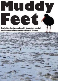
MUDDY FEET - Auckland Regional Council
MUDDY FEET - Auckland Regional Council
MUDDY FEET - Auckland Regional Council

You also want an ePaper? Increase the reach of your titles
YUMPU automatically turns print PDFs into web optimized ePapers that Google loves.
8<br />
The Firth’s geographical position makes it vulnerable to changes induced by natural events<br />
and human developments. The extent of impact arising from such events has, over the years,<br />
attracted considerable attention from numerous scientists and amateur naturalists. Land use in<br />
the catchment is predominantly agricultural, and recent years have seen intensified agriculture<br />
on the Hauraki Plains, accelerated growth of the <strong>Auckland</strong> and Waikato Regions, and the<br />
establishment of the Pacific Coast Highway around the perimeter of the Firth of Thames. This<br />
has resulted in ever increasing pressure on the environmental quality of this ecosystem. The<br />
Firth’s role as the receiving environment for the run-off from most of these areas also makes<br />
it a potentially very important site for monitoring of critical environmental indicators<br />
(Ministry for the Environment, 1997).<br />
1.4 Catchment<br />
The Firth receives freshwater influence directly from two main rivers: the Waihou and the<br />
Piako (Figures 1-2 and 1-3), the smaller Waitakaruru River, the Miranda Stream, Karito<br />
Canal, and a few lesser streams and drains in the west. The Waihou catchment extends back<br />
as far as Putaruru and together with the Piako drains nearly all of the Hauraki Plains.<br />
Historically this was covered with a vast kahikatea forest but is now developed for farming<br />
and a small amount of forestry. Within Hauraki District 67% of land is in primary<br />
production. The Waihou and Piako together contribute most of the sediments and nutrients<br />
that run off the land into the Firth of Thames. Much of the remainder of the catchment in<br />
Hauraki District lies within the Kopuatai peat dome - itself a Ramsar site and a major<br />
component of the Hauraki Plains Flood Control Scheme. There are also other small areas of<br />
peat bog and kahikatea forest under conservation management in the Waihou and Piako<br />
catchments.<br />
The wider Firth of Thames receives freshwater runoff from the Hunua and Coromandel<br />
Ranges - both largely vegetated in indigenous forest. Much of the Hunua water is diverted<br />
into large water supply dams serving <strong>Auckland</strong>, but flood flows from Coromandel rivers (in<br />
particular from the Kauaeranga, Te Puru, Waiomu, Tapu and Te Mata Rivers) can have a<br />
strong (if temporary) influence contributing to flooding of coastal settlements and sediment<br />
loading in the Firth.<br />
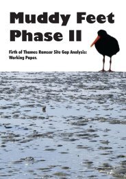
1.5 The Firth of Thames Ramsar Site<br />
The Firth of Thames Ramsar Site is comprised of intertidal area of the southern and western<br />
shores of the Firth of Thames between the west bank of the Waihou River and Kaiaua (Figure<br />
1-1and Figure 1-3). The intertidal area is defined by the extremes of mean low water spring<br />
tides (MLWS), and mean high water springs (MHWS), and covers about 8,500 ha (Veitch &<br />
Habraken, 1999). The vast, open inter-tidal mudflats, the mangrove communities that now<br />
cover much of the upper reaches of the intertidal zone, and the terrestrial areas adjacent to the<br />
mudflats are built on varying proportions of marine and land-derived sediments, old shell<br />
banks and vegetative debris.<br />
The graded shell banks of the coast between Miranda and Whakatiwai (Figure 1-1, Figure 6-3<br />
and Figure 9-2) are mainly derived from an active Chenier Plain, gradually pushed up on the<br />
shores by northeasterly storms and high tides. The Miranda Chenier Plain (course sediment<br />
and/or shell banks over-laying finer sediments) is unique in New Zealand, and one of the<br />
world’s finest examples of this rare coastal landform (Woodroffe, et al, 1983). A series of<br />
true Chenier ridges exist on the stretch of foreshore between Miranda and Kaiaua on the west<br />
coast of the Firth. This site has been the focus for a number of national and international<br />
EcoQuest Education Foundation EQRS/1 12/04