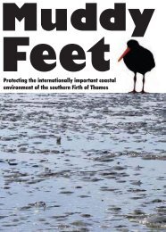
MUDDY FEET - Auckland Regional Council
MUDDY FEET - Auckland Regional Council
MUDDY FEET - Auckland Regional Council

You also want an ePaper? Increase the reach of your titles
YUMPU automatically turns print PDFs into web optimized ePapers that Google loves.
18<br />
3.1.1 Mangrove<br />
The mangrove dominates situations with muddy substrates that are subject to tidal inundation,<br />
particularly along streamsides and nearby mudflats. The dredged drainage channels that are<br />
subject to tidal inundation are also colonised. Few other vascular plants occur amongst the<br />
mangroves but in slightly better drained mangrove sites salt marsh ribbonwood may occur.<br />
Aerial photographs also show that slightly raised, cleared areas amongst the mangrove may<br />
be invaded by Spartina grass (Thomson 2000).<br />
There are a number of management issues associated with mangroves throughout the Ramsar<br />
Site, particularly along the Miranda – Kaiaua Coast. North of the Miranda Stream mangrove<br />
zones are now established along the stream channels and coastal lagoons, with occasional<br />
small patches in the coastal mud. Chapter 4 addresses mangroves in detail.<br />
In summary, mangroves provide several valuable functions:-<br />
• Consolidation of muddy foreshore areas, resulting in less erosion and protecting<br />
coastal areas from wave and some storm damage. (Note: Powerful storms of rare<br />
occurrence can erode the coast and wash away whole plants.)<br />
• Because of the stability of the mangrove habitat and the number of stems and<br />
pneumatophores for animals and plants to settle on, these areas provide protected<br />
habitats for invertebrates and fish, particularly for spawning. A food chain develops,<br />
the apex of which are predators such as fish and birds.<br />
• The shade provided by the mangrove trees prevents the mud drying out – a factor<br />
which can be important for the fauna, especially in prolonged periods of dry weather.<br />
3.1.2 Recent Shellbanks<br />
The large shell banks forming the spits into the sea and the eastern edge of the coastal Chenier<br />
plain are comparatively “young”. Plants colonising this habitat are generally ruderal weeds<br />
such as bur medick (Medicago nigra), pink bindweed (Calystegia sepium), viper’s bugloss<br />
(Echium vulgare), oxtongue (Picris echioides) and ribwort (Plantago lanceolata). Plants<br />
growing on these banks have to cope with exposure to desiccation from the wind and sun, and<br />
a lack of soil in the surface layer. Though most of these plants have wind-blown seeds, it is<br />
possible that some species may be dispersed by birds, as the shell spits and coastal meadows<br />
are favourite roosting places of the waders, and nesting sites of at least three bird species. On<br />
this western shore of the Firth these shell banks may abut salt marsh wetlands and grade into<br />
more weathered older shellbanks that have been modified by shell extraction and grazing of<br />
cattle.<br />
Other plants recorded colonising these areas are herb Robert (Geranium robertianum), beet<br />
(Beta vulgaris), stonecrop (Sedum acre), prickly sowthistle (Sonchus asper) and grasses such<br />
as Lolium perenne, Bromus diandrus, B. hordeaceus and Parapholis incurva. Occasional<br />
Scotch thistle (Cirsium arvense) with large taproots are found on these shellbanks.<br />
3.1.3 Glasswort Salt Marsh<br />
Salt marshes are generally located in the intertidal zone. They are flooded by the high tide<br />
and are exposed at low tide. Mitsch & Gosselink (1993) defined two broad categories of salt<br />
marshes as those formed from reworked marine sediments, and those formed by river<br />
sediments in deltaic areas. The salt marshes along the Miranda-Kaiaua coastline are marine<br />
dominated marshes. Salt marshes depend on a sufficient rate of sedimentation and avoidance<br />
of areas of coastal erosion. In the Miranda area, coastal erosion is avoided due to the band of<br />
EcoQuest Education Foundation EQRS/1 12/04