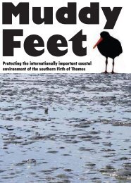
MUDDY FEET - Auckland Regional Council
MUDDY FEET - Auckland Regional Council
MUDDY FEET - Auckland Regional Council

You also want an ePaper? Increase the reach of your titles
YUMPU automatically turns print PDFs into web optimized ePapers that Google loves.
34<br />
5 Mangroves: The Cornerstone of a Dynamic<br />
Coastal Environment<br />
by Bill Brownell<br />
(with contributions from Marie Buchler, Ria Brejaart, Bruce Burns and Steve Clark)<br />
5.1 History<br />
Writing in 1769, Captain Cook comments on his discovery of the “River Thames” (meaning<br />
the current Firth of Thames and the Waihou River combined), “About the entrance to the<br />
narrow [Waihou] part of the River the land is mostly cover’d with Mangroves and other<br />
Shrubs, but further in are immence (sic) woods of as stout lofty timber as is to be found<br />
perhaps in any other part of the world: in many places the woods grow close upon the very<br />
banks of the River but where it doth not the land is Marchey (sic) …” (Beaglehole 1968).<br />
Mangroves were seldom mentioned in subsequent accounts, such as the Hauraki Minute<br />
Books of the Maori Land Court records (Phillips 2000) and the history of the Hauraki Plains<br />
(Tye 1974), mainly because they were not a dominant vegetation type in the area at the time,<br />
and were considered by both Maori and Europeans to be of little value.<br />
The aerial photography series of the southern Firth of Thames coast and Hauraki Plains from<br />
1944 indicate mangroves growing only at the mouths of the Waihou and Piako rivers. In<br />
1952, mangroves extended out slightly more into the tide from the river mouths (including the<br />
Waitakaruru), and they already had achieved quite dense coverage along the banks of the<br />
lower 2-3 kilometres of the Piako. A smattering of them were evident in small groupings on<br />
the coast extending away from the river mouths, with most of the intervening coastline still<br />
showing as apparently shelly/sandy beaches with no mangroves. By 1963 the whole coast<br />
from the Miranda Stream right around to the Waihou had limited coverage of fringing<br />
mangroves, with increasingly extended groupings around the river mouths. Subsequent aerial<br />
photographic records (1977, 1983, 1992, 1993, 1996 and 2002) provide a chronology of<br />
mangrove advancement in the upper Firth of Thames over the past 40 years. According to<br />
veteran local fishermen, the greatest rate of advancement has occurred over the past 3 years<br />
(2002-2004), mainly since the last aerial photos were taken in February 2002 (R. Smith and<br />
Peter Thorburn, personal communications 2004).<br />
5.2 Ecology<br />
The mangroves, or manawa, of the Firth of Thames, and indeed throughout their range in<br />
northern New Zealand, are of a single species originally called Avicennia marina var.<br />
resinifera, more recently referred to as A. marina var. australasica (Duke 1991, Young and<br />
Harvey 1996 and Burns 1998), and now simply identified as A. marina in both New Zealand<br />
and southern Australia (A-M Schwarz, personal communication 2004)<br />
Mangroves have been in New Zealand for at least 9,800 years, and most likely arrived here<br />
considerably before that in the form of propagules drifting over from Australia in the middle<br />
tertiary period (Crisp, et al. 1990). A. marina is the most cold tolerant of all the numerous<br />
mangrove species found mainly between the tropics of Cancer and Capricorn around the<br />
world, and currently exists at a latitude of 38 o 54’ on the south coast of Australia. The<br />
southern margin of the Firth of Thames and associated tidal rivers sustains (at 37 o 14’) one of<br />
the most southerly occurrences of mangroves in New Zealand, and by far the most abundant<br />
population found near the current limits of its range. There are also substantial mangrove<br />
populations at nearby Tauranga and Ohiwa Harbours southeast of the Firth of Thames.<br />
EcoQuest Education Foundation EQRS/1 12/04