introduction — fasid - ICAO Public Maps
introduction — fasid - ICAO Public Maps
introduction — fasid - ICAO Public Maps

You also want an ePaper? Increase the reach of your titles
YUMPU automatically turns print PDFs into web optimized ePapers that Google loves.
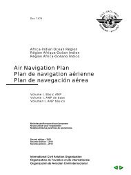
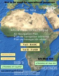
Doc 7474<br />
Africa-Indian Ocean Region<br />
Région Afrique-Océan Indien<br />
Régión África-Océano Índico<br />
Air Navigation Plan<br />
Plan de navigation aérienne<br />
Plan de navegación aérea<br />
Volume II, FASID<br />
Volume II, FASID<br />
Volumen II, FASID
RECORD OF AMENDMENTS AND CORRIGENDA<br />
INSCRIPTION DES AMENDEMENTS ET<br />
LISTA DE ENMIENDAS Y<br />
AMENDMENTS<br />
AMENDEMENTS<br />
ENMIENDAS<br />
CORRIGENDA<br />
No.<br />
N o<br />
Núm.<br />
Date issued<br />
Date entered<br />
Date<br />
d’inscription<br />
Fecha de<br />
anotación<br />
Entered by<br />
Inscrit par<br />
Anotada por<br />
No.<br />
N o<br />
Núm.<br />
Date issued<br />
Date entered<br />
Date<br />
d’inscription<br />
Fecha de<br />
anotación<br />
Entered by<br />
Inscrit par<br />
Anotada por<br />
The designations employed and the presentation of the material in this<br />
publication do not imply the expression of any opinion whatsoever on the part<br />
of <strong>ICAO</strong> concerning the legal status of any country, territory, city or area or<br />
of its authorities, or concerning the delimitation of its frontiers or boundaries.<br />
Les appellations employées dans cette publication et la présentation des<br />
éléments qui y figurent n’impliquent de la part de l’OACI aucune prise de<br />
position quant au statut juridique des pays, territoires, villes ou zones, ou de<br />
leurs autorités, ni quant au tracé de leurs frontières ou limites.<br />
Las denominaciones empleadas en esta publicación y la forma en que<br />
aparecen presentados los datos que contiene no implican, de parte de la OACI,<br />
juicio alguno sobre la condición jurídica de ninguno de los países, territorios,<br />
ciudades o áreas, o de sus autoridades, ni respecto de la delimitación de sus<br />
fronteras o límites.<br />
ii
FACILITIES AND SERVICES IMPLEMENTATION<br />
DOCUMENT (FASID) <strong>—</strong><br />
AFRICA-INDIAN OCEAN REGION<br />
DOCUMENT SUR LA MISE EN ŒUVRE DES INSTALLATIONS<br />
ET SERVICES (FASID) <strong>—</strong><br />
RÉGION AFRIQUE-OCÉAN INDIEN<br />
DOCUMENTO SOBRE LAS INSTALACIONES<br />
Y SERVICIOS (FASID) <strong>—</strong><br />
REGIÓN ÁFRICA-OCÉANO ÍNDICO<br />
Doc 7474<br />
Volume II<br />
Volumen II<br />
Corrigendum<br />
Rectificatif<br />
Corrigendo<br />
27/2/04<br />
1. Insert the following page:<br />
REPRINT<br />
29/6/04<br />
Part III III-AOP 1-33<br />
2. Record the entry of this corrigendum on page ii.<br />
1. Insérer la page ci-jointe:<br />
Partie III III-AOP 1-33<br />
2. Inscrire le rectificatif à la page ii.<br />
1. Insértese la siguiente página:<br />
Parte III III-AOP 1-33<br />
2. Anótese este corrigendo en la página ii.
0-E-iii<br />
TABLE OF CONTENTS<br />
Introduction <strong>—</strong> FASID ........................................................................ 0-E-1<br />
Part I <strong>—</strong> Basic operational requirements and planning criteria (BORPC) <strong>—</strong> FASID ...................... I-E-1<br />
Page<br />
Part II <strong>—</strong> General planning aspects (GEN) <strong>—</strong> FASID<br />
Forecasts ................................................................................<br />
Airport development in the AFI region ..........................................................<br />
Guidance for implementation .................................................................<br />
II-E-1<br />
II-E-3<br />
II-E-3<br />
Part III <strong>—</strong> Aerodrome operational planning (AOP) <strong>—</strong> FASID<br />
Introduction .............................................................................. III-E-1<br />
Aerodrome facilities and services ............................................................. III-E-1<br />
Runway surface condition information .......................................................... III-E-1<br />
Aerodrome emergency planning ............................................................... III-E-1<br />
Table AOP 1 <strong>—</strong> Physical characteristics, radio and visual aids at aerodromes .......................... III-AOP 1-1<br />
Chart AOP 1 <strong>—</strong> Index of aerodromes<br />
Part IV <strong>—</strong> Communications, navigation and surveillance (CNS) <strong>—</strong> FASID<br />
Introduction .............................................................................. IV-E-1<br />
Aeronautical fixed service (AFS) ............................................................. IV-E-1<br />
Aeronautical mobile service (AMS ............................................................ IV-E-1<br />
Aeronautical radio navigation service .......................................................... IV-E-1<br />
Aeronautical surveillance .................................................................... IV-E-1<br />
Table CNS 1A <strong>—</strong> Aeronautical Fixed Telecommunication Network ................................... IV-CNS 1A-1<br />
Chart CNS 1A <strong>—</strong> Rationalized AFTN plan<br />
Table CNS 1B <strong>—</strong> ATN router plan (To be developed) ............................................. IV-CNS 1B-1<br />
Chart CNS 1B <strong>—</strong> ATN router plan (To be developed)<br />
Table CNS 1C <strong>—</strong> ATS message handling services (AMHS) routing plan (To be developed) ............... IV-CNS 1C-1<br />
Chart CNS 1C <strong>—</strong> ATS message handling services (AMHS) routing plan (To be developed)<br />
Table CNS 1D <strong>—</strong> ATS direct speech circuits plan ................................................ IV-CNS 1D-1<br />
Chart CNS 1D <strong>—</strong> ATS direct speech circuits plan<br />
Chart CNS 1E <strong>—</strong> Coverage of the satellite distribution system for information relating to air navigation<br />
(SADIS) for the dissemination of WAFS products using INTELSAT satellite 604 at 60/ E<br />
Table CNS 2 <strong>—</strong> Aeronautical mobile service .................................................... IV-CNS 2-1<br />
VHF frequency utilization plan ............................................................. IV-CNS 2-17<br />
HF en-route radiotelephony networks and VHF extended range .................................... IV-CNS 2-21<br />
Chart CNS 2 <strong>—</strong> HF en-route radiotelephony networks and VHF extended range<br />
Table CNS 3 <strong>—</strong> Table of radio navigation aids ................................................... IV-CNS 3-1<br />
Appendix A to Table CNS 3 ...............................................................IV-CNS 3-A-E-1<br />
Appendix B to Table CNS 3 ...............................................................IV-CNS 3-B-E-1<br />
Chart CNS 3A <strong>—</strong> En-route radio navigation aids<br />
Chart CNS 3B <strong>—</strong> Aids to final approach and landing<br />
Table CNS 4A <strong>—</strong> Surveillance systems ......................................................... IV-CNS 4A-1<br />
Table CNS 4B <strong>—</strong> ATS automation systems ...................................................... IV-CNS 4B-1
0-E-iv<br />
AFI FASID<br />
Page<br />
Part V <strong>—</strong> Air traffic management (ATM) <strong>—</strong> FASID<br />
Introduction ..............................................................................<br />
SSR code allotment plan ....................................................................<br />
Appendix A <strong>—</strong> ATM evolution tables ..........................................................<br />
Appendix B <strong>—</strong> Allocation and assignment of secondary surveillance radar (SSR) codes in the AFI region .....<br />
Chart ATM 1 <strong>—</strong> Map of AFI participating areas (To be developped)<br />
Table ATS 2A <strong>—</strong> HF VOLMET broadcasts .....................................................<br />
Table ATS 2B <strong>—</strong> VHF VOLMET broadcasts ....................................................<br />
Table ATS 3 <strong>—</strong> SSR code assignment system (international and domestic) .............................<br />
Chart ATS 4 <strong>—</strong> VOLMET broadcasts<br />
V-E-1<br />
V-E-1<br />
V-A-E-1<br />
V-B-E-1<br />
V-2A-1<br />
V-2B-1<br />
V-3-1<br />
Part VI <strong>—</strong> Meteorology (MET) <strong>—</strong> FASID<br />
Introduction .............................................................................. VI-E-1<br />
Meteorological service required at aerodromes and requirements for meteorological watch offices .......... VI-E-1<br />
Exchange of MET information for operations ..................................................... VI-E-1<br />
Tropical cyclone and volcanic ash advisory centres ............................................... VI-E-1<br />
World area forecast system (WAFS) ........................................................... VI-E-2<br />
Table MET 1A <strong>—</strong> Meteorological service required at aerodromes ................................... VI-MET 1A-1<br />
Chart MET 1 <strong>—</strong> Chart showing the AFTN routing areas identified by the letters in column 7<br />
of Table MET 1A<br />
Table MET 1B <strong>—</strong> Meteorological watch offices .................................................. VI-MET 1B-1<br />
Table MET 2A <strong>—</strong> Exchange of operational meteorological information ................................ VI-MET 2A-1<br />
Table MET 2B <strong>—</strong> Exchange of SIGMET and special AIREP messages ................................ VI-MET 2B-1<br />
Table MET 2C <strong>—</strong> Exchange of operational meteorological information during the pilgrimage season ......... VI-MET 2C-1<br />
Table MET 3A <strong>—</strong> Tropical cyclone advisory centre ............................................... VI-MET 3A-1<br />
Table MET 3B <strong>—</strong> Volcanic ash advisory centre .................................................. VI-MET 3B-1<br />
Chart MET 3A <strong>—</strong> Current status of <strong>ICAO</strong> tropical cyclone advisory centres (TCACs) <strong>—</strong><br />
Areas of responsibility<br />
Chart MET 3B <strong>—</strong> Current status of <strong>ICAO</strong> volcanic ash advisory centres (VAAC) <strong>—</strong><br />
Areas of responsibility<br />
Table MET 4A <strong>—</strong>AFI MET bulletin exchange (AMBEX) scheme collection areas for<br />
aerodrome forecasts ..................................................................... VI-MET 4A-1<br />
Table MET 4B <strong>—</strong>AFI MET bulletin exchange (AMBEX) scheme collection areas for<br />
air-reports ............................................................................. VI-MET 4B-1<br />
Table MET 5 <strong>—</strong> Requirements for WAFS products ............................................... VI-MET 5-1<br />
Table MET 6 <strong>—</strong> Responsibilities of the world area forecast centres .................................. VI-MET 6-1<br />
Chart MET 4 <strong>—</strong> Maximum areas of coverage <strong>—</strong> Mercator projection<br />
Chart MET 5 <strong>—</strong> Maximum areas of coverage <strong>—</strong> Polar stereographic projection<br />
Chart MET 6 <strong>—</strong> Maximum areas of coverage <strong>—</strong> Polar stereographic projection<br />
Chart MET 7 Table MET 7 <strong>—</strong> Status of authorized access by SADIS users to the satellite broadcast and<br />
location of the operational VSATs .......................................................... VI-MET 7-1<br />
Part VII <strong>—</strong> Search and rescue services (SAR) <strong>—</strong> FASID<br />
Introduction .............................................................................. VII-E-1<br />
Search and rescue facilities .................................................................. VII-E-1<br />
Table SAR 1 <strong>—</strong> Search and rescue facilities ..................................................... VII-SAR 1-1
Table of Contents<br />
0-E-v<br />
Part VIII <strong>—</strong> Aeronautical information services and charts (AIS/MAP) <strong>—</strong> FASID<br />
Introduction .............................................................................. VIII-E-1<br />
Organization and provision of aeronautical information services and charts ............................. VIII-E-1<br />
Table AIS 1 <strong>—</strong> Establishment of aerodrome AIS units ............................................. VIII-AIS 1-1<br />
Table AIS 2 <strong>—</strong> Aeronautical information services required at aerodromes ............................. VIII-AIS 2-1<br />
Table AIS 3 <strong>—</strong> Designated international NOTAM offices (NOF) in the AFI region ....................... VIII-AIS 3-1<br />
Chart AIS 1 <strong>—</strong> International NOTAM offices and areas of responsibility<br />
Table AIS 4 <strong>—</strong> Availability of aeronautical information (To be developed) ............................ VIII-AIS 4-1<br />
Table AIS 5 <strong>—</strong> WGS-84 requirements .......................................................... VIII-AIS 5-1<br />
Table AIS 6 <strong>—</strong> Aeronautical chart requirements .................................................. VIII-AIS 6-1<br />
Table AIS 7 <strong>—</strong> Production responsibility for sheets of the World Aeronautical Chart <strong>—</strong><br />
<strong>ICAO</strong> 1:1 000 000 ....................................................................... VIII-AIS 7-1<br />
Chart AIS 2 <strong>—</strong> Sheet layout and production responsibility for World Aeronautical Chart <strong>—</strong><br />
<strong>ICAO</strong> 1:1 000 000<br />
Table AIS 8 <strong>—</strong> Requirements of the Integrated Aeronautical Information Package ........................ VIII-AIS 8-1<br />
Attachment <strong>—</strong> Sample of an aeronautical information circular (AIC) on the use of GPS as<br />
supplemental means of navigation ........................................................... VII-AIS-A-E-1<br />
Appendix <strong>—</strong> Summary of amendments to the FASID ............................................... A-E-1<br />
Page
0-F-III<br />
TABLE DES MATIÈRES<br />
Introduction <strong>—</strong> FASID ....................................................................... 0-F-1<br />
Partie I <strong>—</strong> Besoins fondamentaux de l’exploitation et critères de planification (BORPC) <strong>—</strong> FASID ..... I-F-1<br />
Page<br />
Partie II <strong>—</strong> Aspects généraux de la planification (GEN) <strong>—</strong> FASID<br />
Prévisions ...............................................................................<br />
Amélioration des aéroports de la Région AFI ....................................................<br />
Éléments indicatifs de mise en œuvre ..........................................................<br />
II-F-1<br />
II-F-3<br />
II-F-3<br />
Partie III <strong>—</strong> Planification opérationnelle d’aérodrome (AOP) <strong>—</strong> FASID<br />
Introduction .............................................................................. III-F-1<br />
Installations et services d’aérodrome .......................................................... III-F-1<br />
Renseignements sur l’état des pistes ........................................................... III-F-1<br />
Plan d’urgence d’aérodrome ................................................................. III-F-1<br />
Tableau AOP 1 <strong>—</strong> Caractéristiques physiques, aides radio et aides visuelles aux aérodromes ............. III-AOP 1-1<br />
Carte AOP 1 <strong>—</strong> Carte d’ensemble des aérodromes<br />
Partie IV <strong>—</strong> Communications, navigation et surveillance (CNS) <strong>—</strong> FASID<br />
Introduction .............................................................................. IV-F-1<br />
Service fixe aéronautique (SFA) .............................................................. IV-F-1<br />
Service mobile aéronautique (SMA) .......................................................... IV-F-1<br />
Service de radionavigation aéronautique ....................................................... IV-F-1<br />
Surveillance aéronautique ................................................................... IV-F-1<br />
Tableau CNS 1A <strong>—</strong> Réseau du service fixe des télécommunications aéronautiques ..................... IV-CNS 1A-1<br />
Carte CNS 1A <strong>—</strong> Plan du RSFTA rationalisé<br />
Tableau CNS 1B <strong>—</strong> Plan des routeurs ATN (à venir) ............................................. IV-CNS 1B-1<br />
Carte CNS 1B <strong>—</strong> Plan des routeurs ATN (à venir)<br />
Tableau CNS 1C <strong>—</strong> Plan de routage des services de messagerie ATS (AMHS) (à venir) ................. IV-CNS 1C-1<br />
Carte CNS 1C <strong>—</strong> Plan de routage des services de messagerie ATS (AMHS) (à venir)<br />
Tableau CNS 1D <strong>—</strong> Plan des circuits vocaux directs ATS ......................................... IV-CNS 1D-1<br />
Carte CNS 1D <strong>—</strong> Plan des circuits vocaux directs ATS<br />
Carte CNS 1E <strong>—</strong> Couverture du Système de diffusion par satellite d’informations relatives à la<br />
navigation aérienne (SADIS) pour les produits du SMPZ au moyen d’INTELSAT 604 à 60 /E<br />
Tableau CNS 2 <strong>—</strong> Service mobile aéronautique ................................................. IV-CNS 2-1<br />
Plan d’utilisation des fréquences VHF ....................................................... IV-CNS 2-17<br />
Réseaux radioléléphoniques HF en route et VHF à portée étendue ................................ IV-CNS 2-21<br />
Carte CNS 2 <strong>—</strong> Réseaux radiotéléphoniques HF en route et VHF à portée étendue<br />
Tableau CNS 3 <strong>—</strong> Aides de radionavigation .................................................... IV-CNS 3-1<br />
Appendice A au Tableau CNS 3 ......................................................... IV-CNS 3-A-F-1<br />
Appendice B au Tableau CNS 3 ..........................................................IV-CNS 3-B-F-1<br />
Carte CNS 3A <strong>—</strong> Aides de radionavigation en route<br />
Carte CNS 3B <strong>—</strong> Aides à l’approche finale et à l’atterrissage<br />
Tableau CNS 4A <strong>—</strong> Systèmes de surveillance ................................................... IV-CNS 4A-1<br />
Tableau CNS 4B <strong>—</strong> Systèmes ATS automatisés ................................................. IV-CNS 4B-1
0-F-IV<br />
FASID AFI<br />
Page<br />
Partie V <strong>—</strong> Gestion du trafic aérien (ATM) <strong>—</strong> FASID<br />
Introduction ..............................................................................<br />
Plan d’allotissement des codes SSR ...........................................................<br />
Appendice A <strong>—</strong> Tableaux d’évolution de l’ATM ................................................<br />
Appendice B <strong>—</strong> Attribution et assignation des codes SSR (radar secondaire de surveillance)<br />
dans la Région AFI ......................................................................<br />
Carte ATM 1 <strong>—</strong>Régions d’application AFI (à venir)<br />
Tableau ATS 2A <strong>—</strong> Émissions radiotéléphoniques VOLMET HF ...................................<br />
Tableau ATS 2B <strong>—</strong> Émissions VHF VOLMET .................................................<br />
Tableau ATS 3 <strong>—</strong> Système d’attribution des codes SSR (international et intérieur) .....................<br />
Carte ATS 4 <strong>—</strong> Émissions VOLMET<br />
V-F-1<br />
V-F-1<br />
V-A-F-1<br />
V-B-F-1<br />
V-2A-1<br />
V-2B-1<br />
V-3-1<br />
Partie VI <strong>—</strong> Météorologie (MET) <strong>—</strong> FASID<br />
Introduction .............................................................................. VI-F-1<br />
Assistance météorologique aux aérodromes et besoins en centres de veille météorologique ............... VI-F-1<br />
Échange de renseignements météorologiques d’exploitation ........................................ VI-F-1<br />
Centres d’avis de cyclones tropicaux et de cendres volcaniques ..................................... VI-F-2<br />
Système mondial de prévisions de zone (SMPZ) ................................................. VI-F-2<br />
Tableau MET 1A <strong>—</strong> Assistance météorologique à mettre en œuvre aux aérodromes .................... VI-MET 1A-1<br />
Carte MET 1 <strong>—</strong> Zones de routage du RSFTA correspondant aux lettres de la colonne 7<br />
du Tableau MET 1A<br />
Tableau MET 1B <strong>—</strong> Centres de veille météorologique ............................................ VI-MET 1B-1<br />
Tableau MET 2A <strong>—</strong> Échange de renseignements météorologiques d’exploitation ...................... VI-MET 2A-1<br />
Tableau MET 2B <strong>—</strong> Échange de messages SIGMET et de messages AIREP spéciaux ................... VI-MET 2B-1<br />
Tableau MET 2C <strong>—</strong> Échange de renseignements météorologiques d’exploitation pendant<br />
la saison de pèlerinage ................................................................... VI-MET-2C-1<br />
Tableau MET 3A <strong>—</strong> Centre d’avis de cyclones tropicaux ......................................... VI-MET 3A-1<br />
Tableau MET 3B <strong>—</strong> Centre d’avis de cendres volcaniques ........................................ VI-MET 3B-1<br />
Carte MET 3A <strong>—</strong> Situation actuelle des centres d’avis de cyclones tropicaux (TCAC) OACI <strong>—</strong><br />
Zones de responsabilité<br />
Carte MET 3B <strong>—</strong> Situation actuelle des centres OACI d’avis de cendres volcaniques (VAAC) <strong>—</strong><br />
Zones de responsabilité<br />
Tableau MET 4A <strong>—</strong> Système d’échange des bulletins MET AFI (AMBEX) <strong>—</strong><br />
Zones de collecte des prévisions d’aérodrome ................................................ VI-MET 4A-1<br />
Tableau MET 4B <strong>—</strong> Système d’échange des bulletins MET AFI (AMBEX) <strong>—</strong><br />
Zones de collecte des comptes rendus en vol .................................................. VI-MET 4B-1<br />
Tableau MET 5 <strong>—</strong> Besoins en produits du SMPZ ................................................ VI-MET 5-1<br />
Tableau MET 6 <strong>—</strong> Responsabilités des centres mondiaux de prévisions de zone ....................... VI-MET 6-1<br />
Carte MET 4 <strong>—</strong> Zones de couverture maximale <strong>—</strong> Projection Mercator<br />
Carte MET 5 <strong>—</strong> Zones de couverture maximale <strong>—</strong> Projection stéréographique polaire (Nord)<br />
Carte MET 6 <strong>—</strong> Zones de couverture maximale <strong>—</strong> Carte Europe<br />
Carte MET 7 <strong>—</strong> Zones de couverture maximale <strong>—</strong> Projection stéréographique polaire (Sud)<br />
Tableau MET 7 <strong>—</strong> Statut d’accès autorisé des utilisateurs du SADIS aux diffusions par satellite<br />
et emplacement des VSAT opérationnels .................................................... VI-MET 7-1<br />
Partie VII <strong>—</strong> Recherches et sauvetage (SAR) <strong>—</strong> FASID<br />
Introduction .............................................................................. VII-F-1<br />
Moyens de recherches et de sauvetage ......................................................... VII-F-1<br />
Tableau SAR 1 <strong>—</strong> Moyens de recherches et de sauvetage .......................................... VII-SAR 1-1
Table des matières<br />
0-F-V<br />
Partie VIII <strong>—</strong> Information et cartes aéronautiques (AIS/MAP) <strong>—</strong> FASID<br />
Introduction .............................................................................. VIII-F-1<br />
Établissement et fourniture de services d’information et de cartes aéronautiques ........................ VIII-F-1<br />
Tableau AIS 1 <strong>—</strong> Établissement de bureaux AIS d’aérodrome ...................................... VIII-AIS 1-1<br />
Tableau AIS 2 <strong>—</strong> Services d’information aéronautique requis aux aérodromes ......................... VIII-AIS 2-1<br />
Tableau AIS 3 <strong>—</strong> Bureaux NOTAM internationaux (NOF) désignés pour la Région AFI ................ VIII-AIS 3-1<br />
Carte AIS 1 <strong>—</strong> Bureaux NOTAM internationaux et zones de responsabilité<br />
Tableau AIS 4 <strong>—</strong> Disponibilité des renseignements aéronautiques (À venir) .......................... VIII-AIS 4-1<br />
Tableau AIS 5 <strong>—</strong> Besoins relatifs au système WGS-84 ........................................... VIII-AIS 5-1<br />
Tableau AIS 6 <strong>—</strong> Besoins relatifs aux cartes aéronautiques ........................................ VIII-AIS 6-1<br />
Tableau AIS 7 <strong>—</strong> Responsabilité de la production des feuilles de la carte aéronautique<br />
du monde au 1/1 000 000 <strong>—</strong> OACI ......................................................... VIII-AIS 7-1<br />
Carte AIS 2 <strong>—</strong> Tableau d’assemblage et responsabilité de l’exécution des feuilles de<br />
la carte aéronautique du monde au 1/1 000 000 <strong>—</strong> OACI<br />
Tableau AIS 8 <strong>—</strong> Besoins relatifs au système intégré d’information aéronautique ....................... VIII-AIS 8-1<br />
Supplément <strong>—</strong> Échantillon de Circulaire d’information aéronautique (AIC) sur l’utilisation du GPS<br />
comme moyen de navigation supplémentaire ................................................. VIII-A-F-1<br />
Appendice <strong>—</strong> Sommaire des amendements du FASID ............................................ A-F-1<br />
Page
0-E-1<br />
INTRODUCTION <strong>—</strong> FASID<br />
1. This second volume of the Air Navigation Plan<br />
(ANP) constitutes the AFI Facilities and Services Implementation<br />
Document (FASID) and accompanies the AFI Basic<br />
ANP. The background to the publication of ANPs in two<br />
volumes (Basic ANP and FASID) is explained in the<br />
<strong>introduction</strong> to the AFI Basic ANP. This FASID may only be<br />
amended according to the procedure approved by the <strong>ICAO</strong><br />
Council as shown in the introductory part of the AFI Basic<br />
ANP.<br />
2. This FASID contains the details of the facilities and<br />
services to be provided in order to fulfill the basic<br />
requirements of the plan and are as agreed between the<br />
provider and user States concerned. Such agreement indicates<br />
a commitment on the part of the State(s) concerned to<br />
implement the requirement(s) specified. The elements of the<br />
FASID are kept under constant review by the AFI Planning<br />
and Implementation Regional Group (APIRG) in accordance<br />
with its schedule of management, in consultation with user<br />
and provider States, and with the assistance of the <strong>ICAO</strong><br />
Eastern and Southern African (ESAF) and the Western and<br />
Central African (WACAF) Regional Offices in Nairobi and<br />
Dakar, respectively. Most of the contents of the FASID<br />
originate from recommendations of the AFI/7 Regional Air<br />
Navigation Meeting (Abuja, 1997) and earlier AFI RAN<br />
meetings, as well as from APIRG conclusions.<br />
3. The Standards, Recommended Practices and<br />
Procedures to be applied and related guidance material for<br />
each part of the FASID (i.e. GEN, AOP, CNS, ATM, MET,<br />
SAR and AIS) are as listed in the equivalent parts of the Basic<br />
ANP. The BORPC in Part I of the AFI Basic ANP is also<br />
taken into consideration in the overall planning processes for<br />
the AFI region.
0-F-1<br />
INTRODUCTION <strong>—</strong> FASID<br />
1. Le présent Document de mise en œuvre des<br />
installations et services (FASID) est le second volume du Plan<br />
de navigation aérienne (ANP) de la Région Afrique-Océan<br />
Indien (AFI), et il est destiné à être utilisé en parallèle avec le<br />
premier volume, à savoir l’ANP de base AFI. Des<br />
renseignements généraux sur la publication des plans de navigation<br />
aérienne en deux volumes (ANP de base et FASID)<br />
figurent dans l’Introduction de l’ANP de base. Le FASID ne<br />
peut être amendé que selon la procédure approuvée par le<br />
Conseil de l’OACI, qui est exposée dans l’Introduction de<br />
l’ANP de base.<br />
2. Le FASID contient le détail des installations et des<br />
services à mettre en œuvre pour satisfaire aux besoins<br />
fondamentaux indiqués dans le Plan, comme convenu entre les<br />
États fournisseurs et les États utilisateurs intéressés. Une telle<br />
entente signifie que les États en question s’engagent à faire le<br />
nécessaire pour répondre aux besoins spécifiés. Les éléments du<br />
FASID font l’objet d’un examen permanent du Groupe régional<br />
AFI de planification et de mise en œuvre (APIRG),<br />
conformément à son calendrier de gestion, en consultation avec<br />
les États fournisseurs et les États utilisateurs et avec le concours<br />
des Bureaux régionaux Afrique orientale et australe (ESAF) et<br />
Afrique occidentale et centrale (WACAF) de l’OACI, situés<br />
respectivement à Naïrobi et à Dakar. La plupart des éléments<br />
figurant dans le FASID proviennent de recommandations de la<br />
Réunion régionale de navigation aérienne AFI/7 (Abuja, 1997),<br />
de réunions régionales AFI antérieures et de conclusions de<br />
l’APIRG.<br />
3. Les normes, pratiques recommandées et procédures<br />
à appliquer pour chaque partie du FASID (à savoir GEN,<br />
AOP, CNS, ATM, MET, SAR et AIS), ainsi que les éléments<br />
indicatifs correspondants, sont indiqués dans les parties<br />
correspondantes de l’ANP de base. L’exposé des besoins<br />
fondamentaux de l’exploitation et des critères de planification<br />
(BORPC) qui figure à la Partie I de l’ANP de base AFI est<br />
également pris en compte dans les processus de planification<br />
générale concernant la Région AFI.
I-E-1<br />
Part I<br />
BASIC OPERATIONAL REQUIREMENTS AND<br />
PLANNING CRITERIA (BORPC) <strong>—</strong> FASID<br />
The facilities and services set out in this FASID have been<br />
developed by the regional planning process referred to in the<br />
AFI Basic ANP. The Basic Operational Requirements and<br />
Planning Criteria agreed by the <strong>ICAO</strong> Air Navigation<br />
Commission for use in the AFI region is the cornerstone of<br />
that process.
I-F-1<br />
Partie I<br />
BESOINS FONDAMENTAUX DE L’EXPLOITATION ET<br />
CRITÈRES DE PLANIFICATION (BORPC) <strong>—</strong> FASID<br />
Les installations et les services spécifiés dans le présent<br />
document ont été déterminés dans le cadre du processus de<br />
planification régionale dont il est fait état dans l’ANP de base<br />
AFI. Les besoins fondamentaux de l’exploitation et les<br />
critères de planification que la Commission de navigation<br />
aérienne de l’OACI a approuvés pour la Région AFI<br />
constituent la pierre angulaire de ce processus.
II-E-1<br />
Part II<br />
GENERAL PLANNING ASPECTS (GEN) <strong>—</strong> FASID<br />
FORECASTS<br />
Traffic forecasts in the AFI region<br />
1. Using the methodology described in the Basic ANP,<br />
traffic forecasts for the major route groups for 1998–2012<br />
have been developed. The forecasts developed by other<br />
organizations are also utilized as appropriate.<br />
2. The historical trends in load factors and average seats<br />
for the areas of routing concerned as well as expectations of<br />
future load factors and trends in average seats will be<br />
developed by the AFI Traffic Forecasting Task Force (TF/TF)<br />
and included in this part in the future.<br />
3. The assumptions to be developed by the AFI TF/TF<br />
for load factors, average seat capacity increases and<br />
consequent growth rates for aircraft movements will also be<br />
included in this part in the future.<br />
4. The traffic forecasts developed for the period<br />
1998–2012 for each of the areas of routing are described in<br />
Tables II-11 and 12.<br />
5. The following paragraphs provide data extracted<br />
from the traffic forecast study done by IATA in 2000 for the<br />
AFI Planning Implementation Regional Group (APIRG).<br />
Average aircraft size<br />
6. The average number of seats per flight on scheduled<br />
services to, from and within Africa was stable between 1994<br />
and 1996, but showed a significant increase in 1997:<br />
Year<br />
Average seats per flight<br />
1994 117.5<br />
1995 118.5<br />
1996 117.8<br />
1997 122<br />
Source: OAG data<br />
7. Globally, average fleet size (the number of aircraft in<br />
an airline’s fleet as opposed to average number of seats per<br />
flight) is expected to increase by around 0.3 per cent per annum<br />
over the next 20 years.* Having reviewed current orders for jet<br />
aircraft placed by African airlines, growth in average fleet size<br />
was set to increase at an average annual rate of 0.2 per cent<br />
lower than the global forecast rate. Taking into account fleet<br />
retirements, which tend to be the older and, on average, smaller<br />
aircraft, it is expected that average fleet size for carriers based<br />
in Africa will increase by just over 0.2 per cent per annum.<br />
8. Non-African airlines provided a larger share of seat<br />
capacity to and from Africa. These carriers are expected to<br />
have a higher increase in average fleet size than the global<br />
average. Accordingly, the overall average annual growth in<br />
fleet size for the forecast was assumed to be 0.3 per cent.<br />
9. However, this percentage was not applied across the<br />
board. Airlines usually want to offer additional flights rather<br />
than larger aircraft, as passengers prefer the flexibility offered<br />
by more frequent flights. On most long-haul routes, airlines<br />
will tend to increase frequency to at least daily service before<br />
using larger aircraft. On short-haul routes, generally more<br />
frequent service is required, although many short- and<br />
medium-haul routes within Africa are not yet served by daily<br />
flights.<br />
10. Therefore, on routes to, from and within Africa with<br />
fewer than two flights per week, no increase in average<br />
aircraft size was assumed. This assumed that additional<br />
demand would be met by increased frequencies. This<br />
threshold of two flights per week was increased to three<br />
flights per week from 2002 onwards, and to four flights per<br />
week from 2007 onwards.<br />
11. For flights overflying Africa, average frequencies<br />
tended to be much higher, and the daily flights threshold was<br />
used for these routes.<br />
*Boeing Current Market Outlook 1998
II-E-2<br />
12. It was assumed that those routes forecast to achieve<br />
strong growth would require larger than average growth in<br />
average aircraft size. In those instances, a sliding scale was<br />
introduced. There were some routes which anticipated decline<br />
(usually for just one or two years); for those routes no<br />
increase in aircraft size was assumed. Small growth routes had<br />
an additional 0.1 per cent increase. This amounts to an<br />
additional 2 per cent increase for those (few) routes that were<br />
forecast to grow by more than 50 per cent in a year. All these<br />
adjustments were made on an annual basis.<br />
13. The net effect of these adjustments was to<br />
redistribute average aircraft size growth over the various<br />
routes. This impacted the number of flights forecast to operate<br />
within each individual FIR. The average increase following<br />
the adjustments described above fluctuated between 0.2 and<br />
0.3 per cent for each forecast year.<br />
14. Scheduled routes between Europe and the Canary<br />
Islands are currently operated at high frequencies. They are<br />
also flown from increasingly slot-congested airports such as<br />
Madrid and Lisbon. It was assumed that average aircraft size<br />
would grow by 1 per cent per annum on these routes, adjusted<br />
upwards for high growth. The resulting combined average<br />
increase in aircraft size was between 1.2 and 1.5 per cent per<br />
annum.<br />
Passenger load factors<br />
15. Passenger load factors, resulting from the optimum<br />
match of market price with demand (yield management),<br />
provides airline management with the means to influence the<br />
number of flights. The long-term trend for IATA member<br />
airlines is showing a gradual increase in average passenger<br />
load factor, but this is influenced by cyclical pressures. It was<br />
assumed in the forecast that for the period 1998–1999,<br />
average passenger load factor would decrease by 1 percentage<br />
point, and for the period 2001–2002, it would increase again<br />
by 1 percentage point. Beyond 2002 it was assumed that<br />
passenger load factors would remain unchanged.<br />
Forecasts by the International Air<br />
Transport Association (IATA)<br />
16. The following aircraft movement forecasts were<br />
based on the annual Passenger Traffic Forecast produced by<br />
IATA. The Passenger Traffic Forecast was based on the<br />
collective opinion of some 80 airlines, other aviation<br />
organizations and IATA experts. Data was collected to<br />
establish base year passenger traffic (1997) between States,<br />
AFI FASID<br />
and forecast growth rates for the next five years (1998–2002),<br />
and average annual growth rates for the years 2002 and 2012.<br />
The forecasts contain State to region passenger forecasts, and<br />
various other aggregates and analyses.<br />
17. Tables II-1 to II-3 detail results for the movement<br />
forecast for flights to, from and within Africa for the period<br />
1998-2012. Table II-1 details the scheduled movements<br />
forecast. As well as the movement forecast for traffic to, from<br />
and within Africa, this table includes details of the two major<br />
scheduled traffic flows which overfly Africa, Europe to the<br />
Canary Islands, and Europe to South America. Table II-2<br />
details charter movements from Western Europe to Africa and<br />
overflying traffic to and from the Canary Islands. Table II-3<br />
shows details of all commercial flight movements to, from and<br />
within Africa including the overflying traffic from Europe to<br />
the Canary Islands and South America.<br />
18. It is expected that by 2012 there will be nearly<br />
1.7 million commercial movements in AFI airspace (including<br />
overflying traffic). Around 62 per cent of all charter flights<br />
through AFI airspace in 1998 were to the Canary Islands from<br />
Western Europe. A further 30 per cent of all charter flights<br />
were to North African States such as Egypt, Tunisia and<br />
Morocco. Forecast growth rates for charter movements are<br />
higher than those shown for scheduled flights to, from and<br />
within the AFI region. This difference is largely due to the<br />
nature of the charter market, which allows more flights to be<br />
flown at off-peak times, and to the high levels of traffic<br />
between the particular State pairs. Figure II-1 details the<br />
number of domestic and international scheduled flights.<br />
Following significant one-off growth for international traffic<br />
in 1997, the growth pattern for international and domestic<br />
traffic thereafter is quite similar. The annual growth<br />
percentages vary between 2 and 5 per cent for both international<br />
and domestic traffic, confirmed in Figure II-2.<br />
19. Table II-4 details the aircraft movements forecast by<br />
different regions <strong>—</strong> either within Africa (including domestic<br />
traffic), or between Africa and the main world regions. Traffic<br />
within Africa accounts for over half of the total movements by<br />
2012. The most important external region is Europe, which is<br />
dominated by traffic between North Africa and Europe, and<br />
to a lesser extent, between South Africa and Europe.<br />
20. The growth percentages do not differ significantly<br />
between regions. The smaller regions (including Asia, the<br />
Americas and Australia) have higher growth expectations,<br />
confirmed in Table II-5. Traffic within Africa has moderate<br />
growth expectations, while the Middle East and European<br />
regions are below or around the average. The largest growth<br />
is expected on routes between Western Europe and the Canary
GEN<br />
II-E-3<br />
Islands.<br />
21. Table II-6 segments the results further into<br />
subregions and shows that the traffic within regions dominates<br />
the African scene. Most of this traffic is domestic movements.<br />
The major inter-regional traffic flows outside Africa are<br />
between Northern Africa and Europe.<br />
22. Tables II-7 and II-8 detail the number of domestic<br />
movements and the percentage increase, respectively, forecast<br />
for the top ten States in Africa (ranked in terms of<br />
movements). South Africa is by far the largest domestic<br />
market in Africa, with Kenya, the next largest market, having<br />
only around one-fifth of the movements of South Africa. The<br />
top ten States together accounted for more than 80 per cent of<br />
total domestic traffic within Africa.<br />
23. Table II-9 shows the movement forecast for the top<br />
ten international scheduled State pairs and Table II-10 shows<br />
the movement forecast for the top ten State pairs for charter<br />
movements.<br />
AIRPORT DEVELOPMENT IN THE<br />
AFI REGION<br />
24. The expansion and development of existing airports<br />
with restricted capacity will resolve the current and expected<br />
problems of airport congestion and also could increase air<br />
traffic movement in the AFI region.<br />
25. In the AFI region some national airports are<br />
expanding and developing into international airports, which<br />
would allow for an increase in air traffic.<br />
General<br />
GUIDANCE FOR IMPLEMENTATION<br />
Basic aspects of financing airports<br />
and air navigation services<br />
26. The substantial investments required to implement<br />
new airport and air navigation services call for innovative as<br />
well as traditional approaches to financing, including<br />
exploring new sources and financing mechanisms. Improvements<br />
in financial control and management are also required<br />
in many States if commercial financial institutions are to be<br />
convinced to advance funds for such investment projects.<br />
27. The following are all important prerequisites for<br />
successful cost recovery of and obtaining financing for airport<br />
and air navigation services:<br />
a) recognition and awareness of <strong>ICAO</strong>’s cost recovery policy<br />
for airport and air navigation services;<br />
b) establishment and existence of an effective cost and<br />
revenue accounting system;<br />
c) a sound methodology for determining the cost basis for<br />
the charges; and<br />
d) an effective mechanism for the collection of the charges.<br />
28. Practical guidance on financial management of<br />
airports and of air navigation services systems is available in<br />
the Airport Economics Manual (Doc 9562) and the Manual<br />
on Air Navigation Services Economics (Doc 9161)<br />
respectively, as well as in the Report on Financial and<br />
Related Organizational and Managerial Aspects of Global<br />
Navigation Satellite Systems (GNSS) Provision and<br />
Operation (Doc 9660).<br />
Cost recovery policy<br />
29. Detailed policy guidance in the area of airport and air<br />
navigation charges is provided in <strong>ICAO</strong>’s Policies on Charges<br />
for Airports and Air Navigation Services (Doc 9082).<br />
30. Basic principles contained in Doc 9082 are, for<br />
example, that charges should be based on the full costs of<br />
service provision, that charges can be levied for services<br />
provided outside the territory of the provider State, and that<br />
consultation with users should take place regarding new or<br />
revised charges. Of relevance in the context of financing is the<br />
principle that when the cost basis for air navigation services<br />
charges is established, the “costs to be taken into account<br />
should be those assessed in relation to the facilities and<br />
services, including satellite services, provided for and<br />
implemented under the <strong>ICAO</strong> Regional Air Navigation Plan(s),<br />
supplemented where necessary pursuant to recommendations<br />
made by the relevant <strong>ICAO</strong> Regional Air Navigation Meeting,<br />
as approved by the Council. Any other facilities and services,<br />
unless provided at the request of operators, should be<br />
excluded...” (paragraph 38 (ii)). Bearing this in mind, priority<br />
should first and foremost be given to financing facilities and<br />
services that meet these important cost recovery prerequisites.
II-E-4<br />
31. International cooperation in the provision and<br />
operation of air navigation services is particularly encouraged<br />
in <strong>ICAO</strong>’s policies.<br />
Availability of financial data essential<br />
for cost recovery and infrastructure financing<br />
32. When financing for airports and air navigation<br />
services infrastructure is being sought it is important to be<br />
able to demonstrate that the providers of airports and air<br />
navigation services in the State concerned employ efficient<br />
and effective accounting systems permitting the identification<br />
and inclusion of all relevant costs in the cost basis for airports<br />
and air navigation services charges. This is particularly<br />
relevant where prospective sources of financing are commercial<br />
banks or other commercial financial institutions, which<br />
place emphasis on evidence of sound financial management<br />
so as to be provided with added assurance that a loan granted<br />
by them can be serviced and repaid by the recipient.<br />
33. Also relevant in the context of financing airports and<br />
air navigation services is demonstration of the ability to draw<br />
up a financing plan. The plan should provide such basic<br />
information as estimates of component costs (labour, materials,<br />
etc.); the funds required at various stages; currencies in which<br />
payments are to be made; the sources from which the funds are<br />
to be forthcoming (self-generated and/or provided by others)<br />
including terms, and repayment (origin of funds used). It should<br />
be stressed that the availability of a financing plan is a<br />
prerequisite for meaningful negotiations with a commercial<br />
financing institution.<br />
Cost-benefit analysis and development<br />
of business cases<br />
34. Cost-benefit analysis is used to estimate the<br />
economic viability of a planned investment project, that is the<br />
extent to which the total benefit from the investment exceeds<br />
its total cost. CNS/ATM is more complex than most projects<br />
and consists of a package of investments.<br />
35. A recommended approach to cost-benefit analysis<br />
of CNS/ATM is that of Net Present Value (NPV). This means<br />
making predictions of the future profiles of the annual costs<br />
and benefits associated with the implementation of CNS/ATM<br />
systems. Once all the year-by-year expenditures and benefits<br />
are established, the net benefit (benefit minus cost) for each<br />
year can be calculated and discounted back to the base year in<br />
accordance with standard accounting practices.<br />
AFI FASID<br />
36. The development of business cases for the<br />
implementation of CNS/ATM systems involves taking costbenefit<br />
analysis a step further. The business case evaluation<br />
should include the impact on revenues of changes in en-route<br />
charges associated with the implementation of the system.<br />
Such analysis will also provide the yearly funding profiles for<br />
each State, subregion or the region concerned depending on<br />
the implementation strategy adopted. The overall socioeconomic<br />
benefits of an improved aviation infrastructure are<br />
difficult to quantify. Nevertheless, States may also wish to<br />
consider these benefits in their overall analysis.<br />
Sources of financing and financing mechanisms<br />
37. Funding for airports and air navigation services may<br />
originate from a variety of sources, six of which are listed<br />
below:<br />
a) contributions from government (national or foreign);<br />
b) commercial sources (debt financing);<br />
c) accumulated excess of revenues over costs (profits);<br />
d) bonds;<br />
e) equity financing (share capital); and<br />
f) leasing.<br />
38. In addition to these six basic sources, combinations<br />
of these may be used; there may be also other options for the<br />
funding of airports and air navigation services in general.<br />
National organizational and<br />
international cooperative issues<br />
Autonomy at the national level<br />
39. There has been a trend over recent years towards air<br />
navigation services and airports being operated by autonomous<br />
authorities established specifically for that purpose.<br />
40. An autonomous authority refers to an independent<br />
entity or body established for the purpose of operating certain<br />
facilities and providing specific services, and being granted<br />
operational and financial freedom to carry out its functions.<br />
Autonomy can take many forms and does not necessarily mean<br />
privatization (although privatization is one form of autonomy)<br />
since ownership can rest in public or private hands or a mixture
GEN<br />
of both. A single autonomous authority may operate both<br />
airports and air navigation services and that authority may be in<br />
the form of a civil aviation authority. Regardless of the<br />
organizational form under which air navigation services are<br />
provided, according to Article 28 of the Convention on<br />
International Civil Aviation (the Convention) it is the State that<br />
is ultimately responsible for the provision and operation of air<br />
navigation facilities and services. It also retains the<br />
responsibility for the safety of civil aviation.<br />
International cooperative ventures<br />
41. International cooperative ventures in the provision<br />
of air navigation services have normally proven to be highly<br />
cost-effective for provider States and users alike, and in some<br />
instances constitute the only means for implementing costly<br />
facilities and services which offer capacity that exceeds the<br />
requirements of individual States. By cooperating in such<br />
facility or service provision the States concerned are able to<br />
provide more efficient services and at lower cost than if they<br />
were to finance the facilities concerned themselves. Major<br />
CNS/ATM systems components are typical of such facilities<br />
and services where international cooperation is essential.<br />
International operating agencies<br />
42. An international operating agency is a separate<br />
entity assigned the task of providing air navigation services,<br />
principally route facilities and services, within a defined area<br />
on behalf of two or more sovereign States. The services such<br />
an agency provides are usually in the categories of air traffic<br />
services, aeronautical telecommunication, search and rescue<br />
(essentially rescue coordinating centres) and aeronautical<br />
information services, but can extend to meteorological<br />
services for air navigation as well. These agencies are also<br />
responsible for the operation of charge collection systems for<br />
the services provided. Examples of international operating<br />
agencies are ASECNA in Africa (which operates airports as<br />
well as air navigation services), COCESNA in Central<br />
America and EUROCONTROL in Europe.<br />
Joint charges collection agencies<br />
43. Another effective, if less encompassing, means for<br />
States to benefit from cooperation in their provision of air<br />
navigation services would be to participate in the operation of<br />
a multinational charges collection agency. This is because<br />
States individually operating route facilities and charging for<br />
the services rendered are involved in considerable accounting<br />
II-E-5<br />
work, and may also encounter collection difficulties where<br />
there is a substantial volume of overflying traffic.<br />
44. Such an agency would collect route air navigation<br />
services charges on behalf of all of the participating States,<br />
including those which are overflown. The agency would then<br />
transfer to each participating State the charges revenue<br />
collected on its behalf. Added to each charge levied for each<br />
participating State would be a small fee or percentage to cover<br />
the State’s share of the agency’s costs. Start-up funds required<br />
for the acquisition of premises and data processing and other<br />
equipment, pre-operational training, etc., should normally not<br />
pose a major problem since they could be obtained through a<br />
financing institution, including a commer-cial bank. The loan<br />
would be repaid over a few years, with instalments and<br />
interest being included in the agency cost element that would<br />
be added to and recovered through the route air navigation<br />
services charges billed and collected by the agency. For the<br />
agency to be cost-effective several States would need to be<br />
involved.<br />
Multinational facilities and services<br />
45. A multinational navigation facility/service is<br />
essentially a facility or service included in an <strong>ICAO</strong> regional air<br />
navigation plan for the purpose of serving international air<br />
navigation in airspace extending beyond the airspace serviced<br />
by a single State in accordance with that regional air navigation<br />
plan. Elements of the satellite communications systems<br />
required to implement the CNS/ATM concept operated for<br />
groups of States represent examples of prospective multinational<br />
air navigation facilities/services while an earlier global<br />
example is the world area forecast system (WAFS).<br />
Joint financing-type arrangements<br />
46. The basis for the joint financing concept is that<br />
certain air navigation facilities and services may be too costly<br />
for a State to provide and operate alone for the benefit of<br />
international civil aviation at large. This is recognized in the<br />
Convention where Chapter XV lays down the basic principles<br />
for “joint support” action if a State applies to <strong>ICAO</strong> for<br />
financial or technical aid or if the Council acts on its own in<br />
offering assistance to remedy a situation that might impair the<br />
safe, efficient and economical operation of international air<br />
services. Two agreements concluded under Chapter XV, one<br />
with Denmark, the other with Iceland, are currently in force.<br />
The agreements cover the operation and financing of facilities<br />
and services provided by Denmark and Iceland for civil<br />
aircraft flying across the North Atlantic, north of the 45°N
II-E-6<br />
latitude. These services comprise air traffic control, communications<br />
and meteorology. Financial responsibility is assumed<br />
by a group of 23 States whose governments contract to the<br />
relevant agreements, including the two provider States. The<br />
responsibility for the administration of the agreements rests<br />
with the Council and the Secretary General, on behalf of the<br />
contracting governments.<br />
47. The joint financing concept used for the Danish and<br />
Icelandic agreements has also been adopted for the administration<br />
by <strong>ICAO</strong> of a height monitoring systems programme<br />
operated jointly by six States providing air navigation services<br />
in the North Atlantic.<br />
48. As another example of a joint financing-type<br />
arrangement, <strong>ICAO</strong> has, on request of the governments<br />
concerned, developed and is now administering the Satellite<br />
distribution system for information related to air navigation<br />
(SADIS) Cost Allocation and Recovery (SCAR) scheme.<br />
49. <strong>ICAO</strong>’s administration of all the arrangements<br />
concerned has proven most successful and cost-effective from<br />
the viewpoint of the contracting governments involved.<br />
50. Joint financing-type arrangements would lend themselves<br />
well to the implementation of a number of CNS/ATM<br />
systems components and other air navigation facilities or<br />
services in situations where it is, for example, very costly for a<br />
State to act alone or where an existing regional organization<br />
(ASECNA, COCESNA, EUROCONTROL, etc.) does not act<br />
on the States’s behalf. Such components include integrity<br />
monitoring and wide area augmentation systems required in<br />
connection with the GNSS, and could also include ground earth<br />
stations (GES) and sharing in the use of communications<br />
satellite transponders.<br />
General<br />
General guidelines on the establishment and<br />
provision of multinational facilities/services<br />
in the AFI region<br />
51. When implementing facilities and services States<br />
will wish to explore the possibilities for the establishment and<br />
provision of a multinational facility/service and the following<br />
guidelines are available in that regard.<br />
Introduction<br />
52. These guidelines were developed by the<br />
CAR/SAM/3 RAN Meeting (1999), Recommendation 13/2<br />
AFI FASID<br />
pursuant to Recommendation ANSEP/2-3 approved by the<br />
Council at the sixth meeting of its 146th Session.<br />
53. They reflect relevant <strong>ICAO</strong> provisions and<br />
established policies on the Organization’s regional planning for<br />
and implementation of facilities/services required for air<br />
navigation applicable in the AFI region. They also recognize<br />
the principle that costs may be recovered for facilities and<br />
services provided for and implemented under the AFI Regional<br />
Plan as approved by the Council according to the principles set<br />
forth in <strong>ICAO</strong>’s Policies on Charges for Airports and Air<br />
Navigation Services (Doc 9082, paragraph 38 (ii) refers) and<br />
the more detailed guidance material in the Manual on Air<br />
Navigation Services Economics (Doc 9161).<br />
Defining multinational air navigation<br />
facilities/services<br />
54. It is expected that multinational air navigation<br />
facilities/services will, for some time, continue to be the<br />
exception rather than the rule within the AFI region. Due to<br />
this, their impact on the system as a whole, as well as the<br />
implications for users and providers of the multinational<br />
facilities/services, need to be identified at an early stage by<br />
the APIRG or other implementation group. Defining a multinational<br />
AFI air navigation facility/service in the following<br />
way would facilitate such identification in a rational manner:<br />
A facility/service specifically identified as such and<br />
included in the AFI Regional Plan for the purpose of<br />
serving international air navigation in airspace extending<br />
beyond the airspace serviced by a single State in<br />
accordance with the AFI Regional Plan.<br />
55. The definition given above would apply only to<br />
multinational facilities and services that, in order to be<br />
implemented, would require an amendment to the AFI<br />
Regional Air Navigation Plan. The purpose of a multinational<br />
facility/service to serve international air navigation in airspace<br />
extending beyond the airspace serviced by a single State is a<br />
useful and qualifying element. It is a crucial criterion in that<br />
it unambiguously discards other possibilities which the<br />
machinery for regional planning and implementation of<br />
requirements for facilities/services provides for under Article<br />
28 of the Convention, in accordance with Standards and<br />
Recommended Practices and relevant Assembly Resolutions,<br />
e.g. delegation of airspace, operating agencies, bilateral and<br />
multilateral agreements or, as a last resort, joint financing<br />
under Chapter XV of the Convention. While in any such case<br />
States would individually remain responsible under Article 28<br />
for the provision of facilities/services within the area of their
GEN<br />
jurisdiction, a “multinational” facility/service by its very<br />
nature would extend beyond the individual airspace of a State.<br />
56. In <strong>ICAO</strong> rules and procedures the term “facility/<br />
service” for air navigation is well understood. Contrary to the<br />
term “project” or any other term which may relate only to<br />
certain segments or phases of an undertaking, it does not<br />
exclude research, development, operation and eventually the<br />
phasing out of a joint venture. In this context, there is<br />
therefore no need to depart from the well known term<br />
“facility/service” for air navigation. There is, however, room<br />
for amplifying the definition by additional elements in order<br />
to dissociate the common undertaking from those facilities/<br />
services provided by one State only.<br />
Applicability of <strong>ICAO</strong> provisions<br />
57. Pursuant to Article 28 of the Convention and in line<br />
with the <strong>ICAO</strong> policies concerning the formulation of regional<br />
plans and their implementation, a multinational<br />
facility/service, establishment of which requires an amendment<br />
to the AFI Regional Air Navigation Plan, would be set<br />
forth in the regional plan as established by the Council. In<br />
turn, when establishing the cost basis for route facility<br />
charges, the Council-approved principles are to be applied,<br />
i.e. the costs to be taken into account should be those assessed<br />
in relation to facilities and services provided for and<br />
implemented under the AFI Regional Plan.<br />
AFI Regional Plan<br />
58. Regional plans for facilities, services and<br />
procedures are established by the Council, normally on the<br />
advice of regional air navigation meetings. Between such<br />
meetings plans are updated, on an ad hoc basis, through the<br />
Procedures for the Amendment of Approved Regional Plans.<br />
In both cases an experimental procedure based on Recommendation<br />
No. 2 of the Conference on the Economics of<br />
Route Air Navigation Facilities and Airports (1973), applies<br />
as follows: in case of an objection to the inclusion of<br />
facilities/services in the plan raised by a State on the grounds<br />
that facilities/services are not required for international civil<br />
aviation, to the extent feasible, costs of the facilities/services<br />
questioned are evaluated.<br />
59. The APIRG as well as all parties to the regional<br />
planning processes for the continuous management of the AFI<br />
Air Navigation Plan, should continue to pay due regard to the<br />
operational requirements, expected technical progress, the<br />
likely financial implications for users and providers, and<br />
II-E-7<br />
possible alternative solutions and operational cost-benefit<br />
considerations.<br />
60. The process for development and implementation of<br />
multinational facilities/services would be similar to that<br />
concerning the inclusion of any facilities/services in the AFI<br />
Regional Plan and would have the general objective of<br />
ensuring continuous and coherent development of the AFI<br />
Regional Plan as a whole and possible benefits of joint action<br />
by participating States.<br />
Planning and development of a multinational<br />
air navigation facility/service in the AFI region<br />
61. The following guidelines constitute a step-by-step<br />
process for the development of a multinational air navigation<br />
facility/service in the AFI region.<br />
62. The need for a multinational air navigation<br />
facility/service may originate from either the APIRG or a<br />
State or a group of States.<br />
63. It is recommended that States consider the following<br />
areas when assessing the need for and implications of<br />
establishing a multinational facility/service:<br />
a) purpose of the multinational air navigation facility/<br />
service and its operational and technical justifications.<br />
This should include the overall plan and targets for the<br />
development and the establishment of the facility/service.<br />
The likely implications if any, on regulations, workingroutines,<br />
equipment, premises and maintenance should be<br />
included. Information on the expected consequences on<br />
the overall AFI air navigation system or any part thereof<br />
should also be included;<br />
b) financial implications and cost-effectiveness. Related<br />
information should include estimates of the total costs of<br />
the multinational facility/service covering, as required,<br />
research and development, implementation, operation and<br />
maintenance, administration, and capital costs; how all<br />
costs incurred prior to the operational phase will be<br />
financed; assessing savings which may accrue from the<br />
implementation of the facility/service (these can be<br />
measured in monetary and/or physical terms, for example,<br />
air traffic controller positions, communications facilities,<br />
etc.) and comparing these savings to the total cost<br />
estimates; proposals as to how cost shares of States<br />
participating in the provision of the project are to be<br />
determined. Also, assessment needs to be provided on<br />
impact on users from charges for the facility/service
II-E-8<br />
concerned;<br />
c) managerial implications; and<br />
d) alternative solutions.<br />
64. If the establishment of a multinational facility/<br />
service will not require an amendment to the AFI Regional<br />
Air Navigation Plan, States need only inform the <strong>ICAO</strong><br />
Regional Office concerned. The regional office, in turn,<br />
should report to the APIRG if the establishment of a<br />
multinational facility/service will have any potential effect on<br />
plans that are under development. The need for an amendment<br />
to the regional air navigation plan should be assessed by the<br />
State or States involved.<br />
65. If the establishment of a multinational air navigation<br />
facility or service will necessitate an amendment to the<br />
regional air navigation plan, the amendment will be carried<br />
out in accordance with the established procedures. The State<br />
or States involved should contact the <strong>ICAO</strong> Regional Office<br />
concerned. In turn, the regional office could consult the<br />
APIRG when required, or if requested by the States<br />
establishing multinational facilities/services, to:<br />
a) ensure the continuous and coherent development of the<br />
AFI Regional Plan as a whole taking into consideration<br />
the effect of such a development on the regional plans of<br />
adjacent regions; and<br />
b) identify specific problems in the air navigation field and<br />
propose, in appropriate form, action aimed at resolving<br />
these problems.<br />
Financial, managerial and<br />
other contractual aspects<br />
66. The participation of States in the provision of a<br />
multinational facility/service is based on the assumption that<br />
any State having supported and agreed to the implementation<br />
of such a facility/service and making use of it should also<br />
shoulder its respective share of the costs involved. The<br />
participating States would need to formalize in an agreement<br />
the terms under which the multinational facility/service is to<br />
be provided. A primary aim of the agreement should be to<br />
ensure that the costs involved are shared among the<br />
participating States in a fair and equitable manner.<br />
67. This part of the guidelines is concerned with the<br />
main contractual aspects, and financial, managerial and other<br />
issues that should normally be considered when initiating<br />
AFI FASID<br />
work on a potential multinational facility/service. The basic<br />
provisions that would need to be considered for incorporation<br />
in such an agreement are outlined, including provisions<br />
concerning cost sharing and cost determination. However, the<br />
guidance does not extend to the presentation of a draft model<br />
agreement or clauses, since circumstances related to the<br />
planning, implementation and operation of individual multinational<br />
facilities/services may vary considerably.<br />
Note.<strong>—</strong> The guidelines generally refer to “agreement” as<br />
a generic term covering one or more agreements as the case<br />
may be.<br />
Types of agreements<br />
68. An agreement covering the development,<br />
implementation, operation and maintenance of a multinational<br />
facility/service could either take the form of a formal<br />
international treaty or an “administrative agreement”. Both<br />
forms establish an international obligation but a treaty<br />
requires the signature of the head of state or government and<br />
will also require the ratification or approval of the national<br />
legislative assembly, which, as a rule, is a time-consuming<br />
process. An “administrative agreement”, on the other hand, is<br />
at a lower level of requirement in respect of formalities and<br />
procedures than a treaty, can be signed by a minister or<br />
director of civil aviation or some other authorized person, and<br />
could be concluded by an exchange of letters or notes.<br />
69. It is recommended that, whenever possible, the<br />
agreement be established in the form of an “administrative<br />
agreement” rather than a formal international treaty because<br />
this would allow the agreement to come into force with<br />
minimum delay and also permit greater flexibility in<br />
incorporating any subsequent modifications required. It is<br />
recognized, however, that in some States constitutional or<br />
legal circumstances may require the approval of the legislative<br />
assembly for financial obligations to be accepted by the State,<br />
particularly if these are of a substantial magnitude and/or<br />
extend over a period of time. Whatever form is used the<br />
agreement(s) should be structured to provide for easy<br />
subsequent amendments as developments may require. To this<br />
end, material of detail which is more likely to require<br />
modifications, and which will not affect the basic provisions<br />
of the agreement, should be contained in annexes or<br />
appendices.<br />
70. It is further recommended that whenever possible<br />
only one general agreement (treaty/“administrative<br />
agreement”) be adopted covering all aspects of the facility/<br />
service concerned through all its phases. However, this may
GEN<br />
not always be possible. In certain circumstances it might be<br />
necessary or preferable to have more than one agreement<br />
(treaty/“administrative agreement”) differing in scope and<br />
content. In those circumstances the aim should be to cover as<br />
many aspects as possible in the “administrative agreement”<br />
and limit the use of the treaty to those aspects for which this<br />
form of agreement is essential for the States concerned.<br />
Recognizing this, one agreement for example, might cover the<br />
activities, including pre-financing, to be undertaken by those<br />
States that accept the responsibility for bringing the<br />
facility/service up to operational status, with another agreement<br />
to be concluded between all the States (including the<br />
first group of States aforementioned), which would use or be<br />
served by the facility/service once it becomes operational. In<br />
such circumstances the former agreement would be important<br />
because the first group of States would have to ensure the<br />
provision of funds from their own resources to ensure the<br />
implementation of the facility/service, since no inflow of<br />
revenues from charges on users (aircraft operators) would<br />
take place until the multinational facility/service becomes<br />
operational.<br />
71. Another possible approach, if required by<br />
circumstances, would be for all the participating States to<br />
conclude an agreement covering, in general terms, their<br />
commitment to participate in the provision of the multinational<br />
facility/service, and then to develop a separate<br />
agreement covering all aspects relating to the financing and<br />
operation of the multinational facility/service.<br />
72. The various basic provisions that would normally<br />
have to be covered in an agreement of this nature are<br />
addressed below in the sequence they would usually appear:<br />
a) Objective of the agreement. In the introductory text the<br />
agreement should set out the objective underlying the<br />
participating States’ decision to jointly arrange for the<br />
provision of the multinational facility/service concerned.<br />
b) Obligations of States party to the agreement. The<br />
agreement should at the outset briefly set forth the basic<br />
obligations of the participating States. These include the<br />
obligation (by a participating State or group of States<br />
individually or collectively or as assigned to an<br />
organization or agency) to establish and operate the<br />
facility/service concerned; the obligation of each<br />
participating State to pay its share of the costs involved;<br />
the obligation to observe <strong>ICAO</strong> policies and practices,<br />
including those addressing cost recovery by States from<br />
aircraft operators, etc.<br />
II-E-9<br />
c) Definition and description of the facility/service. The<br />
agreement should contain a clear and accurate definition<br />
and description of the multinational facility/service to be<br />
provided and the functions it is to perform, including to<br />
the extent possible and desirable, the supporting services<br />
required. It may be advisable in certain cases to make<br />
specific reference to functions that the multinational<br />
facility/service will not be performing.<br />
d) Establishment and operation of the facility/service. The<br />
agreement should specify who will establish and operate<br />
the facility/service concerned, namely whether this is to be<br />
done by one State, two or more States, an existing<br />
international organization, an existing national or international<br />
agency, or a new agency to be established<br />
specifically for this purpose.<br />
Note.<strong>—</strong> The decision as to who should provide the<br />
facility/service could be influenced, in particular, by the<br />
anticipated capital investment and annual costs involved,<br />
as well as the extent to which the alternative providers (i.e.<br />
a participating State or States, international organization<br />
or agency) have been engaged in the function(s) concerned.<br />
e) Legal responsibility. If an international organization or<br />
agency (as referred to in Assembly Resolution A22-19) is<br />
to establish and/or operate the facility/service concerned,<br />
it will have to be endowed with proper legal responsibility<br />
to have the capacity to contract, to acquire and dispose of<br />
property and to institute and answer legal proceedings.<br />
f) Liability aspects. Closely related to legal responsibility<br />
are the liability aspects which may have to be addressed<br />
in the agreement. This involves such aspects as the<br />
determination of the extent to which liability is to be<br />
assumed in connection with the provision of the<br />
multinational facility/service. Other aspects also include<br />
whether the entity providing the facility/service concerned,<br />
an international organization or agency or State(s)<br />
should alone assume such responsibility or whether this<br />
should be shared amongst all the participating States.<br />
g) Managerial aspects:<br />
1) Governing bodies and decision-making arrangements.<br />
The nature of the governing body or bodies<br />
required to administer the agreement needs to be<br />
established and a description of their functions<br />
provided. Should a new agency be established to<br />
operate the multinational facility/service, this would<br />
need to be stipulated in the agreement, where<br />
reference should also be made to the functions and<br />
responsibilities of the executive head of the agency
II-E-10<br />
and to whom he or she would be responsible.<br />
Voting arrangements should be specified. It would<br />
need to be decided whether each participating State<br />
should have equal voting power (as is, for example,<br />
the practice of <strong>ICAO</strong>). Alternatively, each State’s vote<br />
may be weighed in accordance with a predetermined<br />
formula, which would need to be specified, for<br />
example, by determining the voting power according<br />
to that participant’s share of total contributions to the<br />
facility/service or agency con-cerned. A maximum<br />
and/or a minimum limit may be set for the number of<br />
votes that can be assigned to any individual<br />
participant regardless of that participant’s share of<br />
total contributions.<br />
Another voting aspect which has to be decided on, and<br />
specified in the agreement, is whether a simple<br />
majority would apply in all cases or whether for<br />
particular issues a large majority vote (to be specified)<br />
or even unanimity would be required. Where different<br />
degrees of majority voting would apply depending on<br />
the matter or subject being voted on, these would also<br />
need to be clearly identified in the agreement.<br />
2) Organization and staffing. The agreement should<br />
refer to the manner in which the entity actually<br />
operating the facility/service would structure or<br />
organize its functions. This would apply in particular<br />
if the operation is to be assigned to a new agency.<br />
Various aspects of staffing (nationality, numbers and<br />
type, etc.) will also need to be addressed and, as<br />
appropriate, incorporated in the agreement (or an<br />
annex to it). If the participating States agree that the<br />
multinational facility/service is to be provided by one<br />
State or by two or more States (each providing<br />
separate components or parts of the project involved),<br />
the nationality of staff should not give rise to any<br />
problems, and need not be covered in the agreement.<br />
However, operation by an international organization<br />
or agency may require that certain stipulations be<br />
included in the agreement concerning the selection of<br />
qualified staff from participating States. Other aspects<br />
to be considered, aside from the number and types of<br />
staff, are the various elements of conditions of service<br />
including status to be accorded to any expatriate staff,<br />
tax exemptions, etc., which will reflect on the overall<br />
costs of the venture.<br />
3) Consultation. Provision should be made in the<br />
agreement to ensure adequate consultation with States<br />
being party to the agreement but not represented on the<br />
AFI FASID<br />
governing body, and appropriate aircraft operators’<br />
organizations. Such consultations should at least be<br />
undertaken in advance of any developments that could<br />
materially affect cost share to be allocated to these<br />
States, user charges, and the quality of the services<br />
provided.<br />
h) Financial aspects:<br />
1) Pre-implementation considerations. The determination<br />
and presentation of the costs attributable to the<br />
provision of the multinational facility/service concerned<br />
should proceed in a manner acceptable to all the<br />
participating States. In this context it should be noted<br />
that bringing the facility/service up to implementation<br />
status can involve the costs of implementation being<br />
financed by one or more of the participating States.<br />
However, once the facility/service has been implemented,<br />
these costs would be capitalized and then<br />
included as depreciation (together with accumulated<br />
interest) in the overall cost base to be shared among the<br />
States participating in the provision of the facility/<br />
service concerned.<br />
2) Cost determination. In order to formalize the manner<br />
in which the costs to be shared should be arrived at,<br />
the agreement between the States participating in the<br />
provision of a multinational facility/service should<br />
contain clauses referring to the determination of the<br />
related costs. The agreement should also stipulate that<br />
the approach towards cost determination be based on<br />
that recommended in Chapter 4 of the Manual on Air<br />
Navigation Services Economics (Doc 9161). Should<br />
more comprehensive instructions, based on Doc 9161,<br />
be required, it is preferable that these be presented in<br />
an annex in view of their relative volume and detail,<br />
and also because it may be expected that they would<br />
need to be updated and modified more frequently than<br />
the main text of the agreement. (Amendments to the<br />
annexes to the agreement would normally be subject<br />
to the approval of the governing body of the multinational<br />
facility/service).<br />
In line with the approach adopted in Doc 9161, the<br />
annex would normally contain an inventory of the<br />
various components of the multinational facility/service<br />
(e.g. buildings, equipment, number of staff by function,<br />
etc.). It would also cover the determination of annual<br />
costs, i.e. operation and maintenance costs, administrative<br />
overheads, depreciation and/or amortization and<br />
cost of capital as well as special capital outlays. Finally,<br />
where a multinational facility/service or any of its
GEN<br />
components serve other than the multinational<br />
functions specified in the agreement (i.e. functions<br />
serving one State only, or non-aeronautical functions),<br />
instructions should be provided to ensure the accurate<br />
determination of the “multinational” costs to be shared<br />
among the participating States.<br />
The agreement would also need to specify, normally<br />
in an annex, the basic format to be used for the<br />
presentation of the annual costs for approval. The<br />
scope and detail of the format will depend on the<br />
particular circumstances involved.<br />
3) Cost sharing. Once a State has supported and agreed<br />
to the implementation of a multinational facility/<br />
service and is making use of it, it would be expected<br />
to assume responsibility for its share of the costs<br />
involved. This basic obligation should be reflected in<br />
the agreement between the participating States.<br />
The agreement should outline the procedure to be<br />
applied for determining the cost share to be borne by<br />
each participating State. Any cost-sharing method<br />
should, to the extent possible, be equitable, simple and<br />
easy to apply. The question of equity should not only<br />
be considered in the context of the participating<br />
States, but also with respect to the final users (aircraft<br />
operators) since it may be assumed that in most<br />
instances the participating States would include the<br />
costs they incur in the cost base for their air<br />
navigation facility charges, where levied.<br />
In general, it does not appear feasible to recommend<br />
one specific method or approach to cost sharing<br />
because the situation will vary, depending particularly<br />
on the technical and operational characteristics of the<br />
multinational facility/service involved, the views or<br />
policies of the participating States on how costs<br />
should be shared, and the volume of these costs.<br />
In the interest of equity, however, any method of cost<br />
sharing should, in principle, be based on the extent of<br />
the use of the multinational facility/service concerned<br />
by each participating State. Thus, the parameters or<br />
keys used to determine each State’s cost share should<br />
reflect the extent of such use. However, if the use<br />
made of a multinational facility/service can only be<br />
measured by applying complex procedures and at a<br />
cost which is not commensurate with the costs to be<br />
shared, other methods of cost sharing based on readily<br />
available and relevant statistical data could be applied.<br />
Whatever method is selected it must provide for the<br />
just and equitable sharing of the costs involved.<br />
II-E-11<br />
A multinational facility/service might be operated by<br />
one or more States with other States contributing their<br />
share of the costs involved. In such circumstances, all<br />
the States concerned must decide whether or not the<br />
total costs should be subject to sharing or if any<br />
allowances should be made to reflect any tangible<br />
benefits accruing to the State(s) engaged in the actual<br />
operation of the facility/service concerned. Such<br />
benefits would usually be in the form of employment<br />
of nationals, contracts awarded to national companies,<br />
etc., with their associated multiplier effect on the<br />
economies of the State(s) concerned. It should be<br />
noted that the State(s) actually operating the facility/<br />
service would, like other States using it, be obliged to<br />
pay its (their) share of the total costs to be shared.<br />
4) Recovery of costs from users. As a rule, a<br />
multinational facility/service would have to be<br />
“multinationally” financed or prefinanced by a State,<br />
group of States or by an agency as established under<br />
the authority of an agreement by States. However, any<br />
of these could recover the costs so incurred from users<br />
once the facility/service has been implemented.<br />
Nevertheless, States may also choose to recover less<br />
than full costs in recognition of local, regional or<br />
national benefits (Doc 9082, paragraph 39 (i) refers).<br />
Where an agency has been authorized to recover its<br />
costs through charges, the authorizing States would<br />
nevertheless need to make up for revenue shortfalls<br />
where, for example, the States had decided certain<br />
flights should either be exempted from or pay reduced<br />
charges.<br />
It would be up to each participating State to decide<br />
whether or not it wishes to recover its cost share from<br />
the users (aircraft operators). A State could either<br />
include these costs in its cost base for route facility<br />
charges (if it levies such charges), or, alternatively,<br />
recover the costs by levying a separate charge<br />
(normally a more complex and costly procedure to<br />
administer). While the recovery of such cost shares<br />
from users might normally not be referred to in an<br />
agreement on a multinational facility/service, the<br />
agreement could include a provision to the effect that<br />
such recovery must be based on Article 15 of the<br />
Convention as well as the principles and recommendations<br />
in Doc 9082.<br />
If the participating States were to assign the operation<br />
of a multinational facility/service to an international
II-E-12<br />
organization or an international agency and decide<br />
that it should levy charges on aircraft operators for the<br />
purpose of full or partial cost recovery, this would<br />
need to be covered in the agreement. In such instances<br />
the agreement would usually also stipulate (probably<br />
in a separate annex) the charging formula to be used,<br />
reductions and exemptions granted, billing and<br />
payment arrangements, etc. Such procedures would,<br />
of course, need to conform with the provisions of<br />
Article 15 of the Convention and Doc 9082.<br />
5) Budgeting. Proper financial control will require costs<br />
and revenues to be estimated in advance. The<br />
itemization of the costs should basically correspond<br />
with that used for the presentation of costs. This will<br />
enable actual costs to be compared with estimated<br />
costs, and actual revenues with those estimated.<br />
6) Authority to approve the budget. The agreement<br />
should also stipulate who has the authority to approve<br />
the budget and thus authorize the use of funds to meet<br />
operating expenses and capital expenditures. This<br />
authority would normally be vested in the governing<br />
body of the multinational facility/service concerned.<br />
7) Financial auditing. The financial audit function forms<br />
an integral part of the determination of the costs to be<br />
shared and the cost share to be borne by each<br />
participating State as well as of proper financial<br />
control. The agreement between States participating in<br />
the provision of a multinational facility/service should<br />
therefore specify that an annual financial audit be<br />
performed by a certified independent external auditor.<br />
8) Taxation and other government levies. The subject of<br />
tax exemptions and other aspects related to taxation<br />
will need to be addressed in the context of the overall<br />
operations of the multinational facility/service.<br />
Similarly, with regard to other government levies such<br />
as custom fees and duties, value added tax, etc., it may<br />
also need to be considered whether the import or<br />
export, purchase or sale of any equipment, supplies,<br />
etc., required for the operation of the multinational<br />
facility/service concerned should be exempted from<br />
all such levies in the participating States. The<br />
inclusion of clauses to that effect would be likely to<br />
require an agreement subject to ratification, such as a<br />
treaty.<br />
i) Procedures for settlement of disputes. The agreement<br />
should contain stipulations setting out the procedures to be<br />
AFI FASID<br />
followed for settlement of disputes between the<br />
participating States arising from the provision of the<br />
facility/service concerned. Regarding the settlement of<br />
disputes arising from different interpretations being given<br />
to the agreement, the States concerned would have to agree<br />
on the procedures for negotiation or arbitration and on the<br />
body to which an appeal for a final ruling could be made.<br />
j) Accessions, withdrawals, amendments to and termination<br />
of agreement. The agreement should contain provisions,<br />
including those describing the financial implications<br />
involved, to:<br />
<strong>—</strong> cover the subsequent accession by any additional<br />
qualifying State(s) after the agreement is in force; and<br />
<strong>—</strong> specify the procedure to be applied when a signatory<br />
State wishes to withdraw from the agreement as well<br />
as procedures to follow in the event of termination of<br />
the agreement.<br />
Similarly, the agreement should specify the procedures to<br />
be followed if amendments are to be made to the main<br />
text or to any annexes (for which different procedures<br />
would normally apply).<br />
Homogeneous areas and major traffic flows<br />
73. For the purposes of CNS/ATM planning and<br />
implementation, ten homogenous areas of routing have been<br />
defined. While these areas of routing do not encompass all<br />
movements in Africa, they do include the major routes. This<br />
includes the domestic flights in that particular area of routing.<br />
74. Tables II-11 and II-12 summarize the forecast<br />
number of movements (including charters) within each area of<br />
routing for the period 1998–2012.<br />
75. The major traffic flows identified in the<br />
homogeneous areas are given in Table II-13 and Figure II-3.<br />
Management of implementation<br />
coordination groups (ICGs)<br />
76. A table is to be developed and included which<br />
identifies interested provider and user States and international<br />
organizations that correspond to each of the ten AFI areas of<br />
routing specified by the APIRG. That Group, in coordination<br />
with ALLPIRG as appropriate, will manage the formalization<br />
of such groupings and prioritize their work. The table will<br />
serve as a tool for inter-regional coordination.
GEN<br />
II-E-13<br />
Table II-1. AFI region scheduled movements forecast<br />
Year<br />
Scheduled movements<br />
to, from and within<br />
Africa<br />
Scheduled movements<br />
Europe/Canary Islands<br />
Scheduled movements<br />
Europe/South America<br />
Total<br />
scheduled<br />
movements<br />
Percentage<br />
change<br />
1998 628 798 68 430 17 100 714 328<br />
1999 646 879 73 971 18 557 739 407 3.5%<br />
2000 671 671 78 835 20 298 770 804 4.2%<br />
2001 702 933 84 018 22 330 809 281 5.0%<br />
2002 735 825 89 542 24 469 849 836 5.0%<br />
2007 873 190 123 114 35 200 1 031 504 4.0%<br />
2012 1 033 175 161 363 50 572 1 245 110 3.8%<br />
Note.<strong>—</strong> The percentage change for 2007 and 2012 is the average annual percentage change.<br />
Table II-2. AFI region charter movements forecast<br />
Year<br />
Charter movements<br />
to, from and within<br />
Africa<br />
Charter movements<br />
Europe/Canary Islands<br />
Total<br />
charter<br />
movements<br />
Percentage<br />
change<br />
1998 55 478 89 280 144 758<br />
1999 59 680 94 818 154 498 6.7%<br />
2000 62 598 102 311 164 909 6.7%<br />
2001 66 141 113 031 179 172 8.6%<br />
2002 69 849 124 538 194 387 8.5%<br />
2007 86 114 203 243 289 357 8.3%<br />
2012 105 238 319 066 424 304 8.0%<br />
Note.<strong>—</strong> The percentage change for 2007 and 2012 is the average annual percentage change.<br />
Table II-3. AFI region commercial movements forecast<br />
All movements<br />
Year<br />
to, from and within<br />
Africa<br />
All movements<br />
Europe/Canary Islands<br />
All movements<br />
Europe/South America<br />
Total<br />
movements<br />
Percentage<br />
change<br />
1998 684 276 157 710 17 100 859 086<br />
1999 706 559 168 789 18 557 893 905 4.1%<br />
2000 734 269 181 146 20 298 935 713 4.7%<br />
2001 769 074 197 049 22 330 988 453 5.6%<br />
2002 805 674 214 080 24 469 1 044 223 5.6%<br />
2007 959 304 326 357 35 200 1 320 861 4.8%<br />
2012 1 138 413 480 429 50 572 1 669 414 4.8%<br />
Note.<strong>—</strong> The percentage change for 2007 and 2012 is the average annual percentage change.
II-E-14<br />
AFI FASID<br />
Table II-4. Commercial movement forecast by main region pairs<br />
Regions 1997 1998 1999 2000 2001 2002 2007 2012<br />
Africa-Africa 450 137 463 524 477 032 495 424 518 216 542 360 643 327 758 427<br />
Africa-Europe 116 247 117 786 120 700 125 040 131 096 137 312 163 119 195 085<br />
Africa-Europe (Charter) 55 478 59 680 62 598 66 141 69 849 86 114 105 238<br />
Africa-Middle East 36 108 36 510 37 581 39 014 40 719 42 526 49 713 58 350<br />
Africa-Asia 6 366 6 653 6 973 7 322 7 749 8 188 10 246 12 820<br />
Others 4 072 4 325 4 593 4 870 5 153 5 439 6 785 8 493<br />
Overflights 85 530 92 528 99 133 106 348 114 011 158 314 211 935<br />
Overflights (Charter) 89 280 94 818 102 311 113 031 124 538 203 243 319 066<br />
Total 612 930 859 086 893 905 935 712 988 453 1 044 223 1 320 861 1 669 414<br />
Table II-5. Commercial movement forecast percentage change<br />
Regions 1998 1999 2000 2001 2002 2007 2012<br />
Africa-Africa 3.0% 2.9% 3.9% 4.6% 4.7% 3.5% 3.3%<br />
Africa-Europe 1.3% 2.5% 3.6% 4.8% 4.7% 3.5% 3.6%<br />
Africa-Europe (Charter) 7.6% 4.9% 5.7% 5.6% 4.3% 4.1%<br />
Africa-Middle East 1.1% 2.9% 3.8% 4.4% 4.4% 3.2% 3.3%<br />
Africa-Asia 4.5% 4.8% 5.0% 5.8% 5.7% 4.6% 4.6%<br />
Others 6.2% 6.2% 6.0% 5.8% 5.6% 4.5% 4.6%<br />
Overflights 8.2% 7.1% 7.3% 7.2% 6.8% 6.0%<br />
Overflights (Charter) 6.2% 7.9% 10.5% 10.2% 10.3% 9.4%<br />
Total 4.1% 4.7% 5.6% 5.6% 4.8% 4.8%<br />
Note.<strong>—</strong> The percentage change for 2007 and 2012 is the average annual percentage change.
GEN<br />
II-E-15<br />
Table II-6. Forecast scheduled movements between subregions (1998)<br />
Between And Total flights Between And Total flights<br />
Central Africa Central Africa 19 427 North America Northern Africa 1 289<br />
Central Africa Eastern Africa 1 004 North America Southern Africa 805<br />
Central Africa Northern Africa 52 North America Western Africa 1 041<br />
Central Africa Southern Africa 1 986 Northern Africa Eastern Africa 1 447<br />
Central Africa Western Africa 5 527 Northern Africa Northeast Asia 506<br />
Eastern Africa Eastern Africa 113 803 Northern Africa Northern Africa 68 636<br />
Eastern Africa Northeast Asia 427 Northern Africa South Asia 104<br />
Eastern Africa South Asia 1 777 Northern Africa Southeast Asia 272<br />
Eastern Africa Southeast Asia 266 Northern Africa Southern Africa 515<br />
Eastern Africa Southern Africa 7 441 Northern Africa Western Africa 1 852<br />
Eastern Africa Southwest Pacific 161 Southern Africa Northeast Asia 1 622<br />
Eastern Africa Western Africa 1 006 Southern Africa South Asia 286<br />
Eastern Europe Northern Africa 4 016 Southern Africa Southeast Asia 556<br />
Eastern Europe Southern Africa 176 Southern Africa Southern Africa 183 970<br />
Eastern Europe Western Africa 329 Southern Africa Southwest Pacific 676<br />
Lower South America Southern Africa 752 Upper South America Western Africa 18<br />
Lower South America Western Africa 421 Western Africa Southern Africa 1 861<br />
Middle East Central Africa 147 Western Africa Western Africa 54 997<br />
Middle East Eastern Africa 6 429 Western Europe Central Africa 2 130<br />
Middle East Northern Africa 28 370 Western Europe Eastern Africa 11 023<br />
Middle East Southern Africa 961 Western Europe Northern Africa 74 369<br />
Middle East Western Africa 604 Western Europe Southern Africa 11 875<br />
Western Europe Western Africa 13 368
II-E-16<br />
AFI FASID<br />
Table II-7. Forecast of domestic traffic movements <strong>—</strong> top ten States<br />
State 1997 1998 1999 2000 2001 2002 2007 2012<br />
South Africa 120 184 123 519 126 982 131 653 136 102 140 710 157 490 176 564<br />
Kenya 24 562 25 178 25 921 27 002 28 501 30 232 37 944 47 769<br />
Algeria 20 922 21 628 22 306 23 287 24 558 25 836 31 518 35 694<br />
Egypt 20 338 21 024 21 683 22 637 23 873 25 115 30 638 34 697<br />
Seychelles 19 642 20 135 20 728 21 593 22 792 24 176 30 343 38 200<br />
Ethiopia 18 121 18 864 19 638 20 844 22 555 24 632 34 593 48 582<br />
Madagascar 16 065 16 468 16 953 17 660 18 641 19 773 24 817 31 243<br />
Morocco 12 758 13 188 13 602 14 200 14 975 15 754 19 219 21 765<br />
Zimbabwe 11 909 12 240 12 615 13 079 13 521 13 978 15 645 17 540<br />
Cape Verde 11 859 12 248 12 553 12 921 13 537 14 127 16 557 19 404<br />
Other domestic 62 619 64 541 66 284 68 558 71 658 74 778 87 576 101 861<br />
Total domestic 338 979 349 033 359 265 373 434 390 713 409 111 486 340 573 319<br />
Table II-8. Percentage increase domestic traffic movements <strong>—</strong> top ten States<br />
State 1998 1999 2000 2001 2002 2007 2012<br />
South Africa 2.8% 2.8% 3.7% 3.4% 3.4% 2.3% 2.3%<br />
Kenya 2.5% 2.9% 4.2% 5.6% 6.1% 4.6% 4.7%<br />
Algeria 3.4% 3.1% 4.4% 5.5% 5.2% 4.1% 2.5%<br />
Egypt 3.4% 3.1% 4.4% 5.5% 5.2% 4.1% 2.5%<br />
Seychelles 2.5% 2.9% 4.2% 5.6% 6.1% 4.6% 4.7%<br />
Ethiopia 4.1% 4.1% 6.1% 8.2% 9.2% 7.0% 7.0%<br />
Madagascar 2.5% 2.9% 4.2% 5.6% 6.1% 4.6% 4.7%<br />
Morocco 3.4% 3.1% 4.4% 5.5% 5.2% 4.1% 2.5%<br />
Zimbabwe 2.8% 3.1% 3.7% 3.4% 3.4% 2.3% 2.3%<br />
Cape Verde 3.3% 2.5% 2.9% 4.8% 4.4% 3.2% 3.2%<br />
Other domestic 3.1% 2.7% 3.4% 4.5% 4.4% 3.2% 3.1%<br />
Total domestic 3.0% 2.9% 3.9% 4.6% 4.7% 3.5% 3.3%<br />
Note.<strong>—</strong> The percentage change for 2007 and 2012 is the average annual percentage change.
GEN<br />
II-E-17<br />
Table II-9. International scheduled movements <strong>—</strong> top ten State pairs<br />
(excludes overflights)<br />
State pair 1997 1998 1999 2000 2001 2002 2007 2012<br />
France – Morocco 10 390 10 163 9 984 10 043 10 204 10 367 10 587 10 811<br />
Egypt – Saudi Arabia 8 744 8 449 8 314 8 347 8 551 8 847 9 927 11 139<br />
France – Tunisia 8 435 8 401 8 360 8 393 8 511 8 630 8 812 8 999<br />
Mauritius – Réunion 6 818 6 914 7 011 7 173 7 412 7 658 8 540 9 523<br />
Algeria – France 6 706 6 701 6 812 7 033 7 345 7 673 8 811 10 215<br />
South Africa – Zimbabwe 5 957 6 151 6 359 6 632 6 861 7 098 7 965 8 937<br />
Botswana – South Africa 4 093 4 207 4 325 4 484 4 636 4 793 5 364 6 014<br />
United Kingdom – South Africa 3 790 4 087 4 413 4 812 5 289 5 679 7 554 9 608<br />
United Arab Emirates – Egypt 2 654 2 875 3 106 3 390 3 571 3 761 4 619 5 671<br />
France – Réunion 1 962 2 120 2 308 2 565 2 878 3 230 4 782 7 032<br />
Others N/A 319 848 334 062 349 997 369 399 389 698 487 403 605 375<br />
Table II-10. Charter movements <strong>—</strong> top ten State pairs<br />
(includes overflights)<br />
State pair 1998 1999 2000 2001 2002 2007 2012<br />
Germany – Canary Islands 31 774 32 954 34 275 36 093 37 824 45 942 55 250<br />
United Kingdom – Canary Islands 31 343 34 654 39 593 47 218 55 784 120 450 220 354<br />
Spain – Canary Islands 10 852 11 067 11 316 11 612 11 916 13 031 14 108<br />
France – Tunisia 7 806 8 564 8 755 8 950 9 334 11 066 12 990<br />
Germany – Tunisia 6 719 6 868 7 021 7 178 7 485 8 588 9 601<br />
France – Morocco 4 669 5 064 5 290 5 526 5 890 7 784 10 186<br />
Italy – Egypt 4 530 5 350 5 667 6 068 6 542 8 258 10 173<br />
Italy – Tunisia 4 109 4 072 4 076 4 121 4 166 4 229 4 250<br />
Sweden – Canary Islands 3 564 3 759 4 080 4 296 4 480 5 671 7 200<br />
Netherlands – Canary Islands 3 254 3 383 3 527 3 732 3 949 5 032 6 356<br />
Others 36 138 38 763 41 309 44 378 47 017 59 306 73 836
II-E-18<br />
AFI FASID<br />
Table II-11. Scheduled regional results<br />
Area of routing<br />
(AR) Traffic flow 1997 1998 1999 2000 2001 2002 2007 2012<br />
AR-1 Europe – South Atlantic 15 718 17 100<br />
18 557<br />
20 298<br />
22 330<br />
24 469<br />
35 200<br />
50 572<br />
8.8%<br />
8.5%<br />
9.4%<br />
10.0%<br />
9.6%<br />
7.5%<br />
7.5%<br />
AR-2 Atlantic Ocean 4 073 4 325<br />
4 593<br />
4 870<br />
5 153<br />
5 439<br />
6 785<br />
8 493<br />
6.2%<br />
6.2%<br />
6.0%<br />
5.8%<br />
5.5%<br />
4.5%<br />
4.6%<br />
AR-3 Europe – Eastern Africa 10 712 11 023<br />
11 691<br />
12 444<br />
13 378<br />
14 402<br />
19 089<br />
25 604<br />
2.9%<br />
6.1%<br />
6.4%<br />
7.5%<br />
7.7%<br />
5.8%<br />
6.0%<br />
AR-4 Europe – Southern Africa 11 496 12 051<br />
12 732<br />
13 513<br />
14 472<br />
15 368<br />
19 428<br />
24 272<br />
4.8%<br />
5.7%<br />
6.1%<br />
7.1%<br />
6.2%<br />
4.8%<br />
4.6%<br />
AR-5<br />
Gulf of Guinea (coastal<br />
77 382 79 951<br />
81 974<br />
84 397<br />
88 438<br />
92 342<br />
108 499<br />
127 583<br />
routes)<br />
3.3%<br />
2.5%<br />
3.0%<br />
4.8%<br />
4.4%<br />
3.3%<br />
3.3%<br />
AR-6<br />
Iberian Peninsula – Canary<br />
78 638 83 018<br />
88 918<br />
94 300<br />
100 093<br />
106 240<br />
142 274<br />
182 877<br />
Islands<br />
5.6%<br />
7.1%<br />
6.1%<br />
6.1%<br />
6.1%<br />
6.0%<br />
5.1%<br />
AR-7<br />
North Africa coastal area and<br />
144 642 147 021<br />
150 381<br />
155 840<br />
163 215<br />
170 779<br />
202 407<br />
232 553<br />
EUR/AFI interface routes<br />
1.6%<br />
2.3%<br />
3.6%<br />
4.7%<br />
4.6%<br />
3.5%<br />
2.8%<br />
AR-8 Continental Southern Africa 179 050 183 970<br />
189 118<br />
196 042<br />
202 642<br />
209 481<br />
234 331<br />
262 557<br />
2.7%<br />
2.8%<br />
3.7%<br />
3.4%<br />
3.4%<br />
2.3%<br />
2.3%<br />
AR-9 Trans-Sahelian 1 930 2 010<br />
2 096<br />
2 218<br />
2 379<br />
2 545<br />
3 374<br />
4 401<br />
4.1%<br />
4.3%<br />
5.8%<br />
7.2%<br />
7.0%<br />
5.8%<br />
5.5%<br />
AR-10 Trans-Indian Ocean 6 366 6 653<br />
6 973<br />
7 322<br />
7 749<br />
8 188<br />
10 246<br />
12 820<br />
4.5%<br />
4.8%<br />
5.0%<br />
5.8%<br />
5.7%<br />
4.6%<br />
4.6%<br />
Table II-12. Charter regional results<br />
Area of routing<br />
(AR) Traffic flow 1998 1999 2000 2001 2002 2007 2012<br />
AR-3 Europe – Eastern Africa 3 079 3 244<br />
3 459<br />
3 687<br />
3 935<br />
4 970<br />
6 151<br />
5.4%<br />
6.6%<br />
6.6%<br />
6.7%<br />
4.8%<br />
4.4%<br />
AR-4 Europe – Southern Africa 1 567 1 672<br />
1 745<br />
1 825<br />
1 940<br />
2 531<br />
3 270<br />
6.7%<br />
4.3%<br />
4.6%<br />
6.3%<br />
5.5%<br />
5.3%<br />
AR-6<br />
Iberian Peninsula – Canary<br />
89 279 94 817<br />
102 310<br />
113 031<br />
124 536<br />
203 242<br />
319 064<br />
Islands<br />
6.2%<br />
7.9%<br />
10.5%<br />
10.2%<br />
10.3%<br />
9.4%<br />
AR-7<br />
North Africa coastal area and<br />
41 790 45 504<br />
47 161<br />
49 031<br />
51 725<br />
63 631<br />
77 761<br />
EUR/AFI interface routes<br />
8.9%<br />
3.6%<br />
4.0%<br />
5.5%<br />
4.2%<br />
4.1%
GEN<br />
II-E-19<br />
Table II-13. Areas of routing<br />
Area of routing<br />
(AR) Traffic flows FIRs involved Type of area covered Remarks<br />
AR-1<br />
Europe – South Atlantic<br />
Canary Islands<br />
Oceanic en-route<br />
Major traffic flow<br />
(EUR/SAT)<br />
Casablanca<br />
Low density<br />
AFI/SAM<br />
Dakar Oceanic<br />
Recife 1<br />
Sal<br />
AR-2<br />
Atlantic Ocean<br />
Accra<br />
Oceanic en-route<br />
Homogeneous area<br />
(AFI-NAT/SAM interface)<br />
Dakar Oceanic<br />
Low density<br />
AFI/NAT/SAM<br />
Johannesburg Oceanic<br />
Luanda<br />
Sal<br />
AR-3<br />
Europe – Eastern Africa<br />
Addis Ababa<br />
Continental en-route/<br />
Major traffic flow<br />
(EUR-East AFI, including<br />
Antananarivo<br />
oceanic<br />
AFI/EUR<br />
oceanic areas)<br />
Asmara<br />
Low density<br />
Cairo<br />
Dar-es-Salaam<br />
Entebbe<br />
Khartoum<br />
Mauritius<br />
Mogadishu<br />
Nairobi<br />
Seychelles<br />
Tripoli<br />
AR-4<br />
Europe – Southern Africa<br />
Algiers<br />
Continental en-route<br />
Major traffic flow<br />
(EUR-South AFI)<br />
Brazzaville<br />
Low density<br />
AFI/EUR<br />
Gaborone<br />
Johannesburg<br />
Kano<br />
Kinshasa<br />
Luanda<br />
Lusaka<br />
N’Djamena<br />
Niamey<br />
Tripoli<br />
Tunis<br />
Windhoek<br />
AR-5<br />
Gulf of Guinea (coastal<br />
Accra<br />
Continental/oceanic<br />
Homogeneous area<br />
routes)<br />
Brazzaville<br />
Low density<br />
AFI<br />
Dakar<br />
Kano<br />
Roberts<br />
AR-6<br />
Iberian Peninsula – Canary<br />
Canary Islands<br />
Oceanic<br />
Major traffic flow<br />
Islands<br />
Casablanca<br />
High density<br />
AFI/EUR<br />
(Iberian-Canarias)<br />
Lisbon 1
II-E-20<br />
AFI FASID<br />
Area of routing<br />
(AR) Traffic flows FIRs involved Type of area covered Remarks<br />
AR-7<br />
North Africa coastal area and<br />
Algiers<br />
Continental/Oceanic<br />
Homogeneous area<br />
EUR/AFI interface routes<br />
Cairo<br />
Low density<br />
AFI/EUR<br />
(North AFI)<br />
Casablanca<br />
Tripoli<br />
Tunis<br />
AR-8<br />
Continental Southern Africa<br />
Beira<br />
Continental<br />
Homogeneous area<br />
(South AFI)<br />
Gaborone<br />
Low density<br />
AFI<br />
Harare<br />
Capetown<br />
Dar-es-Salaam<br />
Durban<br />
Johannesburg<br />
Lilongwe<br />
Luanda<br />
Lusaka<br />
Windhoek<br />
AR-9<br />
Trans-Sahelian<br />
Asmara<br />
Continental<br />
Homogeneous area<br />
(Sahel)<br />
Dakar<br />
Low density<br />
AFI<br />
Kano<br />
Khartoum<br />
N’Djamena<br />
Niamey<br />
AR-10<br />
Trans-Indian Ocean<br />
Antananarivo<br />
Oceanic<br />
Homogeneous area<br />
(Indian Ocean)<br />
Bombay 1<br />
Low density<br />
AFI/ASIA<br />
Johannesburg Oceanic<br />
Male 1<br />
Mauritius<br />
Perth 1<br />
Seychelles<br />
1. Outside AFI. Indicated for coordination.
GEN<br />
II-E-21<br />
2 000<br />
1 800<br />
1 600<br />
1 400<br />
1 200<br />
1 000<br />
800<br />
600<br />
400<br />
200<br />
0<br />
Domestic International Total<br />
1998 1999 2000 2001 2002 2003 2004 2005 2006 2007 2008 2009 2010 2011 2012<br />
Year<br />
Figure II-1 AFI commercial movements forecast<br />
8<br />
7<br />
6<br />
Domestic<br />
International<br />
Total<br />
Percentage change<br />
5<br />
4<br />
3<br />
2<br />
1<br />
0<br />
1999 2000 2001 2002 2007 2012<br />
Year<br />
Figure II-2 AFI commercial movements forecast <strong>—</strong> annual percentage change
II-E-22<br />
AFI FASID<br />
Figure II-3 Areas of routing
II-F-1<br />
Partie II<br />
ASPECTS GÉNÉRAUX DE LA PLANIFICATION (GEN) <strong>—</strong> FASID<br />
PRÉVISIONS<br />
Prévisions de trafic de la Région AFI<br />
1. Les prévisions de trafic des principaux groupes de<br />
routes pour la période 1998-2012 ont été établies de la façon<br />
décrite dans l’ANP de base. Les prévisions d’autres organisations<br />
ont également été utilisées, selon les besoins.<br />
2. Les tendances des coefficients de remplissage et du<br />
nombre moyen de sièges par zones d’acheminement, ainsi que<br />
leur évolution future prévue, seront établies par l’Équipe de<br />
travail de la prévision du trafic (TF/TF) AFI et ajoutées à la<br />
présente partie à un stade ultérieur.<br />
3. Les hypothèses retenues par l’Équipe TF/TF AFI<br />
pour les coefficients de remplissage, les augmentations du<br />
nombre moyen de sièges et les taux de croissance qui en<br />
résultent du point de vue des mouvements seront aussi<br />
ajoutées à la présente partie à un stade ultérieur.<br />
4. Les prévisions de trafic de chacune des zones<br />
d’acheminement établies pour la période 1998-2012 sont<br />
données dans les Tableaux II-11 et II-12.<br />
5. Les paragraphes ci-après présentent des données<br />
tirées d’une étude sur les prévisions du trafic effectuée en<br />
2000 par l’IATA pour le Groupe régional AFI de planification<br />
et de mise en œuvre (APIRG).<br />
Capacité moyenne des aéronefs<br />
6. De 1994 à 1996, le nombre moyen de sièges par vol<br />
régulier à destination, en provenance et à l’intérieur de<br />
l’Afrique a été stable, mais il a beaucoup augmenté en 1997:<br />
Année<br />
Nombre moyen de sièges par vol<br />
1994 117,5<br />
1995 118,5<br />
1996 117,8<br />
1997 122<br />
Source: Guide officiel des compagnies aériennes<br />
7. À l’échelle mondiale, la capacité moyenne du<br />
matériel volant (nombre d’aéronefs dans la flotte d’une<br />
compagnie aérienne par rapport au nombre moyen de sièges<br />
par vol) devrait augmenter d’environ 0,3 % par an au cours<br />
des vingt prochaines années*. Après analyse des commandes<br />
d’avions à réaction placées par les compagnies aériennes<br />
africaines, il a été estimé que la croissance de la capacité<br />
moyenne du matériel volant augmentera à un taux annuel<br />
moyen inférieur de 0,2 % au taux mondial prévu. Compte tenu<br />
des mises à la réforme, qui touchent habituellement des<br />
aéronefs vieillissants et, en général, plus petits, la capacité<br />
moyenne du matériel volant des transporteurs basés en<br />
Afrique devrait augmenter d’un peu plus de 0,2 % par année.<br />
8. Les compagnies aériennes non africaines ont fourni<br />
une plus grande part des sièges offerts à destination et en<br />
provenance d’Afrique. L’augmentation de la capacité<br />
moyenne de leur matériel volant devrait être supérieure à la<br />
moyenne mondiale. La croissance annuelle moyenne globale<br />
estimée de la capacité du matériel volant a donc été fixée à<br />
0,3 %.<br />
9. Ce pourcentage n’a toutefois pas été appliqué de<br />
façon généralisée. D’ordinaire, les compagnies aériennes<br />
aiment mieux proposer des vols supplémentaires plutôt que<br />
des aéronefs plus grands, les passagers préférant la souplesse<br />
offerte par un service plus fréquent. Pour la plupart des routes<br />
long-courrier, les compagnies aériennes tendront à accroître<br />
* Boeing Current Market Outlook 1998
II-F-2<br />
la fréquence à au moins un vol par jour plutôt qu’à utiliser des<br />
aéronefs de plus grande capacité. Dans le cas des routes courtcourrier,<br />
des vols plus fréquents sont généralement<br />
nécessaires, mais de nombreuses routes court et moyen<br />
courrier à l’intérieur de l’Afrique ne sont pas encore<br />
desservies quotidiennement.<br />
10. En conséquence, pour ce qui est des routes à<br />
destination, en provenance et à l’intérieur de l’Afrique qui<br />
sont desservies par moins de deux vols hebdomadaires, il n’a<br />
pas été prévu d’augmentation de la capacité moyenne des<br />
aéronefs. Ce qui suppose que l’on répondra à une éventuelle<br />
demande supplémentaire par une augmentation de la<br />
fréquence des vols. Ce seuil de deux vols par semaine a été<br />
porté à trois vols par semaine pour 2002 et au-delà, et à quatre<br />
vols par semaine pour 2007 et au-delà.<br />
11. En ce qui concerne les survols de l’Afrique, les<br />
fréquences moyennes ont eu tendance à être beaucoup plus<br />
élevées. Le seuil de un vol par jour a donc été utilisé pour les<br />
routes en question.<br />
12. Dans le cas des routes pour lesquelles on prévoyait<br />
une forte croissance, il a été supposé qu’une augmentation de<br />
la capacité moyenne des aéronefs supérieure à la moyenne<br />
serait nécessaire. On a donc utilisé une échelle mobile. Il y<br />
avait des routes pour lesquelles on prévoyait un déclin<br />
(généralement de un ou deux ans seulement); dans leur cas, il<br />
n’a pas été prévu d’augmentation de la capacité des aéronefs.<br />
Dans le cas des routes à faible croissance, une augmentation<br />
supplémentaire de 0,1 % a été prise en compte. Ce qui a<br />
donné une augmentation supplémentaire de 2 % dans le cas<br />
des (quelques) routes pour lesquelles une croissance<br />
supérieure à 50 % était prévue dans une année. Tous ces<br />
ajustements ont été faits sur une base annuelle.<br />
13. L’effet net de ces ajustements a été une<br />
redistribution de la croissance de la capacité moyenne des<br />
aéronefs entre les diverses routes, ce qui a influé sur le<br />
nombre de vols prévus pour chaque FIR. L’augmentation<br />
moyenne, suite aux ajustements en question ci-dessus, a<br />
fluctué entre 0,2 % et 0,3 % pour chaque année de prévisions.<br />
14. Les routes régulières entre l’Europe et les<br />
Îles Canaries sont actuellement exploitées à des fréquences<br />
élevées. En outre, elles sont utilisées à partir d’aéroports de<br />
plus en plus encombrés, comme Madrid et Lisbonne. Il a été<br />
supposé que la capacité moyenne des aéronefs utilisés sur ces<br />
routes augmentera de 1 % par année, après ajustement à la<br />
hausse compte tenu d’une croissance élevée. L’augmentation<br />
moyenne annuelle combinée de la capacité des aéronefs qui<br />
en résulte se situe entre 1,2 % et 1,5 %.<br />
Coefficients d’occupation<br />
FASID AFI<br />
15. Les coefficients d’occupation, qui résultent d’une<br />
adaptation optimale des tarifs à la demande (optimisation de<br />
la recette unitaire), donnent aux directions des compagnies<br />
aériennes la possibilité d’agir sur le nombre de vols. En ce qui<br />
concerne les compagnies aériennes membres de l’IATA, la<br />
tendance à long terme correspond à une augmentation<br />
graduelle du coefficient d’occupation moyen, mais cela<br />
dépend de pressions cycliques. Il a été supposé, dans les<br />
prévisions, que le coefficient d’occupation moyen diminuerait<br />
d’un point de pourcentage pour la période 1998-1999, qu’il<br />
augmenterait d’un point de pourcentage pour la période<br />
2001-2002, et qu’il resterait inchangé par la suite.<br />
Prévisions de l’Association du transport<br />
aérien international (IATA)<br />
16. Les prévisions de mouvements fournies ci-après ont<br />
été établies à partir des prévisions de trafic passagers<br />
annuelles de l’IATA. Ces prévisions sont fondées sur l’avis de<br />
quelque 80 compagnies aériennes, d’autres organisations de<br />
l’aviation et d’experts de l’IATA. Des données ont été<br />
recueillies pour établir l’année de référence (1997) du trafic<br />
passagers entre les États ainsi que les taux de croissance<br />
prévus pour les cinq années suivantes (1998-2002) et les taux<br />
moyens de croissance annuelle pour 2002 et 2012. Les<br />
données comprennent des prévisions concernant le trafic<br />
passagers entre des États et des régions ainsi que divers totaux<br />
et analyses.<br />
17. Les Tableaux II-1 à II-3 indiquent les prévisions des<br />
mouvements du trafic à destination, en provenance et à<br />
l’intérieur de l’Afrique pour la période 1998-2012. Le<br />
Tableau II-1 concerne le trafic régulier. Il donne aussi des<br />
renseignements sur les deux grands courants de trafic régulier<br />
survolant l’Afrique, à savoir les courants de l’Europe vers les<br />
Îles Canaries et de l’Europe vers l’Amérique du Sud. Le<br />
Tableau II-2 indique les mouvements du trafic d’affrètement<br />
de l’Europe occidentale vers l’Afrique et le trafic de survol à<br />
destination et en provenance des Îles Canaries. Le<br />
Tableau II-3 indique les prévisions des mouvements du trafic<br />
commercial à destination, en provenance et à l’intérieur de<br />
l’Afrique ainsi que les prévisions des mouvements du trafic de<br />
survol de l’Europe vers les Îles Canaries et vers l’Amérique<br />
du Sud.<br />
18. On prévoit qu’en 2012, il y aura près de 1,7 million<br />
mouvements commerciaux dans l’espace aérien AFI (trafic de<br />
survol compris). En 1998, environ 62 % de l’ensemble des<br />
vols d’affrètement traversant l’espace aérien AFI étaient des
GEN<br />
vols à destination des Îles Canaries en provenance de<br />
l’Europe occidentale, et 30 %, des vols vers des États du nord<br />
de l’Afrique, comme l’Égypte, la Tunisie et le Maroc. Les<br />
taux de croissance prévus des mouvements du trafic<br />
d’affrètement sont plus élevés que ceux prévus pour le trafic<br />
régulier à destination, en provenance et à l’intérieur de la<br />
Région AFI. Cette différence est en grande partie attribuable<br />
à la nature du marché de l’affrètement, qui permet davantage<br />
de vols en dehors des périodes de pointe, ainsi qu’aux niveaux<br />
élevés de trafic entre des paires d’États particuliers. La<br />
Figure II-1 indique le nombre de vols réguliers intérieurs et<br />
internationaux. Après une croissance unique importante du<br />
trafic international en 1997, le profil de croissance du trafic<br />
international et du trafic intérieur est sensiblement le même.<br />
Les pourcentages de croissance annuelle varient entre 2 % et<br />
5 % à la fois pour le trafic international et pour le trafic<br />
intérieur, ce que la Figure II-2 indique.<br />
19. Le Tableau II-4 indique les prévisions des<br />
mouvements par régions différentes <strong>—</strong> soit à l’intérieur de<br />
l’Afrique (trafic intérieur compris), soit entre l’Afrique et les<br />
principales régions du monde. Le trafic à l’intérieur de<br />
l’Afrique représente plus de la moitié des mouvements totaux<br />
en 2012. La région extérieure la plus importante est l’Europe.<br />
Les trafics dominants sont le trafic entre le nord de l’Afrique<br />
et l’Europe et, dans une moindre mesure, le trafic entre<br />
l’Afrique du Sud et l’Europe.<br />
20. Les pourcentages de croissance ne diffèrent pas<br />
beaucoup entre les régions. Pour les régions plus petites (y<br />
compris l’Asie, les Amériques et l’Australie), les prévisions<br />
de croissance sont plus élevées, ce qu’indique le Tableau II-5.<br />
Les prévisions de croissance du trafic à l’intérieur de<br />
l’Afrique sont modérées, tandis que celles des Régions<br />
Moyen-Orient et Europe sont au-dessous ou proches de la<br />
moyenne. La croissance la plus importante est prévue sur les<br />
routes entre l’Europe occidentale et les Îles Canaries.<br />
21. Le Tableau II-6 montre les résultats par<br />
sous-régions et indique que le trafic à l’intérieur des régions<br />
domine la scène africaine. La plus grande partie de ce trafic<br />
est constituée de mouvements intérieurs. Les grands courants<br />
de trafic interrégional à l’extérieur de l’Afrique sont des<br />
courants entre l’Afrique septentrionale et l’Europe.<br />
22. Les Tableaux II-7 et II-8 indiquent respectivement<br />
les nombres et les pourcentages d’augmentation prévus des<br />
mouvements intérieurs pour les dix premiers États d’Afrique<br />
(classés en fonction du nombre de mouvements). L’Afrique<br />
du Sud constitue de loin le plus gros marché intérieur<br />
d’Afrique, suivi du Kenya, dont le marché ne représente que<br />
le cinquième de celui de l’Afrique du Sud. Les dix premiers<br />
II-F-3<br />
États représentent plus de 80 % du trafic intérieur total de<br />
l’Afrique.<br />
23. Les Tableaux II-9 et II-10 indiquent les prévisions<br />
des mouvements du trafic régulier international et du trafic<br />
d’affrètement, respectivement, pour les dix premières paires<br />
d’États.<br />
AMÉLIORATION DES AÉROPORTS<br />
DE LA RÉGION AFI<br />
24. L’agrandissement et l’amélioration des aéroports à<br />
capacité limitée auront pour effet d’éliminer les problèmes<br />
d’encombrement actuels et prévus. Ils pourraient aussi<br />
entraîner une croissance des mouvements aériens dans la<br />
Région AFI.<br />
25. Un certain nombre d’aéroports nationaux de la<br />
Région AFI sont en cours d’agrandissement et d’amélioration<br />
en vue d’une utilisation comme aéroports internationaux, ce<br />
qui devrait donner lieu à une augmentation du trafic aérien.<br />
ÉLÉMENTS INDICATIFS DE MISE EN ŒUVRE<br />
Aspects fondamentaux du financement des aéroports<br />
et des services de navigation aérienne<br />
Généralités<br />
26. Les importants investissements qu’exige la mise en<br />
œuvre de nouveaux aéroports et services de navigation<br />
aérienne demandent à la fois des approches novatrices et des<br />
approches traditionnelles du financement, ainsi que la<br />
recherche de nouvelles ressources et de nouveaux mécanismes<br />
financiers. Des améliorations du contrôle financier et de la<br />
gestion sont également nécessaires dans de nombreux pays si<br />
l’on veut que les institutions financières commerciales<br />
puissent être persuadées d’avancer des fonds pour les projets<br />
d’investissement.<br />
27. Les éléments suivants sont des conditions préalables<br />
importantes pour le recouvrement des coûts et le financement<br />
des services d’aéroport et de navigation aérienne:<br />
a) l’acceptation et la connaissance de la politique de l’OACI<br />
de recouvrement des coûts des services d’aéroport et de<br />
navigation aérienne;
II-F-4<br />
b) l’existence d’un système efficace de comptabilité des<br />
coûts et des recettes;<br />
c) une méthode éprouvée de détermination des coûts utilisés<br />
pour le calcul des redevances;<br />
d) un mécanisme efficace de perception des redevances.<br />
28. Des indications pratiques sur la gestion financière<br />
des aéroports et des services de navigation aérienne figurent<br />
dans le Manuel sur l’économie des aéroports (Doc 9562), le<br />
Manuel sur l’économie des services de navigation aérienne<br />
(Doc 9161) et dans le Rapport sur les aspects financiers ainsi<br />
que les aspects organisationnels et gestionnels connexes liés<br />
à la fourniture et à l’exploitation du système mondial de<br />
navigation par satellite (GNSS) (Doc 9660).<br />
Politique de recouvrement des coûts<br />
29. Des orientations de politique détaillées concernant<br />
les redevances d’aéroport et de navigation aérienne figurent<br />
dans la Politique de l’OACI sur les redevances d’aéroport et<br />
de services de navigation aérienne (Doc 9082).<br />
30. Le Doc 9082 énonce des principes fondamentaux,<br />
par exemple que les redevances devraient être basées sur<br />
l’intégralité des coûts de la fourniture du service, que des<br />
redevances peuvent être perçues pour des services assurés à<br />
l’extérieur du territoire de l’État fournisseur, et que les<br />
utilisateurs devraient être consultés sur les redevances<br />
nouvelles ou révisées. Un point doit être souligné dans le<br />
contexte du financement: pour établir les coûts qui serviront<br />
de base au calcul des redevances de services de navigation<br />
aérienne, «les coûts à prendre en compte devraient être les<br />
coûts évalués en fonction des installations et services, y<br />
compris les services par satellite, prévus et mis en œuvre dans<br />
le cadre du ou des plans régionaux de navigation aérienne de<br />
l’OACI, complétés le cas échéant selon les recommandations<br />
formulées par la réunion régionale de navigation aérienne<br />
concernant la région en cause et approuvées par le Conseil.<br />
Ne devraient pas être pris en compte les coûts d’autres<br />
installations et services, sauf s’ils sont fournis à la demande<br />
des exploitants...» [paragraphe 38, alinéa 2)]. Compte tenu de<br />
ce principe, la priorité devrait être clairement donnée au<br />
financement des installations et services qui remplissent ces<br />
importantes conditions en matière de recouvrement des coûts.<br />
31. La politique de l’OACI encourage en particulier la<br />
coopération internationale pour la fourniture et l’exploitation<br />
des services de navigation aérienne.<br />
Données financières indispensables<br />
pour le recouvrement des coûts et le<br />
financement de l’infrastructure<br />
FASID AFI<br />
32. Lorsque l’on cherche à financer l’infrastructure des<br />
aéroports et des services de navigation aérienne, il est important<br />
de pouvoir démontrer que les fournisseurs des aéroports et des<br />
services de navigation aérienne de l’État concerné utilisent des<br />
systèmes comptables efficaces et efficients permettant de<br />
déterminer et d’inclure tous les coûts pertinents dans la base du<br />
calcul des redevances des services de navigation aérienne. Cela<br />
est particulièrement pertinent lorsque les sources éventuelles<br />
de financement sont des banques commerciales ou d’autres<br />
institutions financières commerciales, qui insistent sur des<br />
preuves de gestion financière solide pour pouvoir avoir<br />
l’assurance supplémentaire que le bénéficiaire de leur emprunt<br />
pourra en assurer le service et le rembourser.<br />
33. De même, dans le contexte du financement des<br />
aéroports et des services de navigation aérienne, il faut<br />
démontrer que le bénéficiaire est capable de dresser un plan<br />
financier. Celui-ci devrait fournir des renseignements de base<br />
tels que les prévisions des différents éléments de coût<br />
(main-d’œuvre, matériel, équipement, etc.), les fonds requis<br />
pour les différentes étapes, les devises dans lesquelles les<br />
paiements doivent être faits, la provenance des fonds<br />
(autofinancement ou participation de tiers), y compris les<br />
conditions de remboursement (origine des fonds). On notera<br />
que l’existence d’un plan de financement est une condition<br />
préalable pour toute négociation sérieuse avec une institution<br />
financière commerciale.<br />
Analyses coûts/avantages et analyses<br />
de rentabilisation<br />
34. L’analyse coûts/avantages sert à évaluer la viabilité<br />
économique d’un projet d’investissement, à savoir dans quelle<br />
mesure le total des avantages de l’investissement dépassera le<br />
total des coûts. Les systèmes CNS/ATM sont plus complexes<br />
que la plupart des projets et ils se composent d’un ensemble<br />
d’investissements.<br />
35. La démarche recommandée pour l’analyse coûts/<br />
avantages des systèmes CNS/ATM est celle de la valeur<br />
actualisée nette (VAN). Cette méthode consiste à prévoir les<br />
profils des coûts annuels d’une part, et ceux des avantages<br />
associés à la mise en œuvre des systèmes CNS/ATM. Une fois<br />
l’ensemble des dépenses et avantages annuels établis, le<br />
bénéfice net (avantages moins coûts) pour chaque année peut<br />
être calculé et réévalué en fonction de l’année de référence,<br />
conformément aux pratiques comptables habituelles.
GEN<br />
36. Les analyses prospectives de mise en œuvre des<br />
systèmes CNS/ATM (analyses de rentabilisation) vont plus<br />
loin que les analyses coûts/avantages. Elles devraient prendre<br />
en compte l’effet que les modifications des redevances de<br />
route liées à la mise en œuvre de ces systèmes a sur les<br />
recettes. Une telle analyse fournit aussi des profils annuels de<br />
financement pour chaque État, sous-région ou région<br />
concernés, selon la stratégie de mise en œuvre adoptée. Les<br />
avantages socio-économiques globaux résultant de l’amélioration<br />
de l’infrastructure aéronautique sont difficiles à<br />
quantifier. Les États peuvent cependant souhaiter tenir compte<br />
de ces avantages dans leur analyse d’ensemble.<br />
Sources et mécanismes de financement<br />
37. Le financement des aéroports et des services de<br />
navigation aérienne peut provenir de diverses sources, dont<br />
les six énumérées ci-après:<br />
a) contributions des gouvernements (nationaux ou<br />
étrangers);<br />
b) sources commerciales (financement de la dette);<br />
c) excédent accumulé des recettes par rapport aux coûts<br />
(bénéfices);<br />
d) obligations;<br />
e) financement par capitaux propres (capital social);<br />
f) location.<br />
38. Ces six sources de base peuvent être combinées. Il<br />
existe également d’autres options pour le financement des<br />
aéroports et services de navigation aérienne en général.<br />
Questions intéressant les organisations<br />
nationales et la coopération internationale<br />
Autonomie au niveau national<br />
39. Depuis quelques années, la tendance va dans le sens<br />
d’une exploitation des aéroports et des services de navigation<br />
aérienne par des autorités autonomes créées spécialement à<br />
cette fin.<br />
40. Une autorité autonome est une entité ou un organisme<br />
indépendant institué afin d’exploiter certaines installations<br />
et d’assurer des services particuliers, et bénéficiant<br />
II-F-5<br />
d’une liberté opérationnelle et financière pour exécuter ses<br />
fonctions. L’autonomie peut revêtir de nombreuses formes et<br />
ne signifie pas nécessairement privatisation (quoique la<br />
privatisation soit une forme d’autonomie), car l’entité peut<br />
appartenir au secteur public ou au secteur privé ou aux deux<br />
à la fois. Une entité autonome unique peut exploiter à la fois<br />
des aéroports et des services de navigation aérienne, et cette<br />
entité peut prendre la forme d’une autorité de l’aviation civile.<br />
Quelle que soit la forme organisationnelle dans laquelle les<br />
services de navigation aérienne sont assurés, c’est l’État,<br />
conformément à l’article 28 de la Convention relative à<br />
l’aviation civile internationale (la Convention), qui est en fin<br />
de compte responsable de la fourniture et de l’exploitation des<br />
installations et services de navigation aérienne. Il conserve<br />
aussi la responsabilité de la sécurité de l’aviation civile.<br />
Initiatives de coopération internationale<br />
41. Les initiatives de coopération internationale pour la<br />
fourniture de services de navigation aérienne sont normalement<br />
très rentables pour les États fournisseurs comme<br />
pour les utilisateurs et, dans certains cas, elles constituent la<br />
seule façon de mettre en œuvre des installations et services<br />
coûteux offrant une capacité qui dépasse les besoins des États<br />
pris individuellement. En coopérant à la fourniture de ces<br />
installations ou services, les États concernés sont en mesure<br />
de fournir des services plus efficaces et moins coûteux que<br />
s’ils devaient financer eux-mêmes les installations en<br />
question. Les grands composants des systèmes CNS/ATM<br />
sont représentatifs des installations et services pour lesquels<br />
une coopération internationale est indispensable.<br />
Organisme international d’exploitation<br />
42. Un organisme international d’exploitation est une<br />
entité distincte chargée de fournir des services de navigation<br />
aérienne, principalement des installations et services de route,<br />
dans une région définie, au nom de deux États souverains ou<br />
davantage. Les services assurés par cet organisme relèvent<br />
habituellement des catégories des services de la circulation<br />
aérienne, des télécommunications aéronautiques, des<br />
recherches et du sauvetage (centres de coordination de<br />
sauvetage essentiellement) et des services d’information<br />
aéronautique, mais ils peuvent aussi s’étendre à l’assistance<br />
météorologique à la navigation aérienne. Ces organismes sont<br />
aussi responsables du fonctionnement des systèmes de perception<br />
des redevances pour les services assurés. L’ASECNA<br />
en Afrique (qui exploite des services de navigation aérienne<br />
et des aéroports), la COCESNA en Amérique centrale et<br />
EUROCONTROL en Europe, sont des exemples de pareils
II-F-6<br />
FASID AFI<br />
organismes.<br />
mondial de prévisions de zone (SMPZ).<br />
Organismes conjoints de perception<br />
des redevances<br />
43. Les États peuvent également tirer parti de la<br />
coopération internationale dans la fourniture de services de<br />
navigation aérienne d’une façon plus limitée, mais quand<br />
même efficace, en participant à un organisme multinational<br />
de perception des redevances. En effet, les États qui<br />
exploitent individuellement des installations et services de<br />
route et qui imposent des redevances pour les services<br />
fournis sont appelés à se charger d’une comptabilité très<br />
lourde et peuvent aussi éprouver des difficultés à percevoir<br />
les redevances lorsqu’il y a un fort volume de trafic de<br />
survol.<br />
44. Cet organisme percevrait les redevances pour les<br />
services de route au nom de tous les États participants,<br />
notamment de ceux qui sont survolés. Il transférerait ensuite<br />
à chaque État participant les recettes des redevances ainsi<br />
perçues pour son compte. À chacune des redevances perçues<br />
pour chaque État s’ajouterait un faible montant, ou pourcentage,<br />
correspondant à la part des frais de fonctionnement de<br />
l’organisme de perception. Le capital d’établissement nécessaire<br />
à l’acquisition des locaux ainsi que de l’équipement de<br />
traitement de données et des autres équipements nécessaires,<br />
la formation préalable, etc., ne devraient normalement pas<br />
poser de problèmes particuliers, étant donné qu’il peut être<br />
obtenu auprès d’une institution financière, notamment de<br />
banques commerciales. L’emprunt serait remboursé en<br />
quelques années, et les versements correspondant au principal<br />
et à l’intérêt seraient inclus dans l’élément dépenses de<br />
l’organisme, qui serait ajouté aux redevances sur les services<br />
de navigation aérienne de route facturées et perçues par<br />
l’organisme. Pour que l’organisme soit rentable, il faudrait la<br />
participation de plusieurs États.<br />
Installations et services multinationaux<br />
45. Les installations et services de navigation multinationaux<br />
sont essentiellement des installations ou services<br />
inclus dans un plan régional de navigation aérienne de l’OACI<br />
afin de servir à la navigation aérienne internationale dans<br />
l’espace aérien qui s’étend au-delà de l’espace aérien servi par<br />
un seul État conformément à ce plan régional. Les éléments<br />
des systèmes de communications par satellite qui sont<br />
nécessaires à la mise en œuvre du concept CNS/ATM et qui<br />
sont exploités pour des groupes d’États sont des exemples<br />
d’installations et services multinationaux de navigation<br />
aérienne futurs, tandis qu’un exemple antérieur est le système<br />
Arrangements de financement collectif<br />
46. Le concept de financement collectif est fondé sur le<br />
fait que certains services et installations de navigation<br />
aérienne peuvent être trop onéreux pour qu’un État les<br />
exploite et les fournisse à lui seul au bénéfice de l’ensemble<br />
de l’aviation civile internationale. Ce fait est reconnu<br />
dans la Convention, dont le Chapitre XV établit les principes<br />
de base du «soutien collectif» si un État demande à l’OACI<br />
une aide financière ou technique, ou si le Conseil propose de<br />
son propre chef une aide pour remédier à une situation qui<br />
pourrait compromettre la sécurité, l’efficacité et l’économie<br />
des services aériens internationaux. Deux accords de<br />
financement collectif conclus au titre du Chapitre XV, l’un<br />
avec le Danemark, l’autre avec l’Islande, sont actuellement en<br />
vigueur. Ces accords portent sur l’exploitation et le<br />
financement d’installations et de services fournis par le<br />
Danemark et par l’Islande aux aéronefs civils qui survolent<br />
l’Atlantique Nord au nord de 45/ de latitude N. Les services<br />
comprennent le contrôle de la circulation aérienne, les<br />
communications et l’assistance météorologique. La responsabilité<br />
financière est assumée par un groupe de 23 États dont<br />
les gouvernements sont parties aux accords pertinents, y<br />
compris les deux États fournisseurs. La responsabilité de<br />
l’administration des accords incombe au Conseil de l’OACI<br />
et au Secrétaire général, au nom des gouvernements<br />
contractants.<br />
47. Le concept de financement collectif utilisé pour les<br />
accords conclus avec le Danemark et avec l’Islande a<br />
également été adopté pour l’administration par l’OACI d’un<br />
programme de systèmes de surveillance de tenue d’altitude<br />
réalisé conjointement par six États qui assurent des services<br />
de navigation aérienne sur l’Atlantique Nord.<br />
48. Comme autre exemple d’arrangement de financement<br />
collectif, l’OACI, à la demande des gouvernements<br />
intéressés, a établi et administre actuellement le mécanisme<br />
d’imputation et de recouvrement du coût du Système de<br />
diffusion par satellite d’informations relatives à la navigation<br />
aérienne (SADIS) (SCAR).<br />
49. L’administration par l’OACI de tous les arrangements<br />
en question s’est révélée très réussie et rentable du<br />
point de vue des gouvernements contractants intéressés.<br />
50. Les arrangements de financement collectif se<br />
prêteraient bien à la mise en œuvre de plusieurs éléments des<br />
systèmes CNS/ATM et d’autres installations et services de
GEN<br />
navigation aérienne lorsque, par exemple, il s’avère très<br />
coûteux pour un État d’agir seul ou encore lorsqu’une<br />
organisation régionale existante (ASECNA, COCESNA,<br />
EUROCONTROL, etc.) n’agit pas au nom de cet État. Ces<br />
éléments comprennent entre autres les systèmes de contrôle<br />
d’intégrité et les systèmes de renforcement à couverture<br />
étendue (WAAS) requis pour le GNSS. Ils pourraient aussi<br />
englober les stations terriennes au sol (GES) et l’utilisation<br />
partagée de répéteurs de satellite de télécommunications.<br />
Généralités<br />
Orientations générales pour l’établissement<br />
et l’exploitation d’installations/services<br />
multinationaux dans la Région AFI<br />
51. Lorsqu’ils mettent en œuvre des installations et<br />
services, les États voudront peut-être explorer les possibilités<br />
qu’offrent l’établissement et l’exploitation d’une installation<br />
ou d’un service multinational. Les orientations suivantes ont<br />
été établies à ce sujet.<br />
Introduction<br />
52. Les orientations ci-après ont été élaborées par la<br />
Réunion régionale de navigation aérienne AFI/3 (1999)<br />
(Recommandation 13/2) en application de la Recommandation<br />
ANSEP/2-3, que le Conseil de l’OACI a approuvée à<br />
la sixième séance de sa 146 e session.<br />
53. Elles tiennent compte des dispositions et des<br />
politiques établies par l’OACI pour la planification régionale<br />
et la mise en œuvre des installations et services requis pour la<br />
navigation aérienne dans la Région AFI. Elles reconnaissent<br />
aussi le principe selon lequel les coûts peuvent être recouvrés<br />
pour les installations et services fournis et exploités dans le<br />
cadre du Plan régional AFI approuvé par le Conseil selon les<br />
principes indiqués dans la Politique de l’OACI sur les<br />
redevances d’aéroport et de services de navigation aérienne<br />
[Doc 9082, paragraphe 38, alinéa 2)]. On trouve des éléments<br />
indicatifs plus détaillés dans le Manuel sur l’économie des<br />
services de navigation aérienne (Doc 9161).<br />
Définition des installations/services multinationaux<br />
de navigation aérienne<br />
54. Les installations/services multinationaux de navigation<br />
aérienne continueront sans doute pendant quelque<br />
temps à être l’exception plutôt que la règle dans la Région<br />
II-F-7<br />
AFI. De ce fait, leur impact sur le système pris comme un<br />
tout, de même que leurs conséquences pour les usagers et les<br />
fournisseurs de ces installations/services doivent être<br />
identifiés le plus tôt possible par l’APIRG ou par un autre<br />
groupe de mise en œuvre. La définition suivante d’une<br />
installation/service multinational de navigation aérienne AFI<br />
pourrait faciliter cette identification de façon rationnelle:<br />
Installation ou service expressément identifié comme tel<br />
et prévu dans le Plan régional AFI de l’OACI afin de<br />
servir à la navigation aérienne internationale dans l’espace<br />
aérien qui s’étend au-delà de l’espace aérien servi par un<br />
seul État en conformité avec ce Plan.<br />
55. La définition ci-dessus ne s’appliquerait qu’aux<br />
installations et services multinationaux qui, pour être mis en<br />
œuvre, nécessiteraient un amendement du Plan régional de<br />
navigation aérienne AFI. L’objet d’une installation ou d’un<br />
service multinational, qui est de servir l’aviation internationale<br />
dans un espace aérien qui s’étend au-delà de<br />
l’espace aérien servi par un seul État, est un élément utile et<br />
restrictif. Il s’agit d’un critère crucial, dans ce sens qu’il<br />
écarte sans ambiguïté d’autres possibilités que le mécanisme<br />
régional de planification et de mise en œuvre des besoins en<br />
installations et services prévoit au titre de l’article 28 de la<br />
Convention, conformément aux normes, aux pratiques recommandées<br />
ainsi qu’aux résolutions pertinentes de l’Assemblée<br />
(par exemple délégation de l’espace aérien, organismes<br />
d’exploitation, accords bilatéraux et multilatéraux ou, en<br />
dernier ressort, financement collectif au titre du Chapitre XV<br />
de la Convention). S’il est vrai que dans un tel cas les États<br />
demeureraient individuellement responsables, en vertu de<br />
l’article 28, de la mise en œuvre des installations et services<br />
dans les territoires sous leur juridiction, une installation/<br />
service «multinational» s’étendrait par sa nature même au-delà<br />
de l’espace aérien individuel d’un État.<br />
56. Dans les règles et procédures de l’OACI,<br />
l’expression «installation/service» de navigation aérienne est<br />
bien comprise. Contrairement au mot «projet» ou à tout autre<br />
terme qui pourrait porter uniquement sur certains segments ou<br />
phases d’une entreprise, elle n’exclut pas la recherche, le<br />
développement, l’exploitation et finalement le retrait<br />
progressif d’une initiative conjointe. Dans ce contexte, il n’est<br />
donc pas nécessaire de s’écarter de l’expression bien connue<br />
«installation/service» de navigation aérienne. Il demeure<br />
cependant possible de développer la définition en lui ajoutant<br />
des éléments supplémentaires pour différencier l’initiative<br />
conjointe d’une installation/d’un service fourni par un seul<br />
État.
II-F-8<br />
Application des dispositions de l’OACI<br />
57. En application de l’article 28 de la Convention et<br />
dans le droit fil des politiques de l’OACI concernant la<br />
formulation et la mise en œuvre des plans régionaux, une<br />
installation ou un service multinational dont l’établissement<br />
nécessite un amendement du Plan régional de navigation<br />
aérienne AFI serait indiqué dans le plan régional,<br />
comme il a été établi par le Conseil. De plus, lors de la<br />
détermination de l’assiette de coût pour les redevances des<br />
installations de route, le principe approuvé par le Conseil<br />
doit être appliqué, à savoir que les coûts à prendre en<br />
compte devraient être les coûts évalués en fonction des<br />
installations et services prévus et mis en œuvre dans le<br />
cadre du Plan régional AFI.<br />
Plan régional AFI<br />
58. Les plans régionaux concernant les installations, les<br />
services et les procédures sont établis par le Conseil,<br />
normalement sur l’avis de réunions régionales de navigation<br />
aérienne. Entre les réunions, les plans sont mis à jour, selon<br />
les besoins, conformément à la procédure d’amendement des<br />
plans régionaux approuvés. Dans les deux cas, une procédure<br />
expérimentale fondée sur la Recommandation n o 2 de la<br />
Conférence sur l’économie des installations de navigation<br />
aérienne en route et des aéroports (1973) s’applique comme<br />
suit: dans le cas d’une objection à l’inclusion d’installations<br />
et services dans le plan, soulevée par un État estimant qu’ils<br />
ne sont pas nécessaires pour l’aviation civile internationale,<br />
les coûts des installations et services en cause sont évalués,<br />
dans la mesure du possible.<br />
59. L’APIRG ainsi que tous les participants au<br />
processus de planification régionale pour la gestion continue<br />
du Plan de navigation aérienne AFI devraient continuer à<br />
prendre dûment en considération les besoins opérationnels, les<br />
progrès techniques prévus, les incidences financières<br />
probables pour les usagers et fournisseurs, les autres solutions<br />
possibles ainsi que les considérations opérationnelles<br />
coûts/avantages.<br />
60. Le processus d’élaboration et de mise en œuvre des<br />
installations/services multinationaux serait semblable à celui<br />
qui concerne l’inclusion d’installations/services quelconque<br />
dans le Plan régional AFI et aurait le même objectif général,<br />
à savoir assurer le développement continu et cohérent du Plan<br />
régional AFI dans son ensemble ainsi que la réalisation<br />
d’avantages qui pourraient découler d’une initiative conjointe<br />
des États participants.<br />
Planification et établissement d’une installation ou<br />
d’un service multinational de navigation aérienne<br />
dans la Région AFI<br />
FASID AFI<br />
61. Les lignes directrices suivantes décrivent étape par<br />
étape l’établissement d’une installation ou d’un service multinational<br />
de navigation aérienne dans la Région AFI.<br />
62. La nécessité d’une installation ou d’un service<br />
multinational de navigation aérienne peut être établie soit par<br />
l’APIRG, soit par un ou plusieurs États.<br />
63. Il est recommandé que les États examinent les<br />
questions suivantes quand ils évaluent la nécessité d’établir un<br />
service ou une installation multinational, avec toutes ses<br />
implications:<br />
a) objet de l’installation ou du service multinational de<br />
navigation aérienne et justification opérationnelle et<br />
technique. Cet examen devrait porter sur le plan général<br />
et les cibles en ce qui concerne le développement et<br />
l’établissement de l’installation ou du service. Les<br />
incidences probables, s’il y a lieu, sur les règlements, les<br />
routines de travail, le matériel, les locaux et l’entretien<br />
devraient être pris en compte. Des renseignements sur les<br />
conséquences prévues sur la totalité ou une partie du<br />
système de navigation aérienne AFI devraient également<br />
être inclus;<br />
b) incidences financières et rapport coût-efficacité. Les<br />
renseignements à ce sujet devraient porter sur les points<br />
suivants: estimations du coût total de l’installation/du<br />
service multinational, découlant, selon les besoins, des<br />
travaux de recherche-développement, de la mise en<br />
œuvre, de l’exploitation et de l’entretien, de l’administration,<br />
et coûts d’investissement; financement des<br />
coûts engagés avant la phase opérationnelle; estimations<br />
des économies qui pourraient résulter de la mise en œuvre<br />
de l’installation ou du service (ces économies peuvent se<br />
mesurer en termes monétaires ou concrets, par exemple<br />
postes de contrôleur de la circulation aérienne, moyens de<br />
communications, etc.) et comparaison des économies<br />
estimées avec les coûts totaux estimatifs; propositions sur<br />
la manière de déterminer la quote-part des États participants<br />
au projet. Il faut également évaluer l’incidence sur<br />
les usagers des redevances liées à l’installation ou au<br />
service en question;<br />
c) implications gestionnelles;<br />
d) autres solutions.
GEN<br />
64. Si la création d’une installation ou d’un service<br />
multinational ne nécessite pas un amendement du Plan<br />
régional de navigation aérienne AFI, les États n’ont qu’à<br />
informer le Bureau régional OACI approprié. À son tour, le<br />
bureau régional devrait faire rapport à l’APIRG si la mise en<br />
place d’une installation ou d’un service multinational aura une<br />
incidence potentielle sur les plans en cours d’élaboration. La<br />
nécessité d’un amendement du plan régional de navigation<br />
aérienne devrait être évaluée par le ou les États concernés.<br />
65. Si la mise en place d’une installation ou d’un<br />
service multinational de navigation aérienne nécessite un<br />
amendement du plan régional de navigation aérienne,<br />
l’amendement sera apporté conformément aux procédures<br />
établies. Le ou les États concernés devraient communiquer<br />
avec le Bureau régional OACI compétent. À son tour, le<br />
bureau régional pourrait consulter l’APIRG au besoin, ou s’il<br />
y est invité par les États mettant en place l’installation ou le<br />
service multinational, pour:<br />
a) assurer le développement continu et cohérent du Plan<br />
régional AFI dans son ensemble, compte tenu de son effet<br />
sur les plans régionaux des régions adjacentes;<br />
b) identifier les problèmes spécifiques qui se posent dans le<br />
domaine de la navigation aérienne et proposer, sous une<br />
forme appropriée, des mesures visant à les résoudre.<br />
Aspects gestionnels, financiers<br />
et autres aspects contractuels<br />
66. La participation des États à la fourniture d’une<br />
installation ou d’un service multinational est basée sur<br />
l’hypothèse que tout État ayant donné son appui et son accord<br />
à la mise en œuvre de l’installation ou du service et en faisant<br />
usage doit également supporter sa part des coûts qu’il<br />
entraîne. Cela fait, les États participants devraient formaliser<br />
dans un accord les conditions auxquelles l’installation ou le<br />
service multinational doit être fourni. Un but essentiel de<br />
l’accord doit être d’assurer un partage équitable des coûts<br />
entre les États participants.<br />
67. Cette partie des lignes directrices concerne les<br />
principaux aspects contractuels ainsi que les questions financières,<br />
administratives et autres qu’il faudrait normalement<br />
prendre en considération quand on entreprend des travaux en<br />
vue de l’éventuel établissement d’une installation ou d’un<br />
service multinational. Elle donne un aperçu des dispositions<br />
de base qu’il faudrait envisager d’inclure dans un accord à ce<br />
sujet, notamment des dispositions sur le partage et la<br />
II-F-9<br />
détermination des coûts. Cependant, les lignes directrices ne<br />
vont pas jusqu’à présenter un projet d’accord ou de clauses<br />
types, étant donné que les conditions propres à la planification,<br />
à la mise en œuvre et à l’exploitation des installations<br />
et services multinationaux peuvent varier considérablement.<br />
Note.<strong>—</strong> Les lignes directrices utilisent le mot «accord»<br />
comme un terme générique qui peut désigner un ou plusieurs<br />
accords, selon le cas.<br />
Types d’accords<br />
68. Un accord couvrant l’élaboration, la mise en œuvre,<br />
l’exploitation et l’entretien d’une installation ou d’un service<br />
multinational peut prendre l’aspect soit d’un traité<br />
international formel, soit d’un «accord administratif». Les<br />
deux comportent une obligation internationale, mais le traité<br />
requiert la signature du chef de l’État ou du gouvernement et<br />
nécessite également la ratification ou l’approbation de<br />
l’Assemblée législative nationale, processus d’ordinaire assez<br />
long. Par contre, un «accord administratif» se situe à un<br />
niveau moins élevé qu’un traité en ce qui concerne les<br />
formalités et les procédures; il peut être signé par un ministre,<br />
par le Directeur de l’aviation civile ou une autre personne<br />
autorisée, et il peut éventuellement être conclu par un échange<br />
de lettres ou de notes.<br />
69. Il est recommandé, dans la mesure du possible, de<br />
préférer la forme d’un accord administratif plutôt que d’un<br />
traité formel parce que cela permettra à l’accord d’entrer en<br />
vigueur dans un délai minimal et permettra également une<br />
plus grande souplesse de modification ultérieure. Il faut<br />
admettre, cependant, que dans certains États, les circonstances<br />
constitutionnelles ou juridiques peuvent nécessiter<br />
l’approbation de l’Assemblée législative pour que l’État<br />
accepte les obligations d’ordre financier, particulièrement si<br />
elles sont importantes et/ou s’étendent au-delà d’une certaine<br />
période de temps. Quelle que soit la forme utilisée, les<br />
accords devraient être structurés de manière à permettre<br />
facilement l’incorporation des amendements ultérieurs que les<br />
faits nouveaux pourraient nécessiter. À cette fin, les textes des<br />
détails les plus susceptibles de nécessiter des modifications et<br />
qui ne mettent pas en cause les dispositions de base de<br />
l’accord devraient figurer dans des annexes ou des<br />
appendices.<br />
70. Il est en outre recommandé que dans la mesure du<br />
possible un seul accord général (traité ou «accord<br />
administratif») soit adopté qui couvre tous les aspects de<br />
l’installation ou service envisagé dans toutes ses phases.<br />
Cependant, cela peut ne pas être toujours possible. Dans
II-F-10<br />
certaines circonstances, il peut être nécessaire ou préférable<br />
d’avoir plusieurs accords (de type traité ou «accord<br />
administratif») qui diffèrent par leur portée et leur contenu. Le<br />
but doit alors être de couvrir autant d’aspects que possible<br />
dans l’«accord administratif» et de limiter l’usage du traité<br />
aux aspects pour lesquels cette forme d’accord est essentielle<br />
pour les États concernés. Cela étant admis, un accord peut,<br />
par exemple, couvrir les démarches <strong>—</strong> y compris le<br />
préfinancement <strong>—</strong> à accomplir par les États qui endossent la<br />
responsabilité de mener l’installation ou le service jusqu’au<br />
stade opérationnel, tandis qu’un autre accord sera à conclure<br />
entre tous les États (y compris le premier groupe d’États déjà<br />
mentionné) qui utiliseront ou bénéficieront de l’installation ou<br />
du service une fois qu’il sera opérationnel. Dans de telles<br />
circonstances, le premier accord sera important puisque le<br />
premier groupe d’États devra assurer le financement sur<br />
leurs propres ressources afin de permettre la mise en œuvre de<br />
l’installation ou du service, étant donné qu’aucune rentrée de<br />
redevances d’usagers (exploitants d’aéronefs) n’aura<br />
lieu avant que l’installation ou le service ne devienne<br />
opérationnel.<br />
71. Une autre approche possible, si les circonstances<br />
l’exigent, serait que tous les États participants concluent un<br />
accord couvrant, en termes généraux, leur engagement à<br />
participer à la fourniture de l’installation ou du service<br />
multinational, quitte à élaborer ensuite un accord séparé<br />
couvrant tous les aspects relatifs au financement et à<br />
l’exploitation de l’installation ou du service multinational.<br />
72. Les diverses dispositions de base qui devraient en<br />
principe figurer dans un accord de cette nature sont traitées<br />
ci-après, dans l’ordre où elles devraient normalement se<br />
présenter:<br />
a) Objectif de l’accord. L’<strong>introduction</strong> de l’accord devrait<br />
énoncer l’objectif qui sous-tend la décision des États<br />
participants de mettre en place conjointement l’installation<br />
ou le service multinational en question.<br />
b) Obligations des États parties à l’accord. Dès le début,<br />
l’accord devrait énoncer brièvement les obligations de<br />
base des États participants, notamment: l’obligation (pour<br />
un ou plusieurs États participants, individuellement ou<br />
collectivement, ou encore pour une organisation ou<br />
agence en vertu d’une délégation de pouvoirs) d’établir et<br />
d’exploiter l’installation ou le service en question; l’obligation<br />
de chaque État participant de payer sa part des<br />
coûts; l’obligation de respecter les politiques et pratiques<br />
de l’OACI, y compris celles qui portent sur la perception<br />
des redevances par les États auprès des exploitants, etc.<br />
FASID AFI<br />
c) Définition et description de l’installation ou du service.<br />
L’accord devrait définir et décrire clairement et avec<br />
précision l’installation ou le service multinational qui doit<br />
être établi, ainsi que les fonctions qu’il assurera, ainsi que,<br />
dans la mesure du possible et cela est souhaitable, les<br />
services d’appui nécessaires. Dans certains cas, il pourrait<br />
être souhaitable d’indiquer expressément les fonctions que<br />
l’installation ou le service multinational ne prendra pas en<br />
charge.<br />
d) Réalisation et exploitation de l’installation ou du service.<br />
L’accord devrait préciser qui réalisera et exploitera<br />
l’installation ou le service concerné: un seul État, deux<br />
États ou davantage, une organisation internationale existante,<br />
une agence nationale ou internationale existante, ou<br />
une nouvelle agence à créer expressément dans ce but.<br />
Note.<strong>—</strong> La décision de savoir qui fournira l’installation<br />
ou le service peut être influencée, en particulier,<br />
par l’importance des investissements et des coûts annuels<br />
à prévoir, ainsi que par la mesure dans laquelle les<br />
fournisseurs possibles (un ou des États participants, une<br />
organisation ou une agence internationale) sont déjà<br />
engagés dans les activités dont il s’agit.<br />
e) Personnalité juridique. Si la réalisation ou l’exploitation<br />
de l’installation ou du service considéré sont confiées à<br />
une organisation ou agence internationale (au sens de la<br />
Résolution A22-19 de l’Assemblée), il faudra donner à<br />
celle-ci les responsabilités juridiques nécessaires pour<br />
qu’elle puisse contracter, acheter et disposer de biens, de<br />
même qu’ester en justice.<br />
f) Responsabilité légale. Il pourrait être nécessaire<br />
d’évoquer dans l’accord la question de la responsabilité<br />
juridique, intimement liée à celle de la personnalité<br />
juridique. Il s’agirait ici de préciser dans quelle mesure la<br />
partie qui fournit une installation ou un service multinational<br />
engage sa responsabilité. D’autres aspects<br />
pourraient également être précisés, comme par exemple le<br />
point de savoir si l’entité fournissant l’installation ou le<br />
service en question, qu’il s’agisse d’une organisation<br />
internationale ou d’un groupe d’États, devrait assumer<br />
seule cette responsabilité, ou si celle-ci serait répartie<br />
entre tous les États participants.<br />
g) Aspects gestionnels:<br />
1) Organismes de direction et modalités de décision.<br />
La nature et les fonctions de l’organisme (des<br />
organismes) de direction chargé(s) d’administrer
GEN<br />
l’accord doivent être définies et décrites. Si une<br />
nouvelle agence est créée pour exploiter l’installation<br />
ou le service multinational, cela doit être indiqué dans<br />
l’accord, qui fera également mention des fonctions et<br />
responsabilités du directeur général de l’agence, ainsi<br />
que des autorités dont il relève.<br />
Les modalités de vote devraient être définies. Il faudra<br />
décider si chaque État participant disposera d’une<br />
voix égale à celle des autres (comme à l’OACI), ou si<br />
la voix des différents État pourrait être pondérée<br />
conformément à une formule établie d’avance, par<br />
exemple en fonction de la part de cet État dans le total<br />
des contributions à l’installation, au service ou à<br />
l’agence concerné. Un maximum et un minimum<br />
peuvent être fixés pour le nombre des voix pouvant<br />
être attribué à un participant individuel,<br />
indépendamment de la part des contributions totales<br />
qu’il prend en charge.<br />
Il faudra également définir un autre aspect du vote, à<br />
savoir si la majorité simple s’appliquerait dans tous<br />
les cas ou si, pour des questions particulières, une<br />
large majorité (à définir) ou même l’unanimité serait<br />
requise. Quant à savoir si des degrés divers de<br />
majorité s’appliqueraient selon la question faisant<br />
l’objet du scrutin, ce point devrait lui aussi être<br />
clairement défini dans l’accord.<br />
2) Organisation et personnel. L’accord devrait faire<br />
mention de la manière dont l’agence exploitant<br />
effectivement l’installation ou le service structurerait<br />
ou organiserait ses fonctions, particulièrement si<br />
l’exploitation doit être confiée à une nouvelle agence.<br />
Différents aspects intéressant le personnel (nationalité,<br />
effectifs, type, etc.) devront eux aussi être réglés et, au<br />
besoin, pris en compte dans l’accord (ou dans une<br />
annexe). Si les États participants conviennent que<br />
l’installation ou le service multinational doit être<br />
assuré par un ou plusieurs États (chacun fournissant<br />
des composantes individuelles du projet), la<br />
nationalité du personnel ne devrait pas poser de<br />
problème et n’aurait pas à être prise en compte dans<br />
l’accord. Cependant, le bon déroulement des activités<br />
d’une organisation ou d’une agence internationale<br />
peut nécessiter que l’accord prévoie certaines<br />
dispositions concernant la sélection de personnel<br />
qualifié par les États participants. Les autres aspects<br />
à prendre en considération, outre le nombre et les<br />
types d’employés, sont les divers éléments des<br />
conditions de service, notamment le statut à accordé<br />
II-F-11<br />
au personnel expatrié, les exonérations fiscales, etc.,<br />
qui auront un effet sur le coût global de l’initiative.<br />
3) Consultation. L’accord devrait permettre une consultation<br />
adéquate des États qui y sont parties mais qui ne<br />
sont pas représentés au sein de l’organisme de<br />
direction, ainsi que des organisations appropriées<br />
représentant les exploitants d’aéronefs. Ces consultations<br />
devraient au moins avoir lieu lorsqu’on prévoit<br />
un élément nouveau qui pourrait avoir un effet<br />
significatif sur la part des coûts attribuée à ces États,<br />
sur les redevances d’usage et sur la qualité des<br />
services assurés.<br />
h) Aspects financiers:<br />
1) Considérations préliminaires. La détermination et la<br />
présentation des coûts imputables à l’installation ou au<br />
service multinational considéré devraient se dérouler<br />
d’une manière acceptable pour tous les États<br />
participants. À ce sujet, il convient de noter que les<br />
coûts engagés pour amener l’installation ou le service<br />
au stade de mise en œuvre peuvent être à la charge<br />
d’un ou de plusieurs États participants. Cependant,<br />
une fois que l’installation ou le service aura été mis en<br />
œuvre, ces coûts seront capitalisés, puis comptabilisés<br />
au titre de la dépréciation (avec l’intérêt accumulé)<br />
dans la base de coûts générale que doivent prendre en<br />
charge les États participants à l’exploitation de<br />
l’installation ou du service.<br />
2) Détermination des coûts. Pour officialiser le mode<br />
de détermination des coûts à partager, l’accord<br />
conclu entre les États participant à l’exploitation de<br />
l’installation ou du service multinational devrait<br />
contenir des dispositions à cet effet. L’accord devrait<br />
disposer que la méthode utilisée pour déterminer les<br />
coûts devrait être fondée sur celle qui est recommandée<br />
dans le Chapitre 4 du Manuel sur l’économie<br />
des services de navigation aérienne (Doc 9161). Si<br />
des instructions plus complètes établies sur la base du<br />
Doc 9161 sont nécessaires, il serait préférable que<br />
celles-ci figurent dans une annexe, compte tenu de<br />
leur volume et de leur degré de détail, et aussi parce<br />
qu’elles seraient probablement mises à jour ou<br />
modifiées plus fréquemment que le texte principal de<br />
l’accord. (Les amendements des annexes de l’accord<br />
seraient normalement sujets à l’approbation de l’organisme<br />
de direction de l’installation ou du service<br />
multinational.)
II-F-12<br />
Conformément à la démarche adoptée dans le<br />
Doc 9161, l’annexe ferait normalement l’inventaire<br />
des divers éléments de l’installation ou du service<br />
multinational (par exemple bâtiments, matériel,<br />
effectifs par fonction, etc.). Elle devrait aussi porter<br />
sur la détermination des coûts annuels, c’est-à-dire les<br />
coûts d’exploitation et d’entretien, les frais généraux<br />
d’administration, la dépréciation, l’amortissement et<br />
le coût du capital ainsi que les dépenses spéciales<br />
d’investissement. Enfin, lorsqu’une installation ou<br />
un service multinational, ou l’une de ses composantes,<br />
sert à d’autres fins que les fonctions multinationales<br />
spécifiées dans l’accord (c’est-à-dire les fonctions<br />
utilisées par un seul État, ou les fonctions extraaéronautiques),<br />
des instructions devraient être définies<br />
pour assurer la détermination exacte des coûts<br />
«multinationaux» à répartir entre les États<br />
participants.<br />
L’accord devrait aussi spécifier, normalement dans<br />
une annexe, le modèle de base à utiliser pour la<br />
présentation des coûts annuels pour approbation. La<br />
portée et le degré de détail de cette annexe dépendront<br />
des circonstances.<br />
3) Répartition des coûts. Lorsqu’un État a donné son<br />
appui et son accord à la mise en œuvre d’une<br />
installation ou d’un service multinational et qu’il en<br />
fait usage, il est attendu de lui qu’il supporte sa part<br />
des coûts que l’installation ou le service entraîne.<br />
Cette obligation fondamentale devrait être énoncée<br />
dans l’accord entre les États participants.<br />
L’accord devrait décrire la méthode à appliquer pour<br />
déterminer la quote-part de chacun des États<br />
participants. Toute méthode de partage des coûts doit<br />
dans la mesure du possible être équitable, simple et<br />
facile à appliquer. La question de l’équité ne devrait<br />
pas seulement être examinée dans le contexte des<br />
États participants, mais aussi du point de vue des<br />
usagers finals (exploitants d’aéronefs), car on peut<br />
supposer que dans la plupart des cas, les États<br />
participants prendraient en compte leurs coûts dans<br />
l’assiette des redevances de leurs installations de<br />
navigation aérienne, le cas échéant.<br />
En règle générale, il ne semble pas faisable de<br />
recommander une méthode spécifique pour le partage<br />
des coûts, du fait que les circonstances sont variable<br />
et dépendront, en particulier, des caractéristiques<br />
techniques et opérationnelles de l’installation ou du<br />
FASID AFI<br />
service multinational en question, des points de vue ou<br />
des politiques des États participants sur la manière<br />
dont les coûts devraient être partagés ainsi que du<br />
volume de ceux-ci.<br />
Cependant, par souci d’équité, toute méthode de<br />
partage des coûts devrait en principe être fondée sur<br />
la fréquence d’utilisation de l’installation ou du<br />
service multinational par chaque État participant.<br />
Ainsi, les paramètres utilisés pour déterminer la part<br />
des coûts de chaque État devraient rendre compte de<br />
la mesure dans laquelle cet État utilise le service ou<br />
l’installation. Cependant, si l’emploi d’une installation<br />
ou d’un service multinational ne peut être mesuré<br />
qu’en appliquant des méthodes complexes dont le<br />
coût est sans rapport avec les coûts à répartir, on<br />
pourra utiliser d’autres méthodes de répartition<br />
des coûts faisant appel à des données statistiques<br />
pertinentes et faciles à obtenir. Quelle que soit la<br />
méthode retenue, elle doit permettre de calculer la part<br />
des coûts d’une façon juste et équitable.<br />
Une installation ou un service multinational pourrait<br />
être exploité par un ou plusieurs États, les autres<br />
États contribuant aux coûts. En pareil cas, tous les<br />
États concernés doivent décider si les coûts totaux<br />
doivent être partagés ou s’il faudrait prendre en<br />
compte les avantages tangibles revenant à l’État ou<br />
aux États qui exploitent effectivement l’installation<br />
ou le service. Ces avantages prendront habituellement<br />
la forme de l’embauche de personnel<br />
national ou de l’octroi de contrats à des entreprises<br />
nationales, avec l’effet multiplicateur que cela peut<br />
avoir sur l’économie des États concernés. Il faudrait<br />
également noter que les États qui exploitent effectivement<br />
l’installation ou le service auraient, comme<br />
tout État qui l’utilise, l’obligation de payer leur part<br />
des coûts totaux.<br />
4) Recouvrement des coûts auprès des usagers. En règle<br />
générale, une installation ou un service multinational<br />
devrait être financé ou préfinancé sur une base<br />
«multinational» par un ou plusieurs États, ou encore<br />
par une agence créée en application d’un accord<br />
conclu entre les États. Cependant, l’un quelconque de<br />
ces intervenants pourrait recouvrer les coûts auprès<br />
des usagers une fois l’installation ou le service mis en<br />
œuvre. Cela dit, les États peuvent aussi décider de<br />
recouvrer un montant inférieur aux coûts totaux en<br />
échange des avantages retirés sur le plan local,<br />
régional ou national [voir Doc 9082, paragraphe 39<br />
alinéa 1)]. Lorsqu’une agence a été autorisée à
GEN<br />
recouvrer ses coûts au moyen de redevances, les États<br />
qui autorisent ce recouvrement devraient compenser<br />
le manque à gagner lorsque, par exemple, ils ont<br />
décidé que certains vols seraient exonérés des<br />
redevances ou paieraient des redevances réduites.<br />
Il appartiendrait à chacun des États participants de<br />
décider s’il souhaite recouvrer sa part des coûts auprès<br />
des usagers (exploitants d’aéronefs). Un État pourrait<br />
soit inclure ses coûts dans l’assiette utilisée pour<br />
établir les redevances d’une installation de route (s’il<br />
perçoit de telles redevances), soit recouvrer ces coûts<br />
en percevant une redevance séparée (procédure en<br />
général plus complexe et coûteuse à administrer). Le<br />
recouvrement de ces coûts auprès des usagers pourrait<br />
normalement ne pas être mentionné dans un accord<br />
relatif à une installation ou service multinational, mais<br />
l’accord pourrait comprendre une disposition<br />
précisant que ce recouvrement doit être fondé sur<br />
l’article 15 de la Convention ainsi que sur les<br />
principes et recommandations du Doc 9082.<br />
Si les États participants confient l’exploitation d’une<br />
installation ou d’un service multinational à une<br />
organisation ou à une agence internationale et s’ils<br />
décident que cette organisation ou agence devrait<br />
percevoir des redevances auprès des exploitants en<br />
vue d’un recouvrement complet ou partiel des coûts,<br />
l’accord devrait en faire mention. En pareil cas,<br />
l’accord préciserait aussi, habituellement (probablement<br />
dans une annexe distincte), la formule de<br />
calcul à utiliser, les réductions et exonérations accordées,<br />
les modalités de facturation et de paiement,<br />
etc. Naturellement, ces procédures devraient être<br />
conformes aux dispositions de l’article 15 de la<br />
Convention et du Doc 9082.<br />
5) Établissement du budget. Pour assurer un bon<br />
contrôle financier, les coûts et les recettes doivent être<br />
évalués à l’avance. La ventilation des coûts devrait<br />
essentiellement correspondre à celle qui est utilisée<br />
pour la présentation des coûts. On pourra ainsi<br />
comparer les coûts réels aux coûts estimatifs et les<br />
recettes réelles avec celles qui ont été prévues.<br />
6) Organe ayant compétence pour approuver le budget.<br />
L’accord devrait également préciser qui a le pouvoir<br />
d’approuver le budget et donc d’autoriser l’utilisation<br />
de fonds pour faire face aux dépenses d’exploitation<br />
et d’investissement. Ce pouvoir devrait normalement<br />
être confié à l’organisme directeur de l’installation ou<br />
du service multinational.<br />
II-F-13<br />
7) Audit financier. La fonction d’audit financier fait<br />
partie intégrante du mécanisme de détermination des<br />
coûts à partager et de la part des coûts que chaque<br />
État participant doit prendre en charge, et elle vise à<br />
assurer un bon contrôle financier. L’accord conclu<br />
entre les États qui participent à la fourniture d’une<br />
installation ou d’un service multinational devrait donc<br />
spécifier qu’un audit financier annuel sera exécuté par<br />
un vérificateur externe indépendant et qualifié.<br />
8) Taxes et fiscalité. La question de l’exonération fiscale<br />
et des autres aspects liés à la fiscalité devra être<br />
examinée dans le contexte de l’ensemble des activités<br />
de l’installation ou du service multinational. De<br />
même, en ce qui concerne les autres taxes perçues par<br />
les gouvernements, comme les frais et les droits de<br />
douane, la taxe à la valeur ajoutée, etc., il pourra<br />
également être nécessaire de voir si l’importation ou<br />
l’exportation, l’achat ou la vente de matériel,<br />
fournitures, etc., nécessaires pour l’exploitation de<br />
l’installation ou du service multinational devraient<br />
être exonérés de toutes ces charges dans les États<br />
participants. La présence de dispositions dans ce<br />
domaine nécessitera le plus souvent un accord sujet à<br />
ratification, comme un traité.<br />
i) Procédures de règlement des différends. L’accord devrait<br />
contenir des clauses énonçant les procédures à suivre pour<br />
régler les différends entre les États participants au sujet de<br />
l’installation ou du service. En ce qui concerne<br />
le règlement des différends nés d’interprétations divergentes<br />
données à l’accord, les États concernés devraient<br />
s’entendre sur les procédures de négociation ou d’arbitrage,<br />
ainsi que sur l’organisme devant lequel le litige<br />
pourra être en appel pour décision finale.<br />
j) Adhésion aux accords, dénonciation, amendement et<br />
résiliation. L’accord devrait contenir des dispositions, y<br />
compris des dispositions couvrant les incidences financières<br />
connexes, pour:<br />
<strong>—</strong> couvrir l’adhésion ultérieure d’un ou de plusieurs<br />
États répondant aux conditions établies, après l’entrée<br />
en vigueur de l’accord;<br />
<strong>—</strong> spécifier la procédure à suivre quand un État signataire<br />
souhaite se retirer de l’accord, ainsi que les<br />
procédures à suivre en cas de résiliation de l’accord.<br />
De même, l’accord devrait spécifier la procédure à suivre<br />
s’il faut apporter des amendements au texte principal ou
II-F-14<br />
à une annexe (pour laquelle une procédure différente<br />
serait normalement appliquée).<br />
Définition des zones homogènes<br />
et des grands courants de trafic<br />
73. Aux fins de la planification et de la mise en œuvre<br />
des systèmes CNS/ATM, dix zones d’acheminement<br />
homogènes ont été établies. Elles n’englobent peut-être pas<br />
l’ensemble des mouvements du trafic en Afrique, mais elles<br />
comprennent les grandes routes. Cela inclut les vols intérieurs<br />
dans la zone d’acheminement considérée.<br />
74. Les Tableaux II-11 et II-12 indiquent les nombres<br />
prévus de mouvements (affrètements compris) à l’intérieur de<br />
chaque zone d’acheminement pour la période 1998-2012.<br />
FASID AFI<br />
75. Les grands courants de trafic identifiés dans les<br />
zones homogènes sont indiqués dans le Tableau II-13 et la<br />
Figure II-3.<br />
Gestion des groupes de coordination<br />
de la mise en œuvre (ICG)<br />
76. Un tableau sera établi et inclus qui identifie les États<br />
fournisseurs et utilisateurs de même que les organisations<br />
internationales concernés, pour chacune des dix zones<br />
d’acheminement AFI spécifiées par l’APIRG. Ce groupe, en<br />
coordination avec ALLPIRG selon les besoins, gérera la<br />
formalisation de ces groupements et définira les priorités de<br />
leurs travaux. Le tableau servira d’instrument de coordination<br />
interrégionale.
GEN<br />
II-F-15<br />
Tableau II-1. Prévisions des mouvements du trafic régulier <strong>—</strong> Région AFI<br />
Année<br />
Mouvements du trafic régulier à<br />
destination, en provenance<br />
et à l’intérieur de l’Afrique<br />
Mouvements du trafic<br />
régulier<br />
Europe/Îles Canaries<br />
Mouvements du trafic<br />
régulier<br />
Europe/Amérique du Sud<br />
Total<br />
Mouvements du<br />
trafic régulier<br />
1998 628 798 68 430 17 100 714 328<br />
Variation<br />
1999 646 879 73 971 18 557 739 407 3,5 %<br />
2000 671 671 78 835 20 298 770 804 4,2 %<br />
2001 702 933 84 018 22 330 809 281 5,0 %<br />
2002 735 825 89 542 24 469 849 836 5,0 %<br />
2007 873 190 123 114 35 200 1 031 504 4,0 %<br />
2012 1 033 175 161 363 50 572 1 245 110 3,8 %<br />
Note.<strong>—</strong> La variation pour 2007 et 2012 est la variation annuelle moyenne.<br />
Tableau II-2. Prévisions des mouvements du trafic d’affrètement <strong>—</strong> Région AFI<br />
Année<br />
Mouvements du trafic d’affrètement<br />
à destination, en provenance<br />
et à l’intérieur de l’Afrique<br />
Mouvements du trafic<br />
d’affrètement<br />
Europe/Îles Canaries<br />
Total<br />
Mouvements du<br />
trafic d’affrètement<br />
Variation<br />
1998 55 478 89 280 144 758<br />
1999 59 680 94 818 154 498 6,7 %<br />
2000 62 598 102 311 164 909 6,7 %<br />
2001 66 141 113 031 179 172 8,6 %<br />
2002 69 849 124 538 194 387 8,5 %<br />
2007 86 114 203 243 289 357 8,3 %<br />
2012 105 238 319 066 424 304 8,0 %<br />
Note.<strong>—</strong> La variation pour 2007 et 2012 est la variation annuelle moyenne.<br />
Tableau II-3. Prévisions des mouvements commerciaux <strong>—</strong> Région AFI<br />
Année<br />
Tous mouvements à<br />
destination, en provenance<br />
et à l’intérieur de l’Afrique<br />
Tous mouvements<br />
Europe/Îles Canaries<br />
Tous mouvements<br />
Europe/Amérique du Sud<br />
Total<br />
Mouvements<br />
commerciaux<br />
1998 684 276 157 710 17 100 859 086<br />
Variation<br />
1999 706 559 168 789 18 557 893 905 4,1 %<br />
2000 734 269 181 146 20 298 935 713 4,7 %<br />
2001 769 074 197 049 22 330 988 453 5,6 %<br />
2002 805 674 214 080 24 469 1 044 223 5,6 %<br />
2007 959 304 326 357 35 200 1 320 861 4,8 %<br />
2012 1 138 413 480 429 50 572 1 669 414 4,8 %<br />
Note.<strong>—</strong> La variation pour 2007 et 2012 est la variation annuelle moyenne.
II-F-16<br />
FASID AFI<br />
Tableau II-4. Prévisions des mouvements commerciaux par paires de régions principales<br />
Régions 1997 1998 1999 2000 2001 2002 2007 2012<br />
Afrique - Afrique 450 137 463 524 477 032 495 424 518 216 542 360 643 327 758 427<br />
Afrique - Europe 116 247 117 786 120 700 125 040 131 096 137 312 163 119 195 085<br />
Afrique - Europe<br />
(affrètements)<br />
55 478 59 680 62 598 66 141 69 849 86 114 105 238<br />
Afrique - Moyen-Orient 36 108 36 510 37 581 39 014 40 719 42 526 49 713 58 350<br />
Afrique - Asie 6 366 6 653 6 973 7 322 7 749 8 188 10 246 12 820<br />
Autres 4 072 4 325 4 593 4 870 5 153 5 439 6 785 8 493<br />
Survols 85 530 92 528 99 133 106 348 114 011 158 314 211 935<br />
Survols (affrètements) 89 280 94 818 102 311 113 031 124 538 203 243 319 066<br />
Total 612 930 859 086 893 905 935 712 988 453 1 044 223 1 320 861 1 669 414<br />
Tableau II-5. Prévisions des mouvements commerciaux <strong>—</strong> Variations<br />
Régions 1998 1999 2000 2001 2002 2007 2012<br />
Afrique - Afrique 3,0 % 2,9 % 3,9 % 4,6 % 4,7 % 3,5 % 3,3 %<br />
Afrique - Europe 1,3 % 2,5 % 3,6 % 4,8 % 4,7 % 3,5 % 3,6 %<br />
Afrique - Europe (affrètements) 7,6 % 4,9 % 5,7 % 5,6 % 4,3 % 4,1 %<br />
Afrique - Moyen-Orient 1,1 % 2,9 % 3,8 % 4,4 % 4,4 % 3,2 % 3,3 %<br />
Afrique - Asie 4,5 % 4,8 % 5,0 % 5,8 % 5,7 % 4,6 % 4,6 %<br />
Autres 6,2 % 6,2 % 6,0 % 5,8 % 5,6 % 4,5 % 4,6 %<br />
Affrètements 8,2 % 7,1 % 7,3 % 7,2 % 6,8 % 6,0 %<br />
Survols (affrètements) 6,2 % 7,9 % 10,5 % 10,2 % 10,3 % 9,4 %<br />
Total 4,1 % 4,7 % 5,6 % 5,6 % 4,8 % 4,8 %<br />
Note.<strong>—</strong> La variation pour 2007 et 2012 est la variation annuelle moyenne.
GEN<br />
II-F-17<br />
Tableau II-6. Prévisions des mouvements du trafic régulier entre sous-régions (1998)<br />
Entre<br />
et<br />
Vols<br />
totaux Entre et<br />
Vols<br />
totaux<br />
Afrique centrale Afrique centrale 19 427 Amérique du Nord Afrique septentrionale 1 289<br />
Afrique centrale Afrique orientale 1 004 Amérique du Nord Afrique australe 805<br />
Afrique centrale Afrique septentrionale 52 Amérique du Nord Afrique occidentale 1 041<br />
Afrique centrale Afrique australe 1 986 Afrique septentrionale Afrique orientale 1 447<br />
Afrique centrale Afrique occidentale 5 527 Afrique septentrionale Asie du Nord-Est 506<br />
Afrique orientale Afrique orientale 113 803 Afrique septentrionale Afrique septentrionale 68 636<br />
Afrique orientale Asie du Nord-Est 427 Afrique septentrionale Asie du Sud 104<br />
Afrique orientale Asie du Sud 1 777 Afrique septentrionale Asie du Sud-Est 272<br />
Afrique orientale Asie du Sud-Est 266 Afrique septentrionale Afrique australe 515<br />
Afrique orientale Afrique australe 7 441 Afrique septentrionale Afrique occidentale 1 852<br />
Afrique orientale Sud-Ouest du Pacifique 161 Afrique australe Asie du Nord-Est 1 622<br />
Afrique orientale Afrique occidentale 1 006 Afrique australe Asie du Sud 286<br />
Europe orientale Afrique septentrionale 4 016 Afrique australe Asie du Sud-Est 556<br />
Europe orientale Afrique australe 176 Afrique australe Afrique australe 183 970<br />
Europe orientale Afrique occidentale 329 Afrique australe Sud-Ouest du Pacifique 676<br />
Partie inférieure<br />
de l’Amérique du Sud<br />
Afrique australe 752 Partie supérieure<br />
de l’Amérique du Sud<br />
Afrique occidentale 18<br />
Partie inférieure<br />
de l’Amérique du Sud<br />
Afrique occidentale 421 Afrique occidentale Afrique australe 1 861<br />
Moyen-Orient Afrique centrale 147 Afrique occidentale Afrique occidentale 54 997<br />
Moyen-Orient Afrique orientale 6 429 Europe occidentale Afrique centrale 2 130<br />
Moyen-Orient Afrique septentrionale 28 370 Europe occidentale Afrique orientale 11 023<br />
Moyen-Orient Afrique australe 961 Europe occidentale Afrique septentrionale 74 369<br />
Moyen-Orient Afrique occidentale 604 Europe occidentale Afrique australe 11 875<br />
Europe occidentale Afrique occidentale 13 368
II-F-18<br />
FASID AFI<br />
Tableau II-7. Prévisions des mouvements du trafic intérieur <strong>—</strong> les dix premiers États<br />
État 1997 1998 1999 2000 2001 2002 2007 2012<br />
Afrique du Sud 120 184 123 519 126 982 131 653 136 102 140 710 157 490 176 564<br />
Kenya 24 562 25 178 25 921 27 002 28 501 30 232 37 944 47 769<br />
Algérie 20 922 21 628 22 306 23 287 24 558 25 836 31 518 35 694<br />
Égypte 20 338 21 024 21 683 22 637 23 873 25 115 30 638 34 697<br />
Seychelles 19 642 20 135 20 728 21 593 22 792 24 176 30 343 38 200<br />
Éthiopie 18 121 18 864 19 638 20 844 22 555 24 632 34 593 48 582<br />
Madagascar 16 065 16 468 16 953 17 660 18 641 19 773 24 817 31 243<br />
Maroc 12 758 13 188 13 602 14 200 14 975 15 754 19 219 21 765<br />
Zimbabwe 11 909 12 240 12 615 13 079 13 521 13 978 15 645 17 540<br />
Cap-Vert 11 859 12 248 12 553 12 921 13 537 14 127 16 557 19 404<br />
Autres 62 619 64 541 66 284 68 558 71 658 74 778 87 576 101 861<br />
Total 338 979 349 033 359 265 373 434 390 713 409 111 486 340 573 319<br />
Tableau II-8. Pourcentage d’augmentation des mouvements du trafic intérieur <strong>—</strong> les dix premiers États<br />
État 1998 1999 2000 2001 2002 2007 2012<br />
Afrique du Sud 2,8 % 2,8 % 3,7 % 3,4 % 3,4 % 2,3 % 2,3 %<br />
Kenya 2,5 % 2,9 % 4,2 % 5,6 % 6,1 % 4,6 % 4,7 %<br />
Algérie 3,4 % 3,1 % 4,4 % 5,5 % 5,2 % 4,1 % 2,5 %<br />
Égypte 3,4 % 3,1 % 4,4 % 5,5 % 5,2 % 4,1 % 2,5 %<br />
Seychelles 2,5 % 2,9 % 4,2 % 5,6 % 6,1 % 4,6 % 4,7 %<br />
Éthiopie 4,1 % 4,1 % 6,1 % 8,2 % 9,2 % 7,0 % 7,0 %<br />
Madagascar 2,5 % 2,9 % 4,2 % 5,6 % 6,1 % 4,6 % 4,7 %<br />
Maroc 3,4 % 3,1 % 4,4 % 5,5 % 5,2 % 4,1 % 2,5 %<br />
Zimbabwe 2,8 % 3,1 % 3,7 % 3,4 % 3,4 % 2,3 % 2,3 %<br />
Cap-Vert 3,3 % 2,5 % 2,9 % 4,8 % 4,4 % 3,2 % 3,2 %<br />
Autres 3,1 % 2,7 % 3,4 % 4,5 % 4,4 % 3,2 % 3,1 %<br />
Total 3,0 % 2,9 % 3,9 % 4,6 % 4,7 % 3,5 % 3,3 %<br />
Note.<strong>—</strong> La variation pour 2007 et 2012 est la variation annuelle moyenne.
GEN<br />
II-F-19<br />
Tableau II-9. Mouvements du trafic régulier international <strong>—</strong> les dix premières paires d’États<br />
(à l’exclusion des survols)<br />
Paire d’États 1997 1998 1999 2000 2001 2002 2007 2012<br />
France – Maroc 10 390 10 163 9 984 10 043 10 204 10 367 10 587 10 811<br />
Égypte – Arabie saoudite 8 744 8 449 8 314 8 347 8 551 8 847 9 927 11 139<br />
France – Tunisie 8 435 8 401 8 360 8 393 8 511 8 630 8 812 8 999<br />
Maurice – La Réunion 6 818 6 914 7 011 7 173 7 412 7 658 8 540 9 523<br />
Algérie – France 6 706 6 701 6 812 7 033 7 345 7 673 8 811 10 215<br />
Afrique du Sud – Zimbabwe 5 957 6 151 6 359 6 632 6 861 7 098 7 965 8 937<br />
Botswana – Afrique du Sud 4 093 4 207 4 325 4 484 4 636 4 793 5 364 6 014<br />
Royaume-Uni – Afrique du Sud 3 790 4 087 4 413 4 812 5 289 5 679 7 554 9 608<br />
Émirats arabes unis – Égypte 2 654 2 875 3 106 3 390 3 571 3 761 4 619 5 671<br />
France – La Réunion 1 962 2 120 2 308 2 565 2 878 3 230 4 782 7 032<br />
Autres N/D 319 848 334 062 349 997 369 399 389 698 487 403 605 375<br />
Tableau II-10. Mouvements du trafic d’affrètement <strong>—</strong> les dix premières paires d’États<br />
(survols inclus)<br />
Paire d’États 1998 1999 2000 2001 2002 2007 2012<br />
Allemagne – Îles Canaries 31 774 32 954 34 275 36 093 37 824 45 942 55 250<br />
Royaume-Uni – Îles Canaries 31 343 34 654 39 593 47 218 55 784 120 450 220 354<br />
Espagne – Îles Canaries 10 852 11 067 11 316 11 612 11 916 13 031 14 108<br />
France – Tunisie 7 806 8 564 8 755 8 950 9 334 11 066 12 990<br />
Allemagne – Tunisie 6 719 6 868 7 021 7 178 7 485 8 588 9 601<br />
France – Maroc 4 669 5 064 5 290 5 526 5 890 7 784 10 186<br />
Italie – Égypte 4 530 5 350 5 667 6 068 6 542 8 258 10 173<br />
Italie – Tunisie 4 109 4 072 4 076 4 121 4 166 4 229 4 250<br />
Suède – Îles Canaries 3 564 3 759 4 080 4 296 4 480 5 671 7 200<br />
Pays-Bas – Îles Canaries 3 254 3 383 3 527 3 732 3 949 5 032 6 356<br />
Autres 36 138 38 763 41 309 44 378 47 017 59 306 73 836
II-F-20<br />
FASID AFI<br />
Tableau II-11. Résultats régionaux <strong>—</strong> Trafic régulier<br />
Zone<br />
d’acheminement<br />
(AR) Courant de trafic 1997 1998 1999 2000 2001 2002 2007 2012<br />
AR-1 Europe – Atlantique Sud 15 718 17 100<br />
8,8 %<br />
18 557<br />
8,5 %<br />
20 298<br />
9,4 %<br />
22 330<br />
10,0 %<br />
24 469<br />
9,6 %<br />
35 200<br />
7,5 %<br />
50 572<br />
7,5 %<br />
AR-2 Océan atlantique 4 073 4 325<br />
6,2 %<br />
4 593<br />
6,2 %<br />
4 870<br />
6,0 %<br />
5 153<br />
5,8 %<br />
5 439<br />
5,5 %<br />
6 785<br />
4,5 %<br />
8 493<br />
4,6 %<br />
AR-3 Europe – Afrique orientale 10 712 11 023<br />
2,9 %<br />
11 691<br />
6,1 %<br />
12 444<br />
6,4 %<br />
13 378<br />
7,5 %<br />
14 402<br />
7,7 %<br />
19 089<br />
5,8 %<br />
25 604<br />
6,0 %<br />
AR-4 Europe – Afrique australe 11 496 12 051<br />
4,8 %<br />
12 732<br />
5,7 %<br />
13 513<br />
6,1 %<br />
14 472<br />
7,1 %<br />
15 368<br />
6,2 %<br />
19 428<br />
4,8 %<br />
24 272<br />
4,6 %<br />
AR-5<br />
Golfe de Guinée<br />
(routes côtières)<br />
77 382 79 951<br />
3,3 %<br />
81 974<br />
2,5 %<br />
84 397<br />
3,0 %<br />
88 438<br />
4,8 %<br />
92 342<br />
4,4 %<br />
108 499<br />
3,3 %<br />
127 583<br />
3,3 %<br />
AR-6 Péninsule ibérique –<br />
Îles Canaries<br />
78 638 83 018<br />
5,6 %<br />
88 918<br />
7,1 %<br />
94 300<br />
6,1 %<br />
100<br />
093<br />
6,1 %<br />
106 240<br />
6,1 %<br />
142 274<br />
6,0 %<br />
182 877<br />
5,1 %<br />
AR-7<br />
Zone côtière Afrique<br />
septentrionale et routes<br />
d’interface EUR/AFI<br />
144<br />
642<br />
147<br />
021<br />
1,6 %<br />
150<br />
381<br />
2,3 %<br />
155<br />
840<br />
3,6 %<br />
163<br />
215<br />
4,7 %<br />
170 779<br />
4,6 %<br />
202 407<br />
3,5 %<br />
232 553<br />
2,8 %<br />
AR-8 Afrique australe continentale 179<br />
050<br />
183<br />
970<br />
2,7 %<br />
189<br />
118<br />
2,8 %<br />
196<br />
042<br />
3,7 %<br />
202<br />
642<br />
3,4 %<br />
209 481<br />
3,4 %<br />
234 331<br />
2,3 %<br />
262 557<br />
2,3 %<br />
AR-9 Trans-Sahel 1 930 2 010<br />
4,1 %<br />
2 096<br />
4,3 %<br />
2 218<br />
5,8 %<br />
2 379<br />
7,2 %<br />
2 545<br />
7,0 %<br />
3 374<br />
5,8 %<br />
4 401<br />
5,5 %<br />
AR-10 Trans-Océan Indien 6 366 6 653<br />
4,5 %<br />
6 973<br />
4,8 %<br />
7 322<br />
5,0 %<br />
7 749<br />
5,8 %<br />
8 188<br />
5,7 %<br />
10 246<br />
4,6 %<br />
12 820<br />
4,6 %<br />
Tableau II-12. Résultats régionaux <strong>—</strong> Trafic d’affrètement<br />
Zone<br />
d’acheminement<br />
(AR) Courant de trafic 1998 1999 2000 2001 2002 2007 2012<br />
AR-3 Europe – Afrique orientale 3 079 3 244<br />
5,4 %<br />
3 459<br />
6,6 %<br />
3 687<br />
6,6 %<br />
3 935<br />
6,7 %<br />
4 970<br />
4,8 %<br />
6 151<br />
4,4 %<br />
AR-4 Europe – Afrique australe 1 567 1 672<br />
6,7 %<br />
1 745<br />
4,3 %<br />
1 825<br />
4,6 %<br />
1 940<br />
6,3 %<br />
2 531<br />
5,5 %<br />
3 270<br />
5,3 %<br />
AR-6 Péninsule ibérique –<br />
Îles Canaries<br />
89 279 94 817<br />
6,2 %<br />
102 310<br />
7,9 %<br />
113 031<br />
10,5 %<br />
124 536<br />
10,2 %<br />
203 242<br />
10,3 %<br />
319 064<br />
9,4 %<br />
AR-7<br />
Zone côtière Afrique<br />
septentrionale et routes<br />
d’interface EUR/AFI<br />
41 790 45 504<br />
8,9 %<br />
47 161<br />
3,6 %<br />
49 031<br />
4,0 %<br />
51 725<br />
5,5 %<br />
63 631<br />
4,2 %<br />
77 761<br />
4,1 %
GEN<br />
II-F-21<br />
Tableau II-13. Zones d’acheminement<br />
Zone<br />
d’acheminement<br />
(AR) Courants de trafic FIR touchées Type de région Remarques<br />
AR-1<br />
Europe – Atlantique Sud<br />
(EUR/SAT)<br />
Canarias<br />
Casablanca<br />
Dakar Oceanic<br />
Recife 1<br />
Sal<br />
Océanique en route<br />
Faible densité<br />
Grand courant de trafic<br />
AFI/SAM<br />
AR-2<br />
Océan Atlantique<br />
(interface AFI-NAT/SAM)<br />
Accra<br />
Dakar Oceanic<br />
Johannesburg Oceanic<br />
Luanda<br />
Sal<br />
Océanique en route<br />
Faible densité<br />
Zone homogène<br />
AFI/NAT/SAM<br />
AR-3<br />
Europe – Afrique orientale<br />
(EUR-AFI EST, y compris<br />
régions océaniques)<br />
Addis Ababa<br />
Antananarivo<br />
Asmara<br />
Cairo<br />
Dar es Salaam<br />
Entebbe<br />
Khartoum<br />
Mauritius<br />
Mogadishu<br />
Nairobi<br />
Seychelles<br />
Tripoli<br />
Continentale en route/<br />
océanique<br />
Faible densité<br />
Grand courant de trafic<br />
AFI/EUR<br />
AR-4<br />
Europe – Afrique australe<br />
(EUR-AFI SUD)<br />
Alger<br />
Brazzaville<br />
Gaborone<br />
Johannesburg<br />
Kano<br />
Kinshasa<br />
Luanda<br />
Lusaka<br />
N’Djamena<br />
Niamey<br />
Tripoli<br />
Tunis<br />
Windhoek<br />
Continentale en route<br />
Faible densité<br />
Grand courant de trafic<br />
AFI/EUR<br />
AR-5<br />
Golfe de Guinée<br />
(routes côtières)<br />
Accra<br />
Brazzaville<br />
Dakar<br />
Kano<br />
Roberts<br />
Continentale/océanique<br />
Faible densité<br />
Zone homogène<br />
AFI<br />
AR-6 Péninsule ibérique –<br />
Îles Canaries<br />
(P. ibérique-Canaries)<br />
Canarias<br />
Casablanca<br />
Lisboa 1<br />
Océanique<br />
Haute densité<br />
Grand courant de trafic<br />
AFI/EUR
II-F-22<br />
FASID AFI<br />
Zone<br />
d’acheminement<br />
(AR) Courants de trafic FIR touchées Type de région Remarques<br />
AR-7<br />
Zone côtière Afrique<br />
septentrionale et routes<br />
d’interface EUR/AFI<br />
(AFI NORD)<br />
Alger<br />
Cairo<br />
Casablanca<br />
Tripoli<br />
Tunis<br />
Continentale/Océanique<br />
Faible densité<br />
Zone homogène<br />
AFI/EUR<br />
AR-8<br />
Afrique australe<br />
continentale<br />
(AFI SUD)<br />
Beira<br />
Gaborone<br />
Harare<br />
Capetown<br />
Dar es Salaam<br />
Durban<br />
Johannesburg<br />
Lilongwe<br />
Luanda<br />
Lusaka<br />
Windhoek<br />
Continentale<br />
Faible densité<br />
Zone homogène<br />
AFI<br />
AR-9<br />
Trans-Sahel<br />
(Sahel)<br />
Asmara<br />
Dakar<br />
Kano<br />
Khartoum<br />
N’Djamena<br />
Niamey<br />
Continentale<br />
Faible densité<br />
Zone homogène<br />
AFI<br />
AR-10<br />
Trans-Océan Indien<br />
(Océan Indien)<br />
Antananarivo<br />
Johannesburg Oceanic<br />
Male 1<br />
Mauritius<br />
Mumbai 1<br />
Perth 1<br />
Seychelles<br />
Océanique<br />
Faible densité<br />
Zone homogène<br />
AFI/Asie<br />
1. À l’extérieur de la Région AFI. Indiqué pour coordination.
GEN<br />
II-F-23<br />
2 000<br />
1 800<br />
1 600<br />
1 400<br />
1 200<br />
1 000<br />
800<br />
600<br />
400<br />
200<br />
0<br />
Intérieur International Total<br />
1998 1999 2000 2001 2002 2003 2004 2005 2006 2007 2008 2009 2010 2011 2012<br />
Année<br />
Figure II-1. Prévisions des mouvements commerciaux <strong>—</strong> Région AFI<br />
8<br />
7<br />
6<br />
Intérieur<br />
International<br />
Total<br />
5<br />
Variation<br />
4<br />
3<br />
2<br />
1<br />
0<br />
1999 2000 2001 2002 2007 2012<br />
Année<br />
Figure II-2. Variation annuelle des prévisions des mouvements commerciaux <strong>—</strong> Région AFI
II-F-24<br />
FASID AFI<br />
Figure II-3. Zones d’acheminement<br />
LÉGENDE<br />
AR-1:<br />
AR-2:<br />
AR-3:<br />
AR-4:<br />
AR-5:<br />
EUR/Atlantique Sud<br />
AFI-NAT/SAM<br />
EUR-AFI orientale<br />
EUR-AFI australe<br />
Golfe de Guinée<br />
AR-6: Péninsule ibérique-Canaries<br />
AR-7: AFI septentrionale<br />
AR-8: AFI australe<br />
AR-9: Sahel<br />
AR-10: Océan Indien
III-E-1<br />
Part III<br />
AERODROME OPERATIONAL PLANNING (AOP) <strong>—</strong> FASID<br />
INTRODUCTION<br />
1. The Standards, Recommended Practices and<br />
Procedures to be applied and related guidance material are as<br />
listed in paragraph 3, Part III <strong>—</strong> AOP of the AFI Basic ANP.<br />
The material in this part complements that contained Part I <strong>—</strong><br />
BORPC of the Basic ANP and should be taken into consideration<br />
in the overall planning processes for the AFI region.<br />
2. This part contains the details of the facilities and/or<br />
services to be provided to fulfill the basic requirements of the<br />
plan and/or as agreed between the provider and user States<br />
concerned. Such agreement indicates a commitment on the<br />
part of the State(s) concerned to implement the requirement(s)<br />
specified. This element of the FASID, in conjunction<br />
with the AFI Basic ANP, is kept under constant review by the<br />
AFI Planning Implementation Regional Group (APIRG) in<br />
accordance with its schedule of management, in consultation<br />
with user and provider States and with the assistance of the<br />
<strong>ICAO</strong> Eastern and Southern African (ESAF) and the Western<br />
and Central African (WACAF) Regional Offices.<br />
provision of a system and target dates for the implementation<br />
of a facility/service may be shown as “Remarks” (in italics) in<br />
the Table.<br />
Note.<strong>—</strong> When no information or requirement has been<br />
shown or agreed upon, the related entry(ies) in Table AOP 1<br />
is(are) omitted.<br />
RUNWAY SURFACE CONDITION<br />
INFORMATION<br />
5. States should publish information on the runway<br />
surface friction characteristics, such as skid-resistant treatment,<br />
for the guidance of the operators. The runway friction<br />
characteristics should be maintained at acceptable levels,<br />
measured using continuous friction measuring equipment and<br />
the measured values published. Information on publishing<br />
runway surface characteristics as specified in Annex 14,<br />
Volume I, 2.9 are available in Annex 15 and the Airport<br />
Services Manual (Doc 9137), Part 2.<br />
AERODROME FACILITIES AND SERVICES<br />
(FASID Table AOP 1)[AFI/7, Recs. 2/2 and 3/1]<br />
3. Table AOP 1 shows the requirements for physical<br />
characteristics, radio and visual aids as well as other facilities<br />
and services to be provided at each aerodrome included in the<br />
AFI ANP. The explanation preceding Table AOP 1 provides<br />
a detailed description of the data included in the Table.<br />
4. Pertinent information or comments on specific<br />
requirements or identification of particular issues affecting the<br />
AERODROME EMERGENCY<br />
PLANNING<br />
6. Every aerodrome shall establish a comprehensive<br />
aerodrome emergency plan and test the plan by carrying out<br />
full-scale emergency exercises every two years and partial<br />
exercises during the intervening period. Guidance on aerodrome<br />
emergency planning is available in Doc 9137, Part 7.
III-F-1<br />
Partie III<br />
PLANIFICATION OPÉRATIONNELLE<br />
D’AÉRODROME (AOP) <strong>—</strong> FASID<br />
INTRODUCTION<br />
1. Les normes, pratiques recommandées et procédures<br />
à appliquer, ainsi que les éléments indicatifs correspondants,<br />
sont énumérés au paragraphe 3 de la Partie III <strong>—</strong> AOP de<br />
l’ANP de base AFI. Les éléments figurant dans la présente<br />
partie complètent ceux de la Partie I <strong>—</strong> BORPC de l’ANP de<br />
base et devraient être pris en compte dans les processus de<br />
planification générale concernant la Région AFI.<br />
2. La présente partie donne le détail des installations et<br />
services à mettre en œuvre pour satisfaire aux besoins<br />
fondamentaux indiqués dans le Plan ou convenus entre les<br />
États fournisseurs et les États utilisateurs intéressés. Une telle<br />
entente signifie que les États en question s’engagent à faire le<br />
nécessaire pour répondre aux besoins spécifiés. Cette partie<br />
du FASID, en parallèle avec l’ANP de base AFI, fait l’objet<br />
d’un examen permanent du Groupe régional AFI de<br />
planification et de mise en œuvre (APIRG) conformément à<br />
son programme de gestion, en consultation avec les États<br />
fournisseurs et les États utilisateurs et avec le concours des<br />
Bureaux régionaux Afrique orientale et australe (ESAF) et<br />
Afrique occidentale et centrale (WACAF) de l’OACI.<br />
INSTALLATIONS ET SERVICES<br />
D’AÉRODROME<br />
(Tableau AOP 1 du FASID) [AFI/7, Rec. 2/2 et 3/1]<br />
3. Le Tableau AOP 1 précise les besoins à satisfaire en<br />
ce qui concerne les caractéristiques physiques, les aides radio,<br />
les aides visuelles et les autres installations et services à<br />
mettre en œuvre à chaque aérodrome indiqué dans l’ANP<br />
AFI. L’explication qui précède le Tableau AOP 1 offre une<br />
description détaillée des renseignements figurant dans le<br />
tableau.<br />
4. Des renseignements ou des observations sur des<br />
besoins spécifiques ou sur des questions particulières<br />
concernant la fourniture d’un système et la date prévue de<br />
mise en œuvre d’une installation ou d’un service peuvent<br />
figurer sous forme de «Remarques» (en italique) dans le<br />
tableau.<br />
Note.<strong>—</strong>Lorsqu’un renseignement ou un besoin n’a pas été<br />
présenté ou fait l’objet d’une entente, l’entrée (les entrées)<br />
correspondante(s) du Tableau AOP 1 est (sont) omise(s).<br />
RENSEIGNEMENTS SUR L’ÉTAT DES PISTES<br />
5. Les États devraient publier des renseignements sur<br />
les caractéristiques de frottement des pistes (traitement<br />
antidérapage, etc.) à l’intention des exploitants. Les caractéristiques<br />
de frottement devraient être maintenues à des<br />
niveaux acceptables, mesurés au moyen d’un appareil de<br />
mesure continue du frottement, et les valeurs obtenues<br />
devraient être publiées. Des renseignements sur la publication<br />
des caractéristiques de frottement des pistes, qui sont visées<br />
par l’Annexe 14, Volume I, 2.9, figurent dans l’Annexe 15 et<br />
dans le Manuel des services d’aéroport (Doc 9137), 2 e Partie.<br />
PLAN D’URGENCE D’AÉRODROME<br />
6. Chaque aérodrome établira un plan d’urgence<br />
complet et testera ce plan en procédant à un exercice<br />
d’urgence général tous les deux ans et à des exercices partiels<br />
dans l’intervalle. Des éléments indicatifs sur l’établissement<br />
d’un plan d’urgence d’aérodrome figurent dans le Doc 9137,<br />
7 e Partie.
III-AOP 1-1<br />
Table AOP 1 <strong>—</strong> Tableau AOP 1 <strong>—</strong> Tabla AOP 1<br />
PHYSICAL CHARACTERISTICS, RADIO AND VISUAL AIDS AT AERODROMES<br />
CARACTÉRISTIQUES PHYSIQUES, AIDES RADIO ET AIDES VISUELLES AUX AÉRODROMES<br />
CARACTERÍSTICAS FÍSICAS, RADIOAYUDAS Y AYUDAS VISUALES<br />
DE LOS AERÓDROMOS<br />
EXPLANATION OF THE TABLE<br />
Table AOP 1 shows the operational requirements for physical characteristics, radio navigation aids, visual aids and runway visual<br />
range (RVR) at each aerodrome.<br />
Columns 5 to 9 for physical characteristics relate to runways and taxiways. The physical characteristics of taxiways and aprons<br />
should be appropriate for the runways with which they are related.<br />
Columns 4 and 10 to 13 show the requirements for air traffic services, radio and visual aids and reporting the RVR for the runway<br />
with which the entry is associated. These aids are generally indicated by an “X” and the “X” indicates that the aid should be in<br />
accordance with the type of runway (Column 7). If the aid is different from the type of runway, then a “1”, “2” or “3” is entered<br />
to indicate Category I, II or III respectively.<br />
Column<br />
1 Name of the city and aerodrome, preceded by the location indicator.<br />
Designation of the aerodrome as:<br />
RS <strong>—</strong> international scheduled air transport, regular use; and<br />
AS <strong>—</strong> international scheduled air transport, alternate use.<br />
When an aerodrome is needed for more than one type of use, normally only the use highest on the above list<br />
is shown. An exception is that AS aerodromes are identified even when they are required for regular use by<br />
international non-scheduled air transport or international general aviation, as some specifications in Annex 14,<br />
Volume I, place special requirements on these aerodromes.<br />
Example <strong>—</strong> An aerodrome required for both RS and AS use would only be shown as RS in the list. However,<br />
Table AOP 1 may still show specific requirements for AS use.<br />
2 Alternate aerodromes for the regular aerodromes listed in Column 1, or if the aerodrome listed in Column 1<br />
serves only as an alternate, the regular aerodromes for which it is an alternate. The aerodrome is shown by<br />
listing the name of the city, preceded by the location indicator.<br />
3 Required Rescue and Fire Fighting Service (RFF):<br />
The required level of protection expressed by means of an Aerodrome RFF Category Number, in accordance<br />
with Annex 14, Volume I, 9.2.
III-AOP 1-2<br />
AFI FASID<br />
4 Air traffic services<br />
APP <strong>—</strong> Approach control service should be provided (shown by an “X”) and when an “R” is shown, it<br />
indicates that the service should be provided with radar.<br />
TWR <strong>—</strong> Aerodrome control tower should be provided (shown by an “X”) and when an “R” is shown, it<br />
indicates that the service should be provided with an aerodrome surface movement radar.<br />
ATIS <strong>—</strong> Automatic terminal information service should be provided and shown by an “X”.<br />
AFIS <strong>—</strong> Aerodrome flight information service should be provided and shown by an “X”.<br />
5 Runway designation numbers<br />
6 Aerodrome reference code (RC) for aerodrome characteristics expressed in accordance with Annex 14, Volume<br />
I, Chapter 1.<br />
7 Type of each of the runways to be provided. The types of runways, as defined in Annex 14, Volume I,<br />
Chapter 1, are:<br />
NINST <strong>—</strong> non-instrument runway;<br />
NPA <strong>—</strong> non-precision approach runway;<br />
PA1 <strong>—</strong> precision approach runway, Category I;<br />
PA2 <strong>—</strong> precision approach runway, Category II;<br />
PA3 <strong>—</strong> precision approach runway, Category III.<br />
8 Taxiway (TWY) to be provided to threshold of associated runway.<br />
9 Required runway length expressed in terms of a balanced field length. In planning, account is taken of local<br />
conditions. If the requirement for alternate use is more critical, the aircraft type and runway length required are<br />
also indicated below the abbreviation “AS”.<br />
Critical aircraft for pavement strength and required pavement strength expressed as the all-up mass in thousands<br />
of kilograms. The operational mass of an aircraft, such as the A300, B747 and MD11, which may have a<br />
bearing on the design of culverts, cable ducts, bridge overpasses, etc., is also shown. If the aircraft requiring<br />
the aerodrome for alternate use is more critical, the aircraft type and runway strength required are also indicated<br />
below the abbreviation “AS”.<br />
Note 1.<strong>—</strong> A specific aircraft model based on the best available sources of information should be selected<br />
for planning runway length as this requirement is particularly affected by aircraft model differences. Aircraft<br />
models should thus be reviewed carefully to see that the correct one is used in determining the aerodrome<br />
characteristics. The Air Navigation Commission has directed that RAN meetings provide in the plan as realistic<br />
figures as possible on runway length and pavement strength requirements at individual aerodromes.<br />
Note 2.<strong>—</strong> For international general aviation aerodromes, when there is no requirement for the runway to<br />
be paved, the pavement strength may be shown as “UNPAV”.<br />
Note 3.<strong>—</strong> Should a requirement for more than one runway be indicated for an aerodrome, the lengths of<br />
the secondary runways should be planned as appropriate. A specification concerning the lengths of such<br />
runways will be found in Annex 14, Volume I, 3.1.7.<br />
Note 4.<strong>—</strong> When the length or pavement strength is not a current requirement, the year in which it will be<br />
required is entered.
AOP III-AOP 1-3<br />
10 Radio navigation aids (approach and landing);<br />
ILS <strong>—</strong> Instrument landing system, shown against the runway to be served and indicated by an “X” if the<br />
ILS is the same category as the runway type (Column 7) or, if it is different, by a numeral 1, 2 or<br />
3 to indicate a Facility Performance Category I, II or III, respectively. The addition of a “D”<br />
indicates that a distance measuring equipment (DME) should be provided, e.g. as a substitute for<br />
marker beacon components of the required ILS. An “*” indicates that the ILS provides<br />
Category II signal quality, but without continuity of service provided by redundant equipment and<br />
automatic change-over.<br />
VOR <strong>—</strong> Very high frequency omnidirectional radio range. An “X” indicates that the aid should be<br />
provided. The addition of a “D” indicates that a DME is associated with the required VOR<br />
facility.<br />
NDB/L <strong>—</strong> Non-directional beacon, or locator. An “X” indicates that one of the aids should be provided.<br />
GNSS <strong>—</strong> Global Navigation Satellite System, shown against the runway to be served and indicated by an<br />
“X” if the GNSS supports the same category as the runway type or, it if is different, by an<br />
appropriate designator followed by the letter G or S to indicate ground-based augmentation<br />
system (GBAS) or satellite-based augmentation system (SBAS), as appropriate.<br />
11 Lighting aids<br />
PA <strong>—</strong> Precision approach lighting system, Category I, II or III shown by an “X” if the aid is the same<br />
category as the runway type (Column 7) or if it is different by the numeral 1, 2 or 3 against the<br />
runway to be served, to indicate the type of system required.<br />
SA <strong>—</strong> Simple approach lighting system, shown by an “X” against the runway to be served.<br />
VA <strong>—</strong> Visual approach slope indicator system, shown by an “L” or an “S” against the runway to be<br />
served. The letter “L” indicates that the system should be PAPI or T-VASIS (AT-VASIS) and the<br />
letter “S” indicates that the system should be PAPI (APAPI).<br />
RWY <strong>—</strong> Runway edge, threshold and runway end lighting. An “X” indicates that these aids should be<br />
provided.<br />
CLL <strong>—</strong> Runway centre line lighting, shown by an “X” against the runway to be served.<br />
TDZ <strong>—</strong> Runway touchdown zone lighting, shown by an “X” against the runway to be served.<br />
TE <strong>—</strong> Taxiway edge lighting. An “X” indicates that the aid should be provided. This requirement<br />
pertains to the entire aerodrome and only one entry is made when planning requirements for more<br />
than one runway are shown.<br />
TC <strong>—</strong> Taxiway centre line lighting. An “X” indicates that this should be provided for the particular<br />
runway with which the entry is associated.<br />
STB <strong>—</strong> Stop bars. An “X” indicates that stop bars should be provided for the runway with which the entry<br />
is associated.<br />
B <strong>—</strong> Aerodrome or identification beacon. An “X” indicates that the aid should be provided. This<br />
requirement pertains to the entire aerodrome and only one entry is made.
III-AOP 1-4<br />
AFI FASID<br />
12 Marking aids<br />
DES <strong>—</strong> Runway designation marking, shown by an “X” against the runway to be served.<br />
CLM <strong>—</strong> Runway centre line marking. An “X” indicates that the aid should be provided.<br />
THR <strong>—</strong> Runway threshold marking, shown by an “X” against the runway to be served.<br />
TDZ <strong>—</strong> Runway touchdown zone marking, shown by an “X” against the runway to be served.<br />
SST <strong>—</strong> Runway side stripe marking. An “X” indicates that the aid should be provided.<br />
AMG <strong>—</strong> Aiming point marking, shown by an “X” against the runway to be served.<br />
TWY <strong>—</strong> Taxiway centre line and, where required, edge marking. An “X” indicates that the aid should be<br />
provided.<br />
HLD <strong>—</strong> Taxiway holding position marking (renamed Runway holding position marking in Amendment<br />
No. 3 to Annex 14, Volume I), shown by an “X” against the runway to be served. The pattern of<br />
the marking should conform to the provisions of Annex 14, Volume I, 5.2.9.<br />
13 Runway visual range (RVR)<br />
TDZ <strong>—</strong> Observations should be provided representative of the touchdown zone.<br />
MID <strong>—</strong> Observations should be provided representative of the middle of the runway.<br />
END <strong>—</strong> Observations should be provided representative of the end portion of the runway.<br />
EXPLICATION DU TABLEAU<br />
Le Tableau AOP 1 indique, pour chaque aérodrome, les besoins opérationnels à satisfaire en matière de caractéristiques physiques,<br />
d’aides de radionavigation, d’aides visuelles et d’observations de la portée visuelle de piste (RVR).<br />
Les colonnes 5 à 9 indiquent les caractéristiques physiques des voies de circulation et des pistes. Les caractéristiques physiques<br />
des voies de circulation et des aires de trafic devraient être à la mesure des pistes qu’elles desservent.<br />
Les colonnes 4 et 10 à 13 indiquent les besoins en services de la circulation aérienne, aides radio, aides visuelles et observations<br />
de la RVR pour les pistes énumérées. Ces besoins sont généralement indiqués au moyen d’un «X» qui signifie que l’aide devrait<br />
correspondre au type de la piste (colonne 7). Si l’aide ne correspond pas au type de la piste, le chiffre «1», «2» ou «3» désigne<br />
une aide de catégorie I, II ou III respectivement.<br />
Colonne<br />
1 Nom de la ville et nom de l’aérodrome, précédés de l’indicateur d’emplacement.<br />
Vocation de l’aérodrome:<br />
RS <strong>—</strong> transport aérien international régulier, emploi régulier<br />
AS <strong>—</strong> transport aérien international régulier, dégagement
AOP III-AOP 1-5<br />
Dans le cas des aérodromes à vocation multiple, c’est normalement la catégorie la plus élevée de la liste<br />
ci-dessus qui est seule indiquée. Font exception les aérodromes AS, qui sont identifiés comme tels même s’ils<br />
sont régulièrement utilisés par le transport aérien international non régulier ou par l’aviation générale<br />
internationale, car certaines spécifications de l’Annexe 14, Volume I, imposent des exigences particulières en<br />
ce qui concerne ces aérodromes.<br />
Exemple <strong>—</strong> Dans le cas d’un aérodrome à vocation à la fois RS et AS, seul RS est indiqué. Toutefois, des<br />
besoins particuliers à la vocation AS pourront figurer dans le tableau.<br />
2 Aérodromes de dégagement pour l’aérodrome régulier inscrit dans la colonne 1, ou, si l’aérodrome de la<br />
colonne 1 ne sert que de dégagement, aérodromes réguliers pour lesquels il joue ce rôle. L’aérodrome est<br />
indiqué par le nom de la ville, précédé de l’indicateur d’emplacement.<br />
3 Service de sauvetage et de lutte contre l’incendie (RFF) à mettre en œuvre:<br />
Le niveau de protection à assurer est exprimé par un chiffre correspondant à la catégorie RFF de l’aérodrome,<br />
qui est déterminée conformément à l’Annexe 14, Volume I, 9.2.<br />
4 Services de la circulation aérienne:<br />
APP <strong>—</strong> Un service de contrôle d’approche devrait être assuré (lettre X). Un «R» indique que le service<br />
devrait être assuré au moyen d’un radar.<br />
TWR <strong>—</strong><br />
ATIS <strong>—</strong><br />
AFIS <strong>—</strong><br />
Une tour de contrôle d’aérodrome devrait être prévue (lettre X). Un «R» indique que le service<br />
devrait être assuré au moyen d’un radar de surveillance des mouvements de surface.<br />
Un service automatique d’information de région terminale devrait être assuré (lettre X).<br />
Un service d’information de vol d’aérodrome devrait être assuré (lettre X).<br />
5 Numéro d’identification de la piste<br />
6 Code de référence (CR) pour les caractéristiques d’aérodrome, conformément à l’Annexe 14, Volume I,<br />
Chapitre 1 er .<br />
7 Type de chacune des pistes à aménager. Les types de piste, définis dans l’Annexe 14, Volume I, Chapitre 1 er ,<br />
sont les suivants:<br />
NINST <strong>—</strong> piste à vue<br />
NPA <strong>—</strong> piste avec approche classique<br />
PA1 <strong>—</strong> piste avec approche de précision, catégorie I<br />
PA2 <strong>—</strong> piste avec approche de précision, catégorie II<br />
PA3 <strong>—</strong> piste avec approche de précision, catégorie III<br />
8 Voie de circulation (TWY) à aménager jusqu’au seuil de la piste associée.<br />
9 Longueur de piste requise exprimée sous forme de longueur de piste équivalente. La planification tient compte<br />
des conditions locales. Si la vocation d’aérodrome de dégagement est plus critique, le type d’aéronef considéré<br />
et la longueur de piste requise sont également indiqués sous l’abréviation «AS».<br />
Aéronef critique du point de vue de la résistance des chaussées et résistance nécessaire, exprimée sous forme de<br />
masse totale au décollage en milliers de kilogrammes. La masse en ordre d’exploitation d’avions tels que l’A300,
III-AOP 1-6<br />
AFI FASID<br />
le B747 et le MD11, qui peut avoir une incidence sur la conception des ponceaux, des canalisations de câbles, des<br />
passages, etc., est aussi indiquée. Si l’aéronef qui doit utiliser cet aérodrome comme dégagement est plus critique,<br />
le type de l’aéronef et la résistance de la piste sont également indiqués sous l’abréviation «AS».<br />
Note 1. <strong>—</strong> Il faudrait choisir un modèle d’aéronef spécifique en se fondant sur les meilleures sources de<br />
renseignements disponibles pour planifier la longueur de piste, car elle est déterminée dans une très large<br />
mesure par les différences entre les divers modèles d’avions. Il convient donc d’étudier ces modèles avec<br />
attention pour veiller à ce que le modèle le plus approprié soit utilisé pour déterminer les caractéristiques de<br />
l’aérodrome. La Commission de navigation aérienne a donné pour instruction aux réunions régionales de<br />
navigation aérienne d’inscrire dans le plan des chiffres aussi réalistes que possible sur les besoins concernant<br />
la longueur des pistes et la résistance des chaussées de chaque aérodrome.<br />
Note 2. <strong>—</strong> Pour l’aviation générale internationale, lorsqu’il n’est pas nécessaire que la piste soit revêtue,<br />
la résistance du revêtement peut être indiquée au moyen de l’abréviation «UNPAV».<br />
Note 3. <strong>—</strong> S’il est indiqué que l’aérodrome doit être doté de plus d’une piste, la longueur des pistes<br />
secondaires devrait être planifiée comme il convient. Une spécification concernant la longueur de ces pistes<br />
figure dans l’Annexe 14, Volume I, 3.1.7.<br />
Note 4. <strong>—</strong> Lorsque la longueur de la piste ou la résistance de la chaussée ne correspondent pas à un besoin<br />
actuel, l’année où elles répondront à un besoin est indiquée.<br />
10 Aides de radionavigation (approche et atterrissage)<br />
ILS <strong>—</strong> Système d’atterrissage aux instruments, indiqué en regard de la piste à desservir par un «X» si<br />
l’ILS est de la même catégorie que la piste (colonne 7) ou, si la catégorie est différente, par le<br />
chiffre «1», «2» ou «3», qui désigne une installation de catégorie de performances I, II ou III,<br />
respectivement. Un «D» indique qu’un équipement de mesure de distance (DME) devrait être<br />
prévu, par exemple comme moyen de remplacement des radiobornes de l’ILS. Un astérisque (*)<br />
indique que l’ILS produit une qualité de signal de catégorie II, mais sans la continuité du service<br />
assuré par la redondance du matériel et la commutation automatique.<br />
VOR <strong>—</strong> Radiophare omnidirectionnel très haute fréquence (VHF). Un «X» indique que cette aide devrait<br />
être prévue. Un «D» indique qu’un DME doit être associé au VOR.<br />
NDB/L <strong>—</strong> Radiophare non directionnel, ou radiobalise LF/MF. Un «X» indique que l’une ou l’autre de ces<br />
aides devrait être mise en place.<br />
GNSS <strong>—</strong> Système mondial de navigation par satellite, indiqué en regard de la piste à desservir par un «X»<br />
si le GNSS prend en charge la même catégorie que la piste ou, s’il s’agit d’une catégorie<br />
différente, par un indicateur approprié suivi de la lette G ou S pour indiquer soit un système de<br />
renforcement au sol (GBAS) ou un système de renforcement satellitaire (SBAS), selon le cas.<br />
11 Aides lumineuses<br />
PA <strong>—</strong> Dispositif lumineux d’approche de précision, catégorie I, II ou III, indiqué en regard de la piste<br />
à desservir par un «X» si l’aide est de la même catégorie que la piste (colonne 7) ou, si la<br />
catégorie est différente, par le chiffre «1», «2» ou «3», qui représente le type de dispositif requis.<br />
SA <strong>—</strong> Dispositif lumineux d’approche simplifié, indiqué par un «X» en regard de la piste à desservir.
AOP III-AOP 1-7<br />
12 Marques<br />
VA <strong>—</strong> Indicateur visuel de pente d’approche, indiqué par un «L» ou par un «S» en regard de la piste à<br />
desservir. La lettre «L» indique que le dispositif devrait être un PAPI ou un T-VASIS<br />
(AT-VASIS) et la lettre «S» un PAPI (APAPI).<br />
RWY <strong>—</strong> Balisage lumineux de bord, de seuil et d’extrémité de piste. Un «X» indique que ces aides<br />
devraient être fournies.<br />
CLL <strong>—</strong> Balisage lumineux d’axe de piste, indiqué par un «X» en regard de la piste à desservir.<br />
TDZ <strong>—</strong> Balisage lumineux de zone de toucher des roues, indiqué par un «X» en regard de la piste à<br />
desservir.<br />
TE <strong>—</strong> Balisage lumineux de bord de voie de circulation. Un «X» indique que ce dispositif devrait être<br />
fourni. Ce besoin s’applique à l’ensemble de l’aérodrome et il n’est mentionné qu’une seule fois<br />
lorsque la planification porte sur plusieurs pistes.<br />
TC <strong>—</strong> Balisage lumineux axial de voie de circulation. Un «X» signifie que la piste indiquée en regard<br />
devrait être équipée de ce balisage.<br />
STB <strong>—</strong> Barres d’arrêt. Un «X» signifie que la piste indiquée en regard devrait être équipée de ces barres.<br />
B <strong>—</strong> Phare d’aérodrome ou d’identification. Un «X» indique que cette aide devrait être fournie. Ce<br />
besoin s’applique à l’ensemble de l’aérodrome et il n’est mentionné qu’une seule fois.<br />
DES <strong>—</strong> Marques d’identification de piste, indiquées par un «X» en regard de la piste à desservir.<br />
CLM <strong>—</strong> Marques d’axe de piste. Un «X» indique que ces marques devraient être prévues.<br />
THR <strong>—</strong> Marques de seuil de piste, indiquées par un «X» en regard de la piste à desservir.<br />
TDZ <strong>—</strong> Marques de zone de toucher des roues, indiquées par un «X» en regard de la piste à desservir.<br />
SST <strong>—</strong> Marques latérales de piste. Un «X» indique que ces marques devraient être prévues.<br />
AMG <strong>—</strong> Marques de point cible, indiquées par un «X» en regard de la piste à desservir.<br />
TWY <strong>—</strong> Marques axiales de voie de circulation et, le cas échéant, marques de bord. Un «X» indique que<br />
ces marques devraient être prévues.<br />
HLD <strong>—</strong> Marques de point d’attente sur voie de circulation (devenues «marques de point d’attente avant<br />
piste» suite à l’Amendement n o 3 de l’Annexe 14, Volume I), indiquées par un «X» en regard de<br />
la piste à desservir. La configuration des marques devrait être conforme aux dispositions de<br />
l’Annexe 14, Volume I, 5.2.9.<br />
13 Portée visuelle de piste (RVR)<br />
TDZ <strong>—</strong> Il devrait être fait des observations représentatives de la zone de toucher des roues.<br />
MID <strong>—</strong> Il devrait être fait des observations représentatives du point médian de la piste.<br />
END <strong>—</strong> Il devrait être fait des observations représentatives de l’extrémité d’arrêt de la piste.
III-AOP 1-8<br />
AFI FASID<br />
EXPLICACIÓN DE LA TABLA<br />
En la Tabla AOP 1 se indican los requisitos operacionales en materia de características físicas, radioayudas para la navegación,<br />
ayudas visuales y alcance visual en la pista (RVR) de cada aeródromo.<br />
Las Columnas 5 a 9 se refieren a las características físicas de las pistas y calles de rodaje. Las características físicas de las calles<br />
de rodaje y plataformas deben ser adecuadas a las pistas correspondientes.<br />
En las Columnas 4 y 10 a 13 se indican los requisitos en materia de servicios de tránsito aéreo, radioayudas, ayudas visuales y<br />
notificación del RVR de la pista correspondiente. Dichas ayudas se indican generalmente mediante una “X” la cual indica que<br />
la ayuda debería conformarse al tipo de pista (Columna 7). Si la ayuda difiere de la correspondiente al tipo de pista, aparece un<br />
“1”, “2” ó “3” para indicar que se trata de la Categoría I, II o III, respectivamente.<br />
Columna<br />
1 Nombre de la ciudad y del aeródromo, precedidos del indicador de lugar.<br />
Designación del aeródromo como:<br />
RS <strong>—</strong> utilizado como aeródromo regular por el transporte aéreo internacional regular; y<br />
AS <strong>—</strong> utilizado como aeródromo de alternativa por el transporte aéreo internacional regular.<br />
Cuando sea necesario utilizar un aeródromo para más de una de las citadas modalidades, normalmente figurará<br />
sólo la que está enumerada antes. Una excepción es que también se indican los aeródromos AS aun cuando sean<br />
utilizados como aeródromos regulares por el transporte aéreo internacional no regular o la aviación general<br />
internacional, puesto que algunas especificaciones del Anexo 14, Volumen I, disponen requisitos especiales<br />
acerca de estos aeródromos.<br />
Ejemplo <strong>—</strong> Los aeródromos necesarios tanto para uso RS como AS se mostrarían solamente como RS<br />
en la lista. Sin embargo, la Tabla AOP 1 puede indicar aún los requisitos específicos para uso AS.<br />
2 Aeródromos que son de alternativa con respecto a los aeródromos regulares de la Columna 1, o si el aeródromo<br />
citado en la Columna 1 se utiliza solamente como de alternativa, los aeródromos regulares con respecto a los<br />
cuales es aeródromo de alternativa. El aeródromo figura con el nombre de la ciudad, precedido del indicador<br />
de lugar.<br />
3 Servicio de salvamento y extinción de incendios (RFF) requerido:<br />
El nivel requerido de protección se expresa mediante un número de categoría RFF de aeródromo, de<br />
conformidad con el Anexo 14, Volumen I, 9.2.<br />
4 Servicios de tránsito aéreo<br />
APP <strong>—</strong> Debería proporcionarse servicio de control de aproximación (indicado por una “X”) y cuando se<br />
indica una “R” el servicio debería estar provisto de radar.<br />
TWR <strong>—</strong> Debería proporcionarse torre de control de aeródromo (indicado por una “X”) y cuando se indica<br />
una “R” el servicio debería estar provisto de radar para movimientos en la superficie.<br />
ATIS <strong>—</strong> Debería proporcionarse servicio automático de información de terminal e indicado por una “X”.<br />
AFIS <strong>—</strong> Debería proporcionarse servicio de información de vuelo de aeródromo e indicado por una “X”.
AOP III-AOP 1-9<br />
5 Números de designación de pista.<br />
6 Clave de referencia (CR) de aeródromo para las características de aeródromo expresadas de conformidad con<br />
el Anexo 14, Volumen I, Capítulo 1.<br />
7 Tipo de cada una de las pistas que han de suministrarse. Los tipos de pista, según se definen en el Anexo 14,<br />
Volumen I, Capítulo 1, son:<br />
NINST <strong>—</strong> pista de vuelo visual;<br />
NPA <strong>—</strong> pista para aproximaciones que no sean de precisión;<br />
PA1 <strong>—</strong> pista para aproximaciones de precisión de Categoría I;<br />
PA2 <strong>—</strong> pista para aproximaciones de precisión de Categoría II;<br />
PA3 <strong>—</strong> pista para aproximaciones de precisión de Categoría III.<br />
8 Calle de rodaje (TWY) que habría de suministrarse hasta el umbral de la pista conexa.<br />
9 Longitud de pista requerida expresada en términos de longitud de campo compensado. En la planificación se<br />
tienen en cuenta las condiciones locales. Si el requisito para uso del aeródromo de alternativa es más crítico,<br />
el tipo de aeronave y la longitud de pista requerida se indican también debajo de la abreviatura “AS”.<br />
Las aeronaves críticas a efectos de la resistencia del pavimento y la resistencia del pavimento requerida se<br />
expresan en función de la masa total de despegue en miles de kilogramos. La masa operacional de aeronaves<br />
tales como A300, B747 y MD11, que pueda guardar relación con el diseño de alcantarillas, conductos de<br />
cables, puentes de paso alto, etc., se muestra también. Si la aeronave que necesita el aeródromo para uso<br />
alternativo es más crítica, el tipo de aeronave y la resistencia de la pista requerida se indican asimismo debajo<br />
de la abreviatura “AS”.<br />
Nota 1.<strong>—</strong> Debería seleccionarse un determinado modelo de aeronave basado en las mejores fuentes de<br />
información disponibles para fines de planificación de la longitud de la pista, ya que este requisito se ve<br />
particularmente afectado por las diferencias que existen entre los distintos modelos de aeronave. Por lo tanto,<br />
deberían revisarse detenidamente los modelos de aeronave para asegurarse de que se utilice el correcto al<br />
determinar las características del aeródromo. La Comisión de Aeronavegación ha encargado a las reuniones<br />
RAN que proporcionen al plan las cifras más realistas posibles por lo que respecta a los requisitos en materia<br />
de longitud de pista y resistencia del pavimento de cada uno de los aeródromos.<br />
Nota 2.<strong>—</strong> Para los aeródromos utilizados por la aviación general internacional, cuando no exista requisito<br />
de que la pista esté pavimentada, en la resistencia del pavimento podrá aparecer “UNPAV”.<br />
Nota 3.<strong>—</strong> Si se indica un requisito para más de una pista en un aeródromo, deberían planificarse, según<br />
corresponda, las longitudes de las pistas secundarias. En el Anexo 14, Volumen I, 3.1.7, figura una<br />
especificación relativa a las longitudes de dichas pistas.<br />
Nota 4.<strong>—</strong> Cuando la longitud de pista o la resistencia del pavimento no constituyan en la actualidad un<br />
requisito, aparecerá el año en el que pasarán a serlo.<br />
10 Radioayudas para la navegación (aproximación y aterrizaje)<br />
ILS <strong>—</strong> El sistema de aterrizaje por instrumentos se muestra frente a la pista a que ha de prestarse servicio<br />
y se indica mediante una “X”, si el ILS es de la misma categoría que el tipo de pista (Columna 7)<br />
o, si es diferente, mediante el número 1, 2 ó 3 para indicar una instalación de Categoría de<br />
actuación I, II o III, respectivamente. La adición de una “D” indica que debería suministrarse un<br />
equipo radiotelemétrico (DME), p. ej., como sustituto de los componentes de la radiobaliza del
III-AOP 1-10<br />
AFI FASID<br />
ILS requerido. El “*” indica que el ILS exige calidad de señal de Categoría II, pero sin la<br />
fiabilidad ni disponibilidad que ofrecen el equipo redundante y la conmutación automática.<br />
VOR <strong>—</strong> Radiofaro omnidireccional de muy alta frecuencia. La “X” indica que debería suministrarse la<br />
ayuda. La adición de una “D” indica que a la instalación VOR requerida está asociado un DME.<br />
NDB/L <strong>—</strong> Radiofaro no direccional, o radiofaro de localización. La “X” indica que debería suministrarse<br />
una de dichas ayudas.<br />
GNSS <strong>—</strong> Sistema mundial de navegación por satélite indicado frente a la pista a la que presta servicio e<br />
indicado mediante una “X” si el GNSS presta apoyo a la misma categoría que el tipo de pista, o,<br />
si es diferente, mediante un designador apropiado seguido de la letra G o S para indicar sistema<br />
de aumentación basada en tierra (GBAS) o sistema de aumentación basada en satélites (SBAS),<br />
según corresponda.<br />
11 Ayudas luminosas<br />
PA <strong>—</strong> El sistema de iluminación para aproximaciones de precisión de Categoría I, II o III, se muestra<br />
mediante una “X” si la ayuda es de la misma categoría que el tipo de pista (Columna 7) o, si es<br />
diferente, mediante el número 1, 2 ó 3 frente a la pista a la que ha de prestarse servicio, a fin de<br />
indicar el tipo de sistema requerido.<br />
SA <strong>—</strong> El sistema sencillo de iluminación de aproximación se muestra mediante una “X” frente a la pista<br />
a la que ha de prestarse servicio.<br />
VA <strong>—</strong> El sistema visual indicador de pendiente de aproximación se muestra mediante una “L” o una “S”<br />
frente a la pista a la que ha de prestarse servicio. La letra “L” indica que el sistema debería<br />
ser PAPI o T-VASIS (AT-VASIS) y la letra “S” indica que el sistema debería ser PAPI (APAPI).<br />
RWY <strong>—</strong> Luces de borde, umbral y extremo de pista. La “X” indica que deberían suministrarse estas<br />
ayudas.<br />
CLL <strong>—</strong> Las luces de eje de pista se muestran mediante una “X” frente a la pista a la que ha de prestarse<br />
servicio.<br />
TDZ <strong>—</strong> Las luces de zona de toma de contacto en la pista se muestran mediante una “X” frente a la pista<br />
a la que ha de prestarse servicio.<br />
TE <strong>—</strong> Luces de borde de calle de rodaje. La “X” indica que deberían suministrarse dichas ayudas. Este<br />
requisito concierne a todo el aeródromo y sólo se hace una anotación cuando se muestran<br />
requisitos de planificación para más de una pista.<br />
TC <strong>—</strong> Luces de eje de calle de rodaje. La “X” indica que éstas deberían suministrarse para la pista<br />
específica a la cual corresponde la anotación.<br />
STB <strong>—</strong> Barras de parada. La “X” indica que deberían suministrarse barras de parada en la pista a la cual<br />
corresponde la anotación.<br />
B <strong>—</strong> Faro de aeródromo o de identificación. La “X” indica que estas ayudas deberían suministrarse.<br />
Este requisito concierne a todo el aeródromo y sólo se hace una anotación.
AOP III-AOP 1-11<br />
12 Señales<br />
DES <strong>—</strong> La señal designadora de pista se muestra mediante una “X” frente a la pista a la que ha de<br />
prestarse servicio.<br />
CLM <strong>—</strong> Señal de eje de pista. La “X” indica que esta ayuda debería suministrarse.<br />
THR <strong>—</strong> La señal de umbral de pista se muestra mediante una “X” frente a la pista a la que ha de prestarse<br />
servicio.<br />
TDZ <strong>—</strong> La señal de toma de contacto en la pista se muestra mediante una “X” frente a la pista a la que ha<br />
de prestarse servicio.<br />
SST <strong>—</strong> Señal de faja lateral de pista. La “X” indica que esta ayuda debería suministrarse.<br />
AMG <strong>—</strong> La señal de distancia fija se muestra mediante una “X” frente a la pista a la que ha de prestarse<br />
servicio.<br />
TWY <strong>—</strong> Señal de eje de calle de rodaje y, en los casos necesarios, de borde de calle de rodaje. La “X”<br />
indica que la ayuda debería suministrarse.<br />
HLD <strong>—</strong> La señal de punto de espera en rodaje (con el nuevo nombre de señal de punto de espera de pista<br />
según la Enmienda núm. 3 del Anexo 14, Volumen I), se muestra mediante una “X” frente a la<br />
pista a la que ha de prestarse servicio. La configuración de la señal puede conformarse a las<br />
disposiciones del Anexo 14, Volumen I, 5.2.9.<br />
13 Alcance visual en la pista (RVR)<br />
TDZ <strong>—</strong> Deben suministrarse observaciones representativas de la zona de toma de contacto.<br />
MID <strong>—</strong> Deben suministrarse observaciones representativas del punto medio de la pista.<br />
END <strong>—</strong> Deben suministrarse observaciones representativas de la parte de extremo de parada de la pista.
AOP III-AOP 1-13<br />
ATS<br />
Physical characteristics<br />
Caractéristiques physiques<br />
Características físicas<br />
Radio aids<br />
Aides radio<br />
Radio ayudas<br />
Lighting aids<br />
Aides lumineuses<br />
Ayudas de iluminación<br />
Marking aids<br />
Marques<br />
Señales<br />
RVR<br />
City/Aerodrome <strong>—</strong> Use<br />
Ville/Aérodrome <strong>—</strong> emploi<br />
Ciudad/Aeródromo <strong>—</strong> uso<br />
Alternate aerodromes<br />
Aérodromes de dégagement<br />
Aeródromos de alternativa<br />
RFF<br />
APP TWR ATIS AFIS<br />
Rwy No.<br />
Piste n o<br />
Núm.<br />
de pista<br />
RC<br />
CR<br />
Rwy type<br />
Type de<br />
piste<br />
Tipo de<br />
pista<br />
TWY<br />
Runway length/<br />
Pavement strength<br />
Longueur de piste/<br />
Résistance<br />
Longitud de pista/<br />
Resistencia<br />
del pavimento ILS VOR NDB/L GNSS PA SA VA RWY CLL TDZ TE TC STB B DES CLM THR TDZ SST AMG TWY HLD TDZ MID END<br />
1 2 3 4 5 6 7 8 9 10 11 12 13<br />
ALGERIA<br />
DAUA ADRAR/Touat DAUG GHARDAIA 6 X 04 4C NPA X B727-200 3000 XD X X L X X X X X X X X X<br />
RS DAAT TAMANRASSET 22 NINST B727-200 90 X L X X X<br />
B767 160<br />
DAAG ALGER/Houari Boumediene DABB ANNABA 9 X X 05 4E NPA X IL62 3500 XD X X L X X X X X X X<br />
RS DABC CONSTANTINE 23 PA2 B747 350 2 X L X X X X X X X X X X<br />
DAOO ORAN A300 135<br />
LEPA<br />
PALMA DE MALLORCA<br />
09 4E PA1 X B747 3500 2 XD X X S X<br />
27 NPA B747 350 X X X<br />
A300 135<br />
DABB ANNABA/El Mellah DAAG ALGER 7 X X 01 4D NPA X B767 3000 XD X X L X X X X X X X<br />
RS DABC CONSTANTINE 19 PA1 B767 160 2 X X L X X X X X X X X X X<br />
A300 135<br />
05 4D NPA B727-200 2290<br />
23 NINST B727-200 90<br />
DAAE BEJAIA/Bejaia DAAG ALGER 5 X 08 4C NPA X B272-200 2400 X L X X X X X X X X X X<br />
RS DABC CONSTANTINE 26 NPA B727 40 X X X X<br />
DABC CONSTANTINE/Mohamed Boudiaf DAAG ALGER 7 X X 14 4D NPA X A300 2400 XD X X L X X X X X X X X X<br />
RS DABB ANNABA 32 PA1 A300 135 2* X L X X X X X X X X X X<br />
B727-200 90<br />
16 4E NPA B747 3000 2* XD X X X X X X X X X X X X X<br />
34 PA1 B747 X S X X X X X X X X<br />
DAUG GHARDAIA/Noumérate DAAG ALGER 6 X X 12 4D NPA X B767 3100 1 XD X X L X X X X X X X<br />
RS DAUH HASSI-MESSAOUD 30 PA1 B767 160 1 X X X X X X X X X X X<br />
DAOO ORAN A300 135<br />
18 NINST X 1400<br />
361<br />
DAUH HASSI-MESSAOUD/Oued Irara DAUG GHARDAIA 6 X X 01 4D PA1 X B767 3000 1 XD X X L X X X X X X X X X X X X<br />
RS DAUZ ZARZAITINE 19 NPA B767 160 X L X X X X X<br />
A300 135<br />
DAUI IN SALAH/In Salah DAUG GHARDAIA 5 X 05 4D NPA X B727 3000 XD X L X X X X X X X X X X<br />
AS DAAT TAMANRASSET 23 NPA B727 90<br />
DAUA ADRAR B767 160<br />
DAOO ORAN/Es Sénia DAAG ALGER 7 X X 07 4E NPA X B767 3060 XD X X L X X X X X X X X X<br />
RS LEAL ALICANTE 25 PA2 B767 350 2 X L X X X X X X X X X X X X X X X<br />
LEPA PALMA DE MALLORCA A300 135<br />
DAAT TAMANRASSET/Aguennar DAUA ADRAR 5 X 02 4D NPA X B767 3600 2* XD X X L X X X X X X X X X X X X<br />
AS DAUG GHARDAIA 20 NPA B767 160 X L X X X X X X X<br />
DAUZ ZARZAITINE A300 135<br />
08 PA1 B767 3100 2* X L X X X X X X X X X X<br />
26 NPA B767 160<br />
B727 90
III-AOP 1-14<br />
AFI FASID<br />
ATS<br />
Physical characteristics<br />
Caractéristiques physiques<br />
Características físicas<br />
Radio aids<br />
Aides radio<br />
Radio ayudas<br />
Lighting aids<br />
Aides lumineuses<br />
Ayudas de iluminación<br />
Marking aids<br />
Marques<br />
Señales<br />
RVR<br />
City/Aerodrome <strong>—</strong> Use<br />
Ville/Aérodrome <strong>—</strong> emploi<br />
Ciudad/Aeródromo <strong>—</strong> uso<br />
Alternate aerodromes<br />
Aérodromes de dégagement<br />
Aeródromos de alternativa<br />
RFF<br />
APP TWR ATIS AFIS<br />
Rwy No.<br />
Piste n o<br />
Núm.<br />
de pista<br />
RC<br />
CR<br />
Rwy type<br />
Type de<br />
piste<br />
Tipo de<br />
pista<br />
TWY<br />
Runway length/<br />
Pavement strength<br />
Longueur de piste/<br />
Résistance<br />
Longitud de pista/<br />
Resistencia<br />
del pavimento ILS VOR NDB/L GNSS PA SA VA RWY CLL TDZ TE TC STB B DES CLM THR TDZ SST AMG TWY HLD TDZ MID END<br />
1 2 3 4 5 6 7 8 9 10 11 12 13<br />
DABS TEBESSA/Tébessa DABB ANNABA 6 X 11 4C NPA X B737 3000 XD X X L X X X X X X X X X X X<br />
RS DABC CONSTANTINE 29 NPA B727 90 X L X X X X X<br />
12 NPA B727 2400 XD X L X<br />
30 NINST B727 90<br />
DAON TLEMCEN/Zénata DAAG ALGER 6 X 09 4D NPA X B727 2600 XD X X L X X X X X X X X X X X<br />
RS LEAL ALICANTE 27 NPA B727 90 X L X X X X X X<br />
DAOO ORAN<br />
DAUZ ZARZAITINE/In Amenas DAUH HASSI-MESSAOUD 6 X 05 4C NPA X B727 3000 XD X X L X X X X X X X X X X X<br />
RS DAAT TAMANRASSET 23 NPA B727 90 X L X X X X<br />
ANGOLA<br />
15 B737 2200 X X X X X X X X<br />
33<br />
FNHU HUAMBO/Albano Machado FNLU LUANDA 7 X X 11 4E NPA X B707-300C 2600 XD X L X X X X X X X X X X X<br />
RS 29 NPA B707-300C 112 X L X X X X X X<br />
B747 247<br />
FNLU LUANDA/4 de Fevereiro FCBB BRAZZAVILLE 9 X X X 05 4E NPA X B707-300C 3550 XD X X L X X X X X X X X X<br />
RS FNHU HUAMBO 23 PA1 X B707-300C 153 2* X L X X X X X X X X X X<br />
FZAA KINSHASA B747B 322<br />
FOOL LIBREVILLE<br />
FYWH WINDHOEK 07 2600 X X X<br />
25 X<br />
BENIN<br />
DBBB COTONOU/Cadjehoun DIAP ABIDJAN 9 X X 06 4E NPA X B747 2400 XD X X L X X X X X X X X X X<br />
RS DGAA ACCRA 24 PA1 B747 284 2* X L X X X X X X X X<br />
FKKD DOUALA DC8-63 137<br />
DNMM LAGOS<br />
DXXX LOME<br />
GLRB MONROVIA<br />
BOTSWANA<br />
FBFT FRANCISTOWN/Francistown FBSK GABORONE 4 X X 11 3C NINST BE146 2200 XD X X L X X X X X X X X<br />
RS FBMN MAUN 29 NINST BE146 25 X L X X X X X<br />
FBSP SELEBI-PHIKWE<br />
FBSK GABORONE/Sir Seretse Khama Intl FAJS JOHANNESBURG 9 X X 08 4E PA1 X B747 3000 1 XD X L X X X X X X X X X X X X X X X X<br />
RS 26 NPA X B747 296 X L X X X X X X X X<br />
FBKE KASANE/Kasane FLLI LIVINGSTONE 6 X X 08 3C NPA X BE146 2000 XD X L X X X X X X X X X<br />
RS FBMN MAUN 26 NINST BE146 41 L X X X X X<br />
FVFA VICTORIA FALLS<br />
FBMN MAUN/Maun FBFT FRANCISTOWN 6 X X 08 3C NINST BE146 2000 XD X L X X X X X X X X<br />
RS FBSK GABORONE 26 NINST BE146 41 L X X X X<br />
FBKE KASANE
AOP III-AOP 1-15<br />
ATS<br />
Physical characteristics<br />
Caractéristiques physiques<br />
Características físicas<br />
Radio aids<br />
Aides radio<br />
Radio ayudas<br />
Lighting aids<br />
Aides lumineuses<br />
Ayudas de iluminación<br />
Marking aids<br />
Marques<br />
Señales<br />
RVR<br />
City/Aerodrome <strong>—</strong> Use<br />
Ville/Aérodrome <strong>—</strong> emploi<br />
Ciudad/Aeródromo <strong>—</strong> uso<br />
Alternate aerodromes<br />
Aérodromes de dégagement<br />
Aeródromos de alternativa<br />
RFF<br />
APP TWR ATIS AFIS<br />
Rwy No.<br />
Piste n o<br />
Núm.<br />
de pista<br />
RC<br />
CR<br />
Rwy type<br />
Type de<br />
piste<br />
Tipo de<br />
pista<br />
TWY<br />
Runway length/<br />
Pavement strength<br />
Longueur de piste/<br />
Résistance<br />
Longitud de pista/<br />
Resistencia<br />
del pavimento ILS VOR NDB/L GNSS PA SA VA RWY CLL TDZ TE TC STB B DES CLM THR TDZ SST AMG TWY HLD TDZ MID END<br />
1 2 3 4 5 6 7 8 9 10 11 12 13<br />
FBSP SELEBI-PHIKWE/Selebi-Phikwe FBFT FRANCISTOWN 4 X 12 3C NINST ATR42 1780 X X L X X X X X X X X<br />
RS FBSK GABORONE 30 NINST ATR42 18 L X X X X<br />
BURKINA FASO<br />
DFOO BOBO-DIOULASSO/Bobo-Dioulasso DIAP ABIDJAN 8 X X 06 4D PA1 X DC8-63 3300 1 XD X X L X X X X X X X X X X X X<br />
RS GABS BAMAKO 24 NPA DC8-63 127 X L X X X X X X<br />
DRRN NIAMEY<br />
DFFD OUAGADOUGOU<br />
DFFD OUAGADOUGOU/Ouagadougou DIAP ABIDJAN 9 X X 04L 4E PA1 X B747 3000 2* XD X X L X X X X X X X X X X X X<br />
RS DGAA ACCRA 22R NPA B747 266 X L X X X X X X<br />
GABS BAMAKO DC8-63 139<br />
DFOO BOBO-DIOULASSO<br />
DNMM LAGOS<br />
DRRN NIAMEY<br />
BURUNDI<br />
HBBA BUJUMBURA/Bujumbura HUEN ENTEBBE 7 X X 18 4D PA1 X B707-320C 3600 2* XD X L X X X X X X X X X X X X X<br />
RS FZNA GOMA 36 NPA X B707-320C 118 X L X X X X X X<br />
HRYR KIGALI<br />
FZIC KISANGANI<br />
CAMEROON<br />
FKKD DOUALA/Douala DGAA ACCRA 9 X X X 12 4E NPA X DC8-63 2850 XD X X L X X X X X X X<br />
RS FCBB BRAZZAVILLE 30 PA2 B747 3400 2 X L X X X X X X X X X X X X X X<br />
DNCA CALABAR B707-320C 148<br />
DBBB COTONOU B747 327<br />
FKKR GAROUA<br />
DNKN KANO<br />
DNMM LAGOS<br />
FOOL LIBREVILLE<br />
FGSL MALABO<br />
FKYS YAOUNDE<br />
FKKR GAROUA/Garoua FTTJ N'DJAMENA 8 X X 09 4E PA1 X B737-200C 3400 2* X X X L X X X X X X X X X X X X X<br />
RS FKKN N'GAOUNDERE 27 NPA B737-200C 44 X L X X X X X<br />
FKYS YAOUNDE AS<br />
B747 2500<br />
B747 247<br />
FKKL MAROUA/Salak FKKR GAROUA 6 X X 13 4D NPA X B737-200 2100 X X L X X X X X X X X X X<br />
RS FTTJ N'DJAMENA 31 NINST B737-200 42 X L X X X X X<br />
FKKN N'GAOUNDERE<br />
FKKN N'GAOUNDERE/N’Gaoundere FKKR GAROUA 6 X X 03 4D NPA X B737-200 2620 X X X L X X X X X X X X X X<br />
AS FKKL MAROUA 21 NINST B737-200 44 X X X X X<br />
FKYS YAOUNDE
III-AOP 1-16<br />
AFI FASID<br />
ATS<br />
Physical characteristics<br />
Caractéristiques physiques<br />
Características físicas<br />
Radio aids<br />
Aides radio<br />
Radio ayudas<br />
Lighting aids<br />
Aides lumineuses<br />
Ayudas de iluminación<br />
Marking aids<br />
Marques<br />
Señales<br />
RVR<br />
City/Aerodrome <strong>—</strong> Use<br />
Ville/Aérodrome <strong>—</strong> emploi<br />
Ciudad/Aeródromo <strong>—</strong> uso<br />
Alternate aerodromes<br />
Aérodromes de dégagement<br />
Aeródromos de alternativa<br />
RFF<br />
APP TWR ATIS AFIS<br />
Rwy No.<br />
Piste n o<br />
Núm.<br />
de pista<br />
RC<br />
CR<br />
Rwy type<br />
Type de<br />
piste<br />
Tipo de<br />
pista<br />
TWY<br />
Runway length/<br />
Pavement strength<br />
Longueur de piste/<br />
Résistance<br />
Longitud de pista/<br />
Resistencia<br />
del pavimento ILS VOR NDB/L GNSS PA SA VA RWY CLL TDZ TE TC STB B DES CLM THR TDZ SST AMG TWY HLD TDZ MID END<br />
1 2 3 4 5 6 7 8 9 10 11 12 13<br />
FKYS YAOUNDE/Nsimalen DGAA ACCRA 9 X X 01 4E NINST X B747 3400 XD X L X X X X X<br />
RS FCBB BRAZZAVILLE 19 PA2 350 X X L X X X X X X X X X X X X X X X X<br />
FKKD DOUALA<br />
FKKR GAROUA<br />
DNKN KANO<br />
FZAA KINSHASA<br />
DNMN LAGOS<br />
FOOL LIBREVILLE<br />
CANARY ISLANDS (Spain)<br />
GCLP GRAN CANARIA/Gran Canaria, Canary I. GMMN CASABLANCA 9 X X 03L 4E PA1 X B747 3100 2* XD X X S X X X X X X X X X X X X X X<br />
RS GOOY DAKAR 21R NPA B747-56 322 X S X X X X X<br />
GSAI EL AAIUN<br />
LPPT LISBOA 03R 4E NINST 3100 X X X X<br />
GQPP NOUADHIBOU 21L NINST X X X X<br />
LPPS PORTO SANTO<br />
GMME RABAT<br />
GCTS TENERIFE SUR<br />
GCHI HIERRO/Hierro, Canary I. GCLP GRAN CANARIA 5 X X 16 3C NPA ATR42 1250 XD X S X X X X X X X X<br />
RS GCTS TENERIFE SUR 34 NINST ATR42 19 S X X X X<br />
GCLA LA PALMA/La Palma, Canary I. GCLP GRAN CANARIA 8 X X 01 3C NPA B767 2200 XD X X L X X X X X X X X X X<br />
RS GCTS TENERIFE SUR 19 NINST B767 150 L X X X<br />
CGRR LANZAROTE/Lanzarote, Canary I. GCLP GRAN CANARIA 8 X X 04 4C NPA X B767 2400 2* XD X X S X X X X X X X X X X X X<br />
RS GCTS TENERIFE SUR 22 NPA B707-300 152 X L X X X X X<br />
L1011 190<br />
GEML MELILLA/Melilla GMMN CASABLANCA 5 X X 15 3C NPA FK27-200 1050 X L X X X X X X X X X<br />
RS LEMG MALAGA 33 NINST FK27-200 19 L X X X X<br />
GCFV FUERTEVENTURA/Fuerteventura, Canary I. GCLP GRAN CANARIA 8 X X 01 4C PA1 X B767 2400 2* XD X X S X X X X X X X X X X X X<br />
RS GCRR LANZAROTE 19 NPA DC10-30 240 X L X X X X X<br />
GCTS TENERIFE SUR<br />
GCXO TENERIFE NORTE/Los Rodeos, Canary I. GCLP GRAN CANARIA 8 X X 12 4C NPA X B767 3400 XD X X L X X X X X X X X X X X<br />
RS GCTS TENERIFE SUR 30 NPA DC10 240 X L X X X X X<br />
GCTS TENERIFE SUR/Reina Sofia, Canary I. GMAD AGADIR 9 X X 08 4E PA1 X B747 3200 2* XD X X L X X X X X X X X X X X X<br />
RS GMMN CASABLANCA 26 NPA B747 322 X L X X X X X<br />
GSAI EL AAIUN<br />
GCLP GRAN CANARIA<br />
LPPT LISOBA<br />
GMME RABAT<br />
CAPE VERDE<br />
GVFM PRAIA/Francisco Mendes GVAC SAL I. 4 X X 04 3C NPA HS748 1770 X X L X X X X X X X X<br />
RS 22 NINST HS748 19 L X X X X X
AOP III-AOP 1-17<br />
ATS<br />
Physical characteristics<br />
Caractéristiques physiques<br />
Características físicas<br />
Radio aids<br />
Aides radio<br />
Radio ayudas<br />
Lighting aids<br />
Aides lumineuses<br />
Ayudas de iluminación<br />
Marking aids<br />
Marques<br />
Señales<br />
RVR<br />
City/Aerodrome <strong>—</strong> Use<br />
Ville/Aérodrome <strong>—</strong> emploi<br />
Ciudad/Aeródromo <strong>—</strong> uso<br />
Alternate aerodromes<br />
Aérodromes de dégagement<br />
Aeródromos de alternativa<br />
RFF<br />
APP TWR ATIS AFIS<br />
Rwy No.<br />
Piste n o<br />
Núm.<br />
de pista<br />
RC<br />
CR<br />
Rwy type<br />
Type de<br />
piste<br />
Tipo de<br />
pista<br />
TWY<br />
Runway length/<br />
Pavement strength<br />
Longueur de piste/<br />
Résistance<br />
Longitud de pista/<br />
Resistencia<br />
del pavimento ILS VOR NDB/L GNSS PA SA VA RWY CLL TDZ TE TC STB B DES CLM THR TDZ SST AMG TWY HLD TDZ MID END<br />
1 2 3 4 5 6 7 8 9 10 11 12 13<br />
GVAC SAL I./Amilcar Cabral GOOY DAKAR 8 X X 01 4E PA1 X B707-344C 3270 2* XD X X L X X X X X X X X X X X X X<br />
RS GCLP GRAN CANARIA 19 NPA B707-344C 163 X L X X X X X X<br />
B747B 358<br />
CENTRAL AFRICAN REPUBLIC<br />
07 1500<br />
25<br />
FEFF BANGUI/M'Poko FCBB BRAZZAVILLE 8 X X 17 4D NPA X DC8-63 2600 XD X X L X X X X X X X<br />
RS FKKD DOUALA 35 PA1 DC8-63 137 2* X L X X X X X X X X X X<br />
FKKR GAROUA DC10-30 210<br />
FOOL LIBREVILLE<br />
FTTJ N'DJAMENA<br />
FEFT BERBERATI/Berberati 17 3C NPA DC4 1700 X X X L X X X X X<br />
RS 35 NINST DC4 29 X X<br />
CHAD<br />
FTTJ N'DJAMENA/N'Djamena FEFF BANGUI 9 X X 05 4E PA1 X DC10-30 2800 2* XD X X L X X X X X X X X X X X X<br />
RS FKKD DOUALA 23 NPA DC10-30 200 X L X X X X X X<br />
FKKR GAROUA DC8-63 139<br />
DNKN KANO B747 278<br />
DNMM LAGOS<br />
FKKL MAROUA<br />
COMOROS<br />
FMCV ANJOUAN/Ouani FMCZ DZAOUDZI X 10 3B NPA DC4 1754 X L X X X X X X<br />
RS 28 NPA DC4 29 L X X X<br />
FMCZ DZAOUDZI/Pamanzi, Mayotte I. FMNM MAHAJANGA 6 X 16 3C NINST X B737 1850 XD X X L X X X X X X X X X X<br />
RS FMCH MORONI 34 NPA X B737 55 X L X X X X X<br />
FMCH MORONI/Prince Said Ibrahim FMMI ANTANANARIVO 7 X X 02 4D PA1 X B707-300 2900 2* XD X X L X X X X X X X X X X X X<br />
RS HTDA DAR-ES-SALAAM 20 NPA X B707-300 132 X L X X X X X X X<br />
FMNM MAHAJANGA<br />
FSIA<br />
MAHE<br />
FMNN NOSY-BE<br />
FMEE SAINT-DENIS<br />
CONGO<br />
FCBB BRAZZAVILLE/Maya-Maya FEFF BANGUI 9 X X X X 05 4E PA1 X DC10-30 3300 2* XD X X L X X X X X X X X X X X X<br />
RS FKKD DOUALA 23 NPA DC10-30 229 X L X X X X X X<br />
FZAA KINSHASA B747 322<br />
DNMM LAGOS DC8-53 139<br />
FOOL LIBREVILLE<br />
FNLU LUANDA<br />
FCPP POINTE NOIRE/Agostino Neto FCBB BRAZZAVILLE 6 X X 17 4C NPA X B737-200 2050 XD X X L X X X X X X X X X X<br />
RS FOOL LIBREVILLE 35 NPA B737-200 52 X L X X X X X X<br />
FOOG PORT GENTIL
III-AOP 1-18<br />
AFI FASID<br />
ATS<br />
Physical characteristics<br />
Caractéristiques physiques<br />
Características físicas<br />
Radio aids<br />
Aides radio<br />
Radio ayudas<br />
Lighting aids<br />
Aides lumineuses<br />
Ayudas de iluminación<br />
Marking aids<br />
Marques<br />
Señales<br />
RVR<br />
City/Aerodrome <strong>—</strong> Use<br />
Ville/Aérodrome <strong>—</strong> emploi<br />
Ciudad/Aeródromo <strong>—</strong> uso<br />
Alternate aerodromes<br />
Aérodromes de dégagement<br />
Aeródromos de alternativa<br />
RFF<br />
APP TWR ATIS AFIS<br />
Rwy No.<br />
Piste n o<br />
Núm.<br />
de pista<br />
RC<br />
CR<br />
Rwy type<br />
Type de<br />
piste<br />
Tipo de<br />
pista<br />
TWY<br />
Runway length/<br />
Pavement strength<br />
Longueur de piste/<br />
Résistance<br />
Longitud de pista/<br />
Resistencia<br />
del pavimento ILS VOR NDB/L GNSS PA SA VA RWY CLL TDZ TE TC STB B DES CLM THR TDZ SST AMG TWY HLD TDZ MID END<br />
1 2 3 4 5 6 7 8 9 10 11 12 13<br />
COTE D'IVOIRE<br />
DIAP ABIDJAN/Felix Houphouet Boigny Intl DGAA ACCRA 9 X X X 03 4E NPA X B747 2700 XD X X L X X X X X X X<br />
RS DFOO BOBO-DIOULASSO 21 PA2 B747 300 2 X L X X X X X X X X X X X X X X<br />
DBBB COTONOU B707-320C 153<br />
DGSI KUMASI<br />
DNMM LAGOS<br />
DXXX LOME<br />
GLRB MONROVIA<br />
DRRN NIAMEY<br />
DFFD OUAGADOUGOU<br />
DIBK BOUAKE/Bouake DIAP ABIDJAN 5 X X 03 4C NPA X FK28-400 3300 XD X X X X X X X X X X X X<br />
RS 21 PA1 FK28-400 32 1 X X X X X X X X X X X<br />
DEMOCRATIC REP. OF THE CONGO<br />
FZNA GOMA/Goma HBBA BUJUMBURA 6 X X 18 4C NINST B737-200 3000 XD X X L X X X X X X<br />
RS HRYR KIGALI 36 NPA B737-200 122 X L X X X X X X X X<br />
FZAA KINSHASA/N'Djili FEFF BANGUI 9 X X 06 4E NPA X B747-29 4700 XD X X L X X X X X X X<br />
RS FCBB BRAZZAVILLE 24 PA1 B747-29 327 2* X X L X X X X X X X X X X<br />
FKKD DOUALA DC8-62 145<br />
DNMM LAGOS<br />
FOOL LIBREVILLE<br />
FNLU LUANDA<br />
FCPP POINTE NOIRE<br />
FZIC KISANGANI/Bangoka HBBA BUJUMBURA 6 X X 13 4D NPA B707-320C 3500 XD X X L X X X X X X X X X X<br />
AS HUEN ENTEBBE 31 NPA B707-320C 122 X L X X X X X<br />
HRYR KIGALI<br />
FZQA LUBUMBASHI/Luano FLLS LUSAKA 8 X X 07 4D PA1 DC8-63F 3100 2* XD X X L X X X X X X X X X X X<br />
AS 25 NPA DC8-63F 140 X L X X X X X<br />
FZWA MBUJI MAYI/Mbuji Mahi FCBB BRAZZAVILLE 6 X X 17 4C NPA X B737-200 2000 X X L X X X X X X X X X<br />
AS FZQA LUBUMBASHI 35 NINT B737-200 44 X X L X X X X X<br />
DJIBOUTI<br />
HDAM DJIBOUTI/Ambouli HAAB ADDIS ABABA 8 X X 09 4E NPA X B707-320C 3140 XD X X L X X X X X X X X X X<br />
RS OYAA ADEN 27 PA1 X B707-320C 164 2* X X X X X X X X X X X X<br />
HHAS ASMARA B747 320<br />
OEJN JEDDAH<br />
HKJK NAIROBI<br />
OYSN SANA'A<br />
EGYPT<br />
HEBL ABU-SIMBEL/Abu-Simbel HESN ASWAN 4 X 15L 4C NPA X B737-200 3000 XD X L X X X X X X X X X<br />
RS 33R NPA X B737-200 52 X L X X X X X X X<br />
15R NPA X 3000 X X X X X X X X X X<br />
33L NPA X 32 X X X X X X X X X
AOP III-AOP 1-19<br />
ATS<br />
Physical characteristics<br />
Caractéristiques physiques<br />
Características físicas<br />
Radio aids<br />
Aides radio<br />
Radio ayudas<br />
Lighting aids<br />
Aides lumineuses<br />
Ayudas de iluminación<br />
Marking aids<br />
Marques<br />
Señales<br />
RVR<br />
City/Aerodrome <strong>—</strong> Use<br />
Ville/Aérodrome <strong>—</strong> emploi<br />
Ciudad/Aeródromo <strong>—</strong> uso<br />
Alternate aerodromes<br />
Aérodromes de dégagement<br />
Aeródromos de alternativa<br />
RFF<br />
APP TWR ATIS AFIS<br />
Rwy No.<br />
Piste n o<br />
Núm.<br />
de pista<br />
RC<br />
CR<br />
Rwy type<br />
Type de<br />
piste<br />
Tipo de<br />
pista<br />
TWY<br />
Runway length/<br />
Pavement strength<br />
Longueur de piste/<br />
Résistance<br />
Longitud de pista/<br />
Resistencia<br />
del pavimento ILS VOR NDB/L GNSS PA SA VA RWY CLL TDZ TE TC STB B DES CLM THR TDZ SST AMG TWY HLD TDZ MID END<br />
1 2 3 4 5 6 7 8 9 10 11 12 13<br />
HEAX ALEXANDRIA/Alexandria LTAC ANKARA 6 X X X 04 4C NPA X B737-200 2200 X X X L X X X X X X X X X X X X<br />
RS LGAT ATHINAI 22 NPA B737-200 50 X L X X X X X X X X<br />
OLBA BEIRUT<br />
HECA CAIRO 18 NPA 1800 X X L X X X X X X X X X X<br />
LCLK LARNACA 36 NPA 33 X X X X X X X X<br />
HELX LUXOR<br />
HESN ASWAN/Aswan HELX LUXOR 6 X X X 17 4E NPA X B737-200 3400 X X L X X X X X X X X X X X<br />
RS 35 PA1 B737-200 52 2* X L X X X X X X X<br />
HECA CAIRO/Cairo Intl LTAC ANKARA 9 X X X X 05L 4E PA2 X B707-400 3300 2 XD X X L X X X X X X X X X X X X X X X<br />
RS LGAT ATHINAI 23R PA2 B707-300C 153 2 X L X X X X X X X X X X X X X X X<br />
OLBA BEIRUT B747 320<br />
HELX LUXOR<br />
LCNC NICOSIA 05R 4E PA2 X B707-400 4000 2 XD X X L X X X X X X X X X X X X X X X X<br />
LGRP RODOS 23L PA2 B747 320 2 X X L X X X X X X X X X X X X<br />
16 4D NPA X B707-400 3133 X L X X X X X X X<br />
34 NPA B707-300C 153 X L X X X X X X<br />
HEGN HURGHADA/Hurghada HELX LUXOR 9 X X X 16 4E NPA X B767 4000 X X X L X X X X X X X X<br />
RS HESH SHARM EL SHEIK 34 PA1 A300 150 2* X L X X X X X X X X X X<br />
HELX LUXOR/Luxor HESN ASWAN 9 X X X 02 4C NPA X B727-200 3000 XD X X L X X X X X X X X X<br />
RS HECA CAIRO 20 PA1 B727-200 87 1 X L X X X X X X X X X X X<br />
HEGN HURGHADA AS<br />
HSSS KHARTOUM B707-300C 150 L<br />
HEMM MERSA-MATRUH/Mersa-Matruh HEAX ALEXANDRIA 5 15 4D NPA B737-200 3000 L X X X X X X X X<br />
RS 33 NPA B737-200 52 L X X X X X X<br />
HESH SHARM EL SHEIKH/Sharm El Sheikh HEGN HURGHADA 9 X X X 04L 3C PA1 X B767 3080 2* XD X X L X X X X X X X X X X X X<br />
RS HELX LUXOR 22R NINST A300 150 X L X X X X X<br />
04R X 2100 X X X X X X<br />
22L X X X X X<br />
HESC ST. CATHERINE/St. Catherine 4 X 17 3C NPA F27 2115 X X L X X X X X X X X<br />
RS 35 NINST F27 20 X X<br />
HETB TABA/Taba HESH SHARM EL SHEIKH 8 X X 04 4E NINST X B747 3000 X X L X X X X X X X<br />
RS 22 NPA 52 X L X X X X X X X X<br />
EQUATORIAL GUINEA<br />
14 3000<br />
32<br />
FGSL MALABO/Malabo FKKD DOUALA 7 X X 05 4D PA1 X DC8-62 2940 1 X X X L X X X X X X X X X X X X<br />
RS FOOL LIBREVILLE 23 NPA DC8-62 135 X L X X X X X
III-AOP 1-20<br />
AFI FASID<br />
ATS<br />
Physical characteristics<br />
Caractéristiques physiques<br />
Características físicas<br />
Radio aids<br />
Aides radio<br />
Radio ayudas<br />
Lighting aids<br />
Aides lumineuses<br />
Ayudas de iluminación<br />
Marking aids<br />
Marques<br />
Señales<br />
RVR<br />
City/Aerodrome <strong>—</strong> Use<br />
Ville/Aérodrome <strong>—</strong> emploi<br />
Ciudad/Aeródromo <strong>—</strong> uso<br />
Alternate aerodromes<br />
Aérodromes de dégagement<br />
Aeródromos de alternativa<br />
RFF<br />
APP TWR ATIS AFIS<br />
Rwy No.<br />
Piste n o<br />
Núm.<br />
de pista<br />
RC<br />
CR<br />
Rwy type<br />
Type de<br />
piste<br />
Tipo de<br />
pista<br />
TWY<br />
Runway length/<br />
Pavement strength<br />
Longueur de piste/<br />
Résistance<br />
Longitud de pista/<br />
Resistencia<br />
del pavimento ILS VOR NDB/L GNSS PA SA VA RWY CLL TDZ TE TC STB B DES CLM THR TDZ SST AMG TWY HLD TDZ MID END<br />
1 2 3 4 5 6 7 8 9 10 11 12 13<br />
ERITREA<br />
HHAS ASMARA/Asmara Intl HAAB ADDIS ABABA 7 X X 07 4D PA1 X B720 3000 2* XD X X L X X X X X X X X X X X X X<br />
RS HHSB ASSAB 25 NPA X B720 96 X L X X X X X X X<br />
HDAM DJIBOUTI<br />
OEJN JEDDAH 12 1954<br />
HSSS KHARTOUM 30<br />
HHSB ASSAB/Assab OYAA ADEN 8 12 4E NPA B767 3500 X L X X X X X X X X X X X<br />
RS HHAS ASMARA 30 NINST 150 L X X X X<br />
HDAM DJIBOUTI<br />
OYSN SANA'A<br />
ETHIOPIA<br />
HAAB ADDIS ABABA/Bole Intl OYAA ADEN 8 X X 07 4D NPA X B707-330 3700 XD X X L X X X X X X X X X<br />
RS HHAS ASMARA 25 PA1 X B707-330 150 2* X L X X X X X X X X X X X<br />
HDAM DJIBOUTI A300 150<br />
HSSS KHARTOUM DC10 230<br />
HKJK NAIROBI<br />
HADR DIRE DAWA/Dire Dawa Intl HAAB ADDIS ABABA 6 X X 15 4D NINST B720 2800 XD X X L X X X X X X X<br />
RS HDAM DJIBOUTI 33 NPA X B720 96 X L X X X X X X X<br />
GABON<br />
FOON FRANCEVILLE/M'Vengue FCBB BRAZZAVILLE 9 X X 15 4E PA1 X B747 3080 2* X X X L X X X X X X X X X X X X<br />
RS FZAA KINSHASA 33 NPA B747 310 L X X X X X X<br />
FOOL LIBREVILLE DC8-63 135<br />
FCPP POINTE NOIRE<br />
FOOG PORT GENTIL<br />
FOOL LIBREVILLE/Leon M'Ba FEFF BANGUI 9 X X X 16 4E PA1 X B747 3000 2* XD X X L X X X X X X X X X X X X<br />
RS FCBB BRAZZAVILLE 34 NPA B747 310 X L X X X X<br />
FKKD DOUALA DC8-63 135<br />
FOON FRANCEVILLE<br />
FZAA KINSHASA<br />
DNMM LAGOS<br />
FOOG PORT GENTIL<br />
FKYS YAOUNDE<br />
FOOG PORT GENTIL/Port Gentil FKKD DOUALA 6 X X 03 4C NPA X B737-200 1900 X X X L X X X X X X X X<br />
RS FOON FRANCEVILLE 21 PA1 B737-200 44 1 X L X X X X X X X X X<br />
FOOL LIBREVILLE<br />
FCPP POINTE NOIRE<br />
GAMBIA<br />
GBYD BANJUL/Banjul Intl GUCY CONAKRY 9 X X 14 4D NPA B747 3600 XD X X L X X X X X X X<br />
RS GOOY DAKAR 32 PA1 X B747 310 1 X L X X X X X X X X X X<br />
GFLL FREETOWN A340
AOP III-AOP 1-21<br />
ATS<br />
Physical characteristics<br />
Caractéristiques physiques<br />
Características físicas<br />
Radio aids<br />
Aides radio<br />
Radio ayudas<br />
Lighting aids<br />
Aides lumineuses<br />
Ayudas de iluminación<br />
Marking aids<br />
Marques<br />
Señales<br />
RVR<br />
City/Aerodrome <strong>—</strong> Use<br />
Ville/Aérodrome <strong>—</strong> emploi<br />
Ciudad/Aeródromo <strong>—</strong> uso<br />
Alternate aerodromes<br />
Aérodromes de dégagement<br />
Aeródromos de alternativa<br />
RFF<br />
APP TWR ATIS AFIS<br />
Rwy No.<br />
Piste n o<br />
Núm.<br />
de pista<br />
RC<br />
CR<br />
Rwy type<br />
Type de<br />
piste<br />
Tipo de<br />
pista<br />
TWY<br />
Runway length/<br />
Pavement strength<br />
Longueur de piste/<br />
Résistance<br />
Longitud de pista/<br />
Resistencia<br />
del pavimento ILS VOR NDB/L GNSS PA SA VA RWY CLL TDZ TE TC STB B DES CLM THR TDZ SST AMG TWY HLD TDZ MID END<br />
1 2 3 4 5 6 7 8 9 10 11 12 13<br />
GHANA<br />
DGAA ACCRA/Kotoka Intl DIAP ABIDJAN 9 X X X X 03 4D NPA B747 2987 XD X X L X X X X X X X X X<br />
RS DBBB COTONOU 21 PA1 X DC10-30 231 2* X L X X X X X X X X X X X X X<br />
DGSI KUMASI<br />
DNMM LAGOS<br />
DXXX LOME<br />
GLRB MONROVIA<br />
DRRN NIAMEY<br />
DFFD OUAGADOUGOU<br />
DGSI KUMASI/Kumasi DIAP ABIDJAN 5 X X 02 4C NPA X FK28 1980 X X X L X X X X X X X X X X<br />
RS DGAA ACCRA 20 NPA FK28 32 X L X X X X<br />
DGLE TAMALE/Tamale DGAA ACCRA 6 X X 05 4C NPA X FK100 2348 X X X L X X X X X X X X X X<br />
RS DGSI KUMASI 23 NPA X L X X X X X<br />
GUINEA<br />
GUCY CONAKRY/Gbessia DIAP ABIDJAN 8 X X X X 06 4E PA1 X DC8-63 3300 2* XD X X L X X X X X X X X X X X X<br />
RS GABS BAMAKO 24 NPA DC8-63 153 X L X X X X X<br />
GBYD BANJUL DC10 232<br />
GOOY DAKAR B747 250<br />
GFLL FREETOWN<br />
GLRB MONROVIA<br />
GUXN KANKAN/Diankana GABS BAMAKO 6 X X X 10 4D NPA B737 2500 X X X L X X X X X X X X X X<br />
RS 28 NINST B737 51 X L X X X X<br />
GULB LABE/Tata GBYD BANJUL 6 X X X 06 4C NINST B737-200 2600 X X X L X X X X X X X X X X<br />
RS 24 NINST B737-200 48 X L X X X X X<br />
GUNZ N'ZEREKORE/Konia GLRB MONROVIA 4 X X X 18 1C NPA DH7 2000 X X X S X X X X X X X X X X<br />
RS 36 NINST DH7 60 X X X X X<br />
GUINEA-BISSAU<br />
GGOV BISSAU/Osvaldo Vieira Intl GBYD BANJUL 8 X X 03 4D NPA B707-382B 3200 XD X X L X X X X X X X<br />
RS GUOK BOKE 21 PA1 X 148 1 X L XX X X X X X X X X X<br />
GUCY CONAKRY A310 77<br />
GOGG ZIGUINCHOR<br />
KENYA<br />
HKEL ELDORET/Eldoret Intl HUEN ENTEBBE 8 X X 08 4D PA2 X A300 3500 2 XD X X S X X X X X X X X X X X X X X X X<br />
RS HKJK NAIROBI 26 NPA B767 172 X S X X X X X X X<br />
HKMO MOMBASA/Moi Intl HTDA DAR-ES-SALAAM 9 X X 03 4E NPA X B707-300 3350 XD X X L X X X X X X X X X<br />
RS HTKJ KILIMANJARO R 21 PA1 B707-300 153 1 X X X X X X X X X X X<br />
FSIS MAHE B747 320<br />
HKJK<br />
NAIROBI<br />
15 1260<br />
33
III-AOP 1-22<br />
AFI FASID<br />
ATS<br />
Physical characteristics<br />
Caractéristiques physiques<br />
Características físicas<br />
Radio aids<br />
Aides radio<br />
Radio ayudas<br />
Lighting aids<br />
Aides lumineuses<br />
Ayudas de iluminación<br />
Marking aids<br />
Marques<br />
Señales<br />
RVR<br />
City/Aerodrome <strong>—</strong> Use<br />
Ville/Aérodrome <strong>—</strong> emploi<br />
Ciudad/Aeródromo <strong>—</strong> uso<br />
Alternate aerodromes<br />
Aérodromes de dégagement<br />
Aeródromos de alternativa<br />
RFF<br />
APP TWR ATIS AFIS<br />
Rwy No.<br />
Piste n o<br />
Núm.<br />
de pista<br />
RC<br />
CR<br />
Rwy type<br />
Type de<br />
piste<br />
Tipo de<br />
pista<br />
TWY<br />
Runway length/<br />
Pavement strength<br />
Longueur de piste/<br />
Résistance<br />
Longitud de pista/<br />
Resistencia<br />
del pavimento ILS VOR NDB/L GNSS PA SA VA RWY CLL TDZ TE TC STB B DES CLM THR TDZ SST AMG TWY HLD TDZ MID END<br />
1 2 3 4 5 6 7 8 9 10 11 12 13<br />
HKJK NAIROBI/Jomo Kenyatta Intl HAAB ADDIS ABABA 9 X X X 06 4E PA2 X B707-384C 4117 2 XD X X L X X X X X X X X X X X X X X X X<br />
RS HTDA DAR-ES-SALAAM 24 NPA X B707-384C 153 X X L X X X X X X X<br />
HUEN ENTEBBE B747 350<br />
HTKJ KILIMANJARO<br />
HCMM MOGADISHU<br />
HKMO MOMBASA<br />
LESOTHO<br />
FXMM MASERU/Moshoeshoe I. Intl FABL BLOEMFONTEIN 7 X X 04 4D NINST B727 3200 XD X X L X X X X X X X X<br />
RS 22 PA1 X B727 90 1 X L X X X X X X X X X X<br />
LIBERIA<br />
11 1010<br />
29<br />
GLRB MONROVIA/Roberts Intl DIAP ABIDJAN 8 X X 04 4D PA2 X B707-321C 3350 2 XD X X L X X X X X X X X X X X X X X X X<br />
RS DGAA ACCRA 22 NPA DC10-30 190 X L X X X X X<br />
GABS BAMAKO DC8-63 154<br />
GBYD BANJUL<br />
GUCY CONAKRY<br />
GOOY DAKAR<br />
GFLL FREETOWN<br />
GVAC SAL I.<br />
LIBYAN ARAB JAMAHIRIYA<br />
HLLB BENGHAZI/Benina LGAT ATHINAI 8 X X 15L 4C PA1 X B707-320 3600 2* XD X X L X X X X X X X X X X X X X<br />
RS LICC CATANIA 33R NPA B707-320 125 X L X X X X X X<br />
LMML MALTA X X<br />
LICJ PALERMO 15R 4C NPA X B707-320 3600 X L X X X X X X<br />
HLLT TRIPOLI 33L PA1 B707-320 125 2* X L X X X X X X X X X<br />
HLLS SEBHA/Sebha DRZA AGADES 7 X X 13 4C PA1 X B727 3600 1 XD X X L X X X X X X X X X X X X X<br />
RS HLLT TRIPOLI 31 NPA B727 85 X L X X X X X X<br />
06 1360<br />
24<br />
HLLT TRIPOLI/Tripoli Intl HLLB BENGHAZI 8 X X 09 4E PA1 X DC10-30 3736 1 XD X X L X X X X X X X X X X<br />
RS DTTJ DJERBA 27 PA2 A300 150 2 X L X X X X X X X X X X X X X X<br />
LMML MALTA DC10-30 190<br />
DTMB MONASTIR<br />
LICJ PALERMO 18 2235<br />
LIRF ROMA 36<br />
HLLS SEBHA<br />
DTTA TUNIS<br />
MADAGASCAR<br />
FMMI ANTANANARIVO/Ivato HTDA DAR-ES-SALAAM 9 X X X 11 4E PA1 X B747 3100 2* XD X X L X X X X X X X X X X X X X X<br />
RS FMNM MAHAJANGA 29 NPA X B747 351 X L X X X X X X<br />
FQMA MAPUTO B707-320C 121<br />
FIMP MAURITIUS<br />
FMEE SAINT-DENIS
AOP III-AOP 1-23<br />
ATS<br />
Physical characteristics<br />
Caractéristiques physiques<br />
Características físicas<br />
Radio aids<br />
Aides radio<br />
Radio ayudas<br />
Lighting aids<br />
Aides lumineuses<br />
Ayudas de iluminación<br />
Marking aids<br />
Marques<br />
Señales<br />
RVR<br />
City/Aerodrome <strong>—</strong> Use<br />
Ville/Aérodrome <strong>—</strong> emploi<br />
Ciudad/Aeródromo <strong>—</strong> uso<br />
Alternate aerodromes<br />
Aérodromes de dégagement<br />
Aeródromos de alternativa<br />
RFF<br />
APP TWR ATIS AFIS<br />
Rwy No.<br />
Piste n o<br />
Núm.<br />
de pista<br />
RC<br />
CR<br />
Rwy type<br />
Type de<br />
piste<br />
Tipo de<br />
pista<br />
TWY<br />
Runway length/<br />
Pavement strength<br />
Longueur de piste/<br />
Résistance<br />
Longitud de pista/<br />
Resistencia<br />
del pavimento ILS VOR NDB/L GNSS PA SA VA RWY CLL TDZ TE TC STB B DES CLM THR TDZ SST AMG TWY HLD TDZ MID END<br />
1 2 3 4 5 6 7 8 9 10 11 12 13<br />
FMNA ANTSIRANANA/Arrachart FMNM MAHAJANGA 6 X 13 3C NPA X B737 1500 XD X X L X X X X X X X X X X X<br />
RS FMNN NOSY-BE 31 NINST X 50 X X X X X<br />
FMMT TOAMASINA<br />
FMNM MAHAJANGA/Amborovy FMMI ANTANANARIVO 7 X X 14 4C NPA X B707 2200 XD X X L X X X X X X X X X X X<br />
RS FMNA ANTSIRANANA 32 NINST X B707 147 X L X X X X X X<br />
FSIA<br />
MAHE<br />
FIMP MAURITIUS<br />
FMCH MORONI<br />
FMNN NOSY-BE<br />
FMNN NOSY-BE/Fascene FMNA ANTSIRANANA 6 X 05 4C NPA X B737-200 2190 XD X X L X X X X X X X X<br />
RS FMNM MAHAJANGA 23 PA1 X B737-200 46 1 X L X X X X X X X X X X<br />
FMMS SAINTE-MARIE/Sainte-Marie FMMI ANTANANARIVO 5 X X 01 3C NPA X HS748 1200 X X X<br />
RS FMMT TOAMASINA 19 NPA X HS748 22 X X<br />
FMMT TOAMASINA/Toamasina FMMI ANTANANARIVO 6 X X 01 4C NPA X B737-200 2200 X X X L X X X X X X X X<br />
RS 19 PA1 X B737-200 46 1 X L X X X X X X X X X X<br />
FMSD TOLAGNARO/Tolagnaro FMMI ANTANANARIVO 6 X 07 4C NPA X B737 1800 XD X L X X X X X<br />
RS FMMT TOAMASINA 25 NPA X 50 X L X X X X X<br />
MALAWI<br />
FWCL BLANTYRE/Chileka FQBR BEIRA 8 X X 10 4D PA1 X B727 2325 1 XD X X L X X X X X X X X X X X<br />
RS FVHA HARARE 28 NPA X 115 X L X X X X X X<br />
FLLS LUSAKA<br />
FWLI LILONGWE/Lilongwe Intl HTDA DAR-ES-SALAAM 9 X X 14 4E PA1 X B747 3540 1 XD X X L X X X X X X X X X X X X<br />
RS FVHA HARARE 32 NPA X B747 320 X L X X X X X X<br />
FAJS JOHANNESBURG B707-300 150<br />
FLLS LUSAKA<br />
HKJK NAIROBI<br />
MALI<br />
GABS BAMAKO/Senou DIAP ABIDJAN 9 X X 06 4E PA1 X B747 3200 2* XD X X L X X X X X X X X X X X X X X<br />
RS DFOO BOBO-DIOULASSO 24 NPA B747 295 X L X X X X X<br />
GUCY CONAKRY DC8-63 126<br />
GOOY DAKAR<br />
GFLL FREETOWN<br />
GUXD KANKAN<br />
GLRB MONROVIA<br />
GAMB MOPTI-BARBE<br />
DFFD OUAGADOUGOU<br />
GAGO GAO/Gao GAMB MOPTI-BARBE 7 X X 07 4C NPA X B727-200 2500 X X X L X X X X X X X X X X X X<br />
RS DRRN NIAMEY 25 NINST B727-200 65 X L X X X<br />
GATB TOMBOUCTOU<br />
GAKY KAYES/Kayes GABS BAMAKO 7 X 08 4C NPA X B727-200 2500 X X X S X X X X X X X X X X X<br />
RS GANR NIORO 26 NINST 65 X X X X<br />
GOTT TAMBACOUNDA<br />
GAKL KIDAL/Kidal GAGP GAO 4 X 10 4C NPA X AN24 1500 X X X L X X X X X X X X X X X<br />
RS GATB TOMBOUCTOU 28 NINST AN24 21 X X X X
III-AOP 1-24<br />
AFI FASID<br />
ATS<br />
Physical characteristics<br />
Caractéristiques physiques<br />
Características físicas<br />
Radio aids<br />
Aides radio<br />
Radio ayudas<br />
Lighting aids<br />
Aides lumineuses<br />
Ayudas de iluminación<br />
Marking aids<br />
Marques<br />
Señales<br />
RVR<br />
City/Aerodrome <strong>—</strong> Use<br />
Ville/Aérodrome <strong>—</strong> emploi<br />
Ciudad/Aeródromo <strong>—</strong> uso<br />
Alternate aerodromes<br />
Aérodromes de dégagement<br />
Aeródromos de alternativa<br />
RFF<br />
APP TWR ATIS AFIS<br />
Rwy No.<br />
Piste n o<br />
Núm.<br />
de pista<br />
RC<br />
CR<br />
Rwy type<br />
Type de<br />
piste<br />
Tipo de<br />
pista<br />
TWY<br />
Runway length/<br />
Pavement strength<br />
Longueur de piste/<br />
Résistance<br />
Longitud de pista/<br />
Resistencia<br />
del pavimento ILS VOR NDB/L GNSS PA SA VA RWY CLL TDZ TE TC STB B DES CLM THR TDZ SST AMG TWY HLD TDZ MID END<br />
1 2 3 4 5 6 7 8 9 10 11 12 13<br />
GAMB MOPTI-BARBE/Mopti-Barbe GABS BAMAKO 6 X 05 4C NPA X B727-200 2500 X X X S X X X X X X X X X X X X<br />
RS GAGO GAO 23 NINST B727-200 65 X X X X<br />
DFFD OUAGADOUGOU<br />
GATB TOMBOUCTOU<br />
GANR NIORO/Nioro GABS BAMAKO 4 X 08 4C NPA X AN24 1500 X X X L X X X X X X X X X X<br />
RS GAKY KAYES 26 NINST AN24 21 L X X X X<br />
GQNI NEMA<br />
GATB TOMBOUCTOU/Tombouctou GAGO GAO 7 X 07 4C PA1 X B727-200 2500 1 XD X X L X X X X X X X X X X X X X<br />
RS GAMB MOPTI-BARBE 25 NPA B727-200 65 X L X X X X X X X X X<br />
MAURITANIA<br />
GQPA ATAR/Atar GQPP NOUADHIBOU 6 X X 04 4C NPA X DC9 3000 X X L X X X X X X X X X X X<br />
RS GQNN NOUAKCHOTT 22 NINST DC9 50 X X X X<br />
GQPZ ZOUERATE<br />
GQNI NEMA/Nema GABS BAMAKO 6 X X 10 4D NINST X B737-200 2100 X X X X X X X<br />
RS GANR NIORO 28 NPA B737-200 48 X L X X X X X X X X<br />
GQPP NOUADHIBOU/Nouadhibou GQPA ATAR 8 X X 03 4D PA1 X DC10-30 2425 1 XD X X L X X X X X X X X X X X X X X<br />
RS GABS BAMAKO 21 NPA DC10-30 210 X L X X X X X X X X<br />
GMMN CASABLANCA DC8-63 135<br />
GUCY CONAKRY<br />
GOOY DAKAR<br />
GCLP GRAN CANARIA<br />
GQNN NOUAKCHOTT<br />
GQPZ ZOUERATE<br />
GQNN NOUAKCHOTT/Nouakchott GABS BAMAKO 8 X X 05 4D PA1 X DC10-30 3000 2* XD X X L X X X X X X X X X X X X X X<br />
RS GBYD BANJUL 23 NPA DC10-30 213 X L X X X X X X X X<br />
GUCY CONAKRY<br />
GOOY DAKAR<br />
GCLP GRAN CANARIA<br />
GQPP NOUADHIBOU<br />
GQPZ ZOUERATE/Zouerate GQPA ATAR 6 X 28 4C NPA X B737-200 2400 X X X L X X X X X X X X X X<br />
RS GQPP NOUADHIBOU 10 NPA B737-200 50 L X X X X X<br />
MAURITIUS<br />
FIMP MAURITIUS/Sir Seewoosagur Ramgoolam Intl FMMI ANTANANARIVO 9 X X 14 4E PA1 X B747 3300 2* XD X X L X X X X X X X X X X X X<br />
RS HTDA DAR-ES-SALAAM 32 NPA X X L X X X X X X X X<br />
FMNM MAHAJANGA B747 350<br />
FSIE<br />
MAHE<br />
FMEE SAINT-DENIS<br />
MOROCCO<br />
GMAD AGADIR/Al Massira GMNN CASABLANCA 8 X X 10 4E NPA X B720 3200 XD X X L X X X X X X X X X<br />
RS GCLP GRAN CANARIA 28 PA1 B720 104 2* X L X X X X X X X X X X<br />
GMMX MARRAKECH A300 135<br />
GMME RABAT
AOP III-AOP 1-25<br />
ATS<br />
Physical characteristics<br />
Caractéristiques physiques<br />
Características físicas<br />
Radio aids<br />
Aides radio<br />
Radio ayudas<br />
Lighting aids<br />
Aides lumineuses<br />
Ayudas de iluminación<br />
Marking aids<br />
Marques<br />
Señales<br />
RVR<br />
City/Aerodrome <strong>—</strong> Use<br />
Ville/Aérodrome <strong>—</strong> emploi<br />
Ciudad/Aeródromo <strong>—</strong> uso<br />
Alternate aerodromes<br />
Aérodromes de dégagement<br />
Aeródromos de alternativa<br />
RFF<br />
APP TWR ATIS AFIS<br />
Rwy No.<br />
Piste n o<br />
Núm.<br />
de pista<br />
RC<br />
CR<br />
Rwy type<br />
Type de<br />
piste<br />
Tipo de<br />
pista<br />
TWY<br />
Runway length/<br />
Pavement strength<br />
Longueur de piste/<br />
Résistance<br />
Longitud de pista/<br />
Resistencia<br />
del pavimento ILS VOR NDB/L GNSS PA SA VA RWY CLL TDZ TE TC STB B DES CLM THR TDZ SST AMG TWY HLD TDZ MID END<br />
1 2 3 4 5 6 7 8 9 10 11 12 13<br />
GMTA AL HOCEIMA/Cherif Al Idrissi GMFF FES 6 X X 18 4C PA1 B737-200 2160 2* XD X X L X X X X X X X X X X X<br />
RS GMFO OUJDA 36 NINST X B737-200 48 X L X X X X X X X X<br />
GMTT TANGER<br />
GMMN CASABLANCA/Mohammed V GMAD AGADIR 9 X X 17 4E NPA B707-330B 3720 XD X X L X X X X X X X<br />
RS LPFR FARO 35 PA2 X B707-330B 153 2 X L X X X X X X X X X X X X X X X<br />
GCLP GRAN CANARIA B747 320<br />
LPPT LISBOA<br />
LEMG MALAGA<br />
GMMX MARRAKECH<br />
GMME RABAT<br />
GMTT TANGER<br />
GMFK ERRACHIDIA/Moulay Ali Cherif GMFF FES 9 X 13 4E NPA X B747 3200 X X L X X X X X X X X<br />
AS GMMZ OUARZAZATE 31 PA1 B747 320 2* XD X X L X X X X X X X X<br />
GMFO OUJDA<br />
GMFF FES/Saïss GMMN CASABLANCA 8 X X X 10 4C NPA X B727-200 3200 X X L X X X X X X X<br />
RS GMFO OUJDA 28 PA1 B707-300 140 X L X X X X X X X X X X<br />
GMME RABAT A300 135 2* XD<br />
GMMX MARRAKECH/Ménara GMAD AGADIR 7 X X X 10 4C PA1 X B727-200 3100 2* XD X X L X X X X X X X X X X X X<br />
RS GMMN CASABLANCA 28 NPA B727-200 78 X L X X X X X X<br />
GMME RABAT<br />
GMMZ OUARZAZATE/Ouarzazate GMAD AGADIR 6 X 12 4C NPA X A300 3000 XD X X L X X X X X X X<br />
RS GMMN CASABLANCA 30 PA1 135 2* X L X X X X X X X X X<br />
GMFK ERRACHIDIA<br />
GMMX MARRAKECH<br />
GMFO OUJDA/Angads DAAG ALGER 7 X X X 06 4C PA1 X B727-200 3000 2* XD X X L X X X X X X X X X X<br />
RS GMMN CASABLANCA 24 NINST B727-200 78 X L X X X X X X X X<br />
GMFF FES<br />
LEMG MALAGA<br />
DAOO ORAN<br />
GMME RABAT/Salé GMAD AGADIR 8 X X 04 4E PA1 X IL62 3500 2* XD X X L X X X X X X X X X X X X<br />
RS GMMN CASABLANCA 22 NPA IL62 162 X L X X X X X X X<br />
LPFR FARO A300 135<br />
LEMD MADRID<br />
LEMG MALAGA<br />
GMMX MARRAKECH<br />
GMTT TANGER<br />
GMTT TANGER/Ibnou-Batouta GMMN CASABLANCA 8 X X X 10 4C NPA X B727-200 3500 XD X X L X X X X X X X X<br />
RS LEMD MADRID 28 PA1 DC8 153 2* X L X X X X X X X X X X X<br />
LEMG MALAGA A300<br />
GMFO OUJDA<br />
GMME RABAT<br />
LEZL SEVILLA<br />
GMAT TAN-TAN/Plage Blanche GSAI EL AAIUN 4 X 14 3C NPA X FK27 1200 X X L X X X X X X X X X X X<br />
RS 22 NINST FK27 19 L X X X X X<br />
GMTN TETOUAN/Saniat-Rimel GMAD AGADIR 5 X 06 3B NPA B737-200 2300 XD X X L X X X X X X X X X X X<br />
RS GMTA AL-HOCEIMA 24 NINST 48 L X X X X<br />
GMTT TANGER
III-AOP 1-26<br />
AFI FASID<br />
ATS<br />
Physical characteristics<br />
Caractéristiques physiques<br />
Características físicas<br />
Radio aids<br />
Aides radio<br />
Radio ayudas<br />
Lighting aids<br />
Aides lumineuses<br />
Ayudas de iluminación<br />
Marking aids<br />
Marques<br />
Señales<br />
RVR<br />
City/Aerodrome <strong>—</strong> Use<br />
Ville/Aérodrome <strong>—</strong> emploi<br />
Ciudad/Aeródromo <strong>—</strong> uso<br />
Alternate aerodromes<br />
Aérodromes de dégagement<br />
Aeródromos de alternativa<br />
RFF<br />
APP TWR ATIS AFIS<br />
Rwy No.<br />
Piste n o<br />
Núm.<br />
de pista<br />
RC<br />
CR<br />
Rwy type<br />
Type de<br />
piste<br />
Tipo de<br />
pista<br />
TWY<br />
Runway length/<br />
Pavement strength<br />
Longueur de piste/<br />
Résistance<br />
Longitud de pista/<br />
Resistencia<br />
del pavimento ILS VOR NDB/L GNSS PA SA VA RWY CLL TDZ TE TC STB B DES CLM THR TDZ SST AMG TWY HLD TDZ MID END<br />
1 2 3 4 5 6 7 8 9 10 11 12 13<br />
MOZAMBIQUE<br />
FQBR BEIRA/Beira FWCL BLANTYRE 7 X X 12 4D PA1 X B707-382B 3400 2* XD X X L X X X X X X X X X X X X X<br />
RS FAJS JOHANNESBURG 30 NPA X B707-382B 115 X L X X X X X X X<br />
FQMA MAPUTO<br />
06 920<br />
24<br />
FQMA MAPUTO/Maputo Intl FQBR BEIRA 7 X X 05 4E NPA X B707-382B 3660 XD X L X X X X X X X X<br />
RS FADN DURBAN 23 PA1 X B707-382B 102 2* X L X X X X X X X X X X X<br />
FAJS JOHANNESBURG B747 290<br />
FDMS MANZINI<br />
NAMIBIA<br />
FYKT KEETMANSHOOP/Keetmanshop FAUP UPINGTON 7 X 04 4D NPA X B727-44 2420 XD X L X X X X X X X X X X X<br />
RS FYWB WALVIS BAY 22 NPA X B727-44 63 X L X X X X X X<br />
FYWH WINDHOEK<br />
18 1469<br />
36<br />
FYWB WALVIS BAY/Walvis Bay FAAB ALEXANDER BAY 6 X X 09 4D NPA X B737 1520 XD X X L X X X X X X X X X X X<br />
RS FYKT KEETMANSHOOP 27 NPA X B737 62 X L X X X X X X<br />
FYWH WINDHOEK<br />
12 1200<br />
30<br />
FYWH WINDHOEK/Hosea Kutako FAJS JOHANNESBURG 9 X X 08 4E PA1 X B747-400 4532 2* XD X L X X X X X X X X X X X X X<br />
RS FYKT KEETMANSHOOP 26 NPA X B747 320 X L X X X X X X<br />
FAUP UPINGTON 1525<br />
FYWB WALVIS BAY 16<br />
34<br />
NIGER<br />
DRZA AGADES/Sud DNKN KANO 6 X X 07 4C NPA B737-200 2300 X X X L X X X X X X X X X<br />
RS DRRN NIAMEY 25 NINST B737-200 44 X L X X X X X X<br />
HLLS SEBHA<br />
DAAT TAMANRASSET<br />
DRZR ZINDER<br />
DRRN NIAMEY/Diori Hamani Intl DIAP ABIDJAN 9 X X 09R 4E PA1 B747 3000 2* XD X X L X X X X X X X X X X X X<br />
RS DGAA ACCRA 27L NPA B747 288 X L X X X X X<br />
DFOO BOBO-DIOULASSO DC8-63 140<br />
DBBB COTONOU<br />
DNKN KANO 09L 1620<br />
DNMM LAGOS 27R<br />
DXXX LOME<br />
DFFD OUAGADOUGOU<br />
DRZR ZINDER
AOP III-AOP 1-27<br />
ATS<br />
Physical characteristics<br />
Caractéristiques physiques<br />
Características físicas<br />
Radio aids<br />
Aides radio<br />
Radio ayudas<br />
Lighting aids<br />
Aides lumineuses<br />
Ayudas de iluminación<br />
Marking aids<br />
Marques<br />
Señales<br />
RVR<br />
City/Aerodrome <strong>—</strong> Use<br />
Ville/Aérodrome <strong>—</strong> emploi<br />
Ciudad/Aeródromo <strong>—</strong> uso<br />
Alternate aerodromes<br />
Aérodromes de dégagement<br />
Aeródromos de alternativa<br />
RFF<br />
APP TWR ATIS AFIS<br />
Rwy No.<br />
Piste n o<br />
Núm.<br />
de pista<br />
RC<br />
CR<br />
Rwy type<br />
Type de<br />
piste<br />
Tipo de<br />
pista<br />
TWY<br />
Runway length/<br />
Pavement strength<br />
Longueur de piste/<br />
Résistance<br />
Longitud de pista/<br />
Resistencia<br />
del pavimento ILS VOR NDB/L GNSS PA SA VA RWY CLL TDZ TE TC STB B DES CLM THR TDZ SST AMG TWY HLD TDZ MID END<br />
1 2 3 4 5 6 7 8 9 10 11 12 13<br />
DRZR ZINDER/Zinder DRZA AGADES 6 X X 06 4C NPA B737-200 1825 X X L X X X X X X X X<br />
AS DNKN KANO 24 NINST 44 X X X X<br />
DNMA MAIDUGURI<br />
DRRN NIAMEY<br />
FTTJ N'DJAMENA<br />
DNSO SOKOTO<br />
NIGERIA<br />
DNAA ABUJA/Nnamdi Azikiwe DNMM LAGOS 9 X X 04 4E NPA X B747 3600 XD X L X X X X X X<br />
RS DNKN KANO 22 PA1 B747 385 2* X L X X X X X X X X X X X<br />
DNCA CALABAR/Calabar FKKD DOUALA 6 X X 03 3C NPA X B737 2450 XD X X L X X X X X X<br />
RS DNPO PORT HARCOURT 21 PA1 53 2* X L X X X X X X X X X X X<br />
DNIL ILORIN/Ilorin DNAA ABUJA 9 X X 05 4E PA1 X B747 3100 2* XD X X L X X X X X X X X X X X X<br />
AS DNMM LAGOS 23 NPA B747 320 X L X X X X X<br />
DNKA KADUNA/Kaduna DNAA ABUJA 9 05 4E PA1 X B747 3000 2* XD X L X X X X X X X X X X X X<br />
RS DNKN KANO 23 NPA B747 320 X L X X X X X<br />
DNKN KANO/Mallam Aminu Kano Intl DNAA ABUJA 9 X X 06 4E PA2 X B747B 3300 2 XD X X L X X X X X X X X X X X X X X X X X<br />
RS DGAA ACCRA 24 PA2 B747B 322 3* X L X X X X X X X X X X X X X<br />
DBBB COTONOU DC8-63 140<br />
FKKD DOUALA<br />
DNMM LAGOS 05 2600<br />
DNMA MAIDUGURI 23<br />
FTTJ N'DJAMENA<br />
DRRN NIAMEY<br />
DNMM LAGOS/Murtala Muhammed DIAP ABIDJAN 9 X X X 01L 4E PA2 X B747B 3900 2 XD X X L X X X X X X X X X X X X X X X X X<br />
RS DNAA ABUJA 19R PA2 X B747B 258 2 X L X X X X X X X X X X X X X X X<br />
DGAA ACCRA DC8 145<br />
DBBB COTONOU<br />
FKKD DOUALA 01R 4D NPA DC10-30 2745 XD X L X X X X X X X X<br />
DNIL ILORIN 19L PA2 DC10-30 207 2 X X L X X X X X X X X X X X X X X X X<br />
DNKN KANO<br />
FOOL LIBREVILLE<br />
DXXX LOME<br />
DRRN NIAMEY<br />
DFFD OUAGADOUGOU<br />
DNPO PORT HARCOURT<br />
DNMA MAIDUGURI/Maiduguri DNAA ABUJA 9 X X 05 4E PA2 X B747 3000 2 XD X X L X X X X X X X X X X X X X X X X X<br />
RS DNKA KADUNA 23 NPA B747 320 X L X X X X X<br />
DNKN KANO<br />
FTTJ N'DJAMENA<br />
DNPO PORT HARCOURT<br />
DNPO PORT HARCOURT/Port Harcourt Intl DNAA ABUJA 9 X X 03 4E NPA X B747 3000 XD X X L X X X X X X<br />
RS FKKD DOUALA 21 PA1 B747 320 2* X L X X X X X X X X X X X<br />
DNKN KANO<br />
DNMM LAGOS
III-AOP 1-28<br />
AFI FASID<br />
ATS<br />
Physical characteristics<br />
Caractéristiques physiques<br />
Características físicas<br />
Radio aids<br />
Aides radio<br />
Radio ayudas<br />
Lighting aids<br />
Aides lumineuses<br />
Ayudas de iluminación<br />
Marking aids<br />
Marques<br />
Señales<br />
RVR<br />
City/Aerodrome <strong>—</strong> Use<br />
Ville/Aérodrome <strong>—</strong> emploi<br />
Ciudad/Aeródromo <strong>—</strong> uso<br />
Alternate aerodromes<br />
Aérodromes de dégagement<br />
Aeródromos de alternativa<br />
RFF<br />
APP TWR ATIS AFIS<br />
Rwy No.<br />
Piste n o<br />
Núm.<br />
de pista<br />
RC<br />
CR<br />
Rwy type<br />
Type de<br />
piste<br />
Tipo de<br />
pista<br />
TWY<br />
Runway length/<br />
Pavement strength<br />
Longueur de piste/<br />
Résistance<br />
Longitud de pista/<br />
Resistencia<br />
del pavimento ILS VOR NDB/L GNSS PA SA VA RWY CLL TDZ TE TC STB B DES CLM THR TDZ SST AMG TWY HLD TDZ MID END<br />
1 2 3 4 5 6 7 8 9 10 11 12 13<br />
DNSO SOKOTO/Abubakar Saddiq III Intl DNAA ABUJA 9 X X 08 4E PA1 X B747 3000 2* XD X X L X X X X X X X X X X X X<br />
RS DNKA KADUNA 26 NPA B747 320 X L X X X X X<br />
DNKN KANO<br />
DNMM LAGOS<br />
DRRN NIAMEY<br />
RÉUNION (France)<br />
FMME SAINT-DENIS/Gilot La Réunion FMMI ANTANANARIVO 9 X X 12 4E NINST X B747 3200 XD X X L X X X X X X X X X X<br />
RS FIMP MAURITIUS 30 NPA X B747 310 X L X X X X X X X X<br />
FMMT TOAMASINA<br />
14 4E PA1 x B747 2670 2* XD X X L X X X X X X X X X<br />
32 NINST B747 310 L X X X X X X<br />
RWANDA<br />
HRYR KIGALI/Gregoire Kayibanda HBBA BUJUMBURA 9 X X 10 4E NPA X B707-300 3500 XD X X L X X X X X X X X X<br />
RS HTDA DAR-ES-SALAAM 28 PA1 X B707-300 110 2* X L X X X X X X X X X X<br />
HUEN ENTEBBE B747 320<br />
FZNA GOMA<br />
FZIC KISANGANI<br />
HTKJ KILIMANJARO<br />
HKJK NAIROBI<br />
SAO TOME AND PRINCIPE<br />
FPST SAO TOME/Sao Tomé FOOL LIBREVILLE 8 X X 11 4D PA1 B707-300 2440 2* XD X X L X X X X X X X X X X X X<br />
RS 29 NPA B707-300 150 X L X X X X<br />
L1011<br />
SENEGAL<br />
GOGS CAP SKIRING/Cap Skiring GBYD BANJUL 6 X X 15 3D NINST B737-500 1450 X X L X X X X X X X<br />
RS GGOV BISSAU 33 NPA A320 64 X L X X X X X X X X<br />
GOGG ZIGUINCHOR<br />
GOOY DAKAR/Leopold Sedar Senghor Intl GABS BAMAKO 9 X X X 18 4E PA2 X B747 3490 2 XD X L X X X X X X X X X X X X X X X<br />
RS GBYD BANJUL 36 NPA B747 330 X L X X X X X X<br />
GUCY CONAKRY DC8-62 152<br />
GFLL FREETOWN<br />
GCLP GRAN CANARIA 03 2030<br />
GLRB MONROVIA 21<br />
GQPP NOUADHIBOU<br />
GQNN NOUAKCHOTT<br />
GOSS SAINT LOUIS<br />
GVAC SAL I.<br />
GOSS SAINT LOUIS/Saint Louis GOOY DAKAR 6 X X 18 4C NPA B737-200 1900 X X L X X X X X X X X X X<br />
RS GQPP NOUADHIBOU 36 NINST B737-200 64 X L X X X X X<br />
GQNN NOUAKCHOTT<br />
GOTT TAMBACOUNDA/Tambacounda GAKY KAYES 6 06 4C NPA SE210 2000 X X X L X X X X X X X X X<br />
RS GOGG ZIGUINCHOR 24 NPA SE210 49 X L X X X X X<br />
GOGG ZIGUINCHOR/Ziguinchor GBYD BANJUL 6 X X 10 3C NINST B737-500 1545 X X L X X X X X X X<br />
RS GGOV BISSAU 28 NPA B737-500 64 X L X X X X X X<br />
GOGS CAP SKIRING
AOP III-AOP 1-29<br />
ATS<br />
Physical characteristics<br />
Caractéristiques physiques<br />
Características físicas<br />
Radio aids<br />
Aides radio<br />
Radio ayudas<br />
Lighting aids<br />
Aides lumineuses<br />
Ayudas de iluminación<br />
Marking aids<br />
Marques<br />
Señales<br />
RVR<br />
City/Aerodrome <strong>—</strong> Use<br />
Ville/Aérodrome <strong>—</strong> emploi<br />
Ciudad/Aeródromo <strong>—</strong> uso<br />
Alternate aerodromes<br />
Aérodromes de dégagement<br />
Aeródromos de alternativa<br />
RFF<br />
APP TWR ATIS AFIS<br />
Rwy No.<br />
Piste n o<br />
Núm.<br />
de pista<br />
RC<br />
CR<br />
Rwy type<br />
Type de<br />
piste<br />
Tipo de<br />
pista<br />
TWY<br />
Runway length/<br />
Pavement strength<br />
Longueur de piste/<br />
Résistance<br />
Longitud de pista/<br />
Resistencia<br />
del pavimento ILS VOR NDB/L GNSS PA SA VA RWY CLL TDZ TE TC STB B DES CLM THR TDZ SST AMG TWY HLD TDZ MID END<br />
1 2 3 4 5 6 7 8 9 10 11 12 13<br />
SEYCHELLES<br />
FSIA MAHE/Seychelles Intl FMMI ANTANANARIVO 9 X X 13 4E NPA X B747 2987 XD X X L X X X X X X X X<br />
RS HTDA DAR-ES-SALAAM 31 PA1 X B747 308 2* X L X X X X X X X X X X<br />
FMNM MAHAJANGA<br />
FIMP MAURITIUS<br />
HKMO MOMBASA<br />
HKJK NAIROBI<br />
FMNN NOSY-BE<br />
FMEE REUNION<br />
SIERRA LEONE<br />
GFLL FREETOWN/Lungi DIAP ABIDJAN 8 X X 12 4D NPA B707-300 3200 X L X X X X X X<br />
RS GABS BAMAKO 30 PA1 B707-300 152 2* XD X L X X X X X X X X X X<br />
GBYD BANJUL DC10 228<br />
GUCY CONAKRY<br />
GOOY DAKAR<br />
GLRB MONROVIA<br />
SOMALIA<br />
HCMI BERBERA/Berbera HCMV BURAO 4 X 05 3B NINST FK27 4150 L X X X X X X X<br />
AS 23 NINST FK27 17 L X X X<br />
HCMV BURAO/Burao HCMI BERBERA 4 X 13 4B NINST FK27 1840 L X X X X X X X<br />
RS 31 NINST FK27 18 L X X X<br />
AS<br />
DC6 40<br />
HCMH HARGEISA/Hargeisa HCMV BURAO 5 X 06 4C NPA X DC6 2280 X X X L X X X X X X X X X X X<br />
RS 24 NPA DC6 40 X L X X X X X X<br />
HCMK KISIMAYU/Kisimayu HCMM MOGADISHU 7 X 05 4D NPA DC8-62 3700 XD X L X X X X X X X X<br />
AS 23 PA1 X DC8-62 109 2* X L X X X X X X X X X<br />
HCMM MOGADISHU/Mogadishu HAAB ADDIS ABABA 8 X X 05 4D NPA X DC8-62 3150 XD X L X X X X X X X X X<br />
RS HCMK KISIMAYU 23 PA1 X DC8-62 120 2* X L X X X X X X X X X X<br />
FSIA<br />
MAHE<br />
HKMO MOMBASA<br />
HKJK NAIROBI<br />
SOUTH AFRICA<br />
FABL BLOEMFONTEIN/Bloemfontein FAJS JOHANNESBURG 7 X X X 02 4D NPA X B707-344C 2559 1 XD X X L X X X X X X X X X X X<br />
AS FXMU MASERU R 20 NPA X B707-344C 113 X L X X X X X X<br />
12 4D NINST B707-344C 2194 L X X X X X X X X<br />
30 NINST B707-344C 113 L X X X X<br />
FACT CAPE TOWN/Cape Town FAAB ALEXANDER BAY 9 X X X 01 4E PA1 X B747 3201 2* XD X X L X X X X X X X X X X X X X X X<br />
RS FAJS JOHANNESBURG R 19 PA2 B747 3 X X L X X X X X X X X X X X X<br />
FYWH WINDHOEK<br />
16 4E NINST X A320 1701 L X X X X X<br />
34 NINST A320 L X X X X X
III-AOP 1-30<br />
AFI FASID<br />
ATS<br />
Physical characteristics<br />
Caractéristiques physiques<br />
Características físicas<br />
Radio aids<br />
Aides radio<br />
Radio ayudas<br />
Lighting aids<br />
Aides lumineuses<br />
Ayudas de iluminación<br />
Marking aids<br />
Marques<br />
Señales<br />
RVR<br />
City/Aerodrome <strong>—</strong> Use<br />
Ville/Aérodrome <strong>—</strong> emploi<br />
Ciudad/Aeródromo <strong>—</strong> uso<br />
Alternate aerodromes<br />
Aérodromes de dégagement<br />
Aeródromos de alternativa<br />
RFF<br />
APP TWR ATIS AFIS<br />
Rwy No.<br />
Piste n o<br />
Núm.<br />
de pista<br />
RC<br />
CR<br />
Rwy type<br />
Type de<br />
piste<br />
Tipo de<br />
pista<br />
TWY<br />
Runway length/<br />
Pavement strength<br />
Longueur de piste/<br />
Résistance<br />
Longitud de pista/<br />
Resistencia<br />
del pavimento ILS VOR NDB/L GNSS PA SA VA RWY CLL TDZ TE TC STB B DES CLM THR TDZ SST AMG TWY HLD TDZ MID END<br />
1 2 3 4 5 6 7 8 9 10 11 12 13<br />
FADN DURBAN/Durban FAJS JOHANNESBURG 8 X X X 06 4E PA1 X B747 2400 2* XD X X L X X X X X X X<br />
RS FQMA MAPUTO R 24 PA1 B747 300 2* X L X X X X X X X X X<br />
FXMM MASERU B727-300 78<br />
FAJS JOHANNESBURG/Johannesburg FABL BLOEMFONTEIN 9 X X X 03L 4E PA2 X DC10-30 4418 2 XD X X L X X X X X X X X X X X X X X X<br />
RS FACT CAPE TOWN R 21R INST B707-344C 137 1 X L X X X X X<br />
FADN DURBAN B747 298<br />
FVHA HARARE X<br />
FLLS LUSAKA 03R 4E PA2 X B747 2400 2 XD X X L X X X X X X X X X X X X X X X<br />
FQMA MAPUTO 21L PA2 X 298 2 L X X X X X X X X X X X X X<br />
FAUP UPINGTON<br />
FYWH WINDHOEK<br />
FALA LANSERIA/Lanseria FAGM JOHANNESBURG X X 06L 3B NPA X BE90 3048 1 XD X X L X X X X X X X<br />
RS FAJS JOHANNESBURG 24R NINST BE90 41 L X X X X X X<br />
FAWB PRETORIA<br />
06R NINST 1524 X X X X X<br />
24L NINST X X X X X<br />
FAMM MAFIKENG/Mafikeng 8 X X 04 4E PA1 X 4620 1 XD X X L X X X X<br />
AS 22 NINST X X L X X X X<br />
FANS NELSPRUIT/Nelspruit X X 04 1A NINST X 1042 2* XD X X L X X X X<br />
RS 22 NINST X X L X X X X<br />
FAPB PIETERSBURG/Gateway 7 X X 01 3D NINST X 2060 XD X X X X X X<br />
AS 18 NINST X X X X X X<br />
05 NINST X 2320 L X X X X X X<br />
24 NINST X L X X X X<br />
FADE PORT ELIZABETH/Port Elizabeth 7 X X X 08 4D PA1 X 1980 2* XD X L X X X X X X X X<br />
AS R 26 PA1 X L X X X X X X X X<br />
17 NINST X 1677 L X X X X X X<br />
35 NINST X L X X X X<br />
FAUP UPINGTON/Upington FYKT KEETMANSHOOP 7 X X 17 4D NPA B727-44 4900 1 XD X X L X X X X X X X X X X<br />
RS 35 NPA B727-44 X L X X X X X X X X<br />
01 NPA 2438 L X X X X<br />
19 NPA L X X X X X<br />
SUDAN<br />
08 NINST X X<br />
26 NINST 1510 X<br />
HSSJ JUBA/Juba HUEN ENTEBBE 6 X X 13 4C PA1 X B737-200 2400 2* XD X L X X X X X X X X X X X X<br />
RS 31 NINST B737-200 46 X L X X X X<br />
HSKA KASSALA/Kassala HSSS KHARTOUM 7 02 NINST B707-320C 2500 X X X X X X X X X<br />
AS 20 NINST X X X X<br />
B707-320C 112
AOP III-AOP 1-31<br />
ATS<br />
Physical characteristics<br />
Caractéristiques physiques<br />
Características físicas<br />
Radio aids<br />
Aides radio<br />
Radio ayudas<br />
Lighting aids<br />
Aides lumineuses<br />
Ayudas de iluminación<br />
Marking aids<br />
Marques<br />
Señales<br />
RVR<br />
City/Aerodrome <strong>—</strong> Use<br />
Ville/Aérodrome <strong>—</strong> emploi<br />
Ciudad/Aeródromo <strong>—</strong> uso<br />
Alternate aerodromes<br />
Aérodromes de dégagement<br />
Aeródromos de alternativa<br />
RFF<br />
APP TWR ATIS AFIS<br />
Rwy No.<br />
Piste n o<br />
Núm.<br />
de pista<br />
RC<br />
CR<br />
Rwy type<br />
Type de<br />
piste<br />
Tipo de<br />
pista<br />
TWY<br />
Runway length/<br />
Pavement strength<br />
Longueur de piste/<br />
Résistance<br />
Longitud de pista/<br />
Resistencia<br />
del pavimento ILS VOR NDB/L GNSS PA SA VA RWY CLL TDZ TE TC STB B DES CLM THR TDZ SST AMG TWY HLD TDZ MID END<br />
1 2 3 4 5 6 7 8 9 10 11 12 13<br />
HSSS KHARTOUM/Khartoum HAAB ADDIS ABABA 8 X X 18 4C PA1 X DC8-53 2950 1 XD X X L X X X X X X X X X X X X X<br />
RS HHAS ASMARA 36 NPA B707-320C 130 X L X X X X X<br />
HECA CAIRO A300 137<br />
HDAM DJIBOUTI<br />
OEJN JEDDAH<br />
HSKA KASSALA<br />
HELX LUXOR<br />
HKJK NAIROBI<br />
HSPN PORT SUDAN<br />
HSPN PORT SUDAN/Port Sudan Intl OEJN JEDDAH 6 X X 18 4C NPA X B737-200 2500 XD X X L X X X X X X X X X X<br />
RS 36 PA1 B737-200 53 1 X L X X X X X X X<br />
SWAZILAND<br />
FDMS MANZINI/Matsapha FAJS JOHANNESBURG 6 X X 07 4C NPA FK28 2600 X X X L X X X X X X X X X<br />
RS FQMA MAPUTO 25 NINST FK28 29 L X X X X<br />
B707 130<br />
TOGO<br />
DXXX LOME/Tokoin DIAP ABIDJAN 9 X X 05 4E NPA X B747 3000 XD X X L X X X X X X X X<br />
RS DGAA ACCRA 23 PA1 B747 310 2* X L X X X X X X X X X<br />
DBBB COTONOU DC8-63 143<br />
DNMM LAGOS<br />
DRRN NIAMEY<br />
DXNG NIAMTOUGOU<br />
DXNG NIAMTOUGOU/Niamtougou DBBB COTONOU 8 X X 03 PA1 DC10-30 2500 2* XD X X L X X X X X X X X X X X<br />
RS DXXX LOME 21 NPA 220 X L X X X X X<br />
DRRN NIAMEY<br />
DFFD OUAGADOUGOU<br />
TUNISIA<br />
DTTJ DJERBA/Zarzis DTMB MONASTIR 8 X X X X 09 4E PA1 X DC10 3100 2* XD X X L X X X X X X X X X X X X<br />
RS DTTX SFAX 27 NPA DC10 220 X L X X X X X<br />
HLLT TRIPOLI<br />
DTTA TUNIS<br />
DTMB MONASTIR/Habib Bourguiba DTTJ DJERBA 8 X X X X 08 4E PA1 X DC10 2950 2* XD X X L X X X X X X X X X X X X<br />
RS LMML MALTA 26 NPA DC10 220 X L X X X X X<br />
DTTX SFAX<br />
DTKA TABARKA<br />
HLLT TRIPOLI<br />
DTTA TUNIS<br />
DTTX SFAX/Thyna DTTJ DJERBA 7 X X X X 15 4C NPA B727 3000 XD X L X X X X X X X X<br />
RS LMML MALTA 33 NPA B727 90 X L X X X<br />
DTMB MONASTIR<br />
HLLT TRIPOLI<br />
DTTA TUNIS<br />
DTKA TABARKA/7 Novembre DAGG ALGER 8 X X X X 09 4E NPA X DC10 2870 X L X X X X X<br />
RS DABB ANNABA 27 PA1 220 2* XD X X L X X X X X X X X X X X X<br />
DTMB MONASTIR<br />
DTTA TUNIS
III-AOP 1-32<br />
AFI FASID<br />
ATS<br />
Physical characteristics<br />
Caractéristiques physiques<br />
Características físicas<br />
Radio aids<br />
Aides radio<br />
Radio ayudas<br />
Lighting aids<br />
Aides lumineuses<br />
Ayudas de iluminación<br />
Marking aids<br />
Marques<br />
Señales<br />
RVR<br />
City/Aerodrome <strong>—</strong> Use<br />
Ville/Aérodrome <strong>—</strong> emploi<br />
Ciudad/Aeródromo <strong>—</strong> uso<br />
Alternate aerodromes<br />
Aérodromes de dégagement<br />
Aeródromos de alternativa<br />
RFF<br />
APP TWR ATIS AFIS<br />
Rwy No.<br />
Piste n o<br />
Núm.<br />
de pista<br />
RC<br />
CR<br />
Rwy type<br />
Type de<br />
piste<br />
Tipo de<br />
pista<br />
TWY<br />
Runway length/<br />
Pavement strength<br />
Longueur de piste/<br />
Résistance<br />
Longitud de pista/<br />
Resistencia<br />
del pavimento ILS VOR NDB/L GNSS PA SA VA RWY CLL TDZ TE TC STB B DES CLM THR TDZ SST AMG TWY HLD TDZ MID END<br />
1 2 3 4 5 6 7 8 9 10 11 12 13<br />
DTTZ TOZEUR/Nefta DTTJ DJERBA 8 X X X X 09 4E PA1 X B707 3345 2* XD X X L X X X X X X X X X X X X<br />
RS DTMB MONASTIR 27 NPA B707 135 X L X X X X X<br />
DTTX SFAX<br />
DTTF GAFSA<br />
DTTF GAFSA/Ksar DTTJ DJERBA 7 X X X X 05 4D PA1 X B727 2900 1 XD X X X X X X X X X X X X X<br />
RS DTMB MONASTIR 23 NPA B727 90 X L X X X X X X X X<br />
DTTX SFAX<br />
DTTZ TOZEUR<br />
DTTA TUNIS/Carthage DAAG ALGER 9 X X X X 01 4E NPA X B747 3200 X X L X X X X X X X X X X X<br />
RS DABB ANNABA 19 PA1 B747 320 2* XD X L X X X X X X X X<br />
DTTJ DJERBA X<br />
LMML MALTA 11 4E NPA X A300 2870 2* X L X X X X X X X X<br />
DTMB MONASTIR 29 PA1 142 X L X X X X X X X X X<br />
LICJ<br />
PALERMO<br />
LIRF<br />
ROMA<br />
DTTX SFAX<br />
DTKA TABARKA<br />
UGANDA<br />
HUEN ENTEBBE/Entebbe Intl HBBA BUJUMBURA 9 X X X 17 4E PA1 X B747 3658 2* XD X X L X X X X X X X X X X X X X<br />
RS HTDA DAR-ES-SALAAM 35 NPA X X L X X X X X X<br />
HRYR KIGALI<br />
HTKJ KILIMANJARO B747 258<br />
FZIC KISANGANI<br />
HKJK NAIROBI<br />
UNITED REPUBLIC OF TANZANIA<br />
HTDA DAR-ES-SALAAM/Dar-Es-Salaam FWCL BLANTYRE 9 X X X 05 4E PA1 X DC10-30 3000 2* XD X X L X X X X X X X X X X X X X<br />
RS HUEN ENTEBBE 23 NPA X DC10-30 210 X L X X X X X X<br />
HTKJ KILIMANJARO B747 300<br />
FWLI LILONGWE<br />
FSIA<br />
MAHE<br />
FIMP MAURITIUS<br />
HCMM MOGADISHU<br />
HKMO MOMBASA<br />
HKJK NAIROBI<br />
HTZA ZANZIBAR<br />
HTKJ KILIMANJARO/Kilimanjaro Intl HTDA DAR-ES-SALAAM 9 X X 09 4E PA1 X B747 3600 1 XD X X L X X X X X X X X X X X X X<br />
RS HUEN ENTEBBE 27 NPA X B747 300 X L X X X X X X<br />
HKMO MOMBASA DC10 226<br />
HKJK NAIROBI<br />
HTZA ZANZIBAR/Zanzibar HTDA DAR-ES-SALAAM 8 X X 18 4D NINST X B767 2462 XD X L X X X X X X X<br />
RS HTKJ KILIMANJARO 36 NPA B767 136 X L X X X X X X<br />
FSIA<br />
MAHE<br />
HKMO MOMBASA
AOP III-AOP 1-33<br />
ATS<br />
Physical characteristics<br />
Caractéristiques physiques<br />
Características físicas<br />
Radio aids<br />
Aides radio<br />
Radio ayudas<br />
Lighting aids<br />
Aides lumineuses<br />
Ayudas de iluminación<br />
Marking aids<br />
Marques<br />
Señales<br />
RVR<br />
City/Aerodrome <strong>—</strong> Use<br />
Ville/Aérodrome <strong>—</strong> emploi<br />
Ciudad/Aeródromo <strong>—</strong> uso<br />
Alternate aerodromes<br />
Aérodromes de dégagement<br />
Aeródromos de alternativa<br />
RFF<br />
APP TWR ATIS AFIS<br />
Rwy No.<br />
Piste n o<br />
Núm.<br />
de pista<br />
RC<br />
CR<br />
Rwy type<br />
Type de<br />
piste<br />
Tipo de<br />
pista<br />
TWY<br />
Runway length/<br />
Pavement strength<br />
Longueur de piste/<br />
Résistance<br />
Longitud de pista/<br />
Resistencia<br />
del pavimento ILS VOR NDB/L GNSS PA SA VA RWY CLL TDZ TE TC STB B DES CLM THR TDZ SST AMG TWY HLD TDZ MID END<br />
1 2 3 4 5 6 7 8 9 10 11 12 13<br />
WESTERN SAHARA<br />
GSAI EL AAIUN/El Aaiun GMAD AGADIR 6 X X 04 4C NPA B737 2700 XD X X L X X X X X X X<br />
RS GCLP GRAN CANARIA 22 PA1 X B727 87 2* X L X X X X X X X X X X<br />
GSMA SMARA<br />
GCTS TENERIFE SUR<br />
GSMA SMARA/Smara GSAI EL AAIUN 4 17 4C NINST FK27 3000 X X X X X X X X<br />
RS 35 NINST C130 19 X X X<br />
GSVO VILLA CISNEROS/Villa Cisneros GQPP NOUADHIBOU 4 X X 04 4C NINST X B727 3000 X X L X X X X X X X<br />
RS 22 NPA B727 19 X L X X X X X X X<br />
ZAMBIA<br />
FLLI LIVINGSTONE/Livingstone Intl FLLS LUSAKA 4 X X 10 3C NPA X HS748 2292 XD X X L X X X X X X X X X X X X X<br />
RS 28 NPA X HS748 20 X L X X X X X X<br />
15 1372<br />
33<br />
FLLS LUSAKA/Lusaka Intl FWCL BLANTYRE 8 X X X 10 4D PA1 X DC8-62 3962 2* XD X X L X X X X X X X X X X X X X<br />
RS FCBB BRAZZAVILLE 28 NPA X DC8-62 147 X L X X X X X X<br />
HTDA DAR-ES-SALAAM DC10-30 190<br />
FVHA HARARE<br />
FAJS JOHANNESBURG<br />
FLLI<br />
LIVINGSTONE<br />
FLND NDOLA<br />
FLMF MFUWE/Mfuwe FWLI LILONGWE 6 X X 08 4C NPA X B737-200 2200 XD X X L X X X X X X X X X X<br />
RS 26 NPA X B737-200 50 X L X X X X X X<br />
FLND NDOLA/Ndola FLLS LUSAKA 6 X X 10L 4D NPA X B707-300 2515 XD X L X X X X X X X X X X X X X<br />
RS 28R NPA X B707-300 112 X L X X X X X X<br />
ZIMBABWE<br />
10R 1219<br />
28L<br />
FVBU BULAWAYO/Bulawayo FVHA HARARE 8 X X 13 4E NPA X B727-44 2588 2* XD X L X X X X X X X X X X X X<br />
RS 31 NPA X B727-44 63 X L X X X X X X<br />
AS<br />
B747B 260<br />
FVHA HARARE/Harare FVBU BULAWAYO 9 X X X 06 4E PA1 X B747 4727 2* XD X X L X X X X X X X X X X X X<br />
RS FAJS JOHANNESBURG 24 PA1 X B747B 282 2* X L X X X X X X X X X X<br />
FVFA VICTORIA FALLS/Victoria Falls FVBU BULAWAYO 7 X X 12 4E PA1 X B720 2286 2* X X L X X X X X X X X X X X X<br />
RS 30 NINST B747 260 X L X X X X
AFI FASID ÍNDICE DE AERÓDROMOS CARTE D'ENSEMBLE DES AÉRODROMES INDEX OF AERODROMES CHART AOP 1<br />
-40°<br />
-30°<br />
-20°<br />
-10°<br />
0°<br />
10°<br />
20°<br />
30°<br />
40°<br />
50°<br />
60°<br />
70°<br />
Guernsey (U.K.)<br />
Jersey (U.K.)<br />
Luxembourg<br />
Czech Republic<br />
Poland<br />
Slovakia<br />
Germany<br />
Austria<br />
Liechtenstein<br />
Hungary<br />
Switzerland<br />
France<br />
Slovenia<br />
Croatia<br />
EUR ANP<br />
Bosnia and Herzegovina Serbia<br />
Monaco<br />
San Marino<br />
Italy<br />
Romania<br />
Republic of Moldova<br />
Ukraine<br />
Russian Federation<br />
Kazakhstan<br />
Andorra<br />
Vatican City<br />
Montenegro<br />
Bulgaria<br />
The former Yugoslav Republic of Macedonia<br />
Albania<br />
Georgia<br />
Uzbekistan<br />
Kyrgyzstan<br />
Spain<br />
Armenia<br />
Azerbaijan<br />
40° Portugal<br />
40°<br />
Greece<br />
Turkmenistan<br />
Turkey<br />
Tajikistan<br />
China<br />
ALGER/Houari Boumediene BAJAIA/Bajaia<br />
GAFSA/Ksar<br />
CONSTANTINE/Mohamed Boudiaf<br />
TANGER/Ibn Gibraltar Batouta (U.K.)<br />
<br />
ORAN/Es Senia<br />
MONASTIR/Habib Bourguiba<br />
TETOUAN/Tetouan<br />
Malta<br />
<br />
MELILLA/Melilla<br />
TIARET/Aeroport Tiaret A. B. Ain Bouchekif<br />
TEBESSA/Cheikh Larbi Tebessi<br />
AL HOCEIMA/Cherif Al Idrissi <br />
<br />
TLEMCEN/Zenata-Messali El Hadj<br />
<br />
<br />
OUJDA/Angads<br />
SFAX/Thyna<br />
Cyprus<br />
Syrian Arab Republic<br />
<br />
<br />
<br />
RABAT/Sale<br />
FES/Saiss<br />
TOZEUR/Nefta Tunisia DJERBA/Zarzis<br />
Lebanon<br />
<br />
<br />
Afghanistan<br />
CASABLANCA/Mohamed V<br />
NAT ANP<br />
<br />
<br />
TRIPOLI/Tripoli Intl<br />
Iraq<br />
GHARDAIA/Noumerat-Moufdi Zakaria<br />
Morocco<br />
<br />
BENGHAZI/Benina<br />
ERRACHICIA/Errachidia<br />
<br />
MARRAKECH/Menara<br />
!<br />
HASSI MESSAOUD/Oued Irara-Krim Belkacem<br />
<br />
Islamic Republic of Iran<br />
MERSA MATRUH/Mersa Matruh<br />
<br />
<br />
ALEXANDRIA/Alexandria<br />
OURZAZATE/Ourzazate<br />
<br />
Jordan<br />
<br />
Israel<br />
AGADIR/Al Massira<br />
<br />
CAIRO/Cairo Intl<br />
<br />
30° <br />
TABA/Taba<br />
Pakistan<br />
30°<br />
<br />
LANZAROTE/Lanzarote,Canary Is.<br />
Kuwait<br />
LA PALMA/La Palma,Canary Is.<br />
ST. CATHERINE/St. Catherine Intl<br />
<br />
TAN-TAN/Plage Blanche<br />
<br />
<br />
<br />
Algeria<br />
ZARZAITINE/In Amenas<br />
HIERRO/Hierro,Canary GRAN Is. CANARIA/Gran Canaria,Canary Is.<br />
SHARM EL SHEIKH/Sharm El Sheikh<br />
ADRAR/Touat-Cheikh Sidi Mohamed Belkebir<br />
<br />
<br />
<br />
<br />
<br />
EL AAIUN/El Aaiun<br />
HURGHADA/Hurghada<br />
SEBHA/Sebha<br />
<br />
SMARA/Smara<br />
Libyan Arab Jamahiriya<br />
<br />
<br />
<br />
Egypt<br />
LUXOR/Luxor<br />
Bahrain<br />
<br />
Qatar<br />
Western Sahara<br />
VILLA CISNEROS/Villa Cisneros<br />
<br />
ZOUERATT/Zoueratt<br />
<br />
IN SALAH<br />
!<br />
TAMANRASSET/Aguennar<br />
!<br />
TABARKA/7 Novembre<br />
ANNABA/El Mellah TUNIS/Carthage<br />
<br />
ASWAN/Aswan<br />
<br />
ABU-SIMBEL/Abu-Simbel<br />
Saudi Arabia<br />
United Arab Emirates<br />
MID ANP<br />
India<br />
<br />
NOUADHIBOU/Nouadhibou<br />
<br />
ATAR/Atar<br />
Oman<br />
Mauritania <br />
20° 20°<br />
PORT SUDAN/Port Sudan Intl<br />
<br />
KIDAL/Kidal<br />
NOUAKCHOTT/Nouakchott<br />
<br />
<br />
Mali<br />
Niger<br />
AGADES/Manu Dayak<br />
SAL I./Amilcar Cabral<br />
NEMA/Nema New<br />
TOMBOUCTOU/Tombouctou<br />
<br />
<br />
<br />
GAO/Korogoussou<br />
SAINT-LOUIS/Saint-Louis<br />
<br />
<br />
<br />
KHARTOUM/Khartoum<br />
Yemen<br />
NIORO/Nioro<br />
KASSALA/Kassala ASMARA/Asmara Intl<br />
Cape Verde<br />
Chad<br />
<br />
! Eritrea<br />
PRAIA, SA/Francisco Mendes<br />
DAKAR/Leopold Sedar Senghor<br />
<br />
<br />
<br />
KAYES/Kayes<br />
MOPTI-BARBE/Mopti-Barbe<br />
<br />
Senegal <br />
<br />
TAMBACOUNDA/Tambacounda<br />
ZINDER/Zinder<br />
NIAMEY/Diori Hamani<br />
!<br />
Sudan<br />
BANJUL/Banjul Gambia Intl<br />
<br />
<br />
<br />
ASSAB/Assab<br />
SOKOTO/Saddiq Abubakar Iii Int.<br />
ZIGUINCHOR/Ziguinchor<br />
BAMAKO/Senou<br />
<br />
<br />
CAP SKIRING/Cap Skiring<br />
OUAGADOUGOU/Ouagadougou<br />
<br />
<br />
Burkina Faso<br />
KANO/Mallam Aminu Kano Intl<br />
N'DJAMENA/N'Djamena<br />
Guinea-Bissau<br />
BISSAU/Osvaldo Vieira<br />
<br />
MAIDUGURI/Maiduguri<br />
<br />
Djibouti<br />
<br />
<br />
DJIBOUTI/Ambouli<br />
LABE/Tata<br />
<br />
BOBO-DIOULASSO/Bobo-Dioulasso<br />
<br />
<br />
Guinea<br />
<br />
KADUNA/Kaduna<br />
KANKAN/Kankan<br />
MAROUA/Salak<br />
<br />
BERBERA/Berbera<br />
<br />
!<br />
<br />
NIAMTOUGOU/Niamtougou<br />
10° CONAKRY/Gbessia<br />
TAMALE/Tamale<br />
DIRE DAWA/Dire Dawa Intl<br />
HARGEISA/Hargeisa BURAO/Burao Somalia<br />
10°<br />
<br />
<br />
Benin<br />
Nigeria<br />
GAROUA/Garoua<br />
ABUJA/Abuja<br />
<br />
ADDIS ABEBA/Bole Intl<br />
<br />
<br />
FREETOWN/Lungi<br />
<br />
Ethiopia<br />
Sierra Leone<br />
Togo<br />
ILORIN/Ilorin<br />
!<br />
N'ZEREKORE/Konia<br />
BOUAKE/Bouake Ghana<br />
Côte d'Îvoire <br />
N'GAOUNDERE/N'Gaoundere<br />
!<br />
KUMASI/Kumasi<br />
LAGOS/Murtala Muhammed<br />
<br />
MONROVIA/Roberts Liberia Intl<br />
Central African Republic<br />
LOME/Tokoin<br />
COTONOU/Cadjehoun<br />
<br />
<br />
<br />
ACCRA/Kotoka Intl<br />
Cameroon<br />
ABIDJAN/Felix Houphouet-Boigny<br />
<br />
PORT HARCOURT/Port CALABAR/Calabar<br />
Harcourt Intl<br />
JUBA/Juba<br />
<br />
ASIA/PAC ANP<br />
<br />
BANGUI/M'Poko<br />
<br />
BERBERATI/Berberati<br />
DOUALA/Douala<br />
<br />
MALABO/Malabo,Macias Nguema Biyogo I. YAOUNDE/Nsimalen<br />
<br />
<br />
<br />
SAO TOME/Sao Tome<br />
Equatorial Guinea<br />
LIBREVILLE/Leon M'Ba<br />
Uganda<br />
KISANGANI/Bangoka<br />
!<br />
ENTEBBE/Entebbe Intl<br />
Sao Tome and Principe <br />
Kenya<br />
0° KISIMAYU/Kisimayu<br />
0°<br />
PORT GENTIL/Port Gentil<br />
!<br />
Gabon<br />
Maldives<br />
<br />
Congo<br />
NAIROBI/Jomo Kenyatta Intl<br />
FRANCEVILLE/M'Vengue<br />
GOMA/Goma<br />
<br />
KIGALI/Kigali Gregoire Kayibanda<br />
<br />
Rwanda <br />
<br />
Democratic Republic of the Congo<br />
BUJUMBURA/Bujumbura<br />
KILIMANJARO/Kilimanjaro Intl<br />
Burundi <br />
<br />
MOMBASA/Moi Intl<br />
BRAZZAVILLE/Maya Maya<br />
KINSHASA/N'Djili<br />
<br />
MAHE/Seychelles Intl<br />
POINTE NOIRE/Agostino Neto <br />
<br />
<br />
ELDORET/Eldoret<br />
MOGADISHU/Mogadishu<br />
<br />
MBUJI MAYI/Mbuji Mahi<br />
!<br />
United Republic of Tanzania<br />
ZANZIBAR/Zanzibar<br />
<br />
<br />
DAR-ES-SALAAM/Dar-Es-Salaam International Airpo<br />
British Indian Ocean Territory (U.K.)<br />
Brazil<br />
LUANDA/Quatro De Fevereiro<br />
<br />
Seychelles<br />
-10° -10°<br />
CAR/SAM ANP<br />
St. Helena (U.K.)<br />
Angola<br />
HUAMBO/Albano Machad<br />
<br />
LUBUMBASHI/Luano<br />
!<br />
NDOLA/Ndola<br />
<br />
Zambia<br />
LUSAKA/Lusaka Intl<br />
<br />
MFUWE/Mfuwe<br />
Malawi<br />
LILONGWE/Lilongwe International Airport<br />
<br />
BLANTYRE/Chileka<br />
<br />
MORONI/Prince Sai Imbrahim<br />
Glorioso Islands (Fr.)<br />
Comoros ANJOUAN/Ouani<br />
DZAOUDZI/Pamanzi,Mayotte I. <br />
Mayotte (Fr.)<br />
<br />
<br />
MAHAJANGA/Ph. Tsiranana<br />
<br />
ANTSIRANANA/Antsiranana<br />
NOSY-BE/Fascene<br />
Juan De Nova Island (Fr.)<br />
<br />
KASANE/Kasane LIVINGSTONE/Livingstone<br />
VICTORIA FALLS/Victoria Falls International Air<br />
<br />
<br />
HARARE/Harare International<br />
<br />
Mozambique<br />
TOAMASINA/Toamasina<br />
<br />
ANTANANARIVO/Ivato<br />
Zimbabwe<br />
<br />
BEIRA/Beira<br />
Madagascar<br />
-20°<br />
MAUN/Maun<br />
<br />
BULAWAYO/J.M. Nkomo<br />
<br />
<br />
Mauritius<br />
MAURITIUS/Sir Seewoosagur Ramgoolam Intl<br />
-20°<br />
SAINT-DENIS/La Reunion-Gillot Airport<br />
FRANCISTOWN/Francistown<br />
<br />
Île De La Réunion (Fr.)<br />
Namibia<br />
<br />
WALVIS BAY/Walvis Bay<br />
WINDHOEK/Hosea Kutako International Airport<br />
<br />
KEETMANSHOOP/Keetmanshoop<br />
<br />
Botswana<br />
PIETERSBURG/Gateway<br />
!<br />
GABORONE/Sir Seretse Khama Intl<br />
<br />
SELEBI-PHIKWE/Selebi-Phikwe<br />
<br />
MAFIKENG/Mafifeng LANSERIA/Lanseria<br />
MAPUTO/Maputo Intl<br />
!<br />
JOHANNESBURG/Johannesburg International Airport<br />
<br />
NELSPRUIT/Nelspruit<br />
<br />
<br />
Swaziland <br />
MANZINI/Matsapha<br />
TOLAGNARO/Tolagnaro<br />
<br />
SANTE-MARIE/Sante-Marie<br />
South Africa BLOEMFONTEIN/Bloemfontein Airport<br />
! MASERU/Moshoeshoe I Intl<br />
-30°<br />
Lesotho<br />
DURBAN/Durban International Airport<br />
<br />
-30°<br />
UPINGTON/Pierre Van Ryneveld<br />
<br />
CAPE TOWN/Cape Town International Airport<br />
<br />
PORT ELIZABETH/Port Elizabeth<br />
!<br />
Legend<br />
<br />
AFIaopRS2010<br />
-40° -40°<br />
!<br />
AFIaopAS2010<br />
<strong>ICAO</strong> region ANP<br />
SAST 2010<br />
-40°<br />
-30°<br />
-20°<br />
-10°<br />
0°<br />
10°<br />
20°<br />
30°<br />
40°<br />
50°<br />
60°<br />
70°
AFI FASID ÍNDICE DE AERÓDROMOS CARTE D'ENSEMBLE DES AÉRODROMES INDEX OF AERODROMES CHART AOP 1<br />
40° 30° 20° 10° 0° 10° 20° 30° 40° 50° 60° 70° 80°<br />
EUR ANP<br />
40°<br />
40°<br />
ALGER/Houari Boumediene<br />
TABARKA/7 Novembre<br />
ANNABA/El Mellah<br />
30°<br />
NAT ANP<br />
TANGER/Ibnou-Batouta<br />
ORAN/Es Sénia BEJAIA<br />
TUNIS/Carthage<br />
MELILLA (Spain)<br />
CONSTANTINE/Mohamed Boudiaf<br />
MONASTIR/Habib Bourguiba<br />
TETOUAN/Saniat-Rimel<br />
TLEMCEN/Zénata<br />
TEBESSA SFAX/Thyna<br />
AL HOCEIMA/Cherif Al Idrissi<br />
GAFSA/Ksar<br />
RABAT/Salé<br />
OUJDA/Angads<br />
FES/Saïss<br />
TOZEUR/Nefta<br />
DJERBA/Zarzis<br />
MARRAKECH/Ménara<br />
AGADIR/Al Massira<br />
GRAN CANARIA<br />
TENERIFE NORTE/Los Rodeos<br />
LANZAROTE<br />
LA PALMA<br />
FUERTEVENTURA<br />
HIERRO<br />
TAN-TAN/Plage Blanche<br />
TENERIFE SUR/Reina Sofia<br />
CANARY IS. (Spain)<br />
EL AAIUN<br />
SMARA<br />
CASABLANCA/Mohamed V<br />
MOROCCO<br />
GHARDAIA/Noumérate<br />
TUNISIA<br />
ERRACHIDIA/Moulay Ali Cherif<br />
TRIPOLI/Intl<br />
BENGHAZI/Benina<br />
OUARZAZATE<br />
HASSI-MESSAOUD/Oued-Irara<br />
ADRAR/Touat<br />
ZARZAITINE/In Amenas<br />
IN-SALAH<br />
SEBHA<br />
ALGERIA<br />
LIBYAN ARAB JAMAHIRIYA<br />
MERSA-MATRUH ALEXANDRIA<br />
CAIRO/Intl<br />
TABA<br />
ST. CATHERINE<br />
SHARM EL SHEIKH<br />
EGYPT<br />
HURGHADA<br />
LUXOR<br />
30°<br />
WESTERN SAHARA<br />
VILLA CISNEROS<br />
ZOUERATE<br />
TAMANRASSET/Aguennar<br />
ASWAN<br />
ABU-SIMBEL<br />
MID ANP<br />
20°<br />
10°<br />
0°<br />
CAPE VERDE<br />
SAL I./Amilcar Cabral<br />
NOUADHIBOU<br />
SAINT-LOUIS<br />
CONAKRY/Gbessia<br />
NOUAKCHOTT<br />
DAKAR/Leopold Sedar Senghor Intl<br />
SENEGAL<br />
ATAR<br />
MONROVIA/Roberts Intl<br />
NIORO<br />
NEMA<br />
PRAIA/Francisco Mendes<br />
KAYES<br />
GAMBIA<br />
TAMBACOUNDA<br />
BANJUL/Intl<br />
ZIGUINCHOR<br />
BAMAKO/Senou<br />
CAP SKIRING<br />
BISSAU/Osvaldo Vieira Intl<br />
LABE/Tata<br />
GUINEA BISSAU<br />
KANKAN/Diankana<br />
FREETOWN/Lungi<br />
SIERRA LEONE<br />
MAURITANIA<br />
GUINEA<br />
LIBERIA<br />
N'ZEREKORE/Konia<br />
TOMBOUCTOU<br />
MOPTI-BARBE<br />
BOBO-DIOULASSO<br />
BOUAKE<br />
CÔTE D'IVOIRE<br />
MALI<br />
TAMALE<br />
KUMASI<br />
ABIDJAN/Felix<br />
Houphouet Boigny Intl<br />
GAO<br />
BURKINA FASO<br />
OUAGADOUGOU<br />
GHANA<br />
KIDAL<br />
NIAMEY/Diori Hamani Intl<br />
TOGO<br />
LOME/Tokoin<br />
BENIN<br />
NIAMTOUGOU<br />
ILORIN<br />
COTONOU/Cadjehoun<br />
ACCRA/Kotoka Intl<br />
PORT HARCOURT Intl<br />
AGADES/Sud<br />
MALABO<br />
PORT GENTIL<br />
ZINDER<br />
SOKOTO/Abubakar Saddiq III Intl<br />
KANO/Mallam Aminu Kano Intl<br />
KADUNA<br />
ABUJA/Nnamdi Azikiwe<br />
LAGOS/Murtala Muhammed<br />
SAO TOME<br />
NIGERIA<br />
CALABAR<br />
EQUATORIAL GUINEA<br />
SAO TOME & PRINCIPE<br />
NIGER<br />
DOUALA<br />
POINTE NOIRE/Agostino Neto<br />
MAIDUGURI<br />
GAROUA<br />
N'GAOUNDERE<br />
CAMEROON<br />
YAOUNDE/Nsimalen<br />
LIBREVILLE/Leon M'Ba<br />
GABON<br />
N'DJAMENA<br />
MAROUA/Salak<br />
BERBERATI<br />
CONGO<br />
FRANCEVILLE/M'Vengue<br />
BRAZZAVILLE/Maya Maya<br />
CHAD<br />
CENTRAL AFRICAN REPUBLIC<br />
KINSHASA/N'Djili<br />
BANGUI/M'Poko<br />
KISANGANI/Bangoka<br />
RWANDA<br />
DEMOCRATIC REPUBLIC<br />
OF THE CONGO<br />
MBUJI MAWA/Mbuji Mahi<br />
SUDAN<br />
GOMA<br />
<<br />
KHARTOUM<br />
BUJUMBURA<br />
<<br />
JUBA<br />
ENTEBBE/Intl<br />
PORT SUDAN/Intl<br />
UGANDA<br />
KASSALA<br />
ASMARA/Intl<br />
ASSAB<br />
DJIBOUTI/Ambouli<br />
DIRE DAWA/Intl<br />
ADDIS ABABA/Bole Intl<br />
ELDORET/Intl<br />
KIGALI/Gregoire Kayibanda<br />
BURUNDI<br />
NAIROBI/Jomo Kenyatta Intl<br />
KILIMANJARO/Intl<br />
UNITED REPUBLIC<br />
OF TANZANIA<br />
ERITREA<br />
KENYA<br />
DJIBOUTI<br />
ETHIOPIA<br />
HARGEISA<br />
MOGADISHU<br />
KISIMAYU<br />
MOMBASA/Moi Intl<br />
ZANZIBAR<br />
DAR-ES-SALAAM<br />
BERBERA<br />
BURAO<br />
SOMALIA<br />
SEYCHELLES<br />
MAHE/Seychelles Intl<br />
ASIA/PAC<br />
ANP<br />
20°<br />
10°<br />
0°<br />
LUANDA/4 de Fevereiro<br />
10°<br />
20°<br />
CAR/SAM<br />
ANP<br />
ANGOLA<br />
HUAMBO/Albano Machado<br />
NAMIBIA<br />
WALVIS BAY<br />
WINDHOEK<br />
LUBUMBASHI/Luano<br />
NDOLA<br />
BLANTYRE/Chileka<br />
LIVINGSTONE/Intl<br />
HARARE<br />
KASANE<br />
VICTORIA FALLS<br />
MAUN<br />
FRANCISTOWN<br />
SELEBI-PHIKWE<br />
BOTSWANA<br />
ZAMBIA<br />
MFUWE<br />
LILONGWE/Intl<br />
LUSAKA/Intl<br />
ZIMBABWE<br />
BEIRA<br />
BULAWAYO<br />
PIETERSBURG/Gateway<br />
GABORONE/Sir Seretse Khama Intl<br />
MALAWI<br />
MOZAMBIQUE<br />
COMOROS<br />
MORONI/Prince Said Ibrahim<br />
ANJOUAN/Ouani ANTSIRANANA/Arrachart<br />
DZAOUDZI/Pamanzi,<br />
Mayotte I.<br />
MAHAJANGA/Amborovy<br />
MADAGASCAR<br />
ANTANANARIVO/Ivato<br />
NOSY-BE/Fascene<br />
SAINTE-MARIE<br />
TOAMASINA<br />
MAURITIUS<br />
SAINT-DENIS/Gillot La Réunion<br />
ILE DE LA RÉUNION (France)<br />
MAURITIUS/Sir Seewoosagur Ramgoolam Intl<br />
10°<br />
20°<br />
KEETMANSHOOP<br />
LANSERIA<br />
MAFIKENG<br />
JOHANNESBURG/Rand<br />
JOHANNESBURG<br />
NELSPRUIT<br />
MAPUTO/Intl<br />
MANZINI/Matsapha<br />
SWAZILAND<br />
TOLAGNARO<br />
30°<br />
ALEXANDER BAY<br />
UPINGTON<br />
BLOEMFONTEIN<br />
MASERU/Moshoeshoe I. Intl<br />
LESOTHO<br />
DURBAN<br />
30°<br />
SOUTH AFRICA<br />
LEGEND LÉGENDE CLAVE<br />
CAPE TOWN<br />
PORT ELIZABETH<br />
AERODROMES REQUIRED FOR REGULAR USE BY INTERNATIONAL<br />
SCHEDULED AIR TRANSPORT<br />
AÉRODROMES RÉGULIERS NÉCESSAIRES AU TRANSPORT<br />
AÉRIEN INTERNATIONAL RÉGULIER<br />
AERÓDROMOS REGULARES NECESARIOS PARA USO POR<br />
EL TRANSPORTE AÉREO INTERNACIONAL REGULAR<br />
(RS)<br />
40°<br />
AERODROMES REQUIRED FOR ALTERNATE USE (DESTINATION)<br />
BY INTERNATIONAL SCHEDULED AIR TRANSPORT<br />
AÉRODROMES DE DÉGAGEMENT NÉCESSAIRES (DESTINATION)<br />
AU TRANSPORT AÉRIEN INTERNATIONAL RÉGULIER<br />
AERÓDROMOS DE ALTERNATIVA PARA USO (DESTINACIÓN)<br />
POR EL TRANSPORTE AÉREO INTERNACIONAL REGULAR<br />
(AS)<br />
40°<br />
40° 30° 20° 10° 0° 10° 20° 30° 40° 50° 60° 70° 80°<br />
AIS/MAP 02/02
IV-E-1<br />
Part IV<br />
COMMUNICATIONS, NAVIGATION<br />
AND SURVEILLANCE (CNS) <strong>—</strong> FASID<br />
INTRODUCTION<br />
1. The Standards, Recommended Practices and<br />
Procedures to be applied and related guidance material are as<br />
listed in paragraph 3, Part IV <strong>—</strong> CNS of the AFI Basic ANP.<br />
The material in this part complements that contained Part I <strong>—</strong><br />
BORPC of the Basic ANP and should be taken into consideration<br />
in the overall planning processes for the AFI region.<br />
2. This part contains the details of the facilities and<br />
services to be provided to fulfill the basic requirements of the<br />
plan and/or as agreed between the provider and user States<br />
concerned. Such agreement indicates a commitment on the<br />
part of the State(s) concerned to implement the requirement(s)<br />
specified. This element of the FASID, in conjunction with the<br />
Basic AFI ANP, is kept under constant review by the AFI<br />
Planning Implementation Regional Group (APIRG) in<br />
accordance with its schedule of management, in consultation<br />
with user and provider States and with the assistance of the<br />
<strong>ICAO</strong> Eastern and Southern African (ESAF) and the Western<br />
and Central African (WACAF) Regional Offices.<br />
AERONAUTICAL FIXED SERVICE (AFS)<br />
(FASID Tables CNS 1A, 1B, 1C and 1D and<br />
Charts CNS 1A, 1B, 1C, 1D and 1E)<br />
3. Tables CNS 1A, 1B, 1C and 1D show the<br />
requirements for AFTN, ATN ATS message handling services<br />
and ATS direct speech circuits in the AFI region.<br />
4. Chart CNS 1E shows the coverage of the satellite<br />
distribution system for information relating to air navigation<br />
(SADIS) for the dissemination of WAFS products using<br />
INTELSAT satellite 604 at 60/ E.<br />
AERONAUTICAL MOBILE SERVICE (AMS)<br />
(FASID Table CNS 2 and Chart CNS 2)<br />
5. Table CNS 2 contains detailed information on the<br />
provision of aeronautical mobile services for HF and VHF<br />
general purpose requirements, aerodrome and approach<br />
control service (VHF), and flight information and area control<br />
service (VHF) in the AFI region.<br />
AERONAUTICAL<br />
RADIO NAVIGATION SERVICE<br />
(FASID Table CNS 3 and Charts CNS 3A and 3B)<br />
6. Table CNS 3 lists State-by-State in alphabetical order<br />
those radio navigation aids required for navigation and/or to<br />
support terminal area and/or instrument approach procedures<br />
in the AFI region. A more detailed description of required<br />
navigation aid services is given in the explanation of<br />
Table CNS 3.<br />
AERONAUTICAL SURVEILLANCE<br />
(FASID Tables CNS 4A and 4B)<br />
7. Tables CNS 4A and 4B list State-by-State in<br />
alphabetical order the surveillance systems and facilities<br />
required in the AFI region.
IV-F-1<br />
Partie IV<br />
COMMUNICATIONS, NAVIGATION<br />
ET SURVEILLANCE (CNS) <strong>—</strong> FASID<br />
INTRODUCTION<br />
1. Les normes, pratiques recommandées et procédures<br />
à appliquer, ainsi que les éléments indicatifs correspondants,<br />
sont énumérés au paragraphe 3 de la Partie IV <strong>—</strong> CNS de<br />
l’ANP de base AFI. Les éléments figurant dans la présente<br />
partie complètent ceux de la Partie I <strong>—</strong> BORPC de l’ANP de<br />
base et devraient être pris en compte dans les processus de<br />
planification générale concernant la Région AFI.<br />
2. La présente partie donne le détail des installations<br />
et services à mettre en œuvre pour satisfaire aux besoins<br />
fondamentaux indiqués dans le Plan ou convenus entre les<br />
États fournisseurs et les États utilisateurs intéressés. Une telle<br />
entente signifie que les États en question s’engagent à faire le<br />
nécessaire pour répondre aux besoins spécifiés. Cette partie<br />
du FASID, en parallèle avec l’ANP de base AFI, fait l’objet<br />
d’un examen permanent du Groupe régional AFI de<br />
planification et de mise en œuvre (APIRG) conformément à<br />
son programme de gestion, en consultation avec les États<br />
fournisseurs et les États utilisateurs et avec le concours des<br />
Bureaux régionaux Afrique orientale et australe (ESAF) et<br />
Afrique occidentale et centrale (WACAF) de l’OACI.<br />
SERVICE FIXE AÉRONAUTIQUE (SFA)<br />
(Tableaux CNS 1A, 1B, 1C et 1D et Cartes CNS 1A,<br />
1B, 1C, 1D et 1E du FASID)<br />
3. Les Tableaux CNS 1A, 1B, 1C et 1D indiquent les<br />
besoins de la Région AFI en ce qui concerne le RSFTA,<br />
l’ATN, les services de messagerie ATS et les circuits vocaux<br />
directs ATS.<br />
4. La Carte CNS 1E montre la couverture du Système<br />
de diffusion par satellite d’informations relatives à la<br />
navigation aérienne (SADIS) pour les produits du SMPZ<br />
diffusés par le satellite INTELSAT 604, posté à 60/ E.<br />
SERVICE MOBILE AÉRONAUTIQUE (SMA)<br />
(Tableau CNS 2 et Carte CNS 2 du FASID)<br />
5. Le Tableau CNS 2 donne des renseignements<br />
détaillés sur la fourniture de services mobiles aéronautiques<br />
pour les besoins de la Région AFI en fréquences HF et VHF<br />
d’emploi général, le service de contrôle d’aérodrome et<br />
d’approche (VHF) ainsi que le service d’information de vol<br />
et de contrôle régional (VHF).<br />
SERVICE DE RADIONAVIGATION<br />
AÉRONAUTIQUE<br />
(Tableau CNS 3 et Cartes CNS 3A et 3B du FASID)<br />
6. Le Tableau CNS 3 énumère, État par État, dans<br />
l’ordre alphabétique, les aides de radionavigation nécessaires<br />
à la navigation, aux opérations en région terminale et aux<br />
procédures d’approche aux instruments dans la Région AFI.<br />
L’explication du tableau donne une description plus détaillée<br />
des services d’aide à la navigation requis.<br />
SURVEILLANCE AÉRONAUTIQUE<br />
(Tableaux CNS 4A et 4B du FASID)<br />
7. Les Tableaux CNS 4A et 4B énumèrent, État par<br />
État, dans l’ordre alphabétique, les systèmes et installations de<br />
surveillance à prévoir pour la Région AFI.
IV-CNS 1A-1<br />
Table CNS 1A <strong>—</strong> Tableau CNS 1A <strong>—</strong> Tabla CNS 1A<br />
AERONAUTICAL FIXED TELECOMMUNICATIONS NETWORK<br />
RÉSEAU DU SERVICE FIXE DES TÉLÉCOMMUNICATIONS AÉRONAUTIQUES<br />
RED DE TELECOMUNICACIONES FIJAS AERONÁUTICAS<br />
EXPLANATION OF THE TABLE<br />
Column<br />
1 The terminal stations of individual circuits. The circuits are listed alphabetically by the terminal I station. Each circuit<br />
is listed once only. Terminal I is always the station which is first alphabetically within the circuit.<br />
2 Category<br />
M <strong>—</strong> Main AFTN communication centre<br />
T <strong>—</strong> Tributary AFTN communication centre<br />
S <strong>—</strong> AFTN station<br />
3 Remarks<br />
EXPLICATION DU TABLEAU<br />
Colonne<br />
1 Têtes de ligne du circuit. Les circuits sont indiqués dans l’ordre alphabétique des têtes de ligne I. Chaque circuit ne<br />
figure qu’une fois, et la tête de ligne I est toujours la première dans l’ordre alphabétique à l’intérieur du circuit.<br />
2 Catégorie<br />
M <strong>—</strong> Centre de communication RSFTA principal<br />
T <strong>—</strong> Centre de communication RSFTA tributaire<br />
S <strong>—</strong> Station RSFTA<br />
3 Remarques
IV-CNS 1A-2<br />
AFI FASID<br />
EXPLICACIÓN DE LA TABLA<br />
Columna<br />
1 Las estaciones terminales de cada uno de los circuitos. Los circuitos se enumeran en el orden alfabético de las<br />
estaciones terminales I. Cada circuito se enumera solamente una vez. La estación terminal I es siempre aquella que<br />
figura en primer lugar por orden alfabético dentro del circuito.<br />
2 Categoría<br />
M <strong>—</strong> centro principal de comunicaciones AFTN<br />
T <strong>—</strong> centro tributario de comunicaciones AFTN<br />
S <strong>—</strong> estación AFTN<br />
3 Observaciones
CNS IV-CNS 1A-3<br />
Terminal I<br />
Terminal II<br />
Tête de ligne I<br />
Tête de ligne II<br />
Estación terminal I<br />
Estación terminal II<br />
Category<br />
Catégorie<br />
Categoría<br />
Remarks<br />
Remarques<br />
Observaciones<br />
1 2 3<br />
ADDIS ABABA<br />
M<br />
ASMARA<br />
T<br />
DJIBOUTI<br />
T<br />
KHARTOUM<br />
T<br />
NAIROBI<br />
M<br />
NIAMEY<br />
M<br />
(MID) JEDDAH<br />
ALGER<br />
M<br />
CASABLA NCA<br />
M<br />
NIAMEY<br />
M<br />
TUNIS<br />
M<br />
(EUR) PARIS/ORLEANS<br />
BRAZZAVILLE<br />
M<br />
BANGUI<br />
T<br />
DAKAR<br />
M<br />
DOUALA<br />
T<br />
KINSHASA<br />
T<br />
JOHANNESBURG<br />
M<br />
LIBREVILLE<br />
T<br />
LUANDA<br />
T<br />
MALABO S VIA DOUALA<br />
NAIROBI<br />
M<br />
N'DJAMENA<br />
T<br />
NIAMEY<br />
M<br />
SAO TOME AND PRINCIPE<br />
T<br />
CAIRO<br />
M<br />
KHARTOUM<br />
T<br />
NAIROBI<br />
M<br />
TUNIS<br />
M<br />
(EUR) ATHE NS<br />
(MID) BEIRUT AND JEDDAH<br />
CASABLANCA<br />
M<br />
DAKAR<br />
M<br />
LAS PALMAS<br />
T<br />
VILLA CISNEROS<br />
T<br />
(EUR) MADRID
IV-CNS 1A-4<br />
CAR/SAM FASID<br />
Terminal I<br />
Terminal II<br />
Tête de ligne I<br />
Tête de ligne II<br />
Estación terminal I<br />
Estación terminal II<br />
Category<br />
Catégorie<br />
Categoría<br />
Remarks<br />
Remarques<br />
Observaciones<br />
1 2 3<br />
DAKAR<br />
M<br />
ABIDJAN<br />
T<br />
BAMAKO<br />
T<br />
BANJUL<br />
T<br />
BISSAU<br />
T<br />
CONAKRY S VIA ROBERTS<br />
FREETOWN S VIA ROBERTS<br />
NIAMEY<br />
M<br />
NOUAKCHOTT<br />
T<br />
ROBERTS<br />
T<br />
SAL<br />
T<br />
(SAM) BRASILIA<br />
JOHANNESBURG<br />
M<br />
ANTANANARIVO<br />
T<br />
BEIRA<br />
T<br />
BRAZZAVILLE<br />
M<br />
BUJUMBURA<br />
T<br />
DAR-ES-SALAAM<br />
T<br />
GABORONE<br />
T<br />
HARARE<br />
T<br />
KIGALI<br />
T<br />
KINSHASA<br />
T<br />
LILONGWE<br />
T<br />
LUANDA<br />
T<br />
LUSAKA<br />
T<br />
MAPUTO<br />
T<br />
MASE RU<br />
T<br />
MANZINI<br />
T<br />
MAURITIUS<br />
T<br />
NAIROBI<br />
M<br />
WINDHOEK<br />
T<br />
(ASIA/PAC) BRISBANE<br />
(SAM) BUENOS AIRES<br />
NAIROBI<br />
M<br />
DAR-ES-SALAAM<br />
T<br />
DZAOUDZI S VIA ANTANANARIVO<br />
ENTEBBE<br />
T<br />
MAURITIUS<br />
T
CNS IV-CNS 1A-5<br />
Terminal I<br />
Terminal II<br />
Tête de ligne I<br />
Tête de ligne II<br />
Estación terminal I<br />
Estación terminal II<br />
Category<br />
Catégorie<br />
Categoría<br />
Remarks<br />
Remarques<br />
Observaciones<br />
1 2 3<br />
MOGADISHU<br />
T<br />
MORONI S VIA ANTANANARIVO<br />
SEYCHELLES<br />
T<br />
ST. DENIS S VIA MAURITIUS<br />
(ASIA) BOMBAY<br />
NIAMEY<br />
M<br />
ACCRA<br />
T<br />
COTONOU S VIA ACCRA<br />
KANO<br />
T<br />
LAGOS S VIA KANO<br />
LOME S VIA ACCRA<br />
N'DJAMENA<br />
T<br />
OUAGADOUGOU<br />
T<br />
TUNIS<br />
M<br />
TRIPOLI<br />
T<br />
(EUR) ROME
AFTN RATIONALIZED PLAN FOR AFTN AFI REGION PLAN SHOWING MAIN AFTN CENTRES AND TRIBUTARY CONNECTIONS<br />
PLAN PLAN DE RSFTA DE RSFTA POUR RATIONALISE LA RÉGION (CENTRES AFI (CENTRES RSFTA RSFTA PRINCIPAUX ET LES ET LES LIAISONS LIAISONS TRIBUTAIRES)<br />
AFI ANP FASID<br />
PLAN DE LA AFTN PARA LA REGIÓN AFI (CENTROS PRINCIPALES AFTN Y ENLACES TRIBUTARIOS)<br />
CHART CNS COM 1A1<br />
EUR (PARIS/ORLEANS)<br />
EUR (ROME)<br />
EUR (MADRID)<br />
EUR (ATHENS)<br />
ALGER<br />
TUNIS<br />
CASABLANCA<br />
LAS PALMAS<br />
VILLA CISNEROS<br />
TRIPOLI<br />
CAIRO<br />
MID (BEIRUT + JEDDAH)<br />
ASMARA<br />
NOUAKCHOTT<br />
SAL<br />
DAKAR<br />
NIAMEY<br />
KHARTOUM<br />
MID (JEDDAH)<br />
BAMAKO<br />
DJIBOUTI<br />
SAM (BRASILIA)<br />
BANJUL<br />
BISSAU<br />
OUAGADOUGOU<br />
KANO<br />
N'DJAMENA<br />
ADDIS ABABA<br />
ASIA (MUMBAI)<br />
CONAKRY<br />
FREETOWN<br />
ROBERTS<br />
ABIDJAN<br />
LOME<br />
ACCRA COTONOU<br />
MALABO<br />
LIBREVILLE<br />
LAGOS<br />
DOUALA<br />
BANGUI<br />
ENTEBBE<br />
MOGADISHU<br />
SAO TOME + PRINCIPE<br />
BRAZZAVILLE<br />
KIGALI<br />
KINSHASA<br />
NAIROBI<br />
SEYCHELLES<br />
BUJUMBURA<br />
DAR ES SALAAM<br />
LUANDA<br />
LUSAKA<br />
HARARE<br />
MORONI<br />
LILONGWE<br />
DZAOUDZI<br />
BEIRA<br />
WINDHOEK<br />
SAM (BUENOS AIRES)<br />
GABORONE<br />
JOHANNESBURG<br />
MAPUTO<br />
ANTANANARIVO MAURITIUS<br />
SAINT DENIS<br />
ASIA/PAC (BRISBANE)<br />
LEGEND LÉGENDE CLAVE<br />
MAIN AFTN COM CENTRE<br />
CENTRE DE COMMUNICATION RSFTA PRINCIPAL<br />
CENTRO PRINCIPAL COM AFTN<br />
TRIBUTARY AFTN COM CENTRE<br />
CENTRE DE COMMUNICATION RSFTA TRIBUTAIRE<br />
CENTRO TRIBUTARIO COM AFTN<br />
AFTN STATION<br />
STATION RSFTA<br />
ESTACIÓN AFTN<br />
MAIN CIRCUIT<br />
CIRCUIT PRINCIPAL<br />
CIRCUITO PRINCIPAL<br />
TRIBUTARY CIRCUIT<br />
CIRCUIT TRIBUTAIRE<br />
CIRCUITO TRIBUTARIO<br />
AIS/MAP 02/02<br />
MASERU<br />
MANZINI
CNS IV-CNS 1B-1<br />
IV-CNS 1B-1<br />
Table CNS 1B<br />
ATN ROUTER PLAN<br />
Column<br />
EXPLANATION OF THE TABLE<br />
1 Name of the administration, State or organization responsible for management of the router<br />
2 Location of the router<br />
3 ATN router type:<br />
BBIS <strong>—</strong> Backbone Boundary Intermediate System<br />
BIS <strong>—</strong> Boundary Intermediate System<br />
4 Type of interconnection:<br />
Inter-regional<br />
Intra-regional<br />
Inter-domain<br />
5 Name of the city or location of the correspondent router<br />
6 Speed requirements for the interconnecting link<br />
7 Protocol requirements for the interconnecting link<br />
8 Date of implementation of the router services<br />
9 Remarks
CNS IV-CNS 1B-3<br />
Administration Location of router ATN router type<br />
Type of<br />
interconnection<br />
Connected with<br />
routers of<br />
Link speed Link protocol Implementation date Remarks<br />
1 2 3 4 5 6 7 8 9<br />
(TO BE DEVELOPED)
IV-CNS 1C-1<br />
Table CNS 1C<br />
ATS MESSAGE HANDLING SERVICES (AMHS) ROUTING PLAN<br />
EXPLANATION OF THE TABLE<br />
Column<br />
1 Name of the administration, State or organization responsible for management of the AMHS<br />
2 Location of AMHS<br />
3 AMHS type:<br />
AFTN/AMHS Gateway<br />
Message Transfer Agent (MTA) Server<br />
4 Name of the city or location of the correspondent end of the AMHS service<br />
5 Date of implementation of the AMHS services<br />
6 Remarks
IV-CNS 1C-2<br />
AFI FASID<br />
EXPLICACIÓN DE LA TABLA<br />
Columna<br />
1 Nombre de la administración, Estado u organización responsable de la gestión de los AMHS<br />
2 Localización de los AMHS<br />
3 Tipo de AMHS:<br />
Cabecera AFTN/AMHS<br />
Servidor del agente de transferencia de mensajes (MTA)<br />
4 Nombre de la ciudad o localización del extremo corresponsal del servicio AMHS<br />
5 Fecha de implantación de los servicios AMHS<br />
6 Observaciones
CNS IV-CNS 1C-3<br />
Administration Location of AMHS AMHS type AMHS pair Implementation date Remarks<br />
1 2 3 4 5 6<br />
(TO BE DEVELOPED)
IV-CNS 1B-1<br />
Table CNS 1B <strong>—</strong> Tableau CNS 1B <strong>—</strong> Tabla CNS 1B<br />
ATN ROUTER PLAN<br />
PLAN DES ROUTEURS ATN<br />
EXPLANATION OF THE TABLE<br />
Column<br />
1 Name of the administration, State or organization responsible for management of the router<br />
2 Location of the router<br />
3 ATN router type:<br />
BBIS <strong>—</strong> Backbone Boundary Intermediate System<br />
BIS <strong>—</strong> Boundary Intermediate System<br />
4 Type of interconnection:<br />
Inter-regional<br />
Intra-regional<br />
Inter-domain<br />
5 Name of the city or location of the correspondent router<br />
6 Speed requirements for the interconnecting link<br />
7 Protocol requirements for the interconnecting link<br />
8 Date of implementation of the router services<br />
9 Remarks<br />
EXPLICATION DU TABLEAU<br />
Colonne<br />
1 Nom de l’administration, de l’État ou de l’organisation chargé de la gestion du routeur<br />
2 Emplacement du routeur
IV-CNS 1B-2<br />
FASID AFI<br />
3 Type de routeur ATN:<br />
BBIS <strong>—</strong> Système intermédiaire limite principal<br />
BIS <strong>—</strong> Système intermédiaire limite<br />
4 Type d’interconnexion:<br />
Interrégional<br />
Intrarégional<br />
Interdomaine<br />
5 Ville ou emplacement du routeur correspondant<br />
6 Débit nécessaire pour la liaison d’interconnexion<br />
7 Protocole nécessaire pour la liaison d’interconnexion<br />
8 Date de mise en œuvre des services de routeur<br />
9 Remarques
CNS IV-CNS 1B-5<br />
Administration Location of router ATN router type<br />
Type de routeur ATN<br />
Tipo encaminador ATN<br />
Type of<br />
interconnection<br />
Connected with<br />
routers of<br />
Connecté aux<br />
routeurs de<br />
Conectados con<br />
encaminadores de<br />
Link speed<br />
(bps)<br />
Link protocol<br />
Implementation date<br />
Date de mise en œuvre<br />
Fecha de implantación<br />
Remarks<br />
Remarques<br />
Observaciones<br />
1 2 3 4 5 6 7 8 9<br />
(TO BE DEVELOPED)<br />
(À VENIR)<br />
(POR ELABORAR)
IV-CNS 1C-1<br />
Table CNS 1C <strong>—</strong> Tableau CNS 1C <strong>—</strong> Tabla CNS 1C<br />
ATS MESSAGE HANDLING SERVICES (AMHS) ROUTING PLAN<br />
PLAN DE ROUTAGE DES SERVICES DE MESSAGERIE ATS (AMHS)<br />
EXPLANATION OF THE TABLE<br />
Column<br />
1 Name of the administration, State or organization responsible for management of the AMHS<br />
2 Location of AMHS<br />
3 AMHS type:<br />
AFTN/AMHS Gateway<br />
Message Transfer Agent (MTA) Server<br />
4 Name of the city or location of the correspondent end of the AMHS service<br />
5 Date of implementation of the AMHS services<br />
6 Remarks<br />
Colonne<br />
EXPLICATION DU TABLEAU<br />
1 Nom de l’administration, de l’État ou de l’organisation chargé de la gestion des services AMHS<br />
2 Emplacement des services AMHS<br />
3 Type de services AMHS:<br />
Passerelle RSFTA/AMHS<br />
Serveur d’agent(s) de transfert de messages<br />
4 Ville ou emplacement de l’extrémité correspondante des services AMHS<br />
6 Date de mise en œuvre des services AMHS<br />
9 Remarques
CNS IV-CNS 1C-3<br />
Administration Location of AMSH AMSH type AMSH pair Implementation date<br />
Date de mise en œuvre<br />
Fecha de implantación<br />
Remarks<br />
Remarques<br />
Observaciones<br />
1 2 3 4 5 6<br />
(TO BE DEVELOPED)<br />
(À VENIR)<br />
(POR ELABORAR)
IV-CNS 1D-1<br />
Table CNS 1D <strong>—</strong> Tableau CNS 1D <strong>—</strong> Tabla CNS 1D<br />
ATS DIRECT SPEECH CIRCUITS PLAN<br />
PLAN DES CIRCUITS VOCAUX DIRECTS ATS<br />
PLAN DE CIRCUITOS ORALES DIRECTOS ATS<br />
EXPLANATION OF THE TABLE<br />
Column<br />
1 Terminal I: State/Territory and ATS centres to be considered are sequenced in alphabetical order.<br />
2 Terminal II: Stations to be connected in alphabetical order.<br />
3 Type: A indicates the requirement for direct-speech communications capable of establishment in less<br />
than 15 seconds (to be used principally for the exchange of updated flight plan data with<br />
adjacent units and for coordination between air traffic controllers).<br />
Type: D<br />
indicates the requirement for communications which effectively provide for immediate access<br />
between controllers (to be used principally for transfer of control between radar controllers).<br />
4 Remarks<br />
EXPLICATION DU TABLEAU<br />
Colonne<br />
1 Tête de ligne I: États/territoires et centres ATS à prendre en considération énumérés en ordre alphabétique.<br />
2 Tête de ligne II: Les stations qui doivent être reliées sont classées en ordre alphabétique.<br />
3 Type: A communications vocales directes pouvant être établies en moins de 15 secondes (ces<br />
communications servent principalement à l’échange de données actualisées de plan de vol avec<br />
les organes voisins ainsi qu’à la coordination entre contrôleurs de la circulation aérienne).<br />
Type: D<br />
indique un besoin de communications instantanées, assurant un accès immédiat entre<br />
contrôleurs (principalement pour le transfert de contrôle entre contrôleurs radar).<br />
4 Observations
IV-CNS 1D-2<br />
AFI FASID<br />
EXPLICACIÓN DE LA TABLA<br />
Columna<br />
1 Estación terminal I: Los Estados/territorios y centros ATS por considerar se presentan en orden alfabético.<br />
2 Estación terminal II: Estaciones por conectar en orden alfabético.<br />
3 Tipo: A Indica el requisito de comunicaciones orales directas que pueden establecerse en menos<br />
de 15 segundos (para ser utilizadas principalmente en el intercambio de datos actualizados<br />
del plan de vuelo con dependencias adyacentes y para la coordinación entre controladores<br />
de tránsito aéreo).<br />
Tipo: D<br />
Indica el requisito de que se proporcionan comunicaciones eficaces para acceso inmediato<br />
entre controladores (para ser utilizadas principalmente en la transferencia de control entre<br />
controladores radar).<br />
4 Observaciónes
CNS IV-CNS 1D-3<br />
ATS requirements for speech communications<br />
Besoins en communications vocales<br />
Requisitos de communicaciones orales<br />
Terminal I<br />
Tête de ligne I<br />
Estación terminal I<br />
Terminal II<br />
Tête de ligne II<br />
Estación terminal II<br />
Type<br />
Tipo<br />
Remarks<br />
Observations<br />
Observaciónes<br />
1 2 3 4<br />
ALGERIA<br />
ALGER BARCELONA A<br />
ACC-FIC CASABLANCA A<br />
DAKAR<br />
A<br />
MARSEILLE<br />
A<br />
NIAMEY<br />
A<br />
TRIPOLI<br />
A<br />
TUNIS<br />
A<br />
ANGOLA<br />
LUANDA ACCRA A<br />
ACC-FIC BRASILIA A<br />
BRAZZAVILLE<br />
A<br />
DAKAR<br />
A<br />
GABORONE<br />
A<br />
JOHANNESBURG<br />
A<br />
KINSHASA<br />
A<br />
LUSAKA<br />
A<br />
WINDHOEK<br />
A<br />
BENIN<br />
COTONOU ACCRA A<br />
LAGOS<br />
A<br />
LOME<br />
A<br />
BOTSWANA<br />
GABORONE FRANCISTOWN A<br />
ACC-FIC HARARE A<br />
JOHANNESBURG<br />
A<br />
LUANDA<br />
A<br />
LUSAKA<br />
A<br />
WINDHOEK<br />
A<br />
FRANCISTOWN BULAWAYO A<br />
TWR GABORONE A<br />
BURKINA FASO<br />
BOBO DIOULASSO ABIDJAN A<br />
ACCRA<br />
A<br />
BAMAKO<br />
A<br />
OUAGADOUGOU<br />
A<br />
OUAGADOUGOU ABIDJAN A<br />
ACCRA<br />
A<br />
BAMAKO<br />
A<br />
BOBO DIOULASSO<br />
A<br />
NIAMEY<br />
A
IV-CNS 1D-4<br />
AFI FASID<br />
ATS requirements for speech communications<br />
Besoins en communications vocales<br />
Requisitos de communicaciones orales<br />
Terminal I<br />
Tête de ligne I<br />
Estación terminal I<br />
Terminal II<br />
Tête de ligne II<br />
Estación terminal II<br />
Type<br />
Tipo<br />
Remarks<br />
Observations<br />
Observaciónes<br />
1 2 3 4<br />
BURUNDI<br />
BUJUMBURA DAR-ES-SALAAM A<br />
APP GOMA A<br />
KIGALI<br />
A<br />
KINSHASA<br />
A<br />
CAMEROON<br />
DOUALA BATA A<br />
APP BRAZZAVILLE A<br />
KANO<br />
A<br />
LAGOS<br />
A<br />
LIBREVILLE<br />
A<br />
MALABO<br />
A<br />
N’DJAMENA<br />
A<br />
CANARY ISLANDS (Spain)<br />
LAS PALMAS CASABLANCA A<br />
ACC-FIC DAKAR A<br />
LISBOA<br />
A<br />
NOUADHIBOU<br />
A<br />
SAL<br />
A<br />
SANTA MARIA<br />
A<br />
CAPE VERDE<br />
SAL I. DAKAR A<br />
ACC LAS PALMAS A<br />
SANTA MARIA<br />
A<br />
CENTRAL AFRICAN REPUBLIC<br />
BANGUI BRAZZAVILLE A<br />
APP GBADOLITE A<br />
N’DJAMENA<br />
A<br />
CHAD<br />
N’DJAMENA BANGUI A<br />
APP-FIC BRAZZAVILLE A<br />
DOUALA<br />
A<br />
GAROUA<br />
A<br />
KANO<br />
A<br />
KHARTOUM<br />
A<br />
MAIDUGURI<br />
A<br />
NIAMEY<br />
A<br />
TRIPOLI<br />
A<br />
COMOROS<br />
DZAOUDZI ANTANANARIVO A<br />
APP<br />
MORONI ANTANANARIVO A<br />
APP
CNS IV-CNS 1D-5<br />
ATS requirements for speech communications<br />
Besoins en communications vocales<br />
Requisitos de communicaciones orales<br />
Terminal I<br />
Tête de ligne I<br />
Estación terminal I<br />
Terminal II<br />
Tête de ligne II<br />
Estación terminal II<br />
Type<br />
Tipo<br />
Remarks<br />
Observations<br />
Observaciónes<br />
1 2 3 4<br />
CONGO<br />
BRAZZAVILLE ACCRA A<br />
APP-FIC BANGUI A<br />
DOUALA<br />
A<br />
KANO<br />
A<br />
KHARTOUM<br />
A<br />
KINSHASA<br />
A<br />
LIBREVILLE<br />
D<br />
LUANDA<br />
A<br />
N’DJAMENA<br />
A<br />
SAO TOME<br />
A<br />
COTE D’IVOIRE<br />
ABIDJAN ACCRA A<br />
APP BAMAKO A<br />
BOBO DIOULASSO<br />
A<br />
DAKAR<br />
A<br />
NIAMEY<br />
A<br />
OUAGADOUGOU<br />
A<br />
ROBERTSFIELD<br />
A<br />
DEMOCRATIC REP. OF THE CONGO<br />
BUKAVU KIGALI A<br />
GBADOLITE BANGUI A<br />
GOMA BUJUMBURA A<br />
KIGALI<br />
A<br />
LUBUMBASHI NDOLA A<br />
KINSHASA BRAZZAVILLE D<br />
BUJUMBURA<br />
A<br />
DAR-ES-SALAAM<br />
A<br />
ENTEBBE<br />
A<br />
KHARTOUM<br />
A<br />
KIGALI<br />
A<br />
LUANDA<br />
A<br />
LUSAKA<br />
A<br />
DJIBOUTI<br />
DJIBOUTI ADDIS ABABA A<br />
APP ASMARA A<br />
DIRE DAWA<br />
A<br />
HARGHEISA<br />
A<br />
MOGADISHU<br />
A<br />
SANA’A<br />
A
IV-CNS 1D-6<br />
AFI FASID<br />
ATS requirements for speech communications<br />
Besoins en communications vocales<br />
Requisitos de communicaciones orales<br />
Terminal I<br />
Tête de ligne I<br />
Estación terminal I<br />
Terminal II<br />
Tête de ligne II<br />
Estación terminal II<br />
Type<br />
Tipo<br />
Remarks<br />
Observations<br />
Observaciónes<br />
1 2 3 4<br />
EGYPT<br />
CAIRO AMMAN A<br />
ACC ATHENS A<br />
BEIRUT<br />
A<br />
JEDDAH<br />
A<br />
KHARTOUM<br />
A<br />
NICOSIA<br />
A<br />
TEL AVIV<br />
A<br />
TRIPOLI<br />
A<br />
EQUATORIAL GUINEA<br />
BATA DOUALA A<br />
APP LIBREVILLE A<br />
MALABO<br />
A<br />
MALABO BATA A<br />
APP DOUALA A<br />
LIBREVILLE<br />
A<br />
ERITREA<br />
ASMARA ADDIS ABABA A<br />
ACC DJIBOUTI A<br />
JEDDAH<br />
A<br />
KHARTOUM<br />
A<br />
SANA’A<br />
A<br />
ETHIOPIA<br />
ADDIS ABABA ASMARA A<br />
ACC-FIC DJIBOUTI A<br />
JEDDAH<br />
A<br />
KHARTOUM<br />
A<br />
MOGADISHU<br />
A<br />
NAIROBI<br />
A<br />
SANA’A<br />
A<br />
DIRE DAWA DJIBOUTI A<br />
TWR<br />
GABON<br />
LIBREVILLE ACCRA A<br />
ACC BATA A<br />
BRAZZAVILLE<br />
A<br />
DOUALA<br />
A<br />
KANO<br />
A<br />
LAGOS<br />
A<br />
MALABO<br />
A<br />
SAO TOME<br />
A
CNS IV-CNS 1D-7<br />
ATS requirements for speech communications<br />
Besoins en communications vocales<br />
Requisitos de communicaciones orales<br />
Terminal I<br />
Tête de ligne I<br />
Estación terminal I<br />
Terminal II<br />
Tête de ligne II<br />
Estación terminal II<br />
Type<br />
Tipo<br />
Remarks<br />
Observations<br />
Observaciónes<br />
1 2 3 4<br />
GAMBIA<br />
BANJUL BISSAU A<br />
APP DAKAR A<br />
GHANA<br />
ACCRA ABIDJAN A<br />
APP-FIC BOBO DIOULASSO A<br />
BRAZZAVILLE<br />
A<br />
COTONOU<br />
A<br />
KANO<br />
A<br />
LAGOS<br />
A<br />
LIBREVILLE<br />
A<br />
LOME<br />
A<br />
LUANDA<br />
A<br />
NIAMEY<br />
A<br />
OUGADOUGOU<br />
A<br />
SAO TOME<br />
A<br />
GUINEA<br />
CONAKRY BISSAU A<br />
APP FREETOWN A<br />
ROBERTSFIELD<br />
A<br />
GUINEA-BISSAU<br />
BISSAU BANJUL A<br />
APP CONAKRY A<br />
DAKAR<br />
A<br />
KENYA<br />
MOMBASA DAR-ES-SALAAM D<br />
APP KILIMANJARO A<br />
NAIROBI<br />
D<br />
NAIROBI ADDIS ABABA A<br />
ACC DAR-ES-SALAAM A<br />
ENTEBBE<br />
A<br />
KHARTOUM<br />
A<br />
KILIMANJARO<br />
D<br />
MOGADISHU<br />
A<br />
MOMBASA<br />
D<br />
SEYCHELLES<br />
A<br />
LESOTHO<br />
MASERU BLOEMFONTEIN A<br />
APP
IV-CNS 1D-8<br />
AFI FASID<br />
ATS requirements for speech communications<br />
Besoins en communications vocales<br />
Requisitos de communicaciones orales<br />
Terminal I<br />
Tête de ligne I<br />
Estación terminal I<br />
Terminal II<br />
Tête de ligne II<br />
Estación terminal II<br />
Type<br />
Tipo<br />
Remarks<br />
Observations<br />
Observaciónes<br />
1 2 3 4<br />
LIBERIA<br />
ROBERTSFIELD ABIDJAN A<br />
ACC-FIC BAMAKO A<br />
CONAKRY<br />
A<br />
DAKAR<br />
A<br />
FREETOWN<br />
A<br />
LIBYAN ARAB JAMAHIRIA<br />
BENGHAZI ATHENS A<br />
APP MALTA A<br />
TRIPOLI ALGER A<br />
ACC-FIC CAIRO A<br />
KHARTOUM<br />
A<br />
MALTA<br />
A<br />
N’DJAMENA<br />
A<br />
NIAMEY<br />
A<br />
TUNIS<br />
A<br />
MADAGASCAR<br />
ANTANANARIVO BEIRA A<br />
ACC-FIC DAR-ES-SALAAM A<br />
DZAOUDZI<br />
A<br />
JOHANNESBURG<br />
A<br />
MAURITIUS<br />
A<br />
MORONI<br />
A<br />
SAINT-DENIS<br />
A<br />
SEYCHELLES<br />
A<br />
MALAWI<br />
LILONGWE BEIRA A<br />
ACC-FIC DAR-ES-SALAAM A<br />
HARARE<br />
A<br />
LUSAKA<br />
A<br />
MALI<br />
BAMAKO ABIDJAN A<br />
APP BOBO DIOULASSO A<br />
DAKAR<br />
A<br />
GAO<br />
A<br />
MOPTI<br />
A<br />
OUAGADOUGOU<br />
A<br />
ROBERTSFIELD<br />
A<br />
GAO BAMAKO A<br />
APP MOPTI A<br />
NIAMEY<br />
A<br />
MOPTI BAMAKO A<br />
APP GAO A
CNS IV-CNS 1D-9<br />
ATS requirements for speech communications<br />
Besoins en communications vocales<br />
Requisitos de communicaciones orales<br />
Terminal I<br />
Tête de ligne I<br />
Estación terminal I<br />
Terminal II<br />
Tête de ligne II<br />
Estación terminal II<br />
Type<br />
Tipo<br />
Remarks<br />
Observations<br />
Observaciónes<br />
1 2 3 4<br />
MAURITANIA<br />
NOUADHIBOU DAKAR A<br />
APP LAS PALMAS A<br />
NOUAKCHOTT<br />
A<br />
NOUAKCHOTT DAKAR A<br />
APP NOUADHIBOU A<br />
MAURITIUS<br />
MAURITIUS ANTANANARIVO A<br />
ACC-FIC BOMBAY A<br />
COCOS<br />
A<br />
JOHANNESBURG<br />
A<br />
PERTH<br />
A<br />
SAINT-DENIS<br />
A<br />
SEYCHELLES<br />
A<br />
MOROCCO<br />
CASABLANCA ALGER A<br />
ACC-FIC DAKAR A<br />
LAS PALMAS<br />
A<br />
LISBOA<br />
A<br />
SEVILLA<br />
A<br />
VILLA CISNEROS<br />
A<br />
MOZAMBIQUE<br />
BEIRA ANTANANARIVO A<br />
ACC-FIC DAR-ES-SALAAM A<br />
HARARE<br />
A<br />
LILONGWE<br />
A<br />
LUSAKA<br />
A<br />
MAPUTO<br />
A<br />
MAPUTO BEIRA A<br />
APP DURBAN A<br />
JOHANNESBURG<br />
A<br />
MANZINI<br />
A<br />
NAMIBIA<br />
WINDHOEK BLOEMFONTEIN A<br />
ACC-FIC CAPETOWN A<br />
GABORONE<br />
A<br />
JOHANNESBURG<br />
A<br />
LUANDA<br />
A
IV-CNS 1D-10<br />
AFI FASID<br />
ATS requirements for speech communications<br />
Besoins en communications vocales<br />
Requisitos de communicaciones orales<br />
Terminal I<br />
Tête de ligne I<br />
Estación terminal I<br />
Terminal II<br />
Tête de ligne II<br />
Estación terminal II<br />
Type<br />
Tipo<br />
Remarks<br />
Observations<br />
Observaciónes<br />
1 2 3 4<br />
NIGER<br />
NIAMEY ABIDJAN A<br />
ACC-FIC ACCRA A<br />
ALGER<br />
A<br />
DAKAR<br />
A<br />
GAO<br />
A<br />
KANO<br />
A<br />
N’DJAMENA<br />
A<br />
OUAGADOUGOU<br />
A<br />
TRIPOLI<br />
A<br />
NIGERIA<br />
KANO ACCRA A<br />
ACC-FIC BRAZZAVILLE A<br />
DOUALA<br />
A<br />
LAGOS<br />
A<br />
LIBREVILLE<br />
A<br />
MAIDUGURI<br />
A<br />
N’DJAMENA<br />
A<br />
NIAMEY<br />
A<br />
LAGOS ACCRA A<br />
ACC COTONOU A<br />
DOUALA<br />
A<br />
KANO<br />
A<br />
LIBREVILLE<br />
A<br />
MAIDUGURI KANO A<br />
APP N’DJAMENA A<br />
RÉUNION (France)<br />
SAINT-DENIS ANTANANARIVO A<br />
APP MAURITIUS A<br />
RWANDA<br />
KIGALI BUJUMBURA A<br />
APP BUKAVU A<br />
DAR-ES-SALAAM<br />
A<br />
ENTEBBE<br />
A<br />
GOMA<br />
A<br />
KINSHASA<br />
A<br />
SAO TOME AND PRINCIPE<br />
SAO TOME ACCRA A<br />
TWR BRAZZAVILLE A<br />
LIBREVILLE<br />
A
CNS IV-CNS 1D-11<br />
ATS requirements for speech communications<br />
Besoins en communications vocales<br />
Requisitos de communicaciones orales<br />
Terminal I<br />
Tête de ligne I<br />
Estación terminal I<br />
Terminal II<br />
Tête de ligne II<br />
Estación terminal II<br />
Type<br />
Tipo<br />
Remarks<br />
Observations<br />
Observaciónes<br />
1 2 3 4<br />
SENEGAL<br />
DAKAR ABIDJAN A<br />
ACC-FIC ALGER A<br />
BAMAKO<br />
A<br />
BANJUL<br />
A<br />
BISSAU<br />
A<br />
CASABLANCA<br />
A<br />
FREETOWN<br />
A<br />
LAS PALMAS<br />
A<br />
LUANDA<br />
A<br />
NIAMEY<br />
A<br />
NOUADHIBOU<br />
A<br />
NOUAKCHOTT<br />
A<br />
RECIFE<br />
A<br />
ROBERTSFIELD<br />
A<br />
ROCHAMBEAU<br />
A<br />
SAL<br />
A<br />
SEYCHELLES<br />
SEYCHELLES ANTANANARIVO A<br />
ACC-FIC BOMBAY A<br />
DAR-ES-SALAAM<br />
A<br />
MAURITIUS<br />
A<br />
MOGADISHU<br />
A<br />
NAIROBI<br />
A<br />
SIERRA LEONE<br />
FREETOWN DAKAR A<br />
APP CONAKRY D<br />
ROBERTSFIELD<br />
D<br />
SOMALIA<br />
MOGADISHU ADDIS ABABA A<br />
ACC-FIC BOMBAY A<br />
DJIBOUTI<br />
A<br />
NAIROBI<br />
A<br />
SANA’A<br />
A<br />
SEYCHELLES<br />
A<br />
HARGEISA DJIBOUTI A<br />
APP<br />
SOUTH AFRICA<br />
BLOEMFONTEIN CAPETOWN A<br />
DURBAN<br />
A<br />
JOHANNESBURG<br />
A<br />
MASERU<br />
A<br />
PORT ELIZABETH<br />
A<br />
WINDHOEK<br />
A
IV-CNS 1D-12<br />
AFI FASID<br />
ATS requirements for speech communications<br />
Besoins en communications vocales<br />
Requisitos de communicaciones orales<br />
Terminal I<br />
Tête de ligne I<br />
Estación terminal I<br />
Terminal II<br />
Tête de ligne II<br />
Estación terminal II<br />
Type<br />
Tipo<br />
Remarks<br />
Observations<br />
Observaciónes<br />
1 2 3 4<br />
CAPETOWN BLOEMFONTEIN A<br />
JOHANNESBURG<br />
A<br />
PORT ELIZABETH<br />
A<br />
WINDHOEK<br />
A<br />
DURBAN BLOEMFONTEIN A<br />
JOHANNESBURG<br />
A<br />
MANZINI<br />
A<br />
MAPUTO<br />
A<br />
PORT ELIZABETH<br />
A<br />
JOHANNESBURG ANTANANARIVO A<br />
BEIRA<br />
A<br />
BLOEMFONTEIN<br />
A<br />
BRASILIA<br />
A<br />
CAPETOWN<br />
A<br />
DURBAN<br />
A<br />
EZEIZA<br />
A<br />
GABORONE<br />
A<br />
HARARE<br />
A<br />
LUANDA<br />
A<br />
MANZINI<br />
A<br />
MAPUTO<br />
A<br />
MAURITIUS<br />
A<br />
PERTH<br />
A<br />
PORT ELIZABETH<br />
A<br />
WINDHOEK<br />
A<br />
PORT ELIZABETH BLOEMFONTEIN A<br />
CAPETOWN<br />
A<br />
DURBAN<br />
A<br />
JOHANNESBURG<br />
A<br />
SUDAN<br />
KHARTOUM ADDIS ABABA A<br />
ACC-FIC ASMARA A<br />
BRAZZAVILLE<br />
A<br />
CAIRO<br />
A<br />
ENTEBBE<br />
A<br />
JEDDAH<br />
A<br />
KIINSHASA<br />
A<br />
NAIROBI<br />
A<br />
N’DJAMENA<br />
A<br />
TRIPOLI<br />
A<br />
SWAZILAND<br />
MANZINI DURBAN A<br />
APP JOHANNESBURG A<br />
MAPUTO<br />
A
CNS IV-CNS 1D-13<br />
ATS requirements for speech communications<br />
Besoins en communications vocales<br />
Requisitos de communicaciones orales<br />
Terminal I<br />
Tête de ligne I<br />
Estación terminal I<br />
Terminal II<br />
Tête de ligne II<br />
Estación terminal II<br />
Type<br />
Tipo<br />
Remarks<br />
Observations<br />
Observaciónes<br />
1 2 3 4<br />
TOGO<br />
LOME ACCRA A<br />
APP COTONOU A<br />
NIAMTOUGOU<br />
A<br />
NIAMTOUGOU ACCRA A<br />
LOME<br />
A<br />
OUAGADOUGOU<br />
A<br />
TUNISIA<br />
TUNIS ALGER A<br />
ACC-FIC MALTA A<br />
MARSEILLE<br />
A<br />
ROMA<br />
A<br />
TRIPOLI<br />
A<br />
UGANDA<br />
ENTEBBE DAR-ES-SALAAM A<br />
ACC-FIC KHARTOUM A<br />
KIGALI<br />
A<br />
KINSHASA<br />
A<br />
NAIROBI<br />
A<br />
UNITED REPUBLIC OF TANZANIA ANTANANARIVO A<br />
DAR-ES-SALAAM BEIRA A<br />
ACC-FIC BUJUMBURA A<br />
ENTEBBE<br />
A<br />
KIGALI<br />
A<br />
KILIMANJARO<br />
A<br />
KINSHASA<br />
A<br />
LILONGWE<br />
A<br />
LUSAKA<br />
A<br />
MOMBASA<br />
D<br />
NAIROBI<br />
A<br />
SEYCHELLES<br />
A<br />
ZANZIBAR<br />
A<br />
KILIMANJARO DAR-ES-SALAAM A<br />
APP MOMBASA A<br />
NAIROBI<br />
A<br />
ZANZIBAR DAR-ES-SALAAM A<br />
WESTERN SAHARA<br />
EL AIOUN LAS PALMAS A<br />
DAKHLA NOUADHIBOU A
IV-CNS 1D-14<br />
AFI FASID<br />
ATS requirements for speech communications<br />
Besoins en communications vocales<br />
Requisitos de communicaciones orales<br />
Terminal I<br />
Tête de ligne I<br />
Estación terminal I<br />
Terminal II<br />
Tête de ligne II<br />
Estación terminal II<br />
Type<br />
Tipo<br />
Remarks<br />
Observations<br />
Observaciónes<br />
1 2 3 4<br />
ZAMBIA<br />
LUSAKA BEIRA A<br />
ACC-FIC DAR-ES-SALAAM A<br />
GABORONE<br />
A<br />
HARARE<br />
A<br />
KINSHASA<br />
A<br />
LILONGWE<br />
A<br />
LUANDA<br />
A<br />
NDOLA<br />
A<br />
NDOLA LUBUMBASHI A<br />
LUSAKA<br />
A<br />
ZIMBABWE<br />
BULAWAYO FRANCISTOWN A<br />
HARARE<br />
A<br />
HARARE BEIRA A<br />
BULAWAYO<br />
A<br />
GABORONE<br />
A<br />
JOHANNESBURG<br />
A<br />
LILONGWE<br />
A<br />
LUSAKA<br />
A
AFI FASID PLAN DE CIRCUITOS ORALES ATS PLAN DES CIRCUITS VOCAUX DIRECTS ATS ATS DIRECT SPEECH CIRCUITS PLAN CHART CNS 1D<br />
BARCELONA<br />
MARSEILLE<br />
SANTA MARIA<br />
LISBOA<br />
VILLA CISNEROS<br />
SEVILLA<br />
ALGER<br />
ROMA<br />
TUNIS<br />
MALTA<br />
ATHINAI<br />
NICOSIA<br />
BEIRUT<br />
TEL AVIV<br />
LEGEND LÉGENDE CLAVE<br />
DIRECT CIRCUIT TYPE "A"<br />
CIRCUIT DIRECT DE TYPE "A"<br />
CIRCUITO DIRECTO DE TIPO "A"<br />
LAS PALMAS<br />
EL AIOUN<br />
CASABLANCA<br />
TRIPOLI<br />
BENGHAZI<br />
CAIRO<br />
AMMAN<br />
SWITCHED CIRCUIT TYPE "d"<br />
CIRCUIT COMMUTE DE TYPE "d"<br />
CIRCUITO CONMUTADO DE TIPO "d"<br />
STATE AND ATS CENTRE<br />
ETAT ET CENTRE DE ATS<br />
ESTADO Y CENTRO DE ATS<br />
DAKHLA<br />
NOUADHIBOU<br />
ROCHAMBEAU<br />
SAL I.<br />
RECIFE<br />
NOUAKCHOTT<br />
DAKAR<br />
GAO<br />
MOPTI<br />
BANJUL<br />
BISSAU<br />
BAMAKO OUAGADOUGOU<br />
CONAKRY BOBO-DIOULASSO<br />
NIAMEY<br />
KANO<br />
N'DJAMENA<br />
KHARTOUM<br />
ASMARA<br />
JEDDAH<br />
DJIBOUTI<br />
SANA'A<br />
HARGESA<br />
BOMBAY<br />
FREETOWN<br />
NIAMTOUGOU<br />
MAIDUGURI<br />
ADDIS ABABA<br />
DIRE DAWA<br />
ROBERTSFIELD<br />
ABIDJAN<br />
LOME<br />
ACCRA<br />
COTONOU<br />
LAGOS<br />
MALABO<br />
GAROUA<br />
DOUALA<br />
BANGUI<br />
BATA<br />
MOGADISHU<br />
SAO TOME<br />
LIBREVILLE<br />
BRAZZAVILLE<br />
KINSHASA<br />
GBADOLITE<br />
GOMA<br />
ENTEBBE<br />
BUKAVU<br />
BUJUMBURA<br />
KIGALI<br />
KILIMANJARO<br />
NAIROBI<br />
MOMBASA<br />
ZANZIBAR<br />
SEYCHELLES<br />
DAR-ES-SALAAM<br />
LUANDA<br />
BRASILIA<br />
LUBUMBASHI<br />
N'DOLA<br />
MORONI<br />
DZAOUDZI<br />
LUSAKA<br />
LILONGWE<br />
COCOS IS.<br />
HARARE<br />
BRASILIA<br />
WINDHOEK<br />
BULAWAYO<br />
FRANCISTOWN<br />
BEIRA<br />
ANTANANARIVO<br />
SAINT-DENIS<br />
MAURITIUS<br />
PERTH<br />
GABORONE<br />
MAPUTO<br />
JOHANNESBURG<br />
MANZINI<br />
BLOEMFONTEIN<br />
MASERU<br />
DURBAN<br />
AIS/MAP 02/02<br />
EZEIZA<br />
CAPETOWN<br />
PORT ELIZABETH
IV-CNS 2-1<br />
Table CNS 2 <strong>—</strong> Tableau CNS 2 <strong>—</strong> Tabla CNS 2<br />
AERONAUTICAL MOBILE SERVICE<br />
SERVICE MOBILE AÉRONAUTIQUE<br />
SERVICIO MÓVIL AERONÁUTICO<br />
EXPLANATION OF THE TABLE<br />
Column<br />
1 Name of station, preceded by its location indicator. Functions for which frequencies are required, using the<br />
abbreviations and identifiers as listed in the “Explanation of functions and symbols” below.<br />
The annotation “ER” appears where extended range coverage is required on one or more frequencies. The<br />
direction of preferential coverage is indicated (e.g. N, NE, E, etc.).<br />
2 Required number of channels for the function(s) shown in Column 1.<br />
3 HF radiotelephony network designators. An “R” following a designator indicates RDARA family frequencies.<br />
Explanation of functions and symbols<br />
ACC-L Area control service for flights up to FL 250<br />
ACC-U Area control service for flights up to FL 450<br />
APP-L Approach control service for flights below FL 100<br />
APP-I Approach control service for flights up to FL 150<br />
APP-H Approach control service for flights up to FL 250<br />
APP-U Approach control service for flights up to FL 450<br />
FIS-L Flight information service for flights up to FL 250<br />
FIS-U Flight information service for flights up to FL 450<br />
GP<br />
VHF en-route general purpose system<br />
ATIS<br />
Automatic terminal information service<br />
AFIS<br />
Aerodrome flight information service<br />
PAR<br />
Precision approach radar service<br />
SMC<br />
Surface movement control service<br />
TWR<br />
Aerodrome control service<br />
VOLMET VOLMET broadcasts<br />
MWARA Major world air routes area<br />
RDARA Regional and domestic air routes area<br />
RCAG<br />
Remote control air-ground
IV-CNS 2-2<br />
AFI FASID<br />
EXPLICATION DU TABLEAU<br />
Colonne<br />
1 Nom de la station, précédé de l’indicateur d’emplacement. Fonctions pour lesquelles des fréquences sont nécessaires,<br />
indiquées à l’aide d’abréviations et d’identificateurs choisis dans la liste intitulée «Explication des fonctions et<br />
symboles» figurant ci-dessous.<br />
L’annotation «ER» signifie qu’une couverture étendue est requise sur une ou plusieurs fréquences. La direction de<br />
couverture préférée est indiquée (exemple: N, NE, E, etc.).<br />
2 Le nombre de canaux recommandé pour les fonctions mentionnées dans la colonne 1.<br />
3 Indicatifs de réseau radiotéléphonique HF. Un «R» placé après l’indicatif signifie des fréquences de la famille de<br />
fréquences ZLARN.<br />
Explication des fonctions et symboles<br />
ACC-L Contrôle régional jusqu’à FL 250<br />
ACC-U Contrôle régional jusqu’à FL 450<br />
APP-L Contrôle d’approche au-dessous de FL 100<br />
APP-I Contrôle d’approche jusqu’à FL 150<br />
APP-H Contrôle d’approche jusqu’à FL 250<br />
APP-U Contrôle d’approche jusqu’à FL 450<br />
FIS-L Service d’information de vol jusqu’à FL 250<br />
FIS-U Service d’information de vol jusqu’à FL 450<br />
GP<br />
VHF de route d’emploi général<br />
ATIS<br />
Service automatique d’information de région terminale<br />
AFIS<br />
Service d’information de vol d’aérodrome<br />
PAR<br />
Service radar d’approche de précision<br />
SMC<br />
Contrôle des mouvements à la surface<br />
TWR<br />
Contrôle d’aérodrome<br />
VOLMET Émissions VOLMET<br />
ZLAMP Zone de passage des lignes aériennes mondiales principales<br />
ZLARN Zone des lignes aériennes régionales et nationales<br />
RCAG<br />
Air-sol télécommandé
CNS IV-CNS 2-3<br />
EXPLICACIÓN DE LA TABLA<br />
Columna<br />
1 Nombre de la estación, precedido de su indicador de lugar. Funciones para las que se requieren frecuencias,<br />
utilizándose las abreviaturas e identificadores que figuran más adelante en “explicación de funciones y símbolos”.<br />
Las instalaciones que requieren cobertura de alcance ampliado en una o más frecuencias se indican con la sigla “ER”.<br />
Se indica la dirección preferente de cobertura (p. ej., N, NE, E, etc.).<br />
2 Número de canales requerido para las funciones indicadas en la columna 1<br />
3 Designadores de redes radiotelefónicas en HF. Una “R” después del designador indica la familia de frecuencias<br />
ZRRN.<br />
Explicación de funciones y símbolos<br />
ACC-L Servicio de control de área para vuelos hasta el FL 250<br />
ACC-U Servicio de control de área para vuelos hasta el FL 450<br />
APP-L Servicio de control de aproximación para vuelos por debajo del FL 100<br />
APP-I Servicio de control de aproximación para vuelos hasta el FL 150<br />
APP-H Servicio de control de aproximación para vuelos hasta el FL 250<br />
APP-U Servicio de control de aproximación para vuelos hasta el FL 450<br />
FIS-L Servicio de información de vuelo para vuelos hasta el FL 250<br />
FIS-U Servicio de información de vuelo para vuelos hasta el FL 450<br />
GP<br />
Sistema de comunicaciones VHF en ruta para fines generales<br />
ATIS<br />
Servicio automático de información de terminal<br />
AFIS<br />
Servicio de información de vuelo de aeródromo<br />
PAR<br />
Radar de precisión para la aproximación<br />
SMC<br />
Servicio de control del movimiento en la superficie<br />
TWR<br />
Servicio de control de aeródromo<br />
VOLMET Radiodifusiones VOLMET<br />
ZRAMP Zona de paso de rutas aéreas mundiales principales<br />
ZRRN<br />
Zona de paso de rutas aéreas regionales y nacionales<br />
RCAG<br />
Comunicaciones aeroterrestres con telemando
CNS IV-CNS 2-5<br />
Location and function<br />
Emplacement et fonction<br />
Lugar y función<br />
VHF<br />
HF en-route<br />
HF en route<br />
HF en ruta<br />
Location and function<br />
Emplacement et fonction<br />
Lugar y función<br />
VHF<br />
HF en-route<br />
HF en route<br />
HF en ruta<br />
1 2 3 1 2 3<br />
ALGERIA<br />
DAUA ADRAR/Touat<br />
TWR 1<br />
DAAA ALGER<br />
ACC-U 8 AFI-2<br />
ACC-L 5<br />
FIS-L 3-ER 3<br />
VOLMET 1<br />
DAAG ALGER/Houari Boumediene<br />
SMC 1<br />
TWR 1<br />
APP-L 4<br />
APP-I 1<br />
DABS TEBESSA/Tebessa<br />
TWR 1<br />
APP-L 1<br />
DAON TLEMCEN/Zénata<br />
TWR 1<br />
APP-L 1<br />
DAUZ ZARZAITINE<br />
DAUZ ZARZAITINE/In Aménas<br />
TWR 1<br />
APP-L 1<br />
ANGOLA<br />
AFI-2R<br />
DABB ANNABA/El Mellah<br />
SMC 1<br />
TWR 1<br />
APP-L 1<br />
DAAE BEJAIA/Bejaia<br />
TWR 1<br />
DABC CONSTANTINE/Ain el Bey<br />
SMC 1<br />
TWR 1<br />
APP-L 1<br />
DAUG GHARDAIA<br />
DAUG GHARDAIA/Noumérate<br />
SMC 1<br />
TWR 1<br />
APP-L 1<br />
DAUH HASSI-MESSAOUD/Oued Irara<br />
TWR 1<br />
APP-L 1<br />
DAUI IN SALAH/In Salah<br />
TWR 1<br />
DAOO ORAN/Es Sénia<br />
SMC 1<br />
TWR 1<br />
APP-L 1<br />
APP-I 1<br />
DAAT TAMANRASSET<br />
DAAT TAMANRASSET/Aguenar<br />
TWR 1<br />
APP-L 1<br />
AFI-2R<br />
AFI-2R<br />
FNHU HUAMBO/Albano Machado<br />
TWR 1<br />
APP-L 1<br />
FNLU LUANDA<br />
ACC-U 2 AFI-4<br />
GP 1 AFI-4R<br />
ACC-L 1 SAT-2<br />
FNLU LUANDA/4 de Fevereiro<br />
SMC 1<br />
TWR 1<br />
APP-U 1<br />
APP-I 1<br />
APP-L 1<br />
VOLMET<br />
ATIS 1<br />
BENIN<br />
DBBB COTONOU/Cadjehoun<br />
TWR 1 AFI-4R<br />
APP-I 1<br />
BOTSWANA<br />
FBFT FRANCISTOWN/Francistown<br />
TWR 1<br />
APP-H 1<br />
SMC 1<br />
FBSK GABORONE<br />
ACC-U 2-ER 2AFI-4<br />
AFI-4R
IV-CNS 2-6<br />
AFI FASID<br />
Location and function<br />
Emplacement et fonction<br />
Lugar y función<br />
VHF<br />
HF<br />
En route/<br />
en ruta<br />
Location and function<br />
Emplacement et fonction<br />
Lugar y función<br />
VHF<br />
HF<br />
En route/<br />
en ruta<br />
1 2 3 1 2 3<br />
FBSK GABORONE/Sir Seretse Khama<br />
TWR 1<br />
APP-H 2<br />
SMC 1<br />
FBMN MAUN/Maun<br />
TWR 1<br />
APP-H 1<br />
SMC 1<br />
FBKE KASANE/Kasane<br />
TWR 1<br />
APP-H 1<br />
SMC 1<br />
FBSP SELEBI-PHIKWE/Selebi-Phikwe<br />
TWR 1<br />
SMC 1<br />
FKKD DOUALA/Douala<br />
SMC 1<br />
TWR 1<br />
APP-I 1<br />
APP-U 1<br />
FKKR GAROUA<br />
FKKR GAROUA/Garoua<br />
TWR 1<br />
APP-I 1<br />
FKKL MAROUA<br />
FKKL MAROUA/Salak<br />
TWR 1<br />
FKKN N'GAOUNDERE/N'Gaoundéré<br />
TWR 1<br />
AFI-4R<br />
AFI-4R<br />
BURKINA FASO<br />
DFOO BOBO-DIOULASSO/Bobo-Dioulasso<br />
DFOO BOBO-DIOULASSO/Bobo-Dioulasso<br />
TWR 1<br />
APP-I 1<br />
DFFD OUAGADOUGOU<br />
DFFD OUAGADOUGOU/Ouagadougou<br />
TWR 1<br />
APP-U 1<br />
BURUNDI<br />
HBBA BUJUMBURA<br />
ACC-I ER 1<br />
HBBA BUJUMBURA/Bujumbura<br />
SMC 1<br />
TWR 1<br />
APP-H 1<br />
CAMEROON<br />
FKKK DOUALA<br />
ACC-U 2-ER NE 2<br />
SE<br />
VOLMET 1<br />
AFI-1R<br />
AFI-1R<br />
AFI-4R<br />
AFI-4R<br />
FKYS YAOUNDE/Nsimalen<br />
TWR 1<br />
APP-I 1<br />
CANARY ISLANDS (Spain)<br />
GCFV FUERTEVENTURA/Fuerteventura, Canary Is.<br />
SMC 1<br />
TWR 1<br />
APP-I 1<br />
GCCC GRAN CANARIA/Gran Canaria, Canary Is.<br />
ACC-U 4-ER 4<br />
GP 1 SAT-2<br />
ACC-L 4<br />
GCLP GRAN CANARIA/ Gran Canaria, Canary Is.<br />
SMC 1<br />
TWR 1<br />
APP-I 2<br />
APP-U 1<br />
ATIS 1<br />
GCHI HIERRO I./Hierro, Canary Is.<br />
SMC 1<br />
TWR 1<br />
GCLA LA PALMA/La Palma, Canary Is.<br />
SMC 1<br />
TWR 1
CNS IV-CNS 2-7<br />
Location and function<br />
Emplacement et fonction<br />
Lugar y función<br />
VHF<br />
HF en-route<br />
HF en route<br />
HF en ruta<br />
Location and function<br />
Emplacement et fonction<br />
Lugar y función<br />
VHF<br />
HF en-route<br />
HF en route<br />
HF en ruta<br />
1 2 3 1 2 3<br />
GCRR LANZAROTE/Lanzarote, Canary Is.<br />
SMC 1<br />
TWR 1<br />
APP-I 1<br />
GEML MELILLA/Melilla<br />
SMC 1<br />
TWR 1<br />
GCXO TENERIFE NORTE/Los Rodeos Canary Is.<br />
SMC 1<br />
TWR 1<br />
APP-I 1<br />
GCTS TENERIFE SUR/Reina Sofia, Canary Is.<br />
SMC 1<br />
TWR 1<br />
APP-L 1<br />
FTTJ N’DJAMENA/N’Djamena<br />
TWR 1<br />
APP-I 1<br />
COMOROS<br />
FMCV ANJOUAN/Ouani<br />
TWR 1<br />
FMCZ DZAOUDZI/Pamanzi, Mayotte I.<br />
TWR 1<br />
APP-I 1<br />
FMCH MORONI<br />
FMCH MORONI/Prince Said Ibrahim<br />
TWR 1<br />
APP-L 1<br />
AFI-5<br />
CAPE VERDE<br />
GVFM PRAIA/Francisco Mendes<br />
TWR 1<br />
APP-L 1<br />
GVAC SAL I.<br />
ACC-U 2-ER 2 SAT-1<br />
ACC-L 1 SAT-2<br />
AFI-1<br />
AFI-2<br />
GVAC SAL I./Amilcar Cabral<br />
TWR 1<br />
APP-I 1<br />
CONGO<br />
FCCC BRAZZAVILLE<br />
ACC-U 1 AFI-4<br />
FIS-U 2-ER 2 AFI-4R<br />
VOLMET (HF)<br />
FCBB BRAZZAVILLE/Maya-Maya<br />
TWR 1<br />
APP-U 1<br />
FCPP POINTE NOIRE/Agostino Neto<br />
TWR 1<br />
APP-I 1<br />
CENTRAL AFRICAN REPUBLIC<br />
FEFF BANGUI<br />
FIS-L 2-ER 2<br />
FEFF BANGUI/M’Poko<br />
TWR 1<br />
APP-I 1<br />
FEFT BERBERATI/Berberati<br />
TWR 1<br />
CHAD<br />
AFI-4R<br />
FTTT N’DJAMENA<br />
ACC-U 1 AFI-2<br />
FIS-L 1-ER 1<br />
COTE D’IVOIRE<br />
DIII ABIDJAN<br />
ACC-U 1 AFI-1<br />
VOLMET 1<br />
DIAP ABIDJAN/Felix H. Boigny<br />
SMC 1<br />
TWR 1<br />
APP-H 1<br />
DIBK BOUAKE/Bouaké<br />
SMC 1 AFI-1R<br />
TWR 1<br />
APP-I 1
IV-CNS 2-8<br />
AFI FASID<br />
Location and function<br />
Emplacement et fonction<br />
Lugar y función<br />
VHF<br />
HF<br />
En route/<br />
en ruta<br />
Location and function<br />
Emplacement et fonction<br />
Lugar y función<br />
VHF<br />
HF<br />
En route/<br />
en ruta<br />
1 2 3 1 2 3<br />
DEMOCRATIC REPUBLIC OF THE CONGO<br />
FZNA GOMA<br />
AFI-4R<br />
HESN ASWAN/Aswan<br />
TWR 1<br />
APP-I 1<br />
FZNA GOMA/Goma<br />
TWR 1<br />
APP-I 1<br />
FZZA KINSHASA<br />
ACC-U 4-ER 4 AFI-4<br />
AFI-4R<br />
FZAA KINSHASA/N’Djili<br />
TWR 1<br />
APP-I 1<br />
FZIC KISANGANI<br />
FIS-U 1 AFI-4R<br />
ACC-I 1<br />
FZIC KISANGANI/Bangoka<br />
TWR 1<br />
APP-I 1<br />
FZWA MBUJI MAYI/Mbuji Mayi<br />
TWR 1<br />
FZQA LUBUMBASHI<br />
ACC-U 1 AFI-4R<br />
FZQA LUBUMBASHI/Luano<br />
TWR 1<br />
APP-U 1<br />
DJIBOUTI<br />
HDDD DJIBOUTI<br />
HDAM DJIBOUTI/Ambouli<br />
SMC 1<br />
TWR 1 AFI-3R<br />
APP-H 1<br />
HECA CAIRO<br />
ACC-U 8-ER 8 AFI-3<br />
ACC-L 3 MID-1<br />
VOLMET 1<br />
HECA CAIRO/Cairo Intl<br />
SMC 2<br />
TWR 2<br />
APP-I 2<br />
APP-L 1<br />
ATIS 1<br />
HEGN HURGHADA/Hurghada<br />
SMC 1<br />
TWR 2<br />
APP-I 1<br />
APP-L 1<br />
HELX LUXOR/Luxor<br />
SMC 1<br />
TWR 2<br />
APP-I 1<br />
APP-L 1<br />
HEMM MERSA MATRUH/Mersa Matruh<br />
TWR 1<br />
HESC SAINTE CATHERINE/Sainte Catherine<br />
TWR 1<br />
HETB TABA/Taba 2<br />
TWR<br />
HESH SHARM EL SHEIK/Sharm El Sheikh<br />
TWR 2<br />
APP-I 1<br />
APP-L 1<br />
SMC 1<br />
EGYPT<br />
HEBL ABU SIMBEL/Abu Simbel<br />
TWR 1<br />
APP-I 1<br />
EQUATORIAL GUINEA<br />
FGSL MALABO/Malabo<br />
TWR 1<br />
APP-I 1<br />
HEAX ALEXANDRIA/Alexandria<br />
TWR 2<br />
APP-I 1<br />
APP-L 1<br />
SMC 1
CNS IV-CNS 2-9<br />
Location and function<br />
Emplacement et fonction<br />
Lugar y función<br />
VHF<br />
HF en-route<br />
HF en route<br />
HF en ruta<br />
Location and function<br />
Emplacement et fonction<br />
Lugar y función<br />
VHF<br />
HF en-route<br />
HF en route<br />
HF en ruta<br />
1 2 3 1 2 3<br />
ERITREA<br />
HHSB ASSAB/Assab Intl. 1<br />
HHAS ASMARA/Asmara Intl.<br />
SMC 1 AFI-3<br />
TWR 1<br />
APP-U 1<br />
ACC-U 2<br />
ETHIOPIA<br />
HAAB ADDIS ABABA<br />
ACC-U 3-ER 3 AFI-3<br />
AFI-3R<br />
HAAB ADDIS ABABA/Bole Intl<br />
SMC 1<br />
TWR 1<br />
APP-I 1<br />
HADR DIRE DAWA/Aba Tenna<br />
SMC 1<br />
TWR 1<br />
APP-I 1<br />
GAMBIA<br />
GBYD BANJUL/Yundum<br />
SMC 1<br />
TWR 1<br />
APP-H 1<br />
GHANA<br />
DGAA ACCRA<br />
ACC-U 2-ER 2 AFI-4R<br />
DGAA ACCRA/Kotoka Intl<br />
SMC 1<br />
TWR 1<br />
APP-I 1<br />
APP-U 1<br />
DGSI KUMASI/Kumasi<br />
TWR 1<br />
DGLE TAMALE/Tamale<br />
TWR 1<br />
APP 1<br />
GABON<br />
GUINEA<br />
FOON FRANCEVILLE<br />
AFI-4R<br />
GUCY CONAKRY<br />
AFI-1R<br />
FOON FRANCEVILLE/M’Vengué<br />
TWR 1<br />
APP-L 1<br />
SMC 1<br />
GUCY CONAKRY/Gbessia<br />
SMC 1<br />
TWR 1<br />
APP-I 1<br />
FOOO LIBREVILLE<br />
ACC-U 1 AFI-4R<br />
FIS-L 1<br />
FOOL LIBREVILLE/Léon M’Ba<br />
SMC 1<br />
TWR 1<br />
APP-U 1<br />
AFI-4R<br />
GUXD KANKAN/Diankana<br />
TWR 1<br />
GULB LABE/Tata<br />
TWR 1<br />
GUNZ N’ZEREKORE/Konia<br />
TWR 1<br />
FOOG PORT GENTIL<br />
FOOG PORT GENTIL/Port Gentil<br />
TWR 1<br />
APP-I 1<br />
SMC 1<br />
AFI-4R<br />
GUINEA-BISSAU<br />
GGOV BISSAU/Oswaldo Viera Intl<br />
TWR 1<br />
APP-H 1<br />
FIS-L 1<br />
SMC 1
IV-CNS 2-10<br />
AFI FASID<br />
Location and function<br />
Emplacement et fonction<br />
Lugar y función<br />
VHF<br />
HF<br />
En route/<br />
en ruta<br />
Location and function<br />
Emplacement et fonction<br />
Lugar y función<br />
VHF<br />
HF<br />
En route/<br />
en ruta<br />
1 2 3 1 2 3<br />
KENYA<br />
HKEL ELDORET/Eldoret Intl.<br />
SMC<br />
TWR<br />
APP-I<br />
HKMO MOMBASA/Moi Intl<br />
SMC 1<br />
TWR 1<br />
APP-U 1<br />
HKNA NAIROBI<br />
ACC-U 6 AFI-3<br />
FIS-L 1 AFI-3R<br />
HKNA NAIROBI/Jomo Kenyatta Intl<br />
SMC 1<br />
TWR 1<br />
APP-U 1<br />
APP-I 2<br />
HLLB BENGHAZI/Benina<br />
SMC 1<br />
TWR 1<br />
APP-I 1<br />
APP-L 1<br />
HLLS SEBHA/Sebha<br />
SMC 1<br />
TWR 1<br />
APP-I 1<br />
HLLT TRIPOLI<br />
ACC-L 1 AFI-2<br />
FIS-L 1 AFI-3<br />
GP 1<br />
VOLMET 1<br />
HLLT TRIPOLI/Tripoli Intl.<br />
SMC 1<br />
TWR 1<br />
APP-I 1<br />
APP-L 1<br />
LESOTHO<br />
FXMM MASERU<br />
FIS-L<br />
FXMM MASERU/Moshoeshoe I Intl<br />
SMC 1<br />
TWR 1<br />
APP-H 1<br />
LIBERIA<br />
AFI-4R<br />
MADAGASCAR<br />
FMMM ANTANANARIVO<br />
FIS-U 2<br />
ACC-U 1 INO-1<br />
GP 1 AFI-5<br />
VOLMET (HF)<br />
FMMI ANTANANARIVO/Ivato<br />
TWR 1<br />
APP-I 1<br />
GLRB MONROVIA<br />
ACC-U 2-ER 2 AFI-1R<br />
GLRB MONROVIA/Roberts Intl<br />
SMC 2 AFI-1<br />
TWR 1<br />
APP-I 1<br />
LIBYAN ARAB JAMAHIRIA<br />
HLLB BENGHAZI<br />
ACC-U 1 AFI-3<br />
ACC-L 1<br />
FIS-L 1<br />
VOLMET 1<br />
FMNA ANTSIRANANA/Arrachart<br />
TWR 1<br />
FMNM MAHAJANGA/Amborovy<br />
TWR 1<br />
APP-I 1<br />
FMNN NOSY-BE/Fascène<br />
TWR 1<br />
FMMS SAINTE MARIE/St. Marie<br />
AFIS 1<br />
FMMT TOAMASINA/Toamasina<br />
TWR 1<br />
APP-I 1<br />
FMSD TOLAGNARO/Tolagnaro<br />
AFIS 1
CNS IV-CNS 2-11<br />
Location and function<br />
Emplacement et fonction<br />
Lugar y función<br />
VHF<br />
HF en-route<br />
HF en route<br />
HF en ruta<br />
Location and function<br />
Emplacement et fonction<br />
Lugar y función<br />
VHF<br />
HF en-route<br />
HF en route<br />
HF en ruta<br />
1 2 3 1 2 3<br />
MALAWI<br />
FWCL BLANTYRE/Chileka<br />
SMC 1<br />
TWR 1<br />
APP-U 1<br />
FWLI LILONGWE/Lilongwe Intl.<br />
SMC 1<br />
TWR 1<br />
APP-U 1<br />
APP-I 1<br />
FWLL LILONGWE<br />
ACC-U ER 1 AFI-4R<br />
GQPP NOUADHIBOU/Nouadhibou<br />
TWR 1<br />
APP-I 1<br />
GQNN NOUAKCHOTT<br />
GQNN NOUAKCHOTT/Nouakchott<br />
TWR 1<br />
APP-I 1<br />
APP-U 1<br />
GQPZ ZOUERATE/Zouerate<br />
TWR 1<br />
AFI-1R<br />
SAT-2R<br />
MALI<br />
GABS BAMAKO<br />
GABS BAMAKO/Sénou<br />
TWR 1<br />
APP-I 1<br />
APP-U 1<br />
GAGO GAO<br />
GAGO GAO/Gao<br />
TWR 1<br />
APP-I 1<br />
GAKY KAYES/Kayes<br />
TWR 1<br />
GAMB MOPTI-BARBE/Mopti-Barbe<br />
TWR 1<br />
GANR NIORO/Nioro<br />
TWR 1<br />
GATB TOMBOUCTOU/Tombouctou<br />
TWR 1<br />
MAURITANIA<br />
GQPA ATAR/Atar<br />
TWR 1<br />
GQNI NEMA/Nema<br />
TWR 1<br />
GQPP NOUADHIBOU<br />
AFI-1R<br />
AFI-2R<br />
AFI-1R<br />
SAT-2R<br />
MAURITIUS<br />
FIMP MAURITIUS<br />
ACC-U 1 INO-1<br />
FIMP MAURITIUS/Sir Seewoosagur<br />
Ramgoolam Intl<br />
SMC 1<br />
TWR 1<br />
APP-U 1<br />
MOROCCO<br />
GMAD AGADIR/Al Massira<br />
TWR 2<br />
APP-L 2<br />
GMTA AL HOCEIMA/Chérif Al Idrissi<br />
TWR 1<br />
APP-L 3<br />
GMMM CASABLANCA<br />
ACC-U 3-ER 6 AFI-1<br />
VOLMET 1<br />
GMMN CASABLANCA/Mohammed V<br />
TWR 1<br />
APP-L 2<br />
GMFK ERRACHIDIA/Moulay Ali Chérif<br />
TWR 1<br />
GMFF FES/Saïss<br />
TWR 2<br />
ATIS 1
IV-CNS 2-12<br />
AFI FASID<br />
Location and function<br />
Emplacement et fonction<br />
Lugar y función<br />
VHF<br />
HF<br />
En route/<br />
en ruta<br />
Location and function<br />
Emplacement et fonction<br />
Lugar y función<br />
VHF<br />
HF<br />
En route/<br />
en ruta<br />
1 2 3 1 2 3<br />
GMMX MARRAKECH/Ménara<br />
TWR 2<br />
APP-L 1<br />
ATIS 1<br />
GMMZ OUARZAZATE/Ouarzazate<br />
TWR 3<br />
GMFO OUJDA/Angads<br />
TWR 2<br />
APP-L 1<br />
ATIS 1<br />
GMME RABAT/Salé<br />
TWR 3<br />
APP-L 2<br />
NAMIBIA<br />
FYKT KEETMANSHOOP/Keetmanshoop<br />
TWR 1<br />
APP 1<br />
FYWB WALVIS BAY/Walvis Bay<br />
TWR 1<br />
APP 1<br />
FYWH WINDHOEK<br />
FYWH WINDHOEK/Hosea Kutako<br />
TWR 1<br />
APP-I 1<br />
AFI-4<br />
GMTT TANGER/Ibriou Batouta<br />
TWR 1<br />
APP-L 1<br />
GMAT TAN-TAN/Plage Blanche<br />
TWR 1<br />
GMTN TETOUAN/Saniat-Rimel<br />
TWR 1<br />
MOZAMBIQUE<br />
FQBR BEIRA<br />
ACC-U 3-ER 3<br />
FIS-L ER 1 INO-1<br />
FIS-U 1 AFI-4<br />
AFI-4R<br />
FQBR BEIRA/Beira<br />
TWR 1<br />
APP-I 1<br />
SMC 1<br />
FQMA MAPUTO<br />
ACC-U ER 1<br />
FQMA MAPUTO/Maputo<br />
TWR 1<br />
APP-U 1<br />
SMC 1<br />
FQTT TETE<br />
GP ER 1<br />
FQWP NAMPULA<br />
GP ER 1<br />
NIGER<br />
DRZA AGADES/Sud<br />
TWR 1<br />
DRRR NIAMEY<br />
AFI-2<br />
ACC-U 2-ER 2 AFI-4<br />
FIS-U 2<br />
DRRN NIAMEY/Diori Hamani Intl<br />
TWR 1<br />
APP-U 1<br />
DRZR ZINDER/Zinder<br />
TWR 1<br />
NIGERIA<br />
DNAA ABUJA/Nnamdi Azikiwe<br />
TWR 1<br />
APP-I 1<br />
SMC 1<br />
DNCA CALABAR/Calabar<br />
TWR 1<br />
APP-L 1<br />
DNIL ILORIN/Ilorin<br />
TWR 1<br />
APP-L 1<br />
DNKA KADUNA/Kaduna<br />
TWR 1<br />
APP-L 1
CNS IV-CNS 2-13<br />
Location and function<br />
Emplacement et fonction<br />
Lugar y función<br />
VHF<br />
HF en-route<br />
HF en route<br />
HF en ruta<br />
Location and function<br />
Emplacement et fonction<br />
Lugar y función<br />
VHF<br />
HF en-route<br />
HF en route<br />
HF en ruta<br />
1 2 3 1 2 3<br />
DNKK KANO<br />
ACC-U 2-ER 4 AFI-2<br />
AFI-4<br />
DNKN KANO/Mallam Aminu Kano<br />
SMC 1<br />
TWR 1<br />
APP-U 2<br />
DNLL LAGOS<br />
ACC-U 3-ER 4 AFI-4<br />
SAO TOME AND PRINCIPE<br />
FPST SAO TOME<br />
FPST SAO TOME/Sao Tome<br />
TWR 1<br />
APP-I 1<br />
SMC 1<br />
SENEGAL<br />
AFI-4R<br />
DNMM LAGOS/Murtala Muhammed<br />
SMC 1<br />
TWR 1<br />
APP-U 2<br />
DNMA MAIDUGURI/Maiduguri<br />
TWR 1<br />
APP-I 1<br />
DNPO PORT HARCOURT/Port Harcourt<br />
SMC 1<br />
TWR 1<br />
APP-L 1<br />
APP-U 1<br />
DNSO SOKOTO/Siddiq Abubakar III<br />
TWR 1<br />
APP-L 1<br />
RÉUNION (France)<br />
FMEE SAINT-DENIS/Gillot (La Réunion)<br />
SMC 1<br />
TWR 1<br />
APP-U 1<br />
RWANDA<br />
HRYR KIGALI/Gregoire Kayibanda<br />
SMC 1<br />
TWR 1<br />
APP-H 1<br />
ACC-L 1<br />
AFI-4R<br />
GOGS CAP SKIRING/Cap Skiring<br />
TWR 1<br />
GOOO DAKAR<br />
AFI-1<br />
ACC-U 3-ER 3 SAT-1<br />
FIS-U 2 2 SAT-2<br />
GOOY DAKAR/Léopold Sédar Senghor<br />
SMC 1<br />
TWR 1<br />
APP-U 2<br />
GOTT TAMBACOUNDA/Tambacounda<br />
TWR 1<br />
GOSS SAINT-LOUIS/Saint-Louis<br />
TWR 1<br />
GOGG ZIGUINCHOR/Ziguinchor<br />
TWR 1<br />
SEYCHELLES<br />
FSIA MAHE<br />
INO-1<br />
ACC-U ER 1 AFI-5<br />
AFI-3<br />
FSIA MAHE/Seychelles Intl<br />
SMC 1<br />
TWR 1<br />
APP-U 1<br />
SIERRA LEONE<br />
GFLL FREETOWN<br />
AFI-1<br />
GFLL FREETOWN/Lungi<br />
SMC 1<br />
TWR 1<br />
APP-I 1
IV-CNS 2-14<br />
AFI FASID<br />
Location and function<br />
Emplacement et fonction<br />
Lugar y función<br />
VHF<br />
HF<br />
En route/<br />
en ruta<br />
Location and function<br />
Emplacement et fonction<br />
Lugar y función<br />
VHF<br />
HF<br />
En route/<br />
en ruta<br />
1 2 3 1 2 3<br />
SOMALIA<br />
HCMI BERBERA/Berbera<br />
TWR 1<br />
APP-U 1<br />
HCMV BURAO/Burao<br />
TWR 1<br />
HCMH HARGEISA/Hargeisa<br />
TWR 1<br />
APP-U 1<br />
HCMK KISIMAYU/Kisimayu<br />
TWR 1<br />
APP-U 1<br />
HCMM MOGADISHU<br />
ACC-U 1 AFI-3<br />
HCMM MOGADISHU/Mogadishu<br />
SMC 1<br />
TWR 1<br />
APP-U 1<br />
SOUTH AFRICA<br />
FAAB ALEXANDER BAY/<br />
Alexander Bay<br />
TWR 1<br />
FABL BLOEMFONTEIN<br />
ACC-U 1<br />
FIS-L 1<br />
FABL BLOEMFONTEIN/Bloemfontein<br />
TWR 1<br />
APP-I 1<br />
FACT CAPE TOWN<br />
ACC-U 1 SAT-2<br />
FACT CAPE TOWN/CapeTown<br />
TWR 1<br />
FADN DURBAN/Durban<br />
ACC-U 1 INO-1<br />
FIS-L 1<br />
FADN DURBAN/Durban<br />
TWR 1<br />
APP-I 2<br />
FAJS JOHANNESBURG<br />
AFI-4<br />
ACC-U 1<br />
GP 2 AFI-4R<br />
FAJS JOHANNESBURG/Johannesburg<br />
TWR 1<br />
APP-I 2<br />
FAGM JOHANNESBURG/Rand<br />
TWR 1<br />
FALA LANSERIA/Lanseria<br />
TWR 1<br />
FAMM MAFIKENG/Mafikeng<br />
TWR 1<br />
FANS NELSPRUIT/Nelspruit<br />
TWR 1<br />
FAPB PIETERSBURG/Gateway<br />
TWR 1<br />
FADE PORT ELIZABETH/Port Elizabeth<br />
TWR 1<br />
APP-I 1<br />
FAUP UPINGTON/Upington<br />
TWR 1<br />
SUDAN<br />
HSSJ JUBA/Juba<br />
TWR 1<br />
APP-U 1<br />
HSSS KHARTOUM<br />
ACC-U 2 AFI-3<br />
HSSS KHARTOUM/Khartoum<br />
TWR 1<br />
APP-U 1<br />
HSSP PORT SUDAN/Port Sudan<br />
TWR 1<br />
APP-U 1<br />
SWAZILAND<br />
FDMS MANZINI<br />
FDMS MANZINI/Matsapha<br />
TWR 1<br />
APP-I 1
CNS IV-CNS 2-15<br />
Location and function<br />
Emplacement et fonction<br />
Lugar y función<br />
VHF<br />
HF en-route<br />
HF en route<br />
HF en ruta<br />
Location and function<br />
Emplacement et fonction<br />
Lugar y función<br />
VHF<br />
HF en-route<br />
HF en route<br />
HF en ruta<br />
1 2 3 1 2 3<br />
TOGO<br />
DXXX LOMÉ<br />
DXXX LOMÉ/Tokoin<br />
TWR 1<br />
APP-I 1<br />
DXNG NIAMTOUGOU/Niamtougou<br />
TWR 1<br />
APP-H 1<br />
TUNISIA<br />
DTTJ DJERBA/Zarzis<br />
SMC 1<br />
TWR 1<br />
APP-L 1<br />
APP-I 1<br />
DTTF GAFSA/Ksar<br />
TWR 1<br />
DTMB MONASTIR/Habib Bourguiba<br />
SMC 1<br />
TWR 1<br />
APP-I 1<br />
APP-L 1<br />
DTTX SFAX/Thyna<br />
TWR 1<br />
APP-I 1<br />
DTKA TABARKA/7 Novembre<br />
TWR 1<br />
APP-I 1<br />
DTTZ TOZEUR/Nefta<br />
TWR 1<br />
APP-I 1<br />
DTTC TUNIS<br />
ACC-U 3-ER 5<br />
FIS-L 2-ER 1<br />
VOLMET 2-2E 2<br />
DTTA TUNIS/Carthage<br />
SMC 1<br />
TWR 1<br />
APP-I 2<br />
APP-L 2<br />
AFI-4R<br />
UGANDA<br />
HUEN ENTEBBE<br />
AFI-3<br />
ACC-U 1 AFI-4<br />
1 AFI-4R<br />
HUEN ENTEBBE/Entebbe Intl<br />
TWR 1<br />
APP-L 1<br />
UNITED REPUBLIC OF TANZANIA<br />
HTDA DAR-ES-SALAAM<br />
ACC-U 2<br />
ACC-L 4 AFI-4R<br />
VOLMET 1 AFI-4R<br />
INO-1<br />
HTDA DAR-ES-SALAAM/Dar-es-Salaam<br />
SMC 1 AFI-4<br />
TWR 1 AFI-4R<br />
APP-L 1<br />
APP-I 3<br />
HTKJ KILIMANJARO/Kilimanjaro Intl<br />
SMC 1<br />
TWR 1<br />
APP-I 3<br />
HTZA ZANZIBAR/Zanzibar<br />
SMC 1<br />
TWR 1<br />
APP-I 2<br />
WESTERN SAHARA<br />
GSAI EL AAIUN/El Aaiun<br />
TWR 1<br />
APP-L 2<br />
GSVO VILLA CISNEROS/Villa Cisneros<br />
TWR 2<br />
ZAMBIA<br />
FLLI LIVINGSTONE/Livingstone Intl<br />
TWR 1<br />
APP-H 1<br />
FLLS LUSAKA<br />
ACC-U 3-ER 3 AFI-4R
IV-CNS 2-16<br />
AFI FASID<br />
Location and function<br />
Emplacement et fonction<br />
Lugar y función<br />
VHF<br />
HF<br />
En route/<br />
en ruta<br />
Location and function<br />
Emplacement et fonction<br />
Lugar y función<br />
VHF<br />
HF<br />
En route/<br />
en ruta<br />
1 2 3 1 2 3<br />
FLLS LUSAKA/Lusaka Intl<br />
TWR 1<br />
APP-H 2<br />
FLMF MFUWE/Mfuwe<br />
TWR 1<br />
APP-H 1<br />
FLND NDOLA/Ndola<br />
TWR 1<br />
APP-H 1<br />
ZIMBABWE<br />
FVBU BULAWAYO/Bulawayo<br />
TWR 1<br />
APP-H 1<br />
FVHA HARARE<br />
ACC-U 1<br />
GP 1<br />
FIS-L 2-ER 2<br />
FVHA HARARE/Harare<br />
TWR 1<br />
APP-I 1<br />
FVFA VICTORIA FALLS/Victoria Falls<br />
TWR 1<br />
APP-I 1
CNS IV-CNS 2-17<br />
VHF FREQUENCY UTILIZATION PLAN<br />
PLAN D’UTILISATION DES FRÉQUENCES VHF<br />
PLAN DE UTILIZACIÓN DE FRECUENCIAS VHF<br />
Function<br />
Fonction<br />
Función<br />
Frequencies/Bands<br />
Fréquences/Bandes<br />
Frecuencias/<br />
(MHz)<br />
A C B D<br />
TWR 118.000 118.025 118.050 118.075<br />
118.100 118.125 118.150 118.175<br />
118.200 118.225 118.250 118.275<br />
118.300 118.325 118.350 118.375<br />
118.400 118.425 118.450 118.475<br />
118.600 118.625 118.650 118.675<br />
118.700 118.725 118.750 118.775<br />
118.800 118.825 118.850 118.875<br />
118.900 118.925 118.950 118.975<br />
120.800 120.825 120.850 120.875<br />
SMC 121.600 121.625 121.650 121.675<br />
121.700 121.725 121.750 121.775<br />
121.800 121.825 121.850 121.875<br />
121.900 121.925 121.950 121.975<br />
APP-PAR 119.500 119.525 119.550 119.575<br />
119.900 119.925 119.950 119.975<br />
120.100 120.125 120.150 120.175<br />
APP-L 119.000 119.025 119.050 119.075<br />
119.100 119.125 119.150 119.175<br />
APP-L (../..) 119.200 119.225 119.250 119.275<br />
119.400 119.425 119.450 119.475<br />
119.600 119.625 119.650 119.675<br />
119.700 119.725 119.750 119.775<br />
119.800 119.825 119.850 119.875<br />
126.000 126.025 126.050 126.075<br />
APP-I, APP/SR/I 120.000 120.025 120.050 120.075<br />
120.300 120.325 120.350 120.375<br />
120.400 120.425 120.450 120.475<br />
120.700 120.725 120.750 120.775<br />
121.100 121.125 121.150 121.175<br />
121.200 121.225 121.250 121.275<br />
121.300 121.325 121.350 121.375<br />
121.400 121.425 121.450 121.475<br />
123.700 123.725 123.750 123.775<br />
124.000 124.025 124.050 124.075<br />
124.300 124.325 124.350 124.375<br />
125.300 125.325 125.350 125.375<br />
APP-H 125.700 125.725 125.750 125.775<br />
127.200 127.225 127.250 127.275<br />
128.200 128.225 128.250 128.275<br />
128.600 128.625 128.650 128.675
IV-CNS 2-18<br />
AFI FASID<br />
Function<br />
Fonction<br />
Función<br />
Frequencies/Bands<br />
Fréquences/Bandes<br />
Frecuencias/<br />
(MHz)<br />
A C B D<br />
APP-U 123.900 123.925 123.950 123.975<br />
124.400 124.425 124.450 124.475<br />
124.500 124.525 124.550 124.575<br />
124.900 124.925 124.950 124.975<br />
127.800 127.825 127.850 127.875<br />
128.000 128.025 128.050 128.075<br />
ACC-L 123.800 123.825 123.850 123.875<br />
125.400 125.425 125.450 125.475<br />
128.400 128.425 128.450 128.475<br />
129.000 129.025 129.050 129.075<br />
129.600 129.625 129.650 129.675<br />
131.200 131.225 131.250 131.275<br />
ACC-U 118.500 118.525 118.550 118.575<br />
119.300 119.325 119.350 119.375<br />
120.500 120.525 120.550 120.575<br />
120.600 120.625 120.650 120.675<br />
120.900 120.925 120.950 120.975<br />
124.600 124.625 124.650 124.675<br />
124.700 124.725 124.750 124.775<br />
125.100 125.125 125.150 125.175<br />
125.500 125.525 125.550 125.575<br />
125.600 125.625 125.650 125.675<br />
ACC-U (../..) 125.900 125.925 125.950 125.975<br />
126.100 126.125 126.150 126.175<br />
126.500 126.525 126.550 126.575<br />
126.700 126.725 126.750 126.775<br />
127.100 127.125 127.150 127.175<br />
127.300 127.325 127.350 127.375<br />
127.700 127.725 127.750 127.775<br />
128.100 128.125 128.150 128.175<br />
128.300 128.325 128.350 128.375<br />
128.500 128.525 128.550 128.575<br />
128.700 128.725 128.750 128.775<br />
128.800 128.825 128.850 128.875<br />
128.900 128.925 128.950 128.975<br />
129.100 129.125 129.150 129.175<br />
129.200 129.225 129.250 129.275<br />
129.300 129.325 129.350 129.375<br />
129.400 129.425 129.450 129.475<br />
129.500 129.525 129.550 129.575<br />
130.900 130.925 130.950 130.975<br />
132.100 132.125 132.150 132.175<br />
FIS-L 124.200 124.225 124.250 124.275<br />
125.200 125.225 125.250 125.275<br />
FIS-L (../..) 127.500 127.525 127.550 127.575<br />
131.100 131.125 131.150 131.175<br />
FIS-U, GP 124.800 124.825 124.850 124.875<br />
125.800 125.825 125.850 125.875<br />
126.300 126.325 126.350 126.375
CNS IV-CNS 2-19<br />
Function<br />
Fonction<br />
Función<br />
Frequencies/Bands<br />
Fréquences/Bandes<br />
Frecuencias/<br />
(MHz)<br />
A C B D<br />
OPC 131.400 – 131.900<br />
126.900 126.925 126.950 126.975<br />
127.400 127.425 127.450 127.475<br />
131.300 131.325 131.350 131.375<br />
132.300 132.325 132.350 132.375<br />
VOLMET, ATIS 126.200 126.225 126.250 126.275<br />
126.400 126.425 126.450 126.475<br />
126.600 126.625 126.650 126.675<br />
126.800 126.825 126.850 126.875<br />
127.000 127.025 127.050 127.075<br />
127.600 127.625 127.650 127.675<br />
DATA LINK 136.900 – 136.975<br />
EMERGENCY 121.500<br />
AUXILIARY SAR 123.100<br />
AIR-TO-AIR 123.450<br />
Notes.<strong>—</strong><br />
A <strong>—</strong> First choice/ Premier choix/<br />
B <strong>—</strong> Second choice/Deuxième choix/<br />
C <strong>—</strong> Third choice/Troisième choix/<br />
D <strong>—</strong> Third choice/Troisième choix/
CNS IV-CNS 2-21<br />
HF EN-ROUTE RADIOTELEPHONY NETWORKS AND VHF EXTENDED RANGE<br />
RÉSEAUX RADIOTÉLÉPHONIQUES HF EN ROUTE ET VHF PORTÉE ÉLARGIE<br />
REDES RADIOTELEFONICAS HF EN RUTA Y ALCANCE AMPLIADO VHF<br />
Frequency<br />
Fréquence<br />
Frecuencia<br />
(KHz)<br />
ITU allotment area<br />
Zone d’allotissement UIT<br />
Zona de adjudicación UIT AFI-1 AFI-2 AFI-3 AFI-4 AFI-5 INO-1 SAT-1 SAT-2 V AFI<br />
Remarks<br />
Observations<br />
Observaciones<br />
1 2 3 4 5 6 7 8 9 10 11 12<br />
2851 AFI X<br />
2854 SAT X<br />
2860 V AFI X<br />
2878 AFI X<br />
2935 SAT (1)<br />
3404 V AFI X<br />
3419 AFI X<br />
3425 AFI X<br />
3452 SAT X X (3)<br />
3467 AFI, MID, SP X<br />
3476 INO, NAT X<br />
4657 AFI, CEP X<br />
5493 AFI X<br />
5499 V AFI X<br />
5517 AFI, X<br />
5565 SAT X<br />
5634 INO X<br />
5652 AFI, CWP X<br />
6535 SAT X X (3)<br />
6538 V AFI X<br />
6559 AFI X<br />
6574 AFI X<br />
6586 RDARA 7 X<br />
6673 AFI, CEP X<br />
8852 V AFI X<br />
8861 SAT X X (3)<br />
8870 RDARA 5 X<br />
8873 RDARA 4 X<br />
8879 INO, NAT X<br />
8888 RDARA 7 X<br />
8894 AFI X<br />
8903 AFI, CWP X<br />
10057 V AFI X<br />
11291 SAT X<br />
11300 AFI X<br />
11330 AFI, NP (1)<br />
13261 V AFI X<br />
13273 AFI X<br />
13288 AFI, EUR, MID X
IV-CNS 2-22<br />
AFI FASID<br />
Frequency<br />
Fréquence<br />
Frecuencia<br />
(KHz)<br />
ITU allotment area<br />
Zone d’allotissement UIT<br />
Zona de adjudicación UIT AFI-1 AFI-2 AFI-3 AFI-4 AFI-5 INO-1 SAT-1 SAT-2 V AFI<br />
Remarks<br />
Observations<br />
Observaciones<br />
1 2 3 4 5 6 7 8 9 10 11 12<br />
13294 AFI X<br />
13306 INO, NAT X<br />
13315 SAT, NCA X<br />
13357 SAT X X (3)<br />
17955 SAT X X X (3)<br />
17961 AFI, INO X X X X<br />
Note.<strong>—</strong> Headings of columns 3 through 11 indicate the <strong>ICAO</strong> designator for HF MWARA and VOLMET networks operating in or adjacent<br />
to the AFI region and are derived from the ITU allotment area abbreviations as contained in Appendix 27 Aer2 to the ITU Radio Regulations.<br />
ITU Allotment areas from ITU RR Appendix 27 Aer2:<br />
Two- and three-letter entries indicate major world air route areas (MWARAs):<br />
AFI = Africa<br />
EUR = Europe<br />
INO = Indian Ocean<br />
MID = Middle East<br />
NCA = North Central Asia<br />
CEP = Central East Pacific<br />
CWP = Central West Pacific<br />
NAT = North Atlantic<br />
NP = North Pacific<br />
SAT = South Atlantic<br />
Four-letter entries indicate VOLMET areas:<br />
V AFI = VOLMET area <strong>—</strong> Africa-Indian Ocean<br />
V EUR = VOLMET area <strong>—</strong> Europe<br />
V MID = VOLMET area <strong>—</strong> Middle East<br />
V NCA = VOLMET area <strong>—</strong> North Central Asia<br />
V SEA = VOLMET area <strong>—</strong> South East Asia<br />
Numeric followed by alpha(s) indicates regional and domestic air route areas (RDARAs).<br />
Column 12 <strong>—</strong> Remarks indicate:<br />
1) Available for future use in the allotment area indicated, subject to coordination with <strong>ICAO</strong>.<br />
2) Available for future use in the network indicated, subject to coordination with <strong>ICAO</strong>.<br />
3) Frequency selected by applying the provisions of Appendix 27/21 of Appendix 27 Aer2 to the ITU Radio Regulations.
CNS IV-CNS 2-23<br />
Note.<strong>—</strong> Les titres des colonnes 3 à 11 sont les indicatifs OACI de réseau ZLAMP et VOLMET HF fonctionnant dans la Région AFI ou les<br />
régions adjacentes: ces indicatifs sont formés d’après les désignations des zones d’allotissement UIT qui figurent dans l’Appendice 27 Aer2<br />
au Règlement des radiocommunications de l’UIT:<br />
Zones d’allotissement de l’UIT, selon l’Appendice 27 Aer2 au RR de l’UIT:<br />
Les sigles de deux ou trois lettres désignent les zones de passage des lignes aériennes mondiales principales (ZLAMP):<br />
AFI = Afrique CEP = Centre Est Pacifique<br />
EUR = Europe CWP = Centre Ouest Pacifique<br />
INO = Océan Indien NAT = Nord Atlantique<br />
MID = Moyen-Orient NP = Nord Pacifique<br />
NCA = Nord Centre Asie SAT = Sud Atlantique<br />
Les sigles de quatre lettres désignent les zones VOLMET:<br />
V AFI = zone VOLMET <strong>—</strong> Afrique-Océan Indien<br />
V EUR = zone VOLMET <strong>—</strong> Europe<br />
V MID = zone VOLMET <strong>—</strong> Moyen-Orient<br />
V NCA = zone VOLMET <strong>—</strong> Nord Centre Asie<br />
V SEA = zone VOLMET <strong>—</strong> Sud-est asiatique<br />
Les nombres suivis d’une ou plusieurs lettres désignent les zones des lignes aériennes régionales et nationales (ZLARN).<br />
Colonne 12 <strong>—</strong> Observations:<br />
1) Disponible pour utilisation future dans la zone d’allotissement indiquée, sous réserve de coordination avec l’OACI.<br />
2) Disponible pour utilisation future dans le réseau indiqué, sous réserve de coordination avec l’OACI.<br />
3) Fréquence choisie par application des dispositions de l’Appendice 27/21 de l’Appendice 27 Aer2 du Règlement des<br />
radiocommunications de l’UIT.<br />
Nota. <strong>—</strong> Los encabezamientos de las columnas 3 a 11 indican el designador OACI correspondiente a las redes HF de las ZRMP y redes<br />
VOLMET que funcionan en la Región AFI o en regiones adyacentes a las primeras y tienen origen en las abreviaturas de zonas de<br />
adjudicación de la UIT tal Como aparecen en el Apéndice 27 Aer2 del Reglamento de Radiocomunicaciones de la UIT.<br />
Zonas de adjudicación de la UIT según el Reglamento de Radiocomunicaciones de la UIT Apéndice 27 Aer2:<br />
Anotaciones de dos y tres letras indican zonas de paso de rutas aéreas mundiales principales (ZRMP):<br />
AFI = África CEP = Pacífico este central<br />
EUR = Europa CWP = Pacífico oeste central<br />
INO = Océano Índico NAT = Atlántico norte<br />
MID = Oriente medio NP = Pacífico norte<br />
NCA = Asia centro-septentrional SAT = Atlántico sur<br />
Las anotaciones de cuatro letras indican zonas VOLMET:<br />
V AFI = zona VOLMET <strong>—</strong> África-Océano Índico<br />
V EUR = zona VOLMET <strong>—</strong> Europa<br />
V MID = zona VOLMET <strong>—</strong> Oriente medio<br />
V NCA = zona VOLMET <strong>—</strong> Asia centro-septentrional<br />
V SEA = zona VOLMET <strong>—</strong> Asia sudoriental<br />
Las anotaciones numéricas seguidas de letras indican zonas de rutas aéreas regionales y nacionales (ZRRN).
IV-CNS 2-24<br />
AFI FASID<br />
Columna 12 <strong>—</strong> Las observaciones indican lo siguiente:<br />
1) Disponible para uso futuro en la zona de adjudicación indicada, sujeto a coordinación con la OACI.<br />
2) Disponible para uso futuro en la red indicada, con sujeción a coordinación con la OACI.<br />
3) Frecuencia seleccionada aplicando las disposiciones del Apéndice 27/21 del Apéndice 27 Aer2 del Reglamento de Radiocomunicaciones<br />
de la UIT.
AIS/MAP 02/02<br />
SAT-1<br />
HF STATION<br />
ESTACION HF<br />
LEGENDE LÉGENDE CLAVE<br />
VHF EXTENDED RANGE<br />
COUVERTURE VHF ÉLARGIE<br />
COBERTURA VHF AMPLIADA<br />
GRAN CANARIA<br />
SAL I.<br />
DAKAR<br />
NOUADHIBOU<br />
NOUAKCHOTT<br />
(350 NM)<br />
SAT-2<br />
CASABLANCA<br />
AFI-1<br />
OUAGADOUGOU<br />
BAMAKO<br />
BOBO DIOULASSO<br />
CONAKRY<br />
FREETOWN<br />
BOUAKE<br />
MONROVIA<br />
ABIDJAN<br />
LOME<br />
GAO<br />
AFI-2<br />
ALGER<br />
GHARDAIA<br />
NIAMEY<br />
LAGOS<br />
ACCRA<br />
COTONOU<br />
SÃO TOME<br />
ZARZAITINE<br />
TAMANRASSET<br />
KANO<br />
PORT GENTIL<br />
DOUALA<br />
N'DJAMENA<br />
MAROUA<br />
GAROUA<br />
FRANCEVILLE<br />
BANGUI<br />
LIBREVILLE/LÉON M'BA<br />
LIBREVILLE<br />
CAPETOWN<br />
TUNIS<br />
TRIPOLI<br />
LUANDA<br />
BRAZZAVILLE<br />
KINSHASA<br />
BENGHAZI<br />
WINDHOEK<br />
KISANGANI<br />
AFI-4<br />
JOHANNESBURG<br />
GABORONE<br />
MASERU<br />
AFI-3<br />
GOMA<br />
KIGALI<br />
BUJUMBURA<br />
LUBUMBASHI<br />
LUSAKA<br />
CAIRO<br />
KHARTOUM<br />
ASMARA<br />
ADDIS ABABA<br />
ENTEBBE<br />
DAR ES SALAAM<br />
LILONGWE<br />
HARARE<br />
MAPUTO<br />
DURBAN<br />
TETE<br />
BEIRA<br />
NAIROBI<br />
NAMPULA<br />
DJIBOUTI<br />
INO-1<br />
MID-1<br />
MOGADISHU<br />
MORONI<br />
AFI-5<br />
ANTANANARIVO<br />
MAHE<br />
MAURITIUS<br />
HF EN-ROUTE RADIOTELEPHONY NETWORKS AND VHF EXTENDED RANGE<br />
RÉSEAUX RADIOTÉLÉPHONIQUES HF EN ROUTE ET VHF PORTÉE ÈTENDUE<br />
REDES RADIOTELEFONICAS HF EN RUTA Y ALCANCE AMPLIADO VHF<br />
AFI FASIDCHART CNS 2
IV-CNS 3-1<br />
Table CNS 3 <strong>—</strong> Tableau CNS 3 <strong>—</strong> Tabla CNS 3<br />
TABLE OF RADIO NAVIGATION AIDS<br />
(Phases I and II of the AFI GNSS Strategy)<br />
AIDES DE RADIONAVIGATION<br />
(Phases I et II de la stratégie GNSS AFI)<br />
TABLA DE AYUDAS PARA LA RADIONAVEGACIÓN<br />
EXPLANATION OF THE TABLE<br />
Column<br />
1 Name of the State/Territory, city and aerodrome and, for en-route and terminal area aids, the location of the<br />
facility.<br />
2 Type of runway:<br />
NINST <strong>—</strong> non-instrument<br />
NPA <strong>—</strong> non-precision approach runway<br />
PA1 <strong>—</strong> precision approach runway, Category I<br />
PA2 <strong>—</strong> precision approach runway, Category II<br />
3 The function served by the aids shown in columns 4 to 8:<br />
A/L <strong>—</strong> approach and landing<br />
E <strong>—</strong> en-route<br />
T <strong>—</strong> terminal<br />
4 ILS <strong>—</strong> Instrument landing system. The designation number of the runway to be served by an ILS is indicated<br />
together with a Roman numeral I or II to indicate a facility performance Category I or II ILS, respectively.<br />
Note.<strong>—</strong> The symbol “*” indicates that the ILS requires a Category II signal quality but without the<br />
reliability and availability provided by redundant equipment and automatic changeover.<br />
5 Locator, either associated with an ILS or for use as an approach aid to an aerodrome.<br />
6 Distance measuring equipment. Aligned with the ILS shown in column 4 when the DME is required to serve<br />
as a substitute for a marker beacon component of ILS. When aligned with the VOR in column 7, indicates a<br />
requirement for the DME to be collocated with the VOR.<br />
7 Recommended VOR.<br />
8 NDB.<br />
Note 1.<strong>—</strong> New requirements for NDB are discouraged. En-route navigation requirements are to be met<br />
by VOR/DME facilities.
IV-CNS 3-2<br />
AFI FASID<br />
Note 2.<strong>—</strong> A plus sign (+) indicates that the NDB should be withdrawn when the recommended VOR or<br />
VOR/DME is implemented.<br />
Note 3.<strong>—</strong> The LF/MF NDB annotated with the symbol “#” are, with few exceptions, existing national<br />
facilities which are not protected from interference to the extent required by the international planning<br />
provisions of Annex 10.<br />
9 The distance and altitude to which signal protection of the VOR or VOR/DME is required, indicated in nautical<br />
miles (NM) and in hundreds of feet, or recommended rated coverage of NDB expressed in nautical miles.<br />
Note.<strong>—</strong> Rated coverage is defined as the area surrounding an NDB within which the strength of the<br />
vertical field of the ground wave exceeds the minimum value specified for the geographical area in which the<br />
radio beacon is located.<br />
10, 11 To be developed.<br />
12 Remarks.<br />
GNSS <strong>—</strong> global navigation satellite system (including GBAS and SBAS).<br />
GBAS (ground-based augmentation system) implementation planned to be used in precision approach and<br />
landing CAT I, CAT II, CAT III.<br />
SBAS (satellite-based augmentation system) planned to be used for route navigation, for terminal, for nonprecision<br />
approach and landing. An “X” indicates service availability; exact location of installation will be<br />
determined.<br />
Note.<strong>—</strong> CAT I by GBAS or SBAS will be available at locations where analysis of historical MET data or<br />
traffic characteristics justifies the requirement.<br />
Colonne<br />
EXPLICATION DU TABLEAU<br />
1 Nom de l’État/du territoire, de la ville et de l’aérodrome et, dans le cas des aides de route et de région terminale,<br />
emplacement de l’installation.<br />
2 Type de piste:<br />
NINST <strong>—</strong> piste à vue<br />
NPA <strong>—</strong> piste avec approche classique<br />
PA1 <strong>—</strong> piste avec approche de précision, catégorie I<br />
PA2 <strong>—</strong> piste avec approche de précision, catégorie II<br />
3 Fonction des aides indiquées dans les colonnes 4 à 8:<br />
A/L <strong>—</strong> aide d’approche et d’atterrissage<br />
E <strong>—</strong> aide de route<br />
T <strong>—</strong> aide terminale
CNS IV-CNS 3-3<br />
4 ILS <strong>—</strong> Système d’atterrissage aux instruments. Le numéro d’identification de la piste qui doit être desservie<br />
par un ILS est indiqué et accompagné du chiffre romain I ou II pour indiquer une installation ILS de catégorie<br />
de performance I ou II, respectivement.<br />
Note.<strong>—</strong> Le symbole «*» indique que l’ILS doit émettre des signaux de qualité équivalente à ceux de la<br />
catégorie II, sans la fiabilité et la disponibilité procurées par un équipement redondant et le passage<br />
automatique sur équipement de secours.<br />
5 Radiobalise associée à un ILS ou utilisée comme aide d’approche sur un aérodrome.<br />
6 Équipement de mesure de distance. En regard de l’ILS de la colonne 4: le DME doit être utilisé à la place d’une<br />
radioborne faisant partie de l’ILS. En regard du VOR de la colonne 7: le DME doit être coïmplanté avec le<br />
VOR.<br />
7 VOR recommandé.<br />
8 NDB.<br />
Note 1.<strong>—</strong> L’installation de NDB est déconseillée. Les besoins de la navigation en route doivent être<br />
satisfaits au moyen de VOR/DME.<br />
Note 2.<strong>—</strong> Le signe plus (+) indique que le NDB devra être mis hors de service lorsque l’installation VOR<br />
ou VOR/DME aura été mise en œuvre.<br />
Note 3.<strong>—</strong> Presque tous les NDB LF/MF identifiés par le symbole «#» sont des aides nationales existantes<br />
non protégées contre le brouillage autant que l’exigent les dispositions de l’Annexe 10 relatives à la<br />
planification internationale.<br />
9 La distance et l’altitude jusqu’auxquelles les signaux du VOR ou du VOR/DME doivent être protégés, sont<br />
respectivement indiquées en milles marins (NM) et en centaines de pieds, et la couverture nominale<br />
recommandée du NDB est donnée en milles marins.<br />
10, 11 À venir<br />
Note.<strong>—</strong> Par définition, la couverture nominale est la zone entourant le NDB dans laquelle le champ<br />
vertical de l’onde de sol dépasse la valeur minimale spécifiée pour la région où se trouve ce radiophare.<br />
GNSS <strong>—</strong> Système mondial de navigation par satellite (comprend le GBAS et le SBAS)<br />
GBAS (système de renforcement au sol) prévu pour les approches de précision et les atterrissages CAT I,<br />
CAT II, CAT III.<br />
SBAS (système de renforcement satellitaire) prévu pour la navigation de route, la navigation en région<br />
terminale et les approches et atterrissages classiques. Un «X» indique que le service est assuré; l’emplacement<br />
exact de l’installation sera déterminé ultérieurement.<br />
Note.<strong>—</strong> La catégorie I par GBAS ou SBAS sera disponible aux endroits où une analyse des données MET<br />
historiques ou des caractéristiques de la circulation le justifie.<br />
12 Remarques.
IV-CNS 3-4<br />
AFI FASID<br />
EXPLICACIÓN DE LA TABLA<br />
Columna<br />
1 Nombre del Estado/territorio, ciudad y aeródromo y, en el caso de las ayudas en ruta, la ubicación de la<br />
instalación.<br />
2 Tipo de pista:<br />
NINST <strong>—</strong> pista de vuelo visual<br />
NPA <strong>—</strong> pista para aproximaciones que no son de precisión<br />
PA1 <strong>—</strong> pista para aproximaciones de precisión, Categoría I<br />
PA2 <strong>—</strong> pista para aproximaciones de precisión, Categoría II<br />
3 La función de las ayudas figura en las columnas 4 a 8:<br />
A/L <strong>—</strong> aproximación y aterrizaje<br />
E <strong>—</strong> en ruta<br />
T <strong>—</strong> terminal<br />
4 ILS <strong>—</strong> Sistema de aterrizaje por instrumentos. El número de designación de la pista a la que presta servicio<br />
un ILS se indica con el número romano I o II, a fin de indicar la categoría de actuación del ILS de Categoría I<br />
o II respectivamente.<br />
Nota.<strong>—</strong> El símbolo “*” indica que el ILS requiere una calidad de señal de Categoría II, pero sin la<br />
fiabilidad y disponibilidad que proporcionan la redundancia de equipo y la conmutación automática.<br />
5 Radiofaro de localización, ya sea asociado con un ILS o como ayuda para la aproximación a un aeródromo.<br />
6 Equipo radiotelemétrico. Alineado con el ILS según lo indicado en la columna 4 cuando el DME se necesita<br />
para sustituir a una radiobaliza del ILS. Cuando está alineado con el VOR en la columna 7, indica que es<br />
necesario que el DME esté instalado junto al VOR.<br />
7 VOR recomendado.<br />
8 NDB.<br />
Nota 1.<strong>—</strong><br />
Nota 2.<strong>—</strong> Un signo más (+) indica que debería retirarse el NDB al instalar el VOR o VOR/DME<br />
recomendado.<br />
Nota 3.<strong>—</strong> Cuando se anota el símbolo “#” junto a LF/MF NDB se indica, con pocas excepciones, que se<br />
trata de instalaciones nacionales existentes que no están protegidas contra interferencia en la medida<br />
estipulada en las disposiciones del Anexo 10 sobre planificación internacional.<br />
9 La distancia y altitud, indicadas en millas marinas (NM) y en cientos de pies, a que se requiere proteger la señal<br />
del VOR o VOR/DME, o la cobertura nominal recomendada del NDB indicada en millas marinas.<br />
10, 11<br />
Nota.<strong>—</strong> La cobertura nominal se define como la zona que rodea a un NDB, dentro de la cual la intensidad<br />
de campo vertical de la onda terrestre rebasa el valor mínimo especificado para la zona geográfica donde está<br />
emplazado el radiofaro.
CNS IV-CNS 3-5<br />
GNSS <strong>—</strong> sistema mundial de navegación por satélite (incluye GBAS y SBAS).<br />
GBAS (sistema de aumentación basado en tierra) según lo previsto se utilizará en las aproximaciones y<br />
aterrizajes de precisión de CAT I, CAT II y CAT III.<br />
SBAS (sistema de aumentación basado en satélites) según lo previsto, se utilizará en navegación en ruta,<br />
terminal, y aproximaciones y aterrizajes que no son de precisión. La “X” indica disponibilidad de servicio; se<br />
determinará el emplazamiento exacto de la instalación.<br />
Nota.<strong>—</strong><br />
12 Observaciones.
CNS IV-CNS 3-7<br />
Station/Territory<br />
Station/Territoire<br />
Estación/Territorio<br />
Rwy type<br />
Type de piste<br />
Tipo de pista<br />
Function<br />
Fonction<br />
Función ILS L DME VOR NDB<br />
Coverage<br />
Couverture<br />
Cobertura<br />
GBAS<br />
GNSS<br />
SBAS<br />
Remarks<br />
Remarques<br />
Observaciones<br />
1 2 3 4 5 6 7 8 9 10 11 12<br />
ALGERIA<br />
ADRAR/Taouat 04 NPA A/L X X X X 200/250<br />
22 NINST<br />
ALGER/Houari Boumediene E X X 200/500<br />
05 NPA A/L X X X<br />
23 PA2 A/L 23-II X X X<br />
09 PA1 A/L 09-II X<br />
27 NPA A/L<br />
ANNABA/EL Mellah E X X X 200/250<br />
01 NPA A/L X X X X<br />
19 PA1 A/L 19-II X X X<br />
05 NPA A/L<br />
23 NINST A/L<br />
BEJAIA/Bejaia E X<br />
08 NPA A/L<br />
26 NPA A/L<br />
BENI ABBES E X 200/500<br />
BENI AMRANE E X 200/170<br />
BORDJ MOKHTAR E X 100<br />
BORDJ OMAR DRISS E X X X 200/500<br />
BOU-SAADA E X X 200/500<br />
CHERCHELL E X X X 100<br />
CONSTANTINE/Mouhamed Boudiaf E X X X 200/500<br />
14 NPA A/L X X X<br />
32 PA1 A/L 32-II* X X X<br />
16 NPA A/L X X<br />
34 PA1 A/L 34-II* X X<br />
DELLYS E X 50<br />
DJANET E X X 200/500<br />
E X+# 100<br />
EL BAYADH E X 150/100<br />
X 100<br />
EL GOLEA E X X 200/500<br />
E X+ 100<br />
EL OUED E X X X 200/400<br />
GHARDAIA/Noumérate E X X X 200/500<br />
12 NPA A/L X X X<br />
30 PA1 A/L 30-I X X X<br />
HASSI-MESSAOUD/Oued Irara E X X 200/500<br />
E X+# 50<br />
01 PA1 A/L 01-I X X<br />
19 NPA A/L X X<br />
ILLIZI E X 200/500
IV-CNS 3-8<br />
AFI FASID<br />
Station/Territory<br />
Station/Territoire<br />
Estación/Territorio<br />
Rwy type<br />
Type de piste<br />
Tipo de pista<br />
Function<br />
Fonction<br />
Función ILS L DME VOR NDB<br />
Coverage<br />
Couverture<br />
Cobertura<br />
GBAS<br />
GNSS<br />
SBAS<br />
Remarks<br />
Remarques<br />
Observaciones<br />
1 2 3 4 5 6 7 8 9 10 11 12<br />
IN GUEZZAM E X 200/170<br />
X 100<br />
IN SALAH/In Salah E X X 200/400<br />
E X 100<br />
05 NPA A/L X X X<br />
23 NPA A/L X X X<br />
JIJEL/Ferhat Abbas E X X X 200/500<br />
50<br />
MECHERIA E X 50<br />
MOSTAGANEM E X X 200/500<br />
ORAN/Es Sénia E X X 200/400<br />
07 NPA A/L X X X<br />
25 PA2 A/L 25-II X X X<br />
REGGAN E X 80<br />
TAMANRASSET/Aguennar E X X 200/500<br />
02 NPA A/L X X X<br />
20 NPA A/L X X X<br />
08 PA1 A/L 08-II* X<br />
26 NPA A/L X<br />
TEBESSA/Tébessa E X X 200/500<br />
11 NPA A/L X X X<br />
29 NPA A/L<br />
TIARET E X X 200/500 .<br />
E<br />
TIMIMOUN E X X X 200/400<br />
TINDOUF E X X 200/400<br />
X 125<br />
TLEMCEN/Zénata 07 NPA A/L X X X 20/500<br />
25 NPA<br />
X 180<br />
TOUGGOURT E X X 200/500<br />
X 50<br />
ZARZAITINE/In-Amenas E X X 200/400<br />
05 NPA A/L X X X<br />
23 NPA A/L X 135<br />
ZEMMOURI E X X 200/500<br />
X 135<br />
ANGOLA<br />
CUITO CUANAVALE E X X 200/500<br />
HUAMBO/Albano Machado 11 NPA A/L X X 200/500<br />
29 NPA<br />
KUITO E X X 200/500
CNS IV-CNS 3-9<br />
Station/Territory<br />
Station/Territoire<br />
Estación/Territorio<br />
Rwy type<br />
Type de piste<br />
Tipo de pista<br />
Function<br />
Fonction<br />
Función ILS L DME VOR NDB<br />
Coverage<br />
Couverture<br />
Cobertura<br />
GBAS<br />
GNSS<br />
SBAS<br />
Remarks<br />
Remarques<br />
Observaciones<br />
1 2 3 4 5 6 7 8 9 10 11 12<br />
LUANDA/4 de Fevereiro E X X 200/500<br />
05 NPA A/L X X X<br />
23 PA1 A/L 23-II* X X X<br />
LUENA E X X 200/500<br />
SAURIMO E X X 200/500<br />
E X+# 50<br />
BENIN<br />
COTONOU/Cadjehoun E X X 200/500<br />
06 NPA A/L X X X<br />
24 PA1 A/L 24-II* X X X<br />
BOTSWANA<br />
FRANCISTOWN E X X X 200/500<br />
11 NINST A/L<br />
29 NINST<br />
GABORONE/Sir Seretse Khama Intl E X X 200/500<br />
08 PA1 A/L 08-I<br />
26 NPA A/L X X<br />
KASANE/Kasane 08 NPA A/L X X 200/500<br />
26 NINST<br />
MAUN/Maun E X X 200/500<br />
08 NINST A/L X<br />
26 NINST<br />
KANG E X 200/500<br />
SELEBI-PHIKWE/Selebi Phikwe 12 NINST A/L X<br />
30 NINST<br />
BURKINA FASO<br />
BOBO-DIOULASSO/Bobo-Dioulasso E X X 200/500<br />
06 PA1 A/L 06-I X X X<br />
24 NPA A/L X X X<br />
OUAGADOUGOU/Ouagadougou E X X 200/500<br />
04L PA1 A/L 04L-II* X X X<br />
22R NPA A/L X X X<br />
BURUNDI<br />
BUJUMBURA/Bujumbura E X X 200/500<br />
18 PA1 A/L 18-II* X X X<br />
36 NPA A/L X X<br />
CAMEROON<br />
DOUALA/Douala E X X X 200/500<br />
12 NPA A/L X X X<br />
30 PA2 A/L 30-II X X X<br />
FOUMBAN E X 200/500
IV-CNS 3-10<br />
AFI FASID<br />
Station/Territory<br />
Station/Territoire<br />
Estación/Territorio<br />
Rwy type<br />
Type de piste<br />
Tipo de pista<br />
Function<br />
Fonction<br />
Función ILS L DME VOR NDB<br />
Coverage<br />
Couverture<br />
Cobertura<br />
GBAS<br />
GNSS<br />
SBAS<br />
Remarks<br />
Remarques<br />
Observaciones<br />
1 2 3 4 5 6 7 8 9 10 11 12<br />
GAROUA/Garoua E X X 200/500<br />
09 PA1 A/L 09-II* X X X<br />
27 NPA A/L X X<br />
MAMFE E X 200/500<br />
E X 200/500<br />
MAROUA/Salak 13 NPA A/L X X<br />
31 NINST<br />
M’BANGA E X 200<br />
N’GAOUNDERE/N’Gaoundéré E X 200/500<br />
03 NPA A/L X X<br />
21 NINST<br />
YAOUNDE/Nsimalen E X X X 200/500<br />
01 NINST<br />
19 PA2 A/L 19-II* X X X<br />
CANARY ISLANDS (Spain)<br />
GRAN CANARIA/Gran Canaria, Canary Is. E X X 200/500<br />
03L PA2 A/L 03L-I X X X X<br />
21R NPA A/L X X X<br />
03R NINST A/L<br />
21L NINST A/L<br />
HIERRO/Hierro, Canary Is. E 200/500<br />
16 NPA A/L X X<br />
34 NINST A/L<br />
LA PALMA I./La Palma, Canary Is. E X X 200/500<br />
01 NPA A/L X X 40<br />
19 NINST A/L<br />
LANZAROTE/Lanzarote, Canary Is. E X X 200/500<br />
04 PA1 A/L 04-I X X X X<br />
22 NPA A/L X X X<br />
MELILLA/Melilla 15 NPA A/L X X 200/500<br />
33 NINST A/L<br />
FUERTEVENTURA/Fuerteventura, Canary Is. E X X<br />
01 PA1 A/L 01-I X X X 200/500<br />
19 NPA A/L X X X X 40<br />
TENERIFE NORTE/Los Rodeos, Canary Is. E X X 200/500<br />
E X 200<br />
12 NPA A/L X X X<br />
30 NPA A/L X X X<br />
TENERIFE SUR/Reina Sofia, Canary Is. E X X<br />
08 PA1 A/L 08-I X X X X 40/250<br />
26 NPA A/L X X X<br />
CAPE VERDE<br />
PRAIA/Francisco Mendes 04 NPA A/L X
CNS IV-CNS 3-11<br />
Station/Territory<br />
Station/Territoire<br />
Estación/Territorio<br />
Rwy type<br />
Type de piste<br />
Tipo de pista<br />
Function<br />
Fonction<br />
Función ILS L DME VOR NDB<br />
Coverage<br />
Couverture<br />
Cobertura<br />
GBAS<br />
GNSS<br />
SBAS<br />
Remarks<br />
Remarques<br />
Observaciones<br />
1 2 3 4 5 6 7 8 9 10 11 12<br />
SAL I./ Amilcar Cabral 22 NINST E X X 200/500<br />
01 PA1 A/L 01-II X X<br />
19 NPA A/L X X<br />
E X 400<br />
CENTRAL AFRICAN REPUBLIC<br />
BANGUI/M’Poko E X X 200/500<br />
17 NPA A/L X X X<br />
35 PA1 A/L 35-II* X X X<br />
BERBERATI/Berberati E X 200/500<br />
17 NPA A/L X X 200/500<br />
35 NINST<br />
CHAD<br />
ABECHE E X 200/500<br />
N’DJAMENA/N’Djamena E X X 200/500<br />
E X 250<br />
05 PA1 A/L 05-II* X X X<br />
23 NPA A/L X X X<br />
MOUNDOU E X 200/500<br />
COMOROS<br />
ANJOUAN/Ouani 10 NPA A/L X<br />
28 NPA<br />
DZAOUDZI/Pamanzi, Mayotte I.<br />
16 NINST<br />
34 NPA A/L X X X 40/250<br />
MORONI Prince Said Ibrahim E X X 200/500<br />
02 PA1 A/L 02-II* X X X<br />
20 NPA A/L X X X X<br />
CONGO<br />
BRAZZAVILLE/Maya-Maya E X X 200/500<br />
06 PA1 A/L 06 -II* X X X<br />
24 NPA A/L X X X<br />
MAKOUA E X 200/500<br />
POINTE-NOIRE/Agostino Neto E X X 200/500<br />
17 NPA A/L X X X 200/500<br />
35 NPA A/L X X X<br />
X 150<br />
COTE D’IVOIRE<br />
ABIDJAN/Félix Houphouet Boigny E X X 200/500<br />
03 NPA A/L X X X<br />
21 PA2 A/L 21-II X X X<br />
BOUAKE/Bouaké E X X 200/500<br />
03 NPA A/L X X X<br />
21 PA1 A/L 21-I X X X
IV-CNS 3-12<br />
AFI FASID<br />
Station/Territory<br />
Station/Territoire<br />
Estación/Territorio<br />
Rwy type<br />
Type de piste<br />
Tipo de pista<br />
Function<br />
Fonction<br />
Función ILS L DME VOR NDB<br />
Coverage<br />
Couverture<br />
Cobertura<br />
GBAS<br />
GNSS<br />
SBAS<br />
Remarks<br />
Remarques<br />
Observaciones<br />
DEMOCRATIC REP. OF THE CONGO<br />
1 2 3 4 5 6 7 8 9 10 11 12<br />
BUNIA E X 200/500<br />
GOMA/Goma E X X 200/500<br />
18 NINST<br />
36 NPA A/L X X<br />
KALEMIE E X 200/500<br />
KANANGA E X 200/500<br />
KINDU E X 200/500<br />
KINSHASA/N’Djili E X X 200/500<br />
06 NPA A/L X X X<br />
24 PA1 A/L 24-II* X X X<br />
KISANGANI/Bangoka E X 200/500<br />
13 NPA A/L X X<br />
31 NPA A/L X X<br />
LUBUMBASHI/Luano E X X 200/500<br />
07 PA1 A/L 07 -II* X X X<br />
25 NPA A/L X X X<br />
MBUJI MAYI/Mbuji Mayi 17 NPA A/L X X<br />
35 NINST A/L<br />
DJIBOUTI<br />
DJIBOUTI/Ambouli E X X 200/500<br />
09 NPA A/L X X X<br />
27 PA1 A/L 27-II* X X X<br />
EGYPT<br />
ABU SIMBEL/Abu Simbel E X X 200/500<br />
15L NPA A/L X X<br />
33R NPA A/L X X<br />
15R NPA A/L X<br />
33L NPA A/L X<br />
ALEXANDRIA/Alexandria E X X 200/500<br />
04 NPA A/L X X<br />
22 NPA<br />
A/L X X<br />
18 NPA<br />
36 NPA A/L X X<br />
A/L X X<br />
ASWAN/Aswan E X X 200/500<br />
17 NPA A/L X X<br />
35 PA1 A/L 35-II* X X<br />
ASYUT E X X 200/500<br />
BALTIM E X X 200/500
CNS IV-CNS 3-13<br />
Station/Territory<br />
Station/Territoire<br />
Estación/Territorio<br />
Rwy type<br />
Type de piste<br />
Tipo de pista<br />
Function<br />
Fonction<br />
Función ILS L DME VOR NDB<br />
Coverage<br />
Couverture<br />
Cobertura<br />
GBAS<br />
GNSS<br />
SBAS<br />
Remarks<br />
Remarques<br />
Observaciones<br />
1 2 3 4 5 6 7 8 9 10 11 12<br />
CAIRO/Cairo Intl 05L PA2 A/L 05L-II X X<br />
E X X 200/500<br />
T X X<br />
23R PA2 A/L 23R-II X X<br />
E X X 200/500<br />
T X X<br />
05R PA2 A/L 05R-II X X<br />
E X X 200/500<br />
T X X<br />
23L PA2 A/L 23L-II X X<br />
16 NPA A/L X X<br />
34 NPA<br />
E X X 200/500<br />
T X X<br />
EL ARISH E X X 200/500<br />
NPA A/L X X<br />
FAYOUM E X X 200/500<br />
HURGHADA/Hurghada E X X 200/500<br />
16 NPA A/L X X<br />
34 PA1 A/L 34-II* X X<br />
E X X 200/500<br />
LUXOR/Luxor 02 NPA A/L X X X<br />
20 PA1 A/L 20-I X X X<br />
MERSA MATRUH/Mersa Matruh 15 NPA A/L<br />
33 NPA A/L<br />
NUWEIBAA E X 200<br />
SAINTE CATHERINE/Sainte Catherine E X 200<br />
17 NPA A/L X<br />
35 NINST A/L<br />
SHARM EL SHEIK/Sharm El Sheik E X X 200/500<br />
04L PA1 A/L 04L-II* X X X+<br />
22R NINST A/L<br />
TABA/Taba E X 200/500<br />
04 NINST A/L<br />
22 NPA A/L X<br />
EQUATORIAL GUINEA<br />
BATA E X 200<br />
MALABO/Malabo E X 200/500<br />
E X+ 150<br />
05 PA1 A/L 05-I X X<br />
23 NPA A/L X X<br />
ERITREA<br />
ASMARA/Asmara Intl E X X X 200/500<br />
07 PA1 A/L 07-II* X X X<br />
25 NPA A/L X X X<br />
ASSAB/Assab 12 NPA A/L X 150<br />
30 NINST A/L
IV-CNS 3-14<br />
AFI FASID<br />
Station/Territory<br />
Station/Territoire<br />
Estación/Territorio<br />
Rwy type<br />
Type de piste<br />
Tipo de pista<br />
Function<br />
Fonction<br />
Función ILS L DME VOR NDB<br />
Coverage<br />
Couverture<br />
Cobertura<br />
GBAS<br />
GNSS<br />
SBAS<br />
Remarks<br />
Remarques<br />
Observaciones<br />
1 2 3 4 5 6 7 8 9 10 11 12<br />
ETHIOPIA<br />
ADDIS ABABA/Bole Intl E X X 200/500<br />
07 NPA A/L X X X<br />
25 PA1 A/L 25-II* X X X<br />
MAKALE E X X 200/500<br />
DIRE DAWA/Dire Dawa Intl E X X 200/500<br />
E X# 150<br />
15 NINST A/L<br />
33 NPA A/L X X X<br />
GAMBELA E X 200/500<br />
LALIBELA E X 200/500<br />
GABON<br />
FRANCEVILLE/M’Vengue E X X 200/500<br />
15 PA1 A/L 15-II* X X X<br />
33 NPA A/L X X X<br />
LIBREVILLE/Léon M’Ba E X X 200/500<br />
16 PA1 A/L 16-II* X X X<br />
34 NPA A/L X X X<br />
PORT GENTIL/Port Gentil E X 200/500<br />
03 NPA A/L X X<br />
21 PA1 A/L 21-I X X<br />
GAMBIA<br />
BANJUL/Banjul Intl E X X 200/500<br />
14 NPA A/L X X X<br />
32 PA1 A/L 32-I X X X<br />
GHANA<br />
ACCRA/Kotoka Intl E X X 200/500<br />
03 NPA A/L X X X<br />
21 PA1 A/L 21-II* X X X<br />
KUMASI/Kumasi E X X 200/500<br />
02 NPA A/L X X 25/100<br />
20 NPA A/L X 100<br />
PAMPA/Pampa E X X 200/500<br />
TAMALE/Tamale E X X 200/500<br />
05 NPA A/L X X X<br />
23 NPA A/L<br />
GUINEA<br />
CONAKRY/Gbessia E X X 200/500<br />
06 PA1 A/L 06-II* X X X<br />
24 NPA A/L X X X<br />
KANKAN/Diankana E X 150<br />
10 NPA A/L X X<br />
28 NINST A/L
CNS IV-CNS 3-15<br />
Station/Territory<br />
Station/Territoire<br />
Estación/Territorio<br />
Rwy type<br />
Type de piste<br />
Tipo de pista<br />
Function<br />
Fonction<br />
Función ILS L DME VOR NDB<br />
Coverage<br />
Couverture<br />
Cobertura<br />
GBAS<br />
GNSS<br />
SBAS<br />
Remarks<br />
Remarques<br />
Observaciones<br />
1 2 3 4 5 6 7 8 9 10 11 12<br />
LABE/Tata 06 NINST A/L X X<br />
24 NINST A/L<br />
N’ZEREKORE/Konia 18 NPA A/L X X<br />
36 NINST A/L<br />
GUINEA-BISSAU<br />
BISSAU/Osvaldo Vieira Intl E X X 200/500<br />
03 NPA A/L X X X<br />
21 PA1 A/L 21-I X X X X<br />
KENYA<br />
ELDORET/Eldoret Intl 08 PA2 A/L 08-II X X X 200/500<br />
26 NPA A/L X X X<br />
GARISSA E X X 200/500<br />
LODWAR E X X 200/500<br />
E X 350<br />
MANDERA E X X 200/500<br />
MOMBASA/Moi Intl E X X 200/500<br />
03 NPA A/L X X X<br />
21 PA1 A/L 21-I X X X<br />
NAIROBI/Jomo Kenyatta Intl E X X 200/500<br />
06 PA-2 A/L 06-II X X X<br />
24 NPA A/L X X X<br />
NAKURU E X X 40/250<br />
LESOTHO<br />
MASERU/Moshoeshoe I Intl E X X X 200/500<br />
04 NINST A/L<br />
22 PA1 A/L 22-I X X X<br />
LIBERIA<br />
MONROVIA/Roberts Intl E X X 200/500<br />
04 PA2 A/L 04-II X X X<br />
22 NPA A/L X X X<br />
LIBYAN ARAB JAMAHIRIA<br />
BENGHAZI/Benina E X X 200/500<br />
15 L PA1 A/L 15L-II* X X X<br />
33R NPA X X X X<br />
15R NPA A/L<br />
33L PA1 A/L 33L-II*<br />
BENI WALID E X 150/500<br />
GHADAMES E X X 200/500<br />
E X+ 160<br />
KUFRA E X 200/500
IV-CNS 3-16<br />
AFI FASID<br />
Station/Territory<br />
Station/Territoire<br />
Estación/Territorio<br />
Rwy type<br />
Type de piste<br />
Tipo de pista<br />
Function<br />
Fonction<br />
Función ILS L DME VOR NDB<br />
Coverage<br />
Couverture<br />
Cobertura<br />
GBAS<br />
GNSS<br />
SBAS<br />
Remarks<br />
Remarques<br />
Observaciones<br />
1 2 3 4 5 6 7 8 9 10 11 12<br />
SARIR E X X 200/500<br />
E X X 200/500<br />
SEBHA/Sebha 13 PA1 A/L 13-I X X<br />
31 NPA A/L X X<br />
TRIPOLI/Tripoli Intl E X X 50/250<br />
09 PA1 A/L 09-I<br />
27 PA2 A/L 27-II X<br />
ZAWIA E X 200/500<br />
MADAGASCAR<br />
ANKAZOBE E X 200/500<br />
ANTANANARIVO/Ivato E X X X 200/500<br />
11 PA1 A/L 11-II* X X X<br />
29 NPA A/L X X X<br />
ANTSIRANANA/Arrachart E X X X 200/500<br />
13 NPA A/L X X X<br />
31 NINST A/L<br />
MAHAJANGA/Amborovy E X X 200/500<br />
14 NPA A/L X X X<br />
32 NINST A/L<br />
MAINTIRANO E X 200/500<br />
MORAMANGA E X 200/500<br />
MORONDAVA E X 200/500<br />
NOSY-BE/Fascène E X X 200/500<br />
05 NPA A/L X X X<br />
23 PA1 A/L 23-I X X X<br />
SAINTE-MARIE/Sainte-Marie E X X 200/500<br />
01 NPA A/L X<br />
19 NPA A/L X<br />
TOAMASINA/Toamasina E X 200/500<br />
01 NPA A/L X X<br />
19 PA1 A/L 19-I X<br />
TOLAGNARO/Tolagnaro E X X 200/500<br />
07 NPA A/L X X<br />
25 NPA A/L X X<br />
TOLARIA E X 200/500<br />
MALAWI<br />
BLANTYRE/Chileka E X X 200/500<br />
10 PA1 A/L 10-I X X X<br />
28 NPA A/L<br />
LILONGWE/Lilongwe Intl E X X 200/500<br />
14 PA1 A/L 14-I X X X<br />
32 NPA A/L X X X
CNS IV-CNS 3-17<br />
Station/Territory<br />
Station/Territoire<br />
Estación/Territorio<br />
Rwy type<br />
Type de piste<br />
Tipo de pista<br />
Function<br />
Fonction<br />
Función ILS L DME VOR NDB<br />
Coverage<br />
Couverture<br />
Cobertura<br />
GBAS<br />
GNSS<br />
SBAS<br />
Remarks<br />
Remarques<br />
Observaciones<br />
1 2 3 4 5 6 7 8 9 10 11 12<br />
MALI<br />
BAMAKO/Sénou E X X X 200/500<br />
06 PA1 A/L 06-II* X X X<br />
24 NPA A/L X X X<br />
GAO/Gao E X 200/500<br />
07 NPA A/L X X 200/500<br />
25 NINST A/L<br />
KAYES/Kayes E X 200/500<br />
E X+ 200<br />
08 NPA A/L X X<br />
26 NINST A/L<br />
KIDAL/Kidal 10 NPA A/L X<br />
28 NINST A/L<br />
MOPTI-BARBE/Mopti-Barbe 05 NPA A/L X X 200/500<br />
23 NINST A/L<br />
NIORO/Nioro 08 NPA A/L X<br />
26 NINST A/L X+ 50<br />
TESSALIT E X 200/500<br />
E X+ 200<br />
E X X 200/500<br />
TOMBOUCTOU/Tombouctou 07 NPA A/L X X X<br />
25 NPA A/L X X X<br />
MAURITANIA<br />
ATAR/Atar E X 200/500<br />
E X+ 200<br />
04 NPA A/L X X<br />
22 NINST A/L<br />
NEMA/Néma 10 NINST A/L<br />
28 NPA A/L X X 200/500<br />
NOUADHIBOU/Nouadhibou E X X 200/500<br />
03 PA1 A/L 03-II* X X X<br />
21 NPA A/L X X X X 200<br />
NOUAKCHOTT/Nouakchott E X X 200/500<br />
05 PA1 A/L 05-II* X X X<br />
23 NPA A/L X X X<br />
ZOUERATE/Zouérate E X 200/500<br />
10 NPA A/L X X<br />
28 NPA A/L<br />
MAURITIUS<br />
MAURITIUS/Sir Seewoosagur Ramgoolam Intl E X X 200/500<br />
E X 450<br />
14 PA1 A/L 14-I X X X<br />
32 NPA A/L X X X
IV-CNS 3-18<br />
AFI FASID<br />
Station/Territory<br />
Station/Territoire<br />
Estación/Territorio<br />
Rwy type<br />
Type de piste<br />
Tipo de pista<br />
Function<br />
Fonction<br />
Función ILS L DME VOR NDB<br />
Coverage<br />
Couverture<br />
Cobertura<br />
GBAS<br />
GNSS<br />
SBAS<br />
Remarks<br />
Remarques<br />
Observaciones<br />
1 2 3 4 5 6 7 8 9 10 11 12<br />
MOROCCO<br />
AGADIR/Al Massira E X X 200/500<br />
10 NPA A/L X X X<br />
28 PA1 A/L 28 -II* X X X X<br />
AL HOCEIMA/CHerif Al Idrissi E X X 100/500<br />
18 PA1 A/L 18-II* X X X<br />
36 NPA A/L X X X<br />
CASABLANCA/Mohamed V E X X 150/500<br />
17 NPA A/L X X X<br />
35 PA2 A/L 35-II X X X<br />
ERRACHIDA/Moulay Ali Cherif E X X 200/500<br />
13 NPA A/L X X X<br />
31 PA1 A/L 31-II* X X X<br />
FES/Saïss E X X 150/500<br />
10 NPA A/L X X X<br />
28 PA1 A/L 28-II* X X X<br />
MARRAKECH/Ménara E X X 150/500<br />
10 PA1 A/L 10-II* X X X<br />
28 NPA A/L X X X<br />
E X X 200/500<br />
OUARZAZATE/Ouarzazate 12 NPA A/L X X X<br />
30 PA1 A/L 30-II* X X X<br />
OUJDA/Angads E X X 150/500<br />
06 PA1 A/L 06-II* X X X<br />
24 NINST A/L<br />
RABAT/Salé E X X 150/250<br />
04 PA1 A/L 04-II* X X X<br />
22 NPA A/L X X X<br />
TANGER/Ibnou Batouta E X X 150/500<br />
10 NPA A/L X X X<br />
28 PA1 A/L 28-II* X X X<br />
TAN-TAN/Plage Blanche E X X 150/500<br />
14 NPA A/L X<br />
22 NINST A/L<br />
TETOUAN/Saniat Rimel E X X 100/500<br />
06 NPA A/L X X X<br />
24 NINST A/L<br />
MOZAMBIQUE<br />
BEIRA/Beira E X X 200/500<br />
12 PA1 A/L 12-II* X X<br />
30 NPA A/L X X<br />
LIMPOPO E X 300<br />
LICHINGA E X X 200/500<br />
MAPUTO/Maputo Intl E X X 200/500<br />
05 NPA A/L X X<br />
23 PA1 A/L 23-II* X X X
CNS IV-CNS 3-19<br />
Station/Territory<br />
Station/Territoire<br />
Estación/Territorio<br />
Rwy type<br />
Type de piste<br />
Tipo de pista<br />
Function<br />
Fonction<br />
Función ILS L DME VOR NDB<br />
Coverage<br />
Couverture<br />
Cobertura<br />
GBAS<br />
GNSS<br />
SBAS<br />
Remarks<br />
Remarques<br />
Observaciones<br />
1 2 3 4 5 6 7 8 9 10 11 12<br />
NAMPULA E X X 200/500<br />
QUELIMANE E X 200/500<br />
TETE E X X 200/500<br />
NAMIBIA<br />
KEETMANSHOOP/ Keetmanshoop E X X X 200/500<br />
06 NPA A/L X X X<br />
24 NPA A/L<br />
WALVIS BAY/Walvis Bay E X X X 200/500<br />
09 NPA A/L X X X<br />
27 NPA A/L<br />
WINDHOEK/Hosea Kutako E X X X 200/500<br />
08 PA1 A/L 08-II* X X X<br />
26 NPA A/L X X<br />
NIGER<br />
AGADES/Sud E X 200/500<br />
07 NPA A/L X X<br />
25 NINST A/L<br />
DIRKOU E X 200/500<br />
NIAMEY/Diori Hamani Intl E X X X 200/500<br />
09R PA1 A/L 09R-II* X X X<br />
27L NPA A/L X X X<br />
ZINDER/Zinder E X 200/500<br />
06 NPA A/L X<br />
24 NINST A/L<br />
NIGERIA<br />
ABUJA/Nnamdi Azikiwe E X X 200/500<br />
04 NPA A/L X X<br />
22 PA1 A/L 22-II* X X<br />
BIDA E X X 200/500<br />
CALABAR/Calabar E X X 200/500<br />
03 NPA A/L X X<br />
21 PA1 A/L 21-II* X X 50<br />
GWASERO E X X 200/500<br />
ILORIN/Ilorin 05 PA1 A/L 05-II* X X 25/100<br />
23 NPA A/L X X<br />
JOS E X X 200/500<br />
KADUNA/Kaduna E X X 200/500<br />
05 PA1 A/L 05-II* X X X<br />
23 NPA A/L X X<br />
KANO/Mallam Aminu Kano Intl E X X 200/500<br />
06 PA2 A/L 06-II X X<br />
24 PA2 A/L 24-III* X<br />
E X X 200/500
IV-CNS 3-20<br />
AFI FASID<br />
Station/Territory<br />
Station/Territoire<br />
Estación/Territorio<br />
Rwy type<br />
Type de piste<br />
Tipo de pista<br />
Function<br />
Fonction<br />
Función ILS L DME VOR NDB<br />
Coverage<br />
Couverture<br />
Cobertura<br />
GBAS<br />
GNSS<br />
SBAS<br />
Remarks<br />
Remarques<br />
Observaciones<br />
1 2 3 4 5 6 7 8 9 10 11 12<br />
LAGOS/Murtala Muhammed 01L PA2 A/L 01L-II X X X<br />
19R PA2 A/L 19R-II<br />
01R NPA A/L X X X<br />
19L PA2 A/L 01R-II X X X<br />
MAIDUGURI/Maiduguri E X X 200/500<br />
05 PA2 A/L 05-II X X X<br />
23 NPA A/L X X X<br />
PORT HARCOURT/Port Harcourt Intl E X X 200/500<br />
03 NPA A/L X X<br />
21 PA1 A/L 21-II* X X<br />
SOKOTO/ Abubakar Saddiq III Intl E X X 200/500<br />
08 PA1 A/L 08-II* X X X<br />
26 NPA A/L X X X<br />
RÉUNION (France)<br />
E X X 200/500<br />
14 PA1 A/L 14-II* X X X<br />
32 NINST A/L<br />
12 NINST A/L<br />
SAINT-DENIS/Gillot (La Réunion) 30 NPA A/L X X X<br />
RWANDA<br />
KIGALI/Grégoire Kayibanda E X X 200/500<br />
10 NPA A/L X X X<br />
28 PA1 A/L 28-II* X X X<br />
SAO TOME AND PRINCIPE<br />
SAO TOMÉ/Sao Tome E X X 200/500<br />
11 PA1 A/L 11-II* X X X<br />
29 NPA A/L X X X<br />
SENEGAL<br />
CAP SKIRING/Cap Skiring 15 NINST A/L<br />
33 NPA A/L X 25/100<br />
DAKAR/Léopold Sédar Senghor Intl E X X 200/500<br />
18 NPA A/L X X X<br />
36 PA2 A/L 36-II X X X<br />
SAINT-LOUIS/Saint-Louis 18 NPA A/L X 25/100<br />
36 NINST A/L X<br />
TAMBACOUNDA/Tambacounda E X 200/500<br />
06 NPA A/L X X<br />
24 NPA A/L X X<br />
ZIGUINCHOR/Ziguinchor E X 200/500<br />
10 NINST A/L<br />
28 NPA A/L X X
CNS IV-CNS 3-21<br />
Station/Territory<br />
Station/Territoire<br />
Estación/Territorio<br />
Rwy type<br />
Type de piste<br />
Tipo de pista<br />
Function<br />
Fonction<br />
Función ILS L DME VOR NDB<br />
Coverage<br />
Couverture<br />
Cobertura<br />
GBAS<br />
GNSS<br />
SBAS<br />
Remarks<br />
Remarques<br />
Observaciones<br />
1 2 3 4 5 6 7 8 9 10 11 12<br />
SEYCHELLES<br />
MAHE/Seychelles Intl E X X 200/500<br />
(N+E)<br />
E X 150<br />
13 NPA A/L X X<br />
31 PA1 A/L 31-II* X X<br />
PRASLIN E X X 200/500<br />
SIERRA LEONE<br />
FREETOWN/Lungi E X X 200/500<br />
12 NPA A/L X X<br />
30 PA1 A/L 30-II* X X X<br />
SOMALIA<br />
BERBERA/Berbera 05 NINST A/L<br />
23 NINST A/L<br />
BURAO/Burao 13 NINST A/L<br />
31 NINST A/L<br />
HARGEISA/Hargeisa E X X 200/500<br />
E X+ 150<br />
06 NPA A/L X X<br />
24 NPA A/L<br />
KISIMAYU/Kisimayu E X X 200/500<br />
E X+# 200<br />
05 NPA A/L X X<br />
23 PA1 A/L 23-II* X X<br />
MOGADISHU/Mogadishu E X X 200/500<br />
05 NPA A/L X X<br />
23 PA1 A/L 23-II* X X<br />
SOUTH AFRICA<br />
BLOEMFONTEIN/Bloemfontein E X X 200/500<br />
02 NPA A/L X X X<br />
20 NPA A/L X X<br />
12 NINST A/L<br />
30 NINST A/L<br />
CAPE TOWN/Cape Town E X X 200/500<br />
01 PA1 A/L 01-II* X X<br />
19 PA2 A/L 19-III X X<br />
E X X 200/500<br />
DURBAN/Durban 06 PA1 A/L 06-II* X X X<br />
24 PA1 A/L 24-II* X X<br />
GREEFSWALD E X X 200/500<br />
HARTEBEESPOORTDAM E X 200/500<br />
JOHANNESBURG/Johannesburg E X X 200/500<br />
03L PA2 A/L 03L-II X X X<br />
21R NPA A/L X X X<br />
03R PA2 A/L 03R-II X<br />
21L PA2 A/L 21L-II
IV-CNS 3-22<br />
AFI FASID<br />
Station/Territory<br />
Station/Territoire<br />
Estación/Territorio<br />
Rwy type<br />
Type de piste<br />
Tipo de pista<br />
Function<br />
Fonction<br />
Función ILS L DME VOR NDB<br />
Coverage<br />
Couverture<br />
Cobertura<br />
GBAS<br />
GNSS<br />
SBAS<br />
Remarks<br />
Remarques<br />
Observaciones<br />
1 2 3 4 5 6 7 8 9 10 11 12<br />
LANSERIA/Lanseria 06L NPA A/L X X 25/100<br />
24R NINST<br />
MAFIKENG/Mafikeng 04 PA1 A/L 04-I X X X<br />
22 NINST A/L X X<br />
NELSPRUIT/Nelspruit NINST A/L X X X<br />
NINST A/L X X<br />
PIETERSBURG/Gateway E X X 200/500<br />
01 NINST A/L X X X<br />
19 NINST A/L<br />
PORT ELIZABETH/Port Elizabeth 08 PA1 A/L 08-II* X X<br />
26 PA1 A/L X X<br />
17 NINST A/L<br />
35 NINST A/L<br />
UPINGTON/Upington E X X 200/500<br />
17 NINST A/L<br />
35 NPA A/L X X<br />
SUDAN<br />
EL FASHER E X X 200/500<br />
E X+ 200<br />
EL OBEID E X 200/500<br />
GENEINA E X 200/500<br />
E 200<br />
JUBA/Juba E X X 200/500<br />
13 PA1 A/L 13-II* X X<br />
31 NINST A/L<br />
KARINA E X X 200/500<br />
E X+ 200<br />
KASSALA/Kassala E X X 200/500<br />
E X+ 100<br />
02 NINST A/L X X<br />
20 NINST A/L<br />
KHARTOUM/Khartoum E X X 200/500<br />
18 PA1 A/L 18-I X X X<br />
36 NPA A/L X X X<br />
E X X 200/500<br />
MALAKAL E X+ 200<br />
PORT SUDAN/Port Sudan Intl E X X 200/500<br />
E X+ 150<br />
18 NPA A/L X X X<br />
36 PA1 A/L 36-I X X X<br />
SWAZILAND<br />
MANZINI/Matsapha E X X 200/500<br />
07 NPA A/L X X X<br />
25 NINST A/L
CNS IV-CNS 3-23<br />
Station/Territory<br />
Station/Territoire<br />
Estación/Territorio<br />
Rwy type<br />
Type de piste<br />
Tipo de pista<br />
Function<br />
Fonction<br />
Función ILS L DME VOR NDB<br />
Coverage<br />
Couverture<br />
Cobertura<br />
GBAS<br />
GNSS<br />
SBAS<br />
Remarks<br />
Remarques<br />
Observaciones<br />
1 2 3 4 5 6 7 8 9 10 11 12<br />
TOGO<br />
LOME/Tokoin E X X 200/500<br />
05 NPA A/L X X X<br />
23 PA1 A/L 23-II* X X X<br />
E X X 200/500<br />
NIAMTOUGOU/Niamtougou 03 PA1 A/L 03-II* X X X<br />
21 NPA A/L X X X<br />
TUNISIA<br />
BEN AOUN E X 200/500<br />
CAP BON E X 200/500<br />
DJERBA/Zarzis E X X 200 /500<br />
09 PA1 A/L 09-II X X X<br />
27 NPA A/L X X X<br />
EL-BORMA E X 200/500<br />
GAFSA/Ksar E X X 200/500<br />
05 NPA A/L X X<br />
23 NPA A/L X X<br />
MONASTIR/Habib Bourguiba E X X 200/500<br />
07 PA1 A/L 07-II X X X<br />
25 NPA A/L X X<br />
SFAX/Thyna E X 200/500<br />
15 NPA A/L X<br />
33 NPA A/L X<br />
TABARKA/ 7 Novembre E X X 200/500<br />
09 NINST A/L X X<br />
27 PA1 A/L 27-II X X<br />
TOZEUR/Nefta E X X 200/500<br />
09 PA1 A/L 09-II X X X<br />
27 NPA A/L X X<br />
TUNIS/Carthage E X X 200 /500<br />
01 NPA A/L X X<br />
19 PA1 A/L 19-II X X X<br />
11 NPA A/L X X<br />
29 PA1 A/L 29-II X X X<br />
UGANDA<br />
ENTEBBE/ Entebbe Intl E X X 200/500<br />
17 PA1 A/L 17-II* X X X<br />
35 NPA A/L X X X<br />
UNITED REPUBLIC OF TANZANIA<br />
DAR-ES-SALAAM/Dar-es-Salaam E X X 200/500<br />
E X 350<br />
05 PA1 A/L 05-II* X X X<br />
23 NPA A/L X X X<br />
DODOMA E X X 200/500<br />
E X+ 150
IV-CNS 3-24<br />
AFI FASID<br />
Station/Territory<br />
Station/Territoire<br />
Estación/Territorio<br />
Rwy type<br />
Type de piste<br />
Tipo de pista<br />
Function<br />
Fonction<br />
Función ILS L DME VOR NDB<br />
Coverage<br />
Couverture<br />
Cobertura<br />
GBAS<br />
GNSS<br />
SBAS<br />
Remarks<br />
Remarques<br />
Observaciones<br />
1 2 3 4 5 6 7 8 9 10 11 12<br />
KILIMANJARO/Kilimanjaro Intl E X X 200/500<br />
09 PA1 A/L 09-I X X X<br />
27 NPA A/L X X X<br />
MBEYA E X X 200/500<br />
E X+ 100<br />
MWANZA E X X 200/500<br />
ZANZIBAR/Zanzibar E X X 200/500<br />
18 NINST A/L X+ 100<br />
36 NPA A/L X X<br />
WESTERN SAHARA<br />
EL AAIUN/El Aaiun E X X 200/500<br />
04NPA A/L X X<br />
22 PA1 A/L 03-I<br />
SMARA/Smara 17 NINST A/L X<br />
35 NINST A/L<br />
VILLA CISNEROS/Villa Cisneros E X X 200/500<br />
04 NINST A/L X X X<br />
22 NPA A/L X X X<br />
ZAMBIA<br />
MONGU E X+ 350<br />
E X 200/500<br />
KAPIRI E X+ 350<br />
SOLWEZI E X 200/500<br />
LIVINGSTONE/Livingstone Intl E X X 200/500<br />
11 NPA A/L X X<br />
29 NPA A/L X X<br />
LUSAKA/Lusaka Intl E X X 200/500<br />
10 PA1 A/L 10-II* X X X<br />
28 NPA A/L X X X<br />
MFUWE/Mfuwe E X X 200/500<br />
08 NPA A/L X X<br />
26 NPA A/L X X<br />
NDOLA/Ndola E X X 200/500<br />
10L NPA A/L X X<br />
28R NPA A/L X X<br />
ZIMBZABWE<br />
BULAWAYO/Bulawayo E X X 200/500<br />
13 NPA A/L X X<br />
31 NPA A/L X X<br />
GOKWE E X 200/500<br />
HARARE/Harare E X X 200/500<br />
05 PA1 A/L 05-II* X X<br />
23 PA1 A/L 23-II* X X X
CNS IV-CNS 3-25<br />
Station/Territory<br />
Station/Territoire<br />
Estación/Territorio<br />
Rwy type<br />
Type de piste<br />
Tipo de pista<br />
Function<br />
Fonction<br />
Función ILS L DME VOR NDB<br />
Coverage<br />
Couverture<br />
Cobertura<br />
GBAS<br />
GNSS<br />
SBAS<br />
Remarks<br />
Remarques<br />
Observaciones<br />
1 2 3 4 5 6 7 8 9 10 11 12<br />
HWANGE E X 200/500<br />
MASVINGO E X X 200/500<br />
VICTORIA FALLS/Victoria Falls E X 200/500<br />
12 PA1 A/L 12-II* X<br />
30 NINST A/L
IV-CNS 3-A-E-1<br />
Appendix A to Table CNS 3<br />
GEOGRAPHICAL SEPARATION CRITERIA FOR<br />
VOR, VOR/DME AND ILS INSTALLATIONS<br />
VHF omnidirectional radio range<br />
(VOR)/distance measuring equipment (DME)<br />
1. In the selection of frequencies for VOR and/or<br />
VOR/DME the following criteria are to be applied:<br />
a) for VOR required to serve en-route flight operations up to<br />
FL 500, geographic separations should be:<br />
1) for co-channel: 1 020 km (550 NM) between<br />
200 NM/FL 450 facilities;<br />
2) for adjacent channel: 410 km (220 NM);<br />
b) for VORs required for use in terminal areas (40 NM/<br />
FL 250) geographic separation should be:<br />
1) for co-channel: 370 km (200 NM);<br />
2) for adjacent channel: 110 km (60 NM);<br />
c) for VORs required for use in final approach and landing<br />
(25 NM/FL 100) geographic separation should be:<br />
1) for co-channel: 240 km (130 NM);<br />
2) for adjacent channel: 55 km (30 NM);*<br />
2 Detailed frequency assignment criteria for VOR are<br />
provided in Annex 10, Volume I, 3.3.2 with related guidance<br />
material in Attachment C, 3.4 and 3.5, and in Annex 10,<br />
Volume V, 4.2.<br />
3 Detailed frequency assignment criteria for DME are<br />
provided in Annex 10, Volume I, 3.5.3.3 and Attachment C,<br />
and in Annex 10, Volume V, 4.3.<br />
Instrument landing system (ILS)<br />
3. In the selection of frequencies for ILS the following<br />
criteria are to be applied:<br />
a) for co-channel: 175 NM;<br />
b) for adjacent channel: 45 NM.<br />
4. Detailed frequency assignment criteria for ILS are<br />
provided in Annex 10, Volume I, 3.1.3.2 with related<br />
guidance material in Attachment C, 3.5, and in Annex 10,<br />
Volume V, 4.2.<br />
* Based on 100 kHz channel spacing.
IV-CNS 3-A-F-1<br />
Appendice A au Tableau CNS 3<br />
CRITÈRES D’ESPACEMENT GÉOGRAPHIQUE<br />
DES VOR, VOR/DME ET ILS<br />
Radiophare omnidirectionnel VHF (VOR)/<br />
équipement de mesure de distance (DME)<br />
1. Lors de la sélection des fréquences pour les VOR et<br />
les VOR/DME, on appliquera les critères suivants:<br />
a) espacements géographiques pour les VOR utilisés en<br />
croisière jusqu’au FL 500:<br />
1) canal commun: 1 020 km (550 NM) entre installations<br />
200 NM/FL 450;<br />
2) canaux adjacents: 410 km (220 NM);<br />
b) espacements géographiques pour les VOR utilisés en<br />
région terminale (40 NM/FL 250):<br />
1) canal commun: 370 km (200 NM);<br />
2) canaux adjacents: 110 km (60 NM);<br />
c) espacements géographiques pour les VOR utilisés en<br />
approche finale et à l’atterrissage (25 NM/FL 100):<br />
1) canal commun: 240 km (130 NM);<br />
2) canaux adjacents: 55 km (30 NM)*.<br />
2. Les critères d’assignation de fréquences applicables<br />
aux VOR sont exposés en détail en 3.3.2 de l’Annexe 10,<br />
Volume I (des éléments indicatifs connexes figurent en 3.4<br />
et 3.5 du Supplément C), ainsi qu’en 4.2 de l’Annexe 10,<br />
Volume V.<br />
3. Les critères d’assignation de fréquences applicables<br />
aux DME sont exposés en détail en 3.5.3.3 et dans le<br />
Supplément C de l’Annexe 10, Volume I, ainsi qu’en 4.3 de<br />
l’Annexe 10, Volume V.<br />
Système d’atterrissage aux instruments (ILS)<br />
4. Lors de la sélection des fréquences pour les ILS, on<br />
appliquera les critères suivants:<br />
a) canal commun: 175 NM;<br />
b) canaux adjacents: 45 NM.<br />
5. Les critères d’assignation de fréquences applicables<br />
à l’ILS sont exposés en détail en 3.1.3.2 de l’Annexe 10,<br />
Volume I (des éléments indicatifs connexes figurent en 3.5<br />
du Supplément C), ainsi qu’en 4.2 de l’Annexe 10,<br />
Volume V.<br />
* Compte tenu d’un espacement de 100 kHz entre les canaux.
IV-CNS 3-B-E-1<br />
Appendix B to Table CNS 3<br />
CONCEPT OF THE GLOBAL NAVIGATION SATELLITE SYSTEM (GNSS)<br />
STRATEGY FOR THE AFI REGION<br />
Introduction<br />
1. The purpose of the AFI global navigation satellite<br />
system (GNSS) strategy is to define an evolution path for<br />
replacement of ground-based navigation aids, i.e.<br />
VOR/DME/ILS/NDB, ensuring that operational and other<br />
concerns such as positive cost-benefit are fully taken into<br />
account.<br />
2. The AFI GNSS strategy assumes availability of a<br />
GNSS meeting the specified parameters at every phase of<br />
deployment. It does not analyze GNSS systems configuration<br />
per se nor the advantages and disadvantages of various<br />
deployment strategies.<br />
General considerations<br />
3. By necessity, satellite-based and ground-based<br />
navigation systems will co-exist for a period of time.<br />
Considering that the operation of a dual system is detrimental<br />
to a positive cost-benefit, users and providers will cooperate<br />
with a view to reducing the duration of the transition period<br />
as much as possible, having due regard for the following<br />
principles:<br />
a) the level of safety will not be downgraded during the<br />
transition;<br />
b) GNSS-based service must, before the end of the transition<br />
period, fully meet the required parameters of accuracy,<br />
availability, integrity and continuity for all phases of<br />
flight;<br />
c) during the transition gradually evolving levels of<br />
functionality will be available;<br />
d) operational advantage shall be taken of the available<br />
capabilities at every step of deployment;<br />
e) methods of application will take into account safety<br />
considerations of any functional limitations;<br />
f) users must be given sufficient advance notice to re-equip<br />
before ground-based systems are decommissioned.<br />
Evolving functionality*<br />
Phase I (short term), up to 2004 <strong>—</strong><br />
additional ranging and health information<br />
on GPS constellation provided via GEO satellites<br />
4. This phase will allow the use of GNSS as a primary<br />
means of navigation for en-route and for non-precision<br />
approach (NPA), and as a supplemental-means navigation<br />
system for terminal control areas (TMAs). Existing ground<br />
infrastructure remains intact.<br />
Phase I-A (up to 2003)<br />
5. An AFI GNSS test bed will be implemented to<br />
validate the objectives and differential correction algorithms<br />
of the operational European Geostationary Navigation<br />
Overlay Service (EGNOS) to be implemented during Phase I.<br />
Phase I-B (up to 2004)<br />
6. This phase will be achieved by the deployment of a<br />
network of RIM stations through the AFI region. To prepare<br />
EGNOS implementation, numerous activities must be carried<br />
out:<br />
a) final system definition;<br />
b) specifications development;<br />
c) cost-benefit analysis and funding;<br />
* Dates are indicative
IV-CNS 3-B-E-2<br />
d) preparation of the institutional and operational framework<br />
and programmatic issues.<br />
7. This phase will end with EGNOS validation in the<br />
AFI region.<br />
Phase II (medium term), 2005 – 2011 <strong>—</strong><br />
APV-I, 20 m vertical accuracy available<br />
everywhere in the AFI region<br />
8. This phase will allow for:<br />
En-route phase:<br />
a) sufficient capability to meet en-route navigation requirements<br />
everywhere in the AFI region;<br />
b) GNSS being approved as a sole-means system for enroute<br />
navigation, taking into account technical and legal<br />
developments, and institutional aspects;<br />
c) en-route navigation aids being progressively withdrawn in<br />
consultation with users;<br />
Terminal areas:<br />
d) sufficient capability to meet TMA navigation requirements<br />
everywhere in the AFI region;<br />
e) GNSS being approved as sole means for TMAs, taking<br />
into account technical and legal developments, and<br />
institutional aspects;<br />
f) terminal area VOR/DME/NDB and locators not<br />
associated with ILS being progressively withdrawn in<br />
consultation with users during Phase II;<br />
Approach and landing phase:<br />
g) sufficient capability for APV-I in the whole AFI region;<br />
h) ILS continuing to be provided at aerodromes.<br />
AFI FASID<br />
Note.<strong>—</strong> Where the requirements for approach and<br />
landing can be met by APV-I, the withdrawal of ILS<br />
CAT I should be considered.<br />
9. During Phase II, the implementation of long-term<br />
GNSS will be developed.<br />
Phase III (long term), 2012 and onward<br />
10. It is assumed that at least two constellations of<br />
navigation satellites will be available: sole-means navigation<br />
services from en-route to CAT I operation, and CAT I by a<br />
satellite-based augmentation system (SBAS) or ground-based<br />
augmentation system (GBAS) in those locations where analysis<br />
of historical MET data or traffic characteristics justifies the<br />
requirement. Other requirements will be met by GBAS.<br />
11. During Phase III, ILS CAT I will be withdrawn in<br />
consultation with users.<br />
12. Where CAT II/III ILS requirements have been<br />
confirmed, these facilities will remain, unless technical<br />
evolution then demonstrates that the requirement can be<br />
supported by GBAS or SBAS.<br />
Institutional issues<br />
13. Phases II and III of the AFI GNSS strategy will<br />
require the deployment of AFI-specific GNSS components. In<br />
order to minimize costs associated with the deployment and<br />
operation of these components, AFI States should seek<br />
cooperation agreements with systems providers in adjacent<br />
regions with a view to the joint use of GNSS components<br />
where feasible and cost-effective.<br />
14. Meanwhile, the modalities of installation and costrecovery<br />
of multinational facilities, essentially RIM stations,<br />
in some AFI States must be addressed without delay so that<br />
deployment can be initiated as soon as technically possible.
CNS<br />
IV-CNS 3-B-E-3<br />
AFI GNSS Strategy<br />
Phase I Phase II Phase III<br />
2000 – 2004 2005 – 2011 2012 – 2017<br />
Certification Supplemental Primary Sole means from en-route to<br />
APV-I<br />
Sole means from en-route to<br />
CAT I<br />
Oceanic/En-route GPS GPS with EGNOS Long-term GNSS<br />
Continental/En-route GPS GPS with EGNOS Long-term GNSS<br />
Terminal GPS GPS with EGNOS Long-term GNSS<br />
Approach and landing<br />
(GPS/Baro)<br />
NPA<br />
APV-I SBAS<br />
SBAS CAT I<br />
CAT I GBAS<br />
CAT II/III GBAS
IV-CNS 3-B-F-1<br />
Appendice B au Tableau CNS 3<br />
CONCEPT DE LA STRATÉGIE AFI RELATIVE AU SYSTÈME MONDIAL<br />
DE NAVIGATION PAR SATELLITE (GNSS)<br />
Introduction<br />
1. La stratégie relative au système mondial de<br />
navigation par satellite (GNSS) de la Région AFI a pour<br />
but de définir une trajectoire évolutive en vue du remplacement<br />
des aides à la navigation au sol, à savoir les<br />
VOR/DME/ILS/NDB, en faisant en sorte que les facteurs<br />
opérationnels et autres, tels que la nécessité d’un rapport<br />
coûts/avantages positif, soient dûment pris en considération.<br />
2. La stratégie GNSS de la Région AFI part du principe<br />
de l’existence d’un GNSS qui satisfasse aux paramètres<br />
spécifiés pour chaque phase du déploiement. Elle n’évalue<br />
pas la configuration des systèmes GNSS en elle-même, ni les<br />
avantages et inconvénients que présentent les diverses<br />
stratégies de déploiement.<br />
Considérations d’ordre général<br />
3. Les systèmes de navigation par satellite et au moyen<br />
d’aides au sol devront nécessairement coexister pendant un<br />
certain temps. Étant donné que l’exploitation de deux<br />
systèmes n’est pas économique, les utilisateurs et les<br />
fournisseurs devront coopérer pour réduire autant que faire<br />
se peut la durée de la période de transition, en tenant dûment<br />
compte des principes suivants:<br />
a) le niveau de la sécurité ne sera pas diminué pendant la<br />
transition;<br />
b) avant l’expiration de la période de transition, les services<br />
reposant sur le GNSS doivent être pleinement conformes<br />
aux paramètres de précision, de disponibilité, d’intégrité<br />
et de continuité pour toutes les phases du vol;<br />
c) pendant la transition, les niveaux de fonctionnalité<br />
évolueront graduellement;<br />
d) à chaque étape du déploiement, il sera tiré parti au niveau<br />
de l’exploitation des possibilités qui s’offriront;<br />
e) les méthodes d’application tiendront pleinement compte<br />
des répercussions pour la sécurité de toute limitation<br />
fonctionnelle;<br />
f) il faudra informer suffisamment à l’avance les utilisateurs<br />
de la nécessité de s’équiper à nouveau avant que<br />
les systèmes au sol ne soient mis hors service.<br />
Fonctionnalité évolutive*<br />
Phase I (court terme), jusqu’en 2004 <strong>—</strong> Informations<br />
de distance et d’état du GPS supplémentaires fournies<br />
par les satellites GEO<br />
4. Cette phase autorisera l’emploi du GNSS comme<br />
moyen de navigation primaire pour la phase en route et pour<br />
les approches classiques (NPA), et comme moyen de<br />
navigation supplémentaire dans les régions de contrôle<br />
terminal (TMA). L’infrastructure au sol reste inchangée.<br />
Phase I-A (jusqu’à 2003)<br />
5. Un banc d’essai AFI du GNSS sera mis en œuvre<br />
pour valider les objectifs et les algorithmes de correction<br />
différentielle du complément géostationnaire européen de<br />
navigation (EGNOS) opérationnel qui sera mis en œuvre<br />
durant la Phase I.<br />
Phase I-B (jusqu’à 2004)<br />
6. Cette phase sera achevée avec le déploiement d’un<br />
réseau de stations RIM à travers la Région AFI. Pour<br />
préparer la mise en œuvre d’EGNOS, de nombreuses<br />
activités doivent être menées:<br />
a) définition du système final;<br />
* Dates fournies à titre indicatif.
IV-CNS 3-B-F-2<br />
FASID AFI<br />
b) élaboration des spécifications;<br />
c) analyses coûts/avantages et financement;<br />
d) préparation du cadre institutionnel et opérationnel. Les<br />
questions de programmation seront résolues.<br />
7. Cette phase se terminera avec la validation<br />
d’EGNOS dans la Région AFI.<br />
Phase II (moyen terme), 2005-2011 <strong>—</strong> Une capacité<br />
APV-I avec une précision verticale de 20 m sera<br />
disponible dans l’ensemble de la Région AFI<br />
8. Cette phase autorisera:<br />
Phase en route:<br />
a) capacité suffisante pour répondre aux besoins de<br />
navigation en route en tout point de la Région AFI;<br />
b) approbation du GNSS comme système unique pour la<br />
navigation en route, au regard des développements<br />
techniques et juridiques et des aspects institutionnels;<br />
c) retrait progressif des aides à la navigation en route, en<br />
consultation avec les usagers.<br />
Régions terminales:<br />
d) capacité suffisante pour répondre aux besoins de la<br />
navigation en TMA partout dans la Région AFI;<br />
e) approbation du GNSS comme moyen unique pour la<br />
navigation en TMA, compte tenu des développements<br />
techniques et juridiques et des aspects institutionnels;<br />
f) retrait progressif des VOR, DME et NDB de région<br />
terminale ainsi que des radiobalises qui ne sont pas<br />
associées avec l’ILS, en consultation avec les usagers<br />
durant la Phase II;<br />
Phase d’approche et d’atterrissage:<br />
g) capacité suffisante pour des opérations APV-I dans<br />
l’ensemble de la Région AFI;<br />
h) maintien de l’ILS aux aérodromes.<br />
Note.<strong>—</strong> Aux endroits où les besoins d’approche et<br />
d’atterrissage peuvent être satisfaits par des opérations<br />
APV-I, il conviendrait d’envisager le retrait de l’ILS.<br />
9. Pendant la Phase II, la mise en œuvre du GNSS à<br />
long terme sera en cours de développement.<br />
Phase III (long terme), 2012 et au-delà<br />
10. Il est présumé qu’au moins deux constellations de<br />
satellites de navigation seront disponibles: des services de<br />
navigation en moyen unique de la phase en route jusqu’à une<br />
opération CAT I, et opération CAT I avec système de<br />
renforcement satellitaire (SBAS) ou au sol (GBAS) aux<br />
endroits où l’analyse des données MET historiques ou les<br />
caractéristiques du trafic le justifient. Le GBAS répondra aux<br />
autres besoins.<br />
11. Pendant la Phase III, l’ILS CAT I sera retiré en<br />
consultation avec les usagers.<br />
12. Lorsque des besoins en ILS CAT II/III auront été<br />
confirmés, les installations nécessaires seront maintenues, à<br />
moins que les progrès de la technique apportent la preuve<br />
que le SBAS ou le GBAS peuvent répondre à ces besoins.<br />
Questions institutionnelles<br />
13. Les Phases II et III de la stratégie AFI relative au<br />
GNSS nécessiteront le déploiement de composantes GNSS<br />
propres à la Région AFI. Afin de réduire au minimum les<br />
dépenses associées au déploiement et à l’utilisation de ces<br />
composantes, la Région AFI devrait chercher à conclure des<br />
accords de coopération avec les fournisseurs de systèmes des<br />
régions limitrophes, visant à une utilisation conjointe des<br />
composantes du GNSS, lorsque cela est faisable et efficace<br />
du point de vue des coûts.<br />
14. Dans l’intervalle, les modalités de mise en place<br />
d’installations multinationales, à savoir essentiellement des<br />
stations RIM, dans quelques États AFI, ainsi que les<br />
modalités de recouvrement des coûts correspondants, doivent<br />
être étudiées sans délai de façon que le déploiement puisse<br />
être entrepris dès que cela sera techniquement faisable.
CNS<br />
IV-CNS 3-B-F-3<br />
Stratégie GNSS de la Région AFI<br />
Phase I Phase II Phase III<br />
2000-2004 2005-2011 2012-2017<br />
Certification<br />
Moyen<br />
supplémentaire<br />
Moyen<br />
primaire<br />
Moyen unique, de la<br />
phase en route jusqu’à<br />
APV-I<br />
Moyen unique, de la phase<br />
en route jusqu’à CAT I<br />
Région océanique/<br />
en route<br />
Région<br />
continentale/<br />
en route<br />
GPS GPS avec EGNOS GNSS à long terme<br />
GPS GPS avec EGNOS GNSS à long terme<br />
Région terminale GPS GPS avec EGNOS GNSS à long terme<br />
Approche et<br />
atterrissage<br />
(GPS/Baro)<br />
NPA<br />
APV-I SBAS<br />
SBAS CAT I<br />
CAT I GBAS<br />
CAT II/III GBAS
AFI FASID<br />
EN-ROUTE RADIO NAVIGATION AIDS<br />
AIDES DE RADIONAVIGATION EN ROUTE<br />
AYUDAS PARA LA RADIONAVEGACIÓN EN RUTA<br />
Chart CNS 3A<br />
-20°<br />
-10°<br />
0°<br />
10°<br />
20°<br />
30°<br />
40°<br />
50°<br />
ETH<br />
30°<br />
LA PALMA<br />
TENERIFE NORTE<br />
HIERRO<br />
TENERIFE SUR<br />
ZEMMOURI DELLYS ANNABA TABARKA<br />
ALGER<br />
JIJEL<br />
TUNIS<br />
CHERCHELL<br />
CAP BON<br />
TANGER<br />
MOSTAGANEM<br />
BEJAIA<br />
CONSTANTINE<br />
TETOUAN<br />
BENI AMRANE<br />
MONASTIR<br />
TEBESSA<br />
ORAN<br />
BEN AOUN<br />
TIARET<br />
BOU-SAADA<br />
AL HOCEIMA<br />
SFAX<br />
RABAT<br />
GAFSA<br />
OUJDA<br />
EL BAYADH EL OUED<br />
DJERBA<br />
TOZEUR<br />
FES<br />
ZAWIA<br />
CASABLANCA<br />
GHARDAIA<br />
MECHERIA<br />
TOUGGOURT<br />
TRIPOLI<br />
ERRACHIDIA<br />
HASSI-MESSAOUD<br />
MARRAKECH<br />
EL-BORMA<br />
BENI WALID<br />
AGADIR AL<br />
OUARZAZATE<br />
EL GOLEA<br />
GHADAMES<br />
BENI-ABBES<br />
TIMIMOUN<br />
LANZAROTE<br />
FUERTEVENTURA<br />
BORDJ OMAR DRISS<br />
TAN-TAN<br />
TINDOUF<br />
ZARZAITINE<br />
GRAN CANARIA<br />
IN SALAH<br />
REGGAN<br />
SEBHA<br />
ILLIZI<br />
EL AAIUN<br />
BENGHAZI<br />
SARIR<br />
BALTIM<br />
ALEXANDRIA<br />
EL DABA<br />
CAIRO<br />
FAYOUM<br />
HURGHADA<br />
ASYUT<br />
LUXOR<br />
TABA<br />
NUWEIBAA<br />
SAINTE CATHERINE<br />
SHARM EL SHEIKH<br />
VILLA CISNEROS<br />
DJANET<br />
KUFRA<br />
ASWAN<br />
ZOUERATE<br />
TAMANRASSET<br />
ABU SIMBEL<br />
NOUADHIBOU<br />
ATAR<br />
BORDJ MOKHTAR<br />
TESSALIT<br />
NOUAKCHOTT<br />
PAMPA<br />
IN GUEZZAM<br />
DIRKOU<br />
KARIMA(MEROWE)<br />
PORT SUDAN<br />
SAL<br />
TOMBOUCTOU<br />
GAO<br />
AGADES<br />
KHARTOUM<br />
KASSALA<br />
DAKAR<br />
KAYES<br />
BANJUL<br />
TAMBACOUNDA<br />
ZIGUINCHOR<br />
BAMAKO<br />
BISSAU<br />
KANKAN<br />
CONAKRY<br />
FREETOWN<br />
MONROVIA (Roberts)<br />
NIAMEY<br />
ZINDER<br />
SOKOTO<br />
OUAGADOUGOU<br />
KANO<br />
MAIDUGURI<br />
N'DJAMENA<br />
BOBO-DIOULASSO<br />
KADUNA<br />
MAROUA<br />
NIAMTOUGOU<br />
BATA<br />
GWASERO<br />
ABUJA<br />
JOS<br />
GAROUA<br />
TAMALE<br />
MOUNDOU<br />
BOUAKE<br />
BIDA<br />
N'GAOUNDERE<br />
KUMASI<br />
LAGOS<br />
LOME<br />
ABIDJAN<br />
ACCRA<br />
MAMFE<br />
COTONOU<br />
CALABAR<br />
FOUMBAN<br />
PORT HARCOURT<br />
M'BANGA<br />
BERBERATI<br />
DOUALA<br />
YAOUNDE<br />
MALABO<br />
BANGUI<br />
ABECHE<br />
GENEINA<br />
EL FASHER<br />
ASMARA<br />
EL OBEID<br />
LALIBELA<br />
DJIBOUTI<br />
DIRE DAWA<br />
MALAKAL<br />
HARGEISA<br />
ADDIS ABABA<br />
GAMBELLA<br />
JUBA<br />
MAKALE<br />
MANDERA<br />
LODWAR<br />
BUNIA<br />
MOGADISHU<br />
SAO TOME<br />
LIBREVILLE<br />
MAKOUA<br />
KISANGANI<br />
ENTEBBE<br />
NAKURU<br />
GARISSA<br />
KISIMAYU<br />
PORT GENTIL<br />
FRANCEVILLE<br />
GOMA<br />
KIGALI<br />
NAIROBI<br />
KINDU<br />
BUJUMBURA<br />
MWANZA<br />
KILIMANJARO<br />
BRAZAVILLE<br />
MOMBASA<br />
PRASLIN<br />
POINTE-NOIRE<br />
KINSHASA<br />
KANANGA<br />
KALEMIE<br />
DODOMA<br />
ZANZIBAR<br />
MAHE SEYCHELLES<br />
DAR-ES-SALAAM<br />
LUANDA<br />
SAURIMO<br />
MBEYA<br />
KUITO BIE<br />
LUENA<br />
LUBUMBASHI<br />
NDOLA<br />
WEST SOLWEZI TWO<br />
KAPIRI<br />
MFUWE<br />
LICHINGA<br />
MORONI (Hahaia)<br />
NOSY-BE<br />
ANTSIRANANA<br />
CUITO CUANAVALE<br />
MONGU KAOMA<br />
LUSAKA<br />
LILONGWE<br />
TETE<br />
CHILEKA<br />
NAMPULA<br />
MAHAJANGA<br />
SAINTE-MARIE<br />
VICTORIA FALLS<br />
MAUN<br />
LIVINGSTONE<br />
HARARE<br />
GOKWE<br />
FYLDE<br />
HWANGE<br />
MASVINGO<br />
BULAWAYO<br />
FRANCISTOWN<br />
QUELIMANE<br />
BEIRA<br />
MAINTIRANO<br />
MORONDAVA<br />
ANKAZOBE<br />
ANTANANARIVO<br />
TOAMASINA<br />
MORAMANGA<br />
PLAISANCE (MAURITIUS)<br />
SAINT-DENIS<br />
WINDHOEK<br />
GREEFSWALD<br />
WALVIS BAY<br />
KANG<br />
GABORONE<br />
PIETERSBURG<br />
LIMPOPO<br />
TOLIARA<br />
KEETMANSHOOP<br />
UPINGTON<br />
HARTEBEESPOORTDAM<br />
JOHANNESBURG<br />
MANZINI<br />
BLOEMFONTEIN<br />
MASERU<br />
MAPUTO<br />
TOLAGNARO<br />
DURBAN<br />
CAPE TOWN<br />
-40°<br />
-40°<br />
-10°<br />
-10°<br />
40°<br />
40°<br />
N<br />
30°<br />
20°<br />
20°<br />
10°<br />
10°<br />
0°<br />
0°<br />
-20°<br />
-20°<br />
Legend Légende Clave<br />
NON-DIRECTIONAL RADIO BEACON<br />
RADIOPHARE NON DIRECTIONNEL<br />
RADIOFARO NO DIRECCIONAL<br />
(NDB)<br />
-30°<br />
-30°<br />
VHF OMNI-DIRECTIONAL RADIO RANGE<br />
RADIOPHARE OMNIDIRECTIONNEL VHF<br />
RADIOFARO OMNIDIRECCIONAL VHF<br />
(VOR)<br />
DISTANCE MEASURING EQUIPEMENT<br />
DISPOSITIF DE MESURE DE DISTANCE<br />
EQUIPO TELEMETRICO<br />
(DME)<br />
LOCATOR<br />
RADIOBALISE<br />
RADIOBALIZA DE POSICIÓN<br />
(LOC)<br />
-20°<br />
-10°<br />
0°<br />
10°<br />
20°<br />
30°<br />
40°<br />
Escala Scale Échelle: 1 / 21 000 000 à l'Équateur 0 600<br />
1 200 NM<br />
Central Meridian: 20°<br />
1 cm = 210 km à l'Équateur AIS/MAP 02/02<br />
0 275 550 825 1 100 1 375 1 650 1 925 2 200 Km<br />
Source: TABLE CNS 3<br />
50°<br />
Mercator Projection
AFI FASID<br />
EN-ROUTE RADIO NAVIGATION AIDS<br />
AIDES DE RADIONAVIGATION EN ROUTE<br />
AYUDAS PARA LA RADIONAVEGACIÓN EN RUTA<br />
Chart CNS 3A<br />
-20°<br />
-10°<br />
0°<br />
10°<br />
20°<br />
30°<br />
40°<br />
50°<br />
ETH<br />
30°<br />
LA PALMA<br />
TENERIFE NORTE<br />
HIERRO<br />
TENERIFE SUR<br />
ZEMMOURI DELLYS ANNABA<br />
TABARKA<br />
ALGER<br />
JIJEL<br />
TUNIS<br />
CHERCHELL<br />
CAP BON<br />
TANGER<br />
MOSTAGANEM<br />
BEJAIA<br />
CONSTANTINE<br />
TETOUAN<br />
BENI AMRANE<br />
MONASTIR<br />
TEBESSA<br />
ORAN<br />
BEN AOUN<br />
TIARET<br />
BOU-SAADA<br />
SFAX<br />
AL HOCEIMA<br />
RABAT<br />
GAFSA<br />
OUJDA<br />
EL BAYADH EL OUED<br />
DJERBA<br />
TOZEUR<br />
FES<br />
Tunisia<br />
ZAWIA<br />
CASABLANCA<br />
GHARDAIA<br />
MECHERIA<br />
TOUGGOURT<br />
TRIPOLI<br />
ERRACHIDIA<br />
HASSI-MESSAOUD<br />
MARRAKECH<br />
EL-BORMA<br />
Morocco<br />
AGADIR AL<br />
OUARZAZATE<br />
LANZAROTE<br />
FUERTEVENTURA<br />
TAN-TAN<br />
TINDOUF<br />
GRAN CANARIA<br />
EL AAIUN<br />
BENI WALID<br />
EL GOLEA<br />
GHADAMES<br />
BENI-ABBES<br />
TIMIMOUN<br />
Algeria<br />
BORDJ OMAR DRISS<br />
ZARZAITINE<br />
IN SALAH<br />
REGGAN<br />
SEBHA<br />
ILLIZI<br />
Libya<br />
BENGHAZI<br />
SARIR<br />
BALTIM<br />
ALEXANDRIA<br />
EL DABA<br />
CAIRO<br />
FAYOUM<br />
ASYUT<br />
Egypt<br />
HURGHADA<br />
LUXOR<br />
TABA<br />
NUWEIBAA<br />
SAINTE CATHERINE<br />
SHARM EL SHEIKH<br />
30°<br />
Western Sahara<br />
VILLA CISNEROS<br />
DJANET<br />
KUFRA<br />
ASWAN<br />
ZOUERATE<br />
TAMANRASSET<br />
ABU SIMBEL<br />
NOUADHIBOU<br />
ATAR<br />
BORDJ MOKHTAR<br />
TESSALIT<br />
SAL<br />
Gambia, The<br />
Guinea-Bissau<br />
DAKAR<br />
NOUAKCHOTT<br />
Senegal<br />
Guinea<br />
Mauritania<br />
BANJUL<br />
TAMBACOUNDA<br />
ZIGUINCHOR<br />
BAMAKO<br />
BISSAU<br />
KANKAN<br />
CONAKRY<br />
FREETOWN<br />
Sierra Leone<br />
Liberia<br />
Cote d'Ivoire<br />
Mali<br />
TOMBOUCTOU<br />
GAO<br />
KAYES<br />
MONROVIA (Roberts)<br />
IN GUEZZAM<br />
DIRKOU<br />
PAMPA<br />
Ghana<br />
KUMASI<br />
ACCRA<br />
ABIDJAN<br />
Togo<br />
AGADES<br />
Burkina Faso<br />
NIAMEY<br />
ZINDER<br />
SOKOTO<br />
OUAGADOUGOU<br />
KANO<br />
MAIDUGURI<br />
BOBO-DIOULASSO<br />
Benin<br />
KADUNA<br />
NIAMTOUGOU<br />
BATA<br />
GWASERO<br />
JOS<br />
ABUJA<br />
TAMALE<br />
BOUAKE<br />
BIDA<br />
Nigeria<br />
LAGOS<br />
LOME<br />
MAMFE<br />
FOUMBAN<br />
COTONOU<br />
CALABAR<br />
M'BANGA<br />
PORT HARCOURT<br />
DOUALA<br />
YAOUNDE<br />
MALABO<br />
Niger<br />
Chad<br />
ABECHE<br />
GENEINA<br />
N'DJAMENA<br />
MAROUA<br />
GAROUA<br />
MOUNDOU<br />
N'GAOUNDERE<br />
Cameroon<br />
Central African Republic<br />
BERBERATI BANGUI<br />
EL FASHER<br />
KARIMA(MEROWE)<br />
KHARTOUM<br />
Sudan<br />
EL OBEID<br />
Eritrea<br />
KASSALA<br />
PORT SUDAN<br />
ASMARA<br />
LALIBELA<br />
Ethiopia<br />
Djibouti<br />
DIRE DAWA<br />
MALAKAL<br />
ADDIS ABABA<br />
GAMBELLA<br />
JUBA<br />
MAKALE<br />
MANDERA<br />
LODWAR<br />
DJIBOUTI<br />
HARGEISA<br />
Somalia<br />
SAO TOME<br />
Sao Tome and Principe<br />
Equatorial Guinea<br />
LIBREVILLE<br />
MAKOUA<br />
Gabon<br />
PORT GENTIL<br />
Congo<br />
FRANCEVILLE<br />
BUNIA<br />
KISANGANI<br />
Rwanda<br />
GOMA<br />
KIGALI<br />
Uganda<br />
ENTEBBE<br />
NAKURU<br />
NAIROBI<br />
Kenya<br />
GARISSA<br />
KISIMAYU<br />
MOGADISHU<br />
BRAZAVILLE<br />
Congo, DRC<br />
KINDU<br />
BUJUMBURA<br />
Burundi<br />
MWANZA<br />
KILIMANJARO<br />
MOMBASA<br />
PRASLIN<br />
POINTE-NOIRE<br />
KINSHASA<br />
KANANGA<br />
KALEMIE<br />
DODOMA<br />
ZANZIBAR<br />
MAHE SEYCHELLES<br />
Seychelles<br />
LUANDA<br />
United Republic of Tanzania<br />
MBEYA<br />
DAR-ES-SALAAM<br />
SAURIMO<br />
St. Helena<br />
WALVIS BAY<br />
Angola<br />
Namibia<br />
LUENA<br />
LUBUMBASHI<br />
KUITO BIE<br />
NDOLA<br />
WEST SOLWEZI TWO<br />
KAPIRI<br />
CUITO CUANAVALE<br />
LUSAKA<br />
MONGU KAOMA<br />
WINDHOEK<br />
Botswana<br />
Zambia<br />
LIVINGSTONE<br />
GOKWE<br />
VICTORIA FALLS<br />
HWANGE<br />
MAUN<br />
BULAWAYO<br />
FYLDE<br />
Zimbabwe<br />
MFUWE<br />
Malawi<br />
LILONGWE<br />
TETE<br />
HARARE<br />
MASVINGO<br />
FRANCISTOWN<br />
GREEFSWALD<br />
BEIRA<br />
KANG<br />
PIETERSBURG<br />
LIMPOPO<br />
GABORONE<br />
LICHINGA<br />
NAMPULA<br />
CHILEKA<br />
Mozambique<br />
QUELIMANE<br />
Comoros<br />
Mayotte<br />
Juan De<br />
Nova Island<br />
MAINTIRANO<br />
MORONDAVA<br />
MORONI (Hahaia)<br />
Madagascar<br />
TOLIARA<br />
NOSY-BE<br />
MAHAJANGA<br />
ANKAZOBE<br />
ANTANANARIVO<br />
Glorioso Islands<br />
ANTSIRANANA<br />
SAINTE-MARIE<br />
TOAMASINA<br />
MORAMANGA<br />
PLAISANCE (MAURITIUS)<br />
Reunion<br />
Mauritius<br />
SAINT-DENIS<br />
KEETMANSHOOP<br />
UPINGTON<br />
South Africa<br />
HARTEBEESPOORTDAM<br />
MAPUTO<br />
JOHANNESBURG<br />
MANZINI<br />
BLOEMFONTEIN<br />
MASERU<br />
Lesotho<br />
Swaziland<br />
DURBAN<br />
TOLAGNARO<br />
CAPE TOWN<br />
-40°<br />
-40°<br />
40°<br />
40°<br />
N<br />
20°<br />
10°<br />
20°<br />
10°<br />
0°<br />
0°<br />
-10°<br />
-20°<br />
-10°<br />
-20°<br />
-30°<br />
Legend Légende Clave<br />
NON-DIRECTIONAL RADIO BEACON<br />
RADIOPHARE NON DIRECTIONNEL<br />
RADIOFARO NO DIRECCIONAL<br />
VHF OMNI-DIRECTIONAL RADIO RANGE<br />
RADIOPHARE OMNIDIRECTIONNEL VHF<br />
RADIOFARO OMNIDIRECCIONAL VHF<br />
(NDB)<br />
(VOR)<br />
-30°<br />
DISTANCE MEASURING EQUIPEMENT<br />
DISPOSITIF DE MESURE DE DISTANCE<br />
EQUIPO TELEMETRICO<br />
(DME)<br />
LOCATOR<br />
RADIOBALISE<br />
RADIOBALIZA DE POSICIÓN<br />
(LOC)<br />
-20°<br />
-10°<br />
0°<br />
10°<br />
20°<br />
30°<br />
40°<br />
Escala Scale Échelle: 1 / 21 000 000 à l'Équateur 0 600<br />
1 200 NM<br />
Central Meridian: 20°<br />
1 cm = 210 km à l'Équateur AIS/MAP 02/02<br />
0 275 550 825 1 100 1 375 1 650 1 925 2 200 Km<br />
Source: TABLE CNS 3<br />
50°<br />
Mercator Projection
AFI FASID<br />
-20° -10°<br />
AIDS TO FINAL APPROACH AND LANDING<br />
AIDES À L'APPROCHE FINALE ET À L'ATTERRISSAGE<br />
AYUDAS PARA LA APROXIMACIÓN FINAL Y EL ATERRIZAJE<br />
0° 10° 20° 30° 40° 50°<br />
CHART CNS 3B<br />
40° 40°<br />
TANGER<br />
TETOUAN<br />
2 2<br />
MELILLA 2<br />
2<br />
ORAN<br />
2<br />
2<br />
AL HOCEIMA 2<br />
TLEMCEN<br />
RABAT 2<br />
FES<br />
OUJDA<br />
2 2 2 2<br />
CASABLANCA<br />
2<br />
2<br />
2<br />
ATAR<br />
ALGER<br />
BEJAIA<br />
ANNABA<br />
TABARKA<br />
3<br />
2<br />
2<br />
2<br />
2<br />
2<br />
2<br />
2 4<br />
4<br />
CONSTANTINE 2<br />
TEBESSA<br />
GAFSA<br />
TOZEUR<br />
TUNIS<br />
PORT SUDAN<br />
2<br />
KIDAL<br />
NOUAKCHOTT<br />
2<br />
KARIMA<br />
2<br />
TOMBOUCTOU<br />
AGADES<br />
SAL<br />
NEMA<br />
2<br />
22<br />
2<br />
SAINT-LOUIS<br />
2<br />
GAO<br />
2<br />
2<br />
KHARTOUM<br />
2<br />
ASMARA<br />
PRAIA<br />
2<br />
DAKAR<br />
2<br />
NIORO<br />
2<br />
MOPTI-BARBE<br />
KAYES<br />
KASSALA<br />
2<br />
2<br />
2<br />
2<br />
NIAMEY<br />
2<br />
KANO<br />
TAMBACOUNDA<br />
2<br />
2<br />
BANJUL 2<br />
SOKOTO<br />
2<br />
BAMAKO<br />
2<br />
2<br />
2<br />
2<br />
2<br />
EL FASHER<br />
ZIGUINCHOR 2<br />
2<br />
2<br />
OUAGADOUGOU<br />
ZINDER<br />
2<br />
N'DJAMENA<br />
ASSAB<br />
CAP SKIRING<br />
2<br />
2<br />
2<br />
2<br />
2<br />
2<br />
2<br />
BISSAU<br />
LABE<br />
2<br />
2<br />
2<br />
DJIBOUTI<br />
2<br />
2<br />
2<br />
BOBO-DIOULASSO 2<br />
MAIDUGURI<br />
2<br />
2<br />
KANKAN<br />
2<br />
KADUNA<br />
NIAMTOUGOU<br />
MAROUA<br />
2<br />
2<br />
2<br />
DIRE DAWA<br />
BERBERA<br />
10° 2<br />
10°<br />
CONAKRY 2<br />
ABUJA<br />
2<br />
2<br />
2<br />
TAMALE<br />
2<br />
GAROUA<br />
BURAO<br />
MALAKAL<br />
2<br />
2<br />
2<br />
HARGEISA<br />
FREETOWN 2<br />
2<br />
2<br />
BOUAKE<br />
ADDIS ABABA<br />
2<br />
2<br />
ILORIN<br />
2<br />
N'ZEREKORE<br />
3<br />
KUMASI<br />
N'GAOUNDERE<br />
2<br />
2<br />
2<br />
3<br />
2<br />
2<br />
2 3<br />
MONROVIA 2<br />
2<br />
2 3<br />
2<br />
LAGOS<br />
2<br />
2<br />
COTONOU<br />
CALABAR<br />
KANO<br />
JUBA<br />
2<br />
2<br />
LOME<br />
2<br />
2<br />
2<br />
2<br />
BERBERATI<br />
ABIDJAN<br />
ACCRA<br />
PORT HARCOURT<br />
2<br />
2<br />
2<br />
MALABO<br />
DOUALA YAOUNDE<br />
2<br />
2 2<br />
MOGADISHU<br />
2<br />
2<br />
2<br />
2<br />
2<br />
ELDORET<br />
LIBREVILLE<br />
ENTEBBE<br />
KISIMAYU<br />
2<br />
2<br />
2<br />
2<br />
2<br />
2<br />
2<br />
2<br />
2<br />
0° 2<br />
2<br />
SAO TOME<br />
KISANGANI<br />
0°<br />
2<br />
2<br />
2<br />
NAIROBI<br />
PORT GENTIL<br />
2<br />
2<br />
2<br />
GOMA<br />
2<br />
FRANCEVILLE 2<br />
2<br />
2<br />
KIGALI<br />
POINTE-NOIRE<br />
MONASTIR<br />
SFAX<br />
DJERBA<br />
GHARDAIA<br />
TRIPOLI<br />
2<br />
2<br />
2<br />
ERRACHIDIA<br />
2<br />
2<br />
2<br />
HASSI-MESSAOUD<br />
MARRAKECH<br />
2 2<br />
2<br />
2<br />
2<br />
2<br />
2<br />
ALEXANDRIA<br />
2<br />
2<br />
2<br />
2<br />
BENGHAZI<br />
EL ARISH<br />
4<br />
AGADIR<br />
2<br />
2<br />
OUARZAZATE<br />
MERSA MATRUH<br />
4<br />
2<br />
2<br />
2<br />
4 5<br />
30° CAIRO 5<br />
30°<br />
2<br />
LANZAROTE<br />
TENERIFE NORTE<br />
FUERTEVENTURA<br />
TABA<br />
4<br />
LA PALMA<br />
2<br />
TAN-TAN<br />
2<br />
ADRAR<br />
ZARZAITINE<br />
SAINTE CATHERINE<br />
HIERRO<br />
2<br />
2<br />
EL AAIUN<br />
IN SALAH<br />
2<br />
SHARM EL SHEIKH<br />
2<br />
TENERIFE SUR<br />
2<br />
SEBHA<br />
2<br />
SMARA<br />
2<br />
2<br />
GRAN CANARIA<br />
2<br />
HURGHADA<br />
VILLA CISNEROS<br />
2<br />
2<br />
NOUADHIBOU<br />
2<br />
2<br />
N<br />
ZOUERATE<br />
2<br />
2<br />
2<br />
TAMANRASSET<br />
2<br />
4<br />
2<br />
2<br />
2<br />
20° 20°<br />
2<br />
2<br />
2<br />
2<br />
2<br />
LUANDA<br />
2<br />
2<br />
2<br />
BRAZZAVILLE<br />
22<br />
KINSHASA<br />
2<br />
BUJUMBURA<br />
MBUJI MAYI<br />
LUXOR<br />
ASWAN<br />
2<br />
2<br />
2<br />
2<br />
2<br />
2<br />
2<br />
ABU SIMBEL<br />
4<br />
2<br />
KILIMANJARO<br />
DODOMA<br />
MBEYA<br />
2<br />
2<br />
2<br />
MOMBASA<br />
2<br />
ZANZIBAR<br />
2<br />
2<br />
DAR-ES-SALAAM<br />
-10° -10°<br />
2<br />
MAHE<br />
2<br />
2<br />
HUAMBO<br />
MONGU<br />
2<br />
LUBUMBASHI<br />
2<br />
2<br />
2<br />
NDOLA<br />
LUSAKA<br />
MFUWE<br />
2<br />
2<br />
LILONGWE<br />
2<br />
CHILEKA<br />
2<br />
2<br />
2<br />
MORONI<br />
2<br />
ANJOUAN<br />
DZAOUDZI<br />
MAHAJANGA<br />
NOSY-BE<br />
2<br />
2<br />
2<br />
ANTSIRANANA<br />
HARARE<br />
2<br />
2<br />
2<br />
TOAMASINA<br />
VICTORIA FALLS<br />
GOKWE<br />
2<br />
HWANGE<br />
ANTANANARIVO 2<br />
MAUN<br />
BULAWAYO<br />
BEIRA<br />
2<br />
PLAISANCE 2<br />
-20° 2<br />
-20°<br />
2<br />
2<br />
2<br />
LEGEND LÉGENDE CLAVE<br />
INSTRUMENT LANDING SYSTEM<br />
SYSTÈME D'ATTERRISSAGE<br />
SISTEMA DE ATERRIZAJE POR INSTRUMENTOS<br />
VHF OMNI-DIRECTIONAL RADIO RANGE<br />
RADIOPHARE OMNIDIRECTIONNEL VHF<br />
RADIOFARO OMNIDIRECCIONAL VHF<br />
WALVIS BAY<br />
KEETMANSHOOP<br />
MAFIKENG<br />
LANSERIA<br />
3<br />
3<br />
JOHANNESBURG<br />
2<br />
MASERU<br />
2<br />
BLOEMFONTEIN<br />
DURBAN<br />
-30° 2<br />
-30°<br />
(DME)<br />
DISTANCE MEASURING EQUIPEMENT<br />
DISPOSITIF DE MESURE DE DISTANCE<br />
EQUIPO TELEMÉTRICO<br />
(ILS)<br />
(VOR)<br />
2<br />
2<br />
WINDHOEK<br />
2<br />
2<br />
2<br />
KASANE<br />
GABORONE<br />
UPINGTON<br />
FRANCISTOWN<br />
LIVINGSTONE<br />
SELEBI-PHIKWE<br />
PIETERSBURG<br />
NELSPRUIT<br />
MANZINI<br />
MAPUTO<br />
2<br />
2<br />
TOLAGNARO<br />
2<br />
2<br />
SAINTE-MARIE<br />
2<br />
SAINT-DENIS<br />
2<br />
LOCATOR<br />
RADIOBALISE<br />
RADIOFARO DE LOCALIZACIÓN<br />
(LOC)<br />
2<br />
2<br />
CAPE TOWN<br />
PORT ELIZABETH<br />
NON-DIRECTIONAL RADIO BEACON<br />
RADIOPHARE NON DIRECTIONNEL<br />
RADIOFARO NO DIRECCIONAL<br />
(NDB)<br />
2<br />
-40° -40°<br />
0°<br />
Scale Échelle Escala: 1 / 21 000 000 at Equator à l'Équateur al Ecuador<br />
1 cm = 210 km at Equator à l'Équateur al Ecuador<br />
0 600<br />
1 200 NM<br />
0 275 550 825 1 100 1 375 1 650 1 925 2 200 Km<br />
Mercator Projection Projection Mercator Proyección Mercator<br />
Central Meridian: 20°E Méridien Central: 20°E Meridiano Central: 20°E<br />
AIS/MAP 02/02
AFI FASID<br />
-20°<br />
-10°<br />
0°<br />
AIDS TO FINAL APPROACH AND LANDING<br />
AIDES À L'APPROCHE FINALE ET À L'ATTERISSAGE<br />
AYUDAS PARA LA APROXIMACIÓN FINAL Y EL ATERRIZAJE<br />
10°<br />
20°<br />
30°<br />
40°<br />
50°<br />
CHART CNS 3B<br />
40° 40°<br />
TABARKA<br />
2<br />
2<br />
ALGER 3<br />
BEJAIA<br />
TUNIS<br />
2<br />
2<br />
4<br />
2 2<br />
2<br />
2<br />
4<br />
N<br />
2<br />
2<br />
2<br />
2 4<br />
4<br />
TANGER<br />
TETOUAN<br />
MONASTIR<br />
2<br />
2<br />
2<br />
2<br />
2<br />
MELILLA 2<br />
ORAN<br />
CONSTANTINE<br />
2<br />
2<br />
2<br />
TEBESSA<br />
AL HOCEIMA 2<br />
TLEMCEN<br />
SFAX<br />
2<br />
RABAT 2<br />
GAFSA<br />
FES<br />
OUJDA<br />
2<br />
2<br />
2<br />
2<br />
2<br />
2<br />
TOZEUR<br />
DJERBA<br />
2<br />
2<br />
CASABLANCA<br />
2<br />
2<br />
2<br />
2<br />
2<br />
2<br />
30°<br />
2<br />
GHARDAIA<br />
TRIPOLI<br />
2<br />
2<br />
2<br />
2<br />
2<br />
ERRACHIDIA<br />
2<br />
HASSI-MESSAOUD<br />
2<br />
MARRAKECH<br />
2<br />
2<br />
2<br />
2<br />
2<br />
2<br />
ALEXANDRIA<br />
2<br />
2<br />
2<br />
2<br />
BENGHAZI<br />
EL ARISH<br />
4<br />
2<br />
4<br />
AGADIR<br />
2<br />
2<br />
OUARZAZATE<br />
MERSA MATRUH<br />
2<br />
2<br />
4 5<br />
5<br />
2<br />
LANZAROTE<br />
CAIRO<br />
TENERIFE NORTE<br />
2<br />
FUERTEVENTURA<br />
TABA<br />
4<br />
LA PALMA<br />
2 2 2<br />
TAN-TAN<br />
2<br />
2<br />
ZARZAITINE<br />
SAINTE CATHERINE<br />
2<br />
2<br />
ADRAR<br />
HIERRO<br />
2<br />
2<br />
2<br />
2<br />
2<br />
EL AAIUN<br />
IN SALAH<br />
SHARM EL SHEIKH<br />
TENERIFE SUR<br />
2<br />
SEBHA<br />
2<br />
SMARA<br />
2<br />
2<br />
GRAN CANARIA<br />
2<br />
HURGHADA<br />
30°<br />
VILLA CISNEROS<br />
2<br />
2<br />
2<br />
2<br />
NOUADHIBOU<br />
2<br />
ATAR<br />
2<br />
ZOUERATE<br />
TAMANRASSET<br />
2<br />
4<br />
2<br />
20° 20°<br />
22<br />
PORT 2<br />
SUDAN<br />
KIDAL<br />
2<br />
NOUAKCHOTT<br />
2<br />
KARIMA<br />
2<br />
TOMBOUCTOU<br />
AGADES<br />
SAL<br />
NEMA<br />
2<br />
22<br />
2<br />
SAINT-LOUIS<br />
2<br />
GAO<br />
2<br />
2<br />
KHARTOUM<br />
2<br />
ASMARA<br />
2<br />
PRAIA<br />
2<br />
DAKAR<br />
2<br />
2<br />
NIORO<br />
2<br />
MOPTI-BARBE<br />
2<br />
KAYES<br />
KASSALA<br />
2<br />
2<br />
2<br />
NIAMEY<br />
2<br />
KANO<br />
TAMBACOUNDA<br />
2<br />
2<br />
2<br />
BANJUL<br />
SOKOTO<br />
2<br />
2<br />
2<br />
BAMAKO<br />
2<br />
2<br />
EL FASHER<br />
ZIGUINCHOR<br />
2<br />
2<br />
2<br />
2<br />
2<br />
OUAGADOUGOU<br />
ZINDER<br />
2<br />
N'DJAMENA<br />
ASSAB<br />
CAP SKIRING 2<br />
2<br />
2<br />
2<br />
2 2<br />
2<br />
BISSAU<br />
2<br />
LABE<br />
2<br />
2 2<br />
DJIBOUTI<br />
2<br />
BOBO-DIOULASSO 2<br />
MAIDUGURI<br />
2<br />
2<br />
KANKAN<br />
2<br />
KADUNA<br />
2<br />
2<br />
2<br />
NIAMTOUGOU<br />
MAROUA<br />
BERBERA<br />
10° DIRE DAWA<br />
2<br />
2<br />
10°<br />
CONAKRY 2<br />
2<br />
ABUJA<br />
2<br />
2<br />
2<br />
TAMALE<br />
2<br />
GAROUA<br />
2<br />
BURAO<br />
MALAKAL<br />
2<br />
2<br />
HARGEISA<br />
FREETOWN 2<br />
2<br />
2<br />
BOUAKE<br />
ADDIS ABABA<br />
2<br />
2<br />
ILORIN<br />
2<br />
N'ZEREKORE<br />
KUMASI<br />
3<br />
N'GAOUNDERE<br />
2<br />
2<br />
2<br />
3<br />
2<br />
2<br />
2 3<br />
2<br />
MONROVIA 2<br />
2<br />
2 3<br />
2<br />
2<br />
LAGOS<br />
2<br />
2<br />
2<br />
2<br />
2<br />
COTONOU<br />
CALABAR<br />
KANO<br />
JUBA<br />
LOME<br />
2<br />
2<br />
2<br />
BERBERATI<br />
2<br />
ABIDJAN<br />
ACCRA<br />
PORT HARCOURT<br />
2<br />
2<br />
2<br />
2 2<br />
MALABO<br />
DOUALA YAOUNDE<br />
2<br />
2<br />
2<br />
2<br />
ELDORET<br />
2<br />
2<br />
2<br />
2<br />
2<br />
2<br />
LIBREVILLE<br />
ENTEBBE<br />
KISIMAYU<br />
2<br />
2<br />
22<br />
0° 2<br />
SAO TOME<br />
2<br />
KISANGANI<br />
2<br />
0°<br />
2<br />
2<br />
NAIROBI<br />
2<br />
PORT GENTIL<br />
2<br />
2<br />
GOMA 2<br />
2<br />
FRANCEVILLE 2<br />
2<br />
2<br />
KIGALI<br />
2<br />
22<br />
2<br />
2<br />
2<br />
2<br />
2 2<br />
BRAZZAVILLE<br />
BUJUMBURA<br />
MOMBASA<br />
2<br />
KILIMANJARO<br />
2<br />
MAHE<br />
2<br />
2<br />
2<br />
KINSHASA<br />
2<br />
2<br />
POINTE-NOIRE 2<br />
2<br />
MBUJI MAYI<br />
DODOMA<br />
ZANZIBAR<br />
2<br />
2<br />
2<br />
DAR-ES-SALAAM<br />
2<br />
LUANDA<br />
2<br />
MBEYA<br />
2<br />
-10° -10°<br />
2<br />
2<br />
LUBUMBASHI<br />
2<br />
2 2<br />
MORONI<br />
2<br />
2<br />
ANJOUAN<br />
ANTSIRANANA<br />
HUAMBO<br />
NDOLA<br />
DZAOUDZI<br />
2<br />
MFUWE<br />
2<br />
2<br />
2 2<br />
2<br />
2<br />
2<br />
LILONGWE<br />
2<br />
2<br />
NOSY-BE<br />
MONGU<br />
2<br />
LUSAKA<br />
2<br />
CHILEKA<br />
2<br />
MAHAJANGA<br />
SAINTE-MARIE<br />
2<br />
KASANE<br />
LIVINGSTONE<br />
2<br />
2<br />
2<br />
2<br />
HARARE<br />
2<br />
2<br />
2<br />
TOAMASINA<br />
VICTORIA FALLS<br />
GOKWE<br />
2<br />
HWANGE<br />
ANTANANARIVO 2<br />
MAUN<br />
BULAWAYO<br />
BEIRA<br />
2<br />
2<br />
2<br />
-20° PLAISANCE<br />
2<br />
-20°<br />
2<br />
2<br />
2<br />
2<br />
2<br />
LEGEND LÉGENDE CLAVE<br />
FRANCISTOWN<br />
SAINT-DENIS<br />
WINDHOEK<br />
2<br />
2<br />
SELEBI-PHIKWE<br />
INSTRUMENT LANDING SYSTEM<br />
WALVIS BAY<br />
SYSTÈME D'ATTERRISSAGE<br />
(ILS)<br />
PIETERSBURG<br />
SISTEMA DE ATERRIZAJE POR INSTRUMENTOS<br />
GABORONE<br />
TOLAGNARO<br />
NELSPRUIT<br />
2<br />
2<br />
MAPUTO<br />
2<br />
2<br />
2 2<br />
2<br />
KEETMANSHOOP<br />
MAFIKENG 2<br />
2<br />
2<br />
LANSERIA<br />
32<br />
3<br />
(VOR)<br />
JOHANNESBURG<br />
MANZINI<br />
2<br />
VHF OMNI-DIRECTIONAL RADIO RANGE<br />
RADIOPHARE OMNIDIRECTIONNEL VHF<br />
RADIOFARO OMNIDIRECCIONAL VHF<br />
2<br />
MASERU<br />
2<br />
BLOEMFONTEIN<br />
DURBAN<br />
-30° 2 2<br />
2<br />
-30°<br />
(DME)<br />
DISTANCE MEASURING EQUIPEMENT<br />
DISPOSITIF DE MESURE DE DISTANCE<br />
EQUIPO TELEMÉTRICO<br />
2<br />
UPINGTON<br />
LUXOR<br />
ASWAN<br />
2<br />
2<br />
ABU SIMBEL<br />
4<br />
2<br />
2<br />
2<br />
2<br />
MOGADISHU<br />
2<br />
2<br />
LOCATOR<br />
RADIOBALISE<br />
RADIOFARO DE LOCALIZACIÓN<br />
(LOC)<br />
2<br />
2<br />
CAPE TOWN<br />
2<br />
2<br />
2<br />
PORT ELIZABETH<br />
2<br />
NON-DIRECTIONAL RADIO BEACON<br />
RADIOPHARE NON DIRECTIONNEL<br />
RADIOFARO NO DIRECCIONAL<br />
(NDB)<br />
2<br />
-40° -40°<br />
-20°<br />
-10°<br />
0°<br />
10°<br />
20°<br />
30°<br />
40°<br />
50°<br />
Scale Échelle Escala: 1 / 21 000 000 at Equator à l'Équateur al Ecuador<br />
1 cm = 210 km at Equator à l'Équateur al Ecuador<br />
0 600<br />
1 200 NM<br />
0 275 550 825 1 100 1 375 1 650 1 925 2 200 Km<br />
Mercator Projection Projection Mercator Proyección Mercator<br />
Central Meridian: 20°E Méridien Central: 20°E Meridiano Central: 20°E<br />
AIS/MAP 02/02
IV-CNS 4A-1<br />
Table CNS 4A <strong>—</strong> Tableau CNS 4A <strong>—</strong> Tabla CNS 4A<br />
SURVEILLANCE SYSTEMS<br />
SYSTÈMES DE SURVEILLANCE<br />
SISTEMAS DE VIGILANCIA<br />
EXPLANATION OF THE TABLE<br />
Column<br />
1 Name of State/Territory and location of radar head facility or FIR<br />
2 Area of routing<br />
3 Air traffic services unit served by the facility or FIR<br />
4 Primary surveillance radar<br />
5 Coverage of primary surveillance radar in nautical miles<br />
6 Secondary surveillance radar and modes, namely Modes A, C or S<br />
7 Coverage of secondary surveillance radar in nautical miles<br />
8 Automatic dependent surveillance broadcast (under development)<br />
9 Automatic dependent surveillance contract<br />
10 Remarks<br />
Note.<strong>—</strong> The following codes are used in columns 4, 6, 8, 9 and 10:<br />
I <strong>—</strong> Required and implemented<br />
Column 6<br />
I <strong>—</strong> implementation using conventional SSR<br />
MI <strong>—</strong> implementation using monopulse SSR<br />
X <strong>—</strong> Required but implementation status not determined<br />
N <strong>—</strong> Required but not implemented<br />
A <strong>—</strong> Existing facility provided to supplement or substitute the requirement<br />
F <strong>—</strong> Future plan<br />
-Year <strong>—</strong> Planned commissioning year to be used as appropriate in conjunction with “A” and “I”
CNS IV-CNS 4A-5<br />
State/Territory and Location<br />
État/Territoire et Emplacement<br />
Estado/Territorio y Ubicación<br />
AR<br />
ATS unit served<br />
Organisme ATS desservi<br />
Unidad ATS servida<br />
PSR<br />
Coverage<br />
Couverture<br />
Cobertura<br />
(NM)<br />
SSR<br />
Modes<br />
Modos<br />
(A,C<br />
or/ou/o S)<br />
Coverage<br />
Couverture<br />
Cobertura<br />
(NM) ADS-B ADS-C<br />
Remarks<br />
Remarques<br />
Observaciones<br />
1 2 3 4 5 6 7 8 9 10<br />
ALGERIA<br />
AR-4<br />
Alger AR-7 Alger ACC F
IV-CNS 4A-6<br />
AFI FASID<br />
State/Territory and Location<br />
État/Territoire et Emplacement<br />
Estado/Territorio y Ubicación<br />
AR<br />
ATS unit served<br />
Organisme ATS desservi<br />
Unidad ATS servida<br />
PSR<br />
Coverage<br />
Couverture<br />
Cobertura<br />
(NM)<br />
SSR<br />
Modes<br />
Modos<br />
(A,C<br />
or/ou/o S)<br />
Coverage<br />
Couverture<br />
Cobertura<br />
(NM) ADS-B ADS-C<br />
Remarks<br />
Remarques<br />
Observaciones<br />
1 2 3 4 5 6 7 8 9 10<br />
ETHIOPIA<br />
AR-3<br />
Addis Ababa Addis Ababa ACC F-2001<br />
MALAWI<br />
AR-8<br />
Lilongwe Lilongwe ACC N<br />
MAURITIUS<br />
AR-3<br />
Mauritius AR-10 Mauritius ACC<br />
MOROCCO<br />
AR-1<br />
Casablanca 332124.12N 073642.99W AR-6 Casablanca ACC MI(A/C) 250 N<br />
Agadir 301908.96N 092440.75W<br />
AR-7<br />
Ifrane 333151.87N 050926.95W<br />
Safi 321904.94N 091444.078W<br />
MOZAMBIQUE<br />
AR-8<br />
Beira Beira ACC N<br />
NAMIBIA<br />
Windhoek AR-4 Windhoek ACC N<br />
AR-8<br />
NIGER<br />
AR-4<br />
Niamey AR-9 Niamey ACC F
CNS IV-CNS 4A-7<br />
State/Territory and Location<br />
État/Territoire et Emplacement<br />
Estado/Territorio y Ubicación<br />
AR<br />
ATS unit served<br />
Organisme ATS desservi<br />
Unidad ATS servida<br />
PSR<br />
Coverage<br />
Couverture<br />
Cobertura<br />
(NM)<br />
SSR<br />
Modes<br />
Modos<br />
(A,C<br />
or/ou/o S)<br />
Coverage<br />
Couverture<br />
Cobertura<br />
(NM) ADS-B ADS-C<br />
Remarks<br />
Remarques<br />
Observaciones<br />
1 2 3 4 5 6 7 8 9 10<br />
SEYCHELLES<br />
AR-3<br />
Seychelles AR-10 Seychelles ACC N<br />
SOMALIA<br />
AR-3<br />
Mogadishu Mogadishu FIC N<br />
SOUTH AFRICA<br />
AR-2<br />
Cape Town AR-4 Cape Town ACC I(A/C) N<br />
Johannesburg AR-8 Johannesburg ACC I(A/C) I<br />
AR-10 Johannesburg<br />
Oceanic<br />
SUDAN<br />
AR-3<br />
Khartoum AR-9 Khartoum ACC N<br />
TUNISIA<br />
AR-4<br />
Tunis AR-7 Tunis ACC MI(A/C) 250 N<br />
PSR: 365135.417N 0101428.9293E<br />
Sidi Zid: 362829.0381N 0101929.0568E<br />
Akouda 035 53 37N 010 33 46E Tunis ACC MI(A/C) 250<br />
UGANDA<br />
AR-3<br />
Entebbe Entebbe ACC N<br />
UNITED REPUBLIC OF TANZANIA AR-3<br />
Dar-Es-Salaam AR-8 Dar-Es-Salaam ACC N<br />
ZAMBIA<br />
AR-4<br />
Lusaka AR-8 Lusaka ACC N<br />
ZIMBABWE<br />
AR-8<br />
Harare Harare ACC I(A/C) N
IV-CNS 4B-1<br />
Table CNS 4B <strong>—</strong> Tableau CNS 4B <strong>—</strong> Tabla CNS 4B<br />
ATS AUTOMATION SYSTEMS<br />
SYSTÈMES ATS AUTOMATISÉS<br />
EXPLANATION OF THE TABLE<br />
Column<br />
1 Name of State/Territory and location of radar head facility or FIR<br />
2 Area of routing<br />
3 Air traffic services unit served by the ATS automation systems. The abbreviations for this column are:<br />
AACC <strong>—</strong> Area approach control centre<br />
ACC <strong>—</strong> Area control<br />
APP <strong>—</strong> Approach control<br />
EC <strong>—</strong> En-route centre<br />
FIS <strong>—</strong> Flight information service<br />
SMC <strong>—</strong> Surface movement control<br />
TCU <strong>—</strong> Terminal control unit<br />
TMA <strong>—</strong> Terminal control area<br />
TWR <strong>—</strong> Tower control<br />
4 Surveillance sensor linked to the ATS automation systems. Four-letter FIR identifier, enclosed in brackets, shall<br />
be shown for sensors outside the FIR.<br />
5 Radar data processing system<br />
6 Fight data processing system<br />
7 Minimum safe altitude warning system<br />
8 Automatic dependent surveillance<br />
9 Controller-pilot data link communications<br />
10 ATS inter-facility data link communications<br />
11 Processing area of the radar data processing system in (nautical miles) 2<br />
12 Number of ATS positions<br />
13 Remarks<br />
Note.<strong>—</strong> The following codes are used in columns 5 to 12:<br />
I <strong>—</strong> Required and implemented.<br />
X <strong>—</strong> Required but implementation status not determined<br />
N <strong>—</strong> Required but not implemented
IV-CNS 4B-2<br />
AFI FASID<br />
A <strong>—</strong> Existing facility provided to supplement or substitute the requirement<br />
F <strong>—</strong> Future plan<br />
-Year <strong>—</strong> Planned decommissioning year to be used as appropriate in conjunction with “A” and “I”<br />
Colonne<br />
EXPLICATION DU TABLEAU<br />
1 Nom de l’État/territoire et emplacement de la tête radar ou FIR<br />
2 Zone d’acheminement<br />
3 Organisme des services de la circulation aérienne desservi par les systèmes ATS automatisés. Les abréviations<br />
figurant dans cette colonne sont les suivantes:<br />
AACC <strong>—</strong> Centre de contrôle d’approche régional<br />
ACC <strong>—</strong> Contrôle régional<br />
APP <strong>—</strong> Contrôle d’approche<br />
EC <strong>—</strong> Centre en route<br />
FIS <strong>—</strong> Service d’information de vol<br />
SMC <strong>—</strong> Contrôle de la circulation à la surface<br />
TCU <strong>—</strong> Organisme de contrôle terminal<br />
TMA <strong>—</strong> Région de contrôle terminal<br />
TWR <strong>—</strong> Tour de contrôle<br />
4 Capteur de surveillance relié aux systèmes ATS automatisés. Dans le cas d’un capteur situé à l’extérieur de la<br />
FIR, l’identificateur de FIR à 4 lettres sera indiqué, entre parenthèses.<br />
5 Système de traitement de données radar<br />
6 Système de traitement de données de vol<br />
7 Système d’avertissement d’altitude minimale de sécurité<br />
8 Surveillance dépendante automatique<br />
9 Communications contrôleur-pilote par liaison de données<br />
10 Communications de données entre installations ATS<br />
11 Aire de traitement du système de traitement de données radar (en milles marins) 2<br />
12 Nombre de positions ATS<br />
13 Remarques<br />
Note.<strong>—</strong> Les codes ci-après sont utilisés dans les colonnes 5 à 12:<br />
I <strong>—</strong> Nécessaire et mis en œuvre<br />
X <strong>—</strong> Nécessaire mais état de mise en œuvre non déterminé<br />
N <strong>—</strong> Nécessaire mais non mis en œuvre
CNS IV-CNS 4A-3<br />
A <strong>—</strong> Installation actuelle fournie en supplément ou en remplacement de l’installation requise<br />
F <strong>—</strong> Plan futur<br />
< - Année <strong>—</strong> Année prévue de mise en service, avec le code «F» ou le code «N», selon ce qui convient<br />
> - Année <strong>—</strong> Année prévue de mise en service, avec le code «A» ou le code «I», selon ce qui convient
CNS IV-CNS 4B-7<br />
State/Territory and location<br />
État/Territoire et emplacement<br />
Estado/Territorio) y bicación<br />
AR<br />
ATS unit served<br />
Organisme ATS desservi<br />
Unidad ATS servida<br />
Data source<br />
Source des<br />
données<br />
RDPS FDPS MSAW ADS CPDLC AIDC<br />
PA/<br />
RDPS<br />
(NM) 2<br />
NPOS<br />
Remarks<br />
Remarques<br />
Observaciones<br />
1 2 3 4 5 6 7 8 9 10 11 12 13<br />
ALGERIA<br />
AR-4<br />
Alger AR-7 Alger ACC N N N N N N<br />
ANGOLA<br />
AR-2<br />
Luanda AR-4 Luanda ACC N N N N<br />
AR-8<br />
BOTSWANA<br />
AR-4<br />
Gaborone AR-8 Gaborone ACC F
IV-CNS 4B-8<br />
AFI FASID<br />
State/Territory and location<br />
État/Territoire et emplacement<br />
Estado/Territorio) y bicación<br />
AR<br />
ATS unit served<br />
Organisme ATS desservi<br />
Unidad ATS servida<br />
Data source<br />
Source des<br />
données<br />
RDPS FDPS MSAW ADS CPDLC AIDC<br />
PA/<br />
RDPS<br />
(NM) 2<br />
NPOS<br />
Remarks<br />
Remarques<br />
Observaciones<br />
1 2 3 4 5 6 7 8 9 10 11 12 13<br />
KENYA<br />
Nairobi Nairobi ACC Mua Hills 4<br />
Eldoret<br />
Poror I I N N N N<br />
Wajir<br />
Mombasa<br />
LIBYAN ARAB<br />
JAMAHIRIYA<br />
AR-3<br />
Tripoli AR-4 Tripoli ACC N N N N<br />
AR-7<br />
MADAGASCAR<br />
AR--3<br />
Antananarivo AR-10 Antananarivo ACC I-2001 I-2001 I-2001 N<br />
MALAWI<br />
AR-8<br />
Lilongwe Lilongwe ACC N N N<br />
MAURITIUS<br />
AR-3<br />
Mauritius AR-10 Mauritius ACC N N
CNS IV-CNS 4B-9<br />
State/Territory and location<br />
État/Territoire et emplacement<br />
Estado/Territorio) y bicación<br />
AR<br />
ATS unit served<br />
Organisme ATS desservi<br />
Unidad ATS servida<br />
Data source<br />
Source des<br />
données<br />
RDPS FDPS MSAW ADS CPDLC AIDC<br />
PA/<br />
RDPS<br />
(NM) 2<br />
NPOS<br />
Remarks<br />
Remarques<br />
Observaciones<br />
1 2 3 4 5 6 7 8 9 10 11 12 13<br />
SOUTH AFRICA<br />
AR-2<br />
Cape Town AR-4 Cape Town ACC I I N N N N<br />
Johannesburg AR-8 Johannesburg ACC I I N I I N<br />
AR-10<br />
SUDAN<br />
AR-3<br />
Khartoum AR-9 Khartoum ACC F
V-E-1<br />
Part V<br />
AIR TRAFFIC MANAGEMENT (ATM) <strong>—</strong> FASID<br />
INTRODUCTION<br />
1. The Standards, Recommended Practices and<br />
Procedures to be applied and related guidance material are as<br />
listed in paragraph 1, Part V <strong>—</strong> ATM of the AFI Basic ANP.<br />
The material in this part complements that contained in Part I<strong>—</strong><br />
BORPC of the Basic ANP and should be taken into consideration<br />
in the overall planning processes for the AFI region.<br />
2. This part contains the details of the facilities and/or<br />
services to be provided to fulfil the basic requirements of the<br />
plan and/or as agreed between the provider and user States<br />
concerned. Such agreement indicates a commitment on the<br />
part of the State(s) concerned to implement the requirement(s)<br />
specified. This element of the FASID, in conjunction<br />
with the AFI Basic ANP, is kept under constant review by the<br />
AFI Planning Implementation Regional Group (APIRG) in<br />
accordance with its schedule of management, in consultation<br />
with user and provider States and with the assistance of the<br />
<strong>ICAO</strong> Eastern and Southern African (ESAF) and the Western<br />
and Central African (WACAF) Regional Offices.<br />
3. For reasons of both economy and efficiency, it is<br />
necessary to ensure that differences in the development and<br />
implementation of the emerging ATM systems in the AFI<br />
region do not result in incompatibilities. In view of the above,<br />
the evolution of ATM in the AFI region, including the<br />
transition from conventional systems, has been carefully<br />
planned and generally outlined in the ATM Evolution Tables<br />
at Appendix A to the FASID. This approach was taken in<br />
order to ensure that the present levels of safety are not<br />
compromised and to allow a progressive improvement to the<br />
air navigation system, taking due account of cost/benefit<br />
ratios.<br />
SSR CODE ALLOTMENT PLAN<br />
4. The revised Africa-Indian Ocean Code Allotment<br />
Plan at Appendix B should constitute the plan for SSR code<br />
allotment for the AFI region.<br />
[AFI/7, Rec. 5/20]
V-F-1<br />
Partie V<br />
GESTION DU TRAFIC AÉRIEN (ATM) <strong>—</strong> FASID<br />
INTRODUCTION<br />
1. Les normes, pratiques recommandées et procédures<br />
à appliquer, ainsi que les éléments indicatifs correspondants,<br />
sont énumérés au paragraphe 3 de la Partie V <strong>—</strong> ATM de<br />
l’ANP de base AFI. Les éléments figurant dans la présente<br />
partie complètent ceux de la Partie I <strong>—</strong> BORPC de l’ANP de<br />
base et devraient être pris en compte dans les processus de<br />
planification générale concernant la Région AFI.<br />
2. La présente partie donne le détail des installations et<br />
services à mettre en œuvre pour satisfaire aux besoins fondamentaux<br />
indiqués dans le Plan ou convenus entre les États<br />
fournisseurs et les États utilisateurs intéressés. Une telle<br />
entente signifie que les États en question s’engagent à faire le<br />
nécessaire pour répondre aux besoins spécifiés. Cette partie<br />
du FASID, en parallèle avec l’ANP de base AFI, fait l’objet<br />
d’un examen permanent du Groupe régional AFI de<br />
planification et de mise en œuvre (APIRG) conformément à<br />
son programme de gestion, en consultation avec les États<br />
fournisseurs et les États utilisateurs et avec le concours des<br />
Bureaux régionaux Afrique orientale et australe (ESAF) et<br />
Afrique occidentale et centrale (WACAF) de l’OACI.<br />
3. Pour des raisons d’économie et d’efficacité, il<br />
importe de veiller à ce que les différences dans l’élaboration<br />
et la mise en œuvre des nouveaux systèmes ATM de la<br />
Région AFI n’entraînent pas d’incompatibilités. C’est<br />
pourquoi l’évolution de l’ATM dans cette région, y compris<br />
la transition à partir des systèmes classiques, a été planifiée<br />
avec soin et décrite de façon générale dans des tableaux<br />
figurant dans l’Appendice A de la présente partie. Cette<br />
approche a été prise pour éviter que les niveaux actuels de<br />
sécurité soient compromis et pour permettre l’amélioration<br />
progressive du système de navigation aérienne en tenant<br />
dûment compte du rapport coûts/avantages.<br />
PLAN D’ALLOTISSEMENT<br />
DES CODES SSR<br />
4. L’allotissement des codes SSR dans la Région AFI<br />
devrait suivre le plan révisé figurant dans l’Appendice B de<br />
la présente partie.<br />
[AFI/7, Rec. 5/20]
V-A-E-1<br />
Appendix A<br />
ATM EVOLUTION TABLES<br />
TABLE 1 <strong>—</strong> EN-ROUTE OPERATIONS<br />
1. Area of routing AR-1 <strong>—</strong> Europe – South Atlantic (oceanic routes)<br />
2. FIRs Canary Islands, Casablanca, Dakar Oceanic, Recife 1 , Sal<br />
Systems evolution 1995–2005<br />
3. Airspace and traffic<br />
management<br />
Communications<br />
4. Mobile service 5. Fixed service<br />
6. Navigation 7. Surveillance<br />
Progressive evolution<br />
towards a random RNAV<br />
environment from west to<br />
east (2000–2005);<br />
Reduction of longitudinal<br />
separation to 10 minutes<br />
using Mach Number<br />
Technique (1998);<br />
DCPC (data): by participating<br />
aircraft (2000);<br />
Extension of VHF voice<br />
(1999).<br />
Gradual <strong>introduction</strong> of ATNcompatible,<br />
bit-oriented<br />
procedures between AFTN<br />
main centres (1999 onwards).<br />
RNP 5: Casablanca and<br />
Canary Islands FIRs (1998);<br />
RNP 10: other FIRs<br />
(1999–2004);<br />
RNP 5: other FIRs (2004<br />
onwards).<br />
Automatic position reporting<br />
(APR): by participating<br />
aircraft trials (2000);<br />
Automatic dependent<br />
surveillance (ADS): in RNP<br />
airspace by participating<br />
aircraft (from 2000).<br />
Distance-based separation<br />
80 NM (1998–2002) 50 NM<br />
(2002 onwards);<br />
Reduction of lateral<br />
separation to 50 NM<br />
(1999–2004). Further<br />
reduction of lateral separation<br />
to 30 NM (2004 onwards);<br />
RVSM: (2000–2005)<br />
progressive evolution towards<br />
RVSM FL 290/410.<br />
1. Area of routing AR-2 <strong>—</strong> Atlantic Ocean (AFI-NAT/SAM interface)<br />
2. FIRs Accra, Dakar Oceanic, Johannesburg Oceanic, Luanda, Sal<br />
Systems evolution 1995–2005<br />
3. Airspace and traffic<br />
management<br />
Communications<br />
4. Mobile service 5. Fixed service<br />
6. Navigation 7. Surveillance<br />
Random routing;<br />
Reduction of longitudinal<br />
separation to 10 minutes<br />
(2000);<br />
DCPC (data): by participating<br />
aircraft (1998);<br />
Extension of VHF voice<br />
(1999).<br />
Gradual <strong>introduction</strong> of ATNcompatible,<br />
bit-oriented<br />
procedures between main<br />
AFTN centres (1998<br />
onwards);<br />
RNP 10: (2000).<br />
APR: by participating aircraft<br />
trials (2000);<br />
ADS: (2000).<br />
RVSM: in selected airspaces<br />
(2001).<br />
AFTN and ATS/DS (1999).
V-A-E-2<br />
AFI FASID<br />
1. Area of routing AR-3 <strong>—</strong> Europe – Eastern Africa (including oceanic areas)<br />
2. FIRs Addis Ababa, Antananarivo, Asmara, Cairo, Dar-es-Salaam, Entebbe, Khartoum, Mauritius, Mogadishu, Nairobi, Seychelles, Tripoli<br />
Systems evolution 1995–2005<br />
3. Airspace and traffic<br />
management<br />
Communications<br />
4. Mobile service 5. Fixed service<br />
6. Navigation 7. Surveillance<br />
Fixed RNAV routes coexisting<br />
with conventional routes<br />
(1999);<br />
Longitudinal separation: 10<br />
minutes (2000);<br />
Lateral separation:<br />
progressive <strong>introduction</strong> of<br />
30 NM in line with RNP 5 in<br />
the upper airspace (2001);<br />
Vertical separation:<br />
<strong>introduction</strong> of RVSM initially<br />
between FL 350 and FL 370<br />
in selected airspaces (2001<br />
onwards) and extension to<br />
FL 290–FL 410 by 2005;<br />
Extension of VHF voice<br />
(1999);<br />
DCPC (data): by participating<br />
aircraft (2000).<br />
Gradual <strong>introduction</strong> of ATNcompatible,<br />
bit-oriented<br />
procedures between AFTN<br />
main centres (1999 onwards);<br />
Full interface between<br />
aeronautical networks (2001);<br />
AFTN and ATS/DS (1999);<br />
Introduction of ATS interfacility<br />
data communications<br />
(AIDC) starting in 2002 to be<br />
completed by 2005.<br />
RNP 10: (2000);<br />
RNP 5: (2001 onwards).<br />
Procedural;<br />
ADS: (2001 onwards) with<br />
full ground capability in 2005;<br />
SSR: in selected airspaces<br />
(1999);<br />
Automation: progressive<br />
<strong>introduction</strong> of computerassisted<br />
conflict detection<br />
and resolution (from 2000).<br />
Area control service in all<br />
FIRs (1999);<br />
RNAV: gradual<br />
implementation of random<br />
RNAV initially above FL 350<br />
(from 2001).
ATM<br />
V-A-E-3<br />
1. Area of routing AR-4 <strong>—</strong> Europe – Southern Africa<br />
2. FIRs Algiers, Brazzaville, Gaborone, Johannesburg, Kano, Kinshasa, Luanda, Lusaka, N'Djamena, Niamey, Tunis, Tripoli, Windhoek<br />
Systems evolution 1995–2005<br />
3. Airspace and traffic<br />
management<br />
Communications<br />
4. Mobile service 5. Fixed service<br />
6. Navigation 7. Surveillance<br />
Fixed RNAV routes coexisting<br />
with conventional routes<br />
(from 1995–2000);<br />
Longitudinal separation: 10<br />
minutes (from 2000)<br />
Lateral separation minima;<br />
gradual <strong>introduction</strong> of 50 NM<br />
(2000);<br />
RVSM: <strong>introduction</strong> initially<br />
between FL 350 and FL 370<br />
in selected airspaces (2002<br />
onwards), evolving towards<br />
FL 290/410 (from 2005);<br />
Full VHF coverage on all ATS<br />
routes above FL 300 and<br />
150 NM from international<br />
airports;<br />
DCPC (data): by participating<br />
aircraft (from 2001).<br />
Implementation of all ATS/DS<br />
circuits. AFTN and ATS/DS<br />
links upgraded; full interface<br />
between aeronautical<br />
networks (from 2001);<br />
Gradual <strong>introduction</strong> of ATNcompatible,<br />
bit-oriented<br />
procedures between AFTN<br />
main centres (1999 onwards);<br />
Gradual <strong>introduction</strong> of AIDC<br />
to be completed by 2005.<br />
RNP 5: initially between<br />
FL 330 and FL 370 (from<br />
2000);<br />
WGS-84.<br />
Procedural (on account of<br />
traffic diversity);<br />
ADS: (2000 onwards);<br />
SSR: at Brazzaville,<br />
Kinshasa, Luanda and<br />
N’Djamena (from 2000);<br />
RADAR and ADS integration<br />
(from 2000).<br />
Full ATC service on all ATS<br />
routes above FL 245 and<br />
150 NM from international<br />
airports;<br />
Random RNAV between<br />
FL 330 and FL 370.<br />
1. Area of routing AR-5 <strong>—</strong> Gulf of Guinea (coastal routes)<br />
2. FIRs Accra, Brazzaville, Dakar, Kano, Roberts<br />
3. Airspace and traffic<br />
management<br />
Communications<br />
Systems evolution 1995–2005<br />
4. Mobile service 5. Fixed service<br />
6. Navigation 7. Surveillance<br />
Longitudinal separation: 10<br />
minutes (2000);<br />
Lateral separation: 30 NM in<br />
an RNP 5 environment (2001<br />
onwards);<br />
RVSM: initially between<br />
FL 350 and FL 370 (TBD);<br />
Random routing: initially<br />
above FL 350 (2001<br />
onwards)<br />
Full VHF voice<br />
coverage (2000);<br />
Progressive <strong>introduction</strong> of<br />
DCPC (data) (from 1999<br />
onwards).<br />
AFTN and ATS/DS links<br />
upgraded (June 1999);<br />
Gradual <strong>introduction</strong> of ATNcompatible,<br />
bit-oriented<br />
procedures between AFTN<br />
main centres (1999 onwards);<br />
Full interface between<br />
aeronautical networks (2001<br />
onwards).<br />
VOR/DME: (TMAs);<br />
RNP 5 environment: (2001).<br />
SSR: along itinerary Abidjan,<br />
Accra, Lagos (2000);<br />
ADS/CPDLC: (from 2001)<br />
with full ground capability (by<br />
2005).
V-A-E-4<br />
AFI FASID<br />
1. Area of routing AR-6 <strong>—</strong> Iberian Peninsula – Canary Islands<br />
2. FIRs Canary Islands, Casablanca, Lisbon 1 Systems evolution 1995–2005<br />
3. Airspace and traffic<br />
management<br />
Communications<br />
4. Mobile service 5. Fixed service<br />
6. Navigation 7. Surveillance<br />
Fixed RNAV routes (1995);<br />
Longitudinal separation:<br />
30 NM (2001); lateral<br />
separation: 25 NM; both with<br />
radar surveillance (2001);<br />
RVSM: (2002 onwards).<br />
DCPC: (2005 onwards).<br />
Gradual <strong>introduction</strong> of ATNcompatible,<br />
bit-oriented<br />
procedures between main<br />
AFTN centres (2002).<br />
RNP 5: (1998).<br />
APR: by participating aircraft<br />
(1998);<br />
Mode S: (2000);<br />
ADS: by participating aircraft<br />
(1999 onwards).<br />
1. Area of routing AR-7 <strong>—</strong> North AFI/Coastal and EUR/AFI Interface routes<br />
2. FIRs Algiers, Cairo, Casablanca, Tripoli, Tunis<br />
Systems evolution 1995–2005<br />
3. Airspace and traffic<br />
management<br />
Communications<br />
4. Mobile service 5. Fixed service<br />
6. Navigation 7. Surveillance<br />
Reduction of longitudinal<br />
separation to 10 minutes<br />
along specific itineraries<br />
(2000);<br />
Fixed RNAV coexisting with<br />
conventional routes (1999);<br />
DCPC: (2005 onwards);<br />
Extension of VHF voice<br />
(1999).<br />
Gradual <strong>introduction</strong> of ATN<br />
between selected ACCs<br />
(1997);<br />
ATS/DS: (1999).<br />
VOR/DME: (TMAs);<br />
RNP 5: in selected upper<br />
airspaces (2000 onwards).<br />
SSR: high density airspaces<br />
(2000);<br />
Mode S: where justified<br />
(2000).<br />
RVSM: (2002 onwards).<br />
1. Area of routing AR-8 <strong>—</strong> Continental Southern Africa<br />
2. FIRs Beira, Gaborone, Harare, Capetown, Dar-es-Salaam, Durban, Johannesburg, Lilongwe, Luanda, Lusaka, Windhoek<br />
Systems evolution 1995–2005<br />
3. Airspace and traffic<br />
management<br />
Communications<br />
4. Mobile service 5. Fixed service<br />
6. Navigation 7. Surveillance<br />
Fixed RNAV routes coexisting<br />
with conventional routes<br />
(2000);<br />
Longitudinal separation: 10<br />
minutes (23/3/2000);<br />
Full ATC (2000);<br />
Full VHF voice coverage<br />
(2000);<br />
DCPC data: (from 2000).<br />
AFTN implemented (1999);<br />
Gradual <strong>introduction</strong> of ATNcompatible,<br />
bit-oriented<br />
procedures between AFTN<br />
main centres (1999);<br />
ATS/DS: (1999);<br />
VOR/DME: (TMAs);<br />
RNP 10: (2000);<br />
RNP 5: (from 2000) and<br />
evolution to RNP 4 in<br />
selected airspaces.<br />
SSR: high density airspaces<br />
(1996);<br />
ADS/CPDLC: by participating<br />
aircraft (2000);<br />
SSR: Luanda (2000).<br />
Lateral separation: (TBD);<br />
AIDC: (2001–2005).<br />
Random routing initially<br />
above FL 350 (TBD);<br />
RVSM: initially between<br />
FL 330 and FL 370 (TBD).
ATM<br />
V-A-E-5<br />
1. Area of routing AR-9 <strong>—</strong> Trans-Sahelian<br />
2. FIRs Asmara, Dakar, Kano, Khartoum, N'Djamena, Niamey<br />
Systems evolution 1995–2005<br />
3. Airspace and traffic<br />
management<br />
Communications<br />
4. Mobile service 5. Fixed service<br />
6. Navigation 7. Surveillance<br />
Fixed RNAV routes coexisting<br />
with conventional routes<br />
(1999);<br />
Longitudinal separation: 10<br />
minutes (2000);<br />
Extension of VHF voice<br />
(2000);<br />
DCPC (data): (2000–2005).<br />
AFTN and ATS/DS links<br />
upgraded (1999);<br />
Full interface between<br />
aeronautical networks (2001<br />
onwards);<br />
RNP 10: (2000);<br />
RNP 5: (2000 onwards)<br />
evolving towards RNP5<br />
APR: by participating aircraft<br />
(1998);<br />
ADS/DCPC: (2001 onwards)<br />
with full ground capability by<br />
2005;<br />
Lateral separation: 30 NM in<br />
an RNP 5 environment (2001<br />
onwards);<br />
RVSM: initially between<br />
FL350 and FL 370 (TBD).<br />
Gradual <strong>introduction</strong> of ATNcompatible,<br />
bit-oriented<br />
procedures between AFTN<br />
main centres (1999 onwards).<br />
SSR: coverage at N’Djamena<br />
sector.<br />
1. Area of routing AR-10 <strong>—</strong> Trans-Indian Ocean<br />
2. FIRs Antananarivo, Bombay 1 , Johannesburg Oceanic, Male 1 , Mauritius, Perth 1 , Seychelles<br />
Systems evolution 1995–2005<br />
3. Airspace and traffic<br />
management<br />
Communications<br />
4. Mobile service 5. Fixed service<br />
6. Navigation 7. Surveillance<br />
Reduction of longitudinal<br />
separation to 10 minutes<br />
(2000);<br />
Random routing in selected<br />
portions of the airspace<br />
(1999);<br />
RNP itineraries (2000);<br />
DCPC (data): (from 1999);<br />
Extension of VHF voice<br />
(1999).<br />
AFTN and ATS/DS links<br />
upgraded (1999);<br />
Interface between<br />
aeronautical networks (1999);<br />
AIDC: (2002) with full<br />
capability in 2005.<br />
RNP 10: (2000).<br />
APR: by participating aircraft<br />
(1999);<br />
ADS: by participating aircraft<br />
(2000).<br />
Upper airspace control<br />
(1999);<br />
Reduction of lateral<br />
separation to 50 NM<br />
coinciding with RNP 10 (from<br />
2000 onwards);<br />
RVSM: along selected<br />
itineraries initially between<br />
FL 350 and FL 370 (TBD)<br />
evolving towards FL 290–FL<br />
410 (from 2005 onwards).<br />
1. Outside AFI. Indicated for coordination.
V-A-E-6<br />
AFI FASID<br />
TABLE 2 <strong>—</strong> TMAs AND AERODROMES<br />
Systems evolution 1995–2005<br />
Type of<br />
TMA or<br />
Aerodrome<br />
(Note 1)<br />
Characterization<br />
Voice<br />
Communications<br />
Data<br />
Navigation<br />
Surveillance<br />
TMA Type 1<br />
TMA Type 2<br />
Multiple airports within<br />
TMA;<br />
Complex traffic patterns;<br />
High density traffic.<br />
Multiple airports within<br />
TMA with complex traffic<br />
patterns, or TMAs with<br />
medium density traffic.<br />
VHF voice coverage up to<br />
150 NM from all<br />
international airports at<br />
operationally significant<br />
altitudes.<br />
VHF data link by<br />
participating aircraft.<br />
VHF data link by<br />
participating aircraft (the<br />
ground element of the<br />
system where justified<br />
only).<br />
VOR/DME;<br />
Fixed RNAV routes;<br />
GNSS overlay;<br />
NPA GNSS<br />
Voice position reports<br />
plus:<br />
• SSR,<br />
• Mode S (Note 2),<br />
• automatic dependent<br />
Surveillance (ADS) by<br />
participating aircraft.<br />
Voice position reports<br />
plus:<br />
• SSR mode a/c (where<br />
justified),<br />
• ADS (where justified).<br />
TMA Type 3<br />
TMAs with low density<br />
traffic.<br />
N/A<br />
Voice position reports.<br />
Aerodrome<br />
Type 1<br />
Aerodrome<br />
Type 2<br />
High density traffic.<br />
Medium density traffic.<br />
Independent ground and<br />
tower high reliability VHF<br />
voice frequencies.<br />
VHF data link by<br />
participating aircraft;<br />
Gate data link by<br />
participating aircraft.<br />
VHF data link by<br />
participating aircraft (the<br />
ground element of the<br />
system where justified<br />
only).<br />
ILS;<br />
GNSS based approach<br />
procedures:<br />
• overlay to ILS<br />
procedures,<br />
• non-instrument runways,<br />
• non-precision runways.<br />
Voice position reports;<br />
Visual surveillance plus:<br />
• surface movement radar<br />
(where justified),<br />
• ADS by participating<br />
aircraft.<br />
Voice position reports;<br />
Visual surveillance plus<br />
ADS by participating<br />
aircraft (where justified);<br />
Aerodrome<br />
Type 3<br />
Low density traffic.<br />
Single ground/tower high<br />
reliability VHF voice<br />
frequency.<br />
N/A<br />
Voice position reports;<br />
Visual surveillance.<br />
1. Airports and TMAs falling within each type will be designated by the AFI Planning and Implementation Regional Group (APIRG) based on suitable proposals by provider and<br />
user States and organizations concerned.<br />
2. Primary radars may continue to be used in TMAs where there is a mix of transponder-equipped and non-transponder-equipped aircraft and the number of non-transponderequipped<br />
aircraft is sufficiently large to justify the requirement.
ATM<br />
V-A-E-7<br />
TABLE 3 <strong>—</strong> CATEGORIZATION OF TMAs AND AERODROMES<br />
State TMA Type Aerodromes Type<br />
Algeria Alger 1 Alger 1<br />
Constantine 1 Constantine 1<br />
Bejaia 1 3<br />
Jijel 1 3<br />
Annaba 1 Annaba 1<br />
Tebessa 3<br />
Oran 1 Oran 1<br />
Tlemcen 3<br />
Tiaret 3<br />
Mascara 1 3<br />
Other TMAs 1/2 Other Aerodromes 2/3<br />
Angola Luanda Luanda<br />
Huambo<br />
Benin Cotonou 2 Cotonou 2<br />
Botswana Francistown 3 Gaborone 2<br />
Gaborone 2 Others 3<br />
Maun 3<br />
Kasane 3<br />
Burkina Faso Bobo Dioulasso 3 Bobo Dioulasso 3<br />
Ouagadougou 2 Ouagadougou 2<br />
Burundi Bujumbura Bujumbura<br />
Cameroon Douala 2 Douala 2<br />
Yaounde 3 Yaounde/Nsimalen 3<br />
Canary Islands (Spain) Canarias 1 Gran Canaria 1<br />
Tenerife Sur 1<br />
Tenerife Norte 2<br />
Lanzarote 2<br />
Fuerteventura 2<br />
La Palma 3<br />
El Hierro 3<br />
Central African Republic Bangui 2 Bangui 2<br />
Chad N’Djamena 2 N’Djamena 2<br />
Comoros<br />
Moroni<br />
Congo Brazzaville 2 Brazzaville 2<br />
Pointe Noire 3 Point Noire 3<br />
Côte d'Ivoire Abidjan 2 Abidjan/F.H. Boigny 2<br />
Bouake 3 Bouake 3<br />
Democratic Republic of the Congo Kinshasa 2 Kinshasa 2<br />
Other TMAs 3 Other aerodromes 3<br />
Djibouti Djibouti Djibouti
V-A-E-8<br />
AFI FASID<br />
State TMA Type Aerodromes Type<br />
Egypt Alexandria 2 Abu Simbel 2<br />
Aswan 2 Alexandria 2<br />
Cairo 1 Aswan 2<br />
Hurgadah 2 El Arish 1 3<br />
Luxor 2 Cairo 1<br />
Hurghada 2<br />
Luxor<br />
Mers Matruh<br />
Sharm El Sheikh 2<br />
St. Catherine 3<br />
Taba 3<br />
Equatorial Guinea Malabo 2 Malabo 3<br />
Bata 1 3<br />
Eritrea Asmara 3 Asmara 3<br />
Assab<br />
Ethiopia Addis Ababa 3 Addis Ababa 3<br />
Dire Dawa<br />
Gabon Libreville 2 Libreville 2<br />
Port Gentil 3 Port Gentil 3<br />
Gambia Banjul Banjul<br />
Ghana Accra 2 Accra/KIA 2<br />
Kumasi 3 Kumasi/Kumasi 3<br />
Guinea/Liberia Roberts 2 Conakry 2<br />
Freetown 2<br />
Monrovia 2<br />
Guinea Bissau Bissau Bissau<br />
Kenya Nairobi 1 Nairobi 1<br />
Eldoret<br />
Mombasa<br />
Lesotho Maseru 2 Maseru 2<br />
Libyan Arab Jamahiria Benghazi Benghazi<br />
Tripoli<br />
Tripoli<br />
Sebha<br />
Madagascar Ivato 2 Ivato 2<br />
Mahajanga 3<br />
Toamasina 3<br />
Malawi Lilongwe 3 Lilongwe 3<br />
Mali Bamako 2 Bamako 2<br />
Mauritania Nouakchott 2 Nouakchott 3<br />
Nouadhibou 3 Nouadhibou 3<br />
Mauritius Mauritius S.S. Ramgoolam
ATM<br />
V-A-E-9<br />
State TMA Type Aerodromes Type<br />
Morocco Casablanca 1 Casablanca 1<br />
Agadir 2 Agadir 2<br />
Fes 2 Fes 2<br />
Marrakech 2 Marrakech 2<br />
Ouarzazate 2 Ouarzazate 2<br />
Oujda 2 Oujda 2<br />
Rabat-Sale 2 Rabat-Sale 2<br />
Tangiers 2 Tangiers 2<br />
Mozambique Beira 3 Beira 3<br />
Maputo 2 Maputo 2<br />
Namibia Windhoek Windhoek<br />
Niger Niamey 2 Niamey 2<br />
Nigeria Abuja 2 Abuja 2<br />
Calabar 3 Calabar 3<br />
Ilorin 3 Ilorin 3<br />
Kaduna 2 Kaduna 2<br />
Kano 1 Kano 2<br />
Lagos 1 Lagos/Murtala Mhmd. 1<br />
Maiduguri 2 Maiduguri 3<br />
Port Harcourt 2 Port Harcourt 2<br />
Sokoto 3 Sokoto 3<br />
Réunion (France) St. Denis 2 St. Denis 2<br />
Rwanda Kigali Kigali<br />
Sao Tome Sao Tome 3 Sao Tome 3<br />
Senegal Dakar 2 Dakar/L.S. Senghor 2<br />
Seychelles Seychelles 2 Seychelles Int. 2<br />
Somalia Mogadishu Mogadishu<br />
South Africa Bloemfontein 3 Bloemfontein 3<br />
Cape Town 2 Cape Town 2<br />
Durban 2 Durban 2<br />
East London 3 East London 3<br />
George 3 George 3<br />
Johannesburg 1 Johannesburg 1<br />
Lanseria 1 Lanseria 1<br />
Port Elizabeth 3 Port Elizabeth 3<br />
Sudan Khartoum Khartoum<br />
Swaziland Manzini Manzini<br />
Togo Lome 2 Lome 2<br />
Niamtougou 3 Niamtougou 3<br />
Tunisia Tunis 1 Tunis 1<br />
Djerba 1 Djerba 1<br />
Monastir 2 Monastir 1<br />
Sfax 2 Sfax 2<br />
Tabarka 2 Tabarka 2<br />
Tozeur 2 Tozeur 2
V-A-E-10<br />
AFI FASID<br />
State TMA Type Aerodromes Type<br />
Uganda Entebbe 3 Entebbe 3<br />
United Republic of Tanzania Dar-es-Salaam 3 Dar-es-Salaam 3<br />
Zambia Lusaka 2 Lusaka 2<br />
Zimbabwe Harare Harare<br />
1. Indicates aerodrome not part of the AFI plan.
ATM<br />
V-A-E-11<br />
TABLE 4 <strong>—</strong> ATM OPERATIONAL REQUIREMENTS IN AN RNP/RNAV ENVIRONMENT<br />
Note.<strong>—</strong>Asterisks refer to explanations in the corresponding row of the Remarks column.<br />
Code ATM operational Required functions <strong>—</strong> air Required services <strong>—</strong> ground Remarks<br />
AIR TRAFFIC SERVICES<br />
1. Routings and required conventional functionalities<br />
1A Fixed routes RNAV capability NAVAID infrastructure<br />
1B Flexible routes RNAV capability NAVAID infrastructure<br />
2. Routings and required CNS/ATM functionalities<br />
2A Fixed routes DCPC (voice/data)<br />
RNP/X approval/certification<br />
FMS<br />
2B Flexible routes DCPC (voice/data)<br />
RNP/X approval/certification<br />
FMS<br />
DCPC (voice/data) See Notes 1, 2 and 3.<br />
DCPC (voice/data) See Notes 1, 2 and 3.<br />
2C<br />
Dynamic user-preferred re-route<br />
(e.g. DARPs)<br />
DCPC (voice/data)<br />
RNP/X approval/certification<br />
AOC data link<br />
Direct flight plan uploads<br />
FMS<br />
DCPC (voice/data)<br />
AOC data link<br />
Flight plan generation<br />
AOC/ATS data communication<br />
Utilization dependent on airspace<br />
complexity.<br />
See Notes 1, 2 and 3.<br />
2D Autonomy of flight concept* TBD TBD Concept still undergoing definition<br />
by <strong>ICAO</strong>.<br />
3. En-route vertical separation reductions<br />
3A<br />
1 000 ft vertical separation between<br />
FL 290 and FL 410<br />
RVSM certification/operational<br />
approval<br />
Voice/data communication<br />
Height monitoring sampling<br />
Voice/data communication<br />
See Regional Supplementary<br />
Procedures (Doc 7030)<br />
NAT/RAC-1, 2-1.<br />
Sampling to verify that aircraft<br />
population height-keeping<br />
accuracy is in conformance with<br />
appropriate standards.<br />
4. En-route longitudinal separation reductions<br />
4A 80 NM (non-radar environment) RNAV<br />
MNPS approval<br />
Voice/data communication<br />
4B 50 NM (non-radar environment) RNP 10 approval/certification<br />
FMS<br />
DCPC (voice/data)<br />
4C 30 NM (non-radar environment) FMS<br />
DCPC (voice/data)<br />
RNP 4 approval/certification<br />
ADS<br />
MNT<br />
60-minute position reporting<br />
Voice/data communication<br />
30-minute position reporting<br />
MNT<br />
DCPC/voice/data<br />
DCPC (voice/data)<br />
ADS<br />
MNT may be required<br />
MNPS is used in a generic sense<br />
and may not be required in all<br />
cases.<br />
See Note 1.<br />
Final requirements TBD.<br />
MNT may be required.<br />
See Notes 1, 2 and 3.<br />
Final requirements TBD.<br />
See Notes 1, 2, 3 and 4.<br />
4D<br />
Less than 30 NM (non-radar<br />
environment)<br />
FMS<br />
DCPC (voice/data)<br />
RNP/X approval/certification<br />
ADS<br />
DCPC (voice/data)<br />
ADS<br />
Final requirements TBD.<br />
See Notes 1, 2, 3 and 4.
V-A-E-12<br />
AFI FASID<br />
Code ATM operational Required functions <strong>—</strong> air Required services <strong>—</strong> ground Remarks<br />
4E 10 minutes (non-radar environment) RNAV<br />
Voice/data communication<br />
4F 7 minutes (non-radar environment) FMS<br />
DCPC (voice/data)<br />
RNP 10 approval/certification<br />
5. En-route lateral separation<br />
5A 60 NM (non-radar environment) RNP 12.6 approval/certification<br />
Voice/data communication<br />
5B 50 NM (non-radar environment) RNP 10 approval/certification<br />
Voice/data communication<br />
5C 30 NM (non-radar environment) RNP 4 approval/certification<br />
DCPC (voice/data)<br />
MNT where prescribed<br />
Voice/data communication<br />
DCPC (voice/data)<br />
Voice/data communication<br />
Pilot position reports<br />
Voice/data communication<br />
Pilot position reports<br />
DCPC (voice/data)<br />
RNAV capability may not be<br />
required in all situations.<br />
Accurate time requirement/common<br />
time Reference.<br />
See Note 1.<br />
Final requirements TBD.<br />
Accurate time requirement/common<br />
time reference.<br />
See Notes 1, 2 and 3.<br />
Presently implemented as MNPS<br />
and AUSEP in the NAT and Asia<br />
Pacific regions respectively.<br />
Performance monitoring may be<br />
required.<br />
See Notes 1, 3 and 5.<br />
Performance monitoring may be<br />
required.<br />
See Notes 1, 3 and 5.<br />
Final requirements TBD.<br />
Performance monitoring may be<br />
required<br />
See Notes 1, 2, 3 and 5.<br />
5D<br />
Less than 30 NM (non-radar<br />
environment)<br />
DCPC (voice/data)<br />
RNP/X approval/certification<br />
ADS<br />
DCPC (voice/data)<br />
ADS<br />
Final requirements TBD.<br />
Performance monitoring may be<br />
required.<br />
See Notes 1, 2, 3, 4 and 5.<br />
5E<br />
16.5 NM (uni-directional) (non-radar<br />
environment)<br />
RNP 5 approval/certification<br />
DCPC voice<br />
DCPC voice<br />
Relates to VOR reference system.<br />
See Notes 3, 5, 6 and 7.<br />
5F<br />
18 NM (bi-directional) (non-radar<br />
environment<br />
RNP 5 approval/certification<br />
DCPC voice<br />
DCPC voice<br />
Relates to VOR reference system.<br />
See Notes 3, 5, 6 and 7.<br />
5G 10 to 15 NM (radar environment) RNP 5 approval/certification<br />
DCPC voice<br />
5H 8 to 12 NM (radar environment) RNP 4 approval/certification<br />
DCPC voice<br />
Radar<br />
DCPC voice<br />
Radar<br />
DCPC voice<br />
System safety evaluation required.<br />
See Notes 3, 5, 6 and 7.<br />
System safety evaluation required.<br />
See Notes 3, and 5.<br />
AIRSPACE MANAGEMENT<br />
6A<br />
Airspace integration and flexible<br />
use of airspace*<br />
To be provided to all aircraft<br />
Separate databases for:<br />
• aircraft<br />
• AOC<br />
• military reserved airspace<br />
• national security<br />
• environmental<br />
• aeronautical information<br />
• airports<br />
• weather<br />
• traffic<br />
• SAR<br />
• rules of the air<br />
This provides the information that is<br />
necessary to create flexible use<br />
of airspace.<br />
See Note 8.
ATM<br />
V-A-E-13<br />
Code ATM operational Required functions <strong>—</strong> air Required services <strong>—</strong> ground Remarks<br />
AIR TRAFFIC FLOW MANAGEMENT<br />
7A<br />
Integrated air traffic flow<br />
management<br />
To be provided to all aircraft<br />
Separate databases for:<br />
• aircraft<br />
• AOC<br />
• airspace requirements<br />
• environmental<br />
• aeronautical information<br />
• airports<br />
• weather<br />
• traffic forecast<br />
Purpose is to ensure an optimum<br />
flow of air traffic by balancing<br />
traffic demand and ATC<br />
capacity.<br />
Integrated automation of database<br />
management<br />
AOC interface<br />
ATC/ASM/ATFM interface<br />
1. When data link is used for communication, voice communications must be available. Depending upon the separation requirement, the voice requirement may be for direct<br />
voice.<br />
2. Performance requirements of data link depend upon the application for which it is being used.<br />
3. The approval for RNP operations is specific for each RNP type.<br />
4. ADS requirement is associated with and related to the overall communication performance requirements for position reporting.<br />
5. Lateral route systems require regional safety assessments and agreement.<br />
6. In some cases, the RNP requirement may be met without the use of RNAV; however, in future CNS/ATM systems, all aircraft are expected to be RNAV-equipped.<br />
7. RNP/5 relates to a VOR reference system up to the year 2000, at which time safety assessments will be required against a new target level of safety.<br />
8. Emerging concept or technology. Consensus still to be reached.
V-A-F-1<br />
Appendice A<br />
TABLEAUX D’ÉVOLUTION DE L’ATM<br />
TABLEAU 1 <strong>—</strong> EN ROUTE<br />
1. Zone d’acheminement AR-1 <strong>—</strong> Europe – Atlantique Sud (routes océaniques)<br />
2. FIR Canarias, Casablanca, Dakar Oceanic, Recife 1 , Sal<br />
Évolution des systèmes 1995–2005<br />
3. Gestion de l’espace aérien<br />
et du trafic<br />
Communications<br />
4. Service mobile 5. Service fixe<br />
6. Navigation 7. Surveillance<br />
Évolution progressive vers un<br />
environnement de RNAV<br />
libre, de l’ouest vers l’est<br />
(2000–2005);<br />
Réduction de la séparation<br />
longitudinale à 10 minutes,<br />
grâce à la technique du<br />
nombre de Mach (1998);<br />
Séparation en distance de<br />
80 NM (1998–2002), de<br />
50 NM (à compter de 2002);<br />
DCPC (données): par<br />
aéronefs participants (2000);<br />
Extension des<br />
communications vocales VHF<br />
(1999).<br />
Introduction progressive de<br />
procédures de niveau bit<br />
compatibles avec l’ATN entre<br />
centres principaux RSFTA (à<br />
compter de 1999).<br />
RNP 5: FIR Casablanca et<br />
Canary Islands (1998);<br />
RNP 10: autres FIR<br />
(1999–2004);<br />
RNP 5: autres FIR (à compter<br />
de 2004).<br />
Comptes rendus de position<br />
automatiques (APR): essais<br />
par aéronefs participants<br />
(2000);<br />
Surveillance dépendante<br />
automatique (ADS): en<br />
espace aérien RNP par<br />
aéronefs participants (à<br />
compter de 2000).<br />
Réduction de la séparation<br />
latérale à 50 NM<br />
(1999–2004). Autre réduction<br />
de la séparation latérale, à<br />
30 NM (à compter de 2004);<br />
RVSM: (2000–2005)<br />
évolution progressive vers le<br />
RVSM entre les FL 290 et<br />
410.<br />
1. Zone d’acheminement AR-2 <strong>—</strong> Océan Atlantique (interface AFI-NAT/SAM)<br />
2. FIR Accra, Dakar Oceanic, Johannesburg Oceanic, Luanda, Sal<br />
Évolution des systèmes 1995–2005<br />
3. Gestion de l’espace aérien<br />
et du trafic<br />
Communications<br />
4. Service mobile 5. Service fixe<br />
6. Navigation 7. Surveillance<br />
Cheminements libres;<br />
Réduction de la séparation<br />
longitudinale à 10 minutes<br />
(2000);<br />
RVSM: dans certains<br />
espaces aériens (2001).<br />
DCPC (données): par<br />
aéronefs participants (1998);<br />
Extension des<br />
communications vocales VHF<br />
(1999).<br />
Introduction progressive de<br />
procédures de niveau bit<br />
compatibles avec l’ATN entre<br />
centres principaux RSFTA (à<br />
compter de 1998);<br />
RSFTA et ATS/DS (1999).<br />
RNP 10: (2000).<br />
APR: essais par aéronefs<br />
participants (2000);<br />
ADS: (2000).
V-A-F-2<br />
FASID AFI<br />
1. Zone d’acheminement AR-3 <strong>—</strong> Europe – Afrique orientale (y compris régions océaniques)<br />
2. FIR Addis Ababa, Antananarivo, Asmara, Cairo, Dar es Salaam, Entebbe, Khartoum, Mauritius, Mogadishu, Nairobi, Seychelles, Tripoli<br />
Évolution des systèmes 1995–2005<br />
3. Gestion de l’espace aérien<br />
et du trafic<br />
Communications<br />
4. Service mobile 5. Service fixe<br />
6. Navigation 7. Surveillance<br />
Coexistence de routes RNAV<br />
fixes et de routes classiques<br />
(1999);<br />
Séparation longitudinale:<br />
10 minutes (2000);<br />
Séparation latérale:<br />
<strong>introduction</strong> progressive<br />
d’une séparation de 30 NM<br />
en rapport avec la RNP 5<br />
dans l’espace aérien<br />
supérieur (2001);<br />
Séparation verticale:<br />
<strong>introduction</strong> du RVSM, dans<br />
un premier temps, entre les<br />
FL 350 et 370 dans certains<br />
espaces aériens (à compter<br />
de 2001), puis application<br />
entre les FL 290 et 410 d’ici<br />
2005;<br />
Extension des<br />
communications vocales VHF<br />
(1999);<br />
DCPC (données): par<br />
aéronefs participants (2000).<br />
Introduction progressive de<br />
procédures de niveau bit<br />
compatibles avec l’ATN entre<br />
centres principaux RSFTA (à<br />
compter de 1999);<br />
Interface complète entre<br />
réseaux aéronautiques<br />
(2001);<br />
RSFTA et ATS/DS (1999);<br />
Introduction de<br />
communications de données<br />
entre installations ATS<br />
(AIDC) à compter de 2002. À<br />
terminer pour 2005.<br />
RNP 10: (2000);<br />
RNP 5: (à compter de 2001).<br />
Aux procédures;<br />
ADS: (à compter de 2001),<br />
avec possibilités sol<br />
complètes en 2005;<br />
SSR: dans certains espaces<br />
aériens (1999);<br />
Automatisation: <strong>introduction</strong><br />
progressive de la détection et<br />
résolution de conflit assistées<br />
par ordinateur (à compter de<br />
2000).<br />
Contrôle régional dans toutes<br />
les FIR (1999);<br />
RNAV: mise en œuvre<br />
progressive de la RNAV libre,<br />
dans un premier temps<br />
au-dessus du FL 350 (à<br />
compter de 2001).
ATM<br />
V-A-F-3<br />
1. Zone d’acheminement AR-4 <strong>—</strong> Europe – Afrique australe<br />
2. FIR Alger, Brazzaville, Gaborone, Johannesburg, Kano, Kinshasa, Luanda, Lusaka, N’Djamena, Niamey, Tunis, Tripoli, Windhoek<br />
Évolution des systèmes 1995–2005<br />
3. Gestion de l’espace aérien<br />
et du trafic<br />
Communications<br />
4. Service mobile 5. Service fixe<br />
6. Navigation 7. Surveillance<br />
Coexistence de routes RNAV<br />
fixes et de routes classiques<br />
(de 1995 à 2000);<br />
Séparation longitudinale:<br />
10 minutes (à compter de<br />
2000);<br />
Minimums de séparation<br />
latérale: <strong>introduction</strong><br />
progressive d’une séparation<br />
de 50 NM (2000);<br />
Couverture VHF complète sur<br />
toutes les routes ATS<br />
au-dessus du FL 300 et<br />
jusqu’à 150 NM des<br />
aéroports internationaux;<br />
DCPC (données): par<br />
aéronefs participants (à<br />
compter de 2001).<br />
Mise en œuvre de tous les<br />
circuits ATS/DS. Mise à<br />
niveau des liaisons RSFTA et<br />
ATS/DS; interface complète<br />
entre réseaux aéronautiques<br />
(à compter de 2001);<br />
Introduction progressive de<br />
procédures de niveau bit<br />
compatibles avec l’ATN entre<br />
centres principaux RSFTA (à<br />
compter de 1999);<br />
RNP 5: dans un premier<br />
temps, entre les FL 330 et<br />
370 (à compter de 2000);<br />
WGS-84.<br />
Aux procédures (en raison de<br />
la diversité du trafic);<br />
ADS: (à compter de 2000);<br />
SSR: à Brazzaville,<br />
Kinshasa, Luanda et<br />
N’Djamena (à compter de<br />
2000);<br />
Intégration du radar et de<br />
l’ADS (à compter de 2000).<br />
RVSM: <strong>introduction</strong>, dans un<br />
premier temps, entre les<br />
FL 350 et 370 dans certains<br />
espaces aériens (à compter<br />
de 2002), puis application<br />
entre les FL 290 et 410 (à<br />
compter de 2005);<br />
Introduction progressive des<br />
AIDC. À terminer pour 2005.<br />
Service ATC complet sur<br />
toutes les routes ATS<br />
au-dessus du FL 245 et<br />
jusqu’à 150 NM des<br />
aéroports internationaux;<br />
RNAV libre entre les FL 330<br />
et 370.<br />
1. Zone d’acheminement AR-5 <strong>—</strong> Golfe de Guinée (routes côtières)<br />
2. FIR Accra, Brazzaville, Dakar, Kano, Roberts<br />
Évolution des systèmes 1995–2005<br />
3. Gestion de l’espace aérien<br />
et du trafic<br />
Communications<br />
4. Service mobile 5. Service fixe<br />
6. Navigation 7. Surveillance<br />
Séparation longitudinale:<br />
10 minutes (2000);<br />
Séparation latérale: 30 NM<br />
dans un environnement<br />
RNP 5 (à compter de 2001);<br />
RVSM: dans un premier<br />
temps, entre les FL 350 et<br />
370 (à élaborer);<br />
Cheminement libre: dans un<br />
premier temps au-dessus du<br />
FL 350 (à compter de 2001).<br />
Couverture vocale VHF<br />
complète (2000);<br />
Introduction progressive des<br />
DCPC (données) (à compter<br />
de 1999).<br />
Mise à niveau des liaisons<br />
RSFTA et ATS/DS<br />
(juin 1999);<br />
Introduction progressive de<br />
procédures de niveau bit<br />
compatibles avec l’ATN entre<br />
centres principaux RSFTA (à<br />
compter de 1999);<br />
Interface complète entre<br />
réseaux aéronautiques (à<br />
compter de 2001).<br />
VOR/DME: (TMA);<br />
Environnement RNP 5:<br />
(2001).<br />
SSR: le long de l’itinéraire<br />
Abidjan, Accra, Lagos<br />
(2000);<br />
ADS/CPDLC: (à compter de<br />
2001), avec possibilités sol<br />
complètes (pour 2005).
V-A-F-4<br />
FASID AFI<br />
1. Zone d’acheminement AR-6 <strong>—</strong> Péninsule ibérique – Îles Canaries<br />
2. FIR Canarias, Casablanca, Lisboa 1 Évolution des systèmes 1995–2005<br />
3. Gestion de l’espace aérien<br />
et du trafic<br />
Communications<br />
4. Service mobile 5. Service fixe<br />
6. Navigation 7. Surveillance<br />
Routes RNAV fixes (1995);<br />
Séparation longitudinale:<br />
30 NM (2001); séparation<br />
latérale: 25 NM; les deux<br />
avec surveillance radar<br />
(2001);<br />
RVSM: (à compter de 2002).<br />
DCPC: (à compter de 2005).<br />
Introduction progressive de<br />
procédures de niveau bit<br />
compatibles avec l’ATN entre<br />
centres principaux RSFTA<br />
(2002).<br />
RNP 5: (1998).<br />
APR: par aéronefs<br />
participants (1998);<br />
Mode S: (2000);<br />
ADS: par aéronefs<br />
participants (à compter de<br />
1999).<br />
1. Zone d’acheminement AR-7 <strong>—</strong> Nord/côte AFI et routes d’interface EUR/AFI<br />
2. FIR Alger, Cairo, Casablanca, Tripoli, Tunis<br />
Évolution des systèmes 1995–2005<br />
3. Gestion de l’espace aérien<br />
et du trafic<br />
Communications<br />
4. Service mobile 5. Service fixe<br />
6. Navigation 7. Surveillance<br />
Réduction de la séparation<br />
longitudinale à 10 minutes<br />
sur des itinéraires précis<br />
(2000);<br />
Coexistence de routes RNAV<br />
fixes et de routes classiques<br />
(1999);<br />
DCPC: (à compter de 2005);<br />
Extension des<br />
communications vocales VHF<br />
(1999).<br />
Introduction progressive de<br />
l’ATN entre certains ACC<br />
(1997);<br />
ATS/DS: (1999).<br />
VOR/DME: (TMA);<br />
RNP 5: dans certains<br />
espaces aériens supérieurs<br />
(à compter de 2000).<br />
SSR: espaces aériens à forte<br />
densité (2000);<br />
Mode S: où il est justifié<br />
(2000).<br />
RVSM: (à compter de 2002).
ATM<br />
V-A-F-5<br />
1. Zone d’acheminement AR-8 <strong>—</strong> Afrique australe continentale<br />
2. FIR Beira, Gaborone, Harare, Capetown, Dar es Salaam, Durban, Johannesburg, Lilongwe, Luanda, Lusaka, Windhoek<br />
Évolution des systèmes 1995–2005<br />
3. Gestion de l’espace aérien<br />
et du trafic<br />
Communications<br />
4. Service mobile 5. Service fixe<br />
6. Navigation 7. Surveillance<br />
Coexistence de routes RNAV<br />
fixes et de routes classiques<br />
(2000);<br />
Séparation longitudinale:<br />
10 minutes (23/3/2000);<br />
ATC complet (2000);<br />
Séparation latérale: (à<br />
élaborer);<br />
Couverture vocale VHF<br />
complète (2000);<br />
DCPC (données): (à compter<br />
de 2000).<br />
RSFTA mis en œuvre (1999);<br />
Introduction progressive de<br />
procédures de niveau bit<br />
compatibles avec l’ATN entre<br />
centres principaux RSFTA (à<br />
compter de 1999);<br />
ATS/DS: (1999);<br />
AIDC: (2001–2005).<br />
VOR/DME: (TMA);<br />
RNP 10: (2000);<br />
RNP 5: (à compter de 2000)<br />
et évolution vers la RNP 4<br />
dans certains espaces<br />
aériens.<br />
SSR: espaces aériens à forte<br />
densité (1996);<br />
ADS/CPDLC: par aéronefs<br />
participants (2000);<br />
SSR: Luanda (2000).<br />
Cheminement libre, dans un<br />
premier temps au-dessus du<br />
FL 350 (à élaborer);<br />
RVSM: dans un premier<br />
temps entre les FL 330 et<br />
370 (à élaborer).<br />
1. Zone d’acheminement AR-9 <strong>—</strong> Trans-Sahel<br />
2. FIR Asmara, Dakar, Kano, Khartoum, N’Djamena, Niamey<br />
Évolution des systèmes 1995–2005<br />
3. Gestion de l’espace aérien<br />
et du trafic<br />
Communications<br />
4. Service mobile 5. Service fixe<br />
6. Navigation 7. Surveillance<br />
Coexistence de routes RNAV<br />
fixes et de routes classiques<br />
(1999);<br />
Séparation longitudinale:<br />
10 minutes (2000);<br />
Extension des<br />
communications vocales VHF<br />
(2000);<br />
DCPC (données):<br />
(2000–2005).<br />
Mise à niveau des liaisons<br />
RSFTA et ATS/DS (1999);<br />
Interface complète entre<br />
réseaux aéronautiques (à<br />
compter de 2001);<br />
RNP 10: (2000);<br />
RNP 5: (à compter de 2000)<br />
évolution vers la RNP5.<br />
APR: par aéronefs<br />
participants (1998);<br />
ADS/DCPC: (à compter de<br />
2001) avec possibilités sol<br />
complètes pour 2005;<br />
Séparation latérale: 30 NM<br />
dans un environnement<br />
RNP 5 (à compter de 2001);<br />
RVSM: dans un premier<br />
temps entre les FL350 et 370<br />
(à élaborer).<br />
Introduction progressive de<br />
procédures de niveau bit<br />
compatibles avec l’ATN entre<br />
centres principaux RSFTA (à<br />
compter de 1999);<br />
SSR: couverture dans le<br />
secteur N’Djamena.
V-A-F-6<br />
FASID AFI<br />
1. Zone d’acheminement AR-10 <strong>—</strong> Trans-océan Indien<br />
2. FIR Antananarivo, Johannesburg Oceanic, Male 1 , Mauritius, Mumbai 1 , Perth 1 , Seychelles<br />
Évolution des systèmes 1995–2005<br />
3. Gestion de l’espace aérien<br />
et du trafic<br />
Communications<br />
4. Service mobile 5. Service fixe<br />
6. Navigation 7. Surveillance<br />
Réduction de la séparation<br />
longitudinale à 10 minutes<br />
(2000);<br />
Cheminement libre dans<br />
certaines parties de l’espace<br />
aérien (1999);<br />
Itinéraires RNP (2000);<br />
DCPC (données): (à compter<br />
de 1999);<br />
Extension des<br />
communications vocales VHF<br />
(1999).<br />
Mise à niveau des liaisons<br />
RSFTA et ATS/DS (1999);<br />
Interface entre réseaux<br />
aéronautiques (1999);<br />
AIDC: (2002) avec<br />
possibilités complètes en<br />
2005.<br />
RNP 10: (2000).<br />
APR: par aéronefs<br />
participants (1999);<br />
ADS: par aéronefs<br />
participants (2000).<br />
Contrôle de l’espace aérien<br />
supérieur (1999);<br />
Réduction de la séparation<br />
latérale à 50 NM,<br />
simultanément à la RNP 10<br />
(à compter de 2000);<br />
RVSM: sur certains<br />
itinéraires, dans un premier<br />
temps entre les FL 350 et<br />
370 (à élaborer); évolution<br />
vers une application entre les<br />
FL 290 et 410 (à compter de<br />
2005).<br />
1. À l’extérieur de la Région AFI. Indiqué aux fins de la coordination.
ATM<br />
V-A-F-7<br />
TABLEAU 2 <strong>—</strong> TMA ET AÉRODROMES<br />
Évolution des systèmes 1995–2005<br />
Type de TMA<br />
ou<br />
d’aérodrome<br />
(Note 1)<br />
Caractérisation<br />
Voix<br />
Communications<br />
Données<br />
Navigation<br />
Surveillance<br />
TMA type 1<br />
TMA type 2<br />
Plusieurs aéroports<br />
dans la TMA;<br />
Configurations de<br />
circulation complexes;<br />
Forte densité de<br />
circulation.<br />
Plusieurs aéroports<br />
dans la TMA avec<br />
configurations de<br />
circulation complexes,<br />
ou densité de<br />
circulation moyenne.<br />
Couverture vocale VHF<br />
jusqu’à 150 NM à partir de<br />
tous les aéroports<br />
internationaux, aux<br />
altitudes importantes du<br />
point de vue de<br />
l’exploitation.<br />
Liaison de données VHF<br />
par aéronefs participants.<br />
Liaison de données VHF<br />
par aéronefs participants<br />
(élément sol du système<br />
seulement où il est<br />
justifié).<br />
VOR/DME;<br />
Routes RNAV fixes;<br />
Complément GNSS;<br />
NPA GNSS.<br />
Comptes rendus de<br />
position vocaux, plus:<br />
• SSR,<br />
• Mode S (Note 2),<br />
• surveillance dépendante<br />
automatique (ADS) par<br />
aéronefs participants.<br />
Comptes rendus de<br />
position vocaux, plus:<br />
• SSR mode a/c (où il est<br />
justifié),<br />
• ADS (où elle est<br />
justifiée).<br />
TMA type 3<br />
TMA à faible densité de<br />
circulation.<br />
S/O<br />
Comptes rendus de<br />
position vocaux.<br />
Aérodrome<br />
type 1<br />
Forte densité de<br />
circulation.<br />
Liaison de données VHF<br />
par aéronefs participants;<br />
Comptes rendus de<br />
position vocaux;<br />
Aérodrome<br />
type 2<br />
Aérodrome<br />
type 3<br />
Densité de circulation<br />
moyenne.<br />
Faible densité de<br />
circulation.<br />
Fréquences vocales VHF<br />
indépendantes à haute<br />
fiabilité pour le contrôle sol<br />
et la tour.<br />
Fréquence vocale VHF<br />
unique à haute fiabilité<br />
pour le contrôle sol et la<br />
tour.<br />
Liaison de données de<br />
porte par aéronefs<br />
participants.<br />
Liaison de données VHF<br />
par aéronefs participants<br />
(élément sol du système<br />
seulement où il est<br />
justifié).<br />
S/O<br />
ILS;<br />
Procédures d’approche au<br />
GNSS:<br />
• superposition aux<br />
procédures ILS,<br />
• pistes à vue,<br />
• pistes avec approche<br />
classique.<br />
Surveillance visuelle, plus:<br />
• radar de circulation à la<br />
surface (où il est<br />
justifié),<br />
• ADS par aéronefs<br />
participants.<br />
Comptes rendus de<br />
position vocaux;<br />
Surveillance visuelle, plus<br />
ADS par aéronefs<br />
participants (où elle est<br />
justifiée);<br />
Comptes rendus de<br />
position vocaux;<br />
Surveillance visuelle.<br />
1. Les aéroports et les TMA seront classés dans les différents types par le Groupe régional AFI de planification et de mise en œuvre (APIRG) sur la base de propositions des<br />
États fournisseurs, des États utilisateurs et des organisations intéressés.<br />
2. Les radars primaires peuvent être maintenus en usage dans les TMA fréquentées à la fois par des aéronefs équipés de transpondeurs et par des aéronefs qui ne le sont<br />
pas, à condition que le nombre de ces derniers le justifie.
V-A-F-8<br />
FASID AFI<br />
TABLEAU 3 <strong>—</strong> CATÉGORISATION DES TMA ET DES AÉRODROMES<br />
État TMA Type Aérodromes Type<br />
Afrique du Sud Bloemfontein 3 Bloemfontein 3<br />
Cape Town 2 Cape Town 2<br />
Durban 2 Durban 2<br />
East London 3 East London 3<br />
George 3 George 3<br />
Johannesburg 1 Johannesburg 1<br />
Lanseria 1 Lanseria 1<br />
Port Elizabeth 3 Port Elizabeth 3<br />
Algérie Alger 1 Alger 1<br />
Constantine 1 Constantine 1<br />
Bejaia 1 3<br />
Jijel 1 3<br />
Annaba 1 Annaba 1<br />
Tebessa 3<br />
Oran 1 Oran 1<br />
Tlemcen 3<br />
Tiaret 3<br />
Mascara 1 3<br />
Autres TMA 1/2 Autres aérodromes 2/3<br />
Angola Luanda Luanda<br />
Huambo<br />
Bénin Cotonou 2 Cotonou 2<br />
Botswana Francistown 3 Gaborone 2<br />
Gaborone 2 Autres 3<br />
Maun 3<br />
Kasane 3<br />
Burkina Faso Bobo Dioulasso 3 Bobo Dioulasso 3<br />
Ouagadougou 2 Ouagadougou 2<br />
Burundi Bujumbura Bujumbura<br />
Cameroun Douala 2 Douala 2<br />
Yaounde 3 Yaounde/Nsimalen 3<br />
Comores<br />
Moroni<br />
Congo Brazzaville 2 Brazzaville 2<br />
Pointe Noire 3 Pointe Noire 3<br />
Côte d’Ivoire Abidjan 2 Abidjan/F.H. Boigny 2<br />
Bouake 3 Bouake 3<br />
Djibouti Djibouti Djibouti
ATM<br />
V-A-F-9<br />
État TMA Type Aérodromes Type<br />
Égypte Alexandria 2 Abu Simbel 2<br />
Aswan 2 Alexandria 2<br />
Cairo 1 Aswan 2<br />
Hurgadah 2 El Arish 1 3<br />
Luxor 2 Cairo 1<br />
Hurghada 2<br />
Luxor<br />
Mers Matruh<br />
Sharm El Sheikh 2<br />
St. Catherine 3<br />
Taba 3<br />
Érythrée Asmara 3 Asmara 3<br />
Assab<br />
Éthiopie Addis Ababa 3 Addis Ababa 3<br />
Dire Dawa<br />
Gabon Libreville 2 Libreville 2<br />
Port Gentil 3 Port Gentil 3<br />
Gambie Banjul Banjul<br />
Ghana Accra 2 Accra/KIA 2<br />
Kumasi 3 Kumasi/Kumasi 3<br />
Guinée/Libéria Roberts 2 Conakry 2<br />
Freetown 2<br />
Monrovia 2<br />
Guinée-Bissau Bissau Bissau<br />
Guinée équatoriale Malabo 2 Malabo 3<br />
Bata 1 3<br />
Îles Canaries (Espagne) Canarias 1 Gran Canaria 1<br />
Tenerife Sur 1<br />
Tenerife Norte 2<br />
Lanzarote 2<br />
Fuerteventura 2<br />
La Palma 3<br />
El Hierro 3<br />
Jamahiriya arabe libyenne Benghazi Benghazi<br />
Tripoli<br />
Tripoli<br />
Sebha<br />
Kenya Nairobi 1 Nairobi 1<br />
Eldoret<br />
Mombasa<br />
Lesotho Maseru 2 Maseru 2<br />
Madagascar Ivato 2 Ivato 2<br />
Mahajanga 3<br />
Toamasina 3<br />
Malawi Lilongwe 3 Lilongwe 3<br />
Mali Bamako 2 Bamako 2
V-A-F-10<br />
FASID AFI<br />
État TMA Type Aérodromes Type<br />
Maroc Casablanca 1 Casablanca 1<br />
Agadir 2 Agadir 2<br />
Fes 2 Fes 2<br />
Marrakech 2 Marrakech 2<br />
Ouarzazate 2 Ouarzazate 2<br />
Oujda 2 Oujda 2<br />
Rabat-Sale 2 Rabat-Sale 2<br />
Tangiers 2 Tangiers 2<br />
Maurice Mauritius S.S. Ramgoolam<br />
Mauritanie Nouakchott 2 Nouakchott 3<br />
Nouadhibou 3 Nouadhibou 3<br />
Mozambique Beira 3 Beira 3<br />
Maputo 2 Maputo 2<br />
Namibie Windhoek Windhoek<br />
Niger Niamey 2 Niamey 2<br />
Nigéria Abuja 2 Abuja 2<br />
Calabar 3 Calabar 3<br />
Ilorin 3 Ilorin 3<br />
Kaduna 2 Kaduna 2<br />
Kano 1 Kano 2<br />
Lagos 1 Lagos/Murtala Mhmd. 1<br />
Maiduguri 2 Maiduguri 3<br />
Port Harcourt 2 Port Harcourt 2<br />
Sokoto 3 Sokoto 3<br />
Ouganda Entebbe 3 Entebbe 3<br />
République centrafricaine Bangui 2 Bangui 2<br />
République démocratique du Congo Kinshasa 2 Kinshasa 2<br />
Autres TMA 3 Autres aérodromes 3<br />
République-Unie de Tanzanie Dar-es-Salaam 3 Dar-es-Salaam 3<br />
Réunion (France) St. Denis 2 St. Denis 2<br />
Rwanda Kigali Kigali<br />
Sao Tomé-et-Principe Sao Tome 3 Sao Tome 3<br />
Sénégal Dakar 2 Dakar/L.S. Senghor 2<br />
Seychelles Seychelles 2 Seychelles Int. 2<br />
Somalie Mogadishu Mogadishu<br />
Soudan Khartoum Khartoum<br />
Swaziland Manzini Manzini<br />
Tchad N’Djamena 2 N’Djamena 2<br />
Togo Lome 2 Lome 2<br />
Niamtougou 3 Niamtougou 3
ATM<br />
V-A-F-11<br />
État TMA Type Aérodromes Type<br />
Tunisie Tunis 1 Tunis 1<br />
Djerba 1 Djerba 1<br />
Monastir 2 Monastir 1<br />
Sfax 2 Sfax 2<br />
Tabarka 2 Tabarka 2<br />
Tozeur 2 Tozeur 2<br />
Zambie Lusaka 2 Lusaka 2<br />
Zimbabwe Harare Harare<br />
1. Indique un aérodrome qui ne figure pas dans le Plan AFI.
V-A-F-12<br />
FASID AFI<br />
TABLEAU 4 <strong>—</strong> BESOINS OPÉRATIONNELS ATM DANS UN ENVIRONNEMENT RNP/RNAV<br />
Note.<strong>—</strong> Les astérisques renvoient à des explications figurant dans la colonne Remarques.<br />
Code<br />
Améliorations opérationnelles<br />
de l’ATM Fonctions nécessaires <strong>—</strong> air Services nécessaires <strong>—</strong> sol Remarques<br />
SERVICES DE LA CIRCULATION AÉRIENNE<br />
1. Routes et fonctionnalité classique nécessaire<br />
1A Routes fixes Capacité RNAV Infrastructure NAVAID<br />
1B Routes flexibles Capacité RNAV Infrastructure NAVAID<br />
2. Routes et fonctionnalité CNS/ATM nécessaire<br />
2A Routes fixes DCPC (voix/données)<br />
Approbation/certification RNP/X<br />
FMS<br />
2B Routes flexibles DCPC (voix/données)<br />
Approbation/certification RNP/X<br />
FMS<br />
DCPC (voix/données) Voir Notes 1, 2 et 3.<br />
DCPC (voix/données) Voir Notes 1, 2 et 3.<br />
2C<br />
Prise en compte dynamique des<br />
changements d’itinéraire demandés<br />
par les usagers (p. ex. DARP)<br />
DCPC (voix/données)<br />
Approbation/certification RNP/X<br />
Liaison de données AOC<br />
Téléchargement direct des plans<br />
de vol<br />
FMS<br />
DCPC (voix/données)<br />
Liaison de données AOC<br />
Production des plans de vol<br />
Communication de données<br />
AOC/ATS<br />
Utilisation selon la complexité de<br />
l’espace aérien.<br />
Voir Notes 1, 2 et 3.<br />
2D Concept d’autonomie du vol* À déterminer À déterminer Concept toujours en cours de<br />
définition par l’OACI.<br />
3. Réductions de la séparation verticale en route<br />
3A<br />
Séparation verticale de 1 000 ft<br />
entre les FL 290 et 410<br />
Certification/approbation<br />
opérationnelle RVSM<br />
Communication voix/données<br />
Échantillonnage de données<br />
liées à la surveillance de la<br />
tenue d’altitude<br />
Communication voix/données<br />
Voir les Procédures<br />
complémentaires régionales<br />
(Doc 7030) de l’OACI,<br />
NAT/RAC-1, 2-1.<br />
Échantillonnage pour vérifier que<br />
la précision de la tenue<br />
d’altitude de la population<br />
d’aéronefs est conforme aux<br />
normes pertinentes.<br />
4. Réductions de la séparation longitudinale en route<br />
4A 80 NM (environnement non radar) RNAV<br />
Approbation MNPS<br />
Communication voix/données<br />
4B 50 NM (environnement non radar) Approbation/certification RNP 10<br />
FMS<br />
DCPC (voix/données)<br />
4C 30 NM (environnement non radar) FMS<br />
DCPC (voix/données)<br />
Approbation/certification RNP 4<br />
ADS<br />
MNT<br />
Compte rendu de position aux<br />
60 minutes<br />
Communication voix/données<br />
Comptes rendus de position<br />
aux 30 minutes<br />
MNT<br />
DCPC (voix/données)<br />
DCPC (voix/données)<br />
ADS<br />
La MNT pourrait être nécessaire.<br />
Les MNPS sont indiquées dans<br />
un sens générique; elles ne<br />
seront peut-être pas<br />
nécessaires dans tous les cas.<br />
Voir Note 1.<br />
Besoins finals à élaborer.<br />
La MNT pourrait être nécessaire.<br />
Voir Notes 1, 2 et 3.<br />
Besoins finals à élaborer.<br />
Voir Notes 1, 2, 3 et 4.
ATM<br />
V-A-F-13<br />
Code<br />
Améliorations opérationnelles<br />
de l’ATM Fonctions nécessaires <strong>—</strong> air Services nécessaires <strong>—</strong> sol Remarques<br />
4D<br />
Moins de 30 NM (environnement<br />
non radar)<br />
FMS<br />
DCPC (voix/données)<br />
Approbation/certification RNP/X<br />
ADS<br />
DCPC (voix/données)<br />
ADS<br />
Besoins finals à élaborer.<br />
Voir Notes 1, 2, 3 et 4.<br />
4E<br />
10 minutes (environnement non<br />
radar)<br />
RNAV<br />
Communication voix/données<br />
MNT, sur prescription<br />
Communication voix/données<br />
La capacité RNAV ne sera<br />
peut-être pas nécessaire<br />
dans toutes les situations.<br />
Temps précis nécessaire/<br />
référence de temps commune.<br />
Voir Note 1.<br />
4F 7 minutes (environnement non radar) FMS<br />
DCPC (voix/données)<br />
Approbation/certification RNP 10<br />
5. Séparation latérale en route<br />
5A 60 NM (environnement non radar) Approbation/certification<br />
RNP 12,6<br />
Communication voix/données<br />
5B 50 NM (environnement non radar) Approbation/certification RNP 10<br />
Communication voix/données<br />
5C 30 NM (environnement non radar) Approbation/certification RNP 4<br />
DCPC (voix/données)<br />
DCPC (voix/données)<br />
Communication voix/données<br />
Comptes rendus de position<br />
du pilote<br />
Communication voix/données<br />
Comptes rendus de position<br />
du pilote<br />
DCPC (voix/données)<br />
Besoins finals à élaborer<br />
Temps précis nécessaire/<br />
référence de temps commune.<br />
Voir Notes 1, 2 et 3.<br />
Actuellement en application dans<br />
le cadre des MNPS et AUSEP<br />
dans les Régions NAT et<br />
ASIA/PAC, respectivement.<br />
Une surveillance des<br />
performances pourrait<br />
être nécessaire.<br />
Voir Notes 1, 3 et 5.<br />
Une surveillance des<br />
performances pourrait<br />
être nécessaire.<br />
Voir Notes 1, 3 et 5.<br />
Besoins finals à élaborer<br />
Une surveillance des<br />
performances pourrait<br />
être nécessaire.<br />
Voir Notes 1, 2, 3 et 5.<br />
5D<br />
Moins de 30 NM (environnement non<br />
radar)<br />
DCPC (voix/données)<br />
Approbation/certification RNP/X<br />
ADS<br />
DCPC (voix/données)<br />
ADS<br />
Besoins finals à élaborer<br />
Une surveillance des<br />
performances pourrait<br />
être nécessaire.<br />
Voir Notes 1 à 5.<br />
5E<br />
16,5 NM (unidirectionnel)<br />
(environnement non radar)<br />
Approbation/certification RNP 5<br />
DCPC voix<br />
DCPC voix<br />
Concerne le système de<br />
référence VOR.<br />
Voir Notes 3, 5, 6 et 7.<br />
5F<br />
18 NM (bidirectionnel)<br />
(environnement non radar)<br />
Approbation/certification RNP 5<br />
DCPC voix<br />
DCPC voix<br />
Concerne le système de<br />
référence VOR.<br />
Voir Notes 3, 5, 6 et 7.<br />
5G 10 à 15 NM (environnement radar) Approbation/certification RNP 5<br />
DCPC voix<br />
Radar<br />
DCPC voix<br />
Évaluation de la sécurité du<br />
système nécessaire.<br />
Voir Notes 3, 5, 6 et 7.<br />
5H<br />
8 à 12 NM<br />
(environnement radar)<br />
Approbation/certification RNP 4<br />
DCPC voix<br />
Radar<br />
DCPC voix<br />
Évaluation de la sécurité du<br />
système nécessaire.<br />
Voir Notes 3 et 5.
V-A-F-14<br />
FASID AFI<br />
Code<br />
Améliorations opérationnelles<br />
de l’ATM Fonctions nécessaires <strong>—</strong> air Services nécessaires <strong>—</strong> sol Remarques<br />
GESTION DE L’ESPACE AÉRIEN<br />
6A<br />
Unification et utilisation flexible<br />
de l’espace aérien*<br />
À fournir à tous les aéronefs<br />
Bases de données distinctes pour:<br />
– aéronefs<br />
– AOC<br />
– espace aérien réservé aux<br />
vols militaires<br />
– sûreté nationale<br />
– environnement<br />
– information aéronautique<br />
– aéroports<br />
– météorologie<br />
– trafic<br />
– SAR<br />
– règles de l’air<br />
Pour fournir les renseignements<br />
nécessaires à l’utilisation<br />
flexible de l’espace aérien.<br />
Voir Note 8.<br />
GESTION DES COURANTS DE TRAFIC AÉRIEN<br />
7A<br />
Gestion intégrée des courants<br />
de trafic aérien<br />
À fournir à tous les aéronefs<br />
Bases de données distinctes pour:<br />
– aéronefs<br />
– AOC<br />
– besoins de l’espace aérien<br />
– environnement<br />
– information aéronautique<br />
– aéroports<br />
– météorologie<br />
– prévisions de trafic<br />
Le but est d’optimiser la<br />
circulation aérienne en<br />
équilibrant la demande de<br />
trafic et la capacité ATC.<br />
Automatisation intégrée<br />
de la gestion des bases<br />
de données<br />
Interface AOC<br />
Interface ATC/ASM/ATFM<br />
1. Lorsqu’on utilise une liaison de données pour communiquer, on doit aussi disposer de communications vocales. Selon la séparation à assurer, il pourrait s’agir de<br />
communications vocales directes.<br />
2. Les performances requises de la liaison de données dépendent de son application.<br />
3. À chaque type de RNP correspond une approbation RNP.<br />
4. L’exigence concernant l’ADS est liée aux performances globales requises des communications pour les comptes rendus de position.<br />
5. Les systèmes de routes latérales doivent faire l’objet d’évaluations de sécurité et d’accords régionaux.<br />
6. Dans certains cas, la RNP peut être respectée sans recourir à la RNAV; toutefois, dans le futur environnement CNS/ATM, tous les aéronefs devront être équipés pour la<br />
RNAV.<br />
7. La RNP/5 sera liée à un système de référence VOR jusqu’en 2000; à ce moment, des évaluations de la sécurité seront exécutées en fonction d’un nouveau niveau de sécurité<br />
visé.<br />
8. Concept ou technologie naissant; il n’y a pas encore consensus.
V-B-E-1<br />
Appendix B<br />
ALLOCATION AND ASSIGNMENT OF SECONDARY<br />
SURVEILLANCE RADAR (SSR) CODES IN THE AFI REGION<br />
Objectives of the new<br />
code allotment plan (CAP)<br />
1. The new code allotment plan (CAP) shall provide<br />
States in the AFI region with a means to coordinate the use of<br />
4 096 secondary surveillance radar (SSR) codes in Mode A/3<br />
in the most efficient and economical manner.<br />
2. The plan shall foster the early implementation of a<br />
method which will ultimately allow an assigned four-digit<br />
code to be maintained for the longest possible time during a<br />
flight in the AFI region.<br />
General principles to meet<br />
the objective<br />
3. The detailed principles governing the use of SSR<br />
codes in the AFI region are based on the following general<br />
principles which are complementary to the worldwide<br />
provisions (PANS-ATM, Doc 4444, Chapter 8). These<br />
principles provide for a smooth transition from the present<br />
use of SSR to that mentioned in 2.<br />
4. Mode A/3 codes shall be used for ATS purposes<br />
only.<br />
5. Codes will be allocated to ATS units on the basis of<br />
duly justified operational requirements and their number will<br />
be established based on the number of aircraft to be handled<br />
simultaneously within a specified area and for a determined<br />
period of protection during traffic peaks.<br />
6. Code requirements will be expressed in terms of<br />
complete code series (sixty-four four-digit codes in each<br />
series) or specified parts thereof. In special cases, such<br />
requirements may even cover designated four-digit codes<br />
only.<br />
7. Codes intended to be used as international transit<br />
codes will be allocated to specific area control centres (ACCs)<br />
for use within participating areas (PAs) consisting of the areas<br />
of ATS responsibility of several States.<br />
8. Codes intended to be used for domestic purposes will<br />
be allotted to States for use by ATS units which require limited<br />
geographical protection for such codes only.<br />
Operational and technical<br />
factors involved<br />
9. The following operating conditions are likely to<br />
persist for the lifetime of the next CAP concept:<br />
a) both auto-active and passive SSR decoding equipment will<br />
be used for ATS purposes in the AFI region;<br />
b) because of this, comparatively simple code assignment<br />
methods, such as the assignment by reference to ATC<br />
sectors, will coexist with, and vertically or laterally adjoin,<br />
more sophisticated computer-assisted code assignment<br />
methods; and<br />
c) as 4 096 code capability in Mode A/3 is a prerequisite for<br />
full application of sophisticated code assignment methods,<br />
it appears essential to make this capability a mandatory<br />
requirement for aircraft operating international transit<br />
flights. For this reason, an environment of sixty-four code<br />
capability is not taken into account in this context.<br />
10. For guidance material detailing the requirements for<br />
the development of automated SSR code assignment systems,<br />
refer below to Considerations Relevant to the Progressive<br />
Sophistication of Treatment of SSR-derived Data for ATS<br />
Purposes.
V-B-E-2<br />
AFI FASID<br />
Distribution of codes<br />
Permanent code distribution<br />
and categories<br />
11. Certain codes are reserved for special purposes on<br />
a worldwide scale. The remaining code series for use in the<br />
region are, in this CAP, divided into two distinct categories:<br />
transit codes for international use and domestic codes for<br />
national use.<br />
12. The number of codes used for international transit<br />
purposes has to be relatively high, due to the extended<br />
geographical protection required in order to reduce to a<br />
minimum the chances of confusion between the identity of<br />
two different aircraft assigned the same four-digit code.<br />
Sufficient protection must be allowed to prevent interference<br />
with affected PAs in neighbouring regions.<br />
13. The number of codes used for domestic purposes<br />
can be kept relatively small, as these may be repeated in<br />
different States or, as the case may be, even within the same<br />
State.<br />
14. Where required, the allocation possibilities can be<br />
increased significantly by dividing specific code series into<br />
eight blocks of eight four-digit codes.<br />
Special purpose codes<br />
15. Specific codes in certain series are reserved for<br />
special purposes as follows:<br />
Series 00 <strong>—</strong> Code 0000 is available as a general purpose<br />
code for domestic use by any State. (Codes 0001 – 0077 are<br />
available for domestic purposes (16 refers)).<br />
Series 20 <strong>—</strong> Code 2000 is to be used by flights required to set<br />
a code without specific ATC instructions when entering an<br />
area where SSR coverage is available. (Codes 2001 – 2077<br />
are available for international transit purposes.)<br />
Series 75 <strong>—</strong> Code 7500 is reserved for use in the event of<br />
unlawful interference. (Codes 7501 – 7577 are available for<br />
domestic use subject to specific conditions (17 refers)).<br />
Series 76 <strong>—</strong> Code 7600 is reserved for use in the event of<br />
radiotelephony communication failure. (Codes 7601 – 7677<br />
are available for domestic use subject to specific conditions<br />
(17 refers)).<br />
Series 77 <strong>—</strong> Code 7700 is reserved for use in the event of<br />
emergencies. (Codes 7701 – 7777 are temporarily unavailable.<br />
16. Code blocks in the series 00 (with the exception of<br />
code 0000) are allotted to States for domestic purposes so that<br />
every State in the region is allotted two octal blocks of fourdigit<br />
codes in such a manner that a code duplication is avoided<br />
at the State borders.<br />
17. States may use discrete codes 7501 – 7577 and 7601 –<br />
7677 for domestic purposes provided they have ascertained that<br />
in the area concerned and in affected adjacent areas:<br />
a) no sixty-four code ground equipment is in operation; and<br />
b) 4 096-code ground decoding equipment has the capability<br />
of permitting the use of such codes without generating the<br />
aural or visual alarms associated with the special purpose<br />
codes 7500 and 7600 (see Annex 10, Volume IV, 2.1.4).<br />
Transit codes<br />
18. Transit codes are allocated to specific ACCs or<br />
approach control units (APPs) for assignment to international<br />
transit flights. Aircraft will retain the assigned code beyond<br />
national boundaries but not normally beyond the AFI region<br />
(21 c) refers).<br />
19. Initially the allotment of transit codes in the AFI<br />
region is based on one participating area which includes the<br />
following flight information centres/area control centres<br />
(FICs/ACCs):<br />
Accra<br />
Addis Ababa<br />
Antananarivo<br />
Beira<br />
Brazzaville<br />
Cairo<br />
Cape Town<br />
Dakar<br />
Dar-es-Salaam<br />
Durban<br />
Entebbe<br />
Gaborone<br />
Harare<br />
Johannesburg<br />
Kano<br />
Khartoum<br />
Kinshasa<br />
Lilongwe<br />
Luanda<br />
Lusaka<br />
Mauritius<br />
Mogadishu<br />
Nairobi<br />
N’Djamena<br />
Niamey<br />
Roberts<br />
Sal<br />
Seychelles<br />
Tripoli<br />
Windhoek<br />
Note.<strong>—</strong> Transit codes allocated to ATS units in Algeria,<br />
Egypt, Morocco, Spain (Canarias) and Tunisia are listed in<br />
the Air Navigation Plan <strong>—</strong> European Region (Doc 7754).<br />
20. Transit codes shall be assigned in accordance with<br />
the following principles governing the originating region code<br />
assignment method (ORCAM):
ATM<br />
a) when an aircraft enters the AFI region (either on<br />
departure or in flight), it will be assigned a specific fourdigit<br />
code by the first ATS unit concerned in the region.<br />
This code will be selected from a given stock of code<br />
series allocated in such a manner that duplication of codes<br />
assigned by different centres is prevented within the<br />
region;<br />
b) each flight will keep the original code assigned on<br />
entering the region for the whole flight time within that<br />
region. Appropriate code protection criteria have to be<br />
applied in order to avoid duplication by too early<br />
reassignment of the same code. Efforts should be made to<br />
reduce the “protection period” referred to in 21 d) while<br />
retaining adequate protection; and<br />
c) normally a code change will be required at the time a<br />
flight crosses the AFI region boundary. However, in<br />
specific cases and by specific arrangements agreed<br />
between the ATS units affected during the continuation of<br />
the flight, the assigned code may be retained beyond the<br />
AFI region boundary.<br />
21. In establishing the number of transit code series,<br />
account has been taken of the following factors:<br />
a) the lifetime of the air navigation plan of which SSR is but<br />
one element. At present this does not exceed a maximum<br />
of seven years;<br />
b) the air traffic forecasts for the AFI region in order to<br />
determine the likely growth of air traffic classified as<br />
international in the region;<br />
c) the requirement for code series for a given ATC unit is<br />
derived from the total number of aircraft requiring<br />
assignment of a specific code during the busiest period of<br />
activity of that ATC unit;<br />
d) in calculating the required code series in accordance with<br />
c) above, a “protection period” of approximately three<br />
hours is used, i.e. any specific code assigned to an aircraft<br />
by an ATC unit is normally available for re-use after a<br />
period of three hours following the initial assignment of<br />
the code; and<br />
e) the assignment of a specific code to an aircraft is made<br />
once the aircraft in question is ready for departure on a<br />
flight, or when the aircraft in flight is expected to come<br />
under imminent control. Permanent code assignments<br />
based on the flight number or any other systematic<br />
distinguishing features cannot as a general rule be<br />
V-B-E-3<br />
accepted because of the wasteful effects on the economy in<br />
the use of codes required.<br />
22. Common criteria applying to traffic figures will have<br />
to be established to assess the number of transit codes required<br />
by each ACC or APP in the region. The distribution of transit<br />
codes should be done by reference to the portion of peak<br />
international flights originating from the ACC or APP and that<br />
will be assigned an SSR code. A fix time evaluation of each<br />
facility could be used to determine the SSR code requirements.<br />
23. All code series allocated to the AFI region must be<br />
protected from affected PAs in neighbouring regions.<br />
Domestic codes<br />
24. Domestic codes are allocated for use by flights<br />
which, throughout their flight, remain within the boundaries of<br />
the agreed area of use of such codes (normally within one<br />
State). The relevant code series are: 04, 05, 06, 07, 12, 13, 30,<br />
31, 35, 52, 53, 57, 66, 67 and 70. In addition, codes 0001 to<br />
0077, 7501 to 7577 and 7601 to 7677 may be available with<br />
the conditions specified in 16 and 17 respectively.<br />
25. Domestic codes should be used so that utmost<br />
economy in the number of codes required is achieved. As<br />
national requirements vary considerably, no definite rules can<br />
at present be established; however, in order to assist States,<br />
and in order to facilitate required international coordination of<br />
use of domestic codes in border areas, the following guidelines<br />
are provided.<br />
26. As a general rule, codes employed primarily for<br />
transit purposes may be used for domestic purposes in those<br />
States where a buffer of one FIR exists between the area where<br />
the code is used for transit and that where it is used for<br />
domestic purposes. Based on appropriate agreements between<br />
the ATC units affected, exceptions to this rule may be made,<br />
provided that it is ensured that this will not lead to difficulties.<br />
27. With regard to domestic codes used primarily for<br />
terminal control purposes (terminal control area (TMA/APP)<br />
and ground controlled approach (GCA), it is assumed that,<br />
unless specified otherwise, the area of operational use of the<br />
code concerned corresponds to the area of use of the<br />
associated air-ground communication channel.<br />
28. Domestic codes used for terminal purposes<br />
(TMA/APP and GCA) or used within specified portions of the<br />
airspace (sectors) will be ensured protection in these functions.<br />
Adjacent States may use such codes for their domestic
V-B-E-4<br />
purposes provided a buffer equal to one sector or a distance<br />
of 60 NM between the closest edge of the two areas of use<br />
exists.<br />
Monitoring of the plan<br />
29. While full implementation of the CAP must<br />
inevitably be achieved gradually, it is expected that progressive<br />
development of ground facilities will allow in future an<br />
AFI FASID<br />
increasing number of States to adhere to the provisions foreseen<br />
in the plan.<br />
30. Provisions regarding the progressive implementation<br />
of the SSR CAP and its monitoring should be agreed by the<br />
AFI region. States expecting to introduce SSR facilities are<br />
requested to advise the <strong>ICAO</strong> Regional Office as to their<br />
intended use of codes at least six months in advance, in order<br />
to permit timely accomplishment of any necessary<br />
coordination.
ATM<br />
V-B-E-5<br />
ABBREVIATIONS AND GLOSSARY OF TERMS<br />
PA<br />
CAP<br />
AFI PA<br />
ORCAM<br />
Basic code<br />
Discrete code<br />
Four-digit code<br />
Code series<br />
Code block<br />
Participating area. An area of specified dimensions comprising the areas of<br />
ATS responsibility of several States wherein a four-digit code assigned to a<br />
specific aircraft engaged in an international flight is normally retained by this<br />
aircraft while operating in that area.<br />
Code allotment plan.<br />
The <strong>ICAO</strong> AFI region except the following States: Algeria, Egypt, Morocco,<br />
Spain (Canarias FIR), Tunisia (included in EUR CAP).<br />
Originating region code assignment method (20 refers).<br />
An SSR identity code containing combinations of A and B pulses only (also<br />
replies from a 4 096 code transponder where no C or D pulses are present):<br />
(Z1, Z2, (0, 0) with Zi = 0, 1, 2, . . .7)<br />
An SSR identity code containing all those combinations of A, B, C and D<br />
pulses which do not constitute a basic code (cannot be generated by a sixtyfour<br />
code transponder):<br />
(Z1, Z2, Z3, Z4) with Zi = (0, 1, 2, . . .7) and Z3 + Z4 … 0.<br />
An SSR identity code containing combinations of A, B, C and D pulses (any<br />
reply generated by a 4 096-code transponder):<br />
(Z1, Z2, Z3, Z4) with Zi = (0, 1, 2, . . .7).<br />
A group of the sixty-four four-digit codes having the same first two digits.<br />
A continuous sequence of four-digit codes within a code series. Specific<br />
“octal” blocks of eight sequential codes having common first three digits may<br />
be identified by reference to the third digit of the full four-digit code (e.g.<br />
0-block = codes XX00 to XX07. Codes 0010 to 0017 may be designated as<br />
codes 00 (1), codes 0020 to 0027 as codes 00 (2), etc.).<br />
Code assignment Distribution of SSR codes to aircraft (see PANS-ATM, Doc 4444).<br />
Code allocation<br />
Code allotment<br />
Transit code<br />
Domestic code<br />
Distribution of SSR codes to services (see PANS-ATM).<br />
Distribution of SSR codes to areas or states (see PANS-ATM).<br />
A code allotted to a specific ATC unit for assignment to an aircraft engaged<br />
in an international flight and which will be retained by this aircraft at least<br />
while operating within the related PA.<br />
A code allotted to a specific State for use by a designated ATS unit within<br />
that State in relation to flights which remain throughout their operation within<br />
the agreed area of use of the code concerned.
V-B-E-6<br />
AFI FASID<br />
CONSIDERATIONS RELEVANT TO THE PROGRESSIVE SOPHISTICATION OF TREATMENT<br />
OF SSR-DERIVED DATA FOR ATS PURPOSES<br />
Introduction<br />
1. The AFI region States are relying increasingly on the<br />
use of secondary surveillance radar (SSR) in automated air<br />
traffic control (ATC) ground systems to ensure uninterrupted<br />
identification of individual aircraft and maintenance of<br />
radar/flight plan correlation.<br />
2. The common availability of specified capabilities in<br />
automated ATC ground systems has been recognized as being<br />
essential for:<br />
a) the participation of individual automated ATC units in a<br />
cooperative environment;<br />
b) the application of a common SSR code assignment<br />
method in accordance with the <strong>ICAO</strong> principles; and<br />
c) the efficient utilization of four-digit SSR codes in<br />
automated ATC ground systems.<br />
3. This “Statement of essential common capabilities for<br />
automated ATC ground systems in relation to the use of SSR”<br />
lists the capabilities concerned; it is intended to become a<br />
common part of the basis for minimum operational<br />
specifications for automated ground systems.<br />
General system consideration<br />
4. The application of automatic data processing in ATC<br />
ground systems allows for great freedom in the definition of<br />
system capabilities. This freedom should be exploited to:<br />
a) provide for all essential capabilities related to the use of<br />
SSR in the most simple manner having due regard to<br />
operational requirements; and<br />
b) enable individual automated ATC ground systems to<br />
function as part of a cooperative environment and to<br />
comply with agreed conventions facilitating such<br />
cooperation (e.g. principles and basic rules for code<br />
assignment, code assignment methods, etc.).<br />
5. Individual automated ATC ground systems should, as<br />
part of a cooperative environment, be capable of making the<br />
maximum use of four-digit identity codes previously assigned<br />
by other units controlling the aircraft concerned, i.e. they<br />
should not introduce any code changes or, if this is impossible<br />
in some circumstances, they should require only the minimum<br />
of changes.<br />
6. Taking into account a possible cooperation of ATC<br />
ground systems within the AFI region with others outside the<br />
region and the range of four-digit identity codes which may be<br />
utilized under such arrangements, automated ATC ground<br />
systems should be capable of performing all system functions<br />
related to the use of SSR for any four-digit identity code.<br />
7. Automated ATC ground systems should be designed<br />
to allow the use of a minimum number of four-digit identity<br />
SSR codes. (The application of sophisticated code correlation<br />
methods may reduce the number of codes needed in<br />
comparison with those required when simpler methods are<br />
used.)<br />
8. The processing of SSR data in automated ATC<br />
ground systems should be aimed at reducing the need for<br />
controller intervention.<br />
Essential capabilities for automated<br />
ground systems<br />
9. It is essential that automated ATC ground systems be<br />
designed to have certain capabilities in common, based on the<br />
assumption that:<br />
a) the maximum use will be made of previously assigned<br />
four-digit identity SSR codes and of Mode C;<br />
b) only where continuing use of previously assigned codes<br />
would give rise to ambiguity will new four-digit identity<br />
codes be assigned in accordance with a suitable common<br />
SSR code assignment method;<br />
c) the prime use of four-digit identity codes will be to<br />
facilitate automatic identification, automatic tracking and<br />
automatic radar/flight plan data correlation; and<br />
d) the differentiation of aircraft essential for the execution of<br />
these functions can be achieved through the use of a<br />
single, adequately protected code per flight.
ATM<br />
10. In detail, automated ATC ground systems should be<br />
capable of automatic:<br />
a) exchange of four-digit identity codes, in particular, of<br />
timely transmission to adjacent centres concerned of<br />
information on the code previously assigned to flights to<br />
be transferred;<br />
b) assignment of four-digit identity codes, in all instances<br />
where no previous code assignment has been made or<br />
where previous assignments are found to be unsuitable;<br />
c) recognition of SSR codes, in particular, decoding of all<br />
SSR codes transmitted within the SSR coverage of a<br />
centre (auto-active decoding);<br />
d) processing of SSR code information, including:<br />
1) initiation of automatic tracking of SSR responses;<br />
Note.<strong>—</strong> This does not exclude tracking on the basis<br />
of primary radar returns in areas where adequate<br />
primary coverage is available.<br />
2) determination for each code whether it meets the<br />
criteria to be established for unambiguous correlation;<br />
3) recognition of any code duplications affecting<br />
correlation;<br />
4) proposing action by controllers to resolve code<br />
duplications affecting correlation;<br />
5) establishment of initial correlation between real-time<br />
radar information and current flight plan information<br />
on the basis of decoded SSR replies (including<br />
Mode C information). Correlation should be achieved<br />
sufficiently in advance of time at which an aircraft<br />
enters the jurisdiction of a centre;<br />
6) maintenance of correlation between real-time radar<br />
information and current flight plan information on the<br />
basis of decoded SSR replies and/or coincidence of<br />
flight plan information (route, heading, altitude) or<br />
other distinguishing criteria and radar information;<br />
7) storage of code information until a time at which its<br />
activation and protection is desired; and<br />
8) activation of stored information for correlation at a<br />
given time and/or within a given airspace;<br />
e) display of information, including:<br />
V-B-E-7<br />
1) presentation in a suitable manner of decoded SSR<br />
replies and/or correlated flight plan information;<br />
2) filtering of information to be displayed on the basis of<br />
SSR-derived data (Modes A and C); and<br />
3) indication of code duplications;<br />
f) initiation of alarms, indicating the detection of special<br />
codes as specified on a regional or worldwide basis,<br />
maintenance of tracking and correlation on aircraft using<br />
these codes; and<br />
g) recovery from ground system degradation. In cases of<br />
ground system degradation (excluding display component<br />
failure) to the extent that essential SSR-derived<br />
information is not displayed, automated ATC ground<br />
systems should be capable of restoring all essential<br />
information within the shortest possible time. Until full<br />
serviceability can be restored, the above aim may necessitate<br />
suppression of functions of secondary importance.<br />
Development of automated SSR code<br />
assignment systems<br />
11. As the use of computers could be a limiting factor<br />
in code assignment and thus reflect on the code allotment, the<br />
following principles for the development of automated SSR<br />
code assignment systems should be observed:<br />
a) automated systems shall not require the use of basic codes<br />
when there is a need to recognize a grouping of aircraft.<br />
The automated equipment shall be able to achieve group<br />
recognition on the basis of a four-digit code common to<br />
such grouping;<br />
Note.<strong>—</strong> International transit flights are not to be<br />
transferred on such common codes to adjacent ATS units<br />
unless specifically agreed between the units concerned.<br />
b) automated systems shall be capable of using code blocks<br />
(parts of a code series) without getting confused if, in a<br />
neighbouring system, other blocks of the same code series<br />
(with the same first and second digits) are used;<br />
c) automated equipment shall be capable of coping with a<br />
limited number of code conflicts rather than preventing<br />
code duplications by means of more complicated and less<br />
economical code allocation and assignment methods;
V-B-E-8<br />
Note.<strong>—</strong> It is expected that this feature will become<br />
even more important as traffic increases.<br />
d) automated systems shall be capable of assigning codes<br />
with reference to the category of a flight, i.e. transit codes<br />
shall be assigned to international transit flights and<br />
domestic codes to flights confined within the smaller area<br />
of use reserved for such codes;<br />
e) automated systems shall permit the addition of a sophisticated<br />
capability of assigning codes with reference to the<br />
routing or special code protection required for specific<br />
AFI FASID<br />
flights, especially when this will permit economies in the<br />
number of codes required;<br />
f) the code assignment logic of an automated system shall<br />
not impose any restrictions on the free choice of any<br />
specific additional codes if this is required to satisfy new<br />
requirements; and<br />
g) automated code assignment systems shall aim at<br />
international cooperation. National solutions should be<br />
considered only as interim ones.
ATM<br />
V-B-E-9<br />
GUIDELINES FOR THE APPLICATION OF TABLE ATS 3<br />
Introduction<br />
1. In accordance with the implementation requirements<br />
of the table below, States and organizations responsible for<br />
providing air traffic services in the AFI regions should<br />
properly apply the procedures of the AFI SSR code allocation<br />
plan (CAP) approved by the AFI Planning and Implementation<br />
Regional Group (APIRG). This document contains<br />
guidelines for achieving this objective.<br />
2. It is impossible to cover all potential variables due to<br />
the diversity of circumstances and characteristics which, at a<br />
given point, might have a bearing on the application of<br />
procedures; therefore, it is expected that States will interpret<br />
correctly the application criteria and that this guide will serve<br />
as an auxiliary document for applying the procedures. It is<br />
also noted that the <strong>ICAO</strong> ESAF and WACAF Regional<br />
Offices will be responsible for monitoring the CAP, so States<br />
may therefore ask them for clarification when necessary.<br />
Use of codes<br />
General procedures<br />
3. States and organizations responsible for providing<br />
services should limit the use of SSR codes to the series<br />
allocated to them in Table ATS 3.<br />
4. States and organizations responsible for services<br />
should internally redistribute allocated codes, distributing the<br />
available code series or fractions thereof to ATC units<br />
equipped with radar systems under their jurisdiction, taking<br />
into account the volume of outgoing flights and overflights<br />
requiring codes.<br />
Note.<strong>—</strong> In order to make better use of code series, they<br />
may be divided in fractions in such a way that they may be<br />
used as a whole or in halves, quarters or eighths of a series,<br />
as required, according to the volume of flights served by each<br />
ATC unit.<br />
5. Codes are assigned to flights leaving the jurisdiction<br />
of the ATC unit where those flights originate. This means that<br />
they are assigned to departures from airports within the area<br />
and to overflights arriving from airspaces lacking radar<br />
service or to other aircraft which have not been previously<br />
assigned a code.<br />
6. Efforts should be made to maintain the code already<br />
assigned to an aircraft. This assumes that the code is known<br />
at the time of coordination and that it may be introduced into<br />
the automated processing system, so that the system will<br />
recognize when the aircraft enters the radar system coverage<br />
area.<br />
Code occupation period<br />
7. In order to protect the use of a unique code for each<br />
flight, avoiding its double assignment to another flight within<br />
the airspace of a PA, each State or ATC unit shall determine<br />
a “protection period” within its area, i.e. the period of time in<br />
which the code used by a flight cannot be assigned to another<br />
flight.<br />
8. The submitted proposal estimates a protection period<br />
of 6 hours for all cases, this period being considered the most<br />
critical. This gives ATC units greater capacity for using<br />
allocated codes through a reduction in the protection period,<br />
as long as it does not cause a duplication as mentioned in 11.<br />
9. For maximum economy of codes, it is recommended<br />
that they be assigned as closely as possible to the time of<br />
flight activation; likewise, when a flight has already been<br />
assigned a code and it is not activated within a reasonable<br />
time limit, the code assignment should be cancelled, releasing<br />
it for use by another flight.<br />
10. In some cases, when flight times within airspaces<br />
with radar coverage so permit, codes may be assigned in a<br />
cyclical manner; that is, codes are progressively assigned until<br />
reaching the last available code, at which time the assignment<br />
starts over again from the beginning, irrespective of the time<br />
elapsed. In some cases, when feasible, this procedure is<br />
simpler for ATC units.<br />
Saturation<br />
11. When the demand for codes exceeds the number<br />
available due to an increase in traffic, and solutions such as a<br />
reduction of the protection period cannot be adopted, ATC<br />
units may apply the following measures:<br />
a) in the case of transit flights, use can be made of code<br />
series allocated to States/FIRs belonging to non-adjacent
V-B-E-10<br />
PAs. This procedure should be used in extreme cases after<br />
coordinating with those States that might be affected. The<br />
<strong>ICAO</strong> ESAF and WACAF Regional Offices may recommend<br />
this solution after studying the possibilities and assessing<br />
potential consequences;<br />
b) in the case of domestic flights, use can be made of transit<br />
codes allocated to the State/FIR concerned or, if necessary,<br />
to another State/FIR within the same PA, at the same time<br />
taking the relevant protective measures to avoid any<br />
negative effects.<br />
Assigning codes to domestic flights<br />
12. Table ATS 3 recommends assigning codes from the<br />
series apportioned for domestic flights for use by States/FIRs.<br />
Based on the needs of ATC units, this proposal could be<br />
AFI FASID<br />
modified to permit a more appropriate application, considering<br />
that:<br />
a) the same code can be assigned to different domestic<br />
flights, as long as airspaces where the flights take place<br />
are not adjacent and there is no intermediate radar<br />
coverage area for at least 60 nautical miles;<br />
b) the rule described in a) above may be applied within the<br />
same State/FIR and also between adjacent States/FIRs<br />
when relevant arrangements have been made;<br />
c) in order to take maximum advantage of this procedure, it is<br />
preferable to allocate the same domestic codes in different<br />
smaller areas, instead of assigning codes taken from many<br />
different series; and<br />
d) when saturation in the demand for domestic codes is foreseen,<br />
the procedure described in b) above may be applied.
V-B-F-1<br />
Appendice B<br />
ATTRIBUTION ET ASSIGNATION DES CODES SSR<br />
(RADAR SECONDAIRE DE SURVEILLANCE)<br />
DANS LA RÉGION AFI<br />
Objectifs du nouveau plan<br />
d’allotissement de codes (CAP)<br />
1. Le nouveau plan d’allotissement des codes (CAP) a<br />
pour but de fournir aux États de la Région AFI un moyen de<br />
coordonner l’emploi de 4 096 codes SSR mode A/3 de la<br />
manière la plus efficace et économique possible.<br />
2. Grâce à ce plan, il sera plus facile d’appliquer à bref<br />
délai une méthode qui permettra en définitive qu’un code à<br />
quatre chiffres qui a été assigné à un aéronef soit conservé<br />
aussi longtemps que possible pendant un vol dans la<br />
Région AFI.<br />
Principes généraux à suivre<br />
pour réaliser l’objectif<br />
3. Les principes détaillés régissant l’emploi des<br />
codes SSR dans la Région AFI reposent sur les principes<br />
généraux ci-après, qui complètent les dispositions mondiales<br />
(PANS-ATM, Doc 4444, Chapitre 8). En les appliquant, on<br />
pourra passer sans heurt de l’emploi actuel du SSR à celui<br />
dont il est question en 2.<br />
4. Les codes SSR mode A/3 seront utilisés uniquement<br />
à des fins ATS.<br />
5. Les codes seront attribués aux organismes ATS<br />
selon les besoins opérationnels dûment justifiés, et leur<br />
nombre sera fonction du nombre des aéronefs à acheminer<br />
simultanément à l’intérieur d’une région spécifiée et pendant<br />
une période de protection déterminée lors de pointes de<br />
trafic.<br />
6. Les besoins en codes seront exprimés sous forme de<br />
séries complètes de codes (chaque série comprenant 64 codes<br />
à quatre chiffres) ou de parties déterminées de ces séries.<br />
Dans certains cas, il sera même possible de demander<br />
seulement certains codes particuliers à quatre chiffres.<br />
7. Des codes devant servir de codes de transit<br />
international seront attribués à certains centres de contrôle<br />
régional (ACC) pour être utilisés dans des régions<br />
d’application (PA) composées des zones de responsabilité<br />
ATS de plusieurs États.<br />
8. Des codes à usage intérieur seront attribués à des<br />
États pour être utilisés par des organismes ATS qui ont<br />
besoin d’une protection géographique restreinte pour ces<br />
codes seulement.<br />
Facteurs opérationnels et<br />
techniques en cause<br />
9. Les conditions d’utilisation ci-dessous persisteront<br />
probablement pendant la durée de vie du nouveau concept de<br />
CAP:<br />
a) on utilisera aux fins ATS dans la Région AFI à la fois un<br />
équipement de décodage SSR auto-actif et un équipement<br />
passif;<br />
b) pour cette raison, des méthodes d’assignation de codes<br />
relativement simples (exemple: assignation selon le<br />
secteur ATC) coexisteront et seront utilisées côte à côte,<br />
dans le plan vertical ou dans le plan horizontal, avec des<br />
méthodes d’assignation assistée par ordinateur, plus<br />
sophistiquées;<br />
c) l’application intégrale de méthodes d’assignation sophistiquées<br />
étant subordonnée à la capacité d’utiliser<br />
4 096 codes en mode A/3, il semble indispensable de<br />
rendre cette capacité obligatoire en ce qui concerne les<br />
aéronefs qui effectuent des vols en transit international.<br />
La capacité d’utiliser 64 codes n’est donc pas prise en<br />
compte dans ce contexte.<br />
10. Les éléments indicatifs détaillés concernant les<br />
besoins de développement de systèmes d’assignation<br />
automatisée de codes SSR figurent dans les Considérations
V-B-F-2<br />
relatives au perfectionnement progressif du traitement de<br />
l’information SSR aux fins ATS, qui sont exposées plus loin.<br />
Répartition des codes<br />
Répartition permanente des codes<br />
et catégories de codes<br />
11. Certains codes sont réservés à l’échelle mondiale<br />
pour des usages particuliers. Dans le présent CAP, les autres<br />
séries de codes utilisables dans la région sont réparties dans<br />
deux catégories distinctes: codes de transit pour usage<br />
international et codes intérieurs pour usage national.<br />
12. Le nombre des codes utilisés aux fins du transit<br />
international doit être relativement élevé, car il faut assurer une<br />
protection dans une vaste zone géographique pour limiter le<br />
risque de confondre les identités de deux aéronefs différents<br />
auxquels le même code à quatre chiffres aurait été assigné. Il<br />
faut prévoir une protection suffisante pour éviter toute<br />
interférence avec les PA intéressées des régions voisines.<br />
13. Le nombre des codes utilisés à des fins intérieures<br />
peut être relativement faible, car les mêmes codes peuvent<br />
être répétés dans différents États ou même, le cas échéant,<br />
dans le même État.<br />
14. Lorsqu’il le faut, on peut augmenter considérablement<br />
le nombre d’attributions possibles en divisant une<br />
série particulière de codes en huit blocs de huit codes à<br />
quatre chiffres.<br />
Codes d’emploi particulier<br />
15. Des codes particuliers de certaines séries sont<br />
réservés à des fins spéciales, comme suit:<br />
Série 00 <strong>—</strong> Le code 0000 est disponible comme code<br />
d’emploi général pour l’utilisation intérieure par n’importe<br />
quel État. (Les codes 0001 à 0077 sont disponibles pour<br />
l’utilisation intérieure [voir 16]).<br />
Série 20 <strong>—</strong> Le code 2000 doit être utilisé par des vols tenus<br />
d’afficher un code sans instruction ATC particulière au<br />
moment d’entrer dans une zone où la couverture SSR existe.<br />
(Les codes 2001 à 2077 sont disponibles aux fins du transit<br />
international).<br />
Série 75 <strong>—</strong> Le code 7500 est réservé pour les cas<br />
d’intervention illicite. (Les codes 7501 à 7577 sont<br />
FASID AFI<br />
disponibles pour l’utilisation intérieure sous réserve de<br />
conditions particulières [voir 17]).<br />
Série 76 <strong>—</strong> Le code 7600 est réservé à l’utilisation en cas de<br />
panne des communications radiotéléphoniques. (Les<br />
codes 7601 à 7677 sont disponibles pour l’utilisation<br />
intérieure sous réserve de conditions particulières [voir 17]).<br />
Série 77 <strong>—</strong> Le code 7700 est réservé pour les cas d’urgence.<br />
(Les codes 7701 à 7777 sont temporairement indisponibles.)<br />
16. Des blocs de codes de la série 00 (à l’exception du<br />
code 0000) sont attribués aux États à des fins intérieures, de<br />
telle façon qu’il est attribué à chaque État de la région deux<br />
blocs octaux de codes à quatre chiffres, d’une manière qui<br />
évite tout double emploi de codes aux frontières entre États.<br />
17. Les États peuvent utiliser les codes discrets 7501<br />
à 7577 et 7601 à 7677 à des fins intérieures, à condition de<br />
s’assurer que, dans la région intéressée comme dans les<br />
zones limitrophes intéressées:<br />
a) aucun équipement sol à 64 codes n’est en fonctionnement;<br />
b) l’équipement sol de décodage à 4 096 codes peut tolérer<br />
l’emploi des codes en question sans produire les alarmes<br />
audibles ou visuelles associées aux codes d’emploi particulier<br />
7500 et 7600 (voir Annexe 10, Volume IV, 2.1.4).<br />
Codes de transit<br />
18. Des codes de transit sont attribués à des ACC ou à<br />
des organismes de contrôle d’approche (APP) particuliers<br />
pour être assignés aux aéronefs en transit international. Ces<br />
aéronefs conserveront le code qui leur est assigné en<br />
franchissant les frontières nationales mais ne le conserveront<br />
normalement pas au-delà des limites des PA de la<br />
Région AFI [voir 21 c)].<br />
19. Au début, l’assignation des codes de transit dans la<br />
Région AFI se fera dans une seule région d’application<br />
comprenant les centres d’information de vol/centres de<br />
contrôle régional (FIC/ACC) suivants:<br />
Accra Dar-es-Salaam Kinshasa Niamey<br />
Addis Ababa Durban Lilongwe Roberts<br />
Antananarivo Entebbe Luanda Sal<br />
Beira Gaborone Lusaka Seychelles<br />
Brazzaville Harare Mauritius Tripoli<br />
Cairo Johannesburg Mogadishu Windhoek<br />
Cape Town Kano Nairobi<br />
Dakar Khartoum N’Djamena
ATM<br />
Note.<strong>—</strong> Les codes de transit attribués aux organismes<br />
ATS de l’Algérie, de l’Égypte, de l’Espagne (Canaries), du<br />
Maroc et de la Tunisie sont énumérés dans le Plan de<br />
navigation aérienne <strong>—</strong> Région Europe (Doc 7754).<br />
20. Des codes de transit seront assignés selon les<br />
principes ci-dessous qui régissent la méthode d’assignation<br />
des codes par région d’origine (ORCAM):<br />
a) lorsqu’un aéronef pénètre dans la Région AFI (au départ<br />
ou en vol), un code particulier à quatre chiffres lui sera<br />
assigné par le premier organisme ATS intéressé de la<br />
région. Ce code sera choisi dans un stock de séries de<br />
codes attribuées de manière à empêcher que, dans les<br />
limites de la région, des codes soient assignés en double<br />
par différents centres;<br />
b) chaque vol conservera le code original qui lui est assigné<br />
à son entrée dans la région pendant toute la durée du vol<br />
dans cette région. Des critères appropriés de protection<br />
des codes doivent être appliqués pour éviter tout double<br />
emploi qui résulterait d’une réassignation précoce du<br />
même code. Il faut s’efforcer de réduire la «période de<br />
protection» mentionnée en 21 d) en continuant à assurer<br />
une protection adéquate;<br />
c) normalement, il faudra changer de code au moment où un<br />
aéronef franchit la limite de la Région AFI. Toutefois,<br />
dans des cas particuliers et en vertu de dispositions<br />
particulières prises d’un commun accord par les<br />
organismes ATS intéressés pendant la continuation du<br />
vol, le code assigné pourra être conservé au-delà de la<br />
limite de la Région AFI.<br />
21. Pour déterminer le nombre de séries de codes de<br />
transit, il a été tenu compte des facteurs suivants:<br />
a) la période de validité du plan de navigation aérienne,<br />
dont le SSR n’est qu’un des éléments. Actuellement,<br />
cette durée ne dépasse pas un maximum de sept ans;<br />
b) les prévisions de trafic dans la Région AFI, qui<br />
permettent de déterminer la croissance probable, dans la<br />
région, du trafic classé dans la catégorie internationale;<br />
c) les besoins de séries de codes pour un organisme ATC<br />
donné sont basés sur le nombre total d’aéronefs<br />
nécessitant l’assignation d’un code particulier pendant la<br />
période d’activité maximale de cet organisme;<br />
d) le calcul des séries de codes nécessaires selon c) ci-dessus<br />
est basé sur une «période de protection» d’environ<br />
V-B-F-3<br />
trois heures, c’est-à-dire que tout code particulier assigné<br />
à un aéronef par un organisme ATC est normalement<br />
disponible pour réutilisation à l’expiration d’une période<br />
de trois heures suivant son assignation initiale;<br />
e) l’assignation à un aéronef d’un code particulier est faite dès<br />
que l’aéronef est prêt au départ pour un vol, ou, lorsque le<br />
contrôle de l’aéronef en vol est imminent. En règle<br />
générale, les assignations permanentes de codes en<br />
fonction du numéro de vol ou de tout autre caractéristique<br />
distinctive ne sont pas acceptables parce qu’elles<br />
entraîneraient des gaspillages dans l’utilisation des codes.<br />
22. Il faudra adopter des critères communs en matière<br />
de nombres de mouvements aériens pour déterminer le<br />
nombre des codes de transit dont a besoin chaque ACC ou<br />
APP de la région. Les codes de transit devraient être répartis<br />
en fonction de la proportion des aéronefs en vol international<br />
en provenance de cet ACC ou APP en période de pointe et<br />
auxquels un code SSR sera assigné. Une évaluation à heure<br />
fixe de chaque installation pourrait servir à déterminer les<br />
besoins de codes SSR.<br />
23. Toutes les séries de codes attribuées à la<br />
Région AFI doivent être protégées vis-à-vis des PA<br />
concernées dans les régions voisines.<br />
Codes intérieurs<br />
24. Les codes intérieurs sont destinés aux aéronefs qui,<br />
d’un bout à l’autre de leur vol, demeurent à l’intérieur de la<br />
région convenue d’emploi de ces codes (normalement dans<br />
les limites d’un seul État). Les séries de codes pertinentes<br />
sont 04, 05, 06, 07, 12, 13, 30, 31, 35, 52, 53, 57, 66, 67 et<br />
70. En outre, les codes 0001 à 0077, 7501 à 7577 et 7601 à<br />
7677 pourront être disponibles conformément aux conditions<br />
spécifiées en 16 et 17, respectivement.<br />
25. Les codes intérieurs devraient être utilisés de<br />
manière à assurer un maximum d’économie dans le nombre<br />
de codes nécessaires. Comme les besoins nationaux sont très<br />
variés, il est impossible d’établir à présent des règles<br />
précises; toutefois, les indications ci-dessous faciliteront la<br />
tâche des États ainsi que la coordination internationale<br />
nécessaire de l’emploi des codes intérieurs au voisinage des<br />
frontières.<br />
26. En règle générale, des codes employés principalement<br />
aux fins du transit peuvent être utilisés aux fins<br />
intérieures dans les États où existe une zone tampon d’une
V-B-F-4<br />
FIR entre la zone où le code est employé pour le transit et<br />
celle où il est employé aux fins intérieures. Sur la base<br />
d’accords appropriés entre les organismes ATC intéressés,<br />
des exceptions à cette règle peuvent être admises, à condition<br />
de s’assurer que cela n’entraînera pas de difficultés.<br />
27. En ce qui concerne les codes intérieurs utilisés<br />
principalement à des fins de contrôle en région terminale<br />
(région de contrôle terminale [TMA/APP] et approche<br />
contrôlée du sol [GCA]), on suppose que, sauf indications<br />
contraires, la région d’emploi opérationnel du code en<br />
question correspond à la région d’emploi du canal de<br />
communication air-sol associé.<br />
28. Les codes intérieurs utilisés pour le contrôle en<br />
région terminale (TMA/APP et GCA) ou dans des parties<br />
spécifiées (secteurs) de l’espace aérien bénéficieront d’une<br />
protection dans ces fonctions. Les États limitrophes pourront<br />
utiliser ces codes à leurs fins intérieures pourvu qu’il y ait<br />
FASID AFI<br />
une zone tampon égale à un secteur ou une distance de<br />
60 NM entre les limites les plus proches des deux zones.<br />
Suivi du plan<br />
29. L’exécution intégrale du CAP devra forcément être<br />
réalisée par étapes, mais le développement progressif<br />
d’installations au sol améliorées permettra à l’avenir qu’un<br />
nombre grandissant d’États adhèrent aux dispositions que<br />
prévoit le plan.<br />
30. Les dispositions concernant la mise en œuvre<br />
progressive du CAP SSR et son suivi devraient être<br />
convenues par la Région AFI. Les États qui comptent mettre<br />
en service des moyens SSR sont priés d’aviser le bureau<br />
régional de l’OACI avec un préavis minimum de six mois,<br />
pour permettre que la coordination nécessaire soit assurée en<br />
temps utile.
ATM<br />
V-B-F-5<br />
ABRÉVIATIONS ET SIGNIFICATION DES TERMES<br />
PA<br />
CAP<br />
AFI PA<br />
Région d’application. Région de dimensions spécifiées, comprenant les zones de<br />
responsabilité ATS de plusieurs États, dans les limites de laquelle un code à quatre<br />
chiffres assigné à un aéronef en vol international est normalement conservé par cet<br />
aéronef tant qu’il vole dans cette région.<br />
Plan d’allotissement des codes.<br />
Région AFI de l’OACI, sauf l’Algérie, l’Égypte, l’Espagne (Canaries), le Maroc et la<br />
Tunisie (qui sont inclus dans le CAP EUR).<br />
ORCAM Méthode d’assignation des codes par région d’origine (voir 20).<br />
Code de base<br />
Code discret<br />
Code à quatre chiffres<br />
Série de codes<br />
Bloc de codes<br />
Code d’identité SSR comprenant uniquement des combinaisons d’impulsions A et B<br />
(ainsi que des réponses d’un transpondeur à 4 096 codes dans les cas où il n’y a pas<br />
d’impulsions C ou D):<br />
(Z1, Z2, (0, 0) avec Zi = 0, 1, 2,... 7).<br />
Code d’identité SSR comprenant toutes les combinaisons d’impulsions A, B, C et D qui<br />
ne forment pas un code de base (ne peut pas être générée par un transpondeur à<br />
64 codes):<br />
(Z1, Z2, Z3, Z4) avec Zi = 0, 1, 2,... 7) et Z3 + Z4 … 0.<br />
Code d’identité SSR comprenant des combinaisons d’impulsions A, B, C et D (toute<br />
réponse produite par un transpondeur à 4 096 codes):<br />
(Z1, Z2, Z3, Z4) avec Zi = (0, 1, 2,... 7).<br />
Groupe de 64 codes à quatre chiffres dont les deux premiers chiffres sont identiques.<br />
Série continue de codes à quatre chiffres d’une même série. Des blocs «octaux»<br />
particuliers de huit codes successifs dont les trois premiers chiffres sont les mêmes<br />
peuvent être identifiés par le troisième chiffre du code complet à quatre chiffres<br />
[exemples: le bloc 0 désigne les codes XX00 à XX07; les codes 0010 à 0017 peuvent<br />
être désignés comme «codes 00 (1)», les codes 0020 à 0027, comme «codes 00 (2)»,<br />
etc.].<br />
Assignation de codes Attribution de codes SSR à des aéronefs (voir PANS-ATM, Doc 4444).<br />
Attribution de codes<br />
Allotissement de codes<br />
Code de transit<br />
Code intérieur<br />
Attribution de codes SSR à des services ATS (voir PANS-ATM).<br />
Attribution de codes SSR à des régions ou à des États (voir PANS-ATM).<br />
Code attribué à un organisme ATS particulier pour être assigné à un aéronef en vol<br />
international et qui sera conservé par cet aéronef au moins pendant qu’il vole à<br />
l’intérieur de la PA concernée.<br />
Code attribué à un État particulier, à l’usage d’un organisme ATC désigné à l’intérieur<br />
de cet État, en relation avec des vols qui se déroulent entièrement dans la région<br />
convenue d’utilisation de ce code.
V-B-F-6<br />
FASID AFI<br />
CONSIDÉRATIONS RELATIVES AU PERFECTIONNEMENT PROGRESSIF<br />
DU TRAITEMENT DE L’INFORMATION SSR AUX FINS ATS<br />
Introduction<br />
1. Les États de la Région AFI comptent de plus en plus<br />
sur l’emploi du radar secondaire de surveillance (SSR) dans<br />
les systèmes sol automatisés du contrôle de la circulation<br />
aérienne (ATC) pour assurer l’identification continue de<br />
chaque vol et maintenir la corrélation entre les données radar<br />
et le plan de vol.<br />
2. Il a été reconnu indispensable que les systèmes sol<br />
ATC automatisés aient en commun des capacités spécifiées<br />
pour:<br />
a) la participation de chaque organisme ATC automatisé à<br />
un environnement coopératif;<br />
b) l’application d’une méthode commune d’assignation de<br />
codes SSR en accord avec les principes de l’OACI;<br />
c) l’utilisation efficace des codes SSR à quatre chiffres dans<br />
les systèmes sol ATC automatisés.<br />
3. Le présent «Énoncé de capacités communes<br />
indispensables pour les systèmes sol ATC automatisés en<br />
relation avec l’utilisation du SSR» dresse la liste des<br />
capacités dont il s’agit; il est destiné à faire partie intégrante<br />
de la base commune de spécifications opérationnelles<br />
minimales pour les systèmes sol automatisés.<br />
5. Chacun des systèmes sol ATC automatisés devrait,<br />
dans un environnement coopératif, être capable de faire un<br />
usage maximal des codes d’identité à quatre chiffres<br />
précédemment assignés par d’autres organismes assurant le<br />
contrôle des aéronefs en cause, c’est-à-dire qu’il ne devrait<br />
introduire aucun changement dans les codes ou, si cela est<br />
impossible dans certaines circonstances, ne devrait exiger<br />
que le minimum de changements.<br />
6. En tenant compte d’une éventuelle coopération entre<br />
les systèmes sol ATC dans la Région AFI et d’autres<br />
systèmes extérieurs à la région, ainsi que de la gamme de<br />
codes d’identité à quatre chiffres pouvant être utilisés dans<br />
le cadre de ces arrangements, les systèmes sol ATC<br />
automatisés devraient être capables d’accomplir toutes les<br />
fonctions du système en rapport avec l’utilisation du SSR<br />
pour tout code d’identité à quatre chiffres.<br />
7. Les systèmes sol ATC automatisés devraient être<br />
conçus pour permettre l’emploi d’un nombre minimal de<br />
codes SSR d’identité à quatre chiffres. (L’application de<br />
méthodes sophistiquées de corrélation des codes peut réduire<br />
le nombre de codes nécessaires par rapport à ce qui est<br />
nécessaire lorsque des méthodes plus simples sont<br />
employées).<br />
8. Le traitement des données SSR dans les systèmes sol<br />
ATC automatisés devrait viser à réduire les besoins<br />
d’intervention d’un contrôleur.<br />
Examen général du système<br />
4. L’application du traitement automatique des données<br />
dans les systèmes sol ATC permet une grande liberté dans la<br />
définition des possibilités du système. Cette liberté devrait<br />
être mise à profit pour:<br />
a) assurer de la manière la plus simple toutes les capacités<br />
essentielles en rapport avec l’emploi du SSR, eu égard<br />
aux besoins de l’exploitation;<br />
b) permettre à chaque système sol ATC automatisé de<br />
fonctionner dans le cadre d’un environnement coopératif<br />
et de se conformer aux conventions adoptées pour<br />
faciliter cette coopération (par exemple principes et<br />
règles de base pour l’assignation des codes, méthodes<br />
d’assignation des codes, etc.).<br />
Capacités indispensables<br />
pour les systèmes sol automatisés<br />
9. Il est indispensable que les systèmes sol ATC<br />
automatisés soient conçus pour avoir en commun certaines<br />
capacités, étant supposé que:<br />
a) il sera fait un usage maximal des codes SSR d’identité à<br />
quatre chiffres assignés précédemment et du mode C;<br />
b) c’est seulement lorsque le fait de continuer à employer<br />
les codes assignés précédemment entraînerait des<br />
ambiguïtés que de nouveaux codes d’identité à<br />
quatre chiffres seront assignés, selon une méthode<br />
appropriée d’assignation de codes SSR communs;
ATM<br />
c) l’usage premier des codes d’identité à quatre chiffres sera<br />
de faciliter l’identification automatique, la poursuite<br />
automatique et la corrélation automatique radar/plan de<br />
vol;<br />
d) la différenciation des aéronefs qui est indispensable pour<br />
l’exécution de ces fonctions peut être réalisée par<br />
l’emploi d’un code unique, par vol, dûment protégé.<br />
10. En détail, les systèmes sol ATC automatisés<br />
devraient être capables d’effectuer automatiquement:<br />
a) l’échange de codes d’identité à quatre chiffres, en<br />
particulier, la prompte transmission aux centres adjacents<br />
concernés des informations sur le code précédemment<br />
assigné aux vols à transférer;<br />
b) l’assignation de codes d’identité à quatre chiffres, dans<br />
tous les cas où une assignation de code n’a pas été faite<br />
précédemment ou ceux où il est constaté que les<br />
assignations antérieures ne conviennent pas;<br />
c) la reconnaissance des codes SSR, en particulier, le<br />
décodage de tous les codes SSR transmis à l’intérieur de<br />
la couverture SSR d’un centre (décodage auto-actif);<br />
d) le traitement de l’information relative aux codes SSR, en<br />
particulier:<br />
1) déclenchement de la poursuite automatique des<br />
réponses SSR;<br />
Note.<strong>—</strong> Ceci n’exclut pas la poursuite sur la base<br />
de données du radar primaire dans des zones où<br />
existe une couverture primaire adéquate.<br />
2) détermination, pour chaque code, qu’il satisfait aux<br />
critères qui seront établis pour une corrélation sans<br />
ambiguïté;<br />
3) reconnaissance de tout double emploi de code<br />
affectant la corrélation;<br />
4) proposition des mesures à prendre par les contrôleurs<br />
pour résoudre les doubles emplois de codes affectant<br />
la corrélation;<br />
5) établissement de la corrélation initiale entre les<br />
informations radar en temps réel et les informations<br />
des plans de vol en vigueur, sur la base des réponses<br />
SSR décodées (y compris les informations mode C).<br />
La corrélation devrait être réalisée suffisamment tôt<br />
V-B-F-7<br />
avant le moment où un aéronef entre dans la zone de<br />
responsabilité d’un centre;<br />
6) maintien de la corrélation entre les informations radar<br />
en temps réel et les informations des plans de vol en<br />
vigueur, sur la base des réponses SSR décodées<br />
et/ou de la coïncidence des informations des plans<br />
de vol (route, cap, altitude) ou d’autres critères de<br />
distinction et informations radar;<br />
7) stockage des informations relatives aux codes<br />
jusqu’au moment où on veut les mettre en activité et<br />
les protéger;<br />
8) mise en activité d’informations stockées pour<br />
corrélation à un moment donné et/ou à l’intérieur<br />
d’un espace aérien donné;<br />
e) affichage des informations, en particulier:<br />
1) présentation d’une manière appropriée des réponses<br />
SSR décodées et/ou des informations de plans de vol<br />
corrélées;<br />
2) filtrage des informations à afficher sur la base des<br />
données provenant du SSR (modes A et C); et<br />
3) indication de tout double emploi de code;<br />
f) déclenchement d’alarmes, indiquant la détection de<br />
codes spéciaux, comme spécifié au niveau régional ou<br />
mondial, avec maintien de la poursuite et de la<br />
corrélation sur les aéronefs utilisant ces codes; et<br />
g) rétablissement en cas de dégradation du système sol. En<br />
cas de dégradation du système sol (à l’exclusion des<br />
défaillances de la composante affichage), dans la mesure<br />
où les informations essentielles provenant du SSR ne<br />
sont pas affichées, les systèmes sol ATC automatisés<br />
devraient être capables de rétablir dans un minimum de<br />
temps toutes les informations essentielles. Jusqu’à ce<br />
qu’un rétablissement intégral du service ait pu être<br />
assuré, cela peut nécessiter la suppression de fonctions<br />
d’importance secondaire.<br />
Développement de systèmes automatisés<br />
d’assignation de codes SSR<br />
11. Comme l’ordinateur pourrait être un facteur<br />
limitant dans l’assignation des codes, avec des
V-B-F-8<br />
retentissements sur l’allotissement des codes, il convient<br />
d’observer les principes suivants pour le développement de<br />
systèmes automatisés d’assignation de codes SSR:<br />
a) les systèmes automatisés n’exigeront pas l’emploi de<br />
codes de base lorsqu’il faut reconnaître un groupe<br />
d’aéronefs. Le matériel automatisé sera capable d’assurer<br />
la reconnaissance du groupe sur la base d’un code à<br />
quatre chiffres commun à ce groupe;<br />
Note.<strong>—</strong> Les vols internationaux en transit ne doivent<br />
pas être transférés sur de tels codes communs à des<br />
organismes ATS adjacents à moins que cela ne soit<br />
expressément convenu entre les organismes intéressés.<br />
b) les systèmes automatisés seront capables d’utiliser sans<br />
risque de confusion des blocs de codes (parties d’une<br />
série de codes) si, dans un système voisin, d’autres blocs<br />
de la même série de codes (avec premier et deuxième<br />
chiffres identiques) sont employés;<br />
c) le matériel automatisé sera capable de faire face à un<br />
nombre limité de conflits entre codes plutôt que<br />
d’empêcher les doubles emplois de codes par des<br />
méthodes d’attribution et d’assignation de codes plus<br />
compliquées et moins économiques;<br />
FASID AFI<br />
Note.<strong>—</strong> Il est à prévoir que cet élément deviendra<br />
encore plus important avec l’accroissement du trafic.<br />
d) les systèmes automatisés seront capables d’assigner des<br />
codes par référence à la catégorie d’un vol; ainsi, des<br />
codes de transit seront assignés à des vols internationaux<br />
en transit et des codes intérieurs à des vols confinés à<br />
une aire d’utilisation plus restreinte réservée pour ces<br />
codes;<br />
e) les systèmes automatisés permettront l’addition d’une<br />
capacité sophistiquée d’assignation de codes par<br />
référence à l’itinéraire, ou la protection de codes<br />
spéciaux qui est nécessaire pour certains vols, surtout<br />
lorsque cela permettra des économies dans le nombre de<br />
codes nécessaires;<br />
f) la logique d’assignation des codes d’un système<br />
automatisé ne restreindra pas le libre choix de codes<br />
supplémentaires particuliers si c’est nécessaire pour<br />
satisfaire de nouveaux besoins;<br />
g) les systèmes automatisés d’assignation de codes viseront<br />
à la coopération internationale. Les solutions nationales<br />
devraient être considérées comme des solutions<br />
provisoires.
ATM<br />
V-B-F-9<br />
LIGNES DIRECTRICES POUR L’UTILISATION DU TABLEAU ATS 3<br />
Introduction<br />
1. Pour répondre aux besoins énumérés dans le tableau<br />
ci-dessous, les États et les organisations chargés d’assurer les<br />
services de la circulation aérienne dans la Région AFI<br />
devraient dûment suivre les procédures du plan d’attribution<br />
des codes SSR (CAP) de la Région AFI, qui a été approuvé<br />
par le Groupe régional AFI de planification et de mise en<br />
œuvre (APIRG). La présente section contient des lignes<br />
directrices à ce sujet.<br />
2. En raison de la diversité des situations et des<br />
caractéristiques qui, à un moment donné, peuvent avoir une<br />
incidence sur l’application des procédures, on ne peut couvrir<br />
ici toutes les variables possibles. On attend donc des États<br />
qu’ils interprètent correctement les critères d’application et<br />
qu’ils utilisent ce guide comme document complémentaire<br />
pour l’application des procédures en question. Il convient de<br />
noter que les Bureaux régionaux ESAF et WACAF de l’OACI<br />
seront chargés de la surveillance de l’application du CAP.<br />
Les États pourront donc s’adresser à eux pour obtenir des<br />
éclaircissements, au besoin.<br />
Utilisation des codes<br />
Procédures générales<br />
3. Les États et les organisations chargés de la prestation<br />
des services devraient limiter l’utilisation des codes SSR aux<br />
séries qui leur sont attribuées dans le Tableau ATS 3.<br />
4. Les États et les organisations chargés des services<br />
devraient distribuer les codes qui leur sont attribués, par<br />
séries ou fractions de série, aux organismes ATC dotés de<br />
systèmes radar qui relèvent de leur compétence, en tenant<br />
compte du nombre de vols au départ et de survols auxquels un<br />
code doit être assigné.<br />
Note.<strong>—</strong> Pour en faire un meilleur usage des séries de<br />
codes, on peut les fractionner d’une manière qui permet de<br />
les utiliser par séries entières ou par moitiés, quarts ou<br />
huitièmes de série, selon les besoins, en fonction du nombre<br />
des vols desservis par chaque organisme ATC.<br />
5. Les codes sont assignés aux vols qui quittent la zone<br />
de responsabilité de l’organisme ATC d’où ils partent. Ils<br />
sont donc assignés aux vols au départ des aéroports situés<br />
dans cette zone et aux survols provenant d’espaces aériens<br />
sans service radar ou qui n’ont pas reçu de code.<br />
6. Il faut s’efforcer de ne pas changer un code qui a déjà<br />
été assigné à un vol. Cela suppose que ce code est connu au<br />
moment de la coordination et qu’il peut être introduit dans le<br />
système de traitement automatique, pour que ce système<br />
puisse reconnaître l’aéronef quand il pénètre dans la zone de<br />
couverture radar.<br />
Période de protection des codes<br />
7. Pour veiller à ce qu’un seul code soit affecté à<br />
chaque vol et éviter qu’un même code ne soit assigné à deux<br />
vols dans l’espace aérien d’une PA, chaque État ou organisme<br />
ATC fixera une «période de protection» applicable à<br />
l’intérieur de sa zone de responsabilité, c’est-à-dire une<br />
période pendant laquelle un code utilisé par un vol ne pourra<br />
être assigné à un autre vol.<br />
8. Il est proposé de prévoir une période de protection de<br />
six heures dans tous les cas, cette période étant jugée la plus<br />
critique. Cela donne aux organismes ATC une plus grande<br />
latitude pour utiliser les codes qui leur sont attribués, en réduisant<br />
la période de protection, à condition que cela ne provoque<br />
pas de double assignation, comme il est indiqué en 11.<br />
9. Pour tenir au minimum le nombre de codes utilisés,<br />
il est recommandé d’assigner les codes le moins de temps<br />
possible avant l’activation du vol. De même, lorsqu’un vol<br />
qui a déjà reçu un code n’est pas activé dans un délai<br />
raisonnable, l’assignation devrait être annulée pour que le<br />
code puisse être assigné à un autre vol.<br />
10. Dans certains cas, quand les temps de vol à<br />
l’intérieur de l’espace aérien à couverture radar le permettent,<br />
les codes peuvent être assignés de façon cyclique, c’est-à-dire<br />
assignés l’un après l’autre jusqu’au dernier code disponible,<br />
et le cycle est alors recommencé, quel que soit le temps<br />
écoulé. Quand elle peut être appliquée, cette méthode<br />
simplifie la tâche des organismes ATC.<br />
Saturation<br />
11. Lorsque, par suite d’une augmentation du trafic, la<br />
demande de codes dépasse le nombre de codes disponibles et<br />
que l’on ne peut appliquer de solutions comme abréger la
V-B-F-10<br />
période de protection, les organismes ATC peuvent prendre<br />
les mesures suivantes:<br />
a) dans le cas des vols en transit, ils peuvent utiliser les<br />
séries de codes attribuées à des États ou FIR situés dans<br />
des PA non limitrophes. Cette mesure ne devrait être<br />
utilisée que dans des cas extrêmes, après coordination<br />
avec les États qu’elle risque de concerner. Les Bureaux<br />
régionaux ESAF et WACAF de l’OACI peuvent<br />
recommander cette solution après avoir étudié toutes les<br />
possibilités et évalué les conséquences potentielles;<br />
b) dans le cas des vols intérieurs, ils peuvent utiliser les<br />
codes de transit attribués à l’État ou à la FIR intéressé ou,<br />
si nécessaire, à un autre État ou FIR situé dans la même<br />
PA, tout en prenant les mesures de protection nécessaires<br />
pour éviter toutes conséquences défavorables.<br />
Assignation de codes à des vols intérieurs<br />
12. Le Tableau ATS 3 proposé recommande d’assigner<br />
des codes faisant partie des séries destinées à être utilisées<br />
FASID AFI<br />
par les États/FIR pour les vols intérieurs. Selon les besoins<br />
des organismes ATC, cette proposition pourrait être modifiée<br />
pour permettre une application plus appropriée, en tenant<br />
compte des éléments suivants:<br />
a) le même code peut être assigné à des vols intérieurs<br />
différents, pour autant que les espaces aériens où ces vols<br />
se déroulent ne sont pas adjacents et qu’il n’existe pas de<br />
région à couverture radar intermédiaire sur au moins<br />
60 NM;<br />
b) la règle énoncée en a) ci-dessus peut être appliquée à<br />
l’intérieur du même État/FIR ainsi qu’entre États/FIR<br />
voisins quand des dispositions appropriées ont été prises;<br />
c) pour tirer parti au mieux de cette procédure, il est<br />
préférable d’assigner les mêmes codes intérieurs dans<br />
différentes petites zones au lieu d’utiliser des codes<br />
appartenant à des séries différentes;<br />
d) quand on prévoit une saturation de la demande de<br />
codes intérieurs, la mesure énoncée en b) peut être<br />
appliquée.
V-2A-1<br />
Table ATS 2A <strong>—</strong> Tableau ATS 2A <strong>—</strong> Tabla ATS 2A<br />
HF VOLMET BROADCASTS<br />
EMISSIONS RADIOTELEPHONIQUES VOLMET HF<br />
RADIODIFUSIONES VOLMET EN HF<br />
EXPLANATION OF THE TABLE<br />
The transmitting station appears at the top of each block. Names in lower case letters indicate aerodromes for which reports are<br />
required.<br />
EXPLICATION DU TABLEAU<br />
La station d’émission figure à la partie supérieure de chaque case. Les noms en minuscules sont ceux des aérodromes pour<br />
lesquels des messages d’observation sont nécessaires.<br />
EXPLICACIÓN DE LA TABLA<br />
El nombre de la estación transmisora figura a la cabeza de cada columna. Los nombres en minúscula indican los aeródromos<br />
respecto a los cuales se requieren informes.<br />
FREQUENCIES/FRÉQUENCES/FRECUENCIAS: 2860, 5499, 10057, 17901/13261 kHz<br />
Brazzaville<br />
15–25<br />
45–55<br />
Antananarivo<br />
25–30<br />
55–60<br />
Brazzaville<br />
Douala<br />
Libreville<br />
Bangui<br />
N’Djaména<br />
Kinshasa<br />
Pointe-Noire<br />
Port-Gentil<br />
Yaoundé<br />
Luanda<br />
Sao Tomé<br />
Lagos<br />
Kano<br />
Garoca<br />
Antananarivo<br />
Mahajanga<br />
Toamasina<br />
Moroni<br />
Saint-Denis<br />
Mauritius<br />
Nosy-Bé
V-2B-1<br />
Table ATS 2B <strong>—</strong> Tableau ATS 2B <strong>—</strong> Tabla ATS 2B<br />
VHF VOLMET BROADCASTS<br />
ÉMISSIONS VHF VOLMET<br />
RADIODIFUSIONES VOLMET EN VHF<br />
EXPLANATION OF THE TABLE<br />
In the box at the top of each block are shown the location in the vicinity of which the broadcasts are to be made and the<br />
recommended frequency(ies) assigned for the broadcasts.<br />
EXPLICATION DU TABLEAU<br />
Dans la case située au haut de chaque bloc sont indiqués les emplacements à proximité desquels les émissions doivent être<br />
effectuées ainsi que les fréquences qu’il est recommandé d’assigner à ces émissions.<br />
EXPLICACIÓN DE LA TABLA<br />
En la cabeza de cada columna se indica el lugar, en cuyas cercanías se realiza la radiodifusión, y las frecuencias recomendadas<br />
asignadas para las radiodifusiones.<br />
LAS PALMAS DE<br />
ALGER<br />
126.8 MHz<br />
CAIRO<br />
126.2 MHz<br />
CASABLANCA<br />
127.6 MHz<br />
GRAN CANARIA<br />
126.6 MHz<br />
TUNIS<br />
126.6 MHz<br />
ALGER<br />
ANNABA<br />
CONSTANTINE<br />
ORAN<br />
TUNIS<br />
MADRID<br />
BARCELONA<br />
PALMA DE<br />
MALLORCA<br />
MARSEILLE<br />
NICE<br />
Q<br />
Q<br />
Q<br />
Q<br />
Q<br />
Q<br />
Q<br />
Q<br />
Q<br />
Q<br />
CAIRO<br />
BEIRUT<br />
DAMASCUS<br />
NICOSIA<br />
ATHENS<br />
BENGHAZI<br />
KHARTOUM<br />
JEDDAH<br />
ALEXANDRIA<br />
ASWAN<br />
LUXOR<br />
AMMAN<br />
TEL AVIV<br />
Q<br />
Q<br />
Q<br />
Q<br />
Q<br />
Q<br />
Q<br />
Q<br />
Q<br />
Q<br />
Q<br />
Q<br />
Q<br />
CASABLANCA/<br />
Mohamed V<br />
RABAT<br />
MARRAKECH<br />
TANGER<br />
AGADIR<br />
OUJDA<br />
LAS PALMAS DE<br />
GRAN CANARIA<br />
MÁLAGA<br />
SEVILLA<br />
Q<br />
LAS PALMAS DE<br />
GRAN CANARIA<br />
TENERIFE<br />
EL AAIUN<br />
LANZAROTE<br />
MADRID<br />
CASABLANCA<br />
MARRAKECH<br />
AGADIR<br />
LISBOA<br />
TUNIS/<br />
Carthage<br />
JERBA/Zarzis<br />
MONASTIR/<br />
Habib Bourgiba<br />
SFAX/El Maou<br />
Q
V-3-1<br />
Table ATS 3 <strong>—</strong> Tableau ATS 3 <strong>—</strong> Tabla ATS 3<br />
SSR CODE ASSIGNMENT SYSTEM (INTERNATIONAL AND DOMESTIC)<br />
SYSTÈME D’ATTRIBUTION DES CODES SSR (INTERNATIONAL ET INTÉRIEUR)<br />
SISTEMA DE ASIGNACIÓN DE CÓDIGOS SSR (INTERNACIONALES Y NACIONALES)<br />
FIR<br />
(ACCRA – KANO)<br />
CODE<br />
CÓDIGO<br />
ACCRA<br />
ADDIS ABABA<br />
ANTANANARIVO<br />
ASMARA<br />
BEIRA<br />
BLOEMFONTEIN<br />
BRAZZAVILLE<br />
BUJUMBURA<br />
CAIRO<br />
CAPE TOWN<br />
DAKAR<br />
DAR-ES-SALAAM<br />
DJIBOUTI<br />
DURBAN<br />
ENTEBBE<br />
GABORONE<br />
GILLOT APP<br />
HARARE<br />
JOHANNESBURG<br />
KANO<br />
0000 GENERAL PURPOSE CODE/CODE D’EMPLOI GÉNÉRAL/CÓDIGO PARA FINES GENERALES<br />
0001-0077 – – – – – – – – – – – – – – – – – – – –<br />
0100-0177 – – – – – – – – – – – – – – – – – – – –<br />
0200–0277 – – T – – – – – – – – – – – – – – – – –<br />
0300–0377 – – – – – – – – – – – T – – – – – – – –<br />
0400–0477 D D D<br />
0500–0577 * – D D<br />
0600–0677 * – D<br />
0700–0777 * – D<br />
1101–1177 – – – – – – – – – – – – – T – – – – – –<br />
1200–1277 D * D D<br />
1300–1377 D D * D D<br />
1400–1477 – – – – – – – – D – – – – – – – – – – –<br />
1500–1577 – – – – – – – – – – – – – – – – – – – –<br />
1600–1677 – – – – – – – – D – – – – – – – – – – –<br />
1700–1777 – – – – – – – – – – – – – – – – – – – T<br />
2001–2077<br />
2100–2177<br />
2200–2277<br />
2300–2377 – – – – – – – – T – – – – – – – – – – –<br />
2400–2477 – T – – – – – – – – – – – – – – – – –<br />
2500–2577<br />
2600–2677 – – – – – – – – – – – – – – – – – – T –<br />
2700–2777 – – – – – – – T – – – – – – – – – – –
V-3-2<br />
AFI FASID<br />
FIR<br />
(ACCRA – KANO)<br />
CODE<br />
CÓDIGO<br />
ACCRA<br />
ADDIS ABABA<br />
ANTANANARIVO<br />
ASMARA<br />
BEIRA<br />
BLOEMFONTEIN<br />
BRAZZAVILLE<br />
BUJUMBURA<br />
CAIRO<br />
CAPE TOWN<br />
DAKAR<br />
DAR-ES-SALAAM<br />
DJIBOUTI<br />
DURBAN<br />
ENTEBBE<br />
GABORONE<br />
GILLOT APP<br />
HARARE<br />
JOHANNESBURG<br />
KANO<br />
3000–3077 D * – D<br />
3100–3177 D * D D – D<br />
3200–3277 – – – – – – – – – – – – – – – – – – – –<br />
3300–3377 – – – – – – – – D – – – – – – – – – – –<br />
3400–3477 – – – – – – – – – – – – – – – – – – – –<br />
3500–3577<br />
3600–3677 – – – – – – – – – – – – – – – – – T – –<br />
3700–3777 – – – – – – – – – – – – – – – – – –<br />
4000–4077 – – – – – – – – – – – – – – – – – – – –<br />
4100–4177 – – – – – – – – – – – – – – – – – – – –<br />
4200–4277 – – – – – – – – – – – – – T – – – – –<br />
4300–4377 – – – – – – – – – – – – – – – T – – – –<br />
4400–4477 – – – – – – – – D – – – – – – – – – – –<br />
4500–4577<br />
4600–4677 T – – T – – – – – – – – – – – – – – – –<br />
4700–4777 D – – – – – –<br />
5000–5077 – – – – – – – – – – T – – – – – – – – –<br />
5100–5177 – – – – – – T – – – – – – – – – – – – –<br />
5200–5277 D * D D<br />
5300–5377 D D D<br />
5400–5477<br />
5500–5577<br />
5600–5677<br />
5700–5777 D * D –<br />
6000–6077<br />
6100–6177 – – – – – – – – – – – – – – – – – – – –<br />
6200–6277 – – – – – – – – – – – – – – – – – – – –<br />
6300–6377<br />
6400–6477<br />
6500–6577
ATM<br />
V-3-3<br />
FIR<br />
(ACCRA – KANO)<br />
CODE<br />
CÓDIGO<br />
ACCRA<br />
ADDIS ABABA<br />
ANTANANARIVO<br />
ASMARA<br />
BEIRA<br />
BLOEMFONTEIN<br />
BRAZZAVILLE<br />
BUJUMBURA<br />
CAIRO<br />
CAPE TOWN<br />
DAKAR<br />
DAR-ES-SALAAM<br />
DJIBOUTI<br />
DURBAN<br />
ENTEBBE<br />
GABORONE<br />
GILLOT APP<br />
HARARE<br />
JOHANNESBURG<br />
KANO<br />
6600–6677 D *<br />
6700–6777 D *<br />
7001–7077 D *<br />
7100–7177 – – – – – – – – – – – – – – – – – – – –<br />
7200–7277<br />
7300–7377<br />
7400–7477 – – – – T – – – – – – – – – – – – – – –<br />
7500<br />
7600<br />
7700<br />
FIR<br />
(KHARTOUM –<br />
WINDHOEK)<br />
CODE<br />
CÓDIGO<br />
KHARTOUM<br />
KIGALI<br />
KINSHASA<br />
LILONGWE<br />
LUANDA<br />
LUSAKA<br />
MASERU<br />
MATSAPHA<br />
MAURITIUS<br />
MOGADISHU<br />
NAIROBI<br />
N’DJAMENA<br />
NIAMEY<br />
PORT ELIZABETH<br />
ROBERTS<br />
SAL<br />
SEYCHELLES<br />
TRIPOLI<br />
WINDHOEK<br />
0000 GENERAL PURPOSE CODE/CODE D’EMPLOI GÉNÉRAL/CÓDIGO PARA FINES GENERALES<br />
0001–0077 – – – – – – – – – – – – – – – – – – –<br />
0100–0177 T – – – – – – – – – – – – – – – – –<br />
0200–0277 – – – – – – – – – – – – – – – – – – –<br />
0300–0377 – – – – – – – – – – – – – – – – – – –<br />
0400–0477 D * D<br />
0500–0577 * D * D D D<br />
0600–0677 * D D * D D D<br />
0700–0777 * D D * D D D D<br />
1101–1177 – – – – – – – – – – – – – – – – – – –<br />
1200–1277 D D D * D<br />
1300–1377 D D D<br />
1400–1477 – – – – – – – – – – T – – – – – – – –
V-3-4<br />
AFI FASID<br />
FIR<br />
(KHARTOUM –<br />
WINDHOEK)<br />
CODE<br />
CÓDIGO<br />
KHARTOUM<br />
KIGALI<br />
KINSHASA<br />
LILONGWE<br />
LUANDA<br />
LUSAKA<br />
MASERU<br />
MATSAPHA<br />
MAURITIUS<br />
MOGADISHU<br />
NAIROBI<br />
N’DJAMENA<br />
NIAMEY<br />
PORT ELIZABETH<br />
ROBERTS<br />
SAL<br />
SEYCHELLES<br />
TRIPOLI<br />
WINDHOEK<br />
1500–1577 – – – – – T – – – – – – – – T – – – –<br />
1600–1677 – – – – – – – – – – – – – – – T – –<br />
1700–1777 – – – – – – – – – – – – – – – – – – –<br />
2001–2077<br />
2100–2177<br />
2200–2277<br />
2300–2377 – – – – – – – – – – – – – – – – – – –<br />
2400–2477 – – – – – – – – – – – – – – – – – –<br />
2500–2577<br />
2600–2677 – – – – – – – – – – – – – – – – – – –<br />
2700–2777 – – – – – – – – – – – – – – – – – – –<br />
3000–3077 * D * D D<br />
3100–3177 * D * – D D<br />
3200–3277 – – – – – – – – – – – – T – – – – – –<br />
3300–3377 – – – T – – – – – – – – – – – – – – –<br />
3400–3477 – – – – – – – – – T – – – – – – – – –<br />
3500–3577<br />
3600–3677 – – – – – – – – – – – – – – – – – – –<br />
3700–3777 – – – – – – – – – – – – – – – T – – –<br />
4000–4077 – – – – – – – – – – – – – – – – – T –<br />
4100–4177 – – – – – – – – – – T – – – – – – –<br />
4200–4277 – – – – – – – – – – – – – – – – – –<br />
4300–4377 – – – – – – – – – – – – – – – – – – –<br />
4400–4477 – – – – – – – – T – – – – – – – – – –<br />
4500–4577<br />
4600–4677 – – – – – – – – – – – – – – – – – – –<br />
4700–4777 – – – – – – – – – – – – – – – – – –<br />
5000–5077 – – – – – – – – – – – – – – – – – –<br />
5100–5177 – – – – – – – – – – – – – – – – – –<br />
5200–5277 D D D * D
ATM<br />
V-3-5<br />
FIR<br />
(KHARTOUM –<br />
WINDHOEK)<br />
CODE<br />
CÓDIGO<br />
KHARTOUM<br />
KIGALI<br />
KINSHASA<br />
LILONGWE<br />
LUANDA<br />
LUSAKA<br />
MASERU<br />
MATSAPHA<br />
MAURITIUS<br />
MOGADISHU<br />
NAIROBI<br />
N’DJAMENA<br />
NIAMEY<br />
PORT ELIZABETH<br />
ROBERTS<br />
SAL<br />
SEYCHELLES<br />
TRIPOLI<br />
WINDHOEK<br />
5300–5377 D D D * D<br />
5400–5477<br />
5500–5577<br />
5600–5677<br />
5700–5777 * D D<br />
6000–6077<br />
6100–6177 – – T – – – – – – * – – – – – – – – –<br />
6200–6277 – – – – T – – – – – – – – – – – – – –<br />
6300–6377<br />
6400–6477<br />
6500–6577<br />
6600–6677<br />
6700–6777<br />
7001–7077 D D<br />
7100–7177 – – – – – – – – – – – – – – – – – T<br />
7200–7277<br />
7300–7377<br />
7400–7477 – – – – – – – – – – – – – – – – – – –<br />
7500<br />
7600<br />
7700<br />
T Whole series for transit use<br />
– Transit code retained<br />
* Not available for domestic use<br />
D Domestic use<br />
XX 7601-7612 Red Cross/humanitarian<br />
T Série complète pour vol en transit<br />
– Code de transit conservé<br />
* Non disponible pour usage intérieur<br />
D Usage intérieur<br />
XX 7601-7612 Croix Rouge/Humanitaire<br />
T Series completas para uso en tránsito<br />
– Código de tránsito por mantener<br />
* No disponible para uso nacional<br />
D Utilización nacional<br />
XX 7601-7612 Cruz Roja/Humanitarios
AFI FASID VOLMET BROADCASTS ÉMISSIONS VOLMET DIFUSIONES VOLMET<br />
CHART ATS 4<br />
20°W<br />
10°W<br />
0°E<br />
10°E<br />
20°E<br />
30°E<br />
40°E<br />
50°E<br />
60°E<br />
N<br />
40°N 40°N<br />
ALGER<br />
TUNIS<br />
CASABLANCA<br />
30°N 30°N<br />
LAS PALMAS<br />
CAIRO<br />
20°N 20°N<br />
10°N 10°N<br />
0°N 0°N<br />
BRAZZAVILLE<br />
10°S 10°S<br />
ANTANANARIVO<br />
20°S 20°S<br />
30°S 30°S<br />
LEGEND LÉGENDE CLAVE<br />
VOLMET BROADCAST STATION<br />
STATION D'ÉMISSION VOLMET<br />
ESTACIÓN DE DIFUSIONES VOLMET<br />
(HF)<br />
(VHF)<br />
40°S 40°S<br />
20°W<br />
10°W<br />
0°E<br />
10°E<br />
20°E<br />
30°E<br />
40°E<br />
50°E<br />
60°E<br />
Mercator Projection Projection Mercator Proyección Mercator<br />
Central Meridian: 20°E Méridien Central: 20°E Meridiano Central: 20°E<br />
AIS/MAP 02/02
VI-E-1<br />
Part VI<br />
METEOROLOGY (MET) <strong>—</strong> FASID<br />
INTRODUCTION<br />
1. The Standards, Recommended Practices and<br />
Procedures to be applied are as listed in paragraph 2,<br />
Part VI <strong>—</strong> MET of the AFI Basic ANP. The material in this<br />
part complements that contained in Part I <strong>—</strong> BORPC of the<br />
Basic ANP and should be taken into consideration in the<br />
overall planning processes for the AFI region.<br />
2. This part contains the details of the facilities and/or<br />
services to be provided to fulfil the basic requirements of the<br />
plan and/or as agreed between the provider and user States<br />
concerned. Such agreement indicates a commitment on the<br />
part of the State(s) concerned to implement the requirement(s)<br />
specified. This element of the FASID, in conjunction with the<br />
AFI Basic ANP, is kept under constant review by the AFI<br />
Planning Implementation Regional Group (APIRG) in<br />
accordance with its schedule of management, in consultation<br />
with user and provider States and with the assistance of the<br />
<strong>ICAO</strong> Eastern and Southern African (ESAF) and the Western<br />
and Central African (WACAF) Regional Offices.<br />
METEOROLOGICAL SERVICE AT AERODROMES<br />
AND REQUIREMENTS FOR<br />
METEOROLOGICAL WATCH OFFICES<br />
(FASID Tables MET 1A and 1B<br />
and Chart MET 1)<br />
3. The meteorological service to be provided to meet<br />
the requirements of international flight operations is outlined<br />
in Table MET 1A. AFTN routing areas identified by the<br />
letters in Table MET 1A are shown on Chart MET 1. The<br />
requirements for meteorological watch offices (MWO),<br />
together with the service to be provided to flight information<br />
regions (FIR), upper flight information regions (UIR), control<br />
areas (CTA) and search and rescue regions (SRR) are listed<br />
in Table MET 1B.<br />
EXCHANGE OF OPERATIONAL<br />
METEOROLOGICAL INFORMATION<br />
(FASID Tables MET 2A, 2B, 2C, 4A and 4B)<br />
4. The requirements for the exchange of reports in the<br />
METAR/SPECI code forms and aerodrome forecasts in the<br />
TAF code form, not catered for by the AFI Meteorological<br />
Bulletin Exchange (AMBEX) Scheme, to satisfy international<br />
flight operations in the AFI region are shown in<br />
Table MET 2A.<br />
5. Table MET 2B contains the exchange requirements<br />
in the AFI region for SIGMET messages and special airreports.<br />
6. Table MET 2C sets out the OPMET information,<br />
additional to that contained in Table MET 2A, required by<br />
States during the pilgrimage season.<br />
7. Tables MET 4A and 4B set out the AMBEX Scheme<br />
for the collection of aerodrome forecasts (TAFs) and airreports<br />
(AIREPs), respectively.<br />
Note.<strong>—</strong> Details of the AMBEX procedures, including the<br />
exchange of TAFs and AIREPs required under the Scheme, are<br />
given in the AMBEX Handbook prepared by the <strong>ICAO</strong> WACAF<br />
Regional Office in coordination with the <strong>ICAO</strong> ESAF Regional<br />
Office.<br />
TROPICAL CYCLONE AND VOLCANIC ASH<br />
ADVISORY CENTRES<br />
(FASID Tables MET 3A and B and<br />
Charts MET 3A and MET 3B)<br />
8. The area of responsibility, the period of operation of<br />
the tropical cyclone advisory centre (TCAC), Réunion, and<br />
the MWOs to which advisory information should be sent by
VI-E-2<br />
the TCAC are contained in Table MET 3A. The areas of<br />
responsibility of the designated TCACs in all regions are<br />
shown on Chart MET 3A.<br />
9. The areas of responsibility of the volcanic ash<br />
advisory centre (VAAC), Toulouse, the MWOs and the area<br />
control centres to which the advisory information should be<br />
sent by the VAAC are contained in Table MET 3B. The areas<br />
of responsibility of the designated VAACs in all regions are<br />
shown on Chart MET 3B.<br />
Note.<strong>—</strong> Operational procedures to be used for the<br />
dissemination of information on volcanic eruptions and<br />
associated ash clouds in areas which could affect routes used<br />
by international flights and necessary pre-eruption arrangements<br />
as well as the list of operational contact points are<br />
provided in the Handbook on the International Airways<br />
Volcano Watch (IAVW) (Doc 9766). Additional guidance<br />
regarding what each of the parties in the IAVW is expected to<br />
do and why, are contained in the Manual on Volcanic Ash,<br />
Radioactive Material and Toxic Chemical Clouds (Doc 9691).<br />
WORLD AREA FORECAST SYSTEM (WAFS)<br />
(FASID Tables MET 5, MET 6 and MET 7 and<br />
Charts MET 4, MET 5, MET 6 and MET 7)<br />
AFI FASID<br />
10. Table MET 5 sets out the AFI region’s requirements<br />
for WAFS products: upper wind and temperature and<br />
significant weather (SIGWX) charts, and the gridded binary<br />
(GRIB) data, and abbreviated plain language SIGWX, to be<br />
provided by WAFC London.<br />
11. Table MET 6 sets out the WAFC responsibility for<br />
the production of SIGWX forecasts and upper wind and<br />
temperature charts for the areas of coverage indicated, and the<br />
GRIB data. WAFS maximum areas of coverage are shown on<br />
Charts MET 4, MET 5, MET 6 and MET 7.<br />
12. Table MET 7 provides the status of authorized<br />
access by the satellite distribution system for information<br />
relating to air navigation (SADIS) users to the satellite<br />
broadcast and location of the operational VSATs. The table<br />
is included in the FASID for information purposes and kept<br />
up to date by the Regional Offices concerned.
VI-F-1<br />
Partie VI<br />
MÉTÉOROLOGIE (MET) <strong>—</strong> FASID<br />
INTRODUCTION<br />
1. Les normes, pratiques recommandées et procédures<br />
à appliquer sont énumérés au paragraphe 2 de la Partie VI <strong>—</strong><br />
MET de l’ANP de base AFI. Les éléments figurant dans la<br />
présente partie complètent ceux de la Partie I <strong>—</strong> BORPC<br />
de l’ANP de base AFI et devraient être pris en compte dans<br />
les processus de planification générale concernant la<br />
Région AFI.<br />
2. La présente partie donne le détail des installations et<br />
services à mettre en œuvre pour satisfaire aux besoins fondamentaux<br />
indiqués dans le Plan ou convenus entre les États<br />
fournisseurs et les États utilisateurs intéressés. Une telle<br />
entente signifie que les États en question s’engagent à faire le<br />
nécessaire pour répondre aux besoins spécifiés. Cette partie<br />
du FASID, en parallèle avec l’ANP de base AFI, fait l’objet<br />
d’un examen permanent du Groupe régional AFI de<br />
planification et de mise en œuvre (APIRG) conformément à<br />
son programme de gestion, en consultation avec les États<br />
fournisseurs et les États utilisateurs et avec le concours des<br />
Bureaux régionaux Afrique orientale et australe (ESAF) et<br />
Afrique occidentale et centrale (WACAF) de l’OACI.<br />
ASSISTANCE MÉTÉOROLOGIQUE<br />
AUX AÉRODROMES ET BESOINS<br />
EN CENTRES DE VEILLE<br />
MÉTÉOROLOGIQUE<br />
(Tableaux MET 1A et 1B<br />
et Carte MET 1 du FASID)<br />
3. L’assistance météorologique à fournir doit répondre<br />
aux besoins de la navigation aérienne internationale qui sont<br />
indiqués dans le Tableau MET 1A. Les zones de routage du<br />
RSFTA, qui sont identifiées par des lettres dans le<br />
Tableau MET 1A, sont représentées sur la Carte MET 1. Le<br />
Tableau MET 1B indique les besoins en centres de veille<br />
météorologique ainsi que les services à fournir aux régions<br />
d’information de vol (FIR), régions supérieures d’information<br />
de vol (UIR), régions de contrôle (CTA) et régions de<br />
recherches et de sauvetage (SRR).<br />
ÉCHANGE DE RENSEIGNEMENTS<br />
MÉTÉOROLOGIQUES D’EXPLOITATION<br />
(Tableaux MET 2A, 2B, 2C,<br />
4A et 4B du FASID)<br />
4. Le Tableau MET 2A indique les besoins des vols<br />
internationaux effectués dans la Région AFI en ce qui<br />
concerne l’échange de messages en code METAR/SPECI et<br />
l’échange de prévisions d’aérodrome en code TAF qui ne sont<br />
pas prévus dans le Système d’échange de bulletins MET AFI<br />
(AMBEX).<br />
5. Le Tableau MET 2B indique les besoins de la<br />
Région AFI en ce qui concerne l’échange de messages<br />
SIGMET et de comptes rendus en vol spéciaux.<br />
6. Le Tableau MET 2C indique les renseignements<br />
OPMET dont les États ont besoin pendant la saison de<br />
pèlerinage, qui s’ajoutent à ceux figurant dans le<br />
Tableau MET 2A.<br />
7. Les Tableaux MET 4A et 4B décrivent le système<br />
AMBEX de collecte de prévisions d’aérodrome (TAF) et de<br />
comptes rendus en vol (AIREP), respectivement.<br />
Note.<strong>—</strong> Des renseignements détaillés sur les procédures<br />
du système AMBEX, notamment l’échange de TAF et<br />
d’AIREP prévu par le système, figurent dans le manuel<br />
AMBEX produit par le Bureau régional WACAF en<br />
coordination avec le Bureau régional ESAF de l’OACI.
VI-F-2<br />
CENTRES D’AVIS DE CYCLONES TROPICAUX<br />
ET DE CENDRES VOLCANIQUES<br />
(Tableau MET 3A et 3B<br />
et Cartes MET 3A et 3B du FASID)<br />
8. La zone de responsabilité et la période de fonctionnement<br />
du centre d’avis de cyclones tropicaux (TCAC) de<br />
La Réunion et les MWO auxquels ce TCAC devrait envoyer<br />
les renseignements consultatifs figurent dans le Tableau MET<br />
3A. Les zones de responsabilité des TCAC désignés pour<br />
toutes les régions sont représentées sur la Carte MET 3A.<br />
9. Les zones de responsabilité du centre d’avis de<br />
cendres volcaniques (VAAC) de Toulouse, ainsi que les<br />
MWO et centres de contrôle régional auxquels ce VAAC<br />
devrait envoyer les renseignements consultatifs, figurent dans<br />
le Tableau MET 3B. Les zones de responsabilité des VAAC<br />
désignés pour toutes les régions sont représentées sur la<br />
Carte MET 3B.<br />
Note.<strong>—</strong> Les procédures opérationnelles à suivre pour la<br />
diffusion des renseignements sur les éruptions volcaniques et<br />
les nuages de cendres volcaniques qui risquent d’influer sur<br />
les routes utilisées par des vols internationaux ainsi que les<br />
dispositions à prendre avant une éruption et la liste des<br />
points de contact opérationnels figurent dans le Manuel de la<br />
veille des volcans le long des voies aériennes internationales<br />
(IAVW) (Doc 9766). Des indications supplémentaires sur le<br />
rôle que les différents participants à l’IAVW sont appelés à<br />
jouer et les motifs connexes figurent dans le Manuel sur les<br />
nuages de cendres volcaniques, de matières radioactives et de<br />
produits chimiques toxiques (Doc 9691).<br />
FASID AFI<br />
SYSTÈME MONDIAL DE PRÉVISIONS<br />
DE ZONE (SMPZ)<br />
(Tableaux MET 5, MET 6 et MET 7 et<br />
Cartes MET 4, MET 5, MET 6 et MET 7 du FASID)<br />
10. Le Tableau MET 5 énonce les besoins de la<br />
Région AFI en produits du SMPZ à provenir du CMPZ de<br />
Londres (cartes des vents et des températures en altitude,<br />
cartes du temps significatif [SIGWX], données binaires<br />
aux points de grille [GRIB] et SIGWX en langage clair<br />
abrégé).<br />
11. Le Tableau MET 6 indique les responsabilités du<br />
CMPZ en ce qui concerne la production des prévisions<br />
SIGWX et des cartes des températures et des vents en<br />
altitude pour les zones de couverture définies, ainsi que<br />
des données GRIB. Les zones de couverture maximale du<br />
SMPZ sont représentées sur les Cartes MET 4, MET 5,<br />
MET 6 et MET 7.<br />
12. Le Tableau MET 7 porte sur le statut d’accès autorisé<br />
par les usagers du Système de diffusion par satellite<br />
d’informations relatives à la navigation aérienne (SADIS) aux<br />
émissions par satellite. Il indique aussi l’emplacement des<br />
VSAT opérationnels. Le tableau est inclus à titre<br />
d’information et il est tenu à jour par les bureaux régionaux<br />
concernés.
VI-MET 1A-1<br />
Table MET 1A <strong>—</strong> Tableau MET 1A <strong>—</strong> Tabla MET 1A<br />
METEOROLOGICAL SERVICE REQUIRED AT AERODROMES<br />
ASSISTANCE MÉTÉOROLOGIQUE À METTRE EN ŒUVRE AUX AÉRODROMES<br />
SERVICIO METEOROLÓGICO REQUERIDO EN LOS AERÓDROMOS<br />
EXPLANATION OF THE TABLE<br />
Column<br />
1 Name of the aerodrome or location where meteorological service is required<br />
2 Designation of aerodrome:<br />
RS <strong>—</strong> international scheduled air transport, regular use<br />
AS <strong>—</strong> international scheduled air transport, alternate use<br />
3 <strong>ICAO</strong> location indicator of the aerodrome<br />
4 Name of the meteorological office responsible for the provision of meteorological service at the aerodrome<br />
indicated in column 1<br />
5 <strong>ICAO</strong> location indicator of the responsible meteorological office<br />
6 Areas of coverage of charts required for flight documentation<br />
Note.<strong>—</strong> Areas of coverage denoted by B, C, E, etc., are shown on Charts MET 4, MET 5, MET 6 and MET 7.<br />
7 AFTN routing areas to which flight documentation is required to be prepared<br />
Note.<strong>—</strong> The AFTN routing areas are shown on Chart MET 1.<br />
8 Requirement for trend forecasts<br />
9 Requirement for 24-hour validity aerodrome forecasts in TAF code<br />
Colonne<br />
EXPLICATION DU TABLEAU<br />
1 Nom de l’aérodrome ou lieu où le service météorologique doit être assuré<br />
2 Vocation de l’aérodrome:<br />
RS <strong>—</strong> transport aérien international régulier, emploi régulier<br />
AS <strong>—</strong> transport aérien international régulier, dégagement<br />
3 Indicateur d’emplacement OACI de l’aérodrome
VI-MET 1A-2<br />
AFI FASID<br />
4 Nom du centre météorologique chargé de fournir l’assistance météorologique à l’aérodrome indiqué dans la<br />
colonne 1<br />
5 Indicateur d’emplacement OACI du centre météorologique responsable<br />
6 Zones de couverture des cartes à inclure dans la documentation de vol<br />
Note.<strong>—</strong> Les zones de couverture désignées par B, C, E, etc., sont représentées sur les cartes MET 4, MET 5,<br />
MET 6 et MET 7.<br />
7 Zones de routage du RSFTA pour lesquelles il est nécessaire de préparer une documentation de vol.<br />
Note.<strong>—</strong> Les zones de routage du RSFTA sont représentées sur la carte MET 1.<br />
8 Besoins en prévisions de tendance<br />
9 Besoins en prévisions d’aérodrome établies dans la forme symbolique TAF et valides pour 24 heures<br />
Columna<br />
EXPLICACIÓN DE LA TABLA<br />
1 Nombre del aeródromo o lugar en el que se requieren servicios meteorológicos<br />
2 Designación del aeródromo como:<br />
RS <strong>—</strong> utilizado como aeródromo regular por el transporte aéreo internacional regular<br />
AS <strong>—</strong> utilizado como aeródromo de alternativa por el transporte aéreo internacional regular<br />
3 Indicador de lugar de la OACI asignado al aeródromo<br />
4 Nombre de la oficina meteorológica encargada de proporcionar servicios meteorológicos en el aeródromo<br />
indicado en la columna 1<br />
5 Indicador de lugar de la OACI de la oficina asignado a la oficina meteorológica encargada<br />
6 Zonas de cobertura de los mapas necesarios para la documentación de vuelo<br />
Nota.<strong>—</strong> Las zonas de cobertura denominada con las letras B, C, E, etc., aparecen en las Cartas MET 4,<br />
MET 5, MET 6 y MET 7.<br />
7 Áreas de encaminamiento AFTN para las que debe prepararse documentación de vuelo<br />
Nota.<strong>—</strong> Las áreas de encaminamiento AFTN figuran en la Carta MET 1.<br />
8 Requisitos para expedir pronósticos de aterrizaje de tipo tendencia<br />
9 Requisitos de expedir pronósticos de aeródromo en clave TAF con un período de validez de 24 horas
MET VI-MET 1A-3<br />
Aerodrome where service is required<br />
Aérodrome où le service doit être assuré<br />
Aeródromo donde se requiere el servicio<br />
Name<br />
Nom<br />
Nombre<br />
Use<br />
Vocation<br />
Uso<br />
<strong>ICAO</strong><br />
loc. ind.<br />
Ind. d’empl.<br />
OACI<br />
Ind. lugar<br />
OACI<br />
Responsible MET Office<br />
Centre MET responsable<br />
Oficina MET responsable<br />
Name<br />
Nom<br />
Nombre<br />
Areas of coverage of charts<br />
Zones de couverture des cartes<br />
Zonas de cobertura de los mapas<br />
<strong>ICAO</strong><br />
loc. ind.<br />
Ind. d’empl.<br />
OACI<br />
Ind. lugar<br />
OACI B C D E G H EUR<br />
AFTN<br />
routing areas<br />
of destination<br />
Zones<br />
de routage<br />
du RSFTA<br />
Áreas de<br />
encaminamiento<br />
AFTN<br />
Forecasts to be<br />
provided<br />
Prévisions<br />
à fournir<br />
Pronósticos a<br />
suministrar<br />
Trend<br />
Tendance<br />
Tendencia<br />
TAF<br />
24h<br />
1 2 3 4 5 6 7 8 10<br />
ALGERIA X X<br />
ADRAR/Touat RS DAUA ADRAR/Touat DAUA D, E, L<br />
ALGER/HouariBoumediene RS DAAG ALGER/HouariBoumediene DAAG D, E, G, H, L, O X X<br />
ANNABA/El Mellah RS DABB ANNABA/El Mellah DABB D, E, L X X<br />
CONSTANTINE/Mohamed Boudiaf RS DABC CONSTANTINE/Mohamed Boudiaf DABC D, E, L X<br />
GHARDAIA/Noumérate RS DAUG GHARDAIA/Noumérate DAUG D, E, L<br />
HASSI-MESSAOUD/Oued Irara RS DAUH HASSI-MESSAOUD/Oued Irara DAUH D, E, L<br />
IN-SALAH/In Salah RS DAUI IN SALAH DAUI D, E, L<br />
ORAN/Es Sénia RS DAOO ORAN/Es Sénia DAOO D, E, L X X<br />
TAMANRASSET/Aguennar AS DAAT TAMANRASSET/Aguennar DAAT D, E, L X<br />
TEBESSA/Tebessa RS DABS TEBESSA DABS D, E, L<br />
TLEMCEN/Zenata RS DAON TLEMCEN/Zenata DAON D, E, L X<br />
ZARZAITINE/In Amenas RS DAUZ ZARZAITINE/In Amenas DAUZ D, E, L<br />
ANGOLA X X<br />
HIUAMBO/Huambo RS FNHU LUANDA/4 de Fevereiro FNLU F<br />
LUANDA/4 deFevereiro RS FNLU LUANDA/4 de Fevereiro FNLU D, E, F, G, H, L, M,<br />
U, S<br />
X<br />
X<br />
BENIN<br />
X<br />
COTONOU/Cadjehoun RS DBBB COTONOU/Cadjehoun DBBB D, E, F, G, H, L, U X X<br />
BOTSWANA<br />
X<br />
FRANCISTOWN/Francistown RS FBFT GABORONE/Sir Seretse Khama Intl FBSK F<br />
GABORONE/Sir Seretse Khama Intl RS FBSK GABORONE/Sir Seretse Khama Intl FBSK E, F, H X X<br />
KASANE/Kasane RS FBKE GABORONE/Sir Seretse Khama Intl FBSK F<br />
MAUN/Maun RS FBMN GABORONE/Sir Seretse Khama Intl FBSK F<br />
SELEBI-PHIKWE/Selebi-Phikwe RS FBSP GABORONE/Sir Seretse Khama Intl FBSK F<br />
BURKINA FASO<br />
X<br />
BOBO-DIOULASSO/Bobo-Dioulasso RS DFOO OUAGADOUGOU/Ouagadougou DFFD D, G, H<br />
OUAGADOUGOU/Ouagadougou RS DFFD OUAGADOUGOU/Ouagadougou DFFD D, E, F, G, H, L X X
VI-MET 1A-4<br />
AFI FASID<br />
Aerodrome where service is required<br />
Aérodrome où le service doit être assuré<br />
Aeródromo donde se requiere el servicio<br />
Name<br />
Nom<br />
Nombre<br />
Use<br />
Vocation<br />
Uso<br />
<strong>ICAO</strong><br />
loc. ind.<br />
Ind. d’empl.<br />
OACI<br />
Ind. lugar<br />
OACI<br />
Responsible MET Office<br />
Centre MET responsable<br />
Oficina MET responsable<br />
Name<br />
Nom<br />
Nombre<br />
Areas of coverage of charts<br />
Zones de couverture des cartes<br />
Zonas de cobertura de los mapas<br />
<strong>ICAO</strong><br />
loc. ind.<br />
Ind. d’empl.<br />
OACI<br />
Ind. lugar<br />
OACI B C D E G H EUR<br />
AFTN<br />
routing areas<br />
of destination<br />
Zones<br />
de routage<br />
du RSFTA<br />
Áreas de<br />
encaminamiento<br />
AFTN<br />
Forecasts to be<br />
provided<br />
Prévisions<br />
à fournir<br />
Pronósticos a<br />
suministrar<br />
Trend<br />
Tendance<br />
Tendencia<br />
TAF<br />
24h<br />
1 2 3 4 5 6 7 8 10<br />
BURUNDI<br />
X<br />
BUJUMBURA/Bujumbura RS HBBA BUJUMBURA/Bujumbura HBBA E, F, H, L X X<br />
CAMEROON<br />
X<br />
DOUALA/Douala RS FKKD DOUALA/Douala FKKD D, E, F, G, H, L, U X X<br />
GAROUA/Garoua RS FKKR GAROUA/Garoua FKKR F, L X<br />
MAROUA/Salak RS FKKL DOUALA/Douala FKKD F<br />
N'GAOUNDERE/N'Gaoundéré AS FKKN DOUALA/Douala FKKD F<br />
YAOUNDE/Nsimalen RS FKYS YAOUNDE/Nsimalen FKYS E, F, L X X<br />
CANARY ISLANDS (Spain) X X<br />
GRAN CANARIA/Gran Canaria,<br />
Canary I.<br />
RS GCLP GRAN CANARIA/Gran Canaria,<br />
Canary I.<br />
GCLP D, E, F, G, L, M, S X X<br />
HIERRO/Hierro,Canary I. RS GCHI GRAN CANARIA/Gran Canaria,<br />
Canary I.<br />
LA PALMA/La Palma, Canary I. RS GCLA GRAN CANARIA/Gran Canaria,<br />
Canary I.<br />
LANZAROTE/Lanzarote, Canary I. RS GCRR GRAN CANARIA/Gran Canaria,<br />
Canary I.<br />
GCLP<br />
GCLP<br />
GCLP<br />
G<br />
G<br />
E, G, L<br />
MELILLA/Melilla RS GEML MELILLA/Melilla GEML G, L<br />
FUERTEVENTURA/Fuerteventura,<br />
Canary I.<br />
RS GCFV GRAN CANARIA/Gran Canaria,<br />
Canary I.<br />
GCLP<br />
E, G, L<br />
TENERIFE SUR/Reina Sofia,<br />
Canary I.<br />
TENERIFE NORTE/Los Rodeos,<br />
Canary I.<br />
RS GCTS TENERIFE SUR/Reina Sofia,<br />
Canary I.<br />
RS GCXO TENERIFE NORTE/Los Rodeos,<br />
Canary I.<br />
GCTS E, L, M, S X X<br />
GCXO E, G, L, M, S X X<br />
CAPE VERDE X X<br />
PRAIA/Francisco Mendes RS GVPR SAL I./Amilcar Cabral GVAC G<br />
SAL I./Amilcar Cabral RS GVAC SAL I./Amilcar Cabral GVAC E, F, G, K, L, M, S,<br />
T<br />
X<br />
X
MET VI-MET 1A-5<br />
Aerodrome where service is required<br />
Aérodrome où le service doit être assuré<br />
Aeródromo donde se requiere el servicio<br />
Name<br />
Nom<br />
Nombre<br />
Use<br />
Vocation<br />
Uso<br />
<strong>ICAO</strong><br />
loc. ind.<br />
Ind. d’empl.<br />
OACI<br />
Ind. lugar<br />
OACI<br />
Responsible MET Office<br />
Centre MET responsable<br />
Oficina MET responsable<br />
Name<br />
Nom<br />
Nombre<br />
Areas of coverage of charts<br />
Zones de couverture des cartes<br />
Zonas de cobertura de los mapas<br />
<strong>ICAO</strong><br />
loc. ind.<br />
Ind. d’empl.<br />
OACI<br />
Ind. lugar<br />
OACI B C D E G H EUR<br />
AFTN<br />
routing areas<br />
of destination<br />
Zones<br />
de routage<br />
du RSFTA<br />
Áreas de<br />
encaminamiento<br />
AFTN<br />
Forecasts to be<br />
provided<br />
Prévisions<br />
à fournir<br />
Pronósticos a<br />
suministrar<br />
Trend<br />
Tendance<br />
Tendencia<br />
TAF<br />
24h<br />
1 2 3 4 5 6 7 8 10<br />
CENTRAL AFRICAN REPUBLIC<br />
X<br />
BANGUI/M'Poko RS FEFF BANGUI/M'Poko FEFF D, E, F, G, H, L, O X X<br />
BERBERATI/Berberati RS FEFT BANGUI/M'Poko FEFF F<br />
CHAD<br />
X<br />
N'DJAMENA/N'Djamena RS FTTJ N'DJAMENA/N'Djamena FTTJ D, F, H, L, O X X<br />
COMOROS<br />
ANJOUAN/Ouani RS FMCV MORONI/Hahaïa FMCH F<br />
DZAOUDZI/Pamanzi Mayotte I. RS FMCZ DZAOUDZI/Pamanzi, Mayotte I. FMCZ F<br />
MORONI/Prince Said Ibrahim RS FMCH MORONI/Prince Said Ibrahim FMCH F, H, L X<br />
CONGO<br />
X<br />
BRAZZAVILLE/Maya-Maya RS FCBB BRAZZAVILLE/Maya-Maya FCBB D, E, F, G, H, L X X<br />
POINTE-NOIRE/Agostino Neto RS FCPP POINTE-NOIRE/Agostino Neto FCPP D, F X X<br />
COTE D'IVOIRE X X<br />
ABIDJAN//Felix Houphouet Boigny Intl RS DIAP ABIDJAN//Felix Houphouet Boigny Intl DIAP D, E, F, G, H, L, S X X<br />
BOUAKE/Bouaké RS DIBK ABIDJAN//Felix Houphouet Boigny Intl DIAP D, G<br />
DEMOCRATIC REP. OF CONGO X X<br />
GOMA/Goma RS FZNA KINSHASA/N'Djili FZAA F, H<br />
KINSHASA/N'Djili RS FZAA KINSHASA/N'Djili FZAA D, E, F, H, L X X<br />
KISANGANI/Bangoka AS FZIC KINSHASA/N'Djili FZAA F<br />
LUBUMBASHI/Luano AS FZQA KINSHASA/N'Djili FZAA E, F, L<br />
Mbujimayi/Mbujimayi AS FZWA KINSHASA/N'Djili FZAA F
VI-MET 1A-6<br />
AFI FASID<br />
Aerodrome where service is required<br />
Aérodrome où le service doit être assuré<br />
Aeródromo donde se requiere el servicio<br />
Name<br />
Nom<br />
Nombre<br />
Use<br />
Vocation<br />
Uso<br />
<strong>ICAO</strong><br />
loc. ind.<br />
Ind. d’empl.<br />
OACI<br />
Ind. lugar<br />
OACI<br />
Responsible MET Office<br />
Centre MET responsable<br />
Oficina MET responsable<br />
Name<br />
Nom<br />
Nombre<br />
Areas of coverage of charts<br />
Zones de couverture des cartes<br />
Zonas de cobertura de los mapas<br />
<strong>ICAO</strong><br />
loc. ind.<br />
Ind. d’empl.<br />
OACI<br />
Ind. lugar<br />
OACI B C D E G H EUR<br />
AFTN<br />
routing areas<br />
of destination<br />
Zones<br />
de routage<br />
du RSFTA<br />
Áreas de<br />
encaminamiento<br />
AFTN<br />
Forecasts to be<br />
provided<br />
Prévisions<br />
à fournir<br />
Pronósticos a<br />
suministrar<br />
Trend<br />
Tendance<br />
Tendencia<br />
TAF<br />
24h<br />
1 2 3 4 5 6 7 8 10<br />
DJIBOUTI<br />
X<br />
DJIBOUTI/Ambouli RS HDAM DJIBOUTI/Ambouli HDAM F, H, L, O X X<br />
EGYPT X X X X<br />
ABU SIMBEL/Abu Simbel RS HEBL CAIRO/Cairo Intl HECA H<br />
ALEXANDRIA/Alexandria RS HEAX CAIRO/Cairo Intl HECA E, H, L, O X<br />
ASWAN/Aswan RS HESN CAIRO/Cairo Intl HECA H<br />
CAIRO/Cairo Intl RS HECA CAIRO/Cairo Intl HECA D, E, G, H, K, L, O,<br />
U, V, W<br />
HURGHADA/Hurghada RS CAIRO/Cairo Intl HECA E, H, L, O<br />
X<br />
X<br />
LUXOR/Luxor RS HELX CAIRO/Cairo Intl HECA E, H, L, O X<br />
MERSA-MATRUH/Mersa-Matruh RS HEMM CAIRO/Cairo Intl HECA H<br />
SHARM EL SHEIKH/Sharm El Sheikh RS HESH CAIRO/Cairo Intl HECA H<br />
ST. CATHERINE/St. Catherine RS HESC CAIRO/Cairo Intl HECA H<br />
TABA/Taba RS HETB CAIRO/Cairo Intl HECA E, H, L, O<br />
EQUATORIAL GUINEA<br />
X<br />
MALABO/Malabo RS FGSL MALABO/Malabo FGSL D, F, G, L, U<br />
ERITREA<br />
X<br />
ASMARA/Asmara Intl RS HHAS ASMARA/Asmara Intl HHAS X H, L, O X X<br />
ASSAB/Assab RS HHSB ASSAB/Assab HHSB X H, L, O X<br />
ETHIOPIA X X<br />
ADDIS ABABA/Bole Intl RS HAAB ADDIS ABABA/Bole Intl HAAB D, E, F, H, L,O, U,<br />
V, Z<br />
DIRE DAWA/Dire Dawa Intl RS HADR ADDSIS ABABA/Bole Intl HAAB H<br />
X<br />
X
MET VI-MET 1A-7<br />
Aerodrome where service is required<br />
Aérodrome où le service doit être assuré<br />
Aeródromo donde se requiere el servicio<br />
Name<br />
Nom<br />
Nombre<br />
Use<br />
Vocation<br />
Uso<br />
<strong>ICAO</strong><br />
loc. ind.<br />
Ind. d’empl.<br />
OACI<br />
Ind. lugar<br />
OACI<br />
Responsible MET Office<br />
Centre MET responsable<br />
Oficina MET responsable<br />
Name<br />
Nom<br />
Nombre<br />
Areas of coverage of charts<br />
Zones de couverture des cartes<br />
Zonas de cobertura de los mapas<br />
<strong>ICAO</strong><br />
loc. ind.<br />
Ind. d’empl.<br />
OACI<br />
Ind. lugar<br />
OACI B C D E G H EUR<br />
AFTN<br />
routing areas<br />
of destination<br />
Zones<br />
de routage<br />
du RSFTA<br />
Áreas de<br />
encaminamiento<br />
AFTN<br />
Forecasts to be<br />
provided<br />
Prévisions<br />
à fournir<br />
Pronósticos a<br />
suministrar<br />
Trend<br />
Tendance<br />
Tendencia<br />
TAF<br />
24h<br />
1 2 3 4 5 6 7 8 10<br />
GABON<br />
X<br />
FRANCEVILLE/M'vengué RS FOON LIBREVILLE/Léon M'Ba FOOL F<br />
LIBREVILLE/Leon M'Ba RS FOOL LIBREVILLE/Léon M'Ba FOOL D, E, F, G, H, L X X<br />
PORT GENTIL/Port Gentil RS FOOG LIBREVILLE/Léon M'Ba FOOL F<br />
GAMBIA<br />
X<br />
BANJUL/Yundum Intl RS GBYD BANJUL/Yundum Intl GBYD D, E, G, L<br />
GHANA<br />
ACCRA/Kotoka Intl RS DGAA ACCRA/Kotoka Intl DGAA D, E, F, G, H, L X X<br />
KUMASI/Kumasi RS DGSI ACCRA/Kotoka Intl DGAA D<br />
TOMALE/Tomale RS DGLE D<br />
GUINEA<br />
X<br />
CONAKRY/Gbessia RS GUCY CONAKRY/Gbessia GUCY D, E, G, L, U X X<br />
KANKAN/Kankan RS GUXN CONAKRY/Gbessia GUCY G<br />
LABE/Tata RS GULB CONAKRY/Gbessia GUCY G<br />
N'ZEREKORE/Konia RS GUNZ CONAKRY/Gbessia GUCY G<br />
GUINEA-BISSAU<br />
X<br />
BISSAU/Osvaldo Vieira Intl RS GGOV BISSAU/Osvaldo Vieira Intl GGOV F, G, L X X<br />
KENYA X X<br />
ELDORET/Eldoret Intl RS HKEL ELDORET/Eldoret Intl HKEL E, F, H, L X X<br />
MOMBASA/Moi Intl. RS HKMO MOMBASA/Moi Intl. HKMO E, F, H, L X X<br />
NAIROBI/Jomo Kenyatta Intl RS HKJK NAIROBI/Jomo Kenyatta Intl HKJK D, E, F, H, L, O, V X X<br />
LESOTHO<br />
X<br />
MASERU/Moshoeshoe I. Intl RS FXMM MASERU/Moshoeshoe I. Intl FXMM F, H X X
VI-MET 1A-8<br />
AFI FASID<br />
Aerodrome where service is required<br />
Aérodrome où le service doit être assuré<br />
Aeródromo donde se requiere el servicio<br />
Name<br />
Nom<br />
Nombre<br />
Use<br />
Vocation<br />
Uso<br />
<strong>ICAO</strong><br />
loc. ind.<br />
Ind. d’empl.<br />
OACI<br />
Ind. lugar<br />
OACI<br />
Responsible MET Office<br />
Centre MET responsable<br />
Oficina MET responsable<br />
Name<br />
Nom<br />
Nombre<br />
Areas of coverage of charts<br />
Zones de couverture des cartes<br />
Zonas de cobertura de los mapas<br />
<strong>ICAO</strong><br />
loc. ind.<br />
Ind. d’empl.<br />
OACI<br />
Ind. lugar<br />
OACI B C D E G H EUR<br />
AFTN<br />
routing areas<br />
of destination<br />
Zones<br />
de routage<br />
du RSFTA<br />
Áreas de<br />
encaminamiento<br />
AFTN<br />
Forecasts to be<br />
provided<br />
Prévisions<br />
à fournir<br />
Pronósticos a<br />
suministrar<br />
Trend<br />
Tendance<br />
Tendencia<br />
TAF<br />
24h<br />
1 2 3 4 5 6 7 8 10<br />
LIBERIA X X<br />
MONROVIA/Roberts Intl RS GLRB MONROVIA/Roberts Intl GLRB D, E, G, K, L, S X X<br />
LIBYAN ARAB JAMAHIRIYA X X<br />
BENGHAZI/Benina RS HLLB BENGHAZI/Benina HLLB D, E, H, L, O X X<br />
SEBHA/Sebha RS HLLS BENGHAZI/Benina HLLB D, H<br />
TRIPOLI/Tripoli Intl RS HLLT TRIPOLI/Tripoli Intl HLLT D, E, F, G, H, L, O X X<br />
MADAGASCAR X X<br />
ANTANANARIVO/Ivato RS FMMI ANTANANARIVO/Ivato FMMI F, H, L, O X X<br />
ANTSIRANANA/Arrachart RS FMNA MAHAJANGA/Amborovy FMNM F,H<br />
MAHAJANGA/Amborovy RS FMNM MAHAJANGA/Amborovy FMNM F, H X X<br />
NOSY-BE/Fascène RS FMNN MAHAJANGA/Amborovy FMNM F, H<br />
SAINTE MARIE/Sainte Marie RS FMMS TOAMASINA/Toamasina FMMT F<br />
TOAMASINA/Toamasina RS FMMT TOAMASINA/Toamasina FMMT F X X<br />
TOLAGNARO/Tolagnaro RS FMSD ANTANANARIVO/Ivato FMMI F<br />
MALAWI<br />
X<br />
BLANTYRE/Chileka RS FWCL BLANTYRE/Chileka FWCL F X<br />
LILONGWE/Lilongwe Intl RS FWLI LILONGWE/Lilongwe Intl FWLI E, F, H X X<br />
MALI<br />
X<br />
BAMAKO/Sénou RS GABS BAMAKO/Sénou GABS D, E, F, G, H, L, O X X<br />
GAO/Gao RS GAGO BAMAKO/Sénou GABS D, G<br />
KAYES/Kayes RS GAKY BAMAKO/Sénou GABS G<br />
KIDAL/Kidal RS GAKL BAMAKO/Sénou GABS G<br />
MOPTI-BARBE/Mopti-Barbe RS GAMB BAMAKO/Sénou GABS G<br />
NIORO/Nioro RS GANR BAMAKO/Sénou GABS G<br />
TOMBOUCTOU/Tombouctou AS GATB BAMAKO/Sénou GABS G
MET VI-MET 1A-9<br />
Aerodrome where service is required<br />
Aérodrome où le service doit être assuré<br />
Aeródromo donde se requiere el servicio<br />
Name<br />
Nom<br />
Nombre<br />
Use<br />
Vocation<br />
Uso<br />
<strong>ICAO</strong><br />
loc. ind.<br />
Ind. d’empl.<br />
OACI<br />
Ind. lugar<br />
OACI<br />
Responsible MET Office<br />
Centre MET responsable<br />
Oficina MET responsable<br />
Name<br />
Nom<br />
Nombre<br />
Areas of coverage of charts<br />
Zones de couverture des cartes<br />
Zonas de cobertura de los mapas<br />
<strong>ICAO</strong><br />
loc. ind.<br />
Ind. d’empl.<br />
OACI<br />
Ind. lugar<br />
OACI B C D E G H EUR<br />
AFTN<br />
routing areas<br />
of destination<br />
Zones<br />
de routage<br />
du RSFTA<br />
Áreas de<br />
encaminamiento<br />
AFTN<br />
Forecasts to be<br />
provided<br />
Prévisions<br />
à fournir<br />
Pronósticos a<br />
suministrar<br />
Trend<br />
Tendance<br />
Tendencia<br />
TAF<br />
24h<br />
1 2 3 4 5 6 7 8 10<br />
MAURITANIA<br />
X<br />
ATAR/Atar RS GQPA NOUAKCHOTT/Nouakchott GQNN G<br />
NEMA/Néma RS GQNI NOUAKCHOTT/Nouakchott GQNN G<br />
NOUADHIBOU/Nouadhibou RS GQPP NOUADHIBOU/Nouadhibou GQPP D, G, L X X<br />
NOUAKCHOTT/Nouakchott RS GQNN NOUAKCHOTT/Nouakchott GQNN D, E, F, G, L X X<br />
ZOUERATE/Zouerate RS GQPZ NOUAKCHOTT/Nouakchott GQNN G<br />
MAURITIUS X X<br />
MAURITIUS/Sir Seewoosagur<br />
Ramgoolam Intl<br />
RS FIMP MAURITIUS/Sir Seewoosagur<br />
Ramgoolam Intl<br />
FIMP A, E, F, H, L, O, V,<br />
W<br />
X<br />
X<br />
MOROCCO X X X<br />
AGADIR/Al Massira RS GMAD AGADIR/Al Massira GMAD E, G, L X X<br />
AL HOCEIMA/Cherif Al Idrissi RS GMTA CASABLANCA/Mohammed V GMMN E, G, L<br />
CASABLANCA/Mohammed V RS GMMN CASABLANCA/Mohammed V GMMN D, E, G, H, K, L, O,<br />
S<br />
X<br />
X<br />
ERRACHIDIA/Moulay AliCherif AS GMFK CASABLANCAMohammed V GMMN E, G, L, O X X<br />
FES/Saïss RS GMFF FES/Saïss GMFF G, L X X<br />
MARRAKECH/Ménara RS GMMX MARRAKECH/Ménara GMMX E, G, L X X<br />
OUARZAZATE/Ouarzazate RS GMMZ CASABLANCA/Mohammed V GMMN E, G, L X X<br />
OUJDA/Angads RS GMFO OUJDA/Angads GMFO E, L X X<br />
RABAT/Salé RS GMME RABAT/Salé GMME E, G, L, M, U X X<br />
TANGER/Ibnou Batouta RS GMTT TANGER/Ibnou Batouta GMTT E, G, L X X<br />
TAN-TAN/Plage Blanche RS GMAT CASABLANCA/Mohammed V GMMN G<br />
TETOUAN/Saniat-Rimel RS GMTN TANGER/Ibnou Batouta GMTT G<br />
MOZAMBIQUE<br />
X<br />
BEIRA/Beira RS FQBR BEIRA/Beira FQBR F X X<br />
MAPUTO/Maputo Intl RS FQMA MAPUTO/Maputo Intl FQMA F, H, L X X
VI-MET 1A-10<br />
AFI FASID<br />
Aerodrome where service is required<br />
Aérodrome où le service doit être assuré<br />
Aeródromo donde se requiere el servicio<br />
Name<br />
Nom<br />
Nombre<br />
Use<br />
Vocation<br />
Uso<br />
<strong>ICAO</strong><br />
loc. ind.<br />
Ind. d’empl.<br />
OACI<br />
Ind. lugar<br />
OACI<br />
Responsible MET Office<br />
Centre MET responsable<br />
Oficina MET responsable<br />
Name<br />
Nom<br />
Nombre<br />
Areas of coverage of charts<br />
Zones de couverture des cartes<br />
Zonas de cobertura de los mapas<br />
<strong>ICAO</strong><br />
loc. ind.<br />
Ind. d’empl.<br />
OACI<br />
Ind. lugar<br />
OACI B C D E G H EUR<br />
AFTN<br />
routing areas<br />
of destination<br />
Zones<br />
de routage<br />
du RSFTA<br />
Áreas de<br />
encaminamiento<br />
AFTN<br />
Forecasts to be<br />
provided<br />
Prévisions<br />
à fournir<br />
Pronósticos a<br />
suministrar<br />
Trend<br />
Tendance<br />
Tendencia<br />
TAF<br />
24h<br />
1 2 3 4 5 6 7 8 10<br />
NAMIBIA<br />
X<br />
KEETMANSHOOP/Keetmanshoop RS FYKT WINDHOEK/Windhoek FYWH F<br />
WALVIS BAY/Walvis Bay RS FYWB WINDHOEK/Windhoek FYWH F<br />
WINDHOEK/Hosea Kutako RS FYWH WINDHOEK/Hosea Kutako FYWH D, E, F, L X X<br />
NIGER<br />
X<br />
AGADES/Sud RS DRZA NIAMEY/Diori Hamani Intl. DRRN D, F, L<br />
NIAMEY/Diori Hamani Intl. RS DRRN NIAMEY/Diori Hamani Intl. DRRN D, E, F, G, H, L, O X X<br />
ZINDER/Zinder RS DRZR NIAMEY/Diori Hamani Intl. DRRN D, F<br />
NIGERIA X X<br />
ABUJA/Nnandi Azikiwe RS DNAA KANO/Kano DNKN D, E X<br />
CALABAR/Calabar RS DNCA LAGOS/Murtala Muhammed DNMM D, F<br />
ILORIN/Ilorin AS DNIL LAGOS/Murtala Muhammed DNMM D<br />
KADUNA/Kaduna RS DNKA KANO/Mallam AminuKano Intl. DNNK D<br />
KANO/Mallam Aminu Kano Intl RS DNKN KANO/Mallam Aminu Kano Intl DNKN D, E, F, H, L, O X X<br />
LAGOS/Murtala Muhammed RS DNMM LAGOS/Murtala Muhammed DNMM D, E, F, G, H, K, L,<br />
O, S<br />
MAIDUGURI/Maiduguri RS DNMA KANO/Mallam Aminu Kano Intl DNKN D<br />
PORT HARCOURT/Port Harcourt Intl RS DNPO LAGOS/Murtala Muhammed DNMM E, F, L<br />
SOKOTO/Saddiq Abubakar III Intl RS DNSO KANO/Mallam Aminu Kano Intl DNKN D<br />
X<br />
X<br />
RÉUNION (France) X X<br />
SAINT-DENIS/Gillot La Réunion RS FMEE SAINT-DENIS/Gillot La Réunion FMEE F, H, L, O X X<br />
RWANDA<br />
KIGALI/Gregoire Kayibanda RS HRYR KIGALI/Gregoire Kayibanda HRYR X<br />
E, F, H, L, O X X
MET VI-MET 1A-11<br />
Aerodrome where service is required<br />
Aérodrome où le service doit être assuré<br />
Aeródromo donde se requiere el servicio<br />
Name<br />
Nom<br />
Nombre<br />
Use<br />
Vocation<br />
Uso<br />
<strong>ICAO</strong><br />
loc. ind.<br />
Ind. d’empl.<br />
OACI<br />
Ind. lugar<br />
OACI<br />
Responsible MET Office<br />
Centre MET responsable<br />
Oficina MET responsable<br />
Name<br />
Nom<br />
Nombre<br />
Areas of coverage of charts<br />
Zones de couverture des cartes<br />
Zonas de cobertura de los mapas<br />
<strong>ICAO</strong><br />
loc. ind.<br />
Ind. d’empl.<br />
OACI<br />
Ind. lugar<br />
OACI B C D E G H EUR<br />
AFTN<br />
routing areas<br />
of destination<br />
Zones<br />
de routage<br />
du RSFTA<br />
Áreas de<br />
encaminamiento<br />
AFTN<br />
Forecasts to be<br />
provided<br />
Prévisions<br />
à fournir<br />
Pronósticos a<br />
suministrar<br />
Trend<br />
Tendance<br />
Tendencia<br />
TAF<br />
24h<br />
1 2 3 4 5 6 7 8 10<br />
SAO TOME AND PRINCIPE<br />
X<br />
SAO TOME/Sao Tomé RS FPST SAO TOME/Sao Tomé FPST F, G, L X X<br />
SENEGAL X X<br />
CAP SKIRING/Cap Skiring RS GOGS DAKAR/Leopold S. Senghor GOOY G<br />
DAKAR/Léopold SedarSenghor RS GOOY DAKAR/Leopold S. Senghor GOOY D, E, F, G, H, K, L,<br />
O, S, U<br />
SAINT LOUIS/Saint Louis RS GOOS DAKAR/Leopold S. Senghor GOOY G<br />
TAMBACOUNDA/Tambacounda RS GOTT DAKAR/Leopold S. Senghor GOOY G<br />
ZIGUINCHOR/Ziguinchor RS GOGG DAKAR/Leopold S. Senghor GOOY G<br />
X<br />
X<br />
SEYCHELLES X X<br />
MAHE/Seychelles Intl RS FSIA MAHE/Seychelles Intl FSIA E, F, H, L, O, V, W X X<br />
SIERRA LEONE X X<br />
FREETOWN/Lungi RS GFLL FREETOWN/Lungi GFLL D, E, G, L X X<br />
SOMALIA<br />
X<br />
BERBERA/Berbera AS HCMI MOGADISHU/Mogadishu HCMM H, O<br />
BURAO/Burao RS HCMV MOGADISHU/Mogadishu HCMM H<br />
HARGEISA/Hargeisa RS HCMH MOGADISHU/Mogadishu HCMM H<br />
KISIMAYU/Kisimayu AS HCMK MOGADISHU/Mogadishu HCMM H<br />
MOGADISHU/Mogadishu RS HCMM MOGADISHU/Mogadishu HCMM E, F, H, L, O X X<br />
SOUTH AFRICA X X X X X X<br />
BLOEMFONTEIN/Bloemfontein RS FABL BLOEMFONTEIN/Bloemfontein FABL F X X<br />
CAPE TOWN/Cape Town RS FACT CAPE TOWN/Cape Town FACT E, F, T, K X X<br />
DURBAN/Durban RS FADN DURBAN/Durban FADN F, O, V X X<br />
JOHANNESBURG/Johannesburg RS FAJS JOHANNESBURG/Johannesburg FAJS A, D, E, F, G, H, K, L,<br />
O, R, S, T, W, V, Y<br />
LANSERIA/Lanseria RS FALA JOHANNESBURG/Johannesburg FAJS F<br />
X<br />
X
VI-MET 1A-12<br />
AFI FASID<br />
Aerodrome where service is required<br />
Aérodrome où le service doit être assuré<br />
Aeródromo donde se requiere el servicio<br />
Name<br />
Nom<br />
Nombre<br />
Use<br />
Vocation<br />
Uso<br />
<strong>ICAO</strong><br />
loc. ind.<br />
Ind. d’empl.<br />
OACI<br />
Ind. lugar<br />
OACI<br />
Responsible MET Office<br />
Centre MET responsable<br />
Oficina MET responsable<br />
Name<br />
Nom<br />
Nombre<br />
Areas of coverage of charts<br />
Zones de couverture des cartes<br />
Zonas de cobertura de los mapas<br />
<strong>ICAO</strong><br />
loc. ind.<br />
Ind. d’empl.<br />
OACI<br />
Ind. lugar<br />
OACI B C D E G H EUR<br />
AFTN<br />
routing areas<br />
of destination<br />
Zones<br />
de routage<br />
du RSFTA<br />
Áreas de<br />
encaminamiento<br />
AFTN<br />
Forecasts to be<br />
provided<br />
Prévisions<br />
à fournir<br />
Pronósticos a<br />
suministrar<br />
Trend<br />
Tendance<br />
Tendencia<br />
TAF<br />
24h<br />
1 2 3 4 5 6 7 8 10<br />
UPINGTON/Upington AS FAUP JOHANNESBURG/Johannesburg FAJS F<br />
MAFIKENG/Mafikeng AS FAMM JOHANNESBURG/Johannesburg FAJS F<br />
NELSPRUIT/Nelspruit RS FANS JOHANNESBURG/Johannesburg FAJS F<br />
PIETERSBURG/Gateway AS FAPB JOHANNESBURG/Johannesburg FAJS F<br />
PORT ELIZABETH/Port Elizabeth AS FADE JOHANNESBURG/Johannesburg FAJS F<br />
SUDAN<br />
X<br />
JUBA/Juba RS HSSJ KHARTOUM/Khartoum HSSS H<br />
KASSALA/Kassala AS HSKA KHARTOUM/Khartoum HSSS H<br />
KHARTOUM/Khartoum RS HSSS KHARTOUM/Khartoum HSSS D, E, F, H, L, O X X<br />
PORT SUDAN/Port Sudan Intl RS HSSP KHARTOUM/Khartoum HSSS H, O<br />
SWAZILAND<br />
X<br />
MANZINI/Matsapha RS FDMS MANZINI/Matsapha FDMS F, H X X<br />
TOGO<br />
X<br />
LOME/Tokoin RS DXXX LOME/Tokoin DXXX D, E, F, G, H, L X X<br />
NIAMTOUGOU/Niamtougou RS DXNG LOME/Tokoin DXXX D X<br />
TUNISIA X X X X X<br />
DJERBA/Zarzis RS DTTJ I.N.M. (Institut National de la Météo) DTTA D, E, F, G, H, L, O,<br />
U<br />
MONASTIR/Habib Bourguiba RS DTMB I.N.M DTTA D, E, F, G, H, L, O,<br />
U<br />
SFAX/Thyna RS DTTX I.N.M DTTA D, E, F, G, H, L, O,<br />
U<br />
TABARKA/7 Novembre RS DTKA I.N.M DTTA D, E, F, G, H, L, O,<br />
U<br />
TOZEUR/Nefta RS DTTZ I.N.M DTTA D, E, F, G, H, L, O,<br />
U<br />
TUNIS/Carthage RS DTTA I.N.M DTTA D, E, F, G, H, L, O,<br />
U<br />
X<br />
X<br />
X<br />
X<br />
X<br />
X<br />
X<br />
X<br />
X<br />
X
MET VI-MET 1A-13<br />
Aerodrome where service is required<br />
Aérodrome où le service doit être assuré<br />
Aeródromo donde se requiere el servicio<br />
Name<br />
Nom<br />
Nombre<br />
Use<br />
Vocation<br />
Uso<br />
<strong>ICAO</strong><br />
loc. ind.<br />
Ind. d’empl.<br />
OACI<br />
Ind. lugar<br />
OACI<br />
Responsible MET Office<br />
Centre MET responsable<br />
Oficina MET responsable<br />
Name<br />
Nom<br />
Nombre<br />
Areas of coverage of charts<br />
Zones de couverture des cartes<br />
Zonas de cobertura de los mapas<br />
<strong>ICAO</strong><br />
loc. ind.<br />
Ind. d’empl.<br />
OACI<br />
Ind. lugar<br />
OACI B C D E G H EUR<br />
AFTN<br />
routing areas<br />
of destination<br />
Zones<br />
de routage<br />
du RSFTA<br />
Áreas de<br />
encaminamiento<br />
AFTN<br />
Forecasts to be<br />
provided<br />
Prévisions<br />
à fournir<br />
Pronósticos a<br />
suministrar<br />
Trend<br />
Tendance<br />
Tendencia<br />
TAF<br />
24h<br />
1 2 3 4 5 6 7 8 10<br />
UGANDA<br />
X<br />
ENTEBBE/Entebbe Intl RS HUEN ENTEBBE/Entebbe Intl HUEN E, F, H, O X X<br />
UNITED REPUBLIC OF TANZANIA X X<br />
DAR-ES-SALAAM/Dar-Es-Salaam RS HTDA DAR-ES-SALAAM/Dar-Es-Salaam HTDA E, F, H, L, O, V X X<br />
KILIMANJARO/Kilimanjaro Intl RS HTKJ KILIMANJARO/Kilimanjaro Intl HTKJ E, F, H, L, O X X<br />
ZANZIBAR/Zanzibar RS HTZA ZANZIBAR/Zanzibar HTZA E, F, H, L, O X X<br />
WESTERN SAHARA<br />
X<br />
EL AAIUN/El Aaiun RS GSAI EL AAIUN/El Aaiun GSAI G<br />
SMARA/Smara RS GSMA EL AAIUN/El Aaiun GSAI G<br />
VILLA CISNEROS/Villa Cisneros RS GSVO EL AAIUN/El Aaiun GSAI G<br />
ZAMBIA X X<br />
LIVINGSTONE/Livingstone Intl RS FLLI LUSAKA/Lusaka Intl FLLS F<br />
LUSAKA/Lusaka Intl RS FLLS LUSAKA/Lusaka Intl FLLS D, E, F, H, L, V X X<br />
MFUWE/Mfuwe AS FLMF LUSAKA/Lusaka Intl FLLS F<br />
NDOLA/Ndola AS FLND LUSAKA/Lusaka Intl FLLS F<br />
ZIMBABWE X X<br />
BULAWAYO/Bulawayo RS FVBU BULAWAYO/Bulawayo FVBU F<br />
HARARE/Harare RS FVHA HARARE/Harare FVHA A, D, E, F, H, L X X<br />
VICTORIA FALLS/Victoria Falls RS FVFA HARARE/Harare FVHA F
CHART SHOWING THE AFTN ROUTING AREAS IDENTIFIED BY THE LETTERS IN COLUMN 7 OF TABLE MET-1A<br />
ZONES DE ROUTAGE DU RSFTA CORRESPONDANT AUX LETTRES DE LA COLONNE 7 DU TABLEAU MET-1A<br />
CARTA CON LAS ÁREAS DE ENCAMINAMIENTO AFTN CORRESPONDIENTES A LAS LETRAS DE LA COLUMNA 7 DE LA TABLA MET-1A<br />
AIS/MAP 02/02<br />
180°<br />
165°<br />
150°<br />
135°<br />
120°<br />
105°<br />
90°<br />
75°<br />
60°<br />
45°<br />
30°<br />
15°<br />
0°<br />
15°<br />
30°<br />
45°<br />
60°<br />
75°<br />
90°<br />
105°<br />
120°<br />
135°<br />
150°<br />
165°<br />
180°<br />
AFI FASID<br />
75°<br />
60°<br />
C<br />
B<br />
E<br />
U<br />
75°<br />
60°<br />
45°<br />
P<br />
K<br />
L<br />
Z<br />
45°<br />
30°<br />
15°<br />
0°<br />
15°<br />
M<br />
T<br />
S<br />
G<br />
D<br />
F<br />
H<br />
O<br />
V<br />
W<br />
R<br />
A<br />
P<br />
30°<br />
15°<br />
0°<br />
15°<br />
30°<br />
45°<br />
N<br />
Y<br />
N<br />
30°<br />
45°<br />
60°<br />
180°<br />
165°<br />
150°<br />
135°<br />
120°<br />
105°<br />
90°<br />
75°<br />
60°<br />
45°<br />
30°<br />
15°<br />
0°<br />
15°<br />
30°<br />
45°<br />
60°<br />
75°<br />
90°<br />
105°<br />
A<br />
120°<br />
135°<br />
150°<br />
165°<br />
180°<br />
60°<br />
CHART MET 1
VI-MET 1B-1<br />
Table MET 1B <strong>—</strong> Tableau MET 1B <strong>—</strong> Tabla MET 1B<br />
METEOROLOGICAL WATCH OFFICES<br />
CENTRES DE VEILLE MÉTÉOROLOGIQUE<br />
OFICINAS DE VIGILANCIA METEOROLÓGICA<br />
EXPLANATION OF THE TABLE<br />
Column<br />
1 Location of the meteorological watch office (MWO)<br />
2 <strong>ICAO</strong> location indicator, assigned to the MWO<br />
3 Name of the FIR, UIR and/or search and rescue region (SRR) served by the MWO<br />
4 <strong>ICAO</strong> location indicator assigned to the ATS unit serving the FIR, UIR and/or SRR<br />
5 Remarks<br />
Note. <strong>—</strong> Unless otherwise stated in column 5, the MWO listed in column 1 is the designated collecting centre<br />
for the air-reports received within the corresponding FIR/UIR listed in column 3.<br />
Colonne<br />
EXPLICATION DU TABLEAU<br />
1 Emplacement du centre de veille météorologique (MWO)<br />
2 Indicateur d’emplacement OACI du MWO<br />
3 Nom de la FIR, de l’UIR et/ou de la région de recherches et de sauvetage (SRR) desservie(s) par le MWO<br />
4 Indicateur d’emplacement OACI des organismes ATS desservant la FIR, l’UIR et/ou les SRR<br />
5 Remarques<br />
Note.<strong>—</strong> Sauf indication contraire dans la colonne 5, le MWO indiqué dans la colonne 1 est le centre<br />
collecteur désigné des comptes rendus en vol reçus dans la FIR/UIR figurant dans la colonne 3.
VI-MET 1B-2<br />
AFI FASID<br />
EXPLICACIÓN DE LA TABLA<br />
Columna<br />
1 Lugar de la oficina de vigilancia meteorológica (MWO)<br />
2 Indicador de lugar de la OACI asignado a la MWO<br />
3 Nombre de las FIR, UIR o región de búsqueda y salvamento (SRR) a las que presta servicio la MWO<br />
4 Nombre del indicador de lugar asignado a la dependencia ATS que presta servicio a las FIR, UIR o SRR<br />
5 Observaciones<br />
Nota.<strong>—</strong> Salvo indicación distinta en la Columna 5, la MWO que figura en la Columna 1 es el centro<br />
colector designado para las aeronotificaciones recibidas en las FIR/UIR correspondientes reseñadas en la<br />
Columna 3.
MET VI-MET 3B-3<br />
Volcanic ash<br />
advisory<br />
centre<br />
Area of responsibility<br />
MWO to which advisory<br />
information is to be sent<br />
1 2 3 4 5<br />
Name<br />
ACC/FIC to which advisory<br />
information is to be sent<br />
6<br />
<strong>ICAO</strong> Loc. Ind.<br />
Toulouse<br />
(France)<br />
AFI Region<br />
Santa Maria Oceanic*, EUR* (except<br />
for London, Scottish and Shannon<br />
FIRs) and MID* Regions:<br />
south of 71N, west of 60E<br />
Accra<br />
Addis Ababa<br />
Amilcar Cabral<br />
Antananarivo<br />
Brazzaville<br />
Bujumbura<br />
Dakar<br />
Gran Canaria<br />
Kano<br />
Kigali<br />
Kinshasa<br />
Nairobi<br />
Niamey<br />
N'Djamena<br />
Sal I.<br />
DGAA<br />
HAAB<br />
GVAC<br />
FMMI<br />
FCBB<br />
HBBA<br />
GOOY<br />
GCLP<br />
DNKN<br />
HRYR<br />
FZAA<br />
HKJK<br />
DRRN<br />
FTTJ<br />
GVAC<br />
Accra<br />
Addis Ababa<br />
Antananarivo<br />
Brazzaville<br />
Bujumbura<br />
Dar es Salaam<br />
Dakar<br />
Gran Canaria<br />
Kano<br />
Kigali<br />
Kinshasa<br />
Nairobi<br />
Niamey<br />
N'Djamena<br />
Robertsfield (Conakry)<br />
Sal I.<br />
DGAA<br />
HAAA<br />
FMMM<br />
FCCC<br />
HBBA<br />
HTDC<br />
GOOO<br />
GCCC<br />
DNKK<br />
HRYR<br />
FZAA<br />
HKNA<br />
DRRR<br />
FTTT<br />
GUCY<br />
GVSC<br />
Requirement shown in EUR, MID and NAT Regional Air Navigation Plans.
MET VI-MET 1B-3<br />
Area served/Région desservie/Zona atendida<br />
MWO location<br />
Emplacement du MWO<br />
Lugar de la MWO<br />
<strong>ICAO</strong><br />
loc.ind.<br />
Ind. d’empl.<br />
OACI<br />
Ind. lugar<br />
OACI<br />
Name<br />
Nom<br />
Nombre<br />
<strong>ICAO</strong><br />
loc. ind.<br />
Ind. d’empl.<br />
OACI<br />
Ind. lugar<br />
OACI<br />
Remarks<br />
Remarques<br />
Observaciones<br />
1 2 3 4 5<br />
ALGERIA<br />
ALGER/Baraki 1 DAAL Alger FIR/SRR DAAA<br />
ANGOLA<br />
LUANDA/4 de Fevereiro FNLU Luanda FIR/SRR FNAN<br />
BOTSWANA<br />
GABORONE/Sir Seretse Khama Intl FBSK Gaborone FIR/SRR FBGR<br />
BURUNDI<br />
BUJUMBURA/Bujumbura HBBA Bujumbura FIR HBBA<br />
CANARY ISLANDS (Spain)<br />
GRAN CANARIA/Gran Canary, Canary I. GCLP Canarias FIR and Grando RSS GCCC<br />
CAPE VERDE<br />
SAL I./AMILCAR CABRAL GVAC Sal Oceanic FIR/SRR GVSC<br />
CHAD<br />
N'DJAMENA/N'Djamena FTTJ N'Djamena FIR/SRR FTTT<br />
CONGO<br />
BRAZZAVILLE/Maya-Maya FCBB Brazzaville FIR/SRR FCCC<br />
DEMOCRATIC REP. OF THE CONGO<br />
KINSHASA/N'Djili FZAA Zaire FIR, Kinshasa SRR FZAA<br />
EGYPT<br />
CAIRO/Cairo Intl HECA Cairo FIR/SRR HECC<br />
ETHIOPIA<br />
ADDIS ABABA/Bole Intl HAAB Addis Ababa FIR/SRR HAAA<br />
ERITREA<br />
ASMARA HHAS Asmara FIR HHAA<br />
GHANA<br />
ACCRA/Kotoka Intl DGAA Accra FIR/SRR DGAC<br />
KENYA<br />
NAIROBI/Jomo Kenyatta Intl HKJK Nairobi FIR/SRR HKNA
VI-MET 1B-4<br />
AFI FASID<br />
Area served/Région desservie/Zona atendida<br />
MWO location<br />
Emplacement du MWO<br />
Lugar de la MWO<br />
<strong>ICAO</strong><br />
loc.ind.<br />
Ind. d’empl.<br />
OACI<br />
Ind. lugar<br />
OACI<br />
Name<br />
Nom<br />
Nombre<br />
<strong>ICAO</strong><br />
loc. ind.<br />
Ind. d’empl.<br />
OACI<br />
Ind. lugar<br />
OACI<br />
Remarks<br />
Remarques<br />
Observaciones<br />
1 2 3 4 5<br />
LIBERIA 2<br />
MONROVIA/Roberts Intl GLRB Roberts FIR/SRR GLRB<br />
LIBYAN ARAB JAMAHIRIYA<br />
TRIPOLI/Tripoli Intl HLLT Tripoli FIR/SRR HLLL<br />
MADAGASCAR<br />
ANTANANARIVO/Ivato FMMI Antananarivo FIR/SRR FMMM<br />
MALAWI<br />
LILONGWE/Lilongwe Intl FWLI Lilongwe FIR/SRR FWLL<br />
MAURITIUS<br />
MAURITIUS/Sir Seewoosagur Ramgoolam Intl FIMP Mauritius FIR/SRR FIMM<br />
MOROCCO<br />
CASABLANCA/Anfa GMMC Casablanca FIR/SRR GMMM<br />
MOZAMBIQUE<br />
MAPUTO/Maputo Intl FQMA Beira FIR/SRR FQBE<br />
NAMIBIA<br />
WINDHOEK/Hosea Kutako FYWH Windhoek FIR/SRR FYWH<br />
NIGER<br />
NIAMEY/Diori Hamani Intl. DRRN Niamey FIR/SRR DRRR<br />
NIGERIA<br />
KANO/Mallam Aminu Kano Intl DNKN Kano FIR/SRR DNKK<br />
RWANDA<br />
KIGALI/Gregoire Kayibanda HRYR Kigali FIR/SRR HRYR<br />
SENEGAL<br />
DAKAR/Leopold Sedar Senghor GOOY Dakar FIR/SRR Dakar oceanic FIR GOOO<br />
SEYCHELLES<br />
MAHE/Seychelles Intl FSIA Seychelles FIR/SRR FSSS<br />
SOMALIA<br />
MOGADISHU/Mogadishu HCMM Mogadishu FIR/SRR HCSM
MET VI-MET 1B-5<br />
Area served/Région desservie/Zona atendida<br />
MWO location<br />
Emplacement du MWO<br />
Lugar de la MWO<br />
<strong>ICAO</strong><br />
loc.ind.<br />
Ind. d’empl.<br />
OACI<br />
Ind. lugar<br />
OACI<br />
Name<br />
Nom<br />
Nombre<br />
<strong>ICAO</strong><br />
loc. ind.<br />
Ind. d’empl.<br />
OACI<br />
Ind. lugar<br />
OACI<br />
Remarks<br />
Remarques<br />
Observaciones<br />
1 2 3 4 5<br />
SOUTH AFRICA<br />
BLOEMFONTEIN/Bloemfontein FABL Bloemfontein FIR FABL<br />
CAPE TOWN/Cape Town FACT Cape town FIR FACT<br />
DURBAN/Durban FADN Durban FIR FADN<br />
JOHANNESBURG/Johannesburg FAJS Johannesburg FIR/ARCC FAJS<br />
Port Elizabeth FIR<br />
FAPE<br />
Cape Town MRCC<br />
Johannesburg SRR<br />
PRETORIA/Central MET Office FAPR Johannesburg OceanicFIR/ARCC FAJS<br />
SUDAN<br />
KHARTOUM/Khartoum HSSS Khartoum FIR/SRR HSSS<br />
TUNISIA<br />
Institut National de la Météorologie DTTA Tunis FIR/UIR DTTC<br />
UGANDA<br />
ENTEBBE/Entebbe Intl. HUEN Entebbe FIR HUEC<br />
UNITED REPUBLIC OF TANZANIA<br />
DAR-ES-SALAAM/Dar-es-Salaam HTDA Dar-es-Salaam FIR HTDC<br />
ZAMBIA<br />
LUSAKA/Lusaka Intl FLLS Lusaka FIR/SRR FLFI<br />
ZIMBABWE<br />
HARARE/Harare FVHA Harare FIR/SRR FVHA<br />
1. To be established/À implanter/Se establecerá<br />
2. Responsibility MWO transferred provisionally to Conakry (GUCY) Guinea/Responsabilité MWO transférée provisoirement à Conakry (GUCY) Guineé/Responsabilidad<br />
MWO transferida provisionalmente a Conakry (GUCY) Guinea
VI-MET 2A-1<br />
Table MET 2A <strong>—</strong> Tableau MET 2A <strong>—</strong> Tabla MET 2A<br />
EXCHANGE OF OPERATIONAL METEOROLOGICAL INFORMATION<br />
ÉCHANGE DE RENSEIGNEMENTS MÉTÉOROLOGIQUES D’EXPLOITATION<br />
INTERCAMBIO DE INFORMACIÓN METEOROLÓGICA OPERACIONAL<br />
EXPLANATION OF THE TABLE<br />
Regular Exchanges<br />
Non-regular exchanges<br />
($ 4 flights per week) (< 4 flights per week)<br />
F = METAR/SPECI + TAF<br />
S = METAR/SPECI<br />
T = TAF<br />
f = METAR/SPECI + TAF<br />
s = METAR/SPECI<br />
t = TAF<br />
X = AERODROME INCLUDED IN THE AMBEX SCHEME<br />
EXPLICATION DU TABLEAU<br />
Échanges réguliers<br />
Échanges non réguliers<br />
($ 4 vols par semaine) (< 4 vols par semaine)<br />
F = METAR/SPECI + TAF<br />
S = METAR/SPECI<br />
T = TAF<br />
f = METAR/SPECI + TAF<br />
s = METAR/SPECI<br />
t = TAF<br />
X = AÉRODROMES DANS LE SYSTÈME AMBEX<br />
EXPLICACIÓN DE LA TABLA<br />
Intercambios regulares<br />
Intercambios no regulares<br />
($ 4 vuelos por semana) (< 4 vuelos por semana)<br />
F = METAR/SPECI + TAF<br />
S = METAR/SPECI<br />
T = TAF<br />
f = METAR/SPECI + TAF<br />
s = METAR/SPECI<br />
t = TAF<br />
X = AERÓDROMOS EN EL PLAN AMEX
MET VI-MET 2A-3<br />
TO BE AVAILABLE IN/À METTRE À LA DISPOSITION DE/ESTARÁN DISPONIBLES EN<br />
From/De<br />
<strong>ICAO</strong><br />
loc. ind.<br />
Ind.<br />
d’empl.<br />
OACI<br />
Ind. lugar<br />
OACI<br />
Algeria<br />
Angola<br />
Benin<br />
Botswana<br />
Burkina Faso<br />
Burundi<br />
Cameroon<br />
Canary Islands (Spain)<br />
Cape Verde<br />
Central African Republic<br />
Chad<br />
Comoros<br />
Congo<br />
Cote D’ivoire<br />
Democratic Rep. of the Congo<br />
Djibouti<br />
Egypt<br />
Equatorial Guinea<br />
Eritrea<br />
Ethiopia<br />
Gabon<br />
Gambia<br />
Ghana<br />
Guinea<br />
Guinea Bissau<br />
Kenya<br />
Lesotho<br />
Liberia<br />
Libyan Arab Jamahiriya<br />
Madagascar<br />
Malawi<br />
Mali<br />
Mauritania<br />
Mauritius<br />
Morocco<br />
Mozambique<br />
Namibia<br />
Niger<br />
Nigeria<br />
Réunion (France)<br />
Rwanda<br />
Sao Tome and Principe<br />
Senegal<br />
Seychelles<br />
Sierra Leone<br />
Somalia<br />
South Africa<br />
Sudan<br />
Swaziland<br />
Togo<br />
Tunisia<br />
Uganda<br />
United Rep. of Tanzania<br />
Western Sahara<br />
Zambia<br />
Zimbabwe<br />
AMBEX<br />
AFI<br />
ALGERIA<br />
ADRAR DAUA F F<br />
ALGER/Baraki<br />
DAAL<br />
ALGER/HARAri DAAG t t T t S T T T S T T S S S S t S X<br />
ANNABA DABB t T t S T t t T S S S S X<br />
CONSTANTINE DABC t T F T t F T F t t T S F S F t S<br />
GHARDAIA DAUG F F F T F<br />
HASSI-MESSAOUD DAUH F F F F F<br />
IN-SALAH<br />
DAUI<br />
ORAN DAOO T T t S S S S X<br />
TAMANRASSET DAAT t T t S T T T T S S t t X<br />
TEBESSA DABS F<br />
TLEMCEN DAON t<br />
ZARZAITINE DAUZ F F F F S F F<br />
ANGOLA<br />
HUAMBO FNHU S S s S S S F S S<br />
LUANDA FNLU t s S s S S S S S s S S S S S X<br />
BENIN<br />
COTONOU DBBB S S S S S S S S S t S t S S S S X<br />
BOTSWANA<br />
FRANCISTOWN FBFT F S<br />
GABORONE FBSK f S t S S S S S X<br />
KASANE FBKE F<br />
MAUN FBMN F<br />
SELEBI-PHIKWE FBSP F<br />
BURKINA FASO<br />
BOBO-DIOULASSO DFOO S S S S S<br />
OUAGADOUGOU DFFD s S S S S t S S S s S S X
VI-MET 2A-4<br />
AFI FASID<br />
TO BE AVAILABLE IN/À METTRE À LA DISPOSITION DE/ESTARÁN DISPONIBLES EN<br />
From/De<br />
<strong>ICAO</strong><br />
loc. ind.<br />
Ind.<br />
d’empl.<br />
OACI<br />
Ind. lugar<br />
OACI<br />
Algeria<br />
Angola<br />
Benin<br />
Botswana<br />
Burkina Faso<br />
Burundi<br />
Cameroon<br />
Canary Islands (Spain)<br />
Cape Verde<br />
Central African Republic<br />
Chad<br />
Comoros<br />
Congo<br />
Cote D’ivoire<br />
Democratic Rep. of the Congo<br />
Djibouti<br />
Egypt<br />
Equatorial Guinea<br />
Eritrea<br />
Ethiopia<br />
Gabon<br />
Gambia<br />
Ghana<br />
Guinea<br />
Guinea Bissau<br />
Kenya<br />
Lesotho<br />
Liberia<br />
Libyan Arab Jamahiriya<br />
Madagascar<br />
Malawi<br />
Mali<br />
Mauritania<br />
Mauritius<br />
Morocco<br />
Mozambique<br />
Namibia<br />
Niger<br />
Nigeria<br />
Réunion (France)<br />
Rwanda<br />
Sao Tome and Principe<br />
Senegal<br />
Seychelles<br />
Sierra Leone<br />
Somalia<br />
South Africa<br />
Sudan<br />
Swaziland<br />
Togo<br />
Tunisia<br />
Uganda<br />
United Rep. of Tanzania<br />
Western Sahara<br />
Zambia<br />
Zimbabwe<br />
AMBEX<br />
BURUNDI<br />
BUJUMBURA HBBA S S s S S S S S S S<br />
CAMEROON<br />
DOUALA FKKD S s S S S S S S S S t S S S X<br />
GAROUA FKKR f f S S S S S S S<br />
MAROUA FKKL S S<br />
N’GAOUNDERE FKKN S S S S<br />
YAOUNDE FKYS S S S S S S t s X<br />
CANARY ISLANDS (Spain)<br />
GRAN CANARIA GCLP S t s S S t S<br />
LA PALMA GCLA S<br />
LANZAROTE GCRR s S S S S S s S X<br />
PUERTO DEL ROSARIO GCFV S S S<br />
TENERIFE NORTE GCXO S<br />
TENERIFE SUR GCTS s S S S S S S X<br />
CAPE VERDE<br />
PRAIA GVPR S S S S<br />
AMILCAR CABRAL GVAC S S S S X<br />
CENTRAL AFRICAN REPUBLIC<br />
BANGUI FEFF T S s S S S S S S t s s S X<br />
BERBERATI FEFT S S S<br />
CHAD<br />
N’DJAMENA FTTJ S s s S S S S S S S s S s S S S X<br />
COMOROS<br />
ANJOUAN FMCV S<br />
DZAOUDZI FMCZ S S<br />
MORONI FMCH S S S S S S S X
MET VI-MET 2A-5<br />
TO BE AVAILABLE IN/À METTRE À LA DISPOSITION DE/ESTARÁN DISPONIBLES EN<br />
From/De<br />
<strong>ICAO</strong><br />
loc. ind.<br />
Ind.<br />
d’empl.<br />
OACI<br />
Ind. lugar<br />
OACI<br />
Algeria<br />
Angola<br />
Benin<br />
Botswana<br />
Burkina Faso<br />
Burundi<br />
Cameroon<br />
Canary Islands (Spain)<br />
Cape Verde<br />
Central African Republic<br />
Chad<br />
Comoros<br />
Congo<br />
Cote D’ivoire<br />
Democratic Rep. of the Congo<br />
Djibouti<br />
Egypt<br />
Equatorial Guinea<br />
Eritrea<br />
Ethiopia<br />
Gabon<br />
Gambia<br />
Ghana<br />
Guinea<br />
Guinea Bissau<br />
Kenya<br />
Lesotho<br />
Liberia<br />
Libyan Arab Jamahiriya<br />
Madagascar<br />
Malawi<br />
Mali<br />
Mauritania<br />
Mauritius<br />
Morocco<br />
Mozambique<br />
Namibia<br />
Niger<br />
Nigeria<br />
Réunion (France)<br />
Rwanda<br />
Sao Tome and Principe<br />
Senegal<br />
Seychelles<br />
Sierra Leone<br />
Somalia<br />
South Africa<br />
Sudan<br />
Swaziland<br />
Togo<br />
Tunisia<br />
Uganda<br />
United Rep. of Tanzania<br />
Western Sahara<br />
Zambia<br />
Zimbabwe<br />
AMBEX<br />
CONGO<br />
BRAZZAVILLE FCBB T S S s S S T S S S S S S t S S s S S S S t S S s X<br />
POINTE NOIRE FCPP S<br />
COTE D’IVOIRE<br />
ABIDJAN DIAP S S s s S S S S S s S T S t S S s S S S S X<br />
BOUAKE DIBK t S s S S S S T<br />
DEMOCRATIC REP. OF<br />
THE CONGO<br />
GOMA FZNA s S S S S<br />
KINSHASA FZAA S S S T S S S S S S s s S S t S S S S S X<br />
KISANGANI FZIC s S S S<br />
LUBUMBASHI FZQA F f s S F S S S S S<br />
DJIBOUTI<br />
DJIBOUTI HFAM t s S S S t S S S S X<br />
EGYPT<br />
ABU-SIMBEL HEBL S<br />
ALEXANDRIA HEAX T S S S X<br />
ASWAN HESN T S<br />
CAIRO HECA T S S S T X<br />
LUXOR HELX S S S S S X<br />
EQUATORIAL GUINEA<br />
MALABO FGSL f S S S S X<br />
ERITREA<br />
ASMARA HHAS t S S S t S S t X<br />
ETHIOPIA<br />
ADDIS ABABA HAAB S S S S S t S S S S X<br />
BAHAR DARE HABD T<br />
DIRE DAWA HADR S S S X
VI-MET 2A-6<br />
AFI FASID<br />
TO BE AVAILABLE IN/À METTRE À LA DISPOSITION DE/ESTARÁN DISPONIBLES EN<br />
From/De<br />
<strong>ICAO</strong><br />
loc. ind.<br />
Ind.<br />
d’empl.<br />
OACI<br />
Ind. lugar<br />
OACI<br />
Algeria<br />
Angola<br />
Benin<br />
Botswana<br />
Burkina Faso<br />
Burundi<br />
Cameroon<br />
Canary Islands (Spain)<br />
Cape Verde<br />
Central African Republic<br />
Chad<br />
Comoros<br />
Congo<br />
Cote D’ivoire<br />
Democratic Rep. of the Congo<br />
Djibouti<br />
Egypt<br />
Equatorial Guinea<br />
Eritrea<br />
Ethiopia<br />
Gabon<br />
Gambia<br />
Ghana<br />
Guinea<br />
Guinea Bissau<br />
Kenya<br />
Lesotho<br />
Liberia<br />
Libyan Arab Jamahiriya<br />
Madagascar<br />
Malawi<br />
Mali<br />
Mauritania<br />
Mauritius<br />
Morocco<br />
Mozambique<br />
Namibia<br />
Niger<br />
Nigeria<br />
Réunion (France)<br />
Rwanda<br />
Sao Tome and Principe<br />
Senegal<br />
Seychelles<br />
Sierra Leone<br />
Somalia<br />
South Africa<br />
Sudan<br />
Swaziland<br />
Togo<br />
Tunisia<br />
Uganda<br />
United Rep. of Tanzania<br />
Western Sahara<br />
Zambia<br />
Zimbabwe<br />
AMBEX<br />
GABON<br />
FRANCEVILLE FOON f S S f<br />
LIBREVILLE FOOL S f S T S S S S S S S s s S S S X<br />
PORT GENTIL FOOG s S S S s S<br />
GAMBIA<br />
BANJUL GBYD t S S S s S S S s S S S S X<br />
GHANA<br />
ACCRA DGAA t S S S S s s S S S S S T S t S S S S S X<br />
KUMASI DGSI S s S S<br />
GUINEA<br />
CONAKRY GUCY S S T S S S S S S S S S X<br />
KANKAN GUXN T t S S S S S S s S<br />
LABE<br />
N’ZEREKORE<br />
GULB<br />
GUNZ<br />
GUINEA BISSAU<br />
BISSAU GGOV S S S s s s S S X<br />
KENYA<br />
ELDORET<br />
HKEL<br />
MOMBASA HKMO s S S t S S S S S s S S S X<br />
NAIROBI HKJK s S s S S S 1 S S S S S s S S S S X<br />
LESOTHO<br />
MASERU FXMM S S S S S S X<br />
LIBERIA<br />
MONROVIA GLRB s t S S S S S S s S S S X<br />
LIBYAN ARAB JAMARIHIYA<br />
BENGHAZI HLLB S S t T S S X<br />
SEBHA HLLS F t t t t S t t S S S<br />
TRIPOLI HLLT S t t t S T t t T S S S S S X<br />
MADAGASCAR
MET VI-MET 2A-7<br />
TO BE AVAILABLE IN/À METTRE À LA DISPOSITION DE/ESTARÁN DISPONIBLES EN<br />
From/De<br />
<strong>ICAO</strong><br />
loc. ind.<br />
Ind.<br />
d’empl.<br />
OACI<br />
Ind. lugar<br />
OACI<br />
Algeria<br />
Angola<br />
Benin<br />
Botswana<br />
Burkina Faso<br />
Burundi<br />
Cameroon<br />
Canary Islands (Spain)<br />
Cape Verde<br />
Central African Republic<br />
Chad<br />
Comoros<br />
Congo<br />
Cote D’ivoire<br />
Democratic Rep. of the Congo<br />
Djibouti<br />
Egypt<br />
Equatorial Guinea<br />
Eritrea<br />
Ethiopia<br />
Gabon<br />
Gambia<br />
Ghana<br />
Guinea<br />
Guinea Bissau<br />
Kenya<br />
Lesotho<br />
Liberia<br />
Libyan Arab Jamahiriya<br />
Madagascar<br />
Malawi<br />
Mali<br />
Mauritania<br />
Mauritius<br />
Morocco<br />
Mozambique<br />
Namibia<br />
Niger<br />
Nigeria<br />
Réunion (France)<br />
Rwanda<br />
Sao Tome and Principe<br />
Senegal<br />
Seychelles<br />
Sierra Leone<br />
Somalia<br />
South Africa<br />
Sudan<br />
Swaziland<br />
Togo<br />
Tunisia<br />
Uganda<br />
United Rep. of Tanzania<br />
Western Sahara<br />
Zambia<br />
Zimbabwe<br />
AMBEX<br />
ANTANANARIVO FMMI S S S S S S S s X<br />
MAHAJANGA FMNM S S S X<br />
NOSY BE FMNN F<br />
TOAMASINA FMMT s s S X<br />
MALAWI<br />
BLANTYRE FWCL S S S F s S S S<br />
LILONGWE FWLI S S S S S S s S S S X<br />
MALI<br />
BAMAKO GABS S t S S s S s S t S S S S S S S S s S X<br />
GAO GAGO S t S S S S<br />
KAYES GAKY S S S S<br />
MOPTI-BARBE GAMB t S<br />
NIORO<br />
GANR<br />
TOMBOUCTOU GATB t<br />
MAURITANIA<br />
ATAR<br />
GQPA<br />
KAEDI GQNK S<br />
NEMA<br />
GQNI<br />
NOUADHIBOU GQPP S t S S S s S S S s s X<br />
NOUAKCHOTT GQNN S S S t S S S s S S S s s X<br />
MAURITIUS<br />
MAURITIUS FIMP s S S S S S s X<br />
MOROCCO<br />
AGADIR GMAD S S t T S S S X<br />
AL HOCEIMA GMTA S<br />
CASABLANCA GMMN S S t t f T S t S s S S X<br />
FES GMFF S S T<br />
MARRAKECH GMMX S S T S s S S S X<br />
OUJDA GMFO S T<br />
RABAT GMME S S t t f T S S X<br />
TANGER GMTT S t T s S X<br />
TAN-TAN GMAT S S
VI-MET 2A-8<br />
AFI FASID<br />
TO BE AVAILABLE IN/À METTRE À LA DISPOSITION DE/ESTARÁN DISPONIBLES EN<br />
From/De<br />
<strong>ICAO</strong><br />
loc. ind.<br />
Ind.<br />
d’empl.<br />
OACI<br />
Ind. lugar<br />
OACI<br />
Algeria<br />
Angola<br />
Benin<br />
Botswana<br />
Burkina Faso<br />
Burundi<br />
Cameroon<br />
Canary Islands (Spain)<br />
Cape Verde<br />
Central African Republic<br />
Chad<br />
Comoros<br />
Congo<br />
Cote D’ivoire<br />
Democratic Rep. of the Congo<br />
Djibouti<br />
Egypt<br />
Equatorial Guinea<br />
Eritrea<br />
Ethiopia<br />
Gabon<br />
Gambia<br />
Ghana<br />
Guinea<br />
Guinea Bissau<br />
Kenya<br />
Lesotho<br />
Liberia<br />
Libyan Arab Jamahiriya<br />
Madagascar<br />
Malawi<br />
Mali<br />
Mauritania<br />
Mauritius<br />
Morocco<br />
Mozambique<br />
Namibia<br />
Niger<br />
Nigeria<br />
Réunion (France)<br />
Rwanda<br />
Sao Tome and Principe<br />
Senegal<br />
Seychelles<br />
Sierra Leone<br />
Somalia<br />
South Africa<br />
Sudan<br />
Swaziland<br />
Togo<br />
Tunisia<br />
Uganda<br />
United Rep. of Tanzania<br />
Western Sahara<br />
Zambia<br />
Zimbabwe<br />
AMBEX<br />
MOZAMBIQUE<br />
BEIRA FQBR S S S S S S S S S S S X<br />
MAPUTO FQMA s s S S S S S S S S S S X<br />
NAMIBIA<br />
KEETMANSHOOP FYKT F<br />
WALVIS BAY FYWB F<br />
WINDHOEK FYWH T s S S S X<br />
NIGER<br />
AGADES DRZA s s S S S s S S<br />
NIAMEY DRRN S s S S s S S S S S S S S S S S S X<br />
ZINDER DRZR s s S s s S<br />
NIGERIA<br />
ABUJA DNAA S<br />
CALABAR DNCA S S S s s<br />
KADUNA DNKA S S<br />
KANO DNKN s S S S S S S S S S S T S S s S S S S X<br />
LAGOS DNMM S S S S S S S S S S S S S T S t s S S S S S t X<br />
MAIDUGURI DNMA S s s S S S S s<br />
PORT HARCOURT DNPO S s S S s S t<br />
SOKOTO DNSO S<br />
RÉUNION (France)<br />
SAINT DENIS FMEE S S S S S S X<br />
RWANDA<br />
KIGALI HRYR S S s S S S S S S S S S X<br />
SAO TOME AND PRINCIPE<br />
SAO TOME FPST S T S s S S s X<br />
SENEGAL<br />
CAP SKIRING GOGS S S S<br />
DAKAR GOOY s S S S S T S t F S S S S S S S S S s X<br />
SAINT LOUIS GOSS t S S S S S S
MET VI-MET 2A-9<br />
TO BE AVAILABLE IN/À METTRE À LA DISPOSITION DE/ESTARÁN DISPONIBLES EN<br />
From/De<br />
<strong>ICAO</strong><br />
loc. ind.<br />
Ind.<br />
d’empl.<br />
OACI<br />
Ind. lugar<br />
OACI<br />
Algeria<br />
Angola<br />
Benin<br />
Botswana<br />
Burkina Faso<br />
Burundi<br />
Cameroon<br />
Canary Islands (Spain)<br />
Cape Verde<br />
Central African Republic<br />
Chad<br />
Comoros<br />
Congo<br />
Cote D’ivoire<br />
Democratic Rep. of the Congo<br />
Djibouti<br />
Egypt<br />
Equatorial Guinea<br />
Eritrea<br />
Ethiopia<br />
Gabon<br />
Gambia<br />
Ghana<br />
Guinea<br />
Guinea Bissau<br />
Kenya<br />
Lesotho<br />
Liberia<br />
Libyan Arab Jamahiriya<br />
Madagascar<br />
Malawi<br />
Mali<br />
Mauritania<br />
Mauritius<br />
Morocco<br />
Mozambique<br />
Namibia<br />
Niger<br />
Nigeria<br />
Réunion (France)<br />
Rwanda<br />
Sao Tome and Principe<br />
Senegal<br />
Seychelles<br />
Sierra Leone<br />
Somalia<br />
South Africa<br />
Sudan<br />
Swaziland<br />
Togo<br />
Tunisia<br />
Uganda<br />
United Rep. of Tanzania<br />
Western Sahara<br />
Zambia<br />
Zimbabwe<br />
AMBEX<br />
TAMBACOUNDA GOTT S S S<br />
ZIGUINCHOR GOGG S S S S<br />
SEYCHELLES<br />
MAHE FSIA S S s S s X<br />
SIERRA LEONE<br />
FREETOWN GFLL S S S S s s S S X<br />
SOMALIA<br />
BURAO HCMV s<br />
HARGEISA HCMH S<br />
KISIMAYU HCMK t S S<br />
MOGADISHU HCMM S S S S S X<br />
SOUTH AFRICA<br />
BLOEMFONTEIN FABL s s S S S S S S X<br />
CAPE TOWN FACT S S X<br />
DURBAN FADN s t S S S t S S S S S X<br />
JOHANNESBURG FAJS S T s S S S t S S S S S S X<br />
LANSERIA<br />
FALA<br />
UPINGTON FAUP S S<br />
SUDAN<br />
JUBA HSSJ s s S S S S S<br />
KASSALA HSKA S<br />
KHARTOUM HSSS t t S f S T S t t S S S X<br />
PORT SUDAN HSPN S S<br />
SWAZILAND<br />
MANZINI FDMS S S S S S S s S S S X<br />
TOGO<br />
LOME DXXX F S S S s s s S S S S S S S S t S S S X<br />
NIAMTOUGOU DXNG F t t S s S S S<br />
TUNISIA<br />
DJERBA DTTJ S t T t s t S T S S S t
VI-MET 2A-10<br />
AFI FASID<br />
TO BE AVAILABLE IN/À METTRE À LA DISPOSITION DE/ESTARÁN DISPONIBLES EN<br />
From/De<br />
<strong>ICAO</strong><br />
loc. ind.<br />
Ind.<br />
d’empl.<br />
OACI<br />
Ind. lugar<br />
OACI<br />
Algeria<br />
Angola<br />
Benin<br />
Botswana<br />
Burkina Faso<br />
Burundi<br />
Cameroon<br />
Canary Islands (Spain)<br />
Cape Verde<br />
Central African Republic<br />
Chad<br />
Comoros<br />
Congo<br />
Cote D’ivoire<br />
Democratic Rep. of the Congo<br />
Djibouti<br />
Egypt<br />
Equatorial Guinea<br />
Eritrea<br />
Ethiopia<br />
Gabon<br />
Gambia<br />
Ghana<br />
Guinea<br />
Guinea Bissau<br />
Kenya<br />
Lesotho<br />
Liberia<br />
Libyan Arab Jamahiriya<br />
Madagascar<br />
Malawi<br />
Mali<br />
Mauritania<br />
Mauritius<br />
Morocco<br />
Mozambique<br />
Namibia<br />
Niger<br />
Nigeria<br />
Réunion (France)<br />
Rwanda<br />
Sao Tome and Principe<br />
Senegal<br />
Seychelles<br />
Sierra Leone<br />
Somalia<br />
South Africa<br />
Sudan<br />
Swaziland<br />
Togo<br />
Tunisia<br />
Uganda<br />
United Rep. of Tanzania<br />
Western Sahara<br />
Zambia<br />
Zimbabwe<br />
AMBEX<br />
MONASTIR DTMB S T s S T S S S t<br />
SFAX DTTX S<br />
TABARKA DTKA S<br />
TOZEUR DTTZ S T<br />
TUNIS DTTA S T t t S T S S S X<br />
UGANDA<br />
ENTEBBE HUEN S s S S S S S S S S S S S X<br />
UNITED REP. OF TANZANIA<br />
DAR-ES-SALAAM HTDA s S s S S S S S S S S s S X<br />
KILIMANJARO HTKJ S S S S S S S S S S S S X<br />
ZANZIBAR HTZA S S S X<br />
WESTERN SAHARA<br />
EL AAIUN GSAI S f t f F S<br />
SMARA GS.. S f F<br />
VILLA CISNEROS GSVO S f t F S<br />
ZAMBIA<br />
LIVINGSTONE FLLI S s S F S<br />
LUSAKA FLLS S S S S S S S S S S X<br />
MFUWE FLMF S S F<br />
NDOLA FLND S s s s S S F S S<br />
ZIMBABWE<br />
BULAWAYO FVBU S s S f S F S S<br />
HARARE FVHA S S S S f S S S S S X<br />
VICTORIA FALLS FVFA F F F<br />
ASIA<br />
AUSTRALIA<br />
ADELAIDE APAD t<br />
KALGOORLIE APKG t<br />
PERTH APPH t T t
MET VI-MET 2A-11<br />
TO BE AVAILABLE IN/À METTRE À LA DISPOSITION DE/ESTARÁN DISPONIBLES EN<br />
From/De<br />
<strong>ICAO</strong><br />
loc. ind.<br />
Ind.<br />
d’empl.<br />
OACI<br />
Ind. lugar<br />
OACI<br />
Algeria<br />
Angola<br />
Benin<br />
Botswana<br />
Burkina Faso<br />
Burundi<br />
Cameroon<br />
Canary Islands (Spain)<br />
Cape Verde<br />
Central African Republic<br />
Chad<br />
Comoros<br />
Congo<br />
Cote D’ivoire<br />
Democratic Rep. of the Congo<br />
Djibouti<br />
Egypt<br />
Equatorial Guinea<br />
Eritrea<br />
Ethiopia<br />
Gabon<br />
Gambia<br />
Ghana<br />
Guinea<br />
Guinea Bissau<br />
Kenya<br />
Lesotho<br />
Liberia<br />
Libyan Arab Jamahiriya<br />
Madagascar<br />
Malawi<br />
Mali<br />
Mauritania<br />
Mauritius<br />
Morocco<br />
Mozambique<br />
Namibia<br />
Niger<br />
Nigeria<br />
Réunion (France)<br />
Rwanda<br />
Sao Tome and Principe<br />
Senegal<br />
Seychelles<br />
Sierra Leone<br />
Somalia<br />
South Africa<br />
Sudan<br />
Swaziland<br />
Togo<br />
Tunisia<br />
Uganda<br />
United Rep. of Tanzania<br />
Western Sahara<br />
Zambia<br />
Zimbabwe<br />
AMBEX<br />
CHINA<br />
BEIJING ZBAA t<br />
HANGZHOU ZSHC t<br />
SHANGAI ZSSS t<br />
HONG KONG (China)<br />
HONG KONG VHHH t T<br />
INDIA<br />
AHMADABAD VAAH t T t T<br />
BOMBAY VABB t T t T T<br />
DELHI VIDP t T t T T<br />
MADRAS VOMM T T<br />
INDONESIA<br />
JAKARTA WIII t<br />
SURABAYA WRSJ t<br />
PAKISTAN<br />
KARACHI OPKC S t t t<br />
LAHORE OPLA S t<br />
ISLAMABAD OPRN S t<br />
SINGAPORE<br />
SINGAPORE WSSS t t T<br />
SRI LANKA<br />
COLOMBO VCBI t<br />
THAILAND<br />
BANGKOK<br />
VTDB<br />
CAR<br />
CUBA<br />
HABANA MUHA t
VI-MET 2A-12<br />
AFI FASID<br />
TO BE AVAILABLE IN/À METTRE À LA DISPOSITION DE/ESTARÁN DISPONIBLES EN<br />
From/De<br />
<strong>ICAO</strong><br />
loc. ind.<br />
Ind.<br />
d’empl.<br />
OACI<br />
Ind. lugar<br />
OACI<br />
Algeria<br />
Angola<br />
Benin<br />
Botswana<br />
Burkina Faso<br />
Burundi<br />
Cameroon<br />
Canary Islands (Spain)<br />
Cape Verde<br />
Central African Republic<br />
Chad<br />
Comoros<br />
Congo<br />
Cote D’ivoire<br />
Democratic Rep. of the Congo<br />
Djibouti<br />
Egypt<br />
Equatorial Guinea<br />
Eritrea<br />
Ethiopia<br />
Gabon<br />
Gambia<br />
Ghana<br />
Guinea<br />
Guinea Bissau<br />
Kenya<br />
Lesotho<br />
Liberia<br />
Libyan Arab Jamahiriya<br />
Madagascar<br />
Malawi<br />
Mali<br />
Mauritania<br />
Mauritius<br />
Morocco<br />
Mozambique<br />
Namibia<br />
Niger<br />
Nigeria<br />
Réunion (France)<br />
Rwanda<br />
Sao Tome and Principe<br />
Senegal<br />
Seychelles<br />
Sierra Leone<br />
Somalia<br />
South Africa<br />
Sudan<br />
Swaziland<br />
Togo<br />
Tunisia<br />
Uganda<br />
United Rep. of Tanzania<br />
Western Sahara<br />
Zambia<br />
Zimbabwe<br />
AMBEX<br />
EUR<br />
AUSTRIA<br />
WIEN LOWW t f T f<br />
BELGIUM<br />
BRUXELLES EBBR t t t t t t t T T t T t t t F T T t T t t F t t<br />
OOSTENDE EBOS T T F<br />
BULGARIA<br />
SOFIA LBSF t F<br />
CROATIA<br />
ZAGREB LDZA T<br />
CYPRUS<br />
LARNACA LCLK t S f<br />
NICOSIA LCNC t S f t<br />
CZECH REPUBLIC<br />
PRAGUE LKPR t f t<br />
DENMARK<br />
KOBENHAVN EKCH T<br />
FINLAND<br />
HELSINKI EFHK T
MET VI-MET 2A-13<br />
TO BE AVAILABLE IN/À METTRE À LA DISPOSITION DE/ESTARÁN DISPONIBLES EN<br />
From/De<br />
<strong>ICAO</strong><br />
loc. ind.<br />
Ind.<br />
d’empl.<br />
OACI<br />
Ind. lugar<br />
OACI<br />
Algeria<br />
Angola<br />
Benin<br />
Botswana<br />
Burkina Faso<br />
Burundi<br />
Cameroon<br />
Canary Islands (Spain)<br />
Cape Verde<br />
Central African Republic<br />
Chad<br />
Comoros<br />
Congo<br />
Cote D’ivoire<br />
Democratic Rep. of the Congo<br />
Djibouti<br />
Egypt<br />
Equatorial Guinea<br />
Eritrea<br />
Ethiopia<br />
Gabon<br />
Gambia<br />
Ghana<br />
Guinea<br />
Guinea Bissau<br />
Kenya<br />
Lesotho<br />
Liberia<br />
Libyan Arab Jamahiriya<br />
Madagascar<br />
Malawi<br />
Mali<br />
Mauritania<br />
Mauritius<br />
Morocco<br />
Mozambique<br />
Namibia<br />
Niger<br />
Nigeria<br />
Réunion (France)<br />
Rwanda<br />
Sao Tome and Principe<br />
Senegal<br />
Seychelles<br />
Sierra Leone<br />
Somalia<br />
South Africa<br />
Sudan<br />
Swaziland<br />
Togo<br />
Tunisia<br />
Uganda<br />
United Rep. of Tanzania<br />
Western Sahara<br />
Zambia<br />
Zimbabwe<br />
AMBEX<br />
FRANCE<br />
BALE MULHOUSE LFSB t t t T T t t T t T t T T t t T t t T T t T T F t<br />
BORDEAUX LFBD t T T t t T T t t t t t t t F<br />
LILLE LFQQ T T t t t t T t t t T<br />
LYON/Bron LFLY T T T t T t t T T T T t t T t T t t t t T t t T T F<br />
LYON/Satolas LFLL T T F T T<br />
MARSEILLE LFML t T T T T t t T t T T T T T T t t T T T t t T T t T T T F T T<br />
MONTPELLIER LFMT t T<br />
NICE LFMN t T T T t t T T T T T t T T T t T t T t T t t T T t T T T F T<br />
PARIS/Charles de Gaulle LFPG t T t T t T T t t T t T T T T T t T t T T T t t T T T T t T t T t T T T t T t T<br />
PARIS/Le Bourget LFPB T T T<br />
PARIS/Orly LFPO t t T t T T T t T t T T T T T t T T T t t T T T T T t T t T T T F t T T<br />
STRASBOURG LFST F<br />
TOULOUSE LFBO t t t t T T t t t T t T T F<br />
GERMANY<br />
BERLIN/Schonefeld EDDB S t t F<br />
BERLIN/Tegel EDDT t t<br />
BREMEN EDDW t<br />
DRESDEN EDTN t t<br />
DUSSELDORF EDDL t T T t t t T F T<br />
FRANKFURT EDDF t t t t t T t t t T t t t T T t T t T t T t T t t F t t<br />
HAMBURG EDDH t T T t t t T T<br />
HANNOVER EDVV t T t t t T F t<br />
KOLN EDDK t t t t T t T t T t T t t T t t F t t<br />
LEIPZIG EDDP F<br />
MUNCHEN EDDM t T T t t t t T t F t<br />
NURNBERG EDDN t T t T F t<br />
STUTTGART EDDS t t t T t t t T t T T t t t t t t t T T t T t t F t t<br />
GREECE<br />
ATHINAI/Athinai LGAT t t t t t t t t S t t t t t t t t T s t f t<br />
ATHINAI/Elefsis LGEL S t s f t<br />
IRAKLION LGIR T f<br />
RODOS LGRP S T s
VI-MET 2A-14<br />
AFI FASID<br />
TO BE AVAILABLE IN/À METTRE À LA DISPOSITION DE/ESTARÁN DISPONIBLES EN<br />
From/De<br />
<strong>ICAO</strong><br />
loc. ind.<br />
Ind.<br />
d’empl.<br />
OACI<br />
Ind. lugar<br />
OACI<br />
Algeria<br />
Angola<br />
Benin<br />
Botswana<br />
Burkina Faso<br />
Burundi<br />
Cameroon<br />
Canary Islands (Spain)<br />
Cape Verde<br />
Central African Republic<br />
Chad<br />
Comoros<br />
Congo<br />
Cote D’ivoire<br />
Democratic Rep. of the Congo<br />
Djibouti<br />
Egypt<br />
Equatorial Guinea<br />
Eritrea<br />
Ethiopia<br />
Gabon<br />
Gambia<br />
Ghana<br />
Guinea<br />
Guinea Bissau<br />
Kenya<br />
Lesotho<br />
Liberia<br />
Libyan Arab Jamahiriya<br />
Madagascar<br />
Malawi<br />
Mali<br />
Mauritania<br />
Mauritius<br />
Morocco<br />
Mozambique<br />
Namibia<br />
Niger<br />
Nigeria<br />
Réunion (France)<br />
Rwanda<br />
Sao Tome and Principe<br />
Senegal<br />
Seychelles<br />
Sierra Leone<br />
Somalia<br />
South Africa<br />
Sudan<br />
Swaziland<br />
Togo<br />
Tunisia<br />
Uganda<br />
United Rep. of Tanzania<br />
Western Sahara<br />
Zambia<br />
Zimbabwe<br />
AMBEX<br />
THESSALONIKI LGTS t S T s f<br />
IRELAND<br />
DUBLIN EIDW T<br />
SHANNON EINN T<br />
HUNGARY<br />
BUDAPEST LHBP t T t f t<br />
ITALY<br />
BRINDISI LIBR T T T T t t T F<br />
CATANIA LICC T T S T T F<br />
GENOVA LIMJ t t T t T T S T T t F<br />
MILANO/Linate LIML t T T S t T t F<br />
MILANO/Malpensa LIMC t t t t T t t T t T t t T T t t t T t T t T t t F t<br />
NAPOLI LIRN T T S T t T F<br />
PALERMO LICJ S F<br />
PISA LIRP t T T T T T F<br />
ROMA/Ciampino LIRA T T t S T T T F<br />
ROMA/Fiumicino LIRF t t t t T t t t T t T T t T t T t t t T T t T t T t T F t<br />
TORINO LIMF T t S T T F<br />
LUXEMBOURG<br />
LUXEMBOURG ELLX t t t T T t t T F t t<br />
MALTA<br />
MALTA LMML t t T t F t F<br />
NETHERLANDS<br />
AM STERDAM EHAM t t t t t t t T t T T T t t t T T t T T t t F T T t<br />
MAASTRICHT EHBK T t T F<br />
ROTTERDAM EHRD T t T t F T<br />
NORWAY<br />
OSLO/Fornebu ENFB t<br />
POLAND<br />
GDANSK EPGD T
MET VI-MET 2A-15<br />
TO BE AVAILABLE IN/À METTRE À LA DISPOSITION DE/ESTARÁN DISPONIBLES EN<br />
From/De<br />
<strong>ICAO</strong><br />
loc. ind.<br />
Ind.<br />
d’empl.<br />
OACI<br />
Ind. lugar<br />
OACI<br />
Algeria<br />
Angola<br />
Benin<br />
Botswana<br />
Burkina Faso<br />
Burundi<br />
Cameroon<br />
Canary Islands (Spain)<br />
Cape Verde<br />
Central African Republic<br />
Chad<br />
Comoros<br />
Congo<br />
Cote D’ivoire<br />
Democratic Rep. of the Congo<br />
Djibouti<br />
Egypt<br />
Equatorial Guinea<br />
Eritrea<br />
Ethiopia<br />
Gabon<br />
Gambia<br />
Ghana<br />
Guinea<br />
Guinea Bissau<br />
Kenya<br />
Lesotho<br />
Liberia<br />
Libyan Arab Jamahiriya<br />
Madagascar<br />
Malawi<br />
Mali<br />
Mauritania<br />
Mauritius<br />
Morocco<br />
Mozambique<br />
Namibia<br />
Niger<br />
Nigeria<br />
Réunion (France)<br />
Rwanda<br />
Sao Tome and Principe<br />
Senegal<br />
Seychelles<br />
Sierra Leone<br />
Somalia<br />
South Africa<br />
Sudan<br />
Swaziland<br />
Togo<br />
Tunisia<br />
Uganda<br />
United Rep. of Tanzania<br />
Western Sahara<br />
Zambia<br />
Zimbabwe<br />
AMBEX<br />
WARSZAWA EPWA T<br />
PORTUGAL<br />
FARO LPFR T F T t t t t t t T<br />
LISBOA LPPT T F T t t t t t t t t T t<br />
PORTO LPPR T F T t t t t t t<br />
RUSSIAN FEDERATION<br />
MOSKVA/Domodedovo UUDD t T t<br />
MOSKVA/Sheremetyero UUEE t<br />
MOSKVA/Vnukiovo UUWW F<br />
ST. PETERSBURG ULLI T<br />
SLOVAKIA<br />
BRATISLAVA LKIB t t<br />
SPAIN<br />
BARCELONA LEBL t T F t T t t T T T t t T T T T T t F<br />
IBIZA LEIB T t T<br />
MADRID LEMD t t T F T t t t t T t t T t t t t t T T F<br />
MALAGA LEMG t T F t t T t T t t t T T F<br />
PALMA DE MALLORCA LEPA t t T T t t t T T t t T t T t t T T t T F<br />
SEVILLA LEZL F T t T t t T T<br />
SWEDEN<br />
GOTEBORG ESGG t<br />
MALMO ESMS t<br />
STOCKHOLM/Arlanda ESSA t t T F<br />
STOCKHOLM/Bromma ESSB T<br />
SWITZERLAND<br />
GENEVA LSGG t t t t T t t t T t T t T F t t t t t t t t T t T T t F t t<br />
ZURICH LSZH t t t t T t t t T t T t T F t t t t t t t T t T T t F t t<br />
TURKEY<br />
ANKARA LTAC F T<br />
ISTANBUL LTBA T F T F
VI-MET 2A-16<br />
AFI FASID<br />
TO BE AVAILABLE IN/À METTRE À LA DISPOSITION DE/ESTARÁN DISPONIBLES EN<br />
From/De<br />
<strong>ICAO</strong><br />
loc. ind.<br />
Ind.<br />
d’empl.<br />
OACI<br />
Ind. lugar<br />
OACI<br />
Algeria<br />
Angola<br />
Benin<br />
Botswana<br />
Burkina Faso<br />
Burundi<br />
Cameroon<br />
Canary Islands (Spain)<br />
Cape Verde<br />
Central African Republic<br />
Chad<br />
Comoros<br />
Congo<br />
Cote D’ivoire<br />
Democratic Rep. of the Congo<br />
Djibouti<br />
Egypt<br />
Equatorial Guinea<br />
Eritrea<br />
Ethiopia<br />
Gabon<br />
Gambia<br />
Ghana<br />
Guinea<br />
Guinea Bissau<br />
Kenya<br />
Lesotho<br />
Liberia<br />
Libyan Arab Jamahiriya<br />
Madagascar<br />
Malawi<br />
Mali<br />
Mauritania<br />
Mauritius<br />
Morocco<br />
Mozambique<br />
Namibia<br />
Niger<br />
Nigeria<br />
Réunion (France)<br />
Rwanda<br />
Sao Tome and Principe<br />
Senegal<br />
Seychelles<br />
Sierra Leone<br />
Somalia<br />
South Africa<br />
Sudan<br />
Swaziland<br />
Togo<br />
Tunisia<br />
Uganda<br />
United Rep. of Tanzania<br />
Western Sahara<br />
Zambia<br />
Zimbabwe<br />
AMBEX<br />
IZMIR LTBJ F<br />
UKRAINE<br />
KIEV UKBB T<br />
ODESSA UKOO t<br />
UNITED KINGDOM<br />
BIRMINGHAM EGBB t t t t T t T T<br />
LONDON/Gatwick EGKK t t T t t t t T t t T t T t F T T<br />
LONDON/Heathrow EGLL t T t t t t t T t t T T t T t F T T<br />
LONDON/Stansted EGSS t t t t T T<br />
LUTON EGGW t t t T T F<br />
MANCHESTER EGCC t t t T T T T<br />
PRESTWICK EGPK t t t t T t T T<br />
MID<br />
BAHRAIN<br />
BAHRAIN OBBI t t t T s F<br />
IRAQ<br />
BAGHDAD ORBS S f<br />
ISRAEL<br />
TEL AVIV LLBG t T<br />
JORDAN<br />
AMMAN/Marka OJAM t t F t S F<br />
AMMAN/Q.A. OJAI t t F<br />
KUWAIT<br />
KUWAIT OKBK S F<br />
LEBANON<br />
BEIRUT OLBA t t S t S t F<br />
OMAN<br />
MUSCAT OOMS s t t t f
MET VI-MET 2A-17<br />
TO BE AVAILABLE IN/À METTRE À LA DISPOSITION DE/ESTARÁN DISPONIBLES EN<br />
From/De<br />
<strong>ICAO</strong><br />
loc. ind.<br />
Ind.<br />
d’empl.<br />
OACI<br />
Ind. lugar<br />
OACI<br />
Algeria<br />
Angola<br />
Benin<br />
Botswana<br />
Burkina Faso<br />
Burundi<br />
Cameroon<br />
Canary Islands (Spain)<br />
Cape Verde<br />
Central African Republic<br />
Chad<br />
Comoros<br />
Congo<br />
Cote D’ivoire<br />
Democratic Rep. of the Congo<br />
Djibouti<br />
Egypt<br />
Equatorial Guinea<br />
Eritrea<br />
Ethiopia<br />
Gabon<br />
Gambia<br />
Ghana<br />
Guinea<br />
Guinea Bissau<br />
Kenya<br />
Lesotho<br />
Liberia<br />
Libyan Arab Jamahiriya<br />
Madagascar<br />
Malawi<br />
Mali<br />
Mauritania<br />
Mauritius<br />
Morocco<br />
Mozambique<br />
Namibia<br />
Niger<br />
Nigeria<br />
Réunion (France)<br />
Rwanda<br />
Sao Tome and Principe<br />
Senegal<br />
Seychelles<br />
Sierra Leone<br />
Somalia<br />
South Africa<br />
Sudan<br />
Swaziland<br />
Togo<br />
Tunisia<br />
Uganda<br />
United Rep. of Tanzania<br />
Western Sahara<br />
Zambia<br />
Zimbabwe<br />
AMBEX<br />
QATAR<br />
DOHA OTBD S F<br />
SAUDI ARABIA<br />
DHARAN OEDR t S t t T S<br />
JEDDAH OEJN T t t t T S S t t t t t S t t t T T t T t t f T S t F t T t<br />
MADINAH OEMA T t S S t S t T t T T f T S F T<br />
RIYADH OERK T t t t T t S S t t t t t t t t T t t T T S F t T t<br />
SYRIAN ARAB REPUBLIC<br />
ALEPPO OSAP S<br />
DAMASCUS OSDI t T S S F<br />
UNITED ARAB EMIRATES<br />
ABU DABI OMAA f F t t t f T F f<br />
DUBAI OMDB f F t t t f T F f<br />
RAS AL KHAIMAH OMRK f<br />
SHARJAH OMSS f T t f<br />
YEMEN<br />
ADEN OYAA t S t<br />
HODEIDAH OYHD f S S S<br />
RIYAN OYAR s<br />
SANA’A OYSN f S S S s<br />
NAM<br />
UNITED STATES<br />
BOSTON KBOS t t t t t T T t<br />
NEW YORK KJFK t t t t t t T T t<br />
PHILADELPHIA KPHL t t t t t T T t<br />
MIAMI KMIA T<br />
SAM<br />
ARGENTINA
VI-MET 2A-18<br />
AFI FASID<br />
TO BE AVAILABLE IN/À METTRE À LA DISPOSITION DE/ESTARÁN DISPONIBLES EN<br />
From/De<br />
<strong>ICAO</strong><br />
loc. ind.<br />
Ind.<br />
d’empl.<br />
OACI<br />
Ind. lugar<br />
OACI<br />
Algeria<br />
Angola<br />
Benin<br />
Botswana<br />
Burkina Faso<br />
Burundi<br />
Cameroon<br />
Canary Islands (Spain)<br />
Cape Verde<br />
Central African Republic<br />
Chad<br />
Comoros<br />
Congo<br />
Cote D’ivoire<br />
Democratic Rep. of the Congo<br />
Djibouti<br />
Egypt<br />
Equatorial Guinea<br />
Eritrea<br />
Ethiopia<br />
Gabon<br />
Gambia<br />
Ghana<br />
Guinea<br />
Guinea Bissau<br />
Kenya<br />
Lesotho<br />
Liberia<br />
Libyan Arab Jamahiriya<br />
Madagascar<br />
Malawi<br />
Mali<br />
Mauritania<br />
Mauritius<br />
Morocco<br />
Mozambique<br />
Namibia<br />
Niger<br />
Nigeria<br />
Réunion (France)<br />
Rwanda<br />
Sao Tome and Principe<br />
Senegal<br />
Seychelles<br />
Sierra Leone<br />
Somalia<br />
South Africa<br />
Sudan<br />
Swaziland<br />
Togo<br />
Tunisia<br />
Uganda<br />
United Rep. of Tanzania<br />
Western Sahara<br />
Zambia<br />
Zimbabwe<br />
AMBEX<br />
BUENOS AIRES SAEZ t T T<br />
MENDOZA SAME T<br />
CATARATAS SARI T<br />
BRAZIL<br />
BRASILIA SBBR t T<br />
CAMPO GRANDE SBCG T<br />
NATAL SBNT T<br />
RECIFE SBRF T<br />
RIO DE JANEIRO SBGL t T T<br />
SAO PAULO SBGR t T<br />
SALVADOR SBSV T t<br />
FRENCH GUIANA (France)<br />
CAYENNE SOCA T t<br />
URUGUAY<br />
MONTEVIDEO SUMU T t
VI-MET 2B-1<br />
Table MET 2B <strong>—</strong> Tableau MET 2B <strong>—</strong> Tabla MET 2B<br />
EXCHANGE OF SIGMET AND SPECIAL AIREP MESSAGES<br />
ÉCHANGE DE MESSAGES SIGMET ET DE MESSAGES AIREP SPÉCIAUX<br />
INTERCAMBIO DE MENSAJES SIGMET Y AIREP ESPECIALES<br />
EXPLANATION OF THE TABLE<br />
S = SIGMET, SIGMET with OUTLOOK (for volcanic ash and/or tropical cyclones)<br />
s<br />
= SIGMET and special AIREP<br />
s' = SIGMET with OUTLOOK (for volcanic ash and/or tropical cyclones)<br />
X = To be available on MOTNE<br />
EXPLICATION DU TABLEAU<br />
S = SIGMET, SIGMET avec OUTLOOK (pour les cendres volcaniques et les cyclones tropicaux)<br />
s<br />
= SIGMET et AIREP spéciaux<br />
s' = SIGMET avec OUTLOOK (pour les cendres volcaniques et les cyclones tropicaux)<br />
X = Doit être disponible sur le MOTNE<br />
EXPLICACIÓN DE LA TABLA<br />
S = SIGMET, SIGMET con PROYECCIÓN (para cenizas volcánicas y ciclones tropicales)<br />
s<br />
= SIGMET y AIREP especiales<br />
s' = SIGMET con PROYECCIÓN (para cenizas volcánicas y ciclones tropicales)<br />
X = Disponible en MOTNE
MET VI-MET 2B-3<br />
TO BE AVAILABLE IN/À METTRE À LA DISPOSITION DE/ESTARÁN DISPONIBLES EN<br />
From/De<br />
<strong>ICAO</strong><br />
loc. ind.<br />
Ind.<br />
d’empl.<br />
OACI<br />
Ind. lugar<br />
OACI<br />
Algeria<br />
Angola<br />
Benin<br />
Botswana<br />
Burkina Faso<br />
Burundi<br />
Cameroon<br />
Canary Islands (Spain)<br />
Cape Verde<br />
Central African Republic<br />
Chad<br />
Comoros<br />
Congo<br />
Cote D’ivoire<br />
Democratic Rep. of the Congo<br />
Djibouti<br />
Egypt<br />
Equatorial Guinea<br />
Eritrea<br />
Ethiopia<br />
France (Réunion)<br />
Gabon<br />
Gambia<br />
Ghana<br />
Guinea<br />
Guinea Bissau<br />
Kenya<br />
Lesotho<br />
Liberia<br />
Libyan Arab Jamahiriya<br />
Madagascar<br />
Malawi<br />
Mali<br />
Mauritania<br />
Mauritius<br />
Morocco<br />
Mozambique<br />
Namibia<br />
Niger<br />
Nigeria<br />
Rwanda<br />
Sao Tome and Principe<br />
Senegal<br />
Seychelles<br />
Sierra Leone<br />
Somalia<br />
South Africa<br />
Sudan<br />
Swaziland<br />
Togo<br />
Tunisia<br />
Uganda<br />
United Rep. of Tanzania<br />
Western Sahara<br />
Zambia<br />
Zimbabwe<br />
MOTNE<br />
AFI<br />
ALGERIA<br />
ALGER DAAG s s s s s s s s s s s s s s<br />
ANGOLA<br />
LUANDA FNLU s s s s s s s s s s s s s s s s X<br />
BOTSWANA<br />
GABORONE FBSK s s s s s s s s<br />
BURUNDI<br />
BUJUMBURA HBBA s s s s s s s s s s s<br />
CAMEROON<br />
DOUALA FKKD s’ s’ s’ s’ s’ s’ s’ s’ s’ s’ s’ s’ s’ s’ s’ s’ s’ s’ s’ s’ s’ s’ s’ s’ s’<br />
CANARY ISLANDS (Spain)<br />
GRAN CANARIA GCLP s’ s s s s s s X<br />
CAPE VERDE<br />
AMILCAR CABRAL GVAC s’ s’ S s’ s’ s’ s’ S s’ S S S s’ s’ s’ S s’ s’ s’ X<br />
CHAD<br />
N’DJAMENA FTTJ s s s s s s s s s s s s s s s s s s<br />
CONGO<br />
BRAZZAVILLE FCBB s s s s s s s s s s s s s s s s s s s s s s s s s s<br />
DEMOCRATIC REP. OF THE<br />
CONGO<br />
KINSHASA FZAA s’ s’ s S S S S s’ s’ S S S s’ s’ S s’ s’ s’ s s S s s’ S S s S s S<br />
EGYPT<br />
CAIRO HECA s s s s s s s s s s<br />
ERITREA<br />
ASMARA HHAS s s s s s
VI-MET 2B-4<br />
AFI FASID<br />
TO BE AVAILABLE IN/À METTRE À LA DISPOSITION DE/ESTARÁN DISPONIBLES EN<br />
From/De<br />
<strong>ICAO</strong><br />
loc. ind.<br />
Ind.<br />
d’empl.<br />
OACI<br />
Ind. lugar<br />
OACI<br />
Algeria<br />
Angola<br />
Benin<br />
Botswana<br />
Burkina Faso<br />
Burundi<br />
Cameroon<br />
Canary Islands (Spain)<br />
Cape Verde<br />
Central African Republic<br />
Chad<br />
Comoros<br />
Congo<br />
Cote D’ivoire<br />
Democratic Rep. of the Congo<br />
Djibouti<br />
Egypt<br />
Equatorial Guinea<br />
Eritrea<br />
Ethiopia<br />
France (Réunion)<br />
Gabon<br />
Gambia<br />
Ghana<br />
Guinea<br />
Guinea Bissau<br />
Kenya<br />
Lesotho<br />
Liberia<br />
Libyan Arab Jamahiriya<br />
Madagascar<br />
Malawi<br />
Mali<br />
Mauritania<br />
Mauritius<br />
Morocco<br />
Mozambique<br />
Namibia<br />
Niger<br />
Nigeria<br />
Rwanda<br />
Sao Tome and Principe<br />
Senegal<br />
Seychelles<br />
Sierra Leone<br />
Somalia<br />
South Africa<br />
Sudan<br />
Swaziland<br />
Togo<br />
Tunisia<br />
Uganda<br />
United Rep. of Tanzania<br />
Western Sahara<br />
Zambia<br />
Zimbabwe<br />
MOTNE<br />
ETHIOPIA<br />
ADDIS ABABA HAAB s s’ s s S S s S s’ S s S s s s’ s’ s’ s’ s s’ s s’ s’ S s S s S s’ s’ X<br />
GHANA<br />
ACCRA DGAA s s s s s s s s s s s s s s s s s s X<br />
KENYA<br />
NAIROBI HKJK s’ s s’ S s s S s S s S S s S s S S S s s’ S S s S s S S S X<br />
LIBERIA<br />
MONROVIA GLRB s s s s s s s s s s s s s s s<br />
LIBYAN ARAB JAMAHIRIYA<br />
TRIPOLI HLLT s s s s s s s s s<br />
MADAGASCAR<br />
ANTANANARIVO FMMI S S S S s S S S S S S s’ S s S X<br />
MALAWI<br />
LILONGWE FWKI s’ s s’ S S S s’ S S s S S S<br />
MAURITIUS<br />
MAURITIUS FIMP S s’ s s’ S s’ S S S s’ s’ S s’ s’ X<br />
MOROCCO<br />
CASABLANCA GMMC s s s s s s s s s s s s<br />
MOZAMBIQUE<br />
MAPUTO FQMA s s’ S s s s’ s S S S s s s’ S S S S S<br />
NAMIBIA<br />
WINDHOEK FYWH s s s s s s s<br />
NIGER<br />
NIAMEY DRRN s s s s s s s s s s s s s s s s s s s s s s<br />
NIGERIA<br />
KANO DNKN s s s s s s s s s s s s s s s s s s X
MET VI-MET 2B-5<br />
TO BE AVAILABLE IN/À METTRE À LA DISPOSITION DE/ESTARÁN DISPONIBLES EN<br />
From/De<br />
<strong>ICAO</strong><br />
loc. ind.<br />
Ind.<br />
d’empl.<br />
OACI<br />
Ind. lugar<br />
OACI<br />
Algeria<br />
Angola<br />
Benin<br />
Botswana<br />
Burkina Faso<br />
Burundi<br />
Cameroon<br />
Canary Islands (Spain)<br />
Cape Verde<br />
Central African Republic<br />
Chad<br />
Comoros<br />
Congo<br />
Cote D’ivoire<br />
Democratic Rep. of the Congo<br />
Djibouti<br />
Egypt<br />
Equatorial Guinea<br />
Eritrea<br />
Ethiopia<br />
France (Réunion)<br />
Gabon<br />
Gambia<br />
Ghana<br />
Guinea<br />
Guinea Bissau<br />
Kenya<br />
Lesotho<br />
Liberia<br />
Libyan Arab Jamahiriya<br />
Madagascar<br />
Malawi<br />
Mali<br />
Mauritania<br />
Mauritius<br />
Morocco<br />
Mozambique<br />
Namibia<br />
Niger<br />
Nigeria<br />
Rwanda<br />
Sao Tome and Principe<br />
Senegal<br />
Seychelles<br />
Sierra Leone<br />
Somalia<br />
South Africa<br />
Sudan<br />
Swaziland<br />
Togo<br />
Tunisia<br />
Uganda<br />
United Rep. of Tanzania<br />
Western Sahara<br />
Zambia<br />
Zimbabwe<br />
MOTNE<br />
RÉUNION (France)<br />
SAINT DENIS S S S S S S S S S S S S S s s s<br />
RWANDA<br />
KIGALI HRYR s s s s s s s s s s s<br />
SENEGAL<br />
DAKAR GOOY s s s s s s s s s s s s s s s s s s s s s s s s s s X<br />
SEYCHELLES<br />
MAHE FSIA S s S S s s’ S S S S s S s’ S s’ S X<br />
SOMALIA<br />
MOGADISHU HCMM s s s s s s s s s s s s X<br />
SOUTH AFRICA<br />
BLOEMFONTEIN FABL s s s s X<br />
CAPE TOWN FACT s X<br />
DURBAN FADN s’ s’ s’ s’ s’ s S s’ s’ S s’ S s’ s’ S X<br />
JOHANNESBURG FAJS s s s s s s s s s s s s s s X<br />
SUDAN<br />
KHARTOUM HSSS s s s s s s s s s s s s s s s s s<br />
TUNISIA<br />
TUNIS DTTA s s s s s<br />
UGANDA<br />
ENTEBBE HUEN s s s s s s s s s s s s<br />
UNITED REP. OF TANZANIA<br />
DAR-ES-SALAM HTDA s s S s s s’ S S S S S s s s S S s S S X<br />
ZAMBIA<br />
LUSAKA FLLS s s s’ s s s s s s s s s s s<br />
ZIMBABWE<br />
HARARE FVHA s s s s s s s s s s S X
VI-MET 2B-6<br />
AFI FASID<br />
TO BE AVAILABLE IN/À METTRE À LA DISPOSITION DE/ESTARÁN DISPONIBLES EN<br />
From/De<br />
<strong>ICAO</strong><br />
loc. ind.<br />
Ind.<br />
d’empl.<br />
OACI<br />
Ind. lugar<br />
OACI<br />
Algeria<br />
Angola<br />
Benin<br />
Botswana<br />
Burkina Faso<br />
Burundi<br />
Cameroon<br />
Canary Islands (Spain)<br />
Cape Verde<br />
Central African Republic<br />
Chad<br />
Comoros<br />
Congo<br />
Cote D’ivoire<br />
Democratic Rep. of the Congo<br />
Djibouti<br />
Egypt<br />
Equatorial Guinea<br />
Eritrea<br />
Ethiopia<br />
France (Réunion)<br />
Gabon<br />
Gambia<br />
Ghana<br />
Guinea<br />
Guinea Bissau<br />
Kenya<br />
Lesotho<br />
Liberia<br />
Libyan Arab Jamahiriya<br />
Madagascar<br />
Malawi<br />
Mali<br />
Mauritania<br />
Mauritius<br />
Morocco<br />
Mozambique<br />
Namibia<br />
Niger<br />
Nigeria<br />
Rwanda<br />
Sao Tome and Principe<br />
Senegal<br />
Seychelles<br />
Sierra Leone<br />
Somalia<br />
South Africa<br />
Sudan<br />
Swaziland<br />
Togo<br />
Tunisia<br />
Uganda<br />
United Rep. of Tanzania<br />
Western Sahara<br />
Zambia<br />
Zimbabwe<br />
MOTNE<br />
ASIA<br />
AUSTRALIA<br />
ADELAIDE APAP s’ s’<br />
BRISBANE ABBN s’ s’<br />
DARWIN ADDD s’ s’<br />
MELBOURNE AMML s’ s’<br />
PERTH APPH s s’ s’ X<br />
BANGLADESH<br />
DHAKA VGZR s’<br />
HONG KONG (China)<br />
HONG KONG VHHH S s’ s’<br />
INDIA<br />
BOMBAY VABB S S S S s s s’ s S s’ X<br />
CALCUTA VECC s’ s’ s’ s’ s’ s’ s’ X<br />
DELHI VIDP s’ s’ s’ s’ s’ s’ s’ X<br />
MADRAS VOMM s’ s’ s’ s’ s’ s’<br />
MALAYSIA<br />
KUALA LUMPUR WMKK s’ X<br />
MALDIVES<br />
MALE VRMM s’ X<br />
MYANMAR<br />
YANGON VYYY s’<br />
PAKISTAN<br />
KARACHI OPKC S S s’ X<br />
LAHORE OPLA s’ s’<br />
PHILIPPINES<br />
MANILA RPMM s’ s’
MET VI-MET 2B-7<br />
TO BE AVAILABLE IN/À METTRE À LA DISPOSITION DE/ESTARÁN DISPONIBLES EN<br />
From/De<br />
<strong>ICAO</strong><br />
loc. ind.<br />
Ind.<br />
d’empl.<br />
OACI<br />
Ind. lugar<br />
OACI<br />
Algeria<br />
Angola<br />
Benin<br />
Botswana<br />
Burkina Faso<br />
Burundi<br />
Cameroon<br />
Canary Islands (Spain)<br />
Cape Verde<br />
Central African Republic<br />
Chad<br />
Comoros<br />
Congo<br />
Cote D’ivoire<br />
Democratic Rep. of the Congo<br />
Djibouti<br />
Egypt<br />
Equatorial Guinea<br />
Eritrea<br />
Ethiopia<br />
France (Réunion)<br />
Gabon<br />
Gambia<br />
Ghana<br />
Guinea<br />
Guinea Bissau<br />
Kenya<br />
Lesotho<br />
Liberia<br />
Libyan Arab Jamahiriya<br />
Madagascar<br />
Malawi<br />
Mali<br />
Mauritania<br />
Mauritius<br />
Morocco<br />
Mozambique<br />
Namibia<br />
Niger<br />
Nigeria<br />
Rwanda<br />
Sao Tome and Principe<br />
Senegal<br />
Seychelles<br />
Sierra Leone<br />
Somalia<br />
South Africa<br />
Sudan<br />
Swaziland<br />
Togo<br />
Tunisia<br />
Uganda<br />
United Rep. of Tanzania<br />
Western Sahara<br />
Zambia<br />
Zimbabwe<br />
MOTNE<br />
SINGAPORE<br />
SINGAPORE WSSS S s’ X<br />
SRI LANKA<br />
COLOMBO VCBI s s s s s’ X<br />
THAILAND<br />
BANGKOK VTBD s’ s’ X<br />
VIET NAM<br />
HO-CHI-MINH VVTS s’<br />
CAR<br />
BAHAMAS<br />
NASSAU MYNN s’ s’ s’<br />
CUBA<br />
HABANA MUHA S s’ s’ X<br />
HAITI<br />
PORT-AU-PRINCE MTPP s’ s’ s’ s’ s’<br />
JAMAICA<br />
KINGSTON MKJP s’ s’ s’ s’ s’ X<br />
PUERTO RICO (United States)<br />
SAN JUAN TJSJ s s’ s’ s’ s’ s’ X<br />
EUR<br />
AUSTRIA<br />
WIEN LOWW s s<br />
BELGIUM<br />
BRUXELLES EBBR s<br />
CYPRUS<br />
LARNACA LCLK s s
VI-MET 2B-8<br />
AFI FASID<br />
TO BE AVAILABLE IN/À METTRE À LA DISPOSITION DE/ESTARÁN DISPONIBLES EN<br />
From/De<br />
<strong>ICAO</strong><br />
loc. ind.<br />
Ind.<br />
d’empl.<br />
OACI<br />
Ind. lugar<br />
OACI<br />
Algeria<br />
Angola<br />
Benin<br />
Botswana<br />
Burkina Faso<br />
Burundi<br />
Cameroon<br />
Canary Islands (Spain)<br />
Cape Verde<br />
Central African Republic<br />
Chad<br />
Comoros<br />
Congo<br />
Cote D’ivoire<br />
Democratic Rep. of the Congo<br />
Djibouti<br />
Egypt<br />
Equatorial Guinea<br />
Eritrea<br />
Ethiopia<br />
France (Réunion)<br />
Gabon<br />
Gambia<br />
Ghana<br />
Guinea<br />
Guinea Bissau<br />
Kenya<br />
Lesotho<br />
Liberia<br />
Libyan Arab Jamahiriya<br />
Madagascar<br />
Malawi<br />
Mali<br />
Mauritania<br />
Mauritius<br />
Morocco<br />
Mozambique<br />
Namibia<br />
Niger<br />
Nigeria<br />
Rwanda<br />
Sao Tome and Principe<br />
Senegal<br />
Seychelles<br />
Sierra Leone<br />
Somalia<br />
South Africa<br />
Sudan<br />
Swaziland<br />
Togo<br />
Tunisia<br />
Uganda<br />
United Rep. of Tanzania<br />
Western Sahara<br />
Zambia<br />
Zimbabwe<br />
MOTNE<br />
FRANCE<br />
TOULOUSE LFBO s’ s’ s’ s’ s’ s’ s’ s’ s’ s’ s’ s’ s’ s’ s’ s’ s’ s’ s’ s’ s’ s’ S s’ s’ s’ s’ S s’ s’ s’ s’ S s’ s’ s’ s<br />
GERMANY<br />
FRANKFURT EDDF s s<br />
MUNCHEN EDDM s s<br />
GREECE<br />
ATHINAI LGAT s s s s<br />
HUNGARY<br />
BUDAPEST LHBP s s<br />
ITALY<br />
BRINDISI LIBR s’ s’ s’ s’ s’ s’ s’ s’ s’ s’ s’ s’ s’ s’ s’ s’ s’ s’ S s’ s’ s’ s’ s’ s’ s’ s’ s’ s’ s’ s’ s’ s s’ s’<br />
MILANO LIML s’ s’ s’ s’ s’ s’ s’ s’ s’ s’ s’ s’ s’ s’ s’ s’ s’ s’ S s’ s’ s’ s’ s’ s’ s’ s’ s’ s’ s’ s’ s’ s s’ s’<br />
ROMA LIRA s’ s’ s’ s’ s’ s’ S s’ s’ s’ s’ s’ s’ s’ s’ s’ s’ s’ S s’ s’ s’ s’ s’ s’ s’ s’ s’ s’ s’ s’ s’ s s’ s’<br />
MALTA<br />
MALTA LMML s s s s s<br />
PORTUGAL<br />
LISBOA LPPT s’ s’ s’ s’ s S s’ s’ s’ s’ s’ s’ s’ s’ s’ s’ s’ s’ s’ s’ s’ s’ s’ s’ s’ s’ s’ s’ S s’ s’ s’ s’ s’ s’<br />
ROMANIA<br />
BUCARESTI LROP s<br />
SPAIN<br />
MADRID LEMD s s s<br />
SWITZERLAND<br />
GENEVA LSGG s s<br />
ZURICH LSZH s s<br />
MID<br />
JORDAN<br />
AMMAN OJAI s s s s s
MET VI-MET 2B-9<br />
TO BE AVAILABLE IN/À METTRE À LA DISPOSITION DE/ESTARÁN DISPONIBLES EN<br />
From/De<br />
<strong>ICAO</strong><br />
loc. ind.<br />
Ind.<br />
d’empl.<br />
OACI<br />
Ind. lugar<br />
OACI<br />
Algeria<br />
Angola<br />
Benin<br />
Botswana<br />
Burkina Faso<br />
Burundi<br />
Cameroon<br />
Canary Islands (Spain)<br />
Cape Verde<br />
Central African Republic<br />
Chad<br />
Comoros<br />
Congo<br />
Cote D’ivoire<br />
Democratic Rep. of the Congo<br />
Djibouti<br />
Egypt<br />
Equatorial Guinea<br />
Eritrea<br />
Ethiopia<br />
France (Réunion)<br />
Gabon<br />
Gambia<br />
Ghana<br />
Guinea<br />
Guinea Bissau<br />
Kenya<br />
Lesotho<br />
Liberia<br />
Libyan Arab Jamahiriya<br />
Madagascar<br />
Malawi<br />
Mali<br />
Mauritania<br />
Mauritius<br />
Morocco<br />
Mozambique<br />
Namibia<br />
Niger<br />
Nigeria<br />
Rwanda<br />
Sao Tome and Principe<br />
Senegal<br />
Seychelles<br />
Sierra Leone<br />
Somalia<br />
South Africa<br />
Sudan<br />
Swaziland<br />
Togo<br />
Tunisia<br />
Uganda<br />
United Rep. of Tanzania<br />
Western Sahara<br />
Zambia<br />
Zimbabwe<br />
MOTNE<br />
LEBANON<br />
BEIRUT OLBA s s s<br />
OMAN<br />
MUSCAT OOMS s s s s<br />
SAUDI ARABIA<br />
RIYAD<br />
OERK<br />
JEDDAH OEJN s s s s s s s s s X<br />
SYRIAN ARAB REPUBLIC<br />
DAMASCUS OSDI s s<br />
YEMEN<br />
ADEN OYAA s s s s s s s X<br />
NAM<br />
UNITED STATES<br />
HOUSTON/OCEANIC KZHU s’ s’ s’ s’ s’ s’<br />
MIAMI/OCEANIC KZMA s’ s’ s’ s’ s’ s’<br />
NEW YORK/OCEANIC KZWY s s’ s’ s’ s’ s’ s’<br />
SAM<br />
BRAZIL<br />
BRASILIA SBBR s s<br />
RECIFE OERK s s s s X<br />
URUGUAY<br />
MONTEVIDEO SUMU s<br />
VENEZUELA<br />
CARACAS SVMI s
VI-MET 2C-1<br />
Table MET 2C <strong>—</strong> Tableau MET 2C <strong>—</strong> Tabla MET 2C<br />
EXCHANGE OF OPERATIONAL METEOROLOGICAL INFORMATION<br />
DURING THE PILGRIMAGE SEASON<br />
ÉCHANGE DE RENSEIGNEMENTS MÉTÉOROLOGIQUES<br />
D’EXPLOITATION PENDANT LA SAISON DE PÈLERINAGE<br />
INTERCAMBIO DE INFORMACIÓN METEOROLÓGICA PARA LAS<br />
OPERACIONES DURANTE LA TEMPORADA DE PEREGRINACIÓN<br />
EXPLANATION OF THE TABLE<br />
Column<br />
1 Name of the State in which the operational meteorological information should be available<br />
2 Location from which the operational meteorological information is required<br />
3 TF <strong>—</strong> Aerodrome forecasts<br />
4 RF <strong>—</strong> Route forecasts<br />
X <strong>—</strong> Seasonal requirement<br />
A<br />
EXPLICATION DU TABLEAU<br />
Colonne<br />
1 Nom de l’État où les renseignements météorologiques d’exploitation devraient pouvoir être obtenus.<br />
2 Emplacements en provenance desquels des renseignements météorologiques d’exploitation sont requis.<br />
3 TF <strong>—</strong> Prévisions d’aérodrome<br />
4 RF <strong>—</strong> Prévisions de route<br />
X <strong>—</strong> Besoin saisonnier<br />
A
VI-MET 2C-2<br />
AFI FASID<br />
EXPLICACIÓN DE LA TABLA<br />
Columna<br />
1 Nombre del Estado que debería disponer de la información meteorológica para las operaciones.<br />
2 Lugar desde el cual, o en relación con el cual, se menciona la información meteorológica para las operaciones.<br />
3 TF <strong>—</strong> Pronósticos de aeródromo<br />
4 RF <strong>—</strong> Pronósticos de ruta<br />
X <strong>—</strong> Requisito estacional<br />
A
MET VI-MET 2C-3<br />
To be available in<br />
Doivent être disponibles en<br />
Estarán disponibles en<br />
From or related to<br />
Provenant de ou concernant<br />
De o relacionado con<br />
TF<br />
Information required<br />
Renseignements requis<br />
Información requerida<br />
RF<br />
1 2 3 4<br />
ALGERIA<br />
ASMARA<br />
CAIRO<br />
DHAHRAN<br />
DJIBOUTI<br />
JEDDAH<br />
KHARTOUM<br />
X<br />
X<br />
X<br />
X<br />
X<br />
X<br />
MADINAH<br />
RIYADH<br />
X<br />
X<br />
BENIN<br />
BURKINA FASO<br />
COTE D’IVOIRE<br />
GUINEA<br />
MALI<br />
MAURITANIA<br />
NIGER<br />
SENEGAL<br />
ASMARA<br />
DHAHRAN<br />
DJIBOUTI<br />
JEDDAH<br />
KHARTOUM<br />
MADINAH<br />
NAIROBI<br />
RIYADH<br />
X<br />
X<br />
X<br />
X<br />
X<br />
X<br />
X<br />
X<br />
SIERRA LEONE<br />
JEDDAH<br />
X<br />
CAMEROON<br />
ADDIS ABABA<br />
X<br />
CENTRAL AFRICAN REPUBLIC<br />
CONGO<br />
ASMARA<br />
DHAHRAN<br />
DJIBOUTI<br />
ENTEBBE<br />
JEDDAH<br />
MADINAH<br />
RIYADH<br />
X<br />
X<br />
X<br />
X<br />
X<br />
X<br />
X<br />
CHAD<br />
DHAHRAN<br />
MADINAH<br />
RIYADH<br />
X<br />
X<br />
X<br />
JEDDAH (route/ruta Jeddah-Khartoum)<br />
KHARTOUM (route/ruta Khartoum-Geneina)<br />
X<br />
X<br />
DJIBOUTI<br />
ERITREA<br />
KENYA<br />
UGANDA<br />
UNITED REPUBLIC OF TANZANIA<br />
MADINAH<br />
MADINAH<br />
RIYADH<br />
RIYADH<br />
X<br />
X<br />
X<br />
X<br />
GHANA<br />
ASMARA<br />
DHAHRAN<br />
DJIBOUTI<br />
JEDDAH<br />
KHARTOUM<br />
X<br />
X<br />
X<br />
X<br />
X<br />
MADINAH<br />
RIYADH<br />
X<br />
X
VI-MET 2C-4<br />
AFI FASID<br />
To be available in<br />
Doivent être disponibles en<br />
Estarán disponibles en<br />
From or related to<br />
Provenant de ou concernant<br />
De o relacionado con<br />
TF<br />
Information required<br />
Renseignements requis<br />
Información requerida<br />
RF<br />
1 2 3 4<br />
LIBYAN ARAB JAMAHIRIYA<br />
DHAHRAN<br />
MADINAH<br />
RIYADH<br />
ALGER (route/ruta Casablanca-Tripoli)<br />
CAIRO (route/ruta Tripoli-Jeddah)<br />
X<br />
X<br />
X<br />
X<br />
X<br />
MOROCCO<br />
ASMARA<br />
DHAHRAN<br />
DJIBOUTI<br />
X<br />
X<br />
X<br />
JEDDAH<br />
KHARTOUM<br />
MADINAH<br />
RIYADH<br />
ALGER (route/ruta Casablanca-Tripoli)<br />
CAIRO (route/ruta Tripoli-Jeddah)<br />
X<br />
X<br />
X<br />
X<br />
X<br />
X<br />
NIGERIA<br />
DHAHRAN<br />
MADINAH<br />
RIYADH<br />
CAIRO (route/ruta Tripoli-Jeddah)<br />
X<br />
X<br />
X<br />
X<br />
JEDDAH (route/ruta Jeddah-Khartoum)<br />
KHARTOUM (route/ruta Khartoum-Geneina)<br />
X<br />
X<br />
SEYCHELLES<br />
CAIRO<br />
LUXOR<br />
HARGEISA<br />
MAURITIUS<br />
MOMBASA<br />
PORT SUDAN<br />
X<br />
X<br />
X<br />
X<br />
X<br />
X<br />
SOUTH AFRICA<br />
DHAHRAN<br />
DJIBOUTI<br />
JEDDAH<br />
RIYADH<br />
X<br />
X<br />
X<br />
X<br />
X<br />
X<br />
SUDAN<br />
BAMAKO<br />
CONAKRY<br />
X<br />
X<br />
DAKAR<br />
NOUADHIBOU<br />
OUAGADOUGOU<br />
SAL ISLAND<br />
JEDDAH (route/ruta Jeddah-Khartoum)<br />
X<br />
X<br />
X<br />
X<br />
X<br />
TUNISIA<br />
ASMARA<br />
DHAHRAN<br />
DJIBOUTI<br />
JEDDAH<br />
KHARTOUM<br />
X<br />
X<br />
X<br />
X<br />
X
VI-MET 3A-1<br />
Table MET 3A <strong>—</strong> Tableau MET 3A <strong>—</strong> Tabla MET 3A<br />
TROPICAL CYCLONE ADVISORY CENTRE<br />
CENTRE D’AVIS DE CYCLONES TROPICAUX<br />
CENTRO DE AVISOS DE CICLONES TROPICALES<br />
EXPLANATION OF THE TABLE<br />
Column<br />
1 Location of the tropical cyclone advisory centre (TCAC).<br />
2 Area of responsibility for the preparation of advisory information on tropical cyclones by the TCAC in<br />
Column 1.<br />
3 Period of operation of the TCAC.<br />
4 MWO to which the advisory information on tropical cyclones should be sent.<br />
Note.<strong>—</strong> <strong>ICAO</strong> location indicators for MWOs are shown in Table MET 1B.<br />
Colonne<br />
EXPLICATION DU TABLEAU<br />
1 Emplacement du centre d’avis de cyclones tropicaux (TCAC).<br />
2 Zone pour laquelle le TCAC indiqué dans la colonne 1 doit produire les renseignements consultatifs sur les<br />
cyclones tropicaux.<br />
3 Période de fonctionnement du TCAC.<br />
4 MWO auxquels les renseignements consultatifs sur les cyclones tropicaux devraient être communiqués.<br />
Note.<strong>—</strong> Les indicateurs d’emplacement OACI des MWO figurent dans le Tableau MET 1B.
VI-MET 3A-2<br />
AFI FASID<br />
EXPLICACIÓN DE LA TABLA<br />
Columna<br />
1 Lugar del centro de avisos de ciclones tropicales (TCAC).<br />
2 Zona de responsabilidad para la preparación de la información de asesoramiento sobre ciclones tropicales por<br />
el TCAC en la Columna 1.<br />
3 Período de operación del TCAC.<br />
4 MWO a la que debe enviarse la información de asesoramiento sobre ciclones tropicales.<br />
Nota.<strong>—</strong> Los indicadores de lugar OACI de las MWO se presentan en la Tabla MET 1B.
MET VI-MET 3A-3<br />
Tropical cyclone advisory centre<br />
Centre d’avis de cyclones tropicaux<br />
Centro de avisos de ciclones tropicales<br />
Area of responsibility<br />
Zone de responsabilité<br />
Zona de responsabilidad<br />
Period of operation<br />
Période de fonctionnement<br />
Período de operación<br />
MWO to which advisory<br />
information is to be sent<br />
MWO auquel les renseignements<br />
consultatifs doivent être communiqués<br />
MWO a la que debe enviarse información de<br />
asesoramiento<br />
1 2 3 4<br />
RÉUNION (France)<br />
Southwest Indian Ocean<br />
Sud-ouest de l'océan Indien<br />
Sudoeste del océano Índico<br />
N: 0° S S: 30°S<br />
W: 30°E E: 90°E<br />
1 November–30 April<br />
1 er novembre–30 avril<br />
1 de noviembre–30 de abril<br />
Antananarivo<br />
Bloemfontein<br />
Bombay<br />
Dar-es-Salaam<br />
Durban<br />
Gaborone<br />
Harare<br />
Johannesburg<br />
Lilongwe<br />
Mahé<br />
Male<br />
Maputo<br />
Mauritius<br />
Nairobi<br />
Perth
VI-MET 3B-1<br />
Table MET 3B <strong>—</strong> Tableau MET 3B <strong>—</strong> Tabla MET 3B<br />
VOLCANIC ASH ADVISORY CENTRE<br />
CENTRE D’AVIS DE CENDRES VOLCANIQUES<br />
CENTRO DE AVISOS DE CENIZAS VOLCÁNICAS<br />
EXPLANATION OF THE TABLE<br />
Column<br />
1 Location of the volcanic ash advisory centre (VAAC).<br />
2 Area of responsibility for the preparation of advisory information on volcanic ash by the VAAC in Column 1.<br />
3 MWO to which the advisory information on volcanic ash should be sent.<br />
4 ACC to which the advisory information on volcanic ash should be sent.<br />
5 <strong>ICAO</strong> location indicator assigned to the ACC in Column 4.<br />
Note. <strong>—</strong> <strong>ICAO</strong> location indicators for MWOs are shown in Table MET 1B.<br />
Colonne<br />
EXPLICATION DU TABLEAU<br />
1 Emplacement du centre d’avis de cendres volcaniques (VAAC).<br />
2 Zones pour lesquelles le VAAC indiqué dans la colonne 1 doit produire les renseignements consultatifs sur les<br />
cendres volcaniques.<br />
3 MWO auxquels les renseignements consultatifs sur les cendres volcaniques devraient être communiqués.<br />
4 ACC auxquels les renseignements consultatifs sur les cendres volcaniques devraient être communiqués.<br />
5 Indicateur d’emplacement OACI de l’ACC indiqué dans la colonne 4.<br />
Note.<strong>—</strong> Les indicateurs d’emplacement OACI des MWO figurent dans le Tableau MET 1B.
VI-MET 3B-2<br />
AFI FASID<br />
EXPLICACIÓN DE LA TABLA<br />
Columna<br />
1 Lugar del centro de avisos de cenizas volcánicas (VAAC).<br />
2 Zona de responsabilidad para la preparación de la información de asesoramiento sobre cenizas volcánicas por<br />
el VAAC en la Columna 1.<br />
3 MWO a la que debe enviarse información de asesoramiento sobre cenizas volcánicas.<br />
4 ACC a la que debe enviarse información de asesoramiento sobre cenizas volcánicas.<br />
5 Indicador de lugar OACI del ACC en la Columna 4.<br />
Nota.<strong>—</strong> Los indicadores de lugar OACI de las MWO se presentan en la Tabla MET 1B.
MET VI-MET 3B-3<br />
Volcanic ash<br />
advisory centre<br />
Centre d’avis de<br />
cendres volcaniques<br />
Centro de avisos de cenizas<br />
volcánicas<br />
Area of responsibility<br />
Zone de responsabilité<br />
Zona de responsabilidad<br />
MWO to which advisory<br />
information is to be sent<br />
MWO auxquels les<br />
renseignements consultatifs<br />
doivent être communiqués<br />
MWO a la que debe enviarse información de<br />
asesoramiento<br />
ACC to which advisory<br />
information is to be sent<br />
ACC auxquels les renseignements<br />
consultatifs doivent être communiqués<br />
ACC a la que debe enviarse<br />
información de asesoramiento<br />
1 2 3<br />
Name<br />
Nom<br />
Nombre<br />
<strong>ICAO</strong> loc. Ind.<br />
Ind. d’empl. OACI<br />
Ind. lugar OACI<br />
4 5<br />
Toulouse<br />
(France)<br />
AFI Region<br />
Santa Maria Oceanic*, EUR* (except<br />
for London, Scottish and Shannon<br />
FIRs) and MID* Regions:<br />
south of 71°N, west of 60°E<br />
FIR Santa Maria Oceanic*,<br />
régions EUR* (sauf les FIR London,<br />
Scottish et Shannon) et MID*:<br />
au sud de 71°N, ouest de 60°E<br />
Santa Maria Oceanic*, EUR* (excepto<br />
las FIR London, Scottish y Shannon) y<br />
Regiones MID: sur del paralelo 71°N<br />
oeste del paralelo 60°E<br />
Accra<br />
Addis Ababa<br />
Amilcar Cabral<br />
Antananarivo<br />
Brazzaville<br />
Bujumbura<br />
Dakar<br />
Gran Canaria<br />
Kano<br />
Kigali<br />
Kinshasa<br />
Nairobi<br />
Niamey<br />
N'Djamena<br />
Sal I.<br />
Accra<br />
Addis Ababa<br />
Antananarivo<br />
Brazzaville<br />
Bujumbura<br />
Dakar<br />
Gran Canaria<br />
Kano<br />
Kigali<br />
Kinshasa<br />
Nairobi<br />
Niamey<br />
N'Djamena<br />
Robertsfield (Conakry)<br />
Sal I.<br />
DGAA<br />
HAAB<br />
FMMI<br />
FCBB<br />
HBBA<br />
GOOY<br />
GCLP<br />
DNKN<br />
HRYR<br />
FZAA<br />
HKNA<br />
DRRN<br />
FTTJ<br />
GUCY<br />
GVAC<br />
* Requirement shown in EUR, MID and NAT Regional Air Navigation Plans.<br />
Besoin indiqué dans les plans de navigation aérienne EUR, MID et NAT.<br />
Requisito indicado en los planes regionales de navegación aérea EUR, MID y NAT.
MET VI-MET 3B-3<br />
Volcanic ash<br />
advisory<br />
centre<br />
Area of responsibility<br />
MWO to which advisory<br />
information is to be sent<br />
1 2 3 4 5<br />
Name<br />
ACC/FIC to which advisory<br />
information is to be sent<br />
6<br />
<strong>ICAO</strong> Loc. Ind.<br />
Toulouse<br />
(France)<br />
AFI Region<br />
Santa Maria Oceanic*, EUR* (except<br />
for London, Scottish and Shannon<br />
FIRs) and MID* Regions:<br />
south of 71N, west of 60E<br />
Accra<br />
Addis Ababa<br />
Amilcar Cabral<br />
Antananarivo<br />
Brazzaville<br />
Bujumbura<br />
Dakar<br />
Gran Canaria<br />
Kano<br />
Kigali<br />
Kinshasa<br />
Nairobi<br />
Niamey<br />
N'Djamena<br />
Sal I.<br />
DGAA<br />
HAAB<br />
GVAC<br />
FMMI<br />
FCBB<br />
HBBA<br />
GOOY<br />
GCLP<br />
DNKN<br />
HRYR<br />
FZAA<br />
HKJK<br />
DRRN<br />
FTTJ<br />
GVAC<br />
Accra<br />
Addis Ababa<br />
Antananarivo<br />
Brazzaville<br />
Bujumbura<br />
Dar es Salaam<br />
Dakar<br />
Gran Canaria<br />
Kano<br />
Kigali<br />
Kinshasa<br />
Nairobi<br />
Niamey<br />
N'Djamena<br />
Robertsfield (Conakry)<br />
Sal I.<br />
DGAA<br />
HAAA<br />
FMMM<br />
FCCC<br />
HBBA<br />
HTDC<br />
GOOO<br />
GCCC<br />
DNKK<br />
HRYR<br />
FZAA<br />
HKNA<br />
DRRR<br />
FTTT<br />
GUCY<br />
GVSC<br />
Requirement shown in EUR, MID and NAT Regional Air Navigation Plans.
CURRENT STATUS OF <strong>ICAO</strong> TROPICAL CYCLONE ADVISORY CENTRES (TCAC) À AREAS OF RESPONSIBILITY<br />
SITUATION ACTUELLE DES CENTRES DÁAVIS DE CYCLONES TROPICAUX (TCAC) OACI À ZONES DE RESPONSABILITÉ<br />
SITUACIÓN ACTUAL DE LOS CENTROS DE AVISOS DE CICLONES TROPICALES, OACI (TCAC) À ZONAS DE RESPONSABILIDAD<br />
AIS/MAP 02/20<br />
-180°<br />
-165°<br />
-150°<br />
-135°<br />
-120°<br />
-105°<br />
-90°<br />
-75°<br />
-60°<br />
-45°<br />
-30°<br />
-15°<br />
0°<br />
15°<br />
30°<br />
45°<br />
60°<br />
75°<br />
90°<br />
105°<br />
120°<br />
135°<br />
150°<br />
165°<br />
180°<br />
AFI FASID CHART MET 2<br />
75° 75°<br />
60° 60°<br />
45° 45°<br />
TCAC<br />
HONOLULU<br />
30° 30°<br />
NEW<br />
DELHI<br />
15° 15°<br />
0° 0°<br />
TCAC<br />
NADI<br />
TCAC<br />
MIAMI<br />
TCAC<br />
MIAMI<br />
TCAC<br />
TCAC<br />
REUNION TCAC<br />
DARWIN<br />
TCAC<br />
TOKYO<br />
TCAC<br />
NADI<br />
-15° -15°<br />
-30° -30°<br />
-45° -45°<br />
-60° -60°<br />
-180°<br />
-165°<br />
-150°<br />
-135°<br />
-120°<br />
-105°<br />
-90°<br />
-75°<br />
-60°<br />
-45°<br />
-30°<br />
-15°<br />
0°<br />
15°<br />
30°<br />
45°<br />
60°<br />
75°<br />
90°<br />
105°<br />
120°<br />
135°<br />
150°<br />
165°<br />
180°
$J<br />
$J<br />
J<br />
J<br />
NAT FASID<br />
CURRENT STATUS OF <strong>ICAO</strong> VOLCANIC ASH ADVISORY CENTRES (VAAC) - AREAS OF RESPONSIBILITY<br />
SITUATION ACTUELLE DES CENTRES OACI D’AVIS DE CENDRES VOLCANIQUES (VAAC) - ZONES DE RESPONSABILITÉ<br />
ESTADO ACTUAL DE LOS CENTROS DE AVISOS DE CENIZAS VOLCÁNICAS (VAAC) DE LA OACI - ÁREAS DE RESPONSABILIDAD<br />
СУЩЕСТВУЮЩЕЕ РАСПРЕДЕЛЕНИЕ КОНСУЛЬТАТИВНЫХ ЦЕНТРОВ ИКАО ИО ВУЛКАНИЧЕСКОМУ ПЕПЛУ (VAAC) - РАЙОНЫ ОТВЕТСТВЕННОСТИ<br />
CHART MET 3<br />
-180°<br />
-165°<br />
-150°<br />
-135°<br />
-120°<br />
-105°<br />
-90°<br />
-75°<br />
-60°<br />
-45°<br />
-30°<br />
-15°<br />
0°<br />
15°<br />
30°<br />
45°<br />
60°<br />
75°<br />
90°<br />
105°<br />
120°<br />
135°<br />
150°<br />
165°<br />
90° 90°<br />
FIR<br />
ANCHORAGE ARCTIC<br />
VAAC<br />
ANCHORAGE<br />
FIR<br />
EDMONTON<br />
VAAC<br />
MONTREAL<br />
FIR<br />
SONDRESTROM<br />
75° 75°<br />
FIR<br />
FIR<br />
FIR<br />
FIR<br />
YAKUTSK<br />
KRASNOYARSK<br />
NORWAY<br />
SANKT PETERBURG<br />
FIR<br />
FIR<br />
TYUMEN/ROSCHINO<br />
FIR<br />
FINLAND<br />
REYKJAVIK<br />
FIR<br />
FIR<br />
SWEDEN<br />
ANCHORAGE CONTINENTAL ANCHORAGE CONTINENTAL<br />
60° 60°<br />
FIR<br />
FIR<br />
MAGADAN/SOKOL<br />
FIR<br />
TALLINN<br />
FIR<br />
SCOTTISH<br />
FIR<br />
YEKATERINBURG<br />
FIR<br />
RIGA<br />
FIR<br />
FIR<br />
KOBENHAVN<br />
FIR<br />
MONTREAL<br />
FIR FIR<br />
FIR<br />
NOVOSIBIRSK<br />
FIR<br />
FIR<br />
FIR<br />
KALININGRAD VILNIUS<br />
MOSCOW<br />
FIR<br />
IRKUTSK<br />
WINNIPEG<br />
GANDER OCEANIC<br />
AMSTERDAM<br />
FIR<br />
FIR<br />
FIR<br />
FIR<br />
SAMARA<br />
FIR<br />
FIR<br />
SHANWICK OCEANIC<br />
FIR<br />
MINSK<br />
FIR<br />
SHANNON<br />
FIR<br />
BREMEN<br />
VANCOUVER<br />
LONDON<br />
WARSZAWA<br />
KHABAROVSK<br />
VAAC<br />
BRUXELLES<br />
FIR<br />
FIR<br />
ASTANA<br />
FIR<br />
FIR<br />
LANGEN<br />
FIR FIR<br />
FIR<br />
KYIV<br />
FIR<br />
FIR<br />
MUNICH<br />
PRAHA FIR<br />
L'VIV<br />
FIR<br />
ANCHORAGE<br />
FIR<br />
ANCHORAGE OCEANIC<br />
FIR<br />
GANDER DOMESTIC<br />
PARIS FIR<br />
BRATISLAVA<br />
FIR<br />
FIR<br />
KHARKIV<br />
FIR<br />
REIMS<br />
AKTYUBINSK<br />
TORONTO<br />
WIEN<br />
FIR<br />
CHISINAU FIR<br />
BREST<br />
FIR<br />
FIR<br />
FIR<br />
BUDAPEST<br />
FIR<br />
ODESA<br />
FIR<br />
FIR<br />
FIR<br />
ULAN BATOR<br />
SHENYANG<br />
SEATTLE<br />
FIR<br />
MONCTON<br />
FIR<br />
SWITZERLAND FIR<br />
BUCURESTI<br />
FIR<br />
ROSTOV-NA-DONU<br />
FIR<br />
FIR<br />
45°<br />
BORDEAUX<br />
MILANO FIR<br />
SIMFEROPOL<br />
ALMATY<br />
FIR<br />
MINNEAPOLIS<br />
FIR<br />
KYZYLORDA<br />
45°<br />
FIR<br />
ZAGREB FIR<br />
FIR<br />
SALT LAKE<br />
BOSTON<br />
FIR<br />
FIR<br />
AKTAU<br />
NUKUS<br />
FIR<br />
BEOGRAD<br />
FIR<br />
MARSEILLE<br />
SOFIA<br />
FIR<br />
SHYMKENT<br />
FIR<br />
VAAC<br />
CHICAGO<br />
FIR<br />
FIR<br />
FIR FIR<br />
TBILISI<br />
FIR<br />
FIR<br />
BISHKEK<br />
FIR<br />
FIR<br />
CLEVELAND<br />
MADRID<br />
BRINDISI TIRANA<br />
ISTANBUL<br />
FIR<br />
FIR TURKMENBASHI<br />
FIR FIR<br />
FIR<br />
DENVER<br />
FIR<br />
OSH<br />
FIR<br />
FIR<br />
FIR YEREVAN/ZVARTNOTS BAKU<br />
SAMARKAND TASHKENT<br />
FIR<br />
BEIJING<br />
PYONGYANG<br />
FIR<br />
FIR<br />
BARCELONA<br />
ROMA<br />
FIR<br />
TOKYO<br />
FIR<br />
FIR<br />
ANKARA<br />
FIR<br />
URUMQI<br />
INDIANAPOLIS<br />
NEW YORK<br />
FIR<br />
ASHGABAT<br />
FIR<br />
OAKLAND<br />
KANSAS CITY<br />
SANTA MARIA OCEANIC<br />
FIR<br />
DUSHANBE<br />
LISBOA<br />
FIR<br />
ATHINAI<br />
FIR<br />
FIR<br />
TURKMENABAT<br />
LANZHOU<br />
FIR<br />
WASHINGTON<br />
FIR<br />
FIR<br />
FIR<br />
FIR<br />
FIR<br />
MALTA<br />
INCHEON<br />
FIR<br />
MEMPHIS<br />
LOS ANGELES<br />
FIR<br />
FIR<br />
TUNIS<br />
FIR DAMASCUS<br />
FIR<br />
ALBUQUERQUE<br />
FIR<br />
KABUL<br />
FIR<br />
FT WORTH<br />
ATLANTA<br />
BEIRUT<br />
FIR<br />
BAGHDAD<br />
FIR<br />
FIR<br />
FUKUOKA<br />
FIR<br />
CASABLANCA<br />
FIR<br />
TEHRAN<br />
FIR<br />
FIR<br />
WUHAN<br />
FIR<br />
TEL AVIV<br />
LAHORE<br />
FIR<br />
NEW YORK OCEANIC<br />
AMMAN<br />
SHANGHAI<br />
30° FIR<br />
JACKSONVILLE<br />
FIR<br />
HOUSTON<br />
FIR<br />
FIR<br />
30°<br />
DELHI<br />
FIR<br />
ALGER<br />
FIR<br />
KUWAIT<br />
FIR<br />
KUNMING<br />
TRIPOLI<br />
FIR<br />
KATHMANDU<br />
FIR<br />
CAIRO<br />
FIR<br />
FIR<br />
MIAMI<br />
FIR<br />
KARACHI<br />
FIR<br />
HOUSTON OCEANIC<br />
FIR<br />
CANARIAS<br />
FIR<br />
OAKLAND OCEANIC<br />
NASSAU<br />
GUANGZHOU<br />
FIR<br />
FIR<br />
FIR<br />
FIR<br />
FIR<br />
BAHRAIN<br />
EMIRATES<br />
FIR<br />
MIAMI OCEANIC<br />
JEDDAH<br />
DHAKA<br />
TAIBEI<br />
FIR<br />
FIR<br />
FIR<br />
MEXICO<br />
HABANA<br />
VAAC<br />
MUSCAT<br />
FIR<br />
FIR<br />
FIR<br />
FIR<br />
KOLKATA<br />
FIR<br />
FIR HANOI<br />
HONG KONG<br />
SAN JUAN<br />
FIR<br />
FIR<br />
PORT-AU-PRINCE<br />
FIR<br />
FIR<br />
VIENTIANE<br />
WASHINGTON<br />
FIR<br />
SAL OCEANIC<br />
DAKAR<br />
SANYA<br />
YANGON<br />
FIR<br />
SANTO DOMINGO<br />
KINGSTON<br />
FIR<br />
FIR<br />
NIAMEY<br />
FIR<br />
FIR<br />
MAZATLAN OCEANIC<br />
FIR<br />
ASMARA<br />
FIR<br />
BANGKOK<br />
15° FIR<br />
FIR<br />
N'DJAMENA<br />
FIR<br />
SANA'A<br />
15°<br />
CURACAO<br />
PIARCO<br />
VAAC<br />
KHARTOUM<br />
FIR<br />
FIR<br />
FIR<br />
CHENNAI<br />
FIR<br />
PHNOM PENH FIR<br />
FIR<br />
MANILA<br />
MUMBAI<br />
HO-CHI-MINH<br />
WASHINGTON<br />
BARRANQUILLA<br />
FIR<br />
FIR<br />
PANAMA<br />
FIR<br />
CENTRAL AMERICAN<br />
FIR<br />
FIR<br />
FIR<br />
FIR<br />
KANO<br />
MAIQUETIA<br />
ROCHAMBEAU<br />
DAKAR OCEANIC<br />
FIR<br />
ADDIS ABABA<br />
ROBERTS<br />
FIR<br />
FIR<br />
FIR<br />
MOGADISHU<br />
FIR<br />
PARAMARIBO<br />
FIR<br />
FIR<br />
GEORGETOWN<br />
KUALA LUMPUR<br />
SINGAPORE<br />
FIR<br />
BOGOTA<br />
VAAC<br />
FIR<br />
KOTA KINABALU<br />
FIR<br />
COLOMBO<br />
TOULOUSE<br />
BRAZZAVILLE<br />
FIR<br />
FIR<br />
ENTEBBE<br />
FIR<br />
0°<br />
ACCRA<br />
FIR<br />
MALE<br />
0°<br />
FIR<br />
NAIROBI<br />
GUAYAQUIL<br />
FIR<br />
FIR<br />
FIR<br />
KIGALI<br />
SEYCHELLES<br />
KINSHASA<br />
FIR<br />
FIR<br />
FIR<br />
UJUNG PANDANG<br />
FIR<br />
JAKARTA<br />
FIR<br />
BUJUMBURA<br />
AMAZONICA<br />
FIR<br />
NAURU<br />
PORT MORESBY<br />
FIR<br />
DAR ES SALAAM<br />
FIR<br />
RECIFE<br />
FIR<br />
HONIARA<br />
FIR<br />
LIMA<br />
FIR<br />
LUANDA<br />
FIR<br />
FIR<br />
FIR<br />
FIR<br />
TAHITI<br />
LUSAKA LILONGWE<br />
NADI<br />
-15° -15°<br />
FIR<br />
ANTOFAGASTA<br />
FIR<br />
LA PAZ<br />
FIR<br />
CORDOBA<br />
FIR<br />
ASUNCION<br />
FIR<br />
RESISTENCIA<br />
FIR<br />
BRASILIA<br />
FIR<br />
CURITIBA<br />
FIR<br />
ATLANTICO<br />
-30° -30°<br />
VAAC<br />
LONDON<br />
FIR<br />
BODO OCEANIC<br />
FIR<br />
WINDHOEK<br />
FIR<br />
GABORONE<br />
FIR<br />
JOHANNESBURG<br />
FIR<br />
HARARE<br />
FIR<br />
BEIRA<br />
FIR<br />
MURMANSK OCEANIC<br />
FIR<br />
ANTANANARIVO<br />
FIR<br />
MAURITIUS<br />
$<br />
J<br />
!<br />
(A<br />
J<br />
$<br />
FIR<br />
MAGADAN OCEANIC<br />
FIR<br />
BRISBANE<br />
VAAC<br />
ANCHORAGE<br />
VAAC<br />
WELLINGTON<br />
FIR<br />
SANTIAGO<br />
FIR<br />
PUERTO MONTT<br />
FIR<br />
MENDOZA<br />
VAAC<br />
BUENOS AIRES<br />
FIR<br />
MONTEVIDEO<br />
FIR<br />
EZEIZA<br />
-45° -45°<br />
FIR<br />
CAPETOWN<br />
VAAC<br />
DARWIN<br />
FIR<br />
MELBOURNE<br />
FIR<br />
NEW ZEALAND<br />
VAAC<br />
WELLINGTON<br />
FIR<br />
AUCKLAND OCEANIC<br />
FIR<br />
EASTER I.<br />
-60° -60°<br />
FIR<br />
JOHANNESBURG OCEANIC<br />
FIR<br />
PUNTA ARENAS<br />
FIR<br />
COMODORO RIVADAVIA<br />
$<br />
J<br />
!<br />
(A<br />
J<br />
$<br />
LEGEND LÉGENDE CLAVE УСЛОВНЫЕ ОБОЗНАЧЕНИЯ<br />
-75° AREA NOT COVERED<br />
-75°<br />
ZONE SANS COUVERTURE<br />
!(A<br />
ÁREA NO CUBIERTA<br />
НЕОХВАЧЕННЫЕ РАЙОНЫ<br />
$<br />
J<br />
$<br />
$<br />
-90° -90°<br />
-180°<br />
-165°<br />
-150°<br />
-135°<br />
-120°<br />
-105°<br />
-90°<br />
-75°<br />
-60°<br />
-45°<br />
-30°<br />
-15°<br />
0°<br />
15°<br />
30°<br />
45°<br />
60°<br />
75°<br />
90°<br />
105°<br />
120°<br />
135°<br />
150°<br />
165°<br />
SAST 2010/27
VI-MET 4A-1<br />
Table MET 4A <strong>—</strong> Tableau MET 4A <strong>—</strong> Tabla MET 4A<br />
AFI MET BULLETIN EXCHANGE (AMBEX) SCHEME<br />
COLLECTION AREAS FOR AERODROME FORECASTS<br />
SYSTÈME D’ÉCHANGE DES BULLETINS AFI MET (AMBEX)<br />
ZONES DE COLLECTE DES PRÉVISIONS D’AÉRODROME<br />
SISTEMA DE INTERCAMBIO DE BOLETINES MET AFI (AMBEX)<br />
ZONAS DE RECOPILACIÓN DE PRONÓSTICOS DE AERÓDROMO<br />
EXPLANATION OF THE TABLE<br />
Column<br />
1 Location of the TAF collection centre<br />
2 Aerodromes for which aerodrome forecasts in the TAF code form are collected<br />
EXPLICATION DU TABLEAU<br />
Colonne<br />
1<br />
2<br />
EXPLICACIÓN DE LA TABLA<br />
Columna<br />
1<br />
2
MET VI-MET 4A-3<br />
TAF<br />
Collection centre<br />
Centre collecteur<br />
Zona de recopilación<br />
Collection area<br />
Zone de collecte<br />
Zona de recopilación<br />
TAF<br />
Collection centre<br />
Centre collecteur<br />
Zona de recopilación<br />
Collection area<br />
Zone de collecte<br />
Zona de recopilación<br />
1 2 1 2<br />
ADDIS ABABA<br />
Addis Ababa<br />
Asmara<br />
Aden<br />
Djibouti<br />
CASABLANCA<br />
Casablanca<br />
Agadir<br />
Marrakech<br />
Rabat<br />
Tanger<br />
Las Palmas<br />
Tenerife sur<br />
ALGER<br />
Alger<br />
Annaba<br />
Oran<br />
Tamanrasset<br />
Tunis<br />
Tripoli<br />
Benghazi<br />
DAKAR<br />
Dakar<br />
Abidjan<br />
Banjul<br />
Bamako<br />
Conakry<br />
Freetown<br />
Monrovia<br />
Nouadhibou<br />
Nouakchott<br />
Sal Oceanic<br />
Bissau<br />
ANTANANARIVO<br />
Antananarivo<br />
Mahajanga<br />
Toamasina<br />
Mauritius<br />
Moroni<br />
Saint-Denis<br />
JOHANNESBURG<br />
Johannesburg<br />
Bloemfontein<br />
Cape Town<br />
Durban<br />
Gaborone<br />
Harare<br />
Lilongwe<br />
Lusaka<br />
Manzini<br />
Beira<br />
Maputo<br />
Maseru<br />
Windhoek<br />
BRAZZAVILLE<br />
Brazzaville<br />
Bangui<br />
Douala<br />
Kinshasa<br />
Libreville<br />
Luanda<br />
Malabo<br />
Sao Tome & Principe<br />
NAIROBI<br />
Nairobi<br />
Eldoret International<br />
Bujumbura<br />
Dar-es-Salaam<br />
Entebbe<br />
Kilimanjaro<br />
Khartoum<br />
Kigali<br />
Mahé<br />
Mogadishu<br />
Mombassa<br />
Zanzibar<br />
CAIRO<br />
Cairo<br />
Alexandria<br />
Luxor<br />
Khartoum<br />
NIAMEY<br />
Niamey<br />
Accra<br />
Cotonou<br />
Kano<br />
Lagos<br />
Lome<br />
N’Djamena<br />
Ouagadougou
VI-MET 4A-1<br />
Table MET 4A<br />
AFI MET BULLETIN EXCHANGE (AMBEX) SCHEME<br />
COLLECTION AREAS FOR AERODROME FORECASTS<br />
EXPLANATION OF THE TABLE<br />
Column<br />
1 Location of the TAF collection centre<br />
2 Aerodromes for which aerodrome forecasts in the TAF code form are collected
MET VI-MET 4A-3<br />
TAF<br />
Collection centre<br />
Collection area<br />
TAF<br />
Collection centre<br />
Collection area<br />
1 2 1 2<br />
ADDIS ABABA<br />
Addis Ababa<br />
Asmara<br />
Aden<br />
Djibouti<br />
CASABLANCA<br />
Casablanca<br />
Agadir<br />
Marrakech<br />
Rabat<br />
Tanger<br />
Las Palmas<br />
Tenerife sur<br />
ALGER<br />
Alger<br />
Annaba<br />
Oran<br />
Tamanrasset<br />
Tunis<br />
Tripoli<br />
Benghazi<br />
DAKAR<br />
Dakar<br />
Abidjan<br />
Banjul<br />
Bamako<br />
Conakry<br />
Freetown<br />
Monrovia<br />
Nouadhibou<br />
Nouakchott<br />
Sal Oceanic<br />
Bissau<br />
ANTANANARIVO<br />
Antananarivo<br />
Mahajanga<br />
Toamasina<br />
Mauritius<br />
Moroni<br />
Saint-Denis<br />
JOHANNESBURG<br />
Johannesburg<br />
Bloemfontein<br />
Cape Town<br />
Durban<br />
Gaborone<br />
Harare<br />
Lilongwe<br />
Lusaka<br />
Manzini<br />
Beira<br />
Maputo<br />
Maseru<br />
Windhoek<br />
BRAZZAVILLE<br />
Brazzaville<br />
Bangui<br />
Douala<br />
Kinshasa<br />
Libreville<br />
Luanda<br />
Malabo<br />
Sao Tome & Principe<br />
NAIROBI<br />
Nairobi<br />
Eldoret International<br />
Bujumbura<br />
Dar-es-Salaam<br />
Entebbe<br />
Kilimanjaro<br />
Khartoum<br />
Kigali<br />
Mahé<br />
Mogadishu<br />
Mombassa<br />
Zanzibar<br />
CAIRO<br />
Cairo<br />
Alexandria<br />
Luxor<br />
Khartoum<br />
NIAMEY<br />
Niamey<br />
Accra<br />
Cotonou<br />
Kano<br />
Lagos<br />
Lome<br />
N’Djamena<br />
Ouagadougou
VI-MET 4B-1<br />
Table MET 4B <strong>—</strong> Tableau MET 4B <strong>—</strong> Tabla MET 4B<br />
AFI MET BULLETIN EXCHANGE (AMBEX) SCHEME<br />
COLLECTION AREAS FOR AIR-REPORTS<br />
TABLEAU MET 4B <strong>—</strong> SYSTÈME D’ÉCHANGE DES BULLETINS AFI MET (AMBEX)<br />
ZONES DE COLLECTE DES COMPTES RENDUS EN VOL<br />
TABLA MET 4B <strong>—</strong> SISTEMA DE INTERCAMBIO DE BOLETINES MET AFI (AMBEX)<br />
ZONAS DE RECOPILACIÓN DE AERONOTIFICACIONES<br />
EXPLANATION OF THE TABLE<br />
Column<br />
1 Location of the AIREP collection centre<br />
2 Aerodromes from which AIREP are collected<br />
EXPLICATION DU TABLEAU<br />
Colonne<br />
1<br />
2<br />
EXPLICACIÓN DE LA TABLA<br />
Columna<br />
1<br />
2
MET VI-MET 4B-3<br />
AIREP<br />
Collection centre<br />
Centre collecteur<br />
Zona de recopilación<br />
Collection area<br />
Zone de collecte<br />
Zona de recopilación<br />
AIREP<br />
Collection centre<br />
Centre collecteur<br />
Zona de recopilación<br />
Collection area<br />
Zone de collecte<br />
Zona de recopilación<br />
1 2 1 2<br />
ADDIS ABABA<br />
Addis Ababa<br />
Aden<br />
Asmara<br />
Djibouti<br />
CASABLANCA<br />
Agadir<br />
Casablanca<br />
Marrakech<br />
Rabat<br />
Tanger<br />
Las Palmas<br />
Tenerife Sur<br />
ALGER<br />
Alger<br />
Annaba<br />
Benghazi<br />
Oran<br />
Tamanrasset<br />
Tripoli<br />
Tunis<br />
DAKAR<br />
Bamako<br />
Abidjan<br />
Banjul<br />
Bissau<br />
Conakry<br />
Dakar<br />
Freetown<br />
Monrovia<br />
Nouadhibou<br />
Nouakchott<br />
Sal Oceanic<br />
ANTANANARIVO<br />
Antananarivo<br />
Mahajanga<br />
Mauritius<br />
Moroni<br />
Saint-Denis<br />
Toamasina<br />
JOHANNESBURG<br />
Beira<br />
Bloemfontein<br />
Cape Town<br />
Durban<br />
Gaborone<br />
Harare<br />
Johannesburg<br />
Lilongwe<br />
Lusaka<br />
Manzini<br />
Maputo<br />
Maseru<br />
Windhoek<br />
BRAZZAVILLE<br />
Bangui<br />
Brazzaville<br />
Douala<br />
Kinshasa<br />
Libreville<br />
Luanda<br />
Malabo<br />
Sao Tome & Principe<br />
NAIROBI<br />
Nairobi<br />
Bujumbura<br />
Dar-es-Salaam<br />
Eldoret International<br />
Entebbe<br />
Khartoum<br />
Kigali<br />
Kilimanjaro<br />
Mahé<br />
Mogadishu<br />
Mombasa<br />
Zanzibar<br />
CAIRO<br />
Alexandria<br />
Cairo<br />
Khartoum<br />
Luxor<br />
NIAMEY<br />
Accra<br />
Cotonou<br />
Kano<br />
Lagos<br />
Lome<br />
Niamey<br />
N’Djamena<br />
Ouagadougou
VI-MET 5-1<br />
Table MET 5 <strong>—</strong> Tableau MET 5 <strong>—</strong> Tabla MET 5<br />
REQUIREMENTS FOR WAFS PRODUCTS<br />
BESOINS EN PRODUITS DU WAFS<br />
REQUISITOS DE INFORMACIÓN ELABORADA POR EL WAFS<br />
EXPLANATION OF THE TABLE<br />
Column<br />
1 WAFS products required by the AFI States, to be provided by WAFC London.<br />
2 Area of coverage required for the upper-wind and temperature and SIGWX charts and other WAFS data, to be<br />
provided by WAFC London.<br />
Colonne<br />
EXPLICATION DU TABLEAU<br />
1 Produits du WAFS requis par les États AFI, à fournir par le WAFC de Londres.<br />
2 Couverture requise des cartes des vents et des températures en altitude et des cartes SIGWX et autres données<br />
du WAFS à fournir par le WAFC Londres.<br />
Columna<br />
EXPLICACIÓN DE LA TABLA<br />
1 Información elaborada por el WAFS que necesitan los Estados AFI y que ha de proporcionar el WAFC de<br />
Londres.<br />
2 Zona de cobertura requerida para las cartas de vientos y temperaturas en altitud y SIGWX y otros datos<br />
del WAFS, que ha de proporcionar el WAFC de Londres.
MET VI-MET 5-3<br />
Product required<br />
Produit requis<br />
Producto requerido<br />
Areas required<br />
Couverture requise<br />
Zonas requeridas<br />
1 2<br />
W/T Chart/Carte VT/ Mapa W/T > FL 390<br />
W/T Chart/Carte VT/ Mapa W/T FL 390<br />
W/T Chart/Carte VT/ Mapa W/T FL 340<br />
W/T Chart/Carte VT/ Mapa W/T FL 300<br />
W/T Chart/Carte VT/ Mapa W/T FL 240<br />
W/T Chart/Carte VT/ Mapa W/T FL 180<br />
W/T Chart/Carte VT/ Mapa W/T FL 100<br />
W/T Chart/Carte VT/ Mapa W/T FL 50<br />
SWM/SWH Chart (FL 100 – 630)<br />
Carte SWM/SWH (FL 100 – 630)<br />
Mapa SWM/SWH (FL 100 – 630)<br />
GRIB data/Données GRIB/Datos GRIB<br />
SIGWX forecasts in abbreviated plain language<br />
Prévisions SIGWX en langage clair abrégé<br />
Pronósticos SIGWX en lenguaje claro abreviado<br />
A, B1, E, F, G, H, I, J, EUR<br />
A, B1, E, F, G, H, I, J, EUR<br />
A, B1, E, F, G, H, I, J, EUR<br />
A, B1, E, F, G, H, I, J, EUR<br />
A, B1, E, F, G, H, I, J, EUR<br />
A, B1, E, F, G, H, I, J, EUR<br />
A, B1, E, F, G, H, I, J, EUR<br />
A, B1, E, F, G, H, I, J, EUR<br />
A, B1, E, F, G, H, I, J, EUR<br />
Global/Mondiale/Mundial<br />
Yes<br />
Oui<br />
Sí<br />
Note.<strong>—</strong> SWL charts should be provided outside the WAFS.<br />
Note.<strong>—</strong> Les cartes SWL seront fournies hors du cadre du WAFS.<br />
Nota.<strong>—</strong> Los mapas SWL debería proporcionarse fuera del WAFS.
MET VI-MET 5-3<br />
Forecast required<br />
Areas required<br />
1 2<br />
W/T Chart FL 530 A, B, B1,C,D, E, F, G, H, I, J<br />
W/T Chart FL 450 A, B, B1,C,D, E, F, G, H, I, J<br />
W/T Chart FL 390 A, B, B1,C,D, E, F, G, H, I, J<br />
W/T Chart FL 340 A, B, B1,C,D, E, F, G, H, I, J<br />
W/T Chart FL 300 A, B, B1,C,D, E, F, G, H, I, J<br />
W/T Chart FL 240 A, B, B1,C,D, E, F, G, H, I, J<br />
W/T Chart FL 180 A, B, B1,C,D, E, F, G, H, I, J<br />
W/T Chart FL 100 A, B, B1,C,D, E, F, G, H, I, J<br />
W/T Chart FL 50 A, B, B1,C,D, E, F, G, H, I, J<br />
SWH Chart (FL 250 – 630)<br />
SWH Chart (FL 100 – 450)<br />
SIGWX forecasts in the BUFR code form<br />
A, B, B1,C,D, E, F, G, H, I, J,K,M<br />
NIL<br />
GLOBAL<br />
Upper-air wind and temperature forecasts in the GRIB code form<br />
GLOBAL<br />
Note.1. <strong>—</strong> SWM. charts are provided for limited geographical areas as determined by regional air navigation agreement.
VI-MET 6-1<br />
Table MET 6 <strong>—</strong> Tableau MET 6 <strong>—</strong> Tabla MET 6<br />
RESPONSIBILITIES OF THE WORLD AREA FORECAST CENTRES<br />
RESPONSABILITÉS DES CENTRES MONDIAUX DE PRÉVISIONS DE ZONE<br />
RESPONSABILIDADES DE LOS CENTROS MUNDIALES DE PRONÓSTICOS DE ÁREA<br />
EXPLANATION OF THE TABLE<br />
Column<br />
1 Name of the world area forecast centre (WAFC)<br />
2 Area of responsibility for the preparation of significant weather (SIGWX) forecasts by the WAFC in column 1<br />
3 Area of coverage of the SIGWX charts prepared or relayed by the WAFC in column 1<br />
4 Area of coverage of the upper-wind and temperature charts prepared by the WAFC in column 1<br />
5 Area of coverage of the GRIB data prepared by the WAFC in column 1<br />
Colonne<br />
EXPLICATION DU TABLEAU<br />
1 Nom du centre mondial de prévisions de zone (WAFC)<br />
2 Zone pour laquelle le WAFC indiqué dans la colonne 1 doit produire des prévisions du temps significatif<br />
(SIGWX)<br />
3 Zone de couverture des cartes SIGWX produites ou retransmises par le WAFC indiqué dans la colonne 1<br />
4 Zone de couverture des cartes des vents et des températures en altitude produites par le WAFC indiqué dans<br />
la colonne 1<br />
5 Couverture des données GRIB produites par le WAFC indiqué dans la colonne 1
VI-MET 6-2<br />
AFI FASID<br />
EXPLICACIÓN DE LA TABLA<br />
Columna<br />
1 Nombre del centro mundial de pronósticos de área (WAFC)<br />
2 Zona de responsabilidad para la preparación de pronósticos del tiempo significativo (SIGWX) del WAFC<br />
indicado en la Columna 1<br />
3 Zona de cobertura de los mapas SIGWX preparados o retransmitidos por el WAFC indicado en la Columna 1<br />
4 Zona de cobertura de los mapas de vientos y temperaturas en altitud preparados por el WAFC indicado en la<br />
Columna 1<br />
5 Zona de cobertura de los datos GRIB preparados por el WAFC indicado en la Columna 1
MET VI-MET 6-3<br />
SIGWX<br />
Upper-wind and temperature<br />
Vents et températures en altitude<br />
Vientos y temperaturas en altitud<br />
WAFC<br />
Area of responsibility<br />
Zone de responsabilité<br />
Zona de responsabilidad<br />
Areas of coverage of SIGWX<br />
Zone de couverture des SIGWX<br />
Zonas de cobertura de los SIGWX<br />
Areas of coverage of charts<br />
Zone de couverture des cartes<br />
Zonas de cobertura de los mapas<br />
GRIB data<br />
Données GRIB<br />
Datos GRIB<br />
1 2 3 4 5<br />
London<br />
Londres<br />
Global<br />
Mondiale<br />
Mundial<br />
B, E, G, H, K, E, R and/et/y<br />
MID (FL 100–630), C and/et/y D<br />
B, C, D, E, G, H and/et/y K Global<br />
Mondiale<br />
Mundial<br />
Washington<br />
Global<br />
Mondiale<br />
Mundial<br />
A, B, H, J, E, G, I and/et/y F A, B, E, F, G, H, I and/et/y J Global<br />
Mondiale<br />
Mundial
MET VI-MET 6-3<br />
Areas of Coverage of<br />
SIGWX<br />
Areas of Coverage of<br />
Upper-wind and temperature<br />
WAFC<br />
In the BUFR code form In chart form In the GRIB code form In chart form<br />
1 2 3 4 5<br />
London Global SWH: B, C,D, E, G, H and K<br />
SWM(FL100-FL450):ASIA SOUTH,EUR and<br />
MID<br />
Global<br />
A,B,B1,C,D,E,EUR,G,H<br />
and I<br />
Washington Global SWH: A, B1, F, H, J, I and M<br />
SWM (FL100-FL450):NAT<br />
Global<br />
A,B1,E,F,G,H,I and J<br />
Note – WAFCs continue to issue forecasts of upper-air wind and temperature and of SIGWX in chart form until 1 July 2005
MAXIMUM AREAS OF COVERAGE - MERCATOR PROJECTION<br />
ZONES D E COUVERTURE MAXI MALE - PROJEC TI ON MERC ATOR<br />
ZONAS DE COBERTURA MÁXIMA - PROYECCIÓN MERCATOR<br />
AIS/MAP 02/02<br />
180°<br />
165°<br />
150°<br />
135°<br />
120°<br />
105°<br />
90°<br />
75°<br />
60°<br />
45°<br />
30°<br />
15°<br />
B<br />
0°<br />
15°<br />
30°<br />
45°<br />
60°<br />
75°<br />
90°<br />
105°<br />
120°<br />
135°<br />
150°<br />
165°<br />
180°<br />
AFI FASID<br />
75°<br />
C<br />
C<br />
75°<br />
60°<br />
A<br />
A<br />
D<br />
B1<br />
D<br />
60°<br />
45°<br />
F<br />
B1<br />
F<br />
E<br />
B<br />
F<br />
E<br />
45°<br />
30°<br />
30°<br />
15°<br />
B<br />
15°<br />
0°<br />
0°<br />
15°<br />
30°<br />
45°<br />
F<br />
F<br />
B1 B1<br />
C<br />
D<br />
E<br />
C<br />
F<br />
D<br />
E<br />
15°<br />
30°<br />
45°<br />
B<br />
A<br />
A<br />
60°<br />
180°<br />
165°<br />
150°<br />
135°<br />
120°<br />
105°<br />
90°<br />
75°<br />
60°<br />
45°<br />
30°<br />
15°<br />
0°<br />
15°<br />
30°<br />
45°<br />
60°<br />
75°<br />
90°<br />
105°<br />
120°<br />
135°<br />
150°<br />
165°<br />
60°<br />
180°<br />
CHART MET 4
WAFS MAXIMUM AREAS OF COVERAGE - POLAR STEREOGRAPHIC PROJECTION (NORTH)<br />
ZONES DE COUVERTURE MAXIMALE DU WAFS - PROJECTION STÉRÉOGRAPHIQUE POLAIRE (NORD)<br />
ZONAS DE COBERTURE DE DIMENSIONS MÁXIMAS DEL WAFS - PROYECCIÓN ESTEREOGRÁFICA POLAR (NORTE)<br />
AFI FASID CHART MET 5<br />
G<br />
H<br />
AIS/MAP 02/02
WAFS MAXIMUM AREAS OF COVERAGE - EUROPEAN CHART<br />
ZONES DE COUVERTURE MAXIMALE DU WAFS - CARTE EUROPE<br />
ZONAS DE COBERTURE DE DIMENSIONS MÁXIMAS DEL WAFS - CARTA EUROPA<br />
AFI FASID CHART MET 6<br />
AIS/MAP 02/02
VI-MET 7-1<br />
Table MET 7 <strong>—</strong> Tableau MET 7 <strong>—</strong> Tabla MET 7<br />
STATUS OF AUTHORIZED ACCESS BY SADIS USERS TO<br />
THE SATELLITE BROADCAST AND LOCATION OF THE OPERATIONAL VSATs<br />
STATUT D’ACCÈS AUTORISÉ DES UTILISATEURS DU SADIS AUX DIFFUSIONS<br />
PAR SATELLITE ET EMPLACEMENT DES VSAT OPÉRATIONNELS<br />
SITUACIÓN DE ACCESO AUTORIZADO POR LOS<br />
USUARIOS SADIS A LA RADIODIFUSIÓN POR SATÉLITE Y LUGAR<br />
DE LOS VSAT OPERACIONALES<br />
EXPLANATION OF THE TABLE<br />
Column<br />
1 Name of the State/Territory<br />
2 User of the satellite broadcast. Abbreviations used:<br />
ASECNA <strong>—</strong> Agency for Air Navigation Safety in Africa and Madagascar (The)<br />
CAA <strong>—</strong> civil aviation authority<br />
NMS <strong>—</strong> national meteorological service<br />
O <strong>—</strong> other than the civil aviation authority or the national meteorological service<br />
3 Location of VSAT: city and, where applicable, aerodrome to be indicated<br />
4 Indication whether the access to the satellite broadcast has been approved:<br />
X <strong>—</strong> yes<br />
[blank] <strong>—</strong> no.<br />
5 Indication whether the equipment is operational:<br />
2w <strong>—</strong> two-way VSAT operational<br />
1w <strong>—</strong> one-way VSAT operational<br />
[blank] <strong>—</strong> no
VI-MET 7-2<br />
AFI FASID<br />
EXPLICATION DU TABLEAU<br />
Colonne<br />
1 Nom de l’État/territoire<br />
2 Utilisateur des diffusions par satellite. Abréviations:<br />
ASECNA <strong>—</strong> Agence pour la Sécurité de la Navigation Aérienne en Afrique et à Madagascar<br />
CAA <strong>—</strong> administration de l’aviation civile<br />
NMS <strong>—</strong> service météorologique national<br />
O <strong>—</strong> autre que l’administration de l’aviation civile ou le service météorologique national<br />
3 Emplacement du VSAT: les noms de la localité et, le cas échéant, de l’aérodrome doivent être indiqués.<br />
4 Indication d’approbation de l’accès aux diffusions par satellite:<br />
X <strong>—</strong> accès approuvé<br />
[néant] <strong>—</strong> accès non approuvé<br />
5 Indication d’équipement opérationnel:<br />
2w <strong>—</strong> VSAT bidirectionnel opérationnel<br />
1w <strong>—</strong> VSAT unidirectionnel opérationnel<br />
[néant] <strong>—</strong> équipement non opérationnel<br />
Columna<br />
1 Nombre del Estado/territorio<br />
EXPLICACIÓN DE LA TABLA<br />
2 Usuario de la radiodifusión por satélite. Las abreviaturas empleadas son:<br />
ASECNA <strong>—</strong> Agence pour la Sécurité de la Navigation Aérienne en Afrique et à Madagascar<br />
CAA <strong>—</strong> administración de aviación civil<br />
NMS <strong>—</strong> servicio meteorológico nacional<br />
O <strong>—</strong> otros que no sean la administración de aviación civil o el servicio meteorológico nacional<br />
3 Lugar del VSAT: ha de indicarse la ciudad y, de ser aplicable, el aeródromo<br />
4 Indicación de si se ha aprobado el acceso a la radiodifusión por satélite:<br />
X <strong>—</strong> sí<br />
[en blanco] <strong>—</strong> no<br />
5 Indicación de si el equipo está en condiciones de funcionamiento:<br />
2w <strong>—</strong> VSAT funcional en ambos sentidos<br />
1w <strong>—</strong> VSAT funcional en un sentido<br />
[en blanco] <strong>—</strong> no
MET VI-MET 7-3<br />
Satellite distribution system for information relating to air navigation (SADIS)<br />
Système de diffusion par satellite d’informations releatives à la navigation aérienne (SADIS)<br />
Sistema de distribución por satélite de información relativa a la navegación aérea (SADIS)<br />
State/Territory<br />
État/Territoire<br />
Estado/Territorio<br />
User of satellite broadcast<br />
Utilisateur des diffusions par satellite<br />
Usuario de la radiodifusión por satélite<br />
Location of VSAT<br />
Emplacement du VSAT<br />
Lugar del VSAT<br />
Access approved<br />
Accès approuvé<br />
Acceso aprobado<br />
Equipment operational<br />
Équipement opérationnel<br />
Equipo funcional<br />
1 2 3 4 5<br />
BENIN ASECNA Cotonou X 1w<br />
BOTSWANA NMS Gaborone/S.S. Khama Airport X 1w<br />
BURKINA FASO ASECNA Ouagadougou X 1w<br />
BURUNDI NMS X<br />
CAMEROON ASECNA Douala/Airport X 1w<br />
CENTRAL AFRICAN REPUBLIC ASECNA Bangui/Mpoko X<br />
CHAD ASECNA Ndjamena/Aéroport X 1w<br />
CONGO ASECNA Brazzaville/Maya Maya Aéroport X 1w<br />
CÔTE D’IVOIRE ASECNA Abidjan/F.H. Boigny Aéroport X 1w<br />
DEMOCRATIC REP. OF THE<br />
CONGO<br />
NMS Kinshasa/Aeroport N’Jili X 1w<br />
EQUATORIAL GUINEA ASECNA Malabo/Aéroport X 1w<br />
ERITREA NMS X<br />
ETHIOPIA NMS Addis Ababa/Bole Intl. X 1w<br />
ETHIOPIA CAA Addis Ababa X 1w<br />
GABON ASECNA Libreville/Aéroport MBa X 1w<br />
GAMBIA NMS Banjul/Yundum Intl. X 1w<br />
GHANA NMS X<br />
GUINEA NMS Conakry/Aéroport Gbessia X 1w<br />
KENYA NMS Nairobi/Jomo Kenyatta Intl. X 1w<br />
MADAGASCAR ASECNA Antananarivo/Aéroport IVATO X 1w<br />
MALAWI NMS X<br />
MALI ASECNA Bamako/Senou X<br />
MAURITANIA ASECNA Nouakchott/Nouakchott X<br />
MAURITIUS NMS Mauritius/Sirs. Rangoolam Intl. X 1w<br />
NAMIBIA NMS Windhoek/Airport X 1w<br />
NIGER ASECNA Niamey/Aéroport Diori Hamani X 1w<br />
NIGER EAMAC Niamey EAMAC X 1w<br />
NIGERIA NMS X<br />
SENEGAL ASECNA Dakar/Aéroport L.S. Senghor X 1w
VI-MET 7-4<br />
AFI FASID<br />
Satellite distribution system for information relating to air navigation (SADIS)<br />
Système de diffusion par satellite d’informations releatives à la navigation aérienne (SADIS)<br />
Sistema de distribución por satélite de información relativa a la navegación aérea (SADIS)<br />
State/Territory<br />
État/Territoire<br />
Estado/Territorio<br />
User of satellite broadcast<br />
Utilisateur des diffusions par satellite<br />
Usuario de la radiodifusión por satélite<br />
Location of VSAT<br />
Emplacement du VSAT<br />
Lugar del VSAT<br />
Access approved<br />
Accès approuvé<br />
Acceso aprobado<br />
Equipment operational<br />
Équipement opérationnel<br />
Equipo funcional<br />
1 2 3 4 5<br />
SENEGAL ASECNA Dakar/Aéroport L.S. Senghor X 1w<br />
SEYCHELLES NMS Mahé/Seychelles Intl. X 1w<br />
SIERRA LEONE NMS X<br />
SOMALIA NMS X<br />
SOUTH AFRICA NMS Pretoria/NMS X 2w<br />
SOUTH AFRICA NMS Pretoria/NMS X 1w<br />
SWAZILAND NMS Mbabane/NMS X 1w<br />
TANZANIA NMS Dar-es-Salaam/Airport X 1w<br />
TOGO ASECNA Lome/Tokoin X 1w<br />
UGANDA NMS Entebbe/Intl. X 1w<br />
ZAMBIA NMS Lusaka/Intl. X 1w
MET VI-MET 7-1<br />
VI-MET 7-1<br />
Table MET 7<br />
STATUS OF AUTHORIZED ACCESS BY SADIS USERS TO<br />
THE SATELLITE BROADCAST AND LOCATION OF THE OPERATIONAL VSATs<br />
Column<br />
1 Name of the State/Territory<br />
EXPLANATION OF THE TABLE<br />
2 User of the satellite broadcast. Abbreviations used:<br />
CAA <strong>—</strong> civil aviation authority<br />
NMS <strong>—</strong> national meteorological service<br />
O <strong>—</strong> other than the civil aviation authority or the national meteorological service<br />
3 Location of VSAT: town and, where applicable, aerodrome to be indicated<br />
4 Indication whether the equipment is operational:<br />
2w <strong>—</strong> two-way VSAT operational<br />
1w <strong>—</strong> one-way VSAT operational<br />
[blank] <strong>—</strong> no<br />
Editorial Note. <strong>—</strong> The content of the FASID Table MET 7 is to be kept up-to-date by the PIRGs and regional offices<br />
concerned.
MET VI-MET 7-3<br />
State/Territory User of satellite broadcast Location of VSAT Equipment operational<br />
1 2 3 4<br />
ALGERIA<br />
BENIN<br />
NMS<br />
NMS<br />
Dar-El-Beida<br />
Cotonou Airport<br />
1w<br />
1w<br />
BOTSWANA NMS Gaborone/S.S. Khama Airport 1w<br />
BURKINA FASO NMS Ouagadougou Airport 1w<br />
BURUNDI<br />
NMS<br />
CAMEROON NMS Douala Airport 1w<br />
CENTRAL AFRICAN REPUBLIC NMS Bangui Mpoko<br />
CHAD NMS Ndjamena Airport 1w<br />
CONGO NMS Brazzaville Maya Maya Airport 1w<br />
CÔTE D’IVOIRE NMS Abidjan F.H. Boigny Airport 1w<br />
DEMOCRATIC REP. OF THE<br />
CONGO<br />
EGYPT<br />
NMS<br />
NMS<br />
Kinshasa N’Jili Airport<br />
Cairo Airport<br />
1w<br />
1w<br />
EQUATORIAL GUINEA NMS Malabo Airport 1w<br />
ERITREA<br />
NMS<br />
ETHIOPIA NMS Addis Ababa/Bole Intl. 1w<br />
ETHIOPIA CAA Addis Ababa 1w<br />
GABON NMS Libreville/MBa Airport 1w<br />
GAMBIA NMS Banjul/Yundum Intl. 1w<br />
GHANA NMS Accra Airport 1w<br />
GUINEA NMS Conakry Gbessia Airport 1w<br />
KENYA<br />
KENYA<br />
NMS<br />
NMS<br />
Nairobi/Jomo Kenyatta Intl.<br />
Mombasa Airport<br />
1w<br />
1w<br />
MADAGASCAR NMS Antananarivo/IVATO Airport 1w<br />
MALAWI<br />
MALI<br />
NMS<br />
NMS<br />
MAURITANIA NMS Nouakchott/Nouakchott<br />
MAURITIUS NMS Mauritius/Sirs. Rangoolam Intl. 1w<br />
MOZAMBIQUE NMS Maputo Airport 1w<br />
NIGER NMS Niamey/Diori Hamani Airport 1w<br />
NIGER O Niamey EAMAC 1w<br />
NIGERIA NMS Lagos Airport 1w
VI-MET 7-4<br />
AFI FASID<br />
State/Territory User of satellite broadcast Location of VSAT Equipment operational<br />
1 2 3 4<br />
RWANDA NMS Kigali Aiport 1w<br />
SENEGAL NMS Dakar/L.S. Senghor Airport 1w<br />
SENEGAL NMS Dakar/L.S. Senghor Airport 2w<br />
SEYCHELLES NMS Mahé/Seychelles Intl. 1w<br />
SIERRA LEONE<br />
SOMALIA<br />
NMS<br />
NMS<br />
SOUTH AFRICA NMS Pretoria/NMS 2w<br />
SOUTH AFRICA NMS Pretoria/NMS 1w<br />
SWAZILAND NMS Mbabane/NMS 1w<br />
TANZANIA NMS Dar-es-Salaam/Airport 1w<br />
TOGO<br />
TUNISA<br />
NMS<br />
NMS<br />
Lome/Tokoin<br />
1w<br />
UGANDA NMS Entebbe/Intl. 1w<br />
ZAMBIA<br />
ZIMBABWE<br />
NMS<br />
NMS<br />
Lusaka/Intl.<br />
Harare Airport<br />
1w<br />
1w
MAXIMUM AREAS OF COVERAGE - POLAR STEREOGRAPHIC PROJECTION (SOUTH)<br />
ZONES DE COUVERTURE MAXIMALES - PROJECTION STÉRÉOGRAPHIQUE POLAIRE (SUD)<br />
ZONAS DE COBERTURA MÁXIMA - PROYECCIÓN ESTEREOGRÁFICA POLAR (SUR)<br />
AFI FASID<br />
CHART MET 7<br />
K<br />
J<br />
AIS/MAP 02/02
VII-E-1<br />
Part VII<br />
SEARCH AND RESCUE (SAR) SERVICES <strong>—</strong> FASID<br />
INTRODUCTION<br />
1. The Standards, Recommended Practices and<br />
procedures to be applied and related guidance material are as<br />
listed in paragraph 3, Part VII <strong>—</strong> SAR of the AFI Basic ANP.<br />
The material in this part complements that contained in Part<br />
I <strong>—</strong> BORPC of the Basic ANP and should be taken into<br />
consideration in the overall planning processes for the AFI<br />
region.<br />
2. This part contains the details of the facilities and/or<br />
services to be provided to fulfil the basic requirements of the<br />
plan and/or as agreed between the provider and user States<br />
concerned. Such agreement indicates a commitment on the<br />
part of the State(s) concerned to implement the requirement(s)<br />
specified. This element of the FASID, in conjunction with the<br />
AFI Basic ANP, is kept under constant review by the AFI<br />
Planning Implementation Regional Group (APIRG) in<br />
accordance with its schedule of management, in consultation<br />
with user and provider States and with the assistance of the<br />
<strong>ICAO</strong> Eastern and Southern African (ESAF) and the Western<br />
and Central African (WACAF) Regional Offices.<br />
SEARCH AND RESCUE FACILITIES<br />
(FASID Table SAR 1)<br />
[AFI/7, Rec. 6/8]<br />
3. The list of search and rescue (SAR) facilities as<br />
contained in Table SAR 1 should constitute the plan for SAR<br />
facilities for the AFI region.
VII-F-1<br />
Partie VII<br />
RECHERCHES ET SAUVETAGE (SAR) <strong>—</strong> FASID<br />
INTRODUCTION<br />
1. Les normes, pratiques recommandées et procédures<br />
à appliquer, ainsi que les éléments indicatifs correspondants,<br />
sont énumérés au paragraphe 3 de la Partie VII <strong>—</strong> SAR de<br />
l’ANP de base AFI. Les éléments figurant dans la présente<br />
partie complètent ceux de la Partie I <strong>—</strong> BORPC de l’ANP de<br />
base et devraient être pris en compte dans les processus de<br />
planification générale concernant la Région AFI.<br />
2. La présente partie donne le détail des installations et<br />
services à mettre en œuvre pour satisfaire aux besoins<br />
fondamentaux indiqués dans le Plan ou convenus entre les<br />
États fournisseurs et les États utilisateurs intéressés. Une telle<br />
entente signifie que les États en question s’engagent à faire le<br />
nécessaire pour répondre aux besoins spécifiés. Cette partie<br />
du FASID, en parallèle avec l’ANP de base AFI, fait l’objet<br />
d’un examen permanent du Groupe régional AFI de<br />
planification et de mise en œuvre (APIRG) conformément à<br />
son programme de gestion, en consultation avec les États<br />
fournisseurs et les États utilisateurs et avec le concours des<br />
Bureaux régionaux Afrique orientale et australe (ESAF) et<br />
Afrique occidentale et centrale (WACAF) de l’OACI.<br />
MOYENS DE RECHERCHES ET DE SAUVETAGE<br />
Tableau SAR 1 du FASID<br />
[AFI/7, Rec. 6/8]<br />
3. La liste des moyens de recherches et de sauvetage<br />
(SAR) figurant dans le Tableau SAR 1 devrait constituer le<br />
plan des moyens SAR de la Région AFI.
VII-SAR 1-1<br />
Table SAR 1 <strong>—</strong> Tableau SAR 1 <strong>—</strong> Tabla SAR 1<br />
SEARCH AND RESCUE FACILITIES<br />
MOYENS DE RECHERCHES ET DE SAUVETAGE<br />
INSTALACIONES DE BÚSQUEDA Y SALVAMENTO<br />
EXPLANATION OF THE TABLE<br />
Column<br />
1 Name of the rescue coordination centre (RCC) or rescue subcentre (RSC) followed by the location of each<br />
rescue unit<br />
2 Minimum requirements for search and rescue aircraft, marine craft and desert rescue units (DRU):<br />
Extra-long range (ELR) <strong>—</strong> Aircraft with a radius of action of 2 780 km (1 500 NM) or more, plus 2½ hours<br />
search remaining.<br />
Very long range (VLR) <strong>—</strong> Aircraft with a radius of action of more than 1 850 km (1 000 NM) plus 2½ hours<br />
search remaining.<br />
Long range (LRG) <strong>—</strong> Aircraft with a radius of action of 1 390 km (750 NM) plus 2½ hours search remaining.<br />
Medium range (MRG) <strong>—</strong> Aircraft with a radius of action of 740 km (400 NM) plus 2½ hours search remaining.<br />
Short range (SRG) <strong>—</strong> Aircraft with a radius of action of 280 km (150 NM) plus ½ hour search remaining.<br />
Helicopter (HEL-L) <strong>—</strong> A helicopter suitable for rescue purposes with, in normal circumstances, a radius of<br />
action for rescue purposes of up to 185 km (100 NM) and a capacity for evacuating 1 to 5 persons.<br />
Helicopter (HEL-M) <strong>—</strong> A helicopter suitable for rescue purposes with, in normal circumstances, a radius of<br />
action for rescue purposes of 185 to 370 km (100 to 200 NM) and a capacity for evacuating 6 to 15 persons.<br />
Helicopter (HEL-H) <strong>—</strong> A helicopter suitable for search and rescue purposes with, in normal circumstances, a<br />
radius of action for rescue purposes of more than 370 km (200 NM) and a capacity for evacuating more than<br />
15 persons.<br />
Rescue boat (RB) <strong>—</strong> Short-range coastal and river craft with a speed approaching 14 knots or better.<br />
Rescue vessel (RV) <strong>—</strong> Vessel possessing sea-going qualities, long range and reasonable speed. Patrol, customs,<br />
pilotage and other craft fulfil the purpose if assigned a high priority for search and rescue operations.<br />
Mountain rescue unit (MRU)<br />
Desert rescue unit (DRU)<br />
EXPLICATION DU TABLEAU
VII-SAR 1-2<br />
AFI FASID<br />
Colonne<br />
1 Nom du centre de coordination de sauvetage (RCC) ou du centre secondaire de sauvetage (RSC), suivi de<br />
l’emplacement de chaque équipe de sauvetage.<br />
2 Besoins minimaux en aéronefs de recherches et sauvetage, en bâtiments de surface et en équipes de<br />
sauvetage en zone désertique (DRU):<br />
Extra-long rayon d’action (ELR) <strong>—</strong> Aéronef qui peut effectuer deux heures et demie de recherches<br />
tout en conservant un rayon d’action de 2 780 km (1 500 NM) ou plus.<br />
Très long rayon d’action (VLR) <strong>—</strong> Aéronef qui peut effectuer deux heures et demie de recherches tout en<br />
conservant un rayon d’action de plus de 1 850 km (1 000 NM).<br />
Long rayon d’action (LRG) <strong>—</strong> Aéronef qui peut effectuer deux heures et demie de recherches tout en<br />
conservant un rayon d’action de 1 390 km (750 NM).<br />
Rayon d’action moyen (MRG) <strong>—</strong> Aéronef qui peut effectuer deux heures et demie de recherches tout en<br />
conservant un rayon d’action de 740 km (400 NM).<br />
Court rayon d’action (SRG) <strong>—</strong> Aéronef qui peut effectuer une demi-heure de recherches tout en conservant<br />
un rayon d’action de 280 km (150 NM).<br />
HEL-L <strong>—</strong> Hélicoptère utilisable pour le sauvetage qui, dans les conditions normales, possède un rayon<br />
d’action à des fins de sauvetage pouvant atteindre 185 km (100 NM) et peut évacuer de une à cinq<br />
personnes.<br />
HEL-M <strong>—</strong> Hélicoptère utilisable pour le sauvetage qui, dans les conditions normales, possède un rayon<br />
d’action à des fins de sauvetage compris entre 185 et 370 km (100 et 200 NM) et peut évacuer de six à<br />
quinze personnes.<br />
HEL-H <strong>—</strong> Hélicoptère utilisable pour les recherches et le sauvetage qui, dans les conditions normales,<br />
possède un rayon d’action à des fins de sauvetage supérieur à 370 km (200 NM) et peut évacuer plus de<br />
quinze personnes.<br />
Vedette de sauvetage (RB) <strong>—</strong> Embarcation côtière et fluviale à faible rayon d’action, dont la vitesse avoisine<br />
ou dépasse 14 kt.<br />
Navire de sauvetage (RV) <strong>—</strong> Navire apte à la navigation hauturière, ayant un long rayon d’action et une<br />
vitesse raisonnable. Les patrouilleurs, bateaux de douane, bateaux de pilotes, etc., peuvent jouer ce rôle à<br />
condition que les opérations de recherches et sauvetage soient pour eux suffisamment prioritaires.<br />
Unité de sauvetage en montagne (MRU)<br />
Unité de sauvetage de désert (DRU)
SAR VII-SAR 1-3<br />
Columna<br />
EXPLICACIÓN DE LA TABLA<br />
1 Nombre del centro coordinador de salvamento (RCC) o del subcentro de salvamento (RSC) seguidos del lugar<br />
en que se encuentra cada brigada de salvamento.<br />
2 Requisitos mínimos en cuanto a aeronaves de búsqueda y salvamento, embarcaciones y brigadas y brigadas de<br />
salvamento en el desierto (DRU).<br />
Radio de acción sumamente grande (ELR) <strong>—</strong> Aeronave con un radio de acción de 2 780 km (1 500 NM) o más,<br />
más 2½ horas de reserva para la búsqueda.<br />
Radio de acción muy grande (VLR) <strong>—</strong> Aeronave con un radio de acción de más de 1 850 km (1 000 NM) más<br />
2½ horas de reserva para la búsqueda.<br />
Gran radio de acción (LRG) <strong>—</strong> Aeronave con un radio de acción de 1 390 km (750 NM) más 2½ horas de<br />
reserva para la búsqueda.<br />
Radio de acción medio (MRG) <strong>—</strong> Aeronave con un radio de acción de 740 km (400 NM) más 2½ horas de<br />
reserva para la búsqueda.<br />
Pequeño radio de acción (SRG) <strong>—</strong> Aeronave con un radio de acción de 280 km (150 NM) más ½ hora de<br />
reserva para la búsqueda.<br />
Helicóptero (HEL-L) <strong>—</strong> Helicóptero adecuado para el salvamento y normalmente con un radio de acción<br />
máximo de 185 km (100 NM) y suficiente para evacuar de 1 a 5 personas.<br />
Helicóptero (HEL-M) <strong>—</strong> Helicóptero adecuado para el salvamento y normalmente con un radio de acción<br />
comprendido de 185 a 370 km (100-200 NM) y suficiente para evacuar de 6 a 15 personas.<br />
Helicóptero (HEL-H) <strong>—</strong> Helicóptero adecuado para la búsqueda y salvamento y normalmente con un radio de<br />
acción superior a 370 km (200 NM) y suficiente para evacuar a más de 15 personas.<br />
Embarcación de salvamento (RB) <strong>—</strong> Embarcaciones costeras y fluviales de pequeño radio de acción, con una<br />
velocidad aproximada de 14 nudos o más.<br />
Buque de salvamento (RV) <strong>—</strong> Buque marinero de gran radio de acción y velocidad razonable. Pueden utilizarse<br />
los buques de patrulla, aduanas, pilotaje y de otros tipos siempre que se dé preferencia a las operaciones de<br />
búsqueda y salvamento.<br />
Brigadas de salvamento alpinas (MRU)<br />
Brigada de salvamento en el desierto (DRU)
SAR VII-SAR 1-5<br />
RCC and rescue units<br />
RCP et équipes de sauvetage<br />
RCC y brigadas de salvamento<br />
Required rescue facilities<br />
Moyens de sauvetage requis<br />
Medios exigidos para el salvamento<br />
RCC and rescue units<br />
RCP et équipes de sauvetage<br />
RCC y brigadas de salvamento<br />
Required rescue facilities<br />
Moyens de sauvetage requis<br />
Medios exigidos para el salvamento<br />
1 2 1 2<br />
ALGERIA<br />
BURUNDI<br />
ALGER RCC<br />
Alger SRR<br />
Alger MRG RB<br />
HEL-M RV<br />
Annaba HEL-M RB<br />
Béchar<br />
MRG<br />
Oran HEL-M RB<br />
Ouargla<br />
MRG<br />
Tamanrasset<br />
MRG<br />
Tindouf<br />
MRG<br />
ANGOLA<br />
LUANDA RCC<br />
Luanda ELR RV<br />
Huambo<br />
MRG<br />
BENIN<br />
DRU<br />
BUJUMBURA RCC<br />
CAMEROON<br />
Douala RSC<br />
Bujumbura SRG RB<br />
HEL-M<br />
(BRAZZAVILLE RCC)<br />
Douala MRG RV<br />
HEL-M RB<br />
Limbé<br />
CANARY ISLANDS (Spain)<br />
GANDO RCC<br />
RV<br />
Gando SRR<br />
HEL-M<br />
Gando LRG RB<br />
Tenerife SRG RV<br />
Cotonou RSC<br />
(ACCRA RCC)<br />
BOTSWANA<br />
Cotonou MRG RB<br />
GABORONE RCC<br />
Gaborone<br />
Francistown<br />
Maun<br />
Kasane<br />
BURKINA FASO<br />
Ouagadougou RSC<br />
(NIAMEY RCC)<br />
Ouagadougou<br />
ELR<br />
MRG<br />
HEL-M<br />
MRG<br />
HEL-M<br />
HEL-M<br />
HEL-L<br />
VRL<br />
HEL-L<br />
SRG<br />
RV<br />
CAPE VERDE<br />
SAL RCC<br />
Sal VLR RB<br />
SRG RV<br />
CENTRAL AFRICAN REPUBLIC<br />
Bangui RSC<br />
CHAD<br />
(BRAZZAVILLE RCC)<br />
Bangui<br />
N’DJAMENA RCC<br />
COMOROS<br />
Moroni RSC<br />
N’Djamena SRR<br />
Faya Largeau<br />
N’Djamena<br />
(ANTANANARIVO RCC)<br />
Moroni<br />
MRG<br />
MRG<br />
MRG<br />
SRG<br />
DRU
VII-SAR 1-6<br />
AFI FASID<br />
RCC and rescue units<br />
RCP et équipes de sauvetage<br />
RCC y brigadas de salvamento<br />
Required rescue facilities<br />
Moyens de sauvetage requis<br />
Medios exigidos para el salvamento<br />
RCC and rescue units<br />
RCP et équipes de sauvetage<br />
RCC y brigadas de salvamento<br />
Required rescue facilities<br />
Moyens de sauvetage requis<br />
Medios exigidos para el salvamento<br />
1 2 1 2<br />
CONGO<br />
BRAZZAVILLE RCC<br />
Brazzaville<br />
MRG<br />
HEL-L<br />
Pointe-Noire MRG RV<br />
COTE D’IVOIRE<br />
ABIDJAN RCC<br />
Abidjan<br />
VLR<br />
MRG<br />
HEL-M<br />
RB<br />
RB<br />
El-Minya<br />
DRU<br />
Matruh HEL-M RV DRU<br />
RB<br />
Hadata<br />
DRU<br />
New Valley<br />
DRU<br />
Siwa<br />
DRU<br />
EQUATORIAL GUINEA<br />
Bata RSC<br />
(BRAZZAVILLE RCC)<br />
Bata<br />
SRG<br />
ERITREA<br />
DEMOCRATIC REPUBLIC OF THE CONGO<br />
KINSHASA RCC<br />
Kamina<br />
DJIBOUTI<br />
MRG<br />
Kinshasa MRG RB<br />
Kisangani<br />
Djibouti RSC<br />
(ADDIS ABABA RCC)<br />
MRG<br />
Djibouti SRG DRU<br />
HEL-M<br />
MRU<br />
ASMARA RCC<br />
ETHIOPIA<br />
Asmara HEL-M DRU<br />
Assab<br />
Massawa SRG RV<br />
RB<br />
ADDIS ABABA RCC<br />
GABON<br />
MRU<br />
Addis Ababa SRR HEL-M DRU<br />
Addis Ababa<br />
MRG<br />
EGYPT<br />
CAIRO RCC<br />
Cairo SRR<br />
Alexandria HEL-M RV<br />
RB<br />
Cairo VLR DRU<br />
LRG<br />
MRG<br />
HEL-H<br />
HEL-M<br />
HEL-L<br />
LRU<br />
MRU<br />
SRG<br />
El-Arish HEL-M DRU<br />
El-Tor<br />
DRU<br />
Hurghada HEL-M RV DRU<br />
Ras-Banas<br />
DRU<br />
Luxor HEL-M DRU<br />
RB<br />
Libreville RSC<br />
GAMBIA<br />
Banjul RSC<br />
GHANA<br />
ACCRA RCC<br />
(BRAZZAVILLE RCC)<br />
Libreville MRG RV<br />
HEL-M<br />
Port Gentil HEL-L RV<br />
(DAKAR RCC)<br />
Banjul<br />
Accra SRR<br />
VLR<br />
RB<br />
RB<br />
HEL-L<br />
Accra MRG RB<br />
Takoradi MRG RV
SAR VII-SAR 1-7<br />
RCC and rescue units<br />
RCP et équipes de sauvetage<br />
RCC y brigadas de salvamento<br />
Required rescue facilities<br />
Moyens de sauvetage requis<br />
Medios exigidos para el salvamento<br />
RCC and rescue units<br />
RCP et équipes de sauvetage<br />
RCC y brigadas de salvamento<br />
Required rescue facilities<br />
Moyens de sauvetage requis<br />
Medios exigidos para el salvamento<br />
1 2 1 2<br />
GUINEA<br />
MALAWI<br />
Conakry RSC<br />
(ROBERTS RCC)<br />
Conakry SRG RV<br />
LILONGWE RCC<br />
Lilongwe SRR<br />
Lilongwe<br />
HEL-L<br />
MRG<br />
GUINEA-BISSAU<br />
Bissau RSC<br />
KENYA<br />
(DAKAR RCC)<br />
Bissau<br />
Bolama<br />
NAIROBI RCC<br />
LESOTHO<br />
Kisumu<br />
SRG<br />
RB<br />
RB<br />
Mombasa MRG RV<br />
Nairobi<br />
MRG<br />
HEL-M<br />
MALI<br />
Bamako RSC<br />
MAURITANIA<br />
(DAKAR RCC)<br />
Bamako MRG DRU<br />
HEL-M<br />
HEL-L<br />
Tessalit MRG DRU<br />
Nouakchott RSC<br />
(DAKAR RCC)<br />
Nouadhibou<br />
Nouakchott MRG DRU<br />
RB<br />
Maseru RSC<br />
LIBERIA<br />
(JOHANNESBURG ARCC)<br />
Maseru<br />
ROBERTS RCC<br />
Monrovia<br />
Roberts<br />
LIBYAN ARAB JAMAHIRIYA<br />
TRIPOLI RCC<br />
MRG<br />
HEL-M<br />
MRG<br />
Tripoli SRR HEL-H DRU<br />
Marsa Brega<br />
Sirte<br />
Tobruk<br />
RV<br />
RV<br />
RV<br />
RV<br />
Tripoli VLR RV<br />
MADAGASCAR<br />
MAURITIUS<br />
MAURITIUS RCC<br />
MOROCCO<br />
Mauritius ELR RV<br />
MRG<br />
CASABLANCA RCC<br />
Casablanca SRR HEL-M DRU<br />
Agadir<br />
Al Hoceima<br />
RV<br />
RV<br />
Casablanca LRG RV<br />
Dakhla<br />
RV<br />
Jebha<br />
Kenitra<br />
Laâyoune<br />
M’diq<br />
Nador<br />
Rabat/Salé<br />
Tanger<br />
LRG<br />
LRG<br />
LRG<br />
RV<br />
RV<br />
RV<br />
RV<br />
ANTANANARIVO RCC<br />
Antananarivo<br />
MRG<br />
HEL-L<br />
Antsiranana MRG RV
VII-SAR 1-8<br />
AFI FASID<br />
RCC and rescue units<br />
RCP et équipes de sauvetage<br />
RCC y brigadas de salvamento<br />
Required rescue facilities<br />
Moyens de sauvetage requis<br />
Medios exigidos para el salvamento<br />
RCC and rescue units<br />
RCP et équipes de sauvetage<br />
RCC y brigadas de salvamento<br />
Required rescue facilities<br />
Moyens de sauvetage requis<br />
Medios exigidos para el salvamento<br />
1 2 1 2<br />
MOZAMBIQUE<br />
RÉUNION (France)<br />
BEIRA RCC<br />
Réunion RSC<br />
Beira SRG RV<br />
Maputo MRG RV<br />
(ANTANANARIVO RCC)<br />
Pointe-des-Galets<br />
RV<br />
Nampula<br />
SRG<br />
RB<br />
Tete<br />
SRG<br />
Saint-Denis<br />
MRG<br />
HEL-L<br />
NAMIBIA<br />
RWANDA<br />
Windhoek RSC<br />
(JOHANNESBURG ARCC)<br />
KIGALI RCC<br />
Windhoek<br />
MRG<br />
Kigali<br />
SRG<br />
HEL-L<br />
Walvis Bay RSC<br />
Walvis Bay HEL-M MRG RV<br />
(CAPE TOWN MRCC)<br />
SAO TOME AND PRINCIPE<br />
HEL-<br />
L2SOUT<br />
NIGER<br />
NIAMEY RCC<br />
NIGERIA<br />
Niamey SRR<br />
DRU<br />
Agades MRG DRU<br />
Dirkou<br />
Nguimi<br />
DRU<br />
DRU<br />
Niamey VLR DRU<br />
MRG<br />
Tahoua<br />
Zinder<br />
KANO RCC<br />
Kano<br />
LAGOS RCC<br />
Calabar<br />
SRG<br />
HEL-M<br />
ELR<br />
SPOC<br />
RV<br />
Lagos VLR RB<br />
HEL-H<br />
Port Harcourt VLR RB<br />
HEL-H<br />
DRU<br />
DRU<br />
Sao Tome RSC<br />
SENEGAL<br />
DAKAR RCC<br />
SEYCHELLES<br />
(BRAZZAVILLE RCC)<br />
Sao Tome MRG RB<br />
SRG<br />
Dakar VLR RV<br />
SEYCHELLES RCC<br />
MRG<br />
RB<br />
Mahé MRG RV<br />
SIERRA LEONE<br />
Freetown RSC<br />
(ROBERTS RCC)<br />
RB<br />
Freetown SRG RB<br />
HEL-L
SAR VII-SAR 1-9<br />
RCC and rescue units<br />
RCP et équipes de sauvetage<br />
RCC y brigadas de salvamento<br />
Required rescue facilities<br />
Moyens de sauvetage requis<br />
Medios exigidos para el salvamento<br />
RCC and rescue units<br />
RCP et équipes de sauvetage<br />
RCC y brigadas de salvamento<br />
Required rescue facilities<br />
Moyens de sauvetage requis<br />
Medios exigidos para el salvamento<br />
1 2 1 2<br />
SOMALIA<br />
UGANDA<br />
MOGADISHU RCC<br />
Mogadishu SRR<br />
DRU<br />
Berbera<br />
RV<br />
RB<br />
Chisimaio<br />
RV<br />
RB<br />
Hargeisa<br />
SRG<br />
HEL<br />
Mogadishu VLR RV<br />
MRG RB<br />
HEL<br />
SOUTH AFRICA<br />
CAPE TOWN MRCC<br />
Cape Town<br />
ELR<br />
VLR<br />
JOHANNESBURG ARCC<br />
Johannesburg MRG DRU<br />
ENTEBBE RCC<br />
Entebbe MRG RB<br />
HEL-L<br />
UNITED REP. OF TANZANIA<br />
DAR-ES-SALAAM RCC<br />
Dar-es-Salaam MRG RV<br />
Zanzibar<br />
WESTERN SAHARA<br />
El Aalum RSC<br />
(GANDO RCC)<br />
ZAMBIA<br />
SRG<br />
HEL-H<br />
RB<br />
RV<br />
RB<br />
DRU<br />
SUDAN<br />
KHARTOUM RCC<br />
TOGO<br />
Khartoum SRR HEL-M DRU<br />
El Obeid<br />
MRG<br />
Juba<br />
Khartoum<br />
Port Sudan<br />
MRG<br />
MRG<br />
MRG<br />
LUSAKA RCC<br />
Lusaka<br />
ZIMBABWE<br />
HARARE RCC<br />
Harare SRR<br />
Harare<br />
MRG<br />
HEL-L<br />
HEL-M<br />
MRG<br />
Lomé RSC<br />
(ACCRA RCC)<br />
Lomé MRG RV<br />
HEL-M RB<br />
HEL-L<br />
TUNISIA<br />
TUNIS RCC<br />
Tunis SRR HEL-M DRU<br />
Gabès<br />
SRG<br />
Jerba<br />
RB<br />
Tunis<br />
SRG
LRG<br />
VLR<br />
HEL-L<br />
HEL-M<br />
HEL-L<br />
HEL-M<br />
MRG<br />
HEL-M<br />
HEL-M<br />
AFI BASIC ANP<br />
SERVICIOS DE BÚSQUEDA Y SALVAMENTO<br />
SERVICES DE RECHERCHE ET DE SAUVETAGE<br />
SEARCH AND RESCUE SERVICES CHART SAR 1<br />
40° 30° 20° 10° 0° 10° 20° 30° 40° 50° 60° 70° 80°<br />
MRG<br />
40°<br />
40°<br />
SRG<br />
LRG<br />
HEL-M<br />
HEL-M<br />
HEL-M<br />
30°<br />
LRG<br />
LRG<br />
TENERIFE<br />
SRG<br />
SRR<br />
GANDO<br />
LRG<br />
GANDO<br />
HEL-M<br />
EL AAIUN<br />
DAKHLA<br />
LAAYOUNE<br />
D<br />
HEL-M<br />
TANGER<br />
SRR<br />
CASABLANCA<br />
AGADIR<br />
AL HOCEIMA<br />
M'DIQ<br />
JEBHA NADOR<br />
KENITRA<br />
RABAT/Sale<br />
CASABLANCA<br />
D<br />
TINDOUF<br />
MRG<br />
BECHAR<br />
VLR<br />
ORAN<br />
MRG<br />
MRG<br />
D<br />
ALGER<br />
SRR<br />
ALGER<br />
ANNABA<br />
OUARGLA<br />
SRG<br />
D<br />
TUNIS<br />
JERBA<br />
GABÈS<br />
MRG<br />
SRR<br />
TUNIS<br />
HEL-H<br />
D<br />
TRIPOLI<br />
ELR<br />
VLR<br />
SIRTE<br />
SRR<br />
TRIPOLI<br />
TOBRUK MERSA MATRUH ALEXANDRIA<br />
HABATA<br />
MARSA BREGA<br />
D<br />
D CAIRO<br />
D SIWA<br />
MRG<br />
HEL-M<br />
HEL-L<br />
SRG<br />
SRR<br />
CAIRO<br />
NEW VALLEY D<br />
M D L<br />
LRG<br />
EL-MINYA<br />
D EL-TOR D<br />
HURGHADA<br />
D<br />
HEL-M<br />
HEL-M<br />
D EL-ARISH<br />
HEL-H<br />
HEL-M<br />
HEL-M<br />
D LUXOR<br />
D<br />
RAS-BANAS<br />
VLR<br />
30°<br />
20°<br />
10°<br />
0°<br />
VLR<br />
SRR<br />
SAL OCEANIC<br />
VLR<br />
SRG<br />
SAL<br />
SRR<br />
DAKAR OCEANIC<br />
MRG<br />
BISSAU<br />
NOUADHIBOU<br />
D<br />
DAKAR<br />
BOLAMA<br />
NOUAKCHOTT<br />
BANJUL<br />
SRG<br />
CONAKRY<br />
HEL-L<br />
MRG<br />
SRG<br />
VLR<br />
SRG<br />
MRG<br />
SRR<br />
ROBERTS<br />
FREETOWN<br />
SRR<br />
DAKAR<br />
HEL-M<br />
D<br />
MONROVIA ROBERTS<br />
MRG<br />
BAMAKO<br />
ABIDJAN<br />
MRG<br />
VLR<br />
HEL-M<br />
MRG<br />
TAKORADI<br />
D<br />
TESSALIT<br />
SRR<br />
NIAMEY<br />
COTONOU<br />
LOME<br />
ACCRA<br />
VLR<br />
MRG<br />
MRG<br />
MRG<br />
VLR<br />
SRG<br />
NIAMEY<br />
OUAGADOUGOU<br />
D<br />
SRG<br />
HEL-L<br />
HEL-L<br />
HEL-H<br />
SRR<br />
ACCRA<br />
TAMANRASSET<br />
HEL-M<br />
MRG<br />
MRG<br />
LAGOS<br />
D<br />
AGADES<br />
D TAHOUA<br />
KANO<br />
SRR<br />
KANO<br />
CALABAR<br />
PORT<br />
HARCOURT<br />
LIMBÉ<br />
SAO TOME<br />
SRG<br />
HEL-H<br />
MRG<br />
MRG<br />
HEL-M<br />
HEL-L<br />
BATA<br />
POINTE NOIRE<br />
D<br />
DIRKOU<br />
NGUIMI<br />
ZINDER D<br />
D<br />
DOUALA<br />
SRR<br />
BRAZZAVILLE<br />
HEL-M<br />
MRG<br />
LIBREVILLE<br />
PORT GENTIL<br />
D<br />
HEL-L<br />
BRAZZAVILLE<br />
FAYA LARGEAU<br />
SRR<br />
N'DJAMENA<br />
MRG<br />
N'DJAMENA<br />
BANGUI<br />
MRG<br />
MRG<br />
MRG<br />
KINSHASA<br />
SRR<br />
KINSHASA<br />
KISANGANI<br />
MRG<br />
SRR<br />
KHARTOUM<br />
MRG<br />
SRG<br />
SRG<br />
BUJUMBURA<br />
MRG<br />
MRG<br />
MRG<br />
D<br />
KHARTOUM<br />
EL OBEID<br />
HEL-L<br />
HEL-L2SOUT<br />
KIGALI<br />
HEL-M<br />
JUBA<br />
SRR<br />
ENTEBBE<br />
ENTEBBE<br />
PORT SUDAN<br />
ASMARA<br />
D<br />
ADDIS ABABA<br />
MRG<br />
SRR<br />
ASMARA<br />
SRR<br />
ADDIS ABABA<br />
KISUMU<br />
HEL-M<br />
HEL-M<br />
SRR<br />
NAIROBI<br />
NAIROBI<br />
HEL-M<br />
D<br />
MRG<br />
SRG<br />
MASSAWA<br />
DJIBOUTI<br />
D M<br />
SRG<br />
MRG<br />
MOMBASA<br />
ASSAB<br />
M<br />
HEL-M<br />
SRG<br />
HEL<br />
MOGADISHU<br />
KISIMAYU<br />
BERBERA<br />
HARGEISA<br />
HEL<br />
D<br />
MRG<br />
VLR<br />
MRG<br />
SRR<br />
MOGADISHU<br />
SRR<br />
SEYCHELLES<br />
MAHE<br />
SEYCHELLES<br />
MRG<br />
20°<br />
10°<br />
0°<br />
MRG<br />
MRG<br />
ZANZIBAR<br />
DAR-ES-SALAAM<br />
SRG<br />
10°<br />
20°<br />
30°<br />
SEARCH AND RESCUE REGION<br />
RÉGION DE RECHERCHE ET SAUVETAGE<br />
REGIÓN DE BUSQUEDA Y SALVAMENTO<br />
LEGEND LÉGENDE CLAVE<br />
(SRR)<br />
SAR POINT OF CONTACT FOR THE RECEPTION OF ALERT<br />
MESSAGES DETECTED BY THE COSPAS/SARSAT SYSTEM<br />
POINT DE CONTACT SAR POUR LA RÉCEPTION DES MESSAGES<br />
D'ALERTE DÉTECTÉS PAR LE SYSTÈME COSPAS/SARSAT<br />
PUNTO DE CONTACTO SAR PARA LA RECEPCIÓN DE MENSAJES<br />
DE ALERTA DETECTADOS POR EL SISTEMA COSPAS/SARSAT<br />
RESCUE COORDINATION CENTRE<br />
CENTRE DE COORDINATION DE SAUVETAGE<br />
CENTRO COORDINADOR DE SALVAMENTO<br />
RESCUE SUBCENTRE<br />
CENTRE SECONDAIRE DE SAUVETAGE<br />
SUBCENTRO DE SALVAMENTO<br />
TYPE OF AIRCRAFT<br />
TYPE D'AERONEF<br />
TIPO DE AERONAVE<br />
TYPE OF HELICOPTER<br />
TYPE D'HÉLICOPTÈRE<br />
TIPO DE HELICÕPTERO<br />
RESCUE VESSEL<br />
NAVIRE DE SAUVETAGE<br />
BUQUE DE SALVAMENTO<br />
RESCUE BOAT<br />
EMBARCATION DE SAUVETAGE<br />
LANCHA DE SALVAMENTO<br />
(RCC)<br />
(RSC)<br />
(RV)<br />
(RB)<br />
MRG<br />
HEL-H<br />
SRR<br />
LUANDA<br />
ELR<br />
MRG<br />
MRG<br />
HEL-M<br />
WALVIS BAY<br />
ELR<br />
LUANDA<br />
VLR<br />
MRG<br />
HUAMBO<br />
HEL-L<br />
WINDHOEK<br />
SRR<br />
WINDHOEK<br />
SRR<br />
CAPETOWN<br />
HEL-M<br />
MRG<br />
HEL-L<br />
CAPE TOWN MRCC<br />
MRG<br />
HEL-L<br />
MAUN<br />
SRR<br />
GABORONE<br />
GABORONE<br />
SRR<br />
LUSAKA<br />
SRR<br />
JOHANNESBURG<br />
SRR<br />
BLOEMFONTEIN<br />
KAMINA<br />
LUSAKA<br />
KASANE<br />
MRG<br />
HEL-M<br />
HEL-M<br />
HEL-M<br />
MRG<br />
HEL-L<br />
SRR<br />
HARARE<br />
SRR<br />
LILONGWE<br />
HARARE<br />
FRANCISTOWN<br />
JOHANNESBURG ARCC<br />
D<br />
MASERU<br />
MRG<br />
LILONGWE<br />
MRG<br />
SRR<br />
DURBAN<br />
SRG<br />
TETE<br />
HEL-M<br />
MRG<br />
SRR<br />
DAR ES SALAAM<br />
SRG<br />
MAPUTO<br />
MRG<br />
BEIRA<br />
SRR<br />
BEIRA<br />
MRG<br />
SRG<br />
NAMPULA<br />
HEL-H<br />
MRG<br />
SRG<br />
MORONI<br />
HEL-L<br />
SRR<br />
ANTANANARIVO<br />
MRG<br />
ANTSIRANANA<br />
ANTANANARIVO<br />
MRG<br />
REUNION<br />
POINTE-DES-GALETS<br />
SAINT-DENIS<br />
HEL-L<br />
MRG<br />
MAURITIUS<br />
MRG<br />
ELR<br />
SRR<br />
MAURITIUS<br />
10°<br />
20°<br />
30°<br />
MOUNTAIN RESCUE UNIT<br />
UNITÉ DE SAUVETAGE EN MONTAGNE<br />
BRIGADA DE SALVAMENTO EN ZONAS MONTAÑOSAS<br />
(MRU)<br />
M<br />
SRR<br />
PORT ELIZABETH<br />
DESERT RESCUE UNIT<br />
UNITÉ DE SAUVETAGE DE DESERT<br />
BRIGADA DE SALVAMENTO EN ZONAS DESÉRTICAS<br />
(DRU)<br />
D<br />
ELR<br />
40°<br />
LAND RESCUE UNIT<br />
UNITÉ DE SAUVETAGE TERRESTRE<br />
BRIGADA DE SALVAMENTO TERRESTRE<br />
(MRU)<br />
L<br />
40°<br />
MARITIME MISSION CONTROL CENTRE<br />
CENTRE DE CONTRÔLE DE MISSION AU RCC MARITIME<br />
CENTRO DE CONTROL DE MISIÓN EN EL RCC MARÍTIMO<br />
(MRCC)<br />
SRR<br />
JOHANNESBURG OCEANIC<br />
AFRICAN REGION CONTROL CENTRE<br />
CENTRE DE COORDINATION DE SAUVETAGE AÉRONAUTIQUE<br />
CENTRO COORDINADOR DE SALVAMENTO AERONÁUTICO<br />
(ARCC)<br />
40° 30° 20° 10° 0° 10° 20° 30° 40° 50° 60° 70° 80°<br />
AIS/MAP 02/02
VIII-E-1<br />
Part VIII<br />
AERONAUTICAL INFORMATION SERVICES<br />
AND CHARTS (AIS/MAP) <strong>—</strong> FASID<br />
INTRODUCTION<br />
1. The Standards, Recommended Practices and<br />
Procedures to be applied and related guidance material are<br />
listed in paragraph 2, Part VIII <strong>—</strong> AIS of the AFI Basic ANP.<br />
The material in this part complements that contained in Part<br />
I <strong>—</strong> BORPC of the Basic ANP and should be taken into<br />
consideration in the overall planning processes for the AFI<br />
region.<br />
2. This part contains the details of the facilities and/or<br />
services to be provided to fulfill the basic requirements of the<br />
plan and/or as agreed between the provider and user States<br />
concerned. Such agreement indicates a commitment on the<br />
part of the State(s) concerned to implement the requirement(s)<br />
specified. This element of the FASID, in conjunction with the<br />
AFI Basic ANP, is kept under constant review by the AFI<br />
Planning Implementation Regional Group (APIRG) in<br />
accordance with its schedule of management, in consultation<br />
with user and provider States and with the assistance of the<br />
<strong>ICAO</strong> Eastern and Southern African (ESAF) and the Western<br />
and Central African (WACAF) Regional Offices.<br />
4. Table AIS 2 contains the requirements for the<br />
provision of aeronautical information at aerodromes in the<br />
AFI region.<br />
5. Table AIS 3 sets out the AFI region’s requirements<br />
for International NOTAM Offices (NOFs).<br />
6. Table AIS 4 sets out the requirements for the<br />
availability of the elements of the integrated aeronautical<br />
information package from other States at international<br />
aerodromes in the AFI region.<br />
7. Table AIS 5 sets out the requirements for World<br />
Geodetic System <strong>—</strong> 1984 (WGS-84) aeronautical coordinates<br />
in the AFI region.<br />
8. Table AIS 6 sets out the requirements for<br />
aeronautical charts’ production in the AFI region.<br />
ORGANIZATION AND PROVISION OF<br />
AERONAUTICAL INFORMATION<br />
SERVICES AND CHARTS<br />
(FASID Tables AIS 1 to AIS 8)<br />
3. The requirements for the organization of aeronautical<br />
information services at aerodromes in the AFI region are<br />
shown in Table AIS 1.<br />
9. Table AIS 7 sets out the allocation of production<br />
responsibility for sheets of the World Aeronautical Chart <strong>—</strong><br />
<strong>ICAO</strong> 1: 1 000 000 series for the AFI region.<br />
10. Table AIS 8 sets out the requirements for the<br />
elements of the integrated aeronautical information package<br />
in the AFI region.
VIII-F-1<br />
Partie VIII<br />
INFORMATION ET CARTES<br />
AÉRONAUTIQUES (AIS/MAP) <strong>—</strong> FASID<br />
INTRODUCTION<br />
1. Les normes, pratiques recommandées et procédures<br />
à appliquer, ainsi que les éléments indicatifs correspondants,<br />
sont énumérés au paragraphe 2 de la Partie VIII <strong>—</strong> AIS de<br />
l’ANP de base AFI. Les éléments figurant dans la présente<br />
partie complètent ceux de la Partie I <strong>—</strong> BORPC de l’ANP de<br />
base et devraient être pris en compte dans les processus de<br />
planification générale concernant la Région AFI.<br />
2. La présente partie donne le détail des installations et<br />
services à mettre en œuvre pour satisfaire aux besoins<br />
fondamentaux indiqués dans le Plan ou convenus entre les<br />
États fournisseurs et les États utilisateurs intéressés. Une telle<br />
entente signifie que les États en question s’engagent à faire le<br />
nécessaire pour répondre aux besoins spécifiés. Cette partie<br />
du FASID, en parallèle avec l’ANP de base AFI, fait l’objet<br />
d’un examen permanent du Groupe régional AFI de<br />
planification et de mise en œuvre (APIRG) conformément à<br />
son programme de gestion, en consultation avec les États<br />
fournisseurs et les États utilisateurs et avec le concours des<br />
Bureaux régionaux Afrique orientale et australe (ESAF) et<br />
Afrique occidentale et centrale (WACAF) de l’OACI.<br />
4. Le Tableau AIS 2 indique les besoins relatifs aux<br />
renseignements aéronautiques qui doivent être disponibles aux<br />
aérodromes de la Région AFI.<br />
5. Le Tableau AIS 3 indique les besoins de la<br />
Région AFI en ce qui concerne les bureaux NOTAM internationaux<br />
(NOF).<br />
6. Le Tableau AIS 4 indique les besoins des aérodromes<br />
internationaux de la Région AFI en ce qui concerne<br />
le système intégré d’information aéronautique d’autres<br />
États.<br />
7. Le Tableau AIS 5 indique les besoins de la<br />
Région AFI en ce qui concerne les coordonnées aéronautiques<br />
établies selon le Système géodésique mondial <strong>—</strong> 1984 (WGS-<br />
84).<br />
8. Le Tableau AIS 6 indique les besoins de la<br />
Région AFI relatifs à la production des cartes aéronautiques.<br />
ÉTABLISSEMENT ET FOURNITURE<br />
DE SERVICES D’INFORMATION<br />
ET DE CARTES AÉRONAUTIQUES<br />
[Tableaux AIS 1 à AIS 8 du FASID]<br />
3. Le Tableau AIS 1 indique les besoins relatifs à<br />
l’établissement de services d’information aéronautique aux<br />
aérodromes de la Région AFI.<br />
9. Le Tableau AIS 7 indique les responsabilités en ce<br />
qui concerne l’exécution des diverses feuilles de la Carte<br />
aéronautique du Monde <strong>—</strong> OACI au 1/1 000 000 dans la<br />
Région AFI.<br />
10. Le Tableau AIS 8 indique les besoins de la<br />
Région AFI en ce qui concerne les éléments du système<br />
intégré d’information aéronautique.
VIII-AIS 1-1<br />
Table AIS 1 <strong>—</strong> Tableau AIS 1 <strong>—</strong> Tabla AIS 1<br />
ESTABLISHMENT OF AERODROME AIS UNITS<br />
ÉTABLISSEMENT DE BUREAUX AIS D’AÉRODROME<br />
ESTABLECIMIENTO DE DEPENDENCIAS AIS DE AERÓDROMO<br />
State or Territory<br />
État ou Territoire<br />
Estado o Territorio<br />
AIS aerodrome units required at city/aerodrome<br />
Ville/aérodrome où un Bureau AIS d’aérodrome doit être établi<br />
Dependencias AIS de aeródromo requeridas en ciudad/aeródromo<br />
ALGERIA<br />
ANGOLA<br />
BENIN<br />
BOTSWANA<br />
BURKINA FASO<br />
BURUNDI<br />
CAMEROON<br />
ADRAR/Touat<br />
ALGER/Houari Boumediene<br />
ANNABA/El Mellah<br />
CONSTANTINE/Mohamed Boudiaf<br />
GHARDAIA/Noumérate<br />
HASSI-MESSAOUD/Oued Irara<br />
ORAN/Es Sénia<br />
TAMANRASSET/Aguennar<br />
TÉBESSA/Tébessa<br />
TIARET/Bou-Chekif<br />
TLEMCEN/Zénata<br />
ZARZAITINE/In Amenas<br />
HUAMBO/Albano Machado<br />
LUANDA/4 de Fevereiro<br />
COTONOU/Cadjehoun<br />
FRANCISTOWN/Francistown<br />
GABORONES/Sir Seretse Khama Intl<br />
KASANE/Kasane<br />
MAUN/Maun<br />
SELEBI-PHIKWE/Selebi-Phikwe<br />
BOBO-DIOULASSO/Bobo-Dioulasso<br />
OUAGADOUGOU/Ouagadougou<br />
BUJUMBURA/Bujumbura<br />
DOUALA/Douala<br />
GAROUA/Garoua<br />
MAROUA/Salak<br />
N’GAOUNDERE/N’Gaoundere<br />
YAOUNDE/Nsimalen
VIII-AIS 1-2<br />
AFI FASID<br />
State or Territory<br />
État ou Territoire<br />
Estado o Territorio<br />
AIS aerodrome units required at city/aerodrome<br />
Ville/aérodrome où un Bureau AIS d’aérodrome doit être établi<br />
Dependencias AIS de aeródromo requeridas en ciudad/aeródromo<br />
CANARY ISLANDS (Spain) GRAN CANARIA/Gran Canaria, Canary I.<br />
HIERRO/Hierro, Canary I.<br />
LA PALMA/La Palma, Canary I.<br />
LANZAROTE/Lanzarote, Canary I.<br />
MELILLA/Melilla<br />
FUERTEVENTURA/Fuerteventura, Canary I.<br />
TENERIFE NORTE/Los Rodeos, Canary I.<br />
TENERIFE SUR/Reina Sofia, Canary I.<br />
CAPE VERDE<br />
PRAIA/Francisco Mendes<br />
SAL I./Amilcar Cabral<br />
CENTRAL AFRICAN REPUBLIC<br />
BANGUI/M’Poko<br />
BERBERATI/Berberati<br />
CHAD<br />
COMOROS<br />
CONGO<br />
CÔTE D’IVOIRE<br />
DEMOCRATIC REPUBLIC OF THE CONGO<br />
DJIBOUTI<br />
EGYPT<br />
EQUATORIAL GUINEA<br />
ERITREA<br />
N’DJAMENA/N’Djamena<br />
ANJOUAN/Ouani<br />
DZAOUDZI/Pamanzi, Mayotte I.<br />
MORONI/Hahaia<br />
BRAZZAVILLE/Maya-Maya<br />
POINTE NOIRE/Agostino Neto<br />
ABIDJAN/Felix Houphouet Boigny Intl<br />
BOUAKE/Bouake<br />
GOMA/Goma<br />
KINSHASA/N’Djili<br />
KISANGANI/Bangoka<br />
LUBUMBASHI/Luano<br />
DJIBOUTI/Ambouli<br />
ABU-SIMBEL/Abu-Simbel<br />
ALEXANDRIA/Alexandria<br />
ASWAN/Aswan<br />
CAIRO/Cairo Intl<br />
HURGHADA/Hurghada<br />
LUXOR/Luxor<br />
MERSA-MATRUH/Mersa-Matruh<br />
SHARM EL SHEIKH/Sharm El Sheikh<br />
ST. CATHERINE/St. Catherine<br />
TABA/Taba<br />
MALABO/Malabo<br />
ASMARA/Asmara Intl<br />
ASSAB/Assab
AIS VIII-AIS 1-3<br />
State or Territory<br />
État ou Territoire<br />
Estado o Territorio<br />
AIS aerodrome units required at city/aerodrome<br />
Ville/aérodrome où un Bureau AIS d’aérodrome doit être établi<br />
Dependencias AIS de aeródromo requeridas en ciudad/aeródromo<br />
ETHIOPIA<br />
ADDIS ABABA/Bole Intl<br />
DIRE DAWA/Dire Dawa Intl<br />
GABON<br />
GAMBIA<br />
FRANCEVILLE/M’Vengue<br />
LIBREVILLE/Leon M’ba<br />
PORT GENTIL/Port Gentil<br />
BANJUL/Banjul Intl<br />
GHANA<br />
ACCRA/Kotoka Intl<br />
KUMASI/Kumasi<br />
TAMALE/Tamale<br />
GUINEA<br />
BOKE/Baralande<br />
CONAKRY/Gbessia<br />
FARANAH/Badala<br />
KANKAN/Diankana<br />
LABE/Tata<br />
N’ZEREKORE/Konia<br />
GUINEA-BISSAU<br />
BISSAU/Osvaldo Vieira Intl<br />
KENYA<br />
ELDORET/Eldoret Intl<br />
MOMBASA/Moi Intl<br />
NAIROBI/Jomo Kenyatta Intl<br />
LESOTHO<br />
MASERU/Moshoeshoe I. Intl<br />
LIBERIA<br />
MONROVIA/Roberts Intl<br />
LIBYAN ARAB JAMAHIRIYA<br />
BENGHAZI/Benina<br />
SEBHA/Sebha<br />
TRIPOLI/Tripoli Intl<br />
MADAGASCAR<br />
ANTANANARIVO/Ivato<br />
ANTSIRANANA/Arrachart<br />
MAHAJANGA/Amborovy<br />
NOSY-BE/Fascene<br />
SAINTE-MARIE/Sainte-Marie<br />
TOAMASINA/Toamasina<br />
TOLAGNARO/Tolagnaro<br />
MALAWI<br />
BLANTYRE/Chileka<br />
LILONGWE/Lilongwe Intl<br />
MALI<br />
BAMAKO/Senou<br />
GAO/GAO<br />
KAYES/Kayes<br />
KIDAL/Kidal<br />
MOPTI-BARBE/Mopti-Barbe
VIII-AIS 1-4<br />
AFI FASID<br />
State or Territory<br />
État ou Territoire<br />
Estado o Territorio<br />
AIS aerodrome units required at city/aerodrome<br />
Ville/aérodrome où un Bureau AIS d’aérodrome doit être établi<br />
Dependencias AIS de aeródromo requeridas en ciudad/aeródromo<br />
NIORO/Nioro<br />
TOMBOUCTOU/Tombouctou<br />
MAURITANIA<br />
MAURITIUS<br />
MOROCCO<br />
MOZAMBIQUE<br />
NAMIBIA<br />
NIGER<br />
NIGERIA<br />
REUNION (France)<br />
RWANDA<br />
ATAR/Atar<br />
NEMA/Nema<br />
NOUADHIBOU/Nouadhibou<br />
NOUAKCHOTT/Nouakchott<br />
ZOUERATE/Zouerate<br />
MAURITIUS/Sir Seewoosagur Ramgoolam Intl<br />
AGADIR/Al Massira<br />
AL HOCEIMA/Cherif Al Idrissi<br />
CASABLANCA/Mohammed V<br />
ERRACHIDIA/Moulay Ali Cherif<br />
FES/Saïss<br />
MARRAKECH/Ménara<br />
OUARZAZATE/Ouarzazate<br />
OUJDA/Angads<br />
RABAT/Salé<br />
TANGER/Ibnou-Batouta<br />
TAN-TAN/Plage Blanche<br />
TETOUAN/Saniat-R’mel<br />
BEIRA/Beira<br />
MAPUTO/Maputo Intl<br />
KEETMANSHOOP/Keetmanshoop<br />
WALVIS BAY/Walvis Bay<br />
WINDHOEK/Windhoek<br />
AGADES/Sud<br />
NIAMEY/Diori Hamani Intl<br />
ZINDER/Zinder<br />
ABUJA/Nnamdi Azikiwe<br />
CALABAR/Calabar<br />
ILORIN/Ilorin<br />
KADUNA/Kaduna<br />
KANO/Mallam Aminu Kano Intl<br />
LAGOS/Murtala Muhammed<br />
MAIDUGURI/Maiduguri<br />
PORT HARCOURT/Port Harcourt Intl<br />
SOKOTO/Saddiq Abubakar III Intl<br />
SAINT-DENIS/Gillot La Réunion<br />
KIGALI/Gregoire Kayibanda
AIS VIII-AIS 1-5<br />
State or Territory<br />
État ou Territoire<br />
Estado o Territorio<br />
AIS aerodrome units required at city/aerodrome<br />
Ville/aérodrome où un Bureau AIS d’aérodrome doit être établi<br />
Dependencias AIS de aeródromo requeridas en ciudad/aeródromo<br />
SAO TOME AND PRINCIPE<br />
SENEGAL<br />
SEYCHELLES<br />
SIERRA LEONE<br />
SOMALIA<br />
SOUTH AFRICA<br />
SUDAN<br />
SWAZILAND<br />
TOGO<br />
TUNISIA<br />
UGANDA<br />
UNITED REPUBLIC OF TANZANIA<br />
SAO TOMÉ/Sao Tomé<br />
CAP SKIRING/Cap Skiring<br />
DAKAR/Leopold Sedar Senghor Intl<br />
SAINT LOUIS/Saint Louis<br />
TAMBACOUNDA/Tambacounda<br />
ZIGUINCHOR/Ziguinchor<br />
MAHE/Seychelles Intl<br />
FREETOWN/Lungi<br />
BERBERA/Berbera<br />
BURAO/Burao<br />
HARGEISA/Hargeisa<br />
KISIMAYU/Kisimayu<br />
MOGADISHU/Mogadishu<br />
ALEXANDER BAY/Alexander Bay<br />
BLOEMFONTEIN/Bloemfontein<br />
CAPE TOWN/Cape Town<br />
DURBAN/Durban<br />
JOHANNESBURG/Johannesburg<br />
JOHANNESBURG/Rand<br />
LANSERIA/Lanseria<br />
UPINGTON/Upington<br />
JUBA/Juba<br />
KASSALA/Kassala<br />
KHARTOUM/Khartoum<br />
PORT SUDAN/Port Sudan Intl<br />
MANZINI/Matsapha<br />
LOME/Tokoin<br />
NIAMTOUGOU/Niamtougou<br />
DJERBA/Zarzis<br />
MONASTIR/Habib Bourguiba<br />
SFAX/Thyna<br />
TABARKA/7 Novembre<br />
TOZEUR/Nefta<br />
TUNIS/Carthage<br />
ENTEBBE/Entebbe Intl<br />
DAR-ES-SALAAM/Dar-Es-Salaam<br />
KILIMANJARO/Kilimanjaro Intl<br />
ZANZIBAR/Zanzibar
VIII-AIS 1-6<br />
AFI FASID<br />
State or Territory<br />
État ou Territoire<br />
Estado o Territorio<br />
AIS aerodrome units required at city/aerodrome<br />
Ville/aérodrome où un Bureau AIS d’aérodrome doit être établi<br />
Dependencias AIS de aeródromo requeridas en ciudad/aeródromo<br />
WESTERN SAHARA<br />
ZAMBIA<br />
ZIMBABWE<br />
EL AAIUN/El Aaiun<br />
SMARA/Smara<br />
VILLA CISNEROS/Villa Cisneros<br />
LIVINGSTONE/Livingstone Intl<br />
LUSAKA/Lusaka Intl<br />
MFUWE/Mfuwe<br />
NDOLA/Ndola<br />
BULAWAYO/Bulawayo<br />
HARARE/Harare<br />
VICTORIA FALLS/Victoria Falls
VIII-AIS 2-1<br />
Table AIS 2 <strong>—</strong> Tableau AIS 2 <strong>—</strong> Tabla AIS 2<br />
AERONAUTICAL INFORMATION SERVICES<br />
REQUIRED AT AERODROMES<br />
SERVICES D’INFORMATION AÉRONAUTIQUE<br />
REQUIS AUX AÉRODROMES<br />
SERVICIOS DE INFORMACIÓN AERONÁUTICA<br />
REQUERIDOS EN LOS AERÓDROMOS<br />
EXPLANATION OF THE TABLE<br />
Column<br />
1 Name of the aerodrome or location where aeronautical information services are required<br />
2 Designation of aerodrome:<br />
RS <strong>—</strong> international scheduled air transport, regular use<br />
AS <strong>—</strong> international scheduled air transport, alternate use<br />
3 <strong>ICAO</strong> location indicator of the aerodrome<br />
4 Name of the AIS office responsible for the provision of aeronautical information service at the aerodrome<br />
concerned indicated in column 1<br />
5 <strong>ICAO</strong> AFTN address of the responsible AIS office<br />
6 AIS information to be available at the aerodrome:<br />
AIP+: Includes AIP and Amendments, AIP Supplements, NOTAM, AIC<br />
L <strong>—</strong> country in which the aerodrome is located<br />
S <strong>—</strong> surrounding countries<br />
FIL <strong>—</strong> all countries up to and including the aerodrome of first intended landing<br />
PIB: Pre-flight Information Bulletins<br />
P1 <strong>—</strong> Aerodrome (AD) format<br />
P2 <strong>—</strong> Area format, AD format<br />
P3 <strong>—</strong> Route format, Area format, AD format<br />
PREP: Preparation method of PIB<br />
C <strong>—</strong> Centralized preparation<br />
L <strong>—</strong> Local preparation (at the aerodrome concerned)
VIII-AIS 2-2<br />
AFI FASID<br />
7 Area of coverage by AFTN routing areas for which aeronautical information/flight documentation is required<br />
to be available<br />
Note.<strong>—</strong> The AFTN routing areas are shown on Chart MET 1.<br />
8 Availability of Post-flight Reporting Forms<br />
9 Remarks<br />
(Indicate where processing of aeronautical information is automated/database).<br />
A <strong>—</strong> Automated<br />
Colonne<br />
EXPLICATION DU TABLEAU<br />
1 Nom de l’aérodrome ou de l’emplacement où un service d’information aéronautique doit être disponible<br />
2 Vocation de l’aérodrome:<br />
RS <strong>—</strong> transport aérien international régulier, emploi régulier<br />
AS <strong>—</strong> transport aérien international régulier, dégagement<br />
3 Indicateur d’emplacement OACI de l’aérodrome<br />
4 Nom du Bureau AIS chargé du service d’information aéronautique à l’aérodrome indiqué dans la colonne 1<br />
5 Adresse RSFTA du Bureau AIS<br />
6 Renseignements AIS qui doivent être disponibles à l’aérodrome:<br />
AIP+: AIP et amendements d’AIP, Suppléments d’AIP, NOTAM, AIC<br />
L <strong>—</strong> pays où se trouve l’aérodrome<br />
S <strong>—</strong> pays voisins<br />
FIL <strong>—</strong> tous les pays jusqu’à celui de l’aérodrome du premier atterrissage prévu, inclusivement<br />
PIB: bulletins d’information prévol<br />
P1 <strong>—</strong> format aérodrome (AD)<br />
P2 <strong>—</strong> format région, format AD<br />
P3 <strong>—</strong> format route, format région, format AD<br />
PREP: méthode d’établissement des PIB<br />
C <strong>—</strong> établissement centralisé<br />
L <strong>—</strong> établissement local (à l’aérodrome concerné)<br />
7 Zone de couverture (zones de routage du RSFTA) pour laquelle des renseignements aéronautiques/une<br />
documentation de vol doivent être disponibles<br />
Note.<strong>—</strong> Les zones d’acheminement du RSFTA sont indiquées sur la Carte MET 1.
AIS VIII-AIS 2-3<br />
8 Disponibilité de formulaires de compte rendu après le vol<br />
9 Remarques<br />
(Indique où le traitement des renseignements aéronautiques est automatisé/sur base de données).<br />
A <strong>—</strong> Automatisé<br />
Columna<br />
EXPLICACIÓN DE LA TABLA<br />
1 Nombre del aeródromo y lugar en el que se requieren los servicios de información aeronáutica<br />
2 Designación del aeródromo como:<br />
RS <strong>—</strong> utilizado como aeródromo regular por el transporte aéreo internacional regular<br />
AS <strong>—</strong> utilizado como aeródromo de alternativa por el transporte aéreo internacional regular<br />
3 Indicador de lugar OACI del aeródromo<br />
4 Nombre de la oficina AIS responsable del suministro del servicio de información aeronáutica en el aeródromo<br />
indicado en la Columna 1<br />
5 Dirección AFTN de la OACI en la oficina AIS responsable<br />
6 Información AIS de la que ha de disponerse en el aeródromo:<br />
AIP+: comprende AIP y enmiendas, suplementos AIP, NOTAM, AIC<br />
L <strong>—</strong> país en el que está situado el aeródromo<br />
S <strong>—</strong> países circundantes<br />
FIL <strong>—</strong> todos los países hasta e incluyendo el aeródromo del primer aterrizaje previsto<br />
PIB: boletines de información previa al vuelo<br />
P1 <strong>—</strong> formato de aeródromo, (AD)<br />
P2 <strong>—</strong> formato de área, formato AD<br />
P3 <strong>—</strong> formato de ruta, formato de área, formato AD<br />
PREP: métodos de preparación de los PIB<br />
C <strong>—</strong> preparación centralizada<br />
L <strong>—</strong> preparación local (en el aeródromo de que se trate)<br />
7 Zona de cobertura de las áreas de encaminamiento AFTN respecto a los cuales se requiere disponer de<br />
información aeronáutica/documentación de vuelo<br />
Nota.<strong>—</strong> Las áreas de encaminamiento AFTN figuran en Carta MET 1.<br />
8 Disponibilidad de formularios de notificación posterior al vuelo<br />
9 Observaciones<br />
(Indicar si el procedimiento de la información aeronáutica es automatizado/base de datos).<br />
A <strong>—</strong> Automatizado
AIS VIII-AIS 2-5<br />
Aerodrome where service is required<br />
Aérodrome où un service est nécessaire<br />
Aeródromo donde se requiere el servicio<br />
Name<br />
Nom<br />
Nombre<br />
Use<br />
Vocation<br />
Uso<br />
<strong>ICAO</strong><br />
loc. ind.<br />
Indicateur<br />
d’empl.<br />
OACI<br />
Ind. lugar<br />
OACI<br />
Responsible AIS Office<br />
Bureau AIS responsable<br />
Oficina AIS encargada<br />
Name<br />
Nom<br />
Nombre<br />
AIS information to be<br />
provided<br />
Renseignements AIS<br />
à fournir<br />
Información AIS a<br />
suministrar<br />
AIP+<br />
<strong>ICAO</strong><br />
loc. ind.<br />
Indicateur<br />
d’empl.<br />
OACI<br />
Ind. lugar<br />
OACI L S FIL<br />
P1<br />
P2<br />
P3<br />
PIB<br />
PREP<br />
Area of<br />
coverage by<br />
AFTN routing<br />
areas<br />
Zone de<br />
couverture<br />
(zones<br />
de routage<br />
du RSFTA)<br />
Zona de<br />
cobertura por<br />
áreas de<br />
encaminamie<br />
nto AFTN<br />
Post flight<br />
report<br />
Compte<br />
rendu<br />
après le vol<br />
Informe<br />
posterior<br />
al vuelo<br />
Remarks<br />
Remarques<br />
Observaciones<br />
1 2 3 4 5 6 7 8 9<br />
ALGERIA NOF ALGER,SIA, Dar el Beida DAAAYNYX<br />
ADRAR/Touat RS DAUA X X P1 X<br />
ALGER/Houari Boumediene RS DAAG X X X P3 X<br />
ANNABA/El Mellah RS DABB X X P2 X<br />
CONSTANTINE/Mohamed Boudiaf RS DABC X X P1 X<br />
GHARDAIA/Noumérate RS DAUG X X P1 X<br />
HASSI-MESSAOUD/Oued Irara RS DAUH X X P1 X<br />
ORAN/Es Sénia RS DAOO X X P1 X<br />
TAMANRASSET/Aguennar AS DAAT X X P1 X<br />
TEBESSA/Tébessa RS DABS X X P1 X<br />
TIARET/Bou-Chekif RS DAOB X X P1 X<br />
TLEMCEN/Zénata RS DAON X X P1 X<br />
ZARZAITINE/In Amenas RS DAUZ X X P1 X<br />
ANGOLA<br />
AERONAUTICA LUANDA,<br />
DNAC, Luanda<br />
FNLUYAYX<br />
HUAMBO/Albano Machado RS FNHU X X P2 X<br />
LUANDA/4 de Fevereiro RS FNLU X X X P3 X<br />
BENIN<br />
AEROCIVIL COTONOU, DA,<br />
Cotonou<br />
DBBBYAYX<br />
COTONOU/Cadjehoun RS DBBB X X X P3 X<br />
BOTSWANA AIS, GABORONE FBHQYAYX<br />
FRANCISTOWN/Francistown RS FBFT X X P2 X<br />
GABORONE/Sir Seretse Khama Intl RS FBSK X X X P3 X<br />
KASANE/Kasane RS FBKE X P1 X<br />
MAUN/Maun RS FBMN X P1 X<br />
SELEBI-PHIKWE/Selebi-Phikwe RS FBSP X P1 X<br />
BURKINA FASO<br />
MINITP OUGADOUGOU, DAC,<br />
Ouagadougou, (ASECNA)<br />
DFFVYAYX<br />
BOBO-DIOULASSO/Bobo-Dioulasso RS DFOO X P2 X<br />
OUAGADOUGOU/Ouagadougou RS DFFD X X P3 X
VIII-AIS 2-6<br />
AFI FASID<br />
Aerodrome where service is required<br />
Aérodrome où un service est nécessaire<br />
Aeródromo donde se requiere el servicio<br />
Name<br />
Nom<br />
Nombre<br />
Use<br />
Vocation<br />
Uso<br />
<strong>ICAO</strong><br />
loc. ind.<br />
Indicateur<br />
d’empl.<br />
OACI<br />
Ind. lugar<br />
OACI<br />
Responsible AIS Office<br />
Bureau AIS responsable<br />
Oficina AIS encargada<br />
Name<br />
Nom<br />
Nombre<br />
AIS information to be<br />
provided<br />
Renseignements AIS<br />
à fournir<br />
Información AIS a<br />
suministrar<br />
AIP+<br />
<strong>ICAO</strong><br />
loc. ind.<br />
Indicateur<br />
d’empl.<br />
OACI<br />
Ind. lugar<br />
OACI L S FIL<br />
P1<br />
P2<br />
P3<br />
PIB<br />
PREP<br />
Area of<br />
coverage by<br />
AFTN routing<br />
areas<br />
Zone de<br />
couverture<br />
(zones<br />
de routage<br />
du RSFTA)<br />
Zona de<br />
cobertura por<br />
áreas de<br />
encaminamie<br />
nto AFTN<br />
Post flight<br />
report<br />
Compte<br />
rendu<br />
après le vol<br />
Informe<br />
posterior<br />
al vuelo<br />
Remarks<br />
Remarques<br />
Observaciones<br />
1 2 3 4 5 6 7 8 9<br />
BURUNDI<br />
AEROBU BUJUMBURA, RSA-<br />
SIA, Bujumbura<br />
HBBAYAYX<br />
BUJUMBURA/Bujumbura RS HBBA X X P2 X<br />
CAMEROON<br />
AEROCIVILE YAOUNDÉ, DAC,<br />
Yaoundé, (ASECNA)<br />
FKKYYAYX<br />
DOUALA/Douala RS FKKD X X X P3 X<br />
GAROUA/Garoua RS FKKR X X P2 X<br />
MAROUA/Salak RS FKKL X X P2 X<br />
N'GAOUNDERE/N'Gaoundere AS FKKN X X P2 X<br />
YAOUNDE/Nsimalen RS FKYS X X X P3 X<br />
CANARY ISLANDS (Spain) SIA,c/Juan Ignacio, Madrid LEACYOYX<br />
GRAN CANARIA/Gran Canaria RS GCLP X X P2 X<br />
HIERRO/Hierro RS GCHI X X P2 X<br />
LA PALMA/La Palma RS GCLA X X P2 X<br />
LANZAROTE/Lanzarote RS CGRR X X P2 X<br />
MELILLA/Melilla RS GEML X X P2 X<br />
FUERTEVENTURA/Fuerteventura RS GCFV X X P2 X<br />
TENERIFE NORTE/Los Rodeos RS GCXO X X P2 X<br />
TENERIFE SUR/Reina Sofia RS GCTS X X P2 X<br />
CAPE VERDE<br />
AVIACIVIL SAL, ASA ENASA,<br />
Aeroporto Amilcar Cabral, Ilha do<br />
Sal<br />
GVACYOYX<br />
PRAIA/Francisco Mendes RS GVFM X X P2 X<br />
SAL I./Amilcar Cabral RS GVAC X X X P3 X<br />
CENTRAL AFRICAN REPUBLIC<br />
DIREGENAVIA CIVIL BANGUI,<br />
DGACM, Bangui<br />
FEFVYAYX<br />
BANGUI/M'Poko RS FEFF X X X P3 X<br />
BERBERATI/Berberati RS FEFT X X P2 X<br />
CHAD DAC, N’Djamena FTTVYAYX<br />
N'DJAMENA/N'Djamena RS FTTJ X X X P3 X
AIS VIII-AIS 2-7<br />
Aerodrome where service is required<br />
Aérodrome où un service est nécessaire<br />
Aeródromo donde se requiere el servicio<br />
Name<br />
Nom<br />
Nombre<br />
Use<br />
Vocation<br />
Uso<br />
<strong>ICAO</strong><br />
loc. ind.<br />
Indicateur<br />
d’empl.<br />
OACI<br />
Ind. lugar<br />
OACI<br />
Responsible AIS Office<br />
Bureau AIS responsable<br />
Oficina AIS encargada<br />
Name<br />
Nom<br />
Nombre<br />
AIS information to be<br />
provided<br />
Renseignements AIS<br />
à fournir<br />
Información AIS a<br />
suministrar<br />
AIP+<br />
<strong>ICAO</strong><br />
loc. ind.<br />
Indicateur<br />
d’empl.<br />
OACI<br />
Ind. lugar<br />
OACI L S FIL<br />
P1<br />
P2<br />
P3<br />
PIB<br />
PREP<br />
Area of<br />
coverage by<br />
AFTN routing<br />
areas<br />
Zone de<br />
couverture<br />
(zones<br />
de routage<br />
du RSFTA)<br />
Zona de<br />
cobertura por<br />
áreas de<br />
encaminamie<br />
nto AFTN<br />
Post flight<br />
report<br />
Compte<br />
rendu<br />
après le vol<br />
Informe<br />
posterior<br />
al vuelo<br />
Remarks<br />
Remarques<br />
Observaciones<br />
1 2 3 4 5 6 7 8 9<br />
COMOROS<br />
AVIACIVIL MORONI, DAM,<br />
Moroni<br />
ANJOUAN/Ouani RS FMCV X X P2 X<br />
DZAOUDZI/Pamanzi, Mayotte I. RS FMCZ X X P2 X<br />
MORONI/Hahaia RS FMCH X P1 X<br />
CONGO<br />
AVIACIVILE BRAZZAVILLE,<br />
ANAC, Brazzaville, (ASECNA)<br />
FCBVYAYX<br />
BRAZZAVILLE/Maya-Maya RS FCBB X X X P3 X<br />
POINTE NOIRE/Agostino Neto RS FCPP X X P2 X<br />
COTE D'IVOIRE ANAM, Abidjan, (ASECNA) DIAPYAYX<br />
ABIDJAN/Felix Houphouet Boigny Intl RS DIAP X X X P3 X<br />
BOUAKE/Bouake RS DIBK X X P2 X<br />
DEMOCRATIC REP. OF THE CONGO<br />
NOFKIN, SIA, RVA,<br />
Kinshasa/N’Dolo<br />
FZAZYOYX<br />
GOMA/Goma RS FZNA X X P2 X<br />
KINSHASA/N'Djili RS FZAA X X X P3 X<br />
KISANGANI/Bangoka AS FZIC X X P2 X<br />
LUBUMBASHI/Luano AS FZQA X X X P2 X<br />
DJIBOUTI<br />
Bureau d’Information<br />
Aeronautique, Aéroport de<br />
Djibouti/Ambouli<br />
HDAMYDYX<br />
DJIBOUTI/Ambouli RS HDAM X X X P3 X<br />
EGYPT<br />
Egyptian CAA, AIS, Cairo Int.<br />
Airport<br />
HECAYOYX<br />
ABU-SIMBEL/Abu-Simbel RS HEBL X X P2 X<br />
ALEXANDRIA/Alexandria RS HEAX X X P3 X<br />
ASWAN/Aswan RS HESN X X P2 X<br />
CAIRO/Cairo Intl RS HECA X X X P3 X<br />
HURGHADA/Hurghada RS HEGN X X P3 X<br />
LUXOR/Luxor RS HELX X X P2 X<br />
MERSA-MATRUH/Mersa-Matruh RS HEMM X X P2 X<br />
SHARM EL SHEIKH/Sharm El Sheikh RS HESH X X P2 X<br />
ST. CATHERINE/St. Catherine RS HESC X X P2 X
VIII-AIS 2-8<br />
AFI FASID<br />
Aerodrome where service is required<br />
Aérodrome où un service est nécessaire<br />
Aeródromo donde se requiere el servicio<br />
Name<br />
Nom<br />
Nombre<br />
Use<br />
Vocation<br />
Uso<br />
<strong>ICAO</strong><br />
loc. ind.<br />
Indicateur<br />
d’empl.<br />
OACI<br />
Ind. lugar<br />
OACI<br />
Responsible AIS Office<br />
Bureau AIS responsable<br />
Oficina AIS encargada<br />
Name<br />
Nom<br />
Nombre<br />
AIS information to be<br />
provided<br />
Renseignements AIS<br />
à fournir<br />
Información AIS a<br />
suministrar<br />
AIP+<br />
<strong>ICAO</strong><br />
loc. ind.<br />
Indicateur<br />
d’empl.<br />
OACI<br />
Ind. lugar<br />
OACI L S FIL<br />
P1<br />
P2<br />
P3<br />
PIB<br />
PREP<br />
Area of<br />
coverage by<br />
AFTN routing<br />
areas<br />
Zone de<br />
couverture<br />
(zones<br />
de routage<br />
du RSFTA)<br />
Zona de<br />
cobertura por<br />
áreas de<br />
encaminamie<br />
nto AFTN<br />
Post flight<br />
report<br />
Compte<br />
rendu<br />
après le vol<br />
Informe<br />
posterior<br />
al vuelo<br />
Remarks<br />
Remarques<br />
Observaciones<br />
1 2 3 4 5 6 7 8 9<br />
TABA/Taba RS HETB X X P1 X<br />
EQUATORIAL GUINEA DGAC, Malabo, (ASECNA) FGSLYFYX<br />
MALABO/Malabo RS FGSL X X P2 X<br />
ERITREA CAA, AIS, Asmara HHASYOYX<br />
ASMARA/Asmara Intl RS HHAS X X X P3 X<br />
ASSAB/Assab RS HHSB X X X P2 X<br />
ETHIOPIA<br />
CIVILAIR ADDIS ABABA, CAA-<br />
AIS, Addis Ababa<br />
HAAAYGYX<br />
ADDIS ABABA/Bole Intl RS HAAB X X X P3 X<br />
DIRE DAWA/Dire Dawa Intl RS HADR X X X P2 X<br />
GABON<br />
AVIACIVILE LIBREVILLE,<br />
SGACC, Libreville, (ASECNA)<br />
FOOVYAYX<br />
FRANCEVILLE/M'vengue RS FOON X X P2 X<br />
LIBREVILLE/Leon M'Ba RS FOOL X X X P3 X<br />
PORT GENTIL/Port Gentil RS FOOG X X P2 X<br />
GAMBIA AIS, Banjul Intl Airport GBYDYOYX<br />
BANJUL/Banjul Intl RS GBYD X X P2 X<br />
GHANA<br />
AIS GCAA, Kotoka Intl Airport,<br />
Accra<br />
DGAAYOYX<br />
ACCRA/Kotoka Intl RS DGAA X X X P3 X<br />
KUMASI/Kumasi RS DGSI X X P2 X<br />
TAMALE/Tamale RS DGLE X X P2 X<br />
GUINEA<br />
CIVIL AVIATION CONAKRY, AIS<br />
Conakry<br />
GUCYYOYX<br />
BOKE/Baralande RS GUOK X X P2 X<br />
CONAKRY/Gbessia RS GUCY X X X P3 X<br />
FARANAH/Badala RS GUFH X X P2 X<br />
KANKAN/Diankana RS GUXN X X P2 X<br />
LABE/Tata RS GULB X X P2 X<br />
N'ZEREKORE/Konia RS GUNZ X X P2 X<br />
GUINEA-BISSAU<br />
AEROCIVIL BISSAU, DGAC<br />
Bissau<br />
GGOVYAYX
AIS VIII-AIS 2-9<br />
Aerodrome where service is required<br />
Aérodrome où un service est nécessaire<br />
Aeródromo donde se requiere el servicio<br />
Name<br />
Nom<br />
Nombre<br />
Use<br />
Vocation<br />
Uso<br />
<strong>ICAO</strong><br />
loc. ind.<br />
Indicateur<br />
d’empl.<br />
OACI<br />
Ind. lugar<br />
OACI<br />
Responsible AIS Office<br />
Bureau AIS responsable<br />
Oficina AIS encargada<br />
Name<br />
Nom<br />
Nombre<br />
AIS information to be<br />
provided<br />
Renseignements AIS<br />
à fournir<br />
Información AIS a<br />
suministrar<br />
AIP+<br />
<strong>ICAO</strong><br />
loc. ind.<br />
Indicateur<br />
d’empl.<br />
OACI<br />
Ind. lugar<br />
OACI L S FIL<br />
P1<br />
P2<br />
P3<br />
PIB<br />
PREP<br />
Area of<br />
coverage by<br />
AFTN routing<br />
areas<br />
Zone de<br />
couverture<br />
(zones<br />
de routage<br />
du RSFTA)<br />
Zona de<br />
cobertura por<br />
áreas de<br />
encaminamie<br />
nto AFTN<br />
Post flight<br />
report<br />
Compte<br />
rendu<br />
après le vol<br />
Informe<br />
posterior<br />
al vuelo<br />
Remarks<br />
Remarques<br />
Observaciones<br />
1 2 3 4 5 6 7 8 9<br />
BISSAU/Osvaldo Vieira Intl RS GGOV X X P2 X<br />
KENYA<br />
DIRECTAIR NAIROBI, DCA,<br />
AIS, Nairobi<br />
HKNCYOYX<br />
ELDORET/Eldoret Intl RS HKEL X X P2 X<br />
MOMBASA/Moi Intl RS HKMO X X X P3 X<br />
NAIROBI/Jomo Kenyatta Intl RS HKJK X X X P3 X<br />
LESOTHO CIVILAIR MASERU, AIS Maseru FXMMYOYX<br />
MASERU/Moshoeshoe I. Intl RS FXMM X X X P2 X<br />
LIBERIA<br />
CIVILAIR MONROVIA, DCA<br />
Monrovia<br />
GLMCYAYX<br />
MONROVIA/Roberts Intl RS GLRB X X X P3 X<br />
LIBYAN ARAB JAMAHIRIYA<br />
DIRECTAIR TRIPOLIBYA, AIS<br />
Tripoli<br />
HLLTYOYX<br />
BENGHAZI/Benina RS HLLB X X P2 X<br />
SEBHA/Sebha RS HLLS X X P2 X<br />
TRIPOLI/Tripoli Intl RS HLLS X X X P3 X<br />
MADAGASCAR<br />
AVIACIVIL ANTANANARIVO,<br />
Direction des Transports<br />
Aéríens, Antananarivo<br />
FMMDYAYX<br />
ANTANANARIVO/Ivato RS FMMI X X X P3 X<br />
ANTSIRANANA/Arrachart RS FMNA X X P2 X<br />
MAHAJANGA/Amborovy RS FMNM X X P2 X<br />
NOSY-BE/Fascene RS FMNN X X P2 X<br />
SAINTE-MARIE/Sainte-Marie RS FMMS X X P2 X<br />
TOAMASINA/Toamasina RS FMMT X X P2 X<br />
TOLAGNARO/Tolagnaro RS FMSD X X P2 X<br />
MALAWI<br />
AVIATION LILONGWE, AIS,<br />
DCA Lilongwe<br />
FWHQYOYX<br />
BLANTYRE/Chileka RS FWCL X X X P3 X<br />
LILONGWE/Lilongwe Intl RS FWLI X X X P3 X<br />
MALI<br />
AVIACIVIL BAMAKO, DNAC,<br />
Bamako<br />
GABVYAYX<br />
BAMAKO/Senou RS GABS X X X P3 X<br />
GAO/Gao RS GAGO X X P2 X
VIII-AIS 2-10<br />
AFI FASID<br />
Aerodrome where service is required<br />
Aérodrome où un service est nécessaire<br />
Aeródromo donde se requiere el servicio<br />
Name<br />
Nom<br />
Nombre<br />
Use<br />
Vocation<br />
Uso<br />
<strong>ICAO</strong><br />
loc. ind.<br />
Indicateur<br />
d’empl.<br />
OACI<br />
Ind. lugar<br />
OACI<br />
Responsible AIS Office<br />
Bureau AIS responsable<br />
Oficina AIS encargada<br />
Name<br />
Nom<br />
Nombre<br />
AIS information to be<br />
provided<br />
Renseignements AIS<br />
à fournir<br />
Información AIS a<br />
suministrar<br />
AIP+<br />
<strong>ICAO</strong><br />
loc. ind.<br />
Indicateur<br />
d’empl.<br />
OACI<br />
Ind. lugar<br />
OACI L S FIL<br />
P1<br />
P2<br />
P3<br />
PIB<br />
PREP<br />
Area of<br />
coverage by<br />
AFTN routing<br />
areas<br />
Zone de<br />
couverture<br />
(zones<br />
de routage<br />
du RSFTA)<br />
Zona de<br />
cobertura por<br />
áreas de<br />
encaminamie<br />
nto AFTN<br />
Post flight<br />
report<br />
Compte<br />
rendu<br />
après le vol<br />
Informe<br />
posterior<br />
al vuelo<br />
Remarks<br />
Remarques<br />
Observaciones<br />
1 2 3 4 5 6 7 8 9<br />
KAYES/Kayes RS GAKY X X P2 X<br />
KIDAL/Kidal RS GAKL X X P2 X<br />
MOPTI-BARBE/Mopti-Barbe RS GAMB X X P2 X<br />
NIORO/Nioro RS GANR X X P2 X<br />
TOMBOUCTOU/Tombouctou RS GATB X X P2 X<br />
MAURITANIA<br />
MINITRANS NOUAKCHOTT,<br />
DAC Nouakchot, (ASECNA)<br />
ATAR/Atar RS GQPA X X P2 X<br />
NEMA/Nema RS GQNI X X P2 X<br />
NOUADHIBOU/Nouadhibou RS GQPP X X X P3 X<br />
NOUAKCHOTT/Nouakchott RS GQNN X X X P3 X<br />
ZOUERATE/Zouerate RS GQPZ X X P2 X<br />
MAURITIUS<br />
MAURITIUS/Sir Seewoosagur<br />
Ramgoolam Intl<br />
DCAMAU, DCA-AIS, Sir<br />
Seewoosagur Ramgoolam Int.<br />
Airport<br />
RS FIMP X X X P3 X<br />
MOROCCO<br />
AISMOROC M, NOF CASA,<br />
DAC-AIS,<br />
Aeroport de Casablanca/Anfa<br />
AGADIR/Al Massira RS GMAD X X X P3 X<br />
AL HOCEIMA/Cherif Al Idrissi RS GMTA X X P2 X<br />
CASABLANCA/Mohammed V RS GMMN X X X P3 X<br />
ERRACHIDIA/Moulay Ali Cherif AS GMFK X X P1 X<br />
FES/Saïss RS GMFF X X P2 X<br />
MARRAKECH/Ménara RS GMMX X X P2 X<br />
OUARZAZATE/Ouarzazate RS GMMZ X X P2 X<br />
OUJDA/Angads RS GMFO X X P2 X<br />
RABAT/Salé RS GMME X X X P3 X<br />
TANGER/Ibnou-Batouta RS GMTT X X X P3 X<br />
TAN-TAN/Plage Blanche RS GMAT X X P2 X<br />
TETOUAN/Saniat-Rimel RS GMTN X X P2 X<br />
MOZAMBIQUE<br />
AERONAUTICA MAPUTO, SIA,<br />
Alameda do Aeroporto, Maputo<br />
BEIRA/Beira RS FQBR X X P2 X<br />
MAPUTO/Maputo Intl RS FQMA X X X P3 X
AIS VIII-AIS 2-11<br />
Aerodrome where service is required<br />
Aérodrome où un service est nécessaire<br />
Aeródromo donde se requiere el servicio<br />
Name<br />
Nom<br />
Nombre<br />
Use<br />
Vocation<br />
Uso<br />
<strong>ICAO</strong><br />
loc. ind.<br />
Indicateur<br />
d’empl.<br />
OACI<br />
Ind. lugar<br />
OACI<br />
Responsible AIS Office<br />
Bureau AIS responsable<br />
Oficina AIS encargada<br />
Name<br />
Nom<br />
Nombre<br />
AIS information to be<br />
provided<br />
Renseignements AIS<br />
à fournir<br />
Información AIS a<br />
suministrar<br />
AIP+<br />
<strong>ICAO</strong><br />
loc. ind.<br />
Indicateur<br />
d’empl.<br />
OACI<br />
Ind. lugar<br />
OACI L S FIL<br />
P1<br />
P2<br />
P3<br />
PIB<br />
PREP<br />
Area of<br />
coverage by<br />
AFTN routing<br />
areas<br />
Zone de<br />
couverture<br />
(zones<br />
de routage<br />
du RSFTA)<br />
Zona de<br />
cobertura por<br />
áreas de<br />
encaminamie<br />
nto AFTN<br />
Post flight<br />
report<br />
Compte<br />
rendu<br />
après le vol<br />
Informe<br />
posterior<br />
al vuelo<br />
Remarks<br />
Remarques<br />
Observaciones<br />
1 2 3 4 5 6 7 8 9<br />
NAMIBIA<br />
AIS-DCA, Ausspannplatz,<br />
Windhoek<br />
FYWEZPZX<br />
KEETMANSHOOP/Keetmanshop RS FYKT X X P2 X<br />
WALVIS BAY/Walvis Bay RS FYWB X X P2 X<br />
WINDHOEK/Windhoek RS FYWB X X X P3 X<br />
NIGER<br />
AVIACIVILE NIAMEY, DAC<br />
Niamey, (ASECNA)<br />
DRRVYAYX<br />
AGADES/Sud RS DRZA X X P2 X<br />
NIAMEY/Diori Hamani Intl RS DRRN X X X P3 X<br />
ZINDER/Zinder AS DRZR X X P2 X<br />
NIGERIA<br />
AIRCIVIL LAGOS, NAMA-ATS-<br />
AIS, Ikeja<br />
DNLLYAYX<br />
ABUJA/Nnamdi Azikiwe RS DNAA X X P2 X<br />
CALABAR/Calabar RS DNCA X X P2 X<br />
ILORIN/Ilorin AS DNIL X X P2 X<br />
KADUNA/Kaduna RS DNKA X X P2 X<br />
KANO/Mallam Aminu Kano Intl RS DNKN X X X P3 X<br />
LAGOS/Murtala Muhammed RS DNMM X X X P3 X<br />
MAIDUGURI/Maiduguri RS DNMA X X P2 X<br />
PORT HARCOURT/Port Harcourt Intl RS DNPO X X X P3 X<br />
SOKOTO/Abubakar Saddiq III Intl RS DNSO X X P2 X<br />
RÉUNION )France)<br />
(France)<br />
SAINT-DENIS/Gillot La Réunion RS FMME X X X P2 X<br />
RWANDA DIRAVIAMET KIGALI, SIA, Kigali HRYRYAYX<br />
KIGALI/Gregoire Kayibanda RS HRYR X X X P3 X<br />
SAO TOME & PRINCIPE<br />
ENASA SAO TOME, ENASA-<br />
AIS, Aerporto de Sao Tome<br />
FPSTYOYX<br />
SAO TOME/Sao Tomé RS FPST X X X P3 X<br />
SENEGAL<br />
AVIACIVIL DAKAR, DAC,<br />
Dakar/Yoff<br />
GOOOYAYX<br />
CAP SKIRING/Cap Skiring RS GOGS X X P2 X<br />
DAKAR/Leopold Sedar Senghor Intl RS GOOY X X X P3 X<br />
SAINT LOUIS/Saint Louis RS GOSS X X P2 X
VIII-AIS 2-12<br />
AFI FASID<br />
Aerodrome where service is required<br />
Aérodrome où un service est nécessaire<br />
Aeródromo donde se requiere el servicio<br />
Name<br />
Nom<br />
Nombre<br />
Use<br />
Vocation<br />
Uso<br />
<strong>ICAO</strong><br />
loc. ind.<br />
Indicateur<br />
d’empl.<br />
OACI<br />
Ind. lugar<br />
OACI<br />
Responsible AIS Office<br />
Bureau AIS responsable<br />
Oficina AIS encargada<br />
Name<br />
Nom<br />
Nombre<br />
AIS information to be<br />
provided<br />
Renseignements AIS<br />
à fournir<br />
Información AIS a<br />
suministrar<br />
AIP+<br />
<strong>ICAO</strong><br />
loc. ind.<br />
Indicateur<br />
d’empl.<br />
OACI<br />
Ind. lugar<br />
OACI L S FIL<br />
P1<br />
P2<br />
P3<br />
PIB<br />
PREP<br />
Area of<br />
coverage by<br />
AFTN routing<br />
areas<br />
Zone de<br />
couverture<br />
(zones<br />
de routage<br />
du RSFTA)<br />
Zona de<br />
cobertura por<br />
áreas de<br />
encaminamie<br />
nto AFTN<br />
Post flight<br />
report<br />
Compte<br />
rendu<br />
après le vol<br />
Informe<br />
posterior<br />
al vuelo<br />
Remarks<br />
Remarques<br />
Observaciones<br />
1 2 3 4 5 6 7 8 9<br />
TAMBACOUNDA/Tambacounda RS GOTT X X P2 X<br />
ZIGUINCHOR/Ziguinchor RS GOGG X X P2 X<br />
SEYCHELLES<br />
DIRECTAIR SEYCHELLES,<br />
DCA-AIS, Victoria, Mahé<br />
FSIAYAYX<br />
MAHE/Seychelles Intl RS FSIA X X X P3 X<br />
SIERRA LEONE<br />
AIRCIVIL FREETOWN, DCA-<br />
MTC, Freetown<br />
GFLLYAYX<br />
FREETOWN/Lungi RS GFLL X X X P3 X<br />
SOMALIA<br />
CIVAIR MOGADISHU, DCA-AIS,<br />
Mogadishu<br />
HCMMYAYX<br />
BERBERA/Berbera AS HCMI X P1 X<br />
BURAO/Burao RS HCMV X P2 X<br />
HARGEISA/Hargeisa RS HCMH X X P2 X<br />
KISIMAYU/Kisimayu AS HCMK X X P2 X<br />
MOGADISHU/Mogadishu RS HCMM X X X P2 X<br />
SOUTH AFRICA CAA-AIS, Pretoria FAHQYNYX<br />
ALEXANDERBAY/Alexander Bay RS FAAB X X P2 X<br />
BLOEMFONTEIN/Bloemfontein AS FABL X X P2 X<br />
CAPE TOWN/Cape Town RS FACT X X X P3 X<br />
DURBAN/Durban RS FADN X X X P3 X<br />
JOHANNESBURG/Johannesburg RS FAJS X X X P3 X<br />
JOHANNESBURG/Rand RS FAGM X X P2 X<br />
LANSERIA/Lanseria RS FALA X X P2 X<br />
UPINGTON/Upington RS FAUP X X P2 X<br />
SUDAN<br />
CIVAIR KHARTOUM, CAA-AIS,<br />
Khartoum<br />
HSSSYOYX<br />
JUBA/Juba RS HSSJ X X P2 X<br />
KASSALA/Kassala AS HSKA X X P2 X<br />
KHARTOUM/Khartoum RS HSSS X X X P3 X<br />
PORT SUDAN/Port Sudan Intl RS HSPN X X P2 X<br />
SWAZILAND<br />
MINWORKS MBABANE, CAB<br />
Mbabane<br />
FDMBYAYX<br />
MANZINI/Matsapha RS FDMS X X X P3 X
AIS VIII-AIS 2-13<br />
Aerodrome where service is required<br />
Aérodrome où un service est nécessaire<br />
Aeródromo donde se requiere el servicio<br />
Name<br />
Nom<br />
Nombre<br />
Use<br />
Vocation<br />
Uso<br />
<strong>ICAO</strong><br />
loc. ind.<br />
Indicateur<br />
d’empl.<br />
OACI<br />
Ind. lugar<br />
OACI<br />
Responsible AIS Office<br />
Bureau AIS responsable<br />
Oficina AIS encargada<br />
Name<br />
Nom<br />
Nombre<br />
AIS information to be<br />
provided<br />
Renseignements AIS<br />
à fournir<br />
Información AIS a<br />
suministrar<br />
AIP+<br />
<strong>ICAO</strong><br />
loc. ind.<br />
Indicateur<br />
d’empl.<br />
OACI<br />
Ind. lugar<br />
OACI L S FIL<br />
P1<br />
P2<br />
P3<br />
PIB<br />
PREP<br />
Area of<br />
coverage by<br />
AFTN routing<br />
areas<br />
Zone de<br />
couverture<br />
(zones<br />
de routage<br />
du RSFTA)<br />
Zona de<br />
cobertura por<br />
áreas de<br />
encaminamie<br />
nto AFTN<br />
Post flight<br />
report<br />
Compte<br />
rendu<br />
après le vol<br />
Informe<br />
posterior<br />
al vuelo<br />
Remarks<br />
Remarques<br />
Observaciones<br />
1 2 3 4 5 6 7 8 9<br />
TOGO<br />
MINCOMMERCE LOMÉ, MCT,<br />
Lomé, (ASECNA)<br />
DXXXYAYX<br />
LOME/Tokoin RS DXXX X X X P3 X<br />
NIAMTOUGOU/Niamtougou RS DXNG X X P2 X<br />
TUNISIA<br />
OPAT TUNIS, AIS-CNA, Tunis-<br />
Carthage<br />
DTTCYNYX<br />
DJERBA/Zarzis RS DTTJ X X X P3 X<br />
MONASTIR/Habib Bourguiba RS DTMB X X P2 X<br />
SFAX/Thyna RS DTTX X X P2 X<br />
TABARKA/7 NOVEMBRE RS DTKA X X P2 X<br />
TOZEUR/Nefta RS DTTZ X X P2 X<br />
TUNIS/Carthage RS DTTA X X X P3 X<br />
UGANDA CAA-AIS, Kampala HUENYOYX<br />
ENTEBBE/Entebbe Intl RS HUEN X X X P3 X<br />
UNITED REP. OF TANZANIA AIS, Dar-es-Salaam Airport HTDGYOYO<br />
DAR-ES-SALAAM/Dar-Es-Salaam RS HTDA X X X P3 X<br />
KILIMANJARO/Kilimanjaro Intl RS HTKJ X X X P2 X<br />
ZANZIBAR/Zanzibar RS HTZA X X P2 X<br />
WESTERN SAHARA<br />
EL AAIUN/El Aaiun RS GSAI X X X P2 X<br />
SMARA/Smara RS GSMA X X P2 X<br />
VILLA CISNEROS/Villa Cisneros RS GSVO X X X P2 X<br />
ZAMBIA<br />
AVIATION LUSAKA, DCA-AIS,<br />
Lusaka<br />
FLHQYAYX<br />
LIVINGSTONE/Livingstone Intl RS FLLI X X P2 X<br />
LUSAKA/Lusaka Intl RS FLLS X X X P3 X<br />
MFUWE/Mfuwe RS FLMF X X P2 X<br />
NDOLA/Ndola RS FLND X X P2 X<br />
ZIMBABWE<br />
AVIATION HARARE, CAA-AIS,<br />
Causeway, Harare<br />
FVHAYOYX<br />
BULAWAYO/Bulawayo RS FVBU X X P2 X<br />
HARARE/Harare RS FVHA X X X P3 X
VIII-AIS 2-14<br />
AFI FASID
VIII-AIS 3-1<br />
Table AIS 3 <strong>—</strong> Tableau AIS 3 <strong>—</strong> Tabla AIS 3<br />
DESIGNATED INTERNATIONAL NOTAM OFFICES (NOF)<br />
IN THE AFI REGION<br />
BUREAUX NOTAM INTERNATIONAUX (NOF) DÉSIGNÉS<br />
POUR LA RÉGION AFI<br />
OFICINAS NOTAM INTERNACIONALES (NOF) DESIGNADAS<br />
PARA LA REGIONE AFI<br />
NOF<br />
Areas of responsibility by FIR<br />
Zone de responsabilité par FIR<br />
Zonas de responsabilidad por FIR<br />
Remarks<br />
Remarques<br />
Observaciones<br />
Accra<br />
Addis Ababa<br />
Alger<br />
Antananarivo<br />
Asmara<br />
Brazzaville<br />
Bujumbura<br />
Cairo<br />
Casablanca<br />
Dakar<br />
Dar-es-Salaam<br />
Entebbe<br />
Freetown<br />
Gaborone<br />
Harare<br />
Johannesburg<br />
Khartoum<br />
Kigali<br />
Kinshasa<br />
Lagos<br />
Lilongwe<br />
Accra<br />
Addis Ababa<br />
Alger<br />
Antananarivo<br />
Asmara<br />
Brazzaville<br />
Bujumbura<br />
Cairo<br />
Casablanca<br />
Dakar, Dakar Oceanic, Niamey<br />
Dar-es-Salaam<br />
Entebbe<br />
Roberts<br />
Gaborone<br />
Harare<br />
Bloemfontein, Capetown, Durban, Johannesburg,<br />
Johannesburg Oceanic, Port Elizabeth, Windhoek<br />
Khartoum<br />
Kigali<br />
Kinshasa<br />
Kano<br />
Lilongwe
VIII-AIS 3-2<br />
AFI FASID<br />
NOF<br />
Areas of responsibility by FIR<br />
Zone de responsabilité par FIR<br />
Zonas de responsabilidad por FIR<br />
Remarks<br />
Remarques<br />
Observaciones<br />
Luanda<br />
Lusaka<br />
Madrid<br />
Mahe<br />
Manzini<br />
Maputo<br />
Maseru<br />
Mogadishu<br />
Nairobi<br />
Plaisance<br />
Sal<br />
Tripoli<br />
Tunis<br />
Windhoek<br />
Luanda<br />
Lusaka<br />
Canarias<br />
Seychelles<br />
Swaziland (within Johannesburg FIR)<br />
Beira<br />
Lesotho (within Bloemfontein FIR)<br />
Mogadishu<br />
Nairobi<br />
Mauritius<br />
Sal Oceanic<br />
Tripoli<br />
Tunis<br />
Windhoek
AFI FASID OFICINAS NOTAM INTERNACIONALES Y ÁREA DE RESPONSABILIDAD BUREAUX NOTAM INTERNATIONAUX ET ZONE DE RESPONSABILITÉ INTERNATIONAL NOTAM OFFICES AND AREA OF RESPONSIBILITY<br />
CHART AIS 1<br />
40° 30° 20° 10° 0° 10° 20° 30° 40° 50° 60° 70° 80°<br />
40°<br />
><br />
MADRID<br />
40°<br />
ALGER<br />
TUNIS<br />
CASABLANCA<br />
TRIPOLI<br />
30°<br />
CAIRO<br />
30°<br />
20°<br />
20°<br />
SAL<br />
DAKAR<br />
KHARTOUM<br />
ASMARA<br />
C<br />
10°<br />
FREETOWN<br />
ADDIS ABABA<br />
10°<br />
ACCRA<br />
LAGOS<br />
MOGADISHU<br />
0°<br />
ENTEBBE<br />
0°<br />
KIGALI<br />
NAIROBI<br />
BRAZZAVILLE<br />
KINSHASA<br />
BUJUMBURA<br />
MAHE<br />
DAR ES SALAAM<br />
LUANDA<br />
10°<br />
10°<br />
LILONGWE<br />
LUSAKA<br />
HARARE<br />
ANTANANARIVO<br />
20°<br />
PLAISANCE<br />
20°<br />
GABORONE<br />
JOHANNESBURG<br />
MANZINI<br />
MAPUTO<br />
30°<br />
MASERU<br />
30°<br />
LEGEND LÉGENDE CLAVE<br />
40°<br />
AREA OF RESPONSIBILITY FOR NOTAM GIVEN CLASS I<br />
DISTRIBUTION<br />
ZONE DE RESPONSABILITÉ DES NOTAM QUI FONT L'OBJET<br />
D'UNE DIFFUSION DE 1ÈRE CLASSE<br />
ÁREA DE RESPONSABILIDAD DE LOS NOTAM A QUE SE DA<br />
DISTRIBUCIÓN CLASE 1<br />
INTERNATIONAL NOTAM OFFICE<br />
BUREAU NOTAM INTERNATIONAL<br />
OFICINA NOTAM INTERNACIONAL<br />
(NOF)<br />
DAKAR<br />
EXTENDING SOUTH ALONG MERIDIAN 10°W TO THE SOUTH POLE<br />
CIRCLE AND EAST ALONG THE SOUTH POLE CIRCLE TO 75°E.<br />
S'ÉTENDANT VERS LE SUD LE LONG DU MÉRIDIEN 10°W JUSQU'AU<br />
CERCLE POLAIRE AUSTRAL, ET VERS L'EST LE LONG DU CERCLE<br />
POLAIRE AUSTRAL JUSQU'À 75°E.<br />
SE EXTIENDE HACIA EL SUR A LO LARGO DEL MERIDIANO 10°W HASTA<br />
EL CÍRCULO POLAR ANTÁRTICO Y HACIA EL ESTE A LO LARGO DEL<br />
CÍRCULO POLAR ANTÁRTICO HASTA EL MERIDIANO 75°E.<br />
EXTENDING SOUTH ALONG MERIDIAN 75°E TO THE SOUTH POLE<br />
CIRCLE AND WEST ALONG THE SOUTH POLE CIRCLE TO 10°W.<br />
S'ÉTENDANT VERS LE SUD LE LONG DU MÉRIDIEN 75°E JUSQU'AU<br />
CERCLE POLAIRE AUSTRAL, ET VERS L'OUEST LE LONG DU CERCLE<br />
POLAIRE AUSTRAL JUSQU'À 10°W.<br />
SE EXTIENDE HACIA EL SUR A LO LARGO DEL MERIDIANO 75°E HASTA<br />
EL CÍRCULO POLAR ANTÁRTICO Y HACIA EL OESTE A LO LARGO DEL<br />
CÍRCULO POLAR ANTÁRTICO HASTA EL MERIDIANO 10°W.<br />
40°<br />
<<br />
><br />
40°<br />
AIS/MAP 02/02<br />
30° 20° 10° 0° 10° 20° 30° 40° 50° 60° 70° 80°
VIII-AIS 4-1<br />
Table AIS 4 <strong>—</strong> Tableau AIS 4 <strong>—</strong> Tabla AIS 4<br />
AVAILABILITY OF AERONAUTICAL INFORMATION<br />
DISPONIBILITÉ DES RENSEIGNEMENTS AÉRONAUTIQUES<br />
DISPONIBILIDAD DE INFORMACIÓN AERONÁUTICA<br />
EXPLANATION OF THE TABLE<br />
Table AIS 4 sets out the requirements for the Integrated Aeronautical Information Package provided by Aeronautical Information<br />
Services (AIS) to be available at aerodrome AIS units in the AFI region for pre-flight briefing. For each aerodrome in the AFI<br />
region, this requirement is shown by an “X” against the State/Territory from which the Integrated Aeronautical Information<br />
Package is required.<br />
Designation of aerodrome:<br />
RS <strong>—</strong> international scheduled air transport, regular use;<br />
AS <strong>—</strong> international scheduled air transport, alternate use.
AIS VIII-AIS 4-3<br />
TO BE AVAILABLE IN<br />
À METTRE À LA DISPOSITION DE<br />
ESTARÁN DISPONIBLES EN<br />
FROM/DE<br />
AFI<br />
City/Aerodrome/Use<br />
Ville/Aérodrome/Vocation<br />
Ciudad/Aeródromo/Uso<br />
<strong>ICAO</strong><br />
loc. ind.<br />
Ind. d’empl.<br />
OACI<br />
Ind. lugar<br />
OACI<br />
Algeria<br />
Angola<br />
Benin<br />
Botswana<br />
Burkina Faso<br />
Burundi<br />
Cameroon<br />
Canary Islands (Spain)<br />
Cap Verde<br />
Central African Republic<br />
Chad<br />
Comoros<br />
Congo<br />
Côte d’Ivoire<br />
Democratic Rep. of the Congo<br />
Djibouti<br />
Egypt<br />
Equatorial Guinea<br />
Eritrea<br />
Ethiopia<br />
Gabon<br />
Gambia<br />
Ghana<br />
Guinea<br />
Guinea Bissau<br />
Kenya<br />
Lesotho<br />
ALGERIA<br />
ADRAR/Touat<br />
RS<br />
DAUA<br />
ALGER/Houari Boumediene<br />
RS<br />
DAAG<br />
ANNABA/El Mellah<br />
RS<br />
DABB<br />
CONSTANTINE/Mohamed Boudiaf<br />
RS<br />
GHARDAIA/Noumérate<br />
RS<br />
HASSI-MESSAOUD/Oued Irara<br />
RS<br />
DABC<br />
DAUG<br />
DAUH<br />
ORAN/Es Sénia<br />
RS<br />
DAOO<br />
TAMANRASSET/Aguennar<br />
AS<br />
DAAT<br />
TEBESSA/Tébessa<br />
TIARET/Bou-Chekif<br />
TLEMCEN/Zénata<br />
RS<br />
RS<br />
RS<br />
DABS<br />
DAOB<br />
DAON<br />
ZARZAITINE/In Amenas<br />
RS<br />
DAUZ<br />
ANGOLA<br />
HUAMBO/Albano Machado<br />
RS<br />
LUANDA/4 de Fevereiro<br />
RS<br />
FNHU<br />
FNLU<br />
BENIN<br />
COTONOU/Cadjehoun<br />
RS<br />
DBBB
VIII-AIS 4-4<br />
AFI FASID<br />
TO BE AVAILABLE IN<br />
À METTRE À LA DISPOSITION DE<br />
ESTARÁN DISPONIBLES EN<br />
FROM/DE<br />
AFI<br />
City/Aerodrome/Use<br />
Ville/Aérodrome/Vocation<br />
Ciudad/Aeródromo/Uso<br />
<strong>ICAO</strong><br />
loc. ind.<br />
Ind. d’empl.<br />
OACI<br />
Ind. lugar<br />
OACI<br />
Algeria<br />
Angola<br />
Benin<br />
Botswana<br />
Burkina Faso<br />
Burundi<br />
Cameroon<br />
Canary Islands (Spain)<br />
Cap Verde<br />
Central African Republic<br />
Chad<br />
Comoros<br />
Congo<br />
Côte d’Ivoire<br />
Democratic Rep. of the Congo<br />
Djibouti<br />
Egypt<br />
Equatorial Guinea<br />
Eritrea<br />
Ethiopia<br />
Gabon<br />
Gambia<br />
Ghana<br />
Guinea<br />
Guinea Bissau<br />
Kenya<br />
Lesotho<br />
BOTSWANA<br />
FRANCISTOWN/Francistown<br />
RS<br />
GABORONE/Sir Seretse Khama Intl<br />
RS<br />
FBFT<br />
FBSK<br />
KASANE/Kasane<br />
MAUN/Maun<br />
RS<br />
RS<br />
FBKE<br />
FBMN<br />
SELEBI-PHIKWE/Selebi-Phikwe<br />
RS<br />
FBSP<br />
BURKINA FASO<br />
BOBO-DIOULASSO/Bobo-Dioulasso<br />
RS<br />
OUAGADOUGOU/Ouagadougou<br />
RS<br />
DFOO<br />
DFFD<br />
X X X X X X X X X<br />
X X X X X X X X X X X X X X X X<br />
BURUNDI<br />
BUJUMBURA/Bujumbura<br />
RS<br />
HBBA<br />
CAMEROON<br />
DOUALA/Douala<br />
GAROUA/Garoua<br />
MAROUA/Salak<br />
RS<br />
RS<br />
RS<br />
FKKD<br />
FKKR<br />
FKKL<br />
N'GAOUNDERE/N'Gaoundere<br />
AS<br />
FKKN<br />
YAOUNDE/Nsimalen<br />
RS<br />
FKYS
AIS VIII-AIS 4-5<br />
TO BE AVAILABLE IN<br />
À METTRE À LA DISPOSITION DE<br />
ESTARÁN DISPONIBLES EN<br />
FROM/DE<br />
AFI<br />
City/Aerodrome/Use<br />
Ville/Aérodrome/Vocation<br />
Ciudad/Aeródromo/Uso<br />
<strong>ICAO</strong><br />
loc. ind.<br />
Ind. d’empl.<br />
OACI<br />
Ind. lugar<br />
OACI<br />
Algeria<br />
Angola<br />
Benin<br />
Botswana<br />
Burkina Faso<br />
Burundi<br />
Cameroon<br />
Canary Islands (Spain)<br />
Cap Verde<br />
Central African Republic<br />
Chad<br />
Comoros<br />
Congo<br />
Côte d’Ivoire<br />
Democratic Rep. of the Congo<br />
Djibouti<br />
Egypt<br />
Equatorial Guinea<br />
Eritrea<br />
Ethiopia<br />
Gabon<br />
Gambia<br />
Ghana<br />
Guinea<br />
Guinea Bissau<br />
Kenya<br />
Lesotho<br />
CANARY ISLANDS (Spain)<br />
GRAN CANARIA/Gran Canaria<br />
RS<br />
GCLP<br />
HIERRO/Hierro<br />
LA PALMA/La Palma<br />
RS<br />
RS<br />
GCHI<br />
GCLA<br />
LANZAROTE/Lanzarote<br />
RS<br />
CGRR<br />
MELILLA/Melilla<br />
RS<br />
GEML<br />
FUERTEVENTURA/Fuerteventura<br />
RS<br />
TENERIFE NORTE/Los Rodeos<br />
RS<br />
TENERIFE SUR/Reina Sofia<br />
RS<br />
GCFV<br />
GCXO<br />
GCTS<br />
CAPE VERDE<br />
PRAIA/Francisco Mendes<br />
RS<br />
GVFM<br />
SAL I./Amilcar Cabral<br />
RS<br />
GVAC<br />
CENTRAL AFRICAN REPUBLIC<br />
BANGUI/M'Poko<br />
RS<br />
FEFF<br />
BERBERATI/Berberati<br />
RS<br />
FEFT<br />
CHAD<br />
N'DJAMENA/N'Djamena<br />
RS<br />
FTTJ
VIII-AIS 4-6<br />
AFI FASID<br />
TO BE AVAILABLE IN<br />
À METTRE À LA DISPOSITION DE<br />
ESTARÁN DISPONIBLES EN<br />
FROM/DE<br />
AFI<br />
City/Aerodrome/Use<br />
Ville/Aérodrome/Vocation<br />
Ciudad/Aeródromo/Uso<br />
<strong>ICAO</strong><br />
loc. ind.<br />
Ind. d’empl.<br />
OACI<br />
Ind. lugar<br />
OACI<br />
Algeria<br />
Angola<br />
Benin<br />
Botswana<br />
Burkina Faso<br />
Burundi<br />
Cameroon<br />
Canary Islands (Spain)<br />
Cap Verde<br />
Central African Republic<br />
Chad<br />
Comoros<br />
Congo<br />
Côte d’Ivoire<br />
Democratic Rep. of the Congo<br />
Djibouti<br />
Egypt<br />
Equatorial Guinea<br />
Eritrea<br />
Ethiopia<br />
Gabon<br />
Gambia<br />
Ghana<br />
Guinea<br />
Guinea Bissau<br />
Kenya<br />
Lesotho<br />
COMOROS<br />
ANJOUAN/Ouani<br />
RS<br />
FMCV<br />
DZAOUDZI/Pamanzi, Mayotte I.<br />
RS<br />
FMCZ<br />
MORONI/Hahaia<br />
RS<br />
FMCH<br />
CONGO<br />
BRAZZAVILLE/Maya-Maya<br />
RS<br />
POINTE NOIRE/Agostino Neto<br />
RS<br />
FCBB<br />
FCPP<br />
COTE D'IVOIRE<br />
ABIDJAN/Felix Houphouet Boigny Intl<br />
RS<br />
DIAP<br />
BOUAKE/Bouake<br />
RS<br />
DIBK<br />
DEMOCRATIC REP. OF THE CONGO<br />
GOMA/Goma<br />
KINSHASA/N'Djili<br />
RS<br />
RS<br />
FZNA<br />
FZAA<br />
KISANGANI/Bangoka<br />
AS<br />
FZIC<br />
LUBUMBASHI/Luano<br />
AS<br />
FZQA<br />
DJIBOUTI<br />
DJIBOUTI/Ambouli<br />
RS<br />
HDAM
AIS VIII-AIS 4-7<br />
TO BE AVAILABLE IN<br />
À METTRE À LA DISPOSITION DE<br />
ESTARÁN DISPONIBLES EN<br />
FROM/DE<br />
AFI<br />
City/Aerodrome/Use<br />
Ville/Aérodrome/Vocation<br />
Ciudad/Aeródromo/Uso<br />
<strong>ICAO</strong><br />
loc. ind.<br />
Ind. d’empl.<br />
OACI<br />
Ind. lugar<br />
OACI<br />
Algeria<br />
Angola<br />
Benin<br />
Botswana<br />
Burkina Faso<br />
Burundi<br />
Cameroon<br />
Canary Islands (Spain)<br />
Cap Verde<br />
Central African Republic<br />
Chad<br />
Comoros<br />
Congo<br />
Côte d’Ivoire<br />
Democratic Rep. of the Congo<br />
Djibouti<br />
Egypt<br />
Equatorial Guinea<br />
Eritrea<br />
Ethiopia<br />
Gabon<br />
Gambia<br />
Ghana<br />
Guinea<br />
Guinea Bissau<br />
Kenya<br />
Lesotho<br />
EGYPT<br />
ABU-SIMBEL/Abu-Simbel<br />
RS<br />
ALEXANDRIA/Alexandria<br />
RS<br />
HEBL<br />
HEAX<br />
ASWAN/Aswan<br />
CAIRO/Cairo Intl<br />
RS<br />
RS<br />
HESN<br />
HECA<br />
HURGHADA/Hurghada<br />
RS<br />
HEGN<br />
LUXOR/Luxor<br />
RS<br />
HELX<br />
MERSA-MATRUH/Mersa-Matruh<br />
RS<br />
SHARM EL SHEIKH/Sharm El Sheikh<br />
RS<br />
ST. CATHERINE/St. Catherine<br />
RS<br />
HEMM<br />
HESH<br />
HESC<br />
TABA/Taba<br />
RS<br />
HETB<br />
EQUATORIAL GUINEA<br />
MALABO/Malabo<br />
RS<br />
FGSL<br />
ERITREA<br />
ASMARA/Asmara Intl<br />
ASSAB/Assab<br />
RS<br />
RS<br />
HHAS<br />
HHSB<br />
ETHIOPIA<br />
ADDIS ABABA/Bole Intl<br />
RS<br />
HAAB
VIII-AIS 4-8<br />
AFI FASID<br />
TO BE AVAILABLE IN<br />
À METTRE À LA DISPOSITION DE<br />
ESTARÁN DISPONIBLES EN<br />
FROM/DE<br />
AFI<br />
City/Aerodrome/Use<br />
Ville/Aérodrome/Vocation<br />
Ciudad/Aeródromo/Uso<br />
<strong>ICAO</strong><br />
loc. ind.<br />
Ind. d’empl.<br />
OACI<br />
Ind. lugar<br />
OACI<br />
Algeria<br />
Angola<br />
Benin<br />
Botswana<br />
Burkina Faso<br />
Burundi<br />
Cameroon<br />
Canary Islands (Spain)<br />
Cap Verde<br />
Central African Republic<br />
Chad<br />
Comoros<br />
Congo<br />
Côte d’Ivoire<br />
Democratic Rep. of the Congo<br />
Djibouti<br />
Egypt<br />
Equatorial Guinea<br />
Eritrea<br />
Ethiopia<br />
Gabon<br />
Gambia<br />
Ghana<br />
Guinea<br />
Guinea Bissau<br />
Kenya<br />
Lesotho<br />
DIRE DAWA/Dire Dawa Intl<br />
RS<br />
HADR<br />
GABON<br />
FRANCEVILLE/M'vengue<br />
RS<br />
FOON<br />
LIBREVILLE/Leon M'Ba<br />
RS<br />
FOOL<br />
PORT GENTIL/Port Gentil<br />
RS<br />
FOOG<br />
GAMBIA<br />
BANJUL/Banjul Intl<br />
RS<br />
GBYD<br />
GHANA<br />
ACCRA/Kotoka Intl<br />
KUMASI/Kumasi<br />
TAMALE/Tamale<br />
RS<br />
RS<br />
RS<br />
DGAA<br />
DGSI<br />
DGLE<br />
GUINEA<br />
BOKE/Baralande<br />
CONAKRY/Gbessia<br />
FARANAH/Badala<br />
KANKAN/Diankana<br />
LABE/Tata<br />
N'ZEREKORE/Konia<br />
RS<br />
RS<br />
RS<br />
RS<br />
RS<br />
RS<br />
GUOK<br />
GUCY<br />
GUFH<br />
GUXN<br />
GULB<br />
GUNZ
AIS VIII-AIS 4-9<br />
TO BE AVAILABLE IN<br />
À METTRE À LA DISPOSITION DE<br />
ESTARÁN DISPONIBLES EN<br />
FROM/DE<br />
AFI<br />
City/Aerodrome/Use<br />
Ville/Aérodrome/Vocation<br />
Ciudad/Aeródromo/Uso<br />
<strong>ICAO</strong><br />
loc. ind.<br />
Ind. d’empl.<br />
OACI<br />
Ind. lugar<br />
OACI<br />
Algeria<br />
Angola<br />
Benin<br />
Botswana<br />
Burkina Faso<br />
Burundi<br />
Cameroon<br />
Canary Islands (Spain)<br />
Cap Verde<br />
Central African Republic<br />
Chad<br />
Comoros<br />
Congo<br />
Côte d’Ivoire<br />
Democratic Rep. of the Congo<br />
Djibouti<br />
Egypt<br />
Equatorial Guinea<br />
Eritrea<br />
Ethiopia<br />
Gabon<br />
Gambia<br />
Ghana<br />
Guinea<br />
Guinea Bissau<br />
Kenya<br />
Lesotho<br />
GUINEA-BISSAU<br />
BISSAU/Osvaldo Vieira Intl<br />
RS<br />
GGOV<br />
KENYA<br />
ELDORET/Eldoret Intl<br />
MOMBASA/Moi Intl<br />
RS<br />
RS<br />
HKEL<br />
HKMO<br />
NAIROBI/Jomo Kenyatta Intl<br />
RS<br />
HKJK<br />
LESOTHO<br />
MASERU/Moshoeshoe I. Intl<br />
RS<br />
FXMM<br />
LIBERIA<br />
MONROVIA/Roberts Intl<br />
RS<br />
GLRB<br />
LIBYAN ARAB JAMAHIRIYA<br />
BENGHAZI/Benina<br />
SEBHA/Sebha<br />
TRIPOLI/Tripoli Intl<br />
RS<br />
RS<br />
RS<br />
HLLB<br />
HLLS<br />
HLLT<br />
MADAGASCAR<br />
ANTANANARIVO/Ivato<br />
RS<br />
ANTSIRANANA/Arrachart<br />
RS<br />
MAHAJANGA/Amborovy<br />
RS<br />
FMMI<br />
FMNA<br />
FMNM
VIII-AIS 4-10<br />
AFI FASID<br />
TO BE AVAILABLE IN<br />
À METTRE À LA DISPOSITION DE<br />
ESTARÁN DISPONIBLES EN<br />
FROM/DE<br />
AFI<br />
City/Aerodrome/Use<br />
Ville/Aérodrome/Vocation<br />
Ciudad/Aeródromo/Uso<br />
<strong>ICAO</strong><br />
loc. ind.<br />
Ind. d’empl.<br />
OACI<br />
Ind. lugar<br />
OACI<br />
Algeria<br />
Angola<br />
Benin<br />
Botswana<br />
Burkina Faso<br />
Burundi<br />
Cameroon<br />
Canary Islands (Spain)<br />
Cap Verde<br />
Central African Republic<br />
Chad<br />
Comoros<br />
Congo<br />
Côte d’Ivoire<br />
Democratic Rep. of the Congo<br />
Djibouti<br />
Egypt<br />
Equatorial Guinea<br />
Eritrea<br />
Ethiopia<br />
Gabon<br />
Gambia<br />
Ghana<br />
Guinea<br />
Guinea Bissau<br />
Kenya<br />
Lesotho<br />
NOSY-BE/Fascene<br />
RS<br />
FMNN<br />
SAINTE-MARIE/Sainte-Marie<br />
RS<br />
TOAMASINA/Toamasina<br />
RS<br />
TOLAGNARO/Tolagnaro<br />
RS<br />
FMMS<br />
FMMT<br />
FMSD<br />
MALAWI<br />
BLANTYRE/Chileka<br />
RS<br />
FWCL<br />
LILONGWE/Lilongwe Intl<br />
RS<br />
FWLI<br />
MALI<br />
BAMAKO/Senou<br />
GAO/Gao<br />
KAYES/Kayes<br />
KIDAL/Kidal<br />
RS<br />
RS<br />
RS<br />
RS<br />
GABS<br />
GAGO<br />
GAKY<br />
GAKL<br />
MOPTI-BARBE/Mopti-Barbe<br />
RS<br />
GAMB<br />
NIORO/Nioro<br />
RS<br />
GANR<br />
TOMBOUCTOU/Tombouctou<br />
RS<br />
GATB<br />
MAURITANIA<br />
ATAR/Atar<br />
NEMA/Nema<br />
RS<br />
RS<br />
GQPA<br />
GQNI<br />
NOUADHIBOU/Nouadhibou<br />
RS<br />
GQPP
AIS VIII-AIS 4-11<br />
TO BE AVAILABLE IN<br />
À METTRE À LA DISPOSITION DE<br />
ESTARÁN DISPONIBLES EN<br />
FROM/DE<br />
AFI<br />
City/Aerodrome/Use<br />
Ville/Aérodrome/Vocation<br />
Ciudad/Aeródromo/Uso<br />
<strong>ICAO</strong><br />
loc. ind.<br />
Ind. d’empl.<br />
OACI<br />
Ind. lugar<br />
OACI<br />
Algeria<br />
Angola<br />
Benin<br />
Botswana<br />
Burkina Faso<br />
Burundi<br />
Cameroon<br />
Canary Islands (Spain)<br />
Cap Verde<br />
Central African Republic<br />
Chad<br />
Comoros<br />
Congo<br />
Côte d’Ivoire<br />
Democratic Rep. of the Congo<br />
Djibouti<br />
Egypt<br />
Equatorial Guinea<br />
Eritrea<br />
Ethiopia<br />
Gabon<br />
Gambia<br />
Ghana<br />
Guinea<br />
Guinea Bissau<br />
Kenya<br />
Lesotho<br />
NOUAKCHOTT/Nouakchott<br />
RS<br />
GQNN<br />
ZOUERATE/Zouerate<br />
RS<br />
GQPZ<br />
MAURITIUS<br />
MAURITIUS/Sir Seewoosagur Ramgoolam Intl<br />
RS<br />
FIMP<br />
MOROCCO<br />
AGADIR/Al Massira<br />
RS<br />
GMAD<br />
AL HOCEIMA/Cherif Al Idrissi<br />
RS<br />
CASABLANCA/Mohammed V<br />
RS<br />
ERRACHIDIA/Moulay Ali Cherif<br />
AS<br />
GMTA<br />
GMMN<br />
GMFK<br />
FES/Saïss<br />
RS<br />
GMFF<br />
MARRAKECH/Ménara<br />
RS<br />
OUARZAZATE/Ouarzazate<br />
RS<br />
GMMX<br />
GMMZ<br />
OUJDA/Angads<br />
RABAT/Salé<br />
RS<br />
RS<br />
GMFO<br />
GMME<br />
TANGER/Ibnou-Batouta<br />
RS<br />
TAN-TAN/Plage Blanche<br />
RS<br />
TETOUAN/Saniat-Rimel<br />
RS<br />
GMTT<br />
GMAT<br />
GMTN<br />
MOZAMBIQUE<br />
BEIRA/Beira<br />
RS<br />
FQBR
VIII-AIS 4-12<br />
AFI FASID<br />
TO BE AVAILABLE IN<br />
À METTRE À LA DISPOSITION DE<br />
ESTARÁN DISPONIBLES EN<br />
FROM/DE<br />
AFI<br />
City/Aerodrome/Use<br />
Ville/Aérodrome/Vocation<br />
Ciudad/Aeródromo/Uso<br />
<strong>ICAO</strong><br />
loc. ind.<br />
Ind. d’empl.<br />
OACI<br />
Ind. lugar<br />
OACI<br />
Algeria<br />
Angola<br />
Benin<br />
Botswana<br />
Burkina Faso<br />
Burundi<br />
Cameroon<br />
Canary Islands (Spain)<br />
Cap Verde<br />
Central African Republic<br />
Chad<br />
Comoros<br />
Congo<br />
Côte d’Ivoire<br />
Democratic Rep. of the Congo<br />
Djibouti<br />
Egypt<br />
Equatorial Guinea<br />
Eritrea<br />
Ethiopia<br />
Gabon<br />
Gambia<br />
Ghana<br />
Guinea<br />
Guinea Bissau<br />
Kenya<br />
Lesotho<br />
MAPUTO/Maputo Intl<br />
RS<br />
FQMA<br />
NAMIBIA<br />
KEETMANSHOOP/Keetmanshop<br />
RS<br />
WALVIS BAY/Walvis Bay<br />
RS<br />
WINDHOEK/Windhoek<br />
RS<br />
FYKT<br />
FYWB<br />
FYWH<br />
NIGER<br />
AGADES/Sud<br />
RS<br />
DRZA<br />
NIAMEY/Diori Hamani Intl<br />
RS<br />
DRRN<br />
ZINDER/Zinder<br />
AS<br />
DRZR<br />
NIGERIA<br />
ABUJA/Nnamdi Azikiwe<br />
RS<br />
DNAA<br />
CALABAR/Calabar<br />
ILORIN/Ilorin<br />
KADUNA/Kaduna<br />
RS<br />
AS<br />
RS<br />
DNCA<br />
DNIL<br />
DNKA<br />
KANO/Mallam Aminu Kano Intl<br />
RS<br />
LAGOS/Murtala Muhammed<br />
RS<br />
MAIDUGURI/Maiduguri<br />
RS<br />
PORT HARCOURT/Port Harcourt Intl<br />
RS<br />
SOKOTO/Abubakar Saddiq III Intl<br />
RS<br />
DNKN<br />
DNMM<br />
DNMA<br />
DNPO<br />
DNSO
AIS VIII-AIS 4-13<br />
TO BE AVAILABLE IN<br />
À METTRE À LA DISPOSITION DE<br />
ESTARÁN DISPONIBLES EN<br />
FROM/DE<br />
AFI<br />
City/Aerodrome/Use<br />
Ville/Aérodrome/Vocation<br />
Ciudad/Aeródromo/Uso<br />
<strong>ICAO</strong><br />
loc. ind.<br />
Ind. d’empl.<br />
OACI<br />
Ind. lugar<br />
OACI<br />
Algeria<br />
Angola<br />
Benin<br />
Botswana<br />
Burkina Faso<br />
Burundi<br />
Cameroon<br />
Canary Islands (Spain)<br />
Cap Verde<br />
Central African Republic<br />
Chad<br />
Comoros<br />
Congo<br />
Côte d’Ivoire<br />
Democratic Rep. of the Congo<br />
Djibouti<br />
Egypt<br />
Equatorial Guinea<br />
Eritrea<br />
Ethiopia<br />
Gabon<br />
Gambia<br />
Ghana<br />
Guinea<br />
Guinea Bissau<br />
Kenya<br />
Lesotho<br />
RÉUNION (France)<br />
SAINT-DENIS/Gillot La Reunion<br />
RS<br />
FMME<br />
RWANDA<br />
KIGALI/Gregoire Kayibanda<br />
RS<br />
HRYR<br />
SAO TOME AND PRINCIPE<br />
SAO TOME/Sao Tomé<br />
RS<br />
FPST<br />
SENEGAL<br />
CAP SKIRING/Cap Skiring<br />
RS<br />
GOGS<br />
DAKAR/Leopold Sedar Senghor Intl<br />
RS<br />
GOOY<br />
SAINT LOUIS/Saint Louis<br />
RS<br />
GOSS<br />
TAMBACOUNDA/Tambacounda<br />
RS<br />
GOTT<br />
ZIGUINCHOR/Ziguinchor<br />
RS<br />
GOGG<br />
SEYCHELLES<br />
MAHE/Seychelles Intl<br />
RS<br />
FSIA<br />
SIERRA LEONE<br />
FREETOWN/Lungi<br />
RS<br />
GFLL<br />
SOMALIA<br />
BERBERA/Berbera<br />
BURAO/Burao<br />
AS<br />
RS<br />
HCMI<br />
HCMV
VIII-AIS 4-14<br />
AFI FASID<br />
TO BE AVAILABLE IN<br />
À METTRE À LA DISPOSITION DE<br />
ESTARÁN DISPONIBLES EN<br />
FROM/DE<br />
AFI<br />
City/Aerodrome/Use<br />
Ville/Aérodrome/Vocation<br />
Ciudad/Aeródromo/Uso<br />
<strong>ICAO</strong><br />
loc. ind.<br />
Ind. d’empl.<br />
OACI<br />
Ind. lugar<br />
OACI<br />
Algeria<br />
Angola<br />
Benin<br />
Botswana<br />
Burkina Faso<br />
Burundi<br />
Cameroon<br />
Canary Islands (Spain)<br />
Cap Verde<br />
Central African Republic<br />
Chad<br />
Comoros<br />
Congo<br />
Côte d’Ivoire<br />
Democratic Rep. of the Congo<br />
Djibouti<br />
Egypt<br />
Equatorial Guinea<br />
Eritrea<br />
Ethiopia<br />
Gabon<br />
Gambia<br />
Ghana<br />
Guinea<br />
Guinea Bissau<br />
Kenya<br />
Lesotho<br />
HARGEISA/Hargeisa<br />
KISIMAYU/Kisimayu<br />
RS<br />
AS<br />
HCMH<br />
HCMK<br />
MOGADISHU/Mogadishu<br />
RS<br />
HCMM<br />
SOUTH AFRICA<br />
ALEXANDERBAY/Alexander Bay<br />
RS<br />
BLOEMFONTEIN/Bloemfontein<br />
AS<br />
CAPE TOWN/Cape Town<br />
RS<br />
FAAB<br />
FABL<br />
FACT<br />
DURBAN/Durban<br />
RS<br />
FADN<br />
JOHANNESBURG/Johannesburg<br />
RS<br />
JOHANNESBURG/Rand<br />
RS<br />
FAJS<br />
FAGM<br />
LANSERIA/Lanseria<br />
UPINGTON/Upington<br />
RS<br />
RS<br />
FALA<br />
FAUP<br />
SUDAN<br />
JUBA/Juba<br />
KASSALA/Kassala<br />
RS<br />
AS<br />
HSSJ<br />
HSKA<br />
KHARTOUM/Khartoum<br />
RS<br />
PORT SUDAN/Port Sudan Intl<br />
RS<br />
HSSS<br />
HSPN<br />
SWAZILAND<br />
MANZINI/Matsapha<br />
RS<br />
FDMS
AIS VIII-AIS 4-15<br />
TO BE AVAILABLE IN<br />
À METTRE À LA DISPOSITION DE<br />
ESTARÁN DISPONIBLES EN<br />
FROM/DE<br />
AFI<br />
City/Aerodrome/Use<br />
Ville/Aérodrome/Vocation<br />
Ciudad/Aeródromo/Uso<br />
<strong>ICAO</strong><br />
loc. ind.<br />
Ind. d’empl.<br />
OACI<br />
Ind. lugar<br />
OACI<br />
Algeria<br />
Angola<br />
Benin<br />
Botswana<br />
Burkina Faso<br />
Burundi<br />
Cameroon<br />
Canary Islands (Spain)<br />
Cap Verde<br />
Central African Republic<br />
Chad<br />
Comoros<br />
Congo<br />
Côte d’Ivoire<br />
Democratic Rep. of the Congo<br />
Djibouti<br />
Egypt<br />
Equatorial Guinea<br />
Eritrea<br />
Ethiopia<br />
Gabon<br />
Gambia<br />
Ghana<br />
Guinea<br />
Guinea Bissau<br />
Kenya<br />
Lesotho<br />
TOGO<br />
LOME/Tokoin<br />
RS<br />
DXXX<br />
NIAMTOUGOU/Niamtougou<br />
RS<br />
DXNG<br />
TUNISIA<br />
DJERBA/Zarzis<br />
RS<br />
DTTJ<br />
MONASTIR/Habib Bourguiba<br />
RS<br />
DTMB<br />
SFAX/Thyna<br />
RS<br />
DTTX<br />
TABARKA/7 NOVEMBRE<br />
RS<br />
DTKA<br />
TOZEUR/Nefta<br />
TUNIS/Carthage<br />
RS<br />
RS<br />
DTTZ<br />
DTTA<br />
UGANDA<br />
ENTEBBE/Entebbe Intl<br />
RS<br />
HUEN<br />
UNITED REPUBLIC OF TANZANIA<br />
DAR-ES-SALAAM/Dar-Es-Salaam<br />
RS<br />
KILIMANJARO/Kilimanjaro Intl<br />
RS<br />
HTDA<br />
HTKJ<br />
ZANZIBAR/Zanzibar<br />
RS<br />
HTZA<br />
WESTERN SAHARA<br />
EL AAIUN/El Aaiun<br />
SMARA/Smara<br />
RS<br />
RS<br />
GSAI<br />
GSMA
VIII-AIS 4-16<br />
AFI FASID<br />
TO BE AVAILABLE IN<br />
À METTRE À LA DISPOSITION DE<br />
ESTARÁN DISPONIBLES EN<br />
FROM/DE<br />
AFI<br />
City/Aerodrome/Use<br />
Ville/Aérodrome/Vocation<br />
Ciudad/Aeródromo/Uso<br />
<strong>ICAO</strong><br />
loc. ind.<br />
Ind. d’empl.<br />
OACI<br />
Ind. lugar<br />
OACI<br />
Algeria<br />
Angola<br />
Benin<br />
Botswana<br />
Burkina Faso<br />
Burundi<br />
Cameroon<br />
Canary Islands (Spain)<br />
Cap Verde<br />
Central African Republic<br />
Chad<br />
Comoros<br />
Congo<br />
Côte d’Ivoire<br />
Democratic Rep. of the Congo<br />
Djibouti<br />
Egypt<br />
Equatorial Guinea<br />
Eritrea<br />
Ethiopia<br />
Gabon<br />
Gambia<br />
Ghana<br />
Guinea<br />
Guinea Bissau<br />
Kenya<br />
Lesotho<br />
VILLA CISNEROS/Villa Cisneros<br />
RS<br />
GSVO<br />
ZAMBIA<br />
LIVINGSTONE/Livingstone Intl<br />
RS<br />
FLLI<br />
LUSAKA/Lusaka Intl<br />
MFUWE/Mfuwe<br />
NDOLA/Ndola<br />
RS<br />
RS<br />
RS<br />
FLLS<br />
FLMF<br />
FLND<br />
ZIMBABWE<br />
BULAWAYO/Bulawayo<br />
RS<br />
FVBU<br />
HARARE/Harare<br />
RS<br />
FVHA<br />
VICTORIA FALLS/Victoria Falls<br />
RS<br />
FVFA
AIS VIII-AIS 4-17<br />
TO BE AVAILABLE IN<br />
À METTRE À LA DISPOSITION DE<br />
ESTARÁN DISPONIBLES EN<br />
FROM/DE<br />
AFI<br />
City/Aerodrome/Use<br />
Ville/Aérodrome/Vocation<br />
Ciudad/Aeródromo/Uso<br />
<strong>ICAO</strong><br />
loc. ind.<br />
Ind. d’empl.<br />
OACI<br />
Ind. lugar<br />
OACI<br />
Liberia<br />
Libyan Arab Jamahirya<br />
Madagascar<br />
Malawi<br />
Mali<br />
Mauritania<br />
Mauritius<br />
Morocco<br />
Mozambique<br />
Namibia<br />
Nigeria<br />
Réunion (France)<br />
Rwanda<br />
Sao Tome and Principe<br />
Senegal<br />
Seychelles<br />
Sierra Leone<br />
Somalia<br />
South Africa<br />
Sudan<br />
Swaziland<br />
Togo<br />
Tunisia<br />
Uganda<br />
United Rep. of Tanzania<br />
Western Sahara<br />
Zimbabwe<br />
ALGERIA<br />
ADRAR/Touat<br />
RS<br />
DAUA<br />
ALGER/Houari Boumediene<br />
RS<br />
DAAG<br />
ANNABA/El Mellah<br />
RS<br />
DABB<br />
CONSTANTINE/Mohamed Boudiaf<br />
RS<br />
GHARDAIA/Noumérate<br />
RS<br />
HASSI-MESSAOUD/Oued Irara<br />
RS<br />
DABC<br />
DAUG<br />
DAUH<br />
ORAN/Es Sénia<br />
RS<br />
DAOO<br />
TAMANRASSET/Aguennar<br />
AS<br />
DAAT<br />
TEBESSA/Tébessa<br />
TIARET/Bou-Chekif<br />
TLEMCEN/Zénata<br />
RS<br />
RS<br />
RS<br />
DABS<br />
DAOB<br />
DAON<br />
ZARZAITINE/In Amenas<br />
RS<br />
DAUZ<br />
ANGOLA<br />
HUAMBO/Albano Machado<br />
RS<br />
LUANDA/4 de Fevereiro<br />
RS<br />
FNHU<br />
FNLU<br />
BENIN<br />
COTONOU/Cadjehoun<br />
RS<br />
DBBB
VIII-AIS 4-18<br />
AFI FASID<br />
TO BE AVAILABLE IN<br />
À METTRE À LA DISPOSITION DE<br />
ESTARÁN DISPONIBLES EN<br />
FROM/DE<br />
AFI<br />
City/Aerodrome/Use<br />
Ville/Aérodrome/Vocation<br />
Ciudad/Aeródromo/Uso<br />
<strong>ICAO</strong><br />
loc. ind.<br />
Ind. d’empl.<br />
OACI<br />
Ind. lugar<br />
OACI<br />
Liberia<br />
Libyan Arab Jamahirya<br />
Madagascar<br />
Malawi<br />
Mali<br />
Mauritania<br />
Mauritius<br />
Morocco<br />
Mozambique<br />
Namibia<br />
Nigeria<br />
Réunion (France)<br />
Rwanda<br />
Sao Tome and Principe<br />
Senegal<br />
Seychelles<br />
Sierra Leone<br />
Somalia<br />
South Africa<br />
Sudan<br />
Swaziland<br />
Togo<br />
Tunisia<br />
Uganda<br />
United Rep. of Tanzania<br />
Western Sahara<br />
Zimbabwe<br />
BOTSWANA<br />
FRANCISTOWN/Francistown<br />
RS<br />
GABORONE/Sir Seretse Khama Intl<br />
RS<br />
FBFT<br />
FBSK<br />
KASANE/Kasane<br />
MAUN/Maun<br />
RS<br />
RS<br />
FBKE<br />
FBMN<br />
SELEBI-PHIKWE/Selebi-Phikwe<br />
RS<br />
FBSP<br />
BURKINA FASO<br />
BOBO-DIOULASSO/Bobo-Dioulasso<br />
RS<br />
OUAGADOUGOU/Ouagadougou<br />
RS<br />
DFOO<br />
DFFD<br />
X X X X X X X X<br />
X X X X X X X X X<br />
BURUNDI<br />
BUJUMBURA/Bujumbura<br />
RS<br />
HBBA<br />
CAMEROON<br />
DOUALA/Douala<br />
GAROUA/Garoua<br />
MAROUA/Salak<br />
RS<br />
RS<br />
RS<br />
FKKD<br />
FKKR<br />
FKKL<br />
N'GAOUNDERE/N'Gaoundere<br />
AS<br />
FKKN<br />
YAOUNDE/Nsimalen<br />
RS<br />
FKYS
AIS VIII-AIS 4-19<br />
TO BE AVAILABLE IN<br />
À METTRE À LA DISPOSITION DE<br />
ESTARÁN DISPONIBLES EN<br />
FROM/DE<br />
AFI<br />
City/Aerodrome/Use<br />
Ville/Aérodrome/Vocation<br />
Ciudad/Aeródromo/Uso<br />
<strong>ICAO</strong><br />
loc. ind.<br />
Ind. d’empl.<br />
OACI<br />
Ind. lugar<br />
OACI<br />
Liberia<br />
Libyan Arab Jamahirya<br />
Madagascar<br />
Malawi<br />
Mali<br />
Mauritania<br />
Mauritius<br />
Morocco<br />
Mozambique<br />
Namibia<br />
Nigeria<br />
Réunion (France)<br />
Rwanda<br />
Sao Tome and Principe<br />
Senegal<br />
Seychelles<br />
Sierra Leone<br />
Somalia<br />
South Africa<br />
Sudan<br />
Swaziland<br />
Togo<br />
Tunisia<br />
Uganda<br />
United Rep. of Tanzania<br />
Western Sahara<br />
Zimbabwe<br />
CANARY ISLANDS (Spain)<br />
GRAN CANARIA/Gran Canaria<br />
RS<br />
GCLP<br />
HIERRO/Hierro<br />
LA PALMA/La Palma<br />
RS<br />
RS<br />
GCHI<br />
GCLA<br />
LANZAROTE/Lanzarote<br />
RS<br />
CGRR<br />
MELILLA/Melilla<br />
RS<br />
GEML<br />
FUERTEVENTURA/Fuerteventura<br />
RS<br />
TENERIFE NORTE/Los Rodeos<br />
RS<br />
TENERIFE SUR/Reina Sofia<br />
RS<br />
GCFV<br />
GCXO<br />
GCTS<br />
CAPE VERDE<br />
PRAIA/Francisco Mendes<br />
RS<br />
GVFM<br />
SAL I./Amilcar Cabral<br />
RS<br />
GVAC<br />
CENTRAL AFRICAN REPUBLIC<br />
BANGUI/M'Poko<br />
RS<br />
FEFF<br />
BERBERATI/Berberati<br />
RS<br />
FEFT<br />
CHAD<br />
N'DJAMENA/N'Djamena<br />
RS<br />
FTTJ
VIII-AIS 4-20<br />
AFI FASID<br />
TO BE AVAILABLE IN<br />
À METTRE À LA DISPOSITION DE<br />
ESTARÁN DISPONIBLES EN<br />
FROM/DE<br />
AFI<br />
City/Aerodrome/Use<br />
Ville/Aérodrome/Vocation<br />
Ciudad/Aeródromo/Uso<br />
<strong>ICAO</strong><br />
loc. ind.<br />
Ind. d’empl.<br />
OACI<br />
Ind. lugar<br />
OACI<br />
Liberia<br />
Libyan Arab Jamahirya<br />
Madagascar<br />
Malawi<br />
Mali<br />
Mauritania<br />
Mauritius<br />
Morocco<br />
Mozambique<br />
Namibia<br />
Nigeria<br />
Réunion (France)<br />
Rwanda<br />
Sao Tome and Principe<br />
Senegal<br />
Seychelles<br />
Sierra Leone<br />
Somalia<br />
South Africa<br />
Sudan<br />
Swaziland<br />
Togo<br />
Tunisia<br />
Uganda<br />
United Rep. of Tanzania<br />
Western Sahara<br />
Zimbabwe<br />
COMOROS<br />
ANJOUAN/Ouani<br />
RS<br />
FMCV<br />
DZAOUDZI/Pamanzi, Mayotte I.<br />
RS<br />
FMCZ<br />
MORONI/Hahaia<br />
RS<br />
FMCH<br />
CONGO<br />
BRAZZAVILLE/Maya-Maya<br />
RS<br />
POINTE NOIRE/Agostino Neto<br />
RS<br />
FCBB<br />
FCPP<br />
COTE D'IVOIRE<br />
ABIDJAN/Felix Houphouet Boigny Intl<br />
RS<br />
DIAP<br />
BOUAKE/Bouake<br />
RS<br />
DIBK<br />
DEMOCRATIC REP. OF THE CONGO<br />
GOMA/Goma<br />
KINSHASA/N'Djili<br />
RS<br />
RS<br />
FZNA<br />
FZAA<br />
KISANGANI/Bangoka<br />
AS<br />
FZIC<br />
LUBUMBASHI/Luano<br />
AS<br />
FZQA<br />
DJIBOUTI<br />
DJIBOUTI/Ambouli<br />
RS<br />
HDAM
AIS VIII-AIS 4-21<br />
TO BE AVAILABLE IN<br />
À METTRE À LA DISPOSITION DE<br />
ESTARÁN DISPONIBLES EN<br />
FROM/DE<br />
AFI<br />
City/Aerodrome/Use<br />
Ville/Aérodrome/Vocation<br />
Ciudad/Aeródromo/Uso<br />
<strong>ICAO</strong><br />
loc. ind.<br />
Ind. d’empl.<br />
OACI<br />
Ind. lugar<br />
OACI<br />
Liberia<br />
Libyan Arab Jamahirya<br />
Madagascar<br />
Malawi<br />
Mali<br />
Mauritania<br />
Mauritius<br />
Morocco<br />
Mozambique<br />
Namibia<br />
Nigeria<br />
Réunion (France)<br />
Rwanda<br />
Sao Tome and Principe<br />
Senegal<br />
Seychelles<br />
Sierra Leone<br />
Somalia<br />
South Africa<br />
Sudan<br />
Swaziland<br />
Togo<br />
Tunisia<br />
Uganda<br />
United Rep. of Tanzania<br />
Western Sahara<br />
Zimbabwe<br />
EGYPT<br />
ABU-SIMBEL/Abu-Simbel<br />
RS<br />
ALEXANDRIA/Alexandria<br />
RS<br />
HEBL<br />
HEAX<br />
ASWAN/Aswan<br />
CAIRO/Cairo Intl<br />
RS<br />
RS<br />
HESN<br />
HECA<br />
HURGHADA/Hurghada<br />
RS<br />
HEGN<br />
LUXOR/Luxor<br />
RS<br />
HELX<br />
MERSA-MATRUH/Mersa-Matruh<br />
RS<br />
SHARM EL SHEIKH/Sharm El Sheikh<br />
RS<br />
ST. CATHERINE/St. Catherine<br />
RS<br />
HEMM<br />
HESH<br />
HESC<br />
TABA/Taba<br />
RS<br />
HETB<br />
EQUATORIAL GUINEA<br />
MALABO/Malabo<br />
RS<br />
FGSL<br />
ERITREA<br />
ASMARA/Asmara Intl<br />
ASSAB/Assab<br />
RS<br />
RS<br />
HHAS<br />
HHSB<br />
ETHIOPIA<br />
ADDIS ABABA/Bole Intl<br />
RS<br />
HAAB
VIII-AIS 4-22<br />
AFI FASID<br />
TO BE AVAILABLE IN<br />
À METTRE À LA DISPOSITION DE<br />
ESTARÁN DISPONIBLES EN<br />
FROM/DE<br />
AFI<br />
City/Aerodrome/Use<br />
Ville/Aérodrome/Vocation<br />
Ciudad/Aeródromo/Uso<br />
<strong>ICAO</strong><br />
loc. ind.<br />
Ind. d’empl.<br />
OACI<br />
Ind. lugar<br />
OACI<br />
Liberia<br />
Libyan Arab Jamahirya<br />
Madagascar<br />
Malawi<br />
Mali<br />
Mauritania<br />
Mauritius<br />
Morocco<br />
Mozambique<br />
Namibia<br />
Nigeria<br />
Réunion (France)<br />
Rwanda<br />
Sao Tome and Principe<br />
Senegal<br />
Seychelles<br />
Sierra Leone<br />
Somalia<br />
South Africa<br />
Sudan<br />
Swaziland<br />
Togo<br />
Tunisia<br />
Uganda<br />
United Rep. of Tanzania<br />
Western Sahara<br />
Zimbabwe<br />
DIRE DAWA/Dire Dawa Intl<br />
RS<br />
HADR<br />
GABON<br />
FRANCEVILLE/M'vengue<br />
RS<br />
FOON<br />
LIBREVILLE/Leon M'Ba<br />
RS<br />
FOOL<br />
PORT GENTIL/Port Gentil<br />
RS<br />
FOOG<br />
GAMBIA<br />
BANJUL/Banjul Intl<br />
RS<br />
GBYD<br />
GHANA<br />
ACCRA/Kotoka Intl<br />
KUMASI/Kumasi<br />
TAMALE/Tamale<br />
RS<br />
RS<br />
RS<br />
DGAA<br />
DGSI<br />
DGLE<br />
GUINEA<br />
BOKE/Baralande<br />
CONAKRY/Gbessia<br />
FARANAH/Badala<br />
KANKAN/Diankana<br />
LABE/Tata<br />
N'ZEREKORE/Konia<br />
RS<br />
RS<br />
RS<br />
RS<br />
RS<br />
RS<br />
GUOK<br />
GUCY<br />
GUFH<br />
GUXN<br />
GULB<br />
GUNZ
AIS VIII-AIS 4-23<br />
TO BE AVAILABLE IN<br />
À METTRE À LA DISPOSITION DE<br />
ESTARÁN DISPONIBLES EN<br />
FROM/DE<br />
AFI<br />
City/Aerodrome/Use<br />
Ville/Aérodrome/Vocation<br />
Ciudad/Aeródromo/Uso<br />
<strong>ICAO</strong><br />
loc. ind.<br />
Ind. d’empl.<br />
OACI<br />
Ind. lugar<br />
OACI<br />
Liberia<br />
Libyan Arab Jamahirya<br />
Madagascar<br />
Malawi<br />
Mali<br />
Mauritania<br />
Mauritius<br />
Morocco<br />
Mozambique<br />
Namibia<br />
Nigeria<br />
Réunion (France)<br />
Rwanda<br />
Sao Tome and Principe<br />
Senegal<br />
Seychelles<br />
Sierra Leone<br />
Somalia<br />
South Africa<br />
Sudan<br />
Swaziland<br />
Togo<br />
Tunisia<br />
Uganda<br />
United Rep. of Tanzania<br />
Western Sahara<br />
Zimbabwe<br />
GUINEA-BISSAU<br />
BISSAU/Osvaldo Vieira Intl<br />
RS<br />
GGOV<br />
KENYA<br />
ELDORET/Eldoret Intl<br />
MOMBASA/Moi Intl<br />
RS<br />
RS<br />
HKEL<br />
HKMO<br />
NAIROBI/Jomo Kenyatta Intl<br />
RS<br />
HKJK<br />
LESOTHO<br />
MASERU/Moshoeshoe I. Intl<br />
RS<br />
FXMM<br />
LIBERIA<br />
MONROVIA/Roberts Intl<br />
RS<br />
GLRB<br />
LIBYAN ARAB JAMAHIRIYA<br />
BENGHAZI/Benina<br />
SEBHA/Sebha<br />
TRIPOLI/Tripoli Intl<br />
RS<br />
RS<br />
RS<br />
HLLB<br />
HLLS<br />
HLLT<br />
MADAGASCAR<br />
ANTANANARIVO/Ivato<br />
RS<br />
ANTSIRANANA/Arrachart<br />
RS<br />
MAHAJANGA/Amborovy<br />
RS<br />
FMMI<br />
FMNA<br />
FMNM
VIII-AIS 4-24<br />
AFI FASID<br />
TO BE AVAILABLE IN<br />
À METTRE À LA DISPOSITION DE<br />
ESTARÁN DISPONIBLES EN<br />
FROM/DE<br />
AFI<br />
City/Aerodrome/Use<br />
Ville/Aérodrome/Vocation<br />
Ciudad/Aeródromo/Uso<br />
<strong>ICAO</strong><br />
loc. ind.<br />
Ind. d’empl.<br />
OACI<br />
Ind. lugar<br />
OACI<br />
Liberia<br />
Libyan Arab Jamahirya<br />
Madagascar<br />
Malawi<br />
Mali<br />
Mauritania<br />
Mauritius<br />
Morocco<br />
Mozambique<br />
Namibia<br />
Nigeria<br />
Réunion (France)<br />
Rwanda<br />
Sao Tome and Principe<br />
Senegal<br />
Seychelles<br />
Sierra Leone<br />
Somalia<br />
South Africa<br />
Sudan<br />
Swaziland<br />
Togo<br />
Tunisia<br />
Uganda<br />
United Rep. of Tanzania<br />
Western Sahara<br />
Zimbabwe<br />
NOSY-BE/Fascene<br />
RS<br />
FMNN<br />
SAINTE-MARIE/Sainte-Marie<br />
RS<br />
TOAMASINA/Toamasina<br />
RS<br />
TOLAGNARO/Tolagnaro<br />
RS<br />
FMMS<br />
FMMT<br />
FMSD<br />
MALAWI<br />
BLANTYRE/Chileka<br />
RS<br />
FWCL<br />
LILONGWE/Lilongwe Intl<br />
RS<br />
FWLI<br />
MALI<br />
BAMAKO/Senou<br />
GAO/Gao<br />
KAYES/Kayes<br />
KIDAL/Kidal<br />
RS<br />
RS<br />
RS<br />
RS<br />
GABS<br />
GAGO<br />
GAKY<br />
GAKL<br />
MOPTI-BARBE/Mopti-Barbe<br />
RS<br />
GAMB<br />
NIORO/Nioro<br />
RS<br />
GANR<br />
TOMBOUCTOU/Tombouctou<br />
RS<br />
GATB<br />
MAURITANIA<br />
ATAR/Atar<br />
NEMA/Nema<br />
RS<br />
RS<br />
GQPA<br />
GQNI<br />
NOUADHIBOU/Nouadhibou<br />
RS<br />
GQPP
AIS VIII-AIS 4-25<br />
TO BE AVAILABLE IN<br />
À METTRE À LA DISPOSITION DE<br />
ESTARÁN DISPONIBLES EN<br />
FROM/DE<br />
AFI<br />
City/Aerodrome/Use<br />
Ville/Aérodrome/Vocation<br />
Ciudad/Aeródromo/Uso<br />
<strong>ICAO</strong><br />
loc. ind.<br />
Ind. d’empl.<br />
OACI<br />
Ind. lugar<br />
OACI<br />
Liberia<br />
Libyan Arab Jamahirya<br />
Madagascar<br />
Malawi<br />
Mali<br />
Mauritania<br />
Mauritius<br />
Morocco<br />
Mozambique<br />
Namibia<br />
Nigeria<br />
Réunion (France)<br />
Rwanda<br />
Sao Tome and Principe<br />
Senegal<br />
Seychelles<br />
Sierra Leone<br />
Somalia<br />
South Africa<br />
Sudan<br />
Swaziland<br />
Togo<br />
Tunisia<br />
Uganda<br />
United Rep. of Tanzania<br />
Western Sahara<br />
Zimbabwe<br />
NOUAKCHOTT/Nouakchott<br />
RS<br />
GQNN<br />
ZOUERATE/Zouerate<br />
RS<br />
GQPZ<br />
MAURITIUS<br />
MAURITIUS/Sir Seewoosagur Ramgoolam Intl<br />
RS<br />
FIMP<br />
MOROCCO<br />
AGADIR/Al Massira<br />
RS<br />
GMAD<br />
AL HOCEIMA/Cherif Al Idrissi<br />
RS<br />
CASABLANCA/Mohammed V<br />
RS<br />
ERRACHIDIA/Moulay Ali Cherif<br />
AS<br />
GMTA<br />
GMMN<br />
GMFK<br />
FES/Saïss<br />
RS<br />
GMFF<br />
MARRAKECH/Ménara<br />
RS<br />
OUARZAZATE/Ouarzazate<br />
RS<br />
GMMX<br />
GMMZ<br />
OUJDA/Angads<br />
RABAT/Salé<br />
RS<br />
RS<br />
GMFO<br />
GMME<br />
TANGER/Ibnou-Batouta<br />
RS<br />
TAN-TAN/Plage Blanche<br />
RS<br />
TETOUAN/Saniat-Rimel<br />
RS<br />
GMTT<br />
GMAT<br />
GMTN<br />
MOZAMBIQUE<br />
BEIRA/Beira<br />
RS<br />
FQBR
VIII-AIS 4-26<br />
AFI FASID<br />
TO BE AVAILABLE IN<br />
À METTRE À LA DISPOSITION DE<br />
ESTARÁN DISPONIBLES EN<br />
FROM/DE<br />
AFI<br />
City/Aerodrome/Use<br />
Ville/Aérodrome/Vocation<br />
Ciudad/Aeródromo/Uso<br />
<strong>ICAO</strong><br />
loc. ind.<br />
Ind. d’empl.<br />
OACI<br />
Ind. lugar<br />
OACI<br />
Liberia<br />
Libyan Arab Jamahirya<br />
Madagascar<br />
Malawi<br />
Mali<br />
Mauritania<br />
Mauritius<br />
Morocco<br />
Mozambique<br />
Namibia<br />
Nigeria<br />
Réunion (France)<br />
Rwanda<br />
Sao Tome and Principe<br />
Senegal<br />
Seychelles<br />
Sierra Leone<br />
Somalia<br />
South Africa<br />
Sudan<br />
Swaziland<br />
Togo<br />
Tunisia<br />
Uganda<br />
United Rep. of Tanzania<br />
Western Sahara<br />
Zimbabwe<br />
MAPUTO/Maputo Intl<br />
RS<br />
FQMA<br />
NAMIBIA<br />
KEETMANSHOOP/Keetmanshop<br />
RS<br />
WALVIS BAY/Walvis Bay<br />
RS<br />
WINDHOEK/Windhoek<br />
RS<br />
FYKT<br />
FYWB<br />
FYWH<br />
NIGER<br />
AGADES/Sud<br />
RS<br />
DRZA<br />
NIAMEY/Diori Hamani Intl<br />
RS<br />
DRRN<br />
ZINDER/Zinder<br />
AS<br />
DRZR<br />
NIGERIA<br />
ABUJA/Nnamdi Azikiwe<br />
RS<br />
DNAA<br />
CALABAR/Calabar<br />
ILORIN/Ilorin<br />
KADUNA/Kaduna<br />
RS<br />
AS<br />
RS<br />
DNCA<br />
DNIL<br />
DNKA<br />
KANO/Mallam Aminu Kano Intl<br />
RS<br />
LAGOS/Murtala Muhammed<br />
RS<br />
MAIDUGURI/Maiduguri<br />
RS<br />
PORT HARCOURT/Port Harcourt Intl<br />
RS<br />
SOKOTO/Abubakar Saddiq III Intl<br />
RS<br />
DNKN<br />
DNMM<br />
DNMA<br />
DNPO<br />
DNSO
AIS VIII-AIS 4-27<br />
TO BE AVAILABLE IN<br />
À METTRE À LA DISPOSITION DE<br />
ESTARÁN DISPONIBLES EN<br />
FROM/DE<br />
AFI<br />
City/Aerodrome/Use<br />
Ville/Aérodrome/Vocation<br />
Ciudad/Aeródromo/Uso<br />
<strong>ICAO</strong><br />
loc. ind.<br />
Ind. d’empl.<br />
OACI<br />
Ind. lugar<br />
OACI<br />
Liberia<br />
Libyan Arab Jamahirya<br />
Madagascar<br />
Malawi<br />
Mali<br />
Mauritania<br />
Mauritius<br />
Morocco<br />
Mozambique<br />
Namibia<br />
Nigeria<br />
Réunion (France)<br />
Rwanda<br />
Sao Tome and Principe<br />
Senegal<br />
Seychelles<br />
Sierra Leone<br />
Somalia<br />
South Africa<br />
Sudan<br />
Swaziland<br />
Togo<br />
Tunisia<br />
Uganda<br />
United Rep. of Tanzania<br />
Western Sahara<br />
Zimbabwe<br />
RÉUNION (France)<br />
SAINT-DENIS/Gillot La Reunion<br />
RS<br />
FMME<br />
RWANDA<br />
KIGALI/Gregoire Kayibanda<br />
RS<br />
HRYR<br />
SAO TOME AND PRINCIPE<br />
SAO TOME/Sao Tomé<br />
RS<br />
FPST<br />
SENEGAL<br />
CAP SKIRING/Cap Skiring<br />
RS<br />
GOGS<br />
DAKAR/Leopold Sedar Senghor Intl<br />
RS<br />
GOOY<br />
SAINT LOUIS/Saint Louis<br />
RS<br />
GOSS<br />
TAMBACOUNDA/Tambacounda<br />
RS<br />
GOTT<br />
ZIGUINCHOR/Ziguinchor<br />
RS<br />
GOGG<br />
SEYCHELLES<br />
MAHE/Seychelles Intl<br />
RS<br />
FSIA<br />
SIERRA LEONE<br />
FREETOWN/Lungi<br />
RS<br />
GFLL<br />
SOMALIA<br />
BERBERA/Berbera<br />
BURAO/Burao<br />
AS<br />
RS<br />
HCMI<br />
HCMV
VIII-AIS 4-28<br />
AFI FASID<br />
TO BE AVAILABLE IN<br />
À METTRE À LA DISPOSITION DE<br />
ESTARÁN DISPONIBLES EN<br />
FROM/DE<br />
AFI<br />
City/Aerodrome/Use<br />
Ville/Aérodrome/Vocation<br />
Ciudad/Aeródromo/Uso<br />
<strong>ICAO</strong><br />
loc. ind.<br />
Ind. d’empl.<br />
OACI<br />
Ind. lugar<br />
OACI<br />
Liberia<br />
Libyan Arab Jamahirya<br />
Madagascar<br />
Malawi<br />
Mali<br />
Mauritania<br />
Mauritius<br />
Morocco<br />
Mozambique<br />
Namibia<br />
Nigeria<br />
Réunion (France)<br />
Rwanda<br />
Sao Tome and Principe<br />
Senegal<br />
Seychelles<br />
Sierra Leone<br />
Somalia<br />
South Africa<br />
Sudan<br />
Swaziland<br />
Togo<br />
Tunisia<br />
Uganda<br />
United Rep. of Tanzania<br />
Western Sahara<br />
Zimbabwe<br />
HARGEISA/Hargeisa<br />
KISIMAYU/Kisimayu<br />
RS<br />
AS<br />
HCMH<br />
HCMK<br />
MOGADISHU/Mogadishu<br />
RS<br />
HCMM<br />
SOUTH AFRICA<br />
ALEXANDERBAY/Alexander Bay<br />
RS<br />
BLOEMFONTEIN/Bloemfontein<br />
AS<br />
CAPE TOWN/Cape Town<br />
RS<br />
FAAB<br />
FABL<br />
FACT<br />
DURBAN/Durban<br />
RS<br />
FADN<br />
JOHANNESBURG/Johannesburg<br />
RS<br />
JOHANNESBURG/Rand<br />
RS<br />
FAJS<br />
FAGM<br />
LANSERIA/Lanseria<br />
UPINGTON/Upington<br />
RS<br />
RS<br />
FALA<br />
FAUP<br />
SUDAN<br />
JUBA/Juba<br />
KASSALA/Kassala<br />
RS<br />
AS<br />
HSSJ<br />
HSKA<br />
KHARTOUM/Khartoum<br />
RS<br />
PORT SUDAN/Port Sudan Intl<br />
RS<br />
HSSS<br />
HSPN<br />
SWAZILAND<br />
MANZINI/Matsapha<br />
RS<br />
FDMS
AIS VIII-AIS 4-29<br />
TO BE AVAILABLE IN<br />
À METTRE À LA DISPOSITION DE<br />
ESTARÁN DISPONIBLES EN<br />
FROM/DE<br />
AFI<br />
City/Aerodrome/Use<br />
Ville/Aérodrome/Vocation<br />
Ciudad/Aeródromo/Uso<br />
<strong>ICAO</strong><br />
loc. ind.<br />
Ind. d’empl.<br />
OACI<br />
Ind. lugar<br />
OACI<br />
Liberia<br />
Libyan Arab Jamahirya<br />
Madagascar<br />
Malawi<br />
Mali<br />
Mauritania<br />
Mauritius<br />
Morocco<br />
Mozambique<br />
Namibia<br />
Nigeria<br />
Réunion (France)<br />
Rwanda<br />
Sao Tome and Principe<br />
Senegal<br />
Seychelles<br />
Sierra Leone<br />
Somalia<br />
South Africa<br />
Sudan<br />
Swaziland<br />
Togo<br />
Tunisia<br />
Uganda<br />
United Rep. of Tanzania<br />
Western Sahara<br />
Zimbabwe<br />
TOGO<br />
LOME/Tokoin<br />
RS<br />
DXXX<br />
NIAMTOUGOU/Niamtougou<br />
RS<br />
DXNG<br />
TUNISIA<br />
DJERBA/Zarzis<br />
RS<br />
DTTJ<br />
MONASTIR/Habib Bourguiba<br />
RS<br />
DTMB<br />
SFAX/Thyna<br />
RS<br />
DTTX<br />
TABARKA/7 NOVEMBRE<br />
RS<br />
DTKA<br />
TOZEUR/Nefta<br />
TUNIS/Carthage<br />
RS<br />
RS<br />
DTTZ<br />
DTTA<br />
UGANDA<br />
ENTEBBE/Entebbe Intl<br />
RS<br />
HUEN<br />
UNITED REPUBLIC OF TANZANIA<br />
DAR-ES-SALAAM/Dar-Es-Salaam<br />
RS<br />
KILIMANJARO/Kilimanjaro Intl<br />
RS<br />
HTDA<br />
HTKJ<br />
ZANZIBAR/Zanzibar<br />
RS<br />
HTZA<br />
WESTERN SAHARA<br />
EL AAIUN/El Aaiun<br />
SMARA/Smara<br />
RS<br />
RS<br />
GSAI<br />
GSMA
VIII-AIS 4-30<br />
AFI FASID<br />
TO BE AVAILABLE IN<br />
À METTRE À LA DISPOSITION DE<br />
ESTARÁN DISPONIBLES EN<br />
FROM/DE<br />
AFI<br />
City/Aerodrome/Use<br />
Ville/Aérodrome/Vocation<br />
Ciudad/Aeródromo/Uso<br />
<strong>ICAO</strong><br />
loc. ind.<br />
Ind. d’empl.<br />
OACI<br />
Ind. lugar<br />
OACI<br />
Liberia<br />
Libyan Arab Jamahirya<br />
Madagascar<br />
Malawi<br />
Mali<br />
Mauritania<br />
Mauritius<br />
Morocco<br />
Mozambique<br />
Namibia<br />
Nigeria<br />
Réunion (France)<br />
Rwanda<br />
Sao Tome and Principe<br />
Senegal<br />
Seychelles<br />
Sierra Leone<br />
Somalia<br />
South Africa<br />
Sudan<br />
Swaziland<br />
Togo<br />
Tunisia<br />
Uganda<br />
United Rep. of Tanzania<br />
Western Sahara<br />
Zimbabwe<br />
VILLA CISNEROS/Villa Cisneros<br />
RS<br />
GSVO<br />
ZAMBIA<br />
LIVINGSTONE/Livingstone Intl<br />
RS<br />
FLLI<br />
LUSAKA/Lusaka Intl<br />
MFUWE/Mfuwe<br />
NDOLA/Ndola<br />
RS<br />
RS<br />
RS<br />
FLLS<br />
FLMF<br />
FLND<br />
ZIMBABWE<br />
BULAWAYO/Bulawayo<br />
RS<br />
FVBU<br />
HARARE/Harare<br />
RS<br />
FVHA<br />
VICTORIA FALLS/Victoria Falls<br />
RS<br />
FVFA
AIS VIII-AIS 4-31<br />
TO BE AVAILABLE IN<br />
À METTRE À LA DISPOSITION DE<br />
ESTARÁN DISPONIBLES EN<br />
FROM/DE<br />
EUR<br />
<strong>ICAO</strong><br />
City/Aerodrome/Use<br />
Ville/Aérodrome/Vocation<br />
Ciudad/Aeródromo/Uso<br />
loc. ind.<br />
Ind. d’empl.<br />
OACI<br />
Ind. lugar<br />
OACI<br />
Austria<br />
Belgium<br />
Bulgaria<br />
Croatia<br />
Cyprus<br />
Czech Republic<br />
Denmark<br />
Finland<br />
France<br />
Germany<br />
Greece<br />
Hungary<br />
Ireland<br />
Italy<br />
Luxembourg<br />
Malta<br />
Netherlands<br />
Norway<br />
Poland<br />
Portugal<br />
Romania<br />
Russian Federation<br />
Slovakia<br />
Spain<br />
Sweden<br />
Switzerland<br />
Turkey<br />
Ukraine<br />
United Kingdom<br />
ALGERIA<br />
ADRAR/Touat<br />
RS<br />
DAUA<br />
ALGER/Houari Boumediene<br />
RS<br />
DAAG<br />
ANNABA/El Mellah<br />
RS<br />
DABB<br />
CONSTANTINE/Mohamed Boudiaf<br />
RS<br />
GHARDAIA/Noumérate<br />
RS<br />
HASSI-MESSAOUD/Oued Irara<br />
RS<br />
DABC<br />
DAUG<br />
DAUH<br />
ORAN/Es Sénia<br />
RS<br />
DAOO<br />
TAMANRASSET/Aguennar<br />
AS<br />
DAAT<br />
TEBESSA/Tébessa<br />
TIARET/Bou-Chekif<br />
TLEMCEN/Zénata<br />
RS<br />
RS<br />
RS<br />
DABS<br />
DAOB<br />
DAON<br />
ZARZAITINE/In Amenas<br />
RS<br />
DAUZ<br />
ANGOLA<br />
HUAMBO/Albano Machado<br />
RS<br />
LUANDA/4 de Fevereiro<br />
RS<br />
FNHU<br />
FNLU<br />
BENIN<br />
COTONOU/Cadjehoun<br />
RS<br />
DBBB
VIII-AIS 4-32<br />
AFI FASID<br />
TO BE AVAILABLE IN<br />
À METTRE À LA DISPOSITION DE<br />
ESTARÁN DISPONIBLES EN<br />
FROM/DE<br />
EUR<br />
<strong>ICAO</strong><br />
City/Aerodrome/Use<br />
Ville/Aérodrome/Vocation<br />
Ciudad/Aeródromo/Uso<br />
loc. ind.<br />
Ind. d’empl.<br />
OACI<br />
Ind. lugar<br />
OACI<br />
Austria<br />
Belgium<br />
Bulgaria<br />
Croatia<br />
Cyprus<br />
Czech Republic<br />
Denmark<br />
Finland<br />
France<br />
Germany<br />
Greece<br />
Hungary<br />
Ireland<br />
Italy<br />
Luxembourg<br />
Malta<br />
Netherlands<br />
Norway<br />
Poland<br />
Portugal<br />
Romania<br />
Russian Federation<br />
Slovakia<br />
Spain<br />
Sweden<br />
Switzerland<br />
Turkey<br />
Ukraine<br />
United Kingdom<br />
BOTSWANA<br />
FRANCISTOWN/Francistown<br />
RS<br />
GABORONE/Sir Seretse Khama Intl<br />
RS<br />
FBFT<br />
FBSK<br />
KASANE/Kasane<br />
MAUN/Maun<br />
RS<br />
RS<br />
FBKE<br />
FBMN<br />
SELEBI-PHIKWE/Selebi-Phikwe<br />
RS<br />
FBSP<br />
BURKINA FASO<br />
BOBO-DIOULASSO/Bobo-Dioulasso<br />
RS<br />
OUAGADOUGOU/Ouagadougou<br />
RS<br />
DFOO<br />
DFFD<br />
BURUNDI<br />
BUJUMBURA/Bujumbura<br />
RS<br />
HBBA<br />
CAMEROON<br />
DOUALA/Douala<br />
GAROUA/Garoua<br />
MAROUA/Salak<br />
RS<br />
RS<br />
RS<br />
FKKD<br />
FKKR<br />
FKKL<br />
N'GAOUNDERE/N'Gaoundere<br />
AS<br />
FKKN<br />
YAOUNDE/Nsimalen<br />
RS<br />
FKYS
AIS VIII-AIS 4-33<br />
TO BE AVAILABLE IN<br />
À METTRE À LA DISPOSITION DE<br />
ESTARÁN DISPONIBLES EN<br />
FROM/DE<br />
EUR<br />
<strong>ICAO</strong><br />
City/Aerodrome/Use<br />
Ville/Aérodrome/Vocation<br />
Ciudad/Aeródromo/Uso<br />
loc. ind.<br />
Ind. d’empl.<br />
OACI<br />
Ind. lugar<br />
OACI<br />
Austria<br />
Belgium<br />
Bulgaria<br />
Croatia<br />
Cyprus<br />
Czech Republic<br />
Denmark<br />
Finland<br />
France<br />
Germany<br />
Greece<br />
Hungary<br />
Ireland<br />
Italy<br />
Luxembourg<br />
Malta<br />
Netherlands<br />
Norway<br />
Poland<br />
Portugal<br />
Romania<br />
Russian Federation<br />
Slovakia<br />
Spain<br />
Sweden<br />
Switzerland<br />
Turkey<br />
Ukraine<br />
United Kingdom<br />
CANARY ISLANDS (Spain)<br />
GRAN CANARIA/Gran Canaria<br />
RS<br />
GCLP<br />
HIERRO/Hierro<br />
LA PALMA/La Palma<br />
RS<br />
RS<br />
GCHI<br />
GCLA<br />
LANZAROTE/Lanzarote<br />
RS<br />
CGRR<br />
MELILLA/Melilla<br />
RS<br />
GEML<br />
FUERTEVENTURA/Fuerteventura<br />
RS<br />
TENERIFE NORTE/Los Rodeos<br />
RS<br />
TENERIFE SUR/Reina Sofia<br />
RS<br />
GCFV<br />
GCXO<br />
GCTS<br />
CAPE VERDE<br />
PRAIA/Francisco Mendes<br />
RS<br />
GVFM<br />
SAL I./Amilcar Cabral<br />
RS<br />
GVAC<br />
CENTRAL AFRICAN REPUBLIC<br />
BANGUI/M'Poko<br />
RS<br />
FEFF<br />
BERBERATI/Berberati<br />
RS<br />
FEFT<br />
CHAD<br />
N'DJAMENA/N'Djamena<br />
RS<br />
FTTJ
VIII-AIS 4-34<br />
AFI FASID<br />
TO BE AVAILABLE IN<br />
À METTRE À LA DISPOSITION DE<br />
ESTARÁN DISPONIBLES EN<br />
FROM/DE<br />
EUR<br />
<strong>ICAO</strong><br />
City/Aerodrome/Use<br />
Ville/Aérodrome/Vocation<br />
Ciudad/Aeródromo/Uso<br />
loc. ind.<br />
Ind. d’empl.<br />
OACI<br />
Ind. lugar<br />
OACI<br />
Austria<br />
Belgium<br />
Bulgaria<br />
Croatia<br />
Cyprus<br />
Czech Republic<br />
Denmark<br />
Finland<br />
France<br />
Germany<br />
Greece<br />
Hungary<br />
Ireland<br />
Italy<br />
Luxembourg<br />
Malta<br />
Netherlands<br />
Norway<br />
Poland<br />
Portugal<br />
Romania<br />
Russian Federation<br />
Slovakia<br />
Spain<br />
Sweden<br />
Switzerland<br />
Turkey<br />
Ukraine<br />
United Kingdom<br />
COMOROS<br />
ANJOUAN/Ouani<br />
RS<br />
FMCV<br />
DZAOUDZI/Pamanzi, Mayotte I.<br />
RS<br />
FMCZ<br />
MORONI/Hahaia<br />
RS<br />
FMCH<br />
CONGO<br />
BRAZZAVILLE/Maya-Maya<br />
RS<br />
POINTE NOIRE/Agostino Neto<br />
RS<br />
FCBB<br />
FCPP<br />
COTE D'IVOIRE<br />
ABIDJAN/Felix Houphouet Boigny Intl<br />
RS<br />
DIAP<br />
BOUAKE/Bouake<br />
RS<br />
DIBK<br />
DEMOCRATIC REP. OF THE CONGO<br />
GOMA/Goma<br />
KINSHASA/N'Djili<br />
RS<br />
RS<br />
FZNA<br />
FZAA<br />
KISANGANI/Bangoka<br />
AS<br />
FZIC<br />
LUBUMBASHI/Luano<br />
AS<br />
FZQA<br />
DJIBOUTI<br />
DJIBOUTI/Ambouli<br />
RS<br />
HDAM
AIS VIII-AIS 4-35<br />
TO BE AVAILABLE IN<br />
À METTRE À LA DISPOSITION DE<br />
ESTARÁN DISPONIBLES EN<br />
FROM/DE<br />
EUR<br />
<strong>ICAO</strong><br />
City/Aerodrome/Use<br />
Ville/Aérodrome/Vocation<br />
Ciudad/Aeródromo/Uso<br />
loc. ind.<br />
Ind. d’empl.<br />
OACI<br />
Ind. lugar<br />
OACI<br />
Austria<br />
Belgium<br />
Bulgaria<br />
Croatia<br />
Cyprus<br />
Czech Republic<br />
Denmark<br />
Finland<br />
France<br />
Germany<br />
Greece<br />
Hungary<br />
Ireland<br />
Italy<br />
Luxembourg<br />
Malta<br />
Netherlands<br />
Norway<br />
Poland<br />
Portugal<br />
Romania<br />
Russian Federation<br />
Slovakia<br />
Spain<br />
Sweden<br />
Switzerland<br />
Turkey<br />
Ukraine<br />
United Kingdom<br />
EGYPT<br />
ABU-SIMBEL/Abu-Simbel<br />
RS<br />
ALEXANDRIA/Alexandria<br />
RS<br />
HEBL<br />
HEAX<br />
ASWAN/Aswan<br />
CAIRO/Cairo Intl<br />
RS<br />
RS<br />
HESN<br />
HECA<br />
HURGHADA/Hurghada<br />
RS<br />
HEGN<br />
LUXOR/Luxor<br />
RS<br />
HELX<br />
MERSA-MATRUH/Mersa-Matruh<br />
RS<br />
SHARM EL SHEIKH/Sharm El Sheikh<br />
RS<br />
ST. CATHERINE/St. Catherine<br />
RS<br />
HEMM<br />
HESH<br />
HESC<br />
TABA/Taba<br />
RS<br />
HETB<br />
EQUATORIAL GUINEA<br />
MALABO/Malabo<br />
RS<br />
FGSL<br />
ERITREA<br />
ASMARA/Asmara Intl<br />
ASSAB/Assab<br />
RS<br />
RS<br />
HHAS<br />
HHSB<br />
ETHIOPIA<br />
ADDIS ABABA/Bole Intl<br />
RS<br />
HAAB
VIII-AIS 4-36<br />
AFI FASID<br />
TO BE AVAILABLE IN<br />
À METTRE À LA DISPOSITION DE<br />
ESTARÁN DISPONIBLES EN<br />
FROM/DE<br />
EUR<br />
<strong>ICAO</strong><br />
City/Aerodrome/Use<br />
Ville/Aérodrome/Vocation<br />
Ciudad/Aeródromo/Uso<br />
loc. ind.<br />
Ind. d’empl.<br />
OACI<br />
Ind. lugar<br />
OACI<br />
Austria<br />
Belgium<br />
Bulgaria<br />
Croatia<br />
Cyprus<br />
Czech Republic<br />
Denmark<br />
Finland<br />
France<br />
Germany<br />
Greece<br />
Hungary<br />
Ireland<br />
Italy<br />
Luxembourg<br />
Malta<br />
Netherlands<br />
Norway<br />
Poland<br />
Portugal<br />
Romania<br />
Russian Federation<br />
Slovakia<br />
Spain<br />
Sweden<br />
Switzerland<br />
Turkey<br />
Ukraine<br />
United Kingdom<br />
DIRE DAWA/Dire Dawa Intl<br />
RS<br />
HADR<br />
GABON<br />
FRANCEVILLE/M'vengue<br />
RS<br />
FOON<br />
LIBREVILLE/Leon M'Ba<br />
RS<br />
FOOL<br />
PORT GENTIL/Port Gentil<br />
RS<br />
FOOG<br />
GAMBIA<br />
BANJUL/Banjul Intl<br />
RS<br />
GBYD<br />
GHANA<br />
ACCRA/Kotoka Intl<br />
KUMASI/Kumasi<br />
TAMALE/Tamale<br />
RS<br />
RS<br />
RS<br />
DGAA<br />
DGSI<br />
DGLE<br />
GUINEA<br />
BOKE/Baralande<br />
CONAKRY/Gbessia<br />
FARANAH/Badala<br />
KANKAN/Diankana<br />
LABE/Tata<br />
N'ZEREKORE/Konia<br />
RS<br />
RS<br />
RS<br />
RS<br />
RS<br />
RS<br />
GUOK<br />
GUCY<br />
GUFH<br />
GUXN<br />
GULB<br />
GUNZ
AIS VIII-AIS 4-37<br />
TO BE AVAILABLE IN<br />
À METTRE À LA DISPOSITION DE<br />
ESTARÁN DISPONIBLES EN<br />
FROM/DE<br />
EUR<br />
<strong>ICAO</strong><br />
City/Aerodrome/Use<br />
Ville/Aérodrome/Vocation<br />
Ciudad/Aeródromo/Uso<br />
loc. ind.<br />
Ind. d’empl.<br />
OACI<br />
Ind. lugar<br />
OACI<br />
Austria<br />
Belgium<br />
Bulgaria<br />
Croatia<br />
Cyprus<br />
Czech Republic<br />
Denmark<br />
Finland<br />
France<br />
Germany<br />
Greece<br />
Hungary<br />
Ireland<br />
Italy<br />
Luxembourg<br />
Malta<br />
Netherlands<br />
Norway<br />
Poland<br />
Portugal<br />
Romania<br />
Russian Federation<br />
Slovakia<br />
Spain<br />
Sweden<br />
Switzerland<br />
Turkey<br />
Ukraine<br />
United Kingdom<br />
GUINEA-BISSAU<br />
BISSAU/Osvaldo Vieira Intl<br />
RS<br />
GGOV<br />
KENYA<br />
ELDORET/Eldoret Intl<br />
MOMBASA/Moi Intl<br />
RS<br />
RS<br />
HKEL<br />
HKMO<br />
NAIROBI/Jomo Kenyatta Intl<br />
RS<br />
HKJK<br />
LESOTHO<br />
MASERU/Moshoeshoe I. Intl<br />
RS<br />
FXMM<br />
LIBERIA<br />
MONROVIA/Roberts Intl<br />
RS<br />
GLRB<br />
LIBYAN ARAB JAMAHIRIYA<br />
BENGHAZI/Benina<br />
SEBHA/Sebha<br />
TRIPOLI/Tripoli Intl<br />
RS<br />
RS<br />
RS<br />
HLLB<br />
HLLS<br />
HLLT<br />
MADAGASCAR<br />
ANTANANARIVO/Ivato<br />
RS<br />
ANTSIRANANA/Arrachart<br />
RS<br />
MAHAJANGA/Amborovy<br />
RS<br />
FMMI<br />
FMNA<br />
FMNM
VIII-AIS 4-38<br />
AFI FASID<br />
TO BE AVAILABLE IN<br />
À METTRE À LA DISPOSITION DE<br />
ESTARÁN DISPONIBLES EN<br />
FROM/DE<br />
EUR<br />
<strong>ICAO</strong><br />
City/Aerodrome/Use<br />
Ville/Aérodrome/Vocation<br />
Ciudad/Aeródromo/Uso<br />
loc. ind.<br />
Ind. d’empl.<br />
OACI<br />
Ind. lugar<br />
OACI<br />
Austria<br />
Belgium<br />
Bulgaria<br />
Croatia<br />
Cyprus<br />
Czech Republic<br />
Denmark<br />
Finland<br />
France<br />
Germany<br />
Greece<br />
Hungary<br />
Ireland<br />
Italy<br />
Luxembourg<br />
Malta<br />
Netherlands<br />
Norway<br />
Poland<br />
Portugal<br />
Romania<br />
Russian Federation<br />
Slovakia<br />
Spain<br />
Sweden<br />
Switzerland<br />
Turkey<br />
Ukraine<br />
United Kingdom<br />
NOSY-BE/Fascene<br />
RS<br />
FMNN<br />
SAINTE-MARIE/Sainte-Marie<br />
RS<br />
TOAMASINA/Toamasina<br />
RS<br />
TOLAGNARO/Tolagnaro<br />
RS<br />
FMMS<br />
FMMT<br />
FMSD<br />
MALAWI<br />
BLANTYRE/Chileka<br />
RS<br />
FWCL<br />
LILONGWE/Lilongwe Intl<br />
RS<br />
FWLI<br />
MALI<br />
BAMAKO/Senou<br />
GAO/Gao<br />
KAYES/Kayes<br />
KIDAL/Kidal<br />
RS<br />
RS<br />
RS<br />
RS<br />
GABS<br />
GAGO<br />
GAKY<br />
GAKL<br />
MOPTI-BARBE/Mopti-Barbe<br />
RS<br />
GAMB<br />
NIORO/Nioro<br />
RS<br />
GANR<br />
TOMBOUCTOU/Tombouctou<br />
RS<br />
GATB<br />
MAURITANIA<br />
ATAR/Atar<br />
NEMA/Nema<br />
RS<br />
RS<br />
GQPA<br />
GQNI<br />
NOUADHIBOU/Nouadhibou<br />
RS<br />
GQPP
AIS VIII-AIS 4-39<br />
TO BE AVAILABLE IN<br />
À METTRE À LA DISPOSITION DE<br />
ESTARÁN DISPONIBLES EN<br />
FROM/DE<br />
EUR<br />
<strong>ICAO</strong><br />
City/Aerodrome/Use<br />
Ville/Aérodrome/Vocation<br />
Ciudad/Aeródromo/Uso<br />
loc. ind.<br />
Ind. d’empl.<br />
OACI<br />
Ind. lugar<br />
OACI<br />
Austria<br />
Belgium<br />
Bulgaria<br />
Croatia<br />
Cyprus<br />
Czech Republic<br />
Denmark<br />
Finland<br />
France<br />
Germany<br />
Greece<br />
Hungary<br />
Ireland<br />
Italy<br />
Luxembourg<br />
Malta<br />
Netherlands<br />
Norway<br />
Poland<br />
Portugal<br />
Romania<br />
Russian Federation<br />
Slovakia<br />
Spain<br />
Sweden<br />
Switzerland<br />
Turkey<br />
Ukraine<br />
United Kingdom<br />
NOUAKCHOTT/Nouakchott<br />
RS<br />
GQNN<br />
ZOUERATE/Zouerate<br />
RS<br />
GQPZ<br />
MAURITIUS<br />
MAURITIUS/Sir Seewoosagur Ramgoolam Intl<br />
RS<br />
FIMP<br />
MOROCCO<br />
AGADIR/Al Massira<br />
RS<br />
GMAD<br />
AL HOCEIMA/Cherif Al Idrissi<br />
RS<br />
CASABLANCA/Mohammed V<br />
RS<br />
ERRACHIDIA/Moulay Ali Cherif<br />
AS<br />
GMTA<br />
GMMN<br />
GMFK<br />
FES/Saïss<br />
RS<br />
GMFF<br />
MARRAKECH/Ménara<br />
RS<br />
OUARZAZATE/Ouarzazate<br />
RS<br />
GMMX<br />
GMMZ<br />
OUJDA/Angads<br />
RABAT/Salé<br />
RS<br />
RS<br />
GMFO<br />
GMME<br />
TANGER/Ibnou-Batouta<br />
RS<br />
TAN-TAN/Plage Blanche<br />
RS<br />
TETOUAN/Saniat-Rimel<br />
RS<br />
GMTT<br />
GMAT<br />
GMTN<br />
MOZAMBIQUE<br />
BEIRA/Beira<br />
RS<br />
FQBR
VIII-AIS 4-40<br />
AFI FASID<br />
TO BE AVAILABLE IN<br />
À METTRE À LA DISPOSITION DE<br />
ESTARÁN DISPONIBLES EN<br />
FROM/DE<br />
EUR<br />
<strong>ICAO</strong><br />
City/Aerodrome/Use<br />
Ville/Aérodrome/Vocation<br />
Ciudad/Aeródromo/Uso<br />
loc. ind.<br />
Ind. d’empl.<br />
OACI<br />
Ind. lugar<br />
OACI<br />
Austria<br />
Belgium<br />
Bulgaria<br />
Croatia<br />
Cyprus<br />
Czech Republic<br />
Denmark<br />
Finland<br />
France<br />
Germany<br />
Greece<br />
Hungary<br />
Ireland<br />
Italy<br />
Luxembourg<br />
Malta<br />
Netherlands<br />
Norway<br />
Poland<br />
Portugal<br />
Romania<br />
Russian Federation<br />
Slovakia<br />
Spain<br />
Sweden<br />
Switzerland<br />
Turkey<br />
Ukraine<br />
United Kingdom<br />
MAPUTO/Maputo Intl<br />
RS<br />
FQMA<br />
NAMIBIA<br />
KEETMANSHOOP/Keetmanshop<br />
RS<br />
WALVIS BAY/Walvis Bay<br />
RS<br />
WINDHOEK/Windhoek<br />
RS<br />
FYKT<br />
FYWB<br />
FYWH<br />
NIGER<br />
AGADES/Sud<br />
RS<br />
DRZA<br />
NIAMEY/Diori Hamani Intl<br />
RS<br />
DRRN<br />
ZINDER/Zinder<br />
AS<br />
DRZR<br />
NIGERIA<br />
ABUJA/Nnamdi Azikiwe<br />
RS<br />
DNAA<br />
CALABAR/Calabar<br />
ILORIN/Ilorin<br />
KADUNA/Kaduna<br />
RS<br />
AS<br />
RS<br />
DNCA<br />
DNIL<br />
DNKA<br />
KANO/Mallam Aminu Kano Intl<br />
RS<br />
LAGOS/Murtala Muhammed<br />
RS<br />
MAIDUGURI/Maiduguri<br />
RS<br />
PORT HARCOURT/Port Harcourt Intl<br />
RS<br />
SOKOTO/Abubakar Saddiq III Intl<br />
RS<br />
DNKN<br />
DNMM<br />
DNMA<br />
DNPO<br />
DNSO
AIS VIII-AIS 4-41<br />
TO BE AVAILABLE IN<br />
À METTRE À LA DISPOSITION DE<br />
ESTARÁN DISPONIBLES EN<br />
FROM/DE<br />
EUR<br />
<strong>ICAO</strong><br />
City/Aerodrome/Use<br />
Ville/Aérodrome/Vocation<br />
Ciudad/Aeródromo/Uso<br />
loc. ind.<br />
Ind. d’empl.<br />
OACI<br />
Ind. lugar<br />
OACI<br />
Austria<br />
Belgium<br />
Bulgaria<br />
Croatia<br />
Cyprus<br />
Czech Republic<br />
Denmark<br />
Finland<br />
France<br />
Germany<br />
Greece<br />
Hungary<br />
Ireland<br />
Italy<br />
Luxembourg<br />
Malta<br />
Netherlands<br />
Norway<br />
Poland<br />
Portugal<br />
Romania<br />
Russian Federation<br />
Slovakia<br />
Spain<br />
Sweden<br />
Switzerland<br />
Turkey<br />
Ukraine<br />
United Kingdom<br />
RÉUNION (France)<br />
SAINT-DENIS/Gillot La Reunion<br />
RS<br />
FMME<br />
RWANDA<br />
KIGALI/Gregoire Kayibanda<br />
RS<br />
HRYR<br />
SAO TOME AND PRINCIPE<br />
SAO TOME/Sao Tomé<br />
RS<br />
FPST<br />
SENEGAL<br />
CAP SKIRING/Cap Skiring<br />
RS<br />
GOGS<br />
DAKAR/Leopold Sedar Senghor Intl<br />
RS<br />
GOOY<br />
SAINT LOUIS/Saint Louis<br />
RS<br />
GOSS<br />
TAMBACOUNDA/Tambacounda<br />
RS<br />
GOTT<br />
ZIGUINCHOR/Ziguinchor<br />
RS<br />
GOGG<br />
SEYCHELLES<br />
MAHE/Seychelles Intl<br />
RS<br />
FSIA<br />
SIERRA LEONE<br />
FREETOWN/Lungi<br />
RS<br />
GFLL<br />
SOMALIA<br />
BERBERA/Berbera<br />
BURAO/Burao<br />
AS<br />
RS<br />
HCMI<br />
HCMV
VIII-AIS 4-42<br />
AFI FASID<br />
TO BE AVAILABLE IN<br />
À METTRE À LA DISPOSITION DE<br />
ESTARÁN DISPONIBLES EN<br />
FROM/DE<br />
EUR<br />
<strong>ICAO</strong><br />
City/Aerodrome/Use<br />
Ville/Aérodrome/Vocation<br />
Ciudad/Aeródromo/Uso<br />
loc. ind.<br />
Ind. d’empl.<br />
OACI<br />
Ind. lugar<br />
OACI<br />
Austria<br />
Belgium<br />
Bulgaria<br />
Croatia<br />
Cyprus<br />
Czech Republic<br />
Denmark<br />
Finland<br />
France<br />
Germany<br />
Greece<br />
Hungary<br />
Ireland<br />
Italy<br />
Luxembourg<br />
Malta<br />
Netherlands<br />
Norway<br />
Poland<br />
Portugal<br />
Romania<br />
Russian Federation<br />
Slovakia<br />
Spain<br />
Sweden<br />
Switzerland<br />
Turkey<br />
Ukraine<br />
United Kingdom<br />
HARGEISA/Hargeisa<br />
KISIMAYU/Kisimayu<br />
RS<br />
AS<br />
HCMH<br />
HCMK<br />
MOGADISHU/Mogadishu<br />
RS<br />
HCMM<br />
SOUTH AFRICA<br />
ALEXANDERBAY/Alexander Bay<br />
RS<br />
BLOEMFONTEIN/Bloemfontein<br />
AS<br />
CAPE TOWN/Cape Town<br />
RS<br />
FAAB<br />
FABL<br />
FACT<br />
DURBAN/Durban<br />
RS<br />
FADN<br />
JOHANNESBURG/Johannesburg<br />
RS<br />
JOHANNESBURG/Rand<br />
RS<br />
FAJS<br />
FAGM<br />
LANSERIA/Lanseria<br />
UPINGTON/Upington<br />
RS<br />
RS<br />
FALA<br />
FAUP<br />
SUDAN<br />
JUBA/Juba<br />
KASSALA/Kassala<br />
RS<br />
AS<br />
HSSJ<br />
HSKA<br />
KHARTOUM/Khartoum<br />
RS<br />
PORT SUDAN/Port Sudan Intl<br />
RS<br />
HSSS<br />
HSPN<br />
SWAZILAND<br />
MANZINI/Matsapha<br />
RS<br />
FDMS
AIS VIII-AIS 4-43<br />
TO BE AVAILABLE IN<br />
À METTRE À LA DISPOSITION DE<br />
ESTARÁN DISPONIBLES EN<br />
FROM/DE<br />
EUR<br />
<strong>ICAO</strong><br />
City/Aerodrome/Use<br />
Ville/Aérodrome/Vocation<br />
Ciudad/Aeródromo/Uso<br />
loc. ind.<br />
Ind. d’empl.<br />
OACI<br />
Ind. lugar<br />
OACI<br />
Austria<br />
Belgium<br />
Bulgaria<br />
Croatia<br />
Cyprus<br />
Czech Republic<br />
Denmark<br />
Finland<br />
France<br />
Germany<br />
Greece<br />
Hungary<br />
Ireland<br />
Italy<br />
Luxembourg<br />
Malta<br />
Netherlands<br />
Norway<br />
Poland<br />
Portugal<br />
Romania<br />
Russian Federation<br />
Slovakia<br />
Spain<br />
Sweden<br />
Switzerland<br />
Turkey<br />
Ukraine<br />
United Kingdom<br />
TOGO<br />
LOME/Tokoin<br />
RS<br />
DXXX<br />
NIAMTOUGOU/Niamtougou<br />
RS<br />
DXNG<br />
TUNISIA<br />
DJERBA/Zarzis<br />
RS<br />
DTTJ<br />
MONASTIR/Habib Bourguiba<br />
RS<br />
DTMB<br />
SFAX/Thyna<br />
RS<br />
DTTX<br />
TABARKA/7 NOVEMBRE<br />
RS<br />
DTKA<br />
TOZEUR/Nefta<br />
TUNIS/Carthage<br />
RS<br />
RS<br />
DTTZ<br />
DTTA<br />
UGANDA<br />
ENTEBBE/Entebbe Intl<br />
RS<br />
HUEN<br />
UNITED REPUBLIC OF TANZANIA<br />
DAR-ES-SALAAM/Dar-Es-Salaam<br />
RS<br />
KILIMANJARO/Kilimanjaro Intl<br />
RS<br />
HTDA<br />
HTKJ<br />
ZANZIBAR/Zanzibar<br />
RS<br />
HTZA<br />
WESTERN SAHARA<br />
EL AAIUN/El Aaiun<br />
SMARA/Smara<br />
RS<br />
RS<br />
GSAI<br />
GSMA
VIII-AIS 4-44<br />
AFI FASID<br />
TO BE AVAILABLE IN<br />
À METTRE À LA DISPOSITION DE<br />
ESTARÁN DISPONIBLES EN<br />
FROM/DE<br />
EUR<br />
<strong>ICAO</strong><br />
City/Aerodrome/Use<br />
Ville/Aérodrome/Vocation<br />
Ciudad/Aeródromo/Uso<br />
loc. ind.<br />
Ind. d’empl.<br />
OACI<br />
Ind. lugar<br />
OACI<br />
Austria<br />
Belgium<br />
Bulgaria<br />
Croatia<br />
Cyprus<br />
Czech Republic<br />
Denmark<br />
Finland<br />
France<br />
Germany<br />
Greece<br />
Hungary<br />
Ireland<br />
Italy<br />
Luxembourg<br />
Malta<br />
Netherlands<br />
Norway<br />
Poland<br />
Portugal<br />
Romania<br />
Russian Federation<br />
Slovakia<br />
Spain<br />
Sweden<br />
Switzerland<br />
Turkey<br />
Ukraine<br />
United Kingdom<br />
VILLA CISNEROS/Villa Cisneros<br />
RS<br />
GSVO<br />
ZAMBIA<br />
LIVINGSTONE/Livingstone Intl<br />
RS<br />
FLLI<br />
LUSAKA/Lusaka Intl<br />
MFUWE/Mfuwe<br />
NDOLA/Ndola<br />
RS<br />
RS<br />
RS<br />
FLLS<br />
FLMF<br />
FLND<br />
ZIMBABWE<br />
BULAWAYO/Bulawayo<br />
RS<br />
FVBU<br />
HARARE/Harare<br />
RS<br />
FVHA<br />
VICTORIA FALLS/Victoria Falls<br />
RS<br />
FVFA
AIS VIII-AIS 4-45<br />
TO BE AVAILABLE IN<br />
À METTRE À LA DISPOSITION DE<br />
ESTARÁN DISPONIBLES EN<br />
FROM/DE<br />
ASIA CAR MID NAM SAM<br />
City/Aerodrome/Use<br />
Ville/Aérodrome/Vocation<br />
Ciudad/Aeródromo/Uso<br />
<strong>ICAO</strong><br />
loc. ind.<br />
Ind. d’empl.<br />
OACI<br />
Ind. lugar<br />
OACI<br />
Australia<br />
Bangladesh<br />
China<br />
India<br />
Indonesia<br />
Malaysia<br />
Maldives<br />
Myanmar<br />
Pakistan<br />
Philippines<br />
Singapore<br />
Sri Lanka<br />
Thailand<br />
Viet Nam<br />
Bahamas<br />
Cuba<br />
Haiti<br />
Jamaica<br />
Puerto Rico (United States)<br />
Bahrain<br />
Iraq<br />
Israel<br />
Jordan<br />
Kuwait<br />
Lebanon<br />
Oman<br />
Qatar<br />
Saudi Arabia<br />
Syrian Arab Republic<br />
United Arab Emirates<br />
Yemen<br />
United States<br />
Argentina<br />
Brazil<br />
French Guiana (France)<br />
Uruguay<br />
Venezuela<br />
ALGERIA<br />
ADRAR/Touat<br />
RS<br />
DAUA<br />
ALGER/Houari Boumediene<br />
RS<br />
DAAG<br />
ANNABA/El Mellah<br />
RS<br />
DABB<br />
CONSTANTINE/Mohamed Boudiaf<br />
RS<br />
GHARDAIA/Noumérate<br />
RS<br />
HASSI-MESSAOUD/Oued Irara<br />
RS<br />
DABC<br />
DAUG<br />
DAUH<br />
ORAN/Es Sénia<br />
RS<br />
DAOO<br />
TAMANRASSET/Aguennar<br />
AS<br />
DAAT<br />
TEBESSA/Tébessa<br />
TIARET/Bou-Chekif<br />
TLEMCEN/Zénata<br />
RS<br />
RS<br />
RS<br />
DABS<br />
DAOB<br />
DAON<br />
ZARZAITINE/In Amenas<br />
RS<br />
DAUZ<br />
ANGOLA<br />
HUAMBO/Albano Machado<br />
RS<br />
LUANDA/4 de Fevereiro<br />
RS<br />
FNHU<br />
FNLU<br />
BENIN<br />
COTONOU/Cadjehoun<br />
RS<br />
DBBB
VIII-AIS 4-46<br />
AFI FASID<br />
TO BE AVAILABLE IN<br />
À METTRE À LA DISPOSITION DE<br />
ESTARÁN DISPONIBLES EN<br />
FROM/DE<br />
ASIA CAR MID NAM SAM<br />
City/Aerodrome/Use<br />
Ville/Aérodrome/Vocation<br />
Ciudad/Aeródromo/Uso<br />
<strong>ICAO</strong><br />
loc. ind.<br />
Ind. d’empl.<br />
OACI<br />
Ind. lugar<br />
OACI<br />
Australia<br />
Bangladesh<br />
China<br />
India<br />
Indonesia<br />
Malaysia<br />
Maldives<br />
Myanmar<br />
Pakistan<br />
Philippines<br />
Singapore<br />
Sri Lanka<br />
Thailand<br />
Viet Nam<br />
Bahamas<br />
Cuba<br />
Haiti<br />
Jamaica<br />
Puerto Rico (United States)<br />
Bahrain<br />
Iraq<br />
Israel<br />
Jordan<br />
Kuwait<br />
Lebanon<br />
Oman<br />
Qatar<br />
Saudi Arabia<br />
Syrian Arab Republic<br />
United Arab Emirates<br />
Yemen<br />
United States<br />
Argentina<br />
Brazil<br />
French Guiana (France)<br />
Uruguay<br />
Venezuela<br />
BOTSWANA<br />
FRANCISTOWN/Francistown<br />
RS<br />
GABORONE/Sir Seretse Khama Intl<br />
RS<br />
FBFT<br />
FBSK<br />
KASANE/Kasane<br />
MAUN/Maun<br />
RS<br />
RS<br />
FBKE<br />
FBMN<br />
SELEBI-PHIKWE/Selebi-Phikwe<br />
RS<br />
FBSP<br />
BURKINA FASO<br />
BOBO-DIOULASSO/Bobo-Dioulasso<br />
RS<br />
OUAGADOUGOU/Ouagadougou<br />
RS<br />
DFOO<br />
DFFD<br />
BURUNDI<br />
BUJUMBURA/Bujumbura<br />
RS<br />
HBBA<br />
CAMEROON<br />
DOUALA/Douala<br />
GAROUA/Garoua<br />
MAROUA/Salak<br />
RS<br />
RS<br />
RS<br />
FKKD<br />
FKKR<br />
FKKL<br />
N'GAOUNDERE/N'Gaoundere<br />
AS<br />
FKKN<br />
YAOUNDE/Nsimalen<br />
RS<br />
FKYS
AIS VIII-AIS 4-47<br />
TO BE AVAILABLE IN<br />
À METTRE À LA DISPOSITION DE<br />
ESTARÁN DISPONIBLES EN<br />
FROM/DE<br />
ASIA CAR MID NAM SAM<br />
City/Aerodrome/Use<br />
Ville/Aérodrome/Vocation<br />
Ciudad/Aeródromo/Uso<br />
<strong>ICAO</strong><br />
loc. ind.<br />
Ind. d’empl.<br />
OACI<br />
Ind. lugar<br />
OACI<br />
Australia<br />
Bangladesh<br />
China<br />
India<br />
Indonesia<br />
Malaysia<br />
Maldives<br />
Myanmar<br />
Pakistan<br />
Philippines<br />
Singapore<br />
Sri Lanka<br />
Thailand<br />
Viet Nam<br />
Bahamas<br />
Cuba<br />
Haiti<br />
Jamaica<br />
Puerto Rico (United States)<br />
Bahrain<br />
Iraq<br />
Israel<br />
Jordan<br />
Kuwait<br />
Lebanon<br />
Oman<br />
Qatar<br />
Saudi Arabia<br />
Syrian Arab Republic<br />
United Arab Emirates<br />
Yemen<br />
United States<br />
Argentina<br />
Brazil<br />
French Guiana (France)<br />
Uruguay<br />
Venezuela<br />
CANARY ISLANDS (Spain)<br />
GRAN CANARIA/Gran Canaria<br />
RS<br />
GCLP<br />
HIERRO/Hierro<br />
LA PALMA/La Palma<br />
RS<br />
RS<br />
GCHI<br />
GCLA<br />
LANZAROTE/Lanzarote<br />
RS<br />
CGRR<br />
MELILLA/Melilla<br />
RS<br />
GEML<br />
FUERTEVENTURA/Fuerteventura<br />
RS<br />
TENERIFE NORTE/Los Rodeos<br />
RS<br />
TENERIFE SUR/Reina Sofia<br />
RS<br />
GCFV<br />
GCXO<br />
GCTS<br />
CAPE VERDE<br />
PRAIA/Francisco Mendes<br />
RS<br />
GVFM<br />
SAL I./Amilcar Cabral<br />
RS<br />
GVAC<br />
CENTRAL AFRICAN REPUBLIC<br />
BANGUI/M'Poko<br />
RS<br />
FEFF<br />
BERBERATI/Berberati<br />
RS<br />
FEFT<br />
CHAD<br />
N'DJAMENA/N'Djamena<br />
RS<br />
FTTJ
VIII-AIS 4-48<br />
AFI FASID<br />
TO BE AVAILABLE IN<br />
À METTRE À LA DISPOSITION DE<br />
ESTARÁN DISPONIBLES EN<br />
FROM/DE<br />
ASIA CAR MID NAM SAM<br />
City/Aerodrome/Use<br />
Ville/Aérodrome/Vocation<br />
Ciudad/Aeródromo/Uso<br />
<strong>ICAO</strong><br />
loc. ind.<br />
Ind. d’empl.<br />
OACI<br />
Ind. lugar<br />
OACI<br />
Australia<br />
Bangladesh<br />
China<br />
India<br />
Indonesia<br />
Malaysia<br />
Maldives<br />
Myanmar<br />
Pakistan<br />
Philippines<br />
Singapore<br />
Sri Lanka<br />
Thailand<br />
Viet Nam<br />
Bahamas<br />
Cuba<br />
Haiti<br />
Jamaica<br />
Puerto Rico (United States)<br />
Bahrain<br />
Iraq<br />
Israel<br />
Jordan<br />
Kuwait<br />
Lebanon<br />
Oman<br />
Qatar<br />
Saudi Arabia<br />
Syrian Arab Republic<br />
United Arab Emirates<br />
Yemen<br />
United States<br />
Argentina<br />
Brazil<br />
French Guiana (France)<br />
Uruguay<br />
Venezuela<br />
COMOROS<br />
ANJOUAN/Ouani<br />
RS<br />
FMCV<br />
DZAOUDZI/Pamanzi, Mayotte I.<br />
RS<br />
FMCZ<br />
MORONI/Hahaia<br />
RS<br />
FMCH<br />
CONGO<br />
BRAZZAVILLE/Maya-Maya<br />
RS<br />
POINTE NOIRE/Agostino Neto<br />
RS<br />
FCBB<br />
FCPP<br />
COTE D'IVOIRE<br />
ABIDJAN/Felix Houphouet Boigny Intl<br />
RS<br />
DIAP<br />
BOUAKE/Bouake<br />
RS<br />
DIBK<br />
DEMOCRATIC REP. OF THE CONGO<br />
GOMA/Goma<br />
KINSHASA/N'Djili<br />
RS<br />
RS<br />
FZNA<br />
FZAA<br />
KISANGANI/Bangoka<br />
AS<br />
FZIC<br />
LUBUMBASHI/Luano<br />
AS<br />
FZQA<br />
DJIBOUTI<br />
DJIBOUTI/Ambouli<br />
RS<br />
HDAM
AIS VIII-AIS 4-49<br />
TO BE AVAILABLE IN<br />
À METTRE À LA DISPOSITION DE<br />
ESTARÁN DISPONIBLES EN<br />
FROM/DE<br />
ASIA CAR MID NAM SAM<br />
City/Aerodrome/Use<br />
Ville/Aérodrome/Vocation<br />
Ciudad/Aeródromo/Uso<br />
<strong>ICAO</strong><br />
loc. ind.<br />
Ind. d’empl.<br />
OACI<br />
Ind. lugar<br />
OACI<br />
Australia<br />
Bangladesh<br />
China<br />
India<br />
Indonesia<br />
Malaysia<br />
Maldives<br />
Myanmar<br />
Pakistan<br />
Philippines<br />
Singapore<br />
Sri Lanka<br />
Thailand<br />
Viet Nam<br />
Bahamas<br />
Cuba<br />
Haiti<br />
Jamaica<br />
Puerto Rico (United States)<br />
Bahrain<br />
Iraq<br />
Israel<br />
Jordan<br />
Kuwait<br />
Lebanon<br />
Oman<br />
Qatar<br />
Saudi Arabia<br />
Syrian Arab Republic<br />
United Arab Emirates<br />
Yemen<br />
United States<br />
Argentina<br />
Brazil<br />
French Guiana (France)<br />
Uruguay<br />
Venezuela<br />
EGYPT<br />
ABU-SIMBEL/Abu-Simbel<br />
RS<br />
ALEXANDRIA/Alexandria<br />
RS<br />
HEBL<br />
HEAX<br />
ASWAN/Aswan<br />
CAIRO/Cairo Intl<br />
RS<br />
RS<br />
HESN<br />
HECA<br />
HURGHADA/Hurghada<br />
RS<br />
HEGN<br />
LUXOR/Luxor<br />
RS<br />
HELX<br />
MERSA-MATRUH/Mersa-Matruh<br />
RS<br />
SHARM EL SHEIKH/Sharm El Sheikh<br />
RS<br />
ST. CATHERINE/St. Catherine<br />
RS<br />
HEMM<br />
HESH<br />
HESC<br />
TABA/Taba<br />
RS<br />
HETB<br />
EQUATORIAL GUINEA<br />
MALABO/Malabo<br />
RS<br />
FGSL<br />
ERITREA<br />
ASMARA/Asmara Intl<br />
ASSAB/Assab<br />
RS<br />
RS<br />
HHAS<br />
HHSB<br />
ETHIOPIA<br />
ADDIS ABABA/Bole Intl<br />
RS<br />
HAAB
VIII-AIS 4-50<br />
AFI FASID<br />
TO BE AVAILABLE IN<br />
À METTRE À LA DISPOSITION DE<br />
ESTARÁN DISPONIBLES EN<br />
FROM/DE<br />
ASIA CAR MID NAM SAM<br />
City/Aerodrome/Use<br />
Ville/Aérodrome/Vocation<br />
Ciudad/Aeródromo/Uso<br />
<strong>ICAO</strong><br />
loc. ind.<br />
Ind. d’empl.<br />
OACI<br />
Ind. lugar<br />
OACI<br />
Australia<br />
Bangladesh<br />
China<br />
India<br />
Indonesia<br />
Malaysia<br />
Maldives<br />
Myanmar<br />
Pakistan<br />
Philippines<br />
Singapore<br />
Sri Lanka<br />
Thailand<br />
Viet Nam<br />
Bahamas<br />
Cuba<br />
Haiti<br />
Jamaica<br />
Puerto Rico (United States)<br />
Bahrain<br />
Iraq<br />
Israel<br />
Jordan<br />
Kuwait<br />
Lebanon<br />
Oman<br />
Qatar<br />
Saudi Arabia<br />
Syrian Arab Republic<br />
United Arab Emirates<br />
Yemen<br />
United States<br />
Argentina<br />
Brazil<br />
French Guiana (France)<br />
Uruguay<br />
Venezuela<br />
DIRE DAWA/Dire Dawa Intl<br />
RS<br />
HADR<br />
GABON<br />
FRANCEVILLE/M'vengue<br />
RS<br />
FOON<br />
LIBREVILLE/Leon M'Ba<br />
RS<br />
FOOL<br />
PORT GENTIL/Port Gentil<br />
RS<br />
FOOG<br />
GAMBIA<br />
BANJUL/Banjul Intl<br />
RS<br />
GBYD<br />
GHANA<br />
ACCRA/Kotoka Intl<br />
KUMASI/Kumasi<br />
TAMALE/Tamale<br />
RS<br />
RS<br />
RS<br />
DGAA<br />
DGSI<br />
DGLE<br />
GUINEA<br />
BOKE/Baralande<br />
CONAKRY/Gbessia<br />
FARANAH/Badala<br />
KANKAN/Diankana<br />
LABE/Tata<br />
N'ZEREKORE/Konia<br />
RS<br />
RS<br />
RS<br />
RS<br />
RS<br />
RS<br />
GUOK<br />
GUCY<br />
GUFH<br />
GUXN<br />
GULB<br />
GUNZ
AIS VIII-AIS 4-51<br />
TO BE AVAILABLE IN<br />
À METTRE À LA DISPOSITION DE<br />
ESTARÁN DISPONIBLES EN<br />
FROM/DE<br />
ASIA CAR MID NAM SAM<br />
City/Aerodrome/Use<br />
Ville/Aérodrome/Vocation<br />
Ciudad/Aeródromo/Uso<br />
<strong>ICAO</strong><br />
loc. ind.<br />
Ind. d’empl.<br />
OACI<br />
Ind. lugar<br />
OACI<br />
Australia<br />
Bangladesh<br />
China<br />
India<br />
Indonesia<br />
Malaysia<br />
Maldives<br />
Myanmar<br />
Pakistan<br />
Philippines<br />
Singapore<br />
Sri Lanka<br />
Thailand<br />
Viet Nam<br />
Bahamas<br />
Cuba<br />
Haiti<br />
Jamaica<br />
Puerto Rico (United States)<br />
Bahrain<br />
Iraq<br />
Israel<br />
Jordan<br />
Kuwait<br />
Lebanon<br />
Oman<br />
Qatar<br />
Saudi Arabia<br />
Syrian Arab Republic<br />
United Arab Emirates<br />
Yemen<br />
United States<br />
Argentina<br />
Brazil<br />
French Guiana (France)<br />
Uruguay<br />
Venezuela<br />
GUINEA-BISSAU<br />
BISSAU/Osvaldo Vieira Intl<br />
RS<br />
GGOV<br />
KENYA<br />
ELDORET/Eldoret Intl<br />
MOMBASA/Moi Intl<br />
RS<br />
RS<br />
HKEL<br />
HKMO<br />
NAIROBI/Jomo Kenyatta Intl<br />
RS<br />
HKJK<br />
LESOTHO<br />
MASERU/Moshoeshoe I. Intl<br />
RS<br />
FXMM<br />
LIBERIA<br />
MONROVIA/Roberts Intl<br />
RS<br />
GLRB<br />
LIBYAN ARAB JAMAHIRIYA<br />
BENGHAZI/Benina<br />
SEBHA/Sebha<br />
TRIPOLI/Tripoli Intl<br />
RS<br />
RS<br />
RS<br />
HLLB<br />
HLLS<br />
HLLT<br />
MADAGASCAR<br />
ANTANANARIVO/Ivato<br />
RS<br />
ANTSIRANANA/Arrachart<br />
RS<br />
MAHAJANGA/Amborovy<br />
RS<br />
FMMI<br />
FMNA<br />
FMNM
VIII-AIS 4-52<br />
AFI FASID<br />
TO BE AVAILABLE IN<br />
À METTRE À LA DISPOSITION DE<br />
ESTARÁN DISPONIBLES EN<br />
FROM/DE<br />
ASIA CAR MID NAM SAM<br />
City/Aerodrome/Use<br />
Ville/Aérodrome/Vocation<br />
Ciudad/Aeródromo/Uso<br />
<strong>ICAO</strong><br />
loc. ind.<br />
Ind. d’empl.<br />
OACI<br />
Ind. lugar<br />
OACI<br />
Australia<br />
Bangladesh<br />
China<br />
India<br />
Indonesia<br />
Malaysia<br />
Maldives<br />
Myanmar<br />
Pakistan<br />
Philippines<br />
Singapore<br />
Sri Lanka<br />
Thailand<br />
Viet Nam<br />
Bahamas<br />
Cuba<br />
Haiti<br />
Jamaica<br />
Puerto Rico (United States)<br />
Bahrain<br />
Iraq<br />
Israel<br />
Jordan<br />
Kuwait<br />
Lebanon<br />
Oman<br />
Qatar<br />
Saudi Arabia<br />
Syrian Arab Republic<br />
United Arab Emirates<br />
Yemen<br />
United States<br />
Argentina<br />
Brazil<br />
French Guiana (France)<br />
Uruguay<br />
Venezuela<br />
NOSY-BE/Fascene<br />
RS<br />
FMNN<br />
SAINTE-MARIE/Sainte-Marie<br />
RS<br />
TOAMASINA/Toamasina<br />
RS<br />
TOLAGNARO/Tolagnaro<br />
RS<br />
FMMS<br />
FMMT<br />
FMSD<br />
MALAWI<br />
BLANTYRE/Chileka<br />
RS<br />
FWCL<br />
LILONGWE/Lilongwe Intl<br />
RS<br />
FWLI<br />
MALI<br />
BAMAKO/Senou<br />
GAO/Gao<br />
KAYES/Kayes<br />
KIDAL/Kidal<br />
RS<br />
RS<br />
RS<br />
RS<br />
GABS<br />
GAGO<br />
GAKY<br />
GAKL<br />
MOPTI-BARBE/Mopti-Barbe<br />
RS<br />
GAMB<br />
NIORO/Nioro<br />
RS<br />
GANR<br />
TOMBOUCTOU/Tombouctou<br />
RS<br />
GATB<br />
MAURITANIA<br />
ATAR/Atar<br />
NEMA/Nema<br />
RS<br />
RS<br />
GQPA<br />
GQNI<br />
NOUADHIBOU/Nouadhibou<br />
RS<br />
GQPP
AIS VIII-AIS 4-53<br />
TO BE AVAILABLE IN<br />
À METTRE À LA DISPOSITION DE<br />
ESTARÁN DISPONIBLES EN<br />
FROM/DE<br />
ASIA CAR MID NAM SAM<br />
City/Aerodrome/Use<br />
Ville/Aérodrome/Vocation<br />
Ciudad/Aeródromo/Uso<br />
<strong>ICAO</strong><br />
loc. ind.<br />
Ind. d’empl.<br />
OACI<br />
Ind. lugar<br />
OACI<br />
Australia<br />
Bangladesh<br />
China<br />
India<br />
Indonesia<br />
Malaysia<br />
Maldives<br />
Myanmar<br />
Pakistan<br />
Philippines<br />
Singapore<br />
Sri Lanka<br />
Thailand<br />
Viet Nam<br />
Bahamas<br />
Cuba<br />
Haiti<br />
Jamaica<br />
Puerto Rico (United States)<br />
Bahrain<br />
Iraq<br />
Israel<br />
Jordan<br />
Kuwait<br />
Lebanon<br />
Oman<br />
Qatar<br />
Saudi Arabia<br />
Syrian Arab Republic<br />
United Arab Emirates<br />
Yemen<br />
United States<br />
Argentina<br />
Brazil<br />
French Guiana (France)<br />
Uruguay<br />
Venezuela<br />
NOUAKCHOTT/Nouakchott<br />
RS<br />
GQNN<br />
ZOUERATE/Zouerate<br />
RS<br />
GQPZ<br />
MAURITIUS<br />
MAURITIUS/Sir Seewoosagur Ramgoolam Intl<br />
RS<br />
FIMP<br />
MOROCCO<br />
AGADIR/Al Massira<br />
RS<br />
GMAD<br />
AL HOCEIMA/Cherif Al Idrissi<br />
RS<br />
CASABLANCA/Mohammed V<br />
RS<br />
ERRACHIDIA/Moulay Ali Cherif<br />
AS<br />
GMTA<br />
GMMN<br />
GMFK<br />
FES/Saïss<br />
RS<br />
GMFF<br />
MARRAKECH/Ménara<br />
RS<br />
OUARZAZATE/Ouarzazate<br />
RS<br />
GMMX<br />
GMMZ<br />
OUJDA/Angads<br />
RABAT/Salé<br />
RS<br />
RS<br />
GMFO<br />
GMME<br />
TANGER/Ibnou-Batouta<br />
RS<br />
TAN-TAN/Plage Blanche<br />
RS<br />
TETOUAN/Saniat-Rimel<br />
RS<br />
GMTT<br />
GMAT<br />
GMTN<br />
MOZAMBIQUE<br />
BEIRA/Beira<br />
RS<br />
FQBR
VIII-AIS 4-54<br />
AFI FASID<br />
TO BE AVAILABLE IN<br />
À METTRE À LA DISPOSITION DE<br />
ESTARÁN DISPONIBLES EN<br />
FROM/DE<br />
ASIA CAR MID NAM SAM<br />
City/Aerodrome/Use<br />
Ville/Aérodrome/Vocation<br />
Ciudad/Aeródromo/Uso<br />
<strong>ICAO</strong><br />
loc. ind.<br />
Ind. d’empl.<br />
OACI<br />
Ind. lugar<br />
OACI<br />
Australia<br />
Bangladesh<br />
China<br />
India<br />
Indonesia<br />
Malaysia<br />
Maldives<br />
Myanmar<br />
Pakistan<br />
Philippines<br />
Singapore<br />
Sri Lanka<br />
Thailand<br />
Viet Nam<br />
Bahamas<br />
Cuba<br />
Haiti<br />
Jamaica<br />
Puerto Rico (United States)<br />
Bahrain<br />
Iraq<br />
Israel<br />
Jordan<br />
Kuwait<br />
Lebanon<br />
Oman<br />
Qatar<br />
Saudi Arabia<br />
Syrian Arab Republic<br />
United Arab Emirates<br />
Yemen<br />
United States<br />
Argentina<br />
Brazil<br />
French Guiana (France)<br />
Uruguay<br />
Venezuela<br />
MAPUTO/Maputo Intl<br />
RS<br />
FQMA<br />
NAMIBIA<br />
KEETMANSHOOP/Keetmanshop<br />
RS<br />
WALVIS BAY/Walvis Bay<br />
RS<br />
WINDHOEK/Windhoek<br />
RS<br />
FYKT<br />
FYWB<br />
FYWH<br />
NIGER<br />
AGADES/Sud<br />
RS<br />
DRZA<br />
NIAMEY/Diori Hamani Intl<br />
RS<br />
DRRN<br />
ZINDER/Zinder<br />
AS<br />
DRZR<br />
NIGERIA<br />
ABUJA/Nnamdi Azikiwe<br />
RS<br />
DNAA<br />
CALABAR/Calabar<br />
ILORIN/Ilorin<br />
KADUNA/Kaduna<br />
RS<br />
AS<br />
RS<br />
DNCA<br />
DNIL<br />
DNKA<br />
KANO/Mallam Aminu Kano Intl<br />
RS<br />
LAGOS/Murtala Muhammed<br />
RS<br />
MAIDUGURI/Maiduguri<br />
RS<br />
PORT HARCOURT/Port Harcourt Intl<br />
RS<br />
SOKOTO/Abubakar Saddiq III Intl<br />
RS<br />
DNKN<br />
DNMM<br />
DNMA<br />
DNPO<br />
DNSO
AIS VIII-AIS 4-55<br />
TO BE AVAILABLE IN<br />
À METTRE À LA DISPOSITION DE<br />
ESTARÁN DISPONIBLES EN<br />
FROM/DE<br />
ASIA CAR MID NAM SAM<br />
City/Aerodrome/Use<br />
Ville/Aérodrome/Vocation<br />
Ciudad/Aeródromo/Uso<br />
<strong>ICAO</strong><br />
loc. ind.<br />
Ind. d’empl.<br />
OACI<br />
Ind. lugar<br />
OACI<br />
Australia<br />
Bangladesh<br />
China<br />
India<br />
Indonesia<br />
Malaysia<br />
Maldives<br />
Myanmar<br />
Pakistan<br />
Philippines<br />
Singapore<br />
Sri Lanka<br />
Thailand<br />
Viet Nam<br />
Bahamas<br />
Cuba<br />
Haiti<br />
Jamaica<br />
Puerto Rico (United States)<br />
Bahrain<br />
Iraq<br />
Israel<br />
Jordan<br />
Kuwait<br />
Lebanon<br />
Oman<br />
Qatar<br />
Saudi Arabia<br />
Syrian Arab Republic<br />
United Arab Emirates<br />
Yemen<br />
United States<br />
Argentina<br />
Brazil<br />
French Guiana (France)<br />
Uruguay<br />
Venezuela<br />
RÉUNION (France)<br />
SAINT-DENIS/Gillot La Reunion<br />
RS<br />
FMME<br />
RWANDA<br />
KIGALI/Gregoire Kayibanda<br />
RS<br />
HRYR<br />
SAO TOME AND PRINCIPE<br />
SAO TOME/Sao Tomé<br />
RS<br />
FPST<br />
SENEGAL<br />
CAP SKIRING/Cap Skiring<br />
RS<br />
GOGS<br />
DAKAR/Leopold Sedar Senghor Intl<br />
RS<br />
GOOY<br />
SAINT LOUIS/Saint Louis<br />
RS<br />
GOSS<br />
TAMBACOUNDA/Tambacounda<br />
RS<br />
GOTT<br />
ZIGUINCHOR/Ziguinchor<br />
RS<br />
GOGG<br />
SEYCHELLES<br />
MAHE/Seychelles Intl<br />
RS<br />
FSIA<br />
SIERRA LEONE<br />
FREETOWN/Lungi<br />
RS<br />
GFLL<br />
SOMALIA<br />
BERBERA/Berbera<br />
BURAO/Burao<br />
AS<br />
RS<br />
HCMI<br />
HCMV
VIII-AIS 4-56<br />
AFI FASID<br />
TO BE AVAILABLE IN<br />
À METTRE À LA DISPOSITION DE<br />
ESTARÁN DISPONIBLES EN<br />
FROM/DE<br />
ASIA CAR MID NAM SAM<br />
City/Aerodrome/Use<br />
Ville/Aérodrome/Vocation<br />
Ciudad/Aeródromo/Uso<br />
<strong>ICAO</strong><br />
loc. ind.<br />
Ind. d’empl.<br />
OACI<br />
Ind. lugar<br />
OACI<br />
Australia<br />
Bangladesh<br />
China<br />
India<br />
Indonesia<br />
Malaysia<br />
Maldives<br />
Myanmar<br />
Pakistan<br />
Philippines<br />
Singapore<br />
Sri Lanka<br />
Thailand<br />
Viet Nam<br />
Bahamas<br />
Cuba<br />
Haiti<br />
Jamaica<br />
Puerto Rico (United States)<br />
Bahrain<br />
Iraq<br />
Israel<br />
Jordan<br />
Kuwait<br />
Lebanon<br />
Oman<br />
Qatar<br />
Saudi Arabia<br />
Syrian Arab Republic<br />
United Arab Emirates<br />
Yemen<br />
United States<br />
Argentina<br />
Brazil<br />
French Guiana (France)<br />
Uruguay<br />
Venezuela<br />
HARGEISA/Hargeisa<br />
KISIMAYU/Kisimayu<br />
RS<br />
AS<br />
HCMH<br />
HCMK<br />
MOGADISHU/Mogadishu<br />
RS<br />
HCMM<br />
SOUTH AFRICA<br />
ALEXANDERBAY/Alexander Bay<br />
RS<br />
BLOEMFONTEIN/Bloemfontein<br />
AS<br />
CAPE TOWN/Cape Town<br />
RS<br />
FAAB<br />
FABL<br />
FACT<br />
DURBAN/Durban<br />
RS<br />
FADN<br />
JOHANNESBURG/Johannesburg<br />
RS<br />
JOHANNESBURG/Rand<br />
RS<br />
FAJS<br />
FAGM<br />
LANSERIA/Lanseria<br />
UPINGTON/Upington<br />
RS<br />
RS<br />
FALA<br />
FAUP<br />
SUDAN<br />
JUBA/Juba<br />
KASSALA/Kassala<br />
RS<br />
AS<br />
HSSJ<br />
HSKA<br />
KHARTOUM/Khartoum<br />
RS<br />
PORT SUDAN/Port Sudan Intl<br />
RS<br />
HSSS<br />
HSPN<br />
SWAZILAND<br />
MANZINI/Matsapha<br />
RS<br />
FDMS
AIS VIII-AIS 4-57<br />
TO BE AVAILABLE IN<br />
À METTRE À LA DISPOSITION DE<br />
ESTARÁN DISPONIBLES EN<br />
FROM/DE<br />
ASIA CAR MID NAM SAM<br />
City/Aerodrome/Use<br />
Ville/Aérodrome/Vocation<br />
Ciudad/Aeródromo/Uso<br />
<strong>ICAO</strong><br />
loc. ind.<br />
Ind. d’empl.<br />
OACI<br />
Ind. lugar<br />
OACI<br />
Australia<br />
Bangladesh<br />
China<br />
India<br />
Indonesia<br />
Malaysia<br />
Maldives<br />
Myanmar<br />
Pakistan<br />
Philippines<br />
Singapore<br />
Sri Lanka<br />
Thailand<br />
Viet Nam<br />
Bahamas<br />
Cuba<br />
Haiti<br />
Jamaica<br />
Puerto Rico (United States)<br />
Bahrain<br />
Iraq<br />
Israel<br />
Jordan<br />
Kuwait<br />
Lebanon<br />
Oman<br />
Qatar<br />
Saudi Arabia<br />
Syrian Arab Republic<br />
United Arab Emirates<br />
Yemen<br />
United States<br />
Argentina<br />
Brazil<br />
French Guiana (France)<br />
Uruguay<br />
Venezuela<br />
TOGO<br />
LOME/Tokoin<br />
RS<br />
DXXX<br />
NIAMTOUGOU/Niamtougou<br />
RS<br />
DXNG<br />
TUNISIA<br />
DJERBA/Zarzis<br />
RS<br />
DTTJ<br />
MONASTIR/Habib Bourguiba<br />
RS<br />
DTMB<br />
SFAX/Thyna<br />
RS<br />
DTTX<br />
TABARKA/7 NOVEMBRE<br />
RS<br />
DTKA<br />
TOZEUR/Nefta<br />
TUNIS/Carthage<br />
RS<br />
RS<br />
DTTZ<br />
DTTA<br />
UGANDA<br />
ENTEBBE/Entebbe Intl<br />
RS<br />
HUEN<br />
UNITED REPUBLIC OF TANZANIA<br />
DAR-ES-SALAAM/Dar-Es-Salaam<br />
RS<br />
KILIMANJARO/Kilimanjaro Intl<br />
RS<br />
HTDA<br />
HTKJ<br />
ZANZIBAR/Zanzibar<br />
RS<br />
HTZA<br />
WESTERN SAHARA<br />
EL AAIUN/El Aaiun<br />
SMARA/Smara<br />
RS<br />
RS<br />
GSAI<br />
GSMA
VIII-AIS 4-58<br />
AFI FASID<br />
TO BE AVAILABLE IN<br />
À METTRE À LA DISPOSITION DE<br />
ESTARÁN DISPONIBLES EN<br />
FROM/DE<br />
ASIA CAR MID NAM SAM<br />
City/Aerodrome/Use<br />
Ville/Aérodrome/Vocation<br />
Ciudad/Aeródromo/Uso<br />
<strong>ICAO</strong><br />
loc. ind.<br />
Ind. d’empl.<br />
OACI<br />
Ind. lugar<br />
OACI<br />
Australia<br />
Bangladesh<br />
China<br />
India<br />
Indonesia<br />
Malaysia<br />
Maldives<br />
Myanmar<br />
Pakistan<br />
Philippines<br />
Singapore<br />
Sri Lanka<br />
Thailand<br />
Viet Nam<br />
Bahamas<br />
Cuba<br />
Haiti<br />
Jamaica<br />
Puerto Rico (United States)<br />
Bahrain<br />
Iraq<br />
Israel<br />
Jordan<br />
Kuwait<br />
Lebanon<br />
Oman<br />
Qatar<br />
Saudi Arabia<br />
Syrian Arab Republic<br />
United Arab Emirates<br />
Yemen<br />
United States<br />
Argentina<br />
Brazil<br />
French Guiana (France)<br />
Uruguay<br />
Venezuela<br />
VILLA CISNEROS/Villa Cisneros<br />
RS<br />
GSVO<br />
ZAMBIA<br />
LIVINGSTONE/Livingstone Intl<br />
RS<br />
FLLI<br />
LUSAKA/Lusaka Intl<br />
MFUWE/Mfuwe<br />
NDOLA/Ndola<br />
RS<br />
RS<br />
RS<br />
FLLS<br />
FLMF<br />
FLND<br />
ZIMBABWE<br />
BULAWAYO/Bulawayo<br />
RS<br />
FVBU<br />
HARARE/Harare<br />
RS<br />
FVHA<br />
VICTORIA FALLS/Victoria Falls<br />
RS<br />
FVFA
VIII-AIS 5-1<br />
Table AIS 5 <strong>—</strong> Tableau AIS 5 <strong>—</strong> Tabla AIS 5<br />
WGS-84 REQUIREMENTS<br />
BESOINS RELATIFS AU SYSTÈME WGS-84<br />
REQUISITOS DEL WGS-84<br />
EXPLANATION OF THE TABLE<br />
Column<br />
1 Name of the aerodrome for which WGS-84 coordinates are required with the designation of the aerodrome use:<br />
RS <strong>—</strong> international scheduled air transport, regular use<br />
AS <strong>—</strong> international scheduled air transport, alternate use<br />
2 Runway designation numbers<br />
3 Type of each of the runways to be provided. The types of runways, as defined in Annex 14, Volume I,<br />
Chapter 1, are:<br />
NINST <strong>—</strong> non-instrument runway<br />
NPA <strong>—</strong> non-precision approach runway<br />
PA1 <strong>—</strong> precision approach runway, Category I<br />
PA2 <strong>—</strong> precision approach runway, Category II<br />
PA3 <strong>—</strong> precision approach runway, Category III<br />
4 Requirement for the WGS-84 coordinates for FIR, shown by an “X” against the State or territory to be covered<br />
5 Requirement for the WGS-84 coordinates for en-route points, shown by an “X” against the State or territory<br />
to be covered<br />
6 Requirement for the WGS-84 coordinates for the terminal area, shown by an “X” against the aerodrome to be<br />
covered<br />
7 Requirement for the WGS-84 coordinates for the approach points, shown by an “X” against the runway<br />
designation to be covered<br />
8 Requirement for the WGS-84 coordinates for runways, shown by an “X” against the runway designation to be<br />
covered<br />
9 Requirement for the WGS-84 coordinates for aerodrome/heliport points (e.g. aerodrome/heliport reference<br />
point, taxiway, parking position, etc.), shown by an “X” against the aerodrome to be covered<br />
10 Requirement for geoid undulation shown by an “X” against the runway threshold to be covered
VIII-AIS 5-2<br />
AFI FASID<br />
11 Requirement for the WGS-84 quality system, shown by an “X” against the State or territory to be covered<br />
12 Requirement for publication of WGS-84 coordinates in the AIP shown by an X against the State or territory<br />
to be covered<br />
13 Remarks (timetable for implementation)<br />
Colonne<br />
EXPLICATION DU TABLEAU<br />
1 Nom de l’aérodrome pour lequel des coordonnées WGS-84 sont nécessaires, et vocation de l’aérodrome:<br />
RS <strong>—</strong> transport aérien international régulier, emploi régulier<br />
AS <strong>—</strong> transport aérien international régulier, dégagement<br />
2 Numéro d’identification de la piste<br />
3 Type de chacune des pistes disponibles. Les types de piste, qui sont définis dans l’Annexe 14, Volume I,<br />
Chapitre 1 er , sont les suivants:<br />
NINST <strong>—</strong> piste à vue<br />
NPA <strong>—</strong> piste avec approche classique<br />
PA1 <strong>—</strong> piste avec approche de précision, catégorie I<br />
PA2 <strong>—</strong> piste avec approche de précision, catégorie II<br />
PA3 <strong>—</strong> piste avec approche de précision, catégorie III<br />
4 Coordonnées WGS-84 nécessaires pour la FIR (indiqué par un «X» en regard de l’État ou du territoire<br />
concerné)<br />
5 Coordonnées WGS-84 nécessaires pour les points en route (indiqué par un «X» en regard de l’État ou du<br />
territoire concerné)<br />
6 Coordonnées WGS-84 nécessaires pour la région terminale (indiqué par un «X» en regard de l’aérodrome<br />
concerné)<br />
7 Coordonnées WGS-84 nécessaires pour les points d’approche (indiqué par un «X» en regard de la piste<br />
concernée)<br />
8 Coordonnées WGS-84 nécessaires pour la piste (indiqué par un «X» en regard de la piste concernée)<br />
9 Coordonnées WGS-84 nécessaires pour les points d’aérodrome/hélistation (par exemple point de référence<br />
d’aérodrome/hélistation, voie de circulation, poste de stationnement, etc.) (indiqué par un «X» en regard de<br />
l’aérodrome concerné)<br />
10 Ondulation du géoïde nécessaire (indiqué par un «X» en regard de la piste [seuil] concernée)<br />
11 Système qualité WGS-84 nécessaire (indiqué par un «X» en regard de l’État ou du territoire concerné)
AIS VIII-AIS 5-3<br />
12 Coordonnées WGS-84 à publier dans l’AIP (indiqué par un «X» en regard de l’État ou du territoire concerné)<br />
13 Remarques (calendrier de mise en œuvre)<br />
Columna<br />
EXPLICACIÓN DE LA TABLA<br />
1 Nombre del aeródromo para el que se requieren las coordenadas WGS-84, con la designación relativa a la<br />
utilización del aeródromo:<br />
RS <strong>—</strong> utilizado como aeródromo regular por el transporte aéreo internacional regular<br />
AS <strong>—</strong> utilizado como aeródromo de alternativa por el transporte aéreo internacional regular<br />
2 Números de designación de pista<br />
3 Tipo de cada una de las pistas que han de suministrarse. Los tipos de pista, según se definen en el Anexo 14,<br />
Volumen I, Capítulo 1, son:<br />
NINST <strong>—</strong> pista de vuelo visual<br />
NPA <strong>—</strong> pista para aproximaciones que no sean de precisión<br />
PA1 <strong>—</strong> pista para aproximaciones de precisión, Categoría I<br />
PA2 <strong>—</strong> pista para aproximaciones de precisión, Categoría II<br />
PA3 <strong>—</strong> pista para aproximaciones de precisión, Categoría III<br />
4 Requisito de proporcionar las coordenadas WGS-84 de las FIR, indicado con una “X” frente al Estado o<br />
territorio que corresponda<br />
5 Requisito de proporcionar las coordenadas WGS-84 de los puntos en ruta, indicado con una “X” frente al<br />
aeródromo que corresponda<br />
6 Requisito de proporcionar las coordenadas WGS-84 del área terminal, indicado con una “X” frente al<br />
aeródromo que corresponda<br />
7 Requisitos de proporcionar las coordenadas WGS-84 de los puntos de aproximación, indicado con una “X”<br />
frente a la designación de pista que corresponda.<br />
8 Requisito de proporcionar las coordenadas WGS-84 de las pistas, indicado con una “X” frente a la designación<br />
de pista que corresponda<br />
9 Requisito de proporcionar las coordenadas WGS-84 de los puntos del aeródromo/helipuerto (p. ej., puntos de<br />
referencia del aeódromo/helipuerto, calle de rodaje, puestos de estacionamiento, etc.), indicado con una “X”<br />
frente al aeródromo que corresponda<br />
10 Requisito para una ondulación geoidal indicado con una “X” frente al umbral de la pista que corresponda<br />
11 Requisito de proporcionar el sistema de calidad WGS-84, indicado con una “X” frente al Estado o territorio<br />
que corresponda
VIII-AIS 5-4<br />
AFI FASID<br />
12 Requisito de publicar las coordenadas WGS-84 en la AIP, indicado con una “X” frente al Estado o territorio<br />
que corresponda<br />
13 Observaciones (calendario de implantación)
AIS VIII-AIS 5-5<br />
State, territory or aerodrome for which WGS-84 is required<br />
État, territoire ou aérodrome pour lequel des coordonnées<br />
WGS-84 sont nécessaires<br />
Estado, territorio o aeródromo para el que se requiere el WGS-84<br />
WGS-84 required<br />
Coordonnées WGS-84 nécessaires<br />
WGS-84 requerido<br />
City/Aerodrome/Use<br />
Ville/Aérodrome/Vocation<br />
Ciudad/Aeródromo/Uso<br />
RWY<br />
no.<br />
Piste n o<br />
Pista<br />
núm.<br />
RWY<br />
type<br />
Type de<br />
piste<br />
Tipo de<br />
pista FIR ENR<br />
TMA<br />
CTA<br />
CTZ APP RWY<br />
AD/<br />
HEL<br />
GUND<br />
Quality<br />
system<br />
Système<br />
qualité<br />
Sistema de<br />
calidad<br />
AIP<br />
Remarks<br />
Remarques<br />
Observaciones<br />
1 2 3 4 5 6 7 8 9 10 11 12 13<br />
ALGERIA X X X X<br />
DAUA<br />
ADRAR/Touat<br />
RS<br />
04<br />
22<br />
NPA<br />
NINST<br />
X X X X X<br />
DAAG<br />
ALGER/Houari Boumediene<br />
RS<br />
05<br />
23<br />
NPA<br />
PA2<br />
X<br />
X<br />
X<br />
X<br />
X<br />
X<br />
X<br />
X<br />
09<br />
27<br />
DABB<br />
ANNABA/El Mellah<br />
RS<br />
01<br />
19<br />
NPA<br />
PA1<br />
X<br />
X<br />
X<br />
X<br />
X<br />
X<br />
X<br />
X<br />
05<br />
23<br />
NPA<br />
NINST<br />
X<br />
X<br />
X<br />
DABC<br />
CONSTANTINE/Mohamed Boudiaf<br />
RS<br />
14<br />
32<br />
NPA<br />
PA1<br />
X<br />
X<br />
X<br />
X<br />
X<br />
X<br />
X<br />
X<br />
16<br />
94<br />
NPA<br />
PA1<br />
X<br />
X<br />
X<br />
X<br />
X<br />
X<br />
DAUG<br />
GHARDAIA/Noumérate<br />
RS<br />
13<br />
31<br />
NPA<br />
PA1<br />
X<br />
X<br />
X<br />
X<br />
X<br />
X<br />
01<br />
19<br />
DAUH<br />
HASSI-MESSAOUD/Oued Irara<br />
RS<br />
01<br />
19<br />
PA1<br />
NPA<br />
X<br />
X<br />
X<br />
X<br />
X<br />
X<br />
X<br />
X<br />
DAOO<br />
ORAN/Es Sénia<br />
RS<br />
07<br />
25<br />
NPA<br />
PA2<br />
X<br />
X<br />
X<br />
X<br />
X<br />
X<br />
X<br />
X<br />
DAAT<br />
TAMANRASSET/Aguennar<br />
AS<br />
03<br />
21<br />
PA1<br />
NPA<br />
X<br />
X<br />
X<br />
X<br />
X<br />
X<br />
X<br />
X<br />
09<br />
27<br />
DABS<br />
TEBESSA/Tébessa<br />
RS<br />
11<br />
29<br />
NPA<br />
NPA<br />
X<br />
X<br />
X<br />
X<br />
X<br />
X<br />
X<br />
X<br />
DAOB<br />
TIARET/Bou-Chekif<br />
RS<br />
09<br />
27<br />
NPA<br />
NINST<br />
X<br />
X<br />
X<br />
X<br />
X<br />
X<br />
X<br />
X
VIII-AIS 5-6<br />
AFI FASID<br />
State, territory or aerodrome for which WGS-84 is required<br />
État, territoire ou aérodrome pour lequel des coordonnées<br />
WGS-84 sont nécessaires<br />
Estado, territorio o aeródromo para el que se requiere el WGS-84<br />
WGS-84 required<br />
Coordonnées WGS-84 nécessaires<br />
WGS-84 requerido<br />
City/Aerodrome/Use<br />
Ville/Aérodrome/Vocation<br />
Ciudad/Aeródromo/Uso<br />
RWY<br />
no.<br />
Piste n o<br />
Pista<br />
núm.<br />
RWY<br />
type<br />
Type de<br />
piste<br />
Tipo de<br />
pista FIR ENR<br />
TMA<br />
CTA<br />
CTZ APP RWY<br />
AD/<br />
HEL<br />
GUND<br />
Quality<br />
system<br />
Système<br />
qualité<br />
Sistema de<br />
calidad<br />
AIP<br />
Remarks<br />
Remarques<br />
Observaciones<br />
1 2 3 4 5 6 7 8 9 10 11 12 13<br />
DAON<br />
TLEMCEN/Zénata<br />
RS<br />
07<br />
25<br />
NPA<br />
NPA<br />
X<br />
X<br />
X<br />
X<br />
X<br />
X<br />
X<br />
X<br />
DAUZ<br />
ZARZAITINE/In Amenas<br />
RS<br />
05<br />
23<br />
NPA<br />
NPA<br />
X<br />
X<br />
X<br />
X<br />
X<br />
X<br />
X<br />
X<br />
15<br />
33<br />
ANGOLA X X X X<br />
FNHU<br />
HUAMBO/Albano Machado<br />
RS<br />
11<br />
29<br />
NPA<br />
NPA<br />
X<br />
X<br />
X<br />
X<br />
X<br />
X<br />
X<br />
X<br />
FNLU<br />
LUANDA/4 de Fevereiro<br />
RS<br />
05<br />
23<br />
NPA<br />
PA1<br />
X<br />
X<br />
X<br />
X<br />
X<br />
X<br />
X<br />
X<br />
07<br />
25<br />
BENIN X X X X<br />
DBBB<br />
COTONOU/Cadjehoun<br />
RS<br />
06<br />
24<br />
NPA<br />
PA1<br />
X X X<br />
X<br />
X<br />
X<br />
X<br />
X<br />
X<br />
BOTSWANA X X X X<br />
FBFT<br />
FRANCISTOWN/Francistown<br />
RS<br />
11<br />
29<br />
16<br />
34<br />
NINST<br />
NINST<br />
X<br />
X<br />
FBSK<br />
GABORONE/Sir Seretse Khama Intl<br />
RS<br />
08<br />
26<br />
PA1<br />
NPA<br />
X<br />
X<br />
X<br />
X<br />
X<br />
X<br />
X<br />
X<br />
FBKE<br />
KASANE/Kasane<br />
RS<br />
08<br />
26<br />
NPA<br />
NINST<br />
X X X X X<br />
FBMN<br />
MAUN/Maun<br />
RS<br />
08<br />
26<br />
NINST<br />
NINST<br />
X<br />
X<br />
FBSP<br />
SELEBI-PHIKWE/Selebi-Phikwe<br />
RS<br />
12<br />
30<br />
NPA<br />
NINST<br />
X X X X X
AIS VIII-AIS 5-7<br />
State, territory or aerodrome for which WGS-84 is required<br />
État, territoire ou aérodrome pour lequel des coordonnées<br />
WGS-84 sont nécessaires<br />
Estado, territorio o aeródromo para el que se requiere el WGS-84<br />
WGS-84 required<br />
Coordonnées WGS-84 nécessaires<br />
WGS-84 requerido<br />
City/Aerodrome/Use<br />
Ville/Aérodrome/Vocation<br />
Ciudad/Aeródromo/Uso<br />
RWY<br />
no.<br />
Piste n o<br />
Pista<br />
núm.<br />
RWY<br />
type<br />
Type de<br />
piste<br />
Tipo de<br />
pista FIR ENR<br />
TMA<br />
CTA<br />
CTZ APP RWY<br />
AD/<br />
HEL<br />
GUND<br />
Quality<br />
system<br />
Système<br />
qualité<br />
Sistema de<br />
calidad<br />
AIP<br />
Remarks<br />
Remarques<br />
Observaciones<br />
1 2 3 4 5 6 7 8 9 10 11 12 13<br />
BURKINA FASO X X X X<br />
DFOO<br />
BOBO-DIOULASSO/Bobo-Dioulasso<br />
RS<br />
06<br />
24<br />
PA1<br />
NPA<br />
X<br />
X<br />
X<br />
X<br />
X<br />
X<br />
X<br />
X<br />
DFFD<br />
OUAGADOUGOU/Ouagadougou<br />
RS<br />
04L<br />
22R<br />
PA1<br />
NPA<br />
X<br />
X<br />
X<br />
X<br />
X<br />
X<br />
X<br />
X<br />
BURUNDI X X X X<br />
HBBA<br />
BUJUMBURA/Bujumbura<br />
RS<br />
18<br />
36<br />
PA1<br />
NPA<br />
X<br />
X<br />
X<br />
X<br />
X<br />
X<br />
X<br />
X<br />
CAMEROON X X X X<br />
FKKD<br />
DOUALA/Douala<br />
RS<br />
12<br />
30<br />
NPA<br />
PA2<br />
X<br />
X<br />
X<br />
X<br />
X<br />
X<br />
X<br />
X<br />
FKKR<br />
GAROUA/Garoua<br />
RS<br />
09<br />
27<br />
PA1<br />
NPA<br />
X<br />
X<br />
X<br />
X<br />
X<br />
X<br />
X<br />
X<br />
FKKL<br />
MAROUA/Salak<br />
RS<br />
13<br />
31<br />
NPA<br />
NINST<br />
X X X X X<br />
FKKN<br />
N'GAOUNDERE/N'Gaoundere<br />
AS<br />
03<br />
21<br />
NPA<br />
NINST<br />
X X X X X<br />
FKYS<br />
YAOUNDE/Nsimalen<br />
RS<br />
01<br />
19<br />
NINST<br />
PA2<br />
X X X X X<br />
CANARY ISLANDS (Spain) X X X X<br />
GCLP<br />
GRAN CANARIA/Gran Canaria<br />
RS<br />
03L<br />
21R<br />
PA1<br />
NPA<br />
X<br />
X<br />
X<br />
X<br />
X<br />
X<br />
X<br />
X<br />
03R<br />
21L<br />
NINST<br />
NINST<br />
GCHI<br />
HIERRO/Hierro<br />
RS<br />
16<br />
34<br />
NPA<br />
NINST<br />
X X X X X<br />
GCLA<br />
LA PALMA/La Palma<br />
RS<br />
01<br />
19<br />
NPA<br />
NINST<br />
X X X X X<br />
CGRR<br />
LANZAROTE/Lanzarote<br />
RS<br />
04<br />
22<br />
NPA<br />
NPA<br />
X<br />
X<br />
X<br />
X<br />
X<br />
X<br />
X<br />
X
VIII-AIS 5-8<br />
AFI FASID<br />
State, territory or aerodrome for which WGS-84 is required<br />
État, territoire ou aérodrome pour lequel des coordonnées<br />
WGS-84 sont nécessaires<br />
Estado, territorio o aeródromo para el que se requiere el WGS-84<br />
WGS-84 required<br />
Coordonnées WGS-84 nécessaires<br />
WGS-84 requerido<br />
City/Aerodrome/Use<br />
Ville/Aérodrome/Vocation<br />
Ciudad/Aeródromo/Uso<br />
RWY<br />
no.<br />
Piste n o<br />
Pista<br />
núm.<br />
RWY<br />
type<br />
Type de<br />
piste<br />
Tipo de<br />
pista FIR ENR<br />
TMA<br />
CTA<br />
CTZ APP RWY<br />
AD/<br />
HEL<br />
GUND<br />
Quality<br />
system<br />
Système<br />
qualité<br />
Sistema de<br />
calidad<br />
AIP<br />
Remarks<br />
Remarques<br />
Observaciones<br />
1 2 3 4 5 6 7 8 9 10 11 12 13<br />
GEML<br />
MELILLA/Melilla<br />
RS<br />
15<br />
33<br />
NPA<br />
NINST<br />
X X X X X<br />
GCFV<br />
FUERTEVENTURA/Fuerteventura<br />
RS<br />
01<br />
19<br />
PA1<br />
NPA<br />
X<br />
X<br />
X<br />
X<br />
X<br />
X<br />
X<br />
X<br />
GCXO<br />
TENERIFE NORTE/Los Rodeos<br />
RS<br />
12<br />
30<br />
NPA<br />
NPA<br />
X<br />
X<br />
X<br />
X<br />
X<br />
X<br />
X<br />
X<br />
GCTS<br />
TENERIFE SUR/Reina Sofia<br />
RS<br />
08<br />
26<br />
PA1<br />
NPA<br />
X<br />
X<br />
X<br />
X<br />
X<br />
X<br />
X<br />
X<br />
CAPE VERDE X X X X<br />
GVFM<br />
PRAIA/Francisco Mendes<br />
RS<br />
04<br />
22<br />
NPA<br />
NINST<br />
X X X X X<br />
GVAC<br />
SAL I./Amilcar Cabral<br />
RS<br />
01<br />
19<br />
PA1<br />
NPA<br />
X<br />
X<br />
X<br />
X<br />
X<br />
X<br />
X<br />
X<br />
07<br />
25<br />
CENTRAL AFRICAN REPUBLIC X X X X<br />
FEFF<br />
BANGUI/M'Poko<br />
RS<br />
17<br />
35<br />
NPA<br />
PA1<br />
X<br />
X<br />
X<br />
X<br />
X<br />
X<br />
X<br />
X<br />
FEFT<br />
BERBERATI/Berberati<br />
RS<br />
17<br />
35<br />
NPA<br />
NINST<br />
X X X X X<br />
CHAD X X X X<br />
FTTJ<br />
N'DJAMENA/N'Djamena<br />
RS<br />
05<br />
23<br />
PA1<br />
NPA<br />
X<br />
X<br />
X<br />
X<br />
X<br />
X<br />
X<br />
X<br />
COMOROS X X X X<br />
FMCV<br />
ANJOUAN/Ouani<br />
RS<br />
10<br />
28<br />
NPA<br />
NPA<br />
X<br />
X<br />
X<br />
X<br />
X<br />
X<br />
X<br />
X<br />
FMCZ DZAOUDZI/Pamanzi, Mayotte I.<br />
RS<br />
16<br />
34<br />
NINST<br />
NPA<br />
X X X X X<br />
FMCH<br />
MORONI/Hahaia<br />
RS<br />
02<br />
20<br />
PA1<br />
NPA<br />
X<br />
X<br />
X<br />
X<br />
X<br />
X<br />
X<br />
X
AIS VIII-AIS 5-9<br />
State, territory or aerodrome for which WGS-84 is required<br />
État, territoire ou aérodrome pour lequel des coordonnées<br />
WGS-84 sont nécessaires<br />
Estado, territorio o aeródromo para el que se requiere el WGS-84<br />
WGS-84 required<br />
Coordonnées WGS-84 nécessaires<br />
WGS-84 requerido<br />
City/Aerodrome/Use<br />
Ville/Aérodrome/Vocation<br />
Ciudad/Aeródromo/Uso<br />
RWY<br />
no.<br />
Piste n o<br />
Pista<br />
núm.<br />
RWY<br />
type<br />
Type de<br />
piste<br />
Tipo de<br />
pista FIR ENR<br />
TMA<br />
CTA<br />
CTZ APP RWY<br />
AD/<br />
HEL<br />
GUND<br />
Quality<br />
system<br />
Système<br />
qualité<br />
Sistema de<br />
calidad<br />
AIP<br />
Remarks<br />
Remarques<br />
Observaciones<br />
1 2 3 4 5 6 7 8 9 10 11 12 13<br />
CONGO X X X X<br />
FCBB<br />
BRAZZAVILLE/Maya-Maya<br />
RS<br />
06<br />
24<br />
PA1<br />
NPA<br />
X<br />
X<br />
X<br />
X<br />
X<br />
X<br />
X<br />
X<br />
FCPP<br />
POINTE NOIRE/Agostino Neto<br />
RS<br />
17<br />
35<br />
NPA<br />
NPA<br />
X<br />
X<br />
X<br />
X<br />
X<br />
X<br />
X<br />
X<br />
COTE D'IVOIRE X X X X<br />
DIAP<br />
ABIDJAN/Felix Houphouet Boigny Intl<br />
RS<br />
03<br />
21<br />
NPA<br />
PA2<br />
X<br />
X<br />
X<br />
X<br />
X<br />
X<br />
X<br />
X<br />
DIBK<br />
BOUAKE/Bouake<br />
RS<br />
03<br />
21<br />
NPA<br />
PA1<br />
X<br />
X<br />
X<br />
X<br />
X<br />
X<br />
X<br />
X<br />
DEMOCRATIC REP. OF THE CONGO X X X X<br />
FZNA<br />
GOMA/Goma<br />
RS<br />
18<br />
36<br />
NINST<br />
NPA<br />
X X X X X<br />
FZAA<br />
KINSHASA/N'Djili<br />
RS<br />
07<br />
25<br />
NPA<br />
PA1<br />
X<br />
X<br />
X<br />
X<br />
X<br />
X<br />
X<br />
X<br />
FZIC<br />
KISANGANI/Bangoka<br />
AS<br />
13<br />
31<br />
NPA<br />
NPA<br />
X<br />
X<br />
X<br />
X<br />
X<br />
X<br />
X<br />
X<br />
FZQA<br />
LUBUMBASHI/Luano<br />
AS<br />
08<br />
26<br />
PA1<br />
NPA<br />
X<br />
X<br />
X<br />
X<br />
X<br />
X<br />
X<br />
X<br />
DJIBOUTI X X X X<br />
HDAM<br />
DJIBOUTI/Ambouli<br />
RS<br />
09<br />
27<br />
NPA<br />
PA1<br />
X<br />
X<br />
X<br />
X<br />
X<br />
X<br />
X<br />
X<br />
EGYPT X X X X<br />
HEBL<br />
ABU-SIMBEL/Abu-Simbel<br />
RS<br />
15L<br />
33R<br />
NPA<br />
NPA<br />
X<br />
X<br />
X<br />
X<br />
X<br />
X<br />
X<br />
X<br />
15R<br />
33L<br />
NPA<br />
NPA<br />
X<br />
X<br />
X<br />
X<br />
X<br />
X<br />
HEAX<br />
ALEXANDRIA/Alexandria<br />
RS<br />
04<br />
22<br />
NPA<br />
NPA<br />
X<br />
X<br />
X<br />
X<br />
X<br />
X<br />
X<br />
X<br />
18<br />
36<br />
NPA<br />
NPA<br />
X<br />
X<br />
X<br />
X<br />
X<br />
X
VIII-AIS 5-10<br />
AFI FASID<br />
State, territory or aerodrome for which WGS-84 is required<br />
État, territoire ou aérodrome pour lequel des coordonnées<br />
WGS-84 sont nécessaires<br />
Estado, territorio o aeródromo para el que se requiere el WGS-84<br />
WGS-84 required<br />
Coordonnées WGS-84 nécessaires<br />
WGS-84 requerido<br />
City/Aerodrome/Use<br />
Ville/Aérodrome/Vocation<br />
Ciudad/Aeródromo/Uso<br />
RWY<br />
no.<br />
Piste n o<br />
Pista<br />
núm.<br />
RWY<br />
type<br />
Type de<br />
piste<br />
Tipo de<br />
pista FIR ENR<br />
TMA<br />
CTA<br />
CTZ APP RWY<br />
AD/<br />
HEL<br />
GUND<br />
Quality<br />
system<br />
Système<br />
qualité<br />
Sistema de<br />
calidad<br />
AIP<br />
Remarks<br />
Remarques<br />
Observaciones<br />
1 2 3 4 5 6 7 8 9 10 11 12 13<br />
HESN<br />
ASWAN/Aswan<br />
RS<br />
17<br />
35<br />
NPA<br />
PA1<br />
X<br />
X<br />
X<br />
X<br />
X<br />
X<br />
X<br />
X<br />
HECA<br />
CAIRO/Cairo Intl<br />
RS<br />
05L<br />
23R<br />
PA2<br />
PA2<br />
X<br />
X<br />
X<br />
X<br />
X<br />
X<br />
X<br />
X<br />
05R<br />
23L<br />
PA2<br />
PA2<br />
X<br />
X<br />
X<br />
X<br />
X<br />
X<br />
16<br />
34<br />
NPA<br />
NPA<br />
X<br />
X<br />
X<br />
X<br />
X<br />
X<br />
HEGN<br />
HURGHADA/Hurghada<br />
RS<br />
16<br />
34<br />
NPA<br />
PA1<br />
X<br />
X<br />
X<br />
X<br />
X<br />
X<br />
X<br />
X<br />
HELX<br />
LUXOR/Luxor<br />
RS<br />
02<br />
20<br />
NPA<br />
PA1<br />
X<br />
X<br />
X<br />
X<br />
X<br />
X<br />
X<br />
X<br />
HEMM<br />
MERSA-MATRUH/Mersa-Matruh<br />
RS<br />
15<br />
33<br />
NPA<br />
NPA<br />
X<br />
X<br />
X<br />
X<br />
X<br />
X<br />
X<br />
X<br />
HESH<br />
SHARM EL SHEIKH/Sharm El Sheikh<br />
RS<br />
04L<br />
22R<br />
PA1<br />
NINST<br />
X X X X X<br />
04R<br />
22L<br />
HESC<br />
ST. CATHERINE/St. Catherine<br />
RS<br />
17<br />
35<br />
NPA<br />
NINST<br />
X X X X X<br />
HETB<br />
TABA/Taba<br />
RS<br />
04<br />
22<br />
NINST<br />
NPA<br />
X X X X X<br />
14<br />
32<br />
EQUATORIAL GUINEA X X X X<br />
FGSL<br />
MALABO/Malabo<br />
RS<br />
05<br />
23<br />
PA1<br />
NPA<br />
X<br />
X<br />
X<br />
X<br />
X<br />
X<br />
X<br />
X
AIS VIII-AIS 5-11<br />
State, territory or aerodrome for which WGS-84 is required<br />
État, territoire ou aérodrome pour lequel des coordonnées<br />
WGS-84 sont nécessaires<br />
Estado, territorio o aeródromo para el que se requiere el WGS-84<br />
WGS-84 required<br />
Coordonnées WGS-84 nécessaires<br />
WGS-84 requerido<br />
City/Aerodrome/Use<br />
Ville/Aérodrome/Vocation<br />
Ciudad/Aeródromo/Uso<br />
RWY<br />
no.<br />
Piste n o<br />
Pista<br />
núm.<br />
RWY<br />
type<br />
Type de<br />
piste<br />
Tipo de<br />
pista FIR ENR<br />
TMA<br />
CTA<br />
CTZ APP RWY<br />
AD/<br />
HEL<br />
GUND<br />
Quality<br />
system<br />
Système<br />
qualité<br />
Sistema de<br />
calidad<br />
AIP<br />
Remarks<br />
Remarques<br />
Observaciones<br />
1 2 3 4 5 6 7 8 9 10 11 12 13<br />
ERITREA X X X X<br />
HHAS<br />
ASMARA/Asmara Intl<br />
RS<br />
07<br />
25<br />
12<br />
30<br />
PA1<br />
NPA<br />
X<br />
X<br />
X<br />
X<br />
X<br />
X<br />
X<br />
X<br />
HHSB<br />
ASSAB/Assab<br />
RS<br />
12<br />
30<br />
NPA<br />
NINST<br />
X X X X X<br />
ETHIOPIA X X X X<br />
HAAB<br />
ADDIS ABABA/Bole Intl<br />
RS<br />
07<br />
25<br />
NPA<br />
PA1<br />
X<br />
X<br />
X<br />
X<br />
X<br />
X<br />
X<br />
X<br />
HADR<br />
DIRE DAWA/Dire Dawa Intl<br />
RS<br />
15<br />
33<br />
NINST<br />
NPA<br />
X X X X X<br />
GABON X X X X<br />
FOON<br />
FRANCEVILLE/M'vengue<br />
RS<br />
15<br />
33<br />
PA1<br />
NPA<br />
X<br />
X<br />
X<br />
X<br />
X<br />
X<br />
X<br />
X<br />
FOOL<br />
LIBREVILLE/Leon M'Ba<br />
RS<br />
16<br />
34<br />
PA1<br />
NPA<br />
X<br />
X<br />
X<br />
X<br />
X<br />
X<br />
X<br />
X<br />
FOOG<br />
PORT GENTIL/Port Gentil<br />
RS<br />
03<br />
21<br />
NPA<br />
PA1<br />
X<br />
X<br />
X<br />
X<br />
X<br />
X<br />
X<br />
X<br />
GAMBIA X X X X<br />
GBYD<br />
BANJUL/Banjul Intl<br />
RS<br />
14<br />
32<br />
NPA<br />
PA1<br />
X<br />
X<br />
X<br />
X<br />
X<br />
X<br />
X<br />
X<br />
GHANA X X X X<br />
DGAA<br />
ACCRA/Kotoka Intl<br />
RS<br />
03<br />
21<br />
NPA<br />
PA1<br />
X<br />
X<br />
X<br />
X<br />
X<br />
X<br />
X<br />
X<br />
DGSI<br />
KUMASI/Kumasi<br />
RS<br />
02<br />
20<br />
NPA<br />
NPA<br />
X<br />
X<br />
X<br />
X<br />
X<br />
X<br />
X<br />
X<br />
DGLE<br />
TAMALE/Tamale<br />
RS<br />
05<br />
23<br />
NPA<br />
NPA<br />
X<br />
X<br />
X<br />
X<br />
X<br />
X<br />
X<br />
X
VIII-AIS 5-12<br />
AFI FASID<br />
State, territory or aerodrome for which WGS-84 is required<br />
État, territoire ou aérodrome pour lequel des coordonnées<br />
WGS-84 sont nécessaires<br />
Estado, territorio o aeródromo para el que se requiere el WGS-84<br />
WGS-84 required<br />
Coordonnées WGS-84 nécessaires<br />
WGS-84 requerido<br />
City/Aerodrome/Use<br />
Ville/Aérodrome/Vocation<br />
Ciudad/Aeródromo/Uso<br />
RWY<br />
no.<br />
Piste n o<br />
Pista<br />
núm.<br />
RWY<br />
type<br />
Type de<br />
piste<br />
Tipo de<br />
pista FIR ENR<br />
TMA<br />
CTA<br />
CTZ APP RWY<br />
AD/<br />
HEL<br />
GUND<br />
Quality<br />
system<br />
Système<br />
qualité<br />
Sistema de<br />
calidad<br />
AIP<br />
Remarks<br />
Remarques<br />
Observaciones<br />
1 2 3 4 5 6 7 8 9 10 11 12 13<br />
GUINEA X X X X<br />
GUOK<br />
BOKE/Baralande<br />
RS<br />
02<br />
20<br />
NINST<br />
NINST<br />
X<br />
GUCY<br />
CONAKRY/Gbessia<br />
RS<br />
06<br />
24<br />
PA1<br />
NPA<br />
X<br />
X<br />
X<br />
X<br />
X<br />
X<br />
X<br />
X<br />
GUFH<br />
FARANAH/Badala<br />
RS<br />
09<br />
27<br />
NPA<br />
NINST<br />
X X X X X<br />
GUXN<br />
KANKAN/Diankana<br />
RS<br />
10<br />
28<br />
NPA<br />
NINST<br />
X X X X X<br />
GULB<br />
LABE/Tata<br />
RS<br />
06<br />
24<br />
NINST<br />
NINST<br />
X<br />
GUNZ<br />
N'ZEREKORE/Konia<br />
RS<br />
18<br />
36<br />
NPA<br />
NINST<br />
X X X X X<br />
GUINEA-BISSAU X X X X<br />
GGOV<br />
BISSAU/Osvaldo Vieira Intl<br />
RS<br />
03<br />
21<br />
NPA<br />
PA1<br />
X<br />
X<br />
X<br />
X<br />
X<br />
X<br />
X<br />
X<br />
KENYA X X X X<br />
HKEL<br />
ELDORET/Eldoret Intl<br />
RS<br />
08<br />
26<br />
PA2<br />
NPA<br />
X<br />
X<br />
X<br />
X<br />
X<br />
X<br />
X<br />
X<br />
HKMO<br />
MOMBASA/Moi Intl<br />
RS<br />
03<br />
21<br />
NPA<br />
PA1<br />
X<br />
X<br />
X<br />
X<br />
X<br />
X<br />
X<br />
X<br />
15<br />
33<br />
HKJK<br />
NAIROBI/Jomo Kenyatta Intl<br />
RS<br />
06<br />
24<br />
PA2<br />
NPA<br />
X<br />
X<br />
X<br />
X<br />
X<br />
X<br />
X<br />
X<br />
LESOTHO X X X X<br />
FXMM<br />
MASERU/Moshoeshoe I. Intl<br />
RS<br />
04<br />
22<br />
11<br />
29<br />
NINST<br />
PA1<br />
X X X X X
AIS VIII-AIS 5-13<br />
State, territory or aerodrome for which WGS-84 is required<br />
État, territoire ou aérodrome pour lequel des coordonnées<br />
WGS-84 sont nécessaires<br />
Estado, territorio o aeródromo para el que se requiere el WGS-84<br />
WGS-84 required<br />
Coordonnées WGS-84 nécessaires<br />
WGS-84 requerido<br />
City/Aerodrome/Use<br />
Ville/Aérodrome/Vocation<br />
Ciudad/Aeródromo/Uso<br />
RWY<br />
no.<br />
Piste n o<br />
Pista<br />
núm.<br />
RWY<br />
type<br />
Type de<br />
piste<br />
Tipo de<br />
pista FIR ENR<br />
TMA<br />
CTA<br />
CTZ APP RWY<br />
AD/<br />
HEL<br />
GUND<br />
Quality<br />
system<br />
Système<br />
qualité<br />
Sistema de<br />
calidad<br />
AIP<br />
Remarks<br />
Remarques<br />
Observaciones<br />
1 2 3 4 5 6 7 8 9 10 11 12 13<br />
LIBERIA X X X X<br />
GLRB<br />
MONROVIA/Roberts Intl<br />
RS<br />
04<br />
22<br />
PA2<br />
NPA<br />
X<br />
X<br />
X<br />
X<br />
X<br />
X<br />
X<br />
X<br />
LIBYAN ARAB JAMAHIRIYA X X X X<br />
HLLB<br />
BENGHAZI/Benina<br />
RS<br />
15L<br />
33R<br />
PA1<br />
NPA<br />
X<br />
X<br />
X<br />
X<br />
X<br />
X<br />
X<br />
X<br />
15R<br />
33L<br />
NPA<br />
PA1<br />
X<br />
X<br />
X<br />
X<br />
X<br />
X<br />
HLLS<br />
SEBHA/Sebha<br />
RS<br />
13<br />
31<br />
PA1<br />
NPA<br />
X<br />
X<br />
X<br />
X<br />
X<br />
X<br />
X<br />
X<br />
06<br />
24<br />
HLLT<br />
TRIPOLI/Tripoli Intl<br />
RS<br />
09<br />
27<br />
PA1<br />
PA2<br />
X<br />
X<br />
X<br />
X<br />
X<br />
X<br />
X<br />
X<br />
18<br />
36<br />
MADAGASCAR X X X X<br />
FMMI<br />
ANTANANARIVO/Ivato<br />
RS<br />
11<br />
29<br />
PA1<br />
NPA<br />
X<br />
X<br />
X<br />
X<br />
X<br />
X<br />
X<br />
X<br />
FMNA<br />
ANTSIRANANA/Arrachart<br />
RS<br />
13<br />
31<br />
NPA<br />
NINST<br />
X X X X X<br />
FMNM<br />
MAHAJANGA/Amborovy<br />
RS<br />
14<br />
32<br />
NPA<br />
NINST<br />
X X X X X<br />
FMNN<br />
NOSY-BE/Fascene<br />
RS<br />
05<br />
23<br />
NPA<br />
PA1<br />
X<br />
X<br />
X<br />
X<br />
X<br />
X<br />
X<br />
X<br />
FMMS<br />
SAINTE-MARIE/Sainte-Marie<br />
RS<br />
01<br />
19<br />
NPA<br />
NPA<br />
X<br />
X<br />
X<br />
X<br />
X<br />
X<br />
X<br />
X<br />
FMMT<br />
TOAMASINA/Toamasina<br />
RS<br />
01<br />
19<br />
NPA<br />
PA1<br />
X<br />
X<br />
X<br />
X<br />
X<br />
X<br />
X<br />
X<br />
FMSD<br />
TOLAGNARO/Tolagnaro<br />
RS<br />
07<br />
25<br />
NPA<br />
NPA<br />
X<br />
X<br />
X<br />
X<br />
X<br />
X<br />
X<br />
X
VIII-AIS 5-14<br />
AFI FASID<br />
State, territory or aerodrome for which WGS-84 is required<br />
État, territoire ou aérodrome pour lequel des coordonnées<br />
WGS-84 sont nécessaires<br />
Estado, territorio o aeródromo para el que se requiere el WGS-84<br />
WGS-84 required<br />
Coordonnées WGS-84 nécessaires<br />
WGS-84 requerido<br />
City/Aerodrome/Use<br />
Ville/Aérodrome/Vocation<br />
Ciudad/Aeródromo/Uso<br />
RWY<br />
no.<br />
Piste n o<br />
Pista<br />
núm.<br />
RWY<br />
type<br />
Type de<br />
piste<br />
Tipo de<br />
pista FIR ENR<br />
TMA<br />
CTA<br />
CTZ APP RWY<br />
AD/<br />
HEL<br />
GUND<br />
Quality<br />
system<br />
Système<br />
qualité<br />
Sistema de<br />
calidad<br />
AIP<br />
Remarks<br />
Remarques<br />
Observaciones<br />
1 2 3 4 5 6 7 8 9 10 11 12 13<br />
MALAWI X X X X<br />
FWCL<br />
BLANTYRE/Chileka<br />
RS<br />
10<br />
28<br />
NPA<br />
NPA<br />
X<br />
X<br />
X<br />
X<br />
X<br />
X<br />
X<br />
X<br />
FWLI<br />
LILONGWE/Lilongwe Intl<br />
RS<br />
14<br />
32<br />
PA1<br />
NPA<br />
X<br />
X<br />
X<br />
X<br />
X<br />
X<br />
X<br />
X<br />
MALI X X X X<br />
GABS<br />
BAMAKO/Senou<br />
RS<br />
06<br />
24<br />
PA1<br />
NPA<br />
X<br />
X<br />
X<br />
X<br />
X<br />
X<br />
X<br />
X<br />
GAGO<br />
GAO/Gao<br />
RS<br />
07<br />
25<br />
NPA<br />
NINST<br />
X X X X X<br />
GAKY<br />
KAYES/Kayes<br />
RS<br />
08<br />
26<br />
NPA<br />
NINST<br />
X X X X X<br />
GAKL<br />
KIDAL/Kidal<br />
RS<br />
10<br />
28<br />
NPA<br />
NINST<br />
X X X X X<br />
GAMB<br />
MOPTI-BARBE/Mopti-Barbe<br />
RS<br />
05<br />
23<br />
NPA<br />
NINST<br />
X X X X X<br />
GANR<br />
NIORO/Nioro<br />
RS<br />
08<br />
26<br />
NPA<br />
NINST<br />
X X X X X<br />
GATB<br />
TOMBOUCTOU/Tombouctou<br />
RS<br />
07<br />
25<br />
PA1<br />
NPA<br />
X<br />
X<br />
X<br />
X<br />
X<br />
X<br />
X<br />
X<br />
MAURITANIA X X X X<br />
GQPA<br />
ATAR/Atar<br />
RS<br />
04<br />
22<br />
NPA<br />
NINST<br />
X X X X X<br />
GQNI<br />
NEMA/Nema<br />
RS<br />
10<br />
28<br />
NINST<br />
NPA<br />
X X X X X<br />
GQPP<br />
NOUADHIBOU/Nouadhibou<br />
RS<br />
03<br />
21<br />
PA1<br />
NPA<br />
X<br />
X<br />
X<br />
X<br />
X<br />
X<br />
X<br />
X<br />
GQNN<br />
NOUAKCHOTT/Nouakchott<br />
RS<br />
05<br />
23<br />
PA1<br />
NPA<br />
X<br />
X<br />
X<br />
X<br />
X<br />
X<br />
X<br />
X
AIS VIII-AIS 5-15<br />
State, territory or aerodrome for which WGS-84 is required<br />
État, territoire ou aérodrome pour lequel des coordonnées<br />
WGS-84 sont nécessaires<br />
Estado, territorio o aeródromo para el que se requiere el WGS-84<br />
WGS-84 required<br />
Coordonnées WGS-84 nécessaires<br />
WGS-84 requerido<br />
City/Aerodrome/Use<br />
Ville/Aérodrome/Vocation<br />
Ciudad/Aeródromo/Uso<br />
RWY<br />
no.<br />
Piste n o<br />
Pista<br />
núm.<br />
RWY<br />
type<br />
Type de<br />
piste<br />
Tipo de<br />
pista FIR ENR<br />
TMA<br />
CTA<br />
CTZ APP RWY<br />
AD/<br />
HEL<br />
GUND<br />
Quality<br />
system<br />
Système<br />
qualité<br />
Sistema de<br />
calidad<br />
AIP<br />
Remarks<br />
Remarques<br />
Observaciones<br />
1 2 3 4 5 6 7 8 9 10 11 12 13<br />
GQPZ<br />
ZOUERATE/Zouerate<br />
RS<br />
28<br />
10<br />
NPA<br />
NPA<br />
X<br />
X<br />
X<br />
X<br />
X<br />
X<br />
X<br />
X<br />
MAURITIUS X X X X<br />
FIMP<br />
MAURITIUS/Sir Seewoosagur<br />
Ramgoolam Intl<br />
RS<br />
14<br />
32<br />
PA1<br />
NPA<br />
X<br />
X<br />
X<br />
X<br />
X<br />
X<br />
X<br />
X<br />
MOROCCO X X X X<br />
GMAD<br />
AGADIR/Al Massira<br />
RS<br />
10<br />
28<br />
NPA<br />
PA1<br />
X<br />
X<br />
X<br />
X<br />
X<br />
X<br />
X<br />
X<br />
GMTA<br />
AL HOCEIMA/Cherif Al Idrissi<br />
RS<br />
18<br />
36<br />
PA1<br />
NINST<br />
X X X X X<br />
GMMN<br />
CASABLANCA/Mohammed V<br />
RS<br />
17<br />
35<br />
NPA<br />
PA2<br />
X<br />
X<br />
X<br />
X<br />
X<br />
X<br />
X<br />
X<br />
GMFK<br />
ERRACHIDIA/Moulay Ali Cherif<br />
AS<br />
13<br />
31<br />
NPA<br />
PA1<br />
X<br />
X<br />
X<br />
X<br />
X<br />
X<br />
X<br />
X<br />
GMFF<br />
FES/Saïss<br />
RS<br />
10<br />
28<br />
NPA<br />
PA1<br />
X<br />
X<br />
X<br />
X<br />
X<br />
X<br />
X<br />
X<br />
GMMX<br />
MARRAKECH/Ménara<br />
RS<br />
10<br />
28<br />
PA1<br />
NPA<br />
X<br />
X<br />
X<br />
X<br />
X<br />
X<br />
X<br />
X<br />
GMMZ<br />
OUARZAZATE/Ouarzazate<br />
RS<br />
12<br />
30<br />
NPA<br />
PA1<br />
X<br />
X<br />
X<br />
X<br />
X<br />
X<br />
X<br />
X<br />
GMFO<br />
OUJDA/Angads<br />
RS<br />
06<br />
24<br />
PA1<br />
NINST<br />
X X X X X<br />
GMME<br />
RABAT/Salé<br />
RS<br />
04<br />
22<br />
PA1<br />
NPA<br />
X<br />
X<br />
X<br />
X<br />
X<br />
X<br />
X<br />
X<br />
GMTT<br />
TANGER/Ibnou-Batouta<br />
RS<br />
10<br />
28<br />
NPA<br />
PA1<br />
X<br />
X<br />
X<br />
X<br />
X<br />
X<br />
X<br />
X<br />
GMAT<br />
TAN-TAN/Plage Blanche<br />
RS<br />
14<br />
22<br />
NPA<br />
NINST<br />
X X X X X
VIII-AIS 5-16<br />
AFI FASID<br />
State, territory or aerodrome for which WGS-84 is required<br />
État, territoire ou aérodrome pour lequel des coordonnées<br />
WGS-84 sont nécessaires<br />
Estado, territorio o aeródromo para el que se requiere el WGS-84<br />
WGS-84 required<br />
Coordonnées WGS-84 nécessaires<br />
WGS-84 requerido<br />
City/Aerodrome/Use<br />
Ville/Aérodrome/Vocation<br />
Ciudad/Aeródromo/Uso<br />
RWY<br />
no.<br />
Piste n o<br />
Pista<br />
núm.<br />
RWY<br />
type<br />
Type de<br />
piste<br />
Tipo de<br />
pista FIR ENR<br />
TMA<br />
CTA<br />
CTZ APP RWY<br />
AD/<br />
HEL<br />
GUND<br />
Quality<br />
system<br />
Système<br />
qualité<br />
Sistema de<br />
calidad<br />
AIP<br />
Remarks<br />
Remarques<br />
Observaciones<br />
1 2 3 4 5 6 7 8 9 10 11 12 13<br />
GMTN<br />
TETOUAN/Saniat-Rimel<br />
RS<br />
06<br />
24<br />
NPA<br />
NINST<br />
X X X X X<br />
MOZAMBIQUE X X X X<br />
FQBR<br />
BEIRA/Beira<br />
RS<br />
12<br />
30<br />
06<br />
24<br />
PA1<br />
NPA<br />
X<br />
X<br />
X<br />
X<br />
X<br />
X<br />
X<br />
X<br />
FQMA<br />
MAPUTO/Maputo Intl<br />
RS<br />
05<br />
23<br />
NPA<br />
PA1<br />
X<br />
X<br />
X<br />
X<br />
X<br />
X<br />
X<br />
X<br />
NAMIBIA X X X X<br />
FYKT<br />
KEETMANSHOOP/<br />
Keetmanshop<br />
RS<br />
04<br />
22<br />
18<br />
36<br />
NPA<br />
NPA<br />
X<br />
X<br />
X<br />
X<br />
X<br />
X<br />
X<br />
X<br />
FYWB<br />
WALVIS BAY/Walvis Bay<br />
RS<br />
09<br />
27<br />
NPA<br />
NPA<br />
X<br />
X<br />
X<br />
X<br />
X<br />
X<br />
X<br />
X<br />
12<br />
30<br />
FYWH<br />
WINDHOEK/Windhoek<br />
RS<br />
08<br />
26<br />
PA1<br />
NPA<br />
X<br />
X<br />
X<br />
X<br />
X<br />
X<br />
X<br />
X<br />
16<br />
34<br />
NIGER X X X X<br />
DRZA<br />
AGADES/Sud<br />
RS<br />
07<br />
25<br />
NPA<br />
NINST<br />
X X X X X<br />
DRRN<br />
NIAMEY/Diori Hamani Intl<br />
RS<br />
09R<br />
27L<br />
PA1<br />
NPA<br />
X<br />
X<br />
X<br />
X<br />
X<br />
X<br />
X<br />
X<br />
09L<br />
27R<br />
DRZR<br />
ZINDER/Zinder<br />
AS<br />
06<br />
24<br />
NPA<br />
NINST<br />
X X X X X
AIS VIII-AIS 5-17<br />
State, territory or aerodrome for which WGS-84 is required<br />
État, territoire ou aérodrome pour lequel des coordonnées<br />
WGS-84 sont nécessaires<br />
Estado, territorio o aeródromo para el que se requiere el WGS-84<br />
WGS-84 required<br />
Coordonnées WGS-84 nécessaires<br />
WGS-84 requerido<br />
City/Aerodrome/Use<br />
Ville/Aérodrome/Vocation<br />
Ciudad/Aeródromo/Uso<br />
RWY<br />
no.<br />
Piste n o<br />
Pista<br />
núm.<br />
RWY<br />
type<br />
Type de<br />
piste<br />
Tipo de<br />
pista FIR ENR<br />
TMA<br />
CTA<br />
CTZ APP RWY<br />
AD/<br />
HEL<br />
GUND<br />
Quality<br />
system<br />
Système<br />
qualité<br />
Sistema de<br />
calidad<br />
AIP<br />
Remarks<br />
Remarques<br />
Observaciones<br />
1 2 3 4 5 6 7 8 9 10 11 12 13<br />
NIGERIA X X X X<br />
DNAA<br />
ABUJA/Nnamdi Azikiwe<br />
RS<br />
04<br />
22<br />
NPA<br />
PA1<br />
X<br />
X<br />
X<br />
X<br />
X<br />
X<br />
X<br />
X<br />
DNCA<br />
CALABAR/Calabar<br />
RS<br />
03<br />
21<br />
NPA<br />
PA1<br />
X<br />
X<br />
X<br />
X<br />
X<br />
X<br />
X<br />
X<br />
DNIL<br />
ILORIN/Ilorin<br />
AS<br />
05<br />
23<br />
PA1<br />
NPA<br />
X<br />
X<br />
X<br />
X<br />
X<br />
X<br />
X<br />
X<br />
DNKA<br />
KADUNA/Kaduna<br />
RS<br />
05<br />
23<br />
PA1<br />
NPA<br />
X<br />
X<br />
X<br />
X<br />
X<br />
X<br />
X<br />
X<br />
DNKN<br />
KANO/Mallam Aminu Kano Intl<br />
RS<br />
06<br />
24<br />
PA2<br />
PA2<br />
X<br />
X<br />
X<br />
X<br />
X<br />
X<br />
X<br />
X<br />
05<br />
23<br />
DNMM<br />
LAGOS/Murtala Muhammed<br />
RS<br />
01L<br />
19R<br />
PA2<br />
PA2<br />
X<br />
X<br />
X<br />
X<br />
X<br />
X<br />
X<br />
X<br />
01R<br />
19L<br />
NPA<br />
PA2<br />
X<br />
X<br />
X<br />
X<br />
X<br />
X<br />
DNMA<br />
MAIDUGURI/Maiduguri<br />
RS<br />
05<br />
23<br />
PA2<br />
NPA<br />
X<br />
X<br />
X<br />
X<br />
X<br />
X<br />
X<br />
X<br />
DNPO<br />
PORT HARCOURT/Port Harcourt Intl<br />
RS<br />
03<br />
21<br />
NPA<br />
PA1<br />
X<br />
X<br />
X<br />
X<br />
X<br />
X<br />
X<br />
X<br />
DNSO<br />
SOKOTO/Abubakar Saddiq III Intl<br />
RS<br />
08<br />
26<br />
PA1<br />
NPA<br />
X<br />
X<br />
X<br />
X<br />
X<br />
X<br />
X<br />
X<br />
RÉUNION (France) X X X X<br />
FMME<br />
SAINT-DENIS/Gillot La Réunion<br />
RS<br />
12<br />
30<br />
NINST<br />
NPA<br />
X<br />
X<br />
X<br />
X<br />
X<br />
X<br />
X<br />
X<br />
14<br />
32<br />
PA1<br />
NINST<br />
RWANDA X X X X<br />
HRYR<br />
KIGALI/Gregoire Kayibanda<br />
RS<br />
10<br />
28<br />
NPA<br />
PA1<br />
X<br />
X<br />
X<br />
X<br />
X<br />
X<br />
X<br />
X
VIII-AIS 5-18<br />
AFI FASID<br />
State, territory or aerodrome for which WGS-84 is required<br />
État, territoire ou aérodrome pour lequel des coordonnées<br />
WGS-84 sont nécessaires<br />
Estado, territorio o aeródromo para el que se requiere el WGS-84<br />
WGS-84 required<br />
Coordonnées WGS-84 nécessaires<br />
WGS-84 requerido<br />
City/Aerodrome/Use<br />
Ville/Aérodrome/Vocation<br />
Ciudad/Aeródromo/Uso<br />
RWY<br />
no.<br />
Piste n o<br />
Pista<br />
núm.<br />
RWY<br />
type<br />
Type de<br />
piste<br />
Tipo de<br />
pista FIR ENR<br />
TMA<br />
CTA<br />
CTZ APP RWY<br />
AD/<br />
HEL<br />
GUND<br />
Quality<br />
system<br />
Système<br />
qualité<br />
Sistema de<br />
calidad<br />
AIP<br />
Remarks<br />
Remarques<br />
Observaciones<br />
1 2 3 4 5 6 7 8 9 10 11 12 13<br />
SAO TOME AND PRINCIPE X X X X<br />
FPST<br />
SAO TOME/Sao Tomé<br />
RS<br />
11<br />
29<br />
PA1<br />
NPA<br />
X<br />
X<br />
X<br />
X<br />
X<br />
X<br />
X<br />
X<br />
SENEGAL X X X X<br />
GOGS<br />
CAP SKIRING/Cap Skiring<br />
RS<br />
15<br />
33<br />
NINST<br />
NPA<br />
X X X X X<br />
GOOY<br />
DAKAR/Leopold Sedar Senghor Intl<br />
RS<br />
18<br />
36<br />
PA2<br />
NPA<br />
X<br />
X<br />
X<br />
X<br />
X<br />
X<br />
X<br />
X<br />
03<br />
21<br />
GOSS<br />
SAINT LOUIS/Saint Louis<br />
RS<br />
18<br />
36<br />
NPA<br />
NINST<br />
X X X X X<br />
GOTT<br />
TAMBACOUNDA/Tambacounda<br />
RS<br />
06<br />
24<br />
NPA<br />
NPA<br />
X<br />
X<br />
X<br />
X<br />
X<br />
X<br />
X<br />
X<br />
GOGG<br />
ZIGUINCHOR/Ziguinchor<br />
RS<br />
10<br />
28<br />
NINST<br />
NPA<br />
X X X X X<br />
SEYCHELLES X X X X<br />
FSIA<br />
MAHE/Seychelles Intl<br />
RS<br />
13<br />
31<br />
NPA<br />
PA1<br />
X<br />
X<br />
X<br />
X<br />
X<br />
X<br />
X<br />
X<br />
SIERRA LEONE X X X X<br />
GFLL<br />
FREETOWN/Lungi<br />
RS<br />
12<br />
30<br />
NPA<br />
PA1<br />
X<br />
X<br />
X<br />
X<br />
X<br />
X<br />
X<br />
X<br />
SOMALIA X X X X<br />
HCMI<br />
BERBERA/Berbera<br />
AS<br />
05<br />
23<br />
NINST<br />
NINST<br />
X<br />
HCMV<br />
BURAO/Burao<br />
RS<br />
13<br />
31<br />
NINST<br />
NINST<br />
X<br />
HCMH<br />
HARGEISA/Hargeisa<br />
RS<br />
06<br />
24<br />
NPA<br />
NPA<br />
X<br />
X<br />
X<br />
X<br />
X<br />
X<br />
X<br />
X<br />
HCMK<br />
KISIMAYU/Kisimayu<br />
AS<br />
05<br />
23<br />
NPA<br />
PA1<br />
X<br />
X<br />
X<br />
X<br />
X<br />
X<br />
X<br />
X
AIS VIII-AIS 5-19<br />
State, territory or aerodrome for which WGS-84 is required<br />
État, territoire ou aérodrome pour lequel des coordonnées<br />
WGS-84 sont nécessaires<br />
Estado, territorio o aeródromo para el que se requiere el WGS-84<br />
WGS-84 required<br />
Coordonnées WGS-84 nécessaires<br />
WGS-84 requerido<br />
City/Aerodrome/Use<br />
Ville/Aérodrome/Vocation<br />
Ciudad/Aeródromo/Uso<br />
RWY<br />
no.<br />
Piste n o<br />
Pista<br />
núm.<br />
RWY<br />
type<br />
Type de<br />
piste<br />
Tipo de<br />
pista FIR ENR<br />
TMA<br />
CTA<br />
CTZ APP RWY<br />
AD/<br />
HEL<br />
GUND<br />
Quality<br />
system<br />
Système<br />
qualité<br />
Sistema de<br />
calidad<br />
AIP<br />
Remarks<br />
Remarques<br />
Observaciones<br />
1 2 3 4 5 6 7 8 9 10 11 12 13<br />
HCMM<br />
MOGADISHU/Mogadishu<br />
RS<br />
05<br />
23<br />
NPA<br />
PA1<br />
X<br />
X<br />
X<br />
X<br />
X<br />
X<br />
X<br />
X<br />
SOUTH AFRICA X X X X<br />
FAAB<br />
ALEXANDERBAY/Alexander Bay<br />
RS<br />
01<br />
19<br />
07<br />
25<br />
NPA<br />
NINST<br />
X X X X X<br />
11<br />
29<br />
FABL<br />
BLOEMFONTEIN/Bloemfontein<br />
AS<br />
02<br />
20<br />
PA1<br />
NPA<br />
X<br />
X<br />
X<br />
X<br />
X<br />
X<br />
X<br />
X<br />
12<br />
30<br />
NINST<br />
NINST<br />
FACT<br />
CAPE TOWN/Cape Town<br />
RS<br />
01<br />
19<br />
PA1<br />
NPA<br />
X<br />
X<br />
X<br />
X<br />
X<br />
X<br />
X<br />
X<br />
16<br />
34<br />
FADN<br />
DURBAN/Durban<br />
RS<br />
05<br />
23<br />
NPA<br />
PA1<br />
X<br />
X<br />
X<br />
X<br />
X<br />
X<br />
X<br />
X<br />
FAJS<br />
JOHANNESBURG/Johannesburg<br />
RS<br />
03L<br />
21R<br />
PA2<br />
INST<br />
X<br />
X<br />
X<br />
X<br />
X<br />
03R<br />
21L<br />
PA2<br />
PA2<br />
X<br />
X<br />
X<br />
X<br />
X<br />
X<br />
15<br />
33<br />
NINST<br />
NINST<br />
FAGM<br />
JOHANNESBURG/Rand<br />
RS<br />
18<br />
36<br />
NPA<br />
NPA<br />
X<br />
X<br />
X<br />
X<br />
X<br />
X<br />
X<br />
X
VIII-AIS 5-20<br />
AFI FASID<br />
State, territory or aerodrome for which WGS-84 is required<br />
État, territoire ou aérodrome pour lequel des coordonnées<br />
WGS-84 sont nécessaires<br />
Estado, territorio o aeródromo para el que se requiere el WGS-84<br />
WGS-84 required<br />
Coordonnées WGS-84 nécessaires<br />
WGS-84 requerido<br />
City/Aerodrome/Use<br />
Ville/Aérodrome/Vocation<br />
Ciudad/Aeródromo/Uso<br />
RWY<br />
no.<br />
Piste n o<br />
Pista<br />
núm.<br />
RWY<br />
type<br />
Type de<br />
piste<br />
Tipo de<br />
pista FIR ENR<br />
TMA<br />
CTA<br />
CTZ APP RWY<br />
AD/<br />
HEL<br />
GUND<br />
Quality<br />
system<br />
Système<br />
qualité<br />
Sistema de<br />
calidad<br />
AIP<br />
Remarks<br />
Remarques<br />
Observaciones<br />
1 2 3 4 5 6 7 8 9 10 11 12 13<br />
FALA<br />
LANSERIA/Lanseria<br />
RS<br />
06L<br />
24R<br />
NPA<br />
NINST<br />
X X X X X<br />
06R<br />
24L<br />
17<br />
35<br />
FAUP<br />
UPINGTON/Upington<br />
RS<br />
01<br />
19<br />
NPA<br />
NPA<br />
X<br />
X<br />
X<br />
X<br />
X<br />
X<br />
X<br />
X<br />
08<br />
26<br />
SUDAN X X X X<br />
HSSJ<br />
JUBA/Juba<br />
RS<br />
13<br />
31<br />
PA1<br />
NINST<br />
X X X X X<br />
HSKA<br />
KASSALA/Kassala<br />
AS<br />
02<br />
20<br />
NINST<br />
NINST<br />
X<br />
HSSS<br />
KHARTOUM/Khartoum<br />
RS<br />
18<br />
36<br />
PA1<br />
NPA<br />
X<br />
X<br />
X<br />
X<br />
X<br />
X<br />
X<br />
X<br />
HSPN<br />
PORT SUDAN/Port Sudan Intl<br />
RS<br />
18<br />
36<br />
NPA<br />
PA1<br />
X<br />
X<br />
X<br />
X<br />
X<br />
X<br />
X<br />
X<br />
SWAZILAND X X X X<br />
FDMS<br />
MANZINI/Matsapha<br />
RS<br />
07<br />
25<br />
NINST<br />
NINST<br />
X<br />
TOGO X X X X<br />
DXXX<br />
LOME/Tokoin<br />
RS<br />
05<br />
23<br />
NPA<br />
PA1<br />
X<br />
X<br />
X<br />
X<br />
X<br />
X<br />
X<br />
X<br />
DXNG<br />
NIAMTOUGOU/Niamtougou<br />
RS<br />
03<br />
21<br />
PA1<br />
NPA<br />
X<br />
X<br />
X<br />
X<br />
X<br />
X<br />
X<br />
X<br />
TUNISIA X X X X<br />
DTTJ<br />
DJERBA/Zarzis<br />
RS<br />
09<br />
27<br />
PA1<br />
NPA<br />
X<br />
X<br />
X<br />
X<br />
X<br />
X<br />
X<br />
X
AIS VIII-AIS 5-21<br />
State, territory or aerodrome for which WGS-84 is required<br />
État, territoire ou aérodrome pour lequel des coordonnées<br />
WGS-84 sont nécessaires<br />
Estado, territorio o aeródromo para el que se requiere el WGS-84<br />
WGS-84 required<br />
Coordonnées WGS-84 nécessaires<br />
WGS-84 requerido<br />
City/Aerodrome/Use<br />
Ville/Aérodrome/Vocation<br />
Ciudad/Aeródromo/Uso<br />
RWY<br />
no.<br />
Piste n o<br />
Pista<br />
núm.<br />
RWY<br />
type<br />
Type de<br />
piste<br />
Tipo de<br />
pista FIR ENR<br />
TMA<br />
CTA<br />
CTZ APP RWY<br />
AD/<br />
HEL<br />
GUND<br />
Quality<br />
system<br />
Système<br />
qualité<br />
Sistema de<br />
calidad<br />
AIP<br />
Remarks<br />
Remarques<br />
Observaciones<br />
1 2 3 4 5 6 7 8 9 10 11 12 13<br />
DTMB<br />
MONASTIR/Habib Bourguiba<br />
RS<br />
08<br />
26<br />
PA1<br />
NPA<br />
X<br />
X<br />
X<br />
X<br />
X<br />
X<br />
X<br />
X<br />
DTTX<br />
SFAX/Thyna<br />
RS<br />
15<br />
33<br />
NPA<br />
NPA<br />
X<br />
X<br />
X<br />
X<br />
X<br />
X<br />
X<br />
X<br />
DTKA<br />
TABARKA/7 NOVEMBRE<br />
RS<br />
09<br />
27<br />
NPA<br />
PA1<br />
X<br />
X<br />
X<br />
X<br />
X<br />
X<br />
X<br />
X<br />
DTTZ<br />
TOZEUR/Nefta<br />
RS<br />
09<br />
27<br />
PA1<br />
NPA<br />
X<br />
X<br />
X<br />
X<br />
X<br />
X<br />
X<br />
X<br />
DTTA<br />
TUNIS/Carthage<br />
RS<br />
01<br />
19<br />
NPA<br />
PA1<br />
X<br />
X<br />
X<br />
X<br />
X<br />
X<br />
X<br />
X<br />
11<br />
29<br />
NINST<br />
NPA<br />
X<br />
X<br />
X<br />
UGANDA X X X X<br />
HUEN<br />
ENTEBBE/Entebbe Intl<br />
RS<br />
17<br />
35<br />
PA1<br />
NPA<br />
X<br />
X<br />
X<br />
X<br />
X<br />
X<br />
X<br />
X<br />
UNITED REPUBLIC OF TANZANIA X X X X<br />
HTDA<br />
DAR-ES-SALAAM/Dar-Es-Salaam<br />
RS<br />
05<br />
23<br />
PA1<br />
NPA<br />
X<br />
X<br />
X<br />
X<br />
X<br />
X<br />
X<br />
X<br />
HTKJ<br />
KILIMANJARO/Kilimanjaro Intl<br />
RS<br />
09<br />
27<br />
PA1<br />
NPA<br />
X<br />
X<br />
X<br />
X<br />
X<br />
X<br />
X<br />
X<br />
HTZA<br />
ZANZIBAR/Zanzibar<br />
RS<br />
18<br />
36<br />
NINST<br />
NPA<br />
X X X X X<br />
WESTERN SAHARA X X X X<br />
GSAI<br />
EL AAIUN/El Aaiun<br />
RS<br />
04<br />
22<br />
NPA<br />
PA1<br />
X<br />
X<br />
X<br />
X<br />
X<br />
X<br />
X<br />
X<br />
GSMA<br />
SMARA/Smara<br />
RS<br />
17<br />
35<br />
NINST<br />
NINST<br />
X<br />
GSVO<br />
VILLA CISNEROS/Villa Cisneros<br />
RS<br />
04<br />
22<br />
NINST<br />
NPA<br />
X X X X X
VIII-AIS 5-22<br />
AFI FASID<br />
State, territory or aerodrome for which WGS-84 is required<br />
État, territoire ou aérodrome pour lequel des coordonnées<br />
WGS-84 sont nécessaires<br />
Estado, territorio o aeródromo para el que se requiere el WGS-84<br />
WGS-84 required<br />
Coordonnées WGS-84 nécessaires<br />
WGS-84 requerido<br />
City/Aerodrome/Use<br />
Ville/Aérodrome/Vocation<br />
Ciudad/Aeródromo/Uso<br />
RWY<br />
no.<br />
Piste n o<br />
Pista<br />
núm.<br />
RWY<br />
type<br />
Type de<br />
piste<br />
Tipo de<br />
pista FIR ENR<br />
TMA<br />
CTA<br />
CTZ APP RWY<br />
AD/<br />
HEL<br />
GUND<br />
Quality<br />
system<br />
Système<br />
qualité<br />
Sistema de<br />
calidad<br />
AIP<br />
Remarks<br />
Remarques<br />
Observaciones<br />
1 2 3 4 5 6 7 8 9 10 11 12 13<br />
ZAMBIA X X X X<br />
FLLI<br />
LIVINGSTONE/Livingstone Intl<br />
RS<br />
11<br />
29<br />
15<br />
33<br />
PA1<br />
NPA<br />
X<br />
X<br />
X<br />
X<br />
X<br />
X<br />
X<br />
X<br />
FLLS<br />
LUSAKA/Lusaka Intl<br />
RS<br />
10<br />
28<br />
PA1<br />
NPA<br />
X<br />
X<br />
X<br />
X<br />
X<br />
X<br />
X<br />
X<br />
FLMF<br />
MFUWE/Mfuwe<br />
RS<br />
08<br />
26<br />
NPA<br />
NPA<br />
X<br />
X<br />
X<br />
X<br />
X<br />
X<br />
X<br />
X<br />
FLND<br />
NDOLA/Ndola<br />
RS<br />
10L<br />
28R<br />
PA1<br />
NPA<br />
X<br />
X<br />
X<br />
X<br />
X<br />
X<br />
X<br />
X<br />
10R<br />
28L<br />
ZIMBABWE X X X X<br />
FVBU<br />
BULAWAYO/Bulawayo<br />
RS<br />
13<br />
31<br />
NPA<br />
NPA<br />
X<br />
X<br />
X<br />
X<br />
X<br />
X<br />
X<br />
X<br />
FVHA<br />
HARARE/Harare<br />
RS<br />
06<br />
24<br />
PA1<br />
PA1<br />
X<br />
X<br />
X<br />
X<br />
X<br />
X<br />
X<br />
X<br />
FVFA<br />
VICTORIA FALLS/Victoria Falls<br />
RS<br />
12<br />
30<br />
PA1<br />
NINST<br />
X X X X X
VIII-AIS 6-1<br />
Table AIS 6 <strong>—</strong> Tableau AIS 6 <strong>—</strong> Tabla AIS 6<br />
AERONAUTICAL CHART REQUIREMENTS<br />
BESOINS RELATIFS AUX CARTES AÉRONAUTIQUES<br />
REQUISITOS EN MATERIA DE CARTAS AERONÁUTICAS<br />
EXPLANATION OF THE TABLE<br />
Column<br />
1 Name of the aerodrome for which aeronautical chart is required with the designation of the aerodrome use:<br />
RS <strong>—</strong> international scheduled air transport, regular use<br />
AS <strong>—</strong> international scheduled air transport, alternate use<br />
2 Runway designation numbers<br />
3 Type of each of the runways to be provided. The types of runways, as defined in Annex 14, Volume I,<br />
Chapter 1, are:<br />
NINST <strong>—</strong> non-instrument runway<br />
NPA <strong>—</strong> non-precision approach runway<br />
PA1 <strong>—</strong> precision approach runway, Category I<br />
PA2 <strong>—</strong> precision approach runway, Category II<br />
PA3 <strong>—</strong> precision approach runway, Category III<br />
4 Requirement for the En-route Chart <strong>—</strong> <strong>ICAO</strong> (ENRC), shown by an “X” against the State or territory to be<br />
covered<br />
5 Requirement for the Instrument Approach Chart <strong>—</strong> <strong>ICAO</strong> (IAC), shown by an “X” against the runway<br />
designation to be covered<br />
6 Requirement for the Aerodrome/Heliport Chart <strong>—</strong> <strong>ICAO</strong> (ADC), shown by an “X” against the aerodrome to<br />
be covered<br />
7 Requirement for the Aerodrome Obstacle Chart <strong>—</strong> <strong>ICAO</strong> Type A (AOC-A), shown by an “X” against the<br />
runway designation to be covered<br />
8 Requirement for the Precision Approach Terrain Chart <strong>—</strong> <strong>ICAO</strong> (PATC), shown by an “X” against the runway<br />
designation to be covered<br />
9 Requirement for the Area Chart <strong>—</strong> <strong>ICAO</strong> (ARC), shown by an “X” against the aerodrome to be covered
VIII-AIS 6-2<br />
AFI FASID<br />
10 Requirement for the Standard Departure Chart <strong>—</strong> Instrument <strong>—</strong> <strong>ICAO</strong> (SID), shown by an “X” against the<br />
runway designation to be covered<br />
11 Requirement for the Standard Arrival Chart <strong>—</strong> Instrument <strong>—</strong> <strong>ICAO</strong> (STAR), shown by an “X” against the<br />
runway designation to be covered<br />
12 Requirement for the Visual Approach Chart <strong>—</strong> <strong>ICAO</strong> (VAC), shown by an “X” against the aerodrome or<br />
runway designation to be covered<br />
13 Requirement for the Aerodrome Obstacle Chart <strong>—</strong> <strong>ICAO</strong> Type C (AOC-C), shown by an “X” against the<br />
aerodrome to be covered<br />
14 Remarks<br />
Colonne<br />
EXPLICATION DU TABLEAU<br />
1 Nom de l’aérodrome pour lequel des cartes aéronautiques sont nécessaires, et vocation de l’aérodrome:<br />
RS <strong>—</strong> transport aérien international régulier, emploi régulier<br />
AS <strong>—</strong> transport aérien international régulier, dégagement<br />
2 Numéro d’identification de la piste<br />
3 Type de chacune des pistes disponibles. Les types de piste, qui sont définis dans l’Annexe 14, Volume I,<br />
Chapitre 1 er , sont les suivants:<br />
NINST <strong>—</strong> piste à vue<br />
NPA <strong>—</strong> piste avec approche classique<br />
PA1 <strong>—</strong> piste avec approche de précision, catégorie I<br />
PA2 <strong>—</strong> piste avec approche de précision, catégorie II<br />
PA3 <strong>—</strong> piste avec approche de précision, catégorie III<br />
4 Carte de croisière <strong>—</strong> OACI (ENRC) à fournir quand un «X» figure en regard de l’État ou du territoire concerné<br />
5 Carte d’approche aux instruments <strong>—</strong> OACI (IAC) à fournir quand un «X» figure en regard de la piste concernée<br />
6 Carte d’aérodrome/hélistation <strong>—</strong> OACI (ADC) à fournir quand un «X» figure en regard de l’aérodrome<br />
concerné<br />
7 Carte d’obstacles d’aérodrome <strong>—</strong> OACI, type A (AOC-A), à fournir quand un «X» figure en regard de la piste<br />
concernée<br />
8 Carte topographique pour approche de précision <strong>—</strong> OACI (PATC) à fournir quand un «X» figure en regard de<br />
la piste concernée<br />
9 Carte régionale <strong>—</strong> OACI (ARC) à fournir quand un «X» figure en regard de l’aérodrome concerné<br />
10 Carte de départ normalisé aux instruments <strong>—</strong> OACI (SID) à fournir quand un «X» figure en regard de la piste
AIS VIII-AIS 6-3<br />
concernée<br />
11 Carte d’arrivée normalisée aux instruments <strong>—</strong> OACI (STAR) à fournir quand un «X» figure en regard de la<br />
piste concernée<br />
12 Carte d’approche à vue <strong>—</strong> OACI (VAC) à fournir quand un «X» figure en regard de la piste concernée<br />
13 Carte d’obstacles d’aérodrome <strong>—</strong> OACI, type C (AOC-C), à fournir quand un «X» figure en regard de<br />
l’aérodrome concerné<br />
14 Remarques<br />
Columna<br />
EXPLICACIÓN DE LA TABLA<br />
1 Nombre del aeródromo para el cual se requiere una carta aeronáutica con la designación del uso del aeródromo<br />
RS <strong>—</strong> utilizado como aeródromo regular por el transporte aéreo internacional regular<br />
AS <strong>—</strong> utilizado como aeródromo de alternativa por el transporte aéreo internacional regular<br />
2 Números de designación de pista<br />
3 Tipo de cada una de las pistas que han de suministrarse. Los tipos de pista, según se definen en el Anexo 14,<br />
Volumen I, Capítulo 1, son:<br />
NINST <strong>—</strong> pista de vuelo visual<br />
NPA <strong>—</strong> pista para aproximaciones que no sean de precisión<br />
PA1 <strong>—</strong> pista para aproximaciones de precisión de Categoría I<br />
PA2 <strong>—</strong> pista para aproximaciones de precisión de Categoría II<br />
PA3 <strong>—</strong> pista para aproximaciones de precisión de Categoría III<br />
4 Requisito de la carta en ruta <strong>—</strong> OACI (ENRC), indicado con una “X” frente al Estado o territorio que debe<br />
cubrirse<br />
5 Requisito de la carta de aproximación por instrumentos <strong>—</strong> OACI (IAC), indicado con una “X” frente a la<br />
designación de la pista que debe cubrirse<br />
6 Requisito del plano de aeródromo/helipuerto <strong>—</strong> OACI (ADC), indicado con una “X” frente al aeródromo que<br />
debe cubrirse<br />
7 Requisito del plano de obstáculos de aeródromo <strong>—</strong> OACI Tipo A (AOC–A) indicado con una “X” frente a la<br />
designación de la pista que debe cubrirse<br />
8 Requisito de la carta topográfica para aproximaciones de precisión <strong>—</strong> OACI (PATC), indicado con una “X”<br />
frente a la designación de la pista que debe cubrirse<br />
9 Requisito de la carta de área <strong>—</strong> OACI (ARC), indicado con una “X” frente al aeródromo que debe cubrirse
VIII-AIS 6-4<br />
AFI FASID<br />
10 Requisito de la carta de salida normalizada <strong>—</strong> vuelo por instrumentos <strong>—</strong> OACI (SID), indicado con “X” frente<br />
a la designación de la pista que debe cubrirse<br />
11 Requisito de la carta de llegada normalizada <strong>—</strong> vuelo por instrumentos <strong>—</strong> OACI (STAR), indicado con una<br />
“X” frente a la designación de la pista que debe cubrirse<br />
12 Requisito de la carta de aproximación visual <strong>—</strong> OACI (VAC) indicado con una “X” frente al aeródromo o la<br />
designación de la pista que debe cubrirse<br />
13 Requisito del plano de obstáculos de aeródromo <strong>—</strong> OACI Tipo C (AOC-C), indicado con una “X” frente al<br />
aeródromo que debe cubrirse<br />
14 Observaciones
AIS VIII-AIS 6-5<br />
State, territory or aerodrome for which the chart is required<br />
État, territoire ou aérodrome pour lequel des cartes sont nécessaires<br />
Estado, territorio o aeródromo para el que se requiere la carta<br />
Mandatory charts<br />
Cartes obligatoires<br />
Cartas obligatorias<br />
Conditionally mandatory charts<br />
Cartes obligatoires sous conditions<br />
Cartas condicionalmente obligatorias<br />
City/Aerodrome/Use<br />
Ville/Aérodrome/Vocation<br />
Ciudad/Aeródromo/Uso<br />
RWY<br />
no.<br />
Piste<br />
n°<br />
Pista<br />
núm.<br />
RWY<br />
type<br />
Type de<br />
piste<br />
Tipo<br />
de pista ENRC IAC ADC AOC-A PATC ARC SID STAR VAC AOC-C<br />
Remarks<br />
Remarques<br />
Observaciones<br />
1 2 3 4 5 6 7 8 9 10 11 12 13 14<br />
ALGERIA<br />
DAUA<br />
ADRAR/Touat<br />
RS<br />
04<br />
22<br />
NPA<br />
NINST<br />
X<br />
X X X<br />
X<br />
X<br />
X<br />
DAAG<br />
ALGER/Houari Boumediene<br />
RS<br />
05<br />
23<br />
NPA<br />
PA2<br />
X<br />
X<br />
X<br />
X<br />
X<br />
X<br />
X<br />
X<br />
09<br />
27<br />
DABB<br />
ANNABA/El Mellah<br />
RS<br />
01<br />
19<br />
NPA<br />
PA1<br />
X<br />
X<br />
X<br />
X<br />
X<br />
X<br />
X<br />
05<br />
23<br />
NPA<br />
NINST<br />
X<br />
X<br />
X<br />
DABC<br />
CONSTANTINE/Mohamed Boudiaf<br />
RS<br />
14<br />
32<br />
NPA<br />
PA1<br />
X<br />
X<br />
X<br />
X<br />
X<br />
X<br />
X<br />
16<br />
94<br />
NPA<br />
PA1<br />
X<br />
X<br />
X<br />
X<br />
DAUG<br />
GHARDAIA/Noumérate<br />
RS<br />
13<br />
31<br />
NPA<br />
PA1<br />
X<br />
X<br />
X<br />
X<br />
X<br />
X<br />
X<br />
01<br />
19<br />
DAUH<br />
HASSI-MESSAOUD/Oued Irara<br />
RS<br />
01<br />
19<br />
PA1<br />
NPA<br />
X<br />
X<br />
X<br />
X<br />
X<br />
X<br />
X<br />
DAOO<br />
ORAN/Es Sénia<br />
RS<br />
07<br />
25<br />
NPA<br />
PA2<br />
X<br />
X<br />
X<br />
X<br />
X<br />
X<br />
X<br />
X<br />
DAAT<br />
TAMANRASSET/Aguennar<br />
AS<br />
03<br />
21<br />
PA1<br />
NPA<br />
X<br />
X<br />
X<br />
X<br />
X<br />
X<br />
X<br />
09<br />
27<br />
DABS<br />
TEBESSA/Tébessa<br />
RS<br />
11<br />
29<br />
NPA<br />
NPA<br />
X<br />
X<br />
X<br />
X<br />
X<br />
X<br />
X<br />
DAOB<br />
TIARET/Bou-Chekif<br />
RS<br />
09<br />
27<br />
NPA<br />
NINST<br />
X<br />
X<br />
X<br />
X<br />
X<br />
X<br />
X
VIII-AIS 6-6<br />
AFI FASID<br />
State, territory or aerodrome for which the chart is required<br />
État, territoire ou aérodrome pour lequel des cartes sont nécessaires<br />
Estado, territorio o aeródromo para el que se requiere la carta<br />
Mandatory charts<br />
Cartes obligatoires<br />
Cartas obligatorias<br />
Conditionally mandatory charts<br />
Cartes obligatoires sous conditions<br />
Cartas condicionalmente obligatorias<br />
City/Aerodrome/Use<br />
Ville/Aérodrome/Vocation<br />
Ciudad/Aeródromo/Uso<br />
RWY<br />
no.<br />
Piste<br />
n°<br />
Pista<br />
núm.<br />
RWY<br />
type<br />
Type de<br />
piste<br />
Tipo<br />
de pista ENRC IAC ADC AOC-A PATC ARC SID STAR VAC AOC-C<br />
Remarks<br />
Remarques<br />
Observaciones<br />
1 2 3 4 5 6 7 8 9 10 11 12 13 14<br />
DAON<br />
TLEMCEN/Zénata<br />
RS<br />
07<br />
25<br />
NPA<br />
NPA<br />
X<br />
X<br />
X<br />
X<br />
X<br />
X<br />
X<br />
DAUZ<br />
ZARZAITINE/In Amenas<br />
RS<br />
05<br />
23<br />
NPA<br />
NPA<br />
X<br />
X<br />
X<br />
X<br />
X<br />
X<br />
X<br />
15<br />
33<br />
ANGOLA<br />
FNHU<br />
HUAMBO/Albano Machado<br />
RS<br />
11<br />
29<br />
NPA<br />
NPA<br />
X<br />
X<br />
X<br />
X<br />
X<br />
X<br />
X<br />
X<br />
FNLU<br />
LUANDA/4 de Fevereiro<br />
RS<br />
05<br />
23<br />
NPA<br />
PA1<br />
X<br />
X<br />
X<br />
X<br />
X<br />
X<br />
X<br />
07<br />
25<br />
BENIN<br />
DBBB<br />
COTONOU/Cadjehoun<br />
RS<br />
06<br />
24<br />
NPA<br />
PA1<br />
X<br />
X<br />
X<br />
X<br />
X<br />
X<br />
X<br />
X<br />
BOTSWANA<br />
FBFT<br />
FRANCISTOWN/Francistown<br />
RS<br />
11<br />
29<br />
NINST<br />
NINST<br />
X<br />
X<br />
X<br />
X<br />
X<br />
X<br />
16<br />
34<br />
FBSK<br />
GABORONE/Sir Seretse Khama Intl<br />
RS<br />
08<br />
26<br />
PA1<br />
NPA<br />
X<br />
X<br />
X<br />
X<br />
X<br />
X<br />
X<br />
FBKE<br />
KASANE/Kasane<br />
RS<br />
08<br />
26<br />
NPA<br />
NINST<br />
X X X<br />
X<br />
X<br />
X<br />
X<br />
FBMN<br />
MAUN/Maun<br />
RS<br />
08<br />
26<br />
NINST<br />
NINST<br />
X<br />
X<br />
X<br />
FBSP<br />
SELEBI-PHIKWE/Selebi-Phikwe<br />
RS<br />
12<br />
30<br />
NPA<br />
NINST<br />
X X X<br />
X<br />
X<br />
X
AIS VIII-AIS 6-7<br />
State, territory or aerodrome for which the chart is required<br />
État, territoire ou aérodrome pour lequel des cartes sont nécessaires<br />
Estado, territorio o aeródromo para el que se requiere la carta<br />
Mandatory charts<br />
Cartes obligatoires<br />
Cartas obligatorias<br />
Conditionally mandatory charts<br />
Cartes obligatoires sous conditions<br />
Cartas condicionalmente obligatorias<br />
City/Aerodrome/Use<br />
Ville/Aérodrome/Vocation<br />
Ciudad/Aeródromo/Uso<br />
RWY<br />
no.<br />
Piste<br />
n°<br />
Pista<br />
núm.<br />
RWY<br />
type<br />
Type de<br />
piste<br />
Tipo<br />
de pista ENRC IAC ADC AOC-A PATC ARC SID STAR VAC AOC-C<br />
Remarks<br />
Remarques<br />
Observaciones<br />
1 2 3 4 5 6 7 8 9 10 11 12 13 14<br />
BURKINA FASO<br />
DFOO<br />
BOBO-DIOULASSO/Bobo-Dioulasso<br />
RS<br />
06<br />
24<br />
PA1<br />
NPA<br />
X<br />
X<br />
X<br />
X<br />
X<br />
X<br />
X<br />
X<br />
DFFD<br />
OUAGADOUGOU/Ouagadougou<br />
RS<br />
04L<br />
22R<br />
PA1<br />
NPA<br />
X<br />
X<br />
X<br />
X<br />
X<br />
X<br />
X<br />
BURUNDI<br />
HBBA<br />
BUJUMBURA/Bujumbura<br />
RS<br />
18<br />
36<br />
PA1<br />
NPA<br />
X<br />
X<br />
X<br />
X<br />
X<br />
X<br />
X<br />
X<br />
CAMEROON<br />
FKKD<br />
DOUALA/Douala<br />
RS<br />
12<br />
30<br />
NPA<br />
PA2<br />
X<br />
X<br />
X<br />
X<br />
X<br />
X<br />
X<br />
X<br />
X<br />
FKKR<br />
GAROUA/Garoua<br />
RS<br />
09<br />
27<br />
PA1<br />
NPA<br />
X<br />
X<br />
X<br />
X<br />
X<br />
X<br />
X<br />
FKKL<br />
MAROUA/Salak<br />
RS<br />
13<br />
31<br />
NPA<br />
NINST<br />
X X X<br />
X<br />
X<br />
X<br />
FKKN<br />
N'GAOUNDERE/N'Gaoundere<br />
AS<br />
03<br />
21<br />
NPA<br />
NINST<br />
X X X<br />
X<br />
X<br />
X<br />
FKYS<br />
YAOUNDE/Nsimalen<br />
RS<br />
01<br />
19<br />
NINST<br />
PA2<br />
X<br />
X<br />
X<br />
X<br />
X<br />
X<br />
X<br />
CANARY ISLANDS (Spain)<br />
GCLP<br />
GRAN CANARIA/Gran Canaria<br />
RS<br />
03L<br />
21R<br />
PA1<br />
NPA<br />
X<br />
X<br />
X<br />
X<br />
X<br />
X<br />
X<br />
X<br />
03R<br />
21L<br />
NINST<br />
NINST<br />
X<br />
X<br />
GCHI<br />
HIERRO/Hierro<br />
RS<br />
16<br />
34<br />
NPA<br />
NINST<br />
X X X<br />
X<br />
X<br />
X<br />
GCLA<br />
LA PALMA/La Palma<br />
RS<br />
01<br />
19<br />
NPA<br />
NINST<br />
X X X<br />
X<br />
X<br />
X<br />
CGRR<br />
LANZAROTE/Lanzarote<br />
RS<br />
04<br />
22<br />
NPA<br />
NPA<br />
X<br />
X<br />
X<br />
X<br />
X<br />
X<br />
X<br />
GEML<br />
MELILLA/Melilla<br />
RS<br />
15<br />
33<br />
NPA<br />
NINST<br />
X X X<br />
X<br />
X<br />
X
VIII-AIS 6-8<br />
AFI FASID<br />
State, territory or aerodrome for which the chart is required<br />
État, territoire ou aérodrome pour lequel des cartes sont nécessaires<br />
Estado, territorio o aeródromo para el que se requiere la carta<br />
Mandatory charts<br />
Cartes obligatoires<br />
Cartas obligatorias<br />
Conditionally mandatory charts<br />
Cartes obligatoires sous conditions<br />
Cartas condicionalmente obligatorias<br />
City/Aerodrome/Use<br />
Ville/Aérodrome/Vocation<br />
Ciudad/Aeródromo/Uso<br />
RWY<br />
no.<br />
Piste<br />
n°<br />
Pista<br />
núm.<br />
RWY<br />
type<br />
Type de<br />
piste<br />
Tipo<br />
de pista ENRC IAC ADC AOC-A PATC ARC SID STAR VAC AOC-C<br />
Remarks<br />
Remarques<br />
Observaciones<br />
1 2 3 4 5 6 7 8 9 10 11 12 13 14<br />
GCFV<br />
FUERTEVENTURA/Fuerteventura<br />
RS<br />
01<br />
19<br />
PA1<br />
NPA<br />
X<br />
X<br />
X<br />
X<br />
X<br />
X<br />
X<br />
GCXO<br />
TENERIFE NORTE/Los Rodeos<br />
RS<br />
12<br />
30<br />
NPA<br />
NPA<br />
X<br />
X<br />
X<br />
X<br />
X<br />
X<br />
X<br />
GCTS<br />
TENERIFE SUR/Reina Sofia<br />
RS<br />
08<br />
26<br />
PA1<br />
NPA<br />
X<br />
X<br />
X<br />
X<br />
X<br />
X<br />
X<br />
CAPE VERDE<br />
GVFM<br />
PRAIA/Francisco Mendes<br />
RS<br />
04<br />
22<br />
NPA<br />
NINST<br />
X<br />
X X X<br />
X<br />
X<br />
X<br />
GVAC<br />
SAL I./Amilcar Cabral<br />
RS<br />
01<br />
19<br />
PA1<br />
NPA<br />
X<br />
X<br />
X<br />
X<br />
X<br />
X<br />
X<br />
07<br />
25<br />
CENTRAL AFRICAN REPUBLIC<br />
FEFF<br />
BANGUI/M'Poko<br />
RS<br />
17<br />
35<br />
NPA<br />
PA1<br />
X<br />
X<br />
X<br />
X<br />
X<br />
X<br />
X<br />
X<br />
FEFT<br />
BERBERATI/Berberati<br />
RS<br />
17<br />
35<br />
NPA<br />
NINST<br />
X X X<br />
X<br />
X<br />
X<br />
CHAD<br />
FTTJ<br />
N'DJAMENA/N'Djamena<br />
RS<br />
05<br />
23<br />
PA1<br />
NPA<br />
X<br />
X<br />
X<br />
X<br />
X<br />
X<br />
X<br />
X<br />
COMOROS<br />
FMCV<br />
ANJOUAN/Ouani<br />
RS<br />
10<br />
28<br />
NPA<br />
NPA<br />
X<br />
X<br />
X<br />
X<br />
X<br />
X<br />
X<br />
X<br />
FMCZ DZAOUDZI/Pamanzi, Mayotte I.<br />
RS<br />
16<br />
34<br />
NINST<br />
NPA<br />
X<br />
X<br />
X<br />
X<br />
X<br />
X<br />
FMCH<br />
MORONI/Hahaia<br />
RS<br />
02<br />
20<br />
PA1<br />
NPA<br />
X<br />
X<br />
X<br />
X<br />
X<br />
X<br />
X<br />
CONGO<br />
FCBB<br />
BRAZZAVILLE/Maya-Maya<br />
RS<br />
06<br />
24<br />
PA1<br />
NPA<br />
X<br />
X<br />
X<br />
X<br />
X<br />
X<br />
X<br />
X
AIS VIII-AIS 6-9<br />
State, territory or aerodrome for which the chart is required<br />
État, territoire ou aérodrome pour lequel des cartes sont nécessaires<br />
Estado, territorio o aeródromo para el que se requiere la carta<br />
Mandatory charts<br />
Cartes obligatoires<br />
Cartas obligatorias<br />
Conditionally mandatory charts<br />
Cartes obligatoires sous conditions<br />
Cartas condicionalmente obligatorias<br />
City/Aerodrome/Use<br />
Ville/Aérodrome/Vocation<br />
Ciudad/Aeródromo/Uso<br />
RWY<br />
no.<br />
Piste<br />
n°<br />
Pista<br />
núm.<br />
RWY<br />
type<br />
Type de<br />
piste<br />
Tipo<br />
de pista ENRC IAC ADC AOC-A PATC ARC SID STAR VAC AOC-C<br />
Remarks<br />
Remarques<br />
Observaciones<br />
1 2 3 4 5 6 7 8 9 10 11 12 13 14<br />
FCPP<br />
POINTE NOIRE/Agostino Neto<br />
RS<br />
17<br />
35<br />
NPA<br />
NPA<br />
X<br />
X<br />
X<br />
X<br />
X<br />
X<br />
X<br />
COTE D'IVOIRE<br />
DIAP<br />
ABIDJAN/Felix Houphouet Boigny Intl<br />
RS<br />
03<br />
21<br />
NPA<br />
PA2<br />
X<br />
X<br />
X<br />
X<br />
X<br />
X<br />
X<br />
X<br />
X<br />
DIBK<br />
BOUAKE/Bouake<br />
RS<br />
03<br />
21<br />
NPA<br />
PA1<br />
X<br />
X<br />
X<br />
X<br />
X<br />
X<br />
X<br />
DEMOCRATIC REP. OF THE CONGO<br />
FZNA<br />
GOMA/Goma<br />
RS<br />
18<br />
36<br />
NINST<br />
NPA<br />
X<br />
X<br />
X<br />
X<br />
X<br />
X<br />
X<br />
FZAA<br />
KINSHASA/N'Djili<br />
RS<br />
07<br />
25<br />
NPA<br />
PA1<br />
X<br />
X<br />
X<br />
X<br />
X<br />
X<br />
X<br />
FZIC<br />
KISANGANI/Bangoka<br />
AS<br />
13<br />
31<br />
NPA<br />
NPA<br />
X<br />
X<br />
X<br />
X<br />
X<br />
X<br />
X<br />
FZQA<br />
LUBUMBASHI/Luano<br />
AS<br />
08<br />
26<br />
PA1<br />
NPA<br />
X<br />
X<br />
X<br />
X<br />
X<br />
X<br />
X<br />
DJIBOUTI<br />
HDAM<br />
DJIBOUTI/Ambouli<br />
RS<br />
09<br />
27<br />
NPA<br />
PA1<br />
X<br />
X<br />
X<br />
X<br />
X<br />
X<br />
X<br />
X<br />
EGYPT<br />
HEBL<br />
ABU-SIMBEL/Abu-Simbel<br />
RS<br />
15L<br />
33R<br />
NPA<br />
NPA<br />
X<br />
X<br />
X<br />
X<br />
X<br />
X<br />
X<br />
X<br />
15R<br />
33L<br />
NPA<br />
NPA<br />
X<br />
X<br />
X<br />
X<br />
HEAX<br />
ALEXANDRIA/Alexandria<br />
RS<br />
04<br />
22<br />
NPA<br />
NPA<br />
X<br />
X<br />
X<br />
X<br />
X<br />
X<br />
X<br />
18<br />
36<br />
NPA<br />
NPA<br />
X<br />
X<br />
X<br />
X<br />
HESN<br />
ASWAN/Aswan<br />
RS<br />
17<br />
35<br />
NPA<br />
PA1<br />
X<br />
X<br />
X<br />
X<br />
X<br />
X<br />
X
VIII-AIS 6-10<br />
AFI FASID<br />
State, territory or aerodrome for which the chart is required<br />
État, territoire ou aérodrome pour lequel des cartes sont nécessaires<br />
Estado, territorio o aeródromo para el que se requiere la carta<br />
Mandatory charts<br />
Cartes obligatoires<br />
Cartas obligatorias<br />
Conditionally mandatory charts<br />
Cartes obligatoires sous conditions<br />
Cartas condicionalmente obligatorias<br />
City/Aerodrome/Use<br />
Ville/Aérodrome/Vocation<br />
Ciudad/Aeródromo/Uso<br />
RWY<br />
no.<br />
Piste<br />
n°<br />
Pista<br />
núm.<br />
RWY<br />
type<br />
Type de<br />
piste<br />
Tipo<br />
de pista ENRC IAC ADC AOC-A PATC ARC SID STAR VAC AOC-C<br />
Remarks<br />
Remarques<br />
Observaciones<br />
1 2 3 4 5 6 7 8 9 10 11 12 13 14<br />
HECA<br />
CAIRO/Cairo Intl<br />
RS<br />
05L<br />
23R<br />
PA2<br />
PA2<br />
X<br />
X<br />
X<br />
X<br />
X<br />
X<br />
X<br />
X<br />
X<br />
05R<br />
23L<br />
PA2<br />
PA2<br />
X<br />
X<br />
X<br />
X<br />
X<br />
X<br />
16<br />
34<br />
NPA<br />
NPA<br />
X<br />
X<br />
X<br />
X<br />
HEGN<br />
HURGHADA/Hurghada<br />
RS<br />
16<br />
34<br />
NPA<br />
PA1<br />
X<br />
X<br />
X<br />
X<br />
X<br />
X<br />
X<br />
HELX<br />
LUXOR/Luxor<br />
RS<br />
02<br />
20<br />
NPA<br />
PA1<br />
X<br />
X<br />
X<br />
X<br />
X<br />
X<br />
X<br />
HEMM<br />
MERSA-MATRUH/Mersa-Matruh<br />
RS<br />
15<br />
33<br />
NPA<br />
NPA<br />
X<br />
X<br />
X<br />
X<br />
X<br />
X<br />
X<br />
HESH<br />
SHARM EL SHEIKH/Sharm El Sheikh<br />
RS<br />
04L<br />
22R<br />
PA1<br />
NINST<br />
X X X<br />
X<br />
X<br />
X<br />
04R<br />
22L<br />
HESC<br />
ST. CATHERINE/St. Catherine<br />
RS<br />
17<br />
35<br />
NPA<br />
NINST<br />
X X X<br />
X<br />
X<br />
X<br />
HETB<br />
TABA/Taba<br />
RS<br />
04<br />
22<br />
NINST<br />
NPA<br />
X<br />
X<br />
X<br />
X<br />
X<br />
X<br />
14<br />
32<br />
EQUATORIAL GUINEA<br />
FGSL<br />
MALABO/Malabo<br />
RS<br />
05<br />
23<br />
PA1<br />
NPA<br />
X<br />
X<br />
X<br />
X<br />
X<br />
X<br />
X<br />
X<br />
ERITREA<br />
HHAS<br />
ASMARA/Asmara Intl<br />
RS<br />
07<br />
25<br />
PA1<br />
NPA<br />
X<br />
X<br />
X<br />
X<br />
X<br />
X<br />
X<br />
X<br />
12<br />
30
AIS VIII-AIS 6-11<br />
State, territory or aerodrome for which the chart is required<br />
État, territoire ou aérodrome pour lequel des cartes sont nécessaires<br />
Estado, territorio o aeródromo para el que se requiere la carta<br />
Mandatory charts<br />
Cartes obligatoires<br />
Cartas obligatorias<br />
Conditionally mandatory charts<br />
Cartes obligatoires sous conditions<br />
Cartas condicionalmente obligatorias<br />
City/Aerodrome/Use<br />
Ville/Aérodrome/Vocation<br />
Ciudad/Aeródromo/Uso<br />
RWY<br />
no.<br />
Piste<br />
n°<br />
Pista<br />
núm.<br />
RWY<br />
type<br />
Type de<br />
piste<br />
Tipo<br />
de pista ENRC IAC ADC AOC-A PATC ARC SID STAR VAC AOC-C<br />
Remarks<br />
Remarques<br />
Observaciones<br />
1 2 3 4 5 6 7 8 9 10 11 12 13 14<br />
HHSB<br />
ASSAB/Assab<br />
RS<br />
12<br />
30<br />
NPA<br />
NINST<br />
X X X<br />
X<br />
X<br />
X<br />
ETHIOPIA<br />
HAAB<br />
ADDIS ABABA/Bole Intl<br />
RS<br />
07<br />
25<br />
NPA<br />
PA1<br />
X<br />
X<br />
X<br />
X<br />
X<br />
X<br />
X<br />
X<br />
HADR<br />
DIRE DAWA/Dire Dawa Intl<br />
RS<br />
15<br />
33<br />
NINST<br />
NPA<br />
X<br />
X<br />
X<br />
X<br />
X<br />
X<br />
GABON<br />
FOON<br />
FRANCEVILLE/M'vengue<br />
RS<br />
15<br />
33<br />
PA1<br />
NPA<br />
X<br />
X<br />
X<br />
X<br />
X<br />
X<br />
X<br />
X<br />
FOOL<br />
LIBREVILLE/Leon M'Ba<br />
RS<br />
16<br />
34<br />
PA1<br />
NPA<br />
X<br />
X<br />
X<br />
X<br />
X<br />
X<br />
X<br />
FOOG<br />
PORT GENTIL/Port Gentil<br />
RS<br />
03<br />
21<br />
NPA<br />
PA1<br />
X<br />
X<br />
X<br />
X<br />
X<br />
X<br />
X<br />
GAMBIA<br />
GBYD<br />
BANJUL/Banjul Intl<br />
RS<br />
14<br />
32<br />
NPA<br />
PA1<br />
X<br />
X<br />
X<br />
X<br />
X<br />
X<br />
X<br />
X<br />
GHANA<br />
DGAA<br />
ACCRA/Kotoka Intl<br />
RS<br />
03<br />
21<br />
NPA<br />
PA1<br />
X<br />
X<br />
X<br />
X<br />
X<br />
X<br />
X<br />
X<br />
DGSI<br />
KUMASI/Kumasi<br />
RS<br />
02<br />
20<br />
NPA<br />
NPA<br />
X<br />
X<br />
X<br />
X<br />
X<br />
X<br />
X<br />
DGLE<br />
TAMALE/Tamale<br />
RS<br />
05<br />
23<br />
NPA<br />
NPA<br />
X<br />
X<br />
X<br />
X<br />
X<br />
X<br />
X<br />
GUINEA<br />
GUOK<br />
BOKE/Baralande<br />
RS<br />
02<br />
20<br />
NINST<br />
NINST<br />
X<br />
X<br />
X<br />
X<br />
X<br />
X<br />
GUCY<br />
CONAKRY/Gbessia<br />
RS<br />
06<br />
24<br />
PA1<br />
NPA<br />
X<br />
X<br />
X<br />
X<br />
X<br />
X<br />
X<br />
GUFH<br />
FARANAH/Badala<br />
RS<br />
09<br />
27<br />
NPA<br />
NINST<br />
X X X<br />
X<br />
X<br />
X
VIII-AIS 6-12<br />
AFI FASID<br />
State, territory or aerodrome for which the chart is required<br />
État, territoire ou aérodrome pour lequel des cartes sont nécessaires<br />
Estado, territorio o aeródromo para el que se requiere la carta<br />
Mandatory charts<br />
Cartes obligatoires<br />
Cartas obligatorias<br />
Conditionally mandatory charts<br />
Cartes obligatoires sous conditions<br />
Cartas condicionalmente obligatorias<br />
City/Aerodrome/Use<br />
Ville/Aérodrome/Vocation<br />
Ciudad/Aeródromo/Uso<br />
RWY<br />
no.<br />
Piste<br />
n°<br />
Pista<br />
núm.<br />
RWY<br />
type<br />
Type de<br />
piste<br />
Tipo<br />
de pista ENRC IAC ADC AOC-A PATC ARC SID STAR VAC AOC-C<br />
Remarks<br />
Remarques<br />
Observaciones<br />
1 2 3 4 5 6 7 8 9 10 11 12 13 14<br />
GUXN<br />
KANKAN/Diankana<br />
RS<br />
10<br />
28<br />
NPA<br />
NINST<br />
X X X<br />
X<br />
X<br />
X<br />
GULB<br />
LABE/Tata<br />
RS<br />
06<br />
24<br />
NINST<br />
NINST<br />
X<br />
X<br />
X<br />
X<br />
X<br />
GUNZ<br />
N'ZEREKORE/Konia<br />
RS<br />
18<br />
36<br />
NPA<br />
NINST<br />
X X X<br />
X<br />
X<br />
X<br />
GUINEA-BISSAU<br />
GGOV<br />
BISSAU/Osvaldo Vieira Intl<br />
RS<br />
03<br />
21<br />
NPA<br />
PA1<br />
X<br />
X<br />
X<br />
X<br />
X<br />
X<br />
X<br />
X<br />
KENYA<br />
HKEL<br />
ELDORET/Eldoret Intl<br />
RS<br />
08<br />
26<br />
PA2<br />
NPA<br />
X<br />
X<br />
X<br />
X<br />
X<br />
X<br />
X X X<br />
HKMO<br />
MOMBASA/Moi Intl<br />
RS<br />
03<br />
21<br />
NPA<br />
PA1<br />
X<br />
X<br />
X<br />
X<br />
X<br />
X<br />
X<br />
15<br />
33<br />
HKJK<br />
NAIROBI/Jomo Kenyatta Intl<br />
RS<br />
06<br />
24<br />
PA2<br />
NPA<br />
X<br />
X<br />
X<br />
X<br />
X<br />
X<br />
X<br />
LESOTHO<br />
FXMM<br />
MASERU/Moshoeshoe I. Intl<br />
RS<br />
04<br />
22<br />
NINST<br />
PA1<br />
X<br />
X<br />
X<br />
X<br />
X<br />
X<br />
X<br />
11<br />
29<br />
LIBERIA<br />
GLRB<br />
MONROVIA/Roberts Intl<br />
RS<br />
04<br />
22<br />
PA2<br />
NPA<br />
X<br />
X<br />
X<br />
X<br />
X<br />
X<br />
X X X<br />
LIBYAN ARAB JAMAHIRIYA<br />
HLLB<br />
BENGHAZI/Benina<br />
RS<br />
15L<br />
33R<br />
PA1<br />
NPA<br />
X<br />
X<br />
X<br />
X<br />
X<br />
X<br />
X<br />
X<br />
15R<br />
33L<br />
NPA<br />
PA1<br />
X<br />
X<br />
X<br />
X
AIS VIII-AIS 6-13<br />
State, territory or aerodrome for which the chart is required<br />
État, territoire ou aérodrome pour lequel des cartes sont nécessaires<br />
Estado, territorio o aeródromo para el que se requiere la carta<br />
Mandatory charts<br />
Cartes obligatoires<br />
Cartas obligatorias<br />
Conditionally mandatory charts<br />
Cartes obligatoires sous conditions<br />
Cartas condicionalmente obligatorias<br />
City/Aerodrome/Use<br />
Ville/Aérodrome/Vocation<br />
Ciudad/Aeródromo/Uso<br />
RWY<br />
no.<br />
Piste<br />
n°<br />
Pista<br />
núm.<br />
RWY<br />
type<br />
Type de<br />
piste<br />
Tipo<br />
de pista ENRC IAC ADC AOC-A PATC ARC SID STAR VAC AOC-C<br />
Remarks<br />
Remarques<br />
Observaciones<br />
1 2 3 4 5 6 7 8 9 10 11 12 13 14<br />
HLLS<br />
SEBHA/Sebha<br />
RS<br />
13<br />
31<br />
PA1<br />
NPA<br />
X<br />
X<br />
X<br />
X<br />
X<br />
X<br />
X<br />
06<br />
24<br />
HLLT<br />
TRIPOLI/Tripoli Intl<br />
RS<br />
09<br />
27<br />
PA1<br />
PA2<br />
X<br />
X<br />
X<br />
X<br />
X<br />
X<br />
X<br />
X<br />
18<br />
36<br />
MADAGASCAR<br />
FMMI<br />
ANTANANARIVO/Ivato<br />
RS<br />
11<br />
29<br />
PA1<br />
NPA<br />
X<br />
X<br />
X<br />
X<br />
X<br />
X<br />
X<br />
X<br />
FMNA<br />
ANTSIRANANA/Arrachart<br />
RS<br />
13<br />
31<br />
NPA<br />
NINST<br />
X X X<br />
X<br />
X<br />
X<br />
FMNM<br />
MAHAJANGA/Amborovy<br />
RS<br />
14<br />
32<br />
NPA<br />
NINST<br />
X X X<br />
X<br />
X<br />
X<br />
FMNN<br />
NOSY-BE/Fascene<br />
RS<br />
05<br />
23<br />
NPA<br />
PA1<br />
X<br />
X<br />
X<br />
X<br />
X<br />
X<br />
X<br />
FMMS<br />
SAINTE-MARIE/Sainte-Marie<br />
RS<br />
01<br />
19<br />
NPA<br />
NPA<br />
X<br />
X<br />
X<br />
X<br />
X<br />
X<br />
X<br />
FMMT<br />
TOAMASINA/Toamasina<br />
RS<br />
01<br />
19<br />
NPA<br />
PA1<br />
X<br />
X<br />
X<br />
X<br />
X<br />
X<br />
X<br />
FMSD<br />
TOLAGNARO/Tolagnaro<br />
RS<br />
07<br />
25<br />
NPA<br />
NPA<br />
X<br />
X<br />
X<br />
X<br />
X<br />
X<br />
X<br />
MALAWI<br />
FWCL<br />
BLANTYRE/Chileka<br />
RS<br />
10<br />
28<br />
NPA<br />
NPA<br />
X<br />
X<br />
X<br />
X<br />
X<br />
X<br />
X<br />
X<br />
FWLI<br />
LILONGWE/Lilongwe Intl<br />
RS<br />
14<br />
32<br />
PA1<br />
NPA<br />
X<br />
X<br />
X<br />
X<br />
X<br />
X<br />
X<br />
MALI<br />
GABS<br />
BAMAKO/Senou<br />
RS<br />
06<br />
24<br />
PA1<br />
NPA<br />
X<br />
X<br />
X<br />
X<br />
X<br />
X<br />
X<br />
X
VIII-AIS 6-14<br />
AFI FASID<br />
State, territory or aerodrome for which the chart is required<br />
État, territoire ou aérodrome pour lequel des cartes sont nécessaires<br />
Estado, territorio o aeródromo para el que se requiere la carta<br />
Mandatory charts<br />
Cartes obligatoires<br />
Cartas obligatorias<br />
Conditionally mandatory charts<br />
Cartes obligatoires sous conditions<br />
Cartas condicionalmente obligatorias<br />
City/Aerodrome/Use<br />
Ville/Aérodrome/Vocation<br />
Ciudad/Aeródromo/Uso<br />
RWY<br />
no.<br />
Piste<br />
n°<br />
Pista<br />
núm.<br />
RWY<br />
type<br />
Type de<br />
piste<br />
Tipo<br />
de pista ENRC IAC ADC AOC-A PATC ARC SID STAR VAC AOC-C<br />
Remarks<br />
Remarques<br />
Observaciones<br />
1 2 3 4 5 6 7 8 9 10 11 12 13 14<br />
GAGO<br />
GAO/Gao<br />
RS<br />
07<br />
25<br />
NPA<br />
NINST<br />
X X X<br />
X<br />
X<br />
X<br />
GAKY<br />
KAYES/Kayes<br />
RS<br />
08<br />
26<br />
NPA<br />
NINST<br />
X X X<br />
X<br />
X<br />
X<br />
GAKL<br />
KIDAL/Kidal<br />
RS<br />
10<br />
28<br />
NPA<br />
NINST<br />
X X X<br />
X<br />
X<br />
X<br />
GAMB<br />
MOPTI-BARBE/Mopti-Barbe<br />
RS<br />
05<br />
23<br />
NPA<br />
NINST<br />
X X X<br />
X<br />
X<br />
X<br />
GANR<br />
NIORO/Nioro<br />
RS<br />
08<br />
26<br />
NPA<br />
NINST<br />
X X X<br />
X<br />
X<br />
X<br />
GATB<br />
TOMBOUCTOU/Tombouctou<br />
RS<br />
07<br />
25<br />
PA1<br />
NPA<br />
X<br />
X<br />
X<br />
X<br />
X<br />
X<br />
X<br />
MAURITANIA<br />
GQPA<br />
ATAR/Atar<br />
RS<br />
04<br />
22<br />
NPA<br />
NINST<br />
X<br />
X X X<br />
X<br />
X<br />
X<br />
GQNI<br />
NEMA/Nema<br />
RS<br />
10<br />
28<br />
NINST<br />
NPA<br />
X<br />
X<br />
X<br />
X<br />
X<br />
X<br />
GQPP<br />
NOUADHIBOU/<br />
Nouadhibou<br />
RS<br />
03<br />
21<br />
PA1<br />
NPA<br />
X<br />
X<br />
X<br />
X<br />
X<br />
X<br />
X<br />
GQNN<br />
NOUAKCHOTT/Nouakchott<br />
RS<br />
05<br />
23<br />
PA1<br />
NPA<br />
X<br />
X<br />
X<br />
X<br />
X<br />
X<br />
X<br />
GQPZ<br />
ZOUERATE/Zouerate<br />
RS<br />
28<br />
10<br />
NPA<br />
NPA<br />
X<br />
X<br />
X<br />
X<br />
X<br />
X<br />
X<br />
MAURITIUS<br />
FIMP<br />
MAURITIUS/Sir Seewoosagur<br />
Ramgoolam Intl<br />
RS<br />
14<br />
32<br />
PA1<br />
NPA<br />
X<br />
X<br />
X<br />
X<br />
X<br />
X<br />
X<br />
X<br />
MOROCCO<br />
GMAD<br />
AGADIR/Al Massira<br />
RS<br />
10<br />
28<br />
NPA<br />
PA1<br />
X<br />
X<br />
X<br />
X<br />
X<br />
X<br />
X<br />
X
AIS VIII-AIS 6-15<br />
State, territory or aerodrome for which the chart is required<br />
État, territoire ou aérodrome pour lequel des cartes sont nécessaires<br />
Estado, territorio o aeródromo para el que se requiere la carta<br />
Mandatory charts<br />
Cartes obligatoires<br />
Cartas obligatorias<br />
Conditionally mandatory charts<br />
Cartes obligatoires sous conditions<br />
Cartas condicionalmente obligatorias<br />
City/Aerodrome/Use<br />
Ville/Aérodrome/Vocation<br />
Ciudad/Aeródromo/Uso<br />
RWY<br />
no.<br />
Piste<br />
n°<br />
Pista<br />
núm.<br />
RWY<br />
type<br />
Type de<br />
piste<br />
Tipo<br />
de pista ENRC IAC ADC AOC-A PATC ARC SID STAR VAC AOC-C<br />
Remarks<br />
Remarques<br />
Observaciones<br />
1 2 3 4 5 6 7 8 9 10 11 12 13 14<br />
GMTA<br />
AL HOCEIMA/Cherif Al Idrissi<br />
RS<br />
18<br />
36<br />
PA1<br />
NINST<br />
X X X<br />
X<br />
X<br />
X<br />
GMMN<br />
CASABLANCA/Mohammed V<br />
RS<br />
17<br />
35<br />
NPA<br />
PA2<br />
X<br />
X<br />
X<br />
X<br />
X<br />
X<br />
X<br />
X<br />
GMFK<br />
ERRACHIDIA/Moulay Ali Cherif<br />
AS<br />
13<br />
31<br />
NPA<br />
PA1<br />
X<br />
X<br />
X<br />
X<br />
X<br />
X<br />
X<br />
GMFF<br />
FES/Saïss<br />
RS<br />
10<br />
28<br />
NPA<br />
PA1<br />
X<br />
X<br />
X<br />
X<br />
X<br />
X<br />
X<br />
GMMX<br />
MARRAKECH/Ménara<br />
RS<br />
10<br />
28<br />
PA1<br />
NPA<br />
X<br />
X<br />
X<br />
X<br />
X<br />
X<br />
X<br />
GMMZ<br />
OUARZAZATE/Ouarzazate<br />
RS<br />
12<br />
30<br />
NPA<br />
PA1<br />
X<br />
X<br />
X<br />
X<br />
X<br />
X<br />
X<br />
GMFO<br />
OUJDA/Angads<br />
RS<br />
06<br />
24<br />
PA1<br />
NINST<br />
X X X<br />
X<br />
X<br />
X<br />
GMME<br />
RABAT/Salé<br />
RS<br />
04<br />
22<br />
PA1<br />
NPA<br />
X<br />
X<br />
X<br />
X<br />
X<br />
X<br />
X<br />
GMTT<br />
TANGER/Ibnou-Batouta<br />
RS<br />
10<br />
28<br />
NPA<br />
PA1<br />
X<br />
X<br />
X<br />
X<br />
X<br />
X<br />
X<br />
GMAT<br />
TAN-TAN/Plage Blanche<br />
RS<br />
14<br />
22<br />
NPA<br />
NINST<br />
X X X<br />
X<br />
X<br />
X<br />
GMTN<br />
TETOUAN/Saniat-Rimel<br />
RS<br />
06<br />
24<br />
NPA<br />
NINST<br />
X X X<br />
X<br />
X<br />
X<br />
MOZAMBIQUE<br />
FQBR<br />
BEIRA/Beira<br />
RS<br />
12<br />
30<br />
PA1<br />
NPA<br />
X<br />
X<br />
X<br />
X<br />
X<br />
X<br />
X<br />
X<br />
06<br />
24<br />
FQMA<br />
MAPUTO/Maputo Intl<br />
RS<br />
05<br />
23<br />
NPA<br />
PA1<br />
X<br />
X<br />
X<br />
X<br />
X<br />
X<br />
X
VIII-AIS 6-16<br />
AFI FASID<br />
State, territory or aerodrome for which the chart is required<br />
État, territoire ou aérodrome pour lequel des cartes sont nécessaires<br />
Estado, territorio o aeródromo para el que se requiere la carta<br />
Mandatory charts<br />
Cartes obligatoires<br />
Cartas obligatorias<br />
Conditionally mandatory charts<br />
Cartes obligatoires sous conditions<br />
Cartas condicionalmente obligatorias<br />
City/Aerodrome/Use<br />
Ville/Aérodrome/Vocation<br />
Ciudad/Aeródromo/Uso<br />
RWY<br />
no.<br />
Piste<br />
n°<br />
Pista<br />
núm.<br />
RWY<br />
type<br />
Type de<br />
piste<br />
Tipo<br />
de pista ENRC IAC ADC AOC-A PATC ARC SID STAR VAC AOC-C<br />
Remarks<br />
Remarques<br />
Observaciones<br />
1 2 3 4 5 6 7 8 9 10 11 12 13 14<br />
NAMIBIA<br />
FYKT<br />
KEETMANSHOOP/Keetmanshop<br />
RS<br />
04<br />
22<br />
NPA<br />
NPA<br />
X<br />
X<br />
X<br />
X<br />
X<br />
X<br />
X<br />
X<br />
18<br />
36<br />
FYWB<br />
WALVIS BAY/Walvis Bay<br />
RS<br />
09<br />
27<br />
NPA<br />
NPA<br />
X<br />
X<br />
X<br />
X<br />
X<br />
X<br />
X<br />
12<br />
30<br />
FYWH<br />
WINDHOEK/Windhoek<br />
RS<br />
08<br />
26<br />
PA1<br />
NPA<br />
X<br />
X<br />
X<br />
X<br />
X<br />
X<br />
X<br />
16<br />
34<br />
NIGER<br />
DRZA<br />
AGADES/Sud<br />
RS<br />
07<br />
25<br />
NPA<br />
NINST<br />
X<br />
X X X<br />
X<br />
X<br />
X<br />
DRRN<br />
NIAMEY/Diori Hamani Intl<br />
RS<br />
09R<br />
27L<br />
PA1<br />
NPA<br />
X<br />
X<br />
X<br />
X<br />
X<br />
X<br />
X<br />
09L<br />
27R<br />
DRZR<br />
ZINDER/Zinder<br />
AS<br />
06<br />
24<br />
NPA<br />
NINST<br />
X X X<br />
X<br />
X<br />
X<br />
NIGERIA<br />
DNAA<br />
ABUJA/Nnamdi Azikiwe<br />
RS<br />
04<br />
22<br />
NPA<br />
PA1<br />
X<br />
X<br />
X<br />
X<br />
X<br />
X<br />
X<br />
X<br />
DNCA<br />
CALABAR/Calabar<br />
RS<br />
03<br />
21<br />
NPA<br />
PA1<br />
X<br />
X<br />
X<br />
X<br />
X<br />
X<br />
X<br />
DNIL<br />
ILORIN/Ilorin<br />
AS<br />
05<br />
23<br />
PA1<br />
NPA<br />
X<br />
X<br />
X<br />
X<br />
X<br />
X<br />
X<br />
DNKA<br />
KADUNA/Kaduna<br />
RS<br />
05<br />
23<br />
PA1<br />
NPA<br />
X<br />
X<br />
X<br />
X<br />
X<br />
X<br />
X
AIS VIII-AIS 6-17<br />
State, territory or aerodrome for which the chart is required<br />
État, territoire ou aérodrome pour lequel des cartes sont nécessaires<br />
Estado, territorio o aeródromo para el que se requiere la carta<br />
Mandatory charts<br />
Cartes obligatoires<br />
Cartas obligatorias<br />
Conditionally mandatory charts<br />
Cartes obligatoires sous conditions<br />
Cartas condicionalmente obligatorias<br />
City/Aerodrome/Use<br />
Ville/Aérodrome/Vocation<br />
Ciudad/Aeródromo/Uso<br />
RWY<br />
no.<br />
Piste<br />
n°<br />
Pista<br />
núm.<br />
RWY<br />
type<br />
Type de<br />
piste<br />
Tipo<br />
de pista ENRC IAC ADC AOC-A PATC ARC SID STAR VAC AOC-C<br />
Remarks<br />
Remarques<br />
Observaciones<br />
1 2 3 4 5 6 7 8 9 10 11 12 13 14<br />
DNKN<br />
KANO/Mallam Aminu Kano Intl<br />
RS<br />
06<br />
24<br />
PA2<br />
PA2<br />
X<br />
X<br />
X<br />
X<br />
X<br />
X<br />
X<br />
X<br />
X<br />
05<br />
23<br />
DNMM<br />
LAGOS/Murtala Muhammed<br />
RS<br />
01L<br />
19R<br />
PA2<br />
PA2<br />
X<br />
X<br />
X<br />
X<br />
X<br />
X<br />
X<br />
X<br />
X<br />
01R<br />
19L<br />
NPA<br />
PA2<br />
X<br />
X<br />
X<br />
X<br />
X<br />
DNMA<br />
MAIDUGURI/Maiduguri<br />
RS<br />
05<br />
23<br />
PA2<br />
NPA<br />
X<br />
X<br />
X<br />
X<br />
X<br />
X<br />
X<br />
DNPO<br />
PORT HARCOURT/Port Harcourt Intl<br />
RS<br />
03<br />
21<br />
NPA<br />
PA1<br />
X<br />
X<br />
X<br />
X<br />
X<br />
X<br />
X<br />
DNSO<br />
SOKOTO/Abubakar Saddiq III Intl<br />
RS<br />
08<br />
26<br />
PA1<br />
NPA<br />
X<br />
X<br />
X<br />
X<br />
X<br />
X<br />
X<br />
RÉUNION (France)<br />
FMME<br />
SAINT-DENIS/Gillot La Réunion<br />
RS<br />
12<br />
30<br />
NINST<br />
NPA<br />
X<br />
X<br />
X<br />
X<br />
X<br />
X<br />
X<br />
14<br />
32<br />
PA1<br />
NINST<br />
X<br />
X<br />
X<br />
RWANDA<br />
HRYR<br />
KIGALI/Gregoire Kayibanda<br />
RS<br />
10<br />
28<br />
NPA<br />
PA1<br />
X<br />
X<br />
X<br />
X<br />
X<br />
X<br />
X<br />
SAO TOME AND PRINCIPE<br />
FPST<br />
SAO TOME/Sao Tomé<br />
RS<br />
11<br />
29<br />
PA1<br />
NPA<br />
X<br />
X<br />
X<br />
X<br />
X<br />
X<br />
X<br />
X<br />
SENEGAL<br />
GOGS<br />
CAP SKIRING/Cap Skiring<br />
RS<br />
15<br />
33<br />
NINST<br />
NPA<br />
X<br />
X<br />
X<br />
X<br />
X<br />
X<br />
X<br />
GOOY<br />
DAKAR/Leopold Sedar Senghor Intl<br />
RS<br />
18<br />
36<br />
PA2<br />
NPA<br />
X<br />
X<br />
X<br />
X<br />
X<br />
X X X<br />
03<br />
21
VIII-AIS 6-18<br />
AFI FASID<br />
State, territory or aerodrome for which the chart is required<br />
État, territoire ou aérodrome pour lequel des cartes sont nécessaires<br />
Estado, territorio o aeródromo para el que se requiere la carta<br />
Mandatory charts<br />
Cartes obligatoires<br />
Cartas obligatorias<br />
Conditionally mandatory charts<br />
Cartes obligatoires sous conditions<br />
Cartas condicionalmente obligatorias<br />
City/Aerodrome/Use<br />
Ville/Aérodrome/Vocation<br />
Ciudad/Aeródromo/Uso<br />
RWY<br />
no.<br />
Piste<br />
n°<br />
Pista<br />
núm.<br />
RWY<br />
type<br />
Type de<br />
piste<br />
Tipo<br />
de pista ENRC IAC ADC AOC-A PATC ARC SID STAR VAC AOC-C<br />
Remarks<br />
Remarques<br />
Observaciones<br />
1 2 3 4 5 6 7 8 9 10 11 12 13 14<br />
GOSS<br />
SAINT LOUIS/Saint Louis<br />
RS<br />
18<br />
36<br />
NPA<br />
NINST<br />
X X X<br />
X<br />
X<br />
X<br />
GOTT<br />
TAMBACOUNDA/Tambacounda<br />
RS<br />
06<br />
24<br />
NPA<br />
NPA<br />
X<br />
X<br />
X<br />
X<br />
X<br />
X<br />
X<br />
GOGG<br />
ZIGUINCHOR/Ziguinchor<br />
RS<br />
10<br />
28<br />
NINST<br />
NPA<br />
X<br />
X<br />
X<br />
X<br />
X<br />
X<br />
SEYCHELLES<br />
FSIA<br />
MAHE/Seychelles Intl<br />
RS<br />
13<br />
31<br />
NPA<br />
PA1<br />
X<br />
X<br />
X<br />
X<br />
X<br />
X<br />
X<br />
X<br />
SIERRA LEONE<br />
GFLL<br />
FREETOWN/Lungi<br />
RS<br />
12<br />
30<br />
NPA<br />
PA1<br />
X<br />
X<br />
X<br />
X<br />
X<br />
X<br />
X<br />
X<br />
SOMALIA<br />
HCMI<br />
BERBERA/Berbera<br />
AS<br />
05<br />
23<br />
NINST<br />
NINST<br />
X<br />
X<br />
X<br />
X<br />
X<br />
X<br />
HCMV<br />
BURAO/Burao<br />
RS<br />
13<br />
31<br />
NINST<br />
NINST<br />
X<br />
X<br />
X<br />
X<br />
X<br />
HCMH<br />
HARGEISA/Hargeisa<br />
RS<br />
06<br />
24<br />
NPA<br />
NPA<br />
X<br />
X<br />
X<br />
X<br />
X<br />
X<br />
X<br />
HCMK<br />
KISIMAYU/Kisimayu<br />
AS<br />
05<br />
23<br />
NPA<br />
PA1<br />
X<br />
X<br />
X<br />
X<br />
X<br />
X<br />
X<br />
HCMM<br />
MOGADISHU/Mogadishu<br />
RS<br />
05<br />
23<br />
NPA<br />
PA1<br />
X<br />
X<br />
X<br />
X<br />
X<br />
X<br />
X<br />
SOUTH AFRICA<br />
FAAB<br />
ALEXANDERBAY/Alexander Bay<br />
RS<br />
01<br />
19<br />
NPA<br />
NINST<br />
X<br />
X X X<br />
X<br />
X<br />
X<br />
07<br />
25<br />
11<br />
29
AIS VIII-AIS 6-19<br />
State, territory or aerodrome for which the chart is required<br />
État, territoire ou aérodrome pour lequel des cartes sont nécessaires<br />
Estado, territorio o aeródromo para el que se requiere la carta<br />
Mandatory charts<br />
Cartes obligatoires<br />
Cartas obligatorias<br />
Conditionally mandatory charts<br />
Cartes obligatoires sous conditions<br />
Cartas condicionalmente obligatorias<br />
City/Aerodrome/Use<br />
Ville/Aérodrome/Vocation<br />
Ciudad/Aeródromo/Uso<br />
RWY<br />
no.<br />
Piste<br />
n°<br />
Pista<br />
núm.<br />
RWY<br />
type<br />
Type de<br />
piste<br />
Tipo<br />
de pista ENRC IAC ADC AOC-A PATC ARC SID STAR VAC AOC-C<br />
Remarks<br />
Remarques<br />
Observaciones<br />
1 2 3 4 5 6 7 8 9 10 11 12 13 14<br />
FABL<br />
BLOEMFONTEIN/Bloemfontein<br />
AS<br />
02<br />
20<br />
PA1<br />
NPA<br />
X<br />
X<br />
X<br />
X<br />
X<br />
X<br />
X<br />
12<br />
30<br />
NINST<br />
NINST<br />
X<br />
X<br />
FACT<br />
CAPE TOWN/Cape Town<br />
RS<br />
01<br />
19<br />
PA1<br />
NPA<br />
X<br />
X<br />
X<br />
X<br />
X<br />
X<br />
X<br />
16<br />
34<br />
FADN<br />
DURBAN/Durban<br />
RS<br />
05<br />
23<br />
NPA<br />
PA1<br />
X<br />
X<br />
X<br />
X<br />
X<br />
X<br />
X<br />
FAJS<br />
JOHANNESBURG/Johannesburg<br />
RS<br />
03L<br />
21R<br />
PA2<br />
INST<br />
X<br />
X<br />
X<br />
X<br />
X<br />
X<br />
X<br />
X<br />
03R<br />
21L<br />
PA2<br />
PA2<br />
X<br />
X<br />
X<br />
X<br />
X<br />
X<br />
15<br />
33<br />
NINST<br />
NINST<br />
X<br />
X<br />
FAGM<br />
JOHANNESBURG/Rand<br />
RS<br />
18<br />
36<br />
NPA<br />
NPA<br />
X<br />
X<br />
X<br />
X<br />
X<br />
X<br />
X<br />
FALA<br />
LANSERIA/Lanseria<br />
RS<br />
06L<br />
24R<br />
NPA<br />
NINST<br />
X X X<br />
X<br />
X<br />
06R<br />
24L<br />
17<br />
35<br />
FAUP<br />
UPINGTON/Upington<br />
RS<br />
01<br />
19<br />
NPA<br />
NPA<br />
X<br />
X<br />
X<br />
X<br />
X<br />
X<br />
X<br />
08<br />
26<br />
SUDAN<br />
HSSJ<br />
JUBA/Juba<br />
RS<br />
13<br />
31<br />
PA1<br />
NINST<br />
X<br />
X X X<br />
X<br />
X<br />
X
VIII-AIS 6-20<br />
AFI FASID<br />
State, territory or aerodrome for which the chart is required<br />
État, territoire ou aérodrome pour lequel des cartes sont nécessaires<br />
Estado, territorio o aeródromo para el que se requiere la carta<br />
Mandatory charts<br />
Cartes obligatoires<br />
Cartas obligatorias<br />
Conditionally mandatory charts<br />
Cartes obligatoires sous conditions<br />
Cartas condicionalmente obligatorias<br />
City/Aerodrome/Use<br />
Ville/Aérodrome/Vocation<br />
Ciudad/Aeródromo/Uso<br />
RWY<br />
no.<br />
Piste<br />
n°<br />
Pista<br />
núm.<br />
RWY<br />
type<br />
Type de<br />
piste<br />
Tipo<br />
de pista ENRC IAC ADC AOC-A PATC ARC SID STAR VAC AOC-C<br />
Remarks<br />
Remarques<br />
Observaciones<br />
1 2 3 4 5 6 7 8 9 10 11 12 13 14<br />
HSKA<br />
SKASSALA/Kassala<br />
AS<br />
02<br />
20<br />
NINST<br />
NINST<br />
X<br />
X<br />
X<br />
X<br />
X<br />
HSSS<br />
KHARTOUM/Khartoum<br />
RS<br />
18<br />
36<br />
PA1<br />
NPA<br />
X<br />
X<br />
X<br />
X<br />
X<br />
X<br />
X<br />
HSPN<br />
PORT SUDAN/Port Sudan Intl<br />
RS<br />
18<br />
36<br />
NPA<br />
PA1<br />
X<br />
X<br />
X<br />
X<br />
X<br />
X<br />
X<br />
SWAZILAND<br />
FDMS<br />
MANZINI/Matsapha<br />
RS<br />
07<br />
25<br />
NINST<br />
NINST<br />
X<br />
X<br />
X<br />
X<br />
X<br />
X<br />
TOGO<br />
DXXX<br />
LOME/Tokoin<br />
RS<br />
05<br />
23<br />
NPA<br />
PA1<br />
X<br />
X<br />
X<br />
X<br />
X<br />
X<br />
X<br />
X<br />
DXNG<br />
NIAMTOUGOU/Niamtougou<br />
RS<br />
03<br />
21<br />
PA1<br />
NPA<br />
X<br />
X<br />
X<br />
X<br />
X<br />
X<br />
X<br />
TUNISIA<br />
DTTJ<br />
DJERBA/Zarzis<br />
RS<br />
09<br />
27<br />
PA1<br />
NPA<br />
X<br />
X<br />
X<br />
X<br />
X<br />
X<br />
X<br />
X<br />
DTMB<br />
MONASTIR/Habib Bourguiba<br />
RS<br />
08<br />
26<br />
PA1<br />
NPA<br />
X<br />
X<br />
X<br />
X<br />
X<br />
X<br />
X<br />
DTTX<br />
SFAX/Thyna<br />
RS<br />
15<br />
33<br />
NPA<br />
NPA<br />
X<br />
X<br />
X<br />
X<br />
X<br />
X<br />
X<br />
DTKA<br />
TABARKA/7 Novembre<br />
RS<br />
09<br />
27<br />
NPA<br />
PA1<br />
X<br />
X<br />
X<br />
X<br />
X<br />
X<br />
X<br />
DTTZ<br />
TOZEUR/Nefta<br />
RS<br />
09<br />
27<br />
PA1<br />
NPA<br />
X<br />
X<br />
X<br />
X<br />
X<br />
X<br />
X<br />
DTTA<br />
TUNIS/Carthage<br />
RS<br />
01<br />
19<br />
NPA<br />
PA1<br />
X<br />
X<br />
X<br />
X<br />
X<br />
X<br />
X<br />
11<br />
29<br />
NINST<br />
NPA<br />
X<br />
X<br />
X
AIS VIII-AIS 6-21<br />
State, territory or aerodrome for which the chart is required<br />
État, territoire ou aérodrome pour lequel des cartes sont nécessaires<br />
Estado, territorio o aeródromo para el que se requiere la carta<br />
Mandatory charts<br />
Cartes obligatoires<br />
Cartas obligatorias<br />
Conditionally mandatory charts<br />
Cartes obligatoires sous conditions<br />
Cartas condicionalmente obligatorias<br />
City/Aerodrome/Use<br />
Ville/Aérodrome/Vocation<br />
Ciudad/Aeródromo/Uso<br />
RWY<br />
no.<br />
Piste<br />
n°<br />
Pista<br />
núm.<br />
RWY<br />
type<br />
Type de<br />
piste<br />
Tipo<br />
de pista ENRC IAC ADC AOC-A PATC ARC SID STAR VAC AOC-C<br />
Remarks<br />
Remarques<br />
Observaciones<br />
1 2 3 4 5 6 7 8 9 10 11 12 13 14<br />
UGANDA<br />
HUEN<br />
ENTEBBE/Entebbe Intl<br />
RS<br />
17<br />
35<br />
PA1<br />
NPA<br />
X<br />
X<br />
X<br />
X<br />
X<br />
X<br />
X<br />
X<br />
UNITED REPUBLIC OF TANZANIA<br />
HTDA<br />
DAR-ES-SALAAM/Dar-Es-Salaam<br />
RS<br />
05<br />
23<br />
PA1<br />
NPA<br />
X<br />
X<br />
X<br />
X<br />
X<br />
X<br />
X<br />
X<br />
HTKJ<br />
KILIMANJARO/Kilimanjaro Intl<br />
RS<br />
09<br />
27<br />
PA1<br />
NPA<br />
X<br />
X<br />
X<br />
X<br />
X<br />
X<br />
X<br />
HTZA<br />
ZANZIBAR/Zanzibar<br />
RS<br />
18<br />
36<br />
NINST<br />
NPA<br />
X<br />
X<br />
X<br />
X<br />
X<br />
X<br />
WESTERN SAHARA<br />
GSAI<br />
EL AAIUN/El Aaiun<br />
RS<br />
04<br />
22<br />
NPA<br />
PA1<br />
X<br />
X<br />
X<br />
X<br />
X<br />
X<br />
X<br />
X<br />
GSMA<br />
SMARA/Smara<br />
RS<br />
17<br />
35<br />
NINST<br />
NINST<br />
X<br />
X<br />
X<br />
X<br />
X<br />
GSVO<br />
VILLA CISNEROS/Villa Cisneros<br />
RS<br />
04<br />
22<br />
NINST<br />
NPA<br />
X<br />
X<br />
X<br />
X<br />
X<br />
X<br />
ZAMBIA<br />
FLLI<br />
LIVINGSTONE/Livingstone Intl<br />
RS<br />
11<br />
29<br />
PA1<br />
NPA<br />
X<br />
X<br />
X<br />
X<br />
X<br />
X<br />
X<br />
X<br />
15<br />
33<br />
FLLS<br />
LUSAKA/Lusaka Intl<br />
RS<br />
10<br />
28<br />
PA1<br />
NPA<br />
X<br />
X<br />
X<br />
X<br />
X<br />
X<br />
X<br />
FLMF<br />
MFUWE/Mfuwe<br />
RS<br />
08<br />
26<br />
NPA<br />
NPA<br />
X<br />
X<br />
X<br />
X<br />
X<br />
X<br />
X<br />
FLND<br />
NDOLA/Ndola<br />
RS<br />
10L<br />
28R<br />
PA1<br />
NPA<br />
X<br />
X<br />
X<br />
X<br />
X<br />
X<br />
X<br />
10R<br />
28L
VIII-AIS 6-22<br />
AFI FASID<br />
State, territory or aerodrome for which the chart is required<br />
État, territoire ou aérodrome pour lequel des cartes sont nécessaires<br />
Estado, territorio o aeródromo para el que se requiere la carta<br />
Mandatory charts<br />
Cartes obligatoires<br />
Cartas obligatorias<br />
Conditionally mandatory charts<br />
Cartes obligatoires sous conditions<br />
Cartas condicionalmente obligatorias<br />
City/Aerodrome/Use<br />
Ville/Aérodrome/Vocation<br />
Ciudad/Aeródromo/Uso<br />
RWY<br />
no.<br />
Piste<br />
n°<br />
Pista<br />
núm.<br />
RWY<br />
type<br />
Type de<br />
piste<br />
Tipo<br />
de pista ENRC IAC ADC AOC-A PATC ARC SID STAR VAC AOC-C<br />
Remarks<br />
Remarques<br />
Observaciones<br />
1 2 3 4 5 6 7 8 9 10 11 12 13 14<br />
ZIMBABWE<br />
FVBU<br />
BULAWAYO/Bulawayo<br />
RS<br />
13<br />
31<br />
NPA<br />
NPA<br />
X<br />
X<br />
X<br />
X<br />
X<br />
X<br />
X<br />
X<br />
FVHA<br />
HARARE/Harare<br />
RS<br />
06<br />
24<br />
PA1<br />
PA1<br />
X<br />
X<br />
X<br />
X<br />
X<br />
X<br />
X<br />
FVFA<br />
VICTORIA FALLS/Victoria Falls<br />
RS<br />
12<br />
30<br />
PA1<br />
NINST<br />
X X X<br />
X<br />
X
VIII-AIS 7-1<br />
Table AIS 7 <strong>—</strong> Tableau AIS 7 <strong>—</strong> Tabla AIS 7<br />
PRODUCTION RESPONSIBILITY FOR SHEETS OF THE<br />
WORLD AERONAUTICAL CHART <strong>—</strong> <strong>ICAO</strong> 1:1 000 000<br />
RESPONSABILITÉ DE LA PRODUCTION DES FEUILLES DE<br />
LA CARTE AÉRONAUTIQUE DU MONDE AU 1/1 000 000 <strong>—</strong> OACI<br />
RESPONSABILIDAD DE LA PRODUCCIÓN DE LAS HOJAS DE<br />
LA CARTA AERONÁUTICA MUNDIAL <strong>—</strong> OACI 1:1 000 000<br />
EXPLANATION OF THE TABLE<br />
Column<br />
1 Name of State/Territory accepting production responsibility<br />
2 World Aeronautical Chart <strong>—</strong> <strong>ICAO</strong> 1:1 000 000 sheet number(s) for which production responsibility is<br />
accepted<br />
3 Remarks<br />
Colonne<br />
EXPLICATION DU TABLEAU<br />
1 Nom de l’État/territoire qui a accepté de produire des feuilles<br />
2 Numéros des feuilles de la Carte aéronautique du monde au 1/1 000 000 <strong>—</strong> OACI que l’État a accepté de<br />
produire<br />
3 Remarques
VIII-AIS 7-2<br />
AFI FASID<br />
EXPLICACIÓN DE LA TABLA<br />
Columna<br />
1 Nombre del Estado/territorio que acepta la responsabilidad de la producción<br />
2 Carta aeronáutica mundial <strong>—</strong> OACI 1:1 000 000, número de las hojas por cuya producción se acepta la<br />
responsabilidad<br />
3 Observaciones
AIS VII-AIS 7-3<br />
State<br />
État<br />
Estado<br />
Sheet number(s)<br />
Numéros de feuilles<br />
Números de las hojas<br />
Remarks<br />
Remarques<br />
Observaciones<br />
ALGERIA 2345-46, 2421-22, 2452, 2453, 2537, 2538, 2539, 2540, 2571,<br />
2572, 2573, 2661<br />
ANGOLA 3056, 3057, 3150, 3151, 3179<br />
CANARY ISLANDS (Spain) 2455, 2536, 2575<br />
CAPE VERDE 2656, 2657, 2699<br />
DEMOCRATIC REP. OF THE CONGO 2907, 2908, 2933, 2934, 3027, 3028, 3029<br />
EGYPT 2447, 2448, 2543, 2544<br />
ETHIOPIA 2688, 2788, 2789, 2809, 2810<br />
GHANA 2782<br />
KENYA 2910, 2931<br />
LIBERIA 2818<br />
LIBYAN ARAB JAMAHIRIYA 2449, 2450, 2541, 2542, 2569, 2424<br />
MOROCCO 2420<br />
MOZAMBIQUE 3154, 3175, 3276, 3299<br />
NIGERIA 2783, 2784, 2815<br />
SOMALIA 2790, 2791, 2808, 2911<br />
SOUTH AFRICA 3178, 3273, 3274, 3300, 3301, 3302, 3396, 3397, 3398, 3421,<br />
3422<br />
SUDAN 2567, 2568, 2665, 2666, 2667, 2689, 2690, 2787, 2811<br />
UGANDA 2909<br />
UNITED KINGDOM 3022, 3034, 3147, 3171, 3280, 3499<br />
UNITED REPUBLIC OF TANZANIA 2932, 3030, 3031, 3053<br />
Note.<strong>—</strong> In those instances where the production responsibility for certain sheets has been accepted by more than one State,<br />
these States by mutual agreement should define limits of responsibility for those sheets.<br />
Note.<strong>—</strong> Dans les cas où la responsabilité de l’exécution de certaines feuilles a été acceptée par plusieurs États, ces États, par<br />
entente mutuelle, devraient définir les limites de leur responsabilité pour ces feuilles.<br />
Nota.<strong>—</strong> En aquellos casos en que la responsabilidad de producir ciertas hojas haya sido aceptada por más de un Estado,<br />
dichos Estados deberían definir, por mutuo acuerdo, sus ámbitos respectivos de responsabilidad con respecto a las hojas de que<br />
se trate.
VIII-AIS 8-1<br />
Table AIS 8 <strong>—</strong> Tableau AIS 8 <strong>—</strong> Tabla AIS 8<br />
REQUIREMENTS OF THE<br />
INTEGRATED AERONAUTICAL INFORMATION PACKAGE<br />
BESOINS RELATIFS AU SYSTÈME INTÉGRÉ<br />
D’INFORMATION AÉRONAUTIQUE<br />
REQUISITOS DEL PAQUETE INTEGRADO<br />
DE INFORMACIÓN AERONÁUTICA<br />
EXPLANATION OF THE TABLE<br />
Column<br />
1 Name of State/Territory<br />
2 Availability of AIP (see Remarks)<br />
3 AIP Amendment issued at regular intervals or publication date<br />
4 AIP Amendment <strong>—</strong> issued in accordance with AIRAC procedures<br />
5 AIP Amendment <strong>—</strong> NIL notification issued when Amendment not published<br />
6 AIP Supplement <strong>—</strong> issued regularly<br />
7 AIP Supplement <strong>—</strong> issued in accordance with AIRAC procedures<br />
8 NIL Notification when AIP Supplement not issued on the AIRAC effective date previously published<br />
9 AIC published as required<br />
10 NOTAM isssued on regular basis in accordance with the NOTAM Format<br />
11 Trigger NOTAM issued as required (Annex 15, Chapter 5)<br />
12 Checklist of NOTAM issued as required (Annex 15, Chapter 5)<br />
13 Monthly printed plain language list of valid NOTAM issued as required (Annex 15, Chapter 5)<br />
14 AIRAC system implemented as required
VIII-AIS 8-2<br />
AFI FASID<br />
15 NIL notifications issued as required<br />
16 Remarks (Indicate if AIP is available in the restructured format and if not, expected date of implementation)<br />
Colonne<br />
1 Nom de l’État/territoire<br />
2 Disponibilité de l’AIP (voir Remarques)<br />
EXPLICATION DU TABLEAU<br />
3 Amendement d’AIP publié à intervalles réguliers ou date de publication<br />
4 Amendement d’AIP <strong>—</strong> Publié conformément aux procédures AIRAC<br />
5 Amendement d’AIP <strong>—</strong> Notification «NÉANT» émise quand l’amendement n’est pas publié<br />
6 Supplément d’AIP <strong>—</strong> Publié régulièrement<br />
7 Supplément d’AIP <strong>—</strong> Publié conformément aux procédures AIRAC<br />
8 Notification «NÉANT» émise quand le Supplément d’AIP n’est pas publié à la date d’entrée en vigueur AIRAC<br />
publiée précédemment<br />
9 AIC publiée selon les besoins<br />
10 NOTAM publié régulièrement selon le format NOTAM<br />
11 NOTAM déclencheur publié selon les besoins (Annexe 15, Chapitre 5)<br />
12 Liste récapitulative des NOTAM publiée selon les besoins (Annexe 15, Chapitre 5)<br />
13 Liste mensuel imprimée en langage clair des NOTAM valide publiée selon les besoins (Annexe 15, Chapitre 5)<br />
14 Système AIRAC mis en œuvre selon les besoins<br />
15 Notifications NÉANT émises selon les besoins<br />
16 Remarques (Indique si l’AIP est disponible dans le nouveau format et, si ce n’est pas le cas, la date<br />
d’application prévue)
AIS VIII-AIS 8-3<br />
Columna<br />
1 Nombre del Estados/territorios<br />
2 Disponibilidad de AIP (véase Observaciones)<br />
EXPLICACIÓN DE LA TABLA<br />
3 Enmienda AIP expedida a intervalos regulares o fecha de publicación<br />
4 Enmienda AIP expedida con arreglo a los procedimientos AIRAC<br />
5 Enmienda AIP <strong>—</strong> notificación NIL expedida cuando la enmienda no se publica<br />
6 Suplemento AIP <strong>—</strong> expedido regularmente<br />
7 Suplemento AIP <strong>—</strong> expedido con arreglo a los procedimientos AIRAC<br />
8 Notificación NIL cuando el Suplemento AIP no se expide en la fecha de entrada en vigor AIRAC previamente<br />
publicada<br />
9 AIC publicada según sea necesario<br />
10 NOTAM expedido regularmente con arreglo al formato NOTAM<br />
11 Iniciador NOTAM expedido según sea necesario (Anexo 15, Capítulo 5)<br />
12 Lista de verificación de NOTAM expedida según sea necesario (Anexo 15, Capítulo 5)<br />
13 Lista mensual impresa en lenguaje claro de los NOTAM validos expedida según sea necesario (Ane xo 15, Capítulo<br />
5)<br />
14 Sistema AIRAC implantado según sea necesario<br />
15 Notificaciones NIL expedidas según sea necesario<br />
16 Observaciones (Indíquese si la AIP está disponible en formato reestructurado y, de no ser así, la fecha prevista<br />
de implantación.)
AIS VIII-AIS 8-5<br />
AIP amendment<br />
Amendement d’AIP<br />
Enmienda de AIP<br />
AIP supplement<br />
Supplément d’AIP<br />
Suplemento de AIP<br />
NOTAM<br />
AIRAC<br />
State/Territory<br />
État/Territoire<br />
Estado/Territorio<br />
AIP<br />
REG<br />
AIRAC<br />
NIL<br />
NÉANT REG AIRAC<br />
NIL<br />
NÉANT<br />
AIC<br />
REG<br />
Trigger<br />
Déclencheur<br />
Iniciador<br />
Checklist<br />
Liste<br />
récapitulative<br />
Lista de<br />
verificación<br />
List of valid NOTAM<br />
NOTAM valides<br />
NOTAM validos REG<br />
NIL<br />
NÉANT<br />
Remarks<br />
Remarques<br />
Observaciones<br />
1 2 3 4 5 6 7 8 9 10 11 12 13 14 15 16<br />
ALGERIA X X X X X X X X X X X X X X<br />
ANGOLA X X X X X X X X X X X X X X<br />
BOTSWANA X X X X X X X X X X X X X X<br />
BURKINA FASO X X X X X X X X X X X X X X<br />
BURUNDI X X X X X X X X X X X X X X<br />
CAMEROON X X X X X X X X X X X X X X<br />
CANARY ISLANDS (Spain) X X X X X X X X X X X X X X<br />
CAPE VERDE X X X X X X X X X X X X X X<br />
CENTRAL AFRICAN<br />
REPUBLIC<br />
X X X X X X X X X X X X X X<br />
CHAD X X X X X X X X X X X X X X<br />
COMOROS X X X X X X X X X X X X X X<br />
CONGO X X X X X X X X X X X X X X<br />
COTE D’IVOIRE X X X X X X X X X X X X X X<br />
DJIBOUTI X X X X X X X X X X X X X X<br />
EGYPT X X X X X X X X X X X X X X<br />
EQUATORIAL GUINEA X X X X X X X X X X X X X X<br />
ERITREA X X X X X X X X X X X X X X<br />
ETHIOPIA X X X X X X X X X X X X X X<br />
GABON X X X X X X X X X X X X X X<br />
GAMBIA X X X X X X X X X X X X X X<br />
GHANA X X X X X X X X X X X X X X<br />
GUINEA X X X X X X X X X X X X X X<br />
GUINEA-BISSAU X X X X X X X X X X X X X X<br />
KENYA X X X X X X X X X X X X X X<br />
LESOTHO X X X X X X X X X X X X X X<br />
LIBERIA X X X X X X X X X X X X X X<br />
LIBYAN ARAB JAMAHIRIYA X X X X X X X X X X X X X X<br />
MADAGASCAR X X X X X X X X X X X X X X
VIII-AIS 8-6<br />
AFI FASID<br />
AIP amendment<br />
Amendement d’AIP<br />
Enmienda de AIP<br />
AIP supplement<br />
Supplément d’AIP<br />
Suplemento de AIP<br />
NOTAM<br />
AIRAC<br />
State/Territory<br />
État/Territoire<br />
Estado/Territorio<br />
AIP<br />
REG<br />
AIRAC<br />
NIL<br />
NÉANT REG AIRAC<br />
NIL<br />
NÉANT<br />
AIC<br />
REG<br />
Trigger<br />
Déclencheur<br />
Iniciador<br />
Checklist<br />
Liste<br />
récapitulative<br />
Lista de<br />
verificación<br />
List of valid NOTAM<br />
NOTAM valides<br />
NOTAM validos REG<br />
NIL<br />
NÉANT<br />
Remarks<br />
Remarques<br />
Observaciones<br />
1 2 3 4 5 6 7 8 9 10 11 12 13 14 15 16<br />
MALAWI X X X X X X X X X X X X X X<br />
MALI X X X X X X X X X X X X X X<br />
MAURITANIA X X X X X X X X X X X X X X<br />
MAURITIUS X X X X X X X X X X X X X X<br />
MOROCCO X X X X X X X X X X X X X X<br />
MOZAMBIQUE X X X X X X X X X X X X X X<br />
NAMIBIA X X X X X X X X X X X X X X<br />
NIGER X X X X X X X X X X X X X X<br />
NIGERIA X X X X X X X X X X X X X X<br />
RÉUNION (France) X X X X X X X X X X X X X X<br />
RWANDA X X X X X X X X X X X X X X<br />
SAO TOME AND PRINCIPE X X X X X X X X X X X X X X<br />
SENEGAL X X X X X X X X X X X X X X<br />
SEYCHELLES X X X X X X X X X X X X X X<br />
SIERRA LEONE X X X X X X X X X X X X X X<br />
SOMALIA X X X X X X X X X X X X X X<br />
SOUTH AFRICA X X X X X X X X X X X X X X<br />
SUDAN X X X X X X X X X X X X X X<br />
SWAZILAND X X X X X X X X X X X X X X<br />
TOGO X X X X X X X X X X X X X X<br />
TUNISIA X X X X X X X X X X X X X X<br />
UGANDA X X X X X X X X X X X X X X<br />
UNITED REP. OF TANZANIA X X X X X X X X X X X X X X<br />
WESTERN SAHARA X X X X X X X X X X X X X X<br />
ZAIRE X X X X X X X X X X X X X X<br />
ZAMBIA X X X X X X X X X X X X X X<br />
ZIMBABWE X X X X X X X X X X X X X X
VIII-A-E-1<br />
Attachment<br />
SAMPLE OF AN AERONAUTICAL INFORMATION<br />
CIRCULAR (AIC) ON THE USE OF GPS<br />
AS SUPPLEMENTAL MEANS OF NAVIGATION<br />
Note 1.<strong>—</strong> States are expected to ensure the validity of<br />
documentation referenced in this AIC before its publication.<br />
Note 2.<strong>—</strong> Additional requirements by States (e.g.<br />
licensing, availability, NOTAM) may be included.<br />
5. The interim policy stated in this AIC parallels the<br />
early stages of the use of GPS as authorized by the United<br />
States Federal Aviation Administration (FAA), and Transport<br />
Canada. Its aim is to realize early benefits from existing<br />
capabilities of GPS without waiting for the availability of<br />
differential GPS or full GNSS.<br />
INTRODUCTION<br />
1. <strong>ICAO</strong> Circular 267 was published in 1996 to provide<br />
guidelines for the <strong>introduction</strong> and operational use of the<br />
Global Navigation Satellite System (GNSS) comprising the<br />
global positioning system (GPS) and the global orbiting<br />
navigation satellite system (GLONASS).<br />
2. This AIC reviews the capabilities, limitations and<br />
constraints of the GPS, sets out airworthiness criteria for the<br />
approval of GNSS-based aircraft navigation equipment and<br />
defines conditions for the use of GNSS as supplemental<br />
means of navigation for en-route and terminal operations and<br />
overlay non-precision approaches.<br />
3. The GPS of the United States is a satellite-based<br />
radio navigation system. In October 1994, the system was<br />
formally offered by the United States for use by the<br />
international aviation community, and the offer was accepted<br />
by the <strong>ICAO</strong> Council on 26 October 1994.<br />
4. In February 1995, at its ninth meeting, the AFI<br />
Planning and Implementation Regional Group (APIRG)<br />
adopted the AFI Communications, Navigation and Surveillance<br />
and Air Traffic Management (CNS/ATM) Implementation<br />
Plan, which, inter alia, advocates the progressive utilization of<br />
GNSS for all phases of flight in the AFI region.<br />
BRIEF DESCRIPTION OF THE GPS<br />
6. Twenty-four satellites are in six orbits approximately<br />
20 200 km (10 900 NM) above the surface of the earth. Each<br />
satellite broadcasts a timing signal and data message. A<br />
portion of the data message gives a GPS receiver the orbital<br />
details of each satellite. The receiver measures the time taken<br />
for the signal to arrive from the satellites in view and, from<br />
this information, computes a position and velocity.<br />
7. Three satellites are needed to determine a twodimensional<br />
position, and four for a three-dimensional<br />
position. The elevation and geometry of each satellite relative<br />
to the receiver must satisfy certain criteria before the designed<br />
system accuracy can be achieved. Standard positioning<br />
service (SPS) accuracy of 100 metres or better should be<br />
available with 95 per cent probability and 300 metres or better<br />
with 99.99 per cent probability. The vertical accuracy is 156<br />
metres (95 per cent probability), and the timing/time control<br />
accuracy is within 340 nanoseconds (95 per cent probability)<br />
of Coordinated Universal Time (UTC). However, it should be<br />
noted that the GPS signal may suffer interference, and that<br />
gaps in coverage do occur. These gaps are normally transient<br />
and predictable.
VIII-A-E-2<br />
AFI FASID<br />
GEODETIC CONSIDERATIONS<br />
8. GPS derived position information is referenced to the<br />
World Geodetic System <strong>—</strong> 1984 (WGS-84) datum. This<br />
datum relates geographical coordinates to a mathematically<br />
defined ellipsoid that approximates the shape of the Earth.<br />
The point of origin for the WGS-84 datum is the Earth’s<br />
centre of gravity. <strong>ICAO</strong> has adopted WGS-84 as the common<br />
geodetic system for international civil aviation and requested<br />
that as of 1 January 1998, published geographical coordinates<br />
be referred to WGS-84 (Annex 15, 3.6.4).<br />
9. Aeronautical geographical coordinates throughout the<br />
world have in the past been derived in relation to local or<br />
regional datums. A given set of coordinates referenced to a<br />
national datum could, however, be significantly displaced from<br />
the same coordinates referenced to the WGS-84. Therefore,<br />
where the WGS-84 coordinates have not been implemented,<br />
GPS-based navigation may result in significant position errors<br />
in flight. For example, it is not safe to use GPS-derived<br />
information to carry out instrument approaches at runways for<br />
which WGS-84 coordinates have not been provided.<br />
10. Guidance on WGS-84 is provided in the World<br />
Geodetic System <strong>—</strong> 1984 (WGS-84) Manual (Doc 9674).<br />
Determination of WGS-84 coordinates are to be carried out in<br />
accordance with specifications in Annex 11, Chapter 2, and<br />
Annex 14, Chapter 2.<br />
Aircraft-based augmentation can be implemented by:<br />
a) receiver autonomous integrity monitoring (RAIM)<br />
whereby, provided that there are five satellites in view<br />
with adequate geometry, erroneous information from one<br />
satellite can be detected. If there are six satellites in view,<br />
the faulty satellite can be rejected by the receiver; or<br />
b) aircraft autonomous integrity monitoring (AAIM)<br />
whereby the GPS signal is integrated with other sensors<br />
(for example, INS) which can detect and reject spurious<br />
information from the GPS.<br />
USE OF GPS RECEIVERS IN VFR AND IFR<br />
14. There are a number of GPS receivers available that<br />
do not meet the requirements for IFR operations specified in<br />
FAA TSO-C129. Although sufficiently accurate guidance is<br />
normally furnished by these receivers, false information can,<br />
however, be provided without warning. Although the use of<br />
such receivers is not permitted in IFR, uncertified GPS<br />
receivers may be used to support VFR navigation only in<br />
conjunction with standard VFR navigation practices, namely<br />
the cross-checking of present position by visual reference to<br />
landmarks.<br />
15. Only certified GPS receivers should be used in IFR.<br />
OTHER CONSIDERATIONS<br />
11. Introduction of GPS-based operations involves a<br />
number of additional considerations that must be taken into<br />
account. These include data-base development and<br />
maintenance, pilot training, certification, and ground and<br />
flight inspection.<br />
THE NEED FOR AUGMENTATION<br />
OF THE GPS<br />
12. Present ground-based navigation aids are<br />
monitored, and the monitor takes action if erroneous signals<br />
are being radiated. On the present configuration of the GPS<br />
system it may take considerable time before users become<br />
aware of any malfunctioning.<br />
13. Aircraft-based augmentation can provide this information<br />
as necessary for supplemental means of navigation.<br />
SUPPLEMENTARY-MEANS USE OF THE GPS<br />
16. VOR, VOR/DME and NDB as appropriate are the<br />
primary navigation systems for continental en-route and<br />
terminal area operations and for non-precision approach and<br />
landing in the (NNNN) FIR. Aircraft must be suitably<br />
equipped with serviceable primary navigation systems for<br />
navigation appropriate for the intended flight operations.<br />
17. With immediate effect a GPS receiver may be used<br />
to navigate the aircraft under the following conditions:<br />
Continental en-route and terminal area<br />
a) the GPS navigation equipment must have been certified to<br />
comply with the requirements for any of the Classes in<br />
FAA TSO C-129 or equivalent, be installed and approved<br />
in accordance with FAA AC 20-138 for stand-alone<br />
equipment or AC 20-130 for multi-sensor equipment and<br />
be operated in accordance with the approved flight manual<br />
or any supplement thereof;
AIS<br />
b) aircraft using GPS equipment under IFR must be<br />
equipped with another approved and operational means of<br />
navigation. Should GPS navigation capability be lost, this<br />
equipment must allow navigation along the planned route<br />
or suitable alternate route. Monitoring of the traditional<br />
navigation equipment is necessary when there are<br />
insufficient satellites in view for RAIM to operate;<br />
Non-precision approach<br />
Note.<strong>—</strong> The following applies only when approach<br />
coordinates are provided using separate AIC for specific<br />
runways when and where WGS-84 based coordinates have<br />
been provided.<br />
c) the GPS navigation equipment must have been certified to<br />
comply with the requirements for one of the Classes A1,<br />
B1, B3, C1, C3 in FAA TSO C-129 or equivalent,<br />
installed and approved in accordance with FAA AC 20-<br />
138 for stand-alone equipment (or equivalent) or, AC 20-<br />
130 for multi-sensor equipment (or equivalent), and<br />
operated in accordance with the approved Flight Manual<br />
or any Supplement thereof;<br />
VIII-A-E-3<br />
d) aircraft with approved GPS installations can use GPSbased<br />
non-precision approach procedure(s) in which<br />
points and fixes have been referenced to the WGS-84<br />
provided the following conditions are complied with:<br />
i) the avionics database must be current and must<br />
contain the non-precision approach to be flown. All<br />
associated databases must contain coordinates<br />
referenced to the WGS-84; and<br />
ii) an approach procedure using GPS shall not be flown<br />
unless it is retrieved from the avionics database. The<br />
GPS avionics must store the location of all waypoints<br />
and fixes defining the approach and must present them<br />
in the order depicted on the relevant instrument<br />
approach chart.<br />
18. Users are encouraged to submit details of any<br />
discrepancies on the use of GPS and/or any other comments<br />
to the following address:<br />
(To be included)
VIII-A-E-4<br />
AFI FASID<br />
TERMINOLOGY<br />
For the purpose of this AIC, the following apply:<br />
Accuracy: the degree of conformance between the estimated<br />
or measured position and/or velocity of a platform at a<br />
given time and its true position and/or velocity.<br />
Availability: the ability of the total system to perform its<br />
function at the initiation of the intended operation.<br />
Continuity: the ability of the total system to perform its<br />
function without interruption during the intended<br />
operation.<br />
Integrity: the ability of a system to provide timely warnings<br />
to users when the system should not be used for<br />
navigation.<br />
Primary-means navigation system: navigation system<br />
approved for a given operation or phase of flight that must<br />
meet accuracy and integrity requirements but need not<br />
meet full availability and continuity of service<br />
requirements. Safety is achieved by limiting flights to<br />
specific periods, and through appropriate procedural<br />
restrictions.<br />
Note.<strong>—</strong> There is no requirement to have a sole-means<br />
navigation system on board to support a primary- means<br />
system.<br />
Receiver autonomous integrity monitoring (RAIM): a<br />
technique whereby an airborne GNSS receiver/processor<br />
autonomously monitors the integrity of the navigation<br />
signals from GNSS satellites.<br />
Sole-means navigation system: a navigation system approved<br />
for a given operation or phase of flight that must allow the<br />
aircraft to meet, for that operation or phase of flight, all<br />
four navigation system performance requirements:<br />
accuracy, integrity, availability and continuity of service.<br />
Note.<strong>—</strong> This term does not exclude the carriage of<br />
other navigation systems. Any sole-means navigation<br />
system could include one (stand-alone installation) or<br />
several sensors, possibly of different types (multi-sensors<br />
installation).<br />
Supplemental-means navigation system: a navigation system<br />
that must be used in conjunction with a sole-means<br />
navigation system. Approval for supplemental means for a<br />
given phase of flight requires that a sole- means navigation<br />
system for that phase of flight must be on board and may be<br />
monitored for cross-checking. Among the navigation<br />
system performance requirements for a given operation or<br />
phase of flight, a supplemental-means navigation system<br />
must meet the accuracy and integrity requirements for that<br />
operation or phase of flight; there is no requirement to meet<br />
availability and continuity requirements.
VIII-A-F-1<br />
Supplément<br />
ÉCHANTILLON DE CIRCULAIRE D’INFORMATION<br />
AÉRONAUTIQUE (AIC) SUR L’UTILISATION DU GPS<br />
COMME MOYEN DE NAVIGATION SUPPLÉMENTAIRE<br />
Note 1.<strong>—</strong> Il est attendu des États qu’ils s’assurent de la<br />
validité de la documentation mentionnée dans la présente<br />
AIC avant de la publier.<br />
Note 2.<strong>—</strong> D’autres exigences des États peuvent être ajoutées<br />
(p. ex., délivrance de licences, disponibilité, NOTAM).<br />
5. La politique intérimaire énoncée dans la présente<br />
AIC est analogue au premier stade de l’utilisation du GPS<br />
autorisé par la Federal Aviation Administration (FAA) des<br />
États-Unis et Transports Canada. Elle a pour but de tirer parti<br />
dès que possible des capacités actuelles du GPS sans attendre<br />
que le GPS différentiel ou le GNSS final deviennent<br />
disponibles.<br />
INTRODUCTION<br />
1. La Circulaire 267 de l’OACI a été publiée en 1996<br />
pour donner des directives sur la mise en œuvre et l’utilisation<br />
du système mondial de navigation par satellite (GNSS), qui<br />
comprend le système mondial de localisation (GPS) et le<br />
système mondial de satellites de navigation (GLONASS).<br />
2. La présente AIC examine les capacités, les limites et<br />
les contraintes du GPS, définit les critères de navigabilité pour<br />
l’approbation du matériel de navigation GNSS embarqué et<br />
définit les conditions d’emploi du GNSS comme moyen de<br />
navigation supplémentaire pour les opérations en route et en<br />
région terminale, ainsi que pour les approches de<br />
non-précision superposées.<br />
3. Le GPS des États-Unis est un système de<br />
radionavigation par satellite. En octobre 1994, les États-Unis<br />
ont officiellement offert à la communauté de l’aviation<br />
internationale la possibilité d’utiliser ce système. Cette offre<br />
a été acceptée par le Conseil de l’OACI le 26 octobre 1994.<br />
4. En février 1995, à sa neuvième réunion, le Groupe<br />
régional AFI de planification et de mise en œuvre (APIRG) a<br />
adopté le Plan de mise en œuvre du système de<br />
communications, de navigation, de surveillance et de gestion du<br />
trafic aérien (CNS/ATM) de la Région AFI, qui préconise entre<br />
autres l’utilisation progressive du GNSS pour toutes les phases<br />
du vol dans la Région AFI.<br />
BRÈVE DESCRIPTION DU GPS<br />
6. Vingt-quatre satellites sont positionnés sur six orbites<br />
à environ 20 200 km (10 900 NM) de la surface terrestre.<br />
Chaque satellite émet un signal de temps et un message de<br />
données. Une partie du message de données indique aux<br />
récepteurs GPS la position de chaque satellite sur son orbite.<br />
Le récepteur mesure le temps que met le signal à lui parvenir<br />
depuis le satellite en vue, et se sert de cette information pour<br />
calculer la position et la vitesse.<br />
7. Trois satellites sont nécessaires pour déterminer une<br />
position à deux dimensions et quatre, une position à trois<br />
dimensions. L’altitude et la géométrie de chaque satellite par<br />
rapport aux récepteurs doivent répondre à certains critères<br />
pour que l’on puisse obtenir le degré de précision prévu pour<br />
le système. Le service de localisation standard (SPS) devrait<br />
donner une précision de 100 mètres ou mieux, avec une<br />
probabilité de 95 %, et de 300 mètres ou mieux, avec une<br />
probabilité de 99,99 %. La précision verticale est de<br />
156 mètres (probabilité: 95 %), et la précision du contrôle de<br />
temps se situe en deçà de 340 nanosecondes (probabilité:<br />
95%) du Temps universel coordonné (UTC). On notera<br />
toutefois que le signal GPS peut pâtir du brouillage, et que<br />
des interruptions dans la couverture peuvent survenir. Ces<br />
interruptions sont normalement passagères et prévisibles.
VIII-A-F-2<br />
CONSIDÉRATIONS GÉODÉSIQUES<br />
8. L’information de position obtenue par GPS est<br />
indiquée en fonction du système géodésique mondial 1984<br />
(WGS-84). Dans ce référentiel, les coordonnées géographiques<br />
sont établies par rapport à un ellipsoïde mathématiquement<br />
défini qui représente approximativement la forme<br />
de la Terre. Les données du WGS-84 ont pour point d’origine<br />
le centre de gravité de la Terre. L’OACI a adopté le WGS-84<br />
comme seul système de référence géodésique pour l’aviation<br />
civile internationale et a demandé qu’à compter du 1 er janvier<br />
1998, les coordonnées géographiques publiées soient<br />
exprimées conformément à ce système (Annexe 15, 3.6.4).<br />
9. Dans le passé, les coordonnées géographiques<br />
aéronautiques étaient calculées, dans le monde entier, en<br />
fonction de référentiels locaux ou régionaux. Or, un ensemble<br />
de coordonnées établi par rapport à un référentiel national peut<br />
s’écarter sensiblement des mêmes coordonnées établies par<br />
rapport au WGS-84. Il s’ensuit que, là où les coordonnées du<br />
WGS-84 n’ont pas encore été mises en œuvre, la navigation au<br />
GPS pourrait être entachée d’erreurs importantes. Ainsi donc,<br />
il serait hasardeux d’utiliser les données tirées du GPS pour<br />
effectuer une approche aux instruments sur les pistes pour<br />
lesquelles les coordonnées du WGS-84 n’ont pas été fournies.<br />
10. Des éléments indicatifs sur le WGS-84 figurent dans<br />
le Manuel du système géodésique mondial <strong>—</strong> 1984 (WGS-84)<br />
(Doc 9674). La détermination des coordonnées du WGS-84<br />
doit être effectuée conformément aux spécifications de<br />
l’Annexe 11, Chapitre 2, et de l’Annexe 14, Chapitre 2.<br />
AUTRES CONSIDÉRATIONS<br />
11. L’<strong>introduction</strong> d’opérations fondées sur le GPS<br />
nécessite de prendre en compte un certain nombre d’autres<br />
considérations. Ces considérations concernent notamment la<br />
constitution et la tenue de bases de données, la formation des<br />
pilotes, la certification et l’inspection au sol et en vol.<br />
NÉCESSITÉ D’UN RENFORCEMENT DU GPS<br />
12. Le fonctionnement des aides de navigation terrestres<br />
actuellement utilisées est surveillé par un dispositif, et ce<br />
dispositif intervient si des signaux erronés sont émis. Vu la<br />
configuration actuelle du GPS, il peut s’écouler un temps<br />
considérable avant que les usagers se rendent compte d’une<br />
anomalie.<br />
FASID AFI<br />
13. Un système de renforcement embarqué permet<br />
d’obtenir cette information nécessaire pour le moyen<br />
supplémentaire de navigation. Un tel système peut être mis en<br />
œuvre:<br />
a) par contrôle autonome de l’intégrité par le récepteur<br />
(RAIM), qui permet, à condition que cinq satellites soient<br />
en vue et que leur géométrie soit adéquate, de détecter des<br />
informations erronées provenant d’un satellite. S’il y a six<br />
satellites en vue, le récepteur peut alors rejeter le satellite<br />
défaillant; ou<br />
b) par contrôle autonome de l’intégrité par l’aéronef<br />
(AAIM), qui fournit le signal GPS à d’autres capteurs (par<br />
exemple l’INS), qui peuvent détecter et rejeter des<br />
informations erronées provenant du GPS.<br />
UTILISATION DE RÉCEPTEURS GPS<br />
EN VFR ET EN IFR<br />
14. Il existe un certain nombre de récepteurs GPS qui<br />
ne répondent pas aux critères spécifiés dans la norme<br />
TSO-C129 de la FAA pour les opérations IFR. Ces récepteurs<br />
donnent normalement des indications suffisamment précises,<br />
mais ils peuvent aussi donner de fausses informations sans<br />
avertissement préalable. Si les récepteurs GPS non<br />
homologués ne peuvent pas être utilisés en vol IFR, ils<br />
peuvent l’être pour aider la navigation VFR, mais seulement<br />
en conjonction avec les pratiques de navigation VFR<br />
standard, c’est-à-dire la vérification de la position par<br />
référence visuelle par rapport à des repères au sol.<br />
15. Seuls des récepteurs GPS homologués devraient<br />
être utilisés en vol IFR.<br />
UTILISATION DU GPS COMME MOYEN<br />
SUPPLÉMENTAIRE<br />
16. Le VOR, le VOR/DME et le NDB sont, selon qu’il<br />
convient, les systèmes de navigation primaires pour le vol en<br />
route continental et le vol en région terminale, ainsi que pour<br />
les approches de non-précision et l’atterrissage dans la FIR<br />
(NNNN). Les aéronefs doivent être équipés des systèmes de<br />
navigation primaires en état de marche qui conviennent au vol<br />
envisagé.
AIS<br />
17. Dès à présent, un récepteur GPS peut être utilisé<br />
pour naviguer dans les conditions suivantes:<br />
Navigation en route continentale et en région terminale<br />
a) l’équipement de navigation GPS doit avoir été certifié<br />
conforme aux critères de l’une quelconque des classes de la<br />
norme TSO C-129 de la FAA ou à des critères équivalents,<br />
avoir été installé et approuvé conformément à la norme AC<br />
20-138 de la FAA, s’il s’agit d’équipement autonome, ou<br />
à la norme AC 20-130, s’il s’agit d’équipement à capteurs<br />
multiples, et être utilisé conformément au manuel de vol<br />
approuvé ou à tout supplément à ce manuel;<br />
b) les aéronefs utilisant un équipement GPS en vol IFR<br />
doivent être dotés d’un autre moyen opérationnel<br />
approuvé de navigation, à savoir d’un moyen qui permet<br />
de suivre la route prévue ou une autre route appropriée en<br />
cas de panne du système de navigation GPS. La<br />
surveillance du fonctionnement de l’équipement de<br />
navigation classique est nécessaire quand il n’y a pas<br />
assez de satellites en visibilité pour le fonctionnement du<br />
RAIM.<br />
Approche de non-précision<br />
Note.<strong>—</strong> Les indications ci-après ne s’appliquent que<br />
lorsque les coordonnées des approches sont fournies au<br />
moyen d’AIC distinctes pour des pistes particulières là où le<br />
WGS-84 a été mis en œuvre.<br />
c) l’équipement de navigation GPS doit avoir été certifié<br />
conforme aux critères de la classe A1, B1, B3, C1 ou C3<br />
de la norme TSO C-129 de la FAA ou à des critères<br />
VIII-A-F-3<br />
équivalents, avoir été installé et approuvé conformément<br />
à la norme AC 20-138 de la FAA, s’il s’agit d’équipement<br />
autonome (ou l’équivalent), ou à la norme AC 20-130, s’il<br />
s’agit d’équipement à capteurs multiples (ou l’équivalent),<br />
et être utilisé conformément au manuel de vol approuvé ou<br />
à tout supplément à ce manuel;<br />
d) les aéronefs dotés d’installations GPS approuvées peuvent<br />
utiliser des procédures d’approche de non-précision<br />
fondées sur le GPS qui ont été établies en tenant compte<br />
du WGS-84, sous réserve que les dispositions suivantes<br />
soient respectées:<br />
1) la base de données de l’avionique doit être à jour et<br />
comprendre l’approche de non-précision suivie.<br />
Toutes les bases de données associées doivent<br />
contenir des coordonnées établies conformément au<br />
WGS-84;<br />
2) une procédure d’approche au GPS ne doit être suivie<br />
que si elle provient de la base de données de<br />
l’avionique. L’avionique du GPS doit contenir en<br />
mémoire les coordonnées de tous les points de<br />
cheminement et repères définissant l’approche et les<br />
présenter dans l’ordre figurant sur la carte d’approche<br />
aux instruments pertinente.<br />
18. Les usagers sont encouragés à signaler toute<br />
anomalie qu’ils auront constatée lors de l’utilisation du GPS,<br />
et à soumettre toutes autres observations à l’adresse suivante:<br />
[Adresse]
VIII-A-F-4<br />
FASID AFI<br />
DÉFINITIONS<br />
Dans la présente AIC, les définitions ci-après s’appliquent:<br />
Continuité: Capacité du système total d’accomplir sa fonction<br />
sans interruption pendant l’opération prévue.<br />
Contrôle autonome de l’intégrité par le récepteur (RAIM):<br />
Technique par laquelle un récepteur/processeur de GNSS<br />
embarqué dans l’aéronef contrôle de façon autonome<br />
l’intégrité des signaux de navigation des satellites du<br />
GNSS.<br />
Disponibilité: Capacité du système total de remplir sa<br />
fonction au commencement de l’opération prévue.<br />
Intégrité: Aptitude d’un système à fournir en temps utile des<br />
avertissements aux usagers lorsque le système ne devrait<br />
pas être utilisé pour la navigation.<br />
Précision: Degré de conformité entre la position et/ou la<br />
vitesse estimée ou mesurée d’une plate-forme à un instant<br />
donné et sa position ou vitesse vraie.<br />
Système primaire de navigation: Système de navigation<br />
approuvé pour une opération ou une phase de vol donnée,<br />
qui répond aux critères de précision et d’intégrité, mais<br />
qui n’est pas tenu de satisfaire complètement aux critères<br />
de disponibilité et de continuité du service. La sécurité est<br />
obtenue en limitant les vols à des périodes spécifiques et<br />
en imposant les restrictions de procédure appropriées.<br />
Note.<strong>—</strong> Il n’est pas exigé qu’un système primaire de<br />
navigation soit appuyé par un système unique de<br />
navigation à bord de l’aéronef.<br />
Système supplémentaire de navigation: Système de navigation<br />
qui doit être utilisé conjointement avec un système unique<br />
de navigation. L’approbation d’un système supplémentaire<br />
de navigation pour une phase de vol donnée exige la<br />
présence à bord d’un système de navigation unique pour<br />
cette phase du vol. Un système de navigation<br />
supplémentaire doit satisfaire aux mêmes spécifications de<br />
précision et d’intégrité qu’un système unique pour<br />
l’opération ou la phase considérée, mais il n’est pas tenu<br />
de satisfaire aux spécifications de disponibilité et de<br />
continuité.<br />
Système unique de navigation: Système de navigation<br />
approuvé pour une opération ou une phase de vol donnée<br />
qui doit permettre à l’aéronef de satisfaire, pour cette<br />
opération ou phase de vol, aux quatre critères de la qualité<br />
de navigation requise: précision, intégrité, disponibilité et<br />
continuité du service.<br />
Note.<strong>—</strong> Cette définition n’exclut pas l’utilisation à<br />
bord d’autres systèmes de navigation. Un système unique<br />
peut comprendre un (installation autonome) ou plusieurs<br />
capteurs (installation multicapteurs), éventuellement de<br />
types différents.
A-E-1<br />
Appendix<br />
SUMMARY OF AMENDMENTS TO THE FASID<br />
Approved by the President on behalf of the Council<br />
March 2000-<br />
AOP Amendment of the text to the explanation of the<br />
Table AOP-1 as per GREPECAS Conclusion 14/30<br />
CNS Amendment of the requirements to Table CNS 3<br />
–Table of Radio Navigation Aids for Zimbabwe<br />
(ESAF 02/6)<br />
Amendment of the requirements to Table CNS 1D<br />
– ATS Direct Speech Circuits Plan for Djibouti and<br />
Ethiopia (ESAF 02/7)
A-E-1<br />
Appendix<br />
SUMMARY OF AMENDMENTS TO THE FASID<br />
Approved by the President on behalf of the Council<br />
March 2000<br />
MET<br />
Amendment of the requirements for Eritrea as they<br />
apply to Table MET 1B and Table MET 2B<br />
(ESAF 99/1)<br />
AIS<br />
Amendment of the areas of responsibility for the<br />
Addis Ababa NOTAM office to correspond to the<br />
Addis Ababa FIR as well as the addition of a requirement<br />
for a NOTAM office at Asmara FIR as these<br />
requirements apply to Chart AIS 1 (ESAF 99/1)<br />
SAR<br />
Amendment of the requirements of Addis Ababa<br />
SSR/RCC and the Asmara RCC as they apply to<br />
Table SAR 1 (ESAF 99/1)