

Buletin Geospatial Sektor Awam - Bil 1/ 2007 - Malaysia Geoportal
Buletin Geospatial Sektor Awam - Bil 1/ 2007 - Malaysia Geoportal
Buletin Geospatial Sektor Awam - Bil 1/ 2007 - Malaysia Geoportal
- No tags were found...

Create successful ePaper yourself
Turn your PDF publications into a flip-book with our unique Google optimized e-Paper software.
<strong>Buletin</strong> <strong>Geospatial</strong> <strong>Sektor</strong> <strong>Awam</strong> |
<strong>Buletin</strong> <strong>Geospatial</strong> <strong>Sektor</strong> <strong>Awam</strong> |Dari Meja Ketua EditorAssalamualaikum dan Salam Sejahtera,Banyak perubahan telah berlaku di sekeliling kita tanpa kita sedari terutamanya darisegi fizikal, seperti tumbuhnya bangunan pencakar langit, pertambahan taman-taman baru dansebagainya. Pertumbuhan atau pembangunan sesebuah kawasan baru boleh mendatangkanimpak yang buruk sekiranya tidak dirancang dan diuruskan dengan baik. Isu alam sekitar semakinhari semakin menjadi topik hangat diperkatakan. Kian hari masalah alam sekitar kian meruncing.Terbaru, kita telah di kejutkan dengan berita kejadian banjir di Selatan tanah air yang telah memberikesan dan melumpuhkan sistem pentadbiran tempatan. Bencana alam kali ini yang dicatatkansebagai yang terburuk dalam tempoh 30 tahun semestinya mencetuskan suasana panik dankelam kabut akibat tiada persediaan awal bagi menghadapi bencana tersebut. Para penyelidikboleh mengambil iktibar daripada bencana ini bagi menghadapi bencana alam tahunan, terutamadi Pantai Timur dan membuat kajian terbaik dalam menangani permasalahan banjir ini. Akibatnyakerugian harta benda dan yang paling ditakuti kehilangan nyawa orang tersayang. Langkah perludiambil bagi mengurangkan risiko kejadian yang sama berulang. Persediaan awal menanganibencana boleh dilakukan sekiranya ramalan dan jangkaan telah dibuat, iaitu dengan membuatanalisis terhadap sumber-sumber atau data-data yang ada seperti data pergerakan orang awam,angin, jumlah penduduk, kawasan tinggi, jaringan pengangkutan, jaringan sungai dan sebagainya.Data-data ini boleh digembleng untuk mendapat satu hasil yang baik sebagai satu maklumat bagimenghadapi bencana tersebut.Menyentuh isu sumber data untuk dibuat analisis dan kajian kemungkinan, suka saya mengambilkesempatan di sini untuk memaklumkan bahawa kewujudan Pusat Infrastruktur Data <strong>Geospatial</strong>Negara (MaCGDI), merupakan pemangkin kepada kajian kemungkinan tersebut. MaCGDI yangberperanan sebagai pusat perkongsian data <strong>Geospatial</strong> telah menyediakan satu infrastrukturyang boleh diakses secara internet bagi mendapatkan data-data yang berkaitan. Para pembuatkeputusan, perancang dan pentadbir boleh mengambil manfaat hasil dari perkongsian data melalui<strong>Malaysia</strong>n <strong>Geospatial</strong> Data Infrastructure (MyGDI) untuk membuat analisis bagi pencegahan banjir,penempatan mangsa banjir, pembinaan semula kawasan dan banyak lagi.Akhir kata, dalam konteks penjagaan alam sekitar serta pengagihan sumber dengan cara yangbersepadu dan menyeluruh, kerjasama semua pihak sama ada kerajaan mahupun swasta sertaorang perseorangan amat diperlukan dalam menangani masalah alam sekitar. Sudah menjadikewajipan kita bagi memastikan alam sekitar yang bersih, sihat dan produktif serta mampu memenuhikeperluan dan aspirasi diri dan negara.
<strong>Buletin</strong> <strong>Geospatial</strong> <strong>Sektor</strong> <strong>Awam</strong> |3masing-masing pihak mempunyai kepakaran yangboleh dimanfaatkan. Perbincangan juga meliputicara-cara teknologi GIS, GPS dan Remote Sensingboleh dimanfaatkan bagi pengurusan sumberalam semula jadi dan alam sekitar. Mr KapilSibal telah mencadangkan supaya ditubuhkansebuah kumpulan kerja untuk memulakan danmelaksanakan kerjasama ini yang merangkumipembangunan ICT, GIS, GPS dan Remote Sensing.Lawatan teknikal ke <strong>Malaysia</strong> yang menjuruskepada latihan dan pembelajaran penggunaanteknologi terkini ke arah membangunkan pangkalandata geospatial dan pembinaan kapasiti NSDIboleh dimulakan oleh India. Pembangunan NSDI diIndia masih di peringkat permulaan, walhal prosespenubuhan dan pembangunan NSDI di <strong>Malaysia</strong>telah dimulakan semenjak tahun 1997 lagi. Denganini, pengalaman <strong>Malaysia</strong> boleh menyumbangke arah kebaikan pembangunan NSDI di India.Perbincangan Y.B. Menteri dengan Mr. Kapil Sibaladalah positif dan berkesan bagi pembangunandan pelaksanaan GIS, GPS dan Remote Sensingdi <strong>Malaysia</strong> apabila India boleh membekal teknologidan ilmu pengetahuan teknikal dengan kos yangberpatutan.dan ICT yang ada hubungan langsung dengankandungan Map World Forum <strong>2007</strong>. Beliau jugamenyentuh isu-isu semasa mengenai alam sekitar,pemanasan bumi (global warming), pengurusansumber asli, perkembangan teknologi geospatialyang terkini dan kerjasama yang boleh diadakantentang teknologi berkaitan dengan India. Dalamucapan beliau, Y.B. Menteri memberitahu mengenaipenggunaan teknologi yang termampu oleh keduaduanegara bagi tujuan kerjasama dua hala yanglebih berkesan. <strong>Malaysia</strong> boleh memberi kerjasamadan sumbangan teknologi berkaitan yang termampukepada India dan begitu juga India sebaliknya.Ucapan Y.B. Menteri yang menyatakan keperihatinan<strong>Malaysia</strong> mengenai isu alam sekitar dan kerjasamadalam teknologi geospatial telah mendapatsambutan yang baik dari wartawan dan KerajaanIndia. Teks ucapan beliau telah diedarkan kepadawartawan-wartawan yang membuat liputan dipersidangan. Selepas itu, Y.B. Menteri juga telahdiberi penghormatan untuk merasmikan bersamapersidangan melalui upacara yang diadakan dihadapan seramai lebih seribu para hadirin dariseluruh dunia. Beliau juga diberi penghormatanmerasmikan Pameran GIS, GPS dan RemoteSensing di ruang Dewan Pameran bersama MenteriSains & Teknologi dan Pembangunan Lautan India,Mr. Kapil Sibal.Perjumpaan dan perbincangan dua haladengan Mr. Kapil SibalUcap Utama dan Pembukaan RasmiPersidanganSempena persidangan Map World Forum <strong>2007</strong>,Kerajaan India telah mengundang Y.B. MenteriSumber Asli dan Alam Sekitar secara rasminyauntuk menyampaikan ucap utama di sampingmenghadiri persidangan dan mengadakanperjumpaan dengan Menteri Sains & Teknologidan Pembangunan Lautan India, Mr. Kapil Sibal.Y.B. Menteri telah menyampaikan ucap utamasempena pembukaan persidangan pada pagi 22Januari <strong>2007</strong>. Ucapan beliau selama 20 minittelah menyentuh secara langsung mengenaiperkara-perkara yang berkaitan dengan teknologiPerasmian pameran oleh Mr. Kapil Sibal danY.B. Dato’ Seri Azmi bin Khalid.Dalam Sidang Media yang diadakan bersama Mr.Kapil Sibal, Y.B. Menteri telah ditanya mengenaiisu pembakaran hutan yang mengakibatkan jerebudi <strong>Malaysia</strong> dan langkah-langkah serta teknologigeospatial yang digunakan untuk mengatasinya.Beliau telah memberitahu mereka bahawa melaluipersidangan ini, adalah diharapkan beberapainovasi ke arah menentukan ’hotspot’ yangsebenarnya di muka bumi kawasan pembakaranboleh dicapai. Ucap utama dan kehadiran Y.B.Menteri telah mendapat liputan sebuah akbartempatan India ‘The Hindus’.
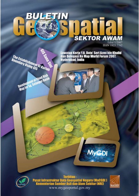
<strong>Buletin</strong> <strong>Geospatial</strong> <strong>Sektor</strong> <strong>Awam</strong> | 4Aktiviti ForumDari 22 hingga 25 Januari <strong>2007</strong>, delegasi <strong>Malaysia</strong>telah menghadiri beberapa sesi plenari, seminardan sesi poster. Sesi-sesi ini telah memberi banyakfaedah dari segi pendedahan kepada pembangunandan perancangan terkini teknologi geospatial olehpakar-pakar dari negara membangun dan negaramaju. India sendiri mempunyai pakar IT dan GISyang cemerlang di sektor awam dan juga sektorswasta. Beberapa pembentang plenari dari USA,Austria, Netherland, United Kingdom dan Denmarktelah mempersembahkan pengalaman dan kajiankes yang baik untuk diikuti oleh para peserta forum.Sesi plenari telah mempamerkan pengalaman dankesungguhan profesional dan pakar yang telahbergiat lama dalam penyelidikan dan pembangunandalam bidang GPS, GIS dan Remote Sensingdan organisasi yang berjaya mempeloporinya.Antara pakar-pakar itu ialah Prof. Stig Enemark(Denmark), Peter Holland (Australia), Prof. BasKok (Netherland), Prof. Josef Strobl (Austria) danPresident ESRI (USA), Jack Dangermond.mapping, natural resources and ecology monitoringdan Web GIS. Timbalan Ketua Pengarah Ukurdan Pemetaan <strong>Malaysia</strong> (TKPUP), Y.Bhg. Dato’Sr. Dr. Abdul Kadir bin Taib telah dijemput untukmembentangkan satu kertas kerja pada sesiseminar yang bertajuk Surveying and Mapping.Oleh sebab sesi persembahan diadakan secaraselari di <strong>Bil</strong>ik Dewan yang berasingan, para delegasi<strong>Malaysia</strong> telah dibahagikan mengikut kesesuaiandan topik yang berkaitan untuk menghadiri sesiagar semua persembahan kertas berkenaan dapatdimanfaatkan. Banyak pengalaman dan ilmu sertainovasi yang dipamerkan boleh digunakan sebagaiukuran dan penyelidikan untuk faedah dan kebaikanpengurusan, perancangan dan pembangunanKementerian secara keseluruhannya.Lawatan Teknikal ke NICKebanyakan kandungan sesi persidanganmempunyai kaitan rapat dengan bidang utamayang dijalankan oleh JUPEM dan MaCGDI, danjuga Jabatan di bawah NRE yang mempunyaiUnit atau Seksyen GIS, seperti di Jabatan AlamSekitar <strong>Malaysia</strong>. Pegawai berkenaan yang hadirdiyakini boleh meningkatkan keupayaan merekadengan mengambil ikhtibar dan pengalaman ideadan kajian kes yang dibentangkan. Di samping itu,perhubungan yang baru dapat diwujudkan denganpakar-pakar terkemuka dunia untuk rujukan sertakhidmat nasihat bagi usaha seterusnya.Sebanyak 23 tema telah dipersembahkan olehpembentang-pembentang kertas kerja dalamseminar dan sesi teknikal. Antara tema yang menjadisesuai dan berkaitan bagi delegasi Y.B. Menteriialah disaster management, spatial databaseinfrastructure, standards and interoperability,forestry and remote sensing, surveying andSatu lawatan ke National Informatics Centre (NIC),Department of Information Technology, Ministryof Communication and Information TechnologyIndia telah diadakan pada 25 Januari <strong>2007</strong>.Kedatangan delegasi <strong>Malaysia</strong> telah disambutoleh Timbalan Ketua Pengarah NIC, Dr. MaheshChandra di pejabat beliau. Dr. Mahesh telahmenerangkan profil dan organisasi NIC secararingkas. Isu pembangunan pangkalan data GISuntuk menyimpan segala maklumat di agensiKerajaan dibincangkan.Kemudiannya delegasi <strong>Malaysia</strong> telah dibawamelihat secara dekat aplikasi dan pembangunanGIS serta pangkalan data geospatial yangdibangunkan di beberapa seksyen di NIC.Lawatan ini telah memberikan pengalaman danpendedahan yang berkesan kepada cara-caradata spatial dan bukan-spatial (textual) disimpandan diuruskan dalam pangkalan data geografiatau geodatabase menggunakan teknologi danperisian GIS terkini dari AS. Sistem rangkaianyang diwujudkan merangkumi semua agensiKerajaan bagi menguruskan pemantauan aplikasidan sistem yang dibangunkan di setiap agensi di
<strong>Buletin</strong> <strong>Geospatial</strong> <strong>Sektor</strong> <strong>Awam</strong> |5lokasi yang berbeza. Bagi <strong>Malaysia</strong>, pihak MaCGDIsedang menguruskan penubuhan pangkalandata yang sama fungsinya yang dinamakanNational <strong>Geospatial</strong> Data Centre (NGDC), tetapimasih dalam peringkat awal lagi untuk direalisasisepenuhnya. Antara isu yang belum diselesaikanialah dasar perkongsian data kebangsaan yangperlu digubal.Tuan Haji Mohd Ibrahim bin Haji Abu Bakar (TKSU II)bersama dengan Timbalan Ketua Pengarah NICdi pejabat NIC.Pihak NIC telah menggubal sebuah dokumenKerajaan ‘Dasar Pemetaan Kebangsaan’ sejak enam(6) bulan yang lalu. Dasar ini merangkumi perkaraperkaramengenai perundangan perkongsiandata dan integrasi data di kalangan agensi-agensiKerajaan India. <strong>Malaysia</strong> masih belum mempunyai‘Dasar Pemetaan atau Geoinformasi Negara’.Di NIC, jaringan tidak menjadi masalah dalampenyebaran data geospatial ke agensi-agensiKerajaan kerana talian Internet untuk mencapaidata-data geospatial secara dalam talian amatbaik sekali, tidak seperti yang dihadapi olehMaCGDI melalui pembekal sedia ada. Di <strong>Malaysia</strong>,penggubalan dasar atau kertas Kabinet yangmenyeluruh diperlukan untuk memastikan satudasar perkongsian data yang tulen dan berwibawadapat digunakan dengan berkesan.Faedah dan syor-syor<strong>Geospatial</strong> Data Centre (GDC) di peringkat nasionalamat diperlukan untuk memastikan data disimpandan diuruskan untuk kegunaan agensi Kerajaan.Oleh sebab usaha ke arah ini menghadapi masalahketika ini, adalah dicadangkan satu prototaipaplikasi dan pangkalan data ini dibangunkanbagi menyimpan dan menguruskan data-dataagensi di bawah NRE. MaCGDI telah mempunyaicadangan ke arah usaha ini tetapi menghadapibeberapa masalah termasuk keperluan suatudasar kebangsaan yang menyeluruh mengenaigeoinformasi (geoinformation) dan hal-ehwalpemetaan (mapping matter), isu perkongsian data,siapakah pihak penjaga tunggal (sole custodian)bagi GDC ini, tahap penggunaan agensi-agensidi peringkat persekutuan, negeri dan PBT, dankesediaan agensi pembekal data untuk menyertaiGDC ini. Sebagai permulaan, penggubalan ‘DasarPemetaan/Geoinformasi Kebangsaan’ adalahkritikal supaya pematuhan yang menyeluruh dapatmemastikan kejayaan GDC ini. MaCGDI adalahagensi yang boleh dipertanggungjawabkan untukmemainkan peranan awal dalam hal ini. Olehitu, isu perkongsian data akan dibawa kepadaperhatian Kabinet secara berasingan ke arah dasaryang lebih jelas supaya undang-undang/peraturanyang mantap mengenai GIS dapat disediakanuntuk negara.Keperluan memastikan data mempunyai kualitiyang baik juga merupakan isu kritikal supaya datadan pangkalan data mempunyai integriti untukdikongsi dan digunakan oleh banyak agensi.Dengan kewibawaan data ini, ia amat sesuaiuntuk kegunaan seperti pengurusan bencana,pengurusan alam sekitar dan amaran kecemasan.Satu garis panduan di peringkat kebangsaandiperlukan bagi memastikan data yang digunakanuntuk jentera pentadbiran Kerajaan mencapaitahap ketepatan yang tinggi serta terkini, dapatdiwujudkan.Aplikasi GIS telah terbukti amat diperlukanoleh kebanyakan agensi Kerajaan terutama dibawah NRE bagi isu-isu yang berkaitan denganperhutanan, pengurusan banjir, alam sekitar,perlombongan, perhilitan dan sumber asli lain. Daripengalaman Map World Forum, GIS dan RemoteSensing merupakan penyelesaian yang terbaikbagi perancangan dan pembangunan sesebuahnegara dalam era ICT dan globalisasi. Sudahtiba masanya semua agensi menggunakan GISuntuk pemantauan, pengurusan, penguatkuasaan,penyelidikan, perancangan dan pengambilankeputusan. Sebagai permulaan, arahan yangmantap dari NRE boleh dibuat agar Jabatan AlamSekitar sendiri menunjukkan aplikasi GIS yangboleh dimanfaatkan.
<strong>Buletin</strong> <strong>Geospatial</strong> <strong>Sektor</strong> <strong>Awam</strong> |6Integrasi data dan standardisasi adalah isu pentingyang perlu digemblengkan oleh agensi sepertiJabatan Standard, JUPEM dan MaCGDI dan jugasemua agensi di bawah NRE. Teknologi GPS,GIS dan Remote Sensing serta kebolehan ICTboleh digunakan untuk menggabungkan semuadata geospatial yang ada di agensi Kerajaan.NGDC boleh digunakan sebagai landasan awaluntuk menggabungkan data geospatial melaluiInternet. MaCGDI merupakan ahli PertubuhanStandard Antarabangsa (International StandardOrganisation) yang bersidang setiap tahun.Pembangunan standard bagi geospatial datamerupakan aktiviti yang berterusan. MaCGDI danJUPEM adalah Jabatan yang memainkan perananpenting dalam menguruskan standardisasi datageospatial.Pembangunan keupayaan modal insan bagiNational Spatial Data Infrastructure (NSDI), seperti<strong>Malaysia</strong>n <strong>Geospatial</strong> Data Infrastructure atauMyGDI yang dibangunkan oleh MaCGDI adalahpenting. Ini termasuk pembangunan sumbermanusia, kekuatan institusi, teknologi, kepakarandan keupayaan kewangan yang merupakansebahagian dari proses pembangunan keupayaanmodal insan yang dimaksudkan. Latihan praktikalsecara praktikal dan acara kesedaran terhadapGIS boleh mewujudkan komuniti GIS yang pakar.Majlis-majlis seperti Hari GIS atau Minggu GISboleh diadakan di Kementerian apabila semuaagensi boleh menunjukkan sistem GIS masingmasing.Pameran dan persembahan teknikalmengenai GIS untuk murid-murid sekolah jugaboleh diadakan bagi memberi pendedahan awalkepada golongan rendah dan belasan tahun.Melalui persidangan ini, antara faedah-faedah yangtelah dicapai adalah seperti yang berikut:i. Mendapat pendedahan yang meluas berkaitandengan teknologi geospatial terkini danperkembangan aplikasi GIS serta GPS danRemote Sensing;ii.Dapat menimba ilmu dan mendapat ikhtibarmelalui pengalaman-pengalaman sertamaklumat pembentangan kajian kes yangboleh dijadikan sumber rujukan;iii. Dapat meningkatkan jaringan di peringkatantarabangsa antara negara-negara majudan membangun sambil dapat bertemudan berinteraksi secara langsung denganpengguna-pengguna aplikasi GIS dan pakardari serata dunia;iv. Perkongsian pengalaman menggunakanaplikasi teknologi geospatial di beberapaperingkat pengurusan bencana, penjagaanalam sekitar dan pengurusan sumber asliserta berpeluang didedahkan kepada kaedahpraktikal terbaik untuk mengawal bencana,penjagaan alam sekitar yang lestari danpengurusan sumber asli yang moden dancanggih; danv. Mencetuskan idea/cadangan penambahbaikanpraktikal untuk meningkatkan infrastrukturpangkalan data spatial dalam organisasi dannegara sendiri.PenutupAdalah diharapkan pembangunan sistem GIS di<strong>Malaysia</strong> akan berhasil membawa perubahan yangberjaya mempertingkat pengurusan perkhidmatanawam secara berkesan. Sistem GIS mampumemacu <strong>Malaysia</strong> dalam era ICT dan globalisasiuntuk mencapai taraf negara-negara maju seawalmungkin. <strong>Malaysia</strong>, sebagai bakal menjadi negaramaju seharusnya memanfaatkan teknologi terkiniseperti GIS, GPS dan Remote Sensing. Faedahyang dicapai boleh menjana ilmu dan teknologiterkini kepada pengurusan agensi Kerajaan yangakhirnya boleh membantu dalam merangka dasarNegara dan program yang baik dan cemerlang.Adalah satu keperluan mendesak untuk <strong>Malaysia</strong>mengwujudkan mekanisma yang lebih bersepaduserta bersinergi bagi memantapkan pembangunandan pengurusan data dan informasi negara.Teknologi GIS, GPS dan Remote Sensingdigabungkan dengan ICT diyakini memberipulangan yang baik.Persidangan antarabangsa Map Asia <strong>2007</strong> yangakan diadakan pada bulan Ogos <strong>2007</strong> di KualaLumpur City Centre (KLCC), Kuala Lumpurmerupakan susulan dan kesinambungan darihasil lawatan kerja ke Hyderabad. NRE akanmenjadi penaung dan penganjur persidanganantarabangsa ini.InfoMaklumat lanjut berkaitan Map Asia 2002-<strong>2007</strong>boleh di akses melalui www.mapasia.org
<strong>Buletin</strong> <strong>Geospatial</strong> <strong>Sektor</strong> <strong>Awam</strong> | 7Development Of Flood Risk Map ForSg. Selangor BasinAbd. Jalil bin HassanSenior Researcher,National Hydraulic Research Institute of <strong>Malaysia</strong> (NAHRIM)AbstractFlood is a natural disaster in this country. Flood behaviour must well be understood before a proper measure canbe taken for its mitigation. At present, one of the ways to study and understand flood behaviours is by generatingflood risk maps. Hydraulic modelling using a computer model is required in order to carry out flood simulationto produce flood levels at various locations along the river and flood plain. However, to analyse a river systemrequires voluminous amount of data such as rainfall distributions, river properties and most importantly the floodplain topography. GIS software is able to handle the processing problems as an input to the hydraulic model. Theoutput of the hydraulic simulation can be transferred to GIS software to generate flood layers for various scenarios.Further analysis such as flood damage assessment can be carried out for planning and design purposes. This inturn would be suitable for a decision support system.This paper presents the various processes carried out using GIS tool to develop hydrological and, hydrodynamicmodels, 3D ground model and the generation of flood risk map.Introduction<strong>Malaysia</strong> experiences two types of flood namelythe monsoon and flash floods. The monsoon floodoccurs mainly during Northeast Monsoon whichprevails from the months of November to Marchwith heavy rains to the east coast states of thePeninsula, northern part of Sabah and southernpart of Sarawak. Some of the recorded floodexperiences in the country occurred in 1926,1931, 1947, 1954, 1957, 1963, 1965, 1967, 1969,1971, 1973, 1983, 1988, 1993, 1998 and 2001.The report from the Department of Irrigation andDrainage (DID) stated that about 29,000 sq. kmor 9% of the total land area and more than 4.82million people (22%) are affected by floodingannually. Damage caused by floods is estimatedto be about RM915 million. The flood prone areasare shown in Figure 1. Monsoon flood is governedby heavy and long duration of rainfall that coversa large area. The flood from 2-6 October, 2003affected a large area in the northwesternpart of the Peninsulacovering the states of Kedah,Pulau Pinang and Northern Perak.The recent December flood badlydamaged the southern part ofPeninsula <strong>Malaysia</strong> involvingthe states of Melaka and Johor.Flash flood normally occurs quiterapidly such as the case of thetwo events occurring in April andOctober 2002 in Kuala Lumpurwhich has been recognized dueto uncontrolled development andactivities within the catchmentsand flood plains. At present thedevelopment of a flood risk mapis a difficult process since theinformation from hydraulic analyses is neededto be exported and combined with the floodplain i.e. ground data. Therefore the use of GISin processing raw data and combined with thehydraulic analyses to delineate flood extent shallbe demonstrated in this paper.Objective of the study• The main purpose of the study is to develop acomplete river model consisting of hydrological,hydraulic, 3D ground model including variousGIS layers covering the main river system andflood plain.• The model will generate a flood risk mapbased on various return periods and providequick results on flood impact due to probablehuman activities within a catchments area.Figure 1 : Flood Prone Areas in <strong>Malaysia</strong>
<strong>Buletin</strong> <strong>Geospatial</strong> <strong>Sektor</strong> <strong>Awam</strong> | 8Study AreaSg. Selangor is located at the northern part ofthe state of Selangor (Figure 2). The catchmentis approximately 1960km2 which covers about aquarter of the area of the state of Selangor. Themain river, Sg. Selangor starts from the west of theTitiwangsa Range at an elevation of approximately1700m between the borders of the states ofSelangor and Pahang. It flows approximately110km towards the southwest to the Straits OfMelaka. The major tributaries are Sg. Kerling, Sg.Kubu, Sg. Rening, Sg. Batang Kali, Sg. Buloh,and Sg. Sembah as shown in Figure 3. To theeast of the basin is a mountainous area which ismainly covered with forest and plantations whilethe west side is generally swampy and flat withpaddy as the main agriculture activity. The mostrecent land-use map for the catchments is shownin Figure 4. Sg. Selangor was selected for thisstudy because of the availability of the river surveydata together with the ground elevation of theflood plain within 500m to 2km on each side ofthe river. Concurrently, due to its location, it is apotential area to be developed since the adjacentKlang Valley development is almost reaching asaturation level in the near future.Guna Tanah 199720 0 20 40 K ilometersFigure 4 : Landuse map (Source-DOA)Flood risk map developmentLanduse97.shpAIRHUTANKAW. DIBERSIHKANPAYAPDG.TERNAK & RUMPUTPERBANDARANPERLOMBONGANPERTANIANThe process to delineate the flood extent consistsof 3 main components, namely, hydrologicrainfall-runoff model, hydrodynamic model and3D ground model. The process and data inputfor all the processes are shown in Figure 5. Themain softwares used in the study are InfoWorksRS (River Simulation) for Hydrologic and Hydaulicmodelling while Arc View + 3D Analyst and Surfer8.0 are for the development of various layers and3D ground model. InfoWorks RS combines waterlevel from the hydraulic computation with the 3D(Shapefile) to produce the extent of flooding. Theriver model covers 110 km by cross sections at1km apart and which begins at the new ‘SPLASH’dam down to the river mouth covering the floodplain.WNSEGIS applicationFigure 2 : Study AreaFigure 3 : River SystemDue to the large amount of data being required forthe input to the hydrologic and hydraulic models,most of the processes were carried out by usingGIS software namely, Arcview 3.1 and 3D Analyst.The processes are :• delineate the subcatchment boundary• transform point rainfall to areal rainfall• distribute the areal rainfall to subcatchmentrainfall• estimating land-use and soil type forsubcatchment• generate 3D ground model from contour andspot height• generate flood extent• estimate flood damage
<strong>Buletin</strong> <strong>Geospatial</strong> <strong>Sektor</strong> <strong>Awam</strong> |9Rainfall dataSoil type Land useContour DEMRiver surveyHydrologicalmodelling3D – GroundmodelHydraulicmodellingLand useFlood extentFigure 5 : Process involved in the development ofFlood Risk MapFlood damageassesmentData collectionThe main factor to ensure that the study issuccessful is the availability of informationand data. Tremendous effort was employedto process all important data. The table belowlisted the most critical information required forthe analysis.Type Source ScaleHydrological dataRainfall data DID 1:50,000Land use data DOA 1:50000Soil type data DOA 1:500000Hydraulic dataRiver cross section DID 1:2000Ground data3-D flood plain terrain data DID 1:5000Contour JUPEM 1:25,000Table 1 : List of most critical information in thecatchmentsNoteDID - Department of Irrigation andDrainageDOA - Department of AgricultureJUPEM - Department of Survey andMapping <strong>Malaysia</strong>Rainfall runoff modellingThe main inputs to the rainfall runoff modelare the subcatchment area, river gradient,land-use, soil type and rainfall distribution.Most of this data can be extracted fromJUPEM topographical map, DID hydrologicalstation and the Department of Agriculture(DOA). Various GIS analyses were carried outto determine the information that is illustratedbelow.Division of subcatchmentVarious methods to delineate thesubcatchment are available but for thisexercise the subcatchment boundary wasdigitized manually from the contour andriver layers using ArcView. This manualprocess was selected because the contourinterval of 20m does not provide a goodrepresentation for the downstream part ofthe basin which is very flat. The division ofsubcatchment is shown in Figure 5.River slopeThe river slope was estimated by using asimple approach which is the differenceof height divided by the length of the river.Both of this information is available formthe contour and river layers.Soil distributionThe rainfall runoff model (SCS Method)requires the soil group to be defined by theCurve No (CN) for each subcatchment.Value for CN base on land-use is availablefrom many references. This informationwas then combined to the Land-use layerusing Join Table technique. Overlayingprocess using ‘Union’ was carried outto distribute the soil group to varioussubcatchment to calculate the averageCN for each subcatchment.Rainfall area distributionA rainfall runoff model requires an arealrainfall data. However DID only providespoint rainfall from hydrological stationswithin the basin. Thiessen polygontechnique was used to convert thepoint rainfall to areal rainfall. It is thenredistributed to the various subcatchmentusing the overlay process. Thiessen’sPolygon map is shown in Figures 7 and8.
WNSE<strong>Buletin</strong> <strong>Geospatial</strong> <strong>Sektor</strong> <strong>Awam</strong> | 10Figure 5 : Division of subcatchmentRiver cross sectionThe main inputs for the hydraulic model arethe river cross section and flood plain. Thecross section survey was done at 1km intervalwhich extends up to 1km on each side of theriver bank. Therefore about 100 cross sectionswere required for the data input involving thecoordinate longitude latitude and the groundvalue. Experience shows that by using themanual input, the process would need about2 months to complete. The cross section datawhich is available in 3D point in AutoCad wereconverted to 3D ground model using ArcView3D Analyst and development of the riverhydrodynamic model was completed withinone week. The model is shown in Figure 9and Figure 10.Figure 6 : Soil hydrological classificationPoligon Theisen#YBkt. FraserLdg. Sg. Gumut#YLdg. Sg. Belata#YLoji Air Kuala Kubu#Y#YBalai Polis Sang LeeFigure 9 : Sample river cross section in thehydraulic modelLdg. Sg. Tinggi#YLdg. Hopeful#YPengorekan Bijih Btg Berjuntai #YLdg Bukit Belimbing#Y#YLdg Stratmore#Y#Y #YLdg. Kuala Selangor Ldg. Rajaghiri#YLdg. Rasa#YLdg. Batang Kali#YLadang SerendahJabatan Perikanan, Bkt. Tinggi#Y#YPusat Mengawal Kusta Negara20 0 20 40 K ilometersFigure 7 : Tranforming point rainfall to areal rainfall(Thiessen’s Polygon)Gabungan Sub tadahan dan Poligon TheissenTh es ien 1971.s hpB atang B erj untaiB u ki t B atu P ahat dB u ki t B atu P ahat uB u ki t B ujan gK g L ub okK g . A sah anK g . T imahK u al a Selan go r K an a nK u al a Selan go r K iriLa dan g H o lm wo odLa dan g K em ps eyLa dan g K g . B ah aruLa dan g Ten amara mLa dan g Tg . P as irR antau P an jan gR izab Amp ang P ec h ahR izab R a ja Mu s aSg . B ah aruSg . B atan g K aliSg . B ulohSg . D ar ahSg . E ng k akSg . G ah auSg . G ap ihSg . G erac h iSg . K ay u Ar aSg . K el ub iSg . K em p asSg . K er lin gSg . K ub uSg . M engk u an gSg . R ab aSg . R aw an gSg . R en in gSg . R ohSg . S elang or (h ulu)Sg . S erus aTg . K ajangN20 0 20 40 KilometersWESFigure 8 : Overlaying areal rainfall with subcatchmentFigure 10 : Part of river hydraulic model in the river networkGround model developmentInfoWorks RS combines the hydraulic modeland the ground model during the hydraulicsimulation process to delineate the floodextent. The quality and accuracy of the floodextent depend on the quality of the ground
<strong>Buletin</strong> <strong>Geospatial</strong> <strong>Sektor</strong> <strong>Awam</strong> |11model. The ground model was developed fromthe contour map, the survey data and spotheight in the flood plain. The contour intervalfrom JUPEM is at 20m interval while thesurvey contour was at 5m interval. Spot heightis available in the flood plain at a spacing of200m. The bed level along the centre line ofthe river was extracted from the cross-sectionsurvey. Elevation of infrastructures such asroad and bund in the flood plain are partlyavailable and treated as a hard break line inArcView 3D Analyst during the triangulationprocess. The information above, especiallythe contour can be considered good for theupstream steep stretch but does not producea good 3D ground model at the lower partof the river system where the flood plain isflatter and consist many infrastructures suchas roads and bunds. The ground model wasfurther improved by using the Kriging methodin Surfer 8.0 which produces grids at 10– 30 m spacing. The final ground model forthe whole river system is about 700 Mbyteand which consumes a high percentage ofmemory and thus slowing the simulation time.For the purpose of the study, only the middlepart of the river system that contained about200 Mbyte was used. The 3D TIN was thenexported to 3D shp file using TIN exporter toInfoWorks RS. The ground model in InfoWorksRS is shown in Figure 11 and Figure 12.Simulation and generation of floodmapSimulations using storm of 1:100 ARI wascarried out to reduce to flood extent which thenwas exported to ArcView. Flood depth at variouslocations are shown in Figure 13. Using theoverlay process between the flood map and landuse,flood damage assessment is easily done asshown in Figure 14. The flood extent changesat various time can also be produced to help inunderstanding the pattern of flood movement inthe flood plain (Figure 15).100 tahun< 11 - 2 m2 - 3 m3 - 4 m4 - 5 m3 0 3 6 KilometersSFigure 13 : Flood depth along the riverWNEGuna tanah _banjir 100 tahunAIRHUTANKAW. DIBERSIHK ANPAYAPDG.TERNAK & R UMPUTPE RBANDAR ANPE RLOMB ONGANPE RTANIANNWE3 0 3 6 K ilometersSFigure 14 : Flood inundation area based on land-use.Figure 11 : 3D ground model generated using 3DAnalyst and SurferFigure 12 : Combination of hydraulic model and3D ground model“Flood is a natural disaster in this country.Flood behaviour must well be understoodbefore a proper measure can be taken for itsmitigation. At present, one of the ways tostudy and understand flood behaviours isby generating flood risk maps. Hydraulicmodelling using a computer modelis required in order to carry out floodsimulation to produce flood levels atvarious locations along the river and floodplain”
<strong>Buletin</strong> <strong>Geospatial</strong> <strong>Sektor</strong> <strong>Awam</strong> | 12Start – 0 hourAfter –10 hoursAfter 20 hoursAfter 30 hoursAfter 40 hoursAfter 60 hoursFigure 15 : Flood movement along the flood plain varies with time
<strong>Buletin</strong> <strong>Geospatial</strong> <strong>Sektor</strong> <strong>Awam</strong> |13ConclusionThe study has demonstrated that the flood mapdelineation for a big river system can be achievedin a short time with the support of GIS tools. Theprocesses of overlaying layer help to reduce theeffort of processing data for hydrological, hydraulicand ground model. The quality of the flood extentdepends to a large extent on the quality of theground model that requires a proper triangulationprocess. In the future, easy production of floodrisk map will enhance the planning of floodmanagement in the country.ReferencesAbd. Jalil bin Hassan (2002) - PenggunaanTeknologi Terkini Ke Arah Pengurusan Banjir YangBersepadu - Persidangan Pengurus Kanan JPS2002- Kijal TerengganuDepartment of Irrigation and Drainage (1982)Hydrological Procedure No. 1 – Estimation of thedesign rainstorm in Peninsular <strong>Malaysia</strong> (Revisedand updated) Ranhill Bersekutu Sdn Bhd,Infoworks RS – Wallingford Software U.K 2005KTA Tenaga Sdn. Bhd. (2003) Flood DamageAssessment of 26 April 2001 Flooding affectingThe Klang Valley and the generalized proceduresand guideline for assessment of flood damages– Draft Final reportMohamad Fadhlillah bin Haji Mahmood – (1996).An Investigation into the tidal effects on thedrainage systems in east coast of peninsular<strong>Malaysia</strong>.Mohamad Roseli bin Zainal Abidin (1999).Hydrological and Hydraulic Sensitivity Analysesfor Flood Modelling with limited data. Ph.D. thesis,University Of BirminghamPeter Hausmann and Matthias Weber (1996).Possible contributions of hydroinformatics to riskanalysis in insurance. 2nd international conferenceon hydroinformatics/Zurich/Switzerland/ 9-13September 1996.Richard Krimm (1996) Reducing flood lossesin the United States. (1996) - Proceedings ofan international workshop on floodplain riskmanagement, Hiroshima, 11-13 Nov 1996Sepakat Setia perunding Sdn. Bhd.(2002)Master plan Study on Flood Mitigation and RiverManagement for Sg. Selangor – Final report –Jabatan Pengairan dan Saliran.Are GIS dataAre GIS dataaccurate?GIS data are not accurate when comparedto what land surveyors observe andrecord in the field. Issue on quality andcoverage of the source data makes theGIS-ready information in dilemma. Ananalysis of the quality and coverage ofpossible sources is required because aparticular GIS feature is often shown onmultiple sources of varying quality. Inactual fact, the quality of source materialsshould be equal to or greater than thedesired quality of the converted database;otherwise the source can be rejectedand replaced. For example, if maps donot show the required information withappropriate accuracy, precise calculationsor aerial mapping may have to be used toprovide the data. Therefore it is crucial toidentify the accuracy of sources beforedefining them in database and beforethe cost of conversion is estimated andquoted and data conversion begun. It isalso important that GIS-ready informationshould explicitly and accurately refer tothe source documents from which theywere compiled. Such linkage could beachieved by carrying a source documentidentifier in the database record of eachGIS feature, or linking to scanned imagesof those source documents. As such, inspatial data infrastructure this shouldnot be isolated because users starvingfor data not just need data but currentand accurate data readily available tocontribute, locally, nationally and globallyto economic growth, environmental qualityand stability, and social progress.Framework Data Development andImplementation Section 1 (FWI), MaCGDI
<strong>Buletin</strong> <strong>Geospatial</strong> <strong>Sektor</strong> <strong>Awam</strong> |14INTRODUCTIONThe Establishment ofKariah Boundary Using GISProf. Madya Dr. Zakaria bin Mat Arof andNorshahrizan bin Mohd Hashim,Integrated Agro-Technology and Research Management (IATREM), UiTM Perlis.AbstractKariah or mosque based community boundary identification has become a crucial and sensitive rights issue. Theboundaries define the rights, onus, power and services of the people especially for the Muslim community. Theboundaries are normally alienated according to the mosque capacity of congregation, population borders andleader’s intuitive. However with the highly demanded community efficiency management, land-use optimization,population handling and land value appreciation, the situation is getting tense, vague and causes a great deal ofconfusion in the kariah’s right. This project is undertaken to include more sustainable parameters in the boundaryof the kariah. The study was based on one of the kariah boundaries in Perlis, <strong>Malaysia</strong>. GIS techniques (ArcGIS)of overlaying, reclassification according to Thiessen principle, Neighbourhood, Network analysis and Matching areahave been used in the analysis. The result shows various structures of boundaries in different polygonal shapeswhere each shape is analysed with respect to the named parameter. The research revealed that none of thetechniques was able to give the optimum result for all parameters but the best boundary has been suggested.Mosque is a place of worship for Muslims. Inaddition the mosque also acts as an administrativecentre for the Muslim community, civilizationand hence, the centre of attraction. A mosque’sboundary is a subset of an administrative boundary.There are about 99 mosques in Perlis which aresanctioned by the State Religious Department.Every mosque has its own county, known asthe kariah boundary. Kariah boundary means alimited area of jurisdiction of a particular mosque.According to Shuib Daud (2003), the boundaryhas a great impact on the mosque managementespecially in relation to worship, social interactionand syariah legal issues.From the theoretical point of view, the boundariescan be viewed as a hierarchy division of an area(Gunnar Thorvaldsen, 1997). A country is dividedinto several states. The states are divided intoseveral districts or provinces and which are inturn divided again into smaller entities known asmukims, municipalities etc.is to investigate a new approach in order tofacilitate the implementation of a spatially basedboundary where GIS is used. GIS or GeographicalInformation System has become a useful tool forany related spatially data based managementwhich can integrate data from various platforms,which becomes an effective information fordecision making (Zakaria Mat Arof, 2002). In thispaper, this technique has been used to analyzevarious spatial elements contributing to the newestablishment of Muhammadiah Mosques kariahboundary.The study area is located in the region of Arau inPerlis (Figure 1). In general, the kariah boundariesaround Arau were assigned in a sub-structuredmanner where each kariah was establishedmainly based on general understanding amongthe respective stakeholders (Shuib Daud, 2003).There are several rules or criteria set by certainauthorities to establish administrative boundaries.Initially, the boundaries to a large extent, followedthe topographical divisions such as rivers,mountain ranges etc. Eventually, it became morecommon to use the greater range of functionalcriteria such as communication, infrastructure,social and cultural divisions.However the implementation process for thetime being is time consuming, hardly integratedinformation and is a tedious task. This researchFigure 1 : Study Area
<strong>Buletin</strong> <strong>Geospatial</strong> <strong>Sektor</strong> <strong>Awam</strong> |15BACKGROUND STUDYA set of rules or criteria were discussed inmany pieces of work by different authors andorganizations such as JUPEM, 2005; Eagleson etal., 1999, 2003; Gunnar Thorvaldsen, 1997; AnnaKatz, 2004; and Gian Gandi et al., 2004.Department of Survey and Mapping, <strong>Malaysia</strong>(JUPEM) for example, administers boundarieswithin <strong>Malaysia</strong> that separate nations, states, localgovernment and individual right. The boundaryis determine basically according to the physicalbarriers such as thalweg (river), watershed, hilland many other types of allocation right.In the earlier study by Eagleson et al. (1999,2003) it shows that an administrative boundarydetermined for a rural area depends largely onpopulation density, catchments areas, roadsnetwork and natural barriers. While the study forthe metropolitan area, shows that topographicbarriers, road network and circularity index are thecriteria’s priority.have been developed. Four conceptual modelsin the environment were also examined.-Table1. They found that, combination of number 2and 3 model where thematic map and spatialselection techniques were involved was the mostappropriate method for boundary determination ina metropolitan region.METHODOLOGYThis study was based on the research anddevelopment approach where the existingboundary determinations were studied and thealternative boundary was proposed. Four basicmodels have been used to test various approachesin generating the best kariah boundary for theMuhammadiah Mosques. The overall methodologyadopted is given in Figure 2 and is segregated intothree difference stages.ModelDescription1 Interactive boundary delineation2 Thematic selection3 Spatial selection using Thiessen polygon4 Thiessen selection based on the existing boundariesTable 1 : Conceptual Model of Administrative Boundary DeterminationMeanwhile according to Anna Katz (2004),based on the case study of delimiting of electoralboundaries, the most widely accepted rule forredistricting the boundary should be relatively equalin population. In this study, Anna Katz specifies thatgeographic elements or certain geographic factorshave to be taken into account in the process ofdelimiting electoral district lines. The author dividedthe geographic factors as geographic boundariesand geographic size or shape. In the mean timeGunnar Thorvaldsen (1997) combined physicalboundaries, communication, infrastructure, socialand cultural division as the main criteria to definelocal historic boundaries in Norway.Similarly, there are also many approaches thathave been adopted in the process of boundarydetermination. In the case of Eagleson et al.(2003) a prototype consisting of cost-distanceallocation, road proximity boundaries and boundaryalignment methods within GIS environmentThe first stage is problem identification. Theobjectives of this stage are to investigate andrevise the current method and criteria usedby various organizations particularly the Perlisreligious authority for boundary determination. Itwas conducted through interviews, discussionsand by reviewing documents. The following arethe criteria adopted.i. Equal Distanceii. Within Legal Boundaries (state, district, mukim)iii. Shortest Distanceiv. Minimum Physical Barriers (river, railway,highway, etc)v. Centre of Attractionvi. Not much variation to the existing boundaryThe second stage is a model creation (Figure 3and Figure 4). There are two models involved;the basic model and the multi-combination model.
<strong>Buletin</strong> <strong>Geospatial</strong> <strong>Sektor</strong> <strong>Awam</strong> |16significant role to identify the barrier and theanalysis is to ensure that the boundary proposedwill have the minimum constraint from thebarriers.Network analysis is used to manage networkedfacilities that fall within specific distances. In thisstudy, the network analysis will trace a particularpath (eg. shortest path) within the definedpolygon.The matching area contains a predefined polygonaccording to a specific justification such assize, area and shape. This model will act as acomplementary method particularly to solve theisolated polygons that may occur in the analysis.Figure 2 : Methodology of ResearchThe four basic models are Thiessen polygon,Neighbourhood Analysis, Network Analysis andMatching Area. The multi-combination modelsare the result from manipulations of the basicmodels.Thiessen polygon (also known as Voronoi) hasbeen used to define individual areas around eachpoint in such a way that the polygon boundariesare equidistant from neighbouring points.Neighbourhood analysis analyzed the relationshipbetween objects and a similar surrounding object.In this study, the neighbourhood analysis playasThe last is the evaluation stage. The objectiveof this stage is to analyze and test the proposedboundary around the kariah of MuhammadiahMosque. The advantages and disadvantagesof the proposed boundary with respect to thedefined criteria were investigated together with thecomparative polygon shape difference betweenthe newly designed and the existing boundary.ARCGIS 9, ARCVIEW 3.1, MAPINFO, AUTOCADsoftware have been used in the full process of thestudy. The vector data is based on the cadastresheet measuring according to the CassiniCoordinate System. While the aerial photographhas been used as a main source of raster imageto enhance the visualization quality and overallperspective.Figure 3 : Basic Models and Initial Stage
<strong>Buletin</strong> <strong>Geospatial</strong> <strong>Sektor</strong> <strong>Awam</strong> |17Figure 4 : Multi-CombinationRESULT AND ANALYSISTable 2 shows the outcome from each modelanalysis and Table 3 and 4 show the result fromthe initial stage analysising, while Table 5 showsthe result from multi-combination stage analysis.It is clear that none of the techniques could beable to give the optimum result for all parametersbut the result from model M in the Table 6, hassignificantly displayed many advantages thatmeet the whole criteria with minimum limitation.The whole combination of Thiessen Polygon,Neighbourhood Analysis, Network Analysis andMatching Area seem to be the most appropriateapproach for the area. In addition the result alsoshows the minimum variation of polygon shapebetween the new and the existing boundary andwhich is considered to be very satisfactory.öCONCLUSIONA newly improved method of boundarydetermination is identified in this paper. A newkariah boundary for Muhammadiah Mosque inArau, Perlis is being proposed. The proposedsolution, outline an organization of the spatialbased data on the GIS capabilities to generatethe kariah boundary. By using this approach, itis anticipated that each kariah boundary will beformed in a more informed manner. Combination ofvarious approaches has its own unique implicationwith respect to individual location geographicmatters. However in this case study it is clearthat all models combination give better result forthe kariah. In turn, this approach would enablerapid and efficient techniques for the boundaryanalysis.ööööööööööModel A = Thiesseen Polygon B = Network Polygon C = Matching AreaAdvantages Equidistance boundary Shortest and optimum route Equidistance all cornersDisadvantages Regardless Legal boundaries Regardless Legal boundaries Regardless Legal boundariesRegardless physical barriers Regardless physical barriers Regardless physical barriersPolygon shape is look odd (linear area)Table 2 : Results from Basic Polygons Analysis
<strong>Buletin</strong> <strong>Geospatial</strong> <strong>Sektor</strong> <strong>Awam</strong> |18öööööööööModel D = Thiessen + Neighborhood Analysis E = Thiessen + Network Polygon F = Thiessen + Matching AreaAdvantages Regard physical barriers Distance based boundary Distance based boundaryRegard legal boundaries Near to the centre attraction Near to the centre attractionDisadvantages Uncertain distance elements Regardless physical barriers Regardless physical barriersRegard legal boundariesRegard legal boundariesöTable 3 : Result from Initial Stage AnalysisööööööööööModel G = Neighborhood Analysis + H = Neighborhood Analysis + I = Network Polygon +Network Polygon Matching Area Matching AreaAdvantages Shortest path Regard physical barriers Distance based boundaryRegard physical barriers Regard legal boundaries Near to the centre attractionRegard legal boundariesNear to the centre attractionNear to the centre attractionDisadvantages Minimum Uncertain distance elements Regardless physical barriersRegard legal boundariesTable 4 : Results from Initial Stages AnalysisööööööööööModel J = Thiessen + Neighborhood K = Thiessen + Neighborhood L = Thiessen + Network PolygonAnalysis + Network Analysis Analysis + Matching Area + Matching AreaAdvantages Shortest path Regard physical barriers Distance based boundaryRegard physical barriers Regard legal boundaries Near to the centre attractionRegard legal boundariesNear to the centre attractionNear to the existing boundaryNear to the existing boundaryDisadvantages Complicated Analysis Time taken Complicated Analysis Time taken Regardless physical barriersRegard legal boundariesTable 5 : Results form Multi Combination Stages Analysis
<strong>Buletin</strong> <strong>Geospatial</strong> <strong>Sektor</strong> <strong>Awam</strong> |19ööövii.S. Eagleson, F. Escobar and I. Williamson,2003. “Automating the administrationboundary design process using hierarchicalspatial reasoning theory and geographicinformation systems,” http://www.geom.unimelb.edu.au/research/SDI.research/publications/publilgis.php, Access:December 2004.REFERENCESi. Anna Katz, 2002. “Using GIS to evaluateredistricting plans,” http://www.aceproject.org/main/english/et/etk02.htm, Access:December 2004.ii.iii.iv.ModelAdvantagesDisadvantagesM = Thiessen + NeighborhoodAnalysis + Network Analysis+ Matching AreaShortest pathRegard physical barriersRegard legal boundariesNear to the centre attractionNear to the existing boundaryMinimumTable 6 : Multi Combination StageGian Gandi, Noreen Fairweather and MyrtlePalacio, 2004. “Boundary delimitationBelize”.Task Force. http://www.belizeelections.org/bound_delimitations.pdf.Access:Jun 2005.Gunnar Thorvaldsen, 2004. “On boundariesand areas in local history research,” http:///www.rhd.uit.no/census/boundaries.htm,Access: July 2004.JUPEM, 2005. ” Sambutan Ulang Tahun ke-120”. Penerbitan Khas.v. Peter Smailes, 1997. “Better spatial unitsfor Australian Rural research: The urgentneed for revision of the Australian standardgeographical classification,” 1997.viii.Shuib Daud, 2003. Group Discussion Note.UPELS, UiTM Perlis.ix. Zakaria Mat Arof, 2002. “Design aCollaborative Spatial Decision SupportSystem for Land Development Approval “.Phd Thesis. Unpublished. USM.10 TIPS OF ICT SECURITYIN MyGDI1. Protect your personal information and knowwho you are dealing with. Do not revealinformation about yourself to people orwebsites you do not know on the internet.2. Create hard-to-guess passwords and keepthem private.3. Don’t open emails from unknown sources.4. Use anti-virus, anti-spyware and keep themupdated regularly.5. Update your operating system and webbrowser regularly.6. Know the dangers of using File sharingor Peer-to-peer (P2P) systems as it maycontain spyware and viruses. It can alsocreate legal and ethical issues regardingthe unauthorized sharing of copyrightedmaterials.7. Back up your important files regularly.8. Don’t leave your computer unattended andpassword protect it when not in used.9. Never reveal your true identity in chatrooms.vi.S. Eagleson, F. Escobar and I. Williamson,1999. “Spatial hierarchical reasoning appliedto administrative boundary design usingGIS,” presented at 6th South East AsianSurveyor Congress, Fremantle, 1999.10. Contact helpdesk@macgdi.gov.my for anysecurity incidents while accessing MyGDIand MyCERT if something goes wrongonline.ria@macgdi.gov.myKKICT Section of MaCGDI
<strong>Buletin</strong> <strong>Geospatial</strong> <strong>Sektor</strong> <strong>Awam</strong> |20Permodelan KelestarianBandar SetempatShaharudin bin Idrus, Abdul Hadi bin Harman Shah,Ahmad Fariz bin Mohamed dan Abdul Samad bin HadiInstitut Alam Sekitar dan Pembangunan (LESTARI)43600 UKM, Bangidinn6358@gmail.comBandar sebagai satu entiti kompleks perlu dilihatdari pelbagai sudut pandangan dan disiplin yangberbeza demi mendapatkan gambaran danmakna sebenar kewujudan sesebuah bandar dansebarang perubahan yang berlaku di dalamnya.Artikel ini mengungkapkan kelestarian bandarsetempat dalam kerangka permodelan yangbegitu kompleks menggunakan asas ekosistembandar. Permasalahan yang wujud di bandar tidakdapat ditangani melalui satu sudut pandangansahaja kerana telah diakui banyak pihak bahawapermasalahan yang timbul amat berkait rapatdengan permasalahan yang lain pula. Justeru,pendekatan terintegrasi antara-disiplin, multidisiplindan transdisiplin merupakan pendekatanterbaik dalam menangani permasalahan yangtimbul di bandar. Lantaran itu, permasalahanyang wujud itu diterjemahkan dalam bentukpermodelan untuk memudahkan pemahaman dancuba mengatasi permasalahan tersebut dengancara yang sebaik mungkin. Dalam hal ini, isukelestarian bandar setempat digunakan sebagaicontoh permodelan. Sistem Maklumat Geografi(GIS) yang mampu mengintegrasikan data yangada digunakan dalam menganalisis data yangdiperolehi pada skala setempat. Penyelidikanini merupakan satu percubaan jujur dalammengintegrasikan sains dan penyelidikan saintifiksains sosial dengan menggunakan metodologisains dalam pengkajian bandar. Berdasarkan ideasains kompleks (complexity science), penyelidikanini cuba menilai kelestarian pembandaran diwilayah Lembah Bernam-Linggi yang terletak ditengah-tengah Semenanjung <strong>Malaysia</strong> (Rajah1). Percubaan ini adalah sebagai sumbanganpendekatan baru dalam analisis kelestarian bandarmenggunakan perspektif setempat terutamanyadalam bidang sains sosial di <strong>Malaysia</strong> yang masihterikat dalam kerangka sempit sektoral.diteliti disebabkan beberapa faktor. Pertamanya,kewujudannya sebagai sebahagian dari wilayahLembah Klang yang menjadi nadi pembangunannegara. Selain itu, lokasinya adalah keseluruhannegeri Selangor yang menyumbang sebanyak 30peratus daripada pembangunan KDNK negara.Justeru itu, kawasan ini telah dicatatkan sebagaikawasan yang menjadi tumpuan pembandarannegara ini dalam tempoh beberapa tahun akandatang dan menjadi tumpuan penting dalamDasar Perbandaran Negara. Kawasan megaurbanini akan terus menjana pembangunanekonomi negara dan dalam masa yang samapembangunan fizikal dan infrastruktur yangdilaksanakan jika tidak dijalankan dengan lebihberhati-hati akan memusnahkan alam sekitarsekelilingnya. Pembinaan Lapangan TerbangAntarabangsa Kuala Lumpur (KLIA) di Sepangmemberikan tempias yang begitu bermaknake negeri yang berhampiran khususnya NegeriSembilan. Lokasi KLIA yang berhampiran akanmenarik para pelancong luar negara khususnyauntuk datang melancong ke tempat-tempatpelancongan yang menarik yang terdapat diNegeri Sembilan. Kesemua faktor ini menjadikanLembangan Bernam-Linggi terus-terusanmengalami perkembangan pantas menjelangtahun 2020. Lantaran itulah, penyelidikan kecilini mengarah kepada penelitian model yang akanmenaksir kelestarian wilayah ini dalam tempohbeberapa tahun akan datang ini.Lembangan Bernam – Linggi Dalam ArusGlobalisasiPerubahan pesat terutamanya perubahan fizikalyang berlaku di Lembangan Bernam – Linggi atauLembangan Proton City – Linggi dalam tempoh lebihempat dasawarsa yang lalu amat menarik untukRajah 1 : Konurbasi Lembangan Bernam - Linggi
<strong>Buletin</strong> <strong>Geospatial</strong> <strong>Sektor</strong> <strong>Awam</strong> |21Dayahuni Sebagai Asas KelestarianTelah banyak yang diperkatakan terhadappembangunan lestari atau pembangunanmampan (sustainable development). Namunartikel ini pula melihat hubungkaitan di antarapembangunan lestari yang diterjemahkan dalambentuk bandar lestari. Sementara bandar lestariitu pula diteliti melalui bandar berdayahuni (livablecity). Konsep dayahuni (livable) digembleng dalamartikel ini untuk meneliti aspek kelestarian bandardalam konteks pembangunan lestari denganmengambil Lembangan Bernam-Linggi sebagaikawasan pemerhatian. Lembangan Bernam-Linggi yang berdayahuni memberi makna bahawapenduduknya sentiasa ’ceria’, sibuk denganpelbagai aktiviti dalam persekitaran ekonomi, sosialdan fizikal yang segar, hening kehijauan, selamat,menarik dan sihat (Casselati 1997; Cities (PLUS)2003; Girardet 2004; Salzano 1997; Timmer andSeymour 2006). Maka tumpuan pemerhatianadalah terhadap masyarakat dan kehidupanhariannya sebagaimana yang dijelmakan dalamaspek-aspek pemikiran urbanisme baru. Ciri-ciridayahuni itu dirungkai menerusi kesan tindakanpenduduk dalam lembangan ini menggunakanperkhidmatan bandar setiap hari di tempat-tempatyang menjadi tumpuan mereka, dengan bantuanpendekatan metabolisme bandar yang diperluas(Newman 1999). Pendekatan itu membolehkanpemerhatian dibuat menerusi ruang dan masadalam satu jangka masa singkat seperti dalamsatu putaran harian.Dinamika Dalaman BandarBerdayahuniDalam memahami model yang diutarakan dalamartikel ini, satu contoh bandar yang terletak dalamLembangan Bernam-Linggi iaitu bandar Nilaidi Negeri Sembilan digunakan. Dalam usahamemahami getaran (vibration) ruang-masa dikawasan bandar Nilai ini, konsep metabolismebandar (urban metabolism) digunakan untukmenggambarkan putaran kehidupan harianpenduduknya. Konsep metabolisme bandar yangtelah diperkenalkan oleh Wolman (1965) dantelah dibincangkan secara lebih mendalam olehNewman dan Kenworthy (1999) dan Newman(2004) yang kedua-dua mereka menghujahkanbahwa bandar sebagai satu sistem yangberoperasi agak sama dengan ekosistem biologiyang mengimbangkan sumber input dan outputyang terhasil dalam bentuk sisa. Bandar sebagaisatu sistem begitu mudahterancam (vulnerable)sebagai sistem semulajadi yang lain. Jikapunkeseimbangan dapat dicapai tidak semestinyabandar itu lestari disebabkan kesan-kesan dangangguan yang tidak dijangkakan.Berdasarkan konsep metabolisme bandar tadi,aktiviti ruang-masa penduduk yang menghuni dibawah kawasan Majlis Perbandaran Nilai ditelitidan diperhatikan dalam tempoh 24 jam padahari-hari bekerja selama beberapa bulan. Datagunatanah pada skala yang lebih mendalamdiperolehi dan maklumat metabolisme hariantelah dikontekstualkan menggunakan GIS. Rajah2, Rajah 3 dan Rajah 4 di bawah menunjukkankawasan-kawasan yang menjadi tumpuanmanusia pada waktu pagi, tengahari, dan petang/malam.Majlis Perbandaran Nilai (MPN) terletak disempadan kawsan Selangor – Negeri Sembilan.MPN telah dinaiktaraf semenjak tahun 2001selepas mencapai pendapatan minimum RM1juta. Kawasan yang terdapat di dalam MPN iniantara lainnya ialah Nilai Lama, Bandar Baru Nilai,Taman Semarak, Nilai Mini, Nilai 1, Nilai 2 danNilai 3. jumlah penduduk yang menghuni MPNtelah menunjukkan pertumbuhan dalam tempohbeberapa tahun. Dalam tahun 1921, jumlahpenduduk yang direkodkan berjumlah 669 orangmenurun lepada 428 orang pada tahun 1970sebelum meningkat kepada masing-masing 1,308dan 1,698 dalam tahun 1980 dan 2000 (JabatanStatistik 2000). Dalam tahun 2003, jumlahpenduduknya dianggarkan seramai 114,134 orangyang menunjukkan peningkatan yang begitu ketaradalam tempoh tiga tahun yang lalu yang antaralainnya disebabkan oleh pengluasan kawasanMPN, di samping migrasi masuk yang begitu tinggiuntuk menampung jumlah peluang pekerjaanyang meningkat di kawasan perindustrian baruyang tumbuh (Rancangan Struktur Nilai 2003)Aktiviti ruang-masa telah dibahagikan kepada tigakategori iaitu, awal pagi (6–11 pagi); tengahari(12–4 petang) dan akhir petang/malam (6 petang–12 tengahmalam). Kawasan tumpuan utamapenduduk di awal pagi ialah stesen komuter,pasar basah, dan kedai kopi yang terletak di NilaiLama dan Taman Semarak, juga di bangunanMPN di mana penduduk memulakan tugasanharian mereka terutamanya yang bekerja dijabatan kerajaan berhampiran. Di samping itujuga, pasar basah turut menjadi tumpuan manusiayang datang untuk mendapatkan barangan harianseperti ikan, ayam, daging, sayur-sayuran danbuah-buahan. Tempat lain yang menjadi tumpuanmanusia ialah kawasan sekolah dengan ibubapa
<strong>Buletin</strong> <strong>Geospatial</strong> <strong>Sektor</strong> <strong>Awam</strong> |22menghantar anak-anak mereka di awal pagi iaitudi antara 6.30 pagi hingga 7.30 pagi di beberapabuah sekolah yang terdapat di kawasan MPN.Pada sebelah tengaharinya pula (12 tengahari- 4 petang), tumpuannya lebih kepada kawasankomersil apabila kebanyakan kedai-kedai telahmemulakan perniagaannya sekitar pukul 10 pagidan 11 pagi. Kawasan komersil seperti kedairuncit, bengkel motor, bank, kedai telekomunikasidan maklumat merupakan tumpuan utama yangkebanyakannya dikunjungi oleh pelajar sekolahdan kolej yang terdapat di sekitar bandar Nilai.Pejabat pos dan bank menjadi tumpuan yangtinggi pada sebelah tengahari. Tempat-tempat lainadalah Nilai Square, yang terletak berhampiranHotel Alson Klana. Berbanding dengan tumpuanpada sebelah pagi, Nilai 3 menjadi tempatkunjungan utama untuk pengunjung mendapatkanbarangan keperluan mereka dan mempunyai lebihpilihan untuk membelibelah.Rajah 4 : Kawasan Tumpuan Pada Waktu MalamPada sebelah petang/malamnya pula (8 malamhingga 12 tengahmalam), kebanyakan penduduktelah berada di rumah setelah penat bekerjaseharian. Namun, tempat-tempat yang menjaditumpuan pada sebelah malam ialah kedai makandan minum atau restoran yang menjadi satu trenbaru di kalangan orang Melayu dan keluarganyatetapi tidak kepada orang Cina yang seringmembawa keluarganya menikmati makam malamdi kedai yang menjadi pilihan masing-masing.Makna Tersirat Di Sebalik Tumpuandan Pergerakan Harian PendudukRajah 2 : Kawasan Tumpuan Penduduk Pada Waktu PagiRajah 3 : Kawasan Tumpuan Pada Waktu TengahariApa yang boleh diperjelaskan daripada rajah yangmenjadi tumpuan penduduk yang ditunjukkanadalah pergerakan reruang manusia yangmenghuni MPN yang dilihat dalam ruang-masamereka. Dua kumpulan pergerakan dapat dikesaniaitu pergerakan harian dan pergerakan tanpabentuk (amorphous) ataupun tidak berstruktur.Pergerakan harian yang telah menjadi rutinkehidupan harian penduduknya dapat diperhatikandengan jelas daripada pemerhatian yangdijalankan selama beberapa bulan itu. Di satusegi yang lain pula, pergerakan tanpa strukturitu memperlihatkan pergerakan penduduk yangmenyumbang kepada peningkatan metabolismeharian penduduknya dalam menentukan bandaryang berdayahuni (livability) tadi. Kesemuapergerakan yang diperhatikan ini penting untukmelihat sejauhmana dayahuni harian bandaritu. Dalam merancang pembangunan bandaritu seterusnya nanti, pergerakan ini akan dapatmembantu dalam menyediakan asas infrastrukturyang masih lagi kekurangan misalnya penyediaanruang letak kereta, kawasan rekreasi dan rehatserta keperluan yang begitu mendesak untukkeseluruhan penduduknya.
<strong>Buletin</strong> <strong>Geospatial</strong> <strong>Sektor</strong> <strong>Awam</strong> |23Daripada segi yang lain pula, artikel inimengartikulasikan bagaimana pengaruh globalisasiyang melanda negara dapat dilihat dengan begitujelas daripada pergerakan dan barangan yangdijual di kedai-kedai yang terdapat. Getarankehidupan yang dilalui penduduknya amat berkaitdengan metabolisme harian yang tercerna melaluipergerakan yang dijelaskan di atas. Perkara iniakan memberikan implikasi kepada perancanganbandar pada masa hadapan.Vanessa Timmer & Seymoar 2006. Liveable City.Paper prepared for World Urban Forum 2006.Vancouver, Canada.Wolman, A. 1965. The Metabolism of the City.Scientific American. 213, 179-190.PenghargaanKami merakamkan setinggi-tinggi penghargaanterima kasih kepada Kementerian Sains, Teknologidan Inovasi (MOSTI) yang memberikan geranpenyelidikan E-Science Fund untuk membiayaipenyelidikan kecil ini. Penyelidikan ini masih lagiberterusan menjelang akhir tahun 2008.RujukanCasselati, A. 1997. “The Nature of Livability” inLennard, SH et.al (eds). Making Cities Livable.International Making Cities Livable Conferences,California, USA: Godolier Press.CitiesPLUS, 2003. A Sustainable Urban System:The long-term Plan for Greater Vancouver.Vancouver, CanadaGirardet, H. 2004. Cities People Planet: LiveableCities for a Sustainable World. Chichester: JohnWiley & Sons Ltd.Jabatan Statistik <strong>Malaysia</strong>. 2000. Banci Pendudukdan Perumahan Negara Nalaysia: PopulasiMengikut Pihak Berkuasa Tempatan. CetakanKerajaan. Kuala Lumpur.Newman, P. & Kenworthy, J. 1999. Sustainabilityand Cities: Overcoming Automobile Dependence.1st Edition. Washington D.C.: Island Press.Land IntegratedInformation Services(LIIS) provides theintegration of informationfrom the various landrelated Governmentagencies such as PTG,JPPH, Local Authoritiesand JUPEM into a singleapplication interface.Geoinformationfor Executive(G4E) is apurpose-builtapplicationaimed forusage bygovernmentexecutiveofficers in policy and decision making, planning,implementation, monitoring and enforcement.Your tool forsearching anddiscoveringgeospatial dataoffered by themany dataprovidersNewman, P. 2004. Sustainability and Cities:Extending the metabolism model. Landscape andUrban Planning 44:219-226Rancangan Struktur Nilai.Government PrintersKuala Lumpur:Salzano, E. 1997. “Seven Aims for the Livable City”in Lennard, SH et.al (eds). Making Cities Livable.International Making Cities Livable Conferences,California, USA: Godolier Press.Geographical Names Database is the data bank ofgeographical names whereby its purpose is to storenames, location, historical background and gazettenotifications that have authoritative records available forgovernment and public use and users can browse theinformation through internet via <strong>Malaysia</strong> <strong>Geoportal</strong>.
<strong>Buletin</strong> <strong>Geospatial</strong> <strong>Sektor</strong> <strong>Awam</strong> | 24Development of A User Interface ApplicationFor Information Delivery System – A Case Study ofIpoh City Council’s Department of Town PlanningProf. Madya Dr. Abdul Nasir bin Matori andMohamad Shahrustami bin Mohd NadzeriCivil Engineering Department, University Technology of PETRONASTel: 605 - 3687 291Email: nasrat@petronas.comAbstractTown planning process requires various information such as housing, industrial and commercial area distribution,underground and public utilities as well as land use pattern of a particular urban area. While these information aremostly available at the Planning Department of a City or Municipal Council of a particular urban municipal area, theirdelivery was still undertaken manually.Hence, it is time-consuming and tedious. In the case of Majlis Bandaraya Ipoh (MBI) on the average there are ten(10) clients looking for information per day, and the time spent to entertain them was approximately four (4) hours.To improve this information delivery, a GIS-base user-interface was developed using data from MBI and is calledthe Ipoh Integrated Mapping (IIM). With this application the time required to serve the same number of clients (10)is expected to be reduced to a mere approximately 1.5 hours.The reduction time, subsequently would result in more information that could be delivered and more informationseekers could be serviced and which consequently would increase the Planning Department’s revenue. As anexample, the revenue from the sale of plans would increase by almost 30% [1]. Besides the application would alsoreduce the man-hour requirement for information delivery as well as saving in excessive paper work.INTRODUCTIONHousing, industrial and commercial areadistribution, site location, underground and publicutilities as well as land-use pattern of a particularurban area are a few types of information neededby various people for different planning purposes.They could be a land owner who wants to build ahouse, a shop owner who wants to setup officesor business outlets, a developer who seeks thepossibility of developing a residential schemeor township and/or for civil engineers to performregular inspections, maintenance and planningfor future expansion of the underground utilitiesin order to cater for a new development in aparticular area, as well as various governmentaland non-governmental agencies which needthese information for their day-to-day operationor decision making. in addition to the technicalrequirement these information may be neededfor legal requirements. For instance, the recentamendment to the Town and Country Planning Actrequires that certain planning applications shall beaccompanied by a development proposal reportthat includes the following information [2]. Theyare status of land use and restrictions, land useanalysis and intensity of development, analysis ofissue and potential of sites, analysis of surroundingdevelopment and the policies of the structure andlocal plans.While these and other typesof information (in hardcopy)are provided by the planningDepartment of a City orMunicipal Council of aparticular urban or municipalarea, their delivery to theinformation user/seeker isusually human-based whichinvolves the following steps/activities as depicted inFigure 1.Figure 1 : Flow Steps of Manual Information Delivery
<strong>Buletin</strong> <strong>Geospatial</strong> <strong>Sektor</strong> <strong>Awam</strong> |25The average time required by the front desk staff,which include technical assistant, technician, clerkand administrative assistant to service 10 clients(the average number of clients per day) by meansof the above manual process is almost 4 hours.Hence the process is not only time-consuming butalso limits the number of clients and the amountof information that could be delivered. Thereforethere is a need to improve the information deliverysystem which could both reduce the time requiredto deliver the information and man-power and alsoincrease the number of information seekers thatcould be served in a more friendly environment.This could be achieved if a computerized deliverysystem such as IIM is used as shown in Figure 2.its favourable geographical location andthe availability of information required forthis study. The data that were used andacquired from MBI in a digitized format areLand-use map, Road network and Housinglot. These are the information that manyusers (such as land owners, engineers,land developer and urban planners will askfor various purposes [3].Development of user-interfaceA user-interface was developed to improvethe delivery mechanism to the informationseekers as well as to perform spatial dataanalysis to support certain decision-makingFigure 2 : Flow Steps of Computerized Information DeliveryIn Figure 2, the information delivery activities usingIIM are less compared to those in Figure 1. Hencethe time required to deliver the information is alsoreduced to approximately 1.5 hours.MATERIAL AND METHODThis section will elaborate the material andmethod proposed to MBI in order to improve theirinformation delivery to their clients. It begins withdata acquisition, user interface and databasedevelopment, spatial data analysis and ends upwith the end-product in the form of user interfaceapplication.Data AcquisitionIpoh City Council or in Malay ‘MajlisBandaraya Ipoh’ (MBI) was chosen asthe location for this case study due toduring planning activities. This interfacewas developed using Microsoft Visual BasicVersion 6.0 as the programming Language[5] and the MapInfo Professional GISsoftware Version 7.0 [6], as the medium inwhich the data are kept. It is called IpohIntegrated Mapping (IIM). The user accesslevel and function of key menus shall beexplained in the following section as well asin the appendix.User Access Level.The format of the application is shownin Figure 3 once the user is channeled tothe Planning Department’s database andthis first form of the application is calledthe User Access Level. The colour of theinterface is chosen based on the coloursof the bougainvillea, the official flower
<strong>Buletin</strong> <strong>Geospatial</strong> <strong>Sektor</strong> <strong>Awam</strong> | 26for Ipoh. It is noted that the User-AccessLevel interface is the main form on whichall the events and functions associated withthe application shall be worked upon anddisplayed.The top left corner shows the logo ofMBI which is the potential owner of thisapplication. The interface consists of three(3) parts, viz-a-viz, on the left is the open/close map/layers and queries function, themain tools used with the map placed on theright of the interface and the display boxin the middle on which the map/layers andevents for each functions and tools shall bedisplayed and activated correspondingly.Open LayerThis has almost the same function with theOpen Map where it opens the map and thedifference is that the Open Layer opens themap layer by layer as in Figures 7 and 8.Explanation should arrive here. The mapof which the application communicatedis constructed in several layers throughMapInfo application and each layer displaysa different information of the map. Forinstance a typical map may contain spatialdata on land lots, road networks, rivers,railway networks, water supply pipelinesetc. and each of these data is actuallyconstructed and incorporated in eachdifferent layer. This Open Layer function isOpen MapThis is the main function of the applicationwhere it will open the map of Ipoh withcoloured regions showing different typesof land-use (see Figure. 6). The colourrepresentation on these different land-usecould be viewed by clicking or Show/Hide Legend tool in the Toolbar. In fact, thisOpen Map function is the first and foremostthing that the user will perform beforemaking any spatial query, for example byasking the application to show on the mapthe location of his/her land lot through anyof the Queries function; Lot Search, LandUse, Road or Find. Since the scope of thisproject is only on Ipoh city centre district, thecurrent application would only display mapof the said area. Addition for other parts ordistricts of Ipoh could be easily incorporatedby saving the new map into the same filewhere the current map is locatedFigure 3 : User Access Levelactually important and is mostly used whenthe layer by layer information is required fora specific task.Close Map/LayerAs the name implies, this function closesthe currently opened map and layers. Forthe latter, this function closes all layers thatare currently opened simultaneously. Toclose layer by layer use Layer Control tooldesignated with from the Toolbar. It isnoted that the user must use this function ifhe/she wishes to switch to Open Map fromOpen Layer and vice versa.Query FunctionsQuery functions consist of Lot Search,Land Use, Road and Find and they are notonly used by the landowner, who wish toknow about their lands and developmentssurrouning their lands but are also used byurban planners and engineers since it shows
<strong>Buletin</strong> <strong>Geospatial</strong> <strong>Sektor</strong> <strong>Awam</strong> |27not only the spatial data of a particular landuseor road but also able to retrieve thefiles associated with that particular land orroad for their planning and decision makingfunctions.Lot SearchThis is one of many types of informationregarding urban characteristic that is mostlyenquired by the landowner who comes tothe Planning Department. The Lot Searchfunction in this application allows a user tosearch the file of a particular lot within forexample, the city centre district of his/herconcern and the user would only need toenter the corresponding lot number and thefile pertaining to that particular lot will bedisplayed as in Figure 9.Land-useLand-use is the most important informationon urban related matters since everythingregarding urban infrastructure or economicdevelopment are related with land use.Thus, it is the most important informationthat all users from landowners to engineersand urban planners would request and needfor various purposes. While Lot Searchallows the user to make file search basedon lot number, Land Use function allowsuser to search for the same file based onthe type of use of land of a particular landlot. Since this information is provided by theMBI where the language medium used forall its operations and database systems isthe Malay Language, the user is requiredto enter the type of land-use in Malay,for instance kediaman for residential,perdagangan for business, institusi forinstitution, kawasan lapang for open spaceetc.RoadThe query function allows the user to viewassociated information of a particular roadwithin, for example, the city centre districtby entering the corresponding road name.Information such as road length, width,pedestrian road width etc. are examples ofthe information associated with the road.This function is mostly used by staff fromthe Engineering and Traffic Departmentsfor their operations as well as to supporttheir decision making tasks (e.g. whether ornot to designate a particular street as onewaytraffic based on its traffic volume). Thedisplay of this query is given as in Figure10.FindThis function allows the user to make asearch and display the result on the maprather than open its corresponding file andthis function is more spatial based wherethe user for instance, can view the locationof his/her lot on the map by the applicationhighlights of the location with symbolsselected by the user in this function’smechanism. The spatial distribution ofthe particular land-use for instance couldalso be produced via this function. Whilethe input of previously discussed queryfunctions; namely Lot Search, Land Useand Road, are based on lot number, landusetype, and road name, respectively, thisFind function allows the user to make spatialsearch based on a wide number of inputsor characteristics such as lot identificationnumber, owner or heights (esp. for buildinglot) for land lot related search. This functionwill be mostly used by the in-house staffeither from within the Planning Departmentas well as that of other departments. Thedisplay of this query function is shown inFigure 11.Tools for Map WorkingThis is referred to the tools provided at therightmost part of the interface which consistsof the necessary tools required to work withmap, perform simple analysis as well as toprint out map or results on queries. Theseare select, zoom in, zoom out, changeview, pan, info tool, layer control, show/hide legend, marquee select, radius select,polygon select, show statistics, object infoand print.OUTCOME OF END-PRODUCTWith the user interface such as the IIM, theinformation delivery and certain query for decisionmakingprocess could be carried out with theleast of assistance from the front desk personnel.Examples of the typical information delivery andthe query scenarios are shown in Figures 4 and5. The searching and delivery of the informationis expected to be four (4) times faster than that ofmanual delivery and hence four (4) times as manyclients could be served at any one particular time.The displays of the IIM windows during informationdelivery and query process are presented in Figure6 to 11.
<strong>Buletin</strong> <strong>Geospatial</strong> <strong>Sektor</strong> <strong>Awam</strong> | 28Example of Information Delivery Process FlowThe typical of information delivery process flow using IIM is shown in Figure 4. The scenario is alsoshown in Figure 3.Us er Acc essFront-de skCom puterUs er opensUs er InterfaceOp enMap/Layer Search Pri ntFigure 4 : Information Delivery Process Flow using IIMExample of Query/Decision-making/ Spatial Analysis Process FlowAn example of a query process flow to know the road width of a certain road is shown in Figure 5.From this query process, a decision could be made whether or not the width of that road stretch isstill suitable for that particular locality.Us er Acc essFront-de skCom puterUs er opensUs erInterface / IIOp en Map Road Road WidthFigure 5 : Query Process Flow using IIMFigure 6 : Map appears when OpenMap command is clickedFigure 7 : Open Layer function allows user toopen map layer by layer for specific task.Figure 8 : Shownare layer of land lots by polygon in black andlayer of road networks by line in yellowFigure 9 : Lot Search Window shows not only thesearched file of a particular lot (bottom table ofthe window) but also allows the user to browsethrough the entire database of every recorded lot(top table of the window)
<strong>Buletin</strong> <strong>Geospatial</strong> <strong>Sektor</strong> <strong>Awam</strong> |29Figure 10 : Road function allows user to viewcorresponding file of a particular roadDISCUSSION AND CONCLUSIONA computerized information delivery system suchas IIM will improve significantly the informationdelivery to the clients of MBI. It is expected tobe four (4) times as fast compared to manualinformation delivery. At the same time it is expectedthat more clients ((four (4) times as many)) couldbe entertained at any one particular time. A betterutilization of human resources will also be possiblewith this application in place since less personnelor none would be required to perform a very basicroutine job (manual file search, photocopying,etc) instead he/she could be assigned for job withhigher role profile which will improve the humanresource utilization in the organization. Generally,by implementing the computerized informationdelivery system, the revenue of the departmentconcern would increase by almost 30%. Besidesthe IIM implementation would also improvecommunication within the department and withless paper work.However, prior to embarking on such a system,additional budget and additional training fora certain number of staff will be required.Nevertheless in the long run the organization willgain by implementing such a system.ACKNOWLEDGEMENTSThe author would like to thank the Departmentof Town Planning of Majlis Bandaraya Ipoh andMajlis Perbandaran Taiping for their assistancein the preparation of this paper. Special thanksalso goes to Mr Mohamad Shahrustami bin MohdNadzeri for compiling and developing the userinterface for this study.Figure 11 : Find function allows user to performspatial search based on a wide array of searchinputs as shown in the drop-down menu of theFind windowREFERENCES1. Syahrulnizam b. Baharom, AssistantTown Planning Officer, Department ofTown Planning & Building Control, TaipingMunicipal Council, Oral Communication.2. Rancangan Tempatan KawasanPerancangan Pusat Majlis Bandaraya Ipoh,MBI in-house publication.3. A. Yaakub et al, ‘GIS and the DevelopmentControl System for a Local Authority in<strong>Malaysia</strong> (Habitat International)’, ElsevierScience Ltd, 2003.4. Jaslina Shaidin, Town Planning Officer, TownPlanning Department, Ipoh City Council,Oral Communication.5. CW Kong, ‘Learning Microsoft Visual Basic;Step by Step 6.0’, Venton Publishing, 2000.6. MapInfo Professional User’s Guide Version7.0, MapInfo Corporation, Troy, NY, 2002.Prof. Madya Dr. Abdul Nasir bin MatoriMohamad Shahrustami bin Mohd NadzeriCivil Engineering Department, UniversityTechnology of PETRONASTel: 605 - 3687 291Email: nasrat@petronas.com
GIS sana siniPengenalan<strong>Buletin</strong> <strong>Geospatial</strong> <strong>Sektor</strong> <strong>Awam</strong> |30Lawatan Teknikal ke Agensi-Agensi<strong>Geospatial</strong> di Western AustraliaSiti Zaleha binti YusofPusat Infrastruktur Data <strong>Geospatial</strong> Negara (MaCGDI)Kementerian Sumber Asli dan Alam Sekitar (NRE)Pusat Infrastruktur Data <strong>Geospatial</strong> Negara(MaCGDI) telah melantik perunding ERAS bagimelaksanakan Kajian Keberkesanan PelaksanaanMyGDI mulai Oktober 2006. Salah satu skop kajianadalah Kajian Penanda Aras (Benchmark) MyGDIdengan GDI Negara lain yang mempunyai strukturyang hampir sama dan diperakui cemerlang didunia. Untuk tujuan lawatan ini beberapa agensiyang telah melaksanakan sistem yang hampirserupa di Western Australia telah dipilih seperti WALand Information System (WALIS), Department OfLand Information (Landgate), Western AustraliaRemote Sensing Centre dan NGIS Australia PtyLtd.Antara tujuan dan motivasi bagi lawatan teknikalini adalah:Mengkaji bagaimana Agensi-agensi <strong>Geospatial</strong>Australia sangat berdayasaing dalam perolehanReturn of Investment (ROI) dengan cepat;Mengkaji kelicinan Agensi <strong>Geospatial</strong> di Australiaberkongsi data geospatial, membangunkanaplikasi Landgate dan penyebaran datageospatial yang berkapasiti tinggi untukStakeholders dan Rakyat;Mengkaji konsep dan mekanisma kekuatangandingan di antara Kerajaan - Swasta dalammerealisasikan pembangunan geospatial diAustralia yang berindustri berbilion ringgit (<strong>Bil</strong>lionDollar Industry); danMempelajari tahap kesediaan data geospatialdan Akta-akta <strong>Geospatial</strong> yang telahdibangunkan.dari KLIA pada cuti Hari Buruh dan selamat tibadi Lapangan Terbang Perth pada jam 3.00 petangwaktu tempatan.Senarai peserta lawatan teknikal adalah sepertiberikut :Tn. Hj Mohd Ibrahim bin Haji Abu Bakar (TKSUII, Kem. Sumber Asli dan Alam Sekitar)En. Mohd Jamal bin Mahussin (PengarahUPEN, Perak)En. Faizan bin Abdul Rahman (Timb. PengarahBhg. Penilaian, JPPH, Putrajaya)Tn. Hj. Mohamad Kamali bin Adimin (PengarahSeksyen Kartografi, JUPEM, KL)En. Mohd Shukri bin Azam (KPP (Makro),UPEN Terengganu)Pn. Halimatun binti Pawan (KPP (Penilaian),JPPH, Ipoh)Pn. Mariyam binti Mohamad (KPP (PembangunanSistem 1), MaCGDI)Pn. Zaleha @ Siti Zaleha binti Yusof (KPP(Pengurusan Data), MaCGDI)Tn. Hj. Mohaizi bin Mohamad (Lead Consultant,ERAS)En. Richard Teh Eng Koon (Consultant, ERAS)Dr. Sharifah Mariam bin Syed MohammedAlhabshi (Consultant, ERAS)Cik Nazirah binti Mohaizi (Urusetia, ERAS)Cik Sarah binti Hisham (Urusetia, ERAS)Adalah diharapkan lawatan ini dapat memberiimpak kepada MaCGDI dan agensi-agensidalam usaha memajukan MyGDI dan PusatMaklumat <strong>Geospatial</strong> Negara (NGDC).Hasil LawatanHasil lawatan yang diketuai oleh Tuan Haji MohdIbrahim bin Haji Abu Bakar (TKSU II) KementerianSumber Asli Dan Alam Sekitar, membawadelegasi seramai 13 pegawai dari pelbagai agensidan negeri, serta dari pihak perunding sendiri.Lawatan dari 1 hingga 5 Mei <strong>2007</strong>, mula bertolakSesi taklimat teknologi ER Mapper, Geosamba dan iDelvedi University of Western Australia (UWA)
<strong>Buletin</strong> <strong>Geospatial</strong> <strong>Sektor</strong> <strong>Awam</strong> |31Lebih kurang 3 hari bermula dari 2 Mei sehingga 4Mei, kami telah melawat ke beberapa agensi sertadiberi taklimat dan mengadakan perbincanganyang sangat memberi manfaat. Antara agensiyang dilawati adalah:Department Of Land Information (DLI)WA Land Information System (WALIS)WA Remote Sensing CentreER MapperNGIS Pty Ltd.Sesi taklimat padat juga dapat di kongsiberkaitan:DLI - Data capture and distribution processDLI - Data Custodion issueIntroduction to SLIP (Shared Land InformationPortal)Landgate PortalMetadata Policies and implementation in WAand AustraliaWALIS organization structuresOther WALIS InitiativesWALIS ComitteesWALIS interaction with stakeholdersWA Remote Sensing Centre – Product andprocess deliveryER Mapper TechnologyIntroduction to NGISGeosamba ApplicationCommon Spatial Introduction Initiative (CS2i)Introduction to AmristariDelve ApplicationWALIS berkongsi pejabat yang sama denganLandgate merupakan agensi pusat bagi WesternAustralia yang bertanggungjawab menyelarasmenyusun dan membangun strategi, standard danpolisi bagi pengurusan perkongsian data. Setelah25 tahun, WALIS nempaknya berjaya didalampelaksanaan GDI kerana sokongan yang kuatdari Western Australia <strong>Geospatial</strong> Community,walaupun mempunyai kakitangan seramai 9 orangsahaja.Department of Land Information (DLI), yang jugadikenali sebagai Landgate adalah merupakanagensi yang menguruskan tanah di WesternAustralia. Landgate terdiri dari beberapa agensiyang berkaitan tanah seperti Department of Land,Department of Survey, WA Remote SensingCentre dan Department of Valuation.Khusyuk mendengar taklimat di NGIS.Perbincangan bersama pegawaiWA Remote Sensing CentreLawatan ke pejabat WA Remote Sensing Centre..tercabut pula posterSetelah kepenatan di dalam coaster..Bergambar kenangan di Boldpark,salah satu tempat menarik di PerthMengabadikan kenangan bersama DrMarnie Leybourne, Pengarah WALIS
<strong>Buletin</strong> <strong>Geospatial</strong> <strong>Sektor</strong> <strong>Awam</strong> |32MaCGDI participated in the26th AnnualESRI International User Conference,San Diego, USADr. Zainal bin A. MajeedPusat Infrastruktur Data <strong>Geospatial</strong> Negara (MaCGDI)Kementerian Sumber Asli dan Alam Sekitar (NRE)Twenty-Sixth Annual ESRI InternationalUser Conference (UC) was held from 07 -11 August 2006 and it was the largest GISConference in the world. For the year 2006, ESRIcelebrated its 10 years anniversary at the SanDiego Convention Center in San Diego, California.The theme of the conference is “Geography andGIS - communicating our world”.About 15,000 people, whom are users frommore than 120 countries attended to learn new skills,share information and discover the best practicesand tips and techniques that they can instantly use.This year, three officers from MaCGDI, namelyDr. Zainal bin A. Majeed, Puan Ria binti Sachlinand Y.Bhg. Datin Paduka Jawahiril Kamaliah bintiMohamad attended the conference. The ESRIInternational User Conference (UC) brought theGIS community together for an intensive weekof technology briefings, technical workshops,panel discussions, user meetings, presentation ofprofessional papers and special events.As in past years, Monday’s programmewas dedicated to plenary sessions —while 380technical workshops filled the agenda for thewhole day of Tuesday, Wednesday, Thursday andFriday. There were over 200 technical workshopsbeing held. For most people this is the reason forthem to come to the UC. From this workshop, userswould be able to listen to products staff explaininghow it works, and why it works in a particular wayand would get the opportunity to ask questions.On the other hand, Pre-conference seminars,including the Education User Conference and theSurvey and GIS Summit took place on Saturdayand Sunday. One of the presenters in the Surveyand GIS Summit was Dr. Zainal bin A. Majeedfrom MaCGDI, <strong>Malaysia</strong>. Dr. Zainal bin A. Majeedpresented a current issue entitled “From Surveyto GIS-Ready Information: Management withinGIS Environment”. He presented the researchundertaken to investigate how geospatialdata handling techniques and technology canbe potentially used to enhance the existingmanagement of an entire survey datasets fromtheir captured stage to a GIS-ready state andthe delivery of this to the user. The conferenceattended by MaCGDI has given a lot of experience,knowledge, practical ideas on software anddatabase development, GIS trends, ICT skillsand geospatial technologies. Since the sessionswere held concurrently, they were separated sothat all relevant sessions can be attended andbenefited. It is hoped that MaCGDI participatesand contributes papers in this event every year.MaCGDI participated inESRI International User Confrence 2006In parallel to these events, the Map Galleryfeatured more than 800 maps produced by ESRIusers around the world and the 240,000 square-feet Exhibit Pavilion accomodated booths from285 geospatial companies, public agencies, andnon-profit organizations.
<strong>Buletin</strong> <strong>Geospatial</strong> <strong>Sektor</strong> <strong>Awam</strong> |33Seminar MyGDI Peringkat Negeri SelangorAnjuran MaCGDI Dengan Kerjasama KerajaanNegeri SelangorNorazmel bin Abd. KarimPusat Infrastruktur Data <strong>Geospatial</strong> Negara (MaCGDI)Kementerian Sumber Asli dan Alam Sekitar (NRE)PENGENALANPusat Infrastruktur Data<strong>Geospatial</strong> Kebangsaan(MaCGDI) merupakansebuah projek peringkatnasional yang menyediakaninfrastruktur untuk menyokongperkongsian maklumat yangmelibatkan pelbagai jabatandan agensi negeri. Di siniamalan perkongsian pintarantara jabatan dengan agensinegeri secara tidak langsungmeningkatkan pengurusan pentadbiran awam diSelangor terutamanya dari aspek perancangandan pembangunan berkaitan dengan tanahmelalui penggunaan ICT dan teknologi GIS.Perkembangan teknologi maklumat geografi(GIS) dan teknologi ICT telah memberi ruangseluas-luasnya kepada masyarakat untukmencuba pendekatan-pendekatan baru bagimelaksanakannya ke dalam sistem pentadbiransesuatu organisasi atau negara. PenggunaanGIS telah terbukti dapat melicinkan prosedurpentadbiran dalam membuat keputusan,perancangan dan perlaksanaan dasar.Seminar ini telah dihadirilebih daripada 100 pesertadari pelbagai agensi dinegeri Selangor. Pesertapesertaini terdiri daripadaUnit Perancang Ekonomi,Majlis Bandaraya Shah Alam,Majlis Perbandaran SubangJaya dan Majlis PerbandaranPetaling Jaya turut sertadalam seminar ini.Di seminar ini, empat kertas kerja telahdibentangkan bagi perkongsian data / maklumatdan penggunaan GIS dalam membuat keputusan/dasar, perancangan, pelaksanaan, pemantauandan penguatkuasaan secara tepat dan cepatterhadap sesuatu pembangunan yang dijalankan.Pembentang-pembentang kertas kerja terdiridaripada Sr. Dr. Zainal bin A. Majeed dan PuanZaleha binti Yusof dari MaCGDI, En. Amiruddinbin Mohamad dari MPSJ dan juga pensyarahProf. Madya Dr. Khoiri Mohd Dimyati dari UiTMShah Alam.Konsep ini amat penting untuk kita mengharungiarus globalisasi dan dunia tanpa sempadan.PROGRAM SEMINAR DAN PAMERAN GISSeminar MyGDI Peringkat Negeri Selangor telahberjaya dilaksanakan di Quality Hotel, Shah Alampada 27 Disember 2006 dan telah dirasmikanoleh Y.Bhg. Dato’ Noordin bin Sulaiman,Timbalan Setiausaha Kerajaan Negeri Selangor(Pembangunan) dan seterusnya mengadakanlawatan ke sudut pameran bagi melihat teknologidan pembangunan GIS yang terkini yangdipersembahkan oleh MaCGDI.Y.Bhg. Dato’ Noordin bin Sulaiman (TSUK)merasmikan Seminar MyGDI Peringkat NegeriSelangor
<strong>Buletin</strong> <strong>Geospatial</strong> <strong>Sektor</strong> <strong>Awam</strong> |34Seminar ini bermatlamat untuk:Memberi pendedahan dan meningkatkanpengetahuan mengenai teknologi GIS yangterkini;Memaklumkan kepada peserta, agensiagensipembekal data dan pengguna datamengenai isu-isu keselamatan, dasar danhak cipta data geospatial; danMewujudkan suasana perkongsianmaklumat dan idea antara peserta.Lawatan ke sudut pameran MaCGDI olehY.Bhg. Dato’ Noordin bin SulaimanMaklum balas yang diterima daripadapihak kerajaan negeri Selangor amatlahmemberangsangkan dengan kesudiannyaberkongsi maklumat geospatial dengan pihakMaCGDI supaya maklumat geospatial tersebutdapat digunakan secara optimum oleh semualapisan masyarakat amnya.Di samping itu, sudut pameran MaCGDI jugadiadakan bagi mempersembahkan aplikasi MyGDIdan G4E supaya dapat menarik peserta seminaruntuk melihat, mendengar dan mencuba sendiriaplikasi-aplikasi tersebut.KESIMPULANSecara keseluruhannya, Seminar MyGDIPeringkat Negeri Selangor berjaya dilaksanakandan Agensi-agensi Berkaitan Tanah (ABT) telahmemberi reaksi positif terhadap peranan MaCGDIdalam memacu pihak-pihak berkenaan ke arahperkongsian data khususnya di kalangan agensiagensidi negeri Selangor.Penyampaian cenderahati olehEn. Baharudin bin Ahmadkepada penceramah dariMajlis Perbandaran Subang Jaya
AKTIVITI MaCGDI<strong>Buletin</strong> <strong>Geospatial</strong> <strong>Sektor</strong> <strong>Awam</strong> |35Mesyuarat Jawatankuasa Teknikal Framework MyGDIMesyuarat Jawatankuasa Teknikal Framework MyGDI <strong>Bil</strong>. 1/<strong>2007</strong> ini telah diadakan di HotelSheraton, Labuan pada 16 April <strong>2007</strong>, yang dipengerusikan oleh Y.Bhg Dato’ Sr Dr. Abdul Kadir BinTaib. Mesyuarat ini disertai oleh 30 agensi-agensi pembekal data MyGDI.MESYUARATJAWATANKUASATEKNIKAL STANDARDMyGDI (JTSM)Pada 17 April <strong>2007</strong> bertempat di Hotel Sheraton Labuan telah diadakan satu MesyuaratJawatankuasa Teknikal Standard MyGDI (JTSM) <strong>Bil</strong>. 1/<strong>2007</strong> yang telah dipengerusikan oleh EncikHasan bin Jamil Pengarah Ukur dan Pemetaan <strong>Malaysia</strong> Wilayah Persekutuan Kuala Lumpur/Putrajaya.
AKTIVITI MaCGDI<strong>Buletin</strong> <strong>Geospatial</strong> <strong>Sektor</strong> <strong>Awam</strong> |36Mesyuarat JawatankuasaTeknikal Clearinghouse MyGDIMesyuarat Jawatankuasa Teknikal Clearinghouse MyGDI <strong>Bil</strong>. 1/<strong>2007</strong> yang dipengerusikan olehPuan Fuziah binti Abu Hanifah, Pengarah MaCGDI telah diadakan di Tingkat 13 Bangunan WismaSumber Asli, Kementerian Sumber Asli dan Alam Sekitar (NRE), Putrajaya pada 05 April <strong>2007</strong>.Taklimat Framework danBengkel PenentuanHarga Data <strong>Geospatial</strong>Satu Taklimat Framework danBengkel Penentuan Harga Data<strong>Geospatial</strong> telah diadakan di HotelNew Pacific, Kota Bharu, KelantanDarul Naim pada 2 hingga 3Julai, <strong>2007</strong>. Taklimat framework inidipengerusikan oleh Y.Bhg. Dato’Sr. Dr. Abdul Kadir bin Taib selakuPengerusi Jawatankuasa TeknikalFramework MyGDI (JTFM).
<strong>Buletin</strong> <strong>Geospatial</strong> <strong>Sektor</strong> <strong>Awam</strong> | 37GIS sana siniLAWATAN DARI KAKITANGAN BANDAR NUSAJAYA DEVELOPMENT SDN BHD(BNDSB) PADA 7 MEI <strong>2007</strong>Tujuan lawatan bagi mengetahui dengan lebih lanjut tentang sistem pangkalan data GIS yangtelah dibangunkan oleh MaCGDI sebagai garis panduan BNDSB untuk bangunkan sistempangkalan data GIS bagi kawasan Wilayah Pembangunan Iskandar (WPI).Lawatan dari UiTM, UPM dan UTM ke MaCGDI
<strong>Buletin</strong> <strong>Geospatial</strong> <strong>Sektor</strong> <strong>Awam</strong> | 38EXPO HARTA INTELEKPAMERAN HARI HARTA INTELEK NEGARA <strong>2007</strong>YB. Datuk Mohd Shafiebin Haji Apdal iaituMenteri PerdaganganDalam Negeri dan HalEhwal Pengguna sedangmelawat booth pameranMaCGDI.Pameran Hari Harta Intelek Negara <strong>2007</strong> telahdianjurkan oleh Kementerian PerdaganganDalam Negeri dan Hal Ehwal Pengguna(KPDN & HEP) dengan penganjuran bersamaoleh Perbadanan Harta Intelek (MyIPO) diKuala Lumpur Convention Centre (KLCC)di Conference Hall 1,2,3, Banquet Hall danBallroom 2 pada 26 -29 April <strong>2007</strong>.
AKTIVITI MaCGDI<strong>Buletin</strong> <strong>Geospatial</strong> <strong>Sektor</strong> <strong>Awam</strong> | 39PAMERAN DI SEMINAR CABARANIMPLEMENTASI ICT KEPADA KETUA-KETUAJABATAN DAN PEGAWAI-PEGAWAI KANANNEGERI PAHANG DARUL MAKMURSeminar Cabaran Implementasi ICT kepada Ketua-ketua Jabatan dan Pegawai-pegawai KananNegeri Pahang ini telah dianjurkan oleh Unit Pengurusan Teknologi Maklumat, Pahang pada 14dan 15 Mei <strong>2007</strong> dan telah dirasmikan oleh YB Setiausaha Kerajaan Pahang. Seminar ini telahberlangsung di Hotel Holiday Villa Cherating dengan jayanya.2nd NGIS Conference & Exhibition di PWTC, Kuala Lumpur
<strong>Buletin</strong> <strong>Geospatial</strong> <strong>Sektor</strong> <strong>Awam</strong> | 40GIS sana siniPameran Pusat Sains Negara di DesaPeringkat Negeri Johor di MersingPameran Perniagaan sempenaUlangtahun Pertama Hari KesedaranBencana Anjuran Jabatan PerdanaMenteri berlangsung di PWTC, KualaLumpur pada 26 hingga 27 Disember2006.Y.B Dato’ Seri Mohamed Nazri binAbdul Aziz (Menteri di Jabatan PerdanaMenteri) sedang mendengar taklimatPembangunan G4E daripada KetuaSeksyen Pembangunan Aplikasi GIS,MaCGDI.
<strong>Buletin</strong> <strong>Geospatial</strong> <strong>Sektor</strong> <strong>Awam</strong> |41BULETIN GEOSPATIALSEKTOR AWAMFORMAT DAN GARISPANDUANSUMBANGAN ARTIKEL* * * * * * * * * * * * * * * * * * *<strong>Buletin</strong> <strong>Geospatial</strong> <strong>Sektor</strong> <strong>Awam</strong> diterbitkan dua (2) kali setahun oleh Pusat Infrastruktur Data<strong>Geospatial</strong> Negara (MaCGDI). Sidang Pengarang amat mengalu-alukan sumbangan samaada berbentuk artikel atau laporan bergambar mengenai perkembangan Sistem MaklumatGeografi di Agensi Kerajaan, Badan Berkanun dan Institusi Pengajian Tinggi.Garispanduan Untuk PenulisManuskrip boleh ditulis dalam Bahasa Melayu atau Bahasa Inggeris.Setiap artikel yang mempunyai abstrak perlu ditulis dengan huruf condong (italic).Format manuskrip adalah seperti berikut:Jenis huruf (font) : ArialSaiz huruf bagi tajuk : 12Saiz huruf : 10Langkau (spacing) : singleMargin: Atas, bawah, kiri & kanan = 2.5cmJustifikasi teks : KiriLajur (column) : Satu lajur setiap mukasuratSumbangan hendaklah dikemukakan dalam bentuk softcopy dalam format Microsoft Word.Semua imej grafik hendaklah dibekalkan dalam format .tif atau .jpg dengan resolusi tidakkurang daripada 150 d.p.i.Segala pertanyaan dan sumbangan hendaklah dikemukakan kepada :Ketua EditorPusat Infrastruktur Data <strong>Geospatial</strong> Negara (MaCGDI)Kementerian Sumber Asli dan Alam Sekitar (NRE)Aras 7 & 8, Wisma Sumber Asli,No. 25 Persiaran Perdana, Presint 4,62574 PUTRAJAYA,<strong>Malaysia</strong>.Tel : 603-8886 1209Fax : 603-8889 4851Email : yaba@macgdi.gov.mySebarang Pertanyaan Mengenai Kursus-kursus GIS Anjuran MaCGDI, sila hubungi:Encik Muhamad Zamri bin MustaphaTel: 603-88861177Email : zamri@macgdi.gov.my
<strong>Buletin</strong> <strong>Geospatial</strong> <strong>Sektor</strong> <strong>Awam</strong> |


