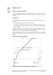
Citation report - Victoria's Planning Schemes
Citation report - Victoria's Planning Schemes
Citation report - Victoria's Planning Schemes

Create successful ePaper yourself
Turn your PDF publications into a flip-book with our unique Google optimized e-Paper software.
Description<br />
The railway cutting extends for 800 metres between Coventry Street and Bridport Street, corresponding,<br />
approximately, to the portion of railway line between what are now the South Melbourne and Albert Park<br />
light rail stations. The cutting is crossed at Dorcas Street, Bank Street and Park Street by three bluestone<br />
bridges of identical design. Each of these comprises, at the lower level, a central segmental-arched opening<br />
with rock-faced voussoirs, flanked by smoother battered piers, and thence by rock-faced abutments. The<br />
upper level, with smoother ashlar masonry, is delineated by two projecting courses of smooth-faced<br />
stonework. On the inside of this wall, facing the road, the stonework has a bush-hammered finish with a<br />
smooth border, and there are some iron spike railings. The bridge closest to South Melbourne station also<br />
has an engraved panel bearing the name of the original engineer, William Elsdon, and the date 1857.<br />
The steeply sloping sides of the railway cutting are grassed, and there are also a number of mature pepper<br />
trees (Schinus molle, a ubiquitous element along railway reserves such as these) and other plantings. A<br />
number of buildings have been erected alongside the railway cutting, variously fronting Ferrars Street or<br />
Ferrars Place. The scout hall, on Ferrars Place near Bridport Street, is a utilitarian red brick structure with<br />
buttress-like brick piers and a broad gabled roof. The premises of the South Melbourne Cycle Club at 335-<br />
337 Ferrars Street is a red brick building, apparently of Edwardian or inter-war vintage, which is enlivened by<br />
rendered stringcourses, scotia cornices and flat-arched windows with steel-framed casement sashes. There<br />
is also row of townhouses, of quite recent origin, at 339-349 Ferrars Street.<br />
History<br />
The first railway line in the present-day City of Port Phillip, and also the first public steam train service in<br />
Australia, was the 2¼ mile (3.6 kilometre) link between Sandridge Pier to Flinders Street, which was laid out<br />
from 1852 by the Melbourne & Hobson’s Bay Railway Company. This opened on 12 September 1854 and<br />
such was its success over the next twelve months that the company, having returned an eight percent<br />
dividend to its shareholders, decided to erect a branch line to St Kilda. A public meeting was held in<br />
December 1855 to consider possible routes; A proposal to locate the line to the south and west of the hill<br />
was rejected by residents, who considered that it would hinder their access to the beach, and it was<br />
subsequently decided that the line should be on the east of the hill, along Moray Street. Early the following<br />
year, this option was also dropped when a select committee deemed it too expensive. Instead, it was<br />
decided that the new line should neither follow the east or west of the hill but, rather to extend through the<br />
centre of it, parallel to Ferrars Street.<br />
Construction of the branch line commenced in Spring 1856, with 200 workmen under the direction of the<br />
company engineer, William Elsdon, who had replaced its original engineer, James Moore, in December<br />
1854. The new line turned off the main Sandridge railway soon after the Flinders Street terminus, extending<br />
3 miles (4.8 kilometres) to a purpose-built station building on Fitzroy Street. Completion of the project was<br />
delayed due to difficulties with the original contractor, who was eventually replaced by another from Sydney,<br />
and the new line opened on 13 May 1857. Over the next few years, the Melbourne & Hobson’s Bay Railway<br />
Company upgrading both of its lines, which included the duplication of tracks and the opening of new<br />
stations. On the St Kilda branch, stations were opened at Emerald Hill (now South Melbourne) in September<br />
1858, and at Butts (now Albert Park) in November 1860.<br />
Thematic Context<br />
COMPARATIVE ANALYSIS<br />
The railway cutting at South Melbourne can be compared to a small number of similar cuttings in the inner<br />
metropolitan area. In terms of its early date, it is most comparable to the cutting that runs between Windsor<br />
Station and Alma Road, East St Kilda. The railway line between Windsor and North Brighton opened on 19<br />
December 1859, being part of a longer route to Brighton Beach that was laid out by the St Kilda & Brighton<br />
Railway Company, in several stages, from 1858. The cutting, which is approximately 600 metres long,<br />
bisects Alma Park and includes the road bridges at Chapel Street and Dandenong Road. The cutting retains<br />
some historic infrastructure, including red brick bridges and retaining walls (within the City of Stonnington),<br />
while the portion through Alma Park (within the City of Port Phillip) is delineated by rows of mature pepper<br />
trees. While this cutting is clearly of some aesthetic and value, it is of a curving form and thus lacks the<br />
continuous vista qualities that are so strongly evident at South Melbourne. A second cutting, in the portion<br />
between Hotham Street and Elsternwick Station, is straighter but shorter (about 500 metres), and this is<br />
located within the City of Glen Eira.<br />
Other railway cuttings in the inner suburbs also tend to be of curved profile, and are generally shorter, and of<br />
more recent origin, than the example at South Melbourne. The cutting between Brewster Street and<br />
Glenbervie station in Essendon, which dates from 1872, is about 500 metres long and is also of a gently