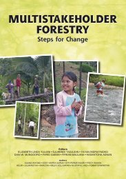
English 2.28MB - Center for International Forestry Research
English 2.28MB - Center for International Forestry Research
English 2.28MB - Center for International Forestry Research

You also want an ePaper? Increase the reach of your titles
YUMPU automatically turns print PDFs into web optimized ePapers that Google loves.
| Site description<br />
Table 4. Identified land types in Khe Tran<br />
Land types (Pahy) Description<br />
Cutect vườn Land <strong>for</strong> garden<br />
Cutect màu Land <strong>for</strong> agriculture<br />
Cutect a tong Land <strong>for</strong> peanut farming<br />
Cutect along Land <strong>for</strong> <strong>for</strong>est plantation<br />
Cutect vá Land <strong>for</strong> cemetery<br />
Cutect cho tro Land <strong>for</strong> rice farming<br />
Cutect tiêu Land <strong>for</strong> pepper farming<br />
Cutect cao su Land <strong>for</strong> rubber farming<br />
Cutect âm bút Land <strong>for</strong> natural <strong>for</strong>est<br />
Cutect cỏ Land <strong>for</strong> grass/bare land<br />
Đa pưh Pahy Pahy/O Lau river<br />
Đá so tù moi Tu moi tributary<br />
Cutect ta xu Land <strong>for</strong> houses<br />
Ân yên cooh 935 Mountain peak of 935<br />
A chuh Rana Rana waterfall<br />
Chooh Rana Sandy area of Rana riverside<br />
Mỏ zeeng Gold mine<br />
Along papứt Big tree <strong>for</strong>est<br />
Along cacet Small tree <strong>for</strong>est<br />
Câm foong fứt Bridge<br />
dry land <strong>for</strong> agriculture, <strong>for</strong>ests, home garden, rice field and rivers. The <strong>for</strong>ests<br />
classification was further divided into plantation, small tree and big tree <strong>for</strong>ests<br />
(see Table 5).<br />
O Lau river is an important part of the landscape near the village. It traverses<br />
the entire village territory, close to the settlements. The second big river, My<br />
Chanh river in the northern part of Khe Tran, is rarely used by the local people.<br />
Forests within and around the village are categorized into three types as<br />
mentioned above. Plantation <strong>for</strong>ests in our survey include Acacia and rubber.<br />
The oldest (8 years) rubber plantation of the village is situated near the main<br />
road, and covers about 10 ha, including some patches of new plantations. The<br />
Acacia plantation begins in the middle of the village and reaches to the upper part,<br />
covering about 160 ha. Small tree <strong>for</strong>est represents the dominant types of <strong>for</strong>est<br />
around the village, mainly inside the Phong Dien Nature Reserve, and consists<br />
of young Myrtaceae and Rubiaceae <strong>for</strong>ests. Big tree <strong>for</strong>est (or primary <strong>for</strong>est) is<br />
distant from the village, situated at more than one day’s walk, inside the reserve<br />
area.<br />
Bare lands (Figure 7) were caused historically by war, fires, grazing and<br />
shifting cultivation (Le Trong Trai et al. 2001). This land type, dominated by<br />
shrubs and grasses, is the target of re<strong>for</strong>estation ef<strong>for</strong>ts by the government. Acacia<br />
plantations are developed on these bare hills.<br />
The rest of the village’s landscape is divided into settlements, home<br />
gardens (pepper and fruits), bare hills, rivers and roads. If land <strong>for</strong> plantation is<br />
geographically specialized (Acacia in the upper part and rubber in the lower part),<br />
home gardens can be found near the houses in both parts of the village.