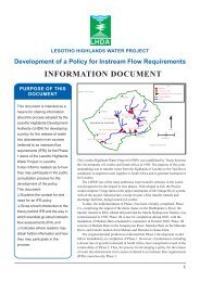
Metsi Consultants - DWA Home Page
Metsi Consultants - DWA Home Page
Metsi Consultants - DWA Home Page

Create successful ePaper yourself
Turn your PDF publications into a flip-book with our unique Google optimized e-Paper software.
5.1. HYDROLOGY<br />
Report No 678-F-001<br />
METSI CONSULTANTS: SUMMARY OF MAIN FINDINGS FOR PHASE 1 DEVELOPMENT<br />
SECTION 5. MINIMUM DEGRADATION SCENARIO<br />
The Minimum Degradation IFRs are designed to minimise future degradation of the downstream river reaches or,<br />
for the reach immediately downstream of the existing Katse Dam, to indicate what minimum degradation could<br />
have been like. They represent the hypothetical “best case” situation with dams in place as it is assumed that<br />
dams do not limit the IFRs. For IFR Site 2 - downstream of Katse Dam - this scenario used the pre-Katse<br />
hydrological data.<br />
For all parts of the affected rivers, the modified flow regimes encompassed two kinds of reduction - in the range of<br />
low flows and in the number of floods. For instance, in the wet season, the range of low flows at IFR Site 1 could<br />
be reduced from 0.02-6.75 m 3 s -1 to 0.02-6.00 m 3 s -1 , and at IFR Site 6 from 1.69-434.00 m 3 s -1 to<br />
1.69-224.00 m 3 s -1 . Similarly the dry season low flow ranges at IFR Site 1 could be reduced from 0.00-4.03 m 3 s -1<br />
to 0.00-4.00 m 3 s -1 , and at IFR Site 6 from 0.90-120.00 m 3 s -1 to 0.90-70.00 m 3 s -1 . Thus, it is indicated that<br />
proportionally more low flow could be lost from the downstream sites than from the upstream sites without serious<br />
impacts to river ecosystems.<br />
With respect to floods, the main losses allowed are a reduction in the number of the smallest (Class 1) within-year<br />
floods and, at some sites, the largest (Class 4) within-year floods, since these are deemed to have very similar<br />
functioning to the Class 2 and 3 floods, respectively. Thus, the number of Class 1 floods at IFR Site 3 is reduced<br />
from seven to five per annum, and at IFR Site 5 from four to two per annum. The number of Class 4 within-year<br />
floods is reduced from two to one per annum at IFR Site 1, but no reduction of the natural flood situation is<br />
imposed at IFR Site 4. The remaining within-year floods at each site are distributed proportionally according to<br />
their natural occurrence. The 1:5 year flood is omitted for all sites on the assumption that the other major floods<br />
(1:2, 1:10, 1:20 year) would maintain most of the same flood functioning.<br />
For each site, the volumes encompassed in the new flow regime are estimated and compared to the present<br />
Mean Annual Runoff (MAR). In total, the modified flow regimes comprised 55-67% of the present-day MAR<br />
(Table 5.1). Summary values in Table 5.1 are provided for comparison purposes only. If actually applied, the<br />
releases from the dams would have to be based on the capping levels for low flows and the flood volumes<br />
provided in the detailed biophysical scenario report (No 648-F-04).<br />
5.2. BIOPHYSICAL CONSEQUENCES<br />
The reduced flow regimes would be expected to result in subtle shifts in river condition. A negligible (0-10%) or<br />
low (10-20%) increase in the proportion of mud in the rivers, and in its deposition at river margins and in<br />
backwaters, is predicted. A concomitant increase in the growth of slippery biofilms on underwater surfaces is also<br />
expected. These changes are anticipated to be most obvious (20-40%) in the reaches downstream of Katse Dam<br />
(IFR Reach 2). The lower Senqu River (IFR Reach 6) and lower Senqunyane River (IFR Reach 8) would be least<br />
affected (0-5% change).<br />
At the same levels of change, there would be a decrease in the movement of sand, gravel, cobbles and boulders<br />
along the rivers. Over short periods more sand might accumulate in flow-sensitive cobble riffles and in pools and<br />
thereby reduce their depths but, providing catchment erosion does not increase, larger floods would periodically<br />
25