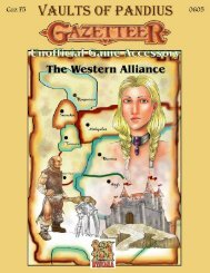
The Heldannic Order - Vaults of Pandius
The Heldannic Order - Vaults of Pandius
The Heldannic Order - Vaults of Pandius

You also want an ePaper? Increase the reach of your titles
YUMPU automatically turns print PDFs into web optimized ePapers that Google loves.
GEOGRAPHY<br />
<strong>The</strong> Land<br />
<strong>The</strong> <strong>Heldannic</strong> Territories are situated<br />
on the Western Sea <strong>of</strong> Dawn, due north<br />
<strong>of</strong> the Ethengar Steppes. Long an<br />
afterthought <strong>of</strong> the Known World, the<br />
<strong>Heldannic</strong> topography mirrors the unique<br />
isolation <strong>of</strong> its natives. <strong>The</strong> cold rocky<br />
hills that dominate Heldann are not part<br />
<strong>of</strong> the Northern Reaches’ High Coastal<br />
Plain, nor are they simply foothills to the<br />
western mountains. Neither are the<br />
lowlands an extension <strong>of</strong> Norwold’s<br />
Coastal Plain.<br />
Plains<br />
<strong>The</strong>re are three zones <strong>of</strong> relatively flat<br />
terrain found in Heldann. Of these, two<br />
are contiguous, but varying weather<br />
patterns and historical conventions have<br />
kept them as distinct regions.<br />
<strong>The</strong> Low Coastal Plain (<strong>Heldannic</strong><br />
Littoral Plain) is a pair <strong>of</strong> annular swaths<br />
about the Freiburg Hills and the<br />
Ostbergen. Altendorf is at the Plain’s<br />
western extent. It supports minimal<br />
agriculture but is adequate for long-term<br />
grazing. <strong>The</strong> weather is wet and chilly,<br />
particularly south <strong>of</strong> the Ostbergen. <strong>The</strong><br />
Plain continues into the north beyond the<br />
current borders before ending at the<br />
Skaufskogr Hills near Landfall. This<br />
latter sub-region is well-irrigated, with a<br />
rich, bountiful soil.<br />
West <strong>of</strong> Altendorf is the High Fluvial<br />
Plain and the waters <strong>of</strong> the Elber, Isar,<br />
and Pflanis. <strong>The</strong> soil here is deep and<br />
loamy, and cottage farming is possible.<br />
Tree stands can be seen along the river<br />
banks. Altitude begins at 400 feet in the<br />
east and climbs as one approaches the<br />
hills. <strong>The</strong> highest point on the Plain is<br />
2,000 feet, just east <strong>of</strong> Pflazen.<br />
Finally, the Skolvik Plain is a flat<br />
stretch in the middle <strong>of</strong> the Sudbergen. It<br />
is 2,300 feet above sea level along the<br />
Isar-Pflenzen Hills and averages 2,600<br />
feet. <strong>The</strong> Skolvik reaches 3,000 feet in<br />
the southwest before yielding to the<br />
Schwarzberg Hills, which are part <strong>of</strong> the<br />
Wendarian foothills. <strong>The</strong> soil is thicker<br />
here, too, and there are breaks in the<br />
underlying rock that reach a deep water<br />
table. Wells are small, enough for a<br />
household or two. Isolated freeholds are<br />
rare in the north and extreme west, for<br />
fear <strong>of</strong> the local trolls and Boldavian<br />
undead, respectively.<br />
Hills<br />
<strong>The</strong> hilly territory that characterizes<br />
Heldann’s southern half is collectively<br />
termed the <strong>Heldannic</strong> Shield by<br />
geologists. <strong>The</strong> Shield is a singular,<br />
massive rocky formation <strong>of</strong> granite that<br />
connects the Sea <strong>of</strong> Dawn with the<br />
mountains at the western end <strong>of</strong> the<br />
nation.<br />
<strong>The</strong> coastal strips drop to sea level or<br />
end in seaside cliffs (100-250 feet), but<br />
inlands the hills begin at 1,000 feet and<br />
quickly double that altitude. This<br />
measure continues to increase in the<br />
south and west, rising to between 3,000<br />
and 4,100 feet.<br />
<strong>The</strong> Sudbergen account for over half <strong>of</strong><br />
the Shield’s area. <strong>The</strong> topsoil is very thin<br />
throughout the region. Agriculture is a<br />
backbreaking labor, yet Heldanners have<br />
been doing this for centuries. Sheep and<br />
pig farming are the most fruitful<br />
endeavors, yet even that is at a<br />
subsistence level. Soil nutrients dry up<br />
quickly, and freeholders are forced to<br />
move about every 15 years.<br />
Tree coverage increases towards the<br />
east, leading to the well-treed<br />
Schoenbergen. <strong>The</strong>se hills are part <strong>of</strong> an<br />
excellent river basin – the Blauchen –<br />
that empties into the Sea <strong>of</strong> Dawn.<br />
It should be noted that, outside <strong>of</strong> the<br />
mountains, the steepest climb in Heldann<br />
is achieved going from the shores south<br />
<strong>of</strong> Blauendorf over 4,000 feet up to the<br />
Ethengar Steppes. [Treat passage in this<br />
direction as mountainous, but as hilly<br />
parallel to the trail – Ed.]<br />
<strong>The</strong> Freiburg Hills are a small cluster <strong>of</strong><br />
rocky hills similar in composition to the<br />
Sudbergen. <strong>The</strong>y only rise to a paltry<br />
1,200 feet, and cliffs are only seen along<br />
the Elber.<br />
<strong>The</strong> coastal Freiburg Hills and<br />
Ostbergen were originally an extension<br />
<strong>of</strong> the Shield, but ancient tectonic and<br />
weathering processes allowed the<br />
insertion <strong>of</strong> the Low Coastal Plain.<br />
<strong>The</strong> Mengul Foothills are not as<br />
elevated as the Sudbergen. Southwest <strong>of</strong><br />
the Elber, hills are at 2,500 feet, while the<br />
northern run averages only 1,500 feet.<br />
9<br />
Mountains<br />
<strong>The</strong> Altar <strong>of</strong> Vanya is a staggering rock<br />
formation on the coast <strong>of</strong> Heldann. Its<br />
stones reach upwards <strong>of</strong> 8,000 feet, but<br />
they do not form a single peak. Rather,<br />
the massif forms a roughly level structure<br />
in the interior. Little vegetation covers<br />
the Altar’s slick surface. Even at lower<br />
elevations, there is only moss, lichen, and<br />
a few weeds. Unlike the lower<br />
Ostbergen, the Altar is predominantly<br />
hornblende.<br />
<strong>The</strong> native Heldanners saw no need to<br />
settle the rocky formation, which they<br />
refer to as Hymirsheim. <strong>The</strong> Knights<br />
also do not live here, but the Altar serves<br />
as a navigational beacon for their<br />
warbirds and naval vessels. Part <strong>of</strong> the<br />
formation continues under the coastal<br />
waters, and rock slides are not unheard<br />
<strong>of</strong>. <strong>The</strong> coastal facing is sheer in many<br />
places. <strong>The</strong> western slope is gentler, but<br />
tapered. Unbeknownst to either the<br />
Knights or the native Heldanners,<br />
carvings in several ancient scripts adorn a<br />
section <strong>of</strong> the northern face.<br />
Freysfjall is a small granite mountain<br />
west <strong>of</strong> Freiburg. Several minor ridge<br />
lines divert spring water and snow melt<br />
to the Isar and Blauchen. <strong>The</strong> mountain<br />
holds religious significance to native<br />
Heldanners, and the funerary pyre <strong>of</strong><br />
Heldann the Brave was held on its peak.<br />
<strong>The</strong> Red Fangs are a pair <strong>of</strong> ancient<br />
volcanic extrusions piercing the skyline<br />
<strong>of</strong> the central Sudbergen. <strong>The</strong> ancient<br />
magma chambers that produced these<br />
mountains are no longer active. Glaciers<br />
still cling to the eastern Fang, and ice<br />
melt feeds a small river leading to Lake<br />
Erid. <strong>The</strong> Knife Ridge is a trail leading<br />
up the eastern Fang. Heldanners view the<br />
Fangs with trepidation, knowing that<br />
between them are things even worse than<br />
the <strong>Heldannic</strong> Knights. For their part, the<br />
Knights remain ignorant <strong>of</strong> the true<br />
goings-on at Erid.<br />
<strong>The</strong> Territories’ western border is<br />
shaped by the imposing mountains <strong>of</strong> the<br />
Final Range. <strong>The</strong> local <strong>Heldannic</strong><br />
population long considered the western<br />
mountains as the end <strong>of</strong> the world. What<br />
lay beyond was the dominion <strong>of</strong> elves or<br />
giants and other fell beasts.<br />
Archivists and cartographers for the<br />
<strong>Heldannic</strong> Knights know that different