Rigorous Sensor Modeling and Triangulation for OrbView-3 - asprs
Rigorous Sensor Modeling and Triangulation for OrbView-3 - asprs
Rigorous Sensor Modeling and Triangulation for OrbView-3 - asprs
Create successful ePaper yourself
Turn your PDF publications into a flip-book with our unique Google optimized e-Paper software.
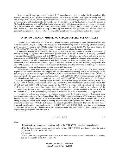
Replacing the rigorous sensor model with an RPC approximation is popular mainly <strong>for</strong> its simplicity. The<br />
January 2003 issue of Photogrammetric Engineering & Remote Sensing contained four papers discussing RPC <strong>and</strong><br />
RPC triangulation. An RPC model, especially when embedded in st<strong>and</strong>ard imagery <strong>for</strong>mats such as NITF, allows<br />
software developers to implement the RPC model once <strong>for</strong> any sensor using the st<strong>and</strong>ardized <strong>for</strong>mat. Un<strong>for</strong>tunately<br />
RPC modeling does not lend itself to long image segments where high frequency corrections cannot be accounted<br />
<strong>for</strong> in the st<strong>and</strong>alone RPC model. The Replacement <strong>Sensor</strong> Model (McGlone, 2004) is a promising extension to the<br />
RPC model. But, until the RSM is fully accepted by the end-user, data provider, <strong>and</strong> software developer<br />
communities, rigorous models will continue to be used <strong>for</strong> complex modeling of airborne <strong>and</strong> satellite sensors.<br />
ORBVIEW-3 SENSOR MODELING AND ASSOCIATED SUPPORT DATA<br />
The <strong>OrbView</strong>-3 satellite carries a linear array pushbroom sensor, providing one meter panchromatic <strong>and</strong> four<br />
meter multispectral imagery. GeoEye sells imagery <strong>and</strong> metadata at varying levels of processing. There are currently<br />
eight <strong>OrbView</strong>-3 products, from BASIC imagery to Orthorectified products (ORTHO). This paper focuses on<br />
<strong>OrbView</strong>-3 BASIC Enhanced Panchromatic Imagery, which includes enhanced telemetry metadata.<br />
Cooperation between the data provider <strong>and</strong> the photogrammetry software supplier is essential to underst<strong>and</strong>ing<br />
<strong>and</strong> implementing the rigorous sensor model <strong>for</strong> a specific sensor. In the case of <strong>OrbView</strong>-3 imagery, agreements<br />
were signed between BAE Systems <strong>and</strong> ORBIMAGE (now GeoEye), then technical material <strong>and</strong> sample imagery<br />
were provided by ORBIMAGE. <strong>OrbView</strong>-3 BASIC Enhanced Imagery including enhanced telemetry data was sent<br />
to BAE Systems along with ground control <strong>and</strong> documentation describing the imagery <strong>and</strong> metadata. Clearly,<br />
cooperation in both business <strong>and</strong> technical aspects is mutually beneficial <strong>for</strong> the data provider (GeoEye) <strong>and</strong> data<br />
user (BAE Systems) – GeoEye wishes to sell imagery products <strong>and</strong> BAE Systems wishes to sell image exploitation<br />
software to mapping <strong>and</strong> intelligence agencies <strong>and</strong> commercial companies.<br />
Support data includes in<strong>for</strong>mation such as sensor location, velocity, orientation angles, focal length, time of<br />
acquisition, <strong>and</strong> camera calibration data. Support data are often supplied as auxiliary files to the raw imagery. In the<br />
past imagery <strong>and</strong> metadata were typically re<strong>for</strong>matted in the photogrammetry workstation into a common <strong>for</strong>mat <strong>for</strong><br />
convenient use by the image processing software solutions such as SOCET SET, but today the image providers are<br />
typically delivering their imagery in common <strong>for</strong>mats such as NITF <strong>and</strong> TIFF. There<strong>for</strong>e, the imagery is often used<br />
directly <strong>for</strong> photogrammetric processing in the software. The associated image metadata is normally stored in a<br />
binary or ASCII <strong>for</strong>mat. Documentation provided by ORBIMAGE details the metadata definition <strong>and</strong> <strong>for</strong>mat. The<br />
SOCET SET <strong>and</strong> SOCET GXP software products use the <strong>OrbView</strong>-3 imagery <strong>and</strong> metadata directly without the<br />
need to re<strong>for</strong>mat either input data source. Since triangulation is typically required by end-users of the<br />
photogrammetry software, a solution providing updated sensor parameters must be provided. In the case of SOCET<br />
SET <strong>and</strong> SOCET GXP, the updated (triangulated) sensor parameters are stored in a separate ASCII support file.<br />
The sensor model converts ground space locations to image space locations, or vice versa. The ground space<br />
coordinates are in the <strong>for</strong>m of Earth-Centered-Earth-Fixed (ECEF) coordinates in meters. The image coordinates are<br />
sub-pixel line <strong>and</strong> sample coordinates. The trans<strong>for</strong>mations are used in nearly every photogrammetric process, from<br />
simply moving the cursor on an image to creating products such as orthophotos. The <strong>OrbView</strong>-3 sensor model<br />
documentation provided by ORBIMAGE outlines the image-to-ground trans<strong>for</strong>mation. There<strong>for</strong>e, the direct imageto-ground<br />
trans<strong>for</strong>mation was implemented in SOCET SET <strong>and</strong> SOCET GXP with the ground-to-image<br />
implemented as an iterative computation of the image-to-ground. The <strong>OrbView</strong>-3 documentation outlines the<br />
projective image-to-ground trans<strong>for</strong>mation as<br />
where<br />
G 1 A k<br />
O<br />
= A + M a<br />
(1)<br />
G<br />
A is the unknown object space coordinate triplet in the ECEF WGS84 coordinate system in meters<br />
O<br />
A is the instantaneous sensor position triplet in the ECEF WGS84 coordinate system in meters<br />
interpolated from the ephemeris metadata<br />
k is a scalar<br />
M is the 3x3 image-to-ground rotation matrix based on instantaneous attitude in<strong>for</strong>mation in the <strong>for</strong>m of<br />
quaternion values from the attitude metadata<br />
ASPRS 2006 Annual Conference<br />
Reno, Nevada ♦ May 1-5, 2006


