

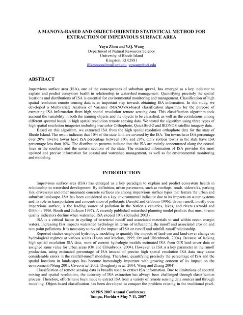
a manova-based and object-oriented statistical method for - asprs
a manova-based and object-oriented statistical method for - asprs
a manova-based and object-oriented statistical method for - asprs

You also want an ePaper? Increase the reach of your titles
YUMPU automatically turns print PDFs into web optimized ePapers that Google loves.
A MANOVA-BASED AND OBJECT-ORIENTED STATISTICAL METHOD FOR<br />
EXTRACTION OF IMPERVIOUS SURFACE AREA<br />
ABSTRACT<br />
Yuyu Zhou <strong>and</strong> Y.Q. Wang<br />
Department of Natural Resources Science<br />
University of Rhode Isl<strong>and</strong><br />
Kingston, RI 02881<br />
ilikespoon@mail.uri.edu, yqwang@uri.edu<br />
Impervious surface area (ISA), one of the consequences of suburban sprawl, has emerged as a key indicator to<br />
explain <strong>and</strong> predict ecosystem health in relationship to watershed management. Quantifying precisely the spatial<br />
locations <strong>and</strong> distributions of ISA is essential <strong>for</strong> environmental monitoring <strong>and</strong> management. Classification of high<br />
spatial resolution remote sensing data is an important step towards obtaining ISA in<strong>for</strong>mation. In this study, we<br />
developed a Multivariate Analysis of Variance (MANOVA)-<strong>based</strong> classification algorithm <strong>for</strong> the purpose of<br />
extracting ISA in<strong>for</strong>mation from high spatial resolution remote sensing data. This classification algorithm took<br />
account the variability in both the training <strong>object</strong>s <strong>and</strong> the <strong>object</strong>s to be classified, as well as the correlations among<br />
different spectral b<strong>and</strong>s in high spatial resolution remote sensing data. We tested the algorithm using three types of<br />
high spatial resolution imageries including true color Orthophoto, QuickBird-2 <strong>and</strong> IKONOS satellite imagery data.<br />
Based on this algorithm, we extracted ISA from the high spatial resolution orthophoto data <strong>for</strong> the state of<br />
Rhode Isl<strong>and</strong>. The result indicates that 10% of the state l<strong>and</strong> are covered by the ISA. Ten towns have ISA percentage<br />
over 20%. Twelve towns have ISA percentage between 10% <strong>and</strong> 20%. Only sixteen towns in the state have ISA<br />
percentage less than 10%. The distribution patterns indicate that the ISA are mainly concentrated along the coastal<br />
lines in the southern <strong>and</strong> the eastern sections of the state. The extracted in<strong>for</strong>mation of ISA provides the most<br />
updated <strong>and</strong> precise in<strong>for</strong>mation <strong>for</strong> coastal <strong>and</strong> watershed management, as well as <strong>for</strong> environmental monitoring<br />
<strong>and</strong> modeling.<br />
INTRODUCTION<br />
Impervious surface area (ISA) has emerged as a key paradigm to explain <strong>and</strong> predict ecosystem health in<br />
relationship to watershed development. By definition, urban pavements, such as rooftops, roads, sidewalks, parking<br />
lots, driveways <strong>and</strong> other manmade concrete surfaces are among impervious surface types that feature the urban <strong>and</strong><br />
suburban l<strong>and</strong>scape. ISA has been considered as a key environmental indicator due to its impacts on water systems<br />
<strong>and</strong> its role in transportation <strong>and</strong> concentration of pollutants (Arnold <strong>and</strong> Gibbons 1996). Urban runoff, mostly over<br />
impervious surface, is the leading source of pollution in the Nation’s estuaries, lakes, <strong>and</strong> rivers (Arnold <strong>and</strong><br />
Gibbons 1996, Booth <strong>and</strong> Jackson 1997). A recently published watershed-planning model predicts that most stream<br />
quality indicators decline when watershed ISA exceed 10% (Schueler 2003).<br />
ISA is a critical factor in cycling of terrestrial runoff <strong>and</strong> associated materials to <strong>and</strong> within ocean margin<br />
waters. Increasing ISA impacts watershed hydrology in terms of influencing the runoff <strong>and</strong> associated erosion <strong>and</strong><br />
non-point pollutions. It is necessary to reveal the impact of ISA on runoff <strong>and</strong> rainfall-runoff relationship.<br />
Reported studies employed hydrologic modeling to quantify the impacts of l<strong>and</strong>-use <strong>and</strong> l<strong>and</strong>-cover change on<br />
hydrological regimes at various scales (Dunn <strong>and</strong> Mackay, 1995; Ott <strong>and</strong> Uhlenbrook, 2004). Because of lacking<br />
high spatial resolution ISA data, most of current hydrologic models estimated ISA from GIS l<strong>and</strong>-cover data or<br />
assigned same value <strong>for</strong> urban areas (Ott <strong>and</strong> Uhlenbrook, 2004). However, as ISA is a key parameter in the runoff<br />
production, using estimated percentage of ISA instead of precise high spatial resolution ISA data may cause<br />
considerable errors in the rainfall-runoff modeling. There<strong>for</strong>e, quantifying precisely the percentage of ISA <strong>and</strong> the<br />
spatial locations in l<strong>and</strong>scapes has become increasingly important with growing concern of its impact on the<br />
environment (Weng 2001, Civco et al. 2002, Dougherty et al. 2004, Wang <strong>and</strong> Zhang 2004).<br />
Classification of remote sensing data is broadly used to extract ISA in<strong>for</strong>mation. Due to limitations of spectral<br />
mixing <strong>and</strong> spatial resolutions, the accuracy of ISA extraction has always been challenged through classification<br />
process. There<strong>for</strong>e, ef<strong>for</strong>ts have been made to extract ISA from a variety of remote sensing data sources <strong>and</strong> through<br />
modeling. Object-<strong>based</strong> classification has been developed to conquer the problem existing in the traditional pixel-<br />
ASPRS 2007 Annual Conference<br />
Tampa, Florida ♦ May 7-11, 2007
ased image classifications (Baatz <strong>and</strong> Schäpe, 2000; Shackel<strong>for</strong>d <strong>and</strong> Davis, 2003). Object-<strong>based</strong> <strong>method</strong> is<br />
especially suitable <strong>for</strong> processing high spatial resolution images.<br />
The classifiers used in the pixel-<strong>based</strong> classification can still be used in <strong>object</strong>-<strong>based</strong> <strong>method</strong>s. For example<br />
fuzzy logic is commonly used in <strong>object</strong>-<strong>based</strong> classification (Shackel<strong>for</strong>d <strong>and</strong> Davis, 2003; Baatz et al., 2004; Benz<br />
et al., 2004). In order to use fuzzy logic, a rule-base must be established first. Subjective factors may be introduced<br />
in the process. Minimum distance <strong>and</strong> maximum likelihood are reliable classifiers <strong>and</strong> often used to make<br />
comparisons with other algorithms (El-Magd <strong>and</strong> Tanton, 2003; Reguzzoni et al., 2003; Wang et al., 2004).<br />
Minimum distance classifier can be used to build a rule base in fuzzy logic classification. Maximum likelihood<br />
classifier is a better one <strong>and</strong> more useful when prior knowledge is available <strong>and</strong> statistic criteria are taken into<br />
account. In some pixel-<strong>based</strong> classifiers, such as the maximum likelihood, the variability <strong>and</strong> relationship between<br />
spectral b<strong>and</strong>s of the training pixels are considered. However such in<strong>for</strong>mation would not be available <strong>for</strong> a single<br />
pixel to be classified in these pixel-<strong>based</strong> <strong>method</strong>s. In most of the existed <strong>object</strong>-<strong>based</strong> <strong>method</strong>s, in<strong>for</strong>mation of<br />
variability in the <strong>object</strong>s <strong>and</strong> relationship between spectral b<strong>and</strong>s was not considered. There<strong>for</strong>e, it will be helpful <strong>for</strong><br />
an <strong>object</strong>-<strong>based</strong> classification to include this type of in<strong>for</strong>mation.<br />
With the availability of the most recent airborne digital orthophotos, we developed an algorithm using<br />
Multivariate Analysis of Variance (MANOVA)-<strong>based</strong> classification to extract the high spatial resolution ISA. We<br />
also tested this algorithm using remote sensing data from different sources. Finally we extracted ISA in<strong>for</strong>mation <strong>for</strong><br />
the coastal state of Rhode Isl<strong>and</strong> <strong>and</strong> summarized the spatial distribution patterns of ISA.<br />
METHODOLOGY<br />
Data Preparation<br />
The Rhode Isl<strong>and</strong> Statewide Planning Program acquired a set of true color digital orthophoto between 2003 <strong>and</strong><br />
2004 through the National Agricultural Imagery Program (NAIP). This 1-meter ground sample distance<br />
orthorectified imagery dataset has a horizontal accuracy of within +/- 3 meters of reference digital ortho quarter<br />
quads (DOQQS) from the National Digital Ortho Program. The ortho images are projected into Rhode Isl<strong>and</strong> State<br />
Plane Coordinate System with zone 3800 in U.S. Survey feet. The resulting spatial resolution in this coordinate<br />
system is 1 meter (3.28 feet). The dataset has red, green <strong>and</strong> blue light spectral b<strong>and</strong>s <strong>and</strong> distributes in GeoTIFF<br />
<strong>for</strong>mat (Figure 1a).<br />
ASPRS 2007 Annual Conference<br />
Tampa, Florida ♦ May 7-11, 2007
Figure 1. (a) The true color digital orthophoto imagery data with 1-meter spatial resolution <strong>for</strong> the state of Rhode<br />
Isl<strong>and</strong> <strong>and</strong> coastal towns <strong>for</strong> ISA pattern analysis; (b) The statewide ISA coverage <strong>and</strong> spatial distributions; (c) <strong>and</strong><br />
(d) The enlarged orthophoto <strong>for</strong> East Greenwich township areas <strong>and</strong> extracted ISA.<br />
We also used the QuickBird-2 satellite data acquired on April 29, 2005 <strong>and</strong> IKONOS satellite data acquired on<br />
December 20, 2003 to test the applicability of the algorithm that we have developed. The QuickBird-2 <strong>and</strong> IKONOS<br />
image data were acquired <strong>for</strong> quantifying <strong>and</strong> identifying l<strong>and</strong>scape characteristics related to impervious surface in<br />
selected portions of the state. QuickBird-2 image data possess 0.6-m spatial resolution on the panchromatic b<strong>and</strong><br />
<strong>and</strong> 2.5-m spatial resolution on the multispectral b<strong>and</strong>s. IKONOS image data possess 1-m spatial resolution on the<br />
panchromatic b<strong>and</strong> <strong>and</strong> 4-m spatial resolution on the multispectral b<strong>and</strong>s. The image data were projected into the<br />
same map coordinates as orthorectified true-color aerial photos. Both QuickBird-2 <strong>and</strong> IKONOS data were<br />
processed using spatial resolution enhancement. After resolution merge the new dataset of QuickBird-2 possesses<br />
0.6-m spatial resolution with 4 spectral b<strong>and</strong>s (Figure 2a) <strong>and</strong> IKONOS processes 1-m spatial resolution with 4<br />
spectral b<strong>and</strong>s (Figure 2b).<br />
ASPRS 2007 Annual Conference<br />
Tampa, Florida ♦ May 7-11, 2007
Figure 2. (a) <strong>and</strong> (c) An example of resolution merged QuickBird-2 image with 0.6-meter spatial resolution <strong>and</strong><br />
extracted ISA; (b) <strong>and</strong> (d ) An example of resolution merged IKONOS image with 1-meter spatial resolution <strong>and</strong><br />
extracted ISA.<br />
As texture in<strong>for</strong>mation can be helpful <strong>for</strong> spatial in<strong>for</strong>mation definition (Woodcock <strong>and</strong> Harward, 1992), we<br />
used a 3 x 3 window to extract the variance in the dataset as one of the features in the image segmentation process.<br />
We selected subset areas in Rhode Isl<strong>and</strong> <strong>for</strong> the algorithm testing. The selected testing areas are typical<br />
suburban communities with intensive urban developments. ISA are a major concern of these communities in terms<br />
of watershed management <strong>and</strong> environmental monitoring.<br />
MANOVA-<strong>based</strong> Classification<br />
After the initial <strong>and</strong> additional segmentation processes, the next step should be the assignment of a class label<br />
to each of the regions on segmented image through a classification process. We developed a MANOVA-<strong>based</strong><br />
classifier on the segmented image in which the relationship between spectral b<strong>and</strong>s <strong>and</strong> the variability in the training<br />
<strong>object</strong>s <strong>and</strong> those <strong>object</strong>s to be classified were taken into account.<br />
This process allowed more in<strong>for</strong>mation to be exploited in the single <strong>object</strong>. For example, in the maximum<br />
likelihood classification the variance <strong>and</strong> co-variance matrices of the training samples are used. In most of the<br />
existing <strong>object</strong>-<strong>based</strong> classification <strong>method</strong>s, the in<strong>for</strong>mation of each spectral b<strong>and</strong> is analyzed separately. If the<br />
response variables were uncorrelated, these <strong>method</strong>s would be powerful. However, since spectral b<strong>and</strong>s in remote<br />
sensing data are correlated, this MANOVA-<strong>based</strong> algorithm referenced the spectral distance to exploit such<br />
correlations. This process improved the result from univariate analysis that ignored the correlations among spectral<br />
b<strong>and</strong>s <strong>and</strong> assumed independence of response variates. We used following distance equation (Eq. 1) in the<br />
MANOVA-<strong>based</strong> classification algorithm.<br />
⎧ 2 n1n2<br />
T −1<br />
⎪<br />
T = ( x1<br />
− x2<br />
) S p ( x1<br />
− x 2)<br />
⎪ n1<br />
+ n2<br />
⎨<br />
(1)<br />
⎪ 2 n1<br />
+ n2<br />
− p 2<br />
T adj =<br />
T<br />
⎪⎩<br />
p(<br />
n1<br />
+ n2<br />
− 2)<br />
ASPRS 2007 Annual Conference<br />
Tampa, Florida ♦ May 7-11, 2007
where 1 n <strong>and</strong> n 2 are the numbers of the pixels in the <strong>object</strong> to be classified <strong>and</strong> training <strong>object</strong>; x 1 <strong>and</strong> x 2 are the<br />
mean spectral vectors of the <strong>object</strong> to be classified <strong>and</strong> training <strong>object</strong>; S p is the pooled covariance <strong>based</strong> on two<br />
2<br />
<strong>object</strong>s; p is the b<strong>and</strong>s; T is the distance between two <strong>object</strong>s; <strong>and</strong> T adj<br />
2<br />
is the distance with the consideration of<br />
the b<strong>and</strong>s <strong>and</strong> pixels numbers.<br />
We carried out the following process. Firstly, we per<strong>for</strong>med the segmentation using the spectral, shape <strong>and</strong><br />
texture in<strong>for</strong>mation in the high spatial resolution remote sensing data <strong>and</strong> obtained the segmented image. After that,<br />
we did the classification <strong>based</strong> on the MANOVA-<strong>based</strong> algorithm as follows. We established the training samples<br />
<strong>for</strong> 5 main categories of ISA, <strong>for</strong>est, grassl<strong>and</strong>, bared soil <strong>and</strong> water. Each category has several sub-categories. We<br />
then recoded the obtained classification result into ISA <strong>and</strong> none-ISA. Upon finishing the classification we used the<br />
existing GIS data through a post-classification process to extract ISA that still could not be identified through the<br />
process. We used a rasterized GIS transportation data from Rhode Isl<strong>and</strong> Geographic In<strong>for</strong>mation System (RIGIS) as<br />
a reference to identify the road networks <strong>and</strong> integrated the road data with output from the classification to obtain<br />
the final ISA coverage. The post-classification warrants that the connected ISA is not interrupted <strong>and</strong> the final result<br />
represents the best in<strong>for</strong>mation from both high spatial resolution remote sensing <strong>and</strong> GIS data.<br />
Algorithm Extending<br />
It takes 113 scenes of digital orthophotos to cover the state of Rhode Isl<strong>and</strong> except Block Isl<strong>and</strong> (Figure. 1a). In<br />
order to extract the ISA <strong>for</strong> the state efficiently, we developed an automatic approach <strong>based</strong> on batch process <strong>and</strong><br />
applied it on the segmentation <strong>and</strong> classification process. Firstly, we carried out the segmentations <strong>for</strong> these scenes<br />
using the same set of the parameters as the testing areas. Secondly, we per<strong>for</strong>med the pre-classification stratification<br />
according to l<strong>and</strong>-cover <strong>and</strong> l<strong>and</strong>-use data from the RIGIS, <strong>and</strong> selected the training <strong>object</strong>s of certain l<strong>and</strong>-cover<br />
types <strong>for</strong> each subset from pre-classification stratification. We compared <strong>and</strong> checked these training data according<br />
to the covariance matrix of each <strong>object</strong>, <strong>and</strong> used the samples with smaller covariance. We then recoded the results<br />
into ISA <strong>and</strong> none-ISA, <strong>and</strong> finally applied the post-classification to obtain the high spatial resolution ISA <strong>for</strong> the<br />
state.<br />
RESULTS<br />
ISA Extraction<br />
In order to check the accuracy <strong>for</strong> the extracted ISA from orthophoto, we selected township of East Greenwich<br />
to per<strong>for</strong>m the accuracy assessment (Figure 1c <strong>and</strong> 1d). We used r<strong>and</strong>om point sampling <strong>method</strong> to evaluate the ISA<br />
accuracy. We selected 200 test samples <strong>and</strong> examined the classification accuracies <strong>for</strong> ISA <strong>and</strong> none-ISA only. The<br />
confusion matrix indicated that this algorithm achieved 94% overall accuracy using orthophoto (Table 1). The<br />
omission <strong>and</strong> commission error were 11% <strong>and</strong> 1.11% <strong>for</strong> the ISA, <strong>and</strong> 1% <strong>and</strong> 10% <strong>for</strong> the none-ISA categories,<br />
respectively. We also tested the algorithm per<strong>for</strong>mance on the QuickBird-2 <strong>and</strong> IKONOS imageries. Results using<br />
QuickBird-2 <strong>and</strong> IKONOS are shown in Figure 2c <strong>and</strong> 2d. This algorithm achieved 94% <strong>and</strong> 91.5% overall<br />
accuracies <strong>for</strong> QuickBird-2 <strong>and</strong> IKONOS imageries, respectively.<br />
R<br />
E<br />
F<br />
E<br />
R<br />
E<br />
N<br />
C<br />
E<br />
Table 1. Accuracy assessment of MONOVA-<strong>based</strong> algorithm derived ISA<br />
MASC Model Derived ISA<br />
ISA none-ISA Row Total Omission Error Accuracy<br />
ISA 89 11 100 11% 89%<br />
none-ISA 1 99 100 1% 99%<br />
Column Total 90 110 200<br />
Commission Error 1.11% 10% Overall<br />
94%<br />
The result of high spatial resolution ISA <strong>for</strong> the entire state is illustrated in Figure 1b. As the first set of precise<br />
statewide ISA data, the result reveals the spatial distribution of ISA, in particular along the coastal line. The results<br />
ASPRS 2007 Annual Conference<br />
Tampa, Florida ♦ May 7-11, 2007
indicate that ISAs cover 10% of the total areas in state of Rhode Isl<strong>and</strong>. Five towns including Central Falls, New<br />
Port, North Providence, Providence, <strong>and</strong> Woonsocket, have ISA cover percentage 30%. Five towns including<br />
Bristol, East Providence, Pawtucket, Warwick, <strong>and</strong> West Warwick, have ISA percentage between 20% <strong>and</strong> 30%.<br />
Twelve towns have ISA percentage between 10% <strong>and</strong> 20%. Only sixteen towns in the state have ISA percentage less<br />
than 10% (Table 2).<br />
Table 2. ISA Percentage of inl<strong>and</strong> <strong>and</strong> coastal townships in Rhode Isl<strong>and</strong>.<br />
Inl<strong>and</strong> Towns Area (ha) ISA (%) Coastal Towns Area (ha) ISA (%)<br />
Exeter 15130 3 Little Compton 5854 6<br />
Foster 13466 3 Charlestown 9900 6<br />
Glocester 14726 4 S Kingstown 15880 7<br />
Scituate 14201 4 Tiverton 7863 8<br />
W Greenwich 13271 5 Jamestown 2505 9<br />
Hopkinton 11437 5 E Greenwich 4226 11<br />
Burrillville 14760 5 Narragansett 3691 12<br />
Richmond 10556 6 Portsmouth 6115 13<br />
Coventry 16183 8 N Kingstown 11444 14<br />
N Smithfield 6448 9 Barrington 2227 14<br />
Smithfield 7154 9 Westerly 7962 16<br />
Cumberl<strong>and</strong> 7319 13 Warren 1619 16<br />
Johnston 6305 15 Middletown 3420 18<br />
Lincoln 4915 16 Cranston 7492 19<br />
W Warwick 2096 26 Bristol 2559 20<br />
N Providence 1501 31 E Providence 3625 20<br />
Central Falls 334 38 Warwick 9300 24<br />
Woonsocket 2044 40 Pawtucket 2296 26<br />
Newport 2096 30<br />
Providence 4873 37<br />
Average 7 Average 14<br />
Spatial distributions of ISAs are uneven in the state (Figure 1b). ISAs are more intensive along the coastal<br />
townships than that in interior areas of the state (Figure 1b <strong>and</strong> Table 2). Comparisons of the percentage of ISA<br />
among costal towns reveal the spatial patterns of ISA cover in these areas (Figure 1b). The percentages of ISA are<br />
diverse among the coastal towns (Table 2). ISAs in the coastal townships are relatively higher than that in the inl<strong>and</strong><br />
towns.<br />
Patterns of ISA Distribution<br />
The riparian zones are important in hydrology, ecology <strong>and</strong> environmental management because of their<br />
relationship with soil conservation, biodiversity <strong>and</strong> water quality. However, with the urban <strong>and</strong> suburban<br />
development ISA along <strong>and</strong> near the riparian zones increased quickly. In order to underst<strong>and</strong> the spatial patterns of<br />
ISA along riparian zones, we built five buffer zones in sizes of 15-, 60-, 120-, 300-, <strong>and</strong> 600-meter along the major<br />
rivers, such as Moshassuck River in northern part of the state <strong>and</strong> Chipuxet River in southern part of the state, to<br />
find spatial distribution of ISA within these zones in coastal towns (Figure 1a). As ISAs along transportation lines<br />
<strong>for</strong>m the effective ISA that play more important roles in environmental impacts than isolated ISA, we analyzed the<br />
distribution pattern of ISA along the major roads by constructing similar 5 buffer zones as those applied to the major<br />
rivers.<br />
Since there are no major rivers in 3 of the coastal towns, we compared the ISA within different sizes of buffer<br />
zones <strong>for</strong> 17 towns. The results of ISA patterns were illustrated in Figure 3. Percentage of ISA in most of the towns<br />
shows an increasing trend with the increase of buffered areas. The town of Westerly is an exception, where the ISA<br />
show a decreasing trend with the increase of buffer size along the major river (Figure. 3). This is because Westerly<br />
has only very limited areas that are covered by the river buffers. The decreasing trend may not reflect the real pattern<br />
of ISA cover within the township areas.<br />
ASPRS 2007 Annual Conference<br />
Tampa, Florida ♦ May 7-11, 2007
ISA percentage(%)<br />
0.4<br />
0.3<br />
0.2<br />
0.1<br />
0<br />
Barrington<br />
Charlestown<br />
15 meters 60 meters 120 meters 300 meters 600 meters<br />
E Greenwich<br />
E Providence<br />
Jamestown<br />
Middletown<br />
N Kingstown<br />
Portsmouth<br />
Providence<br />
S Kingstown<br />
Figure 3. ISA Percentage in 5 buffer zones along the major rivers in coastal towns.<br />
Warwick<br />
Westerly<br />
ASPRS 2007 Annual Conference<br />
Tampa, Florida ♦ May 7-11, 2007<br />
Tiverton<br />
Little Compton<br />
Pawtucket<br />
Warren<br />
Cranston<br />
Figure 4 shows the ISA along the major roads with varied sizes of buffered areas. Different from the patterns<br />
observed in the riparian zones, the percentage of ISA shows a decreasing trend with the increase of buffered areas,<br />
which indicates that most of the ISAs distribute along the road networks. The rate of decreasing in percentage of<br />
ISA is reduced as the buffered areas enlarged.<br />
ISA percentage(%)<br />
0.7<br />
0.6<br />
0.5<br />
0.4<br />
0.3<br />
0.2<br />
0.1<br />
0<br />
15 meters 60 meters 120 meters 300 meters 600 meters<br />
Barrington<br />
Bristol<br />
Charlestown<br />
E Greenwich<br />
E Providence<br />
Jamestown<br />
Middletown<br />
N Kingstown<br />
Narragansett<br />
Newport<br />
Portsmouth<br />
Providence<br />
S Kingstown<br />
Warwick<br />
Westerly<br />
Little Compton<br />
Tiverton<br />
Pawtucket<br />
Warren<br />
Cranston<br />
Figure 4. ISA Percentage in 5 buffer zones along the major roads in coastal towns.
CONCLUSIONS AND DISCUSSIONS<br />
This study developed a MANOVA-<strong>based</strong> classification algorithm on the segmented images. The variability<br />
within the <strong>object</strong> <strong>and</strong> the relationship between the spectral b<strong>and</strong>s were taken into account. Compared with the pixel<strong>based</strong><br />
<strong>method</strong>, this algorithm achieved more precise <strong>and</strong> accurate in<strong>for</strong>mation on ISA distribution. In pixel-<strong>based</strong><br />
<strong>method</strong>s, the variability <strong>and</strong> relationship between spectral b<strong>and</strong>s of the training samples are taken into account in<br />
some classifiers such as maximum likelihood. There was no such in<strong>for</strong>mation <strong>for</strong> a single pixel to be classified in<br />
those <strong>method</strong>s. In most of existing <strong>object</strong>-<strong>based</strong> <strong>method</strong>s, the relationships between different spectral b<strong>and</strong>s were not<br />
considered. Because of the correlations among different spectral b<strong>and</strong>s in remote sensing data, it is helpful to<br />
consider this correlation in<strong>for</strong>mation in the data process. The MANOVA-<strong>based</strong> algorithm exploits the correlations of<br />
the spectral b<strong>and</strong>s to explain the spectral distance between the training <strong>object</strong>s <strong>and</strong> those <strong>object</strong>s to be classified.<br />
The algorithm is successful in extraction of ISA from high spatial resolution airborne true color digital<br />
Orthophoto, as well as from space borne multispectral images. True color Orthophoto data are more common among<br />
state agencies <strong>and</strong> have been widely used by the general public. The QuickBird-2 <strong>and</strong> IKONOS data have<br />
advantages in multispectral coverage. The digital Orthophoto, spatially enhanced QuickBird-2 <strong>and</strong> IKONOS data<br />
possess comparable spatial resolution. The results from multiple testing areas, as well as from the entire state with<br />
different l<strong>and</strong>scape <strong>and</strong> ISA characteristics verified that this algorithm is applicable <strong>and</strong> robust. There<strong>for</strong>e, the<br />
algorithm can meet the requirements in high spatial resolution ISA extraction.<br />
This study provided the high spatial resolution ISA in<strong>for</strong>mation <strong>for</strong> the state of Rhode Isl<strong>and</strong> using the<br />
developed algorithm. This is the first statewide high spatial resolution ISA dataset in Rhode Isl<strong>and</strong>. The data are<br />
valuable <strong>for</strong> l<strong>and</strong> management, planning, <strong>and</strong> <strong>for</strong> ecological <strong>and</strong> hydrological modeling to determine the impacting<br />
effects of l<strong>and</strong> use patterns on coastal environment <strong>and</strong> watersheds of the state. The distribution patterns obtained<br />
from this study indicate that ISAs are mainly concentrated along the coastal areas in the southern <strong>and</strong> eastern<br />
sections of the state. The percentages of ISA are highest within the nearest buffer along the road networks. ISAs are<br />
in increasing trends with the increase of buffer size along the riparian zones. The impact of ISA on water quality,<br />
particularly <strong>for</strong> the towns that have high percentage of ISA cover, needs to be considered in development <strong>and</strong><br />
planning.<br />
ACKNOWLEDGEMENTS<br />
This study was funded by the Rhode Isl<strong>and</strong> Agricultural Experimental Station (RI00H330). The QuickBird-2<br />
data came from another project funded by the Institute <strong>for</strong> the Application of Geospatial Technology, <strong>and</strong> the<br />
IKONOS data came from ASPRS GeoEye Award.<br />
REFERENCES<br />
Arnold, C.A. Jr., <strong>and</strong> C.J. Gibbons (1996). Impervious surface coverage: the emergence of a key urban<br />
environmental indicator. Journal of the American Planning Association, 62(2): 243-258.<br />
Baatz, M. <strong>and</strong> A. Schäpe (2000). Multiresolution segmentation: an optimization approach <strong>for</strong> high quality multiscale<br />
image segmentation. In: Angew<strong>and</strong>te Geographische In<strong>for</strong>mationsverarbeitung XII (Strobl, J. <strong>and</strong> T.<br />
Blaschke, editors), Wichmann-Verlag, Heidelberg, pp. 12-23.<br />
Baatz, M., U. Benz, S. Dehghani, M. Heynen, A. Höltje, P. Hofmann, I. Lingenfelder, M. Mimler, M. Sohlbach, M.<br />
Weber, <strong>and</strong> G. Willhauck (2004). eCognition User Guide, URL: http://www.definiens-imaging.com,<br />
Definiens Imaging, München, Germany (last date accessed: 25 July 2005).<br />
Benz, U., P. Hofmann, G. Willhauck, I. Lingenfelder, <strong>and</strong> M. Heynen (2004). Multi-resolution, <strong>object</strong>-<strong>oriented</strong> fuzzy<br />
analysis of remote sensing data <strong>for</strong> GIS-ready in<strong>for</strong>mation. ISPRS Journal of Photogrammetry & Remote<br />
Sensing, 58 (3-4): 239– 258.<br />
Booth, D.B., <strong>and</strong> C.R. Jackson (1997). Urbanization of aquatic systems: Degradation thresholds, stormwater<br />
detection, <strong>and</strong> the limits of mitigation. Journal of American Water Resources Association, 35(5): 1077-<br />
1090.<br />
Civco, D.L., J.D. Hurd, E.H. Wilson, C.L. Arnold, <strong>and</strong> S. Prisloe (2002). Quantifying <strong>and</strong> Describing Urbanizing<br />
L<strong>and</strong>scapes in the Northeast United States. Photogrammetric Engineering & Remote Sensing, 68(10):<br />
1083-1090.<br />
Dougherty, M., L. D. R<strong>and</strong>el, J. G.. Scott, A. J. Claire, <strong>and</strong> G. Norm<strong>and</strong> (2004). Evaluation of Impervious Surface<br />
ASPRS 2007 Annual Conference<br />
Tampa, Florida ♦ May 7-11, 2007
Estimates in a Rapidly Urbanizing Watershed. Photogrammetric Engineering & Remote Sensing, 70(11):<br />
1275–1284.<br />
Dunn, S.M. <strong>and</strong> R. Mackay (1995). Spatial variation in evapotranspiration <strong>and</strong> the influence of l<strong>and</strong> use on<br />
catchment hydrology. Journal of Hydrology, 171(1-2): 49-73.<br />
El-Magd, I. A., <strong>and</strong> T.W. Tanton (2003). Improvements in l<strong>and</strong> use mapping <strong>for</strong> irrigated agriculture from satellite<br />
sensor data using a multi-stage maximum likelihood classification. International Journal of Remote<br />
Sensing, 24(21): 4197-4206.<br />
Ott, B. <strong>and</strong> S. Uhlenbrook (2004). Quantifying the impact of l<strong>and</strong>-use changes at the event <strong>and</strong> seasonal time scale<br />
using a process-orientated catchment model. Hydrology <strong>and</strong> Earth System Sciences, 8(1): 62–78.<br />
Reguzzoni, M., F. Sanso, G. Venuti, <strong>and</strong> P. A. Brivio (2003). Bayesian classification by data augmentation.<br />
International Journal of Remote Sensing, 24(20): 3961-3981.<br />
Schueler, T. (2003). Impacts of Impervious Cover on Aquatic Systems. Center <strong>for</strong> Watershed Protection (CWP),<br />
Ellicott City, MD., 142p.<br />
Shackel<strong>for</strong>d, A.K <strong>and</strong> C. H. Davis (2003). A combined fuzzy pixel-<strong>based</strong> <strong>and</strong> <strong>object</strong>-<strong>based</strong> approach <strong>for</strong><br />
classification of high-resolution multispectral data over urban areas. IEEE Transactions on Geoscience &<br />
Remote Sensing, 41(10): 2354-2363.<br />
Wang, L., W. P. Sousa, <strong>and</strong> P. Gong (2004). Integration of Object-<strong>based</strong> <strong>and</strong> Pixel-<strong>based</strong> Classification <strong>for</strong> Mapping<br />
Mangroves with IKONOS Imagery. International Journal of Remote Sensing, 25(1): 1-14.<br />
Wang, Y. <strong>and</strong> X. Zhang (2004). A SPLIT Model <strong>for</strong> Extraction of Subpixel Impervious Surface In<strong>for</strong>mation.<br />
Photogrammetric Engineering <strong>and</strong> Remote Sensing, 70: 821-828.<br />
Weng, Q. H. (2001). Modeling Urban Growth Effects on Surface Runoff with the Integration of Remote Sensing <strong>and</strong><br />
GIS. Environmental Management, 28(6): 737-748.<br />
Woodcock, C. E., <strong>and</strong> V. J. Harward (1992). Nested-Hierarchical Scene Models <strong>and</strong> Image Segmentation.<br />
International Journal of Remote Sensing, 13(16): 3167-3187.<br />
ASPRS 2007 Annual Conference<br />
Tampa, Florida ♦ May 7-11, 2007


