Barking Station Masterplan Document PDF 12 MB - Meetings ...
Barking Station Masterplan Document PDF 12 MB - Meetings ...
Barking Station Masterplan Document PDF 12 MB - Meetings ...

You also want an ePaper? Increase the reach of your titles
YUMPU automatically turns print PDFs into web optimized ePapers that Google loves.
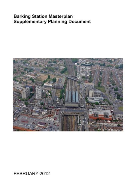
<strong>Barking</strong> <strong>Station</strong> <strong>Masterplan</strong><br />
Supplementary Planning <strong>Document</strong><br />
FEBRUARY 20<strong>12</strong>
Contents<br />
Chapter 1 <strong>Barking</strong> <strong>Station</strong> Interchange: A Vision<br />
1.1 Introduction 6<br />
Chapter 2 <strong>Barking</strong> <strong>Station</strong> Interchange: Setting the Scene<br />
2.1 The Wider Setting 10<br />
2.2 Historic Roots 16<br />
2.3 <strong>Barking</strong> <strong>Station</strong> Today 23<br />
2.4 <strong>Masterplan</strong> Objectives 28<br />
2.5 Community Consultation 30<br />
2.6 Planning Policy 33<br />
Chapter 3 <strong>Barking</strong> <strong>Station</strong> Interchange: <strong>Masterplan</strong><br />
3.1 Planning Principles 37<br />
3.2 Movement 45<br />
3.3 Spaces 52<br />
3.4 Tall Buildings 55<br />
3.5 Phasing and Deliverability 58<br />
3.6 Planning Obligations 59<br />
3.7 Planning Applications 60<br />
Chapter 4 <strong>Barking</strong> <strong>Station</strong> Interchange: Site Allocations<br />
4.1 Introduction 64<br />
BS1 <strong>Barking</strong> <strong>Station</strong> Renovation 65<br />
BS2 <strong>Barking</strong> <strong>Station</strong> Forecourt Improvements 70<br />
BS3 <strong>Station</strong> Parade 73<br />
BS4 Trocoll House 75<br />
BS5 Wakering Road 78<br />
BS6 Wigham House Site A 81<br />
BS7 Wigham House Site B 84<br />
BS8 Roding House 87<br />
BS9 Cambridge Road 90<br />
BS10 Anchor Retail Store 93<br />
BS11 Crown House 98<br />
BS<strong>12</strong> Linton Road Car Park 100<br />
Appendix A <strong>Barking</strong> <strong>Station</strong> Interchange: Baseline Analysis<br />
3
Chapter 1<br />
<strong>Barking</strong> <strong>Station</strong> Interchange: A Vision<br />
5
1.1: Introduction<br />
A Vision for <strong>Barking</strong> <strong>Station</strong> Interchange<br />
1.1.1 <strong>Barking</strong> Town Centre is one of the most strategically important regional centres in<br />
east London, home to a diverse community, a bustling street market, and the<br />
historic Abbey ruins. <strong>Barking</strong> lies in the heart of the London Thames Gateway<br />
area, part of the largest regeneration project in Europe.<br />
1.1.2 The station is an arrival point and for many, the first impression they have of the<br />
Borough. <strong>Barking</strong> Town Centre has not lost its individuality and spirit of place.<br />
<strong>Barking</strong> <strong>Station</strong> itself epitomises this spirit. A grade II listed building, it is an<br />
example of a station rebuilt during the British Railways ‘Modernisation Period’.<br />
The station benefits from a wide range of transport connections, but it and the<br />
immediate area suffer from poor quality public realm, capacity problems and a<br />
general lack of investment 1 .<br />
1.1.3 In recent years there has been a surge of positive development in the town<br />
centre. Much of this has focused around the civic heart with the completion of<br />
<strong>Barking</strong> Central in 2010. This award-winning scheme has created a new public<br />
space and vista of the Town Hall. The juxtaposition of the new community and<br />
residential buildings against the existing urban fabric testifies how the character<br />
of an area should not be eroded but highlighted by new interventions.<br />
1.1.4 The civic centre of <strong>Barking</strong> has set a benchmark for the wider regeneration of the<br />
town centre in terms of sensitivity of design and provision of quality public realm.<br />
<strong>Barking</strong> <strong>Station</strong> Interchange area needs to better integrate with the regeneration<br />
which has already taken place in the town centre and to respond to the scale and<br />
quality of this new development.<br />
1.1.5 Within this context, this <strong>Masterplan</strong> seeks to draw on the existing elements in the<br />
town centre and to build on this success for <strong>Barking</strong>’s gateway. The purpose of<br />
the <strong>Masterplan</strong> is to convey a shared vision for the <strong>Barking</strong> <strong>Station</strong> area and to<br />
provide a catalyst for the regeneration of this key point in the town centre and<br />
Borough. Creating a positive sense of arrival at <strong>Barking</strong> <strong>Station</strong> will help<br />
strengthen the identity of the town centre, attracting residents and investors to the<br />
Borough. The Council and its partners are committed to transforming the station<br />
so that it can operate as a best practice transport interchange, radically changing<br />
the perception of <strong>Barking</strong> Town Centre on arrival.<br />
1.1.6 The <strong>Barking</strong> <strong>Station</strong> <strong>Masterplan</strong> Supplementary Planning <strong>Document</strong> (SPD)<br />
specifically sets out the need to improve the grade II listed station, the<br />
surrounding public realm and presents a number of development opportunities,<br />
which build on the areas existing historic assets. It indicates how these proposed<br />
development sites connect to their surroundings by all modes of transport<br />
including walking, cycling and public transport. It also provides clarity as to<br />
appropriate uses in terms of the quantity and location of residential, retail, office<br />
and leisure development.<br />
1 DfT, Better <strong>Station</strong>s Report, 2010<br />
6
Figure 1: Illustrative Model Views of the <strong>Barking</strong> <strong>Station</strong> <strong>Masterplan</strong> (Indicative Only)<br />
Figure 2: Public realm at <strong>Barking</strong> Central<br />
7
Chapter 2<br />
<strong>Barking</strong> <strong>Station</strong> Interchange: Setting the Scene<br />
9
2.1: The Wider Setting<br />
2.1.1 Whilst <strong>Barking</strong> has excellent transport connections, as a gateway it is not<br />
providing a fitting arrival for a Major Centre. The refurbishment and renewal of<br />
the <strong>Station</strong> <strong>Masterplan</strong> area and <strong>Barking</strong> <strong>Station</strong> in particular will dramatically<br />
improve the town centre. The transformation of the station and its forecourt will<br />
be catalytic to the wider town centre regeneration.<br />
2.1.2 The London Plan (2011) designates <strong>Barking</strong> Town Centre as a Major Centre<br />
with potential for medium growth and regeneration. <strong>Barking</strong> and Dagenham’s<br />
adopted Core Strategy (2010) further recognises the importance of <strong>Barking</strong><br />
Town Centre in its Strategic Objectives, whilst Policy CM1 of Core Strategy<br />
designates <strong>Barking</strong> Town Centre as a Key Regeneration Area.<br />
2.1.3 The <strong>Barking</strong> <strong>Station</strong> <strong>Masterplan</strong> area is set out in the adopted <strong>Barking</strong> Town<br />
Centre Area Action Plan (BTCAAP) as site allocation BTCSSA3: <strong>Barking</strong><br />
<strong>Station</strong>. Site Specific Allocation BTCSSA3, proposes that the site is suitable for<br />
the following:<br />
Improved transport interchange<br />
Shops, restaurants, cafes<br />
Office and other commercial uses including leisure<br />
Hotel<br />
New homes<br />
2.1.4 The engineering and design consultancy Atkins has produced an extensive<br />
evidence base for the <strong>Masterplan</strong>. Appointed in Summer 2008, by London<br />
Thames Gateway Development Corporation (LTGDC), to complete a<br />
Supplementary Planning <strong>Document</strong> for <strong>Barking</strong> <strong>Station</strong> and its immediate urban<br />
area, Atkins made a series of revisions to the <strong>Masterplan</strong> before arriving at this<br />
preferred development scenario. Appendix A to this document details some key<br />
background information, which illustrates the findings of this work. The full<br />
evidence base produced for the <strong>Masterplan</strong> can be viewed on the Council’s<br />
Planning Policy website.<br />
2.1.5 A need for change in <strong>Barking</strong> Town Centre is clearly established in the<br />
Council’s adopted planning policy. The Core Strategy clearly drives investment<br />
and development to <strong>Barking</strong> Town Centre. Policy CM2, Managing Housing<br />
Growth seeks the delivery of 6,000 homes in <strong>Barking</strong> Town Centre. The<br />
requirement for this residential development is echoed in the <strong>Barking</strong> Town<br />
Centre Area Action Plan (2011). Policy BTC13, Housing Supply reiterates this<br />
housing target. Increased provision of sustainably accessible, town centre<br />
housing will drive forward the associated retail and leisure development<br />
required to sustain and support the growing numbers of people living in the<br />
<strong>Station</strong> <strong>Masterplan</strong> area.<br />
2.1.6 Policy CE2: Location of Office Development, of the Core Strategy directs office<br />
development to <strong>Barking</strong> Town Centre, promoting and enhancing its status as a<br />
Major Centre. There is need for improved and new additional commercial<br />
offices in the <strong>Station</strong> <strong>Masterplan</strong> area. Much of the existing stock is of poor<br />
quality; upgrading of the office fabric and the delivery of a new office quarter to<br />
10
the north of the <strong>Masterplan</strong> area will further support the town centre’s economy.<br />
The <strong>Barking</strong> Town Centre Area Action Plan affirms this approach, seeking the<br />
development of mixed use office schemes as set out in Policy BTC3: Office<br />
Development.<br />
2.1.7 Whilst <strong>Barking</strong> is relatively healthy in terms of vitality and viability there is a need<br />
to extend the retail offer and to make provision for larger floor plates to encourage<br />
investment from multiples if it is to prosper. This is substantiated by the <strong>Barking</strong><br />
Town Centre Retail Update (2009) and the market analysis conducted by Savills<br />
in 2010 2 . The provision of new and improved retail space will bolster <strong>Barking</strong>’s<br />
position in the market; strengthening its competitiveness against neighbouring<br />
shopping destinations. Policy CM5: Town Centre Hierarchy of the Core Strategy<br />
and Policy BTC1: Additional Shopping Floorspace of the <strong>Barking</strong> Town Centre<br />
Area Action Plan recognises this and sets out the need to develop and reinforce<br />
the town centre’s retail offer.<br />
2.1.8 The attraction of new residents to <strong>Barking</strong> Town Centre and the creation of<br />
increased and enhanced office space in the <strong>Station</strong> <strong>Masterplan</strong> area will support<br />
the development of a broader range of leisure uses and an improved evening<br />
economy. Policy CP1: Vibrant Culture and Tourism, of the Core Strategy and<br />
Policy BTC5: Leisure Uses and the Evening Economy, of the <strong>Barking</strong> Town<br />
Centre Area Action Plan seek better provision of leisure and entertainment uses<br />
in <strong>Barking</strong> Town Centre. In creating a vibrant mixed-use area, the <strong>Masterplan</strong> will<br />
build on the assets already present in the <strong>Barking</strong> <strong>Station</strong> area, capitalising on its<br />
excellent transport connections. Providing a more diverse range of activities in<br />
the station quarter will be bring it to life, making <strong>Barking</strong> Town Centre a dynamic<br />
place to live, work and visit. The need for improved hotel accommodation in<br />
<strong>Barking</strong> Town Centre is highlighted in Policy BTC14, Hotel Development of the<br />
<strong>Barking</strong> Town Centre Area Action Plan and further substantiated in work<br />
conducted by King Sturge in 2008 3 and the market analysis conducted by Savills<br />
in 2010 2 .<br />
2 Demand for Office Use in <strong>Barking</strong> Town Centre, April 2008, King Sturge<br />
<strong>Barking</strong> Stage 3 Market Analysis and Scenario Review, February, 2010, Savills<br />
3 Hotel Requirements in <strong>Barking</strong>, April 2008, King Sturge<br />
11
Development Picture<br />
2.1.9 Significant investment has taken place in <strong>Barking</strong> Town Centre in recent years.<br />
An important role of the <strong>Masterplan</strong> is to reflect the principles of a number of<br />
schemes in close proximity to the station area, to better connect to and to draw<br />
on the regeneration which has, or will be taking place in the near future.<br />
<strong>Barking</strong> Central<br />
2.1.10 The civic core of <strong>Barking</strong> Town Centre has been radically transformed through a<br />
masterplan by Allford Hall Monagham and Morris. The award winning 4 scheme<br />
includes a Learning Centre which is host to a library, a cafe, an art gallery, a one<br />
stop shop for enquires and a range of courses and qualifications. In addition to<br />
this community-based learning facility, more than 500 homes have been built as<br />
part of the development, unified by a public realm which includes the creation of<br />
Market Square. This space also includes a piece of public art implemented by<br />
the landscape architects Muf, the 7 metre high folly, which has the appearance of<br />
the <strong>Barking</strong> Abbey ruins, seeks to recreate a fragment of the imaginary lost past<br />
of <strong>Barking</strong>. A number of local groups were involved in the design of this project<br />
including students from the Theatre School, elders from the Afro-Caribbean lunch<br />
club and apprentices from the local brick laying college. The distinctive use of<br />
colour in the scheme reflects the developments central public space, an<br />
arboretum, taking inspiration from the trees and the changing seasons. The<br />
arboretum provides a tranquil green space in what is a very urban environment.<br />
The choice of brick for some of the new buildings is particularly successful,<br />
working in harmony with the existing, grand 1950s Town Hall which is given a<br />
new lease of life in its stylish setting.<br />
Figure 3: <strong>Barking</strong> Central<br />
<strong>12</strong>
Vicarage Field Shopping Centre<br />
2.1.11 Planning permission was granted in 2010 for the Vicarage Field shopping centre<br />
(BTCSSA10 in the <strong>Barking</strong> Town Centre Area Action Plan). Located to the<br />
immediate east of <strong>Barking</strong> <strong>Station</strong>, the shopping centre does not contribute<br />
positively to the architectural form of <strong>Station</strong> Parade. The dated design provides<br />
little active frontage and has a poor relationship to the external public realm. It<br />
does, however, fulfil a key function in the town centre. Its shops and the large<br />
floor plate anchor food store strengthen the vitality of <strong>Barking</strong> and when the<br />
shopping centre is open for business it provides a covered pedestrian connection<br />
to Ripple Road. There is a recognised need for larger retail floor plates in <strong>Barking</strong><br />
Town Centre to ensure that it maintains its role as a Major Centre 5 . The<br />
proposed scheme for Vicarage Field will rejuvenate the existing building,<br />
providing increased unit sizes as part of a mixed-use retail and residential<br />
development. Furthermore, both the external articulation and internal space will<br />
be subject to significant modernisation and improvement. These works will<br />
facilitate the enhancement of the <strong>Station</strong> <strong>Masterplan</strong> area, assisting in attracting<br />
new traders and brands to the town centre. The approved plans for Vicarage<br />
Field include a 23 storey residential building which will become <strong>Barking</strong>’s tallest<br />
building. Its proximity to <strong>Barking</strong> <strong>Station</strong> means that it will act as an important<br />
landmark signifying the location of this key transport node.<br />
Figure 4: Illustration of the Vicarage Field Shopping Centre scheme<br />
4 Housing Design Awards 2005, MIPIM Best Mixed Use Award 2007, British Construction Award 2007,<br />
British Construction Industry Award 2008 – Local Authority Award, 2008 European Prize for Urban Public<br />
Space, London’s Public Space Award 2009, Completed Housing Design Award 2010 and a Building for Life<br />
Award 2010<br />
5 <strong>Barking</strong> Town Centre, Retail Study Update 2009, King Sturge LPP<br />
<strong>Barking</strong> Stage 3 Market Analysis and Scenario Review, February 2010, Savills<br />
13
King William Street Quarter<br />
2.1.<strong>12</strong> To the west of the <strong>Station</strong> <strong>Masterplan</strong> area is the King William Street Quarter.<br />
This site was the location of the former Lintons Estate, a dilapidated 1960s<br />
housing development. Construction of the first phase of this scheme started in<br />
late 2010 and will deliver 31 much needed family homes (3 and 4 bed). It will<br />
provide affordable council housing and is the initial phase of the King William<br />
Street Quarter <strong>Masterplan</strong> which seeks to create a new exemplar residential<br />
district in the town centre. The new site layout provides an opportunity to improve<br />
the north south and east west connections from Linton Road and into William<br />
Street. The <strong>Station</strong> <strong>Masterplan</strong> seeks to provide improved pedestrian connections<br />
to this site to better integrate it into the town centre.<br />
<strong>Barking</strong> Enterprise Centre<br />
2.1.13 The King William Street Quarter development also includes the creation of a<br />
four-storey enterprise centre for small business set-ups. Located at the junction of<br />
Cambridge Road and Linton Road, construction began on site in early 2011.<br />
<strong>Barking</strong> and Dagenham has the third highest rate of business start ups in the<br />
country 6 and the <strong>Barking</strong> Enterprise Centre is part of the Council’s strategy to<br />
foster business growth, ensuring that new businesses stay within the Borough<br />
rather than move elsewhere. In addition to providing almost 50 small office units,<br />
the centre will support businesses with a range of facilities and services to ensure<br />
that they flourish and grow. The design of the centre includes photovoltaic cells<br />
and a brown roof.<br />
Figure 5: Illustration of the <strong>Barking</strong> Enterprise Centre<br />
6 Office for National Statistics, TGLP Knowledge Platform; Business Demography<br />
14
Tanner Street<br />
2.1.14 The award winning Tanner Street 7 is a mixed tenure scheme of white rendered<br />
residential terraces and a 10 storey tower. Completed in 2006, the development is<br />
located to the north west of the <strong>Station</strong> <strong>Masterplan</strong> area. Jestico + Whiles and<br />
Peter Barber Architects collaborated to create a traditional street pattern of<br />
predominantly low-rise terraces with private gardens, delivering a high quality<br />
housing scheme which replaced three uninspiring blocks of flats. The high-density<br />
homes range from one-bedroom flats to four-bedroom townhouses and include<br />
properties for private sale, shared ownership, shared-ownership self-build, and<br />
affordable rent.<br />
London Road / North Street<br />
2.1.15 Located in the heart of the town centre the London Road / North Street site,<br />
BTCSSA1 of the <strong>Barking</strong> Town Centre Area Action Plan, will see the delivery of<br />
some 100 homes, a Skills Centre, a large food store together, a number of<br />
individual retail units and a new public space - Market Square.<br />
2.1.16 Works began on site in 2010, with phase 1 of the scheme expected to be<br />
completed in September 20<strong>12</strong>. Designed by Rick Mather Architects, the initial<br />
phase is for a Skills Centre, a new type of educational facility, providing 14-19 year<br />
olds with vocational training in hospitality, construction, hair and beauty and IT.<br />
Included in this development is a Bistro, a new eating establishment for the town<br />
centre which will give the students an opportunity to train in a real working<br />
environment. The <strong>Barking</strong> Methodist Church will front onto the newly created<br />
public realm, Market Square, and will include community function spaces and<br />
meeting rooms. The Skills Centre will also provide opportunities for the public to<br />
attend seminars, lectures and other events.<br />
2.1.17 Phase 2 of the scheme is due to start on site in Autumn 20<strong>12</strong> and is targeted for<br />
completion in March 2015. This later development will conclude works to the public<br />
realm, deliver new homes, a large food store and see improved active retail<br />
frontage onto Abbey Green.<br />
Figure 6: Illustration of the Skills Centre<br />
7 RIBA Award Winner, 2007<br />
15
2.2: Historic Roots<br />
2.2.1 The first settlement at <strong>Barking</strong> was of Saxon origin, the navigable River Roding<br />
leading to this early development. The town evolved around the shores of the<br />
river, with a thriving fishing fleet supplying the London market as well as local<br />
needs.<br />
16<br />
1796: Georgian <strong>Barking</strong><br />
Georgian <strong>Barking</strong> was a linear village on<br />
a north south axis, know as North<br />
Street. Local employment was a mix of<br />
agriculture and industry, with a tannery<br />
and mill visible on the map.<br />
Notable is the lack of development<br />
along the road to Long Bridge Farm,<br />
which now forms the main East Street /<br />
<strong>Station</strong> Parade and market place<br />
armature, along with the north/south<br />
route which appears to run on the future<br />
railway alignment.<br />
1870 – 1882: The Victorians and the<br />
railway<br />
The Victorians built the railway<br />
connections to <strong>Barking</strong>, although it was<br />
far less dominant than the current<br />
arrangement. The town is still<br />
dominated by the north-south axis,<br />
although development along East Street<br />
is now evident.<br />
The land away from the main linear axis<br />
is still largely agricultural, with the<br />
exception of a few railway terraces.<br />
Farming and the local mill still appear to<br />
be the main local employers.
17<br />
Early 1900’s: Rapid intensification<br />
The early 1900’s signal a period of rapid<br />
local intensification, with the<br />
construction of the wider terraced street<br />
forms, the expansion of the railway<br />
cutting to accommodate more tracks,<br />
and the rapid decline of local farmland.<br />
The twin armatures of North Street and<br />
East Street now appear to be of equal<br />
importance, and the church still holds it<br />
local position of significance.<br />
Post War to present day: Severance<br />
The post war period signals both the<br />
demolition of much of the Victorian<br />
street fabric in favour of modernist<br />
estates, and the implementation of<br />
1960’s highway design theory.<br />
With this demolition, North Street<br />
becomes an urban backwater, with<br />
East Street taking the role as the local<br />
centre, and the church losing its local<br />
significance in location terms. The<br />
railway has expanded still further to its<br />
current capacity.
Historic buildings and unique spaces<br />
2.2.2 The <strong>Barking</strong> <strong>Station</strong> area is a mixture of post war architecture dating from<br />
the 1950s to the 1980s. Whilst the townscape quality on the whole is quite poor,<br />
there are a number of buildings and spaces with heritage interest which the SPD<br />
aims to preserve and enhance (see Figure 7).<br />
Figure 7: Heritage features in the <strong>Masterplan</strong> area<br />
18
2.2.3 The south of the <strong>Barking</strong> <strong>Station</strong> <strong>Masterplan</strong> area lies within the Abbey and<br />
<strong>Barking</strong> Town Centre Conservation Area. The Abbey and <strong>Barking</strong> Town Centre<br />
Conservation Appraisal (2009) highlights the need to incorporate the few<br />
remaining heritage assets into the regeneration of the area. The built heritage of<br />
the town centre offers important clues as to how to create a sense of place<br />
distinctive to <strong>Barking</strong>. These buildings and their settings should be retained,<br />
enhanced and used as inspiration for future development.<br />
<strong>Barking</strong> <strong>Station</strong><br />
2.2.4 The present station, the fourth on the same general site, is grade II listed 8 . The<br />
booking hall, which dates from the British Railway Modernisation Period, was<br />
designed and built between 1959 and 1963. The image below shows the station<br />
as it was in the early 1960s. The simple, continuous facia and clear views through<br />
the glazed corners brought light into the concourse on all four sides.<br />
2.2.5 The station formed part of a wider urban development scheme, which included<br />
the creation of <strong>Station</strong> Parade as a planned streetscape of shops and offices on<br />
the railway overbridge.<br />
2.2.6 A bold and innovative structure, the station is formed from cast and pre-stressed<br />
concrete. Although not formally acknowledged, the concept for the main station<br />
building appears to have been inspired by the main station in Rome, completed in<br />
1950.<br />
Figure 8: <strong>Barking</strong> <strong>Station</strong> shortly after completion in 1961<br />
8 Listing text for the <strong>Barking</strong> <strong>Station</strong> Booking Hall: <strong>Station</strong> booking hall. 1961.<br />
Architect H H Powell, Eastern Region Architect; Project Architect John Ward. Fair-faced concrete and<br />
precast concrete with much glazing. The booking hall stands on a bridge over railway tracks and is fourteen<br />
bays long. The concrete roof trusses span the booking hall in three unequal pitches, and are<br />
cranked out over the road to provide cover for waiting cars. The fascia to the roof over the road is vertically<br />
ribbed fair-faced concrete. High level glazing surrounds the building on all elevations and front is<br />
fully glazed. <strong>Station</strong> trading units have been added in recent years adjacent to the street glazing, but<br />
there is still a fine sense of space within the hall. A well proportioned and well detailed building.<br />
Listing NGR: TQ4441784334<br />
19
2.2.7 According to the original drawings the station was partly finished internally in grey<br />
and white tiles. The interior of the building has been much altered over the past<br />
50 years, however there is potential to both adapt the building to accommodate<br />
anticipated future passenger numbers and to reinvigorate the station and restore<br />
the building’s open feel.<br />
Figure 9: An internal view of <strong>Barking</strong> <strong>Station</strong>, around 1961<br />
2.2.8 The main building was conceived as a light expansive space dominated by<br />
glazing and open space. A well-proportioned building, the design of the station<br />
provided users with a sense of height, light and space.<br />
2.2.9 Since the station was developed a number of changes have been made to the<br />
interior of the main station building these include:<br />
The retail unit on the frontage between the groups of doors, and the block that<br />
was originally the Enquiry and Parcels Offices, have been replaced by modern<br />
structures with larger footprints. Consequently, more of the concourse is now<br />
occupied by development than the original design envisaged. The retail<br />
development has also narrowed the width of the entrances, reducing the <strong>Station</strong>’s<br />
capacity to below that originally intended despite passenger numbers increasing.<br />
One of the two original ticket barrier openings has been blocked by retail units.<br />
The original design included three bays of doors at each end of the building.<br />
Since then, these have been reduced to one bay of doors at each end.<br />
The upper glazing is now largely obscured by advertising boards and information<br />
screens.<br />
20
The concrete supports and features are discoloured.<br />
New lighting has been installed to compensate for loss of natural lighting.<br />
2.2.10 The 1960s buildings on either side of the station (Figure 10) do not have heritage<br />
status, however they were conceived at the same time as the station and, as with<br />
the retail units at <strong>Station</strong> Parade, form part of the overall vision for the 1959-1963<br />
<strong>Station</strong> <strong>Masterplan</strong>.<br />
Figure 10: Trocoll House (BS4) and Roding House (BS9)<br />
form bookends to the main station<br />
21
Baptist Tabernacle<br />
2.2.11 The grade II listed Baptist<br />
Tabernacle. This is an important<br />
local landmark. Designed by<br />
Holliday and Greenwood, it was built<br />
in 1893 in the Renaissance style.<br />
The immediate public realm could<br />
be enhanced with sensitive<br />
treatment to improve the setting of<br />
the grade II listed building.<br />
The <strong>Barking</strong> Tap<br />
2.2.<strong>12</strong> The <strong>Barking</strong> Tap is a locally listed<br />
Victorian building and a prominent<br />
feature on Linton Road. Dating from<br />
1894, it is all that remains of the<br />
<strong>Barking</strong> Brewery, which was one of<br />
the traditional industries of the town.<br />
<strong>Station</strong> Parade<br />
2.2.13 Units 1 – 9 <strong>Station</strong> Parade, whilst in<br />
a poor state of repair, are some of<br />
the last historic buildings in the<br />
Town Centre predating World War I.<br />
The distinct urban grain and<br />
brickwork are a recognisable feature<br />
of the high street. These buildings lie<br />
within the Abbey and <strong>Barking</strong> Town<br />
Centre Conservation Area.<br />
22
2.3: <strong>Barking</strong> <strong>Station</strong> Today<br />
2.3.1 In this chapter a number of the key challenges and opportunities facing the<br />
station area and its immediate surrounds are identified and visually presented to<br />
set the context for the <strong>Masterplan</strong>.<br />
Challenges<br />
Poor arrival experience at <strong>Barking</strong><br />
<strong>Station</strong> does not build any<br />
expectation of a quality town centre.<br />
Physical clutter combined with narrow<br />
pavements create a sense of<br />
confusion.<br />
23<br />
Dominance of transport<br />
infrastructure.<br />
Conflict between pedestrians and<br />
vehicular traffic.
Overcrowding of narrow pavements<br />
on either side of <strong>Station</strong> Parade at<br />
peak times.<br />
Primary bus routes conflict with the<br />
major pedestrian desire line between<br />
the <strong>Station</strong> and East Street.<br />
Poor quality public realm visually<br />
detracts from the area.<br />
24<br />
Key walking routes are poorly<br />
overlooked, lacking active frontages<br />
and natural surveillance.<br />
High levels of informal crossing<br />
between public transport stops.<br />
Narrow entrances and extensive<br />
retail units exacerbate overcrowding<br />
on the concourse.
Lack of cycle parking.<br />
An incoherent mixture of street<br />
furniture - litter bins, public toilets and<br />
service cabinets break up the public<br />
space and are poorly maintained.<br />
25<br />
Poor quality building stock does not<br />
have a positive impact on the<br />
character of <strong>Station</strong> Parade.<br />
<strong>Barking</strong> edges. The north-west corner<br />
of the <strong>Masterplan</strong> area is poorly<br />
defined.
Opportunities<br />
<strong>Barking</strong> is a local transport hub. It is served by London Underground, London<br />
Overground, National Rail operator c2c and many London Bus routes. A frequent<br />
service to Central London is only 15 minutes by train.<br />
A range of high quality development<br />
is located within the <strong>Station</strong>’s walking<br />
catchment.<br />
<strong>Barking</strong> Central, a mix of old and new. Recent development signifies how distinctive<br />
buildings and public spaces can transform and work sensitively to unite existing historic<br />
architecture.<br />
26<br />
Under-realised historic assets.
New paving, street furniture and a<br />
new road layout to accommodate the<br />
new ELT1 at the southern end of<br />
<strong>Station</strong> Parade and Ripple Road.<br />
Public art has been used throughout<br />
the town centre. This includes<br />
temporary installations.<br />
New homes at William Street Quarter<br />
present the opportunity to improve<br />
pedestrian links to this and<br />
surrounding residential areas.<br />
27<br />
The fine street grain of <strong>Station</strong><br />
Parade needs to be maintained and<br />
enhanced to ensure connectivity and<br />
local character is retained.<br />
The curvature of the buildings<br />
surrounding the old bandstand create<br />
a significant space.<br />
East Street Market. The market is an<br />
integral part of the social vitality of<br />
<strong>Barking</strong> Town Centre.
2.4: <strong>Masterplan</strong> Objectives<br />
Aim: Ensure that the plans for the <strong>Barking</strong> <strong>Station</strong> area contribute to the sustainable<br />
economic regeneration of the town centre by improving the station and<br />
interchange so they are fit for the future. Creating inspirational low carbon<br />
buildings and spaces which symbolise the importance of this gateway. Drawing<br />
on and enhancing the area’s existing heritage assets, the <strong>Masterplan</strong> will make<br />
it easier and safer for people to move around and contain a vital mix of retail<br />
and commercial uses which will enliven the street scene and increase<br />
employment opportunities for local people.<br />
OBJECTIVE 1: Commerce and leisure<br />
Restore <strong>Barking</strong>’s position as an important retail destination. Create more jobs by<br />
increasing the low representation of high street multiples to compliment the town<br />
centre’s strong and independent retail offer, including delivery of an anchor department<br />
store on <strong>Station</strong> Parade. Capitalise on <strong>Barking</strong>’s excellent transport links, its proximity to<br />
the Olympic Park and the facilities and services offered by the <strong>Barking</strong> Enterprise<br />
Centre by improving the quality of office and business space and attracting new visitor<br />
accommodation.<br />
OBJECTIVE 2: Housing<br />
Increase the numbers of people living in the station area by providing high quality<br />
places to live. Make sure that a significant proportion of these are affordable to local<br />
people.<br />
OBJECTIVE 3: Place<br />
Make the station area a place where people want to visit and feel safe by revitalising<br />
existing heritage assets, conserving and enhancing the area’s history to inspire the<br />
creation of buildings and places which are cherished in the future. Create a station<br />
quarter which uses energy and resources efficiently. Improve legibility and provide a<br />
sense of security.<br />
OBJECTIVE 4: Movement<br />
Reinvigorate <strong>Barking</strong> <strong>Station</strong> so it can cope with the increasing demands which will be<br />
placed on it, by restoring the station’s open feel and celebrating its architecture. Provide<br />
step free access to all platforms and improve the quality of interchange between<br />
different modes of transport. Significantly increase the ease with which pedestrians and<br />
cyclists can use and navigate the area.<br />
OBJECTIVE 5: Spaces<br />
Make the station area a place where pedestrians come first by increasing the extent of<br />
the public realm, particularly outside the station. Remove street clutter, improve signage<br />
and reduce conflict with motorised transport. Create inspirational spaces which enhance<br />
the historic context of the area, green the urban environment and minimise redundant<br />
space.<br />
28
Figure 11: Illustrative Model View of the <strong>Barking</strong> <strong>Station</strong> <strong>Masterplan</strong> (Indicative Only)<br />
29
2.5: Community Consultation<br />
2.5.1 The process of creating a masterplan for the <strong>Barking</strong> <strong>Station</strong> area has involved<br />
consultation with stakeholders and councillors at the different stages of the<br />
visioning process to ensure that the SPD reflects the aspirations of key parties.<br />
2.5.2 The draft <strong>Masterplan</strong> was consulted on between 19 July and 13 September<br />
2011. The consultation was in accordance with the Town and Country Planning<br />
(Local Development) (England) Regulations 2004 (the regulations) and the<br />
Council’s adopted Statement of Community Involvement. Further to this, the<br />
Council consulted local land owners in the <strong>Station</strong> <strong>Masterplan</strong> area to ensure<br />
that a response was received from these landowners; consultation to this group<br />
was extended to 2 November 2011. The <strong>Masterplan</strong> was also presented to the<br />
<strong>Barking</strong> Town Centre Working Group at its meeting in March 2011, members<br />
were reminded to participate in the consultation at the July 2011 meeting.<br />
2.5.2 Prior to this, the following consultation took place:<br />
Transport for London has had input with respect to the bus network, the public<br />
carriageway, freight infrastructure and other public transport infrastructure.<br />
Other important stakeholders involved with the project early on include the<br />
London Thames Gateway Development Corporation, c2c/NEx, Design for<br />
London and the Homes and Community Agency.<br />
<strong>Barking</strong> <strong>Station</strong> Forecourt Improvements<br />
2.5.3 Prior to consultation on the draft SPD in 2011, particular elements of the SPD<br />
were more advanced than others. Implementation of BS2: <strong>Barking</strong> <strong>Station</strong><br />
Forecourt is one of the most advanced site allocations in the <strong>Masterplan</strong>. The<br />
Council undertook public consultation on this element over two days in March<br />
2010. Held in <strong>Barking</strong> <strong>Station</strong>, officers provided background information to the<br />
scheme and exchanged ideas with the various groups of people using the<br />
station. Participants included pedestrians, cyclists, bus passengers, train/<br />
underground passengers and private vehicle users.<br />
2.5.4 The themes arising from this consultation were:<br />
Overcrowding and pedestrian congestion<br />
Lack of waiting spaces for buses<br />
Security concerns and poor lighting<br />
Narrow access points into the station<br />
2.5.5 The primary requirements which came through from the public were:<br />
Create a safer environment<br />
Better shelters and regular buses<br />
Move bus shelters away from the doors<br />
Make the station accessible to all (DDA compliant)<br />
30
Residents Urban Design Forum<br />
2.5.6 In December 2010, planning officers at LBBD consulted the <strong>Barking</strong> and<br />
Dagenham Residents Urban Design Forum (RUDF) on the main elements of the<br />
emerging draft SPD. The RUDF is a group of residents who have been trained to<br />
provide the Council with guidance on development schemes coming forward in<br />
the borough. The Forum is intended as a means of opening up the planning and<br />
development process and specifically urban design decisions to the community.<br />
2.5.7 The main points raised by the Residents Urban Design Forum were as follows:<br />
<strong>Barking</strong> <strong>Station</strong> Forecourt Improvements<br />
The bus stop arrangement is very confusing, with lots of people moving in<br />
different directions<br />
The location of the bus stops is not obvious<br />
There is a need for more pavement space outside the station<br />
A separate waiting area for buses would improve the congestion<br />
The proposed relocation of the taxi rank to Wakering Road is a good idea<br />
<strong>Barking</strong> <strong>Station</strong> Renovation<br />
A need for better access, the <strong>Station</strong> is not user friendly<br />
Concern about the darkness of the south eastern part of the platforms. This is not<br />
a popular area when waiting for trains<br />
A de-cluttered station concourse would be a huge improvement. It needs to be<br />
much more legible, allowing you to see the information boards more clearly<br />
The longer term aspiration to have one central entrance would make a vast<br />
improvement<br />
Provide centralised seating on the concourse, so that you can see people you are<br />
meeting coming out of the station. This could be around a feature such as a clock<br />
There must be clear information boards for people who do not know <strong>Barking</strong><br />
The extended concourse (over bridge extension) looks good because it appears<br />
to be light and airy<br />
The new platforms should be covered because when they are wet it can be<br />
dangerous<br />
Where would the ticket machines be on the concourse? This needs to be thought<br />
about in terms of dispersing people across the space so that there is no conflict<br />
with the entrance(s) to the station<br />
Bus Movement<br />
The pedestrian crossing at Cambridge Road/<strong>Station</strong> Parade causes delays to<br />
buses. It would be better to have a direct route<br />
It would make sense to have a new bus stop outside of the new anchor retail<br />
store to encourage shoppers into East Street<br />
Heritage Assets<br />
Good to see that there is a mixture of refurbishment and new development in the<br />
draft plans<br />
Office Development<br />
Wigham House A and B seem to currently have empty / to let office<br />
accommodation. Why is this, how is this situation improved?<br />
31
2.6: Planning Policy<br />
2.6.1 The <strong>Barking</strong> <strong>Station</strong> <strong>Masterplan</strong> SPD is part of a broader spatial strategy for the<br />
Borough. The SPD sets out the Council’s overall guidance for the site allocation<br />
BTCSSA3 of the <strong>Barking</strong> Town Centre Area Action Plan (2011). The <strong>Masterplan</strong><br />
reflects and provides further detail on three adopted planning policy documents<br />
and should be read alongside these key Development Plan <strong>Document</strong>s<br />
(DPDs):<br />
Core Strategy (2010)<br />
<strong>Barking</strong> Town Centre Area Action Plan (2011)<br />
Borough Wide Development Policies (2011)<br />
2.6.2 The SPD does not have the same status as the development plan but it is an<br />
important material consideration in the determination of planning applications.<br />
2.6.3 The provisions of this SPD will be implemented through the development<br />
management process and the determination of applications in the <strong>Barking</strong> <strong>Station</strong><br />
<strong>Masterplan</strong> area and will also provide the basis for securing external funding<br />
2.6.4 This document is intended to complement rather than duplicate other planning<br />
documents. In addition to the three listed DPDs, the <strong>Masterplan</strong> has been<br />
informed by the following national, regional and local planning documents and<br />
best practice guidance:<br />
National<br />
Planning Policy Statement 1 (PPS1): Delivering Sustainable Communities<br />
Planning Policy Statement 3 (PPS3): Housing<br />
Planning Policy Statement 4 (PPS4): Planning for Sustainable Economic Growth<br />
Planning Policy Statement 5 (PPS5): Planning for the Historic Environment<br />
Planning Policy Statement 9 (PPS9): Biodiversity and Geological Conservation<br />
Planning Policy Guidance 13 (PPG13): Transport<br />
Planning Policy Statement 23 (PPS23): Planning and Pollution Control<br />
Planning Policy Statement 25 (PPS25): Development and Flood Risk<br />
DETR – By Design: Urban Design in the Planning System: Towards Better<br />
Practice<br />
The Urban Design Compendium and Urban Design Compendium 2<br />
Manual for Streets, Department for Transport (2007)<br />
Manual for Streets 2, Department for Transport (2010)<br />
English Heritage: Streets for All (2005)<br />
English Heritage / CABE: Guidance on Tall Buildings (2007)<br />
English Heritage: Understanding Place, Historic Assessments: Principles and<br />
Practice (2010)<br />
Regional<br />
The London Plan (2011)<br />
Planning for a Better London (2008) Mayor’s Transport Strategy (2010)<br />
Sub-Regional Development Framework, East London (2006)<br />
Transport for London Streetscape Guidance (2009)<br />
Streets for All (2005)<br />
Transport for London: Making London a Walkable City (2004)<br />
32
TfL Interchange Best Practice Guidelines (2009)<br />
Local<br />
Abbey and <strong>Barking</strong> Town Centre Conservation Area Appraisal (2009)<br />
Urban Design Guidance for <strong>Barking</strong> Town Centre AAP Draft SPD (2009)<br />
Urban Design Framework SPD (2007)<br />
Saturation Point: Addressing the health impacts of hot food takeaway SPD (2010)<br />
Biodiversity, How Biodiversity can be protected and enhanced in the development<br />
process Draft SPD (2010)<br />
Trees and Development Draft SPD (2010)<br />
<strong>Barking</strong> Code (2010)<br />
Urban Design Principles, <strong>Barking</strong> Town Centre, Allies and Morrison Architects<br />
(2006)<br />
Local Implementation Plan (LIP1 and LIP2)<br />
<strong>Barking</strong> and Dagenham Local Strategic Partnership’s Community Plan (2009)<br />
Status<br />
2.6.5 The SPD has been put together in accordance with the framework provided<br />
in the Government’s Planning Policy Statement <strong>12</strong>: Local Spatial Planning<br />
(2008). The Statutory Development Plan is the starting point when determining<br />
planning applications for the development or use of land. The Development Plan<br />
consists of The London Plan (2011) and the London Borough of <strong>Barking</strong> and<br />
Dagenham’s Development Plan <strong>Document</strong>s (DPDs).<br />
33
Chapter 3<br />
<strong>Barking</strong> <strong>Station</strong> Interchange: <strong>Masterplan</strong><br />
35
36<br />
Figure <strong>12</strong>: The <strong>Barking</strong> <strong>Station</strong> <strong>Masterplan</strong>
3.1 Planning Principles<br />
3.1.1 This first section of Chapter 3 highlights locally specific design and planning<br />
considerations, which must be satisfied when delivering a scheme in the <strong>Station</strong><br />
<strong>Masterplan</strong> area. Objective 4: Movement (3.2), Objective 5: Spaces (3.3) and tall<br />
buildings (3.4) are to be considered separately owing to the importance of each<br />
of these elements in the future success of the station area.<br />
3.1.2 The <strong>Barking</strong> <strong>Station</strong> <strong>Masterplan</strong> provides more detail on the implementation of<br />
site allocation BTCSSA3: <strong>Barking</strong> <strong>Station</strong>, of the <strong>Barking</strong> Town Centre Area<br />
Action Plan (2011). It should be impressed that this SPD is part of a suite of<br />
documents that need to be considered as a whole. The Core Strategy (2010), the<br />
Borough Wide Development Policies DPD (2011) and the <strong>Barking</strong> Town Centre<br />
Area Action Plan (2011) all contain policies, which provide guidance on principles<br />
such good urban design, tall buildings, conservation and sustainability. In<br />
accordance with government advice, these policies are not duplicated within this<br />
<strong>Masterplan</strong>.<br />
3.1.3 The <strong>Station</strong> <strong>Masterplan</strong> does not seek to provide definitive designs for site<br />
allocations nor does it set specific storey heights for individual buildings or<br />
stipulate exacting material choices for public realm interventions. Instead, this<br />
section seeks to convey a shared set of principles to guide development in the<br />
<strong>Station</strong> <strong>Masterplan</strong> area.<br />
Compatible land uses<br />
3.1.4 The <strong>Barking</strong> <strong>Station</strong> <strong>Masterplan</strong> area will accommodate the following 9 :<br />
400-500 new homes<br />
7,000 sq.m additional shopping space (net)<br />
30,000 sq.m additional office space<br />
A new civic square<br />
Improvements to transport connections, including renovation of the grade II listed<br />
station, improved bus links, cycle facilities and the pedestrian environment<br />
3.1.5 The Thames Gateway is a focus for delivering a significant number of new<br />
homes. The London Plan defines the need to make optimum use of sites in areas<br />
with good public transport and community facilities. As such, <strong>Barking</strong> Town<br />
Centre will play a major role in delivering additional residential accommodation.<br />
The <strong>Barking</strong> Town Centre Area Action Plan (2011) and the Core Strategy (2010)<br />
set out that the wider town centre will provide some 6,000 quality new homes,<br />
including provision of affordable housing. Homes in the <strong>Barking</strong> <strong>Station</strong><br />
<strong>Masterplan</strong> area must be of exceptional quality, providing enough space in<br />
dwellings with adequate room sizes and storage to ensure they can be used<br />
flexibly and by a range of residents.<br />
9 The figures provided here reflect those of the <strong>Barking</strong> Town Centre Area Action Plan (BTCAAP, 2011)<br />
and indicate additional floorspace only (not refurbished accommodation). The BTCAAP sets out that there<br />
is capacity in the <strong>Masterplan</strong> area for 2,000 sq.m of additional retail space until 2016 (reflecting the<br />
<strong>Barking</strong> Town Centre Retail Study Update, 2009) and a total of 7,000 sq.m over the Plan period (until<br />
2025).<br />
37
3.1.6 The <strong>Station</strong> <strong>Masterplan</strong> area needs to provide a range of retail units from small,<br />
medium and large to ensure a healthy balance between independent and large<br />
multiples. <strong>Barking</strong> is defined in the London Plan as a Major Centre. In contrast to<br />
other comparable shopping destinations <strong>Barking</strong> has a relative undersupply of<br />
multiple retailers 10 . This is particularly apparent in the comparison goods sector.<br />
The town centre has a strong independent retail presence, this is a positive<br />
quality but if <strong>Barking</strong> is to prosper it needs to attract a greater diversity of national<br />
multiples.<br />
3.1.7 The office fabric in <strong>Barking</strong> Town Centre is outdated and of poor quality 11 . Whilst<br />
the office stock in the <strong>Station</strong> area is suitable for the current demand, there is a<br />
need to improve the quality of existing accommodation and to make provision for<br />
future demand.<br />
3.1.8 The figures below illustrate the proposed arrangement of land uses:<br />
Figure 13: Predominant ground floor land use<br />
Figure 14: Predominant land use above ground floor<br />
38
Objective 1: Commerce and Leisure<br />
A vibrant major centre<br />
3.1.9 The <strong>Masterplan</strong> must deliver a station area which meets the needs of those living<br />
in and around, working and visiting the town centre and to encourage new<br />
residents, businesses and retailers to <strong>Barking</strong>. To help achieve this new buildings<br />
should provide active frontages at the ground floor and be designed to ensure<br />
that there is overlooking from windows and balconies into the spaces outside and<br />
below.<br />
3.1.10 Building on the success of recent development at <strong>Barking</strong> Central, schemes<br />
should be designed to feel safe both during the day and at night. The design and<br />
landscaping of developments should reduce possible hiding places to reduce<br />
crime and the fear of crime in the area. When designing schemes crime should<br />
be considered to ensure that a positive image is promoted and that new<br />
developments foster a safe and secure environment.<br />
Developing a strong evening economy<br />
3.1.11 Improving the range of evening activities in <strong>Barking</strong> Town Centre is fundamental<br />
to the success of the <strong>Station</strong> <strong>Masterplan</strong> area. Evening activities will enhance the<br />
vibrancy of <strong>Barking</strong> Town Centre beyond normal working hours making the area<br />
a more attractive place to live and work.<br />
Objective 2: Housing<br />
A place to live and work<br />
3.1.<strong>12</strong> The introduction of new residential and office accommodation in the <strong>Masterplan</strong><br />
area will provide added vitality to the town centre. Mixed-use development will<br />
make the station area a dynamic and exciting place to live and work. Greater<br />
numbers of people in the station area will sustain and drive improvements to the<br />
retail and leisure environment making it a place where people will want to dwell<br />
and spend more time.<br />
3.1.13 It is imperative that new homes coming forward in the <strong>Station</strong> <strong>Masterplan</strong> area<br />
are of an exceptional standard. It is especially important in flatted developments<br />
that the design of homes incorporates adequate storage and secure cycle<br />
parking. Homes must conform to the space standards set out in Policy BP6:<br />
Internal Space Standards of the Borough Wide Development Policies DPD<br />
(2011). The standards set out here are broadly consistent with those in the<br />
Mayor’s London Housing Design Guide (2010). Should the GLA standards be<br />
adopted as supplementary planning guidance to the London Plan, it is considered<br />
acceptable for developers to follow the Mayor’s approach instead of that set out<br />
under Policy BP6.<br />
10 <strong>Barking</strong> Town Centre, Retail Study Update 2009, King Sturge LPP<br />
11 Demand for Office Use in <strong>Barking</strong> Town Centre, April 2008, King Sturge<br />
<strong>Barking</strong> Stage 3 Market Analysis and Scenario Review, February 2010, Savills<br />
39
40<br />
Figure 15: Planning Principles
Objective 3: Place<br />
Locally distinctive character<br />
3.1.14 New buildings should engage with the existing urban structure. Schemes should<br />
strengthen local character and positively engage with the Abbey and <strong>Barking</strong><br />
Town Centre Conservation Area and the statutory and locally listed buildings in<br />
the station quarter. Development in the <strong>Station</strong> <strong>Masterplan</strong> area should draw<br />
upon and reveal the heritage assets already in place. More detailed information<br />
on urban design and appropriate interventions can be found in the <strong>Barking</strong> Town<br />
Centre Area Action Plan (2011) and the Borough Wide Development Policies<br />
DPD (2011).<br />
3.1.15 The design of shop fronts within the <strong>Barking</strong> <strong>Station</strong> <strong>Masterplan</strong> is an area where<br />
more control is needed. The explosion of neon and badly located signage in the<br />
station area currently detracts from the architecture of the high street, creating a<br />
cluttered and overly busy environment. Shop frontages coming forward must<br />
accord with Policy BP7 of the Borough Wide Development Policies DPD. The<br />
design of shop fronts should harmonise with the character of the building. Fascias<br />
should be contained within the shop front surround; the Council will also<br />
discourage neon and flashing signs. The placement of projecting signage should<br />
also relate to the appearance of the surrounding area and not be sited at variant<br />
heights as this too has created a discordant street scene.<br />
3.1.16 Development in the <strong>Masterplan</strong> area should try to conserve and enhance the<br />
nature of <strong>Barking</strong> Town Centre and its fine grain of shop frontages. Where larger<br />
retail floorplates are proposed, the design should be sympathetic to the character<br />
of the town centre’s existing street pattern.<br />
Key views and vistas<br />
3.1.17 <strong>Barking</strong>’s natural topography is relatively flat, limiting the opportunities for views<br />
within the <strong>Barking</strong> <strong>Masterplan</strong> SPD area.<br />
3.1.18 The two buildings flanking <strong>Barking</strong> <strong>Station</strong> are set back from <strong>Station</strong> Parade. This<br />
enables clear views of the <strong>Station</strong> both from East Street / <strong>Station</strong> Parade and<br />
Longbridge Road. These setbacks should be preserved in any redevelopment,<br />
ensuring the retention of these views.<br />
3.1.19 The main views include:<br />
360 degree views from junction of <strong>Station</strong> Parade, London Road and Ripple<br />
Road, north along <strong>Station</strong> Parade, east along Ripple Road and west along Linton<br />
Road.<br />
From Town Quay across Abbey Green towards St Margaret’s Church and<br />
<strong>Barking</strong> Town Hall.<br />
From the Ripple Road entrance of Vicarage Fields shopping centre to the Police<br />
<strong>Station</strong> and JD Sports.<br />
3.1.20 Longer views include:<br />
From the A406 across Town Quay towards St Margaret’s Church and the Town<br />
Hall.<br />
From the bridge on the A13 which crosses the River Roding towards the Town<br />
Centre and the clock tower.<br />
41
Creating a healthy town centre<br />
3.1.21 It is also important that the <strong>Masterplan</strong> promotes healthy lifestyles by encouraging<br />
walking, cycling and leisure pursuits that help to prevent obesity and weight<br />
problems. Schemes should make it easy for people to choose to move around<br />
either on foot or by bike. The provision of good quality public space will directly<br />
improve the quality of life for those living and working in the area by facilitating a<br />
more outdoor lifestyle and providing a calming environment 13 .<br />
3.1.22 The <strong>Masterplan</strong> area is located in the ‘Hot Food Takeaway Exclusion Zone’ set<br />
out in the SPD ‘Saturation Point’, 2010. As such, no new hot food takeaways will<br />
be able to come forward in the <strong>Station</strong> <strong>Masterplan</strong> area. Saturation Point is part of<br />
a wider Council strategy to reduce the high levels of obesity in the borough.<br />
Sustainability<br />
3.1.23 Sustainable development is a core principle underpinning the <strong>Masterplan</strong> which<br />
aims to create a station quarter which uses energy and resources efficiently. The<br />
Council aspires for <strong>Barking</strong> Town Centre to be an environmental exemplar,<br />
raising the quality of life for the local community now and in the future. In 2005<br />
<strong>Barking</strong> Town Centre was designated as an Energy Action Area under the<br />
Energy Action Areas programme launched by the GLA. The town centre was<br />
re-classified as a Mayoral Low Carbon Zone in 2009. The purpose of the Low<br />
Carbon Zone is to achieve carbon reduction targets through joint working<br />
between the local authority, the community and developers.<br />
3.1.24 As part of this, the Council will expect sites in the <strong>Masterplan</strong> area to incorporate<br />
decentralised heating/energy systems. This will be subject to the heat load<br />
demand of the proposed development being appropriate. Any decentralised<br />
energy systems should be made technically compatible with the London Thames<br />
Gateway Heat Network. Where decentralised energy systems are incorporated,<br />
on-site renewables should be electricity generating only.<br />
3.1.25 Schemes should respond to the surrounding environment both urban and natural.<br />
Buildings should use energy efficiently and incorporate the following measures:<br />
Built to high standards of sustainable design and construction<br />
Minimise CO 2 emissions<br />
Apply the sequential approach to preserving and enhancing the natural<br />
environment<br />
Be designed around the needs of pedestrians and cyclists<br />
Mitigate noise<br />
Not cause a breach of air quality standards<br />
3.1.26 Any proposed development will need to assess whether the land is contaminated<br />
in order to ensure that the ground water, which in the <strong>Barking</strong> area is abstracted<br />
locally for public water supply, is protected from pollution.<br />
3.1.27 Development will need to comply with the Borough Wide Development Policies<br />
DPD (2011). The Council also desire schemes in the <strong>Masterplan</strong> to achieve the<br />
following:<br />
Respond to solar orientation. Minimise single aspect homes, particularly<br />
<strong>12</strong> Sustainable places for health and well-being, CABE, 2009<br />
42
those which face south or north<br />
Maximise natural light and ventilation. Orientate and arrange buildings to<br />
manage solar heat gain<br />
Be designed for passive energy efficiency<br />
Use construction material manufactured from recycled or renewable<br />
resources<br />
Re-use and refurbish, where possible, appropriate existing buildings and<br />
infrastructure<br />
Incorporate features such as photovoltaics, green walls and brown or green<br />
roofs<br />
Provide sustainable urban drainage systems where appropriate<br />
Employ grey water recycling where appropriate<br />
Figure 16: Key views and vistas in the wider <strong>Barking</strong> Town Centre setting<br />
Planning Policy Reference<br />
Core Strategy DPD<br />
CM1: General Principles for Development<br />
CM2: Managing Housing Growth<br />
CM3: Green Belt and Public Open Space<br />
CM5: Town Centre Hierarchy<br />
CR1: Climate Change and Environmental Management<br />
CR2: Preserving and Enhancing the Natural Environment<br />
CR3: Sustainable Waste Management<br />
CR4: Flood Management<br />
CC1: Family Housing<br />
CC2: Social Infrastructure to Meet Community Needs<br />
43
CE1: Vibrant and Prosperous Town Centres<br />
CE2: Location of Office Development<br />
CP1: Vibrant Culture and Tourism<br />
CP2: Protecting and Promoting our Historic Environment<br />
CP3: High Quality Built Environment<br />
<strong>Barking</strong> Town Centre Area Action Plan<br />
BTC1: Additional Shopping Floorspace<br />
BTC2: Primary and Secondary Shopping Frontages<br />
BTC3: Office Development<br />
BTC4: Hotel Development<br />
BTC5: Leisure Uses and the Evening Economy<br />
BTC6: <strong>Barking</strong> as a Visitor Destination<br />
BTC13: Housing Supply<br />
BTC14: Estate Regeneration<br />
BTC15: Social Infrastructure and Community Facilities<br />
BTC16: Urban Design<br />
BTC19: Heritage and the Historic Environment<br />
BTC22: Sustainable Energy<br />
BTCSSA3: <strong>Barking</strong> <strong>Station</strong><br />
Borough Wide Development Policies DPD<br />
BR1: Environmental Building Standards<br />
BR2: Energy and On-Site Renewables<br />
BR3: Greening the Urban Environment<br />
BR4: Water Resource Management<br />
BR11: Walking and Cycling<br />
BR13: Noise Mitigation<br />
BR14: Air Quality<br />
BE1: Protection of Retail Uses<br />
BE2: Development in Town Centres<br />
BE4: Managing the Evening Economy<br />
BE5: Offices – Design and Change of Use<br />
BC1: Delivering Affordable Housing<br />
BC2: Accessible and Adoptable Housing<br />
BC6: Loss of Community Facilities<br />
BC7: Crime Prevention<br />
BC8: Mixed Use Development<br />
BC9: Live-Work Units<br />
BC10: The Health Impacts of Development<br />
BC11: Utilities<br />
BP1: Culture, Leisure and Tourism<br />
BP2: Conservation Areas and Listed Buildings<br />
BP3: Archaeology<br />
BP5: External Amenity Space<br />
BP7: Advertisement Control<br />
BP8 Protecting Residential Amenity<br />
BP10: Housing Density<br />
BP11: Urban Design<br />
Abbey and <strong>Barking</strong> Town Centre Conservation Area Appraisal<br />
44
3.2 Objective 4: Movement<br />
3.2.1 Integral to the success of the SPD is improving the means by which people move<br />
through the <strong>Station</strong> <strong>Masterplan</strong> area; whether by foot, cycle, public transport or<br />
car.<br />
3.2.2 The ease by which people can make connections to <strong>Barking</strong> <strong>Station</strong> and the type<br />
of environment created in the surrounds will very much depend on transport<br />
layout, the pedestrian environment and use of the public realm to ease conflicts.<br />
3.2.3 With 3.7 million people already travelling through <strong>Barking</strong> <strong>Station</strong> every year, this<br />
figure is likely to significantly increase over the next decade. <strong>Barking</strong> <strong>Station</strong> will<br />
also serve as an important transport hub to support the proposed growth in the<br />
London Riverside area, which is being proposed in the emerging London<br />
Riverside area, which is being progressed in the emerging London Riverside<br />
Opportunity Area Planning Framework (OAPF). Forecasts from TfL’s public<br />
transport model (Regional Railplan) suggest that from 2007 to 2031, the number<br />
of alighters at <strong>Barking</strong> <strong>Station</strong> will increase by 70 percent while the number of<br />
boarders by 130 percent, in morning peak. Analysis of these forecasts suggests<br />
the need for more capacity at the gatelines and ticket hall in order to<br />
accommodate this increased use. Whilst the area is well connected by public<br />
transport links, the visual environment, street cutter and narrow pavements<br />
outside <strong>Barking</strong> <strong>Station</strong> make for a very poor arrival experience. There is little<br />
space for people to enjoy their surroundings and the lack of clear wayfinding<br />
often leads to conflict between pedestrians and vehicles. Key site allocations<br />
which aim to deliver improvements to the station quarter include BS1: <strong>Barking</strong><br />
<strong>Station</strong> Renovation and BS2: <strong>Barking</strong> <strong>Station</strong> Forecourt Improvements, please<br />
see Chapter 4 of this document for more detail of these schemes.<br />
3.2.4 A key aim of the <strong>Masterplan</strong> is to reduce the negative impacts of traffic and to<br />
give priority to the pedestrian and public transport. It is important that new<br />
transport infrastructure is sensitive to its historic context in terms of design and<br />
materials.<br />
Pedestrians<br />
3.2.5 De-cluttering the <strong>Station</strong> Forecourt (BS2) and <strong>Station</strong> Parade will increase<br />
permeability and legibility. Improvements made to the walking environment will<br />
make it easier for people to move around the whole of the station area. The<br />
choice of materials introduced to the streetscape should comply with the <strong>Barking</strong><br />
Code and must be convenient for wheelchair users, people with impaired vision<br />
and those using pushchairs. The <strong>Station</strong> Forecourt (BS2) works will deliver<br />
three ‘Legible London’ wayfinding signs. This is a clear and intuitive mapping<br />
system which is already being provided in Central London.<br />
3.2.6 The approved planning application for the refurbishment of the existing Vicarage<br />
Field shopping centre (BTCSSA10, of the <strong>Barking</strong> Town Centre Area Action Plan)<br />
has made provision for improvements to St. Awdry’s Walk. This will see a change<br />
in the level of the route, to bring it flush with the proposed cafe uses in the<br />
shopping centre. This will enhance connectivity and the pedestrian environment<br />
providing a key link between the shopping centre and the railway station.<br />
45
46<br />
Figure 16: Pedestrian Links
47<br />
Figure 17: Cycle Links
Cycling<br />
3.2.7 In January 2010, <strong>Barking</strong> and Dagenham was awarded ‘Outer London Biking<br />
Borough Status’ by the Mayor of London and TfL. The London Biking Borough<br />
project actively encourages boroughs to create cycle hubs. These are places<br />
which are dedicated to promoting cycling and enabling people to get from A to B<br />
on their bikes. <strong>Barking</strong> Town Centre has been identified as a ‘Cycle Hub’. The<br />
town centre provides a key destination within the borough with excellent transport<br />
links, retail, leisure and a flagship park surrounded by numerous residential<br />
properties within easy cycling distance. This makes <strong>Barking</strong> the perfect<br />
multipurpose cycling destination, covering commuter, social and leisure cycling.<br />
Funding was secured through the Outer London Biking Borough scheme to<br />
improve connectivity to the town centre, with improvements being made with links<br />
to the Cycle Super Highway and beyond. It is therefore imperative that<br />
developments coming forward in the <strong>Masterplan</strong> area provide secure cycle<br />
parking for residents and that office and larger retail schemes provide shower<br />
facilities for staff to encourage people to make more journeys by bike. Baseline<br />
analysis conducted for the <strong>Masterplan</strong> in 2008 found that there was low use of<br />
bicycles in the station area. This was surmised to be due to the lack of cycle<br />
parking in the station surrounds and the unfriendly street environment. Since this<br />
time, the numbers of people cycling in the town centre has increased year-onyear.<br />
Indeed, currently the cycle parking facilities at <strong>Barking</strong> <strong>Station</strong> are nearing<br />
capacity on a daily basis. The <strong>Station</strong> Forecourt (BS2) development will see an<br />
increased provision of on-street cycle parking, however further secured provision<br />
should also be delivered as part of the <strong>Barking</strong> <strong>Station</strong> Renovation (BS1).<br />
Increasing the numbers of cycle parking facilities, creating a cycle friendly<br />
environment and providing better links to key destinations, such as local schools,<br />
public buildings and surrounding residential areas, is crucial if connectivity is to<br />
be improved and people are to choose to travel by bike.<br />
Buses<br />
3.2.8 Improvements to the <strong>Station</strong> Forecourt (BS2) will see enhanced waiting facilities,<br />
improving access to <strong>Barking</strong> <strong>Station</strong>, and a more welcoming environment for<br />
passengers.<br />
3.2.9 Bus standing facilities may also need to be increased to meet future demand. The<br />
Council will continue to work with TfL Buses to identify any future requirement for<br />
bus standing facilities. The <strong>Barking</strong> Town Centre Area Action Plan sets out, in the<br />
Reasoned Justification text to Policy BTC7: Improving Public Transport, that<br />
facilities for bus standing should be provided for in the <strong>Station</strong> <strong>Masterplan</strong> area.<br />
There is an existing bus standing facility within the <strong>Masterplan</strong> area on<br />
Longbridge Road, opposite the Spotted Dog pub. There is a further standing<br />
facility within the wider town centre area, at London Road. Increased bus stands<br />
are required in the town centre for a range of reasons, including:<br />
To enable parking and layover of buses<br />
To regulate service and frequencies<br />
Change drivers<br />
Allowing bus breaks<br />
Occasional need to turn buses round in case of disruption<br />
48
49<br />
Figure 18: Bus Links
3.2.10 Bus standing facilities are therefore as important as bus stops for the smooth<br />
operation of the bus network in <strong>Barking</strong> Town Centre. The number of stands<br />
required is related to the amount and frequency of bus routes. Future growth in<br />
the town centre bus network may therefore require provision of additional bus<br />
standing facilities in the <strong>Station</strong> <strong>Masterplan</strong> area. The Council will work with<br />
Transport for London to decide where this provision should be best located during<br />
the lifetime of the SPD.<br />
Cars<br />
3.2.11 Limited provision will be made outside the station for pick up/drop off. A car club<br />
already operates in the town centre and developments will be expected to<br />
consider the provision of car club bays. Given the excellent accessibility of the<br />
area (PTAL 6) schemes also have the potential to be car-free. Electrical vehicle<br />
charging points should be provided, where viable, within any new or enhanced<br />
parking provision.<br />
Taxis<br />
3.2.<strong>12</strong> The proposals as part of the improvements to <strong>Barking</strong> <strong>Station</strong> Forecourt (BS2)<br />
include the relocation of the taxi lay-by to Wakering Road. Two bays will remain<br />
at the front of the station; these will also act as an accessible drop off point and<br />
loading bay. The re-provision of the majority of the taxi lay-by to Wakering Road<br />
will not only reduce pedestrian, vehicle conflict on <strong>Station</strong> Parade but will also<br />
provide a complimentary service to the proposed hotel development at site<br />
allocation BS5.<br />
<strong>Barking</strong> Town Centre Transport Model<br />
3.2.13 Transport for London and the Council have developed a transport model of the<br />
<strong>Barking</strong> Town Centre area. The VISSIM micro simulation traffic model is available<br />
to developers as a resource to test the transport impact of schemes proposed in<br />
the town centre area. The model will provide the Council with a consistent basis<br />
for assessing Transport Assessments and allow for a cumulative impact<br />
assessment approach. Transport for London (TfL) sub-regional models (highway<br />
and public transport) can also be utilised for testing the impact of large<br />
developments on the highway and public transport networks.<br />
Planning Policy Reference<br />
Core Strategy<br />
CM4: Transport Links<br />
<strong>Barking</strong> Town Centre Area Action Plan<br />
BTC7: Improving Public Transport<br />
BTC8: Traffic Management / Abbey Road Home Zone<br />
BTC9: Town Centre Car Club<br />
BTC10: Pedestrian Movement<br />
BTC11: Cycling Facilities<br />
BTC<strong>12</strong>: Off-Street Public Car Parking<br />
Borough Wide Policies<br />
BR9: Parking<br />
BR10: Sustainable Transport<br />
BR11: Walking and Cycling<br />
50
51<br />
Figure 19: Vehicular Links
3.3 Objective 5: Spaces<br />
3.3.1 New development around the station should be designed around an integrated<br />
public space that enhances the setting of the grade II listed station. A strong and<br />
unified public realm will vastly improve the visual connection between the station<br />
area and the rest of the town centre and in particular the distinctive civic heart at<br />
<strong>Barking</strong> Central.<br />
3.3.2 Projects in the <strong>Station</strong> <strong>Masterplan</strong> should be guided by the principles of the<br />
<strong>Barking</strong> Code:<br />
1. Use a simplified palette of quality materials and high quality of workmanship on<br />
site.<br />
2. Create a simple and robust streetscape that acts as a foil for lyrical<br />
interventions.<br />
3. Limit carbon footprint through the careful specification of materials.<br />
4. Prioritise pedestrian movement over car use.<br />
5. Enable equal and inclusive use and enjoyment of the public realm for all ages.<br />
6. Including play as an essential dimension for the public realm.<br />
7. Make ease of future maintenance an essential foundation for any proposal.<br />
8. Enable events to take place through the provision of appropriate infrastructure.<br />
<strong>Station</strong> Forecourt<br />
3.3.3 The first project to come forward in the <strong>Station</strong> <strong>Masterplan</strong> is the delivery of<br />
improvements to the station forecourt area. This upgrade will see de-cluttering of<br />
the street environment and reorganisation of the bus standing facilities to give<br />
pedestrians priority and space to make arriving at <strong>Barking</strong> <strong>Station</strong> a more<br />
pleasurable experience. Cycling facilities, seating and wayfinding will also be<br />
enhanced.<br />
52
53<br />
Figure 20: Public Realm
Urban Ecology<br />
3.3.5 Cities are not void of biodiversity. At a time when nature is being increasingly<br />
recognised for its contribution to the mental and physical health of society 13 ,<br />
engagement with urban ecology is of intrinsic importance to the well-being of<br />
<strong>Barking</strong> Town Centre’s residents. The utilisation of vertical building facades for<br />
vegetation and the implementation of brown and green roofs within cities evolves<br />
the traditional concept of habitat 14 . Delivery of the <strong>Masterplan</strong> will see an increase<br />
in green landscaping, utilising native species.<br />
3.3.6 Ecological features such as green walls, bio-diverse brown and green roofs,<br />
wildlife planting, nesting and roosting boxes, and mature tree planting not only<br />
soften bleak areas of townscape but provide urban dwellers with a relaxing<br />
environment and a much needed connection to nature.<br />
3.3.7 Policy BTC20 of the <strong>Barking</strong> Town Centre Area Action Plan designates a route<br />
from Abbey Green to <strong>Barking</strong> Park as a key corridor for the development of a tree<br />
lined street. Street trees are visually attractive and help to mitigate wind speeds<br />
and improve air quality. The introduction of street trees to <strong>Station</strong> Parade will<br />
provide a pleasant route for pedestrians and cyclists, absorb carbon dioxide and<br />
limit the impact of the urban heat island. Street trees should be integrated into<br />
public realm schemes for ease of maintenance and so as not to contribute to the<br />
deterioration of hard landscaping, or to obstruct the movement and lines of site<br />
for all users.<br />
Public Art<br />
3.3.7 There is a strong precedent for developments in <strong>Barking</strong> and Dagenham<br />
successfully incorporating public art as an integral part of the design process. The<br />
key to successful public art is early collaboration, engaging planners, developers,<br />
the private and public sector with artists from the beginning of a project. Schemes<br />
in the <strong>Station</strong> <strong>Masterplan</strong> area should explore the history of <strong>Barking</strong> and reflect<br />
the locality. The involvement of <strong>Barking</strong> residents and local groups in the<br />
production of public art projects will be encouraged.<br />
Planning Policy Reference<br />
<strong>Barking</strong> Town Centre Area Action Plan<br />
BTC18: Public Realm<br />
BTC20: Parks, Open Spaces, Play Areas and Tree Planting<br />
Borough Wide Development Plan<br />
BR3: Greening the Urban Environment<br />
The <strong>Barking</strong> Code for the Public Realm<br />
Trees and development, Draft Supplementary Planning <strong>Document</strong><br />
Biodiversity. How biodiversity can be protected and enhanced in the<br />
development process, Draft Supplementary Planning <strong>Document</strong><br />
13 Community green. using local spaces to tackle inequality and improve health, CABE, 2010<br />
14 Policy 5.10, Urban greening and Policy 5.11, Green roofs and development site environs of the London<br />
Plan 2011<br />
54
3.4 Tall Buildings<br />
3.4.1 Tall buildings within the <strong>Barking</strong> <strong>Station</strong> area should be designed to increase the<br />
legibility of the town centre and signify the status of this location as the main<br />
arrival point into <strong>Barking</strong>. As set out in Policy BTC17 of the <strong>Barking</strong> Town Centre<br />
Area Action Plan, there is the opportunity to create higher density development at<br />
<strong>Barking</strong> <strong>Station</strong> and this includes a grouping of tall buildings.<br />
3.4.2 It is vital that the introduction of a tall building is considered in terms of its effect<br />
on the setting of the grade II listed <strong>Barking</strong> <strong>Station</strong> and the Abbey and <strong>Barking</strong><br />
Town Centre Conservation Area. This is reflected in the <strong>Barking</strong> <strong>Station</strong> Site<br />
Allocation BTCSSA3, of the <strong>Barking</strong> Town Centre Area Action Plan, which<br />
denotes that tall buildings are unlikely to be acceptable on or immediately<br />
adjacent to the station concourse.<br />
3.4.3 The majority of the town centre is characterised by 2-5 storey development,<br />
punctuated by a number of prominent taller, post-war buildings. Whilst the<br />
surrounding area already contains a number of tall buildings, including the Foyer,<br />
Crown House, Roycroft House and Maritime House, there is clearly a need for a<br />
more coherent and legible skyline in <strong>Barking</strong> Town Centre. This is especially so<br />
around the station, which currently contains elements of poor townscape quality<br />
Figure 21: Crown House,<br />
15 storeys<br />
Figure 22: Foyer<br />
9 storeys<br />
which impacts negatively on the setting of the grade<br />
II listed <strong>Barking</strong> <strong>Station</strong>.<br />
55<br />
Figure 23: Maritime House,<br />
10 storeys
3.4.4 A tall building is defined as ‘a building which is significantly taller than its<br />
neighbours and/or which significantly changes the skyline’. Within this context, in<br />
the town centre any building above 5-6 storeys could be considered as tall. This<br />
will, of course, be dependent on contextual factors such the scale and pattern of<br />
adjacent buildings and the relationship to existing and proposed tall buildings.<br />
3.4.5 In 2010, a tall building at the site of Vicarage Field shopping centre (BTCSSA10,<br />
of the <strong>Barking</strong> Town Centre Area Action Plan) was granted consent. At 23 storeys<br />
this scheme, opposite <strong>Barking</strong> <strong>Station</strong>, will become the tallest building in <strong>Barking</strong><br />
Town Centre. Located adjacent to the station it will act as a marker for the railway<br />
station and provide a visual sense of arrival. It is important therefore that no<br />
buildings in <strong>Barking</strong> Town Centre exceed or compete with the height of Vicarage<br />
Field.<br />
3.4.6 The <strong>Barking</strong> Town Centre Area Action Plan (2011) draws on the <strong>Barking</strong> Town<br />
Centre Urban Design Principles Guidance (2006) which establishes the following<br />
strategy for tall buildings:<br />
Buildings should be lower in the historic areas of the town and work with the<br />
scale of existing streets where historic buildings are maintained.<br />
Around the Town Hall views of the Town Hall tower should be protected by<br />
buildings generally below 6 storeys.<br />
Buildings could be higher around the station and close to the river around the<br />
rim of the town centre.<br />
Buildings could be higher where sites are adjacent to the major access roads<br />
and railways where they would act as landmarks.<br />
3.4.7 In light of the Urban Design Principles Guidance and the masterplanning process,<br />
the <strong>Station</strong> <strong>Masterplan</strong> has identified three sites as suitable for tall buildings:<br />
Site BS5 Wakering Road<br />
Site BS8 Wigham House B<br />
Site BS9 Cambridge Road<br />
3.4.8 All applications for tall buildings in the <strong>Station</strong> <strong>Masterplan</strong> area must be accompanied<br />
by accurate and realistic representations of the building, as set out in the<br />
CABE and English Heritage ‘Guidance on Tall Buildings’ (2007, paragraphs 3.1 –<br />
3.6). Proposals should consider the impact on the skyline and have regard to<br />
topography, legibility and be sensitive to their surroundings. The form of tall<br />
buildings at ground level is particularly important, as is how the podium relates to<br />
the surrounding built form. Buildings must be of the highest quality in terms of<br />
architectural design and materials used. The impact on adjacent properties in<br />
terms of privacy and overshadowing must also be considered in addition to the<br />
impact on microclimate, for example wind, sunlight and reflection. More<br />
comprehensive detail regarding the specific requirements for the design of tall<br />
buildings can be found in Policy BP4: Tall Buildings, of the Borough Wide<br />
Development Polices (2011).<br />
3.4.9 In accordance with Policy BTC17: Tall Buildings, of the <strong>Barking</strong> Town Centre<br />
Area Action Plan, any proposals for tall buildings must conserve or enhance the<br />
significance of the area’s heritage assets, its listed buildings, scheduled ancient<br />
56
monuments, conservation areas and other<br />
townscape features of local distinctiveness and<br />
heritage value. Key views, which are set out in<br />
this SPD, and are contained in the <strong>Barking</strong> Town<br />
Centre Area Action Plan and in the <strong>Barking</strong><br />
Town Centre Conservation Area Appraisal must<br />
also be taken into account.<br />
3.4.10 It should also be recognised that high density<br />
can also be achieved without requiring tall<br />
buildings or small units. Inspiration should be<br />
taken from <strong>Barking</strong>’s existing higher density lowrise<br />
developments such as Tanner Street to the<br />
north of the <strong>Station</strong> <strong>Masterplan</strong> area.<br />
Planning Policy Reference<br />
<strong>Barking</strong> Town Centre Area Action Plan<br />
BTC17: Tall Buildings<br />
BTC19: Heritage and the Historic Environment<br />
Borough Wide Development Policies<br />
BP4: Tall Buildings<br />
BP11: Urban Design<br />
<strong>Barking</strong> Town Centre AAP Urban Design<br />
Guidance, Draft SPD<br />
Urban Design Framework, SPD<br />
<strong>Barking</strong> Town Centre Urban Design<br />
Principles Guidance<br />
57<br />
Figure 24: Lemonade Building, at<br />
18 storeys, both the design of the<br />
building and its name respond to<br />
<strong>Barking</strong>’s industrial heritage, the R<br />
Whites factory once occupied the<br />
site
3.5 Phasing and Deliverability<br />
3.5.1 It is imperative that the <strong>Masterplan</strong> is deliverable, for this reason, in 2010, Savills<br />
undertook a market analysis of the work produced by Atkins 16 . By reviewing three<br />
regeneration scenarios for the <strong>Barking</strong> <strong>Station</strong> <strong>Masterplan</strong> area; minimal growth,<br />
cautious growth and aspiration growth Savills guided the design team as to<br />
appropriate quantum and typology of development. The analysis took account of<br />
varying market conditions, and looked at office, retail, residential and leisure use<br />
across the <strong>Masterplan</strong> area.<br />
3.5.2 Information relating to the phasing and implementation of each element of the SPD<br />
is set out in Chapter 4. A summary of the timescale of the elements is as follows:<br />
Short Term: Next 5 Years<br />
BS2 <strong>Barking</strong> <strong>Station</strong> Forecourt Improvements<br />
BS5 Wakering Road<br />
BS9 Cambridge Road<br />
BS1 <strong>Station</strong> Renovation<br />
Medium Term: 5-15 Years<br />
BS11 Crown House<br />
BS<strong>12</strong> Linton Road Car Park<br />
BS4 Trocoll House<br />
BS8 Roding House<br />
BS10 Anchor Retail Store<br />
BS13 Leisure Square<br />
Long Term: 15-25 Years<br />
BS3 <strong>Station</strong> Parade<br />
BS6 Wigham House A<br />
BS7 Wigham House B<br />
Delivering the vision<br />
3.5.3 In early 2011 the Council established the <strong>Barking</strong> Town Centre Working Group.<br />
This forum has been created to bring together the key stakeholders discuss the<br />
wider strategic issues affecting <strong>Barking</strong> Town Centre. Formed of landowners,<br />
businesses, members and Council officers the <strong>Barking</strong> Town Centre Working<br />
Group will be an important driver in achieving the projects set out in the <strong>Barking</strong><br />
<strong>Station</strong> <strong>Masterplan</strong>.<br />
15 <strong>Barking</strong> Stage 3 Market Analysis and Scenario Review, February 2010, Savills<br />
58
3.6 Planning Obligations<br />
Section 106 Contributions<br />
3.6.1 Contributions from developers through negotiations on Section 106 will be sought<br />
by the Council on individual development sites in the <strong>Masterplan</strong> area. Policy CC3:<br />
Achieving Community Benefits through Developer Contributions, of the Core<br />
Strategy sets out that Section 106 Contributions will be sought on a site by site<br />
basis. The <strong>Barking</strong> Town Centre Area Action Plan reiterates this approach, Policy<br />
BTC23: Developer Contributions outlines some priorities for the wider town centre.<br />
Of these, public realm improvements, climate change adaptation measures such<br />
as green roofs, policing and support of the combined heat and power network will<br />
be particularly pertinent to the <strong>Masterplan</strong> area.<br />
3.6.2 The enhancement of the public realm in the station area, including sites BS2 and<br />
BS13 will be of benefit to all of the sites set out in the <strong>Masterplan</strong>. The Council will<br />
therefore use Section 106 to secure improvements to the legibility and visual<br />
cohesiveness of the station area.<br />
London Thames Gateway Development Corporation Tariff<br />
3.6.3 The London Thames Gateway Development Corporation (LTGDC) has also<br />
adopted its own Planning Obligations Community Benefit Strategy. The tariff<br />
based system, now operated by the Council, ensures that proposals contribute<br />
financially and in kind towards the infrastructure that is required in the area to<br />
support the developments that are coming forward for planning approval. For<br />
residential developments the normal contribution will continue to be a discounted<br />
Standard Charge of £6,000 per unit. Monies collected from the tariff will aid the<br />
delivery of infrastructure in the <strong>Masterplan</strong> area and schemes such as Leisure<br />
Square (BS13).<br />
Community Infrastructure Levy<br />
3.6.4 In 2011, the Council will be consulting on a ‘Charging Schedule’ as part of its<br />
preparation to introduce a Community Infrastructure Levy (CIL). The Levy is a<br />
mechanism proposed in the Planning Act 2008 to fund the infrastructure necessary<br />
to support development in an area via a standardised infrastructure charge. The<br />
Levy will allow cumulative contribution to necessary infrastructure including roads,<br />
transport facilities, schools and other educational facilities, medical facilities, sport<br />
and recreational facilities, open spaces and affordable housing.<br />
3.6.5 The introduction of CIL will end contributions being sought from the LTGDC tariff.<br />
Once CIL is implemented Section 106 contributions will still be relevant, provided<br />
that the existing Section 106 tests are met. These include ensuring that the<br />
contribution or undertaking is necessary; directly related to the development; and<br />
reasonably related in scale and kind to the development. However, payments can<br />
no longer be made towards infrastructure covered by the CIL once adopted.<br />
Viability<br />
3.6.6 It is recognised that schemes will only come forward when they are viable, the<br />
Council will therefore consider the impact of Section 106 contributions on<br />
schemes. Negotiations will ensure that the viability, deliverability and design of<br />
59
schemes are not compromised or that projects are prevented from coming<br />
forward.<br />
Planning Policy Reference<br />
Core Strategy<br />
CC3: Achieving Community Benefits through Developer Contributions<br />
<strong>Barking</strong> Town Centre Area Action Plan<br />
BTC23: Developer Contributions<br />
3.7 Planning Applications<br />
3.7.1 On the 31 October 2005 London Thames Gateway Development Corporation<br />
(LTGDC) took over planning powers for certain large planning applications in parts<br />
of the Borough. Whilst the Council still processed planning applications, the<br />
LTGDC decided whether to grant or refuse permission for certain developments.<br />
From April 2011 these planning powers for <strong>Barking</strong> Town Centre and land to the<br />
south of the A13 were returned to the Council.<br />
3.7.2 For strategic and larger schemes the Council encourages applicants and their<br />
agents to take part in pre-application meetings. The Council is committed to<br />
providing clear and consistent advice and the process of pre-application meetings<br />
enable Development Management to provide detailed written advice on how<br />
national and local planning policies may affect a development, speeding up the<br />
development process and avoiding unacceptable proposals. Pre-application advice<br />
enable developers to acquire clear, impartial professional advice at an early stage<br />
regarding key issues which should be addressed prior to submitting a formal<br />
development proposal.<br />
3.7.3 To request a pre-application meeting please download a request form, available<br />
from the Council’s website, under the Development Management section. The<br />
website also gives full details as to the charges for pre-application advice.<br />
Completed forms should be sent via post or email to the address below.<br />
Development Management<br />
Floor 3, Maritime House<br />
1 Linton Road<br />
<strong>Barking</strong><br />
IG11 8HG<br />
Phone: 020 8227 3933<br />
Fax: 020 8227 3490<br />
Email: planning@lbbd.gov.uk<br />
60
3.7.4 You should include the following information with the request form to help<br />
Development Management make an assessment of whether the service is right for<br />
the application.<br />
Ownership details<br />
Full site address<br />
1:<strong>12</strong>50 location plan, with the site outlined in red and adjoining land<br />
outlined in blue<br />
Drawings and photographs of the existing site / building(s)<br />
Drawings of the proposal<br />
Photographs of the site and surroundings<br />
3.7.5 It should be recognised that comments and advice given during the pre-application<br />
process will be given on an informal basis only and will not prejudice any<br />
subsequent decision by the Council on determination of any formal application.<br />
61
62<br />
Figure 25: The <strong>Barking</strong> <strong>Station</strong> <strong>Masterplan</strong>
Chapter 4<br />
<strong>Barking</strong> <strong>Station</strong> Interchange: Site Allocations<br />
63
4.1 Introduction<br />
This section describes each of the elements, which form the <strong>Barking</strong> <strong>Station</strong> <strong>Masterplan</strong><br />
area under the following headings:<br />
Objectives<br />
Why the intervention is required to meet both the aspirations and objectives set out in<br />
Chapter 2 and to deliver the wider vision for the <strong>Station</strong> <strong>Masterplan</strong> area.<br />
Location<br />
Where it is. The extent of the site boundary in relation to the wider masterplan area.<br />
Size<br />
The extent of the site.<br />
Timescale<br />
An indication as to when the site will come forward (SHORT TERM: NEXT 5 YEARS, MEDIUM<br />
TERM: 5 – 15 YEARS, LONG TERM: 15- 25 YEARS).<br />
Implementation<br />
How the project will be delivered. Identifying the stakeholders responsible for supporting,<br />
funding and or delivering the project.<br />
Existing Uses<br />
How it is used currently.<br />
Proposed Uses<br />
How it should be used in the future.<br />
Description<br />
An overview of the main characteristics and constraints of the site.<br />
Design Requirements<br />
Identifying the main physical characteristics, appropriate dimensions and how<br />
development on the site should integrate and relate with the surrounding area.<br />
64
BS1 <strong>Barking</strong> <strong>Station</strong> Renovation<br />
Objectives<br />
Location<br />
Size<br />
Timescale<br />
Implementation<br />
Flood Zone<br />
PTAL<br />
Existing Uses<br />
Sensitively renovate the interior and exterior of the grade II<br />
listed station to enhance its historic significance, including<br />
restoring the building’s open and modernist aesthetic.<br />
Create an uncluttered and efficient main ticket hall.<br />
Ensure future capacity needs are met.<br />
<strong>Barking</strong> <strong>Station</strong> is located at the centre of the <strong>Masterplan</strong> area.<br />
7,329 sq.m<br />
SHORT TERM<br />
16 DfT, Better Rail <strong>Station</strong>s Report, 2010<br />
17 GLA, Mayor’s Transport Strategy, 2010<br />
<strong>Barking</strong> <strong>Station</strong> is in need of substantial improvement, as<br />
recognised in the Better Rail <strong>Station</strong>s report published by the<br />
Government in 2010 16 and the Second Mayor’s Transport<br />
Strategy 17 . Whilst these funds are no longer available, the<br />
Council and its partners (London Thames Gateway Development<br />
Corporation, Network Rail and the various transport operators)<br />
still aspire to make the necessary improvements to renovate the<br />
station to ensure that it is capable of accommodating future<br />
growth and provides a befitting gateway to <strong>Barking</strong> Town Centre.<br />
The Council will continue to lobby the Department of Transport to<br />
secure funding for the improvements.<br />
1<br />
6<br />
Transport interchange<br />
Public realm<br />
Associated retail<br />
Office space for rail staff<br />
65
Proposed Uses<br />
Description<br />
Improved transport interchange and associated public<br />
realm.<br />
Provision of <strong>12</strong> ticket barriers to meet current demand and<br />
accommodate future growth.<br />
Equivalent ticket window provision and additional space for<br />
oyster card machines.<br />
Retail provision equivalent to the existing station (taking into<br />
account opportunities for flanking buildings) with direct<br />
access from the station forecourt and concourse.<br />
Mezzanine level office.<br />
Currently, the environment at <strong>Barking</strong> <strong>Station</strong> is congested and<br />
cluttered with poor wayfinding. The concourse area has become<br />
dominated by retail expansion, creating a cramped and confusing<br />
thoroughfare. The station is already operating at or close to full<br />
passenger capacity at peak hours. Access to the platforms is by<br />
a narrow passage and there is limited capacity to accommodate<br />
future passenger growth.<br />
The transformation of <strong>Barking</strong> <strong>Station</strong> will be driven by the<br />
Council and its Partners. It is vitally important that <strong>Barking</strong><br />
<strong>Station</strong> is upgraded to enable it to better meet both current and<br />
the future demand from the new residential and office<br />
development expected in the area. Crucially, it needs to operate<br />
as a best practice transport interchange, radically changing the<br />
perception of <strong>Barking</strong> Town Centre on arrival.<br />
As part of the masterplanning work Atkins and its partners<br />
Grimshaw, have produced a concept design for the renovation of<br />
<strong>Barking</strong> <strong>Station</strong>, see Figure 26 and Figure 27 for an illustrative<br />
representation of the scheme.<br />
By removing the retail units from the main concourse, the station<br />
will be restored to its former open structure. This will allow for<br />
better movement through the station.<br />
Retail will be re-provided on an overbridge extension. This will<br />
deliver an easier to access retail space, within a larger floorplate.<br />
Whilst this configuration will reduce the number of individual retail<br />
units on the main concourse, the improvement to passenger<br />
circulation and the functionality of the station significantly<br />
outweighs this loss. There also is the potential to provide access<br />
to retail space to the adjoining sites.<br />
18 <strong>Barking</strong> <strong>Station</strong> Interchange <strong>Masterplan</strong>, ODA <strong>Station</strong> Feasibility Study, July 2009<br />
66
Design<br />
Requirements<br />
The new canopy extension to the rear of the existing station<br />
envelope will allow natural daylight to flood into the concourse<br />
area. This will create a much improved space for people<br />
transferring between platforms.<br />
On taking forward this element of the masterplan it is<br />
imperative that further work is conducted to confirm that the<br />
provision of <strong>12</strong> ticket barriers will meet passenger growth<br />
forecasts.<br />
Any redevelopment of the station must conserve or<br />
enhance the significance of the grade II listed structure,<br />
including its setting.<br />
Detailed designs will need to take into account the<br />
structural capacity of the 1960s over deck.<br />
To improve the exterior of the station, it would be desirable<br />
to remove the blue paint currently present on the lower<br />
areas of the station building’s main uprights. This will<br />
enable their revision to the original bare concrete finish.<br />
De-clutter the main ticket hall.<br />
Remove retail from the main concourse area and locate to<br />
an overbridge extension to provide a larger floor plate than<br />
existing units.<br />
Centralise both the entrance to <strong>Barking</strong> <strong>Station</strong> and the<br />
ticket gateline to provide a greater quality of space and<br />
ease congestion.<br />
Improved wayfinding and passenger information.<br />
Overbridge extension sufficient to incorporate ideal runoff<br />
zones, retail and office provision.<br />
New canopy and platform access. Works should explore<br />
the retention of the more decorative canopy elements which<br />
remain from the 1905 – 1908 station.<br />
DDA (Disability Discrimination Act) compliant access to all<br />
platforms.<br />
Introduce ecological measures such as green roofs to<br />
increase urban biodiversity.<br />
Provide secure cycle parking / bike store and, if viable, a<br />
repair facility. This will serve to strengthen <strong>Barking</strong> Town<br />
Centre’s status as a ‘Cycle Hub’ and support the Borough’s<br />
status as an ‘Outer London Biking Borough’.<br />
67
68<br />
Figure 26: An illustration of how the station overbridge extension will allow for a clutter free, light and welcoming entrance to <strong>Barking</strong> <strong>Station</strong><br />
before passengers reach the ticket barriers (Indicative Only).
69<br />
Figure 27: The preferred option for <strong>Barking</strong> <strong>Station</strong>, taking into account the heritage, operational and spatial aspirations for improvements<br />
(Indicative Only).
BS2: <strong>Barking</strong> <strong>Station</strong> Forecourt Improvements<br />
Objectives<br />
Location<br />
Timescale<br />
Implementation<br />
Flood Zone<br />
PTAL<br />
Existing Uses<br />
Proposed Uses<br />
Description<br />
Deliver a generous and welcoming entrance to <strong>Barking</strong>.<br />
Create a locally distinctive entrance to <strong>Barking</strong> drawing on<br />
the historic design of the forecourt.<br />
Create an efficient and clear transport interchange.<br />
The forecourt area outside of <strong>Barking</strong> <strong>Station</strong>. The site extends to<br />
Wakering Road to the north and Cambridge Road to the south<br />
and encompasses both sides of <strong>Station</strong> Parade.<br />
SHORT TERM<br />
The overall cost of the <strong>Barking</strong> <strong>Station</strong> public realm improvement<br />
implementation has been estimated at £1,119,038, with Phase<br />
1 estimated at £883,503.<br />
In addition to TfL LIP funding (£480,000), the project<br />
implementation will be funded through a combination of external<br />
funding including Section106 money.<br />
Works are scheduled to being on site late Summer 2011.<br />
1<br />
6<br />
Transport interchange<br />
Public realm<br />
Transport interchange<br />
Public realm<br />
The forecourt area is the first impression many experience of<br />
<strong>Barking</strong> Town Centre. An important focus for overland transport<br />
services, 11 bus routes, including the East London Transit (ELT),<br />
pass through this key transport interchange.<br />
The high level of passengers using the constrained forecourt<br />
area has a significant impact on the public realm; leading to<br />
conflict between pedestrians and traffic outside the <strong>Station</strong>.<br />
Currently the vehicle dominates the street environment. Street<br />
70
Description<br />
Design<br />
Requirements<br />
clutter, a lack of wayfinding and poor quality design further<br />
contribute to an undefined and confusing space outside the<br />
station.<br />
Improvements to this area of the <strong>Masterplan</strong> would greatly<br />
enhance the arrival experience to the town centre. It is for this<br />
reason, that this is site is regarded as the first catalytic phase of<br />
the <strong>Masterplan</strong>, to be delivered in 2011. The north side of <strong>Station</strong><br />
Parade will be vastly improved as part of these works.<br />
This leaves the south of <strong>Station</strong> Parade to be enhanced at a later<br />
date. These much needed public realm works will come forward,<br />
in part, with the development of the Vicarage Field planning<br />
application (site BTCSSA10, of the <strong>Barking</strong> Town Centre Area<br />
Action Plan).<br />
By using materials consistent with the <strong>Barking</strong> Code, the<br />
forecourt area will better integrate into the wider town centre and<br />
the improvement works associated with the ELT link already<br />
completed in 2010.<br />
Key issues which need to be addressed include:<br />
Pedestrian congestion, which is exacerbated by the location<br />
of bus stops conflicting with one of the station’s entrances.<br />
High levels of informal pedestrian crossing causing safety<br />
risks.<br />
Poor quality public realm, with low quality materials,<br />
incoherent street furniture and poor space provision for<br />
pedestrians.<br />
Lack of provision for cyclists.<br />
Poor legibility and lack of signage.<br />
Draw on the historic design of the forecourt, conserving<br />
and enhancing the setting of the grade II listed station.<br />
Remove the existing bus lay-by to create new on-street bus<br />
bays which can also facilitate the ELT.<br />
Relocate the majority of the taxi rank from the front of<br />
<strong>Barking</strong> <strong>Station</strong> to Wakering Road, with two spaces<br />
remaining on <strong>Station</strong> Parade to provide an accessible drop<br />
off facility and loading bay.<br />
Provide signage and ‘Legible London’ wayfinding.<br />
Remove street clutter, street furniture and unnecessary<br />
signage.<br />
Introduce co-ordinated street furniture and lighting, adhering<br />
to the principles of the <strong>Barking</strong> Code.<br />
71
Figure 28: <strong>Barking</strong> <strong>Station</strong> Forecourt (Indicative only)<br />
Resurface the pavements using high quality materials to<br />
comply with the <strong>Barking</strong> Code.<br />
Increase the provision for cycle parking.<br />
Introduce street trees contribute to the creation of a tree<br />
lined connection between Abbey Green and <strong>Barking</strong> Park.<br />
Trees however, cannot be provided on the railway bridge<br />
area due to loading constraints and a lack of substrate.<br />
72
BS3 <strong>Station</strong> Parade<br />
Objectives<br />
Location<br />
Size<br />
Timescale<br />
Implementation<br />
Flood Zone<br />
PTAL<br />
Existing Uses<br />
Proposed Uses<br />
Description<br />
To introduce a higher quality retail frontage.<br />
Enhance the character of <strong>Station</strong> Parade.<br />
The row of shops immediately opposite <strong>Barking</strong> <strong>Station</strong> fronting<br />
onto <strong>Station</strong> Parade.<br />
1,586 sq.m<br />
LONG TERM<br />
Implementation of this scheme depends on the private owner of<br />
the commercial premises.<br />
1<br />
6<br />
Retail<br />
Office<br />
Retail<br />
Office<br />
Residential<br />
The redevelopment of this site requires careful consideration.<br />
Whilst <strong>Station</strong> Parade is not contained within the grade II listing<br />
of <strong>Barking</strong> <strong>Station</strong>, it was part of the 1959-1963 <strong>Barking</strong> <strong>Station</strong><br />
<strong>Masterplan</strong>, and constructed at the same time. It therefore<br />
reflects the overall approach to the station area at that time of<br />
development. However, <strong>Station</strong> Parade has been much altered<br />
and the retail units are of varying quality.<br />
This is an important focal frontage in <strong>Barking</strong> Town Centre. The<br />
Council would look favourably on an approach which sought to<br />
sensitively refurbish and enhance <strong>Station</strong> Parade as part of a<br />
historic-led renovation project.<br />
Alternatively, the comprehensive redevelopment of <strong>Station</strong><br />
Parade provides the opportunity to deliver larger floorplate units<br />
73<br />
and to improve the quality of the retail environment.
This will encourage a broader range of retailers to this prime site<br />
opposite <strong>Barking</strong> <strong>Station</strong>. Should this comprehensive approach be<br />
taken, the scheme would need to be of exceptional architectural<br />
merit and enhance the setting of the grade II listed station.<br />
The redevelopment of this site also sees the delivery of residential<br />
accommodation on Salisbury Avenue. Development of this site<br />
would be subject to Network Rail releasing the land from<br />
operational duty.<br />
Design<br />
Requirements Whether a historic-led restoration approach or a<br />
comprehensive development of this site take place the<br />
scheme must significantly enhance the setting of the grade II<br />
listed <strong>Barking</strong> <strong>Station</strong>.<br />
This would not be an appropriate location for a tall building<br />
Generally a comprehensive scheme in this location should<br />
be 2-3 storeys, however a 4-5 storey element may be appropriate<br />
on the northern corner of the site to reflect the block<br />
opposite at Salisbury Avenue. The exact height of this<br />
scheme will be determined by the planning process.<br />
Provide retail uses at ground floor to maintain and<br />
strengthen the quality of the positive frontage onto <strong>Station</strong><br />
Parade.<br />
Conserve or enhance the grade II listed <strong>Barking</strong> <strong>Station</strong> and<br />
its setting.<br />
Development of this site would need to take into account the<br />
structural limitations of the 1960s over deck.<br />
Deliver the required amount of child play space or<br />
contributions to off-site provision and/or improvement of<br />
existing spaces.<br />
Introduce ecological measures such as green roofs and soft<br />
landscaping to increase urban biodiversity.<br />
Provide secure cycle parking spaces, changing and shower<br />
facilities for staff.<br />
Figure 29: Model View of <strong>Station</strong> Parade (Indicative Only).<br />
74
BS4 Trocoll House<br />
Objectives<br />
Location<br />
Size<br />
Timescale<br />
Implementation<br />
Flood Zone<br />
PTAL<br />
Existing Uses<br />
Proposed Uses<br />
Create a quality retail environment on arrival to <strong>Barking</strong>.<br />
Deliver high quality office space.<br />
To frame the view of the grade II listed <strong>Barking</strong> <strong>Station</strong>.<br />
Trocoll House abuts <strong>Barking</strong> <strong>Station</strong> to the north. The site fronts<br />
onto <strong>Station</strong> Parade and adjoins site allocation BS5 (Wakering<br />
Road) to the rear. Wakering Road runs alongside the far edge of<br />
the site.<br />
629 sq.m<br />
MEDIUM TERM<br />
This is a medium term aspiration for the <strong>Masterplan</strong> area which<br />
depends on being brought forward and delivered by a private<br />
developer.<br />
Trocoll House is one of a pair of buildings which bookend<br />
<strong>Barking</strong> <strong>Station</strong>. Roding House (BS8) and Trocoll House were<br />
part of the 1959-1963 wider <strong>Barking</strong> <strong>Station</strong> <strong>Masterplan</strong>. As such<br />
they exhibit similar features in terms of materials, height and<br />
massing. The Council therefore requires that any comprehensive<br />
development of this site maintain this relationship with Roding<br />
House and <strong>Barking</strong> <strong>Station</strong>.<br />
1<br />
6<br />
A 5-storey early 1960s building that fronts <strong>Station</strong> Parade and<br />
comprises a pub at ground floor level (The <strong>Barking</strong> Dog) with<br />
serviced office accommodation above, accessed from Wakering<br />
Road.<br />
Retail units at the ground floor. Uses should contribute to<br />
the vitality of <strong>Barking</strong> Town Centre – retail uses (A1),<br />
restaurants, cafes and or drinking establishments (A3 and<br />
A4)<br />
Office accommodation above<br />
75
Description<br />
Design<br />
Requirements<br />
The office fabric in <strong>Barking</strong> Town Centre is outdated and of poor<br />
quality 19 . Whilst the office stock in the area is suitable for the current<br />
demand, there is a need to improve existing accommodation.<br />
Given the agenda to make significant improvements to the railway<br />
station, the surrounding public realm and to diversify the retail<br />
offer, the masterplan aspires improve the potential of this site.<br />
Trocoll House is one of a pair of buildings which bookend <strong>Barking</strong><br />
<strong>Station</strong>. Trocoll House and Roding House (BS8) both retain<br />
detailing, such as the bands of green mosaic tiles on the exterior<br />
walls, which were present when the buildings were constructed;<br />
at a similar time to the grade II listed station. Whilst not listed<br />
buildings themselves they do contribute to the setting and<br />
character of <strong>Barking</strong> <strong>Station</strong>. This site therefore provides the<br />
opportunity to restore and refurbish this building, retaining and<br />
enhancing its original features. The Council would favour this<br />
approach, restoring and enhancing the existing buildings on this<br />
site.<br />
However, should this not be viable and the site is instead brought<br />
forward for a comprehensive redevelopment, it should be noted<br />
that site allocation BTCSSA3, of the <strong>Barking</strong> Town Centre Area<br />
Action Plan, clearly establishes that sites on or immediately<br />
adjacent to the station concourse are not suitable for tall buildings.<br />
Respect and enhance the grade II listed <strong>Barking</strong> <strong>Station</strong>.<br />
This would not be an appropriate location for a tall building.<br />
Should the site be compressively re-developed then the<br />
height of the building must not exceed 5 storeys (in<br />
accordance with Policy BTC17). The exact height of this<br />
scheme will be determined by the planning application<br />
process.<br />
Any future replacement building should mirror the approach<br />
at Roding House (Site BS8) in terms of height and not overly<br />
dominate the main station building in terms of massing.<br />
The use of colour within any comprehensive redevelopment<br />
of this site should be muted and a comparable pallet to the<br />
existing building, rather than using strong colours that would<br />
draw the eye away from the understated grey-and-glass of<br />
the station.<br />
The Council favour a sensitive, historic-led refurbishment of<br />
Trocoll House<br />
Whether a historic-led restoration approach or a<br />
comprehensive development of this site takes place the<br />
scheme must significantly enhance the grade II listed <strong>Barking</strong><br />
station and its setting.<br />
76
Figure 30: Model View of Trocoll House (Indicative Only).<br />
The frontage of this building is well set back from the line of<br />
the carriage way. This enables clear views of the station<br />
from East Street, <strong>Station</strong> Parade and Longbridge Road.<br />
This approach should be taken forward in the design of any<br />
replacement building, so that these views can be retained.<br />
Active retail frontage at ground floor is a key requirement for<br />
this building if it is to be successful and improve the<br />
character of <strong>Station</strong> Parade.<br />
Both refurbishment and comprehensive redevelopment of<br />
this site should explore the possibility of the ground floor<br />
retail unit being accessible from the <strong>Station</strong> concourse. This<br />
will be subject to the refurbishment of <strong>Barking</strong> <strong>Station</strong>.<br />
Introduce ecological measures such as green roofs and soft<br />
landscaping to increase urban biodiversity.<br />
To be a car free development.<br />
Provide secure cycle parking spaces, changing and shower<br />
facilities for staff.<br />
Any comprehensive redevelopment will need to ensure<br />
opportunities for decentralised energy systems are fully<br />
exploited (subject to appropriate levels of predicted<br />
heatload) and compatibility with the district heating network.<br />
Provide secure cycle parking spaces, changing and shower<br />
facilities for staff.<br />
Section 106 contributions to the public realm improvements<br />
including Leisure Square (BS13).<br />
19 Demand for Office Use in <strong>Barking</strong> Town Centre, April 2008, King Sturge<br />
77
BS5 Wakering Road<br />
Objectives<br />
Location<br />
Size<br />
Timescale<br />
Implementation<br />
Flood Zone<br />
PTAL<br />
Existing Uses<br />
Proposed Uses<br />
Description<br />
To develop this narrow site as a high quality hotel scheme.<br />
Create a building which accentuates the arrival into<br />
<strong>Barking</strong>.<br />
Car park to the rear of Trocoll House on Wakering Road. The site<br />
abuts <strong>Barking</strong> <strong>Station</strong> to the south and the Signal Box to the<br />
west.<br />
1,030 SQ.M<br />
SHORT TERM<br />
The site is privately owned and it depends on the landowners to<br />
implement the scheme.<br />
1<br />
6b<br />
An early 1960s car park arranged on two levels, with a raised<br />
ground level and basement below. It provides parking for 95<br />
vehicles.<br />
Hotel<br />
Leisure<br />
Ancillary retail/commercial uses to activate the ground floor<br />
Public realm improvements<br />
Basement car park<br />
The hotel market in <strong>Barking</strong> is currently underdeveloped, with the<br />
town centre deficient in good quality hotel accommodation 20 . A<br />
hotel scheme in this highly accessible location will provide<br />
multiple benefits to the area. Generating local employment, its<br />
conferencing facilities will serve local business, whilst associated<br />
20 Hotel Requirements in <strong>Barking</strong>, April 2008, King Sturge<br />
<strong>Barking</strong> Stage 3 Market Analysis and Scenario Review, February 2010, Savills<br />
78
Description<br />
Design<br />
Requirements<br />
retail and leisure uses will provide evening activities, extending<br />
the vitality of the area beyond normal working hours.<br />
A hotel would also be beneficial in promoting tourism and<br />
supporting the longer-term aspiration for an improved business<br />
district to the north of the <strong>Masterplan</strong> area, stimulating further<br />
investment in the town centre (BS6 and BS7).<br />
In 2010 a planning application was approved for a hotel on this<br />
site which has determined proposed height of the development.<br />
At 22 storeys, and due to the topography of the site, it falls<br />
beneath the height of the permitted tall building at the Vicarage<br />
Field shopping centre, which is in close proximity. It is important<br />
that no buildings exceed or compete with the height of Vicarage<br />
Field, which will act as a marker to the town centre.<br />
The slender, organic design of the scheme has been applauded<br />
by CABE and the GLA. It is imperative, given the strategic<br />
location of this tall building and its immediacy to the grade II<br />
listed <strong>Barking</strong> <strong>Station</strong>, the Abbey and <strong>Barking</strong> Town Centre<br />
Conservation Area and a number of other heritage assets that<br />
the integrity of the architecture is not subject to dumbing down.<br />
Whilst the site in its current form is of no architectural merit or<br />
quality, a tall building on this prominent site in the town centre<br />
must be sensitive to its surrounding context and be visually<br />
innovative and exciting.<br />
This site is considered to be a suitable location for a tall<br />
building of the highest quality, signifying the arrival into<br />
<strong>Barking</strong> <strong>Station</strong>.<br />
Conserve or enhance the scale, height and setting of the<br />
<strong>Barking</strong> <strong>Station</strong>, a grade II listed building and the Spotted<br />
Dog public house, a locally listed building, located on the<br />
corner of Wakering Road.<br />
The height of this building should not exceed that of Vicarage<br />
Field shopping centre (23 storeys).<br />
Any tall building must be of exemplary quality in terms of<br />
design and accord with Policy BTC17: Tall Buildings, of the<br />
<strong>Barking</strong> Town Centre Area Action Plan and Policy BP4: Tall<br />
Buildings, of the Borough Wide Development Policies DPD.<br />
Ground floor uses should animate the street frontage.<br />
Introduce ecological measures such as green roofs and soft<br />
landscaping to increase urban biodiversity.<br />
Provide secure cycle parking spaces for hotel staff and<br />
guests.<br />
79
Provide the facility for charging electric vehicles.<br />
Ensure opportunities for decentralised energy systems are<br />
fully exploited (subject to appropriate levels of predicted<br />
heatload) and compatibility with the district heating network.<br />
Section 106 contributions towards public realm<br />
improvements to Wakering Road and the surrounding area,<br />
including the <strong>Station</strong> Forecourt (BS2).<br />
Figure 31: Model View of Wakering Road Hotel (Indicative Only).<br />
80
BS6 Wigham House Site A<br />
Objectives<br />
Location<br />
Size<br />
Timescale<br />
Implementation<br />
Flood Zone<br />
PTAL<br />
Existing Uses<br />
Proposed Uses<br />
Create a mixed office and residential development as part<br />
of a longer term phase of regeneration.<br />
To establish a revitalised office and living quarter, retaining<br />
existing and attracting new businesses to <strong>Barking</strong> Town<br />
Centre.<br />
This site forms the north west corner of the <strong>Station</strong> <strong>Masterplan</strong><br />
area. To the east is a part 2, 3 and 4 storey office block, Phoenix<br />
House. The northern boundary of the site abuts the Northern<br />
Relief Road. The prominent 9 storey Foyer building is to the<br />
immediate west of the site.<br />
643 sq.m<br />
LONG TERM<br />
This is a long term aspiration for the <strong>Masterplan</strong> area which<br />
depends on being brought forward and delivered by a private<br />
developer.<br />
Redevelopment of this site will require the demolition of two<br />
existing office blocks, which span site allocations BS6 and BS7.<br />
Therefore, the Council seeks a comprehensive approach to the<br />
development of these sites to deliver the optimal scheme and to<br />
best realise the potential of this later component of the<br />
<strong>Masterplan</strong>.<br />
1<br />
6<br />
The site is currently occupied by two office blocks. To the north<br />
west corner is Monteagle Court a 7 storey, 1980s office block. To<br />
the east of the site is Wigham House, this distinctive 1970s office<br />
accommodation stands at 10 storeys and is a predominant<br />
feature of <strong>Barking</strong>’s skyline.<br />
Mixed office and residential scheme<br />
81
Description<br />
Design<br />
Requirements<br />
There is a need to enhance the quality of office space in <strong>Barking</strong><br />
Town Centre to encourage new organisations to locate in <strong>Barking</strong>,<br />
to take advantage of the excellent transport links 21 .<br />
A thriving office quarter to the north of the <strong>Station</strong> <strong>Masterplan</strong> area<br />
will rejuvenate this section of the town centre. An increase in the<br />
numbers of people working and living in the <strong>Barking</strong> <strong>Station</strong><br />
<strong>Masterplan</strong> area will drive and sustain associated uses such as<br />
cafes, restaurants and the leisure economy.<br />
Wakering Road provides and important pedestrian link in the town<br />
centre but is currently poorly overlooked. As such, there is<br />
potential to better animate the frontage, providing a safer street<br />
environment. New development on this site should therefore be<br />
outward facing, in contrast to an inward-looking scheme. This will<br />
open up this site and better integrate it with the wider <strong>Station</strong><br />
<strong>Masterplan</strong> area. Improvements to the public realm and<br />
pedestrian walkways to this site will dramatically improve the<br />
northern end of the station quarter, strengthening the sense of<br />
place.<br />
Buildings across this site should be comprehensively<br />
planned to ensure that there is a coherent transition from the<br />
low-rise residential accommodation to the south and the tall<br />
building element to the north on Wigham House Site B<br />
(BS7).<br />
The residential element of this site should be orientated<br />
towards Wakering Road and the Wakering Road site (BS5)<br />
rather than the northern relief road.<br />
Proposals for this allocation should consider especially the<br />
potential of, and connectivity to the surrounding public<br />
realm.<br />
Introduce soft landscaping and ecological measures to<br />
increase urban biodiversity.<br />
An above ground area of parking is included to enhance<br />
viability.<br />
Deliver the required amount of child play space or<br />
contributions to off-site provision and/or improvement of<br />
existing spaces.<br />
Introduce ecological measures such as green roofs and soft<br />
landscaping to increase urban biodiversity.<br />
Provide secure cycle parking spaces, changing and shower<br />
facilities for staff.<br />
Ensure opportunities for decentralised energy systems are<br />
fully exploited (subject to appropriate levels of predicted<br />
heatload) and compatibility with the district heating network.<br />
82
Figure 32: Model View of Wigham House A and B (Indicative Only).<br />
Figure 33: Model View of Wigham House A and B (Indicative Only).<br />
21 Demand for Office Use in <strong>Barking</strong> Town Centre, April 2008, King Sturge<br />
<strong>Barking</strong> Stage 3 Market Analysis and Scenario Review, February 2010, Savills<br />
83
BS7 Wigham House Site B<br />
Objectives<br />
Location<br />
Size<br />
Timescale<br />
Implementation<br />
Flood Zone<br />
PTAL<br />
Existing Uses<br />
Create an office development as part of a longer term<br />
phase of regeneration.<br />
To establish a revitalised office and living quarter, retaining<br />
existing and attracting new businesses to <strong>Barking</strong> Town<br />
Centre.<br />
This site forms the north west corner of the <strong>Station</strong> <strong>Masterplan</strong><br />
area. To the east is Phoenix House, a part 2, 3 and 4 storey<br />
office block. The northern boundary of the site abuts the northern<br />
relief road. The south of the site fronts onto Wigham House Site<br />
A (BS6). The prominent 9 storey Foyer building is to the<br />
immediate west of the site.<br />
1133 sq.m<br />
LONG TERM<br />
This is a long term aspiration for the <strong>Masterplan</strong> area which<br />
depends on being brought forward and delivered by a private<br />
developer.<br />
Redevelopment of this site will require the demolition of two<br />
existing office blocks, which span site allocations BS6 and BS7.<br />
Therefore, the Council seek a comprehensive approach to the<br />
development of these sites to deliver the optimal scheme and to<br />
best realise the potential of this later component of the<br />
masterplan.<br />
1<br />
6<br />
The site is currently occupied by two office blocks. To the north<br />
west corner is Montague Court a 7 storey, 1980s office block.<br />
The east of the site is occupied by Wigham House, this 1970s<br />
office accommodation stands at 10 storeys and is a predominant<br />
feature of <strong>Barking</strong>’s skyline.<br />
84
Proposed Uses<br />
Description<br />
Design<br />
Requirements<br />
Office<br />
As stated previously (BS6), there is a need to enhance the quality<br />
of the outdated office space in <strong>Barking</strong> Town Centre to encourage<br />
new organisations to locate in <strong>Barking</strong>, to take advantage of the<br />
excellent transport links 22 .<br />
This site offers the opportunity to deliver a prominent new office<br />
development, to be constructed as part of the long term phased<br />
renewal of the northern corner of the study area.<br />
This site is clearly visible from the northern relief road and<br />
currently does not give a good image of <strong>Barking</strong> Town Centre. A<br />
signature tall building of 10-<strong>12</strong> storeys on the northern corner<br />
would accentuate and better define the edge of this site. This<br />
location accords with the <strong>Barking</strong> Town Centre Urban Design<br />
Principles Guidance (2006) which identifies that buildings could be<br />
higher where sites are adjacent to major access roads.<br />
New development on this site should be outward facing, in<br />
contrast to an inward-looking scheme. This will open up this site<br />
and better integrate it with the wider <strong>Station</strong> <strong>Masterplan</strong> area.<br />
Improvements to the public realm and pedestrian walkways to this<br />
site will dramatically improve the northern end of the station<br />
quarter, strengthening the sense of place.<br />
Buildings across this site should be comprehensively<br />
planned to ensure that there is a coherent transition from the<br />
mid-rise residential and office accommodation to the south<br />
(BS6) and the tall building element to the north of this site.<br />
This site may be a suitable location for a tall building. A<br />
building of 10-<strong>12</strong> storeys is considered to be appropriate on<br />
the north-west corner of this site to better define its edge.<br />
Located in full sight from the northern relief road, this site is<br />
prominent on arrival to <strong>Barking</strong> by car. It is therefore<br />
important that any tall building in this location is of an<br />
extremely high quality, signifying the importance of this site.<br />
Any design for a tall building will need to relate to the Foyer,<br />
an existing and distinctive neighbouring tall building (9<br />
storeys).<br />
22 Demand for Office Use in <strong>Barking</strong> Town Centre, April 2008, King Sturge<br />
<strong>Barking</strong> Stage 3 Market Analysis and Scenario Review, February 2010, Savills<br />
85
This scheme should not seek to compete with Vicarage<br />
Field which, at 23 storeys is to be the tallest building in<br />
<strong>Barking</strong> Town Centre, it should also take into consideration<br />
the tall building allocation at Wakering Road (BS5).<br />
Any tall building must be of exemplary quality in terms of<br />
design and accord with Policy BTC17: Tall Buildings, of the<br />
<strong>Barking</strong> Town Centre Area Action Plan and Policy BP4: Tall<br />
Buildings, of the Borough Wide Development Policies DPD.<br />
The remainder of the site provides the opportunity for<br />
mid-rise buildings (4-6 storeys). These should relate<br />
sensitively to the adjacent part 2, 3 and 4 storey building.<br />
Proposals for this allocation should consider especially the<br />
potential of, and connectivity to the surrounding public<br />
realm.<br />
Introduce ecological measures such as green roofs and soft<br />
landscaping to increase urban biodiversity.<br />
As with Wigham House Site A, an above ground area of<br />
parking is included to enhance viability.<br />
Provide secure cycle parking spaces, changing and shower<br />
facilities for staff.<br />
Ensure opportunities for decentralised energy systems are<br />
fully exploited (subject to appropriate levels of predicted<br />
heatload) and compatibility with the district heating network<br />
Figure 34: Model View of the tall building at Wigham House B (Indicative Only).<br />
86
BS8 Roding House<br />
Objectives<br />
Location<br />
Size<br />
Timescale<br />
Implementation<br />
Flood Zone<br />
PTAL<br />
Existing Uses<br />
To add retail and a prominent office lobby to the ground<br />
floor to deliver an attractive public space.<br />
Deliver a high quality office space.<br />
To frame the view of the grade II listed <strong>Barking</strong> <strong>Station</strong>.<br />
Roding House abuts <strong>Barking</strong> <strong>Station</strong> to the south. The site fronts<br />
onto <strong>Station</strong> Parade and adjoins a residential development,<br />
Central House, to the rear. The site is bound by Cambridge Road<br />
to the south, while <strong>Barking</strong> <strong>Station</strong> forms the northern edge of the<br />
site.<br />
957 sq.m<br />
MEDIUM TERM<br />
This is a medium term aspiration for the <strong>Station</strong> <strong>Masterplan</strong><br />
which depends on being brought forward and delivered by a<br />
private developer.<br />
Roding House is one of a pair of buildings which bookend<br />
<strong>Barking</strong> <strong>Station</strong>. Trocoll House (BS4) and Roding House were<br />
part of the 1959-1963 <strong>Barking</strong> <strong>Station</strong> <strong>Masterplan</strong>. As such they<br />
exhibit similar features in terms of materials, height and massing.<br />
The Council therefore requires that any comprehensive<br />
development of this site maintain this relationship with Trocoll<br />
House and <strong>Barking</strong> <strong>Station</strong>.<br />
1<br />
6<br />
A 5-storey early 1960s building that fronts <strong>Station</strong> Parade with<br />
office accommodation above, accessed from Cambridge Road.<br />
There are seven units at the ground floor, these comprise:<br />
Cafe<br />
Fast food restaurant<br />
Bank<br />
Pharmacy<br />
Convenience store<br />
87
Proposed Uses<br />
Description<br />
Design<br />
Requirements<br />
Betting shop<br />
Games, computer retailer<br />
Retail units at the ground floor. Uses should contribute to the<br />
vitality of <strong>Barking</strong> Town Centre – retail uses (A1),<br />
restaurants, cafes and or drinking establishments (A3 and<br />
A4)<br />
Office accommodation above<br />
The office fabric in <strong>Barking</strong> Town Centre is outdated and of poor<br />
quality 23 . Whilst the office stock in the area is suitable for the<br />
current demand, there is a need to improve existing<br />
accommodation. Given the agenda to make significant<br />
improvements to the railway station, the surrounding public realm<br />
and to diversify the retail offer, the <strong>Masterplan</strong> aspires improve<br />
the potential of this site.<br />
Roding House is one of a pair of buildings which bookend <strong>Barking</strong><br />
<strong>Station</strong>. Roding House and Trocoll House (BS4) both retain<br />
detailing, such as the bands of green mosaic tiles on the exterior<br />
walls, which were present when the buildings were constructed; at<br />
a similar time to the grade II listed station. Whilst not listed<br />
buildings themselves they do contribute to the setting and<br />
character of <strong>Barking</strong> <strong>Station</strong>. This site therefore provides the<br />
opportunity to restore and refurbish this building, retaining and<br />
enhancing its original features. The Council would favour this<br />
approach, restoring and enhancing the existing building on this<br />
site.<br />
However, should this not be viable and the site is instead brought<br />
forward for a comprehensive redevelopment, it should be noted<br />
that allocation BTCSSA3 of the <strong>Barking</strong> Town Centre Area Action<br />
Plan, clearly establishes that sites on or immediately adjacent to<br />
the station concourse are not suitable for tall buildings.<br />
Respect and enhance the grade II listed <strong>Barking</strong> <strong>Station</strong>.<br />
This would not be an appropriate location for a tall building<br />
Should the site be compressively re-developed then the<br />
height of the building should not exceed 5 storeys (in<br />
accordance with Policy BTC17 of the <strong>Barking</strong> Town Centre<br />
Area Action Plan). The exact height of this scheme will be<br />
determined by the planning application process.<br />
23<br />
Demand for Office Use in <strong>Barking</strong> Town Centre, April 2008, King Sturge<br />
<strong>Barking</strong> Stage 3 Market Analysis and Scenario Review, February 2010, Savills<br />
88
Figure 35: Model View of Roding House (Indicative Only).<br />
89<br />
Any future replacement building should mirror the approach<br />
at Trocoll House (Site BS4) in terms of height and not overly<br />
dominate the main station building in terms of massing.<br />
The use of colour within any comprehensive redevelopment<br />
of the site should be muted and comparable pallet to the<br />
existing building, rather than using strong colours that would<br />
draw the eye away from the understated grey-and-glass of<br />
the station.<br />
The Council favour a sensitive, historic-led refurbishment of<br />
Roding House<br />
Whether a historic-led restoration approach or a<br />
comprehensive development of this site takes place the<br />
scheme must significantly enhance the setting of the grade II<br />
<strong>Barking</strong> <strong>Station</strong> and its setting.<br />
The frontage of this building is well set back from the line of<br />
the carriage way. This enables clear views of the station<br />
from East Street, <strong>Station</strong> Parade and Longbridge Road. This<br />
approach should be taken forward in the design of any<br />
replacement building, so that these views can be retained.<br />
The ground floor of any new building on this site could<br />
incorporate a setback/canopy to further open up the view of<br />
the station from the south.<br />
Active retail frontage at ground floor is a key requirement for<br />
this building if it is to be successful and improve the<br />
character of <strong>Station</strong> Parade.<br />
Introduce ecological measures such as green roofs and soft<br />
landscaping to increase urban biodiversity.<br />
To be a car free development.<br />
Any comprehensive redevelopment will need to ensure<br />
opportunities for decentralised energy systems are fully<br />
exploited (subject to appropriate levels of predicted<br />
heatload) and compatibility with the district heating network.<br />
Provide secure cycle parking spaces, changing and shower<br />
facilities for staff.<br />
Section 106 contributions to the public realm improvements<br />
including Leisure Square (BS13).
BS9 Cambridge Road<br />
Objectives<br />
Location<br />
Size<br />
Timescale<br />
Implementation<br />
Flood Zone<br />
PTAL<br />
Existing Uses<br />
Proposed Uses<br />
To transform Cambridge Road into a thriving residential and<br />
mixed use quarter.<br />
Deliver new housing in close proximity to the station.<br />
Introduce recreational uses, such as a budget gym, to<br />
provide amenity for the new residents and to enhance the<br />
town centre’s evening offer.<br />
This site is located to the south of <strong>Barking</strong> <strong>Station</strong>. The northern<br />
boundary of the site abuts the railway line while to the east is<br />
Central House a 7 storey residential development. The south of<br />
the site fronts onto Cambridge Road, to the west are the offices<br />
of Hapag-Lloyd.<br />
1,782 sq.m<br />
SHORT TERM<br />
This site is being brought forward by Swan Housing Association.<br />
In 2010 the Council received a planning application for the<br />
development of this site for a high density residential-led mixed<br />
use scheme. The application is currently (in 2011) undergoing a<br />
detailed design review following concerns from the Council, the<br />
GLA, LTGDC and CABE. Conversations are taking place with the<br />
GLA and the Council regarding a revised planning application for<br />
this site, taking into consideration concerns about the design<br />
form of development and over densification of the initial scheme.<br />
1<br />
6<br />
Cleared brownfield land<br />
Residential<br />
Retail at ground floor. Uses should contribute to the vitality<br />
of <strong>Barking</strong> Town Centre - retail uses (A1), restaurants cafes<br />
and or drinking establishments (A3 and A4)<br />
Office<br />
90
Description<br />
Design<br />
Requirements<br />
Leisure<br />
This site has potential for new residential apartments with<br />
commercial uses at ground floor. The Council is working with<br />
Swan Housing Association to bring forward a residential-led mixed<br />
use scheme for this site. The excellent transport connections and<br />
central location of this site make it an ideal location for new<br />
homes. The residential element of this scheme will make a<br />
contribution to meeting the <strong>Barking</strong> Town Centre Area Action Plan<br />
housing target of some 6,000 additional homes.<br />
The Council would also encourage the exploration of opportunities<br />
for the inclusion of an appropriate recreational uses, potentially a<br />
private gym, to reflect the need for improved facilities in the<br />
<strong>Station</strong> <strong>Masterplan</strong> area 24 .<br />
This is also a site identified as suitable for a tall building.<br />
Proposals for this site must consider the impact on the skyline and<br />
be of exceptional design and use materials which are appropriate<br />
to its setting. The form of the building at ground level is particularly<br />
important, as is how the podium relates to the surrounding built<br />
form.<br />
This site is a suitable location for a tall building.<br />
The tall building element of this scheme should be designed<br />
in harmony with the hotel development at Wakering Road<br />
(BS5). It should not compete with, or exceed, the height of<br />
Vicarage Field and must relate positively to the Hapag Lloyd<br />
office block.<br />
A tall building element of up to 20 storeys is considered to be<br />
appropriate to the western end of the site. The remainder of<br />
the site should relate to the height of the adjoining residential<br />
block Central House (7 storeys).<br />
Any tall building must be of exemplary quality in terms of<br />
design and accord with Policy BTC17: Tall Buildings, of the<br />
<strong>Barking</strong> Town Centre Area Action Plan and Policy BP4: Tall<br />
Buildings, of the Borough Wide Development Policies DPD.<br />
It must conserve or enhance the Abbey and <strong>Barking</strong> Town<br />
Centre Conservation area and the grade II Baptist<br />
Tabernacle and the locally listed <strong>Barking</strong> Tap which are in<br />
close proximity to the site.<br />
The ground floor of this scheme must relate positively to<br />
Cambridge Road with active uses to animate the street<br />
frontage.<br />
91
Deliver the required amount of child play space or<br />
contributions to off-site provision and/or improvement of<br />
existing spaces.<br />
Should leisure use be delivered on this site, such as a<br />
private gym, it should be accessible to the public and not be<br />
exclusive to the residents of Cambridge Road.<br />
Introduce ecological measures such as green roofs and soft<br />
landscaping to increase urban biodiversity.<br />
Ensure opportunities for decentralised energy systems<br />
Figure 36: Model View of Cambridge Road (Indicative Only).<br />
24 <strong>Barking</strong> Stage 3 Market Analysis and Scenario Review, February 2010, Savills<br />
92
BS10 Anchor Retail Store<br />
Objectives<br />
Location<br />
Size<br />
Timescale<br />
Implementation<br />
Flood Zone<br />
PTAL<br />
Existing Uses<br />
Deliver a large floor plate for comparison retail.<br />
Improve the quality of the retail offer in <strong>Barking</strong> Town<br />
Centre.<br />
Provide a positive relationship with Leisure Square (BS13).<br />
The site is located in the south east corner of the <strong>Station</strong><br />
<strong>Masterplan</strong> area. It sits beside an important junction, the meeting<br />
of East Street, London Road, Linton Road, Ripple Road and<br />
<strong>Station</strong> Parade.<br />
3,574 sq.m<br />
MEDIUM TERM<br />
The site is in multiple ownership. This scheme would be brought<br />
forward and delivered by the private sector.<br />
There will be a need for Section 106 contributions from the<br />
developer towards public realm improvements, including Leisure<br />
Square (BS13).<br />
1<br />
6<br />
This site comprises a mixture of uses and buildings.<br />
To the north west of the site and fronting onto Cambridge Road<br />
is a 1950s office building, Cambridge House, and associated car<br />
parking.<br />
The eastern edge of the site includes units 1 – 25 <strong>Station</strong><br />
Parade. These are retail units at ground floor, with the exception<br />
of no.25, which is the <strong>Barking</strong> Arms public house. The buildings<br />
are a mixture of residential and back office accommodation<br />
above.<br />
The locally listed <strong>Barking</strong> Tap public house forms the south west<br />
corner of the site.<br />
93
Proposed Uses<br />
Description<br />
Anchor retail store(s) to provide comparison retail and leisure.<br />
<strong>Barking</strong> is defined in the London Plan as a Major Centre. In<br />
contrast to other comparable shopping destinations <strong>Barking</strong> has a<br />
relative undersupply of multiple retailers 25 . This is particularly<br />
apparent in the comparison goods sector. The Town Centre has a<br />
strong independent retail presence, this is a positive quality but if<br />
<strong>Barking</strong> is to prosper it needs to attract a greater diversity of<br />
national multiples. The <strong>Station</strong> <strong>Masterplan</strong> area needs to provide<br />
a range of retail units from small, medium and large to ensure a<br />
balance between independent and large multiples.<br />
This site has been established as an important opportunity within<br />
the town centre to provide a large floorplate of some 3,500 sq.m<br />
(net) of retail space. <strong>Barking</strong> does not currently have any<br />
department stores and this site, given its central and corner plot<br />
location, has been identified as having the potential to deliver an<br />
anchor retail store. Such a development will offer a hugely<br />
valuable contribution to regeneration and have a profound impact<br />
on the surrounding community.<br />
However, this parcel of land also lies within the Abbey and<br />
<strong>Barking</strong> Town Centre Conservation Area. This encompasses retail<br />
frontage, which, although in a poor state of repair, are some of the<br />
last historic retail buildings in the Town Centre predating World<br />
War I (units 1-9 <strong>Station</strong> Parade).<br />
The allocation also includes the <strong>Barking</strong> Tap Public House. This<br />
locally listed Victorian building is a prominent feature of Linton<br />
Road. Dating from 1894, it is all remains of the <strong>Barking</strong> Brewery,<br />
which was one of the traditional industries of the town.<br />
To the west of the site and in immediate proximity is the grade II<br />
listed Baptist Tabernacle.<br />
This site is a vital opportunity to provide comparison retail in<br />
<strong>Barking</strong> Town Centre but requires sensitive design to maximise<br />
the existing heritage assets whilst ensuring that the site remains<br />
viable and deliverable. One of the unique features of <strong>Barking</strong><br />
Town Centre is its ability to integrate new and old architecture, as<br />
evidenced at <strong>Barking</strong> Central.<br />
The Council favour a retail development on this site which<br />
preserves the <strong>Barking</strong> Tap and Units 1-9 <strong>Station</strong> Parade, all of<br />
which fall within the Abbey and <strong>Barking</strong> Town Centre<br />
Conservation Area.<br />
94
Design<br />
Requirements<br />
The development of this site would need to incorporate the<br />
existing buildings of historic interest unless a comprehensive<br />
scheme of exceptional architectural merit is proposed.<br />
Any proposal for this site would need to reflect the distinctive<br />
curve of <strong>Station</strong> Parade / East Street junction, mirroring the line of<br />
the buildings opposite. The design of any new building should<br />
respond to this feature as it forms an important point in the Town<br />
Centre.<br />
The development of this site will support the town centre as an<br />
attractive place to shop and relax. The arrival of a large retail store<br />
to the town centre will also benefit the training of local people,<br />
providing service sector employment and improved skills.<br />
The bandstand area, which is to the immediate south of the<br />
Anchor Retail Store site is an important space in the town centre.<br />
Whilst there have been improvements to the paving in this area,<br />
as a result of the works conducted to create the East London<br />
Transit Line 1a route (ELT) down Ripple Road, there remains an<br />
incoherent mixture of street furniture - litter bins, public toilet and<br />
service cabinets. These are poorly maintained; this not only<br />
detracts from the area but breaks up the public space.<br />
The delivery of the Anchor Retail Store on this site presents an<br />
opportunity to create an enhanced public realm, providing a<br />
quality space for pedestrians. The comprehensive development of<br />
this site could also see the set back of the building line fronting<br />
<strong>Station</strong> Parade to align with Roding House and the <strong>Station</strong>. This<br />
will provide better sight lines towards <strong>Barking</strong> <strong>Station</strong> and create a<br />
wider pavement, assisting pedestrian flows.<br />
This would not be an appropriate location for a tall building.<br />
Building heights should relate to articulation of 2 <strong>Station</strong><br />
Parade (the Barclays bank opposite) and not exceed 5<br />
storeys.<br />
Respect and enhance the grade II listed Baptist Tabernacle.<br />
Provide a heritage statement which evidences how the<br />
development preserves and enhances the character of the<br />
Conservation Area and enhances the setting of listed and<br />
locally listed buildings.<br />
The Council favours the partial retention of the <strong>Barking</strong> Tap<br />
public house in any scheme and would seek to preserve the<br />
units of historical merit on <strong>Station</strong> Parade (Units 1-9).<br />
25 <strong>Barking</strong> Town Centre, Retail Study Update 2009, King Sturge LPP<br />
95
26 Policy 4.9, Small shops, of the London Plan (2011)<br />
Provide a unit of a minimum of 3,500 sq.m for comparison<br />
retail. Floorspace should be flexible to allow for subdivision if<br />
necessary.<br />
A variety of smaller units ranging from between 140 sq.m<br />
and 470 sq. m (weighted towards the smaller<br />
sizes).<br />
In accordance with the London Plan 26 , the Council will seek<br />
contributions through Section 106, if viable, to support the<br />
provision of affordable shop units suitable for small or<br />
independent retailers.<br />
Any building(s) in this location would need to be of an<br />
exceptional standard and relate to the fine grain of the<br />
buildings in the vicinity.<br />
Any development of this site must be of high quality. New<br />
retail buildings in this area must be worthy of civic pride,<br />
appropriate to their location and enhance the urban<br />
environment.<br />
Comprehensive development of this site could see the<br />
setting back of the building line fronting <strong>Station</strong> Parade to<br />
align with Roding House and <strong>Barking</strong> <strong>Station</strong>.<br />
The design should respect and reinforce the rhythm of the<br />
curved facade at 1 <strong>Station</strong> Parade.<br />
Active frontages are key on this corner location.<br />
Connectivity is an important feature. The comprehensive<br />
development of this site would have to provide good<br />
connections through the site, between the store and the<br />
wider area. The scheme should not focus inwardly, but<br />
embrace its central setting.<br />
The north east corner of the site faces onto Leisure Square<br />
(BS13). It is important that any development does not create<br />
a blank edge onto this space and that natural surveillance<br />
and pedestrian permeability is considered in the design of<br />
any scheme. The store should optimise this new public<br />
space and revitalise this area of the town centre.<br />
To be a car free development. All servicing and deliveries<br />
should be off-street.<br />
Introduce ecological measures such as green roofs and soft<br />
landscaping to increase urban biodiversity.<br />
Provide secure cycle parking spaces, changing and shower<br />
facilities for staff.<br />
Ensure opportunities for decentralised energy systems are<br />
fully exploited (subject to appropriate levels of predicted<br />
heatload) and compatibility with the district heating network.<br />
Section 106 contributions to the public realm improvements<br />
to Leisure Square (BS13).<br />
96
Figure 37: Model View of Anchor Retail Store (Indicative Only).<br />
97
BS11 Crown House<br />
Objectives<br />
Location<br />
Size<br />
Timescale<br />
Implementation<br />
Flood Zone<br />
PTAL<br />
Existing Uses<br />
Proposed Uses<br />
Description<br />
Deliver better quality office accommodation.<br />
Improve the vitality of the ground floor, introducing<br />
commercial uses to enliven the existing office<br />
accommodation.<br />
Provide a positive relationship with Leisure Square.<br />
Crown House<br />
761 sq.m<br />
MEDIUM TERM<br />
This site depends on being brought forward and developed by<br />
the private sector.<br />
1<br />
6<br />
Office accommodation<br />
Ground floor car parking<br />
Retail units at ground floor. Uses should enhance the<br />
vitality of Leisure Square (BS13) – retail uses (A1) and<br />
cafes (A3)<br />
Refurbished office accommodation above<br />
Crown House falls within the Abbey and <strong>Barking</strong> Town Centre<br />
Conservation Area. In the Conservation Appraisal for this area<br />
the building is identified as a negative contributor. There is<br />
therefore a requirement to improve the visual impact of this<br />
building on the local setting.<br />
98
Description<br />
Design<br />
Requirements<br />
There is a need for an improved quality of office accommodation<br />
in <strong>Barking</strong> Town Centre 27 . This site allocation sets out the need for<br />
a major refurbishment of the existing Crown House offices while<br />
creating a podium to enable the provision of commercial uses at<br />
ground floor level fronting Linton Road. This will create smaller<br />
retail and cafe units along the ground floor to enliven the front of<br />
the building.<br />
Figure 38: Model View of Crown House (Indicative Only).<br />
Refurbishment of Crown House must conserve or enhance<br />
the character of the Abbey and <strong>Barking</strong> Town Centre<br />
Conservation Area.<br />
Any scheme on this site should conserve and enhance the<br />
grade II listed Baptist Tabernacle to the immediate west of<br />
the site.<br />
Refurbishment of office accommodation to include a full<br />
external makeover in addition to an internal refit.<br />
Active frontage should be created to maximise the<br />
relationship to Linton Road and Leisure Square.<br />
Introduce ecological measures such as green roofs and soft<br />
landscaping to increase urban biodiversity.<br />
Provide secure cycle spaces, changing and shower faculties<br />
for staff.<br />
27 Demand for Office Use in <strong>Barking</strong> Town Centre, April 2008, King Sturge<br />
<strong>Barking</strong> Stage 3 Market Analysis and Scenario Review, February 2010, Savills<br />
99
BS<strong>12</strong> Linton Road Car Park<br />
Objectives<br />
Location<br />
Size<br />
Timescale<br />
Implementation<br />
Flood Zone<br />
PTAL<br />
Existing Uses<br />
Proposed Uses<br />
Deliver a high quality residential and office scheme in close<br />
proximity to the station.<br />
To reinstate the historic street alignment and containment<br />
of Cambridge Road.<br />
Create a street with clear built edges.<br />
This site is to the immediate west of the grade II listed Baptist<br />
Tabernacle. The north and west boundary of the site fronts onto<br />
Cambridge Road. Crown House and its surface level car park<br />
form the eastern boundary.<br />
1,536 sq.m<br />
MEDIUM TERM<br />
The majority of this site is owned by the Council and it is<br />
anticipated that <strong>Barking</strong> and Dagenham will retain the freehold<br />
ownership of the land. The Council will prepare a brief for the site<br />
in order to appoint a development partner to deliver a<br />
comprehensive scheme in line with this site allocation.<br />
Prior to delivery of this site, any proposal for this site will need to<br />
ensure that suitable alternative parking is made available for the<br />
market traders who use the land for storing vehicles on market<br />
days.<br />
1<br />
6<br />
Car park used for market traders, 46 spaces<br />
Residential<br />
Small office units<br />
100
Description<br />
Design<br />
Requirements<br />
This proposal involves reinstating the historic street alignment of<br />
Cambridge Road by providing a new residential and small office<br />
development. The provision of small offices in this location will<br />
compliment the Enterprise Centre which is adjacent to this site.<br />
The introduction of new residential accommodation into <strong>Barking</strong><br />
Town Centre will provide added vitality and vibrancy. This will<br />
support restaurants and leisure uses, which should help to change<br />
the perception of <strong>Barking</strong> which is currently has very little evening<br />
activity.<br />
The animation of Cambridge Road will also lend natural<br />
surveillance to a key walking route, linking the new King William<br />
Street Quarter Development to the wider town centre.<br />
This would not be an appropriate location for a tall building.<br />
Conserve or enhance the character of the Abbey and<br />
<strong>Barking</strong> Town Centre Conservation Area.<br />
Any scheme on this site should conserve and enhance the<br />
grade II listed Baptist Tabernacle to the immediate south<br />
east of the site.<br />
Positive street frontage and natural surveillance should be<br />
formed by a mix of residential and small office units fronting<br />
onto Cambridge Road. This should form a street with a clear<br />
built edge.<br />
Introduce ecological measures such as green roofs and soft<br />
landscaping to increase urban biodiversity.<br />
Deliver the required amount of child play space or<br />
contributions to off-site provision and/or improvement of<br />
existing spaces.<br />
To be a car free development.<br />
Provide secure cycle parking spaces for residents and<br />
changing and shower facilities for the staff of the office units.<br />
Figure 39: Model View of Linton Road Car Park (Indicative Only).<br />
101