

i Detection of Smoke and Dust Aerosols Using Multi-sensor Satellite ...
i Detection of Smoke and Dust Aerosols Using Multi-sensor Satellite ...
i Detection of Smoke and Dust Aerosols Using Multi-sensor Satellite ...

Create successful ePaper yourself
Turn your PDF publications into a flip-book with our unique Google optimized e-Paper software.
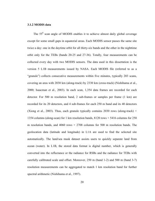
3.1.2 MODIS data<br />
The 55 0 scan angle <strong>of</strong> MODIS enables it to achieve almost daily global coverage<br />
except for some small gaps in equatorial areas. Each MODIS <strong>sensor</strong> passes the same site<br />
twice a day: one in the daytime orbit for all thirty-six b<strong>and</strong>s <strong>and</strong> the other in the nighttime<br />
orbit only for the TEBs (b<strong>and</strong>s 20-25 <strong>and</strong> 27-36). Totally, four measurements can be<br />
collected every day with two MODIS <strong>sensor</strong>s. The data used in this dissertation is the<br />
version 5 L1B measurements issued by NASA. Each MODIS file (referred to as a<br />
“granule”) collects consecutive measurements within five minutes, typically 203 scans,<br />
covering an area with 2030 km (along-track) by 2330 km (cross-track) (Nishihama et al.,<br />
2000; Isaacman et al., 2003). In each scan, 1,354 data frames are recorded for each<br />
detector. For 500 m resolution b<strong>and</strong>, 2 sub-frames or samples per frame (1 km) are<br />
recorded for its 20 detectors, <strong>and</strong> 4 sub-frames for each 250 m b<strong>and</strong> <strong>and</strong> its 40 detectors<br />
(Xiong et al., 2003). Thus, each granule typically contains 2030 rows (along-track) ×<br />
1354 columns (along-scan) for 1 km resolution b<strong>and</strong>s, 8120 rows × 5416 columns for 250<br />
m resolution b<strong>and</strong>s, <strong>and</strong> 4060 rows × 2708 columns for 500 m resolution b<strong>and</strong>s. The<br />
geolocation data (latitude <strong>and</strong> longitude) in L1A are used to find the selected site<br />
automatically. The l<strong>and</strong>/sea mask dataset assists users to quickly separate l<strong>and</strong> from<br />
ocean (water). In L1B, the stored data format is digital number, which is generally<br />
converted into the reflectance or the radiance for RSBs <strong>and</strong> the radiance for TEBs with<br />
carefully calibrated scale <strong>and</strong> <strong>of</strong>fset. Moreover, 250 m (b<strong>and</strong> 1-2) <strong>and</strong> 500 m (b<strong>and</strong> 3-7)<br />
resolution measurements can be aggregated to match 1 km resolution b<strong>and</strong> for further<br />
spectral arithmetic (Nishihama et al., 1997).<br />
20

![[Sample B: Approval/Signature Sheet] - George Mason University](https://img.yumpu.com/21978828/1/190x245/sample-b-approval-signature-sheet-george-mason-university.jpg?quality=85)
![[Sample B: Approval/Signature Sheet] - George Mason University](https://img.yumpu.com/18694905/1/190x245/sample-b-approval-signature-sheet-george-mason-university.jpg?quality=85)


![[Sample B: Approval/Signature Sheet] - George Mason University](https://img.yumpu.com/18694552/1/189x260/sample-b-approval-signature-sheet-george-mason-university.jpg?quality=85)

![[Sample B: Approval/Signature Sheet] - George Mason University](https://img.yumpu.com/18694474/1/190x245/sample-b-approval-signature-sheet-george-mason-university.jpg?quality=85)