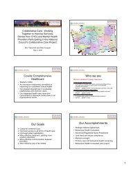
Water Protection Activities in Washtenaw County
Water Protection Activities in Washtenaw County
Water Protection Activities in Washtenaw County

Create successful ePaper yourself
Turn your PDF publications into a flip-book with our unique Google optimized e-Paper software.
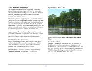
A12: Salem Township<br />
Dry holes have occurred <strong>in</strong> many sections of Salem Township<br />
and the entire township has been identified as "well first.” This<br />
requires that wells be drilled first prior to construct<strong>in</strong>g any new<br />
homes.<br />
A review of the surface soils of the Township shows that 23% of<br />
the land is covered by sandy soils. 28% of the land surface is<br />
hydrous or has a seasonal high water table that comes to the<br />
surface. <strong>Water</strong> features cover 3.14% of the Township.<br />
Groundwater supplies are threatened by the presence of two<br />
landfills, the Salem Township landfill that is capped and <strong>in</strong>active<br />
and the active Veolia ES landfill, which is among the largest<br />
<strong>in</strong> Southeast Michigan. Both are listed by the Michigan<br />
Department of Environmental Quality as P.A. 451, Part 201<br />
Sites or sites of known or suspected groundwater<br />
contam<strong>in</strong>ation.<br />
Dr<strong>in</strong>k<strong>in</strong>g <strong>Water</strong>: Well Information<br />
From 1968 through 1992, 695 dr<strong>in</strong>k<strong>in</strong>g water wells were drilled<br />
<strong>in</strong> Salem Township. Of these, 525 have been added to the<br />
<strong>Washtenaw</strong> <strong>County</strong> Groundwater Database. Between the years<br />
2000 to 2005 there were 255 new wells drilled and 76 wells<br />
were replaced. The average depth <strong>in</strong> the Township is 110 feet.<br />
This number is very mislead<strong>in</strong>g because of the great range of<br />
well depths <strong>in</strong> the Township. Sections 14, 17, 18, 19, 20, 30,<br />
and 36 have an average well depth of over 150 feet. Sections<br />
19, 20, and 36 have well depths far deeper, with average<br />
depths of 251, 195, and 234 feet.<br />
94<br />
Salem Twp. – Town Hall<br />
Dr<strong>in</strong>k<strong>in</strong>g <strong>Water</strong>: Consumer Confidence Report Summary<br />
None.<br />
Surface <strong>Water</strong> Features: Flem<strong>in</strong>g Creek, Johnson Creek,<br />
Walker Creek/Dra<strong>in</strong>, Ingall Dra<strong>in</strong>, Wagner Dra<strong>in</strong>.<br />
Local Indicator Data<br />
Salem Township has one TMDL site for poor dissolved oxygen<br />
at Johnson Creek, from the confluence with the Walled lake<br />
branch upstream to 5 Mile rd. West of Currie Rd. It has three<br />
Part 201 sites. It has four NPDES permits for storm water and<br />
two NPDES pollutant discharge permits. Salem Township has<br />
four UST sites, and no AST or LUST sites.