Water Protection Activities in Washtenaw County
Water Protection Activities in Washtenaw County
Water Protection Activities in Washtenaw County

You also want an ePaper? Increase the reach of your titles
YUMPU automatically turns print PDFs into web optimized ePapers that Google loves.
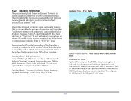
B7 - Plan 7: River Rais<strong>in</strong> <strong>Water</strong>shed Management Plan<br />
(Phase 1)<br />
Plan Date: April 2006<br />
The <strong>Washtenaw</strong> <strong>County</strong> portion of the River Rais<strong>in</strong> <strong>Water</strong>shed<br />
exists <strong>in</strong> the South-central and Southwestern part of the<br />
<strong>County</strong>. It has the second largest dra<strong>in</strong>age area <strong>in</strong> the county,<br />
rank<strong>in</strong>g beh<strong>in</strong>d the Huron. The watershed starts <strong>in</strong> the north at<br />
Sharon, Freedom, Lodi, and Pittsfield townships and extends<br />
south <strong>in</strong>to the townships of Manchester, Bridgewater, Sal<strong>in</strong>e<br />
and York. Additionally, portions of Manchester Village, and<br />
Sal<strong>in</strong>e and Milan cities also dra<strong>in</strong> to the River Rais<strong>in</strong><br />
<strong>Water</strong>shed. The <strong>Water</strong>shed Starts to the west of <strong>Washtenaw</strong><br />
<strong>County</strong> <strong>in</strong> Hillsdale <strong>County</strong> and runs eastward through Jackson<br />
<strong>County</strong> <strong>in</strong>to <strong>Washtenaw</strong>. South of <strong>Washtenaw</strong> <strong>County</strong> the<br />
River Rais<strong>in</strong> and the watershed areas that feed it cont<strong>in</strong>ue on<br />
through Lenawee and Monroe <strong>County</strong> and eventually dra<strong>in</strong> to<br />
Lake Erie. The Rais<strong>in</strong> <strong>Water</strong>shed is approximately 1074 square<br />
miles and extends <strong>in</strong>to Ohio <strong>in</strong> its southern reaches. A TMDL<br />
for pathogens and untreated sewage discharge exists <strong>in</strong> the<br />
Sal<strong>in</strong>e River, <strong>in</strong> York Township.<br />
The River Rais<strong>in</strong> <strong>Water</strong>shed Management Plan - Phase 1 is a<br />
University of Michigan School of Natural Resources and<br />
Environment (SNRE) student project that was <strong>in</strong>itiated <strong>in</strong><br />
cooperation with the River Rais<strong>in</strong> <strong>Water</strong>shed Council<br />
(RRWC). It is part of the $277,000 Section 319 grant to<br />
develop and implement a formal <strong>Water</strong>shed Management Plan.<br />
The SNRE plans to follow this student project with another,<br />
presumably Phase 2.<br />
The plan focuses on three areas: water quality, conservation of<br />
natural areas, and laws and ord<strong>in</strong>ances. The water quality<br />
section conta<strong>in</strong>ed an assessment based on eight sampl<strong>in</strong>g<br />
138<br />
locations along three tributaries <strong>in</strong> the watershed: Hazen Creek,<br />
Evans Creek, and River Rais<strong>in</strong>. Each sampl<strong>in</strong>g location was<br />
tested three times, once <strong>in</strong> August and November of 2005, then<br />
aga<strong>in</strong> <strong>in</strong> March of 2006. Analysis was conducted on the<br />
samples for Total Phosphorus (TP), Soluble Reactive<br />
Phosphorus (SRP), Ammonia, Nitrate, and Total Suspended<br />
Matter. TP results ranged from approximately 20 - 175 µg/L,<br />
while SRP range from 1 - 35 µg/L. Nitrate results ranged from<br />
approximately 0.2 – 5 mg/L.<br />
The plan recommends expand<strong>in</strong>g the riparian buffers as a<br />
primary method for address<strong>in</strong>g elevated nutrient levels, not<strong>in</strong>g<br />
that more than 60% of the stream corridors sampled have<br />
buffers of less than 16 meters. It further recommends<br />
<strong>in</strong>tegrat<strong>in</strong>g the analysis and recommendations of the Phase 1<br />
study <strong>in</strong>to a comprehensive Rive Rais<strong>in</strong> <strong>Water</strong>shed<br />
Management Plan.<br />
NOTE:<br />
“The River Rais<strong>in</strong> <strong>Water</strong>shed Management Plan - Phase 1”<br />
is a University of Michigan student research project that is<br />
<strong>in</strong>tended to <strong>in</strong>form the development of a State approved<br />
watershed management plan. It is NOT a watershed<br />
management plan. The River Rais<strong>in</strong> <strong>Water</strong>shed Council is<br />
currently work<strong>in</strong>g to develop a formal watershed<br />
management plan for the Rais<strong>in</strong>.