Water Protection Activities in Washtenaw County
Water Protection Activities in Washtenaw County
Water Protection Activities in Washtenaw County

You also want an ePaper? Increase the reach of your titles
YUMPU automatically turns print PDFs into web optimized ePapers that Google loves.
APPENDIX A:<br />
Local Unit of Government <strong>Water</strong> Quality<br />
Indicators<br />
Page<br />
#<br />
Appendix A: Introduction & CCR TABLE (65-71)<br />
A1 Ann Arbor Township; Map & Text 72<br />
A2 Augusta Township; Map & Text 74<br />
A3 Bridgewater Township; Map & Text 76<br />
A4 Dexter Township; Map & Text 78<br />
A5 Freedom Township; Map & Text 80<br />
A6 Lima Township; Map & Text 82<br />
A7 Lodi Township; Map & Text 84<br />
A8 Lyndon Township; Map & Text 86<br />
A9 Manchester Township; Map & Text 88<br />
A10 Northfield Township; Map & Text 90<br />
A11 Pittsfield Township; Map & Text 92<br />
A12 Salem Township; Map & Text 94<br />
A13 Sal<strong>in</strong>e Township; Map & Text 96<br />
A14 Scio Township; Map & Text 98<br />
A15 Sharon Township; Map & Text 100<br />
A16 Superior Township; Map & Text 102<br />
A17 Sylvan Township; Map & Text 104<br />
A18 Webster Township; Map & Text 106<br />
A19 York Township; Map & Text 108<br />
A20 Ypsilanti Township; Map & Text 110<br />
A21 Ann Arbor City; Map & Text 112<br />
A22 Barton Hills Village; Map & Text 114<br />
A23 Chelsea Village; Map & Text 116<br />
A24 Dexter Village; Map & Text 118<br />
A25 Manchester Village; Map & Text 120<br />
A26 Milan City; Map & Text 122<br />
A27 Sal<strong>in</strong>e City; Map & Text 124<br />
A28 Ypsilanti City; Map & Text 126<br />
APPENDIX A:<br />
Local Unit of Government <strong>Water</strong> Quality Indicators<br />
Introduction:<br />
This section is <strong>in</strong>tended to provide <strong>in</strong>formation on sites that can be<br />
considered <strong>in</strong>dicators of local water quality. For each municipal<br />
district <strong>in</strong> <strong>Washtenaw</strong> <strong>County</strong>, there is a <strong>Water</strong> Quality Indicator map<br />
and companion text. Included <strong>in</strong> the text is general <strong>in</strong>formation about<br />
the current state of the groundwater composition and a list of major<br />
surface water features with photographs. Information about dr<strong>in</strong>k<strong>in</strong>g<br />
water sources and quality, <strong>in</strong>clud<strong>in</strong>g consumer confidence report<br />
summaries and well <strong>in</strong>formation is also <strong>in</strong>cluded. The maps compile<br />
11 <strong>in</strong>dicator data sets and well first areas. Local <strong>in</strong>dicator data is<br />
discussed for each governmental unit.<br />
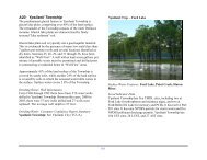
Surface <strong>Water</strong> Features<br />
Surface water features <strong>in</strong>clude prom<strong>in</strong>ent lakes and large ponds. A list<br />
of the more significant water features as well as a photograph and a<br />
small description of recreational opportunities is provided for each<br />
governmental unit.<br />
65