Water Protection Activities in Washtenaw County
Water Protection Activities in Washtenaw County
Water Protection Activities in Washtenaw County

You also want an ePaper? Increase the reach of your titles
YUMPU automatically turns print PDFs into web optimized ePapers that Google loves.
B4 - Plan 4: <strong>Water</strong>shed Plan for the Huron River <strong>in</strong> the Ann<br />
Arbor – Ypsilanti Metropolitan Area<br />
Plan Date: Updated March 2000<br />
The <strong>Washtenaw</strong> <strong>County</strong> Office of the Dra<strong>in</strong> Commissioner<br />
manages and updates the <strong>Water</strong>shed Plan for the Huron River<br />
<strong>in</strong> the Ann Arbor – Ypsilanti Metropolitan Area. This plan was<br />
orig<strong>in</strong>ally prepared <strong>in</strong> 1994 by the <strong>Washtenaw</strong> <strong>County</strong> Office<br />
of the Dra<strong>in</strong> Commissioner and the Huron River <strong>Water</strong>shed<br />
Council. The plan was revised <strong>in</strong> 2000 and is scheduled for<br />
further revision <strong>in</strong> 2007. The plan covers the middle portion of<br />
the Huron River <strong>in</strong>clud<strong>in</strong>g all or portions of Salem, Scio, Ann<br />
Arbor, Superior, Pittsfield, and Ypsilanti Townships and the<br />
Cities of Ann Arbor and Ypsilanti. The follow<strong>in</strong>g Huron River<br />
Sub-bas<strong>in</strong>s/Creeksheds are covered: Flem<strong>in</strong>g, Traver, Honey,<br />
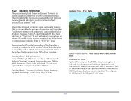
Allen, Miller, Malletts, Swift Run, and Ford Lake. The plan<br />
covers an area of approximately 73,300 acres.<br />
The plan identifies major impairments to the watershed area<br />
and describes associated sources and impacts. Identified<br />
impairments <strong>in</strong>clude: excess nutrients, sedimentation, toxic<br />
compounds, pathogens, E. coli, litter and debris, temperature,<br />
and flow issues. A description of each of these impairments is<br />
provided. There are 10 Total Maximum Daily Loads (TMDLs)<br />
currently <strong>in</strong> place or scheduled for development <strong>in</strong> this<br />
watershed to address problems with phosphorus, E. coli, fish<br />
consumption advisories, polychlor<strong>in</strong>ated biphenyls, pathogens,<br />
poor fish and macro <strong>in</strong>vertebrate communities, and elevated<br />
mercury <strong>in</strong> fish tissue.<br />
The plan describes watershed management activities <strong>in</strong>tended<br />
to mitigate the impairments and lists them <strong>in</strong> three categories<br />
as: “completed”, “ongo<strong>in</strong>g”, or a “recent <strong>in</strong>itiative”. On-go<strong>in</strong>g<br />
programs <strong>in</strong>clude “Adopt-a-Stream” and “Community Partners<br />
134<br />
for Clean Streams”. The recent <strong>in</strong>itiatives section of the plan<br />
describes many programs <strong>in</strong>clud<strong>in</strong>g the Middle Huron<br />
Phosphorus Reduction Initiative, the Malletts Creek<br />
Restoration Project, and the “Time of Sale” on-site well and<br />
septic <strong>in</strong>spection program.<br />
The plan also conta<strong>in</strong>s a list of recommendations that aim to<br />
protect the Michigan designated uses that are threatened, and<br />
<strong>in</strong>cludes an additional designated use based on local concern –<br />
Recreation and Urban Amenity Opportunities. The<br />
recommendations are grouped <strong>in</strong>to the follow<strong>in</strong>g categories:<br />
Best Management Practices (BMPs), Education and<br />
Community Involvement, Plann<strong>in</strong>g Regulations and Policy,<br />
Monitor<strong>in</strong>g and Data Collection, and Interagency Coord<strong>in</strong>ation.<br />
BMPs recommended <strong>in</strong>clude but are not limited to: storm<br />
water capital improvements, flow management, catch bas<strong>in</strong><br />
retrofits, stream bank stabilization, and dye-test<strong>in</strong>g for illicit<br />
discharges.<br />
Appendices to this plan <strong>in</strong>clude a detailed physical and<br />
biological assessment for each of the tributaries <strong>in</strong> the study<br />
area conducted under a contract with the <strong>Washtenaw</strong> <strong>County</strong><br />
Soil Conservation District with additional volunteer work<br />
conducted though the Adopt-a-Stream program. Also <strong>in</strong>cluded<br />
are watershed management plans for Flem<strong>in</strong>g Creek, Malletts<br />
Creek, Ford Lake, and Allen’s Creek, as well as a storm water<br />
management plan for Buhr Park. Future updates of this plan<br />
will <strong>in</strong>clude the Miller Creek plan that was completed <strong>in</strong> 2004.