Flathead County Transportation Plan – Phase II
Flathead County Transportation Plan – Phase II
Flathead County Transportation Plan – Phase II

You also want an ePaper? Increase the reach of your titles
YUMPU automatically turns print PDFs into web optimized ePapers that Google loves.
<strong>Flathead</strong> <strong>County</strong> <strong>Transportation</strong> <strong>Plan</strong> <strong>–</strong> <strong>Phase</strong> <strong>II</strong><br />
Identified Issues:<br />
Increasing traffic volumes<br />
Narrow windy roadway with no shoulders<br />
Limited sight distances<br />
High rate of crashes, particularly between Whitefish Stage and US Highway 93<br />
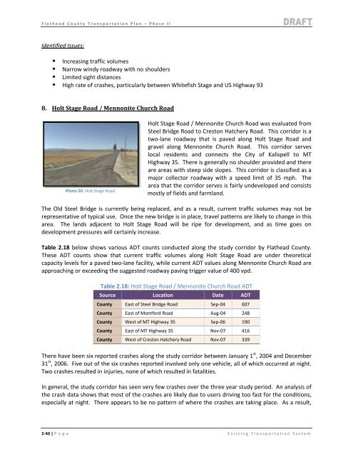
8. Holt Stage Road / Mennonite Church Road<br />
Photo 20: Holt Stage Road<br />
Holt Stage Road / Mennonite Church Road was evaluated from<br />
Steel Bridge Road to Creston Hatchery Road. This corridor is a<br />
two‐lane roadway that is paved along Holt Stage Road and<br />
gravel along Mennonite Church Road. This corridor serves<br />
local residents and connects the City of Kalispell to MT<br />
Highway 35. There is generally no shoulder provided and there<br />
are areas with steep side slopes. This corridor is classified as a<br />
major collector roadway with a speed limit of 35 mph. The<br />
area that the corridor serves is fairly undeveloped and consists<br />
mostly of fields and farmland.<br />
The Old Steel Bridge is currently being replaced, and as a result, current traffic volumes may not be<br />
representative of typical use. Once the new bridge is in place, travel patterns are likely to change in this<br />
area. The lands adjacent to Holt Stage Road will be ripe for development, and as time goes on<br />
development pressures will certainly increase.<br />
Table 2.18 below shows various ADT counts conducted along the study corridor by <strong>Flathead</strong> <strong>County</strong>.<br />
These ADT counts show that current traffic volumes along Holt Stage Road are under theoretical<br />
capacity levels for a paved two‐lane facility, while current ADT values along Mennonite Church Road are<br />
approaching or exceeding the suggested roadway paving trigger value of 400 vpd.<br />
Table 2.18: Holt Stage Road / Mennonite Church Road ADT<br />
Source Location Date ADT<br />
<strong>County</strong> East of Steel Bridge Road Sep‐04 607<br />
<strong>County</strong> East of Montford Road Aug‐04 248<br />
<strong>County</strong> West of MT Highway 35 Sep‐06 190<br />
<strong>County</strong> East of MT Highway 35 Nov‐07 416<br />
<strong>County</strong> West of Creston Hatchery Road Nov‐07 339<br />
There have been six reported crashes along the study corridor between January 1 st , 2004 and December<br />
31 st , 2006. Five out of the six crashes reported involved only one vehicle, all of which occurred at night.<br />
Two crashes resulted in injuries, none of which resulted in fatalities.<br />
In general, the study corridor has seen very few crashes over the three year study period. An analysis of<br />
the crash data shows that most of the crashes are likely due to users driving too fast for the conditions,<br />
especially at night. There appears to be no pattern of where the crashes are taking place. As a result,<br />
2‐40 | P age Existing <strong>Transportation</strong> System