

Cranbourne East Precinct Structure Plan - Growth Areas Authority
Cranbourne East Precinct Structure Plan - Growth Areas Authority
Cranbourne East Precinct Structure Plan - Growth Areas Authority

You also want an ePaper? Increase the reach of your titles
YUMPU automatically turns print PDFs into web optimized ePapers that Google loves.
e ryl<br />
FUTURE<br />
CRANBOURNE EAST<br />
RAIL STATION<br />
ADRIAN ST<br />
BERWICK - CRANBOURNE RD<br />
DS BLVD<br />
CASEY FIELDS B<br />
CASEY FIELDS<br />
<strong>Cranbourne</strong> <strong>East</strong> <strong>Precinct</strong> <strong>Structure</strong> <strong>Plan</strong><br />
DEVELOPMENT CONTRIBUTIONS PLAN<br />
MAY 2010<br />
HEATHER GV<br />
RETIREMENT<br />
VILLAGE<br />
State<br />
Primary<br />
School<br />
P-6<br />
IVE WAYS RD<br />
COLLINS ST<br />
RETIREMENT<br />
VILLAGE<br />
BERWICK - CRANBOURNE RD<br />
PATTERSONS RD
This page has been intentionally left blank.
CONTENTS<br />
PURPOSE 3<br />
REPORT STRUCTURE 3<br />
1.0 STRATEGIC BASIS 5<br />
1.1 PLANNING AND ENVIRONMENT ACT 1987 5<br />
1.2 PRECINCT STRUCTURE PLAN 7<br />
1.3 THE AREA TO WHICH THE DCP APPLIES 9<br />
1.4 LSP3 DEVELOPMENT CONTRIBUTIONS PLAN 10<br />
1.5 INFRASTRUCTURE PROJECT JUSTIFICATION 11<br />
1.6 INFRASTRUCTURE PROJECTS 13<br />
2.0 CALCULATION OF CONTRIBUTIONS 19<br />
2.1 CALCULATION OF NDA AND DEMAND UNITS 19<br />
2.2 CALCULATION OF CONTRIBUTION CHARGES 20<br />
3.0 ADMINISTRATION AND IMPLEMENTATION 32<br />
3.1 ADMINISTRATION OF THE DCP 32<br />
3.2 IMPLEMENTATION STRATEGY 34<br />
4.0 OTHER INFORMATION 35<br />
4.1 ACRONYMS 35<br />
4.2 GLOSSARY 35<br />
cranbourne east development contributions plan<br />
1
2<br />
This page has been intentionally left blank.<br />
cranbourne east development contributions plan<br />
SM | 20100511 02:03
PURPOSE<br />
The <strong>Cranbourne</strong> <strong>East</strong> <strong>Precinct</strong> <strong>Structure</strong> <strong>Plan</strong> Development Contributions<br />
<strong>Plan</strong> (the DCP), 2010 has been prepared by the <strong>Growth</strong> <strong>Areas</strong> <strong>Authority</strong><br />
with the assistance of the City of Casey, Government agencies, service<br />
authorities and major stakeholders.<br />
The DCP:<br />
• Outlines projects required to ensure that future residents, visitors<br />
and workers in the area can be provided with timely access<br />
to infrastructure and services necessary to support a quality,<br />
affordable lifestyle,<br />
• Establishes a framework for development proponents to make<br />
a financial contribution towards the cost of the identified<br />
infrastructure projects. It ensures the cost of providing new<br />
infrastructure and services is shared equitably between various<br />
development proponents and the wider community, and<br />
• Provides the details of the calculation of financial contributions<br />
that must be made by future developments towards the<br />
nominated projects.<br />
REPORT STRUCTURE<br />
This document comprises four parts:<br />
PART ONE<br />
Part 1 clearly explains the strategic basis for the Development<br />
Contributions <strong>Plan</strong>, which includes information about the <strong>Cranbourne</strong><br />
<strong>East</strong> <strong>Precinct</strong> <strong>Structure</strong> <strong>Plan</strong> and justification for the various<br />
infrastructure projects included in the Development Contributions<br />
<strong>Plan</strong>.<br />
PART TWO<br />
Part 2 sets out how the development contributions are calculated<br />
and costs apportioned.<br />
PART THREE<br />
Part 3 focuses on administration and implementation of the<br />
Development Contributions <strong>Plan</strong>.<br />
PART FOUR<br />
Provides other information<br />
cranbourne east development contributions plan<br />
Introduction<br />
3
4<br />
SANDRINGHAM<br />
Date: 23 April 2010<br />
Revision.: O<br />
CHELTENHAM<br />
MENTONE<br />
PORT PHILLIP<br />
BAY<br />
SOUTHLAND<br />
NEPEAN HWY<br />
HEATHERTON RD<br />
LOWER DANDENONG RD<br />
MORDIALLOC<br />
NEPEAN HWY<br />
MOUNT ELIZA<br />
0 5<br />
10 km<br />
Part 1: Strategic Basis<br />
SPRINGVALE RD<br />
CHELSEA<br />
FRANKSTON FWY<br />
CARRUM<br />
DOWNS<br />
MOOROODUC HWY<br />
20km<br />
FRANKSTON<br />
FRANKSTON BYPASS<br />
SPRINGVALE<br />
DANDENONG<br />
EASTLINK<br />
DANDENONG BYPASS<br />
BALLARTO RD<br />
LANGWARRIN<br />
CRANBOURNE RD<br />
10km<br />
WESTERN PORT HWY (FUTURE FREEWAY)<br />
ENDEAVOUR<br />
HILLS<br />
PRINCES HWY<br />
POUND RD<br />
HALLAM RD<br />
SOTUH GIPPSLAND HWY<br />
5km<br />
CRANBOURNE<br />
PRINCES FWY<br />
HAMPTON<br />
PARK<br />
ROYAL<br />
BOTANIC<br />
GARDENS<br />
SHRIVES RD<br />
POUND RD<br />
NARRE WARREN - CRANBOURNE RD<br />
FOUNTAIN GATE<br />
THOMPSONS RD<br />
NARRE WARREN<br />
CLYDE - FIVE WAYS RD<br />
BERWICK-CRANBOURNE RD<br />
CLYDE<br />
SOUTH GIPPSLAND HWY<br />
BLIND BIGHT<br />
BERWICK<br />
CLYDE CR EEK<br />
BALLARTO RD<br />
PRINCES HWY<br />
CARDINIA RESERVOIR<br />
UPPER<br />
BEACONSFIELD<br />
OFFICER<br />
CARDINIA RD<br />
PRINCES FWY<br />
PAKENHAM<br />
KOO WEE RUP RD<br />
To Drouin/<br />
Warragul<br />
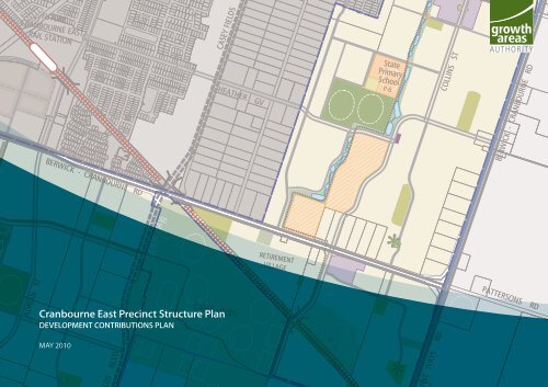
<strong>Cranbourne</strong> <strong>East</strong> <strong>Precinct</strong> <strong>Structure</strong> <strong>Plan</strong> Area<br />
Existing Major Road Network<br />
Future Road<br />
Railway Line<br />
Major Waterways & Waterbodies<br />
Central Activities District (CAD)<br />
Principal Activity Centre (PAC)<br />
Major Activity Centre (MAC)<br />
Major Employment <strong>Areas</strong><br />
Public Parks / Recreation<br />
plan 2 plan 1<br />
metropolitan & regional regional context context<br />
cranbourne east east precinct development structure contributions plan plan<br />
SM | 20100511 02:03
1.0 STRATEGIC BASIS<br />
The strategic basis for this Development Contributions <strong>Plan</strong> is established<br />
by the State and Local <strong>Plan</strong>ning Policy Framework of the Casey<br />
<strong>Plan</strong>ning Scheme. Key documents are Melbourne 2030, the <strong>Growth</strong><br />
Area Framework <strong>Plan</strong>s, the Municipal Strategic Statement and the<br />
<strong>Cranbourne</strong> <strong>East</strong> <strong>Precinct</strong> <strong>Structure</strong> <strong>Plan</strong> (and supporting documents),<br />
which set out a broad, long term vision for the sustainable development<br />
of the Development Contributions <strong>Plan</strong> area.<br />
The <strong>Growth</strong> Area Framework <strong>Plan</strong>s, September 2006, have been<br />
incorporated into the Victoria <strong>Plan</strong>ning Provisions and illustrate the<br />
planned extent of residential, employment and other development as<br />
well as the location of larger activity centres for each growth area. They<br />
also include key elements of infrastructure and services including the<br />
regional open space network, the location of public transport networks,<br />
freeways and arterial roads.<br />
The <strong>Cranbourne</strong> <strong>East</strong> <strong>Precinct</strong> <strong>Structure</strong> <strong>Plan</strong> has been developed<br />
following a comprehensive planning process and provides a greater level<br />
of detail to guide the development of the Development Contributions<br />
<strong>Plan</strong> area.<br />
1.1 PLANNING AND ENVIRONMENT ACT 1987<br />
This Development Contributions <strong>Plan</strong> has been prepared in accordance<br />
with Part 3B of the <strong>Plan</strong>ning and Environment Act 1987 (the Act)<br />
and has been developed in line with the State and Local <strong>Plan</strong>ning<br />
Policy Framework of the Casey <strong>Plan</strong>ning Scheme as well as Victorian<br />
Government Guidelines.<br />
The Development Contributions <strong>Plan</strong> provides for the charging of a<br />
‘development infrastructure levy’ pursuant to section 46J(a) of the Act<br />
towards works, services or facilities. It also provides for the charging of<br />
a ‘community infrastructure levy’ pursuant to section 46J(b) of the Act<br />
as some items are classified as community infrastructure under the Act.<br />
This Development Contributions <strong>Plan</strong> forms part of the Casey <strong>Plan</strong>ning<br />
Scheme pursuant to section 46I of the Act and is an incorporated<br />
document under Clause 81 of the Casey <strong>Plan</strong>ning Scheme.<br />
The Development Contributions <strong>Plan</strong> is enforced under Schedule 10<br />
to the Development Contributions <strong>Plan</strong> Overlay in the Casey <strong>Plan</strong>ning<br />
Scheme.<br />
cranbourne east development contributions plan<br />
Part 1: Strategic Basis<br />
5
6<br />
Scale: 1:20000m @ A3<br />
1:10000m @ A1<br />
Date: 2 May 2010<br />
Revision.: O<br />
0 200 400 600m<br />
Part 1: Strategic Basis<br />
ROYAL BOTANIC<br />
GARDENS<br />
CRANBOURNE<br />
CRANBOURNE<br />
RAIL STATION<br />
SOUTH GIPPSLAND HWY<br />
CRANBOURNE RACECOURSE<br />
& RECREATION RESERVE<br />
CRANBOURNE<br />
TOWN CENTRE<br />
FUTURE<br />
LINSELL BLVD<br />
EXTENSION<br />
CAMERON ST<br />
NARRE WARREN - CRANBOURNE RD<br />
PROPOSED<br />
NAC<br />
JUNCTION VILLAGE<br />
RECREATION<br />
RESERVE<br />
LINSELL BLVD<br />
SOUTH GIPPSLAND HWY<br />
DEECD<br />
P12 SCHOOL<br />
BERWICK - CRANBOURNE RD<br />
ADRIAN ST<br />
BROAD OAK DR<br />
FUTURE<br />
CRANBOURNE EAST<br />
RAIL STATION<br />
State<br />
Primary<br />
School<br />
P-6<br />
NELSON ST<br />
CASEY FIELDS BLVD<br />
CASEY FIELDS BLVD<br />
HEATHER GV<br />
BALLARTO RD<br />
CASEY FIELDS<br />
LINSELL BLVD<br />
RETIREMENT<br />
VILLAGE<br />
State<br />
Primary<br />
School<br />
P-6<br />
COLLINS ST<br />
CLYDE - FIVE WAYS RD<br />
RETIREMENT<br />
VILLAGE<br />
BERWICK - CRANBOURNE RD<br />
PATTERSONS RD<br />
<strong>Precinct</strong> <strong>Structure</strong> <strong>Plan</strong> Area<br />
Urban <strong>Growth</strong> Boundary<br />
Residential<br />
Local Town Centre (NAC)<br />
Local Centre<br />
Employment<br />
Community Facilities<br />
State Primary School (P-6)<br />
Non-Government Education Facility (subject to permit)<br />
Unencumbered Active Open Space<br />
Unencumbered Passive Open Space<br />
Encumbered Open Space<br />
Arterial Road<br />
Connector Street (potential future arterial)<br />
Connector Street<br />
Access Street<br />
Shared Path (within open space)<br />
Shared Path (within widened road reserve)<br />
Pedestrian Bridge<br />
Railway Line & Station<br />
Future Grade Separated Crossing (developed initially at grade)<br />
Proposed Future Grade Separated Road Link (subject to investigation)<br />
Heritage Site<br />
Lakes/Waterbodies<br />
Native Vegetation (to be retained)<br />
Green Wedge Land<br />
Future Urban Area<br />
Existing Urban Area<br />
Regional Open Space<br />
Golf Course<br />
plan 5 plan 2<br />
future urban future structure urban plan structure<br />
cranbourne cranbourne east east precinct development structure contributions plan plan<br />
SM | 20100511 02:03
1.2 PRECINCT STRUCTURE PLAN<br />
The <strong>Cranbourne</strong> <strong>East</strong> <strong>Precinct</strong> <strong>Structure</strong> <strong>Plan</strong> (PSP) abuts the <strong>Cranbourne</strong><br />
Town Centre <strong>Structure</strong> <strong>Plan</strong> area (which is defined as a principal<br />
activity centre under Melbourne 2030) and includes part of the growth<br />
communities of <strong>Cranbourne</strong> <strong>East</strong> and Clyde North.<br />
The PSP is expected to:<br />
• house up to 18,000 residents in approximately 6,600 households,<br />
and<br />
• accommodate more than 2,800 jobs in land uses in the<br />
<strong>Cranbourne</strong> <strong>East</strong> PSP area.<br />
The <strong>Precinct</strong> <strong>Structure</strong> <strong>Plan</strong> establishes the future urban structure of the<br />
new community by setting out the location of transport, open space<br />
and active recreation, social infrastructure, activity centres, residential<br />
neighbourhoods and places for local employment (Refer <strong>Plan</strong> 2).<br />
This Development Contributions <strong>Plan</strong> relates strongly to the <strong>Precinct</strong><br />
<strong>Structure</strong> <strong>Plan</strong> which provides the rationale and justification for<br />
infrastructure items that have been included within this Development<br />
Contributions <strong>Plan</strong>.<br />
cranbourne east development contributions plan<br />
Part 1: Strategic Basis<br />
7
8<br />
Scale: 1:20000m @ A3<br />
1:10000m @ A1<br />
Date: 2 May 2010<br />
Revision.: O<br />
0 200 400 600m<br />
Part 1: Strategic Basis<br />
ROYAL BOTANIC<br />
GARDENS<br />
CRANBOURNE<br />
CRANBOURNE<br />
RAIL STATION<br />
SOUTH GIPPSLAND HWY<br />
CRANBOURNE RACECOURSE<br />
& RECREATION RESERVE<br />
CRANBOURNE PAC<br />
TOWN CENTRE<br />
FUTURE<br />
LINSELL BLVD<br />
EXTENSION<br />
CAMERON ST<br />
NARRE WARREN - CRANBOURNE RD<br />
PROPOSED<br />
NAC<br />
JUNCTION VILLAGE<br />
RECREATION<br />
RESERVE<br />
LINSELL BLVD<br />
SOUTH GIPPSLAND HWY<br />
DEECD<br />
P12 SCHOOL<br />
BERWICK - CRANBOURNE RD<br />
ADRIAN ST<br />
BROAD OAK DR<br />
FUTURE<br />
CRANBOURNE EAST<br />
RAIL STATION<br />
State<br />
Primary<br />
School<br />
P-6<br />
NELSON ST<br />
CASEY FIELDS BLVD<br />
CASEY FIELDS BLVD<br />
HEATHER GV<br />
BALLARTO RD<br />
CASEY FIELDS<br />
LINSELL BLVD<br />
RETIREMENT<br />
VILLAGE<br />
State<br />
Primary<br />
School<br />
P-6<br />
COLLINS ST<br />
CLYDE - FIVE WAYS RD<br />
RETIREMENT<br />
VILLAGE<br />
BERWICK - CRANBOURNE RD<br />
PATTERSONS RD<br />
<strong>Precinct</strong> <strong>Structure</strong> <strong>Plan</strong> Area<br />
Development Types<br />
Residential<br />
Non-Government Education<br />
Employment<br />
plan 3<br />
dcp area DCP & precinct areas development & development structure types plan types area<br />
cranbourne east cranbourne development east development contributions contributions plan plan<br />
SM | 20100511 02:03
1.3 THE AREA TO WHICH THE DEVELOPMENT<br />
CONTRIBUTIONS PLAN APPLIES<br />
In accordance with section 46K(1)(a) of the Act, the DCP applies to land<br />
shown in <strong>Plan</strong> 3 and shown as DCPO10 on the Casey <strong>Plan</strong>ning Scheme<br />
maps (‘the DCP area’).<br />
As a new development area, which will develop concurrently on multiple<br />
fronts the <strong>Cranbourne</strong> <strong>East</strong> precinct forms a single Main Catchment Area<br />
(‘MCA‘) for all infrastructure projects. The MCA is the geographic area<br />
from which a given item of infrastructure will draw most of its use.<br />
In selecting items, consideration has been given to whether items have<br />
already been funded through another contribution mechanism, such as<br />
a mandatory infrastructure construction requirement of the <strong>Cranbourne</strong><br />
<strong>East</strong> <strong>Precinct</strong> <strong>Structure</strong> <strong>Plan</strong>, an existing local development contributions<br />
plan, an agreement under section 173 of the Act or as a condition on<br />
an existing planning permit. Identified overlap in funding has been<br />
addressed, for example by adjusting other relevant Development<br />
Contributions <strong>Plan</strong>s or other suitable means provided for in the <strong>Plan</strong>ning<br />
and Environment Act.<br />
cranbourne east development contributions plan<br />
Part 1: Strategic Basis<br />
9
1.4 LSP3 DEVELOPMENT CONTRIBUTIONS PLAN<br />
Prior to the approval of Amendment C121 to the Casey <strong>Plan</strong>ning Scheme,<br />
part of the DCP area was within the area covered by Development<br />
Contributions <strong>Plan</strong> for Local <strong>Structure</strong> <strong>Plan</strong> 3 <strong>Cranbourne</strong> <strong>East</strong> (”LSP3 -<br />
DCP”). Refer <strong>Plan</strong> 5.<br />
The LSP3 DCP 1994 was prepared in the early 1990’s and first put in<br />
place through Amendment L100 to the <strong>Cranbourne</strong> <strong>Plan</strong>ning Scheme<br />
in 1994. The LSP3 DCP was then placed into the new format required to<br />
meet changes to the <strong>Plan</strong>ning and Environment Act 1987 in relation to<br />
Development Contributions with the latest version being approved in<br />
1999.<br />
The LSP3 DCP 1999 applied to most of the land covered by the <strong>Cranbourne</strong><br />
<strong>East</strong> <strong>Precinct</strong> <strong>Structure</strong> <strong>Plan</strong> and covered by this Development<br />
Contributions <strong>Plan</strong>.<br />
The LSP3 DCP 1999 was amended through Amendment C121 to the<br />
Casey <strong>Plan</strong>ning Scheme in 2009 to create a document titled Development<br />
Contributions <strong>Plan</strong> for Local <strong>Structure</strong> <strong>Plan</strong> 3 <strong>Cranbourne</strong> – <strong>East</strong>, March<br />
2009.<br />
Amendment C121 to the Casey <strong>Plan</strong>ning Scheme:<br />
• Updated the list and cost of projects included in the plan to<br />
facilitate the timely provision of critical infrastructure to service the<br />
<strong>Cranbourne</strong> <strong>East</strong> community.<br />
• Deleted the application of the DCP to land affected by the<br />
<strong>Cranbourne</strong> <strong>East</strong> <strong>Precinct</strong> <strong>Structure</strong> <strong>Plan</strong> and the Collison Estate.<br />
• Updated the estimated future residential lot yield based on the<br />
revised area of land covered by the plan.<br />
• Updated the administrative arrangements which guide the<br />
implementation of the DCP.<br />
• Specified the collecting agency for the plan, which is Casey City<br />
Council.<br />
• Specified the development agency for each project included in the<br />
DCP.<br />
• Updated the wording of the DCP to reflect the planning context in<br />
2009.<br />
• Maintained the contribution rate in the LSP3 DCP 1999 of $2,675<br />
per lot and indexed that rate to reflect December 2008 dollars. The<br />
2008 dollar rate was used in the document to reflect the applicable<br />
rate when Amendment C121 came into operation.<br />
10 Part 1: Strategic Basis<br />
Casey City Council collected development contributions under the<br />
LSP3 DCP 1999 prior to it being updated by Amendment C121. The<br />
contributions collected and held by Casey City Council at the date that<br />
LSP3 DCP 2009 came into affect are to be used for projects contained in<br />
the revised document titled Development Contributions <strong>Plan</strong> for Local<br />
<strong>Structure</strong> <strong>Plan</strong> 3 <strong>Cranbourne</strong> – <strong>East</strong>, March 2009.<br />
Prior to the date upon which the document titled Development<br />
Contributions <strong>Plan</strong> for Local <strong>Structure</strong> <strong>Plan</strong> 3 <strong>Cranbourne</strong> – <strong>East</strong>, March<br />
2009 came into effect, funds had been collected by Casey City Council<br />
from:<br />
• The Hunt Club Estate,<br />
• The Cascades on Clyde Estate,<br />
• Blue Hills Retirement Village,<br />
• The Avenues Estate, and<br />
• Brindalee Estate.<br />
EXISTING AGREEMENTS UNDER SECTION 173 OF THE PLANNING<br />
AND ENVIRONMENT ACT<br />
Casey City Council has entered into a number of infrastructure<br />
agreements under Section 173 of the <strong>Plan</strong>ning and Environment Act<br />
1987 affecting land covered by the LSP3 DCP. These agreements relate<br />
to:<br />
• The subject land within the Hunt Club Estate Volume 11071 Folio<br />
953, being Lot Q on PS606311F, and Volume 10997 Folio 912,<br />
being Lot A on PS539465X (the ‘Hunt Club Agreement’), and<br />
• The subject land being parts of land situated at 545 Berwick-<br />
<strong>Cranbourne</strong> Road, Clyde North, being the land more particularly<br />
described in certificates of title volume 11064 folios 782, volume<br />
11707 folio 762, volume 11076 folio 258, volume 11701 folio 763<br />
and volume 11068 folio 855 (the ‘Cascades Agreement’).<br />
This plan is consistent with and allows for implementation of these<br />
agreements. This plan does not affect land covered by these agreements.<br />
INFRASTRUCTURE PROJECTS DELIVERED TO DATE<br />
Prior to Amendment C121, the following projects had been delivered<br />
under the LSP3 DCP 1999:<br />
• Land acquisition for Linsell Boulevard from Narre Warren-<br />
<strong>Cranbourne</strong> Road east to the Pipe Track,<br />
• Construction of Linsell Boulevard from Rochester Parade to Broad<br />
Oak Drive, and<br />
• Land acquisition and construction of Linsell Boulevard from Clyde<br />
Road to Casey Fields Boulevard. Note: The arrangements for the<br />
delivery of this project is subject to an agreement under section<br />
173 of the <strong>Plan</strong>ning and Environment Act 1987 between Casey City<br />
Council and GEO Developments Pty Ltd dated 9 January 2009 for<br />
the property at Part 545 Berwick-<strong>Cranbourne</strong> Road, Clyde North.<br />
The following projects were included in the revised March 2009 LSP3<br />
DCP through Amendment C121 to the Casey <strong>Plan</strong>ning Scheme from the<br />
LSP3 DCP 1999 (however, the costs for the projects were updated):<br />
• Construction of Linsell Boulevard from Rochester Parade to Narre<br />
Warren-<strong>Cranbourne</strong> Road,<br />
• Construction for Linsell Boulevard from Broad Oak Drive for a<br />
distance of 200 metres to the east,<br />
• Land acquisition and construction of Linsell Boulevard from Clyde<br />
Road to Casey Fields Boulevard,<br />
• State road and rail contributions, and<br />
• A community centre adjacent to the proposed secondary college<br />
in the Hunt Club Estate.<br />
In preparing this Development Contributions <strong>Plan</strong>, arrangements<br />
needed to be made for the LSP3 DCP 2009 to continue to apply to land<br />
for which a planning permit had been issued prior to the introduction<br />
of this Development Contributions <strong>Plan</strong>. Accordingly, the Blue Hills &<br />
GEO properties will continue to have Schedule 4 to the Development<br />
Contributions <strong>Plan</strong> Overlay (“DCP0-4”) apply and the balance of the<br />
<strong>Cranbourne</strong> <strong>East</strong> PSP area will be covered by this DCP via DCPO 10.<br />
cranbourne east development contributions plan<br />
SM | 20100511 02:03
1.5 INFRASTRUCTURE PROJECT JUSTIFICATION<br />
1.5.1 INTRODUCTION<br />
The need for infrastructure has been determined according to the<br />
anticipated development scenario for <strong>Cranbourne</strong> <strong>East</strong> as described<br />
in the <strong>Cranbourne</strong> <strong>East</strong> <strong>Precinct</strong> <strong>Structure</strong> <strong>Plan</strong> and its supporting<br />
documents.<br />
Items can be included in a Development Contributions <strong>Plan</strong> if they will<br />
be used by the future community of an area. New development does not<br />
have to trigger the need for new items in its own right. The development<br />
is charged in line with its projected share of use. An item can be included<br />
in a Development Contributions <strong>Plan</strong> regardless of whether it is within<br />
or outside the Development Contributions <strong>Plan</strong> area.<br />
Before inclusion in this Development Contributions <strong>Plan</strong>, all items have<br />
been assessed to ensure they have a relationship or nexus to proposed<br />
development in the <strong>Cranbourne</strong> <strong>East</strong> PSP area. The cost apportionment<br />
methodology adopted in this Development Contributions <strong>Plan</strong> relies<br />
on the nexus principle. A new development is deemed to have a nexus<br />
with an item if it is expected to make use of that item. A summary of how<br />
each item relates to projected growth area development is set out below<br />
and the apportionment of external use are identified in Table 4.<br />
The items that have been included in the Development Contributions<br />
<strong>Plan</strong> all have the following characteristics:<br />
• They are essential to the health, safety and well-being of the<br />
community,<br />
• They will be used by a broad cross-section of the community,<br />
• They reflect the vision and objectives expressed in the <strong>Cranbourne</strong><br />
<strong>East</strong> <strong>Precinct</strong> <strong>Structure</strong> <strong>Plan</strong>, and<br />
• They are not recurrent items.<br />
1.5.2 LAND FOR INTERSECTION OUTSIDE THE STANDARD ROAD<br />
RESERVE (FLARING)<br />
Projects RD20, RD21, RD22 and RD23 specify additional land to that<br />
contained in the relevant road reserve to accommodate intersection<br />
works and driver sight lines. As a general rule these projects involve<br />
intersections with arterial roads. The GAA established a land acquisition<br />
model for these instances in consultation with VicRoads and Casey City<br />
Council which has been incorporated into this DCP. The model provides<br />
that:<br />
• Such land acquisition is identified as a separate project to the<br />
intersection construction.<br />
• VicRoads will be the development agency responsible for<br />
managing the land acquisition for intersections with Berwick-<br />
<strong>Cranbourne</strong> Road.<br />
• The DCP will maintain a single Collection Agency, being the<br />
Council. The Council will forward the funds collected for<br />
the VicRoads projects to VicRoads who will manage their<br />
implementation.<br />
• In-kind works will be agreed by the Collection Agency, but only<br />
with the endorsement of the development agency.<br />
• The area of land for each relevant intersection is shown in the<br />
Appendix. CEDC Consultants created detailed CAD drawings to<br />
show the interim and ultimate intersection treatments. These<br />
treatments were established and agreed with both VicRoads and<br />
Casey City Council, based on information and analysis prepared<br />
by GTA Consultants in their expert evidence report prepared to<br />
support the preparation of the <strong>Cranbourne</strong> <strong>East</strong> PSP and this<br />
Development Contributions <strong>Plan</strong>.<br />
• The area of land is land required (including flaring) in addition<br />
to the standard road reserve to deliver the relevant intersection<br />
works as set out in this Development Contributions <strong>Plan</strong>.<br />
• Each land area is valued and the relevant land value included in<br />
the DCP.<br />
All other land for the Berwick-<strong>Cranbourne</strong> Road ultimate road reserve<br />
not identified in the DCP will be funded from VicRoads resources.<br />
1.5.3 ITEMS NOT INCLUDED IN THE DEVELOPMENT CONTRIBUTIONS<br />
PLAN<br />
The following items are not included in the DCP, as they are not<br />
considered to be higher order items, but must be provided by developers<br />
as a matter of course:<br />
• Internal streets and connector streets, and associated traffic<br />
management measures,<br />
• Flood mitigation works,<br />
• Local drainage systems,<br />
• Main drainage works,<br />
• Intersections connecting the development to the existing road<br />
network, except where specified as Development Contributions<br />
<strong>Plan</strong> projects,<br />
• Water, sewerage, underground power, gas, telecommunications<br />
services,<br />
• Local pathways and connections to the regional and/or district<br />
pathway network,<br />
• Basic levelling, water tapping and landscaping of open space,<br />
• Passive public open space reserve master plans and agreed<br />
associate works required by the PSP,<br />
• Council’s plan checking and supervision costs, and,<br />
• Bus stops.<br />
cranbourne east development contributions plan<br />
Part 1: Strategic Basis<br />
11
Scale: 1:20000m @ A3<br />
1:10000m @ A1<br />
Date: 2 May 2010<br />
Revision.: O<br />
0 200 400 600m<br />
12 Part 1: Strategic Basis<br />
ROYAL BOTANIC<br />
GARDENS<br />
CRANBOURNE<br />
CRANBOURNE<br />
RAIL STATION<br />
SOUTH GIPPSLAND HWY<br />
CRANBOURNE RACECOURSE<br />
& RECREATION RESERVE<br />
CRANBOURNE PAC<br />
TOWN CENTRE<br />
FUTURE<br />
LINSELL BLVD<br />
EXTENSION<br />
RD19<br />
CAMERON ST<br />
RD14<br />
NARRE WARREN - CRANBOURNE RD<br />
PROPOSED<br />
NAC<br />
JUNCTION VILLAGE<br />
RECREATION<br />
RESERVE<br />
LINSELL BLVD<br />
RD15<br />
SOUTH GIPPSLAND HWY<br />
DEECD<br />
P12 SCHOOL<br />
BERWICK - CRANBOURNE RD<br />
ADRIAN ST<br />
BROAD OAK DR<br />
FUTURE<br />
CRANBOURNE EAST<br />
RAIL STATION<br />
State<br />
Primary<br />
School<br />
P-6<br />
RD09<br />
RD08<br />
RD13<br />
RD16 & RD20<br />
NELSON ST<br />
RD01(b)<br />
RD02<br />
CASEY FIELDS BLVD<br />
RD05<br />
RD06<br />
RD12<br />
RD01(c)<br />
CASEY FIELDS BLVD<br />
HEATHER GV<br />
BALLARTO RD<br />
RD10<br />
RD04<br />
RD01(d)<br />
RD11 & RD21<br />
CASEY FIELDS<br />
RD01(a)<br />
LINSELL BLVD<br />
RETIREMENT<br />
VILLAGE<br />
State<br />
Primary<br />
School<br />
P-6<br />
RD03<br />
RD17 & RD22<br />
COLLINS ST<br />
CLYDE - FIVE WAYS RD<br />
RETIREMENT<br />
VILLAGE RD07<br />
BERWICK - CRANBOURNE RD<br />
RD18 & RD23<br />
PATTERSONS RD<br />
<strong>Precinct</strong> <strong>Structure</strong> <strong>Plan</strong> Area<br />
Construction<br />
Land<br />
Signalised T-Intersection<br />
Roundabout<br />
Pedestrian Signals<br />
4-Way Intersection<br />
plan 4<br />
roads & roads intersections & intersections<br />
cranbourne east cranbourne development east development contributions contributions plan plan<br />
SM | 20100511 02:03
1.6 INFRASTRUCTURE PROJECTS<br />
1.6.1 TRANSPORT<br />
The transport related projects in the Development Contributions <strong>Plan</strong> are<br />
based on the transport network depicted in <strong>Plan</strong> 4 which is supported<br />
by the <strong>Cranbourne</strong> <strong>East</strong> PSP Transport Modeling & Assessment, GTA<br />
Consultants, March 2009 and subsequent refinement by GTA to this<br />
assessment. The transport projects comprise of two categories:<br />
• Road construction and duplication including land requirements,<br />
and<br />
• Construction of major controlled intersections, including land<br />
requirements for widening of the arterial corridor necessary to<br />
accommodate the intersection.<br />
The transport plan was prepared taking into account the requirements<br />
and objectives of the <strong>Cranbourne</strong> <strong>East</strong> <strong>Precinct</strong> <strong>Structure</strong> <strong>Plan</strong>.<br />
The road and intersection projects listed below are funded by the<br />
Development Contributions <strong>Plan</strong>:<br />
DCP<br />
PROJECT PROJECT DESCRIPTION<br />
NUMBER<br />
Casey Fields Boulevard – Land required for extension of road reservation<br />
RD01 (a) from connector street width to 34m between northern edge of the UGB and<br />
RD01 (b)<br />
RD01 (c)<br />
RD01 (d)<br />
RD02<br />
RD03<br />
RD04<br />
RD05<br />
RD06<br />
RD07<br />
RD08<br />
Garden Street. Total land required is estimated to be 0.64 hectares.<br />
Casey Fields Boulevard – Land required for extension of road reservation<br />
from connector street width to 34m between Berwick <strong>Cranbourne</strong> Road and<br />
Casey Fields. Total land required is estimated to be 0.8 hectares.<br />
Casey Fields Boulevard – Land required for extension of road reservation<br />
from connector street width to 34m between Ballarto Road and the UGB.<br />
Total land required is estimated to be 0.4 hectares.<br />
Casey Fields Boulevard – Land required for extension of road reservation<br />
from connector street width to 34m Within Blue Hills Retirement Village and<br />
the Hunt Club Estate immediately north of Berwick-<strong>Cranbourne</strong> Road. Total<br />
land required is estimated to be 0.761 hectares.<br />
Casey Fields Boulevard connection immediately north of South Gippsland<br />
Highway – Land required for 34 metre road reservation and initial<br />
construction of 27 metre connector street. Total land required is 0.9012<br />
hectares.<br />
North-south connector – Land required for 27 metre road reservation<br />
and construction of 201 metres of connector street. Total land required is<br />
estimated to be 0.634 hectares.<br />
Heather Grove – Construction of road to an urban standard within the<br />
Collison Estate.<br />
Linsell Boulevard – Land required for 34 metre road reservation between the<br />
Pipe Track and Casey Fields Boulevard. Total land required is 1.4 hectares.<br />
Linsell Boulevard – Construction of single carriageway between the Pipe<br />
Track and Casey Fields Boulevard.<br />
Linsell Boulevard – Land for Linsell Boulevard road reservation and<br />
construction to realign section of road 340 metres east of Clyde Road. Total<br />
land required is 0.998 hectares.<br />
Ballarto Road – Land for widening of Ballarto Road to the south of the<br />
existing carriageway to achieve a 34 metre road reservation. Total land<br />
required is 1.5 hectares.<br />
DCP<br />
PROJECT<br />
NUMBER<br />
RD09<br />
RD10<br />
RD11<br />
RD12<br />
RD13<br />
RD14<br />
RD15<br />
RD16<br />
RD17<br />
RD18<br />
RD19<br />
RD20<br />
RD21<br />
RD22<br />
RD23<br />
PROJECT DESCRIPTION<br />
Ballarto Road – Upgrade of northern 22 metre carriageway to urban standard<br />
between the South Gippsland Highway and the UGB (including procurement<br />
of native vegetation offsets estimated to cost $21,392).<br />
Linsell Boulevard and Casey Fields Boulevard – Construction of interim<br />
signalised intersection.<br />
Berwick-<strong>Cranbourne</strong> Road and Casey Fields Boulevard – Construction of<br />
ultimate T- signalised intersection. Intersection scope includes southern leg of<br />
Casey Fields Boulevard only.<br />
Ballarto Road and Casey Fields Boulevard – Construction of interim<br />
signalised intersection.<br />
South Gippsland Highway and Casey Fields Boulevard- Construction of<br />
roundabout and pedestrian operated signals.<br />
South Gippsland Highway and Ballarto Road – Construction of roundabout<br />
and pedestrian operated signals.<br />
Berwick-<strong>Cranbourne</strong> Road – Signalised pedestrian crossing to provide<br />
pedestrian and cycle access from the <strong>Cranbourne</strong> <strong>East</strong> PSP area to the<br />
Complex and rail station environs.<br />
Berwick-<strong>Cranbourne</strong> Road and Broad Oak Drive – Construction of interim<br />
signalised intersection.<br />
Berwick <strong>Cranbourne</strong> Road and Morison Road – Construction of interim<br />
signalised intersection.<br />
Heather Grove and Berwick <strong>Cranbourne</strong> Road – Construction of interim<br />
roundabout.<br />
Cameron Street and new east-west connector street – Construction of<br />
interim signalised intersection. Total land required is 0.15 hectares.<br />
Land acquisition to support RD16 intersection construction and ultimate<br />
arterial flaring. Total land required is 0.15 hectares.<br />
Land acquisition to support for RD11 intersection construction and<br />
ultimate arterial flaring. Total land required is 0.13 hectares.<br />
Land acquisition to support for RD17 intersection construction and<br />
ultimate arterial flaring. Total land required is 0.14 hectares.<br />
Land acquisition to support for RD18 intersection construction and<br />
ultimate arterial flaring. Total land required is 0.13 hectares.<br />
cranbourne east development contributions plan<br />
Part 1: Strategic Basis<br />
13
Scale: 1:20000m @ A3<br />
1:10000m @ A1<br />
Date: 2 May 2010<br />
Revision.: O<br />
0 200 400 600m<br />
14 Part 1: Strategic Basis<br />
ROYAL BOTANIC<br />
GARDENS<br />
CRANBOURNE<br />
CRANBOURNE<br />
RAIL STATION<br />
SOUTH GIPPSLAND HWY<br />
CRANBOURNE PAC<br />
TOWN CENTRE<br />
FUTURE<br />
LINSELL BLVD<br />
EXTENSION<br />
CAMERON ST<br />
CI01 & CI02<br />
CRANBOURNE Western RACECOURSE Community Centre<br />
& RECREATION RESERVE Dual Kinder<br />
Maternal and Child Health<br />
2 consulting rooms<br />
Multi-purpose room<br />
NARRE WARREN - CRANBOURNE RD<br />
PROPOSED<br />
NAC<br />
JUNCTION VILLAGE<br />
RECREATION<br />
RESERVE<br />
LINSELL BLVD<br />
SOUTH GIPPSLAND HWY<br />
DEECD<br />
P12 SCHOOL<br />
BERWICK - CRANBOURNE RD<br />
ADRIAN ST<br />
BROAD OAK DR<br />
FUTURE<br />
CRANBOURNE EAST<br />
RAIL STATION<br />
State<br />
Primary<br />
School<br />
P-6<br />
NELSON ST<br />
CASEY FIELDS BLVD<br />
CASEY FIELDS BLVD<br />
HEATHER GV<br />
BALLARTO RD<br />
CASEY FIELDS<br />
LINSELL BLVD<br />
LTC01<br />
Selandra Rise Local<br />
Centre Town Square<br />
Contruction of town square<br />
CI03 & CI04<br />
<strong>East</strong>ern Community Centre<br />
Dual Kinder<br />
Consulting room<br />
Multi-purpose room<br />
RETIREMENT<br />
VILLAGE<br />
State<br />
Primary<br />
School<br />
P-6<br />
COLLINS ST<br />
CLYDE - FIVE WAYS RD<br />
RETIREMENT<br />
VILLAGE<br />
BERWICK - CRANBOURNE RD<br />
CI05 & CI06<br />
Selandra Rise Community Centre<br />
5 consulting rooms<br />
3 Business incubator consulting rooms<br />
Staff Hub<br />
PATTERSONS RD<br />
plan 5<br />
community community facilities facilities<br />
cranbourne east cranbourne development east development contributions contributions plan plan<br />
SM | 20100511 02:03
1.6.2 COMMUNITY FACILITIES<br />
The needs analysis undertaken by Bell <strong>Plan</strong>ning Associates and<br />
assessment by Casey City Council determined the requirement for a<br />
range of community facilities which are illustrated in <strong>Plan</strong> 5.<br />
The community and indoor facility projects listed below are funded by<br />
the Development Contributions <strong>Plan</strong>:<br />
DCP<br />
PROJECT<br />
NUMBER<br />
PROJECT DESCRIPTION<br />
Cl01 Land for Western Community Centre. Land required is 0.8 hectares.<br />
Cl02<br />
Cl03<br />
Cl04<br />
Cl05<br />
Cl06<br />
Construction of Western Community Centre. Construction of dual kinder,<br />
Maternal & Child Health, 2 consulting rooms and multi-purpose room.<br />
Land for <strong>East</strong>ern Community Centre (co-located with school). Land<br />
required is 0.5 hectares. Note: Casey City Council may increase this site area<br />
and adjust the Selandra Rise Community Centre site area if it determines that the<br />
proposed maternal and child health facilities should be constructed at the <strong>East</strong>ern<br />
Community Centre site. At the time of preparing the DCP a final decision had not<br />
been made. The DCP provides the flexibility for the facility to be constructed at<br />
either site.<br />
Construction of <strong>East</strong>ern Community Centre (co-located with school).<br />
Construction of centre to include dual kinder, consulting room and multipurpose<br />
room. Refer also to the note in CL03 above regarding potential<br />
co-location of maternal and child health facilities within the site.<br />
Land for Selandra Rise Community Centre (located in the Local Town<br />
Centre). Land required is 0.3 hectares. Refer also to the note in CL03 above<br />
regarding potential co-location of maternal and child health facilities within<br />
the site.<br />
Construction of Selandra Rise Community Centre (located in the Local<br />
Town Centre). Construction of centre including 5 consulting rooms, staff hub<br />
and 3 business incubator consulting rooms. Refer also to the note in CL03<br />
above regarding potential co-location of maternal and child health facilities<br />
within the site.<br />
cranbourne east development contributions plan<br />
Part 1: Strategic Basis<br />
15
Scale: 1:20000m @ A3<br />
1:10000m @ A1<br />
Date: 2 May 2010<br />
Revision.: O<br />
0 200 400 600m<br />
16 Part 1: Strategic Basis<br />
ROYAL BOTANIC<br />
GARDENS<br />
CRANBOURNE<br />
CRANBOURNE<br />
RAIL STATION<br />
SOUTH GIPPSLAND HWY<br />
CRANBOURNE RACECOURSE<br />
& RECREATION RESERVE<br />
CRANBOURNE PAC<br />
TOWN CENTRE<br />
FUTURE<br />
LINSELL BLVD<br />
EXTENSION<br />
CAMERON ST<br />
AR03 & AR04<br />
Western Active Playing Fields<br />
2 Football/cricket ovals<br />
2 Netball courts<br />
Cricket nets<br />
Football/cricket pavilion<br />
Netball pavilion<br />
NARRE WARREN - CRANBOURNE RD<br />
PROPOSED<br />
NAC<br />
JUNCTION VILLAGE<br />
RECREATION<br />
RESERVE<br />
LINSELL BLVD<br />
DEECD<br />
P12 SCHOOL<br />
BERWICK - CRANBOURNE RD<br />
ADRIAN ST<br />
BROAD OAK DR<br />
FUTURE<br />
CRANBOURNE EAST<br />
RAIL STATION<br />
State<br />
Primary<br />
School<br />
P-6<br />
SOUTH GIPPSLAND HWY<br />
NELSON ST<br />
CASEY FIELDS BLVD<br />
CASEY FIELDS BLVD<br />
AR06<br />
Land For Northern Active<br />
Playing Fields 2<br />
HEATHER GV<br />
BALLARTO RD<br />
CASEY FIELDS<br />
LINSELL BLVD<br />
RETIREMENT<br />
VILLAGE<br />
State<br />
Primary<br />
School<br />
P-6<br />
COLLINS ST<br />
CLYDE - FIVE WAYS RD<br />
RETIREMENT<br />
VILLAGE<br />
BERWICK - CRANBOURNE RD<br />
AR01 & AR02<br />
<strong>East</strong>ern Active Playing Fields<br />
3 Soccer pitches or<br />
2 Football/cricket ovals<br />
Cricket nets<br />
Pavilion<br />
PATTERSONS RD<br />
AR05<br />
Land For Northern Active<br />
Playing Fields 1<br />
plan 6<br />
active active recreation recreationfacilities<br />
cranbourne east cranbourne development east development contributions contributions plan plan<br />
SM | 20100511 02:03
1.6.3 ACTIVE RECREATION FACILITIES<br />
The analysis undertaken by Bell <strong>Plan</strong>ning Associates and Casey City<br />
Council established the basis for land for sport and the specific facilities<br />
required to be built on the sporting reserves to meet the needs of the<br />
future community, refer <strong>Plan</strong> 6.<br />
The active recreation projects listed below are funded by the<br />
Development Contributions <strong>Plan</strong>:<br />
DCP<br />
PROJECT<br />
NUMBER<br />
AR01<br />
AR02<br />
AR03<br />
AR04<br />
AR05<br />
AR06<br />
PROJECT DESCRIPTION<br />
<strong>East</strong>ern Active Playing Fields. Construction of 3 soccer pitches and 2<br />
football/cricket ovals and cricket nets.<br />
<strong>East</strong>ern Pavilion. Construction of a pavilion to serve the eastern active<br />
playing fields (football/soccer/cricket).<br />
Western Active Playing Fields. Construction of 2 football/cricket ovals,<br />
cricket nets and 2 netball courts.<br />
Western Pavilion. Construction of a pavilion to serve the western active<br />
playing fields (football/cricket/netball).<br />
Land for Northern Active Playing Fields 1. Land of 7.905 hectares required<br />
to facilitate future construction of 2 football/cricket ovals, pavilion, cricket nets<br />
and 2 netball courts.<br />
Land for Northern Active Playing Fields 2. Land of 3.03 hectares required to<br />
facilitate future construction of 3 lawn bowling rinks and pavilion.<br />
1.6.4 LOCAL TOWN CENTRE SQUARE<br />
The DCP includes funding for the upgrade of the Selandra Rise Local<br />
Town Centre Square (DCP project reference LTC 01). Extensive planning<br />
and design work undertaken by Stockland, the <strong>Plan</strong>ning Institute of<br />
Australia, the GAA and the City of Casey as part of the PSP preparation<br />
and the Selandra Rise demonstration project determined that a town<br />
square was required. The project has been included in the DCP to<br />
facilitate the achievement of the vision for the project and consists of<br />
basic improvements to open space.<br />
The following local town centre square project is funded by the<br />
Development Contributions <strong>Plan</strong>:<br />
DCP<br />
PROJECT<br />
NUMBER<br />
LTC-01<br />
PROJECT DESCRIPTION<br />
1.6.5 STRATEGIC PLANNING<br />
Funding for the preparation of the <strong>Cranbourne</strong> <strong>East</strong> <strong>Precinct</strong> <strong>Structure</strong><br />
<strong>Plan</strong> and Development Contributions <strong>Plan</strong> was made available up front<br />
by major development proponents. This funding of $1,234,000 has been<br />
included as a project in the Development Contributions <strong>Plan</strong> so that<br />
the burden of providing advance funding is shared equitably over the<br />
area benefiting from the project which is covered by this Development<br />
Contributions <strong>Plan</strong>.<br />
1.6.6 PROJECT TIMING<br />
Selandra Rise Local Town Centre Square. Construction of town square based<br />
on concept design prepared by LAB Architecture and the GAA in association<br />
with the Demonstration Project Partners.<br />
Each item in the Development Contributions <strong>Plan</strong> has an assumed<br />
indicative provision trigger specified in Table 4. The timing of the provision<br />
of the items in this Development Contributions <strong>Plan</strong> is consistent with<br />
information available at the time that the Development Contributions<br />
<strong>Plan</strong> was prepared. The development agency will monitor and assess<br />
the required timing for individual items and may seek an amendment<br />
to the Casey <strong>Plan</strong>ning Scheme to adjust indicative provision triggers as<br />
part of the 5 year review (or earlier if justified).<br />
While indicative provision triggers are provided these do not preclude<br />
the early provision of certain infrastructure to be constructed/provided<br />
by development proponents as works or land in-kind, if agreed to by the<br />
Collecting Agency.<br />
All items included in the DCP will be provided within 25 years from the<br />
date upon which this DCP was first incorporated into the Casey <strong>Plan</strong>ning<br />
Scheme.<br />
1.6.7 DISTINCTION BETWEEN COMMUNITY AND DEVELOPMENT<br />
INFRASTRUCTURE<br />
In accordance with the <strong>Plan</strong>ning and Environment Act 1987 and the<br />
Ministerial Direction on Development Contributions, the Development<br />
Contributions <strong>Plan</strong> makes a distinction between “development” and<br />
“community” infrastructure. The timing of payment of contributions is<br />
linked to the type of infrastructure in question.<br />
For community infrastructure, contributions are to be made by the<br />
home-builder at the time of building approval. Contributions relating<br />
to community infrastructure will be paid for at a “per-dwelling” rate. The<br />
<strong>Plan</strong>ning and Environment Act 1987 stipulates that the amount that<br />
may be contributed under a community infrastructure levy is no more<br />
than $900 per dwelling.<br />
The following infrastructure projects are deemed to be community<br />
infrastructure:<br />
DCP<br />
PROJECT<br />
NUMBER<br />
PROJECT DESCRIPTION<br />
AR-02 <strong>East</strong>ern Pavilion. Construction of a pavilion to serve active playing<br />
fields 2 (football/soccer/cricket).<br />
AR-04 Western Pavilion. Construction of a pavilion to serve active playing<br />
fields (football/cricket/netball).<br />
All other infrastructure projects are considered to be in the development<br />
infrastructure category. Contributions relating to development<br />
infrastructure are to be made by developers at the time of subdivision,<br />
if subdivision is not applicable payments must be made prior to<br />
construction of works.<br />
cranbourne east development contributions plan<br />
Part 1: Strategic Basis<br />
17
Scale: 1:20000m @ A3<br />
1:10000m @ A1<br />
Date: 2 May 2010<br />
Revision.: O<br />
0 200 400 600m<br />
ROYAL BOTANIC<br />
GARDENS<br />
CRANBOURNE<br />
CRANBOURNE<br />
RAIL STATION<br />
18 Part 2: Calculation of Contributions<br />
CRANBOURNE<br />
TOWN CENTRE<br />
CRANBOURNE RACECOURSE<br />
& RECREATION RESERVE<br />
NARRE WARREN - CRANBOURNE RD<br />
22<br />
23<br />
24<br />
25<br />
26<br />
27<br />
LINSELL BLVD<br />
4<br />
20<br />
29<br />
5<br />
21<br />
28<br />
3<br />
19<br />
30<br />
32<br />
18<br />
31<br />
SOUTH GIPPSLAND HWY<br />
BERWICK - CRANBOURNE RD<br />
6<br />
16<br />
17<br />
33<br />
7<br />
15<br />
14<br />
13<br />
35<br />
34<br />
8<br />
36B<br />
12<br />
2<br />
36A<br />
9<br />
10<br />
11<br />
37<br />
1<br />
BALLARTO RD<br />
CASEY FIELDS<br />
39<br />
38<br />
60<br />
61<br />
59B 58 57<br />
59A<br />
56 55<br />
40<br />
62<br />
42<br />
41<br />
65<br />
LINSELL BLVD<br />
43<br />
54<br />
45<br />
44<br />
64<br />
47<br />
46<br />
49<br />
48<br />
CLYDE - FIVE WAYS RD<br />
52<br />
51<br />
50<br />
53<br />
63<br />
BERWICK - CRANBOURNE RD<br />
PATTERSONS RD<br />
<strong>Precinct</strong> <strong>Structure</strong> <strong>Plan</strong> Area<br />
Urban <strong>Growth</strong> Boundary<br />
57 Property Reference Number<br />
Conventional Residential<br />
Medium Density Residential (preferred indicative locations)<br />
High Density Residential (preferred indicative locations)<br />
Local Town Centre (NAC)<br />
Local Centre<br />
Employment<br />
Community Facilities<br />
State Primary School (P6)<br />
Non-Government Education Facility (subject to permit)<br />
Unencumbered Active Open Space/Playing Fields<br />
Unencumbered Passive Open Space<br />
Waterway/Drainage<br />
Conservation Open Space<br />
Heritage Open Space<br />
Land to be Acquired by City of Casey for Casey Fields<br />
Existing Road Reserve (not allocated for development)<br />
Arterial Road - 6 Lane<br />
Arterial Road - 4 Lane<br />
Connector Street (included in DCP)<br />
Golf Course<br />
Rail Line (RR)<br />
Green Wedge Land<br />
Future Urban Area<br />
Existing Urban Area<br />
Regional Open Space<br />
Note: This plan should be read in conjunction with tables 3 & 4<br />
plan 6 plan 7<br />
precinct land structure use budget plan area<br />
cranbourne east east precinct development structure contributions plan plan<br />
SM | 20100511 02:03
2.0 CALCULATION OF CONTRIBUTIONS<br />
Part 1 sets out the strategic basis for this Development Contributions <strong>Plan</strong><br />
and identifies infrastructure items to be included in the Development<br />
Contributions <strong>Plan</strong>. Part 2 focuses on the calculation of contributions<br />
and apportionment of costs.<br />
The general cost apportionment method includes the following steps:<br />
• Calculation of the NDA and demand units (refer Tables 1 and 2),<br />
• Calculation of project costs (refer Table 4),<br />
• Identification and allowance for external use (refer Table 5),<br />
• Identification of development types required to pay the levy (refer<br />
Table 5),<br />
• Summary of costs payable by development type for each<br />
infrastructure category (refer Table 6).<br />
2.1 CALCULATION OF NDA AND DEMAND UNITS<br />
2.1.1 INTRODUCTION<br />
The following section sets out how Net Developable Area (NDA) is<br />
calculated, provides a detailed land budget for every property in the<br />
DCP area and outlines the residential and employment projections<br />
anticipated in the <strong>Cranbourne</strong> <strong>East</strong> PSP area.<br />
2.1.2 NET DEVELOPABLE AREA<br />
In this Development Contributions <strong>Plan</strong>, all development infrastructure<br />
contributions are payable on the net developable land on any given<br />
development site.<br />
For the purposes of this Development Contributions <strong>Plan</strong> NDA is defined<br />
as the total amount of land within the precinct that is made available<br />
for development of housing and employment buildings, including lots,<br />
local and connector streets. It is the total precinct area minus community<br />
facilities, schools and educational facilities and open space, encumbered<br />
land and arterial roads. Local parks defined at the subdivision stage are<br />
included in NDA.<br />
The NDA for the Development Contributions <strong>Plan</strong> has been calculated in<br />
the Tables 1 and 2 below to ensure the levies are properly apportioned.<br />
NDA is expressed in net developable hectares of land (NDHa).<br />
2.1.3 LAND BUDGET AND DEMAND UNITS<br />
NDHa is the demand unit.<br />
The <strong>Cranbourne</strong> <strong>East</strong> <strong>Precinct</strong> <strong>Structure</strong> <strong>Plan</strong> covers a total area of<br />
578hectares.<br />
The NDA is established by deducting the land requirements for Council<br />
operated community facilities, state education facilities, encumbered<br />
land and land for arterial roads and open space (both active and passive)<br />
from the precinct area. As such the NDHa for the PSP area is 468 hectares<br />
which equates to approximately 81% of the <strong>Cranbourne</strong> <strong>East</strong> PSP area.<br />
It should be noted that the areas designated for local town centres<br />
(NACs) have been included as part of the NDA and are required to pay a<br />
the residential development contribution.<br />
Based on the <strong>Precinct</strong> <strong>Structure</strong> <strong>Plan</strong>, there are 3 development types<br />
included in this DCP: Residential (including local town centres),<br />
Employment (land south of Ballarto Road) and Non-Government<br />
Education (which is defined to mean the Roman Catholic Trust School<br />
Site at 255 Berwick-<strong>Cranbourne</strong> Road, Clyde North). Table 1 below<br />
summarises the NDHa for each development type.<br />
Land shown as properties 62, 63, 64 and 65, 38, 39, 40, and part of 41)<br />
are subject to the LSP3 DCP 2009. They are not subject to this DCP and<br />
are not included in the calculation of NDA or NDHa in this Development<br />
Contributions <strong>Plan</strong>. However, these properties form part of the<br />
catchment for a number of the infrastructure projects. External demand<br />
generated by these properties has been accounted for in calculating<br />
overall demand for infrastructure in this Development Contributions<br />
<strong>Plan</strong>. As indicated in Table 1, these areas equal 59.52 NDHa.<br />
Table 1: <strong>Precinct</strong> NDAs<br />
1 TOTAL PRECINCT 467.76<br />
2 Blue Hills and GEO removal 59.52<br />
3 Non-Government Education Development Type 12.41<br />
4 Residential NDA (=1-2-3) Development Type 395.72<br />
5 Employment Area Development Type 33.96<br />
cranbourne east development contributions plan<br />
Part 2: Calculation of Contributions<br />
19
2.2 CALCULATION OF CONTRIBUTION CHARGES<br />
2.2.1 CALCULATION OF COSTS<br />
Each project has been assigned a land and/or construction cost. These<br />
costs are listed in Table 5. Where costs are historic, they have been<br />
indexed to, and expressed in, 1st January 2010 dollars. Costs will be<br />
indexed annually in accordance with the indexation method specified.<br />
CDCE Pty Ltd prepared the construction costs for each road and<br />
intersection project for the GAA. The City of Casey prepared the costs<br />
for the community building and recreation projects.<br />
Detailed sheets showing the concept plans for each of the projects can<br />
be found in the Appendix to this Development Contributions <strong>Plan</strong>. The<br />
cost sheets include:<br />
• Land items,<br />
• Road construction and intersection works, and<br />
• Community and sports building projects,<br />
• Selandra Rise Town Centre Square.<br />
COMMUNITY AND SPORTS BUILDING PROJECTS<br />
The City of Casey prepared the estimated cost for each of the community<br />
and sports building projects.The location of each project and construction<br />
concept for each facility was identified and the costs for each project<br />
have been accurately determined. The detailed concept for each facility<br />
is based on similar buildings constructed within the municipality.<br />
20 Part 2: Calculation of Contributions<br />
ROAD CONSTRUCTION AND INTERSECTION WORKS<br />
CEDC prepared the estimated cost for each of the road and intersection<br />
projects. Base costs for the works have been established by using current<br />
City of Casey road construction estimation rates.<br />
Road construction and intersection costs were derived from intersection<br />
and road modelling prediction data prepared by GTA Consultants, from<br />
which functional designs where generated. These designs were overlaid<br />
onto available topographical and existing conditions data to establish<br />
site specific component costing as shown in the Attachments to this<br />
Development Contributions <strong>Plan</strong>.<br />
Detailed intersection analysis was undertaken to determine the<br />
functional layout of intersections with a 10-year design life. Intersection<br />
layouts are shown in the Appendix.<br />
The general assumptions used are:<br />
• No land acquisition cost have been allowed for unless stated<br />
(these are identified in separate DCP projects),<br />
• No trunk services have been allowed for,<br />
• Drainage allowance is only for ‘road reserve or project land’ areas,<br />
ie: no external catchments. However, major drainage such as<br />
culverts have been included in the costs, and<br />
• A typical excavation depth has been allowed for ie: road thickness.<br />
Specific additional costs have been included for:<br />
• Traffic management devices,<br />
• Field survey and detail design fees,<br />
• Construction overheads and supervision, and<br />
• Existing services adjustment or relocation.<br />
With respect to road construction along existing road alignments:<br />
• Most difficulties along the alignment will have been dealt with<br />
or built around due to the existing road, hence upgrading of<br />
pavement will have no affect or only a minor effect on, in-ground<br />
or underground assets,<br />
• Similar vertical alignments have been allowed for hence; follow<br />
natural terrain, removing possibility of extra earthworks, and<br />
• Higher level of traffic management and service relocation has<br />
been allowed for.<br />
With respect to road construction for new road alignments:<br />
• Design follows natural terrain,<br />
• Existing service alterations have been included and would be<br />
minimal, and<br />
• Major cost items such as Melbourne Water pipe line crossings and<br />
drainage culverts have been included.<br />
CONTINGENCY COSTS FOR ALL PROJECTS<br />
In light of the accuracy of the scope of works requirements, a 20%<br />
contingency is included for each infrastructure project.<br />
For road infrastructure, the 20% contingency is appropriate as costs<br />
are based on functional design completed in CAD and draped over<br />
existing infrastructure plans. This establishes accurate and measurable,<br />
scope of works, limits of works and quantities for roads works including<br />
intersection and connections to existing roads. Items that have been<br />
valued and included in costs are: (which are sometimes allocated in<br />
a contingency of other DCPs based on a higher level costing) traffic<br />
management, survey, design, construction overheads (supervision),<br />
lump sum for service adjustments to SEC poles, water fittings, manholes<br />
etc. Also the costs are fully detailed including for example: street trees,<br />
road line marking, footpaths and street lighting.<br />
Detailed concepts for each recreation and community facility were<br />
based on similar recent buildings constructed within the municipality. A<br />
contingency of 20% was therefore applied.<br />
VALUATION OF LAND<br />
Land to be acquired through the DCP was valued in May 2010 to<br />
determine the market value of the land. Where a single land acquisition<br />
project included land to be acquired from more than one property, a<br />
valuation was prepared for individual properties and added together to<br />
determine the overall cost of the project. The valuation assumed that:<br />
• The land is zoned for residential development and a PSP has been<br />
approved,<br />
• The areas to be acquired are discrete parcels, and<br />
• All land is unencumbered and able to be serviced.<br />
The May 2010 valuations were commissioned by the GAA. They have<br />
been lodged with Casey City Council for reference as a base cost point<br />
from which to index land costs during the life of this Development<br />
Contributions <strong>Plan</strong>.<br />
SELANDRA RISE TOWN CENTRE SQUARE<br />
LAB Architecture, together with the GAA prepared a detailed cost of for<br />
the town square, a copy of which is included in Attachment 5. As a well<br />
developed concept plan was prepared, a 20% contingency was applied<br />
to this project.<br />
cranbourne east development contributions plan<br />
SM | 20100511 02:03
2.2.2 EXTERNAL USE<br />
The strategic planning undertaken has determined an allowance for<br />
other use external to the DCP area for specific projects - (i.e. use that<br />
does not emanate from the <strong>Cranbourne</strong> <strong>East</strong> <strong>Precinct</strong> <strong>Structure</strong> <strong>Plan</strong><br />
Development Contributions <strong>Plan</strong> area). Table 5 quantifies any external<br />
demand (as a percentage) for each infrastructure project. Where this is<br />
the case, a percentage discount has been made to the dollar amount<br />
that will be recovered.<br />
In addition any funding commitments, in existence before the approval<br />
of this Development Contributions <strong>Plan</strong>, under other Development<br />
Contributions <strong>Plan</strong>s and agreements under Section 173 of the <strong>Plan</strong>ning<br />
and Environment Act 1987 that impact upon this Development<br />
Contributions <strong>Plan</strong> are identified and quantified in Table 6. Infrastructure<br />
costs have been apportioned to users external to the DCP area for:<br />
COMMUNITY FACILITIES<br />
The Blue Hills and GEO developments that have obligations under<br />
the LSP3 DCP form 20% of the catchment for the various community<br />
facilities located within the eastern precinct. Accordingly, projects CI-03,<br />
CI-04, CI-05 and CI-06 have each been allocated 20% external demand<br />
which has been deducted from the total project cost to establish the<br />
total cost attributable to the <strong>Cranbourne</strong> <strong>East</strong> MCA.<br />
OUTDOOR ACTIVE RECREATION<br />
Projects AR-05 and AR-06 partly service catchments beyond the DCP<br />
area.<br />
LAND<br />
60% of the land for the 2 netball courts located outside the UGB (project<br />
AR-05) and 60% of one of the 2 football/cricket ovals located outside<br />
the UGB (project AR-06) are required by catchment external to the<br />
<strong>Cranbourne</strong> <strong>East</strong> MCA. This external demand also impacts upon the land<br />
take required for these facilities, as a result 60% of the 1.5 hectares set<br />
aside for the bowling greens is attributed to external demand which<br />
equates to 30% of the total area of 3.03 hectares for project AR-06.<br />
Collectively, 60% of the 1 hectare set aside for the two netball courts<br />
together with 60% of 3.45 hectares set aside for the single oval account<br />
for 34% of the total area of 7.905 hectares for project AR-05.<br />
NON-GOVERNMENT ADJUSTMENT<br />
The Non-Government Education facility is liable for 25% of the residential<br />
development infrastructure levy. Therefore, to ensure that surplus funds<br />
are not collected, the final cost of projects attributable to the DCP were<br />
adjusted downwards to equalise the additional income from the Non-<br />
Government Education site.<br />
2.2.3 COST APPORTIONMENT<br />
This Development Contributions <strong>Plan</strong> apportions a charge to new<br />
development according to its projected share of use of identified<br />
infrastructure items. Since development contributions charges are<br />
levied ‘up-front’, a measure of actual use by individual development sites<br />
is not possible. Therefore costs must be shared in accordance with the<br />
estimated share of use.<br />
This Development Contributions <strong>Plan</strong> cannot and does not require<br />
payment from existing or approved development. However, the share<br />
of use that existing development receives from these items is taken<br />
into account when calculating the contribution expected from new<br />
development. This means new development only pays its fair share of<br />
the estimated cost of new infrastructure and services (and does not pay<br />
for the use by existing development).<br />
This Development Contributions <strong>Plan</strong> calculates how much each<br />
new development should pay towards provision of the identified<br />
infrastructure item. This is the total cost of the item (after deducting<br />
other funding sources and making allowance for any external demand)<br />
divided by total (existing and proposed) demand units within its<br />
catchment, then aggregated for all items used by a new development.<br />
If a new development is not in the catchment for a particular item, it<br />
does not pay towards the cost of that item. The balance of the cost of<br />
the items not recovered under this Development Contributions <strong>Plan</strong> will<br />
be funded from alternative sources.<br />
To support this approach, a main catchment area has been determined<br />
for each item.<br />
2.2.4 MAIN CATCHMENT AREAS<br />
The Main Catchment Area (‘MCA’) is the geographic area from which a<br />
given item of infrastructure will draw most of its use. The DCP area forms<br />
a single MCA.<br />
It is important to note that the number of demand units (net developable<br />
hectares) in each area is based on the land budgets outlined in Tables<br />
2 and 3 (i.e. the Summary Land Use Budget and the Property Specific<br />
Land Use Budget), with the removal of GEO and Blue Hills components<br />
as outlined in Section 2.1.3.<br />
The per hectare contributions will not be amended to respond to minor<br />
changes to land budgets that may result from the subdivision process.<br />
In other words, the Development Contributions <strong>Plan</strong> is permanently<br />
linked to the Detailed Land Budget in Table 2.<br />
For the purposes of the Development Contributions <strong>Plan</strong>, the number of<br />
developable hectares will only change if the Collecting Agency agrees<br />
to a variation to the <strong>Precinct</strong> and Detailed Land Budget and associated<br />
tables. Table 2 should be used to determine the number of developable<br />
hectares (for Development Contributions <strong>Plan</strong> purposes) on individual<br />
parcels.<br />
2.2.5 DEVELOPMENT TYPES AND THEIR RESPECTIVE CHARGES<br />
The Development Contributions <strong>Plan</strong> identifies the following broad<br />
development types and their general location:<br />
• Residential neighbourhoods (including local town centre/activity<br />
centre and other non-residential uses),<br />
• Non-Government Education (defined to mean the Roman Catholic<br />
Trust School Site) and,<br />
• Employment land south of Ballarto Road.<br />
The location of Residential Neighbourhoods, Non-Government<br />
Education and Employment Land is shown on <strong>Plan</strong> 3.<br />
Charges in this Development Contributions <strong>Plan</strong> have been determined<br />
for each of these development types and are different for each type. This<br />
variation reflects the fact that employment land does not contribute<br />
towards community and active open space items. Further, Non-<br />
Government Education land is required to pay 25% of the residential<br />
DCP rate.<br />
Neither Non-Government Education or Employment land is required<br />
to pay a Community Infrastructure Levy as this only applies to new<br />
dwellings.<br />
Table 6 sets out the costs for the type of development making a<br />
contribution to each infrastructure project , the contribution per net<br />
developable hectare for each infrastructure items, the total cost of the<br />
infrastructure and amount to be contributed by the charge area.<br />
cranbourne east development contributions plan<br />
Part 2: Calculation of Contributions<br />
21
Table 2: Summary Land Use Budget<br />
DESCRIPTION<br />
EAST AREA RESIDENTIAL AREA WEST AREA RESIDENTIAL AREA RESIDENTIAL AREA TOTALS WEST AREA EMPLOYMENT AREA TOTAL PRECINCT<br />
Hectares % of Total<br />
Area % of NDA Hectares % of Total<br />
Area % of NDA Hectares % of Total<br />
Area % of NDA Hectares % of Total<br />
Area % of NDA Hectares % of Total<br />
<strong>Precinct</strong> % of NDA<br />
TOTAL PRECINCT AREA (ha) 314.50 100.00% 220.83 100.0% 535.33 100.0% 42.65 100.0% 577.98 100.0%<br />
TRANSPORT<br />
6 Lane Arterial Roads 8.46 2.69% 3.38% 3.92 1.78% 2.14% 12.38 2.31% 2.86% 0.00 0.00% 0.00% 12.38 2.14% 2.65%<br />
4 Lane Arterial Roads 2.65 0.84% 1.06% 7.61 3.45% 4.16% 10.26 1.92% 2.37% 3.05 7.15% 8.98% 13.31 2.30% 2.85%<br />
Connector St (inc. in DCP) 0.62 0.20% 0.25% 0.00 0.00% 0.00% 0.62 0.12% 0.14% 0.00 0.00% 0.00% 0.62 0.11% 0.13%<br />
Railway Corridors / Easements 5.95 1.89% 2.37% 0.00 0.00% 0.00% 5.95 1.11% 1.37% 0.00 0.00% 0.00% 5.95 1.03% 1.27%<br />
Sub-total 17.68 5.62% 7.06% 11.53 5.22% 6.30% 29.21 5.46% 6.74% 3.05 7.15% 8.98% 32.26 5.58% 6.90%<br />
COMMUNITY FACILITIES<br />
Community Services Facilities 0.80 0.25% 0.32% 0.80 0.36% 0.44% 1.60 0.30% 0.37% 0.00 0.00% 0.00% 1.60 0.28% 0.34%<br />
Sub-total 0.80 0.25% 0.32% 0.80 0.36% 0.44% 1.60 0.30% 0.37% 0.00 0.00% 0.00% 1.60 0.28% 0.34%<br />
GOVERNMENT EDUCATION<br />
Government Schools 3.50 1.11% 1.40% 3.51 1.59% 1.92% 7.01 1.31% 1.62% 0.00 0.00% 0.00% 7.01 1.21% 1.50%<br />
Sub-total 3.50 1.11% 1.40% 3.51 1.59% 1.92% 7.01 1.31% 1.62% 0.00 0.00% 0.00% 7.01 1.21% 1.50%<br />
OPEN SPACE<br />
ENCUMBERED LAND AVAILABLE FOR RECREATION<br />
Power easements 0.00 0.00% 0.00% 0.00 0.00% 0.00% 0.00 0.00% 0.00% 0.00 0.00% 0.00% 0.00 0.00% 0.00%<br />
Waterway / Drainage Line / Wetland / retarding 23.24 7.39% 9.27% 0.00 0.00% 0.00% 23.24 4.34% 5.36% 4.25 9.96% 12.51% 27.49 4.76% 5.88%<br />
Heritage (private lot or transferred to Council) 0.36 0.11% 0.14% 0.00 0.00% 0.00% 0.36 0.07% 0.08% 0.00 0.00% 0.00% 0.36 0.06% 0.08%<br />
Conservation 0.99 0.31% 0.40% 3.14 1.42% 1.71% 4.13 0.77% 0.95% 0.84 1.97% 2.47% 4.97 0.86% 1.06%<br />
Sub-total<br />
UNENCUMBERED LAND AVAILABLE FOR RECREATION<br />
24.59 7.82% 9.81% 3.14 1.42% 1.71% 27.73 5.18% 6.39% 5.09 11.93% 14.99% 32.82 5.68% 7.02%<br />
Active Open Space 8.75 2.8% 3.49% 11.84 5.4% 6.47% 20.59 3.85% 4.75% 0.00 0.00% 0.00% 20.59 3.56% 4.40%<br />
Passive Open Space 7.64 2.4% 3.05% 4.37 2.0% 2.39% 12.01 2.24% 2.77% 0.55 1.29% 1.62% 12.56 2.17% 2.69%<br />
Sub-total 16.39 5.2% 6.54% 16.21 7.3% 8.85% 32.60 6.09% 7.52% 0.55 1.29% 1.62% 33.15 5.74% 7.09%<br />
TOTALS OPEN SPACE 40.98 13.0% 16.35% 19.35 8.8% 10.57% 60.33 11.3% 13.91% 5.64 13.22% 16.61% 65.97 11.4% 14.11%<br />
OTHER<br />
Road Reserves not available for development 0.95 0.30% 0.38% 1.53 0.69% 0.84% 2.48 0.46% 0.57% 0.00 0.00% 0.00% 2.48 0.43% 0.53%<br />
Land to be acquired directly by Casey for Casey Fields 0.00 0.00% 0.00% 1.00 0.45% 0.55% 1.00 0.19% 0.23% 0.00 0.00% 0.00% 1.00 0.17% 0.21%<br />
Sub-total 0.95 0.30% 0.38% 2.53 1.15% 1.38% 3.48 0.65% 0.80% 0.00 0.00% 0.00% 3.48 0.60% 0.74%<br />
NET DEVELOPABLE AREA (NDA) ha 250.59 79.68% 183.11 82.92% 433.70 81.01% 33.96 79.62% 467.66 80.91%<br />
External Apportionment of Open Space 0.00 0.00% 0.00% 0.00 0.00% 0.00% 0.00 0.00% 0.00% 0.00 0.00% 0.00% 0.00 0.00% 0.00%<br />
Eff ective Open Space delivery taking into account Northern Active Open<br />
Space Provision (Ovals = 66% apportionment & tennis / lawn Bowls 68%<br />
apportionment to <strong>Cranbourne</strong> <strong>East</strong> DCP respectively)<br />
22 Part 2: Calculation of Contributions<br />
39.88 9.20% 0.55 1.62% 40.43 8.65%<br />
cranbourne east development contributions plan<br />
SM | 20100511 02:03
Table 2: Summary Land Use Budget (continued)<br />
Estimated Residential Lot Yield<br />
DESCRIPTION EAST RESIDENTIAL WEST RESIDENTIAL RESIDENTIAL TOTALS<br />
RETAIL & EMPLOYMENT Ha Ha Ha<br />
Activity Centre (retail / offi ce / mixed use) 6.13 1.952 8.09<br />
Other Employment 0.00 0.00 0.00<br />
Golf Course 7.25 0.00 7.25<br />
Identifi ed Non Government School 12.40 0.00 12.40<br />
Sub-total 25.78 1.95 27.74<br />
RESIDENTIAL Ha Dwell / ha Dwellings Ha Dwell / ha Dwellings Ha Dwell / ha Dwellings<br />
Residential - Conventional Density Residential 152.88 13 1987 128.12 13 1666 281.00 13 3653<br />
Residential - Medium Density 46.10 23 1060 49.53 23 1139 95.63 23 2199<br />
Residential - Medium Density - Retirement 22.33 23 514 0 23 0 22.33 23 514<br />
Residential - High Density 4.58 35 160 2.35 35 82 6.93 35 242<br />
Subtotal Against Net Residential Area (NRA) 225.88 16.5 3721 180.00 16.0 2887 405.88 16.3 6608<br />
COMBINED RES/ RETAIL / EMP / OTHER NDA (Ha)<br />
Dwell /<br />
NDha<br />
Dwellings NDA (Ha)<br />
Dwell /<br />
NDha<br />
Dwellings NDA (Ha)<br />
TOTALS RESIDENTIAL YIELD AGAINST NDA 251.67 14.79 3721 181.95 15.87 2887 433.62 15.24 6608<br />
Dwell /<br />
NDha<br />
Dwellings<br />
cranbourne east development contributions plan<br />
Part 2: Calculation of Contributions<br />
23
Table 3: Property Specific land use budgets<br />
PROPERTY<br />
NUMBER<br />
TOTAL AREA<br />
(HECTARES)<br />
6 LANE ARTERIAL<br />
ROAD /<br />
WIDENING<br />
TRANSPORT COMMUNITY ENCUMBERED LAND AVAILABLE FOR RECREATION<br />
SUB-ARTERIAL<br />
ROAD (4 LANE)<br />
CONNECTOR ST<br />
(INC. IN DCP)<br />
RAILWAY<br />
RESERVATION<br />
COMMUNITY<br />
FACILITIES<br />
GOVERNMENT<br />
SCHOOLS<br />
POWER<br />
EASEMENT<br />
DRAINAGE<br />
BASINS/LINES &<br />
WETLANDS<br />
PRE & POST<br />
CONTACT<br />
HERITAGE<br />
CONSERVATION<br />
AREAS<br />
UNENCUMBERED LAND<br />
FOR RECREATION<br />
EMPLOYMENT 42.65 0.00 3.05 0.00 0.00 0.00 0.00 0.00 4.25 0.00 0.84 0.00 0.55 0.00 33.96 79.62% 0.00% 1.62% 1.62%<br />
cranbourne east development contributions plan<br />
24 Part 2: Calculation of Contributions<br />
SM | 20100511 02:03<br />
OTHER<br />
TOTAL NET<br />
DEVELOPABLE AREA<br />
(HECTARES)<br />
KEY PERCENTAGES<br />
WEST AREA RESIDENTIAL<br />
Property 1 11.92 0.43 1.61 0 0 0 0 0 0 0 0 0.79 0 0 0 9.09 76.26% 9% 0% 8.69% 7.52% 1.17% 0.11<br />
Property 2 30.46 0 2.19 0 0 0 0 0 0 0 0.08 1.93 0.68 0 1.00 24.58 80.70% 8% 2.77% 10.61% 7.52% 3.10% 0.76<br />
Property 3 64.37 0.41 0 0 0 0.80 3.51 0 0 0 0 5.08 0.98 0 0 53.59 83.25% 9.48% 1.83% 11.31% 7.52% 3.79% 2.03<br />
Property 4 38.43 0 0 0 0 0 0 0 0 0 3.01 4.04 0 0 0 31.38 81.65% 13% 0.00% 12.87% 7.52% 5.36% 1.68<br />
Property 5 3.41 0 0 0 0 0 0 0 0 0 0 0 0 0 0 3.41 100.00% 0% 0% 0% 7.52% -7.52% -0.26<br />
Property 6 2.02 0 0 0 0 0 0 0 0 0 0 0 0 0 0 2.02 100.00% 0% 0% 0% 7.52% -7.52% -0.15<br />
Property 7 2.10 0 0 0 0 0 0 0 0 0 0.02 0 0 0 0 2.08 99.05% 0% 0.00% 0.00% 7.52% -7.52% -0.16<br />
Property 8 17.75 0.33 0 0 0 0 0 0 0 0 0 0 1.01 0 0 16.41 92.45% 0% 6.15% 6.15% 7.52% -1.36% -0.22<br />
Property 9 2.95 0 0.25 0 0 0 0 0 0 0 0 0 0.19 0 0 2.51 85.08% 0% 7.57% 7.57% 7.52% 0% 0.00<br />
Property 10 2.93 0 0.25 0 0 0 0 0 0 0 0 0 0 0 0 2.68 91.47% 0% 0% 0% 7.52% -7.52% -0.20<br />
Property 11 2.74 0 0.55 0 0 0 0 0 0 0 0 0 0 0 0 2.19 79.93% 0% 0% 0% 7.52% -7.52% -0.16<br />
Property 12 2.74 0 0.01 0 0 0 0 0 0 0 0 0 0 0 0 2.73 99.64% 0% 0% 0% 7.52% -7.52% -0.21<br />
Property 13 2.12 0 0 0 0 0 0 0 0 0 0 0 0 0 0 2.12 100.00% 0% 0% 0% 7.52% -7.52% -0.16<br />
Property 14 2.11 0 0 0 0 0 0 0 0 0 0 0 0 0 0 2.11 100.00% 0% 0% 0% 7.52% -7.52% -0.16<br />
Property 15 2.12 0 0 0 0 0 0 0 0 0 0 0 0 0 0 2.12 100.00% 0% 0% 0% 7.52% -7.52% -0.16<br />
Property 16 2.02 0 0 0 0 0 0 0 0 0 0 0 0.43 0 0 1.59 78.71% 0% 27.04% 27.04% 7.52% 19.53% 0.31<br />
Property 17 2.14 0 0 0 0 0 0 0 0 0 0 0 0 0 0 2.14 100.00% 0% 0% 0% 7.52% -7.52% -0.16<br />
Property 18 2.12 0 0 0 0 0 0 0 0 0 0 0 0 0 0 2.12 100.00% 0% 0% 0% 7.52% -7.52% -0.16<br />
Property 19 2.15 0 0 0 0 0 0 0 0 0 0 0 0 0 0 2.15 100.00% 0% 0% 0% 7.52% -7.52% -0.16<br />
Property 20 3.33 0 0 0 0 0 0 0 0 0 0 0 0 0 0 3.33 100.00% 0% 0% 0% 7.52% -7.52% -0.25<br />
Property 21 3.32 0 0 0 0 0 0 0 0 0 0 0 0 0 0 3.32 100.00% 0% 0% 0% 7.52% -7.52% -0.25<br />
Property 22 2.15 0 0 0 0 0 0 0 0 0 0 0 0 0 0 2.15 100.00% 0% 0% 0% 7.52% -7.52% -0.16<br />
Property 23 2.13 0 0 0 0 0 0 0 0 0 0 0 0.15 0 0 1.98 92.96% 0% 7.58% 7.58% 7.52% 0% 0.00<br />
Property 24 2.10 0 0 0 0 0 0 0 0 0 0 0 0.90 0 0 1.20 57.14% 0% 75.00% 75.00% 7.52% 67.48% 0.81<br />
Property 25 2.08 0 0 0 0 0 0 0 0 0 0 0 0 0 0 2.08 100.00% 0% 0% 0% 7.52% -7.52% -0.16<br />
Property 26 2.03 0 0 0 0 0 0 0 0 0 0 0 0 0 0 2.03 100.00% 0% 0% 0% 7.52% -7.52% -0.15<br />
Sub-total 213.74 1.17 4.86 0.00 0.00 0.80 3.51 0.00 0.00 0.00 3.11 11.84 4.34 0.00 1.00 183.11 85.67% 6.47% 2.37% 8.84% 7.52% 1.32% 2.42<br />
Road Reserve 1 2.75 0 2.75 0 0 0 0 0 0 0 0 0 0 0.0 0.0 0.00 0.0% 0% 0% 0% 7.52% -7.52% 0<br />
Road Reserve 2 0.81 0 0 0 0 0 0 0 0 0 0 0 0 0.81 0.0 0.00 0% 0% 0% 0% 7.52% -7.52% 0<br />
Road Reserve 3 0.78 0 0 0 0 0 0 0 0 0 0.03 0 0.03 0.72 0.0 0.00 0% 0% 0% 0% 7.52% -7.52% 0<br />
Road Reserve 4 2.75 2.75 0 0 0 0 0 0 0 0 0 0 0 0 0 0.00 0% 0% 0% 0% 7.52% -7.52% 0<br />
Sub-total 7.09 2.75 2.75 0.00 0.00 0.00 0.00 0.00 0.00 0.00 0.03 0.00 0.03 1.53 0.00 0.00 0.00% 0.00% 0.00% 0.00% 7.52% -7.52% 0.00<br />
TOTAL WEST 220.83 3.92 7.61 0.00 0.00 0.80 3.51 0.00 0.00 0.00 3.14 11.84 4.37 1.53 1.00 183.11 82.92% 6.47% 2.39% 8.85%<br />
WEST AREA EMPLOYMENT<br />
Property 27 2.01 0 0.20 0 0 0 0 0 0 0 0 0 0 0 0 1.81 90.05% 0% 0% 0% 1.62% -1.62% -0.03<br />
Property 28 2.03 0 0 0 0 0 0 0 0 0 0 0 0 0 0 2.03 100.00% 0% 0% 0% 1.62% -1.62% -0.03<br />
Property 29 1.87 0 0 0 0 0 0 0 0 0 0 0 0 0 0 1.87 100.00% 0% 0% 0% 1.62% -1.62% -0.03<br />
Property 30 2.32 0 0.24 0 0 0 0 0 0 0 0 0 0 0 0 2.08 89.66% 0% 0% 0% 1.62% -1.62% -0.03<br />
Property 31 1.73 0 0 0 0 0 0 0 0 0 0 0 0 0 0 1.73 100.00% 0% 0% 0% 1.62% -1.62% -0.03<br />
Property 32 2.09 0 0.14 0 0 0 0 0 0 0 0 0 0 0 0 1.95 93.30% 0% 0% 0% 1.62% -1.62% -0.03<br />
Property 33 17.47 0 0.96 0 0 0 0 0 3.59 0 0 0 0.55 0 0 12.37 70.81% 0% 4.45% 4.45% 1.62% 2.83% 0.35<br />
Property 34 3.54 0 0.20 0 0 0 0 0 0 0 0 0 0 0 0 3.34 94.35% 0% 0% 0% 1.62% -1.62% -0.05<br />
Property 35 2.14 0 0.13 0 0 0 0 0 0 0 0 0 0 0 0 2.01 93.93% 0% 0% 0% 0.00% 0.00% 0.00<br />
Property 36A 2.60 0 0.16 0 0 0 0 0 0.60 0 0 0 0 0 0 1.84 70.77% 0% 0% 0% 0.00% 0.00% 0.00<br />
Property 36B 2.15 0 0.78 0 0 0 0 0 0.06 0 0 0 0 0 0 1.31 60.93% 0% 0% 0% 1.62% -1.62% -0.02<br />
Property 37 42.65 0.00 3.05 0.00 0.00 0.00 0.00 0.00 4.25 0.00 0.84 0.00 0.55 0.00 0.00 33.96 79.62% 0.00% 1.62% 1.62% 1.62% 0.00% 0.06<br />
Sub-total 42.65 0.00 3.05 0.00 0.00 0.00 0.00 0.00 4.25 0.00 0.84 0.00 0.55 0.00 33.96 79.62% 0.00% 1.62% 1.62% 1.62% 0.00% 0.06<br />
TOTAL<br />
ACTIVE OPEN<br />
SPACE<br />
PASSIVE OPEN<br />
SPACE<br />
ROAD<br />
RESERVES NOT<br />
ALLOCATED FOR<br />
DEVELOPMENT<br />
LAND AQUIRED<br />
BY CASEY FOR<br />
CASEY FIELDS<br />
NET DEVPT AREA<br />
% OF PRECINCT<br />
ACITVE OPEN<br />
SPACE% NDA<br />
PASSIVE OPEN<br />
SPACE % NDA<br />
TOTAL PASSIVE<br />
& ACTIVE OPEN<br />
SPACE %<br />
OPEN SPACE DEL<br />
TARGET %<br />
DIFFERENCE<br />
EQUIV LAND AREA
Table 3: Property Specific land use budgets (continued)<br />
PROPERTY<br />
NUMBER<br />
TOTAL AREA<br />
(HECTARES)<br />
6 LANE ARTERIAL<br />
ROAD /<br />
WIDENING<br />
TRANSPORT COMMUNITY ENCUMBERED LAND AVAILABLE FOR RECREATION<br />
SUB-ARTERIAL<br />
ROAD (4 LANE)<br />
CONNECTOR ST<br />
(INC. IN DCP)<br />
RAILWAY<br />
RESERVATION<br />
COMMUNITY<br />
FACILITIES<br />
GOVERNMENT<br />
SCHOOLS<br />
POWER<br />
EASEMENT<br />
DRAINAGE<br />
BASINS/LINES &<br />
WETLANDS<br />
PRE & POST<br />
CONTACT<br />
HERITAGE<br />
CONSERVATION<br />
AREAS<br />
UNENCUMBERED LAND<br />
FOR RECREATION<br />
ACTIVE OPEN<br />
SPACE<br />
PASSIVE OPEN<br />
SPACE<br />
ROAD<br />
RESERVES NOT<br />
ALLOCATED FOR<br />
DEVELOPMENT<br />
OTHER<br />
LAND AQUIRED<br />
BY CASEY FOR<br />
CASEY FIELDS<br />
TOTAL NET<br />
DEVELOPABLE AREA<br />
(HECTARES)<br />
NET DEVPT AREA<br />
% OF PRECINCT<br />
KEY PERCENTAGES<br />
EAST AREA RESIDENTIAL<br />
Property 38 15.25 0 0 0 0 0 0 0 0.66 0 0.09 0 1.98 0 0 12.52 82.07% 0% 15.82% 15.82% 7.52% 8.30% 1.04<br />
Property 39 0.16 0.05 0 0 0 0 0 0 0 0 0 0 0 0 0 0.11 68.75% 0% 0% 0% 7.52% -7.52% -0.01<br />
Property 40 0.49 0 0 0 0 0 0 0 0 0 0 0 0 0 0 0.49 100.00% 0% 0% 0% 7.52% -7.52% -0.04<br />
Property 41 23.95 0.75 0 0 0 0 0 0 0 0 0.30 0 0 0 0 22.90 95.62% 0% 0% 0% 7.52% -7.52% -1.72<br />
Property 42 10.14 0 0 0 0 0 0 0 0 0 0 0.37 0 0 0 9.77 96.35% 4% 0% 4% 7.52% -3.73% -0.36<br />
Property 43 26.20 0.36 0 0 0 0 0 0 0.61 0.12 0 0 1.61 0 0 23.50 89.69% 0% 6.85% 6.85% 7.52% -0.67% -0.16<br />
Property 44 1.22 0.06 0 0 0 0 0 0 0 0 0 0 0 0 0 1.16 95.08% 0% 0% 0% 7.52% -7.52% -0.09<br />
Property 45 1.21 0.08 0 0 0 0 0 0 0 0 0 0 0 0 0 1.13 93.39% 0% 0% 0% 7.52% -7.52% -0.08<br />
Property 46 1.21 0.09 0 0 0 0 0 0 0 0 0 0 0 0 0 1.12 92.56% 0% 0% 0% 7.52% -7.52% -0.08<br />
Property 47 1.22 0.07 0 0 0 0 0 0 0 0 0 0 0 0 0 1.15 94.26% 0% 0% 0% 7.52% -7.52% -0.09<br />
Property 48 1.09 0.04 0 0 0 0 0 0 0 0 0 0 0 0 0 1.05 96.33% 0% 0% 0% 7.52% -7.52% -0.08<br />
Property 49 1.35 0.01 0 0 0 0 0 0 0 0 0 0 0 0 0 1.34 99.26% 0% 0% 0% 7.52% -7.52% -0.10<br />
Property 50 1.20 0 0 0 0 0 0 0 0 0 0 0 0 0 0 1.20 100.00% 0% 0% 0% 7.52% -7.52% -0.09<br />
Property 51 1.19 0 0 0 0 0 0 0 0 0 0 0 0 0 0 1.19 100.00% 0% 0% 0% 7.52% -7.52% -0.09<br />
Property 52 0.11 0.01 0 0 0 0 0 0 0 0 0 0 0 0 0 0.10 90.91% 0% 0% 0% 7.52% -7.52% -0.01<br />
Property 53 0.79 0.11 0 0 0 0 0 0 0 0 0 0 0 0 0 0.68 86.08% 0% 0% 0% 7.52% -7.52% -0.05<br />
Property 54 114.89 0.01 1.00 0 0 0.80 3.50 0 5.13 0.24 0 4.00 4.05 0 0 96.16 83.70% 4.16% 4.21% 8.37% 7.52% 0.85% 0.82<br />
Property 55 1.30 0 0 0 0 0 0 0 0 0 0 0 0 0 0 1.30 100.00% 0% 0% 0% 7.52% -7.52% -0.10<br />
Property 56 1.24 0 0 0 0 0 0 0 0 0 0 0 0 0 0 1.24 100.00% 0% 0% 0% 7.52% -7.52% -0.09<br />
Property 57 1.26 0 0 0 0 0 0 0 0 0 0 0 0 0 0 1.26 100.00% 0% 0% 0% 7.52% -7.52% -0.09<br />
Property 58 1.28 0 0 0.08 0 0 0 0 0 0 0 0 0 0 0 1.20 93.75% 0% 0% 0% 7.52% -7.52% -0.09<br />
Property 59A 1.33 0 0 0.53 0 0 0 0 0 0 0 0 0 0 0 0.80 60.15% 0% 0% 0% 7.52% -7.52% -0.06<br />
Property 59B 1.33 0 0 0.01 0 0 0 0 0 0 0 0 0 0 0 1.32 99.25% 0% 0% 0% 7.52% -7.52% -0.10<br />
Property 60 4.00 0 0 0 0 0 0 0 0 0 0 0 0 0 0 4.00 100.00% 0% 0% 0% 7.52% -7.52% -0.30<br />
Property 61 36.33 0 0.00 0 0 0.00 0.00 0 2.31 0.00 0 4.38 0.00 0 0 29.64 81.59% 14.78% 0.00% 14.78% 7.52% 7.26% 2.15<br />
Property 62 4.51 0 0 0 0 0 0 0 0 0 0 0 0 0 0 4.51 100.00% 0% 0% 0% 7.52% -7.52% -0.34<br />
Property 63 1.99 0 0.53 0 0 0 0 0 0 0 0 0 0 0 0 1.46 73.37% 0% 0% 0% 7.52% -7.52% -0.11<br />
Property 64 37.95 0 0 0 0 0 0 0 14.35 0 0 0 0 0 0 23.60 62.19% 0% 0% 0% 7.52% -7.52% -1.77<br />
Property 65 4.86 0 0 0 0 0 0 0 0.17 0 0 0 0 0 0 4.69 96.50% 0% 0% 0% 7.52% -7.52% -0.35<br />
Sub-total 299.05 1.64 1.53 0.62 0.00 0.80 3.50 0.00 23.23 0.36 0.39 8.75 7.64 0.00 0.00 250.59 83.8% 3.5% 3.0% 6.54% 7.52% -0.98% -2.45<br />
Road Reserve 5 6.82 6.82 0 0 0 0 0 0 0 0 0 0 0 0 0 0.00 0% 0% 0% 0% 7.52% -7.52% 0<br />
Road Reserve 6 2.08 0 1.12 0 0 0 0 0 0.01 0 0 0 0 0.95 0 0.00 0% 0% 0% 0% 7.52% -7.52% 0<br />
Railway Reserve 6.55 0 0 0 5.95 0 0 0 0 0 0.60 0 0 0 0 0.00 0% 0% 0% 0% 7.52% -7.52% 0<br />
Sub-total 15.45 6.82 1.12 0.00 5.95 0.00 0.00 0.00 0.01 0.00 0.60 0.00 0.00 0.95 0.00 0.00 0.00% 0.00% 0.00% 0.00% 7.52% -7.52% 0.00<br />
TOTALS EAST 314.50 8.46 2.65 0.62 5.95 0.80 3.50 0.00 23.24 0.36 0.99 8.75 7.64 0.95 0.00 250.59 79.68% 3.49% 3.05% 6.54%<br />
TOTAL<br />
PRECINCT<br />
577.98 12.38 13.31 0.62 5.95 1.60 7.01 0.00 27.49 0.36 4.97 20.59 12.56 2.48 1.00 467.66 80.91% 4.40% 2.69% 7.09% 7.09% 0.00% 0.00<br />
ACITVE OPEN<br />
SPACE% NDA<br />
PASSIVE OPEN<br />
SPACE % NDA<br />
TOTAL PASSIVE<br />
& ACTIVE OPEN<br />
SPACE %<br />
OPEN SPACE DEL<br />
TARGET %<br />
cranbourne east development contributions plan<br />
DIFFERENCE<br />
Part 2: Calculation of Contributions<br />
EQUIV LAND AREA<br />
25
Table 4: Project Details<br />
DCP<br />
PROJECT<br />
NO.<br />
TRANSPORT<br />
INFRASTRUCTURE<br />
CATEGORY<br />
RD01 (a) Development<br />
RD01 (b) Development<br />
RD01 (c) Development<br />
RD01 (d) Development<br />
RD02 Development<br />
RD03 Development<br />
RD04 Development<br />
RD05 Development<br />
RD06 Development<br />
RD07 Development<br />
RD08 Development<br />
RD09 Development<br />
RD10 Development<br />
RD11 Development<br />
RD12 Development<br />
RD13 Development<br />
RD14 Development<br />
RD15 Development<br />
RD16 Development<br />
RD17 Development<br />
RD18 Development<br />
DEVELOPMENT<br />
AGENCY<br />
Casey City<br />
Council<br />
Casey City<br />
Council<br />
Casey City<br />
Council<br />
Casey City<br />
Council<br />
Casey City<br />
Council<br />
Casey City<br />
Council<br />
Casey City<br />
Council<br />
Casey City<br />
Council<br />
Casey City<br />
Council<br />
Casey City<br />
Council<br />
Casey City<br />
Council<br />
Casey City<br />
Council<br />
Casey City<br />
Council<br />
Casey City<br />
Council<br />
Casey City<br />
Council<br />
Casey City<br />
Council<br />
Casey City<br />
Council<br />
Casey City<br />
Council<br />
Casey City<br />
Council<br />
Casey City<br />
Council<br />
Casey City<br />
Council<br />
RD19 Development<br />
Casey City<br />
Council<br />
RD20 Development VicRoads<br />
RD21 Development VicRoads<br />
RD22 Development VicRoads<br />
26 Part 2: Calculation of Contributions<br />
DESCRIPTION<br />
Casey Fields Boulevard – Land required for extension of road reservation from<br />
connector street width to 34m between northern edge of the UGB and Garden<br />
Street. Total land required is estimated to be 0.64 hectares.<br />
Casey Fields Boulevard – Land required for extension of road reservation from<br />
connector street width to 34m between Berwick <strong>Cranbourne</strong> Road and Casey Fields.<br />
Total land required is estimated to be 0.8 hectares.<br />
Casey Fields Boulevard – Land required for extension of road reservation from<br />
connector street width to 34m between Ballarto Road and the UGB. Total land<br />
required is estimated to be 0.4 hectares.<br />
Casey Fields Boulevard – Land required for extension of road reservation from<br />
connector street width to 34m Within Blue Hills Retirement Village and the Hunt<br />
Club Estate immediately north of Berwick-<strong>Cranbourne</strong> Road. Total land required is<br />
estimated to be 0.761 hectares.<br />
Casey Fields Boulevard connection immediately north of South Gippsland<br />
Highway – Land required for 34 metre road reservation and initial construction of 27<br />
metre connector street. Total land required is 0.9012 hectares.<br />
North-south connector – Land required for 27 metre road reservation and<br />
construction of 201 metres of connector street. Total land required is estimated to<br />
be 0.634 hectares.<br />
Heather Grove – Construction of road to an urban standard within the Collison<br />
Estate.<br />
Linsell Boulevard – Land required for 34 metre road reservation between the Pipe<br />
Track and Casey Fields Boulevard. Total land required is 1.4 hectares.<br />
Linsell Boulevard – Construction of single carriageway between the Pipe Track and<br />
Casey Fields Boulevard.<br />
Linsell Boulevard – Land for Linsell Boulevard road reservation and construction to<br />
realign section of road 340 metres east of Clyde Road. Total land required is 0.998<br />
hectares.<br />
Ballarto Road – Land for widening of Ballarto Road to the south of the existing<br />
carriageway to achieve a 34 metre road reservation. Total land required is 1.5<br />
hectares.<br />
Ballarto Road – Upgrade of northern 22 metre carriageway to urban standard<br />
between the South Gippsland Highway and the UGB (including procurement of<br />
native vegetation offsets estimated to cost $21,392).<br />
Linsell Boulevard and Casey Fields Boulevard – Construction of interim signalised<br />
intersection.<br />
Berwick-<strong>Cranbourne</strong> Road and Casey Fields Boulevard – Construction of ultimate<br />
T- signalised intersection. Intersection scope includes southern leg of Casey Fields<br />
Boulevard only.<br />
Ballarto Road and Casey Fields Boulevard – Construction of interim signalised<br />
intersection.<br />
South Gippsland Highway and Casey Fields Boulevard- Construction of<br />
roundabout and pedestrian operated signals.<br />
South Gippsland Highway and Ballarto Road – Construction of roundabout and<br />
pedestrian operated signals.<br />
Berwick-<strong>Cranbourne</strong> Road – Signalised pedestrian crossing to provide pedestrian<br />
and cycle access from the <strong>Cranbourne</strong> <strong>East</strong> PSP area to the Complex and rail station<br />
environs.<br />
Berwick-<strong>Cranbourne</strong> Road and Broad Oak Drive – Construction of interim<br />
signalised intersection.<br />
Berwick <strong>Cranbourne</strong> Road and Morison Road – Construction of interim signalised<br />
intersection.<br />
Heather Grove and Berwick <strong>Cranbourne</strong> Road – Construction of interim<br />
roundabout.<br />
Cameron Street and new east-west connector street – Construction of interim<br />
signalised intersection. Total land required is 0.15 hectares.<br />
Land acquisition to support RD16 intersection construction and ultimate arterial<br />
flaring. Total land required is 0.15 hectares.<br />
Land acquisition to support for RD11 intersection construction and ultimate<br />
arterial flaring. Total land required is 0.13 hectares.<br />
Land acquisition to support for RD17 intersection construction and ultimate<br />
arterial flaring. Total land required is 0.14 hectares.<br />
ESTIMATED PROJECT COST MAIN CATCHMENT AREA (MCA)<br />
LAND CONSTRUCTION TOTAL<br />
DETERMINATION<br />
757,000 - 757,000<br />
972,000 - 972,000<br />
374,000 - 374,000<br />
918,000 - 918,000<br />
1,046,000 696,425 1,742,425<br />
698,000 772,334 1,470,334<br />
- 1,883,760 1,883,760<br />
1,680,000 - 1,680,000<br />
- 1,514,002 1,514,002<br />
1,200,000 2,450,478 3,650,478<br />
1,500,000 - 1,500,000<br />
- 3,654,737 3,654,737<br />
- 2,763,215 2,763,215<br />
- 3,808,795 3,808,795<br />
- 1,999,510 1,999,510<br />
- 1,901,716 1,901,716<br />
- 2,523,318 2,523,318<br />
- 179,520 179,520<br />
- 2,973,361 2,973,361<br />
- 3,355,383 3,355,383<br />
- 1,585,663 1,585,663<br />
- 2,197,523 2,197,523<br />
180,000 - 180,000<br />
156,000 - 156,000<br />
168,000 - 168,000<br />
The <strong>Cranbourne</strong> <strong>East</strong> PSP area forms the MCA for this<br />
facility. Given the facility services both the <strong>Cranbourne</strong><br />
<strong>East</strong> MCA and LSP3 DCP MCA, this MCA generates<br />
demand for 53% of this facility.<br />
The <strong>Cranbourne</strong> <strong>East</strong> PSP area forms the MCA for this<br />
facility. External demand beyond the MCA has been<br />
estimated.<br />
The <strong>Cranbourne</strong> <strong>East</strong> PSP area forms the MCA for this<br />
facility. External demand beyond the MCA has been<br />
estimated.<br />
The <strong>Cranbourne</strong> <strong>East</strong> PSP area forms the MCA for this<br />
facility. Given the facility services both the <strong>Cranbourne</strong><br />
<strong>East</strong> MCA and LSP3 DCP MCA, this MCA generates<br />
demand for 53% of this facility.<br />
The <strong>Cranbourne</strong> <strong>East</strong> PSP area forms the MCA for this<br />
facility. External demand beyond the MCA has been<br />
estimated.<br />
The <strong>Cranbourne</strong> <strong>East</strong> PSP area forms the MCA for this<br />
facility.<br />
The <strong>Cranbourne</strong> <strong>East</strong> PSP area forms the MCA for this<br />
facility. Given the facility services both the <strong>Cranbourne</strong><br />
<strong>East</strong> MCA and LSP3 DCP MCA, this MCA generates<br />
demand for 53% of this facility.<br />
The <strong>Cranbourne</strong> <strong>East</strong> PSP area forms the MCA for this<br />
facility. Given the facility services both the <strong>Cranbourne</strong><br />
<strong>East</strong> MCA and LSP3 DCP MCA, this MCA generates<br />
demand for 53% of this facility.<br />
The <strong>Cranbourne</strong> <strong>East</strong> PSP area forms the MCA for this<br />
facility. Given the facility services both the <strong>Cranbourne</strong><br />
<strong>East</strong> MCA and LSP3 DCP MCA, this MCA generates<br />
demand for 53% of this facility.<br />
The <strong>Cranbourne</strong> <strong>East</strong> PSP area forms the MCA for this<br />
facility.<br />
The <strong>Cranbourne</strong> <strong>East</strong> PSP area forms the MCA for this<br />
facility.<br />
The <strong>Cranbourne</strong> <strong>East</strong> PSP area forms the MCA for this<br />
facility.<br />
The <strong>Cranbourne</strong> <strong>East</strong> PSP area forms the MCA for this<br />
facility.<br />
The <strong>Cranbourne</strong> <strong>East</strong> PSP area forms the MCA for this<br />
facility. External demand beyond the MCA has been<br />
estimated.<br />
The <strong>Cranbourne</strong> <strong>East</strong> PSP area forms the MCA for this<br />
facility.<br />
The <strong>Cranbourne</strong> <strong>East</strong> PSP area forms the MCA for this<br />
facility.<br />
The <strong>Cranbourne</strong> <strong>East</strong> PSP area forms the MCA for this<br />
facility.<br />
The <strong>Cranbourne</strong> <strong>East</strong> PSP area forms the MCA for this<br />
facility.<br />
The <strong>Cranbourne</strong> <strong>East</strong> PSP area forms the MCA for this<br />
facility.<br />
The <strong>Cranbourne</strong> <strong>East</strong> PSP area forms the MCA for this<br />
facility.<br />
The <strong>Cranbourne</strong> <strong>East</strong> PSP area forms the MCA for this<br />
facility.<br />
The <strong>Cranbourne</strong> <strong>East</strong> PSP area forms the MCA for this<br />
facility.<br />
The <strong>Cranbourne</strong> <strong>East</strong> PSP area forms the MCA for this<br />
facility.<br />
The <strong>Cranbourne</strong> <strong>East</strong> PSP area forms the MCA for this<br />
facility.<br />
The <strong>Cranbourne</strong> <strong>East</strong> PSP area forms the MCA for this<br />
facility.<br />
INDICATIVE PROVISION<br />
TRIGGER<br />
At time of subdivision/ access<br />
demand.<br />
At time of subdivision/ access<br />
demand.<br />
At time of subdivision/ access<br />
demand.<br />
At time of subdivision/ access<br />
demand.<br />
At time of subdivision/ access<br />
demand.<br />
At time of subdivision/ access<br />
demand.<br />
STRATEGIC<br />
JUSTIFICATION<br />
<strong>Cranbourne</strong> <strong>East</strong> Development<br />
<strong>Plan</strong> and <strong>Cranbourne</strong> <strong>East</strong><br />
PSP Transport Modelling and<br />
Assessment, GTA Consultants,<br />
2009<br />
<strong>Cranbourne</strong> <strong>East</strong> PSP Transport<br />
Modelling and Assessment,<br />
GTA Consultants, 2009<br />
As Above<br />
As Above<br />
As Above<br />
As Above<br />
At time of access demand. As Above<br />
At time of subdivision/ access<br />
demand.<br />
At time of subdivision/ access<br />
demand.<br />
At time of duplication of Linsell<br />
Boulevard.<br />
As Above<br />
As Above<br />
As Above<br />
At time of subdivision. As Above<br />
At time of subdivision/ access<br />
demand.<br />
At time of subdivision/ access<br />
demand.<br />
As Above<br />
As Above<br />
At time of subdivision. As Above<br />
At time of subdivision/ access<br />
demand.<br />
When Casey Fields Boulevard is<br />
connected to South Gippsland<br />
Highway.<br />
When Ballarto Road is sealed for<br />
urban traffic use.<br />
When subdivision to the south is<br />
constructed.<br />
At time of subdivision/ access<br />
demand.<br />
At time of subdivision/ access<br />
demand.<br />
At time of subdivision/ access<br />
demand.<br />
At time of subdivision/ access<br />
demand.<br />
At time of subdivision/ access<br />
demand.<br />
As Above<br />
As Above<br />
As Above<br />
As Above<br />
As Above<br />
As Above<br />
As Above<br />
As Above<br />
As Above<br />
At time of subdivision. As Above<br />
At time of subdivision. As Above<br />
cranbourne east development contributions plan<br />
SM | 20100511 02:03
Table 4: Project Details (continued)<br />
DCP<br />
PROJECT<br />
NO.<br />
INFRASTRUCTURE<br />
CATEGORY<br />
DEVELOPMENT<br />
AGENCY<br />
RD23 Development VicRoads<br />
COMMUNITY<br />
Cl01 Development<br />
Cl02 Development<br />
Cl03 Development<br />
Cl04 Development<br />
Cl05 Development<br />
Cl06 Development<br />
OPEN SPACE<br />
AR01 Development<br />
AR02 Community<br />
AR03 Development<br />
AR04 Community<br />
AR05 Development<br />
AR06 Development<br />
LOCAL TOWN CENTRE<br />
LTC-01 Development<br />
STRUCTURE PLANNING<br />
PL01 Development<br />
Casey City<br />
Council<br />
Casey City<br />
Council<br />
Casey City<br />
Council<br />
Casey City<br />
Council<br />
Casey City<br />
Council<br />
Casey City<br />
Council<br />
Casey City<br />
Council<br />
Casey City<br />
Council<br />
Casey City<br />
Council<br />
Casey City<br />
Council<br />
Casey City<br />
Council<br />
Casey City<br />
Council<br />
Casey City<br />
Council<br />
Casey City<br />
Council<br />
DESCRIPTION<br />
Land acquisition to support for RD18 intersection construction and ultimate<br />
arterial flaring. Total land required is 0.13 hectares.<br />
ESTIMATED PROJECT COST MAIN CATCHMENT AREA (MCA)<br />
LAND CONSTRUCTION TOTAL<br />
DETERMINATION<br />
426,000 - 426,000<br />
Land for Western Community Centre. Land required is 0.8 hectares. 2,200,000 - 2,200,000<br />
Construction of Western Community Centre. Construction of dual kinder, Maternal<br />
& Child Health, 2 consulting rooms and multi-purpose room.<br />
Land for <strong>East</strong>ern Community Centre (co-located with school). Land required is 0.5<br />
hectares. Note: Casey City Council may increase this site area and adjust the Selandra<br />
Rise Community Centre site area if it determines that the proposed maternal and child<br />
health facilities should be constructed at the <strong>East</strong>ern Community Centre site. At the<br />
time of preparing the DCP a final decision had not been made. The DCP provides the<br />
flexibility for the facility to be constructed at either site.<br />
Construction of <strong>East</strong>ern Community Centre (co-located with school).<br />
Construction of centre to include dual kinder, consulting room and multi-purpose<br />
room. Refer also to the note in CL03 above regarding potential co-location of<br />
maternal and child health facilities within the site.<br />
Land for Selandra Rise Community Centre (located in the Local Town Centre).<br />
Land required is 0.3 hectares. Refer also to the note in CL03 above regarding<br />
potential co-location of maternal and child health facilities within the site.<br />
Construction of Selandra Rise Community Centre (located in the Local Town<br />
Centre). Construction of centre including 5 consulting rooms, staff hub and<br />
3 business incubator consulting rooms. Refer also to the note in CL03 above<br />
regarding potential co-location of maternal and child health facilities within the site.<br />
<strong>East</strong>ern Active Playing Fields. Construction of 3 soccer pitches and 2 football/<br />
cricket ovals and cricket nets.<br />
<strong>East</strong>ern Pavilion. Construction of a pavilion to serve the eastern active playing<br />
fields (football/soccer/cricket).<br />
Western Active Playing Fields. Construction of 2 football/cricket ovals, cricket nets<br />
and 2 netball courts.<br />
Western Pavilion. Construction of a pavilion to serve the western active playing<br />
fields (football/cricket/netball).<br />
Land for Northern Active Playing Fields 1. Land of 7.905 hectares required to<br />
facilitate future construction of 2 football/cricket ovals, pavilion, cricket nets and 2<br />
netball courts.<br />
Land for Northern Active Playing Fields 2. Land of 3.03 hectares required to<br />
facilitate future construction of 3 lawn bowling rinks and pavilion.<br />
Selandra Rise Local Town Centre Square. Construction of town square based on<br />
concept design prepared by LAB Architecture and the GAA in association with the<br />
Demonstration Project Partners.<br />
Preparation of <strong>Cranbourne</strong> <strong>East</strong> <strong>Precinct</strong> <strong>Structure</strong> <strong>Plan</strong> and Development<br />
Contributions <strong>Plan</strong>.<br />
- 1,995,219 1,995,219<br />
1,375,000 - 1,375,000<br />
- 1,771,827 1,771,827<br />
900,000 - 900,000<br />
- 1,471,444 1,471,444<br />
- 3,077,048 3,077,048<br />
- 1,827,746 1,827,746<br />
- 3,289,832 3,289,832<br />
- 2,162,212 2,162,212<br />
7,905,000 - 7,905,000<br />
3,030,000 - 3,030,000<br />
- 1,396,560 1,396,560<br />
- 1,234,000 1,234,000<br />
The <strong>Cranbourne</strong> <strong>East</strong> PSP area forms the MCA for this<br />
facility.<br />
The <strong>Cranbourne</strong> <strong>East</strong> PSP area forms the MCA for this<br />
facility.<br />
The <strong>Cranbourne</strong> <strong>East</strong> PSP area forms the MCA for this<br />
facility.<br />
The <strong>Cranbourne</strong> <strong>East</strong> PSP area forms the MCA for this<br />
facility. External demand beyond the MCA has been<br />
estimated.<br />
The <strong>Cranbourne</strong> <strong>East</strong> PSP area forms the MCA for this<br />
facility. External demand beyond the MCA has been<br />
estimated.<br />
The <strong>Cranbourne</strong> <strong>East</strong> PSP area forms the MCA for this<br />
facility. External demand beyond the MCA has been<br />
estimated.<br />
The <strong>Cranbourne</strong> <strong>East</strong> PSP area forms the MCA for this<br />
facility. External demand beyond the MCA has been<br />
estimated.<br />
The <strong>Cranbourne</strong> <strong>East</strong> PSP area forms the MCA for this<br />
facility.<br />
The <strong>Cranbourne</strong> <strong>East</strong> PSP area forms the MCA for this<br />
facility.<br />
The <strong>Cranbourne</strong> <strong>East</strong> PSP area forms the MCA for this<br />
facility.<br />
The <strong>Cranbourne</strong> <strong>East</strong> PSP area forms the MCA for this<br />
facility.<br />
The <strong>Cranbourne</strong> <strong>East</strong> PSP area forms the MCA for this<br />
facility. External demand beyond the MCA has been<br />
estimated.<br />
The <strong>Cranbourne</strong> <strong>East</strong> PSP area forms the MCA for this<br />
facility. External demand beyond the MCA has been<br />
estimated.<br />
The <strong>Cranbourne</strong> <strong>East</strong> PSP area forms the MCA for this<br />
facility.<br />
The <strong>Cranbourne</strong> <strong>East</strong> PSP area forms the MCA for this<br />
facility.<br />
INDICATIVE PROVISION<br />
TRIGGER<br />
At time of subdivision. As Above<br />
At time of subdivision.<br />
When population growth triggers<br />
requirement for additional facilities.<br />
At time of subdivision. As Above<br />
When population growth triggers<br />
requirement for additional facilities.<br />
STRATEGIC<br />
JUSTIFICATION<br />
ASR Research, GAA and Casey<br />
City Council analysis has<br />
determined the need for this<br />
facility.<br />
Social Aspects of Urban<br />
Development – incl. Comm/<br />
Rec Facilities Requirements -<br />
Specialist Report - Bell <strong>Plan</strong>ning<br />
Associates, Sep 07,<br />
<strong>Plan</strong>ning for infrastructure in<br />
<strong>Growth</strong> <strong>Areas</strong> - Human Service<br />
Reference Group, April 2008<br />
www.wyndham.vic.gov.au/cou<br />
As Above<br />
At time of subdivision. As Above<br />
When population growth triggers<br />
requirement for additional facilities.<br />
When population growth triggers<br />
requirement for additional facilities.<br />
When population growth triggers<br />
requirement for additional facilities.<br />
When population growth triggers<br />
requirement for additional facilities.<br />
When population growth triggers<br />
requirement for additional facilities.<br />
When population growth triggers<br />
requirement for additional facilities.<br />
When population growth triggers<br />
requirement for additional facilities.<br />
When stage one of the Local Town<br />
Centre is constructed.<br />
Complete<br />
As Above<br />
As Above<br />
As Above<br />
As Above<br />
As Above<br />
As Above<br />
As Above<br />
LAB and the GAA developed<br />
the concept as part of a<br />
Demonstration project<br />
involving Stockland, the City<br />
of Casey and the <strong>Plan</strong>ning<br />
Institute of Australia.<br />
GAA PSP Guidelines require<br />
comprehensive planning to<br />
occur before development<br />
can be approved. The DCP<br />
Guidelines allow for <strong>Structure</strong><br />
<strong>Plan</strong> and DCP preparation costs<br />
to be included within DCPs.<br />
cranbourne east development contributions plan<br />
Part 2: Calculation of Contributions<br />
27
Table 5: Calculation of Costs<br />
DCP<br />
PROJECT<br />
NO.<br />
TRANSPORT<br />
INFRASTRUCTURE<br />
CATEGORY<br />
RD01 (a) Development<br />
RD01 (b) Development<br />
RD01 (c) Development<br />
RD01 (d) Development<br />
RD02 Development<br />
RD03 Development<br />
RD04 Development<br />
RD05 Development<br />
RD06 Development<br />
RD07 Development<br />
RD08 Development<br />
RD09 Development<br />
RD10 Development<br />
RD11 Development<br />
RD12 Development<br />
RD13 Development<br />
RD14 Development<br />
RD15 Development<br />
RD16 Development<br />
RD17 Development<br />
RD18 Development<br />
RD19 Development<br />
DEVELOPMENT<br />
AGENCY<br />
Casey City<br />
Council<br />
Casey City<br />
Council<br />
Casey City<br />
Council<br />
Casey City<br />
Council<br />
Casey City<br />
Council<br />
Casey City<br />
Council<br />
Casey City<br />
Council<br />
Casey City<br />
Council<br />
Casey City<br />
Council<br />
Casey City<br />
Council<br />
Casey City<br />
Council<br />
Casey City<br />
Council<br />
Casey City<br />
Council<br />
Casey City<br />
Council<br />
Casey City<br />
Council<br />
Casey City<br />
Council<br />
Casey City<br />
Council<br />
Casey City<br />
Council<br />
Casey City<br />
Council<br />
Casey City<br />
Council<br />
Casey City<br />
Council<br />
Casey City<br />
Council<br />
RD20 Development VicRoads<br />
RD21 Development VicRoads<br />
28 Part 2: Calculation of Contributions<br />
DESCRIPTION<br />
Casey Fields Boulevard – Land required for extension of road reservation from<br />
connector street width to 34m between northern edge of the UGB and Garden<br />
Street. Total land required is estimated to be 0.64 hectares.<br />
Casey Fields Boulevard – Land required for extension of road reservation from<br />
connector street width to 34m between Berwick <strong>Cranbourne</strong> Road and Casey Fields.<br />
Total land required is estimated to be 0.8 hectares.<br />
Casey Fields Boulevard – Land required for extension of road reservation from<br />
connector street width to 34m between Ballarto Road and the UGB. Total land<br />
required is estimated to be 0.4 hectares.<br />
Casey Fields Boulevard – Land required for extension of road reservation from<br />
connector street width to 34m Within Blue Hills Retirement Village and the Hunt<br />
Club Estate immediately north of Berwick-<strong>Cranbourne</strong> Road. Total land required is<br />
estimated to be 0.761 hectares.<br />
Casey Fields Boulevard connection immediately north of South Gippsland<br />
Highway – Land required for 34 metre road reservation and initial construction of 27<br />
metre connector street. Total land required is 0.9012 hectares.<br />
North-south connector – Land required for 27 metre road reservation and<br />
construction of 201 metres of connector street. Total land required is estimated to<br />
be 0.634 hectares.<br />
Heather Grove – Construction of road to an urban standard within the Collison<br />
Estate.<br />
Linsell Boulevard – Land required for 34 metre road reservation between the Pipe<br />
Track and Casey Fields Boulevard. Total land required is 1.4 hectares.<br />
Linsell Boulevard – Construction of single carriageway between the Pipe Track and<br />
Casey Fields Boulevard.<br />
Linsell Boulevard – Land for Linsell Boulevard road reservation and construction to<br />
realign section of road 340 metres east of Clyde Road. Total land required is 0.998<br />
hectares.<br />
Ballarto Road – Land for widening of Ballarto Road to the south of the existing<br />
carriageway to achieve a 34 metre road reservation. Total land required is 1.5<br />
hectares.<br />
Ballarto Road – Upgrade of northern 22 metre carriageway to urban standard<br />
between the South Gippsland Highway and the UGB (including procurement of<br />
native vegetation offsets estimated to cost $21,392).<br />
Linsell Boulevard and Casey Fields Boulevard – Construction of interim signalised<br />
intersection.<br />
Berwick-<strong>Cranbourne</strong> Road and Casey Fields Boulevard – Construction of ultimate<br />
T- signalised intersection. Intersection scope includes southern leg of Casey Fields<br />
Boulevard only.<br />
Ballarto Road and Casey Fields Boulevard – Construction of interim signalised<br />
intersection.<br />
South Gippsland Highway and Casey Fields Boulevard- Construction of<br />
roundabout and pedestrian operated signals.<br />
South Gippsland Highway and Ballarto Road – Construction of roundabout and<br />
pedestrian operated signals.<br />
Berwick-<strong>Cranbourne</strong> Road – Signalised pedestrian crossing to provide pedestrian<br />
and cycle access from the <strong>Cranbourne</strong> <strong>East</strong> PSP area to the Complex and rail station<br />
environs.<br />
Berwick-<strong>Cranbourne</strong> Road and Broad Oak Drive – Construction of interim<br />
signalised intersection.<br />
Berwick <strong>Cranbourne</strong> Road and Morison Road – Construction of interim signalised<br />
intersection.<br />
Heather Grove and Berwick <strong>Cranbourne</strong> Road – Construction of interim<br />
roundabout.<br />
Cameron Street and new east-west connector street – Construction of interim<br />
signalised intersection. Total land required is 0.15 hectares.<br />
Land acquisition to support RD16 intersection construction and ultimate arterial<br />
flaring. Total land required is 0.15 hectares.<br />
Land acquisition to support for RD11 intersection construction and ultimate<br />
arterial flaring. Total land required is 0.13 hectares.<br />
ESTIMATED<br />
LAND COST<br />
ESTIMATED<br />
CONSTRUCTION<br />
COST<br />
TOTAL PROJECT<br />
COST<br />
ESTIMATED<br />
EXTERNAL<br />
USE %<br />
TOTAL COST<br />
ATTRIBUTABLE TO<br />
MAIN CATCHMENT<br />
AREA<br />
$757,000 $0 $757,000 47% $397,984<br />
$972,000 $0 $972,000 40% $578,511<br />
$374,000 $0 $374,000 40% $222,596<br />
$918,000 $0 $918,000 47% $482,628<br />
$1,046,000 $696,425 $1,742,425 40% $1,037,050<br />
$698,000 $772,334 $1,470,334 0% $1,458,513<br />
$0 $1,883,760 $1,883,760 0% $1,868,615<br />
$1,680,000 $0 $1,680,000 47% $883,242<br />
$0 $1,514,002 $1,514,002 47% $795,970<br />
$1,200,000 $2,450,478 $3,650,478 0% $3,621,130<br />
$1,500,000 $0 $1,500,000 0% $1,487,941<br />
$0 $3,654,737 $3,654,737 0% $3,625,354<br />
$0 $2,763,215 $2,763,215 0% $2,741,000<br />
$0 $3,808,795 $3,808,795 40% $2,266,904<br />
$0 $1,999,510 $1,999,510 0% $1,983,435<br />
$0 $1,901,716 $1,901,716 0% $1,886,427<br />
$0 $2,523,318 $2,523,318 0% $2,503,031<br />
$0 $179,520 $179,520 0% $178,077<br />
$0 $2,973,361 $2,973,361 0% $2,949,456<br />
$0 $3,355,383 $3,355,383 0% $3,328,407<br />
$0 $1,585,663 $1,585,663 0% $1,572,915<br />
$0 $2,197,523 $2,197,523 0% $2,179,856<br />
$180,000 $0 $180,000 0% $178,553<br />
$156,000 $0 $156,000 0% $154,746<br />
DEVELOPMENT<br />
TYPES MAKING<br />
CONTRIBUTION<br />
Residential, Non-<br />
Government Education<br />
and Employment<br />
Residential, Non-<br />
Government Education<br />
and Employment<br />
Residential, Non-<br />
Government Education<br />
and Employment<br />
Residential, Non-<br />
Government Education<br />
and Employment<br />
Residential, Non-<br />
Government Education<br />
and Employment<br />
Residential, Non-<br />
Government Education<br />
and Employment<br />
Residential, Non-<br />
Government Education<br />
and Employment<br />
Residential, Non-<br />
Government Education<br />
and Employment<br />
Residential, Non-<br />
Government Education<br />
and Employment<br />
Residential, Non-<br />
Government Education<br />
and Employment<br />
Residential, Non-<br />
Government Education<br />
and Employment<br />
Residential, Non-<br />
Government Education<br />
and Employment<br />
Residential, Non-<br />
Government Education<br />
and Employment<br />
Residential, Non-<br />
Government Education<br />
and Employment<br />
Residential, Non-<br />
Government Education<br />
and Employment<br />
Residential, Non-<br />
Government Education<br />
and Employment<br />
Residential, Non-<br />
Government Education<br />
and Employment<br />
Residential, Non-<br />
Government Education<br />
and Employment<br />
Residential, Non-<br />
Government Education<br />
and Employment<br />
Residential, Non-<br />
Government Education<br />
and Employment<br />
Residential, Non-<br />
Government Education<br />
and Employment<br />
Residential, Non-<br />
Government Education<br />
and Employment<br />
Residential, Non-<br />
Government Education<br />
and Employment<br />
Residential, Non-<br />
Government Education<br />
and Employment<br />
NUMBER OF NET<br />
DEVELOPABLE<br />
HECTARES IN MCA<br />
CONTRIBUTION<br />
PER NET<br />
DEVELOPABLE<br />
HECTARE<br />
395.72 $1,006<br />
395.72 $1,462<br />
395.72 $563<br />
395.72 $1,220<br />
395.72 $2,621<br />
395.72 $3,686<br />
395.72 $4,722<br />
395.72 $2,232<br />
395.72 $2,011<br />
395.72 $9,151<br />
395.72 $3,760<br />
395.72 $9,161<br />
395.72 $6,927<br />
395.72 $5,729<br />
395.72 $5,012<br />
395.72 $4,767<br />
395.72 $6,325<br />
395.72 $450<br />
395.72 $7,453<br />
395.72 $8,411<br />
395.72 $3,975<br />
395.72 $5,509<br />
395.72 $451<br />
395.72 $391<br />
cranbourne east development contributions plan<br />
SM | 20100511 02:03
Table 5: Calculation of Costs (continued)<br />
DCP<br />
PROJECT<br />
NO.<br />
INFRASTRUCTURE<br />
CATEGORY<br />
DEVELOPMENT<br />
AGENCY<br />
RD22 Development VicRoads<br />
RD23 Development VicRoads<br />
COMMUNITY<br />
Cl01 Development<br />
Cl02 Development<br />
Cl03 Development<br />
Cl04 Development<br />
Cl05 Development<br />
Cl06 Development<br />
OPEN SPACE<br />
AR01 Development<br />
AR02 Community<br />
AR03 Development<br />
AR04 Community<br />
AR05 Development<br />
AR06 Development<br />
LOCAL TOWN CENTRE<br />
LTC-01 Development<br />
STRUCTURE PLANNING<br />
PL01 Development<br />
Casey City<br />
Council<br />
Casey City<br />
Council<br />
Casey City<br />
Council<br />
Casey City<br />
Council<br />
Casey City<br />
Council<br />
Casey City<br />
Council<br />
Casey City<br />
Council<br />
Casey City<br />
Council<br />
Casey City<br />
Council<br />
Casey City<br />
Council<br />
Casey City<br />
Council<br />
Casey City<br />
Council<br />
Casey City<br />
Council<br />
Casey City<br />
Council<br />
DESCRIPTION<br />
Land acquisition to support for RD17 intersection construction and ultimate<br />
arterial flaring. Total land required is 0.14 hectares.<br />
Land acquisition to support for RD18 intersection construction and ultimate<br />
arterial flaring. Total land required is 0.13 hectares.<br />
ESTIMATED<br />
LAND COST<br />
ESTIMATED<br />
CONSTRUCTION<br />
COST<br />
TOTAL PROJECT<br />
COST<br />
ESTIMATED<br />
EXTERNAL<br />
USE %<br />
TOTAL COST<br />
ATTRIBUTABLE TO<br />
MAIN CATCHMENT<br />
AREA<br />
$168,000 $0 $168,000 0% $166,649<br />
$426,000 $0 $426,000 0% $422,575<br />
DEVELOPMENT<br />
TYPES MAKING<br />
CONTRIBUTION<br />
Residential, Non-<br />
Government Education<br />
and Employment<br />
Residential, Non-<br />
Government Education<br />
and Employment<br />
NUMBER OF NET<br />
DEVELOPABLE<br />
HECTARES IN MCA<br />
CONTRIBUTION<br />
PER NET<br />
DEVELOPABLE<br />
HECTARE<br />
395.72 $421<br />
395.72 $1,068<br />
Land for Western Community Centre. Land required is 0.8 hectares. $2,200,000 $0 $2,200,000 0%<br />
Residential and<br />
$2,182,313 Non-Government<br />
Education<br />
361.76 $6,032<br />
Construction of Western Community Centre. Construction of dual kinder, Maternal<br />
& Child Health, 2 consulting rooms and multi-purpose room.<br />
Land for <strong>East</strong>ern Community Centre (co-located with school). Land required is 0.5<br />
$0 $1,995,219 $1,995,219 0%<br />
Residential and<br />
$1,979,178 Non-Government<br />
Education<br />
361.76 $5,471<br />
hectares. Note: Casey City Council may increase this site area and adjust the Selandra<br />
Rise Community Centre site area if it determines that the proposed maternal and child<br />
health facilities should be constructed at the <strong>East</strong>ern Community Centre site. At the<br />
time of preparing the DCP a final decision had not been made. The DCP provides the<br />
flexibility for the facility to be constructed at either site.<br />
Construction of <strong>East</strong>ern Community Centre (co-located with school).<br />
$1,375,000 $0 $1,375,000 20%<br />
Residential and<br />
$1,091,156 Non-Government<br />
Education<br />
361.76 $3,016<br />
Construction of centre to include dual kinder, consulting room and multi-purpose<br />
room. Refer also to the note in CL03 above regarding potential co-location of<br />
maternal and child health facilities within the site.<br />
$0 $1,771,827 $1,771,827 20%<br />
Residential and Non-<br />
$1,406,066 Government Education 361.76 $3,887<br />
Land for Selandra Rise Community Centre (located in the Local Town Centre).<br />
Land required is 0.3 hectares. Refer also to the note in CL03 above regarding<br />
potential co-location of maternal and child health facilities within the site.<br />
Construction of Selandra Rise Community Centre (located in the Local Town<br />
$900,000 $0 $900,000 20%<br />
Residential and Non-<br />
$714,211 Government Education 361.76 $1,974<br />
Centre). Construction of centre including 5 consulting rooms, staff hub and<br />
3 business incubator consulting rooms. Refer also to the note in CL03 above<br />
regarding potential co-location of maternal and child health facilities within the site.<br />
$0 $1,471,444 $1,471,444 20%<br />
Residential and Non-<br />
$1,167,691 Government Education 361.76 $3,228<br />
<strong>East</strong>ern Active Playing Fields. Construction of 3 soccer pitches and 2 football/<br />
cricket ovals and cricket nets.<br />
<strong>East</strong>ern Pavilion. Construction of a pavilion to serve the eastern active playing<br />
fields (football/soccer/cricket).<br />
Western Active Playing Fields. Construction of 2 football/cricket ovals, cricket nets<br />
and 2 netball courts.<br />
Western Pavilion. Construction of a pavilion to serve the western active playing<br />
fields (football/cricket/netball).<br />
Land for Northern Active Playing Fields 1. Land of 7.905 hectares required to<br />
facilitate future construction of 2 football/cricket ovals, pavilion, cricket nets and 2<br />
netball courts.<br />
Land for Northern Active Playing Fields 2. Land of 3.03 hectares required to<br />
facilitate future construction of 3 lawn bowling rinks and pavilion.<br />
Selandra Rise Local Town Centre Square. Construction of town square based on<br />
concept design prepared by LAB Architecture and the GAA in association with the<br />
Demonstration Project Partners.<br />
Preparation of <strong>Cranbourne</strong> <strong>East</strong> <strong>Precinct</strong> <strong>Structure</strong> <strong>Plan</strong> and Development<br />
Contributions <strong>Plan</strong>.<br />
$0 $3,077,048 $3,077,048 0% $3,052,310<br />
$0 $1,827,746 $1,827,746 0% $1,827,746<br />
$0 $3,289,832 $3,289,832 0% $3,263,383<br />
$0 $2,162,212 $2,162,212 0% $2,162,212<br />
$7,905,000 $0 $7,905,000 34% $5,175,355<br />
$3,030,000 $0 $3,030,000 32% $2,043,835<br />
$0 $1,396,560 $1,396,560 0% $1,385,332<br />
$0 $1,234,000 $1,234,000 0% $1,224,079<br />
Residential and Non-<br />
Government Education 361.76 $8,437<br />
Residential and Non-<br />
Government Education 361.76 $5,052<br />
Residential and Non-<br />
Government Education 361.76 $9,021<br />
Residential and Non-<br />
Government Education 361.76 $5,977<br />
Residential and Non-<br />
Government Education 361.76 $14,306<br />
Residential and Non-<br />
Government Education 361.76 $5,650<br />
Residential and Non-<br />
Government Education 361.76 $3,829<br />
Residential, Non-<br />
Government Education<br />
and Employment<br />
395.72 $3,093<br />
cranbourne east development contributions plan<br />
Part 2: Calculation of Contributions<br />
29
Table 6: Summary of Charges<br />
DCP<br />
PROJECT<br />
NO.<br />
TRANSPORT<br />
INFRASTRUCTURE<br />
CATEGORY<br />
DEVELOPMENT<br />
AGENCY<br />
RD01 (a) Development Casey City Council<br />
RD01 (b) Development Casey City Council<br />
DESCRIPTION<br />
Casey Fields Boulevard – Land required for extension of road reservation from connector street width to 34m<br />
between northern edge of the UGB and Garden Street. Total land required is estimated to be 0.64 hectares.<br />
Casey Fields Boulevard – Land required for extension of road reservation from connector street width to 34m<br />
between Berwick <strong>Cranbourne</strong> Road and Casey Fields. Total land required is estimated to be 0.8 hectares.<br />
RD01 (c) Development Casey City Council<br />
Casey Fields Boulevard – Land required for extension of road reservation from connector street width to 34m<br />
between Ballarto Road and the UGB. Total land required is estimated to be 0.4 hectares.<br />
Casey Fields Boulevard – Land required for extension of road reservation from connector street width to 34m<br />
RD01 (d) Development Casey City Council Within Blue Hills Retirement Village and the Hunt Club Estate immediately north of Berwick-<strong>Cranbourne</strong> Road. Total<br />
land required is estimated to be 0.761 hectares.<br />
RD02 Development Casey City Council<br />
Casey Fields Boulevard connection immediately north of South Gippsland Highway – Land required for 34 metre<br />
road reservation and initial construction of 27 metre connector street. Total land required is 0.9012 hectares.<br />
RD03 Development Casey City Council<br />
North-south connector – Land required for 27 metre road reservation and construction of 201 metres of connector<br />
street. Total land required is estimated to be 0.634 hectares.<br />
Residential Development<br />
Infrastructure Levy per Net<br />
Developable Hectare<br />
Employment Development<br />
Infrastructure Levy per Net<br />
Developable Hectare<br />
Non-Government Education<br />
Development Infrastructure<br />
Levy per Net Developable<br />
Hectare<br />
Community Infrastructure<br />
Levy (per dwelling)<br />
$1,006 $1,006 $251 $0<br />
$1,462 $1,462 $365 $0<br />
$563 $563 $141 $0<br />
$1,220 $1,220 $305 $0<br />
$2,621 $2,621 $655 $0<br />
$3,686 $3,686 $921 $0<br />
RD04 Development Casey City Council Heather Grove – Construction of road to an urban standard within the Collison Estate. $4,722 $4,722 $1,181 $0<br />
RD05 Development Casey City Council<br />
Linsell Boulevard – Land required for 34 metre road reservation between the Pipe Track and Casey Fields<br />
Boulevard. Total land required is 1.4 hectares.<br />
$2,232 $2,232 $558 $0<br />
RD06 Development Casey City Council Linsell Boulevard – Construction of single carriageway between the Pipe Track and Casey Fields Boulevard. $2,011 $2,011 $503 $0<br />
RD07 Development Casey City Council<br />
RD08 Development Casey City Council<br />
RD09 Development Casey City Council<br />
Linsell Boulevard – Land for Linsell Boulevard road reservation and construction to realign section of road 340<br />
metres east of Clyde Road. Total land required is 0.998 hectares.<br />
Ballarto Road – Land for widening of Ballarto Road to the south of the existing carriageway to achieve a 34 metre<br />
road reservation. Total land required is 1.5 hectares.<br />
Ballarto Road – Upgrade of northern 22 metre carriageway to urban standard between the South Gippsland<br />
Highway and the UGB (including procurement of native vegetation offsets estimated to cost $21,392).<br />
$9,151 $9,151 $2,288 $0<br />
$3,760 $3,760 $940 $0<br />
$9,161 $9,161 $2,290 $0<br />
RD10 Development Casey City Council Linsell Boulevard and Casey Fields Boulevard – Construction of interim signalised intersection. $6,927 $6,927 $1,732 $0<br />
RD11 Development Casey City Council<br />
Berwick-<strong>Cranbourne</strong> Road and Casey Fields Boulevard – Construction of ultimate T- signalised intersection.<br />
Intersection scope includes southern leg of Casey Fields Boulevard only.<br />
$5,729 $5,729 $1,432 $0<br />
RD12 Development Casey City Council Ballarto Road and Casey Fields Boulevard – Construction of interim signalised intersection. $5,012 $5,012 $1,253 $0<br />
RD13 Development Casey City Council<br />
South Gippsland Highway and Casey Fields Boulevard- Construction of roundabout and pedestrian operated<br />
signals.<br />
$4,767 $4,767 $1,192 $0<br />
RD14 Development Casey City Council South Gippsland Highway and Ballarto Road – Construction of roundabout and pedestrian operated signals. $6,325 $6,325 $1,581 $0<br />
RD15 Development Casey City Council<br />
Berwick-<strong>Cranbourne</strong> Road – Signalised pedestrian crossing to provide pedestrian and cycle access from the<br />
<strong>Cranbourne</strong> <strong>East</strong> PSP area to the Complex and rail station environs.<br />
$450 $450 $113 $0<br />
RD16 Development Casey City Council Berwick-<strong>Cranbourne</strong> Road and Broad Oak Drive – Construction of interim signalised intersection. $7,453 $7,453 $1,863 $0<br />
RD17 Development Casey City Council Berwick <strong>Cranbourne</strong> Road and Morison Road – Construction of interim signalised intersection. $8,411 $8,411 $2,103 $0<br />
RD18 Development Casey City Council Heather Grove and Berwick <strong>Cranbourne</strong> Road – Construction of interim roundabout. $3,975 $3,975 $994 $0<br />
RD19 Development Casey City Council<br />
RD20 Development VicRoads<br />
RD21 Development VicRoads<br />
RD22 Development VicRoads<br />
RD23 Development VicRoads<br />
30 Part 2: Calculation of Contributions<br />
Cameron Street and new east-west connector street – Construction of interim signalised intersection. Total land<br />
required is 0.15 hectares.<br />
Land acquisition to support RD16 intersection construction and ultimate arterial flaring. Total land required is<br />
0.15 hectares.<br />
Land acquisition to support for RD11 intersection construction and ultimate arterial flaring. Total land required<br />
is 0.13 hectares.<br />
Land acquisition to support for RD17 intersection construction and ultimate arterial flaring. Total land required<br />
is 0.14 hectares.<br />
Land acquisition to support for RD18 intersection construction and ultimate arterial flaring. Total land required<br />
is 0.13 hectares.<br />
$5,509 $5,509 $1,377 $0<br />
$451 $451 $113 $0<br />
$391 $391 $98 $0<br />
$421 $421 $105 $0<br />
$1,068 $1,068 $267 $0<br />
cranbourne east development contributions plan<br />
SM | 20100511 02:03
Table 6: Summary of Charges (continued)<br />
DCP<br />
PROJECT<br />
NO.<br />
COMMUNITY<br />
INFRASTRUCTURE<br />
CATEGORY<br />
DEVELOPMENT<br />
AGENCY<br />
DESCRIPTION<br />
Residential Development<br />
Infrastructure Levy per Net<br />
Developable Hectare<br />
Employment Development<br />
Infrastructure Levy per Net<br />
Developable Hectare<br />
Non-Government Education<br />
Development Infrastructure<br />
Levy per Net Developable<br />
Hectare<br />
Community Infrastructure<br />
Levy (per dwelling)<br />
Cl01 Development Casey City Council Land for Western Community Centre. Land required is 0.8 hectares. $6,032 $0 $1,508 $0<br />
Cl02 Development Casey City Council<br />
Construction of Western Community Centre. Construction of dual kinder, Maternal & Child Health, 2 consulting<br />
rooms and multi-purpose room.<br />
Land for <strong>East</strong>ern Community Centre (co-located with school). Land required is 0.5 hectares. Note: Casey City<br />
Council may increase this site area and adjust the Selandra Rise Community Centre site area if it determines that the<br />
Cl03 Development Casey City Council proposed maternal and child health facilities should be constructed at the <strong>East</strong>ern Community Centre site. At the time of<br />
preparing the DCP a final decision had not been made. The DCP provides the flexibility for the facility to be constructed at<br />
either site.<br />
Construction of <strong>East</strong>ern Community Centre (co-located with school). Construction of centre to include dual<br />
Cl04 Development Casey City Council kinder, consulting room and multi-purpose room. Refer also to the note in CL03 above regarding potential colocation<br />
of maternal and child health facilities within the site.<br />
Cl05 Development Casey City Council<br />
Land for Selandra Rise Community Centre (located in the Local Town Centre). Land required is 0.3 hectares. Refer<br />
also to the note in CL03 above regarding potential co-location of maternal and child health facilities within the site.<br />
Construction of Selandra Rise Community Centre (located in the Local Town Centre). Construction of centre<br />
Cl06 Development Casey City Council including 5 consulting rooms, staff hub and 3 business incubator consulting rooms. Refer also to the note in CL03<br />
above regarding potential co-location of maternal and child health facilities within the site.<br />
OPEN SPACE<br />
$5,471 $0 $1,368 $0<br />
$3,016 $0 $754 $0<br />
$3,887 $0 $972 $0<br />
$1,974 $0 $494 $0<br />
$3,228 $0 $807 $0<br />
AR01 Development Casey City Council <strong>East</strong>ern Active Playing Fields. Construction of 3 soccer pitches and 2 football/cricket ovals and cricket nets. $8,437 $0 $2,109 $0<br />
AR02 Community Casey City Council <strong>East</strong>ern Pavilion. Construction of a pavilion to serve the eastern active playing fields (football/soccer/cricket). $0 $0 $0 $337<br />
AR03 Development Casey City Council Western Active Playing Fields. Construction of 2 football/cricket ovals, cricket nets and 2 netball courts. $9,021 $0 $2,255 $0<br />
AR04 Community Casey City Council Western Pavilion. Construction of a pavilion to serve the western active playing fields (football/cricket/netball). $0 $0 $0 $398<br />
AR05 Development Casey City Council<br />
AR06 Development Casey City Council<br />
LOCAL TOWN CENTRE<br />
LTC-01 Development Casey City Council<br />
STRUCTURE PLANNING<br />
Land for Northern Active Playing Fields 1. Land of 7.905 hectares required to facilitate future construction of 2<br />
football/cricket ovals, pavilion, cricket nets and 2 netball courts.<br />
Land for Northern Active Playing Fields 2. Land of 3.03 hectares required to facilitate future construction of 3 lawn<br />
bowling rinks and pavilion.<br />
Selandra Rise Local Town Centre Square. Construction of town square based on concept design prepared by LAB<br />
Architecture and the GAA in association with the Demonstration Project Partners.<br />
$14,306 $0 $3,576 $0<br />
$5,650 $0 $1,412 $0<br />
$3,829 $0 $957 $0<br />
PL01 Development Casey City Council Preparation of <strong>Cranbourne</strong> <strong>East</strong> <strong>Precinct</strong> <strong>Structure</strong> <strong>Plan</strong> and Development Contributions <strong>Plan</strong>. $3,093 $3,093 $773 $0<br />
Total Residential Development Infrastructure Levy $166,426<br />
Total Employment Development Infrastructure Levy $101,575<br />
Total Non-Government Education Development Infrastructufre Levy (25% of residential levy) $41,607<br />
Total Community Infrastrastructure Levy - per dwelling $735<br />
cranbourne east development contributions plan<br />
Part 2: Calculation of Contributions<br />
31
3.0 ADMINISTRATION AND IMPLEMENTATION<br />
3.1 ADMINISTRATION OF THE DEVELOPMENT<br />
CONTRIBUTIONS PLAN<br />
This section sets how the Development Contributions <strong>Plan</strong> will be<br />
administered and includes the timing of payment, provision of works<br />
and land in kind and how the Development Contributions <strong>Plan</strong> fund will<br />
be managed in terms of reporting, indexation and review periods.<br />
3.1.1 PAYMENT OF CONTRIBUTION LEVIES AND TIMING<br />
DEVELOPMENT INFRASTRUCTURE<br />
The Development Infrastructure Levy in this Development Contributions<br />
<strong>Plan</strong> applies to the subdivision land, the construction of a building or the<br />
construction or carrying out works.<br />
For subdivision of land<br />
• An infrastructure levy must be paid to the Collecting Agency<br />
for the land within the following specified time, namely after<br />
certification of the relevant plan of subdivision but not more<br />
than 21 days prior to the issue of a Statement of Compliance with<br />
respect to that plan.<br />
• Where the subdivision is to be developed in stages, the<br />
infrastructure levy for the stage to be developed may only be paid<br />
to the Collecting Agency within 21 days prior to the issue of a<br />
Statement of Compliance for that stage provided that a Schedule<br />
of Development Contributions is submitted with each stage of<br />
the plan of subdivision. This Schedule must show the amount of<br />
the development contributions payable for each stage and the<br />
value of the contributions for prior stages to the satisfaction of the<br />
Collecting Agency.<br />
• If the Collecting Agency agrees to works or provision of land in<br />
lieu of the payment of the infrastructure levy, the land owner must<br />
enter into an agreement under section 173 of the <strong>Plan</strong>ning and<br />
Environment Act in respect of the proposed works or provision of<br />
land in lieu to specify implementation requirements.<br />
32 Part 3: Administration & Implementation<br />
For development of land where no subdivision is proposed<br />
• Provided an infrastructure levy has not already been paid on<br />
subject land, an infrastructure levy must be paid to the Collecting<br />
Agency in accordance with this Development Contributions <strong>Plan</strong><br />
for each demand unit (net developable hectare) proposed to be<br />
developed prior to the commencement of any development (for<br />
example: development includes buildings, car park, access ways,<br />
landscaping and ancillary components). The Collecting Agency<br />
may require that contributions be made at either the planning or<br />
building permit stage for Development Infrastructure.<br />
• If the Collecting Agency agrees to works or provision of land in<br />
lieu of the payment of the infrastructure levy, the land owner must<br />
enter into an agreement under section 173 of the <strong>Plan</strong>ning and<br />
Environment Act in relation to the proposed works or land in lieu.<br />
Where no planning permit is required<br />
The following requirements apply where no planning permit is required<br />
to subdivide land, construct a building or construct or carry out works.<br />
The land may only be used and developed subject to the following<br />
requirements being met:<br />
• Unless a suitable alternative arrangement has been agreed to<br />
by the Collecting Agency in a section 173 agreement, prior to<br />
the commencement of any development, an infrastructure levy<br />
must be paid to the Collecting Agency in accordance with this<br />
Development Contribution <strong>Plan</strong> for the land.<br />
• If the Collecting Agency agrees to works or provision of land in<br />
lieu of the payment of the infrastructure levy, the land owner must<br />
enter into an agreement under section 173 of the <strong>Plan</strong>ning and<br />
Environment Act in respect of the proposed works or provision of<br />
land in lieu.<br />
COMMUNITY INFRASTRUCTURE<br />
The Community Infrastructure Levy in this Development Contributions<br />
<strong>Plan</strong> applies to the construction of dwellings.<br />
Contributions relating to community infrastructure are to be made<br />
by the home-builder prior to issue of a Building Permit. However,<br />
development proponents are encouraged to pay the levy prior to the<br />
issue of a statement of compliance to reduce the administrative burden<br />
of collection from individual home builders.<br />
Levies for ‘residential buildings’ will be calculated at the rate for a single<br />
dwelling. In all other forms of accommodation, the dwelling is the<br />
individual unit (such as each dwelling in a residential village, retirement<br />
village, serviced apartment and so on). Corrective institutions are exempt<br />
from this levy.<br />
A community infrastructure levy is not payable for a dwelling on a lot<br />
which was created prior to the date that this development contributions<br />
plan was first incorporated into the Casey <strong>Plan</strong>ning Scheme.<br />
cranbourne east development contributions plan<br />
SM | 20100511 02:03
3.1.2 PROVIDING WORKS OR LAND IN LIEU OF CASH CONTRIBUTIONS<br />
This section sets out what in the collecting or development agency will<br />
consider in deciding whether to accept works or land in lieu of a cash<br />
contribution in this Development Contributions <strong>Plan</strong>. It also sets out how<br />
such works or land will be offset against the relevant levy obligation.<br />
As outlined in Section 3.1.1, payment of development contributions is<br />
to be made in cash. However the Act allows a collecting or development<br />
agency to accept land, works, facilities or services in-lieu of cash<br />
contribution on some projects at the discretion of the collecting or<br />
development agency. Only development infrastructure, and land for<br />
development infrastructure and community infrastructure projects, may<br />
be provided in lieu of the cash levy required under this Development<br />
Contributions <strong>Plan</strong>.<br />
Alternatively, infrastructure works and land may be provided by<br />
developers with a credit provided against their overall development levy<br />
obligation, subject to the written agreement of the collecting agency. In<br />
determining whether to agree to the provision of works in lieu of cash<br />
the Collecting Agency will have regard to the following:<br />
• Only works or land identified in the Development Contributions<br />
<strong>Plan</strong> can be provided in lieu of cash,<br />
• Works must be provided to a standard that generally accords with<br />
the Development Contributions <strong>Plan</strong> unless agreed between the<br />
Collecting Agency and the developer,<br />
• Detailed design must be approved by the Collecting Agency and<br />
generally accord with the standards outlined in the Development<br />
Contributions <strong>Plan</strong> unless agreed by the Collecting Agency and<br />
the developer,<br />
• The construction of works must be completed to the satisfaction<br />
of the Collecting Agency, and<br />
• There is no additional financial impact on the Development<br />
Contributions <strong>Plan</strong>.<br />
3.1.3 CREDIT FOR OVER PROVISION<br />
Where the Collection Agency agrees that a development proponent<br />
can physically provide an infrastructure item (either works and/or land),<br />
the situation may arise where the developer makes a contribution<br />
with a value that exceeds their levy obligation in this Development<br />
Contributions <strong>Plan</strong> for the individual project.<br />
In such a case the developer may be entitled to credits against other<br />
projects in the Development Contributions <strong>Plan</strong> to the extent that they<br />
“over contributed”. Alternatively, a developer may seek an agreement<br />
with the Collecting Agency to provide for a cash reimbursement where<br />
a significant over contribution has been made on a particular project.<br />
The details of credits and reimbursements will need to be negotiated<br />
with, and agreed to by the Collecting Agency.<br />
3.1.4 COLLECTING AGENCY (AGENCY RESPONSIBLE FOR COLLECTING<br />
INFRASTRUCTURE LEVIES)<br />
Casey City Council is the collecting agency pursuant to section 46K(1)<br />
(fa) of the <strong>Plan</strong>ning and Environment Act 1987. It is the municipal council<br />
to whom all levies are payable. As the collecting agency, Casey City<br />
Council is also responsible for the administration and enforcement of<br />
this Development Contributions <strong>Plan</strong>.<br />
3.1.5 DEVELOPMENT AGENCY (AGENCY RESPONSIBLE FOR<br />
PROVISION OF INFRASTRUCTURE ITEMS)<br />
Casey City Council is the development agency for all infrastructure items<br />
in this Development Contributions <strong>Plan</strong> except RD20, RD21, RD22 and<br />
RD23 .<br />
VicRoads is the development agency for infrastructure items RD20,<br />
RD21, RD22 and RD23 .<br />
A development agency in this Development Contributions <strong>Plan</strong> may<br />
transfer responsibility for provision of an infrastructure item to another<br />
development agency in this Development Contributions <strong>Plan</strong>, by<br />
agreement with that development agency.<br />
3.1.6 FUNDS ADMINISTRATION<br />
Levy contributions made under this Development Contributions <strong>Plan</strong><br />
will be held by the collecting or development agency until required for<br />
provision of the item. Details of funds received and expenditures will be<br />
held by the collecting and/or development agency in accordance with<br />
the provisions of the Local Government Act 1989 and the <strong>Plan</strong>ning and<br />
Environment Act 1987.<br />
The administration of contributions made under the Development<br />
Contributions <strong>Plan</strong> will demonstrate:<br />
• The amount and timing of funds collected,<br />
• The source of the funds collected,<br />
• The amount and timing of expenditure on specific projects,<br />
• The project on which the expenditure was made,<br />
• The account balances for individual projects, and<br />
• Clearly show any pooling of funds to deliver specific projects<br />
where applicable.<br />
The Collecting and/or development agency will provide for regular<br />
monitoring, reporting and review of the monies received and expended<br />
in accordance with this Development Contributions <strong>Plan</strong>.<br />
The development agency will establish interest bearing accounts and<br />
all monies held in these accounts will be used solely for the provision<br />
of infrastructure as itemised in this Development Contributions <strong>Plan</strong>, as<br />
required under Section 46QB(2) of the <strong>Plan</strong>ning and Environment Act<br />
1987.<br />
Should the collecting or development agency resolve not to proceed<br />
with any of the infrastructure projects listed in this Development<br />
Contributions <strong>Plan</strong>, the funds collected for these items will be used for<br />
the provision of additional works, services or facilities where approved<br />
by the Minister responsible for the <strong>Plan</strong>ning & Environment Act, or<br />
will be refunded to developers and/or owners of land subject to these<br />
infrastructure charges.<br />
cranbourne east development contributions plan<br />
Part 3: Administration & Implementation<br />
33
3.1.7 INDEXATION<br />
Capital costs of all infrastructure items except for land are in 1st January<br />
2010 dollars and will be indexed by the Collecting Agency annually for<br />
inflation in the following way.<br />
In relation to the costs associated with infrastructure items other than<br />
land, the cost must be adjusted according to the following method:<br />
• The capital cost for each infrastructure item will be adjusted by<br />
applying the Building Price Index, as published in the latest edition<br />
of Rawlinsons Australian Construction Handbook on 1st January<br />
and 1st July each year,<br />
In relation to the cost of land, the land value must be adjusted by adopting<br />
a revised value determined according to the following method:<br />
• The land value will be adjusted on 1 July each year (excluding<br />
2010) following site specific land valuations undertaken by a<br />
registered valuer. Within 14 days of the adjustments being made,<br />
the Collecting Agency will publish the amended contributions on<br />
the Collecting Agency’s website.<br />
In relation to the cost of the strategic planning for the preparation of<br />
the PSP and DCP, these costs will be indexed quarterly in line with the<br />
Commonwealth Statisticians’ Consumer Price Index (All Groups) for<br />
Melbourne (CPI) from 1 January 2010.<br />
DEVELOPMENT CONTRIBUTIONS PLAN REVIEW PERIOD<br />
This Development Contributions <strong>Plan</strong> adopts a long-term outlook for<br />
development. It takes into account planned future development in<br />
<strong>Cranbourne</strong> <strong>East</strong>. A ‘full development’ horizon of land within the current<br />
Urban <strong>Growth</strong> Boundary to the year 2025 has been adopted for this<br />
Development Contributions <strong>Plan</strong>.<br />
This Development Contributions <strong>Plan</strong> commenced on the date<br />
when it was first incorporated into the Casey <strong>Plan</strong>ning Scheme. This<br />
Development Contributions <strong>Plan</strong> will end when development within the<br />
Development Contributions <strong>Plan</strong> area is complete, which is projected<br />
to be 2035 and when the Development Contributions <strong>Plan</strong> is removed<br />
from the <strong>Plan</strong>ning Scheme.<br />
The Development Contributions <strong>Plan</strong> is expected to be revised and<br />
updated at least every 5 years. This results of the review may require<br />
an amendment to the Casey <strong>Plan</strong>ning Scheme to replace this document<br />
with an alternative, revised document. This review is anticipated to<br />
include:<br />
• Update any aspect of the plan which is required.<br />
• Review of projects required, as well as their costs and scope (as<br />
relevant) and indicative provision trigger.<br />
• Review of estimated NDA particularly where the <strong>Cranbourne</strong> <strong>East</strong><br />
<strong>Precinct</strong> <strong>Structure</strong> <strong>Plan</strong> is subject to a substantive amendment.<br />
• Review of land values for land to be acquired through the plan.<br />
34 Part 3: Administration & Implementation<br />
3.2 IMPLEMENTATION STRATEGY<br />
This section provides further details regarding how the Collecting Agency<br />
intends to implement the Development Contributions <strong>Plan</strong>. In particular<br />
this section clearly identifies the rationale for the implementation<br />
strategy and details the various measures that have been adopted to<br />
reduce the risk posed by the Development Contributions <strong>Plan</strong> to all<br />
parties.<br />
3.2.1 RATIONALE FOR THE IMPLEMENTATION STRATEGY<br />
This Implementation Strategy has been incorporated into the<br />
Development Contributions <strong>Plan</strong> to provide certainty to both the<br />
Collecting Agency and development proponents. The implementation<br />
strategy recognises the complexities associated with infrastructure<br />
provision and funding and seeks to minimise risk to the Collection<br />
Agency, development agency, development proponents and the<br />
community. The implementation strategy has been formulated by:<br />
• Assessing the risk posed by the <strong>Precinct</strong> <strong>Structure</strong> <strong>Plan</strong> layout<br />
(identifying high risk items),<br />
• Having regard to the development context,<br />
• Assessing the need for finance requirements – upfront financing<br />
and pooling of funds,<br />
• Agreeing the land value and indexing it appropriately (where<br />
possible),<br />
• Seeking direct delivery of infrastructure and land by development<br />
proponents where appropriate,<br />
• Identifying preferred implementation mechanisms to achieve<br />
the above outcomes and reducing the risk associated with the<br />
Development Contributions <strong>Plan</strong> to ensure that it will be delivered<br />
as intended, and<br />
• Providing adequate resources to administer the Development<br />
Contributions <strong>Plan</strong>.<br />
3.2.2 PREFERRED IMPLEMENTATION MECHANISMS<br />
Under Section 46P of the <strong>Plan</strong>ning and Environment Act 1987, the<br />
Collecting Agency may accept (with the consent of the development<br />
agency where the Collecting Agency is not also the development<br />
agency), the provision of land, works, services or facilities by the<br />
applicant in part or full satisfaction of the amount of levy payable. This<br />
can be agreed with the Collecting Agency before or after the application<br />
for the permit is made or before or after the development is carried out.<br />
To co-ordinate the provision of infrastructure, the Urban <strong>Growth</strong> Zone<br />
Schedule for the <strong>Cranbourne</strong> <strong>East</strong> PSP requires an application for<br />
subdivision to be accompanied by a Public infrastructure <strong>Plan</strong> to the<br />
satisfaction of the responsible authority. The Public Infrastructure <strong>Plan</strong><br />
needs to show the location, type, staging and timing of infrastructure on<br />
the land as identified in the <strong>Cranbourne</strong> <strong>East</strong> PSP and <strong>Cranbourne</strong> <strong>East</strong><br />
DCP or reasonably required as a result of the subdivision of the land and<br />
address the following:<br />
• Stormwater drainage works,<br />
• Road works internal or external to the land consistent with any<br />
relevant traffic report or assessment,<br />
• The reserving or encumbrance of land for infrastructure, including<br />
for public open space and community facilities,<br />
• Any infrastructure works which an applicant proposes to provide<br />
in lieu of development contributions in accordance with the<br />
<strong>Cranbourne</strong> <strong>East</strong> DCP,<br />
• The effects of the provision of infrastructure on the land or any<br />
other land, and<br />
• Any other relevant matter related to the provision of infrastructure<br />
reasonably required by the responsible authority.<br />
Through the approval of this plan Casey City Council (acting as the<br />
Collecting Agency) will consider if and what infrastructure should be<br />
provided as in-kind works under the <strong>Cranbourne</strong> <strong>East</strong> DCP in accordance<br />
with section 46P of the Act. The approved Infrastructure <strong>Plan</strong> must<br />
include a list of DCP infrastructure which the Collecting Agency has<br />
agreed in writing to allow to be provided as works in lieu.<br />
Once approved, the Public Infrastructure and Land <strong>Plan</strong> must be<br />
implemented to the satisfaction of the responsible authority. The<br />
implementation of the Public Infrastructure <strong>Plan</strong> may include the<br />
requirement to enter into a section 173 agreement.<br />
cranbourne east development contributions plan<br />
SM | 20100511 02:03
4.0 OTHER INFORMATION<br />
4.1 ACRONYMS<br />
AFL Australian Football League (e.g. AFL ovals)<br />
Casey RACE Casey Recreation & Aquatic Centre<br />
CIL Community Infrastructure Levy<br />
DIL Development Infrastructure Levy<br />
GAA <strong>Growth</strong> <strong>Areas</strong> <strong>Authority</strong><br />
Ha Hectare<br />
MCA Main Catchment Area<br />
MCH Maternal & Child Health<br />
NAC Neighbourhood Activity Centre<br />
NDA Net Developable Area<br />
NDHa Net Developable Hectare<br />
PSP <strong>Precinct</strong> <strong>Structure</strong> <strong>Plan</strong><br />
UGB Urban <strong>Growth</strong> Boundary<br />
UGZ Urban <strong>Growth</strong> Zone<br />
4.2 GLOSSARY<br />
Active Open Space<br />
Land set aside for the specific purpose of formal organised/club based<br />
sports.<br />
Activity Centre<br />
Provide the focus for services, commercial and retail based employment<br />
and social interaction. They are where people shop, work, meet, relax<br />
and live. They are well-served by public transport, they range in size and<br />
intensity of use. In the growth areas, these are referred to as principal<br />
activity centres, major activity centres, neighbourhood activity centres<br />
and local centres. For further information refer to Melbourne 2030.<br />
Arterial Road<br />
A higher order road providing for moderate to high volumes at relatively<br />
high speeds typically used for inter-suburban journeys and linking<br />
to freeways, and declared under the Road Management Act 2004. All<br />
arterials are managed by the State Government.<br />
Co-location<br />
Locating land uses adjacent to each other to enable complementary<br />
programs, activities and services and shared use of resources and<br />
facilities. For example, the co-location of schools and active open space.<br />
Community Facilities<br />
Infrastructure provided by government or non-government organisations<br />
for accommodating a range of community support services, programs<br />
and activities. This includes facilities for education and learning<br />
(e.g. government and non-government schools, universities, adult<br />
learning centres), early years (e.g. preschool, maternal and child health,<br />
childcare), health and community services (e.g. hospitals, aged care,<br />
doctors, dentists, family and youth services, specialist health services),<br />
community (e.g. civic centres, libraries, neighbourhood houses), arts and<br />
culture (e.g. galleries, museums, performance space), sport, recreation<br />
and leisure (e.g. swimming pools), justice (e.g. law courts), voluntary and<br />
faith (e.g. places of worship) and emergency services (e.g. police, fire and<br />
ambulance stations).<br />
Note: For the purposes of calculation of the development infrastructure levy<br />
liability for the Roman Catholic Trust Non-Government School – the School<br />
is defined as “Non-Government Education” in the land use types in this DCP.<br />
As such the school is liable to pay the relevant contribution.<br />
Connector Street<br />
A lower order street providing for low to moderate volumes and<br />
moderate speeds linking local streets to the arterial network. Managed<br />
by the relevant local council. (See Table C1 in clause 56)<br />
Conventional Density Housing<br />
Housing with an average density of 10 to 15 dwellings per net<br />
developable hectare.<br />
Development Contributions <strong>Plan</strong><br />
Document that sets out the contributions expected from each individual<br />
landowner to fund infrastructure and services. Refer to Part 3B of the<br />
<strong>Plan</strong>ning and Environment Act 1987.<br />
Encumbered Land<br />
Land that is constrained for development purposes. Includes easements<br />
for power/transmission lines, sewers, gas, waterways/drainage, retarding<br />
basins/wetlands, landfill, conservation and heritage areas. This land may<br />
be used for a range of activities (e.g. walking trails, sports fields).<br />
Freeway<br />
A high speed and high volume road with the highest level of access<br />
control and typically used for longer distance journeys across the<br />
metropolitan area and country Victoria. All freeways are managed by<br />
VicRoads.<br />
<strong>Growth</strong> Area<br />
<strong>Areas</strong> on the fringe of metropolitan Melbourne around major regional<br />
transport corridors that are designated for large-scale change, over<br />
many years from rural to urban use. Melbourne has five growth areas<br />
called Casey-Cardinia, Hume, Melton-Caroline Springs, Whittlesea and<br />
Wyndham.<br />
<strong>Growth</strong> Area Framework <strong>Plan</strong><br />
Government document that sets long-term strategic planning direction<br />
to guide the creation of a more sustainable community in the growth<br />
areas.<br />
High Density Housing<br />
Housing with an average density of more than 30 dwellings per net<br />
developable hectare.<br />
Housing Density (Net)<br />
The number of houses divided by NDA<br />
Linear Open Space Network<br />
Corridors of open space, mainly along waterways that link together<br />
forming a network.<br />
Land Budget Table<br />
A table setting out the total precinct area, NDA and constituent land<br />
uses proposed within the precinct.<br />
cranbourne east development contributions plan<br />
Other Information<br />
35
Lot<br />
A part (consisting of one or more pieces) of any land (except a road, a<br />
reserve, or common property) shown on a plan, which can be disposed<br />
of separately and includes a unit or accessory unit on a registered plan of<br />
strata subdivision and a lot or accessory lot on a registered cluster plan.<br />
Lower Density Housing<br />
Housing with an average density of less than 10 dwellings per hectare.<br />
Major Activity Centre<br />
Activity centres that have similar characteristics to Principal Activity<br />
Centres but serve smaller catchment areas. For further information refer<br />
to Melbourne 2030.<br />
Main Catchment Area<br />
The geographic area from which a given item of infrastructure will draw<br />
most of its use.<br />
Major Employment Area<br />
<strong>Areas</strong> identified on the <strong>Growth</strong> Area Framework <strong>Plan</strong> for economic and<br />
employment growth.<br />
Medium Density Housing<br />
Housing with an average density of 16 to 30 dwellings per net<br />
developable hectare.<br />
Native Vegetation<br />
<strong>Plan</strong>ts that are indigenous to Victoria, including trees, shrubs, herbs, and<br />
grasses.<br />
Net Developable Area<br />
Total amount of land within the precinct that is made available for<br />
development of housing and employment buildings, including lots,<br />
local and connector streets. Total precinct area minus community<br />
facilities, schools and educational facilities and open space, arterial roads<br />
and encumbered land. Small local parks defined at subdivision stage are<br />
included in net developable area.<br />
Net Residential Area<br />
As per NDA but excluding neighbourhood activity centres, nongovernment<br />
schools and golf course sites.<br />
Passive Open Space<br />
Open space that is set aside for parks, gardens, linear corridors,<br />
conservation bushlands, nature reserves, public squares and community<br />
gardens that are made available for passive recreation, play and<br />
unstructured physical activity including walking, cycling, hiking,<br />
revitalisation, contemplation and enjoying nature.<br />
36 Other Information<br />
<strong>Precinct</strong> <strong>Structure</strong> <strong>Plan</strong><br />
A statutory document that describes how a precinct or series of sites<br />
within a growth area will be developed over time. A precinct structure<br />
plan sets out the broad environmental, social and economic parameters<br />
for the use and development of land within the precinct.<br />
Principal Public Transport Network<br />
A high-quality public transport network that connects Principal and<br />
Major Activity Centres, and comprises the existing radial fixed-rail<br />
network, extensions to this radial network and new cross-town bus<br />
routes.<br />
Public Open Space<br />
Land that is set aside in the precinct structure plan for public recreation<br />
or public resort, or as parklands, or for similar purposes. Incorporates<br />
active and passive open space.<br />
Urban <strong>Growth</strong> Boundary<br />
A statutory planning management tool used to set clear limits to<br />
metropolitan Melbourne’s urban development.<br />
Urban <strong>Growth</strong> Zone<br />
Statutory zone that applies to land that has been identified for future<br />
urban development. The UGZ has four purposes: (1) to manage transition<br />
of non-urban land into urban land, (2) to encourage development of<br />
well-planned and well-serviced new urban communities in accordance<br />
with an overall plan, (3) to reduce the number of development approvals<br />
needed in areas where an agreed plan is in place, and (4) to safeguard<br />
non-urban land from use and development that could prejudice its<br />
future urban development.<br />
cranbourne east development contributions plan<br />
SM | 20100511 02:03
e ryl<br />
FUTURE<br />
CRANBOURNE EAST<br />
RAIL STATION<br />
ADRIAN ST<br />
BERWICK - CRANBOURNE RD<br />
DS BLVD<br />
CASEY FIELDS B<br />
CASEY FIELDS<br />
<strong>Cranbourne</strong> <strong>East</strong> <strong>Precinct</strong> <strong>Structure</strong> <strong>Plan</strong><br />
DEVELOPMENT CONTRIBUTIONS PLAN - APPENDIX<br />
MAY 2010<br />
HEATHER GV<br />
RETIREMENT<br />
VILLAGE<br />
State<br />
Primary<br />
School<br />
P-6<br />
IVE WAYS RD<br />
COLLINS ST<br />
RETIREMENT<br />
VILLAGE<br />
BERWICK - CRANBOURNE RD<br />
PATTERSONS RD
2<br />
This page has been intentionally left blank.<br />
cranbourne east development contributions plan<br />
SM | 20100510 10:52
D<br />
OOL<br />
RD01 (a) Casey Fields Boulevard – Land required for extension of road reservation from connector street width to 34m between northern edge of the UGB and Garden Street. Total land required is estimated to be 0.64 hectares.<br />
RD05 Linsell Boulevard – Land required for 34 metre road reservation between the Pipe Track and Casey Fields Boulevard. Total land required is 1.4 hectares.<br />
Property E9<br />
Butterfield Pl<br />
RD01(a) = 0.01ha<br />
Property E8<br />
60s Cornell Rd<br />
RD01(a) = 0.32ha<br />
Property E4<br />
165s Berwick <strong>Cranbourne</strong> Rd<br />
RD01(a) = 0.25ha<br />
RD05 = 1.40ha<br />
D<br />
Property E5<br />
2s Donohue St<br />
RD01(a) = 0.06ha<br />
LINSELL BLVD<br />
Item RD01(a)<br />
Item RD05<br />
cranbourne east development contributions plan<br />
3
BERWICK - CRANBOURNE RD<br />
ADRIAN ST<br />
RD01 (b) Casey Fields Boulevard – Land required for extension of road reservation from connector street width to 34m between Berwick <strong>Cranbourne</strong> Road and Casey Fields. Total land required is estimated to be 0.8 hectares.<br />
RD01 (d) Casey Fields Boulevard – Land required for extension of road reservation from connector street width to 34m Within Blue Hills Retirement Village and the Hunt Club Estate immediately north of Berwick-<strong>Cranbourne</strong> Road. Total land required is estimated to be 0.761 hectares.<br />
RD21 Land acquisition to support for RD11 intersection construction and ultimate arterial flaring. Total land required is 0.13 hectares.<br />
4<br />
Property E7<br />
125 Berwick <strong>Cranbourne</strong> Rd<br />
RD01(d) = 0.02ha<br />
Property 1<br />
150 Berwick<br />
<strong>Cranbourne</strong> Rd<br />
RD01(b) = 0.41ha<br />
RD21 = 0.13ha<br />
Property 2<br />
11 Nelson St<br />
RD01(b) = 0.40ha<br />
BLVD<br />
Property E3<br />
165s Berwick-<br />
<strong>Cranbourne</strong> Rd<br />
RD01(d) = 0.74ha<br />
CASEY FIELDS<br />
Item RD01(b)<br />
Item RD01(d)<br />
Item Rd21<br />
RETIREMENT<br />
VILLAGE<br />
cranbourne east development contributions plan<br />
SM | 20100510 10:52
NELSON ST<br />
RD01 (c) Casey Fields Boulevard – Land required for extension of road reservation from connector street width to 34m between Ballarto Road and the UGB. Total land required is estimated to be 0.4 hectares.<br />
RD02 Casey Fields Boulevard connection immediately north of South Gippsland Highway – Land required for 34 metre road reservation and initial construction of 27 metre connector street. Total land required is 0.9012 hectares.<br />
SLAND HWY<br />
Property E1<br />
1715 South Gippsland Hwy<br />
RD02 = 0.59ha<br />
Property 37<br />
1330 Ballarto Rd<br />
RD01(c) = 0.14ha<br />
Property 34<br />
1665 South Gippsland Hwy<br />
RD01(c) = 0.26ha<br />
CA<br />
Property E2 (part 34)<br />
1665 South Gippsland Hwy<br />
RD02 = 0.31ha<br />
Item RD01(c)<br />
Item RD02<br />
BALLARTO RD<br />
cranbourne east development contributions plan<br />
5
6<br />
RD02 Casey Fields Boulevard connection immediately north of South Gippsland Highway – Land required for 34 metre road reservation and initial construction of 27 metre connector street. Total land required is 0.9012 hectares.<br />
cranbourne east development contributions plan<br />
SM | 20100510 10:52
RD03 North-south connector – Land required for 27 metre road reservation and construction of 201 metres of connector street. Total land required is estimated to be 0.634 hectares.<br />
cranbourne east development contributions plan<br />
7
8<br />
RD03 North-south connector – Land required for 27 metre road reservation and construction of 201 metres of connector street. Total land required is estimated to be 0.634 hectares.<br />
DCP Roadworks Estimate<br />
Road Name: RD03 256 Berwick <strong>Cranbourne</strong> Rd<br />
Limit of works: As shown on drawing<br />
Length of Job: Road works only<br />
Notes: Costs based on abutting signalised crossing at Berwick <strong>Cranbourne</strong> Rd and<br />
divided rd with single through & right turn lane for Morison Rd Collector<br />
Item Unit Rate wide units cost/m Unit cost Quantity subset subtotal Amount<br />
m width metres cost<br />
Roadworks subtotal $ 2,432.10 198 m $ 481,555.80 $ 481,556<br />
Bulk Earthworks m³ $ 40.00 7.9 metres $ 40 $ 316.00 m $ 62,568.00 $<br />
-<br />
Pavement (Urban) m² $ 91.50 13.8 metres $ 92 $ 1,262.70 m $ 250,014.60 $<br />
-<br />
Crushed Rock Shoulder m² $ 20.00 0 metres $ 20 $ - m $ - $<br />
-<br />
Pavement Removal m³ $ 10.00 0 metres $ -<br />
$<br />
-<br />
kerb and Channel S 503 m $ 40.00 0.5 sides $ 40 $ 20.00 m $ 3,960.00 $<br />
-<br />
Kerb and Channel S 504 $ 45.00 2 sides $ 45 $ 90.00 m $ 17,820.00<br />
side entry pits std drw S305 unit $ 1,200.00 2 interval metres $ 50 $ 48.00 m $ 9,504.00<br />
Bike path 2.0m wide conc m² $ 50.00 0 metres $ -<br />
$<br />
-<br />
Shared pathway 2.5m wide gravel m² $ 30.00 0 metres $ -<br />
$<br />
-<br />
Pedestrian Footpath 1.5m wide m² $ 50.00 3 metres $ 150.00<br />
$ 29,700.00<br />
Pedestrian Footpath 1.5m gravel m² $ 30.00 0 metres $ -<br />
$<br />
-<br />
Drainage , subgrade drain m $ 14.70 2 $ 15 $ 29.40 m $ 5,821.20 $<br />
-<br />
Linemarking & Signage m $ 25.00 4 metres $ 25 $ 100.00 m $ 19,800.00 $<br />
-<br />
Landscaping refer plantings m $ 20.00 0 metres $ 20 $ - m $ - $<br />
-<br />
Concrete Island Infill m² $ 45.00 0.6 $ 45 $ 27.00 m $ 5,346.00 $<br />
-<br />
level / trim nature strip<br />
as per standard drawings<br />
m² $ 4.00 8 metres $ 4 $ 32.00 m $ 6,336.00 $<br />
Tree <strong>Plan</strong>ting 2 - 2.5m tall unit $25/m-$150/tree 1 rows of trees $ 25 $ 25.00 m $ 4,950.00<br />
Tube Stock <strong>Plan</strong>tings unit $5.27 -$6.78 0 metres wide $ 6 $ - m $ - $<br />
-<br />
as per draft tree strategy $<br />
-<br />
root barriers optional as per design in respect of appropriate offset criteria<br />
300mm dia conc drain Stormwater Cr BF per metre $182 198 metres $ 182.00<br />
$ 36,036<br />
375mm conc drain stormwater Cr Bk fill per metre $231 0 metres $ -<br />
$<br />
-<br />
450mm conc drain stormwater Cr BF per metre $294 0 metres $ -<br />
$<br />
-<br />
525mm conc drain stormwater Cr BF per metre $351 0 metres $ -<br />
$<br />
-<br />
Traffic Signals Unit $ 166,500.00 0 No of intesection $ - $<br />
-<br />
Traffic Signal Conduit subset m $ 35.00 0 metres $ - $<br />
-<br />
Street Lighting m $ 100.00 1 rows of lights $ 100.00 m $ 19,800.00<br />
lighting conduit m $ 50.00 1 No of runs/sides $ 50.00 m $ 9,900.00<br />
Subtotal $ 2,432.10<br />
$ 481,555.80<br />
estimated total $ 481,556<br />
Traffic Management 5.0% $ 24,078<br />
Survey and Design 10.0% $ 48,156<br />
Overheads (supervision etc) 15.0% $ 72,233<br />
Contingency (construction) 20.0% $ 96,311<br />
Total Allowances & Contingencies 50% $ 240,778<br />
Services relocation Sec Poles, water fittingItem $ 50,000<br />
Total excluding land cost $ 772,334<br />
Land Acquisition hectares $ 1,000,000.00 0 hectares 100% $<br />
-<br />
Total Estimated Cost<br />
Adopted Cost<br />
$ 772,334<br />
Estimate Prepared by: CDCE May-10<br />
cranbourne east development contributions plan<br />
SM | 20100510 10:52
T<br />
RD03 North-south connector – Land required for 27 metre road reservation and construction of 201 metres of connector street. Total land required is estimated to be 0.634 hectares.<br />
RD22 Land acquisition to support for RD17 intersection construction and ultimate arterial flaring. Total land required is 0.14 hectares.<br />
Property 59B<br />
17/265 Berwick-<br />
<strong>Cranbourne</strong> Rd<br />
RD03 = 0.01ha<br />
Property 59A<br />
16/265 Berwick-<br />
<strong>Cranbourne</strong> Rd<br />
RD03 = 0.53ha<br />
Property 41<br />
280 Berwick <strong>Cranbourne</strong> Rd<br />
RD22 = 0.14ha<br />
Property 58<br />
275 Berwick-<br />
<strong>Cranbourne</strong> Rd<br />
RD03 = 0.09ha<br />
Item RD03<br />
Item RD22<br />
cranbourne east development contributions plan<br />
9
10<br />
RD04 Heather Grove – Construction of road to an urban standard within the Collison Estate.<br />
cranbourne east development contributions plan<br />
SM | 20100510 10:52
RD04 Heather Grove – Construction of road to an urban standard within the Collison Estate.<br />
DCP Roadworks Estimate<br />
Road Name: RD04 Heather Grove from Casey Fields Bld to edge of Collison Estate<br />
Limit of works: Fit into 20m Easement as shwon on drawing<br />
Length of Job: Casey Fields Bld road reserve to edge of Collison Estate S 105 modified<br />
Notes: Costs based on City of Casey specification for road construction. No allowance has been made for the intersection with Casey Fields Bld<br />
No allowance has been made for the intersection works with, Mayfield or Collsion Rds<br />
Item Unit Rate wide units cost/m Unit cost Quantity subset subtotal Amount<br />
m width metres cost<br />
Roadworks subtotal $ 1,843.78 516 m $ 951,390.00 $ 951,390<br />
Bulk Earthworks m³ $ 40.00 5.55 metres $40 $ 222.00 m $ 114,552.00 $<br />
-<br />
Pavement (Urban) m² $ 91.50 9.9 metres $92 $ 905.85 m $ 467,418.60 $<br />
-<br />
Crushed Rock Shoulder m² $ 20.00 0 metres $20 $ - m $ - $<br />
-<br />
Pavement Removal m³ $ 10.00 0 metres $ -<br />
$<br />
-<br />
kerb and Channel S 503 m $ 40.00 0 sides $36 $ - m $ - $<br />
-<br />
Kerb and Channel S 504 $ 45.00 2 sides $45 $ 90.00 m $ 46,440.00<br />
side entry pits std drw S305 unit $ 1,200.00 2 interval metres 50 no $ 24,768.00 $ 24,768<br />
Bike path 2.5m wide conc m² $ 50.00 2.5 metres $ 125.00<br />
$ 64,500.00<br />
Shared pathway 2.5m wide gravel m² $ 30.00 0 metres $ -<br />
$<br />
-<br />
Pedestrian Footpath 1.4m wide m² $ 50.00 0 metres $ -<br />
$<br />
-<br />
Pedestrian Footpath 1.5m gravel m² $ 30.00 0 metres $ -<br />
$<br />
-<br />
Drainage , subgrade drain m $ 14.70 2 $15 $ 29.40 m $ 15,170.40 $<br />
-<br />
Linemarking & Signage m $ 25.00 3 metres $25 $ 75.00 m $ 38,700.00 $<br />
-<br />
Landscaping refer plantings m $ 20.00 0 metres $20 $ - m $ - $<br />
-<br />
Concrete Path m² $ 45.00 0 $45 $ - m $ - $<br />
-<br />
level / trim nature strip<br />
as per standard drawings<br />
m² $ 4.00 7 metres $4 $ 28.00 m $ 14,448.00 $<br />
Tree <strong>Plan</strong>ting 2 - 2.5m tall unit $25/m-$150/tree 2 rows of trees $25 $ 50.00 m $ 25,800.00<br />
Tube Stock <strong>Plan</strong>tings unit $5.27 -$6.78 0 metres wide $6 $ - m $ - $<br />
-<br />
as per draft tree strategy $<br />
-<br />
root barriers optional as per design in respect of appropriate offset criteria<br />
300mm dia conc drain Stormwater Cr BF per metre $182 123 metres $ 43.38<br />
$ 22,386<br />
375mm conc drain stormwater Cr Bk fill per metre $231 123 metres $ 55.06<br />
$ 28,413<br />
450mm conc drain stormwater Cr BF per metre $294 123 metres $ 70.08<br />
$ 36,162<br />
525mm conc drain stormwater Cr BF per metre $351 0 metres $ -<br />
$<br />
-<br />
Traffic Signals Unit $ 166,500.00 0 No of intesection $ - $<br />
-<br />
Traffic Signal Conduit subset m $ 35.00 0 metres $ - $<br />
-<br />
Street Lighting m $ 100.00 1 rows of lights $ 100.00 m $ 51,600.00<br />
lighting conduit m $ 50.00 1 No of runs/sides $ 50.00 m $ 25,800.00<br />
Subtotal $ 1,843.78<br />
$ 976,158.00<br />
estimated total $ 976,158<br />
Traffic Management 7.0% $ 68,331<br />
Survey and Design 10.0% $ 97,616<br />
Overheads (supervision etc) 15.0% $ 146,424<br />
Contingency (construction) 20.0% $ 195,232<br />
Total Allowances & Contingencies 52% $ 507,602<br />
Services relocation Sec Poles, water fittingItem $ 400,000<br />
Total excluding land cost $ 1,883,760<br />
Land Acquisition hectares $ 1,000,000.00 hectares 100% $<br />
-<br />
Total Estimated Cost<br />
Adopted Cost<br />
$ 1,883,760<br />
Estimate Prepared by: CDCE May-10<br />
cranbourne east development contributions plan<br />
11
12<br />
RD06 Linsell Boulevard – Construction of single carriageway between the Pipe Track and Casey Fields Boulevard.<br />
cranbourne east development contributions plan<br />
SM | 20100510 10:52
RD06 Linsell Boulevard – Construction of single carriageway between the Pipe Track and Casey Fields Boulevard.<br />
DCP Roadworks Estimate<br />
Road Name: RD-06 Linsell Bld from Barnby Gr to Casey Fields Bld<br />
Limit of works: As shown on drawing<br />
Length of Job: Road works only S 107 V1 (B)<br />
Notes: Costs based single carriageway of S-107(B) dual carriageway crossing from south to north lane as shown<br />
Limit of costing is to commencement of flaring for intersection<br />
Item Unit Rate wide units cost/m Unit cost Quantity subset subtotal Amount<br />
m width metres cost<br />
Roadworks subtotal $ 1,575.69 433 m $ 682,272.20 $ 682,272<br />
Bulk Earthworks m³ $ 40.00 4.3 metres $ 40 $ 172.00 m $ 74,476.00 $<br />
-<br />
Pavement (Urban) m² $ 91.50 7.4 metres $ 92 $ 677.10 m $ 293,184.30 $<br />
-<br />
Crushed Rock Shoulder m² $ 20.00 0 metres $ 20 $ - m $ - $<br />
-<br />
<strong>Structure</strong> for pipe track crossing m³ $ 800.00 297 metres $ 237,600.00 $ 237,600<br />
Pavement Removal m³ $ 10.00 0 metres $ -<br />
$<br />
-<br />
kerb and Channel S 503 m $ 40.00 1 sides $ 40 $ 40.00 m $ 17,320.00 $<br />
-<br />
Kerb and Channel S 504 $ 45.00 1 sides $ 45 $ 45.00 m $ 19,485.00<br />
side entry pits std drw S305 unit $ 1,200.00 1 interval metres 50 no $ 10,392.00 $ 10,392<br />
Bike path 2.5m wide conc m² $ 50.00 2.5 metres $ 125.00<br />
$ 54,125.00<br />
Shared pathway 2.5m wide gravel m² $ 30.00 0 metres $ -<br />
$<br />
-<br />
Pedestrian Footpath 1.4m wide m² $ 50.00 0 metres $ -<br />
$<br />
-<br />
Pedestrian Footpath 1.5m gravel m² $ 30.00 0 metres $ -<br />
$<br />
-<br />
Drainage , subgrade drain m $ 14.70 1 $ 15 $ 14.70 m $ 6,365.10 $<br />
-<br />
Linemarking & Signage m $ 25.00 1 metres $ 25 $ 25.00 m $ 10,825.00 $<br />
-<br />
Landscaping refer plantings m $ 20.00 0 metres $ 20 $ - m $ - $<br />
-<br />
Concrete Path m² $ 45.00 0 $ 45 $ - m $ - $<br />
-<br />
level / trim nature strip<br />
as per standard drawings<br />
m² $ 4.00 8.4 metres $ 4 $ 33.60 m $ 14,548.80 $<br />
Tree <strong>Plan</strong>ting 2 - 2.5m tall unit $25/m-$150/tree 2 rows of trees $ 25 $ 50.00 m $ 21,650.00<br />
Tube Stock <strong>Plan</strong>tings unit $5.27 -$6.78 0 metres wide $ 6 $ - m $ - $<br />
-<br />
as per draft tree strategy $<br />
-<br />
root barriers optional as per design in respect of appropriate offset criteria<br />
300mm dia conc drain Stormwater Cr BF per metre $182 149 metres $ 62.63<br />
$ 27,118<br />
375mm conc drain stormwater Cr Bk fill per metre $231 149 metres $ 79.49<br />
$ 34,419<br />
450mm conc drain stormwater Cr BF per metre $294 149 metres $ 101.17<br />
$ 43,806<br />
525mm conc drain stormwater Cr BF per metre $351 0 metres $ -<br />
$<br />
-<br />
Traffic Signals Unit $ 166,500.00 0 No of intesection $ - $<br />
-<br />
Traffic Signal Conduit subset m $ 35.00 0 metres $ - $<br />
-<br />
Street Lighting m $ 100.00 1 rows of lights $ 100.00 m $ 43,300.00<br />
lighting conduit m $ 50.00 1 No of runs/sides $ 50.00 m $ 21,650.00<br />
Subtotal $ 1,575.69<br />
$ 930,264.20<br />
estimated total $ 930,264<br />
Traffic Management 7.0% $ 65,118<br />
Survey and Design 10.0% $ 93,026<br />
Overheads (supervision etc) 15.0% $ 139,540<br />
Contingency (construction) 20.0% $ 186,053<br />
Total Allowances & Contingencies 52% $ 483,737<br />
Services relocation Sec Poles, water fittingItem $ 100,000<br />
Total excluding land cost $ 1,514,002<br />
Land Acquisition hectares $ 1,000,000.00 hectares 100% $<br />
-<br />
Total Estimated Cost<br />
Adopted Cost<br />
$ 1,514,002<br />
Estimate Prepared by: CDCE May-10<br />
cranbourne east development contributions plan<br />
13
14<br />
RD07 Linsell Boulevard – Land for Linsell Boulevard road reservation and construction to realign section of road 340 metres east of Clyde Road. Total land required is 0.998 hectares.<br />
cranbourne east development contributions plan<br />
SM | 20100510 10:52
RD07 Linsell Boulevard – Land for Linsell Boulevard road reservation and construction to realign section of road 340 metres east of Clyde Road. Total land required is 0.998 hectares.<br />
DCP Roadworks Estimate<br />
Road Name: RD-07 Linsell Bld re alignment west of Clyde Rd (dual carriageway)<br />
Limit of works: As shown on drawing<br />
Length of Job: Connection to Vicroads Roundabout dual carriageway for 235m then taper to single carriageway S 107 V1 (B)<br />
Notes: Vicroads roundabout is not costed<br />
Item Unit Rate wide units cost/m Unit cost Quantity subset subtotal Amount<br />
m width metres cost<br />
Roadworks subtotal $ 3,090.53 511 m $ 1,579,261.60 $ 1,579,262<br />
Bulk Earthworks m³ $ 40.00 8.6 metres $ 40 $ 344.00 m $ 175,784.00 $<br />
-<br />
Pavement (Urban) m² $ 91.50 14.8 metres $ 92 $ 1,354.20 m $ 691,996.20 $<br />
-<br />
Crushed Rock Shoulder m² $ 20.00 0 metres $ 20 $ - m $ - $<br />
-<br />
Pavement Removal m³ $ 10.00 0 metres $ -<br />
$<br />
-<br />
kerb and Channel S 503 m $ 40.00 2 sides $ 40 $ 80.00 m $ 40,880.00 $<br />
-<br />
Kerb and Channel S 504 $ 45.00 2 sides $ 45 $ 90.00 m $ 45,990.00<br />
side entry pits std drw S305 unit $ 1,200.00 2 interval metres $ 50 $ 48.00 m $ 24,528.00<br />
Bike path 2.5m wide conc m² $ 50.00 5 metres $ 250.00<br />
$ 127,750.00<br />
Shared pathway 2.5m wide gravel m² $ 30.00 0 metres $ -<br />
$<br />
-<br />
Pedestrian Footpath 1.4m wide m² $ 50.00 0 metres $ -<br />
$<br />
-<br />
Pedestrian Footpath 1.5m gravel m² $ 30.00 0 metres $ -<br />
$<br />
-<br />
Drainage , subgrade drain m $ 14.70 2 $ 15 $ 29.40 m $ 15,023.40 $<br />
-<br />
Linemarking & Signage m $ 25.00 2 metres $ 25 $ 50.00 m $ 25,550.00 $<br />
-<br />
Landscaping refer plantings m $ 20.00 0 metres $ 20 $ - m $ - $<br />
-<br />
Concrete Path m² $ 45.00 0 $ 45 $ - m $ - $<br />
-<br />
level / trim nature strip<br />
as per standard drawings<br />
m² $ 4.00 12 metres $ 4 $ 48.00 m $ 24,528.00 $<br />
Tree <strong>Plan</strong>ting 2 - 2.5m tall unit $25/m-$150/tree 3 rows of trees $ 25 $ 75.00 m $ 38,325.00<br />
Tube Stock <strong>Plan</strong>tings unit $5.27 -$6.78 0 metres wide $ 6 $ - m $ - $<br />
-<br />
as per draft tree strategy $<br />
-<br />
root barriers optional as per design in respect of appropriate offset criteria<br />
300mm dia conc drain Stormwater Cr BF per metre $182 651 metres $ 231.86<br />
$ 118,482<br />
375mm conc drain stormwater Cr Bk fill per metre $231 185 metres $ 83.63<br />
$ 42,735<br />
450mm conc drain stormwater Cr BF per metre $294 185 metres $ 106.44<br />
$ 54,390<br />
525mm conc drain stormwater Cr BF per metre $351 0 metres $ -<br />
$<br />
-<br />
Traffic Signals Unit $ 125,000.00 0 No of intesection $ - $<br />
-<br />
Traffic Signal Conduit subset m $ 35.00 0 metres $ - $<br />
-<br />
Street Lighting m $ 100.00 2 rows of lights $ 200.00 m $ 102,200.00<br />
lighting conduit m $ 50.00 2 No of runs/sides $ 100.00 m $ 51,100.00<br />
Subtotal $ 3,090.53<br />
$ 1,579,261.60<br />
estimated total $ 1,579,262<br />
Traffic Management 7.0% $ 110,548<br />
Survey and Design 10.0% $ 157,926<br />
Overheads (supervision etc) 15.0% $ 236,889<br />
Contingency (construction) 20.0% $ 315,852<br />
Total Allowances & Contingencies 52% $ 821,216<br />
Services relocation Sec Poles, water fittingItem $ 50,000<br />
Total excluding land cost $ 2,450,478<br />
Land Acquisition hectares $ 1,000,000.00 hectares 100% $<br />
-<br />
Total Estimated Cost<br />
Adopted Cost<br />
$ 2,450,478<br />
Estimate Prepared by: CDCE May-10<br />
cranbourne east development contributions plan<br />
15
16<br />
RD07 Linsell Boulevard – Land for Linsell Boulevard road reservation and construction to realign section of road 340 metres east of Clyde Road. Total land required is 0.998 hectares.<br />
ST<br />
Property 54<br />
305 Berwick <strong>Cranbourne</strong> Rd<br />
RD07 = 0.99ha<br />
RETIREMENT<br />
VILLAGE<br />
Item RD07<br />
RD<br />
cranbourne east development contributions plan<br />
SM | 20100510 10:52
Property 27<br />
1240 Ballarto Rd<br />
RD08 = 0.24ha<br />
JUNCTION VILLAGE<br />
RECREATION<br />
RESERVE<br />
Property 28<br />
1250 Ballarto Rd<br />
RD08 = 0.20ha<br />
Property 31<br />
1260 Ballarto Rd<br />
RD08 = 0.24ha<br />
SOUTH GIPPSLAND HWY<br />
Property 33<br />
1280 Ballarto Rd<br />
RD08 = 0.14ha<br />
AD<br />
Property 35<br />
1290 Ballarto Rd<br />
RD08 = 0.20ha<br />
Property 12<br />
1305 Ballarto Rd<br />
RD08 = 0.01ha<br />
Property 36B<br />
11/1320 Ballarto Rd<br />
RD08 = 0.17ha<br />
NELSON ST<br />
CASEY FIELDS BLVD<br />
RD08 Ballarto Road – Land for widening of Ballarto Road to the south of the existing carriageway to achieve a 34 metre road reservation. Total land required is 1.5 hectares.<br />
Property 11<br />
1325 Ballarto Rd<br />
RD08 = 0.08ha<br />
Property 36A<br />
Property 37<br />
10/1320 Ballarto Rd<br />
1330 Ballarto Rd<br />
RD08 = 0.13ha<br />
RD08 = 0.10ha<br />
Item RD08<br />
BALLARTO RD<br />
cranbourne east development contributions plan<br />
17
18<br />
RD09 Ballarto Road – Upgrade of northern 22 metre carriageway to urban standard between the South Gippsland Highway and the UGB (including procurement of native vegetation offsets estimated to cost $21,392).<br />
cranbourne east development contributions plan<br />
SM | 20100510 10:52
RD09 Ballarto Road – Upgrade of northern 22 metre carriageway to urban standard between the South Gippsland Highway and the UGB (including procurement of native vegetation offsets estimated to cost $21,392).<br />
DCP Roadworks Estimate<br />
Road Name: RD09 Ballarto Rd Proposed Alignment Northern Carriageway only<br />
Limit of works: As shown on drawing<br />
Length of Job: Sth Gippsland Hwy to Casey Fields Bld including intersection along this length S 107 V1 (B)<br />
Notes: Costs based length between Casey fields Bld and Sth Gippsland Hwy intersections only<br />
Item Unit Rate wide units cost/m Unit cost Quantity subset subtotal Amount<br />
m width metres cost<br />
Roadworks subtotal $ 1,587.01 916 m $ 1,453,700.60 $ 1,453,701<br />
Bulk Earthworks m³ $ 40.00 4.3 metres $ 40 $ 172.00 m $ 157,552.00 $<br />
-<br />
Pavement (Urban) m² $ 91.50 7.4 metres $ 92 $ 677.10 m $ 620,223.60 $<br />
-<br />
Crushed Rock Shoulder m² $ 20.00 0 metres $ 20 $ - m $ - $<br />
-<br />
Pavement Removal m³ $ 10.00 0 metres $ -<br />
$<br />
-<br />
Culvert <strong>Structure</strong> 17No. 1.2m x 1.2m m $ 1,500.00 449 sides $ 673,500.00 $ 673,500<br />
kerb and Channel S 503 m $ 40.00 1 sides $ 40 $ 40.00 m $ 36,640.00 $<br />
-<br />
Kerb and Channel S 504 $ 45.00 1 sides $ 45 $ 45.00 m $ 41,220.00<br />
side entry pits std drw S305 unit $ 1,200.00 1 interval metres $ 50 $ 24.00 m $ 21,984.00<br />
Bike path 2.5m wide conc m² $ 50.00 2.5 metres $ 125.00<br />
$ 114,500.00<br />
Shared pathway 2.5m wide gravel m² $ 30.00 0 metres $ -<br />
$<br />
-<br />
Pedestrian Footpath 1.4m wide m² $ 50.00 0 metres $ -<br />
$<br />
-<br />
Pedestrian Footpath 1.5m gravel m² $ 30.00 0 metres $ -<br />
$<br />
-<br />
Drainage , subgrade drain m $ 14.70 1 $ 15 $ 14.70 m $ 13,465.20 $<br />
-<br />
Linemarking & Signage m $ 25.00 1 metres $ 25 $ 25.00 m $ 22,900.00 $<br />
-<br />
Landscaping refer plantings m $ 20.00 0 metres $ 20 $ - m $ - $<br />
-<br />
Concrete Path m² $ 45.00 0 $ 45 $ - m $ - $<br />
-<br />
level / trim nature strip<br />
as per standard drawings<br />
m² $ 4.00 7.2 metres $ 4 $ 28.80 m $ 26,380.80 $<br />
Tree <strong>Plan</strong>ting 2 - 2.5m tall unit $25/m-$150/tree 2 rows of trees $ 25 $ 50.00 m $ 45,800.00<br />
Tube Stock <strong>Plan</strong>tings unit $5.27 -$6.78 0 metres wide $ 6 $ - m $ - $<br />
-<br />
as per draft tree strategy $<br />
-<br />
root barriers optional as per design in respect of appropriate offset criteria<br />
300mm dia conc drain Stormwater Cr BF per metre $182 305 metres $ 60.60<br />
$ 55,510<br />
375mm conc drain stormwater Cr Bk fill per metre $231 305 metres $ 76.92<br />
$ 70,455<br />
450mm conc drain stormwater Cr BF per metre $294 305 metres $ 97.89<br />
$ 89,670<br />
525mm conc drain stormwater Cr BF per metre $351 0 metres $ -<br />
$<br />
-<br />
Traffic Signals Unit $ 166,500.00 0 No of intesection $ - $<br />
-<br />
Traffic Signal Conduit subset m $ 35.00 0 metres $ - $<br />
-<br />
Street Lighting m $ 100.00 1 rows of lights $ 100.00 m $ 91,600.00<br />
lighting conduit m $ 50.00 1 No of runs/sides $ 50.00 m $ 45,800.00<br />
Subtotal $ 1,587.01<br />
$ 2,127,200.60<br />
estimated total $ 2,127,201<br />
Traffic Management 7.0% $ 148,904<br />
Survey and Design 10.0% $ 212,720<br />
Overheads (supervision etc) 15.0% $ 319,080<br />
Contingency (construction) 20.0% $ 425,440<br />
Total Allowances & Contingencies 52% $ 1,106,144<br />
Services relocation Sec Poles, water fittingItem $ 400,000<br />
Total excluding land cost $ 3,633,345<br />
Land Acquisition hectares $ 1,000,000.00 hectares 100% $<br />
-<br />
Total Estimated Cost<br />
Adopted Cost<br />
$ 3,633,345<br />
Estimate Prepared by: CDCE May-10<br />
cranbourne east development contributions plan<br />
19
20<br />
RD10 Linsell Boulevard and Casey Fields Boulevard – Construction of interim signalised intersection.<br />
cranbourne east development contributions plan<br />
SM | 20100510 10:52
RD10 Linsell Boulevard and Casey Fields Boulevard – Construction of interim signalised intersection.<br />
DCP Roadworks Estimate<br />
Road Name: RD-10 Intersection of Casey Fields Bld & Linsell Bld<br />
Limit of works: As shown on drawing<br />
Length of Job: Intersection works only<br />
Notes: Costs based on signalised crossing with double through lanes and single right turn lane divided for Linsell Bld and<br />
CFB single through lanes and single right turn lane<br />
Item Unit Rate wide units cost/m Unit cost Quantity subset subtotal Amount<br />
m width metres cost<br />
Roadworks subtotal $ 1,012,450.40<br />
1 m $ 1,012,450.40 $ 1,012,450<br />
Bulk Earthworks m³ $ 40.00 2667 metres $ 40 $ 106,680.00 m $ 106,680.00 $<br />
-<br />
Pavement (Urban) m² $ 91.50 5334 metres $ 92 $ 488,061.00 m $ 488,061.00 $<br />
-<br />
Crushed Rock Shoulder m² $ 20.00 0 metres $ 20 $ - m $ - $<br />
-<br />
Pavement Removal m³ $ 10.00 0 metres $ -<br />
$<br />
-<br />
kerb and Channel S 503 m $ 40.00 653 sides $ 40 $ 26,120.00 m $ 26,120.00 $<br />
-<br />
Kerb and Channel S 504 $ 45.00 609 sides $ 45 $ 27,405.00 m $ 27,405.00<br />
side entry pits std drw S305 unit $ 1,200.00 12 interval metres $ 50 $ 14,400.00 m $ 14,400.00<br />
Bike path 2.5m wide conc m² $ 85.00 857 metres $ 72,845.00<br />
$ 72,845.00<br />
Shared pathway 2.5m wide gravel m² $ 30.00 0 metres $ -<br />
$<br />
-<br />
Pedestrian Footpath 1.4m wide m² $ 50.00 0 metres $ -<br />
$<br />
-<br />
Pedestrian Footpath 1.5m gravel m² $ 30.00 0 metres $ -<br />
$<br />
-<br />
Drainage , subgrade drain m $ 14.70 1262 $ 15 $ 18,551.40 m $ 18,551.40 $<br />
-<br />
Linemarking & Signage m $ 25.00 1262 metres $ 25 $ 31,550.00 m $ 31,550.00 $<br />
-<br />
Landscaping refer plantings m $ 20.00 0 metres $ 20 $ - m $ - $<br />
-<br />
Concrete Island Infill m² $ 45.00 533 $ 45 $ 23,985.00 m $ 23,985.00 $<br />
-<br />
level / trim nature strip<br />
as per standard drawings<br />
m² $ 4.00 2436 metres $ 4 $ 9,744.00 m $ 9,744.00 $<br />
Tree <strong>Plan</strong>ting 2 - 2.5m tall unit $25/m-$150/tree 0 rows of trees $ 25 $ - m $<br />
-<br />
Tube Stock <strong>Plan</strong>tings unit $5.27 -$6.78 0 metres wide $ 6 $ - m $ - $<br />
-<br />
as per draft tree strategy $<br />
-<br />
root barriers optional as per design in respect of appropriate offset criteria<br />
300mm dia conc drain Stormwater Cr BF per metre $182 343 metres $ 62,426.00<br />
$ 62,426<br />
375mm conc drain stormwater Cr Bk fill per metre $231 343 metres $ 79,233.00<br />
$ 79,233<br />
450mm conc drain stormwater Cr BF per metre $294 0 metres $ -<br />
$<br />
-<br />
525mm conc drain stormwater Cr BF per metre $351 0 metres $ -<br />
$<br />
-<br />
Traffic Signals Unit $ 166,500.00 4 No of intesection $ 666,000 $ 666,000<br />
Traffic Signal Conduit subset m $ 35.00 225 metres $ 7,875.00 $ 7,875<br />
Street Lighting m $ 100.00 343 rows of lights $ 34,300.00 m $ 34,300.00<br />
lighting conduit m $ 50.00 343 No of runs/sides $ 17,150.00 m $ 17,150.00<br />
Subtotal $ 1,012,450.40<br />
$ 1,686,325.40<br />
estimated total $ 1,686,325<br />
VicRoads 10yr maintenance costs item $100,000.00 1 $ 100,000<br />
Traffic Management 7.0% $ 118,043<br />
Survey and Design 10.0% $ 168,633<br />
Overheads (supervision etc) 15.0% $ 252,949<br />
Contingency (construction) 20.0% $ 337,265<br />
Total Allowances & Contingencies 52% $ 876,889<br />
Services relocation Sec Poles, water fittingItem $ 100,000<br />
Total excluding land cost $ 2,763,215<br />
Land Acquisition hectares $ 1,000,000.00 hectares 100% $<br />
-<br />
Total Estimated Cost<br />
Adopted Cost<br />
$ 2,763,215<br />
Estimate Prepared by: CDCE May-10<br />
cranbourne east development contributions plan<br />
21
22<br />
RD11 Berwick-<strong>Cranbourne</strong> Road and Casey Fields Boulevard – Construction of ultimate T- signalised intersection. Intersection scope includes southern leg of Casey Fields Boulevard only.<br />
cranbourne east development contributions plan<br />
SM | 20100510 10:52
RD11 Berwick-<strong>Cranbourne</strong> Road and Casey Fields Boulevard – Construction of ultimate T- signalised intersection. Intersection scope includes southern leg of Casey Fields Boulevard only.<br />
DCP Roadworks Estimate<br />
Road Name: RD11 Casey Fields Bld & Berwick <strong>Cranbourne</strong> Rd interim signalised intersection<br />
Limit of works: As shown on drawing<br />
Length of Job: Intersection works only<br />
Notes: Costs based on signalised crossing with 2 through lanes each way and two right turn lanes (south) for Berwick <strong>Cranbourne</strong> Rd<br />
CFB double through lanes and doublet turn lane for CFB<br />
Ignoring Rail crossing completely<br />
Item Unit Rate wide units cost/m Unit cost Quantity subset subtotal Amount<br />
m width metres cost<br />
Roadworks subtotal $ 1,498,239.00<br />
1 m $ 1,498,239.00 $ 1,498,239<br />
Bulk Earthworks m³ $ 40.00 4466 metres $ 40 $ 178,640.00 m $ 178,640.00 $<br />
-<br />
Pavement (Urban) m² $ 91.50 8932 metres $ 92 $ 817,278.00 m $ 817,278.00 $<br />
-<br />
Crushed Rock Shoulder m² $ 20.00 0 metres $ 20 $ - m $ - $<br />
-<br />
Pavement Removal m³ $ 10.00 0 metres $ -<br />
$<br />
-<br />
kerb and Channel S 503 m $ 40.00 812 sides $ 40 $ 32,480.00 m $ 32,480.00 $<br />
-<br />
Kerb and Channel S 504 $ 45.00 748 sides $ 45 $ 33,660.00 m $ 33,660.00<br />
side entry pits std drw S305 unit $ 1,200.00 12 interval metres $ 50 $ 14,400.00 m $ 14,400.00<br />
Bike path 2.5m wide conc m² $ 50.00 0 metres $ -<br />
$<br />
-<br />
Shared pathway 2.5m wide gravel m² $ 30.00 0 metres $ -<br />
$<br />
-<br />
Pedestrian Footpath 1.4m wide m² $ 50.00 6 metres $ 300.00<br />
$ 300.00<br />
Pedestrian Footpath 1.5m gravel m² $ 30.00 0 metres $ -<br />
$<br />
-<br />
Drainage , subgrade drain m $ 14.70 1560 $ 15 $ 22,932.00 m $ 22,932.00 $<br />
-<br />
Linemarking & Signage m $ 25.00 1757 metres $ 25 $ 43,925.00 m $ 43,925.00 $<br />
-<br />
Landscaping refer plantings m $ 20.00 0 metres $ 20 $ - m $ - $<br />
-<br />
Concrete Island Infill m² $ 45.00 1897 $ 45 $ 85,365.00 m $ 85,365.00 $<br />
-<br />
level / trim nature strip<br />
as per standard drawings<br />
m² $ 4.00 2992 metres $ 4 $ 11,968.00 m $ 11,968.00 $<br />
Tree <strong>Plan</strong>ting 2 - 2.5m tall unit $25/m-$150/tree 0 rows of trees $ 25 $ - m $<br />
-<br />
Tube Stock <strong>Plan</strong>tings unit $5.27 -$6.78 0 metres wide $ 6 $ - m $ - $<br />
-<br />
as per draft tree strategy $<br />
-<br />
root barriers optional as per design in respect of appropriate offset criteria<br />
300mm dia conc drain Stormwater Cr BF per metre $182 457 metres $ 83,174.00<br />
$ 83,174<br />
375mm conc drain stormwater Cr Bk fill per metre $231 457 metres $ 105,567.00<br />
$ 105,567<br />
450mm conc drain stormwater Cr BF per metre $294 0 metres $ -<br />
$<br />
-<br />
525mm conc drain stormwater Cr BF per metre $351 0 metres $ -<br />
$<br />
-<br />
Traffic Signals Unit $ 166,500.00 4 No of intesection $ 666,000 $ 666,000<br />
Traffic Signal Conduit subset m $ 35.00 360 metres $ 12,600.00 $ 12,600<br />
Street Lighting m $ 100.00 457 rows of lights $ 45,700.00 m $ 45,700.00<br />
lighting conduit m $ 50.00 457 No of runs/sides $ 22,850.00 m $ 22,850.00<br />
Subtotal $ 1,498,239.00<br />
$ 2,176,839.00<br />
estimated total $ 2,176,839<br />
VicRoads 10yr maintenance costs item $100,000.00 1 $ 100,000<br />
Traffic Management 7.0% $ 152,379<br />
Survey and Design 10.0% $ 217,684<br />
Overheads (supervision etc) 15.0% $ 326,526<br />
Contingency (construction) 20.0% $ 435,368<br />
Total Allowances & Contingencies 52% $ 1,131,956<br />
Services relocation Sec Poles, water fittingItem $ 400,000<br />
Total excluding land cost $ 3,808,795<br />
Land Acquisition hectares $ 1,000,000.00 0 hectares 100% $<br />
-<br />
Total Estimated Cost<br />
Adopted Cost<br />
$ 3,808,795<br />
Estimate Prepared by: CDCE May-10<br />
cranbourne east development contributions plan<br />
23
24<br />
RD12 Ballarto Road and Casey Fields Boulevard – Construction of interim signalised intersection.<br />
cranbourne east development contributions plan<br />
SM | 20100510 10:52
RD12 Ballarto Road and Casey Fields Boulevard – Construction of interim signalised intersection.<br />
DCP Roadworks Estimate<br />
Road Name: RD12 Intersection of Casey Fields Bld & Ballarto Rd<br />
Limit of works: As shown on drawing<br />
Length of Job: Intersection works only (0m to the east of CFB)<br />
Notes: Costs based on signalised crossing with single through and single right turn lane (divided) for Ballarto Rd<br />
CFB single through lanes and single right turn lane for CFB<br />
Item Unit Rate wide units cost/m Unit cost Quantity subset subtotal Amount<br />
m width metres cost<br />
Roadworks subtotal $ 423,738.20<br />
1 m $ 423,738.20 $ 423,738<br />
Bulk Earthworks m³ $ 40.00 965 metres $ 40 $ 38,600.00 m $ 38,600.00 $<br />
-<br />
Pavement (Urban) m² $ 91.50 1930 metres $ 92 $ 176,595.00 m $ 176,595.00 $<br />
-<br />
Crushed Rock Shoulder m² $ 20.00 0 metres $ 20 $ - m $ - $<br />
-<br />
Pavement Removal m³ $ 10.00 0 metres $ -<br />
$<br />
-<br />
kerb and Channel S 503 m $ 40.00 328 sides $ 40 $ 13,120.00 m $ 13,120.00 $<br />
-<br />
Kerb and Channel S 504 $ 45.00 388 sides $ 45 $ 17,460.00 m $ 17,460.00<br />
side entry pits std drw S305 unit $ 1,200.00 8 interval metres $ 50 $ 9,600.00 m $ 9,600.00<br />
Bike path 2.5m wide conc m² $ 50.00 412 metres $ 20,600.00<br />
$ 20,600.00<br />
Shared pathway 2.5m wide gravel m² $ 30.00 0 metres $ -<br />
$<br />
-<br />
Pedestrian Footpath 1.4m wide m² $ 50.00 0 metres $ -<br />
$<br />
-<br />
Pedestrian Footpath 1.5m gravel m² $ 30.00 0 metres $ -<br />
$<br />
-<br />
Drainage , subgrade drain m $ 14.70 716 $ 15 $ 10,525.20 m $ 10,525.20 $<br />
-<br />
Linemarking & Signage m $ 25.00 716 metres $ 25 $ 17,900.00 m $ 17,900.00 $<br />
-<br />
Landscaping refer plantings m $ 20.00 0 metres $ 20 $ - m $ - $<br />
-<br />
Concrete Island Infill m² $ 45.00 262 $ 45 $ 11,790.00 m $ 11,790.00 $<br />
-<br />
level / trim nature strip<br />
as per standard drawings<br />
m² $ 4.00 1552 metres $ 4 $ 6,208.00 m $ 6,208.00 $<br />
Tree <strong>Plan</strong>ting 2 - 2.5m tall unit $25/m-$150/tree 0 rows of trees $ 25 $ - m $<br />
-<br />
Tube Stock <strong>Plan</strong>tings unit $5.27 -$6.78 0 metres wide $ 6 $ - m $ - $<br />
-<br />
as per draft tree strategy $<br />
-<br />
root barriers optional as per design in respect of appropriate offset criteria<br />
300mm dia conc drain Stormwater Cr BF per metre $182 180 metres $ 32,760.00<br />
$ 32,760<br />
375mm conc drain stormwater Cr Bk fill per metre $231 180 metres $ 41,580.00<br />
$ 41,580<br />
450mm conc drain stormwater Cr BF per metre $294 0 metres $ -<br />
$<br />
-<br />
525mm conc drain stormwater Cr BF per metre $351 0 metres $ -<br />
$<br />
-<br />
Traffic Signals Unit $ 166,500.00 4 No of intesection $ 666,000 $ 666,000<br />
Traffic Signal Conduit subset m $ 35.00 192 metres $ 6,720.00 $ 6,720<br />
Street Lighting m $ 100.00 180 rows of lights $ 18,000.00 m $ 18,000.00<br />
lighting conduit m $ 50.00 180 No of runs/sides $ 9,000.00 m $ 9,000.00<br />
Subtotal $ 423,738.20<br />
$ 1,096,458.20<br />
estimated total $ 1,096,458<br />
VicRoads 10yr maintenance costs item $100,000.00 1 $ 100,000<br />
Traffic Management 10.0% $ 109,646<br />
Survey and Design 10.0% $ 109,646<br />
Overheads (supervision etc) 15.0% $ 164,469<br />
Contingency (construction) 20.0% $ 219,292<br />
Total Allowances & Contingencies 55% $ 603,052<br />
Services relocation Sec Poles, water fittingItem $ 200,000<br />
Total excluding land cost $ 1,999,510<br />
Land Acquisition hectares $ 1,000,000.00 0 hectares 100% $<br />
-<br />
Total Estimated Cost<br />
Adopted Cost<br />
$ 1,999,510<br />
Estimate Prepared by: CDCE May-10<br />
cranbourne east development contributions plan<br />
25
26<br />
RD13 South Gippsland Highway and Casey Fields Boulevard- Construction of roundabout and pedestrian operated signals.<br />
cranbourne east development contributions plan<br />
SM | 20100510 10:52
RD13 South Gippsland Highway and Casey Fields Boulevard- Construction of roundabout and pedestrian operated signals.<br />
DCP Roadworks Estimate<br />
Road Name: RD13 Casey Fields Bld and Sth Gippsland Hwy Roundabout<br />
Limit of works: As shown on drawing<br />
Length of Job: Intersection works only 30m Radius Central Roundabout<br />
Notes: Costs include all road lengths within intersection confines<br />
2 No. signalised Pedestrian Crossings<br />
Item Unit Rate wide units cost/m Unit cost Quantity subset subtotal Amount<br />
m width metres cost<br />
Roadworks subtotal $ 700,849.00<br />
1 m $ 700,849.00 $ 700,849<br />
Bulk Earthworks m³ $ 40.00 2363 metres $ 40 $ 94,520.00 m $ 94,520.00 $<br />
-<br />
Pavement (Urban) m² $ 91.50 4156 metres $ 92 $ 380,274.00 m $ 380,274.00 $<br />
-<br />
Crushed Rock Shoulder m² $ 20.00 0 metres $ 20 $ - m $ - $<br />
-<br />
Pavement Removal m³ $ 10.00 3027 metres $ 30,270.00<br />
$ 30,270.00<br />
kerb and Channel S 503 m $ 40.00 475 sides $ 40 $ 19,000.00 m $ 19,000.00 $<br />
-<br />
Kerb and Channel S 504 $ 45.00 475 sides $ 45 $ 21,375.00 m $ 21,375.00<br />
side entry pits std drw S305 unit $ 1,200.00 8 interval metres $ 50 $ 9,600.00 m $ 9,600.00<br />
Bike path 2.5m wide conc m² $ 50.00 0 metres $ -<br />
$<br />
-<br />
Shared pathway 2.5m wide gravel m² $ 30.00 0 metres $ -<br />
$<br />
-<br />
Pedestrian Footpath 1.4m wide m² $ 50.00 0 metres $ -<br />
$<br />
-<br />
Pedestrian Footpath 1.5m gravel m² $ 30.00 0 metres $ -<br />
$<br />
-<br />
Drainage , subgrade drain m $ 14.70 950 $ 15 $ 13,965.00 m $ 13,965.00 $<br />
-<br />
Linemarking & Signage m $ 25.00 950 metres $ 25 $ 23,750.00 m $ 23,750.00 $<br />
-<br />
Landscaping refer plantings m $ 20.00 0 metres $ 20 $ - m $ - $<br />
-<br />
Concrete Path m² $ 45.00 0 $ 45 $ - m $ - $<br />
-<br />
level / trim nature strip<br />
as per standard drawings<br />
m² $ 4.00 3800 metres $ 4 $ 15,200.00 m $ 15,200.00 $<br />
Tree <strong>Plan</strong>ting 2 - 2.5m tall unit $25/m-$150/tree 0 rows of trees $ 25 $ - m $<br />
-<br />
Tube Stock <strong>Plan</strong>tings unit $5.27 -$6.78 0 metres wide $ 6 $ - m $ - $<br />
-<br />
as per draft tree strategy $<br />
-<br />
root barriers optional as per design in respect of appropriate offset criteria<br />
300mm dia conc drain Stormwater Cr BF per metre $182 165 metres $ 30,030.00<br />
$ 30,030<br />
375mm conc drain stormwater Cr Bk fill per metre $231 165 metres $ 38,115.00<br />
$ 38,115<br />
450mm conc drain stormwater Cr BF per metre $294 0 metres $ -<br />
$<br />
-<br />
525mm conc drain stormwater Cr BF per metre $351 0 metres $ -<br />
$<br />
-<br />
Pedestrian Traffic signals $134,000.00 2 $ 268,000<br />
Traffic Signals Unit $ 166,500.00 0 No of intesection $ - $<br />
-<br />
Traffic Signal Conduit subset m $ 35.00 0 metres $ - $<br />
-<br />
Street Lighting m $ 100.00 165 rows of lights $ 16,500.00 m $ 16,500.00<br />
lighting conduit m $ 50.00 165 No of runs/sides $ 8,250.00 m $ 8,250.00<br />
Subtotal $ 700,849.00<br />
$ 700,849.00<br />
estimated total $ 968,849<br />
Traffic Management 10.0% $ 96,885<br />
Survey and Design 10.0% $ 96,885<br />
Overheads (supervision etc) 15.0% $ 145,327<br />
Contingency (construction) 20.0% $ 193,770<br />
Total Allowances & Contingencies 55% $ 532,867<br />
Services relocation Sec Poles, water fittin Item $ 400,000<br />
Total excluding land cost $ 1,901,716<br />
Land Acquisition hectares $ 1,000,000.00 0 hectares 100% $<br />
-<br />
Total Estimated Cost<br />
Adopted Cost<br />
$ 1,901,716<br />
Estimate Prepared by: CDCE May-10<br />
cranbourne east development contributions plan<br />
27
28<br />
RD14 South Gippsland Highway and Ballarto Road – Construction of roundabout and pedestrian operated signals.<br />
cranbourne east development contributions plan<br />
SM | 20100510 10:52
RD14 South Gippsland Highway and Ballarto Road – Construction of roundabout and pedestrian operated signals.<br />
DCP Roadworks Estimate<br />
Road Name: RD14 Ballarto Rd and Sth Gippsland Hwy Roundabout<br />
Limit of works: As shown on drawing<br />
Length of Job: Intersection works only<br />
Notes: Costs include all road lengths within intersection confines<br />
2 No. signalised Pedestrian Crossings<br />
Item Unit Rate wide units cost/m Unit cost Quantity subset subtotal Amount<br />
m width metres cost<br />
Roadworks subtotal $ 1,101,882.40<br />
1 m $ 1,101,882.40 $ 1,101,882<br />
Bulk Earthworks m³ $ 40.00 3346.2 metres $ 40 $ 133,848.00 m $ 133,848.00 $<br />
-<br />
Pavement (Urban) m² $ 91.50 6692 metres $ 92 $ 612,318.00 m $ 612,318.00 $<br />
-<br />
Crushed Rock Shoulder m² $ 20.00 0 metres $ 20 $ - m $ - $<br />
-<br />
Pavement Removal m³ $ 10.00 3027 metres $ 30,270.00<br />
$ 30,270.00<br />
kerb and Channel S 503 m $ 40.00 731 sides $ 40 $ 29,240.00 m $ 29,240.00 $<br />
-<br />
Kerb and Channel S 504 $ 45.00 731 sides $ 45 $ 32,895.00 m $ 32,895.00<br />
side entry pits std drw S305 unit $ 1,200.00 8 interval metres $ 50 $ 9,600.00 m $ 9,600.00<br />
Bike path 2.5m wide conc m² $ 50.00 0 metres $ -<br />
$<br />
-<br />
Shared pathway 2.5m wide gravel m² $ 30.00 0 metres $ -<br />
$<br />
-<br />
Pedestrian Footpath 1.4m wide m² $ 50.00 0 metres $ -<br />
$<br />
-<br />
Pedestrian Footpath 1.5m gravel m² $ 30.00 0 metres $ -<br />
$<br />
-<br />
Drainage , subgrade drain m $ 14.70 1462 $ 15 $ 21,491.40 m $ 21,491.40 $<br />
-<br />
Linemarking & Signage m $ 25.00 1462 metres $ 25 $ 36,550.00 m $ 36,550.00 $<br />
-<br />
Landscaping refer plantings m $ 20.00 0 metres $ 20 $ - m $ - $<br />
-<br />
Concrete Path m² $ 45.00 0 $ 45 $ - m $ - $<br />
-<br />
level / trim nature strip<br />
as per standard drawings<br />
m² $ 4.00 5848 metres $ 4 $ 23,392.00 m $ 23,392.00 $<br />
Tree <strong>Plan</strong>ting 2 - 2.5m tall unit $25/m-$150/tree 0 rows of trees $ 25 $ - m $<br />
-<br />
Tube Stock <strong>Plan</strong>tings unit $5.27 -$6.78 0 metres wide $ 6 $ - m $ - $<br />
-<br />
as per draft tree strategy $<br />
-<br />
root barriers optional as per design in respect of appropriate offset criteria<br />
300mm dia conc drain Stormwater Cr BF per metre $182 306 metres $ 55,692.00<br />
$ 55,692<br />
375mm conc drain stormwater Cr Bk fill per metre $231 306 metres $ 70,686.00<br />
$ 70,686<br />
450mm conc drain stormwater Cr BF per metre $294 0 metres $ -<br />
$<br />
-<br />
525mm conc drain stormwater Cr BF per metre $351 0 metres $ -<br />
$<br />
-<br />
Pedestrian signal crossings $134,000.00 2 $ 268,000<br />
Traffic Signals Unit $ 166,500.00 0 No of intesection $ - $<br />
-<br />
Traffic Signal Conduit subset m $ 35.00 0 metres $ - $<br />
-<br />
Street Lighting m $ 100.00 306 rows of lights $ 30,600.00 m $ 30,600.00<br />
lighting conduit m $ 50.00 306 No of runs/sides $ 15,300.00 m $ 15,300.00<br />
Subtotal $ 1,101,882.40<br />
$ 1,101,882.40<br />
estimated total $ 1,369,882<br />
Traffic Management 10.0% $ 136,988<br />
Survey and Design 10.0% $ 136,988<br />
Overheads (supervision etc) 15.0% $ 205,482<br />
Contingency (construction) 20.0% $ 273,976<br />
Total Allowances & Contingencies 55% $ 753,435<br />
Services relocation Sec Poles, water fittin Item $ 400,000<br />
Total excluding land cost $ 2,523,318<br />
Land Acquisition hectares $ 1,000,000.00 0 hectares 100% $<br />
-<br />
Total Estimated Cost<br />
Adopted Cost<br />
$ 2,523,318<br />
Estimate Prepared by: CDCE May-10<br />
cranbourne east development contributions plan<br />
29
30<br />
RD16 Berwick-<strong>Cranbourne</strong> Road and Broad Oak Drive – Construction of interim signalised intersection.<br />
cranbourne east development contributions plan<br />
SM | 20100510 10:52
RD16 Berwick-<strong>Cranbourne</strong> Road and Broad Oak Drive – Construction of interim signalised intersection.<br />
DCP Roadworks Estimate<br />
Road Name: RD-16 BCR & Broad Oak Drive intersection<br />
Limit of works: As shown on drawing<br />
Length of Job: Intersection works only expected to be the first intersection to be built<br />
Notes: Costs based on signalised crossing, with 2 through lanes and single right & left turn lanes for Berwick <strong>Cranbourne</strong> Rd and<br />
divided rd with double through & single right turn lane for Broad Oak Drive<br />
Item Unit Rate wide units cost/m Unit cost Quantity subset subtotal Amount<br />
m width metres cost<br />
Roadworks subtotal $ 1,149,339.90<br />
1 m $ 1,149,339.90 $ 1,149,340<br />
Bulk Earthworks m³ $ 40.00 3898 metres $ 40 $ 155,920.00 m $ 155,920.00 $<br />
-<br />
Pavement (Urban) m² $ 91.50 7388 metres $ 92 $ 676,002.00 m $ 676,002.00 $<br />
-<br />
Crushed Rock Shoulder m² $ 20.00 0 metres $ 20 $ - m $ - $<br />
-<br />
Pavement Removal m³ $ 10.00 0 metres $ -<br />
$<br />
-<br />
kerb and Channel S 503 m $ 40.00 273 sides $ 40 $ 10,920.00 m $ 10,920.00 $<br />
-<br />
Kerb and Channel S 504 $ 45.00 1004 sides $ 45 $ 45,180.00 m $ 45,180.00<br />
side entry pits std drw S305 unit $ 1,200.00 8 interval metres $ 50 $ 9,600.00 m $ 9,600.00<br />
Bike path 2.5m wide conc m² $ 85.00 0 metres $ -<br />
$<br />
-<br />
Shared pathway 2.5m wide gravel m² $ 30.00 0 metres $ -<br />
$<br />
-<br />
Pedestrian Footpath 1.4m wide m² $ 50.00 0 metres $ -<br />
$<br />
-<br />
Pedestrian Footpath 1.5m gravel m² $ 30.00 0 metres $ -<br />
$<br />
-<br />
Drainage , subgrade drain m $ 14.70 1277 $ 15 $ 18,771.90 m $ 18,771.90 $<br />
-<br />
Linemarking & Signage m $ 25.00 1277 metres $ 25 $ 31,925.00 m $ 31,925.00 $<br />
-<br />
Landscaping refer plantings m $ 20.00 0 metres $ 20 $ - m $ - $<br />
-<br />
Concrete Island Infill m² $ 45.00 409 $ 45 $ 18,405.00 m $ 18,405.00 $<br />
-<br />
level / trim nature strip<br />
as per standard drawings<br />
m² $ 4.00 2874 metres $ 4 $ 11,496.00 m $ 11,496.00 $<br />
Tree <strong>Plan</strong>ting 2 - 2.5m tall unit $25/m-$150/tree 0 rows of trees $ 25 $ - m $<br />
-<br />
Tube Stock <strong>Plan</strong>tings unit $5.27 -$6.78 0 metres wide $ 6 $ - m $ - $<br />
-<br />
as per draft tree strategy $<br />
-<br />
root barriers optional as per design in respect of appropriate offset criteria<br />
300mm dia conc drain Stormwater Cr BF per metre $182 240 metres $ 43,680.00<br />
$ 43,680<br />
375mm conc drain stormwater Cr Bk fill per metre $231 240 metres $ 55,440.00<br />
$ 55,440<br />
450mm conc drain stormwater Cr BF per metre $294 0 metres $ -<br />
$<br />
-<br />
525mm conc drain stormwater Cr BF per metre $351 0 metres $ -<br />
$<br />
-<br />
Traffic Signals Unit $ 166,500.00 4 No of intesection $ 666,000 $ 666,000<br />
Traffic Signal Conduit subset m $ 35.00 264 metres $ 9,240.00 $ 9,240<br />
Street Lighting m $ 100.00 480 rows of lights $ 48,000.00 m $ 48,000.00<br />
lighting conduit m $ 50.00 480 No of runs/sides $ 24,000.00 m $ 24,000.00<br />
Subtotal $ 1,149,339.90<br />
$ 1,824,579.90<br />
estimated total $ 1,824,580<br />
VicRoads 10yr maintenance costs item $100,000.00 1 $ 100,000<br />
Traffic Management 7.0% $ 127,721<br />
Survey and Design 10.0% $ 182,458<br />
Overheads (supervision etc) 15.0% $ 273,687<br />
Contingency (construction) 20.0% $ 364,916<br />
Total Allowances & Contingencies 52% $ 948,782<br />
Services relocation Sec Poles, water fittingItem $ 100,000<br />
Total excluding land cost $ 2,973,361<br />
Land Acquisition hectares $ 1,000,000.00 0 hectares 100% $<br />
-<br />
Total Estimated Cost<br />
Adopted Cost<br />
$ 2,973,361<br />
Estimate Prepared by: CDCE May-10<br />
cranbourne east development contributions plan<br />
31
32<br />
RD17 Berwick <strong>Cranbourne</strong> Road and Morison Road – Construction of interim signalised intersection.<br />
cranbourne east development contributions plan<br />
SM | 20100510 10:52
RD17 Berwick <strong>Cranbourne</strong> Road and Morison Road – Construction of interim signalised intersection.<br />
DCP Roadworks Estimate<br />
Road Name: RD17 Berwick <strong>Cranbourne</strong> Rd & Morrison Rd signalised intersection<br />
Limit of works: As shown on drawing<br />
Length of Job: Intersection works only<br />
Notes: Costs based on signalised crossing divided rd with 2 through lanes and single right & left turn lanes for Berwick <strong>Cranbourne</strong> Rd and<br />
divided rd with single through & right turn lane for Morrison Rd Collector<br />
Item Unit Rate wide units cost/m Unit cost Quantity subset subtotal Amount<br />
m width metres cost<br />
Roadworks subtotal $ 1,335,300.30<br />
1 m $ 1,335,300.30 $ 1,335,300<br />
Bulk Earthworks m³ $ 40.00 4473 metres $ 40 $ 178,920.00 m $ 178,920.00 $<br />
-<br />
Pavement (Urban) m² $ 91.50 7614 metres $ 92 $ 696,681.00 m $ 696,681.00 $<br />
-<br />
Crushed Rock Shoulder m² $ 20.00 321 metres $ 20 $ 6,420.00 m $ 6,420.00 $<br />
-<br />
Pavement Removal m³ $ 10.00 0 metres $ -<br />
$<br />
-<br />
kerb and Channel S 503 m $ 40.00 781 sides $ 40 $ 31,240.00 m $ 31,240.00 $<br />
-<br />
Kerb and Channel S 504 $ 45.00 878 sides $ 45 $ 39,510.00 m $ 39,510.00<br />
side entry pits std drw S305 unit $ 1,200.00 8 interval metres $ 50 $ 9,600.00 m $ 9,600.00<br />
Bike path 2.5m wide conc m² $ 85.00 0 metres $ -<br />
$<br />
-<br />
Shared pathway 2.5m wide gravel m² $ 30.00 0 metres $ -<br />
$<br />
-<br />
Pedestrian Footpath 1.4m wide m² $ 50.00 0 metres $ -<br />
$<br />
-<br />
Pedestrian Footpath 1.5m gravel m² $ 30.00 0 metres $ -<br />
$<br />
-<br />
Drainage , subgrade drain m $ 14.70 1659 $ 15 $ 24,387.30 m $ 24,387.30 $<br />
-<br />
Linemarking & Signage m $ 25.00 1659 metres $ 25 $ 41,475.00 m $ 41,475.00 $<br />
-<br />
Landscaping refer plantings m $ 20.00 0 metres $ 20 $ - m $ - $<br />
-<br />
Concrete Island Infill m² $ 45.00 1332 $ 45 $ 59,940.00 m $ 59,940.00 $<br />
-<br />
level / trim nature strip<br />
as per standard drawings<br />
m² $ 4.00 2526 metres $ 4 $ 10,104.00 m $ 10,104.00 $<br />
Tree <strong>Plan</strong>ting 2 - 2.5m tall unit $25/m-$150/tree 0 rows of trees $ 25 $ - m $<br />
-<br />
Tube Stock <strong>Plan</strong>tings unit $5.27 -$6.78 0 metres wide $ 6 $ - m $ - $<br />
-<br />
as per draft tree strategy $<br />
-<br />
root barriers optional as per design in respect of appropriate offset criteria<br />
300mm dia conc drain Stormwater Cr BF per metre $182 421 metres $ 76,622.00<br />
$ 76,622<br />
375mm conc drain stormwater Cr Bk fill per metre $231 421 metres $ 97,251.00<br />
$ 97,251<br />
450mm conc drain stormwater Cr BF per metre $294 0 metres $ -<br />
$<br />
-<br />
525mm conc drain stormwater Cr BF per metre $351 0 metres $ -<br />
$<br />
-<br />
Traffic Signals Unit $ 166,500.00 4 No of intesection $ 666,000 $ 666,000<br />
Traffic Signal Conduit subset m $ 35.00 252 metres $ 8,820.00 $ 8,820<br />
Street Lighting m $ 100.00 421 rows of lights $ 42,100.00 m $ 42,100.00<br />
lighting conduit m $ 50.00 421 No of runs/sides $ 21,050.00 m $ 21,050.00<br />
Subtotal $ 1,335,300.30<br />
$ 2,010,120.30<br />
estimated total $ 2,010,120<br />
VicRoads 10yr maintenance costs item $100,000.00 1 $ 100,000<br />
Traffic Management 7.0% $ 140,708<br />
Survey and Design 10.0% $ 201,012<br />
Overheads (supervision etc) 15.0% $ 301,518<br />
Contingency (construction) 20.0% $ 402,024<br />
Total Allowances & Contingencies 52% $ 1,045,263<br />
Services relocation Sec Poles, water fittingItem $ 200,000<br />
Total excluding land cost $ 3,355,383<br />
Land Acquisition hectares $ 1,000,000.00<br />
hectares 100% $<br />
-<br />
Total Estimated Cost<br />
Adopted Cost<br />
$ 3,355,383<br />
Estimate Prepared by: CDCE May-10<br />
cranbourne east development contributions plan<br />
33
34<br />
RD18 Heather Grove and Berwick <strong>Cranbourne</strong> Road – Construction of interim roundabout.<br />
cranbourne east development contributions plan<br />
SM | 20100510 10:52
RD18 Heather Grove and Berwick <strong>Cranbourne</strong> Road – Construction of interim roundabout.<br />
DCP Roadworks Estimate<br />
Road Name: RD-18 Berwick <strong>Cranbourne</strong> Rd & Heather Grove Roundabout<br />
Limit of works: As shown on drawing<br />
Length of Job: Intersection works plus land acquistion (6m perimeter)<br />
Notes: Costs based on roundabout with 60m long second approaches north & south and single lanes west<br />
Item Unit Rate wide units cost/m Unit cost Quantity subset subtotal Amount<br />
m width metres cost<br />
Roadworks subtotal $ 829,459.80<br />
1 m $ 829,459.80 $ 829,460<br />
Bulk Earthworks m³ $ 40.00 2206 metres $ 40 $ 88,240.00 m $ 88,240.00 $<br />
-<br />
Pavement (Urban) m² $ 91.50 4412 metres $ 92 $ 403,698.00 m $ 403,698.00 $<br />
-<br />
Crushed Rock Shoulder m² $ 20.00 0 metres $ 20 $ - m $ - $<br />
-<br />
Pavement Removal m³ $ 10.00 0 metres $ -<br />
$<br />
-<br />
kerb and Channel S 503 m $ 40.00 497 sides $ 40 $ 19,880.00 m $ 19,880.00 $<br />
-<br />
Kerb and Channel S 504 $ 45.00 675 sides $ 45 $ 30,375.00 m $ 30,375.00<br />
side entry pits std drw S305 unit $ 1,200.00 8 interval metres $ 50 $ 9,600.00 m $ 9,600.00<br />
Bike path 2.5m wide conc m² $ 85.00 0 metres $ -<br />
$<br />
-<br />
Shared pathway 2.5m wide gravel m² $ 30.00 0 metres $ -<br />
$<br />
-<br />
Pedestrian Footpath 1.4m wide m² $ 50.00 0 metres $ -<br />
$<br />
-<br />
Pedestrian Footpath 1.5m gravel m² $ 30.00 0 metres $ -<br />
$<br />
-<br />
Drainage , subgrade drain m $ 14.70 1284 $ 15 $ 18,874.80 m $ 18,874.80 $<br />
-<br />
Linemarking & Signage m $ 25.00 1284 metres $ 25 $ 32,100.00 m $ 32,100.00 $<br />
-<br />
Landscaping refer plantings m $ 20.00 0 metres $ 20 $ - m $ - $<br />
-<br />
Concrete Path m² $ 45.00 0 $ 45 $ - m $ - $<br />
-<br />
level / trim nature strip<br />
as per standard drawings<br />
m² $ 4.00 4688 metres $ 4 $ 18,752.00 m $ 18,752.00 $<br />
Tree <strong>Plan</strong>ting 2 - 2.5m tall unit $25/m-$150/tree 0 rows of trees $ 25 $ - m $<br />
-<br />
Tube Stock <strong>Plan</strong>tings unit $5.27 -$6.78 0 metres wide $ 6 $ - m $ - $<br />
-<br />
as per draft tree strategy $<br />
-<br />
root barriers optional as per design in respect of appropriate offset criteria<br />
300mm dia conc drain Stormwater Cr BF per metre $182 380 metres $ 69,160.00<br />
$ 69,160<br />
375mm conc drain stormwater Cr Bk fill per metre $231 380 metres $ 87,780.00<br />
$ 87,780<br />
450mm conc drain stormwater Cr BF per metre $294 0 metres $ -<br />
$<br />
-<br />
525mm conc drain stormwater Cr BF per metre $351 0 metres $ -<br />
$<br />
-<br />
Traffic Signals Unit $ 166,500.00 0 No of intesection $ - $<br />
-<br />
Traffic Signal Conduit subset m $ 35.00 0 metres $ - $<br />
-<br />
Street Lighting m $ 100.00 340 rows of lights $ 34,000.00 m $ 34,000.00<br />
lighting conduit m $ 50.00 340 No of runs/sides $ 17,000.00 m $ 17,000.00<br />
Subtotal $ 829,459.80<br />
$ 829,459.80<br />
estimated total $ 829,460<br />
Traffic Management 10.0% $ 82,946<br />
Survey and Design 10.0% $ 82,946<br />
Overheads (supervision etc) 15.0% $ 124,419<br />
Contingency (construction) 20.0% $ 165,892<br />
Total Allowances & Contingencies 55% $ 456,203<br />
Services relocation Sec Poles, water fittingItem $ 300,000<br />
Total excluding land cost $ 1,585,663<br />
Land Acquisition hectares $ 1,000,000.00 0 hectares 100% $<br />
-<br />
Total Estimated Cost<br />
Adopted Cost<br />
$ 1,585,663<br />
Estimate Prepared by: CDCE May-10<br />
cranbourne east development contributions plan<br />
35
36<br />
RD19 Cameron Street and new east-west connector street – Construction of interim signalised intersection. Total land required is 0.15 hectares.<br />
cranbourne east development contributions plan<br />
SM | 20100510 10:52
RD19 Cameron Street and new east-west connector street – Construction of interim signalised intersection. Total land required is 0.15 hectares.<br />
DCP Roadworks Estimate<br />
Road Name: RD-19 Cameron Street & new West Collector signalised intersection<br />
Limit of works: As shown on drawing<br />
Length of Job: Intersection works only<br />
Notes: Costs based on signalised crossing with 2 through lanes and single right turn lanes divided road for Cameron st only<br />
Item Unit Rate wide units cost/m Unit cost Quantity subset subtotal Amount<br />
m width metres cost<br />
Roadworks subtotal $ 767,180.50<br />
1 m $ 767,180.50 $ 767,181<br />
Bulk Earthworks m³ $ 40.00 2108 metres $ 40 $ 84,320.00 m $ 84,320.00 $<br />
-<br />
Pavement (Urban) m² $ 91.50 4216 metres $ 92 $ 385,764.00 m $ 385,764.00 $<br />
-<br />
Crushed Rock Shoulder m² $ 20.00 0 metres $ 20 $ - m $ - $<br />
-<br />
Pavement Removal m³ $ 10.00 0 metres $ -<br />
$<br />
-<br />
kerb and Channel S 503 m $ 40.00 594 sides $ 40 $ 23,760.00 m $ 23,760.00 $<br />
-<br />
Kerb and Channel S 504 $ 45.00 571 sides $ 45 $ 25,695.00 m $ 25,695.00<br />
side entry pits std drw S305 unit $ 1,200.00 8 interval metres $ 50 $ 9,600.00 m $ 9,600.00<br />
Bike path 2.5m wide conc m² $ 85.00 0 metres $ -<br />
$<br />
-<br />
Shared pathway 2.5m wide gravel m² $ 30.00 0 metres $ -<br />
$<br />
-<br />
Pedestrian Footpath 1.4m wide m² $ 50.00 0 metres $ -<br />
$<br />
-<br />
Pedestrian Footpath 1.5m gravel m² $ 30.00 0 metres $ -<br />
$<br />
-<br />
Drainage , subgrade drain m $ 14.70 1165 $ 15 $ 17,125.50 m $ 17,125.50 $<br />
-<br />
Linemarking & Signage m $ 25.00 1165 metres $ 25 $ 29,125.00 m $ 29,125.00 $<br />
-<br />
Landscaping refer plantings m $ 20.00 0 metres $ 20 $ - m $ - $<br />
-<br />
Concrete Island Infill m² $ 45.00 226 $ 45 $ 10,170.00 m $ 10,170.00 $<br />
-<br />
level / trim nature strip<br />
as per standard drawings<br />
m² $ 4.00 2758 metres $ 4 $ 11,032.00 m $ 11,032.00 $<br />
Tree <strong>Plan</strong>ting 2 - 2.5m tall unit $25/m-$150/tree 0 rows of trees $ 25 $ - m $<br />
-<br />
Tube Stock <strong>Plan</strong>tings unit $5.27 -$6.78 0 metres wide $ 6 $ - m $ - $<br />
-<br />
as per draft tree strategy $<br />
-<br />
root barriers optional as per design in respect of appropriate offset criteria<br />
300mm dia conc drain Stormwater Cr BF per metre $182 303 metres $ 55,146.00<br />
$ 55,146<br />
375mm conc drain stormwater Cr Bk fill per metre $231 303 metres $ 69,993.00<br />
$ 69,993<br />
450mm conc drain stormwater Cr BF per metre $294 0 metres $ -<br />
$<br />
-<br />
525mm conc drain stormwater Cr BF per metre $351 0 metres $ -<br />
$<br />
-<br />
Traffic Signals Unit $ 166,500.00 3 No of intesection $ 499,500 $ 499,500<br />
Traffic Signal Conduit subset m $ 35.00 195 metres $ 6,825.00 $ 6,825<br />
Street Lighting m $ 100.00 303 rows of lights $ 30,300.00 m $ 30,300.00<br />
lighting conduit m $ 50.00 303 No of runs/sides $ 15,150.00 m $ 15,150.00<br />
Subtotal $ 767,180.50<br />
$ 1,273,505.50<br />
estimated total $ 1,273,506<br />
VicRoads 10yr maintenance costs item $100,000.00 1 $ 100,000<br />
Traffic Management 7.0% $ 89,145<br />
Survey and Design 7.0% $ 89,145<br />
Overheads (supervision etc) 15.0% $ 191,026<br />
Contingency (construction) 20.0% $ 254,701<br />
Total Allowances & Contingencies 49% $ 624,018<br />
Services relocation Sec Poles, water fittingItem $ 200,000<br />
Total excluding land cost $ 2,197,523<br />
Land Acquisition hectares $ 1,000,000.00<br />
hectares 100% $<br />
-<br />
Total Estimated Cost<br />
Adopted Cost<br />
$ 2,197,523<br />
Estimate Prepared by: CDCE May-10<br />
cranbourne east development contributions plan<br />
37
38<br />
RD20 Land acquisition to support RD16 intersection construction and ultimate arterial flaring. Total land required is 0.15 hectares.<br />
Property 3<br />
50 Berwick-<strong>Cranbourne</strong> Rd<br />
RD20 = 0.15ha<br />
BERWICK - CRANBOURNE RD<br />
Item RD20<br />
cranbourne east development contributions plan<br />
SM | 20100510 10:52
RD23 Land acquisition to support for RD18 intersection construction and ultimate arterial flaring. Total land required is 0.13 hectares.<br />
Property 53<br />
425 Berwick-<strong>Cranbourne</strong> Rd<br />
RD23 = 0.11ha<br />
Property 52<br />
415 Berwick-<strong>Cranbourne</strong> Rd<br />
RD23 = 0.01ha<br />
Property 54<br />
305 Berwick-<strong>Cranbourne</strong> Rd<br />
RD23 = 0.01ha<br />
BERWICK - CRANBO<br />
Item RD23<br />
cranbourne east development contributions plan<br />
39
40<br />
Cl02 Cl01 Land Construction for Western of Western Community Community Centre. Centre. Land required Construction is 0.8 hectares. of dual kinder, Maternal & Child Health, 2 consulting rooms and multi-purpose room.<br />
AR03 Western Active Playing Fields. Construction of 2 football/cricket ovals, cricket nets and 2 netball courts.<br />
AR04 Western Pavilion. Construction of a pavilion to serve the western active playing fields (football/cricket/netball).<br />
State<br />
Primary<br />
School<br />
P-6<br />
Property 4<br />
1555 South Gippsland Hwy<br />
AR03 & AR04 = 4.04ha<br />
Property 3<br />
50 Berwick <strong>Cranbourne</strong> Rd<br />
AR03 & AR04 = 5.08ha<br />
CI01 & CI02 = 0.80ha<br />
ADRIAN ST<br />
Item AR03 & AR04<br />
Item CI01 & CI02<br />
S BLVD<br />
cranbourne east development contributions plan<br />
SM | 20100510 10:52
Cl02 Construction of Western Community Centre. Construction of dual kinder, Maternal & Child Health, 2 consulting rooms and multi-purpose room.<br />
AR03 Western Active Playing Fields. Construction of 2 football/cricket ovals, cricket nets and 2 netball courts.<br />
AR04 Western Pavilion. Construction of a pavilion to serve the western active playing fields (football/cricket/netball).<br />
DESCRIPTION QTY UNITS RATE AMOUNT<br />
C102 - WESTERN COMMUNITY CENTRE<br />
Double Kindergarten, plus Maternal and Child Health (with 2<br />
consulting rooms) including public foyer, waiting room and toilets<br />
500 Sq m $2,150 $1,075,000<br />
Community Room (50m2) plus junior toilets, shared multi-purpose<br />
kitchen and storage rooms<br />
100 Sq m $2,150 $215,000<br />
Car parking (incl. disabled Parking Provision) 20 Per space $3,000 $60,000<br />
Landscaping - Level A (high quality around buildings, car parks and<br />
entries)<br />
600<br />
(approx)<br />
Sq m $45 $27,000<br />
Landscaping – Level B (screening landscaping around perimeter<br />
including hydro mulching and tube stock planting)<br />
600<br />
(approx)<br />
Sq m $25 $15,000<br />
Playground 1 Per item $200,000 $200,000<br />
Footpaths (1.4m wide) concrete<br />
240<br />
(approx)<br />
Sq m $95 $22,800<br />
Paved areas<br />
100<br />
(approx)<br />
Sq m $120 $12,000<br />
SUB-TOTAL $1,626,800<br />
Contingency infrastructure @ 20% $258,000<br />
Contingency landscaping @ 10% $33,680<br />
Indexation from $2008 to $2010 $76,739<br />
TOTAL $1,995,219<br />
DESCRIPTION QTY UNITS RATE AMOUNT<br />
AR03 - WESTERN ACTIVE PLAYING FIELDS<br />
2 senior district level ovals to be constructed with warm season grasses,<br />
including irrigation, drainage, and imported soil profile (173m x 143m)<br />
2 $400,000 $800,000<br />
Perimeter fencing (1.8m) 1,800 Lin M $70 $126,000<br />
2 Ovals perimeter fencing (1.2m) 600 Lin M $60 $36,000<br />
6 light towers 6 Per tower $65,000 $390,000<br />
16 goal posts 16 per post $2,000 $32,000<br />
2 cricket pitches (including all-weather surfacing) 2 per pitch $20,000 $40,000<br />
3 practice cricket training nets (incl. pitches, nets or both?) 3 per net $28,000 $84,000<br />
2 netball courts (includes rings, no fencing) 2 per crt $75,000 $150,000<br />
1 court of training lights (4 towers per court) 1 per court $22,000 $22,000<br />
4 interchange shelters 4 per item $4,000 $16,000<br />
Carparking (100 unsealed spaces incl. 85 football/cricket, 15 netball) (incl.<br />
disabled Parking Provision)<br />
100<br />
per Carpk<br />
$2,000 $200,000<br />
synthetic run-on pads for entrance gates 1 Per entrance $2,000 $2,000<br />
District level playground 1 Per p/ground $200,000 $200,000<br />
Recreation concrete path (2 km linear, 2.5m wide) 2,000 Lin M $95 $190,000<br />
Landscaping – Level A (high quality around buildings, car parks and<br />
entries)<br />
4,000<br />
sq m<br />
$45 $180,000<br />
Landscaping – Level B (screening landscaping around perimeter of the<br />
reserve including hydro mulching and tube stock planting)<br />
7,000<br />
sq m<br />
$25 $175,000<br />
2 Irrigation storage water tanks 150,000L 2 per tank $20,000 $40,000<br />
Irrigation system 1 Per system $40,000 $40,000<br />
Contingency infrastructure @ 20%<br />
Contingency landscaping @ 10%<br />
Indexation from $2008 to $2010<br />
SUB-TOTAL $2,723,000<br />
$336,000<br />
$104,300<br />
$126,532<br />
TOTAL $3,289,832<br />
DESCRIPTION QTY UNITS RATE AMOUNT<br />
AR04 - WESTERN PAVILLION<br />
Pavilion with 4 football/cricket change rooms (4@51m2 each) and showers<br />
& toilets (4@23m2 each), public toilets (male 15m2, female 15m2, disabled<br />
5m2), kitchen/kiosk (25 m2), storage (1@15m2 & 1@10m2), cleaners room<br />
(5m2), office (12m2), referees room (2@10m2), community space (120m2),<br />
Bar (8m2), external covered viewing area (100m2)<br />
Netball pavilion with 2 change rooms (2@20m2), showers and toilets<br />
(2@18m2), storage (10m2), external viewing area<br />
634 sq m $2,310 $1,464,540<br />
116 sq m $2,310 $267,960<br />
Contingency infrastructure @ 20%<br />
Indexation from $2008 to $2010<br />
SUB-TOTAL $1,732,500<br />
$346,500<br />
$83,162<br />
TOTAL $2,162,212<br />
cranbourne east development contributions plan<br />
41
Cl04 Construction of <strong>East</strong>ern Community Centre (co-located with school). Construction of centre to include dual kinder, consulting room and multi-purpose room.<br />
Cl06<br />
Construction of Selandra Rise Community Centre (located in the Local Town Centre). Construction of centre including 5 consulting rooms, staff hub and 3 business incubator consulting rooms. Refer also to the note in CL03 above regarding potential co-location of maternal<br />
and child health facilities within the site.<br />
AR01 <strong>East</strong>ern Active Playing Fields. Construction of 3 soccer pitches and 2 football/cricket ovals and cricket nets.<br />
AR02 <strong>East</strong>ern Pavilion. Construction of a pavilion to serve the eastern active playing fields (football/soccer/cricket).<br />
42<br />
DESCRIPTION QTY UNITS RATE AMOUNT<br />
CI04 - EASTERN COMMUNITY CENTRE<br />
Double Kindergarten, plus 1 consulting room including public foyer<br />
and toilets<br />
450<br />
Sq m<br />
$2,000 $900,000<br />
Multi-purpose room suitable for occasional child care (80m2) (plus<br />
junior toilets, shared multi-purpose kitchen) and storage rooms<br />
100<br />
Sq m<br />
$2,000 $200,000<br />
Car parking (incl. disabled Parking Provision) 20 Per space $3,000 $60,000<br />
Landscaping Level A (high quality around buildings, car parks and<br />
entries)<br />
600<br />
(Approx)<br />
Sq m<br />
$45 $27,000<br />
Landscaping – Level B (screening landscaping around perimeter of the<br />
reserve including hydro mulching and tube stock planting)<br />
600<br />
(Approx)<br />
Sq m<br />
$25 $15,000<br />
Playground 1 Per item $200,000 $200,000<br />
Footpaths (1.4m wide) 240<br />
(Approx)<br />
Sq m<br />
$95 $22,800<br />
Paved areas 200<br />
(Approx)<br />
Sq m<br />
$120 $24,000<br />
DESCRIPTION QTY UNITS RATE AMOUNT<br />
CI06 - SELANDRA RISE COMMUNITY CENTRE<br />
Contingency infrastructure @ 20%<br />
Contingency landscaping @ 10%<br />
Indexation from $2008 to $2010<br />
5 x consulting rooms including public foyer, reception, waiting room<br />
and toilets<br />
250<br />
Sq m<br />
$2,100 $525,000<br />
3 x Community Rooms (40m2) with storage rooms and shared multipurpose<br />
(commercial) kitchen<br />
150<br />
Sq m<br />
$2,100 $315,000<br />
Staff hub and storage (8 workstations) 80 Sq m $1,900 $152,000<br />
Car parking (incl. disabled Parking Provision) 20 Per space $3,000 $60,000<br />
Landscaping Level A (high quality around buildings, car parks and<br />
entries)<br />
300<br />
(Approx)<br />
Sq m<br />
$45 $135,000<br />
Paved areas 100<br />
(Approx)<br />
Sq m<br />
$25 $2,500<br />
Contingency infrastructure @ 20%<br />
Contingency landscaping @ 10%<br />
Indexation from $2008 to $2010<br />
SUB-TOTAL $1,448,800<br />
$220,000<br />
$34,880<br />
$68,147<br />
TOTAL $1,771,827<br />
SUB-TOTAL $1,189,500<br />
$198,400<br />
$19,750<br />
$56,594<br />
TOTAL $1,471,444<br />
DESCRIPTION QTY UNITS RATE AMOUNT<br />
AR01 - EASTERN ACTIVE PLAYING FIELDS<br />
2 senior district level ovals to be constructed with warm season grasses,<br />
including irrigation, drainage, and imported soil profile (173m x 143m)<br />
2 $400,000 $800,000<br />
Perimeter fencing (1.8m) 1,800 Lin M $70 $126,000<br />
2 Ovals perimeter fencing (1.2m) 600 Lin M $60 $36,000<br />
6 light towers 6 Per tower $64,500 $387,000<br />
6 goal posts 6 per post $3,000 $18,000<br />
2 cricket pitches (including all-weather surfacing) 2 per pitch $20,000 $40,000<br />
3 practice cricket training nets 3 per net $28,000 $84,000<br />
6 interchange shelters 6 per item $4,000 $24,000<br />
Car parking (105 unsealed spaces incl. 85 football/cricket, 15 netball) (incl.<br />
disabled Parking Provision)<br />
105<br />
per Carpk<br />
$2,000 $210,000<br />
synthetic run-on pads for entrance gates 1 Per entrance $2,000 $2,000<br />
District level playground 1 Per p/ground $200,000 $200,000<br />
Recreation concrete path (2 km linear, 2.5m wide) 2,000 Lin M $95 $190,000<br />
Landscaping – Level A (high quality around buildings, car parks and<br />
entries)<br />
4,000<br />
sq m<br />
$45 $180,000<br />
Landscaping – Level B (screening landscaping around perimeter of the<br />
reserve including hydro mulching and tube stock planting)<br />
7,000<br />
sq m<br />
$25 $175,000<br />
2 Irrigation storage water tanks 150,000L 2 per tank $20,000 $40,000<br />
Irrigation system 1 Per system $40,000 $40,000<br />
Contingency infrastructure @ 20%<br />
Contingency landscaping @ 10%<br />
Indexation from $2008 to $2010<br />
SUB-TOTAL $2,552,000<br />
$303,000<br />
$103,700<br />
$118,348<br />
TOTAL $3,077,048<br />
DESCRIPTION QTY UNITS RATE AMOUNT<br />
AR02 - EASTERN PAVILLION<br />
Pavilion with 4 soccer/cricket change rooms (4@51m2 each) and showers<br />
& toilets (4@23m2 each), public toilets (male 15m2, female 15m2, disabled<br />
5m2), kitchen/kiosk (25 m2), storage (1@15m2 & 1@10m2), cleaners room<br />
(5m2), office (12m2), referees room (2@10m2), community space (120m2),<br />
Bar (8m2), external covered viewing area (100m2)<br />
634 sq m $2,310 $1,464,540<br />
Contingency infrastructure @ 20%<br />
Indexation from $2008 to $2010<br />
SUB-TOTAL $1,464,540<br />
$292,908<br />
$70,298<br />
TOTAL $1,827,746<br />
cranbourne east development contributions plan<br />
SM | 20100510 10:52
GV<br />
Cl03<br />
Land for <strong>East</strong>ern Community Centre (co-located with school). Land required is 0.5 hectares. Note: Casey City Council may increase this site area and adjust the Selandra Rise Community Centre site area if it determines that the proposed maternal and child health facilities should be<br />
constructed at the <strong>East</strong>ern Community Centre site. At the time of preparing the DCP a final decision had not been made. The DCP provides the flexibility for the facility to be constructed at either site.<br />
Cl04<br />
Construction of <strong>East</strong>ern Community Centre (co-located with school). Construction of centre to include dual kinder, consulting room and multi-purpose room. Refer also to the note in CL03 above regarding potential co-location of maternal and child health facilities within the<br />
site.<br />
Cl05 Land for Selandra Rise Community Centre (located in the Local Town Centre). Land required is 0.3 hectares. Refer also to the note in CL03 above regarding potential co-location of maternal and child health facilities within the site.<br />
Cl06<br />
Construction of Selandra Rise Community Centre (located in the Local Town Centre). Construction of centre including 5 consulting rooms, staff hub and 3 business incubator consulting rooms. Refer also to the note in CL03 above regarding potential co-location of maternal<br />
and child health facilities within the site.<br />
AR01 <strong>East</strong>ern Active Playing Fields. Construction of 3 soccer pitches and 2 football/cricket ovals and cricket nets.<br />
AR02 <strong>East</strong>ern Pavilion. Construction of a pavilion to serve the eastern active playing fields (football/soccer/cricket).<br />
LINSELL BLVD<br />
Property 61<br />
245 Berwick-<br />
<strong>Cranbourne</strong> Rd<br />
AR01 & AR02 = 4.38ha<br />
State<br />
Primary<br />
School<br />
P-6<br />
Property 54<br />
305 Berwick <strong>Cranbourne</strong> Rd<br />
AR01 & AR02 = 4.00ha<br />
CI03 & CI04 = 0.50ha<br />
CI05 & CI06 = 0.30ha<br />
COLLINS ST<br />
Item AR01 & AR02<br />
Item CI03 & CI04<br />
Item CI05 & CI06<br />
RETIREMENT<br />
VILLAGE<br />
BERWICK - CRANBOURNE RD<br />
cranbourne east development contributions plan<br />
43
44<br />
AR05 Land for Northern Active Playing Fields 1. Land of 7.905 hectares required to facilitate future construction of 2 football/cricket ovals, pavilion, cricket nets and 2 netball courts.<br />
AR06 Land for Northern Active Playing Fields 2. Land of 3.03 hectares required to facilitate future construction of 3 lawn bowling rinks and pavilion.<br />
Property 66<br />
2/585 Berwick <strong>Cranbourne</strong> Rd<br />
AR05 = 7.91ha<br />
AR06 = 3.03ha<br />
Item AR05<br />
Item AR06<br />
cranbourne east development contributions plan<br />
SM | 20100510 10:52
LTC-01 Selandra Rise Local Town Centre Square. Construction of town square based on concept design prepared by LAB Architecture and the GAA in association with the Demonstration Project Partners.<br />
DESCRIPTION QTY UNITS RATE AMOUNT<br />
1 WEST AREA (PLAZA)<br />
a Paving Sq.m 357 $250 $89,250<br />
b Lighting Item 1 $80,000 $80,000<br />
c Drainage Item 1 $50,000 $50,000<br />
d Custom seating No. 5 $10,000 $50,000<br />
e Bins No. 2 $1,000 $2,000<br />
f Drinking fountain No. 1 $1,500 $1,500<br />
g Bike hoops No. 5 $600 $3,000<br />
h Bollards No. 5 $250 $1,250<br />
i Advanced trees No. 12 $500 $6,000<br />
j WSUD (eg bio retention tree pits, rain gardens) Item 1 $50,000 $50,000<br />
SUB TOTAL $333,000<br />
2 WEST AREA (GREEN SPACE)<br />
a Paving Sq.m 60 $250 $15,000<br />
b Lighting Item 1 $15,000 $15,000<br />
c Drainage Item 1 $25,000 $25,000<br />
d Seating No. 3 $5,000 $15,000<br />
e Retaining/seating wall Lin.m 40 $250 $10,000<br />
f Picnic table No. 3 $3,500 $10,500<br />
g Shelter Item 1 $100,000 $100,000<br />
h Playground Item 1 $100,000 $100,000<br />
i Water feature Item 1 $100,000 $100,000<br />
j Public art Item 1 $200,000 $200,000<br />
k Grass (turf) Sq.m 200 $20 $4,000<br />
l Garden beds Sq.m 50 $75 $3,750<br />
m Advanced trees No. 5 $500 $2,500<br />
SUB TOTAL $600,750<br />
3 EAST AREA (PLAZA)<br />
a Paving Sq.m 125 $250 $31,250<br />
b Lighting Item 1 $20,000 $20,000<br />
c Drainage Item 1 $25,000 $25,000<br />
d Custom seating No. 2 $10,000 $20,000<br />
e Bins No. 1 $1,000 $1,000<br />
f Drinking fountain No. 1 $1,500 $1,500<br />
g Bike hoops No. 3 $600 $1,800<br />
h Bollards No. 8 $250 $2,000<br />
i Advanced trees No. 5 $500 $2,500<br />
j WSUD (eg bio retention tree pits, rain gardens) Item 1 $25,000 $25,000<br />
k Sentinel (20-30m tall) Item 1 $100,000 $100,000<br />
SUB TOTAL $230,050<br />
TOTAL $1,163,800<br />
Contingency (20%) $232,760<br />
GRAND TOTAL $1,396,560<br />
cranbourne east development contributions plan<br />
45


