Mineral Industries and Geology of Certain Areas - Vermont Agency ...
Mineral Industries and Geology of Certain Areas - Vermont Agency ...
Mineral Industries and Geology of Certain Areas - Vermont Agency ...

Create successful ePaper yourself
Turn your PDF publications into a flip-book with our unique Google optimized e-Paper software.
REPORT OF THE VERMONT STATE GEOLOGIST. 63<br />
I yJ,i S' 111,L hill<br />
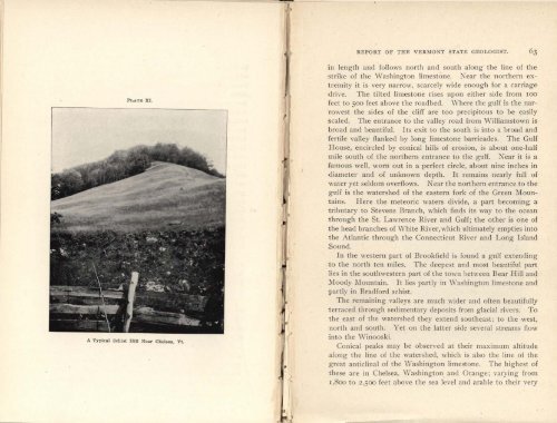
PLATE XI.<br />
Vt.<br />
p<br />
1<br />
A'<br />
in length <strong>and</strong> follows north <strong>and</strong> south along the line <strong>of</strong> the<br />
strike <strong>of</strong> the Washington limestone. Near the northern extremity<br />
it is very narrow, scarcely wide enough for a carriage<br />
drive. The tilted limestone rises upon either side from ioo<br />
feet to 500 feet above the roadbed. Where the gulf is the nar -<br />
rowest the sides <strong>of</strong> the cliff are too precipitous to be easily<br />
scaled. The entrance to the valley road from Williamstown is<br />
broad <strong>and</strong> beautiful. Its exit to the south is into a broad <strong>and</strong><br />
fertile valley flanked by long limestone barricades. The Gulf<br />
House, encircled by conical hills <strong>of</strong> erosion, is about one-half<br />
mile south <strong>of</strong> the northern entrance to the gulf. Near it is a<br />
arnous well, worn out in a perfect circle, about nine inches in<br />
diameter <strong>and</strong> <strong>of</strong> unknown depth. It remains nearly full <strong>of</strong><br />
water yet seldom overflows. Near the northern entrance to the<br />
gulf is the watershed <strong>of</strong> the eastern fork <strong>of</strong> the Green Mountains.<br />
Here the meteoric waters divide, a part becoming a<br />
tributary to Stevens Branch, which finds its way to the ocean<br />
through the St. Lawrence River <strong>and</strong> Gulf; the other is one <strong>of</strong><br />
the head branches <strong>of</strong> White River, which ultimately empties into<br />
the Atlantic through the Connecticut River <strong>and</strong> Long Isl<strong>and</strong><br />
Sound.<br />
In the western part <strong>of</strong> Brookfield is found a gulf extending<br />
to the north ten miles. The deepest <strong>and</strong> most beautiful part<br />
lies in the southwestern part <strong>of</strong> the town between Bear Hill <strong>and</strong><br />
Moody Mountain. It lies partly in Washington limestone <strong>and</strong><br />
partly in Bradford schist.<br />
The remaining valleys are much wider <strong>and</strong> <strong>of</strong>ten beautifully<br />
terraced through sedimentary deposits from glacial rivers. To<br />
the east <strong>of</strong> the watershed they extend southeast; to the west,<br />
north <strong>and</strong> south. Yet on the latter side several streams flow<br />
into the Winooski.<br />
Conical peaks may he observed at their maximum altitude<br />
along the line <strong>of</strong> the watershed, which is also the line <strong>of</strong> the<br />
great anticlinal <strong>of</strong> the Washington limestone. The highest <strong>of</strong><br />
these are in Chelsea, \Vashington <strong>and</strong> Orange; varying from<br />
i,800 to 2,500 feet above the sea level <strong>and</strong> arable to their very