sustainable use of biological diversity.pdf - India Environment Portal
sustainable use of biological diversity.pdf - India Environment Portal
sustainable use of biological diversity.pdf - India Environment Portal

You also want an ePaper? Increase the reach of your titles
YUMPU automatically turns print PDFs into web optimized ePapers that Google loves.
Land <strong>use</strong> and bio<strong>diversity</strong> patterns on chacras in northeast Argentina<br />
Land <strong>use</strong> and bio<strong>diversity</strong> patterns on chacras in northeast Argentina<br />
Mitsuhiko Toda 1 and Ginzo Aoyama 1<br />
1<br />
Japan Wildlife Research Center (JWRC)<br />
1. introduction<br />
While extremely long longitudinally, Latin America<br />
alone covers a broad range <strong>of</strong> latitudes and accompanying<br />
climates, from tropical in the north to polar in<br />
the south. Argentina, which is situated at the southern<br />
tip <strong>of</strong> South America, is a major agricultural<br />
producer, and is therefore home to many secondary<br />
natural environments such as farmland. At the same<br />
time, there are four natural World Heritage sites in<br />
Argentina. It is a treasure chest <strong>of</strong> diverse natural<br />
features, from subtropical forests to glaciers. The<br />
present report draws upon the example <strong>of</strong> subtropical<br />
areas around Iguazú National Park (province <strong>of</strong><br />
Misiones), which is one <strong>of</strong> the most renowned specimens<br />
<strong>of</strong> nature in the country, and illustrates how<br />
the natural resources on areas <strong>of</strong> family-owned land<br />
is managed in a <strong>sustainable</strong> manner, resulting in the<br />
maintenance <strong>of</strong> a high degree <strong>of</strong> bio<strong>diversity</strong>.<br />
2. overview <strong>of</strong> the area and survey<br />
2.1 The natural environment <strong>of</strong> Argentina<br />
Argentina has an area <strong>of</strong> 2,780,000 square kilometres,<br />
placing it as the second largest country in Latin<br />
America and eighth in the world. It extends about<br />
3,800 kilometres from north to south, and has climates<br />
ranging from subtropical to polar. It is an agricultural<br />
nation, with beef cattle, wheat, corn, and<br />
soybeans among its major products. Much <strong>of</strong> the<br />
population is concentrated in the north, and conversely<br />
the south has a lower population density.<br />
Most <strong>of</strong> the country has been developed as farmland,<br />
with forests now only covering about ten percent <strong>of</strong><br />
the country.<br />
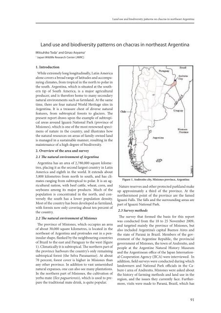
2.2 The natural environment <strong>of</strong> Misiones<br />
The province <strong>of</strong> Misiones, which occupies an area<br />
<strong>of</strong> about 30,000 square kilometres, is located in the<br />
northeast <strong>of</strong> Argentina and protrudes out in a peninsular<br />
shape, flanked by the neighbouring countries<br />
<strong>of</strong> Brazil to the east and Paraguay to the west (figure<br />
1). Climatically it is subtropical. The northern part <strong>of</strong><br />
the province harbours the country’s only remaining<br />
subtropical forest (the Selva Paranaense). At about<br />
70 percent, forest cover is higher in Misiones than<br />
any other province. In addition to vast untarnished<br />
natural expanses, one can also see many plantations.<br />
In the northern part <strong>of</strong> Misiones, the cultivation <strong>of</strong><br />
yerba mate (Ilex paguariensis), which is <strong>use</strong>d to prepare<br />
the traditional mate drink, is quite popular.<br />
figure 1. andresito city, Misiones province, argentina<br />
Nature reserves and other protected parkland make<br />
up approximately a third <strong>of</strong> the province. At the<br />
northernmost point <strong>of</strong> the province are the famed<br />
Iguazú Falls. The falls and the surrounding areas are<br />
part <strong>of</strong> Iguazú National Park.<br />
2.3 Survey methods<br />
The survey that formed the basis for this report<br />
was conducted from the 18 to 25 November 2009,<br />
and targeted mainly the province <strong>of</strong> Misiones, but<br />
also included Argentina’s capital Buenos Aires and<br />
the state <strong>of</strong> Paraná in Brazil. Members <strong>of</strong> the government<br />
<strong>of</strong> the Argentine Republic, the provincial<br />
government <strong>of</strong> Misiones, the town <strong>of</strong> Andresito, and<br />
people at the Argentine Natural History M<strong>use</strong>um<br />
and the Argentinean <strong>of</strong>fice <strong>of</strong> the Japan International<br />
Cooperation Agency (JICA) were interviewed. In<br />
addition, field surveys were conducted during which<br />
landowners and National Park <strong>of</strong>ficials in the Cabure-i<br />
area <strong>of</strong> Andresito, Misiones were asked about<br />
the history <strong>of</strong> farming methods and land <strong>use</strong> in the<br />
region, and the issues they currently face. Furthermore,<br />
visits were made to Paraná, Brazil, which has<br />
© JWRC<br />
91