pdf. 4MB - Ku-ring-gai Council
pdf. 4MB - Ku-ring-gai Council
pdf. 4MB - Ku-ring-gai Council

You also want an ePaper? Increase the reach of your titles
YUMPU automatically turns print PDFs into web optimized ePapers that Google loves.
<strong>Ku</strong> • <strong>ring</strong> • <strong>gai</strong> <strong>Council</strong><br />
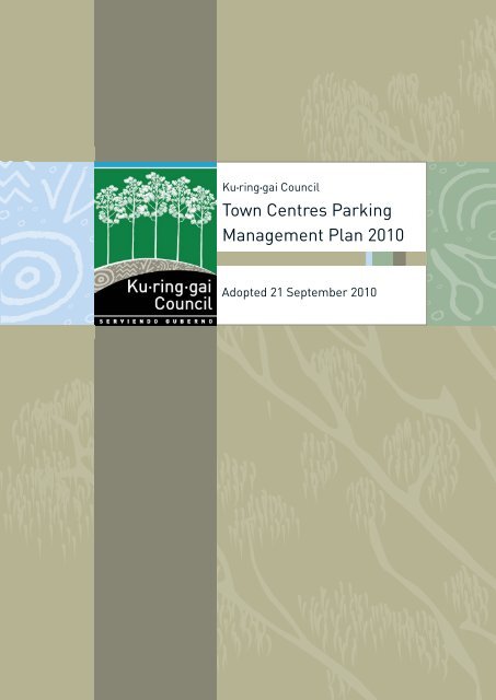
Town Centres Parking<br />
Management Plan 2010<br />
Adopted 21 September 2010
THIS PAGE IS INTENTIONALLY LEFT BLANK
C<br />
PART 1 INTRODUCTION p-2<br />
PART 2 ARUP PARKING STUDY – RECOMMENDATIONS<br />
2.1 Roseville ....................................................................................... p-6<br />
2.2 Lindfield ........................................................................................ p-6<br />
2.3 Gordon .......................................................................................... p-6<br />
2.4 Pymble .......................................................................................... p-6<br />
2.5 Turramurra ................................................................................... p-7<br />
2.6 St Ives ........................................................................................... p-7<br />
2.7 Wahroonga .................................................................................... p-7<br />
PART 3 KEY ISSUES AND DISCUSSION<br />
3.1 Mixed use, retail, commercial & residential parking rates ........ p-10<br />
3.2 Time management/enforcement & pay parking .......................... p-14<br />
3.3 Public car parking & undergrounding of at-grade car parking .. p-16<br />
3.4 Resident parking schemes/parking permits ............................... p-18<br />
3.5 Commuter parking ....................................................................... p-19<br />
3.6 Bus zones ...................................................................................... p-23<br />
3.7 Loading zones ............................................................................... p-24<br />
3.8 Accessible parking ....................................................................... p-25<br />
3.9 Car share parking ......................................................................... p-27<br />
3.10 Bicycle parking ............................................................................. p-28<br />
3.11 Motorcycle/motor scooter parking .............................................. p-29<br />
3.12 School parking ............................................................................. p-30<br />
3.13 Taxi zones ..................................................................................... p-31<br />
3.14 Clearways ..................................................................................... p-32<br />
PART 4 CONSULTATION p-34<br />
CONTENTS<br />
PART 5 LONG TERM PARKING STRATEGIES<br />
5.1 Gordon .......................................................................................... p-39<br />
5.2 Lindfield ........................................................................................ p-42<br />
5.3 Pymble .......................................................................................... p-45<br />
5.5 Roseville ....................................................................................... p-47<br />
5.5 Turramurra ................................................................................... p-49<br />
5.6 St Ives ........................................................................................... p-52<br />
5.7 Wahroonga ................................................................................... p-55<br />
<strong>Ku</strong>-<strong>ring</strong>-<strong>gai</strong> Town Centres Parking Management Plan 2010<br />
i
PART 6<br />
PART 7<br />
PART A<br />
STRATEGIES TO MANAGE TEMPORARY<br />
IMPACTS DUE TO RECONSTRUCTION OF<br />
PARKING FACILITIES<br />
6.1 General ......................................................................................... p-58<br />
6.2 Gordon Wade Lane Car Park ........................................................ p-60<br />
6.3 Gordon Moree Street Car Park .................................................... p-63<br />
6.4 Lindfield Kochia Lane Car Park ................................................... p-64<br />
6.5 Lindfield Woodford Lane Car Park .............................................. p-67<br />
6.6 Pymble Grandview Lane Car Park ............................................... p-70<br />
6.7 Roseville Larkin Lane Car Park ................................................... p-71<br />
6.8 Roseville Lord Street Car Park .................................................... p-74<br />
6.9 St Ives Shopping Village/Village Green Parade Car Park ........... p-76<br />
6.10 Turramurra Ray Street/William Street Car Park ........................ p-78<br />
6.11 Turramurra Plaza Car Park ......................................................... p-81<br />
6.12 Turramurra Gilroy Lane Car Park ............................................... p-82<br />
6.13 Wahroonga Coonanbarra Road Car Park .................................... p-85<br />
STATUTORY PROCESSES<br />
7.1 <strong>Ku</strong>-<strong>ring</strong>-<strong>gai</strong> Traffic Committee .................................................... p-88<br />
7.2 <strong>Ku</strong>-<strong>ring</strong>-<strong>gai</strong> Traffic Generating Developments Committee ......... p-89<br />
7.3 Sydney Regional Development Advisory Committee (SDRAC) ... p-90<br />
APPENDICES<br />
A1 <strong>Ku</strong>-<strong>ring</strong>-<strong>gai</strong> Town Centre Parking Management Plan (Arup) ..... p-92<br />
A2 Wahroonga Traffic and Parking Study (Arup) .............................. p-93<br />
A3 Parking Management Planning Workshop and Plenary p-94<br />
Outcomes ......................................................................................<br />
A4 Town Centre Plans Showing Long Term Parking Arrangements p-105<br />
A5 Plans of Strategies to Manage Temporary Impacts due to p-111<br />
Reconstruction of <strong>Council</strong> Owned Parking Facilities ..................<br />
A6 Precinct by Precinct Analysis ...................................................... p-120<br />
ii<br />
<strong>Ku</strong>-<strong>ring</strong>-<strong>gai</strong> Town Centres Parking Management Plan 2010
INTRODUCTION<br />
PART<br />
1<br />
<strong>Ku</strong>-<strong>ring</strong>-<strong>gai</strong> Town Centres Parking Management Plan 2010<br />
p-1
1 INTRODUCTION<br />
Du<strong>ring</strong> the preparation of the draft Town Centres LEP and DCP in<br />
2005/2006, <strong>Council</strong> resolved, in relation to each centre, that a “Parking<br />
Management Plan (PMP) be prepared and reported to <strong>Council</strong> prior to<br />
gazettal of the Draft Local Environmental Plan”.<br />
The need for such a study was made further evident du<strong>ring</strong> the<br />
consultation and planning process for the town centres. The issue of car<br />
parking was one of the main concerns raised by residents and business<br />
owners. Typical concerns raised include:<br />
• commuter parking in local streets;<br />
• lack of commuter parking stations;<br />
• lack of parking for people wishing to “park-and-ride”;<br />
• lack of public parking generally;<br />
• school parking; and<br />
• future undergrounding of public parking areas.<br />
Arup was engaged in 2007 to prepare a background study. The objectives<br />
of the study was to develop a comprehensive plan for the long term<br />
management and provision of car parking within the main commercial<br />
centres of <strong>Ku</strong>-<strong>ring</strong>-<strong>gai</strong> LGA which:<br />
• addresses existing <strong>Council</strong> resolutions in relation to parking within<br />
the town centres, particularly in relation to maintaining current<br />
levels of public off-street car parking (both time restricted and<br />
unrestricted);<br />
• addresses recommendations made by the independent<br />
chairpersons in the town centre public hea<strong>ring</strong> reports (in relation<br />
to reclassification);<br />
• identifies links with town centre contributions strategy and<br />
development contributions plans;<br />
• integrates with <strong>Council</strong>’s long term financial model (CTFM);<br />
• is consistent with the community’s values and vision;<br />
• is in accordance with State Government policies and guidelines;<br />
• is consistent with <strong>Council</strong>’s policies for parking, sustainability and<br />
ESD and the Environmental Levy;<br />
• involves and effectively engages the <strong>Council</strong>, community and<br />
relevant stakeholders;<br />
• is economically viable and commercially appropriate; and<br />
p-2<br />
<strong>Ku</strong>-<strong>ring</strong>-<strong>gai</strong> Town Centres Parking Management Plan 2010
1 INTRODUCTION (continued)<br />
1<br />
• meets access and disability requirements.<br />
The Arup background study was completed in February 2009 and<br />
examined the existing parking conditions within the centres in terms<br />
of supply and demand (with respect to extent and time), examined the<br />
future growth of the centres. Estimates were made of the future parking<br />
demand based on the likely growth in development at the time. The<br />
background report also considered broad strategies for addressing<br />
parking issues in commercial centres; and make recommendations in<br />
relation to each centre as to how to address issues and provide for the<br />
future demand.<br />
Arup was also commissioned to undertake a Traffic and Parking Study<br />
for the Wahroonga village in early 2008. One of the objectives of the study<br />
was to develop a master plan for car parking in the Wahroonga centre.<br />
Purpose of this PMP<br />
The <strong>Ku</strong>-<strong>ring</strong>-<strong>gai</strong> Town Centres Parking Management Plan expands<br />
on the Arup background study and considers parking strategies in<br />
each of the 6 town centres in more detail, particularly in relation to<br />
land uses, long/short term parking and parking for other modes of<br />
transport. Consideration is also given to ways of managing the potential<br />
redevelopment of <strong>Council</strong> car parks in order to minimise the impact<br />
due to the temporary loss of parking. As the Wahroonga centre was<br />
studied separately, the main parking outcomes of the Wahroonga Traffic<br />
and Parking Study are only shown within this report, with specific details<br />
available in the respective study.<br />
INTRODUCTION<br />
<strong>Ku</strong>-<strong>ring</strong>-<strong>gai</strong> Town Centres Parking Management Plan 2010<br />
p-3
THIS PAGE IS INTENTIONALLY LEFT BLANK<br />
p-4<br />
<strong>Ku</strong>-<strong>ring</strong>-<strong>gai</strong> Town Centres Parking Management Plan 2010
PART<br />
2<br />
2 Arup Parking Study – Recommendations<br />
2.1 Roseville<br />
2.2 Lindfield<br />
2.3 Gordon<br />
2.4 Pymble<br />
2.5 Turramurra<br />
2.6 St Ives<br />
2.7 Wahroonga<br />
ARUP PARKING STUDY<br />
<strong>Ku</strong>-<strong>ring</strong>-<strong>gai</strong> Town Centres Parking Management Plan 2010<br />
p-5
2 ARUP PARKING STUDY – RECOMMENDATIONS<br />
After analysing the future parking supply and demand in the town<br />
centres, p40 of the <strong>Ku</strong>-<strong>ring</strong>-<strong>gai</strong> Town Centres Parking Management Plan<br />
(ARUP, 2008) suggests that<br />
…the basis of the future car parking strategy should be to retain<br />
the current general availability of public car parking and for the future<br />
developers of large consolidated retail, commercial and residential<br />
development sites to accommodate all future car parking demand on site,<br />
including visitor car parking, such that <strong>Council</strong> will not have to operate future<br />
Section 94 contributions plans to construct any balance or future shortfall of<br />
car parking supply from this source.<br />
Centre-specific Recommendations from Arup Parking Study<br />
2.1 Roseville<br />
Provide future car parking on site in all new retail / commercial and<br />
mixed use development in accordance with <strong>Council</strong>’s Town Centres LEP,<br />
2006.<br />
No additional public car parking other than the Lord Street and Larkin<br />
Lane improvements will be required to be provided by <strong>Council</strong>.<br />
2.2 Lindfield<br />
Provide future car parking on site in major retail/commercial and mixed<br />
use developments in accordance with <strong>Council</strong>’s Town Centres LEP 2006<br />
and retaining existing public car park numbers.<br />
Additional public car parking will be provided on the western side of the<br />
Pacific Highway/Railway Line primarily through the construction of new<br />
roads between Beaconsfield Parade, Bent Street and Balfour Street.<br />
2.3 Gordon<br />
Provide future car parking for retail / commercial and mixed use<br />
development on site in accordance with <strong>Council</strong>’s Town Centres LEP<br />
2006.<br />
Additional public car parking will be provided on street along Wade<br />
Avenue and a new street which is to be constructed between Moree<br />
Street and St John’s Avenue.<br />
2.4 Pymble<br />
Provide future car parking on site for major developments in accordance<br />
with <strong>Council</strong> Code requirements (Town Centres LEP 2006).<br />
Proposed town centre urban design changes, between Grandview and<br />
Post Office Streets mainly, will result in an additional 50 public car<br />
parking spaces being provided for the centre.<br />
p-6<br />
<strong>Ku</strong>-<strong>ring</strong>-<strong>gai</strong> Town Centres Parking Management Plan 2010
2 ARUP PARKING STUDY – RECOMMENDATIONS<br />
(continued)<br />
2<br />
2.5 Turramurra<br />
Provide all future car parking on site for major developments in<br />
accordance with <strong>Council</strong>’s Town Centres LEP 2006 retaining existing<br />
public car park numbers.<br />
Additional public car parking is to be provided on street with the<br />
construction of a new road between Gilroy Road and Turramurra Avenue<br />
and the widening of Forbes Lane.<br />
2.6 St Ives<br />
Provide future car parking on site in all new retail, commercial and<br />
mixed use development in accordance with <strong>Council</strong>’s Town Centres LEP,<br />
2006.<br />
Additional public car parking will be provided by the construction of on<br />
street public parking improvements along Memorial Avenue and Stanley<br />
Lane.<br />
2.7 Wahroonga<br />
The final list of parking recommendations is primarily aimed at<br />
improving parking turnover which would increase the number of spaces<br />
available at any given time. There is significant scope for increasing<br />
turnover in Wahroonga and such measures should be introduced before<br />
consideration is given to increasing parking supply.<br />
While the provision of future car parking on site for major developments<br />
would address the needs of those land uses, there also are other<br />
peripheral parking issues and themes not directly related to major<br />
developments that also require discussion and appropriate strategies<br />
to address. These issues and themes are explored in the next section,<br />
where appropriate strategies are also recommended.<br />
ARUP PARKING STUDY<br />
<strong>Ku</strong>-<strong>ring</strong>-<strong>gai</strong> Town Centres Parking Management Plan 2010<br />
p-7
THIS PAGE IS INTENTIONALLY LEFT BLANK<br />
p-8<br />
<strong>Ku</strong>-<strong>ring</strong>-<strong>gai</strong> Town Centres Parking Management Plan 2010
PART<br />
3<br />
3 Key Issues And Discussion<br />
3.1 Mixed use, retail, commercial & residential parking rates<br />
3.2 Time management/enforcement & pay parking<br />
3.3 Public car parking & undergrounding of at-grade car parking<br />
3.4 Resident parking schemes/parking permits<br />
3.5 Commuter parking<br />
3.6 Bus zones<br />
3.7 Loading zones<br />
3.8 Accessible parking<br />
3.9 Car share parking<br />
3.10 Bicycle parking<br />
3.11 Motorcycle/motor scooter parking<br />
3.12 School parking<br />
3.13 Taxi zones<br />
3.14 Clearways<br />
KEY ISSUES & DISCUSSION<br />
<strong>Ku</strong>-<strong>ring</strong>-<strong>gai</strong> Town Centres Parking Management Plan 2010<br />
p-9
3.1 MIXED USE, RETAIL, COMMERCIAL &<br />
RESIDENTIAL PARKING RATES<br />
In accordance with the recommendations in the Arup study, parking<br />
for mixed use, retail, commercial and residential land uses should be<br />
provided on site. On-site parking rates should reflect the accessibility of<br />
a centre, so in centres with good access to public transport (rail, bus),<br />
parking rates should be typically lower than centres with less access to<br />
public transport. This is one of the principles underpinning integrated<br />
land use and transport planning, and transit oriented development.<br />
The foreshadowed Metropolitan Parking Policy (NSW Department of<br />
Planning) and the yet to be released revision to the RTA Guide to Traffic<br />
Generating Developments are likely to set out parking provision rates<br />
based on accessibility to transport.<br />
Lower parking provision in centres with good access to public transport<br />
would be consistent with State Government policy, and would support the<br />
role of public transport and therefore reduce congestion and emissions.<br />
Residents, employees and visitors to the town centres would therefore be<br />
encouraged to consider alternative forms of transport as their means of<br />
travel to or from the centre. Residents in town centres should not expect<br />
that they will necessarily be able to find convenient parking on-street<br />
immediately outside or even near their property.<br />
Parking requirements are specified in terms of ranges, which give<br />
flexibility. For example, as the floorspace to be developed increases,<br />
the rate of total parking provision tends to be lower due multi purpose<br />
trips and non-conflicting parking demand peaks/”sha<strong>ring</strong>”. Ranges<br />
also take into account accessibility to public transport (e.g. rail, bus),<br />
and can improve economic viability by reducing depth of excavation for<br />
underground car parking. Parking can be provided which exceeds the<br />
upper range, however excess spaces will be included in the calculation of<br />
gross floor area.<br />
<strong>Council</strong>’s draft Town Centres DCP specifies the following for parking<br />
provision:<br />
Mixed Use Development – Car Parking Rates<br />
For mixed-use sites within 400m of a rail station and within a commercial<br />
centre, the following parking ranges would apply:<br />
Land Use<br />
Office and<br />
business,<br />
including<br />
professional<br />
suites<br />
Parking Space Requirement<br />
1 space/33m 2 GFA to<br />
1 space/45m 2 GFA<br />
Suggested split:<br />
90% employee parking<br />
10% visitor parking<br />
p-10<br />
<strong>Ku</strong>-<strong>ring</strong>-<strong>gai</strong> Town Centres Parking Management Plan 2010<br />
Retail/shops,<br />
including<br />
restaurants and<br />
cafes<br />
1 space/26m 2 GFA to)<br />
1 space/33m 2 GFA<br />
Suggested split:<br />
30% employee parking<br />
70% shopper parking
3.1 MIXED USE, RETAIL, COMMERCIAL &<br />
RESIDENTIAL PARKING RATES (continued)<br />
3<br />
Residential:<br />
Studio<br />
1 bedroom<br />
2 bedroom<br />
3 or more bedroom<br />
Visitor<br />
0- 0.5<br />
0.6 - 1.0<br />
1.0 – 1.25<br />
1.0 – 1.5<br />
1 space/6 units<br />
Note: due to existing fragmented ownership patterns, some proposed mixed<br />
use sites (such as in Hill Street Roseville) would require significant<br />
amalgamation to achieve additional FSR in accordance with Clause 6.4<br />
of the draft <strong>Ku</strong>-<strong>ring</strong>-<strong>gai</strong> LEP (Town Centres), to facilitate urban design<br />
excellence. To ensure the viability of mixed use development in such<br />
situations, a possible reduction in parking rates may be considered.<br />
Indicatively, this could be a reduction of 20%, although further detailed<br />
studies would need to be undertaken regarding the parking rate reduction<br />
to ensure no negative impact on the parking around the centre. It is<br />
recommended to accommodate the longer term parking needs (residents,<br />
employees) on-site and reduce the quantity of short term (retail, visitor)<br />
parking needs in centres where there is demonstrated spare short term<br />
capacity du<strong>ring</strong> peak times in the surrounding roads.<br />
Business and Office Development - Car Parking Rates<br />
The following parking rangs apply for office, business premises and<br />
retail, where the development is within 400 metres of a train station and<br />
within a commercial centre:<br />
Land Use<br />
Office and<br />
business, including<br />
professional suites<br />
Retail<br />
Parking Space Requirement<br />
1 space/33m 2 GFA to<br />
1 space/45m 2 GFA*<br />
Plus, 1 space if resident/manager or caretaker<br />
Plus, 1 courier space for development in<br />
excess of 200m2 GFA<br />
Suggested split:<br />
90% employee parking<br />
10% visitor parking<br />
1 space/26m 2 GFA to)<br />
1 space/33m 2 GFA<br />
Suggested split:<br />
30% employee parking<br />
70% shopper parking<br />
* Parking provision at a rate of less than 1 per 45m 2 GFA may be<br />
considered if accompanied by firm and ongoing proposals to encourage<br />
alternative means of transport. This may include strategies such as:<br />
• transport Access Guides (TAG);<br />
• staff discount/subsidy towards public transport costs;<br />
• dedicated shuttle bus between the development and railway<br />
station;<br />
• adoption and implementation of a car pool/ car sha<strong>ring</strong> scheme;<br />
<strong>Ku</strong>-<strong>ring</strong>-<strong>gai</strong> Town Centres Parking Management Plan 2010<br />
KEY ISSUES & DISCUSSION<br />
p-11
3.1 MIXED USE, RETAIL, COMMERCIAL &<br />
RESIDENTIAL PARKING RATES (continued)<br />
• use of taxis or public transport for work related journeys;<br />
• priority parking for staff who pool with 2 or more passengers; and<br />
• regularly publicise and monitor the scheme and establish a plan<br />
with measurable targets.<br />
Residential Flat Building Development – Car Parking Rates<br />
For residential flat buildings, the following car parking ranges would<br />
apply:<br />
Studio<br />
1 bedroom<br />
2 bedroom<br />
3 or more bedroom<br />
Visitor<br />
Parking Space Requirement<br />
0- 0.5<br />
0.7 – 1<br />
1 – 1.25<br />
1 – 2<br />
1 space/4 units<br />
Multi-Dwelling Housing Development – Car Parking Rates<br />
For multi-dwelling housing, the following car parking ranges would<br />
apply:<br />
1 bedroom<br />
2 bedroom<br />
3 or more bedroom<br />
Visitor<br />
Parking Space Requirement<br />
1<br />
1-1.5<br />
1-2<br />
1 space/4 units<br />
Bicycle Parking Rates<br />
For mixed use and residential flat building development sites within the<br />
town centres, the following bicycle parking rates apply:<br />
Land Use<br />
Office and business<br />
Retail/shops<br />
Residential<br />
Parking Space Requirement<br />
1 space/200m 2 GFA (for employees)<br />
1 space/750m 2 over 1000m 2 (for visitors)<br />
1 space/300m 2 GFA (for employees)<br />
1 space/500m 2 over 1000m 2 (for shoppers)<br />
1 space/5 units (for residents)<br />
1 space/10 units (for visitors)<br />
For bicycle parking rates for other land uses, refer to Austroads Guide to<br />
p-12<br />
<strong>Ku</strong>-<strong>ring</strong>-<strong>gai</strong> Town Centres Parking Management Plan 2010
3.1 MIXED USE, RETAIL, COMMERCIAL &<br />
RESIDENTIAL PARKING RATES (continued)<br />
3<br />
Traffic Enginee<strong>ring</strong> Practice Part 14 – Bicycles.<br />
Note: that connectivity of large publicly available basement car parks in<br />
retail/commercial cores of the town centres should be achieved where<br />
practical, so that individual basement car parks would act as a larger car<br />
park, improving parking opportunities within the one precinct and possibly<br />
reducing vehicle congestion and circulation at the surface.<br />
For all other locations, car parking is to be provided in accordance with<br />
DCP43.<br />
Parking spaces can be shared by more than one user, which allows<br />
parking facilities to be used more efficiently. Shared parking takes<br />
advantage of the fact that most parking spaces are only used part time<br />
by a particular land use, and many parking facilities have a significant<br />
portion of unused spaces, with utilization patterns that follow predictable<br />
daily, weekly and annual cycles. Efficient sha<strong>ring</strong> of spaces can allow<br />
parking requirements to be reduced. The table below provides and<br />
indication of compatible land uses that could share parking facilities:<br />
Typical Peak Parking Demand Periods of Various Land Uses<br />
Weekday Peaks Evening Peaks Weekend Peaks<br />
Retail<br />
Medical centres<br />
Business/Offices<br />
Professional services<br />
Schools<br />
Medical<br />
Recommendations<br />
Auditoriums<br />
Bars and dance halls<br />
Meeting halls<br />
Restaurants<br />
Theatres<br />
Religious institutions<br />
Parks<br />
Retail<br />
Restaurants/cafe<br />
• That on-site parking in Town Centres be provided in accordance with<br />
<strong>Council</strong>’s draft Town Centres DCP.<br />
KEY ISSUES & DISCUSSION<br />
<strong>Ku</strong>-<strong>ring</strong>-<strong>gai</strong> Town Centres Parking Management Plan 2010<br />
p-13
3.2 TIME MANAGEMENT/ENFORCEMENT & PAY<br />
PARKING<br />
Parking enforcement must be undertaken to ensure turnover of timerestricted<br />
spaces (particularly in high demand areas), as well as to<br />
maintain safety clearances and visibility at key restricted areas. The<br />
degree to which an area is enforced varies with factors including<br />
demand, the level of resources available and the perception by the users<br />
of “revenue raising”. Arup elsewhere suggests that enforcement must be<br />
sufficient to give motorists a perception that they are likely to be caught if<br />
they exceed the posted limits.<br />
Resident surveys in 2006 indicate that parking issues rate highly in town<br />
centres. Some of the parking issues may relate to not being able to find<br />
a space at the desired location and at the desired time, however in the<br />
Arup background study, surveys of parking areas and on-street parking<br />
show that most centres generally have adequate short term parking,<br />
although some car parks experience high levels of demand du<strong>ring</strong><br />
certain times (typically the middle hours of the day). Surveys undertaken<br />
by <strong>Council</strong> staff in 2004 indicate that in some areas up to an average of<br />
10% of vehicles in car parks overstay the posted limits. Turnover can also<br />
be impacted by longer term users moving their vehicles and returning to<br />
park in the same car park, extending their stay at the expense of other<br />
legitimate short term users.<br />
Therefore, there may be a role for increased enforcement, to encourage<br />
turnover of high demand spaces. Enforcement could be increased by<br />
either increasing the patrols undertaken by <strong>Council</strong> enforcement officers<br />
or employing electronic enforcement options, including pay parking.<br />
Both strategies require increased resources, however it is possible that<br />
in the future, car parks in large redevelopment sites (such as the St Ives<br />
Shopping Village and the Gordon Centre) would implement a scheme<br />
whereby the shopper can access the car park for a limited time (typically<br />
2 or 3 hours). Any time spent over the time limit would incur charges,<br />
resulting in a more self-enforcing car park. This would better manage<br />
privately owned but publicly available car parks, but <strong>Council</strong>-owned car<br />
parks would require either more enforcement or other electronic means<br />
to further improve turnover.<br />
To minimise the possibility for motorists to move their vehicles and<br />
returning to park in the same car park, multiple stays per day are<br />
discouraged in high utilisation car parks. Indicatively, this could be in<br />
car parks where peak weekday utilisation is typically greater than 80%,<br />
which includes Wade Lane car park, St Ives Village Green car park, Tryon<br />
Road car park and Gilroy Lane car park. Some car parks and most in<br />
smaller centres such as Pymble and Roseville are generally not utilised<br />
more than 80% du<strong>ring</strong> the weekday peak.<br />
<strong>Council</strong>‘s Regulatory Services have recently acquired hand-held<br />
electronic enforcement units. These would speed up the process of<br />
inf<strong>ring</strong>ing vehicles through the electronic issuing of tickets, which would<br />
potentially allow regulatory officers greater coverage.<br />
p-14<br />
<strong>Ku</strong>-<strong>ring</strong>-<strong>gai</strong> Town Centres Parking Management Plan 2010<br />
The Arup background study suggests that paid parking is probably not<br />
warranted at the current vacancy rates experienced in the town centres.<br />
There are, however, some car parks and locations in various centres that<br />
experience either high levels of demand, or difficulties in enforcement.
3.2 TIME MANAGEMENT/ENFORCEMENT & PAY<br />
PARKING (continued)<br />
3<br />
Currently, <strong>Council</strong> operates paid parking only in the Culworth Avenue<br />
car park, in Killara. This car park is predominantly used by commuters.<br />
Users are required to pay a $5 flat fee for all day parking, and no fee is<br />
charged on weekends. The only known paid parking scheme on privately<br />
owned land in <strong>Ku</strong>-<strong>ring</strong>-<strong>gai</strong> is at the San Hospital in Wahroonga, where<br />
visitors are charged on a sliding scale for stays longer than 15 minutes.<br />
Parking fees for outpatients are lower than those for visitors.<br />
Paid parking could be a mechanism whereby overall turnover of parking<br />
spaces improves, providing more parking opportunities for a greater<br />
number of users. This would also result greater compliance, and the<br />
revenue streams generated could be directed to meet the capital costs of<br />
implementing the scheme in the early stages of implementation. Multiple<br />
stays per day or longer stays would be discouraged, as these would<br />
incur higher charges. In the subsequent stages, revenue would service<br />
the operational costs as well as contribute towards local parking/<br />
public domain improvements, new on-street parking, town centre<br />
parking management and improvements to public transport facilities<br />
including interchanges and shelters, as well as additional peak period<br />
feeder bus services. Funding shortfalls for key parking and transport<br />
related projects identified in the Town Centres Works Program would be<br />
reduced.<br />
Recommendations<br />
• That <strong>Council</strong> seek to implement enforcement and compliance strategies<br />
that maximise turnover of parking spaces and opportunities for <strong>Council</strong>.<br />
• That more than one stay per day in high utilisation car parks be<br />
discouraged.<br />
KEY ISSUES & DISCUSSION<br />
<strong>Ku</strong>-<strong>ring</strong>-<strong>gai</strong> Town Centres Parking Management Plan 2010<br />
p-15
3.3 PUBLIC CAR PARKING & UNDERGROUNDING<br />
OF AT-GRADE CAR PARKING<br />
<strong>Council</strong> has a number of public car parks in the town centres, with most<br />
spaces typically having 2 hour parking restrictions to ensure turnover<br />
while providing shopper convenience. Shorter term parking (1/2 or 1<br />
hour) is usually located on the kerbside, and is intended for much shorter<br />
stay and quick access. Other privately owned but publicly available<br />
parking (such as the in Gordon Centre or St Ives Shopping Village) have<br />
notional time limits, including 3 hour limits.<br />
Figure 3.3-1:<br />
Typical street parking sign.<br />
Most <strong>Council</strong> car parks exist due to the surrounding older type strip<br />
shops/offices in the town centres generally not being able to provide<br />
parking on-site to service their needs and those of their customers.<br />
However, as redevelopment of the town centres occurs, new on-site<br />
parking would need to be provided to cater for the parking needs of<br />
the development. As this on-site provision increases, the role and<br />
importance of large at-grade <strong>Council</strong> car parks would be slowly<br />
diminished. New on-site parking would also help to address longer term<br />
(employee) parking which is currently transferred to surrounding roads<br />
and competes directly with commuters, residents and other longer stay<br />
users.<br />
In 2006, <strong>Council</strong> resolved to ensure there is no loss of publicly available<br />
car parking in the town centres. It follows that if (subject to the outcomes<br />
of the reclassification of <strong>Council</strong> lands) <strong>Council</strong> car park sites were to be<br />
redeveloped, the existing publicly available car parking would have to be<br />
replaced, probably by undergrounding. However, as indicated in the Arup<br />
background study, the parking needs of the town centres would be met<br />
if redeveloped sites provided for their own parking needs on-site, which<br />
could gradually diminish the long term need for <strong>Council</strong> car park sites.<br />
There is therefore scope to reduce the quantity of car parking needed<br />
to be undergrounded. It is likely that the cost to underground public car<br />
parks where mixed use or other development is proposed above (such<br />
as the Wade Lane car park) would be considered through a planning<br />
agreement with a developer and as a result, these projects were not<br />
included in the <strong>Ku</strong>-<strong>ring</strong>-<strong>gai</strong> Town Centres Development Contribution Plan.<br />
For shorter stays, it is envisaged that the bulk of on-street parking would<br />
be retained, with new roads and public domain improvements offe<strong>ring</strong><br />
the opportunity to increase on-street parking. Depending on demand,<br />
it may be necessary to extend the times that period parking operates<br />
in key streets (and car parks) on weekends (eg Village Green Parade,<br />
Grandview Street, St Johns Avenue, Rohini Street, Lindfield Avenue, Hill<br />
Street) to ensure adequate turnover on Saturdays and Sundays.<br />
New roads are appropriate projects for development contributions due<br />
to the benefits to vehicle access and circulation, as well as pedestrian/<br />
bicycle permeability and the additional on-street public parking they<br />
provide (where appropriate). Some roads are critical to the traffic<br />
improvements being proposed in various town centres. These have been<br />
identified in the <strong>Ku</strong>-<strong>ring</strong>-<strong>gai</strong> Town Centres Development Contribution<br />
Plan.<br />
p-16<br />
<strong>Ku</strong>-<strong>ring</strong>-<strong>gai</strong> Town Centres Parking Management Plan 2010
3.3 PUBLIC CAR PARKING & UNDERGROUNDING<br />
OF AT-GRADE CAR PARKING (continued)<br />
3<br />
Recommendations<br />
• That new developments in the town centre provide for their own parking<br />
needs on site.<br />
• That adjoining redeveloped sites allow for the possibility of interconnected<br />
car parks where possible.<br />
• That times of operation of period parking be reviewed to ensure adequate<br />
turnover on weekends in high demand locations.<br />
• That parking restrictions in major shopping centres, in particular, St Ives,<br />
be referred for further investigation as to appropriate parking restriction<br />
times and be referred to the <strong>Ku</strong><strong>ring</strong>-<strong>gai</strong> Traffic Committee, if necessary.<br />
KEY ISSUES & DISCUSSION<br />
<strong>Ku</strong>-<strong>ring</strong>-<strong>gai</strong> Town Centres Parking Management Plan 2010<br />
p-17
3.4 RESIDENT PARKING SCHEMES/PARKING<br />
PERMITS<br />
Resident parking schemes are used by some inner metropolitan councils<br />
with older dense development, including North Sydney, the former South<br />
Sydney, Randwick and Woollahra, where on-street parking can be in<br />
high demand and properties are too small to accommodate vehicles onsite.<br />
In such areas, residents do not have access to sufficient off-street<br />
parking, and parking may be heavily restricted near their residences.<br />
Resident parking schemes are now regulated under the Road Transport<br />
(Safety and Traffic Management) Act 1999 along with business parking<br />
permits, commuter parking permits and residents’ visitor parking<br />
permits. It is important to note that resident parking schemes must be<br />
implemented in accordance with the Roads and Traffic Authority’s Permit<br />
Parking Manual, which include eligibility criteria. Most single dwelling<br />
properties in <strong>Ku</strong>-<strong>ring</strong>-<strong>gai</strong> have sufficient space on-site to provide for<br />
parking for more than one vehicle, and therefore, few areas would qualify<br />
for such schemes.<br />
The Manual generally allows for a maximum of two resident parking<br />
permits per household reducing by one permit for each available offstreet<br />
parking space.<br />
There are a number of disadvantages to resident parking schemes:<br />
• administrative costs, some of which could be recouped through<br />
charging for permits;<br />
• tradespeople, visitors and residents themselves with new, hired or<br />
additional vehicles without a permit may be adversely affected by<br />
the restrictions; and<br />
• other users, including those visiting affected areas, are adversely<br />
affected.<br />
New development sites must comply with the requirements of <strong>Council</strong>’s<br />
Town Centre DCP to provide for on-site resident and visitor parking<br />
requirements. These developments are assumed to provide adequately<br />
for the needs of their residents on-site, and therefore would not be<br />
eligible for a resident parking scheme. The introduction of any resident<br />
parking scheme could result in demands for their introduction in<br />
numerous other locations which may not comply with normal guidelines.<br />
<strong>Council</strong> recently considered the use of resident parking schemes in <strong>Ku</strong><strong>ring</strong>-<strong>gai</strong>,<br />
and resolved (minute 102 of OMC 9 June 2009) that unless RTA<br />
eligibility criteria change, resident parking schemes not be introduced<br />
into <strong>Ku</strong>-<strong>ring</strong>-<strong>gai</strong>, but that the needs of residents and other stakeholders<br />
continue to be considered on their merit through the <strong>Ku</strong>-<strong>ring</strong>-<strong>gai</strong> Traffic<br />
Committee.<br />
If paid parking is implemented in Town Centres, it is unlikely that<br />
resident parking schemes would be introduced, as the paid parking areas<br />
are likely to only affect the general commercial core and not residential<br />
areas.<br />
Recommendation<br />
• That resident parking schemes not be introduced in <strong>Ku</strong>-<strong>ring</strong>-<strong>gai</strong>.<br />
p-18<br />
<strong>Ku</strong>-<strong>ring</strong>-<strong>gai</strong> Town Centres Parking Management Plan 2010
3.5 COMMUTER PARKING<br />
3<br />
Figure 3.5-1:<br />
Typical off-street parking<br />
sign.<br />
Commuter parking is often perceived to be the responsibility of local<br />
councils, yet these facilities draw patronage to the City Rail network.<br />
While the majority of commuter car parks in <strong>Ku</strong>-<strong>ring</strong>-<strong>gai</strong> are located on<br />
railway land, the local roads surrounding railway stations in <strong>Ku</strong>-<strong>ring</strong>-<strong>gai</strong><br />
also utilised for parking by commuters on weekdays.<br />
Parking demand around rail centres in <strong>Ku</strong>-<strong>ring</strong>-<strong>gai</strong> is high, with<br />
commuter car parks generally at full utilisation, and significant numbers<br />
of unrestricted on-street parking spaces occupied by all-day parking<br />
(commuters). Surveys conducted in the Arup study in 2007 indicate<br />
that on average, 86% of commuters who drove a car to the railway<br />
station stated they were <strong>Ku</strong>-<strong>ring</strong>-<strong>gai</strong> residents. Therefore, the primary<br />
beneficiaries of commuter parking in <strong>Ku</strong>-<strong>ring</strong>-<strong>gai</strong> are its residents. The<br />
proportion of adult boarding passengers who were car drivers averaged<br />
35%, and ranged from 17% at Roseville station to 52% at Gordon station.<br />
The importance of commuter parking is recognised, particularly in the<br />
role it plays in reducing the length of vehicle trips and transfer<strong>ring</strong> part<br />
of a journey to another mode (rail). However, the impacts of extensive<br />
commuter car parking can be towards residents (through parking<br />
on local roads) or towards traffic congestion, as these car parks are<br />
typically located close to rail stations and town centres where congestion<br />
du<strong>ring</strong> commuter peak times is not desirable. Therefore, commuter<br />
parking and amenity have competing benefits and impacts.<br />
Off-street parking areas<br />
Surveys indicate that residents would like additional commuter car<br />
parking, and that the apparent lack of parking can be a deterrent to<br />
accessing the rail station. Indeed, the Pymble centre has no formalised<br />
off-street commuter car parking, so there is a high reliance on<br />
unrestricted on-street parking to cater for the demand. Other centres<br />
such as Lindfield has a small section of unrestricted car park on <strong>Council</strong><br />
land (Woodford Lane), while centres such as Gordon have significantly<br />
higher amounts of commuter parking (on railway lands).<br />
Consideration could be given to re-allocating underutilised sections of<br />
time restricted car parks to commuter parking. It is likely though, that<br />
additional commuter car parking provided by <strong>Council</strong> would incur a user<br />
charge similar to that currently operating at <strong>Council</strong>’s Culworth Avenue<br />
commuter car park (Killara), which is equipped with a pay-and-display<br />
system.<br />
While the provision of additional off-street car parking would create<br />
additional capacity, anecdotal evidence suggests that it does little to<br />
reduce the impact to on-street parking, as spare capacity created onstreet<br />
is typically reabsorbed by other commuters.<br />
KEY ISSUES & DISCUSSION<br />
The use of surplus railway lands for commuter parking may be increased<br />
in the future. However, in some centres, such as Gordon, there is<br />
relatively little spare space to accommodate additional commuter<br />
parking. Some potential sites would be affected by embankments or<br />
cuttings which reduces the feasibility of constructing car parking, and<br />
some sites would be located mid way between 2 stations (which would<br />
<strong>Ku</strong>-<strong>ring</strong>-<strong>gai</strong> Town Centres Parking Management Plan 2010<br />
p-19
3.5 COMMUTER PARKING (continued)<br />
be less attractive for commuters). Also, if quadruplication of the North<br />
Shore railway occurs, it would have significant impacts to at-grade<br />
commuter car parks unless they were replaced in an alternate location<br />
or configuration. Discussion and consultation with Railcorp and Ministry<br />
of Transport regarding new commuter parking opportunities will<br />
continue, to encourage use of public transport by residents of <strong>Ku</strong>-<strong>ring</strong><strong>gai</strong>.<br />
On-street parking<br />
Unrestricted on-street parking tends to take a significant load of the total<br />
commuter parking at railway stations, even where there are a substantial<br />
number of formal off-street commuter car parking spaces. Commuters<br />
who leave their vehicles for the day generally accept that if parking is<br />
available to them on-street, they may have to walk further distances to<br />
their transport connections than shoppers.<br />
Residents close to rail centres usually accept that convenient on-street<br />
parking is not necessarily available to them. However, residents close to<br />
rail centres should not expect that they will necessarily be able to find<br />
parking on-street immediately outside or even near their property.<br />
It is likely that, as consolidation of lots and consequent development of<br />
medium density sites occurs, minor additional on-street parking will be<br />
available through the removal of redundant driveway crossings. Once<br />
removed, the additional space is likely to be occupied by commuters.<br />
Redevelopment of retail areas would result in improved provision for<br />
employee parking on-site, which could release additional unrestricted<br />
kerb side space for commuters.<br />
Until such time as attractive alternatives to accessing railway stations<br />
can be provided, it is generally not recommended to alter existing<br />
unrestricted kerbside parking around railways stations. This would<br />
require a shift in modes of access to rail stations from car to other<br />
modes (bus, walk, cycle), which will be encouraged through the Public<br />
Domain Plan and improvements to bus interchanges and bicycle<br />
facilities.<br />
Passenger pick up and drop off<br />
Passenger pick up and drop off points at rail stations (commonly known<br />
as ‘kiss and ride’) is very short term parking which can encourage<br />
commuters (not near rail stations and bus routes) to use rail services,<br />
although it does not necessarily reduce vehicle trip generation and<br />
congestion around rail stations du<strong>ring</strong> peak times. Most town centres<br />
already have some kerbside space near rail stations set aside for<br />
passenger pick up and drop off, although these mostly operate on a part<br />
time basis (i.e. du<strong>ring</strong> peak periods), and are signposted with minimal<br />
‘No Parking’ restrictions (which permits passenger set down and pick<br />
up, but not longer stays). Resident surveys suggest that current space for<br />
passenger pick up and drop off is inadequate.<br />
p-20<br />
<strong>Ku</strong>-<strong>ring</strong>-<strong>gai</strong> Town Centres Parking Management Plan 2010
3.5 COMMUTER PARKING (continued)<br />
3<br />
It should be noted that the spatial priority around transport interchanges<br />
should be towards pedestrians, buses and cyclists first, to encourage<br />
these modes over private vehicles. As a result, passenger pick up and<br />
drop off areas are proposed to be generally located somewhat further<br />
from the station entrances.<br />
To improve passenger pick up and drop off, it is proposed to provide<br />
additional space and to extend part time areas to full time in the larger<br />
centres, while smaller centres would have new or increased passenger<br />
pick up and drop off zones. To improve visibility and user awareness, it is<br />
proposed to supplement signage with a plate displaying the words “Pick<br />
Up and Drop Off Only”.<br />
Improved commuter pick up and drop off facilities have been considered<br />
as part of general transport interchange upgrades in the rail centres.<br />
Where appropriate, interchange upgrades are projects that would attract<br />
development contributions, and have therefore been included in the <strong>Ku</strong><strong>ring</strong>-<strong>gai</strong><br />
Town Centres Development Contribution Plan.<br />
Feeder bus services to railway stations<br />
From the Arup surveys conducted in 2007, the proportion of adult<br />
boarding passengers who travelled by bus to a railway station averaged<br />
9%, and ranged from 2% at Roseville station to 19% at Turramurra<br />
station. The relatively low proportions could be attributed to low<br />
frequency bus services and route coverage, despite all the major rail<br />
stations in <strong>Ku</strong>-<strong>ring</strong>-<strong>gai</strong> being connected to bus services.<br />
Strategies to improve access to the railway stations through bus services<br />
should provide a useful alternative to commuter parking, However,<br />
services have to be relatively direct, frequent and operate at the time<br />
commuters need them in order to be an attractive alternative. This would<br />
entail increasing the frequency of feeder services to at least 7.30pm.<br />
The Ministry of Transport has undertaken Bus Reform Planning in NSW<br />
and currently, the contract regions where <strong>Ku</strong>-<strong>ring</strong>-<strong>gai</strong> is located have<br />
undergone network planning and review. These types of issues have<br />
been raised by stakeholders and were considered by the Ministry as<br />
part of the consultation process. The revised bus networks have been<br />
introduced and are now operating.<br />
Part of the Bus Reform in NSW involves implementation of Strategic Bus<br />
Corridors, which are intended to be high frequency services connecting<br />
key regional centres in Sydney. Travel time improvements are proposed<br />
via measures such as bus priority and key intersections, dedicated bus<br />
lanes and clearways. One such route is the service between Mona Vale<br />
and Macquarie (route 36), via Gordon railway station. This service is<br />
operated by Forest Coach Lines and is particularly beneficial to residents<br />
of St Ives town centre as it would provide a frequent feeder service<br />
connecting St Ives to Gordon railway station. Strategic Bus Corridor<br />
route 7 (between Macquarie and Hornsby, via Turramurra) commenced<br />
operation on 23 March 2009 and provides an intermediate feeder role to<br />
Turramurra railway station.<br />
KEY ISSUES & DISCUSSION<br />
<strong>Ku</strong>-<strong>ring</strong>-<strong>gai</strong> Town Centres Parking Management Plan 2010<br />
p-21
3.5 COMMUTER PARKING (continued)<br />
Recommendations<br />
• Forest Coach Lines, Shorelink Bus Company and the Ministry of Transport<br />
be lobbied to increase services to/from St Ives du<strong>ring</strong> critical peak times<br />
and to extend frequencies to 7.30pm, to absorb some the on-street<br />
commuter parking occur<strong>ring</strong> around Gordon and other rail centres.<br />
• <strong>Council</strong> continue to work with the Ministry of Transport and bus operators<br />
to achieve an attractive alternative to commuter parking by developing<br />
effective feeder services to railway stations.<br />
• That buses, pedestrians and bicycles have priority over private vehicles in<br />
terms of commuter access and proximity of on-street parking to rail station<br />
entrances.<br />
• <strong>Council</strong> work with the Ministry of Transport to implement Strategic Bus<br />
Corridors in <strong>Ku</strong>-<strong>ring</strong>-<strong>gai</strong>.<br />
• <strong>Council</strong> generally not alter existing unrestricted kerbside parking around<br />
railways stations until such time as attractive alternatives for accessing<br />
railway stations can be provided.<br />
• That discussion and consultation continue with the Ministry of Transport<br />
and Railcorp regarding new commuter car parking opportunities in the <strong>Ku</strong><strong>ring</strong>-<strong>gai</strong><br />
town centres.<br />
Strategic Bus Corridors<br />
Future Strategic Bus Corridors<br />
Turramurra<br />
Station<br />
St Ives<br />
Gordon<br />
Station<br />
Figure 3.5-2:<br />
Strategic Bus Corridors (source: NSW Metropolitan Transport Plan).<br />
p-22<br />
<strong>Ku</strong>-<strong>ring</strong>-<strong>gai</strong> Town Centres Parking Management Plan 2010
3.6 BUS ZONES<br />
3<br />
Figure 3.6-1:<br />
Typical bus zone sign.<br />
Bus zones are critical to the effective operation of bus services in town<br />
centres. Competition for kerbside parking usually requires that bus stops<br />
be formalised through “Bus Zone” signposting, so that bus services have<br />
clear and specific space allocations in the town centres.<br />
As noted elsewhere, the Ministry of Transport has undertaken bus<br />
network reviews and planning for the 2 contract regions within <strong>Ku</strong><strong>ring</strong>-<strong>gai</strong>.<br />
Some routes have become more direct to improve travel time<br />
and efficiency, while some routes have changed completely or were<br />
discontinued. This may have an impact on existing bus zones within<br />
the town centres. Therefore, <strong>Council</strong> will need to work with Ministry of<br />
Transport and bus operators when conside<strong>ring</strong> changes to bus stops.<br />
Nonetheless, throughout the planning of the town centres, the role of<br />
bus services and bus stops were considered, with opportunities being<br />
taken to seek improvements where possible. For example, in the Gordon<br />
centre, it is proposed to upgrade the bus interchange in Henry Street<br />
to increase the available space for buses, as well as layover space.<br />
Similarly in St Ives, the intersection of 2 Strategic Bus Corridors in the<br />
town centre will require formalisation of existing bus stops into bus<br />
zones, as well as the creation of new bus zones. Bus interchange projects<br />
have been included in the Draft <strong>Ku</strong>-<strong>ring</strong>-<strong>gai</strong> Contribution Plan 2010.<br />
Recommendation<br />
• That <strong>Council</strong> work with Ministry of Transport and bus operators when<br />
conside<strong>ring</strong> new bus zones or changes to bus zones.<br />
KEY ISSUES & DISCUSSION<br />
<strong>Ku</strong>-<strong>ring</strong>-<strong>gai</strong> Town Centres Parking Management Plan 2010<br />
p-23
3.7 LOADING ZONES<br />
Loading zones should not be provided unless off-street loading facilities<br />
are not available, and the competition for kerbside space results in<br />
parking not readily being available for goods vehicles.<br />
Figure 3.7-1:<br />
Typical loading zones sign.<br />
There are currently a large number of retail sites in town centres that do<br />
not have dedicated on-site loading facilities. These sites are frequently<br />
small strip shops, where the space or access at the rear of the site may<br />
be restricted. Some of the larger sites, such as the Gordon Centre, St<br />
Ives Shopping Village and Turramurra Plaza, have dedicated on-site<br />
loading facilities. Some centres also have high demand for short term<br />
on-street parking, while others have sufficient spare capacity.<br />
Town Centre redevelopment generally entails consolidation of sites,<br />
which would enable the provision of on-site loading and unloading<br />
facilities. For commercial sites, it may be sufficient to provide for courier<br />
space in accordance with <strong>Council</strong>s DCP43 (Car Parking), while larger<br />
retail and commercial sites will invariably be required to have on-site<br />
servicing for the largest vehicle expected to service the site.<br />
Therefore, <strong>Council</strong> will be seeking the inclusion of on-site loading/<br />
servicing facilities as part of any retail or commercial development<br />
application, which would reduce the need for on-street loading areas.<br />
However, the presence of an existing on-street loading zone will not be<br />
considered as loading space for a new application.<br />
A goods vehicle can park in a Loading Zone for 30 minutes and a<br />
station wagon can park for 15 minutes, whilst actually loading or<br />
unloading goods. Loading zones are typically approximately 9m long (or<br />
approximately 2 vehicle spaces), enough to accommodate a medium rigid<br />
truck, and are usually located at the approach end of a row of parallel<br />
parking spaces, for ease of entry and exit.<br />
For smaller sites where a need for a loading area can be demonstrated<br />
and where competition for kerbside parking is high, consideration could<br />
be given to introducing loading zones (subject to technical and safety<br />
criteria). However, it is likely that loading zones would be available for a<br />
limited time only, to maximise the reduction in kerbside space and short<br />
term parking. Should requests for loading zones in a town centre arise,<br />
they should be evaluated on a centre-wide basis to maximise sha<strong>ring</strong>, so<br />
as to avoid a proliferation of these spaces.<br />
It is unlikely that the RTA will agree to installation of loading zones<br />
on Pacific Highway, Mona Vale Road/Ryde Road or Boundary Street/<br />
Babbage Road, or in areas signposted as No Parking or No Stopping.<br />
Recommendation<br />
• That on-site loading space and facilities be incorporated in future retail/<br />
commercial/mixed use developments in the Town Centres.<br />
• That requests for loading zones be evaluated on a centre-wide basis.<br />
p-24<br />
<strong>Ku</strong>-<strong>ring</strong>-<strong>gai</strong> Town Centres Parking Management Plan 2010
3.8 ACCESSIBLE PARKING<br />
3<br />
Figure 3.8-1:<br />
Typical accessible parking<br />
sign.<br />
Car parks are required to have a proportion of their spaces allocated<br />
to drivers with mobility permits. <strong>Council</strong>’s public car parks generally<br />
provide some accessible parking spaces. The proposed redevelopment<br />
of a number of <strong>Council</strong> car parks provides an opportunity to re-evaluate<br />
the number of accessible spaces available, as well as the opportunity<br />
to create a better quality space. Accessible parking in commuter car<br />
parks is generally the responsibility of Railcorp, and it is noted that the<br />
Turramurra and Gordon centres have accessible parking spaces close to<br />
the station entrance.<br />
Retail and commercial development in town centres will b<strong>ring</strong> about<br />
additional parking, a component of which will be required to be<br />
accessible. Accessible parking within development sites in town centres<br />
should generally be provided in the following proportions (subject to<br />
demand):<br />
Land Use<br />
Minimum Rate of Provision (% of<br />
total number of parking spaces)<br />
Retail/Commercial 1-2%<br />
Civic/Community Centres 2-3%<br />
Recreational Facilities 2-3%<br />
Theatres/Entertainment Centres 3-4%<br />
Medical Centres 3%<br />
Accessible parking spaces are not normally provided on-street for safety<br />
reasons, as the lateral clearances to moving traffic required for those<br />
spaces is much greater that for normal kerbside spaces. Motorists with<br />
mobility parking scheme permits can usually park in time restricted<br />
parking spaces for longer periods than shown on the signs.<br />
Opportunities may exist for on-street accessible parking in centres<br />
where on-street angle parking is proposed such as Grandview Street in<br />
Pymble and in Milray Street in Lindfield. Subject to adequate width and<br />
lateral clearances. on-street accessible parking could be considered<br />
in parallel parking spaces where road widening and modification is<br />
proposed eg. Forbes Lane.<br />
Disabled parking has a regulatory function, and as such, on-street<br />
disabled car parking and disabled car parking in <strong>Council</strong> car parks can<br />
be enforced. However, there is no regulatory framework around the<br />
provision of preferential parking for parents with prams. These spaces<br />
are often provided in private car parks (in addition to disabled parking)<br />
and are typically located close to entrances or lifts, and wider than<br />
typical parking spaces. Preferential parking for parents with prams are<br />
provided, and operate, on a bona-fide basis and cannot therefore be<br />
enforced.<br />
KEY ISSUES & DISCUSSION<br />
<strong>Council</strong> could encourage the provision of parking for parents with<br />
prams in private car parks. However Australian Standard 2890.1 - 2004<br />
(Off Street Car Parking) requires that parking spaces in areas of short<br />
term, high turnover off-street car parking (such as shopping centres)<br />
be minimum 2.7m wide, to allow for full opening of all doors of adjacent<br />
vehicles. Carparks designed this way greatly improve the accessibility of<br />
<strong>Ku</strong>-<strong>ring</strong>-<strong>gai</strong> Town Centres Parking Management Plan 2010<br />
p-25
3.8 ACCESSIBLE PARKING (continued)<br />
all users including parents with prams.<br />
Recommendation<br />
• That accessible parking be incorporated in future retail/commercial/mixed<br />
use developments in the Town Centres.<br />
• That accessible parking be incorporated in the redevelopment of <strong>Council</strong><br />
car parks.<br />
• That <strong>Council</strong> encourage the provision of preferential parking for parents<br />
with prams in private car parks.<br />
p-26<br />
<strong>Ku</strong>-<strong>ring</strong>-<strong>gai</strong> Town Centres Parking Management Plan 2010
3.9 CAR SHARE PARKING<br />
3<br />
The Ryde Integrated Transport Strategy notes that car sha<strong>ring</strong><br />
..is a concept of sha<strong>ring</strong> a car between a group of people.<br />
Commercial organisations allow members to rent a car per hour or for<br />
longer, with a designated pick up and drop off location. The benefits of a car<br />
sha<strong>ring</strong> scheme is that members have access to a car when they need it,<br />
such as for doing the shopping or taking children to functions without having<br />
to purchase, park and maintain a private car. It is estimated that only 6 cars<br />
are needed to service the needs of 100 people.<br />
Such schemes are also <strong>gai</strong>ning popularity with infrequent car users in<br />
areas where there is no provision for on-site parking and the demand<br />
for on-street parking is high. The <strong>Council</strong> of the City of Sydney and North<br />
Sydney <strong>Council</strong> have allocated on-street parking spaces dedicated to<br />
shared vehicles in convenient locations. Car share spaces could be<br />
provided on-site, incorporated into new residential development, as an<br />
alternative to vehicle ownership. One car share service provider has<br />
indicated that mixed use areas, comprising commercial and residential<br />
land uses create an environment where car sha<strong>ring</strong> schemes is most<br />
likely to succeed, as the mix of commercial and residential provides a<br />
greater consistency of demand through the week than an area where a<br />
single land use type dominates. As an example, in the Ryde LGA, the area<br />
that was suggested would be able to support a car share scheme would<br />
be Macquarie Park, underpinned by its mixes of business, retail and<br />
educational uses.<br />
Dedicated on-street spaces would need to be supported by a good mix<br />
of surrounding land uses. Gordon town centre would have a good mix of<br />
retail, residential and business uses to warrant further consideration of<br />
dedicated car share parking, but this would also be subject to operator’s<br />
commercial viability. However, on 21 September 2010, <strong>Council</strong> resolved<br />
not to support the provision of car share parking spaces.<br />
KEY ISSUES & DISCUSSION<br />
<strong>Ku</strong>-<strong>ring</strong>-<strong>gai</strong> Town Centres Parking Management Plan 2010<br />
p-27
3.10 BICYCLE PARKING<br />
Bicycles are being encouraged as an alternative and low impact form<br />
of transport, particularly for trips under 5km. Bicycle parking/storage<br />
facilities should be provided at common destinations of bicycle trips such<br />
as schools, employers, railway stations, parks, bus interchanges and<br />
shopping strips.<br />
Figure 3.10-1:<br />
Typical bicycle parking sign.<br />
Bicycle parking at railway stations requires a high level of security.<br />
Austroads recommends provision of bicycle lockers, cages and<br />
compounds supported by end of trip facilities such as change lockers<br />
and showers. Public bicycle parking in town centres is likely to be short<br />
term parking, so the guidelines suggest a lower security facility such<br />
as bicycle rails. All parking facilities should be located in areas of high<br />
visibility. Bicycle parking facilities are not normally provided on-street.<br />
Under <strong>Council</strong>’s DCP55 (multi-unit housing in the railway/Pacific<br />
Highway corridor and St Ives Centre), new developments are required<br />
to provide on-site bicycle parking to accommodate the needs of the<br />
residents and their visitors. However, there is a need to provide public<br />
bicycle parking in the town centre areas, to facilitate alternative modes of<br />
access to shops, community/commercial services and transport nodes.<br />
See section on parking rates (above) for bicycle parking requirements for<br />
specific land uses.<br />
Recommendation<br />
• That <strong>Council</strong> incorporate the provision of bicycle parking in the town<br />
centres, including bicycle racks and lockers where appropriate and<br />
including locations identified in the Public Domain Plan.<br />
p-28<br />
<strong>Ku</strong>-<strong>ring</strong>-<strong>gai</strong> Town Centres Parking Management Plan 2010
3.11 MOTORCYCLE/MOTOR SCOOTER PARKING<br />
3<br />
Figure 3.3-1:<br />
Typical motorcycle/motor<br />
scooter parking sign.<br />
Motorcycles and motorised scooters are perceived as an economical and<br />
relatively fast alternative to the private motor vehicle. Given the state of<br />
fuel prices and congestion on roads, the popularity of motorcycles and<br />
scooters has grown considerably. Motorcycles use land more efficiently<br />
than other motorised transport modes by occupying less road space and<br />
parking space. However, parked motorcycles risk damage from being<br />
tipped over by careless drivers.<br />
There is currently dedicated motorcycle parking at the lower level of the<br />
Wade Lane car park. All other motorcycle parking currently occurs in<br />
passenger vehicle parking spaces, although unauthorised motorcycle<br />
parking often occurs in road related areas such as nature strips or<br />
footpaths.<br />
There are increasing requests for improved parking locations for<br />
motorcycles particularly at railway stations and general town centre<br />
precincts, as some users feel their motorcycles or scooters are<br />
vulnerable to damage or theft if left parked on the roadway or in poorly<br />
lit or quiet areas around railway stations. Cyclists have similar theft<br />
concerns with bicycles secured outside railway stations.<br />
Surveys indicate Turramurra railway station has the highest mode of<br />
access by motorcycle in <strong>Ku</strong>-<strong>ring</strong>-<strong>gai</strong> (although still very low compared<br />
to other modes). Other centres indicate little or no access to the railway<br />
station via motorcycle.<br />
Consideration should be given to allocating a number of the parking<br />
spaces within public car parks for motorcycle parking, and should be<br />
located such that they are in a visible location and not subject to being<br />
tipped over by a manoeuv<strong>ring</strong> car. Also, irregular or undersize spaces<br />
could be utilised for motorcycle parking. On-street motorcycle parking<br />
could be provided (subject to road crossfall and slope) by adapting<br />
existing parallel or angle parking (end) spaces. Conversion of parallel<br />
or angle parking spaces to motorcycle spaces could be considered if the<br />
demand for such spaces increases. Kerbing may be required where cars<br />
are found to occupy motorcycle spaces.<br />
Within development sites, discretion by the applicant could be exercised<br />
in terms of the number of dedicated motorcycle spaces provided.<br />
As a guide, 1%-2% of the total parking spaces could be dedicated to<br />
motorcycle parking, particularly since 1 car space could yield up to 4<br />
motorcycle parking spaces.<br />
Recommendation<br />
• That <strong>Council</strong> liaise with Railcorp regarding the provision of dedicated<br />
motorcycle/scooter parking in appropriate locations in commuter car<br />
parks.<br />
KEY ISSUES & DISCUSSION<br />
• That dedicated motorcycle/scooter parking be incorporated in future<br />
<strong>Council</strong>-owned public parking areas.<br />
• That development sites consider allocating spaces to motorcycle/scooter<br />
parking.<br />
<strong>Ku</strong>-<strong>ring</strong>-<strong>gai</strong> Town Centres Parking Management Plan 2010<br />
p-29
3.12 SCHOOL PARKING<br />
In 2009, <strong>Council</strong> adopted the updated Traffic and Transport Policy<br />
(minute 69, OMC 7 April 2009) which takes the position that all future<br />
development consents for schools include conditions requi<strong>ring</strong> adequate<br />
parking and pick-up/set-down facilities be provided on-site. This reduces<br />
potential conflicts and minimises the impact to surrounding areas by<br />
concentrating set down and pick up on-site.<br />
Figure 3.12-1:<br />
Typical school parking sign.<br />
At schools where on-site parking and/or set-down/pick-up facilities are<br />
not provided, parents and carers seek parking close to the main school<br />
gates, which is where the greatest concentration of children cross the<br />
road and access buses. School communities should be encouraged<br />
to use the road space near the schools du<strong>ring</strong> school peak times, so<br />
that children are dropped off/picked up safely and efficiently. Some<br />
schools have a management policy or practice to speed up the process,<br />
particularly when picking children up in the afternoon.<br />
The increased use of public transport, including buses, would reduce<br />
congestion and parking demand at most schools. It is therefore<br />
considered that convenient and safe bus zones and should be provided<br />
at schools and that schools be encouraged to promote the use of public<br />
transport or walking where appropriate.<br />
Recommendations<br />
• That requests for peak school period on-street parking restrictions to<br />
assist schools with set-down/pick-up activities at schools, be considered as<br />
being short term measures only.<br />
• That all future development consents for schools in <strong>Ku</strong>-<strong>ring</strong>-<strong>gai</strong> Town<br />
Centres include conditions requi<strong>ring</strong> adequate parking and pick-up/setdown<br />
facilities to be provided on-site.<br />
p-30<br />
<strong>Ku</strong>-<strong>ring</strong>-<strong>gai</strong> Town Centres Parking Management Plan 2010
3.13 TAXI ZONES<br />
3<br />
Figure 3.13-1:<br />
Typical taxi zones sign.<br />
Taxis play a role in providing a public transport service “at call”, and for<br />
those with mobility difficulties. There is a regular taxi presence at each<br />
of the rail centres in <strong>Ku</strong>-<strong>ring</strong>-<strong>gai</strong>. Taxi ranks at these centres typically<br />
have a capacity of 1 or 2 vehicles and are generally located adjacent to, or<br />
close proximity to, the station entrance.<br />
Town centre planning undertaken allows for the continuing presence<br />
of taxi ranks within the town centres and in many cases, improvements<br />
to location and access In the case of the Gordon town centre, additional<br />
capacity is proposed in the interchange area.<br />
Where taxi zones are incorporated within a bus interchange upgrade<br />
project, these have been included in the <strong>Ku</strong>-<strong>ring</strong>-<strong>gai</strong> Town Centres<br />
Development Contribution Plan.<br />
Recommendation<br />
• That provision be made within the town centres for taxi parking at close<br />
proximity to rail station entrances/shopping centre entrances.<br />
KEY ISSUES & DISCUSSION<br />
<strong>Ku</strong>-<strong>ring</strong>-<strong>gai</strong> Town Centres Parking Management Plan 2010<br />
p-31
3.14 CLEARWAYS<br />
Clearways are implemented by the RTA on main roads, to improve<br />
capacity du<strong>ring</strong> periods of high demand. Typically in <strong>Ku</strong>-<strong>ring</strong>-<strong>gai</strong>, the<br />
Pacific Highway and Boundary Street have Clearway conditions imposed<br />
on them in peak directions du<strong>ring</strong> the morning and evening peaks. Mona<br />
Vale Road has limited Clearway conditions (north of about Link Road),<br />
with none signposted on Ryde Road.<br />
Figure 3.14-1:<br />
Typical clearway sign.<br />
Kerbside parking is not permitted in a Clearway area, resulting in those<br />
spaces being quarantined (usually on weekdays from 6am-10am and/or<br />
3pm-7pm). Where appropriate, kerbside parking is permitted in off-peak<br />
periods, allowing passing trade to occur on retail frontages.<br />
While <strong>Council</strong> has no control over implementation of Clearway<br />
conditions, it would not support the extension of Clearway conditions to<br />
between 10am and 3pm in town centres that have retail frontage to main<br />
roads.<br />
The RTA has indicated that, to facilitate the operation of the Strategic<br />
Bus Corridor 36 (Mona Vale to Macquarie), at some point in time it may<br />
implement peak and contra-peak Clearway conditions on Mona Vale<br />
Road through the St Ives town centre, which is generally not affected by<br />
Clearway operation at the moment. While kerbside parking should still<br />
be available between 10am and 3pm, strategies to address the impact<br />
to parking are discussed in the centre-specific recommendations for St<br />
Ives.<br />
p-32<br />
<strong>Ku</strong>-<strong>ring</strong>-<strong>gai</strong> Town Centres Parking Management Plan 2010
CONSULTATION<br />
PART<br />
4<br />
<strong>Ku</strong>-<strong>ring</strong>-<strong>gai</strong> Town Centres Parking Management Plan 2010<br />
p-33
4 CONSULTATION<br />
As part of the consultation strategy for the Parking Management<br />
Plan and Action Plan, a Working Party was formed to provide input<br />
at key stages and assist in communication and engagement with the<br />
community. The Working Party comprised the Mayor/Deputy Mayor<br />
(Chair), interested <strong>Council</strong>lors, representatives from the Chambers of<br />
Commerce from each centre and resident representatives, and met twice<br />
du<strong>ring</strong> the life of the project.<br />
Town Centres Resident and Business Survey<br />
Du<strong>ring</strong> the data collection process in September 2007, preliminary<br />
consultation with business owners and residents was undertaken using<br />
email surveys. In terms of business owners, the most common response<br />
was a request for <strong>Council</strong> to provide permits for business staff to park in<br />
<strong>Council</strong> car parks or for more unrestricted/all day parking, and provision<br />
of loading/courier spaces. Residents responses generally revolved<br />
around the provision of more parking (including more short term<br />
parking), commuter parking, drop off areas and enforcement.<br />
Parking Management Plan Information Briefing - 5 December 2007<br />
The Parking Briefing & Information Session was held on Wednesday, 5<br />
December (7pm to 8.30pm). The purpose of this session was to:<br />
• provide a concise summary of the context of parking planning;<br />
• give a background briefing on current issues and approaches to<br />
parking management; and<br />
• provide business and resident representatives with materials to<br />
take away and review about parking issues in their respective<br />
centres.<br />
Participants were given time over the end of year break to review the<br />
material provided.<br />
Parking Management Plan Workshop and Plenary - 13 February<br />
2008<br />
The second session was a Parking Workshop & Plenary, to encourage<br />
the centre-based groups to draw out key issues from the above<br />
materials, and points from representatives’ own experience of parking in<br />
their respective centre. This will parallel other groups’ work for parking<br />
in the other town centres. A plenary allowed sha<strong>ring</strong> of ideas from each<br />
town centre’s group.<br />
Following the second session, the refined results of the workshops<br />
were considered and added to the other research work to support and<br />
direct the draft Parking Management Plan. A summary of the workshop<br />
responses is located in the Part A3 of the Appendix.<br />
p-34<br />
<strong>Ku</strong>-<strong>ring</strong>-<strong>gai</strong> Town Centres Parking Management Plan 2010
4 CONSULTATION (continued)<br />
4<br />
Exhibition<br />
The plan is to be placed on public exhibition in conjunction with the Town<br />
Centres Public Domain Plan, where feedback from the wider community<br />
will be obtained prior to finalisation of the plan.<br />
Wahroonga Traffic and Parking Study<br />
Separate and extensive consultation was undertaken for the Wahroonga<br />
Traffic and Parking Study, including 3 stakeholder meetings and other<br />
community input. More information on the stakeholder meetings can be<br />
found in the study. The draft study report was placed on public exhibition<br />
and submissions from stakeholders were received.<br />
CONSULTATION<br />
<strong>Ku</strong>-<strong>ring</strong>-<strong>gai</strong> Town Centres Parking Management Plan 2010<br />
p-35
THIS PAGE IS INTENTIONALLY LEFT BLANK<br />
p-36<br />
<strong>Ku</strong>-<strong>ring</strong>-<strong>gai</strong> Town Centres Parking Management Plan 2010
PART<br />
5<br />
5 Long Term Parking Strategies<br />
5.1 Gordon<br />
5.2 Lindfield<br />
5.3 Pymble<br />
5.4 Roseville<br />
5.5 Turramurra<br />
5.6 St Ives<br />
5.7 Wahroonga<br />
LONG TERM PARKING STRATEGIES<br />
<strong>Ku</strong>-<strong>ring</strong>-<strong>gai</strong> Town Centres Parking Management Plan 2010<br />
p-37
5 LONG TERM PARKING STRATEGIES<br />
Analysis of future parking provision and future parking demand was<br />
undertaken for each of the 6 town centres on a precinct basis. For<br />
the purpose of the analysis, most centres typically were divided into<br />
2 precincts: western and eastern, with the close proximity of Pacific<br />
Highway and the north shore railway line typically forming the boundary<br />
between precincts. While it is likely that in most centres there would be<br />
multi-purpose trips occur<strong>ring</strong> (i.e. 1 trip/parking space serving multiple<br />
destinations within the centre), the separation into precincts allows<br />
for a finer grained analysis of potential parking demand and supply by<br />
conside<strong>ring</strong> spatial barriers such as railways and arterial roads, which<br />
may confine parking demand and behaviours to certain areas.<br />
Development scenarios broadly consistant with the minimum and<br />
maximum growth scenarios were considered. Minimum scenario<br />
contemplates developments more likely to proceed based on viability<br />
and site ownership/amalgamations. The maximum scenario considers<br />
development which approaches full buildout, as well as some <strong>Council</strong>owned<br />
sites subject to reclassification. The analysis serves as an<br />
indication of the parking space numbers and demand likely to be<br />
generated, and slight variations in floorspaces may produce slightly<br />
different results but unlikely to result in different strategies.<br />
The long term parking strategies proposed below recognise the town<br />
centre studies undertaken to date, where the public domain plans and<br />
the traffic/transport models from the studies propose measures to<br />
accommodate additional parking on new roads (where appropriate).<br />
In some centres, changes to traffic facilities and circulation patterns<br />
require modifications to parking layout to accommodate the new<br />
arrangements. There are also specific recommendations in the studies<br />
relating to new or expanded facilities such as rail/bus interchanges and<br />
commuter pick up and drop off zones.<br />
Dedicated commuter parking is not specifically dealt with as it is not<br />
feasible for <strong>Council</strong> to provide dedicated off-street commuter parking<br />
to cater for the demand indicated in Table 7 (page 39) of the Arup study.<br />
As an example of the magnitude of demand and supply, the dedicated<br />
commuter parking in Gordon caters for approximately 50% of the<br />
demand, and in the other rail centres approximately 10%-15% of the<br />
demand. However, in many town centres, redevelopment of residential<br />
sites may reduce the number of driveway crossings, increasing on-street<br />
long stay parking. The Arup study also acknowledges that commuter<br />
parking demand should not increase with Town Centre development<br />
(except for St Ives) since new commuters would be living within walking<br />
distance of the rail stations<br />
Resident and business workshops on parking management<br />
have highlighted areas for specific attention and reaffirmed the<br />
recommendations in the studies particularly relating to pick up/drop off<br />
areas.<br />
p-38<br />
<strong>Ku</strong>-<strong>ring</strong>-<strong>gai</strong> Town Centres Parking Management Plan 2010
5 LONG TERM PARKING STRATEGIES<br />
(continued)<br />
5<br />
5.1 Gordon<br />
Western Precincts<br />
The main parking demand generating uses in the western half of the<br />
Gordon town centre would be the Gordon Centre, the proposed mixed<br />
use development on the corner of Pacific Highway and St Johns Avenue,<br />
as well as the mainly commercial uses along Pacific Highway north of<br />
Dumaresq Street. The Gordon Centre’s car park caters for a significant<br />
amount of this demand. Moree Street car park is located in this area.<br />
For the minimum development scenario, the analysis indicates spare<br />
short stay parking capacity of approximately 480 spaces in the weekday<br />
peak, which suggests the majority of customer parking needs would be<br />
accommodated on-site. Also, it is estimated that there would be spare<br />
capacity of approximately 280 long stay spaces in the weekday peak,<br />
which indicates in general that there should be sufficient employee<br />
parking on site to cater for the demand. Long stay on-street parking<br />
was excluded from the analysis as these are likely to be occupied by<br />
commuters.<br />
The above analysis includes parking changes resulting from new roads<br />
and circulation patterns, which are detailed below:<br />
• additional on-site retail/business parking in Gordon Centre site<br />
(including eastern wing) as a result of redevelopment;<br />
• additional on-site retail/business parking in St Johns Avenue/Moree<br />
Street site (precinct H) as a result of new development;<br />
• redevelopment of the Chambers site will result in additional on-site<br />
business and community parking;<br />
• extend 1hr parking on northern side of Dumaresq Street to whole of<br />
frontage of new urban park;<br />
• minor reduction in kerbside parking on Pacific Highway due to<br />
installation of new pedestrian activated signals on Pacific Highway<br />
north of Moree Street;<br />
• consolidation of residential sites in Moree Street, Dumaresq Street,<br />
McIntyre Street Merriwa Street and the subsequent reduction in the<br />
number of driveway crossings would result in minor additional onstreet<br />
parking, the majority of which is likely to be unrestricted;<br />
• introduce a car share parking space in the eastern end of Merriwa<br />
Street or the western end of Fitzsimons Lane, and possibly at the<br />
western end of Moree Street; and<br />
• additional on-street parking on new roads between St Johns<br />
Avenue/Moree Street and Moree Street/Dumaresq Street. Introduce<br />
1hr parking restriction.<br />
LONG TERM PARKING STRATEGIES<br />
<strong>Ku</strong>-<strong>ring</strong>-<strong>gai</strong> Town Centres Parking Management Plan 2010<br />
p-39
5 LONG TERM PARKING STRATEGIES<br />
(continued)<br />
5.1 Gordon (continued)<br />
Eastern Precincts<br />
Short stay parking demand on the eastern side of Pacific Highway comes<br />
primarily from the strip shops adjacent to Pacific Highway. The short<br />
stay parking needs are currently serviced by the Wade Lane car park.<br />
Long stay parking demand comes about as a result of commuters and<br />
Ravenswood School, as well as retail/commercial employee parking<br />
(which is not effectively catered for on-site).<br />
The minimum development scenario would result in spare capacity of<br />
approximately 390 short stay parking spaces. This is somewhat more<br />
than the existing capacity of the Wade Lane car park. Although this<br />
indicates the Wade Lane car park could be surplus to requirements,<br />
under a minimum development scenario there would still be strip<br />
shops that would not redevelop and would therefore still rely on short<br />
stay parking in Wade Lane. As a result, consideration could be given<br />
to removal of a level of parking in Wade Lane if only the sites likely to<br />
redevelop are actually redeveloped. If 100% of the strip shops were<br />
redeveloped, then it is conceivable that Wade Lane car park could be<br />
redeveloped to provide only 1 level of short stay parking (approx 120<br />
spaces), since the majority of short stay parking needs would be catered<br />
on-site.<br />
Long stay parking needs would be more adequately catered for under a<br />
minimum redevelopment scenario, with the analysis indicating a surplus<br />
of 6 long stay spaces. This would be further improved to 78 spaces if<br />
100% of the strip shops were redeveloped.<br />
p-40<br />
<strong>Ku</strong>-<strong>ring</strong>-<strong>gai</strong> Town Centres Parking Management Plan 2010<br />
The above analysis includes parking changes resulting from new roads<br />
and circulation patterns, which are detailed below:<br />
• additional on-site retail/business parking under redeveloped strip<br />
shops along Pacific Highway and St Johns Avenue;<br />
• additional on-site retail/business parking under redeveloped<br />
<strong>Council</strong> car park site in Wade Lane;<br />
• transfer Wade Lane car park underground, allocate accessible<br />
parking and 1 utilise undersize spaces for motorcycles/motor<br />
scooters. Retain 2hr time restriction;<br />
• new full-time commuter pick up and drop off zone at southern end<br />
of Wade Lane. Existing part time commuter pick up and drop off<br />
zone on both sides of Werona Avenue to remain. Reinforce with<br />
supplementary “Pick Up and Drop Off Only” plates;<br />
• bicycle parking on footpath area outside main entrances to Gordon<br />
Centre and Gordon Shopping Village, as well as redeveloped <strong>Council</strong><br />
Chambers site and St Johns Avenue strip shop precinct. Install<br />
bicycle parking at eastern end of St Johns Avenue in proximity to<br />
railway station entrance or alternatively install bicycle lockers on<br />
the western side of Werona Avenue in the vicinity of the railway<br />
station entrance;<br />
• investigate possible part-time loading zone on west side of Wade<br />
Lane near Park Avenue, from 7am-10am (temporary, subject to<br />
redevelopment of nearby strip shops);
5 LONG TERM PARKING STRATEGIES<br />
(continued)<br />
5<br />
5.1 Gordon (continued)<br />
• investigate possible part-time loading zone on the northern side<br />
of St Johns Avenue adjacent to the strip shops, from 7am-10am<br />
(temporary, subject to redevelopment of nearby strip shops);<br />
• reallocation of majority of commuter parking spaces in bus<br />
interchange area to surrounding at-grade commuter car parks;<br />
• revised bus interchange in Henry Street, incorporating extra bus<br />
capacity, bus parking (layover) and taxi zones. Bus interchange in<br />
Werona Avenue to remain largely unchanged; and<br />
• new traffic signals at the intersection of Pacific Highway and<br />
Ravenswood Avenue will result in a minor reduction of unrestricted<br />
parking spaces on the southern side of Ravenswood Avenue near<br />
Pacific Highway.<br />
See plan in Appendix 4.<br />
LONG TERM PARKING STRATEGIES<br />
<strong>Ku</strong>-<strong>ring</strong>-<strong>gai</strong> Town Centres Parking Management Plan 2010<br />
p-41
5 LONG TERM PARKING STRATEGIES<br />
(continued)<br />
5.2 Lindfield<br />
Western Precincts<br />
Western precincts are characterised by the Balfour Centre and strip<br />
shops along Pacific Highway. Short term parking needs are catered for<br />
on-street and in <strong>Council</strong>’s Woodford Lane car park. The Woodford Lane<br />
car park also caters for a small amount long stay parking typically used<br />
by commuters, otherwise the vast majority of commuter parking in<br />
Lindfield occurs on-street.<br />
Under a future minimum redevelopment scenario, it is estimated that<br />
there will be approximately 160 surplus short term parking spaces in<br />
the western side of Lindfield. Redevelopment of 100% of the strip shops<br />
would increase the surplus to approximately 200 spaces. Given that the<br />
Woodford Lane car park currently contains 72 short stay parking spaces,<br />
there is the flexibility to reduce this amount in the future if strip shops<br />
along Pacific Highway redevelop.<br />
Long stay retail/business employee parking would also effectively be<br />
catered for on site, with the analysis indicating a modest surplus of 6<br />
spaces du<strong>ring</strong> the Thursday peak period. This would be an improvement<br />
over the existing situation, and the reduction in employee parking onstreet<br />
would b<strong>ring</strong> about additional parking opportunities for commuters.<br />
Included in the future parking availability are the following:<br />
• additional on-site retail/business parking in redeveloped strip shop<br />
sites on the western side of Pacific Highway;<br />
• consolidation of residential sites in Bent Street and the subsequent<br />
reduction in the number of driveway crossings would result in minor<br />
additional on-street parking, the majority of which is likely to be<br />
unrestricted;<br />
• 6 additional 1hr on-street spaces on the northern side of Balfour<br />
Street, as a result of relocation of Balfour Lane;<br />
• transfer Woodford Lane car park underground, including parking<br />
for community uses, allocate accessible parking and utilise<br />
undersized spaces for motorcycles/motor scooters. Retain existing<br />
combination of 2hr time limit and unrestricted spaces;<br />
• 13 new 1hr indented parallel parking spaces on western side of<br />
Woodford Lane;<br />
• 28 new 2hr parking spaces on new road between Beaconsfield<br />
Parade and Bent Street;<br />
• 5 new 1hr parking spaces on new road between Bent Street and<br />
Balfour Street; and<br />
• consider formalised loading zone at the eastern end of either<br />
Beaconsfield Parade or Bent Street (temporary, subject to<br />
redevelopment of adjacent strip shops).<br />
p-42<br />
<strong>Ku</strong>-<strong>ring</strong>-<strong>gai</strong> Town Centres Parking Management Plan 2010
5 LONG TERM PARKING STRATEGIES<br />
(continued)<br />
5<br />
5.2 Lindfield (continued)<br />
Eastern Precincts<br />
The main parking generating uses on the eastern side of the railway<br />
is Franklins supermarket, the strip shops on Lindfield Avenue and the<br />
commercial site at 12-16 Tryon Road (known as the ‘pink building’). Tryon<br />
Road car park is the main short term parking facility, with the Havilah<br />
Lane car park cate<strong>ring</strong> for somewhat longer stays. A significant amount<br />
of commuter parking occurs in unrestricted portions of roads east of the<br />
railway station.<br />
It is estimated that there would be approximately 215 surplus short stay<br />
parking spaces on the eastern side of the railway under a minimum<br />
redevelopment scenario. The redevelopment of the Minister’s site on<br />
Lindfield Avenue and the retention of the Tryon Road car park would<br />
be the largest contributors to parking supply. There is expected to be<br />
modest surplus of on-site long stay parking spaces, despite the heritage<br />
site on Lindfield Avenue not expected to provide adequate long term<br />
parking on-site, and this would be expected to reduce competition<br />
between employees and commuters for long stay on-street spaces.<br />
If 100% of the strip shops were to be redeveloped in conjunction with<br />
<strong>Council</strong>-owned lands (Tryon Road car park), the surplus in short term<br />
parking spaces is expected to rise modestly higher. There would be a<br />
minor shortfall of long stay parking in the eastern precincts, although<br />
this shortfall is less than 10% of expected demand.<br />
The substantial surplus in short term parking achieved as a result of<br />
redevelopment suggests that <strong>Council</strong> would have the option of reducing<br />
the quantity of parking in the redeveloped Tryon Road car park. It is<br />
suggested that reductions in Tryon Road car park could be considered<br />
once the Minister’s site is redeveloped.<br />
Below are the parking strategies proposed for the eastern part of<br />
Lindfield:<br />
• additional on-site retail/business parking in Minister’s site in<br />
Lindfield Avenue as a result of redevelopment;<br />
• removal of the pedestrian activated signals in Lindfield Avenue and<br />
the installation of new signals at intersection of Lindfield Avenue<br />
and Tryon Road. This requires re-organisation of kerbside space in<br />
the area;<br />
• on the western side of Lindfield Avenue, the Taxi Zone would be<br />
relocated immediately north of the new traffic signals, followed by<br />
the Bus Zone. The area south of the signals is required to be kept<br />
clear to accommodate a through lane (northbound) and a dedicated<br />
right turn lane into Tryon Road;<br />
• on the eastern side of Lindfield Avenue, the area immediately north<br />
of Tryon Road is required to be kept clear to accommodate a through<br />
lane (southbound) and a dedicated left turn lane into Tryon Road.<br />
The existing bus zone on the south side of the intersection would be<br />
located immediately north of this clear zone. Locate a part time pick<br />
up and drop off area in place of the current bus zone, and reinforce<br />
with supplementary “Pick Up and Drop Off Only” plates;<br />
LONG TERM PARKING STRATEGIES<br />
<strong>Ku</strong>-<strong>ring</strong>-<strong>gai</strong> Town Centres Parking Management Plan 2010<br />
p-43
5 LONG TERM PARKING STRATEGIES<br />
(continued)<br />
5.2 Lindfield (continued)<br />
• in Tryon Road, the existing part time pick up and drop off area would<br />
have to be removed to accommodate the approach lanes to Lindfield<br />
Avenue. One possibility is to relocate it further east, into the existing<br />
2hr Parking zone. It is likely that the existing Loading Zone on the<br />
northern side of Tryon Road would have to be removed once the<br />
traffic signals are installed. As a replacement, a section of kerbside<br />
parking on the eastern side of Lindfield Avenue (just south of Kochia<br />
Lane) could be re-allocated as a part time Loading Zone, from 7am-<br />
10am, with 1/2hr parking thereafter;<br />
• transfer Tryon Road car park underground, allocate accessible<br />
parking at surface and utilise undersized spaces for motorcycles/<br />
motor scooters. Retain existing 2hr time restriction;<br />
• retain Havilah Lane car park or incorporate into adjacent Minister’s<br />
site. Retain 4hr time limit;<br />
• consolidation of residential sites in Milray Street and the<br />
subsequent reduction in the number of driveway crossings would<br />
result in minor additional on-street parking, the majority of which is<br />
likely to be unrestricted;<br />
• Bus Zones on Pacific Highway to remain unchanged; and<br />
• possible commuter accessible parking space in Tryon Lane (in<br />
conjunction with new access roads between Pacific Highway and<br />
Tryon Lane).<br />
See plan in Appendix 4.<br />
p-44<br />
<strong>Ku</strong>-<strong>ring</strong>-<strong>gai</strong> Town Centres Parking Management Plan 2010
5 LONG TERM PARKING STRATEGIES<br />
(continued)<br />
5<br />
5.3 Pymble<br />
Southern Precincts<br />
The north shore railway line divides Pymble into northern and southern<br />
precincts. The main parking generating uses on the southern side are<br />
the strip shops on Pacific Highway opposite Livingstone Avenue, as well<br />
as commuters and PLC. Most of the short stay parking is located behind<br />
the shops on Pacific Highway but also on surrounding roads such as<br />
Livingstone Avenue and Everton Road.<br />
No significant change is expected in this area, although the strip shops<br />
on Pacific Highway opposite Livingstone Avenue have the opportunity to<br />
redevelop, thereby providing their own parking on-site. This would be a<br />
significant improvement over the existing arrangements. Excluding this<br />
site, the analysis indicates satisfactory short stay parking, and a minor<br />
shortfall of long stay parking.<br />
The above analysis includes parking changes resulting from new roads<br />
and circulation patterns, which are detailed below:<br />
• consider full-time commuter pick up and drop off space at the<br />
north-western end of Everton Road (both sides). Reinforce with<br />
supplementary “Pick Up and Drop Off Only” plates.<br />
Northern Precincts<br />
The main parking generating uses north of the railway line are the<br />
strip shops in Grandview Street, Pacific Highway and Post Office Street.<br />
Commuter parking also occurs on-street in unrestricted areas. <strong>Council</strong><br />
owns 2 short stay car parks in the precinct – Alma Street car park and<br />
Grandview Lane car park.<br />
Under a minimum redevelopment scenario, there would be<br />
approximately 185 surplus short term parking spaces. In terms of<br />
long stay (employee) parking, the analysis indicates a shortfall of<br />
approximately 18 spaces, reflecting a shortage of all-day parking for<br />
business uses on mixed use sites that would not redevelop. In a scenario<br />
where 100% of strip shops are developed, the long stay (employee)<br />
demand would be satisfied, with a minor surplus. Also, under this<br />
scenario, there would be approximately 200 spare short term parking<br />
spaces du<strong>ring</strong> the weekday peak.<br />
Parking strategies in this precinct would be mainly in the following<br />
locations:<br />
• additional on-site retail/business parking in redeveloped strip shop<br />
sites on Grandview Street and Pacific Highway;<br />
• additional on-site business parking in redeveloped strip shop sites<br />
on Pacific Highway opposite Livingstone Avenue;<br />
• re-design/expand Grandview Lane car park to create 23 additional<br />
2hr parking spaces. Allocate accessible parking and utilise<br />
undersize spaces for motorcycles/motor scooters;<br />
LONG TERM PARKING STRATEGIES<br />
<strong>Ku</strong>-<strong>ring</strong>-<strong>gai</strong> Town Centres Parking Management Plan 2010<br />
p-45
5 LONG TERM PARKING STRATEGIES<br />
(continued)<br />
5.3 Pymble (continued)<br />
• change layout of on-street parking on the northern side of<br />
Grandview Street (between Pacific Highway and Alma Street) to<br />
angle parking, to create up 10 additional 1/2 hr parking spaces.<br />
Utilise undersized spaces for motorcycle parking. Consider 1<br />
accessible parking space;<br />
• 10 additional parking spaces in new road connecting Post Office<br />
Street with Alma Street. Allocate 1hr time limit;<br />
• existing Bus Zone in Grandview Street to remain;<br />
• existing Taxi Zone in Grandview Street to remain, and introduce fulltime<br />
commuter pick up and drop off space directly east of Taxi Zone.<br />
Reinforce with supplementary “Pick Up and Drop Off Only” plates;<br />
and<br />
• consider possible part time Loading Zone from 7am-10am on the<br />
northern side of Grandview Street between Pacific Highway and<br />
Alma Street (temporary, subject to redevelopment of adjacent strip<br />
shops).<br />
See plan in Appendix 4.<br />
p-46<br />
<strong>Ku</strong>-<strong>ring</strong>-<strong>gai</strong> Town Centres Parking Management Plan 2010
5 LONG TERM PARKING STRATEGIES<br />
(continued)<br />
5<br />
5.4 Roseville<br />
Western Precincts<br />
Western precincts of Roseville are characterised by the strip shops<br />
along Pacific Highway, as well as the Roseville Cinema and the Roseville<br />
Memorial Club. Short term parking needs are catered for in <strong>Council</strong>’s<br />
Larkin Lane car park and on-street. Anecdotally, the parking in the<br />
Larkin Lane car park is inadequate since the Roseville Cinema and the<br />
Roseville Memorial Club have no on-site parking for their patrons and<br />
the 2hr limit in the car park is generally not practical for typical duration<br />
of movie sessions. There is no formal commuter pick up and drop off<br />
point on the western side.<br />
Analysis of the minimum development scenario indicates that the short<br />
stay parking needs of the western side of Roseville should be satisfied<br />
with the proposed measures below, with a surplus of approximately 25<br />
spaces. Specific measures would be required to better accommodate<br />
cinema patrons du<strong>ring</strong> daytime peak periods, and as a suggestion, a<br />
portion of the redeveloped Larkin Lane car park could be allocated so<br />
as to permit 3hr stays with the purchase of a valid movie ticket from<br />
Roseville Cinema. Such a scheme is likely to require equipment that<br />
issues parking tickets with electronic validation.<br />
However, there would be a shortfall in the long stay (employee) parking<br />
needs due to some sites not redeveloping, as well as minimal on-site<br />
provision for the Cinema and the Memorial Club. These users are likely<br />
to continue to compete with commuters for on-street long stay spaces.<br />
If 100% of the strip shops are redeveloped on the western side, the<br />
surplus of short stay parking spaces is estimated to increase to 100<br />
spaces. The shortfall in long stay (employee) is expected to be reduced<br />
significantly but not completely eliminated, a<strong>gai</strong>n due to minimal on-site<br />
provision for the Cinema and the Memorial Club.<br />
Parking strategies in this precinct would be mainly in the following<br />
locations:<br />
• additional on-site retail/business parking in redeveloped strip shop<br />
sites on western side of Pacific Highway; and<br />
• redevelopment of Larkin Lane car park over 2 levels to create<br />
approximately 36 additional spaces. Allocate accessible parking and<br />
utilise undersize spaces for motorcycles/motor scooters. Connect<br />
lower level to basement parking of redeveloped strip shops on<br />
Pacific Highway. Consider peak time commuter pick up and drop off<br />
zone on top deck of car park.<br />
Eastern Precincts<br />
The Lord Street car park is the main short stay car park on the eastern<br />
side of Roseville, although there is also substantial short stay parking<br />
on Hill Street and the western end of the side roads. Short stay parking<br />
is used primarily by customers of the strip shops in Hill Street. A small<br />
commuter car park and the roads off Hill Street generally cater for<br />
long stay parking (employee and commuter), including (to some extent)<br />
parking for Roseville College.<br />
LONG TERM PARKING STRATEGIES<br />
<strong>Ku</strong>-<strong>ring</strong>-<strong>gai</strong> Town Centres Parking Management Plan 2010<br />
p-47
5 LONG TERM PARKING STRATEGIES<br />
(continued)<br />
5.4 Roseville (continued)<br />
Under a minimum redevelopment scenario, it is estimated that there<br />
would be 138 surplus short term parking spaces, while the majority of<br />
long stay (employee) parking would be catered on-site. If 100% of the<br />
strip shops were to be redeveloped, the surplus short term parking<br />
spaces would rise to approximately 160, with the majority of long stay<br />
(employee) still catered for on-site.<br />
As the redevelopment of the strip shops in Hill Street are subject to<br />
feasibility, consideration could be given to allow a further reduction in<br />
the parking provision for these sites. Indicatively, a parking reduction of<br />
20% could be accommodated particularly given the estimated number<br />
of surplus short stay car parking spaces – reductions would be for<br />
short stay parking, with long-stay parking to be provided in full. Parking<br />
strategies in this precinct would be mainly in the following locations:<br />
• additional on-site retail/business parking in redeveloped strip shop<br />
sites on Hill Street;<br />
• transfer Lord Street car park underground, allocate accessible<br />
parking at surface and utilise undersized spaces for motorcycles/<br />
motor scooters;<br />
• retain existing Bus Zone on western side of Hill Street (outside<br />
railway station entrance) and introduce new Bus Zone on eastern<br />
side of Hill Street, just south of Lord Street and across existing<br />
drive-through area (following redevelopment of corner site),<br />
resulting in loss of one 1/2hr parking space. Extend existing 1/2hr<br />
parking on southern side of Lord Street to (extended) Bancroft Lane,<br />
resulting in 2 additional 1/2hr parking spaces). Net increase of one<br />
1/2hr parking space around corner site;<br />
• taxi Zone on western side of Hill Street (outside railway station<br />
entrance) to remain as existing. Re-allocate 2 adjoining 1/2hr<br />
parking spaces as full-time commuter pick-up and drop-off zone<br />
and reinforce with supplementary “Pick Up and Drop Off Only”<br />
plates;<br />
• re-allocate 2 spaces (currently 1/2hr parking) on eastern side of Hill<br />
Street (south of Roseville Avenue) adjoining existing Mail Zone as<br />
full-time commuter pick-up and drop-off zone, and reinforce with<br />
supplementary “Pick Up and Drop Off Only” plates;<br />
• school pm period Bus Zone on eastern side of Hill Street (north of<br />
Roseville Avenue) to remain as existing;<br />
• consider part time Loading Zone from 7am-10am on the southern<br />
side of Lord Street near Hill Street (temporary, subject to<br />
redevelopment of adjacent strip shops); and<br />
• existing student pick-up and drop-off zone on the northern side<br />
of Victoria Street (outside Roseville College) to be retained, and<br />
reinforce with supplementary “Pick Up and Drop Off Only” plates.<br />
See plan in Appendix 4.<br />
p-48<br />
<strong>Ku</strong>-<strong>ring</strong>-<strong>gai</strong> Town Centres Parking Management Plan 2010
5 LONG TERM PARKING STRATEGIES<br />
(continued)<br />
5<br />
5.5 Turramurra<br />
Ray Street Precinct<br />
Land uses in the Ray Street precinct include strip shops on Pacific<br />
Highway and William Street, and the Coles Supermarket on Ray Street.<br />
Turramurra Library is located adjacent to Coles. A substantial atgrade<br />
car park at the rear of Coles and the strip shops (partly owned<br />
by Coles and partly by <strong>Council</strong>) caters for the short stay parking needs<br />
of shoppers, while parking adjacent to the railway line is unrestricted<br />
and is utilised by commuters. Some of the spaces in the car park are<br />
signposted with 4hr limits, to enable short commuter trips to CBDs such<br />
as Chatswood, North Sydney and the City.<br />
Under a minimum redevelopment scenario, a surplus of approximately<br />
210 short stay spaces is anticipated in the precinct, while the majority of<br />
long stay (employee) parking would be accommodated. In a maximum<br />
redevelopment scenario, similar levels of spare short stay parking<br />
spaces as the minimum scenario would be available. Theoretically,<br />
the option therefore exists to reduce the number of spaces <strong>Council</strong><br />
eventually replaces (underground) in the Ray Street car park. Parking<br />
strategies in this precinct would be mainly in the following locations:<br />
• additional on-site retail/business parking in redeveloped strip shop<br />
sites on northern side of Pacific Highway, between Ray Street and<br />
William Street;<br />
• additional on-site retail/community parking in Ray Street precinct,<br />
associated with redevelopment of Coles/Ray Street car park site;<br />
• transfer Ray Street car park underground, allocate accessible<br />
parking, 40 commuter parking spaces and utilise undersized spaces<br />
for motorcycles/motor scooters;<br />
• new Taxi Zone on northern side of Forbes Lane, adjacent to station<br />
entrance and new town square; and<br />
• widen Forbes Lane to permit kerbside parking on both sides,<br />
resulting in approximately 37 spaces. Allocate 30 spaces as 1/2hr<br />
parking. 3 spaces to be designated as full-time commuter pick-up<br />
and drop-off zone on the northern side of Forbes Lane, adjacent to<br />
new town square. Reinforce commuter space with supplementary<br />
“Pick Up and Drop Off Only” plates. Include 2 accessible parking<br />
spaces and 2 Taxi Zone spaces in the vicinity of railway station<br />
entrance.<br />
Kissing Point Road Precinct<br />
Turramurra Plaza is currently the main land use in this precinct,<br />
supported by a car park at the rear of the site, which is mostly owned by<br />
<strong>Council</strong>. The majority of spaces in this car park are signposted with 2hr<br />
limits, for shopper convenience, with a small number of spaces reserved<br />
for the Turramurra Plaza.<br />
Both the minimum and maximum redevelopment scenarios show modest<br />
surpluses in short stay parking, while being able to cater for the majority<br />
of the long stay (employee) parking needs on site.<br />
LONG TERM PARKING STRATEGIES<br />
<strong>Ku</strong>-<strong>ring</strong>-<strong>gai</strong> Town Centres Parking Management Plan 2010<br />
p-49
5 LONG TERM PARKING STRATEGIES<br />
(continued)<br />
5.5 Turramurra (continued)<br />
Below are the parking strategies proposed for this precinct:<br />
• additional on-site retail/business parking in redeveloped strip shop<br />
sites on southern side of Pacific Highway, between Kissing Point<br />
Road and Duff Street, incorporating <strong>Council</strong>’s car park;<br />
• revised parking layout on new Stonex Street (connecting Kissing<br />
Point Road with Duff Street), resulting in approximately 28 on-street<br />
spaces. Introduce 1hr time limit;<br />
• bus Zone on eastern side of Kissing Point Road (north of Boyd<br />
Street) to remain as existing; and<br />
• formalise part time No Parking zone on the northern side of Boyd<br />
Street as commuter pick-up and drop-off zone, and reinforce with<br />
supplementary “Pick Up and Drop Off Only” plates.<br />
Rohini Street/Turramurra Avenue Precinct<br />
The dominant land use in this precinct is strip shop retail and business<br />
uses. The Turramurra Avenue/Gilroy Lane car park supports the strip<br />
shops by providing short stay parking. The bus interchange and railway<br />
station entrance is located in this precinct, and there is significant<br />
demand for commuter (long stay) parking as well as commuter drop off<br />
and pick up space.<br />
Analysis of a minimum and maximum redevelopment scenario show<br />
substantial surpluses in short stay parking, while being able to cater<br />
for the majority of the long stay (employee) parking needs on site. The<br />
option would exist, therefore, for <strong>Council</strong> to reconsider the number of<br />
spaces in the Turramurra Avenue/Gilroy Lane car park that need to be<br />
relocated underground. Indicatively, the car park could be reduced by up<br />
to 60 spaces under the minimum development scenario, and by up to 75<br />
spaces under a maximum development scenario.<br />
Additional parking strategies in this precinct would be mainly in the<br />
following locations:<br />
• additional on-site retail/business parking in redeveloped strip shop<br />
sites on northern side of Pacific Highway, between Rohini Street and<br />
Turramurra Avenue;<br />
• additional on-site retail/business parking in redeveloped strip shop<br />
sites on Rohini Street;<br />
• transfer Gilroy Lane car park underground, allocate accessible<br />
parking at surface and utilise undersized spaces for motorcycles/<br />
motor scooters;<br />
• due to new traffic signals at the intersection of Pacific Highway<br />
and Turramurra Avenue, the 5 existing 1hr spaces on both sides<br />
of Turramurra Avenue (between Pacific Highway and Gilroy Lane)<br />
would have to be removed. However, due to the removal of the<br />
traffic signals at the intersection of Pacific Highway with Rohini<br />
Street, these spaces could be recovered in Rohini Street via the<br />
reduction of the extent of No Stopping restrictions near Pacific<br />
Highway;<br />
p-50<br />
<strong>Ku</strong>-<strong>ring</strong>-<strong>gai</strong> Town Centres Parking Management Plan 2010
5 LONG TERM PARKING STRATEGIES<br />
(continued)<br />
5<br />
5.5 Turramurra (continued)<br />
• 20 new 2hr parking spaces in new road between Gilroy Road and<br />
Turramurra Avenue. Remove 5 unrestricted spaces on the western<br />
side of Turramurra Avenue to accommodate new road connection;<br />
• revised bus interchange in Rohini Street, incorporating access from<br />
new Ray Street/Rohini Street bridge and shelters;<br />
• relocate Taxi Zone from bus interchange to western side of Rohini<br />
Street, north of pedestrian crossing;<br />
• full-time commuter pick-up and drop-off zone on the eastern side<br />
of Rohini Street in the vicinity of the pedestrian crossing. Reinforce<br />
with supplementary “Pick Up and Drop Off Only” plates; and<br />
• potential to consider part time Loading Zone from 7am-10am on the<br />
eastern side of Rohini Street (temporary, subject to redevelopment<br />
of adjacent strip shops).<br />
See plan in Appendix 4<br />
LONG TERM PARKING STRATEGIES<br />
<strong>Ku</strong>-<strong>ring</strong>-<strong>gai</strong> Town Centres Parking Management Plan 2010<br />
p-51
5 LONG TERM PARKING STRATEGIES<br />
(continued)<br />
5.6 St Ives<br />
Northern precincts<br />
St Ives Shopping Village and the St Ives Village Green are the main<br />
parking generators in this precinct, as well as strip shops on the<br />
northern side of Mona Vale Road. St Ives library is located at the<br />
northern edge of the Shopping Village. While there is extensive basement<br />
parking provision underneath the St Ives Shopping Village, a substantial<br />
number of spaces are also provided on the surface, partly on Shopping<br />
Village land and partly on <strong>Council</strong> land (including Village Green Parade).<br />
Significant parking demand in this area occurs daily, and is compounded<br />
on Saturdays when sporting activities on the Village Green coincide with<br />
peak shopper times.<br />
Redevelopment of the St Ives Shopping Village would result in additional<br />
on-site parking provision (mostly underground), and a more logical and<br />
user friendly car park layout. Under a minimum redevelopment scenario<br />
of the northern precincts, it is anticipated there would be sufficient spare<br />
short-stay capacity du<strong>ring</strong> peak weekday times to cater for the demand.<br />
However it is likely that the peak parking demand would arise on<br />
Saturdays when softball in the adjacent Village Green and William Cowan<br />
Oval overlap with the peak shopping period (typically 11am-12pm). Given<br />
the match times are generally spaced 2hrs apart, future strategies<br />
would be designed to permit players and spectators to attend, but also<br />
to encourage turnover of spaces at the 2 hour interval, accepting that a<br />
small proportion of players or visitors would stay longer than 1 match.<br />
The minimum redevelopment scenario was also analysed under these<br />
conditions and it is considered that while it is unlikely that there will be<br />
significant spare capacity, the short stay parking available in the vicinity<br />
of the Village Green and William Cowan Oval should be adequate for the<br />
demand.<br />
To achieve satisfactory parking capacity and utilisation/turnover, the<br />
following parking provision and strategies are proposed for the northern<br />
precincts:<br />
• additional on-site retail/business parking in redeveloped St Ives<br />
Shopping Village site, incorporating <strong>Council</strong>’s car park;<br />
• additional on-site retail/business parking in redeveloped strip shop<br />
sites on northern side of Mona Vale Road between Denley Lane and<br />
Memorial Avenue;<br />
• redesign Village Green Parade to include 24 parallel spaces on<br />
northern side of roadway. Apply 1hr time limit. Restrictions to apply<br />
weekdays and to 4pm on Saturdays;<br />
• 38 at-grade car parking spaces to be retained and redesigned at<br />
the eastern end of Village Green Parade. Allocate 21 spaces on<br />
southern side as 1hr parking and allocate 17 spaces on northern<br />
side as 2hr spaces. Restrictions to apply weekdays and to 4pm on<br />
Saturdays;<br />
• 120 at-grade car parking spaces to be retained and redesigned<br />
at the western end of Village Green Parade, adjacent to Cowan<br />
Road. Alternatively, relocate parking underground as part of<br />
p-52<br />
<strong>Ku</strong>-<strong>ring</strong>-<strong>gai</strong> Town Centres Parking Management Plan 2010
5 LONG TERM PARKING STRATEGIES<br />
(continued)<br />
5<br />
5.6 St Ives (continued)<br />
redevelopment of the site. Apply 2hr limit and allocate accessible<br />
parking spaces. Restrictions to apply weekdays and to 4pm on<br />
Saturdays;<br />
• additional 43 short term spaces on Memorial Avenue including new<br />
90 degree indented spaces Village Green frontage;<br />
• additional 34 short terms spaces on Cowan Road including new 90<br />
degree indented spaces on William Cowan Oval frontage;<br />
• due to new traffic signals on Mona Vale Road and new Shopping<br />
Village entrance, existing 2hr parking on the northern side of Mona<br />
Vale Road (between Cowan Rd and Denley Lane will be removed.<br />
Also, unrestricted parking on the southern side of Mona Vale Road<br />
(opposite new Shopping Village entrance) will be removed. Retain<br />
existing 1hr parking on northern side of Mona Vale Road (east of<br />
Denley Lane), although this may be impacted by future Clearway<br />
restrictions imposed by RTA;<br />
• new Bus Zones to be implemented on both sides of Mona Vale Road<br />
adjacent to new Shopping Village entrance;<br />
• existing Bus Zones on Mona Vale Road east of Memorial Avenue/<br />
Rosedale Road to be retained;<br />
• redesign existing Bus Stop on western side of Memorial Avenue with<br />
improved bus accommodation, shelters and information;<br />
• introduce Taxi Zone in redesigned section of Denley Lane opposite<br />
new town square;<br />
• introduce 2hr parking restrictions on both sides of Memorial<br />
Avenue, generally between Mona Vale Road and Killeaton Street,<br />
and to the eastern side of Cowan Road generally between Village<br />
Green Parade and Kanoona Avenue. Restrictions to apply weekdays<br />
and to 4pm on Saturdays; and<br />
• introduce 2hr parking restrictions to the eastern side of Cowan<br />
Road, from Village Green Parade and extending to <strong>Council</strong>’s car<br />
park frontage. Restrictions to apply weekdays and to 4pm on<br />
Saturdays.<br />
Southern precincts<br />
The southern precincts generally consist of strip shops on the southern<br />
side of Mona Vale Road, and mostly concentrated between Rosedale<br />
Road and Stanley Street. The Porters Lane car park and the <strong>Council</strong> car<br />
park on Mona Vale Road opposite Stanley Street generally service the<br />
short-stay parking needs of the strip shops between Rosedale Road and<br />
Stanley Street. Porters Lane car park is also the location of <strong>Council</strong>’s<br />
YMCA facility and the former headmaster’s cottage (currently operating<br />
as a café). Further to the northeast is the Masada College and Corpus<br />
Christi School, although parking associated with the schools does not<br />
directly affect the commercial and retail core of the St Ives Town Centre.<br />
In a minimum redevelopment scenario, there is expected to be net<br />
surplus of short and long stay parking spaces. This would be despite a<br />
small reduction in car spaces in the Porters Lane car park to allow for<br />
<strong>Ku</strong>-<strong>ring</strong>-<strong>gai</strong> Town Centres Parking Management Plan 2010<br />
LONG TERM PARKING STRATEGIES<br />
p-53
5 LONG TERM PARKING STRATEGIES<br />
(continued)<br />
5.6 St Ives (continued)<br />
their conversion to a public square.<br />
While the surplus in short stay parking may warrant reconsideration<br />
of the need for the car park on Mona Vale Road opposite Stanley<br />
Street, there is merit in retaining it particularly for the convenience of<br />
northbound motorists on Mona Vale Road that wish to access the retail/<br />
business uses in this precinct.<br />
Therefore, the parking strategies proposed for this precinct include:<br />
• additional on-site retail/business parking in redeveloped strip shop<br />
sites on the southern side of Mona Vale Road, west of Stanley Street;<br />
• additional on-site retail/business parking in redeveloped strip<br />
shop sites on the eastern side of Mona Vale Road, north of Shinfield<br />
Avenue;<br />
• redesign/modify Porters Lane car park to accommodate<br />
approximately 50 spaces. Allocate accessible parking spaces and<br />
retain 2hr time limit;<br />
• retain <strong>Council</strong> car park on Mona Vale Road, opposite Stanley Street;<br />
• widen Stanley Lane to accommodate 16 kerbside parking spaces.<br />
Apply 1hr limit;<br />
• retain existing 1hr parking on southern side of Mona Vale Road<br />
(west of Stanley Street), although this may also be impacted by<br />
future Clearway restrictions imposed by RTA; and<br />
• introduce new Bus Zone on the north-eastern side of Stanley Street,<br />
south of Gillott Way.<br />
See plan in Appendix 4.<br />
p-54<br />
<strong>Ku</strong>-<strong>ring</strong>-<strong>gai</strong> Town Centres Parking Management Plan 2010
5 LONG TERM PARKING STRATEGIES<br />
(continued)<br />
5<br />
5.7 Wahroonga<br />
As significant redevelopment of the Wahroonga shopping village is not<br />
expected (particularly to the extent of the other town centres), this would<br />
not result in additional on-site parking being provided. However, parking<br />
demand is unlikely to change significantly in the short to medium term.<br />
Arup suggests that the following measures should not be introduced<br />
in isolation, and that it is essential that modifications to parking time<br />
restrictions be accompanied by increased levels of parking enforcement.<br />
The measures are summarised below:<br />
• reduce Parking Time Restrictions in Main Car Park and Village<br />
Streets. It is recommended that the current parking restrictions<br />
be modified so that the 4 hour bays in the main car park would<br />
be reduced to 2 hours, and time restrictions applied to Woodville<br />
Avenue;<br />
• extend Parking Time Restrictions to Other Streets. It is<br />
recommended that the current parking restrictions be modified,<br />
where most of the changes involve converting unrestricted parking<br />
areas within short walking distance of the village to 2 hour parking,<br />
including sections of Warwilla Avenue and Ne<strong>ring</strong>ah Avenue (south);<br />
• introduce 3hr parking to sections of unrestricted parking around<br />
Wahroonga Park; and<br />
• increased/more effective parking enforcement. It is recommended<br />
that <strong>Council</strong> investigate the provision of more rangers for parking<br />
enforcement and also investigate electronic parking enforcement.<br />
Specific details of the measures can be found in Section 4 of the<br />
Wahroonga Traffic and Parking Study.<br />
LONG TERM PARKING STRATEGIES<br />
<strong>Ku</strong>-<strong>ring</strong>-<strong>gai</strong> Town Centres Parking Management Plan 2010<br />
p-55
THIS PAGE IS INTENTIONALLY LEFT BLANK<br />
p-56<br />
<strong>Ku</strong>-<strong>ring</strong>-<strong>gai</strong> Town Centres Parking Management Plan 2010
PART<br />
6<br />
6 Strategies To Manage Temporary Impacts Due To<br />
Reconstruction Of Parking Facilities<br />
6.1 General<br />
6.2 Gordon Wade Lane Car Park<br />
6.3 Gordon Moree Street Car Park<br />
6.4 Lindfield Kochia Lane Car Park<br />
6.5 Lindfield Woodford Lane Car Park<br />
6.6 Pymble Grandview Lane Car Park<br />
6.7 Roseville Larkin Lane Car Park<br />
6.8 Roseville Lord Street Car Park<br />
6.9 St Ives Shopping Village/Village Green Parade Car Park<br />
6.10 Turramurra Ray Street/William Street Car Park<br />
6.11 Turramurra Plaza Car Park<br />
6.12 Turramurra Gilroy Lane Car Park<br />
6.13 Wahroonga Coonanbarra Road Car Park<br />
<strong>Ku</strong>-<strong>ring</strong>-<strong>gai</strong> Town Centres Parking Management Plan 2010<br />
TEMPORARY IMPACTS MANAGEMENT<br />
p-57
6.1 GENERAL<br />
Du<strong>ring</strong> the public hea<strong>ring</strong>s into the reclassification of <strong>Council</strong> lands in<br />
2007, the Chairperson recommended that in relation to public parking for<br />
the Turramurra, Pymble and Lindfield centres<br />
…the manner in which any public car parking which is to be<br />
eliminated due to restructu<strong>ring</strong> the centre, is to be replaced and managed<br />
to compensate for any parking which may be lost by the reclassification<br />
process.*<br />
Du<strong>ring</strong> the Parking Management public workshops held in February<br />
2008, participants raised this as a general concern. Therefore, strategies<br />
are proposed for the substantial car parks in all 6 centres, where those<br />
car parks are affected by the reclassification process and may result in<br />
significant parking impacts du<strong>ring</strong> their reconstruction.<br />
Due to procedural issues associated with the hea<strong>ring</strong>s in 2007, the public<br />
hea<strong>ring</strong>s into the reclassification of <strong>Council</strong> lands were undertaken<br />
a<strong>gai</strong>n in July 2008. It recommended that <strong>Council</strong> proceed with the<br />
reclassification of the sites, subject to the following:<br />
• having regard to submissions presented to the public hea<strong>ring</strong>,<br />
<strong>Council</strong> satisfy itself on the legal and procedural appropriateness of<br />
proceeding with the reclassifications under the exhibited draft Town<br />
Centres LEP;<br />
• to address concerns raised in submissions to the public hea<strong>ring</strong> in<br />
relation to <strong>Council</strong>’s dealings with public land in the town centres<br />
<strong>Council</strong> prepare, place on public exhibition and adopt a policy for<br />
sale, long term lease or other transactions relating to public land,<br />
not covered by the <strong>Ku</strong> <strong>ring</strong> <strong>gai</strong> Planning Agreement Policy (2008);<br />
• council enter into a dialogue with appropriate management<br />
committees and user groups where community facilities currently<br />
located on land proposed for reclassification will be affected by<br />
future land dealings to ensure that the community is involved in and<br />
consulted about the future planning for these community facilities;<br />
and<br />
• council write to all persons and organisations that made a<br />
submission to the public hea<strong>ring</strong> thanking them for their input and<br />
advising them of <strong>Council</strong>’s decision.<br />
Although the recommendation above does not specifically refer to the<br />
recommendations from the hea<strong>ring</strong>s in 2007, it is considered to be<br />
relevant and therefore requires addressing.<br />
To this end, strategies are proposed to manage the way parking is<br />
replaced. In most cases, the temporary loss of car parking spaces in<br />
p-58<br />
<strong>Ku</strong>-<strong>ring</strong>-<strong>gai</strong> Town Centres Parking Management Plan 2010<br />
* Winnacott, LS 2008, “Report to <strong>Ku</strong>-<strong>ring</strong>-<strong>gai</strong> <strong>Council</strong> on Public Hea<strong>ring</strong> into<br />
Reclassification of Community Land as Operational Land”.
6.1 GENERAL (continued)<br />
6<br />
a large car park would impact on the availability of short term spaces<br />
for the surrounding shops/businesses. Due to the temporary nature of<br />
the impact, the strategy proposes reallocation of existing unrestricted<br />
parking (in close proximity to the town centre) to short term parking,<br />
to service the needs of shoppers and visitors. Where reallocation is<br />
undertaken, it is recommended that the time restrictions reflect those<br />
in the car park they replace. Typically, this would be 2hr parking from<br />
8.30am-6pm (Mon-Fri) and 8.30am-12.30pm (Sat), but the Saturday<br />
restriction could be relaxed in certain areas (subject to demand).<br />
Consideration is given to the parking impacts of redevelopment of car<br />
parks as standalone projects. If this would result in unsatisfactory<br />
parking impacts, redevelopment in conjunction with a major site is<br />
considered.<br />
Temporary loss of unrestricted parking around town centres would<br />
impact on commuters who park around railway stations to catch trains,<br />
employees who drive to the town centre but have no on-site parking<br />
at their workplace, and other long term users. Some of the employee<br />
demand may be reduced if car park redevelopment is co-ordinated with<br />
a substantial retail/commercial site located nearby. With the temporary<br />
changes, however, it is likely that commuters and employees would be<br />
required to temporarily park further away from the town centres than<br />
they would otherwise be able to. This would be an opportunity for these<br />
users to consider alternative modes for travel to the town centres, such<br />
as bus, bicycle, car pooling or walking.<br />
TEMPORARY IMPACTS MANAGEMENT<br />
<strong>Ku</strong>-<strong>ring</strong>-<strong>gai</strong> Town Centres Parking Management Plan 2010<br />
p-59
6.2 GORDON WADE LANE CAR PARK<br />
Figure 6.2-1:<br />
Gordon Wade Lane Car Park.<br />
Strategy to cater for parking needs du<strong>ring</strong> redevelopment of the<br />
Wade Lane car park (site G9)<br />
The Wade Lane car park contains approximately 374 spaces, and it<br />
generally services the parking needs of the retail and commercial areas<br />
on the eastern side of the Pacific Highway. The typical peak weekday<br />
occupancy rate of the car park is 93%. These sites currently have limited<br />
on-site parking, and those that do have spaces tend to use them for<br />
employee (long stay) parking. Visitors to Gordon Library and even the<br />
<strong>Council</strong> Chambers are also likely to be users of the car park.<br />
Complete redevelopment of the Wade Lane car park in isolation<br />
Impact to parking<br />
Redevelopment of the Wade Lane car park site would result in a loss of<br />
374 short term car parking spaces. The limited on-site parking of the<br />
surrounding strip shops and library would not be able to cater for the<br />
demand.<br />
The demand generated by the retail commercial land uses on the eastern<br />
side of Pacific Highway is estimated to be in the order of 590 spaces,<br />
which includes approximately 390 short term spaces, for shoppers/<br />
visitors.<br />
It is unlikely that the number of spaces currently in the Wade Lane car<br />
park could be temporarily allocated elsewhere on the eastern side of<br />
Gordon. There would also be substantial impacts to commuter parking<br />
if this was to be undertaken. There are also connectivity issues related<br />
p-60<br />
<strong>Ku</strong>-<strong>ring</strong>-<strong>gai</strong> Town Centres Parking Management Plan 2010
6.2 GORDON WADE LANE CAR PARK (continued)<br />
6<br />
to the construction of the underground parking, as the draft <strong>Ku</strong>-<strong>ring</strong>-<strong>gai</strong><br />
Town Centres DCP indicates the new Wade Lane underground car park<br />
being connected to the underground parking of the sites on the eastern<br />
side of Pacific Highway, under the existing Wade Lane roadway. Clearly,<br />
if the car park was to be redeveloped in isolation, the continuity and<br />
connection could be more difficult to achieve. Multiple disruptions to<br />
access along Wade Lane are also likely to occur.<br />
As a result, it is not recommended that this car park be redeveloped in<br />
isolation.<br />
Coordinated redevelopment of the Wade Lane site<br />
Impact to parking<br />
If the redevelopment of the car park was to be coordinated with<br />
redevelopment of an amalgamated site on the eastern side of Pacific<br />
Highway, the impacts resulting from the loss of the car park would be<br />
reduced, and would facilitate the connection of the car parks under<br />
Wade Lane. Some strip shops on the eastern side of Pacific Highway are<br />
unlikely to redevelop in the medium-long term, which will result in a<br />
reduced but ongoing demand for parking in the area.<br />
Strategy<br />
Assuming the sites likely to be developed on the eastern side of Pacific<br />
Highway are those along Pacific Highway between St Johns Avenue and<br />
Gordon Arcade, these should be co-ordinated with the redevelopment of<br />
the car park. The remaining sites have a total of approximately 4,930sqm<br />
of retail floor space and 3,900sqm of commercial floor space. In terms of<br />
parking spaces, a total of up to 305 spaces would be required (145 short<br />
term and 160 long term spaces) to service these areas.<br />
As is the case now, <strong>Council</strong>’s public parking areas generally do not cater<br />
for long term demand (which is typically met on-site or in surrounding<br />
roads). Therefore, the strategies below will focus on the short term<br />
parking needs.<br />
Du<strong>ring</strong> redevelopment of the above sites, it is estimated that the<br />
following peak period short term parking spaces would be available:<br />
• 20 spaces in St Johns Avenue (east);<br />
• 3 spaces in Henry Street (south of Churchill Lane);<br />
• 18 spaces on the eastern side of Pacific Highway (between Park<br />
Avenue and St Johns Avenue);<br />
• 5 spaces on the eastern side of Pacific Highway (south of St Johns<br />
Avenue); and<br />
• 10 spaces spare capacity in the Pearson Street car park du<strong>ring</strong> the<br />
peak period of the Gordon town centre, which could be utilised for<br />
customer parking.<br />
TEMPORARY IMPACTS MANAGEMENT<br />
<strong>Ku</strong>-<strong>ring</strong>-<strong>gai</strong> Town Centres Parking Management Plan 2010<br />
p-61
6.2 GORDON WADE LANE CAR PARK (continued)<br />
This totals 56 spaces, which is some 89 spaces short of the needs of the<br />
surrounding retail/commercial land uses.<br />
In addition to the above, it is considered that the following temporary<br />
measures could be implemented to increase parking availability on the<br />
eastern side of Gordon. However, given the presence of the North Shore<br />
railway line and the distance of some of these spaces to the commercial/<br />
retail areas, not all spaces may be attractive for customer parking.<br />
There would also be temporary impacts to commuters. These measures<br />
include:<br />
• 11 spaces on the western side of Henry Street (opposite the at-grade<br />
commuter car park, opposite railway underpass) be reallocated<br />
from unrestricted parking to 2hr parking;<br />
• 14 spaces in Werona Avenue (north of Khartoum Avenue) be<br />
reallocated from unrestricted/4hr parking to 2hr parking;<br />
• up to 43 spaces in Robert Street reallocated from unrestricted<br />
parking to 2hr parking (as Robert Street has relatively good access<br />
to the Railway concourse across the North Shore railway line);<br />
• 3 spaces on the southern side of Khartoum Avenue (between<br />
Werona Avenue and Khartoum Lane) be reallocated from<br />
unrestricted parking to 2hr parking;<br />
• up to 11 spaces in Dumaresq Street reallocated from unrestricted<br />
parking to 2hr parking; and<br />
• 6 spaces on the southern side of Moree Street reallocated from<br />
unrestricted parking to 2hr parking.<br />
These measures would result in additional 88 short term parking spaces<br />
on the eastern side of the Pacific Highway.<br />
The above also excludes sites which have a small amount of on-site<br />
customer parking (eg BWS and Westpac sites), which would further<br />
assist in addressing the demand. It is also likely that any spare capacity<br />
on the western side of Pacific Highway (eg Moree Street car park and<br />
possibly the Gordon Centre car park) would also be utilised by visitors to<br />
the eastern precincts.<br />
By implementing these measures du<strong>ring</strong> construction of the Wade Lane<br />
car park site and redevelopment of part of the sites on the eastern side<br />
of Pacific Highway, it is considered that the interim parking needs of the<br />
eastern precincts of Gordon can be met.<br />
See plan in Appendix 5 for details<br />
p-62<br />
<strong>Ku</strong>-<strong>ring</strong>-<strong>gai</strong> Town Centres Parking Management Plan 2010
6.3 GORDON MOREE STREET CAR PARK<br />
6<br />
The Moree Street car park contains 25 spaces, and it generally<br />
contributes to the parking needs of the retail and commercial areas on<br />
the western side of the Pacific Highway between St Johns Avenue and<br />
Moree Street. The typical peak weekday occupancy rate of the car park<br />
is 72% or 18 spaces. Redevelopment of this car park is unlikely to have<br />
an impact on parking needs, with spare capacity on the northern side of<br />
St Johns Avenue. Impacts would be further reduced if redevelopment is<br />
co-ordinated with the redevelopment of the nearby strip shops on the<br />
western side of the Pacific Highway between St Johns Avenue and Moree<br />
Street. No specific strategies are therefore proposed if this car park is<br />
redeveloped in isolation.<br />
TEMPORARY IMPACTS MANAGEMENT<br />
<strong>Ku</strong>-<strong>ring</strong>-<strong>gai</strong> Town Centres Parking Management Plan 2010<br />
p-63
6.4 LINDFIELD KOCHIA LANE CAR PARK<br />
Figure 6.4-1:<br />
Lindfield Kochia Lane Car Park.<br />
Strategy to cater for parking needs du<strong>ring</strong> redevelopment of the<br />
Tryon Road/Kochia Lane car park<br />
The Tryon Road/Kochia Lane car park contains approximately 138<br />
spaces, and generally services the parking needs of the retail and<br />
commercial areas on the eastern side of the Pacific Highway. Typical<br />
weekday peak occupancy of the car park is 69%. Some of the retail and<br />
commercial sites on the eastern side of the Pacific Highway currently<br />
have limited on-site parking and tend to use them for employee (long<br />
stay) parking. Parking is available under the commercial development at<br />
12-18 Tryon Road, although it is quarantined from public use by security<br />
gates. The Franklins supermarket site has a parking area under the<br />
building which is made available to customers and staff.<br />
Complete redevelopment of the Tryon Road/Kochia Lane car park in<br />
isolation<br />
Given the Lindfield Town Square proposal, and proposed underground<br />
car park connectivity to the adjoining site at 12-18 Tryon Road, it is<br />
likely that this car park would be redeveloped simultaneously with the<br />
adjoining site at 12-18 Tryon Road.<br />
Impact to parking<br />
p-64<br />
<strong>Ku</strong>-<strong>ring</strong>-<strong>gai</strong> Town Centres Parking Management Plan 2010<br />
Redevelopment of the Tryon Road/Kochia Lane car park site would<br />
result in a loss of 138 short term car parking spaces. The limited on-site<br />
parking within the surrounding retail/commercial land uses alone would<br />
not be able to cater for the demand. The redevelopment in conjuction<br />
with the adjoining site at 12-18 Tryon Road would not offer short stay
6.4 LINDFIELD KOCHIA LANE CAR PARK<br />
(continued)<br />
parking relief, as the majority of the site accommodates business (long<br />
stay/employee) parking, which is not currently catered for in the Tryon<br />
Road/Kochia Lane car park. Therefore the short-stay demand would<br />
have to be taken up on-street.<br />
The demand generated by the retail and commercial land uses on the<br />
eastern side of Pacific Highway is estimated to be in the order of 384<br />
spaces, which includes approximately 196 short term spaces.<br />
Strategy<br />
As is the case now, <strong>Council</strong>’s public parking areas generally do not cater<br />
for long term demand (which is typically met on-site or in surrounding<br />
roads). Therefore, the strategies below will focus on the short term<br />
parking needs to cater for the demand for 196 spaces.<br />
Du<strong>ring</strong> redevelopment of the above sites, it is estimated that the<br />
following peak period short term parking spaces would be available:<br />
• 53 spaces in Lindfield Avenue;<br />
• 41 spaces in Tryon Road;<br />
• 14 spaces in Milray Street; and<br />
• 25 spaces in the Havilah Lane car park (<strong>Council</strong> car park).<br />
This totals 133 spaces, which would result in a temporary shortfall of 63<br />
spaces.<br />
Temporary additional parking could be created through the following<br />
measures:<br />
• 19 spaces in Tryon Road reallocated from unrestricted parking to<br />
short term parking;<br />
• 13 spaces on the southern side of Havilah Road reallocated from<br />
unrestricted parking to short term parking;<br />
• 6 spaces on the eastern side of Lindfield Avenue (between Tryon<br />
Lane and Russell Avenue) reallocated from unrestricted parking to<br />
short term parking;<br />
• 5 spaces on the eastern side of Milray Street (between Tryon Road<br />
and Kochia Lane) reallocated from unrestricted parking to short<br />
term parking;<br />
• 5 spaces on the western side of Milray Street, outside 2-4 Tryon<br />
Road (2D3 site undergoing redevelopment); and<br />
• 13 spaces on the northern side of Havilah Road (between Lindfield<br />
Avenue to opposite Havilah Lane) reallocated from unrestricted<br />
parking to short term parking.<br />
<strong>Ku</strong>-<strong>ring</strong>-<strong>gai</strong> Town Centres Parking Management Plan 2010<br />
6<br />
TEMPORARY IMPACTS MANAGEMENT<br />
p-65
6.4 LINDFIELD KOCHIA LANE CAR PARK<br />
(continued)<br />
The additional 61 spaces above and the 133 existing spaces would<br />
address the demand for 196 short term spaces. However, there would<br />
be impacts to commuters and longer term parking needs for the area,<br />
therefore consideration will also be give to coordinating redevelopment<br />
of the car park site with other retail sites on the eastern side of Pacific<br />
Highway.<br />
See plan in Appendix 5 for details of this option<br />
Coordinated redevelopment of the Tryon Road/Kochia Lane car park<br />
Impact to parking<br />
In order to minimise the impact on parking in the area, the<br />
redevelopment of the Tryon Road/Kochia Lane car park could be<br />
coordinated with the redevelopment of a nearby retail site. Within the<br />
area around the car park, the redevelopment of the Minister’s site (23-43<br />
Lindfield Avenue, 2 Kochia Lane and Havilah Lane car park) offers the<br />
best opportunity to coordinate redevelopment. It is also the site in close<br />
proximity to the car park most likely to redevelop.<br />
Strategy<br />
The redevelopment of the Minister’s site would temporarily remove<br />
demand for 92 short term parking spaces or almost 50% of the existing<br />
short term parking demand for the eastern side of Pacific Highway.<br />
A total of approximately 104 spaces would be required to service the<br />
remaining retail/commercial short term parking need.<br />
Du<strong>ring</strong> redevelopment of the car park and the Minister’s site, it is<br />
estimated that the following peak period short term parking spaces<br />
would be available:<br />
• 53 spaces in Lindfield Avenue;<br />
• 41 spaces in Tryon Road; and<br />
• 14 spaces in Milray Street.<br />
This totals 108 spaces, which would effectively meet the short term<br />
parking needs of the remaining retail/commercial uses, and would not<br />
require reallocation of existing unrestricted spaces to short term parking<br />
spaces. However, the flexibility would exist to consider temporarily<br />
reallocating unrestricted spaces in Tryon Road and the southern end<br />
of Milray Street to short term parking, should the need arise. However,<br />
given the current peak occupancy rate of the existing car park (69%),<br />
consideration could be given to reducing the amount of unrestricted<br />
parking that is proposed to be reallocated.<br />
Therefore, the impact of the redevelopment of the Tryon Road/Kochia<br />
Lane car park would be significantly reduced if coordinated with the<br />
redevelopment of the Minister’s site.<br />
See plan in Appendix 5 for details on this option.<br />
p-66<br />
<strong>Ku</strong>-<strong>ring</strong>-<strong>gai</strong> Town Centres Parking Management Plan 2010
6.5 LINDFIELD WOODFORD LANE CAR PARK<br />
6<br />
Figure 6.5-1:<br />
Lindfield Woodford Lane Car Park.<br />
Strategy to cater for parking needs du<strong>ring</strong> redevelopment of the<br />
Woodford Lane car park<br />
The Woodford Lane car park contains 72 short term parking spaces<br />
and 40 unrestricted parking spaces. Typical weekday peak occupancy<br />
of the short term parking spaces is 54% with the unrestricted spaces<br />
100% occupied. The unrestricted parking spaces are regularly used by<br />
commuters on weekdays. The car park generally services the short term<br />
parking needs of the retail and commercial areas on the western side<br />
of the Pacific Highway. Some of these sites currently have limited onsite<br />
parking and tend to use them for employee (long stay) parking. 2hr<br />
parking is available under and adjoining the Coles site, off Balfour Street<br />
for the customers of Coles and the Balfour Centre. Some parking in the<br />
Coles at-grade car park is reserved for staff.<br />
Complete redevelopment of the Woodford Lane car park in isolation<br />
Impact to parking<br />
Redevelopment of the Woodford Lane car park site would result in a loss<br />
of 72 short term parking spaces and 40 unrestricted parking spaces.<br />
The limited on-site parking within the surrounding retail/commercial<br />
land uses alone would not be able to cater for the demand. Therefore the<br />
demand would have to be taken up on-street.<br />
The short term parking demand generated by the retail and commercial<br />
land uses on the eastern side of Pacific Highway is estimated to be in the<br />
order of 311 spaces.<br />
TEMPORARY IMPACTS MANAGEMENT<br />
<strong>Ku</strong>-<strong>ring</strong>-<strong>gai</strong> Town Centres Parking Management Plan 2010<br />
p-67
6.5 LINDFIELD WOODFORD LANE CAR PARK<br />
(continued)<br />
Only the short term parking needs will initially be considered, although<br />
strategies to temporarily accommodate the 40 long term spaces<br />
currently on the site will be explored.<br />
Strategy<br />
As is the case now, <strong>Council</strong>’s public parking areas generally do not cater<br />
for long term demand (which is typically met on-site or in surrounding<br />
roads). Therefore, the strategies below will focus on the short term<br />
parking needs to cater for the demand for 311 spaces.<br />
Du<strong>ring</strong> redevelopment of the car park site, it is estimated that the<br />
following peak period short term parking spaces would be available:<br />
• 67 spaces on Pacific Highway;<br />
• 2 spaces in Tryon Place;<br />
• 9 spaces in Beaconsfield Parade (near intersection with Pacific<br />
Highway);<br />
• 9 spaces in Bent Street (near intersection with Pacific Highway);<br />
• 8 spaces in Balfour Street (near intersection with Pacific Highway);<br />
and<br />
• 113 spaces in the car park off Balfour Lane, opposite Coles.<br />
This totals 208 spaces, resulting in a shortfall of some 103 short term<br />
parking spaces. The only areas reasonably able to accommodate the<br />
shortfall would be on-street, in areas closest to Pacific Highway. This<br />
would require temporary reallocation of unrestricted parking to short<br />
term parking at the eastern ends of Balfour Street, Bent Street and<br />
Beaconsfield Parade. There would be impacts to commuters, and this<br />
would be compounded by the temporary loss of the 40 unrestricted<br />
spaces currently in the car park site. Therefore, this option is the least<br />
desirable.<br />
Coordinated redevelopment of the Woodford Lane car park<br />
Impact to parking<br />
In order to minimise the impact on parking in the area, the<br />
redevelopment of the Woodford Lane car park could be coordinated with<br />
the redevelopment of a nearby retail site. Within the area around the car<br />
park, the redevelopment of southern half of the western side of Pacific<br />
Highway between Bent Street and Beaconsfield Parade (302-326 Pacific<br />
Highway) offers a good opportunity to coordinate redevelopment. It is<br />
also the site in close proximity to the car park most likely to redevelop.<br />
Strategy<br />
Coordinated redevelopment of 302-326 Pacific Highway would reduce<br />
the short term demand for parking in the area by 69 spaces. Therefore,<br />
the short term parking shortfall would effectively be approximately<br />
34 spaces. Demand for longer term (employee) parking could also be<br />
temporarily reduced where it was not previously accommodated on site.<br />
p-68<br />
<strong>Ku</strong>-<strong>ring</strong>-<strong>gai</strong> Town Centres Parking Management Plan 2010
6.5 LINDFIELD WOODFORD LANE CAR PARK<br />
(continued)<br />
In order to cater for the 34 space shortfall, the following temporary<br />
measures are proposed:<br />
• 6 spaces on the southern side of Beaconsfield Parade (between<br />
Pacific Highway and Drovers Way) reallocated from unrestricted<br />
parking to short term parking;<br />
• 10 spaces on the eastern side of Pacific Highway (south of railway<br />
underpass) reallocated from unrestricted parking to short term<br />
parking. Note these would be available after 10am due to Clearway<br />
restrictions on Pacific Highway; and<br />
• 18 spaces reallocated from unrestricted parking to short term<br />
parking, distributed between Bent Street and Balfour Street. This is<br />
likely to occupy 4-5 car spaces on each side of these roads.<br />
The above measures are likely to result in reduced long term parking<br />
impacts than if the car park was developed in isolation. Given the current<br />
peak occupancy rates of the existing car park (54%), consideration could<br />
be given to reducing the amount of unrestricted parking that is proposed<br />
to be reallocated.<br />
To accommodate the 40 unrestricted spaces currently on the site,<br />
it would be desirable to prioritise construction of the new road to<br />
the south-west of the site. Within this new road, it is possible to<br />
accommodate at least 15 on-street parking spaces, and if extended to<br />
connect to Bent Street, could accommodate up to 28 spaces. This would<br />
address a reasonable portion of the 40 spaces, although competition with<br />
commuters may limit employee parking opportunities.<br />
See plan in Appendix 5 for details on this option.<br />
<strong>Ku</strong>-<strong>ring</strong>-<strong>gai</strong> Town Centres Parking Management Plan 2010<br />
6<br />
TEMPORARY IMPACTS MANAGEMENT<br />
p-69
6.6 PYMBLE GRANDVIEW LANE CAR PARK<br />
The Grandview Lane car park accommodates 49 short term car parking<br />
spaces. Utilisation surveys in Pymble indicate that in the northern<br />
precincts, short term parking is 57% utilised du<strong>ring</strong> the weekday peak<br />
period. This results in approximately 75 short term parking spaces in the<br />
area being available du<strong>ring</strong> the peak period. Therefore, if the Grandview<br />
Lane car park is redeveloped, it is considered that 49 spaces would<br />
be transferred to unutilised on-street short term parking. Similarly,<br />
demand from the Alma Street car park (14 spaces) could be transferred<br />
to unutilised on-street short term parking, should the car park be<br />
redeveloped. Therefore, no strategies would be necessary in the Pymble<br />
Town Centre.<br />
p-70<br />
<strong>Ku</strong>-<strong>ring</strong>-<strong>gai</strong> Town Centres Parking Management Plan 2010
6.7 ROSEVILLE LARKIN LANE CAR PARK<br />
6<br />
Figure 6.7-1:<br />
Roseville Larkin Lane car park.<br />
Strategy to cater for parking needs du<strong>ring</strong> redevelopment of the<br />
Larkin Lane car park<br />
The Larkin Lane car park contains 44 short term parking spaces, with a<br />
typical weekday peak occupancy of 86%. It generally services the short<br />
term parking needs of the retail and commercial areas on the western<br />
side of the North Shore railway line. Some of these sites currently have<br />
limited on-site parking and tend to use them for employee (long stay)<br />
parking. The Roseville Cinema site and the Roseville Memorial Club site<br />
effectively have no on-site parking, and therefore rely on the car park as<br />
one of the main parking areas for their customers. The 2hr restriction in<br />
the majority of the car park is not particularly suited to daytime patrons<br />
of the Roseville Cinema, where screening times can exceed 2 hours.<br />
Complete redevelopment of the Larkin Lane car park in isolation<br />
Impact to parking<br />
Redevelopment of the Larkin Lane car park site would result in a loss<br />
of 44 short term parking spaces. The limited on-site parking within the<br />
surrounding retail/commercial land uses alone would not be able to<br />
cater for the demand. Therefore the demand would have to be taken up<br />
on-street.<br />
The short term parking demand generated by the retail and commercial<br />
land uses on the western side of the North Shore railway line is<br />
estimated to be in the order of 120 spaces du<strong>ring</strong> the weekday peak hour<br />
(which occurs at 10am and 12pm).<br />
TEMPORARY IMPACTS MANAGEMENT<br />
<strong>Ku</strong>-<strong>ring</strong>-<strong>gai</strong> Town Centres Parking Management Plan 2010<br />
p-71
6.7 ROSEVILLE LARKIN LANE CAR PARK<br />
(continued)<br />
Strategy<br />
Du<strong>ring</strong> redevelopment of the car park site, it is estimated that the<br />
following peak period short term parking spaces would be available:<br />
• 31 spaces on Pacific Highway (available either after 10am or before<br />
3pm);<br />
• 7 spaces in Maclaurin Parade; and<br />
• 10 spaces in Larkin Street.<br />
This totals 48 spaces, which is 72 spaces short of the 120 spaces<br />
required.<br />
The following temporary measures could be implemented in an attempt<br />
to address the shortfall:<br />
• 25 spaces on the eastern side of Pacific Highway (south of Clanville<br />
Road) reallocated to short term parking (subject to RTA approval,<br />
and available after 10am Clearway conditions end);<br />
• 7 spaces on the northern side of Maclaurin Parade reallocated to<br />
short term parking; and<br />
• 14 spaces on the eastern side of Larkin Street reallocated to short<br />
term parking.<br />
These 46 additional spaces would be the effective limit of temporary<br />
parking reallocation, as even the spaces in Maclaurin Parade and Larkin<br />
Street mentioned above would not be that attractive and convenient due<br />
to the steep grade of Maclaurin Parade. Furthermore, they would not<br />
effectively address the shortfall. It is noted though, that of the 92 short<br />
term spaces currently available on the western side of the North Shore<br />
railway line, the peak utilisation was 79 spaces, with the peak utilisation<br />
of the Larkin Lane car park was up to 38 spaces (out of 44).<br />
Given the above, consideration should be given into coordinating the<br />
redevelopment of the car park with redevelopment of a nearby retail/<br />
commercial site.<br />
Coordinated redevelopment of the Larkin Lane car park<br />
Impact to parking<br />
In order to minimise the impact on parking in the area, the<br />
redevelopment of the Larkin Lane car park could be coordinated with<br />
the redevelopment of a nearby retail site. Within the area around the<br />
car park, the redevelopment between The Rifleway and 80 Pacific<br />
Highway (80-96 Pacific Highway) offers the best opportunity to coordinate<br />
redevelopment. It is also the site in close proximity to the car park most<br />
likely to redevelop.<br />
Strategy<br />
Coordinated redevelopment of 80-96 Pacific Highway would reduce the<br />
short term demand for parking in the area by approximately 35 spaces to<br />
85 spaces. Given there are currently 48 short term parking spaces in the<br />
p-72<br />
<strong>Ku</strong>-<strong>ring</strong>-<strong>gai</strong> Town Centres Parking Management Plan 2010
6.7 ROSEVILLE LARKIN LANE CAR PARK<br />
(continued)<br />
area, the short term parking shortfall would be approximately 37 spaces.<br />
Demand for longer term (employee) parking could also be temporarily<br />
reduced where it was not previously accommodated on site.<br />
In order to cater for the 37 space shortfall, the following temporary<br />
measures are proposed:<br />
• 25 spaces on the eastern side of Pacific Highway (south of Clanville<br />
Road) reallocated to short term parking (subject to RTA approval,<br />
available after 10am); and<br />
• 7 spaces on the northern side of Maclaurin Parade reallocated to<br />
short term parking.<br />
These measures reduce the short term parking shortfall to 5 spaces.<br />
Further reallocations could be considered subject to suitability.<br />
See plan in Appendix 5 for details on this option.<br />
<strong>Ku</strong>-<strong>ring</strong>-<strong>gai</strong> Town Centres Parking Management Plan 2010<br />
6<br />
TEMPORARY IMPACTS MANAGEMENT<br />
p-73
6.8 ROSEVILLE LORD STREET CAR PARK<br />
Figure 6.8-1:<br />
Roseville Lord Street Car Park.<br />
Strategy to cater for parking needs du<strong>ring</strong> redevelopment of the<br />
Lord Street car park<br />
The Lord Street car park contains 58 short term parking spaces, with a<br />
typical weekday peak occupancy of 100%. It generally services the short<br />
term parking needs of the retail and commercial areas on the eastern<br />
side of the North Shore railway line. Some of these sites currently have<br />
limited on-site parking and tend to use them for employee (long stay)<br />
parking.<br />
Complete redevelopment of the Lord Street car park in isolation<br />
Impact to parking<br />
Redevelopment of the Lord Street car park site would result in a loss<br />
of 58 short term parking spaces. The limited on-site parking within the<br />
surrounding retail/commercial land uses alone would not be able to<br />
cater for the demand. Therefore the demand would have to be taken up<br />
on-street.<br />
The short term parking demand generated by the retail and commercial<br />
land uses on the eastern side of the North Shore railway line is estimated<br />
to be in the order of 106 spaces du<strong>ring</strong> the weekday peak hour (which<br />
occurs at 10am and 12pm).<br />
p-74<br />
<strong>Ku</strong>-<strong>ring</strong>-<strong>gai</strong> Town Centres Parking Management Plan 2010
6.8 ROSEVILLE LORD STREET CAR PARK<br />
(continued)<br />
Strategy<br />
Du<strong>ring</strong> redevelopment of the car park site, it is estimated that the<br />
following peak period short term parking spaces would be available:<br />
• 90 spaces in Hill Street;<br />
• 6 spaces at the western end of Roseville Avenue; and<br />
• 11 spaces at the western end of Lord Street.<br />
This totals 107 spaces, which would meet the requirements for the<br />
eastern side of Roseville. Further inspection of the short term onstreet<br />
parking surveys shows that the utilisation is approximately 76%,<br />
and indicates that there is spare capacity on-street. Theoretically, the<br />
reconstruction of the Lord Street car park should not impact on the short<br />
term parking needs of the eastern side of Roseville.<br />
Should the need for additional short term parking arise, it is possible to<br />
temporarily accommodate additional 45 short term parking spaces by<br />
conside<strong>ring</strong> the following measures:<br />
• 21 spaces on the western side of Hill Street (adjacent to commuter<br />
car park) reallocated to short term parking;<br />
• 12 spaces distributed equally between Roseville Avenue, and<br />
Bancroft Avenue (at their western ends) reallocated to short<br />
term parking. This would result in an extension of the timerestricted<br />
parking on each side of the above roads by 3 spaces, or<br />
approximately 20m; and<br />
• 12 spaces at the western end of Lord Street reallocated to short<br />
term parking. This would result in an extension of the timerestricted<br />
parking on each side of Lord Street by 6 spaces, or<br />
approximately 40m.<br />
These additional spaces would lie in close proximity to the retail core<br />
on the eastern side of Roseville, and could be implemented if and when<br />
required. Co-rdination with a development site on Hill Street would<br />
reduce the impact of the temporary loss of the car park.<br />
See plan in Appendix 5 for details on this option.<br />
<strong>Ku</strong>-<strong>ring</strong>-<strong>gai</strong> Town Centres Parking Management Plan 2010<br />
6<br />
TEMPORARY IMPACTS MANAGEMENT<br />
p-75
6.9 ST IVES SHOPPING VILLAGE/VILLAGE GREEN<br />
PARADE CAR PARK<br />
Figure 6.9-1:<br />
St Ives Shopping Village/Village Green Parade car park.<br />
Strategy to cater for St Ives Shopping Village redevelopment<br />
Strategies are based on the following redevelopment scenarios:<br />
Complete redevelopment of St Ives Shopping Village<br />
Impact to parking<br />
This is the scenario considered to have the least parking impact.<br />
Complete redevelopment of the Shopping Village will temporarily<br />
make the basement parking levels (A, B1, B2 and C) under the Village<br />
unavailable. However, redevelopment of the entire site and the nearby<br />
strip shops on Mona Vale Road (176-188) will also effectively cancel the<br />
parking demand currently being generated by the Village.<br />
The remainder of the commercial/retail land use in the precinct will be<br />
the sites between the new Denley Lane and Durham Avenue (1,537sqm<br />
retail and 853sqm commercial). The parking needs for these floor<br />
areas would be 116 spaces, of which 66 spaces would be short term<br />
parking (based on the parking rates in the draft DCP). It is assumed that<br />
the commercial development at the site located south-west from the<br />
Shopping Village is unlikely to redevelop and therefore will still make use<br />
of the 37 spaces on site.<br />
Strategy<br />
Du<strong>ring</strong> redevelopment, the following parking would still be available in<br />
the precinct:<br />
• 67 spaces, near the Memorial Ave entrance to the car park;<br />
p-76<br />
<strong>Ku</strong>-<strong>ring</strong>-<strong>gai</strong> Town Centres Parking Management Plan 2010
6.9 ST IVES SHOPPING VILLAGE/VILLAGE GREEN<br />
PARADE CAR PARK (continued)<br />
• 110 spaces, in the <strong>Council</strong> car park at the intersection of Cowan<br />
Road and Village Green Pde; and<br />
• 40 spaces (approx) on-site, within sites between the new Denley<br />
Lane and Durham Avenue (these would be unavailable if these sites<br />
are redeveloped at the same time as the Shopping Village).<br />
These 217 spaces would be more than sufficient to service the needs of<br />
the remaining retail/commercial land uses in the precinct.<br />
Conside<strong>ring</strong> the users of the Village Green on Saturdays, there would be<br />
some 174 spaces on street (Cowan Road, Kanoona Avenue, Collins Road,<br />
Memorial Avenue) to cater for the demand, as currently occurs. Conflicts<br />
between the needs of Village Green users and retail/commercial users<br />
are likely to be minimal due to the absence of the Shopping Village du<strong>ring</strong><br />
its redevelopment.<br />
Staged redevelopment of St Ives Shopping Village<br />
This scenario requires management of existing sections of parking within<br />
the St Ives Shopping Village du<strong>ring</strong> staged redevelopment.<br />
Impact to parking<br />
Impacts to parking would depend on staging patterns. A scenario<br />
will be considered where the western half of the centre (from a line<br />
approximately extending north from the unnamed lane between the St<br />
Ives Shopping Village and the at-grade car park) will remain open for<br />
trading. The eastern portion could therefore redevelop independently of<br />
the western half. Under this scenario, it is assumed that a supermarket<br />
will still operate within this area.<br />
Strategy<br />
Under this scenario, parking levels B1, B2 and C (approximately 400<br />
spaces) would still be available, in addition to the 177 spaces in the atgrade<br />
car parks near the Memorial Avenue and Cowan Road entrances.<br />
The trading space in the western portion of the centre is estimated to<br />
be some 11,000sqm gross floor area, which could require up to 650<br />
car spaces (depending on retail mix). A shortfall of some 73 spaces<br />
would therefore result. This could be addressed by maintaining a row<br />
of angle parking in Village Green Parade, and possibly relocating it to<br />
the northern side. Some 70 spaces could be made available from this<br />
measure, which would effectively address the needs of the parking<br />
Village. As with the full redevelopment scenario, additional parking<br />
would be available on-street in Cowan Road and Memorial Avenue (and to<br />
a lesser extent, in Kanoona Avenue and Collins Road).<br />
Therefore, if and when an application for staged development is received,<br />
the application could be designed and staged such that enough parking is<br />
retained on-site to support any retail/commercial activities still trading<br />
while other parts of the centre undergo reconstruction. This would<br />
also be included in a construction and traffic management plan for the<br />
development.<br />
See plan in Appendix 5 for details on this option.<br />
<strong>Ku</strong>-<strong>ring</strong>-<strong>gai</strong> Town Centres Parking Management Plan 2010<br />
6<br />
TEMPORARY IMPACTS MANAGEMENT<br />
p-77
6.10 TURRAMURRA RAY STREET/WILLIAM<br />
STREET CAR PARK<br />
Figure 6.10-1:<br />
Turramurra Ray Street/William Street car park.<br />
Strategy to cater for parking needs du<strong>ring</strong> redevelopment of the<br />
Town Square/Coles site (site A3)<br />
This site may develop in its entirety, although the possibility exists of a<br />
staged redevelopment, should the existing supermarket wish to continue<br />
trading. Therefore, parking management strategies are based on the<br />
full development scenario and a staged redevelopment. The typical peak<br />
weekday occupancy rate of the William Street/Ray Street car park is<br />
73%.<br />
Complete redevelopment of Town Square/Coles site<br />
Impact to parking<br />
The full redevelopment of the Town Square/Coles site would result the<br />
Coles and Ray Street car parks being unavailable, as well as a loss of<br />
the commuter parking in William Street along the railway line. However,<br />
the temporary removal of the supermarket would also b<strong>ring</strong> about a<br />
significant reduction in parking demand.<br />
Within the precinct, it is assumed that only the strip shops along Pacific<br />
Highway (between Ray Street and Forbes Lane) and the site on the<br />
northern corner of Pacific Highway and Ray Street would still be actively<br />
trading du<strong>ring</strong> the redevelopment of the Town Square/Coles site. This<br />
would result in the need for car parking for 2,126sqm of retail floor space<br />
and 360sqm of commercial floor space. In terms of parking spaces, a<br />
p-78<br />
<strong>Ku</strong>-<strong>ring</strong>-<strong>gai</strong> Town Centres Parking Management Plan 2010
6.10 TURRAMURRA RAY STREET/WILLIAM<br />
STREET CAR PARK (continued)<br />
total of approximately 58 short term parking spaces would be required.<br />
Strategy<br />
Du<strong>ring</strong> redevelopment of the site, it is estimated that the following<br />
parking spaces would be available:<br />
• 7 spaces in William Street near the roundabout with Forbes Lane,<br />
and near Pacific Highway; and<br />
• 15 spaces in Ray Street.<br />
This totals 22 spaces, which is some 36 spaces short of the needs of the<br />
surrounding retail/commercial land uses.<br />
In addition to the above, it is considered that the following could be<br />
achieved to increase parking availability:<br />
• a row of angle parking on the western side of Higgs Lane could be<br />
maintained du<strong>ring</strong> reconstruction work, resulting in approximately<br />
15 additional spaces. Public domain works in this area could<br />
proceed after the main car park on the site is operational;<br />
• the existing on-street parking in William Street (between the<br />
roundabout at Forbes Lane, and Higgs Lane) could be maintained<br />
du<strong>ring</strong> reconstruction work, resulting in approximately 18 additional<br />
spaces. A<strong>gai</strong>n, public domain works in this area could proceed after<br />
the main car park on the site is operational; and<br />
• 11 spaces unrestricted spaces on the western side of Ray Street<br />
reallocated to 2hr parking.<br />
These 41 additional spaces would result in a supply of approximately<br />
63 spaces, which would satisfy the short term parking needs of the<br />
remaining businesses in the precinct.<br />
See plan in Appendix 5 for details.<br />
Staged redevelopment of Town Square/Coles site<br />
It is conceivable that the Coles supermarket may wish to continue<br />
trading while the remainder of the site is redeveloped. The staged<br />
redevelopment of the Town Square/Coles site would result the Coles and<br />
Ray Street car parks being impacted, as well as a loss of the commuter<br />
parking in William Street along the railway line.<br />
Within the precinct, it is assumed that Coles, the strip shops along<br />
Pacific Highway (between Ray Street and Forbes Lane) and the site on the<br />
northern corner of Pacific Highway and Ray Street would still be actively<br />
trading du<strong>ring</strong> the redevelopment of the Town Square/Coles site. This<br />
would result in the need for car parking for 4,300sqm of retail floor space<br />
and 360sqm of commercial floor space. In terms of parking spaces, a<br />
total of approximately 106 short term parking spaces would be required.<br />
Strategy<br />
To maintain short term parking for the strip shops along Pacific Highway<br />
it is assumed that the ‘complete redevelopment’ strategy (above) would<br />
<strong>Ku</strong>-<strong>ring</strong>-<strong>gai</strong> Town Centres Parking Management Plan 2010<br />
6<br />
TEMPORARY IMPACTS MANAGEMENT<br />
p-79
6.10 TURRAMURRA RAY STREET/WILLIAM<br />
STREET CAR PARK (continued)<br />
be implemented to give 63 short term spaces as a first step.<br />
Secondly, for the supermarket to continue trading, it would be in its<br />
own interest to provide adequate parking in order to continue attracting<br />
customers. It is considered that a minimum of approximately 50 short<br />
term spaces would be required to service the customer parking needs<br />
of the supermarket. Clearly, this would require some of the existing<br />
parking on the site to be retained du<strong>ring</strong> redevelopment, as there would<br />
be no other convenient and accessible short term parking nearby. It is<br />
recommmended that the existing 2hr parking between the back of the<br />
Coles site and Higgs Lane be maintained in use du<strong>ring</strong> redevelopment,<br />
as well as the 6 parallel spaces along the access driveway adjacent<br />
to the Coles building. This would result in 52 short term spaces being<br />
available. In addition, there is capacity adjacent to and under the existing<br />
supermarket to accommodate over 11 staff vehicles, which should also<br />
be retained.<br />
These measures should maintain access to adequate short term parking<br />
du<strong>ring</strong> the staged redevelopment of the site. Once the Ray St stage of the<br />
redevelopment is completed (complete with underground parking), car<br />
parking demand could be transferred to it while the existing Coles site is<br />
redeveloped as part of the next stage.<br />
See plan in Appendix 5 for details.<br />
p-80<br />
<strong>Ku</strong>-<strong>ring</strong>-<strong>gai</strong> Town Centres Parking Management Plan 2010
6.11 TURRAMURRA PLAZA CAR PARK<br />
6<br />
Figure 6.11-1:<br />
Turramurra Plaza Car Park.<br />
Strategy to cater for parking needs du<strong>ring</strong> redevelopment of<br />
Turramurra Plaza site (C2)<br />
Given that the Turramurra Plaza site is expected to be redeveloped<br />
entirely (not staged), there will effectively be no retail and commercial<br />
activity in the precinct du<strong>ring</strong> this time. Therefore, the demand<br />
for parking would effectively be removed for the duration of the<br />
construction.<br />
It is considered unlikely that the Mobil service station site will redevelop,<br />
therefore this will remain the only active site in the Stonex Street<br />
precinct. However, this site has adequate on-site parking for its needs<br />
and should therefore be largely unaffected by the temporary loss of<br />
parking adjacent to it.<br />
There is however, the potential for Hillview precinct (cnr Pacific Highway/<br />
Kissing Point Road) to redevelop. As above, though, it is likely that these<br />
sites will be reconstructed entirely, resulting in demand for parking<br />
temporarily being removed. No significant car parking assets will be<br />
temporarily unavailable as a result of redevelopment of this site.<br />
From the above, it is considered that additional parking management<br />
measures will not be required du<strong>ring</strong> the redevelopment of this precinct.<br />
TEMPORARY IMPACTS MANAGEMENT<br />
<strong>Ku</strong>-<strong>ring</strong>-<strong>gai</strong> Town Centres Parking Management Plan 2010<br />
p-81
6.12 TURRAMURRA GILROY LANE CAR PARK<br />
Figure 6.12-1:<br />
Turramurra Gilroy Lane Car Park.<br />
Strategy to cater for parking needs du<strong>ring</strong> redevelopment of the<br />
Turramurra Avenue/Gilroy Lane car park<br />
Redevelopment of the <strong>Council</strong> car park off Gilroy Lane will make the car<br />
park unavailable to customers of the surrounding shops/offices. Also,<br />
access along Gilroy Lane may be impacted, which suggests opening of<br />
the new road between Turramurra Avenue and Gilroy Road should be<br />
considered with the redevelopment of this site. The typical peak weekday<br />
occupancy rate of the Turramurra Avenue/Gilroy Lane car park is 86%.<br />
Complete redevelopment of Turramurra Avenue/Gilroy Lane car<br />
park in isolation<br />
Impact to parking<br />
In the precincts north of Pacific Highway and east of Rohini Street,<br />
approximately 7,861sqm of retail space, 2,922sqm of commercial space,<br />
and the Turramurra Uniting Church would be the primary drivers for<br />
parking demand while redevelopment occurs. This would result in the<br />
need for approximately 220 short term spaces du<strong>ring</strong> the peak.<br />
Strategy<br />
Du<strong>ring</strong> redevelopment of the site, it is estimated that the following short<br />
term parking spaces would be available:<br />
• 36 spaces in Rohini Street, as existing on-street parking;<br />
• 18 spaces in Eastern Road (between Rohini Street and King Street),<br />
as existing on-street parking;<br />
p-82<br />
<strong>Ku</strong>-<strong>ring</strong>-<strong>gai</strong> Town Centres Parking Management Plan 2010
6.12 TURRAMURRA GILROY LANE CAR PARK<br />
(continued)<br />
• 11 spaces in Gilroy Road; and<br />
• 13 spaces (approx) in sites at Woolworths service station and<br />
Masonic Hall which are generally utilised for customer parking.<br />
This totals 78 short term parking spaces, or just over one third of those<br />
that would be required to service the precinct’s needs.<br />
Given that the existing Gilroy Lane/Turramurra Avenue car park does<br />
not cater for long stay parking, the temporary loss of this car park will<br />
not impact on availability of long stay parking on weekdays. However, it<br />
is recommended that the amount of short term parking be temporarily<br />
increased du<strong>ring</strong> the time the Gilroy Lane/Turramurra Avenue car<br />
park is unavailable. This will require reallocation of some existing<br />
unrestricted on-street parking to short stay parking (1hr or 2hr parking).<br />
By inspection of the existing unrestricted on-street parking in the<br />
vicinity, it is recommended the following changes be made:<br />
• 23 spaces in Turramurra Avenue (between Pacific Highway and<br />
new road connecting Gilroy Road with Turramurra Avenue) be<br />
reallocated to short stay parking;<br />
• 23 spaces in Rohini Street (between Eastern Road and the northern<br />
end of Rohini Street) to be reallocated to short stay parking;<br />
• 16 spaces on the eastern side of Eastern Road (north of Cameron<br />
Park) to be reallocated to short term parking; and<br />
• 10 spaces in north-south section of Gilroy Road to be reallocated to<br />
short term parking. This would result in 5 spaces or 30m on each<br />
side of Gilroy Road being reallocated to short term parking.<br />
This would total approximately 150 spaces, which respresents a shortfall<br />
of approximately 70 spaces. Re-allocating additional unrestricted spaces<br />
in residential streets to satisfy the expected demand would impact<br />
further on commuters and would not be an attractive option for shoppers<br />
due to the distance from the shops. Therefore it is not recommended that<br />
this car park be redeveloped in isolation.<br />
Co-rodinated redevelopment of Turramurra Avenue/Gilroy Lane car<br />
park with other sites<br />
In this scenario, it is assumed the strip shops on Pacific Highway<br />
between Turramurra Avenue and Rohini Street precinct would redevelop,<br />
with the strip shops in Rohini Street therefore unlikely to redevelop in the<br />
short to medium term.<br />
Impact to parking<br />
In the precincts north of Pacific Highway and east of Rohini Street, there<br />
would still be approximately 4,896sqm of retail space, 2,593sqm of<br />
commercial space. This would result in the need for approximately 140<br />
short term spaces du<strong>ring</strong> the peak.<br />
<strong>Ku</strong>-<strong>ring</strong>-<strong>gai</strong> Town Centres Parking Management Plan 2010<br />
6<br />
TEMPORARY IMPACTS MANAGEMENT<br />
p-83
6.12 TURRAMURRA GILROY LANE CAR PARK<br />
(continued)<br />
Strategy<br />
Du<strong>ring</strong> redevelopment of the site, it was estimated above that 78 short<br />
term parking spaces would be available on-street or on some sites,<br />
which represents more than half those that would be required under this<br />
scenario.<br />
As indicated above, temporarily re-allocating sections of unrestricted<br />
parking in Eastern Road, Turramurra Avenue, Rohini Street and Gilroy<br />
Road to 2hr parking would result in a total of 150 short term spaces<br />
available. These spaces should be adequate to cater for the temporary<br />
loss of the Gilroy Lane/Turramurra Avenue car park du<strong>ring</strong> its<br />
redevelopment.<br />
See plan in Appendix 5 for details on this option.<br />
p-84<br />
<strong>Ku</strong>-<strong>ring</strong>-<strong>gai</strong> Town Centres Parking Management Plan 2010
6.13 WAHROONGA COONANBARRA ROAD CAR<br />
PARK<br />
The main car park in Wahroonga (Coonanbarra Road) has not been<br />
considered for possible relocation underground, although du<strong>ring</strong><br />
consultation suggestions were made as to the feasibility of an additional<br />
deck, which was ultimately discarded due to costs. As a result, the car<br />
park would be unaffected by this type of activity.<br />
<strong>Ku</strong>-<strong>ring</strong>-<strong>gai</strong> Town Centres Parking Management Plan 2010<br />
6<br />
TEMPORARY IMPACTS MANAGEMENT<br />
p-85
THIS PAGE IS INTENTIONALLY LEFT BLANK<br />
p-86<br />
<strong>Ku</strong>-<strong>ring</strong>-<strong>gai</strong> Town Centres Parking Management Plan 2010
STATUTORY PROCESSES<br />
PART<br />
7<br />
7 Statutory Processes<br />
7.1 <strong>Ku</strong>-<strong>ring</strong>-<strong>gai</strong> Traffic Committee<br />
7.2 <strong>Ku</strong>-<strong>ring</strong>-<strong>gai</strong> Traffic Generating Developments Committee<br />
7.3 Sydney Regional Development Advisory Committee (SDRAC)<br />
<strong>Ku</strong>-<strong>ring</strong>-<strong>gai</strong> Town Centres Parking Management Plan 2010<br />
p-87
7.1 KU-RING-GAI TRAFFIC COMMITTEE<br />
The <strong>Ku</strong>-<strong>ring</strong>-<strong>gai</strong> Traffic Committee is a technical body made up of<br />
representatives of <strong>Council</strong>, the Police Service, the Roads and Traffic<br />
Authority and the local Member of State Parliament. The Committee’s<br />
role is to consider and advise <strong>Council</strong> on local traffic related matters.<br />
Alterations to on-street parking restrictions are required to be<br />
considered by the <strong>Ku</strong>-<strong>ring</strong>-<strong>gai</strong> Traffic Committee and <strong>Council</strong>, as they<br />
involve changes to traffic facilities. Consultation is undertaken with<br />
directly affected stakeholders and responses are considered when a<br />
report is submitted to the Committee.<br />
As the majority of strategies proposed in the Parking Management<br />
Plan involve changes to on-street parking restrictions, these would<br />
be referred to the <strong>Ku</strong>-<strong>ring</strong>-<strong>gai</strong> Traffic Committee and <strong>Council</strong> for<br />
consideration. This would also apply to bus zones, loading zones and taxi<br />
zones.<br />
p-88<br />
<strong>Ku</strong>-<strong>ring</strong>-<strong>gai</strong> Town Centres Parking Management Plan 2010
7.2 KU-RING-GAI TRAFFIC GENERATING<br />
DEVELOPMENTS COMMITTEE<br />
7<br />
As the RTA functions as the central point for traffic matters under the<br />
Traffic Act (1909), it also has a responsibility to provide advice about a<br />
development’s impact on traffic generation, and to provide guidelines on<br />
vehicular movement and parking for such development.<br />
The <strong>Ku</strong>-<strong>ring</strong>-<strong>gai</strong> Traffic Generating Developments Committee advises<br />
<strong>Council</strong> on the traffic and parking aspects of traffic generating<br />
developments. It is made up of representatives from <strong>Council</strong>, the Police<br />
Service, the Roads and Traffic Authority and Ministry of Transport (casual<br />
member). Referral of development applications to the Committee is<br />
triggered based on size or capacity of the development under Column 3<br />
of Schedule 3 of SEPP (Infrastructure) 2007.<br />
Applications that would typically be referred to the Committee include<br />
apartment buildings with 75-300 units, commercial buildings between<br />
2,500sqm and 10,000sqm, and shops between 500sqm and 2,000sqm.<br />
This scale of development could be considered to be of medium traffic<br />
impact. Of particular scrutiny would be the parking provision and<br />
resulting traffic generation impacts. Notification of the development is<br />
undertaken in accordance with <strong>Council</strong>’s notification policy.<br />
It is likely that a number of mixed use, retail and commercial<br />
developments within the <strong>Ku</strong>-<strong>ring</strong>-<strong>gai</strong> Town Centres would be referred to<br />
this committee for RTA input into the development application process.<br />
STATUTORY PROCESSES<br />
<strong>Ku</strong>-<strong>ring</strong>-<strong>gai</strong> Town Centres Parking Management Plan 2010<br />
p-89
7.3 SYDNEY REGIONAL DEVELOPMENT ADVISORY<br />
COMMITTEE (SDRAC)<br />
The Sydney Regional Development Advisory Committee (SRDAC) is a<br />
committee created by the Roads and Traffic Authority to advise <strong>Council</strong>’s<br />
on it’s behalf.<br />
It is made up of representatives from the Roads and Traffic Authority, the<br />
Police Service, and Ministry of Transport, Ministry of Transport (casual<br />
member) and Transport Workers Union (casual member).<br />
Referral of development applications to the SRDAC is also triggered<br />
based on size or capacity of the development under Column 2 of Schedule<br />
3 of SEPP (Infrastructure) 2007, which are of a larger scale/capacity than<br />
those considered by the <strong>Ku</strong>-<strong>ring</strong>-<strong>gai</strong> Traffic Generating Developments<br />
Committee.<br />
Applications that would typically be referred to the Committee include<br />
apartment buildings over 300 units, commercial buildings greater<br />
10,000sqm, and shops greater than 2,000sqm. This scale of development<br />
could be considered to be of medium-large traffic impact. The parking<br />
provision and resulting traffic generation impacts would be critical<br />
elements considered by this committee. Notification of the development<br />
is also undertaken in accordance with <strong>Council</strong>’s notification policy.<br />
It is likely that a number of larger mixed use, retail and commercial<br />
developments, particularly those Key Sites or Key Areas within the <strong>Ku</strong><strong>ring</strong>-<strong>gai</strong><br />
Town Centres would be referred to this committee for RTA input<br />
into the development application process.<br />
p-90<br />
<strong>Ku</strong>-<strong>ring</strong>-<strong>gai</strong> Town Centres Parking Management Plan 2010
APPENDICES<br />
PART<br />
A<br />
A<br />
A1<br />
A2<br />
A3<br />
A4<br />
A5<br />
A6<br />
Appendices<br />
<strong>Ku</strong>-<strong>ring</strong>-<strong>gai</strong> Town Centre Parking Management Plan (Arup)<br />
Wahroonga Traffic and Parking Study (Arup)<br />
Parking Management Planning Workshop and Plenary Outcomes<br />
Town Centre Plans Showing Long Term Parking Arrangements<br />
Plans of Strategies to Manage Temporary Impacts due to<br />
Reconstruction of <strong>Council</strong> Owned Parking Facilities<br />
Precinct by Precinct Analysis<br />
<strong>Ku</strong>-<strong>ring</strong>-<strong>gai</strong> Town Centres Parking Management Plan 2010<br />
p-91
A1<br />
KU-RING-GAI TOWN CENTRE PARKING<br />
MANAGEMENT PLAN (ARUP)<br />
p-92<br />
<strong>Ku</strong>-<strong>ring</strong>-<strong>gai</strong> Town Centres Parking Management Plan 2010
APPENDICES<br />
A2<br />
WAHROONGA TRAFFIC AND PARKING STUDY<br />
(ARUP)<br />
A<br />
<strong>Ku</strong>-<strong>ring</strong>-<strong>gai</strong> Town Centres Parking Management Plan 2010<br />
p-93
A3<br />
PARKING MANAGEMENT PLANNING<br />
WORKSHOP AND PLENARY OUTCOMES<br />
ST IVES<br />
Issue/Comment<br />
Concerned by numbers provided for<br />
car spaces. Need guarantees for future<br />
spaces. Developers to provide.<br />
Meet needs of all stakeholders:<br />
community (shoppers, library/guides,<br />
sporting groups), business owners.<br />
Some agreement to possible additional<br />
parking in Cowan Rd and Memorial<br />
Ave, but no loss of community land<br />
particularly in relation to Memorial Ave.<br />
Defined parking zones for all<br />
stakeholders<br />
Need more detail in car park planning,<br />
particularly street level parking,<br />
including elderly, disabled, drop off<br />
zones (library etc), children/adults,<br />
bicycles (big focus on sustainability/<br />
green parking).<br />
Suggest to segregate dynamic zones<br />
from static zones. Also consider<br />
commercial loading zones<br />
Long stay parking – need to provide for<br />
staff and businesses and get the balance<br />
right. Encourage staff to think green eg<br />
walk/ride to work<br />
Better parking on Stanley St side<br />
General concern regarding parking in<br />
surrounding residential streets including<br />
its impact on remaining road width.<br />
Suggest that No Parking be installed in<br />
Rosedale Rd (between Porters Ln and<br />
Shinfield Ave) and Shinfield Ave (between<br />
Rosedale Rd and Dorset Dr)<br />
Response<br />
Adequate car parking will be provided in accordance with the<br />
Town Centres DCP. Developers will need to comply with the<br />
DCP and its parking requirements.<br />
Parking in large redevelopment sites will be required to<br />
provide parking for all user groups, although there is likely<br />
to be some sha<strong>ring</strong> of parking as peak times of some user<br />
groups do not coincide with others. Parking for sporting<br />
groups will be catered for in the 2hr parking areas off<br />
Village Green Pde as well as on Memorial Avenue and part<br />
of Cowan Road. Any spillover could be accommodated within<br />
the redeveloped St Ives Shopping Village, where additional<br />
parking spaces would be provided.<br />
Revised parking arrangements in Memorial Ave are not<br />
expected to impact on community land.<br />
There is likely to be some sha<strong>ring</strong> of parking as peak times<br />
of some user groups do not coincide with others. As a result,<br />
defined parking zones may result in the provision of more<br />
spaces than actually required<br />
This has been broadly addressed in the attached plans,<br />
although specific details of provision within individual<br />
development sites would be known when a DA is lodged.<br />
On-site loading facilities would be a requirement of the Town<br />
Centres DCP. This will reduce or eliminate the need for onstreet<br />
loading zones.<br />
The Town Centres DCP suggests appropriate splits for<br />
employee and customer parking in retail/commercial/mixed<br />
use sites. The DCP also requires provision of bicycle parking,<br />
motorcycle parking and encourages car share parking on site.<br />
The proposal to widen Stanley Lane would provide additional<br />
on-street parking and would act as a buffer for when the<br />
RTA introduces peak period Clearways on Mona Vale Rd.<br />
Redevelopment of strip shops would also require the provision<br />
of additional parking.<br />
Additional on-site parking in redeveloped sites is expected<br />
to reduce the need for long term parking in surrounding<br />
residential streets.<br />
Parking restrictions in that section of Rosedale Rd are not<br />
being considered, and it is likely the additional on-site parking<br />
in redeveloped sites would reduce demand for on-street<br />
parking in Rosedale Rd.<br />
p-94<br />
<strong>Ku</strong>-<strong>ring</strong>-<strong>gai</strong> Town Centres Parking Management Plan 2010
A3<br />
PARKING MANAGEMENT PLANNING<br />
WORKSHOP AND PLENARY OUTCOMES<br />
(continued)<br />
A<br />
ST IVES<br />
Issue/Comment<br />
Parking impacts to residents in Kanoona<br />
Ave and Collins Rd (near St Ives Village<br />
Green)<br />
Could develop multi-level car park on<br />
vacant site on Mona Vale Rd adjacent to<br />
Mitre 10 hardware and opposite (near<br />
Shell service station)<br />
Response<br />
Additional parking in the redeveloped St Ives Shopping Village<br />
site should reduce demand for parking in surrounding roads.<br />
2hr parking in Memorial Avenue and parts of Cowan Rd should<br />
ensure access to the Village Green and provide turnover. This<br />
is expected to reduce the impact to Kanoona Ave and Collins<br />
Rd.<br />
This site is owned by the St Ives Shopping Village and is<br />
expected to be incorporated into a future redevelopment of<br />
the St Ives Shopping Village, which will include additional<br />
parking.<br />
APPENDICES<br />
<strong>Ku</strong>-<strong>ring</strong>-<strong>gai</strong> Town Centres Parking Management Plan 2010<br />
p-95
A3<br />
PARKING MANAGEMENT PLANNING<br />
WORKSHOP AND PLENARY OUTCOMES<br />
(continued)<br />
TURRAMURRA<br />
Issue/Comment<br />
Truck issues at Coles loading dock<br />
Church functions on Mondays occupy<br />
much parking in Gilroy Ln car park. What<br />
happens du<strong>ring</strong> redevelopment of car<br />
park?<br />
Concerns relating to redevelopment<br />
of car parks, and temporary parking<br />
provision du<strong>ring</strong> construction. Options<br />
to manage car parking include timing<br />
strategies (redevelop when a significant<br />
portion of nearby retail redevelop) and<br />
spatial strategies (temporarily apply<br />
time restrictions to unrestricted parking<br />
near retail/commercial – impacts to<br />
commuters?)<br />
Response<br />
Redevelopment of the Coles site would require adequate onsite<br />
service vehicle provision. It is likely that the future loading<br />
dock area would be accessed from Ray Street.<br />
If the Gilroy Ln car park is redeveloped, it is likely that it will<br />
be co-ordinated with redevelopment of strip shops on Pacific<br />
Hwy and/or Rohini St, which will result in reduced demand<br />
for parking in the area. However, to cater for the remaining<br />
demand, it is proposed to temporarily re-allocate sections of<br />
unrestricted parking in Turramurra Ave, Rohini St, Eastern Rd<br />
and Gilroy Rd to 2hr parking, to cater for short term needs.<br />
If public car parks are redeveloped, it is likely they will be<br />
co-ordinated with redevelopment of nearby strip shops to<br />
reduced demand for parking in the area. To cater for the<br />
remaining demand, sections of nearby unrestricted parking<br />
could be temporarily re-allocated to 1hr or 2hr parking to<br />
ensure access to retail and commercial services. There will be<br />
a temporary impact to commuters who park on surrounding<br />
roads and board trains, although the priority would lie in<br />
maintaining business activity by providing short term parking.<br />
p-96<br />
<strong>Ku</strong>-<strong>ring</strong>-<strong>gai</strong> Town Centres Parking Management Plan 2010
A3<br />
PARKING MANAGEMENT PLANNING<br />
WORKSHOP AND PLENARY OUTCOMES<br />
(continued)<br />
A<br />
PYMBLE<br />
Issue/Comment<br />
Construct short-stay parking in site<br />
known as 1 Alma Street (adjacent to<br />
Grandview Lane car park)<br />
Agree with new angle parking in<br />
Grandview Street, particularly for<br />
elderly and disabled<br />
Suggest angle parking extend all the<br />
way to Station Street<br />
Restrict parking on 1 side of Taunton<br />
St to maintain access<br />
Agree with new vehicle access<br />
between Station Street and Robert<br />
Pymble Park [Alma Street]<br />
More signage needed indicating<br />
directions to Pymble shops<br />
Response<br />
This site is proposed to be incorporated into the redesigned<br />
Grandview Lane car park, with the current access road<br />
realigned opposite Park Cr.<br />
Agreement noted<br />
This was considered, however preliminary investigations<br />
indicate it is only feasible between Pacific Highway and Alma<br />
Street due to the wider road reserve in that section. Additional<br />
parking would be available in new road connecting Post Office St<br />
with Alma St<br />
This can be considered separately, subject to directly affected<br />
residents agreeing to the proposal, and <strong>Ku</strong>-<strong>ring</strong>-<strong>gai</strong> Traffic<br />
Committee/<strong>Council</strong> approval. However it would result in a<br />
reduction of 8 unrestricted parking spaces which would impact<br />
on commuters and to a lesser extent, residents.<br />
Agreement noted<br />
Additional directional signage could be considered, including<br />
directional signage to car parks, to improve visibility and access<br />
to the centre.<br />
APPENDICES<br />
<strong>Ku</strong>-<strong>ring</strong>-<strong>gai</strong> Town Centres Parking Management Plan 2010<br />
p-97
A3<br />
PARKING MANAGEMENT PLANNING<br />
WORKSHOP AND PLENARY OUTCOMES<br />
(continued)<br />
GORDON<br />
Issue/Comment<br />
Recognition of 7 days/week trading<br />
of some businesses (eg, video shop,<br />
take-aways). Suggestions include 1/2hr<br />
parking on weekends in St Johns Ave, to<br />
cater for above.<br />
Large increase in residents in Gordon<br />
(new homes/units). Need to reflect this in<br />
the need for future parking numbers<br />
Resident parking in residential streets<br />
only<br />
In relation to commuter parking – do we<br />
need more? Global warming implications<br />
of more parking. Improvements to bus/<br />
train services, to reduce global warming.<br />
Constraints: convenience, co-ordination<br />
cost, will to change habits. Rather than<br />
larger commuter car parks at station,<br />
encourage people to use public transport<br />
Pay parking – intermittent law<br />
enforcement<br />
Developers to provide parking for their<br />
residents in new buildings<br />
Redesign surface commuter car parks, to<br />
get more efficiency<br />
Response<br />
To improve turnover on weekends, consideration could be<br />
given to extending sections of1/2hr parking restrictions<br />
in St Johns Ave to 6pm on Saturdays and Sundays. This<br />
would be subject to shop owners in St Johns Ave agreeing<br />
to the proposal, and <strong>Ku</strong>-<strong>ring</strong>-<strong>gai</strong> Traffic Committee/<strong>Council</strong><br />
approval. Proposal could be extended to key streets in other<br />
centres with similar trading characteristics/needs.<br />
New residential development in the Gordon Town Centre<br />
will require the provision of on-site parking for residents<br />
in accordance with the draft Town Centres DCP. Due to the<br />
proximity of new units to the town centre, it is unlikely that<br />
these residents will place significant additional pressure on<br />
parking numbers. Despite this, new retail/commercial/mixed<br />
use development would also be required to provide parking<br />
on site in accordance with the Town Centres DCP.<br />
New retail/commercial development on Gordon will be<br />
required to provide parking on site, which would reduce some<br />
of the demand for parking in residential streets. However,<br />
the bulk of parking in residential streets is probably by<br />
commuters, the majority of which are <strong>Ku</strong>-<strong>ring</strong>-<strong>gai</strong> residents.<br />
It is not proposed to displace these commuters until such<br />
time as attractive alternatives for accessing railway stations<br />
can be provided.<br />
The amount of off-street commuter car parking in Gordon is<br />
not expected to change significantly as part of the Parking<br />
Management Plan and the draft Town Centres LEP/DCP.<br />
Strategies are focused more on improving access to railway<br />
stations by bus, walking, cycling and passenger pick up/<br />
drop off, including revised bus interchange at Gordon. New<br />
residential development in town centres also reduces the<br />
need for additional commuter parking, due to it’s proximity to<br />
the rail station.<br />
<strong>Council</strong>’s rangers are being equipped with hand held<br />
enforcement units, which can speed up the enforcement<br />
process and therefore improve coverage. Paid parking tends<br />
to have an automatic enforcement effect and discourages<br />
longer term parking by commuters and staff, resulting in<br />
additional spaces available for shoppers. Paid parking may<br />
therefore be considered in the future for the 6 town centres.<br />
The draft Town Centres DCP requires developers to provide<br />
parking on-site for residents, retail and business uses.<br />
Due to the revised bus interchange, the commuter parking<br />
spaces lost in this process will be accommodated in<br />
surrounding commuter car parks through redesign of the<br />
existing layout.<br />
p-98<br />
<strong>Ku</strong>-<strong>ring</strong>-<strong>gai</strong> Town Centres Parking Management Plan 2010
A3<br />
PARKING MANAGEMENT PLANNING<br />
WORKSHOP AND PLENARY OUTCOMES<br />
(continued)<br />
A<br />
GORDON<br />
Issue/Comment<br />
Future on-street parking in Wade Lane<br />
should be on left side travelling south<br />
Need to clarify section 7.3 of Arup<br />
study – Effect of future urban design –<br />
Wade Lane one way parallel parking 14<br />
spaces, vs. what was on the background<br />
information CD.<br />
Consider duplicating bus interchange on<br />
eastern side of railway.<br />
Response<br />
Noted – updated plan will show commuter pick up and drop<br />
off area on the eastern (left) side of Wade Lane.<br />
It is proposed to permit short term parking along Wade<br />
Lane as part of the urban design, which would result in<br />
approximately 14 additional parking spaces. The future Town<br />
Centre car parking strategy map incorrectly indicates Wade<br />
Lane as being one-way northbound – Wade Lane is intended<br />
to be one-way southbound in the future with parallel parking<br />
on one side.<br />
While improvements will be made to the bus interchange on<br />
the eastern side of the railway, it is not proposed to expand<br />
the bus interchange on the eastern side significantly, as the<br />
bulk of the bus services to/from Gordon originate and depart<br />
from the western side of the railway line.<br />
APPENDICES<br />
<strong>Ku</strong>-<strong>ring</strong>-<strong>gai</strong> Town Centres Parking Management Plan 2010<br />
p-99
A3<br />
PARKING MANAGEMENT PLANNING<br />
WORKSHOP AND PLENARY OUTCOMES<br />
(continued)<br />
LINDFIELD<br />
Issue/Comment<br />
Strong disagreement with the option<br />
of installation of parking meters (via<br />
petition from business owners, 60<br />
signatures). Will deter customers. Timed<br />
parking limits tends to push the problem<br />
elsewhere. Leakage to other centres.<br />
Underground car park at Kochia Lane<br />
should be multi-level, with upper level<br />
for short term parking, lower level/s for<br />
long term/commuter parking (could get<br />
Railcorp contribution?)<br />
Capacity of [Kochia Lane] underground<br />
car park to be of sufficient capacity to<br />
serve into the future<br />
Similar comments regarding Woodford<br />
Lane car park<br />
Proposed angle parking in Milray street<br />
indicates it may become one-way.<br />
Suggest to delay this as long as possible<br />
to preserve amenity<br />
Convenience is important, so short stay<br />
parking is a criterion<br />
Provide commuter parking<br />
Insufficient emphasis on impact of traffic<br />
flows on parking. e.g. Woodside Ave not<br />
wide enough for on-street parking on<br />
both sides. Similar situation in Lindfield<br />
Ave, Havilah Rd<br />
Long term parking – rail commuters and<br />
employees<br />
Response<br />
<strong>Council</strong>’s rangers are being equipped with hand held<br />
enforcement units, which can speed up the enforcement<br />
process and therefore improve coverage. Paid parking tends<br />
to have an automatic enforcement effect and discourages<br />
longer term parking by commuters and staff, resulting in<br />
additional spaces available for shoppers. Paid parking may<br />
therefore be considered in the future for the 6 town centres.<br />
Should the Kochia Lane car park be transferred underground,<br />
then <strong>Council</strong> is committed to retaining the existing number of<br />
spaces of public parking. As a result, underground parking<br />
would retain the 2hr limit currently in place on the surface. It<br />
is unlikely that Railcorp would contribute to provide additional<br />
commuter parking – focus is more on alternative means of<br />
access to rail station, rather than more commuter parking.<br />
As noted above, <strong>Council</strong> is committed to retaining the<br />
existing number of spaces of public parking if the Kochia<br />
Lane car park is transferred underground. However, future<br />
development of retail/commercial/residential sites would be<br />
required to provide for their own parking needs, reducing the<br />
demand on public car parking.<br />
See above<br />
It is not intended to introduce one way flow in Milray St.<br />
Although further investigation needs to be undertaken, if<br />
angle parking requires one way circulation, then it is likely the<br />
existing parallel parking arrangements in Milray St will be<br />
retained.<br />
Sufficient short term parking will be available, both onstreet,<br />
in <strong>Council</strong> car parks and within new retail/commercial<br />
development sites (which will be required to provide on-site<br />
parking for customers/visitors).<br />
Lindfield has a small number of unrestricted spaces<br />
in the Woodford Lane car park, which are mostly used<br />
by commuters. However, it is unlikely that <strong>Council</strong> will<br />
provide additional commuter parking. The focus is more on<br />
alternative means of access to rail stations, rather than more<br />
commuter parking.<br />
On-street parking on both sides of a road tends to act as<br />
passive traffic calming, forcing 2 passing vehicles to slow<br />
down. Removal of parking on one side could create additional<br />
issues such as increased speeds.<br />
See comments above regarding commuter parking. Future<br />
retail/commercial development would be required to provide<br />
on-site parking, a proportion of which would be used by<br />
employees.<br />
p-100<br />
<strong>Ku</strong>-<strong>ring</strong>-<strong>gai</strong> Town Centres Parking Management Plan 2010
A3<br />
PARKING MANAGEMENT PLANNING<br />
WORKSHOP AND PLENARY OUTCOMES<br />
(continued)<br />
A<br />
LINDFIELD<br />
Issue/Comment<br />
Suggest a minibus service from East<br />
Lindfield to station, to reduce commuter<br />
parking<br />
Utilise tennis court space near library/<br />
seniors centre for parking.<br />
Impact of increase in traffic and<br />
residents that the Planning Panel<br />
approves not taken into account in any<br />
on-street parking.<br />
Increased residential densities seem<br />
to exacerbate parking problems<br />
notwithstanding what <strong>Council</strong>’s<br />
intentions may be.<br />
Response<br />
There is currently a Shorelink/Transdev bus service (route<br />
558/556) from East Lindfield and East Killara to Lindfield<br />
station which operates on approx 1/2 hr frequencies du<strong>ring</strong><br />
peaks. <strong>Council</strong> does not have funds to introduce minibus<br />
services, however it will continue to work with bus operators<br />
to improve services.<br />
This site is expected to be redeveloped into mixed use<br />
development, which would include parking for residential and<br />
retail/commercial uses. Also, surrounding redeveloped retail/<br />
commercial sites will provide for their own parking needs onsite,<br />
reducing the need for public parking.<br />
Development is generally located in the core of the town<br />
centres, which would provide good access to retail and<br />
commercial services and transport, which in turn would<br />
reduce the need for vehicle trips and on-street parking.<br />
All new development would be required to provide for its<br />
own parking needs on site, reducing demand for on-street<br />
parking.<br />
See above<br />
APPENDICES<br />
<strong>Ku</strong>-<strong>ring</strong>-<strong>gai</strong> Town Centres Parking Management Plan 2010<br />
p-101
A3<br />
PARKING MANAGEMENT PLANNING<br />
WORKSHOP AND PLENARY OUTCOMES<br />
(continued)<br />
ROSEVILLE<br />
Issue/Comment<br />
Larkin Lane [car park] upgrade is positive<br />
Lord St Village Green is positive (if no loss<br />
of parking as a result of undergrounding)<br />
Increase in commercial and retail floor<br />
space requires increase in customer<br />
parking<br />
Local people like a viable village shopping<br />
centre. Therefore, parking is important<br />
Priority should be for residents, not<br />
commuters (61% of commuters who park<br />
at station are from within <strong>Ku</strong>-<strong>ring</strong>-<strong>gai</strong><br />
– lower than other centres). Therefore,<br />
to accommodate additional parking,<br />
short stay on-street parking should be<br />
extended into existing long stay on-street<br />
parking<br />
Concern about loss of spaces (as noted in<br />
Arup report) in Lord Street car park<br />
Enforcement of parking restrictions is<br />
essential<br />
Concern that an increase in residents will<br />
lead to an increase in use of unrestricted<br />
spaces by the residents<br />
Victoria St not wide enough for on-street<br />
parking on both sides<br />
Response<br />
Comment noted<br />
<strong>Council</strong> is committed (by resolution) to no loss of existing<br />
publicly owned car parking, therefore, the same number of<br />
surface parking spaces would be transferred underground.<br />
The draft Town Centres DCP requires developers to provide<br />
parking on-site for residents, retail and business uses.<br />
See above.<br />
The Town Centres DCP required developers to provide<br />
parking on-site for residents, retail and business uses.<br />
This should reduce demand for on-street parking spaces.<br />
Short stay on-street parking typically extends as far as the<br />
retail/commercial areas, and does not typically spread into<br />
residential areas. The data shows that there is generally<br />
spare short term parking in Roseville, and the quantity of<br />
commuter parking in Roseville is generally lower than other<br />
centres, due to a higher proportion of commuters walking to<br />
the station (67%). Therefore, there is no plan to extend short<br />
stay parking further into residential areas.<br />
<strong>Council</strong> is committed (by resolution) to no loss of existing<br />
publicly owned car parking, therefore, the same number of<br />
surface parking spaces would be transferred underground.<br />
<strong>Council</strong>’s rangers are being equipped with hand held<br />
enforcement units, which can speed up the enforcement<br />
process and therefore improve coverage. However, to<br />
improve turnover, parking opportunities and enforcement,<br />
paid parking may be considered in the future for the 6 town<br />
centres.<br />
The draft Town Centres DCP requires developers to provide<br />
parking on-site for residents and visitors.<br />
On-street parking on both sides of a road tends to act as<br />
passive traffic calming, forcing 2 passing vehicles to slow<br />
down. Removal of parking on one side could create additional<br />
issues such as increased speeds. The width of Victoria St is<br />
considered adequate for local access and circulation. Onstreet<br />
parking on both sides of a road tends to act as passive<br />
traffic calming, forcing 2 passing vehicles to slow down.<br />
Removal of parking on one side could create additional issues<br />
such as increased speeds.<br />
p-102<br />
<strong>Ku</strong>-<strong>ring</strong>-<strong>gai</strong> Town Centres Parking Management Plan 2010
A3<br />
PARKING MANAGEMENT PLANNING<br />
WORKSHOP AND PLENARY OUTCOMES<br />
(continued)<br />
A<br />
ROSEVILLE<br />
Issue/Comment<br />
More disabled parking spaces needed<br />
Trucks parking in Hill St outside liquor<br />
store and grocery store obstruct visibility<br />
at the intersection of Hill St and Lord St<br />
Suggest some seating areas in Hill St<br />
opposite the shops<br />
Improve crossing conditions/<br />
opportunities in Hill St<br />
Need a crossing in Lord St (at the shops),<br />
to protect pedestrian<br />
Easy Access upgrade needed for<br />
Roseville railway station<br />
Response<br />
Sufficient accessible parking will be provided in <strong>Council</strong>’s<br />
car park sites when they are redeveloped. Also, redeveloped<br />
retail/commercial sites will be required to provide parking<br />
on site, a proportion of which would be accessible. On-street<br />
accessible parking is not encouraged due to the additional<br />
width required and passing traffic. Drivers with mobility<br />
parking permits can park for longer than the signposted time<br />
limits.<br />
This would be resolved when the site is redeveloped since<br />
additional parking would have to be provided, including onsite<br />
servicing for loading/unloading. In the interim, a part<br />
time loading zone can be considered in Lord St near Hill St to<br />
enable businesses to load/unload in a dedicated space.<br />
This will be addressed separately in the draft Town Centres<br />
Public Domain Plan<br />
This is outside the scope of the Parking Management Plan<br />
although additional requests for crossing points in Hill St can<br />
be considered on their merits and technical aspects. It should<br />
be noted that additional crossing points generally require<br />
removal of kerbside parking spaces, for visibility and safety.<br />
This is outside the scope of the Parking Management Plan,<br />
however there is the potential for the raised threshold in Lord<br />
St to be converted to a raised threshold crossing.<br />
Railcorp has indicated that Roseville station is currently not<br />
a priority to receive an Easy Access Upgrade. <strong>Council</strong> will<br />
continue to lobby for upgrades, but in the meantime, Lindfield<br />
railway station is being converted to an accessible station.<br />
APPENDICES<br />
<strong>Ku</strong>-<strong>ring</strong>-<strong>gai</strong> Town Centres Parking Management Plan 2010<br />
p-103
THIS PAGE IS INTENTIONALLY LEFT BLANK<br />
p-104<br />
<strong>Ku</strong>-<strong>ring</strong>-<strong>gai</strong> Town Centres Parking Management Plan 2010
A4<br />
TOWN CENTRE PLANS SHOWING LONG TERM<br />
PARKING ARRANGEMENTS<br />
A<br />
LEGEND<br />
1/2 P PARKING<br />
1P PARKING<br />
2P PARKING<br />
3P PARKING<br />
4P PARKING<br />
B<br />
T<br />
K&R<br />
LZ<br />
UNLIMITED PARKING<br />
BUS STOPS<br />
TAXI ZONE<br />
KISS AND RIDE ZONE<br />
INTERIM LOADING ZONE<br />
APPENDICES<br />
ST IVES<br />
Draft <strong>Ku</strong>-<strong>ring</strong>-<strong>gai</strong> Town Centres Parking Management Plan 2010<br />
p-105
A4<br />
TOWN CENTRE PLANS SHOWING LONG TERM<br />
PARKING ARRANGEMENTS (CONTINUED)<br />
A<br />
LEGEND<br />
1/2 P PARKING<br />
1P PARKING<br />
2P PARKING<br />
3P PARKING<br />
4P PARKING<br />
B<br />
T<br />
K&R<br />
LZ<br />
UNLIMITED PARKING<br />
BUS STOPS<br />
TAXI ZONE<br />
KISS AND RIDE ZONE<br />
INTERIM LOADING ZONE<br />
APPENDICES<br />
TURRAMURRA<br />
Draft <strong>Ku</strong>-<strong>ring</strong>-<strong>gai</strong> Town Centres Parking Management Plan 2010<br />
p-106
A4<br />
TOWN CENTRE PLANS SHOWING LONG TERM<br />
PARKING ARRANGEMENTS (CONTINUED)<br />
A<br />
LEGEND<br />
1/2 P PARKING<br />
1P PARKING<br />
2P PARKING<br />
3P PARKING<br />
4P PARKING<br />
B<br />
T<br />
K&R<br />
LZ<br />
UNLIMITED PARKING<br />
BUS STOPS<br />
TAXI ZONE<br />
KISS AND RIDE ZONE<br />
INTERIM LOADING ZONE<br />
APPENDICES<br />
PYMBLE<br />
Draft <strong>Ku</strong>-<strong>ring</strong>-<strong>gai</strong> Town Centres Parking Management Plan 2010<br />
p-107
A4<br />
TOWN CENTRE PLANS SHOWING LONG TERM<br />
PARKING ARRANGEMENTS (CONTINUED)<br />
A<br />
LEGEND<br />
1/2 P PARKING<br />
1P PARKING<br />
2P PARKING<br />
3P PARKING<br />
4P PARKING<br />
B<br />
T<br />
K&R<br />
LZ<br />
UNLIMITED PARKING<br />
BUS STOPS<br />
TAXI ZONE<br />
KISS AND RIDE ZONE<br />
INTERIM LOADING ZONE<br />
APPENDICES<br />
GORDON<br />
Draft <strong>Ku</strong>-<strong>ring</strong>-<strong>gai</strong> Town Centres Parking Management Plan 2010<br />
p-108
A4<br />
TOWN CENTRE PLANS SHOWING LONG TERM<br />
PARKING ARRANGEMENTS (CONTINUED)<br />
A<br />
LEGEND<br />
1/2 P PARKING<br />
1P PARKING<br />
2P PARKING<br />
3P PARKING<br />
4P PARKING<br />
B<br />
T<br />
K&R<br />
LZ<br />
UNLIMITED PARKING<br />
BUS STOPS<br />
TAXI ZONE<br />
KISS AND RIDE ZONE<br />
INTERIM LOADING ZONE<br />
APPENDICES<br />
LINDFIELD<br />
Draft <strong>Ku</strong>-<strong>ring</strong>-<strong>gai</strong> Town Centres Parking Management Plan 2010<br />
p-109
A4<br />
TOWN CENTRE PLANS SHOWING LONG TERM<br />
PARKING ARRANGEMENTS (CONTINUED)<br />
A<br />
LEGEND<br />
1/2 P PARKING<br />
1P PARKING<br />
2P PARKING<br />
3P PARKING<br />
4P PARKING<br />
B<br />
T<br />
K&R<br />
LZ<br />
UNLIMITED PARKING<br />
BUS STOPS<br />
TAXI ZONE<br />
KISS AND RIDE ZONE<br />
INTERIM LOADING ZONE<br />
APPENDICES<br />
ROSEVILLE<br />
Draft <strong>Ku</strong>-<strong>ring</strong>-<strong>gai</strong> Town Centres Parking Management Plan 2010<br />
p-110
A5<br />
PLANS OF STRATEGIES TO MANAGE<br />
TEMPORARY IMPACTS DUE TO<br />
RECONSTRUCTION OF COUNCIL OWNED<br />
PARKING FACILITIES<br />
A<br />
C<br />
50<br />
48<br />
46<br />
30-32<br />
6<br />
9<br />
5A 7 11 13 15<br />
28<br />
3 5<br />
4<br />
COWAN<br />
Maintain existing parking<br />
12 4 14 16<br />
18<br />
1<br />
3<br />
162<br />
171<br />
20<br />
5-9<br />
173<br />
22<br />
26<br />
24<br />
177<br />
11-19<br />
21<br />
110<br />
164 164A<br />
MONA<br />
179<br />
Shopping Centre parking<br />
183<br />
VILLAGE GREEN<br />
185<br />
400<br />
183A<br />
166-172<br />
187-189<br />
Maintain 1 row parking<br />
LANE<br />
VALE<br />
176<br />
70<br />
Staged<br />
Re-development<br />
197<br />
178<br />
DENLEY<br />
184<br />
186<br />
188<br />
199 201<br />
1<br />
190 190A<br />
Maintain existing parking<br />
PARADE<br />
LANE<br />
192A192B192C<br />
194 196<br />
2<br />
DURHAM<br />
126<br />
67<br />
198 200<br />
RD<br />
203<br />
1<br />
128<br />
AVE<br />
167<br />
169<br />
2<br />
RD<br />
171<br />
173<br />
175<br />
177<br />
MEMORIAL<br />
205<br />
PORTERS<br />
204A 204A<br />
206<br />
207<br />
MONA<br />
4<br />
3<br />
19<br />
6<br />
24<br />
5<br />
213<br />
17<br />
8<br />
APPENDICES<br />
9169A<br />
0<br />
ST IVES TEMPORARY PARKING PLAN<br />
2P PARKING<br />
COUNCIL LAND/CAR PARK<br />
CO-ORDINATED REDEVELOPMENT<br />
<strong>Ku</strong>-<strong>ring</strong>-<strong>gai</strong> Town Centres Parking Management Plan 2010<br />
p-111
12451243<br />
A5<br />
PLANS OF STRATEGIES TO MANAGE<br />
TEMPORARY IMPACTS DUE TO<br />
RECONSTRUCTION OF COUNCIL OWNED<br />
PARKING FACILITIES (CONTINUED)<br />
2-4<br />
PATHWAY<br />
4.57W<br />
19-21<br />
28<br />
37<br />
30 32<br />
2 2A<br />
1337<br />
1408<br />
6<br />
RAY<br />
16<br />
8 10-12<br />
14 18<br />
ST<br />
1333<br />
1 5<br />
53<br />
FORBES<br />
11<br />
51<br />
ROHINI<br />
WILLIAM<br />
12<br />
12<br />
HIGGS LN<br />
47-49<br />
10<br />
8<br />
LN<br />
OLIVE LANE<br />
6<br />
6 4<br />
3<br />
ST<br />
2<br />
8-10<br />
4 14 20<br />
22 24 26<br />
28<br />
EASTERN<br />
39<br />
ROHINI<br />
5-7<br />
17 17A<br />
9 11 15<br />
16<br />
37 35 33 31 29 27 25 23<br />
4 2<br />
PATHWAY<br />
GILROY<br />
21<br />
CO-ORDINATED<br />
REDEVELOPMENT<br />
19<br />
ST<br />
GILROY<br />
17<br />
8 10 12 14 16<br />
18-22<br />
24-26<br />
5 5<br />
9<br />
5-7<br />
1-3<br />
4<br />
2<br />
RD<br />
1-7<br />
6<br />
GILROY<br />
12731271<br />
9<br />
11<br />
15<br />
29 31<br />
17 19 21 23 25 27<br />
33 35<br />
COUNCIL OWNED<br />
LAND / CAR PARK<br />
12691267 1263<br />
1259<br />
LANE<br />
1255<br />
2-8<br />
10<br />
11<br />
2A<br />
1257 12531251<br />
TURRAMURRA<br />
12 14 16<br />
18 20 22 24 24 26<br />
28<br />
1247<br />
TURRAMURRA<br />
1A 3<br />
1<br />
5<br />
7<br />
9 11<br />
AVE<br />
12<br />
15 17<br />
19<br />
21<br />
2<br />
NULLA<br />
WONGA<br />
1<br />
6 8<br />
1 5 7<br />
3<br />
NULLA<br />
4<br />
6<br />
STONEX<br />
LANE<br />
1396<br />
1392<br />
1390<br />
1380-1388<br />
1323 1319<br />
1370-1378<br />
1315<br />
1311<br />
13071305 1301<br />
1297-9<br />
1295 1293<br />
1275<br />
1362<br />
13601358<br />
1356 1340 1334<br />
HIGHWAY<br />
1328<br />
1318-1322<br />
1233<br />
1225<br />
2<br />
KU-RING-GA<br />
3<br />
1<br />
1364<br />
TURRAMURRA SITE 1 TEMPORARY PARKING PLAN<br />
2P PARKING<br />
COUNCIL LAND/CAR PARK<br />
CO-ORDINATED REDEVELOPMENT<br />
p-112<br />
<strong>Ku</strong>-<strong>ring</strong>-<strong>gai</strong> Town Centres Parking Management Plan 2010
A5<br />
PLANS OF STRATEGIES TO MANAGE<br />
TEMPORARY IMPACTS DUE TO<br />
RECONSTRUCTION OF COUNCIL OWNED<br />
PARKING FACILITIES (CONTINUED)<br />
A<br />
CHERRY<br />
33<br />
4<br />
1444<br />
OND<br />
15<br />
9<br />
1373<br />
1A<br />
17<br />
6 14 12<br />
7<br />
5<br />
3<br />
1<br />
3 5 5A<br />
1<br />
6<br />
4<br />
2<br />
6<br />
1440 1428 1426 1420<br />
DR<br />
2<br />
8<br />
1361<br />
10<br />
CHERRY<br />
8<br />
1359<br />
PACIFIC<br />
1A<br />
4<br />
ST<br />
2<br />
1351<br />
1416<br />
8<br />
CO-ORDINATED<br />
REDEVELOPMENT<br />
1345<br />
1337<br />
1408<br />
STONEX<br />
11<br />
6<br />
LANE<br />
6<br />
RAY<br />
8 10-12<br />
14 18<br />
1396<br />
16<br />
ST<br />
1392<br />
1390<br />
3<br />
1333<br />
1 5<br />
6<br />
1380-1388<br />
53<br />
FORBES<br />
1323<br />
1319<br />
1370-1378<br />
1<br />
1315<br />
1A<br />
51<br />
ROHINI<br />
WILLIAM<br />
1311<br />
1364<br />
15<br />
COUNCIL OWNED<br />
LAND / CAR PARK<br />
13071305 1301<br />
RD<br />
12<br />
HIGGS LN<br />
4-6 2<br />
47-49<br />
10<br />
5<br />
8<br />
LN<br />
1297-9<br />
6<br />
OLIVE LANE<br />
6<br />
1295<br />
1362<br />
4<br />
3<br />
2<br />
1293<br />
ST<br />
13601358<br />
2<br />
8-10<br />
4 14 20<br />
RETAIN EXISTING PARKING IN THIS<br />
AREA DURING REDEVELOPMENT<br />
13<br />
3<br />
2<br />
22 24 26<br />
EASTERN<br />
39<br />
ROHINI<br />
1275<br />
5-7<br />
17 17A<br />
9 11 15<br />
37 35 33 31 29 27 25 23<br />
4 2<br />
PATHWAY<br />
GILROY<br />
1356 1340 1334<br />
21<br />
19<br />
ST<br />
GILROY<br />
17<br />
HIGHWAY<br />
9<br />
5-7<br />
1-7<br />
1-3<br />
4<br />
2<br />
RD<br />
6<br />
8 10 12 14 16<br />
18-22<br />
GILROY<br />
12731271<br />
9<br />
11<br />
15<br />
29 31<br />
17 19 21 23 25 27<br />
12691267 1263<br />
1328<br />
1259<br />
LANE<br />
1255<br />
2 8<br />
1257 125312<br />
TURRAMURRA SITE 2 TEMPORARY PARKING PLAN<br />
(COMPLETE REDEVELOPMENT)<br />
APPENDICES<br />
1/4-1/2P PARKING<br />
1P PARKING<br />
2P PARKING<br />
COUNCIL LAND/CAR PARK<br />
CO-ORDINATED REDEVELOPMENT<br />
<strong>Ku</strong>-<strong>ring</strong>-<strong>gai</strong> Town Centres Parking Management Plan 2010<br />
p-113
9<br />
10<br />
A5<br />
PLANS OF STRATEGIES TO MANAGE<br />
TEMPORARY IMPACTS DUE TO<br />
RECONSTRUCTION OF COUNCIL OWNED<br />
PARKING FACILITIES (CONTINUED)<br />
CHERRY<br />
33<br />
4<br />
1444<br />
OND<br />
15<br />
1373<br />
1A<br />
17<br />
1<br />
3 5 5A<br />
4<br />
2<br />
6<br />
1440 1428 1426 1420<br />
DR<br />
2<br />
8<br />
1361<br />
CHERRY<br />
1359<br />
PACIFIC<br />
1A<br />
ST<br />
1351<br />
1416<br />
8<br />
EXISTING COLES<br />
SUPERMARKET<br />
1345<br />
1337<br />
1408<br />
11<br />
6<br />
6<br />
RAY<br />
3<br />
16<br />
8 10-12<br />
14 18<br />
ST<br />
1333<br />
1 5<br />
6<br />
6<br />
53<br />
FORBES<br />
51<br />
ROHINI<br />
WILLIAM<br />
12<br />
32 29<br />
STAGED<br />
REDEVELOPMENT<br />
OF COUNCIL<br />
OWNED LAND /<br />
CAR PARK<br />
HIGGS LN<br />
47-49<br />
10<br />
5<br />
8<br />
LN<br />
6<br />
OLIVE LANE<br />
6<br />
4<br />
3<br />
ST<br />
2<br />
8-10<br />
4 14 20<br />
22 24 26<br />
RETAIN EXISTING PARKING IN THIS<br />
AREA DURING STAGED<br />
REDEVELOPMENT<br />
13<br />
3<br />
EASTERN<br />
39<br />
ROHINI<br />
5-7<br />
17 17A<br />
9 11 15<br />
37 35 33 31 29 27 25 23<br />
4 2<br />
PATHWAY<br />
GILROY<br />
21<br />
19<br />
ST<br />
GILROY<br />
17<br />
9<br />
5-7<br />
1-7<br />
1-3<br />
4<br />
2<br />
RD<br />
6<br />
8 10 12 14 16<br />
18-22<br />
GILROY<br />
12731271<br />
9<br />
11<br />
15<br />
29 31<br />
17 19 21 23 25 27<br />
12691267 1263<br />
1259<br />
LANE<br />
1255<br />
2 8<br />
1257 125312<br />
7<br />
5<br />
3<br />
8<br />
1<br />
6<br />
4<br />
2<br />
STONEX<br />
LANE<br />
1396<br />
1392<br />
1390<br />
1380-1388<br />
1323 1319<br />
1370-1378<br />
1315<br />
1311<br />
1364<br />
13071305 1301<br />
1297-9<br />
1295<br />
1362<br />
2<br />
1293<br />
13601358<br />
2<br />
1275<br />
1356 1340 1334<br />
HIGHWAY<br />
1328<br />
6 14 12<br />
1<br />
1A<br />
RD<br />
4-6 2<br />
TURRAMURRA SITE 2 TEMPORARY PARKING PLAN<br />
(STAGED REDEVELOPMENT)<br />
1/4-1/2P PARKING<br />
1P PARKING<br />
2P PARKING<br />
COUNCIL LAND/CAR PARK<br />
p-114<br />
<strong>Ku</strong>-<strong>ring</strong>-<strong>gai</strong> Town Centres Parking Management Plan 2010
1<br />
A5<br />
PLANS OF STRATEGIES TO MANAGE<br />
TEMPORARY IMPACTS DUE TO<br />
RECONSTRUCTION OF COUNCIL OWNED<br />
PARKING FACILITIES (CONTINUED)<br />
A<br />
828<br />
799<br />
HIGHWAY<br />
2A<br />
4<br />
AVE<br />
6 8<br />
10<br />
1 3<br />
12-14<br />
16<br />
15 17<br />
5 7 9 11<br />
LANE<br />
12<br />
ROSEDALE<br />
31<br />
29<br />
2A<br />
EDWARD<br />
1A<br />
4<br />
29<br />
S<br />
ST<br />
8 6 4A<br />
22<br />
27<br />
818 810<br />
6<br />
802-808 790788A<br />
CO-ORDINATED<br />
REDEVELOPMENT<br />
25<br />
4<br />
23<br />
2<br />
793-5 791 787 785A 785781-3 777-9<br />
21<br />
789<br />
ST.JOHNS LANE<br />
2<br />
PARK<br />
ST<br />
786-788<br />
784<br />
775<br />
773<br />
WADE<br />
767 755<br />
765 763761759757<br />
780776-778774772 770 762760758 756<br />
AVE<br />
766764<br />
PACIFIC<br />
751<br />
750-754<br />
747<br />
741 737<br />
735733731729<br />
725<br />
17-19A<br />
20A<br />
721 719<br />
717<br />
LANE<br />
12-20<br />
11<br />
CLIPSHAM LANE<br />
ST.JOHNS<br />
15A 13-15 9-11 7<br />
CHURCH HILL<br />
713<br />
10<br />
3<br />
COUNCIL OWNED<br />
LAND / CAR PARK<br />
8<br />
6<br />
1-5<br />
4<br />
91<br />
WERONA<br />
AVE<br />
2<br />
LANE<br />
89<br />
36<br />
34<br />
32<br />
2<br />
2 4<br />
1<br />
11<br />
3<br />
6<br />
5 7<br />
87 85 83 81 79 77<br />
71-73 71-73<br />
HENRY<br />
30 28<br />
PARK<br />
KHARTOUM<br />
6.1W LANE<br />
8 10 12 14 16<br />
9 11 15 17 19<br />
KHARTOUM<br />
69<br />
HENRY PASS<br />
2 4<br />
ROBERT<br />
67<br />
22<br />
1 3 7<br />
65<br />
18<br />
9<br />
20<br />
21 23<br />
6 8 10 12 14<br />
63A<br />
65A<br />
AVE<br />
61-63<br />
AVE<br />
LANE<br />
21<br />
11 17<br />
27<br />
25<br />
10 8 6<br />
ST<br />
23 21 19<br />
APPENDICES<br />
74<br />
24-22<br />
10 1<br />
GORDON TEMPORARY PARKING PLAN<br />
2P PARKING<br />
COUNCIL LAND/CAR PARK<br />
CO-ORDINATED REDEVELOPMENT<br />
<strong>Ku</strong>-<strong>ring</strong>-<strong>gai</strong> Town Centres Parking Management Plan 2010<br />
p-115
386-390<br />
55<br />
3A<br />
A5<br />
PLANS OF STRATEGIES TO MANAGE<br />
TEMPORARY IMPACTS DUE TO<br />
RECONSTRUCTION OF COUNCIL OWNED<br />
PARKING FACILITIES (CONTINUED)<br />
R<br />
1 3<br />
AVE<br />
4<br />
6<br />
4<br />
RD<br />
3<br />
WOODSIDE<br />
2<br />
13<br />
24 20<br />
9<br />
4<br />
345<br />
57<br />
5-9<br />
6 8<br />
10<br />
15<br />
11 17<br />
A2<br />
2 4<br />
5<br />
17<br />
6<br />
7 9<br />
8<br />
8C<br />
10 12 14<br />
11 15 17 19<br />
RD<br />
22<br />
15 11A 11 9 9A<br />
18<br />
16<br />
7 5 3<br />
MILRAY<br />
2<br />
1<br />
3<br />
15<br />
14A 14<br />
14 12 12<br />
59<br />
HAVILAH<br />
1<br />
HAVILAH<br />
55A<br />
10<br />
LANE<br />
12 8-10<br />
1<br />
RD<br />
8<br />
12-14<br />
376-384<br />
51<br />
11 7 1<br />
9 5 3<br />
LINDFIELD<br />
9<br />
5<br />
1-7<br />
4<br />
374<br />
372<br />
2<br />
368-370 366 362-364358-360<br />
356 354<br />
352350<br />
346-348<br />
342 340 338 336<br />
43<br />
41 39<br />
COUNCIL OWNED<br />
LAND / CAR PARK<br />
27-31<br />
23-25<br />
17-21<br />
15 11 9 7 5<br />
2<br />
3<br />
12-18<br />
9-25<br />
CO-ORDINATED<br />
REDEVELOPMENT<br />
5 8<br />
20 22 24<br />
11<br />
27-29<br />
31<br />
6<br />
1-3<br />
10<br />
2-4<br />
KOCHIA<br />
26-28<br />
RD<br />
15<br />
ST<br />
BENT<br />
LANE<br />
BENT ST<br />
37 35 33<br />
AVE<br />
KOCHIA<br />
CHAPMAN LANE<br />
LANE<br />
LANE<br />
8<br />
LANE<br />
10<br />
TRYON<br />
ST<br />
RUSSELL LANE<br />
10 8<br />
WOODFORD<br />
330-332 328 326324<br />
PACIFIC<br />
1-5 7<br />
20 22 24 26<br />
AVE<br />
320-322<br />
DROVERS<br />
19<br />
LANE<br />
W<br />
06 308 310-312 314 316<br />
318<br />
329<br />
323<br />
TRYON<br />
PL<br />
1-5<br />
LANE<br />
LINDFIELD<br />
1A<br />
TRYON<br />
8-10<br />
LINDFIELD SITE 1 TEMPORARY PARKING PLAN<br />
15<br />
12-18<br />
17<br />
19<br />
21<br />
23<br />
25<br />
27<br />
2P PARKING<br />
COUNCIL LAND/CAR PARK<br />
CO-ORDINATED REDEVELOPMENT<br />
p-116<br />
<strong>Ku</strong>-<strong>ring</strong>-<strong>gai</strong> Town Centres Parking Management Plan 2010
6<br />
2<br />
386-390<br />
55<br />
51<br />
9<br />
8<br />
10<br />
2-4<br />
A5<br />
PLANS OF STRATEGIES TO MANAGE<br />
TEMPORARY IMPACTS DUE TO<br />
RECONSTRUCTION OF COUNCIL OWNED<br />
PARKING FACILITIES (CONTINUED)<br />
A<br />
345<br />
RD<br />
2-4<br />
406<br />
57<br />
5 3A<br />
402<br />
LINDFIELD<br />
376-384<br />
LANE<br />
ST<br />
374<br />
372<br />
10<br />
43<br />
41<br />
39<br />
368-370 366 362-364358-360<br />
23<br />
16<br />
25<br />
28 26<br />
14<br />
1<br />
23 21<br />
12<br />
19 17<br />
BALFOUR<br />
24<br />
10 8 6<br />
15<br />
22<br />
4<br />
19A<br />
19B<br />
BENT<br />
20 18<br />
11 9<br />
22-30<br />
17-21<br />
15A<br />
16<br />
4<br />
1<br />
14 12<br />
9-15<br />
5<br />
COUNCIL OWNED<br />
LAND / CAR PARK<br />
5A<br />
10 8<br />
3A<br />
5<br />
4<br />
17 15 11 9 7 5 3<br />
6<br />
6<br />
BENT<br />
1-7<br />
4A<br />
4<br />
BENT ST<br />
4<br />
2<br />
1B<br />
19<br />
1A 1<br />
2<br />
356 354<br />
352350<br />
6<br />
2a<br />
346-348<br />
342 340 338 336<br />
330-332 328 326324<br />
288<br />
296<br />
280-286<br />
320-322<br />
318<br />
302 304 306 308 310-312 314 316<br />
CO-ORDINATED<br />
REDEVELOPMENT<br />
305 307 309 313315317 319321<br />
295-303<br />
283<br />
329<br />
323<br />
37 35 33<br />
1-5<br />
27-31<br />
23-25<br />
17-21<br />
15 11 9<br />
7 5<br />
1-3<br />
2<br />
3<br />
1-5 7<br />
1A<br />
8<br />
10<br />
2-6<br />
1 3 5 7<br />
12-18<br />
APPENDICES<br />
265-271<br />
274-278<br />
19<br />
25A<br />
BALFOUR<br />
LANE<br />
LANE<br />
ARK<br />
CRES<br />
LANE<br />
DROVERS WAY<br />
BEACONSFIELD<br />
WOODFORD<br />
7.62W<br />
LANE<br />
PDE<br />
PACIFIC<br />
TRYON<br />
PL<br />
LANE<br />
AVE<br />
LANE<br />
KOCHIA<br />
CHAPMAN<br />
LINDFIELD<br />
LANE<br />
LANE<br />
TRYON<br />
TRYON<br />
RU<br />
6A<br />
LINDFIELD SITE 2 TEMPORARY PARKING PLAN<br />
AVE<br />
4 6<br />
2P PARKING<br />
COUNCIL LAND/CAR PARK<br />
CO-ORDINATED REDEVELOPMENT<br />
<strong>Ku</strong>-<strong>ring</strong>-<strong>gai</strong> Town Centres Parking Management Plan 2010<br />
p-117
1<br />
8<br />
64<br />
55<br />
3<br />
3A<br />
A5<br />
PLANS OF STRATEGIES TO MANAGE<br />
TEMPORARY IMPACTS DUE TO<br />
RECONSTRUCTION OF COUNCIL OWNED<br />
PARKING FACILITIES (CONTINUED)<br />
172<br />
8<br />
10<br />
CLANVILLE<br />
3 5 7 9<br />
170<br />
HILL<br />
PACIFIC<br />
75<br />
154 148 142<br />
21<br />
136<br />
12 10<br />
2 4 6 8<br />
10<br />
1<br />
OLIVER<br />
9 7<br />
8 6 4<br />
2<br />
71<br />
1A 3<br />
OLIVER LANE<br />
73 69<br />
5 7<br />
5 3<br />
1<br />
GROVE<br />
OLIVER<br />
9<br />
15 17 19 21 23<br />
4<br />
3<br />
ROSEVILLE<br />
8 10 12 14<br />
6<br />
1 7<br />
3<br />
3 5<br />
ROSEVILLE LANE<br />
25<br />
9<br />
16<br />
AVE<br />
11<br />
18<br />
A1<br />
AVE<br />
COUNCIL OWNED<br />
LAND / CAR PARK<br />
6<br />
20<br />
17<br />
15 19<br />
22<br />
4 6 8 10<br />
24<br />
21 23<br />
ROSEVILLE<br />
31<br />
26 28 30 32<br />
25 27 29<br />
12 14 16<br />
9 11 15<br />
17<br />
18<br />
MARTIN<br />
19<br />
20<br />
21<br />
33<br />
22<br />
23<br />
134<br />
132<br />
67 6539 37<br />
63A 55<br />
63 61 53 51 49 47 45<br />
57-59<br />
ST<br />
6.1W<br />
LANE<br />
2<br />
LORD<br />
5 7<br />
7A<br />
6<br />
43 41<br />
124-130 118-122<br />
1<br />
10<br />
1 3<br />
5<br />
112-116 100<br />
23<br />
SIXTH MILE<br />
SIXTH<br />
110<br />
MILE LANE<br />
LANE<br />
108 106 102 98A98 96A<br />
104<br />
THE RIFLEWAY<br />
LARKIN<br />
HIGHWAY<br />
96 90 88 86 84A82-84 76<br />
94 92<br />
89<br />
83<br />
80 78 72 70 66<br />
31-35 29 27 25 23 21 19<br />
11-17 9 7 5<br />
HILL<br />
BANCROFT<br />
LANE<br />
2<br />
1<br />
3<br />
4<br />
3<br />
6<br />
8 10<br />
BANCROFT<br />
3 5 7<br />
79-81 67<br />
69-71<br />
PACIFIC<br />
6<br />
LARKIN<br />
19-21 17 15 11 9<br />
68 62<br />
4 2<br />
THE RIFLEWAY<br />
49<br />
3<br />
LA<br />
4<br />
ROSEVILLE SITE 1 TEMPORARY PARKING PLAN<br />
2P PARKING<br />
COUNCIL LAND/CAR PARK<br />
CO-ORDINATED REDEVELOPMENT<br />
p-118<br />
<strong>Ku</strong>-<strong>ring</strong>-<strong>gai</strong> Town Centres Parking Management Plan 2010
9<br />
11<br />
15<br />
17<br />
19<br />
2B<br />
21<br />
4<br />
6<br />
14<br />
16<br />
18<br />
20<br />
22<br />
8<br />
3<br />
A5<br />
PLANS OF STRATEGIES TO MANAGE<br />
TEMPORARY IMPACTS DUE TO<br />
RECONSTRUCTION OF COUNCIL OWNED<br />
PARKING FACILITIES (CONTINUED)<br />
A<br />
163<br />
161<br />
LL<br />
75<br />
2 4<br />
1<br />
OLIV<br />
1A 3<br />
OLIVER LANE<br />
8 10 12<br />
9<br />
A<br />
11<br />
1<br />
180<br />
2 2A<br />
174 172<br />
170<br />
PACIFIC<br />
154 148 142<br />
134<br />
136<br />
132<br />
25<br />
124-130 118-122<br />
73 69<br />
71<br />
4<br />
67 6539 37<br />
ROSEVILLE<br />
63A 55<br />
6<br />
1 7<br />
63 61 57-59 53 51 49 47 45<br />
ST<br />
3 5<br />
ROSEVILLE LANE<br />
43 41<br />
6.1W<br />
LANE<br />
2<br />
4 6 8 10<br />
LORD<br />
5 7<br />
7A<br />
9 11<br />
12 14<br />
1<br />
110<br />
108<br />
112-116 100<br />
104<br />
102<br />
SHIRLEY<br />
106 98A98 96A<br />
31-35 29 27 25 23 21 19<br />
SIXTH MILE<br />
SIXTH<br />
MILE LANE<br />
HIGHWAY<br />
BANCROFT<br />
RD<br />
8 10 12<br />
RD<br />
24<br />
20A<br />
28<br />
26<br />
30A<br />
28A<br />
THE RIFLEWAY<br />
15<br />
17 21<br />
19<br />
6<br />
6<br />
10<br />
23<br />
4 2<br />
1 3<br />
9 7 5 3 1<br />
19-21 17 15 11 9<br />
11<br />
16 14 12 10 8 6 4 2<br />
POCKLEY<br />
LARKIN<br />
MACLAURIN<br />
5<br />
AVE<br />
LANE<br />
NOLA<br />
10<br />
THE RIFLEWAY<br />
LARKIN<br />
2<br />
14<br />
5-7<br />
ST<br />
8 6A 6<br />
4<br />
RD<br />
3<br />
96 94 92 90 88 86 84A82-84 76<br />
COUNCIL OWNED<br />
LAND / CAR PARK<br />
8<br />
1<br />
10<br />
4A<br />
7<br />
89<br />
80 78 72 70 68 66<br />
62<br />
4<br />
LANE<br />
1<br />
83<br />
PDE<br />
79-81 69-71<br />
67<br />
PACIFIC<br />
2<br />
64<br />
26A<br />
55<br />
36<br />
49<br />
26<br />
47<br />
22<br />
43 25<br />
18<br />
11-17 9 7 5<br />
ROSEVILLE SITE 2 TEMPORARY PARKING PLAN<br />
HILL<br />
HIGHWAY<br />
19-21<br />
5-17<br />
LANE<br />
3A<br />
1<br />
2<br />
3<br />
1<br />
APPENDICES<br />
2P PARKING<br />
COUNCIL LAND/CAR PARK<br />
CO-ORDINATED REDEVELOPMENT<br />
<strong>Ku</strong>-<strong>ring</strong>-<strong>gai</strong> Town Centres Parking Management Plan 2010<br />
p-119
A6<br />
PRECINCT BY PRECINCT ANALYSIS<br />
<br />
<br />
<br />
<br />
<br />
<br />
<br />
<br />
<br />
<br />
<br />
<br />
<br />
<br />
<br />
<br />
<br />
<br />
<br />
<br />
<br />
<br />
<br />
<br />
<br />
<br />
<br />
<br />
<br />
<br />
<br />
<br />
<br />
<br />
<br />
<br />
<br />
<br />
<br />
<br />
<br />
<br />
<br />
<br />
<br />
<br />
<br />
<br />
<br />
<br />
<br />
<br />
<br />
<br />
<br />
<br />
<br />
<br />
<br />
<br />
<br />
<br />
<br />
<br />
<br />
<br />
<br />
<br />
<br />
<br />
<br />
<br />
<br />
<br />
<br />
<br />
<br />
<br />
p-120<br />
<strong>Ku</strong>-<strong>ring</strong>-<strong>gai</strong> Town Centres Parking Management Plan 2010
A6<br />
PRECINCT BY PRECINCT ANALYSIS<br />
(continued)<br />
A<br />
<br />
<br />
<br />
<br />
<br />
<br />
<br />
<br />
<br />
<br />
<br />
<br />
<br />
<br />
<br />
<br />
<br />
<br />
<br />
<br />
<br />
<br />
<br />
<br />
<br />
<br />
<br />
<br />
<br />
<br />
<br />
<br />
<br />
<br />
<br />
<br />
<br />
<br />
<br />
<br />
<br />
<br />
<br />
<br />
<br />
<br />
<br />
<br />
<br />
<br />
<br />
<br />
<br />
<br />
<br />
<br />
<br />
<br />
APPENDICES<br />
<br />
<br />
<br />
<br />
<br />
<br />
<br />
<br />
<br />
<br />
<br />
<br />
<br />
<br />
<br />
<br />
<br />
<br />
<br />
<br />
<br />
<br />
<br />
<br />
<br />
<br />
<br />
<br />
<br />
<br />
<strong>Ku</strong>-<strong>ring</strong>-<strong>gai</strong> Town Centres Parking Management Plan 2010<br />
p-121
A6<br />
PRECINCT BY PRECINCT ANALYSIS<br />
(continued)<br />
<br />
<br />
<br />
<br />
<br />
<br />
<br />
<br />
<br />
<br />
<br />
<br />
<br />
<br />
<br />
<br />
<br />
<br />
<br />
<br />
<br />
<br />
<br />
<br />
<br />
<br />
<br />
<br />
<br />
<br />
<br />
<br />
<br />
<br />
<br />
<br />
<br />
<br />
<br />
<br />
<br />
<br />
<br />
<br />
<br />
<br />
<br />
<br />
<br />
<br />
<br />
<br />
<br />
<br />
<br />
<br />
<br />
<br />
<br />
<br />
<br />
<br />
<br />
<br />
<br />
<br />
<br />
<br />
<br />
<br />
<br />
<br />
<br />
<br />
<br />
<br />
<br />
<br />
<br />
<br />
<br />
<br />
<br />
<br />
<br />
<br />
<br />
<br />
<br />
<br />
<br />
p-122<br />
<strong>Ku</strong>-<strong>ring</strong>-<strong>gai</strong> Town Centres Parking Management Plan 2010
A6<br />
PRECINCT BY PRECINCT ANALYSIS<br />
(continued)<br />
A<br />
<br />
<br />
<br />
<br />
<br />
<br />
<br />
<br />
<br />
<br />
<br />
<br />
<br />
<br />
<br />
<br />
<br />
<br />
<br />
<br />
<br />
<br />
<br />
<br />
<br />
<br />
<br />
<br />
<br />
<br />
<br />
<br />
<br />
<br />
<br />
<br />
<br />
<br />
<br />
<br />
<br />
<br />
<br />
<br />
<br />
<br />
<br />
<br />
<br />
<br />
<br />
<br />
<br />
<br />
<br />
<br />
<br />
<br />
<br />
<br />
<br />
<br />
<br />
<br />
<br />
<br />
<br />
<br />
<br />
<br />
<br />
<br />
<br />
<br />
<br />
<br />
<br />
<br />
<br />
<br />
<br />
<br />
<br />
<br />
<br />
APPENDICES<br />
<strong>Ku</strong>-<strong>ring</strong>-<strong>gai</strong> Town Centres Parking Management Plan 2010<br />
p-123
A6<br />
PRECINCT BY PRECINCT ANALYSIS<br />
(continued)<br />
<br />
<br />
<br />
<br />
<br />
<br />
<br />
<br />
<br />
<br />
<br />
<br />
<br />
<br />
<br />
<br />
<br />
<br />
<br />
<br />
<br />
<br />
<br />
<br />
<br />
<br />
<br />
<br />
<br />
<br />
<br />
<br />
<br />
<br />
<br />
<br />
<br />
<br />
<br />
<br />
p-124<br />
<strong>Ku</strong>-<strong>ring</strong>-<strong>gai</strong> Town Centres Parking Management Plan 2010
A6<br />
PRECINCT BY PRECINCT ANALYSIS<br />
(continued)<br />
A<br />
<br />
<br />
<br />
<br />
<br />
<br />
<br />
<br />
<br />
<br />
<br />
<br />
<br />
<br />
<br />
<br />
<br />
<br />
<br />
<br />
<br />
<br />
<br />
<br />
<br />
<br />
<br />
<br />
<br />
<br />
<br />
<br />
<br />
<br />
<br />
<br />
<br />
<br />
<br />
<br />
<br />
<br />
<br />
<br />
<br />
<br />
<br />
<br />
<br />
<br />
<br />
<br />
<br />
<br />
<br />
<br />
<br />
<br />
<br />
<br />
<br />
<br />
<br />
<br />
<br />
<br />
APPENDICES<br />
<br />
<br />
<br />
<br />
<br />
<br />
<br />
<br />
<br />
<br />
<strong>Ku</strong>-<strong>ring</strong>-<strong>gai</strong> Town Centres Parking Management Plan 2010<br />
p-125
A6<br />
PRECINCT BY PRECINCT ANALYSIS<br />
(continued)<br />
<br />
<br />
<br />
<br />
<br />
<br />
<br />
<br />
<br />
<br />
<br />
<br />
<br />
<br />
<br />
<br />
<br />
<br />
<br />
<br />
<br />
<br />
<br />
<br />
<br />
<br />
<br />
<br />
<br />
<br />
<br />
<br />
<br />
<br />
p-126<br />
<strong>Ku</strong>-<strong>ring</strong>-<strong>gai</strong> Town Centres Parking Management Plan 2010
A6<br />
PRECINCT BY PRECINCT ANALYSIS<br />
(continued)<br />
A<br />
<br />
<br />
<br />
<br />
<br />
<br />
<br />
<br />
<br />
<br />
<br />
<br />
<br />
<br />
<br />
<br />
<br />
<br />
<br />
<br />
<br />
<br />
<br />
<br />
<br />
<br />
<br />
<br />
<br />
<br />
<br />
<br />
<br />
<br />
<br />
<br />
<br />
<br />
<br />
<br />
<br />
<br />
<br />
<br />
<br />
<br />
<br />
<br />
<br />
<br />
<br />
<br />
<br />
<br />
<br />
<br />
<br />
<br />
<br />
<br />
<br />
<br />
<br />
<br />
<br />
<br />
APPENDICES<br />
<br />
<br />
<br />
<br />
<br />
<br />
<br />
<br />
<br />
<br />
<br />
<br />
<br />
<br />
<br />
<br />
<br />
<br />
<br />
<br />
<br />
<br />
<br />
<br />
<strong>Ku</strong>-<strong>ring</strong>-<strong>gai</strong> Town Centres Parking Management Plan 2010<br />
p-127
A6<br />
PRECINCT BY PRECINCT ANALYSIS<br />
(continued)<br />
<br />
<br />
<br />
<br />
<br />
<br />
<br />
<br />
<br />
<br />
<br />
<br />
<br />
<br />
<br />
<br />
<br />
<br />
<br />
<br />
<br />
<br />
<br />
<br />
<br />
<br />
<br />
<br />
<br />
<br />
<br />
<br />
<br />
<br />
<br />
<br />
<br />
<br />
<br />
<br />
<br />
<br />
<br />
<br />
p-128<br />
<strong>Ku</strong>-<strong>ring</strong>-<strong>gai</strong> Town Centres Parking Management Plan 2010
A6<br />
PRECINCT BY PRECINCT ANALYSIS<br />
(continued)<br />
A<br />
<br />
<br />
<br />
<br />
<br />
<br />
<br />
<br />
<br />
<br />
<br />
<br />
<br />
<br />
<br />
<br />
<br />
<br />
<br />
<br />
<br />
<br />
<br />
<br />
<br />
<br />
<br />
<br />
<br />
<br />
<br />
<br />
<br />
<br />
<br />
<br />
<br />
<br />
<br />
<br />
<br />
<br />
<br />
<br />
<br />
<br />
<br />
<br />
<br />
<br />
<br />
<br />
<br />
<br />
<br />
<br />
<br />
<br />
<br />
<br />
<br />
<br />
<br />
<br />
<br />
<br />
<br />
<br />
<br />
<br />
<br />
<br />
<br />
<br />
<br />
<br />
<br />
<br />
<br />
<br />
<br />
<br />
<br />
<br />
<br />
<br />
<br />
<br />
<br />
<br />
<br />
<br />
APPENDICES<br />
<strong>Ku</strong>-<strong>ring</strong>-<strong>gai</strong> Town Centres Parking Management Plan 2010<br />
p-129
A6<br />
PRECINCT BY PRECINCT ANALYSIS<br />
(continued)<br />
<br />
<br />
<br />
<br />
<br />
<br />
<br />
<br />
<br />
<br />
<br />
<br />
<br />
<br />
<br />
<br />
<br />
<br />
<br />
<br />
<br />
<br />
<br />
<br />
<br />
<br />
<br />
<br />
<br />
<br />
<br />
<br />
<br />
<br />
<br />
<br />
<br />
<br />
<br />
<br />
<br />
<br />
<br />
<br />
<br />
<br />
<br />
<br />
<br />
<br />
<br />
<br />
<br />
<br />
<br />
<br />
<br />
<br />
<br />
<br />
<br />
<br />
<br />
<br />
<br />
<br />
<br />
<br />
<br />
<br />
<br />
<br />
<br />
p-130<br />
<strong>Ku</strong>-<strong>ring</strong>-<strong>gai</strong> Town Centres Parking Management Plan 2010
A6<br />
PRECINCT BY PRECINCT ANALYSIS<br />
(continued)<br />
A<br />
<br />
<br />
<br />
<br />
<br />
<br />
<br />
<br />
<br />
<br />
<br />
<br />
<br />
<br />
<br />
<br />
<br />
<br />
<br />
<br />
<br />
<br />
<br />
<br />
<br />
<br />
<br />
<br />
<br />
<br />
<br />
<br />
<br />
<br />
<br />
<br />
<br />
<br />
<br />
<br />
<br />
<br />
<br />
<br />
<br />
<br />
<br />
<br />
<br />
<br />
<br />
<br />
<br />
<br />
<br />
<br />
<br />
<br />
<br />
<br />
<br />
<br />
<br />
<br />
<br />
<br />
<br />
<br />
<br />
<br />
<br />
APPENDICES<br />
<br />
<br />
<br />
<br />
<br />
<br />
<br />
<br />
<br />
<br />
<br />
<br />
<br />
<br />
<br />
<br />
<strong>Ku</strong>-<strong>ring</strong>-<strong>gai</strong> Town Centres Parking Management Plan 2010<br />
p-131
A6<br />
PRECINCT BY PRECINCT ANALYSIS<br />
(continued)<br />
<br />
<br />
<br />
<br />
<br />
<br />
<br />
<br />
<br />
<br />
<br />
<br />
<br />
<br />
<br />
<br />
<br />
<br />
<br />
<br />
<br />
<br />
<br />
<br />
<br />
<br />
<br />
<br />
<br />
<br />
<br />
<br />
<br />
<br />
<br />
<br />
<br />
<br />
<br />
<br />
<br />
<br />
<br />
<br />
<br />
p-132<br />
<strong>Ku</strong>-<strong>ring</strong>-<strong>gai</strong> Town Centres Parking Management Plan 2010
A6<br />
PRECINCT BY PRECINCT ANALYSIS<br />
(continued)<br />
A<br />
<br />
<br />
<br />
<br />
<br />
<br />
<br />
<br />
<br />
<br />
<br />
<br />
<br />
<br />
<br />
<br />
<br />
<br />
<br />
<br />
<br />
<br />
<br />
<br />
<br />
<br />
<br />
<br />
<br />
<br />
<br />
<br />
<br />
<br />
<br />
<br />
<br />
<br />
<br />
<br />
<br />
<br />
<br />
<br />
<br />
<br />
<br />
<br />
<br />
<br />
<br />
<br />
<br />
<br />
<br />
<br />
<br />
<br />
<br />
<br />
<br />
<br />
<br />
<br />
APPENDICES<br />
<strong>Ku</strong>-<strong>ring</strong>-<strong>gai</strong> Town Centres Parking Management Plan 2010<br />
p-133
A6<br />
PRECINCT BY PRECINCT ANALYSIS<br />
(continued)<br />
<br />
<br />
<br />
<br />
<br />
<br />
<br />
<br />
<br />
<br />
<br />
<br />
<br />
<br />
<br />
<br />
<br />
<br />
<br />
<br />
<br />
<br />
<br />
<br />
<br />
<br />
<br />
<br />
<br />
<br />
<br />
<br />
<br />
<br />
<br />
<br />
<br />
<br />
<br />
<br />
<br />
<br />
<br />
<br />
<br />
<br />
<br />
<br />
<br />
<br />
<br />
<br />
<br />
<br />
<br />
<br />
<br />
<br />
<br />
<br />
<br />
<br />
<br />
p-134<br />
<br />
<br />
<br />
<br />
<br />
<br />
<br />
<br />
<br />
<br />
<br />
<br />
<br />
<br />
<br />
<br />
<br />
<br />
<br />
<br />
<br />
<strong>Ku</strong>-<strong>ring</strong>-<strong>gai</strong> Town Centres Parking Management Plan 2010
A6<br />
PRECINCT BY PRECINCT ANALYSIS<br />
(continued)<br />
A<br />
<br />
<br />
<br />
<br />
<br />
<br />
<br />
<br />
<br />
<br />
<br />
<br />
<br />
<br />
<br />
<br />
<br />
<br />
<br />
<br />
<br />
<br />
<br />
<br />
<br />
<br />
<br />
<br />
<br />
<br />
<br />
<br />
<br />
<br />
<br />
<br />
<br />
<br />
<br />
<br />
<br />
<br />
<br />
<br />
<br />
<br />
<br />
<br />
<br />
<br />
<br />
<br />
<br />
<br />
<br />
<br />
<br />
<br />
<br />
<br />
<br />
<br />
<br />
<br />
<br />
APPENDICES<br />
<br />
<br />
<br />
<br />
<br />
<br />
<br />
<br />
<br />
<br />
<br />
<br />
<br />
<br />
<br />
<br />
<br />
<br />
<br />
<br />
<br />
<br />
<br />
<br />
<br />
<br />
<br />
<br />
<br />
<br />
<br />
<strong>Ku</strong>-<strong>ring</strong>-<strong>gai</strong> Town Centres Parking Management Plan 2010<br />
p-135
A6<br />
PRECINCT BY PRECINCT ANALYSIS<br />
(continued)<br />
<br />
<br />
<br />
<br />
<br />
<br />
<br />
<br />
<br />
<br />
<br />
<br />
<br />
<br />
<br />
<br />
<br />
<br />
<br />
<br />
<br />
<br />
<br />
<br />
<br />
<br />
<br />
<br />
<br />
<br />
<br />
<br />
<br />
<br />
<br />
<br />
<br />
<br />
<br />
<br />
<br />
<br />
<br />
<br />
<br />
<br />
<br />
<br />
<br />
<br />
<br />
<br />
<br />
<br />
<br />
<br />
<br />
<br />
<br />
<br />
<br />
<br />
<br />
<br />
<br />
<br />
<br />
<br />
<br />
<br />
<br />
<br />
<br />
<br />
<br />
<br />
<br />
<br />
<br />
<br />
<br />
<br />
<br />
<br />
<br />
<br />
p-136<br />
<strong>Ku</strong>-<strong>ring</strong>-<strong>gai</strong> Town Centres Parking Management Plan 2010
A6<br />
PRECINCT BY PRECINCT ANALYSIS<br />
(continued)<br />
A<br />
<br />
<br />
<br />
<br />
<br />
<br />
<br />
<br />
<br />
<br />
<br />
<br />
<br />
<br />
<br />
<br />
<br />
<br />
<br />
<br />
<br />
<br />
<br />
<br />
<br />
<br />
<br />
<br />
<br />
<br />
<br />
<br />
<br />
<br />
<br />
<br />
<br />
<br />
<br />
<br />
<br />
<br />
<br />
<br />
<br />
<br />
<br />
<br />
<br />
<br />
<br />
<br />
<br />
<br />
<br />
<br />
<br />
<br />
<br />
<br />
<br />
<br />
<br />
<br />
<br />
<br />
<br />
<br />
<br />
<br />
<br />
<br />
<br />
<br />
<br />
<br />
<br />
<br />
<br />
<br />
<br />
<br />
<br />
<br />
<br />
APPENDICES<br />
<strong>Ku</strong>-<strong>ring</strong>-<strong>gai</strong> Town Centres Parking Management Plan 2010<br />
p-137
A6<br />
PRECINCT BY PRECINCT ANALYSIS<br />
(continued)<br />
<br />
<br />
<br />
<br />
<br />
<br />
<br />
<br />
<br />
<br />
<br />
<br />
<br />
<br />
<br />
<br />
<br />
<br />
<br />
<br />
<br />
<br />
<br />
<br />
<br />
<br />
<br />
<br />
<br />
<br />
<br />
<br />
<br />
<br />
<br />
<br />
<br />
<br />
<br />
<br />
<br />
<br />
<br />
<br />
<br />
<br />
<br />
<br />
<br />
<br />
<br />
<br />
<br />
<br />
<br />
<br />
<br />
<br />
<br />
<br />
<br />
<br />
<br />
<br />
<br />
<br />
<br />
<br />
<br />
<br />
<br />
<br />
<br />
<br />
<br />
<br />
<br />
<br />
<br />
<br />
<br />
<br />
<br />
<br />
<br />
p-138<br />
<strong>Ku</strong>-<strong>ring</strong>-<strong>gai</strong> Town Centres Parking Management Plan 2010
A6<br />
PRECINCT BY PRECINCT ANALYSIS<br />
(continued)<br />
A<br />
<br />
<br />
<br />
<br />
<br />
<br />
<br />
<br />
<br />
<br />
<br />
<br />
<br />
<br />
<br />
<br />
<br />
<br />
<br />
<br />
<br />
<br />
<br />
<br />
<br />
<br />
<br />
<br />
<br />
<br />
<br />
<br />
<br />
<br />
<br />
<br />
<br />
<br />
<br />
<br />
<br />
<br />
<br />
<br />
<br />
<br />
<br />
<br />
<br />
<br />
<br />
<br />
<br />
<br />
<br />
<br />
<br />
<br />
<br />
<br />
<br />
<br />
<br />
<br />
<br />
<br />
<br />
<br />
<br />
<br />
<br />
<br />
<br />
<br />
<br />
APPENDICES<br />
<strong>Ku</strong>-<strong>ring</strong>-<strong>gai</strong> Town Centres Parking Management Plan 2010<br />
p-139
A6<br />
PRECINCT BY PRECINCT ANALYSIS<br />
(continued)<br />
<br />
<br />
<br />
<br />
<br />
<br />
<br />
<br />
<br />
<br />
<br />
<br />
<br />
<br />
<br />
<br />
<br />
<br />
<br />
<br />
<br />
<br />
<br />
<br />
<br />
<br />
<br />
<br />
<br />
<br />
<br />
<br />
<br />
<br />
<br />
<br />
<br />
<br />
<br />
<br />
<br />
<br />
<br />
<br />
<br />
<br />
<br />
<br />
<br />
<br />
<br />
<br />
<br />
<br />
<br />
<br />
<br />
<br />
<br />
<br />
<br />
<br />
<br />
<br />
<br />
<br />
<br />
<br />
<br />
<br />
<br />
<br />
<br />
<br />
p-140<br />
<strong>Ku</strong>-<strong>ring</strong>-<strong>gai</strong> Town Centres Parking Management Plan 2010
A6<br />
PRECINCT BY PRECINCT ANALYSIS<br />
(continued)<br />
A<br />
<br />
<br />
<br />
<br />
<br />
<br />
<br />
<br />
<br />
<br />
<br />
<br />
<br />
<br />
<br />
<br />
<br />
<br />
<br />
<br />
<br />
<br />
<br />
<br />
<br />
<br />
<br />
<br />
<br />
<br />
<br />
<br />
<br />
<br />
<br />
<br />
<br />
<br />
<br />
<br />
<br />
<br />
<br />
<br />
<br />
<br />
<br />
<br />
<br />
<br />
<br />
<br />
<br />
<br />
<br />
<br />
<br />
<br />
<br />
<br />
<br />
<br />
<br />
<br />
<br />
<br />
<br />
<br />
<br />
<br />
<br />
<br />
<br />
<br />
<br />
<br />
<br />
<br />
<br />
<br />
<br />
<br />
<br />
<br />
<br />
<br />
<br />
<br />
APPENDICES<br />
<strong>Ku</strong>-<strong>ring</strong>-<strong>gai</strong> Town Centres Parking Management Plan 2010<br />
p-141
THIS PAGE IS INTENTIONALLY LEFT BLANK<br />
p-142<br />
<strong>Ku</strong>-<strong>ring</strong>-<strong>gai</strong> Town Centres Parking Management Plan 2010
THIS PAGE IS INTENTIONALLY LEFT BLANK
818 Pacific Highway, Gordon NSW 2072<br />
Locked Bag 1056, Pymble NSW 2073<br />
T 02 9424 0000 F 02 9424 0001<br />
DX 8703 Gordon TTY 133 677<br />
E kmc@kmc.nsw.gov.au<br />
W www.kmc.nsw.gov.au<br />
ABN 86 408 856 411