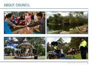
Overview - Parramatta City Council - NSW Government
Overview - Parramatta City Council - NSW Government
Overview - Parramatta City Council - NSW Government

You also want an ePaper? Increase the reach of your titles
YUMPU automatically turns print PDFs into web optimized ePapers that Google loves.
<strong>City</strong> Development Program<br />
Purpose<br />
Economic Development Sub-program<br />
Land Use, Public Spaces Sub-program<br />
The <strong>City</strong> Development Program leads economic development of <strong>Parramatta</strong> as the second CBD of Sydney, managing and developing planning controls for<br />
the <strong>City</strong> and neighbourhoods, and providing education and awareness of the quality of streetscapes.<br />
pp55-63<br />
Achievements<br />
signed a development partner (Grocon Pty Ltd) for the $1.4<br />
billion Civic Place Redevelopment<br />
replaced <strong>Parramatta</strong> Economic Development Board with<br />
Reference Panel<br />
developed Retail Development Plan to maximise CBD<br />
retail opportunities<br />
planned and designed re-opening of key section of Church<br />
Street Mall<br />
reviewed Outdoor Dining and Other Public Domain Activities<br />
and Sister Cities Policy/Program<br />
Purpose<br />
welcomed increased visitor numbers to <strong>Parramatta</strong><br />
completed Economic Strategy<br />
planned free shuttle bus, and park and ride facilities<br />
developed Stage 2 of <strong>Parramatta</strong>’s Residential Development<br />
Strategy (RDS)<br />
created new urban design team with a focus on RDS,<br />
masterplanning and urban design frameworks<br />
adopted Local Floodplain Risk Management Policy for LGA.<br />
Roads, Paths, Access and Flood Mitigation Program<br />
Challenges<br />
The Roads, Paths, Access and Flood Mitigation Program leads the management and provision of transport and flooding infrastructure<br />
for the people of <strong>Parramatta</strong>.<br />
planned works at the Iron Street shops (Lakeside<br />
Shopping Village, North <strong>Parramatta</strong>) were delayed<br />
to 2006/07 after it was discovered that a portion of<br />
the footpath was in private ownership<br />
preparing the Residential Development Strategy in<br />
the context of State <strong>Government</strong>’s Metropolitan<br />
Strategy and community expectations<br />
preparing and implementing a transport plan for<br />
CBD that helps unlock the economic and social<br />
potential of the <strong>City</strong><br />
continually refreshing our marketing efforts to<br />
attract business to <strong>Parramatta</strong>.<br />
Outlook<br />
> prepare four year action plan for <strong>City</strong>’s economic development<br />
> assist relocating organisations<br />
> finalise Residential Development Strategy<br />
> review Section 94 Plan re developer contribution expenditure<br />
> consolidate Local Environment Plan and Regional<br />
Environment Plan<br />
> amend Development Control Plan<br />
> continue Better Neighbourhood Program focusing on<br />
Harris Park<br />
> progress Civic Place Redevelopment.<br />
Provision of Roads, Footpaths and Cycleways Sub-program<br />
Transport Support Services Sub-program, Stormwater Drainage Sub-program<br />
pp64-71<br />
Achievements, Challenges, Outlook at a Glance<br />
Achievements<br />
resurfaced 50 roads, implemented road safety measures and<br />
rehabilitated over 35 street pavements<br />
constructed Subiaco Creek Bridge (<strong>Parramatta</strong> Valley Cycleway)<br />
and completed Duck Creek Cycleway Granville stage<br />
started design work on northern pathway between Lennox<br />
Street bridge and Marsden Street weir<br />
upgraded multi-storey car parks and introduced parking<br />
meters to improve short stay parking<br />
implemented <strong>Parramatta</strong> <strong>City</strong> Centre Transport Plan<br />
surveyed commuters/workers re free shuttle bus service<br />
exhibited Draft Lower <strong>Parramatta</strong> River Flood Plain Plan and<br />
developed project briefs for Brickfield Creek and Duck River<br />
Flood management<br />
prepared flood studies of <strong>Parramatta</strong>’s 11 waterways for<br />
stormwater infrastructure maintenance and enhancement<br />
adopted Flood Policy 2006<br />
constructed Briens Road culverts at Wentworthville to<br />
alleviate local flooding<br />
increased safety capacity of McCoy Park embankments<br />
in Toongabbie<br />
acquired flood prone land with DAs pending for demolition.<br />
Challenges<br />
accommodating delays to flood risk management<br />
planning, pending resolution with Baulkham<br />
Hills <strong>Council</strong><br />
carrying over design relating to routine seepage<br />
assessment/monitoring of Lake <strong>Parramatta</strong> dam<br />
after delays to Department of Commerce’s<br />
document preparation<br />
delaying installation of traffic calming measures in<br />
Epping pending public consultation<br />
improve resident satisfaction ratings for the<br />
conditions of our roads and footpaths.<br />
Outlook<br />
> fund neighbourhood pedestrian improvements across wards<br />
> fund Bike Plan and <strong>Parramatta</strong> Valley Cycleway<br />
> introduce free shuttle bus and park and ride services<br />
> implement Epping TMAP traffic calming measures<br />
> model traffic flows in CBD via Transport Plan<br />
> fund bus shelters in Woodville Ward and Region 13<br />
> introduce Stormwater Management Charge to fund<br />
stormwater infrastructure.<br />
35<br />
<strong>Parramatta</strong> <strong>City</strong> <strong>Council</strong> 2005/06 Annual Report