16 - 20 MAI MAY 16 - 20 - Canadian Archaeological Association
16 - 20 MAI MAY 16 - 20 - Canadian Archaeological Association
16 - 20 MAI MAY 16 - 20 - Canadian Archaeological Association

You also want an ePaper? Increase the reach of your titles
YUMPU automatically turns print PDFs into web optimized ePapers that Google loves.
<strong>20</strong>12<br />
<strong>16</strong> - <strong>20</strong> <strong>MAI</strong> MONTRÉAL <strong>MAY</strong> <strong>16</strong> - <strong>20</strong><br />
XXXI e Réunion annuelle de l’<strong>Association</strong><br />
des archéologues du Québec<br />
45 e Réunion annuelle • 45 th Annual Meeting<br />
de l’<strong>Association</strong> canadienne d’archéologie<br />
of the <strong>Canadian</strong> <strong>Archaeological</strong> <strong>Association</strong><br />
50 ans<br />
Département d’Anthropologie
Conseil d’administration de l’AAQ<br />
Président : Marc Côté<br />
Vice-présidente-Affaires courantes : Geneviève Treyvaud<br />
Vice-président-Éthique et Standards : Érik Phaneuf<br />
Secrétaire : Josée Villeneuve<br />
Trésorier : Vincent Lambert<br />
Administrateur : André Miller<br />
Administratrice : Andréanne Couture<br />
Conseil d’administration de l’ACA • CAA Executive<br />
Président • President: Eldon Yellowhorn<br />
Président élu • President Elect: William Ross<br />
Vice-Président • Vice-President: Alicia Hawkins<br />
Secrétaire-Trésorier • Secretary-Treasurer: Jeff Hunston<br />
Comité organisateur • Organizing Committee:<br />
Adrian L. Burke, Claude Chapdelaine, Brad Loewen, Josée Villeneuve<br />
Coordonateurs de la conférence et du programme • Conference and programme coordinators:<br />
Adrian L. Burke, Claude Chapdelaine, Brad Loewen<br />
Comité des étudiants bénévoles • Volunteers Student committee:<br />
Justine Bourguignon-Tétreault, Mariane-Marilou Leclerc, Delphine Leouffre,<br />
Aimie Néron, Stéphanie Trottier, Mathieu Mercier Gingras et Alex Lefrançois Leduc<br />
Responsable de la salle des publications • Book and Poster displays:<br />
Justine Bourguignon-Tétreault, Mélanie Jonhson-Gervais<br />
Mise en page du programme • Program layout:<br />
Stéphanie Trottier<br />
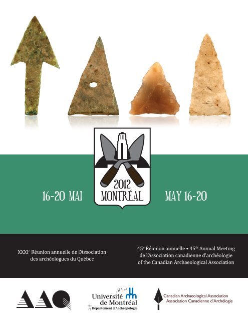
Couverture<br />
Pointes en cuivre, en silex européen et en chert provenant<br />
des fouilles de l’Université de Montréal au site de Pointe-à-<br />
Callière, Montréal. Toutes les pointes proviennent du même<br />
contexte daté entre <strong>16</strong>83 et <strong>16</strong>88.<br />
Cover<br />
Projectile points in copper, European flint and chert, found at<br />
Pointe-à-Callière, Montréal, during excavations by the Université<br />
de Montréal. All the points were found in the same context,<br />
dating to <strong>16</strong>83-<strong>16</strong>88.
BIENVENUE<br />
• WELCOME<br />
Boujou!<br />
Welcome to Montréal. Welcome to the <strong>20</strong>12 annual meeting<br />
of the <strong>Canadian</strong> <strong>Archaeological</strong> <strong>Association</strong>.<br />
Delegates to the conference can choose from a number of<br />
exciting sessions that bring together advocates, students,<br />
and researchers to inform each other of their latest results.<br />
The organizers have done a wonderful job of ensuring<br />
that all branches of archaeology are represented.<br />
So whether your interests guide you to underwater, historic<br />
or area-specific archaeology, the programme has a<br />
session for you. There is a poster session where authors<br />
can meet their audience on a personal level and discuss<br />
their research areas. There are receptions and a banquet<br />
where delegates can mingle and visit with old acquaintances<br />
or make new friends.<br />
While the conference is on, please take some time to enjoy<br />
the many cultural amenities that Montréal has to offer.<br />
For example, the McCord Museum and Musée des Beaux-<br />
Arts are nearby the conference venue and there are also<br />
many public spaces that are easily accessible bus or metro,<br />
such as Jean Talon Market or Mount Royal. Enjoy the<br />
town between sessions by walking down St. Catherine<br />
Street or bring your crowd to Schwartz’s deli. There is a<br />
lot to do in this town.<br />
We hope you enjoy the sessions you attend and find them<br />
informative and thought provoking. The conference is<br />
our best opportunity to meet like-minded people and<br />
share new knowledge about archaeology. Of course, enjoy<br />
your time in Montréal.<br />
Sincerely,<br />
Eldon Yellowhorn<br />
Cher Collègues<br />
Il me fait plaisir en mon nom, celui du Conseil d’administration<br />
et de tous les membres de l’<strong>Association</strong> des archéologues<br />
professionnels du Québec (AAQ) de vous<br />
saluer tous et de vous accueillir à ce colloque annuel conjoint<br />
de l’<strong>Association</strong> canadienne d’archéologie (ACA) et<br />
de notre association québécoise. Je profite de l’occasion<br />
pour féliciter le comité organisateur de l’événement qui a<br />
su préparer un contenu stimulant reflétant la très grande<br />
diversité de nos champs de recherche respectifs. Ce colloque<br />
est un lieu d’échange et de partage de nos connaissances,<br />
souhaitons qu’il soit aussi le lieu de départ de collaborations<br />
fructueuses permettant de faire avancer la<br />
science archéologique.<br />
Marc Côté, archéologue<br />
Président<br />
Bonjour!<br />
Bienvenue à Montréal. Bienvenue au colloque annuel<br />
<strong>20</strong>12 de l’<strong>Association</strong> canadienne d’archéologie.<br />
Les conférenciers peuvent choisir parmi une panoplie de<br />
sessions qui regroupent les amateurs, étudiants et chercheurs<br />
afin de partager leurs dernières découvertes. Les<br />
organisateurs ont fait un excellent travail pour que tous<br />
les aspects de l’archéologie soient représentés. Donc, peu<br />
importe si vos intérêts sont pour l’archéologie subaquatique,<br />
l’archéologie historique, ou une région en particulier,<br />
le programme contient une session pour vous. La session<br />
des affiches permet aux auteurs de rencontrer leur<br />
auditoire en personne et de discuter face-à-face à propos<br />
des résultats présentés. Il y a des réceptions et un banquet<br />
où les participants pourront rencontrer de vieux amis et<br />
faire des nouvelles connaissances.<br />
Lors de votre séjour, n’oubliez pas de profiter des nombreuses<br />
attractions culturelles de Montréal, par exemple<br />
le Musée McCord et le Musée des Beaux-Arts qui se trouvent<br />
près de l’hôtel. Il y a aussi des parcs et marchés qui<br />
sont faciles à rejoindre par métro ou autobus comme le<br />
Marché Jean-Talon et le parc Mont-Royal. Profitez de la<br />
ville en faisant une balade sur la rue Sainte-Catherine ou<br />
amenez un groupe d’amis chez Schwartz. Il y a beaucoup<br />
de choses à faire dans cette ville.<br />
Nous espérons que vous allez aimer les sessions auxquelles<br />
vous assisterez et que vous les trouverez intéressantes<br />
et informatives. Le colloque annuel est le moment<br />
idéal pour rencontrer des collègues et partager de nouvelles<br />
connaissances sur l’archéologie. Surtout, amusezvous<br />
à Montréal.<br />
Sincèrement,<br />
Eldon Yellowhorn<br />
Dear Colleagues<br />
I want to particularly greet our <strong>Canadian</strong> colleagues and<br />
I invite them to discover the extend and richness of our<br />
archaeological heritage. I hope they take advantage as<br />
much as possible of the attractions of Montreal and the<br />
warm welcome of the archaeologists of Quebec.<br />
Marc Côté, archéologue<br />
Président<br />
1
50 ans ça se fête • Let’s celebrate 50 years<br />
Le comité organisateur tient à mentionner que l’organisation de ce colloque conjoint, ACA et AAQ, a été motivé dès<br />
l’automne <strong>20</strong>10 par la volonté de ses membres de célébrer les 50 ans du Département d’anthropologie de l’Université<br />
de Montréal tout en soulignant le dynamisme de l’archéologie au cours de ces cinq décennies. Cet événement n’aurait<br />
pas pu se dérouler sans la contribution exemplaire des étudiants bénévoles ainsi que la participation financière des<br />
organismes suivants : Pointe-à-Callière, Musée d’archéologie et d‘histoire de Montréal, le ministère de la culture, des<br />
communications et de la condition féminine du Québec, l’institut culturel Avataq, Archéotec Inc., Arkeos, Ethnoscop,<br />
Patrimoine-Experts, et l’Université de Montréal.<br />
The organizing committee wishes to mention that this joint meeting of the CAA and the AAQ was proposed in the Fall<br />
of <strong>20</strong>10 to celebrate the 50 year anniversary of the Department of Anthropology at the Université de Montréal and to<br />
reflect on the dynamism of archaeology over the last five decades. This event would not have been possible without the<br />
exemplary contribution of the student volunteers, as well as the financial participation of the following institutions:<br />
Pointe-à-Callière, Musée d’archéologie et d‘histoire de Montréal, le Ministère de la culture, des communications et de<br />
la condition féminine du Québec, l’Institut culturel Avataq, Archéotec Inc., Arkeos, Ethnoscop, Patrimoine-Experts, and<br />
the Université de Montréal.<br />
Cocktail à Pointe-à-Callière, musée<br />
d’archéologie et d’histoire de Montréal<br />
18 mai de 17h30 à 19h30 (Bar payant)<br />
Le vendredi 18 mai, l’équipe de Pointe-à-Callière vous convie au Musée pour souligner son <strong>20</strong> e anniversaire et célébrer<br />
les 10 ans de l’École de fouilles réalisée en partenariat avec l’Université de Montréal, la ville de Montréal et le<br />
ministère de la Culture, des Communications et de la Condition féminine du Québec.<br />
Pour l’occasion, l’exposition permanente Ici naquit Montréal sera accessible.<br />
Pointe-à-Callière offre une véritable plongée dans le passé, le présent et le futur. Dans le passé parce que le Musée est<br />
édifié sur le lieu de fondation de Montréal et qu’il révèle d’authentiques vestiges au fil d’un surprenant parcours souterrain.<br />
Dans le présent, parce qu’il propose des expositions temporaires d’envergure, des programmes éducatifs animés,<br />
des événements urbains différents qui font vibrer, chaque année, des centaines de milliers de visiteurs. Dans le futur,<br />
parce que nous aimons, au Musée, rêver sans cesse de nouvelles façons de partager avec nos publics ce qui a fait notre<br />
ville. Spectacle multimédia à vivre depuis une galerie suspendue au-dessus de vestiges. Muséographies misant sur des<br />
technologies nouvelles et conviviales. Mais une chose est certaine : quelque soit l’âge de nos visiteurs, il ne s’ennuie pas<br />
à Pointe-à-Callière.<br />
Coordonnées :<br />
Pointe-à-Callière, musée d’archéologie et d’histoire de Montréal<br />
350, place Royale, Vieux-Montréal<br />
www.pacmusee.qc.ca<br />
Conference attendees will find a free pass to the PàC museum of archaeology in their packets. You can use this ticket<br />
to visit the museum and current exhibit at any time.<br />
Les participants à la conférence trouveront un billet pour le musée d’archéologie PàC dans leur trousse. Vous pourrez<br />
utiliser ce billet pour visiter le musée et l’exposition courante en tout temps.<br />
2
SOM<strong>MAI</strong>RE<br />
• CONTENTS<br />
INSCRIPTION 4<br />
BOURSES DE VOYAGE DE L’ACA 4<br />
RÉUNIONS D’AFFAIRES 4<br />
AUTRES RÉUNIONS 4<br />
SALLE DES PUBLICATIONS 4<br />
ÉVÉNEMENTS SOCIAUX 5<br />
BANQUET 5<br />
VISITES GUIDÉES 5<br />
ORGANISATION DES SALLES DE<br />
CONFÉRENCE DANS L’HÔTEL<br />
COUP D’OEIL SUR LE PROGRAMME 8<br />
PROGRAMME 9<br />
RÉSUMÉS 25<br />
7<br />
REGISTRATION<br />
TRAVEL FUNDING FROM THE CAA<br />
BUSINESS MEETING<br />
OTHER MEETINGS<br />
POSTER AND BOOK DISPLAYS<br />
SOCIAL EVENTS<br />
BANQUET<br />
TOURS<br />
HOTEL CONFERENCE ROOM LAYOUT<br />
PROGRAM AT A GLANCE<br />
PROGRAM<br />
ABSTRACTS<br />
3
RENSEIGNEMENTS<br />
GÉNÉRAUX<br />
• CONFERENCE<br />
INFORMATION<br />
INSCRIPTION<br />
Les inscriptions commenceront le mercredi soir <strong>16</strong> mai<br />
dans le lobby de l’hôtel entre 17h et <strong>20</strong>h. Les jeudi 17 et<br />
vendredi 18 mai, les inscriptions se feront de 8h à 15h<br />
dans le foyer du 4 e étage près des ascenseurs et de 8h à<br />
12h le samedi 19 mai.<br />
BOURSES DE VOYAGE DE L’ACA<br />
Il y a des bourses de voyage disponibles pour les étudiants<br />
qui participent au colloque. SVP contacter Jeff<br />
Hunston ou le comité étudiant de l’ACA.<br />
Jeff.Hunston@gov.yk.ca - caa.students@gmail.com<br />
PRIX POUR LA MEILLEURE AFFICHE<br />
ÉTUDIANTE<br />
Il y aura un prix populaire pour la meilleure affiche<br />
étudiante. L’étudiant doit être le premier auteur sur<br />
l’affiche. Pour voter, prenez votre bulletin dans la salle<br />
Sherbrooke #2 lors de l’atelier des affiches.<br />
RÉUNIONS D’AFFAIRES<br />
La réunion du conseil d’administration de l’<strong>Association</strong><br />
canadienne d’archéologie se tiendra dans la salle<br />
Rimouski/Chicoutimi au 4 ième étage le samedi 19 mai à<br />
compter de 15:30.<br />
AUTRES RÉUNIONS<br />
Réunion de l’exécutif de l’ACA, salle Gouverneur 1, mercredi<br />
<strong>16</strong> mai, 9h à 17h.<br />
CAPTA - La réunion se tient le mercredi <strong>16</strong> mai. Contact :<br />
Pierre Desrosiers, archéologue<br />
Direction du Patrimoine et de la Muséologie<br />
Ministère de la Culture, des Communications et de la<br />
Condition féminine<br />
Pierre.Desrosiers@mcccf.gouv.qc.ca<br />
SALLE DES PUBLICATIONS et les AFFICHES<br />
La salle Longueuil au 6 ième étage est disponible du jeudi<br />
17 mai au samedi 19 mai entre 8:00 et 17:00 pour exposer<br />
les publications.<br />
La session des affiches se tiendra le samedi après-midi<br />
dans la salle Sherbrooke #2. Le montage est prévu à partir<br />
de 12:30 et la session débute à 13:<strong>20</strong> jusqu’à 17:00.<br />
ÉVÉNEMENTS SOCIAUX<br />
REGISTRATION<br />
Registration will start on the evening of Wednesday<br />
May <strong>16</strong>th in the hotel lobby from 17:00 to <strong>20</strong>:00.<br />
Thursday, May 17th and Friday May 18th, registration<br />
is from 8:00 to 17:00 in the foyer on the 4 th floor in<br />
front of the elevator and from 8:00 to 12:00 on Saturday<br />
morning May 19 th .<br />
TRAVEL FUNDING FROM THE CAA<br />
There are travel grants for students available from the<br />
CAA. Please contact Jeff Hunston or the CAA student<br />
committee.<br />
Jeff.Hunston@gov.yk.ca - caa.students@gmail.com<br />
STUDENT POSTER AWARD<br />
There will be a prize for the best student poster. To vote,<br />
get your ballot in Sherbrooke #2 room during the poster<br />
session.<br />
BUSINESS MEETING<br />
The CAA Business Meeting will be held in the Rimouski/Chicoutimi<br />
room on the 4 th floor Saturday afternoon<br />
May 19 starting at 15:30.<br />
OTHER MEETINGS<br />
CAA Executive meeting, Gouverneur 1 room, Wednesday<br />
May <strong>16</strong>, 9h-17h.<br />
CAPTA - Meeting will be held Wednesday May <strong>16</strong>.<br />
Contact:<br />
Pierre Desrosiers, archéologue<br />
Direction du Patrimoine et de la Muséologie<br />
Ministère de la Culture, des Communications et de la<br />
Condition féminine<br />
Pierre.Desrosiers@mcccf.gouv.qc.ca<br />
POSTER AND BOOK DISPLAYS<br />
Book display in Longueuil Room on the 6 th floor will be<br />
available from Thursday May 17 to Saturday May 19. It<br />
will be open from 8:00 to 17:00.<br />
The poster session is in Sherbrooke #2 room on Saturday<br />
afternoon. Setup starts at 12:30 and the session<br />
runs from 13:<strong>20</strong> to 17:00.<br />
SOCIAL EVENTS<br />
(3 events: cocktail on wednesday night; PAC on friday<br />
4
(3 événements : cocktail du mercredi soir; PAC le vendredi<br />
soir ; cocktail et lancement samedi pm)<br />
Mercredi soir : Cocktail de bienvenue dans le foyer du<br />
6 e étage en face de la salle Sherbrooke (bar payant) à<br />
partir de 18:00 (un coupon pour une consommation<br />
gratuite peut être utilisé lors de ce cocktail ou à celui du<br />
samedi après-midi)<br />
Vendredi soir : Invitation gratuite pour visiter l’exposition<br />
permanente de Pointe-à-Callière, musée d’archéologie<br />
et d’histoire de Montréal<br />
Lieu : 350, place Royale, Vieux-Montréal,<br />
www.pacmusee.qc.ca<br />
Heure : 17:30<br />
Bar payant<br />
Trajet à pied à partir de l’hôtel est de 2 km ou 25 minutes<br />
Samedi après-midi : bar payant de 14:00 à 17:00 dans<br />
le foyer du 6 e étage en face de la salle Sherbrooke puis de<br />
17:00 à 19:00 dans le foyer du 4 e étage en face de la salle<br />
Québec (le coupon pour une consommation gratuite peut<br />
être utilisé lors de ce cocktail du samedi après-midi).<br />
Le lancement de «Archéologiques #25» de l’AAQ se<br />
tiendra dans le foyer au 6 ième étage en face de la salle<br />
Sherbrooke #2 à <strong>16</strong> :30, suivi de l’annonce du gagnant<br />
ou de la gagnante de la meilleure affiche.<br />
BANQUET (Samedi soir)<br />
Le conférencier invité pour le banquet est Robert Grenier,<br />
O.C., ex-président du Comité scientifique international<br />
ICUCH à l’UNESCO/ICOMOS, ex-chef du Service<br />
d’archéologie subaquatique de Parcs Canada, qui nous<br />
présente «40 ans sous la mer : le développement de<br />
l’archéologie subaquatique au Canada».<br />
VISITES GUIDÉES<br />
Il y a trois excursions de planifiées pour le dimanche,<br />
<strong>20</strong> mai. Elles sont gratuites. Prière de s’inscrire lors de<br />
votre inscription. Premier arrivé, premier servi.<br />
1. Randonnée pédestre et visite de l’archéologie<br />
(préhistorique et historique) et de la géologie du<br />
parc du mont-Royal, Montréal (Theresa Gabos,<br />
Valérie Janssen, Adrian Burke)<br />
Le point de rencontre sera le hall du Musée McCord à<br />
9H30.<br />
690 rue Sherbrooke Ouest<br />
Durée : 2 à 3 heures, à pied, SVP porter des chaussures<br />
confortables<br />
Les points forts seront :<br />
1. Collection du site Dawson au Musée McCord<br />
2. Sépulture de Simon McTavish<br />
3. Réservoir d’eau du Haut-Niveau<br />
4. Carrière préhistorique<br />
Le mont Royal, la montagne au cœur de Montréal, fut un<br />
point de repère culturel important pour les habitants de<br />
cette ile depuis la préhistoire. Au fil des années, le mont<br />
Royal fut l’emplacement de sépultures préhistoriques,<br />
de cimetières, de terres agricoles ainsi qu’une banlieue<br />
night; cocktail and launch saturday pm)<br />
Wednesday night: Welcome cocktail in the foyer on<br />
the 6 th floor in front of Sherbrooke (cash bar) starting<br />
at 18:00 (one ticket for a free drink can be used on<br />
Wednesday night or Saturday Afternoon)<br />
Friday night: Free invitation to visit the permanent<br />
exhibit at Pointe-à-Callière, musée d’archéologie et<br />
d’histoire de Montréal<br />
Place: 350, place Royale, Vieux-Montréal,<br />
www.pacmusee.qc.ca<br />
Time: 17:30<br />
Cash Bar<br />
Walking distance from the Hotel is 2 km or 25 minutes<br />
walk.<br />
Saturday afternoon: cash bar from 14:00 to 17:00 in<br />
the foyer on the 6th floor in front of Sherbrooke and<br />
from 17:00 à 19:00 in the foyer of the 4 th floor in front<br />
of Québec (ticket for a free drink can be used for the<br />
Saturday Afternoon cocktail).<br />
The launch of the AAQ’s publication Archéologiques<br />
#25 will be held in the foyer on the 6 th floor in front of<br />
the Sherbrooke #2 room at <strong>16</strong>:30, the announcement of<br />
the winner of the best poster will follow.<br />
BANQUET (Saturday night)<br />
The speaker for the banquet will be Robert Grenier,<br />
O.C., ex-president International Scientific Committee on<br />
Underwater Cultural Heritage, ICUCH, UNESCO/ICO-<br />
MOS. Former Chief of Underwater Archaeology Service<br />
at Parks Canada, who will be presenting: “40 years under<br />
the sea: Development of underwater archaeology in<br />
Canada”<br />
TOURS<br />
There will be three field trips on Sunday, May <strong>20</strong>. They<br />
are all free. Please register on site at the registration<br />
desk. First come, first served.<br />
1. Walking tour of the archaeology (prehistoric<br />
and historic) and geology of the Mount Royal park,<br />
Montreal (Theresa Gabos, Valérie Janssen, Adrian<br />
Burke)<br />
The meeting point will be the lobby of the McCord Museum<br />
at 9:30 am.<br />
690 Sherbrooke Street West<br />
Length: 2 to 3 hours on foot, wear comfortable shoes!<br />
The highlights are:<br />
1. Dawson site collection at the McCord Museum<br />
2. Burial site of Simon McTavish<br />
3. High-level water reservoir<br />
4. Prehistoric stone quarry<br />
Mount Royal, the mountain at the heart of Montreal, has<br />
been an important cultural landmark for the inhabitants<br />
of this island since prehistory. Over time, Mount Royal<br />
has been the site of both prehistoric and modern burial<br />
grounds, cultivated farmland, as well as a prestigious<br />
neighbourhood inhabited by Montreal’s social elite.<br />
5
fortunée habitée par l’élite de Montréal. Avec la création<br />
du Parc du Mont-Royal en 1876, le mont Royal est devenu<br />
l’un des espaces verts les plus importants de l’ile de<br />
Montréal. En <strong>20</strong>05, l’importance historique de la montagne<br />
fut reconnue par le Ministère de la Culture, des<br />
Communications et de la Condition féminine quand elle<br />
a été déclarée arrondissement historique et naturel.<br />
2. Visite à l’école de fouille de l’Université de Montréal<br />
au site de Pointe-à-Callière dans le Vieux Montréal<br />
(Brad Loewen).<br />
Le point de rencontre sera au site même, au 214, place<br />
d’Youville.<br />
Les visites auront lieu entre 13H et 15H.<br />
Description : L’Université de Montréal tient son école<br />
de fouilles en archéologie historique urbaine en mai,<br />
et le site sera ouvert aux conférenciers le dimanche,<br />
<strong>20</strong> mai, de 13h à 15h. Ce site urbain complexe, avec ses<br />
2,5 mètres de sols stratifiés, couvre 400 ans d’histoire<br />
montréalaise. Le site est dans un entrepôt en brique à<br />
deux étages, avec deux portes de garage, deux édifices<br />
à l’ouest du Musée Pointe-à-Callière dans le Vieux-Montréal.<br />
3. Randonnée pédestre le long du Canal Lachine et<br />
introduction à l’archéologie industrielle, Montréal<br />
(Parcs Canada).<br />
Le point de rencontre sera le hall du Musée Pointe-à-<br />
Callière à 9H30.<br />
Les points forts seront :<br />
1. Vieux-Port (canal, silos, bassins etc.)<br />
2. Bassins Peel<br />
3. Bassins St-Gabriel<br />
4. Pointe des Seigneurs<br />
5. Stelco/Dominion Wadding/Brewster<br />
6. <strong>Canadian</strong> Bag /Swing Paint<br />
7. Belding Corticelli/Canal des Sulpiciens<br />
8. Redpath<br />
9. Ancien Pont CN<br />
10. Rue Mill (ateliers, déversoir 2, canaux hydrauliques)<br />
Le canal de Lachine, inauguré en 1825, a permis d’ouvrir<br />
à la navigation la voie tumultueuse du Haut Saint-Laurent<br />
et a joué un rôle majeur dans le développement de l’Ouest<br />
du pays. De plus, sa position stratégique entre les portions<br />
est et ouest du Saint-Laurent a amené, sur ses rives, la<br />
concentration industrielle la plus diversifiée du pays. Son<br />
importance historique nationale en tant que voie navigable<br />
a été reconnue par la Commission des lieux et<br />
monuments historique du Canada (CLMHC) dès 1929,<br />
réitéré en 1987 pour l’inclure dans le réseau national<br />
des canaux du Canada. Le corridor formé par le canal de<br />
Lachine et ses abords a été reconnu Lieu historique national<br />
du Canada en 1996 comme témoin important de<br />
l’industrie manufacturière canadienne. Le canal de Lachine<br />
a été ouvert à la circulation maritime pendant près<br />
de 150 ans (1825-1970). Fermé à la navigation commerciale<br />
en 1970, il est réouvert à la navigation de plaisance<br />
en <strong>20</strong>02 sous la responsabilité de Parcs Canada qui en<br />
gère la navigation et l’interprétation historique.<br />
With the creation of Mount Royal Park in 1876, Mount<br />
Royal became one of the most prominent green-space<br />
on the Island of Montreal and in <strong>20</strong>05, the mountain’s<br />
significance was recognized by the Ministry of Culture<br />
when it was declared a historic and natural district.<br />
2. Visit of the Université de Montréal field school<br />
site of Pointe à Callière in Old Montreal (Brad Loewen).<br />
The meeting point will be at the site, at 214, Place<br />
d’Youville.<br />
The visits will be between 13:00 pm and 15:00 pm.<br />
The highlights are: The Université de Montréal field<br />
school in urban historical archaeology takes place in<br />
May, and the site will be open to visitors from the conference<br />
on Sunday, May <strong>20</strong>th, from 1 to 3 PM. This is<br />
a complex urban site, with 2.5 metres of stratified<br />
soils covering 400 years of Montréal’s history. Place<br />
d’Youville. The site is in a two-storey brick warehouse<br />
with two large garage doors, two buildings west of the<br />
Pointe-à-Callière Museum in Old Montréal.<br />
3. Walking tour of the Lachine Canal industrial archaeology<br />
zone, Montreal (Parks Canada).<br />
The meeting point will be the lobby at 9:30 am, Musée<br />
Pointe-à-Callière.<br />
The highlights are:<br />
1. Old Port (canal, silos, basins, etc..)<br />
2. Peel Basin<br />
3. St. Gabriel Basins<br />
4. Pointe des Seigneurs<br />
5. Stelco / Dominion Wadding / Brewster<br />
6. <strong>Canadian</strong> Bag / Swing Paint<br />
7. Belding Corticelli / Sulpicians’ Canal<br />
8. Redpath<br />
9. Old Bridge CN<br />
10. Mill Street (workshops, Weir 2, water channels)<br />
The Lachine Canal, opened in 1825, opened the tumultuous<br />
Upper St. Lawrence to navigation and played<br />
a major role in the development of the West. Its strategic<br />
position on the St. Lawrence made the canal the<br />
most significant industrial concentration in the country.<br />
Its national historic significance as a waterway has<br />
been recognized by the Historic Sites and Monuments<br />
Historical <strong>Association</strong> (HSMBC) in 1929, renewed in<br />
1987 for inclusion in the national network of canals<br />
of Canada. The corridor formed by the Lachine Canal<br />
and its approaches was recognized National Historic<br />
Site of Canada in 1996 as a material legacy in the <strong>Canadian</strong><br />
manufacturing industry. The Lachine Canal was<br />
opened to marine traffic for nearly 150 years (1825-<br />
1970). Closed to commercial traffic in 1970, the canal<br />
reopened to recreational boating in <strong>20</strong>02 under the<br />
responsibility of Parks Canada, which manages navigation<br />
and historical interpretation.<br />
6
ORGANISATION DES SALLES •<br />
MEETING ROOM LAYOUT<br />
4 e étage<br />
4 th floor<br />
Gouverneur Place Dupuis<br />
E<br />
E<br />
CHICOUTIMI<br />
RIMOUSKI<br />
E<br />
E<br />
E<br />
E<br />
STE-FOY<br />
(LA CAPITALE 1)<br />
EXIT<br />
QUÉBEC<br />
(LA CAPITALE 2)<br />
6 e étage<br />
6 th floor<br />
LONGUEUIL<br />
SORTIE<br />
FOYER<br />
TROIS-<br />
RIVIÈRES<br />
LAVAL<br />
FOYER<br />
PISCINE/<br />
POOL<br />
SORTIE<br />
SHERBROOKE 1 SHERBROOKE 2<br />
SORTIE<br />
7
COUP D’OEIL SUR LE PROGRAMME •<br />
PROGRAM AT A GLANCE<br />
AM<br />
Jeudi 17 mai • Thursday May 17, <strong>20</strong>12<br />
RIMOUSKI CHICOUTIMI STE-FOY QUÉBEC SHERBROOKE 1 SHERBROOK 2<br />
Pérou/Peru Quarries Theory Ontario Iroquoians Pointe-à-Callière Artic<br />
1<br />
2<br />
3<br />
4<br />
6<br />
7<br />
St. Law. Iro.<br />
5<br />
PM<br />
Gender Maritime Theory St.Law. Iro. Hunters Artic<br />
8<br />
9<br />
3<br />
5<br />
10<br />
7<br />
Brit. Colu.<br />
11<br />
AM<br />
Vendredi 18 mai • Friday May 18, <strong>20</strong>12<br />
RIMOUSKI CHICOUTIMI STE-FOY QUÉBEC SHERBROOKE 1 SHERBROOK 2<br />
Historique Fisheries Western General Lakehead PSS Horizon<br />
12<br />
14<br />
15<br />
17<br />
19<br />
<strong>20</strong><br />
Dendro Managing Boreal<br />
13<br />
<strong>16</strong><br />
18<br />
PM<br />
AM<br />
PM<br />
Dendro Archaeometry Managing Boreal Rock Art Ramsden<br />
13<br />
21<br />
<strong>16</strong><br />
18<br />
22<br />
23<br />
Samedi 19 mai • Saturday May 19, <strong>20</strong>12<br />
RIMOUSKI CHICOUTIMI STE-FOY QUÉBEC SHERBROOKE 1 SHERBROOK 2<br />
Bio Arch. Techniques Modelling Montréal Field School Trois-Rivières<br />
24<br />
25<br />
26<br />
27<br />
28<br />
29<br />
CAA • ACA Business Meeting General Montréal Posters •<br />
30<br />
27<br />
Affiches<br />
Banquet<br />
Conf./Guest : Robert Grenier<br />
AAQ :<br />
lancement<br />
8
PROGRAMME • PROGRAM<br />
Jeudi 17 mai, avant-midi • Thursday May 17, morning<br />
L’archéologie péruvienne : nouvelles approches théoriques et technologiques<br />
Fanny Guyon (Organisatrice / Animatrice)<br />
9:00 – 9:<strong>20</strong> Jean-François Millaire et Edward Eastaugh (The University of Western Ontario)<br />
Morphologie urbaine d’une cité ancienne du Pérou: une approche de télédétection intégrée<br />
9:<strong>20</strong> – 9:40 Alexis Mantha (Champlain College, Saint-Lambert)<br />
La vallée de Rapayán lors de périodes tardives de la préhistoire andine : Reconnaissance de terrain VS<br />
Google Earth<br />
9:40 – 10:00 Paul Szpak 1 , Jean-Francois Millaire 1 , Fred J. Longstaffe 2 , Christine D. White 1 (The University of<br />
Western Ontario)<br />
Llama Dung and Seabird Guano: Isotopic Perspectives on Andean Fertilizers from Field and Growth<br />
Chamber Studies<br />
10:00 – 10:<strong>20</strong> Pause café / Coffee break<br />
10:<strong>20</strong> – 10 :40 Marilyn Girard-Rheault (Université de Montréal)<br />
Les camélidés et l’archéologie péruvienne<br />
10:40 – 11:00 Jordan Downey and Jean-François Millaire (The University of Western Ontario)<br />
Satellite Imagery and the Development of the Virú State on the North Coast of Peru<br />
11:00 – 11:<strong>20</strong> Fanny Guyon (Université de Montréal)<br />
L’analyse de l’agencement spatiale des sites architecturés de la culture Recuay<br />
SALLE • ROOM<br />
1 RIMOUSKI<br />
11:<strong>20</strong> – 11:40 Nicole C. Couture, Maria C. Bruno and Deborah E. Blom (The University of McGill)<br />
Truth and reconciliation at Tiwanaku: coming to terms with contradiction in interdisciplinary archaeological<br />
research<br />
11:40 – 12:00 Fernando Astudillo (University of Calgary), Daniela Balanzátegui and Barbara Winter (Simon Fraser<br />
University)<br />
Collectors, Forgers, and Looters: The History behind Andean Ancient Art<br />
2<br />
Pre-Contact Quarries: Permanent Places, Eternal Resources?<br />
Session sponsored by the CAA Quarry special interest group<br />
Organizers: Laura Roskowski and Adrian L. Burke ; Session chair: Laura Roskowski<br />
CHICOUTIMI<br />
9:00 – 9:<strong>20</strong> Nathanial Kitchel (University of Wyoming)<br />
The Newest of Worlds: Quarries as Proxy Measures of Landscape Learning in the Pleistocene Northeast<br />
9:<strong>20</strong> – 9:40 Meaghan Porter (M.A., Stantec Consulting Ltd.)<br />
Why on earth would you want to knap this? A preliminary assessment of site FbPi-8 and the use of Red Deer<br />
Mudstone<br />
9:40 – 10:00 Julie Martindale (University of Saskatchewan)<br />
Bogged down: Mobility and the Exploitation of the Quarry of the Ancestors<br />
10:00 – 10:<strong>20</strong> Pause café / Coffee break<br />
10:<strong>20</strong> – 10 :40 Laura Roskowski and Morgan Netzel (Stantec Consulting Ltd.)<br />
Finding the Needle in the Haystack: Using bone to understand pre-contact mobility within and around the<br />
Quarry of the Ancestors<br />
10:40 – 11:00 Glen MacKay (Prince of Wales Northern Heritage Centre), Adrian L. Burke (Université de Montréal)<br />
Gilles Gauthier (Université de Montréal), Charles Arnold (University of Calgary)<br />
Assessing the Long-Distance Procurement of Thunder River Chert by the Mackenzie Inuit Using Non-<br />
Destructive Polarized Energy Dispersive X-Ray Fluorescence<br />
11:00 – 11:<strong>20</strong> Laurie McClean (Burnside Heritage Foundation Inc.)<br />
Recent Research at the Bloody Bay Cove Summit (DeAl-09), Part of the Bloody Bay Cove Quarry<br />
11:<strong>20</strong> – 11:40 Kenneth R. Holyoke (University of New Brunswick) and M. Gabriel Hrynick (University of Connecticut)<br />
The Mill Brook Washademoak Lake Siteless Survey: Hunter-gatherers, Riverine Landscapes, and Fixed<br />
Resource Locales<br />
11:40 – 12:00 Christian C. L. Thériault (University of New Brunswick)<br />
The Potential Significance of Selected New Brunswick’s Ordovician Cherts into the Regional <strong>Archaeological</strong><br />
Record<br />
9
3<br />
<strong>Archaeological</strong> Theory: A <strong>Canadian</strong> Perspective<br />
Matthew Beaudoin and Scott Neilsen (Organizers / Chairs)<br />
STE-FOY<br />
9:00 – 9:<strong>20</strong> Kathryn Denning (York University)<br />
Archaeology in ‘The Land God Gave Cain’<br />
9:<strong>20</strong> – 9:40 Jennifer Campbell (Archaeology Centre, University of Toronto/Lakehead University)<br />
Identity, Subjectivity, and the <strong>Canadian</strong> Archaeologist Abroad<br />
9:40 – 10:00 Joshua Dent (The University of Western Ontario)<br />
Defining a <strong>Canadian</strong> Political Archaeology<br />
10:00 – 10:<strong>20</strong> Pause café / Coffee break<br />
10:<strong>20</strong> – 10:40 Gary Warrick (Wilfrid Laurier University)<br />
Ontario Archaeology and Bruce Trigger<br />
10:40 – 11:00 Jennifer Schumacher (McMaster University)<br />
Ontario Ceramic Analysis: Moving Forward Through Projects of the Past<br />
11:00 – 11:<strong>20</strong> Jeffrey Dillane (McMaster University)<br />
Out of Site: Applying Non-Site Approaches to the Pre-Contact Landscape of the Trent Valley, Southern Ontario<br />
11:<strong>20</strong> – 11:40 Jennifer Birch (University of Georgia)<br />
Between Villages and Cities: Settlement Aggregation and Community Transformation<br />
11:40 – 12:00 M. Gabriel Hrynick (University of Connecticut)<br />
Historiographical Considerations for <strong>Archaeological</strong> Reports by Nineteenth-Century Natural Historians:<br />
Considering George Frederic Matthew and Henry David Thoreau<br />
4<br />
Ontario Iroquoian Archaeology<br />
Claude Chapdelaine (Chair)<br />
QUÉBEC<br />
9:00 – 9:<strong>20</strong> Steven Dorland (University of Toronto)<br />
The Inside is What Counts: an analysis of regional identity associated with interior and exterior pottery<br />
decoration.<br />
9:<strong>20</strong> – 9:40 Peter Popkin and Thanos Webb<br />
Re-examining deer populations in ancient Huronia<br />
9:40 – 10:00 Gregory V. Braun (University of Toronto)<br />
Between Memory and Materiality: Biographies of Iroquoian Smoking Pipes<br />
10:00 – 10:<strong>20</strong> Pause café / Coffee break<br />
5<br />
Iroquoiens du Saint-Laurent / St. Lawrence Iroquoians<br />
Claude Chapdelaine (Organisateur / Animateur)<br />
10:<strong>20</strong> – 10:40 Timothy J. Abel (Jefferson Community College, SUNY Canton)<br />
St. Lawrence Iroquoians in Northern New York: Past, Present, and Directions for the Future<br />
10:40 – 11:00 Bruce Jamieson (Citizenship and Immigration Canada, Government of Canada)<br />
St. Lawrence Iroquoian Bone and Antler Tool Typology<br />
11:00 – 11:<strong>20</strong> Francis Scardera (Fort Drum Cultural Resources)<br />
Using Squier to Help Identify Remnants of St. Lawrence Iroquoian Earthworks in Jefferson County, New York<br />
11:<strong>20</strong> – 11:40 Michel Gagné (archéologue municipal, MRC du Haut-Saint-Laurent)<br />
Le site McDonald, une fenêtre ouverte sur les premiers Iroquoiens horticulteurs du Québec<br />
11:40 – 12:00 Claude Chapdelaine (Université de Montréal)<br />
De la maisonnée à l’espace villageois : deux saisons de fouilles au site Droulers<br />
6<br />
Dix années de fouilles à la pointe à Callière, Vieux-Montréal<br />
Brad Loewen et Sophie Limoges (Organisateurs / Animateurs)<br />
SHERBROOKE 1<br />
9:00 – 9:<strong>20</strong> Sophie Limoges (Musée Pointe-à-Callière)<br />
Présentation du projet mixte muséo-universitaire. Dix ans déjà!<br />
9:<strong>20</strong> – 9:40 Christian Bélanger (Université de Montréal)<br />
Le fort de Ville-Marie, <strong>16</strong>42-<strong>16</strong>83. Vers un premier plan archéologique de l’établissement historique<br />
9:40 – 10:00 Daniel Landry (Université de Montréal)<br />
Le paysage végétal de la pointe à Callière au XVI e -XVII e siècle<br />
10:00 – 10:<strong>20</strong> Pause café / Coffee break<br />
10
10:<strong>20</strong> – 10:40 Geneviève Treyvaud (Université Laval)<br />
Fer, cuivre et minerais : les activités métallurgiques du fort Ville-Marie, <strong>16</strong>42-<strong>16</strong>88<br />
10:40 – 11:00 Justine Bourguignon-Tétreault (Université de Montréal)<br />
Présence amérindienne et traite à Montréal (<strong>16</strong>75-<strong>16</strong>88). Objets et contextes<br />
11:00 – 11:<strong>20</strong> Brad Loewen (Université de Montréal)<br />
Dîner au travail. Consommation alimentaire en milieu industriel au XIX e siècle<br />
7<br />
<strong>Archaeological</strong> Perspectives on Arctic territory<br />
Pierre M. Desrosiers and Susan Lofthouse (Organizers / Chairs)<br />
SHERBROOKE 2<br />
9:00 – 9:<strong>20</strong> Desrosiers, Pierre (Avataq Cultural Institute)<br />
Lithic Raw Material and the Size of Palaeoeskimo Territory<br />
9:<strong>20</strong> – 9:40 Susan Lofthouse (Avataq Cultural Institute)<br />
Shifting Dorset subsistence strategies in northern Foxe Basin: Early to Late Dorset at Needle Point<br />
9:40 – 10:00 Hervé Monchot (Université Paris Sorbonne-Paris IV)<br />
Cinquante ans après Taylor, la faune du site dorsétien de Tayara (KbFk-7) : état des lieux<br />
10:00 – 10:<strong>20</strong> Pause café / Coffee break<br />
10:<strong>20</strong> – 10:40 Marie-Michelle Dionne (Université Laval, V.P. G.A.I.A. Inc., Group for <strong>Archaeological</strong> Interpretations<br />
and Analyses)<br />
Skin Working Process and Dorset Women across the Land: Functional and Socioeconomical study of lithic tools<br />
10:40 – 11:00 Claire Houmard (UMR 7055, Préhistoire et technologie)<br />
Foxe Basin and Hudson Strait: a territory shared by analogous cultural groups<br />
11:00 – 11:<strong>20</strong> Patty Wells (Memorial University of Newfoundland), Tim Rast (Elfshot), M.A.P Renouf<br />
(Memorial University of Newfoundland)<br />
Techniques of Osseous (Bone, Antler and Ivory) Tool Manufacture at the Dorset Site of Phillip’s Garden,<br />
Northwestern Newfoundland: Some Insights from Experimentation<br />
11:<strong>20</strong> – 11:40 David Craig and Peter Whitridge (Memorial University of Newfoundland)<br />
Not so big: Inuit dwellings and the “small house” movement<br />
11:40 – 12:00 June Zinck, Memorial University of Newfoundland<br />
Bringing Archaeology into the New Dimension: the benefits of using CAD programming to create virtual 3D<br />
reconstructions of <strong>Canadian</strong> archaeological sites<br />
Jeudi 17 mai, après-midi • Thursday May 17, afternoon<br />
8<br />
The Archaeology of Gender: The French Fishery at Newfoundland<br />
Peter Pope (Organizer / Chair)<br />
RIMOUSKI<br />
13:40 – 14:00 Peter E. Pope (Department of Archaeology, Memorial University)<br />
Fisher Men at Work: the Material Culture of the Champs Paya Fishing Room, as a Gendered Site<br />
14 :00 – 14 :<strong>20</strong> Mélissa Burns (Department of Archaeology, Memorial University)<br />
The Taskscape of an 18 th -century French Seasonal Fishing Station on Newfoundland’s Petit Nord<br />
14 :<strong>20</strong> – 14 :40 Stéphane Noël (Université Laval)<br />
Eating like a (Fisher) Man: Faunal Remains as Social Markers in a French Seasonal Cod Fishing Site on the<br />
Petit Nord of Newfoundland<br />
14 :40 – 15 :00 Hilary Hatcher (Department of Archaeology, Memorial University)<br />
Were Women There? A Look at Gender during the English Occupation of a French Fishing Station<br />
15 :00 – 15 :<strong>20</strong> Amanda Crompton (Memorial University)<br />
Tinker, Tailor, Soldier, Sailor: Gender and the French Resident Fishery in Placentia Bay, Newfoundland, <strong>16</strong>62-<br />
1713<br />
15 :<strong>20</strong> – 15 :40 Pause café / Coffee break<br />
11<br />
British Columbia Archaeology<br />
David Pokotylo (Chair)<br />
15 :40 – <strong>16</strong> :00 David Pokotylo (UBC, Vancouver), Nichloas Waber (University of British Columbia, Vancouver), Sandra<br />
Peacock (University of British Columbia, Okanagan) and Brian Kooyman (University of Calgary)<br />
Dating a Stratified Microblade Component at the White Rock Springs Site, Southern Interior British Columbia<br />
<strong>16</strong> :00 – <strong>16</strong> :<strong>20</strong> Gary Coupland (University of Toronto)<br />
Bead Burials and Complex Hunter-Gatherers in the Salish Sea<br />
11
<strong>16</strong> :<strong>20</strong> – <strong>16</strong> :40 Paul Prince (Grant MacEwan University) and Deanna McAvoy (Grant MacEwan University)<br />
Where Are the Deer? Prey Selection and Taxonomic Representation in Faunal Assemblages From Central<br />
British Columbia<br />
<strong>16</strong> :40 – 17 :00 Alejandra Diaz 1 , Alejandra, M.P. Richards 1 , Suzanne Villeneuve 2 , Brian Hayden 2 ( 1 Department of<br />
Anthropology, University of British Columbia, Vancouver; 2 Department of Archaeology, Simon Fraser<br />
University, Burnaby)<br />
Stable Isotope Analysis in the Mid-Fraser Region: Determining Prehistoric Diet in British Columbia<br />
9<br />
Maritime Archaeology on land and under water<br />
Charles Dagneau (Organizer / Chair)<br />
CHICOUTIMI<br />
13:40 – 14:00 Vincent Delmas (University of Montreal) et Erik Phaneuf (AECOM)<br />
Underwater archaeological research at the Petit Mecatina Island site, Lower-North-Shore<br />
14 :00 – 14 :<strong>20</strong> Éric Legua, Mathieu Mercier Gingras, Marcel Goulet and Brad Loewen (Université de Montréal)<br />
Archéologie de la flotte française de 1759<br />
14 :<strong>20</strong> – 14 :40 Erik Phaneuf (AECOM)<br />
Beach shipwreck assessment in Douglastown, Gaspésie, Québec (DeDc-6)<br />
14 :40 – 15 :00 Charles Dagneau (Parks Canada)<br />
The investigation of the Clyde, a mid 19 th c. steamship lost off île du Wreck, Mingan Archipelago National<br />
Park Reserve of Canada<br />
15:00 – 15:<strong>20</strong> Karolyn Gauvin<br />
A bow anchor from the wreck of the Machault, Battle of the Restigouche National Historic Site of Canada<br />
15 :<strong>20</strong> – 15 :40 Pause café / Coffee break<br />
15 :40 – <strong>16</strong> :00 Mike Moloney, University of Calgary<br />
Applications of Space Syntax in Maritime Archaeology<br />
<strong>16</strong>:00 – <strong>16</strong>:<strong>20</strong> Phil Dunning (Parks Canada)<br />
Yeoman and Merchant: Clothing and Accessories from the Elisabeth and Mary, a <strong>16</strong>90 New England Shipwreck<br />
<strong>16</strong>: <strong>20</strong> – <strong>16</strong>:40 Alexandre Poudret-Barré (<strong>Association</strong> Adramar)<br />
L’Atlas archéologique des 2 Mers : un projet archéologique transfrontalier<br />
The <strong>Archaeological</strong> Atlas of the 2 Seas: a cross-border archaeological project<br />
<strong>16</strong>:40 – 17:00 Daniel LaRoche (Parcs Canada/Parks Canada)<br />
Challenges in the Management of Underwater Cultural Heritage in Canada<br />
3<br />
<strong>Archaeological</strong> Theory: A <strong>Canadian</strong> Perspective<br />
Matthew Beaudoin and Scott Neilsen (Organizers / Chairs)<br />
STE-FOY<br />
13 :40 – 14 :00 James Keron (The University of Western Ontario)<br />
Archaeology and Spatial Statistics<br />
14:00 – 14: <strong>20</strong> Gerald Oetelaar (University of Calgary)<br />
Theory and Evidence: The Tyranny of Scientific Objectivity in <strong>Archaeological</strong> Practice<br />
14 :<strong>20</strong> – 14 :40 Amelia Fay (Memorial University)<br />
Merging the Local and the Regional: Future Directions for the archaeology of Inuit-European Contact in<br />
Labrador<br />
14:40 – 15:00 Matthew Beaudoin (The University of Western Ontario)<br />
Archaeologists Colonizing Canada: The Effects of Unquestioned Categories<br />
15:00 – 15:<strong>20</strong> Jeff Oliver (University of Aberdeen)<br />
<strong>Archaeological</strong> Theory and the Indigenization of Canada’s past<br />
15 :<strong>20</strong> – 15 :40 Pause café / Coffee break<br />
15 :40 – <strong>16</strong> :00 Eldon Yellowhorn (Simon Fraser University)<br />
First Nations Historical Archaeology<br />
<strong>16</strong>: 00 – <strong>16</strong>:<strong>20</strong> Scott Neilsen (Labrador Institute of Memorial University)<br />
Regrettably, still implicit…<br />
<strong>16</strong>:<strong>20</strong> – <strong>16</strong>:40 Neal Ferris (The University of Western Ontario)<br />
Discussant<br />
5<br />
12<br />
Iroquoiens du Saint-Laurent / St. Lawrence Iroquoians<br />
Claude Chapdelaine (Organisateur / Animateur)<br />
13 :40 – 14 :00 Christine Perreault (Université de Montréal)<br />
Conservatisme et innovation chez les potières iroquoiennes du site Droulers-Tsiionhiakwatha<br />
QUÉBEC
14 :00 – 14 :<strong>20</strong> Christian Gates Saint-Pierre (Université de Montréal)<br />
L’exploitation de la faune et le travail des matières dures animales au site Droulers (Québec)<br />
14 :<strong>20</strong> – 14 :40 Stéphanie Trottier (Université de Montréal)<br />
De l’importance du maïs et autres cultigènes au site Droulers<br />
14:40 – 15:00 Luc Doyon (Université de Montréal)<br />
Droulers 3.0 – Les SIG et le patrimoine du Haut-Laurent<br />
15:00 – 15:<strong>20</strong> Peter Ramsden (McMaster University (Retired))<br />
A Reconsideration of St. Lawrence Iroquoian Artifacts in the Trent Valley and Beyond<br />
15 :<strong>20</strong> – 15 :40 Pause café / Coffee break<br />
15 :40 – <strong>16</strong> :00 Ellen R. Cowie (Northeast Archaeology Research Center)<br />
St. Lawrence Iroquoian Pottery in Maine: A Review and Update of the Evidence<br />
<strong>16</strong>: 00 – <strong>16</strong>:<strong>20</strong> John G. Crock (University of Vermont)<br />
In the Middle of the Lake Between: St Lawrence Iroquoian Sites and Ceramic Finds in the Northern Lake<br />
Champlain Valley, Vermont<br />
<strong>16</strong>:<strong>20</strong> – <strong>16</strong>:40 Michel Plourde (Archéologue consultant)<br />
L’exploitation du phoque dans le secteur de l’embouchure du Saguenay(Québec, Canada) par les Iroquoiens<br />
au Sylvicole supérieur (1000-1534 de notre ère)<br />
<strong>16</strong>:40 – 17:00 Mariane Gaudreau (Université de Montréal)<br />
Les Stadaconiens sous la loupe : la question de l’identité culturelle dans l’estuaire du St-Laurent<br />
17:00 – 17:<strong>20</strong> Roland Tremblay (Archéologue consultant)<br />
L’occupation iroquoienne du côté sud de l’estuaire du Saint-Laurent. Chronologie, adaptation, identité :<br />
constat et prospectives<br />
10<br />
Seeing beyond the data: Hunter-gatherer Studies<br />
using archaeometry and anthropology<br />
Marie-Michelle Dionne (Organizer) and Frédéric Dussault (Organizer and Chair)<br />
SHERBROOKE 1<br />
13 :40 – 14 :00 Frédéric Dussault (Université Laval)<br />
Reconciling past perceptions: Explorers to Northwest Greenland and Inughuit hygiene<br />
14 :00 – 14 :<strong>20</strong> Maryse Cloutier-Gélinas (Université Laval)<br />
Through Space, Time, and Otherness: A Spatial Analysis of Fifteenth to Twentieth Century Labrador Inuit<br />
Settlement Patterns<br />
14 :<strong>20</strong> – 14 :40 Woollett, James 1 , Najat Bhiry 2 , Andréanne Couture 2 , Isabelle Lemus-Lauzon 2 , Natasha Roy 2 , Lindsay<br />
Swinarton 1 , Cynthia Zutter 3 ( 1 Département d’histoire and Centre d’études Nordiques, Université<br />
Laval; 2 Département de géographie and Centre d’études Nordiques Université Laval; 3 Department of<br />
Social Sciences, McEwan College)<br />
Soil, ice, forest and seals: An interdisciplinary landscape history of the Dog Island region, Nunatsiavut<br />
14:40 – 15:00 Nathalie Gaudreau (Université Laval / Artefactuel)<br />
Adding flesh to the bones: a recent zooarchaeological study from Labrador<br />
15:00 – 15:<strong>20</strong> Lindsay Swinarton (Université Laval)<br />
Bones in the Home: Depositional Practices Among the Labrador Inuit<br />
15 :<strong>20</strong> – 15 :40 Pause café / Coffee break<br />
15 :40 – <strong>16</strong> :00 Andréanne Couture 1 , James Wollett 2 , Najat Bhiry 1 , Yves Monette 3 ( 1 Center for Northern Studies,<br />
geography department, Université Laval; 2 Center for Northern Studies, history department,<br />
Université Laval; 3 <strong>Canadian</strong> Museum of Civilization)<br />
Household Geoarchaeology: Studying the spatial organization of Contact-Period Labrador Inuit communal<br />
houses<br />
<strong>16</strong>: 00 – <strong>16</strong>:<strong>20</strong> Marie-Michelle Dionne (Université Laval et G.A.I.A. Inc.)<br />
What Happened There? Perceive the economic strategies and social relations beyond Use Wear Data<br />
<strong>16</strong>:<strong>20</strong> – <strong>16</strong>:40 Cora Woolsey (McMaster University)<br />
That’s The Way the Cookie Doesn’t Crumble: The Deliberate Use of Decorative Impressions to Reduce Surface<br />
Cracking on Pre-Contact Cooking Pots from New Brunswick<br />
<strong>16</strong>:40 – 17:00 Gordon R. Freeman (University of Alberta)<br />
Hunter-Gatherer Societies Possessed Scientific and Artistic Genius<br />
17:00 – 17:<strong>20</strong> James Wollett (Département d’histoire and Centre d’études nordiques, Université Laval)<br />
Discussant<br />
7<br />
<strong>Archaeological</strong> Perspectives on Arctic territory<br />
Pierre M. Desrosiers and Susan Lofthouse (Organizers / Chairs)<br />
SHERBROOKE 2<br />
13
13 :40 – 14 :00 Lisa Hodgetts (Western University)<br />
Gendered Landscapes of Banks Island’s Northern Interior<br />
14 :00 – 14 :<strong>20</strong> Elsa Cencig (Avataq Cultural Institute), Jennifer Bracewell (McGill University), Elspeth Ready<br />
(Stanford University), Hervé Monchot (Université Paris Sorbonne-Paris IV), Daniel Gendron<br />
(Avataq Cultural Institute)<br />
Aivirtuuq (Kangiqsujuaq, Nunavik) : Archaeology, fieldschool and potential for cultural tourism<br />
14 :<strong>20</strong> – 14 :40 Hervé Monchot (Université Paris Sorbonne-Paris IV), Elspeth Ready (Stanford University),<br />
Elsa Cencig (Avataq Cultural Insitute), Jennifer Bracewell (McGill University) and Daniel Gendron<br />
(Avataq Cultural Insitute)<br />
Saunitarlik (JiEv-15, Nunavik), a winter walrus kill-butchery site<br />
14:40 – 15:00 Benjamin Patenaude (Avataq Cultural Institute)<br />
Preliminary Results of the <strong>20</strong>10 and <strong>20</strong>11 Excavations at Point Ford (Kangiqsujuaq, Nunavik)<br />
15:00 – 15:<strong>20</strong> Jamie E.S. Brake (Nunatsiavut Government)<br />
The Repatriation and Reburial of Human Remains from Zoar, Labrador<br />
15 :<strong>20</strong> – 15 :40 Pause café / Coffee break<br />
15 :40 – <strong>16</strong> :00 Lauren Norman (University of Toronto)<br />
Seasonal Spaces: An archaeofaunal spatial comparison between cold- and warm-season dwellings at the<br />
Pembroke Site, Nunavut<br />
<strong>16</strong>: 00 – <strong>16</strong>:<strong>20</strong> Jennifer Bracewell (McGill University)<br />
Mobility and Adaptation in Prehistoric Northern Finland: a case-study from Northern Ostrobothnia<br />
<strong>16</strong>:<strong>20</strong> – <strong>16</strong>:40 Kristján Ahronson (Prifysgol Bangor University)<br />
An Atlantic Territory and the End of Prehistory in the near-Arctic Islands of the European Atlantic<br />
12<br />
Vendredi 18 mai, avant-midi • Friday May 18, morning<br />
L’archéologie historique<br />
Catherine Losier (Animatrice)<br />
RIMOUSKI<br />
8 :40 – 9 :00 Catherine Losier (Université Laval)<br />
Commercer à Cayenne au cours du XVIII e siècle<br />
9 :00 – 9 :<strong>20</strong> Agnès Gelé (Université LavaL)<br />
La verrerie de table française en Amérique du Nord entre <strong>16</strong>50 et 1760<br />
9 :<strong>20</strong> – 9 :40 Désirée-Emmanuelle Duchaine (Ruralys)<br />
Wolfe’s Cove Hill: un point stratégique pour l’armée britannique lors des batailles de 1759 et 1760<br />
9 :40 -10 :00 Caroline Parent (Université Laval)<br />
L’hygiène au XVIII e siècle : une étude des latrines du second palais de l’intendant à Québec<br />
10 :00 – 10 :<strong>20</strong> Pause café / Coffee break<br />
13<br />
Using Tree Rings to Date and Locate: Dendrochronology and Dendroprovenance<br />
Charles Dagneau and Brad Loewen (Organizers / Chairs)<br />
10 :<strong>20</strong> – 10 :40 Marie-Claude Brien (Université de Montréal)<br />
Le cèdre blanc (Thuja occidentalis) dans le paysage culturel en amont de Montréal au XIX e siècle. Une approche<br />
dendroarchéologique<br />
10 :40 – 11 :00 Michael F.J. Pisaric, Trevor J. Porter, Peter de Montigny, Melissa Dick, Joelle T. Perrault, Kerry-Lynn<br />
Robillard and Ève Wertheimer (Carleton University, Ottawa)<br />
The use of salvaged white pine river logs for dendroarcheological dating in eastern Ontario, Canada<br />
11 :00 – 11 :<strong>20</strong> Igor Drobyshev (Université du Québec en Abitibi-Témiscamingue, Rouyn-Noranda and<br />
Sveriges lantbruksuniversitet (SLU), Alnarp)<br />
Understanding large scale changes in land-use patterns with the help of tree rings<br />
11 :<strong>20</strong> – 11 :40 Aoife Daly (University College, London)<br />
Oak in Northern Europe<br />
11 :40 – 12 :00 Thomas A. Richmond (Cornell University, Ithaca)<br />
The Bennett Tavern and La Chasse-galerie... (The Flying Canoe)<br />
The Archaeology of Fish and Fisheries<br />
Jesse Webb and Susan blair (Organizers / Chairs)<br />
14 CHICOUTIMI<br />
14<br />
8 :40 – 9 :00 Susan E. Blair (University of New Brunswick), Matthew K. Litvak (Mount Allison University) and<br />
W. Jesse Webb (University of New Brunswick)<br />
The Precontact Sturgeon Fishery of the Miramichi River Drainage, Northeastern New Brunswick, Canada
9 :00 – 9 :<strong>20</strong> Eric J. Guiry (Memorial University), Stéphane Noël, Céline Dupont-Hébert (Université Laval) and<br />
Vaughan Grimes (Max Plank Institute for Evolutionary Anthropology, Leipzig)<br />
Understanding Meat Provisioning Practices among Historic North Atlantic Fisheries: Insights from<br />
Stable Isotope Analyses<br />
9 :<strong>20</strong> – 9 :40 Jennifer Comeau (Memorial University of Newfoundland)<br />
Consumption by the French Migratory Fishermen at Sixteenth-Century Ferryland, Newfoundland<br />
9 :40 -10 :00 Paul Szpak (The University of Western Ontario)<br />
Molecular Perspectives on the Taphonomy of Fish Bone<br />
10 :00 – 10 :<strong>20</strong> Pause café / Coffee break<br />
10 :<strong>20</strong> – 10 :40 Megan Caldwell (University of Alberta), Dana Lepofsky (Simon Fraser University) and<br />
Michelle Washington (Sliammon First Nation)<br />
Fish and Fishing in Tla’amin Traditional Territory – From 3,000 years ago until the present<br />
10 :40 – 11 :00 David Bilton and Gay Frederick<br />
What Does Northern Gulf Diversified Fishing Look Like? Presenting Archaeofaunal Data from Shishalh<br />
Territory, British Columbia<br />
11 :00 – 11 :<strong>20</strong> Trevor J. Orchard<br />
Salmon or Herring, Clams or Mussels?: Regional Trends and Local Variations in Fisheries and Shell-fisheries<br />
during the late Holocene in Southern Haida Gwaii, British Columbia<br />
11 :<strong>20</strong> – 11 :40 A. Katherine Patton, Trevor J. Orchard and David Bilton<br />
Reconciling irreconcilable differences: the variable importance of fisheries and shellfisheries on the Northwest<br />
Coast<br />
Western Canada<br />
Nathan Friesen (Chair)<br />
15 STE-FOY<br />
8 :40 – 9 :00 Nathan Friesen (Saskatchewan Ministry of Tourism, Parks, Culture and Sport)<br />
A Spatial Analysis of Tipi Encampment Locations as they Relate to Bison Habitat, Grasslands National Park,<br />
Saskatchewan<br />
9:00 – 9:<strong>20</strong> Darryl Bereziuk and Robin Woywitka (Alberta Culture and Community Service)<br />
The Hummingbird Creek Site (FaPx-1): A Late Period Stratified <strong>Archaeological</strong> Site in Alberta’s Eastern Slopes<br />
9 :<strong>20</strong> – 9 :40 Lindsay Amundsen-Meyer (Department of Archaeology, University of Calgary)<br />
Footprints in the Forest and Islands in a Sea of Grass: A Comparison of Blackfoot and Kayapó Agroforestry<br />
Practices<br />
9 :40 -10 :00 Karen L. Church (Department of Archaeology, University of Calgary)<br />
Understanding the Nature and Patterned Distribution of Culturally Modified Trees on Haida Gwaii / the<br />
Queen Charlotte Islands, BC<br />
10 :00 – 10 :<strong>20</strong> Pause café / Coffee break<br />
<strong>16</strong><br />
Informing and Implementing <strong>Archaeological</strong> Management Plans : Case Studies from Canada<br />
William Moss and Ron Williamson (Organizers / Chairs)<br />
10 :<strong>20</strong> – 10 :40 Susan Hughes (City of Toronto) and Ronald F. Williamson (<strong>Archaeological</strong> Services Inc.)<br />
<strong>Archaeological</strong> Site Management Planning in the City of Toronto: Challenges to Implementing the Plan<br />
10 :40 – 11 :00 Andrew Mason (Golder Associates Ltd.) and Doris Zibauer (Golder Associates Ltd.)<br />
Heritage Site Management Planning in British Columbia: Challenges and Opportunities<br />
11 :00 – 11 :<strong>20</strong> William Moss (Ville de Québec), Daniel Simoneau (Ville de Québec) and Michel Plourde<br />
(consulting archaeologist)<br />
Québec City’s archaeological master plan, a work in progress<br />
11 :<strong>20</strong> – 11 :40 Marcus Letourneau (Golder Associates Ltd.)<br />
Planning for Archaeology: Reflections on the municipal management of archaeological resources in Kingston,<br />
Ontario<br />
11 :40 – 12 :00 Robert I. MacDonald (<strong>Archaeological</strong> Services Inc.)<br />
Paleo-environmental Reconstruction for <strong>Archaeological</strong> Potential Models: Validation from the Sault Ste.<br />
Marie Master Plan<br />
17<br />
General Session A<br />
Scott MacEachern (Chair)<br />
8 :40 – 9 :00 Scott MacEachern (Bowdoin College)<br />
Rooting the San: Reinscribing African Foragers in Human Genetic History<br />
QUÉBEC<br />
15
9 :00 – 9 :<strong>20</strong> Frédéric Belley (Institut d’Archéologie Saint-André)<br />
Why the Mayas Built Pyramids? A Comparative Analysis of the Water Supply System of Zapotitan<br />
9:<strong>20</strong> -9:40 Sarah Sifontes (York University)<br />
Developinga Fossil and Limestone Index using the UV and Red Ranges of the Spectrum<br />
10 :00 – 10 :<strong>20</strong> Pause café / Coffee break<br />
18<br />
The Northeastern Boreal Forest: New Research, Changing Perspectives<br />
David Denton (Organizer), André Burroughs (Organizer and Chair)<br />
10 :<strong>20</strong> – 10 :40 Gilles Rousseau (Arkéos inc.)<br />
La géographie du secteur Rupert-Eastmain et son incidence sur l’occupation humaine<br />
10 :40 – 11 :00 André Costopoulos and Colin D. Wren (McGill University)<br />
<strong>Archaeological</strong> and paleo-environmental survey in Wemindji, James Bay’s paleo-coastal region<br />
11 :00 – 11 :<strong>20</strong> Myriam Letendre (Arkéos inc.)<br />
Répartition et variabilité des sites préhistoriques situés sur le territoire touché par les travaux de EM-1A et<br />
dérivation Rupert, bief « aval »<br />
11 :<strong>20</strong> – 11 :40 David Tessier (Archéotec inc.)<br />
EjFt-003 : 4000 ans d’occupations humaines à la confluence des rivières Kamistikawesich et Rupert. Mise en<br />
contexte et résultats<br />
11 :40 – 12 :00 Daniel Chevrier (Archéotec inc.)<br />
EjFt-003 : 4000 ans d’occupations humaines à la confluence des rivières Kamistikawesich et Rupert. Les<br />
matières premières lithiques en Jamésie<br />
The Lakehead Complex Revisited 2: New Research and New Results from<br />
the <strong>20</strong>11 Thunder Bay Studies<br />
Terrance Gibson (Organizer and Chair)<br />
19 SHERBROOKE 1<br />
8 :40 – 9 :00 Dave Norris (Western Heritage, Winnipeg)<br />
Archaeology in Northern Ontario: How Modern Day Roads are Discovering Ancient Travel Corridors<br />
9 :00 – 9 :<strong>20</strong> Mark Paxton-MacRae (Western Heritage, Winnipeg) and Terrance Gibson (Western Heritage, St Albert)<br />
Excavation and Preliminary Interpretation of the Hodder East Site, Thunder Bay<br />
9 :<strong>20</strong> – 9 :40 Samantha Markham (Lakehead University, Thunder Bay)<br />
Projectile Point Assemblage Variability at the Paleo-Indian Mackenzie 1 Site<br />
9 :40 -10 :00 Gjende Bennett (Lakehead University, Thunder Bay)<br />
Lithic Reduction Strategies at a Late-Paleo-Indian site in North-western Ontario<br />
10 :00 – 10 :<strong>20</strong> Pause café / Coffee break<br />
10 :<strong>20</strong> – 10 :40 Terrance Gibson (Western Heritage, St Albert)<br />
Magnetic Susceptibility: Explorations in the Detection and Excavation of the Intangible in Thunder Bay’s<br />
Ancient <strong>Archaeological</strong> Record<br />
10 :40 – 11 :00 Krista Gilliland (Western Heritage, St Albert), W. Paul Adderley (University of Stirling), Terrance<br />
Gibson (Western Heritage, St Albert), Dave Norris (Western Heritage, Winnipeg)<br />
Context, Chronology, and Culture: Problem-based Geoarchaeology at the Lakehead Complex Sites, Thunder Bay<br />
11 :00 – 11 :<strong>20</strong> Scott Hamilton (Lakehead University, Thunder Bay)<br />
Evaluation of Site Prospecting Effectiveness: RLF Site Field School Excavations<br />
11 :<strong>20</strong> – 11 :40 Christine Shultis (Lakehead University, Thunder Bay)<br />
Geoarcheological Investigation of Five Paleoindian Sites in the Northwestern Lake Superior Basin<br />
11 :40 – 12 :00 William Ross (Ross <strong>Archaeological</strong> Research Associates, Thunder Bay)<br />
Discussant<br />
<strong>20</strong><br />
L’horizon « pseudo-scallop-shell » : nouveaux résultats, bilans et perspectives<br />
Ronan Méhault (Organisateur et Animateur)<br />
SHERBROOKE 2<br />
8 :40 – 9 :00 Peter Timmins (Western University/Timmins Martelle Heritage Consultants Inc.), Amanda Diloreto<br />
(Timmins Martelle Heritage Consultants Inc.)<br />
Beaverbrook: An Early Woodland (Meadowood) Habitation Site in Southwestern Ontario<br />
9 :00 – 9 :<strong>20</strong> Francis Robinson IV (University at Albany-SUNY and The University of Vermont Consulting<br />
Archaeology Program)<br />
The Unrealized Periphery: a Multiscalar Investigation of the Native Americans of the Early Middle Woodland<br />
in Vermont and Beyond<br />
<strong>16</strong>
9 :<strong>20</strong> – 9 :40 Ronan Méhault (Université de Montréal)<br />
Regard macroévolutionniste sur la poterie du Sylvicole moyen ancien (400 avant notre ère. – 500 de notre<br />
ère) à la pointe du Buisson (BhFl-1d), Haut-Saint-Laurent, Québec<br />
9 :40 -10 :00 Amélie Sénécal (Pointe-du-Buisson/Musée québécois d’archéologie)<br />
Originalité culturelle au Sylvicole moyen sur le site de Pointe-du-Gouvernement, Haut-Richelieu, Québec<br />
10 :00 – 10 :<strong>20</strong> Pause café / Coffee break<br />
10 :<strong>20</strong> – 10 :40 André Miller (Groupe de recherche archéologique de l’Outaouais)<br />
Variation stylistique de la céramique de la culture Pointe Péninsule et le changement culturel au Sylvicole<br />
moyen en Outaouais<br />
10 :40 – 11 :00 Christian Gates Saint-Pierre et Claude Chapdelaine (Université de Montréal)<br />
Existe-t-il une sphère d’interaction au Sylvicole moyen tardif?<br />
11 :00 – 11 :<strong>20</strong> Kenneth R. Holyoke (University of New Brunswick)<br />
Ambiguous but Contiguous? Late Maritime Woodland Technology and “Period 6” in the Lower Saint John River<br />
Vendredi 18 mai, après-midi • Friday May 18, afternoon<br />
13<br />
Using Tree Rings to Date and Locate: Dendrochronology and Dendroprovenance<br />
Charles Dagneau and Brad Loewen (Organizers / Chairs)<br />
RIMOUSKI<br />
13 :<strong>20</strong> – 13 :40 Carol Griggs (Cornell Tree Ring Laboratory, Cornell University, Ithaca)<br />
Climate change during the mid-Younger Dryas to early Holocene evident in buried logs found southeast of<br />
Lake Ontario<br />
13:40 – 14:00 Claire Alix (CNRS / Université de Paris 1 Panthéon Sorbonne) et Glenn P. Juday (University of Alaska<br />
Fairbanks)<br />
Date, transit time and origin of driftwood – a tool for tree-ring dating archaeological sites in northwestern<br />
Alaska<br />
14:00 – 14:<strong>20</strong> Yan Boulanger 1 , Dominique Arseneault 2 , Hubert Morin 3 , Charles Dagneau 4 , Yves Jardon, Philip<br />
Bertrand 2 ( 1 Service canadien des forêts, Centre de foresterie des Laurentides ; 2 Chaire de Recherche<br />
sur la Forêt Habitée, Département de biologie, chimie et géographie, Université du Québec à Rimouski<br />
; 3 Centre d’Étude sur la Forêt, Département des sciences fondamentales, Université du Québec à<br />
Chicoutimi ; 4 Groupe de Recherche en Dendrochronologie Historique, Université de Montréal)<br />
Dendro-archaeology and insect outbreaks: The development of long spruce chronologies from old buildings<br />
in eastern and southern Québec to reconstruct the multi-centennial spruce budworm outbreak history<br />
14:<strong>20</strong> - 14 :40 Sarah L. Quann 1 , Amanda B. Young 1 , Colin P. Laroque 1 , Howard J. Falcon-Lang 2 and Martin R. Gibling 3<br />
( 1 Mount Allison Dendrochronology Laboratory, Department of Geography, Mount Allison University;<br />
2<br />
Department of Earth Sciences, Royal Holloway, University of London, Egham; 3 Department of Earth<br />
Sciences, Dalhousie University)<br />
Dendroarchaeological evidence of coal extraction time periods, Joggins Fossil Cliffs, Nova Scotia, Canada<br />
14 :40 – 15:00 Colin P. Laroque 1 , André Robichaud 2 and Mike Dillon 3 ( 1 Mount Allison Dendrochronology Laboratory,<br />
Department of Geography, Mount Allison University; 2 Université de Moncton, campus de Shippagan;<br />
3<br />
Parks Canada, Cultural Resource Specialist, Jasper National Park, Jasper)<br />
Who lobbed the lobstick? Dating the Jasper Lobstick, Jasper National Park, Alberta<br />
15 :00 – 15:<strong>20</strong> Pause café / Coffee break<br />
15 :<strong>20</strong> – 15:40 Malgorzata Danek 1,4 , André Robichaud 2 , Colin P. Laroque 3 and Trevor Bell 1 ( 1 Department of<br />
Geography, Memorial University; 2 Université de Moncton, campus de Shippagan; 3 Department of<br />
Geography, Mount Allison University; 4 Faculty of Geology, Geophysics and Environment Protection,<br />
AGH-University of Science and Technology, Krakow)<br />
Developing a regional eastern larch (Larix larcinia) chronology for the Maritimes<br />
15 :40 – <strong>16</strong>:00 Bryan J. Mood, Colin P. Laroque (Mount Allison University) and André Robichaud (Université de Moncton)<br />
Dendroarchaeological investigations at the Campbell Carriage Factory, Sackville, NB<br />
<strong>16</strong>:00 – <strong>16</strong> :<strong>20</strong> André Robichaud (Université de Moncton) and Colin P. Laroque (Mount Allison University)<br />
Anneaux et aboiteaux : comment se servir du bois pour étudier le passé<br />
<strong>16</strong>:<strong>20</strong> – <strong>16</strong> :40 Cecilia Jennings 1 , Andre Robichaud 2 , James M. Erhman 3 , and Colin P. Laroque 1 ( 1 Mount Allison<br />
University; 2 Université de Moncton, campus de Shippagan; 3 Digital Microscopy Facility, Mount<br />
Allison University)<br />
Odes of Joy, or Sounds of Silence? How do you sample a “priceless” artifact?<br />
<strong>16</strong>:40 – 17 :00 Emily Hogan 1 , Emma Davis 1 , Cecilia Jennings 1 , Stephen Hall 1 , Bryan Mood 1 , Colin P. Laroque 1 ( 1 Mount<br />
Allison Dendrochronology Laboratory, Department of Geography, Mount Allison University)<br />
A Dendroarchaeological Analysis of the Cormier House Sackville, New Brunswick<br />
17
21<br />
Archaeometry: Sciences to help archaeologists<br />
Adelphine Bonneau et Jean-François Moreau (Organizers and Chairs)<br />
CHICOUTIMI<br />
13:<strong>20</strong> – 13:40 Corina Tudor, and M.A.P. Renouf (Department of Archaeology, Memorial University)<br />
Geophysical Investigation at Phillip’s Garden, Northwestern Newfoundland<br />
13:40 – 14:00 Céline Gillot, Département d’Anthropologie (Université de Montréal)<br />
The role of thin section petrography in the understanding of ancient architectural practices: A case study<br />
from the Maya site of Río Bec (Mexico)<br />
14 :00 – 14 :<strong>20</strong> Françoise Duguay, Célat (Université Laval)<br />
Clay Pipes in New France, <strong>16</strong>25-1760: Can Archaeometry be Helpful in Identifying Imitations<br />
14 :<strong>20</strong> – 14 :40 J. Victor Owen (Department of Geology, Saint Mary’s University)<br />
Microstructures of 1st patent Bow porcelain (c. 1744-1749): evidence for the behaviour of alkali-lime glass<br />
frit during the firing of siliceous-aluminous-calcic ceramics and implications for melt fertility<br />
14:40 – 15:00 R.G.V. Hancock (Department of Medical Physics and Applied Radiation Sciences and Department<br />
of Anthropology, McMaster University)<br />
Thoughts on the usefulness of instrumental neutron activation analysis in archaeometry<br />
15:00 – 15:<strong>20</strong> Pause café / Coffee break<br />
15 :<strong>20</strong> – 15 :40 Adelphine Bonneau (Université du Québec à Chicoutimi), Jean-François Moreau (Université du<br />
Québec à Chicoutimi), Réginald Auger (Université Laval), et Bertrand Emard (Hydro-Québec)<br />
Analytical studies of European Trade Glass Beads in Quebec: what instrument for what kind of results?<br />
15 :40 – <strong>16</strong> :00 Geneviève Treyvaud (Laboratoires d’archéologie de l’Université Laval et INRS, Eau, Terre et<br />
Environnement)<br />
<strong>Archaeological</strong> materials and CT Scan application<br />
<strong>16</strong>: 00 – <strong>16</strong>:<strong>20</strong> Rachel ten Bruggencate (Department of Anthropology, University of Manitoba) and<br />
Mostafa Fayek (Department of Geological Sciences , University of Manitoba)<br />
A combined visual-geochemical approach to establishing provenance for pegmatitic quartz artifacts<br />
<strong>16</strong>:<strong>20</strong> – <strong>16</strong>:40 Kate Helwig and Jennifer Poulin (<strong>Canadian</strong> Conservation Institute, Ottawa)<br />
Archaeometric Studies at the <strong>Canadian</strong> Conservation Institute<br />
<strong>16</strong>:40 – 17:00 André Bergeron (Centre de conservation du Québec), Jennifer Poulin (<strong>Canadian</strong> Conservation<br />
Institute, Ottawa), David Denton et Dario Izaguirre (Cree Regional Authority)<br />
Analyse par chromatographie en phase gazeuse et spectrométrie de masse de deux tessons du Sylvicole<br />
supérieur provenant du site FaFs-5 (Baie James)<br />
17 :00 – 17 :<strong>20</strong> Yves Monette (Musée canadien des civilisations)<br />
Vingt fois sur le métier, remettez votre ouvrage disait Boileau ?<br />
Informing and Implementing <strong>Archaeological</strong> Management Plans:<br />
Case Studies from Canada<br />
William Moss and Ron Williamson (Organizers / Chairs)<br />
<strong>16</strong> STE-FOY<br />
13:<strong>20</strong> – 13:40 Jonathan Fowler (Saint Mary’s University)<br />
Integrating <strong>Archaeological</strong> Resource Management and Research at Grand Pré, Nova Scotia<br />
13:40 – 14:00 Rebecca Duggan (Parks Canada)<br />
The Louisbourg coastal conservation plan<br />
14 :00 – 14 :<strong>20</strong> Theresa Gabos (Université de Montréal), et Valérie Janssen (Université de Montréal)<br />
Les paysages culturels du mont Royal : une réflexion sur l’étude de potentiel archéologique<br />
14 :<strong>20</strong> – 14 :40 Martin Cooper (<strong>Archaeological</strong> Services Inc.)<br />
AMPs and TEKs in the Context of Mineral Exploration in northern Ontario<br />
14:40 – 15:00 David Gagné (Réseau Archéo-Québec)<br />
L’archéologie préventive : Guide pratique à l’intention des municipalités du Québec<br />
15:00 – 15:<strong>20</strong> Pause café / Coffee break<br />
15:<strong>20</strong> – 15:40 April Chabot (University of Manitoba)<br />
Federal Repatriation Policy and First Nations in Canada: A Best Practices Model<br />
15 :40 – <strong>16</strong> :00 Zeeshan Abedin (<strong>Archaeological</strong> Services Inc.), Ron Williamson (<strong>Archaeological</strong> Services Inc.),<br />
Barbara Jeffrey, York Region), and Laura Atkins-Paul (York Region)<br />
A 21 st Century “Kettle with One Spoon:” Aboriginal Engagement Program for the York Region <strong>Archaeological</strong><br />
Management Plan<br />
<strong>16</strong>: 00 – <strong>16</strong>:<strong>20</strong> Daniel Gendron (Institut culturel AVATAQ)<br />
Old and New Challenges in Cultural Management in Nunavik<br />
18
<strong>16</strong>:<strong>20</strong> – <strong>16</strong>:40 Michael Heilen (Statistical Research, Inc.), Jeffrey H. Altschul (Statistical Research, Inc.),<br />
Michael R. Polk (Sagebrush Consultants, L.L.C.), and Robert A. Heckman (Statistical Research, Inc.)<br />
Cultural Resource Management Plans from a U.S. Perspective: Challenges and Opportunities<br />
<strong>16</strong>:40 – 17:<strong>20</strong> William Moss (Ville de Québec), Ron Williamson (<strong>Archaeological</strong> Services, Inc.), Teresita Majewski<br />
(Statistical Research, Inc, President, American Cultural Resources <strong>Association</strong> (ACRA)), Andrew<br />
Mason (Golder Associates Ltd.), Pierre Desrosiers (MCCCFQ (substitute))<br />
Round table<br />
18<br />
The Northeastern Boreal Forest: New Research, Changing Perspectives<br />
David Denton (Organizer), André Burroughs (Organizer and Chair)<br />
QUÉBEC<br />
13:<strong>20</strong> – 13:40 Jessica Massé (Archéotec inc.)<br />
L’analyse taphonomique des ossements animaux. Exemples provenant des sites EjFt-003 et EjFu-010<br />
13:40 – 14:00 Marc Boucher et Thierry Rauck (Archéotec inc.)<br />
Stockage et gestion de données archéologiques et spatiales : de l’analyse scientifique à la publication<br />
14 :00 – 14 :<strong>20</strong> Yvonne Ly (Archéotec inc.)<br />
Essai d’identification de la provenance de la poterie jamésienne selon leurs caractéristiques chimiques<br />
14 :<strong>20</strong> – 14 :40 Daniel Poulin (Arkéos inc.)<br />
Les occupations du site EkFs-03 à la fin du XIII e siècle de notre ère<br />
14:40 – 15:00 Anthony Jenkinson, Richard Nuna and Stephen Loring<br />
An “Archaic” boat building site at Kamestastin<br />
15:00 – 15:<strong>20</strong> Pause café / Coffee break<br />
15 :<strong>20</strong> – 15 :40 Francis Marcoux (Cree Regional Authority), James Chism (Waskaganish Cultural Institute)<br />
Nuutameshaanan, State of Knowledge of the EiGo-1 Site<br />
15 :40 – <strong>16</strong> :00 Nicolas Cadieux, Jean-Christophe Ouellet, Hélène Buteau (Archéotec inc.)<br />
La modélisation tridimensionnelle et la représentation des données archéologiques : perspectives et<br />
prospectives<br />
<strong>16</strong>: 00 – <strong>16</strong>:<strong>20</strong> David Denton and John Bosum (Cree Regional Authority)<br />
People, Place and Custom: Exploring and Passing on Historical and <strong>Archaeological</strong> Knowledge in the Rupert<br />
Diversion Area<br />
<strong>16</strong>:<strong>20</strong> – <strong>16</strong>:40 Dario Izaguirre (Administration régionale Crie)<br />
Le Boumhounan au XIX e siècle, témoins archéologiques sur une partie du réseau d’échange à la Baie-James<br />
<strong>16</strong>:40 – 17:00 Kevin Brownlee (The Manitoba Museum) and Myra Sitchon (The University of Manitoba)<br />
Shifting research paradigms in archaeological impact assessments of Hydroelectric Development Projects<br />
along the Churchill River in northern Manitoba<br />
Current Research in <strong>Canadian</strong> Rock Art<br />
22<br />
Jack Brink (Organizer) and Dagmara Zawadzka (Organizer and Chair)<br />
SHERBROOKE 1<br />
13:<strong>20</strong> – 13:40 Rex Weeks (University of Arkansas)<br />
Seeing Mide Rock-Paintings: Perspectives on the Midewigaanan<br />
13:40 – 14:00 Daniel Arsenault (CÉLAT-UQAM, Université du Québec à Montréal)<br />
Rock art as non art: towards the interpretation of some peculiar “rock art” sites in the Far-Eastern <strong>Canadian</strong><br />
Shield!<br />
14 :00 – 14 :<strong>20</strong> Serge Lemaître (Chercheur postdoctorant du Célat, UQAM)<br />
Pour une macro-vision des peintures rupestres du Bouclier canadien<br />
14 :<strong>20</strong> – 14 :40 Dagmara Zawadzka (Université du Québec à Montréal)<br />
Rock art and territoriality: An example from the <strong>Canadian</strong> Shield<br />
14:40 – 15:00 John Norder (Michigan State University)<br />
Sacred Places and Social Landscapes in Northwestern Ontario<br />
15:00 – 15:<strong>20</strong> Pause café / Coffee break<br />
15 :<strong>20</strong> – 15 :40 Chris Arnett (University of British Columbia)<br />
Picture This: Salishan Rock Painting as Resistance<br />
15 :40 – <strong>16</strong> :00 André Bergeron (Centre de conservation du Québec)<br />
Aux grands maux les grands remèdes : la seconde vie des pétroglyphes de Bromptonville<br />
<strong>16</strong>: 00 – <strong>16</strong>:<strong>20</strong> Jack W. Brink (Royal Alberta Museum)<br />
Rock Art and Graffiti Removal at the Okotoks Site: A Never Ending Problem<br />
<strong>16</strong>:<strong>20</strong> – <strong>16</strong>:40 Michael H.J. Turney (Golder Associates Ltd.)<br />
Not Quite Written in Stone: Rock Art Monitoring at Writing-on-Stone Provincial Park, Alberta<br />
19
<strong>16</strong>:40 – 17:00 LJ Butch Amundson, Lisa Hein, and Doug Powell (Stantec Consulting Ltd. Saskatoon, Regina and<br />
Edmonton)<br />
Get it before it’s gone: A summary of image capture at St. Victor Petroglyph Historic Park in southern Saskatchewan<br />
17:00 – 17:<strong>20</strong> Emily Royer<br />
L’importance de l’art rupestre autochtone dans l’enseignement de l’histoire de l’art canadien<br />
17 :<strong>20</strong> -17 :40 Brad Himour (Parks Canada)<br />
The Parks Canada Pictograph Project: Working With Aboriginal Elders to Preserve, Protect and Interpret<br />
Aboriginal Rock Art in Western Canada<br />
23<br />
Papers in honour of Peter Ramsden<br />
Jennifer Campbell (Organizer and Chair)<br />
SHERBROOKE 2<br />
13:<strong>20</strong> – 13:40 Jennifer L. Campbell (University of Toronto)<br />
Opening Remarks and Remarkable Openings: Dr. Peter Ramsden<br />
13:40 – 14:00 Christopher Read (Institute of Technology Sligo)<br />
Deviant burials and the Undead in Medieval Ireland: Evidence from The Bishop’s Seat Kilteasheen Co.<br />
Roscommon<br />
14 :00 – 14 :<strong>20</strong> D. Ann Herring (Department of Anthropology, McMaster University)<br />
Peter Ramsden as Innovative Iconoclast<br />
14 :<strong>20</strong> – 14 :40 Christopher Ellis (University of Western Ontario)<br />
The Davidson Site (AhHk-54) and Late Archaic Settlement Systems<br />
14:40 – 15:00 Eric and Joan Damkjar (<strong>Archaeological</strong> Survey of Alberta)<br />
A Tale of Two Longhouses: <strong>Archaeological</strong> Vignettes from the South and the North<br />
15:00 – 15:<strong>20</strong> Pause café / Coffee break<br />
15 :<strong>20</strong> – 15 :40 Penny Young and Joseph Muller<br />
Regional Analyses and Preceramic Site Distribution Patterns: A Paper Honouring the Research of Peter<br />
Ramsden<br />
15 :40 – <strong>16</strong> :00 Susan M. Jamieson (Trent University)<br />
Rethinking Trigger’s Wendat Socio-Political Model<br />
<strong>16</strong>: 00 – <strong>16</strong>:<strong>20</strong> Aubrey Cannon (McMaster University)<br />
Peopling the Millennial Past: Chronology, Memory, Factions and Events at Namu, British Columbia<br />
<strong>16</strong>:<strong>20</strong> – <strong>16</strong>:40 Neal Ferris (Lawson Chair of <strong>Canadian</strong> Archaeology, Western University/Museum of Ontario<br />
Archaeology)<br />
In Praise of Counter Factual Ontario Late Woodland Culture History<br />
<strong>16</strong>:40 – 17:00 Peter Carruthers<br />
A Strange Encounter in 1960: Adventures in Ontology<br />
17:00 – 17:<strong>20</strong> Lisa K. Rankin (Memorial University)<br />
Wishful Thinking<br />
17:<strong>20</strong> -17:40 Jack Brink (Royal Alberta Museum)<br />
Who’s the Guy with the Spoon on his Nose?<br />
Samedi 19 mai, avant-midi • Saturday May 19, morning<br />
La bioarchéologie au Québec<br />
Isabelle Ribot (Organisatrice et Animatrice)<br />
24 RIMOUSKI<br />
8 :40 – 9 :00 Robert Larocque (Bioarchéologue indépendant)<br />
Les sépultures du cimetière St. Matthew: reflet de la diversité de la communauté protestante de Québec<br />
9 :00 – 9 :<strong>20</strong> Étienne Taschereau (Université Laval, Ville de Québec)<br />
Âge, stress et croissance: test de méthodes nouvelles et anciennes sur des individus immatures exhumés du<br />
cimetière protestant de l’église St. Matthew, rue St-Jean à Québec, QC<br />
9 :<strong>20</strong> – 9 :40 Simon Lucas 1 , Elsa Leboff, Loïc Mourlane, Fanny Morland, Olivier Dutour, Isabelle Ribot, Anne-Marie<br />
Grimoud ( 1 Ecole Pratique des Hautes Études, Paris)<br />
Apports de l’usure dentaire en bioarchéologie: comparaison de populations historiques française et québécoise<br />
9 :40 – 10 :00 Isabelle Ribot 1 , Fanny Morland ( 1 Université de Montréal)<br />
Bilan des recherches récentes en paléonutrition au Québec<br />
10 :00 – 10 :<strong>20</strong> Pause café / Coffee break<br />
<strong>20</strong>
10 :<strong>20</strong> - 10 :40 Jacinthe Vigeant (Université de Montréal)<br />
Immigration et alimentation à Montréal au 17 e -18 e siècle: essai d’interprétation des analyses d’isotopes du<br />
carbone et de l’oxygène de populations archéologiques<br />
10 :40 – 11 :00 Étienne Taschereau (Université Laval, Ville de Québec)<br />
La pensée bioarchéologique québécoise: confusion récente et perspectives d’avenir<br />
Les pratiques techniques des populations passées et des archéologues aujourd’hui<br />
Patrick Eid et Manek Kolhatkar (Organisateurs et Animateurs)<br />
25 CHICOUTIMI<br />
8 :40 – 9 :00 Harry J Lerner (Université Laval)<br />
From data to interpretation: What does measuring use-wear have to do with past human behaviour? An<br />
example from Chicoutimi, Quebec<br />
9 :00 – 9 :<strong>20</strong> Frédéric Hottin (Université Laval)<br />
Des polis aux paradigmes : la réalité de l’analyse tracéologique d’artéfacts lithiques du Québec méridional<br />
9 :<strong>20</strong> – 9 :40 Sean C. Lynch (University of Alberta)<br />
Burning Rocks and Taking Samples: An actualistic experimental approach to identifying thermally altered<br />
quartz<br />
9 :40 – 10 :00 Patrick Eid (Université de Montréal)<br />
La recherche des intentions et des choix économiques à travers les chaînes opératoires lithiques<br />
10 :00 – 10 :<strong>20</strong> Pause café / Coffee break<br />
10 :<strong>20</strong> - 10 :40 Yoann Pépin (Université de Montréal)<br />
La production et l’organisation technologique de la pierre polie dans les campements de la moyenne vallée<br />
du Saint-Laurent, 5500-3000 AA<br />
10 :40 – 11 :00 Manek Kolhatkar (Université de Montréal)<br />
Loosening the bonds of technical practice: the chaîne opératoire as a flawed metaphor<br />
11 :00 – 11 :<strong>20</strong> Jaclyn Nadeau (University at Albany, New York State Museum)<br />
Typologies, Chronologies, and Cultural Markers : Reevaluating Transitional Archaic Broad-Bladed Bifaces<br />
11 :<strong>20</strong> – 11 :40 Geneviève Treyvaud (Université Laval/ Université de Genève)<br />
Reconstitution des technologies employées par les artisans amérindiens et européens de la Nouvelle France<br />
aux XVII e et XVIII e siècles<br />
11 :40 – 12 :00 Jasmine Aslan<br />
Métis Captains’ Coats: Articulating Similarity and Difference<br />
Modelling environment/agent interactions in prehistory<br />
Ariane Burke (Organisatrice et Animatrice)<br />
26 STE-FOY<br />
8 :40 – 9 :00 James Woollett 1 , Martin Fields, Lindsay Swinarton, Céline Dupont-Hébert ( 1 Département d’histoire,<br />
Université Laval)<br />
Modeling the sea ice landscape of the Labrador Inuit through zooarchaeological, climatological and historical<br />
proxies<br />
9 :00 – 9 :<strong>20</strong> William J. D’Andrea 1 , Yongsong Huang 2 , Raymond S. Bradley 3 ( 1 Lamont-Doherty Earth Observatory<br />
of Columbia University, Palisades; 2 Dept. of Geological Sciences, Brown University, Providence;<br />
3<br />
Dept. of Geological Sciences, University of Massachusetts, Amherst)<br />
Abrupt Holocene climate change as an important factor for human migration in West Greenland and Ellesmere<br />
Island<br />
9 :<strong>20</strong> – 9 :40 Burke, A. 1 , Guiducci, A., Izquierdo, M., Levavasseur, G. ( 1 Département d’anthropologie, Université de<br />
Montréal)<br />
Modelling climate variability during the Last Glacial Maximum and its impact on human population expansion<br />
9 :40 – 10 :00 William E. Banks 1 , Francesco d’Errico, João Zilhão ( 1 Université de Bordeaux I)<br />
Human-climate interaction in the Early Upper Palaeolithic: testing the hypothesis of an adaptive shift between<br />
the Proto-Aurignacian and the Early Aurignacian<br />
10 :00 – 10 :<strong>20</strong> Pause café / Coffee break<br />
10 :<strong>20</strong> - 10 :40 Dr. Andrew Bevan (Institute of Archaeology, University College London)<br />
Modelling the interaction of paths and places in prehistoric environments<br />
10 :40 – 11 :00 Mark Collard (Human Evolutionary Studies Program and Department of Archaeology, Simon Fraser<br />
University)<br />
Environmental drivers of cultural evolution in small-scale populations<br />
11 :00 – 11 :<strong>20</strong> Dr. Mark Lake and Enrico Crema (Institute of Archaeology, University College London)<br />
The Cultural Evolution of Adaptive-Trait Diversity when Resources are Uncertain and Finite<br />
21
11 :<strong>20</strong> – 11 :40 Colin D. Wren and André Costopoulos (McGill University)<br />
The role of foresight and information sharing on spatio-temporal patterns of heterogeneous habitat occupation<br />
11 :40 – 12 :00 Enrico Crema (Institute of Archaeology, University College London)<br />
Exogenic and endogenic forces in group fission-fusion dynamics: an abstract model<br />
L’archéologie montréalaise à l’ère des grands projets<br />
Marie-Claude Morin (organisatrice) et Christian Gates Saint-Pierre (Organisateur et Animateur)<br />
27 QUÉBEC<br />
8 :40 – 9 :00 Marie-Claude Morin (Ville de Montréal)<br />
Trois places publiques, trois échelles d’interventions<br />
9 :00 – 9 :<strong>20</strong> Violette Vidal, Pascale Vaillancourt et Hélène Buteau (Archéotec inc.)<br />
Un aperçu du développement du faubourg Saint-Laurent dans le cadre du projet Quartier des Spectacles<br />
9 :<strong>20</strong> – 9 :40 Martin Royer (Ethnoscop inc.)<br />
Inventaires archéologiques dans le cadre de la conception d’une place publique dans le Vieux-Pointe-aux-<br />
Trembles<br />
9 :40 – 10 :00 François C. Bélanger (Ville de Montréal)<br />
La prise en compte des ressources archéologiques dans un projet d’aménagement- Le cas du cimetière<br />
Saint-Antoine<br />
10 :00 – 10 :<strong>20</strong> Pause café / Coffee break<br />
10 :<strong>20</strong> - 10 :40 Marie-Geneviève Lavergne (Ville de Montréal)<br />
Les vestiges archéologiques du Champ-de-Mars - Restaurer un projet de mise en valeur… selon les règles de<br />
l’art<br />
10 :40 – 11 :00 Yanik Blouin (Consultant )<br />
Travaux archéologiques au Champ-de-Mars : analyse et comparaison des modes de construction chez deux<br />
équipes de maçons du XVIII e siècle<br />
11 :00 – 11 :<strong>20</strong> Hugo Comète (Ethnoscop inc.)<br />
Projet Bonaventure : la mise en oeuvre d’une intervention archéologique à travers la circulation et la machinerie<br />
11 :<strong>20</strong> – 11 :40 Désirée-Émanuelle Duchaine (Patrimoine Experts inc.)<br />
Incursion archéologique dans un projet d’envergure : la reconstruction du complexe Turcot<br />
11 :40 – 12 :00 Francis Lamothe (Ethnoscop inc.)<br />
Fouilles archéologiques en aires ouvertes du marché Sainte-Anne et du parlement du Canada-Uni<br />
28 Field Schools in the Twenty-First Century<br />
SHERBROOKE<br />
Allison Bain and Alicia Hawkins (Organizers and Chairs)<br />
1<br />
8 :40 – 9 :00 Allison Bain 1 , William Moss 2 , Réginald Auger 1 and Marcel Moussette 1 ( 1 Université Laval, 2 Ville de<br />
Québec)<br />
Celebrating 30 years of Teaching and Promoting Historical Archaeology in Quebec City<br />
9 :00 – 9 :<strong>20</strong> Alicia Hawkins (Department of Anthropology, Laurentian University)<br />
The Ontario Customer Service Standard: How a government policy transformed the Laurentian University<br />
field school<br />
9 :<strong>20</strong> – 9 :40 Nathalie Gaudreau et Gina Vincelli (Artefactuel, coopérative de travail)<br />
Dépotoir de la ferme Murphy : témoin de vie d’un cordonnier<br />
9 :40 – 10 :00 Amanda Crompton (Department of Archaeology, Memorial University)<br />
Digging on the Hill: The Memorial University Field School at Signal Hill National Historic Site, St. John’s,<br />
Newfoundland<br />
10 :00 – 10 :<strong>20</strong> Pause café / Coffee break<br />
10 :<strong>20</strong> - 10 :40 Roland Sawatzky (The Manitoba Museum and Mennonite Heritage Village) and Valerie McKinley<br />
(Department of Anthropology, University of Winnipeg)<br />
The Quiet in the Land? Field School in a Mennonite Context<br />
10 :40 – 11 :00 Catherine M. Crinnion, Marganit Kenedy, Edgar Lea, Aldo Missio and Janice Teichroeb (Toronto and<br />
Region Conservation Authority)<br />
The Boyd <strong>Archaeological</strong> Field School: Partners and PR<br />
11 :00 – 11 :<strong>20</strong> Joshua Lindala 1 , Dusan Mihailovic 2 , and Mirjana Roksandic 1 ( 1 Department of Anthropology,<br />
University of Winnipeg; 2 University of Belgrade Department of Archaeology)<br />
Balanica field school: student to TA perspective<br />
22
29<br />
Archéologie dans la région de Trois-Rivières, Bécancour et Lac Saint-Pierre<br />
Adrian L. Burke (Organisateur) et Françoise Duguay (Organisatrice et Animatrice)<br />
SHERBROOKE 2<br />
8 :40 – 9 :00 Adrian L. Burke (Université de Montréal)<br />
Trois-Rivières et Bécancour à la fin de l’Archaïque : résultats du projet triennal de l’Université de Montréal<br />
9 :00 – 9 :<strong>20</strong> Pierre J.H. Richard, Tamylia Elkadi et Louis-Philippe Roy (Laboratoire Jacques-Rousseau,<br />
Département de géographie, Université de Montréal)<br />
Paléogéographie post-champlainienne de la région de Bécancour, Laurentie trifluvienne<br />
9 :<strong>20</strong> – 9 :40 Louis-Philippe Roy, Pierre J.H. Richard et Tamylia Elkadi (Laboratoire Jacques-Rousseau,<br />
Département de géographie, Université de Montréal)<br />
Végétation holocène autour des lacs aux Outardes et Saint-Paul, Bécancour<br />
9 :40 – 10 :00 Karine Taché (University of York)<br />
Contribution d’une analyse de résidus organiques à l’étude de la poterie Vinette I dans la vallée moyenne<br />
du Saint-Laurent<br />
10 :00 – 10 :<strong>20</strong> Pause café / Coffee break<br />
10 :<strong>20</strong> - 10 :40 David Tessier (Archéotec inc.)<br />
Étude de potentiel archéologique et intervention dans l’emprise d’une ligne de transport d’Hydro-Québec<br />
reliant le poste de Francheville (Trois-Rivières) à celui de Sorel<br />
10 :40 – 11 :00 Geneviève Treyvaud (Université Laval) et Michel Plourde (Archéologue consultant)<br />
Les Abenakis de la rivière Saint-François au XVIIIe siècle et la question du fort d’Odanak<br />
11 :00 – 11 :<strong>20</strong> Louis Gilbert<br />
Le site de la maison du gouverneur de Varennes à Trois-Rivières (CcFd-<strong>20</strong>) : bilan de 3 saisons de chantierécole<br />
archéologique<br />
11:<strong>20</strong> – 11:40 Françoise Duguay (CÉLAT, Université Laval)<br />
Tadoussac et Trois-Rivières : deux hauts lieux de la traite des fourrures (fin XVI e – tournant XVIII e siècle)<br />
Samedi 19 mai, après-midi • Saturday May 19, afternoon<br />
30<br />
General Session B<br />
Terence Clark (Chair)<br />
STE-FOY<br />
13 :<strong>20</strong> – 13 :40 Terence Clark 1 , Mathew Betts 1 , Shawn Graham 2 and Andrea Gilchrist 1 ( 1 <strong>Canadian</strong> Museum<br />
of Civilization; 2 Department of History, Carleton University)<br />
3D Modeling for the Masses: new technologies that make virtual archaeology accessible<br />
13 :40 – 14 :00 Manuel Lapensée-Paquette (Groupe de recherche archéologique de l’Outaouais)<br />
La recherche archéologique au Parc de Plaisance. La localisation et l’évaluation d’établissements historiques<br />
14 :00 – 14 :<strong>20</strong> Erin Hogg (UBC)<br />
An Analysis of the State of Archaeology in the <strong>Canadian</strong> School Curricula<br />
14:<strong>20</strong> – 14:40 Charest, Nadia and Caroline Jackson (The University of Sheffield)<br />
Rethinking French importance in the trade of European items in New France: following the circulation<br />
French trade beads in Quebec and Ontario, <strong>16</strong>00-<strong>16</strong>50 A.D.<br />
14 :40 – 15 :00 Julie-Anne Bouchard-Perron, Émilie Young-Vigneault et Nadia Ardila (G.A.I.A. Inc.)<br />
Se doter d’un toit et d’une pitance au 17 e siècle: Résultats des analyses environnementales sur le site du Parc<br />
des Braves à Québec<br />
27<br />
L’archéologie montréalaise à l’ère des grands projets<br />
Marie-Claude Morin (organisatrice) et Christian Gates Saint-Pierre (Organisateur et Animateur)<br />
QUÉBEC<br />
13 :40 – 14 :00 Julie-Anne Bouchard-Perron, Jacynthe Bernard et Nadia Ardila (G.A.I.A. Inc.)<br />
Vendre, acheter et échanger à Montréal au 19 e siècle : Résultats des analyses environnementales sur le site<br />
de la Place d’Youville<br />
14 :00 – 14 :<strong>20</strong> François Véronneau et Claude Joyal (SACL inc.)<br />
Le site de la maison Nivard-de-Saint-Dizier à Verdun, un bijou du patrimoine archéologique préhistorique et<br />
historique montréalais<br />
14 :<strong>20</strong> – 14 :40 Sophie Limoges (Archéo-Québec et Pointe-à-Callière, musée d’archéologie et d’histoire de Montréal)<br />
et Nathalie Barbe (coordonnatrice du réseau Archéo-Québec)<br />
Le réseau Archéo-Québec: Bilan et projets d’avenir<br />
23
31 Affiches / Posters : 13:<strong>20</strong> - 17:00<br />
SHERBROOKE 2<br />
Ames, Christopher J.H. 1 , Carlos E. Cordova 2 , April Nowell 3 , and Michael Bisson 1 ( 1 McGill University, 2 Oklahoma State<br />
University, 3 University of Victoria)<br />
Hominin occupation, landscape evolution, and middle and late Pleistocene environmental change in the north Azraq Basin in<br />
Jordan’s desert interior<br />
Anstey, Robert J. 1 , Stephen P. Norris 2 , M.A.P. Renouf 1 and T. Bell 3 ( 1 Department of Archaeology, Memorial University;<br />
2<br />
Department of Educational Policy Studies, University of Alberta; 3 Department of Geography, Memorial University)<br />
Science Education via Archaeology: Enriching High School Curricula through Adapted Primary Archaeology Literature<br />
Collins, Benjamin R. (McGill University)<br />
The Taphonomy of the Final Middle Stone Age Faunal Assemblage from Sibudu Cave, South Africa<br />
Dunlop, John 1 , Dan Kellogg 2 and Blake Williams 2 ( 1 <strong>Archaeological</strong> Services Inc., University of Western Ontario;<br />
2<br />
<strong>Archaeological</strong> Services Inc.)<br />
Geophysical Survey Applications to the CRM Industry in Southern Ontario: Case studies of success at three sites in southern<br />
Ontario<br />
Duval, Isabelle (Université du Québec à Chicoutimi)<br />
Analyse de provenance sur un gorgerin avec la micro-XRF<br />
Forbes, Lisbeth, Carol Griggs, and Thomas Richmond (Cornell Tree Ring Laboratory, Cornell University)<br />
Settling claims of “the earliest construction” between several houses in Schenectady, New York<br />
Foreman, Lindsay J. (University of Western Ontario, London, Project Archaeologist, Golder Associates Ltd.)<br />
Ubiquitous Fragmented Fauna: Interpreting Western Basin Cervid Processing and Discard Practices in Ontario, A.D. 800-<strong>16</strong>00<br />
Gervais, Mélanie Johnson (Université de Montréal)<br />
Pêcheries et échanges transatlantiques au Régime français : Étude de la répartition géographique des grès grossiers français<br />
en Nouvelle-France<br />
Gilliland, Krista (Western Heritage)<br />
The Hearth and the Hummock: A sediment-based record of cultural activities at the Fort Denison site near Humboldt, Saskatchewan<br />
Guiry, Eric J. 1 , Vaughan Grimes 1,2 , and Domingo C. Salazar-García 2 ( 1 Department of Archaeology, Memorial University;<br />
2<br />
Department of Human Evolution, Max Plank Institute for Evolutionary Anthropology)<br />
Dogs as Dietary Proxies for Humans in Bone Chemistry: Case Studies from the Maritime Archaic and Spanish Copper Age<br />
Higdon, John, and Corey Hutchings<br />
Northern Cultural Resource Management and Climate Change<br />
Léouffre, Delphine, et Monique Laliberté (Ethnoscop inc., Montréal)<br />
Vendre et gouverner. Coup d’oeil sur la collection de la place D’Youville<br />
Ponomarenko, Elena V. (Ecosystem Archaeology Services, Ottawa)<br />
Human Visibility in Maritime Landscapes: Anthropogenic Ignition of Hurricane Debris<br />
Tulloch, Heather (Parcs Canada, Cornwall)<br />
Discovering the Officers’ Barracks from the 1812 Fort on Point Henry, Kingston, Ontario<br />
Wolff, Christopher B., Marné Timon, and Jesse Crosier (SUNY Plattsburgh)<br />
Analysis of Dorset Paleoeskimo Stone Tool Production at the Stock Cove Site (CkAl-3), Newfoundland<br />
Woods, Audrey (Université de Montréal)<br />
Le village iroquoien de Mailhot-Curran, Saint-Anicet<br />
Zutter, Cynthia, and Claire Earley, MacEwan (University, Edmonton)<br />
Starch Grain Analysis of Organic Residue from 18th Century Inuit Soapstone Vessels in Northern Labrador<br />
32<br />
Banquet : 19:00 - 22:00<br />
Conférencier / Guest speaker : Robert Grenier<br />
STE-FOY ET QUÉBEC<br />
Grenier, Robert (O.C., ex-président du Comité scientifique international ICUCH à l’UNESCO/ICOMOS, ex-chef du Service<br />
d’archéologie subaquatique de Parcs Canada)<br />
40 ans sous la mer : le développement de l’rchéologie subaquatique au Canada / 40 years under the sea: development of underwater<br />
archaeology in Canada.<br />
24
RÉSUMÉS • ABSTRACTS<br />
Par ordre alphabétique / by alphabetical order<br />
[1]: numéro de l’atelier / session number<br />
Abel, Timothy J. (Jefferson Community College, SUNY Canton) •<br />
St. Lawrence Iroquoians in Northern New York: Past, Present, and Directions<br />
for the Future [5]<br />
For over a century and a half, researchers have pondered the numerous<br />
earthen enclosure settlements in Jefferson and St. Lawrence<br />
Counties, New York. Despite being among the most densely populated<br />
areas of New York in late prehistory, archaeologists have only sporadically<br />
sought to conduct research and answer key research questions<br />
about who these populations were, where they came from, and what<br />
happened to them at the boundary between prehistory and history.<br />
This paper summarizes that past research, research of my own between<br />
1994-<strong>20</strong>01 and, finally, discusses some fertile topics for future<br />
research.<br />
Ahronson, Kristján (Prifysgol Bangor University) • An Atlantic<br />
Territory and the End of Prehistory in the near-Arctic Islands of the European<br />
Atlantic [7]<br />
Carved and rock-cut sculpture identifies a poorly understood facet of<br />
early Christianity, whether on Skellig Michael, rising out of the Ocean<br />
off southwest Ireland, or perched on the Heimaklettur cliff-face in<br />
Iceland’s Westman Islands. Hundreds of Atlantic places marked as<br />
special or sacred by simple sculpture span a zone stretching from the<br />
Irish and Scottish coasts to Iceland. Established ‘certainties’ and fundamental<br />
ambiguities characterise this northern region. Scotland’s<br />
western islands are known as a core area for early medieval monastic<br />
communities, thought to have produced simple cross sculpture<br />
through devotional impulse, and yet the nature and extent of early<br />
Christian settlements beyond the Gaelic-speaking world is unclear.<br />
Similarly, Old Norse speakers dominated this north Atlantic territory<br />
by the late Viking Age, but the timing and way in which this region<br />
was transformed are difficult to perceive. By looking to Iceland, we<br />
may be able to resolve some of these ambiguities.<br />
Alix 1 , Claire (CNRS / Université de Paris 1 Panthéon Sorbonne) et<br />
Glenn P. Juday (University of Alaska Fairbanks) • Date, transit time<br />
and origin of driftwood – a tool for tree-ring dating archaeological sites<br />
in northwestern Alaska [13]<br />
We have undertaken an effort to establish a library of dendrochronologies<br />
from the main driftwood-producing rivers in Alaska with<br />
the goal of re-initiating archaeological tree-ring research in Arctic<br />
coastal regions. Trees from interior Alaska fall in the rivers and are<br />
transported downstream to the sea. Some logs get stuck in the rivers,<br />
others sink while a few end up on the coast and are used by people.<br />
Over the centuries, wood remains have been frozen into archaeological<br />
middens (especially of the last 1500 years) and are under-utilized<br />
for chronological and climatic reconstructions. In this paper, we present<br />
our first results, propose an average transit time for driftwood<br />
between place of origin and first use and discuss applicability to archaeological<br />
wood. Beyond the regional signal found within interior<br />
Alaska, the trees share a common climate signal that may also prove<br />
useful for long-term reconstructions.<br />
Ames, Christopher J.H. 1 , Carlos E. Cordova 2 , April Nowell 3 , and<br />
Michael Bisson 1 ( 1 McGill University, 2 Oklahoma State University,<br />
3<br />
University of Victoria) • Hominin occupation, landscape evolution,<br />
and middle and late Pleistocene environmental change in the north Azraq<br />
Basin in Jordan’s desert interior [31]<br />
Recent archaeological excavation and geomorphic survey in the former<br />
bed of the North Azraq marsh has identified a complex stratigraphic<br />
succession characterized by cyclical aggradations of lake<br />
and/or marsh deposits indicative of wet periods, intercalated with<br />
erosional unconformities and wind-blown sediments suggestive of<br />
drier environments. <strong>Archaeological</strong> material embedded within this<br />
stratigraphic sequence typologically spans the past 250,000 years,<br />
including Lower, Middle, Upper, and Epipaleolithic industries. Coupled<br />
with the evidence of upland lake terrace deposits and paleoshorelines<br />
in the basalt flows that flank the north Azraq basin, we<br />
hypothesize that the Azraq region and its inhabitants experienced<br />
dramatic environmental fluctuations since at least the middle Pleistocene,<br />
corresponding to at least three distinct paleo-environments,<br />
including perennial lakes we suspect occurred during parts of MIS 9,<br />
MIS 7, and MIS 5. We also believe these fluctuations play a critical role<br />
in understanding the spatial distribution of archaeological material<br />
throughout the current Azraq landscape.<br />
Amundsen-Meyer, Lindsay (Department of Archaeology, University<br />
of Calgary) • Footprints in the Forest and Islands in a Sea of Grass:<br />
A Comparison of Blackfoot and Kayapó Agroforestry Practices [15]<br />
The Americas contain a diverse array of past and present cultures<br />
in highly varied environments with a wide range of cultural beliefs<br />
and subsistence practices. Included in this menagerie are huntergatherers<br />
as well as agricultural/horticultural groups, two economic<br />
systems often considered to be on opposite ends of a subsistence continuum.<br />
Acceptance of this continuum creates a dichotomy between<br />
subsistence strategies based solely on the use of nature, and those<br />
based on control of nature. Through comparison of the evidence for<br />
domesticated landscapes in Amazonia and on the Northwestern Great<br />
Plains, this paper will show that this is, in fact, a false dichotomy.<br />
Furthermore, although the management and use of “wild” or semidomesticated<br />
resources is often seen as a step on the road to agriculture,<br />
this domestication of landscape and resource management can,<br />
in fact, be a specifically chosen subsistence strategy in and of itself.<br />
Amundson, LJ Butch, Lisa Hein, and Doug Powell (Stantec Consulting<br />
Ltd. Saskatoon, Regina and Edmonton) • Get it before it’s<br />
gone: A summary of image capture at St. Victor Petroglyph Historic<br />
Park in southern Saskatchewan [22]<br />
St. Victor Petroglyph Historic Park is the site of a large collection of<br />
precontact rock carvings on the horizontal surface of an outcrop of<br />
the Ravenscrag sandstone. Situated on a prominent, north-facing cliff,<br />
the site has a commanding view of the glacial lake plain to the north.<br />
The glyphs include the hoof prints of bison, paw prints of grizzly<br />
bears, human hand and foot prints, several human forms, bird prints,<br />
the representation of a turtle and geometric forms. The glyphs are<br />
subject to erosion by both chemical and mechanical process included<br />
a significant rock fall in <strong>20</strong>01. Over the years several attempts to capture<br />
the glyphs in images for posterity have included rubbings, mapping,<br />
standard and stereo photography, digital photography and laser<br />
imagery.<br />
Anstey, Robert J. 1 , Stephen P. Norris 2 , M.A.P. Renouf 1 and T. Bell 3<br />
( 1 Department of Archaeology, Memorial University; 2 Department<br />
of Educational Policy Studies, University of Alberta; 3 Department<br />
of Geography, Memorial University) • Science Education<br />
via Archaeology: Enriching High School Curricula through Adapted Primary<br />
Archaeology Literature [31]<br />
This poster presents an overview of an ongoing project focused on<br />
student understanding of archaeology in high schools. This project is<br />
a collaborative venture between CRYSTAL-Alberta and Memorial University<br />
of Newfoundland. The overall aim of CRYSTAL-Alberta is to<br />
increase understanding of the skills and resources needed to improve<br />
the quality of science and mathematics education, and understanding<br />
of the best ways to enrich the preparation of young <strong>Canadian</strong>s in<br />
these foundation subjects. One of the ways to enrich high school curricula<br />
is through the adaptation of primary literature. Interactive text<br />
and visualizations can improve interest and engagement in science<br />
education. The specific aim of the current project is to extend this<br />
scope to include social science subjects, in particular archaeology that<br />
often incorporates scientific methods and reasoning. The first phase<br />
of this project involves the adaptation and visualization of primary<br />
literature about the Maritime Archaic occupation of Newfoundland<br />
for eventual use in interactive web-based high school curricula. The<br />
25
social and pedagogical implications of this project are discussed and<br />
future work is proposed.<br />
Arnett, Chris (University of British Columbia) • Picture This: Salishan<br />
Rock Painting as Resistance [22]<br />
Rock art studies in Western North America rely on 19 th century ethnographic<br />
models of interpretation which attribute the production of<br />
rock art to a range of activities in a variety of locations. The ethnographic<br />
and archaeological record suggests variability over time but<br />
in the Salishan territories there is a consistent Late Period association<br />
between large rock painting displays, overland trail systems and<br />
natural travel corridors such as lakes and inlets. The paintings along<br />
these travel corridors are on distinctive landforms associated with<br />
mythological events. From the cultural perspective, tumulh, the red<br />
ochre paint used in the paintings, has protective qualities. The iconography,<br />
rarely seen in public as it was the product of shwoonAhm<br />
guardian spirits and dreams, served a similar function. Thus Salishan<br />
rock paintings fulfilled a dual purpose: the rock (the mythological<br />
being and its story/teachings) was marked and protected and the<br />
paintings, possessed of material agency, served as a prophylactic, deterrent<br />
art placed in a visible location to mitigate social and cultural<br />
disruption connected to European influences.<br />
Arsenault, Daniel (CÉLAT-UQAM, Université du Québec à Montréal)<br />
• Rock art as non art: towards the interpretation of some peculiar<br />
“rock art” sites in the Far-Eastern <strong>Canadian</strong> Shield! [22]<br />
The North Shore of the St. Lawrence River, Québec, has yielded a few<br />
rock painting sites, but just two of them can be identified as real “rock<br />
art sites” thanks to their graphic contents. Three other sites are rock<br />
outcrops with some smudges of red ochre. What can be said about<br />
such sites without visual symbols? Indeed some clues are found in<br />
Innu traditions as well as in XVIII th century’s old maps, but the results<br />
of the <strong>20</strong>11 summer fieldwork offer additional answers and some<br />
insights for the better interpretation of what appears to be rock art<br />
sites without graphic.<br />
Aslan, Jasmine • Métis Captains’ Coats: Articulating Similarity and<br />
Difference [25]<br />
Although the establishment of the fur trade in North America is often<br />
described in negative or destructive terms, cultural contact also engendered<br />
processes of creation and invention. From the <strong>16</strong> th century<br />
on, indigenous groups assimilated foreign goods and manufacturing<br />
techniques, producing any number of ‘hybrid’ artefacts. In this paper,<br />
I discuss the emergence and evolution of one such class of objects:<br />
painted hide captains’ coats. Made according to traditional processes,<br />
they nonetheless reflect striking European influences in their design.<br />
My discussion of these artifacts hinges on research I conducted into<br />
the ethnohistories of two such garments from the British and Pitt<br />
Rivers museums’ collections. In the first part of my paper, I consider<br />
models and approaches in the study of hybrid artifacts, and the ways<br />
in which these affected my ethno-archaeological analyses of these<br />
specimens. In the second, I present my findings; the outcome of my<br />
research into their ethnohistories.<br />
Astudillo, Fernando (University of Calgary), Daniela Balanzátegui,<br />
and Barbara Winter (Simon Fraser University) • Collectors,<br />
Forgers, and Looters: The History behind Andean Ancient Art [1]<br />
The publication of “Incidents of Travel and Expedition in the Land<br />
of the Incas” (Squier 1887), showing drawings of Inca art, created a<br />
demand in Europe and North America for “Andean antiquities”. As result,<br />
collectors and museums included in their wish list the Andean<br />
art as an essential piece. The demand created a network of looters<br />
and artisans that made replicas often sold as authentic. These replicas<br />
are now part of the modern museum collections worldwide. The<br />
Museum of Archaeology and Ethnology of Simon Fraser University<br />
(Burnaby, B.C), have objects associated with Andean pre-Columbian<br />
societies such as Inca, Chimu, Moche, Pasto, Quimbaya, Tumaco-La<br />
Tolita, Manteño, and Sican. In the format of a museum temporary exhibit<br />
we presented to the public the probable reasons why the ceramics<br />
form part of the collection. Objects of Andean cultures have special<br />
significance for collectors and museums; however, it does not mean<br />
that they are authentic.<br />
Bain 1 , Allison, William Moss 2 , Réginald Auger 1 and Marcel Moussette<br />
1 ( 1 Université Laval, 2 Ville de Québec) • Celebrating 30 years<br />
of Teaching and Promoting Historical Archaeology in Quebec City [28]<br />
In partnership with the Ville de Québec and Québec’s Ministry of Culture,<br />
Communications and Women’s Condition, Université Laval has<br />
offered a field school in Historical Archaeology since 1982. In <strong>20</strong>12<br />
we will celebrate thirty years of training young archaeologists. Over<br />
400 undergraduate and graduate schools have been trained under<br />
three different field directors. The school has worked at three major<br />
sites in the City: the Intendant’s Palais; Domaine de Maizerets and<br />
the îlot Hunt site, now known as the award-winning Auberge Saint-<br />
Antoine. This presentation will discuss each of these projects and will<br />
highlight the importance of consistent training and collecting methods,<br />
and the key role that long term partnership agreements have<br />
played for research and the development of theoretical agendas as<br />
well as for the promotion of archaeology within this UNESCO World<br />
Heritage City.<br />
Banks 1 , William E., Francesco d’Errico, João Zilhão ( 1 Université<br />
de Bordeaux I) • Human-climate interaction in the Early Upper Palaeolithic:<br />
testing the hypothesis of an adaptive shift between the Proto-<br />
Aurignacian and the Early Aurignacian [26]<br />
Material culture changes during the Proto-Aurignacian and the Aurignacian<br />
are coincident with abrupt and marked climatic changes. We<br />
use eco-cultural niche modeling to quantitatively evaluate whether<br />
shifts in material culture are correlated with environmental variability<br />
and, if so, whether the ecological niches exploited by human populations<br />
shifted accordingly. We employ genetic algorithm (GARP) and<br />
maximum entropy (Maxent) techniques to estimate the ecological<br />
niches exploited by humans (i.e., eco-cultural niches) during these<br />
two phases of the Aurignacian. A Partial-ROC analysis is used to evaluate<br />
niche variability between the two phases. Results indicate that the<br />
changes in material culture between the Proto-Aurignacian and the<br />
Early Aurignacian are associated with an expansion of the ecological<br />
niche exploited during the latter phase. These shifts in eco-cultural<br />
niche and material culture are interpreted to represent an adaptive<br />
response to the relative deterioration in environmental conditions at<br />
the onset of Heinrich Event (HE) 4.<br />
Beaudoin, Matthew (The University of Western Ontario) • Archaeologists<br />
Colonizing Canada: The Effects of Unquestioned Categories<br />
[3]<br />
Many would argue that colonialism is a fundamental aspect of historical<br />
archaeology; however, the underlying meaning of this statement<br />
is often ignored. In sum, the production of archaeology is part of the<br />
colonial process and is based around a discourse of colonizer norms<br />
and colonized enclaves. This has resulted in the unconscious production<br />
of an accepted Euro-<strong>Canadian</strong> dominant “historical archaeology”<br />
and various “colonial archaeologies” of perceived minority groups,<br />
that accepts the premise of a Euro-<strong>Canadian</strong> normative master narrative<br />
punctuated with alternative discourses of specific groups. In<br />
effect, we’ve created two distinct narratives of historical archaeology<br />
that are framed against each other but never quite coming in contact.<br />
By examining multi-generational sites from 19th-century Ontario I<br />
explore the effects this has on the continued discourse, and why we<br />
should be bridging these disparate narratives.<br />
Bélanger, Christian (Université de Montréal) • Le fort de Ville-Marie,<br />
<strong>16</strong>42-<strong>16</strong>83. Vers un premier plan archéologique des vestiges [6]<br />
De nombreux vestiges de construction associés au fort de Ville-Marie<br />
ont été mis au jour au fil des campagnes de fouilles. Les structures,<br />
parmi lesquelles figurent notamment un puits, des segments de plusieurs<br />
palissades, deux grandes fosses d’emprise de bâtiment, divers<br />
ouvrages maçonnés en pierre ainsi que des poteaux isolés, sont<br />
distribuées au travers de tous les secteurs d’intervention, soit sur<br />
une superficie d’environ 150 mètres carrés. Dans le cadre de cette<br />
présentation, nous verrons que ces structures, bien qu’enchevêtrées<br />
en partie, sont pour la plupart inter-reliées et articulées dans l’espace<br />
et témoignent de l’existence d’un plan d’ensemble d’aménagement<br />
dont nous tenterons de reconstituer les principales caractéristiques.<br />
Il sera également fait mention de certaines difficultés d’interprétation<br />
qui subsistent, notamment en ce qui concerne la fonction de certains<br />
des ouvrages mis au jour.<br />
Ville-Marie’s old fort (<strong>16</strong>42-<strong>16</strong>75).<br />
Toward a reconstructed map based on archaeology The remains of<br />
several structures associated with Ville-Marie’s old fort have come to<br />
light over the years of excavation. They include a well, segments of<br />
several palisades, two large building pits, various masonry remains<br />
26
and individual post-holes, distributed throughout the excavation<br />
area of about 150 square metres. Analysis of these densely packed<br />
structures shows that they are interrelated and articulated as a single<br />
spatial ensemble, revealing aspects of an original plan that we can<br />
partially reconstruct. Difficulties persist, however, in the interpretation<br />
of certain structural remains.<br />
Bélanger, François C. (Ville de Montréal) • La prise en compte des<br />
ressources archéologiques dans un projet d’aménagement- Le cas du<br />
cimetière Saint-Antoine [27]<br />
La Ville de Montréal a développé une expertise qui lui permet de<br />
pratiquer une archéologie préventive, s’insérant en amont des projets<br />
d’aménagement et de construction et en travaillant de concert<br />
avec les architectes, architectes paysagistes, ingénieurs, urbanistes et<br />
archéologues. Le cas du réaménagement du square Dorchester, de la<br />
place du Canada et des rues adjacentes illustre bien cette expertise de<br />
prise en charge d’un patrimoine archéologique funéraire. En effet, la<br />
présence du cimetière Saint-Antoine datant de 1799 à 1854 incite à<br />
minimiser l’impact des travaux sur les sépultures en place et à conserver<br />
in situ la quasi totalité du cimetière. Derrière tout cela, la Ville<br />
de Montréal affirme son implication dans la protection, la gestion et<br />
la mise en valeur de son patrimoine archéologique.<br />
The Ville de Montréal has developed an expertise which enables it to<br />
practice preventive archaeology, fitting upstream of installation and<br />
construction projects while working in liaison with the architects,<br />
landscape gardeners, engineers, town planners and archaeologists.<br />
The case of the refitting of Dorchester Square, of Place du Canada and<br />
the adjacent streets illustrates well this expertise of assumption of<br />
responsibility of a funerary archaeological heritage. Indeed, the presence<br />
of the Saint-Antoine cemetery going back to 1799 to 1854 encourages<br />
to minimize the impact of work on the burials in place and<br />
to preserve in situ to it quasi totality of the cemetery. Behind all that,<br />
the Ville de Montréal affirms its implication in protection, management<br />
and the development of its archaeological inheritance.<br />
Belley, Frédéric (Institut d’Archéologie Saint-André) • Why the<br />
Mayas Built Pyramids? A Comparative Analysis of the Water Supply<br />
System of Zapotitan [17]<br />
This paper examines the meaning of the pyramids of Zapotitan, a<br />
territory that is not much studied. This area provides valuable information<br />
about the way the aboriginal population survived during<br />
the Classical period. The analysis of the water supply system helps<br />
to reconstitute a path of life. Also, we examine the Classical ecological<br />
contexts that set the human occupation in this area. The paper<br />
is characterized by an archaeological and historical analysis of the<br />
landscape, the geology, in order to learn how the ecological elements<br />
affected the first human occupation in this area. How the humans survived<br />
in this area is our main interrogation. The project proposes the<br />
hypothesis through the analysis of the writings and architecture, and<br />
the ecology. - Firstly, we do a short summary of the principal datas<br />
relating to the space, the time, and to the social structures of the Classical<br />
period. Secondly, we try to state on the knowledge on the three<br />
following principles: 1) the role of ideology inside a Maya society; 2)<br />
the role of the environment in the daily life of the Mayas; 3) the role of<br />
the pyramids in the immediate environment of the inhabitants of the<br />
sample sites. We will observe that the relations of our samples were<br />
characterized by the necessity to keep a strong control of the water<br />
supply to help the population to survive.<br />
Bennett, Gjende (Lakehead University, Thunder Bay) • Lithic Reduction<br />
Strategies at a Late-Paleo-Indian site in North-western Ontario<br />
[19]<br />
Recent excavations at the Mackenzie 1 site located on a Lake Minong<br />
strandline and overlooking the Mackenzie River gorge east of Thunder<br />
Bay have added a great amount of information to the knowledge<br />
of the Paleo-Indian occupation of the area. Due to the nature of the<br />
soil and the age of the site only the lithics remain. This entire collection<br />
is largely made from a local siliceous chert found in the gunflint<br />
formation called taconite. During the two seasons of excavation a very<br />
large lithic assemblage was collected. This includes not just debitage<br />
and cores but various types of formal tools, some in their early stage<br />
of manufacture. With this in mind I have started thesis work by applying<br />
reduction sequence studies to the Mackenzie 1 assemblage. In<br />
doing this I hope to determine what stages are present and in what<br />
quantities in an attempt to help establish the site functionality. From<br />
this it may be possible to determine where in the sequence the distinct<br />
flavour of the Lakehead Complex appears.<br />
Bereziuk, Darryl, and Robin Woywitka (<strong>Archaeological</strong> Survey,<br />
Historic Resources Management Branch, Alberta Culture and<br />
Community Services) • The Hummingbird Creek Site (FaPx-1): A Late<br />
Period Stratified <strong>Archaeological</strong> Site in Alberta’s Eastern Slopes [15]<br />
Targeted exploratory field programs guided by high resolution landscape<br />
models (LiDAR) in support of the Green Zone Adaptive Management<br />
Program (GZAMP) have resulted in the discovery of the<br />
Hummingbird Creek Site (FaPx-1). The site is located within the central<br />
eastern slopes of Alberta, and lies upon a remnant alluvial terrace<br />
that provides a commanding view of the confluence of Hummingbird<br />
Creek and the Ram River. Excavation conducted in <strong>20</strong>11 identified a<br />
series of precontact occupations within a well-stratified sedimentary<br />
sequence. Radiocarbon AMS dates and tephrochronology results indicate<br />
the cultural occupations span the last 2,500 14 C years. The artifact<br />
assemblage is described, and a preliminary chronostratigraphic<br />
framework is presented. The significance of the site to our understanding<br />
of Late Holocene cultural dynamics within Alberta’s Eastern<br />
Slopes is also discussed.<br />
Bergeron, André (Centre de conservation du Québec) • Aux<br />
grands maux les grands remèdes : la seconde vie des pétroglyphes de<br />
Bromptonville [22]<br />
À l’automne 1963, des archéologues amateurs découvrent un ensemble<br />
de pétroglyphes sur du schiste ardoisier localisé dans le lit de<br />
la rivière Saint-François, en Estrie (Cantons-de-l’Est), au Québec. Les<br />
pétroglyphes sont vraisemblablement d’origines culturelles mixtes,<br />
c’est-à-dire amérindiennes et autres, et datent d’entre 1740 et 1815,<br />
mais peuvent aussi être plus récents ou anciens. L’année suivant leur<br />
découverte, l’archéologue qui s’intéresse à ce site croit les vestiges<br />
menacés et décide d’entreprendre leur prélèvement à l’aide de dynamite.<br />
Cette présentation retrace les grandes lignes de la découverte de<br />
ces pétroglyphes, leurs pérégrinations et leur oubli dans des réserves<br />
après leur extraction du site. Suite à leur redécouverte en 1995, un<br />
projet de restauration permet de reconstituer deux segments du site<br />
à l’aide des blocs de pétroglyphes retrouvés. En <strong>20</strong>02, ces interventions<br />
connaissent leur conclusion lors de la mise en valeur, au Musée<br />
de la nature et des sciences de Sherbrooke, du seul site à pétroglyphes<br />
attesté dans les Cantons-de-l’Est.<br />
In the fall of 1963, two amateur archaeologists discovered an assemblage<br />
of petroglyphs on slate in the Saint-François river bed, in Estrie<br />
(Eastern Townships), Quebec. Their provenance may be culturally<br />
mixed (Native and other), and they likely date from between 1740<br />
and 1815, although this remains an estimate. A year after their discovery,<br />
the archaeologist who had taken an interest in the site, concerned<br />
that the petroglyphs were at risk, decided to have them removed using<br />
dynamite. This paper highlights the history of these petroglyphs<br />
from their discovery and travels, through to their long years of obscurity<br />
in storage after removal from the site, to their rediscovery. It was<br />
decided, when the petroglyphs were once again uncovered in 1995,<br />
to undertake the conservation of two segments of the site for display<br />
at the Sherbrooke Musée de la nature et des sciences. In <strong>20</strong>02, these<br />
petroglyphs were put on display, an example of the only petroglyphs<br />
found in the Eastern Townships.<br />
Bergeron, André (Centre de conservation du Québec), Jennifer<br />
Poulin (<strong>Canadian</strong> Conservation Institute, Ottawa), David Denton<br />
(Cree Regional Authority), Dario Izaguirre (Cree Regional Authority)<br />
• Analyse par chromatographie en phase gazeuse et spectrométrie<br />
de masse de deux tessons du Sylvicole supérieur provenant du<br />
site FaFs-5 (Baie James) [21]<br />
Le site FaFs-5 a été répertorié lors de la campagne d’inventaire archéologique<br />
conduite par les équipes de L’Administration régionale<br />
crie durant l’été <strong>20</strong>03. La collection de FaFs-5 comprend un total de<br />
242 tessons de poterie dont l’analyse a permis d’identifier 4 vases,<br />
un tesson de pipe et 232 tessons de corps. En <strong>20</strong>11, une demande est<br />
présentée au Centre de conservation du Québec pour consolider la<br />
structure des tessons, en prévision de leur intégration dans un projet<br />
d’exposition itinérante. Lors de la documentation des objets, des<br />
résidus de nature organique sont remarqués sur un rebord de col et<br />
sur deux tessons de panse du Sylvicole supérieur. Des échantillons<br />
sont alors prélevés et envoyés à l’Institut canadien de conservation<br />
pour analyse. Cette dernière va notamment révéler la présence de<br />
27
produits associés à la pharmacopée traditionnelle des populations<br />
autochtones, suggérant une continuité dans l’utilisation des produits<br />
de la médecine traditionnelle depuis la préhistoire.<br />
Bevan, Andrew (Institute of Archaeology, University College London)<br />
• Modelling the interaction of paths and places in prehistoric environments<br />
[26]<br />
Geographers have a long tradition of modelling settlement hierarchies,<br />
as well as a continuing interest in routing problems both<br />
through discrete networks such as road systems, and across continuous<br />
landscapes. Archaeologists have an interest in understanding<br />
how settlements, camps and other more enduring areas of human<br />
activity distribute themselves across a landscape, how such places interact<br />
with one another, how travel between them is structured, and<br />
what role the environment plays as a forcing factor. Unfortunately, the<br />
paleoenvironmetal evidence available to archaeologists is often far<br />
more patchy than for those studying the present day or very recent<br />
periods of human history. This paper will address these challenges,<br />
emphasising the increasing relevance of methods such as point process<br />
models, spatial interaction models, moderate levels of environmental<br />
realism and Monte Carlo simulation.<br />
Bilton, David, and Gay Frederick • What Does Northern Gulf Diversified<br />
Fishing Look Like? Presenting Archaeofaunal Data from Shishalh<br />
Territory, British Columbia [14]<br />
Different fishing adaptations were noted amongst Coast Salish groups<br />
in the Gulf of Georgia. Northern groups had a diversified fishing adaptation,<br />
while Central and Straits groups had more specialized fishing<br />
technologies. <strong>Archaeological</strong> investigations have traditionally focused<br />
in the latter areas, and these data have been well-used to understand<br />
the development of ethnographic cultural traits. This paper presents<br />
new archaeofaunal data from the traditional territory of the Shishalh<br />
nation, the southernmost Northern group, to expand our understanding<br />
of prehistoric cultural diversity amongst the Coast Salish.<br />
Birch, Jennifer (University of Georgia) • Between Villages and Cities:<br />
Settlement Aggregation and Community Transformation [3]<br />
Archaeologists have focused a great deal of attention on explaining<br />
the origins of village societies and the transition to a Neolithic way<br />
of life. Considerable interest has also concentrated on urbanism and<br />
the rise of the earliest cities. Between these two revolutions in human<br />
cultural development lies a critical and under-theorized phase in societal<br />
evolution. Throughout world, at various points in time, people<br />
living in small, dispersed village communities have come together<br />
into larger and more complex social formations. This paper will begin<br />
with an exploration of the social processes involved in the creation<br />
and maintenance of aggregated settlements and how they brought<br />
about transformations that affected virtually every aspect of a society<br />
and its culture. It will conclude with a discussion of how the archaeological<br />
record of Northern Iroquoian communities is particularly well<br />
suited to understanding how changes in community-based practices<br />
relate to cultural change at the regional scale.<br />
Blair, Susan E. (University of New Brunswick), Matthew K. Litvak<br />
(Mount Allison University) and W. Jesse Webb (University of New<br />
Brunswick) • The Precontact Sturgeon Fishery of the Miramichi River<br />
Drainage, Northeastern New Brunswick, Canada [14]<br />
The modern community of Metepenagiag Mi’kmaq Nation is located<br />
in northwestern New Brunswick, Canada, at the confluence of the<br />
Northwest and Little Southwest Miramichi Rivers, near the modern<br />
head-of-tide. This area has a high density of recorded precontact archaeological<br />
sites, including two National Historic Sites, the Oxbow<br />
Site, and the Augustine Mound. When combined with local knowledge<br />
and historical information, these sites contain rich, contextualized<br />
information about the period between 3500 and 500 years ago, and<br />
are the focus of long-term collaborative research between archaeologists,<br />
biologists, community researchers and institutions, such as Metepenagiag<br />
Heritage Park. On most of these sites, calcined sturgeon<br />
scutes and spines (many identified as Acipenser oxyrinchus) dominate<br />
faunal assemblages. This paper will explore the distribution of<br />
sturgeon remains in these sites, and present preliminary NSERCsupported<br />
research on their implication for our understanding of the<br />
relationship among the ancient Mi’kmaq of Metepenagiag, the Miramichi<br />
River, and sturgeon.<br />
Blouin, Yanik (Consultant) • Travaux archéologiques au Champ-de-<br />
Mars : analyse et comparaison des modes de construction chez deux<br />
équipes de maçons du XVIII e siècle [27]<br />
En 1717, Chaussegros de Léry amorce la construction d’une enceinte<br />
bastionnée protégeant la ville de Montréal. Le projet n’est achevé<br />
qu’en 1744 et il aura requis la participation de plus de 230 artisans et<br />
journaliers, sans compter l’aide apportée par les soldats en poste dans<br />
la ville. Aujourd’hui, les vestiges mis en valeur au Champ-de-Mars<br />
constituent l’unique exemple d’un front complet de cette ancienne<br />
fortification. Les travaux de restauration qui ont pris place en <strong>20</strong>10<br />
ont donné l’occasion de procéder à un relevé exhaustif des parements<br />
de l’escape et de la contrescarpe. Leur analyse permet de reconstituer<br />
les gestes de deux équipes différentes de maçons, de même qu’elle<br />
soulève de nouvelles avenues pour l’enregistrement et la description<br />
des vestiges archéologiques.<br />
Under Chaussegros de Léry, Montreal’s fortification was built between<br />
1717 and 1744. Today, Champ-de-Mars remains are the last<br />
example of a complete front of this old fortification. In <strong>20</strong>10, an archaeological<br />
survey allows an exhaustive drawing of the walls. Their<br />
analysis shows differences between two mason teams. Also, the conclusion<br />
brings some new ways in field archaeology.<br />
Bonneau Adelphine (Université du Québec à Chicoutimi), Jean-<br />
François Moreau (Université du Québec à Chicoutimi), Réginald<br />
Auger (Université Laval), et Bertrand Emard (Hydro-Québec) •<br />
Analytical studies of European Trade Glass Beads in Quebec: what instrument<br />
for what kind of results? [21]<br />
Chemical analysis on trade glass beads in Quebec were performed<br />
since the 1990’s by Ron Hancock and Jean-François Moreau using<br />
Neutron Activation Analysis (NAA) (Hancock et al. 1996, Moreau et<br />
Hancock <strong>20</strong>10). This work results on a huge database of trade glass<br />
beads composition that can provide an estimate dating for the beads<br />
by comparison of the chemical composition. However, new questions<br />
are asked by the archaeologists: how were these beads made? Is it<br />
possible to make sub-groups in the dating groups in order to follow<br />
the penetration of beads from their coastal point of arrival into the<br />
continent? In literature, two techniques are more and more developed:<br />
Raman spectroscopy, which gave us the opportunity to find the<br />
“shape” of the opacifiers in the glass, to identify the type of glass and<br />
to make different groups of beads because of their glass type; and LA-<br />
ICP-MS, gave us the total composition of the glass with the analysis of<br />
38 chemical elements and thus makes possible to defined sub-groups<br />
of beads which correspond with archaeological evidence on the site.<br />
Bouchard-Perron, Julie-Anne, Émilie Young-Vigneault et Nadia<br />
Ardila (G.A.I.A. Inc.) • Se doter d’un toit et d’une pitance au 17 e siècle:<br />
Résultats des analyses environnementales sur le site du Parc des Braves<br />
à Québec [30]<br />
Au cours de la fouille du site du Parc des Braves par la Commission<br />
des Champs de Bataille Nationaux à l’été <strong>20</strong>11, deux logis érigés au<br />
17 e siècle et visiblement incendiés avant le 18 e siècle ont été mis au<br />
jour. L’analyse des échantillons de sol et de bois prélevés dans ces<br />
logis par l’équipe de GAIA Inc. a permis d’acquérir plusieurs informations<br />
autrement inaccessibles et concernant la façon dont les logis<br />
ont été construits, divisés, utilisés et détruits. Les résultats obtenus<br />
jettent une lumière nouvelle sur le processus de colonisation aux<br />
environs de Québec et sur la manière dont les colons ont pu combiner<br />
des techniques anciennes et un environnement nouveau pour<br />
se créer un mode de vie unique.<br />
Bouchard-Perron, Julie-Anne, Jacynthe Bernard et Nadia Ardila<br />
(G.A.I.A. Inc.) • Vendre, acheter et échanger à Montréal au 19 e<br />
siècle : Résultats des analyses environnementales sur le site de la Place<br />
d’Youville [27]<br />
Situé en plein cœur du vieux-Montréal, le site de la Place d’Youville<br />
a abrité successivement deux édifices imposants ayant été utilisés<br />
comme marchés au 19 e siècle. L’étude des restes botaniques, entomologiques<br />
et fauniques provenant de dépôts associés aux marchés<br />
et excavés par la firme Ethnoscop Inc. a permis d’obtenir une perspective<br />
unique quant à la façon dont les activités mercantiles se déroulaient<br />
à l’intérieur des édifices. De la salubrité des lieux aux produits<br />
échangés en passant par les techniques de boucherie employées et la<br />
répartition des activités en allant jusqu’aux réseaux d’échanges déployés<br />
et à la façon dont les tendances observées s’inscrivent dans le<br />
monde occidental, cette présentation proposée par GAIA Inc offre un<br />
survol de l’expérience de «faire son marché» au 19 e siècle.<br />
28
Trading and exchanging in 19 th century Montreal: Some perspectives<br />
from environmental archaeology at Place d’Youville site<br />
Located in the heart of Old Montreal, Place d’Youville hosted successively<br />
two imposing buildings that were used as markets during<br />
the 19 th century. The botanical, entomological and faunal contents<br />
of the deposits associated with these markets, excavated by the firm<br />
Ethnoscop Inc., were analyzed and have provided unique insights on<br />
how mercantile activities took place on site. From the sanitary conditions<br />
to the products traded, through the butchery techniques employed,<br />
activities distribution, the exchange networks deployed and<br />
the way the trends relate to the Western world as a whole, this paper<br />
proposed by GAIA Inc. provides an overview of the experience of “going<br />
to the market” in the 19 th century.<br />
Boucher, Marc et Thierry Rauck (Archéotec inc.) • Stockage et gestion<br />
de données archéologiques et spatiales : de l’analyse scientifique à<br />
la publication [18]<br />
L’informatisation des pratiques en archéologie offre un éventail<br />
grandissant d’outils de traitement des données. Mettre en relation<br />
les différentes données, de provenances multiples, structurées selon<br />
différents formats et stockées sur différents supports représente un<br />
défi de taille. Afin de remédier à ce genre de limitation technique, un<br />
projet d’intégration des données archéologiques a été mis sur pied<br />
au sein de la firme Archéotec inc. L’objectif principal vise à permettre<br />
une saisie solide, un archivage fiable ainsi qu’une consultation flexible<br />
et facile des connaissances. Privilégiant l’utilisation de logiciels<br />
et de formats ouverts, ce projet vise aussi à permettre une exportation<br />
aisée de l’information vers les outils d’analyse et de publication<br />
existants, tout en offrant de nouvelles possibilités. Nous présentons<br />
un aperçu des différentes technologies utilisées ainsi que leurs fondements<br />
philosophiques respectifs. Nous abordons ensuite les bénéfices<br />
obtenus durant l’analyse archéologique ainsi qu’au moment de<br />
la publication, qu’elle soit sous une forme traditionnelle imprimée ou<br />
dans un format numérique, tel le catalogue web des outils lithiques<br />
des sites de la dérivation Rupert produit à la demande de la Société<br />
d’énergie de la Baie James.<br />
Spatial and archaeological data storage and management: from scientific<br />
analysis to publishing. The computerization of archaeological<br />
practices offers a growing set of tools for data processing. To assemble<br />
data coming from multiple origins, each having their own structures<br />
and being stored on different types of support, often represents quite<br />
a challenge. In order to lift those technical limitations and difficulties,<br />
Archéotec inc. launched a project to globally integrate all of our current<br />
archaeological data. The main goal was to provide a solid input<br />
control towards a reliable archiving system that offers great flexibility<br />
and ease of use. Favouring open software and formats, this endeavour<br />
also facilitates data exporting toward existing tools for analysis and<br />
publication while providing new opportunities. This communication<br />
presents an overview of the various technologies being used as well<br />
as their respective philosophical basis. We show their usefulness during<br />
the analysis stage as well as during the publishing stages, whether<br />
it be on a traditional paper format or digital format like the web catalogue<br />
of the stone tools from the sites of the Rupert Diversion produced<br />
for the Société d’énergie de la Baie James.<br />
Boulanger 1 , Yan, Dominique Arseneault 2 , Hubert Morin 3 , Charles<br />
Dagneau 4 , Yves Jardon, Philip Bertrand 2 ( 1 Service canadien des<br />
forêts, Centre de foresterie des Laurentides ; 2 Chaire de Recherche<br />
sur la Forêt Habitée, Département de biologie, chimie et géographie,<br />
Université du Québec à Rimouski ; 3 Centre d’Étude sur<br />
la Forêt, Département des sciences fondamentales, Université<br />
du Québec à Chicoutimi ; 4 Groupe de Recherche en Dendrochronologie<br />
Historique, Université de Montréal Spruce budworm<br />
(SBW, Archips fumiferana Clem.)) • Dendro-archaeology and insect<br />
outbreaks: The development of long spruce chronologies from old<br />
buildings in eastern and southern Québec to reconstruct the multi-centennial<br />
spruce budworm outbreak history [13]<br />
Outbreaks are the most important natural disturbance in the southern<br />
part of the boreal forest in north-eastern North America. Long<br />
reconstructions spanning several outbreak cycles are needed to accurately<br />
assess the long-term SBW outbreak dynamic. Such long history<br />
may be obtained through classical dendrochronological analyses<br />
as severe defoliation causes marked reductions in radial growth of<br />
host trees. As the use of living trees rarely led to chronologies longer<br />
than <strong>20</strong>0 years, we built several host and non-host chronologies from<br />
“archaeological” material in eastern and southern Québec. This material<br />
allowed us to reconstruct the multi-centennial SBW outbreak history<br />
(AD 1513-<strong>20</strong>02 and AD 1551-1995) in these two areas. Results<br />
suggested that eastern and southern Québec have experienced frequent<br />
and synchronized outbreaks throughout the last 400 years. We<br />
demonstrate that old buildings, especially early settlement churches,<br />
provide an excellent dendrochronological material to build long and<br />
well-replicated SBW host chronologies. As a complement, host and<br />
non-host chronologies built in this dendroentomological context were<br />
also used to date several patrimonial buildings in these regions.<br />
Bourguignon-Tétreault, Justine (Université de Montréal) •<br />
Présence amérindienne et traite à Montréal (<strong>16</strong>75-<strong>16</strong>88). Objets et<br />
contexts [6]<br />
Les fouilles sur le site de l’ilot Callière ont révélé des contextes<br />
stratigraphiques que l’on associe à la période comprise entre le démantèlement<br />
des installations du fort de Ville-Marie et la reprise du<br />
terrain par Louis-Hector de Callière en <strong>16</strong>88. La composition des sols,<br />
de pair avec la culture matérielle qu’ils contiennent, jette une lumière<br />
nouvelle sur l’occupation de la pointe durant cet intervalle; plusieurs<br />
éléments soutiennent l’hypothèse d’occupations amérindiennes sur<br />
la pointe lors des foires de fourrures, tout en montrant la persistance<br />
de traditions et technologies autochtones à la fin du XVII e siècle. La<br />
collection à l’étude comprend des céramiques et du verre européen,<br />
divers biens de traite et de la céramique amérindienne en quantité<br />
notable. L’étude d’un assemblage aussi diversifié dans une perspective<br />
d’interculturalité euro-amérindienne pose certains problèmes<br />
méthodologiques et appelle une réflexion critique sur la division<br />
préhistoire-histoire et le lien à établir entre l’approche conceptuelle<br />
et l’analyse de la collection.<br />
Native presence and trade at Montréal (<strong>16</strong>75-<strong>16</strong>88). Objects and contexts<br />
Excavations at the Îlot Callière have brought to light stratigraphic<br />
contexts associated with a short hiatus between the dismantling of<br />
Ville-Marie’s old fort and the sector’s redevelopment by Louis-Hector<br />
de Callière. The soils’ composition and the material culture they contain<br />
reveal an period of Native occupation, possibly related to the annual<br />
fur trade fair, and show the persistence of Native traditions and<br />
technology in the later 17 th century. The collection includes European<br />
ceramics and glass, various trade goods and significant concentrations<br />
of Native pottery. The study of this assemblage, from the perspective<br />
of Euro-Amerindian “interculturality”, raises methodological<br />
issues and calls for a critical reconsideration of the Prehistory-History<br />
boundary. It also holds challenges for a conceptual approach to the<br />
collection’s study.<br />
Bracewell, Jennifer (McGill University) • Mobility and Adaptation<br />
in Prehistoric Northern Finland: a case-study from Northern Ostrobothnia<br />
[7]<br />
Since the end of the last ice-age, adaptation to arctic and sub-arctic<br />
environments has meant adaptation to rapidly changing environments.<br />
Mobile populations became sedentary and then mobile again.<br />
Calling this a “reversion” to mobility fails to consider the importance<br />
of history in shaping societies, and subscribes to an outdated conception<br />
of cultural evolutionism. This paper considers how a mobile<br />
population that was sedentary adapted to changes in their environment.<br />
A case-study along a river estuary in Neolithic and Iron Age<br />
Northern Finland demonstrates that sometimes new technologies<br />
and a diversification of resources can facilitate and enhance the option<br />
of increased mobility in response to changing climate and ecosystemic<br />
conditions. Supporting cases from the <strong>Canadian</strong> sub-arctic<br />
are discussed. It is also shown that although the population became<br />
increasingly mobile, they retained some of their former relationships<br />
to the landscape, returning to and re-using monumental sites at important<br />
locations along the river.<br />
Brake, Jamie E.S. (Nunatsiavut Government) • The Repatriation<br />
and Reburial of Human Remains from Zoar, Labrador [7]<br />
William Duncan Strong visited Labrador from 1927-28 as a member<br />
of the second Rawson-MacMillan Subarctic Expedition and Assistant<br />
Curator of Ethnology and Archaeology at the Chicago Field Museum.<br />
His expedition responsibilities included investigating archaeological<br />
sites and collecting artifacts to build an understanding of the history<br />
of human occupation in this region. He had also been tasked with<br />
29
inging human remains from Inuit graves to Chicago to add to the<br />
Field Museum collections. In 1927 Strong visited the former Moravian<br />
mission station of Zoar where he removed the remains of 22 individuals<br />
from marked graves in a Christian cemetery. A reburial was<br />
staged in 1928 to quiet local anger when people were outraged after<br />
learning about what happened and the facts of the matter remained<br />
unknown in Labrador for more than 80 years. In the Spring of <strong>20</strong>11<br />
the remains were returned to the Labrador Inuit and were reburied<br />
at Zoar.<br />
Braun, Gregory V. (University of Toronto) • Between Memory and<br />
Materiality: Biographies of Iroquoian Smoking Pipes [4]<br />
Smoking pipes are ubiquitous finds at many Iroquoian domestic settlements;<br />
however the traditional focus on their decoration may limit<br />
our understanding of the social and mechanical performance of these<br />
objects. This paper therefore employs a biographical approach in order<br />
to better understand the various contexts in which smoking pipes<br />
were manufactured, used and discarded. Petrographic, macroscopic<br />
and experimental techniques are used to examine the ceramic industries<br />
at two Middle Ontario Iroquoian villages that were occupied<br />
during the late 13 th century AD. The resulting data suggest that an important<br />
interplay existed between memory and materiality throughout<br />
the life-cycle of smoking pipes – beginning with the selection of<br />
symbolically charged raw materials for their manufacture, and ending<br />
with their decommissioning, deliberate breakage and discard.<br />
Brien, Marie-Claude (Université de Montréal) • Le cèdre blanc<br />
(Thuja occidentalis) dans le paysage culturel en amont de Montréal au<br />
XIX e siècle. Une approche dendroarchéologique [13]<br />
Le cèdre blanc est une essence forestière fortement utilisée dans les<br />
constructions rurales et urbaines du XIX e siècle. L’analyse dendrochronologique<br />
de six ensembles architecturaux ruraux composés de<br />
bâtiments en pièce-sur-pièce et situés dans les vallées de l’Outaouais<br />
et du haut Saint-Laurent nous a permis d’aborder l’établissement<br />
colonial d’une façon originale. Elle nous en apprend entre autres<br />
davantage sur le paysage culturel domestique et sur les différentes<br />
stratégies d’exploitation des ressources ligneuses. Les chronologies<br />
élaborées à partir de ces sites ruraux ont par ailleurs servi de points<br />
d’ancrage géographique dans la recherche de la région de provenance<br />
des pièces de cèdre blanc mis au jour sur cinq sites archéologiques<br />
montréalais. L’étude de dendroprovenance a permis de différencier<br />
quatre sous-régions d’approvisionnement du cèdre blanc pour<br />
Montréal au XIX e siècle, apportant une meilleure compréhension des<br />
réseaux d’échanges de cette ressource. Cette étude ouvre la voie à<br />
une compréhension renouvelée du patrimoine architectural et archéologique<br />
de Montréal et son amont.<br />
The Eastern white cedar (Thuja occidentalis) in the 19 th century cultural<br />
landscape of Montreal’s upstream valleys: a dendroarchaeological<br />
approach<br />
The Eastern white cedar appears widely in rural and urban construction<br />
of the 19 th century. Dendrochronological study of six rural<br />
building groups, made of stacked logs, in the Ottawa and Upper St.<br />
Lawrence Valleys sheds new light on colonial settlement patterns. It<br />
informs us on aspects of the domestic cultural landscape and on different<br />
strategies for exploiting this forest resource. The chronologies<br />
from these rural sites also serve as geographical anchorage points for<br />
a dendroprovenance study of white cedar timbers recovered from<br />
five archaeological sites in urban Montreal. We have differentiated<br />
four sub-regions that supplied cedar timber to Montreal in the 19 th<br />
century, leading to a better understanding of rural-urban trade networks<br />
for this resource. In these ways, the study refines our understanding<br />
of architectural and archaeological heritage in Montreal and<br />
its upstream hinterland.<br />
Brink, Jack W. (Royal Alberta Museum) • Rock Art and Graffiti Removal<br />
at the Okotoks Site: A Never Ending Problem [22]<br />
A large quartzite glacial erratic south of Calgary has red ochre rock<br />
art in a number of places. This prominent rock has been subjected<br />
to repeated graffiti making by visitors. A program of graffiti removal<br />
using high pressure water spray was undertaken, initially without<br />
archaeological consultation. This oversight led to a second project<br />
where graffiti was removed under close supervision by the author.<br />
Most graffiti falls on non-rock art surfaces but some directly overlies<br />
ochre images. Close inspection of water spraying suggests that no<br />
damage is being done to the underlying rock art. It appears that a<br />
mineral veneer has developed over the ochre, protecting it from damage.<br />
Though far from ideal, water spray removal of graffiti is one tool<br />
to address the never ending problem of continuous vandalism and<br />
protection of the rock art at the Okotoks site.<br />
Brink, Jack (Royal Alberta Museum) • Who’s the Guy with the Spoon<br />
on his Nose? [23]<br />
Peter Ramsden’s sole and entire contribution to my education has<br />
been to teach me about something called a Google-Smack: a juxtaposition<br />
of two words that is so bizarre that no Google search will find<br />
them linked together. Like domesticated fowl coming home to roost,<br />
I now see the words “Honour” and “Peter Ramsden” in the same sentence.<br />
As we pause to reflect on the deeper meaning of this, I provide<br />
a western perspective on Peter’s influence on <strong>Canadian</strong> archaeology.<br />
And in my remaining 19 minutes…<br />
Brownlee, Kevin (The Manitoba Museum) and Myra Sitchon (The<br />
University of Manitoba) • Shifting research paradigms in archaeological<br />
impact assessments of Hydroelectric Development Projects<br />
along the Churchill River in northern Manitoba [18]<br />
<strong>Archaeological</strong> investigations in northern Manitoba are driven primarily<br />
by hydroelectric development. The largest project involved<br />
a six year pre-impact archaeological assessment project prior to the<br />
diversion of the Churchill River into the Nelson River in 1976. Its inception<br />
occurred late into the planning process resulting in a lack of<br />
funding, understaffing and limiting its scope. Subsequent archaeological<br />
investigations began 14 years later in 1990 with a post mitigation<br />
reassessment of sites with outcomes that have significantly changed<br />
our perspectives on the ancient history of the region. More recently in<br />
Granville Lake, an area with a proposed hydroelectric dam, archaeological<br />
work initiated by the Okawamithikani First Nation with The<br />
Manitoba Museum, furthers our understanding of site identification<br />
and interpretation in the boreal forest. This presentation compares<br />
archaeological investigations carried out on the Churchill River since<br />
1969 and the role the local community plays in the recording of their<br />
history.<br />
Le développement hydroélectrique dans le nord du Manitoba constitue<br />
le principal moteur derrière la mise en place de programmes<br />
de recherches archéologiques. Réalisé avant la dérivation en 1976 du<br />
Fleuve Churchill vers la rivière Nelson, le projet de plus grande envergure,<br />
d’une durée de six ans, visait à évaluer les impacts de ce projet<br />
sur les ressources archéologiques. Sa mise en place tardive dans le<br />
processus de planification s’est traduit par un manque de financement<br />
et d’effectifs qui ont limité sa portée. Des recherches archéologiques<br />
entreprises 14 ans plus tard, soit en 1990, avaient pour but de réexaminer<br />
les sites qui avaient fait l’objet de mesures d’atténuation. Les<br />
résultats ont changé, de manière significative, notre perspective sur<br />
l’histoire ancienne de la région. Plus récemment, à Granville Lake, une<br />
région visée par la construction d’un autre aménagement hydroélectrique,<br />
le travail archéologique initié par la Nation d’Okawamithikani,<br />
en collaboration avec le Musée du Manitoba, a contribué à faire<br />
avancer notre interprétation et l’identification de sites en forêt boréale.<br />
Cette présentation compare les recherches archéologiques réalisées<br />
sur le Fleuve Churchill depuis 1969 et le rôle des communautés<br />
locales dans la collecte de données concernant leur histoire.<br />
Burke, A. 1 , Guiducci, A., Izquierdo, M., Levavasseur, G., ( 1 Département<br />
d’anthropologie, Université de Montréal) • Modelling climate<br />
variability during the Last Glacial Maximum and its impact on<br />
human population expansion [26]<br />
The “Groupe d’Étude des Dispersions d’Hominidés” was formed in<br />
<strong>20</strong>08 to investigate the impact of environmental change on the pattern<br />
of hominid dispersals. In this research, we use a high-resolution<br />
climate simulation to test the impact of climate variability on the<br />
distribution of human populations in the Iberian Peninsula during<br />
the Late Glacial Maximum. The effects of climate change on regional<br />
environments during the onset of full glacial conditions in the Iberian<br />
Peninsula is a hotly debated topic, our research helps shed light<br />
on this debate as well as exploring the relationship between climate<br />
variability and population dynamics during the early phases of the<br />
modern human colonisation of Europe.<br />
Burke, Adrian L. (Université de Montréal) • Trois-Rivières et Bécancour<br />
à la fin de l’Archaïque : résultats du projet triennal de l’Université<br />
de Montréal [29]<br />
30
La région de Trois-Rivières et Bécancour a toujours été un lieu<br />
d’interaction et d’échanges pour les peuples amérindiens. Vers la<br />
fin de l’Archaïque et le début du Sylvicole (env. 4000-2500 BP),<br />
cette région devient particulièrement courue ou achalandée. Les<br />
sites archéologiques sont nombreux et les matériaux indiquent des<br />
liens avec plusieurs régions à travers le grand Nord-Est. Comment<br />
expliquer l’importance de la région de Trois-Rivières et Bécancour<br />
pendant l’Archaïque terminal et le Sylvicole inférieur? Sa position<br />
géographique peut sans doute expliquer en partie cette popularité.<br />
Cependant, d’autres aspects environnementaux et sociopolitiques<br />
rentrent en jeu aussi. Un projet de recherche mené par les archéologues<br />
de l’Université de Montréal et étalé sur trois ans (<strong>20</strong>09-<strong>20</strong>11)<br />
a abordé ces questions avec des campagnes de prospection, sondages<br />
et fouilles archéologiques ainsi qu’une campagne de carottage dans<br />
deux lacs de la région. Nous présentons les premiers résultats de ces<br />
recherches et nos interprétations.<br />
Burns, Mélissa (Department of Archaeology, Memorial University)<br />
• The Taskscape of an 18 th -century French Seasonal Fishing Station<br />
on Newfoundland’s Petit Nord [8]<br />
From the early 1500s, migratory fishermen from Brittany and Normandy<br />
pursued a seasonal salt-cod fishery on the Petit Nord, in<br />
northern Newfoundland. Returning every summer, year after year,<br />
French fishermen acquired the knowledge needed to tame and develop<br />
the Petit Nord. This small-scale, exclusively male society was<br />
well adapted to the Newfoundland landscape. By 1700, fishermen<br />
had significantly modified their environment by clearing forests, fishing<br />
cod, hunting birds and building paths, cookrooms, fishing stages,<br />
shelters and such. Through a case study of the fishing room Champs<br />
Paya, this paper will discuss the daily life of seasonal fishermen in<br />
northern Newfoundland in the 18 th century. A taskscape analysis<br />
suggests that this male society treated the Petit Nord as part of the<br />
Breton maritime cultural landscape, even if this was, geographically,<br />
part of another continent.<br />
Cadieux, Nicolas, Jean-Christophe Ouellet, Hélène Buteau (Archéotec<br />
inc.) • La modélisation tridimensionnelle et la représentation<br />
des données archéologiques : perspectives et prospectives [18]<br />
La modélisation en trois dimensions de sites archéologiques constitue<br />
un nouvel outil qui s’offre aux archéologues pour représenter<br />
visuellement les données archéologiques obtenues sur le terrain.<br />
Ce type de représentation a été appliqué à un ensemble de données<br />
provenant du site EjFt-003. C’est par la combinaison des données<br />
topographiques, archéologiques et ethnographiques qu’ont été reconstruits<br />
l’environnement et les activités réalisées par les groupes<br />
préhistoriques dont témoignent les données archéologiques récoltées<br />
sur le site. Au-delà d’une simple reconstruction visuelle, l’application<br />
de cette méthode de représentation permet de rendre compte, avec<br />
un grand souci de réalisme et d’acuité, de certaines facettes de la vie<br />
des groupes préhistoriques étudiés. Certains résultats issus de cet exercice<br />
sont présentés ici dans le but de stimuler les discussions sur<br />
l’utilité et le potentiel de ce type de méthode pour l’interprétation et<br />
la diffusion des données archéologiques.<br />
Tridimensional imaging and the representation of archaeological data:<br />
perspectives and prospectives<br />
3D modeling of archaeological site offers archaeologists a new and<br />
stimulating way to represent data gathered in the field. This type<br />
of 3D representation has been used to visualize archaeological data<br />
from the site EjFt-003. By combining topographical, archaeological<br />
and ethnographical information, we have reconstructed the environment<br />
and the activities conducted by the prehistoric groups. The resulting<br />
3D model offers more than just a pretty picture. This method<br />
allows us to visualize with great detail and veracity the daily life of the<br />
studied groups. Results of this exercise are presented here in order<br />
to stimulate debate and discussion on the potential and utility of the<br />
application of this type of method upon interpretation and diffusion<br />
of archaeological data.<br />
Caldwell, Megan (University of Alberta), Dana Lepofsky (Simon<br />
Fraser University), and Michelle Washington (Sliammon First<br />
Nation) • Fish and Fishing in Tla’amin Traditional Territory – From<br />
3,000 years ago until the present [14]<br />
Fish and shellfish are central to Tla’amin cultural identity. In the past,<br />
many species of marine fish and shellfish were managed throughout<br />
Tla’amin traditional territory. Our research over the past several<br />
years has focused on identifying intertidal management features (fish<br />
traps, cleared clam beaches) on the landscape, and associating these<br />
features with both other archaeological remains (village and campsite<br />
locations, faunal remains) and the specific local ecological knowledge<br />
held by Tla’amin community members. We present the findings<br />
of this research, with a focus on the specific means by which Tla’amin<br />
people managed fish and shellfish resources in the past – the intertidal<br />
management features, tenure systems and social conventions<br />
that allowed for management and harvest of a variety of taxa over the<br />
last 3,000+ years – and will conclude with a discussion on the current<br />
state of fish and shellfish resources in Tla’amin traditional territory.<br />
Campbell, Jennifer (Archaeology Centre, University of Toronto/<br />
Lakehead University) • Identity, Subjectivity, and the <strong>Canadian</strong> Archaeologist<br />
Abroad [3]<br />
Anthropological archaeologists often examine national identity programs<br />
that use history to legitimize geo-political engagements; focusing<br />
on the colonial legacy and the lasting entanglements of the<br />
past colonial-subject with the post-post-colonial-subjectivity. In this<br />
paper I explore the impacts of researcher subjectivity, in particular<br />
the subjectivity of <strong>Canadian</strong> trained anthropological archaeologists,<br />
on the interpretations we draw about the colonial subject. How does<br />
our unique “theoretical moment” impact our analysis of the colonial<br />
endeavour elsewhere? If we are approaching shared anthropological<br />
themes from unique perspectives (by comparison to our colleagues<br />
trained in distinctly American and European schools) than how can<br />
we relate this in our work?<br />
Campbell, Jennifer L. (Archaeology Centre – University of Toronto)<br />
• Opening Remarks and Remarkable Openings: Dr. Peter Ramsden<br />
[23]<br />
Reflections on the career and academic contributions of Dr. Peter<br />
Ramsden - a silver back of <strong>Canadian</strong> archaeology.<br />
Cannon, Aubrey (McMaster University) • Peopling the Millennial<br />
Past: Chronology, Memory, Factions and Events at Namu, British Columbia<br />
[23]<br />
From observations of micro-stratigraphy, differences in the content<br />
of midden deposits, and variable histories of house construction and<br />
abandonment, Peter Ramsden has constructed a vivid history of the<br />
people of the Benson Site that convincingly reveals their perceptions,<br />
decisions and conflicts. Inspired by his efforts, this paper extends a<br />
comparable perspective to the scale of the millennia-long history of<br />
occupation at the site of Namu. Patterns of site development, variation<br />
in midden contents over time and the timing of village establishment<br />
at nearby locations evoke events, perceptions, actions and<br />
differences that can only be understood from the scalar perspective<br />
of the people responsible for the histories represented. New refinements<br />
in the chronology of the Namu occupation add to an increasingly<br />
evocative history of the site, though, paradoxically, they also illustrate<br />
the limitations of any capacity to see people and the details<br />
of their histories over such vast periods of time. This paradox opens<br />
new questions regarding potential inconsistency between the reality<br />
of long-term cultural tradition and its role in contemporary archaeological<br />
narrative.<br />
Carruthers, Peter • A Strange Encounter in 1960: Adventures in Ontology<br />
[23]<br />
An unexpected encounter with Dr. Ramsden in Huronia during August,<br />
1960 lead to a my rethinking of the entire structure of where<br />
I was going in archaeology. There is a tendency to dismiss the brain<br />
development of 17 year olds. This is usually wise and based on personal<br />
experience. Experience, for example, has taught us to be guarded<br />
when working too long in the sun and so some people wear hats.<br />
But how can you protect yourself from the power of Wendat villages<br />
when filtered through the genius of an evolving mind? Well, stick<br />
around and I’ll tell you how Ramsden showed the way.<br />
Cencig, Elsa (Avataq Cultural Institute), Jennifer Bracewell<br />
(McGill University), Elspeth Ready (Stanford University), Hervé<br />
Monchot (Université Paris Sorbonne-Paris IV), Daniel Gendron<br />
(Avataq Cultural Institute) • Aivirtuuq (Kangiqsujuaq, Nunavik) : Archaeology,<br />
fieldschool and potential for cultural tourism [7]<br />
Aivirtuuq is a peninsula located 40 km southeast of Kangiqsujuq (Nunavik).<br />
It is known to the Inuit as an old sea mammal hunting area,<br />
31
mostly walrus and bowhead whales. At the request of Nunaturlik<br />
Land Holding Corporation of Kangiqsujuaq, Avataq Cultural Insitute<br />
started an archaeological project in this area. Supported by the CURA-<br />
ASI research program, this project aims to promote local knowledge<br />
and cultural tourism. In the summer of <strong>20</strong>10 an evaluation of potential<br />
was undertaken at the site. About <strong>20</strong> archaeological sites are known<br />
in the area, both historic and prehistoric. A historical butchering site<br />
(JiEv-15) and a Dorset longhouse (JiEv-4) are of particular interest.<br />
During summer of <strong>20</strong>11, a fieldschool in archaeology for Inuit youth<br />
was undertaken at the historical site of Saunitarlik (JiEv-15).<br />
Aivirtuuq est une péninsule située à 40 km au sud-est de Kangiqsujuaq<br />
(Nunavik), connue des Inuits comme étant un ancien lieu<br />
de chasse aux mammifères marins, principalement le morse et la<br />
baleine boréale. À la demande de la Corporation foncière de Kangiqsujuaq,<br />
Nunaturlik, l’Institut culturel Avataq, via son programme<br />
de recherche ARUC-ASI, y a entrepris un programme de recherches<br />
archéologiques dans le cadre d’un projet de développement sur le<br />
«tourisme culturel». Une première mission fut menée à l’été <strong>20</strong>10<br />
pour évaluer le potentiel archéologique d’Aivirtuuq. On y compte près<br />
d’une vingtaine de sites archéologiques, tant historiques que préhistoriques,<br />
dont notamment un site historique de boucherie (JiEv-15)<br />
et une maison longue dorsétienne (JiEv-4). À l’été <strong>20</strong>11, un chantierécole<br />
en archéologie pour les jeunes inuits y fut mené sur le site historique<br />
Saunitialik (JiEv-15).<br />
Chabot, April (University of Manitoba) • Federal Repatriation Policy<br />
and First Nations in Canada: A Best Practices Model [<strong>16</strong>]<br />
Canada lacks a cohesive federal policy regarding the repatriation of<br />
First Nations cultural heritage property. Thus, policy initiatives have<br />
been left largely to individual provinces. Consequently, the developments<br />
of provincial policies vary in the degree of accountability of<br />
government and cultural resource management firms from province<br />
to province. A case study of the Human Rights Museum in Winnipeg<br />
examines the application of current policies and guidelines in place<br />
within Manitoba to a particular site. This site provides the opportunity<br />
to examine the impact of current policy recommendations on the<br />
work undertaken by archaeologists, contractors, as well as public and<br />
private development interests within Manitoba. The research undertaken<br />
for this thesis includes a comparative analysis across Canada<br />
and to other Commonwealth countries such as Australia and New<br />
Zealand, with the aim of creating a best practices model broadly applicable<br />
to the provinces of Canada.<br />
Chapdelaine, Claude (Université de Montréal) • De la maisonnée à<br />
l’espace villageois : deux saisons de fouilles au site Droulers [5]<br />
Le site Droulers est le plus gros village iroquoien connu dans la partie<br />
québécoise de la Laurentie iroquoienne. L’école de fouilles de<br />
l’Université de Montréal a initié un projet de quatre ans en <strong>20</strong>10 en<br />
inscrivant les recherches dans une démarche favorisant l’archéologie<br />
sociale et l’étude des maisons-longues. Des efforts ont été investis en<br />
septembre <strong>20</strong>11 à l’échelle du village pour répondre à une question<br />
fondamentale : ce type de communauté datant du XVe siècle était-il<br />
entouré d’une palissade ? Un premier bilan s’impose après la fouille<br />
de près de 580 m2 depuis les fouilles dans les années 1990 sur cet<br />
espace villageois couvrant au moins 13,000 m2 ou 1.3 hectares.<br />
From household to village: two field seasons at Droulers/Tsiionhiakwatha<br />
Droulers is the biggest known Iroquoian village in the Quebec portion<br />
of Iroquoian Laurentia. The Université de Montréal field school started<br />
a 4-year project with the objective of making social archaeological<br />
by investigating long houses. Efforts were carried out at the village<br />
scale in September <strong>20</strong>11 to answer a fundamental question: was the<br />
XV th century settlement palisaded? A first summary is presented after<br />
the excavation of more than 580 m2 since the first digs in the 1990 on<br />
this village covering about 13,000 m2 or 1,3 hectares.<br />
Charest, Nadia and Caroline Jackson (The University of Sheffield)<br />
• Rethinking French importance in the trade of European items<br />
in New France: following the circulation French trade beads in Quebec<br />
and Ontario, <strong>16</strong>00-<strong>16</strong>50 A.D. [30]<br />
The Jesuit Relations report that trade between the French of New<br />
France and the Huron confederacy of southern Ontario did not begin<br />
until <strong>16</strong>09; direct trade only in <strong>16</strong>15 (Thwaites 1896-1901, Vol.<br />
<strong>20</strong>). Furthermore, these trade relations were inconsistent and often<br />
unreliable ventures disrupted by warfare and mistrust caused by rival<br />
nations. It is therefore not surprising that recent research by the<br />
authors has revealed reason to question the importance of the French<br />
in the procuring of European trade goods amongst the Ontario Iroquois;<br />
especially regarding trade glass beads. This paper will review<br />
the evidence for the presence of the French in the circulation of trade<br />
glass beads in Quebec and Ontario for GBP2 (<strong>16</strong>00-<strong>16</strong>15) and GBP3<br />
(<strong>16</strong>15-<strong>16</strong>50). To do this, the research combines the 154 new glass<br />
compositions analysed by EPMA from Huron, Neutral and French colonial<br />
sites (n = 6) with the approximate 1, 464 glass compositions<br />
analysed by INAA between 1994 and <strong>20</strong>02 from a number of Huron,<br />
Neutral, Petun, Seneca, and Algonquian sites (n = 32). Through the<br />
comparison of the compositional data, the presence of French material<br />
in the context of trade in each of the (generalized) five Native<br />
groups was examined. It was found that while the French remained<br />
a peripheral source for trade beads amongst the Ontario Iroquois,<br />
and an almost absent source amongst the Seneca of present day New<br />
York State, they held a stronger presence amongst the Algonquians of<br />
northern Quebec.<br />
Chevrier, Daniel (Archéotec inc.) • EjFt-003: 4000 years of human<br />
occupation at confluence of the Rupert and Kamistikawesich rivers. Les<br />
matières premières lithiques en Jamésie [18]<br />
Au cours des dernières années, différentes démarches ont été suivies<br />
pour identifier les matières premières lithiques utilisées par les<br />
groupes amérindiens en Jamésie. La première démarche fut une<br />
recherche des sources potentielles sur l’ensemble de la Jamésie. La<br />
deuxième consista à répertorier toutes les descriptions proposées<br />
par les archéologues dans les sites de la Jamésie et à jumeler les matières<br />
des sites aux sources potentielles. La troisième fut une analyse<br />
macroscopique fine des matières présentes dans les sites de la dérivation<br />
Rupert. La quatrième fut une catégorisation chimique des matières<br />
des sites de la dérivation Rupert à l’aide d’un spectromètre à<br />
fluorescence des rayons-X (XRF portatif); certaines sources ont également<br />
pu être analysées chimiquement. Ces recherches permettent de<br />
dresser un portrait révélateur de l’utilisation des matières premières<br />
au cours des différentes périodes d’occupation de la Jamésie. Ces<br />
travaux ont été réalisés dans le cadre de mandats obtenus de Hydro-<br />
Québec et de la Société d’Énergie de la Baie James par Archéotec inc.<br />
James Bay Raw Lithic Materials<br />
During the last six years, Archéotec Inc. has used various techniques<br />
to identify raw lithic materials used by Amerindian groups in the<br />
James Bay area. We first began with the identification of all possible<br />
geological sources in the James Bay region. We then assembled a list<br />
of all the descriptive expressions used by the archaeologists in the<br />
archaeological reports in order to link them with potential sources<br />
found in proximity of the sites. A third method consisted in producing<br />
a refined macroscopic description of the stone types found in the<br />
archaeological sites of the Upper Rupert Diversion area. The fourth<br />
method is a categorization of various lithic material found in the sites<br />
of the Rupert Diversion area with the help of a portable X-Ray fluorescent<br />
spectrometer; some sources have also been described chemically.<br />
All these approaches allow us to present an overall picture of<br />
the use of lithic materials during the different periods of occupation.<br />
All these projects have been carried out under contracts with Hydro-<br />
Québec and the Société d’Énergie de la Baie James.<br />
Church, Karen L. (Department of Archaeology, University of Calgary)<br />
• Understanding the Nature and Patterned Distribution of Culturally<br />
Modified Trees on Haida Gwaii / the Queen Charlotte Islands,<br />
BC [15]<br />
The inland archaeology of Haida Gwaii has had little intensive archaeological<br />
study other than culturally modified tree (CMT) inventories.<br />
These inventories, conducted in response to logging plans, have documented<br />
thousands of CMTs, some of which are outliers. Individual<br />
CMT sites that exist several kilometers inland away from major concentrations<br />
may indicate where ancient trails once existed - trails that<br />
are hinted at in the ethnographic literature and described by Haida<br />
Elders. Due to the dynamic temperate rainforest environment and<br />
industrial logging, evidence of these trails is now well obscured. By<br />
means of a landscape archaeology approach, I combine least cost path<br />
analyses in a Geographic Information System (GIS) with ethnographic<br />
information, archival maps and other data to derive a methodology for<br />
testing where these trails and related archaeological sites existed.<br />
32
Clark 1 , Terence, Mathew Betts 1 , Shawn Graham 2 and Andrea Gilchrist<br />
1 ( 1 <strong>Canadian</strong> Museum of Civilization, 2 Department of History,<br />
Carleton University, Canada3D) • Modeling for the Masses: new<br />
technologies that make virtual archaeology accessible [30]<br />
A number of recent studies have outlined the use of high resolution<br />
3D modelling of archaeological materials for archival, analytical, and<br />
educational ends. Although the output created by such projects is often<br />
measured in the hundredths of millimetres, the cost and time to<br />
create these models, and their resulting file sizes, is a severely limiting<br />
factor in their production and dissemination. Reacting to the increasing<br />
demand for interactive virtual content in museum websites<br />
and exhibitions, we present more expedient digital technologies that<br />
tap into the power of cloud computing, and the ubiquity of smart<br />
phones and tablets, to bring archaeological remains to the masses.<br />
While these models do not have the resolution of archival-level scans,<br />
we argue that such detail is often not necessary for public uses and<br />
in fact is hindering our ability to provide virtual access to collections.<br />
This paper outlines a workflow - from model creation to end-user<br />
visualization - that is time-efficient, virtually no-cost, and requires<br />
minimal personnel and training.<br />
Cloutier-Gélinas, Maryse (Université Laval) • Through Space, Time,<br />
and Otherness: A Spatial Analysis of Fifteenth to Twentieth Century<br />
Labrador Inuit Settlement Patterns [10]<br />
Using as an example the MA thesis I submitted in <strong>20</strong>10, I wish to<br />
discuss some of the difficulties that may arise from using archaeometrical<br />
data to decipher the cultural phenomena lying behind the archaeological<br />
record. Focusing on winter sites containing sod houses<br />
temporally ranging from precontact Inuit to modern times, my MA<br />
research examined the variability in the spatial patterning of Labrador<br />
Inuit sod houses, and addressed the particular issue of structures<br />
that can be characterized as “outlier houses”. The data was analyzed<br />
using the nearest neighbour method, a distance method stemming<br />
from point pattern analyses, and interpretations were enlightened by<br />
landscape archaeology, ethnolinguistics and phenomenology. Results<br />
suggested that for the Inuit, social distance and spatial distance are<br />
directly proportional, and not bounded by contemporaneity.<br />
Collard, Mark (Human Evolutionary Studies Program and Department<br />
of Archaeology, Simon Fraser University) • Environmental<br />
drivers of cultural evolution in small-scale populations [26]<br />
Successfully modeling human-environment interactions in prehistory<br />
requires a better understanding of the impact of climatic and<br />
ecological factors on the behavior of recent small-scale societies. In<br />
this paper, I outline a series of studies my colleagues, students, and I<br />
have carried out over the last few years in which we have investigated<br />
the drivers of material culture diversity and complexity among historically-documented<br />
hunter-gatherers. These studies indicate that<br />
at a global scale the number and intricacy of the subsistence tools<br />
that hunter-gatherers employ are strongly influenced by effective<br />
temperature and other latitude-linked variables. The studies also indicate<br />
that latitude-related variables have a major impact on both the<br />
total number of artifacts and the total number of artifact-parts among<br />
hunter-gatherers. Together, our studies suggest that the diversity<br />
and complexity of subsistence toolkits and overall material culture<br />
assemblages may provide a means of tracking human-environment<br />
interactions in prehistory.<br />
Collins, Benjamin R. (McGill University) • The Taphonomy of the<br />
Final Middle Stone Age Faunal Assemblage from Sibudu Cave, South<br />
Africa [31]<br />
This study examined the entire faunal assemblage from the Final Middle<br />
Stone Age layers (~38,000 years ago) at Sibudu Cave in order to<br />
generate a more detailed and novel understanding of the taphonomic<br />
processes that took place during the assemblage’s formation. In this<br />
regard, taphonomic indicators such as bone surface modifications<br />
(including cut marks, percussion marks, carnivore tooth marks, rodent<br />
gnawing marks and trampling marks), limb shaft circumference<br />
ratios, fracture patterning, burning and fragmentation were all considered.<br />
The results demonstrate a strong anthropogenic origin for<br />
the faunal assemblage, with cut marks and percussion marks being<br />
much more frequent than tooth marks and few carnivore remains being<br />
present within the assemblage. Furthermore, the highly fragmentary<br />
nature of the assemblage in conjunction with the high incidence<br />
of burned bone agrees with the pattern of site maintenance that has<br />
been presented for the earlier Post-Howieson’s Poort and Howieson’s<br />
Poort levels, suggesting some behavioural continuity through time.<br />
Comeau, Jennifer (Memorial University of Newfoundland) • Consumption<br />
by the French Migratory Fishermen at Sixteenth-Century Ferryland,<br />
Newfoundland [14]<br />
The French cod fishery boasts an expansive history in Newfoundland,<br />
beginning at the onset of the sixteenth century, and perhaps<br />
even before. Ferryland is best known for its permanent seventeenthcentury<br />
English settlement, and the early migratory visitors are often<br />
overlooked. Archaeology at Ferryland shows us that the French were<br />
utilizing the area in the early sixteenth-century for their shore-based<br />
dry fishery. Sixteenth-century ceramics compose the majority of the<br />
material culture present, along with Paleoethnobotanical material.<br />
The historical record provides some description of the fishermen’s<br />
lives in Newfoundland as a whole, while archaeological investigation<br />
at Ferryland gives a much deeper understanding in terms of various<br />
crew dynamics, including class differences. An analysis of the material<br />
culture offers an idea of the diet and foodways of the French fishermen<br />
and provides insight into the daily lives of these early seasonal<br />
visitors at Ferryland.<br />
Comète, Hugo (Ethnoscop inc.) • Projet Bonaventure : la mise en<br />
œuvre d’une intervention archéologique à travers la circulation et la<br />
machinerie [27]<br />
La mise en œuvre du projet Bonaventure, impliquant le réaménagement<br />
de l’autoroute du même nom, pouvait affecter l’intégrité de<br />
contextes archéologiques historiques associés au développement du<br />
quartier Griffintown. Les travaux préparatoires, notamment l’ajout<br />
de voies supplémentaires le long des rues Duke et Nazareth, ont fait<br />
l’objet d’une expertise archéologique au mois de novembre <strong>20</strong>11.<br />
La supervision archéologique des travaux de décontamination et<br />
d’implantation des infrastructures, couvrant une aire de près de <strong>20</strong>00<br />
m2, et des fouilles ponctuelles ont permis de documenter les occupations<br />
domestiques de la deuxième moitié du XIX e siècle. Par endroits,<br />
la fouille d’aires de circulation a exposé des niveaux stratigraphiques<br />
associés aux occupations antérieures à l’incendie du secteur en 1845.<br />
Tout au long des travaux, de nombreux défis logistiques ont du être<br />
relevés par l’équipe d’archéologues. Ces activités archéologiques réalisées<br />
en bordure de rues achalandées, notamment lors des heures de<br />
pointe, doivent faire l’objet de fréquents ajustements afin d’atteindre<br />
les objectifs fixés.<br />
<strong>Archaeological</strong> interventions accompanied the initial phase of the redevelopment<br />
of the Bonaventure highway. Levels prior to the 1845<br />
fire of this part of Griffintown are among the discoveries. These archaeological<br />
activities, carried out along busy streets, are subject to<br />
frequent adjustments in order to achieve the objectives<br />
Cooper, Martin (<strong>Archaeological</strong> Services Inc.) • AMPs and TEKs in<br />
the Context of Mineral Exploration in northern Ontario [<strong>16</strong>]<br />
Ontario’s recently updated Mining Act (<strong>20</strong>09) will contain regulations,<br />
not yet finalized, requiring mineral explorers to consult with<br />
Aboriginal communities prior to undertaking exploration programs.<br />
In addition, there will be a requirement for the identification of both<br />
archaeological and traditional use sites prior to conducting prospecting<br />
and drill programs. Significant spiritual and burial sites will be<br />
protected. CRM companies are already being called upon to conduct<br />
archaeological and Traditional Ecological Knowledge (TEK) programs<br />
within mineral claim areas, some of which are exceedingly large. Consequently,<br />
the approach required will be similar to an <strong>Archaeological</strong><br />
Management Plan (AMP). This paper discusses an ongoing project in<br />
north-western Ontario where the AMP approach is being employed to<br />
identify areas of archaeological potential as well as to map TEK information.<br />
This work has also been integrated into the overall Aboriginal<br />
Consultation program.<br />
Costopoulos, André and Colin D. Wren (McGill University) • <strong>Archaeological</strong><br />
and paleo-environmental survey in Wemindji, James Bay’s<br />
paleo-coastal region [18]<br />
Under a project funded by SSHRC, NSF, ESF, and the Finnish Academy<br />
on environmental change and settlement patterns, we surveyed in<br />
the Old Factory watershed (Wemindji Cree Territory, James Bay, Quebec)<br />
and developed a shoreline displacement curve for eastern James<br />
Bay. Based on previous results from Northern Finland, we hypothesized<br />
that we would find population aggregation at places and times<br />
of relative shoreline stability in a changing landscape. We located two<br />
33
prehistoric occupation sites and two quarries. While the occupation<br />
sites occur in places of temporary relative shoreline stability in the<br />
past, our chronological control of the occupations does not allow a<br />
full test of our model. The locations of the occupations are consistent<br />
with the predictions of the model but their timing is insufficiently<br />
known. The larger site (FeGj-2), one component of which dates to the<br />
<strong>16</strong> th century, includes substantial dwelling features, decorated ceramics,<br />
and a large lithic assemblage.<br />
Dans le cadre d’un projet financé par le CRSHC, le FNS, le ESF et le<br />
Finnish Academy on environmental change and settlement patterns,<br />
on a réalisé un inventaire de la région de Old Factory (Wemindji, Baie<br />
James) et établi une courbe de migration des cordons littoraux de<br />
l’est de la baie James. Basé sur des résultats provenant de la Finlande<br />
du Nord, nous avons formulé l’hypothèse que nous trouverions des<br />
occupations à des endroits et à des moments de stabilité relative du<br />
littoral. Nous avons localisé deux sites d’occupations de la période<br />
préhistorique et deux carrières. Tandis que les sites d’occupations se<br />
retrouvent à des endroits de stabilité relative provisoire du littoral,<br />
le manque de données chronologiques associées à ces occupations<br />
ne nous permet pas de vérifier en totalité notre modèle. Les emplacements<br />
des occupations sont compatibles avec les prévisions du<br />
modèle, mais on ne connaît pas suffisamment leur position dans le<br />
temps. Le site de plus grande envergure (FeGj-2) dont une des composantes<br />
remonte au <strong>16</strong> e siècle, renferme d’importantes structures<br />
d’habitation, de la céramique avec décors, ainsi qu’un grand assemblage<br />
lithique.<br />
Coupland, Gary (University of Toronto) • Bead Burials and Complex<br />
Hunter-Gatherers in the Salish Sea [11]<br />
In recent years archaeologists working in the Salish Sea (Strait of<br />
Georgia) on Canada’s west coast have unearthed several human burials<br />
copiously adorned with stone beads. This paper reports two new<br />
“bead burials” from DjRw14 located at the mouth of Salmon Inlet in<br />
the traditional territory of the shíshálh Nation. The age of the burials<br />
is presented and a model of complex hunter-gatherers is developed<br />
invoking prestige goods exchange, landscape, and mortuary ritual.<br />
Couture 1 , Andréanne, James Wollett 2 , Najat Bhiry 1 , Yves Monette<br />
3 ( 1 Center for Northern Studies, geography department, Université<br />
Laval; 2 Center for Northern Studies, history department,<br />
Université Laval; 3 <strong>Canadian</strong> Museum of Civilization) • Household<br />
Geoarchaeology : Studying the spatial organization of Contact-Period<br />
Labrador Inuit communal houses [10]<br />
By the late 17 th century in Labrador, Inuit communities began to live<br />
in large semi-subterranean winter houses that consolidated multiple<br />
nuclear families in single households. Given that the house is<br />
a fundamental space in Inuit daily life, it is possible to assume that<br />
this architectural transition reflects a significant change in the organization,<br />
economy and patterns of social interaction of Labrador<br />
Inuit communities. Using a geoarchaeological approach, we intend<br />
to document the spatial configuration of these “communal” houses.<br />
Sedimentological, micromorphological and geochemical analyses are<br />
used to identify the location of different activity areas within communal<br />
houses in the Okak Bay and Nain regions of Labrador. We will<br />
compare our results with descriptions of this type of dwelling drawn<br />
from anthropological, historical and archaeological sources. Through<br />
these analyses, we hope to refine the application of geoarchaeological<br />
methods to the study of households and of domestic space.<br />
Géoarchéologie de la maisonnée : Étude de l’organisation spatiale des<br />
maisons communautaires inuites de la période de contact au Labrador<br />
Vers la fin du 17 e siècle, les communautés inuites du Labrador ont<br />
commencé à vivre dans de grandes maisons semi-souterraines dans<br />
lesquelles plusieurs familles nucléaires composaient une maisonnée.<br />
Puisque la maison représente un espace fondamental dans la culture<br />
de ces communautés, cette transition architecturale a probablement<br />
engendré des changements majeurs dans leur organisation, leur<br />
économie et leurs modes d’interactions sociales. À l’aide d’une approche<br />
géoarchéologique, nous tentons de documenter la configuration<br />
interne de ces maisons « communautaires ». Des analyses sédimentologiques,<br />
micromorphologiques et géochimiques sont utilisées<br />
pour identifier la localisation d’aires d’activités au sein de maisons<br />
communautaires de la baie d’Okak et de la région de Nain au Labrador.<br />
Nous projetons comparer nos résultats avec les descriptions faites de<br />
ce type d’habitation dans les sources anthropologiques, historiques<br />
et archéologiques. Par le biais de cette recherche, nous espérons établir<br />
davantage la pertinence des méthodes géoarchéologiques dans<br />
l’étude de la maisonnée et de l’espace domestique.<br />
Couture, Nicole C., Maria C. Bruno, and Deborah E. Blom (The<br />
University of McGill) • Truth and reconciliation at Tiwanaku: coming<br />
to terms with contradiction in interdisciplinary archaeological research<br />
[1]<br />
Since <strong>20</strong>05 the authors have co-directed an interdisciplinary field<br />
project focused on the intensive study of the Mollo Kontu urban<br />
neighborhood at the site of Tiwanaku in highland Bolivia; this research<br />
includes topographic mapping, pedestrian and remote sensing<br />
surveys, and excavations, as well as laboratory analysis of both<br />
micro and macrofauna, ceramics, macrobotanical remains, and<br />
human bone. Drawing on the Mollo Kontu data, we argue that our<br />
most important insights do not necessarily occur when the findings<br />
of specialists from different fields lead to similar conclusions to a<br />
common research question, but rather when their results contradict<br />
each other. Such experiences challenge us to re-evaluate our working<br />
hypotheses and to question the accepted paradigms and agendas<br />
particular to each investigator’s sub-discipline. As such, meaningful<br />
interdisciplinary and collaborative research entails not just the division<br />
of labor between investigators, but also tacking back and forth<br />
during all stages of the research process.<br />
Cowie, Ellen R. (Northeast Archaeology Research Center) • St.<br />
Lawrence Iroquoian Pottery in Maine: A Review and Update of the Evidence<br />
[5]<br />
Twenty years ago, actual St. Lawrence Iroquoian ceramics were recovered<br />
from four site locations at Norridgewock in the central Kennebec<br />
River Valley in Maine. This concentrated sample of over 17 individual<br />
vessels added to a few other isolated St. Lawrence Iroquoian<br />
ceramic finds in a coastal setting, as well as inland settings in the<br />
upper Penobscot and St. John River drainages of Maine. The ceramics<br />
from Norridgewock were variably dated at the Sandy River site at<br />
AD 1450-<strong>16</strong>50 and all ceramics but those from one site were found<br />
in association with other non-Iroquoian, proto-Abenaki vessels. This<br />
paper reviews past findings and interpretations and presents the results<br />
of new radiocarbon analyses of the Norridgewock samples and<br />
the results of a recent search for other St. Lawrence Iroquoian ceramics<br />
among known Late Woodland sites in the Kennebec River valley<br />
in Maine.<br />
Craig, David and Peter Whitridge (Memorial University of Newfoundland)<br />
• Not so big: Inuit dwellings and the “small house” movement<br />
[7]<br />
Precontact Inuit archaeology avails of a rich architectural record.<br />
House outlines and some construction details are typically visible on<br />
the ground surface, allowing preliminary analysis of the size and fabrication<br />
of even unexcavated dwellings. A striking feature of this record<br />
is the diminutive scale of most houses, in stark contrast with the<br />
vast scale of the routinely utilized landscape, made possible in part<br />
by an extraordinarily elaborate travel technology. Indeed, compact<br />
and modular house design (e.g., the snow house) is an intimate correlate<br />
of Inuit mobility. An interesting analogue for these miniature<br />
dwellings is provided by the recent “small house” movement, which<br />
champions compact living spaces such as micro-lofts and tiny houses.<br />
Rationales for small houses emphasizing reduced housing costs and<br />
energy expenditure, and hence greater environmental sustainability,<br />
are clearly germane to the Inuit case, as is the hyper-mobile lifestyle<br />
to which small houses seem like a logical solution.<br />
Crema, Enrico (Institute of Archaeology, University College London)<br />
• Exogenic and endogenic forces in group fission-fusion dynamics:<br />
an abstract model [26]<br />
Human resource exploitation are generally characterised by a nonlinear<br />
relation between group size and individual fitness. Increasing<br />
group size provides benefits (e.g. cooperating, risk-sharing, mutual<br />
defence etc.) up to a certain point, when negative frequency dependence<br />
(e.g. higher resource exploitation, interference) starts to predominate,<br />
and being part of a group is no longer a viable strategy. Such<br />
relation has evolutionary implications in human meta-populations<br />
where individuals can improve their fitness by fissioning to smaller<br />
groups or joining larger communities. This paper will seek to explore<br />
the consequences of such decision making process by means of an<br />
abstract agent-based simulation. I will specifically try to determine<br />
34
whether macro-scale shifts in the metapopulation structure could occur<br />
endogenically (i.e. as a result of interaction between individuals)<br />
and what are the consequences of disturbance processes derived by<br />
external environment changes.<br />
Crinnion, Catherine M., Marganit Kenedy, Edgar Lea, Aldo Missio<br />
and Janice Teichroeb (Toronto and Region Conservation Authority)<br />
• The Boyd <strong>Archaeological</strong> Field School: Partners and PR [28]<br />
For the past 35 years the Boyd <strong>Archaeological</strong> Field School has served<br />
to enlighten and challenge more than 1,100 high school students as<br />
they journey from imagery of Indiana Jones to a more mature understanding<br />
of Ontario’s past peoples and the role of archaeology as a<br />
tool of inquiry. While the waiting lists were long every year in the<br />
beginning, the 21st century brought on tougher times of lower enrolment<br />
and higher costs. While the Field School continues to provide<br />
a full credit course at the secondary school level and attracts a wide<br />
range of geographically diverse students attending from the province,<br />
Canada, the United States, and even Europe, there has been a concerted<br />
effort to provide a program that is accessible to students from a<br />
broader range of socioeconomic and cultural backgrounds - including<br />
a focus on Aboriginal youth. Strategies for addressing these challenges<br />
as well as the challenges of moving towards a curriculum that is<br />
relevant in an era dominated by CRM assessments will be discussed.<br />
Crock, John G. (University of Vermont) • In the Middle of the Lake<br />
Between: St Lawrence Iroquoian Sites and Ceramic Finds in the Northern<br />
Lake Champlain Valley, Vermont [5]<br />
The presence of St. Lawrence Iroquoian sites and ceramics in the<br />
northern Lake Champlain valley has long suggested the presence of<br />
St. Lawrence Iroquoian people in what is now northwestern during<br />
the late pre-Contact. The nature of occupation remains a mystery,<br />
however, with interpretations ranging from longer-term, permanent<br />
settlement to a more intermittent or event-specific presence, perhaps<br />
associated with refugee populations. These hypotheses are compared<br />
to the density and geographic distribution of known sites and finds to<br />
offer additional insight into the meaning of St. Lawrence Iroquoian<br />
sites and ceramic finds in the northern Lake Champlain valley, Vermont.<br />
Crompton, Amanda (Department of Archaeology, Memorial University)<br />
• Digging on the Hill: The Memorial University Field School at<br />
Signal Hill National Historic Site, St. John’s, Newfoundland [28]<br />
Memorial University’s Archaeology Field School was held at Signal<br />
Hill National Historic Site between <strong>20</strong>08 and <strong>20</strong>10, in association with<br />
Parks Canada. Signal Hill is an iconic site in St. John’s, and one that is<br />
heavily-frequented by local residents and tourists. Our field school<br />
provided students with a local, accessible site to learn about doing<br />
archaeology in the public eye. The accessibility of the site had significant<br />
logistical advantages, and presented students with an affordable<br />
option for a field school. Our field school also presented distinct challenges,<br />
such as heavy site visitation and after-hours site security. Students<br />
were expected to participate in standard field excavations and<br />
laboratory work, as well as making contributions to public outreach,<br />
both in the real world and on the internet. This paper will examine<br />
the logistical, institutional and pedagogical realities that emerged in<br />
the course of three seasons of Digging on the Hill.<br />
Crompton, Amanda (Memorial University) • Tinker, Tailor, Soldier,<br />
Sailor: Gender and the French Resident Fishery in Placentia Bay, Newfoundland,<br />
<strong>16</strong>62-1713 [8]<br />
Between <strong>16</strong>62 and 1713, French settlers built fishing establishments<br />
in Placentia Bay, Newfoundland. The main settlement was the colony<br />
of Plaisance, home to French administrators, a military detachment<br />
and a sizeable residential and seasonal fishing community. The vast<br />
majority of Plaisance’s population – seasonal fishing crews, fishing<br />
servants working for residents and the garrison – were men. An examination<br />
of the barracks of the Vieux Fort site (<strong>16</strong>62-<strong>16</strong>90) will<br />
demonstrate how the male gender was constructed and reinforced in<br />
the military at Plaisance. In smaller fishing settlements outside of the<br />
main colony, the gender balance was not as overwhelmingly male as<br />
in Plaisance. One small settlement (ca. 1700-1713) in Placentia Bay,<br />
on Oderin Island, provides an interesting contrast to the situation in<br />
Plaisance. In the smaller communities, women are more visible in the<br />
archaeological and historical record, though they were still immersed<br />
in a predominantly male world.<br />
D’Andrea 1 , William J., Yongsong Huang 2 , Raymond S. Bradley 3<br />
( 1 Lamont-Doherty Earth Observatory of Columbia University,<br />
Palisades; 2 Dept. of Geological Sciences, Brown University, Providence;<br />
3 Dept. of Geological Sciences, University of Massachusetts<br />
Amherst) • Abrupt Holocene climate change as an important factor<br />
for human migration in West Greenland and Ellesmere Island [26]<br />
West Greenland has had multiple episodes of human colonization and<br />
cultural transitions over the past 4,500 y. However, the explanations<br />
for these large-scale human migrations are varied, including climatic<br />
factors, resistance to adaptation, economic marginalization, mercantile<br />
exploration, and hostile neighborhood interactions. Evaluating<br />
the potential role of climate change is complicated by the lack<br />
of quantitative paleoclimate reconstructions near settlement areas.<br />
I will present high-resolution records of temperature over the past<br />
5,600 y based on alkenone unsaturation in sediments of two lakes in<br />
West Greenland. They indicate that major temperature changes in the<br />
past 4,500 y occurred abruptly (within decades), and were coeval in<br />
timing with the archaeological records of settlement and abandonment<br />
of the Saqqaq, Dorset, and Norse cultures, which suggests that<br />
abrupt temperature changes profoundly impacted human civilization<br />
in the region. Temperature variations in West Greenland display<br />
an antiphased relationship to temperature changes in Ireland over<br />
centennial to millennial timescales, resembling the interannual to<br />
multidecadal temperature seesaw associated with the North Atlantic<br />
Oscillation. I will also present a temperature reconstruction, based on<br />
the same methodology, from Ellesmere Island in the <strong>Canadian</strong> High<br />
Arctic that contextualizes the summer temperatures experienced by<br />
the members of the Arctic Small Tools tradition who occupied this<br />
landscape at different intervals during the past 4,500 years.<br />
Dagneau, Charles (Parks Canada) • The investigation of the Clyde, a<br />
mid 19 th c. steamship lost off île du Wreck, Mingan Archipelago National<br />
Park Reserve of Canada [9]<br />
Parks Canada’s Underwater Archaeology Service conducted a submerged<br />
cultural resource inventory in Mingan Archipelago National<br />
Park Reserve of Canada from <strong>20</strong>07 to <strong>20</strong>10. This work has lead to the<br />
discovery and study of several archaeological sites and features. In<br />
<strong>20</strong>08-<strong>20</strong>10, large sections of a 19 th century steamship and its associated<br />
debris field were documented at île du Wreck, both on land and<br />
underwater. Detailed analysis of the ship remains and targeted archival<br />
research were undertaken in order to help the interpretation of<br />
the site, as well as the nearby lighthouse station on île aux Perroquets.<br />
The remains are believed to be associated with the wreck of the Clyde,<br />
a transatlantic steamer stranded and lost on île du Wreck in 1857.<br />
Daly, Aoife (University College, London) • Oak in Northern Europe<br />
[13]<br />
Viking ships in royal burials, barrel staves discarded on a smithy floor,<br />
panels as the support for paintings by the Dutch Masters, beams in the<br />
roofs of cathedrals, planks lining a latrine. A multitude of contexts: all<br />
linked by oak. Through precise chronology and identification of origin,<br />
a history of trade links and timber resource exploitation throughout<br />
Northern Europe, over time, can be told. Dendrochronological<br />
study of oak in the region, over the last 50 years or so, has resulted<br />
in the accumulation of an enormous tree-ring dataset. The generous<br />
sharing of data between scholars has allowed links between a wide<br />
diversity of material contexts. Tree-rings are the key to the nature of<br />
Northern Europe’s forest and it’s exploitation by humans, to the balance<br />
between regions with surplus and those with shortage, to connections<br />
between regions and to mechanisms of trade, both of timber<br />
objects and of timber as a raw material.<br />
Damkjar, Eric and Joan (<strong>Archaeological</strong> Survey of Alberta) • A<br />
Tale of Two Longhouses: <strong>Archaeological</strong> Vignettes from the South and<br />
the North [23]<br />
This paper touches on two of Peter Ramsden’s favorite research areas<br />
– dealing with sites we had the privilege to investigate with Peter.<br />
In the Upper Trent Valley of Southern Ontario, the Coulter site is a<br />
late <strong>16</strong> th century Iroquoian village that saw continued expansion at a<br />
time when the St. Lawrence Iroquoians were experiencing great demographic<br />
disruption – events that may be reflected in the small but<br />
growing amounts of St. Lawrence Iroquoian pottery at Coulter. An unusual<br />
artifact from Coulter may provide a more tangible link with the<br />
St. Lawrence River Valley – what we believe to be a “pottery decorator”<br />
made from sea mammal bone. During two field seasons exploring<br />
the archaeological terra incognita of Prince of Wales Island, Nunavut,<br />
35
we were struck by the paucity of Late Dorset sites – but there was<br />
one. We will draw a tentative connection between the non-descript<br />
Wicklow site and Late Dorset Longhouses.<br />
Danek 1,4 , Malgorzata, André Robichaud 2 , Colin P. Laroque 3 and<br />
Trevor Bell 1 ( 1 Department of Geography, Memorial University;<br />
2<br />
Université de Moncton, campus de Shippagan; 3 Department of<br />
Geography, Mount Allison University; 4 Faculty of Geology, Geophysics<br />
and Environment Protection, AGH-University of Science<br />
and Technology, Krakow) • Developing a regional eastern larch (Larix<br />
larcinia) chronology for the Maritimes [13]<br />
Eastern larch (Larix larcinia) is one of the species commonly found<br />
in historical buildings in the Maritimes, especially those associated<br />
with shipyard structures. Determining the absolute age of larch structural<br />
elements from the 1800s is hindered by the lack of a long-lived<br />
regional master chronology. Today, the tree is only found in bogs,<br />
and when located, it is usually under 100-years old. This research<br />
describes how the MAD Lab sought out a number of long-lived larch<br />
chronologies from living trees, and extended the regional chronology<br />
back in time by adding wood from structures. In this case study,<br />
we will describe the spatial extent of the base chronologies and look<br />
closely at how wood from five structures adds to the regional chronology.<br />
Since there is no previous regional chronology for this species<br />
in the Maritimes, any attempt to produce one furthers the dendroarchaeological<br />
efforts in the region.<br />
Delmas, Vincent (Université de Montreal) and Erik Phaneuf<br />
(AECOM) • Underwater archaeological research at the Petit Mecatina<br />
Island site, Lower-North-Shore [9]<br />
The Hare Harbor-1 site (EdBt-3) is situated in a deep and well protected<br />
cove on the Petit Mecatina Island along the Quebec’s Lower-<br />
North-Shore. Since <strong>20</strong>01, several terrestrial expeditions realized by<br />
the Smithsonian Institution revealed the presence of characteristic<br />
structures of Basque activities and coeval Inuit occupation. Basque<br />
features consisted of a stony tiled floor covered with red earthenware<br />
tiles, as well as middens revealing cooperage and smithy activities.<br />
Since <strong>20</strong>05, the underwater portion of the site has been explored and<br />
partially excavated. The deposit includes ballast piles, tiles and some<br />
whalebones with a rich stratigraphic sequence reminiscent of the Red<br />
Bay site, with well-defined layers of cod bones and wood offcuts. The<br />
aim of this presentation is to make a retrospective of the various underwater<br />
campaigns with emphasis on the methods, the stratigraphy<br />
and some diagnostic artefacts in order to show that the underwater<br />
finds reveal an original and complementary aspect of this complex<br />
site.<br />
Denning, Kathryn (York University) • Archaeology in ‘The Land God<br />
Gave Cain’ [3]<br />
Famously, Cartier is said to have remarked upon his landfall in what is<br />
now Newfoundland, that he supposed this was the land God gave Cain.<br />
One imagines that he was disconcerted by the manifest unsuitability<br />
of the terrain for agriculture, and accordingly surmised that this was<br />
exactly the sort of place to which an accursed sibling-murderer might<br />
be banished to wander for all eternity. This is a surprisingly good<br />
entrée into the world of <strong>Canadian</strong> archaeology. Cartier’s multivalent<br />
pronouncement foreshadowed some distinctive characteristics of archaeology<br />
in Canada: archaeology’s troubled engagements with First<br />
Nations (though now, at times, new resolutions which bode well for<br />
the future); remarkably widely-disseminated archaeological work<br />
done in Canada on the lives of hunter-gatherers and early farmers;<br />
and, arguably, some unique theoretical approaches to the constitution<br />
of archaeological knowledge.<br />
Dent, Joshua (The University of Western Ontario) • Defining a <strong>Canadian</strong><br />
Political Archaeology [3]<br />
Though studying the presence of colonial and post-colonial institutions<br />
within archaeology and the wider field of cultural resource<br />
management (CRM) is not unique to the <strong>Canadian</strong> context, <strong>Canadian</strong><br />
archaeologists and theorists have developed a diverse array of research<br />
and commentary surrounding the contested nature of CRM in<br />
Canada. Can a case be made for a distinctly <strong>Canadian</strong> field of political<br />
archaeology? This paper attempts to accomplish this by highlighting<br />
<strong>Canadian</strong> research in areas including Indigenous stewardship,<br />
historical archaeology, and heritage legislation and policy. Reference<br />
is also made to the globally developing field of heritage studies and<br />
the unique contribution the <strong>Canadian</strong> perspective will bring to this<br />
emerging discipline.<br />
Denton, David and John Bosum (Cree Regional Authority) • People,<br />
Place and Custom: Exploring and Passing on Historical and <strong>Archaeological</strong><br />
Knowledge in the Rupert Diversion Area [18]<br />
Between <strong>20</strong>06 and <strong>20</strong>10, the Archaeology and Cultural Heritage<br />
Program (ACHP) worked on the land with elders and community<br />
members from the Cree communities of Waskaganish, Nemaska and<br />
Mistissini on a community-based program to explore, document and<br />
commemorate the lands affected by the Rupert Diversion. The paper<br />
first examines the historical significance of places, the knowledge related<br />
to them and the people who lived there. We discuss the sometimes<br />
complex interplay between archaeological work and interpretations,<br />
and Cree historical knowledge. The paper then presents<br />
current work to pass on the project results through educational products,<br />
and discusses issues of how to best represent the past, respecting<br />
both Cree knowledge and perspectives and archaeological findings.<br />
This work is funded by Niskamoon Corporation and the Société<br />
d’énergie de la Baie James, with additional support from Ministère de<br />
la Culture, des Communications et de la Condition féminine.<br />
Des gens, des lieux et des coutumes : Découverte et transmission de<br />
l’héritage historique et archéologique dans le secteur de dérivation de<br />
la rivière Rupert.<br />
Entre <strong>20</strong>06 et <strong>20</strong>10, les archéologues du programme sur l’archéologie<br />
et la patrimoine culturel (ACHP), de concert avec les aînés et les membres<br />
des communautés de Waskaganish, de Nemaska et de Mistissini,<br />
ont travaillé sur un programme visant à explorer, documenter et commémorer<br />
le territoire touché par la dérivation de la rivière Rupert.<br />
D’abord, cette communication explore l’importance historique de<br />
certains lieux sur le territoire, les connaissances reliées à ces lieux<br />
et les personnes qui y ont vécu. Nous examinons l’interaction parfois<br />
complexe entre les interprétations archéologiques et les connaissances<br />
historiques cries. Nous présentons ensuite les démarches en cours<br />
pour diffuser les résultats de nos recherches par le biais de produits<br />
éducatifs et comment mieux représenter le passé, en respectant à la<br />
fois la perspective historique crie et les découvertes archéologiques.<br />
Ce travail est financé par la Société Niskamoon et la Société d’énergie<br />
de la Baie James, avec le soutien du Ministère de la Culture, des Communications<br />
et de la Condition féminine.<br />
Desrosiers, Pierre (Avataq Cultural Institute) • Lithic Raw Material<br />
and the Size of Palaeoeskimo Territory [7]<br />
Exotic lithic materials are remarkably frequent finds in Palaeoeskimo<br />
assemblages. By documenting the “chaîne opératoire” of tool production,<br />
it is possible to explain why and how some raw materials have<br />
travelled across such long distances from their source to final destination.<br />
This paper will discuss the different models that consider<br />
size of territory, exchange networks and/or direct procurement strategies.<br />
The notion of territory during the Palaeoeskimo period will be<br />
explored, using examples drawn from lithic quarry sites, production<br />
at residential sites, and ethnographic data.<br />
Diaz 1 , Alejandra, M.P. Richards 1 , Suzanne Villeneuve 2 , Brian<br />
Hayden 2 ( 1 Department of Anthropology, University of British Columbia,<br />
Vancouver; 2 Department of Archaeology, Simon Fraser<br />
University, Burnaby) • Stable Isotope Analysis in the Mid-Fraser Region:<br />
Determining Prehistoric Diet in British Columbia [11]<br />
This paper explores dietary adaptations of humans using stable isotope<br />
analysis as a means of direct dietary reconstruction. We discuss<br />
results of carbon, nitrogen, and sulphur dietary isotope analyses of<br />
canid and human remains from the Mid-Fraser region of British Columbia.<br />
Although dogs are not a direct proxy for humans in dietary<br />
isotope studies, their diets are influenced by human dietary practices,<br />
and therefore indicative of human subsistence strategies and activities.<br />
We examine the relationship between human and canid diet variability<br />
as well as the potential of the isotopic method to differentiate<br />
between the consumption of dietary resources both spatially or temporally.<br />
Results demonstrate that while salmon played an important<br />
part of dog diet at Keatley Creek, dietary intake differed across age<br />
groups and culture periods and differed from human isotopic values,<br />
indicating that prehistoric and proto-historic diet in the Plateau region<br />
requires deeper understanding and further investigation.<br />
Dillane, Jeffrey (McMaster University) • Out of Site: Applying Non-<br />
Site Approaches to the Pre-Contact Landscape of the Trent Valley,<br />
36
Southern Ontario [3]<br />
The site remains the standard unit of analysis in most archaeological<br />
research, despite the reality that sites represent a modern construct<br />
imposed on past landscapes. While there is a certain necessity to sites<br />
as an organizational tool, to apply such tools blindly, risks alienating<br />
the realities of past practices that led to the often unrelated and very<br />
long term accumulations that we perceive as the modern site. While<br />
non-site approaches are certainly not new to the theoretical discourse<br />
of archaeology, their application has been limited. I propose<br />
a new framework for interpreting the material record, which focuses<br />
on the regional distribution of artifacts and other cultural features<br />
as evidence of practice in a space-time context not reliant on the associations<br />
embodied by sites.<br />
Dionne, Marie-Michelle (Université Laval, V.P. G.A.I.A. Inc., Group<br />
for <strong>Archaeological</strong> Interpretations and Analyses) • Skin Working<br />
Process and Dorset Women across the Land: Functional and Socioeconomical<br />
study of lithic tools [7]<br />
Understanding the “chaîne opératoires” of material culture production<br />
is a valuable way of accessing the world of technical and socioeconomical<br />
choices. Ethnographic data shows the importance of skin<br />
working for the production of clothing and equipment necessary to<br />
survival in the Arctic. The analysis of the skin working process gives<br />
access to: a) the management of the different phases of these technical<br />
activities in time and space, and b) the nature of women’s contributions<br />
during the seasonal round. This study demonstrates that,<br />
with a combination of use wear (using high power magnification) and<br />
spatial and gender analyses, it is possible to reconstruct a model of<br />
Palaeoeskimo socioeconomic organization and infer their social interactions.<br />
Three archaeological sites from the south shore of Hudson<br />
Strait (Nunavik) were used in this study, spanning from early to late<br />
Palaeoeskimo: Pita (KcFr-5/2800-2600 BP), Tivi (KcFr-8A/2600-<br />
1000 BP) and Tayara (KbFk-7/2125-1186 BP).<br />
Dionne, Marie-Michelle (Université Laval, Vice-President G.A.I.A.<br />
Inc) • What Happened There ? Perceive the economic strategies and<br />
social relations beyond Use Wear Data [10]<br />
Determining tools function, by usewear analysis, is not a final objective.<br />
The interpretation of functional data must be used to address<br />
technical and cultural choices dimension and, in a larger perspective,<br />
socioeconomical strategies of hunter-gatherer people. However, the<br />
use of ethnoarchaeology and anthropological concepts is necessary<br />
to achieve this goal. The study presented here concerns more specifically<br />
the prehistory of the Arctic. It will be shown that obtaining<br />
functional subcategories (high magnification use wear analysis) from<br />
typological categories makes it possible to observe a preferential organization,<br />
both in space and in seasonal cycle, of technical activities.<br />
Moreover, spatial analysis of those data allows us to study household<br />
dynamics and gender interactions.<br />
Que s’est-il passé à cet endroit ? Percevoir les stratégies économiques et<br />
les relations sociales au-delà des données tracéologiques<br />
La détermination de la fonction des outils, par l’analyse tracéologique,<br />
ne constitue pas une fin en soi. L’interprétation des données fonctionnelles<br />
doit impérativement permettre d’aborder la dimension des<br />
choix techniques et culturels et, dans une perspective plus large, les<br />
stratégies socioéconomiques des peuples de chasseurs-cueilleurs<br />
étudiés. Or, le recours à l’ethnoarchéologie et à certains concepts<br />
anthropologiques est nécessaire à l’atteinte de cet objectif. Il sera<br />
démontré que grâce à l’obtention de sous-catégories fonctionnelles<br />
(analyse des traces d’utilisation à fort grossissement) à partir de<br />
catégories typologiques classiques, il est possible d’observer une<br />
organisation préférentielle, tant dans l’espace qu’au cours du cycle<br />
saisonnier d’exploitation des ressources, des activités techniques. De<br />
plus, l’analyse du mode de répartition spatiale de ces données permet<br />
l’étude de la microéconomie domestique ainsi que des relations entre<br />
les genres.<br />
Dorland, Steven (University of Toronto) • The Inside is What Counts:<br />
an analysis of regional identity associated with interior and exterior<br />
pottery decoration [4]<br />
Recently, there has been a shift to recognize regional variation associated<br />
with pre-contact southern Ontario, demonstrable through environmental,<br />
social and ideational contexts. This paper focusses on regional<br />
strategies associated with Late Woodland pottery decoration.<br />
Two site assemblages dating roughly to the 13 th and 14 th century A.D.<br />
respectively, were analyzed during this study; the Holly site in Simcoe<br />
County, and the Antrex site in the municipality of Peel. My analysis led<br />
me to identify stylistic relations present among variables located on<br />
varying sections of the vessel. By applying a multi-attribute analysis,<br />
my research demonstrated the Antrex site has the same decoration on<br />
the interior and neck sections of the vessel, roughly three times more<br />
than what was apparent among the Holly assemblage. The results indicate<br />
possible regional variation relating to alternate strategies for<br />
actively displaying group identity, at a time when considerable social<br />
change was occurring in the area.<br />
Downey, Jordan and Jean-François Millaire (The University of<br />
Western Ontario) • Satellite Imagery and the Development of the Virú<br />
State on the North Coast of Peru [1]<br />
Satellite remote sensing has become a standard aspect of archaeological<br />
inquiry in the last decade thanks to the widespread availability of<br />
low-cost satellite data and powerful analytical computer software. A<br />
particular strength of digital satellite imagery is its ready integration<br />
into GIS platforms, which has been made all the more seamless with<br />
the recent arrival of ArcGIS 10. Through this and other platforms,<br />
high-resolution satellite imagery is available for the coast of Peru yet<br />
few studies have made use of its potential for studying the socio-political<br />
organization of ancient Andean societies. In this paper, we use<br />
satellite imagery to explore the development of centralized polities in<br />
the Virú Valley during the first half of the Early Intermediate Period,<br />
a time that witnessed extensive remodelling of the landscape in conjunction<br />
with the development of the Virú state around 150 B.C.<br />
Doyon, Luc (Université de Montréal) • Droulers 3.0 – Les SIG et le<br />
patrimoine du Haut-Laurent [5]<br />
Les systèmes d’information géographique constituent des outils<br />
permettant la planification des fouilles archéologiques, la gestion<br />
des données amassées sur le terrain, l’élaboration de documents<br />
cartographiques fiables et la production d’analyses complexes. La<br />
présente communication nous permettra d’exposer les résultats<br />
préliminaires d’un projet visant à intégrer les SIG aux recherches<br />
archéologiques du site Droulers-Tsiionhiakwatha (BgFn-1), dans la<br />
région de Saint-Anicet, au Québec. Ce projet, initié suite à une recherche<br />
exploratoire, a pour but d’utiliser le concept de « spatialisation<br />
différentielle » et les techniques propres de la géographie afin de<br />
mieux comprendre le schème d’établissement intrasite de ce village<br />
iroquoien du Sylvicole supérieur. Les études de cas porteront sur a)<br />
la topographie et sur la délimitation d’obstacles pouvant diminuer la<br />
productivité des fouilles, b) sur l’estimation de l’axe d’orientation de<br />
la maison-longue #3 à partir de techniques d’échantillonnage statistique,<br />
et c) sur l’analyse des tessons de corps de la maison-longue<br />
#1.<br />
Drobyshev, Igor (Université du Québec en Abitibi-Témiscamingue,<br />
Rouyn-Noranda and Sveriges lantbruksuniversitet<br />
(SLU), Alnarp) • Understanding large scale changes in land-use patterns<br />
with the help of tree rings [13]<br />
In the temperate zones of the globe, dendrochronology provides a<br />
powerful tool for dating archeological artifacts. By using tree rings<br />
we can date archeological wood with annual and sometimes even<br />
seasonal resolution, allowing an objective check of historical and<br />
ecological hypotheses. The power of the method increases when dendrochronological<br />
dates are available from a large network of sites, allowing<br />
for analysis of regional and sub-continental patterns. In my<br />
presentation I exemplify this point by discussing the results of fire<br />
history reconstructions in two boreal regions – Sweden and the Upper<br />
Peninsula of Michigan. I argue that the availability of large datasets<br />
with precisely dated forest fires is an important prerequisite for<br />
understanding past environmental history and the dynamics of human<br />
land-use patterns.<br />
Duchaine, Désirée-Émanuelle (Patrimoine Experts inc.) • Incursion<br />
archéologique dans un projet d’envergure : la reconstruction du<br />
complexe Turcot [27]<br />
Des projets d’envergure sont dans la mire des autorités gouvernementales<br />
notamment en raison du fait que la durée de vie de plusieurs<br />
infrastructures routières dans la Ville de Montréal arrive à terme.<br />
Parmi ces derniers, celui visant la reconstruction du complexe Turcot<br />
retient particulièrement l’attention. En effet, l’échangeur Turcot est<br />
une voie névralgique de près de 9 km permettant l’accès au centreville<br />
de Montréal mais surtout au Pont Champlain et à l’autoroute<br />
37
Transcanadienne. Bien que le complexe Turcot soit constitué presque<br />
essentiellement de voies aériennes, le ministère des Transports du<br />
Québec prévoit de revoir sa configuration, ce qui pourrait avoir un<br />
impact sur les biens archéologiques potentiellement présents dans le<br />
sol. En ce qui concerne l’archéologie, une approche méthodologique<br />
spécifique à ce type de projet est donc essentielle afin de planifier les<br />
interventions archéologiques nécessaires.<br />
At the moment, the Turcot interchange is almost entirely an aerial<br />
highway. It’s reconfiguration, by the ministry of Transports of Québec,<br />
could have an impact on the archaeological sites potentially buried<br />
within the ground of the future highway layout. From an archaeological<br />
point of view, a methodological approach specific to this type of<br />
project is required to plan the archaeological interventions needed.<br />
Duchaine, Désirée-Emmanuelle (Ruralys) • Wolfe’s Cove Hill: un<br />
point stratégique pour l’armée britannique lors des batailles de 1759<br />
et 1760 [12]<br />
Au cours de l’été et de l’automne <strong>20</strong>11, des fouilles archéologiques<br />
ont été réalisées sur les sites du musée du Québec (CeEt-542) et<br />
du couvent Saint-Dominique (CeEt-893) dans le cadre du projet<br />
d’agrandissement du Musée national des beaux-arts du Québec. Les<br />
interventions archéologiques sur le site du musée du Québec ont permis<br />
de mettre au jour des témoins importants de l’histoire de la ville<br />
de Québec. Une sépulture d’un militaire ainsi que des vestiges en bois<br />
respectivement associés aux batailles des Plaines (1759) et de Sainte-<br />
Foy (1760) jettent un nouveau regard sur ces événements décisifs<br />
dans l’histoire de Québec. Les fouilles archéologiques sur le site du<br />
couvent Saint-Dominique ont conduit à la découverte des fondations<br />
de la villa Battlefield Cottage construite en 1829. Un autre témoin significatif<br />
de la vie bourgeoise de la ville de Québec.<br />
Duggan, Rebecca (Parks Canada) • The Louisbourg coastal conservation<br />
plan [<strong>16</strong>]<br />
A coastal conservation plan is currently in development for the management<br />
of eroding heritage at the Fortress of Louisbourg. A peer-reviewed<br />
draft conservation plan has been produced, drawing together<br />
information about coastal geomorphology, coastally-positioned heritage<br />
sites, erosion rates, and anticipated coastal change at Louisbourg<br />
based on the IPCC’s fourth assessment report predictions for sea level<br />
rise over the next century. The conservation plan divides the Louisbourg<br />
coastline into management units according to natural coastal<br />
cell divisions. Within each cell, the future outlook for heritage site<br />
protection is to be assessed through a coastal ‘triage’ process. This<br />
is proving to be a complex task with numerous variables to consider<br />
such as heritage value, protection vs. rescue options, financial viability,<br />
research potential, and public engagement options. This paper<br />
will discuss current efforts to work through the triage process, to best<br />
meet resource management needs now & in the years to come.<br />
Duguay, Françoise (Célat, Université Laval) • Clay Pipes in New<br />
France, <strong>16</strong>25-1760: Can Archaeometry be Helpful in Identifying Imitations<br />
[21]<br />
A small number of clay pipe bowls from collections housed in the<br />
Netherlands and the United Kingdom were submitted to neutron<br />
activation, to be used as reference samples. Pipe fragments from an<br />
archaeological site in Trois-Rivières (Canada), presenting unusual<br />
features (identified through macroscopic and microscopic observations),<br />
were also submitted to the same procedure. Comparisons of<br />
results tend to support the impression gained from qualitative characterisation,<br />
that pipes used in New France were mainly imports from<br />
the Netherlands. However, minute chemical component differences<br />
with both the Netherlands and UK pipes, combined with visual characterisation,<br />
lead to another conclusion: some pipes might be imitations<br />
of Dutch products. Where were they made? We propose that<br />
imitations used in New France originated from continental Europe,<br />
perhaps France, since the observed chemical components offer greater<br />
similarity with the Netherlands’ sample than the UK one. Warning:<br />
given the small number of artefacts and samples, the archaeometric<br />
findings shouldn’t be regarded as definitive.<br />
Duguay, Françoise (CÉLAT, Université Laval) • Tadoussac et Trois-<br />
Rivières : deux hauts lieux de la traite des fourrures (fin XVI e – tournant<br />
XVIII e siècle) [29]<br />
L’observation d’une ressemblance des lieux physiques, entre Tadous-<br />
sac et Trois Rivières, a initié une réflexion par rapport à leur statut<br />
prépondérant dans la traite des fourrures. La synthèse des données<br />
biophysiques, ethnohistoriques et historiques établit des points de<br />
comparaison, afin d’identifier des variables qui orientent le sens<br />
de diverses manifestations, notamment l’instauration de postes de<br />
traite. L’étude met en exergue l’importance des deux lieux pour les<br />
populations amérindiennes, notamment algonquiennes, facteur qui<br />
semble avoir eu une incidence pour déterminer leur statut dans le<br />
commerce des fourrures. On remarque, par ailleurs, une dichotomie<br />
dans l’historiographie relative aux deux endroits, quant à la place accordée<br />
aux Amérindiens et au commerce.<br />
Dunlop, John 1 , Dan Kellogg 2 and Blake Williams 2 ( 1 <strong>Archaeological</strong><br />
Services Inc., University of Western Ontario; 2 <strong>Archaeological</strong><br />
Services Inc.) • Geophysical Survey Applications to the CRM Industry<br />
in Southern Ontario: Case studies of success at three sites in southern<br />
Ontario [31]<br />
Geophysical surveying is a non-destructive surveying technique that<br />
is currently regulated as an optional activity during site-specific investigations<br />
in the CRM industry in Ontario. As such, these applications<br />
have little bearing on the regulated process of CRM archaeology.<br />
An examination of geophysical surveys undertaken by <strong>Archaeological</strong><br />
Services Inc. at three sites: the Fort York National Historic site-<br />
Government House Area (AjGu-28), the Damiani Site (AlGv-231), and<br />
Blacker’s Brickworks (AgHb-415), resulted in positive identification<br />
of subsurface archaeological deposits, which guided the excavation<br />
and interpretation of the sites. The results indicate that geophysics<br />
can be effectively used in the assessment process to assist in refining<br />
investigative strategies to sites, the result of which would be greater<br />
efficiency in areas such as project budgeting and site conservation.<br />
Dunning, Phil (Parks Canada) • Yeoman and Merchant: Clothing and<br />
Accessories from the Elisabeth and Mary, a <strong>16</strong>90 New England Shipwreck<br />
[9]<br />
The year <strong>16</strong>89 saw the beginning of King William’s War, between<br />
France and an alliance of England, Spain and Holland. In <strong>16</strong>90 the<br />
New Englanders launched a naval expedition to take Quebec City, the<br />
capital of New France. The attack failed, and on the return voyage<br />
the fleet encountered violent storms in the St. Lawrence River. Four<br />
ships were lost, including the Elizabeth and Mary, carrying members<br />
of the Dorchester, Massachusetts militia. Parks Canada’s underwater<br />
archaeologists excavated the wreck, and the recoveries include footwear,<br />
buttons, textiles, ribbons, buckles and jewellery. These accessories<br />
and articles of clothing represent a microcosm of Dorchester<br />
society, from yeoman to merchant, from kersey to broadcloth, from<br />
pewter to silver.<br />
Dussault, Frédéric (Université Laval) • Reconciling past perceptions:<br />
Explorers to Northwest Greenland and Inughuit hygiene [10]<br />
While initially “discovered” by the explorer John Ross in 1818, the<br />
Polar Inuit also achieved certain recognition for helping Robert Peary<br />
reach the North Pole. Explorers’ accounts attracted the interest of<br />
anthropologists, such as Knud Rasmussen and Erik Holtved, who<br />
sought to understand the essence of Inughuit life by cataloguing their<br />
myths and legends as well as observing them in daily life. Following<br />
their expeditions in Greenland, explorers and anthropologist, related<br />
conflicting details about Inughuit cultural practices, such as hygiene.<br />
By observing the spatial distribution of ectoparasites found in different<br />
activity areas of four sod houses, we were able to infer hygienic<br />
practices described in the Inughuit oral tradition. Through interdisciplinary<br />
analysis of archaeoentomological evidence, oral traditions<br />
and material culture associated with the Polar Inuit, we propose a<br />
different narrative of past hygienic practices of Greenland’s Northwest<br />
coast.<br />
Duval, Isabelle (Université du Québec à Chicoutimi) • Analyse de<br />
provenance sur un gorgerin avec la micro-XRF [31]<br />
Une caractérisation géochimique, de manière non destructive par micro-XRF,<br />
a été réalisée sur un fragment de gorgerin en pierre retrouvé<br />
sur le site Cartier-Roberval (CeEu-4). Les données d’analyses ont<br />
permis d’associer la pierre du gorgerin avec une carrière de pierre<br />
décorative de grès rouge datant de la fin du 19 e siècle dans le Bas-<br />
Saint-Laurent. La compréhension du contexte géologique permet de<br />
suggérer des lieux accessibles pouvant avoir été exploités à la préhistoire.<br />
Les gorgerins sont des objets polis rares qui apportent des in-<br />
38
formations sur les habitudes d’acquisition des matières premières des<br />
groupes autochtones. Des comparaisons ont été faites avec d’autres<br />
gorgerins du Québec et ceux fabriqués en ardoise rubanée.<br />
Provenance analysis with micro-XRF on a gorget stone<br />
A geochemical characterization with a non-destructive micro-XRF<br />
analysis has been done on a stone gorget fragment found at the <strong>16</strong>thcentury<br />
Cartier-Roberval site at Québec City (CeEu-4). Data analysis<br />
has linked the gorget stone with a Bas-Saint-Laurent red sandstone<br />
quarry that was used for decorative construction at the end of the<br />
19 th century. Understanding of the geological context allows us to suggest<br />
accessible places that may have been exploited at the pre-contact<br />
time. Gorgets are rare polished objects that provide information on<br />
Native patterns of raw material acquisition. Comparisons will be<br />
made with other gorgets including those made of banded slate.<br />
Eid, Patrick (Université de Montréal) • La recherche des intentions<br />
et des choix économiques à travers les chaînes opératoires lithiques<br />
[25]<br />
Il n’est certes pas nouveau d’aborder l’étude de la technologie lithique<br />
sous l’angle de l’économie. Dans la tradition anglo-saxonne,<br />
cette question a été principalement abordée via différents modèles<br />
théoriques. Or, aussi intéressants puissent-ils être, il demeure difficile<br />
de faire le pont entre un modèle généralisant et des données<br />
archéologiques, surtout lorsqu’elles prennent la forme de milliers<br />
de petits morceaux de roche. Dans la tradition française, l’approche<br />
technologique aborde plutôt la question selon un angle inductif<br />
et empirique par la recherche des intentions des tailleurs et des<br />
choix économiques perceptibles dans leurs chaînes opératoires.<br />
L’application de cette approche à un échantillon de sites du Sylvicole<br />
dans la région du Témiscouata (Québec) servira de base pour étudier<br />
les apports et les inconvénients de cette méthode.<br />
The search of intentions and economic choices in lithic chaînes opératoires.<br />
The study of lithic technology from an economic viewpoint is not new<br />
in itself. In the Anglo-Saxon tradition, this question has mostly been<br />
addressed through the use of theoretical models. As interesting as this<br />
approach can be, it remains difficult to fill the gap between a model<br />
and the archaeological data, especially when they take the form of<br />
thousands of pieces of rock. The French technological approach however<br />
addresses this question with an inductive and empiric method,<br />
where the intentions and economic choices of individuals are rebuilt<br />
as chaînes opératoires. The application of this approach on a sample<br />
of archaeological sites from the Woodland period in Southern Québec<br />
(Témiscouata region) will be used to explore the contributions and<br />
disadvantages of this method.<br />
Ellis, Christopher (University of Western Ontario) • The Davidson<br />
Site (AhHk-54) and Late Archaic Settlement Systems [23]<br />
This paper revisits one of Peter Ramsden’s early research interests,<br />
the seasonality of Archaic site occupations, through the lens of Davidson,<br />
a 1.5 ha site near Parkhill, Ontario, intensively used from ca.<br />
2500-800 BC. In general, Archaic research has been known for the<br />
“domination of theorizing and paucity of data” to quote one group of<br />
observers and since our analytical work is still very much in its infancy,<br />
this research in some ways continues that trend. Nonetheless, preliminary<br />
observations allow us to actually assess some long-standing<br />
ideas about Archaic settlement systems and suggests that while some<br />
conclusions seem correct, many other assumptions we use to approach<br />
Late Archaic settlement systems in Ontario may be misleading.<br />
Notably, we have used rigid and mechanistic models of these<br />
systems grounded in adaptationist ideas. However, actual settlement<br />
and subsistence practices of Archaic peoples seem to have been much<br />
more flexible and “messy” and cannot be as easily explained solely in<br />
terms of environmental or least effort influences on behaviour.<br />
Fay, Amelia (Memorial University) • Merging the Local and the Regional:<br />
Future Directions for the archaeology of Inuit-European Contact<br />
in Labrador [3]<br />
The study of Inuit-European contact in Labrador presents the perfect<br />
opportunity for a combination of analytical approaches. Geographic<br />
and temporal scale are represented by the different extent and timing<br />
of contact along the coast, the physical environment served to both<br />
permit and constrain human activities and mobility, and power and<br />
identity are negotiated through the spatial and material realms. ‘Contact’<br />
in Labrador is difficult to define because it occurred at different<br />
times throughout many places along the coast to various extents.<br />
My archaeological exploration of Inuit-European contact in Labrador<br />
takes this into account by merging a local history from Nain within<br />
the broader coastal network.<br />
Ferris, Neal (Lawson Chair of <strong>Canadian</strong> Archaeology Western<br />
University/Museum of Ontario Archaeology) • In Praise of Counter<br />
Factual Ontario Late Woodland Culture History [23]<br />
Peter’s contribution to what is commonly referred to as Ontario’s<br />
Late Woodland has been both profound and insignificant. Profound in<br />
that it has invited imaginings, conceptions, and interpretations of the<br />
archaeological record from this period as, in fact, an archaeological<br />
record inviting archaeologically-based theorizing of that material record;<br />
Insignificant in that many of his cohort in Ontario ignored as irrelevant<br />
an approach that didn’t obviously and logically build cultural<br />
historical models of the ancient past based on historically transitory<br />
socio-linguistic ethnicities. And so some if not most of Peter’s writings<br />
on the subject was thus freed from interfering with the dominant<br />
cultural historical debates of the day around what dialect pots or sites<br />
spoke, or how ancient archaeological patterns were the result of early<br />
17 th century historical events and observations. Unfettered by that<br />
Ontario cultural historical logic, Peter’s musings have retained an intellectual<br />
currency that invites imagining an archaeology of Ontario’s<br />
Late Woodland that is, well, of relevance to archaeology beyond those<br />
still wishing to conceive of Ontario’s Late Woodland as a local history<br />
of how the early 17 th century came to be. It is a relief to think that<br />
Ontario Late Woodland archaeology might just be increasingly close<br />
to catching up with Peter’s irrelevance.<br />
Ferris, Neal (The University of Western Ontario) • Discussant [3]<br />
Forbes, Lisbeth, Carol Griggs, and Thomas Richmond (Cornell<br />
Tree Ring Laboratory, Cornell University) • Settling claims of “the<br />
earliest construction” between several houses in Schenectady, New York<br />
[31]<br />
Schenectady was first settled by the Dutch Colony at a bend in the Mohawk<br />
River upstream from the Hudson River, as a strategic location<br />
for the fur trade in the mid-<strong>16</strong>00s. The city has a well-documented<br />
history, with the historic section nicely preserved. “My house was<br />
built first” is bantered about by the residents, especially for the Brouwer<br />
and Yates Houses where the properties were owned before 1700.<br />
In resolving this dilemma, the history of the city and its inhabitants<br />
need to be considered. The biggest problem with the claim is a major<br />
catastrophic event in <strong>16</strong>90 – the Schenectady massacre – in which<br />
most residents were killed or captured and the city completely demolished,<br />
and after which it took a long time for re-establishment.<br />
Another question is whether the fur traders would build such elegant<br />
homes. The Cornell Tree-Ring Laboratory dated the two houses plus<br />
the Mabee Farm west of Schenectady to resolve this dilemma.<br />
Foreman, Lindsay J. (University of Western Ontario, Project Archaeologist,<br />
Golder Associates Ltd.) • Ubiquitous Fragmented Fauna:<br />
Interpreting Western Basin Cervid Processing and Discard Practices<br />
in Ontario, A.D. 800-<strong>16</strong>00 [31]<br />
Between A.D. 500 and <strong>16</strong>00 the Western Basin peoples of the lower<br />
Great Lakes region practiced a mixed subsistence economy, combining<br />
the production of domestic crops with hunting, fishing, and<br />
gathering of local animal and plant resources. The cervid remains<br />
recovered from their sites are consistently highly fragmented. This<br />
study attempts to identify the cause(s) of this fragmentation in four<br />
southwestern Ontario assemblages dating between A.D. 800 and<br />
<strong>16</strong>00. It examines both the identifiable and unidentifiable large mammal<br />
remains by bone size, type, degree of burning, and long bone fracture<br />
angle, outline, and edge texture. Together these data suggest that<br />
bone marrow and grease were consistently extracted from “fresh”<br />
cervid carcasses, and that axial and appendicular elements were<br />
processed and frequently discarded separately. These activities were<br />
conducted throughout the year, indicating that within-bone nutrients<br />
were central to Western Basin meal preparation and to the taste of<br />
individual dishes.<br />
Fowler, Jonathan (Saint Mary’s University) • Integrating <strong>Archaeological</strong><br />
Resource Management and Research at Grand Pré, Nova Scotia<br />
39
[<strong>16</strong>]<br />
The Government of Canada has recently put forward The Landscape<br />
of Grand Pré for inscription on the World Heritage List. Part of the<br />
submission process involved formulating a plan to protect and study<br />
archaeological resources at Grand Pré. This presentation highlights<br />
some of the challenges and opportunities for archaeology within one<br />
of Atlantic Canada’s most storied landscapes.<br />
Freeman, Gordon R. (University of Alberta) • Hunter-Gatherer Societies<br />
Possessed Scientific and Artistic Genius [10]<br />
The megazonic TEMPLE TO THE SUN, MOON AND MORNINGSTAR<br />
near Majorville, Alberta contains an accurate 5<strong>20</strong>0-year-old solar calendar.<br />
The calendar is marked by alignments of stones, or of V-sights<br />
made by the intersection of hillsides or of rocks, which accurately<br />
point to the positions of Sun rises and sets on the Summer and Winter<br />
Solstices, and when the day and night are each 12.0 hours long<br />
(the Equalday/night). The most accurate horizon astronomy measurements<br />
ever made in an archaeological site will be shown. The<br />
Gregorian Equinoxes (<strong>20</strong>-21 March and 22-23 September) are not<br />
true Equalnights. The true Equalday/nights are 17-18 March and 25-<br />
26 September. The calendar ARTISTICALLY marks EACH SEPARATE<br />
YEAR in the leap year cycle. The Plains population 5<strong>20</strong>0 years ago<br />
possessed the same scientific and artistic genius as populations possess<br />
today. We are still hunter-gatherers. In general, women gather<br />
(shop), and men hunt (brute-force activity). See HIDDEN STONE-<br />
HENGE, G. R. Freeman (May <strong>20</strong>12).<br />
Friesen, Nathan (Heritage Conservation Branch, Saskatchewan<br />
Ministry of Tourism, Parks, Culture and Sport) • A Spatial Analysis<br />
of Tipi Encampment Locations as they Relate to Bison Habitat, Grasslands<br />
National Park, Saskatchewan [15]<br />
Previous research by the author found that tipi encampments within<br />
Grasslands National Park tend to be located along the margins of areas<br />
that are modeled to be preferentially grazed by bison. The suggested<br />
explanation for this pattern was that camps were located in<br />
order to best surveil bison herds for the purpose of maximizing opportunities<br />
to hunt any herd that might be in the area. The current<br />
analysis will use cumulative viewshed analysis to test whether the<br />
modeled bison grazing areas are more visible from the camp locations<br />
than from a set of random locations. Bison movement data from<br />
the current resident bison population within the Park will be used to<br />
test whether the model of bison grazing areas is accurate, as well as<br />
to explore how the distribution of tipi encampment sites compares<br />
with this data.<br />
Gabos, Theresa (Université de Montréal), et Valérie Janssen<br />
(Université de Montréal) • Les paysages culturels du mont Royal :<br />
une réflexion sur l’étude de potentiel archéologique [<strong>16</strong>]<br />
L’étude de potentiel archéologique est un outil de gestion du territoire<br />
de plus en plus utilisé dans la protection du patrimoine archéologique.<br />
Néanmoins, sa réalisation mène rarement à une réflexion<br />
sur la nature de l’étude, de même que sur sa structure et son<br />
contenu et cela, malgré son importance en archéologie préventive.<br />
Dans notre présentation, nous aborderons plusieurs problématiques<br />
associées à l’étude de potentiel, autant en ce qui concerne la nécessité<br />
de mettre à jour les méthodes et les critères que la place de la population<br />
dans la prise de décision concernant le patrimoine archéologique.<br />
Par l’utilisation des paysages culturels, nous tentons donc à la fois de<br />
répondre aux besoins de gestion actuelle en archéologie préventive,<br />
mais également de proposer une approche qui permettrait de pallier<br />
les problématiques observées.<br />
Gagné, David (Réseau Archéo-Québec) • L’archéologie préventive :<br />
Guide pratique à l’intention des municipalités du Québec [<strong>16</strong>]<br />
L’adoption de la nouvelle loi sur le patrimoine culturel du Québec<br />
amène de nouvelles dispositions pour les municipalités désirant<br />
mettre en valeur ou protéger son patrimoine. En matière<br />
d’archéologie, les démarches peuvent paraître complexes et coûteuses.<br />
Pour contrer cette image erronée, le réseau Archéo-Québec<br />
présentera un guide pratique destiné aux municipalités pour comprendre<br />
la marche à suivre adapté à chacune des réalités. Ce guide,<br />
présenté en avant-première, comporte de nombreux exemples illustrant<br />
différentes situations que peuvent vivre les municipalités ainsi<br />
que des solutions détaillées selon les différents cas.<br />
Gagné, Michel (MRC du Haut-Saint-Laurent) • Le site McDonald,<br />
une fenêtre ouverte sur les premiers Iroquoiens horticulteurs du Québec<br />
[5]<br />
La période qui marque le début de la sédentarisation des groupes<br />
iroquoiens dans la vallée du Saint-Laurent représente une étape<br />
très peu documentée. Jusqu’ici, l’ensemble des sites villageois connus<br />
reliés à l’occupation des Iroquoiens du Saint-Laurent sur les territoires<br />
québécois et ontarien fait remonter l’occupation villageoise<br />
la plus ancienne vers le milieu du 15 e siècle, soit à une époque où<br />
le schème d’établissement, les structures sociales et les stratégies de<br />
subsistance semblent déjà très bien établis, voire cristallisés. Avant la<br />
découverte du site McDonald, cette phase cruciale du développement<br />
ne trouvait aucune évidence matérielle permettant de mieux saisir le<br />
processus menant à l’établissement des premières communautés villageoises.<br />
L’analyse des données du site McDonald ouvre dorénavant<br />
la porte à une meilleure compréhension des phénomènes complexes<br />
qui permettront à ces communautés d’amorcer leur trajectoire culturelle<br />
les menant vers un mode de vie basé essentiellement sur la<br />
sédentarité.<br />
Gates Saint-Pierre, Christian (Université de Montréal) •<br />
L’exploitation de la faune et le travail des matières dures animales au<br />
site Droulers (Québec) [5]<br />
Les fouilles archéologiques entreprises au site Droulers dans les<br />
années 1990, puis en <strong>20</strong>10-<strong>20</strong>11, ont mené à la récupération d’une<br />
quantité impressionnante de restes osseux d’animaux, incluant plusieurs<br />
outils en os (outils sur matières dures animales) et des débris<br />
de production. Cette communication présente un aperçu des modes<br />
d’exploitation de la faune par les villageois du site Droulers et des<br />
modes de production des outils en os, en mettant l’accent sur les particularités<br />
locales et régionales. Ces premiers résultats s’inscrivent<br />
dans un plus vaste projet visant ultimement à identifier des techniques<br />
de production précises, à reconstituer les chaînes opératoires<br />
et à déterminer la fonction de certains outils ou catégories d’outils<br />
problématiques à l’aide d’analyses tracéologiques.<br />
Gates Saint-Pierre, Christian et Claude Chapdelaine (Université<br />
de Montréal) • Existe-t-il une sphère d’interaction au Sylvicole moyen<br />
tardif? [<strong>20</strong>]<br />
La transition du Sylvicole moyen ancien au Sylvicole moyen tardif est<br />
souvent comprise comme le passage d’une relative homogénéité stylistique<br />
de la production céramique à une régionalisation accrue au<br />
Québec méridional. Si la distribution des empreintes ondulantes sur<br />
un large territoire et pendant une longue période de 900 ans donne<br />
l’impression d’une stase culturelle, que se passe-t-il après l’abandon<br />
de ce style? Le Sylvicole moyen tardif profite de marqueurs culturels<br />
variés avec une production céramique distinctive et plusieurs types<br />
de pointes en pierre taillée. Un examen de la distribution des sites<br />
de cet épisode culturel permettra d’aborder la notion de sphère<br />
d’interaction et de la comparer brièvement à la répartition des principaux<br />
sites du Sylvicole moyen ancien.<br />
Gaudreau, Mariane (Université de Montréal) • Les Stadaconiens<br />
sous la loupe : la question de l’identité culturelle dans l’estuaire du St-<br />
Laurent [5]<br />
L’identité culturelle des occupants des sites à caractère iroquoïde retrouvés<br />
à l’extérieur du territoire d’occupation traditionnel des Stadaconiens<br />
est encore aujourd’hui matière à débats. En effet, ces traces<br />
éparses retrouvées dans l’estuaire du St-Laurent ainsi que la quasiinvisibilité<br />
des groupes algonquiens forcent les archéologues à ne pas<br />
reléguer aux oubliettes cette vieille question qui occupait déjà l’esprit<br />
des chercheurs dans les années 1960 et 1970. Cette présentation<br />
détaille les données de mon projet de maîtrise dans lequel j’ai tenté<br />
de cerner l’identité culturelle des autochtones qui se sont établis sur<br />
le site Rioux, sur l’île Verte, au Sylvicole supérieur tardif. Résultats,<br />
réflexions et déconstruction vers une meilleure compréhension des<br />
occupants de la province de Canada.<br />
Gaudreau, Nathalie (Université Laval / Artefactuel) • Adding flesh<br />
to the bones: a recent zooarchaeological study from Labrador [10]<br />
Semi-subterranean sod house ruins from the Seal Islands site<br />
(FaAw-5), long believed to be of Inuit origin, yielded an abundant<br />
faunal collection. The old saying: “Tell me what you eat, I’ll tell you<br />
who you are” has been proven wrong in this case. Zooarchaeological<br />
analyses including a cementochronological study, the examination<br />
40
of butchery marks on seal bones, and archival and environmental<br />
analyses, suggest that the Seal Islands inhabitants were mostly European<br />
rather than Inuit. It is also possible that Seal Islands site may<br />
represent one of the first known examples of mixed marriages between<br />
Europeans and Inuit, perhaps shedding light on Métis origins<br />
in Labrador. Furthermore, many aspects of the subsistence strategies<br />
practiced on this site are similar to those of other Settlers whom were<br />
employees of various commercial ventures. The establishment of<br />
the first permanent European inhabitants in Labrador represents a<br />
significant shift from the employees of the fish trade, the majority of<br />
whom lived in the region only for the fishing season. The new Settler<br />
population had to adapt to their new environment with its particular<br />
seasonal calendar in order to sustain their basic subsistence needs<br />
while also trying to obtain commercially traded goods. From now on<br />
we should ask ourselves: “Tell me what you eat, when, where, how<br />
and why you eat it… and I’ll tell you who you are”.<br />
Gaudreau, Nathalie, et Gina Vincelli (Artefactuel, coopérative de<br />
travail) • Dépotoir de la ferme Murphy : témoin de vie d’un cordonnier<br />
[28]<br />
La fouille archéologique éducative effectuée à l’automne <strong>20</strong>10 sur le<br />
site du dépotoir Murphy (CfEv-2) sur les terrains de l’école secondaire<br />
Mont-Saint-Sacrement à Saint-Gabriel-de-Valcartier, a permis<br />
aux 12 étudiants formant le groupe parascolaire d’archéologie de<br />
connaître le métier d’archéologue et d’expérimenter les méthodes<br />
d’intervention sur le terrain et en laboratoire. L’intervention a été réalisée<br />
dans une zone de dépotoir associé à l’ancienne ferme des Murphy,<br />
une famille irlandaise établie à Saint-Gabriel-de-Valcartier au<br />
courant de la deuxième moitié du XIX ème et de la première moitié du<br />
XX ème siècle. La fouille archéologique de ce secteur, par la mise au jour<br />
d’une culture matérielle des plus riches et l’enquête orale effectuée<br />
auprès de monsieur Herman Murphy, dernier descendant de cette<br />
famille irlandaise, ont permis de documenter les modes de vie d’un<br />
cordonnier et de sa famille.<br />
Gauvin, Karolyn (Parks Canada) • A bow anchor from the wreck of<br />
the Machault, Battle of the Restigouche National Historic Site of Canada<br />
[9]<br />
The frigate Machault was a French convoy vessel lost in a naval encounter<br />
to the British in July 1760 in the Restigouche River, Chaleur<br />
Bay, Canada. Parks Canada archaeologists excavated the wreck site<br />
from 1969 to 1972 and proceeded to raise a portion of the ship’s hull<br />
as well as an anchor during the 1972 field season. These vestiges are<br />
now displayed at the visitor interpretation centre with a rich collection<br />
of artefacts, which are part of the Battle of the Restigouche National<br />
Historic Site of Canada. The Machault anchor was discovered<br />
tethered in place 40m west of the wreck. From its positioning, size,<br />
and weight, it would seem logical to conclude that this was a bow<br />
anchor located on the starboard side. Strangely, this was the only anchor<br />
found on the Machault site. Other abnormalities came to light as<br />
well. This paper is the object of a case study in which the Machault<br />
anchor’s irregularities and unique craftsmanship will be discussed.<br />
Gelé, Agnès (Université Laval) • La verrerie de table française en<br />
Amérique du Nord entre <strong>16</strong>50 et 1760 [12]<br />
En archéologie historique, les artefacts en métal et céramique sont<br />
étudiés quasi-systématiquement, entre autre à des fins de datation.<br />
Ce n’est pas le cas pour la verrerie de table, moins facile à appréhender<br />
et qui nécessite souvent un recours à l’archéométrie. Dans<br />
le cadre d’un doctorat à l’université Laval, j’entreprends une étude<br />
de la verrerie de table française en Amérique du Nord, en me penchant<br />
plus particulièrement sur les collections québécoises et de la<br />
Guyane Française pour la période <strong>16</strong>50-1760. Il s’agit de présenter<br />
cette recherche, qui a pour objet de spécifier ce qu’est susceptible<br />
de nous apporter l’étude de ce mobilier, de déterminer entre autre<br />
si l’établissement d’une typo-chronologie précise liée à des données<br />
d’ordre compositionnel pourrait permettre d’utiliser la verrerie de<br />
table comme élément de datation fiable, de renseigner les échanges<br />
commerciaux dans la zone Atlantique nord et de voir s’il est possible<br />
d’observer des données d’ordre social par l’étude de ce mobilier.<br />
Gendron, Daniel (Institut culturel AVATAQ) • Old and New Challenges<br />
in Cultural Management in Nunavik [<strong>16</strong>]<br />
Avataq created its Department of Archaeology 27 years ago to look<br />
after the archaeological resources of Nunavik. Its mandate was given<br />
by the Elders Conference. The Department has been carrying all<br />
manners of projects from salvage excavations, CRM, and long-term<br />
research projects. Always having to deal with two levels of Government:<br />
Provincial for the mainland, and Federal (now Nunavut for the<br />
islands). Although there have been a number of management plans<br />
devised, there has never been one aimed specifically at cultural management.<br />
Avataq has always worked out of the good will of the regional<br />
government and municipalities and landholding corporations.<br />
The upcoming implementation of the Plan Nord will necessitate the<br />
elaboration of a more concrete and solid management plan. This presentation<br />
focuses on the various ways in which archaeology has been<br />
carried out and how it should be developed from this point on.<br />
Gervais, Mélanie Johnson (Université de Montréal) • Pêcheries et<br />
échanges transatlantiques au Régime français : Étude de la répartition<br />
géographique des grès grossiers français en Nouvelle-France [31]<br />
Les dernières décennies ont vues quelques rares études concernant le<br />
grès grossier français retrouvé sur le territoire de la Nouvelle-France.<br />
Pourtant, ces céramiques ont beaucoup à dire sur les groupes humains<br />
et les contextes dans lesquels ils étaient utilisés et échangés durant le<br />
Régime français. La littérature existante démontre que les grès français<br />
sont généralement retrouvés dans les contextes archéologiques<br />
maritimes, d’où ils offrent un aperçu privilégié sur les activités des<br />
marchands et des marins normands et basques qui voguèrent vers<br />
l’Amérique du Nord. Le but de notre recherche documentaire était<br />
d’examiner les tendances et d’augmenter notre connaissance du<br />
grès français retrouvés sur les sites archéologiques québécois principalement,<br />
mais aussi dans les régions maritimes canadiennes. Nous<br />
désirions ainsi cartographier avec plus de précision les interactions<br />
entre les groupes impliqués dans les pêcheries et les échanges transatlantiques<br />
au Régime français. Cette affiche se veut une présentation<br />
des principaux tableaux et cartes émanant de notre étude.<br />
Gibson, Terrance (Western Heritage, St Albert) • Magnetic Susceptibility:<br />
Explorations in the Detection and Excavation of the Intangible<br />
in Thunder Bay’s Ancient <strong>Archaeological</strong> Record [19]<br />
In previous papers at the CAA I have provided a number examples<br />
showing that near surface geophysical surveys, using gradiometers<br />
and magnetometers, can help to localize archaeological fire hearths,<br />
since they regularly produce faint but detectable magnetic anomalies<br />
that can be mapped with good precision on a site. This is caused by<br />
a steady conversion of the natural iron compounds in soils into magnetically<br />
susceptible ones during the repeated heating and cooling<br />
conditions encountered for most archaeological hearths. Magnetically<br />
susceptible soil appears to be profoundly enduring in a soil profile<br />
even as the visible components of hearths may completely disappear<br />
over time. The challenge is to find these soil remnants that are invisible<br />
and for all intents and purposes intangible. For several years<br />
the author has coordinated an intensive effort to do this through<br />
the collection of tens of thousands of soil samples from a number of<br />
PalaeoIndian excavations in the Thunder Bay district. The effort to<br />
collect these soils has been great, and has produced interesting results,<br />
but it has inevitably led to a serious re-evaluation of the data<br />
recovery process. Regular soil sampling, though laudable in its goals,<br />
is not without its pitfalls, not only in the effort need to collect the soils,<br />
but also in their laboratory measurement. The author’s most recent<br />
efforts have taken a new direction, moving from soil collection and<br />
post-excavation processing to direct in-situ measurement of susceptibility.<br />
This approach promises to be easier, faster and has the potential<br />
to produce immediate results that could help in the identification<br />
of intangible hearths while excavation proceeds.<br />
Gilbert, Louis • Le site de la maison du gouverneur de Varennes à<br />
Trois-Rivières (CcFd-<strong>20</strong>) : bilan de 3 saisons de chantier-école archéologique<br />
[29]<br />
En <strong>20</strong>09, le chantier-école archéologique du Collège Laflèche commençait<br />
l’exploration d’un nouveau site de l’arrondissement historique<br />
de Trois-Rivières. Après une première saison plutôt décevante,<br />
qui avait tout de même permis de s’assurer de la présence de sols<br />
anciens non perturbés dans un secteur à risque, les résultats obtenus<br />
ont permis de dresser une séquence d’occupation de ce secteur allant<br />
d’avant <strong>16</strong>74 jusqu’à la fin du XIX e siècle. Des vestiges de la maison de<br />
René Gaultier de Varennes, deuxième gouverneur de la ville, ont été<br />
mis au jour, ainsi que des indices d’une occupation ouvrière du XIX e<br />
siècle. Ces fouilles, réalisées par des étudiants en Histoire et Civilisation<br />
du Collège Laflèche, ont permis de jeter un regard nouveau sur<br />
41
un site qui était jusqu’alors mal connu et de confirmer son potentiel<br />
archéologique.<br />
Gilliland, Krista (Western Heritage, St. Albert, AB) • The Hearth<br />
and the Hummock: A sediment-based record of cultural activities at the<br />
Fort Denison site near Humboldt, Saskatchewan [31]<br />
Two key features were recovered during excavations at Fort Denison.<br />
The first is a hearth demonstrating multiple uses, and the second is<br />
a low sandy hill-like feature bounded by upper and lower layers of<br />
clay-rich sediment, interpreted as representing a defensive trench<br />
or zareba. The working hypothesis is that both features date to the<br />
military occupation of the fort, and geoarchaeological work was undertaken<br />
to investigate their formation and relative chronology. Preliminary<br />
results of stratigraphic and micromorphological analyses<br />
demonstrate that episodes of hearth use were interrupted by periods<br />
of disuse and possible site abandonment, and that it later functioned<br />
as a pit for domestic waste. These analyses also support a cultural<br />
origin for the hill-like feature and indicate that it precedes the formation<br />
of the hearth. These investigations suggest a broader history of<br />
cultural activity at Fort Denison that includes the periods preceding<br />
and post-dating military occupation of the site.<br />
Gilliland, Krista (Western Heritage, St Albert), W. Paul Adderley<br />
(University of Stirling), Terrance Gibson (Western Heritage,<br />
St Albert), Dave Norris (Western Heritage, Winnipeg) • Context,<br />
Chronology, and Culture: Problem-based Geoarchaeology at the Lakehead<br />
Complex Sites, Thunder Bay [19]<br />
With the goal of advancing site interpretations to include the broader<br />
landscape and cultural contexts, geoarchaeological work at the Lakehead<br />
Complex/Interlake Complex sites in the Thunder Bay region<br />
is addressing three fundamental problems. Firstly, we comment on<br />
the nature and extent of disturbance and redeposition at these sites.<br />
Secondly, we investigate the origin of pit-like depressions that are<br />
frequently associated with more deeply buried artifact-bearing sediments.<br />
Thirdly, we address the relative lack of a detailed chronology<br />
for these sites. Using a combination of stratigraphic and thin section<br />
analyses, luminescence profiling, and optical dating, we document<br />
the depositional history of predominantly artifact-bearing sediments<br />
to construct key stratigraphic and chronological frameworks for the<br />
site complex. Our work has broader resonance with current issues<br />
regarding interpreting archaeological sites in fluvial landscapes, establishing<br />
chronologies at sites with poor organic preservation, and<br />
employing sediment-based evidence to further understandings of<br />
sites found in Boreal forest settings.<br />
Gillot, Céline (Doctorante, Département d’Anthropologie, Université<br />
de Montréal) • The role of thin section petrography in the<br />
understanding of ancient architectural practices: A case study from the<br />
Maya site of Río Bec (Mexico) [21]<br />
Despite the significant achievements made over the last few decades<br />
in the scientific examination of archaeological materials and the constant<br />
development of new efficient analytical techniques, conventional<br />
thin section petrography continues to hold an important place in<br />
the archaeologist’s toolkit. Simple observation of thin sections with a<br />
polarizing microscope still has the potential to provide large amount<br />
of information not easily obtained by other methods. In some cases,<br />
this basic method can even be sufficient to answer the archaeologists’<br />
questions. Using as an example the work carried out on the building<br />
materials employed in the prehispanic Maya site of Río Bec, this<br />
presentation aims to demonstrate how valuable petrographic analyses<br />
are for the understanding of past architectures in particular. They<br />
may bring new insights not only on the building materials and the<br />
construction techniques, but also on the technological choices made<br />
by the builders and the reasons behind these choices.<br />
Girard-Rheault, Marilyn, (Université de Montréal) • Les camélidés<br />
et l’archéologie péruvienne [1]<br />
Les camélidés furent les mammifères les plus polyvalents pour<br />
l’homme en Amérique du sud avant l’arrivée des colons. Les archéologues<br />
attestent non seulement de leur présence durant toute la<br />
préhistoire, mais aussi de leur exploitation par les peuples préhispaniques.<br />
Parmi ces camélidés, il semble qu’un petit camélidé, aujourd’hui<br />
disparu, ait été exploité par les Mochicas. Afin de mieux comprendre<br />
l’évolution des camélidés et de leur relation avec les peuples préhispaniques,<br />
il serait nécessaire d’effectuer davantage d’analyses génétiques<br />
(ADN) sur les restes fauniques attribués aux camélidés. Ces<br />
nouvelles sources d’informations offriraient un nouveau regard sur<br />
les données archéologiques et ethnohistoriques.<br />
Grenier, Robert (O.C., ex-président du Comité scientifique international<br />
ICUCH à l’UNESCO/ICOMOS, ex-chef du Service<br />
d’archéologie subaquatique de Parcs Canada) • 40 ans sous la<br />
mer : le développement de l’archéologie subaquatique au Canada /<br />
40 years under the sea: development of underwater archaeology in<br />
Canada [32]<br />
Cette communication bilingue, fortement illustrée, retrace la naissance<br />
et les étapes marquantes qui ont permis au Canada de devenir,<br />
à l’échelle internationale, un chef de file incontesté pour la gestion et<br />
la protection des biens culturels submergés. Ce succès est souligné<br />
par la sélection du galion basque le San Juan de 1565, trouvé à Red<br />
Bay, sur le logo officiel de l’UNESCO pour la Convention de <strong>20</strong>01<br />
sur le patrimoine culturel subaquatique. Ce choix est justifié, selon<br />
l’UNESCO, par la signification du San Juan et par l’excellence du travail<br />
des archéologues subaquatiques de Parcs Canada sur cette épave<br />
qui relie l’histoire du Nouveau Monde et de l’Ancien. La sélection de<br />
l’UNESCO a été appuyée, récemment, par le prestigieux prix Keith<br />
Muckelroy attribué par le British Heritage au rapport de <strong>20</strong>00 pages<br />
publié par l’équipe de Parcs Canada en <strong>20</strong>07. Ce prix reconnaissait<br />
ce rapport comme la référence internationale pour les générations<br />
futures; évaluation confirmée par les maîtres de la discipline tant en<br />
Europe qu’en Amérique.<br />
Les principales étapes menant à ce succès incluent la recherche controversée<br />
du trésor du Chameau de 1725 près de Louisbourg, au début<br />
des années 60; les fouilles d’une canonnière de la guerre 1812<br />
près de Brockville en 1967; la fouille majeure de la frégate française<br />
Machault de 1760, dans la Baie des Chaleurs, de 69 à 72; l’évaluation<br />
de potentiel de la célèbre frégate anglaise Sapphire de <strong>16</strong>96, à Bay<br />
Bulls, Terre-Neuve, en 1977; la fouille du galion San Juan coulé en<br />
1565 à Red Bay, au Labrador, avec trois autres baleiniers basques;<br />
les fouilles du Elizabeth and Mary de <strong>16</strong>90, un des navires de la flotte<br />
d’invasion de l’amiral Phipps, coulé près de Baie-Comeau; enfin plusieurs<br />
expéditions en Arctique de 1983 à <strong>20</strong>08 à la recherche des navires<br />
de John Franklin complètent ce tour d’horizon de 1963 à <strong>20</strong>08.<br />
L’ expertise ainsi accumulée allait nous permettre de jouer un rôle de<br />
chef de file dans l’élaboration du texte de la Convention de l’UNESCO<br />
de <strong>20</strong>01 sur la Protection du patrimoine culturel subaquatique.<br />
Through Robert Grenier’s four decade carreer since 1963, this illustrated<br />
and bilingual talk retraces the birth and selected chapters of<br />
underwater archaeology development in Canada, now a world leader<br />
in the field. This leadership is best demonstrated by the selection<br />
by UNESCO in <strong>20</strong>00 of the <strong>16</strong> th century Basque galleon San Juan of<br />
Red Bay on its logo as the representative of all heritage shipwrecks.<br />
UNESCO justified this selection by the excellence of the work of Park<br />
Canada’s marine archaeologists and by the international historic importance<br />
of the Basque galleon for its role as an outstanding link between<br />
the history of the Old World with that of the New World. The<br />
validity of the UNESCO selection has been confirmed recently by the<br />
prestigious Keith Muckelroy Award given by British Heritage to the<br />
<strong>20</strong>00 page Red Bay report published by Parks Canada in <strong>20</strong>07. This<br />
prize recognized the report as the international reference in the field<br />
for years to come, a statement which was corroborated by leading<br />
experts in the field.<br />
Among the main steps leading to this success, we have to include, the<br />
controversial search for the Chameau treasure of 1725, near Louisbourg,<br />
NS, in the early sixties; the excavation and raising of a gun<br />
boat related to the War of 1812, near Brockville, Ontario, in 1967;<br />
the earliest large scale underwater excavation ever undertaken in<br />
North America, the one of the 1760 French frigate Le Machault, in la<br />
Baie des Chaleurs, 1969-72; the test excavation of <strong>16</strong>96 British frigate<br />
Sapphire, in 1977, in Bay Bulls NFDL; the excavation, raising and<br />
reburial of the 1565 Basque galleon San Juan, in Red Bay Labrador,<br />
including the finding of three contemporaneous galleons; the excavation<br />
near Baie-Comeau, Québec, of the Elizabeth and Mary, one of<br />
admiral Phipps’ invading ships from Boston in <strong>16</strong>90. Information on<br />
several expeditions looking for John Franklin’s ships in the Arctic will<br />
complete this overview ranging from 1963 to <strong>20</strong>08. This accumulated<br />
expertise finally helped us play a leading role in the development<br />
of the <strong>20</strong>01 UNESCO Convention for the Protection of the Underwater<br />
Cultural Heritage, 1996-<strong>20</strong>01.<br />
42
Griggs, Carol (Cornell Tree Ring Laboratory, Cornell University,<br />
Ithaca) • Climate change during the mid-Younger Dryas to early Holocene<br />
evident in buried logs found southeast of Lake Ontario [13]<br />
Horizontal logs sticking out of the bank of Bell Creek near Fulton, NY,<br />
intrigued the landowner enough to contact the Cornell Tree Ring Laboratory.<br />
Five samples were collected on the first visit, and 14 C dates<br />
of two samples placed one in early and the other in mid-Holocene.<br />
Subsequent collection and analysis of samples from 75 logs extended<br />
the range back into the mid-Younger Dryas with a significant number<br />
of samples from the middle YD into the Preboreal chronozone during<br />
the early Holocene. Tree-ring chronologies and stable isotope analysis<br />
indicate several clumps of extreme environmental and climatic<br />
change at the site. The site’s location on the southeastern lowlands of<br />
Lake Ontario and the lake sediments below the logs indicate that the<br />
changes potentially link to those on a much larger scale (e.g. isostatic<br />
rebound, meltwater drainage from the northwest, and changes in the<br />
level of ancestral Lake Ontario) during the retreat of the Laurentide<br />
ice sheet.<br />
Guiry, Eric J. 1 , Vaughan Grimes 1,2 , and Domingo C. Salazar-García 2<br />
( 1 Memorial University; 2 Department of Human Evolution, Max<br />
Plank Institute for Evolutionary Anthropology, Leipzig, Germany)<br />
• Dogs as Dietary Proxies for Humans in Bone Chemistry: Case<br />
Studies from the Maritime Archaic and Spanish Copper Age [31]<br />
Domestic dog (Canis familiaris) remains have been recognized as<br />
possible proxies for humans in stable isotope-based paleodietary<br />
reconstructions. In light of the Native American Graves Protection<br />
and Repatriation Act and similar legislation, this ‘Canine Surrogacy<br />
Approach’ (CSA) has been used as a method for reducing reliance on<br />
direct analyses of human remains. The majority of CSA applications<br />
have been conducted on an ad hoc basis and few systematic analyses<br />
of the degree to which dog stable isotope signatures cross-contextually<br />
reflect those of humans have been conducted. This poster compares<br />
human and dog stable carbon and nitrogen isotope data deriving<br />
from Maritime Archaic as well as a Spanish Copper Age sites in<br />
order to assess the suitability of dog remains as proxies for associated<br />
humans in pre-contact/prehistoric hunter-gatherer and agricultural<br />
contexts. Results suggest that dogs in these contexts can provide suitable,<br />
albeit rough, proxies for their human keepers.<br />
Guiry 1 , Eric J. , Stéphane Noël 2 , Céline Dupont-Hébert 2 , and<br />
Vaughan Grimes 1,3 ( 1 Department of Archaeology, Memorial<br />
University, St. John’s; 2 Laboratoires d’archéologie, Départment<br />
d’histoire, Université Laval, Québec City; 3 Department of Human<br />
Evolution, Max Plank Institute for Evolutionary Anthropology,<br />
Leipzig) • Understanding Meat Provisioning Practices among Historic<br />
North Atlantic Fisheries: Insights from Stable Isotope Analyses [14]<br />
Newfoundland and Iceland were annually visited and/or settled in<br />
part by European cod fishermen after the <strong>16</strong> th and 10 th centuries, respectively.<br />
Meat products were a key aspect of diet for these seafarers.<br />
Zooarchaeological work at these early historic fisheries has provided<br />
insights into many aspects of livestock and meat use. These techniques,<br />
however, give limited information of animal husbandry and<br />
meat product origin (i.e. imported from Europe vs. locally raised). We<br />
present new stable carbon and nitrogen isotope ratios from the bone<br />
collagen of domestic and wild fauna (n=46) excavated from an early<br />
French fishing station in Newfoundland (17 th -19 th century) and a historic<br />
fishing settlement in Iceland (19 th century). Data are interpreted<br />
to show animal husbandry and meat trade practices in each context.<br />
Results suggest similar approaches to the provisioning of animal<br />
products between French and Icelandic cod fishing operations and allow<br />
identification of transatlantic origin of certain livestock species.<br />
Guyon, Fanny (Université de Montréal) • L’analyse de l’agencement<br />
spatiale des sites architecturés de la culture Recuay [1]<br />
Bien que de notoriété ancienne dans l’archéologie péruvienne, la culture<br />
Recuay demeure peu étudiée. La concentration de ces recherches<br />
sur les céramiques, fournit aux chercheurs une image fragmentée des<br />
connaissances sur la culture Recuay. Notre sujet de recherche porte<br />
sur l’analyse de l’agencement spatial des sites architecturés référencés<br />
Recuay. A partir d’une étude comparée des caractéristiques architecturales<br />
des sites archéologiques, nous tenterons de mettre en<br />
exergue les similitudes et les différences qui existent au sein et entre<br />
les occupations Recuay. Cette recherche a pour but de s’interroger<br />
sur l’occupation spatiale intra et interrégionale, tout en tentant<br />
d’extraire de l’architecture un schéma identitaire. Pour y parvenir,<br />
nous utiliserons une voie qui débute en archéologie; les restitutions<br />
archéologiques assistées par ordinateur (TICs). Notre présentation<br />
tentera de montrer le potentiel de l’informatique dans les recherches<br />
archéologiques au Pérou.<br />
Hamilton, Scott (Lakehead University, Thunder Bay) • Evaluation<br />
of Site Prospecting Effectiveness: RLF Site Field School Excavations<br />
[19]<br />
As part of an <strong>Archaeological</strong> Field School, different methods of archaeological<br />
prospecting were conducted at a late Paleo-Indian site<br />
within the larger McKenzie River highway salvage project. This involved<br />
5 metre interval shovel testing coupled with magnetic gradiometer<br />
survey as tools for identifying archaeological sites defined<br />
by very localized lithic scatters. This was followed by conventional<br />
large-scale excavation. Significant problems with ‘false negative’ results<br />
were observed when comparing the results of 30 to 40 cm wide<br />
shovel test pits with those from 50 cm wide pits. Even these larger<br />
pits failed to identify and delimit localized lithic scatters that are interpreted<br />
to represent discrete flaking stations.<br />
Hancock, R.G.V. (Department of Medical Physics and Applied<br />
Radiation Sciences and Department of Anthropology, McMaster<br />
University, Hamilton) • Thoughts on the usefulness of instrumental<br />
neutron activation analysis in archaeometry [21]<br />
Instrumental neutron activation analysis (INAA) has proven useful<br />
over time in the analysis and interpretation of many different materials,<br />
including obsidians, ceramics, glass trade beads, trade copper and<br />
brass, and even lithics. Some successes will be briefly illustrated. The<br />
primary problem in Canada is getting access to INAA, since the numbers<br />
of research reactors across the country is dwindling. A secondary<br />
problem is that INAA is a bulk analysis technique and sometimes<br />
it may be more profitable to conduct spot analyses, especially for understanding<br />
multicoloured glasses. The most important problem facing<br />
archaeometrists these days is a technique-independent one. It is<br />
a mixture of the quality of data being produced, and the suitability of<br />
the data analysis approach(es) that is(are) applied to the data.<br />
Hatcher, Hilary (Department of Archaeology, Memorial University)<br />
• Were Women There? A Look at Gender during the English Occupation<br />
of a French Fishing Station [8]<br />
In <strong>16</strong>84, describing the Newfoundland migratory fishery, Captain<br />
Francis Wheler, R.N., famously observed that “Soe longe as there<br />
comes noe women, they are not fixed”. However, women did come to<br />
Newfoundland and so some British fishermen did become fixed, leading<br />
to a shift from a predominantly migratory to a resident fishery, on<br />
the English Shore. Women became an integral part of this resident<br />
industry, as members of the shore crews who processed the catch. <strong>Archaeological</strong><br />
evidence from EfAx-09, the site of the migratory French<br />
fishing room Champs Paya, in northern Newfoundland, suggests a<br />
British occupation for several seasons, around 1800. This paper will<br />
look at the historical and archaeological evidence to assess whether<br />
there were women present during this temporary occupation and to<br />
consider what this might say about the nature of the British occupation<br />
on the French shore of Newfoundland.<br />
Hawkins, Alicia (Department of Anthropology, Laurentian University,<br />
Sudbury) • The Ontario Customer Service Standard: How a<br />
government policy transformed the Laurentian University field school<br />
[28]<br />
The Laurentian University archaeology fieldschool is traditionally<br />
located on an aboriginal site in central or northern Ontario. It is a<br />
six-week on-site course with no modern amenities and no possibility<br />
for commuting. Recent Ontario government policy requires people<br />
working in the public sector, such as universities, to provide accessible<br />
services to ‘consumers’ of a range of abilities. How the policy<br />
is applied to fieldschools has not yet been worked out at Laurentian,<br />
but awareness of it led to the discovery that people self-select out of<br />
the fieldschool, and that our policies for admission discourage others<br />
from enrolling. Cognizance of these two things led to a reconsideration<br />
of the goals of the fieldschool and how those goals could<br />
be achieved. I will discuss the positive outcomes of this for the <strong>20</strong>11<br />
fieldschool, and consider future challenges.<br />
Heilen, Michael (Statistical Research, Inc.), Jeffrey H. Altschul<br />
(Statistical Research, Inc.), Michael R. Polk (Sagebrush Consultants,<br />
L.L.C.), and Robert A. Heckman (Statistical Research, Inc.)<br />
43
• Cultural Resource Management Plans from a U.S. Perspective: Challenges<br />
and Opportunities [<strong>16</strong>]<br />
In the United States, as with most countries, historic preservation is<br />
predicated on a model of balancing development with heritage preservation.<br />
Most U.S. federal agencies and many state and local jurisdictions<br />
have historic preservation plans that identify the steps and<br />
schedules of historic preservation activities. Through UNESCO conventions<br />
and international lenders, there is also increasing pressure<br />
in developing countries to deal with cultural heritage in the planning<br />
process as part of economic and social impact assessments. Recent efforts<br />
have advocated using predictive modeling to provide stakeholders<br />
with an objective and replicable approach to: (1) predicting the<br />
location of archaeological resources, (2) assessing the significance<br />
of resources, and (3) validating predictions. In this presentation, we<br />
present management approaches and show how predictive models<br />
are being integrated into management plans in the United States to<br />
streamline compliance and in Mongolia to show how models are used<br />
in developing countries to build cultural heritage programs.<br />
Helwig, Kate (<strong>Canadian</strong> Conservation Institute, Ottawa), and Jennifer<br />
Poulin (<strong>Canadian</strong> Conservation Institute, Ottawa) • Archaeometric<br />
Studies at the <strong>Canadian</strong> Conservation Institute [21]<br />
This presentation describes several examples of archaeometric studies<br />
undertaken at the <strong>Canadian</strong> Conservation Institute. For each<br />
project, the methodology, instrumental techniques and key results<br />
are outlined. The scientific and photographic techniques employed<br />
include: x-radiography, Fourier transform infrared spectroscopy<br />
(FTIR), gas chromatography-mass spectrometry (GC-MS), Raman<br />
spectroscopy, x-ray diffraction (XRD), scanning electron microscopy/<br />
energy dispersive spectrometry (SEM-EDS) and polarized light microscopy<br />
(PLM). The projects that will be discussed are: a study of<br />
hafting adhesive residues on objects from Southern Yukon ice patches<br />
undertaken to identify the residues and to determine patterns of material<br />
use; research into the characterization of <strong>Canadian</strong> amber allowing<br />
deposits from different geological sources to be distinguished;<br />
the identification of dyes on archaeological textiles using GC-MS; and<br />
finally, the scientific examination of a knife with a corroded iron blade<br />
associated with the body of an Aboriginal man discovered in a glacier<br />
in Northern British Columbia.<br />
Herring, D. Ann (Department of Anthropology, McMaster University)<br />
• Peter Ramsden as Innovative Iconoclast [23]<br />
Peter Ramsden is perhaps best known for his scholarship in Ontario<br />
archaeology but less well known are his substantive contributions<br />
to many aspects of academic life. His iconoclastic approach led to a<br />
legacy of innovations to sport, administrative transparency, and the<br />
conduct of university business at McMaster; his revolutionary ideas<br />
challenge central dogma in nutritional and evolutionary theory.<br />
Higdon, John, and Corey Hutchings • Northern Cultural Resource<br />
Management and Climate Change [31]<br />
Changes in environmental conditions have opened northern regions<br />
to never before seen commercial and recreational concerns. Exploitation<br />
and access to northern locales have exposed seldom-visited<br />
archaeological sites to new and potentially destructive factors. Territorial<br />
archaeology offices in these regions are being confronted with<br />
the difficult task of changing focus from the traditional small-scale<br />
academic interest in these sites to more large-scale commercial exploitation.<br />
Additional aspects such as involvement of local governments<br />
and translation of proposals further complicate the job of local<br />
authorities. These aspects must be addressed in such a way that a<br />
balance is met between the expanding economic interests and the<br />
protection of cultural remains.<br />
Himour, Brad (Parks Canada) • The Parks Canada Pictograph Project:<br />
Working With Aboriginal Elders to Preserve, Protect and Interpret<br />
Aboriginal Rock Art in Western Canada [22]<br />
Archaeologists from Parks Canada are attempting to preserve First<br />
Nation pictographs in the region of Kootenay National Park. The project<br />
has two primary goals: first, to provide a permanent record of pictograph<br />
sites area using digital photography. Images were processed<br />
with software designed to enhance faint pigment residues. The resulting<br />
inventory will be kept on file by Parks Canada and First Nation<br />
communities. The second goal is to record First Nation Traditional<br />
Knowledge concerning rock art sites in order to preserve the cultural<br />
meaning of the pictographs. This provides First Nation communities<br />
with the opportunity to speak for themselves regarding their cultural<br />
history. Interviews were conducted with Elders of four First Nation<br />
communities that are associated with the study area: Piikani, Stoney<br />
Nakoda, Ktunaxa and Kinbasket. It was a privilege to learn sacred aspects<br />
of First Nation culture. This presentation summarizes the results<br />
of the project and illustrates the software technology.<br />
Hodgetts, Lisa (Western University) • Gendered Landscapes of<br />
Banks Island’s Northern Interior [7]<br />
Many recent anthropological and archaeological approaches to landscape<br />
define it as simultaneously physically tangible and culturally<br />
constructed. Landscapes are grounded in the physical reality of particular<br />
spaces, but also incorporate the meanings associated with<br />
them by people and groups as they go about their daily lives. We must<br />
therefore recognize that at any given moment, the same landscape<br />
may be experienced and understood in different ways by different<br />
people. This paper compares the distribution of archaeological camp<br />
sites and hunting sites in the northern interior of Banks Island to reconstruct<br />
the use of the region by Inuinnait men and women from to<br />
the seventeenth to twentieth centuries. It suggests that in this area,<br />
travelled primarily on foot during the summer months, differences<br />
between men’s and women’s knowledge of the landscape may have<br />
been less pronounced than in areas occupied at other times of year.<br />
Hogan 1 , Emily, Emma Davis 1 , Cecilia Jennings 1 , Stephen Hall 1 ,<br />
Bryan Mood 1 , Colin P. Laroque 1 ( 1 Mount Allison Dendrochronology<br />
Laboratory, Department of Geography, Mount Allison University)<br />
• A Dendroarchaeological Analysis of the Cormier House Sackville,<br />
New Brunswick [13]<br />
The Cormier family has lived in their home in Sackville, NB for the<br />
past decade and a half. Due to a long-standing disagreement between<br />
father and son with respect to the speculated age of their family<br />
home, the MAD Lab was contacted to assist in determining the year<br />
in which the structural timber from within their home was harvested.<br />
Ten samples were collected from log beams in the home’s basement<br />
and were identified as red spruce (Picea rubens). Samples were then<br />
processed and crossdated to regional master chronologies of red<br />
spruce. Beams from the structure illustrated a probable construction<br />
period between 1810 and 1815, giving the house an approximate age<br />
of <strong>20</strong>0 years. This date ultimately confirmed Perry Cormier’s (father)<br />
long-held estimation of the home’s age, while Phillip Cormier (son)<br />
lost the bet. Although a simple structure, the Cormier House marks<br />
the 100 th structure dated by the MAD Lab.<br />
Hogg, Erin (University of British Columbia) • An Analysis of the<br />
State of Archaeology in the <strong>Canadian</strong> School Curricula [30]<br />
This paper examines the nature and extent that archaeology is covered<br />
in the <strong>Canadian</strong> public school curricula. Archaeology should<br />
have a stake in the <strong>Canadian</strong> school curricula, so that all students have<br />
an understanding of the discipline and can understand and promote<br />
heritage conservation. I examine the current coverage of archaeology<br />
in each province and territory’s Social Studies curricula, first by<br />
searching for key words such as archaeology, aboriginal, past and<br />
heritage in each document. I then review the content of this coverage<br />
by a statistical comparative analysis of my data. Finally, I evaluate my<br />
findings to the guidelines developed by the <strong>Canadian</strong> <strong>Archaeological</strong><br />
<strong>Association</strong> in the early <strong>20</strong>00’s, to determine if its expectations for<br />
students’ achievement in archaeology are appropriate and are being<br />
met, and identify what future steps for both the school system and<br />
the <strong>Canadian</strong> <strong>Archaeological</strong> <strong>Association</strong> might be to better address<br />
these guidelines.<br />
Holyoke, Kenneth R. (University of New Brunswick) • Ambiguous<br />
but Contiguous? Late Maritime Woodland Technology and “Period 6” in<br />
the Lower Saint John River [<strong>20</strong>]<br />
The Late Maritime Woodland (LMW) is an enigmatic period in the<br />
prehistory of the Maritime Peninsula of northeastern North America.<br />
This statement is particularly true of the LMW in the Lower Saint<br />
John River of south central New Brunswick. A model for settlement<br />
and technology for this area was presented in Blair (<strong>20</strong>04). This model<br />
was based on the integration of feature, artifact and stratigraphic<br />
analyses with supporting radiocarbon dates and encompassed the<br />
period from the Terminal Archaic to the Middle Maritime Woodland<br />
(3090 to 1540 BP), or, “Period 1” to “Period 5” (Blair <strong>20</strong>04). To complete<br />
this sequence, I conducted detailed analysis of artifacts and<br />
features from four LMW assemblages. These assemblages revealed<br />
44
distinctive patterns of procurement and treatment of lithic raw materials,<br />
intra- and intersite patterning. This paper presents the results<br />
of this synthesis and considerations for future research.<br />
Holyoke, Kenneth R. (University of New Brunswick) and M. Gabriel<br />
Hrynick (University of Connecticut) • The Mill Brook Washademoak<br />
Lake Siteless Survey: Hunter-gatherers, Riverine Landscapes, and<br />
Fixed Resource Locales [2]<br />
In the Lower Saint John River Valley of New Brunswick (LSJR), small<br />
lithic scatters and findspots comprise a large portion of the current<br />
archaeological inventory. Despite the prevalence of these archaeological<br />
phenomena, surveys and analyses in the LSJR have tended to<br />
focus on large habitation sites. Using “site” as the dominant archaeological<br />
unit in the region hinders archaeologists’ ability to analyze<br />
larger scale patterning (Blair <strong>20</strong>04). Here we argue that “siteless”<br />
surveys can be used to gather landscape-oriented data, centred on<br />
fixed resource locales such as the Washademoak Lake Chert Source.<br />
The results of such surveys can be integrated with site-oriented research<br />
provided that archaeologists are explicit about scale and unit<br />
construction. Toward that end, we offer a case study from Washademoak<br />
Lake and Mill Brook stream in the LSJR.<br />
Hottin, Frédéric (Université Laval) • Des polis aux paradigmes :<br />
la réalité de l’analyse tracéologique d’artéfacts lithiques du Québec<br />
méridional [25]<br />
Depuis près d’une décennie, des chercheurs tentent d’appliquer<br />
l’analyse tracéologique à fort grossissement à l’étude des assemblages<br />
lithiques québécois. Inspirés par les résultats obtenus par des tracéologues<br />
européens, certains tentèrent de l’incorporer à des projets de<br />
recherche à teneur processualiste. Les embûches méthodologiques se<br />
sont toutefois avérées nombreuses et certains problèmes apparaissent<br />
de plus en plus insolubles. Afin de dénouer l’impasse et de permettre<br />
à la tracéologie de jouer un rôle dans l’étude de la préhistoire<br />
québécoise, il pourrait être avantageux d’adopter, d’adapter ou de<br />
développer une approche qui soit plus à même de s’accorder avec la<br />
réalité particulière du Québec méridional.<br />
Traces, Theory and the reality of use-wear analysis in southern Quebec<br />
For almost a decade, researchers have tried to apply high-power usewear<br />
analysis to the study of Quebec’s lithic assemblages. Inspired by<br />
the promising results of European studies, some have tried to incorporate<br />
it in processualist research projects. But, so far, the enterprise<br />
has proved itself quite an ordeal. Numerous methodological problems<br />
have arisen, some of which that cannot be resolved. It thus seems that<br />
if use-wear analysis is to play a part in the study of Quebec’s prehistory,<br />
an other paradigm has to be adapted or developed in accordance<br />
to its unusual context.<br />
Houmard, Claire (UMR 7055, Préhistoire et technologie) • Foxe<br />
Basin and Hudson Strait: a territory shared by analogous cultural<br />
groups [7]<br />
Foxe Basin is particularly well-known for its wealth of archaeological<br />
sites and the high quality of organic presentation found there. This<br />
permitted a thorough study of approximately 2,500 osseous objects<br />
from six different sites: the Tayara site from Hudson Strait and five<br />
sites from the Igloolik region - Parry Hill (Kaleruserk), Lyon Hill, Jens<br />
Munk (Kapuivik), Freuchen and Kaersut (K’aersut). Each site revealed<br />
different occupation sequences that viewed together covered the<br />
whole Palaeo-Eskimo period, from the Early Pre-Dorset to the Terminal<br />
Dorset. The long-term trends in cultural evolution could thus<br />
be reconstructed. The comparison of Tayara and the sites from the<br />
Igloolik region, in terms of typological and technological characteristics<br />
evidenced strong cultural analogies from the Final Pre-Dorset to<br />
the Middle Dorset phase: similar types of artifacts, similar choices in<br />
terms of raw material selection and similar technological practices.<br />
Hrynick, M. Gabriel (University of Connecticut) • Historiographical<br />
Considerations for <strong>Archaeological</strong> Reports by Nineteenth-Century<br />
Natural Historians: Considering George Frederic Matthew and Henry<br />
David Thoreau [3]<br />
On the Maritime Peninsula, nineteenth-century archaeological reports<br />
by natural historians comprise an important portion of the regional<br />
literature, yet the information and interpretations they contain are<br />
frequently used without explicit attention to historiography. This can<br />
distort contemporary perceptions of variability in the archaeological<br />
record, especially of archaeological manifestations represented by<br />
small data sets. Here I argue that nineteenth century natural history<br />
reports must be considered within the genre of natural history, free<br />
from post hoc disciplinary distinctions. To illustrate this point, I compare<br />
George Frederic Matthew’s (1884) account of dwelling features<br />
from the Quoddy Region, New Brunswick to Henry David Thoreau’s<br />
natural history writings about Native Americans in the Northeast. I<br />
suggest that careful attention to genre and historical context, as well<br />
as comparisons to subsequent reports, can help archaeologists to better<br />
employ such accounts in contemporary research.<br />
Hughes, Susan (City of Toronto), and Ronald F. Williamson (<strong>Archaeological</strong><br />
Services Inc.) • <strong>Archaeological</strong> Site Management Planning<br />
in the City of Toronto: Challenges to Implementing the Plan [<strong>16</strong>]<br />
The City of Toronto has developed a comprehensive archaeological potential<br />
and site management model and is now employing it to review<br />
all Planning Act applications and proposed smaller scale impacts to<br />
known archaeological sites. While these are major achievements for<br />
the largest municipality in Canada, other Divisions in the City engage<br />
in land-disturbing activities that are rarely preceded by assessment.<br />
The City is currently designing a framework for the dissemination of<br />
AMP data and the creation of inter- and intra-divisional and external<br />
protocols/processes to address this issue. It is anticipated that<br />
a new Major Capital Infrastructure Co-ordination office, initiated by<br />
the City Manager, will obviate the need for multiple project tracking<br />
IT systems and allow for the tracking of most city activities, including<br />
external service and infrastructure providers, in one system. The<br />
challenge will be to implement this system in a way that recognizes<br />
the full range of impacts to known and potential archaeological sites<br />
by the activities of the various divisions and providers.<br />
Izaguirre, Dario (Administration régionale Crie) • Le Boumhounan<br />
au XIX e siècle, témoins archéologiques sur une partie du réseau<br />
d’échange à la Baie-James [18]<br />
Avec l’installation du commerce des fourrures sur le territoire de la<br />
Baie-James, les rivières, qui étaient déjà des voies de communication,<br />
devinrent de vraies routes commerciales. Ainsi, des postes de traite<br />
apparurent le long de certains plans d’eau. Ces établissements sont<br />
pour la plupart historiquement connus. Cependant, nous connaissons<br />
peu la manifestation archéologique des échanges commerciaux, dans<br />
les sites éloignés des postes de traite situés à l’intérieur des terres,<br />
surtout au XIX e siècle. Boumhounan est l’appellation crie désignant<br />
les cours d’eau utilisés pour le transport des fourrures et le ravitaillement<br />
des postes de traite. Un boumhounan était situé sur le territoire<br />
affecté par la dérivation de la rivière Rupert; il servait à connecter les<br />
rivières Rupert et Eastmain aux postes de traite de Neoskweskau et<br />
Nichikun. Le long de cette voie, une série de sites datant du XIX e siècle<br />
ont été découverts. Cette présentation contribuera à démontrer de<br />
quelle façon les sites faisant partie du Boumhounan nous permettent<br />
de mieux connaître la dynamique commerciale entre les traiteurs de<br />
fourrures et les Cris occupant ces régions durant le XIX e siècle.<br />
The Boumhounan in the 19 th century: <strong>Archaeological</strong> witness to part of<br />
an exchange network in the James Bay area territory<br />
With the onset of the fur trade in the James Bay territory, the rivers,<br />
communications ways, became true commercial routes. Trading<br />
posts appears on certain bodies of water; for the most part, these<br />
establishments are historically documented. Much less well known<br />
are the archaeological manifestations of this trade in sites far from<br />
the inland trading posts. This is especially true for the 19 th century.<br />
Boumhounan is the Cree term for waterways used for the transport<br />
of furs and the resupply of the fur trade posts. A boumhounan was<br />
located in the territory affected by the Rupert diversion; it connected<br />
the Eastmain and Rupert Rivers with the trading posts of Neoskweskau<br />
and Nichikun. Along this route a series of sites dating to the 19 th<br />
century have been discovered. This paper will show how these sites<br />
tied to the Boumhounan help us to better understand the dynamics of<br />
trade between the fur traders and the Crees occupying these regions<br />
during the 19 th century.<br />
Jamieson, Bruce (Citizenship and Immigration Canada, Government<br />
of Canada) • St. Lawrence Iroquoian Bone and Antler Tool Typology<br />
[5]<br />
This presentation will examine the bone, antler, ivory and shell artifacts<br />
from St. Lawrence Iroquoian and Huron archaeological assemblages<br />
and offer some preliminary observations regarding functional<br />
45
and ethnic variations reflected in them. Five sites, will be compared:<br />
Draper and Keffer-late pre-contract Huron villages; Roebuck and<br />
McKeown - late pre-contact St. Lawrence Iroquoian villages; and<br />
Steward, a stratified St. Lawrence Iroquoian fishing station.<br />
Jamieson, Susan M. (Trent University) • Rethinking Trigger’s Wendat<br />
Socio-Political Model [23]<br />
Bruce Trigger’s Wendat socio-political construct continues to be<br />
widely cited and generally accepted as fact by archaeologists working<br />
in southern Ontario. However, Trigger’s underlying assumptions of<br />
Northern Iroquoian homogeneity and neo-evolutionary understandings<br />
of such concepts as `egalitarianism’ and `hierarchy’ limit questions<br />
asked of the archaeological record and cause us to uncritically<br />
dismiss historical documents. Similarly, our archaeological interpretations<br />
are constrained by his predominantly rationalist interpretations<br />
for trade items. I conclude that approaches of the sort termed<br />
`romantic’ by Trigger provide a means to address intensified group<br />
ritual, especially as expressed by the Feast of Souls/Feast of the Dead<br />
and its associated feasting and gifting. In turn, they allow us to more<br />
forcefully interpret networks of social obligation and agencies of<br />
cultural transformation that resulted in varying degrees of political<br />
centralization in southern Ontario during the late sixteenth and early<br />
seventeenth centuries.<br />
Jenkinson, Anthony, Richard Nuna and Stephen Loring • An “Archaic”<br />
boat building site at Kamestastin [18]<br />
Since 1999 Tshikapisk Foundation, (an organization promoting Innu<br />
experiential education and historical and archaeological research)<br />
has pursued archaeological work in the tundra regions of Northern<br />
Labrador and adjacent Northern Quebec. This region is the homeland<br />
of the Mushuau Innuts, the People of the Tundra, the northern<br />
most group of Innu. So far this research has discovered over 260 sites<br />
(143 of these dating from the pre-contact era) including occupations<br />
from all recognized archaeological periods in the region, from about<br />
7000 BP to the present. Unique among the pre-contact sites in the<br />
Kamestastin region is the Kaniuekutat site (GlCs-15.) This paper will<br />
describe the characteristics and discuss the significance of what appears<br />
to be an archaic era canoe building site with an assemblage<br />
consisting entirely of quartz and slate.<br />
Un site de construction de canoe de la période Archaïque à Kamestastin<br />
Depuis 1999 la Fondation de Tshikapisk, (une organisation vouée à la<br />
promotion de l’apprentissage innu expérientielle dans le domaine de<br />
la recherche historique et archéologique) réalise des recherches dans<br />
la toundra du Labrador et du Nord du Québec. Cette région est occupée<br />
par les Mushuau Innuts, les Gens de la Toundra, le groupe innu le<br />
plus septentrional. À ce jour, ces recherches ont permis d’enregistrer<br />
plus de 260 sites (dont 143 datent de la période pré-contact) associés<br />
à toutes les périodes archéologiques reconnues dans la région, depuis<br />
7000 ans BP à aujourd’hui. Parmi ceux-ci, le site Kaniuekutat (GlCs-<br />
15), dans la région Kamestastin, est unique. Cette conférence décrira<br />
les caractéristiques de ce site et discutera de la signification de ce qui,<br />
vraisemblablement, s’apparente à un site de fabrication de canoë de<br />
la période archaïque, dont l’assemblage lithique se compose entièrement<br />
de quartz et d’ardoise.<br />
Jennings 1 , Cecilia, Andre Robichaud 2 , James M. Erhman 3 , and Colin<br />
P. Laroque 1 ( 1 Mount Allison University; 2 Université de Moncton,<br />
campus de Shippagan; 3 Digital Microscopy Facility, Mount<br />
Allison University) • Odes of Joy, or Sounds of Silence? How do you<br />
sample a “priceless” artifact? [13]<br />
Antonio Stradivari’s violins are famous around the world for their superior<br />
quality and incredible cultural and financial value, but only a<br />
fraction of authentic Stradivari survive today, making them a common<br />
subject of replication. The MAD Lab received an old violin from a client,<br />
with a label claiming it had been built by Stradivarius in 1734. In<br />
order to determine whether or not this violin was a fake, the wood of<br />
the violin had to be dated, since any growth past 1734 would prove<br />
the instrument false. We relied on traditional dendroarchaeological<br />
methods, but in order to ensure there was no damage to a potentially<br />
priceless instrument, we also used new applications of a replication<br />
polymer technology in conjunction with a scanning electron microscope,<br />
as we tried to trace the violin’s wood back to its origins and<br />
discover when and where it was made.<br />
Keron, James (University of Western Ontario) • Archaeology and<br />
Spatial Statistics [3]<br />
This paper presents the history and intellectual traditions of spatial<br />
statistics in archaeology, discusses some of the methodological problems<br />
and reviews the tools available to assist the archeologist in conducting<br />
this form of analysis. Thirty-five years ago a focus of processual<br />
archaeology was the application of spatial statistics. After 1990,<br />
with the advent of the post processual approach, emphasis waned<br />
and, in the more extreme forms, was simply rejected altogether. Despite<br />
this shift, some focus has been maintained and advances have<br />
been made in other areas of the academy. The spatial nature of most<br />
archaeological material imposes constraints on statistical analysis in<br />
that it violates one of the conditions for application of traditional statistics<br />
- homogeneity. Familiarity with the nature and applicability<br />
of spatial statistics is critical to valid statistical analysis. Fortunately,<br />
there are a number of statistical packages available which implement<br />
the more common methods.<br />
Kitchel, Nathanial (University of Wyoming) • The Newest of Worlds:<br />
Quarries as Proxy Measures of Landscape Learning in the Pleistocene<br />
Northeast [2]<br />
Quarries and toolstone acquisition areas of fined grained siliceous<br />
materials provide fixed points on the landscape with particular importance<br />
to prehistoric populations. Despite the occurrence of a constellation<br />
of lithic raw materials during the Paleoindian period, questions<br />
remain about the rapidity with which these early populations<br />
acquired knowledge of tool stone sources. It is also unclear whether<br />
the acquisition of this knowledge is archaeologically visible. In this<br />
study the presence or absence of various raw materials in early and<br />
middle fluted point sites from northeastern North America is used<br />
to investigate changes in toolstone use between earlier and later Paleoindian<br />
populations. These differences may help us understand the<br />
process of landscape learning and other phenomenon associated with<br />
the colonization of uninhabited landscapes. This study will evaluate<br />
different models of colonization and how quickly stone quarries and<br />
tool stone sources became places of lasting importance throughout<br />
prehistory.<br />
Kolhatkar, Manek (Université de Montréal) • Loosening the bonds<br />
of technical practice: the chaîne opératoire as a flawed metaphor [25]<br />
For the past half-century, the chaîne opératoire approach has allowed<br />
its practitioners to gain a better understanding of the technical practices<br />
of people, through the belief that form should not preclude the<br />
deeper structural explanation of such practices. In this regard, the<br />
chaîne opératoire can be understood as a metaphor as to how we<br />
should link gestures together, that is, a sequential but linear, programmatic<br />
as well as ultimately homogenizing reconstruction and<br />
understanding of technical activities. Here, through my analysis of the<br />
manufacture of projectile points that occurred at the Late Paleoindian<br />
site of La Martre (Gaspe peninsula, Quebec), I will show that such an<br />
approach is useful but insufficient for it brings one to confuse the different<br />
logical links that happen at various scales of technical practice,<br />
where the craftsman and the social group end up being considered<br />
as the same person. Other, more complex metaphors, could be used<br />
so as to make more room for the variability that archaeologists try to<br />
describe with increasing levels of details.<br />
Les failles de la chaîne opératoire, et la libération de la pratique technique<br />
Depuis les années 60, l’approche de type chaîne opératoire a permis<br />
aux archéologues d’acquérir une meilleure connaissance des pratiques<br />
techniques des populations étudiées, au travers d’une analyse<br />
structurelle plutôt que formelle de telles pratiques. La chaîne opératoire<br />
peut ainsi être comprise comme une métaphore permettant de<br />
lier les gestes techniques de façon séquentielle, mais aussi linéaire,<br />
prédéterminée et homogénéisée. Mes analyses de la fabrication de<br />
pointes de projectiles qui ont eu lieu sur le site paléoindien récent<br />
de La Martre (Gaspésie, Québec) montrent qu’une telle approche est<br />
utile mais insuffisante car elle ne fait pas suffisamment la distinction<br />
entre les différents liens logiques qui se manifestent dans les multiples<br />
échelles de la pratique technique. D’autres métaphores plus<br />
complexes pourraient être utilisées de telle sorte que la variabilité<br />
dont les archéologues tentent de rendre compte puisse s’exprimer<br />
avec moins de restrictions.<br />
46
Lake, Mark and Enrico Crema (Institute of Archaeology, University<br />
College London) • The Cultural Evolution of Adaptive-Trait Diversity<br />
when Resources are Uncertain and Finite [26]<br />
In this paper we present a model aimed at exploring how the diversity<br />
of adaptive cultural traits (e.g. subsistence traits) evolves by innovation<br />
and cultural transmission when the payoff from adopting<br />
those traits is both uncertain and frequency dependent. We find that<br />
traits that exploit the same shared resource evolve most quickly when<br />
intermediate rates of cultural transmission promote fluctuation in<br />
trait diversity. Higher rates of cultural transmission, which promote<br />
predominantly low diversity, and lower rates, which promote predominantly<br />
high diversity, both retard the adoption of traits offering<br />
higher payoff. We also find that the distribution of traits that exploit<br />
independent resources can evolve towards the theoretical Ideal Free<br />
Distribution so long as the rate of cultural transmission is low. Increasing<br />
the rate of cultural transmission reduces trait diversity, so that a<br />
more limited number of ‘niches’ are occupied at any given time.<br />
Lamothe, Francis (Ethnoscop inc.) • Fouilles archéologiques en aires<br />
ouvertes du marché Sainte-Anne et du parlement du Canada-Uni [27]<br />
Situé au cœur du Vieux-Montréal, le site de la place D’Youville constitue<br />
l’un des lieux centraux des activités économiques, sociales et<br />
politiques de la ville au XIX e siècle. Le projet d’agrandissement du<br />
musée Pointe-à-Callière a entraîné la réalisation en <strong>20</strong>11 des fouilles<br />
archéologiques, parmi les plus importantes effectuées à Montréal au<br />
cours des 25 dernières années. Le site touché par les travaux renferme<br />
les vestiges du premier marché Sainte-Anne (1832-1844) articulé<br />
avec le collecteur William (1832-1989) qui canalisait les eaux<br />
de l’ancienne Petite rivière Saint-Pierre. Le marché fut converti en<br />
parlement du Canada-Uni en 1844 et Montréal fut la capitale des Haut<br />
et Bas-Canada, jusqu’à ce que des manifestants incendient le bâtiment<br />
en 1849. Par la suite, un nouveau marché Sainte-Anne sera construit<br />
au même emplacement et sera en activité jusqu’à sa démolition en<br />
1901. Les fouilles archéologiques effectuées en <strong>20</strong>11 ont permis de<br />
recueillir plus de 100 000 artefacts et écofacts et de documenter une<br />
part importante des vestiges architecturaux toujours en place.<br />
Under place D’Youville are the remains of St. Anne market, erected<br />
in 1832 and transformed into a parliament in 1844; burned in 1849,<br />
the building was rebuilt in 1851 as a market and destroyed in 1901.<br />
Among the most intensive in Montréal since the 1980s, archaeological<br />
excavations conducted in <strong>20</strong>11 revealed a major part of the remains<br />
of the market/parliament, along with more than 100 000 artifacts<br />
and ecofacts.<br />
Landry, Daniel (Université de Montréal) • Le paysage végétal de la<br />
pointe à Callière et son évolution du XVI e au XVIII e siècle [6]<br />
Depuis quelques années dans le Vieux-Montréal, des études paléobotaniques<br />
basées sur le contenu pollinique des sols archéologiques<br />
permettent peu à peu d’appréhender l’aspect et la diversité des différents<br />
groupements végétaux qui composaient le paysage ancien<br />
du secteur. Le site de l’îlot Callière s’inscrit dans ce cadre d’études<br />
paléoécologiques et permet de bâtir une chronologie des peuplements<br />
végétaux. D’un environnement local particulier de prucheraie<br />
avant l’arrivée des Européens, on y observe plusieurs étapes locales,<br />
périlocales et régionales de transformation de l’espace écologique,<br />
avant l’aménagement du fort de Ville-Marie en <strong>16</strong>42 puis après, durant<br />
les périodes de vie active et d’abandon du fort. Nous présenterons<br />
le rythme de ces changements ainsi que des parallèles entre événements<br />
botaniques et activités anthropiques du XVI e au XVIII e siècle<br />
à la pointe à Callière.<br />
The Pointe-à-Callière vegetal landscape and its evolution from the <strong>16</strong> th<br />
to 18 th centuries<br />
Palaeo-botanical studies in Old Montreal, based on the pollens found<br />
in archaeological soils, provide a fuller picture of different vegetal<br />
groupings that made up the former landscape. The Îlot Callière site<br />
has contributed extensively to these studies, revealing a chronology<br />
of vegetal communities. From its beginnings as a spruce grove before<br />
the arrival of Europeans, this site shows several transformations of<br />
the local, perilocal and regional ecologies before the construction<br />
of Ville-Marie’s old fort and, subsequently, during the phases of the<br />
fort’s active life and its abandon. We present these changes as well<br />
as links between botanical events and human activities at Pointe-à-<br />
Callière from the <strong>16</strong> th to the 18 th centuries.<br />
Lapensée-Paquette, Manuel (Groupe de recherche archéologique<br />
de l’Outaouais) • La recherche archéologique au Parc de Plaisance. La<br />
localisation et l’évaluation d’établissements historiques [30]<br />
Au cours de l’été <strong>20</strong>11, un programme de recherche archéologique et<br />
de mise en valeur a été mis en œuvre au Parc national de Plaisance,<br />
en Outaouais, après quatre ans de travaux archéologiques initiés lors<br />
d’un projet de construction de piste cyclable régionale. Notre présentation<br />
exposera les premiers résultats des travaux de localisation et<br />
d’évaluation de quatre établissements historiques notoires : un poste<br />
de traite aussi appelé ‘’Fort de la Petite-Nation’’ (seconde moitié 18 e<br />
siècle), la ‘’Maison de la Petite-Nation’’ et la métairie Valcourt, deux<br />
établissements du début du 19 e siècle reliés au développement initial<br />
de la seigneurie de la Petite-Nation, ainsi qu’un établissement<br />
de nature incertaine identifié comme le ‘’Grand Campement’’ dans<br />
des documents du 18 e et du 19 e siècle. Les résultats présentés proviennent<br />
d’un vaste inventaire archéologique du parc et de travaux<br />
d’évaluation de sites connus.<br />
LaRoche, Daniel (Parcs Canada/Parks Canada) • Challenges in the<br />
Management of Underwater Cultural Heritage in Canada [9]<br />
Parks Canada has been an active and important player in underwater<br />
archaeology for very many years in Canada. Numerous underwater<br />
archaeological sites have been investigated across Canada but in<br />
many instances data has not been compiled and organized in a format<br />
allowing local managers of Heritage Places and their partners to access<br />
data through adapted management tools. In order to remediate<br />
such situation, it was decided to test a specific type of Underwater<br />
Cultural Heritage Management Plan (UCHMP) model for two sites.<br />
The model provides a standardized framework including sections<br />
on approaches for communicating with diving and non-diving visitors<br />
and the general public. The presentation will also talk about the<br />
context of the experiment, the process and the anticipated benefits<br />
of UCHMP.<br />
Larocque, Robert, Bioarchéologue indépendant • Les sépultures<br />
du cimetière St. Matthew: reflet de la diversité de la communauté protestante<br />
de Québec [24]<br />
Trois campagnes de fouilles conduites par la Ville de Québec et<br />
Ethnoscop ont mené à l’exhumation des restes de plus de <strong>20</strong>0 défunts<br />
du cimetière St. Matthew (1771-1860), premier lieu d’inhumation<br />
protestant de la ville de Québec. Classés monuments historiques en<br />
1978, le cimetière et l’église, qui fut construite en 1848 puis agrandie<br />
à plusieurs reprises, furent acquis par la Ville de Québec en 1979.<br />
Dès lors, ils ont été convertis en cimetière-jardin et bibliothèque.<br />
Les sépultures, qui proviennent de deux secteurs du cimetière,<br />
présentent des similitudes, mais aussi des particularités et différences<br />
notables dans les variables qui permettent de caractériser<br />
les modes d’inhumation et attentions apportées aux défunts: le type<br />
d’ensevelissement (caveau, cercueil, pleine terre), la distribution spatiale<br />
des défunts, les artefacts qui leur sont associés, les âges au décès<br />
et la disposition des os. Nous proposerons certaines interprétations<br />
de ces différences, relatives notamment au statut socio-économique<br />
des défunts.<br />
Laroque 1 , Colin P., André Robichaud 2 and Mike Dillon 3 ( 1 Mount Allison<br />
Dendrochronology Laboratory, Department of Geography,<br />
Mount Allison University; 2 Université de Moncton, campus de<br />
Shippagan; 3 Parks Canada, Cultural Resource Specialist, Jasper<br />
National Park, Jasper) • Who lobbed the lobstick? Dating the Jasper<br />
Lobstick, Jasper National Park, Alberta [13]<br />
A lobstick tree was an important cultural or navigational symbol positioned<br />
along the banks of rivers at the height of the fur trade. They<br />
were created by the removal of lower branches, leaving a tree topped<br />
with a distinct tuft, indicating an obvious cultural modification. For<br />
years, the prominent Jasper lobstick was visible along the banks of<br />
the Athabasca River. It had been attributed to a meeting of the early<br />
railroad surveyors for much of its written history, but in recent years,<br />
two other possible explanations came to light. Parks Canada was set<br />
to build a roadside pull-out near the lobstick, when the tree fell over<br />
into the river in the spring of <strong>20</strong>07. Two samples of the lobstick were<br />
provided to the MAD Lab by Parks Canada and we dated where the<br />
lobbing activity fit in time, and in doing so ended the debate as to who<br />
lobbed the lobstick.<br />
Lavergne, Marie-Geneviève (Ville de Montréal) • Les vestiges<br />
archéologiques du Champ-de-Mars - Restaurer un projet de mise en<br />
47
valeur… selon les règles de l’art [27]<br />
Situé à l’arrière de l’hôtel de ville, le Champ-de-Mars constitue une<br />
porte d’entrée du Vieux-Montréal, un lieu unique de l’identité de<br />
Montréal. En 1992, un front complet des fortifications qui entouraient<br />
Montréal au 18 ième siècle y était mis en valeur. Force fut de constater<br />
qu’une quinzaine d’années plus tard, l’état de dégradation des vestiges<br />
était préoccupant et que des travaux de stabilisation étaient nécessaires.<br />
L’approche proposée devait tenir compte des grands principes<br />
énoncés dans les chartes internationales traitant de la conservation<br />
du patrimoine archéologique. Sur ces bases, un concept de protection<br />
résolument contemporain, privilégiant la lumière pour mettre<br />
en valeur et assurer la lisibilité de ce patrimoine exceptionnel, a été<br />
développé.<br />
Located at the rear of Town Hall, Champ-de-Mars is a gateway to old<br />
Montreal, a unique place contributing to the identity of Montreal. In<br />
1992, a full front of the 18 th century enclosure wall was enhanced.<br />
Fifteen years later, the state of degradation of these remains was<br />
worrying and stabilization work was necessary. The proposed approach<br />
was to take into account the principles set out in international<br />
charters dealing with the conservation of archaeological heritage. On<br />
these bases, a resolutely contemporary protection concept, focusing<br />
on light to enhance this exceptional heritage and ensure its legibility,<br />
was developed.<br />
Legua, Éric, Mathieu Mercier Gingras, Marcel Goulet and Brad<br />
Loewen, Université de Montréal • Archéologie de la flotte française<br />
de 1759 [9]<br />
Automne 1759, période décisive de la Guerre de Sept Ans. Cent-vingt<br />
voiles britanniques remontent le Saint-Laurent vers Québec, obligeant<br />
les 40 bâtiments français qui y mouillent à se retirer en amont des<br />
rapides de Richelieu. La chute de la capitale coloniale emprisonne la<br />
flotte française, qui se sépare en petites escadres pour filer devant<br />
les canons britanniques et gagner l’Atlantique avant l’hiver. Le 22 novembre,<br />
quatre vaisseaux, surpris par une tempête pendant leur fuite,<br />
échouent sur la côte de Lévis. La catastrophe entre dans la mémoire<br />
locale et, 250 ans plus tard, inspire une campagne de prospections<br />
par l’Université de Montréal. Les vestiges d’un navire, découverts en<br />
<strong>20</strong>09 puis photographiés en <strong>20</strong>11, montrent des éléments de carène<br />
d’un vaisseau de taille intermédiaire, possiblement le Duc de Fronsac<br />
ou le Maréchal de Senneterre.<br />
Autumn 1759: a decisive moment in the Seven Years’ War. One hundred<br />
twenty British sails advance up the St. Lawrence toward Québec<br />
City, forcing the 40 French warships stationed in the port to retreat<br />
upstream of the Richelieu Rapids... The fall of the colonial capital imprisoned<br />
the French fleet, which broke into squadrons to slip past the<br />
British cannons and gain the Atlantic before the onset of winter. The<br />
22nd of November, a storm surprised four escaping vessels, driving<br />
them onto the Lévis shore. The disaster lives on in local memory and,<br />
250 years later, inspired a campaign to find the wrecks by the Université<br />
de Montréal. The remains of one vessel, found in <strong>20</strong>09 and<br />
photographed in <strong>20</strong>11, include the floor of a medium-sized warship,<br />
possibly the Duc de Fronsac or the Maréchal de Senneterre.<br />
Lemaître, Serge (Chercheur postdoctorant du Célat, UQAM) •<br />
Pour une macro-vision des peintures rupestres du Bouclier canadien<br />
[22]<br />
En 1971, Kenneth Kidd déclarait, à propos de l’art rupestre canadien,<br />
« We are still in the recording stage – analysis will come later ». Où<br />
en sommes-nous 40 ans plus tard? Des analyses iconographiques ont<br />
été réalisées, le support et le rocher ont été pris en compte, la localisation<br />
et le paysage environnant font désormais partie de l’étude et<br />
l’ethnographie fut sollicitée pour contextualiser cette production culturelle.<br />
On peut donc se réjouir des résultats. Cependant, il me semble<br />
que l’on se soit encore trop concentré sur un vestige archéologique<br />
particulier, l’art rupestre, et que nous avons ainsi perdu une vue<br />
d’ensemble. Depuis longtemps, l’art rupestre du Bouclier canadien<br />
est perçu comme un vaste ensemble homogène mais est-ce vraiment<br />
le cas ? N’existe-t-il pas des particularismes régionaux ? Peut-on<br />
mettre en parallèle la localisation des sites avec ce que nous savons<br />
des autres vestiges archéologiques ?<br />
Léouffre, Delphine, et Monique Laliberté (Ethnoscop inc., Montréal)<br />
• Vendre et gouverner. Coup d’oeil sur la collection de la place<br />
D’Youville [31]<br />
En <strong>20</strong>11, Pointe-à-Callière, Musée d’archéologie et d’histoire de Montréal,<br />
a mandaté la firme Ethnoscop inc., pour réaliser des fouilles archéologiques<br />
sur le site de la place D’Youville à Montréal. Ces fouilles<br />
ont généré plus de 1<strong>16</strong> 000 objets ou fragments d’objets de toutes<br />
catégories. Nous présenterons l’essentiel des découvertes faites à<br />
travers les artefacts provenant des couches d’occupation du premier<br />
marché Sainte-Anne/Parlement du Canada-Uni (1832-1849) et du<br />
troisième marché (1851-1901). Parmi les lots appartenant aux sols<br />
d’occupation du marché Sainte-Anne et du Parlement, il va de soi que<br />
ceux de l’incendie de 1849 témoignent des derniers jours du Parlement.<br />
Qu’en est-il des lots situés en dessous de la couche d’incendie<br />
: appartiennent-ils au marché ou au Parlement? Voilà une question<br />
à laquelle nous tenterons de répondre. Le troisième marché érigé<br />
moins de dix ans après la fin de l’utilisation du premier, se distingue<br />
par une vaste collection illustrant son aménagement et sa vocation.<br />
On peut dire que la récolte de <strong>20</strong>11 a été grande, mais aussi de qualité<br />
et qu’elle illustre une période charnière de Montréal.<br />
Lerner, Harry J. (Université Laval) • From data to interpretation:<br />
What does measuring use-wear have to do with past human behaviour?<br />
An example from Chicoutimi, Quebec [25]<br />
A reliable and systematic way to quantify use-wear on stone tools has<br />
been a long-standing goal among archaeologists and it has proven<br />
elusive for just as long. Equally elusive has been a consistent way of<br />
translating such quantitative data into insightful information about<br />
past human behaviour and its cultural underpinnings. As important<br />
as what and how we measure is why we measure and what our measures<br />
ultimately mean. A brief discussion of image analysis as applied<br />
to both experimental and archaeological use-wear, followed by a consideration<br />
of how the resulting data should and should not be used to<br />
gain greater insight into past human behaviour will be presented.<br />
Letendre, Myriam (Arkéos inc.) • Répartition et variabilité des sites<br />
préhistoriques situés sur le territoire touché par les travaux de EM-1A<br />
et dérivation Rupert, bief « aval » [18]<br />
Plusieurs années de recherches sur le terrain menées sur le territoire<br />
touché par les travaux de EM-1A et dérivation Rupert, ont conduit<br />
à la découverte de plus d’une centaine de sites archéologiques dont<br />
une bonne part est attribuée à la période préhistorique. Le secteur du<br />
bief « aval » regroupe les terres et marges fluviales comprises entre<br />
le cours des rivières Lemare et Nemiscau, en incluant ces dernières.<br />
Un premier regard sera jeté sur les différentes manifestations de<br />
l’occupation de ce territoire en s’attardant aux répartitions spatiale<br />
et temporelle des sites répertoriés. L’examen des données intrasites<br />
permettra d’élaborer une typologie des sites qui, mise en relation<br />
avec les schèmes d’établissement et d’exploitation qui prévalent dans<br />
cette région du subarctique, permettra de reconstituer la dynamique<br />
de l’occupation du territoire à l’étude et de rendre visible tout un lot<br />
de facteurs de variation.<br />
Distribution and variability of prehistoric sites in the “lower” Rupert<br />
reservoir area<br />
Several years of research in the territory affected by the EM-1A—<br />
Rupert Diversion project have led to the discovery of over 100 archaeological<br />
sites, many dating to the prehistoric period. The “lower”<br />
Rupert Reservoir includes lands and riverine zones between and including<br />
the Lemare and Nemiscau Rivers. This paper will provide a<br />
first look at the different manifestations of the occupation of the territory,<br />
focusing on the spatial and temporal distribution of the sites. An<br />
examination of the inter-site data allows us to propose a site typology,<br />
which—in relation with settlement and resource-use patterns common<br />
to this subarctic region—allow a reconstruction of the dynamics<br />
of occupation in the study area, and brings to light a series of factors<br />
responsible for the variability.<br />
Letourneau, Marcus (Golder Associates Ltd.) • Planning for Archaeology:<br />
Reflections on the municipal management of archaeological<br />
resources in Kingston, Ontario [<strong>16</strong>]<br />
This presentation will reflect upon a multi-year archaeological planning<br />
project undertaken by the Corporation of the City of Kingston,<br />
Ontario. This project was developed to integrate archaeology into<br />
not only the land-use and heritage approvals processes, but also into<br />
municipal operations. Stemming from changes to the Ontario Heritage<br />
Act and the Ontario Provincial Policy Statement, this project was<br />
initiated in <strong>20</strong>06 and included the development of policies, by-laws,<br />
48
an <strong>Archaeological</strong> Master Plan, new municipal processes, and a draft<br />
Urgent <strong>Archaeological</strong> Protocol. It also required significant public<br />
and staff consultation on the development and implementation of<br />
the program. This presentation will discuss the origins of the project;<br />
some of the challenges and opportunities of the process; the products<br />
and innovations; and, outline key learning points.<br />
Limoges, Sophie (Musée Pointe-à-Callière) • L’École de fouilles sur<br />
le lieu de fondation de Montréal, 10 ans d’une collaboration fructueuse<br />
entre un musée et une université ! [6]<br />
En 1998, Pointe-à-Callière qui conserve en son sous-sol le premier<br />
cimetière catholique de Montréal (<strong>16</strong>43-<strong>16</strong>54), s’intéresse à une<br />
propriété voisine. Le Musée y croit possible que des vestiges anciens<br />
– peut-être ceux du fort de Ville-Marie et du château de Callière – soient<br />
toujours préservés. Des sondages exploratoires confirment le<br />
potentiel archéologique du site. Le Musée se porte donc acquéreur<br />
en <strong>20</strong>02 du vieil entrepôt, sis au 214 place D’Youville. L’École de<br />
fouilles qui y est menée conjointement par le Musée Pointe-à-Callière<br />
et l’Université de Montréal célèbre, en <strong>20</strong>12, ses dix ans ! Plus que<br />
jamais, l’importance du site, l’intérêt des collections archéologiques<br />
qui en proviennent et le rayonnement que génèrent ces découvertes<br />
à l’échelle continentale en font un lieu de connaissances et de diffusion<br />
incontournable. C’est la première fois au Québec qu’un musée<br />
s’associe à une université pour créer une école de fouilles en milieu<br />
urbain, offrant ainsi une occasion unique de réaliser un programme<br />
de recherche multidisciplinaire commun.<br />
The Field School at Montréal’s birthplace: 10 years of Museum-University<br />
collaboration!<br />
In 1998, the Musée Pointe-à-Callière, which harbours the remains<br />
of Montréal’s first Catholic cemetery (<strong>16</strong>43-<strong>16</strong>54), set its sights on a<br />
neighbouring property. The Museum believed that the site could hold<br />
remains of Ville-Marie’s old fort and the so-called Château de Callière.<br />
Testing confirmed the site’s potential and in <strong>20</strong>02 the Museum purchased<br />
the aging warehouse at 214, Place d’Youville. The field school<br />
conducted jointly by the Musée Pointe-à-Callière and the Université<br />
de Montréal celebrates its tenth anniversary in <strong>20</strong>12. Excavation continues<br />
to reveal the site’s importance, and the growing collection has<br />
made this study a reference for early colonisation in North America.<br />
The joint Museum-University model reinforces links between the creation<br />
and the diffusion of archaeological knowledge. For the first time<br />
in Québec, a museum and a university combine to create a field school<br />
in an urban setting, opening doors to multidisciplinary research.<br />
Limoges, Sophie (présidente réseau Archéo-Québec et Pointeà-Callière,<br />
musée d’archéologie et d’histoire de Montréal) et<br />
Nathalie Barbe (coordonnatrice du réseau Archéo-Québec) • Le<br />
réseau Archéo-Québec: Bilan et projets d’avenir [27]<br />
Le réseau Archéo-Québec œuvre depuis 1999 à sensibiliser les publics<br />
à l’importance du patrimoine archéologique québécois. Depuis sa<br />
fondation, il a su mobiliser le milieu en favorisant des synergies entre<br />
les intervenants des domaines culturels et touristiques. Regroupant<br />
aujourd’hui les forces vives de l’archéologie au Québec, Archéo-Québec<br />
compte une centaine de membres institutionnels et individuels<br />
voués à la conservation, à la recherche et à la mise en valeur du patrimoine<br />
archéologique. Archéo-Québec offre support et conseils à ses<br />
membres et coordonne des activités fédératrices et de qualité dont le<br />
Mois de l’archéologie qui offre une vitrine exceptionnelle aux projets<br />
de recherche et aux lieux de diffusion aux quatre coins du Québec.<br />
Après la mise en œuvre de différents projets (formations, trousses<br />
éducatives pour les écoles, guide en matière d’archéologie destiné<br />
aux municipalités, etc.) Archéo-Québec est devenu un acteur incontournable<br />
de l’archéologie au Québec. Cette conférence présentera les<br />
bons coups du regroupement ainsi que ses projets d’avenir.<br />
Since 1999, the Archéo-Québec network has been working to raise<br />
public awareness of the importance of Québec’s archaeological heritage.<br />
Since the beginning, it has managed to engage the community<br />
by promoting synergy between various stakeholders in the cultural<br />
and tourism sectors. Now comprised of the driving forces in Québec<br />
archaeology, Archéo-Québec has some one hundred institutional and<br />
individual members dedicated to conservation, to research, and to<br />
highlighting our archaeological heritage. Archéo-Québec offers support<br />
and advice to its members, and coordinates unifying, high profile<br />
activities such as Quebec Archaeo Month, which offers an exceptional<br />
showcase for research projects and presentation venues throughout<br />
Québec. With the implementation of a variety of projects (training,<br />
education kits for schools, archaeological guides for municipalities,<br />
etc.), Archéo-Québec has become a key player in the field of archaeology<br />
in Québec. This lecture will provide a glimpse of the group’s<br />
achievements, as well as its upcoming projects.<br />
Lindala 1 , Joshua, Dusan Mihailovic 2 , and Mirjana Roksandic 1<br />
( 1 Department of Anthropology, University of Winnipeg; 2 University<br />
of Belgrade Department of Archaeology) • Balanica field<br />
school: student to TA perspective [28]<br />
The presentation will revolve around contrasting experiences of a<br />
fieldschool: one of a participating student and one of a teaching assistant<br />
happily reunited in the same person. After a brief introduction<br />
to the fieldschool through a video and a short outline of the project,<br />
we will discuss the expectations and challenges faced by a student<br />
not versed in international collaborations, and how these look once<br />
the student found himself in the role of a teaching assistant. The most<br />
important issues discussed will be cross-cultural communication, different<br />
approaches to the learning process by Serbian and <strong>Canadian</strong>/<br />
American students, expectations and concerns of instructor and principal<br />
investigator and how these roles are negotiated. Some reflections<br />
of personal growth will be offered.<br />
Loewen, Brad (Université de Montréal) • Dîner au travail. Rapports<br />
alimentaires en milieu industriel à la pointe à Callière au XIX e siècle<br />
[6]<br />
À l’îlot Callière, une dizaine de contextes stratifiés du XIX e siècle<br />
mettent en scène une dense suite d’aménagements et d’activés.<br />
Dans ces années, le site se transforme au gré de l’évolution socioéconomique<br />
du quartier portuaire qu’il occupe, tout en conservant son<br />
caractère industriel. Il est donc intéressant d’y retrouver d’abondants<br />
témoins d’activités « domestiques », sous la forme de restes de repas<br />
et de vaisselle alimentaire qui suivent fidèlement l’évolution<br />
des modes, mœurs et marché alimentaires du XIX e siècle en même<br />
temps qu’ils mettent en scène les rapports socio-alimentaires qui se<br />
construisent en milieu de travail. La mise en rapport de ces vestiges<br />
avec l’idée de « dîner au travail », sous ses aspects de sociabilité et<br />
de socialisation, nous permet d’explorer un thème qui est toujours<br />
d’actualité, mais qui plonge ses racines culturelles dans un passé industriel<br />
très lointain.<br />
Eating at work. Food, drink and social relations in the industrial context<br />
of Pointe-à-Callière in the 19 th century<br />
At the Îlot Callière site, about ten stratified contexts from the 19 th<br />
century reveal a dense sequence of buildings and activities. Over the<br />
course of the century, the site was transformed rapidly in step with<br />
the socio-economic evolution of the port quarter that surrounded it,<br />
without ever losing its industrial vocation. Interestingly, these contexts<br />
hold an abundance of “domestic” artefacts in the form of food remains<br />
and vessels that closely follow the culinary fashions, habits and<br />
markets of the 19 th century, and create a setting for the socio-culinary<br />
relations that were constructed in the workplace. By combining these<br />
artefacts with the idea of “eating at work”, as seen through its aspects<br />
of sociability and socialisation, this paper explores a theme that remains<br />
current despite its cultural origins in a distant industrial past.<br />
Lofthouse, Susan (Avataq Cultural Institute) • Shifting Dorset<br />
subsistence strategies in northern Foxe Basin: Early to Late Dorset at<br />
Needle Point [7]<br />
Previous studies on Dorset subsistence have indicated a distinct increase<br />
in the importance of walrus hunting in the Early Dorset period,<br />
followed by what appears to be a gradual decline in importance by<br />
the Late Dorset period. Needle Point, on Rowley Island in northern<br />
Foxe Basin, features a sequence of eight Dorset sites spanning from<br />
Early to Late Dorset. Excavations at the upper-most five sites, which<br />
cover a time period from 2100 B.P. to 940 B.P., have yielded well-preserved<br />
faunal assemblages. One of the earlier sites features an ivory<br />
extraction area containing a substantial number of walrus skulls. The<br />
presence of walrus bone appears to decline over time, although ivory<br />
flake debitage and skull fragments maintain an important presence<br />
throughout the occupation sequence. This provides an ideal opportunity<br />
to evaluate suggested changes in Dorset walrus exploitation<br />
through the evidence found at one location in the central ‘Core Area’.<br />
Losier, Catherine (Université Laval) • Commercer à Cayenne au<br />
cours du XVIII e siècle [12]<br />
49
Cette présentation vise à documenter la manière dont les habitants<br />
de la Guyane s’inséraient dans l’économie mondiale du 18 e siècle par<br />
l’étude des réseaux commerciaux. Au cours de l’Ancien régime, le<br />
politique économique du mercantilisme désignait la France comme<br />
partenaire commercial unique pour la Guyane. Cependant, il est attesté<br />
par les documents historiques que des entorses au mercantilisme<br />
n’étaient pas rares, car la métropole négligeait trop souvent sa colonie<br />
sud-américaine laissant les habitants démunis. Les données archéologiques<br />
recueillies sur divers sites de la Guyane et les documents<br />
archivistiques autorisent la mise en perspective du protectionnisme<br />
économique de la France et de l’apport du commerce international,<br />
intercolonial, et des échanges illicites quant à l’approvisionnement<br />
guyanais. La mise en commun de ces données permet de dresser le<br />
portrait du réseau commercial associé à la Guyane au cours du 18 e<br />
siècle et de suivre ses fluctuations en conjonction avec les différents<br />
événements qui ont ponctué l’histoire de la colonie de Cayenne.<br />
Lucas, Simon 1 , Elsa Leboff, Loïc Mourlane, Fanny Morland, Olivier<br />
Dutour, Isabelle Ribot, Anne-Marie Grimoud ( 1 Ecole Pratique<br />
des Hautes Études, Paris) • Apports de l’usure dentaire en<br />
bioarchéologie: comparaison de populations historiques française et<br />
québécoise [24]<br />
Le rôle des aliments (consistance, composition) étant lié à l’usure<br />
dentaire, notre objectif est de comparer cet aspect dans deux populations<br />
transatlantiques d’origine Française des XVII e et XVIII e siècles.<br />
Les sites étudiés sont: Notre-Dame (Montréal, Québec) et St Pierre-<br />
Darnétal (Caen, France). Nous avons analysé les maxillaires conservés<br />
à au mois 50%, selon une échelle de six degrés de sévérité et quatre<br />
types d’usure et construit des courbes d’usure, selon le schéma de<br />
la Fédération Dentaire Internationale. Les résultats montrent des<br />
différences dans la répartition bilatérale de l’usure (degré, type) au<br />
maxillaire et à la mandibule en lien avec le morphotype dentaire, l’âge<br />
et le sexe; ils suggèrent des variations dans les habitudes de vie et<br />
mesurent le potentiel infectieux à partir des abcès alvéolaires péridentaires<br />
et l’impact sur la santé. Cette étude explore l’adaptation de<br />
groupes de même origine, l’un supposé ancestral et l’autre migrant<br />
dans un nouvel environnement.<br />
Ly, Yvonne (Archéotec inc.) • Essai d’identification de la provenance<br />
de la poterie jamésienne selon leurs caractéristiques chimiques [18]<br />
Les interventions archéologiques dans le cadre des travaux hydroélectriques<br />
de la rivière Rupert a permis de mettre au jour une collection<br />
importante de poterie amérindienne. Dans le but, entre autres,<br />
d’en étudier la provenance, des tessons de poterie ont été soumis à<br />
une analyse à l’aide d’un spectromètre PXRF (Field-portable X-ray<br />
fluorescence). Les résultats obtenus ont ainsi été comparés avec des<br />
données chimiques déjà existantes de plusieurs échantillons d’argile<br />
prélevés en Ontario, au Québec et dans les provinces atlantiques.<br />
Assessing James Bay pottery provenience by its chemical characterization.<br />
The archaeological fieldwork made within the context of the Rupert<br />
River Diversion Hydropower Project has uncovered an important ceramic<br />
assemblage. By using a field portable X-ray fluorescence spectrometer<br />
(PXRF), 60 pottery shreds were analysed in order to try to<br />
determine their origin by using their chemical signature. The elemental<br />
composition data obtained were then compared to existing clay<br />
sample data from Ontario, Quebec and the Atlantic provinces.<br />
Lynch, Sean C. (University of Alberta) • Burning Rocks and Taking<br />
Samples: An actualistic experimental approach to identifying thermally<br />
altered quartz [25]<br />
Experimental approaches in archaeology aim to reconstruct the archaeological<br />
record by replicating the practices of prehistoric peoples.<br />
Archaeologists who attempt to reproduce prehistoric technologies often<br />
confine their research to laboratories, without recreating similar<br />
conditions (e.g., environmental, social dynamics) to those that would<br />
have been present in the past. In this paper, an actualistic experimental<br />
approach was used to produce thermally altered quartz, as seen<br />
archaeologically in the James Bay Region. This experiment sought to<br />
replicate the similar environmental and social dynamics of thermal<br />
alterations by heating quartz in and around an open wood-burning<br />
fire. Thermally altering stone is known to improve the processes of<br />
tool production. However, in this region, thermal alterations have potentially<br />
variable purposes. The findings of this project demonstrate<br />
that when archaeologists attempt to emulate the past, the dynamics<br />
of an experimental approach must first be assessed to ensure its relevance<br />
to the reconstruction of prehistoric practices.<br />
MacDonald, Robert I. (<strong>Archaeological</strong> Services Inc.) • Paleo-environmental<br />
Reconstruction for <strong>Archaeological</strong> Potential Models: Validation<br />
from the Sault Ste. Marie Master Plan [<strong>16</strong>]<br />
Modeling the potential for discovering pre-contact Aboriginal archaeological<br />
sites within a particular study area may employ a variety of<br />
inductive and deductive techniques, the selection of which depends<br />
on the context of investigation. Frequently, this includes the reconstruction<br />
of past environments at various key time horizons. These<br />
reconstructions provide important contextual information for interpreting<br />
human paleoecology and land-use patterns. Additionally, they<br />
may provide crucial evidence regarding environmental processes,<br />
such as erosion, inundation, and sedimentation, which can affect the<br />
preservation, integrity, or visibility of archaeological sites. The potential<br />
model recently completed for the Sault Ste. Marie archaeological<br />
master plan illustrates the utility of bringing geographical information<br />
systems (GIS) technology to bear on such questions and provides<br />
a particularly clear reminder of the importance of including paleoenvironmental<br />
reconstruction in any modeling exercise.<br />
MacEachern, Scott (Bowdoin College) • Rooting the San: Reinscribing<br />
African Foragers in Human Genetic History [17]<br />
Over the last two decades, research in African historical genetics<br />
has focused on two issues: the origins of modern humans on the<br />
continent, and secondarily the Bantu expansion. Only the former research<br />
question has attracted widespread Western attention beyond<br />
academia, for obvious reasons. A significant element in this historical<br />
genetic research on modern human origins involves the rooting of genetic<br />
lineages, both mitochondrial and y-chromosomal, with African<br />
foraging populations, especially southern African San-speaking populations.<br />
Both academic and media representations of this research<br />
have portrayed these present-day African foraging populations as<br />
in some fashion ancient, more closely related to the ancestors of all<br />
modern humans and so divorced from the flow of time. This accords<br />
with <strong>20</strong>th-century stereotypes of these groups, but raises fundamental<br />
issues of evolutionary understanding. In this paper, I will examine<br />
genetic representations of African foraging groups, and the ways in<br />
which we understand ‘modernity’ in modern populations.<br />
MacKay, Glen (Prince of Wales Northern Heritage Centre), Adrian<br />
L. Burke (Université de Montréal), Gilles Gauthier (Université<br />
de Montréal), Charles Arnold (University of Calgary) • Assessing<br />
the Long-Distance Procurement of Thunder River Chert by the Mackenzie<br />
Inuit Using Non-Destructive Polarized Energy Dispersive X-Ray<br />
Fluorescence [2]<br />
In his journal entry of July 24, 1789, Alexander Mackenzie noted that<br />
his party had passed a small river at each side of which the Natives<br />
and Esquimaux get flint. This location has been identified as the<br />
mouth of the Thunder River in the lower Mackenzie Valley. In this paper,<br />
we evaluate Mackenzie’s observation that Inuit groups obtained<br />
raw material from this source. We use polarized energy dispersive<br />
X-Ray Fluorescence (P-ED-XRF) to compare the geochemical profiles<br />
of lithic raw materials from Thunder River and Kuukpak, a Mackenzie<br />
Inuit winter village located more than 400 km downriver of the<br />
Thunder River Quarry. Our results confirm that the Kuukpangmiut<br />
obtained raw material from Thunder River. As immovable resources,<br />
quarries are fixed places in often shifting social landscapes. We draw<br />
on several historic references to examine the social context of Mackenzie<br />
Inuit use of the Thunder River Quarry, which appears to have involved<br />
long-distance travel into the territory of neighbouring groups.<br />
Mantha, Alexis (Champlain College, Saint-Lambert) • La vallée de<br />
Rapayán lors de périodes tardives de la préhistoire andine: Reconnaissance<br />
de terrain VS Google Earth [1]<br />
Cette présentation porte sur les groupes préhistoriques de la vallée<br />
de Rapayán dans les Andes centrales du Pérou lors de la période de<br />
l’Intermédiaire Récent (1000 à 1450 après J.-C.) et de l’Horizon Inca<br />
(1450 après J.-C. à 1532 après J.-C.). Depuis près d’une décennie, mon<br />
équipe et moi-même avons été en mesure d’identifier et d’étudier<br />
l’architecture de surface de quelques 80 sites distribués verticalement<br />
entre <strong>20</strong>00m et 4500m d’altitude. Lors de nos maintes reconnaissances<br />
de terrain, les images satellites à haute résolution mises<br />
en ligne par Google Earth n’étaient pas encore disponibles pour cette<br />
zone des Andes centrales. Depuis lors, l’accès à ces images satellites<br />
50
m’a permis de comparer et de corriger certaines informations colligées<br />
sur le terrain ainsi que d’approfondir certaines questions de<br />
recherche, notamment en ce qui à trait à l’occupation Inca de la vallée<br />
de Rapayán. Dans cette présentation, j’entends évaluer la contribution<br />
de Google Earth à la collecte de données par rapport aux méthodes<br />
de terrain plus traditionnelles.<br />
Marcoux, Francis (Cree Regional Authority), James Chism (Waskaganish<br />
Cultural Institute) • Nuutameshaanan, State of Knowledge<br />
of the EiGo-1 Site [18]<br />
This paper provides an overview of the ethnographic and archaeological<br />
knowledge of Nuutameshaanan (Smokey Hill), a Cree traditional<br />
fishing site of historical importance, attended for nearly 1500 years<br />
in the area of Waskaganish. For centuries, the Cree have been coming<br />
to the site in the fall to catch cisco by an ingenious system of fish<br />
weirs. The fact that eleven areas of the site were located may reflect<br />
the abundance and reliability of this resource. On such area, Eigo-<br />
1.10, is located on the 15 m terrace, on the portage trail. Its excavation<br />
has revealed a large quantity of stone tools and potsherds from the<br />
Middle Woodland. An occupation of the historical period with typical<br />
artifacts of the 18 th and 19 th century was also identified. The site is<br />
significant for the Crees of Waskaganish who consider it a landmark<br />
of their cultural identity.<br />
Nuutameshaanan : État des connaissances du Site EiGo-1<br />
Cette communication brosse un tableau des connaissances ethnographiques<br />
et archéologiques du site Nuutameshaanaan (Smokey<br />
Hill), un lieu de pêche traditionnel cri d’importance historique,<br />
fréquenté depuis près de 1500 ans dans la région de Waskaganish.<br />
Depuis des siècles, les Cris se rendent sur le site à l’automne pour y<br />
prendre le cisco par un ingénieux système de trappes à poissons. Le<br />
fait que onze stations ont été localisées reflète peut-être l’abondance<br />
et la fiabilité de cette ressource. Une en particulier EiGo-1.10 se<br />
trouve sur la terrasse de 15 m, sur le sentier du portage. La fouille de<br />
cette station a révélé un riche outillage lithique ainsi que des tessons<br />
de céramique du Sylvicole moyen. Une occupation de la période historique<br />
avec des artéfacts typiques du 18 e et du 19 e siècle a également<br />
été identifiée. Le site est significatif pour les Cris de Waskaganish qui<br />
y perçoivent un point de repère de leur appartenance culturelle.<br />
Markham, Samantha (Lakehead University, Thunder Bay) • Projectile<br />
Point Assemblage Variability at the Paleo-Indian Mackenzie 1<br />
Site [19]<br />
The Mackenzie Sites appear to form part of the late Paleo-Indian<br />
Lakehead Complex that occupied the unglaciated peninsula between<br />
Glacial Lakes Agassiz and Minong at the end of the Pleistocene. While<br />
a number of archaeological sites and isolated Plano finds have been<br />
made throughout the region, most excavated collections are from<br />
large-scale quarry workshops, and have yielded vast assemblages of<br />
lithic debitage with comparatively few diagnostic tools. In contrast,<br />
the Mackenzie 1 Site appears to be an extensive and repeatedly used<br />
stream mouth habitation place exhibiting a broad range of stylistic<br />
influences represented in the projectile point assemblage. This paper<br />
will revisit the work introduced last year and preliminary results of<br />
the specific attribute analysis can be revealed. The thesis analysis will<br />
permit identification of statistically significant patterned variation<br />
that will challenge or support the definition of the Lakehead Complex.<br />
The surprisingly large sample of 370 points will in turn enable more<br />
credible comparison to late Paleo-Indian projectile point typologies<br />
developed in other regions.<br />
Martindale, Julie (University of Saskatchewan) • Bogged down:<br />
Mobility and the Exploitation of the Quarry of the Ancestors [2]<br />
Quarries are permanent fixtures on the landscape, and the importance<br />
of accessing them is often reflected in the mobility patterns and<br />
to some degree the organization of lithic technology among mobile<br />
hunter-gatherers. The scarcity of lithic resources in the northern<br />
boreal forest of Alberta would have posed a particular problem for<br />
mobile hunter-gatherers, especially given the challenges to mobility<br />
that were imposed by its rugged environment. Due to the limited<br />
raw material availability, when a lithic resource was located, it likely<br />
would have been heavily exploited, as is the case at the Quarry of the<br />
Ancestors. However, access and utilization patterns of such resources<br />
would have been impacted by seasonal conditions. In the winter,<br />
expansive muskeg and swamps would have frozen over, making mobility<br />
and transportation in every direction easier. In the summer,<br />
long distances could be travelled by canoe on the various tributaries,<br />
streams, and rivers that spill into the Athabasca River, opening<br />
up the possibility of bulk transportation over longer distances. Acidic<br />
soils have destroyed organic materials that would have provided us<br />
with more information on subsistence patterns associated with the<br />
utilization of the Quarry, but it is useful to question whether huntergatherers<br />
organized their seasonal mobility around food resources or<br />
this permanent lithic resource or some combination of these depending<br />
on the time of year.<br />
Mason, Andrew (Golder Associates Ltd.,) and Doris Zibauer<br />
(Golder Associates Ltd.) • Heritage Site Management Planning in<br />
British Columbia: Challenges and Opportunities [<strong>16</strong>]<br />
Using Vancouver as a backdrop, this presentation examines the current<br />
state of heritage site management planning in British Columbia.<br />
Specifically, shortcomings of the BC Heritage Conservation Act and the<br />
role of local government planning departments are outlined. Recent<br />
initiatives by the provincial Archaeology Branch and some municipal<br />
governments to address this issue are reviewed. The presentation<br />
concludes by looking at private sector planning tools used to manage<br />
heritage resources as part of an overall environmental management<br />
system or corporate social responsibility policy.<br />
Massé, Jessica (Archéotec inc.) • L’analyse taphonomique des ossements<br />
animaux. Exemples provenant des sites EjFt-003 et EjFu-010<br />
[18]<br />
Selon Behrensmeyer et Kidwell, la taphonomie peut être définie<br />
comme l’étude des processus de conservation et de la façon dont<br />
l’information que contiennent les données fossiles peut être affectée<br />
(traduction libre). Ces processus sont conditionnés par les différents<br />
agents taphonomiques qui altèrent les assemblages osseux, tant<br />
avant qu’après l’enfouissement des vestiges. L’analyse des surfaces<br />
osseuses a pour but d’associer l’altération observée à l’agent qui en<br />
est responsable. Ces observations permettent ainsi de reconstituer<br />
l’histoire taphonomique de l’assemblage étudié, afin de comprendre<br />
son origine, ainsi que les conditions de son accumulation et de ses<br />
modifications. Par cette reconstitution, il est possible d’estimer la<br />
validité des informations en déterminant si la composition quantitative<br />
de l’assemblage archéologique mis au jour est représentative<br />
des faunes originellement exploitées. Divers exemples illustrent la<br />
contribution des analyses taphonomiques à l’interprétation des sites<br />
EjFt-003 et EjFu-010.<br />
The taphonomic study of animal bones. Examples from EjFt-03 and<br />
EjFu-10 sites<br />
According to Behrensmeyer and Kidwell the definition of taphonomy<br />
is «the study of processes of preservation and how they affect information<br />
in the fossil record». Those processes are caused by different<br />
taphonomic agents that deteriorate fossil assemblages, before and after<br />
burial. The principal goal of the analysis of bone surface is to link<br />
recognizable modification patterns to its taphonomic agent. These<br />
observations are then useful to reconstruct the taphonomic history<br />
of fossil assemblages and to understand their origin, formation and<br />
modification. The taphonomic reconstruction seeks to evaluate how<br />
faithfully original faunal assemblages have been recorded. Examples<br />
from EjFt-003 and EjFu-010 illustrate how taphonomic analysis can<br />
contribute to site interpretation.<br />
McClean, Laurie (Burnside Heritage Foundation Inc.) • Recent Research<br />
at the Bloody Bay Cove Summit (DeAl-09), Part of the Bloody<br />
Bay Cove Quarry [2]<br />
Many pre-contact assemblages from northeast Newfoundland primarily,<br />
or completely, consist of rhyolite artifacts. The source for<br />
this stone was discovered in Bloody Bay Cove during the Burnside<br />
Heritage Foundation Inc.’s 1990 archaeological survey. While a few<br />
diagnostic artifacts have been found at small reduction stations skirting<br />
the rhyolite outcrops, the great majority of the assemblages recovered<br />
to date consists of undiagnostic flakes, cores, performs and<br />
hammerstones recovered from mixed context. Learning who made<br />
these unfinished artifacts is one of the goals of ongoing research in<br />
Bloody Bay Cove. Discrete activity areas throughout the Bloody Bay<br />
Cove Summit site (DeAl-09) suggest deposition during single knapping<br />
episodes or a few repeat visits. Recent partial excavation of one<br />
of these small sites suggests a Paleoeskimo activity area.<br />
51
Méhault, Ronan (Département d’anthropologie, Université de<br />
Montréal) • Regard macroévolutionniste sur la poterie du Sylvicole<br />
moyen ancien (400 avant notre ère. – 500 de notre ère) à la pointe du<br />
Buisson (BhFl-1d), Haut-Saint-Laurent, Québec [<strong>20</strong>]<br />
Cette communication permettra de présenter un projet de doctorat<br />
qui vise à identifier les caractéristiques technofonctionnelles et stylistiques<br />
des poteries produites au cours du Sylvicole moyen ancien<br />
au Québec. Un regard nouveau, inspiré du macroévolutionnisme, sera<br />
jeté sur un riche corpus archéologique. Ce canevas théorique réconcilie<br />
approche typologique et approche évolutionniste (ou populationnelle),<br />
qui mettent respectivement en évidence deux dimensions<br />
de la variabilité culturelle, 1 :Comportements propres aux artisans de<br />
cette période (optique synchronique); 2 :Interprétation sur le plan<br />
adaptatif (coût ou payoff) du processus évolutif qui oriente la variabilité<br />
de ces productions au fil du temps (optique diachronique).<br />
La transmission culturelle renvoie davantage à des mécanismes lamarckiens<br />
qui supportent la possibilité d’un changement brusque<br />
et transformationnel (saltationnisme). Ces mécanismes correspondent<br />
donc à une acception normativiste de l’évolution culturelle. Ils<br />
suggèrent en outre la possibilité que ce processus soit influencé par<br />
l’intentionnalité des artisans (explications téléologiques).<br />
Macroevolutionary insight on Early Middle Woodland (400 BCE-500<br />
CE) pottery at Pointe-du-Buisson (BhFl-1d), Upper St. Lawrence, Quebec<br />
This communication will allow for the presentation of a PhD research<br />
project that aims to identify the technofunctional and stylistic characteristics<br />
of pottery manufactured during the Early Middle Woodland<br />
subperiod in Quebec. New insight, drawn from a macroevolutionary<br />
perspective, will be applied to a rich archaeological assemblage. This<br />
theoretical framework reconciles both the typological and the evolutionist<br />
(or population-thinking) approaches, which respectively outline<br />
two dimensions of cultural variability; 1:Behaviours favoured by<br />
pottery manufacturers (synchronic perspective); 2: Interpretation,<br />
in terms of adaptive responses, of the evolutionary process orienting<br />
the variability of these productions through time (diachronic perspective).<br />
Cultural transmission is better understood via Lamarckian<br />
mechanisms which support the possibility for evolutionary leaps<br />
(saltations) or transformations. These mechanisms therefore correspond<br />
to a normativist understanding of cultural evolution. They<br />
also suggest that this last process is likely to be influenced by the<br />
craftsperson’s intentionality (teleological explanations).<br />
Millaire, Jean-François et Edward Eastaugh (The University<br />
of Western Ontario) • Morphologie urbaine d’une cité ancienne du<br />
Pérou: une approche de télédétection intégrée [1]<br />
Nos travaux de prospection au Groupe Gallinazo (100 AEC – 700 EC),<br />
dans la vallée de Virú, ont mis en évidence les avantages d’une approche<br />
intégrée de différentes techniques de télédétection pour les<br />
sites archéologiques de la côte désertique du Pérou septentrional. Le<br />
Groupe, un site de 40 ha formé d’un réseau de maisons agglutinées,<br />
de places, de bâtiments civiques et de rues, était la capitale d’un état<br />
archaïque où vivait une population de plus de 10,000 personnes. En<br />
<strong>20</strong>08, nous avons entrepris une analyse détaillée du paysage urbain<br />
de cette cité préhispanique utilisant le carottage, le magnétomètre et<br />
le géoradar. Nous présentons ici les principaux résultats de ce travail<br />
de terrain ainsi que le potentiel et les limites de chaque méthode utilisée.<br />
Miller, André (Groupe de recherche archéologique de l’Outaouais)<br />
• Variation stylistique de la céramique de la culture Pointe Péninsule et<br />
le changement culturel au Sylvicole moyen en Outaouais [<strong>20</strong>]<br />
Cette présentation explore les changements culturels, qui s’expriment<br />
à travers la céramique du Sylvicole Moyen, sur le site BiFw-6 du Parc<br />
du lac Leamy à Gatineau, en particulier le passage de l’homogénéité<br />
stylistique de la céramique au Sylvicole moyen ancien (AD 0-400/500)<br />
à une hétérogénéité stylistique de la céramique lors du déclin de la<br />
sphère d’influence de la culture Pointe Péninsule au Sylvicole moyen<br />
tardif (AD 400/500-1000). Notre étude a porté sur un échantillon<br />
constitué de près d’une centaine de vases décorés de styles décoratifs<br />
récurrents au Sylvicole moyen, notamment l’empreinte dentelée<br />
quadrangulaire, qui est une des principales techniques d’impression<br />
employée tout au long de la séquence du site, mais aussi de la composition<br />
globale des décors laquelle suit une ligne évolutive.<br />
Moloney, Mike (University of Calgary) • Applications of Space Syn-<br />
tax in Maritime Archaeology [9]<br />
Space syntax – a methodology developed for analyzing the relationship<br />
between spatial structure and social processes – has been applied<br />
to architectural and settlement remains at several terrestrial<br />
archaeology sites, in an effort to better understand the socio-spatial<br />
dynamics at play. Such an approach has never been applied to ship<br />
structures. This paper will describe modern applications of space<br />
syntax to the architectural analysis of buildings and homes, and discuss<br />
the potential benefits of applying this type of analysis to better<br />
understand the social dynamics aboard ship structures of the past.<br />
Monchot, Hervé (Université Paris Sorbonne-Paris IV) • Cinquante<br />
ans après Taylor, la faune du site dorsétien de Tayara (KbFk-7) : état<br />
des lieux [7]<br />
Le site de Tayara à livré un assemblage faunique très bien conservé<br />
qui nous renseigne sur le comportement et les habitudes des Dorsétiens<br />
il y a plus de <strong>20</strong>00 ans sur la rive sud du détroit d’Hudson. Cet assemblage<br />
est largement dominé par les mammifères marins, phoque<br />
annelé, phoque barbu et morse et à un degré moindre le béluga. Les<br />
mammifères terrestres sont dominés par les renards (roux et arctique)<br />
et le caribou. Enfin, signalons que les oiseaux, essentiellement<br />
des eiders, représentent une part non négligeable dans l’alimentation.<br />
Les études archéozoologiques et taphonomiques montrent que nous<br />
sommes en présence de petites occupations d’un groupe humain<br />
(certainement une ou deux cellules familiales) très opportuniste, qui<br />
s’est établi en un endroit stratégique sur l’île de Qikirtaq (i.e., terrain<br />
sableux, accès à l’océan), lieu de passages de nombreuses migrations<br />
animales (morse, beluga, eider…) durant la belle saison.<br />
Monchot, Hervé (Université Paris Sorbonne-Paris IV), Elspeth<br />
Ready (Stanford University), Elsa Cencig (Avataq Cultural Insitute),<br />
Jennifer Bracewell (McGill University), and Daniel<br />
Gendron (Avataq Cultural Insitute) • Saunitarlik (JiEv-15, Nunavik),<br />
a winter walrus kill-butchery site [7]<br />
The fauna from Saunitarlik is dominated by walrus, followed by ringed<br />
seal, bearded seal, and caribou. Dog, polar bear, beluga and a small<br />
rorqual (baleen) whales are also present in the assemblage. Osteometric<br />
study of the walrus mandibles indicates that the hunted population<br />
was essentially composed of juveniles, followed by females, and<br />
a few males. In view of walrus ethology and biology, this age structure<br />
suggests that JiEv-15 corresponds to a kill-butchery locale where walrus<br />
living on the northern side of the peninsula were hunted during<br />
the winter. Inuit groups occupied igloos near the butchery site and<br />
hunted walrus for ivory and blubber (possibly for commercial ends),<br />
as well for human consumption (of both fresh meat and igunak), and,<br />
in all likelihood, for dogfood. However, human diets at the site may<br />
have largely consisted of seals hunted in the vicinity as well as portions<br />
of caribou brought to the site.<br />
Monette, Yves (Musée canadien des civilisations) • Vingt fois sur le<br />
métier, remettez votre ouvrage » disait Boileau ? [21]<br />
Pour faire de la Science, il faut trois ingrédients : de la rigueur, de la<br />
rigueur et encore de la rigueur. Et comme n’importe quelle science<br />
moderne, l’archéométrie n’y échappe pas ! Reconstituer les comportements<br />
et activités des populations humaines passées à partir<br />
de l’analyse scientifique artefacts, de restes organiques ou de traces<br />
diverses est le défi que tente constamment de relever l’archéologue.<br />
Mais aux difficultés inhérentes au matériel étudié s’ajoute une panoplie<br />
de limites et de contraintes imposée par les techniques analytiques<br />
mises à contribution en archéométrie. Cette présentation cherche<br />
à faire le point sur la pratique de cette science et surtout à relever<br />
certains pièges en puisant dans son abondante littérature. Assistonsnous<br />
à une nouvelle génération d’alchimistes ?<br />
Mood 1 , Bryan J., Colin P. Laroque 1 , and André Robichaud 2 ( 1 Mount<br />
Allison Dendrochronology Laboratory, Department of Geography,<br />
Mount Allison University; 2 Secteur des Arts et des sciences<br />
humaines (géographie et gestion intégrée des zones côtières),<br />
Université de Moncton, campus de Shippagan, Shippagan) • Dendroarchaeological<br />
investigations at the Campbell Carriage Factory,<br />
Sackville, NB. [13]<br />
The Campbell Carriage Factory is of particular interest to a Sackvillebased<br />
restoration society that refurbished the building, and reopened<br />
it to the public as a historical museum. The building was known to<br />
originally be a tannery, but was later converted to the carriage factory.<br />
The earliest dates of transactions at the carriage factory were known<br />
52
to be from the mid-1850s, but the date of construction of the original<br />
tannery building remained a mystery. To end the mystery, we sampled<br />
beams from within the structure and compared them with other<br />
beams from a church at Barachois, NB. The beams from the nearby<br />
church were well documented from parish records indicating exactly<br />
when they were cut. Our dendroarchaeological study indicates that<br />
the original building was constructed between 1844 and 1845, only<br />
five to seven years before it was sold to the Campbell family to be<br />
turned into a carriage factory.<br />
Morin, Marie-Claude (Ville de Montréal) • Trois places publiques,<br />
trois échelles d’interventions [27]<br />
La Place D’Armes, le Quartier des Spectacles et la Place du Village sont<br />
des projets du domaine public qui supposent plusieurs phases de réalisation.<br />
Outre l’aménagement des lieux, ces projets impliquent des<br />
travaux de démolition, de nivellement, de réfection et de construction<br />
d’infrastructures où la ressource archéologique doit être prise<br />
en compte. Dans certains cas, la présence de cette ressource permet<br />
même d’orienter les concepts d’aménagement. Cette communication<br />
sera l’occasion de présenter les outils et moyens qui ont permis la<br />
planification de ces interventions ainsi que le cheminement de chacun<br />
des projets.<br />
Place D’Armes, the Quartier des Spectacles, and Place du Village are<br />
projects located on public land involving several phases of achievement.<br />
In addition to the urban development of those tree locations,<br />
the projects will necessitate works of demolition, levelling, rehabilitation,<br />
and construction of new infrastructures where archaeological<br />
resources may be present, and must be taken into account. In some<br />
cases, such archaeological resources have even been be used in the<br />
definition of the development concepts. This communication is an occasion<br />
to present the tools and means that allowed an appropriate<br />
planning of the projects, as well as the progression of each of these.<br />
Moss, William (Ville de Québec), Daniel Simoneau (Ville de Québec),<br />
and Michel Plourde (consulting Archaeologist) • Québec<br />
City’s archaeological master plan, a work in progress [<strong>16</strong>]<br />
The City of Québec is developping an archaeological master plan for<br />
its territory which includes four legally-defined historic districts, one<br />
of which is a UNESCO world heritage site. The plan is being developped<br />
in the context of renewed provincial heritage legislation that<br />
will come into force in October <strong>20</strong>12 and of the adoption of a revised<br />
urban master plan required under provincial legislation. The archaeological<br />
master plan will be accompanied by policy and programmes<br />
designed to foster public and promoter participation in the process.<br />
This paper will examine the methodology developped for the predictive<br />
modelling and will address challenges to policy and programme<br />
development.<br />
Nadeau, Jaclyn (University at Albany, New York State Museum) •<br />
Typologies, Chronologies, and Cultural Markers : Reevaluating Transitional<br />
Archaic Broad-Bladed Bifaces [25]<br />
This paper is the result of an ongoing research project into the technological<br />
and social changes of the Transitional Archaic of northeastern<br />
North America. This dynamic period in the region’s prehistory is traditionally<br />
marked as the boundary between Archaic mobile huntergatherer-fishers<br />
and Woodland ceramic-producing, horticulturalists.<br />
Broad-bladed bifaces, one of the dominant point types at this time,<br />
are recognized throughout the Eastern Woodlands under a variety<br />
of classifications. Associated forms include: Savannah River, Koens-<br />
Crispin, Lehigh, Snook Kill, Perkiomen, Atlantic, Wayland Notched,<br />
Coburn, Dry Brook, Mansion Inn, and Orient Fishtail varieties (Pagoulatos<br />
<strong>20</strong>09:222). Functionally, these are thought to be spearpoints,<br />
knives, and/or fishing implements and investigating their use and<br />
distribution has been a major focus of research into the Transitional<br />
Archaic. It is still unclear, however, whether their appearance is the<br />
result of adaptation, migration, or diffusion. I argue that we must<br />
couple this technologically oriented research with a renewed interest<br />
in the cultural context of these finds. Combining both functionally and<br />
ideologically based methods and theories should offer further insight<br />
into changing social and economic patterns.<br />
Neilsen, Scott (Labrador Institute of Memorial University) • Regrettably,<br />
still implicit… [3]<br />
In recent decades there has been a conjoint effort to develop the<br />
discipline of archaeology, both through advancements in theory and<br />
in practice. Survey, excavation and laboratory techniques (e.g. GIS,<br />
paleo-botany and residue analysis) grow more advanced with the<br />
passing of each season, and sophisticated paradigms (e.g. critical theory,<br />
optimal foraging theory, feminism, and settlement analysis) are<br />
increasingly applied to the recovery and interpretation of archaeological<br />
data. Assuming these developments continue, it seems evident<br />
that archaeology will, and some would argue already has, become an<br />
academic discipline unto itself, outside the boundaries of anthropology.<br />
In this paper I argue that for this to be the case, for Academia and<br />
society to accept this as true – we must step back from the assertion<br />
of independent archaeological theories, which can be more simply<br />
considered methods for constructing archaeological narratives, and<br />
work to solidify a single framework and theory of archaeology.<br />
Noël, Stéphane (Université Laval) • Eating like a Fisher Man: Faunal<br />
Remains as Social Markers in a French Seasonal Cod Fishing Site on the<br />
Petit Nord of Newfoundland [8]<br />
From the early <strong>16</strong> th century to 1904, exclusively male fishing crews<br />
ventured every year from France to the coast of Newfoundland, to<br />
catch and process codfish. They lived in seasonal fishing rooms established<br />
on the coast, sharing living space, food and most of their<br />
time with their fellow crew members. These fishing crews were socially<br />
stratified and one’s position in the hierarchy could influence,<br />
for example, access to food. Moreover, tasks were clearly delineated<br />
and some men would do work that was then assumed to be part of<br />
the women’s realm, such as cooking and serving food. By using historical<br />
accounts and zooarchaeological data from the fishing room of<br />
Champs Paya (EfAx-09), this paper explores the role of food and food<br />
consumption in the construction and negotiation of class and gender<br />
identities in a male-only community.<br />
Norder, John (Michigan State University) • Sacred Places and Social<br />
Landscapes in Northwestern Ontario [22]<br />
The rock art of northwestern Ontario, part of the larger <strong>Canadian</strong><br />
Shield Rock Art Tradition, forms a corpus of sites that constitute one<br />
of the few remaining visible components of the ancestral social landscape<br />
of Algonquian-speaking peoples. The placement of these sites<br />
on the landscape not only mark locations of sacred significance, their<br />
spatial distributions contribute to a pattern of social organization and<br />
structure that have served to guide the behaviors and beliefs of the<br />
descendant peoples for generations through European contact and<br />
up to the present. This paper explores the idea that the placement of<br />
rock art sites is an act that transcends relatively simply interpretations<br />
of religious and spiritual performance and is one that is, instead,<br />
deeply imbedded within ideologies and practices associated with the<br />
maintenance of broader social order.<br />
Norman, Lauren (University of Toronto) • Seasonal Spaces: An<br />
archaeofaunal spatial comparison between cold- and warm-season<br />
dwellings at the Pembroke Site, Nunavut [7]<br />
The Pembroke Site is a short-term Thule Inuit habitation site located<br />
on Victoria Island, Nunavut. In <strong>20</strong>09, two cold-season dwellings and<br />
one warm-season dwelling were excavated. These dwellings were<br />
originally assigned warm- or cold-season designations based on their<br />
architecture; these designations were further validated by the faunal<br />
data. Additional analyses of the faunal data highlight the differences<br />
of spatial patterning in seasonal dwellings. The short-term nature<br />
of the occupation (one or two years) and the excavation of well-preserved<br />
cold- and warm-season faunal assemblages facilitated the intra-feature<br />
spatial analysis and enabled comparisons of the seasonal<br />
dwellings. In this paper, I compare and contrast the spatial patterning<br />
in the seasonal dwellings. Both dwellings have similar species representations<br />
and a distinct platform/living surface division; however,<br />
the warm-season dwelling had much less distinct activity areas than<br />
the cold-season dwellings.<br />
Norris, Dave (Western Heritage, Winnipeg) • Archaeology in Northern<br />
Ontario: How Modern Day Roads are Discovering Ancient Travel<br />
Corridors [19]<br />
The twinning of the TransCanada highway (Hwy #11/17) in northern<br />
Ontario has lead to the discovery of several Paleo- -Indian sites<br />
along ancient Minong beach strand lines. One site in particular, the<br />
Mackenzie 1 site, has yielded significant amounts of artifacts, including<br />
projectile points, scrapers, drills and bifaces. These artifacts shed<br />
light on past paleo lifeways on a scale not seen previously in northern<br />
53
Ontario. This presentation focuses on the assemblage and preliminary<br />
site analysis from the viewpoint of a consulting archaeologist. It<br />
will also offer introspective thoughts from the lead archaeologist regarding<br />
items found in the artifact assemblage and preliminary ideas<br />
of site function.<br />
Oetelaar, Gerald (University of Calgary) • Theory and Evidence: The<br />
Tyranny of Scientific Objectivity in <strong>Archaeological</strong> Practice [3]<br />
Although humans interpret and explain the world around them from<br />
a variety of different perspectives, they all rely on empirical evidence<br />
to validate their explanations of phenomena. Approval of the evidence<br />
as support for a particular interpretation requires an acceptance of<br />
alternative worldviews and their respective theoretical frameworks.<br />
Archaeologists trained in the western scientific tradition accept as evidence<br />
only those data that are consistent with their theoretical constructs<br />
and reject as metaphysical all explanations of the world proffered<br />
by indigenous populations. In fact, indigenous interpretations<br />
and explanations of natural or cultural phenomena are supported by<br />
empirical data and are capable of being subjected to rigorous scientific<br />
testing. However, researchers must be willing to accept alternative<br />
worldviews and the associated theoretical frameworks to evaluate<br />
the relevance and admissibility of the evidence rather than simply<br />
privileging the data that is consistent with their western worldview.<br />
In this paper, I challenge the supposed scientific objectivity of current<br />
archaeological practice by exploring the nature of the relationship between<br />
theory and evidence in western and indigenous science.<br />
Oliver, Jeff (University of Aberdeen) • <strong>Archaeological</strong> Theory and<br />
the Indigenization of Canada’s past [3]<br />
In an age of theoretical awareness (or at least its aspiration), the development<br />
of an Indigenous perspective is now widespread, if not de<br />
rigor, in <strong>Canadian</strong> archaeology. Largely as a consequence of the increasing<br />
global influence of postcolonial thought, ’doing’ the archaeology<br />
of decent communities carries the responsibility of seriously<br />
engaging with contemporary Indigenous voices and identities. More<br />
controversially, it is also often concerned with transposing contemporary<br />
value systems on people in the past. This paper briefly traces<br />
the historical development of archaeologies of Indigenous identity<br />
in Canada by connecting the role of diverse influences, from movements<br />
within the colonial and post-colonial state to the condition of<br />
postmodernity. Through outlining the contours of an emerging intellectual<br />
climate, it asks the question: are we closer to understanding<br />
the past?<br />
Orchard, Trevor J. • Salmon or Herring, Clams or Mussels?: Regional<br />
Trends and Local Variations in Fisheries and Shell-fisheries during the<br />
late Holocene in Southern Haida Gwaii, British Columbia [14]<br />
Traditional Northwest Coast fisheries are often stereotyped as having<br />
a primary focus on salmon, with regional variations in secondary fish<br />
resources largely tied to particular cultural groups, and with shellfish<br />
forming a low-level staple to be consumed in periods of hardship. Ongoing<br />
research in southern Haida Gwaii points to a much more subtle<br />
pattern of local and temporal variability. Salmon, while undoubtedly<br />
an important resource in the region, shows striking trends in relative<br />
abundance across temporal (millennial) and geographic scales,<br />
with other fish taxa, most notably herring and rockfish, sometimes<br />
dominating late Holocene faunal assemblages. Likewise, shellfish use<br />
is highly variable, and seems to be structured by geographic and ecological<br />
variations. As a whole, these patterns point to highly flexible<br />
approaches to fisheries and shell-fisheries in late Holocene southern<br />
Haida Gwaii, with populations focusing on local resources and responding<br />
to local and temporal variations in resource availability.<br />
Owen, J. Victor (Department of Geology, Saint Mary’s University),<br />
Nick Panes (Sanderstead) • Microstructures of 1 st patent Bow porcelain<br />
(c. 1744-1749): evidence for the behaviour of alkali-lime glass frit<br />
during the firing of siliceous-aluminous-calcic ceramics and implications<br />
for melt fertility [21]<br />
Microstructures and phase compositions reveal the behaviour of alkali-lime<br />
glass frit during the kiln firing of an S-A-C porcelain artifact<br />
with a composition consistent with 1st patent (1744) Bow porcelain.<br />
The frit behaved as an alkali delivery system to the clayey (metakaolin)<br />
matrix. Alkalis diffused at subsolidus temperatures, rendering<br />
the frit relatively refractory. Partial melting subsequently occurred<br />
at the frit/metakaolin interface, creating siliceous coronas on the<br />
frit, which subsequently devitrified to symplectic intergrowths of<br />
silica polymorphs, diopside + pseudowollastonite. Corona margins<br />
served as a crystallization front from which calcic plagioclase grew,<br />
extracting lime from the coronas as they advanced into metakaolin<br />
domains, gradually consuming them. The resultant feldspathic matrix<br />
is porous, suggesting that this was a subsolidus process. Unlike<br />
soluble alkali carbonates used in some other porcelain pastes, the frit<br />
represented a point source of fluxing components that controlled the<br />
melt fertility of the porcelain paste on a domainal scale.<br />
Parent, Caroline (Université Laval) • L’hygiène au XVIII e siècle : une<br />
étude des latrines du second palais de l’intendant à Québec [12]<br />
Le XVIII e siècle est un contexte intéressant pour étudier l’hygiène,<br />
particulièrement car il marque un tournant dans l’histoire des mentalités<br />
: c’est une époque de transition vers l’époque contemporaine.<br />
Ainsi, plusieurs changements ont lieu dans toutes les sphères de la<br />
société, notamment dans le domaine de l’hygiène. Il sera question<br />
dans cette communication de l’hygiène dite publique (infrastructures<br />
et législation) et celle dite domestique (utilisation de lieux à vocation<br />
sanitaire comme des latrines). Les latrines du second palais de<br />
l’intendant à Québec, construites vers 1719/1722, s’inscrivent dans<br />
un cadre normatif établi. Quand est-il de leur construction à proprement<br />
dite? Est-ce que les différents éléments structuraux qui composent<br />
ce complexe sanitaire respectent les normes architecturales<br />
de l’époque? Comment s’effectuait l’entretien? La découverte de<br />
plusieurs conduits d’évacuation des déjections suppose un mode de<br />
fonctionnement propre. Le recours à une modélisation 3D s’est avéré<br />
nécessaire pour répondre à toutes ces questions et avoir une meilleure<br />
idée de leur utilisation.<br />
Patenaude, Benjamin (Avataq Cultural Institute) • Preliminary Results<br />
of the <strong>20</strong>10 and <strong>20</strong>11 Excavations at Point Ford (Kangiqsujuaq,<br />
Nunavik) [7]<br />
The area that surrounds the present day community of Kangiqsujuaq<br />
(Nunavik, Quebec), has been witness to extensive occupation by human<br />
groups throughout the pre-historic and historic periods. Situated<br />
approximately 2.5 km to the Northwest of Kangiqsujuaq, Point Ford<br />
is one location that demonstrates this history of occupation for the<br />
area. The Quarmait site (JjFa-1) is situated along the Northern side of<br />
Point Ford. The first formal excavations at Quarmait were conducted<br />
by Avataq Cultural Institute during the summer of <strong>20</strong>10 and <strong>20</strong>11 at<br />
the request of the Nunaturlik Landholdings Corporation of Kangiqsujuaq.<br />
These investigations were carried out within the context of<br />
a field school aimed at promoting local history and the continued<br />
development of a cultural tourism package for the area. This paper<br />
presents the preliminary results of these excavations.<br />
Patton, A. Katherine, Trevor J. Orchard and David Bilton • Reconciling<br />
irreconcilable differences: the variable importance of fisheries<br />
and shellfisheries on the Northwest Coast [14]<br />
Prior to recent decades, research into Northwest Coast subsistence<br />
consistently emphasized the role of vertebrates in pre-contact economies,<br />
with shellfish commonly viewed as “background noise”. In contrast,<br />
more recent work has begun to more systematically examine<br />
shellfish use, with a number of important studies exploring how<br />
shellfish harvesting practices were incorporated into regional settlement<br />
and economic systems. None of these studies, however, have<br />
tried to integrate vertebrate and invertebrate data systematically. In<br />
this paper, we compare the abundance of vertebrate and invertebrate<br />
data from archaeological sites in three British Columbia locations:<br />
Prince Rupert Harbour, Haida Gwaii, and northern Gulf of Georgia.<br />
We consider how the abundance of shellfish remains in relation to<br />
fish remains differs between these regions and what this patterning<br />
reveals about the relative importance of these resources in three key<br />
areas of the Northwest Coast. We also discuss the methodological<br />
problems that archaeologists have encountered trying to integrate<br />
these data sets.<br />
Paxton-MacRae, Mark (Western Heritage, Winnipeg) and Terrance<br />
Gibson (Western Heritage, St Albert) • Excavation and Preliminary<br />
Interpretation of the Hodder East Site, Thunder Bay [19]<br />
During the summer of <strong>20</strong>11 excavations took place at Hodder East,<br />
DcJh-44, at an apparent Lakehead Complex site on a rise of land less<br />
than a kilometer from the Current River on the eastern edge of Thunder<br />
Bay. Originally discovered in 1993, the site sits less than half a<br />
kilometre to the east of the Naiomi site, DcJh-42, of apparently similar<br />
54
age. The site’s recoveries consist of a mixture of early manufacturing<br />
stage bifaces, some tools, cores and a great deal of debitage. The<br />
site is close to a number of other small sites and may represent an<br />
early stage lithic reduction location within a localized region containing<br />
several possible taconite quarry sites. This paper examines the<br />
artifactual and stratigraphic data collected, and discusses the site’s<br />
internal character and how it compares to other Lakehead Complex<br />
archaeological sites in the Thunder Bay region.<br />
Pépin, Yoann (Université de Montréal) • La production et<br />
l’organisation technologique de la pierre polie dans les campements de<br />
la moyenne vallée du Saint-Laurent, 5500-3000 AA [25]<br />
C’est bien connu, l’archaïque terminal se distingue des périodes précédentes<br />
par sa complexification, et des suivantes par l’absence de<br />
poterie amérindienne. Une complexité qui se prolonge au travers des<br />
sous-systèmes sociaux, économiques et technologiques. En mettant<br />
de l’avant l’organisation et la production des objets polis bouchardés<br />
provenant des fouilles du site CeEt-481, il est possible de nuancer ces<br />
affirmations. Situé à l’entrée de la moyenne vallée du Saint-Laurent,<br />
le site rassemble plusieurs occupations de la fin de l’Archaïque supérieur<br />
(5500 à 3800 AA. (non cal.) et de la période terminale 3800-<br />
3000 AA. (non cal.). Les défis inhérents face à l’analyse des objets polis,<br />
encouragent fortement les lithiciens à s’attarder aux processus qui<br />
déterminent la formation des assemblages et les modes d’occupation<br />
du territoire. Ces facteurs sont ainsi déterminants sur la composition,<br />
l’état et l’apparente complexité de l’outillage poli, servant encore parfois<br />
d’étiquette pour une culture entière.<br />
Production and technological organisation of ground stone artefacts in<br />
the central valley of the St.Lawrence River during the Archaic period<br />
From the archaeologist’s perspective, the end of the archaic period is<br />
a blend of social, economic and technological complexity. If placing<br />
at the foreground the organisation and production of ground stone<br />
artifacts, this complexity is much less obvious. In fact ground stone<br />
objects, tool or production debris are particularly subject to be influenced<br />
by formation process of archeological sites and by individuals’<br />
settlement patterns. These factors are determinant to the composition,<br />
state and complexity of the overall ground stone organisation.<br />
Situated in the central valley of the St. Lawrence River, CeEt-481 is a<br />
multicomponent site mainly occupied from late to terminal archaic. A<br />
wide variety of ground stone objects has been discovered and is used<br />
to understand the formation of this category of the lithic assemblage<br />
and the general organisation in ground stone technology for those<br />
people.<br />
Perreault, Christine (Université de Montréal) • Conservatisme et<br />
innovation chez les potières iroquoiennes du site Droulers-Tsiionhiakwatha<br />
[5]<br />
La tradition céramique du site Droulers, daté de la fin du 15 e siècle<br />
de notre ère et situé dans la région de Saint-Anicet, reflète autant les<br />
tendances stylistiques générales du Sylvicole supérieur que celles des<br />
Iroquoiens du Saint-Laurent. Elle se présente sous des formes et des<br />
styles décoratifs à la fois variés et récurrents. Toutefois, les tendances<br />
qui en découlent ne semblent pas conformes à l’évolution stylistique<br />
des vases iroquoiens du Saint-Laurent de la province occidentale. En<br />
effet, le décor au dentelé, style décoratif qui remonte à la période du<br />
Sylvicole moyen, est présent en quantité importante dans tous les secteurs<br />
du site, et parfois en combinaison avec des motifs et des formes<br />
considérés récents. Ces vases exprimeraient à la fois un certain conservatisme<br />
des traditions décoratives et un souci d’innovation en associant<br />
ce décor à des formes nouvelles et progressives. Ainsi, nous<br />
cherchons à savoir pourquoi le décor au dentelé est aussi important<br />
sur un site considéré récent et en quoi cela nous informe-t-il sur les<br />
familles et les clans ayant habité ce site villageois. Nous croyons que<br />
les caractères conservateurs et innovateurs des vases décorés au dentelé<br />
ont joué un rôle dans la reconnaissance d’une identité villageoise,<br />
mais que ce décor peut poser problème pour la datation de notre assemblage.<br />
Conservatism and innovation in the decoration of Iroquoian pottery at<br />
the Droulers-Tsiionhiakwatha site<br />
Located in the Saint-Anicet area, the Droulers site ceramic tradition<br />
reflects the stylistic trends of the Late Woodland period and of the St.<br />
Lawrence Iroquoians who inhabited this site during the late 15 th century.<br />
The pottery from this site has variable but recurrent shapes and<br />
decorative styles. These decorative and stylistic trends do not however<br />
seem to follow the same stylistic evolution that many authors<br />
attribute to typical St. Lawrence Iroquoian vessels of the Western<br />
Province. In fact, the dentate stamp that originated during the Middle<br />
Woodland period is seen in important quantities in all areas of the<br />
site. This particular motif is often seen in combination with more<br />
recent pottery shapes and styles. This pottery therefore expresses a<br />
certain conservatism of decorative traditions and innovation by associating<br />
this motif to new and progressive forms. The purpose of this<br />
presentation is to examine why the dentate stamp is so widely used<br />
at the Droulers site and what this can teach us about the families and<br />
clans that inhabited this village. We believe that the conservative and<br />
innovative characteristics of the dentate stamped pottery play a role<br />
the cultural identity of a village, but that this decor may however pose<br />
a problem when dating our ceramic collection.<br />
Phaneuf, Erik (AECOM) • Beach shipwreck assessment in Douglastown,<br />
Gaspésie, Québec (DeDc-6) [9]<br />
On the 6 of December <strong>20</strong>10, the shores of the Gaspé Peninsula and<br />
the North-Coast of the province of Quebec were battered by a vicious<br />
storm. Destroying many houses along the coast, it also unearthed part<br />
of the hull of a ship on a distant section of the Douglastown beach<br />
in Gaspé town. After it was published in the local newspaper, the<br />
Ministère de la Culture, des Communications et de la Condition féminine<br />
du Québec, Direction de Gaspésie-les-Îles-de-la-Madeleine, mandated<br />
an assessment of the remains. Lying on its starboard side with<br />
its stern pointing towards the bay, the remains included <strong>16</strong> metres of<br />
tips of frame timbers protruding from the beach with a section of the<br />
portside left hanging in mid-air. Many artefacts littered the inside of<br />
the wreck. This presentation outlines the assessment of what seems<br />
to be a locally constructed mid-19 th century 50-ton vessel.<br />
Pisaric, Michael F.J., Trevor J. Porter, Peter de Montigny, Melissa<br />
Dick, Joelle T. Perrault, Kerry-Lynn Robillard and Ève Wertheimer<br />
(Carleton University, Ottawa) • The use of salvaged white pine<br />
river logs for dendroarcheological dating in eastern Ontario, Canada<br />
[13]<br />
Ottawa, Canada was an important centre in the timber trade of the<br />
19 th and <strong>20</strong> th centuries. Old-growth white pine (Pinus strobus) was<br />
abundant and valued for shipbuilding. Because of high demand, the<br />
timber trade removed most old-growth white pine in eastern Ontario.<br />
Therefore, the potential to develop long, regionally representative<br />
tree-ring records is limited. However, logs lost to the bottom of rivers<br />
during log drives are being recovered and provide a unique opportunity<br />
to develop tree-ring records. Using recovered white pine logs and<br />
living trees, we developed a well-replicated chronology spanning AD<br />
<strong>16</strong>70-<strong>20</strong>09. The utility of our multi-centennial white pine chronology<br />
for dating historic structures was also tested. We successfully dated<br />
several structures that previously had no historic timeline associated<br />
with them, while also corroborating or refining the history of a<br />
number of others including buildings on the grounds of the Governor<br />
General’s residence.<br />
Plourde, Michel (Archéologue consultant) • L’exploitation du<br />
phoque dans le secteur de l’embouchure du Saguenay (Québec, Canada)<br />
par les Iroquoiens au Sylvicole supérieur (1000-1534 de notre ère) [5]<br />
Au cours de la période comprise entre les années 1000 et 1500 de<br />
notre ère, le secteur de l’embouchure du Saguenay aurait été exploité<br />
par des groupes Iroquoiens du Saint-Laurent en quête de ressources<br />
marines, et plus particulièrement du phoque. Ces groupes<br />
provenaient vraisemblablement de la région de Québec où se trouvaient<br />
leurs camps de base et auraient ainsi développé une forme<br />
d’adaptation aux ressources marines de l’estuaire, faisant d’eux les<br />
groupes iroquoiens les plus mobiles de toute la vallée du Saint-Laurent.<br />
Nous proposons que l’exploitation des mammifères marins fût<br />
pratiquée en deux temps, d’abord au printemps, lors de courtes périodes<br />
par des groupes de chasseurs masculins attirés par le phoque<br />
du Groenland et puis en été, par des familles entières profitant de la<br />
présence de phoques gris et commun. Les pinnipèdes étaient probablement<br />
traqués sur la batture ou sur les glaces et abattus à la hache<br />
ou au gourdin. Puisque les résidus alimentaires retrouvés dans les<br />
vases de cuisson étaient surtout composés de poissons et de mammifères<br />
terrestres, il est supposé que des sous-produits de la chasse<br />
au phoque aient été rapportés dans la région de Québec et utilisés<br />
comme réserve de nourriture, comme matière première ou comme<br />
monnaie d’échange. Nous défendons également l’hypothèse que ces<br />
55
excursions dans l’estuaire n’étaient pas nécessairement liées à la précarité<br />
de l’agriculture dans la région de Québec puisque cette pratique<br />
aurait été adoptée tardivement, soit après 1300 de notre ère et peut<br />
être même à partir de 1400 de notre ère. Les données sont issues de<br />
six sites ayant fait l’objet de fouilles et qui sont répartis sur une bande<br />
littorale de 40 km de long comprise entre Baie-Sainte-Catherine et<br />
Les Escoumins.<br />
Pokotylo, David (UBC, Vancouver), Nichloas Waber (University<br />
of British Columbia, Vancouver), Sandra Peacock (University of<br />
British Columbia, Okanagan)and Brian Kooyman (University of<br />
Calgary) • Dating a Stratified Microblade Component at the White<br />
Rock Springs Site, Southern Interior British Columbia [11]<br />
The antiquity and duration of microblade technology on the British<br />
Columbia Southern Interior Plateau has been problematic due to a<br />
minimal number of securely dated contexts, particularly in upland areas.<br />
We report the occurrence of a microblade assemblage stratified<br />
below radiocarbon dated toss-zone deposits of an earth oven feature<br />
at the White Rock Springs site in Upper Hat Creek Valley, BC. On the<br />
basis of earth oven usage history, we propose that microblades could<br />
have been made and used at this site as late as ca. 1860 BP. This dated<br />
context supports the hypothesis of the persistence of microblade<br />
technology at logistical camps with mobile settlement strategies in<br />
upland areas of the Plateau into the late pre-contact period.<br />
Ponomarenko, Elena V. (Ecosystem Archaeology Services, Ottawa)<br />
• Human Visibility in Maritime Landscapes: Anthropogenic Ignition<br />
of Hurricane Debris [31]<br />
According to our findings, tree uprooting caused by hurricane-speed<br />
winds creates in the soil a specific signature (trace fossil) that enables<br />
site-specific reconstruction of past hurricanes. Trace fossil analysis of<br />
soils in Kejimkujik National Park (Nova Scotia) revealed presence of<br />
three to four generations of hurricane-caused tree uprooting structures<br />
in each of 40 study sites within the area of 400 square kilometers.<br />
Many paleo-hurricanes were followed by fires. Timing of the<br />
hurricane events was determined by radiocarbon dating of charcoal<br />
associated with coupled hurricane-fire events. During the time period<br />
from 300 to 10000 years ago, the study area has been affected<br />
by 18 hurricanes, with the average frequency of the events peaking<br />
in the last millennium (~every <strong>20</strong>0 years). Prolonged breaks in fires<br />
that followed the hurricanes (e.g., between AD500 and AD1100) were<br />
attributed to the lack of camp sites/open hearths in the area during<br />
the breaks.<br />
Visibilité humaine dans les paysages maritimes. La mise au feu anthropogène<br />
des détritus d’ouragan. Selon nos recherches, le déracinement<br />
d’un arbre par un vent d’ouragan laisse une « signature » typique<br />
(chablis fossile) dans le sol, permettant la reconnaissance d’épisodes<br />
d’ouragan dans le passé. L’analyse des chablis fossiles au Parc national<br />
de Keijimkujik en Nouvelle-Écosse révèle la trace de trois à quatre<br />
chablis cycloniques à chacun des 40 sites étudiés dans une aire<br />
de 400 km2. Le feu a suivi plusieurs paléocyclones : il en reste des<br />
charbons permettant la datation radiocarbone des tempêtes. Entre<br />
10 000 et 300 AA, 18 ouragans se sont abattus sur l’aire à l’étude (~<br />
à tous les <strong>20</strong>0 ans), avec un pic de fréquence au dernier millénaire.<br />
Nous recensons aussi des pauses prolongées du rythme d’incendies<br />
post-cycloniques (par ex., entre 500 et 1100 de notre ère), que nous<br />
attribuons à l’absence de feux de camp ou d’autres incendies anthropogènes<br />
dans la région.<br />
Pope, Peter E. (Department of Archaeology, Memorial University)<br />
• Fisher Men at Work: the Material Culture of the Champs Paya<br />
Fishing Room, as a Gendered Site [8]<br />
The migratory salt cod fishery created archaeological sites along<br />
North America’s Atlantic coasts which are gendered: the material<br />
expression of men living, temporarily, without women. By 1541, European<br />
fishermen were using Cape Rouge Harbour in northern Newfoundland<br />
as a seasonal shore station. By <strong>16</strong>40, one of the fishing<br />
rooms there was known to Breton crews as Champs Paya, a choice<br />
location which remained in seasonal use until the end of the 19 th century.<br />
As part of the research project An Archaeology of the Petit Nord,<br />
a Memorial University team excavated this site, between <strong>20</strong>06 and<br />
<strong>20</strong>11. This paper asks how the gendered character of the site is expressed<br />
in the material record, with special attention to site features<br />
and to ceramic finds, including the brown faiënce, Breton and Ligurian<br />
earthenwares and Normandy stonewares recovered.<br />
Popkin, Peter and Thanos Webb • Re-examining deer populations in<br />
ancient Huronia [4]<br />
The territory of Huronia, between Lake Simcoe and Georgian Bay, was<br />
home to a population of Iroquois for several centuries prior to contact<br />
with Jesuit missionaries, French traders, and Samuel de Champlain<br />
in the 17 th century. Archaeologists claim that while deer, particularly<br />
white tailed deer (Odocoileus virginianus), was an important source<br />
of meat, hide and bone for the Native population, the territory of Huronia<br />
was poor in this resource relative to neighbouring territories<br />
particularly those occupied by Neutral and Petun. We assess the veracity<br />
of this claim by determining the potential for deer populations<br />
in ancient Huronia through an analysis of numerous sources including<br />
ethnographic data, faunal studies and modern deer population<br />
estimates.<br />
Porter, Meaghan (Stantec Consulting Ltd.) • Why on earth would<br />
you want to knap this? A preliminary assessment of site FbPi-8 and the<br />
use of Red Deer Mudstone [2]<br />
<strong>Archaeological</strong> workshop and campsite FbPi-8 is over 600 m long<br />
east-west along the upper terrace of the Red Deer River. The initial<br />
excavations occurred in <strong>20</strong>11 resulting in the recovery of over 30,000<br />
artifacts including lithic material, faunal remains and fire broken rock.<br />
The principal lithic material used is a highly variable local mudstone<br />
which has vertebrate fossil inclusions throughout (including freshwater<br />
sponges). A recorded quarry source for this material (called Red<br />
Deer Mudstone, ‘bog’ material and Paskapoo Chert) is located on the<br />
south side of the river just across from FbPi-8. This presentation will<br />
explore this unique yet challenging material type and provide a preliminary<br />
discussion of the site.<br />
Poudret-Barré, Alexandre (<strong>Association</strong> Adramar) • L’Atlas archéologique<br />
des 2 Mers : un projet archéologique transfrontalier The <strong>Archaeological</strong><br />
Atlas of the 2 Seas: a cross-border archaeological project<br />
[9]<br />
L’Atlas archéologique des 2 Mers (A2S) est un projet européen de<br />
valorisation du patrimoine sous-marin de la Manche et la Mer du<br />
Nord. Il regroupe trois partenaires : l’Adramar, Héritage Flandres et<br />
le HWTMA. La volonté de ce partenariat est de mettre en commun<br />
les ressources et les savoir-faire nationaux afin de promouvoir la recherche<br />
en archéologie sous-marine. Cette collaboration est soutenue<br />
par trois des principaux organismes de recherches et de gestion de<br />
l’archéologie sous-marine en Europe et s’appuie sur l’implication active<br />
de bénévoles passionnés. Le projet A2S a pour objectif de rassembler<br />
à travers une interface cartographique en ligne des informations<br />
issues de recherches documentaire et d’opérations archéologiques<br />
sous-marines afin de les diffuser à un large public. De plus les partenaires<br />
développent des actions de médiation du patrimoine archéologique<br />
sous-marin vers les scolaires.<br />
Poulin, Daniel (Arkéos inc.) • Les occupations du site EkFs-03 à la fin<br />
du XIII e siècle de notre ère [18]<br />
Le site EkFs-003, sur la rivière Lemare, constitue le site le plus imposant,<br />
mis au jour dans la portion des biefs aval de la dérivation Rupert,<br />
tant par le nombre de structures (23) que la quantité d’objets<br />
témoins lithiques (<strong>16</strong>213). Les datations radiocarbone, au nombre de<br />
13, s’échelonnent de 4580-44<strong>20</strong> ans BP pour la structure 14 à 0 ans<br />
BP pour la structure 2 couvrant la période connue pour l’occupation<br />
du territoire du projet EM-1A. Plus particulièrement, cette étude<br />
s’intéresse à la période comprise entre 1170-1280 ans de notre ère à<br />
laquelle cinq foyers (ST-1, ST-5, ST-9, ST-12 et ST-18) du site EkFs-003<br />
sont rattachés par la datation radiocarbone.<br />
The occupations at the EkFs-03 site at the end of the 13 th century CE<br />
The EkFs-003 site, located on the Lemare River, is the largest site<br />
brought to light in the lower reservoir of the Rupert diversion area,<br />
whether measured by the number of structures (23) or number of<br />
lithic artifacts (<strong>16</strong>,213). The 13 radiocarbon dates range from 4580-<br />
44<strong>20</strong> BP for structure 14 to 0 BP for structure 2, covering the whole<br />
period of known occupation of the EM-1A project area. This paper<br />
focuses on the period between 1170-1280 CE, during which five<br />
hearths can be associated by radiocarbon dating.<br />
Prince, Paul (Grant MacEwan University) and Deanna McAvoy<br />
(Grant MacEwan University) • Where Are the Deer? Prey Selection<br />
and Taxonomic Representation in Faunal Assemblages From Central<br />
56
British Columbia [11]<br />
Faunal assemblages from several late prehistoric sites in the central<br />
interior of BC are evaluated against prey selection models, which<br />
typically emphasize that body size and abundance govern forager’s<br />
subsistence choices. In the central interior of British Columbia, the<br />
historic staple of Carrier populations was sockeye salmon, which fluctuated<br />
cyclically in abundance and were complemented with a wide<br />
range of terrestrial fauna. These game animals are difficult to rank according<br />
to most prey selection criteria, which predict cervids should<br />
be favoured. In the archaeological assemblages, few salmon elements<br />
are preserved, and a wide range of terrestrial fauna are represented,<br />
but not many cervids. This leads us to explore the possibilities that<br />
taphonomic factors have biased the representation of cervids, that<br />
body size is not a good predictor of prey choice in this case, or that<br />
prey selection models are just not applicable.<br />
Quann 1 , Sarah L., Amanda B. Young 1 , Colin P. Laroque 1 , Howard<br />
J. Falcon-Lang 2 and Martin R. Gibling 3 ( 1 Mount Allison Dendrochronology<br />
Laboratory, Department of Geography, Mount Allison<br />
University; 2 Department of Earth Sciences, Royal Holloway,<br />
University of London, Egham; 3 Department of Earth Sciences,<br />
Dalhousie University) • Dendroarchaeological evidence of coal extraction<br />
time periods, Joggins Fossil Cliffs, Nova Scotia, Canada [13]<br />
Joggins, Nova Scotia, was one of the first places in North America<br />
where coal was mined. Remnants of these underground mines are<br />
now being exposed by cliff retreat, allowing for investigation into<br />
past mining activity. Dendrochronological methods were employed<br />
to date exposed timber pit props from 14 openings preserved within<br />
the relic coal mine workings on the adjacent Fundy and Dirty seams.<br />
Of the 73 samples collected, 48 were successfully cross-dated against<br />
a local red spruce (Picea rubens Sarg.) master chronology, thereby<br />
establishing the year in which each individual sample was cut as a live<br />
tree. Results indicate cut dates of 1849-1875 and differentiate two<br />
distinct phases of mining, which are generally consistent with written<br />
archival records of mining activity on these coal seams. Findings improve<br />
knowledge of the industrial archaeology of the UNESCO World<br />
Heritage Site and help refine the regional master red spruce chronology<br />
for future dendrochronological studies.<br />
Ramsden, Peter (McMaster University (Retired)) • A Reconsideration<br />
of St. Lawrence Iroquoian Artifacts in the Trent Valley and Beyond<br />
[5]<br />
This presentation examines the significance of St. Lawrence Iroquoian<br />
pottery and other artifacts on sites in the Trent Valley, as well as<br />
in parts of Huronia and the adjacent <strong>Canadian</strong> Shield. While some of<br />
these occurrences are indicative of the presence of St. Lawrence Iroquoian<br />
populations, in other cases they may simply reflect the eclectic<br />
nature of material culture in the Late Woodland Northeast.<br />
Rankin, Lisa K. (Memorial University) • Wishful Thinking [23]<br />
What does it take to pull together the kind of controversial, interestpeaking,<br />
plain language paper that we have come to expect from Peter<br />
Ramsden? According to the man himself it is a matter on deciding<br />
what figures to use and explaining your way around them. However,<br />
archaeological theory would suggest that in order to understand the<br />
ideas developed by a specific individual we must also understand the<br />
context in which the ideas were created. This paper will fuse both<br />
processes by first selecting the images and then attempting to contextualize<br />
the Ramsden brain.<br />
Read, Christopher (Institute of Technology Sligo, Ireland) • Deviant<br />
burials and the Undead in Medieval Ireland: Evidence from The<br />
Bishop’s Seat Kilteasheen Co. Roscommon [23]<br />
The excavation of a number of Early Medieval (8 th /9 th century AD)<br />
deviant burials at The Bishop’s Seat, a high status, Gaelic ecclesiastical<br />
site in the Northwest of Ireland has shed light on the likely belief<br />
in Revenants, an undead reanimated corpse. A deviant burial is simply<br />
one that deviates from the standard Christian rite and with these<br />
examples, deliberate steps were taken to insure the bodies did not<br />
come back to life. This paper will present the excavation and analysis<br />
of these burials within the wider context of the site and deviant burials<br />
from other parts of Ireland and Europe, demonstrating a belief in<br />
and a fear of the undead several centuries before the vampire scares<br />
of the Later Medieval period. The Kilteasheen <strong>Archaeological</strong> Project<br />
is an international, interdisciplinary project funded by the Royal Irish<br />
Academy.<br />
Ribot, Isabelle (Université de Montréal) et Fanny Morland (Université<br />
de Montréal) • Bilan des recherches récentes en paléonutrition<br />
au Québec [24]<br />
Afin de mieux comprendre l’évolution de l’alimentation en milieu urbain<br />
entre les 17 e et 19 e siècles, les isotopes stables du carbone et<br />
de l’azote (collagène de fragments de côtes, n=132) ont été analysés<br />
pour deux populations: Notre-Dame (Montréal, <strong>16</strong>91-1796); et Saint-<br />
Matthew (Ville de Québec, 1771-1860). D’après les valeurs obtenues<br />
(δ 13 C, δ 15 N), les Euro-Québécois consommaient des aliments variés<br />
comme chez les Européens et Nord Américains d’origine européenne:<br />
des ressources C3 (céréales, légumes, fruits), quelques aliments<br />
riches en protéines (viande, poisson) et occasionnellement des ressources<br />
C4 (maïs, canne à sucre). Des différences nutritionnelles<br />
significatives ont été notées entre plusieurs groupes d’âge (0-2 ans;<br />
>2-11 ans; >11 ans), suggérant une phase de sevrage (1½-2 ans) et<br />
des variations entre adultes et non adultes. En particulier pour les enfants<br />
de St-Matthew, le déroulement de ces changements alimentaires<br />
et leur impact possible est exploré en lien avec la croissance et la<br />
sévérité des paléopathologies.<br />
Richard, Pierre J.H., Tamylia Elkadi et Louis-Philippe Roy (Laboratoire<br />
Jacques-Rousseau, Département de géographie, Université<br />
de Montréal) • Paléogéographie post-champlainienne de la région<br />
de Bécancour, Laurentie trifluvienne [29]<br />
Les sédiments des lacs Saint-Paul (1,8 m) et aux Outardes (3,3 m), et<br />
les couches de la tourbière (1,15 m) dans la Réserve écologique Léon-<br />
Provancher (à 6-7 m d’altitude) près de Bécancour, furent caractérisés<br />
par pyrolyse. Des macrorestes végétaux furent datés au 14 C (n=11). La<br />
tourbière est récente (1800 A.D.). Les dépôts sous-jacents et les sédiments<br />
des lacs sont des alluvions silteuses charriées par les eaux du<br />
fleuve et celles de la rivière Bécancour. Elles remontent à 3000 ans au<br />
lac Saint-Paul. Les sédiments au lac aux Outardes se sont accumulés<br />
entre 9700 ans et 7000 ans avant l’Actuel, et depuis 3500-3000 ans.<br />
Entre les deux périodes, il y eut un arrêt des apports sédimentaires<br />
sans doute causé par une inondation de la vallée corrélative de la Seconde<br />
Transgression laurentienne identifiée dans l’estuaire maritime<br />
du Saint-Laurent entre 7000-6750 et 3250 ans avant l’Actuel. Cela indique<br />
une longue inversion dans le processus d’exondation postglaciaire<br />
des basses terres laurentines durant l’Archaïque récent.<br />
Richmond, Thomas A. (Cornell University, Ithaca) • The Bennett<br />
Tavern and La Chasse-galerie... (The Flying Canoe) [13]<br />
Nestled literally in the middle of nowhere on the Unadilla River, between<br />
Oneonta and Utica, there is a historic tavern outside of New<br />
Berlin, New York. Dating back to the period 1783-1789, the building<br />
was moved and merged with a newer building between 1790<br />
and 1810, and its present condition no longer belies its spirit-tinged<br />
past. An adjacent Hop-Barn, however, is on the National Register of<br />
Historic Places. Now, based on research by Dr. Carol Griggs, the pine<br />
used in the construction of the tavern has been tied by the use of dendrochronological<br />
methods to another historic artefact: a huge 27.4<br />
ft (8.35 m) dugout canoe found in the 1890s buried in the silt of the<br />
Susequehanna River, outside of Binghamton NY, 70 miles (112 km)<br />
away, one originally rumoured to have been used in the Sullivan campaign<br />
of 1779. We are pretty sure it did not fly there, but we haven’t<br />
found any evidence to tell us whether the occupants sold their souls<br />
along the way!<br />
Robichaud 1 , André and Colin P. Laroque 2 (Université de Moncton)<br />
and Colin P. Laroque (Mount Allison University) • Anneaux et<br />
aboiteaux : comment se servir du bois pour étudier le passé [13]<br />
L’intérêt de déterminer l’âge exact des aboiteaux remonte aux débuts<br />
des études acadiennes. Jusqu’à récemment, le moyen de le faire était<br />
limité à quelques approches traditionnelles, notamment l’utilisation<br />
des documents d’archives souvent fragmentaires. Après l’arrivée<br />
dans les Maritimes d’un laboratoire spécialisé en dendrochronologie<br />
(le Mount Allison Dendrochronology Laboratory – MAD Lab), la nécessité<br />
scientifique d’utiliser le bois archéologique pour construire<br />
de longues chronologies de cernes en raison de la rareté des vieux<br />
arbres et la relative abondance de structures anciennes ont favorisé<br />
le développement de la dendroarchéologie dans la région. De nombreuses<br />
structures en bois ont ainsi été datées par le MAD Lab depuis<br />
<strong>20</strong>04, y compris quelques dalles d’aboiteaux. Dans cette communication,<br />
on présente les techniques utilisées (mesure des cernes, interdatation<br />
et identification du bois) et quelques études de cas en faisant<br />
57
un bref bilan des aboiteaux datés par la dendroarchéologie.<br />
Tree-Rings and Ring-Dykes: Using wood to study the human past<br />
An interest for dating early land reclamation dykes goes back to the<br />
first studies of Acadian settlement. Until recently, only historical<br />
methods were available, using archival material that was often fragmentary.<br />
With the founding of a specialised tree-ring laboratory in<br />
the Maritimes (Mount Allison Dendrochronology Laboratory – MAD<br />
Lab), the need for archaeological wood to build long chronologies, in<br />
light of the rarity of old trees and the relative abundance of old structures,<br />
led to a regional emphasis on dendroarchaeology. The MAD Lab<br />
has dated numerous wooden structures since <strong>20</strong>04, including historical<br />
dyke sluices. In this paper, we present the results of the dyke study,<br />
along with case studies and applied methods of measuring, interdatation<br />
and wood identification.<br />
Robinson IV, Francis (University at Albany-SUNY and The University<br />
of Vermont Consulting Archaeology Program) • The Unrealized<br />
Periphery: a Multiscalar Investigation of the Native Americans of<br />
the Early Middle Woodland in Vermont and Beyond [<strong>20</strong>]<br />
The archaeological signatures of the Early Middle Woodland Native<br />
groups of Vermont and surrounding areas exhibit a number of seeming<br />
contradictions. On one hand, the pottery they produced represents<br />
an early apogee in terms of skill and aesthetics, and populations<br />
apparently grew markedly from the previous period. On the other,<br />
the burial elaboration and long-distance exchange conducted during<br />
the Early Woodland period seems for a time to have been abandoned<br />
or actively rejected. This phenomenon is especially intriguing when<br />
one considers that Native groups in most of the rest of the Eastern<br />
Woodlands participated to some degree in the Hopewell Interaction<br />
Sphere. Beginning with a survey of notable sites in Vermont, I will expand<br />
outward and explore some of the possible reasons for this technological<br />
and ceremonial disjuncture. I will conclude by noting areas<br />
of continuity and briefly discuss the resurgence of limited non-local<br />
exchange during the Jack’s Reef horizon.<br />
Roskowski, Laura and Morgan Netzel (Stantec Consulting Ltd.)<br />
• Finding the Needle in the Haystack: Using bone to understand precontact<br />
mobility within and around the Quarry of the Ancestors [2]<br />
The Quarry of the Ancestors is a well-known site complex in the Athabasca<br />
Oilsands region of Alberta. However, although the cultural deposits<br />
at this site complex are abundant, little chronological data has<br />
been recovered from the excavations conducted within the Quarry<br />
and its adjacent satellite sites. Projectile points are not commonly recovered<br />
and often do not correlate stylistically with known, diagnostic<br />
typologies. Until recently, it was assumed that the preservation of<br />
bone in the boreal forest of Alberta was rare, and recovering bone was<br />
likened to finding a needle in a haystack. However, recent improvements<br />
in both survey and excavation field methods has resulted in the<br />
identification of over 60 sites yielding calcined bone in the Oilsands<br />
region. The radiocarbon dates and subsistence information obtained<br />
from these bone concentrations will be invaluable for understanding<br />
the nature of Precontact use of the Quarry and the evolution of its use<br />
through time.<br />
Ross, William (Ross <strong>Archaeological</strong> Research Associates, Thunder<br />
Bay) • Discussant [19]<br />
Rousseau, Gilles (Arkéos inc.) • La géographie du secteur Rupert-<br />
Eastmain et son incidence sur l’occupation humaine [18]<br />
La communication présentera les caractéristiques biophysiques du<br />
territoire qui a été l’objet d’interventions archéologiques dans le<br />
cadre du détournement de la Rupert vers le bassin de l’Eastmain. Le<br />
territoire étudié correspond à une bande de terrain faisant partie du<br />
versant nord du bassin de la Rupert. Il recoupe successivement le<br />
cours des rivière Lemare et Némiscau avant de joindre le versant sud<br />
du bassin de l’Eastmain. Ce territoire se situe dans la bordure nord<br />
des forêts fermées dominées par les pessières à mousses hypnacées.<br />
Les conditions écologiques favorables à un établissement humain se<br />
sont établies entre 7000 et 6000 ans BP, environ 1000 ans après que<br />
le front glaciaire eut commencé à retraiter de la position Sakami. Ce<br />
territoire est notamment marqué par une incidence élevée des feux<br />
de forêt, un facteur de renouvellement de la végétation, mais aussi<br />
une contrainte pour les populations qui l’habitent.<br />
The geography of the Rupert-Eastmain sector and implications for human<br />
occupation<br />
This paper will present the biophysical characteristics of the territory<br />
studied archaeologically in connection with the diversion of the Rupert<br />
River into the Eastmain drainage basin. The study area consists<br />
of a band within the northern part of the Rupert catchment which<br />
intersects first the Lemare and then the Nemiscau Rivers before joining<br />
with the southern part of the Eastmain River drainage basin. This<br />
area is at the northern edge of the closed-crown, spruce-moss forest.<br />
Favourable conditions for human occupation developed between<br />
7000 and 6000 BP, about 1000 years after the retreat of the glacial<br />
front to the Sakami position. This territory is distinguished by a high<br />
frequency of forest fires, resulting in the renewal of the vegetation,<br />
but also introducing constraints for human populations living in the<br />
vicinity.<br />
Roy, Louis-Philippe, Pierre J.H. Richard et Tamylia Elkadi (Laboratoire<br />
Jacques-Rousseau, Département de géographie, Université<br />
de Montréal) • Végétation holocène autour des lacs aux Outardes<br />
et Saint-Paul, Bécancour [29]<br />
L’analyse des sédiments des lacs Saint-Paul (22 spectres) et aux Outardes<br />
(40 spectres) livre des assemblages polliniques qui, comparés à<br />
ceux de diagrammes bien datés dans les régions voisines de Lanoraie<br />
et de Saint-Flavien, corroborent la chronologie 14 C des sites. La végétation<br />
du Domaine bioclimatique de l’Érablière à tilleul s’est mise en<br />
place il y a 8000 ans. La composante coniférienne (sapin, épinette,<br />
pin blanc, pruche) était élevée entre 2700 et 1500 ans avant l’Actuel,<br />
chutant fortement depuis lors au profit des bouleaux. Les marais se<br />
sont développés depuis 1250 ans autour du lac aux Outardes, mais<br />
pas autour du lac Saint-Paul. Les assemblages polliniques indicateurs<br />
des défrichements euro-canadiens sont manifestes depuis 1765 A.D.<br />
: apophytes, céréales, Zea mays et changements dans l’abondance<br />
et la composition des peuplements forestiers. Ceux traduisant une<br />
présence amérindienne antérieure sont rares et ambigus : quelques<br />
grains de pollen d’apophytes ou ressemblant au maïs durant le Sylvicole<br />
supérieur.<br />
Royer, Emily • L’importance de l’art rupestre autochtone dans<br />
l’enseignement de l’histoire de l’art canadien [22]<br />
L’histoire de l’art canadien tend à résumer la préhistoire à celle de l’art<br />
paléolithique européen. Il en est ainsi de la matière qui est enseignée<br />
au cégep et dans les universités québécoises. La présence d’un phénomène<br />
visuel millénaire et redevable aux cultures autochtones demeure<br />
ainsi méconnue. Pourtant, l’art rupestre témoigne de la diversité<br />
culturelle qui distingue le territoire canadien depuis avant même<br />
l’arrivée des premiers colons européens. Toutefois, l’enseignement<br />
de l’histoire de l’art canadien préfère se consacrer aux arts de traditions<br />
occidentales. Malgré la reconnaissance de la contribution de<br />
certains créateurs autochtones contemporains, ceux des époques coloniale<br />
et antérieures sont encore trop souvent réduits à des sociétés<br />
sans histoire, sans histoire de l’art. Depuis quelques décennies, des<br />
chercheurs s’efforcent pourtant de détruire les figures de l’«Indien»<br />
«sauvage» et «noble». Comment l’intégration des arts autochtones à<br />
l’enseignement de l’histoire de l’art est-elle une voie vers la pleine<br />
reconnaissance des cultures autochtones?<br />
Royer, Martin (Ethnoscop inc.) • Inventaires archéologiques dans le<br />
cadre de la conception d’une place publique dans le Vieux-Pointe-aux-<br />
Trembles [27]<br />
Occupé depuis le dernier tiers du XVII e siècle, le village palissadé de<br />
Pointe-aux-Trembles s’est développé jusqu’à son incendie en 1912.<br />
Par la suite, l’ouverture du boulevard Saint-Jean-Baptiste a redonné<br />
un certain faste au secteur mais celui-ci, malgré l’existence de bâtiments<br />
patrimoniaux, est en déclin. Pour revitaliser et bien marquer<br />
le cœur du Vieux–Pointe-aux-Trembles, l’administration municipale<br />
prévoit aménager une place publique, la Place du Village. Des inventaires<br />
ont été effectués en <strong>20</strong>09 et <strong>20</strong>10 afin de vérifier la présence de<br />
ressources archéologiques dans le boulevard et le noyau institutionnel.<br />
Le front bâti du Régime français et du Régime anglais, le tracé<br />
de l’ancienne rue Saint-Jean, un dépôt pouvant témoigner d’activités<br />
de traite, des segments de la courtine nord de <strong>16</strong>90, les vestiges de<br />
l’église de 1710 et des sépultures rattachées aux cimetières de 1710<br />
et de 1843 figurent parmi les découvertes.<br />
Occupied since the <strong>16</strong>70s, the fortified village of Pointe-aux-Trembles<br />
58
has developed itself until the great fire of 1912. Thereafter, the opening<br />
of Saint-Jean-Baptiste Boulevard has restored a certain pomp<br />
to the area but it is now in decline, despite the presence of heritage<br />
buildings. To revitalize and clearly mark the heart of Vieux–Pointeaux-Trembles,<br />
the Borough plans to build a public square. <strong>Archaeological</strong><br />
digs were done in <strong>20</strong>09 and <strong>20</strong>10 to establish if archaeological<br />
resources were preserved in the boulevard and the surroundings.<br />
Domestic buildings of the French and English Regimes, the course of<br />
Saint-Jean street, artifacts bearing witness to some trade with Native<br />
Americans, segments of the first north curtain, remains of the church<br />
of 1710 and burials from the 1710 and 1843 cemeteries were found.<br />
Sawatzky, Roland (The Manitoba Museum and Mennonite Heritage<br />
Village) and Valerie McKinley (Department of Anthropology,<br />
University of Winnipeg) • The Quiet in the Land? Field School in<br />
a Mennonite Context [28]<br />
Multiple partnerships and funding sources have been relied upon to<br />
complete three seasons of excavations at a Mennonite site in southern<br />
Manitoba, with a fourth season planned. It has become apparent<br />
that public involvement through volunteerism, exhibits, lectures and<br />
tours is essential to the success of the field school and research. Integrated<br />
fully from its inception, the public is more than a component<br />
of the project; it is the purpose of the project. This presents some<br />
challenges for directors and students, but it also provides numerous<br />
opportunities that strengthen research, student learning and funding<br />
possibilities.<br />
Scardera, Francis (Fort Drum Cultural Resources) • Using Squier<br />
to Help Identify Remnants of St. Lawrence Iroquoian Earthworks in Jefferson<br />
County, New York [5]<br />
During the late fall of 1848, Ephraim Squier was one of the first to<br />
systematically document over one hundred native earthworks in the<br />
State of New York. Motivated by a preoccupation that modern development<br />
would soon alter the cultural landscape, Squier focused<br />
his efforts on the recording and mapping of earthen enclosures and<br />
mound features, consequently placing less emphasis on the cultural<br />
affiliation of the architects who built them. This paper will illustrate<br />
how a holistic approach in landscape archaeology can be employed in<br />
re-locating earthworks noted by Squier, thus providing an opportunity<br />
to identify and confirm remnants of St. Lawrence Iroquoian occupation.<br />
The holistic model proposes that the cross-referencing of data<br />
obtained from several sources, including environment and landscape<br />
attributes, archival sources, the use of oral history and non-intrusive<br />
geophysical prospecting such as ground penetrating radar and a resistivity<br />
meter, can be employed in detecting cultural earthen structures<br />
more effectively than a field survey that is predominantly reliant on<br />
data collected from shovel test pits. Although this paper focuses specifically<br />
on the Jefferson County area, it is hoped that the proposed<br />
approach incites a renewed interest in re-locating other earthworks<br />
documented by Squier as part of a process towards confirming sites<br />
occupied by the St. Lawrence Iroquois.<br />
Schumacher, Jennifer (McMaster University) • Ontario Ceramic<br />
Analysis: Moving Forward Through Projects of the Past [3]<br />
Ceramic research in Ontario archaeology has reached a crucial point<br />
with a growing need to adopt new theories and adapt past frameworks.<br />
In this paper I suggest that the re-appraisal of past and current<br />
approaches through use of extent collections can produce new<br />
understandings of Ontario’s archaeological record. I will discuss the<br />
methodological and theoretical approaches that can be applied to<br />
demonstrate the value of such reassessment by using the Early Late<br />
Woodland of Van Besien site as a case study. Using theoretical concepts<br />
of technological style and attribute analysis I demonstrate the<br />
value of utilizing extent collections and the pragmatic issues concerning<br />
their use. The future of Ontario archaeology lies not only in further<br />
excavation but also in revisiting past research and excavations<br />
using emerging methodological techniques and theory.<br />
Sénécal, Amélie (Pointe-du-Buisson/Musée québécois<br />
d’archéologie) • Originalité culturelle au Sylvicole moyen sur le site de<br />
Pointe-du-Gouvernement, Haut-Richelieu, Québec [<strong>20</strong>]<br />
Le site de Pointe-du-Gouvernement, situé dans la région du Haut-<br />
Richelieu, a fait l’objet de plusieurs interventions archéologiques.<br />
Les analyses morphostylistiques de la poterie de Pointe-du-Gouvernement<br />
ont révélé que le site est occupé depuis l’Archaïque ancien<br />
jusqu’au Sylvicole supérieur récent avec une intensification des occupations<br />
au Sylvicole moyen. Dans le but de comprendre un peu mieux<br />
la nature des liens unissant les groupes entre 2 400 et 1 000 ans avant<br />
aujourd’hui et de contribuer à l’amélioration de nos connaissances<br />
des populations ayant vécues au Sylvicole moyen, une étude comparative<br />
fut menée il y a quelques années. La production céramique des<br />
régions suivantes fut comparée à celle de Pointe-du-Gouvernement<br />
pour la période du Sylvicole moyen : la région de Montréal, la MRC de<br />
Brome-Missisquoi et la région de Québec. Cette étude comparative a<br />
pour but de mettre en lumière l’originalité culturelle des potières de<br />
Pointe-du-Gouvernement au cours du Sylvicole moyen.<br />
Shultis, Christine (Lakehead University, Thunder Bay) • Geoarcheological<br />
Investigation of Five Paleoindian Sites in the Northwestern<br />
Lake Superior Basin [19]<br />
A group of Paleoindian (Lakehead complex) sites have recently been<br />
identified along the northern Lake Superior basin, near Thunder Bay,<br />
Ontario. A reconstruction of the depositional setting prior to, during,<br />
and after occupation at five of these archaeological sites is being<br />
conducted in order to reconstruct the paleogeography of the region<br />
shortly after deglaciation. In general, I suggest that all five sites were<br />
occupied when proglacial Lake Minong was at, or below, the Minong<br />
level (~230m asl) that, based on regional radiocarbon dating suggests<br />
a time between 9400 and 8300? 14 C BP. More specifically, site<br />
stratigraphy suggests that three archaeological materials are contemporaneous<br />
with either active beach formation, or adjacent to an active<br />
river. The fourth archaeological site remains under investigation.<br />
Initial data and conclusions will be presented.<br />
Sifontes, Sarah (York University) • Developing a Fossil and Limestone<br />
Index using the UV and Red Ranges of the Spectrum [17]<br />
Archaeology has been quickly adapting to include remote sensing to<br />
their array of analysis techniques and within these new technologies<br />
spectroradiometry has been known to be a great tool for nonintrusive<br />
applications but there are only a few records to date of fossil spectroradiometry.<br />
And this article aims to initially explore the development<br />
of a Normalized Difference Fossil Index (NDFI) that, like NDVI, looks<br />
at two different bands or ranges of the spectrum in order to better differentiate<br />
fossils from their limestone matrix. In this project, <strong>16</strong> Cambrian<br />
period marine fossil samples and <strong>16</strong> limestone samples from<br />
the Kawartha area of Lakefield, Ontario are examined through their<br />
spectral signatures in the UV (350-380 nanometres) and Red (600-<br />
650 nanometres) ranges of the electromagnetic spectrum where only<br />
two samples show low levels of noise and are capable of accurately<br />
portraying fossil signatures for a Cephalopod and a Brachiopod as<br />
well as the two limestone matrices surrounding them. This experiment<br />
should be regarded the base for future studies in the field of<br />
remote sensing for archaeological applications and more specifically<br />
spectroradiometry for fossil analysis, where the UV and Red range<br />
are key to understanding the spectral variations of marine fossils on<br />
a limestone surface.<br />
Swinarton, Lindsay (Université Laval) • Bones in the Home: Depositional<br />
Practices Among the Labrador Inuit [10]<br />
Historic Inuit ethnographies record that various taboos and rituals<br />
existed for the appropriate treatment of hunted animals. For example,<br />
the remains of sea and land mammals were to be consumed separately<br />
in order to prevent contamination. If the patterning of such behaviour<br />
could be visible in the archaeological record, zooarchaeologists<br />
could explore broader facets of human-animal relationships. To this<br />
end, one approach is to examine the spatial relationships of faunal<br />
remains within a dwelling, as the placement allotted to particular animal<br />
remains, in relation to other animal remains and to the dwelling<br />
architecture, may reflect elements of the social rules that regulated<br />
animal acquisition, consumption and discard. This presentation examines<br />
the spatial relationships among the various taxa represented<br />
in the faunal assemblage and the architecture of a 17 th -18 th century<br />
Inuit dwelling at the winter village site of Nachvak Village (IgCx-3),<br />
Nachvak Fjord, Labrador.<br />
Szpak, Paul (The University of Western Ontario) • Molecular Perspectives<br />
on the Taphonomy of Fish Bone [14]<br />
A thorough understanding of the taphonomic processes that structure<br />
zooarchaeological assemblages is essential for their interpretation.<br />
From a comparative perspective, this paper reviews the chemical<br />
and structural composition of fish bone, and the role that they play<br />
59
in the survival of fish bone in archaeological assemblages. Fish are<br />
characterized by several important differences in comparison with<br />
other vertebrates, specifically: (1) a less stable organic component,<br />
(2) weaker mineral-organic interactions, (3) loosely packed and<br />
poorly mineralized collagen, (4) a higher concentration of skeletal<br />
lipids. All of these factors make fish bone, in comparison to mammalian<br />
or bird bone, more prone to biotic and abiotic degradation in the<br />
burial environment.<br />
Szpak, Paul, Jean-Francois Millaire, Fred J. Longstaffe, Christine<br />
D. White (The University of Western Ontario) Llama Dung and<br />
Seabird Guano: Isotopic Perspectives on Andean Fertilizers from Field<br />
and Growth Chamber Studies [1]<br />
This study presents stable isotope (d15N) data for maize (Zea mays)<br />
fertilized with Peruvian seabird guano and llama dung; plants were<br />
grown under field (agricultural plots near Guañape, Peru) and controlled<br />
(growth chamber) conditions. A very large enrichment in<br />
15N characterized both the growth chamber and field grown plants<br />
fertilized with seabird guano (><strong>20</strong>‰), while the llama dung fertilized<br />
plants are characterized by a more moderate enrichment in 15N<br />
(2−5‰), similar to what has been observed for European crops fertilized<br />
with livestock manure. We discuss these results in light of the<br />
interpretation of human dietary practices in the Andes, as well as the<br />
potential of detecting these fertilization practices using various kinds<br />
of isotopic data.<br />
Taché, Karine (University of York) • Contribution d’une analyse de<br />
résidus organiques à l’étude de la poterie Vinette I dans la vallée moyenne<br />
du Saint-Laurent [29]<br />
Le début du Sylvicole est une époque de changements dans le Nord-<br />
Est américain, associée à l’émergence d’une plus grande complexité<br />
sociale, la création de vastes réseaux d’interaction, et à l’adoption de<br />
nouvelles technologies. La moyenne vallée du Saint-Laurent a livré<br />
des témoins d’une occupation humaine importante à cette période, et<br />
est donc une région particulièrement propice à l’étude de ces développements<br />
culturels. Dans cette présentation il est question de données<br />
inédites découlant de l’analyse de résidus organiques de tessons<br />
Vinette I trouvés au site CcFb-4 (Parc-des-Pins) en <strong>20</strong>11. Ces données<br />
proviennent d’une analyse de lipides par chromatographie gazeusespectrométrie<br />
de masse (GC-MS) et par chromatographie gazeuse<br />
combinée à l’analyse du rapport isotopique par spectrométrie de<br />
masse (GC-IRMS). Les vases Vinette I sont les tous premiers contenants<br />
en céramique dans le Nord-Est, mais leur contexte d’origine<br />
et les conditions ayant favorisé leur adoption demeurent méconnus.<br />
Documenter comment on utilisait la poterie Vinette I, grâce à l’analyse<br />
des résidus organiques préservés à l’intérieur de ses parois, fournit<br />
une base solide pour mieux comprendre pourquoi les groupes humains<br />
ont commencé à produire et employer des vases en céramique<br />
au début du Sylvicole.<br />
Taschereau, Étienne (Université Laval, Ville de Québec) • Âge,<br />
stress et croissance: test de méthodes nouvelles et anciennes sur des individus<br />
immatures exhumés du cimetière protestant de l’église St. Matthew,<br />
rue St-Jean à Québec, QC [24]<br />
Très souvent, les bioarchéologues ont recours à des méthodes standardisées<br />
afin de favoriser la comparabilité de leurs résultats. C’est<br />
notamment le cas pour estimer des paramètres démographiques ou<br />
épidémiologiques. Le fait que ces méthodes fassent autorité dans le<br />
domaine laisse croire qu’elles sont toutes valables et presque interchangeables.<br />
Chacune d’elle repose pourtant sur des fondements méthodologiques<br />
qui leur sont propres. Les interprétations sont donc<br />
susceptibles de varier en fonction des méthodes choisies. Pour chaque<br />
paramètre étudié, nous présenterons certaines méthodes usuelles et<br />
observerons leur degré de divergence lorsque appliquées à notre<br />
échantillon. Leurs résultats seront aussi confrontés à des méthodes<br />
sur mesure que nous avons échafaudées en fonction des limites des<br />
méthodes usuelles et des différents biais méthodologiques inhérents<br />
à notre échantillon. Nous évaluerons ensuite l’impact d’un choix de<br />
méthode pour un paramètre préalable (âge au décès) à l’estimation<br />
d’un autre paramètre (âge au développement de troubles de croissance).<br />
Taschereau, Étienne (Université Laval, Ville de Québec) • La pensée<br />
bioarchéologique québécoise: confusion récente et perspectives<br />
d’avenir [24]<br />
La définition de bioarchéologie est tributaire d’une pluralité de phénomènes<br />
structurels, conjoncturels, de nature historique, ponctuels,<br />
sociaux, individuels, etc. Elle est changeante et à géométrie variable.<br />
Au Québec, on peut retracer ses principales influences relativement<br />
facilement. Nous mettrons en perspective le sens et la forme qu’a pris<br />
la bioarchéologie québécoise dans les années 1980 à <strong>20</strong>00 avec : 1-<br />
des changements survenus antérieurement dans les sociétés québécoise<br />
et occidentale, 2- ce qui s’est fait ailleurs durant ces deux décennies,<br />
et 3- les changements survenus ici depuis une dizaine d’années.<br />
La bioarchéologie d’ici est, à l’image de la culture québécoise, un<br />
modèle hybride et unique de plus en plus ouvert aux influences extérieures.<br />
Le temps est venu de faire le point et de la redéfinir d’une<br />
manière qui actualise l’histoire récente et qui est cohérente à la fois<br />
avec le contexte québécois et avec un cadre global.<br />
ten Bruggencate, Rachel (University of Manitoba, Department of<br />
Anthropology), and Mostafa Fayek (University of Manitoba, Department<br />
of Geological Sciences) • A combined visual-geochemical<br />
approach to establishing provenance for pegmatitic quartz artifacts<br />
[21]<br />
Relatively high-quality pegmatitic quartz is a common lithic raw material<br />
where it occurs naturally. Provenance analysis of this material<br />
holds considerable potential for reconstructing technological and social<br />
strategies in areas where higher quality raw materials – such as<br />
chert or obsidian – are scarce. We have combined SIMS Pb isotope<br />
and trace element analysis with qualitative macroscopic categorization<br />
to arrive at a sourcing technique for this analytically challenging<br />
raw material. The utility of this technique is demonstrated through<br />
application to pegmatitic quartz samples from archaeological quarries<br />
in the Granville Lake district of northern Manitoba.<br />
Tessier, David (Archéotec inc.) • EjFt-003 : 4000 ans d’occupations<br />
humaines à la confluence des rivières Kamistikawesich et Rupert. Mise<br />
en contexte et résultats [18]<br />
L’impressionnante collection d’artéfacts mise au jour au cours des<br />
six années d’interventions archéologiques menées par la firme Archéotec<br />
inc. sur les 19 aires comprises dans le site EjFt-003 permet<br />
aujourd’hui de dresser un portrait fiable de son utilisation par les<br />
groupes humains qui ont très tôt reconnu le fort potentiel de cet espace.<br />
Une brève description de l’environnement du site, de ses particularités<br />
physiographiques ainsi qu’un aperçu des découvertes et<br />
des interprétations servira à dresser la table aux communications<br />
suivantes portant sur cette portion du territoire. La présentation<br />
s’insérera à l’intérieur d’un cadre chronologique basé sur les datations<br />
14 C obtenues lors de ce projet, situant ainsi les événements discutés<br />
à l’intérieur des différentes périodes d’occupations humaines<br />
identifiées. Ces travaux ont été réalisés dans le cadre de mandats obtenus<br />
de la Société d’Énergie de la Baie James par Archéotec inc.<br />
EjFt-003: 4000 years of human occupation at confluence of the Rupert<br />
and Kamistikawesich rivers.<br />
During the six years campaign, Archéotec inc. led the excavation of 19<br />
operations on site EjFt-003 situated at the confluence of the Rupert<br />
and Kamistikawesich rivers. According to the impressive collection<br />
of recovered artefacts, it is assumed that this site rapidly became an<br />
area of strategic importance for the various hunting groups. We will<br />
facilitate the next lectures pertaining to EjFt-003 by providing a brief<br />
description of the site’s environment and physiographical characteristics,<br />
while commenting and interpreting a number of discoveries.<br />
Using the available radiocarbon dates, we will present a chronological<br />
framework for the different periods that will be discussed. All<br />
these projects have been carried out under contracts with the Société<br />
d’Énergie de la Baie James.<br />
Tessier, David (Archéotec inc.) • Étude de potentiel archéologique<br />
et intervention dans l’emprise d’une ligne de transport d’Hydro-Québec<br />
reliant le poste de Francheville (Trois-Rivières) à celui de Sorel [29]<br />
Le corridor considéré pour ce projet inclut la colline de l’aéroport de<br />
Trois-Rivières, la rive nord du lac Saint-Pierre, les îles du lac Saint-<br />
Pierre et l’embouchure de la rivière Richelieu à Sorel. Le fort potentiel<br />
archéologique de ces régions est indéniable. Une première intervention<br />
a été menée l’automne dernier sur le sommet de la colline de<br />
l’aéroport de Trois-Rivières par une équipe d’archéologues de la firme<br />
Archéotec inc. Les trois zones inventoriées offraient une possibilité<br />
d’y découvrir des témoins d’une occupation ancienne sur ce qui était<br />
d’abord une île émergente dans les eaux d’une Mer de Champlain en<br />
pleine régression, à l’embouchure du Saint-Maurice. La communica-<br />
60
tion se fera donc sur deux volets. Le premier portera sur l’étude de<br />
potentiel et la seconde sur l’intervention archéologique faite sur trois<br />
zones identifiées comme offrant un fort potentiel archéologique.<br />
Thériault, Christian C. L. (University of New Brunswick) • The Potential<br />
Significance of Selected New Brunswick’s Ordovician Cherts into<br />
the Regional <strong>Archaeological</strong> Record [2]<br />
Ordovician cherts are present in the archaeological record throughout<br />
the Maritime Peninsula. Those materials have so far been associated<br />
with a few locations where quarries have been discovered and explored.<br />
While no such quarries have yet been found in New Brunswick,<br />
these materials do occur in geological formations. This paper will describe<br />
chert-bearing rock formations from three Ordovician volcanic<br />
arcs: the Popelogan Formation (Popelogan arc), located between the<br />
Upsalquitch and Charlo Rivers; the Boucher Brook Formation (Tetagouche<br />
back-arc), located alongside the Nepisiguit, Tetagouche and<br />
Upsalquitch Rivers; the Oak Mountain Formation (Meductic remnant<br />
arc), located alongside Eel River near the Saint-John River/Maliseet<br />
Trail. Samples from those formations will be described, analysed and<br />
macroscopically associated with regional archaeological specimens.<br />
This study will provide a glimpse into the potential exploitation of<br />
Ordovician lithics from New Brunswick as well as their significance<br />
for our understanding of the regional geoarchaeological record.<br />
Timmins, Peter (Western University/Timmins Martelle Heritage<br />
Consultants Inc.), Amanda Diloreto (Timmins Martelle Heritage<br />
Consultants Inc.) • Beaverbrook: An Early Woodland (Meadowood)<br />
Habitation Site in Southwestern Ontario [<strong>20</strong>]<br />
The Beaverbrook site (AfHh-386) was subject to mitigative excavations<br />
by Timmins Martelle Heritage Consultants Inc. in the summer of<br />
<strong>20</strong>09. The site is located in London, Ontario, on a sandy plateau overlooking<br />
the Thames River. Beaverbrook is a relatively large Meadowood<br />
component, extending over .5 hectares. The site was ploughdisturbed<br />
in the 19 th and early <strong>20</strong> th centuries, but was fortuitously<br />
protected as urban development engulfed the surrounding area in<br />
the last half of the <strong>20</strong> th century. Hand excavation of 558 one-metre<br />
units, followed by mechanical topsoil stripping around the periphery<br />
of the site, yielded over 29,000 artifacts and a complex settlement<br />
pattern involving 100 subsurface cultural features. The lithic and ceramic<br />
assemblages are among the largest recovered from southern<br />
Ontario Meadowood contexts, and the settlement patterns, although<br />
challenging, hold potential for intra-site spatial analysis including the<br />
definition of inferred house structures. This paper presents the results<br />
of our preliminary analysis of the Beaverbrook data.<br />
Tremblay, Roland (Archéologue consultant) • L’occupation iroquoienne<br />
du côté sud de l’estuaire du Saint-Laurent. Chronologie, adaptation,<br />
identité: constat et prospectives / The Iroquoian Occupation on<br />
the Southern Side of the St.-Lawrence Estuary. Chronology, Adaptation<br />
and Identity : Assessment and Future Research [5]<br />
La question de la présence des Iroquoiens du côté sud de l’estuaire<br />
du Saint-Laurent a été amorcée avec une approche académique par<br />
Charles Martijn au cours des années 1960, à la suite de ses interventions<br />
à l’île aux Basques et à l’île Verte. Au cours des décennies<br />
subséquentes, de nouveaux éléments régionaux se sont amalgamés à<br />
l’essor des recherches iroquoianistes dans la vallée du Saint-Laurent,<br />
ce qui a permis d’alimenter cette étude spécifique sur différents aspects.<br />
À la lumière des plus récentes contributions de l’archéologie,<br />
notre présentation examine le chemin parcouru en faisant la mise au<br />
point sur l’état actuel de nos connaissances de l’occupation iroquoienne<br />
au sud de l’estuaire du Saint-Laurent. Cet exercice débouche sur<br />
l’identification de pistes de recherches spécifiques qui nous semblent<br />
fondamentales pour la suite des choses.<br />
Treyvaud, Geneviève (Laboratoires d’archéologie de l’Université<br />
Laval et INRS, Eau, Terre et Environnement) • <strong>Archaeological</strong> materials<br />
and CT Scan application [21]<br />
The use of tomography analysis in Archaeology allows us to image<br />
the structural aspect of an artefact. The non-destructive and accuracy<br />
of this technique opens new perspectives in the archaeological field,<br />
allowing us to study the technological objects through corrosion or<br />
other stratigraphic formwork. It also allows us to define and understand<br />
the internal structures of the object, the « chaine opératoire »<br />
and characterize the materials used and the stratigraphic distribution<br />
of objects. This method provides quantitative and qualitative parameters<br />
of the materials used and their environment. CT Scan analysis<br />
enables us to recognize the different types of formatting to metals, to<br />
characterize the inclusions or the provision of other equipment at recycling<br />
or handling. Its application on ceramic or glass has enhanced<br />
manufacturing methods, weaknesses in the structures, different pasta<br />
or degreasers used. As far as stone tools results have identified the<br />
procedures used in the manufacture of the object and to recognize the<br />
traces left by other tools.<br />
Treyvaud, Geneviève (Université Laval) et Michel Plourde (Archéologue<br />
consultant) • Les Abenakis de la rivière Saint-François au<br />
XVIII e siècle et la question du fort d’Odanak [29]<br />
Depuis 1979, le Grand Conseil de la Nation Wabanaki, mandaté par les<br />
deux conseils de bande d’Odanak et de Wôlinak et le Musée des Abénakis,<br />
a comme mission d’assurer un avenir à la nation Abénakise en<br />
proposant différentes études reliées à la documentation de son passé<br />
et la valorisation de sa culture. Il semble ainsi tout naturel d’intégrer<br />
l’archéologie à ce processus. En collaboration avec le conseil de bande<br />
d’Odanak et le Musée des Abénakis ainsi que Patrimoine canadien,<br />
nous avons mis sur pied un projet de recherche archéologique visant<br />
à participer à cette mission. Plusieurs objectifs ont été mis de l’avant<br />
tel que la découverte du fort des Abénakis et par extension, une meilleure<br />
connaissance de leur mode vie aux périodes de « Transition » et<br />
« Coloniale », et l’analyse documentaire de la collection archéologique<br />
actuellement entreposée dans la réserve du Musée. Cette présentation<br />
porte sur les premiers résultats des interventions archéologiques<br />
de <strong>20</strong>10 et de <strong>20</strong>11.<br />
Treyvaud, Geneviève (Université Laval) • Fer, cuivre et minerais.<br />
Les activités métallurgiques au fort de Ville-Marie, <strong>16</strong>42-<strong>16</strong>88 [6]<br />
L’étude tomodensitométrique des scories, des résidus et des échantillons<br />
de sols provenant du site du fort Ville-Marie a montré que les<br />
occupants du site procédaient à différents travaux métallurgiques de<br />
forge, mais surtout à des essais d’obtention de produits métalliques.<br />
Cette étude a permis de caractériser les matériaux utilisés et la chaîne<br />
opératoire mise en œuvre par les forgerons travaillant sur le site.<br />
Cette étude par l’équipe de recherche de l’Université de Montréal<br />
et du Musée Pointe-à-Callière a généré de nouvelles données sur les<br />
processus métallurgiques utilisés en Nouvelle-France.<br />
Iron, copper and ores: Metallurgy at Ville-Marie’s old fort, <strong>16</strong>42-<strong>16</strong>88<br />
he CT scan study of slag, tailings and soil samples from the site of<br />
Ville-Marie’s old fort shows that the occupants of the site work carried<br />
out different metalworking procedures including forging and especially<br />
assaying for heavy and precious metals. This study allowed<br />
us to characterize the materials involved and the chaine opératoire<br />
followed by 17th-century smiths working at the site. This study by<br />
the research team from the Université de Montréal and the Musée<br />
Pointe-à-Callière has generated new data on metallurgical processes<br />
used in New France.<br />
Treyvaud, Geneviève (Université Laval/ Université de Genève) •<br />
Reconstitution des technologies employées par les artisans amérindiens<br />
et européens de la Nouvelle France aux XVII e et XVIII e siècles [25]<br />
Les sujets spécifiques du traitement des minerais, de l’application des<br />
technologies et des mises en forme des objets métalliques n’ont été<br />
que sommairement décrits dans les études sur la culture matérielle<br />
en Amérique du Nord. Cette étude réalisée dans le cadre d’une thèse<br />
de doctorat met à jour les connaissances sur le travail des artisans du<br />
métal de même que l’impact social et économique de cet art au cours<br />
de la période de contact puis de la fondation de la Nouvelle France au<br />
XVII e et XVIII e siècles. Les analyses spécifiques réalisées sur les assemblages<br />
archéologiques métalliques provenant de sites urbains,<br />
Montréal et Québec, et de sites régionaux, Fort Temiscamingue, les<br />
postes de traite de Chicoutimi, de la Metabetchouan et de Pano documentent<br />
la chaîne opératoire métallurgique pendant la colonisation<br />
de la Nouvelle France.<br />
The processing of metals, the manufacture of objects and the influence<br />
of technology have only been briefly described in studies of material<br />
culture in North America. Thus, our knowledge of the metalworkers<br />
as well as the social and economic impact of this art during<br />
the 17 th and 18 th centuries remains limited. This study, conducted as<br />
part of a doctoral thesis, aims at documenting the environmental context<br />
in which metallurgy occurred during the colonization of Nouvelle<br />
France and, through the application of theoretical concepts, at pro-<br />
61
viding a better understanding of an important period in the colonial<br />
history of North America. This research focuses on the chaînes opératoires<br />
of metallurgical techniques employed by European and Native<br />
American artisans of Nouvelle France, as well as on the technological<br />
choices concerning the process of metal production during the technological<br />
adaptation of people to their environment.<br />
Trottier, Stéphanie (Université de Montréal) • De l’importance du<br />
maïs et autres cultigènes au site Droulers [5]<br />
Notre projet de recherche porte sur le site Droulers, le plus imposant<br />
village iroquoien du complexe de villages de Saint-Anicet. L’objectif<br />
principal de cette communication est de présenter les principaux indices<br />
liés à l’agriculture. Les éléments possibles permettant de proposer<br />
la prépondérance de ce mode de subsistance seront discutés.<br />
La présentation se concentrera sur les résultats préliminaires des<br />
restes végétaux recueillis à Droulers lors des campagnes de <strong>20</strong>10 et<br />
de <strong>20</strong>11. Il nous importe de savoir si les résultats reflètent la place<br />
de l’agriculture telle que suggérée par les écrits ethnohistoriques.<br />
Quelles espèces de plantes y ont été trouvées et dans quelle mesure<br />
peut-on confirmer l’importance du maïs? Que nous dit leur répartition<br />
spatiale (horizontale) et verticale (terreau vs structure) à l’échelle du<br />
site et plus particulièrement à l’échelle des maisons-longues?<br />
Tudor, Corina and M.A.P. Renouf, (Department of Archaeology,<br />
Memorial University) • Geophysical Investigation at Phillip’s Garden,<br />
Northwestern Newfoundland [21]<br />
Geophysical investigations at Phillip’s Garden are presented. Phillip’s<br />
Garden is the largest Dorset Palaeoeskimo settlement in Newfoundland,<br />
with the remains of over 67 dwellings identified. We use two<br />
complementary geophysical methods, Ground Penetrating Radar<br />
and Magnetomery to survey several excavated and one unexcavated<br />
dwellings. The purpose of this study is to test the efficacy of geophysical<br />
methods at Phillip’s Garden, which could non-intrusively identify<br />
dwellings at the site as well as their associated features. While geophysical<br />
methods have been previously used in North America, our<br />
research furthers their use by operating at a much higher resolution,<br />
collecting data along transects 10-25 cm apart. We concluded that<br />
geophysical methods are useful in identifying house layout and some<br />
interior features, such as pits.<br />
Tulloch, Heather (Agence Parcs Canada, Cornwall) • Discovering<br />
the Officers’ Barracks from the 1812 Fort on Point Henry, Kingston, Ontario<br />
[31]<br />
Prior to the stone fort that was constructed on Point Henry in the<br />
1830s, military structures were erected to protect the Royal Naval<br />
Dockyard and supply routes in Kingston. One of the most impressive<br />
early structures was the two-storey, limestone, officers’ barracks. The<br />
barracks were constructed in 18<strong>20</strong> and demolished in the early 1840s<br />
when the Advanced Battery of the second fort was completed. In <strong>20</strong>04<br />
archaeological excavations revealed the southwest corner of the barracks<br />
foundations on the exterior of the current fortifications, from<br />
that archaeologists were able to project the location of the barracks,<br />
as well as other structures from the 1812 fortification, on the interior<br />
of the Advanced Battery. In <strong>20</strong>11 several units were excavated inside<br />
the current fort to locate remains of 1812 features. Four of these units<br />
revealed the officers’ barracks stone foundations as well as material<br />
culture associated with the occupation of the structure.<br />
Turney, Michael H.J. (Golder Associates Ltd.) • Not Quite Written<br />
in Stone: Rock Art Monitoring at Writing-on-Stone Provincial Park, Alberta<br />
[22]<br />
Writing-on-Stone Provincial Park, located astride the Milk River in<br />
Southern Alberta is a ‘special place’ in every sense of the word. In<br />
recognition of the special nature of this park, Alberta Parks is spearheading<br />
a project to nominate the Park for UNESCO World Heritage<br />
Site status. Towards this goal, for the last two years at the tail end of<br />
the tourist season, the rock art panels at the Park have been systematically<br />
monitored, possibly the only program of its kind in Canada.<br />
Comparison of current conditions at these rock art sites with historic<br />
baseline data allows the impact of human visitation and natural deterioration<br />
to be determined. The establishment of systematic baseline<br />
data and the regular monitoring of the rock art panels allows those<br />
charged with management of such sensitive cultural resources to<br />
determine where and from what direction the impacts are likely to<br />
come, and how best to protect them.<br />
Véronneau, François et Claude Joyal (SACL inc.) • Le site de la<br />
maison Nivard-de-Saint-Dizier à Verdun, un bijou du patrimoine archéologique<br />
préhistorique et historique montréalais [27]<br />
Le site Nivard occupe un emplacement archéologique exceptionnel<br />
à Montréal. Il est localisé stratégiquement à la sortie des rapides de<br />
Lachine, lieu inévitable de passage et dernier obstacle à la navigation<br />
sur le fleuve Saint-Laurent. Les travaux archéologiques menés depuis<br />
<strong>20</strong>05 par la SACL ont permis de retracer des occupations amérindiennes<br />
et euro-québécoises qui s’échelonnent sur environ 5 000 ans.<br />
Sous les remblais du parc Georges O’Reilly en périphérie de la Maison<br />
Nivard, des milliers de vestiges archéologiques sont préservés<br />
sur une aire évaluée à 6 780 m2: tessons de poteries; outils lithiques<br />
exotiques; harpon en os; cuivre natif ; fosses; foyers (dates radiocarbones);<br />
traces de piquets... On y reconnaît des visiteurs depuis la fin<br />
de l’Archaïque laurentien (6 500 à 4 000 A.A.) jusqu’au Sylvicole supérieur<br />
(1 000 à 450 A.A.). La période historique a également livré<br />
un riche corpus de données témoignant de l’occupation de la Maison<br />
Nivard construite en 1710, et possiblement celles laissées par le fort<br />
de Verdun au XVII e siècle.<br />
The Nivard site is located in Verdun at the bottom of the last rapids<br />
of St. Laurence river. This is one of the most famous archaeological<br />
discoveries on the island of Montreal. Joins us to learn about the prehistorical<br />
remains, the artefacts collection and the datas who give an<br />
hypothetical location of the Verdun fort built in <strong>16</strong>65.<br />
Vidal, Violette, Pascale Vaillancourt et Hélène Buteau (Archéotec<br />
inc.) • Un aperçu du développement du faubourg Saint-Laurent dans le<br />
cadre du projet Quartier des Spectacles [27]<br />
L’intégration de la protection des ressources archéologiques dans<br />
l’aménagement du Quartier des Spectacles a permis la réalisation<br />
d’études de potentiel archéologique afin de définir les secteurs les<br />
plus susceptibles de livrer des données archéologiques. En tenant<br />
compte de la nature et de l’emplacement des travaux de réaménagement<br />
du Quartier des Spectacles, des interventions archéologiques de<br />
surveillance et d’inventaire ont été réalisées dans les secteurs à haut<br />
potentiel archéologique. Les résultats ont permis de documenter le<br />
développement de la partie nord-ouest du faubourg Saint-Laurent<br />
qui s’amorce à la fin du dix-huitième siècle, ainsi que la nature des occupations,<br />
principalement résidentielles, artisanes et commerciales.<br />
The integration of archaeological resources protection within the<br />
Quartier des Spectacles project allowed the realization of archaeological<br />
potential studies that defined areas most susceptible to deliver<br />
archaeological data. By taking into account the works that were being<br />
done within the Quartier des Spectacles, archaeological supervisions<br />
and surveys were realized in high archaeological potential areas. The<br />
results allowed to better understand the development of the northwest<br />
part of the Saint Lawrence suburb which began at the end of the<br />
eighteenth century.<br />
Vigeant, Jacinthe (Université de Montréal) • Immigration et alimentation<br />
à Montréal au 17 e -18 e siècle: essai d’interprétation des analyses<br />
d’isotopes du carbone et de l’oxygène de populations archéologiques<br />
[24]<br />
À ce jour, les analyses isotopiques entreprises sur des collections<br />
ostéologiques euro-québécoises ont été effectuées sur le collagène<br />
(carbone et azote) des os. Ce projet ajoute au corpus de données<br />
en analysant le carbonate (carbone et oxygène) des os et des dents.<br />
L’objectif est double : étudier le δ 13 C de la nourriture et le δ 18 O de<br />
l’eau consommée durant le cours de la vie d’individus enterrés au<br />
cimetière Notre-Dame (<strong>16</strong>91-1796). Sur l’ensemble des squelettes,<br />
56 ont été sélectionnés en raison de la présence d’une prémolaire,<br />
45 de ces dents sont associées à l’os de la mâchoire, et 34 possèdent<br />
aussi une troisième molaire. Cela permet d’étudier les variations isotopiques<br />
intra-individuelles (± 2 ans, 10-15 ans et avant le décès). Les<br />
résultats obtenus affinent la connaissance du régime alimentaire à<br />
Montréal à cette époque (incorporation du maïs, proportion de différentes<br />
sources de protéines) et permettent d’aborder le sujet de la<br />
mobilité.<br />
Warrick, Gary (Wilfrid Laurier University) • Ontario Archaeology<br />
and Bruce Trigger [3]<br />
The archaeology of Aboriginal people in Ontario is based on a strong<br />
scientific approach to data collection and analysis, a materialist and<br />
62
systemic approach to interpretation of data, and a humanist approach<br />
to writing ancient history. It will be argued in this paper that the theoretical<br />
approach to Aboriginal archaeology in Ontario has been heavily<br />
influenced by and reflects the ideas and writings of Bruce Trigger.<br />
The widespread adoption and application of Trigger’s theoretical perspective<br />
in Ontario is the result of a rich database (i.e. abundance of<br />
archaeological sites and historical and ethnographic records), historical<br />
factors (history of training of senior archaeologists in Ontario and<br />
an emphasis on the archaeological investigation of Iroquoian sites,<br />
settlement patterns, and explanations for socio-cultural change), and<br />
politically active Aboriginal communities.<br />
Weeks, Rex (University of Arkansas) • Seeing Mide Rock-Paintings:<br />
Perspectives on the Midewigaanan [22]<br />
The midewigaan is probably the most distinctive symbol of the Midewiwin,<br />
or the Grand Medicine Society, of the Anishinaabeg (original<br />
people). A midewigaan is a long, rectangular-to-ovular building of<br />
brush-arbor latticework for the Mide initiation and healing ceremonies.<br />
I find depictions of the midewigaanan among the <strong>Canadian</strong><br />
Shield rock-paintings by the formal comparison with the illustrations<br />
from the midewiigwaasan (Mide birchbark scrolls) and from<br />
the ethnographic photos of the structures. The rock-paintings appear<br />
to represent the midewigaanan from four vantage points. They are<br />
represented in the planview, in the profile lengthwise, in the facing<br />
of the entrances, and in looking at the midewigaanaak (midewigaan<br />
latticework) itself. A total of sixteen plausible examples are identified<br />
at Shield rock-painting sites. From this study, archeologists may<br />
be able to establish the significance of some of the <strong>Canadian</strong> rock-art<br />
through the identification of the midewigaanan as a diagnostic sign of<br />
the Midewiwin, which is vital to many First Nations’ communities.<br />
Wells, Patty (Memorial University of Newfoundland), Tim Rast<br />
(Elfshot), M.A.P Renouf (Memorial University of Newfoundland)<br />
• Techniques of Osseous (Bone, Antler and Ivory) Tool Manufacture at<br />
the Dorset Site of Phillip’s Garden, Northwestern Newfoundland: Some<br />
Insights from Experimentation [7]<br />
The experimental manufacture of a number o f osseous implements<br />
using reproduction lithic tools informs a study of Dorset osseous<br />
material culture from Phillip’s Garden (EeBi-1), northwestern Newfoundland.<br />
A barbed point, harpoon head, needle and foreshaft- like<br />
tool unique to Phillip’s Garden were made using microblades, unifacially<br />
and bifacially retouched flakes, scrapers, burin-like tools and<br />
abraders. The performance of the lithics was variable; some were<br />
unsuitable, while others, sometimes used together, were excellent for<br />
cutting, particularly through thick bone. These results aid in the interpretation<br />
of techniques employed by Dorset toolmakers in the manufacture<br />
of 23 osseous tool types consisting of over 2800 pieces from<br />
Phillip’s Garden. This presentation will summarize the experimental<br />
work and present results of the archaeological analysis.<br />
Wolff, Christopher B., Marné Timon, and Jesse Crosier (SUNY<br />
Plattsburgh) • Analysis of Dorset Paleoeskimo Stone Tool Production<br />
at the Stock Cove Site (CkAl-3), Newfoundland [31]<br />
The Stock Cove Site (CkAl-3) is a well-known multicomponent site at<br />
the base of Trinity Bay in eastern Newfoundland. It is perhaps best<br />
recognized for its Dorset Paleoeskimo architecture, including features<br />
that have been interpreted as the only Dorset longhouse on the<br />
island. The Dorset lithic assemblage from the site has been described<br />
in some detail; however, virtually none of the analysis has focused<br />
on the production sequence and manufacturing techniques of the assemblage.<br />
This poster discusses recent lithic analyses of stone artifacts<br />
recovered from Stock Cove, with a focus on harpoon endblade<br />
production methods used by the Dorset in Trinity Bay.<br />
Woods, Audrey (Université de Montréal) • Le village iroquoien de<br />
Mailhot-Curran, Saint-Anicet [31]<br />
Cette affiche porte sur l’étude d’un petit groupe d’Iroquoiens du<br />
Saint-Laurent qui habitait la région de Saint-Anicet au cours du XVI e<br />
siècle. Il s’agit de présenter les résultats de mon mémoire de maitrise<br />
qui traite de l’occupation villageoise de Mailhot-Curran (BgFn-2) et,<br />
plus particulièrement, d’une analyse morpho-stylistique de la poterie.<br />
Nous avons défini les caractéristiques de la tradition céramique des<br />
potières de Mailhot-Curran afin d’identifier les tendances singulières<br />
et propres au site. En confrontant notre collection à celles d’autres<br />
sites, nous avons tenté de comprendre comment elle cadrait avec les<br />
tendances de sa région immédiate (Saint-Anicet), avec celles de sa<br />
province culturelle iroquoienne (région occidentale) et avec celles<br />
de sa province voisine (région centrale). Ceci nous a permis de connaître,<br />
en tenant compte de la variabilité culturelle des occupants de<br />
Mailhot-Curran, ses associations sous-régionales, régionales et interrégionales<br />
avec d’autres sites villageois de la vallée du Saint-Laurent.<br />
Nous avons aussi défini la place temporelle qu’occupait Mailhot-Curran<br />
dans la grande séquence iroquoienne du Saint-Laurent.<br />
Woollett, James (Département d’histoire and Centre d’études<br />
nordiques, Université Laval) • Discussant [10]<br />
Woollett, James 1 , Najat Bhiry 2 , Andréanne Couture 2 , Isabelle Lemus-Lauzon<br />
2 , Natasha Roy 2 , Lindsay Swinarton 1 , Cynthia Zutter 3<br />
( 1 Département d’histoire and Centre d’études Nordiques, Université<br />
Laval; 2 Département de géographie and Centre d’études<br />
Nordiques Université Laval; 3 Department of Social Sciences, Mc-<br />
Ewan College) • Soil, ice, forest and seals: An interdisciplinary landscape<br />
history of the Dog Island region, Nunatsiavut [10]<br />
Collaborative archaeometric research strategies have considerable<br />
potential research into human-environment interrelationships.<br />
These approaches provide means of obtaining diverse and precise<br />
data pertinent to the reconstruction of physical, ecological and cultural<br />
landscapes. As well, these methods have proved essential for<br />
the identification of human landscape impacts and the examination<br />
of landscapes as artifacts. This paper presents a synthesis of current<br />
interdisciplinary research in this vein regarding the landscape history<br />
of the Nain and Okak regions of Labrador. Results of fieldwork<br />
and laboratory research regarding diverse aspects of environmental<br />
change and land use will be presented, including geoarchaeology,<br />
zooarchaeology, archaeobotany, forestry and paleoclimatology.<br />
These studies demonstrate trends in environmental change during<br />
the so–called Little Ice Age and the diversity and resilience of Inuit<br />
land use activities during this time. They demonstrate, as well, the<br />
impacts (both subtle and not so subtle) that Inuit occupancy had on<br />
the coastal ecosystem of north-central Labrador.<br />
Woollett 1 , James, Martin Fields, Lindsay Swinarton, Céline Dupont-Hébert<br />
( 1 Département d’histoire, Université Laval) • Modeling<br />
the sea ice landscape of the Labrador Inuit through zooarchaeological,<br />
climatological and historical proxies [26]<br />
Coastal land-fast sea ice represents a critically important environment<br />
for the Labrador Inuit, in terms of hunting territory, travel<br />
routes and cultural landscape used and occupied from fall freeze up<br />
to spring melt. It is however a temporary and very dynamic environment<br />
that leaves only indirect archaeological traces. This paper attempts<br />
a reconstruction of local sea ice conditions in the Nain region<br />
of Nunatsiavut (Labrador) through the use of zooarchaeological, climatological<br />
and historical proxies. Chronological variability in general<br />
sea ice conditions is addressed through the palaeoclimatological<br />
data sources and species abundance and seasonality of ice-sensitive<br />
marine mammal species. The geographical structure of Inuit hunting<br />
territories will be investigated through a fine-grained analysis of zooarchaeological<br />
analyses of seal life history, settlement patterns and<br />
sea ice distribution.<br />
Woolsey, Cora (Vanier Canada Graduate Scholar, McMaster University)<br />
• That’s The Way the Cookie Doesn’t Crumble: The Deliberate<br />
Use of Decorative Impressions to Reduce Surface Cracking on Pre-Contact<br />
Cooking Pots from New Brunswick [10]<br />
The concept of style is fraught with contention, ambiguity, and ad hoc<br />
theoretical construction. That style is a fundamental dichotomy, the<br />
other half of which is function (Dunnell 1978), has implicitly or explicitly<br />
been assumed by many archaeologists up to the present without<br />
any empirical basis or epistemological justification. More recent<br />
studies of pottery (e.g., Schiffer et al. 1994) have asserted that surface<br />
modifications, such as impressed designs, may have technological as<br />
well as decorative functions, showing that style is not the opposite of<br />
function. However, such a perspective has not been widely adopted,<br />
and decorations continue to be seen as changing through time and<br />
across space because of factors distinct from function or from conscious<br />
effort by craftspeople. Preliminary research in a multi-stage<br />
programme will be presented showing a correlation between surface<br />
decorations and a decreased rate of surface cracking in pre-contact<br />
cooking pots from New Brunswick.<br />
Wren, Colin D., and André Costopoulos (McGill University) • The<br />
63
ole of foresight and information sharing on spatio-temporal patterns<br />
of heterogeneous habitat occupation [26]<br />
We explore the spatio-temporal patterns of populations colonizing<br />
a new resource landscape. In particular, we look at the relationship<br />
between environmental variables and behaviour in constraining the<br />
pattern of occupation. In previous work, we used an agent-based<br />
model to show that the ability to assess and make predictions about<br />
resources in a local environment, which we call foresight, is only beneficial<br />
at intermediate levels in realistic resource landscapes. Here we<br />
extend this model to explore the role of different systems of information<br />
sharing between agents on the overall success and spatio-temporal<br />
patterning of habitat occupation. We show that even without complex<br />
models of spatial memory, cognition, or cultural transmission,<br />
low levels of information sharing on a small scale have a significant<br />
impact on agent success and spatial patterning of populations.<br />
Yellowhorn, Eldon (Simon Fraser University) • First Nations Historical<br />
Archaeology [3]<br />
Theorising material culture is one of the pillars supporting scientism<br />
in archaeology. However, historical archaeology goes against this<br />
trend because its objectives keep it closer to its roots in the humanities.<br />
Rather than seeking explanation, the motive for historical archaeology<br />
is to understand the era and context of the places under<br />
investigation. Rather than constructing theories about those sites,<br />
the immediate goal is to find the narrative associated with them. My<br />
experience conducting a historical archaeology project on the Piikani<br />
First Nation demonstrated to me that residents there were disinterested<br />
in theories of place or agency. Instead, their main interest was<br />
in the stories that such places and artifacts elicited. Piikani people<br />
could recall who occupied a house or whose labour was invested at<br />
specific locales. This framed my conclusion that theorizing material<br />
culture, much of which is recognizable, was subordinate to the narratives<br />
drawn from places.<br />
Young, Penny and Joseph Muller • Regional Analyses and Preceramic<br />
Site Distribution Patterns: A Paper Honouring the Research of Peter<br />
Ramsden [23]<br />
P. Ramsden conducted and fostered archaeological studies of preceramic<br />
occupations across southern Ontario, broadening the scope<br />
of this research to the level of regional analyses, in part manifested<br />
through the work of these authors on their respective projects under<br />
and subsequent to his guidance. This paper provides a synopsis of<br />
preceramic site distribution patterns in general, and some results this<br />
work has yielded: as this session is in honour of Peter Ramsden, our<br />
focus is on preceramic sites that he has studied, or were subject to<br />
research by students under his tutelage. In summarizing his legacy of<br />
work in the field of southern Ontario preceramic archaeology, recent<br />
insights into historical factors that have shaped both archaeological<br />
potential modeling and sampling strategies are introduced, with the<br />
intent that future research designs may afford testing of the proposed<br />
hypotheses.<br />
The Program has involved a number of Aboriginal communities (Anishnaabe,<br />
Iroquoian and Métis) who have an interest in the Region’s<br />
archaeological record. The Region has taken key steps to ensure that<br />
there are no barriers to participation. From day trips to Georgina Island<br />
to evening meetings with the Métis, the Program has excelled<br />
at providing a voice to each community. This is particularly evident<br />
in the evolving policies of the <strong>Archaeological</strong> Management Plan and<br />
the Aboriginal Engagement Protocol that will set best practice standards<br />
for such plans and protocols in Ontario. Ongoing for over two<br />
years, the success of the Program can be attributed to the Aboriginal<br />
communities who have come together to embody the ideology of the<br />
“kettle with one spoon.”<br />
Zinck, June (Memorial University of Newfoundland) • Bringing<br />
Archaeology into the New Dimension: the benefits of using CAD programming<br />
to create virtual 3D reconstructions of <strong>Canadian</strong> archaeological<br />
sites [7]<br />
The main objective of this paper is to discuss how 3D reconstructions<br />
using Computer Aided Design (CAD) programs can benefit the analysis<br />
of <strong>Canadian</strong> archaeological sites. Beginning first with an explanation<br />
CAD technology, I will present Inuit sod-houses from Labrador<br />
that were reconstructed using points collected from the <strong>20</strong>11 field<br />
season. I will argue that the use of computer programming and virtual<br />
3D reconstructions provides a new avenue for preservation, and<br />
that these reconstructions can offer a new way to engage with 1) the<br />
dissemination of knowledge both within academic and public forums,<br />
and 2) bodily engagement with space, potentially providing a deeper<br />
understanding of what it would be like during daily practices at this<br />
time. Using these 3D models, one can look at how different spatial features<br />
were perceived and experienced by men, women, children, etc,<br />
during its various uses (i.e. worship, rituals, and social gatherings).<br />
Zutter, Cynthia, and Claire Earley (MacEwan University, Edmonton)<br />
• Starch Grain Analysis of Organic Residue from 18 th Century Inuit<br />
Soapstone Vessels in Northern Labrador [31]<br />
To date, little research has been published regarding the analysis of<br />
starch grains in relation to Inuit diet and plant utilization (Hartery<br />
<strong>20</strong>06). Our research will attempt to fill this gap in Inuit plant use<br />
while adding to the comprehensive archaeological knowledge of the<br />
18 th century Oakes Bay site (HeCg-08) on Dog Island, Northern Labrador.<br />
Carbonized food residue recovered from thirteen soapstone<br />
vessel fragments retrieved from Dog Island was subjected to starch<br />
analysis following various accepted methodologies, including Horrocks’<br />
(<strong>20</strong>05). The results were compared to a reference collection<br />
created from ten economically important plant species that were<br />
likely to have been used by the Inuit in antiquity. This study will compliment,<br />
and add to, recent research done on Inuit archaeobotanical<br />
remains, including macro botanicals and phytolith analysis (Zutter &<br />
Pigford <strong>20</strong>10; Zutter <strong>20</strong>09).<br />
Zawadzka, Dagmara (Université du Québec à Montréal) • Rock art<br />
and territoriality: An example from the <strong>Canadian</strong> Shield [22]<br />
<strong>Canadian</strong> Shield rock art is most often viewed as a manifestation of<br />
the spiritual beliefs of Algonquian-speaking peoples couched within<br />
their cultural landscapes. Though usually interpreted as markers of<br />
sacred places, these images painted on river and lake-side cliffs can<br />
also shed light on other cultural roles, such as trail markers associated<br />
with travel routes. Rock art might have also been of importance as a<br />
territorial marker, participating in the socialisation of landscape and<br />
reflecting a concern with identity that was communicated visually<br />
through rock art distributed within the landscape. Rock art brings an<br />
order to the landscape through the shared group symbols. By examining<br />
the distribution of rock art sites in the Temagami area (Ontario) in<br />
relation to hunting territories, more light can be shed on rock art, as<br />
well as Indigenous peoples’ perception of cultural landscapes.<br />
Zeeshan Abedin (<strong>Archaeological</strong> Services Inc.), Ron Williamson<br />
(<strong>Archaeological</strong> Services Inc.), Barbara Jeffrey (York Region),<br />
and Laura Atkins-Paul (York Region) • A 21st Century “Kettle with<br />
One Spoon:” Aboriginal Engagement Program for the York Region <strong>Archaeological</strong><br />
Management Plan [<strong>16</strong>]<br />
The Region of York is undertaking an Aboriginal Engagement Program<br />
in conjunction with their <strong>Archaeological</strong> Management Plan.<br />
64