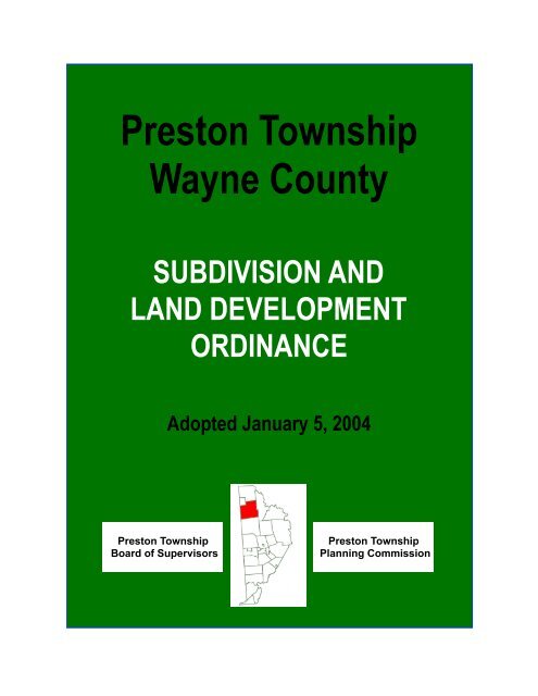
Preston Township Wayne County - Shepstone Management Company
Preston Township Wayne County - Shepstone Management Company
Preston Township Wayne County - Shepstone Management Company

You also want an ePaper? Increase the reach of your titles
YUMPU automatically turns print PDFs into web optimized ePapers that Google loves.
<strong>Preston</strong> <strong>Township</strong><br />
<strong>Wayne</strong> <strong>County</strong><br />
SUBDIVISION AND<br />
LAND DEVELOPMENT<br />
ORDINANCE<br />
Adopted January 5, 2004<br />
<strong>Preston</strong> <strong>Township</strong><br />
Board of Supervisors<br />
<strong>Preston</strong> <strong>Township</strong><br />
Planning Commission
<strong>Preston</strong> <strong>Township</strong>, <strong>Wayne</strong> <strong>County</strong><br />
Subdivision and Land Development Ordinance<br />
Table of Contents<br />
Article I - General Provisions 1<br />
§ 1 Title 1<br />
§ 2 Authority and Jurisdiction 1<br />
§ 3 Purposes 2<br />
§ 4 Interpretation 2<br />
§ 5 Liability 2<br />
§ 6 Constitutional Construction 2<br />
§ 7 Repealer 3<br />
Article II - Definitions 4<br />
§ 8 General 4<br />
§ 9 Specific Definitions 4<br />
Article III - Procedures, Plans and Improvement Requirements 11<br />
§ 10 Minor Subdivisions and Land Developments 11<br />
§ 11 Major Subdivisions and Land Developments 16<br />
§ 12 Required Improvements - Generally 28<br />
§ 13 Required Improvements - Major Subdivisions 29<br />
§ 14 Completion of Improvements or Guarantee Thereof 29<br />
§ 15 Inspection Costs Related to Improvements 31<br />
§ 16 Maintenance Guarantees 31<br />
Article IV - Special Approvals 32<br />
§ 17 General 32<br />
§ 18 Conditional Approval 32<br />
§ 19 Addition 32<br />
§ 20 Reapproval 33<br />
§ 21 Lot of Record 33<br />
§ 22 Change in Lot Lines 33<br />
§ 23 Un-subdivision 34<br />
Article V - Design Standards 35<br />
§ 24 Lots 35<br />
§ 25 Streets 36<br />
§ 26 Signs 41<br />
§ 27 Utilities 41<br />
§ 28 Survey Markers 41<br />
Page<br />
i
<strong>Preston</strong> <strong>Township</strong>, <strong>Wayne</strong> <strong>County</strong><br />
Subdivision and Land Development Ordinance<br />
§ 29 Drainage Easements 42<br />
§ 30 Sewage Disposal 42<br />
§ 31 Water Supply 43<br />
§ 32 Erosion and Sedimentation 43<br />
§ 33 Storm Water <strong>Management</strong> 43<br />
§ 34 Flood Plain <strong>Management</strong> 44<br />
§ 35 Commercial and Industrial Subdivisions and Other Land Developments - Generally 45<br />
§ 36 Telecommunication Facilities 49<br />
§ 37 Kennel and Animal Farm Land Developments 51<br />
§ 38 Recreational Land Developments 51<br />
§ 39 Sand, Gravel and Quarrying Land Developments 54<br />
§ 40 Seasonal Camp Land Developments 55<br />
§ 41 Multi-Family Dwelling Land Developments 55<br />
§ 42 Conservation Subdivisions 61<br />
Article VI - Mobile Home Parks 64<br />
§ 43 Design Standards and Other Requirements 64<br />
§ 44 Application to Existing Parks 68<br />
Article VII - Administration, Enforcement, Penalties and Enactment 70<br />
§ 45 Amendments to the Pennsylvania Municipalities Planning Code 70<br />
§ 46 Waivers and Modifications 70<br />
§ 47 Fees 71<br />
§ 48 Enforcement 71<br />
§ 49 Preventive Remedies 71<br />
§ 50 Enforcement Remedies 72<br />
§ 51 Jurisdiction 72<br />
§ 52 Continuation 72<br />
§ 53 Enactment 73<br />
ii
<strong>Preston</strong> <strong>Township</strong>, <strong>Wayne</strong> <strong>County</strong><br />
Subdivision and Land Development Ordinance<br />
ARTICLE I<br />
General Provisions<br />
§ 1 Title.<br />
This Ordinance shall be known and may be cited as the "Subdivision and Land Development Ordinance of<br />
<strong>Preston</strong> <strong>Township</strong>, <strong>Wayne</strong> <strong>County</strong>, Pennsylvania."<br />
§ 2 Authority and Jurisdiction.<br />
2.1 The authority of the Board of Supervisors to adopt this Ordinance regulating subdivision and land<br />
development within <strong>Preston</strong> <strong>Township</strong>, <strong>Wayne</strong> <strong>County</strong> is granted by the Pennsylvania<br />
Municipalities Planning Code, Act 247 of 1968, as amended. No subdivision or land development<br />
of any lot, tract, or parcel of land shall be made, no street, sanitary sewer, storm sewer, water main,<br />
or other improvements in connection therewith shall be laid out, constructed, opened, or dedicated<br />
for public use or travel, or for the common use of occupants of buildings abutting thereon, except in<br />
accordance with the provisions of this Ordinance. The jurisdiction of the approval powers of this<br />
Ordinance shall be limited to land in <strong>Preston</strong> <strong>Township</strong>, <strong>Wayne</strong> <strong>County</strong>.<br />
2.2 The Board of Supervisors hereby designates the <strong>Preston</strong> <strong>Township</strong> Planning Commission as the<br />
receiving body for subdivisions and land developments under this Ordinance. The Board of<br />
Supervisors shall be in charge of the administration of this Ordinance and shall have the power to<br />
act on the approval of all subdivisions and land developments.<br />
2.3 All applications for subdivision and land development located within <strong>Preston</strong> <strong>Township</strong> shall be<br />
submitted to the <strong>Preston</strong> <strong>Township</strong> Planning Commission secretary at least 10 days prior to the<br />
meeting of the Commission for review and report together with a fee sufficient to cover the costs of<br />
the review and report, which fee shall be paid by the applicant. Also, a copy of the plans and<br />
supplementary data (including the <strong>County</strong> review fee) shall be sent to the <strong>Wayne</strong> <strong>County</strong><br />
Department of Planning for review. The <strong>Township</strong> shall not approve such applications until the<br />
<strong>County</strong> report is received or until the expiration of thirty (30) days from the date the application was<br />
forwarded to the county.<br />
2.4 The provisions and requirements of these regulations shall apply to and control all subdivision and<br />
land development for which plans have not been legally recorded in the Office of the Recorder of<br />
Deeds in and for <strong>Wayne</strong> <strong>County</strong>, Pennsylvania, prior to the effective date of these regulations.<br />
2.5 Sale of lots, issuance of building permits, or erection of buildings: no lot in a subdivision or land<br />
development may be sold or sales agreement entered into; no permit to erect, alter, or repair any<br />
building upon land in a subdivision or land development may be issued; and no building may be<br />
erected in a subdivision or land development unless and until a subdivision or land development<br />
plan has been approved and recorded with the Office of the Recorder of Deeds of the <strong>County</strong>, and<br />
until the improvements required in connection therewith have either been constructed or<br />
guaranteed, as herein provided.<br />
Page 1 of 73
<strong>Preston</strong> <strong>Township</strong>, <strong>Wayne</strong> <strong>County</strong><br />
Subdivision and Land Development Ordinance<br />
§ 3 Purposes.<br />
It is the intent, purpose, and scope of this Ordinance to help:<br />
3.1 Protect and provide for the public health, safety, and general welfare of <strong>Preston</strong> <strong>Township</strong>.<br />
3.2 Guide the future growth and development of <strong>Preston</strong> <strong>Township</strong>.<br />
3.3 Provide for adequate light, air, and privacy; secure safety from fire, flood, stormwater and other<br />
danger; and prevent overcrowding of the land and undue congestion of population.<br />
3.4 Protect the character and the social and economic stability of all parts of <strong>Preston</strong> <strong>Township</strong>.<br />
3.5 Protect and conserve the value of land, buildings and improvements throughout <strong>Preston</strong> <strong>Township</strong><br />
and minimize conflicts between land uses.<br />
3.6 Guide public and private policy and action in order to provide adequate and efficient transportation,<br />
water, sewerage, parks, playgrounds, recreation, and other public requirements and facilities.<br />
3.7 Provide for safe and convenient circulation of people and goods throughout the <strong>Township</strong>, including<br />
pedestrian travel, and provide for the proper location and width of streets and building lines.<br />
3.8 Establish reasonable standards of design and procedures for subdivisions and land developments<br />
in order to further the orderly layout of land, and to ensure proper legal description and<br />
monumenting of subdivisions and land developments.<br />
3.9 Ensure that improvements for public facilities are available and will have a sufficient capacity to<br />
serve proposed subdivisions and land developments.<br />
3.10 Implement <strong>Preston</strong> <strong>Township</strong>'s Comprehensive Plan.<br />
§ 4 Interpretation.<br />
The provisions of this Ordinance shall be held to be the minimum requirements to meet the purposes above<br />
stated.<br />
§ 5 Liability.<br />
The grant of approval of a subdivision or land development plan shall not constitute a representation,<br />
guarantee, or warranty of any kind by <strong>Preston</strong> <strong>Township</strong> or by any official or employee thereof, of the<br />
practicability or safety of the proposed use and shall create no liability upon <strong>Preston</strong> <strong>Township</strong>, its officials,<br />
or employees.<br />
§ 6 Constitutional Construction.<br />
If any of the provisions of this Ordinance shall be held to be unconstitutional, the validity of any of the<br />
Page 2 of 73
emaining provisions of this Ordinance shall not be affected thereby. It is hereby declared as the legislative<br />
intention that this Ordinance would have been adopted had such unconstitutional provision not been<br />
included herein.<br />
§ 7 Repealer.<br />
<strong>Preston</strong> <strong>Township</strong>, <strong>Wayne</strong> <strong>County</strong><br />
Subdivision and Land Development Ordinance<br />
The previous Subdivision Ordinance for <strong>Preston</strong> <strong>Township</strong>, <strong>Wayne</strong> <strong>County</strong>, Pennsylvania is hereby<br />
repealed.<br />
Page 3 of 73
<strong>Preston</strong> <strong>Township</strong>, <strong>Wayne</strong> <strong>County</strong><br />
Subdivision and Land Development Ordinance<br />
ARTICLE II<br />
Definitions<br />
§ 8 General.<br />
Unless the context clearly indicates to the contrary:<br />
8.1 The word shall is mandatory, the word may is optional.<br />
8.2 Words used in the present tense include the future tense.<br />
8.3 Words in the singular include the plural and those in the plural include the singular.<br />
8.4 The words person, developer, subdivider, and landowner shall be construed to include a<br />
corporation, partnership, firm, association, company, or other similar business entity, as well as<br />
individuals.<br />
8.5 The word building includes structure and shall be construed as if followed by the phrase, "...or part<br />
thereof."<br />
§ 9 Specific Definitions.<br />
For the purposes of this Ordinance, the following words and phrases shall have the meaning as given in<br />
this Article:<br />
ADDITION: A subdivision of land which is created with the intent and purpose of conveying one lot to the<br />
owner of an adjoining lot, tract, or parcel. Once approved in accordance with the terms of this Ordinance,<br />
the lot to be conveyed shall be considered an integral part of the adjoining landowner's former lot and not a<br />
new lot, tract, or parcel of land, and said lot shall not be sold separately without subdivision approval at the<br />
time of any future division.<br />
AGENT: A duly authorized person designated by the landowner to act on his behalf.<br />
ALLEY: A public or private street right-of-way primarily designed to serve as secondary access to the side<br />
or rear of those properties whose principal frontage is on an approved street.<br />
ALL-WEATHER SURFACE: The surfacing of a street, parking area, access or walkway to a mud-free or<br />
otherwise permanently passable condition during all seasons of the year and under adverse weather<br />
conditions. Macadam, gravel, crushed stone or other state-approved surfaces will all suffice to meet this<br />
test but the depth and installation of the material shall be subject to the review of the <strong>Township</strong> Engineer<br />
and Roadmaster as well as approval by the <strong>Township</strong> Board of Supervisors. Pennsylvania Department of<br />
Transportation specifications shall also be applicable.<br />
ANTENNA: A device used to collect or transmit telecommunications or radio signals.<br />
panels, microwave dishes, and single poles known as whips.<br />
Examples are:<br />
Page 4 of 73
<strong>Preston</strong> <strong>Township</strong>, <strong>Wayne</strong> <strong>County</strong><br />
Subdivision and Land Development Ordinance<br />
APPLICANT: A landowner, subdivider, or developer, as hereinafter defined, who has filed an application for<br />
subdivision or land development, including his heirs, successors, and assigns.<br />
BLOCK: A tract of land bounded by streets, or by a combination of streets and public parks, cemeteries,<br />
railroad rights-of-way, shorelines of waterways, or boundary lines of municipalities.<br />
BUILDING SETBACK LINE: A line within a property defining the minimum required distance between any<br />
structure to be erected and the adjacent right-of-way or side and rear lot lines.<br />
CARTWAY: The graded or paved portion of a street used for vehicular travel, excluding shoulders.<br />
CHANGE IN LOT LINES: Any change or alteration in existing lot lines. A change in lot lines constitutes a<br />
subdivision.<br />
COMMON OPEN SPACE: A parcel or parcels of land or an area of water, or a combination of land and<br />
water within a development site and designed and intended for the use or enjoyment of residents of a<br />
development, not including streets, off-street parking areas, and areas set aside for public facilities.<br />
CONDITIONAL APPROVAL: A special approval of a subdivision or land development granted by Board of<br />
Supervisors with conditions attached thereto.<br />
CUL-DE-SAC: A street with only one (1) outlet which intersects another street at one (1) end and is<br />
terminated at the other in a vehicular turnaround.<br />
DEP: The Pennsylvania Department of Environmental Protection.<br />
DEVELOPER: Any landowner, agent of such landowner, or tenant with the permission of such landowner,<br />
who makes or causes to be made a subdivision of land or a land development.<br />
DEVELOPMENT PLAN: The provisions for development, including a planned residential development, a<br />
plat of subdivision, all covenants relating to use, location and bulk of buildings and other structures,<br />
intensity of use or density of development, streets, ways and parking facilities, common open space and<br />
public facilities. The phrase “provisions of the development plan” shall mean the written and graphic<br />
materials referred to in this definition.<br />
DRIVEWAY: A privately owned vehicular access from a private or public street into a lot, tract, or parcel of<br />
land which is used or intended to be used to provide access to not more than one (1) lot, tract, or parcel of<br />
land.<br />
EASEMENT: A right to use the land of another for a specific purposes; and (vii) the preparation of plans<br />
and specifications and estimates of proposed work and attendant costs.<br />
FINAL PLAN: The ultimate map and supporting material drawn and submitted as required in these<br />
regulations for a subdivision or land development.<br />
FINAL PLAT: The ultimate map showing the layout of the subdivision or land development which, if<br />
Page 5 of 73
approved by the Board of Supervisors, shall be stamped and signed indicating final approval and shall be<br />
the plat of record.<br />
FRONTAGE: The distance measured along the street right-of-way line, between the lot side lines.<br />
IMPERVIOUS AREA: Any surface which prevents or impedes the infiltration and percolation of water into<br />
the ground. This includes, but is not limited to; buildings, roads, driveways, parking areas, pavement, etc.<br />
IMPROVEMENTS: Those physical additions, installation, and changes required to render land suitable for<br />
the proposed use.<br />
LAND DEVELOPMENT: A subdivision of land or the improvement of one lot or two or more contiguous lots,<br />
tracts or parcels of land for any purpose involving:<br />
1) a group of two or more residential or nonresidential buildings, whether proposed initially or<br />
cumulatively; or a single nonresidential building on a lot or lots regardless of the number of<br />
occupants or tenure; or<br />
2) the division or allocation of land or space, whether initially or cumulatively, between or among two<br />
or more existing or prospective occupants by means of, or for the purpose of streets, common<br />
areas, leaseholds, condominiums, building groups or other features.<br />
Excluded from the definition of land development are:<br />
<strong>Preston</strong> <strong>Township</strong>, <strong>Wayne</strong> <strong>County</strong><br />
Subdivision and Land Development Ordinance<br />
1) the conversion of an existing single-family detached dwelling or single family semi-detached<br />
dwelling into not more than three residential units, unless such units are intended to be a<br />
condominium; and<br />
2) the addition of an accessory building, including farm buildings, on a lot or lots subordinate to an<br />
existing principal building.<br />
LANDOWNER: The legal or beneficial owner or owners of land including the holder of an option or contract<br />
to purchase (whether or not such option or contract is subject to any condition), a lessee if he is authorized<br />
under the lease to exercise the rights of the landowner, or other person having a proprietary interest in land.<br />
LOCATION MAP: A map insert or miniaturized map of the proposed subdivision or land development<br />
placed on the plat for the purpose of locating the property as it relates to other adjoining lands of the owner,<br />
the surrounding street network, villages, and natural features.<br />
LOT: A designated parcel, tract or area of land established by a plat or otherwise as permitted by law and<br />
to be used, developed or built upon as a unit.<br />
LOT AREA: The square footage or acreage contained within the property lines of the individual plot or<br />
parcel of land.<br />
LOT DEPTH: The horizontal distance between the front and rear property lines measured perpendicular to<br />
Page 6 of 73
<strong>Preston</strong> <strong>Township</strong>, <strong>Wayne</strong> <strong>County</strong><br />
Subdivision and Land Development Ordinance<br />
the street.<br />
LOT OF RECORD: Any lot or parcel of land that was legally recorded prior to the enactment of this<br />
Ordinance either within a deed or upon a plat or any lot or parcel of land that constitutes all of the remaining<br />
land following a legal subdivision.<br />
LOT WIDTH: The average of the width of a lot at the building setback line and rear of the property.<br />
MAJOR SUBDIVISIONS OR LAND DEVELOPMENTS:<br />
classified as minor subdivisions and land developments.<br />
All subdivisions and land developments not<br />
MINOR SUBDIVISIONS OR LAND DEVELOPMENTS: All subdivisions and land developments that meet<br />
the criteria specified herein for such activities. See § 10.1.<br />
MOBILE HOME: A transportable, single family dwelling intended for permanent occupancy, contained in<br />
one (1) unit, or in two (2) or more units designed to be joined into one (1) integral unit capable of again<br />
being separated for repeated towing, which arrives at a site complete and ready for occupancy except for<br />
minor and incidental unpacking and assembly operations, and constructed so that it may be used without a<br />
permanent foundation.<br />
MOBILE HOME LOT: A parcel of land in a mobile home park, improved with the necessary utility<br />
connections and other appurtenances necessary for the erections thereon of a single mobile home. The<br />
mobile home lot in a mobile home park may be either owned by the occupant of the mobile home or leased<br />
from the mobile home park owner.<br />
MOBILE HOME PARK: A parcel or contiguous parcels of land which has been so designated and<br />
improved that it contains two or more mobile home lots for the placement thereon of mobile homes.<br />
MODIFICATION: A relief of the requirements of one or more of the standards of this Ordinance if the literal<br />
enforcement will exact undue hardship because of peculiar conditions pertaining to the land in question,<br />
provided that such modifications will not be contrary to the public interest and that the purpose and intent of<br />
the ordinance is observed.<br />
NEWLY CREATED LOT: Any lot or parcel created by the subdividing of a larger parcel that has no previous<br />
record of existence, either in the form of a deed description, recorded map, or by any other legal means.<br />
ONE-HUNDRED YEAR FLOOD PLAIN: The one-hundred (100) year floodway and that maximum area of<br />
land that is likely to be flooded by a one-hundred (100) year flood shown on flood plain maps approved or<br />
promulgated by the United States Department of Housing and Urban Development.<br />
PLANNING COMMISSION: The <strong>Preston</strong> <strong>Township</strong> Planning Commission.<br />
PLAT: The map or plan of a subdivision or land development, whether sketch, preliminary, or final.<br />
PRELIMINARY PLAN: The design map and supporting material drawn and submitted as required in these<br />
regulations for a proposed subdivision or land development.<br />
Page 7 of 73
<strong>Preston</strong> <strong>Township</strong>, <strong>Wayne</strong> <strong>County</strong><br />
Subdivision and Land Development Ordinance<br />
PRELIMINARY PLAT: The design map showing the proposed layout of the subdivision or land<br />
development which, if approved by the Board of Supervisors, shall be stamped and signed indicating<br />
preliminary approval. The preliminary plat that has been approved is not for recording purposes.<br />
PRIVATE STREET: A street, road, access, easement, or right-of-way, constructed to the standards of<br />
<strong>Preston</strong> <strong>Township</strong>, used for access that is not being dedicated or offered for dedication to <strong>Preston</strong> <strong>Township</strong><br />
and that will be owned and maintained by the landowner an Association or another persons.<br />
PROFESSIONAL ENGINEER: An individual licensed and registered under the laws of this Commonwealth<br />
on either a permanent or temporary basis to engage in the practice of engineering.<br />
PROFESSIONAL LAND SURVEYOR: An individual licensed and registered under the laws of this<br />
Commonwealth on either a permanent or temporary basis to engage in the practice of land surveying.<br />
PUBLIC STREET: A street, road, access, easement, or right-of-way used for access which is dedicated to<br />
<strong>Preston</strong> <strong>Township</strong>, constructed to the standards of <strong>Preston</strong> <strong>Township</strong>, and which will be maintained by<br />
<strong>Preston</strong> <strong>Township</strong> upon the <strong>Township</strong> acceptance of the same.<br />
REAPPROVAL: The act of reapproving a lot or parcel of land which had been approved but not recorded in<br />
the Register and Recorder's Office of <strong>Wayne</strong> <strong>County</strong> within the ninety (90) days as required by this<br />
Ordinance.<br />
RECREATIONAL LAND DEVELOPMENT: The division or re-division of a lot, tract or parcel of land, by any<br />
means, into two or more lots, tracts, parcels or other divisions of land, including changes in existing lot line<br />
for the purpose, whether immediate or future, of lease, rent, sale or transfer of ownership, for the purpose<br />
of providing a site for travel trailers, truck campers, camper trailers, motor homes and tents, for transient<br />
use. Campgrounds, recreational vehicle parks, primitive camping facilities and other similar facilities shall<br />
fall under this definition. This definition is not, however, intended to cover second-home communities of<br />
single-family dwellings or mobile home parks.<br />
1) Transient recreational subdivisions or land developments are publicly operated facilities, or<br />
businesses, offering sites with the usual accessory recreational and service facilities, not normally<br />
including eating facilities, for use for tent camping and/or recreational vehicle camping by the<br />
public at large on a transient basis. Sites are rented on a daily or weekly basis.<br />
2) Non-transient recreational subdivisions or land developments are planned private communities<br />
with recreational and service facilities, including central water and sewage and usually a restaurant<br />
and/or bar, lounge, chapel, and community hall, for use only by occupants of tent and/or<br />
recreational vehicle sites within the campground. Sites may be owned in common, or may be<br />
owned individually by deed conveyance. or may be leased on an annual basis.<br />
RECREATIONAL VEHICLE: A vehicular unit primarily designed as temporary living quarters for<br />
recreational camping or travel use, which either has its own automotive power or is mounted on, or drawn<br />
by, another vehicle. The basic entities are: travel trailer, camping trailer, truck camper, and motor home.<br />
Page 8 of 73
<strong>Preston</strong> <strong>Township</strong>, <strong>Wayne</strong> <strong>County</strong><br />
Subdivision and Land Development Ordinance<br />
REGULATORY FLOOD ELEVATION: The one-hundred (100) year flood elevation plus a free board safety<br />
factor of 1-1/2 feet.<br />
RIGHT-OF-WAY: The right of use which is reserved and/or conveyed as an easement or a public<br />
thoroughfare for vehicular and/or pedestrian traffic.<br />
SEWAGE DISPOSAL-CENTRAL: A sewage collection and disposal system in which sewage is carried<br />
from more than one individual lot, by a system of pipes to a central treatment plant which involves a point<br />
discharge to the waters of the commonwealth; in compliance with the applicable Pennsylvania Department<br />
of Environmental Protection regulations.<br />
SEWAGE DISPOSAL-SUBSURFACE: A system of piping, tanks or other facilities serving one or more lots<br />
and collecting, treating and disposing of sewage, in whole or in part into or onto the soil for final disposal in<br />
compliance with the applicable Pennsylvania Department of Environmental Protection regulations.<br />
Examples include; conventional in ground systems, sand mounds, spray irrigation systems or other similar<br />
community systems.<br />
SKETCH PLAN: An informal plan indicating existing features of a tract and its surroundings and the<br />
general layout of the proposed subdivision or land development presented for discussion purposes only<br />
and not for approval.<br />
SKETCH PLAT: An informal map indicating existing features of a tract and its surroundings and the general<br />
layout of the proposed subdivision or land development presented for discussion purposes only and not for<br />
approval.<br />
STREET: Includes street, avenue, boulevard, road, highway, freeway, parkway, lane, alley, viaduct and any<br />
other ways used or intended to be used by vehicular traffic or pedestrians whether public or private, not<br />
including driveways.<br />
STRUCTURE: Any man-made object having an ascertainable stationary location on or in land or water,<br />
whether or not affixed to the land (excluding fences, sewage systems and utility lines).<br />
SUBDIVIDER: Any landowner, or agent of such landowner, or tenant with the permission of such<br />
landowner, who makes or causes to be made a subdivision of land.<br />
SUBDIVISION: The division or redivision of a lot, tract or parcel of land by any means into two or more<br />
lots, tracts, parcels or other divisions of land including changes in existing lot lines for the purpose, whether<br />
immediate or future, of lease, partition by the court for distribution to heirs or devisees, transfer of<br />
ownership or building or lot development; provided, however, that the subdivision by lease of land for<br />
agricultural purposes into parcels of more than ten acres, not involving any new street or easement of<br />
access or any residential dwelling, shall be exempted.<br />
TELECOMMUNICATIONS FACILITY: Consists of the equipment and structures involved in receiving or<br />
transmitting telecommunication or radio signals, but limited to those facilities with respect to which the State<br />
and Federal governments have not, under public utility laws, strictly pre-empted the <strong>Township</strong> from<br />
regulating.<br />
Page 9 of 73
<strong>Preston</strong> <strong>Township</strong>, <strong>Wayne</strong> <strong>County</strong><br />
Subdivision and Land Development Ordinance<br />
TELECOMMUNICATIONS EQUIPMENT BUILDING: The building in which the electronic receiving and<br />
relay equipment for a telecommunications facility is housed.<br />
TOWER: A structure that is intended to support equipment used to transmit and/or receive<br />
telecommunications signals. Examples of such structures includes monopoles and lattice construction<br />
steel structures.<br />
TOWNSHIP ENGINEER: A professional engineer licensed as such in the Commonwealth of Pennsylvania,<br />
duly appointed as the engineer for <strong>Preston</strong> <strong>Township</strong>.<br />
TOWNSHIP SUPERVISORS: The Board of Supervisors of <strong>Preston</strong> <strong>Township</strong>, <strong>Wayne</strong> <strong>County</strong>,<br />
Pennsylvania.<br />
UN-SUBDIVISION: The act of eliminating an existing subdivision by combining lots or parcels of land into<br />
one (1) deed describing the entire tract as one (1) lot or parcel.<br />
WAIVER: A relief of the procedural requirements of one or more provisions of this Ordinance if the<br />
requirements pertaining to the same are not applicable because of peculiar conditions pertaining to the<br />
application or land in question, provided that such relief will not be contrary to the public interest and that<br />
the purpose and intent of the ordinance is observed.<br />
Page 10 of 73
ARTICLE III<br />
Procedures, Plans, and Improvement Requirements<br />
§ 10 Minor Subdivisions and Land Developments.<br />
A minor subdivision or land development requires a final plan, but a sketch plan is optional. In determining<br />
the number of lots, each newly created lot from the parent parcel, since the adoption of this Ordinance,<br />
shall be counted, including the parent parcel. The following requirements shall apply:<br />
10.1 Definition of a Minor Subdivision and Land Development<br />
Any subdivision or land development shall be considered a minor subdivision only if it:<br />
10.1.1 Contains ten (10) or fewer lots. Once the number of lots exceeds ten (10) whether in one<br />
(1) submission or over a period of time and several submissions, the said subdivision or<br />
land development shall no longer be a minor subdivision or land development.<br />
10.1.2 Fronts on an existing street or road and does not involve the construction of other<br />
improvements such as central sewer or water.<br />
10.1.3 Does not landlock or limit the ultimate use of interior adjacent land.<br />
10.1.4 Does not conflict with any provision of the <strong>Township</strong> Comprehensive Plan or these<br />
regulations.<br />
10.1.5 Is not a mobile home park or recreational land development.<br />
10.1.6 Is exempt from <strong>Township</strong> stormwater management requirements.<br />
10.2 Sketch Plan Procedures<br />
Any subdivider or developer may, prior to subdividing or developing land as defined in this<br />
Ordinance, submit to the <strong>Preston</strong> <strong>Township</strong> Planning Commission a sketch plan showing the<br />
information required below. A sketch plan is informal and for informational or advisory purposes<br />
only. A sketch plan submission shall consist of six (6) copies of the plat and six (6) copies of the<br />
letter of intent stating that it is only a sketch plan. The submission of a sketch plan shall not<br />
constitute an official submission of a plan to the <strong>Preston</strong> <strong>Township</strong> Planning Commission and no<br />
formal action is mandated.<br />
10.3 Sketch Plan Specifications<br />
The sketch plat shall be at a sufficient scale to show the entire tract on one (1) sheet and should<br />
show or include the following:<br />
10.3.1 Location map.<br />
<strong>Preston</strong> <strong>Township</strong>, <strong>Wayne</strong> <strong>County</strong><br />
Subdivision and Land Development Ordinance<br />
Page 11 of 73
10.3.2 The location and proposed layout of that portion which is to be subdivided or developed<br />
in relation to the entire tract.<br />
10.3.3 All existing structures within the portion to be subdivided or developed.<br />
10.3.4 The name and mailing address of the landowner and the names of all adjoining property<br />
owners (including those across streets) as disclosed by the most recent deed and tax<br />
records.<br />
10.3.5 All streets, streams, and utilities in the tract of land.<br />
10.3.6 The tentative layout of the remainder of the tract owned by the subdivider or developer, if<br />
any.<br />
10.3.7 Name of local municipality and county in which tract is located.<br />
10.3.8 North arrow and Graphic scale.<br />
10.3.9 Date map was drawn.<br />
10.4 Final Plan Procedures.<br />
<strong>Preston</strong> <strong>Township</strong>, <strong>Wayne</strong> <strong>County</strong><br />
Subdivision and Land Development Ordinance<br />
The applicant shall submit twelve (12) copies of the final plan and the applicable number of copies<br />
of all supporting material as specified below to the <strong>Preston</strong> <strong>Township</strong> Planning Commission. Only<br />
original unaltered prints of the plat shall be accepted. Copies of the plan may be distributed to<br />
other reviewing agencies as may be appropriate.<br />
10.4.1 All applicable items listed in Sections 10.5 and 10.6 shall be required for a complete<br />
submittal.<br />
10.4.2 The <strong>Preston</strong> <strong>Township</strong> Planning Commission, shall review the final plan to determine its<br />
conformance with the requirements and standards contained in this Ordinance. The<br />
<strong>Preston</strong> <strong>Township</strong> Planning Commission shall make a report of its recommendations to<br />
the Board of Supervisors. One (1) copy of the final plat shall be retained by the <strong>Preston</strong><br />
<strong>Township</strong> Planning Commission in their files.<br />
10.4.3 All applications for final approval shall be acted upon by the <strong>Township</strong> Board of<br />
Supervisors who shall render their decision and communicate it to the applicant not later<br />
than ninety (90) days following the date of the regular meeting of the <strong>Preston</strong> <strong>Township</strong><br />
Planning Commission next following the date the application is filed, provided that should<br />
the said next regular meeting occur more than thirty (30) days following the filing of the<br />
application, the said ninety (90) day period shall be measured from the thirtieth day<br />
following the day the application has been filed. The decision shall be in writing and shall<br />
be communicated to the applicant personally or mailed to him at his last known address<br />
not later than fifteen (15) days following the decision.<br />
Page 12 of 73
10.4.4 All applications for subdivision and land development within <strong>Preston</strong> <strong>Township</strong> shall be<br />
forwarded upon receipt by the <strong>Preston</strong> <strong>Township</strong> Planning Commission to the <strong>Wayne</strong><br />
<strong>County</strong> Department of Planning for review and report, together with a fee sufficient to<br />
cover the costs of the review and report, which fee shall be paid by the applicant. <strong>Preston</strong><br />
<strong>Township</strong> shall not approve such applications until the <strong>County</strong>’s report is received or until<br />
the expiration of thirty (30) days from the date the application was forwarded to the<br />
<strong>County</strong>. The one (1) copy of the final plan forwarded to the Department of Planning shall<br />
be retained in their files.<br />
10.4.5 If the final plan is approved, each copy of the plat shall be stamped and signed. One (1)<br />
copy shall be retained by Board of Supervisors. One (1) copy shall be forwarded to DEP.<br />
One (1) copy shall be returned to the <strong>Preston</strong> <strong>Township</strong> Planning Commission, to place in<br />
their files with the copy they had kept after completing their review and report. The<br />
remaining copies shall be returned to the applicant.<br />
10.4.6 The applicant shall record the approved plat with the Register and Recorder’s Office of<br />
<strong>Wayne</strong> <strong>County</strong>, Pennsylvania within ninety (90) days from the date of approval placed on<br />
the approved plat. The approval shall be deemed to have lapsed if the applicant has<br />
failed to record the approved plat within that time period. The Register and Recorder’s<br />
Office shall not accept any plat for recording unless such plat officially notes the approval<br />
of the Board of Supervisors.<br />
10.5 Final Plat Specifications<br />
The final plat shall be clearly and legibly drawn on a sheet or multiple sheets (with match lines) not<br />
more than 2'x3' and not less that 11"x17". All prints and reproductions for use by the <strong>Township</strong><br />
shall be in black and white. The plat shall be designed in compliance with applicable provisions of<br />
this Ordinance, and shall show the following information:<br />
10.5.1 Location map.<br />
<strong>Preston</strong> <strong>Township</strong>, <strong>Wayne</strong> <strong>County</strong><br />
Subdivision and Land Development Ordinance<br />
10.5.2 Title block, containing name of owner, name of municipality and county.<br />
10.5.3 Name and mailing address of present landowner.<br />
10.5.4 Name and mailing address of applicant if different from landowner.<br />
10.5.5 Subdivision or land development name, if any.<br />
10.5.6 Current tax map and parcel identification number of tract.<br />
10.5.7 Current deed book and page identification number of tract.<br />
10.5.8 Boundaries of the tract and approximate location of abutting properties.<br />
10.5.9 The names of all adjoining property owners (including those across streets) as disclosed<br />
Page 13 of 73
y the most recent deed and tax records.<br />
10.5.10 Graphic scales.<br />
<strong>Preston</strong> <strong>Township</strong>, <strong>Wayne</strong> <strong>County</strong><br />
Subdivision and Land Development Ordinance<br />
10.5 .11 Reference meridian - North arrow indicating true, magnetic, or other source.<br />
10.5.12 Date map was drawn and dates of all revisions.<br />
10.5.13 All existing and proposed lot lines, with accurate dimensions and bearings of straight<br />
lines and radii, arcs, and central angles of curved lines.<br />
10.5.14 Each lot identified by number and/or letter.<br />
10.5.15 Area of each proposed lot, including the total area remaining in parent parcel, if any.<br />
10.5.16 Test pit and percolation test sites along with soil types and boundaries.<br />
10.5.17 The location of all existing streets, with information concerning right-of-way widths, types<br />
of street surfaces, and street names.<br />
10.5.18 The location and identification of all existing bodies of water, water courses with direction<br />
of flow, buildings, drain pipes, culverts, sewer lines, sewage systems, water lines, water<br />
wells, oil wells, gas wells, gas lines, power lines, telephone lines, structures, public<br />
facilities, and any other significant man-made or natural features on the tract to be<br />
subdivided or developed.<br />
10.5.19 The location, dimension, and purpose of easements or other rights-of-way including any<br />
limitations on their use.<br />
10.5.20 The location, dimension, and identification of building setback lines.<br />
10.5.21 Name, mailing address, signature, and title of person who prepared the map if done by<br />
someone other than the professional(s) who certified the plan.<br />
10.5.22 An approval block area of approximately 5"x5" free of all writing and drawing, for use by<br />
<strong>Preston</strong> <strong>Township</strong> in recording any approval and conditions.<br />
10.5.23 Where the subdivision or land development lies partially or completely in any designated<br />
one-hundred (100) year flood plain, those areas shall be identified and the boundaries<br />
shown.<br />
10.5.24 A site data table listing the following: total acreage; number of lots; zoning districts;<br />
proposed water service facilities; proposed sewer service facilities.<br />
10.5.25 Location and type of all lot corners and other permanent monuments, designating which<br />
have been set in place or found.<br />
Page 14 of 73
<strong>Preston</strong> <strong>Township</strong>, <strong>Wayne</strong> <strong>County</strong><br />
Subdivision and Land Development Ordinance<br />
10.5.26 Name, mailing address, original certification by stamp or seal, and original signature of<br />
the professional(s) who certified the map and/or survey. Each print shall be individually<br />
signed and sealed or stamped by the appropriate professional(s) certifying the plat. Land<br />
surveys must be certified by a professional land surveyor.<br />
10.5.27 Contour lines, stating whether derived from a field survey or based on U.S.G.S.<br />
topographic maps, with a maximum 20 foot interval, if necessary. The <strong>Township</strong> may<br />
require greater detail when it is determined to be needed for a plan.<br />
10.5.28 The final plat for a minor land development shall contain the following statement:<br />
“[The applicant] certifies the information contained in this application is true and correct.<br />
Alterations from this approved plan by the present or future owners is a violation of the<br />
<strong>Preston</strong> <strong>Township</strong> Subdivision and Land Development Ordinance. Changes in the scope<br />
and /or limits of the project and its features will require a new application to be submitted.<br />
[signature of applicant]<br />
This statement must appear on the map with an original signature of the applicant on<br />
every copy submitted for approval.<br />
10.5.29 Existing and proposed use of all lots involved.<br />
10.5.30 No plats that will require access to a public highway shall be finally approved unless<br />
highway occupancy permits from the Pennsylvania Department of Transportation or<br />
<strong>Preston</strong> <strong>Township</strong>, depending on jurisdiction, are obtained. Waivers of this standard, with<br />
notice of such requirements given on the plat, may be approved where the proposed use<br />
is agricultural or of a similar non-building purpose.<br />
10.6 Final Plan Supporting Materials<br />
The following items shall be submitted by the applicant in support of and as a part of the final plan:<br />
10.6.1 An application or letter of intent, as the case may be, signed by property owner, including<br />
a statement that the application is for final approval and clearly indicating which lots are<br />
to be included for consideration. The letter should authorize municipal officials and their<br />
representative(s) to enter onto the property for inspection(s) required by the application,<br />
and the letter should concisely explain the scope of the proposal. One (1) original and<br />
six (6) copies are required.<br />
10.6.2 All applicable fees as required by <strong>Preston</strong> <strong>Township</strong>. (See Article VII).<br />
10.6.3 The completed appropriate components of the DEP “Planning Module for Land<br />
Development" to meet the requirements of the Pennsylvania Sewage Facilities Act and<br />
the Clean Streams Act. All items must be either filled in or marked non-applicable (n/a).<br />
Page 15 of 73
The original plus six (6) copies of the planning modules, with attachments, shall be<br />
submitted.<br />
10.6.4 If sewage service is proposed by means of a hook-up to an existing line by the applicant<br />
for this subdivision or land development, an original plus six (6) copies of a letter from the<br />
sewer authority or sewer company in whose service area the subdivision or land<br />
development is located stating that they will provide sewage service to this subdivision or<br />
land development.<br />
10.6.5 If water service is proposed by means of a hook-up to an existing line by the applicant for<br />
this subdivision or land development, an original plus six (6) copies of a letter from the<br />
water authority or water company in whose service area the subdivision or land<br />
development is located stating that they will provide water service to this subdivision or<br />
land development.<br />
10.6.6 Where the said subdivision or land development lies partially or completely in any<br />
designated one-hundred (100) year flood plain, the applicant shall submit plans showing<br />
the relationship of the subdivision or land development with respect to the elevations and<br />
extent of flood plain areas as shown on the municipality's flood plain maps provided by<br />
the Federal Emergency <strong>Management</strong> Agency. The plans shall include a description as to<br />
how the subdivision or land development will be made to comply with the municipality's<br />
flood plain management regulations, if applicable. An original plus six (6) copies of<br />
plans shall be submitted.<br />
§ 11 Major Subdivisions and Land Developments<br />
Any subdivision or land development which is not classified as a minor subdivision or land development in<br />
§ 10 shall be considered as a major subdivision or land development. For a major subdivision or land<br />
development; a sketch plan is optional, both a preliminary plan and a final plan are mandatory.<br />
11.1 Sketch Plan Procedures. Any subdivider or developer may, prior to subdividing or developing land<br />
as defined in this Ordinance, submit to the <strong>Preston</strong> <strong>Township</strong> Planning Commission a sketch plat<br />
showing the information required below. A sketch plan is informal and for informational or advisory<br />
purposes only. A sketch plan submission shall consist of six (6) copies of the plat and six (6)<br />
copies of a letter of intent stating that it is only a sketch plan. The submission of a sketch plan shall<br />
not constitute an official submission of a plan to the <strong>Preston</strong> <strong>Township</strong> Planning Commission and<br />
no formal action is mandated.<br />
11.2 Sketch Plat Specifications. The sketch plat shall be at a sufficient scale to show the entire tract on<br />
one (1) sheet and should show or include the following:<br />
11.2.1 Location map.<br />
<strong>Preston</strong> <strong>Township</strong>, <strong>Wayne</strong> <strong>County</strong><br />
Subdivision and Land Development Ordinance<br />
11.2.2 The location and proposed layout of that portion which is to be subdivided or developed<br />
in relation to the entire tract.<br />
Page 16 of 73
11.2.3 All existing structures within the portion to be subdivided or developed.<br />
11.2.4 The name and address of the landowner and the names of all adjoining property owners<br />
(including those across streets) as disclosed by the most recent deed and tax records.<br />
11.5.5 All streets, streams, and utilities in the tract of land.<br />
11.5.6 The tentative layout of the remainder of the tract owned by the subdivider or developer, if<br />
any.<br />
11.5.7 Name of municipality and county in which tract is located.<br />
11.5.8 North arrow and Graphic scale.<br />
11.5.9 Date map was drawn.<br />
<strong>Preston</strong> <strong>Township</strong>, <strong>Wayne</strong> <strong>County</strong><br />
Subdivision and Land Development Ordinance<br />
11.3 Preliminary Plan Procedures. The applicant shall submit twelve (12) copies of the preliminary plat<br />
and the applicable number of copies of all supporting material as specified below to the <strong>Preston</strong><br />
<strong>Township</strong> Planning Commission. Only original unaltered prints of the plat shall be accepted.<br />
11.3.1 All applicable items listed in § 11.4 and § 11.5 below shall be required for a complete<br />
submittal.<br />
11.3.2 The <strong>Township</strong> Planning Commission shall review the preliminary plan to determine its<br />
conformance with the requirements and standards contained in this Ordinance. The<br />
<strong>Preston</strong> <strong>Township</strong> Planning Commission shall make a report of its recommendations to<br />
the Board of Supervisors. One (1) copy of the preliminary plat shall be retained by the<br />
<strong>Preston</strong> <strong>Township</strong> Planning Commission in their files.<br />
11.3.3 All applications for preliminary approval shall be acted upon by the Board of Supervisors<br />
which shall render its decision and communicate it to the applicant not later than ninety<br />
(90) days following the date of the regular meeting of the <strong>Preston</strong> <strong>Township</strong> Planning<br />
Commission next following the date the application is filed, provided that should the said<br />
next regular meeting occur more than thirty (30) days following the filing of the<br />
application, the said ninety (90) day period shall be measured from the thirtieth day<br />
following the day the application has been filed. The decision shall be in writing and shall<br />
be communicated to the applicant personally or mailed to him at his last known address<br />
not later than fifteen (15) days following the decision.<br />
11.3.4 All applications for subdivisions and land developments within <strong>Preston</strong> <strong>Township</strong> shall be<br />
forwarded upon receipt by the <strong>Preston</strong> <strong>Township</strong> Planning Commission to the <strong>Wayne</strong><br />
<strong>County</strong> Department of Planning for review and report, together with a fee sufficient to<br />
cover the costs of the review and report, which fee shall be paid by the applicant.<br />
<strong>Preston</strong> <strong>Township</strong> shall not approve such applications until the <strong>County</strong>’s report is<br />
received or until the expiration of thirty (30) days from the date the application was<br />
forwarded to the <strong>County</strong>.<br />
Page 17 of 73
<strong>Preston</strong> <strong>Township</strong>, <strong>Wayne</strong> <strong>County</strong><br />
Subdivision and Land Development Ordinance<br />
11.3.5 If the preliminary plan is approved, each copy of the plat shall be stamped and signed.<br />
One (1) copy shall be retained by the Board of Supervisors. One (1) copy shall be<br />
forwarded to DEP. One (1) copy shall be returned to the <strong>Preston</strong> <strong>Township</strong> Planning<br />
Commission, to place in their files with the copy they had kept after completing their<br />
review and report. The remaining copies shall be returned to the applicant.<br />
11.3.6 When a preliminary application has been duly approved, the applicant shall be entitled to<br />
final approval in accordance with terms of the approved preliminary application as<br />
hereinafter provided. When an application for approval of a plat, whether preliminary or<br />
final, has been approved without conditions or approved by the applicant’s acceptance<br />
of conditions, no subsequent change or amendment in the zoning, subdivision, or other<br />
governing ordinance or plan shall be applied to affect adversely the right of the applicant<br />
to commence and to complete any aspect of the approved development in accordance<br />
with the terms of such approval within five (5) years from such approval. When final<br />
approval is preceded by preliminary approval, the five (5) year period shall be counted<br />
from the date of the preliminary approval. In the case of any doubt as to the terms of a<br />
preliminary approval, the terms shall be construed in the light of the provisions of the<br />
governing ordinances or plans as they stood at the time when the application for such<br />
approval was duly filed.<br />
11.3.7 If an application is properly denied, any subsequent application shall be subject to any<br />
intervening changes in governing regulations.<br />
11.3.8 Approval of the preliminary plan by the Board of Supervisors constitutes approval of the<br />
subdivision or land development, general layout, approximate dimension of streets and<br />
lots, and other planned features as required by this Ordinance. The approval binds the<br />
applicant to the general scheme for the subdivision or land development shown and<br />
permits the applicant to proceed with the installation of site improvements, subject to<br />
obtaining work permits and plan approvals from utility companies, federal and state<br />
agencies, the municipality, and other agencies where required.<br />
11.3.9 Approval of the preliminary plan does not authorize the sale of lots or the recording of the<br />
preliminary plat.<br />
11. 4 Preliminary Plat Specifications. The preliminary plat shall be clearly and legibly drawn on a sheet<br />
or multiple sheets (with match lines) not more than 2'x3' and not less than 11" x 17". The plat shall<br />
be designed in compliance with applicable provisions of this Ordinance, and shall show the<br />
following information:<br />
11.4.1 Location map.<br />
11.4.2 Title Block, containing name of owner, name of municipality and county.<br />
11.4.3 Name and mailing address of present landowner.<br />
Page 18 of 73
11.4.4 Name and mailing address, of applicant, if different from landowner.<br />
11.4.5 Subdivision or land development name, if any.<br />
11.4.6 Current tax map and parcel identification number of tract.<br />
11.4.7 Current deed book and page identification number of tract.<br />
11.4.8 Boundaries of the tract and approximate location of abutting properties.<br />
11.4.9 The names of all adjoining property owners (including those across streets) as disclosed<br />
by the most recent deed and tax records.<br />
11.4.10 Graphic scale.<br />
<strong>Preston</strong> <strong>Township</strong>, <strong>Wayne</strong> <strong>County</strong><br />
Subdivision and Land Development Ordinance<br />
11.4.11 Reference meridian - North arrow indicating true, magnetic, or other source.<br />
11.4.12 Date map was drawn and dates of all revisions.<br />
11.4.13 All existing and proposed lot lines, with approximate dimensions of straight lines and<br />
radii, arcs and central angles of curved lines.<br />
11.4.14 Each lot identified by number and/or letter.<br />
11.4.15 Area of each proposed lot, including the total area remaining in parent parcel, if any.<br />
11.4.16 Sewage test pit and percolation test sites along with soil types and boundaries.<br />
11.4.17 The location of all existing streets, with information concerning right-of-way widths, types<br />
of street surfaces, and street names.<br />
11.4.18 The location and identification of all existing bodies of water, water courses with direction<br />
of flow, buildings, drain pipes, culverts, sewer lines, sewage systems, water lines, water<br />
wells, oil wells, gas wells, gas lines, power lines, telephone lines, structures, public<br />
facilities, and any other significant man-made or natural features on the tract to be<br />
subdivided or developed.<br />
11.4.19 The approximate location, dimension, and purpose of all easements or other rights-ofway<br />
including any limitations on their use.<br />
11.4.20 The approximate location, dimension, and identification of building setback lines.<br />
11.4.21 Name, mailing address, signature, and title of person who prepared the map. If<br />
applicable, the plat(s) should contain the certification (original signature and original seal<br />
or stamp) of the professional certifying the information on the plat.<br />
Page 19 of 73
11.4.22 An approval block area of approximately 5"x5" free of all writing and drawing, for use by<br />
<strong>Preston</strong> <strong>Township</strong> in recording any approval and conditions.<br />
11.4.23 Where the subdivision or land development lies partially or completely in any designated<br />
one-hundred (100) year flood plain, those areas shall be identified and the boundaries<br />
accurately shown.<br />
11.4.24 A site data table listing the following: total acreage; proposed number of lots; lineal feet of<br />
new streets; zoning districts; proposed water service facilities; proposed sewer service<br />
facilities.<br />
11.4.25 Any common open space reserved.<br />
11.4.26 Proposed street lines, right-of-way lines, and easements indicating dimensions,<br />
purposes, and any limitations on their use.<br />
11.4.27 Names of proposed streets.<br />
<strong>Preston</strong> <strong>Township</strong>, <strong>Wayne</strong> <strong>County</strong><br />
Subdivision and Land Development Ordinance<br />
11.4.28 Approximate location of any proposed water, sanitary sewer, and storm sewer lines and<br />
other utility lines.<br />
11.4.29 Contour lines, stating whether derived from a field survey or based on U.S.G.S.<br />
topographic maps, with a maximum 20 foot interval. A smaller interval may be required if<br />
determined to be necessary.<br />
11.4.30 Existing and proposed use of all lots involved.<br />
11.5 Preliminary Plan Supporting Materials. The following items shall be submitted by the applicant in<br />
support of and as a part of the preliminary plan:<br />
11.5.1 An application or letter of intent, as the case may be, signed by the property owner,<br />
including a statement that the application is for preliminary approval and clearly indicating<br />
which lots are to be included for consideration. The letter should authorize that the<br />
municipal officials and their representative(s) can enter the property for inspection(s)<br />
required by the application, and the letter should concisely explain the scope of the<br />
proposal. One (1) original and six (6) copies are required.<br />
11.5.2 All applicable fees as required in Article VII of this Ordinance.<br />
11.5.3 The completed appropriate components of the DEP "Planning Module for Land<br />
Development" to meet the requirements of the Pennsylvania Sewage Facilities Act and<br />
the Clean Streams Act. All items must be either filled in or marked non-applicable (n/a).<br />
The original plus six (6) copies of the planning modules, with attachments shall be<br />
submitted.<br />
Page 20 of 73
11.5.4 Streets<br />
<strong>Preston</strong> <strong>Township</strong>, <strong>Wayne</strong> <strong>County</strong><br />
Subdivision and Land Development Ordinance<br />
11.5.3.1 Six (6) copies of evidence (usually in the form of a letter) that DEP has<br />
reviewed and accepted the subdivision or land development as an<br />
amendment to the <strong>Township</strong>’s Official Plan in accordance with the provisions<br />
of the Pennsylvania Sewage Facilities Act and Chapter 71, Administration of<br />
the Sewage Facilities Program; or<br />
11.5.3.2 If the above evidence has not been submitted, any preliminary approval of a<br />
subdivision or land development shall be conditioned upon the approval of<br />
the Planning Module(s) for Land Development by <strong>Preston</strong> <strong>Township</strong> as an<br />
amendment to the <strong>Township</strong>'s Official Plan and the approval of that<br />
amendment by DEP. If <strong>Preston</strong> <strong>Township</strong> and/or DEP has disapproved or not<br />
granted these approvals within six (6) months of the date of preliminary<br />
approval, the preliminary approval shall automatically become null and void.<br />
11.5.4.1 Cross-section drawings for all proposed streets showing rights-of-way,<br />
cartways, shoulders, materials, ditches, and proposed cuts and fills; including<br />
accurate dimensions and slopes; also showing curbs, sidewalks, planting<br />
strips, etc. when required. The applicant shall provide six (6) black and white<br />
prints of all drawings, one (1) of which shall be returned.<br />
11.5.4.2 Centerline profile drawings of all proposed streets showing both existing and<br />
proposed grades.<br />
11.5.4.3 Six (6) copies of an occupancy permit application from the Department of<br />
Transportation for state roads or from the <strong>Preston</strong> <strong>Township</strong> for <strong>Preston</strong><br />
<strong>Township</strong> streets shall be presented, where applicable.<br />
11.5.4.4 Designs of proposed bridges and culverts, or a statement that there are none<br />
proposed.<br />
11.5.5 Storm Water <strong>Management</strong> Facilities<br />
11.5.5.1 A storm water management plan is required for all major subdivisions and<br />
land developments except as may be exempted by applicable municipal<br />
regulations. The plan shall provide for the implementation, construction, and<br />
maintenance of such measures and devices consistent with the provisions of<br />
the applicable DEP laws and regulations and/or <strong>Township</strong> watershed storm<br />
water plan as are reasonably necessary to prevent injury to health, safety,<br />
and property. Such measures and devices shall include such actions as are<br />
required to manage the quantity, velocity, and direction of resulting storm<br />
water runoff in a manner which adequately protects health, safety, and<br />
property from possible injury.<br />
Page 21 of 73
<strong>Preston</strong> <strong>Township</strong>, <strong>Wayne</strong> <strong>County</strong><br />
Subdivision and Land Development Ordinance<br />
11.5.5.2<br />
Drawings of existing and proposed facilities for storm water management,<br />
including grades, dimensions, materials, calculations, etc. Six (6) copies of<br />
drawings shall be submitted, one (1) of which shall be returned to the<br />
applicant.<br />
11.5.6 Water Service Facilities. The applicant shall provide evidence of the availability of water<br />
to each lot by complying with and providing the required information pertaining to one of<br />
the methods listed in the following subsections:<br />
11.5.6.1 When water service to the proposed subdivision or land development is to be<br />
provided by connecting to an existing public or private central system, the<br />
applicant shall submit a letter from the owner or operator of the system which<br />
states that they can provide the subdivision or land development with water<br />
and lists the source of supply. Plans and profiles of the proposed water<br />
distribution system shall be submitted showing: materials; pipe sizes; location<br />
of lines, valves, and fire hydrants; and accurate grades, dimensions, and<br />
depths. Six (6) copies of drawings shall be submitted, one (1) of which shall<br />
be returned to the applicant.<br />
11.5.6.2 When water service to the proposed subdivision or land development is to be<br />
provided by a new public or private central system, the applicant shall supply<br />
a report specifying the following items: proposed source of water supply; a<br />
statement from the Delaware or Susquehanna River Basin Commissions<br />
indicating their awareness of this proposal and the requirements, if any, which<br />
the applicant must meet; a statement from DEP indicating their awareness of<br />
this proposal and the requirements, if any, which the applicant must meet; a<br />
statement from the Pennsylvania Public Utility Commission indicating their<br />
awareness of this proposal and the requirements, if any, which the applicant<br />
must meet; and a statement from the applicant specifying who will own the<br />
system and who and how responsibility for the maintenance of the system will<br />
be provided. Plans and profiles of the proposed water distribution system<br />
shall be submitted showing: materials; pipe sizes; location of lines, valves,<br />
and fire hydrants; and accurate grades, dimensions, and depths. Six (6)<br />
copies of drawings shall be submitted, one (1) of which shall be returned to<br />
the applicant.<br />
11.5.6.3 When connection to an existing system or construction of a new system<br />
cannot feasibly be accomplished, individual on-lot water supply systems may<br />
be utilized.<br />
11.5.6.4 Where the applicant proposes water service other than in one of the three<br />
ways above, the applicant shall submit a narrative describing the proposed<br />
method with appropriate plans and specifications. Six (6) copies of drawings<br />
shall be submitted, one (1) of which shall be returned to the applicant.<br />
11.5.7 Sewer Service Facilities. The applicant shall submit evidence that sewage service for<br />
Page 22 of 73
<strong>Preston</strong> <strong>Township</strong>, <strong>Wayne</strong> <strong>County</strong><br />
Subdivision and Land Development Ordinance<br />
each lot shall be provided by complying with and providing the required information<br />
pertaining to one of the methods listed in the following subsections:<br />
11.5.7.1 When sewer service to the proposed subdivision or land development is to be<br />
provided by connecting to an existing public or private central collection and<br />
treatment system, the applicant shall submit a letter from the owner or<br />
operator of the system which states that they will accept the sewage flows<br />
generated by the proposed subdivision or land development. Six (6) copies<br />
of plans and profiles of the proposed sewerage system shall be submitted<br />
showing: material; pipe sizes; location of manholes; accurate grades,<br />
dimensions, and depths; and other pertinent information.<br />
11.5.7.2 When sewer service to the proposed subdivision or land development is to be<br />
provided by a new public or private central collection and treatment system,<br />
the applicant shall submit six (6) copies of plans and profiles of the proposed<br />
sewage system showing materials; pipe sizes; location of manholes; accurate<br />
grades, dimensions, and depths; and other pertinent information.<br />
11.5.7.3 When connection to an existing system or construction of a new system<br />
cannot feasibly be accomplished, individual on-lot sewage systems may be<br />
utilized. The location and construction of individual on-lot sewer systems<br />
shall meet the requirements of DEP and the municipal sewage enforcement<br />
officer.<br />
11.5.7.4 When the applicant proposes sewer service other than in one of the three<br />
ways above, the applicant shall submit a narrative describing the proposed<br />
method with appropriate plans and specifications. Six (6) copies of drawings<br />
shall be submitted, one (1) of which shall be returned to the applicant.<br />
11.5.8 Electric Service Facilities. Six (6) copies of a letter from the electric utility company in<br />
whose service area the subdivision or land development is located stating that they will<br />
provide electric service to this subdivision or land development.<br />
11.5.9 Telephone Service Facilities. Six (6) copies of a letter from the telephone company in<br />
whose service area the subdivision or land development is located stating that they will<br />
provide telephone service to this subdivision or land development.<br />
11.5.10 Gas Service Facilities. If gas service is proposed by the applicant for this subdivision or<br />
land development, six (6) copies of a letter from the gas company in whose service area<br />
the subdivision or land development is located stating that they will provide gas service to<br />
this subdivision or land development.<br />
11.5.11 Cable Television Service Facilities. If cable television service is proposed by the<br />
applicant for this subdivision or land development, six (6) copies of a letter from the cable<br />
television company in whose service area the subdivision or land development is located<br />
stating that they will provide cable television service to this subdivision or land<br />
Page 23 of 73
development.<br />
<strong>Preston</strong> <strong>Township</strong>, <strong>Wayne</strong> <strong>County</strong><br />
Subdivision and Land Development Ordinance<br />
11.5.12 If the applicant proposes to dedicate all or some portion of the amenities and/or facilities<br />
to <strong>Preston</strong> <strong>Township</strong> at some future date, the applicant shall submit a narrative<br />
description of how responsibility for maintenance and care of those amenities and/or<br />
facilities shall be handled during the period before the offer of dedication to <strong>Preston</strong><br />
<strong>Township</strong>. In no event shall <strong>Preston</strong> <strong>Township</strong> be bound to accept dedication of such<br />
amenities and/or facilities if, at the time of offer of dedication, they do not meet the<br />
standards of <strong>Preston</strong> <strong>Township</strong> as they exist at that time.<br />
11.5.13 The type, location and extent of all erosion and sedimentation control measures shall be<br />
shown on an erosion and sedimentation control plan that conforms to the requirements of<br />
Chapter 102 (Erosion and Sediment Pollution Control) of Title 25 Rules and Regulations<br />
of the PA DEP. Evidence of compliance with Chapter 102 can normally be provided with<br />
a letter of approval from the <strong>Wayne</strong> Conservation District.<br />
11.5.14 Where the subdivision or land development lies partially or completely in any designated<br />
one-hundred (100) year flood plain, the applicant shall submit plans showing the<br />
relationship of the subdivision or land development with respect to the elevations and<br />
extent of flood plain areas as shown on the municipality’s flood plain maps provided by<br />
the Federal Emergency <strong>Management</strong> Agency. The plans shall include a description as to<br />
how the subdivision or land development will be made to comply with <strong>Township</strong>'s flood<br />
plain management regulations, if any. Six (6) copies of plans shall be submitted.<br />
11.5.15 Upon the discretion of the Board of Supervisors, a Property Owners Association (POA)<br />
may be required for submissions which require the construction of improvements<br />
required by this Ordinance. Along with any other items determined to be necessary,<br />
ownership, maintenance, and repair of the improvements shall be established with<br />
documentation determined to be acceptable by <strong>Preston</strong> <strong>Township</strong>.<br />
11.6 Final Plan Procedures. The applicant shall submit twelve (12) copies of the final plat and the<br />
applicable number of copies of all supporting material as specified in § 11.8 to the <strong>Preston</strong><br />
<strong>Township</strong> Planning Commission. Only original unaltered prints of the plat shall be accepted.<br />
11.6.1 Generally, no major subdivision or land development, or portion thereof, shall be<br />
considered for final approval unless it has a valid preliminary approval in effect.<br />
11.6.2 Application for final approval may be submitted in sections or stages of development<br />
involving portions of the approved preliminary plan if so desired by the applicant. The<br />
Board of Supervisors shall review the application and determine what, if any,<br />
requirements or guarantees as to improvements in future sections or stages of<br />
development as it finds essential for the protection of any finally approved section of the<br />
subdivision or land development. In determining these requirements or guarantees, the<br />
Board of Supervisors shall insure that each section or stage shall relate logically and<br />
provide continuity of access, extension of utilities, and availability of amenities and<br />
services. The requirements or guarantees as determined shall become a part of the<br />
Page 24 of 73
<strong>Preston</strong> <strong>Township</strong>, <strong>Wayne</strong> <strong>County</strong><br />
Subdivision and Land Development Ordinance<br />
requirements of this Ordinance which shall be met by the applicant prior to the granting<br />
of final approval by the <strong>Township</strong> Board of Supervisors and shall carry the same weight<br />
as if they had been incorporated into the Ordinance at the time of adoption.<br />
11.6.3 The final plan shall conform to the approved preliminary plan. Where, in the opinion of<br />
the Board of Supervisors, there have been significant modifications or changes to the<br />
approved preliminary plan, final approval shall be denied and the applicant shall be<br />
required to resubmit the subdivision or land development for preliminary approval.<br />
11.6.4 All applicable items listed in § 11.7 and § 11.8 shall be required for a complete submittal.<br />
11.6.5 The <strong>Preston</strong> <strong>Township</strong> Planning Commission, shall review the final plan to determine its<br />
conformance with the requirements and standards contained in this Ordinance. The<br />
<strong>Preston</strong> <strong>Township</strong> Planning Commission shall make a report of its recommendations to<br />
the Board of Supervisors. One (1) copy of the final plat shall be retained by the <strong>Preston</strong><br />
<strong>Township</strong> Planning Commission in their files.<br />
11.6.6 All applications for final approval shall be acted upon by the <strong>Township</strong> Board of<br />
Supervisors which shall render its decision and communicate it to the applicant no later<br />
than ninety (90) days following the date of the regular meeting of the <strong>Preston</strong> <strong>Township</strong><br />
Planning Commission next following the date the application is filed, provided that should<br />
the said next regular meeting occur more than thirty (30) days following the filing of the<br />
application, the said ninety (90) day period shall be measured from the thirtieth day<br />
following the day the application has been filed. The decision shall be in writing and shall<br />
be communicated to the applicant personally or mailed to him at his last know address<br />
not later than fifteen (15) days following the decision.<br />
11.6.7 All applications for subdivision and land development within <strong>Preston</strong> <strong>Township</strong> shall be<br />
forwarded upon receipt by the <strong>Preston</strong> <strong>Township</strong> Planning Commission to the <strong>Wayne</strong><br />
<strong>County</strong> Department of Planning for review and report, together with a fee sufficient to<br />
cover the costs of the review and report, which fee shall be paid by the applicant. <strong>Preston</strong><br />
<strong>Township</strong> shall not approve such application until the <strong>County</strong>’s report is received or until<br />
the expiration of thirty (30) days from the date the application was forwarded to the<br />
<strong>County</strong>.<br />
11.6.8 If the final plan is approved, each plat shall be stamped and signed. One (1) copy shall<br />
be retained by the Board of Supervisors. One (1) copy shall be forwarded to DEP One<br />
(1) copy shall be returned to the <strong>Preston</strong> <strong>Township</strong> Planning Commission, to place in<br />
their files with the copy they had kept after completing their review and report. The<br />
remaining copies shall be returned to the applicant.<br />
11.6.9 The applicant shall record the approved plat with the Register and Recorder's Office of<br />
<strong>Wayne</strong> <strong>County</strong>, Pennsylvania within ninety (90) days from the date of approval placed on<br />
the approved plat. The approval shall be deemed to have lapsed if the applicant has<br />
failed to record the approved plat within that time period. The Register and Recorder's<br />
Office shall not accept any plat for recording unless such plat officially notes the approval<br />
Page 25 of 73
of the Board of Supervisors.<br />
11.6.10 The completion of improvements or a suitable guarantee thereof as set forth in § 14 is a<br />
prerequisite to final plan approval.<br />
11.7 Final Plat Specifications. The final plat shall be clearly and legibly drawn on a sheet or multiple<br />
sheets (with match lines) not more than 2'x3' and not less than 11" x 17". The plat shall be<br />
designed in compliance with applicable provisions of this Ordinance, and shall show the following<br />
information:<br />
11.7.1 Location map.<br />
11.7.2 Title block containing name of owner, name of municipality and county.<br />
11.7.3 Name and mailing address of present landowner.<br />
11.7.4 Name and mailing address of applicant, if different from landowner.<br />
11.7.5 Subdivision or land development name, if any.<br />
11.7.6 Current tax map and parcel identification number of tract.<br />
11.7.7 Current deed book and page identification number of tract.<br />
11.7.8 Boundaries of the tract and approximate location of abutting properties.<br />
11.7.9 The names of all adjoining property owners (including those across streets) as disclosed<br />
by the most recent deed and tax records.<br />
11.7.10 Graphic scale.<br />
<strong>Preston</strong> <strong>Township</strong>, <strong>Wayne</strong> <strong>County</strong><br />
Subdivision and Land Development Ordinance<br />
11.7.11 Reference meridian - North arrow indicating true, magnetic, or other source.<br />
11.7.12 Date map was drawn and dates of all revisions.<br />
11.7.13 All existing and proposed lot lines, with accurate dimensions and bearings of straight<br />
lines and radii, arcs, and central angles of curved lines.<br />
11.7.14 Each lot identified by number and/or letter.<br />
11.7.15 Area of each proposed lot and the total area remaining in parent parcel, if any.<br />
11.7.16 Test pit and percolation test sites along with soil types and boundaries.<br />
11.7.17 Location of all existing streets, with information concerning right-of-way widths, types of<br />
street surfaces, and street names.<br />
Page 26 of 73
<strong>Preston</strong> <strong>Township</strong>, <strong>Wayne</strong> <strong>County</strong><br />
Subdivision and Land Development Ordinance<br />
11.7.18 The location and identification of all existing bodies of water, water courses with direction<br />
of flow, buildings, drain pipes, culverts, sewer lines, sewage systems, water lines, water<br />
wells, oil wells, gas wells, gas lines, power lines, telephone lines, structures, public<br />
facilities, and any other significant man-made or natural features on the tract to be<br />
subdivided or developed.<br />
11.7.19 The location, dimension, and purpose of existing easements or other rights-of-way<br />
including any limitation on their use.<br />
11.7.20 The location, dimension, and identification of building setback lines.<br />
11.7.21 Name, mailing address, signature, and title of person who prepared the map if done by<br />
someone other than the professional(s) who certified the plan.<br />
11.7.22 An approval block area of approximately 5"x5" free of all writing and drawing, for use by<br />
<strong>Preston</strong> <strong>Township</strong> in recording any approval and conditions.<br />
11.7.23 Where the subdivision or land development lies partially or completely in any designated<br />
one-hundred (100) year flood plain, the boundaries of these areas shall be accurately<br />
depicted.<br />
11.7.24 A site data table listing the following: total acreage; number of lots; lineal feet of new<br />
streets; zoning districts; water service facilities; sewer service facilities.<br />
11.7.25 Any common open space reserved.<br />
11.7.26 New street lines, right-of-way lines, and easements indicating dimensions, purposes, and<br />
any limitations on their use.<br />
11.7.27 Names of new streets.<br />
11.7.28 Location of any new water, sanitary sewer, and storm sewer lines.<br />
11.7.29 Existing and proposed use of all lots involved.<br />
11.7.30 Location and type of all lot corners and other permanent monuments, designating which<br />
have been set in place or found.<br />
11.7.31 Name, mailing address, original certification by stamp or seal, and original signature of<br />
the professional(s) who certified the map and/or survey. Each print shall be individually<br />
signed and sealed or stamped by the appropriate professional(s) certifying the plat. Land<br />
surveys must be certified by a professional land surveyor.<br />
11.7.32 The final plat for a major land development shall contain the following statement:<br />
Page 27 of 73
“[The applicant] certifies the information contained in this application is true and correct.<br />
Alterations from this approved plan by the present or future owners is a violation of the<br />
<strong>Preston</strong> <strong>Township</strong> Subdivision and Land Development Ordinance. Changes in the scope<br />
and/or limits of the project and its features will require a new application to be submitted.<br />
[signature of applicant]”<br />
This statement must appear on the map with an original signature of the applicant on<br />
every copy submitted for approval.<br />
11.8 Final Plan Supporting Materials. The following items shall be submitted by the applicant in support<br />
of and as part of the final plan:<br />
11.8.1 An application or letter of intent, as the case may be, signed by the property owner,<br />
including a statement that the application is for final approval and clearly indicating which<br />
lots are to be included for consideration. The letter should authorize municipal officials<br />
and representative(s) to enter the property for inspection(s) required by the application<br />
and concisely explain the scope of the proposal. One (1) original and six (6) copies are<br />
required.<br />
11.8.2 All applicable fees as required herein.<br />
11.8.3 Six (6) copies of evidence (usually in the form of a letter) that DEP has reviewed and<br />
accepted the subdivision or land development as an amendment to <strong>Township</strong>'s Official<br />
Plan in accordance with the provisions of the Pennsylvania Sewage Facilities Act and<br />
Chapter 71, Administration of the Sewage Facilities Program.<br />
11.8.4 Six (6) copies of as-built drawings, including cross-sections, profiles and other design<br />
specifications for any the following improvements that have been required or installed in<br />
accordance with these or applicable regulations, unless the same have been financially<br />
guaranteed pursuant to § 14 hereof:<br />
11.8.4.1 Streets, bridges or culverts.<br />
11.8.4.2 Storm water management facilities.<br />
11.8.4.3 Water service facilities other than individual on-lot wells.<br />
11.8.4.4 Central sewage disposal facilities.<br />
11.8.4.5 Electric, telephone, gas and cable television service facilities other than those<br />
extensions designed to serve individual dwelling units on each lot.<br />
§ 12 Required Improvements - Generally<br />
<strong>Preston</strong> <strong>Township</strong>, <strong>Wayne</strong> <strong>County</strong><br />
Subdivision and Land Development Ordinance<br />
Physical improvements to the proposed subdivision or land development shall be provided, constructed<br />
Page 28 of 73
and installed by the applicant prior to the <strong>Township</strong> Board of Supervisors giving Final Approval to any<br />
subdivision or land development plan, or in the case of financially guaranteed improvements, the release of<br />
such guarantee. All improvements shall be constructed in accordance with the design specifications of this<br />
Ordinance or, as applicable, those of the Pennsylvania Department of Transportation, Department of<br />
Environmental Protection, or such other federal, state, county, or <strong>Preston</strong> <strong>Township</strong> agency having<br />
jurisdiction. All minor subdivisions or land developments shall be required, at a minimum, to have installed<br />
lot corner and/or line markers and wooden stake witnesses.<br />
§ 13 Required Improvements - Major Subdivisions<br />
All major subdivisions or land developments shall be required to have installed the following as a minimum:<br />
13.1 Permanent lot corner and/or line markers (iron pipes or concrete) consistent with § 28 hereof.<br />
13.2 Sewer service facilities. Individual on-lot sewage disposal facilities shall not be deemed part of the<br />
required improvements of this Ordinance.<br />
13.3 Water service facilities. Individual on-lot water supply and distribution systems shall not be<br />
deemed part of the required improvements of this Ordinance.<br />
13.4 Erosion and sedimentation control measures, facilities, and restoration work, if any required.<br />
13.5 Storm water management facilities, if any required.<br />
13.6 Flood plain management measures, if any required.<br />
13.7 All grading, excavation, and filling.<br />
13.8 Streets, including sub-base, shoulders, ditches, culverts, base course, surface course, and<br />
grading.<br />
13.9 Street signs.<br />
13.10 Trenching for underground utility lines, when necessary, unless exempted therefrom by the<br />
Pennsylvania Public Utility Commission.<br />
13.11 Fire hydrants, if any required.<br />
13.12 Bridges, if any required.<br />
13.13 Sidewalks and curbs, if any required.<br />
<strong>Preston</strong> <strong>Township</strong>, <strong>Wayne</strong> <strong>County</strong><br />
Subdivision and Land Development Ordinance<br />
§ 14 Completion of Improvements or Guarantee Thereof<br />
14.1 After approval of the Preliminary Plan, the subdivider, in a manner consistent with the Pennsylvania<br />
Municipalities Planning Code, shall provide for the installation of the required improvements.<br />
Page 29 of 73
<strong>Preston</strong> <strong>Township</strong>, <strong>Wayne</strong> <strong>County</strong><br />
Subdivision and Land Development Ordinance<br />
Before requesting Final Plan approval the subdivider must:<br />
14.1.1 Install all the improvements approved on the Preliminary Plan and required in Article V at<br />
the standards required, or<br />
14.1.2 File with the Secretary of the <strong>Township</strong> a performance guarantee to insure installation<br />
and construction of all required improvements at the standards required. Such guarantee<br />
shall meet with the approval of the <strong>Township</strong> Solicitor as to form and procedure.<br />
The subdivider shall meet with the <strong>Township</strong> Engineer to develop a schedule, so that at the time<br />
each improvement is to be installed and upon its completion, adequate inspections can be made.<br />
14.2 This Section is designed to be consistent with Section 509 through Section 511 of the Pennsylvania<br />
Municipalities Planning Code and the <strong>Township</strong> hereby incorporates all authorities and<br />
requirements contained therein as part of this Ordinance.<br />
14.2.1 Posting - The performance guarantee must be approved by the Board with the advice of<br />
the <strong>Township</strong> Solicitor and Engineer, and must:<br />
14.2.1.1 Be a corporate surety bond, certified check, or other security, provided the<br />
same is satisfactory to the Board and consistent with the requirements of the<br />
Pennsylvania Municipalities Planning Code.<br />
14.2.1.2 Be payable to <strong>Preston</strong> <strong>Township</strong>.<br />
14.2.1.3 Be in an amount sufficient to complete the improvements in compliance with<br />
these and other <strong>Township</strong> regulations plus expected cost increases as<br />
provided in the Municipalities Planning Code.<br />
14.2.1.4 In the case of cash or its equivalent, be held in an escrow fund in the name of<br />
the municipality.<br />
14.2.1.5 Specify a satisfactory completion date for improvements which shall not be<br />
more than one (1) year from the date of the Final Approval. Provisions may<br />
also be made, pursuant to the aforementioned Code, for completion of<br />
improvements in phases or over a longer period, in cases of large<br />
developments.<br />
14.2.2 Return - When the improvements have been completed and reviewed for conformity with<br />
these and other <strong>Township</strong> regulations by the <strong>Township</strong> Engineer, or other qualified<br />
individual designated by the <strong>Township</strong>, and approved by the <strong>Township</strong> Board of<br />
Supervisors, the guarantee shall be released and returned pursuant to Section 510 of the<br />
Pennsylvania Municipalities Planning Code. When any of the required improvements<br />
have been completed and approved or materials for the same have been secured onsite,<br />
a portion of the security commensurate with the cost of these improvements, may be<br />
released and returned.<br />
Page 30 of 73
14.2.3 Default - In the event of default, the obligor and surety shall be liable thereon to the<br />
<strong>Township</strong> for the cost of the improvements or parts thereof not installed. If proceeds of<br />
such bond, or other security are insufficient to pay the cost of installing or making repairs<br />
or corrections to all the improvements covered by said security, the Board of Supervisors<br />
may, at its option, install part of such improvements in all or part of the subdivision or land<br />
development and may institute appropriate legal or equitable action to recover the<br />
moneys necessary to complete the remainder of the improvements. All of the proceeds,<br />
whether resulting from the security or from any legal or equitable action brought against<br />
the developer, or both, shall be used solely for the installation of the improvements<br />
covered by such security, and not for any other municipal purpose.<br />
§ 15 Inspection Costs Related to Improvements<br />
Prior to the certification of any improvements or release of any guarantee, the subdivider shall pay all<br />
inspection and related costs (for professional services, meetings, advertisements and expenses other than<br />
legal) associated with the improvements or guarantees. These costs will be assessed as a special fee<br />
apart from any regular fees provided for in § 47 of these regulations. Said payment shall be made to the<br />
<strong>Township</strong>.<br />
§ 16 Maintenance Guarantees<br />
<strong>Preston</strong> <strong>Township</strong>, <strong>Wayne</strong> <strong>County</strong><br />
Subdivision and Land Development Ordinance<br />
Where improvements are being dedicated to the <strong>Township</strong>, the subdivider shall comply with the applicable<br />
requirements of any other <strong>Township</strong> ordinances governing dedication of improvements and submit a<br />
maintenance bond or other approved performance guarantee to guarantee maintenance and repair of<br />
those improvements for eighteen months from the date of dedication. The maintenance bond shall<br />
generally be a maximum of 15% of the costs of improvements, subject to approval of the Board of<br />
Supervisors.<br />
Page 31 of 73
<strong>Preston</strong> <strong>Township</strong>, <strong>Wayne</strong> <strong>County</strong><br />
Subdivision and Land Development Ordinance<br />
ARTICLE IV<br />
Special Approvals<br />
§ 17 General<br />
Where provisions of this Article differ from or are not addressed in other articles of this Ordinance, the<br />
provisions of this Article shall apply.<br />
§ 18 Conditional Approval<br />
18.1 The Board of Supervisors may decide when considering an application to offer the applicant a<br />
conditional approval. If the <strong>Township</strong> Board of Supervisors decides to make such an offer to the<br />
applicant, the <strong>Preston</strong> <strong>Township</strong> shall specify in writing to the applicant the conditions and the time<br />
within which he may accept the same.<br />
18.2 After the notice required above has been sent to the applicant, a conditional approval shall be<br />
granted within the time specified by said notice if:<br />
18.2.1 Both the Board of Supervisors and the applicant enter into a written agreement which<br />
conforms with the provisions of § 18.3 below; and<br />
18.2.2 Said written agreement if filed with the Board of Supervisors within a time period<br />
established by the Board of Supervisors; and<br />
18.2.3 No condition specified in the agreement shall in any way negate or vary the requirements<br />
of this Ordinance or any other regulations as they shall pertain to the application.<br />
18.3 The agreement between the applicant and the Board of Supervisors shall contain the following<br />
information:<br />
§ 19 Addition<br />
18.3.1 Statement of conditions.<br />
18.3.2 A time period established by the Board of Supervisors in which the applicant must<br />
agree to the conditions of approval.<br />
18.3.3 Signatures of both parties.<br />
18.3.4 The Board of Supervisors shall determine a time period in which the applicant must<br />
complete the conditions as set forth with the approval. Failure to complete the<br />
conditions within the time frame established by the Board of Supervisors without<br />
requesting and receiving an extension of time will result in an automatic revocation of<br />
approval.<br />
19.1. An addition shall be considered as a minor subdivision or land development.<br />
Page 32 of 73
<strong>Preston</strong> <strong>Township</strong>, <strong>Wayne</strong> <strong>County</strong><br />
Subdivision and Land Development Ordinance<br />
19.2. Required supporting material for an addition:<br />
19.2.1 A letter of intent, signed by the applicant, or his agent, including a statement that the<br />
application is for an addition.<br />
19.2.2 No planning module shall be required if the remaining land from the parcel where the<br />
addition was taken contains an existing septic system or the remaining land contains a<br />
currently acceptable sewage testing area that was previously approved by the<br />
municipality and the DEP. Documentation confirming the acceptability of prior testing is<br />
required.<br />
19.2.3 Two (2) deeds shall be recorded after approval of the plat. The first deed will include the<br />
acreage being conveyed as an addition to the parent parcel of the grantee. The second<br />
deed will describe the parent parcel and the addition as one (1) lot. Copies of the<br />
proposed deed language shall be submitted with any application.<br />
§ 20 Reapproval<br />
20.1 A reapproval may be granted by the Board of Supervisors.<br />
20.2 Required supporting material for a reapproval:<br />
20.2.1 A letter of intent, signed by the applicant, or his agent, including a statement that the<br />
application is for reapproval. The letter shall also contain a statement indicating that the<br />
submission for reapproval has not been altered in any way from the original submission<br />
that had been previously approved.<br />
20.2.2 No planning module shall be required.<br />
§ 21 Lot of Record<br />
21.1 Approval may be granted to a lot of record by the Board of Supervisors.<br />
21.2 Required supporting material for a lot of record:<br />
21.2.1 A letter of intent, signed by the applicant, or his agent, including a statement that the<br />
application is for a lot of record. The applicant shall also provide evidence that the parcel<br />
in question is, in fact, a lot of record.<br />
21.2.2 No planning module shall be required.<br />
§ 22 Change in Lot Lines<br />
22.1 A change in lot lines shall be considered as a minor subdivision or land development.<br />
Page 33 of 73
22.2 Required supporting material for a change in lot lines:<br />
22.2.1 A letter of intent, signed by the applicant, or his agent, including a statement that the<br />
application is for a change in lot lines.<br />
22.2.2 No planning module shall be required provided the proposal does not violate existing<br />
sewage status.<br />
§ 23 Un-Subdivision<br />
<strong>Preston</strong> <strong>Township</strong>, <strong>Wayne</strong> <strong>County</strong><br />
Subdivision and Land Development Ordinance<br />
23.1 An un-subdivision shall be considered as a minor subdivision or land development.<br />
23.2 Required supporting material for an un-subdivision:<br />
23.2.1 A letter of intent, signed by the applicant, or his agent, including a statement that the<br />
application is for an un-subdivision.<br />
23.2.2 No planning module shall be required.<br />
Page 34 of 73
ARTICLE V<br />
Design Standards<br />
The following standards shall be applicable to the design of all subdivisions and land developments in<br />
<strong>Preston</strong> <strong>Township</strong>, <strong>Wayne</strong> <strong>County</strong>. The standards and requirements contained in this Article are intended<br />
as minimums for the promotion and protection of the public health, safety, and general welfare.<br />
§ 24 Lots<br />
24.1 General<br />
24.2 Lot Size<br />
<strong>Preston</strong> <strong>Township</strong>, <strong>Wayne</strong> <strong>County</strong><br />
Subdivision and Land Development Ordinance<br />
24.1.1 Unless particular circumstances of the property make it impractical, side lot lines shall be<br />
at approximate right angles to straight street lines and approximately on radial lines to<br />
curved street lines.<br />
24.1.2 All lots shall front on, and have direct access to, an existing public or private street or a<br />
proposed street which meets the requirements of this Ordinance and/or any applicable<br />
regulations.<br />
24.1.3 Unless particular circumstances of the property make it impractical, lot lines shall follow<br />
municipal boundaries rather than cross them, in order to avoid jurisdictional problems.<br />
24.1.4 All lots shall be served by off-street parking.<br />
24.2.1 Lots shall conform to the <strong>Preston</strong> <strong>Township</strong> zoning ordinance requirements, if any.<br />
Where no zoning ordinance exists, lots shall be not less than the following dimensions<br />
(also see Conservation Subdivisions section):<br />
Minimum Minimum Minimum Minimum<br />
Minimum Average Road Front Side/Rear<br />
Sewage-Water Arrangement Lot Size Lot Width Frontage Setback Setback<br />
On-lot Sewage/On-lot Water 87,120 sq. ft. 200 ft. 75 ft. 35 ft. 20 ft.<br />
On-lot Sewage/Central Water 87,120 sq. ft. 200 ft. 75 ft. 35 ft. 20 ft.<br />
Community Subsurface Sewage/On-lot Water 43,560 sq. ft. 150 ft. 75 ft. 35 ft. 20 ft.<br />
Community Subsurface Sewage/Central Water 43,560 sq. ft. 150 ft. 75 ft. 35 ft. 20 ft.<br />
Central Sewage/On-lot Water 43,560 sq. ft. 150 ft. 75 ft. 35 ft. 20 ft.<br />
Central Sewage/Central Water 43,560 sq. ft. 150 ft. 75 ft. 35 ft. 20 ft.<br />
24.2.1 Lots fronting on a cul-de-sac turnaround shall have a minimum frontage at street right-ofway<br />
of 50 feet.<br />
Page 35 of 73
<strong>Preston</strong> <strong>Township</strong>, <strong>Wayne</strong> <strong>County</strong><br />
Subdivision and Land Development Ordinance<br />
§ 25 Streets<br />
The following standards shall apply to all proposed streets connected with a subdivision or land<br />
development:<br />
25.1 General<br />
25.1.1 Proposed streets shall provide for the continuation, connection, and projection of streets<br />
in surrounding areas and shall conform to all plans and policies as may have been<br />
adopted by Board of Supervisors.<br />
25.1.2 Proposed streets shall be properly related to the street and highway plans of the state,<br />
county, and local municipality. Streets shall be designed to provide adequate vehicular<br />
access to all lots and with regard for topographic conditions, projected volumes of traffic,<br />
and subdivision or land development possibilities in the area.<br />
25.1.3 The street system of a proposed subdivision or land development shall be designed to<br />
create a hierarchy of street functions.<br />
25.1.4 All streets shall be designed with proper drainage to avoid future damage to the street.<br />
The design shall assure that the surface sheds water, side ditches collect and carry water<br />
away, and an adequate number and sizing of culverts has been planned.<br />
25.1.5 Access to a state road requires authorization from the Pennsylvania Department of<br />
Transportation and receipt of a valid highway occupancy permit.<br />
25.1.6 Access to a <strong>Preston</strong> <strong>Township</strong> street shall require authorization from <strong>Preston</strong> <strong>Township</strong>.<br />
25.2 Public Streets<br />
25.2.1 New public streets shall be constructed to the standards that are required by the <strong>Preston</strong><br />
<strong>Township</strong> Road Ordinance.<br />
25.2.2 Final approval for subdivisions and land developments which propose public streets shall<br />
not be granted until all applicable standards have been met or street construction is<br />
financially guaranteed.<br />
25.3. Private Streets<br />
25.3.1 New private streets shall be constructed to the standards that are set forth in § 25.4<br />
below.<br />
25.3.2 <strong>Preston</strong> <strong>Township</strong> shall not be required to accept such new private streets for public<br />
dedication until the streets meet such additional standards and specifications as <strong>Preston</strong><br />
<strong>Township</strong> may require for public dedication.<br />
Page 36 of 73
25.3.3 Final approval for subdivisions and land developments which propose private streets<br />
shall not be granted until all applicable standards have been met or street construction is<br />
financially guaranteed.<br />
25.4 Engineering Standards for Private Streets<br />
25.4.1 Right-of-way - The minimum street right-of-way width shall be 50 feet.<br />
25.4.2 Cartway - The minimum width of the cartway shall be 18 feet. The cartway shall<br />
generally be centered within the right-of-way.<br />
25.4.3 Street Construction<br />
<strong>Preston</strong> <strong>Township</strong>, <strong>Wayne</strong> <strong>County</strong><br />
Subdivision and Land Development Ordinance<br />
25.4.3.1 The cartway, shoulders, and ditch areas shall be cleared and grubbed to a<br />
depth sufficient to remove all organic material, and graded to the lines and<br />
profile of the cross-section governing the road design. The design and<br />
construction of the street bed shall take into consideration the supporting<br />
capacities of the subgrade, with particular attention to those soils which are<br />
subject to frost heave.<br />
25.4.3.2 All disturbed areas outside of the ditches shall be graded to match the<br />
existing ground contour, seeded or planted, and mulched until vegetation is<br />
re-established.<br />
25.4.3.3 The base contour shall have a minimum thickness of 8 inches of natural<br />
gravel or durable crushed stone with a maximum size of 6 inches.<br />
25.4.3.4 The surface course shall have a minimum thickness of 4 inches of 2B<br />
modified compacted.<br />
25.4.3.5 The subgrade, base, and surface course shall all be constructed so that there<br />
is a uniform slope away from the center of a minimum of 0.5 inch per foot.<br />
25.3.4 Shoulders. Where curbs are not provided, shoulders 4 feet wide constructed of 6 inches<br />
of natural gravel or durable crushed stone shall be required. They shall slope toward the<br />
ditch 1 inch to 2 inches per foot.<br />
25.3.5 Ditches. Side ditches on both sides of the street shall be provided to handle surface<br />
water from the cartway, back slope, and ground water. The ditches shall be a minimum<br />
of 24 inches deep measured below the elevation of the edge of the shoulder adjacent to<br />
the ditch. They shall have side slopes of a minimum 1.5 horizontal to 1.0 vertical. The<br />
bottom width will be sized to carry the flow from a storm of ten (10) year frequency. Side<br />
ditches shall be provided when the capacity of the parallel ditches is reached for the<br />
design storm. Traverse ditches shall not intersect parallel ditches at an angle of more<br />
than 30 degrees to minimize scour and sedimentation. Where the non-erodible velocity<br />
of the ditch material is exceeded, the ditch shall be lined with stone, concrete, bituminous<br />
Page 37 of 73
paving, or other accepted methods to prevent scouring and erosion.<br />
25.3.6 Culverts. Culverts shall be provided to carry all surface water under roads. The<br />
applicant shall provide engineering hydraulic calculations to justify the locations and<br />
sizes of the proposed culverts. The minimum inside diameter of culverts shall be 15<br />
inches or the equivalent pipe arch where head room is restricted. The culvert shall have<br />
a minimum of 12 inches of cover under the cartway. Culverts shall be designed for a<br />
minimum of 10 (ten) year storm frequency, and will be sized to carry the design flow<br />
based on inlet or outlet conditions, whichever governs. The inlets and outlets shall be<br />
designed and constructed with due consideration to storm water management and to<br />
minimize erosion.<br />
25.3.7 Grades. The maximum grade shall be 15% measured along the centerline.<br />
25.3.7.1 The maximum grade across the turnaround in a cul-de-sac shall be 0.5<br />
inches per foot in any direction.<br />
25.3.7.2 Intersections shall be approached on all sides by leveling areas. Such<br />
leveling areas shall have a minimum length of 50 feet measured from the<br />
intersection of the centerline, within which no grade shall exceed a maximum<br />
of 5%.<br />
25.3.8 Sight Distance. Measured along the centerline from height of eye of 3.75 feet to height<br />
of object of 0.5 feet, sight distance in both directions with respect to any new private<br />
street intersection with another street shall be a minimum of 200 feet, except along State<br />
highways where Pennsylvania Department of Transportation criteria shall apply.<br />
25.3.9 Horizontal Curves. Whenever street lines are deflected from each other by more than 5<br />
degrees, the centerlines shall be connected with a curve having a minimum radius of 100<br />
feet. A minimum tangent of 50 feet shall be required between a curve and a street<br />
intersection. To the greatest extent possible, combinations of the minimum radius and<br />
maximum grade shall be avoided.<br />
25.3.10 Vertical Curves. Vertical curves shall be used at changes in grade exceeding 1%.<br />
25.3.11 Intersections<br />
<strong>Preston</strong> <strong>Township</strong>, <strong>Wayne</strong> <strong>County</strong><br />
Subdivision and Land Development Ordinance<br />
25.3.11.1 No intersection shall be more than a four (4) way intersection.<br />
25.3.11.2 Streets shall intersect as nearly as possible at 90 degree angles. No street<br />
shall intersect another at an angle of less than 70 degrees.<br />
25.3.11.3 Streets intersecting another street shall either intersect directly opposite each<br />
other or shall be separated by at least 150 feet between centerlines<br />
measured along the centerline of the street being intersected.<br />
Page 38 of 73
<strong>Preston</strong> <strong>Township</strong>, <strong>Wayne</strong> <strong>County</strong><br />
Subdivision and Land Development Ordinance<br />
25.3.11.4 Grades at intersections shall meet the requirements set forth in § 25.3.7<br />
above.<br />
25.2.11.5 Horizontal approaches of streets at an intersection shall follow a straight line<br />
for a distance of at least 50 feet measured from the intersection of the<br />
centerline.<br />
25.2.11.6 Clear sight triangles. Clear sight triangles shall be provided at all street<br />
intersections. The triangular area shall be graded and/or sight obstructions<br />
removed and prohibited to permit unimpeded vision in both directions for a<br />
minimum of 50 feet. Sight distances shall be computed along the intersection<br />
right-of-way lines.<br />
25.3.12 Cul-de-sac Streets. Dead end streets shall be designed as cul-de-sacs.<br />
25.3.12.1 Cul-de-sac streets shall not exceed 1,200 feet in length measured from the<br />
centerline of the intersection to the centerline of the turnaround, nor shall<br />
more than ten (10) lots be fronted on a cul-de-sac street under any<br />
circumstances.<br />
25.3.12.2 The minimum diameter of the right-of-way line for the turnaround shall be 120<br />
feet.<br />
25.3.12.3 The minimum diameter of the cartway for the turnaround shall be 100 feet.<br />
25.3.12.4 Grades within the turnaround shall meet the requirements set forth in §<br />
25.3.7.1 above.<br />
25.3.13 Where a subdivision or land development abuts or contains an existing or proposed<br />
arterial, limited access right-of-way, or major traffic street, the Board of Supervisors may<br />
require marginal access streets, reverse frontage lots or other such treatment as will<br />
provide protection for abutting properties, reduction in the number of intersections with<br />
the arterial, limited access right-of-way, or major street and separation of local and<br />
through traffic.<br />
25.3.14 The slopes of banks along streets and roads, measured perpendicular to the cartway<br />
centerline, shall be no greater than required to provide a factor of safety of 1.75 against<br />
slides, slumps, spreads, or slope movement from any cause. In the absence of detailed<br />
engineering stability analysis for the material involved, a minimum of 1.5 horizontal to 1.0<br />
vertical for cut slopes and 2.0 horizontal to 1.0 vertical for fill slopes will be required<br />
provided the material is adequate to provide these slopes. All fills will be placed in<br />
accordance with good engineering practice, free of stumps and other organic material<br />
and compacted.<br />
25.3.15 Curbs and sidewalks may be proposed and installed by the applicant, but are not<br />
generally required. The Board of Supervisors may require curbs and/or sidewalks if they<br />
Page 39 of 73
25.4 Privates Drives<br />
<strong>Preston</strong> <strong>Township</strong>, <strong>Wayne</strong> <strong>County</strong><br />
Subdivision and Land Development Ordinance<br />
exist in the adjacent neighborhood or if they would be deemed necessary to provide<br />
access to community facilities such as schools, shopping areas, or recreation areas.<br />
This shall be determined by the Board of Supervisors during or before the preliminary<br />
plan submission. Sidewalks and curbs shall be constructed to the specifications of the<br />
Pennsylvania Department of Transportation for the material chosen by the applicant and<br />
agreed to by the Board of Supervisors.<br />
Private driveways to be owned in common or individually by the prospective lot owners may be<br />
used to access a maximum of three (3) single-family dwellings. The following standards shall apply<br />
to private driveways:<br />
25.4.1 Individual driveways serving only one single-family dwelling, or two such dwellings in the<br />
case of shared driveways, shall not be subject to any of the street design or improvement<br />
requirements of this Ordinance or the <strong>Township</strong> Road Ordinance, provided that, in the<br />
case of two dwellings, the deed for each lot (a copy of which shall be submitted) shall<br />
contain appropriate restrictive covenants;<br />
25.4.1.1 setting forth the manner in which the costs of repairs, upgrade and<br />
maintenance shall be apportioned between the owners,<br />
25.4.1.2 restricting each parcel from further subdivision,<br />
25.4.1.3 providing for the maintenance of a minimum right-of-way of fifty (50) feet in<br />
width for said driveway, and<br />
25.4.1.4 documenting that the parties understand the driveway is the not the<br />
responsibility of the <strong>Township</strong> and that they have no recourse to the <strong>Township</strong><br />
for repairs, upgrades or maintenance unless and until said driveway is<br />
brought completely up to then prevailing road dedication requirements of<br />
<strong>Preston</strong> <strong>Township</strong> and is accepted by the Board of Supervisors.<br />
25.4.2 Standards of construction for other shared driveways servicing up to three (3) singlefamily<br />
dwellings may be modified provided;<br />
25.4.2.1 the deed for each lot (a copy of which shall be submitted) shall contain<br />
appropriate restrictive covenants meeting the requirements of § 25.4.1<br />
immediately above,<br />
25.4.2.2 the driveway shall meet the following minimum design standards:<br />
Minimum Right-of-Way<br />
Minimum Pavement Width<br />
Minimum Shoulder Width<br />
50 feet<br />
16 feet<br />
3 feet<br />
Page 40 of 73
§ 26 Signs<br />
25.4.2.3 pavement shall consist of an all-weather surface,<br />
25.4.2.4 applicants proposing driveways of this nature shall not be required to submit<br />
detailed engineering data (e.g. profiles, grade analyses, etc.) in conjunction<br />
with the submission but driveways shall be subject to inspection by <strong>Township</strong><br />
representatives to determine compliance with these standards.<br />
25.4.3 No more than two (2) lots (a single new lot) shall be created on a cumulative basis from<br />
any parcel accessed through an existing easement where the right-of-way is not already<br />
controlled through fee simple ownership by the subdivider.<br />
26.1 Each new street shall be named. Names of new streets shall not duplicate or approximate existing<br />
or platted street names within <strong>Preston</strong> <strong>Township</strong>, adjacent local municipalities within the <strong>County</strong>, or<br />
postal delivery district, or approximate such names by the use of suffixes such as lane, way, drive,<br />
court, avenue, etc. If a zoning ordinance is in effect, these regulations would also apply.<br />
26.2 Street name signs shall be provided and installed by the applicant at each intersection prior to final<br />
approval. The signs shall conform to all applicable regulations currently in effect. At a minimum<br />
they shall be 6 inches high and 18 inches long mounted on standard break-away posts<br />
approximately 10 feet above the ground that conform to PennDOT standards. The lettering shall be<br />
a minimum of 4 inches high and double faced.<br />
26.3 Signs indicating "no outlet" shall be provided and installed by the applicant on each cul-de-sac<br />
street prior to final approval. The sign shall be located on the right hand side of the street, facing<br />
the intersection, and be between 50 and 200 feet from the centerline of the intersections. The sign<br />
shall meet the standards of the Pennsylvania Department of Transportation for design<br />
specifications and installation.<br />
§ 27 Utilities<br />
27.1 Easements. Utility easements shall be provided for wires, conduits, storm and sanitary sewers,<br />
gas, water, and/or other utility lines intended to service abutting lots. Utility companies shall be<br />
consulted by the applicant when locating utility easements using the "one-call system." The<br />
requirements of the utility company shall serve as the minimum standards.<br />
27.2 The Pennsylvania Public Utility Commission order regulating underground and overhead electrical<br />
distribution shall be complied with by the applicant.<br />
§ 28 Survey Markers<br />
<strong>Preston</strong> <strong>Township</strong>, <strong>Wayne</strong> <strong>County</strong><br />
Subdivision and Land Development Ordinance<br />
28.1 Survey markers shall be established or located at each existing and proposed lot corner. If it is<br />
impossible or impractical to set a survey marker precisely on the corner, then survey markers may<br />
be established on the line of the lot and offset a distance from the actual corner. Such distance<br />
shall be so noted on the final plat.<br />
Page 41 of 73
<strong>Preston</strong> <strong>Township</strong>, <strong>Wayne</strong> <strong>County</strong><br />
Subdivision and Land Development Ordinance<br />
28.2 Survey markers shall be made of iron pipe, iron or steel bars, concrete, stone, or other similar<br />
durable material. Wooden stakes or other similar less durable material shall be prohibited.<br />
28 .3 A wooden stake or other suitable object shall be placed or found near each survey marker as a<br />
witness with a notation made on it which identifies the lot by number, letter, or name of landowner.<br />
§ 29 Drainage Easements<br />
Drainage along and across streets shall be designed so as to meet the applicable requirements of this<br />
Ordinance, the storm water management ordinance and/or the road ordinance. All drainage facilities for<br />
this purpose shall be located, to the best of the applicant's ability to adequately meet the engineering<br />
requirements of the facility, within the street right-of-way. If this is not possible, additional drainage<br />
easements shall be provided adjacent to the street right-of-way by the applicant and indicated on all plans.<br />
Drainage easements shall also be provided along all side and rear lot lines. The easements shall extend a<br />
minimum of 10 feet from each side and rear lot line onto the lot.<br />
§ 30 Sewage Disposal<br />
30.1 All subdivisions and land developments shall be required to have provisions for disposal of sewage<br />
and all other waste water. The applicant shall provide for the most effective type of sanitary<br />
sewage disposal facility consistent with existing physical, geographical, and geological conditions.<br />
30.2 The applicant shall comply with all appropriate state and <strong>Preston</strong> <strong>Township</strong> regulations for inclusion<br />
of the proposed subdivision or land development in the <strong>Township</strong>'s Official Plan for sewage<br />
systems.<br />
30.3 If the applicant proposed to construct or connect to a public or private collection and treatment<br />
system, the system shall be designed in accordance with specifications of the Department of<br />
Environmental Protection and <strong>Preston</strong> <strong>Township</strong>.<br />
30.4 If the applicant proposes that individual on-lot sewage systems will be used, the requirements of<br />
DEP and <strong>Preston</strong> <strong>Township</strong> governing the location and design of such systems shall be followed by<br />
the applicant and all present and future owners.<br />
30.5 Approval of a subdivision or land development proposing the use of on-lot sewage disposal shall in<br />
no way indicate or guarantee approval of any on-lot disposal system.<br />
30.6 The applicant and/or all present and future owners shall be required to obtain appropriate permits<br />
from the state and/or <strong>Preston</strong> <strong>Township</strong> prior to the construction of any sewage disposal system,<br />
including holding tanks.<br />
30.7 If the applicant proposes a community subsurface sewage disposal system as the means of<br />
treating and disposing of sewage, disposal areas shall be on separate "sewage disposal lot(s)".<br />
Each sewage disposal lot shall be a minimum of 1 acre.<br />
Page 42 of 73
<strong>Preston</strong> <strong>Township</strong>, <strong>Wayne</strong> <strong>County</strong><br />
Subdivision and Land Development Ordinance<br />
§ 31 Water Supply<br />
31.1 All subdivisions and land developments shall be required to have provisions for the supply and<br />
distribution of water. The applicant shall provide for the most effective type of water supply system<br />
consistent with existing physical, geographical, and geological conditions.<br />
31.2 If the applicant proposes to construct or connect to a public or private water supply and distribution<br />
system, the system shall be designed in accordance with specifications of the federal<br />
Environmental Protection Agency, state and <strong>Preston</strong> <strong>Township</strong> as they may apply. If no such<br />
federal, state, or <strong>Preston</strong> <strong>Township</strong> specifications exist or apply, the system shall be designed to<br />
meet accepted engineering practices. The specifications of the Association of Fire Underwriters<br />
and the American Water Works Association shall be used as guides in designing water supplies<br />
and distribution systems.<br />
31.3 If the applicant proposes that individual on-lot water systems will be used, the requirements of the<br />
state and <strong>Preston</strong> <strong>Township</strong> governing the location and design of such systems shall be followed<br />
by the applicant and all present and future owners.<br />
31.4 If the applicant proposed a new central water system, the well shall be located on a "well lot" if the<br />
system is intended to serve 3 or more lots. The "well lot" must be a minimum of 25 feet by 25 feet.<br />
If the central system will serve only 2 lots, and is simply a "shared well" no "well lot" will be<br />
required.<br />
§ 32 Erosion and Sedimentation<br />
32.1 The erosion and sedimentation control plan, control measures, facilities, and restoration work shall<br />
comply with DEP rules and regulations.<br />
32.2 If the <strong>County</strong> and/or <strong>Preston</strong> <strong>Township</strong> has additional rules and regulations, the erosion and<br />
sedimentation control plan, control measures, facilities, and restoration work shall be designed to<br />
comply with these additional rules and regulations.<br />
32.3 If the earthmoving activity proposed requires the obtaining of a DEP erosion and sedimentation<br />
control permit, the DEP rules and regulations governing the issuance of permits shall be adhered<br />
to.<br />
§ 33 Storm Water <strong>Management</strong><br />
Storm water management shall comply with the <strong>Preston</strong> <strong>Township</strong> Storm Water <strong>Management</strong> Ordinance.<br />
Said Ordinance is specifically applicable to all areas within the Delaware River, Equinunk Creek,<br />
Lackawaxen River, Lackawanna River, Starrucca/Cascade Creek and Susquehanna River watersheds,<br />
these collectively encompassing all of <strong>Preston</strong> <strong>Township</strong>'s land area. Where no storm water management<br />
ordinance applies, the following shall apply:<br />
33.1 Storm water management plans shall be drawn to the specifications and requirements of state,<br />
county, and/or <strong>Preston</strong> <strong>Township</strong> regulations. If no such regulations exist, the plans shall meet<br />
Page 43 of 73
accepted engineering practices.<br />
33.2 Storm sewers, culverts, and related facilities shall be provided in order to permit unimpeded flow of<br />
natural water courses, insure adequate drainage of all low points and areas along streets, and<br />
intercept water runoff along streets at intervals that are properly related to the extent and grade of<br />
the area drained.<br />
33.3 Measures shall be implemented to: assure that the maximum rate of stormwater runoff is no<br />
greater after subdivision and land development than prior to subdivision and land development<br />
activities; or, manage the quantity, velocity, and direction of resulting storm water runoff in a<br />
manner which otherwise adequately protects health and property from possible injury.<br />
§ 34 Flood Plain <strong>Management</strong><br />
<strong>Preston</strong> <strong>Township</strong>, <strong>Wayne</strong> <strong>County</strong><br />
Subdivision and Land Development Ordinance<br />
34.1 All subdivisions and land developments shall comply with the provisions of state, and <strong>Preston</strong><br />
<strong>Township</strong> Flood Plain Ordinance and regulations.<br />
34.2 In addition thereto, the following shall be applied:<br />
34.2.1 The general health, safety, and welfare of the community shall be promoted and<br />
preserved.<br />
34.2.2 Each subdivision lot or land development site within designated (100) year flood plains<br />
shall be provided with a safe building lot or site with adequate access. Public facilities<br />
which serve such lots or sites shall be designed and installed to preclude flood damage.<br />
34.2.3 Where not prohibited by this or any other codes or ordinances, land located in<br />
designated one-hundred (100) year flood plains may be subdivided or developed with the<br />
provision that the applicant construct all buildings and structures to preclude flood<br />
damage in accordance with this and any other codes or ordinances regulating such<br />
subdivision or land development.<br />
34.2.4 The finished elevation of proposed streets within designated one-hundred (100) year<br />
flood plains shall be no more than 1 foot below the one-hundred (100) year flood<br />
elevation. Drainage openings shall be sufficient to discharge flood flows without unduly<br />
increasing flood heights.<br />
34.2.5 All new or replacement sewer service facilities, water service facilities, and utilities,<br />
whether public or private, located in designated one-hundred (100) year flood plains,<br />
shall be flood-proofed up to a point 1-1/2 feet above the one-hundred (100) year flood<br />
elevation.<br />
Page 44 of 73
§ 35 Commercial and Industrial Subdivisions and Other Land Developments - Generally<br />
35.1 Application.<br />
<strong>Preston</strong> <strong>Township</strong>, <strong>Wayne</strong> <strong>County</strong><br />
Subdivision and Land Development Ordinance<br />
All commercial and industrial subdivisions and land developments shall conform with the provisions<br />
of the applicable section(s) of this Ordinance. Notwithstanding any requirements that may exist<br />
under the Pennsylvania Municipalities Planning Code to submit an application for approval, the<br />
land development standards contained herein shall not, however, apply to the following:<br />
35.1.1 Temporary or accessory activities.<br />
35.1.2 Minor building alterations, repairs or maintenance activities.<br />
35.1.3 Conversion of single-family dwellings to two-family dwellings.<br />
35.1.4 Replacement, rehabilitation or reconstruction of a structure or facility for the same use at<br />
the same scale.<br />
35.1.5 Construction of any non-residential structure of less than one-thousand (1,000) square<br />
feet in floor area that does not involve any of the activities specifically regulated herein.<br />
These standards contained herein shall also not apply to new commercial agricultural land<br />
developments that involve the husbandry, at any one time, of less than one-hundred (100) livestock<br />
units or one (1) livestock unit per acre of land; or to animals raised for 4-H or other youth club<br />
activities. Where new commercial agricultural land developments exceed both these thresholds<br />
they shall be subject to review hereunder. A livestock unit shall consist of any one of the following<br />
and livestock units for non-specified animals shall be calculated based on similarity to those that<br />
are specified:<br />
One (1) hog;<br />
One (1) large animal (cows, sheep, goats, deer, etc.);<br />
Five-hundred (500) poultry;<br />
Three-hundred (300) other small animals (rabbits, chinchillas, mink, etc.).<br />
The above list is intended to clarify, in terms of their practical application, the exceptions already<br />
provided under the Pennsylvania Municipalities Planning Code. No person is exempted from the<br />
demands to file any plan required under such Code regardless whether or not standards for the<br />
same have been included in this Ordinance.<br />
35.2 Procedure. Commercial, industrial and other non-residential land developments shall comply fully<br />
with the procedures set forth in Article III of this Chapter, "Procedures, Plans and Improvement<br />
Requirements," regardless whether or not any actual conveyance of land by metes and bounds or<br />
other means is involved. Plans for new or expanded commercial, industrial or other non-residential<br />
developments shall be prepared and submitted for review and approval in the same manner as<br />
plans for subdivisions.<br />
Page 45 of 73
<strong>Preston</strong> <strong>Township</strong>, <strong>Wayne</strong> <strong>County</strong><br />
Subdivision and Land Development Ordinance<br />
35.3 Street Systems.<br />
35.3.1 Traffic movements in and out of commercial and industrial areas should not interfere with<br />
external traffic, nor should they create hazards for adjacent residential areas.<br />
35.3.2 The design of streets, service drives, and pedestrian ways, should provide for safe and<br />
hazard-free internal circulation, including provision for fire lanes where appropriate.<br />
35.3.3 The points of ingress and egress shall be designed so as not to require commercial or<br />
industrial traffic to pass through residential areas.<br />
35.3.4 All commercial access streets shall be paved pursuant to the requirements for public<br />
streets in the <strong>Preston</strong> <strong>Township</strong> Road Ordinance.<br />
35.4 Plan Review Standards. Plans shall address the specific site conditions, delivering the best<br />
possible service to customers in terms of traffic circulation, parking and pick-up and delivery<br />
services, while also protecting the public health, safety and general welfare. The <strong>Township</strong> may, in<br />
the interest of achieving these objectives, impose specific conditions on the approval of such a land<br />
development to address site conditions including but not limited to steep slopes, limited sight<br />
distance and lack of existing site buffers.<br />
35.4.1 The amount of parking required shall be based on Industry studies of parking needs for<br />
the type of use proposed or actual case-study comparisons for projects of similar<br />
character. The <strong>Township</strong> may require the developer or applicant to gather and submit<br />
such data in support of its proposed parking provisions and the National Parking<br />
Association and Urban Land Institute are examples of such industry sources. Where the<br />
<strong>Township</strong> Board of Supervisor shall determine such industry standards are inadequate<br />
for the particular use or site involved or such standards are unavailable, the following<br />
standards shall be applied:<br />
Hotels/motels<br />
Industrial uses<br />
Places of public assembly<br />
Offices<br />
Restaurants<br />
Auto service stations<br />
Other Commercial uses<br />
1 space per rental room<br />
1 space per 400 sq. ft. floor area<br />
1 space per 5 seats<br />
1 space per 300 sq. ft. floor area<br />
1 space per 50 sq. ft. floor area<br />
4 spaces plus 1 per employee<br />
1 space per 250 sq. ft. floor area<br />
35.4.2 Each parking space shall consist of not less than an average of two hundred seventy<br />
(270) square feet of usable area for each motor vehicle, including interior driveways,<br />
driveways connecting the garage, or parking space, with a street or alley.<br />
35.4.3 Any lighting used to illuminate any off-street parking shall be so arranged as to reflect the<br />
light away from adjoining premises and public right-of-ways. All parking areas which are<br />
designed to accommodate twelve (12) or more vehicles shall be landscaped using<br />
materials of sufficient growth and height to aesthetically balance the impact of the open<br />
Page 46 of 73
<strong>Preston</strong> <strong>Township</strong>, <strong>Wayne</strong> <strong>County</strong><br />
Subdivision and Land Development Ordinance<br />
paved area and provide effective stormwater control.<br />
35.4.4 Any building erected, converted or enlarged for commercial, office, manufacturing,<br />
wholesale, institutional or similar uses shall also provide adequate off-street areas for<br />
loading and unloading of vehicles. The minimum size loading space shall be sixty (60)<br />
feet in depth and twelve (12) feet in width, with an overhead clearance of fourteen (14)<br />
feet.<br />
35.4.5 Access drives shall not open upon any public right-of-way within one-hundred (100) feet<br />
of the nearest right-of-way line of any intersecting public street or highway or where the<br />
sight distance in either direction would be less than five-hundred (500) feet. These<br />
standards shall supersede those found in any other ordinance<br />
35.4.6 There shall be no more than one entrance and one exit to any business or parking area<br />
on any one highway unless safety considerations should demand it. Each entrance and<br />
exit shall be clearly defined with curbing, fencing or vegetative screening so as to prevent<br />
access to the area from other than the defined entrance and exits provided that such<br />
screening shall not impede sight distance in either direction. In no case shall one<br />
entrance and exit be located within one-hundred (100) feet of any other on the same<br />
property or adjoining property along the same public right-of-way. Existing lots of record,<br />
however, shall be exempt from this separation requirement to the extent there is no other<br />
means of providing access.<br />
35.4.7 All non-residential parking and loading areas and parallel circulation and service lanes<br />
shall be separated from the paving edge of a public thoroughfare or adjoining property<br />
lines by a planting strip at least fifteen (15) feet in depth.<br />
35.4.8 The Board of Supervisors, at its discretion, may require a traffic impact study with any<br />
land development application involving an activity likely to generate more than fivehundred<br />
(500) trip-ends per day based on the following daily rates:<br />
Residential uses<br />
Industrial uses<br />
Restaurants<br />
Fast-food restaurant<br />
Convenience market<br />
Supermarket<br />
Car wash<br />
Offices<br />
Other commercial uses<br />
Institutional uses<br />
Other uses<br />
9.6 trip-ends per dwelling unit<br />
3.3 trip-ends per employee<br />
7.9 trip-ends per seat<br />
23.9 trip-ends per seat<br />
605.6 trip-ends per 1,000 sq. ft. gross floor area<br />
177.6 trip-ends per 1,000 sq. ft. gross floor area<br />
108.0 trip-ends per car stall<br />
6.0 trip-end per employee<br />
50.0 trip-ends per 1,000 sq. ft. gross floor area<br />
4.0 trip-ends per employee<br />
See "Trip Generation" – Institute of Transportation Engineers<br />
The study shall examine existing and projected traffic flows before and after development<br />
and generally follow the guidelines set forth for such studies by the Institute of<br />
Transportation Engineers. Its purpose shall be to ensure that proposed developments do<br />
Page 47 of 73
not adversely affect the transportation network and to identify any traffic problems<br />
associated with access to the site from the network. It shall identify solutions to potential<br />
problems and any improvements needed. The scope of the study shall be approved in<br />
advance by the Planning Commission.<br />
The impacts of additional traffic associated with any land development shall be mitigated<br />
with appropriate design measures approved by the Pennsylvania Department of<br />
Transportation or <strong>Preston</strong> <strong>Township</strong>, if such impacts would result in a significant decline<br />
in the level of service of any existing highway or intersection. Traffic delays shall be<br />
maintained at a level below where the highway is expected to be in 10 years absent the<br />
new land development.<br />
35.4.9 Landscaping may be required, access may be required to be modified and other<br />
measures taken to accomplish these purposes and to secure conformance with the<br />
objectives of the <strong>Township</strong> Comprehensive Plan, or other plans of the <strong>Township</strong> or<br />
<strong>County</strong>.<br />
35.5 Lot, Block and Setback Standards<br />
<strong>Preston</strong> <strong>Township</strong>, <strong>Wayne</strong> <strong>County</strong><br />
Subdivision and Land Development Ordinance<br />
35.5.1 Block lengths shall be a minimum of six-hundred (600) feet. Where safety considerations<br />
mandate, eight-hundred (800) feet may be required as a minimum.<br />
35.5.2 Lot sizes shall be sufficient to provide adequate space for off-street parking and loading,<br />
landscaping, and other facilities. They shall also be substantial enough to buffer the use<br />
from adjacent residences and mitigate any negative environmental impacts on the<br />
community or neighborhood. Lots shall, in no case, be less than one-half acre in lot area<br />
and, where on-site sewage disposal facilities are to be utilized, a minimum of one-acre<br />
shall be required.<br />
35.5.3 The following minimum setbacks, as provided for under Section 503 (4.1) of the<br />
Pennsylvania Municipalities Planning Code, shall apply to all commercial, industrial and<br />
other non-residential land developments in <strong>Preston</strong> <strong>Township</strong>:<br />
Minimum Minimum Minimum<br />
Utilities Front Lot Side Lot Rear Lot<br />
Available Line Setback* Line Setback Line Setback<br />
Off-site water and sewage 50 feet 20 feet 20 feet<br />
Either off-site water or off-site sewage 50 feet 35 feet 35 feet<br />
On-site water and sewage 50 feet 50 feet 50 feet<br />
*Note: Applied from the edge of the highway right-of-way.<br />
These setback areas, however, may be used for purposes of parking, fencing, wells and<br />
Page 48 of 73
sewage disposal systems consistent with State law, but shall otherwise apply to all<br />
structures and improvements, including dams.<br />
35.5.4 Any setback which does not adequately buffer a land development from adjacent<br />
residences or otherwise mitigate environment impacts on the community or<br />
neighborhood shall be increased as may be necessary to accomplish these purposes<br />
and landscaping shall be required to create an effective buffer within 5 years or less.<br />
However, the additional buffer area shall be restricted to the minimum required to<br />
effectively limit such impacts to the property being developed (e.g., maintain odors, lights,<br />
vibrations and noise on-site, ensure that industrial operations are fully screened, etc.).<br />
35.5.5 All setbacks in the case of uses which may generate significant amounts of commercial<br />
truck traffic, flood-lighting, noise or odors, including trucking terminals, distribution<br />
facilities, amusements parks, auto race tracks, wood products manufacturers,<br />
concentrated animal feeding operations not otherwise exempt from this Ordinance, allnight<br />
recreational facilities, junkyards or similar enterprises shall be increased to a<br />
minimum of 200 feet where off-site water supply and sewage disposal facilities are<br />
provided and a minimum of 300 feet where on-site water supply and sewage facilities are<br />
used. Additional setbacks, landscaping or other buffer screening may be required where<br />
such areas are not forested. Also, in those instances where greater setback are<br />
demanded by other <strong>Township</strong> regulations, those greater setbacks shall apply.<br />
"Significant" shall mean any degree or amount of impact which can be seen, felt, heard,<br />
smelled or otherwise detected by the human senses from two-hundred (200) feet away<br />
on a regular and continuing basis.<br />
§ 36 Telecommunications Facilities<br />
<strong>Preston</strong> <strong>Township</strong>, <strong>Wayne</strong> <strong>County</strong><br />
Subdivision and Land Development Ordinance<br />
The following standards shall apply to telecommunications facility land developments. These shall be in<br />
addition to any applicable regulation of the Federal Communication Commission (FCC) and Federal<br />
Aviation Administration (FAA):<br />
36.1 Notwithstanding minimum setbacks provided for § 35.5.3, any tower shall be setback from all<br />
property lines a distance that is at least equal to one and one-half times the height of the tower.<br />
The tower shall also be setback from any active recreation facilities or fields a distance that is at<br />
least equal to one and one-half times the height of the tower.<br />
36.2 The applicant shall demonstrate that the tower for the communications facility is the minimum<br />
height necessary for the service area and that the site chosen is the one which will afford the<br />
opportunity to construct the lowest height communications tower possible, taking into consideration<br />
all lands available within a reasonable distance including those which may lie within adjoining<br />
municipalities.<br />
36.3 The applicant shall present documentation that the tower is designed in accordance with best<br />
industry practice.<br />
Page 49 of 73
<strong>Preston</strong> <strong>Township</strong>, <strong>Wayne</strong> <strong>County</strong><br />
Subdivision and Land Development Ordinance<br />
36.4 The applicant shall demonstrate that the proposed tower adequately addresses all aspects of<br />
aviation safety in view of known local aviation traffic as well as FAA requirements.<br />
36.5 The need for additional buffer yard treatment shall be evaluated. Proximity of the communications<br />
structure to existing or platted residential properties shall be considered in applying such<br />
requirements. Existing trees on the site which serve to provide a natural buffer shall be preserved<br />
unless absolutely required to be removed for purposes of access or safety.<br />
36.6 The applicant shall provide visual depictions or studies to indicate how the communications facility<br />
will appear once constructed in relation to the surrounding natural environment and from the<br />
perspective of adjacent or nearby residents as well as travelers.<br />
36.7 Where the telecommunication facility is located on a property with another principal use, the<br />
applicant shall present documentation that the owner of the property has granted or will grant an<br />
easement for the proposed facility and that vehicular access is provided to the facility.<br />
36.8 Free-standing pole-type communications structures shall be given preference over towers<br />
supported by guy wires.<br />
36.9 All communications structures shall be lighted for safety in a manner consistent with industry best<br />
practices and where lighted additional setbacks may be imposed to shield adjacent properties from<br />
the effects of such lighting.<br />
36.10 All property owners and adjacent municipalities within five-hundred (500) feet of the outside<br />
perimeter of the communications structure, including guy wires, shall be notified by certified mail<br />
prior to the Planning Commission making a recommendation on a Preliminary Plan for such a land<br />
development. This responsibility shall be the applicant's and such applicant shall provide proof of<br />
notification as part of their application.<br />
36.11 Should any tower cease to be used as a communications facility, the owner or operator or then<br />
owner of the land on which the tower is located, shall be required to remove the same within one<br />
(1) year from the abandonment of use. Failure to do so shall authorize the <strong>Township</strong> to remove the<br />
facility and charge back the cost of removal to the foregoing parties. The <strong>Township</strong> may also file a<br />
municipal lien against the land to recover the costs of removal and attorney's fees.<br />
36.12 An applicant for approval of a communications structure shall include with the application evidence<br />
of written contact with all wireless service providers who supply service within the <strong>Township</strong> for the<br />
purpose of assessing the feasibility of co-located facilities. Should co-location not be feasible, the<br />
applicant shall demonstrate that a good faith effort has been made to mount the antenna on an<br />
existing building or structure, including proof of contacts, building investigations and similar<br />
evidence. Should such efforts fail to result in a suitable site, a new communications tower may be<br />
permitted, but shall be constructed to provide available capacity for other providers should there be<br />
a future additional need for such facilities.<br />
36.13 Wind power generation facilities shall be subject to these same standards to the extent applicable.<br />
Page 50 of 73
§ 37 Kennel and Animal Farm Land Developments<br />
It shall be unlawful to keep more than six (6) dogs of six (6) months of age or more on any property,<br />
regardless of the number of owners, unless there is minimum of 10,000 square feet of lot area per dog.<br />
Kennels shall be located a minimum of three-hundred (300) feet from any adjoining property line and the<br />
<strong>Township</strong> Board of Supervisors shall be authorized to impose special setbacks, buffers and other measures<br />
to limit noise, odor, water pollution and other impacts on adjacent properties. No kennel shall be operated<br />
on any property which lacks a full-time manager or resident manager to deal with problems of noise and<br />
other impacts on adjoining properties. These same standards shall also apply to any animal shelter, animal<br />
refuge, animal farm, game farm or similar facility where six (6) or more animals of more than twenty-five<br />
(25) pounds and six (6) months of age each are kept. These standards shall not apply to any dairy, poultry,<br />
sheep, horse or goat farms, however.<br />
§ 38 Recreational Land Developments<br />
<strong>Preston</strong> <strong>Township</strong>, <strong>Wayne</strong> <strong>County</strong><br />
Subdivision and Land Development Ordinance<br />
The following design standards and other requirements shall apply to recreational land developments.<br />
38.1 A recreational land development shall have a gross area of at least five (5) contiguous acres of<br />
land in single ownership or under unified control.<br />
38.2 All recreational land developments shall provide and maintain a vegetative screening strip of<br />
planted or natural growth, along all property boundary lines. Such screening shall be at a depth of<br />
not less than twenty (20) feet, to effectively screen the area to a minimum of six (6) feet in height<br />
within a reasonable time period (one year of application approval). A planting plan specifying<br />
types, size and location of existing and proposed plant material shall be required and approved by<br />
the Board of Supervisors.<br />
38.3 Recreational land development lots or camping sites in non-transient recreational land<br />
developments shall comply with the lot requirements found in § 24 hereof. Transient recreational<br />
land development lots or camping sites shall be a minimum of fifty (50) feet wide and seventy-five<br />
(75) feet deep and may be clustered. Gross density, however, shall not exceed a total of five (5)<br />
sites per acre in such instance (eight [8] sites per acre if tent/primitive type camping only).<br />
Frontages on cul-de-sacs may be varied.<br />
38.4. Individual recreational land development lots or camping sites shall be separated from service<br />
building structures and other occupied buildings and structures by a minimum distance of fifty (50)<br />
feet. Also, notwithstanding the above requirements, no recreational vehicle or tent platform shall<br />
be located closer than twenty-five (25) feet to the street right-of-way; closer than twenty-five (25)<br />
feet to any other recreational vehicle or tent platform; or one-hundred (100) feet to any adjacent<br />
property line.<br />
38.5 At least two off-street parking spaces of two-hundred-seventy (270) square feet each shall be<br />
provided for each site. At least one such off-street parking space shall be provided on each lot as<br />
required.<br />
Page 51 of 73
<strong>Preston</strong> <strong>Township</strong>, <strong>Wayne</strong> <strong>County</strong><br />
Subdivision and Land Development Ordinance<br />
38.6 The street design standards contained in Article V of this Ordinance shall apply to streets within<br />
non-transient recreational land developments. Transient recreational land development streets<br />
shall be not less than fifty (50) feet in right-of-way width, and shall be cleared, graded and<br />
constructed as required by the <strong>Township</strong> Board of Supervisors upon recommendation of the<br />
<strong>Township</strong> Engineer, based upon the size of the development, site conditions and type of<br />
development proposed (i.e. primitive tent camping or RV camping).<br />
38.7 No individual on-site sewage or water supply shall be permitted, and all community systems for the<br />
common use of campsite occupants shall fully comply, as evidenced by approved plans, with the<br />
standards imposed by the Pennsylvania Department of Environmental Protection and <strong>Preston</strong><br />
<strong>Township</strong>.<br />
38.8 No permanent external appurtenances, such as carports, cabanas or patios - physically and<br />
permanently attached to the recreational unit, may be attached to any travel trailer or other<br />
recreational vehicle parked in a recreational land development, and the removal of wheels or<br />
placement of the unit on a foundation in such a park is prohibited.<br />
38.9 A recreational land development shall be so located that no entrance or exit from a park shall<br />
discharge traffic into a densely populated residential area exceeding one dwelling unit per acre, nor<br />
require movement of traffic from the park through such an area to obtain access to a public<br />
highway. A minimum of 150 feet of frontage on a State or <strong>Township</strong> highway shall be required.<br />
38.10 A minimum of 10% of the gross site area of the recreational land development shall be set aside<br />
and developed as common use areas for open and enclosed recreational facilities. No recreational<br />
vehicle site, required buffer strip, street right-of-way, cartway, storage area or utility site shall be<br />
counted as meeting this requirement.<br />
38.11 Entrances and exits to recreational land developments shall be designed for safe and convenient<br />
movement of traffic into and out of the park, and to minimize marginal friction with free movement<br />
of traffic on adjacent streets. All traffic into or out of the park shall be through such entrances and<br />
exits. Streets shall be laid out to intersect as nearly as possible at right angles; in any event, no<br />
street shall intersect another at less than seventy (70) degrees. The radii of curbs and pavements<br />
at intersections shall be such as to facilitate easy turning movement for vehicles with trailer<br />
attached. No intersection of an entrance and/or exit with a State or <strong>Township</strong> highway shall be<br />
located where less than 500 feet of sight distance exists in either direction along the State or<br />
<strong>Township</strong> highway, nor shall such intersection be located within 150 feet of any other intersection.<br />
38.12 In connection with the use of any recreational land development, no parking, loading or<br />
maneuvering incidental to parking or loading shall be permitted on any public street, sidewalk,<br />
required buffer, right-of-way or any public grounds; or any private grounds not part of the<br />
recreational land development, unless the owner has given written permission for such use. Each<br />
recreational land development operator shall provide off-street parking, loading and maneuvering<br />
space located and sealed so that the prohibitions above may be observed, and shall be<br />
responsible for violations of these requirements.<br />
38.13 Campsites shall be used only for camping purposes. No improvement or any mobile home<br />
Page 52 of 73
<strong>Preston</strong> <strong>Township</strong>, <strong>Wayne</strong> <strong>County</strong><br />
Subdivision and Land Development Ordinance<br />
designed for permanent occupancy shall be erected or placed on any campsite. All recreational<br />
vehicles in the development shall be maintained in a transportable condition at all times. Any action<br />
toward removal of wheels or to attach the recreational vehicle to the ground for stabilizing purposes<br />
is hereby prohibited. Moreover, no campsite shall be occupied for more than 12 consecutive<br />
months, and no campsite shall be the primary and principal residence of the owner or any other<br />
occupant; each campsite to be used and occupied (excepting occasional guests) for camping and<br />
recreational purposes only by a single household. The <strong>Township</strong> may require any owner to remove<br />
a recreational vehicle from the campground for a period of 7 days, unless such owner can establish<br />
a prior removal within the immediately preceding 12 months. These requirements shall be attached<br />
to each campsite sale or membership in non-transient recreational land developments by restrictive<br />
covenant.<br />
38.14 The management of every recreational land development shall be responsible for maintaining<br />
accurate records concerning the occupancy of all campsites. The term "management" shall include<br />
associations of property owners when such are responsible for maintenance and operation of<br />
common facilities. The <strong>Township</strong> Board of Supervisors and/or its designated agents shall have<br />
access to, and the right to inspect, records for evidence of permanent residency or lack thereof.<br />
The <strong>Township</strong> Board of Supervisors and/or their designated agents shall, in addition, have the<br />
authority, when any provision of this Article is violated, to prohibit the occupancy of any and all<br />
campsites in a recreational development until the owners and/or management provide evidence of<br />
compliance with these provisions.<br />
38.15 No owner or occupant of any campsite or recreational land development lot shall permit or allow<br />
the dumping or placement of any sanitary or other waste anywhere upon any campsite or<br />
elsewhere within the development, except in places designated therefore. No outside toilets shall<br />
be erected or maintained on any campsite. Plumbing fixtures within any recreational vehicles<br />
placed upon lots in the recreational land development shall be connected to the sewage disposal<br />
system for the development. Sanitary facilities, including toilets, urinals and showers, shall be<br />
provided within five-hundred (500) feet of each lot or campsite. A minimum of one toilet per sex per<br />
twenty-five (25) lots or campsites shall be provided.<br />
38.16 All property lines within the development shall be kept free and open; and no fences, except as<br />
may be required by screening sections or may exist naturally, ledges or walls, shall be permitted<br />
thereon. This shall not, however, preclude the erection of fences around the perimeter of the<br />
development.<br />
38.17 No noxious or offensive activities or nuisances shall be permitted on any campsite or lot. The<br />
management plan shall provide for limiting significant noise generating activities to specified<br />
periods of time that allows for sleeping by neighboring residents.<br />
38.18 No animals shall be kept or maintained on any campsite or lot, except the usual household pets.<br />
Pets shall be kept confined so as not to become a nuisance.<br />
38.19 No person shall burn trash, garbage or other like refuse on any campsite. All such refuse shall be<br />
placed and kept in airtight receptacles for the same. No owner shall permit the accumulation of<br />
litter or refuse or junk vehicles on a campsite or lot.<br />
Page 53 of 73
<strong>Preston</strong> <strong>Township</strong>, <strong>Wayne</strong> <strong>County</strong><br />
Subdivision and Land Development Ordinance<br />
38.20 Notwithstanding any provisions herein contained to the contrary, picnic tables, benches, storage<br />
sheds, fire boxes or fireplaces, and similar items of personal property, may be placed on a<br />
campsite. All personal property on a campsite shall be maintained in good condition so as not to<br />
become unsightly.<br />
38.21 Each owner shall keep drainage ditches and swales located on his campsite free and unobstructed<br />
and in good repair, and shall provide for the installation of such culverts upon his campsite as may<br />
be reasonably required for proper drainage. He shall also prevent erosion on his campsite or lot.<br />
38.22 No drilling, refining, quarrying or mining operation of any kind shall be permitted, nor shall drilling<br />
for water or digging of water wells be permitted on any individual campsite or lot.<br />
38.23 No recreation vehicle shall be parked on any street or roadway within the development.<br />
38.24 Each campsite fireplace shall be provided with a fire rim of concrete construction at least eight (8)<br />
inches in height to contain the fire.<br />
38.25 Potable water drinking fountains shall be provided within three-hundred (300) feet of each campsite<br />
and fire fighting needs shall also be addressed in the case of recreational land developments<br />
accommodating recreational vehicles by providing an emergency water source approved by the<br />
local fire department.<br />
38.26 The operational standards contained in this section shall be incorporated in restrictive covenants<br />
attached to the deeds for lots in non-transient recreational developments and shall be made part of<br />
a management plan for any transient recreational developments, which covenants and/or plan shall<br />
be approved by the <strong>Township</strong> Board of Supervisors in its review of preliminary and final plans for<br />
the recreational development. A management plan shall be required for all recreational land<br />
developments and restrictive covenants incorporating the standards of this section shall be<br />
required of all non-transient recreational developments. This shall be in addition to the submission<br />
requirements contained in Article III of this Ordinance. A plan or set of covenants that does not<br />
adequately provide for conformance with this Section shall not be approved. Where deed<br />
covenants are used, they shall provide for the establishment of a bona fide property owners<br />
association. The plan and/or covenants shall also provide the <strong>Township</strong> with the option (but not the<br />
obligation) of being a party to their enforcement and include a right for the <strong>Township</strong> to periodically<br />
inspect the development for continued compliance with the plan and/or covenants.<br />
38.27 These regulations shall apply to any extensions of existing recreational subdivisions and land<br />
developments, including increases in the number of lots or available spaces, even though no<br />
addition to total land area is involved. However, nothing herein shall apply to existing facilities.<br />
§ 39 Sand, Gravel and Quarrying Land Developments<br />
39.1 Sand, gravel and other quarrying and excavation land developments shall extend no closer than<br />
five-hundred (500) feet to any existing residence, institution or public or semi-public facility. In the<br />
case of blasting operations, this distance may be increased by the Board of Supervisors. The<br />
Page 54 of 73
<strong>Township</strong> Board of Supervisors shall ensure all such operations are buffered from adjoining<br />
properties and the public highway by landscaping or existing wooded areas of no less than onehundred<br />
(100) feet in depth.<br />
39.2 All extraction industries shall comply fully with the Pennsylvania Surface Mining legislation and<br />
provide evidence of such compliance in connection with any land development application.<br />
§ 40 Seasonal Camp Land Developments<br />
40.1 Seasonal camp land developments where lodging, combined with recreational experiences, is<br />
offered for renumeration on either a profit or non-profit basis shall maintain a building setback of no<br />
less than one-hundred (100) feet for all new principal structures, including any structure where<br />
meals, lodging or entertainment is offered.<br />
40.2 Any structure or device to be used for outdoor public announcement purposes shall be located a<br />
minimum of two-hundred (200) feet from any property boundary and include buffering and<br />
operational controls to limit the negative impacts on adjacent property owners as shall be<br />
determined necessary by the Board of Supervisors.<br />
40.3 Seasonal camp land development proposals shall include evidence of compliance with the sewage<br />
disposal and water supply planning requirements contained herein as well as those of the<br />
Department of Environmental Protection.<br />
40.4 Seasonal camp land development proposals shall include fire protection planning in conjunction<br />
with the local fire departments.<br />
40.5 Seasonal camp land development shall require a minimum of 43,560 square feet of land area per 6<br />
individuals lodged at any one time.<br />
§ 41 Multi-family Dwelling Land Developments<br />
<strong>Preston</strong> <strong>Township</strong>, <strong>Wayne</strong> <strong>County</strong><br />
Subdivision and Land Development Ordinance<br />
Multi-family dwelling projects shall be considered major subdivisions and land developments subject to the<br />
jurisdiction of this ordinance. The "major subdivision" classification shall apply to all subdivisions of<br />
property in connection with the development, regardless of whether or not these are connected with<br />
building development, and approvals required shall be requested and acted upon concurrently as one<br />
subdivision. Application for preliminary approval of multi-family dwelling projects, accordingly, will be made<br />
to <strong>Preston</strong> <strong>Township</strong> in the manner provided under Article III hereof.<br />
41.1 Application Requirements. The developer shall also submit the following additional information:<br />
41.1.1 An application for multi-family dwelling approval on a form to be supplied by the <strong>Township</strong><br />
or, in the absence of such form, by a letter or brief from the developer or the developer's<br />
representative indicating how the development will meet the general site requirements of<br />
this ordinance and otherwise comply with the intent of this section, describing the<br />
organization and management of the project.<br />
Page 55 of 73
<strong>Preston</strong> <strong>Township</strong>, <strong>Wayne</strong> <strong>County</strong><br />
Subdivision and Land Development Ordinance<br />
41.1.2 A proposed lot plan showing the approximate (generally within five feet) location of all<br />
buildings and improvements including parking areas, planting strips (if any), signs, storm<br />
drainage facilities, water supply and distribution system, sewage treatment and collection<br />
systems and the specific areas provided as open space in connection with the<br />
requirements of this Ordinance. Building layouts, floor plans and profiles shall also be<br />
provided indicating building dimensions, numbers, and sizes of units, common ownership<br />
or use areas (apart from the open space referenced below), lighting and such other<br />
information as shall be required to determine compliance with the design standards<br />
contained herein and any other building standards which may be applicable in <strong>Preston</strong><br />
<strong>Township</strong>. Setbacks from property lines, improvements and other buildings shall also be<br />
indicated.<br />
41.1.3 A schedule or plan, and proposed agreement(s) either with the <strong>Township</strong> or a property<br />
owners' association for the purpose of dedicating, in perpetuity, the exclusive use and/or<br />
ownership of the recreation area and open space required by this Ordinance to the<br />
prospective dwelling owners or occupants. Such agreement may be incorporated in the<br />
applicant's proposed covenants and restrictions, but shall in any event, provide to the<br />
satisfaction of the <strong>Township</strong> that maintenance and use of the property, regardless of<br />
ownership, be restricted to either: (1) activities intended for the sole benefit of the<br />
occupants of the particular project proposed, or (2) permanent open space as hereinafter<br />
provided.<br />
The application package shall be processed on a schedule identical with requirements for review<br />
and approval of other Preliminary Plans under the Subdivision and Land Development Ordinance<br />
including providing the <strong>Wayne</strong> <strong>County</strong> Planning Department with an opportunity to review copies of<br />
the entire package.<br />
41.2 Planning Commission Action. The <strong>Township</strong> Planning Commission, before recommending action<br />
to Board of Supervisors, may also hold a public meeting pursuant to the Pennsylvania<br />
Municipalities Planning Code. The <strong>Preston</strong> <strong>Township</strong> Planning Commission shall then report its<br />
findings together with a recommendation for approval, conditional approval or disapproval.<br />
41.3 Board of Supervisors Action. The Board of Supervisors shall act on the Preliminary Plan and<br />
"Planning Module for Land Development" concurrently, making the Preliminary Plan approval, if<br />
one shall be given, subject to approval by the Pennsylvania Department of Environmental<br />
Protection (DEP). The plan approval shall be null and void absent such DEP approval unless the<br />
Board of Supervisors shall have determined the legal limit of time for DEP action has passed. No<br />
building permit shall be issued to the applicant, however, until all conditions attached to the<br />
approval of any Preliminary Plan, including DEP approval of the "Planning Module" shall have been<br />
satisfied and nothing herein shall be construed as permitting the issuance of a building permit prior<br />
to Preliminary approval. This requirement notwithstanding, the building permit application shall be<br />
made with the Preliminary Plan and shall, if granted, be valid for a period equal to that for<br />
Preliminary Plan approval. If the Preliminary Plan shall be rejected no building permit shall be<br />
granted.<br />
41.4 Installation of Improvements. Following Preliminary Plan approval, the developer shall provide for<br />
Page 56 of 73
<strong>Preston</strong> <strong>Township</strong>, <strong>Wayne</strong> <strong>County</strong><br />
Subdivision and Land Development Ordinance<br />
the installation of required or proposed improvements including, but not limited to; landscaping,<br />
streets, parking areas, storm drainage facilities, recreational facilities and lighting. Building<br />
improvements shall similarly be completed or guaranteed prior to the applicant's request for Final<br />
Approval. No right of occupancy shall, however, exist until such time as Final Plan approval shall<br />
have been granted in accordance with the procedures and informational requirements of this<br />
ordinance, and buildings have been completed and inspected by the Building Permit Officer.<br />
Complete final building plans shall also be submitted as part of the Final Plan application.<br />
41.5 Recording Requirement. No person shall sell, transfer, lease or agree or enter into an agreement to<br />
sell or lease any land and/or building or interests in the individual dwelling units to be created, or<br />
erect any building thereon except in accord with the provisions of this Section, unless Final Plan<br />
approval has been granted and the Final Plan has been recorded in the Office of the <strong>Wayne</strong><br />
<strong>County</strong> Recorder of Deeds.<br />
41.6 Location. There shall be a one-hundred (100) foot setback of all buildings and improvements in a<br />
multi-family dwelling project from the property lines of any adjacent parcels and a seventy-five (75)<br />
feet setback from any public right-of-way. This shall not apply to fences, utility lines or rights-ofway,<br />
and sewage systems installed under State law, however.<br />
41.7 Land Area Per Dwelling Unit. Multi-family dwelling projects shall be granted a 100% density bonus<br />
above the number of dwelling units per acre which would be permitted if the parcel on which the<br />
units are to be constructed were to be developed for single-family residential use. Therefore,<br />
where the minimum lot size is one-half acre (21,780 square feet) and multi-family dwellings are to<br />
be constructed, the number of units permitted shall be obtained by dividing the total tract size in<br />
square feet by 10,890 square feet (one-fourth acre and 50% of the minimum lot size). Density,<br />
however, shall be calculated by taking the total acreage of the development and deducting the<br />
following acreages;<br />
41.7.1 Land contained within public rights-of-way<br />
41.7.2 Land contained within the rights-of-way of existing or proposed private streets (Where<br />
formal rights-of-way are not involved the width of the street shall be assumed as fifty (50)<br />
feet wide); and<br />
41.7.3 Land contained with the boundaries of easements previously granted to public utility<br />
corporations.<br />
41.8 Recreation Areas and Open Spaces. All areas of a multi-family development not conveyed to<br />
individual owners; and not occupied by buildings and required or proposed improvements shall<br />
remain as permanent open space or be dedicated to recreation area to be used for the sole benefit<br />
and enjoyment of the residents of the particular units being proposed. Such open space shall be<br />
part of the same parcel and contiguous and shall be subject to the following regulations:<br />
41.8.1 Recreation areas shall be immediately adjacent to the proposed units and freely and<br />
safely accessible to all residents of the development and shall not be used to fulfill open<br />
space requirements or provide recreational areas for residents of other units, excepting<br />
Page 57 of 73
<strong>Preston</strong> <strong>Township</strong>, <strong>Wayne</strong> <strong>County</strong><br />
Subdivision and Land Development Ordinance<br />
those provided for in § 41.8.2 below. No less than 50% of the open space to be provided<br />
shall be dedicated to recreational area for the sole benefit and enjoyment of the residents<br />
of the particular units proposed.<br />
41.8.2 Land designated simply as open space shall be maintained as open space and may not<br />
be separately sold, used to meet open space or recreation area requirements for other<br />
developments, subdivided or developed excepting that a holding zone may be reserved<br />
for future development pursuant to such density requirements as presently exist,<br />
provided such lands are specifically defined and indicated as "reserved for future<br />
development" on all plats. Such lands shall not be included in calculating permitted<br />
density for the proposed development. These provisions, however shall not be construed<br />
as granting or reserving to the developer any rights or privileges to develop on the basis<br />
of a "pre-approved plan" if density requirements shall have been modified to preclude<br />
such development.<br />
41.8.3 Open space areas shall be maintained so that their use and enjoyment as open space<br />
are not diminished or destroyed. Such areas may be owned, preserved and maintained<br />
by either one or both of the following mechanisms:<br />
41.8.3.1 Dedication to a property owners association which assumes full responsibility<br />
for maintenance of the open space.<br />
41.8.3.2 Deed-restricted private ownership which shall prevent development of the<br />
open space, provide for its maintenance and protect the rights of owners or<br />
occupants of dwelling units to use and enjoy, in perpetuity, such portion of the<br />
open space as shall have been dedicated to recreation area for the project.<br />
This is intended to allow the owner/developer to retain ownership and use of<br />
a portion of the property (for hunting, fishing, etc.) provided the permanence<br />
of the open space is guaranteed.<br />
Whichever mechanism(s) may be used, the developer shall provide, to the satisfaction of<br />
the <strong>Township</strong> and its Solicitor, and prior to the granting of any Final Plan approval, for the<br />
perpetual maintenance of the open space and also the use and enjoyment of the<br />
recreation area by residents of the units being approved. No lots shall be sold nor shall<br />
any building be occupied until and unless such arrangements or agreements have been<br />
finalized and recorded.<br />
41.8.4 At least fifty (50) percent of the designated recreation area shall be usable for active<br />
recreational activities and shall not include swamps, quarries, slopes over 24% in grade,<br />
or acreage used for improvements. Storm drainage facilities and sewage effluent<br />
disposal areas are considered improvements.<br />
41.8.5 Developments of 50 units or more shall also provide one-half acre of parks and<br />
playgrounds per 50 units.<br />
Page 58 of 73
<strong>Preston</strong> <strong>Township</strong>, <strong>Wayne</strong> <strong>County</strong><br />
Subdivision and Land Development Ordinance<br />
41.9 Design Criteria.<br />
The following design criteria shall apply to multi-family developments;<br />
41.9.1 There shall be no more than eight (8) dwellings in each multi-family building.<br />
41.9.2 No structure shall be constructed within twenty (20) feet of the edge of any access road<br />
to or through the development or within ten (10) feet of the edge of any parking area.<br />
41.9.3 Access roads through the development shall comply with street requirements of this<br />
ordinance and no parking space shall be designed such that a vehicle would be backing<br />
or driving out onto a through road. Instead, there shall be a defined entrance and exit to<br />
and from each parking area.<br />
41.9.4 No multi-family development shall be served by more than one access to any public<br />
highway, unless topography or other physical circumstances would preclude the use of a<br />
single entrance in a safe manner.<br />
41.9.5 Two (2) improved parking spaces per dwelling unit shall be provided and for every two (2)<br />
units intended for rental or other transient occupancy, one additional space shall be<br />
provided to accommodate parking needs during sales and other peak visitation periods.<br />
41.9.6 No more than sixty (60) parking spaces shall be provided in one lot, nor more than fifteen<br />
(15) in a continuous row without being interrupted by landscaping. All off-street parking<br />
shall be adequately lighted and so arranged as to direct light away from residences.<br />
41.9.7 No structure shall be erected within a distance equal to its own height of any other<br />
structure.<br />
41.9.8 Where a property line is not wooded, a planting strip of fifty (50) feet in width shall be<br />
required to buffer adjoining property owners and ensure privacy. A landscaping plan shall<br />
be prepared by the developer and approved by the <strong>Township</strong>.<br />
41.9.9 Multi-family developments shall be subject to the <strong>Township</strong> Stormwater <strong>Management</strong><br />
Ordinance and stormwater management requirements of this ordinance, as the case may<br />
be. Facilities shall be, at a minimum, designed to accommodate storms of a 10 year<br />
frequency unless a more stringent standard shall be recommended by the <strong>Township</strong><br />
Engineer. The general performance standard shall be that the amount of uncontrolled<br />
stormwater leaving the site along any property line after development shall not exceed<br />
that estimated for the site prior to development. In instances where stormwater facilities<br />
are impractical for engineering reasons the <strong>Township</strong> Engineer may modify this standard<br />
as it applies to a particular project but shall provide for the maximum practical reduction<br />
in flow which can be achieved under the circumstances.<br />
41.10 Water and Sewage Facilities. All multi-family developments shall be served with off-site sewage<br />
facilities and water supplies as defined herein.<br />
Page 59 of 73
<strong>Preston</strong> <strong>Township</strong>, <strong>Wayne</strong> <strong>County</strong><br />
Subdivision and Land Development Ordinance<br />
41.11 Non-Residential Uses. Non-residential uses shall not be permitted in a multi-family development<br />
unless planned as part of a Planned Residential Development. This, however, shall not preclude<br />
such ancillary facilities as laundry areas, service buildings, recreational facilities and the like.<br />
Where a developer proposes to construct multi-family units on property on which there are existing<br />
or proposed non-residential uses (other than ancillary facilities and open space uses) there shall be<br />
a minimum setback of the multi-family structures from such uses of two hundred (200) feet and the<br />
parcels shall be clearly segregate.<br />
41.12 Conversions of Existing Structures. Conversions of motels, hotels or other existing structures to<br />
multi-family dwelling use regardless of whether such conversions involve structural alterations,<br />
shall be considered subdivisions and land developments and be subject to this ordinance. If the<br />
proposed project does involve structural alterations, the Preliminary Plan shall include a<br />
certification of a registered architect or engineer to the effect that the existing building is structurally<br />
sound and that the proposed conversion will not impair structural soundness.<br />
41.13 Maintenance of Common Facilities. Maintenance of a multi-family dwelling project shall be vested<br />
(1) an association or other legal entity organized prior to the offering of the first unit for occupancy,<br />
or (2) a manager, who may be the developer, or a person designated by the developer before the<br />
developer offers a unit for occupancy, or (3) the owners or occupants of units themselves if the total<br />
number of owners or occupants within the development is not more than five (5). If the developer<br />
shall opt to manage the project or designate a manager, the preliminary application shall include<br />
financial statements, a description of previous management experiences and other data sufficient<br />
for the <strong>Township</strong> to ascertain the financial responsibility of the manager.<br />
The association or manager, as the case may be, shall be responsible for maintenance, repair and<br />
replacement of the common areas of the development including buildings and, if applicable, the<br />
furniture, fixtures and equipment within the units. The project instruments shall specify the<br />
expenses which the maintenance organization may incur and collect from purchasers as a<br />
maintenance fee and secure maintenance of the project as well as enforcement of applicable<br />
covenants and restrictions in perpetuity. The <strong>Township</strong> may require that a Certified Public<br />
Accountant review, at the applicant's expense, such financial data for purposes of determining that<br />
proposed fees are, in fact, adequate to secure maintenance on a continuing basis.<br />
The developer shall, in filing a Preliminary Plan, provide a narrative description of how<br />
responsibility for maintenance and care of the units, common areas and other amenities will be<br />
assured and a pro forma operating budget for the maintenance organization including a breakdown<br />
of the common expense to be borne by the maintenance organization and a separation of longterm<br />
maintenance costs from on-going routine maintenance costs. There shall also be provided a<br />
narrative description of how the developer proposes to assure maintenance and care of the units<br />
and common facilities during any sales program, based on which the <strong>Township</strong> may require<br />
additional temporary facilities to accommodate service demands. Copies of all applicable<br />
instruments shall be provided, for purposes of determining that long-term arrangements for<br />
maintenance of common facilities have, in fact, been made by the developer and/or with the<br />
occupants.<br />
Page 60 of 73
Any developer who proposes to construct multi-family dwellings for transient use under the terms of<br />
this ordinance and who proposes to convey the common elements of said multi-family dwelling<br />
project to an association of purchasers of units therein shall submit a maintenance bond or other<br />
performance guarantee acceptable to the <strong>Township</strong> Solicitor ensuring long-term maintenance and<br />
repair of said common elements. Such maintenance bond or other guarantee shall;<br />
41.13.1 Be for a period of not less than fifteen (15) years from the date of the final approval of<br />
said multi-family dwelling-transient use by the <strong>Township</strong>;<br />
41.13.2 Be in an amount equal to the amount collected or to be collected for long-term<br />
maintenance (as indicated in the budget referenced above) by the developer or other<br />
responsible parties from each purchaser during the first year after sales to such<br />
purchases begin, multiplied by the total number of expected purchasers.<br />
If the development shall be subject to the Pennsylvania Uniform Condominium Act or other<br />
applicable Commonwealth statutes governing the sale of real property used for multi-family<br />
occupancy, the developer shall certify as to his or her compliance with said statutes. To the extent<br />
the provisions of such statutes conflict with this sub-section such certifications shall suffice as to<br />
conformance with these requirements. If a developer is not subject to the Pennsylvania Uniform<br />
Condominium Act he or she shall present an Attorney's opinion to this effect.<br />
§ 42 Conservation Subdivisions<br />
<strong>Preston</strong> <strong>Township</strong>, <strong>Wayne</strong> <strong>County</strong><br />
Subdivision and Land Development Ordinance<br />
Developments which provide for single-family dwelling units wherein dwelling units are grouped in sections<br />
in order to maximize the amount of common open space and to preserve the natural settings, shall be<br />
designated as conservation subdivisions. This section is intended to provide for such conservation<br />
subdivisions so that landowners might be able to preserve the equity in their land for development<br />
purposes while also preserving open space for public benefit. Conservation subdivisions can produce the<br />
same return for landowners, reduce the cost of public services, create a far more solid sense of community<br />
and truly preserve open space while conventional subdivisions tend to isolate, require more roads and<br />
services, reduce the potential for agriculture and consume vast amounts of open space in the name of<br />
"preserving rural character." Conservation subdivisions are encouraged and may be required by this<br />
ordinance. They shall be processed in the same manner as other major subdivisions and in accord with<br />
the standards and procedures which follow.<br />
42.1 Sketch Plan Requirements. The Planning Commission shall have the authority to require<br />
preparation of two Sketch Plans as provided herein, for any subdivision of ten (10) lots or more,<br />
one illustrating a conventional subdivision and the other depicting how the property might be<br />
developed using the conservation subdivision technique. If this latter Sketch Plan is determined to<br />
provide a superior design in accord with the purposes of this ordinance and the same density can<br />
be achieved, the Planning Commission may then require use of this technique. This review and<br />
decision making process shall take place within the total time frame provided for review of and<br />
action on a Preliminary Plan.<br />
42.2 Permitted Number of Dwelling Units. The maximum permitted number of dwelling units shall be<br />
determined by deducting from the total tract area:<br />
Page 61 of 73
<strong>Preston</strong> <strong>Township</strong>, <strong>Wayne</strong> <strong>County</strong><br />
Subdivision and Land Development Ordinance<br />
42.2.1 All areas within the rights-of-way of any existing or proposed streets; and<br />
42.2.2 All areas occupied by public utility easements.<br />
42.2.3 All wetlands, floodplains, slopes of 25% or more, water bodies and other undevelopable<br />
areas.<br />
The net figure shall be divided by the minimum lot size applicable and rounded to the nearest<br />
whole number of dwelling units permitted.<br />
42.3 Dwelling Types Permitted. Only single-family detached and two family dwellings shall be employed<br />
in this concept. All other dwelling types shall be considered multi-family dwellings and be subject<br />
to the standards of Section 41 of this Ordinance.<br />
42.4 Reduction of Development Standards. Development standards for lot size, lot width and setbacks<br />
may be reduced as necessary to create a safe and workable design that maximizes preservation of<br />
open space, provided no dwelling structure (single-family or two-family) is located on less than<br />
one-acre of land where on-site sewer and/or water facilities are to be provided or one-half acre of<br />
land where off-site sewer and water facilities are to be provided; and further provided the total<br />
density (in individual dwelling units) for the tract shall not exceed that which would result from a<br />
conventional subdivision plan designed in accord with this ordinance, as determined from the basic<br />
Sketch Plan submission. No lot in a conservation subdivision shall exceed 150% of the minimum<br />
lot size that otherwise would apply excepting that up to 20% of the open space requirement may be<br />
met with estate lots exceeding ten (10) acres in lot area, provided that such lots are limited to one<br />
dwelling unit each.<br />
42.5 Open Space Requirements. No individual parcel of common open space shall be less than one (1)<br />
acre except as to roadway median strips, traffic islands, walkways, trails, courtyards, play areas,<br />
recreation facilities, drainageways leading directly to streams, historic sites or unique natural<br />
features requiring common ownership protection. No less than 40% of the total land area of the<br />
conservation subdivision shall be dedicated to permanent open space. No less than 25% of the<br />
this open space shall be usable for active recreational activities and not include wetlands,<br />
floodplain, slopes over 25% in grade or other undevelopable area.<br />
42.6 Protection of Open Space. The open space resulting from conservation subdivision design shall<br />
be permanently protected through a conservation easement and generally titled to a property<br />
owner's association (POA) prior to the sale of any lots or dwelling units by the subdivider.<br />
Membership shall be mandatory for each property owner within the subdivision and successive<br />
owners with voting of one vote per lot or unit and the subdivider's control, therefore, passing to the<br />
individual lot/unit owners on sale of the majority of the lots or units. All restrictions on the<br />
ownership, use and maintenance of common open space shall be permanent and the POA shall be<br />
responsible for liability insurance, local taxes, and maintenance of all open space, recreational<br />
facilities and other commonly held amenities. Each property owner must be required to pay their<br />
proportionate share of the POA's cost and the POA must be able to file liens on the lot/unit owner's<br />
Page 62 of 73
<strong>Preston</strong> <strong>Township</strong>, <strong>Wayne</strong> <strong>County</strong><br />
Subdivision and Land Development Ordinance<br />
property if levied assessments are not paid. The POA must also have the ability to adjust the<br />
assessment to meet changing needs.<br />
42.7 Trail Requirements. All lots and dwelling units shall have direct access to the open space provided<br />
in a conservation subdivision and there shall be a system of marked and/or improved trails<br />
developed to connect the open spaces with each other and with individual lots and dwelling units.<br />
42.8 Density Bonus. If the permanent open space created by the conservation subdivision technique is<br />
in active agricultural use for the raising of farm animals or crops (not including forestry) and this<br />
use is continued and protected by an easement for this purpose, the total number of dwelling units<br />
permitted in the conservation subdivision may be increased by up to 20%. A similar bonus will be<br />
provided in those instances where no new lots are created along an existing public highway, but<br />
rather are fronted on interior or marginal access streets.<br />
Page 63 of 73
ARTICLE VI<br />
Mobile Home Parks<br />
This Article contains provisions setting forth minimum standards for the design, construction, alteration, and<br />
extension of mobile home parks and related utilities and facilities.<br />
§ 43. Design Standards and Other Requirements<br />
43.1 A mobile home park shall have a gross area of at least five (5) contiguous acres of land under the<br />
unified control of an owner/operator or a property owners association.<br />
43.2 Mobile home parks shall not be located in any area subject to any hazard or nuisance, such as<br />
excessive noise, vibration, smoke, toxic matter, radiation, heat, odor or glare; nor shall they be<br />
located on any soils classified by the U.S.D.A. Natural Resource Conservation Conservation<br />
Service as having a seasonal high water table within twenty-four (24) inches of the surface or on<br />
any slope of 15% or greater.<br />
43.3 The ground surface in all parts of every park shall be graded and equipped to drain all surface<br />
water in a safe, efficient manner. All stormwater facilities shall comply with the <strong>Township</strong><br />
Stormwater <strong>Management</strong> Ordinance. Stormwater management plans for achieving this objective<br />
shall be reviewed by the <strong>Wayne</strong> Conservation District and the <strong>Township</strong> Engineer.<br />
43.4 All exposed ground surfaces shall be protected with a vegetative growth that is capable of<br />
preventing soil erosion and the emanation of dust during dry weather. The owner shall, within a<br />
reasonable period of time, insure that the above requirements have been satisfied.<br />
43.5 Park Areas for Non-Residential Uses<br />
<strong>Preston</strong> <strong>Township</strong>, <strong>Wayne</strong> <strong>County</strong><br />
Subdivision and Land Development Ordinance<br />
43.5.1 Mobile home parks shall be restricted to residential uses, except those uses that are<br />
required for the direct servicing and well-being of park residents and for the<br />
management and maintenance of the park.<br />
43.5.2 Nothing contained in this Section shall be deemed as prohibiting the sale of a mobile<br />
home located on a mobile home lot and connected to utilities.<br />
43.5.3 In all parks designed to accommodate ten (10) or more mobile homes, there shall be one<br />
or more recreation areas that are easily accessible to all park residents. The size of such<br />
recreation areas shall be not less than 10% of the total area of the mobile home park.<br />
Recreation areas shall be located so as to be free of traffic hazards, and should, where<br />
the topography permits, be centrally located.<br />
43. 6 Required Setbacks, Buffer Strips and Screening<br />
43.6.1 All mobile homes shall be located at least seventy-five (75) feet from the right-of-way line<br />
of any public street or highway, and at least fifty (50) feet from any other park property<br />
boundary lines.<br />
Page 64 of 73
<strong>Preston</strong> <strong>Township</strong>, <strong>Wayne</strong> <strong>County</strong><br />
Subdivision and Land Development Ordinance<br />
43.6.2 There shall be a minimum distance of twenty (20) feet between an individual mobile<br />
home and the adjoining pavement of a park street, common parking area or other<br />
common areas and structures.<br />
43.6.3 All mobile home parks shall be required to provide screening, such as fencing or natural<br />
growth, along the property boundary line separating the park from adjacent uses. A<br />
planting or screening plan shall be approved by the Board of Supervisors.<br />
43.6.4 Accessory structures, including tool sheds, trash receptacles, patios, porches, garages<br />
and bike racks, may be erected within required setback and buffer areas, provided that a<br />
fire lane of at least ten (10) feet in width is maintained, clear of all obstacles, on each<br />
side of each mobile home lot. No structures of any kind may be erected within ten (10)<br />
feet of the mobile home lot line.<br />
43.6.5 Mobile homes shall not be located within fifty (50) feet of the top-of-bank of any<br />
watercourse.<br />
43.7 Erection and Placement of Mobile Homes<br />
43.7.1 Mobile homes shall be separated from each other, and from other buildings and<br />
structures, by at least thirty (30) feet.<br />
43.7.2 An enclosure of similar design and material to the mobile home itself shall be erected<br />
around the entire base of each mobile home. Enclosures shall be placed within one year<br />
of occupancy of the mobile home.<br />
43.8 Park Street System<br />
43.8.1 A safe and convenient vehicular access shall be provided from abutting public streets or<br />
roads.<br />
43.8.2 The entrance road connecting the park with a public street or highway shall have a<br />
pavement width of no less than twenty-four (24) feet and a right-of-way of no less than<br />
fifty (50) feet, and no parking shall be allowed on either side of the street. All mobile<br />
home lots shall be served by the entrance road or internal streets connected thereto, and<br />
none shall be served directly from the public street or highway.<br />
43.8.3 Surfaced roadways shall be of adequate width to accommodate anticipated traffic. The<br />
minimum pavement width shall be eighteen (18) feet. Dead-end (cul-de-sac) streets shall<br />
be provided with a paved turn-around having an outside diameter of no less than onehundred-twenty<br />
(120) feet and shall not exceed 1,200 feet in length. All streets shall<br />
have a right-of-way of no less than fifty (50) feet. Rumble strips or other pavement<br />
warnings may be required at intersections.<br />
43.8.4 All parks shall be furnished with lighting units so spaced, and equipped with luminaries<br />
Page 65 of 73
43.9 Walks<br />
<strong>Preston</strong> <strong>Township</strong>, <strong>Wayne</strong> <strong>County</strong><br />
Subdivision and Land Development Ordinance<br />
placed at such mounting heights, as will provide adequate levels of illumination for the<br />
safe movement of pedestrians and vehicles at night.<br />
43.8.5 All park streets shall adhere to the Pennsylvania Department of Transportation<br />
"Guidelines for Design of Local Roads and Streets." For purposes of evaluation under<br />
these guidelines, park streets shall be considered local access urban highways.<br />
43.8.6 There shall generally be at least two points of ingress and/or egress in each mobile home<br />
park but no more than two accesses to a mobile home park from any one public right-ofway<br />
(emergency accesses excepted), and all driveways to individual units along a public<br />
right-of-way shall front on an interior or marginal access street. Accesses shall be<br />
separated by at least 150 feet where they intersect with a public street.<br />
43.9.1 General Requirements - All parks containing ten (10) or more mobile homes shall be<br />
provided with safe, convenient, all-weather surfaced pedestrian walkways between<br />
individual mobile homes, the park streets, and all community facilities provided for park<br />
residents.<br />
43.9.2 Common Walk System - A common walk system shall be provided and maintained<br />
between locations where pedestrian traffic is concentrated. Such common walks shall<br />
have a minimum width of three and one-half feet.<br />
43.9.3 Individual Walks - All mobile home stands shall be connected to common walks, to paved<br />
streets, or to paved driveways or parking spaces connecting to a paved street. Such<br />
individual walks shall have a minimum width of two feet.<br />
43.10 Mobile Home Site. The area of the mobile home site shall be improved to provide a permanent<br />
foundation for the placement and tiedown of the mobile home, thereby securing the structure<br />
against uplift, sliding, rotation and overturning. Mobile homes shall not be considered placed on a<br />
permanent foundation unless wheels have been removed and the home is resting on concrete<br />
piers to the frost level, a foundation of poured concrete, block construction or a concrete slab.<br />
43.10.1 The mobile home site shall not heave, shift or settle unevenly under the weight of the<br />
mobile home, due to frost action, inadequate drainage, vibration or other forces acting on<br />
the superstructure.<br />
43.10.2 The mobile home site shall be provided with anchors and tiedowns, such as cast-in-place<br />
concrete "deadmen", eyelets embedded in concrete foundations or runways, screw<br />
augers, arrowhead anchors, or other devices securing the stability of the mobile home.<br />
43.10.3 Anchors and tiedowns shall be placed at least at each corner of the mobile home site,<br />
and each shall be able to sustain a minimum tensile strength of 2,800 pounds.<br />
Page 66 of 73
43.11 Mobile Home Lot Size and Density<br />
43.11.1 All mobile home lots shall be served with an off-site sewage disposal system and an offsite<br />
water supply, shall have a minimum lot area of 10,000 square feet and shall be not<br />
less than 75 feet wide at the setback line. Density within the park as a whole shall not<br />
exceed one mobile home per 21,780 sq. ft. (0.50 acre) and no less than 50% of the park<br />
shall be dedicated to permanent open space. No less than half of this open space shall<br />
be usable for active recreational activities and not include wetlands, floodplains, slopes<br />
over 15% in grade or other undevelopable area.<br />
43.11.2 All square feet areas and density calculations shall be measured or taken exclusive of<br />
any rights-of-way. For the purpose of administration, public rights-of-way shall mean all<br />
easements or other rights-of-way that are open for free and easy use by other lot<br />
occupants and/or the general public.<br />
43.11.3 All lots intended to be conveyed individually to mobile home occupants shall meet<br />
minimum lot area standards applicable to other single-family homes in recognition of the<br />
lesser degree of control inherent in parks managed by multiple owners as opposed to a<br />
single operator.<br />
43.12 Water Supply. An adequate off-site supply of water shall be provided for mobile homes, service<br />
buildings, and other accessory facilities, as required by this Ordinance. The water supply shall be<br />
capable of supplying a minimum of 400 gallons per day per mobile home, and the water distribution<br />
system shall be designed and maintained so as to provide a pressure of not less than 35 pounds<br />
per square inch under normal operating conditions, at service buildings and other locations<br />
requiring potable water supply. There must also be an adequate reserve supply of water at<br />
adequate pressure to meet fire fighting needs as estimated by the fire company serving the area.<br />
Any other applicable requirements of the Pennsylvania Department of Environmental Protection<br />
with respect to water supply shall also be met. Fire hydrants and accompanying water storage for<br />
fire suppression may be required at the discretion of the <strong>Township</strong> Board of Supervisors.<br />
43.13 Sewage Disposal. An adequate and safe sewerage system shall be provided in all parks for<br />
conveying and disposing of sewage from mobile homes, service buildings, and other accessory<br />
facilities. Such system shall be designed, constructed, and maintained, in accordance with the<br />
Pennsylvania Department of Environmental Protection and local sewage regulations.<br />
43.14 Required Off-Street Parking. Off-street parking areas shall be provided in all mobile home parks<br />
for the use of park occupants and guests. No less than 2 vehicular parking spaces of at least 200<br />
square feet each in size shall be provided for each mobile home lot. Common parking areas shall<br />
not be located further than 300 feet from the mobile home lots they are intended to serve. Any<br />
common parking areas shall be all-weather surfaced.<br />
43.15 Utilities<br />
<strong>Preston</strong> <strong>Township</strong>, <strong>Wayne</strong> <strong>County</strong><br />
Subdivision and Land Development Ordinance<br />
43.15.1 Electrical Distribution: All mobile home parks shall have an underground electrical/<br />
telephone distribution system which shall be installed and maintained in accordance with<br />
Page 67 of 73
the local electric power company's and telephone company's specifications regulating<br />
such systems. All connections from the meter box to the trailer shall be installed by a<br />
qualified electrician and each trailer shall have its own meter box.<br />
43.15.2 Liquefied Petroleum Gas (LPG) Systems. Liquefied petroleum gas systems, when<br />
provided in mobile home parks, shall be provided with safety devices to relieve excessive<br />
pressures with discharges terminating at a safe location. Systems shall have at least one<br />
accessible means for shutting-off gas located outside the mobile home, and which shall<br />
be maintained in effective operating condition. All LPG piping outside of the mobile home<br />
shall be well supported and protected against mechanical injury. Undiluted liquefied<br />
petroleum gas shall not be conveyed through piping equipment and systems in mobile<br />
homes. Vessels of more than 12 and less than 60 U.S. gallons gross capacity shall be<br />
secured to prevent accidental overturning. No LPG vessel shall be stored or located<br />
inside or beneath any storage cabinet, carport, mobile home or any other structure.<br />
43.15.3 Fuel Oil Supply Systems. All fuel oil supply systems, when provided in mobile home<br />
parks, shall be installed and maintained in conformity with the following regulations:<br />
43.15.3.1 All piping from outside fuel storage tanks or cylinders to mobile homes shall<br />
be securely fastened in place.<br />
43.15.3.2 All fuel oil supply systems shall have shutoff valves located within five (5)<br />
inches of storage tanks.<br />
43.15.3.3 All fuel storage tanks or cylinders shall be securely placed and shall not be<br />
located closer than ten (10) feet from any mobile home parking area or exit.<br />
43.15.3.4 Storage tanks located in areas subject to traffic shall be protected against<br />
physical damage.<br />
43.16 Licensing and Inspection. The <strong>Township</strong> Board of Supervisors, by general resolution or in the<br />
granting of approval for a mobile home park, may attach a condition requiring annual inspection<br />
and licensing of mobile home parks, including provisions for revocation of licenses if the owner/<br />
operators or property owners associations shall fail to meet standards contained herein. The<br />
<strong>Township</strong> Board of Supervisors and/or its designated agents shall, in addition, have the authority,<br />
when any provision of this Article is violated, to prohibit the occupancy of any vacant mobile home<br />
sites in a mobile home park until the owners and/or management provide evidence of compliance<br />
with these provisions.<br />
§ 44. Application to Existing Parks<br />
<strong>Preston</strong> <strong>Township</strong>, <strong>Wayne</strong> <strong>County</strong><br />
Subdivision and Land Development Ordinance<br />
44.1 Extensions or enlargements of existing mobile home parks by addition of land areas or increase in<br />
the number of available lots shall fully comply with the provisions of this Article, except to the extent<br />
which they would be modified by restrictive covenants approved by the <strong>Township</strong> for an existing<br />
contiguous portion of the park.<br />
Page 68 of 73
<strong>Preston</strong> <strong>Township</strong>, <strong>Wayne</strong> <strong>County</strong><br />
Subdivision and Land Development Ordinance<br />
44.2 No new or replacement mobile home in an existing park shall be erected any closer than 20 feet to<br />
another home site, structure or property line; and on one side of the home there shall be<br />
maintained a completely open, unobstructed yard of ten (10) feet in width for a fire lane. No decks,<br />
parking areas, service buildings or other structures shall be erected in said yard. All replacement<br />
mobile homes shall comply with the skirting and anchoring requirements applying to mobile homes<br />
in new parks.<br />
Page 69 of 73
ARTICLE VII<br />
Administration, Enforcement, Penalties, and Enactment<br />
§ 45 Amendments to the Pennsylvania Municipalities Planning Code (ACT 247)<br />
All Pennsylvania laws enacted which amend the Pennsylvania Municipalities Planning Code shall<br />
automatically supersede and amend those portions of this Ordinance which are affected by such enacted<br />
laws, unless specifically not intended or mandated to do so under the law.<br />
§ 46 Waivers and Modifications<br />
<strong>Preston</strong> <strong>Township</strong>, <strong>Wayne</strong> <strong>County</strong><br />
Subdivision and Land Development Ordinance<br />
The Board of Supervisors shall have the power to authorize such waivers or modifications from the<br />
provisions or requirements of these regulations as will not be contrary to the public interest and will<br />
maintain the spirit and original intent of this Ordinance.<br />
46.1 Application. The Board of Supervisors may grant a modification of the requirements of one or more<br />
provisions of this Ordinance if the literal enforcement will exact undue hardship because of peculiar<br />
conditions pertaining to the land in question, provided that such modification will not be contrary to<br />
the public interest and that the purpose and intent of the ordinance is observed. All requests for a<br />
modification shall be in writing and shall accompany and be a part of the application for<br />
development. The request shall state in full the grounds and facts of unreasonableness or<br />
hardship on which the request is based, the provision(s) of the ordinance involved and the<br />
minimum modification necessary. The request for modification shall be referred to the <strong>Preston</strong><br />
<strong>Township</strong> Planning Commission for advisory comments. The Board of Supervisors shall keep a<br />
written record of all actions on all requests for modifications. The Board of Supervisors may also<br />
waive any requirement that by its nature would not be applicable to a given application.<br />
46.2 Approvals. The Board of Supervisors may grant a modification from these regulations providing the<br />
following findings are made where relevant in a given case:<br />
46.2.1 That there are unique physical circumstances or conditions, including irregularity,<br />
narrowness or shallowness of lot size or shape, or exceptional topographical or other<br />
physical conditions peculiar to the particular property, and that the unnecessary hardship<br />
is due to such conditions and not the circumstances or conditions generally created by<br />
the provisions of this Ordinance.<br />
46.2.2 That because of such physical circumstances or conditions, there is no possibility that the<br />
property can be subdivided or developed in strict conformity with the provisions of this<br />
Ordinance and that the authorization of a modification is therefore necessary to enable<br />
the reasonable use of the property.<br />
46.2.3 That such unnecessary hardship has not been created by the applicant. Financial<br />
hardship is not grounds for a modification.<br />
46.2.4 That the modification, if authorized, will not alter the essential character of the area in<br />
which the property is located, nor substantially or permanently impair the appropriate<br />
Page 70 of 73
§ 47 Fees<br />
subdivision or land development of adjacent property, nor be detrimental to the public<br />
welfare.<br />
46.2.5 That the modification, if authorized, will represent the minimum modification that will<br />
afford relief and will represent the least modification possible of the regulations in issue.<br />
46.2.6 In granting any modification, the Board of Supervisors may attach such conditions and<br />
safeguards as it may deem necessary.<br />
The Board of Supervisors shall from time to time adopt a schedule of fees to defray a portion of the<br />
expenses associated with processing applications. Such fees may include engineering and planning review<br />
fees and the inspection fees associated with improvements. All fees shall be submitted by applicants with<br />
their applications, including estimated payments in advance for all review fees and associated professional<br />
expenses, actual costs to be assessed and settled prior to final approvals or release of financial<br />
guarantees.<br />
§ 48 Enforcement<br />
In addition to those who may, by law, have the authority to enforce and/or prosecute, it is specifically<br />
designated that it shall be the duty of the Board of Supervisors to administer this Ordinance.<br />
§ 49 Preventive Remedies<br />
<strong>Preston</strong> <strong>Township</strong>, <strong>Wayne</strong> <strong>County</strong><br />
Subdivision and Land Development Ordinance<br />
49.1 In addition to other remedies, <strong>Preston</strong> <strong>Township</strong> may institute and maintain appropriate actions by<br />
law or in equity to restrain, correct or abate violations, to prevent unlawful construction, to recover<br />
damages and to prevent illegal occupancy of a building, structure or premises. The description by<br />
metes and bounds in the instrument of transfer or other documents used in the process of selling<br />
or transferring shall not exempt the seller or transferor from such penalties or from the remedies<br />
herein provided.<br />
49.2 <strong>Preston</strong> <strong>Township</strong> may refuse to issue any permit or grant any approval necessary to further<br />
improve or develop any real property which has been developed or which has resulted from a<br />
subdivision of real property in violation of any ordinance adopted pursuant to this article. This<br />
authority to deny such a permit or approval shall apply to any of the following applicants:<br />
49.2.1 The owner of record at the time of such violation.<br />
49.2.2 The vendee or lessee of the owner of record at the time of such violation without regard<br />
as to whether such vendee or lessee had actual or constructive knowledge of the<br />
violation.<br />
49.2.3 The current owner of record who acquired the property subsequent to the time of<br />
violation without regard as to whether such current owner had actual or constructive<br />
knowledge of the violation.<br />
Page 71 of 73
49.2.4 The vendee or lessee of the current owner of record who acquired the property<br />
subsequent to the time of violation without regard as to whether such vendee or lessee<br />
had actual or constructive knowledge of the violation.<br />
As an additional condition for issuance of a permit or the granting of an approval to any such<br />
owner, current owner, vendee or lessee for the development of any such real property, <strong>Preston</strong><br />
<strong>Township</strong> may require compliance with the conditions that would have been applicable to the<br />
property at the time the applicant acquired an interest in such real property.<br />
§ 50 Enforcement Remedies<br />
50.1 Any person, partnership or corporation who or which has violated the provisions of the Subdivision<br />
or Land Development Ordinance of <strong>Preston</strong> <strong>Township</strong> or any related Ordinance enacted under the<br />
Pennsylvania Municipalities Planning Code or prior enabling laws shall, upon being found liable<br />
therefor in a civil enforcement proceeding commenced by <strong>Preston</strong> <strong>Township</strong>, pay a judgment of not<br />
more than $500 plus all court costs, including reasonable attorney fees incurred by <strong>Preston</strong><br />
<strong>Township</strong> as a result thereof. No judgment shall commence or be imposed, levied or payable until<br />
the date of the determination of a violation by the District Justice. If the defendant neither pays nor<br />
timely appeals the judgment, <strong>Preston</strong> <strong>Township</strong> may enforce the judgment pursuant to the<br />
applicable rules of civil procedure. Each day that a violation continues shall constitute a separate<br />
violation, unless the District Justice determining that there has been a violation further determines<br />
that there was a good faith basis for the person, partnership or corporation violating the ordinance<br />
to have believed that there was no such violation, in which event there shall be deemed to have<br />
been only one such violation until the fifth day following the date of the determination of a violation<br />
by the District Justice and thereafter each day that a violation continues shall constitute a separate<br />
violation.<br />
50.2 The Court of Common Pleas, of <strong>Wayne</strong> <strong>County</strong>. Pennsylvania, upon petition, may grant an Order of<br />
Stay, upon cause shown, tolling the per diem judgment pending a final adjudication of the violation<br />
and judgment.<br />
50.3 Nothing contained in this section shall be construed or interpreted to grant to any person or entity<br />
other than <strong>Preston</strong> <strong>Township</strong> the right to commence any action for enforcement pursuant to this<br />
section.<br />
§ 51 Jurisdiction<br />
The duly designated District Justice having authority in and for <strong>Preston</strong> <strong>Township</strong>, <strong>Wayne</strong> <strong>County</strong>,<br />
Pennsylvania, shall have initial jurisdiction in proceedings brought under this Ordinance.<br />
§ 52 Continuation<br />
<strong>Preston</strong> <strong>Township</strong>, <strong>Wayne</strong> <strong>County</strong><br />
Subdivision and Land Development Ordinance<br />
The modification or repeal of any prior ordinance, resolution, or regulation by this Ordinance shall not annul<br />
or otherwise relieve any party from any permit issued, condition imposed, approval granted, approval<br />
denied, order issued, or violation, penalty, or other liability incurred pursuant to such affected ordinance,<br />
resolution, or regulation.<br />
Page 72 of 73
<strong>Preston</strong> <strong>Township</strong>, <strong>Wayne</strong> <strong>County</strong><br />
Subdivision and Land Development Ordinance<br />
§ 53 Enactment<br />
Ordained and enacted this 5th day of January, 2004, to be effective five (5) days hence.<br />
PRESTON TOWNSHIP BOARD OF SUPERVISORS<br />
by: ________________________<br />
Chairman<br />
_________________________<br />
Supervisor<br />
_________________________<br />
Supervisor<br />
ATTEST: _________________________<br />
<strong>Preston</strong> <strong>Township</strong> Secretary<br />
Page 73 of 73