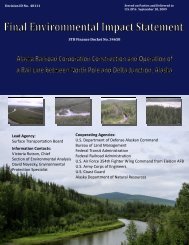
Norfolk Southern/Conrail Rail ConnectionâBucyrus, Ohio - Surface ...
Norfolk Southern/Conrail Rail ConnectionâBucyrus, Ohio - Surface ...
Norfolk Southern/Conrail Rail ConnectionâBucyrus, Ohio - Surface ...

Create successful ePaper yourself
Turn your PDF publications into a flip-book with our unique Google optimized e-Paper software.
4.1 POTENTIAL ENVIRONMENTAL IMPACTS FROM THE PROPOSED ACTION<br />
4.1.1 Land Use<br />
4.1.1.1 Evaluation Criteria<br />
The following criteria were used to assess the significance of land use impacts:<br />
Land Use Consistency and Compatibility<br />
C<br />
C<br />
C<br />
C<br />
The severity of visual, air quality and noise impacts on sensitive land uses.<br />
Interference with the normal functioning of adjacent land uses.<br />
Alteration of flood water flow that could increase flooding in adjacent areas.<br />
Consistency and/or compatibility with local land use plans and policies.<br />
Prime Agricultural Land<br />
C<br />
Permanent loss of Natural Resources Conservation Service-designated prime farmland.<br />
4.1.1.2 Potential Impacts<br />
Current Land Use and Zoning<br />
The proposed project would result in minimal impacts to land use. The properties for which NS is<br />
negotiating rights to allow the proposed construction and operation are disturbed areas. The proposed<br />
track would have an approximately 40-foot wide right-of-way, between the existing NS right-of-way<br />
and the existing <strong>Conrail</strong> right-of-way. The proposed track would be centered in this right-of-way.<br />
While on the <strong>Conrail</strong> right-of-way, the proposed track would be parallel to and spaced at a<br />
perpendicular distance of 15 feet from the centerline of the existing <strong>Conrail</strong> track for 1,000 feet and then<br />
would curve toward and meet the existing <strong>Conrail</strong> rail line. Approximately 4.6 acres of land would be<br />
obtained for the connection, of which 1.5 acres would be occupied by track. The area that would be<br />
converted to rail use is disturbed urban land that contains grasses and woody vegetation.<br />
Consistency with Local Plans<br />
Neither the City of Bucyrus nor Crawford County have zoning ordinances, therefore, this project is<br />
consistent with local plans (Appendix C, Exhibits C-20 and C-22).<br />
Prime Farmlands and Coastal Zones<br />
There would be no loss of prime farmland within the proposed new right-of-way. Temporary<br />
construction impacts to adjacent land from excavation, such as mixing of soil profiles or soil<br />
compaction, are expected to be minor due to the small amount of land affected and because construction<br />
would be limited to the proposed new right-of-way. The proposed construction would not conflict with<br />
adjacent land uses.<br />
No construction activities would occur within a designated coastal zone.<br />
4.1.2 Socioeconomics and Environmental Justice<br />
4-2