

GS1-2-3-4 Goodwin Sands - United Kingdom Hydrographic Office
GS1-2-3-4 Goodwin Sands - United Kingdom Hydrographic Office
GS1-2-3-4 Goodwin Sands - United Kingdom Hydrographic Office
SHOW LESS

You also want an ePaper? Increase the reach of your titles
YUMPU automatically turns print PDFs into web optimized ePapers that Google loves.
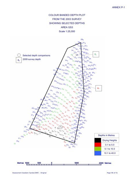
ANNEX P-1<br />
COLOUR BANDED DEPTH PLOT<br />
FROM THE 2003 SURVEY<br />
SHOWING SELECTED DEPTHS<br />
AREA GS3<br />
Scale 1:25,000<br />
8 2<br />
Selected depth comparisons<br />
2009 survey depth<br />
8 2<br />
4 7<br />
Depths in Metres<br />
Drying Heights<br />
0.1 to 5.0<br />
5.1 to 10.0<br />
10.1 to 40.0<br />
Assessment <strong>Goodwin</strong> <strong>Sands</strong>/2009 – Original Page 46 of 51


