planning department - Town of Scarborough
planning department - Town of Scarborough
planning department - Town of Scarborough

Create successful ePaper yourself
Turn your PDF publications into a flip-book with our unique Google optimized e-Paper software.
Report from Planning Department continued<br />
been focused on remodeling, additions and accessory living<br />
units as homeowners chose to improve their property rather<br />
than buy new.<br />
Development Review<br />
On the review and permitting side, our Planning Staff<br />
coordinated and reviewed development plans and staffed<br />
sixteen Planning Board meetings. The Planning Board and<br />
staff reviewed a range residential and non-residential<br />
development projects and issued final approvals for those<br />
listed in the table below. The review and approval <strong>of</strong> the<br />
Red Robin restaurant along Gallery Boulevard, a major<br />
addition to the Piper Shores retirement community, the<br />
approval <strong>of</strong> a commercial subdivision along Route One in<br />
Dunstan, and an extension <strong>of</strong> the Carter Brook Drive<br />
residential subdivision are the larger projects taken up by the<br />
Board.<br />
Comprehensive Plan Implementation<br />
2011 marked the fifth consecutive year <strong>of</strong> work by Planning<br />
staff, our consultant Mark Eyerman <strong>of</strong> Planning Decisions,<br />
and the recently renamed Long Range Planning Committee<br />
on implementing the <strong>Town</strong>’s Updated Comprehensive Plan.<br />
This committee has worked diligently to carry out the<br />
recommendations <strong>of</strong> the Comprehensive Plan and<br />
modernize the <strong>Town</strong>’s zoning and land use standards. I’d<br />
like to take this opportunity to recognize the committee for<br />
their dedication and resolve to complete this significant task<br />
as well as for the very thorough and inclusive public process<br />
the committee uses to craft and work through these zoning<br />
changes in the various villages and neighborhoods <strong>of</strong><br />
<strong>Scarborough</strong>.<br />
Specific to fiscal year 2011, the committee’s achievements<br />
included: an expansion <strong>of</strong> a village-style residential zone<br />
(the Village Residential 2 District) in Dunstan to include the<br />
area around the Dunstan Crossing development as well as<br />
the east side <strong>of</strong> Broadturn Rd; updates to, and a small<br />
expansion <strong>of</strong>, the commercial zoning in the vicinity <strong>of</strong> the<br />
Black Point Rd and Highland Ave intersection to enable this<br />
area to serve as a neighborhood center with small<br />
businesses, civic uses and residences; and the creation <strong>of</strong> a<br />
Aquifer Protection Overlay District that establishes some<br />
new standards to help protect the <strong>Town</strong>’s sand and gravel<br />
aquifer areas where the groundwater is particularly<br />
vulnerable to contamination.<br />
Planning and Engineering Studies<br />
In addition to these other activities, our <strong>department</strong> has<br />
been involved in some important transportation and storm<br />
water-related studies and initiatives. One <strong>of</strong> the most visible<br />
projects is the improvements that have been made to the<br />
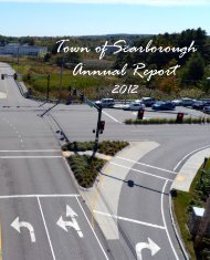
Haigis Parkway / Route One intersection, and by extension,<br />
the Southgate / Route One intersection. This project was a<br />
result <strong>of</strong> the Payne Road “West” Transportation Study that<br />
included a range <strong>of</strong> recommendations to slow and reduce<br />
traffic on the residential section <strong>of</strong> Payne Road; encourage<br />
more use <strong>of</strong> Route One and Haigis Parkway by commuters<br />
July 1, 2010, through June 30, 2011<br />
and visitors; and to fix safety and capacity issues at both the<br />
Dunstan Corner intersections and Haigis/Route One. The<br />
Planning Department helped design, permit and facilitate<br />
this Haigis/Route One project, while the Public Works<br />
Department did a masterful job <strong>of</strong> executing and managing<br />
its construction. The result <strong>of</strong> this capital project is an<br />
intersection with additional turn lanes, sidewalks and<br />
crosswalks, and improved landscaping and aesthetics to<br />
accommodate more traffic, lessen the improvements needed<br />
at the Dunstan intersections, and establish a more attractive<br />
gateway <strong>of</strong>f <strong>of</strong> the Haigis Parkway. The next major step in<br />
implementing the Payne Road Study is executing the<br />
intersection improvements planned for Dunstan Corner,<br />
which is on schedule for construction in 2012.<br />
Another transportation effort in 2011 was the Oak Hill<br />
pedestrian plan. Given Oak Hill’s importance as a<br />
municipal, school and town center, the <strong>Town</strong> has been<br />
making a consistent effort to shape this area as a more<br />
compact, pedestrian-friendly place. To that end, we<br />
received a grant from PACTS (the Portland Area<br />
Comprehensive Transportation System) to examine ways to<br />
make this area more walkable and pedestrian oriented. This<br />
study was conducted in the spring <strong>of</strong> 2011 and resulted in a<br />
comprehensive plan for sidewalk, crosswalk, landscaping<br />
and other improvements that can enhance Oak Hill and<br />
make it safer, more attractive and more appealing for<br />
pedestrians to use.<br />
The third <strong>planning</strong> initiative <strong>of</strong> note in 2011 is the Red<br />
Brook watershed <strong>planning</strong> process. This is a <strong>planning</strong> and<br />
engineering study that the <strong>Town</strong> pursued, with the assistance<br />
<strong>of</strong> the Cumberland County Soil and Water Conservation<br />
District and Maine Department <strong>of</strong> Environmental Protection,<br />
to study the condition <strong>of</strong> the watershed and establish a plan<br />
<strong>of</strong> action to improve the water quality and habitat <strong>of</strong> the<br />
stream and surrounding drainage area. This has been an<br />
important effort, given that Red Brook has been classified as<br />
an urban impaired stream (by Maine DEP). This <strong>planning</strong><br />
process included significant public participation and<br />
decision making, and in June <strong>of</strong> 2011 resulted in a final plan<br />
that includes both a summary <strong>of</strong> the watersheds current<br />
status as well as a range <strong>of</strong> measures to be taken to maintain<br />
and improve its condition. This plan will need to be<br />
followed by a systemic implementation process in order to<br />
see improvements.<br />
Lastly, I would like to thank and recognize all <strong>of</strong> our staff –<br />
<strong>Town</strong> Engineer James Wendel, Assistant <strong>Town</strong> Planner Jay<br />
Chace, Chief Code Enforcement Officer David Grysk, Code<br />
Enforcement Officers Tom Reinsborough and Jonathan<br />
Reed, and Administrative Assistants Carole Logan and<br />
Robin Dahms – for their hard work, dedication and<br />
pr<strong>of</strong>essionalism.<br />
Respectfully submitted,<br />
Daniel B. Bacon<br />
<strong>Town</strong> Planner<br />
26