Using Historic Landscape Characterisation
Using Historic Landscape Characterisation
Using Historic Landscape Characterisation

Create successful ePaper yourself
Turn your PDF publications into a flip-book with our unique Google optimized e-Paper software.
<strong>Using</strong> <strong>Historic</strong> <strong>Landscape</strong> <strong>Characterisation</strong><br />
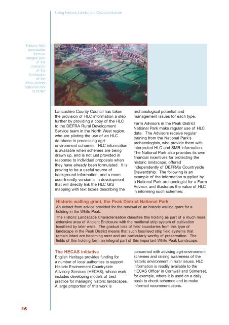
<strong>Historic</strong> field<br />
boundaries<br />
form an<br />
integral part<br />
of the<br />
character<br />
of the<br />
landscape<br />
of the<br />
Peak District<br />
National Park<br />
© PDNP<br />
Lancashire County Council has taken<br />
the provision of HLC information a step<br />
further by providing a copy of the HLC<br />
to the DEFRA Rural Development<br />
Service team in the North West region,<br />
who are piloting the use of an HLC<br />
database in processing agrienvironment<br />
schemes. HLC information<br />
is available when schemes are being<br />
drawn up, and is not just provided in<br />
response to individual proposals when<br />
they have already been formulated. It is<br />
proving to be a useful source of<br />
background information, and a more<br />
user-friendly version is in development<br />
that will directly link the HLC GIS<br />
mapping with text boxes describing the<br />
archaeological potential and<br />
management issues for each type.<br />
Farm Advisors in the Peak District<br />
National Park make regular use of HLC<br />
data. The Advisors receive regular<br />
training from the National Park’s<br />
archaeologists, who provide them with<br />
interpreted HLC and SMR information.<br />
The National Park also provides its own<br />
financial incentives for protecting the<br />
historic landscape, offered<br />
independently of DEFRA’s Countryside<br />
Stewardship. The following is an<br />
example of the information supplied by<br />
a National Park archaeologist for a Farm<br />
Advisor, and illustrates the value of HLC<br />
in informing such schemes:<br />
<strong>Historic</strong> walling grant, the Peak District National Park<br />
An extract from advice provided for the renewal of an historic walling grant for a<br />
holding in the White Peak:<br />
The <strong>Historic</strong> <strong>Landscape</strong> <strong>Characterisation</strong> classifies this holding as part of a much more<br />
extensive area of Ancient Enclosure with the medieval strip system of cultivation<br />
fossilised by later walls. The gradual loss of field boundaries from this type of<br />
landscape in the Peak District means that such fossilised strip field systems that<br />
remain intact are becoming rarer and are particularly worthy of preservation. The<br />
fields of this holding form an integral part of this important White Peak <strong>Landscape</strong>.<br />
The HECAS initiative<br />
English Heritage provides funding for<br />
a number of local authorities to support<br />
<strong>Historic</strong> Environment Countryside<br />
Advisory Services (HECAS), whose work<br />
includes developing models of best<br />
practice for managing historic landscapes.<br />
A large proportion of this work is<br />
concerned with advising agri-environment<br />
schemes and raising awareness of the<br />
historic environment in rural issues. HLC<br />
information is readily available to the<br />
HECAS Officer in Cornwall and Somerset,<br />
for example, where it is used on a daily<br />
basis to check schemes and to make<br />
informed recommendations.<br />
16